Arlington Public Schools Thomas Jefferson Site Evaluation Preliminary Findings. Thomas Jefferson Working Group Meeting #2 October 1, 2014
|
|
|
- Gary Palmer
- 5 years ago
- Views:
Transcription


1 Arlington Public Schools Thomas Jefferson Site Evaluation Preliminary Findings Thomas Jefferson Working Group Meeting #2 October 1, 2014 SAN ANTONIO BEXAR COUNTY PEDESTRIAN SAFETY ACTION PLAN
2 INTRODUCTION
3 Observations and mode counts during arrival & dismissal on a typical day Intersection counts (cars, trucks, pedestrians, bicyclists) Daily roadway counts (car volume, speed and class) Parking counts Crash data Infrastructure assessment Intersection operational analysis Parent, student, staff surveys Special event observations
4 Inclement weather day observations Community center user survey Data on use of theatre, cooking kitchen, community center, fields and courts Case studies of similar sites Analysis of existing transit service Infrastructure recommendations Assess impacts of new school and middle school expansion on transportation network Coordinate with design team on site layout Parking supply considerations SRTS Team
5 How does the transportation system currently operate on and surrounding the TJ campus? What is the Transportation Demand Management (TDM) potential for the TJ campus? How might the transportation system operate if a new elementary school is built?
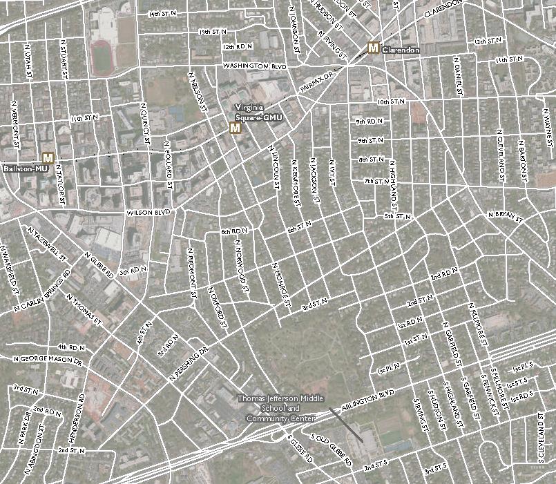
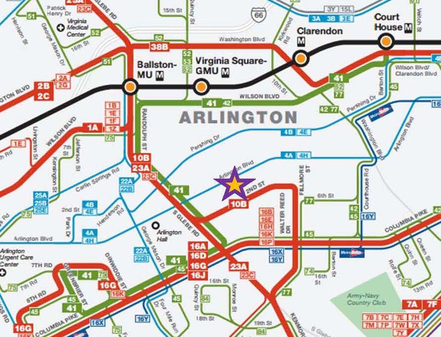
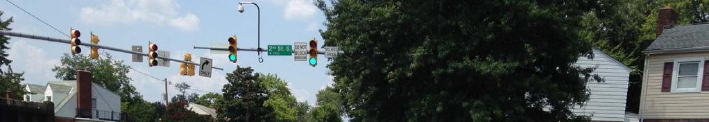
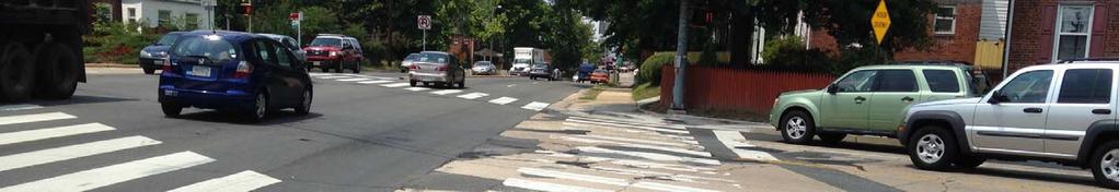
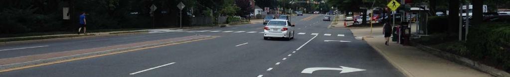
6 HOW DOES THE TRANSPORTATION SYSTEM CURRENTLY OPERATE ON THE TJ CAMPUS? Transportation System Infrastructure
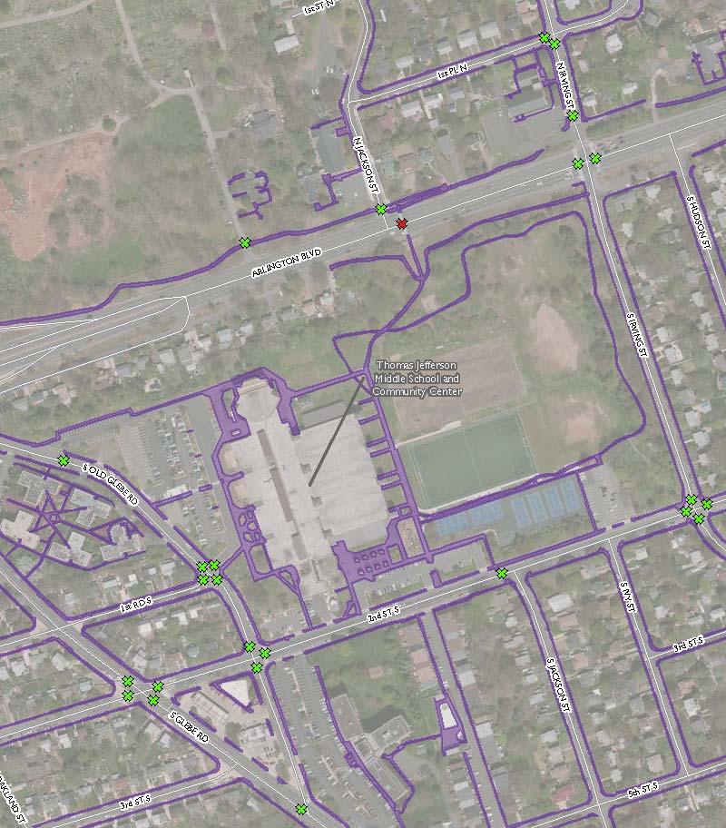
7

8
9

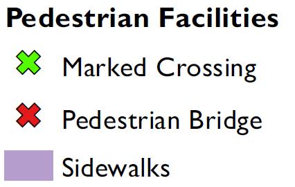
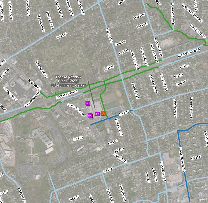
10 Bike Share Station
11
12 Route Art 41 4A 10B 23A/23B/23T Stops on roads S. Glebe Road Arlington Blvd S. Glebe Road and 2 nd Street S. Glebe Road Hours, Monday to Friday 5:30 a.m. to 12:55 a.m. 5:30 a.m. to 12:50 a.m. 5:35 a.m. to 1:40 a.m. 5:30 a.m. to 1:20 a.m. Headways between 7a.m. and 5 p.m. 15 to 20 minutes 5 to 40 minutes combined 30 minutes 10 to 30 minutes combined
13


14 370 spaces available on TJ campus, including 11 ADA spaces 227 spaces available in lots west of middle school, including 5 ADA spaces 58 spaces available in community center lot, including 3 ADA spaces 57 spaces available in tennis court lot, including 3 ADA spaces
15 HOW DOES THE TRANSPORTATION SYSTEM CURRENTLY OPERATE ON THE TJ CAMPUS? Transportation System Use


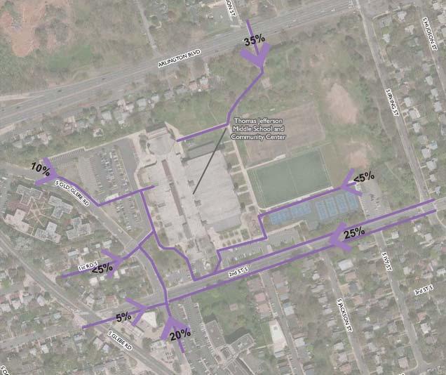
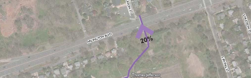
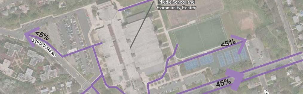
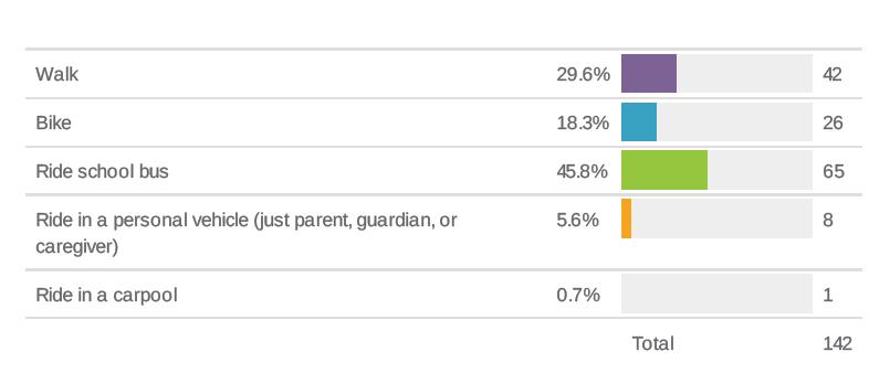
16 40 To School 40 From School Student Tally Parent Survey Student Tally Parent Survey


17 1% Carpool 1% Other 4% Transit 4% Walk 90% Drive
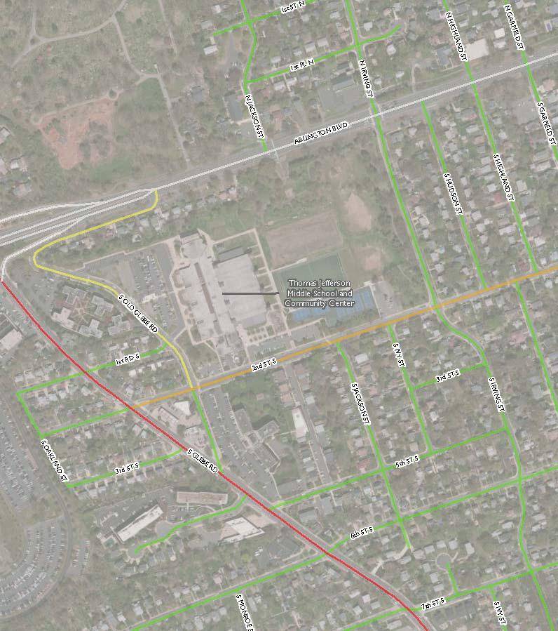
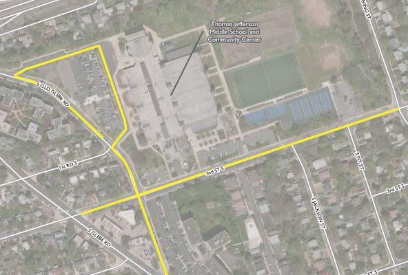
18 Observation & Mode Count Locations Traffic Count Locations
19
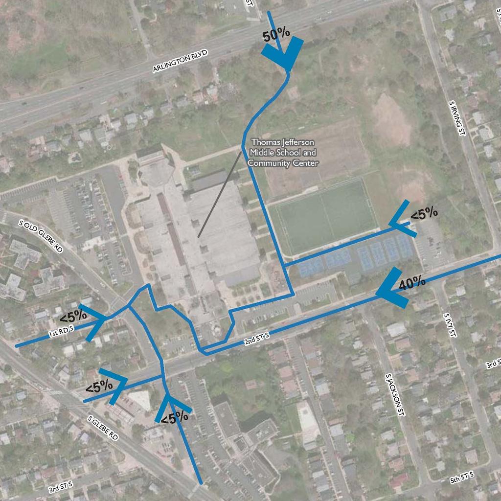
20
21
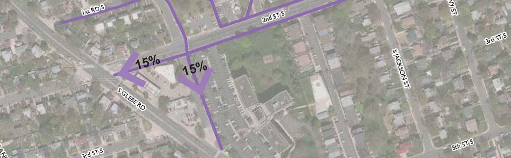
22
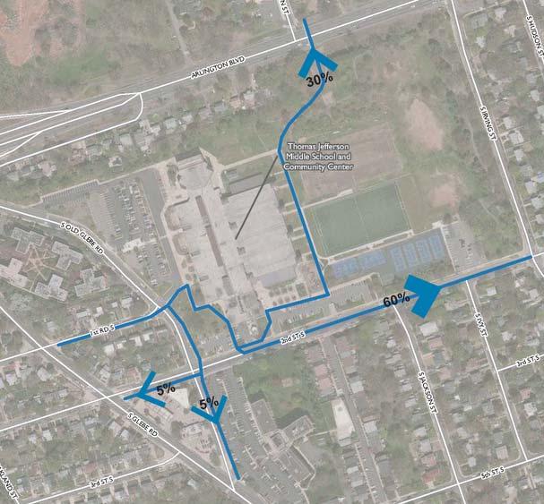
23
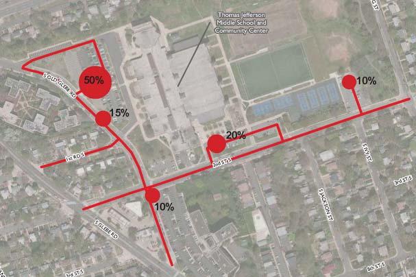
24
25

26 Community center user survey (mode of travel, parking location) Data on use of theatre, cooking kitchen, community center, fields and courts
27
28 2 nd Street Speed Data Overall Speed Limit: 25 MPH 85 th Percentile Speed: 30 MPH During Arrival and Dismissal School Zone Speed Limit: 20 MPH 85 th Percentile Speed: 27MPH/29MPH (AM/PM)

29 During arrival, motorists may experience increased delay: Turning right onto Arlington Blvd from S. Old Glebe Road Crossing Arlington Blvd on Irving Street Traveling east on Arlington Blvd Traveling west on 2 nd Street towards Glebe Intersection of 2 nd Street & Old Glebe Road During dismissal, the study intersections operate better due to less commuter traffic and fewer trips associated with the school

30 370 spaces on TJ campus, including 11 ADA spaces Over 1,000 spaces on streets surrounding TJ campus
 on a typical")
31 50% 45% 40% 35% 30% 25% 20% 15% 10% 5% 0% Occupancy of Lots 47% 42% 44% 14% Parking Occupancy *Shows parking before dismissal (~1:30PM) on a typical day

32 On site over 100% occupied On street approx. 50% occupied (concentrated near school)


33 Three years of crash data Crash data doesn t capture near misses or close calls Arlington Blvd and Glebe Road most crashes typical of high volume roads Seven crashes involved pedestrians Two crashes involved bicycles
34 WHAT IS THE TDM POTENTIAL FOR THE SITE?
35 Advantages Joint use potential Existing multimodal infrastructure Disadvantages Existing barriers to non Single Occupancy Vehicle travel
36 Safety of intersections and crossings Amount of traffic along route Child's age Speed of traffic along route Distance Concerns about bullying, violence, or crime Heavy/bulky items to carry Darkness Lack of adequate pedestrian and bicycle facilities on the way Weather or climate Lack of adults to walk or bike with Other transportation options are more convenient Afterschool activities School is on the way to another destination Lack of crossing guards Lack of bicycle Lack of adequate pedestrian and bicycle facilities at school (e.g., Hills Before school activities 0.0% 10.0% 20.0% 30.0% 40.0% 50.0% 60.0% 70.0% Very Important Somewhat important
37 Route 50 ( bike path has no guardrail between it and Route 50 ) Intersection of Columbia Pike and Glebe Road ( a great concern that my child has to cross Col Pike & Glebe Road no crossing guards at these intersections ) George Mason Drive ( difficult to cross even for adults ) Jackson St ( winding hill with cars parked on both sides )
38 Trip distance Trip duration Convenience Weather or climate Heavy or bulky items to carry Comfort Lack of adequate sidewalks or pathways Difficult road crossings Need car for travel during work Lack of showers or lockers Hills Concern about violence or crime on route 0.0% 10.0% 20.0% 30.0% 40.0% 50.0% 60.0% 70.0% 80.0% 90.0% Very important Somewhat important
39 Weather or climate Heavy or bulky items to carry Convenience Trip distance Lack of comfortable places to bike (bike lanes, paths, or safe streets) Trip duration Difficult road crossings Comfort Don't own a bike or a bikeshare membership Lack of showers or lockers Don't know safe route Lack of covered bicycle parking Lack of secure bicycle parking Need car for travel during work Bikeshare stations too far away Concern about violence or crime on route Don't know how to ride a bike 0.0% 10.0% 20.0% 30.0% 40.0% 50.0% 60.0% Very important Somewhat important
40

41


42
43 Concern about bullying, violence, or crime Prefer other transportation options Afterschool activities Heavy/bulky items to carry Weather or climate Lack of adult supervision School is on the way to another destination Bus schedule is not convenient Child's age Traffic safety on route to bus stop Bus stops are not conveniently located Before school activities Bus does not reliably follow established schedule 0.0% 5.0% 10.0% 15.0% 20.0% 25.0% 30.0% 35.0% 40.0% 45.0% Very Important Somewhat Important
44 Trip duration Convenience to other destinations (e.g., home, errands) Convenience to APS work location Stops/stations too far away Comfort Trip distance Heavy/bulky items to carry Reliability Weather or climate Frequency Cost Operating hours Need car for travel during work 0.0% 10.0% 20.0% 30.0% 40.0% 50.0% 60.0% 70.0% 80.0% Very important Somewhat important


45
46
47 HOW MIGHT THE TRANSPORTATION SYSTEM OPERATE IF A NEW ELEMENTARY SCHOOL IS BUILT?
48 Distribution of uses over time bell times Choice versus neighborhood school Spatial relationship of uses on the site relative to transportation facilities (e.g. vehicle and bike parking, pedestrian pathways, transit stops) school location combined bus and/or pick up/drop off areas parking needs Minimize conflicts between users (i.e. separate modes)
49 Walk Bike School Bus Personal Vehicle Carpool Transit Other Choice School 5% 1% 66% 27% 1% 0% 0% Neighborhood School 22% 1% 47% 29% 1% 0% 0%
50 Inclement weather day observations Community center user survey Data on use of theatre, cooking kitchen, community center, fields and courts Case studies of similar sites Analysis of existing transit service Infrastructure recommendations Assess impacts of new school and middle school expansion on transportation network Coordinate with design team on site layout Parking supply considerations SRTS Team
Arlington Public Schools Abingdon Elementary School Site Evaluation Preliminary Transportation Findings
 Arlington Public Schools Abingdon Elementary School Site Evaluation Preliminary Transportation Findings Arlington County Public Facilities Review Committee (PFRC) November 19, 2014 SAN ANTONIO-BEXAR COUNTY
Arlington Public Schools Thomas Jefferson Site Evaluation Transportation Networks. Thomas Jefferson Working Group Meeting #6 November 10, 2014
 Arlington Public Schools Thomas Jefferson Site Evaluation Transportation Networks Thomas Jefferson Working Group Meeting #6 November 10, 2014 2 3 INTRODUCTION 4 Goal of our work: Identify and assess multi-modal
Arlington Public Schools New Elementary School at Thomas Jefferson Site Off-Site Transportation. Thomas Jefferson BLPC / PFRC Meeting July 27, 2016
 Arlington Public Schools New Elementary School at Thomas Jefferson Site Off-Site Transportation Thomas Jefferson BLPC / PFRC Meeting July 27, 2016 1.Review of Analysis 2.Key Transportation Issues 3.Recommendations
2016 APS Go! Surveys Summary Results for Oakridge Elementary School
 2016 APS Go! Surveys Summary Results for Oakridge Elementary School This report summarizes results from the 2016 APS Go! surveys for Oakridge Elementary School. Student, parent/caregiver and staff surveys
2016 APS Go! Surveys Summary Results for Arlington Traditional School
 2016 APS Go! Surveys Summary Results for Arlington Traditional School This report summarizes results from the 2016 APS Go! surveys for Arlington Traditional School. Student, parent/caregiver and staff
2016 APS Go! Surveys Summary Results for Trades Center
 2016 APS Go! Surveys Summary Results for Trades Center This report summarizes results from the 2016 APS Go! surveys for Trades Center. Staff surveys were conducted at all schools and work sites as part
Parent Survey Report: One School in One Data Collection Period
 Parent Survey Report: One School in One Data Collection Period School Name: Bilquist Elementary School Set ID: 15803 School Group: Clackamas County Month and Year Collected: December 2016 School Enrollment:
Arlington s Master Transportation Plan
 Arlington s Master Transportation Plan The Master Transportation Plan (MTP) Adopted in eight parts Goals & Policies element and MTP Map adopted in 2007 Bicycle, Pedestrian and Demand and Systems Management
APS Stratford Project Transportation Analysis Overview. Stratford BLPC #5 June 1, 2015
 APS Stratford Project Transportation Analysis Overview Stratford BLPC #5 June 1, 2015 8 Arrival/dismissal observations and counts BLPC arrival/dismissal observations BLPC early release observation Williamsburg
Abingdon Elementary School School Transportation Report
 Abingdon Elementary School School Transportation Report May 2015 Prepared for Arlington Public Schools by Toole Design Group, LLC 1 CONTENTS Executive Summary... 3 Introduction... 7 Existing Conditions
Parent Survey Report: One School in One Data Collection Period
 Parent Survey Report: One School in One Data Collection Period School Name: Pinckney Elementary School Set ID: 12170 School Group: Douglas County Month and Year Collected: October 2014 School Enrollment:
Chapter 2. Bellingham Bicycle Master Plan Chapter 2: Policies and Actions
 Chapter 2 Bellingham Bicycle Master Plan Chapter 2: Policies and Actions Chapter 2: Policies and Actions The Bicycle Master Plan provides a road map for making bicycling in Bellingham a viable transportation
C/CAG. Sunnybrae Elementary School Walking and Bicycling Audit. San Mateo-Foster City School District JUNE 2013
 Sunnybrae Elementary School Walking and Bicycling Audit JUNE 2013 San Mateo-Foster City School District C/CAG City/County Association of Governments of San Mateo County SUNNYBRAE ELEMENTARY SCHOOL WALKING
PenPlace SPRC #6. September 27, DRAFT
 PenPlace SPRC #6 1 Agenda Site and Project Overview Multiple Transportation Options Traffic Analysis Neighborhood Analysis Street Network Street Sections/Sidewalk Width Pedestrian/Bicycle Circulation Secure
Eliminate on-street parking where it will allow for a dedicated bus only lane %
 Traffic Dashboard Priorities Survey Responses Introduction 1) Are you familiar with bus rapid transit (BRT)? a. No, BRT is new to me. 597 23.5% b. I ve heard of BRT, but I don t know much about it. 1,136
NM-POLICY 1: Improve service levels, participation, and options for non-motorized transportation modes throughout the County.
 Transportation PRINCE WILLIAM COUNTY 2008 COMPREHENSIVE PLAN NON-MOTORIZED PLAN CONTENTS Goals, Policies, and Action Strategies Table 4 (Bike Facility Classifications and Descriptions) Table 5 (Bike Facility
Columbia Pike Implementation Team (CPIT) Meeting
 Meeting") Columbia Pike Implementation Team (CPIT) Meeting November 30, 2010 Agenda Introductions / Purpose of Meeting Review of project goals Multimodal project: 10% street design between the curbs Discussion Multimodal
Columbia Pike Implementation Team (CPIT) Meeting November 30, 2010 Agenda Introductions / Purpose of Meeting Review of project goals Multimodal project: 10% street design between the curbs Discussion Multimodal
Business owner or commercial property owner in Arlington, 8. Visitor in Arlington, 17
 1. How do you currently travel around your neighborhood? (Select your top 3) Resident of Arlington 86.72% 222 Worker in Arlington 20.70% 53 Business owner or commercial property own 3.13% 8 Visitor in
Bicycle Facilities Planning
 Bicycle Facilities Planning Overview Types of Cyclists Purpose for Riding Types of Facilities Bike Lanes Bicycle Boulevards Cycle Tracks Intersections Signals Signing and Marking Discussion Types of Bicyclists
CPC Parking Lot Riverside Drive. Transportation Rationale
 CPC Parking Lot Transportation Rationale Prepared By: NOVATECH Suite 200, 240 Michael Cowpland Drive Ottawa, Ontario K2M 1P6 September 2015 Novatech File: 114093 Ref: R-2015-153 Table of Contents 1.0 INTRODUCTION...
El Paso County 2040 Major Transportation Corridors Plan
 El Paso County 2040 Major Transportation Corridors Plan Connect-our-County Online Transportation User Survey Preliminary Results June 24, 2010 Years of Residence 2. How many years have you LIVED HERE?
Development of Arlington County s Marked Crosswalk Guidelines. Jon Lawler, P.E. Design Engineer Arlington County, VA
 Development of Arlington County s Marked Crosswalk Guidelines Jon Lawler, P.E. Design Engineer Arlington County, VA April 13, 2015 Transportation System Users Residents Estimated 215,000 in 2014 Lowest
July 5, Arthur R. Ware, Jr. Elementary School 2017 Safe Routes to School Walkabout Report
 July 5, 2017 Arthur R. Ware, Jr. Elementary School 2017 Safe Routes to School Walkabout Report 1 Walkabout Report Introduction On April 28, 2017, City, School, and SAWMPO staff met to conduct a Safe Routes
Update of the Master Transportation Plan s (MTP) Bicycle Element
 Bicycle Element") Update of the Master Transportation Plan s (MTP) Bicycle Element April 23, 2019 Background & Context Arlington has an established reputation for advanced bicycle infrastructure and planning Bicycling addresses
Update of the Master Transportation Plan s (MTP) Bicycle Element April 23, 2019 Background & Context Arlington has an established reputation for advanced bicycle infrastructure and planning Bicycling addresses
MASTER BICYCLE AND PEDESTRIAN PLAN
 VILLAGE OF NORTHBROOK MASTER BICYCLE AND PEDESTRIAN PLAN DRAFT PLAN OPEN HOUSE May 2, 2018 AGENDA 1. Community Engagement 2. Vision and Goals 3. General Structure of Plan 4. Recommendations Overview 5.
Sustainable Transportation Initiatives and Plans in Caledon
 Sustainable Transportation Initiatives and Plans in Caledon Arash Olia, P.Eng., PhD. Coordinator, Transportation Development Finance & Infrastructure Services Town of Caledon Eric Chan, P.Eng., PMP Manager,
TRANSPORTATION TRAINING TOPICS. April 6, 2010
 TRANSPORTATION TRAINING TOPICS April 6, 2010 Roles of Transportation Providers Context and Policy Makers Division of Transportation and Traffic Other City Operations Other Transportation Operators CMA
Multimodal Transportation Plan
 Multimodal Transportation Plan The Multimodal Transportation Plan will accommodate MILLENIALS ARE DRIVING LESS. WE CANNOT BUILD OUR WAY all modes of transportation by keeping pedestrians, OUT OF CONGESTION.
Virginia Hospital Center Expansion
 Virginia Hospital Center Expansion Site Plan Amendment (SP #177) SPRC Meeting #2 Dennis Sellin Arlington County DES/Transportation February 5, 2018 1 Arlington County Master Transportation Plan Goals Move
N. Frederick Street to N. Manchester Street
 November 20, 2014 N. Frederick Street to N. Manchester Street Goals and Summary, November 2007 Map, December 2007 Bicycle Element, July 2008 Pedestrian Element, July 2008 Demand and System Management,
Telegraph Avenue Complete Streets DRAFT Recommendations. Oakland Public Works Department September 11 and 13, 2014 Open Houses
 Telegraph Avenue Complete Streets DRAFT Recommendations Oakland Public Works Department September 11 and 13, 2014 Open Houses Presentation Overview What are complete streets? What problem are we trying
Performance Criteria for 2035 Long Range Transportation Plan
 Minimizing Impacts on Natural, Historic, Cultural or Archeological Resources 2035 LRTP Weighting Factor: 7% Objective 1.1: Use appropriate planning and design criteria to protect and enhance the built
Transportation, Parking & Roads
 Transportation, Parking & Roads Design Carolina North as a walkable community Design the transportation system and development patterns (i.e., urban design elements such as density, building design, mix
Getting Your SRTS Project Funded. Ryan Snyder
 Getting Your SRTS Project Funded Ryan Snyder Steps in Submitting a Successful Application 1. Stakeholder outreach: create a SRTS coalition 2. Develop a comprehensive plan and program with all 5 Es 3. Conceive
FY Transportation Capital Improvement Plan Update Arlington Committee for Transportation Choices
 FY 2017-2026 Transportation Capital Improvement Plan Update Arlington Committee for Transportation Choices November 1, 2017 Forecasted Growth Arlington continues to grow with a shift towards multi-family
3 Silverton High School Report
 3 Silverton High School Report Principal: Justin Lieuallen Grades: 9-12 Enrollment: 1,277 Address: 1456 Pine Street First bell: 7:55 a.m. Silverton, OR 97381 Last bell: 3:05 p.m. Free & Reduced Lunch:
Rail Station Fact Sheet CentrePort/DFW Airport Station
 Rail Station Fact Sheet CentrePort/DFW Airport Station Station Overview CentrePort/DFW Airport Station is located by Statler Boulevard at Breezewood Drive in Fort Worth. Free shuttles connect the station
Living Streets Policy
 Living Streets Policy Introduction Living streets balance the needs of motorists, bicyclists, pedestrians and transit riders in ways that promote safety and convenience, enhance community identity, create
Aitkin School Routing Plan July 2010
 Aitkin School Routing Plan July 2010 Prepared by: Arrowhead Regional Development Commission Regional Planning Division Aitkin School Routing Plan July 2010 Aitkin School Routing Plan July 2010 Prepared
10/30/2012 VIA
 10/30/2012 VIA EMAIL David Hung, Associate Planner Community Development Department, Current Planning Division City of Sacramento 300 Richards Blvd., 3 rd Floor Sacramento, CA 95811 RE: The Cannery On-Site
SAFE ROUTES TO SCHOOL
 SAFE ROUTES TO SCHOOL Edgewood Elementary School Existing Conditions and ACTION PLAN > Oak Creek - Franklin Joint School District Table of Contents CONTEXT Enrollment Boundaries Enrollment
US 41 COMPLETE STREETS CORRIDOR PLANNING STUDY from University Parkway to Whitfield Avenue
 41 US 41 COMPLETE STREETS CORRIDOR PLANNING STUDY from University Parkway to Whitfield Avenue EXECUTIVE SUMMARY DRAFT FEBRUARY 2019 Project Overview The US 41 Complete Streets Corridor Planning Study,
2018 Transportation Survey October 17, Prepared by:
 Transportation Survey October 17, Prepared by: Overview Methodology Systemwide results Strengths/Weaknesses by mode Importance of possible improvements Conclusions Methodology 500 Chittenden County residents
Safe Routes to School Program in California: An Update
 Safe Routes to School Program in California: An Update Claudia Chaufan, MD, PhD Jarmin Yeh, MSSW, MPH Leslie Ross, PhD Pat Fox, PhD, MSW Institute for Health & Aging, Department of Social and Behavioral
Priority 1: Ala Wai Pedestrian and Bicycle Safety and Mobility Project
 Priority 1: Ala Wai Pedestrian and Bicycle Safety and Mobility Project The full application can be found here: http://www.oahumpo.org/wp-content/uploads/2015/05/alawai_application.pdf Description The Ala
Designing for Pedestrian Safety in Washington, DC
 Designing for Pedestrian Safety in Washington, DC February 25, 2014 George Branyan Pedestrian Program Coordinator District Department of Transportation DC Journey to work mode split: 2012 Means of Transportation
Parent Survey Report: One School in One Data Collection Period
 Parent Survey Report: One School in One Data Collection Period School Name: Broken Arrow Elementary School Set ID: 12172 School Group: Douglas County Month and Year Collected: October 2014 School Enrollment:
COMPLETE STREETS PLANNER S PORTFOLIO
 COMPLETE STREETS PLANNER S PORTFOLIO ISSUE 3 APRIL 2016 PLANNER S PORTFOLIO COMPLETE STREETS 1 2 6 10 14 OVERVIEW MATURE NEIGHBORHOODS GROWING SUBURBS CENTRAL PLACES ACTIVITY CORRIDORS Planner s Portfolio
92% COMMUTING IN THE METRO. Congested Roadways Mode Share. Roadway Congestion & Mode Share
 COMMUTING IN THE METRO Roadway Congestion & Mode Share The majority of major roadways in Greater Des Moines are without congestion and have underutilized capacity. This surplus capacity could be used for
CITY OF ABBOTSFORD TRANSPORTATION AND TRANSIT MASTER PLAN
 CITY OF ABBOTSFORD TRANSPORTATION AND TRANSIT MASTER PLAN EXECUTIVE COMMITTEE MONDAY, OCTOBER 2, 2017 TRANSPORTATION & TRANSIT AGENDA 1. Plan Overview 2. Shaping Influences 3. Existing Conditions and What
See Figure 38, Existing Nonmotorized Connections.
 Nonmotorized Connections Existing Nonmotorized Connections Pedestrian, vehicle and bike traffic access and movements are confined primarily to Penny Drive on campus. Due to the steep slope along the length
Built Environment Childhood Obesity Forum September 15, 2010
 Built Environment Childhood Obesity Forum September 15, 2010 TITLE Why do we have cities? Boston MA To minimize travel & maximize exchange (bring people closer together) How have we built our urban roadway
Physical Implications of Complete Streets Policies
 Presentation Overview Physical Implications of Complete Norm Cox, ASLA, LLA Landscape Architect Ann Arbor, Michigan, 10:45 to Noon What Are Complete Streets? What Matters to Bicyclists and Pedestrians
Roads and Vehicular Traffic Design Principles. Roads and Vehicular Traffic Recommendations
 CIRCULATION AND PARKING roads and vehicular traffic The Campus Master Plan updates the campus transportation network through a multi-modal approach that encourages walking and biking while improving vehicular
Introduction. Using the Checklist. TDM-Supportive Development Design and Infrastructure Checklist Version 1.0 (30 June 2017) City of Ottawa
 City of Ottawa") Introduction The s Transportation Impact Assessment (TIA) Guidelines (specifically Module 4.1 Development Design) requires proponents of qualifying developments to use the City s TDM-Supportive Development
Introduction The s Transportation Impact Assessment (TIA) Guidelines (specifically Module 4.1 Development Design) requires proponents of qualifying developments to use the City s TDM-Supportive Development
11/28/2016 VIA
 11/28/2016 VIA EMAIL Ethan Meltzer, Assistant Planner City of Sacramento Community Development Department 300 Richards Blvd., 3 rd Floor Sacramento, Ca 95811 RE: Natomas Corporate Center Commercial Building
Item 7 Enclosure Citizens Advisory Committee March 27, 2013 San Francisco Safe Routes to School Program
 Item 7 Enclosure Citizens Advisory Committee March 27, 2013 1 San Francisco Safe Routes to School Program Ana Validzic, MPH SF Department of Public Health 2 Safe Routes to School Program Need Fewer kids
West Dimond Blvd Upgrade Jodhpur Street to Sand Lake Road
 West Dimond Blvd Jodhpur St to Sand Lake CSS Transportation Project Summary Municipality of Anchorage Project # 05 005 Project Manager: John Smith, P.E. (MOA PM&E) Project Administrator: Julie Makela,
Bike Routes Assessment: 95 Ave, 106 St & 40 Ave. Replace with appropriate image in View > Master.
 Bike Routes Assessment: 95 Ave, 106 St & 40 Ave Replace with appropriate image in View > Master. Transportation Committee October 15, 2014 City Council Direction What we are trying to achieve The Way Ahead:
Route 29 Solutions Projects
 Route 29 Solutions Route 29 Solutions Projects www.route29solutions.org October 10, 2014 Route 29 Widening to Six Lanes Albemarle County This project will widen a 1.8-mile segment of Route 29 from four
CONNECTING PEOPLE TO PLACES
 CONNECTING PEOPLE TO PLACES 82 EAST BENCH MASTER PLAN 07 Introduction The East Bench transportation system is a collection of slow moving, treelined residential streets and major arteries that are the
Data Analysis February to March Identified safety needs from reported collisions and existing travel patterns.
 Welcome! Thank you for participating in today s Valencia Bikeway Improvements workshop. Data Analysis February to March Identified safety needs from reported collisions and existing travel patterns. Initial
Proposed White Flint Separated Bike Lane Network September 2015
 Proposed White Flint Separated Bike Lane Network September 2015 Abstract This report includes a proposed separated bike lane network for the White Flint Sector Plan area. Separated bike lanes create a
Traffic Impact Memorandum. May 22, 2018
 BISHOP PROFESSIONAL DEVELOPMENT BUILDING Proposed Land-use Change & Parking Modification 3601 SW 31st Street Topeka, Kansas 66614 CFS Project No. 185077 Traffic Impact Memorandum May 22, 2018 Prepared
2 Mark Twain Elementary School Report
 2 Mark Twain Elementary School Report Principal: Greg Kaatz Grades: K-2 Enrollment: 323 Address: 425 N. Church Street First bell: 8:10 a.m. Silverton, OR 97381 Last bell: 2:30 p.m. Free & Reduced Lunch:
Lawrence Safe Routes to School. Community Meeting January 14, 2015
 Lawrence Safe Routes to School Community Meeting January 14, 2015 Safe Routes to School The 6 E s Education Encouragement Enforcement Engineering Evaluation Equity What are the elements of a SRTS plan?
Castro Valley Municipal Advisory Council March 19, 2018
 Castro Valley Municipal Advisory Council March 19, 2018 1 Background 2 Draft Bicycle Vision and Pedestrian Networks 3 Next Steps 4 Updates Agenda 2 PROJECT AREA: Unincorporated Areas of Alameda County
City of Novi Non-Motorized Master Plan 2011 Executive Summary
 City of Novi Non-Motorized Master Plan 2011 Executive Summary Prepared by: February 28, 2011 Why Plan? Encouraging healthy, active lifestyles through pathway and sidewalk connectivity has been a focus
Community Bicycle Planning
 Community Bicycle Planning City of Mentor s Bicycle Facility Plan Allen E. Pennington, P.E. Civil Engineer - Traffic Office of the Mentor City Engineer Why has Mentor participated in bicycle planning?
Washington State University Bicycle and Pedestrian Plan Working Paper #7: Implementation Strategies
 nnn Washington State University Bicycle and Pedestrian Plan nnn TO: Bridgette Brady, CAPP, Director Parking and Transportation Services FROM: Alta Planning Design DATE: November 2013 Introduction As described
SAFE ROUTES TO SCHOOL
 SAFE ROUTES TO SCHOOL Forest Ridge Elementary School Existing Conditions and ACTION PLAN > Oak Creek - Franklin Joint School District Table of Contents CONTEXT Enrollment Boundaries
J Street and Folsom Boulevard Lane Conversion Project (T ) Before and After Traffic Evaluation
 Before and After Traffic Evaluation") J Street and Folsom Boulevard Lane Conversion Project (T15125400) Before and After Traffic Evaluation Prepared by Transportation Division June 2014 Executive Summary On February 12, 2013, the City of Sacramento
J Street and Folsom Boulevard Lane Conversion Project (T15125400) Before and After Traffic Evaluation Prepared by Transportation Division June 2014 Executive Summary On February 12, 2013, the City of Sacramento
Measuring Transportation: Traffic, Mobility and Accessibility
 Measuring Transportation: Traffic, Mobility and Accessibility THIS FEATURE COMPARES THREE APPROACHES TO MEASURING TRANSPORTATION SYSTEM PERFORMANCE. TRAFFIC-BASED MEASUREMENTS EVALUATE MOTOR VEHICLE MOVEMENT;
Completing the Street: Denning Drive
 Completing the Street: Denning Drive Public Workshop and Walking Audit Winter Park Civic Center May 12, 2016 Completing the Street What Makes This a Complete Street? Completing the Street Complete Streets
WALK- AND bike-friendly TURLOCK
 WALK- AND bike-friendly TURLOCK Ideas to Encourage Walking and Biking Benefits to the COMMUNITY Get Connected People who walk and bike have many more opportunities for casual interactions with friends
EXECUTIVE SUMMARY. Vision
 Vision Walking and bicycling in Salt Lake City will be safe, convenient, comfortable, and viable transportation options that connect people to places, foster recreational and economic development opportunities,
Pedestrian, Bicycle and Traffic Calming Strategic Implementation Plan. January 18, 2011
 Pedestrian, Bicycle and Traffic Calming Strategic Implementation Plan January 18, 2011 Tonight s Agenda Receive update on project Provide feedback on two policy issues Complete Streets Policy Project Prioritization
2018 AASHTO BIKE GUIDE
 2018 AASHTO BIKE GUIDE Your presenters Jessica Fields, PE Denver Office Director Sagar Onta, PE, PTOE Denver Engineering Director 35 years of combined experience street design, transportation planning,
Project Goals Project Limits Boston Bikes Data Existing Conditions Proposed Options Discussion
 COMMERCIAL STREET/ ATLANTIC AVENUE BICYCLE FACILITIES Toole Design Group Nick Jackson Michelle Langone Danila, P.E., PTOE April 28, 2011 Presentation Outline Project Goals Project Limits Boston Bikes Data
Planning Guidance in the 2012 AASHTO Bike Guide
 Planning Guidance in the 2012 AASHTO Bike Guide Presentation by: RJ Eldridge Peter Lagerwey August 22, 2012 WEBINAR 2: PLANNING GUIDANCE IN THE 2012 AASHTO BIKE GUIDE Today s Webinar Significant Updates
City of Gainesville Transportation/Roadway Needs PROJECT SUMMARY
 A1 Roadway Resurfacing $23,846,000 TYPE: Preservation of existing system Roadway resurfacing A2 Signal Replacement $6,000,000 TYPE: Preservation of existing system Replace traffic signals. B1 W 6th St
Rim Rock Elementary School Walking and Biking Audit
 Rim Rock Elementary School Walking and Biking Audit September 29, 2016 Rim Rock Elementary School Audit for Walking and Biking September 29, 2016 Audit Team Members: Sam Atkins, City Engineer, City of
Why Zone In on Speed Reduction?
 Learn it. Do it. Live it! SPEED REDUCTION IN THE ZONE Why Zone In on Speed Reduction? Speeding is a serious issue that plays a major role in the risk of serious injury and pedestrian fatality in a crash.
The Transformation of Portland into a Two-Wheeled Mecca. Mia Birk, Principal, Alta Planning + Design
 The Transformation of Portland into a Two-Wheeled Mecca Mia Birk, Principal, Alta Planning + Design Development of Portland s Bikeway Network 1990 Early 1990s Infrastructure Growing Public Support Growing
Bluffdale South (SR140) Bicycle/Shoulder Lanes Project Type Bicycle
 Bicycle/Shoulder Lanes Project Type Bicycle") Bluffdale 14600 South (SR140) Bicycle/Shoulder Lanes Project Type Bicycle From Pony Express to UPRR Bridge over SR-140 $ 669,700 $ 624,361 To build bicycle/shoulder lanes on SR-140. SR-140 is an official
Bluffdale 14600 South (SR140) Bicycle/Shoulder Lanes Project Type Bicycle From Pony Express to UPRR Bridge over SR-140 $ 669,700 $ 624,361 To build bicycle/shoulder lanes on SR-140. SR-140 is an official
3/10/2016 VIA th Street, Suite 203 Sacramento, CA
 3/10/2016 VIA EMAIL Arwen Wacht, Associate Planner City of Sacramento Community Development Department 300 Richards Boulevard, 3 rd Floor Sacramento, CA 95811 RE: Natomas Fountains (P16-012) Dear Ms. Wacht:
MULTIMODAL TRANSPORTATION ANALYSIS FIRST DRAFT NEW ES AT REED SITE WASHINGTON, DC. May 8, 2018 (DRAFT)
") MULTIMODAL TRANSPORTATION ANALYSIS NEW ES AT REED SITE WASHINGTON, DC May 8, 2018 () Prepared by: 1140 Connecticut Avenue NW Suite 600 Washington, DC 20036 Tel: 202.296.8625 Fax: 202.785.1276 3914 Centreville
MULTIMODAL TRANSPORTATION ANALYSIS NEW ES AT REED SITE WASHINGTON, DC May 8, 2018 () Prepared by: 1140 Connecticut Avenue NW Suite 600 Washington, DC 20036 Tel: 202.296.8625 Fax: 202.785.1276 3914 Centreville
Active Transportation Access to Transit
 Active Transportation Access to Transit Introduction COMO Connect customers access transit service in many ways, including walking, bicycling, riding in a car and being dropped off, and directly boarding
A Safe Routes to School Survey in Hillsborough County
 A Safe Routes to School Survey in Hillsborough County Prepared for Florida Department of Transportation, District 7 Project Manager: Peter Hsu, P.E. Prepared by Huaguo Zhou, Ph.D., P.E. Senior Research
Multimodal Analysis in the 2010 Highway Capacity Manual
 Multimodal Analysis in the 2010 Highway Capacity Manual It s not just cars anymore! Jamie Parks, AICP HCAT Conference May 9-10, 2011 Multimodal LOS in the 2010 HCM History and background Overview of methods
Houma-Thibodaux Metropolitan Planning Organization STP<200K Funding Application APPLICATION
 APPLICATION HOUMA-THIBODAUX METROPOLITAN PLANNING ORGANIZATION (HTMPO) FOR SURFACE TRANSPORTATION PROGRAM (STP
APPENDIX A. Outreach Summary
 APPENDIX A Outreach Summary COUNTYWIDE TRANSPORTATION PLAN Summary of Public Outreach and Engagement To gather an understanding of the transportation issues and priorities throughout the county, and inform
LTAC: Katie Mencarini, Central & Hampton Roads streets and a fifteen minute debrief to discuss the findings. Participants walked along Mill Road
 Walkabout Summary On June 3, 2013, five participants met at Glen Allen Elementary School in Glen Allen, Virginia to take a closer look at the walking and biking network around the school. In addition to
CITY OF COCOA BEACH 2025 COMPREHENSIVE PLAN. Section VIII Mobility Element Goals, Objectives, and Policies
 CITY OF COCOA BEACH 2025 COMPREHENSIVE PLAN Section VIII Mobility Element Goals, Objectives, and Policies Adopted August 6, 2015 by Ordinance No. 1591 VIII MOBILITY ELEMENT Table of Contents Page Number
LOUISIANA STATE UNIVERSITY COMPREHENSIVE & STRATEGIC CAMPUS MASTER PLAN. APPENDIX L - Mobilitiy Component Implementation Matrix
 LOUISIANA STATE UNIVERSITY COMPREHENSIVE & STRATEGIC CAMPUS MASTER PLAN APPENDIX L - Mobilitiy Component Implementation Matrix TRANSPORTATION DEMAND MANAGEMENT (TDM) TRANSIT/TIGER TRAILS/ TRAMLINK Staff/Faculty
Vallecito Elementary School. Travel Plan
 Vallecito Elementary School Travel Plan TABLE OF CONTENTS 1. PURPOSE... 1 1.1. SR2S PLANNING, IMPLEMENTATION AND MONITORING... 1 1.2. MARIN COUNTY MEASURE A... 1 2. VALLECITO ELEMENTARY SCHOOL PROFILE...
MTP BICYCLE ELEMENT UPDATE. November 2017
 MTP BICYCLE ELEMENT UPDATE November 2017 TIME FOR AN UPDATE Bicycle Element adopted in July 2008 Almost 10 years old Many planned facilities have been implemented 10 years more experience in planning,
Transportation 2040 Update: Eudora Public Input As of June 1, 2017
 Transportation 2040 Update: Eudora Public Input As of June 1, 2017 Overview... 1 Survey Responses... 2 Overview The Lawrence Douglas County Metropolitan Planning Organization (MPO) is updating our long
Solana Beach Comprehensive Active Transportation Strategy (CATS)
") Solana Beach Comprehensive Active Transportation Strategy (CATS) 3.0 Goals & Policies The Solana Beach CATS goals and objectives outlined below were largely drawn from the Solana Beach Circulation Element
Solana Beach Comprehensive Active Transportation Strategy (CATS) 3.0 Goals & Policies The Solana Beach CATS goals and objectives outlined below were largely drawn from the Solana Beach Circulation Element
NJDOT Complete Streets Checklist
 Background The New Jersey Department of Transportation s Complete Streets Policy promotes a comprehensive, integrated, connected multi-modal network by providing connections to bicycling and walking trip