City of Wauwatosa Bicycle & Pedestrian Facilities Plan
|
|
|
- Louisa Carter
- 5 years ago
- Views:
Transcription


1 City of Wauwatosa Bicycle & Pedestrian Facilities Plan Adopted April 1, 2014
2
3 City of Wauwatosa Bicycle & Pedestrian Facilities Plan Adopted April 1, 2014
4 Page intentionally left blank.
5 Table of Contents List of Tables... iii List of Figures...iv Acknowledgements...iv Executive Summary... v Purpose... v Vision & Goals... v Proposed Bicycle and Pedestrian Facilities... vi Recommendations... vii 1 Plan Overview Purpose The Case for Bicycling and Walking Public Involvement Vision & Goals Existing Conditions Regional Context Bicycle Conditions Pedestrian Conditions Existing Plans and Policies Bicycle Network Recommendations & Implementation Overview Development of Bicycle Recommendations and Network Bicycle Network Recommendations Bicycle Facility Recommendations Implementation Planning Level Cost Estimates Prioritization Criteria Priority Bikeway Projects Pedestrian Network Recommendations & Implementation Overview Development of Pedestrian Recommendations and Network Pedestrian Network Recommendations Pedestrian Facility Recommendations Criteria Implementation Planning Level Cost Estimates Potential Pedestrian Projects Bicycle and Pedestrian Non Infrastructure Recommendations Overview Development of Bicycle and Pedestrian Non Infrastructure Policy Recommendations Encouragement Recommendations Education Recommendations i
6 5.5 Enforcement Recommendations Evaluation Recommendations Other Recommendations Implementation Approaches and Funding Opportunities Implementation Approaches Inter Agency Coordination Funding Conclusion Appendix A Public Comments A.1 General Comments A.2 WikiMap Comments A.3 Parkway Comments Appendix B Existing Plans and Policies B.1 Statewide Documents B.2 Regional and County Documents B.3 Local Planning Documents B.4 Recommendations Appendix C Bicycle Network and Cost Estimates C.1 Recommended Bicycle Network by Facility Type Appendix D Planning Level Cost Details Appendix E Model Complete Streets Ordinance E.1 Overview E.2 Policy Options E.3 Model Local Ordinance on Complete Streets Appendix F Sample Street Cross Sections ii
7 List of Tables Table 1: Summary of existing and proposed bikeways in Wauwatosa Table 2: Recommended bike lanes Table 3: Recommended cycletracks Table 4: Recommended neighborhood greenways Table 5: Recommended shared lane markings ("sharrows") Table 6: Recommended signed bike routes Table 7: Recommended grade separated crossings Table 8: Recommended shared use paths Table 9: Actions and responsible agencies/departments for on street bicycle network objective Table 10: Actions and responsible agencies/departments for off street bicycle network objective Table 11: Planning level cost estimates for on street bicycle facility recommendations Table 12: Planning level cost estimates for off street bicycle facility recommendations Table 13: Planning level item cost estimates for grade separated bicycle and pedestrian facilities Table 14: Planning level cost estimates for grade separated bicycle and pedestrian facilities Table 15: City of Madison Bike/Ped Capital Budget Requests Table 16: WisDOT guidelines for sidewalk placement Table 17: Actions and responsible agencies/departments for pedestrian connectivity objective Table 18: Actions and responsible agencies/departments for pedestrian access objective Table 19: Draft table of Federal funding sources available for bicycle and pedestrian projects Table 20: Recreation corridors and other bike routes in Milwaukee County Table 21: Recommendations for provision of sidewalks Table 22: Required short term bicycle parking spaces Table 23: WisDOT guidelines for sidewalk placement Table 24: Recommended bike lanes Table 25: Recommended cycletracks Table 26: Recommended shared lane markings ("sharrows") Table 27: Recommended neighborhood greenways Table 28: Recommended signed bike routes Table 29: Recommended shared use paths Table 30: Planning level costs for signed bike route (add signs) Table 31: Planning level costs for sharrows (no major action) Table 32: Planning level costs for bike lanes (no major action) Table 33: Planning level costs for bike lanes (lane diet) Table 34: Planning level costs for bike lanes (road diet) Table 35: Planning level costs for climbing lanes (lane diet) Table 36: Planning level costs for bike lanes (widen road) Table 37: Planning level costs for buffered bike lanes (lane diet) Table 38: Planning level costs for sidewalks (widen existing) Table 39: Planning level costs for sidewalks (construct new) Table 40: Planning level costs for shared use path (widen existing) Table 41: Planning level costs for shared use path (construct new) Table 42: Planning level costs for one way cycletrack Table 43: Planning level costs for two way cycletrack iii
8 List of Figures Figure 1: Commute mode share for Wauwatosa and Milwaukee... 9 Figure 2: Map of existing bicycle network Figure 3: Attitudes of Portland residents toward bicycling Figure 4: Map of latent bicycle demand in Wauwatosa Figure 5: Map of existing and proposed bicycle facilities Figure 6: Latent Pedestrian Demand Heat Map Figure 7: Map of proposed sidewalk priorities and missing sidewalks Figure 8: Map of routes entered in online interactive map Figure 9: Map of points entered in online interactive map Figure 10: Trails and bicycle routes in Milwaukee County Figure 11: Existing & Planned Bike and Pedestrian Facilities Acknowledgements City of Wauwatosa Kathleen Ehley, Mayor Paulette Enders, Development Director Jen Ferguson, Assistant Planner Alan Kesner, City Attorney Jeff Roznowski, Wauwatosa Alder (Served on Steering Committee) John Ruggini, Finance Director (Served on Steering Committee) Jason Wilke, Wauwatosa Alder (Served on Steering Committee) Bill Wehrley, City Engineer (Served on Steering Committee) Bicycle & Pedestrian Facilities Plan Steering Committee (listed alphabetically) Courtney Christiansen, Public Health Nurse Ed Haydin, Resident Sue Javoroksi, Public Health Nurse Sarah Lerand, Resident Craig Maher, Resident Alex Ng, Resident Jim Plaisted, Resident, Village BID Janelle Pudenz, Wauwatosa School District Tom Schuler, Resident Tim Sharpee / Don Semega, Wauwatosa Police Department Barbara Stanton, Resident Jon Stolz, Resident Sarah Toomsen, Milwaukee County Parks Others Gary Metz, Resident Chris Squires, Wisconsin DOT iv
9 Executive Summary Purpose The City of Wauwatosa is making strides toward becoming a better place to walk and ride a bike. The City s compact size and grid street layout in much of the City provide potential for Wauwatosa to be a great place for bicycling and walking. Paths and trails including the Hank Aaron State Trail, the Oak Leaf Trail, and paths along the Menomonee River and through the County Grounds provide connections to nearby areas and recreational and transportation routes that are appropriate for all ages and abilities. At the same time, there are improvements that could be undertaken.. Major highways and streets, including Highway 45, Mayfair Road, Blue Mound Road, and others, can present obstacles to people traveling on foot or by bike. The Menomonee River, while presenting opportunities for paths and recreation, also divides the City. The purpose of this plan is to build upon the City s strengths while facilitating additional bicycling and walking opportunities in Wauwatosa. The City s Comprehensive Plan states that the goal of enhancing the walk ability and bike ability of the city stands out as being one of the most universally agreed upon themes of the comprehensive planning process. This plan makes the case for why bicycling and walking are important for a vibrant community and provides a vision for bicycling and walking in Wauwatosa. Goals and recommendations are provided to build on Wauwatosa s existing bicycle and pedestrian network, and to provide education and encouragement programs to facilitate bicycling and walking. By undertaking this planning process, the City has demonstrated its commitment to improving bicycling and walking conditions for its residents and visitors. Vision & Goals A community must know what it is hoping to achieve when planning its future. The vision and goals below demonstrate specific steps that the City of Wauwatosa hopes to undertake and achieve through the Bicycle & Pedestrian Facilities Plan. In addition to the vision and goals, recommendations have been developed. The Vision provides an overarching theme for what is hoped to be achieved through this plan: Wauwatosa will continue to be attractive as a healthy, safe, and livable community because it facilitates bicycling and walking as travel and recreation options for residents, visitors, and businesses. Bicycling and walking will be integral components of quality of life, economic development, and accessibility features of the city. Goals are broad statements that express general priorities. Goals are based on the identification of key issues and opportunities for bicycling and walking in Wauwatosa: Provide a clearly labeled, interconnected network of bicycle and pedestrian facilities that meets the transportation and recreational needs of Wauwatosa residents and visitors. The network should link neighborhoods, schools, parks, employment centers, commercial areas and surrounding communities. Increase the bicycle commute mode share to 2% by 2016 and 4% by Increase the walking commute mode share to 5% by 2016 and 7% by Executive Summary v
10 Increase bicycle and pedestrian safety through education and enforcement efforts targeted at high risk activities by all types of road users. These efforts should not only reduce the number of crashes, but also increase all road users confidence and perception of safety. Be nationally recognized as a bicycle and pedestrian friendly community. The Recommendations in this Plan are more specific than goals and are usually attainable through strategic planning and implementation activities. Implementation of a recommendation should contribute to the fulfillment of a goal. Following the recommendation, specific actions that can be taken by a specific group, agency, department, or organization to achieve the recommendation are discussed. The Plan s recommendations are included in Chapters 3, 4, and 5. The Vision, Goals, and Recommendations were developed based on input from the Plan Steering Committee, public input, and other common goals and objectives from existing plans in Wauwatosa. Proposed Bicycle and Pedestrian Facilities This plan includes comprehensive recommendations for enhancing the bikeway and pedestrian networks in Wauwatosa. If fully implemented, the bikeway network will expand from approximately 25 miles of facilities, to slightly over 120 miles as detailed in the table below. Facility Existing* Proposed Total Bike Lanes Cycle Tracks Neighborhood Greenways Shared Lane Markings Signed Bike Routes Shared Use Paths Total * Miles of existing facilities are approximate The plan also calls for installing approximately 22 miles of pedestrian facilities, primarily surrounding schools and along major streets. Using broad planning level costs, it is estimated that implementing these facility recommendations would incur the following costs: Facility Low Estimate Median Estimate High Estimate On Street Bike Facilities $2,732,000 Off Street Bike Facilities $10,914,000 Grade Separated Crossings $3,350,000 $9,050,000 Pedestrian Facilities $4,480,000 $8,960,000 The costs noted above should only be used for general planning purposes; actual project costs will be determined by a variety of factors determined during project scoping and design. vi Executive Summary
11 Recommendations The following recommendations are provided for this plan. When and whether or not these recommendations happen is subject to a host of issues including zoning and potential future zoning changes, the development market and economic conditions, and community input provided during the public involvement processes associated with land and street development. Additional public input will also occur during the Capital Improvements Program (CIP) and budget processes. The Common Council determines project and infrastructure approvals. Bicycle Facility Recommendations The following priority projects are included in Section 3.8. Menomonee River Parkway Path and Bike Lanes: The County is in the process of developing a design for reconstructing much of the Menomonee River Parkway in 2014 and The City strongly encourages the County to evaluate and include if at all feasible a shared use path from Swan Boulevard to West Congress Street. The reconstructed parkway should also include on street bicycle facilities. The Neighborhood Greenway Network: The proposed network of neighborhood greenways can be implemented at low cost with simple signage and street markings. The neighborhood greenways will provide a network of quiet neighborhood streets that provide connections throughout much of the city. Shared lane Markings: Shared lane markings are a low cost, easy to implement bikeway facility. Low LOE Bike Lanes: Many of the bicycle lanes proposed in this plan simply require restriping the existing street. These low level of effort bike lanes can be implemented in the near term. Wayfinding Signs: Section discusses providing wayfinding signs for the bicycle network in Wauwatosa. The wayfinding system should be well thought out and should expand as the bicycle network expands. A system of wayfinding signs should be put in place after basic expansion of the bicycle network has occurred. Pedestrian Facility Recommendations The following potential facility projects are included in Section 4.8. Areas near schools: Many areas proximate to schools should have adequate pedestrian facilities within two blocks of schools, in particular near Underwood Elementary, Eisenhower Elementary, Madison Elementary, Whitman Middle, and West High. Additionally, a safe route between McKinley School neighborhood and Whitman School neighborhood. [NOTE: The solution will be studied in detail using the Safe Routes to School planning grant awarded by WisDOT to the City and McKinley School and will include participation of all stakeholders. All options will be explored including paths along North Avenue, Burleigh Street, and Menomonee River Parkway.] Mayfair Road: On one side of the street north of North Avenue to nearly the northern limit of the city. 124 th Street: On the Wauwatosa side of the street from south of Watertown Plank Road to nearly the northern limits of the city. 116 th /115 th Streets: These streets are a north south connection from Center Avenue to the southern city limits and connect school areas, denser multifamily housing, parks, and other attractions. Executive Summary vii
12 Center Street: On the south side of the street from Mayfair Road to 124 th Street. Burleigh Street: On the south side of the street from Highway 100 to the eastern city limit. Watertown Plank Road: On the north side of the street where it is missing from Highway 45 to Elm Lawn Street. Wisconsin Avenue: From Highway 100 to 90 th Street. Parkways: All three of the parkways should have a walking facility of some sort such as a path in lieu of a sidewalk on one side of the street at minimum. There is a section of the Menomonee River Parkway that has a path for a segment and a sidewalk. viii Executive Summary
13 1 Plan Overview 1.1 Purpose The City of Wauwatosa has the potential of becoming one of the top cities in the state for bicycling and walking. It is already making strides toward becoming a better place to walk and ride a bike. In 2012, the City decided to take another step by beginning the development of its first bicycle and pedestrian plan. The City s compact size and grid street layout in much of the City provide potential for Wauwatosa to be a great place for bicycling and walking. Businesses, schools and the Village are within easy walking distances of many neighborhoods. Paths and trails including the Hank Aaron State Trail, the Oak Leaf Trail, and paths along the Menomonee River and through the County Grounds provide connections to nearby areas and recreational and transportation routes that are appropriate for all ages and abilities. At the same time, there are obstacles to address. Major highways and streets, including Highway 45, Mayfair Road, Blue Mound Road, and others, can present difficulties to people traveling on foot or by bike. The Menomonee River, while presenting opportunities as a terrific natural asset for recreation, also tends to separate the City. The City is not starting from scratch. The purpose of this plan is to build upon the many strengths that the City already has and to develop manageable plan and approach to address future conditions. The City s Comprehensive Plan states that the goal of enhancing the walk ability and bike ability of the city stands out as being one of the most universally agreed upon themes of the comprehensive planning process. This plan makes the case for why bicycling and walking are important for a vibrant community and provides a vision for bicycling and walking in Wauwatosa. Goals and specific recommendations are provided to build on Wauwatosa s existing bicycle and pedestrian network, and to provide education and encouragement programs to facilitate bicycling and walking. By undertaking this planning process, the City has demonstrated its commitment to improving bicycling and walking conditions for its residents and visitors. Plan Overview 1
14 1.2 The Case for Bicycling and Walking Cities across the country are embracing bicycling and walking as viable transportation modes and as means to support and achieve multiple objectives including: economic development, maximizing transportation investments, improving public health, addressing transportation equity, and reducing environmental impacts. In addition, many households are growing more interested in leading car free or car light lifestyles, especially as fuel costs continue to rise and appreciation increases for the health benefits of active transportation. There is great interest among citizens and stakeholders in pursuing development and transportation solutions that are more sustainable meaning less costly to maintain over time, less polluting and more equitable. The bicycle is increasingly seen as a key component of sustainable transportation systems. Bicycling is by far one of the cheapest transportation modes for municipalities and other government agencies to support. In many cases, bicycle facilities utilize existing roadway space and only require relatively low cost pavement markings and/or signage. Often touted as the world s most efficient machine, the bicycle also has a much smaller impact on household transportation costs compared to automobiles and transit. Similarly, improving walkability is a high priority in many communities across the nation, especially those that are undergoing periods of redevelopment and revitalization. Walkable neighborhoods and districts typically boast lower crime rates, improved public health, increased economic activity, higher property values, and higher levels of community interaction. These trends, described in more detail in the following pages, support implementation of this plan Economic Vitality Active transportation biking and walking positively impacts economic vitality on three scales: the City, the neighborhood, and the household. The City In many industries the competition for workers is place based; people are choosing employers not just on salary and traditional benefits, but on external criteria such as lifestyle and quality of life. In today s global economy, the ability to attract business and business s ability to attract employees depends on the livability index of the community, which is composed of five factors: 1. Low crime 2. Good schools 3. Easy commutes 4. Close to home recreation 5. A friendly and open social environment A bicycle friendly road system and extensive path system is central to items 3, 4, and 5 on this list. The knowledge workers of today and tomorrow s businesses want healthy and sustainable lifestyles, of which daily bicycling is a part. Cities that are making investments to become more walkable and bikeable are seeing dividends in the form of attracting new residents and employers. The Neighborhood Investing in bicycle and pedestrian infrastructure is a key strategy for revitalizing and improving neighborhoods. These investments improve access to businesses, make streets more attractive to a broader range of users, 2 Plan Overview
15 increase neighborhood livability by increasing social interaction and perceptions of personal safety and reducing vehicle congestion. Improving bicycle and pedestrian connectivity to established neighborhoods also supports the redevelopment and creation of mixed use districts and provide safe routes to schools. The Household According to the League of American Bicyclists, a motor vehicle is the second highest household expense in the United States, after housing. In Wauwatosa, approximately six percent of households report not owning a car while 56 percent report owning two or more cars. 1 The American Automobile Association estimates that Americans spend on average $8,485 each year to own and operate a car. 2 It is estimated that about $7,000 of this leaves the local economy (through fuel purchases, insurance fees, etc.) while the remainder stays (through taxes, maintenance, registration, etc.). In a period of high variability in the cost of fuel, bicycling offers a lower cost transportation option. Compared with vehicle ownership and use, bicycling has an annual operating cost less than four percent of average car operating costs. 3 Providing transportation choices can give households the option of owning fewer cars, thus freeing up more household money that can be spent in the local economy Health The Centers for Disease Control and Prevention recommends two and a half hours of moderate intensity aerobic activity every week, which is equivalent to 10 minutes of brisk walking, three times per day, five days per week. 4 Adults who are physically active are healthier and less likely to develop many chronic diseases that are more common amongst inactive adults. In young people, there are nearly twice as many overweight children and almost three times as many overweight adolescents in the U.S. today as there were in Expanded and improved bicycle and pedestrian facilities and support programs enable children, adolescents, and adults to get exercise as a part of their daily transportation routines. The health benefits of active transportation have also been shown to include increased labor productivity amongst adults and improved academic performance for youth Transportation Choice Improving bicycling and walking conditions will expand transportation choices for the entire community. For those on low or fixed incomes, biking and walking may provide a supplement to public transit. Many people cannot drive because they are too young, have a physical disability, or do not have the economic resources to own and operate a car. Some of these people can bicycle or walk if safe and convenient bikeways and sidewalks are present. Biking and walking may also be options for the elderly who reach an age where driving is no longer an option. Older adults still need to travel to the grocery store, to medical appointments, and to access recreational opportunities. Improvements to bicycling and walking conditions make it easier for Wauwatosa s residents to agein place, while also lowering transportation costs. Transit access is also important for people of all ages. Well developed bicycle and pedestrian systems expand the reach of transit systems. Providing safe and convenient facilities, such as bike lanes, sidewalks, and shared use paths increase the service radius of a transit stop or station, particularly where distances between stops are great. 1 U.S. Census Bureau; American Community Survey, 2010 American Community Survey 5 Year Estimates. Table B Generated by Kevin Luecke using American FactFinder August 6, The American Automobile Association reports the average annual cost of owning a sedan to be $9,000 per year in 2012; an SUV is over $11, of owning andoperating vehicle in u s increased 1 9 percent according toaaa%e2%80%99s 2012 %E2%80%98yourdriving costs%e2%80%99 study/ 3 Pedaling to Prosperity. The Sierra Club. 4 Centers for Disease Control and Prevention, How Much Physical Activity do Adults Need? accessed 8/7/13 Plan Overview 3
16 1.2.4 Recreation Creating a citywide network of bikeways with connectivity to surrounding municipalities increases the opportunities for close to home, affordable recreation for people of all ages by enhancing access to the City s and Milwaukee County s many public parks and other recreational venues. Completing shared use paths along the County parkways, especially the Menomonee River Parkway, provide an excellent recreation opportunity for cyclists and pedestrians. Biking, walking, and jogging along parkway paths are great ways to de stress, exercise, and experience nature Building Community & Public Safety It cannot be underestimated what bicycling contributes to building community and promoting public safety. Building a strong sense of community is dependent on knowing your neighbors and meeting the people who live on the next block or in the next neighborhood. A community that bicycles and walks will significantly increase the social interactions that create these bonds. More bicycling also means more eyes on the streets and on the paths. The best deterrent to crime is the active presence of people in the public realm who are engaged in constructive activities. This is especially true for issues related to youth crime and gangs, which seek to mark territory and control public space as a sign of their power and presence Environment Bicycling and walking are not the only solutions to environmental issues like air pollution and climate change, but they can make meaningful contributions to solving these problems. Increased levels of bicycling and walking reduce fossil fuel consumption, air pollution, and carbon emissions. While every car trip cannot be replaced with a non motorized trip, every trip made by bike or on foot does reduce pollution, especially when the trip covers a short distance. Based upon research conducted by the U.S. Environmental Protection Agency, it is estimated that up to 80% of the pollution created by automobiles is emitted in the first few minutes of operation, before pollution control devices begin to work effectively Traffic Congestion & Safety Bicycling can have an impact on local traffic congestion. On average, around one third of all daily trips are less than three miles in length, a distance covered by bicycle in fifteen to twenty minutes. Most of these trips are made by automobile, in part due to a lack of walking and bicycling facilities that are perceived to be safe. Improved bicycling conditions can reduce congestion by providing the option to travel by bicycle for shopping, running errands, visiting friends, and commuting to work or school. At certain times of day, there may be little difference in the time it takes to make a short trip by bicycle or by car, and bicycling may save time and money. Safe, clear, and consistent accommodations for cyclists enhance safety for all street users. Interestingly, more people bicycling and walking will likely increase traffic safety for these groups. For example, bicycle lanes provide cyclists clear guidance and more confidence about riding in the street, and also give motorists information about where to expect bikes. When entering a street with bike lanes from a side street or driveway, bike lanes provide better sight distance for motorists watching for oncoming traffic. Research undertaken by the Alliance for Biking and Walking shows that areas with more bicycling trips per capita have a lower frequency of bicycle/motor vehicle crashes than areas with lower numbers of bicycling trips per capita; when bicyclists are encountered more frequently on streets, motorists become more accustomed to sharing the road with them. 6 5 Catalysts for the Control of Automotive Cold Start Emissions, United States Environmental Protection Agency, Accessed 8/8/13 6 Bicycling and Walking in the United Sates: 2012 Benchmarking Report, Alliance for Biking and Walking, Plan Overview
17 1.3 Public Involvement Public participation is a critical part of any successful planning effort in order to ensure that the plan meets the needs and desires of the public. Public participation in the planning process is especially important in Wauwatosa where many members of the public are actively engaged in bicycling and walking issues. Public participation and feedback for this plan was primarily solicited through three channels: a Plan Steering Committee, two open houses, and a website that allowed participants to comment on bicycling and walking in the community Bicycle & Pedestrian Facilities Plan Steering Committee A Plan Steering Committee was formed at the beginning of the planning process. The Committee was made up of City staff, alders, and local residents actively involved in walking and bicycling issues and representing a broad range of interests. The Committee was specifically chosen to represent both walking and bicycling and to involve members from multiple neighborhoods in Wauwatosa. The Plan Steering Committee met five times over the course of the planning process to provide direction for the plan, provide local input and expertise, and review draft plan documents. The Committee meetings were open to the public Public Open Houses Two open houses were held to present information to the public and solicit feedback. The first open house was held Wednesday, May 1 at Fire Station #1. The meeting was attended by more than 50 people. Displays were provided that described the different types of bicycle and pedestrian facilities that could be included in the Plan recommendations, showed existing bicycle facilities in Wauwatosa, and provided an overview of the planning process. A brief presentation described the planning process and a question and answer session was held to address specific issues and inquiries raised by the public. Comments and questions were wide ranging, but specific themes were identified: The Menomonee River Parkway: The Menomonee River Parkway has the potential to be a fantastic community resource, but it currently is in poor condition. Poor pavement conditions and high traffic volumes make many people leery of bicycling on the Parkway, while a lack of pedestrian accommodations between North Swan Boulevard and West Congress Street make the Parkway undesirable for pedestrian use. The Parkway will be reconstructed within the next few years. Access to schools: Access to schools can be difficult on foot or on bike; this is particularly true for Wauwatosa West High School and Whitman Middle School. Many students have to cross the Menomonee River, North Mayfair Road, railroad tracks, and/or the Highway 45 to travel to school from their homes. Accessibility issues also exist around other schools throughout the city, including a safe route between McKinley School neighborhood and Whitman School neighborhood. [NOTE: The options will be studied in detail using the Safe Routes to School planning grant awarded by WisDOT to the City and McKinley School and will include participation of all stakeholders. All options will be explored including paths along North Avenue, Burleigh Street, and Menomonee River Parkway.] Signs and street markings: An opportunity exists to improve bicycling conditions in Wauwatosa by adding wayfinding signs and street markings (bikes lanes, sharrows, or others) to many parts of the city. Many of these treatments are relatively low cost and could be implemented in a short timeframe. Connectivity: Much of the city has a grid street network that provides good connectivity for pedestrians, bicyclists, and motorists. However, major features (including rail lines, freeways, major streets, and the Plan Overview 5
18 Menomonee River) can limit the connectivity in many parts of the city. Providing bicycle and pedestrian links across some of these would make walking and bicycling much easier in Wauwatosa. A summary of public comments is provided in Appendix A Interactive Online Map An interactive online map was available for public use and comment from mid March through the end of June, The map allowed users to note locations where they walk or bike and provide specific comments on the route or location. Over 130 people provided 720 total comments about locations that need improvements, difficult street crossings, key bicycle destinations, and other factors relating to walking and bicycling. A summary of the comments received through the interactive map are provided in Appendix A. 6 Plan Overview
19 1.4 Vision & Goals A community must know what it is hoping to achieve when planning its future. The vision and goals below demonstrate specific steps that the City of Wauwatosa hopes to undertake and achieve through the Bicycle & Pedestrian Facilities Plan. In addition to the vision and goals, specific recommendatons have been developed. Each of these items has a specific purpose: The Vision provides an overarching theme for what is hoped to be achieved through this plan. Goals are broad statements that express general priorities. Goals are based on the identification of key issues, opportunities and constraints for bicycling and walking in Wauwatosa. Recommendations are more specific than goals and are usually attainable through strategic planning and implementation activities. Implementation of a recommendation should contribute to the fulfillment of a goal. Included with the recommendations are specific actions that can be taken by a specific group, agency, department, or organization to achieve a recommendation, and through that, a goal. The Vision, Goals, and Recommendations were developed based on input from the Plan Steering Committee, public input, and other common goals of bicycle and pedestrian plans. The Plan s recommendations are included in Chapters 3, 4, and 5. Vision Wauwatosa will continue to be attractive as a healthy, safe, and livable community because it facilitates bicycling and walking as travel and recreation options for residents, visitors, and businesses. Bicycling and walking will be integral components of quality of life, economic development, and accessibility features of the city. Goals Provide a clearly labeled, interconnected network of bicycle and pedestrian facilities that meets the transportation and recreational needs of Wauwatosa residents and visitors. The network should link neighborhoods, schools, parks, employment centers, commercial areas and surrounding communities. Increase the bicycle commute mode share to 2% by 2016 and 4% by Increase the walking commute mode share to 5% by 2016 and 7% by Increase bicycle and pedestrian safety through education and enforcement efforts targeted at high risk activities by all types of road users. These efforts should not only reduce the number of crashes, but also increase all road users confidence and perception of safety. Be nationally recognized as a bicycle and pedestrian friendly community. Achievement of these goals will move Wauwatosa toward achieving the Plan s vision of being a healthy, safe, and livable community where bicycling and walking are common activities. Plan Overview 7
20 2 Existing Conditions 2.1 Regional Context Wauwatosa is a picturesque city located just west of and adjacent to the City of Milwaukee. It has a rich history spanning two centuries: the original township was founded in 1835, the Village was incorporated in 1892, and the current City of Wauwatosa was incorporated in Known as the City of Homes, Wauwatosa has beautiful, vibrant, and historic neighborhoods that feature a variety of architecturally distinct houses; this can largely be attributed to the fact that it was the second city in Wisconsin to adopt a zoning ordinance (in 1921). 8 Much of the community, especially the portion east of the Menomonee River, was developed prior to the Second World War and consists of compact development patterns and a grid street network which supports biking and walking. Wauwatosa s most prominent physical feature is the Menomonee River and its associated riparian forest and floodplain. These features comprise the Menomonee River Parkway, which bisects the city on a north south axis and is part of Milwaukee County s historic parkway system. Today, Wauwatosa is a community of 46,396 inhabitants spread across square miles of land. 9 Although the city s peak population was recorded as 58,676 in the 1970 Census, it is estimated that the community has experienced minor levels of population growth over the last few years. Wauwatosa has a strong economy with several manufacturing firms (including Harley Davidson and Briggs & Stratton) and a blossoming medical research and development industry. The median household income is approximately $15,000 more than Wisconsin as a whole; just over five percent of the population is below poverty level. Retail sales per capita are nearly twice the statewide average, which is at least partially due to Mayfair Mall, a large regional shopping center located within the city Mode Share The primary source for determining the percentage of Wauwatosa residents that ride a bike or walk on a regular basis (that is, the community s mode share) is the American Community Survey (ACS), which is administered by the U.S. Census Bureau on an ongoing basis. The survey asks thinking about the previous week, what was your primary mode of transportation to work? The question and survey present some issues with accurately monitoring mode share: If someone drove to work three days out of the week and biked the other two days, they are recorded only as driving to work. The weather can strongly impact results from year to year. The data only represents trips to work, which are a small percentage of the total number of trips people typically make in a week, and ignores trips to a restaurant, park, playground, or school. Despite these drawbacks, ACS data is one of the best resources available for determining mode share because the survey is carried in the same format for all municipalities from year to year. Figure 1 compares the commute mode share of the cities of Wauwatosa and Milwaukee. Two goals of this plan are to increase the percentage of Wauwatosa s bicycling and walking mode share. 7 About Wauwatosa. City of Wauwatosa. 8 Ibid. 9 State and County QuickFacts. Wauwatosa, WI Estimate, US Census Bureau. 8 Existing Conditions
21 Figure 1: Commute mode share for Wauwatosa and Milwaukee 10 Wawautosa & Milwaukee Commute Mode Shares Drove alone 71.0% 84.6% Carpooled Worked at home Walked 6.1% 2.3% 4.0% 4.8% 2.4% 11.9% Public transportation Bicycle Motorcycle Other means 1.9% 0.8% 0.6% 0.2% 0.3% 0.6% 0.1% 8.4% 0.0% 10.0% 20.0% 30.0% 40.0% 50.0% 60.0% 70.0% 80.0% 90.0% Percent of Commuters Milwaukee Wauwatosa 10 Source: Table B08301: Means of Transportation to Work American Community Survey 5 Year Estimates. United States Census Bureau. Existing Conditions 9
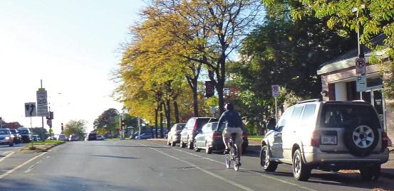
22 2.2 Bicycle Conditions Existing Bicycle Facilities Existing bicycle facilities are displayed on Map 1 and are described below. Bike Lanes Currently, two streets in the City have bike lanes. Wauwatosa Avenue in the eastern portion of the city includes bike lanes north of West North Avenue. The typical cross section of Wauwatosa Avenue includes two through lanes (one lane in each direction) flanked by bike lanes on each side with parking lanes against the curbs. This street was reconfigured in the recent past in order to add the two bike lanes. The light color of the pavement makes the white pavement markings difficult to see in many instances. Bike lanes also exist along West Center Street from the Menomonee River Parkway east into Milwaukee. Most of West Center Street is located within Milwaukee, with the exception of a portion between 76 th Street and Lefeber Avenue. The typical cross section of West Center Street includes 11 through lanes (one lane in each direction) flanked by 5.5 bike lanes with 7 parking lanes against the curbs. Bike lanes will be included with projects that are currently underway on West Watertown Plank Road from North Mayfair Road to approximately Harwood Avenue, and on North Glenview Avenue from West Blue Mound Road to Harwood Avenue. Shared Use Paths In Wauwatosa, shared use paths are most commonly located along parkways. Along the Menomonee River Parkway, shared use paths exist north of West Congress Street, between Swan Boulevard and North 68 th Street (passing through the Village), and east of North 66 th Street. These segments are designated as parts of the Oak Leaf Trail, which is a network of 114 miles of bikeways consisting of paved shared use paths, park drives, and municipal streets. The Oak Leaf Trail provides connections throughout Milwaukee County and is owned and managed by the Milwaukee County Parks Department. Two gaps one small (approximately 0.4 miles) and one large (3.5 miles) break the continuity of shared use paths along this parkway. Also designated as part of the Oak Leaf Trail, a shared use path follows the Underwood Creek Parkway from North 115 th Street east to the Underwood Creek Parkway. The Honey Creek Parkway does not currently contain any shared use paths. Wauwatosa is the western terminus of the Hank Aaron State Trail, which runs approximately 12 miles east from North 124 th Street and Blue Mound Road to Lakeshore State Park in Milwaukee. Also beginning at the intersection of North 124 th Street and Blue Mound is a major spur of the Oak Leaf Trail which runs north and east through the Village and connects Wauwatosa to Milwaukee. Just to the north of Miller Park it reconnects to the northern spur of the Hank Aaron State Trail. This serves as an important link for the Milwaukee County Oak Leaf Trail system, completing a set of loops around Milwaukee County. In addition to the aforementioned shared use paths that create regional connections, smaller shared use paths connect neighborhoods within Wauwatosa. The Madison Park Path crosses through the park, connecting North 100 th Street near West Glendale Avenue to North 92 nd Street north of the Luther Manor retirement community. Internal circulator paths also exist within the Milwaukee County Research Park (this shared use path provides a cross connection between North Mayfair Road and West Wisconsin Avenue) and the County Grounds Park. The paths within the County Grounds Park are unpaved and several are actually maintenance roads that allow bicycle and pedestrian use. Significant development is planned or currently underway within the County Grounds and bicycle and pedestrian accommodations will be included as part of this development. 10 Existing Conditions


23 City of Wauwatosa Bicycle & Pedestrian Facilities Plan Figure 2: Map of existing bicycle network Existing Conditions 11
24 Page intentionally left blank. 12 Existing Conditions
25 2.2.2 Bicycle Opportunities Development Patterns & Major Destinations Wauwatosa is predominately laid out following traditional pre war development patterns, including compact neighborhoods, strong connectivity between houses and commercial areas, and a grid street network (discussed in further detail in the following section). These development patterns, which are reflective of a time in history when households had at most one automobile and often had none at all, are much more conducive to biking than late 20 th century suburban development patterns. This is largely due to the fact that when Wauwatosa s historic neighborhoods were built, its residents relied on the ability to walk or bike to get to work, buy groceries, or reach transit. Major destinations in Wauwatosa include commercial districts, employment centers, and civic institutions such as parks, schools, and libraries. The Mayfair Road and North Avenue commercial corridors contain many of Wauwatosa s shopping and dining destinations. These corridors combine to form a sideways tee that serves as a commercial spine for the City, resulting in most neighborhoods being within a half mile (easy biking and walking distance) of a commercial corridor. The East Tosa portion of North Avenue is the most vibrant and bike friendly portion of either of these corridors. However, the Village is arguably the heart of Wauwatosa and is one of the community s most important commercial destinations. This district has several bike friendly features, including a dense collection of shops, restaurants, and offices as well as a bicycle and pedestrian only bridge over the Menomonee River, connecting the Village to the shared use paths along the greenway. The City s 2008 Comprehensive Plan highlights several opportunities for redevelopment and revitalization in the community, including the Burleigh Street and State Street mixed use redevelopment zones that can become important destinations for cyclists and pedestrians. Wauwatosa s primary employment area is known as the Life Science Center. This large area actually includes three zones: 1. University of Wisconsin Milwaukee Innovation Campus: This area is planned as a public private research park, housing UWM s Engineering Graduate School and Institute for Industrial Innovation as well as private businesses and a residential component. 2. Milwaukee County Research Park: Home of Milwaukee County s major biomedical and information technology research and development corporations. 3. Milwaukee Regional Medical Center: This collection of hospitals, medical offices, and the Medical College of Wisconsin provide approximately 17,000 jobs, indirectly stimulate approximately 17,600 more jobs in the area, and in 2009 had a $1.9 billion economic impact on the region. 11 Innovation Campus and the Regional Medical Center both border the Menomonee River Parkway. With thousands of workers traveling to this area every day, there is a significant opportunity to shift vehicular commutes to bike by providing safe and comfortable on street bike facilities and shared use paths. Grid Street Network Wauwatosa s grid street network is well suited for biking and walking. Grid street networks disperse traffic across many streets rather than concentrating high volumes of traffic on only a few streets. As such, they are more 11 Wauwatosa Innovation Parkway. Wauwatosa Economic Development Department. Existing Conditions 13
26 efficient and typically more comfortable for cyclists and pedestrians since they reduce the need for high volume, multi lane streets that would otherwise act as barriers. In addition, a grid street network provides the shortest possible routes between every Point A and every Point B in the community while also presenting a variety of route choices for each trip. In other words, a cyclist that is late for an appointment could choose the shortest route to her destination and then choose a more scenic route for the trip home. Finally, a grid street network facilitates the development of neighborhood greenways, which give priority to neighborhood traffic including bicyclists through low speed limits, speed cushions, and other traffic control measures. While cars are allowed on neighborhood greenways, their existing low speed limits encourages motorists to seek alternate, parallel routes resulting in most through traffic being diverted to another street. Parkways In 1923, a plan for a regional network of parks, parkways, golf courses, and other open spaces was developed by Charles B Whitnall. 12 Although this plan was not fully implemented, its legacy includes a number of parkways, many of which are considered eligible for the National Register of Historic Places. Of the three parkways traversing Wauwatosa, one is listed in the National Register (Honey Creek Parkway) and two are eligible for listing (Menomonee River Parkway and Underwood Creek Parkway). These parkways, as part of the Milwaukee County Park System, are great resources for the community. In addition to their aesthetic and environmental benefits, the parkways include streets and shared use paths that provide continuous linear routes for bicycling. However, the roads within the parkways do not have bike lanes and the pavement conditions are generally very poor. Cycling along the Menomonee River Parkway is further challenged by high volumes of traffic. Some segments of this road experience up to 9,000 average daily trips (ADT), a significant amount. Further compounding the issue, a significant amount of peak condition queuing occurs at the intersections of Menomonee River Parkway at West North Avenue and at North Swan Boulevard. Intercity Connectivity There are many opportunities for bicycle facilities to connect Wauwatosa to Milwaukee and other surrounding communities. The existing infrastructure namely bike lanes along West Center Street, shared use paths along the Menomonee River Parkway, and the Hank Aaron State Trail is the primary way in which bicyclists currently travel intercity. However, the connected street grid also provides many opportunities for non designated routes for bicyclists. Coordinating bicycle plans and infrastructure changes (such as street reconstruction, intersection modifications, shared use paths along parkways, and neighborhood greenways) with Milwaukee, Brookfield, West Allis, Elm Grove, and other surrounding municipalities will further enhance intercity connectivity Bicycle Barriers & Challenges Traffic Volumes The ideal street for transportation cycling purposes is often one that provides relatively direct connections from one side of the city to the other, while also having access to shopping, dining, jobs, and residential areas. These streets are also appealing to motorists, often resulting in high traffic volumes. Many of Wauwatosa s high traffic volume streets, such as Watertown Plank Road and Mayfair Road, are multi lane streets designed to convey very high traffic volumes close to or in excess of 25,000 ADT. Far more common in Wauwatosa are two lane streets, such as North Avenue and Wisconsin Avenue, which were designed to convey lower levels of traffic than they do currently. The Menomonee River Parkway was initially designed as a pleasure or scenic route and as a way for Existing Conditions
27 people to access recreational opportunities, but now functions as a through street carrying a higher volume of faster traffic than was intended. Some of these streets, including Wauwatosa Avenue, Blue Mound Road, and Mayfair Road are also part of the state highway system. Providing accommodation for bicycles along both of these types of streets typically means the addition of bike lanes. However, traffic volumes are low to moderate on the majority of local streets in Wauwatosa. Combined with the positive benefits of the grid street network (described previously in Section 2.2.2), the result is that the majority of the community s minor, local streets are very bike friendly. Pavement Conditions As with all street users, cyclists prefer smooth, well maintained pavement surfaces. The city and statemaintained street surfaces in Wauwatosa are generally good. However, the pavement conditions of the countymaintained parkways are typically poor to fair. Typically, poor pavement conditions affect cyclists route preferences. The inadequate pavement condition of the Menomonee River Parkway, coupled with this street s high traffic volumes, greatly reduce the comfort and usability of what is otherwise a convenient and scenic street for cyclists. This was strongly supported by comments presented to TDG at public meetings and the WikiMap as the plan was being developed. Constrained Right of Way (Arterials) The addition of bike lanes, cycle tracks, and other facilities is often influenced by narrow street widths. This situation is typically the case along multi lane streets and streets with designated on street parking. In many cases, streets cannot be widened to provide space for such facilities due to constrained right of way. In these situations, the possible actions include 1) removing a travel lane or parking lane (typically on just one side), 2) acquiring additional right of way and widening the street (often at great expense), 3) placing shared lane markings in the travel lanes, or 4) choosing not to provide adequate bicycle accommodation and supporting cycling with other options on alternative, parallel streets. Connectivity The excellent connectivity provided by Wauwatosa s grid street network (described in Section 2.2.2) is interrupted by three primary obstacles: Hwy US 45, railroads (the Canadian Pacific and Union Pacific Railroads), and the Menomonee River. Each of these span the City with a limited number of crossings, which funnel traffic bicycle and motor vehicles to a few streets in order to cross them. Some crossings, such as the pedestrian and bicycleonly extension of Harwood Avenue across the Menomonee River, are safe and comfortable for non motorized traffic. Another example is the Oak Leaf Trail connector (from 116 th Street to Underwood Parkway), which has underpasses to cross three major highways. Other crossings, however, are very constrained and can be quite uncomfortable for cyclists. This is one of most significant connectivity issues for the City. Existing Conditions 15
28 2.3 Pedestrian Conditions Existing Pedestrian Facilities Existing Sidewalks In general, the eastern half of Wauwatosa has sidewalks along almost all of its streets while the western half has few. Being the older portion of the city, the eastern half was developed at a time when walking was a common mode of transportation much as it is today and sidewalks were therefore considered integral parts of the City s transportation network. The western, post war portion of the community was developed during a period when American culture was moving toward automobile dependence and sidewalks were not included in street construction projects. Typically sidewalks are considered to be important along commercial corridors, streets with transit service, streets connecting to schools, and streets with high traffic volumes. Some of Wauwatosa s major streets that exhibit these characteristics include portions of Mayfair Road, Menomonee River Parkway, Burleigh Street, North 124 th Street, Watertown Plank Road, Wisconsin Avenue, North Swan Boulevard, and West Center Street. Sidewalks, where they exist, are generally in good or very good condition in Wauwatosa, although sidewalk replacements were deferred for several years due to constrained budgets. Existing Shared Use Paths The shared use paths described in Section also function as important elements within Wauwatosa s pedestrian network. These shared use paths include the Menomonee River and Underwood Creek Parkway segments of the Oak Leaf Trail, the Hank Aaron State Trail, and shorter shared use paths through neighborhoods and parks Pedestrian Opportunities Development Patterns & Major Destinations Previously discussed in Section 2.2.2, Wauwatosa s compact, pre war development patterns provide good connectivity between neighborhoods and commercial areas. Some of Wauwatosa s most walkable areas are the Village and the East Tosa portion of West North Avenue (including the neighborhoods surrounding each of these districts). Future redevelopment and revitalization efforts, such as the plans for mixed use districts along State Street and Burleigh Street, are significant opportunities for increasing Wauwatosa s walkability. Enhancing pedestrian connectivity between these zones and surrounding neighborhoods should be a priority for the community and will enhance the future economic redevelopment potential. It is important that parks and schools be accessible by foot, especially for children. Schools and parks are conveniently located across the community. Schools to consider evaluating for pedestrian accessibility include Madison Elementary, Eisenhower Elementary, Underwood Elementary, Whitman Middle, Wauwatosa West High, and St. Joseph Catholic Schools. Parks without adequate sidewalk connectivity include Madison Park, Hartung Park, Webster Park, Wisconsin Avenue Park, and Chippewa Park. Additionally, a safe route between McKinley School neighborhood and Whitman School neighborhood will be evaluated. [NOTE: Options will be studied in detail using the Safe Routes to School planning grant awarded by WisDOT to the City and McKinley School and will include participation of all stakeholders. All options will be explored including paths along North Avenue, Burleigh Street, and Menomonee River Parkway.] 16 Existing Conditions
29 Grid Street Network Many of the benefits of Wauwatosa s grid street network described in Section also apply to pedestrians. Namely, they provide short routes to destinations, allow people to vary their route, and disperse automobile traffic, the latter of which results in fewer high volume intersections for pedestrians to cross. For these reasons, a grid street network when coupled with a diversity of land uses is the ideal foundation for walkability, meaning an environment in which many daily errands and tasks can be completed on foot. Parkways The historic system of parkways in Wauwatosa including Honey Creek Parkway, Menomonee River Parkway, and Underwood Creek Parkway are attractive open spaces that provide access to nature for the community as well as linear connections for walking. Currently, shared use paths exist along several portions of the Menomonee River and Underwood Creek Parkways, but there a number of gaps exist that render these connections incomplete. Bridging the gaps between existing shared use paths, especially those along the Menomonee River Parkway, will be an important step for pedestrian mobility. The parkways also provide opportunities for nature trails, mountain bike trails, and footpaths that serve primarily as recreational routes. Intercity Connectivity Wauwatosa s grid street network is mirrored by similar street networks in surrounding municipalities. This affords hundreds of street connections for pedestrians, as well as for other modes of transportation. While it is unlikely that a significant number of people will make intercity walking trips to go to school or a job, intercity connectivity for pedestrians is important because they strengthen economic and cultural ties across city lines. From an economic development perspective, pedestrian connectivity with surrounding communities may help Wauwatosa s businesses by increasing access to them. An example of this opportunity is the East Tosa portion of North Avenue, which likely attracts pedestrians from nearby Milwaukee neighborhoods. Improvements to intercity connectivity can be made by enhancing crossings of streets such as N. 60 th Street, Center Street, and Blue Mound Road. Also important is ensuring that sidewalks leading to and from city limits are complete, comfortable, and accessible. Good and attractive pedestrian facilities can provide appealing options for walking to and supporting nearby businesses Pedestrian Facility Considerations Sidewalks The option of putting sidewalks on streets that currently do not have them will be evaluated on a case by case basis as street reconstruction projects arise and neighborhood input and support is obtained. Criteria used to identify areas of importance for pedestrian facilities include filling gaps in the existing system, proximity to schools, traffic volume, proximity to existing paths, and bus stop locations. Major Street Crossings Crossing major streets can potentially present issues for pedestrians, especially for the elderly, children and people who are disabled. Even in locations with continuous sidewalks, the presence of a single street that is difficult to safely cross can discourage pedestrian activity in the entire area. Major arterials are can be challenging to cross as there are often significant distances between controlled intersections with crosswalks and pedestrian signals. If streets do not have medians (which would allow two stage pedestrian crossings), the challenge is exacerbated. Wauwatosa s major street crossings are found along Mayfair Road, Blue Mound Road, Capitol Drive, Wauwatosa Avenue, and Watertown Plank Road. The latter of these streets bisects the Life Science Center (see Section 2.2.2), which is a major employment center with approximately 17,000 employees, significant pedestrian Existing Conditions 17
30 traffic, and the possibility of even much higher levels of pedestrian activity. Currently, there are three marked and unmarked crosswalks along the entire 1.4 mile stretch of Watertown Plank Road that runs through this area. As the Life Science Center continues to develop with the Innovation Campus project, efforts should be considered to enhance pedestrian crossings of Watertown Plank Road. A number of streets, including 100 th Street and Center Street, can become challenging to cross or navigate during school drop off and pick up times. Right of Way Considerations Any addition of pedestrian facilities will need to take into account the existing right of way along local, collector, and arterial streets. In some locations ample right of way is not available. When facilities are not present, adjacent homeowners often plant vegetation or install landscape furnishings within the right of way. Similarly, commercial property owners often use this space for parking, storage, signs, and displays. The addition of facilities in these right of ways would have to resolve these potential conflicts. In locations where right of way is simply not available, purchasing additional land or acquiring easements would be necessary in order to construct pedestrian facilities. Connectivity As with bicycle mobility, Highway 45, railroads (the Canadian Pacific and Union Pacific Railroads), Mayfair Road, Capitol Drive, Wauwatosa Avenue, and the Menomonee River can be obstacles for pedestrians to cross. Crossings along these occur at a few points, which may or may not be convenient for pedestrians. While being a great opportunity for pedestrians both for transportation and recreation uses for linear movements the Menomonee River Parkway has few crossing opportunities. In some instances, such as between W. Burleigh Street and W. North Avenue and between W. Hampton Avenue and W. Capitol Drive, there are stretches longer than one mile without pedestrian crossings. More than any other mode of transportation, direct access is important for pedestrian mobility. With the construction of future shared use paths along the Menomonee River Parkway, a possible connection between Hartung Park and the Sheraton Lawns neighborhoods should be considered. 18 Existing Conditions
31 2.4 Existing Plans and Policies Eight statewide, four regional/county, and four municipal plans and policies were reviewed during the preparation of this Bicycle & Pedestrian Facilities Plan. Dating from as long ago as 1991 (A Park and Open Space Plan for Milwaukee County) to as recent as 2011, these documents each provide elements of context that help to ensure current planning efforts for bicycle and pedestrian infrastructure and policies align with and support the ongoing strategies and infrastructure programs of the City of Wauwatosa, Milwaukee County, and the State of Wisconsin. Three plans in particular stand out as influential to the development of the Bicycle & Pedestrian Facilities Plan. Connections 2030 (WisDOT s comprehensive transportation plan) calls for the elimination of barriers to bicycle and pedestrian connectivity, support for local bike/pedestrian infrastructure projects and the incorporation of Complete Streets street design projects that equally accommodate cars, bikes, pedestrians, and transit. The Southeastern Wisconsin Regional Planning Commission s (SEWRPC) A Regional Transportation System Plan for Southeastern Wisconsin: 2035, which is the regional transportation plan for the Milwaukee area, provides guidance on the inclusion of bike lanes and sidewalks along various types of streets. It also encourages intercity bikeway and pedestrian connections as well as a regional shared use path system totaling 575 miles in length. Finally, the City of Wauwatosa s Comprehensive Plan identifies walkability and bike friendliness as important goals for the community. It includes a number of goals and objectives related to improving the city for walking and biking, thereby laying the foundation for a future, more detailed bicycle and pedestrian plan. Existing Conditions 19

32 3 Bicycle Network Recommendations & Implementation This chapter presents objectives and policies that will support the development of the bicycle network included in this chapter. 3.1 Overview Creating a network of safe and useful bikeways is the primary goal of this plan. For a network to be safe, it needs to be made up of bicycle facilities that increase actual safety as well as the perception of safety, which is the primary impediment urban and suburbanites cite as the reason they do not bicycle more often. For a network to be useful it needs to connect people to places they want to go, and be continuous, direct, efficient, and easy to navigate. For Wauwatosa to attain its goal of increasing bicycle ridership for transportation, it is important to define the target audience for increased cycling activity. Over the last decade, Portland, Oregon has come to understand its population and their attitudes toward cycling in a simple but useful framework. While Portland is now known as one of the most bicycle friendly cities in the United States, the City found that its Four Types of Transporation Cyclists in Portland By Proportion of Population Interested but Concerned 59% Figure 3: Attitudes of Portland residents toward bicycling Strong & Fearless 1% No Way, No How 33% Enthused & Confident 7% bicycling demographics were not all that different than other U.S. cities and provides a relevant case study. Less than one percent of its population could be described as Strong and Fearless riders, those willing to bicycle under almost any traffic conditions. About seven percent are Enthused and Confident cyclists, those who are comfortable bicycling under many conditions, but are still concerned about safety in traffic. The largest group is the estimated 60 percent of the population that is Interested but Concerned, for whom safety in traffic is the biggest impediment to bicycling. 13 Approximately one third of the population is not interested in bicycling at all. These percentages are displayed in Figure 2. After determining these population groups, Portland set out to build a bicycle network that would serve the greatest number of people those that are Interested but Concerned. By serving this group of people, Portland also served people who were more confident about bicycling with traffic. After Portland s initial assessment the city has continued to count and survey cyclists on a regular basis. Portland s daily bike commuters doubled between 1992 and 2000, and more than doubled again by Improvements to the bicycle network are believed to be the primary factor accounting for this growth. Portland s analysis is now used around the U.S. by cities and urbanizing counties to help them focus bicycling improvements to meet the needs of the approximately 67 percent of the population that is interested and willing to bicycle more if bicycling conditions can be improved. 13 Four Types of Transportation Cyclists in Portland Bicycle Network Recommendations & Implementation
33 3.1.1 Meeting the Needs of All Users It is essential that the Wauwatosa bicycle network address the needs of all cyclists and potential cyclists. This includes the young and old, weekend recreational enthusiasts who converge on the Oak Leaf Trail and Hank Aaron State Trail, children biking to school, and families bicycling to the Hoyt Park Pool. It also includes people cycling to The Village to visit a restaurant, the music teacher riding to her twice weekly in home lesson, and the custodial staff riding to Mayfair Mall for their overnight cleaning shift. And it includes the other categories of cyclists who are more comfortable with traffic and are biking to work in Wauwatosa or surrounding communities. This plan recommends facility types and treatments that will improve cycling conditions for all of these people and many types of bicycle trips. It also embodies a strong focus on creating a network of low stress bikeways that can be used for daily transportation and close to home recreation by a larger share of Wauwatosa residents that are enthused and confident or interested but concerned. Bicycle Network Recommendations & Implementation 21
34 3.2 Development of Bicycle Recommendations and Network The recommendations and proposed network in this chapter were developed to support the vision and goals described in Chapter 1 of this plan and a variety of factors that are described below were used to develop them. Public Input As noted in Section 1.3 and Appendix A, public input that was provided for the development of this plan factored heavily into the development of the vision, goals, and recommendations included herein. Additionally, public comments highlighted areas that currently receive heavy bicycle use, as well as areas in which people would like to bicycle, but are not currently comfortable for most riders. Steering Committee Input The Plan Steering Committee provided extensive input about recommendations related to bicycling as well as criteria for where bicycle facilities should be located. General criteria for bicycle facilities included connecting schools, parks, businesses, and neighborhoods throughout Wauwatosa, providing bicycle facilities on higher volume streets, particularly those that serve businesses, and providing a network of low stress facilities that can be used by bicyclists with a wide range of abilities. Existing and Potential Bicycle Demand The online mapping tool highlighted in Section provided an overview of existing bicycle usage in Wauwatosa. In addition to the data collected through the online interactive map, a map was developed using a variety of factors that could lead to increased bicycling in the future. This heat map included factors such as population density, the presence of schools or higher education institutions, and proximity to trails or paths. The factors were weighted and combined to produce Map 2, which indicates demand for bicycling throughout the City and can be used to identify where the need for bicycle facilities exist to help meet that potential demand. The intensity of the demand shown on the map is relative to other areas depicted on the map. 22 Bicycle Network Recommendations & Implementation

35 City of Wauwatosa Bicycle & Pedestrian Facilities Plan Figure 4: Map of latent bicycle demand in Wauwatosa Bicycle Network Recommendations & Implementation 23
36 Field Work Extensive field work was conducted by the project team during the spring and summer of 2013 to verify the need for bicycle facilities in specific locations and ensure that appropriate facilities are recommended. Every collector and arterial street and the majority of neighborhood streets in Wauwatosa was subject to a windshield survey. This survey provides a general, but fairly comprehensive, assessment of roadway factors that are important for determining the need and potential for bicycle accommodations. In addition to the windshield survey, multiple stops per street segment were made to take cross section measurements and verify other conditions. Following is a list of factors that were considered in the field review process: Street connectivity Topography Functional classification Types of land uses served Speed limit Observed traffic speeds and volumes Traffic controls at intersections Presence of turn lanes at intersections Presence of and design of highway interchanges Pavement quality Trail connectivity Presence of sidepaths Likely truck traffic volumes Presence of public bus routes Relationship to key destinations Connectivity to adjacent jurisdictions Presence of barriers and potential as a barrier avoidance route Potential sight distance or other safety issues (dangerous drainage grates) Potential for roadway hazards including vegetative overgrowth Observed cyclists Observed need for motor vehicle parking Roadside conditions such as drainage structures, presence of sidewalks, buffers, streams, wetlands, etc. Roadway measures: Curbed or open section Overall road and median width Number and width of travel lanes Shoulder width Presence of parking and parking lane width Because the primary purpose of the survey was to make a bicycle facility recommendation, a complete inventory of these features was not documented for every roadway section reviewed. However, much of the data collected was logged manually on data collection sheets. In addition to the windshield survey, a number of streets were reviewed using publicly available Google maps and online street view applications, which are very current for Wauwatosa. 24 Bicycle Network Recommendations & Implementation
37 3.3 Bicycle Network Recommendations This section describes the recommendations that have been developed to help Wauwatosa achieve its vision and goals for bicycling with regards to the bicycle network and support infrastructure. Recommendations are presented individually with specific components listed underneath designed to achieve each recommendation. A brief discussion for each recommendation is also provided Bicycle Network Recommendations The bicycle network recommendations developed for the plan are summarized below. Section includes the recommendations as well as a brief discussion about each component. Recommendation 1: Continue to expand the network of on street bicycle facilities in Wauwatosa. Implement the bicycle network recommendations provided in Section 3.4 of this plan. Provide bicycle facilities on or along collector and arterial streets where space is currently available or when they are reconstructed. Provide a network of neighborhood greenways parallel to major street corridors and connecting locations such as schools and parks. Ensure that the bicycle network provides connections into neighboring communities, particularly to existing and planned bicycle facilities. Recommendation 2: Increase the off street bikeways and connections throughout Wauwatosa. Request that Milwaukee County provide a continuous shared use path along the Menomonee River Parkway. Close key gaps in off street bicycle corridors. Provide high visibility crossing treatments where off street bikeways cross arterial and collector streets. Pave prioritized unpaved bikeways in the City to allow for year round use. Recommendation 3: Maintain bicycle facilities to a level that provides year round, safe, comfortable, and convenient usage for all users. Sweep all on street and paved off street bikeways regularly. Provide prompt maintenance of potholes and other pavement damage on bikeways. Repaint bikeway markings before they fade. Clear snow from on street and off street bikeways in a timely manner. Recommendation 4: Provide support infrastructure to make it easy for people to bicycle in Wauwatosa. Provide a system of wayfinding signs that provide direction and distance to popular destinations in Wauwatosa and surrounding communities. Incorporate ample bicycle parking throughout the City, particularly in the Village, commercial districts, parks, and schools. Bicycle Network Recommendations & Implementation 25
38 Recommendation 5: Improve bicycle access at major obstacles and hazardous areas. Provide high visibility bicycle crossings at problem areas. Ensure that bicycle access is maintained when construction closes bikeways. Recommendation 6: Evaluate future development and redevelopment for inclusion of bicycle accommodations. Craft and adopt a Wauwatosa tailored complete streets ordinance to facilitate biking accommodations in the City.. 26 Bicycle Network Recommendations & Implementation
39 3.3.2 Bicycle Network Recommendations Recommendation 1: Continue to expand the network of on street bicycle facilities in Wauwatosa. Wauwatosa has recently added some on street bicycle facilities, but more are needed to connect destinations and provide travel options for residents and visitors. The consideration of new facilities will occur with additional input from the Common Council and residents through the Capital Improvement Plan and budget process. Implement the bicycle network recommendations provided in Section 3.4 of this plan. Provide a mixture of bikeways as a comprehensive network. As summarized in section 3.1, there are a variety of bicyclists in the City with different levels of experience and confidence. A comprehensive network will provide a means of matching the cyclist with a type of bikeway or street he/she feels comfortable using. On street bicycle facilities are a critical component of the bicycle network they provide a specific space for bicyclists to ride on busier streets and indicate to bicyclists and motorists alike where bicyclists should position themselves on shared streets. Provide bicycle facilities on or along collector and arterial streets where space is currently available or when they are reconstructed. By implementing the network recommendations provided in this chapter, Wauwatosa will provide a wellconnected network for its residents and visitors. It is particularly important that bicycle facilities be included on arterials and collector streets since these streets serve important destinations and cross features such as rivers and freeways. However, without a dedicated bicycle facility, most people are not comfortable bicycling on most arterial and collector streets. Just a few years ago, there were no designated on street bicycle facilities in Wauwatosa. In 2013 there are bike lanes on portions of North Wauwatosa Avenue and West Center Street, and bike lanes will be included in an upcoming reconstruction of West North Avenue. Although the number of onstreet facilities is limited, the City has been moving in the right direction by adding designated bike facilities on busier streets. This momentum should be maintained as the City implements the recommendations of this plan. Provide a network of neighborhood greenways parallel to major street corridors and connecting locations such as schools and parks. Even with bicycle facilities on arterial and collector streets, many people, particularly those who are less assertive on a bicycle or who are riding with children, will not be comfortable bicycling on these streets. To serve all levels of bicyclists, a network of neighborhood greenways should be provided parallel to major street corridors and connecting destinations such as schools and parks. Neighborhood greenways are quiet residential streets that are typically already good streets for bicycling. By signing these streets and adding traffic calming where appropriate, these streets can be excellent for bicycling while also reducing cut through traffic and speeding without limiting access by residents. Ensure that the bicycle network provides connections into neighboring communities, particularly to existing and planned bicycle facilities. The transportation network does not end at the City s borders many destinations that people wish to visit lie in neighboring communities. It is important that as Wauwatosa s bicycle network continues to develop, it provides good connections into neighboring communities. Whenever possible, on street bicycle facilities should connect to on street facilities in neighboring communities. Bicycle Network Recommendations & Implementation 27
40 Recommendation 2: Increase the off street bikeways and connections throughout Wauwatosa. Off street bikeways, also known as shared use paths, are important elements of a viable non motorized transportation system. They provide alternatives to on street biking, with which many new and potential cyclists are not yet comfortable. This helps Wauwatosa develop bike and pedestrian systems that are appealing for all potential users, regardless of experience or confidence. Seasoned and skilled cyclists also make good use of shared use paths as they can be the shortest, most direct route between two points. For example, it is easy to imagine people traveling from the City s northwestern neighborhoods to The Village choosing to use shared use paths along the Menomonee River Parkway. In addition to serving as alternative routes, shared use paths can provide critical connections across obstacles that would otherwise hinder bicycle and pedestrian mobility. Such connections could include bridges over rivers and grade separated crossings over major streets and highways. In addition to the transportation benefits of off street bikeways, they also provide opportunities for recreational riding, jogging and walking. Paths along parkways provide access to nature and are often preferred over on street bikeways due to their aesthetics and quiet nature. Request that Milwaukee County provide a continuous shared use path along the Menomonee River Parkway. The Menomonee River Parkway is the single greatest opportunity for shared use paths in Wauwatosa. The Parkway is owned and managed by Milwaukee County, so the expansion of the existing paths into a continuous system from one end of the city to the other will require coordination between the City and the County. From a planning and design perspective, it is important to coordinate and align connecting paths and access points with Wauwatosa s other existing and planned on street and off street bikeways. It may also be necessary to explore various implementation strategies that form a partnership between the City and the County. Construction of a path along the Menomonee River Parkway will take careful planning to ensure that the path does not negatively impact the resource. Close key gaps in off street bicycle corridors. Often these gaps are at critical locations, such as crossings of barriers including rivers, railroads, highways, and other major streets. These gaps in the off street network should be closed to increase the usability of the existing network. Provide high visibility crossing treatments where off street bikeways cross arterial and collector streets. Enhancing the visibility of crossings will not only improve user safety, but will also help increase the community s awareness of the availability of its pathways. Crossing visibility can be increased by using continental style crosswalks, signage (on the side of the street or overhead), in street markings and signs, and lighted beacons or signals. Pave prioritized unpaved bikeways in the City to allow for year round use. Paving existing unpaved paths will allow for year round use in all weather conditions if they are also cleared of snow (see Policy Recommendation 3.4); it will also increase the ease of use of these facilities. 28 Bicycle Network Recommendations & Implementation
41 Recommendation 3: Maintain bicycle facilities to a level that provides year round safe, comfortable, and convenient usage for all users. Maintenance of bicycle facilities is often more important than maintaining streets for motor vehicles. Bicyclists rely on clean and smooth surfacing to balance their two wheel vehicles and negotiate turns and stops. If bicyclists attention is constantly being directed to watching for the next pothole or piece of glass, they will not be able to focus on the operation of the bicycle itself, creating a safety issue. Sweep all on street and paved off street bikeways regularly. Glass and other debris present a far more significant hazard for bicyclists than for motor vehicle operators. Glass can lead to flat tires while even relatively small objects such as sticks or gravel can create a fall hazard. It is important to sweep all bikeways, on street and off street, to clear debris. Provide prompt maintenance of potholes and other pavement damage on bikeways. Similar to debris, potholes and other pavement damage presents a more significant hazard to bicyclists than to motor vehicle operators. Potholes and cracks that may not be considered significant for motor vehicles can easily lead to a crash on a bicycle. Potholes and pavement damage should be quickly repaired on all bikeways. The City should include prompts for bikeway maintenance under its Request Tracker system. Repaint bikeway markings before they fade. Separation of bicyclists from motorists occurs mostly through on road markings and signage. Of the two, markings are more important. Bikeway markings are somewhat more difficult to maintain in Wisconsin than in many states because of the toll that snow plowing, salt, and sand have on marking material. To continue to reap the benefits of separation, bikeway markings need to be kept fresh and visible. Clear snow from key on street and off street bikeways in a timely manner. Over the past two decades, the use of the bicycle has clearly expanded to transportation. As part of that, bicyclists are extending the traditional seven to nine month season for bicycling to year round use. Improved cycling gear and bicycle equipment (studded and knobby tires, vastly improved lighting, and suspension systems) has aided and encouraged more people to ride into and through the winter. As these changes have occurred, there has been a commensurate demand in keeping bikeways clear of snow and ice. Bicyclists using bikeways during the winter almost always have the same destinations as do motorists. Currently, the Milwaukee County Parks Department does not clear snow on the vast majority of its paths. As such, a partnership may be necessary between the City and the County to ensure that these important transportation corridors, or at least key segment, are accessible during the winter. Bikeways, both on street and off street, should have snow promptly removed after a snow event. Bicycle Network Recommendations & Implementation 29
42 Recommendation 4: Provide support infrastructure to make it easy for people to bicycle in Wauwatosa. As Wauwatosa develops a comprehensive bicycle network, it also needs to provide support infrastructure to facilitate bicycle use. Bicyclists must be able to find their way around the City s network and should know that secure bicycle parking is available at their destination. Provide a system of wayfinding signs that provide direction and distance to popular destinations in Wauwatosa and surrounding communities. Wayfinding is a means of providing key information about destinations, direction, and distance to help bicyclists determine the best routes for their trips. In the past, ubiquitous bicycle route signs were often erected but provided no real guidance other than stating the obvious: you are on a bicycle route. Complete wayfinding signs, provide on the ground information that help bicyclists find their way around a community or between communities significantly stretching the utility of on street and path networks. Directional and destination plaques can be added to existing or new route signs to provide additional messaging to bicyclists. All new signage used by the City and its partners should include the full complement of supplemental directional plaques. Provide ample high quality bicycle parking throughout the City, particularly in the Village, commercial districts, parks, and schools. No one serious about developing a property for residential or commercial use would overlook the need to park motor vehicles. Similarly, one of the most important aspects of accommodating bicyclists at destinations is through bicycle parking. Fortunately, the cost for bicycle parking is very inexpensive compared to motor vehicle parking. The City should add bicycle parking in high destination areas, especially in commercial areas and at schools. All new businesses and schools should be built with ample bicycle parking the day they open their doors to the public. Specific locations for increased bicycle parking include: Commercial districts The Village North Avenue, from 60 th to 76 th Streets and 86 th to 92 nd Streets Mayfair Mall Schools Libraries Recreation centers Government buildings New bicycle parking installed in the City should comply with the Association of Pedestrian and Bicycle Professionals guidance described in the Bicycle Parking Guidelines, 2 nd Edition. The guide provides best practices for bicycle parking installation and acceptable as well as unacceptable types of racks. The guide is available for a small fee from APBP: 30 Bicycle Network Recommendations & Implementation
43 Recommendation 5: Improve bicycle access at major obstacles and hazardous areas. Perhaps the greatest obstacle for new cyclists is the perception that riding a bicycle is a dangerous activity. Improving safety, as well as the perception of safety, is therefore an important exercise in facilitating a greater percentage of the community to bike. As with motor vehicles, cyclists more regularly encounter hazards and are at a greater risk than motorists at intersections and construction zones. Provide high visibility bicycle crossings at problem areas. Increasing the safety of intersections and similar problem areas will help to eliminate several of the barriers that challenge bicycling in Wauwatosa. One way in which intersection safety can be increased is through the installation of highly visible pavement markings and signage. At a minimum, it is critical to ensure that appropriate regulatory signage is present and that striping across intersections and their approaches is visible and well maintained. Painted striping should be inspected semi annually and may require repainting annually or even more frequently. Thermoplastic, which is more durable and longer lasting than paint, is a recommended alternative marking material. 14 A relatively new traffic control device, a green lane is installed by filling the bike lane with green paint or thermoplastic where it crosses a challenging intersection or right turn lane. Intersections can be further enhanced by incorporating bike signals, which can give bikes a head start across intersections, and bike boxes, which allow cyclists to wait in front of cars at red lights and avoid right turn conflicts. However, where conditions are extremely hazardous and traffic volumes or right of way preclude intersection modifications, a gradeseparated crossing may be the best solution. These can take the form of a bridge over the roadway, or an underpass/tunnel under the street. Ensure that bicycle access is maintained when construction closes bikeways. Street reconstruction, water and sewer repair, and other disruptive projects are unavoidable occurrences in any established community. While it is not realistic to completely avoid disrupting bicycle traffic during construction, reasonable efforts should be made to ensure bicycle access, either by means of temporary lane relocation or detours to alternate routes. As a rule of thumb, if it is possible to maintain car access along the street, bike access should also be maintained. For any closures, bicyclists should be alerted ahead of the closure or even before the detour so they can plan their route. 14 While significantly more durable than paint, thermoplastic still requires repair and replacements on a regular basis. Typically every three to five years. Bicycle Network Recommendations & Implementation 31
44 Recommendation 6: Evaluate future development and redevelopment for the inclusion of bicycle accommodations. Ideally, bicycle and pedestrian facilities and infrastructure should be included with all street projects when they are initially constructed, or when streets are reconstructed. Including bicycle and pedestrian facilities at this time is less expensive than retrofitting facilities as stand alone projects. Craft and adopt a Wauwatosa tailored complete streets ordinance to facilitate biking accommodations in the City. All major street and road projects can follow this ordinance to include adequate accommodation for bicycles and pedestrians that will help further the implementation of this plan. The policy should also apply to streets built by private developers, such as interior circulating streets in a newly developed site. A model Complete Streets ordinance can be used to offer guidance and is provided in Appendix E. Currently the State of Wisconsin has a version of a complete streets law for bicycle and pedestrian accommodations (SS 84.01(35)). If State or Federal funds are used for a project, bicycle and pedestrian accommodations are to be included in the project unless there is justification for not including them. Exceptions are provided in State law and a rule (Trans 75). 32 Bicycle Network Recommendations & Implementation
45 3.4 Bicycle Facility Recommendations Background The facility recommendations in this plan include both short term and long term recommendations. Some facilities, such as shared lane marking and some bike lanes could easily be implemented in the very near term, while others will take more time due to space or financial constraints. For example, for bicycle lanes to be provided on some streets, the street may need to be widened; however, the opportunity to widen may only occur when the street is scheduled for reconstruction, which may be many years in the future. When and whether or not this happens is subject to a host of issues including zoning and potential future zoning changes, the development market and economic conditions, and community input provided during the public involvement processes associated with land and street development. In the short run, the City may choose to install another bikeway type such as shared lane markings, or the street may not be of high enough priority and potential use for any action to be taken until development/redevelopment occurs. Streets where both on street and off street facilities are recommended may have one facility developed in an earlier phase and the other in a later phase. While a specific facility has been recommended for many streets, it is important to understand that interim facilities may be cost effective ways to improve conditions incrementally, allowing bicycle use to grow and creating the need for higher grade facilities that will more effectively serve larger volumes of bicyclists. Just as streets are incrementally managed to respond to changing volumes of motor vehicle traffic, the various types of bicycle accommodations may be applied as demand and usage grows over time Street Jurisdiction While this is a City of Wauwatosa plan it makes recommendations for lands and transportation facilities within the City that are under the jurisdiction of Milwaukee County and the State of Wisconsin. The Plan also includes recommendations for bicycle facilities on some City of Milwaukee streets. These recommendations are included in order to provide a complete and well connected system of bikeways in Wauwatosa and connecting to adjacent municipalities. The City will need to work with the proper jurisdictions to implement the recommendations of this plan in consideration of consistency with the jurisdiction s written plans and the priority assigned by the jurisdiction. The City should explore options including cost and maintenance sharing if it results in the implementation of plan elements on streets under the jurisdiction of other entities. Bicycle Network Recommendations & Implementation 33


46 3.4.3 On Street Bicycle Facility Types The tables below provide brief descriptions of the different types of on street bicycle facilities included in the plan recommendations. Bike Lane A bike lane is a pavement marking that designates a portion of a street for the preferential or exclusive use of bicycles. Bike lane markings are typically dashed where vehicles are allowed to cross the bike lane, such as for right turns or at bus stops. Bike lanes are recommended on two way arterial and collector streets where there is enough width to accommodate a bike lane in both directions, and on oneway streets where there is enough width for a single bike lane. Buffered Bike Lane Buffered bike lanes are created by striping a buffer zone between a bike lane and the adjacent travel lane. Some buffered bike lanes also offer a painted buffer between the bike lane and an adjacent parking lane. Buffered bike lanes should be considered at locations where there is excess pavement width or where adjacent traffic speeds are above 35 mph. Contraflow Bike Lane Contraflow bike lanes run in the opposite direction of other traffic on a one way street. Contraflow bike lanes provide bike access on one way streets where bicyclists may otherwise ride against traffic or on the sidewalk. Contraflow bike lanes may be separated from other traffic by painted lines, a painted buffer, or a physical delineator. 34 Bicycle Network Recommendations & Implementation
 is provided in the uphill direction to accommodate slow moving bicyclists in the uphill direction and a shared lane marking is provided in the downhill direction,")


47 Climbing Bike Lane A climbing lane is a bikeway design for a two way street that has a steep slope and insufficient width to permit bike lanes in both directions. A bike lane (the climbing lane) is provided in the uphill direction to accommodate slow moving bicyclists in the uphill direction and a shared lane marking is provided in the downhill direction, where bicyclists can typically travel at speeds close to motor vehicles. Colored Bike Lane All of the above bike lanes may have green color applied to them to highlight the presence of the bike lane. Colored lanes are typically used in high conflict areas such as through complicated intersections, in areas where traffic is merging across the bike lane, or in areas where traffic frequently turns across the bike lane. In 2011, colored bicycle lanes received interim approval from FHWA to be used on streets, thereby making way for their ultimate inclusion in the Manual of Uniform Traffic Control Devices in its next update. Cycletrack A cycletrack is a bicycle facility that is physically separated from both the street and the sidewalk. A cycletrack may be constructed at street level using street space, or at the sidewalk level using space adjacent to the street. Cycletracks separate bicyclists from motor vehicle traffic using a variety of methods, including curbs, raised concrete medians, bollards, on street parking, large planting pots/boxes, landscaped buffers (trees and lawn), or other methods. Cycletracks designed to be level with the sidewalk should provide a vertical separation between bicyclists and pedestrians, as well as a different surface treatment to delineate the bicycle from the pedestrian space (such as asphalt vs. concrete). Cycletracks can be one way for bicycles on each side of a two way road, or two way, and installed on one or both sides of the road. Cycletracks provide cyclists with a higher level of comfort compared to bike lanes, and are typically used on large multi lane arterials where higher vehicle speeds exist. They may also be appropriate on high volume but lower speed streets. Bicycle Network Recommendations & Implementation 35


48 Neighborhood Greenway A neighborhood greenway, sometimes also called a bicycle boulevard, is a street with low motorized traffic volumes and speeds designated to provide priority to bicyclists and neighborhood motor vehicle traffic. Neighborhood greenways may simply have signs and shared lane markings, or may include traffic calming elements including speed humps, traffic circles, chicanes, or traffic diverters. Neighborhood greenways benefit neighborhoods by reducing cut through traffic and speeding without limiting access by residents. Shared Lane Marking Collector or Arterial Street Shared lane markings (sharrows) are used on streets where bicyclists and motor vehicles share the same travel lane. The sharrow helps position bicyclists in the most appropriate location to ride. It also provides a visual cue to motorists that bicyclists have a right to use the street. On a four lane street, sharrows should be placed in the outside lane. If the outside travel lane is too narrow for a motorist to comfortably pass a cyclists while staying within the travel lane (generally less than 13 feet) the sharrow marking may be centered in the lane. This encourages cyclists to take the lane, and encourages motorists to use the left lane to pass. In a foot lane, the marking may be offset from the curb by 4 feet. For foot lanes, the BIKES MAY USE FULL LANE SIGN is recommended, because drivers are not used to sharing the road with cyclists and may not provide comfortable clearance when passing. Sharrows are not appropriate on streets with speed limits greater than 35 mph. Shared Lane Marking Neighborhood Street Shared lane markings (sharrows) may also be used on residential streets to designate bicycle facilities where there is not sufficient width for bike lanes. Studies have shown that sharrows direct bicyclists away from the door zone of parked cars, alert motorists of appropriate bicyclist positioning and encourage safe passing of bicyclists by motorists. 36 Bicycle Network Recommendations & Implementation


49 Signed Bike Route Signed bike routes provide distance and directional information as a wayfinding aid for bicyclists. Signed routes may be established on streets, trails or any combination of facility types that offer a continuous bicycling environment. Signs should offer cyclists information about alternative routes and accessible destinations from their current location, and not simply designate the street as a bike route. They also can be used to suggest the types of conditions cyclists can expect on a route by referencing trails or roadways by name. Signed routes provide new cyclists greater confidence when they are exploring utilitarian cycling for the first time or when they are in unfamiliar territory. Signed routes can also prevent cyclists from getting lost in residential areas with curvilinear street layouts and few through streets. Bike Box (Advanced Stop Line) Bike boxes are street markings at signalized intersections that allow bicyclists to move to the front of a traffic queue during the red signal phase. Allowing bicyclists to move to the front of the queue can increase their visibility to motorists and can reduce right hook crashes with motorists at the beginning of the green signal phase. Bike boxes can also aid cyclists in position for left turns. This plan does not recommend any specific locations for bike boxes, but they should be considered on streets with bike lanes as the proposed bicycle network is more fully implemented Off Street Bicycle Facility Types The tables below provide brief descriptions of the different types of off street bicycle facilities included in the plan recommendations. Shared Use Path A shared use path is an off street bicycle and pedestrian facility that is physically separated from motor vehicle traffic. Typically shared use paths are located in an independent right of way such as in a park, stream valley greenway, along a utility corridor, or an abandoned railroad corridor. Shared use paths are used by other non motorized users including pedestrians, skaters, wheelchair users, joggers, and sometimes equestrians. Bicycle Network Recommendations & Implementation 37

50 Sidepath A sidepath is a shared use path located adjacent to roadway. It is designed for use by bicyclists and pedestrians and each may travel in either direction. Sidepaths are sometimes created by designating a wide sidewalk for shared use, or they may be a segment of a longer trail or network of trails. Sidepaths are sometimes provided to facilitate connections to on and off street bicycle facilities. A sidepath is not generally a substitute for on street bicycle facilities, but may be considered in constrained conditions, or in addition to on street facilities. Sidepaths may not be appropriate in areas of high pedestrian activity unless there is space to successfully manage conflicts. Design details for these facility types are available from the following resources: The American Association of State Highway and Transportation Officials (AASHTO) Guide for the Development of Bicycle Facilities, 4 th Edition (2012) The Federal Highway Administration s (FHWA) Manual on Uniform Traffic Control Devices (2009) The Wisconsin Department of Transportation s Wisconsin Bicycle Facility Design Handbook (2004) facility.pdf The National Association of City Transportation Officials (NACTO) Urban Bikeway Design Guide (2012) for cycling/design guide/ Bicycle Network Table 1 provides a summary of the total miles of different bikeways recommended by this plan. Table 1: Summary of existing and proposed bikeways in Wauwatosa. Facility Existing* Proposed Total Bike Lanes Cycle Tracks Neighborhood Greenways Shared Lane Markings Signed Bike Routes Shared Use Paths Total * Miles of existing facilities are approximate Tables 2 through 7 provide the full bicycle network recommendations by facility type. Each facility recommendation includes the streets, paths, or other features that bound the recommended facility, as well as the approximate facility length in miles. Map 3 following the tables displays the recommended bicycle network as well as existing bikeways in the City of Wauwatosa. A listing of the recommended bikeways including implementation comments and planning level cost estimates is provided in Appendix C. 38 Bicycle Network Recommendations & Implementation
51 Table 2: Recommended bike lanes Street From To Miles Discovery Pkwy. N. Swan Blvd. W. Watertown Plank Rd Harwood Ave. W. Watertown Plank Rd. N. Glenview Ave Harwood Ave. W. State St. N. Wauwatosa Ave Milwaukee Ave. N. 83rd St. N. 60th St N. 100th St. W. Hampton Ave. W. Keefe St N. 124th St. W. Hampton Ave. W. Capitol St N. 124th St. W. Burleigh St. W. North Ave N. 124th St. W. North Ave. W. Watertown Plank Rd N. 124th St. W. Capitol St. W. Burleigh St N. 60th St. W. Center St. Milwaukee Ave N. 68th St. W. State St. W. Mount Vernon Ave N. 68th St. Milwaukee Ave W. State St N. 92nd St. W. Hampton Ave. W. Capitol St N. 92nd St. W. Watertown Plank Rd. W. Wisconsin Ave N. 92nd St. W. Michigan St. W. Schlinger Ave N. Glenview Ave W. Blue Mound Rd. N. Honey Creek Pkwy N. Mayfair Rd. W. Hampton Ave. I N. Menomonee River Pkwy. Harwood Ave. W. Congress St N. Swan Blvd. W. Center St. W. Watertown Plank Rd N. Wauwatosa Ave. W. Center St. W. State St W Grantosa Dr. N. 100th St. N. 94th St W. Burleigh St. N. 124th St. N. Menomonee River Pkwy W. Capitol Dr. N. Menomonee River Pkwy. N. 100 th St W. Center St. N. 124th St. N. Mayfair Rd W. Congress St. W. Menomonee River Pkwy. N. Mayfair Rd W. Congress St. N. 94th St. N. 92nd St W. Hampton Ave. N. Mayfair Rd. N. 92nd St W. North Ave. N. 124th St. N. 60th St W. Potter Rd. N. 115th St. N. Mayfair Rd W. State St. Harwood Ave. N. 60th St W. Watertown Plank Rd. N. 124th St. N. Mayfair Rd W. Wisconsin Ave N. Mayfair Rd. N. Hawley Rd Total Table 3: Recommended cycletracks Street From To Miles N. Wauwatosa Ave. Stickney Ave. W. Garfield Ave W. Center St. N. 118th St. N. 117th Pl Total 0.03 Bicycle Network Recommendations & Implementation 39
52 Table 4: Recommended neighborhood greenways Street From To Miles Washington Cir. Hillcrest Dr. W. Washington Blvd W. Ruby Ave. Extension N. 105th St. East end 0.61 W. Diane Dr. N. 124th St. East end 0.13 W. Wirth St. N. 124th St. N. 119th St W. Martin Dr. N. 62nd St. Martha Washington Dr W. Garfield Ave. N. 67th St. N. 60th St W. Wells St. N. 76th St. N. Hawley Ave Hillcrest Dr. N. 83rd St. Washington Cir W. Hawthorne Ave. N. 92nd St. N Glenview Ave Wilson Blvd. N. 97th St. N. Swan Blvd 0.29 W. Glendale Ave. N. Delco Ave. East end 0.82 W. Congress St. N. Mayfair Rd. N. 105th St W. Courtland Ave. N. Mayfair Rd. N. Parkside Dr N. 97th St. N. Menomonee River Pkwy. Wilson Blvd Portland Ave. N. Robertson St. N. 76th St Stickney Ave. N. Swan Blvd. N. Wauwatosa Ave W. Wright St. N. Swan Blvd. N. 60th St W. Garfield Ave. N. Wauwatosa Ave. N. 68th St N. 76th St. Portland Ave. W. Wells St N. 85th St. Ravenswood Cir. W. Hawthorne Ave Ravenswood Cir. W. Blue Mound Rd. N. 85th St N. 117th St. W. Burleigh St. W. Hadley St N. 118th St. W. Center St. W. Watertown Plank Rd N. 65th St. W. Center St. W. Lloyd St N. 70th St. W. Center St. W. Mount Vernon Ave N. 83rd St. W. Center St. Milwaukee Ave N. 88th St. W. Center St. W. North Ave N. Parkside Dr. W. Courtland Ave. N. Delco Ave N. 115th St. W. Diane Dr. W. Park Hill Ave N. 117th Pl. W. Hadley St. W. Center St Martha Washington Dr. W. Lloyd St. W. Martin Dr N. 62nd St. W. Martin Dr. W. State St Charles Hart Pkwy. W. Menomonee River Pkwy. Milwaukee Ave N. 105th St. W. Ruby Ave. W. Congress St N. Robertson St. W. Watertown Plank Rd. W. Blue Mound Rd W. Washington Blvd. Washington Cir. N. 60th St Jackson Park Blvd. N. Menomonee River Pkwy. City Hall 1.20 Total Bicycle Network Recommendations & Implementation
53 Table 5: Recommended shared lane markings ("sharrows") Street From M Miles Harwood Ave. N. Glenview Ave. Pedestrian bridge 0.23 Harwood Ave. N. Wauwatosa Ave. Milwaukee Ave Ludington Ave. W. North Ave. N. 83rd St N. 68th St. W. Center St. Milwaukee Ave N. 91st St. W. Wisconsin Ave. W. Michigan St. * N. 93rd St. W. Wisconsin Ave. W. Michigan St. * N. 99th St. W. Keefe Ave. W. Concordia Ave Private St. N. Mayfair Rd. W. Center St. Connector Path 0.49 W. Concordia Ave. N. 99th St. N. Menomonee River Pkwy W. Keefe Ave. N. 100th St. N. 99th St W. Michigan St. N. 91st St. N. 93rd St. * W. Potter Rd. W. Underwood Pkwy. N. 115th St * Street is in the City of Milwaukee Total 3.75 Table 6: Recommended signed bike routes Street From To Miles Honey Creek Pkwy. W. Blue Mound Rd. N. 60th St Underwood Creek Pkwy. W. Watertown Plank Rd. N. Swan Blvd 1.71 Total 3.59 Table 7: Recommended grade separated crossings Location Description West Concordia Avenue Bridge Bridge over the Menomonee River for a planned shared use path North Swan Boulevard Underpass Underpass of reconstructed North Swan Boulevard Underwood Creek Bridge Bridge over Underwood Creek for a planned shared use path Hansen Park Rail Underpass Expansion of existing underpass to better accommodate bicyclists and pedestrians West Center Street / Mayfair Road Grade separation for a planned crossing of Mayfair Road Bicycle Network Recommendations & Implementation 41
54 Table 8: Recommended shared use paths Street From To Miles Burleigh Path (117th to Mayfair) N. 117th St. N. Mayfair Rd Burleigh Path (Blue Mound) N. Mayfair Rd. N. Menomonee River Pkwy Burleigh Sidepath (Mt. Mary) N. Menomonee River Pkwy. N. 93rd St Center St. Connector Private Street W. Center St Grantosa Connection Madison Park W. Grantosa Dr Grantosa Path N. Menomonee River Pkwy. N. 100th St Hanson Golf Course Connection Underwood Pkwy 0.27 Harwood Ave. Connector Harwood Ave. Harwood Ave 0.03 Menomonee River Parkway West Path N. Menomonee River Pkwy. W. Burleigh St MMSD Paths Underwood Pkwy N. Swan Blvd MMSD Paths N. Swan Blvd. W. Watertown Plank Rd N. 115th St. Connector N. 115th St. Hank Aaron State Trail 0.11 N. Mayfair Rd. Sidepath Oak Leaf Trail W. Wisconsin Ave N. Mayfair Rd. Sidepath (East) W. Keefe Ave. W. Burleigh St N. Mayfair Rd. Sidepath (West) W. Capitol Dr. W. Burleigh St N. Menomonee River Pkwy. Path W. Courtland Ave N. Menomonee River Pkwy. Sidepath W. Congress St. Existing path at N. 91st St N. Swan Blvd. Sidepath Underwood Creek Pkwy. New roundabout 0.40 Northwest Rail Trail W. Feerick St. W. Center St Oak Leaf Trail Underwood Extension W. Blue Mound Pkwy N. 115th St South Honey Creek Path W. O'Connor St. N. Hawley Rd Swan Blvd. Underpass Hansen Park County Grounds 0.06 Underwood Elementary School Path Underwood Creek Path W. Potter Rd Underwood Parkway Path W. Watertown Plank Rd. N. Swan Blvd W. Blue Mound Rd. Underpass at Underwood Creek 0.03 W. Congress St. Sidepath N. Mayfair Rd. N. 104th St W. Dearbourn Ave. Extension W. Dearbourn Ave. HAST Connection 0.07 W. Diane Dr. Connector W. Diane Dr. N. 115th St W. Garfield Ave. Connector W. Garfield Ave. W. Garfield Ave W. Keefe Ave. Sidepath N. Menomonee River Pkwy. N. 100th St W. Meinecke Ave Extension W. Meinecke Ave. W. North Ave W. Ripley Ave. Extension W. Ripley Ave. Underwood Creek Path 0.07 W. Ruby Ave. Extension W. Ruby Ave. Planned path 0.03 Whitman School Connection N. 114th St. W. Center St Wirth Street Extension Wirth St. Northwest Rail Trail 0.15 W. Capitol Dr. Sidepath (Both Sides) N. 124 th St. N. Menomonee River Pkwy Currie Park Path W. Burleigh St. N. Mayfair Rd Total Bicycle Network Recommendations & Implementation


55 City of Wauwatosa Bicycle & Pedestrian Facilities Plan Figure 5: Map of existing and proposed bicycle facilities Bicycle Network Recommendations & Implementation 43
56 Page intentionally left blank. 44 Bicycle Network Recommendations & Implementation
57 3.4.6 Signing of the Bicycle Network Wayfinding signs provide information about destinations, direction, and distance to help bicyclists determine the best route to take to major destinations. Signs provide on the ground information that help bicyclists understand and use the on and off street network without the use of a map. Directional signs also provide additional messaging to motorists to expect bicycles on the roadway. The presence of signs encourages bicycling on designated corridors because users feel the signs will direct them to the best route for getting to their destination. Signs may also be used to direct bicyclists around barriers. Wayfinding is particularly important for Wauwatosa since it has an extensive grid network of neighborhood streets that can be enhanced for longer bicycle journeys with wayfinding signs. Wayfinding is an important component of establishing the recommended bicycle network. Wayfinding signs may be used alone as a signed route, or in combination with other pavement markings such as bike lanes or shared lane markings. The installation of signs and other bicycle network improvements do not need to occur at the same time. For example, for some lower speed/lower volume streets, installation of wayfinding signage may precede the striping of bike lanes, and could be used as an interim step toward implementing additional recommended treatments. The recommended network consists of several signed routes that have no pavement markings. Over time, the City may find it makes sense to add additional signed routes to the network. The decision to develop a signed route versus installing a bike lane or shared lane marking may be based on the following criteria: Alternate routes parallel, and within close proximity (less than a half mile), to a route with bicycle facilities. Lower volume streets. Spur routes, or routes that may span a relatively short distance and terminate at a specific destination or loop back into the main route. As noted in Recommendation 4, the City should sign its bikeway network as it develops. Signs should include wayfinding indicating to users the direction, distance, and approximate time to specific locations around the city. Guidance for establishing a comprehensive wayfinding system based on the latest Manual on Uniform Traffic Control Devices (MUTCD) standards, the American Association of State Highway Transportation Officials (AASHTO) bicycle guidelines, and the Wisconsin Department of Transportation Bicycle Facility Design Handbook. The American Association of State Highway and Transportation Officials (AASHTO) Guide for the Development of Bicycle Facilities, 4 th Edition (2012) The Federal Highway Administration s (FHWA) Manual on Uniform Traffic Control Devices (2009) The Wisconsin Department of Transportation s Wisconsin Bicycle Facility Design Handbook (2004) facility.pdf Bicycle Network Recommendations & Implementation 45
58 3.5 Implementation Implementation includes a series of action items and recommended coordination to help prioritize next steps and undertake the recommendations in the plan. This section discusses implementation measures related to bicycle facilities, while Chapter 5 discusses measures associated with bicycle programs related to education, enforcement, and encouragement efforts. Recommendation 1 of this plan calls for a dramatic expansion of the on street bicycle network in the city. Table 9 provides basic implementation steps and the agencies or departments that will be involved in implementing this objective. Table 9: Actions and responsible agencies/departments for on street bicycle network objective Action Responsible Agency/Department 1. Follow the recommendations for on street bikeways presented in this plan. City, County, WisDOT 2. Provide bicycle facilities on or along all collector and arterial streets in the city. City, County, WisDOT 3. Create Safe Routes to School Plans for key schools that identify further onstreet bicycle facility gaps or needs associated with those school areas. City, School District 4. Follow WisDOT, AASHTO and/or NACTO guidance for all on street bikeways. City 5. Consider the need for on street bicycle facilities with every street resurfacing or reconstruction that the City carries out. Similarly, Recommendation 2 of this plan calls for expanding the off street bikeway network in Wauwatosa. Table 10 provides basic implementation steps and the agencies that will be involved in implementing this objective. City Table 10: Actions and responsible agencies/departments for off street bicycle network objective Action Responsible Agency/Department 1. Strongly encourage the Milwaukee County Parks Department to include a City, County shared use path with the planned reconstruction of the Menomonee River Parkway. 2. Work to close key gaps in the existing off street bikeway network. City, County, WisDOT 3. Provide high visibility crossing treatments where off street bikeways cross arterial and collector streets. City, County, WisDOT 46 Bicycle Network Recommendations & Implementation
59 3.6 Planning Level Cost Estimates Planning level costs for implementation of the bikeway network are based on 2011 national figures for specific facility types. The costs have been adjusted for inflation. A detailed breakdown of how cost estimates were determined for each facility type is included in Appendix D. It should be noted that the costs provided include high quality thermoplastic pavement markings and a 25 percent contingency built in to the cost. These costs should only be used for planning level cost estimation; actual costs will vary from project to project and year to year. Tables 11 and 12 display the projected planning level costs for the bicycle facilities in the recommended network. It is important to note that the planning costs provided are for installing the proposed facilities as stand alone projects. When possible, the City should install proposed facilities as part of scheduled street projects such as resurfacing or reconstruction. Doing so can greatly reduce the cost of the new facilities and may allow state or Federal funds to be used. Table 11: Planning level cost estimates for on street bicycle facility recommendations On street facilities Miles Cost Est. Bike Lanes $2,608,000 Neighborhood Greenway $69,000 Signed Bike Route 3.59 $12,000 Shared Lane Marking (Sharrows) 3.75 $43,000 GRAND TOTAL $2,732,000 Table 12: Planning level cost estimates for off street bicycle facility recommendations Off street facilities Miles Cost Est. Two way Cycle Track 0.03 $45,000 Shared use Path $10,869,000 GRAND TOTAL $10,914,000 Table 13 displays general cost ranges for grade separated bicycle and pedestrian facilities. Costs for these types of facilities can vary widely, and the costs provided should only be used as a rough planning guide. As with other bicycle facilities, it is most efficient to construct grade separated facilities, particularly underpasses, when the street being crossed is reconstructed. Table 13: Planning level item cost estimates for grade separated bicycle and pedestrian facilities Facility type Low Est. High Est. Small creek/river bridge $150,000 $350,000 Street underpass * $200,000 $1,000,000 Street overpass $1,250,000 $3,000,000 * Assumes construction of underpass at same time as street reconstruction Using the planning level costs provided in Table 14, the following cost ranges are provided for the facilities recommended in this plan: Table 14: Planning level cost estimates for grade separated bicycle and pedestrian facilities Facility type Low Est. High Est. Small creek/river bridge (3) $450,000 $1,050,000 Street underpass (2) $400,000 $2,000,000 Street overpass (2) $2,500,000 $6,000,000 GRAND TOTAL $3,350,000 $9,050,000 Bicycle Network Recommendations & Implementation 47
60 3.6.1 Maintenance Costs Once bicycle facilities are installed, they must be maintained in order to serve their intended purpose. Maintenance ranges from regular actions such as sweeping and minor damage repair, to intermediate level actions such as restriping and replacing pavement markings, to large scale actions such as resurfacing a shared use path. All of these maintenance activities carry a cost. In general, maintenance activities should be included, and funded, with the standard street maintenance schedule and budget. These items include sweeping, patching and crack repair, and restriping. Establishing accurate estimates for maintenance of future bicycle facilities is difficult for several reasons. First, it is difficult to predict when different bicycle facilities will be built and operational. Second, maintenance costs, especially for shared use paths, vary considerably from year to year. For example, if the shoulders of a path are washed out with an unusually heavy rainstorm, maintenance costs for that year will be higher than average. Third, labor is an important cost factor in maintenance. If existing crews can handle minor day to day maintenance without depleting resources for other maintenance needs, overall costs will be held to minimum. However, at some point additional labor will be necessary and costs will be higher at that point. Fourth, maintenance of onroad bikeways will not significantly vary from existing maintenance costs. That is because neighborhood greenways, and even certain aspects of bicycle lanes (sweeping, crack and patching repairs, seal coats, resurfacings) would receive the same maintenance whether they were designated bikeways or not (the exception to that is bike lane markings). Fifth, marking materials (paint, epoxy, sprayed thermoplastic, and tape) having dramatically varying lives depending on the material chosen and will cause year to year variations. The following provides a range of estimates for different types of bikeways. Shared Use Paths This is likely to be the most difficult bikeway to estimate costs for. An estimate range is $1,000 to $2,000 per year per mile and does not include winter maintenance. That estimate may be high until the year when shoulder repair or major patching occurs. Of the 19 miles recommended for this plan, approximately five miles will be maintained by other maintaining authorities. A build out of 10 miles in ten years would produce maintenance costs of $10,000 to $20,000 per year. Neighborhood Greenways Maintenance costs for neighborhood greenways are limited to the markings and signage provided on and along the streets. The streets themselves will not be marked with bicycle lanes and the typical maintenance needs of the street will remain the same. The painting of individual symbols (two per block) will cost approximately $50 per symbol or $1,000 per mile. The replacement of signs is also an important consideration. If signs are replaced on a ten year cycle, two signs would be replaced every mile at a cost of $200. The plan recommends miles of neighborhood greenways when totally built out. A build out of approximately 10_miles greenways in ten years will cost $12,000 per year. Bicycle Lane and Shared Lane Markings It can generally be assumed that painted bike lanes will need to be restriped annually. This work should be performed at the same time as restriping of other street lines. The City of Wauwatosa provided cost estimates for restriping ranging from $0.085 to $0.11 per linear foot. If all of the bike lanes in this plan are implemented, the city will have miles of streets with bike lanes. Assuming two lanes per street (one in each direction) and 1.5 lines per bike lane (some will require two lines if parking is allowed on the street, others will require only one line if next to the curb), the City will have 705,988 feet of line to maintain. Using a conservative estimate of $0.10 to paint each linear foot of striping, the annual maintenance cost for bike lane lines will be $70,599 per year. If half of the 48 Bicycle Network Recommendations & Implementation
61 bike lane markings were added in the next 10 years, the cost would be approximately $35,300 annually. Additional funds should be budgeted for maintaining sharrows and other street markings related to bicycle facilities. For purposes of estimating maintenance costs, 12 bike lanes symbols are assumed to be used for every mile of bike lane. Another seven miles of shared lane markings are recommended with the same 12 symbols per mile being assumed. If all the facilities are marked approximately 600 symbols would be used at a cost of $30,000. A partial build out of half of the marked facilities would cost $15,000 per year. Total Maintenance Costs Based on a partial build out of bikeways, total maintenance costs would range between $80,000 and $100,000. For complete build out of all recommended facilities maintenance costs would range from $140,000 to $160, Capital Costs Capital costs include funding necessary to initially construct facilities. Considering the short term priorities as recommended in Section 3.8 and average costs to build facilities, capital outlays per year will need to average $300,000 to $400,000 per year for on road facilities and $350,000 to $450,000 per year for off road facilities. At a total of $650,000 to $$850,000, this will allow 10% to 15% of the system to be built per year. Spending for off road facilities will vary more considerably per year. That amount will also be reduced by the amount the city can secure in grants funding. It does not include the funding of Milwaukee County parkways paths and costs for underpasses and overpasses. Costs for grade separated crossings, particularly overpasses can be extremely expensive and need to be inserted into capital budgets separately. It is assumed that either the costs will be covered by a larger street reconstruction or an 80% grant. In order to implement this plan, it is possible that the City may have capital outlays nearing $1 million per year for some years. By comparison, the City of Madison with a population of about five times that of Wauwatosa, has annual capital budget requests for bikeways for the next six years ranging from $6 million to $12 million. The budget requests for the Madison Bicycle & Pedestrian Capital program are noted below. Table 15: City of Madison Bike/Ped Capital Budget Requests 15 Year Capital Budget Request 2014 $11,930, $7,929, $7,535, $9,554, $6,057, $9,724,000 In any given year, approximately 75% or more of the budget for the bicycle and pedestrian program comes from General Obligation debt, with the remainder being covered by special assessments, TIF funds, Federal funds, donations, or other sources. 15 City of Madison Capital Budget, Capital Improvement Program. Engineering Bicycle and Pedestrian. CIP53L.pdf Bicycle Network Recommendations & Implementation 49
62 3.7 Prioritization Criteria A general prioritization of bikeway projects is provided in Section 3.8. The project priority is based on criteria included below. 1. Imminent street reconstruction that may be able to include on street or off street bicycle facilities, or both, in the project scope. 2. Latent bicycle demand was mapped using the following set of criteria: housing density, transit stops, the location of paths, and school locations. See Map 2 for a general depiction of demand based on these criteria. 3. Strong interest/desire for a facility as demonstrated through public comments. 4. Planning level cost and level of effort for facility implementation. 5. Feedback from the Plan Steering Committee 50 Bicycle Network Recommendations & Implementation
63 3.8 Priority Bikeway Projects Based on the prioritization criteria outlined in Section 3.7 and discussions with the Plan Steering Committee, the following bicycle projects should be a priority for the City in the near term (1 3 years): Near term Bicycle Facility Priorities (1 3 years): Menomonee River Parkway Path and Bike Lanes: The County is in the process of developing a design for reconstructing much of the Menomonee River Parkway in 2014 and The City strongly encourages the County to evaluate and include if at all feasible a shared use path from Swan Boulevard to West Congress Street. The reconstructed parkway should also include on street bicycle facilities. The Neighborhood Greenway Network: The proposed network of neighborhood greenways can be implemented at low cost with simple signage and street markings. The neighborhood greenways will provide a network of quiet neighborhood streets that provide connections throughout much of the city. Shared lane Markings: Shared lane markings are low cost, easy to implement bikeway facility. Low LOE Bike Lanes: Many of the bicycle lanes proposed by this plan will simply require restriping the existing street. These low level of effort bike lanes can be implemented in the near term. Wayfinding Signs: Section discusses providing wayfinding signs for the bicycle network in Wauwatosa. The wayfinding system should be well thought out and expand as the bicycle network expands. A system of wayfinding signs should be put in place after basic expansion of the bicycle network has occurred. In addition to the near term priorities listed above, the following three grade separated crossings should be prioritized: 1. North Swan Boulevard Underpass: An underpass of the reconstructed Swan Boulevard will provide pedestrian access from the developing Innovation Park to Hanson Park and Wisconsin Department of Natural Resources facilities on the north side of Swan Boulevard. Currently only pedestrian accommodations exist on the north side of Swan Boulevard. An underpass constructed during the reconstruction will cost a fraction of the cost of building a grade separated facility outside of the reconstruction. 2. Menomonee River Parkway / Mayfair Road: A bridge or underpass at this location will connect the proposed shared use path along the Menomonee River Parkway across Mayfair Road. As the highest volume surface street in the area, Mayfair Road presents a significant barrier to bicyclists and pedestrians. Much of Mayfair Road is scheduled to be reconstructed in coming years; incorporation of a grade separated bicycle and pedestrian facility into that reconstruction could save considerable costs. The opportunity may arise for other projects in this plan to be implemented in the near term though street reconstructions (especially related to the Zoo Interchange and Mayfair Road), park projects, or redevelopment opportunities. These opportunities should be seized, and bicycle projects should be included whenever possible even if they are not a part of this prioritized list. Bicycle Network Recommendations & Implementation 51
64 4 Pedestrian Network Recommendations & Implementation 4.1 Overview This chapter focuses on the recommendations that support the network of pedestrian facilities in the City, providing direction on the development of these facilities. Chapter 5 provides recommendations on other aspects of pedestrian travel unrelated to pedestrian facilities including education, encouragement, and enforcement practices. 4.2 Development of Pedestrian Recommendations and Network A variety of factors that are described below were used to develop the recommendations and pedestrian network described in this plan. These factors are largely the same as the factors described in Section 3.2 for the development of the bicycle recommendations and network. Public Input As noted in Section 1.3 and Appendix A, extensive public input was provided for the development of this plan. These comments factored heavily into the development of the vision, goals, and recommendations included herein. Additionally, public comments highlighted areas that currently receive heavy pedestrian use, as well as areas in which people would like to walk but are not currently comfortable due to lack of facilities. Steering Committee Input The Plan Steering Committee provided input about objectives and policies related to walking as well as criteria for where pedestrian facilities should be located. General criteria for locating pedestrian facilities included connecting schools and providing pedestrian facilities on higher volume streets, particularly those that serve businesses. Existing and Potential Pedestrian Demand The online mapping tool highlighted in Section provided an overview of existing pedestrian use in Wauwatosa. In addition to the data collected thorough the online interactive map, a map was developed using a variety of factors that could lead to increased walking in the future. This heat map included these factors: population density, the presence of schools or higher education institutions, locations of transit stops, and proximity to trails or paths. The factors were weighted and combined to produce Map 4, which indicates potential demand for walking throughout the city. The heat map indicates the relative potential for increased walking and the possible location of facilities to help meet that potential demand. 52 Pedestrian Network Recommendations & Implementation

65 City of Wauwatosa Bicycle & Pedestrian Facilities Plan Figure 6: Latent Pedestrian Demand Heat Map Pedestrian Network Recommendations & Implementation 53
66 4.3 Pedestrian Network Recommendations The City of Wauwatosa has some of the best examples of pedestrian facilities in Wisconsin and also some yet has areas that may be are clearly underserved by pedestrian facilities. The following recommendations are centered on improving facilities and the safety of pedestrians in Wauwatosa. Providing safe facilities near schools has special emphasis in this plan. Additionally, pedestrian facilities must be accessible to all users and meet the standards for accessibility as provided by the Public Rights of way Accessibility Guidelines (PROWAG). Each recommendation related to pedestrian facilities is provided below is accompanied by a discussion with a set of policies. Implementation measures and responsibilities are discussed later in section 4.5 and relate directly to the recommendations policies. The consideration of all recommendations will take into account zoning and potential future zoning changes, development market and economic conditions, and community input provided during the public involvement processes associated with land and infrastructure development. Additional public input will also occur during the Capital Improvements Program (CIP) and budget processes. The Common Council determines project and infrastructure approvals Pedestrian Network Recommendations The pedestrian network recommendations developed for the plan are summarized below. Section includes the recommendations as well as a brief discussion about each policy. Recommendation 7: Facilitate pedestrian connectivity throughout Wauwatosa. Consider pedestrian accommodations on new streets in the City. Consider pedestrian accommodations along existing collector and arterial streets that do not currently have accommodations as street reconstruction occurs and public support is obtained. Consider sidewalks within ¼ mile of all schools in Wauwatosa in collaboration with the Wauwatosa School District. Ensure that new and existing pedestrian facilities meet or exceed ADA requirements. Consider closing key gaps in the existing pedestrian system. Recommendation 8: Improve pedestrian access at major obstacles and hazardous areas. Provide high visibility pedestrian crossings at problem areas. Ensure that pedestrian access is maintained when construction closes pedestrian facilities. Recommendation 9: Evaluate future development and redevelopment in the City for inclusion of pedestrian accommodations. Craft and adopt a Wauwatosa tailored complete streets ordinance to facilitate walking in the City. Where applicable, consider the installation of pedestrian accommodations as a part of all new development. 54 Pedestrian Network Recommendations & Implementation
67 4.3.2 Pedestrian Network Recommendations Recommendation 7: Facilitate pedestrian connectivity throughout Wauwatosa. As areas are redeveloped and streets are reconstructed, there will be opportunities to include appropriate pedestrian accommodations. Also important to consider is the closure of key gaps in the existing facility system primarily along major streets and near schools. A fairly extensive exercise was conducted as part of this plan to help locate these key segments. Consider pedestrian accommodations on new streets in the city. Pedestrian accommodations should be considered as a matter of course on new streets in the City. By including facilities at the time of construction, construction costs can be included in the initial project cost and be accomplished in a more economical manner. Consider pedestrian accommodations along existing collector and arterial streets that do not currently have accommodations. Collector and arterial streets are medium to high traffic streets. These streets often connect key areas of the city and often have commercial establishments and other destinations along them. Just as providing motor vehicle access along these streets and to adjacent destinations is important, so too is providing pedestrian access. Sidewalks or shared use paths should be considered along all collector and arterial streets to provide safe accommodations for pedestrians. Examples of collector and arterial streets that could include these facilities are Watertown Plank Road, Mayfair Road, and 124 th Street among others. In collaboration with the Wauwatosa School District, consider pedestrian accommodations within ¼ mile of all schools in Wauwatosa. Pedestrian accommodations should be considered within a ¼ mile of all Wauwatosa schools to aid access to neighborhood schools. A large number of Wauwatosa students live within walking distance of their schools, and having safe and convenient pedestrian facilities is important for students who walk to school. Considering appropriate facilities within ¼ mile of all school will begin to form the network needed to promote more walking to school. The Safe Routes to School (SRTS) Program provides a tool for evaluating schools on a case by case basis and includes public input in the process. An on going collaborative process with the school district should be further developed. Ensure that new and existing pedestrian facilities meet or exceed ADA requirements. A pedestrian facility loses much of its value if it is not accessible to all potential users. The Architectural and Transportation Barriers Compliance Board (the U.S. Access Board) has recommended accessibility guidelines for the design, construction and alteration of pedestrian facilities in the public right of way. These ADA accessibility guidelines, the proposed Public Right of Way Accessibility Guidelines, address new and altered pedestrian facilities. The guidelines ensure that sidewalks, pedestrian street crossings, pedestrian signals and other facilities for pedestrian use that are constructed or altered in the public right of way by state and local governments are readily accessible to and usable by pedestrians with disabilities. When the guidelines are adopted as accessibility standards in regulations issued by other federal agencies, such as Departments of Transportation, compliance with the accessibility standards is mandatory. Consider closing key sidewalk gaps in the existing pedestrian system. These gaps may connect existing sidewalks, connect to nearby paths, or connect to schools or other destinations. The City should focus on closing these key gaps to make the facilities that currently exist more useful. Examples Pedestrian Network Recommendations & Implementation 55
68 include installing short path segments from the south end of North 111 th Street to connect to West North Avenue and from the south end of North 115 th Street to connect to the Hank Aaron State Trail. An example of a short segment of missing sidewalk is the first block of Barding Boulevard east of the Menomonee River Parkway 56 Pedestrian Network Recommendations & Implementation
69 Recommendation 8: Improve pedestrian access at major obstacles and hazardous areas. To complete a trip as a pedestrian, travel is necessary along streets and across streets. Pedestrians often have difficulty crossing major streets and over half of all pedestrian motor vehicle crashes occur at intersections. Measures that improve crossings include crosswalk markings, median islands, pedestrian signals, and intersection design details that slow turning traffic at intersections. Provide high visibility pedestrian crossings at problem areas. Increasing the safety of intersections and similar problem areas is a key component in facilitating walking in Wauwatosa. One way in which intersection safety can be increased is through the installation of highly visible pavement markings and signage. At a minimum, it is critical to ensure that appropriate regulatory signage is present and that striping across intersections and their approaches is visible and well maintained. Painted striping should be inspected semi annually and may require repainting annually or even more frequently. Thermoplastic, which is more durable and longer lasting than paint, is a recommended alternative marking material. 16 Where conditions are extremely hazardous and traffic volumes or right of way preclude intersection modifications, a grade separated crossing might be considered a viable solution. These can take the form of a bridge over the roadway, or an underpass/tunnel under the street and would need to be approved by the Common Council, with public input Ensure that pedestrian access is maintained when construction closes pedestrian facilities. Street reconstruction, water and sewer repair, and other disruptive projects are unavoidable occurrences in any established community. While it is not realistic to completely avoid disrupting pedestrian travel during construction, reasonable efforts should be made to ensure access, either by means of temporary walkway relocation or detours to alternate routes. As a rule of thumb, if it is possible to maintain car access along the street, pedestrian access should also be maintained. 16 While significantly more durable than paint, thermoplastic still requires repair and replacements on a regular basis. Typically every three to five years. Pedestrian Network Recommendations & Implementation 57
70 Recommendation 9: Evaluate future development and redevelopment in the City for inclusion of pedestrian accommodations. Opportunities to incorporate pedestrian facilities tied to new developments, especially commercial redevelopments. The City s Comprehensive Plan establishes a framework for this type of development and recognizes that these redevelopment sites will provide opportunities for improving walkability, thus enhancing the viability of these sites and businesses. Another key opportunity to incorporate pedestrian facilities exists when streets are reconstructed. Typically this is the most economical time to add both bicycle and pedestrian facilities. A Wauwatosa tailored complete streets ordinance passed by the Common Council would clearly clarify how to put this practice into motion. Craft and adopt a Wauwatosa tailored complete streets ordinance to facilitate walking in the City All major street and road projects can follow this ordinance to include adequate accommodation for bicycles and pedestrians will help further the implementation of this plan. The policy should also apply to streets built by private developers, such as interior circulating streets in a newly developed site. A model Complete Streets ordinance can be used to offer guidance and is provided in Appendix E. Currently the State of Wisconsin has a version of a complete streets law for bicycle and pedestrian accommodations (SS 84.01(35)). If State or Federal funds are used for a project, bicycle and pedestrian accommodations are to be included in the project unless there is justification for not including them. Exceptions are provided in State law and a rule (Trans 75). Where applicable, consider the installation of pedestrian accommodations in all new development. The importance of pedestrian facilities has been thoroughly discussed in earlier parts of this document and in the City s Comprehensive Plan. Beyond fostering community interaction and increasing retail sales, pedestrian facilities are an essential tool for building an equitable transportation system. For sidewalks, Wisconsin DOT provides guidelines for installation on new and existing streets. The WisDOT guidance is provided in Table 16. Table 16: WisDOT guidelines for sidewalk placement Land Use / Dwelling Unit / Functional Classification Commercial & Industrial (All Streets) New Urban and Suburban Streets Both Sides Residential (Arterials) Both Sides Both Sides Residential (Collectors) Residential (Local Road) More than 4 units/acre Residential (Local Road) 1 4 units/acre Both Sides Both sides Prefer both sides; Require at least one side Existing Urban and Suburban Streets Both sides. Every effort should be made to add sidewalks where they do not exist and to complete missing links Multifamily: Both sides Single family: Prefer both sides, require at least one side Prefer both sides; Require at least one side One side preferred, at least 4 feet Residential (Local Road) One side preferred; At least 4 feet shoulder on both sides required Fewer than 1 unit/acre Shoulder on both sides Notes for additional consideration: 1. Local streets within two blocks of a school that would be on a walking route sidewalk required on at least one side. 2. Sidewalks may be omitted on one side of new streets where that side clearly cannot be developed and where there are not existing or anticipated uses that would generate pedestrian trips on that side. 3. Where there are service roads, the sidewalk adjacent to the main road may be eliminated and replaced by a sidewalk adjacent to the service road on the side away from the main road 58 Pedestrian Network Recommendations & Implementation

71 4.4 Pedestrian Facility Recommendations Background This section presents different types of pedestrian facilities, and specific recommendations to implement. The consideration of all recommendations will take into account zoning and potential future zoning changes, development market and economic conditions, and community input provided during the public involvement processes associated with land and infrastructure development. Additional public input will also occur during the Capital Improvements Program (CIP) and budget processes. The Common Council determines project and infrastructure approvals Street Jurisdiction While this is a City of Wauwatosa plan, the plan makes recommendations for pedestrian facilities within the City that are under the jurisdiction of Milwaukee County and the State of Wisconsin. The Plan also includes recommendations for pedestrian facilities on some City of Milwaukee and City of Brookfield streets if the connection is vital to City of Wauwatosa. These recommendations are included in order to provide a complete and well connected pedestrian system in the City of Wauwatosa that connects to adjacent municipalities. The City will work with the proper jurisdictions to implement the recommendations of this plan and will explore options including cost and maintenance sharing if it results in the implementation of plan elements on streets under the jurisdiction of other entities Pedestrian Facility Types Pedestrian facilities is used as a general term to include a number of accommodations for pedestrians. These include sidewalks, paths, pedestrian signals, crosswalk markings, and median islands. Sidewalks Sidewalks are constructed of concrete in Wauwatosa, are typically five feet wide and are located immediately adjacent to streets, preferably on both sides. Sidewalks are used to separate foot traffic from vehicle traffic, to reduce conflicts, and to increase comfort of pedestrians. Recent research has supported sidewalks as being very effective in reducing crashes. Pedestrian Network Recommendations & Implementation 59


72 Shared Use Path A shared use path is an off street bicycle and pedestrian facility that is physically separated from motor vehicle traffic. Typically shared use paths are located in an independent right of way such as in a park, stream valley greenway, along a utility corridor, or an abandoned railroad corridor. Shared use paths are used by other non motorized users including bicyclists, skaters, wheelchair users, and joggers. Pedestrian Signals When traffic signals are used at intersections, pedestrian signals are added to provide separate indications for pedestrians. In the absence of pedestrian signals, pedestrians are directed by state law to use the traffic signals intended for motorists. This is rarely desirable except in remote areas. Crosswalk Extensions of sidewalks through intersections are legal crosswalks under state and local laws, regardless of if they are painted on the street. At busier intersections, signalized intersections and at mid block crossings, crosswalks are marked for additional visibility for motorists and to direct pedestrians to the appropriate crossing area. Standard crosswalks are comprised of two parallel lines across a street. 60 Pedestrian Network Recommendations & Implementation


73 Crosswalk Continental Continental crosswalks provide greater visibility than standard crosswalks. Continental markings should be considered at busier street crossings, at unsignalized crossings, in school zones, and any locations where pedestrian crossings are difficult. Crosswalk Colored or Textured Colored or textured crosswalks are often used to increase the visibility of a crosswalk while establishing a character for a neighborhood. For example, red textured crosswalks may evoke older brick streets and may be used in a historic district. In general, colored crosswalks are less visible than continental crosswalks. While colored crosswalks may have appropriate uses, textured crosswalks should be avoided as they present a rough surface to those most sensitive to it: pedestrians and people using wheelchairs, walkers, or canes. Median Island Medians provide space in the middle of intersections or at right turn locations for pedestrians to stage crossings in multiple steps. These facilities make crossings easier and safer for pedestrians. They should be a minimum of six feet in width and length Pedestrian Network Overview The conditions of the pedestrian system were observed and fieldwork was conducted to support the recommendations. An inventory of existing facilities was performed. Criteria were used to identify streets that typically have pedestrian facilities, but currently do not in Wauwatosa. Pedestrian Network Recommendations & Implementation 61
74 4.5 Criteria A multi step process was used to analyze where gaps in the City s existing pedestrian facilities system exist and provide a set of recommendations. 1. A sidewalk inventory was completed using aerial photos and other mapping products to determine the presence of gaps in the sidewalk system. Both sides of the street were inventoried. A generalized sidewalk inventory is displayed on the sidewalk prioritization map (Map 5). 2. Pedestrian demand (including existing and latent demand) was mapped using the following set of criteria: housing density, transit stops, the location of paths, and school locations. See Map 4 for a general depiction of demand based on these criteria. 3. Criteria used to identify areas of importance for pedestrian facilities included proximity to schools, the volume of traffic on streets, proximity to paths, and bus stop locations. 4. An initial set of maps was produced to depict the intersection or overlap of these criteria. The results were overlaid on the pedestrian demand map and shared with the plan Steering Committee. The Steering Committee s primary response was that schools should receive a considerable amount of weight for determining needed facilities.. 5. Based on feedback and continued analysis, two criteria stood out as being the best predictors of facility deficiencies and needs: school locations and volume of traffic. In the case of this analysis, there is merit to reducing the number of criteria since many of the factors were reinforcing themselves. For example, bus routes are typically on busy streets, therefore by selecting busy streets as a criterion, bus routes are also indirectly covered by busy streets. 62 Pedestrian Network Recommendations & Implementation


75 City of Wauwatosa Bicycle & Pedestrian Facilities Plan Figure 7: Map of proposed sidewalk priorities and missing sidewalks Pedestrian Network Recommendations & Implementation 63
76 Page intentionally left blank. 64 Pedestrian Network Recommendations & Implementation
77 4.6 Implementation Implementation includes a series of action items and recommended coordination to help prioritize next steps and undertake the recommendations in the plan. This section discusses implementation measures related to pedestrian facilities, while Chapter 5 discusses measures associated with pedestrian programs related to education, enforcement, and encouragement efforts. Recommendation 7 of this plan calls for an increase in connectivity of pedestrian facilities within the City. The City is nearly completely developed and opportunities for new construction along new streets will be relatively rare in the future. However, as areas are redeveloped and streets are reconstructed, there will be opportunities to include facilities.. Additionally, the closure of key gaps in the existing system primarily along major streets and near schools would increase pedestrian connectivity. A fairly extensive exercise was conducted as part of this plan to help locate these key segments. Table 17: Actions and responsible agencies/departments for pedestrian connectivity objective Action 1. Follow the recommendations for new and retrofitted facilities presented in this plan Responsible Agency/Department City, County, WisDOT 2. Provide pedestrian facilities as part of new developments in the City City, County, WisDOT, Developers 3. Create Safe Routes to School Plans for key schools that identify pedestrian facility needs associated with those school areas 4. Consider installing median pedestrian islands on all streets with volumes of traffic that exceed approximately 3,000 to 4,000 vehicles per lane. 5. Install high visibility crosswalk markings at all intersections in areas anticipated to have high pedestrian demand. 6. Follow the draft Public Rights of way Guidelines (ADAAG). City City, School District City, County, WisDOT City, County, WisDOT Pedestrians have two basic needs: safety and access. Recommendation 7 addressed many of the safety needs of pedestrians through the provision of improved and expanded facilities. Chapter 5 provides recommendations and actions to enhance safety and facilitating walking. This recommendation and its actions are intended to improve safe access in general for all pedestrians, but also for people with disabilities. Table 18: Actions and responsible agencies/departments for pedestrian access objective Action Responsible Agency/Department 1. Provide crossing opportunities at all intersections City, County, WisDOT 2. Develop a list of intersections that need to have improved access and install City appropriate treatments such as median islands, countdown signals, and/or enhanced crosswalk markings 3. Create/update an ADA transition plan for proactive action on meeting City accessibility guidelines. 4. Provide temporary access for pedestrians in worksites. Establish guidelines for consistent application and dissemination to contractors City, County, WisDOT, Contractors Pedestrian Network Recommendations & Implementation 65
78 4.7 Planning Level Cost Estimates This plan includes planning level costs for implementation of the pedestrian network. These costs are based on 2011 national figures for specific facility types that have been adjusted for inflation. A detailed breakdown of how cost estimates were determined for each facility type is included in Appendix C. It should be noted that the costs provided are for six foot wide sidewalks and have a 25 percent contingency built in to the cost. These costs should only be used for planning level cost estimation; actual costs will vary from project to project and year to year. The cost of providing pedestrian facilities is dependent on a number of factors. Timing is likely to be one of the most important factors. Including sidewalks in a street reconstruction project is typically less expensive than retrofitting since it takes advantage of cost efficiencies of a larger project, such as mobilization of contractor s equipment for the street project. Excavation costs are also likely to be less. Other factors include how flat the grade is where the facility will be located, the number of intersections, and the location of trees (and tree roots). Cost data for the various types of facilities mentioned in this Plan are provided in Appendix D Capital Costs and Budgeting Currently the City requires adjacent property owners to pay for the costs of new and replaced sidewalks. Although this appears to be a workable approach for new subdivisions and large scale commercial and residential redevelopment projects, it may not always be the preferred option moving forward. Generally speaking, any costs not borne completely by adjacent property owners through assessments will have to be paid for through bonds, the general revenue account, or grants. Here few options: Partial Cost Share: Introduce a 50/s0 percent cost share policy for any new facilities constructed independent of a street project. Adjacent property owners will pay for 50% of the cost while the city would pay for 50%. The rationale for applying it to just new retrofitted facilities is that the costs will probably be higher since the project is not tied to an adjacent street project. Pursue Federal Funding: Funding sidewalks is an eligible activity under the Transportation Alternatives program administered by WisDOT especially if the projects make key connections to schools and are supported by a plan. They are also eligible, and have been funded in other communities, under the Surface Transportation Program Urban. Up to 80% of the cost of sidewalk construction could be covered requiring a property assessment amount of 20%. Wait for Street Reconstruction or Resurfacing Projects: Low volume residential streets in Wauwatosa are reconstructed every 50 to 70 years. Resurfacing of streets occurs every 20 to 30 years. Resurfacing presents the best opportunity to rebuild the street cross section with pedestrian facilities and often at the lowest possible cost. 66 Pedestrian Network Recommendations & Implementation
79 4.8 Potential Pedestrian Projects Based on the criteria outlined in Section 4.5 and discussions with the Plan Steering Committee, the following areas are locations to consider adding facilities when the timing is appropriate and only after neighborhood support is received. Areas near schools: Pedestrian facilities should be considered within two blocks of schools, in particular near Underwood Elementary, Eisenhower Elementary, Madison Elementary, Whitman Middle, and West High. Including a safe route between McKinley School neighborhood and Whitman School neighborhood. [NOTE: The solution will be studied in detail using the Safe Routes to School planning grant awarded by WisDOT to the City and McKinley School and will include participation of all stakeholders. All options will be explored including paths along North Avenue, Burleigh Street, and Menomonee River Parkway. Mayfair Road: On one side of the street north of North Avenue to nearly the northern limit of the city. 124 th Street: On the Wauwatosa side of the street from south of Watertown Plank Road to nearly the northern limits of the city. Sidewalks should also be installed where they are missing on the west side of the street in Brookfield, Elm Grove, and Butler. 116 th /115 th Streets: These streets are north south connection from Center Street to the southern city limits and connect school areas, denser multifamily housing, parks, and other attractions. Center Street: On the south side of the street from Mayfair Road to 124 th Street. Burleigh Street: On the south side of the street from Highway 100 to the eastern city limit. Watertown Plank Road: On the north side of the street from Highway 45 to Elm Lawn Street. Wisconsin Avenue: From Highway 100 to 90 th Street. Portions of the street are in the City of Milwaukee. Parkways: All three of the parkways should have a walking facility of some sort such as a path in lieu of a sidewalk on one side of the street at minimum. There is a section of the Menomonee River Parkway that has a path for a segment and a sidewalk. Pedestrian Network Recommendations & Implementation 67
80 5 Bicycle and Pedestrian Non Infrastructure Recommendations 5.1 Overview Encouragement, Education, Enforcement, and Evaluation are the E s that combine with Engineering solutions (discussed in previous chapters) to provide a well rounded and complete bicycle and pedestrian network and plan. Each of the E s are briefly described below. Encouragement combines many initiatives and the strategies of the other E s to build enthusiasm and interest in the network and its use. Programs include Cyclovias, National Bike Month activities, launch parties for new bike/ped facilities, and employer driven incentive strategies such as mileage reimbursements. Education is a broad category that ranges from identifying and promoting safe routes for pedestrians and bicyclists to how to strategies, such as how to ride safely or helmet fit. Education policies and programs are instrumental to the success of networks as they empower users to get out and use the facilities. Enforcement includes policies that address safety issues such as speeding, illegal turns and movements, and general rules of the road. Programs include options for community members to work collaboratively to promote safe bicycling, walking, and driving. Initiatives include crosswalk enforcement, Share the Road, and Be Safe, Be Seen a bike light enforcement campaign. Evaluation includes monitoring the outcomes and documenting the results of the implementation of the other E s. Data collections before and after infrastructure improvements are implemented, such as user surveys and bicycle and pedestrian counts, are critical to measuring the overall effectiveness of the network. The policy recommendations related to the non Engineering E s developed for the plan are summarized below. The remainder of this chapter includes the policy recommendations as well as a brief discussion about each policy. Recommendation 10: Provide events and incentives to facilitate biking and walking. Sponsor Bike to Work Week and Bike & Walk to School Day. Promote the Wisconsin Bike Challenge to local employers to encourage bicycling to work and for other transportation and recreation. Sponsor and/or support local family friendly events that promote bicycling or walking. Recommendation 11: Educate Wauwatosa residents about bicycling and walking issues. Provide bicycle education events such as bicycle rodeos and other activities. Include at least one piece of bicycle and pedestrian education annually in City communications to residents (City newsletter, utility bills, tax bills, other ). Provide bicycle and pedestrian safety and education materials on the City webpage. Investigate offering a bicycle and pedestrian education course as an alternative for bicyclists, pedestrians, and motorists who are first time minor offenders of bicycle and pedestrian related rules of the road. 68 Bicycle and Pedestrian Non Infrastructure Recommendations
81 Recommendation 12: Increase enforcement of existing traffic laws for all street users, particularly those that pose the greatest risks to bicyclists and pedestrians. Perform police walk outs to enforce the state law requiring motorists to yield to pedestrians in crosswalks, particularly in the Village, commercial areas such as North Avenue, and near schools throughout the City. Enforce posted speed limits, particularly in school speed zones. Utilize automated speed tracking equipment to provide feedback to motorists when they are exceeding the speed limit. Recommendation 13: Evaluate and assess levels of bicycling and walking in Wauwatosa. Conduct annual bicycle and walking counts throughout the City to measure the usage of facilities and growth in these modes of travel. Track the total amount of bicycle facilities that have been installed in the City. Apply for and receive a bronze level award for Bicycle Friendly Community from the League of American Bicyclists by Apply for and receive a bronze level award for Walk Friendly Community from the Pedestrian and Bicycle Information Center sponsored by the U.S. Department of Transportation by Recommendation 14: Provide staff and committee support for bicycling and walking. Consider creating the position of bicycle and pedestrian coordinator or assigning the duties to existing staff. Create an official Bicycle and Pedestrian Committee if there is interest. Recommendation 15: Pursue funding for bicycle and pedestrian facilities from federal, state, and local sources. Apply for project specific funding during each state Transportation Alternatives application cycle (typically every two to three years). Support the incorporation of bicycle and pedestrian facilities into street projects using the same funding as the rest of the project. Recommendation 16: Investigate the feasibility of participating in a regional bike share system. Explore funding options and partnerships possibilities for community regional bike share programs. Begin to collect data and consider specific locations for bike share station locations. Conduct a bike share feasibility study. Recommendation 17: Update Wauwatosa s Municipal Code for consistency with state law. Remove city ordinance, subsection relating to bicycling regulations and the use of child seats from the Municipal Code. Remove statute relating to bicyclists riding two abreast from the Municipal Code. Remove statute requiring bells on bicycles from the Municipal Code. Consider changing statute regarding the use of bicycles on sidewalks. Bicycle and Pedestrian Non Infrastructure Recommendations 69
82 5.2 Development of Bicycle and Pedestrian Non Infrastructure Policy Recommendations Much like the processes described in Sections 3.2 and 4.2, the recommendations included in this chapter were largely derived from input from the public and the Plan Steering Committee. 70 Bicycle and Pedestrian Non Infrastructure Recommendations
83 5.3 Encouragement Recommendations Recommendation 10: Provide events and incentives to facilitate biking and walking. Small incentives or events can help facilitate biking and walking.. Often a simple challenge or perks like commute stations providing coffee and bagels during Bike to Work Week can spur people to walk or bike for a trip for which they normally would have driven. Sponsor Bike to Work Week and Bike & Walk to School Day. Bicycling to work or to other destinations is a great way to get exercise, save money, reduce pollution, and have some fun. Bike to Work weeks and Bike and Walk to School days are national activities and are easily organized with help from the League of American Bicyclists website. Information on the website includes a listing of national and local events, suggested promotional materials, and a handbook. The Wisconsin Bike Fed also provides support for local Wisconsin communities who wish to participate. Bike/Walk to School Day is an important component of Safe Routes to School as it both encourages and educates students on how to get to school via bike or their feet. Activities for these events may include: Morning commute stations where cyclists are treated to free coffee and breakfast, bike tune ups, and other incentives; Group rides with local civic leaders; Themed rides, such as a bike parade to school; and Discounts at local businesses for commuters and participants. Promote the Wisconsin Bike Challenge to local employers to encourage bicycling to work and for other transportation and recreation. The Wisconsin Bike Challenge is an annual event geared towards encouraging people to replace car trips with bicycle trips. Part of a larger national challenge, the Wisconsin program targets workplaces, hoping to increase the number of people who choose to commute via bicycle. The majority of the miles logged are commuter miles. Employees can form teams based on their location or their workplace and prizes are awarded in the transportation category. In 2013, over 1 million miles were logged by Wisconsin participants from April through June. Collectively, that s over 22 million calories burned and a savings of almost 1 million pounds of CO2 entering the atmosphere. Transportation trips accounted for 49% of the miles logged. Sponsor and/or support local family friendly events that promote bicycling or walking. Family friendly events can be a great way to capture the interested but concerned portion of the cycling population, as well as a great way to introduce kids to cycling as part of everyday normal life. Often these events are community oriented and can be as simple as a group ride organized on a Sunday. Other events include Cyclovias, themed rides, and rides organized around existing neighborhood festivals, parks, or cultural destinations. Bicycle and Pedestrian Non Infrastructure Recommendations 71
84 5.4 Education Recommendations Recommendation 11: Educate Wauwatosa residents about bicycling and walking issues. Education is critical to the success of a bicycle and pedestrian network within a community. There is oftentimes a mentality that if you build it, they will come when considering bicycle facilities. However, this is not always the case. If people are not comfortable riding their bikes for whatever reason, even the best facilities will remain underutilized. Most Americans do not receive any formal training on how to ride their bikes on a street, how bicycles work, or the rules of the road. Educational activities and strategies attempt to fill that knowledge gap. Partner with local organizations on bicycle education events such as bicycle rodeos and other activities. Bike Rodeos are a great way to direct and deliver bicycle related curricula to children. Topics discussed typically include the parts of a bicycle, how a bike works, how to fix a flat tire, proper helmet fitting, rules of the road, road positioning, and on bike skills. These rodeos are often facilitated by local police department or cycling clubs and model programs are available through the League of American Bicyclists website. Include at least one piece of bicycle and pedestrian education annually in City communications to residents (City newsletter, utility bills, tax bills, etc.). Including bicycle related educational pieces in utility or tax bills is an easy way to reach a large group of people. Simple communications could cover a seasonal topic such as rules of the road, local bicycling ordinances, and back to school safety information. Provide bicycle and pedestrian safety and education materials on the City webpage. Providing bicycle and pedestrian safety and education material to residents via the City s webpage is another excellent way to reach potential and current users. Information should include: Maps and other resources (a bicycle user map will be provided as part of this plan); Links to laws, statutes, and ordinances related to walking and biking both local and state; Information about local biking and walking events; List of and links to local bike shops and their numbers; and List of and links to all walking and biking groups, including clubs, racing teams, and advocacy groups. Investigate offering a bicycle and pedestrian education course as an alternative for bicyclists, pedestrians, and motorists who are first time minor offenders of bicycle and pedestrian related rules of the road. Offering a bicycle and pedestrian education course as an alternative for bicyclists, pedestrians, and motorists who are first time minor offenders of bicycle and pedestrian related rules of the road is an efficient and cost effective way to deal with infractions. The City should explore this option for educating rather than punishing some rules of the road violators. 72 Bicycle and Pedestrian Non Infrastructure Recommendations
85 5.5 Enforcement Recommendations Recommendation 12: Increase enforcement of existing traffic laws for all street users, particularly those that pose the greatest risks to bicyclists and pedestrians. Despite a number of laws aimed at improving safety for non motorized users, lack of compliance with those laws is an often cited reason for why residents do not bike or walk to local destinations more frequently. Enforcement of those laws is often the most effective way of creating a culture of compliance. Perform stings to enforce the state law requiring motorists to yield to pedestrians in crosswalks, particularly in the Village, commercial areas such as North Avenue, and near schools throughout the city. Crosswalk enforcement programs, also known as stings or walk outs, have proven to be an effective way to train motorists to yield to pedestrians in crosswalks. Plains clothed police officers attempt to cross in designated crosswalks and motorists who fail to yield are issued tickets. If this campaign is done frequently enough, but at unpredictable times, it can be a very effective way to increase compliance with yield to pedestrian laws within the community. Enforce posted speed limits, particularly in school speed zones. Too often speed limits are viewed as guidelines by motorists. Studies show that the probability of serious injury and death to non motorized users when hit by a car exponentially increases with each increment of 5mph. The enforcement of posted speed limits though warnings, ticketing and yard sign campaigns can quickly make compliance the rule of the neighborhood. Utilize automated speed tracking equipment to provide feedback to motorists when they are exceeding the speed limit. The use of automated speed tracking equipment is a cost effective way to alert motorists to their speed. The equipment usually utilizing flashing LED signs that change significantly in appearance when an excessive speed is detected. Often placed near schools and other places where pedestrians are known to be present, automated speed tracking equipment can cause motorists to consciously slow down. Bicycle and Pedestrian Non Infrastructure Recommendations 73
86 5.6 Evaluation Recommendations Recommendation 13: Evaluate and assess levels of bicycling and walking in Wauwatosa. By evaluating and assessing the levels of cycling and walking within Wauwatosa, community leaders and city staff will be able to more effectively direct their efforts to improve cycling and walking conditions for residents and visitors. City staff will also be able to justify proposed capital improvement with hard statistics. Conduct annual bicycle and walking counts throughout the City to measure the usage of facilities and growth in these modes of travel. Annual bicycle counts provide a direct mechanism for tracking bicycling trends over time and for determining the impact of projects, policies, and programs that have been implemented. The National Bicycle and Pedestrian Documentation Project provides a recommended methodology, survey and count forms, and reporting forms available for free online. Local trainers for the program are also available. Counts are conducted using volunteer labor and therefore put little financial burden on city budgets. Track the total amount of bicycle facilities that have been installed in the city. Keeping track of the installed facilities within Wauwatosa will allow staff to plan appropriately for future improvements. Having a good understanding of existing conditions will enable planners to make the best use of capital dollars when implementing new facilities. Apply for and receive a bronze level award for Bicycle Friendly Community from the League of American Bicyclists by The League of American Bicyclists ranks applicant communities on their level of bicycle friendliness on a scale from Honorable Mention through Platinum. The Bicycle Friendly Community program provides a roadmap to improve conditions for bicycling and the guidance to make Wauwatosa a more bikeable community. The application process will help the City recognize its strengths and weaknesses regarding bicycling, and the response from the League of American Bicyclists will help guide the City in improving bicycling. Finally, a bicycle friendly ranking is something the City can be proud of. Apply for and receive a bronze level award for Walk Friendly Community from the Pedestrian and Bicycle Information Center sponsored by the U.S. Department of Transportation by The Pedestrian and Bicycle Information Center awards communities that improve and prioritize pedestrian safety, access, mobility and comfort with either a bronze, silver or gold designation. PBIC, which is a partnership between the Federal Highway Administration, the University of North Carolina and FedEx, provides an community assessment tool to evaluate existing pedestrian conditions and programs largely based on the 4 E s: education, encouragement, engineering and enforcement. This walk audit can also be used in planning for future improvements and filling in the gaps in the other E s. Applying for a bronze designation is a very visible way for the City to show its dedication to creating a walkable community. 74 Bicycle and Pedestrian Non Infrastructure Recommendations
87 Recommendation 14: Provide staff and committee support for bicycling and walking. Consider creating the position of bicycle and pedestrian coordinator or assigning the duties to existing staff. Once the plan is complete, it will need to be implemented in order for successful improvements to be made within the community. The best way to achieve this is to have a Bicycle and Pedestrian Coordinator on staff and to create an official city committee in charge of bicycle and pedestrian issues. Hiring a bicycle/pedestrian coordinator or formally designating a coordinator would provide a centralized point of contact for planning, programming and policies related to both on and off street facilities within Wauwatosa. Typical job duties could include: Planning and managing new programs in the areas of non motorized accommodations, safety, education, enforcement, courses, and recreation; Developing safety and promotional information such as quarterly newsletters and route maps; Arranging for special displays and events at public and technical information presentations; Development, review, and implementation of bicycle master plan projects and updates; Serving as principal contact with Federal, state, and local agencies on bicycles and pedestrian matters ; Coordinating and maintaining budget and forecast budgetary needs; Seeking funding for implementation of bicycle facilities and working with appropriate offices to fully integrate bicycle and pedestrian projects in programming decisions; Serving on the bicycle advisory committee and safe routes to schools program committees/efforts; and Developing priorities for special studies in areas such as the location and cause of crashes; effectiveness of new facility designs; barrier removal analysis; and annual bicycle and pedestrian counts. Create an official Bicycle and Pedestrian Committee. Creating a permanent Bicycle and Pedestrian Committee with the City structure emphasizes the City s commitment to make biking and walking safer and more appealing to residents and visitors. Creating an official committee could be as simple as formalizing the Plan s steering committee or adding these responsibilities to the existing duties of the Traffic and Safety Committee keeping a focus typically on non motorized transportation in the public right of way which includes shared use paths. Potential committee responsibilities include: Reviewing and providing input on capital project planning and design as it affects bicycling and walking; Review and comment on changes to zoning, development code, comprehensive plans, and other longterm planning and policy documents; Participation in the development, implementation, and evaluation of Bicycle and Pedestrian related Master Plans and facility standards; Provision of a formal liaison between local government, staff, school district, and the public; Development and monitoring goals and indices related to bicycling; and Promotion of bicycling and walking, including safety and education. Documentation could be developed that defines the committee's charge, responsibilities, member composition, how members are chosen/appointed, what the decision making structure is, and how often the committee meets. Bicycle and Pedestrian Non Infrastructure Recommendations 75
88 5.7 Other Recommendations Recommendation 15: Promote bicycle and pedestrian connections to transit. Transit can be a great complement to bicycling and walking. Buses allow bicyclists and pedestrians to extend their trips and provide alternate transportation if the weather changes. By providing bicycle facilities and improving pedestrian access to the bus network, Wauwatosa can ensure that its transit system is best serving its users. Consider adding pedestrian facilities on streets that have transit stops. Pedestrian facilities and transit stops work together to create complete non motorized networks within a community. Transit stops that are not accessible via sidewalk are likely to be underutilized and if they happen to be heavily used, the lack of pedestrian facilities can create undesirable conditions for users. Consider providing bicycle parking at popular transit stops. Providing bicycle parking at transit stops may enable residents and visitors to use non motorized transportation options for longer trips, ones they might have completed via car. It also provides more transportation options to residents who choose not to drive or are unable to drive to their destinations. 76 Bicycle and Pedestrian Non Infrastructure Recommendations
89 Recommendation 16: Pursue funding for bicycle and pedestrian facilities from federal, state, and local sources. Funding is arguably the greatest limitation to expanding bicycle and pedestrian infrastructure. The last several years of recession have seen dwindling local, state, and federal budgets. This undoubtedly has affected the capital budgets of the City of Wauwatosa and Milwaukee County the two government agencies most likely to fund bicycle and pedestrian projects in this community. State and federal grant programs have not been immune to cut backs resulting from the recession either. Competition for grant funding continues to increase while the total sum available shrinks. Developing a strategy to maximize the availability of funding for bicycle and pedestrian projects in Wauwatosa is important to the implementation of this plan. Apply for project specific funding during each state Transportation Alternatives application cycle (typically every two to three years). One of the most significant grant programs for bicycle and pedestrian projects is the Transportation Alternatives Program or TAP (formerly Transportation Enhancements) 17, which is administered by WisDOT. Last year, more than $32 million was awarded for bicycle and pedestrian projects across the state. Because it is the largest grant program dedicated to these types of projects, it is highly recommended that Wauwatosa submit at least one project specific application each year. Support the incorporation of bicycle and pedestrian facilities into street projects using the same funding as the rest of the project. Beyond improving Wauwatosa s ability to win grant funding, it is important to make the most of the City s internal funding resources. Often, the most cost effective way to implement bicycle and pedestrian infrastructure improvements is by adding them to the scope of other capital projects. Building facilities while replacing or upgrading utilities, or striping bike lanes as part of a street resurfacing projects both provide economies of scale that will help funding for bicycle and pedestrian projects go farther. 17 More information regarding the TAP can be found here: Bicycle and Pedestrian Non Infrastructure Recommendations 77
90 Recommendation 17: Investigate the feasibility of participating in a regional bike share system. Pioneered in Europe in the 1970s, bike sharing systems have existed in the United States since Portland s Yellow Bike Project began in In recent years, new programs have been rapidly expanding across the country and feature membership systems and the ability to find a bike to rent via the internet. These systems are recognized as effective tools for introducing people to cycling, supporting tourism, and increasing pedestrian activity in walkable retail areas as bike share systems help to connect walkable districts. Explore funding options and partnerships possibilities for community regional bike share programs. Exploring opportunities for developing a bike share system in Wauwatosa should include considering the possibility of a regional partnership with Milwaukee and other nearby communities. The City of Milwaukee is currently considering the feasibility of a bike share system. If the decision is to go forward with bike share, it would be beneficial for Wauwatosa to join as a partner. Such a partnership would allow people to buy one membership that works in both cities, bikes to be compatible with any parking station (though it is unlikely that people will ride a bike share bike on intercity trips), and a single organization to manage the system in both cities. In addition, grants are often sought for bike share systems and a co application developed by both cities would likely have a competitive advantage. Currently Capital Bikeshare in Washington, DC, provides service in a number of the surrounding municipalities including Arlington and Alexandria, Virginia. Begin to collect data and consider specific locations for bike share station locations. It is advisable for the City of Wauwatosa to identify preliminary locations for bike share stations. This activity requires collecting and analyzing data, such as public input, bike trip counts, parking turn over, and adjacency to existing and planned bikeways. This data can then be used to identify potential hotspots for bike share activity. Such hotspots will likely include The Village and other mixed use areas (including those that are currently in the planning stages), major parks and recreation sites, the Milwaukee County Research Park, and the Milwaukee Regional Medical Center. This planning work can also be combined with more detailed planning for general bike parking locations. Conduct a bike share feasibility study. A full bike share feasibility analysis should be conducted. This analysis would validate and adjust the preliminary station locations identified in the previous step. It would also estimate the level of demand at each station, develop a schedule for station implementation, and forecast costs and revenues. Finally, along with the feasibility analysis, recommendations will be made regarding the specific bike share system equipment and technology to acquire, as well as suggestions for station area security and amenities. 78 Bicycle and Pedestrian Non Infrastructure Recommendations
91 Recommendation 18: Update Wauwatosa s Municipal Code for consistency with state law. A number of items in the City s Municipal Code either are inconsistent with state law or detract from the bicycle friendliness of the city. These items should be updated to be more bicycle friendly and to be consistent with state law. Remove statue relating to bicycling regulations and the use of child seats from the Municipal Code. The behaviors covered by are included in state law, therefore making the municipal ordinance unnecessary. Additionally, Section 2(c) of the ordinance likely conflicts with state law, Section 2(d) requires compliance with 2(c), and 2(e), which limits the use of child seats to daytime hours, is an unjustified infringement on travel times. Remove statute relating to bicyclists riding two abreast from the Municipal Code. The existing statute requires bicyclists to ride in single file, which is contrary to state law, which allows twoabreast bicycling under many conditions. Remove statute requiring bells on bicycles from the Municipal Code. The existing statute requires bicyclists to have a bell or audible warning device on their bicycle, which imposes a higher standard than state law, which is an inconsistency and not allowed. Consider changing statute regarding the use of bicycles on sidewalks. Bicycling on the sidewalk is a complicated issue. In some areas with few driveway crossings, few pedestrians, and bicyclists who stop or yield at every intersection, it can work fine. In other areas, bicyclists on sidewalks can present a hazard to pedestrians, and are often at risk of being involved in a crash at a driveway or intersection with a motorist who is not expecting a fast moving bicyclist on the sidewalk. Currently it is illegal to ride a bicycle with wheels that are 24 inches or larger on the sidewalk in Wauwatosa. The intent of this regulation was likely to allow children to bicycle on the sidewalk while prohibiting adults from doing so. However, setting this policy by wheel size is ineffective in an era with an expanded range of bicycles and bicycle wheel sizes. A better approach to regulating sidewalk bicycling would be to allow or disallow it by zone, depending on the relative safety of the practice in different areas. Madison, Wisconsin, prohibits sidewalk bicycling in all areas of the city where buildings directly abut the sidewalk. This regulation prohibits sidewalk bicycling in the downtown area as well as other commercial districts where there are likely to be conflicts between bicyclists and pedestrians. The City should consider changing the sidewalk bicycling policy to something similar to Madison s policy, or a similar policy that recognizes that sidewalk bicycling, while generally not the recommended practice for adult bicyclists, is not always inappropriate for a wide range of users including young children. Bicycle and Pedestrian Non Infrastructure Recommendations 79
92 6 Implementation Approaches and Funding Opportunities 6.1 Implementation Approaches The City should pursue implementation of projects in this plan whenever possible. This implementation will likely fall into two distinct categories: stand alone capital projects, and projects that can easily be implemented as part of another project. These opportunities are described more in this section Proactive Implementation: Capital Project Prioritization Prioritizing capital projects is an activity that City departments undertake annually. There are a number of issues in this process for which the City may want to develop guidelines that relate to the bikeway and pedestrian projects in this plan, including the following: Setting a project size (i.e. dollar amount, or level of effort) to determine which bikeway and/or pedestrian projects should be implemented as major capital expenditures. Determining which bikeway and/or pedestrian projects should be integrated into roadway projects that are on the capital project list, or likely to be added to the list. Determining which bikeway and/or pedestrian projects should be in the capital budgets of other City departments, such as recreation and parks, schools, transit, public works, libraries, etc., or in the capital budgets of other municipalities or agencies such as Milwaukee County or Wisconsin DOT. Small and Medium Sized Projects To manage implementation of small and medium sized bikeway and pedestrian projects, many jurisdictions establish an on going Bicycle and Pedestrian Infrastructure Funding Program(s), for which a lump sum is budgeted each year. Selection of which projects to fund annually can be done through an inter department coordination group that is managing implementation of this Plan. This funding is flexible and thus can be used to respond to new opportunities, critical needs that were not foreseen in the planning process as well as annually identified priority projects that are implemented as a part of a City s routine work managing public infrastructure. Such projects may be in conjunction with road resurfacing projects, intersection improvement projects, other programmatic transportation activities, or property management and maintenance activities of the departments managing parks or public schools Opportunity Implementation Frequently, public or private developments or routine departmental work create opportunities to implement bicycle and/or pedestrian projects. While these approaches may be reactive in nature, they are none the less effective methods to implement the Plan. Road Resurfacing: A key opportunity is the annual scheduling of City resurfacing projects. While resurfacing schedules are generally based on pavement quality and pavement life, specific segments of road are typically identified for resurfacing on an annual basis prior to the beginning of the paving season. It is important that this process begin to take into account the implementation needs of this Plan. Development Projects: Private development of residential or commercial projects is also a key opportunity for the City to implement recommendations in the Plan. Based upon their traffic impacts, the site design features that relate to their property frontage, and their requirements to contribute to needed public facilities, the City may be able to require or request that bikeways and pedestrian facilities 80 Implementation Approaches and Funding Opportunities
93 that will serve the development be constructed as a part of the project or part of other transportation improvements that the City is requiring. Routine City Work: A third opportunity relates to monitoring routine work to address such things as neighborhood traffic calming, traffic signal management, and other traffic management and safety needs at intersections, including crosswalk installation and maintenance, curb ramp retrofits, and installation of curb extensions. The City should ensure that bicycle and pedestrian accommodations and safety features, especially those identified in the Plan, are incorporated into these projects as a routine part of evaluation and design. 6.2 Inter Agency Coordination Effective implementation of the Bicycle & Pedestrian Facilities Plan will require ongoing coordination among a significant number of City departments. Additionally, the City will need to coordinate with its neighboring jurisdictions, Milwaukee County, and the State of Wisconsin. Finally, coordination with representatives of the local bicycling advocacy community is also important as they may be able to play a role in keeping projects on track or resolving unforeseen issues. 6.3 Funding Determining how to fund various bikeway and pedestrian improvements is a key strategic issue that communities face when implementing bicycle and pedestrian plans. While there are many funding options, each source may have limitations making it more or less appropriate for certain types of projects. Some funding sources are targeted to infrastructure while others target education and encouragement efforts. Some sources are not directly bicycle or pedestrian related but can be applied to bikeway and pedestrian projects that may have a nexus with another public priority such as historic preservation or public health. Some sources may support grants of hundreds of thousands or millions of dollars; others may be targeted to smaller amounts and require citizen volunteers or community involvement, as a part of the required local match Federal Funding Administered by State Agencies The primary Federal Transportation funding programs for bicycling were consolidated under the MAP 21 legislation of The Transportation Enhancements, Safe Routes to School and National Recreational Trails programs were combined into the Transportation Alternatives Program (TAP). Funding levels were reduced over previous years, and some changes were made in project eligibility. Greater authority was given to Metropolitan Planning Organizations regarding project selection. Table 19 provides a summary of the types of bikeway projects that would be eligible for a wide range of Federal Transportation funding programs. Programs that remain unchanged by MAP 21 include the following. Most of these programs are under a larger Surface Transportation Program known as STP with allocations to sub programs. The Surface Transportation Urban Program provides flexible funding that may be used by States and localities for projects on any Federal aid highway, including bridge projects on any public road, transit capital projects, and intracity and intercity bus terminals and facilities. These funds may be used for either the construction of bicycle transportation facilities and pedestrian walkways, or non construction projects such as maps, brochures, and public service announcements related to safe bicycle use and walking. Although seldom used for bicycle and pedestrian projects, this is still an excellent source of 18 Moving Ahead for Progress in the 21st Century Act (MAP 21) Implementation Approaches and Funding Opportunities 81
94 funding for hard to finance bicycle and pedestrian projects. Up to 80% of project costs can be covered by STP Urban funds. The Milwaukee MPO (Southeastern Wisconsin Regional Planning Commission) administers these funds using a formula to ensure equal distribution. The Transportation Alternatives program will provide the City s best opportunity for federal funding of bicycle and pedestrian projects. Projects that exceed $400,000 are the best fit for this program since a significant amount of administrative work is involved. As indicated above, this is a new program which combines former programs. New for 2014 will be the selection of projects by the Milwaukee MPO (the Southeastern Wisconsin Regional Planning Commission) since they are a federally designated Transportation Management Agency. Ten percent of each State s annual Surface Transportation Program funds is set aside for the Highway Safety Improvement Program and Railway Highway Crossing Program, which addresses bicycle and pedestrian safety at hazardous locations. Funds from the Congestion Mitigation and Air Quality Improvement Program (CMAQ) may be used to construct bicycle facilities, pedestrian walkways, or non construction projects such as maps, brochures, and public service announcements related to safe bicycle use. Milwaukee County is one of the areas in Wisconsin that qualifies for CMAQ funds. Funds from the Recreational Trails Program (RTP) may be used for all kinds of trail projects. This is the only federal transportation funding source that can be used for maintenance activities. The Highway Safety Grant Program (Section 402) is administered by Wisconsin DOT. Federal 402 funds are used for pedestrian and bicycle public information and education programs. Funds are distributed to states annually from the National Highway Traffic Safety Administration (NHTSA) according to a formula based on population and road mileage. Government agencies or government sponsored entities are eligible to apply for 402 funds. The City has been consistent recipients of WisDOT mini grants using NHTSA 402 funds. Table 20 provides a draft list of Federal funding sources that may be available for bicycle and pedestrian projects. Additionally, Advocacy Advance provides an online Bicycle and Pedestrian Federal Funding Resources List with frequently undated links to each program: State Funding Sources Currently, there are no state programs that fund bicycle and pedestrian projects. For a two year period, the WisDOT Bicycle and Pedestrian Facilities Program provided state funds, along with federal funds, to provide funding of local project. The one exception to this is the Department of Natural Resources Stewardship Program. The set of eligible activities includes paths, but only for acquisition of property for paths. When stewardship funds have been used for paths, they have been dedicated primarily for the purchase of long segments of rail properties for trail use. 82 Implementation Approaches and Funding Opportunities
95 6.3.3 Local Funding Sources A discussion of funding approaches was presented earlier in this chapter. One effective approach is that bicycle and pedestrian facilities should be included as part of reconstruction projects and perhaps with resurfacing projects. However, to set the plan in motion, higher priority projects need to be funded as independent projects. In order to do that, local funds will need to be used either on their own and/or as a match for federal funding. Generally, the majority of the bikeway recommendations that are implemented as stand alone projects will need to be funded through the city s general fund. This is particularly true of any on street markings. Projects that have a longer life than street markings (i.e. paths) may be able to be financed through general obligation debt in the same manner that many street or other infrastructure projects are financed. Sidewalks are currently financed completely through property assessments. Assuming Wauwatosa continues assessing abutting property owners for sidewalk construction and repair, implementing the sidewalk recommendations in this plan will not impact the City s budget. A more detailed discussion about funding sidewalk construction is included in Section Implementation Approaches and Funding Opportunities 83
96 Table 19: Draft table of Federal funding sources available for bicycle and pedestrian projects 19 Activity FTA ATI CMAQ HSIP NHPP/NHS STP TAP/TE RTP SRTS* PLAN 402 FLH BYW** TCSP** Access enhancements to public transportation Bicycle and/or pedestrian plans Bicycle lanes on road Bicycle parking Bike racks on transit Bicycle share (capital/equipment; not operations) Bicycle storage or service centers Bridges / overcrossings Bus shelters Coordinator positions (State or local) Crosswalks (new or retrofit) Curb cuts and ramps Helmet promotion Historic preservation (bike, ped, transit facilities) Land/streetscaping (bike/ped route; transit access) Maps (for bicyclists and/or pedestrians) Paved shoulders Police patrols Recreational trails Safety brochures, books Safety education positions Shared use paths / transportation trails Sidewalks (new or retrofit) Signs / signals / signal improvements Signed bicycle or pedestrian routes Spot improvement programs Traffic calming Trail bridges Trail/highway intersections Training Tunnels / undercrossings A key for the programs referenced in Table 19 is provided on the next page. 19 Table provided by the Federal Highway Administration. As some of the programs noted in the table are subject to reauthorization, the table should be considered a draft. 84 Implementation Approaches and Funding Opportunities
97 Table 19 Key FTA: Federal Transit Administration Capital Funds ATI: Associated Transit Improvement CMAQ: Congestion Mitigation and Air Quality Improvement Program HSIP: Highway Safety Improvement Program NHPP/NHS: National Highway Performance Program (National Highway System) STP: Surface Transportation Program TAP/TE: Transportation Alternatives Program / Transportation Enhancement Activities RTP: Recreational Trails Program SRTS: Safe Routes to School Program PLAN: Statewide or Metropolitan Planning 402: State and Community Traffic Safety Program FLH: Federal Lands Highway Program (Federal Lands Access Program, Federal Lands Transportation Program, Tribal Transportation Program) BYW: National Scenic Byways Program TCSP: Transportation, Community, and System Preservation Program Implementation Approaches and Funding Opportunities 85
98 7 Conclusion Wauwatosa has been making strides toward becoming better place to walk and ride a bike in recent years. Improvements such as adding bike lanes on Wauwatosa Avenue and approving bike lanes on North Avenue show that the City is interested in improving bicycling conditions. Streetscape redesigns in the Village and other parts of the City have improved conditions for pedestrians as well. In addition to these improvements, Wauwatosa has slowly been adding connections to the shared use path network running through the city. All of these improvements have made it easier and safer for Wauwatosa residents and visitors to walk or bicycle for transportation or recreation if they want to do so. In addition to these recent bicycling and walking improvements, other actions can be undertaken to continue to make Wauwatosa a great place for residents of all ages and abilities to walk and bicycle to their destinations. By undertaking the development of this plan, the City has shown interest in making these needed improvements. This plan provides specific recommendations for facilities and programs that will better connect Wauwatosa, and make it easier for people to walk and bicycle if they choose to. 86 Conclusion
99 Appendix A Public Comments A.1 General Comments Public comments were received throughout the planning process. The majority of the comments were submitted via to City staff, but comments were also received at the two Open Houses. The comments received will not be reprinted here, but were each considered when developing recommendations for the plan. A.2 WikiMap Comments An online, interactive WikiMap was used to solicit public comments about walking and bicycling in Wauwatosa. The mapping tool is based on Google Maps, and allows users to enter lines or points on the map and add comments to those lines and points. The WikiMap was available from March 11, 2013, until June 26, During that time, 719 total comments were received: 333 line comments 386 point comments 132 unique users (5.44 comments per user average) Maps 6 and 7 on the following pages display the locations and types of comments received, but not any narrative comments that were included with entries. Appendix 87

100 City of Wauwatosa Bicycle & Pedestrian Facilities Plan Figure 8: Map of routes entered in online interactive map 88 Appendix
101 City of Wauwatosa Bicycle & Pedestrian Facilities Plan Figure 9: Map of points entered in online interactive map Appendix 89
102 A.3 Parkway Comments Public comments were solicited online and in person about walking and bicycling in Wauwatosa as part of the outreach for the Wauwatosa Bicycle & Pedestrian Facilities Plan. More comments were received about the County Parkway System within the City of Wauwatosa than any other area of the city. In general, the comments highlight what a great resource the parkways are, but note that they are in poor condition for bicyclists and pedestrians. The comments can be summarized as follows: The pavement condition on the Menomonee River and Underwood Parkways is terrible and presents unsafe conditions for bicyclists. Bike lanes are needed on the Menomonee River and Underwood Parkways. The existing off street portion of the Oak Leaf Trail along the Menomonee River Parkway should be extended north from Swan to Congress. The existing trails along and near the Underwood Parkway should be paved. Lighting is needed on the existing paths, particularly where they are set back from the street and are not lit by the street lights. Too many people use the Menomonee River Parkway as a cut through which results in lots of fast traffic traffic calming measures are needed. A selection of comments related to the Menomonee River and Underwood Creek Parkways is provided at the end of this memo. While some comments have been received about the Honey Creek Parkway, they are not as significant as those received for the Menomonee River and Underwood Creek Parkways. We are still developing the draft network plan for the city, but based on these comments, field work we have conducted, and meetings with the plan s steering committee, we are considering the following bicycle and pedestrian improvements as recommendations: Repave the Menomonee River and Underwood Creek Parkways. Provide a paved shared use path along the North Menomonee River Parkway from the existing path at North Swan Boulevard to the existing path at West Congress Street for bicyclists and pedestrians. Provide bike lanes on the entire length of the Menomonee River Parkway; this will require limiting parking to one side of the street and may require slight widening of the street (two to three feet). Provide shared lane markings on the Underwood Creek Parkway from West Watertown Plank Road to North Swan Boulevard. The impending reconstruction of the Menomonee River Parkway provides a rare opportunity to install a shared use path and on street bicycle facilities. Providing a path will meet the needs of pedestrians, children on bicycles and less confident bicyclists, while on street facilities will meet the need of faster and more confident bicyclists. Bike lanes will also provide a narrowing effect on the travel lanes which may work to slow traffic speeds slightly. Selection of comments related to the Menomonee River Parkway: Paved path needed to connect the Oak Leaf Trail from Village to the path north of W. Congress. Street is in desperate need of repaving Road is in terrible shape, extremely dangerous for cyclists, cars drive excessively fast. The pavement is bad and there's no bike path or designated bike lane. Either would be an improvement. Menomonee River Parkway needs a lot of work. 90 Appendix
103 Would like paved path to continue from Swan to Center running on road is dangerous. This route is frequently used by bicyclists and joggers as a driver, it is hard to see them at dusk. This is an unsafe route and is a very logical extension of the bike path running from Hoyt to the Village Road needs repaving lots of bumpy patches as well as holes. This whole section is dangerous to bike. Enjoy this recreational route. Would like to see improvements so I can take kids with me. Lots of pot holes and bumpy. Needs improvement, please add a marked bike lane. The parkway is treacherous for cycling with the condition of the road. It would be great if this section had an off road bike/walk path for safe travel along the parkway from the north end to the village. Menomonee Parkway is very rough terrible road needs to be replaced a.s.a.p. Crummy road with no pedestrian friendly amenities. Need a paved off street trail like north of congress and west of swan. This section of trail is set back from the roadway and could use lighting. Selection of comments related to the Underwood Creek Parkway: Will this beautiful trail ever be paved? It is such a nice trail but taking a bike on it is dangerous! Also, people walk their dogs off leash on the trails which is dangerous This is a key connection for Wauwatosa bicyclists to connect to the Oak Leaf Trail The road is in horrible shape with potholes and cracks that make it near impossible to ride. This increases traffic on the busy Swan Blvd or HWY 100 which are dangerous Great location, terrible condition Road is in serious need of repair. Not suitable for cycling. Parkway near Hansen golf course is in horrible shape, with huge potholes and rough sections. needs to be repaved and also connected to Hank Aaron and Oak Leaf Road condition dangerous to cyclists. The road conditions on this route are horrible. It's only a matter of time before a biker is seriously injured. This road needs to be fixed a.s.a.p.! Pavement on Underwood Pkwy is uncomfortable for biking very choppy due to breaks between pavement sections. Road condition is treacherous Very rough pavement makes for hazardous ride. The parkway roads are some of the worst roads in the county. This stretch offers many hazards to bikerslarge cracks, potholes, etc. Good alternative route with low traffic, but pavement is terrible. This entire route has severe road cracking. It's very annoying, riding over these cracks with small tires with high air pressure. It causes seat and wrist pain and make me not want to ride on the path Underwood can really use some work. Very rough road, even for vehicles. Otherwise a wide open, lightly trafficked route. Alternate route to and from work, the parkways are nice and safe, but the roads are VERY bumpy and it'd be great to see actual bike lanes marked along with new asphalt. The road along underwood parkway is treacherous for cycling. There needs to be a better access to underwood parkway from Hoyt. Appendix 91
104 Appendix B Existing Plans and Policies This appendix describes background plans and policy documents relevant to the City of Wauwatosa Bicycle and Pedestrian Facilities Plan. The narrative summarizes previous and on going planning efforts affecting biking and walking in Wauwatosa. The summary identifies issues that may impact the findings and ultimate recommendations of this project. The review focuses on plans and studies prepared by the Wisconsin Department of Transportation (WisDOT), the Southeastern Wisconsin Regional Planning Commission (SEWRPC), and local plans from the region. The following plans were reviewed for this analysis: Statewide Documents Wisconsin State Bicycle Transportation Plan 2020 (1998) and Connections 2030 Wisconsin Pedestrian Policy Plan 2020 (2002) and Connections 2030 Advisory on Installation of Bicyclist Compatible Rumble Strips (2011) Wisconsin Department of Transportation Guide for Path/Street Crossings (2011) Developing a Model for Reducing Bicycle/Motor Vehicle Crashes (2006) Wisconsin Bicycle Planning Guidance (2003) Wisconsin Bicycle Facility Design Handbook (2004) Wisconsin Guide to Pedestrian Best Practices (2010) Regional and County Focused Documents Milwaukee County Trails Plan (2007) Planning Connections Milwaukee County Grounds Trail Plan (2011) A Park and Open Space Plan For Milwaukee County (1991) SEWRPC Planning Report 49: A Regional Transportation System Plan for Southeastern Wisconsin: 2035 (2006) Local City, Town, and Village Planning Documents The Village of Wauwatosa A Strategic Development Plan (2011) East Tosa North Avenue Plan (2011) City of Wauwatosa Comprehensive Plan City of Wauwatosa Code of Ordinances B.1 Statewide Documents B.1.1 Wisconsin State Bicycle Transportation Plan 2020 (1998) and Connections 2030 This plan provides guidance on the state owned and state supported transportation systems in Wisconsin. Policies are divided into urban and intercity (rural) geographies. Policies from the urban category apply to Wauwatosa. Urban: Bicycle provisions on urban arterial streets (i.e., wide curb lanes, bicycle lanes or paved shoulders) should be made in accordance with Metropolitan Planning Organization (MPO) and community bicycle plans. 92 Appendix
105 On Urban State Trunk Highways, where suitable accommodations for bicyclists now exist, new highway improvements will be planned to continue an acceptable level of service and safety for bicyclists. WisDOT will cooperate with local jurisdictions to help develop "stand alone" bikeway projects, including bicycle path facilities, when they are consistent with an approved plan and provide important bicycle transportation improvements. Safe crossings should be maintained or created when bikeways and streets intersect highways. Crossing controls or grade separations should be considered where there are inadequate gaps in traffic for safe bicycle path crossing. Intersection design should consider the needs of bicyclists. All intersections should be wide enough for safe bicyclist crossing; WisDOT s comprehensive transportation plan Connections 2030 not only supports the above recommendations, but calls for the incorporation of bicycle and pedestrian accommodations into projects now widely known as complete streets. The plan states: Include bicycle and pedestrian facilities on state and federally funded projects, following the federal Complete Streets policy. The plan goes on to recommend changes to policies, practices, and standards to fully implement complete streets. A state law was passed in 2009 that made complete streets a requirement for new and reconstructed streets. B.1.2 Wisconsin Pedestrian Policy Plan 2020 (2002) and Connections 2030 The Policy Plan encourages local governments, MPOs and Regional Planning Commissions (RPCs) to devote attention to meeting pedestrian needs on roadways in their areas. This guide is WisDOT s primary method to accommodate pedestrians and other interested groups. Key WisDOT policy statements and actions include: WisDOT will review all state trunk highway projects for pedestrian needs using scoping criteria and guidelines. WisDOT supports stand alone sidewalk projects through such programs as the Transportation Enhancement Program for sidewalk retrofit projects to fill in gaps. WisDOT commits to minimizing the barrier effect to walking. This is sometimes posed by state trunk highways or by joining local sidewalks to state trunk highway sidewalks. Particular attention will be paid to needs near high traffic generators such as schools and commercial areas. WisDOT s comprehensive transportation plan Connection 2020 not only supports the above recommendations, but calls for the incorporation of pedestrian accommodations into projects now widely known as complete streets. The plan calls on WisDOT to evaluate and work to expand opportunities to include bicycle and pedestrian accommodations on urban state trunk highway projects. It also lends support for the use ADA design guidelines and the community sensitive design solutions. B.1.3 Advisory on Installation of Bicyclist Compatible Rumble Strips (2011) The purpose of this advisory is two fold: 1) to alert highway officials and engineers in Wisconsin of the potential problems and hazards posed to bicyclists when rumble strips are improperly designed and/or constructed and 2) to act as a limited resource for guidance and standards currently available on rumble strips, especially as they pertain to making rumble strips bicycle compatible. This advisory is intended for all non interstate and nonfreeway rural roadways in Wisconsin regardless of ownership of the roadway or source of funding for highway improvements. Appendix 93
106 Shoulder rumble strips should not be used for the sole purpose of improving safety for bicyclists; their presence is more likely to create a hazard for bicyclists. Transverse strip Where state or federal funds are being used for the installation, a rumble free shoulder and passage shall be provided as specified above. If a paved shoulder is not present, the passage width should be 3 feet from the right edge of the paved roadway. Where state or federal funds are being used for the installation, this 3 passage shall be provided. B.1.4 Wisconsin Department of Transportation Guide for Path/Street Crossings (2011) This document prepared by WisDOT identifies and clarifies intersection right of way rules at the intersection of bicycle multi use paths with streets and highways. The document differentiates between bicyclists using a midblock crossing and those using a crosswalk at a traditional intersection. Generally: Bicyclists should obey traffic controls as they encounter them on the path, and proceed through crossings in a manner that is consistent with the safe use of the crosswalk by pedestrians. Drivers must yield to pedestrians and bicyclists in the crosswalk, and do everything they can to keep from hitting a pedestrian or bicyclists even if they have failed to meet their obligations. B.1.5 Bicycle Crash Analysis for Wisconsin Using a Crash Typing Tool (PBCAT) and Geographic Information System (GIS) (2006) This document is a based on a WisDOT research project which discusses the method and results of evaluating the relationship between road and intersection conditions and incidences of bicycle crashes. The results are used to support safety improvements and countermeasure design for inclusion in future plans and projects. Key findings include: Reported crashes between bicyclists and motorists in the State of Wisconsin have continued to decrease annually since the 1998 State Bicycle Transportation Plan was adopted. Four of the top five crash types most frequently reported indicated that the motorist made the critical error that contributed to the crash. There were far more reported urban crashes than rural crashes (94% compared 6%). The majority of reported crashes occurred at intersections (66% compared to 34%). There was a high frequency of reported sidewalk/crosswalk type crashes (28% of all crashes). Reported crash rates were lower on wider roadways for both local roads and state highways. While urban streets had a much higher crash rate, rural highways had a much higher rate of fatalities. B.1.6 Wisconsin Bicycle Planning Guidance (2003) This document is a reference for Metropolitan Planning Organizations (MPOs) responsible for planning in urbanized areas of Wisconsin. It discusses the importance of bicycling for transportation and outlines and describes the bicycle planning process and content requirements. The focus of this guide is also on the utilitarian and transportation aspects of bicycling and less on recreational uses. B.1.7 Wisconsin Bicycle Facility Design Handbook (2004) This handbook is the primary source for facility design guidance in the state of Wisconsin. It discusses the operating characteristics and needs of bicyclists, and presents the wide range of design options for enhancing a 94 Appendix
107 community s bicycle transportation system. The guide covers basic roadway improvements for shared streets, details for on street bicycle lanes, and the design of shared use paths. Shared Lane Markings (SLMs), introduced into the 2009 edition of the FHWA Manual on Uniform Traffic Control Devices and in common use around the country, are not included in this guide. B.1.8 Wisconsin Guide to Pedestrian Best Practices (2010) The Wisconsin Guide to Pedestrian Best Practices provides detailed design, planning and program information for improving all aspects of the pedestrian environment. The guide serves as a companion document to the Wisconsin Pedestrian Policy Plan 2020 to assist in the implementation of the goals, objectives and actions of the plan and serve as a reference or guidebook for state and local officials. B.2 Regional and County Documents B.2.1 Milwaukee County Trails Plan (2007) This plan was born out of the 2005 formation of the Milwaukee County Trails Council an advisory committee to the Department of Parks, Recreation and Culture for long term planning of Milwaukee County s trail system. The plan describes the existing trail inventory within Milwaukee County, outlines the County s responsibilities and mission in providing, maintaining and creating trails, and makes recommendations as to how best to increase and maintain the overall system. The 2007 inventory of trails included over 30 miles of designated, mapped trails and hundreds more that were not officially mapped. Approximately 55 miles of these trails are paved, while the remainder is comprised of soft surfaces. Comprised of parks, parkways and urban waterways, the County has numerous opportunities to expand the existing trail network. Goals include: Develop a comprehensive, high quality transportation and recreation trail system in Milwaukee County Evaluate existing and potential corridors Expand funding and partnering opportunities to improve trail development and maintenance Promote public awareness, support and enjoyment of trails, facilities and opportunities Of significance to Wauwatosa is the following Proposed Trail Corridor from the plan: 19. The North Menomonee River Valley Connections The connection corridor consists of an area from 68th St. east to 41st St. along the Menomonee River. This corridor is being studied for possible bicycle and pedestrian connections across the Menomonee River and the active Canadian Pacific Railway. The Milwaukee Metropolitan Sewage District (MMSD) has a new Flood Management for Western Milwaukee plan. From details reported by Milwaukee's Department of Community Development and Bicycle and Pedestrian coordinator, MMSD will be purchasing all land between the railroad tracks and the Menomonee River from N 60th St. to the active north/south running railroad tracks (about 42nd St.). With the addition of this land becoming a greenway, the City of Milwaukee should work with MMSD to develop trails and connections across the railroad tracks and river. Currently, there is a gap in the paved shared use path portion of the Oak Leaf Trail; one section terminates near the intersection of West Wells and North 53 rd Street and the other begins in Hart Park. The West Honey Creek Parkway is currently used as on street connection. Completing the proposed trail connection mentioned above would allow the trail to be located entirely off road. Similar to the parkway upstream of Swan, there are pinch Appendix 95
108 points and aesthetic considerations that limit the feasibility of this proposal. Also requiring consideration is the fact that part of the land required for such a trail is owned by the City of Milwaukee (between 60th and Hawley). B.2.2 Planning Connections Milwaukee County Grounds Trail Plan (2011) Commonly referred to as the County Grounds, this large, natural undeveloped open space in the heart of Wauwatosa s urban area presents a significant opportunity to both highlight its unique natural attributes and to provide alternative multi modal transportation and recreation routes. This 245 acre parcel is being developed and will soon be home to the University of Wisconsin Milwaukee s Innovation Campus, a state of the art engineering campus. New street infrastructure, stormwater facilities and residential housing are all planned as part of the development. The Milwaukee County Grounds Trails Plan effort was undertaken to ensure that multi modal connections and accommodations be a significant part of the campus development. The plan utilized several charrettes to gather public input, comment and guidance for the recommendations. Several themes emerged from the process themes that were identified as integral to the stewardship of the County Grounds. The following themes are relevant to the City of Wauwatosa Bicycle and Pedestrian Facilities Plan. 6. Connections and Safety This theme emerged as the most important to participants. Providing strong, safe bicycle and pedestrian connections between downtown Wauwatosa, adjacent institutions and the surrounding neighborhoods is paramount. 7. Overpass/Underpass Two primary connections were identified. The first was a bike/ped bridge over Watertown Plank Road and the second was a new or improved connection over the rail line between Hoyt Park and the existing MMSD trail. 8. Trail Design Environmental sensitivity in trail design is necessary to support the other intended uses for the site. Trails should be constructed using natural or soft surfaces and follow existing desire lines to the greatest extent possible. Additionally, linkages to the surrounding land uses should be installed simultaneously, when new construction or reconstruction is scheduled. 9. Trail Amenities Wayfinding signage is recommended, with clearly defined destinations and mileage markers. Four priority connection projects were identified: Construction of a bike/ped bridge over Watertown Plank Road Swan Boulevard pedestrian crossing Lookout point and access Wildlife/bike/pedestrian underpass at Swan Boulevard B.2.3 A Park and Open Space Plan for Milwaukee County (1991) This plan lays out the roadmap for Milwaukee County parkland development and acquisition. The plan is now over 20 years old and many of the proposed trail development projects have been constructed. The guiding principles of the plan remain the same to provide County residents with multiple options and locations for recreation. The following table outlines existing facilities and proposed facilities (1991) for trail development in the County Parks system. 96 Appendix
109 Table 20: Recreation corridors and other bike routes in Milwaukee County Appendix 97
110 The trails map in Figure 4 illustrates the beginnings of the now extensive trail system located in Milwaukee County. Figure 10: Trails and bicycle routes in Milwaukee County 98 Appendix
111 The following guideline for design of the Parks plan relates directly to access to trails. Recreation corridors providing trail facilities should be well distributed throughout the County and should provide opportunities for a wide range of trail oriented activities, including biking, hiking, horseback riding, nature study, running, jogging, and cross country skiing. Additional recommendations included plans for the Menomonee River Parkway: The Menomonee River Parkway is located along the main stem of the Menomonee River in the City of Milwaukee and Wauwatosa in western Milwaukee County. County owned lands in the Parkway in 1990 encompassed 640 acres, and existing Milwaukee County parks located along the Parkway include Currie Park, Doyne Park, and Jacobus Park. Under the plan, it is recommended that the County acquire, at an estimated cost of $5,000, about seven acres of primary environmental corridor land, including about two acres of floodlands, along the Menomonee River for flood control, resource preservation, and other parkway purposes. It is also recommended that the Menomonee River parkway serve as the location for a variety of resource oriented outdoor recreational facilities, including trail facilities for bicycling, hiking, running, nature study, and ski touring within the recommended Menomonee River recreation corridor; river access, picnic areas, and areas for passive recreational pursuits; and support facilities such as parking lots and restrooms. The cost of providing such facilities has been included in the development costs for the Menomonee River recreation corridor set forth in the preceding section of this chapter. B.2.4 SEWRPC Planning Report 49: A Regional Transportation System Plan for Southeastern Wisconsin: 2035 (2006) A Regional Transportation System Plan for Southeastern Wisconsin: 2035 is the fifth generation regional transportation plan produced by the Southeastern Wisconsin Regional Planning Commission (SEWRPC), the regional planning agency for Southeastern Wisconsin. The bicycle and pedestrian facilities element of the plan was designed to provide for safe accommodation of bicycle and pedestrian travel, encourage bicycle and pedestrian travel, and to provide modal choice. The plan identifies 633 miles of existing on street bikeways (paved shoulders, bicycle lanes and sidepaths) and 203 miles of regional off street shared use paths. The plan specifically calls for the accommodation of bicycles on all arterial streets and highways (except freeways) upon construction, reconstruction or resurfacing (on rural cross sections). Accommodation should be provided through bicycle lanes, wide outside lanes, paved shoulders or, under certain circumstances, a paved sidepath. The plan also calls for providing a regional system of off street shared use paths in accordance with the recommendations of the park and open space plan for each county in the region; these paths would total 575 miles. Sidewalks should be provided according to the following recommendations: Appendix 99
112 Table 21: Recommendations for provision of sidewalks Classification Land Use New Streets Existing Streets Arterial Streets Industrial Both Sides Both Sides Commercial Both Sides Both Sides Residential Both Sides Both Sides Collector Streets Industrial Both Sides Both Sides Commercial Both Sides Both Sides Residential Both Sides Both Sides Land Access Streets Industrial Both Sides Both Sides Commercial Both Sides Both Sides Residential (Medium & High Density) Both Sides At least one side Residential (Low Density) At least one side At least one side Additional Notes: Sidewalks may be omitted on one side of streets where there are no existing or anticipated uses that would generate pedestrian trips on that side. Where there are marginal access control or service roads, the sidewalk along the main road may be eliminated and replaced by a sidewalk along the service road on the side away from the main road. Sidewalks need not be provided along court and cul de sac streets less than 600 feet in length, unless such streets serve multi family development; or along streets served by parallel off street walkways. In low density residential cluster developments, sidewalks could be replaced by perimeter and internal pathway systems Additional recommendations call for all transit stations being readily accessible by bicyclists and pedestrians, providing secure bicycle parking at all park ride lots and where off street parking is provided, providing bicycle parking at the entrance to buildings, and consideration of providing bicycle transport on transit vehicles. B.3 Local Planning Documents The following are local planning documents that relate to the Bicycle and Pedestrian Facilities Plan. The Village of Wauwatosa A Strategic Development Plan (2011) East Tosa North Avenue (2011) City of Wauwatosa Comprehensive Plan City of Wauwatosa Municipal Code B.3.1 The Village of Wauwatosa Strategic Development Plan The Strategic Development Plan has several goals that relate to biking and walking in Wauwatosa. Among them are: Help customers find their way to and around the district, and to its businesses and its support facilities Wayfinding to counteract the regional street pattern that currently exists Create an attractive streetscape along State Street Street design and streetscape should recognize the need to combine pedestrian and motorized environments comfortably for all users Improve the District s comfort and safety for pedestrians and bicyclists Several difficult intersections for pedestrians to navigate Core street pattern and grades are not pedestrian friendly Commercial facilities lack pedestrian links to sidewalks and bus stops Support facilities for bicyclists are lacking 100 Appendix
113 Connect Hart Park to the village business corridor Railroad lines separate the park from the core Village Pedestrians currently cross illegally and without a protected crossing Improve village traffic circulation and access to areas separated from the core One way street patterns limit access Increase the residential population in and around the village Continued residential development will increase the biking and walking population Recommendations of the plan are divided into a geographic framework, policy focuses and policy directives. For the intents and purposes of the bike/ped plan, only the geographic framework will be referenced. Recommendations are divided by geographical sub area and are as follows: The Village Center Village South State Street Hart Park The Reef River Drive Village Center Improve the critical intersection of State and Harwood Improve access to and parking for businesses along Harwood between State and Wauwatosa Provide a safe, direct connection between Hart Park and the Village Center Village South Improve the intersections of Harmonee and Harwood/Watertown Plank Road Strengthen the pedestrian character of Harwood between Harmonee Avenue and the pedestrian bridge State Street Provide a safe, direct connection between Hart Park, the Village Center and State Street businesses Create a sidewalk streetscape consistent with the scale of the commercial and residential environment Establish a street section that accommodates various user needs Provide attractive, easily negotiable intersections at all key intersections Connect commercial destinations with State Street sidewalks Hart Park Connect park and Oak Leaf Trail to the proposed 74th Street railroad and street crossing Define a pedestrian path along the parking lot parallel to the railroad The Reef Provide a pedestrian/bicycle pathway connecting this residential area to community commercial development at 68th Street Develop a traffic pattern that insulates neighborhoods to the north from unwanted traffic River Drive Provide connections to parks and open space resources in the area Appendix 101
114 B.3.2 East Tosa North Avenue (2011) This plan addresses North Avenue an east west corridor that serves as the heart of the community. The 16 block linear district is home to a wide variety of businesses supported by strong connections to the surrounding residential neighborhoods. The plan was a result of the idea that the street and its business district were not reaching the full potential of the vision established by the North Avenue Neighborhood Alliance: East Tosa is a progressive, walkable, urban community offering niche shopping and dining experiences interconnecting with vibrant, established neighborhoods. Current conditions for pedestrians and cyclists present some confusion and ambiguity. The North Avenue bike lane is not continuous and pedestrians are reluctant to cross the street except at the only signalized intersection at 68 th Street. Recommendations for improvements to the pedestrian and bicycle environment include: Modifying traffic flow to create gaps Changing the street section Accommodating alternative transportation Reconstructing sidewalks for maintenance and accessibility Continuous bike lanes Modified Wauwatosa and North intersection to reduce pedestrian crossing distances and reduce the scale of the intersection Defined crosswalks, using asphalt street printing or stamped/concrete colored surface B.3.3 City of Wauwatosa Comprehensive Plan Emerging strongly from the planning process was the goal of enhancing bicycle and pedestrian connections and improving bicycle and pedestrian safety. Residents identified the walkability and bikeability of Wauwatosa as community assets and strengthening these assets is a top priority of the comprehensive plan. Consultants conducted an extensive walkability analysis using four variables: 1. Sidewalk and Trail density 2. Population Density 3. Concentration of Jobs 4. Diversity of Key Pedestrian Destinations The Comprehensive Plan Transportation goal is as follows: Provide a safe and efficient transportation system that meets the needs of multiple users in and around the City, supports economic growth, facilitates biking and walking, and emphasizes the value of public transit. Objectives related specifically to biking and walking are: 1. Maintain an interconnected road, pedestrian and bike network. 2. Encourage development designs, land use patterns, and development densities/intensities that support and complement a range of transportation options, including walking, biking, and various forms of public transit (e.g. bus rapid transit and commuter rail). 102 Appendix
115 3. Ensure safe, efficient, and well maintained neighborhood streets. Related policies include: 1. Take advantage of road upgrades and improvements to establish bike paths and routes on local streets throughout the City to connect neighborhoods with schools, parks, jobs, and shopping. 2. Consider mapping bike paths, road extensions, and other transportation improvements on an Official Map, where appropriate. 3. Work with Milwaukee County and private providers to continue and expand transportation options to those who require them, such as the elderly, disabled, and children. 4. Expand the existing trail network, and work with the county, state, and surrounding communities to interconnect regional trails and bike routes. 5. Support installation of traffic calming devices along key corridors such as North Avenue and State Street. Recommendations to support the objectives and policies include: 1. Continue to make upgrades to existing city roadways 2. Focus on alleviating traffic congestion 3. Enhance the walkability and bikeability of Wauwatosa a. Require future development to be designed for pedestrians b. Support the development of Complete Neighborhoods c. Support the development of Complete Streets d. Recognize the Menomonee River Parkway as an Important Transportation Corridor e. Safety Features and Enhancement f. Install pedestrian oriented wayfinding signage, maps and interpretive signage g. Consider holding a Sunday Parkways event h. Connect to regional trails i. Utilize Safe Routes to School funds j. Apply for Bicycle Friendly Community (BFC) status The map on the following page depicts the existing and plan bicycle and pedestrian facilities of the Comprehensive Plan. Appendix 103

116 City of Wauwatosa Bicycle & Pedestrian Facilities Plan Figure 11: Existing & Planned Bike and Pedestrian Facilities 104 Appendix
117 B.3.4 City of Wauwatosa Municipal Code The following are policies extracted from the Wauwatosa Municipal Code. They specifically relate to bicycle and pedestrian issues within the City. Where needed, commentary has been added in red italic type. According to state law, local authorities may adopt traffic regulations in strict conformity with state law. For subjects addressed by state law, local authorities may not adopt regulations that are stricter or substantially different from the state law. Chapter Pedestrians Right of way on crosswalks. The operator of any vehicle shall yield the right of way to a pedestrian crossing the street within any marked or unmarked crosswalk at an intersection except at those intersections where the movement of traffic is being regulated by traffic officers or traffic control signals Rights and duties at controlled intersection. At intersections where traffic is controlled by traffic control signals or by traffic officers operators of vehicles shall yield the right of way to pedestrians crossing or those who have started to cross the street on a green or "GO" signal and in all other cases pedestrians shall yield the right of way to vehicles lawfully proceeding directly ahead on a green or "GO" signal Right of way on divided streets. Upon the intersections of divided streets, the pedestrian shall have right of way only on that portion of the street between the street limits and the center of the street Right of way forfeited when jay walking. Every pedestrian crossing street at any point other than a marked or unmarked crosswalk shall yield the right ofway to vehicles upon the street Right of way on sidewalks. Pedestrians upon any sidewalk shall have the right of way over all vehicles crossing such sidewalk Walking on left side of street required. Pedestrians using those streets not provided with sidewalks shall travel on and along the left side of such street and the pedestrian, upon meeting a vehicle shall, if applicable, step off the traveled roadway. Pedestrians on Roadway. Pedestrians on North 112th Street between West Blue Mound Road and West Potter Road shall walk on and along the pedestrian walk areas on the east and the west sides of North 112th Street designated by white stripes. Pedestrians on West Potter Road from North 115th Street to N. 112th Street shall walk on and along the pedestrian walk areas on the south side of West Potter Road from North 115th Street to North 112th Street and on the north side of West Potter Road from North 115th Street to North 113th Street all designated by white stripes Soliciting rides unlawful. It is unlawful for any person to be in the roadway for the purpose of soliciting a ride from the operator of any private vehicle. Appendix 105
118 Alighting from or boarding moving streetcars or vehicles prohibited. It is unlawful for any person to alight from or board any streetcar or vehicle when such streetcar or vehicle is in motion Standing or loitering on roadway prohibited. No person shall stand or loiter on any roadway other than in a safety zone if such act interferes with the lawful movement of traffic. Chapter Bicycles Definitions pertaining to bicycles. 1. Bicycle means every device propelled by the feet acting upon pedals and having wheels any two of which are not less than fourteen inches in diameter. 2. Bicycle lane means that portion of a roadway set aside by the governing body of the city or county for the exclusive use of bicycles or other modes of travel where permitted under Wisconsin Statutes Section (2) (a) and so designated by appropriate signs and markings. 3. Bike route means any bicycle lane, bicycle way or highway which has been duly designated by the governing body of the city or county and which is identified by appropriate signs and markings. 4. Bicycle way means any path or sidewalk or portion thereof designated for the use of bicycles by the governing body of the city or county Riding regulations Use of child's seat. 1. It is unlawful for any person to ride or propel a bicycle upon any street or alley in the city of Wauwatosa, except in a careful and prudent manner and with a firm grip on the handle bars at all times to insure perfect control, nor is it lawful for any person who propels or operates a bicycle upon any street or alley in the city of Wauwatosa to carry or permit to be carried any other person upon such bicycle except a bicycle built for the operation of two or more passengers and having two or more sets of pedals. 2. It is unlawful to operate a bicycle equipped with a child seat unless the following regulations are observed: a. The operator shall be eighteen years of age or older; b. The passenger shall be under the age of seven years and seated on the child's seat; c. The child's seat shall be fastened securely to the bicycle and shall be located behind the operator's seat, shall be so designed and manufactured for this specific purpose and be equipped with safety belt, arm rests, back rest, foot and spoke protector; This item may be inconsistent with state law which only requires that child seats shall be used according to the manufacturer s directions. d. A child's seat may be used only after it has been inspected by the police department and found to comply with the provisions of this chapter; This item is problematic as it requires compliance with a statute that may be inconsistent with state law. Additionally, this statute places an undue burden on bicycle users with children. Police officers should inspect child seats to ensure they are being used according to the manufacturer s design and directions. e. A bicycle equipped with a child's seat shall be operated only during the hours of daylight when such seat is occupied. This item is problematic in that it limits the transportation and recreation choices available to bicycle users with children. 106 Appendix
119 Attaching to vehicle prohibited. No person riding a bicycle shall attach himself or his bicycle to any vehicle upon a roadway Riding two abreast. Persons riding bicycles upon a roadway shall ride single file on all roadways which have centerlines or lane lines indicated by painting or other markings. On roadways not divided by painted or other marked centerlines or lane lines, bicycle operators may ride two abreast. This is inconsistent with state law which allows riding two abreast if such operation does not impede the normal and reasonable movement of traffic ( (3)(a)) Required lights and braking devices. 1. No person may operate a bicycle upon a highway, bicycle lane or bicycle way during hours of darkness unless such bicycle is equipped with or the operator is wearing a lamp emitting a white light visible from a distance of at least five hundred feet to the front of such bicycle. Such bicycle shall also be equipped with a red reflector that has a diameter of at least two inches of surface area on the rear so mounted and maintained as to be visible from all distances from fifty to five hundred feet to the rear when directly in front of lawful upper beams of headlamps on a motor vehicle, A lamp emitting a red light visible from a distance of five hundred feet to the rear may be used in addition to but not in lieu of the red reflector. 2. No person may operate a bicycle upon a highway, bicycle lane or bicycle way unless it is equipped with a brake in good working condition, adequate to control the movement of and to stop the bicycle whenever necessary Warning device required. All persons operating bicycles on the streets of the city of Wauwatosa shall be required to have an effective audible warning device affixed to the handle bars or frame of the bicycle. This may be inconsistent with state law that specifies required equipment for bicycles, and does not include an audible warning device Riding on sidewalks prohibited. It is unlawful for any person to ride a bicycle which has a wheel diameter of twenty four inches or more upon the sidewalks in any portion of the city of Wauwatosa Observance of traffic rules required. Any person riding or operating a bicycle upon any street within the limits of the city of Wauwatosa shall observe all traffic rules and regulations Registration required. It is unlawful for anyone to ride a bicycle in the city of Wauwatosa unless it is legally registered in Wauwatosa or in some other place or unless it is owned in a place not having a provision for registration, as provided in this chapter Registration Procedure Fee Identification tag. The owner of a bicycle shall register with the police department his or her name and address and a complete description of the bicycle on forms issued by the department, and shall do likewise thereafter prior to the expiration of such license. The registrations shall be numbered and kept by the department as a public record. Upon each registration there shall be issued a license which shall entitle the licensee and persons authorized by the licensee to operate the bicycle in the city until such license expires. Simultaneously upon the issuance of the Appendix 107
120 license there shall be issued an identification license plate to be fastened to the bicycle. Each license shall, together with a serial number identical with the registration number, show a non expiring period for its validity Registration Identification tag to remain permanently on bicycle. License tags shall be affixed securely to the bicycle, permanently. The tags shall be placed so as to be visible by a law enforcement officer. Wauwatosa license tags may be removed by the bicycle owner, if the owner moves out of the city, or if the bicycle is sold or transferred to another purchaser, or if the bicycle is damaged or no longer useable. Licensed bicycle owners are required to notify the police department if they no longer live in Wauwatosa or have sold or junked their bicycle Denial of registration Condition of bicycle. No bicycle shall be registered unless it is in a safe mechanical condition. The police department may inspect bicycles and deny registration if they are found to be mechanically unsafe Registration Identification tag Mutilation unlawful. No person shall willfully or maliciously remove, destroy or mutilate any identification tag Transfer of registration prohibited. The transfer of registration is strictly prohibited Dealers Report of sale or purchase of used bicycle. Every person, firm, or corporation engaged in the business of buying, selling, exchanging, or trading in new or used bicycles shall, within forty eight hours thereof, report the sale or purchase of any used bicycle or bicycle equipment, fully describing the same on forms furnished by the police department Penalty for violations. 1. Any person over the age of sixteen violating any of the provisions of this chapter shall be subject to the general penalty provisions of this code. 2. Any juvenile violating the provisions of this chapter shall be subject to the penalty provided for under Section Bicycle clinic for violators. 1. It is the declared purpose of this section to encourage the knowledge and practice of bicycle safety and the rules of the road as applied to bicycles. Further, it is recognized that it is the primary responsibility of each parent or custodian of a juvenile to assure that a child under their care has been properly instructed and informed as to the rules of the road and bicycle safety and that a failure of a child to comply with the rules of the road or bicycle safety requirements demonstrates that a parent or custodian has failed to properly oversee and encourage the knowledge and practice of bicycle safety and rules of the road as applied to bicycles. 2. The police chief is authorized to schedule and present bicycle clinics designed to encourage a knowledge of the rules of the road pertaining to bicycles, bicycle safety and other information pertaining to bicycle use. 108 Appendix
121 3. As an alternative to the penalty provided for in Section , a police officer may order a juvenile bicyclist who has violated any of the provisions of this chapter to attend a bicycle clinic conducted by the Wauwatosa police department. The attendance of a juvenile so ordered to attend a bicycle clinic under this section shall be the responsibility of the parent or custodian of such juvenile. 4. The chief of police or his designated representative may grant an adjournment to the ordered attendance at a bicycle clinic if in his discretion sufficient cause is shown. 5. Failure of a parent or custodian to have the juvenile attend such clinic after having been notified of the order constitutes a violation of this section and subjects each parent or custodian to the general penalty provisions of this code Chapter Removal of Snow and Ice The owner, occupant, or person in charge of each and every building or property in the city of Wauwatosa fronting upon or adjoining any street, and the owner or person in charge of any unoccupied building or lot fronting upon or adjoining any city street, the public sidewalk and the adjoining crosswalk by twelve noon of the day following any snowfall or accumulation of ice and shall cause the same to be kept clear from snow and ice. Crosswalks are to be cleared to the plowed area of the street. When ice is formed on any sidewalk or crosswalk and it cannot be removed, the owner, occupant, or person in charge of the adjacent property shall keep the sidewalk and crosswalk sprinkled with calcium chloride, sodium chloride, other acceptable deicing materials or sand. Where snow continues to fall for some time, it shall be removed immediately after the snowfall ends Removal of snow, ice, mud, dirt and rubbish from sidewalks Enforcement. The provisions of Sections to shall be enforced by the police department of the city of Wauwatosa. Chapter Subdivision regulations Other requirements The subdivider shall install such other improvements and facilities as shall be determined by the common council, including but not limited to the following: concrete pavement or concrete sidewalks, permanent storm sewers, catch basins and appurtenances, storm sewer laterals, and landscaping. Chapter 24 Zoning Pedestrian Standards This section of the Municipal Code provides standards for bicycle parking. Short term bicycle parking is required at the levels shown in Table 16. Table 22: Required short term bicycle parking spaces Use Short term Bicycle Parking Spaces Required Multi unit Residential 1 space per 5 dwelling units; 1 space minimum Multi unit Residential (elderly) 1 space per 20 dwelling units; 1 space minimum Commercial, Public and Civic 1 per 10 motor vehicle spaces; 1 space minimum Industrial 1 per 10 motor vehicle spaces; 1 space minimum Appendix 109
122 The section also provides general guidance for the design and dimensions of appropriate bicycle parking racks and spaces. The section includes a description of long term bicycle parking, but does not include any requirements for such parking Pedestrian Standards This section of the Municipal Code provides standards for pedestrian connections to new development. In summary, the section requires all new commercial, mixed use and multi unit residential development to connect the entrance of the building to the street and to at least one adjacent property. The section does not include any requirements for pedestrian facilities for single unit residential development. B.4 Recommendations The following recommendations are provided to update the City of Wauwatosa Municipal Code. The recommendations will be included as recommendations in the final Bicycle and Pedestrian Facilities Plan. B.4.1 General Recommendations The City Attorney should review all statues relating to bicycling for strict compliance with state law. Those that are not in strict compliance should be updated or eliminated. Alternatively, the City should consider eliminating all statutes relating to the operation of bicycles and the equipment required on bicycles. State law currently regulates the operation of bicycles and any local regulations must be in strict compliance with state law (Wisconsin state statute ). Because of the requirement of strict compliance, local bicycle regulations will simply reiterate state law, which is unnecessary. B.4.2 Bicycle Recommendations Eliminate (2) which regulates the use of child seats on bicycles. State law provides guidance for the use of child seats, and some of the provisions of this statute are in conflict with state law. Eliminate which regulates bicycling two abreast. The statute is inconsistent with state law. Eliminate which requires the presence of an audible warning device on all bicycles. This statute may be inconsistent with state law. Consider combining the bicycle registration program described in with the City of Milwaukee s bicycle registration program. Regional registration programs and databases are more likely to aid in the tracking and recovery of stolen or lost bicycles than localized programs. Ensure that police officers are properly trained to inspect bicycles for safety concerns as described in Alternatively, the City could offer regular bicycle safety inspection events at which trained bicycle mechanics are available to inspect bicycles and provide basic safety repairs. Ensure that bicycle safety clinics as described in are regularly offered by the department and are led by League of American Bicyclists certified instructors. B.4.3 Pedestrian Recommendations Chapter (Subdivision Regulations) should require the installation of sidewalks with all new development and redevelopment according to Wisconsin DOT s guidance provided in Table 23 below. 110 Appendix
123 Table 23: WisDOT guidelines for sidewalk placement Land Use / Dwelling Unit / Functional Classification Commercial & Industrial (All Streets) New Urban and Suburban Streets Both Sides Residential (Arterials) Both Sides Both Sides Residential (Collectors) Residential (Local Road) More than 4 units/acre Residential (Local Road) 1 4 units/acre Both Sides Both sides Prefer both sides; Require at least one side Existing Urban and Suburban Streets Both sides. Every effort should be made to add sidewalks where they do not exist and complete missing links Multifamily: Both sides Single family: Prefer both sides, require at least one side Prefer both sides; Require at least one side One side preferred, at least 4 feet Residential (Local Road) One side preferred; At least 4 feet shoulder on both sides required Fewer than 1 unit/acre Shoulder on both sides Notes for additional consideration: 1. Any local street within two blocks of a school site that would be on a walking route to school sidewalk required on at least one side. 2. Sidewalks may be omitted on one side of new streets where that side clearly cannot be developed and where there are not existing or anticipated uses that would generate pedestrian trips on that side. 3. Where there are service roads, the sidewalk adjacent to the main road may be eliminated and replaced by a sidewalk adjacent to the service road on the side away from the main road 4. For rural roads not likely to serve development, a shoulder at least 4 feet in width, preferably 8 feet on primary highways, should be provided. Surface material should provide a stable, mud free walking surface. Appendix 111
124 Appendix C Bicycle Network and Cost Estimates C.1 Recommended Bicycle Network by Facility Type The tables below provide the full bicycle network recommendations by facility type. Each facility recommendation includes a planning level cost estimate. A detailed description of how the planning level costs were arrived at is provided in section C.2 of this appendix. Table 24: Recommended bike lanes Street From To Major Action Miles Cost Est. Discovery Pkwy. N. Swan Blvd. W. Watertown Plank Rd. Constructed with new street 0.59 $37,300 Harwood Ave. W. Watertown Plank Rd. N. Glenview Ave. Limit parking to one side of street 0.18 $11,400 Harwood Ave. W. State St. N. Wauwatosa Ave. Counterflow bike lane and shared lane markings with traffic 0.10 $6,300 Milwaukee Ave. N. 83rd St. N. 60th St. Limit parking to one side of street 1.47 $92,900 N. 100th St. W. Hampton Ave. W. Keefe St $98,600 N. 124th St. W. Hampton Ave. W. Capitol St. Add bike lanes with reconstruction to urban cross section 1.09 $68,900 N. 124th St. W. Burleigh St. W. North Ave. Restripe to include bike lanes 1.00 $63,200 N. 124th St. W. North Ave. W. Watertown Plank Rd. Add bike lanes with reconstruction to urban cross section 1.00 $63,200 N. 124th St. W. Capitol St. W. Burleigh St. Can add buffered lanes or bike lane/right turn lane as is 1.80 $113,800 N. 60th St. W. Center St. Milwaukee Ave. Limit parking to one side of street 1.25 $79,000 N. 68th St. W. State St. W. Mount Vernon Ave. May require parking removal on one side 0.85 $53,700 N. 68th St. Milwaukee Ave W. State St. Add climbing lane on east side and SLMs on west side 0.37 $23,400 N. 92nd St. W. Hampton Ave. W. Capitol St $67,000 N. 92nd St. W. Watertown Plank Rd. W. Wisconsin Ave. Convert to one travel lane each way plus center turn bays 0.47 $29,700 N. 92nd St. W. Michigan St. W. Schlinger Ave. Street is in the City of Milwaukee 0.95 $60,000 Limit parking to one side of street; portions of street are in the City of N. Glenview Ave W. Blue Mound Rd. N. Honey Creek Pkwy. Milwaukee 0.49 $31,000 N. Mayfair Rd. W. Hampton Ave. I 94 Add bike lanes/unmarked shoulder with reconstruction 5.18 $327,400 N. Menomonee River Pkwy. Harwood Ave. W. Congress St. Limit parking to one side of street 4.62 $292,000 N. Swan Blvd. W. Center St. W. Watertown Plank Rd. Includes new overpass and realigned street (part of Zoo Interchange) 1.96 $123,900 N. Wauwatosa Ave. W. Center St. W. State St. May require parking removal on one side 0.83 $52,500 W Grantosa Dr. N. 100th St. N. 94th St $27,800 W. Burleigh St. N. 124th St. N. Menomonee River Pkwy $100,500 W. Center St. N. 124th St. N. Mayfair Rd $60,700 W. Congress St. W. Menomonee River Pkwy. N. Mayfair Rd $10,100 W. Congress St. N. 94th St. N. 92nd St $9,500 W. Hampton Ave. N. Mayfair Rd. N. 92nd St $80,900 W. North Ave. N. 124th St. N. 60th St. Reconfigure striping to include bike lanes 4.07 $257, Appendix
125 W. Potter Rd. N. 115th St. N. Mayfair Rd. Remove parking 0.46 $29,100 W. State St. Harwood Ave. N. 60th St $71,400 W. Watertown Plank Rd. N. 124th St. N. Mayfair Rd $62,600 W. Wisconsin Ave N. Mayfair Rd. N. Hawley Rd. Limit parking to one side of street 3.21 $202,900 Total $2,607,900 Table 25: Recommended cycletracks Street From To Major Action Miles Cost Est. N. Wauwatosa Ave. Stickney Ave. W. Garfield Ave. Connect two neighborhood greenway segments along cross street 0.01 $15,000 W. Center St. N. 118th St. N. 117th Pl. Connect two neighborhood greenway segments along cross street 0.02 $29,900 Total Facilities Length 0.03 $44,900 Table 26: Recommended shared lane markings ("sharrows") Street From To Major Action Miles Cost Est. Harwood Ave. N. Glenview Ave. Pedestrian bridge 0.23 $2,600 Harwood Ave. N. Wauwatosa Ave. Milwaukee Ave $2,800 Ludington Ave. W. North Ave. N. 83rd St $7,800 N. 68th St. W. Center St. Milwaukee Ave $13,100 N. 91st St. W. Wisconsin Ave. W. Michigan St. Street is in the City of Milwaukee N. 93rd St. W. Wisconsin Ave. W. Michigan St. Street is in the City of Milwaukee N. 99th St. W. Keefe Ave. W. Concordia Ave $2,900 Private St. N. Mayfair Rd. W. Center St. Path Shared lane markings along private access road to connect to path 0.49 $5,600 W. Concordia Ave. N. 99th St. N. Menomonee River Pkwy $1,600 W. Keefe Ave. N. 100th St. N. 99th St $700 W. Michigan St. N. 91 st St. N. 93 rd St. Street is in the City of Milwaukee W. Potter Rd. W. Underwood Pkwy. N. 115th St $6,000 Total Facilities Length 3.75 $43,100 Table 27: Recommended neighborhood greenways Street From To Major Action Miles Cost Est. Charles Hart Pkwy. W. Menomonee River Pkwy. Milwaukee Ave $2,100 Hillcrest Dr. N. 83rd St. Washington Cir $17,000 Martha Washington Dr. W. Lloyd St. W. Martin Dr $11,400 N. 105th St. W. Ruby Ave. W. Congress St $1,800 N. 115th St. W. Diane Dr. W. Park Hill Ave $12,100 N. 117th Pl. W. Hadley St. W. Center St $2,100 Appendix 113
126 N. 117th St. W. Burleigh St. W. Hadley St $6,800 N. 118th St. W. Center St. W. Watertown Plank Rd $23,800 N. 62nd St. W. Martin Dr. W. State St $2,700 N. 65th St. W. Center St. W. Lloyd St $11,400 N. 70th St. W. Center St. W. Mount Vernon Ave $35,700 N. 76th St. Portland Ave. W. Wells St $1,200 N. 83rd St. W. Center St. Milwaukee Ave $16,000 N. 85th St. Ravenswood Cir. W. Hawthorne Ave $2,800 N. 88th St. W. Center St. W. North Ave $7,500 N. 97th St. N. Menomonee River Pkwy. Wilson Blvd $2,200 N. Parkside Dr. W. Courtland Ave. N. Delco Ave $2,400 N. Robertson St. W. Watertown Plank Rd. W. Blue Mound Rd $10,500 Portland Ave. N. Robertson St. N. 76th St $7,400 Ravenswood Cir. W. Blue Mound Rd. N. 85th St $1,800 Stickney Ave. N. Swan Blvd. N. Wauwatosa Ave $14,900 W. Congress St. N. Mayfair Rd. N. 105th St $5,800 W. Courtland Ave. N. Mayfair Rd. N. Parkside Dr $1,200 W. Diane Dr. N. 124th St. East end 0.13 $1,900 W. Garfield Ave. N. 67th St. N. 60th St. Add connecting path between N. 67th St. and N. 68th St $6,500 W. Garfield Ave. N. Wauwatosa Ave. N. 68th St. Add connecting path between N. 67th St. and N. 68th St $7,800 W. Glendale Ave. N. Delco Ave. East end 0.82 $12,100 W. Hawthorne Ave. N. 92nd St. N Glenview Ave. Portions of this street are within the City of Milwaukee 0.51 $7,500 W. Martin Dr. N. 62nd St. Martha Washington Dr $700 W. Ruby Ave. Extension N. 105th St. East end 0.61 $9,000 W. Washington Blvd. Washington Cir. N. 60th St $5,200 W. Wells St. N. 76th St. N. Hawley Ave $17,800 W. Wirth St. N. 124th St. N. 119th St $4,000 W. Wright St. N. Swan Blvd. N. 60th St $30,000 Washington Cir. Hillcrest Dr. W. Washington Blvd $2,700 Wilson Blvd. N. 97th St. N. Swan Blvd 0.29 $4,300 Total Facilities Length $310,100 Table 28: Recommended signed bike routes Street From To Major Action Miles Cost Est. Honey Creek Pkwy. W. Blue Mound Rd. N. 60th St $6,200 Underwood Creek Pkwy. W. Watertown Plank Rd. N. Swan Blvd 1.71 $5,600 Total Facilities Length 3.59 $11, Appendix
127 Table 29: Recommended shared use paths Street From To Major Action Miles Cost Burleigh Path (117th to Mayfair) N. 117th St. N. Mayfair Rd. Sidepath or wide sidewalk 0.69 $339,200 Burleigh Path (Blue Mound) N. Mayfair Rd. N. Menomonee River Pkwy. Sidepath or wide sidewalk 0.63 $309,700 Burleigh Sidepath (Mt. Mary) N. Menomonee River Pkwy. N. 93rd St. Sidepath or wide sidewalk 0.34 $167,100 Center St. Connector Private Street W. Center St. Connect W. Center St. across the Menomonee River 0.53 $260,500 Grantosa Connection Madison Park W. Grantosa Dr $186,800 Grantosa Path N. Menomonee River Pkwy. N. 100th St. Path along the creek 0.73 $358,900 Path will require substantial planning, property acquisition, new tunnel Hanson Golf Course Connection Underwood Pkwy under RR 0.27 $132,700 Path connecting Harwood Ave. across the green space at N. Wauwatosa Harwood Ave. Connector Harwood Ave. Harwood Ave Ave $14,700 Menomonee River Parkway West Path N. Menomonee River Pkwy. W. Burleigh St $521,100 MMSD Paths Underwood Pkwy N. Swan Blvd. Pave existing paths under MMSD jurisdiction 1.11 $545,700 MMSD Paths N. Swan Blvd. W. Watertown Plank Rd. Pave existing paths under MMSD jurisdiction 1.54 $757,100 N. 115th St. Connector N. 115th St. Hank Aaron State Trail Connector path between N. 115th St. and the Hank Aaron State Trail 0.11 $54,100 N. Mayfair Rd. Sidepath Oak Leaf Trail W. Wisconsin Ave. Sidepath on east side of Mayfair from OLT to Wisconsin Ave $334,300 N. Mayfair Rd. Sidepath (East) W. Keefe Ave. W. Burleigh St. Sidepath or wide sidewalk 0.51 $250,700 N. Mayfair Rd. Sidepath (West) W. Capitol Dr. W. Burleigh St. Sidepath or wide sidewalk 1.03 $506,300 N. Menomonee River Pkwy. Path W. Courtland Ave. Connect neighborhood greenway to MRP path 0.11 $54,100 N. Menomonee River Pkwy. Sidepath W. Congress St. Existing path at N. 91st St. Shared use path between MRP and Menomonee River 3.54 $1,740,300 N. Swan Blvd. Sidepath Underwood Creek Pkwy. New roundabout 0.40 $196,600 Northwest Rail Trail W. Feerick St. W. Center St. Path along the rail corridor 1.47 $722,700 Oak Leaf Trail Underwood Extension W. Blue Mound Pkwy N. 115th St. Path along Underwood Creek 0.71 $349,000 South Honey Creek Path W. O'Connor St. N. Hawley Rd. Sidepath or wide sidewalk 2.69 $1,322,400 Swan Blvd. Underpass Hansen Park County Grounds Tunnel under Swan Blvd. connecting planned Wisconsin DNR facilities 0.06 $29,500 Underwood Elementary School Path Underwood Creek Path W. Potter Rd. Path along school grounds connecting to existing path 0.24 $118,000 Underwood Parkway Path W. Watertown Plank Rd. N. Swan Blvd. Sidepath or wide sidewalk 1.74 $855,400 W. Blue Mound Rd. Underpass of street for extension of Oak Leaf Trail to the Hank Aaron Underpass at Underwood Creek State Trail 0.03 $14,700 W. Congress St. Sidepath N. Mayfair Rd. N. 104th St $240,900 W. Dearbourn Ave. Extension W. Dearbourn Ave. HAST Connection 0.07 $34,400 W. Diane Dr. Connector W. Diane Dr. N. 115th St. Connector path between W. Diane Dr. and N. 115th St $24,600 Appendix 115
128 W. Garfield Ave. Connector W. Garfield Ave. W. Garfield Ave. Connector Path between N. 67th St. and N. 68th St $14,700 W. Keefe Ave. Sidepath N. Menomonee River Pkwy. N. 100th St $78,700 W. Meinecke Ave Extension W. Meinecke Ave. W. North Ave $39,300 W. Ripley Ave. Extension W. Ripley Ave. Underwood Creek Path 0.07 $34,400 W. Ruby Ave. Extension W. Ruby Ave. Planned path 0.03 $14,700 Whitman School Connection N. 114th St. W. Center St. Path along U.S. 45 through the Whitman School grounds 0.30 $147,500 Wirth Street Extension Wirth St. Northwest Rail Trail 0.15 $73,700 Total Facilities Length $10,869, Appendix
129 Appendix D Planning Level Cost Details The following tables detail how planning level costs were derived. The costs are based on 2011 national level costs for specific materials or activities, and have been inflation adjusted to 2013 figures using a compounding inflation rate of three percent a year. Local costs may vary widely for materials and construction activities, and the costs provided should only be used as ball park level planning costs. Note that costs are provided for some facility types that are not included in this plan these costs may be useful for future planning efforts. Cost figures are included for maintenance of traffic, rerouting traffic during facility installation, and other lump sum costs where appropriate. Table 30: Planning level costs for signed bike route (add signs) Signed Route (Add Signs) Item Unit Quant Unit Cost 2013 Compound Unit Cost 2011 Total Cost per Mile 2013 Total Cost per Mile Comment New Sign EA 10 $ $ $2,200 $2,330 Assume 1 Sign every 500', each direction Lump Sum Items Maintenance of Traffic (5%) LS 1.00 $ $0 $233 Subtotal $2,200 $2,563 25% Contingency $550 $641 Total Estimated Cost $2,800 $3,300 Table 31: Planning level costs for sharrows (no major action) Sharrows (No Major Action/Add Markings) Item Unit Quant Unit Cost 2013 Compound Unit Cost 2011 Total Cost per Mile 2013 Total Cost per Mile Comment Thermoplastic Pavement Marking Symbol EA 20 $ $ $6,000 $6,360 Assume 1 Symbol every 250' per side of the road New Sign EA 10 $ $ $2,200 $2,330 Assume 1 Sign every 500' Lump Sum Items Maintenance of Traffic (5%) LS 1.00 $ $ $410 $435 Subtotal $8,610 $9,125 25% Contingency $2,153 $2,281 Total Estimated Cost $10,800 $11,500 Appendix 117
130 Table 32: Planning level costs for bike lanes (no major action) Bike Lanes (No Major Action/Add Striping) Item Unit Quant Unit Cost 2013 Compound Unit Cost 2011 Total Cost per Mile 2013 Total Cost per Mile Comment Thermoplastic Pavement Marking (6") LF $1.50 $1.59 $30,000 $31,800 Assume 4 lines entire length Thermoplastic Pavement Marking Symbol EA 40 $ $ $12,000 $12,720 Assume 1 Symbol every 250' each side of road 24" Thermoplastic Pavement Marking LF 200 $6.00 $6.36 $1,200 $1,272 Assume 1 High Vis crossing every 2500' New Sign EA 10 $ $ $2,200 $2,330 Assume 1 Sign every 500' each side of road Lump Sum Items Maintenance of Traffic (5%) LS 1.00 $2, $2, $2,270 $2,406 Subtotal $47,670 $50,528 25% Contingency $11,918 $12,632 Total Estimated Cost $59,600 $63,200 Table 33: Planning level costs for bike lanes (lane diet) Bike Lanes (Lane Diet) Item Unit Quant Unit Cost 2013 Compound Unit Cost 2011 Total Cost per Mile 2013 Total Cost per Mile Comment Thermoplastic Pavement Marking (6") LF $1.50 $1.59 $30,000 $31,800 Assume 4 lines entire length (2 white edge) Thermoplastic Pavement Marking Symbol EA 20 $ $ $6,000 $6,360 Assume 1 Symbol every 250' each side of road 24" Thermoplastic Pavement Marking LF 100 $6.00 $6.36 $600 $636 Assume 1 High Vis crossing every 2500' New Sign EA 5 $ $ $1,100 $1,165 Assume 1 Sign every 500' Eradication LF $2.00 $1.50 $20,000 $15,000 Assume 4 lines entire length (mixed edge and center lines) Lump Sum Items Maintenance of Traffic (5%) LS 1.00 $2, $2, $2,885 $2,748 Subtotal $60,585 $57,709 25% Contingency $15,146 $14,427 Total Estimated Cost $75,800 $72, Appendix
131 Table 34: Planning level costs for bike lanes (road diet) Bike Lanes (Road Diet) Item Unit Quant Unit Cost 2013 Compound Unit Cost 2011 Total Cost per Mile 2013 Total Cost per Mile Comment Thermoplastic Pavement Marking (6") LF $1.50 $1.59 $30,000 $31,800 Assume 4 lines entire length Thermoplastic Pavement Marking Symbol EA 40 $ $ $12,000 $12,720 Assume 1 Symbol every 250' each side of road (bike lane) 24" Thermoplastic Pavement Marking LF 200 $6.00 $6.36 $1,200 $1,272 Assume 1 High Vis crossing every 2500' New Sign EA 10 $ $ $2,200 $2,330 Assume 1 Sign every 500' Eradication LF $2.00 $1.50 $30,000 $22,500 Assume 3 lines entire length (2 center yellow, 1 50% skip yellow) Thermoplastic Pavement Marking Symbol EA 20 $ $ $6,000 $6,360 Assume 1 symbol every 250' (Left Turn arrows) Lump Sum Items Maintenance of Traffic (5%) LS 1.00 $4, $3, $4,070 $3,849 Subtotal $85,470 $80,831 25% Contingency $21,368 $20,208 Total Estimated Cost $106,900 $101,100 Table 35: Planning level costs for climbing lanes (lane diet) Climbing Lane (Lane Diet) Item Unit Quant Unit Cost 2013 Compound Unit Cost 2011 Total Cost per Mile 2013 Total Cost per Mile Comment Thermoplastic Pavement Marking (6") LF $1.50 $1.59 $30,000 $31,800 Assume 4 lines entire length (2 white edge, 2 center yellow) Thermoplastic Pavement Marking Symbol EA 40 $ $ $12,000 $12,720 Assume 1 Symbol every 250' each side of road 24" Thermoplastic Pavement Marking LF 200 $6.00 $6.36 $1,200 $1,272 Assume 1 High Vis crossing every 2500' New Sign EA 10 $ $ $2,200 $2,330 Assume 1 Sign every 500' Eradication LF $2.00 $1.50 $40,000 $30,000 Assume 4 lines entire length (mixed edge and center) Lump Sum Items Maintenance of Traffic (5%) LS 1.00 $4, $3, $4,270 $3,906 Subtotal $89,670 $82,028 25% Contingency $22,418 $20,507 Total Estimated Cost $112,100 $102,600 Appendix 119
132 Table 36: Planning level costs for bike lanes (widen road) Bike Lanes (Widen Road/Construct Shoulders 5' each side) 2013 Compound Unit Cost 2011 Total Cost per Mile 2013 Total Cost per Mile 2011 Item Unit Quant. Unit Cost Comment Earthwork, Excavation, Grading CY 3750 $15.00 $25.00 $56,250 $93,750 Assume 10' width and 2' depth Aggregate Base Course for Pavement CY 2000 $50.00 $60.00 $100,000 $120,000 Assume 10' width and 1' depth Milling SY 5900 $6.00 $6.00 $35,400 $35,400 Assume 10' width Asphalt Surface Course TON 500 $60.00 $64.00 $30,000 $32,000 Assume 10' width and 0.125' depth, 13.3 CF in a TON Eradication LF $2.00 $2.12 $20,000 $21,200 Assume 2 lines entire length (2 white edge lines) Thermoplastic Pavement Marking (6") LF $1.50 $1.59 $15,000 $15,900 Assume 2 lines entire length Thermoplastic Pavement Marking Symbol EA 40 $ $ $12,000 $12,720 Assume 1 Symbol every 250' each side of road (bike lane) 24" Thermoplastic Pavement Marking LF 200 $6.00 $6.36 $1,200 $1,272 Assume 1 High Vis crossing every 2500' New Sign EA 10 $ $ $2,200 $2,330 Assume 1 Sign every 500' Lump Sum Items Landscaping (5%) LS 1.00 $3, $3, $3,250 $3,455 Drainage and E&S (10%) LS 1.00 $6, $6, $6,500 $6,910 Maintenance of Traffic (5%) LS 1.00 $3, $3, $3,250 $3,455 Utility Adjustments (10%) LS 1.00 $6, $6, $6,500 $6,910 Subtotal $99,900 $355,302 25% Contingency $24,975 $88,826 Total Estimated Cost $124,900 $444,200 Table 37: Planning level costs for buffered bike lanes (lane diet) Buffered Bike Lane (Lane Diet) Item Unit Quant Unit Cost 2013 Compound Unit Cost 2011 Total Cost per Mile 2013 Total Cost per Mile Comment Thermoplastic Pavement Marking (6") LF $1.50 $1.59 $45,000 $47,700 Assume 6 lines entire length (4 white edge, 2 center yellow) Thermoplastic Pavement Marking Symbol EA 60 $ $ $18,000 $19,080 Assume 1 Symbol every 250' each side of road 24" Thermoplastic Pavement Marking LF 300 $6.00 $6.36 $1,800 $1,908 Assume 1 High Vis crossing every 2500' New Sign EA 15 $ $ $3,300 $3,495 Assume 1 Sign every 500' Eradication LF $2.00 $1.50 $60,000 $45,000 Assume 4 lines entire length (mixed edge and center) Lump Sum Items Maintenance of Traffic (5%) LS 1.00 $6, $5, $6,405 $5,859 Subtotal $134,505 $123,042 25% Contingency $33,626 $30,761 Total Estimated Cost $168,200 $153, Appendix
133 Table 38: Planning level costs for sidewalks (widen existing) Sidewalk with Bikes Permitted (Widen Existing 2' concrete) 2013 Compound Unit Cost 2011 Total Cost per Mile 2013 Total Cost per Mile 2011 Item Unit Quant. Unit Cost Comment Earthwork, Excavation, Grading CY 750 $15.00 $25.00 $11,250 $18,750 Assume 2' width and 2' depth Aggregate Base Course for Pavement CY 400 $50.00 $60.00 $20,000 $24,000 Assume 2' width and 1' depth Concrete Surface Course TON 100 $60.00 $64.00 $6,000 $6,400 Assume 2' width and 0.125' depth, 13.3 CF in a TON Concrete Base Course TON 400 $60.00 $64.00 $24,000 $25,600 Assume 2' width and 0.5' depth, 13.3 CF in a TON Lump Sum Items Landscaping (5%) LS 1.00 $3, $3, $3,063 $3,738 Drainage and E&S (10%) LS 1.00 $6, $7, $6,125 $7,475 Maintenance of Traffic (5%) LS 1.00 $3, $3, $3,063 $3,738 Utility Adjustments (10%) LS 1.00 $6, $7, $6,125 $7,475 Subtotal $79,626 $97,176 25% Contingency $19,907 $24,294 Total Estimated Cost $99,600 $121,500 Appendix 121
134 Table 39: Planning level costs for sidewalks (construct new) Sidewalk w Bikes Permitted (Construct New 6' concrete) 2013 Compound Unit Cost 2011 Total Cost per Mile 2013 Total Cost per Mile 2011 Item Unit Quant. Unit Cost Comment Earthwork, Excavation, Grading CY 4100 $15.00 $25.00 $61,500 $102,500 Assume 6' width and 2' depth Aggregate Base Course for Pavement CY 1000 $50.00 $60.00 $50,000 $60,000 Assume 6' width and 1' depth Concrete Surface Course TON 250 $60.00 $64.00 $15,000 $16,000 Assume 6' width and 0.125' depth, 13.3 CF in a TON Concrete Base Course TON 1000 $60.00 $64.00 $60,000 $64,000 Assume 6' width and 0.5' depth, 13.3 CF in a TON Lump Sum Items Landscaping (5%) LS 1.00 $9, $12, $9,325 $12,125 Drainage and E&S (10%) LS 1.00 $18, $24, $18,650 $24,250 Does not include enhanced features such as Maintenance of Traffic (5%) LS 1.00 $9, $12, $9,325 $12,125 Utility Adjustments (10%) LS 1.00 $18, $24, $18,650 $24,250 Subtotal $242,450 $315,250 25% Contingency $60,613 $78,813 Total Estimated Cost $303,100 $394,100 Table 40: Planning level costs for shared use path (widen existing) Shared Use Path (Widen Existing 4' asphalt) 2013 Compound Unit Cost 2011 Total Cost per Mile 2013 Total Cost per Mile 2011 Item Unit Quant. Unit Cost Comment Earthwork, Excavation, Grading CY 2600 $15.00 $25.00 $39,000 $65,000 Assume 10' width and 2' depth Aggregate Base Course for Pavement CY 400 $50.00 $60.00 $20,000 $24,000 Assume 4' width and 1' depth Asphalt Surface Course TON 100 $60.00 $64.00 $6,000 $6,400 Assume 4' width and 0.125' depth, 13.3 CF in a TON Asphalt Base Course TON 400 $60.00 $64.00 $24,000 $25,600 Assume 4' width and 0.5' depth, 13.3 CF in a TON Lump Sum Items Landscaping (5%) LS 1.00 $4, $6, $4,450 $6,050 Drainage and E&S (10%) LS 1.00 $8, $12, $8,900 $12,100 Does not include enhanced features such as Maintenance of Traffic (5%) LS 1.00 $4, $6, $4,450 $6,050 Utility Adjustments (10%) LS 1.00 $8, $12, $8,900 $12,100 Subtotal $115,700 $157,300 25% Contingency $28,925 $39,325 Total Estimated Cost $144,700 $196, Appendix
135 Table 41: Planning level costs for shared use path (construct new) Shared Use Path (Construct New 10' asphalt) 2013 Compound Unit Cost 2011 Total Cost per Mile 2013 Total Cost per Mile 2011 Item Unit Quant. Unit Cost Comment Earthwork, Excavation, Grading CY 6500 $15.00 $25.00 $97,500 $162,500 Assume 16' width and 2' depth Aggregate Base Course for Pavement CY 1000 $50.00 $60.00 $50,000 $60,000 Assume 10' width and 1' depth Asphalt Surface Course TON 250 $60.00 $64.00 $15,000 $16,000 Assume 10' width and 0.125' depth, 13.3 CF in a TON Asphalt Base Course TON 1000 $60.00 $64.00 $60,000 $64,000 Assume 10' width and 0.5' depth, 13.3 CF in a TON Lump Sum Items Landscaping (5%) LS 1.00 $11, $15, $11,125 $15,125 Drainage and E&S (10%) LS 1.00 $22, $30, $22,250 $30,250 Does not include enhanced features Maintenance of Traffic (5%) LS 1.00 $11, $15, $11,125 $15,125 Utility Adjustments (10%) LS 1.00 $22, $30, $22,250 $30,250 Subtotal $289,250 $393,250 25% Contingency $72,313 $98,313 Total Estimated Cost $361,600 $491,600 Table 42: Planning level costs for one way cycletrack One Way Cycletrack (Construct New 7' asphalt w/ curb & gutter & median) 2013 Compound Unit Cost 2011 Total Cost per Mile 2013 Total Cost per Mile 2011 Item Unit Quant. Unit Cost Comment Earthwork, Excavation, Grading CY 5100 $15.00 $25.00 $76,500 $127,500 Assume 13' (7' lane, 3' excavation each side), 2' depth Aggregate Base Course Pavement & Median CY 1000 $50.00 $60.00 $50,000 $60,000 Assume 10' width and 1' depth Asphalt Surface Course TON 250 $60.00 $64.00 $15,000 $16,000 Assume 10' width and 0.125' depth, 13.3 CF in a TON Asphalt Base Course TON 1000 $60.00 $64.00 $60,000 $64,000 Assume 10' width and 0.5' depth, 13.3 CF in a TON Curb & Gutter / Small Median (3') LF $55.00 $58.00 $550,000 $580,000 Thermoplastic Pavement Marking Symbol EA 20 $ $ $6,000 $6,360 Assume 1 symbol every 250' (bike lanes) New Sign EA 10 $ $ $2,200 $2,330 Assume 1 sign every 500' each side of Cycletrack Lump Sum Items Landscaping (5%) LS 1.00 $37, $42, $37,875 $42,693 Drainage and E&S (10%) LS 1.00 $75, $85, $75,750 $85,386 Maintenance of Traffic (5%) LS 1.00 $37, $42, $37,875 $42,693 Utility Adjustments (10%) LS 1.00 $75, $85, $75,750 $85,386 Subtotal $986,950 $1,112,348 25% Contingency $246,738 $278,087 Total Estimated Cost $1,233,700 $1,390,500 Appendix 123
136 Table 43: Planning level costs for two way cycletrack Two Way Cycletrack (Construct New 10' asphalt w/ curb & gutter & median) 2013 Compound Unit Cost 2011 Total Cost per Mile 2013 Total Cost per Mile 2011 Item Unit Quant. Unit Cost Comment Earthwork, Excavation, Grading CY 6300 $15.00 $25.00 $94,500 $157,500 Assume 16' 5' lanes, 3 ft excavation each side), 2' depth Aggregate Base Course for Pavement CY 1200 $50.00 $60.00 $60,000 $72,000 Assume 10' width and 1' depth Asphalt Surface Course TON 300 $60.00 $64.00 $18,000 $19,200 Assume 10' width and 0.125' depth, 13.3 CF in a TON Asphalt Base Course TON 1200 $60.00 $64.00 $72,000 $76,800 Assume 10' width and 0.5' depth, 13.3 CF in a TON Curb & Gutter / Small Median (3') LF $55.00 $58.00 $550,000 $580,000 Thermoplastic Pavement Marking (6") LF 1300 $1.50 $1.59 $1,950 $2,067 Assume 1 dashed center line, yellow Thermoplastic Pavement Marking (6") LF 2500 $1.50 $2.00 $3,750 $5,000 Assume 0.5 line entire length Thermoplastic Pavement Marking Symbol EA 20 $ $ $6,000 $6,360 Assume 1 symbol every 250' (bike lanes) New Sign EA 10 $ $ $2,200 $2,330 Assume 1 sign every 500' each side of Cycletrack Lump Sum Items Landscaping (5%) LS 1.00 $40, $45, $40,310 $45,946 Drainage and E&S (10%) LS 1.00 $80, $91, $80,620 $91,893 Maintenance of Traffic (5%) LS 1.00 $40, $45, $40,310 $45,946 Utility Adjustments (10%) LS 1.00 $80, $91, $80,620 $91,893 Subtotal $1,050,260 $1,196,935 25% Contingency $262,565 $299,234 Total Estimated Cost $1,312,900 $1,496, Appendix
137 Appendix E Model Complete Streets Ordinance E.1 Overview A model local Complete Streets ordinance is provided below. This model ordinance was developed by the National Policy & Legal Analysis Network to Prevent Childhood Obesity (NPLAN), a project of Public Health Law & Policy (PHLP). The original document contains comments and clarifications about the ordinance: E.2 Policy Options The model offers a variety of policy options. In some instances, alternate language is offered (e.g., [night / day]) or blanks have been left (e.g., [ ]) for the language to be customized to fit the needs of a specific community. In considering which options to choose, drafters should balance public health benefits against practical political considerations and other local conditions in the particular jurisdiction. One purpose of including a variety of options is to stimulate broad thinking about the types of provisions a community might wish to explore, even beyond those described in the model. NPLAN is interested in learning about novel provisions that communities are considering. Please contact us through our website: E.3 Model Local Ordinance on Complete Streets An Ordinance of the [Municipality (E.G. City Of )] Providing for Complete Streets and Amending the [Municipality] Municipal Code The [Adopting body] does ordain as follows: SECTION I. FINDINGS. The [Adopting body] hereby finds and declares as follows: NOW THEREFORE, it is the intent of the [ Adopting body (e.g., city council)] in enacting this ordinance to encourage healthy, active living, reduce traffic congestion and fossil fuel use, and improve the safety and quality of life of residents of [ Municipality ] by providing safe, convenient, and comfortable routes for walking, bicycling, and public transportation. SECTION II. Article/Chapter] of the [Municipality] Municipal Code is hereby amended to read as follows: Sec. [ (*1) ]. PURPOSE. The purpose of this [ article / chapter] is to enable the streets of [ Municipality ] to provide safe, convenient, and comfortable routes for walking, bicycling, and public transportation that encourage increased use of these modes of transportation, enable convenient travel as part of daily activities, improve the public welfare by addressing a wide array of health and environmental problems, and meet the needs of all users of the streets, including children, older adults, and people with disabilities. Sec. [ (*2) ]. DEFINITIONS. The following words and phrases, whenever used in this [article/chapter], shall have the meanings defined in this section unless the context clearly requires otherwise: (a) Complete Streets Infrastructure means design features that contribute to a safe, convenient, or comfortable travel experience for Users, including but not limited to features such as: sidewalks; shared use paths; bicycle lanes; automobile lanes; paved shoulders; street trees and landscaping; planting strips; curbs; accessible curb Appendix 125
138 ramps; bulb outs; crosswalks; refuge islands; pedestrian and traffic signals, including countdown and accessible signals; signage; street furniture; bicycle parking facilities; public transportation stops and facilities; transit priority signalization; traffic calming devices such as rotary circles, traffic bumps, and surface treatments such as paving blocks, textured asphalt, and concrete; narrow vehicle lanes; raised medians; and dedicated transit lanes[, as well as other features such as insert other accommodations if desired] [, and those features identified in insert name of Municipality s Pedestrian/Bicycle Master Plan if it exists]. (b) Street means any right of way, public or private, including arterials, connectors, alleys, ways, lanes, and roadways by any other designation, as well as bridges, tunnels, and any other portions of the transportation network. (c) Street Project means the construction, reconstruction, retrofit, maintenance, alteration, or repair of any Street, and includes the planning, design, approval, and implementation processes [, except that Street Project does not include minor routine upkeep such as cleaning, sweeping, mowing, spot repair, or interim measures on detour routes] [and does not include projects with a total cost of less than $[ ] ]. (d) Users mean individuals that use Streets, including pedestrians, bicyclists, motor vehicle drivers, public transportation riders and drivers, [insert other significant local users if desired, e.g. drivers of agricultural vehicles, emergency vehicles, or freight] and people of all ages and abilities, including children, youth, families, older adults, and individuals with disabilities. Sec. [ (*3)]. REQUIREMENT OF INFRASTRUCTURE ENSURING SAFE TRAVEL. (a) [Insert appropriate agencies, such as Department of Transportation, Department of Public Works, Department of Planning] shall make Complete Streets practices a routine part of everyday operations, shall approach every transportation project and program as an opportunity to improve public [and private] Streets and the transportation network for all Users, and shall work in coordination with other departments, agencies, and jurisdictions to achieve Complete Streets. (b) Every Street Project on public [or private] Streets shall incorporate Complete Streets Infrastructure sufficient to enable reasonably safe travel along and across the right of way for each category of Users; provided, however, that such infrastructure may be excluded, upon written approval by [insert senior manager, such as City Manager or the head of an appropriate agency], where documentation and data indicate that: (1) Use by non motorized Users is prohibited by law; (2) The cost would be excessively disproportionate to the need or probable future use over the long term; (3) There is an absence of current or future need; or (4) Inclusion of such infrastructure would be unreasonable or inappropriate in light of the scope of the project. (c) As feasible, [Municipality] shall incorporate Complete Streets Infrastructure into existing public [and private] Streets to improve the safety and convenience of Users, construct and enhance the transportation network for each category of Users, and create employment. 126 Appendix
139 (d) If the safety and convenience of Users can be improved within the scope of pavement resurfacing, restriping, or signalization operations on public [or private] Streets, such projects shall implement Complete Streets Infrastructure to increase safety for Users. (e) [Insert appropriate agencies, such as Department of Transportation, Department of Public Works, Department of Planning] shall review and either revise or develop proposed revisions to all appropriate plans, zoning and subdivision codes, laws, procedures, rules, regulations, guidelines, programs, templates, and design manuals, including [insert name of Municipality s comprehensive plan equivalent as well as all other key documents by name], to integrate, accommodate, and balance the needs of all Users in all Street Projects on public [and private] Streets. (f) In design guidelines, [insert appropriate agencies] shall coordinate templates with street classifications and revise them to include Complete Streets Infrastructure, such as bicycle lanes, sidewalks, street crossings, and planting strips. (g) Trainings in how to integrate, accommodate, and balance the needs of each category of Users shall be provided for planners, civil and traffic engineers, project managers, plan reviewers, inspectors, and other personnel responsible for the design and construction of Streets. Sec. [ (*4)]. DATA COLLECTION, STANDARDS, AND PUBLIC INPUT. (a) [Insert appropriate agency or agencies] shall collect data measuring how well the Streets of [Municipality] are serving each category of Users. (b) [Insert appropriate agency or agencies] shall put into place performance standards with measurable benchmarks reflecting the ability of Users to travel in safety and comfort. (c) [Insert appropriate agency or agencies] shall establish procedures to allow full public participation in policy decisions and transparency in individual determinations concerning the design and use of Streets. (d) [Insert appropriate agency, agencies, or official] shall implement, administer, and enforce this [article / chapter]. [Agency] is hereby authorized to issue all rules and regulations consistent with this [article/chapter] and shall have all necessary powers to carry out the purpose of and enforce this [article/chapter]. (e) All initial planning and design studies, health impact assessments, environmental reviews, and other project reviews for projects requiring funding or approval by [Municipality] shall: (1) evaluate the effect of the proposed project on safe travel by all Users, and (2) identify measures to mitigate any adverse impacts on such travel that are identified. Sec. [ (*5)]. FURTHER STEPS. (a) The head of each affected agency or department shall report back to the [Adopting body] [annually / within one year of the date of passage of this Ordinance] regarding: the steps taken to implement this Ordinance; additional steps planned; and any desired actions that would need to be taken by [Adopting body] or other agencies or departments to implement the steps taken or planned. Appendix 127
140 (b) A committee is hereby created, to be composed of [insert desired committee composition] and appointed by [the Mayor / President of adopting body / other],to forward [Municipality] s implementation of Complete Streets practices by: (i) addressing short term and long term steps and planning necessary to create a comprehensive and integrated transportation network serving the needs of all Users; (ii) assessing potential obstacles to implementing Complete Streets practices in [Municipality]; (iii) if useful, recommending adoption of an [ordinance / internal policy / other document] containing additional steps; and (iv) proposing revisions to the [insert name of Municipality s comprehensive plan equivalent], zoning and subdivision codes, and other applicable law to integrate, accommodate, and balance the needs of all Users in all Street Projects. The committee shall report on the matters within its purview to the [Adopting body] within one year following the date of passage of this Ordinance. (c) [The committee shall also consider requiring incorporation of Complete Streets modifications and Complete Streets Infrastructure in Street Projects, as well as requiring all initial planning and design studies, health impact assessments, environmental reviews, and other project reviews for infrastructure projects requiring funding or approval by [Municipality] to: (1) evaluate the effect of the proposed project on safe travel by all Users, and (2) identify measures to mitigate any adverse impacts on such travel that are identified.] SECTION III. STATUTORY CONSTRUCTION & SEVERABILITY. (a) This Ordinance shall be construed so as not to conflict with applicable federal or state laws, rules, or regulations. Nothing in this Ordinance authorizes any City agency to impose any duties or obligations in conflict with limitations on municipal authority established by federal or state law at the time such agency action is taken. (b) In the event that a court or agency of competent jurisdiction holds that a federal or state law, rule, or regulation invalidates any clause, sentence, paragraph, or section of this Ordinance or the application thereof to any person or circumstances, it is the intent of the Ordinance that the court or agency sever such clause, sentence, paragraph, or section so that the remainder of this Ordinance remains in effect. (c) In undertaking the enforcement of this Ordinance, [Municipality] is assuming only an undertaking to promote the general welfare. It is not assuming, nor is it imposing on its officers and employees, an obligation through which it might incur liability in monetary damages to any person who claims that a breach proximately caused injury. 128 Appendix
141 Appendix F Sample Street Cross Sections This appendix provides sample street cross sections for the City of Wauwatosa. The following caveats and assumptions apply to all of the cross sections: Bike lanes added to all cross sections. Where parking was provided, it was provided on both sides. Realistically, parking could be provided on just one side of a street providing space for bicycle lanes on both sides. Both standard cross sections and minimum cross sections were provided below. The standard crosssections are commonly used for new streets. The minimum cross sections are best suited for reconstructed or retrofitted streets where existing constraints exist. Even with the minimum crosssections streets, there are perhaps small ways to further reduce the cross section width (see discussion below on use of 10 wide travel lanes). Speed, separation, volume of traffic, and the amount of parked autos (and parking turnover) all have an impact on level of service for bicyclists. Generally, the lower the speeds, volumes, and parking, the more acceptable it is to use the minimum cross sections. Even under the standard cross sections, wider bicycle lanes widths should be considered when posted speeds increase to 35 mph and above. Cross sections are provided from right of way line to right of way line. This includes the tree terrace, sidewalk, and a one foot buffer between the sidewalk and private property. In many cases for the minimum cross sections, the tree terrace was reduced to 4 including the curb head. This is tight especially for tree growth and snow storage and might be especially undesirable when there are no parking lanes. Ten foot travel lanes were used in many of the multi lane minimum cross sections for inner lanes. Eleven foot travel lanes were used when placed next to minimum width bicycle lanes (with and without parking). When a bicycle lane and a parking lane together are 12 in width, then an 11 travel lane was used. Alternatively, but not depicted in the cross sections, a 10 travel lane can be used next to the bicycle lane when the bicycle lane and parking lane together are measured at 13. For a 2 lane street with parking, the curb to curb width becomes 46 under these conditions. A 44 curb to curb cross section is often acceptable using 10 travel lanes, 5 bicycle lanes, and 7 parking lanes especially when used on collector streets and lower volume arterial streets when speeds are low (posted 25 or 30 mph) and parking turnover is low or there is a low percentage of parked autos. Widths are shown including the gutters. Where 5 bicycle lanes are shown next to curbs, there needs to 4 of usable bike lane width void of gutter joints. There are several means of accomplishing this but they involve new construction or reconstruction. Appendix 129


142 Non divided roadway, single travel lane each direction, bike lanes, without parking Standard Cross section: Note: 66 right of way shown Minimum Cross section: Note: Minimum curb to curb cross section shown, but with a 66 right of way. On low speed collectors, it may be acceptable to have 10 travel lanes next to 5 or 6 bike lanes. 130 Appendix

 and parking turnover is low or there")
143 Non divided roadway, single travel lane each direction, bike lanes, with parking Standard Cross section: Note: 72 right of way shown. Minimum Cross section: Notes: 66 right of way shown with a curb to curb width of 46. A 44 curb to curb cross section is often acceptable using 10 travel lanes, 5 bicycle lanes, and 7 parking lanes especially when used on collector streets and lower volume arterial streets when speeds are low (posted 25 or 30 mph) and parking turnover is low or there is a low percentage of parked autos. Appendix 131


144 Non divided roadway, two travel lanes each direction, bike lanes, without parking Standard Cross section: Note: 80 Right of way shown. Minimum Cross section Note: 72 right of way shown. 132 Appendix


145 Non divided roadway, two travel lanes each direction, bike lanes, with parking Standard Cross section: Note: 94 Right of way shown. Minimum Cross section: Note: 86 right of way shown. Appendix 133


146 Divided roadway, two travel lanes each direction, bike lanes, without parking Standard Cross section Note: 100 Right of way shown. Minimum Cross section: Note: 86 Right of way shown. 134 Appendix


147 Divided roadway, two travel lanes each direction, bike lanes, with parking Standard Cross section: Note: 114 right of way shown Minimum Cross section: Note: 102 right of way shown Appendix 135
Perryville TOD and Greenway Plan
 Perryville TOD and Greenway Plan Greenway Glossary Pathway: A bicycle and pedestrian path separated from motorized vehicular traffic by an open space, barrier or curb. Multi-use paths may be within the
Solana Beach Comprehensive Active Transportation Strategy (CATS)
") Solana Beach Comprehensive Active Transportation Strategy (CATS) 3.0 Goals & Policies The Solana Beach CATS goals and objectives outlined below were largely drawn from the Solana Beach Circulation Element
Solana Beach Comprehensive Active Transportation Strategy (CATS) 3.0 Goals & Policies The Solana Beach CATS goals and objectives outlined below were largely drawn from the Solana Beach Circulation Element
Chapter 2. Bellingham Bicycle Master Plan Chapter 2: Policies and Actions
 Chapter 2 Bellingham Bicycle Master Plan Chapter 2: Policies and Actions Chapter 2: Policies and Actions The Bicycle Master Plan provides a road map for making bicycling in Bellingham a viable transportation
Proposed. City of Grand Junction Complete Streets Policy. Exhibit 10
 Proposed City of Grand Junction Complete Streets Policy Exhibit 10 1 City of Grand Junction Complete Streets Policy Vision: The Complete Streets Vision is to develop a safe, efficient, and reliable travel
4 Goals, Objectives & Actions
 Chapter4 4 This chapter presents goals, objectives, and recommended actions to support the vision of making Overland Park a safer and easier place to ride a bicycle. 35 4.1 Recommendations Structure The
PEDESTRIAN ACTION PLAN
 ATTACHMENT 2 CITY OF SANTA MONICA PEDESTRIAN ACTION PLAN CITY OF SANTA MONICA PEDESTRIAN ACTION PLAN This page intentionally left blank EXECUTIVE SUMMARY CHAPTER 1 EXECUTIVE SUMMARY Setting the Stage
EXECUTIVE SUMMARY. Vision
 Vision Walking and bicycling in Salt Lake City will be safe, convenient, comfortable, and viable transportation options that connect people to places, foster recreational and economic development opportunities,
Bicycle Master Plan Goals, Strategies, and Policies
 Bicycle Master Plan Goals, Strategies, and Policies Mobilizing 5 This chapter outlines the overarching goals, action statements, and action items Long Beach will take in order to achieve its vision of
RESOLUTION NO ?? A RESOLUTION OF THE CITY OF NEPTUNE BEACH ADOPTING A COMPLETE STREETS POLICY
 RESOLUTION NO. 2018-?? A RESOLUTION OF THE CITY OF NEPTUNE BEACH ADOPTING A COMPLETE STREETS POLICY WHEREAS, safe, convenient, and accessible transportation for all users is a priority of the City of Neptune
CITY OF BLOOMINGTON COMPLETE STREETS POLICY
 CITY OF BLOOMINGTON COMPLETE STREETS POLICY POLICY OBJECTIVE: The City of Bloomington will enhance safety, mobility, accessibility and convenience for transportation network users of all ages and abilities,
City of Novi Non-Motorized Master Plan 2011 Executive Summary
 City of Novi Non-Motorized Master Plan 2011 Executive Summary Prepared by: February 28, 2011 Why Plan? Encouraging healthy, active lifestyles through pathway and sidewalk connectivity has been a focus
BIKE PLAN CONTENTS GATEWAY
 CONTENTS Acknowledgments...vii Great Rivers Greenway District Board of Directors... vii Great Rivers Greenway District Staff... vii Project Consultants... vii Committees... viii Citizens Advisory Committee
CONNECTING PEOPLE TO PLACES
 CONNECTING PEOPLE TO PLACES 82 EAST BENCH MASTER PLAN 07 Introduction The East Bench transportation system is a collection of slow moving, treelined residential streets and major arteries that are the
Madison Urban Area and Dane County. Bicycle Transportation Plan Summary. September Introduction. Bicycle Plan Scope and Planning Process
 Bicycle Transportation Plan Summary Madison Urban Area and Dane County Introduction September 2000 Bicycling is an important mode of transportation in the Madison urban area and countywide that is available
Hennepin County Bicycle and Pedestrian Planning
 Hennepin County Bicycle and Pedestrian Planning 1 Value of bicycle and sidewalk systems Safety Livability Mobility Health Personal Finances Economic Sustainability Clean Air Recreation Parking and congestion
ACTIVE TRANSPORTATION
 ACTIVE TRANSPORTATION Mobility 2040 Supported Goals Improve the availability of transportation options for people and goods. Support travel efficiency measures and system enhancements targeted at congestion
Chapter 5. Complete Streets and Walkable Communities.
 Chapter 5. Complete Streets and Walkable Communities. 5.1 Description of Complete Streets. Cities throughout the world, and specifically the United States, are coming to embrace a new transportation and
Corpus Christi Metropolitan Transportation Plan Fiscal Year Introduction:
 Introduction: The Safe, Accountable, Flexible, Efficient Transportation Equity Act: A Legacy for Users (SAFETEA-LU) has continued the efforts started through the Intermodal Surface Transportation Efficiency
Exhibit 1 PLANNING COMMISSION AGENDA ITEM
 Exhibit 1 PLANNING COMMISSION AGENDA ITEM Project Name: Grand Junction Circulation Plan Grand Junction Complete Streets Policy Applicant: City of Grand Junction Representative: David Thornton Address:
GRAHAM PEDESTRIAN TRANSPORTATION PLAN
 GRAHAM PEDESTRIAN TRANSPORTATION PLAN Chapter 1 I 1.1 Scope and Purpose n March of 2005, the City of Graham contracted with Greenways Incorporated (GWI) to create a Pedestrian Transportation Plan. The
Transportation Master Plan Advisory Task Force
 Transportation Master Plan Advisory Task Force Network Alternatives & Phasing Strategy February 2016 BACKGROUND Table of Contents BACKGROUND Purpose & Introduction 2 Linking the TMP to Key Council Approved
Living Streets Policy
 Living Streets Policy Introduction Living streets balance the needs of motorists, bicyclists, pedestrians and transit riders in ways that promote safety and convenience, enhance community identity, create
Non-Motorized Transportation 7-1
 Non-Motorized Transportation 7-1 Transportation facilities no longer mean just accommodating a vehicle powered by a combustion engine. Pedestrian and non-motorized facilities are important modes of travel
Chapter 7. Transportation. Transportation Road Network Plan Transit Cyclists Pedestrians Multi-Use and Equestrian Trails
 Chapter 7 Transportation Transportation Road Network Plan Transit Cyclists Pedestrians Multi-Use and Equestrian Trails 7.1 TRANSPORTATION BACKGROUND The District of Maple Ridge faces a number of unique
WALK- AND bike-friendly TURLOCK
 WALK- AND bike-friendly TURLOCK Ideas to Encourage Walking and Biking Benefits to the COMMUNITY Get Connected People who walk and bike have many more opportunities for casual interactions with friends
Chapter 14 PARLIER RELATIONSHIP TO CITY PLANS AND POLICIES. Recommendations to Improve Pedestrian Safety in the City of Parlier (2014)
") Chapter 14 PARLIER This chapter describes the current status and future plans for biking and walking in the City of Parlier. RELATIONSHIP TO CITY PLANS AND POLICIES The Parlier General Plan is the primary
Chapter 14 PARLIER This chapter describes the current status and future plans for biking and walking in the City of Parlier. RELATIONSHIP TO CITY PLANS AND POLICIES The Parlier General Plan is the primary
Welcome. Background. Goals. Vision
 Welcome The formal Public Information Centre (PIC) for the Transportation Master Plan How We GO will be held in early 2017. At that time we will present the recommended transportation system for Niagara
CITY OF COCOA BEACH 2025 COMPREHENSIVE PLAN. Section VIII Mobility Element Goals, Objectives, and Policies
 CITY OF COCOA BEACH 2025 COMPREHENSIVE PLAN Section VIII Mobility Element Goals, Objectives, and Policies Adopted August 6, 2015 by Ordinance No. 1591 VIII MOBILITY ELEMENT Table of Contents Page Number
WALKNBIKE DRAFT PLAN NASHVILLE, TENNESSEE EXECUTIVE SUMMARY NASHVILLE, TENNESSEE
 NASHVILLE, TENNESSEE EXECUTIVE SUMMARY Executive Summary A world-class multi-modal transportation system is essential to a vibrant city and better quality of life. -Mayor Barry The WalknBike plan aims
NM-POLICY 1: Improve service levels, participation, and options for non-motorized transportation modes throughout the County.
 Transportation PRINCE WILLIAM COUNTY 2008 COMPREHENSIVE PLAN NON-MOTORIZED PLAN CONTENTS Goals, Policies, and Action Strategies Table 4 (Bike Facility Classifications and Descriptions) Table 5 (Bike Facility
TOWN OF PORTLAND, CONNECTICUT COMPLETE STREETS POLICY
 TOWN OF PORTLAND, CONNECTICUT COMPLETE STREETS POLICY I. VISION, GOALS & PRINCIPLES VISION To improve the streets of Portland making them safer and more accessible for all users including pedestrians,
TOWN OF WILLIAMSTON, SC BICYCLE AND PEDESTRIAN MASTER PLAN TOWN OF WILLIAMSTON, SC BICYCLE AND PEDESTRIAN MASTER PLAN
 TOWN OF WILLIAMSTON, SC BICYCLE AND PEDESTRIAN MASTER PLAN Americans Want Choices 55% of Americans would rather drive less & walk more. Transit use is growing faster than population or highway travel.
5/7/2013 VIA . RE: University Village Safeway Expansion (P13-019)
") 5/7/2013 VIA EMAIL David Hung, Associate Planner Community Development Department, Current Planning Division City of Sacramento 300 Richards Boulevard, 3 rd Floor Sacramento, CA 95811 RE: University Village
5/7/2013 VIA EMAIL David Hung, Associate Planner Community Development Department, Current Planning Division City of Sacramento 300 Richards Boulevard, 3 rd Floor Sacramento, CA 95811 RE: University Village
University of Victoria Campus Cycling Plan Terms of Reference. 1.0 Project Description
 University of Victoria Campus Cycling Plan Terms of Reference 1.0 Project Description The Campus Cycling Plan, a first for the University, will provide a comprehensive and coordinated approach to support
G AT E WAY PLAN. Community BRIEFING KIT GATEWAY BIKE
 G AT E WAY PLAN GATEWAY BIKE Community BRIEFING KIT PLAN August 2016 TABLE OF CONTENTS INTRODUCTION... 1 THE BENEFITS OF A BIKEABLE COMMUNITY... 2 ECONOMY...2 SAFETY...3 HEALTH...3 HOUSEHOLD SPENDING...3
This page intentionally left blank.
 This page intentionally left blank. COMMUNITY Glenpool Community Overview Glenpool Glenpool is a city of nearly 12,000 residents located in Tulsa County southwest of Tulsa and Jenks. The city is growing
A Matter of Fairness: ROCOG s Environmental Justice Protocol. What is Mobility Limitation?
 No Person Left Behind What is Mobility Limitation? What is the Access Limitation? Environmental Justice population should be provided adequate mobility & access to meet their needs; Identify acceptable
Plant City Walk-Bike Plan
 Plant City Walk-Bike Plan Plant City Commute Mode Share 2.2% 1.4% 2.9% Drove alone 10.2% Carpooled Public transportation (0.1%) Walked Used a Bike (0.4%) 82.9% Taxicab, motorcycle, or other means Worked
Active Transportation Infrastructure Investment A Business Case
 Active Transportation Infrastructure Investment A Business Case In 2016, the Real Estate Foundation awarded the Capital Regional District a $50,000 grant for Shifting Gears: Land Use Change through Active
City of Perth Cycle Plan 2029
 Bicycling Western Australia s response City of Perth Cycle Plan 2029 2012-2021 More People Cycling More Often ABOUT BICYCLING WESTERN AUSTRALIA Bicycling Western Australia is a community based, not-for-profit
Berkeley Strategic Transportation Plan A-76
 Berkeley Strategic Transportation Plan A-76 Appendices 1. A Team Effort 2. Where We ve Been A-11 Berkeley Strategic Transportation Plan Alameda County Transportation Plan Alameda County will be served
Chapter 5 Future Transportation
 Chapter 5 Future Transportation The Future Land Use Plan identifies the desired land use designations. The land uses desired for Crozet depend, in large part, on the success of the transportation system,
Goals, Objectives, and Policies
 Goals, Objectives, and Policies ADVISORY GROUP INPUT PUBLIC INPUT SNS PREVIOUS STUDIES RBPP Goals Vision Statement Southern Nevada will develop a safe, connected, and convenient walking and bicycling system
APPENDIX A: Complete Streets Checklist DRAFT NOVEMBER 2016
 APPENDIX A: Complete Streets Checklist DRAFT NOVEMBER 2016 Complete Streets Checklist MetroPlan Orlando s Complete Streets Checklist is an internal planning tool for staff to further implementation of
FACTS AND FIGURES: MAKING THE CASE FOR COMPLETE STREETS IN LEE COUNTY
 FACTS AND FIGURES: MAKING THE CASE FOR COMPLETE STREETS IN LEE COUNTY Safety: Close to 5,000 pedestrians and bicyclists die each year on U.S. roads, and more than 70,000 are injured. [Mean Streets, Surface
2014 Bellingham Bicycle Master Plan
 2014 Bellingham Bicycle Master Plan Acknowledgements The City of Bellingham is honored by the commitment of the numerous community members and bicycling enthusiasts who participated in the development
Climate Change Action Plan: Transportation Sector Discussion Paper: Cycling
 Climate Change Action Plan: Transportation Sector Discussion Paper: Cycling ontario.ca/climatechange Contents 1. Minister of Transportation s message... 3 2. Introduction... 5 3. Sector Overview and Support
DRAFT MOVING FORWARD RHODE ISLAND BICYCLE MOBILITY PLAN 2018 PREPARED FOR PREPARED BY IN ASSOCIATION WITH
 RHODE ISLAND MOVING FORWARD BICYCLE MOBILITY PLAN 2018 PREPARED FOR PREPARED BY IN ASSOCIATION WITH T AF CHAPTER 1 D R INTRODUCTION CHAPTER 3 ARTICULATES VISION Bicycling is safe, fun and practical in
Bicycle and Pedestrian Chapter TPP Update Overview. TAB September 20, 2017
 Bicycle and Pedestrian Chapter TPP Update Overview TAB September 20, 2017 Bicycling & Walking in the Twin Cities Where are we now? The Bike-Pedestrian system Current trends New developments Where are we
City of Jacksonville Mobility Fee Update
 City of Jacksonville Mobility Fee Update 2017 Preliminary Analysis May 3, 2017 Carnival Cruise lines photo credit Presentation Overview Public Outreach Process Pedestrian and Bicycle Master Plan Study
9/21/2016 VIA . RE: The Knot (DR16-270)
") 9/21/2016 VIA EMAIL Garrett Norman, Assistant Planner City of Sacramento Community Development Department 300 Richards Boulevard, 3 rd Floor Sacramento, CA 95811 RE: The Knot (DR16-270) Dear Mr. Norman:
9/21/2016 VIA EMAIL Garrett Norman, Assistant Planner City of Sacramento Community Development Department 300 Richards Boulevard, 3 rd Floor Sacramento, CA 95811 RE: The Knot (DR16-270) Dear Mr. Norman:
AMATS Complete Streets Policy
 AMATS Complete Streets Policy Table of Contents: Section 1. Definition of Complete Streets Section 2. Principles of Complete Streets Section 3. Complete Streets Policy Section 4. Consistency Section 5.
8/31/2016 VIA . RE: Freeport Arco Fuel Station (P16-039)
") 8/31/2016 VIA EMAIL Garrett Norman, Assistant Planner City of Sacramento Community Development Department 300 Richards Boulevard, 3 rd Floor Sacramento, CA 95811 RE: Freeport Arco Fuel Station (P16-039)
8/31/2016 VIA EMAIL Garrett Norman, Assistant Planner City of Sacramento Community Development Department 300 Richards Boulevard, 3 rd Floor Sacramento, CA 95811 RE: Freeport Arco Fuel Station (P16-039)
WHEREAS, the New Jersey Department of Transportation' s Complete Streets
 WHEREAS, the State Department of Transportation adopted a Complete Streets Policy ( Policy No. 703), effective December 3, 2009, for all projects funded through the Department' s Capital Program and strongly
2. Context. Existing framework. The context. The challenge. Transport Strategy
 Transport Strategy Providing quality connections Contents 1. Introduction 2. Context 3. Long-term direction 4. Three-year priorities 5. Strategy tree Wellington City Council July 2006 1. Introduction Wellington
Kelowna On the Move. Pedestrian and Bicycle Master Plan
 Kelowna On the Move Pedestrian and Bicycle Master Plan Executive Summary April 2016 Purpose of the Plan The Pedestrian and Bicycle Master Plan identifies infrastructure, planning, and policy requirements
General Plan Circulation Element Update Scoping Meeting April 16, 2014 Santa Ana Senior Center, 424 W. 3rd Street, Santa Ana, CA 92701
 General Plan Circulation Element Update Scoping Meeting April 16, 2014 Santa Ana Senior Center, 424 W. 3rd Street, Santa Ana, CA 92701 Meeting Agenda 1. Purpose of Scoping Meeting 2. Project Overview 3.
MASTER BICYCLE AND PEDESTRIAN PLAN
 VILLAGE OF NORTHBROOK MASTER BICYCLE AND PEDESTRIAN PLAN DRAFT PLAN OPEN HOUSE May 2, 2018 AGENDA 1. Community Engagement 2. Vision and Goals 3. General Structure of Plan 4. Recommendations Overview 5.
Bikeway action plan. Bicycle Friendly Community Workshop March 5, 2007 Rochester, MN
 Bikeway action plan Summary The was held on March 5, 2007 at the Rochester Mayo Civic Center. The workshop was hosted by Rochester-Olmsted County Planning Department in collaboration with the League of
Bicycle-Pedestrian Master Plan Update
 Bicycle-Pedestrian Master Plan Update Planning & Zoning Commission November 29, 2017 Overview Project Purpose & Scope Project History Plan Vision & Goals Chapter 5: Making Connections-Beyond the Path Next
CONNECTIVITY PLAN. Adopted December 5, 2017 City of Virginia Beach
 CONNECTIVITY PLAN Adopted December 5, 2017 City of Virginia Beach CONTENTS 1.0 Background & Purpose... 2 2.0 Existing Inventory & Analysis... 3 ViBe District Existing Walking Conditions... 4 3.0 ViBe District
CHAPTER 3: Vision Statement and Goals
 Davidson Walks & Rolls: Active Transportation Master Plan CHAPTER 3 Contents: Overview Vision Statement Measurable Goals Public Outreach CHAPTER 3: Vision Statement and Goals Overview The vision statement
DRAFT. Table of Contents. Background
 Douglas County Table of Contents Existing Infrastructure 86 Funding 89 Policy and Program Recommendations 90 Infrastructure Recommendations 92 Conclusion 95 Background Home to 4,500 residents and Baker
Eastern PA Trail Summit October 1, 2018
 Eastern PA Trail Summit October 1, 2018 WHO WE ARE + WHY + WE RE * HERE * * * * * * Session Goals: Discuss how to coordinate planning and design in small, urbanized towns Consider how to develop alternative
Goal 3: Foster an environment of partnerships and collaboration to connect our communities and regions to one another.
 Non-Motorized Transportation Plan (NMTP) Draft Vision, Goal and,, Tri-County Regional Planning Commission (TCRPC) Purpose The purpose of the Tri-County Regional Planning Commission (TCRPC) Non-Motorized
SUPPORTING DOCUMENTATION PROPOSED TRAILS DEVELOPMENT AND IMPLEMENTATION PLAN
 SUPPORTING DOCUMENTATION PROPOSED TRAILS DEVELOPMENT AND IMPLEMENTATION PLAN Prepared For: Prepared By: Town of Rocky Mountain House Recreation, Parks and Community Services 1 INTRODUCTION 1.1 Purpose
Section 9. Implementation
 Section 9. Implementation The transportation system is just one of many aspects that must be carefully planned to maintain and enhance the quality of living in Cecil County. The Cecil County Bicycle Plan
Complete streets serve the 1/3 of Hoosiers who do not drive.
 Complete Streets Complete streets are safe, comfortable and convenient for all users, including pedestrians, bicyclists, motorists and public transit riders, regardless of age or ability. Complete streets
SANTA CLARA COUNTYWIDE BICYCLE PLAN August 2008
 SANTA CLARA COUNTYWIDE BICYCLE PLAN August 2008 To assist VTA and Member Agencies in the planning, development and programming of bicycle improvements in Santa Clara County. Vision Statement To establish,
How To Encourage More Efficient Transportation in Brazilian Cities
 How To Encourage More Efficient Transportation in Brazilian Cities Todd Litman Victoria Transport Policy Institute Presented Seminar on Discouraging The Use Of Cars São Paulo, Brazil 3 September 2013 Creating
City of Charlottesville Bicycle and Pedestrian Master Plan Update
 City of Charlottesville Bicycle and Pedestrian Master Plan Update September 17, 2014 I. Welcome and meeting overview II. Project status update III. Network overview IV. Break-out groups Pedestrian Network
Public Consultation Centre
 Region of Waterloo Transportation Master Plan Update Public Consultation Centre See the Information Package on how to contact the Project Team and complete the Comment Sheet www.regionofwaterloo.ca/en/exploring-the-region/transportation-master-plan.aspx
Bicycle Facilities Planning
 Bicycle Facilities Planning Overview Types of Cyclists Purpose for Riding Types of Facilities Bike Lanes Bicycle Boulevards Cycle Tracks Intersections Signals Signing and Marking Discussion Types of Bicyclists
CHAPTER 7.0 IMPLEMENTATION
 CHAPTER 7.0 IMPLEMENTATION Achieving the vision of the Better Streets Plan will rely on the ability to effectively fund, build and maintain improvements, and to sustain improvements over time. CHAPTER
10/30/2012 VIA
 10/30/2012 VIA EMAIL David Hung, Associate Planner Community Development Department, Current Planning Division City of Sacramento 300 Richards Blvd., 3 rd Floor Sacramento, CA 95811 RE: The Cannery On-Site
Regional Transportation Needs Within Southeastern Wisconsin
 Regional Transportation Needs Within Southeastern Wisconsin #118274 May 24, 2006 1 Introduction The Southeastern Wisconsin Regional Planning Commission (SEWRPC) is the official areawide planning agency
NASHUA REGIONAL PLANNING COMMISSION REGIONAL BICYCLE AND PEDESTRIAN PLAN
 NASHUA REGIONAL PLANNING COMMISSION REGIONAL BICYCLE AND PEDESTRIAN PLAN June, 2005 Prepared by the Nashua Regional Planning Commission 2005 NRPC Regional Bicycle and Pedestrian Plan- JUNE 2005 ACKNOWLEDGEMENTS
Cascade Bicycle Club Strategic Plan
 The Greater Context Bicycling has become fundamentally important as large-scale currents of change threaten the health, economy and livability of communities throughout the United States and the world
Circulation in Elk Grove includes: Motor vehicles, including cars and trucks
 Circulation, as it is used in this General Plan, refers to the many ways people and goods move from place to place in Elk Grove and the region. Circulation in Elk Grove includes: Motor vehicles, including
6/14/2013 VIA . Evan Compton, Associate Planner Community Development Department City of Sacramento 300 Richards Blvd Sacramento, CA 95814
 6/14/2013 VIA EMAIL Evan Compton, Associate Planner Community Development Department City of Sacramento 300 Richards Blvd RE: Sacramento Natural Foods Co-Op (P13-025) Dear Mr. Compton: WALKSacramento appreciates
Agenda. Overview PRINCE GEORGE S PLAZA METRO AREA PEDESTRIAN PLAN
 PRINCE GEORGE S PLAZA METRO AREA PEDESTRIAN PLAN May 28, 2008 Agenda Welcome and introductions Project overview and issue identification Planning context and strengths Design challenges and initial recommendations
REGIONAL BICYCLE AND PEDESTRIAN DESIGN GUIDELINES
 REGIONAL BICYCLE AND PEDESTRIAN DESIGN GUIDELINES November 16, 2011 Deb Humphreys North Central Texas Council of Governments Bicycle and Pedestrian Advisory Committee Snapshot of the Guide 1. Introduction
12/4/2016 VIA . RE: Grocery Outlet Del Paso (DR16-328)
") 12/4/2016 VIA EMAIL Ethan Meltzer, Assistant Planner City of Sacramento Community Development Department 300 Richards Blvd, 3 rd Floor Sacramento, CA 95811 RE: Grocery Outlet Del Paso (DR16-328) Dear Mr.
12/4/2016 VIA EMAIL Ethan Meltzer, Assistant Planner City of Sacramento Community Development Department 300 Richards Blvd, 3 rd Floor Sacramento, CA 95811 RE: Grocery Outlet Del Paso (DR16-328) Dear Mr.
Vision: Traditional hamlet with an attractive business/pedestrian friendly main street connected to adjacent walkable neighborhoods
 N D. Focus Area II Vision: Traditional hamlet with an attractive business/pedestrian friendly main street connected to adjacent walkable neighborhoods Transit Road Focus Area II is located in the Hamlet
o n - m o t o r i z e d transportation is an overlooked element that can greatly enhance the overall quality of life for the community s residents.
 N o n - m o t o r i z e d transportation is an overlooked element that can greatly enhance the overall quality of life for the community s residents. 84 Transportation CHAPTER 11 INTRODUCTION Transportation
Chapter VISION, MISSION, AND GOALS AND OBJECTIVES. Vision. Mission. Goals and Objectives CONNECTING COMMUNITIES ACROSS THE ST.
 VISION, MISSION, AND GOALS AND OBJECTIVES Chapter 3 The Plan s vision, mission, and goals and objectives were developed through a series of interactive exercises with the Citizens Advisory Committee (CAC)
11/28/2016 VIA
 11/28/2016 VIA EMAIL Ethan Meltzer, Assistant Planner City of Sacramento Community Development Department 300 Richards Blvd., 3 rd Floor Sacramento, Ca 95811 RE: Natomas Corporate Center Commercial Building
Chapter 9: Pedestrians and Bicyclists
 Chapter 9: Pedestrians and Bicyclists Walking and bicycling are essential modes of transportation. These modes allow people to travel without contributing to congestion and air pollution, to access other
Appendix C 3. Bicycle / Pedestrian Planning
 Appendix C 3. Bicycle / Pedestrian Planning BICYCLE/PEDESTRIAN PLANNING 2005 Master Plan GOAL: Provide for safe and convenient bicycle and pedestrian circulation throughout the City. Develop a city-wide
4. ENVIRONMENTAL IMPACT ANALYSIS 9. TRANSPORTATION AND TRAFFIC
 4. ENVIRONMENTAL IMPACT ANALYSIS 9. TRANSPORTATION AND TRAFFIC 4.9.1 INTRODUCTION The following section addresses the Proposed Project s impact on transportation and traffic based on the Traffic Study
Goodlettsville Bicycle and Pedestrian Plan Executive Summary
 Goodlettsville Bicycle and Pedestrian Plan July 2010 In Cooperation with the Nashville Area Metropolitan Planning Executive Organization Summary Introduction Progressive and forward thinking communities
PEDALING FORWARD. A Glance at the SFMTA s Bike Program for SFMTA.COM
 PEDALING FORWARD A Glance at the SFMTA s Bike Program for 2017-2021 SFMTA.COM INTRODUCTION About This Booklet More people from all walks of life see their bicycle as a more convenient way to get where
9/22/2014 VIA . RE: Butano Apartments Pre App (PAMP )
") 9/22/2014 VIA EMAIL Surinder Singh, Senior Planner Planning and Environmental Review Division Sacramento County 827 7th Street, Second Floor RE: Butano Apartments Pre App (PAMP2014-00012) Dear Mr. Singh:
9/22/2014 VIA EMAIL Surinder Singh, Senior Planner Planning and Environmental Review Division Sacramento County 827 7th Street, Second Floor RE: Butano Apartments Pre App (PAMP2014-00012) Dear Mr. Singh:
T1-A - Service Reduction (Re-sizing)
") Key T1-A Choice A Key T1-B Choice B Key T1-C Choice C Key T1-D Choice D Key T1-E Choice E Key T1-F Choice F Key Choice G T2 T1-A - Service Reduction (Re-sizing) Description This key choice would represent
Key T1-A Choice A Key T1-B Choice B Key T1-C Choice C Key T1-D Choice D Key T1-E Choice E Key T1-F Choice F Key Choice G T2 T1-A - Service Reduction (Re-sizing) Description This key choice would represent
West Dimond Blvd Upgrade Jodhpur Street to Sand Lake Road
 West Dimond Blvd Jodhpur St to Sand Lake CSS Transportation Project Summary Municipality of Anchorage Project # 05 005 Project Manager: John Smith, P.E. (MOA PM&E) Project Administrator: Julie Makela,
2. Vision & Goals. Vision. Santa Rosa is a community where walking and bicycling are comfortable and convenient for people of all ages and abilities.
 2. Vision & Goals Overview The goals of the Santa Rosa Bicycle and Pedestrian Master Plan Update reflect the priorities expressed by the community throughout the public outreach phase of this Plan Update.
EXECUTIVE DIRECTIVE NO. 20. Issue Date: July 1, 2011
 ANTONIO R. VILLARAIGOSA MAYOR EXECUTIVE DIRECTIVE NO. 20 Issue Date: July 1, 2011 SUBJECT: Implementation of the 2010 Bicycle Plan It is no secret that the quality of life in Los Angeles is directly influenced
CHAPTER 1 INTRODUCTION
 CHAPTER 1 INTRODUCTION Chapter Table of Contents THE 2017 HOUSTON BIKE PLAN 1-1 HOUSTON BIKEWAYS PROGRAM 1-2 HISTORY OF BICYCLE PLANNING IN HOUSTON 1-3 BICYCLE LEVEL OF COMFORT 1-3 EXISTING PLANS, PROGRAMS
Bicycle and Pedestrian Connectivity Study Phase 2
 Connectivity Study Phase 2 Process PROCESS OUTCOMES Phase Prepared By STEP I Public Participation and Outreach 1. RTP Outreach activities, and development of the Bike and Ped Task Force Phase 1 2011 OCPC
Complete Streets Workshop Follow-up. April 27, 2011 Rockledge City Hall
 Complete Streets Workshop Follow-up April 27, 2011 Rockledge City Hall Agenda Complete Streets draft briefing presentation and sample policy language Share your Complete Streets projects and post workshop