Bicycle Corrals Portland Designing Streets NYC October 25, 2012 Roger Geller, Bicycle Coordinator Portland, OR
|
|
|
- Barnaby Mosley
- 5 years ago
- Views:
Transcription


1 Bicycle Corrals Portland 8-80 Designing Streets NYC October 25, 2012 Roger Geller, Bicycle Coordinator Portland, OR
2 Build it and they will come
3 1990
4 2012
5 Build it better
6 2012 background

7 With bike boxes
8 With boxes and signals
9 With boxes, signals and better lanes
10 Bikeways
11 Funded
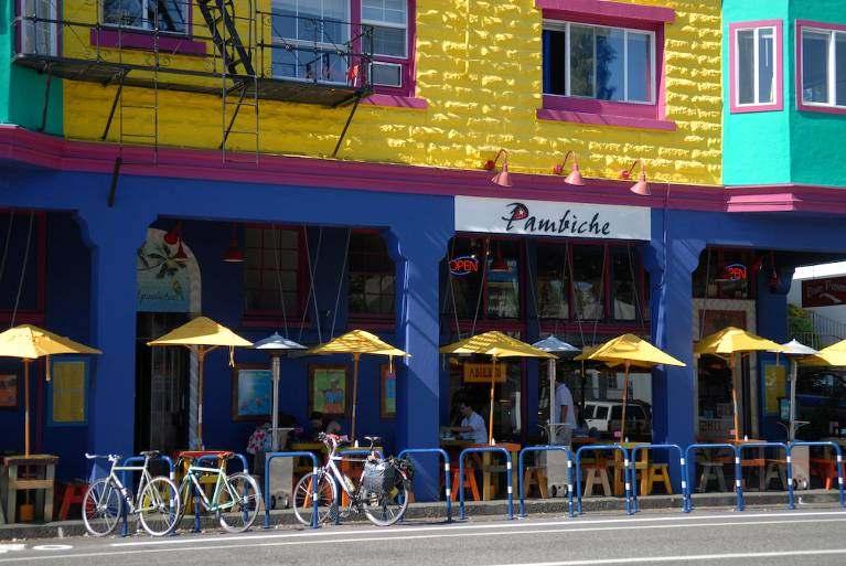
12 Blvd emphasis
13 Bikeways

14 1990 census
15 2008 census
16 percent 23% of commuters lived in areas where average bicycle mode split was 13.2%

17 percent City-wide bicycle commuting has increased more than 20% since % of commuters lived in areas where average bicycle mode split was 9.6%
18 Take away my parking, please.

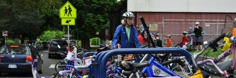
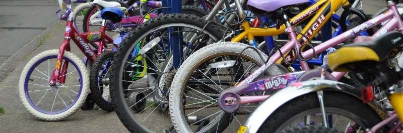
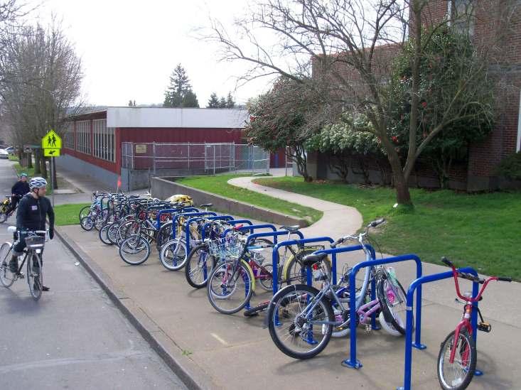
19 Bicycle Corrals

20 Bicycle Corrals
21 21

22 SE 28 TH AVE & PINE ST, Ken s Pizza and Bamboo Sushi 22

23 SW STARK ST & 10 th AVE, Ace Hotel 23

24 NW THURMAN ST & 24 th AVE, Dragonfly Coffee House 24

25 SE DIVISION ST & 22 nd AVE, Bar Avignon 25

26 Importance of children
27 Importance of children
28
29 Bicycle Corrals background map
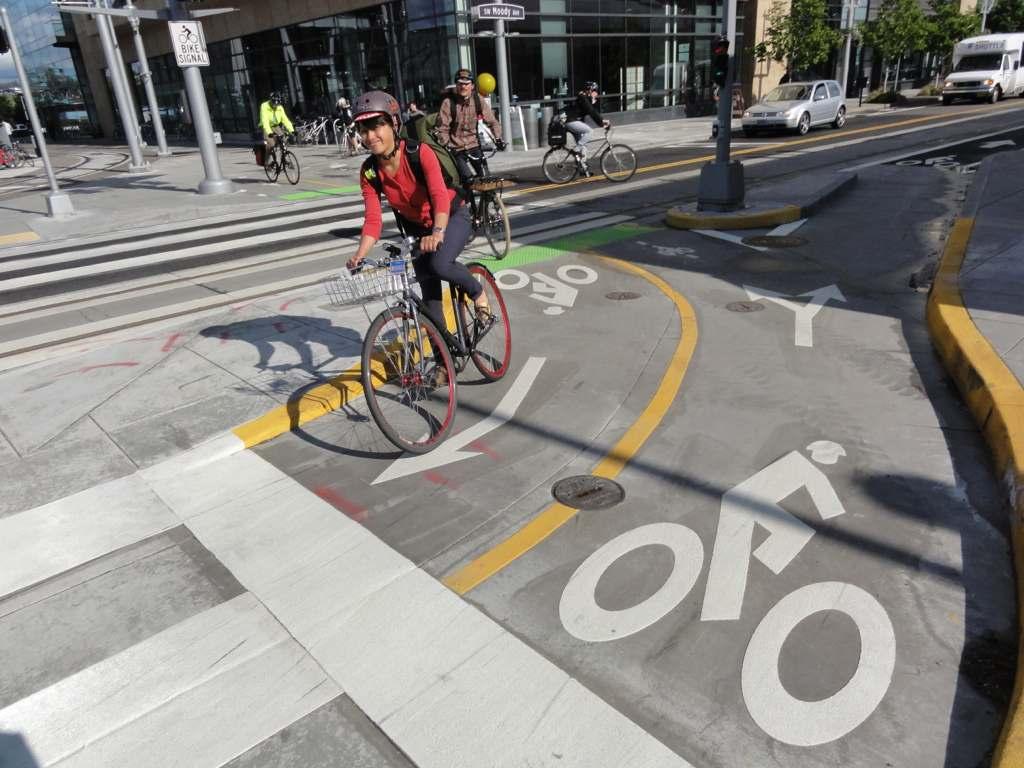
30 Bicycle Corrals installed
31 Bicycle Corrals requested
32 Separation (Comfort) v. Proximity (Access) Facility Type Separation Proximity Difficulty Shared route Shared Lane Marking Bike Lane Bike Boulevard Off-Street Path Cycle Track
33 Build it even better
34 4 Types of Transportation Cyclists Will ride conventional bikeways Need better bikeways Interested but Concerned No way No How Strong & Fearless Enthused & Confident
35 Cycle tracks and buffered lanes
36 Better lane emphasis

37 SW Moody: 2-way cycle track Issues: Edge treatment Transition at ends with signals Most expensive Cully cycle track
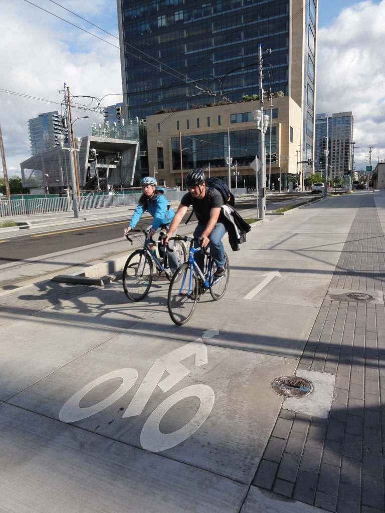
38 SW MOody
39 SW MOody
40 SW MOody

41 SW MOody
42 SW MOody
43 SW MOody

44 SW Moody & Sheridan

45 Cross bike at Scramble signal

46 SW Moody, Portland OR

47 SW Moody, Portland OR
48 SW Moody, Portland OR
49 SW Moody, Portland OR

50 Cycle track SW Broadway: Parking-protected cycle track Issues: Inexpensive retrofit Pedestrian incursions ADA issues Left turns Visibility at right turns Removed a travel lane and moved parking 10 from the curb


51 Cycle track Removed a travel lane and moved parking 10 from the curb

52 SW Broadway cycle track Thanks to Brian McCarter, Zimer Gunsul Frasca

53 Left Turn Box

54 Broadway left turn pocket

55 Broadway left turn pocket

56 Broadway left turn pocket Intersection

57 Cully cycle track

58 SW Broadway ADA zone

59 Cully cycle track

60 Bicycle lanes and tracks
61 Bicycle lanes and tracks

62 Bicycle lanes and tracks

63 Bicycle lanes and tracks

64 Bicycle lanes and tracks

65 NE Cully: Grade-separated cycle track Issues: Easier as new construction Left turns Right turns No more expensive than buffered lanes Cully cycle track

66 Cycle track Cully Boulevard, Northeast Portland

67 Cycle track Cully Boulevard, Northeast Portland

68 Basic design elements Treatment to increase visibility approaching intersection Left turns out of travel lane

69 Cully cycle track
70 NE Multnomah: Parking protected cycle track Issues: 5-lane to 3-lane conversion Transit loading Right turns Left turns Cycle Tracks: NE Multnomah


71 Cycle Tracks: NE Multnomah

72 Cycle Tracks: NE Multnomah

73 SW Stark & Oak: Wide, buffered lanes Issues: Width separation rather than barrier Motorist encroachment Buffered bicycle lanes
74 Standard Configuration: ft. 12 ft. 6 ft ft ft. 8.5 ft. 8.5 ft ft. 6 ft. 2 ft. 12 ft. 6 ft. 1 ft.
75 8 Buffered Bike Lane: " stripe 8" stripe 8" stripe


76 Buffered bicycle lanes Turned a travel lane into a 10 bicycle lane
77 SW Oak
78 SW Oak
79 ? Change is incremental Barriers more political than practical We are making changes and seeing the results
80 Results from Personal Travel Survey 2011 All Trips in Central Portland (excluding CBD) 1994 and 2011 Walk Bike Transit Drive 51% 10% 3% 36% 42% 22% 13% 23%
81 Results from Personal Travel Survey 2011 All Trips in Central Portland (excluding CBD) 1994 and 2011 Walk Bike Transit Drive 51% 10% 3% 36% 42% 22% 13% 23%
82 City of Amsterdam bicycle mode split (all trips) Bike Public Transit Car Foot Center 43% 15% 18% 25% West 32% 18% 20% 30% South 39% 14% 29% 18% East 36% 19% 26% 19% North 17% 15% 38% 30% New-West 17% 23% 37% 23% Southeast 14% 27% 31% 28% Inner Portland* 13% 15% 51% 5% Amsterdam Total 29% 18% 28% 25% Notes: Data source for Amsterdam; divv 2009; for Portland, 2011 Regional Travel Survey Portland data represents all trips only for Central City not including CBD
83 City of Amsterdam mode split (all trips) Bike Public Transit Car Foot Center 43% 15% 18% 25% West 32% 18% 20% 30% South 39% 14% 29% 18% East 36% 19% 26% 19% North 17% 15% 38% 30% New-West 17% 23% 37% 23% Southeast 14% 27% 31% 28% Central Portland 13% 22% 42% 23% Amsterdam Total 29% 18% 28% 25% Notes: Data source for Amsterdam; divv 2009; for Portland, 2011 Regional Travel Survey Portland data represents all trips only for Central City not including CBD
84 Portland Region Transportation Expenditures Cumulative $4 billion active transportation transit Motor vehicle & freight


85 A matter of scale Portland 145 mi 2 /376 km 2 584,000 people Copenhagen 34 mi 2 /88 km 2 551,580 people


86 Thank you Jonathan Maus/bikeportland.org
From Protected Bike Lanes to Robust Bikeway Networks
 From Protected Bike Lanes to Robust Bikeway Networks Christopher M. Monsere @CMonsere Jennifer Dill @JenniferDillPSU Portland State University NACTO Designing Cities 2014 1 Background 2 Credit: People
Bicycle Facilities Planning
 Bicycle Facilities Planning Overview Types of Cyclists Purpose for Riding Types of Facilities Bike Lanes Bicycle Boulevards Cycle Tracks Intersections Signals Signing and Marking Discussion Types of Bicyclists
Lessons from the Green Lanes: Evaluating Protected Bike Lanes
 Lessons from the Green Lanes: Evaluating Protected Bike Lanes http://bit.ly/nitc_583 Christopher M. Monsere @CMonsere Jennifer Dill @JenniferDillPSU Nathan McNeil @NWUrban Portland State University Pro
A Summary of Recent Evaluations of Cycling Facilities in Portland, OR
 A Summary of Recent Evaluations of Cycling Facilities in Portland, OR Christopher Monsere, Ph.D., P.E. Civil & Environmental Engineering Jennifer Dill, Ph.D. Urban Studies & Planning Nathan McNeil Center
Health, Transportation and Bicycling: Connecting the Dotted Lines
 Portland State University PDXScholar Urban Studies and Planning Faculty Publications and Presentations Nohad A. Toulan School of Urban Studies and Planning 11-17-2010 Health, Transportation and Bicycling:
Webinar: A Comprehensive Evaluation of Protected Cycling Facilities: Lessons from Five Cities
 Portland State University PDXScholar TREC Webinar Series Transportation Research and Education Center (TREC) 3-19-2015 Webinar: A Comprehensive Evaluation of Protected Cycling Facilities: Lessons from
Cycle Track Design Best Practices Cycle Track Sections
 Design Best Practices Sections It is along street segments where the separation and protection methods of cycle tracks offer more comfort than conventional bicycle lanes, and are more attractive to a wide
The Transformation of Portland into a Two-Wheeled Mecca. Mia Birk, Principal, Alta Planning + Design
 The Transformation of Portland into a Two-Wheeled Mecca Mia Birk, Principal, Alta Planning + Design Development of Portland s Bikeway Network 1990 Early 1990s Infrastructure Growing Public Support Growing
Rochester Downtown Bicycle Study 2009
 Rochester Downtown Bicycle Study 2009 Relationship of ROCOG Long Range Transportation Plan to Rochester Comprehensive Plan Regional Long Range Transportation Plan (LRTP) is prepared under the auspices
Lessons Learned from Cycle Tracks (Class IV Bikeways) Design Practice
 Design Practice") Lessons Learned from Cycle Tracks (Class IV Bikeways) Design Practice By: Min Zhou, P.E., Principal/Vice President KOA Corporation 1 What is a Cycle Track (Class IV) TYPICAL BIKEWAY CLASSIFICATION CLASS
Lessons Learned from Cycle Tracks (Class IV Bikeways) Design Practice By: Min Zhou, P.E., Principal/Vice President KOA Corporation 1 What is a Cycle Track (Class IV) TYPICAL BIKEWAY CLASSIFICATION CLASS
Physical Implications of Complete Streets Policies
 Presentation Overview Physical Implications of Complete Norm Cox, ASLA, LLA Landscape Architect Ann Arbor, Michigan, 10:45 to Noon What Are Complete Streets? What Matters to Bicyclists and Pedestrians
Lessons from the Green Lanes:
 Executive Summary Lessons from the Green Lanes: Evaluating Protected Bike Lanes in the U.S. By Portland State University Chris Monsere Jennifer Dill Nathan McNeil Kelly Clifton Nick Foster Tara Goddard
Toronto Complete Streets Guidelines
 88 90 5.1 Cycling Design Principles 92 5.2 Context-sensitive Cycling Facilities 96 5.3 Key Cycling Elements Cycling infrastructure provides choice in how people are able to move around the city. Cyclists
» Draft Recommendations» Discussion» Next Steps. Plan for Walking and Biking
 SAC Meeting Plan #3 for September Walking and 12, Biking 2018 » Draft Recommendations» Discussion» Next Steps Plan for Walking and Biking » Stakeholder and Public Outreach» Background data collection and
Rolling Out New Bike Facilities Within the North Bethesda & White Flint Area
 Rolling Out New Bike Facilities Within the North Bethesda & White Flint Area Rolling Out New Bike Facilities Within the North Bethesda & White Flint Area Agenda Designing for all Cyclists Background on
Evaluation of Bike Boxes at Signalized Intersections [Presentation]
![Evaluation of Bike Boxes at Signalized Intersections [Presentation]](/thumbs/89/98792206.jpg "Evaluation of Bike Boxes at Signalized Intersections [Presentation]") Portland State University PDXScholar Urban Studies and Planning Faculty Publications and Presentations Nohad A. Toulan School of Urban Studies and Planning 10-1-2010 Evaluation of Bike Boxes at Signalized
Portland State University PDXScholar Urban Studies and Planning Faculty Publications and Presentations Nohad A. Toulan School of Urban Studies and Planning 10-1-2010 Evaluation of Bike Boxes at Signalized
Copenhagen Cycling Map. Red Lines Cycling facilities
 Copenhagen Cycling Map Red Lines Cycling facilities Copenhagen Cycling Facilities Design Approaches Transportation without Pollution Copenhagen s Strategy Where Cycling is one of the top key activities
Bikeway action plan. Bicycle Friendly Community Workshop March 5, 2007 Rochester, MN
 Bikeway action plan Summary The was held on March 5, 2007 at the Rochester Mayo Civic Center. The workshop was hosted by Rochester-Olmsted County Planning Department in collaboration with the League of
Watertown Complete Streets Prioritization Plan. Public Meeting #1 December 14, 2017
 Watertown Complete Streets Prioritization Plan Public Meeting #1 December 14, 2017 Goals for Public Meeting Overview of MassDOT Complete Streets Funding Program Educate the community on Complete Streets
Bike lanes for. Everyone
 Bike lanes for Everyone Goal: To increase the people riding bicycles as a normal part of every day life People riding bicycles as a normal part of every day life Regardless of age, gender, and social /
Stress Bikeway Network
 Building Portland s Low- Stress Bikeway Network Photo credit: Michael Anderson Bikeportland.org Designing Streets 2015 Austin, TX October 29 2015 Roger Geller Portland Background Existing low- and lower-stress
Board-Approved Funding Awards for Cycle 4 Active Transportation Grant Program Projects (in Order of Project Rankings) Approved on
 Approved on") CAPITAL Large Category Projects Board-Approved Funding Awards for Cycle 4 Active Transportation Grant Program Projects (in Order of Project Rankings) Approved on 07-27-18 1 La Mesa University Ave Pedestrian
CAPITAL Large Category Projects Board-Approved Funding Awards for Cycle 4 Active Transportation Grant Program Projects (in Order of Project Rankings) Approved on 07-27-18 1 La Mesa University Ave Pedestrian
LANCASTER CITY BICYCLE NETWORK
 LANCASTER CITY BICYCLE NETWORK Downtown Merchants Meeting Wednesday, July 19, 2017 http://www.lancasteratp. DOWNTOWN WALKABILITY ANALYSIS What changes can be made, in the least amount of time, and for
Categorizing Cyclists: What Do We Know? Insights from Portland, OR
 Categorizing Cyclists: What Do We Know? Insights from Portland, OR Jennifer Dill, Ph.D. Professor, Urban Studies & Planning Director, Oregon Transportation Research & Education Consortium (OTREC) Portland
Sharrows and Elephants and Bike Boxes!, s, Oh My!
 Sharrows and Elephants and Bike Boxes!, s, Oh My! New Traffic Control Devices on Vancouver s Bike Routes David Rawsthorne, P.Eng. City of Vancouver Engineering g Services CITE Quad Conference, May 2009
Cycle Tracks: Concept and Design Practices. February 17, 2010
 Cycle Tracks: Concept and Design Practices February 17, 2010 Today s webinar presenters APBP Board Member Host Brett Hondorp, Principal, Alta Planning + Design Guest Moderator Zach Vanderkooy, Bicycling
Dear Mr. Tweed: Sincerely, Min Zhou, P.E. Vice President
 December 17, 2012 Mr. Steve Tweed City of Long Beach, Department of Public Works Traffic & Transportation Bureau, 10 th Floor City Hall 333 West Ocean Boulevard Long Beach, CA 90802 Subject: Broadway and
Simulation Analysis of Intersection Treatments for Cycle Tracks
 Abstract Simulation Analysis of Intersection Treatments for Cycle Tracks The increased use of cycle tracks also known as protected bike lanes has led to investigations of how to accommodate them at intersections.
If a person walks within this focus area, these are examples of the places he or she could walk to or from:
 Portland Hillsdale Hillsdale Portland The Hillsdale focus area is located in the City of Portland. It is situated approximately three miles from the City of Portland s downtown, 5.5 miles from the City
Bellevue Downtown Association Downtown Bike Series
 Bellevue Downtown Association Downtown Bike Series Meeting 2 Franz Loewenherz Andreas Piller Kyle Potuzak Chris Long October 26, 2017 Today s Agenda: 1) Meeting Purpose 2) 9/28 Meeting Recap 3) Candidate
Bicycle and Pedestrian Connectivity Study. Old Colony Planning Council
 Bicycle and Pedestrian Connectivity Study Old Colony Planning Council Outline Why consider bike/peds in road designs? Why are measures needed? Connecting Land Use with Transportation Evaluation Tools:
September The State of Bicycling in Montgomery County
 September 2015 The State of Bicycling in Montgomery County The State of Bicycling in Montgomery County Abstract: This report documents the state of bicycling in Montgomery County as of September 2015.
Protected Bike Lanes in San Francisco Mike Sallaberry SFMTA NACTO Workshop - Chicago IL
 Protected Bike Lanes in San Francisco Mike Sallaberry SFMTA 10 14 2011 NACTO Workshop - Chicago IL San Francisco 2 nd Highest Density in the U.S. 47 square miles Mild Climate Market Population ~810,000
Tigard Tigard Transit Center
 Tigard Tigard Transit Center Tigard Transit Center Tigard The Tigard Transit Center focus area is located in the City of Tigard. It is situated in the City of Tigard s downtown and is 4.5 miles from the
10TH & 13TH STREET ROADWAY RECONFIGURATION & PROTECTED BICYCLE LANE PROJECTS
 10TH & 13TH STREET ROADWAY RECONFIGURATION & PROTECTED BICYCLE LANE PROJECTS GOALS & OBJECTIVES Create high quality bicycle network in Center City Reconfi gure the parking and loading layout to meet the
Rail Station Fact Sheet CentrePort/DFW Airport Station
 Rail Station Fact Sheet CentrePort/DFW Airport Station Station Overview CentrePort/DFW Airport Station is located by Statler Boulevard at Breezewood Drive in Fort Worth. Free shuttles connect the station
2017 North Texas Regional Bicycle Opinion Survey
 2017 North Texas Regional Bicycle Opinion Survey Sustainable Development Program Kevin Kokes, AICP Public Meetings April, 2018 North Central Texas Council of Governments MPO for the Dallas-Fort Worth Region
FEDERAL HIGHWAY ADMINISTRATION APPLICATION
 FEDERAL HIGHWAY ADMINISTRATION APPLICATION REQUEST FOR PERMISSION TO EXPERIMENT WITH A BICYCLE BOX INTERSECTION TREATMENT Submitted by: City of Columbus Department of Public Service Date: June 26, 2009
Completing the Street: Denning Drive
 Completing the Street: Denning Drive Public Workshop and Walking Audit Winter Park Civic Center May 12, 2016 Completing the Street What Makes This a Complete Street? Completing the Street Complete Streets
Rail Station Fact Sheet Buckner Station
 Rail Station Fact Sheet Buckner Station Station Overview Buckner Station is located at the intersection of Buckner Boulevard and Elam Road in Dallas. The station opened in 2010 and currently serves as
ADA TRANSITION PLAN FOR ACCESSIBILITY OF PEDESTRIAN FACILITIES WITHIN THE PUBLIC RIGHT-OF-WAYS FRANKLIN COUNTY, FLORIDA
 ADA TRANSITION PLAN FOR ACCESSIBILITY OF PEDESTRIAN FACILITIES WITHIN THE PUBLIC RIGHT-OF-WAYS FRANKLIN COUNTY, FLORIDA APPROVED BY THE FRANKLIN COUNTY BOARD OF COUNTY COMMISSIONERS MAY 5, 2015 1 I. INVENTORY
South Bay Bicycle Master Plan American Planning Association National Conference Los Angeles, CA
 South Bay Bicycle Master Plan 2012 American Planning Association National Conference Los Angeles, CA April 17, 2012 Overview I. Background II. The Importance of Partnerships III. Approach and Success Stories
CITY OF ALBANY TRAFFIC AND SAFETY COMMISSION
 CITY OF ALBANY TRAFFIC AND SAFETY COMMISSION City Hall - Council Chambers 1000 San Pablo Avenue, Albany, CA 94706 Wednesday, November 30, 2016, 7:00 PM 1. CALL TO ORDER The meeting was called to order
Cyclists and Bikeways: What s your match? A guide to bikeway options for a variety of cyclists
 Cyclists and Bikeways: What s your match? guide to bikeway options for a variety of cyclists The workshop and this resource were made possible by funding from the Province of Ontario via the Ministry of
Canada s Capital Region Delegation to the Velo-City Global 2010 Conference
 Canada s Capital Region Delegation to the Velo-City Global 2010 Conference Report of Findings from Visits, Meetings & Presentations In Amsterdam-Den Haag, Utrecht, Berlin & Copenhagen The Itinerary Copenhagen
Bicycle + Pedestrian Connectivity Gap Analysis
 Accelerated Bridge Program Bicycle + Pedestrian Connectivity Gap Analysis Tuesday, October 11 Shriners Hospital, Boston 6:30-8:00 PM Thursday, October 13 Community Rowing, Brighton 6:30-8:00 PM Tuesday,
9/25/2018. Multi-Modal Level of Service (MMLOS) Bianca Popescu, Transportation Planner
 Bianca Popescu, Transportation Planner") Multi-Modal Level of Service (MMLOS) Bianca Popescu, Transportation Planner 1 What is MMLOS? Is this a nice place to walk? Is this a nice place to bike? Is transit convenient? Bottom line - Are there options
Multi-Modal Level of Service (MMLOS) Bianca Popescu, Transportation Planner 1 What is MMLOS? Is this a nice place to walk? Is this a nice place to bike? Is transit convenient? Bottom line - Are there options
Dr. M.L. King, Jr. Street North Complete Streets Resurfacing Opportunities HOUSING, LAND USE, AND TRANSPORTATION COMMITTEE MARCH 22, 2018
 Dr. M.L. King, Jr. Street North Complete Streets Resurfacing Opportunities HOUSING, LAND USE, AND TRANSPORTATION COMMITTEE MARCH 22, 2018 What s Happening The City plans to mill and resurface Dr. M.L.
REGIONAL BICYCLE AND PEDESTRIAN DESIGN GUIDELINES
 REGIONAL BICYCLE AND PEDESTRIAN DESIGN GUIDELINES November 16, 2011 Deb Humphreys North Central Texas Council of Governments Bicycle and Pedestrian Advisory Committee Snapshot of the Guide 1. Introduction
Major Bike Routes 102 Avenue Workshop April 21, 2015
 Major Bike Routes 102 Avenue Workshop April 21, 2015 Our Purpose Today Provide context on how Major Bike Routes fit into Edmonton s future Share information on what we heard in our last phase, and how
The Bike Buzz in Richland. November 2017 Carl Berkowitz
 The Bike Buzz in Richland November 2017 Carl Berkowitz Richland has been growing by leaps and bounds with lots of new homes and roads throughout the community. Recognizing all the growth in the Queensgate
Impact of Bike Facilities on Residential Property Prices
 Portland State University PDXScholar TREC Friday Seminar Series Transportation Research and Education Center (TREC) 2-24-2017 Impact of Bike Facilities on Residential Property Prices Wei Shi Portland State
The public outreach team included:
 1 The public outreach team included: Lauren Ledbetter (Lead VTA Project Manager), Malahat Owrang (VTA Transportation Planner), Karen Gauss (VTA Outreach Specialist) Dana Weissman (Project Manager), Katy
Non-Motorized Transportation 7-1
 Non-Motorized Transportation 7-1 Transportation facilities no longer mean just accommodating a vehicle powered by a combustion engine. Pedestrian and non-motorized facilities are important modes of travel
Flanders Crossing. Save Lives Save Money Saving Our Environment. Portland City Council April 30, 2008
 Flanders Crossing Save Lives Save Money Saving Our Environment Portland City Council April 30, 2008 NWSTELBRG-GLISANSTRAMP Expanding Portland s Bicycle Boulevards NW NAITO PKY Why this project? Part of
Rail Station Fact Sheet UNT Dallas Station
 Rail Station Fact Sheet UNT Dallas Station Station Overview UNT Dallas Station is located on the east side of University Hills Boulevard in Dallas. t is connected by a walking path to the University of
Complete Streets: Policy Framework Complete Streets: Implementation Plans A more Complete Street: Laurier Bike Lane Pilot Project
 Complete Streets Initiatives City of Ottawa Complete Streets: Policy Framework Complete Streets: Implementation Plans A more Complete Street: Laurier Bike Lane Pilot Project Zlatko.Krstulic@Ottawa.ca May
Agenda. Overview PRINCE GEORGE S PLAZA METRO AREA PEDESTRIAN PLAN
 PRINCE GEORGE S PLAZA METRO AREA PEDESTRIAN PLAN May 28, 2008 Agenda Welcome and introductions Project overview and issue identification Planning context and strengths Design challenges and initial recommendations
Driverless Vehicles Potential Influence on Bicyclist Facility Preferences
 Driverless Vehicles Potential Influence on Bicyclist Facility Preferences MICHAEL BLAU, MCRP, LCI O T E C O C T O B E R 2 6, 2 0 1 6 S E S S I O N # 8 2 - E V A L U AT I N G T H E P E R F O R M A N C E
Rail Station Fact Sheet University of Dallas Station
 Rail Station Fact Sheet University of Dallas Station Station Overview University of Dallas Station is located on John Carpenter Freeway and west of Loop 12 across from the University of Dallas in Irving.
On Road Bikeways Part 1: Bicycle Lane Design
 On Road Bikeways Part 1: Bicycle Lane Design Presentation by: Nick Jackson Bill Schultheiss, P.E. September 04, 2012 FOLLOW THE CONVERSATION ON TWITTER Toole Design Group is live tweeting this webinar
APPENDIX A: Complete Streets Checklist DRAFT NOVEMBER 2016
 APPENDIX A: Complete Streets Checklist DRAFT NOVEMBER 2016 Complete Streets Checklist MetroPlan Orlando s Complete Streets Checklist is an internal planning tool for staff to further implementation of
Lessons from Copenhagen. John L Bowman 2013
 Lessons from Copenhagen John L Bowman 2013 Bicycle Strategy Official municipal policy Goals for the next 15 years Updated after 5-10 years 32 page glossy brochure BAC December 2, 2013 John L Bowman 2 Bicycle
CITY OF NEW ORLEANS. Department of Public Works. Baronne Street Bike Lane
 CITY OF NEW ORLEANS Department of Public Works Baronne Street Bike Lane 9/17/2014 Agenda Welcome Greg Lawson, Office of Neighborhood Engagement Introduction - Deputy Mayor Andy Kopplin, Chief Administrative
City Snapshot September 27, 2018
 1 City Snapshot September 27, 2018 Respondent Introduction Thank you for providing data for the PlacesForBikes City Rating program! The information you provide will be used to understand the progress your
Complete Street Analysis of a Road Diet: Orange Grove Boulevard, Pasadena, CA
 Complete Street Analysis of a Road Diet: Orange Grove Boulevard, Pasadena, CA Aaron Elias, Bill Cisco Abstract As part of evaluating the feasibility of a road diet on Orange Grove Boulevard in Pasadena,
Rail Station Fact Sheet Downtown Carrollton Station
 Rail Station Fact Sheet Downtown Carrollton Station Station Overview Downtown Carrollton Station is located at East Belt Line Road and Broadway Street near the historic Downtown Carrollton Square. The
TABLE OF CONTENTS. Executive Summary
 Executive Summary Background... ES-1 Pedestrian Network... ES-2 Bikeway Network... ES-2 Collision History... ES-2 Public Input... ES-4 Conclusions and Recommendations... ES-4 1. Introduction and Setting
What Is a Complete Street?
 Session 5 Charleen Zimmer, AICP, Zan Associates May 5-7, 2010 What Is a Complete Street? May 2010 5-1 Not a Complete Street More of a Complete Street May 2010 5-2 Benefits of Complete Streets Safety for
Active Transportation Facility Glossary
 Active Transportation Facility Glossary This document defines different active transportation facilities and suggests appropriate corridor types. Click on a facility type to jump to its definition. Bike
When composing the study, our primary source for content analysis was a study
 Denise Arriaga Ibarra Natalie Garcia Vincente Velasco Victor Estrada Jonathan Marin Ignacio Alcaraz Cal Poly Pomona Cyclist Population When composing the study, our primary source for content analysis
FEEDBACK SURVEY #2: WHO PARTICIPATED
 Attachment 2 - Summary of Public Opinion Survey Results Attachment 2 FEEDBACK SURVEY #2: WHO PARTICIPATED Online for public input from December 13, 2016 to May 4, 2017 Promoted through 30,000 flyers, sharing
CURBSIDE ACTIVITY DESIGN
 5 CURBSIDE ACTIVITY DESIGN This chapter provides design guidance for separated bike lanes adjacent to curbside activities including parking, loading and bus stops. Typical configurations are presented
Chestnut Street Bikeway Pilot. A Cycle Track From College Ave. to Mulberry St.
 Chestnut Street Bikeway Pilot A Cycle Track From College Ave. to Mulberry St. Prepared by the Department of Public Works - November 2015 Overview In cities across the nation, and internationally, there
A Survey of Planning, Design, and Education for Bikeways and Bus Routes on Urban Streets
 A Survey of Planning, Design, and Education for Bikeways and Bus Routes on Urban Streets, Community & Economic Development Agency, Transportation Services Division (510) 238-3983 bikeped@oaklandnet.com
This page intentionally left blank.
 This page intentionally left blank. COMMUNITY Catoosa Community Overview Catoosa Catoosa is a city of just over 7,000 residents adjacent to the northeast border of Tulsa. The city contains two major regional
CITY OF MINNEAPOLIS 26 th St E/W & 28 th St E/W Protected Bikeway. Open House - February 2017
 CITY OF MINNEAPOLIS 26 th St E/W & 28 th St E/W Protected Bikeway Open House - February 2017 2/27/2017 1 Purpose of Meeting Inform: Provide an overview of the project Opportunity to gather feedback/input/observations
PRINCE GEORGE S PLAZA METRO AREA PEDESTRIAN PLAN
 PRINCE GEORGE S PLAZA METRO AREA PEDESTRIAN PLAN May 28, 2008 Agenda Welcome and introductions Project overview and issue identification Planning context and strengths Design challenges and initial recommendations
BICYCLE PUBLIC HEARING INTRODUCTION. Kathy Kleinschmidt, P.E. Bicycle and Pedestrian Coordinator Dallas District
 BICYCLE PUBLIC HEARING INTRODUCTION Kathy Kleinschmidt, P.E. Bicycle and Pedestrian Coordinator Dallas District Purpose of Public Hearing Texas State Law (Title 43, Subchapter D, 25.55 (b)) affords each
Update on Regional Bicycle, Pedestrian, & Trail Planning. Presented to TCC November 21, 2014
 Update on Regional Bicycle, Pedestrian, & Trail Planning Presented to TCC November 21, 2014 Survey Measure Assess Focus Area Performance- Driven Process Policy Policy Implement Plan Criteria Criteria Criteria
Southside Pilot Proposal
 To improve bicycle access and mobility to UC Berkeley, Downtown Berkeley, and the Southside area, a pilot project could include a two-way parking-protected cycle track. Turn pockets and island bus stops
Multimodal Through Corridors and Placemaking Corridors
 68 Multimodal Through Corridors and Placemaking Corridors Corridors have different functions in a region. Some corridors are used to get smoothly and rapidly through a region or to get quickly to major
A Insert design-related public comment here.
 Design Guidelines A Insert design-related public comment here. - Public Comment, 2016 This regional plan focuses on connecting regional nodes, such as Wilmington, NC (Gary Shell Cross-City Trail shown
2014/2015 BIKE ROUTE PLAN 83 AVENUE PROTECTED BIKE LANE
 About the Project The City of Edmonton is planning a major bike route on the southside of Edmonton. The Strathcona Bike Route will connect the communities of Strathcona, Garneau and the University area,
Washington State University Bicycle and Pedestrian Plan Working Paper #7: Implementation Strategies
 nnn Washington State University Bicycle and Pedestrian Plan nnn TO: Bridgette Brady, CAPP, Director Parking and Transportation Services FROM: Alta Planning Design DATE: November 2013 Introduction As described
The Traffic Monitoring Guide: Counting Bicyclists and Pedestrians. APBP 2017 June 28: 11:15am-12:45pm
 The Traffic Monitoring Guide: Counting Bicyclists and Pedestrians APBP 2017 June 28: 11:15am-12:45pm 2 Presentation Organization Why count bicyclists and pedestrians? Why report count data? What resources
Cycling Master Plan Community Engagement Session WELCOME
 Cycling Master Plan Community Engagement Session WELCOME WHY COMMUNITIES PLAN Considering Short Term and Long Term Needs City of Lethbridge is committed to planning - to determine short term goals along
Multimodal Analysis in the 2010 Highway Capacity Manual
 Multimodal Analysis in the 2010 Highway Capacity Manual It s not just cars anymore! Jamie Parks, AICP HCAT Conference May 9-10, 2011 Multimodal LOS in the 2010 HCM History and background Overview of methods
PORTLAND BICYCLE COUNTS 2007
 PORTLAND BICYCLE COUNTS 2007 The Portland Office of Transportation s (PDOT) annual bicycle counts constitute the City s primary means of assessing progress in its efforts to make the bicycle an integral
Appendix 3 Roadway and Bike/Ped Design Standards
 Appendix 3 Roadway and Bike/Ped Design Standards OTO Transportation Plan 2040 4/20/2017 Page A3-1 Adopted Standards The adopted OTO Design Standards and Major Thoroughfare Plan are contained herein.
Planning Suburban Bike Networks
 Planning Suburban Bike Networks Stacey Meekins, AICP 28 October, 2015 Bikeway design guidance Different Cyclists Have Different Needs No interest 33% Strong and Fearless 1% Enthused and Confident 7% Interested,
43 rd Avenue, Skillman Avenue Protected Bike Lanes
 43 rd Avenue, Skillman Avenue Protected Bike Lanes Presented to Queens Community Board 2 Transportation Committee - November 6, 2017 43 rd Avenue, Skillman Avenue: Presentation Overview Background Project
Duwamish Way-finding and CTR Report
 V. North Tukwila When the North Tukwila Manufacturing and Industrial Center was designated in 1992 as part of the region s land use and transportation plan, the plan called for the area to set a light-rail
Evolving Bicycle Infrastructure in City of Philadelphia
 Evolving Bicycle Infrastructure in City of Philadelphia Gustave Scheerbaum, PE Director, Strategic Initiatives City of Philadelphia Department of Streets @GScheerbaum State of Biking in Philadelphia 2018
Dowling/Beaty Cycling Route
 Public Meeting #2 Dowling/Beaty Cycling Route May 17, 2017 6:00 p.m. 8:00 p.m. Parkdale Public Library - Auditorium 1303 Queen Street West How to Participate Share your questions, ideas and concerns We
Typical Cross Section: DOWNTOWN (Observer Highway - 8th Street)
") Typical Cross Section: DOWNTOWN (Observer Highway - 8th Street) DRAFT SEPTEMBER 23, 14 1 Washington Street Typical Block Downtown Typical Block: DOWNTOWN (Observer Highway - 8th Street) New crosswalks
Typical Cross Section: DOWNTOWN (Observer Highway - 8th Street) DRAFT SEPTEMBER 23, 14 1 Washington Street Typical Block Downtown Typical Block: DOWNTOWN (Observer Highway - 8th Street) New crosswalks
City of El Cerrito San Pablo Avenue Specific Plan. Capital Improvement Program
 City of El Cerrito San Pablo Avenue Specific Plan Capital Improvement Program May 2015 San Pablo Avenue Intersection Improvements San Pablo Avenue and Hill Street/Eastshore Boulevard Background Existing
This page intentionally left blank.
 This page intentionally left blank. Community Plan Catoosa Community Overview Catoosa Catoosa is a city of just over 7,000 residents adjacent to the northeast border of Tulsa. The city contains two major
Evaluation of Innovative Bicycle Facilities:
 Evaluation of Innovative Bicycle Facilities: SW Broadway Cycle Track & SW Stark/Oak Street Buffered Bike Lanes FINAL REPORT Prepared for: City of Portland Bureau of Transportation by: Christopher Monsere,
Rail Station Fact Sheet DFW Airport North Station* (*station under construction with anticipated start of service in late 2018)
") Rail Station Fact Sheet DFW Airport North Station* (*station under construction with anticipated start of service in late 018) Station Overview DFW Airport North Station will be located on DFW nternational
Rail Station Fact Sheet DFW Airport North Station* (*station under construction with anticipated start of service in late 018) Station Overview DFW Airport North Station will be located on DFW nternational