Please see the attached memo for additional project background and information.
|
|
|
- Toby Jones
- 5 years ago
- Views:
Transcription
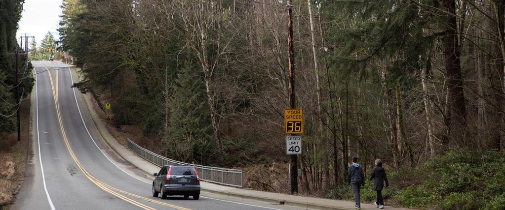
1 Agenda Bill City Council tudy ession March 13, 018 UBJC: DA UBMID: March 07, 018 DPARMN: Issaquah Fall City Road - 4nd to Klahanie DR, Project Update Public Works NDD FROM COUNCIL: Action Direction Informational RCOMMNDAION: XIBI: BUDG: Receive project update and discuss road closure and construction options. 1. xhibit 1 - IFCR Council Memo. xhibit - IFCR Vicinity Map 3. xhibit 3 - IFCR Council Presentation otal dollar amount $0 Approved in budget Fund(s) N/A Budget reallocation required No budgetary impact WORK AN FOCU ARA: ransportation Communication & ngagement igh Performing Government nvironmental ealth & Protection Community afety Community Livability Culture & Recreation Financial ustainability IU BFOR COUNCIL: hall Council reconsider closing Issaquah Fall City Road during construction of the bridge? KY FAC AND INFORMAION UMMARY: he Issaquah Fall City Road project will widen the Issaquah Fall City Road corridor between 4nd Ave to Klahanie Dr from two to four lanes and construct roundabouts at the 4nd, 47th, and Klahanie intersections. he project design also includes a bridge over the North Fork Issaquah Creek, bike lanes, sidewalks, and a pedestrian crossing to Pacific Cascade Middle chool.
2 he project team has achieved a 60% plan design level, however project costs have risen due to unfavorable construction finance trends (including a 7.8% increase in national annual project construction costs) and a finding of poor soils at the bridge foundations. he project team has worked to reduce project costs by refining the existing design and looking at a redesign of the bridge superstructure to eliminate a row of girders. he team has identified an estimated $3.9 million in costs savings if the bridge is built with a full road closure between 47th and Klahanie Dr.. Additional sequencing details will be provided at the meeting for Council consideration. he current plan design keeps the roadway open between 47th Ave and Klahanie Dr, resulting in an estimated 18-month bridge construction time and a total project construction cost of $6. million. he proposed alternative closes the road between 47th and Klahanie Dr., for an estimated seven (7) month bridge construction and a project construction cost estimate of $.3 million. his decision does not affect total project construction time, which remains 18 to 4 months regardless of road closure adjustments. Please see the attached memo for additional project background and information. FINANCIAL IMPAC: here is a $3.9 million construction cost difference between the two options presented. OR ALRNAIV CONIDRD: Option 1: Keep the road open during bridge construction and proceed to 90% design. Option : Close the road during bridge construction, update the bridge design, and proceed to 90% design. Advantages and drawbacks of both options will be presented at the meeting. RLAD CIY GOAL, POLICI, AND MAR AN: Comprehensive Plan Goal., Greater Options and Mobility ransportation ImprovementPlan, Project R-07
3 Memorandum Date: March, 018 o: From: Re: City Council, Lyman oward, Deputy City Manager teve Leniszewski, Public Works Director Andrew Zagars, City ngineer am Park, enior Project ngineer Issaquah Fall City Road Phase 1 Project Update March 13, 018 Presentation to Council ummary At the March 13, 018 meeting, City and consultant staff will be providing Council with an update on the Issaquah Fall City Road Improvement project. his update will provide Council with a project status including a brief project history, project construction cost estimates, value engineering performed to date, and information about a cost reduction opportunity reconsidering a roadway closure during bridge construction. he City staff is looking to the council to provide guidance on whether to move forward with closure of the roadway, between 47th Pl and Klahanie Drive. Project Details and istory he improvements along Issaquah Fall City Road between Issaquah Pine Lake Road and Issaquah Beaver Lake Road became a priority project for the City with the incorporation of the Klahanie neighborhood. his project has been considered a necessity by King County since the nvironmental Impact tudy was completed in Due to the length and complexity of the project, the overall project was separated into two phases. he first phase begins at the western City limits of the roadway at 40 th Ave and the intersection of Klahanie Blvd. he second phase continues from the intersection of Klahanie Blvd to the intersection of Issaquah Beaver Lake Road. he Issaquah Fall City Road project includes four goals: 1. Improve safety for drivers, cyclists, and pedestrians;. Improve operations at intersections; 3. Increase capacity, and; 4. Protect mature trees and environmentally sensitive areas. On March, 016, the City Council approved the design contract for the first phase of the Issaquah Fall City Road project, between 4 nd Ave and Klahanie Dr. he project
4 included a large public involvement scope that to date has included three public meetings and one detour-planning meeting. his project will widen Issaquah Fall City Road to four lanes, with a new bridge over the North Fork Issaquah Creek, roundabouts at three intersections, a pedestrian crossing to the Pacific Cascade Middle chool, sidewalks, bike lanes, and drainage improvements to meet current standards. he project has been programmed for construction beginning in the summer of 018. his is a two-year construction project and would go through the 019 construction season. Project plans are on track to be completed this summer including permits and right of way. As part of the design, the consultant has been tasked to include detour planning. his began with a community workshop held on October 6, 017, to hear from the public and address their concerns related to detour routes and possible road closures. Up until this point, the information shared with the public had stated the City s intention was to keep Issaquah Fall City Road open to one lane of traffic in each direction, thereby not reducing current travel lanes, throughout the construction of the project. Project Funding his project is currently funded through City funds and an approved tate WDO Connecting Washington Grant of $5 million. he grant is separated into the two phases of the project with $3.5 million for the first phase of construction and the remaining $1.5 million for design and construction of Phase II. he City s efforts to secure other grant opportunities for this project have so far been unsuccessful. taff recommends pursuing a ransportation Improvement Board (IB) grant this summer in the amount of $5 million and extend the project out for a bidding date in January of 019. his timeline would allow staff to complete the design prior to a grant award, increasing the chance of obtaining the requested funds. Additionally, the bidding environment has shown to be more favorable in the winter and early spring months. istory of Design and Construction Cost stimates In November 014, the project was initiated with a conceptual design construction estimate of $16. million. he project estimate was taken from information provided by King County and included a five-lane roadway, two traffic lights, a fish passable culvert at North Fork Issaquah Creek, sidewalks, illumination, and project landscaping. During the initial preliminary designs of the project, a planning level, 15% design estimate of $0.3 million was presented to the City Council on February 7, 017, in order to determine if the design was to proceed with a bridge or culvert crossing. he approved preliminary design included a bridge section, three (3) roundabouts, a four-lane roadway section, bike lanes with buffers, sidewalks, illumination and project landscaping. As the design proceeded, a 30% preliminary design included a revised construction estimate of $3.1 million in June, 017. Additions to the project design that increased the
5 overall estimate included a signalized pedestrian crossing and ramp up to Pacific Cascade Middle chool, changes to the initial stormwater design, and increased design for the bridge and retaining walls. he bridge and wall costs were calculated using preliminary geotechnical soil information. he 60% intermediate design level construction estimate increased again to $7.8 million. his estimate included bridge and wall designs based on soil conditions verified and recommended by the geotechnical engineer, intermediate irrigation, landscaping, traffic control to keep the road open during construction, drainage facilities, storm drainage water quality facilities, and environmental mitigation plans. Contributors to the higher costs included poor existing soil conditions that impact bridge foundations, retaining walls, and road design, and an increase in national and local bid prices due to relative economic prosperity. As a result of increasing estimated project costs, staff required the design team to perform value engineering review to look at all options, including but not limited to roadway closure, to reduce project costs. his review was performed by the design consultant and a regional contractor familiar with bridge and roadway projects. Project savings were found through reducing bridge and roadway widths, modifying the roundabout design, reducing landscaping and irrigation in medians, and reducing the amount of walls. As a result, the project construction estimate has been reduced to $6. million. During the value engineering review, it was determined that construction staging and traffic control made up a significant portion of the construction estimate increases. In order to keep traffic open during the construction of the bridge crossing, a temporary roadway and modifications to bridge design are required. he additional bridge design includes additional pile supports, an extra bridge girder, and temporary shoring walls. It was determined that a roadway closure during the bridge construction would lower the $6. million construction estimate to $.3 million. he $3.9 million reduction is a result of the elimination of the items needed to maintain traffic during construction. In addition to reducing costs, closure of the roadway will decrease the estimated construction time of the bridge. With the road kept open, it will take an estimated eighteen (18) months to construct the bridge. With a roadway closure, the bridge is estimated to be constructed within seven (7) months. Please note, as with all construction projects, the final project cost and schedule will remain undetermined until a contract bid is recieved and a complete schedule is provided. Until that time, project estimates are accompanied by a contingency amount. he latest construction estimate includes a contingency increase of 10%. Direction to Proceed taff is seeking direction from Council whether to pursue the IB grant, resulting in moving the bid announcement to January of 019, and whether to reconsider a closure of the roadway between 47th Pl. and Klahanie Dr. for bridge construction.

6 A V N D R D C Y Duthie ill Park 60 5 LN C C W AY W LV D R W AY WA Y LA K 59 C A V 5 DR 4N D 4ND WA 43 RD Y IA QUA -FA LL C I YR D N D AY 5 7 C 5 5 R I D 6 L P 8 46 R C C 7 Phase 1 5ND 53RD N 54 LA N D DR I G 57 53RD 53RD C 43RD LN 30 R 9 31 Y 3 RD 4 IR P 0 P N D C 38 N R WA Y D R 43 C P O IN C 6 C R 31 LN C ND D LN 9 C 44 LN P O PR I L P ND 7 Y WA WA Phase 45 WAY 4 46 WAY RD ILL 46 P L VD BL C 46 RD C 38 W AY C C AC C ND D R 3 8 C W KLA A N C DR 41 C C 37 W A 3 9 WA Y C 4ND RD I DU DR 5 ND P 3 L Yellow Lake R D 44 V ID P RO R 6 AQ U LA K A-B R RD 35 8 BL A CK NUGG AY 4 R N D BLVD KLAANI 4ND C 33RD D N 6 36 D WAY N 70 C 1 7 C 31 I C Y WA 0 40 V DA L 3 7 P 40 C 41 4 LN 4N D C 3 N Laughing Jacobs Lake 5ND P L 9 LN C 3ND 4 OVID N C N D R 5 3ND Klahanie Park 41 C C 6 6 C 35 AY ND W RD DR B 11 D 3R 6 C R 58 LA K C 8 N B A C PI L A K ND C 4 5 D A Q UA 33 C 38 R 8 B R 6 C I A 33RD Beaver Lake Park 7 9 C 4 L P C 0.5 Miles 6 C 59 R 7 W AY 0.5 Beaver Lake 3RD 39 D K 6 PA R C U N V A DU BO A Pine Lake Park L RD C LA L 63 R D P ND 0 L R 63RD LN C 19 B W 1 0 Pine Lake 18 7 Y R K D Y A W C Issaquah-Fall City Rd - Phase City Limits W A 17 C 69 LN WA 0 Y Issaquah-Fall City Rd - Phase11 Beaver Lake Preserve 7 13 P L 9 WAY teven & Rosina Kipper Preserve 6 6 C 7 4 C 4 8 D O 16 P L Issaquah-Fall City Road Project Vicinity Map R O 5 IN W WAY 3 9 oaring agle Park Plateau Golf & Country Club azel Wolf Wetlands ND C C C 7 LN 7 R 13 W AY 9 10 C 13 C OR DR VD BL 7 14 L P I ND R 1 LN 4N D DR LN 8 Y 40 WA ammamish Commons PRIV W C A RD 5 3R D C 3RD P L C 43RD P L 4 RD BM: IssaquahFallCityRd_Projectxtents.mxd I U AQ


7 Issaquah-Fall City Road Project Update City Council Meeting March 13, 018

8 Meeting Agenda Introductions chedule Cost Implications Factors Driving Cost Actions aken Potential Cost avings Discussion Direction from Council

9 Project Overview Congestion Relief & afety 3

10 Project imeline 4

11 Project imeline 5
12 Preliminary stimates of Probable Construction $ 6 stimates include Construction Activities only Conceptual Design stimate (Nov., 014) Planning Level stimate (Feb., 017) Preliminary Design stimate (June, 017) Intermediate Design stimate $16. Million $0.3 Million $3.1 Million $7.8 Million


13 What Changed Conceptual to Preliminary? 7 1. Changed Intersection ypes to Roundabouts. elected Bridge to Replace Culvert 3. elected Landscaped Medians, Irrigation, and Bike Lane Buffers


14 8 What Changed Preliminary to Intermediate Design? Increased Median Width Adding Walls Changed Drainage Design to Relocate Proposed Pond Geotech Report Poor oils Impacts Bridge Foundations Prosperity Good conomy Increasing Unit Prices (FWA Cost Indices) 7.8% ummer 017

15 What ave We Been Doing to Address scalation? 9 Identified Major Cost Drivers Conducted Mini Value ngineering Workshop in Lochner ngaged Regional Contractor to Review Approach & Identify Potential avings


16 Potential Cost avings 10 Focused on Major Cost Drivers Bridge Design & Construction Methods Reduced Roadway Cross ection Walls Number & ype Intersections Design Modifications
17 Current Plan tay the Course 11 Cost chedule Issues $6. Million 15 to 18 months For Bridge Construction 1. Construction stimate Over Budget. Keeps Roadway Open During Construction 3. Construction stimate includes Potential Cost avings from Redesign 4. ome raffic Will Avoid Construction
18 1 Preliminary stimates of Probable Construction $ stimates include Construction Activities only Conceptual Design stimate (Nov., 014) Planning Level stimate (Feb., 017) Preliminary Design stimate (June, 017) Intermediate Design stimate Current Plan tay the Course $16. Million $0.3 Million $3.1 Million $7.8 Million $6. Million

19 Alternative Close the Road 13 Cost chedule Issues $.3 Million 6 to 7 months closure For bridge construction 1. Reduced Construction Cost. horter Bridge Construction chedule 3. Reduces Number of Impacted rees 4. All raffic Must Detour
20 14 Preliminary stimates of Probable Construction $ stimates include Construction Activities only Conceptual Design stimate (Nov., 014) Planning Level stimate (Feb., 017) Preliminary Design stimate (June, 017) Intermediate Design stimate Current Plan tay the Course Alternative Close the Road $16. Million $0.3 Million $3.1 Million $7.8 Million $6. Million $.3 Million

21 15 Funding ransportation Improvement Board 017 Application $5M Request Missed by One Point hovel Readiness 018 Potential Application Due, August of 018 Award, November of 018 Funds Available, January of 019
22 16 Next teps Looking For Council Direction to: tay the Course with Roadway Design Modifications, or Approval to Close the Roadway for Bridge Construction
23 Discussion 17
City of Sammamish. Welcome. Issaquah-Fall City Road Improvements Project Phase I Design: 242nd Avenue SE to Klahanie Drive SE
 Welcome Welcome to the third community meeting for the Issaquah-Fall City Road Improvements Project. AGENDA 6:00 p.m. Welcome and sign-in 6:10 p.m. Presentation 6:50 p.m. Open house Learn about the roadway
CITY OF ROHNERT PARK CITY COUNCIL AGENDA REPORT
 Meeting Date: May 10, 2016 Department: Submitted By: Prepared By: Agenda Title: Mission Statement We Care for Our Residents by Working Together to Build a Better Community for Today and Tomorrow. CITY
Design of Stanley Park S-Curve
 ADMINISTRATIVE REPORT Date: May 4, 2001 TO: FROM: Author/Local: F. Klotzbach/7118 RTS NO. 01644 CC File No. Standing Committee on Transportation and Traffic General Manager of Engineering Services, in
BETHEL ROAD AND SEDGWICK ROAD CORRIDOR STUDY
 DRAFT PLAN City Council Meeting August 14, 2017 STUDY AREA Sedgwick Corridor State Route 160, principal arterial with Class 3 access management designation, commuter and freight route, connection to SR
Knox Street Complete Streets Project
 Knox Street Complete Streets Project Meeting Purpose Get community feedback on two conceptual street design options Meeting Agenda Presentation (20 minutes) Project background and schedule Summary of preferences
TO: Board Members Vancouver Park Board FROM: General Manager Parks and Recreation SUBJECT: Seaside Greenway Improvements
 Date: October 1, 2013 TO: Board Members Vancouver Park Board FROM: General Manager Parks and Recreation SUBJECT: Seaside Greenway Improvements RECOMMENDATION A. THAT the Board approve the new bike paths
UPC Design / CN Locally Administered PE Phase VDOT Administered CN Phase
 Presentation for County Board, February 27, 2018 Regular Hearing N. Lynn Street Esplanade and Custis Trail Improvements Funding Request for VDOT Construction Bid Award UPC Design 70762 / CN 109813 Locally
Application of a Complete Street
 Application of a Complete Street Southbend to Prima Vista Update May 14, 2018 Meeting Agenda Perspective and History Public input received Typical sections being considered Presentation of the 2-lane master
PROJECT FACT SHEET May 25, 2018
 SITE CHALLENGES & PROJECT BACKGROUND In 2014, the City of Aspen identified the Castle Creek Bridge and Hallam Street corridor as a deficient link in Aspen s bicycle and pedestrian network. Safe and efficient
Los Altos Hills Town Council - June 18, 2015 Palo Alto City Council June 22, AGENDA ITEM #2.B Presentation
 Los Altos Hills Town Council - June 18, 2015 Palo Alto City Council June 22, 2015 AGENDA ITEM #2.B Presentation Previous Presentations Los Altos Hills Town Council in May 2014 and February 2015 Palo Alto
AGENDA REPORT. Issue: Discussion of potential improvements on Barnwell Road at Niblick Drive
 AGENDA REPORT To: From: By: Honorable Mayor and City Council Members Warren Hutmacher, City Manager Tom Black, Public Works Director Date: March 23, 2016 Agenda: March 28, 2016 WORK SESSION AGENDA: Barnwell
Henderson Ave. Complete Streets Project
 Henderson Ave. Complete Streets Project Meeting Purpose To finalize conceptual components of project prior to proceeding with preliminary engineering www.dallascompletestreets.wordpress.com MeetingAgenda
Southbend to Prima Vista. October 30, Floresta Corridor Master Plan
 Application of a Complete Street initiative and how it might function operationally 8 8 Southbend to Prima Vista October 30, 2017 Presentation Agenda 2 Perspective and History Traffic projections, Levels
City of Wilsonville 5 th Street to Kinsman Road Extension Project
 City of Wilsonville 5 th Street to Kinsman Road Walking Tour & Neighborhood Workshop Summary Report Public Outreach Overview On July 18 th, 2017, the City of Wilsonville hosted a neighborhood walking tour
PROPOSED BICYCLE AND PEDESTRIAN FACILITY Vicinity of Route 123/I-495 Interchange Tysons, Fairfax County, Virginia
 PROPOSED BICYCLE AND PEDESTRIAN FACILITY Vicinity of Route 123/I-495 Interchange Tysons, Fairfax County, Virginia PRELIMINARY ENGINEERING REPORT Prepared for: Prepared by: July 2017 Table of Contents 1
Citizen Advisory Group Meeting #8 May 5, Welcome. Today s meeting will focus on: Land Use & Transportation CHARLOTTEPLANNING.
 Citizen Advisory Group Meeting #8 May 5, 2010 Welcome. Today s meeting will focus on: Land Use & Transportation CHARLOTTEPLANNING.ORG Meeting Agenda Handouts: o Meeting Agenda o Summary of East Seventh
Municipal Class EA To Address Traffic Congestion On The Ontario Street Corridor (Grand Bend) Public Information Meeting June 4, 2018
 Public Information Meeting June 4, 2018") Municipal Class EA To Address Traffic Congestion On The Ontario Street Corridor (Grand Bend) Public Information Meeting June 4, 2018 Background Agenda Traffic Study Update Class EA Alternatives Bridge
Municipal Class EA To Address Traffic Congestion On The Ontario Street Corridor (Grand Bend) Public Information Meeting June 4, 2018 Background Agenda Traffic Study Update Class EA Alternatives Bridge
Welcome to the Quebec Alternatives Analysis Public Meeting
 Welcome to the Public Meeting Please sign in. Public Comment Please fill out a comment card and tell us what you think. Check back or comment any time at: www.quebecalternatives.com Project Area Technical
Background Planning Committee STAFF REPORT March 7, 2018 Page 2 of 2 On June 21, 2017, the Authority approved the programming of second cycle One Bay
 Planning Committee STAFF REPORT Meeting Date: March 7, 2018 Subject Summary of Issues Recommendations Financial Implications Options Attachments Approval of Resolution 18-11-G Appropriating Measure J TLC
FOLSOM-HOWARD STREETSCAPE OVERVIEW
 FOLSOM-HOWARD STREETSCAPE OVERVIEW SoMa residents should have the same kinds of amenities that other neighborhoods have. The Folsom- Howard Streetscape Project will make SoMa more livable by making it
PROJECT FACT SHEET March 21, 2018
 SITE CHALLENGES & PROJECT BACKGROUND In 2014, the City of Aspen identified the Castle Creek Bridge and Hallam Street corridor as a deficient link in Aspen s bicycle and pedestrian network. Safe and efficient
BUSINESS OF THE CITY COUNCIL CITY OF MERCER ISLAND, WA
 BUSINESS OF THE CITY COUNCIL CITY OF MERCER ISLAND, WA AB 4087 May 1, 2006 Regular Business PEAK PROJECT UPDATE - CITY RELATED ISSUES Proposed Council Action: Receive update. No action required. DEPARTMENT
Approximately 360 trail users cross during a typical summer weekday and 420 cross during a typical summer
 5. PARKR ROAD AT MISSISSIPPI AVN CROSSIN xisting Conditions The High ine Canal trail crosses Parker Road near the Mississippi Avenue intersection (crossing location #3 on Figure 1). South of Parker, the
Lewelling Boulevard Improvements Response to Questions/Comments From October 9, 2001 Community Meeting
 Lewelling Boulevard Improvements Response to Questions/Comments From October 9, 2001 Community Meeting Group 1 Questions/Comments (Topic: Impact to Properties) How many residential/business properties
MAG Town of Cave Creek Bike Study Task 6 Executive Summary and Regional Significance Report
 Page 1 MAG Town of Cave Creek Bike Study Task 6 Executive Summary and Regional Significance Report August 1, 2012 MAG Project #481 Page 2 Task 6 Executive Summary and Regional Significance Report Introduction
El Camino Real Specific Plan. TAC/CAC Meeting #2 Aug 1, 2018
 El Camino Real Specific Plan TAC/CAC Meeting #2 Aug 1, 2018 Land Use Alternatives Goals and Tradeoffs Parks & open space Housing Retail & services Civic spaces Parking Community gathering spaces 3 Alternatives
COMMUNITY WORKSHOP (CW) 3 February 21, 2015
 3 February 21, 2015") QEW Improvements QEW Improvements COMMUNITY WORKSHOP (CW) 3 February 21, 2015 1 WORKSHOP PURPOSE MOVING FORWARD Review of Technically Preferred alternative Seeking feed back for progressing to next design
QEW Improvements QEW Improvements COMMUNITY WORKSHOP (CW) 3 February 21, 2015 1 WORKSHOP PURPOSE MOVING FORWARD Review of Technically Preferred alternative Seeking feed back for progressing to next design
Cincinnati Dayton Rd Widening
 Cincinnati Dayton Rd Widening Project Overview Widening of Cincinnati Dayton Rd to four lanes - providing a center turn lane and an additional northbound lane Realignment of Station Rd Widening of bridge
WELCOME PTH 59N - PTH 101 INTERCHANGE FUNCTIONAL DESIGN STUDY PUBLIC INFORMATION SESSION MONDAY, JUNE 13, :00 P.M. - 8:00 P.M.
 WELCOME - PTH 1 INTERCHANGE FUNCTIONAL DESIGN STUDY PUBLIC INFORMATION SESSION MONDAY, JUNE 13, 11 4:00 P.M. - 8:00 P.M. PROJECT STUDY AREA 1 Wenzel Street PR 2 Pritchard Farm Farm Road Road McGregor Farm
HARRISON STREET/OAKLAND AVENUE COMMUNITY TRANSPORTATION PLAN
 HARRISON STREET/OAKLAND AVENUE Community Workshop #4: Draft Plan Review December 3, 2009 D E S I G N, C O M M U N I T Y & E N V I R O N M E N T INTRODUCTIONS Key Project Staff: Alisa Shen, Project Manager,
Pine Hills Road Pedestrian/Bicycle Safety Study Board of County Commissioners Work Session
 Pine Hills Road Pedestrian/Bicycle Safety Study Board of County Commissioners Work Session February 20, 2018 Meeting Agenda Study Overview Existing Conditions Access Management Potential Gateway Features
Building Great Neighbourhoods QUEEN ALEXANDRA
 Building Great Neighbourhoods QUEEN ALEXANDRA We are here today to Explain how the City is investing in improving your neighbourhood and how your neighbourhood will be improved to meet current City standards.
CITY OF WOODINVILLE ONGOING CAPITAL IMPROVEMENT PROJECT UPDATES
 CITY OF WOODINVILLE ONGOING CAPITAL IMPROVEMENT PROJECT UPDATES PROJECT LOCATION MAP (1) DEYOUNG PARK IMPROVEMENTS Project Description - DeYoung Park Improvements include treehouse deck, play area, new
Omaha s Complete Streets Policy
 Omaha s Complete Streets Policy (Adopted August 2015) VISION To create great places and enhance our quality of life, the City of Omaha will provide safe, accessible streets for all users. Complete Streets
Environmental Assessment Findings & Recommendations. Public Hearing November 13, 2014
 Environmental Assessment Findings & Recommendations Public Hearing November 13, 2014 Welcome! Welcome and Introductions Project and Environmental Assessment Overview Public Comments Adjourn Purpose of
Technical Advisory Committee (TAC)
") Technical Advisory Committee (TAC) January 17, 2018 CareerSource Heartland Sebring, FL 1) ROLL CALL 2) PUBLIC COMMENT 3) APPROVAL OF MINUTES* October 18, 2017 Meeting 4) SR 710 Extension in Okeechobee
Technical Advisory Committee (TAC) January 17, 2018 CareerSource Heartland Sebring, FL 1) ROLL CALL 2) PUBLIC COMMENT 3) APPROVAL OF MINUTES* October 18, 2017 Meeting 4) SR 710 Extension in Okeechobee
Technical Working Group November 15, 2017
 Technical Working Group November 15, 2017 Welcome and Introductions Project Partners Regional Transportation District (RTD) Colorado Department of Transportation (CDOT) Denver Regional Council of Governments
4APNOIPF Vh, YII PTC CITY COUNCIL AGENDA REPORT. Honorable Mayor and City Council Members. 8K TH 63 River Crossing Bridge Replacement Project
 City of RE 4APNOIPF Vh, X` W\ YII PTC ING, CITY COUNCIL AGENDA REPORT Council Meeting Date: September 26, 2016 To: From: Agenda Item: Honorable Mayor and City Council Members Ron Rosenthal, Engineering
North Avenue Corridor Study
 North Avenue Corridor Study Advisory Committee Meeting #6 July 1, 2014 Agenda Concept Revisions based on Advisory Committee feedback Review of New Concept Scoring & Costs Concept Discussion/Questions Voting:
Attached for your reference please find project updates on ongoing VDOT construction projects in Southampton County.
 SOUTHAMPTON COUNTY BOARD OF SUPERVISORS Regular Session i July 25, 2016 6. HIGHWAY MATTERS A. PLAN PROJECT UPDATES Attached for your reference please find project updates on ongoing VDOT construction projects
Readington Road (C.R. 637) Construction
 Construction") Public Information Meeting Thursday, August 2, 2012 Readington Road (C.R. 637) Construction from Dreahook Road to Harlan School Road Branchburg Township, Somerset County Readington Township, Hunterdon
Public Information Meeting Thursday, August 2, 2012 Readington Road (C.R. 637) Construction from Dreahook Road to Harlan School Road Branchburg Township, Somerset County Readington Township, Hunterdon
Description: Widen I-64 to 6 lanes from I-265 to the KY 53 interchange in Shelby County.
 I-64 KIPDA ID # 350 Project Type: ROADWAY CAPACITY Description: Widen I-64 to 6 lanes from I-265 to the KY 53 interchange in Shelby County. Purpose: Project will improve capacity and address safety concerns.
2014/2015 BIKE ROUTE PLAN 83 AVENUE PROTECTED BIKE LANE
 About the Project 2014/2015 BIKE ROUTE PLAN The City of Edmonton is planning a major bike route on the south side of Edmonton. This bike route is one part of a plan to provide citizens with transportation
Welcome to the Sellwood Bridge Project Open House!
 Welcome to the Sellwood Bridge Project Open House! 5:30 7:30 pm Please sign in here Information stations and project staff are located throughout the room. Goals for Tonight s Meeting: Learn how the Preferred
WELCOME! OPEN HOUSE SHAW ROAD IMPROVEMENT PROJECT JUNE 30, 2015
 WELCOME! OPEN HOUSE SHAW ROAD IMPROVEMENT PROJECT JUNE 30, 2015 Traffic Improvements Project Goals Widen roadway to construction two-way left turn lanes-greatly decreases congestion Ease access to & from
GRTC Bus Rapid Transit: Semi-Final Design Phase Public Meetings: October 26 & 27, 2015
 GRTC Bus Rapid Transit: Semi-Final Design Phase Public Meetings: October 26 & 27, 2015 Welcome! Meeting Agenda Project update presentation Up to 15 minutes for Pulse Q&A about project design. (Please reserve
City of Madison, East Johnson Street North Baldwin Street to First Street Local Street Dane County
 City of Madison, East Johnson Street North Baldwin Street to First Street Local Street Dane County Public Involvement Meeting Thursday, November 10, 2016 5:30 to 7 P.M. Festival Foods 810 E. Washington
Reams Road RCA Study. Board of County Commissioners Public Hearing
 Reams Road RCA Study Board of County Commissioners Public Hearing April 24, 2018 Presentation Overview Study Overview Existing Conditions Development of Alternatives Preferred Alternative Public Involvement
Building Great Neighbourhoods BELLEVUE AND VIRGINIA PARK
 Building Great Neighbourhoods BELLEVUE AND VIRGINIA PARK This is Meeting 2 Unfortunately, some residents in Bellevue and Virginia Park received the wrong information for this public open house (Meeting
Exhibit 1 PLANNING COMMISSION AGENDA ITEM
 Exhibit 1 PLANNING COMMISSION AGENDA ITEM Project Name: Grand Junction Circulation Plan Grand Junction Complete Streets Policy Applicant: City of Grand Junction Representative: David Thornton Address:
4 DISRUPTION MANAGEMENT PLAN HIGHWAY 7 RAPIDWAY CONSTRUCTION BETWEEN BAYVIEW AVENUE AND WARDEN AVENUE TOWNS OF MARKHAM AND RICHMOND HILL
 4 DISRUPTION MANAGEMENT PLAN HIGHWAY 7 RAPIDWAY CONSTRUCTION BETWEEN BAYVIEW AVENUE AND WARDEN AVENUE TOWNS OF MARKHAM AND RICHMOND HILL The Transportation Services Committee recommends the adoption of
2014/2015 BIKE ROUTE PLAN 83 AVENUE PROTECTED BIKE LANE
 About the Project The City of Edmonton is planning a major bike route on the southside of Edmonton. The Strathcona Bike Route will connect the communities of Strathcona, Garneau and the University area,
Governance and Priorities Committee Report For the July 2, 2015 Meeting
 CITY OF VICTORIA For the July 2, 2015 Meeting To: Governance and Priorities Committee Date: From: Subject: Brad Dellebuur, A/Assistant Director, Transportation and Parking Services Executive Summary The
Clay Street Bridge Replacement Project
 Clay Street Bridge Replacement Project Frequently Asked Questions (FAQs) The project is located in downtown Placerville on Clay Street between US Highway 50 and Main Street and Cedar Ravine Road. The proposed
Route 245 over Broad Run. The recently replaced bridge links The Plains and other communities in northern Fauquier to Interstate 66.
 28 VIRGINIA DEPARTMENT OF TRANSPORTATION \\ CULPEPER DISTRICT Route 245 over Broad Run. The recently replaced bridge links The Plains and other communities in northern Fauquier to Interstate 66. PROJECT
Capital Projects Update: N. Lynn Street Esplanade and Custis Trail Improvements Advertisement for Construction - Progress Report
 Capital Projects Update: N. Lynn Street Esplanade and Custis Trail Improvements Advertisement for Construction - Progress Report UPC Design 70762 / CN 109813 Locally Administered PE Phase VDOT Administered
Design Criteria. Design Criteria
 F Design Criteria Design Criteria Ministry of Transportation Ministère des Transports DESIGN CRITERIA Page: 1 of 13 WORK PROJECT NO. N/A GO Bloomington Station TYPE OF PROJECT LOCATION Bloomington Road
Highway 93 South Corridor. Planning
 Highway 93 South Corridor 1 Planning Suitable for all categories business and personal presentation, eaque ipsa quae ab illo inventore veritatis et quasi architecto Check It Out Steering Committee Meeting
I-10 AT SCENIC LOOP RD. Open House
 I-10 AT SCENIC LOOP RD Open House General Information I-10 At Scenic Loop Rd KENDALL COUNTY OPEN HOUSE June 30, 2015 Currey Creek Baptist Church 35 Cascade Cavern 5:00 7:00 Boerne, TX 78015 2 Public Meeting
Project Overview. Rolling Road Widening Fairfax County. Get Involved. Design Public Hearing. Contact Information
 Get Involved VDOT representatives will review and evaluate information received as a result of this meeting. Please fill out the comment sheet provided in this brochure if you have any comments or questions.
Memo. Ocean Avenue Corridor Design Project Public Workshop #2 Summary
 Ocean Avenue Corridor Design Project Public Workshop #2 Summary The second public workshop for the Ocean Avenue Corridor Design Project was held on Wednesday, May 14, 2014 from, 6 to 8 pm at Lick Wilmerding
Ocean Park Boulevard Streetscape Improvement Project Alternatives & Trade Offs
 City Council Study Session January 27, 2009 Ocean Park Boulevard Streetscape Improvement Project Alternatives & Trade Offs Scope of Work Purpose of Tonight s Meeting Review work to date and direct staff
Chapter 5. Complete Streets and Walkable Communities.
 Chapter 5. Complete Streets and Walkable Communities. 5.1 Description of Complete Streets. Cities throughout the world, and specifically the United States, are coming to embrace a new transportation and
New York City School Safety Engineering Program. Jackson Wandres The RBA Group June 09, 2005
 8,008,271 858,661 New York City School Safety Engineering Program Jackson Wandres The RBA Group June 09, 2005 Office of School Safety Engineering Project Goals 1) Improve traffic and pedestrian safety.
CITY OF SPOKANE VALLEY Request for Council Action
 CITY OF SPOKANE VALLEY Request for Council Action Meeting Date: December 16, 2014 Department Director Approval: Check all that apply: consent old business new business public hearing information admin.
WELCOME. Stakeholder Involvement Group Meeting #2 Round Lake Public Works October 24, 2018
 WELCOME Stakeholder Involvement Group Meeting #2 Round Lake Public Works October 24, 2018 MEETING AGENDA 1. Welcome and Introductions 2. Study Progress Update 3. Problem Statement 4. Technical Analysis
Chapter 4: Funding and Implementation
 Chapter 4: Funding and Implementation 83 84 Cost Estimating Cost estimating is an iterative process. When a project is in the conceptual stage, preliminary cost estimates are also provided conceptually,
Third Street Bridge & Corridor Project
 Third Street Bridge & Corridor Project Preparation for the FY2018 budget to commence October 1, 2017, includes funding to address a project that has been considered since 1994. The Third Street bridge
Pennsylvania Avenue (CR 484) Design Alternatives Study
 Design Alternatives Study") MEMORANDUM Pennsylvania Avenue (CR 484) Design Alternatives Study Prepared for: APRIL 2016 Prepared By TABLE OF CONTENTS Project Background... 2 Previous Concept... 2 Existing Conditions... 4 New Alternatives...
MEMORANDUM Pennsylvania Avenue (CR 484) Design Alternatives Study Prepared for: APRIL 2016 Prepared By TABLE OF CONTENTS Project Background... 2 Previous Concept... 2 Existing Conditions... 4 New Alternatives...
Scarlett Road Bridge & Road Improvements Lambton Park Community School - Gymnasium Tuesday November 28 th, 2017
 Scarlett Road Bridge & Road Improvements Lambton Park Community School - Gymnasium Tuesday November 28 th, 2017 PROJECT LOCATION 2 SCARLETT ROAD BRIDGE Constructed in 1912, the bridge carries 4 active
Colerain Avenue Roadway Improvements. Sponsored by Hamilton County Engineer
 Colerain Avenue Roadway Improvements Sponsored by Hamilton County Engineer Participants Lead Agency: Hamilton County Engineer Review and Approval: Ohio Department of Transportation Design Engineer: Edwards
Crystal City Potomac Yard Transitway. Enforcement Ordinance & Construction Update
 Enforcement Ordinance & Construction Update December 2015 Project Purpose Provide high-capacity, high-quality transit service Support redevelopment in Crystal City and in Potomac Yard in Alexandria and
City of Beverly Hills North Santa Monica Blvd Reconstruction. Community Meeting Presentation September 30 and October 1, 2015
 City of Beverly Hills North Santa Monica Blvd Reconstruction Community Meeting Presentation September 30 and October 1, 2015 1 Project Description Complete reconstruction of boulevard (pavement, curbs,
Capital Projects Update: N. Lynn Street Esplanade and Custis Trail Improvements 100% Engineering Design - Progress Report
 Capital Projects Update: N. Lynn Street Esplanade and Custis Trail Improvements 100% Engineering Design - Progress Report UPC 70762 Locally Administered PE Phase VDOT Administered CN Phase 4/6/17 1 Project
Hospital Link Project Project Update September 2017
 Hospital Link Project Project Update September 2017 General The project provides a link from Riverside Drive and the Transitway to the Hospital Link Road. Construction is well underway. Read on for important
City of Madison, East Johnson Street North Baldwin Street to First Street Local Street Dane County
 City of Madison, East Johnson Street North Baldwin Street to First Street Local Street Dane County Public Involvement Meeting Thursday, April 28, 2016 6 to 8 P.M. Lapham Elementary School 1045 E. Dayton
INNER LOOP EAST. AIA Rochester Annual Meeting November 13, 2013 TRANSFORMATION PROJECT. Bret Garwood, NBD Erik Frisch, DES
 INNER LOOP EAST TRANSFORMATION PROJECT AIA Rochester Annual Meeting November 13, 2013 Bret Garwood, NBD Erik Frisch, DES Why? We are building a city that encourages walking, biking and enjoying the outdoor
APPENDIX G: INTERSECTION NEEDS AT OKEECHOBEE BOULEVARD
 APPENDIX G: INTERSECTION NEEDS AT OKEECHOBEE BOULEVARD INTERSECTION NEEDS AT SR 7 and OKEECHOBEE BOULEVARD SR 7 Extension Project Development and Environment (PD&E) Study From Okeechobee Boulevard (SR
Town of Bethlehem. Planning Assessment. Bethlehem Town Board
 Town of Bethlehem US 9W Corridor Transportation Planning Assessment Presented e to: Bethlehem Town Board June 2009 Overview Study Background Route 9W Corridor Conditions and Improvements Selkirk Bypass
Ocean Park Boulevard Green Street Project Community Workshop
 Ocean Park Boulevard Green Street Project Community Workshop 2.2.10 Project Objectives Community Priority: reclaim OPB for public open space. Build upon LUCE principles; neighborhood enhancement, connectivity,
US 20 Feasibility Study. Village Board Meeting. Shales Parkway to IL Route 390 IL Route 390 Extension (North Ave to US 20)
") US 20 Feasibility Study Shales Parkway to IL Route 390 IL Route 390 Extension (North Ave to US 20) Village Board Meeting Bartlett Village Hall February 16, 2016 1 Background 1991 IDOT Study Recommendations
US 20 Feasibility Study Shales Parkway to IL Route 390 IL Route 390 Extension (North Ave to US 20) Village Board Meeting Bartlett Village Hall February 16, 2016 1 Background 1991 IDOT Study Recommendations
Environment and Public Works Committee Presentation
 Mixed Use Centers Complete Streets Guidelines Project Environment and Public Works Committee Presentation December 10, 2008 Project Objectives: Conduct an inter-departmental and agency process to study
Public Information Centre
 WELCOME Public Information Centre Father Tobin Road Lougheed Middle School - Library Wednesday November 7, 2012 7:00 p.m.to 9:00 p.m. Please sign in Neighbourhood Traffic Calming Guide Background The City
September 2010 Review Project Concepts SCHEMATIC DESIGN NEGOTIATION CONSTRUCTION
 VII. STANDING COMMITTEES F 10 B. Finance, Audit and Facilities Committee Montlake Triangle Project (formerly Rainier Vista Pedestrian Land Bridge) Adopt Project Budget, Approve UW Funding Commitment, Approve
Community Task Force November 15, 2017
 Community Task Force November 15, 2017 Welcome and Introductions Project Partners Regional Transportation District (RTD) Colorado Department of Transportation (CDOT) Denver Regional Council of Governments
C C C
 C-012-001 Thank you for your support for the creation of new public space and nonmotorized access between downtown and the waterfront through the Overlook Walk, the East-West Connections, and the Promenade.
Elmhurst Metra Station. Public Hearing Wednesday - November 30, 2016
 Elmhurst Metra Station Public Hearing Wednesday - November 30, 2016 Agenda Introduction to Hearing Format - Presentation (20 Minutes) - Exhibits/Workstations - Record (Comment Cards, Court Reporter)
122 Avenue: 107 Street to Fort Road
 : 107 Street to Fort Road November 24, 2015 4:30 8:00 p.m. Meeting Purpose Summarize project work completed to date Share results of public input from Phase 1 Share the draft concept plan and proposed
Downey Road. Transportation Improvement Study
 Downey Road Transportation Improvement Study Workshop 2 Participant Handbook Workshop 1 May 18 and 19, 2016 Workshop 2 June 23 and 28, 2016 Prepared By: City of Guelph Paradigm Transportation Solutions
Building Great Neighbourhoods LANSDOWNE
 Building Great Neighbourhoods LANSDOWNE We are here today to Explain how the City is investing in improving your neighbourhood and how your neighbourhood will be improved to meet current City standards.
Colchester/Riverside/Barrett/ Mill Intersection Study. PAC Meeting #3 September 22, 2016
 Colchester/Riverside/Barrett/ Mill Intersection Study PAC Meeting #3 September 22, 2016 Tonight s Agenda Review Project Purpose and Need Describe short term and long improvements and changes since public
CITY OF PORTSMOUTH PLANNING DEPARTMENT
 CITY OF PORTSMOUTH PLANNING DEPARTMENT MEMORANDUM TO: JOHN P. BOHENKO, CITY MANAGER FROM: JULIET T.H. WALKER, PLANNING DIRECTOR SUBJECT: BICYCLE / PEDESTRIAN PLAN PROGRESS UPDATE DATE: 3/13/2018 Background
Highway 56 Traffic Study Rymal Road to Cemetery Road
 January 31, 2018 6:00 pm 8:00 pm Highway 56 Traffic Study Rymal Road to Cemetery Road City of Hamilton Public Meeting 2 2 Purpose of Public Meeting To review and obtain public input and comments on the
Public Information Meeting
 Richmond Highway (U.S. Route 1) Corridor Improvements Public Information Meeting Tuesday, April 18, 2017 Mount Vernon High School 8515 Old Mt. Vernon Road, Alexandria, VA 22309 Amanda Baxter, VDOT, Special
TOWN OF MORAGA MORAGA WAY AND CAMINO PABLO/CANYON ROAD IMPROVEMENTS Town Council Meeting March 13, 2019
 TOWN OF MORAGA MORAGA WAY AND CAMINO PABLO/CANYON ROAD IMPROVEMENTS Town Council Meeting March 13, 2019 1 Edric Kwan, Public Works Director Josh Peterman, Principal, Fehr and Peers Shawn Knapp, Senior
Committed to Service
 Committed to Service Sherry R. Huber, President Rebecca W. Arnold, Vice President John S. Franden, Commissioner Carol A. McKee, Commissioner Sara M. Baker, Commissioner To: From: ACHD Commissioners, Director,
PARDON OUR DUST. Arlington Boulevard (Route 50), 10 th Street and Courthouse Road Interchange (ARRA) Project No. (FO) , C501, B612, B611
, 10 th Street and Courthouse Road Interchange (ARRA) Project No. (FO) , C501, B612, B611") PARDON OUR DUST Arlington Boulevard (Route 50), 10 th Street and Courthouse Road Interchange (ARRA) Project No. (FO) 0050-000-728, C501, B612, B611 WELCOME Larry Tomlinson, P.E., L.S. Area Construction
PARDON OUR DUST Arlington Boulevard (Route 50), 10 th Street and Courthouse Road Interchange (ARRA) Project No. (FO) 0050-000-728, C501, B612, B611 WELCOME Larry Tomlinson, P.E., L.S. Area Construction
Operations -- Transit From: N/A To: N/A. Improvement Type: Regionally Significant: No
 Central Puget Sound Regional 2017-2020 Transportation Improvement Program Amendments and Corrections to be included in the 2017-20 STIP PSRC's Amendment 2017-08 County: King List of 17-08 Amendment Projects:
Welcome. 53 Avenue Overpass over Whitemud Drive Rehabilitation. Public Information Session. Wednesday, March 9, :30-8:00 p.m.
 BRIDGE REHABILITATION Welcome 53 Avenue Overpass over Whitemud Drive Rehabilitation Public Information Session Wednesday, March 9, 2016 4:30-8:00 p.m. Tonight you can: Learn about the 53 Avenue Overpass
City of Vestavia Hills Traffic Calming Policy for Residential Streets
 City of Vestavia Hills Traffic Calming Policy for Residential Streets PURPOSE: The purpose of the Traffic Calming Policy for Residential Streets is to address safety concerns related to vehicular traffic