Attachment 1. State of. the
|
|
|
- Abraham Dennis
- 5 years ago
- Views:
Transcription
1 Attachment 1 State of the 212

2 State of the 212
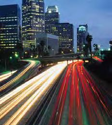
3 212 STATE of the COMMUTE The annual SANDAG State of the Commute report presents a range of data that assesses travel characteristics in the San Diego region, giving readers a sense for the overall condition of the transportation system. The State of the Commute provides comprehensive review of changes in transportation performance and trends in congestion, as well as reporting data and statistics under the ongoing SANDAG performance monitoring program. The report supports the agency s efforts to understand just how well the region s transportation system is performing. It also helps identify opportunities to maximize system efficiency, sustain regional mobility, and track the benefits of transportation improvements. The 212 report provides an update of transportation performance data through December 212. It focuses on regional travel trends, key system performance indicators, and corridor-level performance indicators. The information reveals trends and changes in highway and transit travel, commuting highway travel times, and highway system delays. These statistics are evaluated to document where and how much change has occurred from regional, system, and corridor perspectives. Accordingly, the State of the Commute is organized into three distinct sections: Getting Around the Region This section provides an overview of regional travel trends. It quantifies traffic flows on our freeways, as well as transit ridership levels. It also lays the groundwork for future reporting on walking, biking, and other commute modes. How is the System Working? This section provides performance statistics, including regional and corridor travel delay data and information on the most heavily used transit routes. My Corridor Commute This section analyzes the performance of a number of specific travel corridors in the region. It measures progress relative to benchmarks set for usage, travel times, and other key statistics, highlighting completed or planned projects designed to reduce congestion and minimize delay. In general, data in the 212 State of the Commute report indicates that use of the transportation system has increased, with various factors influencing how commuters get to work. Weekday travel on the region s highways, quantified by vehicle miles traveled (VMT), has seen an increase of approximately 2 percent in the past year. Overall travel by public transit in the region has decreased slightly, by percent (quantified by passenger miles traveled), in comparison to
4 Key roadway infrastructure and transit improvements continue to reduce travel times and commute delays. For example, in early 212 the final segment of the I-1 Express Lanes opened to traffic, resulting in a complete 2-mile, state-of-the-art Express Lanes facility extending from SR 163 in San Diego to SR 78 in Escondido. Data from the corridor shows that there has been an approximate 8 percent reduction in vehicle hours of delay compared to a decade ago. The project is the primary reason why overall travel time and corridor reliability have improved during the afternoon commute. Future State of the Commute reports will provide detailed and complete data analysis documenting performance trends linked to key roadway improvements that were under construction in 213, including the auxiliary lane and interchange improvements on SR 78 in San Marcos and the high occupancy vehicle (HOV) lane improvements on I-8 in the Sorrento Valley area. Basics for Reading the State of the Commute The 212 State of the Commute report focuses on calendar year data reported through December 212. The emphasis is on reporting trends and changes in highway and transit travel, commuting highway travel times, and highway system delay during peak periods of travel Monday through Friday, from 6 to a.m. and from 3 to 7 p.m. Analysis has been conducted on where and how much change has occurred from regional, system, and corridor perspectives. Highway travel is quantified by vehicle miles traveled (VMT), which is defined as a specific vehicle count/use of roadway multiplied by the length of the roadway segment during an average weekday. Transit travel is quantified by passenger miles traveled (PMT), which is often used as a corollary to vehicle miles traveled to illustrate the cumulative number of miles traveled by all transit passengers during a typical weekday on the region s buses, shuttles, trolleys, and commuter trains. Transit use is quantified by passenger boardings (ridership). Travel time is a key metric for assessing changes in trip quality. The time it takes us to travel along key regional corridors during morning and afternoon commute periods provides an indication of delay and other constraints on mobility. The reliability of travel times also is measured by the additional time (or budget time) a traveler needs to build into a trip to ensure on-time arrival 9 percent of the time. Delay also is a key metric for assessing changes in congestion and can be quantified as the total time that we lose due to traveling under congested conditions (how much time is lost when we travel on the freeway at speeds less than 3 miles per hour). The My Corridor Commute section provides data to show how specific commute routes have changed over time, including average weekday corridor VMT, travel times, budgeted travel times, and transit ridership levels. The My Corridor Commute section in the 212 report presents data for the I- North, I-1/SR 163, I-8, SR 2, and SR 78 commute corridors. State of the Commute 212

5 The State of the Transportation Data One of the goals of the State of the Commute is to report travel (in terms of VMT) for all transportation modes. Determining VMT requires robust and reliable sources of travel data, such as roadway vehicle detection stations and transit passenger counters. Currently, only freeway travel has enough data sources available for consistent, complete reporting. SANDAG and its local and regional partners continue to look for additional sources of consistent and reliable transportation data, especially for bicycling, walking, public transit, and other alternative modes. In 212, the County of San Diego Health and Human Services Agency, in partnership with SANDAG and San Diego State University, began the installation of permanent bicycle/ pedestrian counting stations along major corridors. Meanwhile, SANDAG and regional transit operators have started work to improve data analytics related to Compass Card usage. SANDAG also is working to expand roadway vehicle detection to major regional arterials. In 214, SANDAG will begin implementing the Regional Arterial Detection Deployment Project. This project will provide arterial data that will benefit traffic monitoring, operations, and traveler information. SANDAG also continues to work with Caltrans to fill critical vehicle detection gaps in the regional freeway system. As these programs mature, SANDAG will include more robust data from each in future State of the Commute reports. GETTING AROUND the REGION Understanding how travelers use the transportation system is key to developing strategies for near-term and long-term improvements, as well as identifying approaches to meeting our transportation goals. In addition, important factors in measuring the sustainability of transportation systems and environmental impacts include miles traveled on the network, peak period trips, and transit usage. How much are we using the transportation system? The number of miles traveled on the region s surface transportation system is a measure of how connected our communities are in terms of employment and housing. This number is strongly influenced by population, employment levels, and the economy. San Diego County s location on the international border, as well as its role as an employment center for residents of Mexico, Imperial County, and Southwest Riverside County, are contributing factors to the amount of travel that occurs on the region s roadways. The measure of 3
6 Vehicle Miles per Person (Fig. 1.1) AVERAGE WEEKDAY FREEWAY TRAVEL PER PERSON vehicle miles traveled (VMT) also is used as an indication of the environmental impact created by passenger vehicles and commercial trucks. Freeway travel is measured and reported by Caltrans Performance Measurement System (PeMS). PeMS takes data from freeway detectors, estimates travel speeds for a given travel corridor, and calculates travel time from one freeway on-ramp to the ultimate off-ramp. Availability of the data is subject to the operating conditions, or health, of the freeway detectors, which can be affected by weather, scheduled highway maintenance, or major construction activities. Total weekday travel on the region s freeway system increased slightly from 8.64 billion vehicle miles in 211 to 8.81 billion vehicle miles in 212. Overall, per capita freeway travel has grown slightly to approximately 11.2 vehicle miles traveled per person, as illustrated in Figure 1.1. What roadways do we use? (Fig. 1.2) WHAT ROADWAYS DO WE USE? Local Roads Freeways Travel Lane Miles % % 2% 3% 4% % 6% 7% 8% 9% % Source: San Diego Regional Model, Series 12 Forecast, 212 Network Our surface transportation system is composed of a network of local streets, connecting arterial roadways and freeways. All trips use one or more components of the roadway system. Measurements of this usage can aid land use planning and development of operational strategies, as well as guide transportation investments. Freeways remain the primary network for travel to and from work, for shopping, and for entertainment. Since the last State of the Commute report, new segments along SR 9 have been added to the freeway system, along with some smaller additions throughout the region (This report only considers projects completed through December 212). While the freeway system makes up about 2 percent of the total roadway mileage (in terms of lane-miles) in the region, it continues to accommodate the majority of the vehicle miles traveled approximately percent. Local streets and arterials represent about 8 percent of the roadway network, but just 4 percent of the travel. (See Figure 1.2) 4
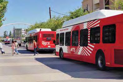
7 Regional travel by transit Increased transit usage decreases traffic congestion and increases the sustainability of our transportation system. Transit helps to reduce vehicle miles traveled and their associated environmental impacts. Passenger miles traveled (PMT) is often used as a transit counterpart to vehicle miles traveled to illustrate the cumulative number of miles traveled by all transit passengers during a typical weekday on the region s buses, shuttles, trolleys, and commuter trains. As seen in Figure 1.3, transit passenger miles traveled in 212 decreased compared to the previous year by approximately percent. In 212, there were approximately 34, weekday passenger boardings, a 2 percent decline in ridership for the five-year period from 28 to 212. (See Figure 1.4) Transit ridership continues to be influenced by the availability of transit services, the price of gasoline, and the state of the regional economy. The availability of transit services is indicated by transit revenue miles. Between 28 and 212, transit revenue miles have seen a percent decline. A couple of key factors account for the decline: service cuts due primarily to state and federal funding reductions; the economic recession and the resulting loss in employment across the San Diego region through 2; and a steep drop in gasoline prices over that same period. Although ridership has gone down, transit operators have become more efficient as shown by nearly a 4 percent increase in weekday passengers per revenue mile over the five-year period. (See Figure 1.) Both major transit operators in the region have been proactive in achieving productivity gains. Metropolitan Transit System s (MTS) Comprehensive Operations Analysis (implemented in 27) and North County Transit District s (NCTD) Mobility Plan (to be fully implemented by 213) led to a number of changes in route structure and service frequencies. Passengers per Revenue Mile Transit Boardings (thousands) Passenger Miles (millions) (Fig. 1.3) WEEKDAY TRANSIT PASSENGER MILES (Fig. 1.4) WEEKDAY TRANSIT RIDERSHIP (Fig. 1.) WEEKDAY TRANSIT PASSENGERS PER REVENUE MILE GETTING AROUND the REGION 212 State of the Commute

.")
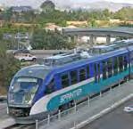
8 Transit Boardings (thousands) (Fig. 1.6) WEEKDAY AVERAGE BUS AND RAIL RIDERSHIP 24 Bus Rail Overall, rail and bus ridership trends are consistent over the past five years. Bus ridership continues to be the workhorse of the transit system, carrying more than two-thirds of total riders. (See Figure 1.6) Bus ridership in the San Diego region is composed of the MTS and NCTD service areas, including MTS local bus, MTS express bus, and MTS Premium Express, as well as NCTD BREEZE local bus. Over the past five years, weekday bus ridership has increased by nearly 7 percent (a 3 percent increase over 211). Bus ridership also has seen a recent uptick due to an increase in frequency and extended weekday hours for local bus services. In 212, both NCTD and MTS worked to both restructure and restore bus service and frequencies on a number of routes that were previously cut as a result of the recession. While NCTD focused on restructuring routes, such as Route 318 and Route 34/44, to extend coverage and provide continuous service, MTS worked to restore and add service throughout its service area. For example, MTS restored service to Route 24 and expanded SuperLoop service to communities east of Genesee Avenue. Weekday rail ridership which includes patrons on the Trolley, COASTER, and SPRINTER services fell in 212, partly due to the Trolley Renewal Project. This major rehabilitation of the Trolley system has caused temporary service lapses and station closures. As construction of each Trolley line is completed over the next two years, Trolley operations and passenger experience will be greatly enhanced with new low-floor rail vehicles, new station platforms, and improved passenger information displays. Meanwhile, Trolley fare revenues have increased. The diverging trends for Trolley ridership and revenues could be the result of the margin of error from ridership estimates; there is a possibility that the ridership decline may be smaller than reported. SANDAG and MTS are working collaboratively on a new ridership estimation program to improve accuracy. 6
9 What alternative choices are travelers using? In addition to transit, alternative travel modes such as carpooling, vanpooling, biking, walking, and teleworking reduce the number of vehicles using the transportation system. The resulting decrease in traffic reduces peak period congestion and associated environmental impacts on the region s roadways. How residents in the region commute has stayed fairly consistent over the past five years, according to commute mode-share data obtained from the American Community Survey (ACS) conducted by the U.S. Census Bureau using a limited number of survey responses (1 out of 4 households). San Diego County survey data indicates that, while the majority of commuters continue to drive alone to work, alternative modes of transportation continue to play a role in the regional commute. (See Figure 1.7) Walking to work and working from home have become attractive choices for some commuters. Carpooling and vanpooling continue to provide the primary alternatives to solo commuting. Findings from the 211 ACS provide one source of information on how commuters use alternative forms of transportation in the San Diego region during peak periods of the day. icommute, the SANDAG Transportation Demand Management (TDM) Program, is currently developing a regional commuter survey that is intended to supplement the ACS and provide another source of data on commuting in the region. icommute provides free ride-matching services, a vanpool program, transit solutions, bicycle encouragement programs, the Guaranteed Ride Home program, SchoolPool, and support for teleworking. 1% (Fig. 1.7) WHAT ALTERNATIVE CHOICES ARE TRAVELERS USING? Carpool/Vanpool Public Transit Walk Bicycle Telework Other 12% 9% Mode Share 6% 3% % GETTING AROUND the REGION 212 State of the Commute

10 icommute has recently undertaken other TDM initiatives aimed at increasing the use of more sustainable travel modes, including:» A regional telework demonstration project that would assist interested employers in initiating and expanding their use of telework» A vanpool/carpool program analysis and expansion plan» Guaranteed Ride Home analysis and expansion plan» Improved multimodal trip planning tools and resources» Corridor specific TDM plans and campaigns While transit use represents a 3 to 4 percent mode share regionwide for the work commute, it should be noted that the transit system is focused primarily on the urbanized areas where trolley and bus systems can cost-effectively serve the maximum number of riders. Comparison of travel on primary routes between major destinations within corridors where significant investments have been made in transit infrastructure (such as the Trolley from San Ysidro to Old Town and from Gillespie Field to the Convention Center) shows a much higher share of transit travel (transit mode share) during the morning peak period:» 31 Percent Transit Mode Share: Northbound I- in South Bay toward Downtown San Diego» 19 Percent Transit Mode Share: SR 94 West toward Downtown San Diego During 212, participation in the regional vanpool program decreased by approximately 6 percent from the previous year, with 78 vanpools carrying,2 daily passengers. In 2, the SANDAG Board of Directors approved Riding to 2: The San Diego Regional Bicycle Plan. It is the first bicycle plan for the region as a whole. It outlines a regional bicycle network, as well as supporting programs. One such program includes development of data collection, reporting, and modeling for active transportation projects. The County of San Diego, in partnership with SANDAG and San Diego State University, has recently deployed a number of automated pedestrian and bicycle counting stations throughout the region. This project will provide usage data on many of the region s major bicycle/pedestrian facilities. As information becomes available, future State of the Commute reports will quantify the importance of bicycling and walking as regional commute modes. This new information on pedestrian activity and infrastructure will be included in future reports, given that many transit commute trips begin with a walk to a transit stop. (Fig. 1.8) TOP VANPOOLS Top Origins Top Destinations 1 Temecula Naval Air Station North Island 2 Murrieta Camp Pendleton 3 Chula Vista UC San Diego 4 Winchester Downtown San Diego Menifee MCAS Miramar/San Onofre (tie) 8

11 HOW is the SYSTEM WORKING? The performance of the surface transportation system is best evaluated by measures such as delay, congested segments, and travel time. Transit is best measured through ridership levels. These indicators can be used to assess improvements, identify bottlenecks, and develop strategies and investment plans. Total freeway delay during peak-hour commute As the economy has slowly pulled out of the recession, and employment numbers have begun to recover, peak-hour demand has increased on the region s roadways. 6 (Fig. 2.1) ANNUAL PEAK PERIOD FREEWAY DELAY - WEEKDAYS Overall delay during peak commute periods provides a snapshot of how the transportation system is working. Severe congestion is measured in terms of the number of vehiclehours the freeway operates below 3 miles per hour. After enjoying significant declines in rush hour delay between 27 and 29, San Diego commuters have since experienced yearly increases in peak period freeway delay. In 212, nearly 4.4 million vehicle hours of delay were observed on the region s highways during peak commute periods, nearly an 11 percent increase compared to 211. (See Figure 2.1) Delay (million vehicle hours) HOW is the SYSTEM WORKING? 212 State of the Commute
12 Regional bottlenecks In recent years, infrastructure improvements have played a key role in decreasing delays at specific freeway bottlenecks. As illustrated in Figure 2.2, identifying the causes of delay and measuring the outcomes of system improvements can be accomplished by examining specific segments/locations along individual freeways. Our efforts to address major bottlenecks along key freeway corridors have resulted in the completion of several projects that have reduced severe congestion levels and delay. For example, previously reported segment bottlenecks along the I- and I-1 corridors were reduced below 26 conditions due to the I- HOV Lane Extension and I-1 Express Lanes projects. among the top bottlenecks, delays on them are relatively moderate when compared to delays experienced on the I- and I-1 segments in previous years. (See Figure 2.2) The SR 163 southbound segment is included in this year s report due to expansion of the freeway detection system within the corridor since 2. Freeway delay prior to 2 is estimated and not observed. Detection improvements enhance our ability to track freeway delays and better estimate travel times along the corridor over time. The identification of top regional bottlenecks, and their impacts on travel times and delays, will be an on-going performance reporting effort in future State of the Commute reports. The 212 report analysis indicates that while certain segments of SR 78 or SR 163 ranked, (Fig. 2.2) REGIONAL BOTTLENECKS Annual Freeway Delay (vehicle hours) per Lane Mile 4, 4, 3, 3, 2, 2, 1,,, Eastbound SR 78 from Mar Vista Rd. to I-1 Northbound I- from I-8 to Manchester Ave. Southbound SR 163 from I-1 to I- Southbound I-8 from I- to I-8 Northbound I-8 from I-8 to I- Southbound I-1 from SR 78 to Centre City Pkwy
.")
13 Annual freeway delay by freeway during commute periods Based on regional travel data for the urban freeway system, it is estimated that approximately percent of daily travel is made during the morning and afternoon commute periods (weekdays from 6 to a.m. and 3 to 7 p.m.). Assessing how much travel is made on the region s key freeway corridors during these high-demand periods provides an understanding of the total time lost due to traveling under congested conditions (when speeds drop to less than 3 miles per hour). In 212, the hours of delay totalled to just over 1.3 million during the morning commute period and over 3.1 million during the afternoon commute period. (Fig. 2.3) DELAY BY FREEWAY DURING COMMUTE PERIODS I-1 14% SR 78 13% A.M. COMMUTE SR 163 % I-8 7% SR 94, % SR 6, 4% Other, 4% Figure 2.3 shows that the majority of freeway delay in the San Diego region occurred along the major freeway corridors (I-, I-1, I-8, SR 78, and SR 163) in 212. These five freeways account for more than 8 percent of the freeway delay observed during the morning and evening commute periods. Both directions of the I- corridor account for the highest observed delay, 22 percent and 34 percent during the morning and afternoon commutes, respectively. I-8 2% SR 78 13% I-1 % I- 22% P.M. COMMUTE SR 163, % I-8 1% I-8, % SR 2, % SR 6, 4% Other, 4% I- 34% NOTE: Delay is based on observed data in the freeway general purpose lanes and available freeway detection. Totals may not add up to percent due to rounding. HOW is the SYSTEM WORKING? 212 State of the Commute
14 212 top transit routes by ridership As shown in Figure 2.4, the Blue Line Trolley, from San Ysidro to Old Town, continues to be the busiest transit route in the region, with more than, daily trips. Figure 2.4 shows the ridership prior to and after the September 212 Trolley realignment. With the realignment, Green Line ridership increased due in part to the streamlining of the Green Line from Santee to Downtown San Diego without transfer, while Orange Line ridership dropped slightly. Peak period ridership on the Blue Line Trolley is influenced by crossborder pedestrian traffic at the San Ysidro Port of Entry, which decreased by 4 percent from 211 to 212. The Green and Orange Lines combined to serve more than 43, daily trips. The Route 7 bus service from La Mesa to Downtown San Diego serves approximately 12, daily trips, and is the most patronized local bus route in the region. The SPRINTER light rail service from Escondido to Oceanside also provides nearly 9, daily trips along the SR 78 corridor. 212 Rank 211 Rank Route Route Description Transit Mode Blue Line Trolley Green Line Trolley Orange Line Trolley SPRINTER (Fig. 2.4) 212 TOP TRANSIT ROUTES BY RIDERSHIP San Ysidro to America Plaza via Chula Vista / National City* Santee to Downtown SD / 12th & Imperial via La Mesa / Mission Valley** El Cajon to Downtown SD / America Plaza via Southeastern Communities*** Downtown SD to La Mesa via North Park / City Heights Oceanside to Escondido via Vista / San Marcos Light Rail Light Rail Light Rail Avg. Daily Passengers 3,92 /,234 19,763 / 23,48 2,73 / 19,69 Local Bus 12,39 Light Rail 8, Skyline Hills to San Diego State University via Downtown SD Downtown SD to Iris Avenue Trolley via Chula Vista / National City 24th Street Trolley to Kaiser Hospital via Southeastern Communities Downtown SD to UTC / VA Medical Center via Pacific Beach Euclid Trolley to UCSD Medical Center / Hillcrest via Downtown SD Local Bus 8,941 Local Bus 8,46 Local Bus 7,698 Local Bus 7,424 Local Bus 7,28 Numbers in bold indicate the Average Daily Passengers prior to the September 212 Trolley realignment. The post-realignment average is used to determine the Transit Route ranking. *Prior to the realignment taking place on September 2, 212, the Blue Line ran from San Ysidro to Old Town. **Prior to the realignment taking place on September 2, 212, the Green Line ran from Santee to Old Town. *** Prior to the realignment taking place on September 2, 212, the Orange Line ran from Gillespie to Convention Center / Downtown SD. 12


15 Transit ridership of TransNet-supported services Continued investments in new transit services, as well as rehabilitation of existing networks, are key to increasing ridership. The TransNet program has played an important role in developing major transit services in the region. TransNet is the regional half-cent sales tax for transportation approved by San Diego County voters. Administered by SANDAG, the TransNet program has provided funding to key regional Trolley enhancements, including the Old Town Trolley Station and the Mission Valley East/West Extension. Most recently, the Blue and Orange Lines have benefited from new low-floor trolleys, track, and station platforms as part of the Trolley Renewal Project. However, partly due to delays associated with construction activities, Trolley ridership declined by 24 percent between 211 and 212. Since September 212, the Orange and Blue Lines have seen a 12 percent and 31 percent reduction in ridership, respectively. With construction anticipated to be completed by 21, the revamped Trolley system is expected to run more efficiently in future years. In 212, TransNet-supported routes the SuperLoop, SPRINTER, COASTER, and Orange/ Blue Lines combined to carry nearly 9, weekday trips, almost one-quarter of all weekday transit trips in the region. (See Figure 2.) (Fig. 2.) REGIONAL TRANSIT RIDERSHIP - TRANSNET PROGRAM Weekday Boardings (Thousands) Blue Line Trolley Orange Line Trolley COASTER SPRINTER SuperLoop HOW is the SYSTEM WORKING? 212 State of the Commute

16 MY CORRIDOR COMMUTE Consistent with previous State of the Commute reports, SANDAG continues its efforts to understand just how well our transportation system is performing from the traveler s perspective. The My Corridor Commute section provides just that a snapshot of annual data focusing on major commute routes. It also presents historical corridor-level data in an effort to capture and identify changes and trends in our commutes over time. This section illustrates how peak travel has changed for the I- North, I-1/ SR 163, I-8, SR 2, and SR 78 commute corridors. It includes freeway performance data for these featured corridors, such as overall corridor travel, travel time, and corridor delay. The data comes from the Performance Measurement System (PeMS), which relies on freeway detectors and is subject to the availability and health of those detectors. Figure 3.1 shows the existing PeMS detection coverage, including detection that was added during 212. Each featured corridor section reports travel times during the morning and afternoon commutes. Travel times represent trip times only while on the freeway, rather than door-todoor commute times. PeMS takes data from freeway detectors, estimates travel speeds for a given segment of freeway, and calculates travel time from one freeway on-ramp to the ultimate off-ramp. Corridor trip times are calculated for travel on the general-purpose, or mixed-flow, lanes of the freeway, and do not reflect the use of any available HOV or Express Lanes during the trip. Morning and evening travel times in this section assume that one enters the freeway at 8 a.m. and p.m., respectively. The reported travel times in this section may differ from travel times reported in other documents, such as the Regional Transportation Plan (RTP). While travel times in My Corridor Commute are based on actual collected roadway data, door-to-door travel times in the RTP are based on the San Diego Regional Transportation Model. Travel time estimates from the Regional Transportation Model are based on roadway configurations, traffic volumes, and intersection controls for all streets, arterials, and freeways along the trip route. Modeled travel times are not observed data, rather they are predicted travel times based on current and future road networks, economic conditions, housing and employment patterns, population growth, etc. Commute travel times are reported in three different ways: average, median, and budget. The average travel time is simply that: the average of all midweek travel times (Tuesdays, Wednesdays, and Thursdays) for a time period. 14
17 THE SAN DIEGO REGION S FREEWAY SYSTEM Oceanside Vista San Marcos The median (or th percentile) travel time is the typical travel time that occurs during the middle of the work week for the same time period. The budget time reported in this section is a measure of the freeway corridor s reliability. The budget time is the time one would need to add to one s typical commute to ensure an on-time arrival under worst-case conditions, or 9 percent of the time. Higher budget times are related to less reliable travel caused by freeway bottlenecks, higher freeway incident rates, prevalence of special events, etc. Carlsbad Encinitas Solana Beach Del Mar Escondido Poway Efforts to improve PeMS and roadway performance monitoring are on-going. Specific enhancements currently under development will allow PeMS to incorporate real-time transit and arterial data. With the completion of the monitoring network on the region s arterials and remaining freeway segments, PeMS will have the ability to report door-to-door travel times in selected corridors for both automobiles and transit vehicles. San Diego MCAS Miramar La Mesa Santee El Cajon Transit performance data comes from the Metropolitan Transit System (MTS), North County Transit District (NCTD), and SANDAG. Lemon Grove This section also provides information about plans for improving mobility along the region s transportation corridors, as well as a brief assessment of the travel benefits resulting from the completion of freeway improvement projects in some of the featured corridors. (Fig. 3.1) Coronado Existing Freeway Detection (general purpose lanes only) New Freeway Detection in 212 National City Imperial Beach Chula Vista San Diego Tijuana, B.C. MY CORRIDOR COMMUTE 212 State of the Commute
18 I- North Commute Corridor The I- North commute corridor serves as a critical north-south travel link connecting San Diego to Los Angeles County, Orange County, and Baja California, Mexico. The corridor provides a number of commuting options for local, regional, and interregional trips, including the existing eight-to ten-lane freeway network, COASTER commuter rail service, and the local street network. The corridor serves as a gateway for San Diego s commuters, recreational users, goods movement, business centers, and local residents. It is estimated to provide access to approximately 22 percent of the region s total jobs. Door-to-door travel times along this corridor for solo drivers are forecast to increase from 7 minutes (in 28) to approximately 6 minutes, if improvements are not made by 2, according to the 2 Regional Transportation Plan (RTP). Freeway congestion is prevalent in the corridor and is expected to worsen during peak commute periods as population grows over time. The average daily traffic volume along I- North ranges from 13, to 2, vehicles. Commute times between SR 76 in Oceanside and Front Street in Downtown San Diego are estimated at 41 minutes during the southbound morning commute, a decrease of percent since last year. The northbound evening peak period commute experienced no change in trip times, averaging 44 minutes in 212. (See Figure 3.3.) Congestion also affects the reliability of travel times in this corridor; commuters needed to plan an extra eight minutes to complete their morning commute reliably. (See Figure 3.4) Figure 3. shows that the average weekday transit ridership in the corridor increased by 3. percent, with more than, daily trips in 212. Proposed 2 RTP improvements include the implementation of the North Coast Corridor (NCC) Program, which is composed of three primary focus areas: four new Express Lanes (I- North Coast Express Lanes Project, which will extend from La Jolla Village Drive to Vandegrift Boulevard); coastal rail and transit improvements; and environmental protection and coastal access improvements. The NCC Program represents a $6. billion investment over the next few decades. The I- North Coast Express Lanes Project would maintain or improve traffic conditions through 2, as well as enable free flow travel during peak commute hours. Figure 3.6 demonstrates that the majority of all freeway delay observed on I- occurs in the North Coast segment between I-8 and SR 76. The proposed improvements will create a flexible freeway network that will provide additional travel choices, including facilities for carpooling, vanpooling, and premium bus services. This project has been identified as a high priority in the region and is currently part of the TransNet Early Action Program (with the focus on the completion of the environmental document). The supplemental draft environmental document was released in August 212, and the final environmental document is expected in summer 213. Current corridor improvements under development include the I- interchange project at Genesee Avenue, which will include improvements to local streets and the addition of auxiliary lanes. Construction is scheduled to begin in late 213. In March 211, construction began on I-8 to add HOV lanes from I- to Mira Mesa Boulevard, as well as a partial Direct Access Ramp (DAR) to Carroll Canyon Road in Sorrento Valley. This project will result in a continuous -mile HOV lane facility from Solana Beach to Sorrento Valley, with direct access to major employment centers for carpoolers and vanpoolers. This project is scheduled for completion in late 213. Several improvements along the LOSSAN (Los Angeles-San Diego-San Luis Obispo) rail corridor were completed in February 212, including double tracking between Carlsbad Village Drive and Palomar Airport Road, as well as the stabilization of 1.6 miles of coastal bluffs in Del Mar. More rail improvements are planned in the corridor, including the San Dieguito, Sorrento to Miramar, and Sorrento Valley double track projects. Detailed project information is available at KeepSanDiegoMoving.com. In conjunction with Caltrans and other corridor stakeholders, SANDAG is developing a Transportation Demand Management (TDM) Plan for the North Coast Corridor. The plan will detail options to manage congestion during future construction projects and build a foundation for continued travel behavior change once construction is complete. This effort is scheduled for completion in December OCEANSIDE TO DOWNTOWN SAN DIEGO
19 1 OCEANSIDE TO DOWNTOWN SAN DIEGO Travel (million vehicle miles) (Fig. 3.2) Average Weekday Travel I- from SR 76 to Front/First Streets Year 212 A.M. Travel Time Southbound Starting at 8 a.m. 41 minutes Oceanside Carlsbad Vista San Marcos (Fig. 3.3) Average Freeway Travel Time AM Southbound PM Northbound Encinitas Travel Time (minutes) COASTER Commuter Rail Year 212 Average Weekday Ridership: 4,664 Solana Beach Del Mar 6 Travel Time (minutes) Budget Time Median Travel Time 14 4 (Fig. 3.4) AM Travel Time Reliability to Downtown San Diego Average Daily Traffic I- at Del Mar Heights Road Year 211: 244, Year 212 P.M. Travel Time Northbound Starting at p.m. 44 minutes San Diego , (Fig. 3.) Average Weekday Transit Ridership 282 Coronado 6, N, 7 Transit Ridership Travel Time (minutes) 4, 3, 2, 1, Note: Ridership at Solana Beach screenline for COASTER and Route 1 bus. Far North (SR 76 to County Line) North Coast (I 8 to SR-76) Mid-Coast (I-8 to I-8) Central (SR 4 to I-8) South (SR 9 to SR-4) (Fig. 3.6) Annual Weekday Delay by Freeway Segment Delay (thousand vehicle hours) I- IMPROVEMENTS: BEFORE AND AFTER (Fig. 3.7) Corridor Delay and Travel Southbound I- from Palomar Airport Road to Manchester Ave Delay Travel Travel (million vehicle miles) Imperial Beach 1-D MY CORRIDOR COMMUTE 212 State of the Commute
20 I-1/SR 163 Commute Corridor The I-1/SR 163 commute corridor consists of a 3- mile, eight-to ten-lane stretch of freeway between SR 78 and Downtown San Diego, a transit network that includes Express Premium Bus service into downtown from northern inland communities, and approximately 2 miles of parallel arterial network. The corridor is the primary inland north-south trunk line that serves travelers coming from Southwest Riverside County to downtown and other regional destinations. The corridor also serves as one element of a major interregional goods movement pathway, connecting Mexico with Riverside and San Bernardino counties, as well as Nevada. The corridor is the primary north-south link that connects northern inland communities with the urban core. Door-to-door travel times along this corridor for single-occupant vehicles are forecast to increase from 47 minutes (in 28) to approximately 1 minutes in 2 without improvements to the corridor, according to the 2 RTP. Average daily traffic in the corridor ranges from, vehicles on SR 163 near Balboa Park to 3, at the I-1/SR 163 junction. Travel times in the general purpose lanes between SR 78 and Balboa Park (Robinson Avenue/Washington Street) via SR 163 are estimated at 31 minutes during the morning southbound commute and 28 minutes during the afternoon northbound commute periods. (See Figure 3.9) These freeway travel times represent a decrease of 14 percent and 2 percent, respectively, compared to last year. Travel reliability also improved in the corridor, with morning budget travel times reduced by minutes in the general purpose lanes. (See Figure 3.) Caltrans and SANDAG completed construction of the last segment of the I-1 Express Lanes in January 212, opening the entire 2-mile Express Lanes facility to traffic from SR 163 to SR 78. The I-1 Express Lanes were designed to meet the diverse needs of corridor travelers for local, regional, and interregional trips. With the completion of the final Express Lanes segment, delay in the general purpose lanes of I-1 from SR 163 to SR 78 decreased by approximately percent from 211. Compared to pre-construction travel conditions in 23, corridor improvements over the past years have cut delay by 8 percent in the general purpose lanes. (See Figure 3.13) The I-1 Express Lanes facility is the region s first adaptable, high-tech transportation system. It is available for free to transit, carpools, vanpools, and motorcycles. For a fee, single-occupant vehicles also are able to travel on the Express Lanes. The toll rate on the Express Lanes is adjusted in real time in order to maintain free flow in the lanes for carpoolers and transit. The facility features a movable barrier, which allows Caltrans to make up to three lanes available to drivers during rush hour in the peak direction. Starting in 214, a Bus Rapid Transit (BRT) system will begin operating in the I-1 corridor, taking advantage of the Express Lanes and the Direct Access Ramps (DARs). The DARs route users directly onto the Express Lanes, avoiding surface streets and general purpose ramps and lanes. Current corridor improvements under development include the Direct Access Ramp at Hillery Drive, which will provide I-1 Express Lanes access to Miramar College and the community of Mira Mesa. At the Sabre Springs Transit Station, a 37-space parking structure is being constructed, along with enhanced bus staging areas, new shelters, next bus arrival signs, electric vehicle charging stations, fuel-efficient and smart vehicle spaces, security cameras, and a modular bicycle parking facility. Construction is scheduled to be complete in 214 for the launch of new BRT service. Construction wrapped up in March 213 at the Del Lago and Rancho Bernardo transit stations to prepare them for the new Rapid bus service. The newly reopened stations feature larger bus staging areas, new shelters, real time next bus arrival signs, and improved bicycle parking facilities. Detailed project information is available at KeepSanDiegoMoving.com. In support of these major corridor improvements, icommute also has begun to provide more focused outreach to employers in the I-1 corridor to promote alternative commutes. icommute will offer interested employers assistance and tools for developing commuter programs to encourage their employees to carpool, vanpool, take transit, and participate in flextime or telework. 18 ESCONDIDO TO DOWNTOWN SAN DIEGO
21 Vista 78 ESCONDIDO TO DOWNTOWN SAN DIEGO San Marcos Transit Ridership Weekday Traffic (thousand vehicles) Travel (million vehicle miles) Travel Time (minutes) Travel Time (minutes), 4, 3, 2, 1, Budget Time 9 (Fig. 3.8) Average Weekday Travel I-1 from SR 78 to Robinson Ave. via SR Median Travel Time (Fig. 3.9) Average Freeway Travel Times AM Southbound (Fig. 3.) AM Travel Time Reliability from SR 78 to Robinson Avenue (Fig. 3.11) Average Weekday Transit Ridership Note: Ridership at Miramar Way screenline for Route 2 and Series 8 Express buses. 3 PM Northbound (Fig. 3.12) Average Weekday Express Lanes Traffic Via Rancho Pkwy Poway Road Miramar Way Carlsbad Encinitas Solana Beach Delay (thoursands of vehicle hours) Year 212 A.M. Travel Time Southbound Starting at 8 a.m. 31 minutes Del Mar Average Daily Traffic I-1 at Poway Road Year 211: 23, I-1 Express Bus Services Year 212 Average Weekday Ridership: 3, Coronado 8 San Diego Year 212 P.M. Travel Time Northbound Starting at p.m. 28 minutes 163 MY CORRIDOR COMMUTE Escondido 1 National City Poway MCAS Miramar I-1 IMPROVEMENTS: BEFORE AND AFTER Delay (Fig. 3.13) Corridor Travel and Delay I-1 from SR 163 to SR 78 Travel La Mesa Travel (million vehicle miles) 12 Santee 67 Lemon Grove 12 El Cajon 212 State of the Commute 67

22 I-8 Commute Corridor The I-8 commute corridor consists of approximately 29 miles of eight-to ten-lane freeway stretching from near I- at the San Ysidro Port of Entry with Mexico to the I- interchange in Sorrento Valley. The corridor includes a transit network that is limited to local route services, and a local roadway network that supports regional eastwest travel to and from the communities adjacent to the freeway. The I-8 corridor serves local, regional, and interregional travel. It is a heavily used regional commuter route that provides a north-south path from South County communities to employment centers in Downtown San Diego and Sorrento Valley. It also serves as part of a larger interregional goods movement corridor, connecting international trips from Mexico to other freeway facilities and to destinations in Riverside and San Bernardino counties, as well as Nevada. Door-to-door travel times for solo drivers from San Ysidro to Downtown San Diego along this corridor are forecast to increase from 28 minutes (in 28) to approximately 32 minutes in 2 without improvements to the freeway, according to the 2 RTP. The average daily traffic volume along this corridor ranges from 16, to 261, vehicles. Commuters generally experience delays in the morning when traveling northbound to Downtown San Diego and Sorrento Valley. In the afternoon, travelers experience delay when traveling to South County locations. Northbound morning commute travel times between SR 9 and Downtown San Diego on I-8 via SR 94 are estimated at 17 minutes for the 13-mile commute. Freeway travel time on I-8 from SR 9 to Sorrento Valley is estimated at 33 minutes for the 2-mile commute in the morning. Southbound afternoon commute travel times to I-8 at SR 9 are estimated at 13 minutes from Downtown San Diego and 34 minutes from Sorrento Valley. (See Figures 3.1 and 3.16) Congestion during the southbound evening commute affects the reliability of travel; commuters needed to plan on an extra 1 minutes to complete their evening commute reliably. (See Figure 3.17) and from SR 2 to Mira Mesa Boulevard. Construction on the I-8 South Project from Palomar Street to the SR 94 began in summer 212 and is scheduled to be completed in fall 213. Construction on the Palomar Street Direct Access Ramp (DAR) and associated transit center and Park & Ride began in April 213 and is scheduled to be finished in winter 214. Construction on the first phase of the I-8 North Project from SR 2 to Mira Mesa Boulevard began in winter 212 with completion expected in winter 21. This project will add HOV lanes and complete the DAR at Carroll Canyon Road, providing direct HOV and transit access on I-8 to major employment centers in Sorrento Valley. The South Bay Bus Rapid Transit system will operate in the HOV/Express Lanes, connecting South County to major regional employment centers in Downtown San Diego (and ultimately to Sorrento Valley). The bus line is scheduled to begin service in mid-21 and will fill a significant service gap in the regional transit system. The I-8 North and South Projects have been identified as high priorities in the region and are part of the TransNet Early Action Program. Detailed information is available at KeepSanDiegoMoving.com. To address current and anticipated demand, proposed improvements along this corridor include the construction of HOV/Express Lanes facilities from Palomar Street to the I-8/I-1 interchange 2 CHULA VISTA TO DOWNTOWN SAN DIEGO AND SORRENTO VALLEY
23 6 CHULA VISTA Del Mar TO DOWNTOWN SAN DIEGO AND SORRENTO VALLEY Travel Time (minutes) Travel Time (minutes) Travel (million vehicle miles) (Fig. 3.14) Average Weekday Travel I-8 from SR 9 to Mira Mesa Blvd (Fig. 3.1) Average Freeway Travel Time from SR 9 to Mira Mesa Blvd. AM Northbound PM Southbound (Fig. 3.16) Average Freeway Travel Time from SR 9 to F & G St. via SR 94 AM Inbound PM Outbound Average Daily Traffic I-8 at Governor Drive Year 211: 199, San Diego Year 212 P.M. Travel Time Southbound 282 Starting at p.m. 13 minutes Coronado Imperial Beach National City 7 1 Year 212 P.M. Travel Time Southbound Starting at p.m. 34 minutes 1 Year 212 A.M. Travel Time Northbound Starting at 8 a.m. 33 minutes 1-D 4 MCAS Miramar 8 94 Chula Vista Year 212 A.M. Travel Time Northbound Starting at 8 a.m. 17 minutes 2 Tijuana, B.C. I-8 IMPROVEMENTS: BEFORE AND AFTER La Mesa Santee Lemon Grove Average Daily Traffic I-8 at SR-4 Year 211: 224, 12 San Diego 67 El Ca Travel Time (minutes) (Fig. 3.17) PM Travel Time Reliability From Budget Time Mira Mesa Blvd. to SR 9 Median Travel Time Delay (thousands of vehicle hours) (Fig. 3.18) Corridor Travel and Delay from Plaza Blvd to H St. Corridor Delay Corridor Travel Travel (millions of vehicle miles) MY CORRIDOR COMMUTE 212 State of the Commute


24 SR 2 Commute Corridor The SR 2 commute corridor consists of approximately 12 miles of four-to six-lane freeway running from SR 12 in Santee to the I-8 interchange in Kearny Mesa. The corridor also includes a roadway network that serves as an alternate route to I-8 for local east-west travel. The corridor serves as a critical east-west travel corridor linking east San Diego County communities to employment centers located in Kearny Mesa. In addition, the corridor serves as an important trunk route, connecting with other key freeway corridors, including I-, I-1, I-8, and SR 163. Peak period travel delays along the corridor are similar to morning and afternoon commute patterns in other east-west corridors in the region. Commuters encounter delays when traveling west in the morning and east in the afternoon. The average daily traffic volume along this corridor ranges from 63, to, vehicles. Commuters typically experience longer travel times during the evening commute than during the morning commute. Travel times in the general purpose lanes between Genesee Avenue in San Diego to Mast Boulevard in Santee are estimated at 14 and 19 minutes during the morning westbound and afternoon eastbound commute periods, respectively. The average commute in 212 increased by 1 to 2 minutes since the previous year, due to delays caused by bottlenecks near I-1, Mission Trails Summit, and the San Diego River Bridge in Santee. (See Figure 3.2) More improvements are planned on SR 2, including the construction of one additional general purpose lane in each direction and two reversible Express Lanes from I-1 to SR 12. The 2 RTP has identified planned Express Lanes improvements on SR 2 for completion by the year 24. More information is available at KeepSanDiegoMoving.com. 22 SANTEE TO KEARNY MESA
25 1 SANTEE TO KEARNY MESA MCAS Miramar 8 Year 212 P.M. Travel Time Eastbound Starting at p.m. 19 minutes Kearny Mesa 163 Average Daily Traffic SR 2 at Santo Road Year 211: 89, 12 Year 212 A.M. Travel Time Westbound Starting at 8 a.m. Santee minutes San Diego 1 8 La Mesa El Cajon Travel (million vehicle miles) (Fig. 3.19) Average Weekday Travel SR 2 from Genesee Ave. to Mast Blvd. 282 Travel Time (minutes) Budget Time (Fig. 3.21) PM Travel Time Reliability Median Travel Time Genessee Ave. to Mast Blvd Lemon Grove Travel Time (minutes) Coronado AM Westbound PM Eastbound National City (Fig. 3.2) Average Freeway Travel Time Delay (thousands of vehicle hours) SR 2 CORRIDOR DELAY AND TRAVEL 1 3 (Fig. 3.22) Genesse Ave. to Mast Blvd Corridor Delay Corridor Travel Chula 2 Vista Travel (millions of vehicle miles) Imperial Beach 9 San Diego 11 1-D Tijuana, B.C. MY CORRIDOR COMMUTE 212 State of the Commute

26 SR 78 Commute Corridor SR 78 serves as a principal commute corridor in North County. The six-lane freeway from Oceanside to Escondido is approximately 17 miles. It provides one of the region s east-west roadways connecting the I- and I-1 corridors. Portions of SR 78 west of I-1 are currently experiencing congestion and delay during peak periods. Door-to-door travel times for solo drivers from Oceanside to Escondido along this corridor are forecast to increase from 32 minutes (in 28) to approximately 39 minutes in 2 without improvements to the freeway, according to the 2 RTP. Average daily traffic in this corridor ranges from 124, at the western end near I- to 162, at the eastern approach to I-1. Travel times in the general purpose lanes between I- and I-1 are estimated at 16 and 27 minutes during the morning westbound and afternoon eastbound commute periods, respectively. The eastbound evening commute on SR 78 has become less reliable, with commuters needing to budget 12 extra minutes to ensure an on-time arrival, compared to nine extra minutes in 211. (See Figures 3.24 and 3.2) Because the SPRINTER runs parallel to SR 78, connecting Oceanside, Vista, San Marcos, and Escondido, it is an important transit alternative to driving in the corridor. The SPRINTER rail service now supports nearly 9, daily passengers each weekday. In addition to these short-term improvements, on-going planning efforts continue to evaluate potential long-range improvements for the SR 78 corridor. SANDAG worked with regional and corridor stakeholders on the SR 78 Corridor Study to examine the feasibility of making additional improvements in the corridor. Completed in May 212, the Corridor Study provided a planninglevel analysis of two freeway facility alternatives, including Express Lane and toll lane improvements. Both alternatives included freeway operational improvements and transit service. The study assessed the travel demand for both alternatives, the financial feasibility of tolling the new lanes or building Express Lanes similar to those in the I-1 corridor, and implementation strategies such as phasing the improvements. In addition, the study analyzed potential impacts to sensitive environments and right-of-way within the corridor. Based on performance, financial feasibility, and public input, the recommendation was to further study Express Lanes for future implementation on SR 78. Caltrans has begun to develop Project Study Reports for Express Lanes on SR 78, as well as improvements to the I-1/SR 78 interchange. Environmental studies are underway on improvements to the I-/SR 78 Interchange. SANDAG, in partnership with Caltrans, San Marcos, and Escondido, has completed roadway improvements to SR 78 at I-1. The improvements will help ease severe traffic congestion during the morning and afternoon commute hours. Improvements to the westbound SR 78 connector and westbound auxiliary lane from I-1 to Nordahl Road were completed in January 212. Work began in February 212 to replace the Nordahl Road Bridge over SR 78 with a wider and longer bridge to provide more capacity at the interchange as well as on SR 78. This bridge replacement and associated ramp widening were completed in November 212. Work to add eastbound auxiliary lanes between Barham Drive, Woodland Parkway, and Nordahl Road began in January 212 and was finished in May OCEANSIDE TO ESCONDIDO
27 OCEANSIDE TO ESCONDIDO 76 SPRINTER Rail Year 212 Average Weekday Ridership: 3,631 1 Oceanside SPRINTER Vista Year 212 P.M. Travel Time Eastbound Starting at p.m. 27 minutes 78 San Marcos Year 212 A.M. Travel Time Westbound Starting at 8 a.m. 16 minutes Carlsbad Escondido Average Daily Traffic SR 78 at Barham Road Year 211: 16, 78 Encinitas Travel (million vehicle miles) (Fig. 3.23) Average Weekday Travel SR 78 from I- to I-1 Solana Beach Del Mar 6 Travel Time (minutes) (Fig. 3.2) PM Travel Time Reliability from I- to I-1 Budget Time 11 Median Travel Time 14 Poway Travel Time (minutes) (Fig. 3.24) Average Freeway Travel Time from I- to I-1 AM Westbound PM Eastbound San Diego Transit Ridership 8 7, 6,, 4, 3, 2 2, 1, 1 (Fig. 3.26) Average Weekday Transit Ridership MCAS Miramar 2 8 La Mesa 12 Santee Note: Ridership at Vista Transit Center screenline for SPRINTER and Route 32, 318, and 32 buses. 67 El Cajon 1 MY CORRIDOR 163 COMMUTE State of the Commute Lemon
28 SR 76 Corridor The section of SR 76 from Oceanside to I-1 serves as a major commuter route. Starting at I-, it links the City of Oceanside with the communities of Bonsall, Fallbrook, Pala, Pauma Valley, Rincon, and Lake Henshaw. East of I-1, SR 76 serves mainly rural communities and tribal reservations. Portions of SR 76 are currently experiencing delay during peak periods. The problem is compounded by insufficient highway capacity, as well as a lack of parallel routes and cross-street traffic access. In order to alleviate the congestion on this corridor, SANDAG is widening and realigning SR 76 between Melrose Drive in Oceanside and I-1. In November 212, the Middle Segment from Melrose Drive to South Mission Road was completed, widening a portion of the corridor to a four-lane highway. Construction on the first phase of the SR 76 East Segment, the final leg of a series of improvements to the corridor, started in summer of 212. Work to widen and upgrade the SR 76/I-1 interchange is expected to be complete in summer 214. The second phase to widen the road from South Mission Road to I-1 is slated to begin in fall/winter 213. The project is part of the TransNet Early Action Program. More information is available at KeepSanDiegoMoving.com. Mid-Coast Corridor The Mid-Coast Corridor Transit Project proposes to extend the San Diego Trolley from the Old Town Transit Center north to University City. Travel demand is expected to increase in the Mid-Coast Corridor, and the Trolley extension will provide a fast, reliable, high-capacity transit choice in the corridor. In July 2, the SANDAG Board of Directors unanimously approved the Locally Preferred Alternative for the Trolley extension project. The alternative will run parallel to I- for most of the route, and will provide service from Old Town to UCSD and Westfield UTC Transit Center. The Draft Supplemental Environmental Impact Statement/ Subsequent Environmental Impact Report (SEIS/SEIR) was released in May 213 for public review and comment. The final SEIS/SEIR is expected to be completed in 214. SANDAG is seeking funding for the project from the Federal Transit Administration (FTA) through the New Starts Program. In September 211, the FTA approved the Mid-Coast project s entry into preliminary engineering, officially placing it in the pipeline to receive New Starts funding. A percent local match to the FTA funding will be provided by a combination of state and regional funds, including TransNet. The project is part of the TransNet Early Action Program. More information is available at KeepSanDiegoMoving.com. Trolley Renewal After nearly 3 years of operation, the Metropolitan Transit System s San Diego Trolley is undergoing a massive overhaul. New low-floor trolleys, track, and station platforms are all part of the project to update the system over the next several years. Construction began in fall 2 and is scheduled to be complete by 21. The renewal project is focused on upgrading the Blue and Orange lines. Work includes adding station amenities; raising station platforms to accommodate low-floor vehicles; replacing old rail and overhead wire; and improving switching, signaling, and crossovers. When the overhaul is complete, riders will see minutes shaved off travel time. With the realignment of the Green Line in September 212, riders no longer need to transfer when traveling from Mission Valley to the Convention Center or PETCO Park. The project is part of the TransNet Early Action Program. More information is available at KeepSanDiegoMoving.com. SR 9 Corridor SR 9 is a 12-mile corridor extending from I- to the Otay Mesa Port of Entry (POE). It is a vital route for interregional and commercial traffic. The Otay Mesa POE is California s busiest commercial border crossing, with approximately 1.4 million truck crossings accounting for $3. billion in goods movement in 212. Continued growth in goods movement through the Otay Mesa POE has led to increased demand on the SR 9 corridor, and it is expected to continue to grow over time. Prior to recent improvements, cars and heavy trucks using SR 9 from I-8 to the Otay Mesa POE traveled on Otay Mesa Road, a six-lane arterial with nearly a dozen signalized intersections. Travel times during peak periods along this six-mile 26

 anticipated from the new freeway facility.")
29 arterial between I-8 and the POE were estimated to be approximately 4 minutes. A number of improvements have been completed as part of this multi-phase corridor improvement project. In 2, the Siempre Viva Road interchange was completed near the Otay Mesa POE as the initial phase of planned improvements. In 2, a new six-lane freeway from Siempre Viva Road to Britannia Boulevard was completed, providing partial freeway capacity along the corridor. A revamped SR 9/I-8 interchange opened to traffic in February 212, providing additional capacity for increased traffic (including freight trucks) anticipated from the new freeway facility. The final phase of construction was completed in July 212 with the opening of a new six-lane freeway facility from Britannia Boulevard to I-8. With the completion of the SR 9 freeway, traffic from I-8 now has a direct freeway connection to the POE and other intermodal facilities in Otay Mesa. Travel time savings due to the new freeway facility range from 2 to 2 minutes, a percent reduction compared to previous corridor travel on Otay Mesa Road. These improvements were partially funded by the TransNet program. Center, and Southwestern College are located near the highway. In December 211, SANDAG acquired the lease to operate the toll road for $341. million with the primary goal of diverting traffic off I-8 and local streets in Chula Vista. Effective June 3, 212, the SANDAG Board of Directors reduced toll prices by as much as 4 percent on South Bay Expressway. In the first six months after the tolls were reduced, the number of trips taken on the toll road exceeded.6 million, ahead of projections. Average daily traffic grew to more than 3, trips, 22 percent higher than the previous year. The higher traffic volume seen on South Bay Expressway following the toll reduction indicates that traffic is being shifted to the toll road. Improvements to the SR 9 corridor also will benefit the planned addition of a third border crossing Otay Mesa East and a connecting toll road, SR 11. SR 11 will extend a four-lane highway two miles east from SR 9 to the new crossing. The new highway and port of entry will ease congestion and reduce lengthy border wait times at the existing Otay Mesa POE. Construction is scheduled to begin in 213, contingent on available funding. SR 12 South Bay Expressway The South Bay Expressway (State Route 12) is a -mile toll road from SR 9 near the Otay Mesa Port of Entry to SR 4 near Spring Valley. The highway provides quick and convenient travel choices between eastern Chula Vista, Downtown San Diego, East County, Sorrento Valley, I-8, I-1, Otay Mesa, and Mexico. Many major shopping, entertainment, recreational, and educational destinations including the Otay Ranch Town Center, the Olympic Training 27
30 Data Sources and Methodology Getting Around the Region Figure 1.1 Freeway Miles Traveled per Person - Weekdays Sources: Caltrans, Freeway Performance Measurement System (PeMS Version 12.2); California Department of Finance, County Population Estimates (Table E-1) Data: Freeway vehicle miles of travel (VMT), County Population Period: Calendar Years 28 through 212 Days: Weekdays (Monday through Friday) Hours: All Figure 1.2 What Roadways Do We Use? Source: SANDAG, San Diego Regional Model, Series 12 Forecast, 212 RTIP Model Network Data: Vehicle miles of travel (VMT), Lane-Miles Period: Calendar Year 212 Days: Weekdays (Monday through Friday) Hours: All Figure 1.3 Weekday Transit Passenger Miles Sources: San Diego Metropolitan Transit System, North County Transit District, SANDAG Passenger Counting Program Reporting Datum: Passenger miles of travel Period: Calendar Years 28 through 212 Days: Weekdays (Monday through Friday) Hours: All Figure 1.4 Weekday Transit Ridership Source: San Diego Metropolitan Transit System, North County Transit District, SANDAG Coordinated Plan Datum: Passenger boardings, includes fixed-route buses, Trolley, COASTER, and SPRINTER, excludes Coronado Ferry Period: Calendar Years 28 through 212 Days: Weekdays (Monday through Friday) Hours: All Figure 1. Weekday Transit Passengers per Revenue Mile Source: San Diego Metropolitan Transit System, North County Transit District, SANDAG Coordinated Plan Datum: Passenger boardings, includes fixed-route buses, Trolley, COASTER, and SPRINTER, excludes Coronado Ferry; Revenue Mileage Period: Calendar Years 28 through 212 Days: Weekdays (Monday through Friday) Hours: All Figure 1.6 Average Weekday Bus and Rail Ridership Source: San Diego Metropolitan Transit System, North County Transit District, SANDAG Passenger Counting Program Reporting Datum: Passenger boardings for Trolley, COASTER, SPRINTER, and Passenger boardings for fixed-route buses Period: Calendar Years 28 through 212 Days: Weekdays (Monday through Friday) Hours: All Figure 1.7 What Alternative Choices are Travelers Using? Source: American Community Survey, One- Year Estimates, U.S. Census Bureau Datum: Means of Transportation to Work (Table B831) Geography: San Diego County, California Period: Calendar Years 27 through 211 Figure 1.8. Top Regional Vanpools by Ridership Source: Vanpool Program, SANDAG Datum: Monthly Vanpool Ridership Period: December 212 How is the System Working? Figure 2.1 Annual Peak Period Freeway Delay - Weekdays Source: Freeway Performance Measurement System (PeMS Version 12.2), Caltrans Datum: Vehicle hours of delay (3 mph threshold) Period: Calendar Years 28 through 212 Days: Weekdays (Monday through Friday) Hours: 6 to a.m., 3 to 7 p.m. Figure 2.2 Regional Bottlenecks Source: Freeway Performance Measurement System (PeMS Version 12.2), Caltrans Datum: Vehicle hours of delay (3 mph threshold) by selected freeway segment Period: Calendar Years 2 through 29 Days: Weekdays (Monday through Friday) Hours: All Delay normalized by lane mileage for each freeway segment. Eastbound SR 78 from Mar Vista Rd to I-1: 8. miles, 3 lanes, 2. lane miles Northbound I- from I-8 to Manchester Ave: 8.1 miles, 4 lanes, 32.4 lane miles Southbound SR-163 from I-1 to I-: 3. miles, 2 lanes and 7. miles, 4 lanes, 37 lane miles Southbound I-8 from I- to I-8:.9 miles, 4 lanes, 43.6 lane miles Northbound I-8 from I-8 to I-:.9 miles, 4 lanes, 43.6 lane miles SB I-1 from SR 78 to Centre City Pkwy: 3.9 miles, 4 lanes, 1.6-lane-miles Figure 2.3 Delay by Freeway During Commute Periods Source: Freeway Performance Measurement System (PeMS Version 12.2), Caltrans Datum: Vehicle hours of delay (3 mph threshold) Period: Calendar Year 212 Days: Weekdays (Monday through Friday) Hours: 6 to a.m., 3 to 7 p.m. Delay aggregated for each freeway corridor in both directions for the portions of freeway route with available detection. 28
31 Figure Top Transit Routes by Ridership Source: San Diego Metropolitan Transit System, North County Transit District, SANDAG Coordinated Plan Datum: Transit boardings for selected routes Period: Calendar Year 212 Days: All Hours: All Figure 2. Regional Transit Ridership TransNet Program Source: San Diego Metropolitan Transit System, North County Transit District, SANDAG Coordinated Plan Datum: Transit boardings for selected routes Period: Calendar Years 28 through 212 Days: All Hours: All My Corridor Commute Figure 3.1 Existing Freeway Detection Source: Freeway Performance Measurement System (PeMS Version 12.2), Caltrans Datum: Freeway Detection Coverage Period: As of December 31, 212 Figures 3.2, 3.8, 3.14, 3.19 and Figure 3.23 Average Weekday Travel Source: Freeway Performance Measurement System (PeMS Version 12.2), Caltrans Datum: Average Vehicle miles of travel (VMT) Period: Annual, Calendar Years 28 through 212 Days: Weekdays (Monday through Friday) Hours: All VMT reflects travel in the freeway general purpose lanes for the featured commute corridors. Figures 3.3, 3.9, 3.1, 3.16, 3.2 and Figure 3.24 Average Freeway Travel Time Source: Freeway Performance Measurement System (PeMS Version 12.2), Caltrans Datum: Average (Mean) Departure Travel Time Period: Annual, Calendar Years 28 through 212 Days: Midweek (Tuesday through Thursday) Hours: Morning Departure Time: 8 a.m., Evening Departure Time: p.m. Figures 3.4, 3., 3.17, 3.21 and Figure 3.2 Freeway Travel Time Reliability Source: Freeway Performance Measurement System (PeMS Version 12.2), Caltrans Data: Annual -Percentile (Median) Departure Travel Time, Annual 9-Percentile Departure Travel Time Period: Annual, Calendar Years 28 through 212 Days: Midweek (Tuesday through Thursday) Hours: Morning Departure Time: 8 a.m., Evening Departure Time: p.m. Budget Time is calculated as the difference between the 9-percentile travel time and the -percentile travel time. Figures 3., 3.11 and 3.26 Average Weekday Transit Ridership Source: San Diego Metropolitan Transit System, North County Transit District, SANDAG Passenger Counting Program Reporting Datum: Transit ridership for specific routes and at selected route screenlines Period: Annual, Calendar Years 28 through 212 Days: Weekdays (Monday through Friday) Hours: All Figure 3.6 Annual Weekday Delay by Freeway Segment Source: Freeway Performance Measurement System (PeMS Version 12.2), Caltrans Datum: Vehicle hours of delay (3 mph threshold) Period: Annual, Calendar Years 28 through 212 Days: Weekdays (Monday through Friday) Delay aggregated for each freeway segment in both directions for the portions of freeway route with available detection. Figures 3.7, 3.13, 3.18 and 3.22 Project Improvements: Before and After Source: Freeway Performance Measurement System (PeMS Version 12.2), Caltrans Data: Freeway vehicle miles of travel (VMT), Freeway vehicle hours of delay (3 mph threshold) Period: Monthly, Calendar Years 26 through 212 (I- North); Calendar Years 23 through 212 (I-1/SR 163); Calendar Years 28 through 212 (I-8 and SR-2); Days: Weekdays (Monday through Friday) Hours: All Figure 3.12 Average Weekday Express Lanes Traffic Source: Fastrak Toll System, SANDAG Datum: Vehicle Counts at selected Express Lane toll gantries Period: Monthly, Calendar Years 23 through 212 Days: Weekdays (Monday through Friday) Hours: All Freeway Annual Average Daily Traffic (AADT) Source: Annual Average Daily Traffic Volumes, Caltrans Data Traffic Branch Period: Calendar Year 211 Days: All Hours: All 29


32 State of the B Street, Suite 8 San Diego, CA 921 (619) sandag.org 1932
North Coast Corridor:
 North Coast Corridor: Connecting People, Transportation & Environment Legislative Hearing: 11.8.10 1 North Coast Corridor Region s Lifeline A Regional Strategy Mobility, Economy & Environment North Coast
Where We Live and Work Today
 San Diego Forward: The 2019-2050 Regional Plan Network Concepts Transportation Committee Item 4 October 19, 2018 Where We Live and Work Today 2018 2 2019 Regional Plan Transportation Committee Item 4 October
SAN DIEGO FORWARD THE REGIONAL PLAN CONTENTS LAND USE / TRANSPORTATION / BENEFITS / IMPLEMENTATION / OUR FUTURE
 JANUARY 2016 SAN DIEGO FORWARD THE REGIONAL PLAN CONTENTS LAND USE / TRANSPORTATION / BENEFITS / IMPLEMENTATION / OUR FUTURE vision: to provide innovative mobility choices and planning to support a sustainable
Purpose and Need. Chapter Introduction. 2.2 Project Purpose and Need Project Purpose Project Need
 Chapter 2 Purpose and Need 2.1 Introduction The El Camino Real Bus Rapid Transit (BRT) Project (Project) would make transit and other transportation improvements along a 17.6-mile segment of the El Camino
SOLANA BEACH BICYCLE TRANSPORTATION PLAN SECOND ADDENDUM
 SOLANA BEACH BICYCLE TRANSPORTATION PLAN SECOND ADDENDUM Prepared by the City of Solana Beach January 2005 Introduction In June of 1993, the Solana Beach City Council adopted a Bikeway Master Plan as directed
Typical Rush Hour Commute. PennyforTransportation.com
 Typical Rush Hour Commute In the News Overview of the Plan Collaborative plan with projects in every community Prioritizing connectivity and congestion relief Dedicated transportation-specific funding;
Arterial Transitway Corridors Study. Ave
 Arterial Transitway Corridors Study Ave January 2012 Arterial Transitway Corridors Study Overview Corridor Features and Demographics 11 study corridors, 95 route miles 86,000 daily rides and half of existing
CITY OF COCOA BEACH 2025 COMPREHENSIVE PLAN. Section VIII Mobility Element Goals, Objectives, and Policies
 CITY OF COCOA BEACH 2025 COMPREHENSIVE PLAN Section VIII Mobility Element Goals, Objectives, and Policies Adopted August 6, 2015 by Ordinance No. 1591 VIII MOBILITY ELEMENT Table of Contents Page Number
Regional Transportation Needs Within Southeastern Wisconsin
 Regional Transportation Needs Within Southeastern Wisconsin #118274 May 24, 2006 1 Introduction The Southeastern Wisconsin Regional Planning Commission (SEWRPC) is the official areawide planning agency
Washington DC Section of ITE Project Briefing
 Washington DC Section of ITE Project Briefing November 5, 2015 Renée Hamilton, VDOT, Deputy District Administrator I-66 Outside the Beltway Improvement Area Project Location Virginia 2 Purpose and Need
EXECUTIVE SUMMARY... vii 1 STUDY OVERVIEW Study Scope Study Area Study Objectives
 Contents EXECUTIVE SUMMARY... vii 1 STUDY OVERVIEW... 1-1 1.1 Study Scope... 1-1 1.2 Study Area... 1-1 1.3 Study Objectives... 1-3 2 EXISTING CONDITIONS... 2-1 2.1 Existing Freeway Conditions... 2-4 2.1.1
Implementing Agency Project Award. Pavement resurfacing and concrete repair of approximately 17 centerline miles throughout city
 Carlsbad Pavement resurfacing and concrete repair of approximately 17 centerline miles throughout city Signal operation modifications, traffic calming, signals, road improvements, concrete and pavement
Highway 217 Corridor Study. Phase I Overview Report
 Highway 217 Corridor Study Phase I Overview Report November 3, 24 BACKGROUND AND OVERVIEW Study purpose The Highway 217 Corridor Study is developing multi-modal transportation solutions for traffic problems
INFRASTRUCTURE: Using the Grid to Create a more Self-Sustaining Downtown. Studio Spring 2013
 EMERGENT FUTURES The San Diego Section of the American Society of Civil Engineers (ASCE) released a new report, the 2012 San Diego County Infrastructure Report Card. Since the last San Diego Report Card
Solana Beach Comprehensive Active Transportation Strategy (CATS)
") Solana Beach Comprehensive Active Transportation Strategy (CATS) 3.0 Goals & Policies The Solana Beach CATS goals and objectives outlined below were largely drawn from the Solana Beach Circulation Element
Solana Beach Comprehensive Active Transportation Strategy (CATS) 3.0 Goals & Policies The Solana Beach CATS goals and objectives outlined below were largely drawn from the Solana Beach Circulation Element
395 Express Lanes Extension
 395 Express Lanes Extension January 2016 Building a network of Express Lanes Project overview Add capacity on I-395 with addition of a third HOV lane and active traffic management Generate guaranteed transit
Transportation Master Plan Advisory Task Force
 Transportation Master Plan Advisory Task Force Network Alternatives & Phasing Strategy February 2016 BACKGROUND Table of Contents BACKGROUND Purpose & Introduction 2 Linking the TMP to Key Council Approved
ALTERNATIVES ANALYSIS EXECUTIVE SUMMARY
 West Valley Connector Corridor ALTERNATIVES ANALYSIS EXECUTIVE SUMMARY FINAL September 2014 Ontario International Airport Ontario Mills Rancho Cucamonga Metrolink Station Kaiser Permanente PARSONS EXECUTIVE
PEDESTRIAN ACTION PLAN
 ATTACHMENT 2 CITY OF SANTA MONICA PEDESTRIAN ACTION PLAN CITY OF SANTA MONICA PEDESTRIAN ACTION PLAN This page intentionally left blank EXECUTIVE SUMMARY CHAPTER 1 EXECUTIVE SUMMARY Setting the Stage
4. ENVIRONMENTAL IMPACT ANALYSIS 9. TRANSPORTATION AND TRAFFIC
 4. ENVIRONMENTAL IMPACT ANALYSIS 9. TRANSPORTATION AND TRAFFIC 4.9.1 INTRODUCTION The following section addresses the Proposed Project s impact on transportation and traffic based on the Traffic Study
ROUTES 55 / 42 / 676 BUS RAPID TRANSIT LOCALLY PREFERRED ALTERNATIVE
 ROUTES 55 / 42 / 676 BUS RAPID TRANSIT LOCALLY PREFERRED ALTERNATIVE April, 2012 1 INTRODUCTION The need for transit service improvements in the Routes 42/55/676 corridor was identified during the Southern
4 Ridership Growth Study
 Clause 4 in Report No. 15 of Committee of the Whole was adopted, without amendment, by the Council of The Regional Municipality of York at its meeting held on November 16, 2017. 4 Ridership Growth Study
Improving Mobility Without Building More Lanes
 Improving Mobility Without Building More Lanes By Mike Salisbury and Will Toor July 2017 Copyright 2017 by Southwest Energy Efficiency Project. All rights reserved. Photo: Courtesy of the Denver Post Anyone
405 Express Lanes General Information & Frequently Asked Questions
 The questions and answers below provide current information on the project to improve Interstate 405 (I-405) in Orange County from State Route 73 to Interstate 605. Why are improvements needed on I-405?
Transit Optimization Plan. September 2017
 Transit Optimization Plan September 2017 Contents Introduction...6 Goals and Focus... 6 Study Process... 7 Report Contents... 8 Existing Conditions...9 Market Assessment... 9 Population...9 Employment...9
TRANSIT PERFORMANCE IN THE I-66 INSIDE THE BELTWAY CORRIDOR
 TRANSIT PERFORMANCE IN THE I-66 INSIDE THE BELTWAY CORRIDOR June 2018 This report summarizes the performance of public transportation systems serving the I-66 inside the Beltway corridor in Northern Virginia.
Connecting Sacramento: A Trip-Making and Accessibility Study
 Connecting Sacramento: A Trip-Making and Accessibility Study Study Overview and Highlights July 2017 Purpose of this study Local governments and transportation agencies often make challenging decisions
Key objectives of the survey were to gain a better understanding of:
 3 COMMUNITY INPUT Community input is an essential part of corridor studies. For the SR 87 corridor study, VTA staff conducted an extensive online survey of people living and commuting along the corridor.
Preliminary Review of the T-REX Southeast Corridor Highway and Light Rail Transit Project
 Preliminary Review of the T-REX Southeast Corridor Highway and Light Rail Transit Project DRCOG Congestion Mitigation Program White Paper 07-1 (February 16, 2007) On time and under budget! Festivities
U NIVERSITY OF B RITISH C OLUMBIA. Fall 2010 Transportation Status Report
 U NIVERSITY OF B RITISH C OLUMBIA Fall 2010 Transportation Status Report 1 April 2011 U NIVERSITY OF B RITISH C OLUMBIA Fall 2010 Transportation Status Report Contents 1. INTRODUCTION... 1 1.1. Context...
Board-Approved Funding Awards for Cycle 4 Active Transportation Grant Program Projects (in Order of Project Rankings) Approved on
 Approved on") CAPITAL Large Category Projects Board-Approved Funding Awards for Cycle 4 Active Transportation Grant Program Projects (in Order of Project Rankings) Approved on 07-27-18 1 La Mesa University Ave Pedestrian
CAPITAL Large Category Projects Board-Approved Funding Awards for Cycle 4 Active Transportation Grant Program Projects (in Order of Project Rankings) Approved on 07-27-18 1 La Mesa University Ave Pedestrian
UBC Vancouver Transportation Status Report Fall 2014
 UBC Vancouver Transportation Status Report Fall 2014 July 2015 1. Introduction... 1 1.1. Context... 1 1.2. Transportation Monitoring Program... 2 1.3. Changes at UBC Affecting Travel Patterns... 4 1.4.
Capital Beltway HOT Lanes - Frequently Asked Questions
 Capital Beltway HOT Lanes - Frequently Asked Questions December 20, 2007 1. What is the cost of the project? The fixed-price design-build cost is approximately $1.4 billion. 2. Why have the project costs
92% COMMUTING IN THE METRO. Congested Roadways Mode Share. Roadway Congestion & Mode Share
 COMMUTING IN THE METRO Roadway Congestion & Mode Share The majority of major roadways in Greater Des Moines are without congestion and have underutilized capacity. This surplus capacity could be used for
MCTC 2018 RTP SCS and Madera County RIFP Multi-Modal Project Eval Criteria GV13.xlsx
 MCTC 8 RTP SCS and Madera County RIFP Multi-Modal Project Eval Criteria GV.xlsx Madera County Transportation Commission Regional Transportation Plan / Sustainable Communities Strategy Multi-Modal Project
Understanding Rail and Bus Ridership
 Finance Committee Information Item III-A October 12, 2017 Understanding Rail and Bus Ridership Washington Metropolitan Area Transit Authority Board Action/Information Summary Action Information MEAD Number:
Program Update. Relationship: RP, RTIP, Budget, POF. Board of Directors Item 16 February 22, Board of Directors Item 16 Feb 22,
 Program Update Board of Directors Item 16 February 22, 2019 Relationship: RP, RTIP, Budget, POF 2019 2020 2025 2030 2035 2040 2045 2050 Contains ten-year capital program budget 2 Board of Directors Item
DON MILLS-EGLINTON Mobility Hub Profile
 Mobility Hub Profile Dundas Don Mills-Eglinton West-Bloor Anchor Hub Gateway Hub N MOBILITY HUBS: Places of connectivity between regional and rapid transit services, where different modes of transportation
I-105 Corridor Sustainability Study (CSS)
") I-105 Corridor Sustainability Study (CSS) Metro Streets and Freeways Subcommittee March 21, 2019 Gary Hamrick Cambridge Systematics, Inc. I-105 CSS Project History & Background Funded by Caltrans Sustainable
I-105 Corridor Sustainability Study (CSS) Metro Streets and Freeways Subcommittee March 21, 2019 Gary Hamrick Cambridge Systematics, Inc. I-105 CSS Project History & Background Funded by Caltrans Sustainable
Arterial Transitway Corridors Study
 Arterial Transitway Corridors Study February 2012 Arterial Transitway Corridors Study Overview Corridor Features and Demographics 11 study corridors, 95 route miles Routes: 86,000 daily rides and half
TRANSPORTATION & MOBILITY
 TRANSPORTATION & MOBILITY ROADWAY SYSTEM There are approximately 40 miles of roadways in Manitou Springs. For planning purposes, roadways are typically assigned a functional classification which defines
PERFORMANCE ANALYSIS of The Draft 2015 CLRP
 Item 9 PERFORMANCE ANALYSIS of The Draft CLRP Presentation to the Transportation Planning Board September 16, CLRP Performance Analysis 1 What is the Long-Range Transportation Plan (CLRP)? The CLRP identifies
CONNECTING PEOPLE TO PLACES
 CONNECTING PEOPLE TO PLACES 82 EAST BENCH MASTER PLAN 07 Introduction The East Bench transportation system is a collection of slow moving, treelined residential streets and major arteries that are the
DULLES AREA TRANSPORTATION ASSOCIATION (DATA) February 18, Susan Shaw, P.E., VDOT, Megaprojects Director
 February 18, Susan Shaw, P.E., VDOT, Megaprojects Director") DULLES AREA TRANSPORTATION ASSOCIATION (DATA) February 18, 2015 Susan Shaw, P.E., VDOT, Megaprojects Director I-66 Corridor Conditions Steady population growth Employment growth in activity centers Congestion
DULLES AREA TRANSPORTATION ASSOCIATION (DATA) February 18, 2015 Susan Shaw, P.E., VDOT, Megaprojects Director I-66 Corridor Conditions Steady population growth Employment growth in activity centers Congestion
A Federal Perspective on Congestion Pricing. Wayne Berman Federal Highway Administration July 8, 2010
 A Federal Perspective on Congestion Pricing Wayne Berman Federal Highway Administration July 8, 2010 Overview Background on Congestion Pricing Benefits and Experiences of Pricing Case Study Miami I-95
Moving Cambridge. City of Cambridge Transportation Master Plan Public Consultation Centre. March 7, :00 8:00 PM.
 City of Cambridge Transportation Master Plan Public Consultation Centre March 7, 2018 5:00 8:00 PM Region of Waterloo City of Cambridge Transportation Master Plan Public Consultation Centre March 7, 2018
Santa Clara I-280 CORRIDOR STUDY
 Santa Clara I-280 CORRIDOR STUDY OCTOBER 2017 PREPARED BY: 1.1 Background The I-280 Corridor Study within Santa Clara County is a high-level highway planning study led by the Santa Clara VTA, in partnership
Transform 66 Project February 4, 2016 Partnering Conference Michigan Department of Transportation American Council of Engineering Companies
 Transform 66 Project February 4, 2016 Partnering Conference Michigan Department of Transportation American Council of Engineering Companies Susan Shaw, PE, CCM, DBIA Megaprojects Director Northern Virginia
NEWMARKET CENTRE Mobility Hub Profile
 Mobility Hub Profile Dundas Newmarket West-Bloor Centre Anchor Hub Gateway Hub N MOBILITY HUBS: Places of connectivity between regional and rapid transit services, where different modes of transportation
TRANSPORTATION TRAINING TOPICS. April 6, 2010
 TRANSPORTATION TRAINING TOPICS April 6, 2010 Roles of Transportation Providers Context and Policy Makers Division of Transportation and Traffic Other City Operations Other Transportation Operators CMA
ROADSOADS CONGESTION HAMPTON SYSTEMYSTEM MANAGEMENT. Part II Roadway Congestion Analysis Mitigation Strategies and Evaluation
 HAMPTON ROADSOADS CONGESTION MANAGEMENT SYSTEMYSTEM Part II Roadway Congestion Analysis Mitigation Strategies and Evaluation Presented by: Dwight Farmer, PE Deputy Executive Director, Transportation April
Governor s Transportation Vision Panel
 Office of Governor Kate Brown Governor s Transportation Vision Panel JLA Public Involvement Project Overview The is a yearlong effort to develop a series of recommendations for the Governor that address
MoPac South: Impact on Cesar Chavez Street and the Downtown Network
 MoPac South: Impact on Cesar Chavez Street and the Downtown Network Prepared by: The University of Texas at Austin Center for Transportation Research Prepared for: Central Texas Regional Mobility Authority
Mobility and Congestion
 Technical Memorandum Mobility and Congestion Prepared for: Prepared by: September 25, 2013 1 Table of Contents 1. Introduction... 1 2. Congestion Forecasting Process... 1 2.1 Mobility and Congestion Terms...
SUMMARY OF TRANSPORTATION INVESTMENTS
 Santa Cruz County 2016 Measure D: Transportation Improvement Expenditure Plan - Approved by over 2/3 of Santa Cruz County voters on November 8, 2016 - Overview Measure D, the 2016 Transportation Improvement
91
 90 91 92 93 94 95 96 97 98 99 100 101 102 103 104 105 106 As previously depicted in Exhibit 4-J, vehicular accidents are shown along Forrester Road. The contributing factors may be due to its current two
Dear City Council Members,
 From: Bob Kenyon [mailto: ] Sent: Monday, February 08, 2016 10:20 AM To: City Clerk Subject: Please prioritize Caltrain and a complete transit network Thank you for prioritizing bringing BART to San Jose
Southwest Bus Rapid Transit (SW BRT) Functional Planning Study - Executive Summary January 19 LPT ATTACHMENT 2.
 Functional Planning Study - Executive Summary January 19 LPT ATTACHMENT 2.") Southwest Bus Rapid Transit (SW BRT) Functional Planning Study - Executive Summary 2011 January 19 1 of 19 Introduction This executive summary presents the results of the Southwest Bus Rapid Transit (SW
Southwest Bus Rapid Transit (SW BRT) Functional Planning Study - Executive Summary 2011 January 19 1 of 19 Introduction This executive summary presents the results of the Southwest Bus Rapid Transit (SW
Strategies to keep people and goods moving in and through Seattle
 Strategies to keep people and goods moving in and through Seattle The Seattle Squeeze and the #Realign99 Closure 2018-2024 Commute Seattle Employer Department Open of Transportation House December 7, 2018
SDForward.com/networks PHASE YEAR (IN ALL NETWORK CONCEPTS) ESTIMATED CAPITAL COSTS ($2018) MILLIONS* PROJECT NAME
 ESTIMATED CAPITAL COSTS ($2018) MILLIONS* PROJECT NAME") Bayshore Bikeway Segment 8B: Ada Street to Palomar Street $1.64 Border to Bayshore Bikeway $10.18 Central Avenue Bikeway $4.62 North Park/Mid-City Bikeways: Howard $8.42 North Park/Mid-City Bikeways: Monroe
Bayshore Bikeway Segment 8B: Ada Street to Palomar Street $1.64 Border to Bayshore Bikeway $10.18 Central Avenue Bikeway $4.62 North Park/Mid-City Bikeways: Howard $8.42 North Park/Mid-City Bikeways: Monroe
July 10, :00-11:30 a.m.
 July 10, 2012 10:00-11:30 a.m. 1. Welcome and Self Introductions 2. Briefing on 10 & 110 Metro ExpressLanes Stephanie Wiggins, Executive Officer, ExpressLanes Demo Project, Metro Metro ExpressLanes is
Appendix T-2: Transportation Facilities Inventory
 Appendix T-2: Transportation Facilities Inventory Roads, Highways and Bridges The Georgia Department of Transportation (GDOT) maintains centerline mile measures for all counties in Georgia based on functional
IMPACTS TO TRANSIT FROM LOS ANGELES CONGESTION REDUCTION DEMONSTRATION. Word Count: 3,386 (body) + 2,000 (8 tables) + 1,500 (6 figures) = 6,886 words
 + 2,000 (8 tables) + 1,500 (6 figures) = 6,886 words") IMPACTS TO TRANSIT FROM LOS ANGELES CONGESTION REDUCTION DEMONSTRATION TRB PAPER -0 Brian Pessaro, AICP Senior Research Associate Center for Urban Transportation Research (CUTR) University of South Florida
IMPACTS TO TRANSIT FROM LOS ANGELES CONGESTION REDUCTION DEMONSTRATION TRB PAPER -0 Brian Pessaro, AICP Senior Research Associate Center for Urban Transportation Research (CUTR) University of South Florida
University Hill Transportation Study Technical Memorandum Alternatives Modeling and Analysis May 2007
 Technical Memorandum May 2007 Syracuse Metropolitan Transportation Council Edwards and Kelcey with Wallace Roberts and Todd Alta Planning and Design CONTENTS SECTION ONE- INTRODUCTION...1 SECTION TWO-
Dulles Area Transportation Association. October 11, Susan Shaw, P.E., Megaprojects Director Virginia Department of Transportation
 Dulles Area Transportation Association October 11, 2017 Susan Shaw, P.E., Megaprojects Director Virginia Department of Transportation Transform 66: Outside the Beltway 2 Project Overview Multimodal improvements
METRO Light Rail: Changing Transit Markets in the Phoenix Metropolitan Area
 METRO Light Rail: Changing Transit Markets in the Phoenix Metropolitan Area Abhishek Dayal, AICP Planner III, METRO Light Rail Phoenix, AZ BACKGROUND Transit in the Phoenix Region Transit services in the
modes, the increased roadway capacity is the implied solution, which, in turn, has been shown to lead to more driving (induced demand).
.") CONGESTION MANAGEMEN T PROGRAM DECEMBER, 201 7 EXECUTIVE SUMMARY A. Introduction Every two years, the San Francisco County Transportation Authority (SFCTA) prepares the San Francisco Congestion Management
CONGESTION MANAGEMEN T PROGRAM DECEMBER, 201 7 EXECUTIVE SUMMARY A. Introduction Every two years, the San Francisco County Transportation Authority (SFCTA) prepares the San Francisco Congestion Management
95 Express Annual Operations Report: Fiscal Year
 95 Express Annual Operations Report: Fiscal Year 2014-2015 General The 95 Express Program completed its sixth full Fiscal Year of operations in June 2015. For the FDOT, its Fiscal Year (FY) is from July
Chapter 2 Current and Future Conditions
 Chapter 2 Current and Future Conditions 2.1 An Overview of Ottawa s Transportation System The City of Ottawa is home to about 870,700 people. The city covers an area of 2,760 square kilometres of which
2. Context. Existing framework. The context. The challenge. Transport Strategy
 Transport Strategy Providing quality connections Contents 1. Introduction 2. Context 3. Long-term direction 4. Three-year priorities 5. Strategy tree Wellington City Council July 2006 1. Introduction Wellington
SANTA MONICA BOULEVARD CORRIDOR
 CIRCULATION ELEMENT WHITE PAPER NO. 3 SANTA MONICA BOULEVARD CORRIDOR INTRODUCTION From the 1930s to the beginning of Los Angeles freeway era, Santa Monica Boulevard, (previously Route 66, the Beverly
Philadelphia Bus Network Choices Report
 Philadelphia Bus Network Choices Report JUNE 2018 SEPTA Table of Contents Executive Summary...7 What if transit gave us more freedom?... 8 What is this report?... 8 The main conclusions... 9 What is happening
Managed Lanes in California:
 Managed Lanes in California: Where We ve Been Where We re Going Joe Rouse Managed Lanes Manager California Department of Transportation Managed Lanes Defined Lanes that are proactively managed in response
Calgary Transit Route 302 Southeast BRT Year One Review June
 Calgary Transit Route 302 Southeast BRT Year One Review 2011 June Calgary Transit Route 302 Southeast BRT: Year One Review 2011 April Table of Contents 1.0 Executive Summary... 1 2.0 Introduction... 3
BUILDING THE CASE FOR TRAVEL OPTIONS IN WASHING TON COUNTY. Image: Steve Morgan. Image: Steve Morgan
 BUILDING THE CASE FOR TRAVEL OPTIONS IN WASHING TON COUNTY Image: Steve Morgan Image: Steve Morgan Image: TriMet Image: TriMet WHAT ARE TRAVEL OPTIONS PROGRAMS? Travel options programs encourage residents,
PURPOSE AND NEED SUMMARY 54% Corridor Need 1. Corridor Need 2. Corridor Need 3. Corridor Need 4. Corridor Need 5
 SUMMARY PURPOSE AND NEED Chapel Hill Transit ridership has increased Buses operate every 4 minutes and have standing room only Exceeding seated capacity by 12% Corridor Need 1 by more than 20 percent between
Appendix 3.2 D. Ridership Errata Sheet
 Appendix 3.2 D Ridership Errata Sheet January 14, 2010 Since the release of the Alternatives Description for the South Coast Rail project, the Massachusetts Department of Transportation has identified
MOUNTAIN HOUSE SPECIFIC PLAN I 9.1 INTRODUCTION ASSUMPTIONS TRANSPORTATION FACILITIES TRANSPORTATION IMPROVEMENTS PHASING 9.
 CHAPTER NINE: TRANSPORTATION AND CIRCULATION 9.1 INTRODUCTION 9.1 9.2 ASSUMPTIONS 9.1 9.3 TRANSPORTATION FACILITIES 9.1 9.4 TRANSPORTATION IMPROVEMENTS PHASING 9.3 LIST OF FIGURES LIST OF TABLES Figure
Memorandum. Fund Allocation Fund Programming Policy/Legislation Plan/Study Capital Project Oversight/Delivery Budget/Finance Contract/Agreement Other:
 Memorandum Date: November 20, 2017 To: Transportation Authority Board From: Eric Cordoba Deputy Director Capital Projects Subject: 12/5/17 Board Meeting: San Francisco Freeway Corridor Management Study
FY Transportation Capital Improvement Plan Update Arlington Committee for Transportation Choices
 FY 2017-2026 Transportation Capital Improvement Plan Update Arlington Committee for Transportation Choices November 1, 2017 Forecasted Growth Arlington continues to grow with a shift towards multi-family
EXECUTIVE SUMMARY OF CALEDON TRANSPORTATION NEEDS STUDY
 EXECUTIVE SUMMARY OF CALEDON TRANSPORTATION NEEDS STUDY The Caledon Transportation Needs Study has been undertaken as a joint project by the Town of Caledon and the Region of Peel to determine the existing
DON MILLS-SHEPPARD Mobility Hub Profile
 DON MILLS-SHEPPARD Mobility Hub Profile Dundas Don Mills-Sheppard West-Bloor Anchor Hub Gateway Hub N MOBILITY HUBS: Places of connectivity between regional and rapid transit services, where different
MULTIMODAL NEEDS ASSESSMENT
 5. PORTS OF ENTRY INTRODUCTION The El Paso MPO region is one of the most significant border crossing regions in the United States. Known as the world s largest international border metroplex, traffic and
Corporate. Report COUNCIL DATE: June 26, 2006 NO: C012 COUNCIL-IN-COMMITTEE. TO: Mayor & Council DATE: June 22, 2006
 Corporate NO: C012 Report COUNCIL DATE: June 26, 2006 COUNCIL-IN-COMMITTEE TO: Mayor & Council DATE: June 22, 2006 FROM: General Manager, Engineering FILE: 0410-20(MoT/Gate) SUBJECT: Surrey Response on
Chapter 7. Transportation. Transportation Road Network Plan Transit Cyclists Pedestrians Multi-Use and Equestrian Trails
 Chapter 7 Transportation Transportation Road Network Plan Transit Cyclists Pedestrians Multi-Use and Equestrian Trails 7.1 TRANSPORTATION BACKGROUND The District of Maple Ridge faces a number of unique
2016 Northwest Metro Region Mobility Report. July 2018
 2016 Northwest Metro Region Mobility Report July 2018 Table of Contents Executive Summary... 6 US 36 Express Lanes Project... 6 2015 US 36 Communities Transportation Mode Share... 7 Preliminary Outcomes
How To Encourage More Efficient Transportation in Brazilian Cities
 How To Encourage More Efficient Transportation in Brazilian Cities Todd Litman Victoria Transport Policy Institute Presented Seminar on Discouraging The Use Of Cars São Paulo, Brazil 3 September 2013 Creating
I-66 Corridor Improvements Route 15 to I-495. November 2014
 I-66 Corridor Improvements Route 15 to I-495 November 2014 I-66 Corridor: Haymarket to the Beltway = Park and Ride Lots 2 Purpose and Need Improve multimodal mobility along the I-66 corridor by providing
Sketch Level Assessment. of Traffic Issues. for the Fluor Daniel I-495 HOT Lane Proposal. Ronald F. Kirby
 Sketch Level Assessment of Traffic Issues for the Fluor Daniel I-495 HOT Lane Proposal Ronald F. Kirby Director of Transportation Planning National Capital Region Transportation Planning Board (TPB) Metropolitan
modes, the increased roadway capacity is the implied solution, which, in turn, has been shown to lead to more driving (induced demand).
.") EXECUTIVE SUMMARY A. Introduction The San Francisco Congestion Management Program (CMP) is a biennial program conducted in accordance with state law to monitor congestion and adopt plans for mitigating
EXECUTIVE SUMMARY A. Introduction The San Francisco Congestion Management Program (CMP) is a biennial program conducted in accordance with state law to monitor congestion and adopt plans for mitigating
Chapter 4 Transportation Strategies to Support Growth
 City of Brantford Chapter 4 Transportation Strategies to Support Growth TABLE OF CONTENTS 4.1 DESIGNING A TRANSPORTATION STRATEGY... 1 4.2 STRATEGIES TO INCREASE SUPPLY... 2 4.2.1 Optimizing the Existing
Preliminary Transportation Analysis
 Preliminary Transportation Analysis Goals of a Robust, Multimodal Transportation Network Safe Accessible/Connected Efficient Comfortable Context-Sensitive Motor Vehicle: Continue to analyze the data to
Transportation in Washoe County. Lee Gibson, Executive Director February 15, 2011
 Transportation in Washoe County Lee Gibson, Executive Director February 15, 2011 RTC OF WASHOE COUNTY Metropolitan Planning Organization Meet long term needs Deliver federal funding Program projects in
Bicycle Master Plan Goals, Strategies, and Policies
 Bicycle Master Plan Goals, Strategies, and Policies Mobilizing 5 This chapter outlines the overarching goals, action statements, and action items Long Beach will take in order to achieve its vision of
South King County High-Capacity Transit Corridor Study
 HIGH-CAPACITY TRANSIT CORRIDOR STUDY South King County Corridor South King County High-Capacity Transit Corridor Study Corridor Report August 2014 South King County High Capacity Transit Corridor Report
Appendix A-K Public Information Centre 2 Materials
 Appendix A-K Public Information Centre 2 Materials Our Rapid Transit Initiative Make an impact on the future of transit Join the discussion on Rapid Transit in London You re invited to a Public Information
Congestion Management Report
 Congestion Management Report F.E. EVERETT TURNPIKE (NORTH), MERRIMACK Segment Length: 7.0 miles Daily Traffic Volumes: 60,000-69,000 Analysis Period: May 2015 Number of Traffic Signals: 0 Number of travel
Executive Summary. Traffic congestion is correlated with the state of the economy. 9.7%
 State of the ommute xecutive Summary SNG serves as the region s clearinghouse for information and data. Infos publish timely, relevant information informing the public while providing context on complex
Presentation of Staff Draft March 18, 2013 COUNTYWIDE TRANSIT CORRIDORS FUNCTIONAL MASTER PLAN
 Presentation of Staff Draft March 18, 2013 COUNTYWIDE TRANSIT CORRIDORS FUNCTIONAL MASTER PLAN Public Outreach Fall 2011: Two community meetings/open houses Fall 2012: Three community meetings/open houses
INTRODUCTION. The focus of this study is to reduce congestion and improve mobility for all modes of transportation. Figure ES-1 Study Corridor Map
 INTRODUCTION The I-280 Corridor Study is a highway planning study led by Santa Clara VTA, in partnership with the City of Cupertino and in coordination with other stakeholders in the study area. The study