Traffic Impact Study WestBranch Residential Development Davidson, NC March 2016
|
|
|
- Felicia Wood
- 5 years ago
- Views:
Transcription


1 Traffic Impact Study WestBranch Residential Development Davidson, NC March 216

2 TRAFFIC IMPACT STUDY FOR THE WestBranch Residential Development LOCATED IN DAVIDSON, NC Prepared For: Lennar Carolinas, LLC 1123 Carmel Commons Blvd Charlotte, NC Prepared By: Ramey Kemp & Associates, Inc. 837 University Executive Park Drive, Suite 26 Charlotte, NC RKA Project #164 March, 216
3 WestBranch Residential Development Traffic Impact Study TABLE OF CONTENTS 1. EXECUTIVE SUMMARY INTRODUCTION Purpose of Report Study Objectives AREA CONDITIONS Transportation Network Study Area Area Roadway System Existing Roadway Conditions Future Roadway Conditions Study Area and Existing Traffic Volumes Study Area - Adjacent Land Use Existing Land Uses Anticipated or Approved Future Development PROJECTED TRAFFIC Site Traffic Trip Generation Trip Distribution and Assignment TRAFFIC ALYSIS Traffic Analysis Scenarios Traffic Analysis Procedure Mitigation Guidelines Capacity and Level of Service at Study Intersections Davidson-Concord Road and Concord Road / East Rocky River Road Davidson-Concord Road and Robert Walker Drive Hudson Place and Samuel Spencer Parkway Hudson Place and Patrick Johnston Lane Hudson Place and Kimberly Road Bradford Park Drive and Robert Walker Drive Bailey Springs Drive and Bradford Park Drive Davidson-Concord Road and Site Drive Robert Walker Drive and Site Drive Robert Walker Drive and Site Drive i
4 WestBranch Residential Development Traffic Impact Study Robert Walker Drive and Site Drive Robert Walker Drive and Site Drive Pedestrian and Bicycle Impacts CONCLUSIONS Summary of Recommended Improvements LIST OF TABLES Table 1 Study Area Roads... 5 Table 2 Proposed Site Trip Generation... 7 Table 3 Highway Capacity Manual - Levels of Service and Delay... 1 Table 4 Analysis Summary of Davidson-Concord Road and Concord Road / East Rocky River Road Table 5 Analysis Summary of Davidson-Concord Road and Robert Walker Drive Table 6 Analysis Summary of Hudson Place and Samuel Spencer Parkway Table 7 Analysis Summary of Hudson Place and Patrick Johnston Lane Table 8 Analysis Summary of Hudson Place and Kimberly Road Table 9 Analysis Summary of Bradford Park Drive and Robert Walker Drive Table 1 Analysis Summary of Bailey Springs Drive and Bradford Park Drive Table 11 Analysis Summary of Davidson-Concord Road and Site Drive Table 12 Analysis Summary of Robert Walker Drive and Site Drive Table 13 Analysis Summary of Robert Walker Drive and Site Drive Table 14 Analysis Summary of Robert Walker Drive and Site Drive Table 15 Analysis Summary of Robert Walker Drive and Site Drive ii
5 WestBranch Residential Development Traffic Impact Study LIST OF FIGURES Figure 1 Figure 2 Figure 3 Figure 4 Figure 5 Figure 6 Figure 7 Figure 8 Figure 9 Site Location Map.....Appendix A Preliminary Site Plan....Appendix A 216 Existing Lane Configurations... Appendix A 216 Existing Peak Hour Traffic Volumes... Appendix A Proposed Site Trip Distribution Percentages... Appendix A Proposed Site Trip Assignment... Appendix A 218 No-Build Peak Hour Traffic Volumes... Appendix A 218 Build Peak Hour Traffic Volumes... Appendix A Recommended Lane Configurations... Appendix A TECHNICAL APPENDIX Appendix A Appendix B Appendix C Appendix D Appendix E Appendix F Appendix G Appendix H Appendix I Appendix J Appendix K Appendix L Appendix M Appendix N Appendix O Figures Traffic Count Data Davidson-Concord Road and Concord Road / East Rocky River Road Sidra Reports Davidson-Concord Road and Robert Walker Drive Synchro and Sidra Reports, Turn Lane Warrants Hudson Place and Samuel Spencer Parkway Synchro Reports Hudson Place and Patrick Johnston Lane Synchro Reports Hudson Place and Kimberly Road Synchro Reports Bradford Park Drive and Robert Walker Drive Synchro Reports Bailey Springs Drive and Bradford Park Drive Synchro Reports Davidson-Concord Road and Site Drive 1 Synchro Reports, Turn Lane Warrants Robert Walker Drive and Site Drive 2 Synchro Reports Robert Walker Drive and Site Drive 3 Synchro Reports Robert Walker Drive and Site Drive 4 Synchro Reports Robert Walker Drive and Site Drive 5 Synchro Reports SimTraffic Reports iii
6 1. EXECUTIVE SUMMARY TRAFFIC IMPACT STUDY WEST BRANCH RESIDENTIAL DEVELOPMENT DAVIDSON, NORTH CAROLI This report summarizes the findings of the Traffic Impact Study (TIS) that was performed for the proposed West Branch Residential Development to be located along the west side of Davidson Concord Road south of Concord Road in Davidson, North Carolina. The purpose of this study is to determine the potential impact to the surrounding transportation system caused by the traffic generated by the proposed development. The proposed site includes 199 detached single-family homes and 17 townhomes. The project is expected to be completed by 218. Access to the site is anticipated via a proposed full access driveway on Davidson Concord Road and four proposed full access driveways on Robert Walker Drive. The study area for the TIS was determined through coordination with the Town of Davidson and the North Carolina Department of Transportation (NCDOT) and consists of the following intersections: 1. Davidson Concord Road and Concord Road / East Rocky River Road (unsignalized) 2. Davidson Concord Road and Robert Walker Drive (unsignalized) 3. Hudson Place and Samuel Spencer Parkway (unsignalized) 4. Hudson Place and Patrick Johnston Lane (unsignalized) 5. Hudson Place and Kimberly Road (unsignalized) 6. Bradford Park Drive and Robert Walker Drive (unsignalized) 7. Bailey Springs Drive and Bradford Park Drive (unsignalized) 8. Davidson Concord Road and Site Drive 1 (unsignalized full access) 9. Robert Walker Drive and Site Drive 2 (unsignalized full access) 1. Robert Walker Drive and Site Drive 3 (unsignalized full access) 11. Robert Walker Drive and Site Drive 4 (unsignalized full access) 12. Robert Walker Drive and Site Drive 5 (unsignalized full access)
7 WestBranch Residential Development Traffic Impact Study Based on coordination with NCDOT and the Town of Davidson, no offsite developments were determined to have an impact on the project study area. In addition, no approved roadway projects are expected to be constructed that would have an impact on the project study area. Several scenarios were analyzed using traffic analysis software. Traffic operations during the weekday AM and PM peak hours were modeled for each scenario. The results of each scenario were compared in order to determine impacts from background traffic growth and the proposed development. The following scenarios were modeled: 216 Existing 218 No-Build 218 Build 218 Build - Roundabout Based on the analysis results, minor impacts are expected by the proposed development. No queue issues are expected. The following improvements have been recommended to be constructed by the developer: Davidson-Concord Road and Robert Walker Drive Construct a southbound right turn lane on Davidson-Concord Road with 125 of full width storage and appropriate taper. Davidson-Concord Road and Site Drive 1 Construct Site Drive 1 as a full access driveway with one ingress and one egress lane on the eastbound approach. Robert Walker Drive and Site Drive 2 Construct Site Drive 2 as a full access driveway with one ingress and one egress lane on the southbound approach. 2
8 WestBranch Residential Development Traffic Impact Study Robert Walker Drive and Site Drive 3 Construct Site Drive 3 as a full access driveway with one ingress and one egress lane on the northbound approach. Robert Walker Drive and Site Drive 4 Construct Site Drive 4 as a full access driveway with one ingress and one egress lane on both the southbound and northbound approaches. Robert Walker Drive and Site Drive 5 Construct Site Drive 5 as a full access driveway with one ingress and one egress lane on both the southbound and northbound approaches. 3
9 WestBranch Residential Development Traffic Impact Study 2. INTRODUCTION 2.1. Purpose of Report This report summarizes the findings of the Traffic Impact Study (TIS) that was performed for the proposed West Branch Residential Development to be located along the west side of Davidson Concord Road south of Concord Road in Davidson, North Carolina. The purpose of this study is to determine the potential impact to the surrounding transportation system caused by the traffic generated by the proposed development Study Objectives The proposed site includes 199 detached single-family homes and 17 townhomes. The project is expected to be completed by 218. Access to the site is anticipated via a proposed full access driveway on Davidson Concord Road and four proposed full access driveways on Robert Walker Drive. Refer to Figure 1 of Appendix A for an illustration of the site location map, and to Figure 2 for the preliminary site plan. Refer to Appendix A for all figures. The objective of this report is to determine what geometric improvements are necessary to mitigate traffic conditions on the transportation network surrounding the site with the proposed development fully built out. 3. AREA CONDITIONS 3.1. Transportation Network Study Area Area Roadway System The project study area for this TIS was based on coordination with the Town of Davidson and the NCDOT. Table 1 summarizes the characteristics of the roadways within the study area. The NCDOT Functional Class map was used to determine the classification of each road. Traffic Volume maps from NCDOT were used to find the average annual daily traffic (AADT) volumes in vehicles per day (vpd) for the roadways. 4
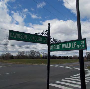
10 ROADWAY WestBranch Residential Development Traffic Impact Study TABLE 1 STUDY AREA ROADS CROSS- CLASSIFICATION SECTION AADT (vpd) SPEED LIMIT (mph) Davidson Concord Road Major Collector Two-Lane 8,4 45 Concord Road Minor Arterial Two-Lane 1, 45 East Rocky River Road Minor Collector Two-Lane 4,6 45 Robert Walker Drive Local Two-Lane No Data 25 Hudson Place Local Two-Lane No Data Not Posted Samuel Spencer Parkway Local Two-Lane No Data Not Posted Kimberly Road Local Two-Lane No Data Not Posted Bradford Park Drive Local Two-Lane No Data Not Posted Bailey Springs Drive Local Two-Lane No Data Not Posted Existing Roadway Conditions Existing lane configurations (number of traffic lanes on the intersection approach), storage capacities, and other intersection and roadway information was collected through field reconnaissance by Ramey Kemp and Associates, Inc. (RKA). Refer to Figure 3 for the existing lane configurations and traffic control at study intersections Future Roadway Conditions Based on coordination with NCDOT and the Town of Davidson, no offsite developments were identified to have an impact on the project study area. In addition, no approved roadway projects are expected to be constructed that would have an impact on the project study area Study Area and Existing Traffic Volumes The study area for the TIS was determined through coordination with NCDOT and the Town of Davidson and consists of the following intersections: 1. Davidson Concord Road and Concord Road / East Rocky River Road (unsignalized) 2. Davidson Concord Road and Robert Walker Drive (unsignalized) 5
11 WestBranch Residential Development Traffic Impact Study 3. Hudson Place and Samuel Spencer Parkway (unsignalized) 4. Hudson Place and Patrick Johnston Lane (unsignalized) 5. Hudson Place and Kimberly Road (unsignalized) 6. Bradford Park Drive and Robert Walker Drive (unsignalized) 7. Bailey Springs Drive and Bradford Park Drive (unsignalized) 8. Davidson Concord Road and Site Drive 1 (unsignalized full access) 9. Robert Walker Drive and Site Drive 2 (unsignalized full access) 1. Robert Walker Drive and Site Drive 3 (unsignalized full access) 11. Robert Walker Drive and Site Drive 4 (unsignalized full access) 12. Robert Walker Drive and Site Drive 5 (unsignalized full access) Existing traffic volumes were determined through traffic counts conducted during the AM peak period (7:-9: AM) and the PM peak period (4:-6: PM). A copy of the traffic count data can be found in Appendix B of this report. The peak hour traffic volumes were not balanced between intersections due to the locations of driveways throughout the network and the traffic at the study intersections peaking during different time periods. As suggested by NCDOT Congestion Management, existing movements with zero volume were converted to four vehicles per hour to prevent incorrect capacity calculations. Refer to Figure 4 for an illustration of the existing peak hour traffic volumes Study Area Adjacent Land Use Existing Land Uses The existing site is undeveloped. The surrounding land is primarily residential, institutional, and commercial Anticipated or Approved Future Development Based on coordination with the NCDOT and the Town of Davidson, no offsite developments were identified that would affect traffic operations within the study area. 6
12 4. PROJECTED TRAFFIC WestBranch Residential Development Traffic Impact Study 4.1. Site Traffic In order to determine the future traffic conditions after the proposed development is completed, an estimate of traffic projected to travel to / from the proposed development is required. The average weekday daily, AM peak hour, and PM peak hour site trips for this study were calculated based on the ITE Trip Generation Manual, 9th Edition Trip Generation The average weekday daily as well as AM and PM peak hour site trips for this study were calculated based on the Institute of Transportation Engineers (ITE) Trip Generation Manual, 9 th Edition. Table 2 summarizes the weekday trip generation. TABLE 2 PROPOSED SITE TRIP GENERATION Weekday Volumes (VPH) Land Use Size Units Daily AM Peak Hour PM Peak Hour Total In Out Total In Out Total Single Family Detached (21) 199 DU 1, Residential Townhouse (23) 17 DU Total Trips 2, (1) Based on ITE Trip Generation - 9th Edition Trip Distribution and Assignment The primary trip distribution percentages were developed based on existing traffic patterns, nearby land uses, employment centers, and engineering judgment. Figure 5 illustrates the proposed site trip distribution percentages. These trip distribution percentages were applied to the total new trip generation data to calculate the proposed site trip assignments shown in Figure 6. It should be noted that due to the geometry of the proposed site driveway, some traffic enters Site Drive 1 and travels through to Site Drive 5, and some traffic enters though the Hudson Place internal connection and travels to the site drives along Robert Walker Drive. 7
13 WestBranch Residential Development Traffic Impact Study 5. TRAFFIC ALYSIS 5.1. Traffic Analysis Scenarios Several scenarios were analyzed using traffic analysis software. Traffic operations during the weekday AM and PM peak hours were modeled for each scenario. The results of each scenario were compared in order to determine impacts from background traffic growth, and the proposed development. The following scenarios were modeled: 216 Existing 218 No-Build 218 Build 218 Build - Roundabout The 216 Existing scenario included the traffic characteristics that currently exist in the study area. Existing peak hour traffic volumes were determined from the intersection counts. No changes to the existing lane configurations were made. In accordance with the Davidson Planning Ordinance pedestrian and bicycle movements were included for all intersections. The 218 No-Build scenario was analyzed to determine the expected future traffic operations. A compounded growth rate of 2% per year was used to project the exiting traffic volumes to the future volumes. These projected volumes represent the 218 No-Build peak hour traffic volumes found in Figure 7. No changes to the existing lane configurations were made. In accordance with the Davidson Planning Ordinance pedestrian and bicycle movements were included for all intersections. The 218 Build scenario was compared to the 218 No-Build scenario to determine expected impacts caused by traffic created by the proposed site. This scenario included the same assumptions as the 218 No-Build scenario. The trips expected to be generated by the proposed site (Figure 6) were added to the 218 No-Build peak hour volumes (Figure 7) to determine the 218 Build peak hour traffic volumes. Refer to Figure 8 for the 218 Build peak hour traffic volumes. No changes to the existing lane configurations were made. In accordance with the Davidson Planning Ordinance pedestrian and bicycle movements were included for all 8
14 WestBranch Residential Development Traffic Impact Study intersections. Recommendations for improvements to the development were included in the traffic models. The 218 Build Roundabout scenario was included based on discussions with the Town of Davidson requesting analysis of the intersection of Davidson-Concord Road and Robert Walker Drive as a roundabout Traffic Analysis Procedure All study intersections (both unsignalized and roundabouts) were analyzed using the methodology outlined in the Highway Capacity Manual (HCM) published by the Transportation Research Board. The computer software packages, Synchro 9.1, SimTraffic 9.1, and Sidra Intersection 5.1 were used to complete the analyses for all of the study area intersections. Synchro was developed by Trafficware Corporation and allows the user to input data into the Synchro software and calculate the output based on methodologies in the HCM. SimTraffic creates a traffic simulation model from the Synchro inputs. SimTraffic was used in this study to determine expected queue lengths. Sidra Intersection 5.1 is a software package developed by Sidra Solutions that is used to analyze roundabouts. Sidra was used to model and analyze the existing roundabout at Davidson- Concord Road and Concord Road and the proposed conversion of the existing Davidson-Concord Road and Robert Walker Drive intersection into a roundabout. Analysis results for roundabout intersections provide delay, and level of service (LOS) for all movements and approaches. The overall intersection delay, and LOS is also provided. The capacity analysis for an unsignalized intersection does not provide an overall LOS for the intersection, but rather a LOS for movements and/or approaches that have a conflicting movement. The HCM defines capacity as the maximum hourly rate at which persons or vehicles can reasonably be expected to traverse a point or uniform section of a lane or roadway during a given time period under prevailing roadway, traffic, and control conditions. LOS is a term used to represent different driving conditions, and is defined as a qualitative measure describing operational conditions within a traffic stream, and their perception by motorists and/or 9
15 WestBranch Residential Development Traffic Impact Study passengers. LOS varies from Level A representing free flow, to Level F where greater vehicle delays are evident. Refer to Table 3 for HCM levels of service and related average control delay per vehicle for both signalized and unsignalized intersections. Control delay as defined by the HCM includes initial deceleration delay, queue move-up time, stopped delay, and final acceleration delay. As shown in Table 3, an average control delay of 4 seconds at a signalized intersection results in a LOS D operation. TABLE 3 HIGHWAY CAPACITY MANUAL - LEVELS OF SERVICE AND DELAY UNSIGLIZED INTERSECTION AVERAGE CONTROL LEVEL DELAY OF SERVICE PER VEHICLE A B C D E F (SECONDS) >5 SIGLIZED INTERSECTION LEVEL OF SERVICE A B C D E F AVERAGE CONTROL DELAY PER VEHICLE (SECONDS) > Mitigation Guidelines NCDOT has guidelines for determining when improvements may be needed by the developer. The District Engineer is responsible for the final determination of the improvements. NCDOT typically requires mitigation to be identified when developments are expected to impact the traffic operations as described below: Overall intersection or intersection approach delay increases by 25% or more. LOS degrades by at least one level LOS is F Synchro 95 th or SimTraffic maximum queue results are greater than the existing turn lane storage length 1
16 WestBranch Residential Development Traffic Impact Study 5.4. Capacity and Level of Service at Study Intersections Davidson-Concord Road and Concord Road / East Rocky River Road The intersection of Davidson-Concord Road and Concord Road was analyzed as a three-leg roundabout with existing lane configurations. Table 4 summarizes the capacity analysis results. Refer to Appendix C for the Sidra reports for this intersection. All SimTraffic reports can be found in Appendix O. Analysis indicates that the intersection will operate at an acceptable LOS in the 218 Build scenario. The addition of site traffic is expected to have a minor effect on the operation of the intersection. Minimal increases in delay and queues are expected. SimTraffic results show no queuing issues at the intersection. No improvements are recommended. Scenario 216 Existing 218 No-Build 218 Build Approach TABLE 4 ALYSIS SUMMARY OF DAVIDSON-CONCORD ROAD AND CONCORD ROAD / EAST ROCKY RIVER ROAD LOS AND DELAY Lane Configurations LOS AM Peak Hour Delay (seconds) Overall LOS (Delay) LOS PM Peak Hour Delay (seconds) EB 1 TH-RT A 7.6 A 7.7 B WB 1 LT-TH B 14.3 B 12.6 (11.4) NB 1 LT-RT B 12.3 B 12.5 EB 1 TH-RT A 7.7 A 7.9 B WB 1 LT-TH C 15.3 B 12.8 (11.7) NB 1 LT-RT B 12.4 B 12.6 EB 1 TH-RT A 7.8 A 8.3 B WB 1 LT-TH C 17.1 B 13.4 (12.2) NB 1 LT-RT B 12.3 B 12.7 Overall LOS (Delay) B (1.5) B (1.6) B (1.9) 11
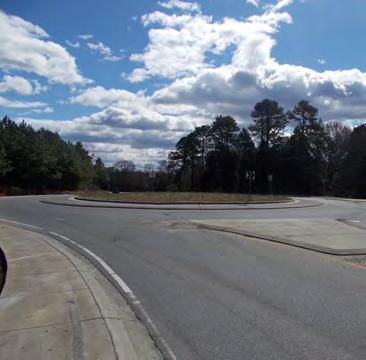
17 WestBranch Residential Development Traffic Impact Study Davidson-Concord Road and Robert Walker Drive The intersection of Davidson-Concord Road and Robert Walker Drive was analyzed as a four-leg unsignalized intersection with existing lane configurations. Table 5 summarizes the capacity analysis results. Refer to Appendix D for the Synchro reports and NCDOT turn warrants for this intersection. All SimTraffic reports can be found in Appendix O. Analysis indicates that the intersection will exceed the threshold for mitigation in the 218 Build scenario. The addition of site traffic is expected to increase the delays on the eastbound approach. In order to mitigate the impacts caused by the addition of the site traffic, it is recommended that a southbound right turn lane with 125 feet of full storage and adequate tapper be constructed at the intersection. Additional analysis intersection was performed using a roundabout as the traffic control at the intersection per discussions with the Town of Davidson. Analysis results that the single lane roundabout will operate efficiently under future build conditions. With a constant growth rate of 2%, the roundabout will operate effectively for 19 years before reaching capacity. Although the construction of a roundabout would accommodate future traffic needs, the conversion of this intersection to a roundabout is not recommended due to the high cost of construction, impact to neighboring properties, and the fact that no significant queues are expected at this intersection under build conditions as an unsignalized intersection. 12
18 Scenario 216 Existing 218 No-Build 218 Build 218 Build Improvements 218 Build - Roundabout Approach WestBranch Residential Development Traffic Impact Study TABLE 5 ALYSIS SUMMARY OF DAVIDSON-CONCORD ROAD AND ROBERT WALKER DRIVE LOS AND DELAY Lane Configurations LOS AM Peak Hour Delay (seconds) EB 2 1 LT-TH, 1 RT D 29.2 Overall LOS (Delay) LOS PM Peak Hour Delay (seconds) E 49.5 WB 2 1 LT-TH, 1 RT C C 2. NB 1 1 LT, 1 TH-RT A 8.5 A 8.5 SB 1 1 LT, 1 TH-RT A 8.1 A 8.2 EB 2 1 LT-TH, 1 RT D 32.9 F 61.5 WB 2 1 LT-TH, 1 RT C C 21.3 NB 1 1 LT, 1 TH-RT A 8.6 A 8.6 SB 1 1 LT, 1 TH-RT A 8.2 A 8.3 EB 2 1 LT-TH, 1 RT F 66.7 F 28.3 WB 2 1 LT-TH, 1 RT C D 28.3 NB 1 1 LT, 1 TH-RT A 8.7 A 9. SB 1 1 LT, 1 TH-RT A 8.2 A 8.3 EB 2 1 LT-TH, 1 RT F 56.1 F WB 2 1 LT-TH, 1 RT C D 27.9 NB 1 1 LT, 1 TH-RT A 8.7 A 9. SB 1 1 LT, 1 TH, 1 RT A 8.2 A 8.3 EB 1 LT-TH-RT B 14.6 B 14.2 WB 1 LT-TH-RT B 12.5 A B 12.1 NB 1 LT-TH-RT A 6.8 (7.9) A 7.7 SB 1 LT-TH-RT A 5.8 A Major street left-turn movement for unsignalized intersection. 2. Stop controlled approach for unsignalized intersection. 3. Overall intersection LOS is not provided for unsignalized intersections Bold marks improvement to approach Overall LOS (Delay) A (8.4) 13
19 WestBranch Residential Development Traffic Impact Study Hudson Place and Samuel Spencer Parkway The intersection of Hudson Place and Samuel Spencer Parkway was analyzed as a three-leg unsignalized intersection with existing lane configurations. Table 6 summarizes the capacity analysis results. Refer to Appendix E for the Synchro reports for this intersection. All SimTraffic reports can be found in Appendix O. Analysis indicates that the intersection will operate at an acceptable LOS in the 218 Build scenario. The addition of site traffic is expected to have a minor effect on the operation of the intersection. Minimal increases in delay and queues are expected. SimTraffic results show no queueing issues at the intersection. No improvements are recommended. Scenario TABLE 6 ALYSIS SUMMARY OF HUDSON PLACE AND SAMUEL SPENCER PARKWAY LOS AND DELAY Approach Lane Configurations LOS AM Peak Hour Delay (seconds) Overall LOS (Delay) LOS PM Peak Hour Delay (seconds) Overall LOS (Delay) 216 Existing 218 No-Build 218 Build WB 2 1 LT-RT A 8.4 A 8.5 NB 1 TH-RT SB 1 1 LT-TH A 3.1 A 2.2 WB 2 1 LT-RT A 8.5 A 8.5 NB 1 TH-RT SB 1 1 LT-TH A 3.1 A 2. WB 2 1 LT-RT A 8.5 A 8.6 NB 1 TH-RT SB 1 1 LT-TH A 3.8 A Major street left-turn movement for unsignalized intersection. 2. Stop controlled approach for unsignalized intersection. 3. Overall intersection LOS is not provided for unsignalized intersections Hudson Place and Patrick Johnston Lane The intersection of Hudson Place and Patrick Johnston Lane was analyzed as a three-leg unsignalized intersection with existing lane configurations. Table 7 summarizes the capacity analysis results. Refer to Appendix F for the Synchro reports for this intersection. All SimTraffic reports can be found in Appendix O. 14
20 WestBranch Residential Development Traffic Impact Study Analysis indicates that the intersection will operate at an acceptable LOS in the 218 Build scenario. The addition of site traffic is expected to have a minor effect on the operation of the intersection. Minimal increases in delay and queues are expected. SimTraffic results show no queueing issues at the intersection. No improvements are recommended. Scenario 216 Existing 218 No-Build 218 Build TABLE 7 ALYSIS SUMMARY OF HUDSON PLACE AND PATRICK JOHNSTON LANE LOS AND DELAY Approach Lane Configurations LOS AM Peak Hour Delay (seconds) Overall LOS (Delay) LOS PM Peak Hour Delay (seconds) EB 2 1 LT-RT A 7.2 A 6.9 A NB 2 1 LT-TH A 7.2 (7.1) A 7.2 SB 2 1 TH-RT A 6.9 A 7. EB 2 1 LT-RT A 7.2 A 7. A NB 2 1 LT-TH A 7.2 A 7.2 (7.1) SB 2 1 TH-RT A 7. A 7. EB 2 1 LT-RT A 7.2 A 6.9 A NB 2 1 LT-TH A 7.3 A 7.3 (7.2) SB 2 1 TH-RT A 7. A Major street left-turn movement for unsignalized intersection. 2. Stop controlled approach for unsignalized intersection. Overall LOS (Delay) A (7.1) A (7.1) A (7.1) 15
21 WestBranch Residential Development Traffic Impact Study Hudson Place and Kimberly Road The intersection of Hudson Place and Kimberly Road was analyzed as a three-leg unsignalized intersection with existing lane configurations. Table 8 summarizes the capacity analysis results. Refer to Appendix G for the Synchro reports for this intersection. All SimTraffic reports can be found in Appendix O. Analysis indicates that the intersection will operate at an acceptable LOS. The addition of site traffic is expected to have a minor effect on the operation of the intersection. Minimal increases in delay and queues are expected. SimTraffic results show no queueing issues at the intersection. No improvements are recommended. Scenario TABLE 8 ALYSIS SUMMARY OF HUDSON PLACE AND KIMBERLY ROAD LOS AND DELAY Approach Lane Configurations LOS AM Peak Hour Delay (seconds) Overall LOS (Delay) LOS PM Peak Hour Delay (seconds) Overall LOS (Delay) 216 Existing 218 No-Build 218 Build EB 1 1 LT-TH A 7.1 A 6.9 WB 1 TH-RT SB 2 1 LT-RT A 8.6 A 8.8 EB 1 1 LT-TH A 7.1 A 6.9 WB 1 TH-RT SB 2 1 LT-RT A 8.6 A 8.8 EB 1 1 LT-TH A 7.1 A 7. WB 1 TH-RT SB 2 1 LT-RT A 8.6 A Major street left-turn movement for unsignalized intersection. 2. Stop controlled approach for unsignalized intersection. 3. Overall intersection LOS is not provided for unsignalized intersections
22 WestBranch Residential Development Traffic Impact Study Bradford Park Drive and Robert Walker Drive The intersection of Bradford Park Drive and Robert Walker Drive was analyzed as a four-leg unsignalized intersection with existing lane configurations. Table 9 summarizes the capacity analysis results. Refer to Appendix H for the Synchro reports for this intersection. All SimTraffic reports can be found in Appendix O. Scenario 216 Existing 218 No-Build 218 Build Analysis indicates that the intersection will operate at an acceptable LOS. The addition of site traffic is expected to have a minor effect on the operation of the intersection. Minimal increases in delay and queues are expected. SimTraffic results show no queueing issues at the intersection. No improvements are recommended. Approach TABLE 9 ALYSIS SUMMARY OF BRADFORD PARK DRIVE AND ROBERT WALKER DRIVE LOS AND DELAY Lane Configurations LOS AM Peak Hour Delay (seconds) EB 2 1 LT-TH-RT A 7.1 Overall LOS (Delay) LOS PM Peak Hour Delay (seconds) A 7.4 WB 2 1 LT-TH-RT A 8. A A 8.4 NB 2 1 LT-TH-RT A 7. (7.6) A 7.4 SB 2 1 LT-TH-RT A 7.3 A 7.3 EB 2 1 LT-TH-RT A 7.1 A 7.5 WB 2 1 LT-TH-RT A 8.1 A A 8.5 NB 2 1 LT-TH-RT A 7. (7.6) A 7.5 SB 2 1 LT-TH-RT A 7.3 A 7.3 EB 2 1 LT-TH-RT A 7.2 A 7.6 WB 2 1 LT-TH-RT A 8.4 A A 8.9 NB 2 1 LT-TH-RT A 7.2 (7.9) A 7.8 SB 2 1 LT-TH-RT A 7.4 A Major street left-turn movement for unsignalized intersection. 2. Stop controlled approach for unsignalized intersection. Overall LOS (Delay) A (7.9) A (8.) A (8.3) 17
23 WestBranch Residential Development Traffic Impact Study Bailey Springs Drive and Bradford Park Drive The intersection of Bailey Springs Drive and Bradford Park Drive was analyzed as a three-leg unsignalized intersection with existing lane configurations. Table 1 summarizes the capacity analysis results. Refer to Appendix I for the Synchro reports for this intersection. All SimTraffic reports can be found in Appendix O. Analysis indicates that the intersection will operate at an acceptable LOS. The addition of site traffic is expected to have a minor effect on the operation of the intersection. Minimal increases in delay and queues are expected. SimTraffic results show no queueing issues at the intersection. No improvements are recommended. Scenario TABLE 1 ALYSIS SUMMARY OF BAILEY SPRINGS DRIVE AND BRADFORD PARK DRIVE LOS AND DELAY Approach Lane Configurations LOS AM Peak Hour Delay (seconds) Overall LOS (Delay) LOS PM Peak Hour Delay (seconds) Overall LOS (Delay) 216 Existing 218 No-Build 218 Build EB 1 TH-RT WB 1 1 LT-TH A A 7.3 NB 2 1 LT-RT A 9. A 9.6 EB 1 TH-RT WB 1 1 LT-TH A A 7.3 NB 2 1 LT-RT A 9. A 9.6 EB 1 TH-RT WB 1 1 LT-TH A A 7.4 NB 2 1 LT-RT A 9.1 A Major street left-turn movement for unsignalized intersection. 2. Stop controlled approach for unsignalized intersection. 3. Overall intersection LOS is not provided for unsignalized intersections
24 WestBranch Residential Development Traffic Impact Study Davidson-Concord Road and Site Drive 1 The intersection of Davison-Concord Road and Site Drive 1 was analyzed as a three-leg unsignalized intersection. Table 11 summarizes the capacity analysis results. Refer to Appendix J for the Synchro reports and NCDOT turn warrants for this intersection. All SimTraffic reports can be found in Appendix O. Analysis indicates that the intersection will operate at an acceptable LOS in the 218 Build scenario. SimTraffic results show no queueing issues at the intersection. According to NCDOT warrants for left and right turn lanes, no turn lanes at the intersection are warranted. Based on preliminary field analysis, the location of this driveway provides approximately 475 of sight distance on the northbound approach which meets the acceptable levels for a 45 mph road. Further verification will be needed once the final location of the site drive is set. It is recommended that Site Drive 1 be constructed with one ingress lane and one shared left / right egress lane. Scenario 218 Build TABLE 11 ALYSIS SUMMARY OF DAVIDSON-CONCORD ROAD AND SITE DRIVE 1 LOS AND DELAY Approach Lane Configurations LOS AM Peak Hour Delay (seconds) Overall LOS (Delay) LOS PM Peak Hour Delay (seconds) EB 2 1 LT-RT B 14.3 B 13.7 NB 1 1 LT-TH A.1 3 A.5 SB 1 TH-RT Major street left-turn movement for unsignalized intersection. 2. Stop controlled approach for unsignalized intersection. 3. Overall intersection LOS is not provided for unsignalized intersections Overall LOS (Delay) 3 19
25 WestBranch Residential Development Traffic Impact Study Robert Walker Drive and Site Drive 2 The intersection of Robert Walker Drive and Site Drive 2 was analyzed as a three-leg unsignalized intersection. Table 12 summarizes the capacity analysis results. Refer to Appendix K for the Synchro reports for this intersection. All SimTraffic reports can be found in Appendix O. Analysis indicates that the intersection will operate at an acceptable LOS in the 218 Build scenario. SimTraffic results show no queueing issues at the intersection. After reviewing NCDOT warrants for left and right turn lanes, no turn lanes on Robert Walker Drive at the intersection are recommended. It is recommended that Site Drive 2 be constructed with one ingress lane and one shared left / right egress lane. Scenario 218 Build TABLE 12 ALYSIS SUMMARY OF ROBERT WALKER DRIVE AND SITE DRIVE 2 LOS AND DELAY Approach Lane Configurations LOS AM Peak Hour Delay (seconds) Overall LOS (Delay) LOS PM Peak Hour Delay (seconds) EB 1 1 LT-TH A.1 A.3 WB 1 TH-RT SB 2 1 LT-RT B 1.1 B Major street left-turn movement for unsignalized intersection. 2. Stop controlled approach for unsignalized intersection. 3. Overall intersection LOS is not provided for unsignalized intersections Overall LOS (Delay) 3 2
26 WestBranch Residential Development Traffic Impact Study Robert Walker Drive and Site Drive 3 The intersection of Robert Walker Drive and Site Drive 3 was analyzed as a three-leg unsignalized intersection. Table 13 summarizes the capacity analysis results. Refer to Appendix L for the Synchro reports for this intersection. All SimTraffic reports can be found in Appendix O. Analysis indicates that the intersection will operate at an acceptable LOS in the 218 Build scenario. SimTraffic results show no queueing issues at the intersection. After reviewing NCDOT warrants for left and right turn lanes, no turn lanes on Robert Walker Drive at the intersection are recommended. It is recommended that Site Drive 3 be constructed with one ingress lane and one shared left / right egress lane. Scenario 218 Build TABLE 13 ALYSIS SUMMARY OF ROBERT WALKER DRIVE AND SITE DRIVE 3 LOS AND DELAY Approach Lane Configurations LOS AM Peak Hour Delay (seconds) Overall LOS (Delay) LOS PM Peak Hour Delay (seconds) EB 1 TH-RT WB 1 1 LT-TH A.1 3 A.3 NB 2 1 LT-RT A 9.8 B Major street left-turn movement for unsignalized intersection. 2. Stop controlled approach for unsignalized intersection. 3. Overall intersection LOS is not provided for unsignalized intersections Overall LOS (Delay) 3 21
27 WestBranch Residential Development Traffic Impact Study Robert Walker Drive and Site Drive 4 The intersection of Robert Walker Drive and Site Drive 4 was analyzed as a four-leg unsignalized intersection. Table 14 summarizes the capacity analysis results. Refer to Appendix M for the Synchro reports for this intersection. All SimTraffic reports can be found in Appendix O. Analysis indicates that the intersection will operate at an acceptable LOS in the 218 Build scenario. SimTraffic results show no queueing issues at the intersection. After reviewing NCDOT warrants for left and right turn lanes, no turn lanes on Robert Walker Drive at the intersection are recommended. It is recommended that Site Drive 4 be constructed with one ingress lane and one shared left / through / right egress lane. Scenario 218 Build TABLE 14 ALYSIS SUMMARY OF ROBERT WALKER DRIVE AND SITE DRIVE 4 LOS AND DELAY Approach Lane Configurations LOS AM Peak Hour Delay (seconds) EB 1 1 LT-TH-RT A.1 Overall LOS (Delay) LOS PM Peak Hour Delay (seconds) A.3 WB 1 1 LT-TH-RT A.1 3 A.3 NB 2 1 LT-TH-RT A 9.5 B 1.1 SB 2 1 LT-TH-RT B 1.4 B Major street left-turn movement for unsignalized intersection. 2. Stop controlled approach for unsignalized intersection. 3. Overall intersection LOS is not provided for unsignalized intersections Overall LOS (Delay) 3 22
28 WestBranch Residential Development Traffic Impact Study Robert Walker Drive and Site Drive 5 The intersection of Robert Walker Drive and Site Drive 5 was analyzed as a four-leg unsignalized intersection. Table 15 summarizes the capacity analysis results. Refer to Appendix N for the Synchro reports for this intersection. All SimTraffic reports can be found in Appendix O. Scenario 218 Build Analysis indicates that the intersection will operate at an acceptable LOS in the 218 Build scenario. SimTraffic results show no queueing issues at the intersection. After reviewing NCDOT warrants for left and right turn lanes, no turn lanes on Robert Walker Drive at the intersection are recommended. It is recommended that Site Drive 5 be constructed with one ingress lane and one shared left / through / right egress lane. TABLE 15 ALYSIS SUMMARY OF ROBERT WALKER DRIVE AND SITE DRIVE 5 LOS AND DELAY Approach Lane Configurations LOS AM Peak Hour Delay (seconds) EB 1 1 LT-TH-RT A.4 Overall LOS (Delay) LOS PM Peak Hour Delay (seconds) A.8 WB 1 1 LT-TH-RT A. 3 A.1 NB 2 1 LT-TH-RT B 1.2 B 12.1 SB 2 1 LT-TH-RT B 1.5 B Major street left-turn movement for unsignalized intersection. 2. Stop controlled approach for unsignalized intersection. 3. Overall intersection LOS is not provided for unsignalized intersections Pedestrian and Bicycle Impacts The construction of the WestBranch Residential Development will not have an adverse effect on the existing levels of service for pedestrian and bicycles. The proposed development is expected to increase the number of pedestrian and bicycle volumes within the area surrounding the development; however sidewalks will be constructed along the frontage of development on Robert Walker Drive and Davidson-Concord Road increasing the pedestrian and bicycle connectivity throughout the surrounding area. Overall LOS (Delay) 3 23
29 WestBranch Residential Development Traffic Impact Study 6. CONCLUSIONS This report summarizes the findings of the Traffic Impact Study (TIS) that was performed for the proposed West Branch Residential Development to be located along the west side of Davidson Concord Road south of Concord Road in Davidson, North Carolina. The purpose of this study is to determine the potential impact to the surrounding transportation system caused by the traffic generated by the proposed development. The proposed site includes 199 detached houses and 17 townhomes. The project is expected to be completed by 218. Access to the site is anticipated via a proposed full access driveway on Davidson Concord Road and four proposed full access driveways on Robert Walker Drive Summary of Recommended Improvements Based on the analysis results, minor impacts are expected by the proposed development. No queue issues are expected. Refer to Figure 9 for the recommended lane configurations. The following improvements have been recommended to be constructed by the developer: Davidson-Concord Road and Robert Walker Drive Construct a southbound right turn lane on Davidson-Concord Road with 125 of full width storage and appropriate taper. Davidson-Concord Road and Site Drive 1 Construct Site Drive 1 as a full access driveway with one ingress and one egress lane on the eastbound approach. Robert Walker Drive and Site Drive 2 Construct Site Drive 2 as a full access driveway with one ingress and one egress lane on the southbound approach. 24
30 WestBranch Residential Development Traffic Impact Study Robert Walker Drive and Site Drive 3 Construct Site Drive 3 as a full access driveway with one ingress and one egress lane on the northbound approach. Robert Walker Drive and Site Drive 4 Construct Site Drive 4 as a full access driveway with one ingress and one egress lane on both the southbound and northbound approaches. Robert Walker Drive and Site Drive 5 Construct Site Drive 5 as a full access driveway with one ingress and one egress lane on both the southbound and northbound approaches. 25
31 WestBranch Residential Development -Traffic Impact Study TECHNICAL APPENDIX
32 WestBranch Residential Development -Traffic Impact Study APPENDIX A FIGURES

33 Robert Walker Drive Concord Road Proposed Site Location SD 5 SD 5 Proposed Site Location SD 4 SD 3 SD 2 SD 2 Proposed Site Proposed Site Location Drives SD 1 LEGEND Proposed Site Location Study Intersection Davidson-Concord Road N WestBranch Residential Development Davidson, NC Site Location Map Scale: Not to Scale Figure 1

34 Scale: Not to Scale N Proposed Site Location SD 5 SD 4 SD 3 SD 5 SD 4 SD 2 Davidson-Concord Road Preliminary Site Plan Figure 2 Kimberly Road Patrick Johnston Lane Hudson Place Concord Road Samuel Spencer Parkway Robert Walker Drive Bradford Park Drive Bailey Springs Drive Proposed Site Location SD 1 WestBranch Residential Development Davidson, NC
35 125' Scale: Not to Scale N Proposed Site Location SD 5 SD 4 SD 3 SD 5 SD 4 SD 2 15' 15' Davidson-Concord Road 75' 216 Existing Lane Configurations Figure 3 Kimberly Road Patrick Johnston Lane Hudson Place Concord Road Samuel Spencer Parkway Robert Walker Drive Bradford Park Drive Bailey Springs Drive LEGEND Unsignalized Intersection Roundabout Existing Lane X' Storage (In Feet) Proposed Site Location WestBranch Residential Development Davidson, NC SD 1
36 75 / 1 7 / / 9 Scale: Not to Scale N Proposed Site Location SD 5 SD 5 SD 4 SD 4 SD 3 SD 2 1 / / / 32 6 / / / 21 Davidson-Concord Road 25 / / / Existing Peak Hour Traffic Volumes Figure 4 Patrick Johnston Lane Kimberly Road 12 / 4 1 / 4 Hudson Place Concord Road 73 / / / / / / 128 Robert Walker Drive Bradford Park Drive 4 / 4 2 / 18 Samuel Spencer Parkway 8 / / / 4 18 / / 18 4 / / 31 1 / 2 11 / 8 2 / 7 11 / 13 8 / 5 9 / 5 18 / / 14 1 / 4 1 / 11 4 / 4 4 / / / 4 3 / 3 3 / 2 3 / 2 3 / 3 61 / / 4 3 / 2 7 / 3 5 / 12 4 / / 121 Bailey Springs Drive Proposed Site Location SD 1 X / Y LEGEND Unsignalized Intersection Roundabout AM / PM Peak Hour Traffic WestBranch Residential Development Davidson, NC
37 (37%) (4%) (16%) Scale: Not to Scale N Proposed Site Location SD 5 SD 4 SD 3 SD 5 SD 4 SD 2 Davidson-Concord Road 25% 9% 16% 4% (16%) (4%) (9%) 16% (3%) (1%) 37% 3% 4% 1% 1% 5% Proposed Site Trip Distribution Percentages Figure 5 Patrick Johnston Lane 5% 5% Kimberly Road Hudson Place Concord Road 3% 3% 1% Robert Walker Drive Bradford Park Drive Samuel Spencer Parkway 1% 8% 2% (2%) 5% (1%) (1%) 3% 7% (29%) 2% (2%) (1%) 1% (5%) 4% (28%) 28% (4%) (8%) 1% 9% 29% (7%) 5% 4% (43%) 3% (3%) (4%) 43% (4%) 4% (4%) (1%) 4% (47%) 1% 47% 2% 2% (3%) (9%) (5%) 5% 5% (5%) (3%) (1%) 5% 1% 1% (5%) (5%) (1%) (1%) (2%) (2%) 2% Bailey Springs Drive LEGEND Unsignalized Intersection Roundabout Proposed Site Location SD 1 X% Entering Trip Distributions (Y%) Exiting Trip Distributions XX% Regional Trip Distributions WestBranch Residential Development Davidson, NC
38 56 / 34 6 / 4 24 / 15 Scale: Not to Scale N Proposed Site Location SD 5 SD 4 SD 3 SD 5 SD 4 SD 2 4 / 15 7 / 26 2 / 7 24 / 15 6 / 4 14 / 8 7 / 26 4 / 3 2 / 1 17 / 6 2 / 5 Davidson-Concord Road 2 / 6 / 2 Proposed Site Trip Assignment Figure 6 Patrick Johnston Lane Kimberly Road Hudson Place Concord Road 14 / 49 Robert Walker Drive Bradford Park Drive Samuel Spencer Parkway 5 / 16 3 / 13 1 / 3 3 / 3 4 / 9 2 / 1 15 / 9 8 / 7 44 / 32 1 / 5 47 / 38 1 / 3 3 / 2 4 / 3 13 / 8 4 / / 53 2 / 8 8 / 5 67 / 46 1 / 5 5 / 2 6 / 4 25 / 74 2 / 6 6 / 4 15 / 9 45 / / 9 5 / / / 7 / 2 2 / 6 71 / 44 5 / / 76 9 / 32 9 / 32 2 / 8 2 / 8 8 / 5 2 / 8 4 / 16 4 / 16 7 / 4 8 / 5 15 / 9 15 / 9 3 / 19 3 / 19 Bailey Springs Drive Proposed Site Location SD 1 X / Y LEGEND Unsignalized Intersection Roundabout AM / PM Peak Hour Traffic WestBranch Residential Development Davidson, NC
39 78 / 14 7 / / 9 Scale: Not to Scale N Proposed Site Location SD 5 SD 5 SD 4 SD 4 SD 3 SD 2 1 / / / / / / 22 Davidson-Concord Road 26 / / / No-Build Peak Hour Traffic Volumes Figure 7 Patrick Johnston Lane Kimberly Road 12 / 4 1 / 4 Hudson Place Concord Road 76 / / / / / / 133 Robert Walker Drive Bradford Park Drive 4 / 4 21 / 19 Samuel Spencer Parkway 8 / / / 4 19 / / 19 4 / / 32 1 / 2 11 / 8 2 / 7 11 / 14 8 / 5 9 / 5 19 / / 15 1 / 4 1 / 11 4 / 4 4 / / / 4 3 / 3 3 / 2 3 / 2 3 / 3 63 / / 4 3 / 2 7 / 3 5 / 12 4 / / 126 Bailey Springs Drive Proposed Site Location SD 1 X / Y LEGEND Unsignalized Intersection Roundabout AM / PM Peak Hour Traffic WestBranch Residential Development Davidson, NC
40 Scale: Not to Scale N Proposed Site Location SD 5 SD 4 SD 3 SD 5 SD 4 SD 2 4 / / / / 43 6 / 4 14 / 8 17 / / 37 9 / / / / 22 Davidson-Concord Road 26 / / / Build Peak Hour Traffic Volumes Figure 8 Patrick Johnston Lane Kimberly Road 12 / 4 1 / 4 Hudson Place Concord Road 76 / / / / 149 Robert Walker Drive Bradford Park Drive 4 / 4 21 / 19 Samuel Spencer Parkway 8 / / / / / 3 3 / 3 4 / 9 2 / 1 1 / / 18 1 / 3 3 / 2 / 8 / / / 5 5 / 2 6 / 4 15 / 9 8 / 7 44 / / / 16 / 2 4 / 3 / 13 / 8 4 / / 26 2 / / / 6 6 / 4 15 / 9 7 / 4 21 / / 27 4 / / 37 1 / / / / 8 4 / / / / 9 27 / / 24 1 / 4 1 / 11 4 / 4 4 / / / 4 3 / 3 3 / 2 3 / 2 3 / 3 72 / / 4 3 / 2 7 / 3 5 / 12 4 / / / / / / / / 33 4 / 24 Bailey Springs Drive Proposed Site Location SD 1 X / Y LEGEND Unsignalized Intersection Roundabout AM / PM Peak Hour Traffic WestBranch Residential Development Davidson, NC
41 Scale: Not to Scale N Proposed Site Location SD 5 SD 4 SD 3 SD 5 SD 4 SD 2 15' 125' 125' 15' Davidson-Concord Road 75' Recommended Lane Configurations Figure 9 Kimberly Road Patrick Johnston Lane Hudson Place Concord Road Samuel Spencer Parkway Robert Walker Drive Bradford Park Drive Bailey Springs Drive LEGEND Unsignalized Intersection Roundabout Existing Lane X' Storage (In Feet) Improvement By Developer Proposed Site Location WestBranch Residential Development Davidson, NC SD 1
42 WestBranch Residential Development -Traffic Impact Study APPENDIX B TRAFFIC COUNT DATA
43 Type of peak hour being reported: Intersection Peak Method for determining peak hour: Total Entering Volume LOCATION: Davidson-Concord Rd -- Concord Rd/E Rocky Diver Rd QC JOB #: CITY/STATE: Davidson, NC DATE: Wed, Feb Peak-Hour: 7:3 AM -- 8:3 AM Peak 15-Min: 7:3 AM -- 7:45 AM Min Count Davidson-Concord Rd Davidson-Concord Rd Concord Rd/E Rocky Diver RdConcord Rd/E Rocky Diver Rd Total Hourly Period (Northbound) (Southbound) (Eastbound) (Westbound) Totals Beginning At Left Thru Right U Left Thru Right U Left Thru Right U Left Thru Right U 7: AM :15 AM :3 AM :45 AM : AM :15 AM :3 AM :45 AM Peak 15-Min Northbound Southbound Eastbound Westbound Flowrates Left Thru Right U Left Thru Right U Left Thru Right U Left Thru Right U Total All Vehicles Heavy Trucks Pedestrians Bicycles Railroad Stopped Buses Comments: Report generated on 2/22/216 12:35 PM SOURCE: Quality Counts, LLC (
44 Type of peak hour being reported: Intersection Peak Method for determining peak hour: Total Entering Volume LOCATION: Davidson-Concord Rd -- Concord Rd/E Rocky River Rd QC JOB #: CITY/STATE: Davidson, NC DATE: Tue, Feb Peak-Hour: 5: PM -- 6: PM Peak 15-Min: 5:3 PM -- 5:45 PM Min Count Davidson-Concord Rd Davidson-Concord Rd Concord Rd/E Rocky River RdConcord Rd/E Rocky River Rd Total Hourly Period (Northbound) (Southbound) (Eastbound) (Westbound) Totals Beginning At Left Thru Right U Left Thru Right U Left Thru Right U Left Thru Right U 4: PM :15 PM :3 PM :45 PM : PM :15 PM :3 PM :45 PM : PM :15 PM Peak 15-Min Northbound Southbound Eastbound Westbound Flowrates Left Thru Right U Left Thru Right U Left Thru Right U Left Thru Right U Total All Vehicles Heavy Trucks Pedestrians Bicycles Railroad Stopped Buses Comments: Report generated on 2/22/216 12:35 PM SOURCE: Quality Counts, LLC (
Traffic Impact Analysis Walton Acres at Riverwood Athletic Club Clayton, NC
 Traffic Impact Analysis Walton Acres at Riverwood Athletic Club Clayton, NC 1. TABLE OF CONTENTS INTRODUCTION...1 1.1. Site Location and Study Area...1 1.2. Proposed Land Use and Site Access...2 1.3.
Traffic Impact Study Little Egypt Road Development Denver, North Carolina June 2017
 Traffic Impact Study Little Egypt Road Development Denver, North arolina June 2017 N. Little Egypt Road DQ\ QDQFLQJ VDOHV RU RWKHU SHUIRUPDQFH EDVHG FULWHULD Proposed Site Driveways Site Driveway 1 TRAFFI
Traffic Impact Analysis Chatham County Grocery Chatham County, NC
 Chatham County Grocery Chatham County, NC TABLE OF CONTENTS 1. INTRODUCTION... 1 1.1. Location and Study Area... 1 1.2. Proposed Land Use and Access... 2 1.3. Adjacent Land Uses... 2 1.4. Existing ways...
Walton Acres at Riverwood Athletic Club Clayton, North Carolina
 9. CONCLUSIONS This Traffic Impact Analysis Update was conducted to determine the potential traffic impacts of the proposed Walton Acres at Riverwood Athletic Club residential development, located east
List of Attachments. Location Map... Site Plan... City of Lake Elsinore Circulation Element... City of Lake Elsinore Roadway Cross-Sections...
 List of Attachments Exhibits Location Map... Site Plan... City of Lake Elsinore Circulation Element... City of Lake Elsinore Roadway Cross-Sections... Existing Lane Geometry and Traffic Controls... Existing
Traffic Impact Study. Westlake Elementary School Westlake, Ohio. TMS Engineers, Inc. June 5, 2017
 TMS Engineers, Inc. Traffic Impact Study Westlake Elementary School Westlake, Ohio June 5, 2017 Prepared for: Westlake City Schools - Board of Education 27200 Hilliard Boulevard Westlake, OH 44145 TRAFFIC
DRAFT Davidson Elementary School Expansion Transportation Impact Analysis
 DRAFT Davidson Elementary School Expansion Transportation Impact Analysis Prepared for: Town of Davidson 216 S. Main Street Davidson, NC 28036 Prepared by: Stantec Consulting Services Inc. 2127 Ayrsley
THIS PAGE LEFT BLANK INTENTIONALLY
 GA SR 25 Spur at Canal Road Transportation Impact Analysis PREPARED FOR GLYNN COUNTY, GEORGIA 1725 Reynolds Street, Suite 300 Brunswick, Georgia 31520 PREPARED BY 217 Arrowhead Boulevard Suite 26 Jonesboro,
TRAFFIC STUDY GUIDELINES Clarksville Street Department
 TRAFFIC STUDY GUIDELINES Clarksville Street Department 9/1/2009 Introduction Traffic studies are used to help the city determine potential impacts to the operation of the surrounding roadway network. Two
TRANSPORTATION ANALYSIS REPORT US Route 6 Huron, Erie County, Ohio
 TRANSPORTATION ANALYSIS REPORT US Route 6 Huron, Erie County, Ohio December 12, 2012 Prepared for: The City of Huron 417 Main Huron, OH 44839 Providing Practical Experience Technical Excellence and Client
5858 N COLLEGE, LLC N College Avenue Traffic Impact Study
 5858 N COLLEGE, LLC nue Traffic Impact Study August 22, 2016 Contents Traffic Impact Study Page Preparer Qualifications... 1 Introduction... 2 Existing Roadway Conditions... 5 Existing Traffic Conditions...
PINESTONE TRAFFIC IMPACT STUDY Travelers Rest, South Carolina
 PINESTONE TRAFFIC IMPACT STUDY Travelers Rest, South Carolina Prepared for Longbranch Development Prepared by January 13, 219 ii Table of Contents Subject Page Signature Page... i Table of Contents...
TRAFFIC IMPACT STUDY And A TRAFFIC SIGNAL WARRANT ANALYSIS FOR A SENIOR LIVING AND APARTMENT DEVELOPMENT
 TRAFFIC IMPACT STUDY And A TRAFFIC SIGNAL WARRANT ANALYSIS FOR A SENIOR LIVING AND APARTMENT DEVELOPMENT DEERFIELD TOWNSHIP, WARREN COUNTY, OHIO Nantucket Circle and Montgomery Road () Prepared for: ODLE
1609 E. FRANKLIN STREET HOTEL TRAFFIC IMPACT STUDY EXECUTIVE SUMMARY
 1609 E. FRANKLIN STREET HOTEL TRAFFIC IMPACT STUDY EXECUTIVE SUMMARY Prepared for: The Town of Chapel Hill Public Works Department Traffic Engineering Division Prepared by: HNTB North Carolina, PC 343
Walmart (Store # ) 60 th Street North and Marion Road Sioux Falls, South Dakota
 60 th Street North and Marion Road Sioux Falls, South Dakota") Walmart (Store #4865-00) 60 th Street North and Marion Road Sioux Falls, South Dakota Prepared for: Wal-Mart Stores, Inc. Bentonville, Arkansas Prepared by: Kimley-Horn and Associates, Inc. ã2013 Kimley-Horn
Walmart (Store #4865-00) 60 th Street North and Marion Road Sioux Falls, South Dakota Prepared for: Wal-Mart Stores, Inc. Bentonville, Arkansas Prepared by: Kimley-Horn and Associates, Inc. ã2013 Kimley-Horn
Shockoe Bottom Preliminary Traffic and Parking Analysis
 Shockoe Bottom Preliminary Traffic and Parking Analysis Richmond, Virginia August 14, 2013 Prepared For City of Richmond Department of Public Works Prepared By 1001 Boulders Pkwy Suite 300, Richmond, VA
Table of Contents FIGURES TABLES APPENDICES. Traffic Impact Study Hudson Street Parking Garage MC Project No.: A Table of Contents
 Traffic Impact Study Hudson Street Parking Garage MC Project No.: 151714A Table of Contents Table of Contents I. INTRODUCTION... 2 II. EXISTING CONDITIONS... 5 III. 215 EXISTING TRAFFIC CONDITIONS... 6
FRONT RANGE CROSSINGS TRAFFIC IMPACT STUDY
 FRONT RANGE CROSSINGS TRAFFIC IMPACT STUDY Prepared for: City of Thornton And Colorado Department of Transportation Prepared by: 11 Blake Street, Suite 2 Denver, Colorado 822 Contact: Brian Bern, PE, PTOE
Glenn Avenue Corridor Traffic Operational Evaluation
 Glenn Avenue Corridor Traffic Operational Evaluation PREPARED FOR: THE CITY OF AUBURN PREPARED BY: DECEMBER 2007 Glenn Avenue Corridor Study--Auburn, Alabama TABLE OF CONTENTS Introduction... 1 Background
Troutbeck Farm Development
 Troutbeck Farm Development Willistown Township, Chester County PA For Submission To: Willistown Township Last Revised: October, 4 TPD# INLM.A. 5 E. High Street Suite 65 Pottstown, PA 9464 6.36.3 TPD@TrafficPD.com
Highway 111 Corridor Study
 Highway 111 Corridor Study June, 2009 LINCOLN CO. HWY 111 CORRIDOR STUDY Draft Study Tea, South Dakota Prepared for City of Tea Sioux Falls Metropolitan Planning Organization Prepared by HDR Engineering,
Bistro 6. City of Barrie. Traffic Impact Study for Pratt Hansen Group Inc. Type of Document: Final Report. Project Number: JDE 1748
 City of Barrie Traffic Impact Study for Pratt Hansen Group Inc. Type of Document: Final Report Project Number: JDE 1748 Date Submitted: June 12 th, 2017 06/12/17 John Northcote, P.Eng. Professional License
Project Report. South Kirkwood Road Traffic Study. Meadows Place, TX October 9, 2015
 Meadows Place, TX October 9, 2015 Contents 1 Introduction... 1 2 Data Collection... 1 3 Existing Roadway Network... 2 4 Traffic Volume Development... 2 5 Warrant Analysis... 3 6 Traffic Control Alternative
Transportation Impact Study for Abington Terrace
 Transportation Impact Study for Abington Terrace Abington Township, Montgomery County, PA Sandy A. Koza, P.E., PTOE PA PE License Number PE059911 Prepared by McMahon Associates, Inc. 425 Commerce Drive,
Road Conversion Study Plumas Street
 Plumas Street Phase I Submitted to The Regional Transportation Commission of Washoe County Submitted by Zong Tian, Ph.D., P.E. Saeedeh Farivar Haiyuan Li, Ph.D. Center for Advanced Transportation Education
TRAFFIC IMPACT STUDY. Creekside Thornton, Colorado. For. August 2015 November 2015 Revised: August Prepared for:
 TRAFFIC IMPACT STUDY For Creekside Thornton, Colorado August 215 November 215 Revised: August 216 Prepared for: Jansen Strawn Consulting Engineers 45 West 2 nd Avenue Denver, Colorado 8223 Prepared by:
NO BUILD TRAFFIC OPERATIONS
 3. 23 NO BUILD TRAFFIC OPERATIONS This section addresses the operations of the transportation system and details how it would be expected to function under year 23 No Build conditions with the projected
Evaluation of M-99 (Broad Street) Road Diet and Intersection Operational Investigation
 Road Diet and Intersection Operational Investigation") Evaluation of M-99 (Broad Street) Road Diet and Intersection Operational Investigation City of Hillsdale, Hillsdale County, Michigan June 16, 2016 Final Report Prepared for City of Hillsdale 97 North Broad
Evaluation of M-99 (Broad Street) Road Diet and Intersection Operational Investigation City of Hillsdale, Hillsdale County, Michigan June 16, 2016 Final Report Prepared for City of Hillsdale 97 North Broad
TRAFFIC ASSESSMENT River Edge Colorado
 TRAFFIC ASSESSMENT River Edge Colorado Submitted by: Fehr & Peers 621 17th Street, Ste. 231 Denver, CO 8293 (33) 296-43 December, 21 App. M-2 Traffic Assessment River Edge Colorado December 21 TABLE OF
REDEVELOPMENT TRAFFIC IMPACT STUDY
 REDEVELOPMENT TRAFFIC IMPACT STUDY For Wendy s Parker, Colorado January 215 Prepared for: Sterling Design Associates, LLC 29 W. Littleton Boulevard #3 Littleton, Colorado 812 Prepared by: 1233 Airport
Chapter 4 Traffic Analysis
 Chapter 4 Traffic Analysis PURPOSE The traffic analysis component of the K-68 Corridor Management Plan incorporates information on the existing transportation network, such as traffic volumes and intersection
Figure 1: Vicinity Map of the Study Area
 ARIZONA TEXAS NEW MEXICO OKLAHOMA May 5, 2016 Mr. Anthony Beach, P.E. BSP Engineers 4800 Lakewood Drive, Suite 4 Waco, Texas 76710 Re: Intersection and Access Analysis along Business 190 in Copperas Cove
TRAFFIC IMPACT ANALYSIS
 TRAFFIC IMPACT ANALYSIS DRAFT 4401 BARCLAY DOWNS DRIVE Barclay Downs Drive Bet. Carnegie Boulevard & Bulfinch Road Charlotte, North Carolina REZONING PETITION #TBD for ZOM Carolinas June 2016 629-001 (C-2165)
Marina Loft (DRC 51-R-12)
") Marina Loft (DRC 51-R-12) traffic study prepared for: Cymbal Development OCtober 2012 Traf Tech October 1, 2012 Mr. Asi Cymbal - President Cymbal Development 3470 North Miami Avenue Upper Suite Miami,
Marina Loft (DRC 51-R-12) traffic study prepared for: Cymbal Development OCtober 2012 Traf Tech October 1, 2012 Mr. Asi Cymbal - President Cymbal Development 3470 North Miami Avenue Upper Suite Miami,
TRAFFIC IMPACT STUDY
 TRAFFIC IMPACT STUDY for the GLEN ELLEN COUNTRY CLUB SENIOR RESIDENTIAL REDEVELOPMENT 84 Millis, Massachusetts Prepared by: McMahon Associates, Inc. Prepared for: Toll Brothers, Inc. August 216 DRAFT
Draft Report. Traffic Impact Study. Superstore, Wal-Mart, and Kent Development. Yarmouth, Nova Scotia. Prepared for
 oad & Traffic Management Road & Traffic Management R Atlantic Traffic Engineering Specialists Draft Report Traffic Impact Study Superstore, Wal-Mart, and Kent Development Yarmouth, Nova Scotia Prepared
NEW YORK CENTRAL PARK SUBDIVISION BLAIS STREET/ST-PIERRE STREET EMBRUN, ONTARIO TRAFFIC IMPACT STUDY. Prepared for:
 NEW YORK CENTRAL PARK SUBDIVISION BLAIS STREET/ST-PIERRE STREET EMBRUN, ONTARIO TRAFFIC IMPACT STUDY Prepared for: Solidex Holdings Limited & Investissement Maurice Lemieux Investments Attn: Mr. Anthony
INDUSTRIAL BUILDING 3009 HAWTHORNE ROAD CITY OF OTTAWA TRANSPORTATION OVERVIEW REVISED. Prepared for: Canada Inc.
 INDUSTRIAL BUILDING 3009 HAWTHORNE ROAD CITY OF OTTAWA TRANSPORTATION OVERVIEW REVISED Prepared for: 7849648 Canada Inc. Octiober 1, 2015 114-598 Overview_2.doc D. J. Halpenny & Associates Ltd. Consulting
Appendix C. NORTH METRO STATION AREA TRAFFIC IMPACT STATEMENT 88th Avenue Station
 Appendix C NORTH METRO STATION AREA TRAFFIC IMPACT STATEMENT 88th Avenue Station Prepared for: Regional Transportation Department and URS Corporation as part of the North Metro EIS David Evans and Associates,
EXECUTIVE SUMMARY. Page 1 of 6
 EXECUTIVE SUMMARY The purpose of this report is to identify conformance with the original traffic impact study for the proposed retail development on Lot 5 of Riverdale Retail Filing No. 1 located on the
Traffic Circulation Study for Neighborhood Southwest of Mockingbird Lane and Airline Road, Highland Park, Texas
 ARIZONA TEXAS NEW MEXICO OKLAHOMA February 13, 2015 Mr. Meran Dadgostar P.E., R.S. Town of Highland Park 4700 Drexel Dr. Highland Park, Texas 75205 Re: Traffic Circulation Study for Neighborhood Southwest
QUICKIE C STORE AND GAS BAR 1780 HERON ROAD OTTAWA, ONTARIO TRANSPORTATION BRIEF. Prepared for:
 QUICKIE C STORE AND GAS BAR 1780 HERON ROAD OTTAWA, ONTARIO TRANSPORTATION BRIEF Prepared for: Quickie Convenience Stores Larny Holdings Ltd. c/o PBC Group April 15, 2015 115-615 Report_1.doc D. J. Halpenny
THE LANDMARK AT TALBOT PARK
 TRAFFIC IMPACT STUDY FOR THE LANDMARK AT TALBOT PARK IN NORFOLK, VA INTERMODAL ENGINEERING, P.C. OCTOBER, 200 The Landmark at Talbot Park is a proposed redevelopment of the existing apartments along the
Grant Avenue Streetscape
 REPORT TYPE GOES HERE Grant Avenue Streetscape PREPARED FOR City of Manassas 9027 Center Street Manassas, VA 20110 PREPARED BY 8300 Boone Boulevard Suite 700 Vienna, Virginia 22182 571.389.8121 July 31,
Waterford Lakes Small Area Study
 Waterford Lakes Small Area Study Existing Traffic Conditions PREPARED FOR: ORANGE COUNTY PUBLIC WORKS DEPARTMENT TRAFFIC ENGINEERING DIVISION ORLANDO, FLORIDA PREPARED WITH: INWOOD CONSULTING ENGINEERS
Henderson Avenue Mixed-Use Development
 Zoning Case: Z145-3 Traffic Impact Analysis Henderson Avenue Mixed-Use Development Dallas, TX October 26 th, 216 Kimley-Horn and Associates, Inc. Dallas, Texas Project #644827 Registered Firm F-928 Traffic
6060 North Central Expressway Mixed-Use Site Dallas, Texas
 Volume 1 Traffic Impact Analysis 6060 North Central Expressway Mixed-Use Site Dallas, Texas April 30, 2018 Kimley-Horn and Associates, Inc. Dallas, Texas Project #063238300 Registered Firm F-928 Traffic
Gateway Transportation Study
 Gateway Transportation Study Amherst, Massachusetts SUBMITTED TO University of Massachusetts Amherst Town of Amherst SUBMITTED BY Vanasse Hangen Brustlin, Inc. Watertown, Massachusetts March 213 Back of
TRAFFIC IMPACT ANALYSIS
 TRAFFIC IMPACT ANALYSIS FOR THE CHAMPAIGN UNIT#4 SCHOOL DISTRICT PROPOSED HIGH SCHOOL (SPALDING PARK SITE) IN THE CITY OF CHAMPAIGN Final Report Champaign Urbana Urbanized Area Transportation Study 6/24/2014
Traffic Impact Analysis (TIA) Process and Procedures Manual. September 2017
 Process and Procedures Manual. September 2017") Traffic Impact Analysis (TIA) Process and Procedures Manual Post Office Box 664 101 Huntersville-Concord Road Huntersville, NC 28070 Phone 704-766-2220 Fax 704-992-5528 www.huntersville.org (c) 2017, Town
Traffic Impact Analysis (TIA) Process and Procedures Manual Post Office Box 664 101 Huntersville-Concord Road Huntersville, NC 28070 Phone 704-766-2220 Fax 704-992-5528 www.huntersville.org (c) 2017, Town
DUNBOW ROAD FUNCTIONAL PLANNING
 DUNBOW ROAD FUNCTIONAL PLANNING Final Report August 3, 216 #31, 316 5th Avenue NE Calgary, AB T2A 6K4 Phone: 43.273.91 Fax: 43.273.344 wattconsultinggroup.com Dunbow Road Functional Planning Final Report
ALLEY 24 TRAFFIC STUDY
 ALLEY 24 TRAFFIC STUDY in City of Frostburg, Maryland January 2013 3566 Teays Valley Road Hurricane, WV Office: (304) 397-5508 www.denniscorporation.com Alley 24 Traffic Study January 2013 Frostburg, Maryland
MEETING FACILITY 2901 GIBFORD DRIVE CITY OF OTTAWA TRANSPORTATION BRIEF. Prepared for: Holiday Inn Express 2881 Gibford Drive Ottawa, ON K1V 2L9
 MEETING FACILITY 2901 GIBFORD DRIVE CITY OF OTTAWA TRANSPORTATION BRIEF Prepared for: Holiday Inn Express 2881 Gibford Drive Ottawa, ON K1V 2L9 December 18, 2012 112-566 Brief_1.doc D. J. Halpenny & Associates
INDUSTRIAL BUILDING 1660 COMSTOCK ROAD CITY OF OTTAWA TRANSPORTATION OVERVIEW. Prepared for:
 INDUSTRIAL BUILDING 1660 COMSTOCK ROAD CITY OF OTTAWA TRANSPORTATION OVERVIEW Prepared for: Simluc Contractors Limited 2550 Blackwell Street, Ottawa K1B 5R1 October 18, 2013 113-584 Overview_1.doc D. J.
Harrah s Station Square Casino
 Transportation Analysis Harrah s Station Square Casino Pittsburgh, Pennsylvania Submitted To: City of Pittsburgh and Pennsylvania Gaming Control Board Prepared By: DKS Associates GAI Consultants December
TAKOMA METRO STATION
 TKOM METRO STTION Traffic nalysis Technical Memorandum Station Planning in Support of Joint evelopment Job No. 13-FQ165-LN-2 November 213 WSHINGTON METROPOLITN RE TRNSIT UTHORITY (WMT) Takoma Metro Station
3.9 - Transportation and Traffic
 Transportation and Traffic 3.9 - Transportation and Traffic This section describes the potential transportation and traffic effects of project implementation on the project site and its surrounding area.
The proposed development is located within 800m of an existing Transit Station where infill developments and intensification are encouraged.
 Stantec Consulting Ltd. 1331 Clyde Avenue, Suite 4 Ottawa ON K2C 3G4 Tel: (613) 722-442 Fax: (613) 722-2799 May 14, 213 File: 1638823 Robinson Park Development Corp. 5699 Power Road Ottawa, ON, K1G 3N4
Design Traffic Technical Memorandum
 State Road 7 Extension PD&E Study Design Traffic Technical Memorandum Palm Beach County, FL October 2010 State Road 7 Extension PD&E Study Design Traffic Technical Memorandum Palm Beach County, FL Prepared
Capital Region Council of Governments
 March 23, 2018 Capital Region Council of Governments PROJECT CONCEPT REPORT Realignment of Swamp and Northfield Road s approaches to Route 44 (Boston Turnpike) Town of Coventry SUMMARY: The Town of Coventry
Truck Climbing Lane Traffic Justification Report
 ROUTE 7 (HARRY BYRD HIGHWAY) WESTBOUND FROM WEST MARKET STREET TO ROUTE 9 (CHARLES TOWN PIKE) Truck Climbing Lane Traffic Justification Report Project No. 6007-053-133, P 101 Ι UPC No. 58599 Prepared by:
Traffic Signal Redesign 50% Design Report
 Traffic Signal Redesign 50% Design Report Joseph Davis, Jace Elkins, Jordan Weyrauch and Zach Crimmins CENE 486 Capstone J3Z Engineering March 10 th, 2016 Table of Contents 1.0 Project Description...1
ENHANCED PARKWAY STUDY: PHASE 2 CONTINUOUS FLOW INTERSECTIONS. Final Report
 Preparedby: ENHANCED PARKWAY STUDY: PHASE 2 CONTINUOUS FLOW INTERSECTIONS Final Report Prepared for Maricopa County Department of Transportation Prepared by TABLE OF CONTENTS Page EXECUTIVE SUMMARY ES-1
Clay Street Realignment Project Traffic Study
 Final Clay Street Realignment Project Traffic Study November 24, 2009 Prepared for: City of Placerville RS07-2466 2990 Lava Ridge Court, Suite 200 Roseville, CA 95661 (916) 773-1900 Fax (916) 773-2015
Patuxent Green Golf Course
 Patuxent Green Golf Course Laurel, Maryland February 23, 2018 Traffic Impact Analysis Prepared for: ADC Builders Alan Cohen 2701 Tower Oaks Boulevard, Suite 200 Rockville, Maryland 20852 TABLE OF CONTENTS
Queensgate Drive Corridor Traffic Study
 January 2015 Prepared for: City of Richland Prepared by: J-U-B ENGINEERS, Inc. 2810 W. Clearwater Avenue, Suite 201 Kennewick, Washington 99336 Table of Contents Introduction and Background... 1 Existing
1609 E. FRANKLIN STREET HOTEL
 1609 E. FRANKLIN STREET HOTEL TRAFFIC IMPACT STUDY Prepared for: The Town of Chapel Hill Public Works Department Traffic Engineering Division Prepared by: HNTB North Carolina, PC 343 East Six Forks Road
Donahue Drive Corridor Traffic Operational Evaluation
 Donahue Drive Corridor Traffic Operational Evaluation PREPARED FOR: THE CITY OF AUBURN PREPARED BY: JANUARY 2007 Donahue Drive Corridor Study--Auburn, Alabama TABLE OF CONTENTS Introduction... 1 Background
Traffic Impact and Access Study PROPOSED DURKEE FARM ESTATES. Foster Street Littleton, Massachusetts. Prepared for: Grimes Road, LLC.
 Traffic Impact and Access Study PROPOSED DURKEE FARM ESTATES Foster Street Littleton, Massachusetts Prepared for: Grimes Road, LLC. Westford, MA Prepared by: MDM Transportation Consultants, Inc. 28 Lord
TRANSPORTATION IMPACT STUDY PROPOSED RIVERFRONT 47 MIXED USE DEVELOPMENT
 November 2016 TRANSPORTATION IMPACT STUDY PROPOSED RIVERFRONT 47 MIXED USE DEVELOPMENT & Aspinwall Borough, Sharpsburg Borough & O Hara Township, Allegheny County, Pennsylvania Prepared for: Riverfront
Traffic Impact Statement
 Traffic Impact Statement Mixed Use Development, US 41 and Old Trail Drive aka Tide-Starbucks 4900 9 th Street North General Development Site Plan (GDSP) Collier County, FL 10/6/2015 Prepared for: Prepared
Technical Memorandum TRAFFIC IMPACT STUDY. RIDLEY ROAD CONVENIENCE STORE Southampton County, VA. Prepared for: Mr. David Williams.
 Technical Memorandum TRFFIC IMPCT STUDY RIDLEY ROD CONVENIENCE STORE Southampton County, V Prepared for: Mr. David Williams By: Charles Smith, P.E., PTOE EPR Charlottesville, V July 2014 1 TBLE OF CONTENTS
FORM A PASCO COUNTY ACCESS CONNECTION PERMIT APPLICATION
 FORM 901.3.A PASCO COUNTY ACCESS CONNECTION PERMIT APPLICATION The following information is required from all applicants directly or indirectly accessing any collector or arterial road or as otherwise
Traffic Impact Study. Roderick Place Columbia Pike Thompson s Station, TN. Transportation Group, LLC Traffic Engineering and Planning
 F i s c h b a c h Transportation Group, LLC Traffic Engineering and Planning Traffic Impact Study Roderick Place Columbia Pike Thompson s Station, TN Prepared March 2016 Ms. Gillian L. Fischbach, P.E.,
Intersection of Massachusetts Avenue and Maple Street in Lexington Signalized Intersection and Roundabout Comparison
 Intersection of Massachusetts Avenue and Maple Street in Lexington Signalized Intersection and Roundabout Comparison Michael Wallwork, Roundabout Expert, Orange Park, Florida Tom Bertulis (MS, PE, PTOE),
Transportation Advisory Board
 C I T Y O F WEATHERFORD Transportation Advisory Board AGENDA REPORT Meeting Date: October 15,2015 Staff Contact: Manny Palacios Jr. Phone: E-mail: 817-598-4296 mpalacios@weatherfordtx.gov SUBJECT: Discuss
Syracuse University University Place Road Closure
 Transportation Impact Study for the proposed Syracuse University University Place Road Closure City of Syracuse, Onondaga County, NY March 216 Project No. 3613 Prepared For: Syracuse University Office
STILLWATER AVENUE CORRIDOR STUDY Old Town, Maine
 Draft Study STILLWATER AVENUE CORRIDOR STUDY Old Town, Maine SUBMITTED TO: BANGOR AREA COMPREHENSIVE TRANSPORTATION SYSTEM SUBMITTED BY: I MAY 23, 2017 DRAFT STILLWATER AVENUE STUDY FINAL REPORT Table
Place Vanier 250 Montreal Road Transportation Impact Study Addendum. Prepared for Broccolini Construction September 20 th, 2012
 Update for the May 31 st, 2012 Traffic Impact Study Prepared for Broccolini Construction 111-23596-00 September 20 th, 2012 2611 Queensview Drive, Suite 300, Ottawa, Ontario CANADA K2B 8K2 Telephone: 613-829-2800
Subject: Solberg Avenue / I-229 Grade Separation: Traffic Analysis
 MEMORANDUM Transportation Bill Troe, AICP Jason Carbee, AICP 12120 Shamrock Plaza Suite 300 Omaha, NE 68154 (402) 334-8181 (402) 334-1984 (Fax) To: Project File Date: Subject: Solberg Avenue / I-229 Grade
Student Housing Development
 Traffic Impact Study for the proposed Student Housing Development City of Oneonta Otsego County, New York Project No. 3259 December 212 Revised February 13, 212 Prepared For: Newman Development Group,
Route 28 (South Orleans Road)/Route 39 (Harwich Road)/Quanset Road Intersection
/Route 39 (Harwich Road)/Quanset Road Intersection") TRAFFIC FEASIBILITY STUDY Route 28 (South Orleans Road)/Route 39 (Harwich Road)/Quanset Road Intersection Orleans, Massachusetts Prepared for: Town of Orleans Prepared by: Fay, Spofford & Thorndike, LLC
TRAFFIC FEASIBILITY STUDY Route 28 (South Orleans Road)/Route 39 (Harwich Road)/Quanset Road Intersection Orleans, Massachusetts Prepared for: Town of Orleans Prepared by: Fay, Spofford & Thorndike, LLC
FINAL DESIGN TRAFFIC TECHNICAL MEMORANDUM
 FINAL DESIGN TRAFFIC TECHNICAL MEMORANDUM July 2014 FINAL (SR 43) Project Development and Environment Study From State Road 60 (Adamo Drive) to I-4 (SR 400) Hillsborough County, Florida Work Program Item
Gene Dillon Elementary School Traffic Study Division Street Site
 To: From: Dr. James Hess, Superintendent Jordan Schwarze, PE, Senior Engineer Matt Pacyna, PE, Senior Associate Date: March 30, 2016 Subject: Gene Dillon Elementary School Traffic Study reet Site Memorandum
ENKA INTERMEDIATE SCHOOL
 TRANSPORTATION IMPACT ANALYSIS Prepared for Buncombe County Schools ENKA INTERMEDIATE SCHOOL Asheville, NC Project Number: 13-71 8/1/13 www.davenportworld.com DAVENlORT Transportation Impact Analysis Enka
MEMORANDUM. DATE March 1, 2012 TO Town of Milton Mark Abbott, Seth Asante, and Efi Pagitsas Boston Region MPO Staff
 MEMORANDUM DATE March 1, 212 TO Town of Milton FROM RE Mark Abbott, Seth Asante, and Efi Pagitsas Boston Region MPO Staff FFY 211 Safety and Operations Analyses at Selected Boston Region MPO Intersections:
DRAFT. Corridor study. Honeysuckle Road. October Prepared for the City of Dothan, AL. Prepared by Gresham, Smith and Partners
 DRAFT Corridor study Honeysuckle Road October 2017 Prepared for the City of Dothan, AL Prepared by TABLE OF CONTENTS SECTION I... 1 STUDY SUMMARY... 1 INTRODUCTION... 1 CONCLUSIONS... 5 SECTION II... 7
Traffic Academy: IJS & IMS FAQ/RULES OF THUMB
 FAQ/RULES OF THUMB HCS intersection analysis criteria See LDM Figure 401-14aE Cycle lengths between 60 to 120 seconds No impractical phases, i.e., 1 second green time Yellow + All Red must be no less than
9 Leeming Drive Redevelopment Ottawa, ON Transportation Brief. Prepared By: Stantec Consulting Ltd.
 9 Leeming Drive Redevelopment Ottawa, ON Transportation Brief Prepared By: Stantec Consulting Ltd. TIA GUIDELINES CHECKLIST Report Context Municipal Address Comment: Section 1.1 Location relative to major
OTTAWA TRAIN YARDS PHASE 3 DEVELOPMENT CITY OF OTTAWA TRANSPORTATION IMPACT STUDY. Prepared for:
 OTTAWA TRAIN YARDS PHASE 3 DEVELOPMENT CITY OF OTTAWA TRANSPORTATION IMPACT STUDY Prepared for: The Ottawa Train Yards Inc. 223 Colonnade Road South, Suite 212 Nepean, Ontario K2E 7K3 January 17, 2012
METHODOLOGY. Signalized Intersection Average Control Delay (sec/veh)
") Chapter 5 Traffic Analysis 5.1 SUMMARY US /West 6 th Street assumes a unique role in the Lawrence Douglas County transportation system. This principal arterial street currently conveys commuter traffic
Chapter 5 Traffic Analysis 5.1 SUMMARY US /West 6 th Street assumes a unique role in the Lawrence Douglas County transportation system. This principal arterial street currently conveys commuter traffic
MEDICAL/OFFICE BUILDING 1637 BANK STREET OTTAWA, ONTARIO TRANSPORTATION OVERVIEW. Prepared for:
 MEDICAL/OFFICE BUILDING 1637 BANK STREET OTTAWA, ONTARIO TRANSPORTATION OVERVIEW Prepared for: 2434984 Ontario Inc. 13-5510 Canotek Road Ottawa, Ontario K1J 9J5 June 4, 2015 115-613 Report_2.doc D. J.
OFFICE/RETAIL DEVELOPMENT 1625 BANK STREET OTTAWA, ONTARIO TRANSPORTATION BRIEF. Prepared for: Canada Inc.
 OFFICE/RETAIL DEVELOPMENT 1625 BANK STREET OTTAWA, ONTARIO TRANSPORTATION BRIEF Prepared for: 9402209 Canada Inc. December 15, 2015 115-625 Report_2.doc D. J. Halpenny & Associates Ltd. Consulting Transportation
CarMax Auto Superstore/ Reconditioning Center #6002 Murrieta, California
 CarMax Auto Superstore/ Reconditioning Center #6002 Murrieta, California TUSTIN 17782 17th Street Suite 200 Tustin, CA 92780-1947 714.665.4500 Fax: 714.665.4501 LOS ANGELES 145 S. Spring Street Suite 120
TRAFFIC IMPACT STUDY COMPREHENSIVE UPDATE TOWN OF THOMPSON S STATION, TENNESSEE PREPARED FOR: THE TOWN OF THOMPSON S STATION
 TRAFFIC IMPACT STUDY COMPREHENSIVE UPDATE TOWN OF THOMPSON S STATION, TENNESSEE PREPARED FOR: THE TOWN OF THOMPSON S STATION Transportation Consultants, LLC 1101 17 TH AVENUE SOUTH NASHVILLE, TN 37212
Traffic Analysis and Design Report. NW Bethany Boulevard. NW Bronson Road to NW West Union Road. Washington County, Oregon
 Traffic Analysis and Design Report NW Bethany Boulevard NW Bronson Road to NW West Union Road Washington County, Oregon May 2011 Table of Contents Table of Contents Section 1 Executive Summary... 2 Section
Existing Conditions. Date: April 16 th, Dan Holderness; Coralville City Engineer Scott Larson; Coralville Assistant City Engineer
 Date: April 16 th, 2015 To: From: Re: Dan Holderness; Coralville City Engineer Scott Larson; Coralville Assistant City Engineer Darian Nagle-Gamm, Traffic Engineering Planner Highway 6 (2 nd Street) /
Ownership Lots 17 & 18 (Part of Lot 14), Montgomery Auto Sales Park
, Montgomery Auto Sales Park") Traffic Impact Analysis Ownership Lots 17 & 18 (Part of Lot 14), Montgomery Auto Sales Park Silver Spring, MD Lot 17: Site Plan No. 821413 Lot 18: Site Plan No. 821414 Filing Number: 13-TS-1198527A Prepared
Traffic Impact Analysis Ownership Lots 17 & 18 (Part of Lot 14), Montgomery Auto Sales Park Silver Spring, MD Lot 17: Site Plan No. 821413 Lot 18: Site Plan No. 821414 Filing Number: 13-TS-1198527A Prepared
EAST AND SOUTH STREET CITY OF ANAHEIM, CALIFORNIA
 T R A F F I C I M P A C T A N A LY S I S EAST AND SOUTH STREET CITY OF ANAHEIM, CALIFORNIA April 217 T R A F F I C I M P A C T A N A LY S I S EAST AND SOUTH STREET CITY OF ANAHEIM, CALIFORNIA Submitted
DIMARCO CANANDAIGUA PROPERTIES HOUSING PROJECT CANANDAIGUA, ONTARIO COUNTY, NEW YORK
 TRAFFIC IMPACT STUDY FOR THE DIMARCO CANANDAIGUA PROPERTIES HOUSING PROJECT CANANDAIGUA, ONTARIO COUNTY, NEW YORK MARCH 14, 2017 PREPARED FOR: 1950 Brighton Henrietta Town Line Rd Rochester, NY 14623 PREPARED