I-95 Northbound at US 1 (Exit 126) Design and Study Final Report
|
|
|
- Brianne Isabel Flynn
- 5 years ago
- Views:
Transcription


1 I-95 Northbound at US 1 (Exit 126) Design and Study Final Report July 2018 Prepared by: Prepared for:
2 TABLE OF CONTENTS 1 Introduction... 1 Study Area Limits... 1 Purpose and Need of the Study... 1 Safety Analysis Summary of I-95 Northbound Crashes Summary of US 1 Crashes Future Conditions No-Build Traffic Analyses Measures of Effectiveness No-Build Geometry and Traffic Volumes Synchro Analysis Build Analysis Build Geometry and Traffic Volumes Synchro Analysis Freeway Analysis Concept Development Initial Concept Screening US 1 Concept Design Process I-95 Concept Design Process Preferred Alternative Planning Level Cost Estimates...17 Project Summary Next Steps Apply for Prioritized Funding Programs SMART SCALE...19 Advance Selected Projects to VDOT Six-Year Improvement Program (SYIP)...19 i i
 between Exit 130 (Route 3) and Exit 126 (US 1).")

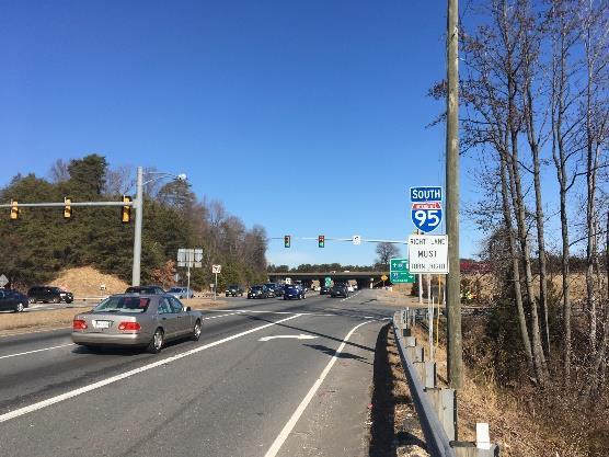
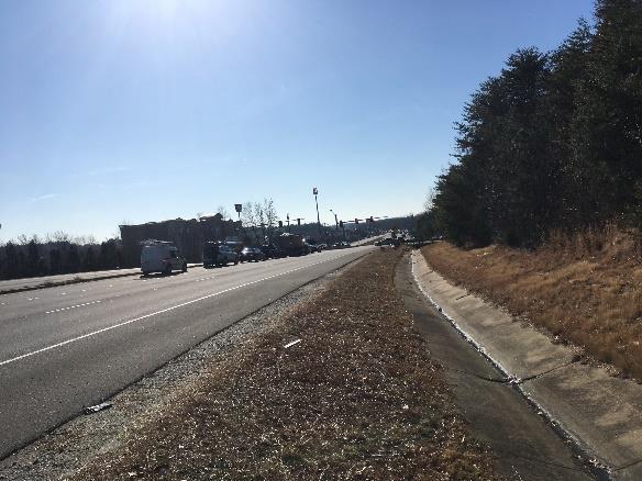
3 1 INTRODUCTION The region s only interstate, I-95, experiences heavy traffic flows during weekday mornings and afternoons. Currently, I-95 carries more than 115,000 vehicles per day (total in both directions) between Exit 130 (Route 3) and Exit 126 (US 1). The purpose of this study is to identify a proposed improvement at the US 1 and I-95 interchange that will mitigate existing congestion and safety issues on US 1 and I-95. The alternatives evaluation will consider improvements to both northbound US 1 and northbound I-95 at Exit 126. The goals of the STARS (Strategically Targeted and Affordable Roadway Solutions) Program are to develop comprehensive, innovative transportation improvements to relieve congestion bottlenecks and create projects that improve critical traffic and safety challenges to be programmed in the VDOT Six-Year Improvement Program. The purpose of this project is to relieve existing and future traffic congestion in the study area, and improve safety. This report documents the existing and future conditions, the alternatives analyzed, and the preferred alternative, the planning level cost estimate, and preliminary conceptual design. Purpose and Need of the Study The purpose of this study is to identify proposed improvements at the US 1 and I-95 interchange (Exit 126) that will help to mitigate existing congestion and safety issues on both northbound US 1 and northbound I-95, especially during the morning peak hour. Improvement alternatives must be able to reduce the northbound queue length on northbound US 1 and improve the merging operations on northbound I-95. Ultimately, the purpose is to positively impact these two Corridors of Statewide Significance (CoSS). Figure 1: Corridor Study Area This project was conducted in two phases: 1) design concept development to specifically determine if a second northbound US 1 left-turn lane could be constructed under the I-95 bridge at the northbound I-95 signalized intersection, and 2) traffic analysis to document the future year no-build and build results within the study area, primarily focusing on the US 1 at I-95 ramp signalized intersection. Study Area Limits The study area for this project is shown in Figure 1. The study area consists of the following corridors and intersections. Corridors Northbound I-95 between northbound US 1 ramp and Route 208 bridge consisting of two off-ramps and one on-ramp at Exit 126 Northbound US 1 between Southpoint Parkway and the northbound I-95 intersections, which includes the following intersections Intersections on US 1 Analyzed for improvements Southbound I-95 Ramps (Signalized) Northbound I-95 Ramps (Signalized) Market Street (Signalized) Not analyzed for improvements Southpoint Parkway (Signalized) US 1 at commercial entrance [KFD/Exxon] (Signalized) Legend Overall Influence Area Analysis Study Area Not Analyzed for Improvements Analysis Traffic Signals 1 1
4 Safety Analysis Kimley-Horn reviewed and analyzed crash data, from the VDOT crash database, to evaluate traffic safety within the study area and identify crash patterns. VDOT Roadway Network System (RNS) crash data was obtained for the latest available five years of crash data (January 1, 2012 to December 31, 2016). The following sections provide a summary of the crashes that occurred within the project study area during the five-year crash analysis period Summary of I-95 Northbound Crashes Crashes on northbound I-95 from 1 mile south of the beginning of the off-ramp taper to northbound US 1 to 1-mile north of the end of on-ramp taper from US 1 were analyzed as part of this study. Over the 5-year crash analysis period, 231 crashes occurred in this area. Of the reported crashes there was one fatal crash, 70 injury crashes, and 160 property damage only (PDO) crashes. The one fatal crash occurred near the off-ramp to southbound US 1. The crash occurred in 2016 and was classified sideswipe same direction crash. The crash was a result of an unsafe lane change from the center lane into the right lane causing the vehicle and two others to lose control. The fatal injury occurred to one of the drivers of the other vehicles. The driver at fault was determined to no be distracted, under the influence of alcohol, or exceeding the speed limit at the time of the crash. In total, it was found that the number of crashes year over year is also growing, with crashes showing a steady increase from 33 total crashes in 2012 to 57 crashes in A yearly summary of crashes by crash severity is shown in Table 1. Crash severity is coded using the KABCO scale, which is defined using the following classifications: K Fatal Injury A Suspected Serious Injury B Suspected Minor Injury C Possible Injury PDO Property Damage Only Table 1: Northbound I-95 Study Area Crashes Number of Crashes Year K A B C PDO Total Total A summary of northbound I-95 crashes by collision type is included in Figure 2. The predominant crash type was rear end, which accounted for 58.9% of crashes. Rear-ends are typical crash types on congested facilities like I-95 within the study area. A crash density analysis was also performed and a summary is included in Figure 3. The high-density locations south of the Exit 126 interchange, near mile marker 125, were caused by clusters of congestion related rear end crashes. The other high-density crash area was the area near the on-ramp from US 1. A map of crashes classified by collision type for the merge area is included in Figure 4. This figure shows rear-end crashes occurring throughout the area. Specifically, 54% of crashes from the US 1 on-ramp to Route 208 overpass are rear ends and 65% of those rear ends occurred during heavy congestion. There were also angle and sideswipe same direction crashes clustered in the area between the gore point and taper for the US 1 on-ramp Summary of US 1 Crashes Crashes on US 1 in the study area, which includes the intersections of US 1 at the southbound I-95 ramps, at the northbound I-95 ramp, and at Market Street are summarized in Table 2 by year and severity. The coding for crash severity is detailed in Section Over the study period from 2012 to 2016, one fatal crash, 155 injury crashes, and 289 PDO crashes occurred. Altogether, 445 total crashes occurred and there was a steady frequency of close to 90 crashes per year. The one fatal crash was a pedestrian related incident. A pedestrian, under the influence of alcohol, attempted to cross northbound US 1 just south of the intersection at the northbound I-95 ramps and was struck by a vehicle. It was determined that the driver was not distracted or under the influence of alcohol. The crash occurred under clear weather conditions at 7:35 PM, the roadway was dark and not lighted. 0.4% 0.4% 13.0% Figure 2: Northbound I-95 Crashes ( ) by Collision Type 13.0% 9.5% 2.2% 2.6% 58.9% Table 2: US 1 Study Area Crashes Number of Crashes Rear End Angle Sideswipe - Same Direction Sideswipe - Opposite Direction Fixed Object in Road Fixed Object - Off Road Non-Collision Deer Year K A B C PDO Total Total


5 Figure 3: Northbound I-95 Crash Density Map ( ) Figure 4: Northbound I-95 Exit 126 Merge Area Crash Map 3 3

6 Crash activity on US 1 was analyzed by intersection and a summary of crashes for the three study intersections by collision type is included in Figure 5. Crashes were assigned to intersections using intersection influence areas. Intersection influence areas typically comprise the functional area of the intersection, including turn lanes and tapers. Intersection influence areas were individually reviewed and extended as needed to include crashes related to the intersection that occurred outside of the functional area. The predominant collision type at all three intersections is rear end crashes at 56%, 47 %, and 55% for the southbound I-95 ramps, northbound I-95 ramps, and Market Street intersections, respectively, which can likely by attributed to the heavy congestion in the corridor. The intersection with the highest crash frequency was at the northbound I-95 ramps with 172 crashes in the 5-year study period. This intersection also had a higher proportion of angle crashes than the other two intersections at 44%. Figure 5: US 1 Intersection Crash Pie Charts by Collision Type A map of crashes at this intersection classified by collision type is included as Figure 6. This graphic shows a cluster of angle crashes where the northbound left turns, onto the northbound I-95 on-ramp, and southbound through movements conflict. The intersection operates with protected/permissive left-turn phasing. During the permissive portion of the traffic signal cycle vehicles are expected to look for gaps in traffic to make the northbound left turn and are not protected by a red light for southbound US 1 traffic. This permissive portion of the traffic signal cycle likely contributes to the high number of crashes between these two movements. There is also a cluster of crashes where the northbound I-95 off-ramp meets southbound US 1. This movement was changed from a merge to yield control somewhere in late 2015 or early After this change in traffic control and geometry, there was an increase in crashes in 2016 relating to this turning movement, from three or fewer before 2016 to six during 2016 as shown in Table 3. However, only two crashes relating to this movement occurred in To determine the safety impact of this change, more after data is required. Table 3: Yearly Summary of Northbound I-95 to Southbound US 1 Crashes Northbound I-95 to Southbound US 1 Crashes TOTAL

7 Figure 6: US 1 at Northbound I-95 Ramps Intersection Crash Map 2 FUTURE CONDITIONS 2040 No-Build Traffic Analyses Once the study team determined that the proposed roadway improvements on US 1 were feasible, the no-build traffic analysis on US 1 and I-95 commenced. Traffic operational analyses were conducted to evaluate the overall performance of the study corridor under AM and PM peak hour conditions in No weekend analysis was conducted for this project, especially since no weekend traffic counts were collected on US 1. However, traffic data on I-95 at Exit 126 were obtained from either the ongoing Fredericksburg Area MPO (FAMPO) I-95 Corridor Evaluation Phase 2, conducted by Baker and ATCS in 2018 (heretofore referred to as the FAMPO Study) or the STARS I-95 Exit 126 Area Study, conducted by Kimley-Horn in 2015 (heretofore referred to as the Area Study). Traffic operations analysis were conducted on US 1 and I-95 using the calibrated CORSIM model developed for the Area Study. Inputs and analysis methodologies are consistent with the VDOT Traffic Operations and Safety Analysis Manual (TOSAM). As the traffic analysis progressed, the scope of the traffic analysis was narrowed to focus on the key issues at the intersection of US 1 at I-95. The study team separated the traffic analysis into a screening analysis using HCS and Synchro and a more detailed analysis using CORSIM and Synchro. The Synchro and CORSIM files from the Area Study were used as the basis for this analysis. The interaction between traffic flow from the traffic signal onto the northbound I-95 entrance ramp was measured using methodologies from the Highway Capacity Manual, Version 6. The table showing the calculation of estimated maximum AM peak period traffic volumes that could be serviced by the traffic signal is provided in the Appendix. The Highway Capacity Software (HCS7) was used to evaluate the effectiveness of the entrance ramp merging operations and its corresponding density and speed. Since this ramp is projected to be over capacity in future conditions, the Highway Capacity Manual methodologies were not applicable to this condition. As a result, the study team used CORSIM to compare the no-build and build conditions on I-95. No existing conditions traffic analysis was conducted for this project. Instead, the future no-build conditions were compared to the build conditions to determine the effectiveness of the build alternatives Measures of Effectiveness Due to the proximity of the signalized intersection to the interstate ramp at this location, the study team used a few measures of effectiveness to determine how the pieces of the network were operating. Two measures of effectiveness were selected to document the quantitative performance of the US 1: Average vehicle delay by movement, approach, and intersection: measured in seconds per vehicle 95 th percentile queue length: measured in feet Three measures of effectiveness were selected to document the quantitative performance of the northbound I-95: Throughput: measured in vehicles per hour Speed: measured in miles per hour Density: measured in vehicles per mile per lane The traffic operations at this interchange are complex, especially in the northbound US 1 to northbound I-95 movement in the morning peak hour. Improvements that reduce the queue length on northbound US 1 may not 5 5

8 include adequate capacity to improve the northbound I-95 operations. In addition, it is important to find a balance of benefits to improve safety in the study area. Because of these challenges, the study team used multiple traffic analysis tools to evaluate the effectiveness of the recommended improvements: Traffic signal analysis Synchro and CORSIM Entrance ramp analysis HCS and CORSIM No-Build Geometry and Traffic Volumes Since traffic analyses near this project were conducted using 2040 or 2045 as the future analysis years, it was determined that this study would be conducted using 2040 traffic volume to determine if the design concepts could accommodate anticipated growth. The future no-build turning movement traffic volumes and geometry on US 1 were obtained from the Area Study as shown in Figure 7; whereas traffic counts on I-95 were derived from the I-95 Corridor Study Phase 2 as shown in Figure 8 and Figure 9. The no-build condition on I-95 includes all funded SMART SCALE projects from Rounds 1 and 2, the Express Lanes Fredericksburg Extension to Exit 133 (US 17) project, and the Rappahannock River Crossing project. Figure 7: No-Build Geometry and Traffic Volumes Figure No-Build I-95 Traffic Forecast AM Peak Hour 5,720 N Source: From FAMPO_Model_3.1_ Figure No-Build I-95 Traffic Forecast PM Peak Hour N 5,
9 2.1.3 Synchro Analysis The study team used Synchro to evaluate the No-Build conditions at the signalized intersections in the corridor. Synchro was used to evaluate the delay and queue lengths for the study intersections and Level of Service The Transportation Research Board s (TRB) Highway Capacity Manual (HCM) methodologies govern the methodology for evaluating capacity and the quality of service provided to road users traveling through a roadway network. There are six letter grades of Level of Service (), ranging from A to F. A indicates a condition of little or no congestion whereas F indicates a condition of severe congestion, unstable traffic flow, and stop-and-go conditions. Intersection is defined in terms of control delay. Table 4 summarizes the delay associated with each category for signalized and unsignalized intersections, respectively. If intersection traffic volume exceeds capacity, a F is automatically reported. Table 5 summarizes the 2040 No-Build delay associated for the three signalized intersections and Table 6 summarizes the 2040 No-Build queue lengths at each intersection. Table 4: Signalized and Unsignalized Intersection Level of Service Criteria Volume-to- Capacity Ratio Control Signalized Intersection Unsignalized Intersection A B 1.0 >10 20 >10 15 C 1.0 >20 35 >15 25 D 1.0 >35 55 >25 35 E 1.0 >55 80 >35 50 F > 1.0 >80 >50 Source: Transportation Research Board, Highway Capacity Manual 2010 Intersection Number and Description 1 Market Street 2 I-95 Northbound Ramps 3 I-95 Southbound Ramps Type of Control Signal Signal Signal Lane Group HCM 2000 results reported. SYNCHRO does not provide level of service or delay for movements with no conflicting volumes. Table 5: 2040 No-Build Signalized Intersection and Level of Service Northbound Southbound Eastbound Westbound AM PM AM PM AM PM AM PM US 1 US 1 Market Street Market Street Overall AM PM Left 29.6 C 39.6 D F F F F Through F 65.3 E 54.0 D F F F F F Right 19.1 B 23.1 C D 42.6 D Approach F 55.2 E 74.8 D F F F 94.4 F F F F US 1 US 1 I-95 NB to NB US 1 Ramp I-95 NB to SB US 1 Ramp Left 83.8 F F Through 0.7 A 0.4 A 83.5 F 49.8 D Right F F 16.4 B 30.4 C Approach 40.2 D F F F 16.4 B 30.4 C F F US 1 US 1 From I-95 Southbound To I-95 Southbound Left F F F F Through F F 4.0 A 3.8 A Right 6.3 A- 8.4 A B F Approach F F 47.4 D 70.8 E F F F F 7 7
10 Intersection Number and Description 1 Market Street 2 I-95 Northbound Ramps 3 I-95 Southbound Ramps Type of Control Signal Signal Signal Lane Group Effective Storage (ft) Table 6: 2040 No-Build Signalized Intersection Queue Lengths Northbound Southbound Eastbound Westbound 95th Percentile 95th Percentile 95th Percentile 95th Percentile Effective Effective Effective Queue (ft) Queue (ft) Queue (ft) Queue (ft) Storage (ft) Storage (ft) Storage (ft) AM PM AM PM AM PM AM PM US 1 US 1 Market Street Market Street Left m # #649 Through #1151 #2067 #319 #643 Right Left 728 m#1413 m#1032 Through US 1 US 1 I-95 NB to NB US 1 Ramp I-95 NB to SB US 1 Ramp Right 800 m#1434 US 1 US 1 From I-95 Southbound To I-95 Southbound Left 300 m#559 Through #2075 m48 Right Synchro 95th percentile queue length results reported. SYNCHRO does not provide queue length for movements with no conflicting volumes. m Volume for Synchro 95th percentile queue is metered by upstream signal. # 95th percentile volume exceeds capacity, queue may be longer m180 Based on the movement capacity analysis during the 2040 AM and PM peak hours, the dual northbound left-turn lanes will be able to process the demand in the AM and PM peak hours. The southbound right-turn lane will not be able to process the demand in neither of the AM nor PM peak hour. Thus, the throughput, which will access the I-95 northbound on-ramp released by the metering effects from the signalized intersection on US 1 will be less than the actual demand Build Analysis Build Geometry and Traffic Volumes The traffic volumes used for the No-Build analysis were used for the Build analysis; however, the geometry was changed because of the recommended improvements on US 1 in both directions as shown in Figure Synchro Analysis The study team used Synchro to evaluate the build conditions at the signalized intersections in the corridor. Synchro was used to evaluate the delay and queue lengths for the study intersections and Level of Service The same methodology used for the No-Build analysis was used for the Build analysis. Table 8 summarizes the 2040 Build delay associated for the three signalized intersections and Table 9 summarizes the 2040 Build queue lengths at each intersection Freeway Analysis Throughput Analysis The US 1 at I-95 northbound ramps intersection meters traffic flow onto the I-95 northbound on-ramp. Using the Highway Capacity Manual (HCM), 6th Edition, Chapter 19 Signalized Intersections methodologies for signalized intersections and optimizing the signal timing phase splits, the adjusted saturation flow rates for the movement groups and the effective phase green times were used to calculate the capacity of the movements subject to the signal timing. The capacity was compared to the demand volumes to determine the throughput. The movement capacity analysis was conducted in a three-step process. The first step was to optimize the signal phase timings using Synchro, Version 10, for the 2040 AM and PM peak hours. The 2040 Synchro models in AM and PM peak hours for the US 1 corridor were provided by VDOT. The models included the intersection of US 1 at I-95 northbound on-ramp and its adjacent intersections, however without the dual northbound left-turn lanes on US 1. The 2040 Synchro models were updated by adding the dual northbound left-turn lanes on US 1 at the intersection of I-95 northbound on-ramp. Then the signal phase timings at this intersection was optimized, while holding the network coordinated cycle length, offsets and phase timings of the remaining intersections constant. 8 8
11 Figure 10. Build Traffic Volumes and Geometry Where the capacity of the movement group is greater than the demand volume for that movement, the throughput equals to the demand volume. Where the capacity is less than the demand volume, the throughput equals to the capacity of the movement. The total throughput on the ramp is the sum of the lower values of either capacity or demand. The results are shown in Table 7. Even though the computed throughput volumes are less than the demand volumes, the demand volumes were used in the CORSIM traffic analysis to determine the worst-case operations on the freeway. Movement Group Table 7: I-95 Northbound On-Ramp Throughput Northbound Left AM Southbound Right Northbound Left PM Southbound Right Adjusted Saturation Flow Rate for Movement (vph) 3,618 1,611 3,618 1,612 Capacity of Movement Group Subject to Signal Timing (vph) 2, , Demand Traffic Volume for Movement Group (vph) 2,059 1,337 1,236 1,393 Total Throughput Volume (vph) 2,596 2, HCS Analysis The Highway Capacity Software (HCS 7) was used to conduct a sensitivity analysis for varying lengths of the acceleration lanes using AM peak hour traffic volumes and density, expressed in passenger cars per mile per lane, as the primary measure of effectiveness. However, since the merging methodologies in the Highway Capacity Manual (HCM), 6th Edition do not differentiate results once the acceleration lane exceeds 1,500 feet, the study team determined that these capacity results should not be used for decision-making purposes, especially since the results were F for all scenarios. The CORSIM analysis followed this analysis. The second step in the process was to calculate the adjusted saturation flow rates for the northbound left-turn movement and the southbound right-turn movement from US 1 onto the I-95 northbound on-ramp. HCM Equation 19-8, shown as below, was used to calculate the adjusted saturation flow rates for the left- and right-turn movements. The adjusted factors and assumptions used in the formula for the calculations are shown in the Appendix. s = s0 fw fhvg fp fbb fa flu flt frt flpb frpb fwz fms fsp Equation 19-8 in HCM The adjusted saturation flow rates for the lane group were multiplied by the number of turn-lanes for each movement resulting in the adjusted saturation flow rate for the movement group. The third step was to compute the capacity of each movement group subject to the signal by multiplying the adjusted saturation flow rate for the movement group with its proportion of the effective green time for the movement in the cycle. The study team analyzed the following scenarios: 2040 AM one-lane merge (1,500 feet acceleration lane) 2040 AM two-lane merge (acceleration lengths in design file as minimum length) 2040 AM two-lane merge (1,500 feet for each acceleration lane as maximum length allowable in HCS) 2045 FAMPO AM one-lane merge (1,500 feet acceleration lane) 2045 FAMPO AM two-lane merge (acceleration lengths in design file as minimum length) 2045 FAMPO AM two-lane merge (1,500 feet for each acceleration length as maximum length allowed in HCS) The following assumptions were used for the merge area capacity analysis. Peak hour factors for the 2040 AM scenarios for the I-95 northbound mainline, I-95 northbound off-ramp at Exit 126B (considered as upstream adjacent ramp), and the I-95 northbound on-ramp from US 1 were calculated based on four 15-minute interval traffic volumes 2040 No-Build CORSIM files. Heavy vehicle percentages (HV%) for the 2040 AM scenarios for the I-95 northbound off-ramp at Exit 126B and the I-95 northbound on-ramp from US 1 were extracted from 2040 No-Build Synchro files. For the 2045 Hybrid AM scenarios, I-95 northbound mainline traffic volumes were derived from the 2045 FAMPO traffic forecast. Since the 2045 forecasts did not include PHFs, the PHF were assumed to be the same as the 2040 AM scenarios. All other inputs in the 2045 hybrid AM scenarios were the same as the 2040 AM scenarios. Rolling terrain was assumed for all scenarios, since both I-95 northbound mainline and the on-ramp are on an upgrade. 9 9
12 Intersection Number and Description 1 Market Street 2 I-95 Northbound Ramps 3 I-95 Southbound Ramps Type of Control Signal Signal Signal Lane Group Table 8: 2040 Build Signalized Intersection and Level of Service Northbound Southbound Eastbound Westbound AM PM AM PM AM PM AM PM US 1 US 1 Market Street Market Street Overall AM PM Left 29.6 C 39.0 D F F F F Through F 66.0 F 54.0 D F F F F F Right 19.1 B 24.4 C D 42.6 D Approach F 56.2 E 74.8 D F F F 94.4 F F F F US 1 US 1 I-95 NB to NB US 1 Ramp I-95 NB to SB US 1 Ramp Left 83.8 F 51.7 D Through 0.7 A 0.4 A 83.5 F 43.0 D Right F F Approach 40.2 D 21.5 C F F F F US 1 US 1 From I-95 Southbound To I-95 Southbound Left F F F F Through F F 4.0 A 3.7 A Right 6.3 A- 8.3 A B F Approach F F 47.4 D 70.7 E F F F F HCM 2000 results reported. SYNCHRO does not provide level of service or delay for movements with no conflicting volumes. Table Build Signalized Intersection Queue Lengths Intersection Number and Description 1 Market Street 2 I-95 Northbound Ramps 3 I-95 Southbound Ramps Type of Control Signal Signal Signal Lane Group Effective Storage (ft) Northbound Southbound Eastbound Westbound 95th Percentile 95th Percentile 95th Percentile 95th Percentile Effective Effective Effective Queue (ft) Queue (ft) Queue (ft) Queue (ft) Storage (ft) Storage (ft) Storage (ft) AM PM AM PM AM PM AM PM US 1 US 1 Market Street Market Street Left 280 m8 m #511 # #416 #649 Through #1621 #1156 #1371 #2067 #273 #319 #417 #643 Right Left 728 m138 m#280 US 1 US 1 I-95 NB to NB US 1 Ramp I-95 NB to SB US 1 Ramp Through m0 m#724 Right 800 m#2447 m#1443 US 1 US 1 From I-95 Southbound To I-95 Southbound Left 300 m#219 m#546 #1091 #1003 Through m#2400 #2075 m58 m47 #2459 #3866 Right m70 m180 Synchro 95th percentile queue length results reported. SYNCHRO does not provide queue length for movements with no conflicting volumes. m Volume for Synchro 95th percentile queue is metered by upstream signal. # 95th percentile volume exceeds capacity, queue may be longer 10 10
13 CORSIM Analysis Operational impacts of modifying the existing single I-95 northbound acceleration lane to two lanes were assessed by comparing travel speed results obtained through a CORSIM point-processing analysis (PPA). The PPA was performed under future 2040 No-Build and Build conditions, along all three northbound I-95 mainline lanes and along each acceleration lane. Overall, one No-Build and four Build scenarios were evaluated in the PPA. No Build: One acceleration lane with approximately 1,350 feet of effective auxiliary length Build Scenario 1 (SC1): One acceleration lane with approximately 1,020 feet of effective auxiliary length and a second acceleration lane with approximately 2,220 feet of effective auxiliary length Build Scenario 2 (SC2): One acceleration lane with approximately 1,020 feet of effective auxiliary length and a second acceleration lane with approximately 3,220 feet of effective auxiliary length Build Scenario 3 (SC3): One acceleration lane with approximately 1,020 feet of effective auxiliary length and a second acceleration lane with approximately 4,220 feet of effective auxiliary length Build Scenario 4 (SC4): One acceleration lane with approximately 2,020 feet of effective auxiliary length and a second acceleration lane with approximately 4,220 feet of effective auxiliary length Each of the five operational analysis scenarios were evaluated under 2040 AM and PM peak hour conditions. Travel speeds reported in the PPA outputs are time mean speeds (TMS), or the average speeds all vehicles are traveling at a specific point on a link. TMS results were obtained at 200-foot intervals along each lane, and the results were averaged from 10 individual microsimulations. By evaluating anticipated TMS, isolated instances of congestion can be better identified. Figure 11 and Figure 12 summarize AM peak hour PPA results, while Figure 13 and Figure 14 summarize PM peak hour PPA results. The No-Build traffic analysis model consisted of the same network elements as the Build models, except at the US 1 and I-95 northbound on-ramp intersection. Initially, with the signalized intersection included in the No-Build model, approximately 50% of the anticipated 2040 peak hour traffic demand was not able to access the on-ramp, resulting in significant queuing on US 1. This unmet traffic demand resulted in low simulated merge traffic volumes (reduced demand by approximately 1,200 vehicles); thereby, resulting in an inaccurate representation of anticipated future merge operations on northbound I-95. To obtain a more accurately represent the future merge operations on northbound I-95, the US 1 and I-95 northbound on-ramp signalized intersection was omitted from the 2040 No-Build AM and PM peak hour CORSIM models. With this approach, the on-ramp processed vehicles up to its approximate capacity and provided a more reasonable evaluation of merge operations on northbound I-95. After removing the signalized intersection, simulated ramp traffic volumes under AM peak hour conditions were approximately 2,165 vehicles. While this is still less than the forecasted 2040 AM peak hour demand of approximately 1,975 vehicles, the simulated traffic volume is comparable to the approximate capacity of a single-lane ramp. Under Build conditions, the proposed two-lane ramp had adequate capacity at both the intersection and along the ramp to accommodate future AM and PM peak hour traffic demands. Under all four AM Build scenarios, a second acceleration lane is expected to increase upstream travel speeds in Lane 1 by approximately 10 percent (i.e. an approximate 5 MPH increase in Lane 1 travel speeds upstream from the ramp merge). Under Build SC1 conditions, Lane 1 travel speeds within the ramp merge area are expected to range between approximately 43 and 49 MPH, and are similar to anticipated AM No Build conditions. Build SC2 includes a longer inside acceleration lane (A1) and is anticipated to increase Lane 1 travel speeds within the merge area by up to 4 MPH. In Build SC3, A1 is extended an additional 1,000 feet from Build SC2. This extension is expected to increase Lane 1 travel speeds within the merge area by up to 2 MPH as compared to Build SC2 conditions. Under SC4 conditions, the length of A1 is held constant from Build SC3; however, the outer acceleration lane (A2) is extended an additional 1,000 feet as compared to either of the three other Build scenarios. Overall within the merge area, it is not anticipated that Build SC4 will result in an increase in Lane 1 travel speeds as compared to Build SC PM PEAK HOUR RESULTS Under 2040 No Build conditions, Lane 1 travel speeds within the merge area are expected to range between approximately 25 and 50 MPH. The mainline I-95 traffic volumes in the PM peak hour are approximately 700 vehicles per hour higher than in the AM peak hour. Because of this difference, merging speeds are much slower under 2040 No Build PM peak hour conditions than AM peak hour conditions. Like AM peak hour conditions, Lane 1 travel speeds upstream from the ramp merge are expected to be reduced due to ramp merge operations. Under all four PM Build scenarios, a second acceleration lane is expected to increase upstream travel speeds in Lane 1 by approximately 10 percent (i.e. an approximate 5 MPH increase in Lane 1 travel speeds upstream from the ramp merge). Under Build SC1 conditions, Lane 1 travel speeds within the ramp merge area are anticipated to increase by up to 5 MPH from No-Build conditions. Under Build SC2, SC3, and SC4, Lane 1 travel speeds within the ramp merge area are anticipated to be like those expected under Build SC1 conditions PEAK HOUR RESULTS Under each AM scenario, the benefits of a second acceleration lane can be directly observed with the approximate 10 percent increase in Lane 1 travel speeds upstream from the ramp. Under each PM scenario, the benefits of a second acceleration lane can be directly observed with the approximate 45 percent increase in Lane 1 travel speeds upstream from the ramp. Within the ramp merge area, the length of the outermost acceleration lane has the largest impact on Lane 1 speeds. An increase in effective auxiliary lane length from approximately 2,220 feet (Build SC1) to approximately 3,220 feet (Build SC2) is anticipated to result in an approximate 4 to 5 MPH increase in AM and PM No-Build travel speeds in Lane 1. Further extension of the outermost acceleration lane is not anticipated to provide additional increases in Lane 1 travel speeds AM PEAK HOUR RESULTS Under 2040 No Build conditions, anticipated travel speeds in Lane 1 (i.e., outer mainline travel lane that is adjacent to the acceleration lane) are expected to range between approximately 25 and 50 MPH within the ramp merge area. These travel speeds are lower than those anticipated in Lane 2 or Lane 3, and are a result of vehicles merging from the acceleration lane. Upstream from the merge, travel speeds in Lane 1 are expected to be less than 45 MPH, indicating that merging operations are anticipated to reduce travel speeds upstream from the ramp as well
14 Figure 11: 2040 AM Traffic Volume Point Processing Results 2040 NO BUILD AM " Peak Hour " Volumes " ,750 A ,465 NB: Effective Aux1= 1,350 feet ,0 1,4 1,6 1,8 2,0 2,2 2,4 2,6 2,8 3,0 3,2 3,4 3,6 3,8 4, BUILD AM - SC1 " Peak Hour " Volumes " ,750 A A ,465 B-SC1: Effective Aux1 = 2,220 feet Effective Aux2 = 1,020 feet 8 1,0 1,4 1,6 1,8 2,0 2,2 2,4 2,6 2,8 3,0 3,2 3,4 3,6 3,8 4, BUILD AM - SC2 " Peak Hour " Volumes " ,750 A A ,465 B-SC2: Effective Aux1 = 3,220 feet Effective Aux2 = 1,020 feet 8 1,0 1,4 1,6 1,8 2,0 2,2 2,4 2,6 2,8 3,0 3,2 3,4 3,6 3,8 4, BUILD AM - SC3 " Peak Hour " Volumes " ,750 A A ,465 B-SC3: Effective Aux1 = 4,220 feet Effective Aux2 = 1,020 feet 8 1,0 1,4 1,6 1,8 2,0 2,2 2,4 2,6 2,8 3,0 3,2 3,4 3,6 3,8 4,0 4,2 4,4 4, BUILD AM - SC4 " Peak Hour " Volumes " ,750 A A ,465 B-SC4: Effective Aux1 = 4,220 feet Effective Aux2 = 2,020 feet 8 1,0 1,4 1,6 1,8 2,0 2,2 2,4 2,6 2,8 3,0 3,2 3,4 3,6 3,8 4,0 4,2 4,4 4,6 Northbound I-95 at US 1 CORSIM Point Processing VOLUME Results 12 12
15 Figure 12: 2040 PM Traffic Volume Point Processing Results 2040 NO BUILD PM " Peak Hour " Volumes " ,450 A ,971 NB: Effective Aux1= 1,350 feet ,0 1,4 1,6 1,8 2,0 2,2 2,4 2,6 2,8 3,0 3,2 3,4 3,6 3,8 4, BUILD PM - SC1 " Peak Hour " Volumes " ,450 A A ,971 B-SC1: Effective Aux1 = 2,220 feet Effective Aux2 = 1,020 feet 8 1,0 1,4 1,6 1,8 2,0 2,2 2,4 2,6 2,8 3,0 3,2 3,4 3,6 3,8 4, BUILD PM - SC2 " Peak Hour " Volumes " ,450 A A ,971 B-SC2: Effective Aux1 = 3,220 feet Effective Aux2 = 1,020 feet 8 1,0 1,4 1,6 1,8 2,0 2,2 2,4 2,6 2,8 3,0 3,2 3,4 3,6 3,8 4, BUILD PM - SC3 " Peak Hour " Volumes " ,450 A A ,971 B-SC3: Effective Aux1 = 4,220 feet Effective Aux2 = 1,020 feet 8 1,0 1,4 1,6 1,8 2,0 2,2 2,4 2,6 2,8 3,0 3,2 3,4 3,6 3,8 4,0 4,2 4,4 4, BUILD PM - SC4 " Peak Hour " Volumes " ,450 A A ,971 B-SC4: Effective Aux1 = 4,220 feet Effective Aux2 = 2,020 feet 8 1,0 1,4 1,6 1,8 2,0 2,2 2,4 2,6 2,8 3,0 3,2 3,4 3,6 3,8 4,0 4,2 4,4 4,6 Northbound I-95 at US 1 CORSIM Point Processing VOLUME Results 13 13
16 Figure 13: 2040 AM Speed Point Processing Results 2040 NO BUILD AM " Time Mean " Speed " ,750 A ,465 NB: Effective Aux1= 1,350 feet ,0 1,4 1,6 1,8 2,0 2,2 2,4 2,6 2,8 3,0 3,2 3,4 3,6 3,8 4, BUILD AM - SC1 Time Mean Speed 2,750 " " " A A ,465 B-SC1: Effective Aux1 = 2,220 feet Effective Aux2 = 1,020 feet 8 1,0 1,4 1,6 1,8 2,0 2,2 2,4 2,6 2,8 3,0 3,2 3,4 3,6 3,8 4,0 Time Mean Speed 2040 BUILD AM - SC2 " " " ,750 A A ,465 B-SC2: Effective Aux1 = 3,220 feet Effective Aux2 = 1,020 feet 8 1,0 1,4 1,6 1,8 2,0 2,2 2,4 2,6 2,8 3,0 3,2 3,4 3,6 3,8 4, BUILD AM - SC3 " Time Mean " Speed " ,750 A A ,465 B-SC3: Effective Aux1 = 4,220 feet Effective Aux2 = 1,020 feet 8 1,0 1,4 1,6 1,8 2,0 2,2 2,4 2,6 2,8 3,0 3,2 3,4 3,6 3,8 4,0 4,2 4,4 4, BUILD AM - SC4 " Time Mean " Speed " ,750 A A ,465 B-SC4: Effective Aux1 = 4,220 feet Effective Aux2 = 2,020 feet 8 1,0 1,4 1,6 1,8 2,0 2,2 2,4 2,6 2,8 3,0 3,2 3,4 3,6 3,8 4,0 4,2 4,4 4,6 Northbound I-95 at US 1 CORSIM Point Processing SPEED Results 14 14
17 Figure 14: 2040 PM Speed Point Processing Results 2040 NO BUILD PM " Time Mean " Speed " ,450 A ,971 NB: Effective Aux1= 1,350 feet ,0 1,4 1,6 1,8 2,0 2,2 2,4 2,6 2,8 3,0 3,2 3,4 3,6 3,8 4, BUILD PM - SC1 " Time Mean " Speed " ,450 A A ,971 B-SC1: Effective Aux1 = 2,220 feet Effective Aux2 = 1,020 feet 8 1,0 1,4 1,6 1,8 2,0 2,2 2,4 2,6 2,8 3,0 3,2 3,4 3,6 3,8 4, BUILD PM - SC2 " Time Mean " Speed " ,450 A A ,971 B-SC2: Effective Aux1 = 3,220 feet Effective Aux2 = 1,020 feet 8 1,0 1,4 1,6 1,8 2,0 2,2 2,4 2,6 2,8 3,0 3,2 3,4 3,6 3,8 4, BUILD PM - SC3 " Time Mean " Speed " ,450 A A ,971 B-SC3: Effective Aux1 = 4,220 feet Effective Aux2 = 1,020 feet 8 1,0 1,4 1,6 1,8 2,0 2,2 2,4 2,6 2,8 3,0 3,2 3,4 3,6 3,8 4,0 4,2 4,4 4, BUILD PM - SC4 " Time Mean " Speed " ,450 A A ,971 B-SC4: Effective Aux1 = 4,220 feet Effective Aux2 = 2,020 feet 8 1,0 1,4 1,6 1,8 2,0 2,2 2,4 2,6 2,8 3,0 3,2 3,4 3,6 3,8 4,0 4,2 4,4 4,
18 3 CONCEPT DEVELOPMENT Initial Concept Screening Kimley-Horn divided the design analysis into two phases. Kimley-Horn starting by developing a design concept to specifically determine if a second northbound US 1 left-turn lane can be constructed under the I-95 bridge at the northbound I-95 signalized intersection. Once the feasibility for improvements on northbound US 1 was verified, Kimley-Horn then determined the feasibility of improvements to the northbound I-95 on-ramp and northbound I-95 to the Route 208 bridge over I US 1 Concept Design Process Kimley-Horn began the design process by completing a field visit in which measurements were taken and compared to as-builts plans to determine the feasibility of a second northbound US 1 left-turn lane. The existing left-turn lane on northbound US 1 to the I-95 northbound on ramp has 700 feet of storage. After confirming the feasibility of a second northbound US 1 left-turn lane, Kimley-Horn developed two options of varying storage lengths for the inside and outside left-turn lanes. Kimley-Horn informed the SWG that bridge pier protection systems (BPPS) would be required to protect the I-95 bridge piers in both directions for both options. The typical section under the I-95 bridge for each concept in both directions would consist of a thirteen-foot left-turn lane, two eleven-foot through lanes, and a seven-foot outside paved shoulder. Alternative 1 included 750 feet of storage for the inside left-turn lane and 1,350 feet for the outside left-turn lane. Alternative 1 would also consist of reconfiguring the I-95 northbound to southbound US 1 off-ramp to create a yield condition from the ramp onto southbound US 1. Alternative 4 was designed to maximize the safety and congestion improvements from US 1 to north of the Route 208 overpass. Alternative 4 included an 820-foot acceleration lane (for 45 mph to 70 mph), a 300-foot merging taper, a 2,440-foot auxiliary lane, and an 840-foot merging taper. Alternative 5 was designed to balance the cost and benefits of the previous alternatives while meeting AASHTO standards. Alternative 5 included an 820-foot acceleration lane (for 45 mph to 70 mph), a 300-foot merging taper, a 1,440-foot auxiliary lane, and an 840-foot merging taper. The design of the northbound acceleration lane was not only based on the results of the traffic analysis, but also on the results of the safety analysis even though safety is weighted at 5% compared to 45% for congestion for SMART SCALE scoring in the Fredericksburg area. As shown in Table 10, the crash modification factor for extending the acceleration lane by 1,000 feet provides a 55% reduction in related crashes; however, the cost of extending the acceleration by 1,000 was approximately $500,000. The study team used this information to determine the most appropriate acceleration lane length. Table 10. Crash Modification Factors for Ramp Extensions Extend Ramp Length Planning Level CMF Extend ramp acceleration length (250') 0.80 Extend ramp acceleration length (500') 0.65 Extend ramp acceleration length (1000') 0.45 Alternative 2 included 1,650 feet of storage for the inside left-turn lane and 675 feet for the outside left-turn lane. Alternative 2 would also consist of reconfiguring the I-95 northbound to northbound US 1 off ramp to create a yield condition from the ramp onto southbound US 1. Kimley-Horn determined that both alternatives would require design exceptions for the lack of shoulder width on US 1, the stopping sight distance for US 1 due to the bridge piers for the I-95 overpass, and the vertical clearance under the I-95 overpass. The SWG provided additional input stating that both alternatives would also require operational impacts due to bridge maintenance inspections conducted every few months during the day. Another design consideration that Kimley-Horn investigated was the length of the southbound US 1 left-turn lane at its signalized intersection with the southbound I-95 ramps. The accommodate southbound left turns, the effective storage length of the southbound left-turn lane is 350 feet I-95 Concept Design Process Once it was determined that the dual left-turn lanes could be accommodated on US 1, Kimley-Horn needed to determine the length of the dual acceleration lanes on northbound I-95. Field measurements were compared to asbuilt plans to confirm that there is room for the two acceleration lanes. Once the designs along I-95 were determined to be feasible, Kimley-Horn began analyzing the necessary lengths for the auxiliary lane on I-95 northbound. Alternative 3 was designed to meet the minimum distance needed to satisfy the AASHTO acceleration lane length. Alternative 3 included an 820-foot acceleration lane (for 45 mph to 70 mph), a 300-foot merging taper, a 540-foot auxiliary lane, and an 840-foot merging taper
19 4 PREFERRED ALTERNATIVE A combination of Alternative 2 and Alternative 5 was chosen as the preferred alternative for US 1 and I-95, respectively. The advantage of the Alternative 2 for US 1 is that it fully uses the second northbound left-turn lane at the intersection with the I-95 on-ramp. With alternative 1, the queue of the outside left-turn lane would have blocked the inside left-turn lane. The Alternative 2 design bypassed that problem by shifting all three northbound lanes 8 feet to the east, over 150 feet. But due to this shift, the gore point of the I-95 northbound off ramp to US 1 northbound (Ramp A) also needed to be adjusted. Alternative 2 also included a modification of the US 1 right-turn lane to the I-95 southbound on-ramp (Ramp B) to a thru-right lane and modifying the US 1 southbound left-turn lane to the I-95 southbound on-ramp (Ramp B) to include a 135-foot left-turn lane taper and 280-foot left-turn lane storage. The modifications to the right-turn lane will help the capacity on US 1 and help northbound drivers preposition to avoid any queues for the left turns to the I-95 northbound on-ramp. The modifications to the left-turn lane increase the effective storage to the existing deficient left-turn lane. Figure 15: Preferred Alternative Typical Sections Ramp D also was widened from one to two lanes to accommodate the additional left-turn lane from US 1 at the I-95 northbound on-ramp intersection. To accommodate the additional lane from US 1, the preferred alternative includes a 420-foot long, 12-foot wide lane shift on I-95 northbound prior to the gore at Ramp D. This shift uses the existing full-depth inside shoulder on I-95 and will include an additional 8-foot inside, paved shoulder. Due to the lane shift, the proposed acceleration lane from US 1 will use the existing paved, right shoulder and widen the existing pavement. The lengthening of the auxiliary lane will also utilize the existing paved, right shoulder and widen the existing to meet VDOT standards. The typical sections for the preferred alternative is shown in Figure 15. The plan view graphics of the preferred alternative is shown in Figure 16, Figure 17, and Figure 18. Planning Level Cost Estimates Planning level cost estimates, in 2018 dollars, were developed for the preferred alternative. Construction (CN) costs were estimated using a combination of PCES, the 2015 version of Transportation and Mobility Planning Division Statewide Planning Level Cost Estimate Spreadsheet, quantity take-offs, and recent bid costs. Preliminary engineering and construction engineering and inspection (CEI) costs were estimated as a percentage of construction costs including contingency. A 30% contingency was included on the construction items estimate (prior to adding CEI costs). A detailed cost estimate should be prepared during the design phase of this project. Cost estimates should be adjusted for appropriate inflation costs when used in funding applications or project allocations. The FY19 total cost for the project is approximately $20.4 million as is shown in Figure 19. Project Summary The previously described preferred alternatives are summarized in a one-page project summary sheet (Figure 19). The information pertaining to the project summary include project description, preferred alternative concept, traffic operational benefits, project cost, and project implementation schedule


20 Figure 16: Preferred Alternative Sheet 1 Figure 17: Preferred Alternative Sheet
 study corridor. To advance these projects beyond the planning stage, FAMPO should take the following steps.")
21 Figure 18: Preferred Alternative Sheet 3 5 NEXT STEPS This study and design should be used as a planning tool to achieve the next steps of planning, programming, designing, and constructing the identified safety and operational improvements in the I-95 Northbound at US 1 (Exit 126) study corridor. To advance these projects beyond the planning stage, FAMPO should take the following steps. Apply for Prioritized Funding Programs The following funding sources should be considered for improvement projects identified in this study SMART SCALE SMART SCALE allocates funding from the construction District Grants Program (DGP) and High-Priority Projects Program (HPPP) to transportation projects based on a scoring process. The scoring process evaluates, scores and ranks projects based on congestion mitigation, economic development, accessibility, safety, environmental quality, and land use factors. The location of the project determines the weight of each of these scoring factors in the calculation of the total score. For projects in Fredericksburg, the scoring factors with the highest weight are congestion (45%) and land use (20%). The preferred alternative is a candidate projects for SMART SCALE funding. Advance Selected Projects to VDOT Six-Year Improvement Program (SYIP) Once project applications are approved for funding through SMART SCALE, the project should be incorporated in the VDOT SYIP, so it can enter the project development process

22 Figure 19: Project Summary Sheet 20 20
Appendix B: Forecasting and Traffic Operations Analysis Framework Document
 Existing Conditions Report - Appendix Appendix B: Forecasting and Traffic Operations Analysis Framework Document This document defines the methodology and assumptions that will be used in the traffic forecasting
I-95 NORTHBOUND AT US 1 (EXIT 126) ALTERNATIVES DESIGN ANALYSIS
 ALTERNATIVES DESIGN ANALYSIS") FAMPO Policy Committee Briefing June 18, 2018 I-95 NORTHBOUND AT US 1 (EXIT 126) ALTERNATIVES DESIGN ANALYSIS WHAT IS THE STARS PROGRAM? Program to develop solutions to reduce crashes and congestion bottlenecks
FAMPO Policy Committee Briefing June 18, 2018 I-95 NORTHBOUND AT US 1 (EXIT 126) ALTERNATIVES DESIGN ANALYSIS WHAT IS THE STARS PROGRAM? Program to develop solutions to reduce crashes and congestion bottlenecks
Traffic Impact Analysis Walton Acres at Riverwood Athletic Club Clayton, NC
 Traffic Impact Analysis Walton Acres at Riverwood Athletic Club Clayton, NC 1. TABLE OF CONTENTS INTRODUCTION...1 1.1. Site Location and Study Area...1 1.2. Proposed Land Use and Site Access...2 1.3.
Subject: Solberg Avenue / I-229 Grade Separation: Traffic Analysis
 MEMORANDUM Transportation Bill Troe, AICP Jason Carbee, AICP 12120 Shamrock Plaza Suite 300 Omaha, NE 68154 (402) 334-8181 (402) 334-1984 (Fax) To: Project File Date: Subject: Solberg Avenue / I-229 Grade
Truck Climbing Lane Traffic Justification Report
 ROUTE 7 (HARRY BYRD HIGHWAY) WESTBOUND FROM WEST MARKET STREET TO ROUTE 9 (CHARLES TOWN PIKE) Truck Climbing Lane Traffic Justification Report Project No. 6007-053-133, P 101 Ι UPC No. 58599 Prepared by:
Chapter 4 Traffic Analysis
 Chapter 4 Traffic Analysis PURPOSE The traffic analysis component of the K-68 Corridor Management Plan incorporates information on the existing transportation network, such as traffic volumes and intersection
METHODOLOGY. Signalized Intersection Average Control Delay (sec/veh)
") Chapter 5 Traffic Analysis 5.1 SUMMARY US /West 6 th Street assumes a unique role in the Lawrence Douglas County transportation system. This principal arterial street currently conveys commuter traffic
Chapter 5 Traffic Analysis 5.1 SUMMARY US /West 6 th Street assumes a unique role in the Lawrence Douglas County transportation system. This principal arterial street currently conveys commuter traffic
Traffic Impact Study. Westlake Elementary School Westlake, Ohio. TMS Engineers, Inc. June 5, 2017
 TMS Engineers, Inc. Traffic Impact Study Westlake Elementary School Westlake, Ohio June 5, 2017 Prepared for: Westlake City Schools - Board of Education 27200 Hilliard Boulevard Westlake, OH 44145 TRAFFIC
Traffic Impact Analysis Chatham County Grocery Chatham County, NC
 Chatham County Grocery Chatham County, NC TABLE OF CONTENTS 1. INTRODUCTION... 1 1.1. Location and Study Area... 1 1.2. Proposed Land Use and Access... 2 1.3. Adjacent Land Uses... 2 1.4. Existing ways...
Harrah s Station Square Casino
 Transportation Analysis Harrah s Station Square Casino Pittsburgh, Pennsylvania Submitted To: City of Pittsburgh and Pennsylvania Gaming Control Board Prepared By: DKS Associates GAI Consultants December
Traffic Impact Study WestBranch Residential Development Davidson, NC March 2016
 Traffic Impact Study WestBranch Residential Development Davidson, NC March 216 TRAFFIC IMPACT STUDY FOR THE WestBranch Residential Development LOCATED IN DAVIDSON, NC Prepared For: Lennar Carolinas, LLC
Introduction Roundabouts are an increasingly popular alternative to traffic signals for intersection control in the United States. Roundabouts have a
 HIGH-CAPACITY ROUNDABOUT INTERSECTION ANALYSIS: GOING AROUND IN CIRCLES David Stanek, PE and Ronald T. Milam, AICP Abstract. Roundabouts have become increasingly popular in recent years as an innovative
TRANSPORTATION ANALYSIS REPORT US Route 6 Huron, Erie County, Ohio
 TRANSPORTATION ANALYSIS REPORT US Route 6 Huron, Erie County, Ohio December 12, 2012 Prepared for: The City of Huron 417 Main Huron, OH 44839 Providing Practical Experience Technical Excellence and Client
Traffic Impact Study Little Egypt Road Development Denver, North Carolina June 2017
 Traffic Impact Study Little Egypt Road Development Denver, North arolina June 2017 N. Little Egypt Road DQ\ QDQFLQJ VDOHV RU RWKHU SHUIRUPDQFH EDVHG FULWHULD Proposed Site Driveways Site Driveway 1 TRAFFI
DUNBOW ROAD FUNCTIONAL PLANNING
 DUNBOW ROAD FUNCTIONAL PLANNING Final Report August 3, 216 #31, 316 5th Avenue NE Calgary, AB T2A 6K4 Phone: 43.273.91 Fax: 43.273.344 wattconsultinggroup.com Dunbow Road Functional Planning Final Report
Walmart (Store # ) 60 th Street North and Marion Road Sioux Falls, South Dakota
 60 th Street North and Marion Road Sioux Falls, South Dakota") Walmart (Store #4865-00) 60 th Street North and Marion Road Sioux Falls, South Dakota Prepared for: Wal-Mart Stores, Inc. Bentonville, Arkansas Prepared by: Kimley-Horn and Associates, Inc. ã2013 Kimley-Horn
Walmart (Store #4865-00) 60 th Street North and Marion Road Sioux Falls, South Dakota Prepared for: Wal-Mart Stores, Inc. Bentonville, Arkansas Prepared by: Kimley-Horn and Associates, Inc. ã2013 Kimley-Horn
Figure 1: Vicinity Map of the Study Area
 ARIZONA TEXAS NEW MEXICO OKLAHOMA May 5, 2016 Mr. Anthony Beach, P.E. BSP Engineers 4800 Lakewood Drive, Suite 4 Waco, Texas 76710 Re: Intersection and Access Analysis along Business 190 in Copperas Cove
PRELIMINARY DRAFT WADDLE ROAD / I-99 INTERCHANGE PROJECT ALTERNATIVE ANALYSIS FINAL TRAFFIC SUMMARY REPORT
 PRELIMINARY DRAFT WADDLE ROAD / I-99 INTERCHANGE PROJECT ALTERNATIVE ANALYSIS FINAL TRAFFIC SUMMARY REPORT Prepared by: In Association with: November 2013 EXECUTIVE SUMMARY Patton Township, in partnership
Evaluation of M-99 (Broad Street) Road Diet and Intersection Operational Investigation
 Road Diet and Intersection Operational Investigation") Evaluation of M-99 (Broad Street) Road Diet and Intersection Operational Investigation City of Hillsdale, Hillsdale County, Michigan June 16, 2016 Final Report Prepared for City of Hillsdale 97 North Broad
Evaluation of M-99 (Broad Street) Road Diet and Intersection Operational Investigation City of Hillsdale, Hillsdale County, Michigan June 16, 2016 Final Report Prepared for City of Hillsdale 97 North Broad
Project Report. South Kirkwood Road Traffic Study. Meadows Place, TX October 9, 2015
 Meadows Place, TX October 9, 2015 Contents 1 Introduction... 1 2 Data Collection... 1 3 Existing Roadway Network... 2 4 Traffic Volume Development... 2 5 Warrant Analysis... 3 6 Traffic Control Alternative
Operational & Geometrical Analysis Technical Memorandum
 I-395 Southbound between Duke Street & Edsall Road: Congestion Relief Feasibility Study Operational & Geometrical Analysis Technical Memorandum Task Order #92 Prepared by: July 17, 2012 Rummel, Klepper
TRAFFIC IMPACT STUDY And A TRAFFIC SIGNAL WARRANT ANALYSIS FOR A SENIOR LIVING AND APARTMENT DEVELOPMENT
 TRAFFIC IMPACT STUDY And A TRAFFIC SIGNAL WARRANT ANALYSIS FOR A SENIOR LIVING AND APARTMENT DEVELOPMENT DEERFIELD TOWNSHIP, WARREN COUNTY, OHIO Nantucket Circle and Montgomery Road () Prepared for: ODLE
THIS PAGE LEFT BLANK INTENTIONALLY
 GA SR 25 Spur at Canal Road Transportation Impact Analysis PREPARED FOR GLYNN COUNTY, GEORGIA 1725 Reynolds Street, Suite 300 Brunswick, Georgia 31520 PREPARED BY 217 Arrowhead Boulevard Suite 26 Jonesboro,
TRAFFIC ASSESSMENT River Edge Colorado
 TRAFFIC ASSESSMENT River Edge Colorado Submitted by: Fehr & Peers 621 17th Street, Ste. 231 Denver, CO 8293 (33) 296-43 December, 21 App. M-2 Traffic Assessment River Edge Colorado December 21 TABLE OF
Design of Turn Lane Guidelines
 Design of Turn Lane Guidelines CTS Transportation Research Conference May 24, 2012 Howard Preston, PE Minnesota Department of Transportation Research Services Office of Policy Analysis, Research & Innovation
ENHANCED PARKWAY STUDY: PHASE 2 CONTINUOUS FLOW INTERSECTIONS. Final Report
 Preparedby: ENHANCED PARKWAY STUDY: PHASE 2 CONTINUOUS FLOW INTERSECTIONS Final Report Prepared for Maricopa County Department of Transportation Prepared by TABLE OF CONTENTS Page EXECUTIVE SUMMARY ES-1
NO BUILD TRAFFIC OPERATIONS
 3. 23 NO BUILD TRAFFIC OPERATIONS This section addresses the operations of the transportation system and details how it would be expected to function under year 23 No Build conditions with the projected
Traffic Circulation Study for Neighborhood Southwest of Mockingbird Lane and Airline Road, Highland Park, Texas
 ARIZONA TEXAS NEW MEXICO OKLAHOMA February 13, 2015 Mr. Meran Dadgostar P.E., R.S. Town of Highland Park 4700 Drexel Dr. Highland Park, Texas 75205 Re: Traffic Circulation Study for Neighborhood Southwest
Capital Region Council of Governments
 March 23, 2018 Capital Region Council of Governments PROJECT CONCEPT REPORT Realignment of Swamp and Northfield Road s approaches to Route 44 (Boston Turnpike) Town of Coventry SUMMARY: The Town of Coventry
FINAL DESIGN TRAFFIC TECHNICAL MEMORANDUM
 FINAL DESIGN TRAFFIC TECHNICAL MEMORANDUM July 2014 FINAL (SR 43) Project Development and Environment Study From State Road 60 (Adamo Drive) to I-4 (SR 400) Hillsborough County, Florida Work Program Item
List of Attachments. Location Map... Site Plan... City of Lake Elsinore Circulation Element... City of Lake Elsinore Roadway Cross-Sections...
 List of Attachments Exhibits Location Map... Site Plan... City of Lake Elsinore Circulation Element... City of Lake Elsinore Roadway Cross-Sections... Existing Lane Geometry and Traffic Controls... Existing
5858 N COLLEGE, LLC N College Avenue Traffic Impact Study
 5858 N COLLEGE, LLC nue Traffic Impact Study August 22, 2016 Contents Traffic Impact Study Page Preparer Qualifications... 1 Introduction... 2 Existing Roadway Conditions... 5 Existing Traffic Conditions...
REDEVELOPMENT TRAFFIC IMPACT STUDY
 REDEVELOPMENT TRAFFIC IMPACT STUDY For Wendy s Parker, Colorado January 215 Prepared for: Sterling Design Associates, LLC 29 W. Littleton Boulevard #3 Littleton, Colorado 812 Prepared by: 1233 Airport
PINESTONE TRAFFIC IMPACT STUDY Travelers Rest, South Carolina
 PINESTONE TRAFFIC IMPACT STUDY Travelers Rest, South Carolina Prepared for Longbranch Development Prepared by January 13, 219 ii Table of Contents Subject Page Signature Page... i Table of Contents...
Shockoe Bottom Preliminary Traffic and Parking Analysis
 Shockoe Bottom Preliminary Traffic and Parking Analysis Richmond, Virginia August 14, 2013 Prepared For City of Richmond Department of Public Works Prepared By 1001 Boulders Pkwy Suite 300, Richmond, VA
Northwest Corridor Project Interchange Modification, Interchange Justification and System Analysis Report Reassessment (Phase I)
") Northwest Corridor Project Interchange Modification, Interchange Justification and System Analysis Report Reassessment (Phase I) Introduction The Georgia Department of Transportation (GDOT) prepared a
Northwest Corridor Project Interchange Modification, Interchange Justification and System Analysis Report Reassessment (Phase I) Introduction The Georgia Department of Transportation (GDOT) prepared a
DIMARCO CANANDAIGUA PROPERTIES HOUSING PROJECT CANANDAIGUA, ONTARIO COUNTY, NEW YORK
 TRAFFIC IMPACT STUDY FOR THE DIMARCO CANANDAIGUA PROPERTIES HOUSING PROJECT CANANDAIGUA, ONTARIO COUNTY, NEW YORK MARCH 14, 2017 PREPARED FOR: 1950 Brighton Henrietta Town Line Rd Rochester, NY 14623 PREPARED
Glenn Avenue Corridor Traffic Operational Evaluation
 Glenn Avenue Corridor Traffic Operational Evaluation PREPARED FOR: THE CITY OF AUBURN PREPARED BY: DECEMBER 2007 Glenn Avenue Corridor Study--Auburn, Alabama TABLE OF CONTENTS Introduction... 1 Background
Troutbeck Farm Development
 Troutbeck Farm Development Willistown Township, Chester County PA For Submission To: Willistown Township Last Revised: October, 4 TPD# INLM.A. 5 E. High Street Suite 65 Pottstown, PA 9464 6.36.3 TPD@TrafficPD.com
Grant Avenue Streetscape
 REPORT TYPE GOES HERE Grant Avenue Streetscape PREPARED FOR City of Manassas 9027 Center Street Manassas, VA 20110 PREPARED BY 8300 Boone Boulevard Suite 700 Vienna, Virginia 22182 571.389.8121 July 31,
Traffic Impact Analysis (TIA) Process and Procedures Manual. September 2017
 Process and Procedures Manual. September 2017") Traffic Impact Analysis (TIA) Process and Procedures Manual Post Office Box 664 101 Huntersville-Concord Road Huntersville, NC 28070 Phone 704-766-2220 Fax 704-992-5528 www.huntersville.org (c) 2017, Town
Traffic Impact Analysis (TIA) Process and Procedures Manual Post Office Box 664 101 Huntersville-Concord Road Huntersville, NC 28070 Phone 704-766-2220 Fax 704-992-5528 www.huntersville.org (c) 2017, Town
Transportation Impact Study for Abington Terrace
 Transportation Impact Study for Abington Terrace Abington Township, Montgomery County, PA Sandy A. Koza, P.E., PTOE PA PE License Number PE059911 Prepared by McMahon Associates, Inc. 425 Commerce Drive,
TRANSPORTATION IMPACT STUDY PROPOSED RIVERFRONT 47 MIXED USE DEVELOPMENT
 November 2016 TRANSPORTATION IMPACT STUDY PROPOSED RIVERFRONT 47 MIXED USE DEVELOPMENT & Aspinwall Borough, Sharpsburg Borough & O Hara Township, Allegheny County, Pennsylvania Prepared for: Riverfront
6060 North Central Expressway Mixed-Use Site Dallas, Texas
 Volume 1 Traffic Impact Analysis 6060 North Central Expressway Mixed-Use Site Dallas, Texas April 30, 2018 Kimley-Horn and Associates, Inc. Dallas, Texas Project #063238300 Registered Firm F-928 Traffic
A Comprehensive HCM 2010 Urban Streets Analysis Using HCS 2010 US 31W in Elizabethtown, KY
 A Comprehensive HCM 2010 Urban Streets Analysis Using HCS 2010 US 31W in Elizabethtown, KY Ashley McLain, PE, PTOE Abstract The HCS 2010 Streets module was used to analyze a segment of the US 31W corridor
1609 E. FRANKLIN STREET HOTEL TRAFFIC IMPACT STUDY EXECUTIVE SUMMARY
 1609 E. FRANKLIN STREET HOTEL TRAFFIC IMPACT STUDY EXECUTIVE SUMMARY Prepared for: The Town of Chapel Hill Public Works Department Traffic Engineering Division Prepared by: HNTB North Carolina, PC 343
7.0 FREEWAYS CONGESTION HOT SPOT PROBLEM & IMPROVEMENT PROJECT ANALYSIS & DEFINITION
 7.0 FREEWAYS CONGESTION HOT SPOT PROBLEM & IMPROVEMENT PROJECT ANALYSIS & DEFINITION 7.1 INTRODUCTION & METHODOLOGY FEASIBILITY REPORT Congestion hot spot problem locations have been assessed using the
Operational Comparison of Transit Signal Priority Strategies
 Operational Comparison of Transit Signal Priority Strategies Revision Submitted on: November, 0 Author: Adriana Rodriguez, E.I Assistant Engineer Parsons Brinckerhoff 0 South Orange Avenue, Suite 00 Orlando,
Henderson Avenue Mixed-Use Development
 Zoning Case: Z145-3 Traffic Impact Analysis Henderson Avenue Mixed-Use Development Dallas, TX October 26 th, 216 Kimley-Horn and Associates, Inc. Dallas, Texas Project #644827 Registered Firm F-928 Traffic
M-58 HIGHWAY ACCESS MANAGEMENT STUDY Mullen Road to Bel-Ray Boulevard. Prepared for CITY OF BELTON. May 2016
 M-58 HIGHWAY ACCESS MANAGEMENT STUDY Prepared for CITY OF BELTON By May 2016 Introduction Missouri State Highway 58 (M-58 Highway) is a major commercial corridor in the City of Belton. As development has
Community Advisory Committee
 Community Advisory Committee Meeting #1 November 19, 2014 Presentation Team Matt Fulda, Greater Bridgeport Regional Council Chris Granatini, P.E., Tighe & Bond Craig Yannes, P.E., PE PTOE, Tighe & Bond
FORM A PASCO COUNTY ACCESS CONNECTION PERMIT APPLICATION
 FORM 901.3.A PASCO COUNTY ACCESS CONNECTION PERMIT APPLICATION The following information is required from all applicants directly or indirectly accessing any collector or arterial road or as otherwise
TRAFFIC STUDY GUIDELINES Clarksville Street Department
 TRAFFIC STUDY GUIDELINES Clarksville Street Department 9/1/2009 Introduction Traffic studies are used to help the city determine potential impacts to the operation of the surrounding roadway network. Two
Highway 111 Corridor Study
 Highway 111 Corridor Study June, 2009 LINCOLN CO. HWY 111 CORRIDOR STUDY Draft Study Tea, South Dakota Prepared for City of Tea Sioux Falls Metropolitan Planning Organization Prepared by HDR Engineering,
Traffic Academy: IJS & IMS FAQ/RULES OF THUMB
 FAQ/RULES OF THUMB HCS intersection analysis criteria See LDM Figure 401-14aE Cycle lengths between 60 to 120 seconds No impractical phases, i.e., 1 second green time Yellow + All Red must be no less than
Highway Capacity and LOS. Reading Assignment: pgs
 Highway Capacity and LOS Reading Assignment: pgs. 170-200 We know from the previous section that traffic flows fairly well when Demand < Capacity. However, when demand approaches capacity, we begin to
APPENDIXB. Traffic Operations Technical Memorandum
 APPENDIXB Traffic Operations Technical Memorandum Environmental Assessment - Lincoln County, SD 85 th Street: Sundowner Avenue to Louise Avenue November 2017 MEMORANDUM Transportation Jim Kollbaum, PE
Practical Application of Turn Lane Design Criteria in Developing Suburban & Urban Corridors
 Practical Application of Turn Lane Design Criteria in Developing Suburban & Urban Corridors Presented by Gilmer D. Gaston, P.E., PTOE October 14, 2014 San Antonio Austin Houston Fort Worth Dallas When
TRAFFIC IMPACT ANALYSIS
 TRAFFIC IMPACT ANALYSIS FOR THE CHAMPAIGN UNIT#4 SCHOOL DISTRICT PROPOSED HIGH SCHOOL (SPALDING PARK SITE) IN THE CITY OF CHAMPAIGN Final Report Champaign Urbana Urbanized Area Transportation Study 6/24/2014
MoPac South: Impact on Cesar Chavez Street and the Downtown Network
 MoPac South: Impact on Cesar Chavez Street and the Downtown Network Prepared by: The University of Texas at Austin Center for Transportation Research Prepared for: Central Texas Regional Mobility Authority
BLOSSOM AT PICKENS SIGNALIZED INTERSECTION IMPROVEMENT STUDY
 BLOSSOM AT PICKENS SIGNALIZED INTERSECTION IMPROVEMENT STUDY Class Project Report for ECIV 542 Traffic Engineering Submitted by Omor Sharif Muchun Song Narges Kaveshgar Quyen Pham Chih-Yao Lin Submission
MEETING FACILITY 2901 GIBFORD DRIVE CITY OF OTTAWA TRANSPORTATION BRIEF. Prepared for: Holiday Inn Express 2881 Gibford Drive Ottawa, ON K1V 2L9
 MEETING FACILITY 2901 GIBFORD DRIVE CITY OF OTTAWA TRANSPORTATION BRIEF Prepared for: Holiday Inn Express 2881 Gibford Drive Ottawa, ON K1V 2L9 December 18, 2012 112-566 Brief_1.doc D. J. Halpenny & Associates
TRAFFIC SIGNAL WARRANT STUDY
 TRAFFIC SIGNAL WARRANT STUDY 5 th STREET & ENCHANTED PINES DRIVE JANUARY 2013 TRAFFIC OPERATIONS ENGINEERING SERVICES/PUBLIC WORKS DEPARTMENT TABLE OF CONTENTS INTERSECTION LOCATION MAP ii INTRODUCTION
DRAFT. Corridor study. Honeysuckle Road. October Prepared for the City of Dothan, AL. Prepared by Gresham, Smith and Partners
 DRAFT Corridor study Honeysuckle Road October 2017 Prepared for the City of Dothan, AL Prepared by TABLE OF CONTENTS SECTION I... 1 STUDY SUMMARY... 1 INTRODUCTION... 1 CONCLUSIONS... 5 SECTION II... 7
HILTON GARDEN INN HOTEL HOTEL EXPANSION 2400 ALERT ROAD, OTTAWA TRANSPORTATION BRIEF. Prepared for:
 HILTON GARDEN INN HOTEL HOTEL EXPANSION 2400 ALERT ROAD, OTTAWA TRANSPORTATION BRIEF Prepared for: Bona Building & Management Co. Ltd. Place Vanier, 333 North River Road Vanier, Ontario K1L 8B9 October
INDUSTRIAL BUILDING 3009 HAWTHORNE ROAD CITY OF OTTAWA TRANSPORTATION OVERVIEW REVISED. Prepared for: Canada Inc.
 INDUSTRIAL BUILDING 3009 HAWTHORNE ROAD CITY OF OTTAWA TRANSPORTATION OVERVIEW REVISED Prepared for: 7849648 Canada Inc. Octiober 1, 2015 114-598 Overview_2.doc D. J. Halpenny & Associates Ltd. Consulting
Technical Memorandum TRAFFIC IMPACT STUDY. RIDLEY ROAD CONVENIENCE STORE Southampton County, VA. Prepared for: Mr. David Williams.
 Technical Memorandum TRFFIC IMPCT STUDY RIDLEY ROD CONVENIENCE STORE Southampton County, V Prepared for: Mr. David Williams By: Charles Smith, P.E., PTOE EPR Charlottesville, V July 2014 1 TBLE OF CONTENTS
INDUSTRIAL BUILDING 1660 COMSTOCK ROAD CITY OF OTTAWA TRANSPORTATION OVERVIEW. Prepared for:
 INDUSTRIAL BUILDING 1660 COMSTOCK ROAD CITY OF OTTAWA TRANSPORTATION OVERVIEW Prepared for: Simluc Contractors Limited 2550 Blackwell Street, Ottawa K1B 5R1 October 18, 2013 113-584 Overview_1.doc D. J.
CHAPTER 3 STUDY AREA OPERATIONAL OVERVIEW
 HPTER 3 STUY RE OPERTIONL OVERVIEW This chapter describes the overall traffic operations within the study area under existing and future conditions and focuses on individual intersections not directly
Highway 49, Highway 351 and Highway 91 Improvements Feasibility Study Craighead County
 Highway 49, Highway 351 and Highway 91 Improvements Feasibility Study Craighead County Executive Summary March 2015 Highway 49, Highway 351 and Highway 91 Improvements Feasibility Study Craighead County
Table of Contents FIGURES TABLES APPENDICES. Traffic Impact Study Hudson Street Parking Garage MC Project No.: A Table of Contents
 Traffic Impact Study Hudson Street Parking Garage MC Project No.: 151714A Table of Contents Table of Contents I. INTRODUCTION... 2 II. EXISTING CONDITIONS... 5 III. 215 EXISTING TRAFFIC CONDITIONS... 6
Access Location, Spacing, Turn Lanes, and Medians
 Design Manual Chapter 5 - Roadway Design 5L - Access Management 5L-3 Access Location, Spacing, Turn Lanes, and Medians This section addresses access location, spacing, turn lane and median needs, including
Roundabout Feasibility Memorandum
 Roundabout Feasibility Memorandum To From Gwen Pipkin Bill Howell Date June 18, 2013 Subject Roundabout Feasibility Study SR 29 PD&E Study From Oil Well Road to SR 82 Collier County, FL FPID 417540-1-22-01
OFFICE/RETAIL DEVELOPMENT 1625 BANK STREET OTTAWA, ONTARIO TRANSPORTATION BRIEF. Prepared for: Canada Inc.
 OFFICE/RETAIL DEVELOPMENT 1625 BANK STREET OTTAWA, ONTARIO TRANSPORTATION BRIEF Prepared for: 9402209 Canada Inc. December 15, 2015 115-625 Report_2.doc D. J. Halpenny & Associates Ltd. Consulting Transportation
CITY OF OAKLAND. 27th Street Bikeway Feasibility and Design. Final Report (v3) March 23, Kimley-Horn and Associates, Inc.
 March 23, Kimley-Horn and Associates, Inc.") CITY OF OAKLAND 27th Street Bikeway Feasibility and Design Final Report (v3) March 23, 2007 PREPARED BY: Kimley-Horn and Associates, Inc. Table of Contents 1. Introduction 3 2. 27 th Street/Bay Place Corridor
CITY OF OAKLAND 27th Street Bikeway Feasibility and Design Final Report (v3) March 23, 2007 PREPARED BY: Kimley-Horn and Associates, Inc. Table of Contents 1. Introduction 3 2. 27 th Street/Bay Place Corridor
Chapter 16: Traffic and Parking A. INTRODUCTION
 Chapter 6: Traffic and Parking A. ITRODUCTIO This chapter examines the potential traffic and parking impacts of the proposed Fresh Kills Park roads. The analysis of transit and pedestrians is presented
Chapter 5 DATA COLLECTION FOR TRANSPORTATION SAFETY STUDIES
 Chapter 5 DATA COLLECTION FOR TRANSPORTATION SAFETY STUDIES 5.1 PURPOSE (1) The purpose of the Traffic Safety Studies chapter is to provide guidance on the data collection requirements for conducting a
TABLE TRAFFIC ANALYSIS SCENARIOS
 4.11 TRANSPORTATION The potential traffic impacts of the proposed project are evaluated in the Buena Park Beach/Orangethorpe Mixed Use Project Traffic Analysis (Traffic Analysis) by Austin-Foust Associates
Low Level Road Improvements Traffic Analysis. Report
 Low Level Road Improvements Traffic Analysis Report June, 22 Table of Contents. INTRODUCTION.... LOW LEVEL ROAD PROJECT....2 STUDY AREA....2. West-End Corridor Improvements... 2.2.2 East-End Corridor Improvements...
INTERSECTION SAFETY STUDY State Route 57 / Seville Road
 INTERSECTION SAFETY STUDY State Route 57 / Seville Road City of Wadsworth, Medina County, Ohio Prepared For: City of Wadsworth Engineering Department 120 Maple Street Wadsworth, OH 44281 Prepared By: GPD
Date: September 7, Project #: Re: Spaulding Youth Center Northfield, NH Property. Traffic Impact Study
 To: Ms. Susan C. Ryan Spaulding Youth Center 72 Spaulding Road Northfield, NH 03276 Date: September 7, 2017 Project #: 52455.00 From: Robin Bousa Director of Transportation Systems Re: Spaulding Youth
Effects of Traffic Signal Retiming on Safety. Peter J. Yauch, P.E., PTOE Program Manager, TSM&O Albeck Gerken, Inc.
 Effects of Traffic Signal Retiming on Safety Peter J. Yauch, P.E., PTOE Program Manager, TSM&O Albeck Gerken, Inc. Introduction It has long been recognized that traffic signal timing can have an impact
ALLEY 24 TRAFFIC STUDY
 ALLEY 24 TRAFFIC STUDY in City of Frostburg, Maryland January 2013 3566 Teays Valley Road Hurricane, WV Office: (304) 397-5508 www.denniscorporation.com Alley 24 Traffic Study January 2013 Frostburg, Maryland
Volume-to-Capacity Estimation of Signalized Road Networks for Metropolitan Transportation Planning
 Volume-to-Capacity Estimation of Signalized Road Networks for Metropolitan Transportation Planning Hao Xu (Corresponding Author) Research Associate Department of Civil & Environmental Engineering Texas
Figure 1: East West Connector Alignment Alternatives Concept Drawing
 Page 2 of 9 Figure 1: East West Connector Alignment Alternatives Concept Drawing The Montebello Drive extension will run north south and connect Wilsonville Road to the Boones Ferry Road to Brown Road
Chapter Capacity and LOS Analysis of a Signalized I/S Overview Methodology Scope Limitation
 Chapter 37 Capacity and LOS Analysis of a Signalized I/S 37.1 Overview The Highway Capacity Manual defines the capacity as the maximum howdy rate at which persons or vehicle can be reasonably expected
unsignalized signalized isolated coordinated Intersections roundabouts Highway Capacity Manual level of service control delay
 Whether unsignalized or signalized, isolated or coordinated, you can use TransModeler to simulate intersections with greater detail and accuracy than any other microsimulation software. TransModeler allows
US-6 Spanish Fork Fact Finding Study. December 2017
 US-6 Spanish Fork Fact Finding Study December 2017 US-6 Spanish Fork Fact Finding Study Avenue Consultants December 2017 US-6 Spanish Fork Fact Finding Study December 2017 Table of Contents 1 Introduction...
CITY OF LOS ANGELES INTER-DEPARTMENTAL MEMORANDUM
 CITY OF LOS ANGELES INTER-DEPARTMENTAL MEMORANDUM Date: April 1, 219 To: Honorable City Council c/o City Clerk, Room 395, City Hall Attention: Honorable Mike Bonin, Chair, Transportation Committee From:
An Analysis of Reducing Pedestrian-Walking-Speed Impacts on Intersection Traffic MOEs
 An Analysis of Reducing Pedestrian-Walking-Speed Impacts on Intersection Traffic MOEs A Thesis Proposal By XIAOHAN LI Submitted to the Office of Graduate Studies of Texas A&M University In partial fulfillment
3 ROADWAYS 3.1 CMS ROADWAY NETWORK 3.2 TRAVEL-TIME-BASED PERFORMANCE MEASURES Roadway Travel Time Measures
 ROADWAYS Approximately 6 million trips are made in the Boston metropolitan region every day. The vast majority of these trips (80 to percent, depending on trip type) involve the use of the roadway network
Impact of Signalized Intersection on Vehicle Queue Length At Uthm Main Entrance Mohd Zulhilmi Abdul Halim 1,b, Joewono Prasetijo 2,b
 Impact of Signalized Intersection on Vehicle Queue Length At Uthm Main Entrance Mohd Zulhilmi Abdul Halim 1,b, Joewono Prasetijo 2,b 1,2 Smart Driving Research Center, Faculty of Civil and Environmental
Volume 1 Traffic Impact Analysis. Texas Odyssey TIA Dallas, Texas. Kimley-Horn and Associates, Inc. Dallas, Texas. May 23, 2018
 Volume 1 Traffic Impact Analysis Texas Odyssey TIA Dallas, Texas May 23, 2018 Kimley-Horn and Associates, Inc. Dallas, Texas Project #064529800 Registered Firm F-928 Traffic Impact Analysis Texas Odyssey
TRAFFIC IMPACT STUDY COMPREHENSIVE UPDATE TOWN OF THOMPSON S STATION, TENNESSEE PREPARED FOR: THE TOWN OF THOMPSON S STATION
 TRAFFIC IMPACT STUDY COMPREHENSIVE UPDATE TOWN OF THOMPSON S STATION, TENNESSEE PREPARED FOR: THE TOWN OF THOMPSON S STATION Transportation Consultants, LLC 1101 17 TH AVENUE SOUTH NASHVILLE, TN 37212
Intersection Traffic Control Feasibility Study
 Intersection Traffic Control Feasibility Study CSAH 9 at CSAH 60 (185th Avenue) Prepared For: Dakota County Transportation Department Western Service Center 14955 Galaxie Avenue, 3rd Floor Apple Valley,
Arterial Management Plan for US Route 250 and State Route 623
 Arterial Management Plan for US Route 250 and State Route 623 June 25, 2014 Brad Shelton, AICP Access Management and Traffic Impact Analysis Programs Manager Transportation and Mobility Planning Division
Chapter 5 5. INTERSECTIONS 5.1. INTRODUCTION
 Chapter 5 5. INTERSECTIONS 5.1. INTRODUCTION Intersections are the physical component of the roadways where two highways intersect. They are the most complex element of roadways, since it requires more
TRAFFIC IMPACT STUDY
 TRAFFIC IMPACT STUDY for the GLEN ELLEN COUNTRY CLUB SENIOR RESIDENTIAL REDEVELOPMENT 84 Millis, Massachusetts Prepared by: McMahon Associates, Inc. Prepared for: Toll Brothers, Inc. August 216 DRAFT
Appendix D: Concept Screening
 Concept Description Concept #1 Route 288 Roadway Widening This concept consists of constructing a third lane on northbound and southbound Route 288 between Powhite Parkway and US 360. This improvement
Technical Memo. Steve Gramm, SDDOT. RE: Phase 1, Task 100: Baseline Analysis. To: From: Steve Hoff, HDR Engineering, Inc.
 Technical Memo To: Steve Gramm, SDDOT From: Steve Hoff, Engineering, Inc. Project: I-190/Silver Street Study CC: Date: 6//010 Job No: DOT Contract 41044, Order PD-0-09 RE: Phase 1, Task 100: Baseline Analysis