CITY OF BOISE COUNCIL MEETING MINUTES JUNE 3, 2014 WORK SESSION. City Hall - Council Chambers Final 4:00 PM 150 N CAPITOL BLVD BOISE, ID 83702
|
|
|
- Amberly Beasley
- 5 years ago
- Views:
Transcription
 prior")
1 CITY OF BOISE COUNCIL MEETING MINUTES JUNE 3, 2014 WORK SESSION City Hall - Council Chambers Final 4:00 PM 150 N CAPITOL BLVD BOISE, ID I. Call to Order PRESENT: Clegg, Eberle, Jordan, McLean, Quintana, Thomson, Bieter ABSENT: To re-order the agenda by placing item number 3 (36th Street/Hill Rd/Catalpa Roundabout, Review Design) prior to number 2 (Downtown Buffered Bike Lanes ) on the agenda as the recommendation to the ACHD Commission regarding the bike lanes will be available shortly and Council would like the opportunity to review prior to discussion. RESULT: MOVER: SECONDER: AYES: APPROVED [UNANIMOUS] Maryanne Jordan, Council President David Eberle, Council Pro Tem Clegg, Eberle, Jordan, McLean, Quintana, Thomson II. Work Session Items 1. Interim Budget Changes (5 mins) Presenter: Brent Davis, Finance and Administration RESULT: MOVER: SECONDER: AYES: APPROVED [UNANIMOUS] Maryanne Jordan, Council President David Eberle, Council Pro Tem Clegg, Eberle, Jordan, McLean, Quintana, Thomson 2. 36th Street / Hill Rd / Catalpa Roundabout, Review Design (20 mins) Presenter: Karen Gallagher, Planning and Development Services RESULT: DISCUSSED 3. Downtown Buffered Bike Lanes (20 mins) Presenter: Karen Gallagher, Planning and Development Services City of Boise Page 1
2 Minutes City Council June 3, 2014 RESULT: DISCUSSED 4. Executive Session: Personnel, Labor Negotiations, Land Acquisition, Records Exempt from Public Disclosure, Pending/Probable Litigation, I.C (1)(b)(c)(d)(f) RESULT: MOVER: SECONDER: AYES: MOVED INTO [UNANIMOUS] Maryanne Jordan, Council President David Eberle, Council Pro Tem Clegg, Eberle, Jordan, McLean, Quintana, Thomson Moved into the regular Work Session meeting. There being no further business, the meeting adjourned. RESULT: MOVER: SECONDER: AYES: APPROVED [UNANIMOUS] Maryanne Jordan, Council President David Eberle, Council Pro Tem Clegg, Eberle, Jordan, McLean, Quintana, Thomson APPROVE: MAYOR ATTEST: CITY CLERK City of Boise Page 2

3 2.1.a City of Boise FY 2014 Interim Budget Changes June 3, 2014 Revenue Neutral Changes 1. Legal (General Fund) FTE increase: 0.6 FTE (base), $0 Legal requests approval of a total increase of 0.6 FTE to its authorized staffing level, to be funded internally. A part-time Attorney IV position is currently dedicated to serving Parks & Recreation, as well as doing real estate transactional work. The highly skilled incumbent will soon be leaving the City, so other staff members are now being trained to assume coverage of these two areas. Subsequently, an additional 0.5 FTE is needed to cover the criminal work they currently do. The new full-time position will be classified as an Attorney I. Another part-time position is dedicated to a specialty court for domestic violence cases, which requires a skilled and specialized prosecutor to achieve the current high level of case resolution. The incumbent needs an additional 4 hours per week to continue this accomplishment, which would constitute an increase of 0.1 FTE to the position. Informational Only 2. Mayor s Office (General Fund) FTE transfer to PDS: 1.0 FTE, $114,639 (base) A vacant 1.0 FTE position from the Mayor s Office has been transferred to PDS for the purpose of creating a new Strategic Real Estate Manager position. The source and destination Accounting Units are both in the General Fund, so this transfer has no net effect to the budget or approved FTE totals at the fund level, only at the department level. The Mayor s Office new FTE level is and PDS-GF is Attachment: IBC Final (2974 : FY 2014 Interim Budget Changes) David H. Bieter Mayor Page 1 Packet Pg. 3
4 2.2.a Date: May 30, 2014 To: From: Mayor and City Council Karen Gallagher Transportation Planner Re: 36 th St / Hill Rd / Catalpa Roundabout Review Design and Landscaping Requested Action Provide comments to ACHD on the landscaping and design for the proposed roundabout at 36 th Street /Hill Road / Catalpa. Design Considerations Green Stormwater Infrastructure with detached sidewalks Attached sidewalk request from School District at Hillside Junior High Single lane with conversion to dual lanes Rapid Flashing Beacon Pedestrian Signals at each crossing Landscaping Considerations Large size of center island (18,000 s.f.) ACHD s default plan is large boulders and rocks Opportunity to enhance community identity with landscaping and railing 36 th Street Garden Center HOA, possible partner Provide direction on if the Council supports landscaping the center island, and, if so, what type/intensity of landscaping. Based on that direction, Parks and Recreation can create a plan and estimate the costs to install and maintain. ACHD plans to hold another Public Information Meeting on June 26 th. Potentially this information could be shared at the public meeting. Attachments Concept Plan Single Lane Pedestrian and Bus Circulation Traffic Considerations Concept Plan Dual Lane Example of ACHD s Landscape Plan Attachment: Binder Jun3 RAB concept (2981 : 36th Street / Hill Rd Roundabout) Packet Pg. 4
5 2.2.a Single-Lane Roundabout Attachment: Binder Jun3 RAB concept (2981 : 36th Street / Hill Rd Roundabout) 36 TH STREET HILL ROAD CATALPA DRIVE INTERSECTION ROUNDABOUT 4/24/14 Packet Pg. 5
6 2.2.a School Circulation Parent Pick Up/Drop Off Bus Pick Up/Drop Off Attachment: Binder Jun3 RAB concept (2981 : 36th Street / Hill Rd Roundabout) Bus Circulation Parent/Vehicle Circulation Pedestrian Circulation *Note: Pedestrian guidance features will be used to route pedestrians to appropriate crossing locations. (See pedestrian treatment board) 36 TH STREET HILL ROAD CATALPA DRIVE INTERSECTION ROUNDABOUT Committed to Service 4/24/14 Packet Pg. 6
7 2.2.a Traffic Considerations Today Near Term (0-15 Years) Long Term (15-20 Years) Total: 1,315 Total: 1,730 Total: 2, Total Intersection Volume (Peak Hour) High Growth Scenario Construction Year ** Multilane Roundabout Estimated Lifespan Single-Lane Roundabout Estimated Lifespan* Attachment: Binder Jun3 RAB concept (2981 : 36th Street / Hill Rd Roundabout) 1, Maximum Length of 125 Traffic Backup (Peak Hour) *Timeframe for conversion to multilane roundabout depends on construction of N 36th extension and rate of general growth **Note: Model shows heavier volume on Catalpa Dr. due to increased congestion on parallel routes. 36 TH STREET HILL ROAD CATALPA DRIVE INTERSECTION ROUNDABOUT Committed to Service 4/24/14 Packet Pg. 7
8 2.2.a Multilane Roundabout Attachment: Binder Jun3 RAB concept (2981 : 36th Street / Hill Rd Roundabout) 36 TH STREET HILL ROAD CATALPA DRIVE INTERSECTION ROUNDABOUT 4/24/14 Packet Pg. 8


9 2.2.a Attachment: Binder Jun3 RAB concept (2981 : 36th Street / Hill Rd Roundabout) Packet Pg. 9
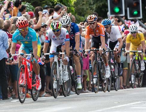
10 Date: May 30, 2014 To: Mayor and City Council From: Re: Karen Gallagher Transportation Planner Buffered Bike Lanes Downtown Requested Action Provide comments to ACHD on buffered bike lane trial on Capitol Boulevard, Idaho Street, and Main Street. This item is on the June 4 th ACHD Commission agenda. Overview Council discussed the buffered bike lanes at a work session two weeks ago, followed by a letter to the ACHD Commission. This is a follow up work session to cover new information. Attached is Director Wong s presentation to the ACHD Commission from May 21 st and data from ACHD. ACHD has tracked bicycle and vehicular data before and throughout the month of May. The bike counts are up with the buffered bike lanes, bicycle behavior/compliance has improved, and overall vehicular travel time has not changed. There not been any crashes reported that are attributable to the trial. There has been a large amount of public feedback, the majority from the motoring public, and a significant amount from the bicycling community. We recognize that change is difficult and the need for more education. The buffered bike lanes bring a multitude of benefits, including: - Improved Walkability - Safety - Economic Development (including attracting mobile employees who can live where they choose and choose bike friendly environments) - Quality of Life - Mode Choice for a wider range of people - Health - Air Quality Recommendation Have a Council Member attend ACHD s meeting to state Boise s support for the buffered bike lanes with refinements. Attachments ACHD PowerPoint, May 21, 2014 ACHD Data Boise City Letter to ACHD, May 21, 2014 Packet Pg. 10


11 21 May 2014 Boise Pilot Project Briefing Bruce Wong, Director Our Mission: We Drive Quality Transportation for all Ada County - Anytime, Anywhere! Packet Pg. 11 1


12 The Why Boise s CCDC hired planner Jeff Speck to recommend pedestrian/bicycle changes to Boise; his report was late for the ACHD FY14 planning cycle, but some of his changes were budgeted nonetheless. ACHD is hosting this pilot project to evaluate other potential changes recommended by the study Boise sponsored. The study recommended permanently converting travel lanes to bike lanes in the downtown core The What operationally replicate the concept (fly before you buy) through May 2014 The How -- In addition to public comments received, ACHD will consider how well the new road configuration works. ACHD will be observing and measuring aspects such as utilization of the bike lanes and peak hour travel times along the affected corridors. We will compare these observations and measurements against baseline data taken before the project. Packet Pg. 12 2
13 Stakeholders Boise Downtown Business Association Boise City Police / Fire Departments Boise City Leadership / Staff Boise City Chamber of Commerce VRT ACHD ACHD Bicycle Advisory Committee Ada County Leadership Packet Pg. 13 3

14 Packet Pg. 14 4
15 Vehicle count methodology Capitol south and north of the river, north of Front Main east of 16 th, east of 13 th, east of 9 th, west of 5 th, west of Broadway Idaho west of Broadway, east of 5 th, east of 9 th, east of 13 th, east of 15 th Bike count methodology Capitol and River, Capitol and Main, Capitol and Idaho Main and 3 rd, 5 th, 9 th, 13 th, 16 th, and Broadway/Ave B and Warm Springs Idaho and 3 rd, 5 th, 8 th, 9 th, 13 th, 16 th Packet Pg. 15 5
16 Base Daily Bike Count Pilot Daily Bike Count Capital In Street On Sidewalk In street On Sidewalk AM (79) (139) PM (210) (285) Main AM (72) (177) PM (169) (304) Idaho AM (45) (148) PM (146) (412) AM 7 9 AM PM 4 6 PM Packet Pg. 16 6
17 Capital Main Idaho Base Daily Vehicle Count AM PM AM PM AM PM Pilot Daily Vehicle Count AM 7 9 AM PM 4 6 PM Packet Pg. 17 7
 Bikes not following the rules of the road Attitude both sides see each other as")

18 ACHD 2014 Public Open House 600 attendees 2/3 rd support As of 21 May 8756 survey responses -- 55% No / 45% Yes 650+ TELLUS 70% against 30% for Common customer themes Increased congestion Bike registration fees (bikes are getting a free ride) Bikes not following the rules of the road Attitude both sides see each other as wrong and arrogant Drivers hate the lanes for the most part cyclists like / tolerate the lanes Parking Loading zone challenges Bikes NOT USING the dedicated bike lanes Buffered bike lanes not safe visibility Main and Idaho buffered lanes appear redundant already have bike lanes The bike lanes are not attractive Packet Pg. 18 8
19 Initial Observations / Lessons Learned: Downtown Business Association OK at this point Reexamine parking / loading zones Of the 20 business surveyed, 12 say they are losing customers Increasing bike traffic -- average vehicle to bike project traffic usage 97.5% / 2.5% Small number of bikes using this for commuting, appears more are using this for recreational growing number after 7 PM Bikes are slowly moving off the sidewalks except on Idaho No huge spike in congestion in the morning / evening peak times White candlesticks are working to delineate bike lanes but not working as well to mark parking, driveways, and transition areas Packet Pg. 19 9
20 Initial Observations / Lessons Learned: Parking concerns on Main between 4 th and 5 th Informally, we have not noticed a decrease in vehicle speeds and are checking with Boise PD Bike boxes if the Commission decides to permanently implement buffered bike lanes, we will need to move select bike boxes further back from intersections No turn on red is largely being unheeded or unobserved by drivers If made permanent, Parade routes will have to be redone Packet Pg
21 Long Range: Need to answer the question what long term problem are we trying to solve and does the demonstration project do just that? Need to answer the question why protected bike lanes, why not just enhanced (traditional) bike lanes on the road way? ROI for the taxpayer May need to consider sacrificing parking verses sacrificing travel lanes for permanent bike lanes Winter Maintenance Although the City is the lead on accessible downtown parking, if the Commission decides to move forward with buffered bike lanes, accessible parking space locations must be a focus item Need to consider / assess growth projections for years regarding implementation, congestion, etc. ROI for the taxpayer --- COST SHARE? Need to keep our powder dry we are learning more every day Packet Pg
22 Recommendation continue as advertised Decision point 4 June (Conclusions / Recommendations) Potential to extend through August 2014 on Capitol (Capitol overlay project begins in Sept 2014) Potential to extent on Idaho No potential to extend on Main west of Capitol Gardner Project Packet Pg


23 If you think about it, our 436,000 customers only need two things from ACHD: Someone they can trust Someone they can count on Our Mission: We Drive Quality Transportation for all Ada County-Anytime, Anywhere! Packet Pg
24 Downtown Buffered Bike Lane - Bicycle Usage Counts 03rd & Idaho 03rd & Main 05th & Idaho 05th & Main 08th & Idaho 09th & Main 09th & Idaho 13th & Idaho 13th & Main 16th & Idaho 16th & Main Broadway/Ave B & Warm Springs Capitol & Idaho Capitol & Main Capitol & River 4/25/14 (Before BBL) AM PM AM PM AM PM AM PM AM PM AM PM AM PM AM PM AM PM AM PM AM PM AM PM AM PM AM PM AM PM Using Street (BBL) direction of traffic flow Using Street (BBL) against traffic flow Using Sidewalk (BBL) direction of traffic flow Using Sidewalk (BBL) against traffic flow Total Bikes (possible BBL usage) Total Bikes (All Directions) Vehicular Volume Ratio Week of 5/5/14 Using Bike Ln (BBL) direction of traffic flow Using Bike Ln (BBL) against traffic flow Using Sidewalk (BBL) direction of traffic flow Using Sidewalk (BBL) against traffic flow Total Bikes (possible BBL usage) Total Bikes ( All Directions) Volume Ratio Week of 5/19/14 Using Bike Ln (BBL) direction of traffic flow Using Bike Ln (BBL) against traffic flow Using Sidewalk (BBL) direction of traffic flow Using Sidewalk (BBL) against traffic flow Total Bikes (possible BBL usage) Total Bikes ( All Directions) Volume Ratio Packet Pg. 24
25 May 21, 2014 John Franden, President Ada County Highway District 3775 Adams Street Garden City, ID Re: Downtown Boise Implementation Plan Buffered Bike Lanes Dear President Franden: The Boise City Council sends an enthusiastic thank you for your innovative installation of buffered bike lanes on Capitol Boulevard, Main Street, and Idaho Street. It is evident that this took courage, foresight and effort to execute and we greatly appreciate it. With Boise recently being recognized as having the 4 th highest percentage of bicycle commuters in the nation, we see the buffered bike lanes as a tremendous step forward in safely assisting bicyclist mobility downtown. We have also observed that pedestrians feel safer with fewer traffic lanes to cross and more buffering between vehicular lanes and the sidewalk. Downtowns are all about pedestrian activity and comfort; and these factors have notably improved as part of the bike lane project. There were eight metrics proposed by ACHD before the pilot was launched, including system failure, travel time, bike counts, and public opinion. We are very pleased to see that the system has not failed with the pilot project. At our work session, Matt Edmond affirmed that there has been no overall change in vehicular travel time and that bicycle use has in fact increased. We are aware of the amount of feedback you have received, both positive and negative, and understand that some of this may be of concern to the District. If the District stopped every project that receives significant negative feedback, many would not proceed. As leaders of public entities we all know it is important to look at the long term vision while working through change management. Change of any significance is never easy; yet, given time and adjustment, the buffered bike lanes will bring a multitude of benefits to our shared constituents, including: - Safety - Economic Development (including attracting mobile employees who can live where they choose and choose bike friendly environments) Packet Pg. 25
26 - Quality of Life - Mode Choice - Health - Air Quality - Improved Walkability While we have certainly seen bicycle and driver behavior that needs to be addressed through education and enforcement, we have also seen families with young riders bicycling in on Main Street and Idaho Street, even in the PM peak hour commute. This a great change to witness and shows that the buffered bike lanes are making downtown more bicycle-accessible to a wider range of people. Boise remains in full support of the buffered bike lanes on Capitol, Main, and Idaho, and strongly recommends keeping and refining them throughout the summer and fall. Based on our limited experience over the last three weeks, the following items are suggested for refinement as we move forward: 1. Increase education Particularly on use of the bike boxes 2. Relocate Accessible Parking spaces to nearest side street 3. Replace the loading zones that were removed 4. Add more paint or stencils to mark parking stalls and notify drivers of the parking zone (drivers are exiting vehicles and not realizing they are in a metered or time-zoned parking stall) 5. Add paint to highlight driveways and alley approaches 6. Replace the sharrows with a green bike lane on Idaho Street, between Capitol and 9 th 7. Examine the street section dimensions to see if some parking spaces can be gained back, especially on Main Street between 4 th and 5 th streets. 8. Refine candlestick placement and striping (Why are candlesticks offset from striping? Can the floating parking be delineated with paint and the candlesticks used solely to define the bike lanes?) 9. On Capitol Boulevard: a. Address Bus Stop loading of wheelchairs across the bike lane. With the bike lane located next to the curb, the bus no longer stops adjacent to the curb to load passengers, specifically those is a wheel chair. One solution is to install a raised pedestrian table in the cross walk starting at the pedestrian ramp and extending across the bike lane to the place where the bus stops. It would look like a speed hump in the bike lane. b. We would like to add parking meters south of Myrtle Street Lastly, Boise requests that we maintain the buffered bike lanes on Main and Idaho while the City Center project is under construction. The buffered lanes extend for many blocks on either side of the City Center area and we see no need to forego the learning experience and benefits of continuing to use those bike lanes while the construction project proceeds. We would be happy to work with the District on a plan for the short segments that will be impacted by the City Center project starting in June. In summary, we applaud the highway district for your efforts in bringing modern concepts for transportation to our downtown. We also believe that a program of this substance and significance requires a lengthier period of transition and adjustment for drivers, cyclists, pedestrians, and implementing agencies than the preceding three weeks have provided. If ACHD will extend the duration of the project as we are requesting Packet Pg. 26

27 here, we pledge our best efforts to assist in refining its operation and in educating our citizens about how to use it and benefit from it. Sincerely, David H. Bieter Mayor cc: Maryanne Jordan Council President Karen Gallagher, Planning and Development Services Matt Edmond, ACHD Packet Pg. 27
Fairview and Main Local Streets Improvement Plan
 PIM#2 Summary Report Meeting Format Date & Time: Location: Address: Prepared By: Community Open House August 11, 2016 5:30 p.m. 7:30 p.m. Red Lion Hotel 1800 W. Fairview Avenue, Boise Stephanie Borders,
Item 08M 1 of 9
 MEETING DATE: December 20, 2017 PREPARED BY: Christopher L. Magdosku, City Engineer DEPT DIRECTOR: Brenda Wisneski DEPARTMENT: Development Services CITY MANAGER: Karen P. Brust SUBJECT: Interim North Coast
Lee s Summit Road Improvement Study Public Open House June 7, 2007 Summary of Comment Card Responses
 Lee s Summit Road Improvement Study Public Open House June 7, 2007 Summary of Comment Card Responses Introduction At the Lee s Summit Road Improvement Study Public Open House held Thursday, June 7, 2007
Advancing Transportation Choices in Des Moines. MPO Environmental Roundtable January 9, 2018
 Advancing Transportation Choices in Des Moines MPO Environmental Roundtable January 9, 2018 Presented by Jennifer McCoy, PE, PTOE City Traffic Engineer Agenda Des Moines Area Transportation Planning Connect
Broad Street Bicycle Boulevard City Council Study Session Summary
 Broad Street Bicycle Boulevard City Council Study Session Summary Overview: On August 15 th, 2017, a City Council Study Session was held to invite community input and request City Council guidance on a
SAN FRANCISCO MUNICIPAL TRANSPORTATION AGENCY
 THIS PRINT COVERS CALENDAR ITEM NO. : 11 DIVISION: Sustainable Streets BRIEF DESCRIPTION: SAN FRANCISCO MUNICIPAL TRANSPORTATION AGENCY Approving traffic modifications on Twin Peaks Boulevard between Christmas
Stakeholder s Meeting #1
 Stakeholder s Meeting #1 Dave Wallace Deputy Director, Plans & Projects 25 June 2014 Our Mission: We drive quality transportation for all Ada County Anytime, Anywhere! 1 Address the completion of a safe,
Committed to Service
 Committed to Service Paul Woods, President Rebecca W. Arnold, Vice President Sara M. Baker, Commissioner Jim D. Hansen, Commissioner Kent Goldthorpe, Commissioner March 14, 2017 Planning and Programming
MASTER BICYCLE AND PEDESTRIAN PLAN
 VILLAGE OF NORTHBROOK MASTER BICYCLE AND PEDESTRIAN PLAN DRAFT PLAN OPEN HOUSE May 2, 2018 AGENDA 1. Community Engagement 2. Vision and Goals 3. General Structure of Plan 4. Recommendations Overview 5.
2014/2015 BIKE ROUTE PLAN 83 AVENUE PROTECTED BIKE LANE
 About the Project 2014/2015 BIKE ROUTE PLAN The City of Edmonton is planning a major bike route on the south side of Edmonton. This bike route is one part of a plan to provide citizens with transportation
Pine Hills Road Pedestrian/Bicycle Safety Study Board of County Commissioners Work Session
 Pine Hills Road Pedestrian/Bicycle Safety Study Board of County Commissioners Work Session February 20, 2018 Meeting Agenda Study Overview Existing Conditions Access Management Potential Gateway Features
BETHEL ROAD AND SEDGWICK ROAD CORRIDOR STUDY
 DRAFT PLAN City Council Meeting August 14, 2017 STUDY AREA Sedgwick Corridor State Route 160, principal arterial with Class 3 access management designation, commuter and freight route, connection to SR
CONNECTIVITY PLAN. Adopted December 5, 2017 City of Virginia Beach
 CONNECTIVITY PLAN Adopted December 5, 2017 City of Virginia Beach CONTENTS 1.0 Background & Purpose... 2 2.0 Existing Inventory & Analysis... 3 ViBe District Existing Walking Conditions... 4 3.0 ViBe District
PEDESTRIAN ACTION PLAN
 ATTACHMENT 2 CITY OF SANTA MONICA PEDESTRIAN ACTION PLAN CITY OF SANTA MONICA PEDESTRIAN ACTION PLAN This page intentionally left blank EXECUTIVE SUMMARY CHAPTER 1 EXECUTIVE SUMMARY Setting the Stage
CITY OF SIGNAL HILL Cherry Avenue Signal Hill, CA
 CITY OF SIGNAL HILL 2175 Cherry Avenue Signal Hill, CA 90755-3799 AGENDA ITEM TO: HONORABLE MAYOR AND MEMBERS OF THE CITY COUNCIL FROM: STEVE MYRTER, P. E. DIRECTOR OF PUBLIC WORKS SUBJECT: SPRING STREET
Citizen Advisory Group Meeting #8 May 5, Welcome. Today s meeting will focus on: Land Use & Transportation CHARLOTTEPLANNING.
 Citizen Advisory Group Meeting #8 May 5, 2010 Welcome. Today s meeting will focus on: Land Use & Transportation CHARLOTTEPLANNING.ORG Meeting Agenda Handouts: o Meeting Agenda o Summary of East Seventh
APPENDIX A: Complete Streets Checklist DRAFT NOVEMBER 2016
 APPENDIX A: Complete Streets Checklist DRAFT NOVEMBER 2016 Complete Streets Checklist MetroPlan Orlando s Complete Streets Checklist is an internal planning tool for staff to further implementation of
A copy of the draft plan is available at:
 To: From: Re: Mayor and City Council Patricia Nilsson, AICP, Comprehensive Planning Manager Boise Central Bench Neighborhood Pedestrian and Bicycle Plan Date: August 24, 2012 Requested Action Provide comments
MARKET/JFK VISION ZERO PILOT PROJECT FEBRUARY 2019 EVALUATION REPORT
 MARKET/JFK VISION ZERO PILOT PROJECT FEBRUARY 2019 EVALUATION REPORT WHY IS THIS PROJECT IMPORTANT? Market Street and JFK Boulevard in Center City are key east-west corridors in the core business district.
Dr. M.L. King, Jr. Street North Complete Streets Resurfacing Opportunities HOUSING, LAND USE, AND TRANSPORTATION COMMITTEE MARCH 22, 2018
 Dr. M.L. King, Jr. Street North Complete Streets Resurfacing Opportunities HOUSING, LAND USE, AND TRANSPORTATION COMMITTEE MARCH 22, 2018 What s Happening The City plans to mill and resurface Dr. M.L.
Corpus Christi Metropolitan Transportation Plan Fiscal Year Introduction:
 Introduction: The Safe, Accountable, Flexible, Efficient Transportation Equity Act: A Legacy for Users (SAFETEA-LU) has continued the efforts started through the Intermodal Surface Transportation Efficiency
Toward Zero Deaths. Regional SHSP Road Show Meeting. Virginia Strategic Highway Safety Plan. presented by
 Toward Zero Deaths Regional SHSP Road Show Meeting presented by Virginia Strategic Highway Safety Plan December 1, 2016 1 Welcome & Introductions Purpose of the Meeting Objectives & Key Outcomes Agenda»
Item to be Addressed Checklist Consideration YES NO N/A Required Description Complete Streets Guidelines
 Passaic County Complete Streets Checklist - Concept Development Project Name Item to be Addressed Checklist Consideration YES NO N/A Required Description Complete Streets Guidelines Existing Plans Have
CITY OF LOS ANGELES INTER-DEPARTMENTAL MEMORANDUM
 CITY OF LOS ANGELES INTER-DEPARTMENTAL MEMORANDUM Date: April 1, 219 To: Honorable City Council c/o City Clerk, Room 395, City Hall Attention: Honorable Mike Bonin, Chair, Transportation Committee From:
LANCASTER CITY BICYCLE NETWORK
 LANCASTER CITY BICYCLE NETWORK Downtown Merchants Meeting Wednesday, July 19, 2017 http://www.lancasteratp. DOWNTOWN WALKABILITY ANALYSIS What changes can be made, in the least amount of time, and for
Broad Street Bicycle Boulevard Design Guidelines
 Broad Street Bicycle Boulevard Design Guidelines Building from the strategies introduced in the 2013 Bicycle Transportation Plan and community input received thus far, City Transportation Staff have identified
EXECUTIVE SUMMARY. Vision
 Vision Walking and bicycling in Salt Lake City will be safe, convenient, comfortable, and viable transportation options that connect people to places, foster recreational and economic development opportunities,
Road Diets FDOT Process
 Florida Department of TRANSPORTATION Road Diets FDOT Process Humberto Castillero, PE, PTOE Roadway Design Office Purpose of Guide Develop a statewide lane elimination review process Balance state & local
2014/2015 BIKE ROUTE PLAN 83 AVENUE PROTECTED BIKE LANE
 About the Project The City of Edmonton is planning a major bike route on the southside of Edmonton. The Strathcona Bike Route will connect the communities of Strathcona, Garneau and the University area,
City of San Diego Vision Zero Draft Strategic Plan FY 2017
 City of San Diego Vision Zero Draft Strategic Plan FY 2017 Engineering Objective: To develop and implement a strategy that employs best planning, design and engineering practices. Background: Over the
City of Fairfax, Virginia City Council Work Session
 City of Fairfax, Virginia City Council Work Session Agenda Item # 4b City Council Meeting 6/2/2015 TO: FROM: SUBJECT: ISSUE(S): SUMMARY: FISCAL IMPACT: RECOMMENDATION: ALTERNATIVE COURSE OF ACTION: RESPONSIBLE
Community Task Force March 14, 2018
 Community Task Force March 14, 2018 Welcome and Introductions Project Partners Regional Transportation District (RTD) City of Aurora Colorado Department of Transportation (CDOT) Denver Regional Council
Summary of Comments Public Meeting: Marietta Street Resurfacing Project Atlanta Contemporary August 29, 2017 / 6:00 pm to 8:00 pm
 Renew Atlanta hosted a public meeting to discuss the Marietta Street Resurfacing project at. Councilmember Cleta Winslow attended the public meeting, where over seventy (70) citizens to include representatives
North Avenue Corridor Study
 North Avenue Corridor Study Advisory Committee Meeting #6 July 1, 2014 Agenda Concept Revisions based on Advisory Committee feedback Review of New Concept Scoring & Costs Concept Discussion/Questions Voting:
SAN FRANCISCO MUNICIPAL TRANSPORTATION AGENCY
 THIS PRINT COVERS CALENDAR ITEM NO.: 10.3 DIVISION: Sustainable Streets BRIEF DESCRIPTION: SAN FRANCISCO MUNICIPAL TRANSPORTATION AGENCY Approving various traffic and parking modifications on Bay Street
MEMORANDUM. Charlotte Fleetwood, Transportation Planner
 MEMORANDUM Date: Updated August 22, 2017 To: Organization: Charlotte Fleetwood, Transportation Planner Boston Transportation Department From: Jason DeGray, P.E., PTOE, Regional Director of Engineering
Short-Term Enhancements Improvements to keep Austin moving. MetroRapid
 Short-Term Enhancements Improvements to keep Austin moving Long-Term Investments Projects to support our future Mobility Hubs MetroRapid MetroRail MetroExpress Commuters Connectors Circulators Project
Active Transportation Facility Glossary
 Active Transportation Facility Glossary This document defines different active transportation facilities and suggests appropriate corridor types. Click on a facility type to jump to its definition. Bike
CHAPTER 3: Vision Statement and Goals
 Davidson Walks & Rolls: Active Transportation Master Plan CHAPTER 3 Contents: Overview Vision Statement Measurable Goals Public Outreach CHAPTER 3: Vision Statement and Goals Overview The vision statement
Solana Beach Comprehensive Active Transportation Strategy (CATS)
") Solana Beach Comprehensive Active Transportation Strategy (CATS) 3.0 Goals & Policies The Solana Beach CATS goals and objectives outlined below were largely drawn from the Solana Beach Circulation Element
Solana Beach Comprehensive Active Transportation Strategy (CATS) 3.0 Goals & Policies The Solana Beach CATS goals and objectives outlined below were largely drawn from the Solana Beach Circulation Element
Beach Cities Living Streets Design Manual and Aviation Boulevard Multimodal Corridor Plan
 Beach Cities Living Streets Design Manual and Aviation Boulevard Multimodal Corridor Plan AGENDA 1 Introductions & Project Scope 2 Public Outreach Recap 3 Living Streets Design Manual 4 Aviation Boulevard
Commerce Street Complete Street Project from Good Latimer Expressway to Exposition Avenue
 Commerce Street Complete Street Project from Good Latimer Expressway to Exposition Avenue T A N Y A B R O O K S A S S I S T A N T D I R E C T O R M O B I L I T Y P L A N N I N G M O B I L I T Y A N D S
DEPARTMENT OF ENVIRONMENTAL SERVICES. North Harrison Street (Lee Highway to Little Falls Road) Comparative Analysis. Prepared for:
 Comparative Analysis. Prepared for:") DEPARTMENT OF ENVIRONMENTAL SERVICES North Harrison Street (Lee Highway to Little Falls Road) Comparative Analysis Prepared for: Arlington County Department of Environmental Services 2100 Clarendon Boulevard,
DEPARTMENT OF ENVIRONMENTAL SERVICES North Harrison Street (Lee Highway to Little Falls Road) Comparative Analysis Prepared for: Arlington County Department of Environmental Services 2100 Clarendon Boulevard,
Public Works Committee Meeting Richard E. Mastrangelo Council Chamber November 20, 2017
 Public Works Committee Meeting Richard E. Mastrangelo Council Chamber November 20, 2017 Purpose of Meeting Why are we here? Project Recap/Updates Project Limits/Segments Road Diet Concept Lessons Learned
Downtown Naples Mobility and Connectivity Study. Naples City Council Presentation January 2017
 Downtown Naples Mobility and Connectivity Study Naples City Council Presentation January 2017 Agenda 1. Introduction 2. Scope Review 3. Project Schedule 4. Existing Conditions 5. Public Charrette 6. Mobility
PLANNING COMMISSION MEETING MINUTES May 17, 2017 CITY COUNCIL CHAMBER 7:00 P.M.
 PLANNING COMMISSION MEETING MINUTES May 17, 2017 CITY COUNCIL CHAMBER 7:00 P.M. I. CALL TO ORDER The meeting was called to order at 7:05 p.m. II. ROLL CALL Present: Absent: Staff: C. Zuellig, A. Bedogne,
Bay to Bay Boulevard Complete Streets Project
 Bay to Bay Boulevard Complete Streets Project Dale Mabry Highway to Bayshore Boulevard February 08, 2018 Photo Source: Tampa Bay Times Alessandra Da Pra Meeting Format Introduction Resurfacing Information
Agenda. Overview PRINCE GEORGE S PLAZA METRO AREA PEDESTRIAN PLAN
 PRINCE GEORGE S PLAZA METRO AREA PEDESTRIAN PLAN May 28, 2008 Agenda Welcome and introductions Project overview and issue identification Planning context and strengths Design challenges and initial recommendations
Omaha s Complete Streets Policy
 Omaha s Complete Streets Policy (Adopted August 2015) VISION To create great places and enhance our quality of life, the City of Omaha will provide safe, accessible streets for all users. Complete Streets
Arlington Public Schools Thomas Jefferson Site Evaluation Transportation Networks. Thomas Jefferson Working Group Meeting #6 November 10, 2014
 Arlington Public Schools Thomas Jefferson Site Evaluation Transportation Networks Thomas Jefferson Working Group Meeting #6 November 10, 2014 2 3 INTRODUCTION 4 Goal of our work: Identify and assess multi-modal
Los Altos Hills Town Council - June 18, 2015 Palo Alto City Council June 22, AGENDA ITEM #2.B Presentation
 Los Altos Hills Town Council - June 18, 2015 Palo Alto City Council June 22, 2015 AGENDA ITEM #2.B Presentation Previous Presentations Los Altos Hills Town Council in May 2014 and February 2015 Palo Alto
FHWA Resources for Pedestrian and Bicycle Professionals
 FHWA Resources for Pedestrian and Bicycle Professionals Charlie Zegeer, UNC Highway Safety Research Center/PBIC Libby Thomas, UNC Highway Safety Research Center Dan Nabors, Vanasse Hangen Brustlin (VHB)
5. RUNNINGWAY GUIDELINES
 5. RUNNINGWAY GUIDELINES These guidelines should be considered collectively when making runningway decisions. A runningway is the linear component of the transit system that forms the right-of-way reserved
Table 1: Recommended Interim Improvement and Long Term Improvement/ROW Preservation Proposed Improvements. Recommended Interim Improvement
 Rebecca W. Arnold, President Sara M. Baker, Vice President John S. Franden, Commissioner Carol A. McKee, Commissioner Mitchell Jaurena, Commissioner June 19, 2012 Planning & Programming Department TO:
Dear Mr. Tweed: Sincerely, Min Zhou, P.E. Vice President
 December 17, 2012 Mr. Steve Tweed City of Long Beach, Department of Public Works Traffic & Transportation Bureau, 10 th Floor City Hall 333 West Ocean Boulevard Long Beach, CA 90802 Subject: Broadway and
Byron Avenue. Public Meeting. Thursday June 16, Traffic Calming Design Sherbourne Road to Island Park Drive
 Byron Avenue Traffic Calming Design Sherbourne Road to Island Park Drive Public Meeting Thursday June 16, 2016 Our Lady of Fatima Parish 153 Woodroffe Avenue 6 9pm 1 Project Summary Area Projects Background
The five potential solutions and some of their benefits and costs are listed in the following table: Ferry Patron Bike Parking Alternatives
 STAFF REPORT City Council of the City of Sausalito AGENDA TITLE: Ferry Patron Bicycle Parking Plan - Summer 2014 RECOMMENDED MOTION: Note and file informational item, no action necessary SUMMARY In April
Outreach Approach RENEW SF served as the primary liaison with the North Beach community; the Chinatown. Executive Summary
 Executive Summary Executive Summary The Columbus Avenue Neighborhood Transportation Study s objective is to identify changes to transportation infrastructure and policies that could enhance the livability
CITY OF NEW ORLEANS. Department of Public Works. Baronne Street Bike Lane
 CITY OF NEW ORLEANS Department of Public Works Baronne Street Bike Lane 9/17/2014 Agenda Welcome Greg Lawson, Office of Neighborhood Engagement Introduction - Deputy Mayor Andy Kopplin, Chief Administrative
file://c:\documents and Settings\SSchafer\Local Settings\Temp\XPgrpwise\4C98A7A9C...
 file://c:\documents and Settings\SSchafer\Local Settings\Temp\XPgrpwise\4C98A7A9C... Page 1 of 1 9/27/2010 Sarah Schafer - JUMP From: Daniel Prohaska To:
Mayor s Bicycle Advisory Council. Wednesday, December 13 th, 2017
 Mayor s Bicycle Advisory Council Wednesday, December 13 th, 2017 Bicyclist Fatalities, Year to Date (January 1 November 30, 2017) - MBAC Briefing Bicyclist Fatality Statistics Year to date total, 2017
Tonight is for you. Learn everything you can. Share all your ideas.
 Strathcona Neighbourhood Renewal Draft Concept Design Tonight is for you. Learn everything you can. Share all your ideas. What is Neighbourhood Renewal? Creating a design with you for your neighbourhood.
CITY OF COCOA BEACH 2025 COMPREHENSIVE PLAN. Section VIII Mobility Element Goals, Objectives, and Policies
 CITY OF COCOA BEACH 2025 COMPREHENSIVE PLAN Section VIII Mobility Element Goals, Objectives, and Policies Adopted August 6, 2015 by Ordinance No. 1591 VIII MOBILITY ELEMENT Table of Contents Page Number
State Street and Pierce Park Lane Intersection Concept Report
 State Street and Pierce Park Lane Intersection Prepared for September 2017 Prepared by CITATION Parametrix. 2017. State Street & Pierce Park Lane Intersection. Prepared by Parametrix, Boise, ID. September
A CHANGING CITY. of Edmonton, it is essential that it reflects the long-term vision of the City.
 A CHANGING CITY By the year 2040, Edmonton will be home to more than 1 million people. To accommodate growth and support a healthy and compact city, we need a new approach to development/redevelopment
MAG Town of Cave Creek Bike Study Task 6 Executive Summary and Regional Significance Report
 Page 1 MAG Town of Cave Creek Bike Study Task 6 Executive Summary and Regional Significance Report August 1, 2012 MAG Project #481 Page 2 Task 6 Executive Summary and Regional Significance Report Introduction
HARRISON STREET/OAKLAND AVENUE COMMUNITY TRANSPORTATION PLAN
 HARRISON STREET/OAKLAND AVENUE Community Workshop #4: Draft Plan Review December 3, 2009 D E S I G N, C O M M U N I T Y & E N V I R O N M E N T INTRODUCTIONS Key Project Staff: Alisa Shen, Project Manager,
Safe Streets. City of Lake Forest Park. March 21, 2017
 Safe Streets City of Lake Forest Park March 21, 2017 1 01 WELCOME 2 Agenda WELCOME WHAT IS THIS PROJECT? CONTEXT DRAFT CITYWIDE PROJECTS EXERCISE INTRODUCTION 3 02 WHAT IS THIS PROJECT? 4 WHAT IS THIS
Bellevue Downtown Association Downtown Bike Series
 Bellevue Downtown Association Downtown Bike Series Meeting 2 Franz Loewenherz Andreas Piller Kyle Potuzak Chris Long October 26, 2017 Today s Agenda: 1) Meeting Purpose 2) 9/28 Meeting Recap 3) Candidate
Introduction. North 12 th Complete Street Project Overview
 Introduction On Wednesday, March 1, 2017, the City of Sacramento, in partnership with Sacramento Regional Transit District and the Sacramento Housing and Redevelopment Agency, hosted a community outreach
NASHUA REGIONAL PLANNING COMMISSION REGIONAL BICYCLE AND PEDESTRIAN PLAN
 NASHUA REGIONAL PLANNING COMMISSION REGIONAL BICYCLE AND PEDESTRIAN PLAN June, 2005 Prepared by the Nashua Regional Planning Commission 2005 NRPC Regional Bicycle and Pedestrian Plan- JUNE 2005 ACKNOWLEDGEMENTS
CRESTON ROAD COMPLETE AND SUSTAINABLE STREETS CORRIDOR PLAN
 CRESTON ROAD COMPLETE AND SUSTAINABLE STREETS CORRIDOR PLAN Preferred Plan Community Presentation September 27, 2017 City of El Paso de Robles in partnership with: Local Government Commission, W-Trans,
Hennepin County Bicycle and Pedestrian Planning
 Hennepin County Bicycle and Pedestrian Planning 1 Value of bicycle and sidewalk systems Safety Livability Mobility Health Personal Finances Economic Sustainability Clean Air Recreation Parking and congestion
GRTC Bus Rapid Transit: Semi-Final Design Phase Public Meetings: October 26 & 27, 2015
 GRTC Bus Rapid Transit: Semi-Final Design Phase Public Meetings: October 26 & 27, 2015 Welcome! Meeting Agenda Project update presentation Up to 15 minutes for Pulse Q&A about project design. (Please reserve
About the Studio. Edward J. Bloustein School of Planning and Public Policy - Rutgers University
 About the Studio Edward J. Bloustein School of Planning and Public Policy - Rutgers University Purpose of studio: Help City of Bayonne apply for Safe Routes to School (SRTS) funding by producing a School
Lessons Learned from Cycle Tracks (Class IV Bikeways) Design Practice
 Design Practice") Lessons Learned from Cycle Tracks (Class IV Bikeways) Design Practice By: Min Zhou, P.E., Principal/Vice President KOA Corporation 1 What is a Cycle Track (Class IV) TYPICAL BIKEWAY CLASSIFICATION CLASS
Lessons Learned from Cycle Tracks (Class IV Bikeways) Design Practice By: Min Zhou, P.E., Principal/Vice President KOA Corporation 1 What is a Cycle Track (Class IV) TYPICAL BIKEWAY CLASSIFICATION CLASS
Riverside Drive Complete Streets Project 3 rd Community Meeting. March 26, 2015
 Riverside Drive Complete Streets Project 3 rd Community Meeting March 26, 2015 Providing Feedback Sign-In with contact information for future updates Complete questionnaire provided tonight Complete comment
Active Transportation Rail to River Corridor. Community Meeting - Segment A
 Active Transportation Rail to River Corridor Community Meeting - Segment A June 29, 2017 Tonight s Agenda > Open House (30 min) > Welcome / Project Overview > Presentation of 30% Design Refinements > Next
PRINCE GEORGE S PLAZA METRO AREA PEDESTRIAN PLAN
 PRINCE GEORGE S PLAZA METRO AREA PEDESTRIAN PLAN May 28, 2008 Agenda Welcome and introductions Project overview and issue identification Planning context and strengths Design challenges and initial recommendations
CITY OF HAMILTON PLANNING AND ECONOMIC DEVELOPMENT DEPARTMENT Transportation Planning and Parking Division
 CITY OF HAMILTON PLANNING AND ECONOMIC DEVELOPMENT DEPARTMENT Transportation Planning and Parking Division TO: Chair and Members Public Works Committee COMMITTEE DATE: June 18, 2018 SUBJECT/REPORT NO:
We support the following: Tom Davies Square 200 Brady Street Sudbury, Ontario
 April 4, 2014 Tom Davies Square 200 Brady Street Sudbury, Ontario RE: Second Avenue Reconstruction Project and Panel Consultation Dear City of Greater Sudbury Mayor and Council: The (SMAP), a council appointment
Southview Blvd & 3 rd Avenue Improvement Project. Public Open House December 4, to 7pm
 Southview Blvd & 3 rd Avenue Improvement Project Public Open House December 4, 2014 5 to 7pm Southview Blvd & 3 rd Avenue Public Information Meeting Agenda Presentation 5:30 to 6:15 pm Purpose of Project
Chapter 2. Bellingham Bicycle Master Plan Chapter 2: Policies and Actions
 Chapter 2 Bellingham Bicycle Master Plan Chapter 2: Policies and Actions Chapter 2: Policies and Actions The Bicycle Master Plan provides a road map for making bicycling in Bellingham a viable transportation
AGENDA REPORT. Issue: Discussion of potential improvements on Barnwell Road at Niblick Drive
 AGENDA REPORT To: From: By: Honorable Mayor and City Council Members Warren Hutmacher, City Manager Tom Black, Public Works Director Date: March 23, 2016 Agenda: March 28, 2016 WORK SESSION AGENDA: Barnwell
Complete Streets. Designing Streets for Everyone. Sarnia
 Complete Streets Designing Streets for Everyone Sarnia Complete Streets ~ Sarnia ~ 2018 Introduction Our City is made up of a network of streets that we use to go for a walk, cycle to work, drive to the
TOWN OF WILLIAMSTON, SC BICYCLE AND PEDESTRIAN MASTER PLAN TOWN OF WILLIAMSTON, SC BICYCLE AND PEDESTRIAN MASTER PLAN
 TOWN OF WILLIAMSTON, SC BICYCLE AND PEDESTRIAN MASTER PLAN Americans Want Choices 55% of Americans would rather drive less & walk more. Transit use is growing faster than population or highway travel.
City of Gainesville Transportation/Roadway Needs PROJECT SUMMARY
 A1 Roadway Resurfacing $23,846,000 TYPE: Preservation of existing system Roadway resurfacing A2 Signal Replacement $6,000,000 TYPE: Preservation of existing system Replace traffic signals. B1 W 6th St
MEETING OF THE CITY OF CONCORD BICYCLE, PEDESTRIAN AND SAFE ROUTES TO TRANSIT PLAN ADVISORY COMMITTEE AGENDA
 MEETING OF THE CITY OF CONCORD BICYCLE, PEDESTRIAN AND SAFE ROUTES TO TRANSIT PLAN ADVISORY COMMITTEE Monday, April 25, 2016 5:30 p.m., Regular Meeting PERMIT CENTER CONFERENCE ROOM 1950 Parkside Drive,
Public Information Centre
 WELCOME Public Information Centre Father Tobin Road Lougheed Middle School - Library Wednesday November 7, 2012 7:00 p.m.to 9:00 p.m. Please sign in Neighbourhood Traffic Calming Guide Background The City
CITY OF BLOOMINGTON COMPLETE STREETS POLICY
 CITY OF BLOOMINGTON COMPLETE STREETS POLICY POLICY OBJECTIVE: The City of Bloomington will enhance safety, mobility, accessibility and convenience for transportation network users of all ages and abilities,
Ross Valley Safe Routes to Schools Task Force Agenda Friday, May 19 th Ross Valley School District 110 Shaw Drive, San Anselmo Blue Room 10:00 am
 Ross Valley Safe Routes to Schools Task Force Agenda Friday, May 19 th Ross Valley School District 110 Shaw Drive, San Anselmo Blue Room 10:00 am Attendees: Karen Baigrie- Team Leader Hidden Valley, Sean
95 th Street Corridor Transportation Plan. Steering Committee Meeting #2
 95 th Street Corridor Transportation Plan Steering Committee Meeting #2 February 18, 2015 PURPOSE OF THE MEETING Update Steering Committee Present Community/Stakeholder Survey Results Present Transportation
5.0 Roadway System Plan
 Southwest Boise Transportation Study Page 16 5.0 Roadway System Plan The Roadway System Plan outlines roadway improvements in the Initial Study Area. It forecasts future deficiencies on the arterial system,
Technical Working Group November 15, 2017
 Technical Working Group November 15, 2017 Welcome and Introductions Project Partners Regional Transportation District (RTD) Colorado Department of Transportation (CDOT) Denver Regional Council of Governments
Frequently Asked Questions (FAQ)
") Frequently Asked s (FAQ) Study Process... 2 Rapid Transit Service and Operations... 5 Public Consultation... 8 Business Impacts... 8 Design and Property Impacts... 9 Construction Impacts...12 Traffic,
Frequently Asked s (FAQ) Study Process... 2 Rapid Transit Service and Operations... 5 Public Consultation... 8 Business Impacts... 8 Design and Property Impacts... 9 Construction Impacts...12 Traffic,
Item No. 14 Town of Atherton
 Item No. 14 Town of Atherton CITY COUNCIL STAFF REPORT CONSENT AGENDA TO: THROUGH: FROM: HONORABLE MAYOR AND CITY COUNCIL GEORGE RODERICKS, CITY MANAGER MICHAEL KASHIWAGI, COMMUNITY SERVICES DIRECTOR MARTY
FOLSOM-HOWARD STREETSCAPE OVERVIEW
 FOLSOM-HOWARD STREETSCAPE OVERVIEW SoMa residents should have the same kinds of amenities that other neighborhoods have. The Folsom- Howard Streetscape Project will make SoMa more livable by making it
E Grand Complete Street Pilot Project
 E Grand Complete Street Pilot Project Des Moines City Council Workshop March 6, 2017 Presented by Brian Willham, PE, PTOE Senior Traffic Engineer Background Connect Downtown Pilot Project Balances safety
PISMO BEACH COUNCIL AGENDA REPORT
 PISMO BEACH COUNCIL AGENDA REPORT Agenda Item 8.E SUBJECT/TITLE: TRAFFIC SAFETY COMMITTEE RECOMMENDATIONS TO CITY COUNCIL RECOMMENDATION: Adopt a Resolution approving the Traffic Safety Committee s recommendation
Tulsa Metropolitan Area LONG RANGE TRANSPORTATION PLAN
 Tulsa Metropolitan Area LONG RANGE TRANSPORTATION PLAN Indian Nations Council of Governments August 2005 CONTACTING INCOG In developing the Destination 2030 Long Range Transportation Plan, INCOG s Transportation