January 2018 FRESNO COUNTY REGIONAL ACTIVE TRANSPORTATION PLAN
|
|
|
- Joseph Evans
- 5 years ago
- Views:
Transcription


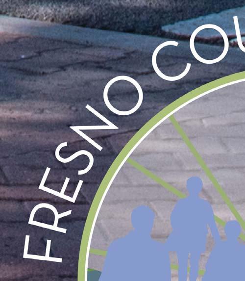

1 FRESNO COUNTY REGIONAL ACTIVE TRANSPORTATION PLAN January 2018 i


2 Acknowledgements: The Fresno Council of Governments thanks the jurisdiction staff members and community members who contributed to the creation of this plan. Front Cover: Crosswalks with bulb outs and brick paving at Draper St, Kingsburg
3 Table of CONTENTS ES Executive Summary ES-1 1 Introduction Vision and Goals Structure of The Active Transportation Plan 1-2 Public Participation 1-4 Bicycle 1-4 Class I Bikeway: Bike Path Class II Bikeway: Bike Lane Class III Bikeway: Bike Route Bicycle Parking Pedestrian 1-1 Trails Sidewalks Crosswalks Relationship To Other Plans and Policies Golden State Corridor Design Plans Caltrans Bicycle Guide For District 6 State And Federal 2-3 Local Jurisdictions 2-1 Bicycle Parking 4-3 Regional 2-1 Supporting Programs 4-3 Fresno Council of Governments Regional Transportation Plan and Sustainable Available Resources Communities Strategy Wayfinding Fresno County Transportation Authority Maintenance Measure C Expenditure Tracking Fresno Council of Governments Transportation Needs Assessment Potential Outcomes Existing Conditions Climate 3-1 Railroads And Historical Development Patterns 3-1 High Volume Regional Connecting Roads 3-2 Other Factors 3-2 Disadvantaged Communities 3-2 Connections With Transit 3-3 Five E s 3-3 Planned Networks And Program Bicycle And Pedestrian Networks 4-1 Crossing And Intersection Improvements 4-1 High Volume Regional Connecting Roads 4-1 i
4 5 Implementation Prioritization Costs 5-1 Funding 5-2 Unincorporated Fresno County Relationship To County Plans 6-1 And Policies County of Fresno General Plan Regional Bicycle & Recreational Trails Master Plan County of Fresno Improvement Standards County of Fresno Standard Drawings Fresno County Code, California Existing Conditions 6-4 Key Destinations Disadvantaged Communities Existing Trip Collisions Past Expenditures Maintenance Policies Planned Networks Firebaugh Relationship to City Plans and Policies 7-1 City of Firebaugh General Plan City of Firebaugh Bicycle Transportation Plan Central Firebaugh Revitalization Plan City of Firebaugh Standard Specifications City of Firebaugh Standard Drawings Municipal Code of Firebaugh, California Existing Conditions 7-3 Key Destinations Disadvantaged Communities Existing Trip Collisions Past Expenditures Maintenance Policies Planned Networks Fowler Relationship to City Plans and Policies 8-1 City of Fowler General Plan Bicycle Transportation Plan City of Fowler Planned Bikeway System Mapping Central Fowler Revitalization Plan City of) Fowler Standard Drawings Municipal Code of Fowler, California Existing Conditions 8-2 Key Destinations Disadvantaged Communities Existing Trip Collisions Past Expenditures Maintenance Policies Planned Networks Huron Relationship to City Plans and Policies 9-1 City of Huron General Plan City of Huron Mobility, Access and Safety Project Municipal Code of Huron, California Existing Conditions 9-3 Key Destinations Disadvantaged Communities Existing Trip Collisions Past Expenditures Maintenance Policies Planned Networks Kerman Relationship to City Plans and Policies 10-1 City of Kerman General Plan City of Kerman Madera Avenue Streetscape Master Plan City of Kerman Standard Drawings Municipal Code of Kerman, California Existing Conditions 10-3 Key Destinations Disadvantaged Communities Existing Trip Collisions Past Expenditures Maintenance Policies Planned Networks ii
5 11 Kingsburg Relationship to City Plans and Policies 11-1 City of Kingsburg General Plan City of Kingsburg Bicycle Transportation Plan Central Kingsburg Revitalization Plan Revitalization Strategy for Downtown Kingsburg North Kingsburg Specific Plan City of Kingsburg School Access and Safety Evaluation City of Kingsburg Standard Specifications City of Kingsburg Standard Drawings Municipal Code of Kingsburg, California Existing Conditions 11-3 Key Destinations Disadvantaged Communities Existing Trip Collisions Past Expenditures Maintenance Policies Planned Networks Mendota Relationship to City Plans and Policies City of Mendota General Plan River Ranch Specific Plan City of Mendota American with Disabilities Act Transition Plan City of Mendota Standard Specifications City of Mendota Standard Drawings Municipal Code of Mendota, California Existing Conditions 12-3 Key Destinations Disadvantaged Communities Existing Trip Collisions Past Expenditures Maintenance Policies Planned Networks Orange Cove Relationship to City Plans and Policies 13-1 City of Orange Cove General Plan City of Orange Cove Proposed Bike Path System City of Orange Cove Standard Drawings Municipal Code and Charter of Orange Cove Existing Conditions 13-3 Key Destinations Disadvantaged Communities Existing Trip Collisions Past Expenditures Maintenance Policies Planned Networks Parlier Relationship to City Plans and Policies 14-1 City of Parlier General Plan Recommendations to Improve Pedestrian Safety in the City of Parlier Existing Conditions 14-3 Key Destinations Disadvantaged Communities Existing Trip Collisions Past Expenditures Maintenance Policies Planned Networks Reedley Relationship to City Plans and Policies City of Reedley General Plan 2030 Update City of Reedley 2010 Bicycle Transportation Plan City of Reedley American with Disabilities Act Self Evaluation and Transition Plan City of Reedley Standard Specifications City of Reedley Standard Drawings Municipal Code of Reedley, California Existing Conditions 15-3 Key Destinations Disadvantaged Communities Existing Trip Collisions Past Expenditures Maintenance Policies Planned Networks San Joaquin Relationship to City Plans and Policies 16-1 City of San Joaquin General Plan The City of San Joaquin 2040 Community Plan City of San Joaquin Mobility and Revitalization Plan Municipal Code of San Joaquin, California iii
6 Existing Conditions 16-2 Key Destinations Disadvantaged Communities Existing Trip Collisions Past Expenditures Maintenance Policies Planned Networks Sanger Relationship to City Plans and Policies A B City of Sanger General Plan City of Sanger Bicycle Plan Sanger Accessibility Master Plan City of Sanger Traffic Safety Assessment City of Sanger Standard Drawings Municipal Code of Sanger, California Existing Conditions 17-2 Key Destinations Disadvantaged Communities Existing Trip Collisions Past Expenditures Maintenance Policies Planned Networks Cities With Current Active Transportation Plans Clovis 18-2 Coalinga 18-3 Fresno 18-5 Selma Appendix A: Plan Conformance with ATP Guidelines Appendix B: Public Participation A-1 Local Workshops to Collect Needs And Desires B-1 Online Crowdsourced Interactive Map B-29 Outreach by Local Community Groups B-30 Regional Transportation Plan Workshops B-69 Project Web Page B-69 Local Workshops to Review Draft Networks B-69 C D E F Appendix C: Relationship To State And Federal Plans And Policies California State Bicycle And Pedestrian Plan C-2 California Green Building Code C-2 California Assembly Bill 32 & Senate Bill 375 C-2 California Assembly Bill 1358 C-2 California Senate Bill 743 C-2 US DOT Policy Statement On Bicycle And Pedestrian Accommodation Regulations And C-2 Recommendations US Americans With Disabilities Act C-2 Title VI of the Civil Rights Act of 1964 C-2 California Government Code Section C-2 Executive Order 12898, Federal Actions to Address Environmental Justice in Minority Populations and Low-Income Populations (Clinton 1994) U.S. Department of Transportation, Updated Environmental Justice Order (a) (amended 5/2/2012 Federal Highway Administration, Actions to Address Environmental Justice in Minority Populations and Low-Income Populations, Order A (6/14/2012) Appendix D: Project Priorities and Cost Estimates Appendix E: Funding Sources C-2 C-2 C-2 D-1 Federal Programs E-1 State Programs E-1 Active Transportation Program Highway Safety Improvement Program Other Statewide Funding Programs Fresno County Transportation Authority (FCTA) Measure C San Joaquin Valley Air Pollution Control District (SJVAPCD) Bikeway Incentive Program Appendix F: Jurisdictional Resolutions Adopting the Plan E-3 E-3 F-1 iv
7 List of FIGURES 1 Introduction Figure 1-2: Class I Bikeway - Bike Path Figure 1-3: Class II Bikeway Bike Lane 1-6 Figure 1-4: Class III Bikeway Bike Route 1-7 Figure 1-5: Class IV Separated Bikeways 1-8 Relationship to Other Plans and Policies Figure 2-1: Figure 2-1, Fresno COG 2018 RTP/SCS Preferred Scenario Land Use Map Unincorporated Fresno County Figure 6-1: Fresno County Existing Bicycle Figure 6-2: Fresno County Unincorporated Communities Existing Bicycle Figure 6-3: Fresno County Unincorporated Communities Existing Pedestrian Figure 6-4: Fresno County Unincorporated County Island Existing Bicycle Figure 6-5: Fresno County Unincorporated County Island Existing Pedestrian Figure 6-6: Fresno County Unincorporated Communities Key Destinations Figure 6-7: Fresno County Unincorporated County Islands Key Destinations Figure 6-8: Fresno County General Plan Zoning Map Figure 6-9: Fresno County Household Median Income Figure 6-10: Fresno County Unincorporated Communities Household Median Income Figure 6-11: Fresno County Unincorporated County Islands Household Median Income Figure 6-12: Fresno County CalEnviroScreen 3.0 Score Figure 6-13: Fresno County Unincorporated Communities CalEnviroScreen 3.0 Score Figure 6-14: Fresno County Unincorporated County Islands CalEnviroScreen 3.0 Score Figure 6-15: Fresno County Unincorporated Communities Free or Reduced Price Meal Eligibility Figure 6-16: Fresno County Unincorporated County Islands Free or Reduced Price Meal Eligibility Figure 6-17: Fresno County Unincorporated Communities Zero Automobile Households Figure 6-18: Fresno County Unincorporated County Islands Zero Automobile Households Figure 6-19: Fresno County Collisions Involving Bicyclists, Figure 6-20: Fresno County Unincorporated Community Collisions Involving Bicyclists, Figure 6-21: Fresno County Unincorporated Community Collisions Involving Pedestrians, Figure 6-22: Fresno County Unincorporated County Islands Collisions Involving Bicyclists, Figure 6-23: Fresno County Unincorporated County Islands Collisions Involving Pedestrians, v
8 Figure 6-24: Fresno County Planned Bicycle Figure 6-25: Fresno County Unincorporated Communities Planned Bicycle Figure 6-26: Fresno County Unincorporated County Island Planned Bicycle Figure 6-27: Fresno County Unincorporated Community Planned Pedestrian Figure 6-28: Fresno County Unincorporated County Island Planned Pedestrian Firebaugh Figure 7-1: Firebaugh Existing Bicycle 7-4 Figure 7-2: Firebaugh Existing Pedestrian 7-5 Figure 7-3: Firebaugh Existing Bicycle Parking 7-6 Figure 7-4: Firebaugh Key Destinations 7-7 Figure 7-5: Firebaugh General Plan Zoning Map 7-8 Figure 7-6: Firebaugh Household Median Income 7-9 Figure 7-7: Firebaugh CalEnviroScreen 3.0 Score 7-9 Figure 7-8: Firebaugh Free or Reduced Price Meal 7-10 Eligibility Figure 7-9: Firebaugh Zero Automobile 7-10 Households Figure 7-10: Firebaugh Planned Bicycle 7-14 Figure 7-11: Firebaugh Planned Pedestrian 7-15 Figure 7-12: Firebaugh Planned Bicycle Parking Fowler Figure 8-1 Fowler Existing Bicycle 8-4 Figure 8-2: Fowler Existing Pedestrian 8-5 Figure 8-3: Fowler Existing Bicycle Parking 8-6 Figure 8-4: Fowler Key Destinations 8-7 Figure 8-5 Fowler General Plan Zoning Map 8-8 Figure 8-6: Fowler Household Median Income 8-9 Figure 8-7: Fowler CalEnviroScreen 3.0 Score 8-9 Figure 8-8: Fowler Free or Reduced Price Meal 8-10 Eligibility Figure 8-9: Fowler Zero Automobile Households 8-10 Figure 8-10: Fowler Collisions Involving Bicyclists, Figure 8-11: Fowler Collisions Involving 8-13 Pedestrians, Figure 8-12: Fowler Planned Bicycle 8-16 Figure 8-13: Fowler Planned Pedestrian 8-17 Figure 8-14: Fowler Planned Bicycle Parking Huron Figure 9-1: Huron Existing Bicycle 9-4 Figure 9-2: Huron Existing Pedestrian 9-5 Figure 9-3: Huron Existing Bicycle Parking 9-6 Figure 9-4: Huron Key Destinations 9-7 Figure 9-5: Huron General Plan Zoning Ma 9-8 Figure 9-6: Huron Household Median Income 9-9 Figure 9-7: Huron CalEnviroScreen 3.0 Score 9-9 Figure 9-8: Huron Free or Reduced Price Meal 9-10 Eligibility Figure 9-9: Huron Zero Automobile Households 9-10 Figure 9-10: Huron Collisions Involving 9-12 Pedestrians, Figure 9-11: Huron Planned Bicycle 9-14 Figure 9-12: Huron Planned Pedestrian 9-15 Figure 9-13: Huron Planned Bicycle Parking Kerman Figure 10-1: Kerman Existing Bicycle 10-4 Figure 10-2: Kerman Existing Pedestrian 10-5 Figure 10-3: Kerman Existing Bicycle Parking 10-6 Figure 10-4: Kerman Key Destinations 10-7 Figure 10-5 Kerman General Plan Zoning Map 10-8 Figure 10-6: Kerman Household Median Income 10-8 Figure 10-7: Kerman CalEnviroScreen 3.0 Score 10-8 Figure 10-8: Kerman Free or Reduced Price Meal Eligibility Figure 10-9: Kerman Zero Automobile Households Figure 10-10: Kerman Collisions Involving Pedestrians, Figure 10-11: Kerman Planned Bicycle Figure 10-12: Kerman Planned Pedestrian Figure 10-13: Kerman Planned Bicycle Parking vi
9 11 Kingsburg Figure 11-1: Kingsburg Existing Bicycle 11-4 Figure 11-2: Kingsburg Existing Pedestrian 11-5 Figure 11-3: Kingsburg Existing Bicycle Parking 11-6 Figure 11-4: Kingsburg Key Destinations 11-7 Figure 11-5 Kingsburg General Plan Zoning Map 11-8 Figure 11-6: Kingsburg Household Median Income 11-9 Figure 11-7: Kingsburg CalEnviroScreen 3.0 Score 11-9 Figure 11-8: Kingsburg Free or Reduced Price Meal Eligibility Figure 11-9: Kingsburg Zero Automobile Households Figure 11-10: Kingsburg Collisions Involving Bicyclists, Figure 11-11: Kingsburg Collisions Involving Pedestrians, Figure 11-12: Kingsburg Planned Bicycle Figure 11-13: Kingsburg Planned Pedestrian Figure 11-14: Kingsburg Planned Bicycle Parking Mendota Figure 12-1: Mendota Existing Bicycle 12-4 Figure 12-2: Mendota Existing 12-5 Pedestrian Figure 12-3: Mendota Existing Bicycle Parking 12-6 Figure 12-4: Mendota Key Destinations 12-7 Figure 12-5 Mendota General Plan Zoning Map 12-8 Figure 12-6: Mendota Household Median Income 12-9 Figure 12-7: Mendota CalEnviroScreen 3.0 Score 12-9 Figure 12-8: Mendota Free or Reduced Price Meal Eligibility Figure 12-9: Mendota Zero Automobile Households Figure 12-10: Mendota Collisions Involving Bicyclists, Figure 12-11: Mendota Collisions Involving Pedestrians, Figure 12-12: Mendota Planned Bicycle Figure Mendota Planned Pedestrian Figure 12-14: Mendota Planned Bicycle Parking Orange Cove Figure 13-1: Orange Cove Existing 13-4 Bicycle Figure 13-2: Orange Cove Existing 13-5 Pedestrian Figure 13-3: Orange Cove Key Destinations 13-7 Figure 13-4 Orange Cove General Plan Zoning Map Figure 13-5: Orange Cove Household Median Income Figure 13-6: Orange Cove CalEnviroScreen 3.0 Score Figure 13-7: Orange Cove Free or Reduced Price Meal Eligibility Figure 13-8: Orange Cove Zero Automobile Households Figure 13-9: Orange Cove Collisions Involving Bicyclists, Figure 13-10: Orange Cove Collisions Involving Pedestrians, Figure 13-11: Orange Cove Planned Bicycle Figure 13-12: Orange Cove Planned Pedestrian Figure 13-13: Orange Cove Planned Bicycle Parking Parlier Figure 14-1: Parlier Existing Bicycle 14-4 Figure 14-2: Parlier Existing Pedestrian 14-5 Figure 14-3: Parlier Key Destinations 14-7 Figure 14-4: Parlier General Plan Zoning Map 14-8 Figure 14-5: Parlier Household Median Income 14-9 Figure 14-6: Parlier CalEnviroScreen 3.0 Score 14-9 Figure 14-7: Parlier Free or Reduced Price Meal Eligibility Figure 14-8: Parlier Zero Automobile Households Figure 14-9: Parlier Collisions Involving Bicyclists, Figure 14-10: Parlier Collisions Involving Pedestrians, Figure 14-11: Parlier Planned Bicycle Figure 14-12: Parlier Planned Pedestrian Figure 14-13: Parlier Planned Bicycle Parking vii
10 15 Reedley Figure 15-1: Reedley Existing Bicycle 15-4 Figure 15-2: Reedley Existing Pedestrian 15-5 Figure 15-3: Reedley Key Destinations 15-7 Figure 15-4: Reedley General Plan Zoning Map 15-8 Figure 15-5: Reedley Household Median Income 15-9 Figure 15-6: Reedley CalEnviroScreen 3.0 Score 15-9 Figure 15-7: Reedley Free or Reduced Price Meal Eligibility Figure 15-8: Reedley Zero Automobile Households Figure 17-4: Sanger General Plan Zoning Map 17-8 Figure 17-5: Sanger Household Median Income 17-9 Figure 17-6: Sanger CalEnviroScreen 3.0 Score 17-9 Figure 17-7: Sanger Free or Reduced Price Meal Eligibility Figure 17-8: Sanger Zero Automobile Households Figure 17-9: Sanger Collisions Involving Bicyclists, Figure 17-10: Sanger Collisions Involving Pedestrians, Figure 17-11: Sanger Planned Bicycle Figure 15-9: Reedley Collisions Involving Bicyclists, Figure 15-10: Reedley Collisions Involving Pedestrians, Figure 15-11: Reedley Planned Bicycle Figure 15-12: Reedley Planned Pedestrian Figure 15-13: Reedley Planned Bicycle Parking San Joaquin Figure 16-1: San Joaquin Existing Bicycle 16-4 Figure 16-2: San Joaquin Existing Pedestrian 16-5 Figure 16-3: San Joaquin Existing Bicycle Parking 16-6 Figure 16-4: San Joaquin Key Destinations 16-7 Figure 16-5: San Joaquin General Plan Zoning Map 16-8 Figure 16-6: San Joaquin Household Median 16-9 Income Figure 16-7: San Joaquin CalEnviroScreen Score Figure 16-8: San Joaquin Free or Reduced Price Meal Eligibility Figure 16-9: San Joaquin Zero Automobile Households Figure 16-11: San Joaquin Planned Pedestrian Figure 16-12: San Joaquin Planned Bicycle Parking Figure 17-12: Sanger Planned Pedestrian Figure 17-13: Sanger Planned Bicycle Parking Cities With Current Active Transportation Plans Figure 18-1: Clovis Planned Bicycle Networks 18-3 Figure 18-2: Clovis Planned Pedestrian Networks 18-3 Figure 18-3: Coalinga Planned Bicycle Networks 18-4 Figure 18-4: Coalinga Planned Pedestrian 18-5 Networks Figure 18-5: City of Fresno Planned Bicycle 18-6 Networks Figure 18-6: City of Fresno Planned Pedestrian Networks Figure 18-7: Selma Planned Bicycle Networks Figure 18-8: Selma Planned Pedestrian Networks Figure 16-12: San Joaquin Planned Bicycle Parking Sanger Figure 17-1: Sanger Existing Bicycle 17-4 Figure 17-2: Sanger Existing Pedestrian 17-5 Figure 17-3: Sanger Key Destinations 17-7 viii
11 List of TABLES 4 Planned Networks And Program Table 4-1: Recommended Level of Enhancement at 4-2 Crosswalks Table 4-2: Recommended Crosswalk Treatments 4-2 and Enhancements Table 4-3: Mode Share Comparison 4-5 Table 7-4: Firebaugh Five E s of Active Transportation Table 7-5: Firebaugh Planned Bicycle and Pedestrian Table 7-6: Firebaugh Planned Bicycle and Pedestrian Network Costs Implementation Table 5-1: Project Cost Estimates 6 Table 5-2: Unit Costs for Other Equipment 5-2 Table 5-3: Funding Sources 5-3 Unincorporated Fresno County Table 6-1: Unincorporated Fresno County Existing Table 6-2: Fresno County Trips to Work by Bicycling and Walking Table 6-3: Fresno County Past Bicycle Expenditures Table 6-4: Fresno County Five E s of Active Transportation Table 6-6: Unincorporated Fresno County Planned Bicycle and Pedestrian Network Costs Fowler Table 8-1: City of Fowler Existing 8-3 Table 8-2: Fowler Trips to Work by Bicycling and 8-10 Walking Table 8-3: Fowler Active Transportation 8-14 Expenditures, Table 8-4: Fowler Five E s of Active Transportation 8-14 Table 8-5: Fowler Planned Bicycle and Pedestrian Table 8-6: Fowler Planned Bicycle and Pedestrian Network Costs Huron Table 9-1: City of Huron Existing 9-3 Table 9-2: Huron Trips to Work by Bicycling and 9-10 Walking Table 9-4: Huron Five E s of Active Transportation Firebaugh Table 7-1: City of Firebaugh Existing 7-3 Table 7-2: Firebaugh Trips to Work by Bicycling and Walking Table 7-3: Firebaugh Active Transportation Expenditures, Table 9-5: Huron Planned Bicycle and Pedestrian Table 9-6: Huron Planned Bicycle and Pedestrian Network Costs ix
12 10 Kerman Table 10-1: City of Kerman Existing Parlier Table 14-1: City of Parlier Existing 14-3 Table 10-2: Kerman Trips to Work by Bicycling and Walking Table 10-3: Kerman Bicycle and Pedestrian Expenditures ( ) Table 10-4: Kerman Five E s of Active Transportation Table 10-5: Kerman Planned Bicycle and Pedestrian Table 10-6: Kerman Planned Bicycle and Pedestrian Network Costs Table 14-2: Parlier Trips to Work by Bicycling and Walking Table 14-3: Parlier Active Transportation Expenditures, Table 14-3: Parlier Five E s of Active Transportation Table 14-4: Parlier Planned Bicycle and Pedestrian Table 14-5: Parlier Planned Bicycle and Pedestrian Network Costs Kingsburg Table 11-1: City of Kingsburg Existing 11-3 Table 11-2: Kingsburg Trips to Work by Bicycling and Walking Table 11-4: Kingsburg Five E s of Active Transportation Table 11-5: Kingsburg Planned Bicycle and Pedestrian Table 11-6: Kingsburg Planned Bicycle and Pedestrian Network Costs Mendota Table 12-1: City of Mendota Existing Table 12-2: Mendota Trips to Work by Bicycling and Walking Table 12-3: Mendota Active Transportation Expenditures, Table 12-4: Mendota Five E s Of Active Transportation Table 12-5: Mendota Planned Bicycle and Pedestrian Table 12-6: Mendota Planned Bicycle and Pedestrian Network Costs Orange Cove Table 13-1: City of Orange Cove Existing 13-3 Table 13-2: Orange Cove Trips to Work by Bicycling and Walking Table 13-3: Orange Cove Five E s of Active Transportation Table 13-4: Orange Cove Planned Bicycle and Pedestrian Table 13-5: Orange Cove Planned Bicycle and Pedestrian Network Costs Reedley Table 15-1: City of Reedley Existing Table 15-2: Reedley Trips to Work by Bicycling and Walking Table 15-3: Active Transportation Expenditures, Table 15-4: Reedley Five E s of Active Transportation Table 15-5: Reedley Planned Bicycle and Pedestrian Table 15-6: Reedley Planned Bicycle and Pedestrian Network Costs San Joaquin Table 16-1: City of San Joaquin Existing 16-3 Table 16-2: San Joaquin Trips to Work by Bicycling and Walking Table 16-3: Active Transportation Expenditures, Table 16-4: San Joaquin Five E s of Active Transportation Table 16-5: San Joaquin Planned Bicycle and Pedestrian Table 16-6: San Joaquin Planned Bicycle and Pedestrian Network Sanger Table 17-1: City of Sanger Existing 13-3 Table 17-2: Sanger Trips to Work by Bicycling and Walking Table 17-3: Sanger Five E s of Active Transportation Table 17-4: Sanger Planned Bicycle and Pedestrian x
13 18 A B Table 17-5: Sanger Planned Bicycle and Pedestrian Network Costs Cities With Current Active Transportation Plans Table 18-1: Clovis Cost Spreadsheet 18-2 Table 18-2: Coalinga Cost Spreadsheet 18-2 Table 18-3: City of Fresno Cost Spreadsheet 18-2 Table 18-4: Selma Cost Spreadsheet 18-2 Appendix A: Plan Conformance with ATP Guidelines Table A-1: Unincorporated Fresno County Plan Conformance with ATP Guidelines Table A-2: Firebaugh Conformance with ATP Guidelines Table A-3: Fowler Conformance with ATP Guidelines Table A-4: Huron Conformance with ATP Guidelines Table A-5: Kerman Conformance with ATP Guidelines Table A-6: Kingsburg Conformance with ATP Guidelines Table A-7: Mendota Conformance with ATP Guidelines Table A-8: Orange Cove Conformance with ATP Guidelines Table A-9: Parlier Conformance with ATP Guidelines Table A-10: Reedley Conformance with ATP Guidelines Table A-11: San Joaquin Conformance with ATP Guidelines Table A-12: Sanger Conformance with ATP Guidelines Appendix B: Public Participation A-1 A-2 A-3 A-5 A-6 A-7 A-8 A-9 A-11 A-12 A-13 A-14 Table B-1: Local Needs Workshops Summary B-1 Table B-2: RTP Workshops Summary B-69 Table B-1: Local Needs Workshops Summary B-69 Table D-1B: Intersection Treatment Levels and D-2 Costs Table D-1C: Railroad and Canal Crossing Costs D-2 Table D-2: Firebaugh Bicycle Projects D-3 Table D-3: Firebaugh Pedestrian Projects D-3 Table D-4: Fowler Bicycle Projects D-4 Table D-5: Fowler Pedestrian Projects D-4 Table D-6: Huron Bicycle Projects D-5 Table D-7: Huron Pedestrian Projects D-5 Table D-8: Kerman Bicycle Projects D-6 Table D-9: Kerman Pedestrian Projects D-7 Table D-10: Kingsburg Bicycle Projects D-8 Table D-11: Kingsburg Pedestrian Projects D-8 Table D-12: Mendota Bicycle Projects D-9 Table D-13: Mendota Pedestrian Projects D-9 Table D-14: Orange Cove Bicycle Projects D-10 Table D-15: Orange Cove Pedestrian Projects D-10 Table D-16: Parlier Bicycle Projects D-11 Table D-17: Parlier Pedestrian Projects D-12 Table D-18: Reedley Bicycle Projects D-12 Table D-19: Reedley Pedestrian Projects D-13 Table D-20: San Joaquin Bicycle Projects D-14 Table D-21: San Joaquin Pedestrian Projects D-14 Table D-22: Sanger Bicycle Projects D-14 Table D-23: Sanger Pedestrian Projects D-15 Table D-24: Fresno County Bicycle Projects D-16 Table D-25: Fresno County Pedestrian Projects D-23 D Appendix D: Project Priorities and Cost Estimates Table D-1A: Bicycle and Pedestrian Improvement Unit Costs D-1 xi
14 EXECUTIVE SUMMARY The Fresno County Regional Active Transportation Plan (ATP) is a comprehensive guide outlining the vision for biking, walking, and other human-powered transportation in Fresno County and a roadmap for achieving that vision. The ATP envisions a complete, safe, and comfortable network of trails, sidewalks, and bikeways that serves all who live and work in the region. This plan seeks to achieve the following goals: create a network of safe and attractive trails, sidewalks, and bikeways that connect Fresno County residents to key destinations, especially local schools, parks, and transit; create a network of regional bikeways that allows bicyclists to safely ride between cities and other regional destinations; increase walking and bicycling trips in the region by creating user-friendly facilities; and increase safety by creating bicycle facilities and improving crosswalks and sidewalks for pedestrians. To achieve these goals, the ATP proposes a comprehensive network of citywide bikeways trails, and sidewalks; crossing improvements at key intersections; and locations for recommended bicycle parking. At build out, the recommended network would add 59 miles of Class III Bikeways (bike routes), 11 miles of Class IV Separated Bikeways, and 89 miles of sidewalks. Build-out of the plan would also improve 80 intersections and street crossings for pedestrians and add 175 bicycle parking locations. The estimated total cost of the proposed network is $506 million. Implementation of the entire network will occur over several decades and require much funding to complete. Some improvements can be implemented relatively easily; however, other improvements are more complex and are not anticipated to occur in the near future. will be constructed in conjunction with adjacent land development, roadway maintenance and capacity enhancement projects, as well as active transportation infrastructure projects using funds available from several different local, state, and federal funding sources. 248 miles of Class I Bikeways (bike paths), 1,591 miles of Class II Bikeways (bike lanes), ES-1


15 Trail crossing in downtown Reedley Public workshop review of proposed Fresno Regional ATP projects ES-2
16 Chapter 1 INTRODUCTION Active transportation is human-powered travel, including walking and bicycling. These activities have many important health, economic, environmental, and social benefits. Active transportation helps families get to schools, parks, work, shopping, restaurants, and bus stops; improves health and reduces the incidence of disease and obesity; reduces air pollution; and saves money on gas and car maintenance. However, many parts of the Fresno County region were developed without good trails, sidewalks, or bike lanes that make walking and biking safe and comfortable for everyone. Disadvantaged communities are also less likely to have these facilities than other neighborhoods. This active transportation plan is an important step toward addressing these needs. The plan will make each jurisdiction eligible for new funding to create new trails, sidewalks, bike lanes, and other improvements for bicycling and walking. The plan will support applications for funding from the statewide Active Transportation Program. The plan will also be used by the Fresno Council of Governments to identify projects for the Fresno County Regional Transportation Plan and support the use of funds provided through sources such as the Fresno County Measure C program. This plan meets all requirements for active transportation plans as specified by the California Transportation Commission s 2017 Active Transportation Program Guidelines. A summary of these requirements and where they are addressed within this plan is provided in Appendix A, Plan Conformance with ATP Guidelines. VISION AND GOALS The Fresno County Regional Active Transportation Plan envisions a complete, safe, and comfortable network of trails, sidewalks, and bikeways that serves all residents of Fresno County. Specifically, this plan has been developed to accomplish the following goals: create a network of safe and attractive trails, sidewalks, and bikeways that connect Fresno County residents to key destinations, especially local schools and parks; create a network of regional bikeways that allows bicyclists to safely ride between cities and other regional destinations; increase walking and bicycling trips in the region by creating user-friendly facilities; and increase safety by creating bicycle facilities and improving crosswalks and sidewalks for pedestrians. 1-1
17 STRUCTURE OF THE ACTIVE TRANSPORTATION PLAN This Active Transportation Plan is a regional document, covering Fresno County and incorporated cities within the County (Figure 1-1). Separate recommendations are made for each area of the region: A countywide bikeway and trail system connecting communities within the County and other regional destinations Bicycle and pedestrian networks for each of the incorporated cities within the County which do not have current active transportation plans: Firebaugh Fowler Huron Mendota Orange Cove Kerman Kingsburg Parlier Reedley San Joaquin Sanger Bicycle and pedestrian networks for the largest unincorporated communities within the county: Biola Cantua Creek Caruthers Del Rey Easton Friant Laton Raisin City Riverdale Tranquillity Bicycle and pedestrian networks for unincorporated county islands bordering the City of Clovis and the City of Fresno Four cities in Fresno County have recently created their own active transportation plans. The recommended projects from these plans are also included in this plan: Coalinga Clovis Fresno Selma 1-2
18 Fig 1-1: Fresno County þ 33 Firebaugh Mendota þ 41 þ þ Kerman Biola Clovis Fresno Friant þ 180 þ 180 þ 180 Sanger 5 þ 33 Tranquillity Easton San Joaquin Raisin City Caruthers Cantua Creek Riverdale Del Rey Fowler Selma Kingsburg Laton Parlier þ 99 Reedley Orange Cove þ 145 þ 41 þ 43 þ 269 Huron þ 198 Coalinga 5 Incorporated City Included in this ATP Unincorporated Community Included in this ATP Cities with Existing ATPs Waterway County Boundary Source: Fresno Council of Governments, 2017, Fehr & Peers,

19 PUBLIC PARTICIPATION BICYCLE FACILITIES Obtaining input from the residents of the Fresno region was an important part of the ATP development process. The public helped identify recommended improvements to the bicycling and walking facilities as well as priorities for projects. Participation was solicited through Bicycle facilities have many components. This section describes the bikeways and supporting facilities that comprise a complete bicycle network. interactive workshops held in each city early in the planning process with city staff, local schools, local interest groups, and the public; an online crowdsourced interactive map, with both English and Spanish captions; outreach via and local community groups; inclusion of the ATP in workshops held across the county to receive input on the development of the 2018 Fresno COG regional transportation plan; a website hosted by Fresno COG to communicate the project schedule, share project documents, and provide general information about the plan process; and workshops in each city to obtain public input on recommended networks. Bikeways are classified in Chapter 1000 of the Highway Design Manual (Caltrans, 2015) into four primary types: Class I bike paths (including shared use paths), Class II bike lanes, Class III bike routes, and Class IV separated bikeways. Appendix B, Public Participation, provides additional details on the public input received. Walking path and bike rack in Reedley 1-4
. Bike paths have minimal cross flow with motorists and are typically located along landscaped corridors. Bike paths can be utilized for both recreational and commute trips.")
20 Class I Bikeway: Bike Path Bike paths, often referred to as shared-use paths or trails, are off-street facilities that provide exclusive use for nonmotorized travel, including bicyclists and pedestrians (Figure 1-2). Bike paths have minimal cross flow with motorists and are typically located along landscaped corridors. Bike paths can be utilized for both recreational and commute trips. These paths provide an important recreational amenity for bicyclists, pedestrians, dog walkers, runners, skaters, and those using other nonmotorized forms of travel. They are frequently designed to offer a benefit to users, such as a connection not previously included in the bicycle or pedestrian network, or traversing a barrier such as a freeway or river. Unless specifically allowed by local laws, equestrians are generally prohibited from using bike paths. If horses and riders are allowed to use the facility, paths should be designed to accommodate all users, typically with wider widths than traditional multiuse paths. Key considerations when designing a Class I Bikeway: Separation from traffic. Scenic attributes such as landscaping and trail placement highlighting views. Shade to encourage use. Connections with other bikeways and activity centers. Well-designed street crossings with measures such as grade separated crossings, bike and pedestrian activated traffic signals, median islands, and warning signs. Curb ramps and curb cuts that are convenient and conform to the americans with disabilities act (ada). Adequate trail width, sight distance, and drainage. Pavement markings and wayfinding signs. Long-term maintenance needs. Figure 1-2: Class I Bikeway - Bike Path 1-5
.")
21 Class II Bikeway: Bike Lane Class II bike lanes are on-street facilities that use striping, stencils, and signage to denote preferential or exclusive use by bicyclists. On-street bikes lanes are located adjacent to motor vehicle traffic (Figure 1-3). Bike lanes are intended to alert drivers about the predictable movements of bicyclists and provide adequate space for comfortable riding. Key considerations when designing a Class II Bikeway: Existing conditions: Bike lanes are most helpful on streets with greater than 3,000 vehicle average daily traffic (ADT) and a posted speed that is greater than 25 mph. Curb-to-curb width and parking considerations in older neighborhoods can present challenges to design due to narrow roadways. Design principles: Provide the maximum bike lane widths available to allow bicyclists to pass other riders safely and navigate around parked cars and other road hazards. Lane striping (six inches wide) should be dashed through heavily trafficked merging areas, including turn lanes at intersection approaches. Skipped green markings may also be used in conflict zones. Drainage grates must be designed to avoid catching bicycle tires. Left-side painted buffers on bike lanes improve separation between bicycles and vehicles in cases with speeds that are greater than 35 mph and high vehicle volumes. Right-side painted buffers can be added between parallel parked cars and the bike lane to create a separation in the door zone, an area in which a driver may open their car door and hit a bicyclist. Maintenance needs: Conduct maintenance frequently to avoid roadway hazards such as potholes and debris. Refresh faded striping and repair or replace damaged or faded signage. Figure 1-3: Class II Bikeway Bike Lane 1-6


22 Class III Bikeway: Bike Route Class III bike routes are streets with pavement markings or signage where bicyclists travel on the shoulder or share a lane with motor vehicles (Figure 2-3). Class III bike routes can be utilized on low-speed and low-volume streets to connect bike lanes or paths along corridors that do not provide enough space for dedicated lanes. Shoulders are preferable but not required on streets with Class III bike routes. In addition to alerting motorists to the presence of bicyclists, bike routes help bike riders find their way to other bikeways or regional destinations like schools and parks. Shared-lane markings, or sharrows, are a common Class III pavement marking that alerts drivers that bicyclists are sharing the road and facilitate wayfinding through neighborhoods. They are best used on streets with less than 3,000 ADT. The chevrons in sharrow markings should be painted near the center of the travel lane, out of the parked vehicle door zone. Key considerations when designing a Class III Bikeway include: Existing conditions: Best on streets with less than 3,000 ADT and a posted speed equal to or less than 25 mph. Design principles: Shoulders are preferable but not required Sharrow marking can be used to alert drivers to presence of bikes Maintenance needs: Conduct maintenance frequently to avoid roadway hazards such as potholes and debris. Sharrow Markings Figure 1-4: Class III Bikeway Bike Route 1-7

23 Class IV Bikeway: Separated Bikeway Class IV separated bikeways, commonly known as cycle tracks, are physically separated bicycle facilities that are distinct from the sidewalk and designed for exclusive use by bicyclists. They are located within the street right-ofway, but provide comfort similar to Class I bike paths. The key feature of a separated bikeway is a vertical element that provides further separation from motor vehicle traffic. Common vertical elements used for separation include a vertical curb, a painted buffer with flexible posts, parked cars, a landscaped area, large planters, or a fixed barrier. Separated bikeways may also be constructed by creating a bike lane at a height above the vehicular lanes, with a continuous sloped transition. Separated bikeways can be either one-way or two-way, accommodating a single direction of travel or both (Figure 1-5). The preferred bike lane width for a separated bikeway is seven feet to allow for passing and maintenance. Minimum buffer width should be two to three feet. Streets with high vehicular volumes and speeds are appropriate candidates for separated bikeways since they increase the separation between bicyclists and motor vehicle traffic. Separated bikeways necessitate wider rightof-way than Class II and III facilities and are best placed in areas with fewer driveways, and thus require careful planning. Key considerations when designing a Class IV Bikeway include: Existing conditions: Especially useful on streets with high ADT and a posted speed greater than 30 mph Curb to curb width and post considerations can present challenges to design due to narrow roadway Design principles The preferred bike lane width for a separated bikeway is seven feet to allow for passing and maintenance. Minimum buffer width should be three feet Appropriate intersection treatments should be paired with separated bikeways Skipped green markings may also be used in conflict zones Drainage grates must be designed to avoid catching bicycle tires Careful planning required Maintenance needs: Conduct maintenance frequently to avoid roadway hazards such as potholes and debris Maintain posts, bollards, or other physical buffer Refresh striping and repair or replace damaged or faded signage Smaller street cleaning equipment may be required Figure 1-5: Class IV Separated Bikeways 1-8

24 Bicycle Parking Bicycle parking is a key component to encouraging ridership by supporting the final stage of a bicycle trip. Locations with high ridership are excellent candidates for bicycle parking, including civic, residential, commercial, and office spaces. At these locations, both short-term and long-term parking should be accommodated. Bicycle parking can be classified into two types: Short-term bicycle parking is temporary bicycle parking intended for visitors. Bicycle racks are a common form of short-term parking. Bicycle racks in front of stores and other destinations allow patrons to park their bike for short periods. Bike parking should be located in well-lit areas to discourage theft. Installing permanent bicycle racks near main entrances also helps bicyclists feel welcome and encourages them to ride their bicycle again on a return trip. Bicycle racks that allow at least two points of contact, such as the wheel and frame, provide the most protection against theft and accidental damage. Long-term bicycle parking is intended for employees, students, commuters, and residents to protect bicycles for long periods. Long-term facilities are more secure than short-term bicycle parking and should fully protect bicycles from theft and weather. Long-term bicycle parking includes bike lockers, bike cages, and bike rooms. Bike lockers are outdoor enclosures that accommodate one or two bicycles and are usually leased on a monthly basis or paid short-term use. Bike cages are fully enclosed, roofed shelters that house racks of bicycle parking, typically found at schools. Bicycle rooms are commonly found inside office or residential buildings, and provide secure indoor parking. Bicycle rooms may feature amenities such as bike pumps and quick-fix tools for employees and residents. Short-Term Bicycle Parking Long-Term Bicycle Parking Types of Bicycle Parking 1 1 Images from APBP Essentials of Bike Parking: Selecting and Installing Bike Parking that Works (2015), pages 2-3, used with permission from the copyright holder. 1-9


25 PEDESTRIAN FACILITIES Trails Class I bikeways, or bike paths, are also used by pedestrians and thus frequently known as shared-use trails. Sidewalks Sidewalks are paved areas immediately adjacent to the vehicular right-of-way for the exclusive use of pedestrians, and may be used by people riding bicycles unless prohibited. Unlike shared-use paths, they are directly adjacent to the main right-of-way. As with trails, shade is important to encourage walking in Fresno County s hot summer climate. Crosswalks Marked crosswalks feature striping and other enhancements to delineate a street crossing for pedestrians. There are two types of marked crosswalks: Controlled crosswalks are located at intersections with stop signs or traffic signals. Uncontrolled crosswalks are located at intersections without stop signs or traffic signals. Under California law, drivers are legally required to yield to pedestrians at uncontrolled crosswalks. The preferred bike lane width for a separated bikeway is seven feet to allow for passing and maintenance. Minimum Sidewalk on J Street in Parlier. Crosswalk with Rectangular Rapid Flashing Beacon across Anchor Avenue in Orange Cove 1-10
Chapter 14 PARLIER RELATIONSHIP TO CITY PLANS AND POLICIES. Recommendations to Improve Pedestrian Safety in the City of Parlier (2014)
") Chapter 14 PARLIER This chapter describes the current status and future plans for biking and walking in the City of Parlier. RELATIONSHIP TO CITY PLANS AND POLICIES The Parlier General Plan is the primary
Chapter 14 PARLIER This chapter describes the current status and future plans for biking and walking in the City of Parlier. RELATIONSHIP TO CITY PLANS AND POLICIES The Parlier General Plan is the primary
Chapter 13 ORANGE COVE
 Chapter 13 ORANGE COVE This chapter describes the current status and future plans for biking and walking in the City of Orange Cove. RELATIONSHIP TO CITY PLANS AND POLICIES The Orange Cove General Plan
APPENDIX A: Complete Streets Checklist DRAFT NOVEMBER 2016
 APPENDIX A: Complete Streets Checklist DRAFT NOVEMBER 2016 Complete Streets Checklist MetroPlan Orlando s Complete Streets Checklist is an internal planning tool for staff to further implementation of
Bicycle Master Plan Goals, Strategies, and Policies
 Bicycle Master Plan Goals, Strategies, and Policies Mobilizing 5 This chapter outlines the overarching goals, action statements, and action items Long Beach will take in order to achieve its vision of
Active Transportation Facility Glossary
 Active Transportation Facility Glossary This document defines different active transportation facilities and suggests appropriate corridor types. Click on a facility type to jump to its definition. Bike
Corpus Christi Metropolitan Transportation Plan Fiscal Year Introduction:
 Introduction: The Safe, Accountable, Flexible, Efficient Transportation Equity Act: A Legacy for Users (SAFETEA-LU) has continued the efforts started through the Intermodal Surface Transportation Efficiency
REGIONAL BICYCLE AND PEDESTRIAN DESIGN GUIDELINES
 REGIONAL BICYCLE AND PEDESTRIAN DESIGN GUIDELINES November 16, 2011 Deb Humphreys North Central Texas Council of Governments Bicycle and Pedestrian Advisory Committee Snapshot of the Guide 1. Introduction
NM-POLICY 1: Improve service levels, participation, and options for non-motorized transportation modes throughout the County.
 Transportation PRINCE WILLIAM COUNTY 2008 COMPREHENSIVE PLAN NON-MOTORIZED PLAN CONTENTS Goals, Policies, and Action Strategies Table 4 (Bike Facility Classifications and Descriptions) Table 5 (Bike Facility
Chapter 2. Bellingham Bicycle Master Plan Chapter 2: Policies and Actions
 Chapter 2 Bellingham Bicycle Master Plan Chapter 2: Policies and Actions Chapter 2: Policies and Actions The Bicycle Master Plan provides a road map for making bicycling in Bellingham a viable transportation
Broad Street Bicycle Boulevard Design Guidelines
 Broad Street Bicycle Boulevard Design Guidelines Building from the strategies introduced in the 2013 Bicycle Transportation Plan and community input received thus far, City Transportation Staff have identified
G AT E WAY PLAN. Community BRIEFING KIT GATEWAY BIKE
 G AT E WAY PLAN GATEWAY BIKE Community BRIEFING KIT PLAN August 2016 TABLE OF CONTENTS INTRODUCTION... 1 THE BENEFITS OF A BIKEABLE COMMUNITY... 2 ECONOMY...2 SAFETY...3 HEALTH...3 HOUSEHOLD SPENDING...3
NJDOT Complete Streets Checklist
 Background The New Jersey Department of Transportation s Complete Streets Policy promotes a comprehensive, integrated, connected multi-modal network by providing connections to bicycling and walking trip
Solana Beach Comprehensive Active Transportation Strategy (CATS)
") Solana Beach Comprehensive Active Transportation Strategy (CATS) 3.0 Goals & Policies The Solana Beach CATS goals and objectives outlined below were largely drawn from the Solana Beach Circulation Element
Solana Beach Comprehensive Active Transportation Strategy (CATS) 3.0 Goals & Policies The Solana Beach CATS goals and objectives outlined below were largely drawn from the Solana Beach Circulation Element
MAG Town of Cave Creek Bike Study Task 6 Executive Summary and Regional Significance Report
 Page 1 MAG Town of Cave Creek Bike Study Task 6 Executive Summary and Regional Significance Report August 1, 2012 MAG Project #481 Page 2 Task 6 Executive Summary and Regional Significance Report Introduction
Proposed. City of Grand Junction Complete Streets Policy. Exhibit 10
 Proposed City of Grand Junction Complete Streets Policy Exhibit 10 1 City of Grand Junction Complete Streets Policy Vision: The Complete Streets Vision is to develop a safe, efficient, and reliable travel
Agenda. Overview PRINCE GEORGE S PLAZA METRO AREA PEDESTRIAN PLAN
 PRINCE GEORGE S PLAZA METRO AREA PEDESTRIAN PLAN May 28, 2008 Agenda Welcome and introductions Project overview and issue identification Planning context and strengths Design challenges and initial recommendations
Off-road Trails. Guidance
 Off-road Trails Off-road trails are shared use paths located on an independent alignment that provide two-way travel for people walking, bicycling, and other non-motorized users. Trails specifically along
Appendix 3 Roadway and Bike/Ped Design Standards
 Appendix 3 Roadway and Bike/Ped Design Standards OTO Transportation Plan 2040 4/20/2017 Page A3-1 Adopted Standards The adopted OTO Design Standards and Major Thoroughfare Plan are contained herein.
PEDESTRIAN ACTION PLAN
 ATTACHMENT 2 CITY OF SANTA MONICA PEDESTRIAN ACTION PLAN CITY OF SANTA MONICA PEDESTRIAN ACTION PLAN This page intentionally left blank EXECUTIVE SUMMARY CHAPTER 1 EXECUTIVE SUMMARY Setting the Stage
Chapter 2 RELATIONSHIP TO OTHER PLANS AND POLICIES
 Chapter 2 RELATIONSHIP TO OTHER PLANS AND POLICIES Many local, regional, state, and federal plans and other documents were reviewed in development of this ATP. These plans and documents contain goals and
EXECUTIVE SUMMARY. Vision
 Vision Walking and bicycling in Salt Lake City will be safe, convenient, comfortable, and viable transportation options that connect people to places, foster recreational and economic development opportunities,
Omaha s Complete Streets Policy
 Omaha s Complete Streets Policy (Adopted August 2015) VISION To create great places and enhance our quality of life, the City of Omaha will provide safe, accessible streets for all users. Complete Streets
City of Novi Non-Motorized Master Plan 2011 Executive Summary
 City of Novi Non-Motorized Master Plan 2011 Executive Summary Prepared by: February 28, 2011 Why Plan? Encouraging healthy, active lifestyles through pathway and sidewalk connectivity has been a focus
Exhibit 1 PLANNING COMMISSION AGENDA ITEM
 Exhibit 1 PLANNING COMMISSION AGENDA ITEM Project Name: Grand Junction Circulation Plan Grand Junction Complete Streets Policy Applicant: City of Grand Junction Representative: David Thornton Address:
SANTA CLARA COUNTYWIDE BICYCLE PLAN August 2008
 SANTA CLARA COUNTYWIDE BICYCLE PLAN August 2008 To assist VTA and Member Agencies in the planning, development and programming of bicycle improvements in Santa Clara County. Vision Statement To establish,
Bicycle and Pedestrian Advisory Committee (BPAC) November 21, 2013
 November 21, 2013") Bicycle and Pedestrian Advisory Committee (BPAC) November 21, 2013 OVERALL LAND USE CONCEPT Overall Broadway Valdez District: 95.5 acres (35.1 acres right-of ways + 60.4 acres developable land) Plan Subareas:
Bicycle and Pedestrian Advisory Committee (BPAC) November 21, 2013 OVERALL LAND USE CONCEPT Overall Broadway Valdez District: 95.5 acres (35.1 acres right-of ways + 60.4 acres developable land) Plan Subareas:
Perryville TOD and Greenway Plan
 Perryville TOD and Greenway Plan Greenway Glossary Pathway: A bicycle and pedestrian path separated from motorized vehicular traffic by an open space, barrier or curb. Multi-use paths may be within the
TABLE OF CONTENTS. Executive Summary
 Executive Summary Background... ES-1 Pedestrian Network... ES-2 Bikeway Network... ES-2 Collision History... ES-2 Public Input... ES-4 Conclusions and Recommendations... ES-4 1. Introduction and Setting
Appendix A: Crosswalk Policy
 Appendix A: Crosswalk Policy Appendix A: Crosswalk Policy Introduction This citywide Crosswalk Policy is aimed at improving pedestrian safety and enhancing pedestrian mobility by providing a framework
CITY OF BLOOMINGTON COMPLETE STREETS POLICY
 CITY OF BLOOMINGTON COMPLETE STREETS POLICY POLICY OBJECTIVE: The City of Bloomington will enhance safety, mobility, accessibility and convenience for transportation network users of all ages and abilities,
PRINCE GEORGE S PLAZA METRO AREA PEDESTRIAN PLAN
 PRINCE GEORGE S PLAZA METRO AREA PEDESTRIAN PLAN May 28, 2008 Agenda Welcome and introductions Project overview and issue identification Planning context and strengths Design challenges and initial recommendations
Appendix T CCMP TRAIL TRAFFIC & TRANSPORTATION DESIGN STANDARD
 Appendix T CCMP 3.3.4 TRAIL TRAFFIC & TRANSPORTATION DESIGN STANDARD 3.3.4 Trail Traffic and Transportation Design Multi-use trails have certain design standards, which vary depending on the agency that
ACTIVE TRANSPORTATION
 ACTIVE TRANSPORTATION Mobility 2040 Supported Goals Improve the availability of transportation options for people and goods. Support travel efficiency measures and system enhancements targeted at congestion
RESOLUTION NO ?? A RESOLUTION OF THE CITY OF NEPTUNE BEACH ADOPTING A COMPLETE STREETS POLICY
 RESOLUTION NO. 2018-?? A RESOLUTION OF THE CITY OF NEPTUNE BEACH ADOPTING A COMPLETE STREETS POLICY WHEREAS, safe, convenient, and accessible transportation for all users is a priority of the City of Neptune
General Design Factors
 Chapter 3: 3-1.0 Introduction General Design Factors Mn/DOT s goals include encouraging and accommodating safe bicycling. From a design perspective, these goals are achieved by first having an understanding
CONNECTING PEOPLE TO PLACES
 CONNECTING PEOPLE TO PLACES 82 EAST BENCH MASTER PLAN 07 Introduction The East Bench transportation system is a collection of slow moving, treelined residential streets and major arteries that are the
City of Albert Lea Policy and Procedure Manual 4.10 ALBERT LEA CROSSWALK POLICY
 4.10 ALBERT LEA CROSSWALK POLICY PURPOSE: Pedestrian crosswalks are an integral part of our transportation infrastructure. To be effective and promote safety, marked crosswalks must be installed after
Cycle Track Design Best Practices Cycle Track Sections
 Design Best Practices Sections It is along street segments where the separation and protection methods of cycle tracks offer more comfort than conventional bicycle lanes, and are more attractive to a wide
Watertown Complete Streets Prioritization Plan. Public Meeting #1 December 14, 2017
 Watertown Complete Streets Prioritization Plan Public Meeting #1 December 14, 2017 Goals for Public Meeting Overview of MassDOT Complete Streets Funding Program Educate the community on Complete Streets
Chapter 3 DESIGN SPECIFICATIONS
 Brampton PathWays Planning and Design Guidelines 27 Chapter 3 DESIGN SPECIFICATIONS 3.1 CLASS 1 MULTI-USE PATH Off-road multi-use trails are the backbone of the Brampton PathWays Network. They are typically
CITY OF ELKO BICYCLE AND PATHWAY PLAN
 CITY OF ELKO BICYCLE AND PATHWAY PLAN INTRODUCTION: The City of Elko is intended to provide the basic framework for the development of a functional bicycle and pathway system for the community with connections
Caltrans Sloat Boulevard Pedestrian Safety Project Response to Community Questions, Comments & Concerns
 Caltrans Sloat Boulevard Pedestrian Safety Project Response to Community Questions, Comments & Concerns Revised: May 10, 2016 The California Department of Transportation (Caltrans) is planning various
Non-Motorized Transportation 7-1
 Non-Motorized Transportation 7-1 Transportation facilities no longer mean just accommodating a vehicle powered by a combustion engine. Pedestrian and non-motorized facilities are important modes of travel
Living Streets Policy
 Living Streets Policy Introduction Living streets balance the needs of motorists, bicyclists, pedestrians and transit riders in ways that promote safety and convenience, enhance community identity, create
COMMUNITY PARTICIPATION CHAPTER 8
 COMMUNITY PARTICIPATION CHAPTER 8 8.1 ROLE OF THE CITY S BICYCLE ADVISORY COMMISION 8.2 BICYCLE TRANSPORTATION PLAN STAKEHOLDERS 8.2.1 Stakeholders 8.2.2 Stakeholders Letters of Recommendations 8.3 CITY
5. RUNNINGWAY GUIDELINES
 5. RUNNINGWAY GUIDELINES These guidelines should be considered collectively when making runningway decisions. A runningway is the linear component of the transit system that forms the right-of-way reserved
Chapter 5. Complete Streets and Walkable Communities.
 Chapter 5. Complete Streets and Walkable Communities. 5.1 Description of Complete Streets. Cities throughout the world, and specifically the United States, are coming to embrace a new transportation and
Prince George s County plans, policies, and projects
 Prince George s County plans, policies, and projects Over 250 projects for trails, bikeways, designated bike lanes and sidewalk construction Trail projects that improve access to Metro Sidewalk and trail
4. Mobility and Transportation Element. Page Bikes and Pedestrians
 Below are the specific General Plan text changes proposed for A-16-015 and the proposed changes to Figure MT-2 Paths and Trails. In general changes consist of removing references to the Bicycle, Pedestrian
Bikeway action plan. Bicycle Friendly Community Workshop March 5, 2007 Rochester, MN
 Bikeway action plan Summary The was held on March 5, 2007 at the Rochester Mayo Civic Center. The workshop was hosted by Rochester-Olmsted County Planning Department in collaboration with the League of
MASTER BICYCLE AND PEDESTRIAN PLAN
 VILLAGE OF NORTHBROOK MASTER BICYCLE AND PEDESTRIAN PLAN DRAFT PLAN OPEN HOUSE May 2, 2018 AGENDA 1. Community Engagement 2. Vision and Goals 3. General Structure of Plan 4. Recommendations Overview 5.
o n - m o t o r i z e d transportation is an overlooked element that can greatly enhance the overall quality of life for the community s residents.
 N o n - m o t o r i z e d transportation is an overlooked element that can greatly enhance the overall quality of life for the community s residents. 84 Transportation CHAPTER 11 INTRODUCTION Transportation
Gordon Proctor Director Policy on Accommodating Bicycle and Pedestrian Travel on ODOT Owned or Maintained Facilities
 Approved: Policy: 20-004(P) Responsible Office: Planning Gordon Proctor Director Policy on Accommodating Bicycle and Pedestrian Travel on ODOT Owned or Maintained Facilities I. POLICY STATEMENT: This policy
TOWN OF PORTLAND, CONNECTICUT COMPLETE STREETS POLICY
 TOWN OF PORTLAND, CONNECTICUT COMPLETE STREETS POLICY I. VISION, GOALS & PRINCIPLES VISION To improve the streets of Portland making them safer and more accessible for all users including pedestrians,
Chapter 7. Transportation. Transportation Road Network Plan Transit Cyclists Pedestrians Multi-Use and Equestrian Trails
 Chapter 7 Transportation Transportation Road Network Plan Transit Cyclists Pedestrians Multi-Use and Equestrian Trails 7.1 TRANSPORTATION BACKGROUND The District of Maple Ridge faces a number of unique
C/CAG. Sunnybrae Elementary School Walking and Bicycling Audit. San Mateo-Foster City School District JUNE 2013
 Sunnybrae Elementary School Walking and Bicycling Audit JUNE 2013 San Mateo-Foster City School District C/CAG City/County Association of Governments of San Mateo County SUNNYBRAE ELEMENTARY SCHOOL WALKING
Tonight is for you. Learn everything you can. Share all your ideas.
 Strathcona Neighbourhood Renewal Draft Concept Design Tonight is for you. Learn everything you can. Share all your ideas. What is Neighbourhood Renewal? Creating a design with you for your neighbourhood.
City Snapshot September 27, 2018
 1 City Snapshot September 27, 2018 Respondent Introduction Thank you for providing data for the PlacesForBikes City Rating program! The information you provide will be used to understand the progress your
Anne Arundel County BICYCLE, PEDESTRIAN, TRANSIT ASSESSMENT GUIDELINES
 Anne Arundel County BICYCLE, PEDESTRIAN, TRANSIT ASSESSMENT GUIDELINES December 2018 TABLE OF CONTENTS I. Executive Summary 3 II. When Is A Bicycle Pedestrian Transit Assessment (BPTA) Required? 4 III.
THE OFFICIAL GUIDE TO CYCLING SAFELY IN PHILADELPHIA
 B IKE NICE THE OFFICIAL GUIDE TO CYCLING SAFELY IN PHILADELPHIA A partnership of the City of Philadelphia and the Bicycle Coalition of Greater Philadelphia ABOUT VISION ZERO & BIKE NICE It s a great day
Bicycle Facilities Planning
 Bicycle Facilities Planning Overview Types of Cyclists Purpose for Riding Types of Facilities Bike Lanes Bicycle Boulevards Cycle Tracks Intersections Signals Signing and Marking Discussion Types of Bicyclists
CURBSIDE ACTIVITY DESIGN
 5 CURBSIDE ACTIVITY DESIGN This chapter provides design guidance for separated bike lanes adjacent to curbside activities including parking, loading and bus stops. Typical configurations are presented
City of Charlottesville Bicycle and Pedestrian Master Plan Update
 City of Charlottesville Bicycle and Pedestrian Master Plan Update September 17, 2014 I. Welcome and meeting overview II. Project status update III. Network overview IV. Break-out groups Pedestrian Network
Safe Streets. City of Lake Forest Park. March 21, 2017
 Safe Streets City of Lake Forest Park March 21, 2017 1 01 WELCOME 2 Agenda WELCOME WHAT IS THIS PROJECT? CONTEXT DRAFT CITYWIDE PROJECTS EXERCISE INTRODUCTION 3 02 WHAT IS THIS PROJECT? 4 WHAT IS THIS
CITY OF COCOA BEACH 2025 COMPREHENSIVE PLAN. Section VIII Mobility Element Goals, Objectives, and Policies
 CITY OF COCOA BEACH 2025 COMPREHENSIVE PLAN Section VIII Mobility Element Goals, Objectives, and Policies Adopted August 6, 2015 by Ordinance No. 1591 VIII MOBILITY ELEMENT Table of Contents Page Number
Zlatko Krstulich, P.Eng. City of O9awa
 Zlatko Krstulich, P.Eng. City of O9awa 1. Introduction to the Ontario Traffic Manual Series 2. What is OTM Book 18: Bicycle Facilities? 3. Study / Committee Team Members 4. Brief overview of the content
City of Elizabeth City Neighborhood Traffic Calming Policy and Guidelines
 City of Elizabeth City Neighborhood Traffic Calming Policy and Guidelines I. Purpose: The City of Elizabeth City is committed to ensure the overall safety and livability of residential neighborhoods. One
5 CIRCULATION AND STREET DESIGN
 5 CIRCULATION AND STREET DESIGN This chapter describes circulation and streetscape improvements proposed for the Northwest Chico Specific Plan Area. It includes detailed design specifications for existing
Multimodal Through Corridors and Placemaking Corridors
 68 Multimodal Through Corridors and Placemaking Corridors Corridors have different functions in a region. Some corridors are used to get smoothly and rapidly through a region or to get quickly to major
Goal 3: Foster an environment of partnerships and collaboration to connect our communities and regions to one another.
 Non-Motorized Transportation Plan (NMTP) Draft Vision, Goal and,, Tri-County Regional Planning Commission (TCRPC) Purpose The purpose of the Tri-County Regional Planning Commission (TCRPC) Non-Motorized
MOVING PASSAIC COUNTY
 MOVING PASSAIC COUNTY COMPLETE STREETS GUIDELINES OCTOBER 2012 Prepared By: Passaic County Department of Planning and Economic Development with assistance from Parsons Brinckerhoff PASSAIC COUNTY COMPLETE
This chapter describes the proposed circulation system and transportation alternatives associated with
 5.0 Circulation 5.1 OVERVIEW This chapter describes the proposed circulation system and transportation alternatives associated with West Landing, and summarize the information contained in the Existing
Construction Specifications Manual
 Isle of Wight County Pedestrian and Bicycle Master Plan Construction Specifications Manual Adopted August 20, 2009 Introduction The Isle of Wight County Pedestrian and Bicycle Facilities Master Plan was
Land Use Bicycle Spaces Required Type Residential
 SAMPLE ORDINANCES AND RESOLUTIONS APPENDIX B SAMPLE BICYCLE PARKING ORDINANCE Land Use Bicycle Spaces Required Type Residential Single Family/Two Family N/A N/A Apartment/Townhome 1 per unit plus 6 space
Double the amount of bicycle ridership while at the same time reducing the number of bicycle crashes by one-third.
 CHAPTER 6 Recommended Policies and Action Items To achieve the goals stated in Chapter 1 and guide implementation of the Bicycle Plan, policies and action items have been identified. They are presented
TRAFFIC CALMING GUIDE FOR TORONTO CITY OF TORONTO TRANSPORTATION SERVICES DIVISION
 TRAFFIC CALMING GUIDE FOR TORONTO CITY OF TORONTO TRANSPORTATION SERVICES DIVISION CITY OF TORONTO TRANSPORTATION SERVICES DIVISION 2016 TRAFFIC CALMING GUIDE FOR TORONTO TABLE OF CONTENTS Introduction
West Dimond Blvd Upgrade Jodhpur Street to Sand Lake Road
 West Dimond Blvd Jodhpur St to Sand Lake CSS Transportation Project Summary Municipality of Anchorage Project # 05 005 Project Manager: John Smith, P.E. (MOA PM&E) Project Administrator: Julie Makela,
CONNECTIVITY PLAN. Adopted December 5, 2017 City of Virginia Beach
 CONNECTIVITY PLAN Adopted December 5, 2017 City of Virginia Beach CONTENTS 1.0 Background & Purpose... 2 2.0 Existing Inventory & Analysis... 3 ViBe District Existing Walking Conditions... 4 3.0 ViBe District
FEDERAL HIGHWAY ADMINISTRATION APPLICATION
 FEDERAL HIGHWAY ADMINISTRATION APPLICATION REQUEST FOR PERMISSION TO EXPERIMENT WITH A BICYCLE BOX INTERSECTION TREATMENT Submitted by: City of Columbus Department of Public Service Date: June 26, 2009
Community Bicycle Planning
 Community Bicycle Planning City of Mentor s Bicycle Facility Plan Allen E. Pennington, P.E. Civil Engineer - Traffic Office of the Mentor City Engineer Why has Mentor participated in bicycle planning?
SAN FRANCISCO MUNICIPAL TRANSPORTATION AGENCY
 THIS PRINT COVERS CALENDAR ITEM NO. : 10.2 DIVISION: Sustainable Streets BRIEF DESCRIPTION: SAN FRANCISCO MUNICIPAL TRANSPORTATION AGENCY Adopting Conceptual Proposal for Streetscape Improvements to Broadway,
Item to be Addressed Checklist Consideration YES NO N/A Required Description Complete Streets Guidelines
 Passaic County Complete Streets Checklist - Concept Development Project Name Item to be Addressed Checklist Consideration YES NO N/A Required Description Complete Streets Guidelines Existing Plans Have
TOWN OF WILLIAMSTON, SC BICYCLE AND PEDESTRIAN MASTER PLAN TOWN OF WILLIAMSTON, SC BICYCLE AND PEDESTRIAN MASTER PLAN
 TOWN OF WILLIAMSTON, SC BICYCLE AND PEDESTRIAN MASTER PLAN Americans Want Choices 55% of Americans would rather drive less & walk more. Transit use is growing faster than population or highway travel.
Color your stress away
 Color your stress away Learn about the Bicycle Master Plan s comfortable, low-stress bicycling network in Montgomery County. Unwind as you color the bicycling scenes. Check out montgomeryplanning.org/bikeplan
Morristown, NJ Complete Streets Policy
 Morristown, NJ Complete Streets Policy Introduction A Complete Street is defined as a means to provide safe access for all users by designing and operating a comprehensive, integrated, connected multi-modal
2.0 LANE WIDTHS GUIDELINE
 2.0 LANE WIDTHS GUIDELINE Road Engineering Design Guidelines Version 2.0.1 May 2018 City of Toronto, Transportation Services City of Toronto Page 0 Background In early 2014, Transportation Services initiated
TRANSPORTATION COMMISSION Agenda Staff Report
 TRANSPORTATION COMMISSION Agenda Staff Report Agenda Item No. 5.a DATE: JULY 31, 2014 TO: FROM: SUBJECT: TRANSPORTATION COMMISSION COMMUNITY DEVELOPMENT DEPARTMENT - PLANNING DRAFT OLYMPIC CORRIDOR PREFERRED
Chapter 2: Standards for Access, Non-Motorized, and Transit
 Standards for Access, Non-Motorized, and Transit Chapter 2: Standards for Access, Non-Motorized, and Transit The Washtenaw County Access Management Plan was developed based on the analysis of existing
Environment and Public Works Committee Presentation
 Mixed Use Centers Complete Streets Guidelines Project Environment and Public Works Committee Presentation December 10, 2008 Project Objectives: Conduct an inter-departmental and agency process to study
El Centro Mobility Hub
 The El Centro drive shed comprises a major portion of the El Centro downtown area, which is well served by bus routes. The proposals intend to promote use of public transit through improvements and enhancements
Rochester Downtown Bicycle Study 2009
 Rochester Downtown Bicycle Study 2009 Relationship of ROCOG Long Range Transportation Plan to Rochester Comprehensive Plan Regional Long Range Transportation Plan (LRTP) is prepared under the auspices
INDOT Complete Streets Guideline & Policy
 INDOT Complete Streets Guideline & Policy INTRODUCTION The Complete Streets guidelines build upon multiple efforts and promote a multimodal transportation system that is integrated and sustains land use
4 MOBILITY PLAN. Mobility Plan Objectives. Mobility Context. 1. Integrate with Local and Regional Transit Improvements
 Harbor Mixed Use CHAPTER Transit Corridor 4: Mobility Plan 4 MOBILITY PLAN Mobility Plan Objectives The Harbor Corridor Plan seeks to expand and improve the ways that people move along and through the
2014/2015 BIKE ROUTE PLAN 83 AVENUE PROTECTED BIKE LANE
 About the Project The City of Edmonton is planning a major bike route on the southside of Edmonton. The Strathcona Bike Route will connect the communities of Strathcona, Garneau and the University area,
Tuesday, September 25 th Mount Holly Municipal Complex 400 East Central Avenue 5:30pm to 7:30pm. Activity Stations o Where do you Live?
 Meeting Information Overview The public workshop for the Mount Holly Comprehensive Bicycle Plan occurred on September 25, 2018. The drop-in workshop allowed attendees to participate in a series of interactive
Proposed Bridge Street East Bicycle Lanes Public Open House Thursday, April 27, 2017
 WELCOME Proposed Bridge Street East Bicycle Lanes Public Open House Thursday, April 27, 2017 Purpose of the Open House The purpose of this Open House is to gain public input on the bicycle lanes proposed
Telegraph Avenue Complete Streets DRAFT Recommendations. Oakland Public Works Department September 11 and 13, 2014 Open Houses
 Telegraph Avenue Complete Streets DRAFT Recommendations Oakland Public Works Department September 11 and 13, 2014 Open Houses Presentation Overview What are complete streets? What problem are we trying
CHAPTER 3: Vision Statement and Goals
 Davidson Walks & Rolls: Active Transportation Master Plan CHAPTER 3 Contents: Overview Vision Statement Measurable Goals Public Outreach CHAPTER 3: Vision Statement and Goals Overview The vision statement
Complete Streets Checklist Process
 Complete Streets Policies and Procedures Complete Streets Checklist Process Background MTC Resolution 3765 calls for all projects funded through MTC s programs and fund sources to consider the accommodations
MCTC 2018 RTP SCS and Madera County RIFP Multi-Modal Project Eval Criteria GV13.xlsx
 MCTC 8 RTP SCS and Madera County RIFP Multi-Modal Project Eval Criteria GV.xlsx Madera County Transportation Commission Regional Transportation Plan / Sustainable Communities Strategy Multi-Modal Project