West LRT Workshop Session Welcome Stony Plain Road from 149 Street to 124 Street May 12, 2010
|
|
|
- Phebe Simmons
- 6 years ago
- Views:
Transcription

1 West LRT Workshop Session Welcome Stony Plain Road from 149 Street to 124 Street May 12, 2010
2 Tonight's Meeting Purpose To provide more detailed information on West LRT concept engineering To provide specific detail on alignment alternatives for Stony Plain Road /149 Street to Stony Plain Road / 124 Street segment To collect comments from participants
3 LRT Workshop Session Schedule West LRT May 4, 2010 Lewis Estates to Meadowlark May 6, 2010 Meadowlark to SPR/142 St. Southeast LRT May 18, 2010 May 19, 2010 Downtown to 95 Ave/83 St Strathearn to Whyte Ave May 12, 2010 SPR/149 St. to SPR/124 St. May 26, 2010 Bonnie Doon to Wagner May 13, 2010 Groat Road to May 27, 2010 Wagner to Downtown Mill Woods
4 Proposed Agenda Welcome and Introductions Project Background Session #1: Right-of-way Alignment Session #2: Station Location and Configuration Session #3: Neighbourhood and Business Access Conclusion
5 West LRT Stony Plain Road from 149 Str. to 124 Str. Project Background
6 Where we are in the process? Council approvals to date: LRT Network Plan (June 2009) Southeast LRT Corridor (December 2009) West LRT Corridor (December 2009)
7 Where we are in the process? West LRT Southeast LRT North LRT (NAIT) Conceptual Planning Preliminary Engineering Detailed Engineering Construction Strategic Planning LEVEL OF DETAIL Project Turnover Plan Produce
: Grade Separations Noise Study Roadway Network Safety Collecting participant comment/input")
8 Where we are in the process today? Presenting information (givens): Grade Separations Noise Study Roadway Network Safety Collecting participant comment/input (testing ideas): Right-of-Way Alignment Station Location Neighbourhood and Business Access
9 Where are we going? Alignment Selection Alignment Definition Reporting MAY SEP NOV DEC Workshops Open Houses Information Sessions Public Hearing On going Consultation with Key Stakeholders
10 LRT Network

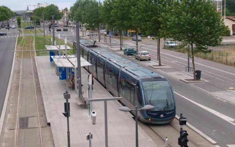
11 Urban Style LRT 11


12 Southeast and West LRT Corridors AREA WE ARE FOCUSING ON TONIGHT

13 LRT Noise Impact LRT Noise Impact Study under way Urban Traffic Noise Policy This policy is in place to address the impacts of traffic noise in the urban environment If the predicted noise level is above 65 dba Leq24, noise attenuation may be warranted


14 Roadway Network Removing 2 existing travel lanes along Stony Plain Road and 104 Avenue Reviewing key intersections Stony Plain Road / 124 Street Stony Plain Road / 149 Street Stony Plain Road / 142 Street Avenue / 118 Street
15 Workshop Session Overview Session #1: Right-of-way Alignment Session #2: Station Location Session #3: Neighbourhood and Business Access

16 Neighbourhood Groupings Segment A: Grovenor Segment B: Glenora Segment C: Westmount
17 West LRT Stony Plain Road from 149 Str. to 124 Str. Session #1 Right-of-Way (ROW) Alignment Alternatives
18 Corridor vs. Alignment CORRIDOR ALIGNMENT

19 Right-of-Way There are impacts Constrained Right-of-Way Minimize property requirements by removing: service roads traffic lanes on-street parking
20 ROW Alignment Options Comment on your chosen section What needs to be considered for each alternative?

21 Legend / Key Roadwork LRT at grade Station Property Requirements

22 ROW Alignment - Segment A ALTERNATIVE 1 Centre Running LRT 2 traffic lanes


23 ROW Alignment - Segment A ALTERNATIVE 2 Centre Running LRT 4 traffic lanes

24 ROW Alignment - Segment A ALTERNATIVE 3 North Running LRT 3 or 4 traffic lanes

25 ROW Alignment - Segment B ALTERNATIVE 1 Centre Running LRT


26 ROW Alignment - Segment B ALTERNATIVE 2 North Running LRT

27 ROW Alignment - Segment C ALTERNATIVE 1 Centre Running LRT

28 ROW Alignment - Segment C ALTERNATIVE 2 North Running LRT
29 ROW Alignment Workshop Question Comment on your chosen section Given that the corridor has been defined and that we are only talking about the ROW alignment alternatives, What needs to be considered for each alternative?
30 West LRT Stony Plain Road from 149 Str. to 124 Str. Session #2 Station Location and Configuration
31 Station Location and Configuration Options Comment on your chosen section How does this station fit into your neighbourhood? How does it affect your travel patterns? (pedestrian, cyclist, or driver)

32 Simple Stop Design Low floor vehicles and platforms provide: Simple Infrastructure Fits into surrounding areas Improved neighbourhood connections
33 Centre Running LRT with Centre Loading Platform Station Configuration

34 Centre Running LRT with Side Loading Platform Station Configuration

35 Centre Running LRT with Staggered Side Loading Platform Station Configuration
36 Overview Station Alternatives Overview of station alternatives at: Stony Plain Road / 149 Street Station Stony Plain Road / 142 Street Station Glenora Station 104 Avenue / 124 Street Station 104 Avenue / 118 Street Station


37 Stony Plain Road / 149 Street Station ALTERNATIVE 1 ALTERNATIVE 2


38 Stony Plain Road / 142 Street Station ALTERNATIVE 1 ALTERNATIVE 2 4 traffic lanes

39 Stony Plain Road / 142 Street Station ALTERNATIVE 3 North Running LRT 3 or 4 traffic lanes

40 Glenora Station 134 Street ALTERNATIVE 1 New Proposed Station Centre Running LRT

41 Glenora Station ADDITIONAL ALTERNATIVE Centre Running LRT

42 Glenora Station 134 Street ALTERNATIVE 2 New Proposed Station North Running LRT

43 124 Street Station 124 Street

44 118 Street Station 118 Street
45 Stations - Workshop Questions Comment on the station in your neighbourhood How does this station fit into your neighbourhood? How does it affect your travel patterns? (pedestrian, cyclist, or driver)
46 West LRT Stony Plain Road from 149 Str. to 124 Str. Break
47 West LRT Stony Plain Road from 149 Str. to 124 Str. Session #3 Neighbourhood and Business Access
48 Neighbourhood and Business Access Comment on your chosen section How do the alternatives affect the way you get around and in/out of your neighbourhood and access businesses?


49 Neighbourhood and Business Access Basic Principles of Neighbourhood Access: Different roads serve different purposes LRT will change direct access to roads within its corridor (like Stony Plain Road) Traffic signals will be located on major roads to facilitate LRT movement


50 Neighbourhood and Business Access Basic Principles of Neighbourhood Access: Turns across LRT tracks will be at signalized intersections Not ALL signalized intersections will allow left hand turns A supporting street and circulation system will be provided

51 Neighbourhood and Business Access ACCESS Existing left turn movement at intersection removed Future jug-handle movements provided

52 Neighbourhood and Business Access Segment A ALTERNATIVE 1 Centre Running LRT - 2 traffic lanes

53 Neighbourhood and Business Access Segment A ALTERNATIVE 2 Centre Running LRT 4 traffic lanes

54 Neighbourhood and Business Access Segment A ALTERNATIVE 3 North Running LRT 3 or 4 traffic lanes

55 Neighbourhood and Business Access Segment B ALTERNATIVE 1 Centre Running LRT

56 Neighbourhood and Business Access Segment B ALTERNATIVE 2 North Running LRT

57 Neighbourhood and Business Access Segment C ALTERNATIVE 1 Centre Running LRT

58 Neighbourhood and Business Access Segment C ALTERNATIVE 2 North Running LRT
59 Neighbourhood and Business Access Workshop Questions Comment on your chosen section How do the alternatives affect the way you get around and in/out of your neighbourhood and access businesses?
60 Wrap Up Fill out Questionnaires Attend other workshops Presentation available on website
61 Wrap Up
62 LRT Workshop Session Schedule West LRT May 4, 2010 Lewis Estates to Meadowlark May 6, 2010 Meadowlark to SPR/142 St. Southeast LRT May 18, 2010 May 19, 2010 Downtown to 95 Ave/83 St Strathearn to Whyte Ave May 12, 2010 SPR/149 St. to SPR/124 St. May 26, 2010 Bonnie Doon to Wagner May 13, 2010 Groat Road to May 27, 2010 Wagner to Downtown Mill Woods
63 Next Steps Alignment Selection Alignment Definition Reporting MAY SEP NOV DEC Workshops Open Houses Information Sessions Public Hearing On going Consultation with Key Stakeholders
64 West LRT Meadowlark to Stony Plain Road / 142 Street Thank you!
CHIEF PEGUIS TRAIL EXTENSION WEST
 1 PRELIMINARY DESIGN OF THE CHIEF PEGUIS TRAIL EXTENSION WEST Public Information Session June 6, 2017 Welcome 1 Thank you for attending today s public information session. The following boards provide
STONY PLAIN ROAD STREETSCAPE
 Jasper Place Revitalization Strategy: Vision The people involved in the Jasper Place Revitalization Strategy envision: Goal 1: Feeling safe in our community Create a community where feeling safe is common--where
MARK MESSIER TRAIL LONG-RANGE PLANNING STUDY WELCOME. Mark Messier Trail Planning Study 137 Avenue to Anthony Henday Drive.
 WELCOME Mark Messier Trail Planning Study 137 Avenue to Anthony Henday Drive December 5, 2013 MEETING PURPOSE To gather your thoughts and ideas for Mark Messier Trail concept plans between 137 Avenue and
Major Bike Routes 102 Avenue Workshop April 21, 2015
 Major Bike Routes 102 Avenue Workshop April 21, 2015 Our Purpose Today Provide context on how Major Bike Routes fit into Edmonton s future Share information on what we heard in our last phase, and how
Tonight is for you. Learn everything you can. Share all your ideas.
 Strathcona Neighbourhood Renewal Draft Concept Design Tonight is for you. Learn everything you can. Share all your ideas. What is Neighbourhood Renewal? Creating a design with you for your neighbourhood.
WELCOME! Please complete a comment sheet as we value your feedback. 4 pm to 8 pm. September 15, Hosted by: AECOM on behalf of City of Calgary
 WELCOME! Thank you for attending our open house. There will be no formal presentation today so please take the time to read the boards. If you have any questions, please do not hesitate to approach one
SR 693 (Pasadena Avenue) Corridor Study from Shore Drive South to 66 th Street
 Corridor Study from Shore Drive South to 66 th Street") Welcome and Introduction Sign-in and comment sheets Restrooms and exits Meeting agenda and timeline Meeting goals / expectations Provide input to guide study recommendations Actively participate throughout
Welcome and Introduction Sign-in and comment sheets Restrooms and exits Meeting agenda and timeline Meeting goals / expectations Provide input to guide study recommendations Actively participate throughout
YELLOWHEAD TRAIL / 149 STREET INTERCHANGE
 YELLOWHEAD TRAIL / 149 STREET INTERCHANGE WELCOME Today we are introducing the concept planning project for a new gradeseparated interchange at Yellowhead Trail and 149 Street PURPOSE Provide information
Information on the proposed alignment recommendation for Bus Rapid Transit from Lewis Estates Transit Centre to Downtown Edmonton
 BUS RAPID TRANSIT (BRT) PLAN Information on the proposed alignment recommendation for Bus Rapid Transit from Lewis Estates Transit Centre to Downtown Edmonton Presented at Open House Sessions: June 5 Stratford
2014/2015 BIKE ROUTE PLAN 83 AVENUE PROTECTED BIKE LANE
 About the Project 2014/2015 BIKE ROUTE PLAN The City of Edmonton is planning a major bike route on the south side of Edmonton. This bike route is one part of a plan to provide citizens with transportation
Saskatchewan Drive Roadway Rehabilitation and Shared-Use Path Widening
 Saskatchewan Drive Roadway Rehabilitation and Shared-Use Path Widening We are here today to present the draft plan for the Saskatchewan Drive Roadway Rehabilitation and Shared-Use Path Widening project
122 Avenue: 107 Street to Fort Road
 : 107 Street to Fort Road November 24, 2015 4:30 8:00 p.m. Meeting Purpose Summarize project work completed to date Share results of public input from Phase 1 Share the draft concept plan and proposed
Building Great Neighbourhoods BONNIE DOON
 Building Great Neighbourhoods BONNIE DOON We Are Here Today To Explain the Neighbourhood Renewal Process Show you the Westwood Preliminary Design Ask for local knowledge Highlight the Local Improvement
Casablanca Boulevard & GO Station Access
 Casablanca Boulevard & GO Station Access Class Environmental Assessment STAKEHOLDER WORKSHOP Thursday September 27th, 2018 5:30PM 8:00PM 1 WORKSHOP PURPOSE Provide an overview of the Design Alternatives
Frequently Asked Questions (FAQ)
") Frequently Asked s (FAQ) Study Process... 2 Rapid Transit Service and Operations... 5 Public Consultation... 8 Business Impacts... 8 Design and Property Impacts... 9 Construction Impacts...12 Traffic,
Frequently Asked s (FAQ) Study Process... 2 Rapid Transit Service and Operations... 5 Public Consultation... 8 Business Impacts... 8 Design and Property Impacts... 9 Construction Impacts...12 Traffic,
Wyldewood Estates. Pre-Application Public Engagement Summary of Issues and Responses
 Wyldewood Estates Pre-Application Public Engagement Summary of Issues and Responses March 2016 Executive Summary Morguard Residential Properties has been thoughtfully planning the redevelopment of Wyldewood
Laurier Segregated Bike Lane Pilot Project July 2013 update
 Laurier Segregated Bike Lane Pilot Project July 2013 update Presentation Overview Background Pilot Monitoring Results Mitigation Recommendations Next Steps Laurier 2 Background Laurier Avenue Segregated
Vermont Rail conversion/feasibility Study
 Vermont Rail conversion/feasibility Study Stakeholder Meetings May 2018 Welcome https://www.youtube.com/watch?v=jcg3cjutk80 Purpose of Tonight s Meeting > Provide a study overview > Solicit feedback and
City of Sammamish. Welcome. Issaquah-Fall City Road Improvements Project Phase I Design: 242nd Avenue SE to Klahanie Drive SE
 Welcome Welcome to the third community meeting for the Issaquah-Fall City Road Improvements Project. AGENDA 6:00 p.m. Welcome and sign-in 6:10 p.m. Presentation 6:50 p.m. Open house Learn about the roadway
Baseline Road Rapid Transit: Bayshore Station to Prince of Wales Drive
 Baseline Road Rapid Transit: Bayshore Station to Prince of Wales Drive Planning and Environmental Assessment Study Consultation Group Meetings May 2014 Presentation Agenda Study Overview Study Progress
Welcome. If you have any questions or comments on the project, please contact:
 Welcome This drop-in public open house is intended to provide information about the Bay Street bike lanes project. This project proposes a dedicated cycling facility along Bay Street between Aberdeen Avenue
Potential Bicycle Facility on Bayou Street Mobile, Alabama
 Potential Bicycle Facility on Bayou Street Mobile, Alabama By Richard A. Hall, P.E. Prepared For Mobile Downtown Alliance Hall Planning & Engineering, Inc. March 28, 2018 Introduction Review of the February
Fields of St. Croix HOA Meeting. October 27, 2016
 Fields of St. Croix HOA Meeting October 27, 2016 Welcome! Why are we here? Update on Manning Avenue Phase 2 Project: Project Design Schedule Project Background Importance of Manning Avenue: Primary north-south
HARRISON STREET/OAKLAND AVENUE COMMUNITY TRANSPORTATION PLAN
 HARRISON STREET/OAKLAND AVENUE Community Workshop #4: Draft Plan Review December 3, 2009 D E S I G N, C O M M U N I T Y & E N V I R O N M E N T INTRODUCTIONS Key Project Staff: Alisa Shen, Project Manager,
Terwillegar Drive Expressway Draft Concept Plan
 Terwillegar Drive Expressway Draft Concept Plan Anthony Henday Drive to Whitemud Drive November 28 5:00-8:00 p.m. December 1 10:00 a.m. - 3:00 p.m. Let s Talk Today you can: Learn about the new direction
Glebe Neighbourhood Cycling Plan
 Glebe Neighbourhood Cycling Plan Summary of Public Comments received after June 5 th Public Information Session Comment STUDY NETWORK CS9, CS8, E, E0 CS4, E CS4 CS8 E Suggestions for alternate cycling
Los Altos Hills Town Council - June 18, 2015 Palo Alto City Council June 22, AGENDA ITEM #2.B Presentation
 Los Altos Hills Town Council - June 18, 2015 Palo Alto City Council June 22, 2015 AGENDA ITEM #2.B Presentation Previous Presentations Los Altos Hills Town Council in May 2014 and February 2015 Palo Alto
Public Engagement Session
 Public Engagement Session Valley Line West LRT will play an essen al role in connec ng Edmonton s communi es, and we are working to have it ready to go as soon as funding becomes available for construc
In station areas, new pedestrian links can increase network connectivity and provide direct access to stations.
 The Last Mile Planning for Pedestrians Planning around stations will put pedestrians first. Making walking to stations safe and easy is important; walking will be a part of every rapid transit Accessible
Traffic Management and Mitigation Study in the Leslieville Community Transportation Services Division & IBI Group IBI GROUP
 Traffic Management and Mitigation Study in the Leslieville Community Transportation Services Division & IBI Group IBI GROUP July 18, 2018 Study Background and Objectives Background - Many development projects
Application of a Complete Street
 Application of a Complete Street Southbend to Prima Vista Update May 14, 2018 Meeting Agenda Perspective and History Public input received Typical sections being considered Presentation of the 2-lane master
Commerce Street Complete Street Project from Good Latimer Expressway to Exposition Avenue
 Commerce Street Complete Street Project from Good Latimer Expressway to Exposition Avenue T A N Y A B R O O K S A S S I S T A N T D I R E C T O R M O B I L I T Y P L A N N I N G M O B I L I T Y A N D S
Telegraph Avenue Complete Streets DRAFT Recommendations. Oakland Public Works Department September 11 and 13, 2014 Open Houses
 Telegraph Avenue Complete Streets DRAFT Recommendations Oakland Public Works Department September 11 and 13, 2014 Open Houses Presentation Overview What are complete streets? What problem are we trying
South King County High-Capacity Transit Corridor Study
 HIGH-CAPACITY TRANSIT CORRIDOR STUDY South King County Corridor South King County High-Capacity Transit Corridor Study Corridor Report August 2014 South King County High Capacity Transit Corridor Report
Environmental Assessment Findings & Recommendations. Public Hearing November 13, 2014
 Environmental Assessment Findings & Recommendations Public Hearing November 13, 2014 Welcome! Welcome and Introductions Project and Environmental Assessment Overview Public Comments Adjourn Purpose of
Welcome to the McKenzie Interchange Project Open House!
 Welcome to the McKenzie Interchange Project Open House! Purpose of Open House To provide you with information regarding the project and for you to have the opportunity to share your input on design concepts.
2014/2015 BIKE ROUTE PLAN 83 AVENUE PROTECTED BIKE LANE
 About the Project The City of Edmonton is planning a major bike route on the southside of Edmonton. The Strathcona Bike Route will connect the communities of Strathcona, Garneau and the University area,
Report Purpose To seek Council s approval of the Wye Road Functional Planning Study (January 2015).
.") COUNCIL MEETING Meeting Date: March 10, 2015 Agenda Item #: 13.1 Wye Road Functional Planning Study (January 2015) Report Purpose To seek Council s approval of the Wye Road Functional Planning Study (January
COUNCIL MEETING Meeting Date: March 10, 2015 Agenda Item #: 13.1 Wye Road Functional Planning Study (January 2015) Report Purpose To seek Council s approval of the Wye Road Functional Planning Study (January
WELCOME. City of Eden Prairie West 70 th Street
 WELCOME City of Eden Prairie West 70 th Street Project Schedule Sep Oct Nov Dec Jan Feb Mar Apr May Jun Jul Aug >>> May WEST SEGMENT Concept Plan Fall 2014 Plan Development Winter 2014 Summer 2015 Construction
ALBERTA AVENUE WHAT WE HEARD REPORT BUILDING GREAT NEIGHBOURHOODS
 ALBERTA AVENUE WHAT WE HEARD REPORT BUILDING GREAT NEIGHBOURHOODS FEBRUARY 2019 EXECUTIVE SUMMARY Starting in 2019, Alberta Avenue will see the replacement and enhancement of its aging collector and local
Alternatives Public Workshop
 US 1 Express Lanes Project Development & Environment (PD&E) Study Alternatives Public Workshop August 2013 1 Today s Agenda Project Background and Overview Tier 1 Alternatives Development Tier 2 Decision-Making
A CHANGING CITY. of Edmonton, it is essential that it reflects the long-term vision of the City.
 A CHANGING CITY By the year 2040, Edmonton will be home to more than 1 million people. To accommodate growth and support a healthy and compact city, we need a new approach to development/redevelopment
Chapter 3 BUS IMPROVEMENT CONCEPTS
 Chapter 3 BUS IMPROVEMENT CONCEPTS The purpose of this chapter is to describe potential bus improvement strategies and potential impacts or implications associated with BRT implementation within the existing
Walterdale Bridge Replacement
 Walterdale Bridge Replacement Public Open House Meeting Purpose To provide background and context information To share information on potential roadway modifications and bridge style options To gather
BETHEL ROAD AND SEDGWICK ROAD CORRIDOR STUDY
 DRAFT PLAN City Council Meeting August 14, 2017 STUDY AREA Sedgwick Corridor State Route 160, principal arterial with Class 3 access management designation, commuter and freight route, connection to SR
I-10 Bypass Project Banning to Cabazon
 I-10 Bypass Project Banning to Cabazon Presentation to City of Banning Town Hall Meeting April 11, 2018 June 17 th, 2005 Emergency Action Plan Conceptual Project Purpose Summary Construct a new roadway
Capital Metro Downtown Multimodal Station
 Capital Metro Downtown Multimodal Station Open House December 11, 2015 Project Goals & Objectives 1 2 3 4 Address near- and long- term MetroRail operational needs Address existing safety issues and modal
a) receiving of legal advice subject to solicitor client privilege and labour relations regarding contract negotiations
 receiving of legal advice subject to solicitor client privilege and labour relations regarding contract negotiations") Regional Municipality of Waterloo Planning and Works Committee Agenda Tuesday, April 4, 2017 9:30 a.m. (Following Closed Session) Regional Council Chamber 150 Frederick Street, Kitchener Media Release:
Regional Municipality of Waterloo Planning and Works Committee Agenda Tuesday, April 4, 2017 9:30 a.m. (Following Closed Session) Regional Council Chamber 150 Frederick Street, Kitchener Media Release:
Leaside Traffic Calming Plan Update. Community Meeting 2 November 22, :00 PM
 Leaside Traffic Calming Plan Update Community Meeting 2 November 22, 2016 7:00 PM Welcome and Study Background Welcome and Thank You! Study background from LPOA s perspective: Why are we doing this study?
WELCOME. Stakeholder Involvement Group Meeting #2 Round Lake Public Works October 24, 2018
 WELCOME Stakeholder Involvement Group Meeting #2 Round Lake Public Works October 24, 2018 MEETING AGENDA 1. Welcome and Introductions 2. Study Progress Update 3. Problem Statement 4. Technical Analysis
SR 826/PALMETTO EXPRESSWAY EXPRESS LANES PD&E STUDY From US 1/SR 5/Dixie Highway to SR 836/Dolphin Expressway FPID No.: ETDM No.
 SR 826/PALMETTO EXPRESSWAY EXPRESS LANES PD&E STUDY From US 1/SR 5/Dixie Highway to SR 836/Dolphin Expressway FPID No.: 432639-1-22-02 ETDM No.: 14308 Newsletter 3 - March 2019 Incluye versión en español
Decision on North Waterloo Routing
 Next Steps Decision on North Waterloo Routing Two route variations remain in north Waterloo. The final preferred route will include only one of the two variations. Please consider these two variations
Pine Hills Road Pedestrian/Bicycle Safety Study Board of County Commissioners Work Session
 Pine Hills Road Pedestrian/Bicycle Safety Study Board of County Commissioners Work Session February 20, 2018 Meeting Agenda Study Overview Existing Conditions Access Management Potential Gateway Features
Bicycle Traffic Control Signal - St. Clair Avenue West and Poplar Plains Road
 PW17.11 REPORT FOR ACTION Bicycle Traffic Control Signal - St. Clair Avenue West and Poplar Plains Road Date: November 4, 2016 To: Public Works and Infrastructure Committee From: Acting General Manager,
Maywood Town Hall Meeting. May 4, 2016
 Maywood Town Hall Meeting May 4, 2016 1 AGENDA Overall I-290 Study Background Maywood Advisory Working Group (AWG) findings to date Noise Wall Update Next Steps 2 Questions? Study team members also available
Public Works and Infrastructure Committee. General Manager, Transportation Services
 STAFF REPORT ACTION REQUIRED Extending the Bay Street Bicycle Lanes Date: May 16, 2013 To: From: Public Works and Infrastructure Committee General Manager, Transportation Services Wards: Toronto Centre
Richmond-Adelaide Cycle Tracks
 Public Drop-In Event Richmond-Adelaide Cycle Tracks June 25, 2018 12:00 p.m. 3:00 p.m. 4:30 p.m. 7:30 p.m. Metro Hall, Rotunda 55 John Street 1 Purpose of Event In Scope Communicate an update about the
McKenzie Interchange Project Fall 2015 Engagement. Appendix 2: Engagement Materials and Feedback Form
 Fall 2015 Engagement Appendix 2: Engagement Materials and Feedback Form Welcome to the McKenzie Interchange Project Open House! Purpose of Open House To provide you with information regarding the project
COMMUNITY WORKSHOP (CW) 3 February 21, 2015
 3 February 21, 2015") QEW Improvements QEW Improvements COMMUNITY WORKSHOP (CW) 3 February 21, 2015 1 WORKSHOP PURPOSE MOVING FORWARD Review of Technically Preferred alternative Seeking feed back for progressing to next design
QEW Improvements QEW Improvements COMMUNITY WORKSHOP (CW) 3 February 21, 2015 1 WORKSHOP PURPOSE MOVING FORWARD Review of Technically Preferred alternative Seeking feed back for progressing to next design
Tempe Streetcar Public Meeting
 Tempe Streetcar Public Meeting April 19, 2017 Agenda Project Background and Status Design Progress Streetcar Stops Art Program Streetcar Vehicles Mill Avenue Configuration Utility Relocation 2 Route and
Bike Routes Assessment: 95 Ave, 106 St & 40 Ave. Replace with appropriate image in View > Master.
 Bike Routes Assessment: 95 Ave, 106 St & 40 Ave Replace with appropriate image in View > Master. Transportation Committee October 15, 2014 City Council Direction What we are trying to achieve The Way Ahead:
PROJECT OVERVIEW. 20th Avenue Project Limits (Lincoln Way to Wawona St)
") PROJECT OVERVIEW In 2014, San Francisco adopted Vision Zero as City policy, with a commitment to eliminate all traffic deaths in the City by 2024. nue Project Limits (Lincoln Way to St) Collision data
PROJECT OVERVIEW In 2014, San Francisco adopted Vision Zero as City policy, with a commitment to eliminate all traffic deaths in the City by 2024. nue Project Limits (Lincoln Way to St) Collision data
Pre-Construction Meeting
 Pre-Construction Meeting Wednesday, March 21 Drop-in from 5 9pm Please visit displays for project information, talk to staff, and ask questions! Edmonton.ca/SouthsideBikeRoutes Objectives & Project Scope
Welcome. 53 Avenue Overpass over Whitemud Drive Rehabilitation. Public Information Session. Wednesday, March 9, :30-8:00 p.m.
 BRIDGE REHABILITATION Welcome 53 Avenue Overpass over Whitemud Drive Rehabilitation Public Information Session Wednesday, March 9, 2016 4:30-8:00 p.m. Tonight you can: Learn about the 53 Avenue Overpass
Route 7 Corridor Study
 Route 7 Corridor Study Executive Summary Study Area The following report analyzes a segment of the Virginia State Route 7 corridor. The corridor study area, spanning over 5 miles in length, is a multi
POLICY: TRAFFIC CALMING
 2006 MAY REFERENCE: COUNCIL APPROVED BY COUNCIL MAY 23, 2006 CITY OPERATIONS - NO. 608 POLICY: TRAFFIC CALMING A. All requests for traffic calming within the City shall be considered in accordance with
Developing Bikeways in South Denver
 Developing Bikeways in South Denver Southeast Denver, Council District 4 October 24, 2018 1 Denver Moves: Bicycles Citywide Bikeway Master Plan: 2011 2015 State of the practice Enhanced Bikeways (2015)
Welcome 78 Ave S.E. Underpass and Road Widening Project Update
 Welcome 78 Ave S.E. Underpass and Road Widening Project Update About the 78 Avenue S.E. Project 69 Avenue S.E. crossing of CP proposed to close to accommodate future CP operations. 78 Avenue S.E. would
Sixth Line Development - Transit Facilities Plan
 Memorandum Date: November 13, 2012 To: From: c.c. Subject: Rob Freeman (Freeman Planning) Kevin Phillips Sixth Line Development - Transit Facilities Plan 33016631 This memo was prepared to review the transit
CITY OF HAMILTON PLANNING AND ECONOMIC DEVELOPMENT DEPARTMENT Transportation Planning and Parking Division
 CITY OF HAMILTON PLANNING AND ECONOMIC DEVELOPMENT DEPARTMENT Transportation Planning and Parking Division TO: Chair and Members Public Works Committee COMMITTEE DATE: June 18, 2018 SUBJECT/REPORT NO:
Water Street Promenade. Engineering and Design Services. Public Information Meeting No. 2. Education / Infrastructure / Innovation. Maplewood Avenue &
 Public Information Meeting No. 2 Water Street Promenade Maplewood Avenue & Engineering and Design Services Adjacent Areas July 16,2014Portsmouth, NH May 10, 2016 Education / Infrastructure / Innovation
Southwest Bus Rapid Transit (SW BRT) Functional Planning Study - Executive Summary January 19 LPT ATTACHMENT 2.
 Functional Planning Study - Executive Summary January 19 LPT ATTACHMENT 2.") Southwest Bus Rapid Transit (SW BRT) Functional Planning Study - Executive Summary 2011 January 19 1 of 19 Introduction This executive summary presents the results of the Southwest Bus Rapid Transit (SW
Southwest Bus Rapid Transit (SW BRT) Functional Planning Study - Executive Summary 2011 January 19 1 of 19 Introduction This executive summary presents the results of the Southwest Bus Rapid Transit (SW
5 REQUEST FOR GRADE-SEPARATED PEDESTRIAN UNDERPASS CROSSINGS OF LESLIE STREET AND ST. JOHN S SIDEROAD TOWN OF AURORA
 5 REQUEST FOR GRADE-SEPARATED PEDESTRIAN UNDERPASS CROSSINGS OF LESLIE STREET AND ST. JOHN S SIDEROAD TOWN OF AURORA The Transportation Services Committee recommends the adoption of the recommendations
Montgomery Road Project Stakeholder Focus Group Meeting # 1 January 29, 2014
 Stakeholder Focus Group (SFG) Meeting #1: The first SFG meeting for the Montgomery Road Study was held on at the Montgomery Village Hall, 200 N. River Street, in Montgomery, Illinois from 2:00-4:00 PM.
County Board Workshop
 CH 21 Downtown Reconstruction Project County Board Workshop Tuesday, October 24, 2017 CH 21 Downtown Prior Lake Reconstruction Agenda 1) Review remaining Project Alternatives 2) Public Engagement Summary
Thank you for attending
 Improving mobility safety comfort WELCOME Thank you for attending The purpose of this meeting is to: Learn about the project Prioritize potential walking and biking improvements on Snelling Ave Gather
Prepared For: Shieldbay Developments Inc. c/o Matson, McConnell Ltd. 2430A Bloor Street West Toronto, Ontario M6S 1P9.
 Prepared For: Shieldbay Developments Inc. c/o Matson, McConnell Ltd. 2430A Bloor Street West Toronto, Ontario M6S 1P9 Prepared By: URS Canada Inc. 4 th Floor, 30 Leek Crescent Richmond Hill, Ontario L4B
Toronto and East York Community Council. Director, Transportation Services, Toronto and East York District
 No Turn on Red Regulations STAFF REPORT ACTION REQUIRED Date: June 1, 2010 To: From: Toronto and East York Community Council Director, Transportation Services, Toronto and East York District Wards: Trinity
CONNECTIVITY PLAN. Adopted December 5, 2017 City of Virginia Beach
 CONNECTIVITY PLAN Adopted December 5, 2017 City of Virginia Beach CONTENTS 1.0 Background & Purpose... 2 2.0 Existing Inventory & Analysis... 3 ViBe District Existing Walking Conditions... 4 3.0 ViBe District
Item B1 November 19, 2009
 November 19, 2009 Planning and Development Department Land Use Planning Division DATE: November 19, 2009 STAFF REPORT TO: FROM: SUBJECT: Members of the Transportation Commission Elizabeth Greene Senior
Reams Road RCA Study. Board of County Commissioners Public Hearing
 Reams Road RCA Study Board of County Commissioners Public Hearing April 24, 2018 Presentation Overview Study Overview Existing Conditions Development of Alternatives Preferred Alternative Public Involvement
Queensboro Bridge Bus Priority Study: Summary of Recommendations. Presentation to Manhattan Community Board 8 May 4, 2011
 : Summary of Recommendations Presentation to Manhattan Community Board 8 May 4, 2011 1 Overview Study Goal: Identify cost-effective ways to improve bus speed and reliability for local and express buses
City of Wilsonville 5 th Street to Kinsman Road Extension Project
 City of Wilsonville 5 th Street to Kinsman Road Walking Tour & Neighborhood Workshop Summary Report Public Outreach Overview On July 18 th, 2017, the City of Wilsonville hosted a neighborhood walking tour
Simulating Street-Running LRT Terminus Station Options in Dense Urban Environments Shaumik Pal, Rajat Parashar and Michael Meyer
 Simulating Street-Running LRT Terminus Station Options in Dense Urban Environments Shaumik Pal, Rajat Parashar and Michael Meyer Abstract The Exposition Corridor transit project is a light rail project
1609 E. FRANKLIN STREET HOTEL TRAFFIC IMPACT STUDY EXECUTIVE SUMMARY
 1609 E. FRANKLIN STREET HOTEL TRAFFIC IMPACT STUDY EXECUTIVE SUMMARY Prepared for: The Town of Chapel Hill Public Works Department Traffic Engineering Division Prepared by: HNTB North Carolina, PC 343
City of Wausau Wausau Center Urban Design and Transportation Master Plan. Design Workshop // October 18, 2018
 City of Wausau Wausau Center Urban Design and Transportation Master Plan Design Workshop // October 18, 2018 Design Workshops // October 15-18 Workshop Study Evaluate circulation and parking patterns around
Thank you for attending the first Public Open House for the Thunder Bay Transportation Master Plan!
 Welcome Thank you for attending the first Public Open House for the Thunder Bay Transportation Master Plan! Please take this opportunity to learn about the study and to tell us your ideas and vision for
California Department of Transportation, District 4. Sloat Boulevard Project Skyline Blvd. to 19 th Ave. Community Update January 13, 2016
 California Department of Transportation, District 4 Sloat Boulevard Project Skyline Blvd. to 19 th Ave. Community Update January 13, 2016 Agenda Welcome and introductions Project overview, history and
Building Great Neighbourhoods BELLEVUE AND VIRGINIA PARK
 Building Great Neighbourhoods BELLEVUE AND VIRGINIA PARK This is Meeting 2 Unfortunately, some residents in Bellevue and Virginia Park received the wrong information for this public open house (Meeting
APPENDIX 2 LAKESHORE ROAD TRANSPORTATION REVIEW STUDY EXECUTIVE SUMMARY
 APPENDIX 2 LAKESHORE ROAD TRANSPORTATION REVIEW STUDY EXECUTIVE SUMMARY Appendix 2 City of Mississauga Lakeshore Road FINAL REPORT Transportation Review Study December 2010 EXECUTIVE SUMMARY Study Purpose
Moving Cambridge. City of Cambridge Transportation Master Plan Public Consultation Centre. March 7, :00 8:00 PM.
 City of Cambridge Transportation Master Plan Public Consultation Centre March 7, 2018 5:00 8:00 PM Region of Waterloo City of Cambridge Transportation Master Plan Public Consultation Centre March 7, 2018
Design Public Hearing MassDOT Project # February 19, 2015 Chatham Town Hall Annex 7:00 P.M.
 Design Public Hearing MassDOT Project #606596 February 19, 2015 Chatham Town Hall Annex 7:00 P.M. Overview Process to date Project goals Data collection results Existing conditions Alternative analysis
US 69 RELIEF ROUTE STUDY
 US 69 RELIEF ROUTE STUDY Jacksonville, Texas PUBLIC MEETING #2 May 29 th, 2018 Welcome to the public meeting for the US 69 Relief Route Study in Jacksonville. This is the second public meeting for this
Wilshire Boulevard Bus Rapid Transit Project
 Los Angeles County Metropolitan Transportation Authority Wilshire Boulevard Bus Rapid Transit Project COMMUNITY MEETINGS November 2008 Agenda Introduction Proposed Project Overview Participating Agencies
Southbend to Prima Vista. October 30, Floresta Corridor Master Plan
 Application of a Complete Street initiative and how it might function operationally 8 8 Southbend to Prima Vista October 30, 2017 Presentation Agenda 2 Perspective and History Traffic projections, Levels
Active Transportation Rail to River Corridor. Community Meeting - Segment A
 Active Transportation Rail to River Corridor Community Meeting - Segment A June 29, 2017 Tonight s Agenda > Open House (30 min) > Welcome / Project Overview > Presentation of 30% Design Refinements > Next
I-95/Temple Avenue Improvements Project Colonial Heights, VA
 I-95/Temple Avenue Improvements Project Colonial Heights, VA Pardon Our Dust Informational Meeting February 3, 2016 Harold Dyson, P.E. Construction Manager, Richmond District Tom Heil, P.E. Allan Myers
Circulation in Elk Grove includes: Motor vehicles, including cars and trucks
 Circulation, as it is used in this General Plan, refers to the many ways people and goods move from place to place in Elk Grove and the region. Circulation in Elk Grove includes: Motor vehicles, including
102 Avenue Corridor Review
 February 26, 2015 102 Avenue Corridor Review Transportation Association of Canada Road Safety Engineering Award Submission for the City of Edmonton Introduction Transportation Association of Canada Road
Welcome. Thank you for your interest in the Lewis & Clark Viaduct Concept Study
 Welcome Thank you for your interest in the Lewis & Clark Viaduct Concept Study Please use the arrows in the upper left hand corner to navigate through the presentation. Use the envelope icon to ask a question