Coolidge - Florence Regional Transportation Plan
|
|
|
- Douglas Brown
- 6 years ago
- Views:
Transcription


1 Coolidge - Florence Regional Transportation Plan A Partnership Among the City of Coolidge, Town of Florence, and ADOT SUMMARY REPORT Kimley-Horn Kimley Kimley-Horn and and Associates, Associates, Inc. Inc. Economic and Real Estate Consulting February 2008
2 TABLE OF CONTENTS Page SUMMARY REPORT...1 PURPOSE...1 BACKGROUND...1 STUDY PROCESS AND PUBLIC INVOLVEMENT...3 RECOMMENDATIONS...5 FUTURE SOCIOECONOMIC AND TRANSPORTATION CONDITIONS...6 PERFORMANCE OF 2005 NETWORK...8 PERFORMANCE OF 2025 ALTERNATIVE NETWORKS...8 RECOMMENDED TRANSPORTATION PLAN - ROADWAY ELEMENT...9 ACCESS MANAGEMENT ROAD DESIGN AND ACCESS CRITERIA PUBLIC TRANSPORTATION PLAN RECOMMENDATION AND IMPLEMENTATION STRATEGY FUNDING AND REVENUE ESTIMATES i
3 LIST OF TABLES Page 1. TECHNICAL ADVISORY COMMITTEE MEMBERS SUMMARY OF 2025 SOCIOECONOMIC DATA LEVEL OF SERVICE CRITERIA ROAD MILEAGE BY FUNCTIONAL CLASSIFICATION MINIMUM ROAD DESIGN AND ACCESS CRITERIA MINIMUM CONSILIDATED RESIDENTIAL AND EMPLOYMENT DENSITIES FOR VARIOUS TYPES OF TRANSIT SERVICES IMPLEMENTATION ACTION PLAN RECOMMENDED PROJECTS BY FUNCTIONAL CLASSIFICATION COOLIDGE PLANNING AREA RECOMMENDED PROJECTS BY FUNCTIONAL CLASSIFICATION FLORENCE PLANNING AREA SUMMARY OF COST ESTIMATES MATRIX OF KEY MULTIMODAL FUNDING SOURCES LIST OF FIGURES Page 1. COOLIDGE-FLORENCE STUDY AREA STUDY PROCESS FUNCTIONAL CLASSIFICATION SYSTEM RECOMMENDED FUNCTIONAL ROAD CLASSIFICATION NUMBER OF LANES MAP DRAFT TRANSIT OPTIONS ii
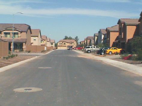
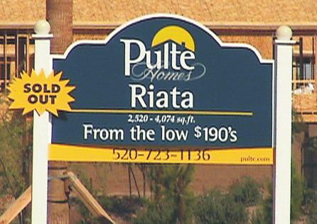
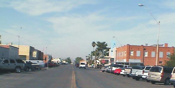
4 SUMMARY REPORT This is a Summary Report of the Coolidge-Florence Regional Transportation Study that developed a regional transportation plan for the planning areas of Coolidge and Florence, Arizona. An effective partnership was forged among the City of Coolidge, the Town of Florence, and the Consultant Team to conduct the study. Funding was provided by the two municipalities and the Arizona Department of Transportation (ADOT) in recognition of the regional growth and the need to develop a coordinated multimodal transportation system. In addition, area residents and stakeholder input was solicited and incorporated in the study through public participation efforts. Complete documentation of the Study is provided in the Final Report. While this study included roadway facilities owned and operated by ADOT within the study area, it is important to recognize that improvements to the state highway system can be made only after in-depth planning and engineering studies are conducted by ADOT, and upon approval of the State Transportation Board. All traffic interchange improvements must be approved by the Federal Highway Administration (FHWA). The recommendations made by this study for improvements on state facilities can serve only as suggestions for further study. PURPOSE. The purpose of the study has been to develop a 20-year transportation plan and implementation program to guide the City of Coolidge and the Town of Florence in meeting transportation needs into the future. Roadway and multimodal improvements were identified to address deficiencies and needs to improve mobility and safety in the County. The study also identified how and when these improvements should be implemented and funded. This long-range multimodal transportation plan is intended for use in day-to-day programming and funding of transportation improvements. In addition, transportation improvements have been prioritized to maximize project benefits within budget limitations. Funding strategies and sources have been included to aid the communities in pursuing local, regional, state, and federal funding. Figure 1 depicts the study area. BACKGROUND. The study area is comprised of the combined planning areas of the City of Coolidge and the Town of Florence within the eastern portion of Pinal County approximately midway between the City of Phoenix and City of Tucson (see Figure 1). The combined planning areas extend from east of I-10 to well past SR 79 and from SR 87 to Bella Vista including the places of Valley Farms, Cactus Forest, Randolph, La Palma, and Florence Gardens. The 336 square mile study area is larger than the combined incorporated areas (as of 2004) of the East Valley cities including City of Mesa, Town of Gilbert, City of Chandler, Town of Queen Creek, and City of Apache Junction. Both communities are experiencing rapid growth. Possible population growth in the study area has been projected in the range of 250,000 to 300,000 persons over the next 20 years. Currently, a Pulte Homes development is underway on the West side of the City of Coolidge, and Anthem at Merrill Ranch on the northwest side of the Town of Florence, which is transforming the landscape to residential use. Other new developments are also underway in the area. In addition, Westcor has signed a contract to construct a regional Shopping Mall in the future on the eastside of the City of Coolidge. Lima & Associates Coolidge-Florence Regional Transportation Study - Page 1

5 FIGURE 1. COOLIDGE-FLORENCE STUDY AREA Lima & Associates Coolidge-Florence Regional Transportation Study - Page 2
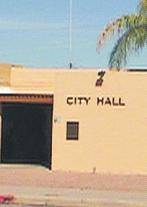
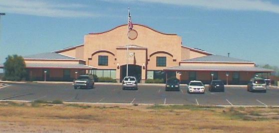
6 STUDY PROCESS AND PUBLIC INVOLVEMENT. A Technical Advisory Committee (TAC) guided the overall conduct of the study, provided background information, and made technical input to the process. The committee was comprised of representatives from the agencies listed in Table 1. An intensive public participation process was undertaken, including two rounds of stakeholder workshops to identify issues, solicit comments, and receive feedback on the study process and recommendations. The study process is illustrated in Figure 2. TABLE 1. TECHNICAL ADVISORY COMMITTEE MEMBERS City of Coolidge: Public Works Department Growth Management Department Town of Florence: Public Works Department Planning and Zoning Department Administration Department Gila River Indian Community ADOT: Transportation Planning Division Public Transportation Division Tucson Engineering District Globe Engineering District Pinal County: Public Works Department Central Arizona Association of Governments FIGURE 2. STUDY PROCESS STUDY PROCESS Technical Coordination/Outreach Existing Conditions One-on-One Meetings Stakeholder Workshop Identify Issues Identify Vision Future Conditions Identify/Evaluate Multimodal Options Develop Transportation Plans and Transit Elements Stakeholder Workshop Open Houses Council Meetings Define Options Develop Implementation Plans The first step of the technical analysis was to analyze the existing conditions and Environmental Justice concerns. Workshops in Coolidge and Florence were held to identify issues and envision components for the transportation plan. Stakeholders included Public Works Department personnel, Coolidge and Florence personnel, elected officials from the City of Coolidge and the Town of Florence, ADOT, CAAG, Pinal County representatives, and citizens. Lima & Associates Coolidge-Florence Regional Transportation Study Page 3

7 Future socioeconomic conditions were projected and a traffic forecasting model of the study area was developed to identify future transportation conditions. Next, multimodal transportation options were identified and evaluated. Based on the results of this analysis, a draft transportation plan was developed including a transit element. A second round of stakeholder workshops was held to review the draft transportation plan and identify constraints to the plan. The findings and recommendations of the study were presented to open houses in Coolidge and Florence for review and comment. Stakeholder Workshops. The first Stakeholder Workshop was held August 9, 2007, at the Council Chambers, Florence Town Hall. The purpose of the meeting was to review the status of the study, present the existing and future demographic and transportation conditions, and obtain input from the stakeholders. The meeting was an open house format with display boards available to be reviewed by participants. Comment cards were available for participants to complete. A brief PowerPoint presentation was given at 4:30 p.m. summarizing the study process, reviewing existing and future demographic and transportation conditions, and discussing the planning approach. The display boards included: 1) Environmental Overview; 2) Land Ownership; 3) Vehicle Crashes; 4) Planned Area Developments; 5) Number of Lanes for Proposed Roadway Network; 6) 2025 Traffic Volumes With or Without the Proposed North-South Freeway; and 7) Draft Florence Land Use Map. Display maps and the PowerPoint presentation were placed on the web sites of both the City of Coolidge and Town of Florence. The second stakeholder workshop was held from 4:00 p.m. to 6:00 p.m. on December 12, 2007, for the Coolidge-Florence Regional Transportation Study at the City of Coolidge Council Chambers. The purpose of the workshop was to present the draft road and public transportation elements of the regional transportation plan and obtain feedback from the participants. The format of the second workshop was similar to that of the first. Display boards presented included: 1) Study Area; 2) 2025 Traffic Volumes for Alternative 1; 3) Road Element Functional Classification; 4) Road Element Number of Lanes; 5) Public Transportation Element; and 6) Public Transportation Options. Overview of Open Houses. Two public open houses were held in January 2008 to present the Coolidge-Florence Regional Transportation Plan to the public and obtain feedback on the plan. One Open House was held at the City of Coolidge Council Chambers on January 8 and one was held at the Town of Florence Council Chambers on January 10. Both events took place between 5:00 p.m. and 7:00 p.m. and were advertised in regional newspapers and on the Web sites of both communities. The format for both open houses included display boards available to be reviewed by participants. Members of the study team were available to answer questions. A brief presentation was given outlining the study process, vision, issues, and presenting the roadway and public transportation elements. The display boards included: 1) Study Area; 2) 2006 Land Ownership; 3) 2025 Traffic Volumes for Alternative 1; 4) Proposed Developments; 5) 2025 Road Functional Classification; 6) 2025 Number of Lanes; 7) 2025 Public Transportation Element; and 8) Public Transportation Options. Lima & Associates Coolidge-Florence Regional Transportation Study Page 4
8 Comments received from both stakeholders and the public are summarized in Chapter 2 of the Final Report. RECOMMENDATIONS. The consultant team recommends the following for the City of Coolidge and the Town of Florence: Transportation Issues. Many of the roads in the study area are currently owned, operated, and maintained by Pinal County; Municipalities must coordinate with the County in developing a street system. Road Plan Implement new continuous roads and widen existing roadways to provide an adequate level-of-service in the study area. Implement a functional classification of 410 miles of major arterials, minor arterials, major collectors, and minor collectors tied to specific design and access criteria. Implement access management principles to manage access to adjacent properties. Roadway Projects The Consultant identified a total of over 140 miles of roadway improvements in the Coolidge Planning Area and over 270 miles of roadway improvements in the Florence Planning Area. Total cost of the Coolidge area projects is estimated at $899 million, including $638 million for miles of major arterial roadways, $246 million for miles of minor arterial roadways, and $15 million for 4.28 miles of major collector roadways. Total cost of the Florence area projects is estimated at $1.7 billion, including $834 million for miles of major arterial roadways, $750 million for miles of minor arterial roadways, $62 million for miles of major collector roadways, $11 million for 3.12 miles of minor collector roadways, and $50 million for miles of frontage roads. Over 32 miles of major arterial roadway projects in the Coolidge planning area estimated to cost a total of $237 million were identified as high-priority projects. Over 45 miles of major arterial roadway projects in the Florence planning area estimated to cost a total of $313 million were identified as high-priority projects. Improvement of Attaway Road between Hunt Highway and Quail Run Lane, a minor arterial in the Florence Planning Area, which is estimated to cost $19.4 million, is also considered a high-priority project. Public Transportation The City of Coolidge and the Town of Florence should proactively support the Pinal Rides Pilot Program by participating on the Advisory Council and providing funding. The City of Coolidge and the Town of Florence should communicate and coordinate with organizations and agencies that are evaluating and/or advocating inter-regional transit service options affecting the County. The City of Coolidge and the Town of Florence should consider development of transit oriented design (TOD) overlays that could be implemented along identified future transit corridors. Lima & Associates Coolidge-Florence Regional Transportation Study Page 5
9 The City of Coolidge and the Town of Florence should continue to present short- and long-range plans to ADOT Public Transportation Division. The City of Coolidge should continue to evaluate the operation of the Cotton Express and plan for service expansion as population growth and development warrant. The Town of Florence should conduct a Transit Feasibility and Implementation Study to identify current and future public transportation needs within the town as well as demographic thresholds for implementing future services. The Town of Florence should hire a Transportation Coordinator, when needed. The Town of Florence should appoint a volunteer Transit Advisory Committee to assist the Town in identifying the desirable attributes of the coordinator position and to work with the coordinator after his or her selection. FUTURE SOCIOECONOMIC AND TRANSPORTATION CONDITIONS. This section summarizes the analysis of the 2025 socioeconomic and transportation conditions for the Coolidge- Florence transportation study area, and the analysis of alternative road networks. First, the 2025 socioeconomic projections area are presented and analyzed. The methods to forecast future traffic and road deficiencies are then described. Next, the conditions of the 2025 existing street network with the 2025 growth projections are analyzed. Sections follow summarizing the analysis of alternative street networks to address roadway deficiencies and spatial allocation of the socioeconomic data among Transportation Analysis Zones (TAZs) defined in the study area. Methodology for Developing Future Socioeconomic Data. The following steps were taken to estimate 2025 socioeconomic data including dwelling units, population, and number of employees. 1. The study area was subdivided into TAZs representing distinct geographical areas. A TAZ is generally bounded by either the roads or other geographic boundaries such as the Gila River. Estimated households, population, and employees are allocated to each TAZ within the study area. A map showing the TAZs in the study area is included in the Final Report. 2. The Central Arizona Association of Governments (CAAG) Planned Area Development database for proposed residential and commercial acres was reviewed. 3. Coordinated with the Town of Florence and City of Coolidge to identify potential residential and commercial growth areas and the timing of these areas. 4. Reviewed locations of planned infrastructure (power, sewer, water). 5. Reviewed the housing permit history in the study area. 6. Reviewed the amount and timing of housing development and commercial and office development growth in urban areas in the Phoenix and Tucson area. 7. Estimated 2025 dwelling units in each TAZ. 8. Estimated employees among retail, office, industrial, government, and other types of employment and allocated to TAZs. Summary of 2025 Socioeconomic Data. Table 2 presents a summary of the socioeconomic projections for the year Population in the study area is growing very rapidly. The estimated total 2005 population is expected to grow to a projected 2025 population of approximately 337,500 Lima & Associates Coolidge-Florence Regional Transportation Study Page 6
10 TABLE 2. SUMMARY OF 2025 SOCIOECONOMIC DATA Area DUS Pop. Emp Emp/ Pop DUS Pop Emp Emp/ Pop Coolidge Planning Area 4,223 12,275 3, ,608 72,153 22, Florence Planning Area 3,494 8,662 5, , ,942 57, County Portion 6,635 14,723 5, , ,419 54, Total Study Area 14,352 35,660 14, , , , Source: Elliot Pollack & Company, Lima & Associates DU=dwelling units, Pop=Population, Emp=Number of employees, Emp/Pop=Ration of employees to population *Population does not include prison population residents, almost an 846 percent increase 42 percent yearly average growth rate. The 2025 population in the study area is allocated among the jurisdictions as follows: 114,000 in the Florence Metropolitan Planning Area 72,100 in the Coolidge Metropolitan Planning Area 151,400 in the Pinal County and Casa Grande portions of the study area. Employment in the study area is also projected to grow rapidly to 134,000 employees, approximately 811 percent increase. This is a 40 percent yearly average growth rate. The high projected growth rates for Coolidge-Florence compare to other high growth areas in the Phoenix metropolitan area and in other areas of Pinal County. For example, the population in the Town of Buckeye in Maricopa County grew from approximately 8,500 residents in the year 2000 to an estimated population of 31,800 residents in percent average yearly growth rate. The City of Maricopa in Pinal County grew from approximately 1,500 residents in the year 2000 to an estimated population of 25,800 residents in percent average yearly growth rate. Traffic Forecasting Process Overview. A traffic forecasting model was developed and validated for the Coolidge-Florence Regional Transportation Study area to estimated future traffic volumes. The model was developed using the TransCAD transportation forecasting software and was calibrated using the year 2005 transportation network and estimated 2005 socioeconomic data. The transportation planning model is a representation of the study area transportation facilities and the travel patterns using these facilities. The traffic model contains inventories of the 2005 roadway facilities and of residential and non-residential units by traffic analysis zones. In general, the traffic model process consists of several steps including estimating the number of daily vehicle trips by TAZ from the socioeconomic inventory, distribution of vehicle trips by TAZ, and then assigning the vehicle trips to the street network. The traffic model is calibrated by comparing the daily traffic volumes produced by the model with current daily traffic counts. When the model matches the traffic counts within acceptable ranges of error the model can then be used to test future year scenarios. These scenarios may contain changes in numbers of housing units, employment centers, travel behavior patterns, or roadway improvements. The transportation planner or engineer, using the trafficforecasting model can project future traffic volumes, which in turn can aid in making planning and project programming decisions. Lima & Associates Coolidge-Florence Regional Transportation Study Page 7
11 The transportation modeling process included the following steps: Development of 2005 transportation roadway network. Determination of 2005 land use data working with the City of Coolidge and Town of Florence. Generation of daily vehicle trips in the trip generation phase. Distribution of vehicle trips in the trip distribution phase - geographical distribution of vehicle trips between origin and destination zones. Assigning vehicle trips to the 2005 road network in the trip assignment phase. The next step in the traffic forecasting process was to apply the calibrated model to forecast 2025 traffic volumes. For this, the 2025 socioeconomic TAZ data was used to forecast the 2025 daily traffic volumes. Method to Identify Road Deficiencies. Roadway deficiencies were identified using traffic level of service. Level of service (LOS) is a qualitative measure of traffic operations stated in terms of factors such as speed, travel time, freedom to maneuver, traffic interruptions, comfort, convenience, and safety. Level of service ranges from LOS A to LOS F, where LOS A represents unrestricted traffic flow and LOS F represents a severely congested traffic condition. In an urban area, the acceptable level of service ranges between LOS C and D. Table 3 presents the planning criteria used for determining level of service based on volume-to-capacity ratio. As the ratio of daily traffic volume increases, the level of service experienced by drivers deteriorates until it exceeds the road capacity and bottle necks occur. TABLE 3. LEVEL OF SERVICE CRITERIA LOS Maximum V/C A 0.29 B 0.54 C 0.75 D 0.90 E 1.00 F >1.00 Source: Transportation Research Board, Highway Capacity Manual PERFORMANCE OF 2005 NETWORK. The Coolidge-Florence TransCAD travel demand model was used to estimate 2025 daily traffic volumes on the existing road network assuming the projected 2025 socioeconomic conditions. Virtually all the roadways are at a level of service F, indicating complete gridlock on the existing system if the study area grows as expected and no roadway improvements are made. An exhibit depicting these findings is included in Chapter 6 of the Final Report. PERFORMANCE OF 2025 ALTERNATIVE NETWORKS. In coordination with the Technical Advisory Committee (TAC), alternative 2025 road networks were identified to meet the Lima & Associates Coolidge-Florence Regional Transportation Study Page 8
12 future travel demand. Beginning with a Base 2025 Road Network, alternative road networks evolved as alternatives were analyzed and as changes were made to the Florence and Coolidge General Plans. The following sections describe alternative networks and the results of the analysis of those alternatives. Base 2025 Road Network. As noted above, a Base 2025 Street Network was developed in coordination with the TAC. The network was developed based on the following information: Coolidge General Plan Land Use Plan Florence General Plan Land Use Plan Development plans in both Florence and Coolidge Regionally Significant Routes for Safety and Mobility Forecasted 2025 traffic volumes in the study area The Base 2025 Network includes new roadways, improvements to existing roadways, and the proposed North-South Freeway Corridor. Figures illustrating the number of lanes and the level of service on the Base 2025 network with the 2025 socioeconomic numbers are included in the Final Report. Base 2025 Road Network Without The North-South Freeway Corridor. In order to illustrate the impact of the North-South Freeway Corridor in the region, daily traffic volumes were estimated on the Base 2025 Street Network without the North-South Freeway Corridor. A Figure showing the level of service on the streets without the North-South Freeway Corridor is also included in the Final Report Alternative Road Network. The Base 2025 Road Network was modified to reflect changes in the road network of the Florence land use plan and evaluated by the Consultant. A figure illustrating the level of service on the alternative road network is included in the Final Report. North-South Freeway Terminated at SR 287. The Alternative Network was modified to analyze the impact of terminating the North-South Freeway Corridor at SR 287. The impacts of terminating the North-South Freeway Corridor at SR 287 include the following: Increase traffic volumes on SR 287 west of the North-South Corridor. Increase traffic volumes on SR 87 south of the North-South Corridor. A figure illustrating these impacts is also presented in the Final Report. RECOMMENDED TRANSPORTATION PLAN - ROADWAY ELEMENT. The analysis of the Base and Alternative 2025 Networks led to the identification and prioritization of projects to be recommended in the Roadway Element of the Coolidge-Florence Regional Transportation Plan, which is summarized in this section. First, the concept of a road functional classification is described and a recommended functional classification for the regional plan is presented. The number of recommended lanes for the regional road network is presented. Next, the concept of access management is discussed Lima & Associates Coolidge-Florence Regional Transportation Study Page 9
13 and recommended road design and access management principles are presented. Design and access criteria are then presented. Road Functional Classification System. The road functional classification system is based on mobility, access to adjacent land uses, and continuity of the street network. Figure 3 illustrates the relationship of mobility and access for various categories of road functional classification. Roads are classified by function, mobility, and access. The functional classification system for the Coolidge- Florence Region includes the following classifications: Freeway, Major Arterial, Minor Arterial, Major and Minor Collector, and local streets. FIGURE 3. FUNCTIONAL CLASSIFICATION SYSTEM Freeways Major Arterial Increasing Mobility Minor Arterial Major Collector Minor Collector Local Street Increasing Access The following describes the characteristics of the street classifications. Freeways provide the highest level of mobility by limiting access to grade-separated interchanges. Freeways do not provide direct access to adjacent properties. Interstate 10 is the only freeway in the vicinity of the study area. A North-South (N-S) freeway corridor has been identified from Apache Junction to Coolidge through the study area. A study to determine alignment of this potential freeway will begin in No funding has been identified for the purchase of right-of-way or for the construction of a North-South freeway. Principal/Major Arterials provide a high level of mobility and are generally six-lane facilities, located on the one-mile grid, serving major traffic within the region connecting neighborhoods and business centers. Examples of proposed Principal/Major Arterials include: Hunt Highway in Florence and Christensen Road in Coolidge. Minor Arterials serve similar circulation needs as Principal Arterials but are typically four- lane roadways. Examples of proposed Minor Arterials include: Butte Road in Florence and Kenilworth Road in Coolidge. Major Collectors can be configured as a four-lane roadway or as a two-lane road with a center turn-lane. Examples of proposed Major Collectors include: Diversion Dam Road in Florence and Northern Avenue in Coolidge. Lima & Associates Coolidge-Florence Regional Transportation Study Page 10

14 Minor Collectors are two-lane roads with no center turn-lane. Major and Minor Collectors provide internal circulation within neighborhoods providing connections to the arterial road system. The establishment of the collector road system is part of the ongoing development activity. Collectors have low access control as they provide connections to the local roadways accessing homes and businesses. Speed limits are lowest for collector roads, and should have lower traffic volumes than larger arterials and expressways. Examples of proposed Minor Collectors include: Ranchview Road and Bowling Rd in Florence. Recommended Road Functional Classification. Figure 4 presents the recommended functional road classification and Figure 5 illustrates the proposed number of lanes. Table 4 presents the road mileage by functional classification. Although the figures illustrating the functional classification and number and lanes include state highways, it is important to note that the Arizona Department of Transportation (ADOT) has the responsibility to determine the improvements on state highways: While this study included roadway facilities owned and operated by ADOT within the study area, it is important to recognize that improvements to the state highway system can be made only after in-depth planning and engineering studies are conducted by ADOT, and upon approval of the State Transportation Board. All traffic interchange improvements must be approved by the Federal Highway Administration (FHWA). The recommendations made by this study for improvements on state facilities can serve only as suggestions for further study. ACCESS MANAGEMENT Need for Access Management. The purpose of major transportation corridors is to provide for the safe and efficient movement of people and goods at a high level of service. If access to these corridors is limited, then safety and mobility will be maintained along the corridors. However, if access to adjacent property is not limited and adjacent property develops, the addition of traffic signals and curb cuts often has an adverse effect on mobility and safety. As land is developed along transportation corridors, vehicle access to property adjacent to the corridor is often achieved directly to and from the transportation corridor. As a result, more trips are forced onto the corridor due to insufficient internal access systems serving these land use activities. As traffic congestion increases, the level of service provided by the major transportation corridor decreases. In addition, crashes along such a corridor generally increase due to the large number of turning and other conflicts along the corridor. Lima & Associates Coolidge-Florence Regional Transportation Study Page 11

15 FIGURE 4. RECOMMENDED FUNCTIONAL ROAD CLASSIFICATION Lima & Associates Coolidge-Florence Regional Transportation Study Page-12

16 FIGURE NUMBER OF LANES MAP Lima & Associates Coolidge-Florence Regional Transportation Study Page-13
17 TABLE 4. ROAD MILEAGE BY FUNCTIONAL CLASSIFICATION Functional Classification Road Mileage Coolidge Planning Area Florence Planning Area Major Arterial Minor Arterial Major Collector 4 14 Minor Collector 0 3 Frontage 0 18 Total What is Access Management? One way to minimize the adverse impact of increased access to adjacent property is to apply access management techniques along transportation corridors. According to the Federal Highway Administration (FHWA) access management is: The process that provides access to land development while simultaneously preserving the flow of traffic on the surrounding system in terms of safety, capacity, and speed. In practical terms this process requires the regulation of vehicular access to public highways from adjoining property in order to limit the number of access points to a roadway, and, therefore; to reduce the number of potential conflict points among the users of the roadway. Access management deals with the traffic problems caused by unmanaged development before they occur. Access management addresses how land is accessed along arterials. Access management focuses on mitigating traffic problems arising from development and increased traffic volume traveling to the new activity centers. Access management calls upon local planning and zoning to address overall patterns of growth and the aesthetic issues arising from development. Access management is the use of techniques by state and local governments to improve the access to highways and local roads. The purpose of these techniques is to improve travel time and improve safety: Increase spacing of intersections and interchanges to improve movement and traffic flow. Reduce the number of driveways to avoid conflict points and reduce accidents. Use left- and right-turn lanes to separate traffic movements, improving both traffic flow and safety. Apply median treatments including two-way left-turn lanes and raised medians that allow drivers to safely turn off of the highway. Use frontage and backage roads that provide for safer and easier access to businesses and local roadways. Implement land use policies that regulate types of land use conducive to the highway environment. Lima & Associates Coolidge-Florence Regional Transportation Study Page-14
18 What are the Benefits of Access Management? The primary benefits of access management are: overall reduced travel time reduced vehicle crashes reduced travel time of customers to businesses The benefits of access management are well documented in the professional literature including the TRB Access Management Manual, NCHRP Report 420, Impacts of Access Management Techniques and other reports. Increase in Speed as Access Points Decrease Some of the most important access management techniques relate to the 0 frequency of driveways and intersections > and the uniformity of traffic signal spacing. Access Points Per MIle Travel time has been shown to decrease significantly as speed increases with the reduction in the number of driveway and intersection access points. The uniform and increased spacing of traffic signals will also increase travel speeds Increase in Speed (MPH) Many studies have shown that crash rates increase with greater frequency of driveways and intersections. More driveways and intersections mean more conflicts between vehicles and also between vehicles and pedestrians. Crashes can be reduced significantly with fewer driveways and intersections. One of the complaints about access management comes from businesses concerned about restricting access to their enterprises. However, studies have shown that the application of access management techniques reduce the travel time from residential areas to commercial areas and thereby increases the overall market area for businesses. The reduction in the number of access points ensures safer access to business. The positive impact of access management on businesses is documented in the FHWA brochure: Safe Access is Good For Business. The brochure and accompanying CD includes support from owners of businesses that were in opposition before access management techniques were applied but in support after the techniques were in effect. Travel Time To Commercial Center ACCIDENT RATE INDEX ACCIDENT RATE INDEX ACCIDENT RATE INDEX Access Points per Mile ACCIDENT RATE INDEX Source: TRB Access Management Manual, 2003 Application of Access Management Techniques Distance to Commercial Center ACCIDENT RATE INDEX Lima & Associates Coolidge-Florence Regional Transportation Study Page-15
19 Access Management Techniques. Access management techniques can be grouped into two broad categories: land use and technical tools. Individual techniques within these categories are listed below. Appendix B describes the individual techniques in more detail. Land use and Development Techniques Technical Tools Acquisition of Access Rights Driveway Consolidation Dedication and Exactions Driveway control Interim Use Allowances Right-in/Right-out Purchase of Development Rights Joint Driveway/Cross-Access Transfer of Development Rights Raised Medians Land Development Regulation Alternative Access Ways Flexible of Cluster Zoning Frontage and Backage Roads Overlay Zones Retrofitting Techniques Subdivision Regulations and Site Plan Review Zoning Regulation ROAD DESIGN AND ACCESS CRITERIA. Recommended Access Management Principles include: Primary Access. For sites that have frontage on two streets, primary access should be onto the minor street. Minimize Access Points. Subdivisions and sites should be designed to minimize the number of access points. A maximum of two driveway entrances are permitted. Cross Access. Where new development adjoins other similarly zoned property or compatible land uses, a cross access easement may be required to permit vehicular movement between the parcels and reduce the number of access points required onto the adjacent public street. This may be required regardless of the development status of the adjoining property, unless the cross access is determined to be unfeasible. Table 5 presents the proposed design and access criteria for the roadway classifications. Appendix C in the Final Report presents the specific street design and access criteria roadway classifications for the Town of Florence and Appendix D in the Final Report presents the street cross sections for the City of Coolidge. Note that the criteria presented in the table are minimum spacing needs and that it is recommended that longer spacing intervals be provided between intersections and between driveways. PUBLIC TRANSPORTATION PLAN. This section suggests and describes potential services, facilities, and equipment and presents the findings of an estimation of 2030 demand for intercity transit in the City of Coolidge and the Town of Florence. Federal, State, and local sources of transit funding are summarized in detail in the Final Report. Lima & Associates Coolidge-Florence Regional Transportation Study Page-16
20 TABLE 5. MINIMUM ROAD DESIGN AND ACCESS CRITERIA Criteria Functional Classification Freeway Principal/Major Arterial Minor Arterial Major Collector Minor Collector Local Street Road Purpose Mobility Mobility Mobility/Access Access/Mobility Access Access Planning Average Daily Traffic >55,000 45,000-55,000 30,000 10,000 8,000 1,000 Design Standards Design Speed 75 mph 55 mph 45 mph 35 mph 35 mph 20 mph Right-of-Way Width Median Divided Divided Divided TWLT TWLT N/A Number of Lanes 4 and Greater Left-turn Lanes NA At all locations where permitted At all locations At all locations where At all locations where where permitted permitted permitted NA Right-turn Lanes Access Management Guidelines Public Access Property Access Traffic Signal Spacing NA Grade-Separated Interchanges Only None NA At all locations where permitted and warranted At all locations where permitted and warranted At all locations where permitted and warranted At all locations where permitted and warranted 1/8-1/2mile 1/8-1/4 mile 1/8-1/4 mile 1/8 mile Rt. in/rt. Out Full access where approved Mile and ½ mile locations, Fully coordinated and progressed where warranted Typical Traffic Control NA Signalized, two-way stop Rt. in/rt. Out Full access where approved ½ mile locations, ¼ mile locations where warranted Signalized, twoway stop Full access where approved ½ mile locations.¼ mile locations where warranted Signalized, two-way stop Full access where approved NA Signalized, two-way stop NA Residential street Not Restricted NA Stop Control Parking Prohibited Prohibited Prohibited Restricted Restricted Allowed Alternative Modes Transit Potential HOV Lane Bus pull-outs and queue jumpers where warranted Bus pull-outs and queue jumpers where warranted NA NA NA Bike Lanes No Yes Yes Yes Yes No Sidewalk (both sides) None TWTL Two-way Turning Lanes Lima & Associates Coolidge-Florence Regional Transportation Study Page 17
21 Transportation Demand Management - consists of a wide range of programs and services that enable people to get around without driving alone. Included are alternative transportation modes such as carpooling, vanpooling, transit, bicycling, and walking, as well as programs that alleviate traffic and parking problems such as telecommuting, variable work hours, and parking management. Transportation Demand Management can address the needs of those traveling long distances with rideshare options such as vanpools and carpools. These types of services are vital in moving people around large areas, whether for work or for traveling to regional centers that have special services, medical facilities, or retail stores. Rideshare Matching Programs - provide service by identifying people who live and work close to each other and then facilitate carpooling and vanpooling. Matching services can pair full-time partners, or simply someone to call in an emergency. Rideshare matching can be done by individual employers or on a community-wide basis. In addition to commute trips, travelers can be matched with others participating in the same extracurricular school function, medical-related trip, shopping trip, or community activity. Rideshare matching is typically done through a computerized system. A variety of vendors have created inexpensive, effective software that makes this process easy to use. Rideshare services can also be offered on-line. Two common forms of ridesharing are carpools and vanpools. Carpool participation is higher than the national average in rural Arizona, suggesting that a potential for developing additional carpools in the area exists. Arizona Rides - is a statewide effort to coordinate provision of human services transportation within counties or regions of counties to increase efficiency, limit service duplication and confusion, and save costs. Arizona Rides was initiated in response to the federal United We Ride program established in Pinal Rides, a pilot project of the program, funded a study of the concept in Central Pinal County. The Final Report of the pilot project was published in December Recommendations included the establishment of a transit coordinating council for the study area and the implementation of service along two regional corridors. Types of Transit Vehicles - A number of roadway-based and fixed-guideway forms of transit service exist, including bus service, light rail, commuter rail, subways, and monorail. Six modes of transit have been identified as likely candidates for eventual implementation in the City of Coolidge and the Town of Florence: [ Dial-A-Ride and Paratransit Services [ Deviated Fixed Route Service [ Regional Bus Service [ Regional Rail Service [ Commuter Rail Service [ Excursion Rail Service The specific features of the two types of bus services are detailed in the Final Report. The concept for excursion rail service is also discussed in the Final Report. Future Transit Needs and Service Thresholds. Concentrations of population within an area suggest where commute trips are likely to originate during the morning peak travel period, and concentrations of employment function as attractors where such trips are likely to terminate. In the Lima & Associates Coolidge-Florence Regional Transportation Study Page 18
22 afternoon, the roles are reversed: Trips originate in areas where employment is concentrated and terminate in residential areas. As Coolidge and Florence develop and increase in total population and in population density, significant areas in each community will likely meet or exceed demographic thresholds empirically determined to warrant the introduction or enhancement of transit service. Transit Service Threshold Methodology. Traditionally, transit thresholds are based on residential densities alone. However, the application of such thresholds to residential densities shown on a TAZ level fails to consider the variations in density within the TAZ itself. To compensate for this observation, the consultant decided to apply the thresholds to the sum of the residential and employment densities within a TAZ rather than to the residential densities alone. A threshold scenario was developed for application to the TAZ array. The threshold levels for the different types of transit service were calculated from data presented in the MAG High Capacity Transit Study. The threshold levels presented in Table 6 were applied to a map of the study area, which is shown in the Final Report, using the forecasted 2025 combined population and employment for each TAZ. TABLE 6. MINIMUM CONSOLIDATED RESIDENTIAL AND EMPLOYMENT DENSITIES FOR VARIOUS TYPES OF TRANSIT SERVICES Transit Service Type Persons/Sq Mile* Bus minimum service 4,500 Bus intermediate service 7,780 Bus frequent service 16,670 Light rail 10,000 Commuter Rail 3,328 * Calculated from Maricopa Association of Governments High Capacity Transit Study, 2003 Bus minimum service = 1/2 mi between routes, 20 buses/day Bus intermediate service = 1/2 mi between routes, 40 buses/day Bus frequent service = 1/2 mi between routes, 120 buses/day Commuter rail = 20 Trains/day on existing track Light rail = 5 min. peak headways These threshold numbers have been used in a number of transit studies nationwide including the High Capacity Transit Study conducted in 2003 for the Maricopa Association of Governments. Note that the bus-minimum service category refers to standard fixed route bus services mostly operated in larger metropolitan areas. Deviated fixed route services and dial-a-ride services, such as the Cotton Express currently operated by the City of Coolidge, sometimes operate in areas that do not meet the minimum density threshold of 4,500 persons per square mile, as do peak-hour commuter bus or van operations. Brief summaries of the different types of transit services and vehicles will be given in the following section. By 2025, portions of Coolidge and Florence will exhibit significant combined population and employment densities. Just one-half square mile of Florence south of Hunt Highway and west of downtown and two quarter square mile areas of central Coolidge are forecasted to have combined densities of more than 11,752 persons per square mile. However areas distributed throughout the study area totaling approximately four square miles are projected to have densities of 7,601 persons per Lima & Associates Coolidge-Florence Regional Transportation Study Page 19
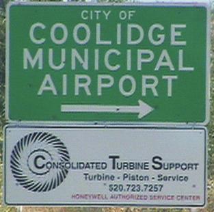
23 square mile or more. A total of over twelve square miles are forecasted to have combined densities of 5,068 or more persons per square mile. Much of the remainder of the portions of the study area forecasted to be urbanized by 2025 will have densities of more than 2,863 persons per square mile. Draft 2025 transit service options suggested by this analysis are shown in Figure 7. The two types of transit service suggested by the forecasted densities are minimum bus service and commuter rail. The existence throughout the future urbanized portions of the study area of regions with densities of 2,863 persons per square mile or more is close enough to the commuter rail threshold of 3,328 persons per square mile that implementation of commuter rail in the region by 2025 would be warranted, assuming that sufficient concentrations of employment within rail-served areas such as Central Phoenix, Central Tucson, and the Phoenix-Mesa Gateway area will exist. Portions of Figure 7 where densities suggest local minimum bus service are highlighted in yellow. Such service could begin as an expansion of the existing Cotton Express service in Coolidge and the implementation of a similar service in Florence. As demand warrants, a network of fixed-route services, with complementary paratransit services, could be developed in these areas. The following services would address future population growth and levels of travel demand within the Coolidge and Florence areas and between these communities and the metropolitan Phoenix and Tucson areas. These alternatives include: Expansion of the Cotton Express local dial-a-ride and deviated fixed route service areas within the City of Coolidge Introduction of a service similar to the Cotton Express within the Town of Florence Regional bus service connecting Coolidge, Florence, Coolidge Municipal Airport, Central Arizona College, Casa Grande, and Eloy Limited Stop commuter bus serving Coolidge, Florence, Queen Creek, Gilbert, and Mesa Limited Stop commuter bus serving Florence, Coolidge, Chandler, Tempe, and Phoenix Limited Stop commuter bus serving Coolidge, Florence, Oro Valley, and Tucson Limited Stop commuter bus serving Florence, Coolidge, Randolph, Eloy, Marana, and Tucson Commuter rail serving Coolidge, Queen Creek, Gilbert, Mesa, Tempe, and Phoenix Commuter rail serving Florence, Queen Creek, Gilbert, Mesa, Tempe, and Phoenix Regional rail service between Phoenix, Tempe, Mesa, Queen Creek, Coolidge, Picacho (Eloy), Marana, and Tucson An excursion rail operation on the Copper Basin Railway from Florence east through the scenic Gila Canyon area Figure 6 also recommends the locations for transit centers and park-and-ride locations. The 10-mile diameter circles depict the catchment areas for the commuter rail service. These are intended to incorporate the areas from where a commuting motorist could reach the rail station at the transit center in the center of the circle within 10 minutes. Locations of transit centers and park-and-ride facilities include: Lima & Associates Coolidge-Florence Regional Transportation Study Page 20

24 FIGURE DRAFT TRANSIT OPTIONS Lima & Associates Coolidge-Florence Regional Transportation Study Page 7-21
25 A combination transit center and park-and-ride facility at the intersection of the Union Pacific Railroad and Hunt Highway for both commuter bus and commuter rail patrons A combination transit center and park-and-ride facility at the intersection of the Union Pacific Railroad, the Copper Basin Railway, and Arizona Farms Road for commuter rail patrons A combination transit center and park-and-ride facility north of downtown Florence at the intersection of SR 79 and the Copper Basin Railway for patrons of commuter bus, commuter rail, and excursion rail services A transit center at Central Arizona College Park-and Ride facilities at the following locations: Coolidge Municipal Airport; The corner of Skousen Road and SR 287; The corner of Florence-Kelvin Highway and SR 79; and at Randolph Road, SR 87, and the Union Pacific The timing of the extension of local service e.g., the Cotton Express in Coolidge to these areas will depend upon the rate of buildout of the various developments that comprise the new service areas. Expansion may also depend upon the degree of transit orientation of the subdivisions. Extending service sooner to areas that are more conducive to transit service, both with regard to the demographics of the particular development and the layout of the development s internal street network, will result in service that can be managed more efficiently and maintains a higher farebox recovery ratio. While the demographic thresholds evaluated in the previous section will govern the timing for prioritizing and implementing the recommended services, the operation of many of these services may be contingent on necessary infrastructure improvements. For example, additional freeway capacity will greatly enhance the efficiency of the limited stop commuter bus services. A bus commuter experiencing peak hour traffic delays on Hunt Highway can put the time to productive use in ways that would be impractical or unsafe for a motorist to do, such as reading, making phone calls, or working on a laptop computer. However, the new freeways may include high-occupancy vehicle (HOV) lanes for the use of buses, vanpools, or carpools, making these alternative ways of commuting timecompetitive with single-occupancy vehicles. Significant improvements in the rail infrastructure such as lengthened sidings and sections of double track will be needed before regional or commuter rail service could be implemented on a regular or frequent basis. RECOMMENDATION AND IMPLEMENTATION STRATEGY. This section presents a capital improvement program designed to address the transportation challenges faced in the City of Coolidge and the Town of Florence, with a plan for implementing the program in short-, mid-, and long-term phases. Working with the TAC and the Project Managers from each community, the consultant team developed cost estimates for the short-, mid-, and long-term transportation projects. Recommendations were presented to the Project Managers and the Technical Advisory Committee for review and comment. Implementation Plan. A program to plan, coordinate, and implement a multimodal regional transportation plan was developed. In addition, long-range projects were identified and costs were estimated. High priority road corridors were also identified. Lima & Associates Coolidge-Florence Regional Transportation Study Page 22
EXECUTIVE SUMMARY REGIONALLY SIGNIFICANT ROUTES FOR SAFETY AND MOBILITY REGIONALLY SIGNIFICANT ROUTES SEPTEMBER 2008 PARTNERING FOR SAFETY & MOBILITY
 REGIONALLY SIGNIFICANT ROUTES REGIONALLY SIGNIFICANT ROUTES FOR SAFETY AND MOBILITY EXECUTIVE SUMMARY PARTNERING FOR SAFETY & MOBILITY SEPTEMBER 2008 Kimley-Horn Kimley Kimley-Horn and and Associates,
City of Homewood Transportation Plan
 City of Homewood Transportation Plan Prepared for: City of Homewood, Alabama Prepared by: Skipper Consulting, Inc. May 2007 TABLE OF CONTENTS INTRODUCTION... 1 BACKGROUND INFORMATION... 1 EXISTING TRANSPORTATION
Recommended Roadway Plan Section 2 - Land Development and Roadway Access
 Recommended Roadway Plan Section 2 - Land Development and Roadway Access SECTION 2 Land Development and Roadway Access 2.1 Land Use and Access Management The Federal Highway Administration (FHWA) defines
ADOT Statewide Bicycle and Pedestrian Program Summary of Phase IV Activities APPENDIX B PEDESTRIAN DEMAND INDEX
 ADOT Statewide Bicycle and Pedestrian Program Summary of Activities APPENDIX B PEDESTRIAN DEMAND INDEX May 24, 2009 Pedestrian Demand Index for State Highway Facilities Revised: May 29, 2007 Introduction
City of Wayzata Comprehensive Plan 2030 Transportation Chapter: Appendix A
 A1. Functional Classification Table A-1 illustrates the Metropolitan Council s detailed criteria established for the functional classification of roadways within the Twin Cities Metropolitan Area. Table
Chapter 4 Traffic Analysis
 Chapter 4 Traffic Analysis PURPOSE The traffic analysis component of the K-68 Corridor Management Plan incorporates information on the existing transportation network, such as traffic volumes and intersection
4. ENVIRONMENTAL IMPACT ANALYSIS 9. TRANSPORTATION AND TRAFFIC
 4. ENVIRONMENTAL IMPACT ANALYSIS 9. TRANSPORTATION AND TRAFFIC 4.9.1 INTRODUCTION The following section addresses the Proposed Project s impact on transportation and traffic based on the Traffic Study
5.0 Roadway System Plan
 Southwest Boise Transportation Study Page 16 5.0 Roadway System Plan The Roadway System Plan outlines roadway improvements in the Initial Study Area. It forecasts future deficiencies on the arterial system,
Access Management Regulations and Standards for Minor Arterials, Collectors, Local Streets
 Access Management Regulations and Standards for Minor Arterials, Collectors, Local Streets September 2009 Paul Grasewicz Access Management Administrator Concept of Access Management The way to manage access
METHODOLOGY. Signalized Intersection Average Control Delay (sec/veh)
") Chapter 5 Traffic Analysis 5.1 SUMMARY US /West 6 th Street assumes a unique role in the Lawrence Douglas County transportation system. This principal arterial street currently conveys commuter traffic
Chapter 5 Traffic Analysis 5.1 SUMMARY US /West 6 th Street assumes a unique role in the Lawrence Douglas County transportation system. This principal arterial street currently conveys commuter traffic
Clackamas County Comprehensive Plan
 ROADWAYS The County s road system permits the movement of goods and people between communities and regions, using any of a variety of modes of travel. Roads provide access to virtually all property. They
Access Management Regulations and Standards
 Access Management Regulations and Standards January 2014 Efficient highway operation Reasonable property access Concept of Access Management The way to manage access to land development while preserving
Highway 111 Corridor Study
 Highway 111 Corridor Study June, 2009 LINCOLN CO. HWY 111 CORRIDOR STUDY Draft Study Tea, South Dakota Prepared for City of Tea Sioux Falls Metropolitan Planning Organization Prepared by HDR Engineering,
CHAPTER 3: CIRCULATION
 CHAPTER 3: CIRCULATION 2025 ENERAL PLAN Circulation Element The Circulation Element addresses multimodal transportation improvements to roads and infrastructure serving motorists, transit patrons, pedestrians,
Access Management Regulations and Standards
 Access Management Regulations and Standards Efficient highway operation Reasonable property access Concept of Access Management The way to manage access to land development while simultaneously preserving
CHAPTER 7 ACCESS MANAGEMENT. Background. Principles of Access Management. Hennepin County Transportation Systems Plan (HC-TSP)
") CHAPTER 7 ACCESS MANAGEMENT Background Principles of Access Management Hennepin County Transportation Systems Plan (HC-TSP) Chapter 7 Access Management 7.1 Background Access management has become an important
CHAPTER 7 ACCESS MANAGEMENT Background Principles of Access Management Hennepin County Transportation Systems Plan (HC-TSP) Chapter 7 Access Management 7.1 Background Access management has become an important
Access Location, Spacing, Turn Lanes, and Medians
 Design Manual Chapter 5 - Roadway Design 5L - Access Management 5L-3 Access Location, Spacing, Turn Lanes, and Medians This section addresses access location, spacing, turn lane and median needs, including
WELCOME TO OPEN HOUSE # 1 June 14, 2017
 Langstaff Road Weston Road to Highway 7 Class Environmental Assessment Study WELCOME TO OPEN HOUSE # 1 June 14, 2017 Please sign in and join our mailing list Purpose of Open House #1 & Study Area York
Transportation Master Plan Advisory Task Force
 Transportation Master Plan Advisory Task Force Network Alternatives & Phasing Strategy February 2016 BACKGROUND Table of Contents BACKGROUND Purpose & Introduction 2 Linking the TMP to Key Council Approved
Chapter 6 Transportation Plan
 Chapter 6 Transportation Plan Transportation Plan Introduction Chapter 6 Transportation Plan Transportation Plan Introduction This chapter describes the components of Arvada s transportation system, comprised
Chapter 5 Future Transportation
 Chapter 5 Future Transportation The Future Land Use Plan identifies the desired land use designations. The land uses desired for Crozet depend, in large part, on the success of the transportation system,
Chapter 2: Standards for Access, Non-Motorized, and Transit
 Standards for Access, Non-Motorized, and Transit Chapter 2: Standards for Access, Non-Motorized, and Transit The Washtenaw County Access Management Plan was developed based on the analysis of existing
Corpus Christi Metropolitan Transportation Plan Fiscal Year Introduction:
 Introduction: The Safe, Accountable, Flexible, Efficient Transportation Equity Act: A Legacy for Users (SAFETEA-LU) has continued the efforts started through the Intermodal Surface Transportation Efficiency
M-58 HIGHWAY ACCESS MANAGEMENT STUDY Mullen Road to Bel-Ray Boulevard. Prepared for CITY OF BELTON. May 2016
 M-58 HIGHWAY ACCESS MANAGEMENT STUDY Prepared for CITY OF BELTON By May 2016 Introduction Missouri State Highway 58 (M-58 Highway) is a major commercial corridor in the City of Belton. As development has
Regional Transportation Needs Within Southeastern Wisconsin
 Regional Transportation Needs Within Southeastern Wisconsin #118274 May 24, 2006 1 Introduction The Southeastern Wisconsin Regional Planning Commission (SEWRPC) is the official areawide planning agency
CITY OF COCOA BEACH 2025 COMPREHENSIVE PLAN. Section VIII Mobility Element Goals, Objectives, and Policies
 CITY OF COCOA BEACH 2025 COMPREHENSIVE PLAN Section VIII Mobility Element Goals, Objectives, and Policies Adopted August 6, 2015 by Ordinance No. 1591 VIII MOBILITY ELEMENT Table of Contents Page Number
The Route 29 Corridor Study was initiated at the request of Virginia s Commonwealth
 CHAPTER 2: Study Background and approach The Route 29 Corridor Study was initiated at the request of Virginia s Commonwealth Transportation Board in response to requests from members of the General Assembly
MCTC 2018 RTP SCS and Madera County RIFP Multi-Modal Project Eval Criteria GV13.xlsx
 MCTC 8 RTP SCS and Madera County RIFP Multi-Modal Project Eval Criteria GV.xlsx Madera County Transportation Commission Regional Transportation Plan / Sustainable Communities Strategy Multi-Modal Project
INTRODUCTION THOROUGHFARE SYSTEM CLASSIFICATIONS
 INTRODUCTION The thoroughfare plan will assist public officials in the development of a specialized system for efficient and safe movement of vehicular traffic while minimizing potential conflicts with
3 ROADWAYS 3.1 CMS ROADWAY NETWORK 3.2 TRAVEL-TIME-BASED PERFORMANCE MEASURES Roadway Travel Time Measures
 ROADWAYS Approximately 6 million trips are made in the Boston metropolitan region every day. The vast majority of these trips (80 to percent, depending on trip type) involve the use of the roadway network
3.0 Future Conditions
 3.0 Future Conditions In order to be able to recommend appropriate improvements to the transportation system of the Town, it is important to first understand the nature and volume of traffic that is expected
Circulation in Elk Grove includes: Motor vehicles, including cars and trucks
 Circulation, as it is used in this General Plan, refers to the many ways people and goods move from place to place in Elk Grove and the region. Circulation in Elk Grove includes: Motor vehicles, including
TRANSPORTATION NEEDS ASSESSMENT
 TRANSPORTATION NEEDS ASSESSMENT A travel demand analysis was carried out to determine the operational issues and the potential benefit that adding traffic capacity would have on the road network. All the
Corridor Advisory Group and Task Force Meeting #10. July 27, 2011
 Corridor Advisory Group and Task Force Meeting #10 July 27, 2011 1 Agenda Recap CAG/TF #9 Public Meeting #2 Summary Single Mode Alternatives Evaluation Results Next Steps 2 3 CAG/TF #9 Recap CAG /TF #9
JONESBORO HIGHWAY 63 HIGHWAY 18 CONNECTOR STUDY
 JONESBORO HIGHWAY 63 HIGHWAY 18 CONNECTOR STUDY Craighead County May 2007 JONESBORO HIGHWAY 63 HIGHWAY 18 CONNECTOR STUDY Craighead County May 2007 Prepared by Planning and Research Division Arkansas State
SECTION 1 - TRAFFIC PLANNING
 SECTION 1 - TRAFFIC PLANNING 1.1 TRAFFIC OPERATIONS 1.1.1 Roadway Functional Classification The Multnomah County Comprehensive Framework Plan s Policy 34: Trafficways and the Functional Classification
Scottsdale Road/Rural Road Alternatives Analysis (AA) Study. Arizona ITE/IMSA Spring Conference March 7, 2012
 Study. Arizona ITE/IMSA Spring Conference March 7, 2012") Scottsdale Road/Rural Road Alternatives Analysis (AA) Study Arizona ITE/IMSA Spring Conference March 7, 2012 Study Location and Duration Primary Study Corridor (major focus of effort) Rural Road and Scottsdale
Scottsdale Road/Rural Road Alternatives Analysis (AA) Study Arizona ITE/IMSA Spring Conference March 7, 2012 Study Location and Duration Primary Study Corridor (major focus of effort) Rural Road and Scottsdale
Multimodal Through Corridors and Placemaking Corridors
 68 Multimodal Through Corridors and Placemaking Corridors Corridors have different functions in a region. Some corridors are used to get smoothly and rapidly through a region or to get quickly to major
ROUTES 55 / 42 / 676 BUS RAPID TRANSIT LOCALLY PREFERRED ALTERNATIVE
 ROUTES 55 / 42 / 676 BUS RAPID TRANSIT LOCALLY PREFERRED ALTERNATIVE April, 2012 1 INTRODUCTION The need for transit service improvements in the Routes 42/55/676 corridor was identified during the Southern
Basalt Creek Transportation Refinement Plan Recommendations
 Basalt Creek Transportation Refinement Plan Recommendations Introduction The Basalt Creek transportation planning effort analyzed future transportation conditions and evaluated alternative strategies for
Exhibit 1 PLANNING COMMISSION AGENDA ITEM
 Exhibit 1 PLANNING COMMISSION AGENDA ITEM Project Name: Grand Junction Circulation Plan Grand Junction Complete Streets Policy Applicant: City of Grand Junction Representative: David Thornton Address:
Magnolia Place. Traffic Impact Analysis. Prepared for: City of San Mateo. Prepared by: Hexagon Transportation Consultants, Inc.
 Magnolia Place Traffic Impact Analysis Prepared for: City of San Mateo Prepared by: Hexagon Transportation Consultants, Inc. Updated January 4, 2010 Table of Contents 1. Introduction...1 2. Existing Conditions...6
MOUNTAIN HOUSE SPECIFIC PLAN I 9.1 INTRODUCTION ASSUMPTIONS TRANSPORTATION FACILITIES TRANSPORTATION IMPROVEMENTS PHASING 9.
 CHAPTER NINE: TRANSPORTATION AND CIRCULATION 9.1 INTRODUCTION 9.1 9.2 ASSUMPTIONS 9.1 9.3 TRANSPORTATION FACILITIES 9.1 9.4 TRANSPORTATION IMPROVEMENTS PHASING 9.3 LIST OF FIGURES LIST OF TABLES Figure
This page intentionally left blank.
 This page intentionally left blank. COMMUNITY Coweta Community Overview Coweta Coweta, a residential community located in Wagoner County, is a suburb of Tulsa situated southeast of the metropolitan area
Chapter 7. Transportation. Transportation Road Network Plan Transit Cyclists Pedestrians Multi-Use and Equestrian Trails
 Chapter 7 Transportation Transportation Road Network Plan Transit Cyclists Pedestrians Multi-Use and Equestrian Trails 7.1 TRANSPORTATION BACKGROUND The District of Maple Ridge faces a number of unique
Highway 217 Corridor Study. Phase I Overview Report
 Highway 217 Corridor Study Phase I Overview Report November 3, 24 BACKGROUND AND OVERVIEW Study purpose The Highway 217 Corridor Study is developing multi-modal transportation solutions for traffic problems
SELECTED ROADWAY CAPACITY ANALYSIS
 CHAPTERFOUR SELECTED ROADWAY CAPACITY ANALYSIS 4.1 SELECTED ROADWAY CAPACITY ANALYSIS Introduction Capacity analysis was performed on six selected roadways within the Dearborn County study area using the
THIS PAGE LEFT BLANK INTENTIONALLY
 GA SR 25 Spur at Canal Road Transportation Impact Analysis PREPARED FOR GLYNN COUNTY, GEORGIA 1725 Reynolds Street, Suite 300 Brunswick, Georgia 31520 PREPARED BY 217 Arrowhead Boulevard Suite 26 Jonesboro,
APPENDIX G: INTERSECTION NEEDS AT OKEECHOBEE BOULEVARD
 APPENDIX G: INTERSECTION NEEDS AT OKEECHOBEE BOULEVARD INTERSECTION NEEDS AT SR 7 and OKEECHOBEE BOULEVARD SR 7 Extension Project Development and Environment (PD&E) Study From Okeechobee Boulevard (SR
Overview. Existing Conditions. Corridor Description. Assessment
 Overview A study of the 23 rd Street corridor was undertaken to document the existing conditions, analyze traffic operations, and recommend remedies for deficient situations Although 23 rd Street is frequently
Proposed. City of Grand Junction Complete Streets Policy. Exhibit 10
 Proposed City of Grand Junction Complete Streets Policy Exhibit 10 1 City of Grand Junction Complete Streets Policy Vision: The Complete Streets Vision is to develop a safe, efficient, and reliable travel
Route 29 Corridor Assessment Update. Development of Possible Solutions
 Route 29 Corridor Assessment Update Development of Possible Solutions Public Workshop #3 October 27, 2016 Purpose of Developing Possible Solutions Recap of where we ve been and timeline for moving forward
South King County High-Capacity Transit Corridor Study
 HIGH-CAPACITY TRANSIT CORRIDOR STUDY South King County Corridor South King County High-Capacity Transit Corridor Study Corridor Report August 2014 South King County High Capacity Transit Corridor Report
Classification Criteria
 SCHEDULE D TO RECOMMENDED OFFICIAL PLAN AMENDMENT NO. 40 SCHEDULE C-4 Road Criteria Criteria Traffic Service Objective Land Service/Access Typical Daily Traffic Volume Flow characteristics Travel Speed
TRAFFIC IMPACT STUDY CRITERIA
 Chapter 6 - TRAFFIC IMPACT STUDY CRITERIA 6.1 GENERAL PROVISIONS 6.1.1. Purpose: The purpose of this document is to outline a standard format for preparing a traffic impact study in the City of Steamboat
5. RUNNINGWAY GUIDELINES
 5. RUNNINGWAY GUIDELINES These guidelines should be considered collectively when making runningway decisions. A runningway is the linear component of the transit system that forms the right-of-way reserved
PennDOT Access Management Model Ordinances Training
 PennDOT Access s Training Trainers: Chad Dixson, AICP, TPD Angela Watson, PB Objective of Today Assist Pennsylvania s municipalities and transportation professionals in better understanding the benefits
West Dimond Blvd Upgrade Jodhpur Street to Sand Lake Road
 West Dimond Blvd Jodhpur St to Sand Lake CSS Transportation Project Summary Municipality of Anchorage Project # 05 005 Project Manager: John Smith, P.E. (MOA PM&E) Project Administrator: Julie Makela,
Lyons Avenue/Dockweiler Road Extension Project Draft Environmental Impact Report. Appendix I Traffic Impact Study
 Lyons Avenue/Dockweiler Road Extension Project Draft Environmental Impact Report Appendix I Traffic Impact Study Street 0 80-1947 500.4501 RITA ld Court 0 91355-1096 400.7401 LA n Avenue 0 590-3745 300-9301
Lee s Summit Road Improvement Study Public Open House June 7, 2007 Summary of Comment Card Responses
 Lee s Summit Road Improvement Study Public Open House June 7, 2007 Summary of Comment Card Responses Introduction At the Lee s Summit Road Improvement Study Public Open House held Thursday, June 7, 2007
Mobility and Congestion
 Technical Memorandum Mobility and Congestion Prepared for: Prepared by: September 25, 2013 1 Table of Contents 1. Introduction... 1 2. Congestion Forecasting Process... 1 2.1 Mobility and Congestion Terms...
2025 Comprehensive Plan for the City of Temple Terrace Florida. Mobility Element. Adopted by City Council June 30, 2009
 2025 Comprehensive Plan for the City of Temple Terrace Florida Mobility Element Adopted by City Council June 30, 2009 Effective Date September 22, 2009 GOAL 2: To protect and promote the quality of life
Intersection Traffic Control Feasibility Study
 Intersection Traffic Control Feasibility Study CSAH 9 at CSAH 60 (185th Avenue) Prepared For: Dakota County Transportation Department Western Service Center 14955 Galaxie Avenue, 3rd Floor Apple Valley,
Sixth Line Development - Transit Facilities Plan
 Memorandum Date: November 13, 2012 To: From: c.c. Subject: Rob Freeman (Freeman Planning) Kevin Phillips Sixth Line Development - Transit Facilities Plan 33016631 This memo was prepared to review the transit
Access Management Benefits & Techniques. Access Management Workshop June 2, 2006
 Access Management Benefits & Techniques Access Management Workshop June 2, 2006 1 Benefits of Access Management Safety As access density increases, crash rates increase Increasing the density of access
Chapter 5 FUNCTIONAL CLASSIFICATION
 Chapter 5 FUNCTIONAL CLASSIFICATION Functional classification is a system by which streets and roadways may be distinguished by types according to their function within the entire transportation network.
Highway 49, Highway 351 and Highway 91 Improvements Feasibility Study Craighead County
 Highway 49, Highway 351 and Highway 91 Improvements Feasibility Study Craighead County Executive Summary March 2015 Highway 49, Highway 351 and Highway 91 Improvements Feasibility Study Craighead County
TRANSIT & NON-MOTORIZED PLAN DRAFT FINAL REPORT Butte County Association of Governments
 1 INTRODUCTION Maintaining a high quality of life is the essence of this plan for transit and non-motorized transportation in Butte County. Curbing greenhouse gas emissions (GHG) by reducing congestion,
Transportation Impact Study for Abington Terrace
 Transportation Impact Study for Abington Terrace Abington Township, Montgomery County, PA Sandy A. Koza, P.E., PTOE PA PE License Number PE059911 Prepared by McMahon Associates, Inc. 425 Commerce Drive,
Bicycle Master Plan Goals, Strategies, and Policies
 Bicycle Master Plan Goals, Strategies, and Policies Mobilizing 5 This chapter outlines the overarching goals, action statements, and action items Long Beach will take in order to achieve its vision of
Preliminary Transportation Analysis
 Preliminary Transportation Analysis Goals of a Robust, Multimodal Transportation Network Safe Accessible/Connected Efficient Comfortable Context-Sensitive Motor Vehicle: Continue to analyze the data to
DRAFT BUENA VISTA 2020 TRANSPORTATION PLAN
 DRAFT BUENA VISTA 2020 TRANSPORTATION PLAN DEVELOPED BY THE TRANSPORTATION PLANNING DIVISION OF THE VIRGINIA DEPARTMENT OF TRANSPORTATION IN COOPERATION WITH THE U.S. DEPARTMENT OF TRANSPORTATION, FEDERAL
Appendix A. Road Classification Review of Outstanding Issues and Proposed Classifications (All Wards) Staff Report Road Classification System
 Staff Report Road Classification System") Appendix A Road Classification Review of Outstanding Issues and Proposed Classifications (All Wards) Staff Report 2000 A.1 of A.10 A.2 of A.10 STAFF REPORT January 26, 2000 To: From: Works Committee Barry
Appendix A Road Classification Review of Outstanding Issues and Proposed Classifications (All Wards) Staff Report 2000 A.1 of A.10 A.2 of A.10 STAFF REPORT January 26, 2000 To: From: Works Committee Barry
Bus Rapid Transit Plans
 Twin Cities Region Bus Rapid Transit Plans ULI Minnesota Workshop Connecting Bus Rapid Transit to the Community December 15, 2009 John Levin Director of Service Development Metro Transit Metropolitan Area
Executive Summary. September 3, 2014
 D Executive Summary September 3, 2014 Study Background and Purpose Citizens for Picture Rocks is a community advocacy group representing the Picture Rocks Fire Department, Pima County Sheriff s Department,
RESOLUTION NO ?? A RESOLUTION OF THE CITY OF NEPTUNE BEACH ADOPTING A COMPLETE STREETS POLICY
 RESOLUTION NO. 2018-?? A RESOLUTION OF THE CITY OF NEPTUNE BEACH ADOPTING A COMPLETE STREETS POLICY WHEREAS, safe, convenient, and accessible transportation for all users is a priority of the City of Neptune
City of Novi Non-Motorized Master Plan 2011 Executive Summary
 City of Novi Non-Motorized Master Plan 2011 Executive Summary Prepared by: February 28, 2011 Why Plan? Encouraging healthy, active lifestyles through pathway and sidewalk connectivity has been a focus
Transportation, Parking & Roads
 Transportation, Parking & Roads Design Carolina North as a walkable community Design the transportation system and development patterns (i.e., urban design elements such as density, building design, mix
2045 Long Range Transportation Plan. Summary of Draft
 2045 Long Range Transportation Plan Summary of Draft Fredericksburg Area Metropolitan Planning Organization The George Washington Region includes the City of Fredericksburg and the counties of Caroline,
INNER LOOP EAST. AIA Rochester Annual Meeting November 13, 2013 TRANSFORMATION PROJECT. Bret Garwood, NBD Erik Frisch, DES
 INNER LOOP EAST TRANSFORMATION PROJECT AIA Rochester Annual Meeting November 13, 2013 Bret Garwood, NBD Erik Frisch, DES Why? We are building a city that encourages walking, biking and enjoying the outdoor
TOWN OF CHAPEL HILL POLICY AND PROCEDURES FOR TRAFFIC CALMING MEASURES
 TOWN OF CHAPEL HILL POLICY AND PROCEDURES FOR TRAFFIC CALMING MEASURES (Adopted by the Town Council on June 30, 2004) (Revised December 6, 2010) (Revised February 8, 2016) POLICY AND PROCEDURES FOR TRAFFIC
5858 N COLLEGE, LLC N College Avenue Traffic Impact Study
 5858 N COLLEGE, LLC nue Traffic Impact Study August 22, 2016 Contents Traffic Impact Study Page Preparer Qualifications... 1 Introduction... 2 Existing Roadway Conditions... 5 Existing Traffic Conditions...
Route 7 Corridor Study
 Route 7 Corridor Study Executive Summary Study Area The following report analyzes a segment of the Virginia State Route 7 corridor. The corridor study area, spanning over 5 miles in length, is a multi
Exhibit B: Proposed amendments to the Transportation Element of the Oakland Comprehensive Plan
 Exhibit B: Proposed amendments to the Transportation Element of the Oakland Comprehensive Plan TRANSPORTATION Introduction An important aspect of any community is its transportation system, the means by
Access requests to County streets and roadways are processed through one of the following methods:
 13.1 GENERAL APPLICATION PROCESS Access requests to County streets and roadways are processed through one of the following methods: A. Planned Developments may set general locations for access points.
Living Streets Policy
 Living Streets Policy Introduction Living streets balance the needs of motorists, bicyclists, pedestrians and transit riders in ways that promote safety and convenience, enhance community identity, create
In station areas, new pedestrian links can increase network connectivity and provide direct access to stations.
 The Last Mile Planning for Pedestrians Planning around stations will put pedestrians first. Making walking to stations safe and easy is important; walking will be a part of every rapid transit Accessible
Chapter 6: Transportation
 Chapter 6: Transportation I. INTRODUCTION The purpose of the Transportation Plan element of the Comprehensive Plan is to provide guidance to the City of North Mankato, as well as existing and future landowners
York Region Population and Employment Growth
 March 1, 2016 1 York Region Population and Employment Growth York Region needs to comply with The Provincial Growth Plan and new forecasts introduced to 2036 and 2041 2 Regional Official Plan Review York
City of Elizabeth City Neighborhood Traffic Calming Policy and Guidelines
 City of Elizabeth City Neighborhood Traffic Calming Policy and Guidelines I. Purpose: The City of Elizabeth City is committed to ensure the overall safety and livability of residential neighborhoods. One
4 DISRUPTION MANAGEMENT PLAN HIGHWAY 7 RAPIDWAY CONSTRUCTION BETWEEN BAYVIEW AVENUE AND WARDEN AVENUE TOWNS OF MARKHAM AND RICHMOND HILL
 4 DISRUPTION MANAGEMENT PLAN HIGHWAY 7 RAPIDWAY CONSTRUCTION BETWEEN BAYVIEW AVENUE AND WARDEN AVENUE TOWNS OF MARKHAM AND RICHMOND HILL The Transportation Services Committee recommends the adoption of
ATTACHMENT 4 - TDM Checklist. TDM Checklist Overview
 ATTACHMENT 4 - TDM Checklist TDM Checklist Overview The proposed checklist rates developments on the degree to which they are TDM and transit supportive. Points are assigned based on the level of transit
1999 On-Board Sacramento Regional Transit District Survey
 SACOG-00-009 1999 On-Board Sacramento Regional Transit District Survey June 2000 Sacramento Area Council of Governments 1999 On-Board Sacramento Regional Transit District Survey June 2000 Table of Contents
ARTINSVILLE ENRY OUNTY REA RANSPORTATION TUDY
 ARTINSVILLE ENRY OUNTY REA RANSPORTATION TUDY DEVELOPED BY THE TRANSPORTATION AND MOBILITY PLANNING DIVISION OF THE VIRGINIA DEPARTMENT OF TRANSPORTATION IN COOPERATION WITH THE U.S. DEPARTMENT OF TRANSPORTATION,
3.0 PROJECT DESCRIPTION
 The following section of the Draft EIR contains a description of the proposed Elk Grove Boulevard/SR 99 Interchange Modification project, consistent with the requirements of CEQA Guidelines Section 15124.
Traffic Calming Policy
 Article I. Purpose and Goal. The purpose of this policy is to establish criteria and procedures the City will use to evaluate requests for, and if appropriate, implement traffic calming measures. Neighborhood
2010 Pedestrian and Bicyclist Special Districts Study Update
 2010 Pedestrian and Bicyclist Special Districts Study Update Pedestrian and Bicyclist Special Districts Program Overview H-GAC s Special Districts Program aims to provide strategic investments in pedestrian
TABLE OF CONTENTS 7.0 THOROUGHFARE PLAN. Analysis of Future Conditions Thoroughfare Plan Proposed Cross-Sections.. 7.
 TABLE OF CONTENTS 7.0 THOROUGHFARE PLAN Analysis of Future Conditions.. 7.2 Thoroughfare Plan.. 7.3 Proposed Cross-Sections.. 7.4 Arterials Minor Arterials Collectors Local Streets Thoroughfare Plan Map
Report. Typical Sections. City of Middleton, WI
 Report Typical Sections City of Middleton, WI December 2006 Report for City of Middleton, Wisconsin Typical Sections repared by: Traffic Associates LLC and STRAND ASSOCIATES, INC. 910 West Wingra Drive
TRANSPORTATION ANALYSIS REPORT US Route 6 Huron, Erie County, Ohio
 TRANSPORTATION ANALYSIS REPORT US Route 6 Huron, Erie County, Ohio December 12, 2012 Prepared for: The City of Huron 417 Main Huron, OH 44839 Providing Practical Experience Technical Excellence and Client