Transportation Improvement Study
|
|
|
- Aleesha Hunter
- 6 years ago
- Views:
Transcription
1 Transportation Improvement Study City of Searcy White County November 2008
2 Transportation Improvement Study City of Searcy White County November 2008 Prepared by: Planning and Research Division Arkansas State Highway and Transportation Department In Cooperation with: City of Searcy Searcy Regional Chamber of Commerce Federal Highway Administration NOTICE OF NONDISCRIMINATION The Arkansas State Highway and Transportation (Department) complies with the Americans with Disabilities Act of 1990, Section 504 of the Rehabilitation Act of 1973, Title VI of the Civil Rights Act of 1964 and other federal equal opportunity laws and therefore does not discriminate on the basis of race, sex, color, age, national origin, religion or disability, in admission or access to and treatment in Department programs and activities, as well as the Department s hiring or employment practices. Complaints of alleged discrimination and inquiries regarding the Department s nondiscrimination policies may be directed to James B. Moore, Jr., Section Head - EEO/DBE (ADA/504/Title VI Coordinator), P.O. Box 2261, Little Rock, AR 72203, (501) , (Voice/TTY 711), or the following address: james.moore@arkansashighways.com. This notice is available from the ADA/504/Title VI Coordinator in large print, on audiotape and in Braille. AHTD:P&R:SP:CM:MBW:11/19/2008
3 Section TABLE OF CONTENTS Page I. Introduction Study Authorization... 1 Overview... 1 Land Use... 3 Existing Highways... 3 Recent, Current and Planned Highway Improvements... 4 Traffic Volumes... 4 Safety Analysis... 5 II. Proposed North Searcy Connection Purpose and Need... 7 Local Roads... 7 Site Topography... 9 Descriptions of Alternatives... 9 Alternative Construction Alternatives Western Section Alternative Alternative Alternative Alternative Alternative Alternative Alternative Eastern Section Alternative Alternative Traffic Demand Potential Environmental Impacts Western Section Eastern Section Findings i
4 Section TABLE OF CONTENTS--continued Page III. Proposed Access Improvements Highway 67 Frontage Road/Brantley Road Purpose and Need Local Roads Descriptions of Alternatives Alternative Alternative Traffic Demand Potential Environmental Impacts Findings IV. Summary and Conclusions Major Findings ii
5 FIGURES Page Figure 1 Current Construction Alternatives--Highway 13 Extension... 2 Figure 2 Analysis Areas... 3 Figure 3 Existing and Projected Traffic... 5 Figure 4 Project Location--Proposed North Searcy Connection... 7 Figure 5 Collins Road... 8 Figure 6 Intersection of North Bypass Road and North Main Street... 9 Figure 7 Topography--Proposed North Searcy Connection Analysis Area Figure 8 Project Segments Figure 9 Construction Alternatives--Western Section - Proposed North Searcy Connection Figure 9a Alternatives 2 and Figure 9b Alternatives 4 and Figure 9c Alternatives 6, 7 and Figure 10 Construction Alternatives-- Eastern Section - Proposed North Searcy Connection Figure 11 Estimated Project Traffic-- Western Section - Proposed North Searcy Connection Figure 12 Estimated Project Traffic-- Eastern Section - Proposed North Searcy Connection Figure 13 Project Location--Highway 67 Frontage Road/Brantley Road Figure 14 Brantley Road Figure 15 Proposed Improvements--Highway 67 Frontage Road/Brantley Road. 23 Figure 16 Commercial/Industrial Sites TABLES Page Table 1 Crash Analysis Summary... 6 Table 2 Alternatives Table 3 Estimated Length and Cost--Proposed North Searcy Connection Construction Alternatives iii
6 Section I Introduction Study Authorization This report was prepared under the authority of Arkansas Highway Commission Minute Order The Minute Order authorized a study of several roadway facilities that could possibly reduce traffic flow problems and improve access. Possible improvements are: 1. A southwestern connection from Highway 36 West to Highway 13 (Highway 13 Extension); 2. A northern connection to link Highways 36 West, 16 and 67; 3. A connection between Highway 16 and North Main Street with improvements to North Main Street; and 4. Improvements to the Highway 67 Frontage Road/Brantley Road to better serve an existing commercial/industrial site and a nearby site that might be available for future industrial development. A study, the Highway 13 Extension Study (July 2005), analyzed the southwestern connection. Three possible corridors were developed and determined to be feasible. A project to extend Highway 13 has been programmed as Job Environmental handling has begun and Figure 1 shows the current construction alternatives under consideration for Job In June 2008, Searcy area officials revised their original request. The Main Street Connection was eliminated from further evaluation and an additional alternative for the northern connection to link Highways 36 West, 16 and 67 was added. This study addresses the remaining proposed improvements (Figure 2). Overview Searcy is located in White County on Highway 67 approximately 50 miles northeast of Little Rock. It serves a large area in central Arkansas as a regional provider of educational, medical and commercial services. The City is home to Harding University and the Arkansas State University Searcy Campus as well as a major medical facility, the White County Medical Center. In addition, Searcy s multi-level economy consists of agriculture, retail and industrial businesses, which provide a stable financial base for the area. Major employers include distribution centers, an ice cream company, and manufacturers of stainless steel sinks, fluid power valves and hose fittings. The City s strong economic base is illustrated by the 57 businesses in the area that employ over 50 employees each. Based on the 1990 and 2000 Census results, the population of White County has increased almost 23%, from 54,676 to 67,165. During the same period, the population of Searcy increased from 15,180 to 18,928, an increase of nearly 25%. The statewide population growth for the same ten-year period was under 14%. Section I 1 Introduction

7 Figure 1 Current Construction Alternatives Highway 13 Extension Job Honey Hill Road Alternative 1 Alternative 3 Alternative 2 N Section I 2 Introduction

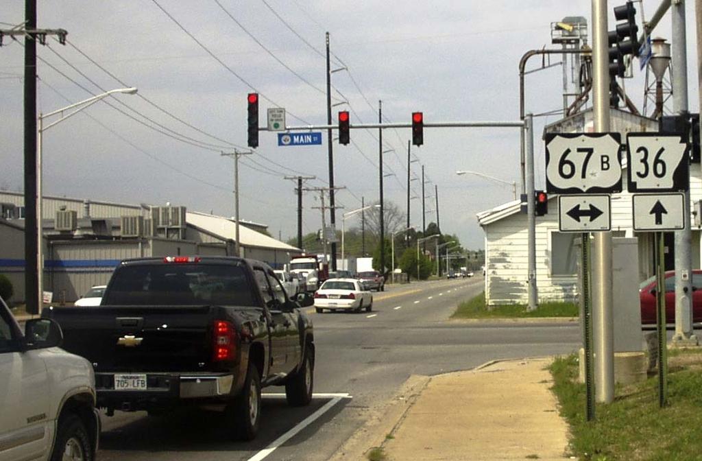
8 Figure 2 Analysis Areas Land Use Land use in White County is primarily agricultural, with nearly 60% of the County s acreage in farms. Most of the commercial and health care facilities are located in Searcy along Highways 67, 67B, 36, and 16, with areas zoned for industrial use located to the south and southeast of the Central Business District (CBD). Most of the residential, school, and park areas are located to the north or west of the CBD. Existing Highways Highway 67 is a principal arterial route through Searcy and is constructed to Interstate System standards from Interstate 40 in North Little Rock to Newport. Highway 67B is a principal arterial that consists of four travel lanes, with curbs, between Highway 67 near the southern city limits and Highway 36. Between Highways 36 and 16, the cross-section is two travel lanes with a two-way, left turn lane. In the Searcy downtown area, Highway 67B (Race Avenue) has been widened from Highway 16 to Davis Drive to allow two lanes with a continuous, two-way, left turn lane. East of Davis Drive, the roadway has four travel lanes with a continuous, two-way, left turn lane. Section I 3 Introduction
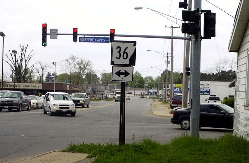
9 Highway 36, also known as the Beebe-Capps Expressway, is the main east/west route through Searcy. Within Searcy, it is classified as a minor arterial route. Beginning west of Searcy near the Ranchette Village Loop, Highway 36 has four travel lanes and a continuous, two-way, left turn lane. This configuration continues through Searcy. Highway 16 is a minor arterial route within the city limits. Regionally, it connects Searcy to the Greers Ferry/Heber Springs area. Highway 16 is a four-lane facility from Covington Road near the northern city limits to Race Avenue, where the road becomes two lanes through the CBD. Recent, Current and Planned Highway Improvements Widening 1.85 miles of Highway 267 east of Highway 67B to include a continuous, two-way, left turn lane completed in August Widening 1.47 miles of Highway 16 (Maple Street) from two to four travel lanes between Covington Road and Race Avenue in Searcy completed in March Widening 1.11 miles of Highway 67B to four travel lanes with a continuous, two-way, left turn lane between Davis Drive and Willow Street in Searcy completed in June Widening 1.94 miles of Highway 36 west of Country Club Road to four travel lanes with a continuous, two-way, left turn lane completed in October Widening 0.73 mile of Highway 67B between Main Street and Cross Street to provide a continuous, two-way, left turn lane estimated completion in November Reconstruction of Highway 16 for a distance of approximately 0.78 mile from Covington Road north under construction. Construction of an extension for Highway 13 between Highways 267 and 36 West scheduled to be let in Traffic Volumes Estimated current and forecast (2008/2028) average daily traffic (ADT) volumes are shown on Figure 3. The highest traffic volumes are found on Highways 67B (Race Avenue and Main Street) and 36 (Beebe-Capps Expressway). Between Highway 67 and North Main Street, current traffic volumes on Highway 67B (Race Avenue) range from 17,000 to 23,000 vehicles per day (vpd) and reflect the traffic generated by the dense commercial development along the highway. Highway 36 is the City s primary east/west route providing access to commercial sites on the east and residential areas on the west. Over 12,000 vehicles travel on Highway 36 daily between the west city limits and Highway 67. On Highway 67B (Main Street), traffic volumes range from 10,000 vpd near Highway 67 to 16,000 vpd near Race Avenue. These volumes also may be attributed to commercial areas along the highway. Section I 4 Introduction
 of the route to a statewide average crash rate for similar")
10 Figure 3 Existing and Projected Traffic Safety Analysis A safety analysis was conducted for several highways related to the proposed travel improvements being considered in this study. The relative safety of a route can be evaluated by comparing the crash rate (the number of crashes per million vehicle miles traveled) of the route to a statewide average crash rate for similar routes. Crash data for 2005, 2006 and 2007 (the three most recent years for which data is available) were analyzed to determine crash rates for various highway segments in the Searcy area. Table 1 summarizes the results of the analysis. Widening of Highway 36 West between Ranchette Village Loop and Country Club Road was completed in 2005 and, since the data is not comparable for the entire analysis period, only data since completion of the roadway improvement is shown. Crash rates that exceed statewide average rates are highlighted. As shown in the table, crash rates for the two segments that are two-lane facilities, Highway 16 (Race Avenue) between Maple Street and Highway 67B and Highway 67B between Highway 36 and Davis Drive, are above the statewide average rates for all three years. Crash rates for Highway 67B (Race Avenue) from Davis Drive to Highway 67 also are above the statewide average rates, reflecting the traffic volume and roadside development for the segment which attracts a large number of turning movements. Section I 5 Introduction
11 Angled or rear-end collisions were the most common types of crashes. Such collisions are indicators of congestion along the roadway, with stop-and-go conditions and frequent turning maneuvers. The leading contributing factors for crashes on all study segments were Following Too Close and Failure to Yield which also reflect roadway congestion. Table 1 Crash Analysis Summary Type of Crash Statewide Average Weighted Crash Roadway Crashes Rates Rates Hwy Segment (Length) Year ADT Per Year (per mvm) (per mvm) 16 From North City Limits Urban four-lane, , to Race Avenue undivided , (1.33 miles) , From Maple Street Urban two-lane, , to Highway 67B undivided , (0.52 miles) , From Ranchette Village Rural four-lane, undivided ,600 * * * Loop with a center turn lane , to Country Club Road (2.04 miles) , From Country Club Road Urban four-lane, undivided , to Highway 67B with a center turn lane , (2.27 miles) , From Highway 67B Urban four-lane, undivided , to Highway 67 part with a center turn lane , (1.99 miles) , B From Highway 67 Urban four-lane, , to Highway 36 undivided , (2.60 miles) , From Highway 36 Urban two-lane, undivided , to Davis Drive with a center turn lane , (1.52 miles) , From Davis Drive Urban four-lane, undivided , to Highway 67 with a center turn lane , (1.67 miles) , Orange shading indicates crash rates higher than the statewide average for similar facilities. Crash rates are measured in crashes per million vehicle miles (mvm) traveled. * Construction to widen highway completed in Note: Statewide average crash rate for a two-lane or a four-lane, undivided roadway uses crash data matched with the roadway inventory as having two or four through lanes of traffic whether a center turn lane is present or not present. Section I 6 Introduction

12 Section II Proposed North Searcy Connection Purpose and Need The purpose of the proposed North Searcy Connection is to provide a route for traffic moving between Highways 36 West, 16 and 67. A northern route could serve traffic traveling to the Heber Springs/Greers Ferry Lake area, a leading vacation destination. Traffic bound for this area includes recreational vehicles and vehicles towing campers and boats which can affect the flow of traffic on local city streets such as Race Avenue (Highways 16 and 67B). The presence of large vehicles on any roadway tends to reduce traffic operation. The route could also serve developing residential areas on both ends of the study corridor and other anticipated future development in north Searcy. The need to link the areas was identified in Searcy s 1994 Master Street Plan. Figure 4 shows the study area for the project. For analysis purposes, the proposed North Searcy Connection will be evaluated as two separate sections. The Western Section covers the area from Highway 36 West to Highway 16 and the Eastern Section is the area between Highways 16 and 67. Figure 4 Project Location Proposed North Searcy Connection Local Roads Portions of Crosby, Nicholson, North Valley, Honey Hill, Collins, Holmes and Covington Roads form the general alignment for the Western Section of the proposed North Searcy Connection corridor between Highways 36 West and 16. Crosby and Nicholson Roads are located approximately two miles west of Searcy. Crosby Road is a rural collector route that extends north from Highway 36 West and generally aligns with Nicholson Road which lies south of Highway 36 West. Nicholson Road is classified as a local road. Section II 7 Proposed North Searcy Connection
, links North Valley and Holmes Roads.")
13 North Valley, Collins and Holmes Roads, located north of Highway 36 West, connect Highways 36 West and 16. North Valley Road, a north/south route, is bordered by residential development. Collins Road, a narrow gravel road that is primarily rural in nature (Figure 5), links North Valley and Holmes Roads. Pavement for Holmes Road, an east/west, collector road, ranges from about 18 feet wide near Collins Road to approximately 22 feet wide near Highway 16. A mix of homes and small businesses are located on the eastern end of Holmes Road. Figure 5 Collins Road Honey Hill Road, a rural collector route located near the western city limits for Searcy, lies south of Highway 36 West and turns east to connect to Highway 267 south of town. Covington Road is a local road that follows Backbone Ridge on the west side of Highway 16 near the northern city limits of Searcy. The road, approximately 1.4 miles long, ends at a closed gate and is primarily rural in character with scattered residences. The first 0.4 mile of the road is paved with a width of about 20 feet and no shoulders; the remainder is gravel and dirt. Two roads, North Bypass and CW, lie within the Eastern Section of the proposed North Searcy Connection. North Bypass Road is an east/west, minor arterial route from North Main Street to Davis Drive. This two-lane road has a pavement width of approximately 20 feet. The City s wastewater treatment plant is located in the southwest quadrant of the North Bypass Road/Davis Drive intersection. CW Road is an east/west, rural major collector route that continues from North Bypass Road/ Davis Drive to Highway 67 at Exit 48. Highway 385 runs over a short section of CW Road just west of Highway 67. This two-lane road has a pavement width of approximately 22 feet and gravel shoulders between Davis Drive and Highway 67. Numerous residences are scattered throughout the corridor. Two bridges, one that Section II 8 Proposed North Searcy Connection

14 crosses the Little Red River and the other over Rocky Branch, are located along the corridor. Site Topography Backbone Ridge lies to the north of North Bypass, Holmes and Collins Roads. The area is characterized by folded ridges, rolling hills and intermediate valleys that could affect alignment of the proposed route. Figure 6 shows typical terrain features of Backbone Ridge (rocky outcrops and wooded areas). Figure 7 shows the topography of the proposed North Searcy Connection corridor. Figure 6 Intersection of North Bypass Road and North Main Street (Looking Northwest) Descriptions of Alternatives For analysis purposes, the proposed North Searcy Connection route has been divided into two sections. The Western Section is the area between Highway 36 West and Highway 16; the Eastern Section includes the area between Highways 16 and 67. Each section has been subdivided into segments which are combined to identify construction alternatives. Project segments are shown with descriptions in Figure 8. Section II 9 Proposed North Searcy Connection

15 Figure 7 Topography Proposed North Searcy Connection Analysis Area
16 Figure 8 Project Segments Segment* Descriptions Western Section Eastern Section * Road Name From To * Road Name From To A North Valley Road Highway 36 West Collins Road New Location Highway 16 North Main Street I B Collins Road North Valley Road Segment F North Bypass Road North Main Street West of Davis Drive C Collins Road Segment F Holmes Road J New Location Highway 16 North Bypass Road D Holmes Road Collins Road Highway 16 North Bypass Road West of Davis Drive Davis Drive E New Location Highway 36 West K CW Road Davis Drive Highway 385 North Collins Road (Nicholson Road area) Highway 385 Highway 385 North Highway 67 F New Location Highway 36 West (Honey Hill Road area) Collins Road G New Location Holmes Road Highway 16 (Collins Road area) (Segment I area) H New Location Collins Road Highway 16 (Segment F area) (Segment I area)
 is the No Build alternative.")
17 Alternatives for the proposed North Searcy Connection are listed in Table 2 (using the segments shown in Figure 8). The Western Section has 8 separate alternatives, while the Eastern Section has three alternatives identified. Alternative 1 for each Section (Western or Eastern) is the No Build alternative. The remaining alternatives represent construction options. Letters used in the descriptions are the segments shown and described in Figure 8 (map is repeated for reference purposes after Table 2). Table 2 Alternatives Western Section Eastern Section Alternative Description Alternative Description 1 No Build 1 No Build 2 ABCD 2 IK 3 ABCG 3 JK 4 EBCD 5 EBCG 6 FCD 7 FCG 8 FH Project Segments Alternative 1 No Build With the No Build alternative, no improvements are made to existing highways and no new highways are built. By taking no action, there are no adverse impacts such as land use changes, relocations or environmental disruptions caused by roadway construction. This alternative would result in no capacity or travel time improvements. Construction Alternatives Proposed construction alternatives involve both new alignment and improvements to existing roadways. In all cases, the existing roadway (North Valley, Collins, Holmes, North Bypass or CW Roads or Highway 385) would be widened to two 12-foot travel Section II 12 Proposed North Searcy Connection
18 lanes with either 8-foot shoulders (typical width of right-of-way ranging from 100 to 150 feet) or curb and gutter with sidewalks (typical width of right-of-way ranging from 75 to 125 feet). New locations would be constructed to the same cross-section. Each of the sections (Western and Eastern) is presented and evaluated separately. Consideration as to how the Western and Eastern Sections would connect should be made for overall roadway network efficiency. Figures 9a to 9c depict how the Western Section alternatives could link to the Eastern Section alternatives. Western Section Proposed North Searcy Connection Figure 9a Construction Alternatives 2 and 3 Western Section Proposed North Searcy Connection Note: Alternative 1, the No-Build Alternative, is not shown. Alternative 2, Western Section Starting at Highway 36 West, this alternative uses the existing alignment for North Valley, Collins and Holmes Roads to Highway 16. Alternative 3, Western Section Starting at Highway 36 West, this alternative uses the existing alignment for North Valley, Collins and Holmes Roads to a point on Holmes Road where it extends northeast on new location to Highway 16 near the terminating point for the Eastern Section Alternative 2. Section II 13 Proposed North Searcy Connection
19 Figure 9b Construction Alternatives 4 and 5 Western Section Proposed North Searcy Connection Alternative 4, Western Section Starting at Highway 36 West in the vicinity of Crosby/Nicholson Roads, this alternative uses new location to connect to Collins Road. This alternative then follows the existing alignment for Collins and Holmes Roads to Highway 16. Alternative 5, Western Section Starting at Highway 36 West in the vicinity of Crosby/Nicholson Roads, this alternative uses new location to connect to Collins Road. This alternative then follows the existing alignment for Collins and Holmes Roads to a point on Holmes Road where it turns northeast on new location to extend to Highway 16 near the terminating point for the Eastern Section Alternative 2. Section II 14 Proposed North Searcy Connection
20 Figure 9c Construction Alternatives 6, 7 and 8 Western Section Proposed North Searcy Connection Alternative 6, Western Section Starting at Highway 36 West near Honey Hill Road, this alternative extends north on new location to Collins Road. It then follows the existing alignment for Collins and Holmes Roads to Highway 16. Alternative 7, Western Section Starting at Highway 36 West near Honey Hill Road, this alternative extends north on new location to Collins Road. It then follows the existing alignment for Collins and Holmes Roads to a point on Holmes Road where it turns northeast on new location to Highway 16 near the terminating point for the Eastern Section Alternative 2. Alternative 8, Western Section Starting at Highway 36 West near Honey Hill Road, this alternative extends north on new location to Collins Road. It continues on new location north of Collins Road turning east to connect to Highway 16 near the terminating point for the Eastern Section Alternative 2. Section II 15 Proposed North Searcy Connection
21 Eastern Section Proposed North Searcy Connection Figure 10 Construction Alternatives Eastern Section Proposed North Searcy Connection Note: Alternative 1, the No-Build Alternative, is not shown. Alternative 2, Eastern Section This alternative begins at Highway 16 and follows new location to North Main Street. At North Main Street, this alternative runs eastbound on the existing alignment of North Bypass Road, CW Road and Highway 385 to Highway 67 at Exit 48. Alternative 3, Eastern Section This alternative begins at Highway 16 and follows new location to North Main Street, then proceeds northeast on new location to North Bypass Road at a point west of Davis Drive. At North Bypass Road, this alternative continues eastward on existing alignment for North Bypass Road, CW Road and Highway 385 to Highway 67 at Exit 48. Cost and mileage estimates for the construction alternatives are presented in Table 3. The estimated cost to construct the Western Section ranges from $17.7 to $26.7 million, depending on the route selected. The estimated cost to build the Eastern Section is between $16.8 and $17.3 million. Overall, the estimated cost to build the proposed North Searcy Connection (Eastern and West Sections) could range from $35.0 million to $43.5 million. All cost estimates include the cost for construction, preliminary engineering (PE), construction engineering (CENG), right-of-way (ROW) and utility relocation in 2008 dollars. Section II 16 Proposed North Searcy Connection
22 Table 3 Estimated Length and Cost Proposed North Searcy Connection Construction Alternatives Alternative Segments (see Figure 8) Length (miles) Roadway Cross-section* ROW Width Needed* (Feet) Estimated 2008 Cost ($ Million) Western Section Alternative 2 A-B-C-D 4.20 (2) 12 lanes $19.3 Alternative 3 A-B-C-G 4.36 (2) 12 lanes $20.2 Alternative 4 E-B-C-D 5.51 (2) 12 lanes $25.7 Alternative 5 E-B-C-G 5.67 (2) 12 lanes $26.7 Alternative 6 F-C-D 3.80 (2) 12 lanes $17.7 Alternative 7 F-C-G 3.96 (2) 12 lanes $18.6 Alternative 8 F-H 4.03 (2) 12 lanes $18.6 Eastern Section Alternative 2 I-K 4.33 (2) 12 lanes $16.8 Alternative 3 J-K 4.41 (2) 12 lanes $17.3 *Exact cross-section not determined at this time. Typical right-of-way widths range from for curb and gutter section with sidewalks and for section with 8-foot open shoulders. Traffic Demand Estimated traffic demand for the proposed North Searcy Connection was based on current (2008) traffic volumes, historical trends and a comparison to traffic volumes for similar facilities. An estimated traffic shift, based on a quick-response technique 1 that evaluates traffic flow for two or more parallel facilities in a proposed corridor, was used to consider possible traffic changes between the existing roadways and the proposed new route. The technique takes into account speed and travel time changes to compare travel desires that could result in traffic changes within the corridor. This method provides estimates based on corridors instead of specific locations. Estimates will need to be refined as any alternative proceeds to the environmental and design phases. An analysis for the Western Section of the proposed Connection extending from Highway 36 West to Highway 16 was prepared using Highway 36 West as the comparable corridor facility. Figure 11 shows possible traffic demand. 1 National Cooperative Highway Research Program (NCHRP) Report 187, Quick-Response Urban Travel Estimation Techniques and Transferable Parameters Section II 17 Proposed North Searcy Connection

 and 67 could be reduced from 28,000 in 2028 to approximately 24,000 vpd.")
23 Figure 11 Estimated Project Traffic Western Section - Proposed North Searcy Connection The analysis of the Eastern Section between Highways 16 (Maple Street) and 67 considered the impact the new construction could have on Race Avenue and was applied to each of the two construction alternatives. The analysis showed that, with the proposed improvements, approximately 8,000 vpd could be anticipated on the new corridor by At the same time, the weighted ADT for Race Avenue between Highways 16 (Maple Street) and 67 could be reduced from 28,000 in 2028 to approximately 24,000 vpd. Figure 12 shows the possible traffic demand that could result from the construction of the Eastern Section. Figure 12 Estimated Project Traffic Eastern Section - Proposed North Searcy Connection Section II 18 Proposed North Searcy Connection
24 Potential Environmental Impacts Cursory environmental reviews were conducted for the proposed North Searcy Connection corridor. The findings are: Western Section Highway 36 West to Highway 16 There are major concentrations of residences in the vicinity of North Valley Road. Residences are scattered around the area between Crosby and North Valley Roads. A small residential community is located north of the Highway 36 West/Honey Hill Road intersection. One historic structure is located on the eastern terminus near the Holmes Road/Highway 16 intersection. Also in this area, there is an apartment complex, a manufactured home park and a business. A possible historic structure is located near the Crosby Road/Highway 36 West intersection. Several eligible structures are located north of Collins and Holmes Roads. An old quarry is situated north of North Valley Road. In the area between Crosby and North Valley Roads, there is a high-voltage power line that runs roughly north and south and an old railroad bed that runs east to west. Other utilities within the project area include two antenna masts located north of Collins Road and west of Holmes Road. Possible wetlands are located in the area between Crosby and North Valley Roads. No other known wetlands have been indicated. Habitat for a very rare (for Arkansas) species of frog, the Northern Crawfish Frog, has been identified in the area west of Highway 16. No hazardous waste sites or potential impacts to a public water supply were noted. Eastern Section Highway 16 to Highway 67 (Exit 48 Highway 385 to Judsonia) Numerous residences are scattered throughout the corridor. Two large subdivisions are located near the corridor s western terminus and one subdivision with mostly manufactured homes is located on the eastern terminus. There are properties within the corridor that are on the Register of Historic Places or that have been identified at the State Historic Preservation office. A number of businesses are located throughout the corridor. A sewage treatment plant is located southwest of the Little Red River. Near the plant, a buried aqueduct (from the filtration plant) bisects the study corridor. An old quarry site is located northwest of the sewage treatment plant. Deener Creek runs through the midsection of the study area. A bike trail follows the north side of Deener Creek. Knox Cemetery is located south of North Bypass Road, near the buried aqueduct. Two bridges are located along the corridor, one that crosses the Little Red River and the other, over Rocky Branch. There are no known wetland soils within this corridor; however, a possibility exists that wetlands may be discovered east of the Little Red River bridge. Section II 19 Proposed North Searcy Connection
25 Possible habitat for the rare frog species, the Northern Crawfish Frog, has been indicated to exist in the area east of Highway 16. A closed landfill, located west of Main Street and north of Rocky Branch (north of the intersection with North Bypass Road), has a high potential for hazardous wastes. No other potential impacts to a public water supply were discovered or hazardous waste sites identified. Findings This study assessed a possible route in the north part of Searcy that would connect Highway 36 West to Highways 16 and 67. Several alternative routes were evaluated; potential users include through and local traffic. There are possible environmental and construction impediments such as residences within the study corridor, homes on the National Register of Historical Places, potential wetland areas, possible habitat for a rare frog, a closed landfill, a sewage treatment plant with a nearby buried aqueduct, a cemetery, Deener Creek, a bike trail that follows the creek and high ridges located on the northern edge of the study area. Additional studies will be needed to determine the extent that possible environmental and construction impacts exist. Both Sections of the proposed North Searcy Connection (Western Section extending from Highway 36 West to Highway 16 and Eastern Section extending from Highway 16 to Highway 67) could be viable routes to serve local traffic and to divert significant volumes from congested existing routes. Section II 20 Proposed North Searcy Connection
26 Section III Proposed Access Improvements Highway 67 Frontage Road/Brantley Road Purpose and Need The Searcy Industrial Development Corporation owns 84 acres that are available for commercial or industrial development on Brantley Road. An additional 180 acres could be available in the near future. Local officials have proposed that the Highway 67 Frontage Road and Brantley Road be improved to allow better access to these sites, especially for truck traffic. Adequate truck access to industries is a critical component of the transportation system, facilitating production activities and distribution of finished products. Poor roadway access can cause freight delivery delays and higher transit costs. The proposed project location is shown on Figure 13. Figure 13 Project Location Highway 67 Frontage Road/Brantley Road Local Roads The Highway 67 Frontage Road (Brantley Road) is located on the west side of Highway 67 near Exit 42. State maintenance is provided for approximately one mile, to just beyond the turn to the west, where the road becomes a city street. Brantley Road Section III 21 Proposed Access Improvements Highway 67 Frontage Road/Brantley Road

 which is currently vacant.")
27 is a narrow, two-lane, low volume road that would require reconstruction to effectively serve additional traffic. Adjacent land use is mainly rural with scattered residences. The White County Health Department is located near the intersection of the Highway 67 Frontage Road and Highway 67B. The Searcy Municipal Airport is located to the west and north of the proposed project. Located on the north side of Brantley Road is an 84-acre commercial/industrial site (Figure 14) which is currently vacant. The City has an option to purchase an additional 180 acres near the intersection of Brantley and Gum Springs Roads for possible future industrial development. Figure 14 Brantley Road 84-Acre Industrial Park Site N Brantley Road Descriptions of Alternatives Two alternatives were considered: Alternative 1, the No Build Alternative, and Alternative 2 which involves improvements to the existing alignment of the Highway 67 Frontage Road and Brantley Road to allow better access for planned commercial and industrial development. Re-alignment of Highway 67B at the Highway 67 Frontage Road intersection may be necessary to allow for turn lanes. Alternative 1 No Build Alternative 1 is the No Build alternative where no improvements are made to the roadway. By taking no action, there will be no adverse impacts such as land use changes, relocations and environmental disruptions. Alternative 2 Improve Highway 67 Frontage and Brantley Roads This alternative would include reconstruction of Brantley Road from the current end of State maintenance to Gum Springs Road, a distance of almost 0.9 mile. Improvements to the present alignment of the frontage road would also be needed for a total proposed project distance of 2.0 miles. The proposed cross-section for the improved roadway is two 12-foot traffic lanes with 8-foot shoulders. Turn lanes at the Highway 67 Frontage Road and Highway 67B intersection are suggested to enhance truck turning movements. Re-alignment on Highway 67B could be required to accommodate the turn lanes. Figure 15 shows the location of proposed improvements. Section III 22 Proposed Access Improvements Highway 67 Frontage Road/Brantley Road
28 Figure 15 Proposed Improvements Highway 67 Frontage Road/Brantley Road Section III 23 Proposed Access Improvements Highway 67 Frontage Road/Brantley Road
29 Traffic Demand Current traffic on Brantley Road is estimated to remain relatively low (less than 400 vpd) even for the estimated future ADT. However, the existing 84-acre and future 180-acre sites (Figure 16) are planned for commercial and industrial development which could increase the volume of traffic using the road. The Highway 67 Frontage Road would be used to provide primary access to either site. A traffic impact study was conducted to estimate traffic volumes that could occur on the Frontage Road and Brantley Road based on the full development of both parcels of land. Figure 16 Commercial/Industrial Sites To estimate vehicle trips that could be generated by fully developing both sites, a trip rate 2 of 31.4 vehicle trip ends per acre was used. The generated traffic was combined with forecast traffic to establish a year 2028 traffic assignment. Trip Rate 31.4 vehicle trip ends per acre. The trip rate is for a mix of commercial businesses and manufacturing with related facilities and support services. Vehicle trip ends represent the total of all trips entering plus all trips leaving. The trips include both truck and auto trips. Auto trips consist of employee trips and business support trips such as vendors and service maintenance trips. Calculation of the number of possible vehicle trips generated for the two parcels of land follows. A reduction of 20 percent of the available acreage was applied for site development activities like ROW and utilities, roads and drainage structures. 2 Institute of Transportation Engineers (ITE) Trip Generation Handbook Section III 24 Proposed Access Improvements Highway 67 Frontage Road/Brantley Road
30 Total Vehicle Trips (Typical Weekday) Parcel 1 Estimated Traffic 31.4 trips x 67 acres (84 17 acres) = 2,104 total vehicle trips or Inbound = 1,052 trips Outbound = 1,052 trips Parcel 2 Estimated Traffic 31.4 trips x 144 acres ( acres) = 4,522 total vehicle trips or Inbound = 2,261 trips Outbound = 2,261 trips Following completion of full build for both parcels of land, approximately 6,600 vehicle trips could occur on a typical weekday. Approximately forty percent of this volume (2,650 vehicles) is estimated to be truck trips. The truck percentage is based on vehicle classification studies conducted on the National Highway System (NHS) Intermodal Connector Routes that access similar types of land uses. When potential traffic is combined with normal traffic, approximately 7,000 vpd are estimated to use this route. Potential Environmental Impacts A cursory environmental review was conducted for the Highway 67 Frontage Road/ Brantley Road corridor. The results follow. Several residences and a business are located on the south side of Brantley Road. The White County Public Health Center is located in the northwest quadrant of the Highway 67B intersection. The Searcy Municipal Airport is located nearby but is not in the study corridor. The entry road to the airport is approximately 0.50 mile north of the study corridor with direct access to Highway 67B. An above ground power line is located on Brantley Road near the corridor s western terminus. A possible wetland exists on the north side of Brantley Road. There are no known hazardous waste sites or potential impacts to the public water supply. Additional environmental evaluations will be necessary to comply with environmental regulations. Findings This study evaluated the need to improve the Highway 67 Frontage and Brantley Roads to serve two potential commercial/industrial sites on Brantley Road. There are potential environmental impacts in the vicinity of the proposed project. They include residences and a business on Brantley Road that might be adversely impacted, along with the White County Health Department near the intersection of Highway 67B and the Frontage Road. Also, there could be a wetland adjacent to Brantley Road. A possible construction constraint is an above ground power line located on the western terminus Section III 25 Proposed Access Improvements Highway 67 Frontage Road/Brantley Road
31 of Brantley Road. Further surveys should be conducted to assess levels of environmental and construction impacts. A traffic impact study prepared to determine possible future traffic volumes that could result from the full development of both commercial/industrial sites showed that over 6,600 vehicle trips could be generated on a typical weekday by year Improvements to the Frontage Road and to Brantley Road could potentially provide better access to market areas and a safer route while accommodating large vehicles. Turn lanes at the intersection could reduce potential conflicts between through and turning vehicles on Highway 67B, especially for large trucks. The estimated cost for improvements is approximately $8.9 million in 2008 dollars. Development at the two industrial sites should be monitored and, as traffic grows, consideration should be given to implementing the proposed project. Section III 26 Proposed Access Improvements Highway 67 Frontage Road/Brantley Road
32 Section IV Summary and Conclusions The City of Searcy requested several studies to determine means to reduce traffic flow problems on city streets, improve indirection of travel for northbound through traffic and to enhance industrial development. These included: 1) A study of a southwestern connecting route between Highways 36 West and 13; 2) An appraisal of a northern connection that could link Highways 36 West, 16 and 67; 3) An evaluation of a connection on new location between Highway 16 and North Main Street, with improvements to North Main Street; and 4) An assessment of needed improvements for the Highway 67 Frontage Road and Brantley Road to enhance access to commercial/industrial sites. The first proposed transportation improvement, the southwestern connection, was handled in the Highway 13 Extension Study that was completed in July A construction project is now programmed as Job and is scheduled to be let in The North Main Street Connection study was eliminated from consideration by officials with the City. The major findings for the two remaining proposed improvements follow. Major Findings Proposed North Searcy Connection The purpose of the proposed North Searcy Connection is to provide a route between Highways 36 West, 16 and 67 for traffic traveling from areas west of the City (Highway 36 West) to the north (Highway 16) or to the east (Highway 67). The project has been divided into two sections, Western and Eastern, for analysis purposes. Seven construction alternatives were identified for the Western Section which covers the area between Highways 36 West and 16; two construction alternatives were identified for the Eastern Section which extends between Highways 16 and 67. Construction of the Western Section is estimated to cost between $17.7 and $26.7 million in 2008 dollars, depending upon the route selected. The cost to construct the Eastern Section is estimated between $16.8 and $17.3 million in 2008 dollars. Projected (2028) traffic is approximately 6,000 vpd for the Western Section and 8,000 vpd for the Eastern Section. Both Sections are feasible to construct and could be viable routes for serving through and local traffic. Proposed Highway 67 Frontage Road/Brantley Road Improvements Two sites on Brantley Road, with a combined area of 264 acres, could be available for commercial/industrial development. It has been proposed to improve the Highway 67 Frontage Road and Brantley Road for better access to the sites. A traffic impact study was prepared to determine possible traffic volumes that could occur with the full development of both parcels of land. The analysis revealed that over 6,600 vpd was Section IV 27 Summary and Conclusions
33 possible, with an estimated forty percent of the traffic consisting of trucks. The estimated cost to improve the Highway 67 Frontage Road and Brantley Road, including turn lanes at the Highway 67B/Frontage Road intersection, is about $8.9 million in 2008 dollars. Consideration should be given to implementing the proposed project as the two sites develop and as the traffic volume increases. Section IV 28 Summary and Conclusions
34
35 Transportation Improvement Study City of Searcy Arkansas State Highway and Transportation Department
JONESBORO HIGHWAY 63 HIGHWAY 18 CONNECTOR STUDY
 JONESBORO HIGHWAY 63 HIGHWAY 18 CONNECTOR STUDY Craighead County May 2007 JONESBORO HIGHWAY 63 HIGHWAY 18 CONNECTOR STUDY Craighead County May 2007 Prepared by Planning and Research Division Arkansas State
Highway 49, Highway 351 and Highway 91 Improvements Feasibility Study Craighead County
 Highway 49, Highway 351 and Highway 91 Improvements Feasibility Study Craighead County Executive Summary March 2015 Highway 49, Highway 351 and Highway 91 Improvements Feasibility Study Craighead County
Executive Summary June 2015
 Executive Summary June 2015 Highway 112 Corridor Study Benton and Washington Counties Executive Summary June 2015 Prepared by Transportation Planning and Policy Division Arkansas State Highway and Transportation
3.0 Future Conditions
 3.0 Future Conditions In order to be able to recommend appropriate improvements to the transportation system of the Town, it is important to first understand the nature and volume of traffic that is expected
Appendix C. NORTH METRO STATION AREA TRAFFIC IMPACT STATEMENT 88th Avenue Station
 Appendix C NORTH METRO STATION AREA TRAFFIC IMPACT STATEMENT 88th Avenue Station Prepared for: Regional Transportation Department and URS Corporation as part of the North Metro EIS David Evans and Associates,
Chapter 5 Future Transportation
 Chapter 5 Future Transportation The Future Land Use Plan identifies the desired land use designations. The land uses desired for Crozet depend, in large part, on the success of the transportation system,
APPENDIX G: INTERSECTION NEEDS AT OKEECHOBEE BOULEVARD
 APPENDIX G: INTERSECTION NEEDS AT OKEECHOBEE BOULEVARD INTERSECTION NEEDS AT SR 7 and OKEECHOBEE BOULEVARD SR 7 Extension Project Development and Environment (PD&E) Study From Okeechobee Boulevard (SR
INTRODUCTION THOROUGHFARE SYSTEM CLASSIFICATIONS
 INTRODUCTION The thoroughfare plan will assist public officials in the development of a specialized system for efficient and safe movement of vehicular traffic while minimizing potential conflicts with
4.0 ACCESS CONTROL PLAN - SH 14 (JEFFERSON STREET/RIVERSIDE AVENUE)
") 4.1 Existing Conditions Roadway Physical Characteristics Typical Sections Jefferson Street 4.0 ACCESS CONTROL PLAN - SH 14 (JEFFERSON STREET/RIVERSIDE AVENUE) The existing typical cross-section for SH
4.1 Existing Conditions Roadway Physical Characteristics Typical Sections Jefferson Street 4.0 ACCESS CONTROL PLAN - SH 14 (JEFFERSON STREET/RIVERSIDE AVENUE) The existing typical cross-section for SH
City of Homewood Transportation Plan
 City of Homewood Transportation Plan Prepared for: City of Homewood, Alabama Prepared by: Skipper Consulting, Inc. May 2007 TABLE OF CONTENTS INTRODUCTION... 1 BACKGROUND INFORMATION... 1 EXISTING TRANSPORTATION
Clackamas County Comprehensive Plan
 ROADWAYS The County s road system permits the movement of goods and people between communities and regions, using any of a variety of modes of travel. Roads provide access to virtually all property. They
City of Wayzata Comprehensive Plan 2030 Transportation Chapter: Appendix A
 A1. Functional Classification Table A-1 illustrates the Metropolitan Council s detailed criteria established for the functional classification of roadways within the Twin Cities Metropolitan Area. Table
2.0 Existing Conditions
 20 2.0 Existing Conditions 2.1 Land Use, Future Growth Patterns, Physical Barriers Geographic Overview Sutter County s land use pattern is characterized by extensive agricultural areas, significant natural
WELCOME TO OPEN HOUSE # 1 June 14, 2017
 Langstaff Road Weston Road to Highway 7 Class Environmental Assessment Study WELCOME TO OPEN HOUSE # 1 June 14, 2017 Please sign in and join our mailing list Purpose of Open House #1 & Study Area York
METHODOLOGY. Signalized Intersection Average Control Delay (sec/veh)
") Chapter 5 Traffic Analysis 5.1 SUMMARY US /West 6 th Street assumes a unique role in the Lawrence Douglas County transportation system. This principal arterial street currently conveys commuter traffic
Chapter 5 Traffic Analysis 5.1 SUMMARY US /West 6 th Street assumes a unique role in the Lawrence Douglas County transportation system. This principal arterial street currently conveys commuter traffic
Chapter 4 Traffic Analysis
 Chapter 4 Traffic Analysis PURPOSE The traffic analysis component of the K-68 Corridor Management Plan incorporates information on the existing transportation network, such as traffic volumes and intersection
Intersection Traffic Control Feasibility Study
 Intersection Traffic Control Feasibility Study CSAH 9 at CSAH 60 (185th Avenue) Prepared For: Dakota County Transportation Department Western Service Center 14955 Galaxie Avenue, 3rd Floor Apple Valley,
Sixth Line Development - Transit Facilities Plan
 Memorandum Date: November 13, 2012 To: From: c.c. Subject: Rob Freeman (Freeman Planning) Kevin Phillips Sixth Line Development - Transit Facilities Plan 33016631 This memo was prepared to review the transit
M-58 HIGHWAY ACCESS MANAGEMENT STUDY Mullen Road to Bel-Ray Boulevard. Prepared for CITY OF BELTON. May 2016
 M-58 HIGHWAY ACCESS MANAGEMENT STUDY Prepared for CITY OF BELTON By May 2016 Introduction Missouri State Highway 58 (M-58 Highway) is a major commercial corridor in the City of Belton. As development has
Phone: Fax: Project Reference No. (to be filled out by MassHighway):
:") Massachusetts Highway Department District 3 Project Need Form (PNF) This form is intended to provide preliminary information about the proposed project. It is not expected that all information that is
Massachusetts Highway Department District 3 Project Need Form (PNF) This form is intended to provide preliminary information about the proposed project. It is not expected that all information that is
TRANSPORTATION & MOBILITY
 TRANSPORTATION & MOBILITY ROADWAY SYSTEM There are approximately 40 miles of roadways in Manitou Springs. For planning purposes, roadways are typically assigned a functional classification which defines
Staunton. Transportation Plan. Transportation Planning Division. Virginia Department of Transportation
 2020 Transportation Plan Developed for the Transportation Planning Division of the Virginia Department of Transportation in cooperation with the U.S. Department of Transportation, Federal Highway Administration
City of Gainesville Transportation/Roadway Needs PROJECT SUMMARY
 A1 Roadway Resurfacing $23,846,000 TYPE: Preservation of existing system Roadway resurfacing A2 Signal Replacement $6,000,000 TYPE: Preservation of existing system Replace traffic signals. B1 W 6th St
US 69 RELIEF ROUTE STUDY
 US 69 RELIEF ROUTE STUDY Jacksonville, Texas PUBLIC MEETING #2 May 29 th, 2018 Welcome to the public meeting for the US 69 Relief Route Study in Jacksonville. This is the second public meeting for this
DRAFT. Corridor study. Honeysuckle Road. October Prepared for the City of Dothan, AL. Prepared by Gresham, Smith and Partners
 DRAFT Corridor study Honeysuckle Road October 2017 Prepared for the City of Dothan, AL Prepared by TABLE OF CONTENTS SECTION I... 1 STUDY SUMMARY... 1 INTRODUCTION... 1 CONCLUSIONS... 5 SECTION II... 7
West Dimond Blvd Upgrade Jodhpur Street to Sand Lake Road
 West Dimond Blvd Jodhpur St to Sand Lake CSS Transportation Project Summary Municipality of Anchorage Project # 05 005 Project Manager: John Smith, P.E. (MOA PM&E) Project Administrator: Julie Makela,
This Chapter sets forth the minimum design, technical criteria and specifications to be used in the preparation of all roadway plans.
 4.1 GENERAL This Chapter sets forth the minimum design, technical criteria and specifications to be used in the preparation of all roadway plans. These Roadway Standards are for new construction and modification
91
 90 91 92 93 94 95 96 97 98 99 100 101 102 103 104 105 106 As previously depicted in Exhibit 4-J, vehicular accidents are shown along Forrester Road. The contributing factors may be due to its current two
Parks Highway: MP Lucus Road to Big Lake Road
 2 Purpose and Need 2.1 Corridor History The Parks Highway is a 324-mile long Rural Interstate Highway that extends from its intersection with the Glenn Highway north to Fairbanks, Alaska. The Parks Highway
Roundabout Feasibility Memorandum
 Roundabout Feasibility Memorandum To From Gwen Pipkin Bill Howell Date June 18, 2013 Subject Roundabout Feasibility Study SR 29 PD&E Study From Oil Well Road to SR 82 Collier County, FL FPID 417540-1-22-01
TRASBURG RANSPORTATION
 TRASBURG RANSPORTATION LAN DEVELOPED BY THE TRANSPORTATION PLANNING DIVISION OF THE VIRGINIA DEPARTMENT OF TRANSPORTATION IN COOPERATION WITH THE U.S. DEPARTMENT OF TRANSPORTATION, FEDERAL HIGHWAY ADMINISTRATION
TRAFFIC IMPACT ANALYSIS
 TRAFFIC IMPACT ANALYSIS FOR THE CHAMPAIGN UNIT#4 SCHOOL DISTRICT PROPOSED HIGH SCHOOL (SPALDING PARK SITE) IN THE CITY OF CHAMPAIGN Final Report Champaign Urbana Urbanized Area Transportation Study 6/24/2014
MASTER THOROUGHFARE PLAN
 MASTER THOROUGHFARE PLAN Master Thoroughfare Plan Update November 2015 Prepared for Town of Northlake AVO 30659 11/11/2015 1201 North Bowser Road Richardson, Texas 75081 Firm Registration No. 312 MASTER
Basalt Creek Transportation Refinement Plan Recommendations
 Basalt Creek Transportation Refinement Plan Recommendations Introduction The Basalt Creek transportation planning effort analyzed future transportation conditions and evaluated alternative strategies for
CITY OF WEST LAKE HILLS. Forest View Neighborhood Traffic Calming Study
 CITY OF WEST LAKE HILLS 901 South Mopac Expressway Building V, Suite 220 Austin, Texas 78746 Texas P.E. Firm Registration No. F-929 Klotz Associates Final Report Submittal: March 20, 2015 Revised Final
TRANSPORTATION ANALYSIS REPORT US Route 6 Huron, Erie County, Ohio
 TRANSPORTATION ANALYSIS REPORT US Route 6 Huron, Erie County, Ohio December 12, 2012 Prepared for: The City of Huron 417 Main Huron, OH 44839 Providing Practical Experience Technical Excellence and Client
Town of Bethlehem. Planning Assessment. Bethlehem Town Board
 Town of Bethlehem US 9W Corridor Transportation Planning Assessment Presented e to: Bethlehem Town Board June 2009 Overview Study Background Route 9W Corridor Conditions and Improvements Selkirk Bypass
Recommended Roadway Plan Section 2 - Land Development and Roadway Access
 Recommended Roadway Plan Section 2 - Land Development and Roadway Access SECTION 2 Land Development and Roadway Access 2.1 Land Use and Access Management The Federal Highway Administration (FHWA) defines
section 4 Existing Conditions, Issues, and Options
 section 4 Existing Conditions, Issues, and Options 4.0 Existing Conditions, Issues, and Options This section analyzes each segment of the corridor on a street to street basis. Each segment is discussed
ARTINSVILLE ENRY OUNTY REA RANSPORTATION TUDY
 ARTINSVILLE ENRY OUNTY REA RANSPORTATION TUDY DEVELOPED BY THE TRANSPORTATION AND MOBILITY PLANNING DIVISION OF THE VIRGINIA DEPARTMENT OF TRANSPORTATION IN COOPERATION WITH THE U.S. DEPARTMENT OF TRANSPORTATION,
3.0 PROJECT DESCRIPTION
 The following section of the Draft EIR contains a description of the proposed Elk Grove Boulevard/SR 99 Interchange Modification project, consistent with the requirements of CEQA Guidelines Section 15124.
CONNECTIVITY PLAN. Adopted December 5, 2017 City of Virginia Beach
 CONNECTIVITY PLAN Adopted December 5, 2017 City of Virginia Beach CONTENTS 1.0 Background & Purpose... 2 2.0 Existing Inventory & Analysis... 3 ViBe District Existing Walking Conditions... 4 3.0 ViBe District
Roadway Classification Design Standards and Policies. Pueblo, Colorado November, 2004
 Roadway Classification Design Standards and Policies Pueblo, Colorado November, 2004 Table of Contents Page Chapter 1. General Provisions 1.1 Jurisdiction 3 1.2 Purpose and Intent 3 1.3 Modification 3
Chapter 7. Transportation. Transportation Road Network Plan Transit Cyclists Pedestrians Multi-Use and Equestrian Trails
 Chapter 7 Transportation Transportation Road Network Plan Transit Cyclists Pedestrians Multi-Use and Equestrian Trails 7.1 TRANSPORTATION BACKGROUND The District of Maple Ridge faces a number of unique
STREET AND HIGHWAY PLAN
 STREET AND HIGHWAY PLAN Introduction The street and highway system in the Winston-Salem Urban Area consists of thousands of miles of traffic carrying facilities, ranging from short local residential streets
APPENDIX 2 LAKESHORE ROAD TRANSPORTATION REVIEW STUDY EXECUTIVE SUMMARY
 APPENDIX 2 LAKESHORE ROAD TRANSPORTATION REVIEW STUDY EXECUTIVE SUMMARY Appendix 2 City of Mississauga Lakeshore Road FINAL REPORT Transportation Review Study December 2010 EXECUTIVE SUMMARY Study Purpose
SNCC Demographic Trends
 Employment Population SNCC Demographic Trends In 1970 the SNCC population was 10,040, accounting for roughly 3% of the County population In 2015, SNCC grew to 60,567 people, roughly 11% of the County population
New Seward and 36 th Avenue Intersection Conceptual Design
 University of Alaska Anchorage New Seward and 36 th Avenue Intersection Conceptual Design Prepared By: Zaid S. Hussein Dana Menendez Galen Jones Civil Engineering Department Prof. Osama Abaza CE A404 Highway
Goodlettsville Bicycle and Pedestrian Plan Executive Summary
 Goodlettsville Bicycle and Pedestrian Plan July 2010 In Cooperation with the Nashville Area Metropolitan Planning Executive Organization Summary Introduction Progressive and forward thinking communities
In Collaboration with: City of Belton Cass County FHWA Johnson County KDOT MoDOT City of Olathe City of Overland Park
 In Collaboration with: City of Belton Cass County FHWA Johnson County KDOT MoDOT City of Olathe City of Overland Park I. Background During the Johnson County Board of County Commissioner s (JCBOCC) meeting
Chapter 5 FUNCTIONAL CLASSIFICATION
 Chapter 5 FUNCTIONAL CLASSIFICATION Functional classification is a system by which streets and roadways may be distinguished by types according to their function within the entire transportation network.
URBAN QUARRY HEADQUARTERS 2717 STEVENAGE DRIVE CITY OF OTTAWA TRANSPORTATION OVERVIEW. Prepared for: Urban Quarry 4123 Belgreen Drive, Ottawa K1G 3N2
 URBAN QUARRY HEADQUARTERS 2717 STEVENAGE DRIVE CITY OF OTTAWA TRANSPORTATION OVERVIEW Prepared for: Urban Quarry 4123 Belgreen Drive, Ottawa K1G 3N2 February 27, 2014 113-584 Overview_1.doc D. J. Halpenny
Exhibit B: Proposed amendments to the Transportation Element of the Oakland Comprehensive Plan
 Exhibit B: Proposed amendments to the Transportation Element of the Oakland Comprehensive Plan TRANSPORTATION Introduction An important aspect of any community is its transportation system, the means by
5 CIRCULATION AND STREET DESIGN
 5 CIRCULATION AND STREET DESIGN This chapter describes circulation and streetscape improvements proposed for the Northwest Chico Specific Plan Area. It includes detailed design specifications for existing
WYDOT DESIGN GUIDES. Guide for. Non-NHS State Highways
 WYDOT DESIGN GUIDES Guide for Non-NHS State Highways 2014 GUIDE FOR Non-NATIONAL HIGHWAY SYSTEM (Non-NHS) STATE HIGHWAYS PRESERVATION REHABILITATION RECONSTRUCTION INTRODUCTION This Guide is directed to
LARIMER COUNTY: ENGINEERING DOUGLAS ROAD (CR 54)
") LARIMER COUNTY: ENGINEERING DOUGLAS ROAD (CR 54) INTRODUCTIONS * Pipeline 1041 Application Coordinator Todd Blomstrom Public Works Director Mark Peterson County Engineer Terry Gilbert Community Development
LARIMER COUNTY: ENGINEERING DOUGLAS ROAD (CR 54) INTRODUCTIONS * Pipeline 1041 Application Coordinator Todd Blomstrom Public Works Director Mark Peterson County Engineer Terry Gilbert Community Development
Route 28 (South Orleans Road)/Route 39 (Harwich Road)/Quanset Road Intersection
/Route 39 (Harwich Road)/Quanset Road Intersection") TRAFFIC FEASIBILITY STUDY Route 28 (South Orleans Road)/Route 39 (Harwich Road)/Quanset Road Intersection Orleans, Massachusetts Prepared for: Town of Orleans Prepared by: Fay, Spofford & Thorndike, LLC
TRAFFIC FEASIBILITY STUDY Route 28 (South Orleans Road)/Route 39 (Harwich Road)/Quanset Road Intersection Orleans, Massachusetts Prepared for: Town of Orleans Prepared by: Fay, Spofford & Thorndike, LLC
MUTCD Part 6G: Type of Temporary Traffic Control Zone Activities
 MUTCD Part 6G: Type of Temporary Traffic Control Zone Activities 6G.01 Typical Applications Each temporary traffic control (TTC) zone is different. Many variables, such as location of work, highway type,
Access Management Regulations and Standards
 Access Management Regulations and Standards January 2014 Efficient highway operation Reasonable property access Concept of Access Management The way to manage access to land development while preserving
INNER LOOP EAST. AIA Rochester Annual Meeting November 13, 2013 TRANSFORMATION PROJECT. Bret Garwood, NBD Erik Frisch, DES
 INNER LOOP EAST TRANSFORMATION PROJECT AIA Rochester Annual Meeting November 13, 2013 Bret Garwood, NBD Erik Frisch, DES Why? We are building a city that encourages walking, biking and enjoying the outdoor
Modal Interrelationships: A bicycle lane is proposed between Harrington Ave and Swanns Station Rd.
 DRAFT PROJECT PAGE July 12, 2007 Main St / Broadway Rd (SR 1579) Project Statement Project Recommendation: From Avent Ferry Rd (NC 42) to the Harnett County line, Broadway Rd/Main St is recommended to
City of Hanover TRANSPORTATION STUDY
 City of Hanover TRANSPORTATION STUDY AUGUST 2006 Prepared by: WSB & Associates, Inc. 701 Xenia Avenue South, Suite 300 Minneapolis, MN 55416 (763) 541-4800 (763) 541-1700 (Fax) City of Hanover Transportation
AGENDA REPORT. Issue: Discussion of potential improvements on Barnwell Road at Niblick Drive
 AGENDA REPORT To: From: By: Honorable Mayor and City Council Members Warren Hutmacher, City Manager Tom Black, Public Works Director Date: March 23, 2016 Agenda: March 28, 2016 WORK SESSION AGENDA: Barnwell
Legislative Update. Frederick County Fall Staunton District. Interstate 81 - Exit 300 at Interstate 66 Southbound Acceleration Lane Extension
 Interstate 81 - Exit 300 at Interstate 66 Southbound Acceleration Lane Extension Application ID 1643 Northern Shenandoah Valley Regional Commission (NSVRC) $3,437,423 This project extends the Interstate
HIGHWAY 11 CORRIDOR STUDY
 HIGHWAY 11 CORRIDOR STUDY Executive Summary August 2016 Roseau County?æA@?çA@ Warroad Lake of the Woods Roseau Roosevelt Badger?ÄA@ Greenbush Legend N Hwy 11 Study Area Figure 1: Corridor Study Limits
Route 7 Corridor Study
 Route 7 Corridor Study Executive Summary Study Area The following report analyzes a segment of the Virginia State Route 7 corridor. The corridor study area, spanning over 5 miles in length, is a multi
ADOT Statewide Bicycle and Pedestrian Program Summary of Phase IV Activities APPENDIX B PEDESTRIAN DEMAND INDEX
 ADOT Statewide Bicycle and Pedestrian Program Summary of Activities APPENDIX B PEDESTRIAN DEMAND INDEX May 24, 2009 Pedestrian Demand Index for State Highway Facilities Revised: May 29, 2007 Introduction
Transportation Corridor Studies: Summary of Recommendations
 Transportation Corridor Studies: Summary of Recommendations Route 4 Corridor Study: Route 10 Corridor Study: Route 44 Corridor Study: Route 175 Corridor Study: Route 5/15 Corridor Study: Rentschler Field
Circulation in Elk Grove includes: Motor vehicles, including cars and trucks
 Circulation, as it is used in this General Plan, refers to the many ways people and goods move from place to place in Elk Grove and the region. Circulation in Elk Grove includes: Motor vehicles, including
122 Avenue: 107 Street to Fort Road
 : 107 Street to Fort Road November 24, 2015 4:30 8:00 p.m. Meeting Purpose Summarize project work completed to date Share results of public input from Phase 1 Share the draft concept plan and proposed
DRAFT BUENA VISTA 2020 TRANSPORTATION PLAN
 DRAFT BUENA VISTA 2020 TRANSPORTATION PLAN DEVELOPED BY THE TRANSPORTATION PLANNING DIVISION OF THE VIRGINIA DEPARTMENT OF TRANSPORTATION IN COOPERATION WITH THE U.S. DEPARTMENT OF TRANSPORTATION, FEDERAL
Traffic Assessment for Woodhaven Redevelopment. City of Rome Oneida County, New York. March 2, 2018
 March 2, 2018 Traffic Assessment for Woodhaven Redevelopment City of Rome Oneida County, New York Prepared for: City of Rome 198 N. Washington Street Rome, NY 13440 Prepared by: C.T. MALE ASSOCIATES 50
Classification Criteria
 SCHEDULE D TO RECOMMENDED OFFICIAL PLAN AMENDMENT NO. 40 SCHEDULE C-4 Road Criteria Criteria Traffic Service Objective Land Service/Access Typical Daily Traffic Volume Flow characteristics Travel Speed
LSC TRANSPORTATION CONSULTANTS, INC. 516 North Tejon Street Colorado Springs, CO (719) FAX (719)
 FAX (719)") LSC TRANSPORTATION CONSULTANTS, INC. 516 North Tejon Street Colorado Springs, CO 80903 (719) 633-2868 FAX (719) 633-5430 E-mail: lsc@lsccs.com May 15, 2009 Mr. Davis Farrar Western Slope Consulting, LLC
LSC TRANSPORTATION CONSULTANTS, INC. 516 North Tejon Street Colorado Springs, CO 80903 (719) 633-2868 FAX (719) 633-5430 E-mail: lsc@lsccs.com May 15, 2009 Mr. Davis Farrar Western Slope Consulting, LLC
Bridges and Arizona Crossings
 Circulation and Transportation 5-11 Discovery Street/Barham Drive. Discovery Street is planned 5.4.3 Specific Plan Circulation Improvements to be extended eastward from its terminus at Craven Road Circulation
Traffic Impact Analysis Walton Acres at Riverwood Athletic Club Clayton, NC
 Traffic Impact Analysis Walton Acres at Riverwood Athletic Club Clayton, NC 1. TABLE OF CONTENTS INTRODUCTION...1 1.1. Site Location and Study Area...1 1.2. Proposed Land Use and Site Access...2 1.3.
TRANSPORTATION NEEDS ASSESSMENT
 TRANSPORTATION NEEDS ASSESSMENT A travel demand analysis was carried out to determine the operational issues and the potential benefit that adding traffic capacity would have on the road network. All the
RURAL HIGHWAY SHOULDERS THAT ACCOMMODATE BICYCLE AND PEDESTRIAN USE (TxDOT Project ) June 7, Presented by: Karen Dixon, Ph.D., P.E.
 June 7, Presented by: Karen Dixon, Ph.D., P.E.") RURAL HIGHWAY SHOULDERS THAT ACCOMMODATE BICYCLE AND PEDESTRIAN USE (TxDOT Project 0-6840) June 7, 2016 Presented by: Karen Dixon, Ph.D., P.E., TTI Team: Kay Fitzpatrick, Raul Avelar, & Subasish Das Project
RURAL HIGHWAY SHOULDERS THAT ACCOMMODATE BICYCLE AND PEDESTRIAN USE (TxDOT Project 0-6840) June 7, 2016 Presented by: Karen Dixon, Ph.D., P.E., TTI Team: Kay Fitzpatrick, Raul Avelar, & Subasish Das Project
o n - m o t o r i z e d transportation is an overlooked element that can greatly enhance the overall quality of life for the community s residents.
 N o n - m o t o r i z e d transportation is an overlooked element that can greatly enhance the overall quality of life for the community s residents. 84 Transportation CHAPTER 11 INTRODUCTION Transportation
Traffic Impact Analysis Chatham County Grocery Chatham County, NC
 Chatham County Grocery Chatham County, NC TABLE OF CONTENTS 1. INTRODUCTION... 1 1.1. Location and Study Area... 1 1.2. Proposed Land Use and Access... 2 1.3. Adjacent Land Uses... 2 1.4. Existing ways...
4. ENVIRONMENTAL IMPACT ANALYSIS 9. TRANSPORTATION AND TRAFFIC
 4. ENVIRONMENTAL IMPACT ANALYSIS 9. TRANSPORTATION AND TRAFFIC 4.9.1 INTRODUCTION The following section addresses the Proposed Project s impact on transportation and traffic based on the Traffic Study
Project Update May 2018
 Project Update May 2018 Dakota County, in cooperation with the City of Lakeville, is planning to reconstruct 202 nd Street West (County Road 50) from Holyoke Avenue to Cedar Avenue (County Road 23). 202
Final Sidewalk Feasibility Study
 Garfield Drive From Anastasia Drive to Elizabeth Place City of South Daytona July 23, 2009 Final Sidewalk Feasibility Study Prepared for: Prepared by: Final Sidewalk Feasibility Study Garfield Drive 2
APPENDIX D COST SUMMARY TABLES
 APPENDIX D COST SUMMARY TABLES Section 1 Between Route 50 and Evergreen Mills Road 3850 linear feet of one 12 foot wide additional lane in southbound direction of Rte 606; from north side of Rte 50 to
Highway 56 Traffic Study Rymal Road to Cemetery Road
 January 31, 2018 6:00 pm 8:00 pm Highway 56 Traffic Study Rymal Road to Cemetery Road City of Hamilton Public Meeting 2 2 Purpose of Public Meeting To review and obtain public input and comments on the
Report. Typical Sections. City of Middleton, WI
 Report Typical Sections City of Middleton, WI December 2006 Report for City of Middleton, Wisconsin Typical Sections repared by: Traffic Associates LLC and STRAND ASSOCIATES, INC. 910 West Wingra Drive
Lee s Summit Road Improvement Study Public Open House June 7, 2007 Summary of Comment Card Responses
 Lee s Summit Road Improvement Study Public Open House June 7, 2007 Summary of Comment Card Responses Introduction At the Lee s Summit Road Improvement Study Public Open House held Thursday, June 7, 2007
Truck Climbing Lane Traffic Justification Report
 ROUTE 7 (HARRY BYRD HIGHWAY) WESTBOUND FROM WEST MARKET STREET TO ROUTE 9 (CHARLES TOWN PIKE) Truck Climbing Lane Traffic Justification Report Project No. 6007-053-133, P 101 Ι UPC No. 58599 Prepared by:
Gwinnett County Department of Transportation SR 324 / Gravel Springs Road at I-85 / SR 403 Interchange Project Number F , PI No.
 June 4, 2015 Dear Resident: Thank you for attending this public information meeting for the proposed SR 324 / Gravel Springs Road at I-85 Interchange. The purpose of this meeting is two-fold: to provide
ARRENTON RANSPORTATION
 ARRENTON RANSPORTATION LAN DEVELOPED BY THE TRANSPORTATION PLANNING DIVISION OF THE VIRGINIA DEPARTMENT OF TRANSPORTATION IN COOPERATION WITH THE U.S. DEPARTMENT OF TRANSPORTATION, FEDERAL HIGHWAY ADMINISTRATION
DESIGN MEMORANDUM WITH DESIGN EXCEPTIONS SP SP
 DRAFT NOT FINAL (Note: document was not finalized due to an eastbound stopping site distance design issue that requires more detailed bridge and roadway design considerations. This discussion starts on
A plan for improved motor vehicle access on Railroad Avenue in Provincetown
 A plan for improved motor vehicle access on Railroad Avenue in Provincetown February 2011 A plan for improved motor vehicle access on Railroad Avenue in Provincetown INTRODUCTION AND PROBLEM IDENTIFICATION
WYDOT DESIGN GUIDES. Guide for. NHS Arterial (Non-Interstate)
") WYDOT DESIGN GUIDES Guide for NHS Arterial (Non-Interstate) 2014 GUIDE FOR NATIONAL HIGHWAY SYSTEM (NHS) HIGHWAYS (NHS ARTERIALS, Non-Interstate) PRESERVATION REHABILITATION RECONSTRUCTION INTRODUCTION
WYDOT DESIGN GUIDES Guide for NHS Arterial (Non-Interstate) 2014 GUIDE FOR NATIONAL HIGHWAY SYSTEM (NHS) HIGHWAYS (NHS ARTERIALS, Non-Interstate) PRESERVATION REHABILITATION RECONSTRUCTION INTRODUCTION
MOUNTAIN HOUSE SPECIFIC PLAN I 9.1 INTRODUCTION ASSUMPTIONS TRANSPORTATION FACILITIES TRANSPORTATION IMPROVEMENTS PHASING 9.
 CHAPTER NINE: TRANSPORTATION AND CIRCULATION 9.1 INTRODUCTION 9.1 9.2 ASSUMPTIONS 9.1 9.3 TRANSPORTATION FACILITIES 9.1 9.4 TRANSPORTATION IMPROVEMENTS PHASING 9.3 LIST OF FIGURES LIST OF TABLES Figure
T A B L E OF C O N T E N T S
 T A B L E OF C O N T E N T S PART III SUBDIVISION REGULATIONS OF THE DEPARTMENT OF PUBLIC WORKS, C & C D PAGE PAGE Responsibility for Development of Streets......... 29 Right-of-Way Widths...... 37 Purpose...........
SECTION 3 STREET DESIGN
 3.01 GENERAL SECTION 3 STREET DESIGN For purposes of geometric and structural design, streets shall be classified according to the following table. The City Engineer will determine the class of all proposed
Access Location, Spacing, Turn Lanes, and Medians
 Design Manual Chapter 5 - Roadway Design 5L - Access Management 5L-3 Access Location, Spacing, Turn Lanes, and Medians This section addresses access location, spacing, turn lane and median needs, including
Iowa Corridor Management Pilot Project Overview. Recommendations For A Corridor Management Program August 2004
 Iowa Corridor Management Pilot Project Overview Recommendations For A Corridor Management Program August 2004 Presentation Overview Project goals Pilot project selection process Analysis results Segment
RZC Appendix 8A Marymoor Subarea Street Requirements
 RZC Appendix 8A Marymoor Subarea Street Requirements For additional design details for Marymoor Subarea infrastructure, refer to the 2017 Marymoor Subarea Infrastructure Planning Report. STREET REQUIREMENTS
Southwest Bus Rapid Transit (SW BRT) Functional Planning Study - Executive Summary January 19 LPT ATTACHMENT 2.
 Functional Planning Study - Executive Summary January 19 LPT ATTACHMENT 2.") Southwest Bus Rapid Transit (SW BRT) Functional Planning Study - Executive Summary 2011 January 19 1 of 19 Introduction This executive summary presents the results of the Southwest Bus Rapid Transit (SW
Southwest Bus Rapid Transit (SW BRT) Functional Planning Study - Executive Summary 2011 January 19 1 of 19 Introduction This executive summary presents the results of the Southwest Bus Rapid Transit (SW