US 31W Access Management Study
|
|
|
- Judith Lamb
- 6 years ago
- Views:
Transcription
1 U. S. 31W ACCESS MANAGEMENT STUDY US 31W Access Management Study Prepared for: Radcliff/Elizabethtown Metropolitan Planning Organization and the Kentucky Transportation Cabinet November 2006
2 Final Report US 31W Access Management Study November 2006 Preparation of this report has been financed by the Federal Highway Administration, the Kentucky Transportation Cabinet and the Radcliff/Elizabethtown Metropolitan Planning Organization. This financial assistance notwithstanding, the contents of this report do not necessarily reflect the official view or policies of all of the funding agencies. Accuracy of the information presented herein is the responsibility of the Radcliff-Elizabethtown Metropolitan Planning Organization.
3 Executive Summary Introduction The US 31W Access Management Study was conducted for the purpose of improving safety and mobility along US 31W in Hardin and Meade counties. US 31W, locally referred to as Dixie Highway, is an economic lifeline through the communities of Elizabethtown, Radcliff, Ft. Knox, Muldraugh, Sonora and Upton. The highway not only serves as a connection between Louisville and Bowling Green, but it also provides access to businesses, industries, public buildings, homes and farms. The study was needed because traffic and congestion have increased steadily over the years and land use changes throughout the corridor ensure that this trend will continue. Along the 41-mile study section, from West Point at the Hardin/Jefferson county line to Upton in southern Hardin County, nearly 1,000 vehicle crashes occur every year. Many of these are related to an overabundance of driveways, intersections and median openings. The study was undertaken with its objective to seek feasible strategies to more effectively manage access along US 31W and, in doing so, improve the safety and efficiency of the highway. It was conducted through a collaborative effort between the Radcliff-Elizabethtown Metropolitan Planning Organization (MPO), the Kentucky Transportation Cabinet, local government agencies, and the public. The MPO Technical Advisory Committee served as an advisory group to the study. The desired outcome of the study was two-fold. First, a list of access management retrofit projects was desired that could be implemented by the Kentucky Transportation Cabinet or local governments. Second, it was desired to have an overall access management plan that would provide tools for implementation and an overall framework for applying access management practices in the corridor. Access Management Access management is defined as a process of balancing the competing needs of traffic movement and land access. Its goal is to provide necessary access for land development while preserving safe operation and mobility along the highway. Access management is important because travel demand and the need for access to adjoining land place a heavy burden on the roadway that is manifested in the form of congested and unsafe traffic conditions. By managing access, government agencies can extend the lives of these roads, decrease traffic congestion, improve safety, and improve air quality, which in term helps to preserve longterm property values and provide an improved quality of life. An effective access management program can reduce crashes as much as 50 percent, increase roadway capacity by 23 to 45 percent, and reduce travel time and delay 40 to 60 percent. The Transportation Research Board s Access Management Manual 1 lists ten principles that can be applied in order to achieve access management goals. These are: 1. Provide a specialized roadway system (according to a functional hierarchy) 2. Limit direct access to major roadways 3. Promote intersection hierarchy 4. Locate signals to favor through movements 5. Preserve the functional area of intersections and interchanges 6. Limit the number of conflict points 7. Separate conflict areas 8. Remove turning vehicles from through-traffic lanes 9. Use non-traversable medians to manage left-turn movements 10. Provide a supporting street and circulation system A primary objective of this study was to develop access management retrofit projects that can be implemented in the US 31W corridor. Retrofit means to build 1 Access Management Manual, Transportation Research Board of the National Academies, Washington, D.C., ES-1
4 Executive Summary projects into the existing roadway system that achieve one or more of the ten access management principles. Currently in Kentucky, on the State-maintained highway system, there are three basic forms of access control: Full Control A fully controlled access highway gives preference to through traffic and has access only at selected public roads or streets. It has no atgrade crossings or intersections. Partial Control A partially-controlled access highway gives preference to through traffic, but may provide access to selected public roads, streets and private driveway connections at-grade. For partiallycontrolled access facilities, minimum spacing between access points is 1,200 feet in rural areas and 600 feet in urban areas. Highway designers are encouraged to incorporate access breaks into a new road design even when entrances are not constructed as part of a project. Access by Permit Additional access points (those which may not meet criteria for partially-controlled access) may be allowed based on considerations of safety and the interest of the highway user. The Transportation Cabinet provides general guidance rather than specific spacing standards. A noted shortcoming with this practice is judged to be the difficulty of applying these criteria consistently throughout the state. Existing Conditions The study section of US 31W extends for miles through Hardin and Meade counties. The route is part of the National Highway System and the National Truck Network. From north to south, the functional classification varies from Urban Principal Arterial to Urban Minor Arterial to Rural Major Collector. The corridor was segregated into five districts, each having unique characteristics. The five district were:! Westpoint-Muldraugh District Jefferson/Hardin County Line to KY 1646 Bullion Boulevard! Radcliff District - KY 1646 Bullion Boulevard to ES-2 KY 220 Cardinal Drive! North Elizabethtown District - KY 220 Cardinal Drive to KY 1600 Rineyville Road! South Elizabethtown District - KY 1600 Rineyville Road to Budco Lane! Sonora-Upton District Budco Lane to Hardin/Larue County Line Current average daily traffic volumes range from 17,000 to 26,000 vehicles per day (vpd) in the Westpoint- Muldraugh District; 20,300 to 33,200 vpd in the Radcliff District; 23,600 to 48,200 vpd in the North Elizabethtown District; 8,000 to 26,400 vpd in the South Elizabethtown District; and 3,100 to 8,000 vpd in the Sonora-Upton District. Based on current average daily traffic volumes and roadway characteristics, levels of service for various segments of US 31W were determined. Level of service (LOS) is a qualitative measure describing operational conditions within a traffic stream. There are six LOS grades, A through F, with LOS A representing the best traffic conditions (free-flow) and LOS F representing the worst (heavy congestion and delay). Typically LOS E is considered to represent conditions at capacity. Sections of US 31W operate at LOS F during peak periods, particularly the section from Ring Road in Elizabethtown to Bullion Boulevard at the north end of Radcliff. The density of access points varies over the five districts. The South Elizabethtown District has the highest density (60 access points per mile), followed by the North Elizabethtown Disrict (44 per mile) and the Radcliff District (41 per mile). An analysis of vehicular crashes from 1999 through 2004 revealed 4,745 reported crashes along the mile study section. Of these, 16 (0.3 percent) were fatal crashes and 989 (20.8 percent) were injury crashes. More than two-thirds of the crashes were determined to be directly attributable to access-related vehicular movements. About one-third of the 41-mile study section (14 miles) of US 31W showed a significantly high crash rate for the five-year period, compared to similar roads in Kentucky. Crash rate normalizes the frequency (number) of crashes with respect to the amount of traffic. Areas with
5 Executive Summary significantly high crash rates were observed in Radcliff, Elizabethtown, and the southern section of US 31W from Sonora to Upton. Evaluation of the existing corridor conditions revealed a number of deficiencies related to inadequate access management. Among these were:! Excessive/closely spaced median openings! Excessive driveways! Inadequate spacing between signals! Non-standard use of two-way left-turn lanes! Access drive delineation! Driveway design! Lack of interconnectivity Future Conditions Traffic volumes along US 31W have increased steadily over the last 10 to 12 years, at a rate of one to three percent per year, and this growth is expected to continue. The socioeconomic variables that directly affect travel demand and traffic growth population and employment are projected to increase significantly between now and the year In Hardin County and Meade County combined, total population is projected to increase by 20 percent (from 124,299 to 149,381) and employment is expected to increase by 24 percent (48,033 to 59,578) by Directly within the corridor, the U.S. Department of Defense Base Realignment and Closure (BRAC) plan will add 5,000 or more new jobs to the Ft. Knox Military Reservation over the next two to three years. Several highway projects are planned currently by the Kentucky Transportation Cabinet that will affect travel demand and traffic conditions along US 31W. Some of these, like the Elizabethtown-to-Radcliff Connector ( E2RC ), will relieve travel demand by providing a parallel alternative. Others, like the extension of KY 3005 (Ring Road) from US 62 to the Western Kentucky Parkway, may result in induced additional travel. The Radcliff-Elizabethtown Urbanized Area Transportation Plan included a number of recommended major transportation improvements, as well as low-cost traffic safety and operational improvements. Several of these were incorporated into the recent Six Year Plan. As part of the Radcliff-Elizabethtown Urbanized Area Transportation Plan, a travel forecasting model was developed to predict future travel demands, identify ES-3 long-range transportation needs, evaluate improvement alternatives, and assess the recommended long-range plan. The model was obtained and applied for the US 31W Access Management Study, from which year 2030 projected average daily traffic volumes and levels of service were determined. Predicted year 2030 average daily traffic volumes are shown in Table ES-1, where they are compared to current daily volumes. Table ES- 1. Projected Traffic Growth Average Daily Traffic Segment Segment End Point Current No. of Lanes Year 2000 Year 2030 Percent Increase Jefferson County Line ,600 39,000-42, Hill Street ,200 39,300-43, Black Jack Road ,100 38,300-41, South Wilson 4 US 31W Bypass 4 42,300 38,400-41,800 (1-10) ,400 24,700-25,000 (5-6) KY ,100 26,900-27, Old Glendale Road ,000 19,200-22, I ,300 19,200-21, KY ,970 8,600-11, Dee Street ,640 5,400-10, KY ,090 8,100-13, KY ,610 8,700-10, Larue County Line Note: A decrease, denoted in red parenthesis ( ), is projected for two sections.this is likely due planned highway projects that will cause a shift in travel demand away from this section of US 31W. Projected future levels of service indicate that capacity will be exceeded during peak traffic periods by year 2030, even if already-planned highway projects are built. Poor levels of service are anticipated for sections of US 31W through Radcliff and Elizabethtown. Traffic levels approaching capacity are also expected for the two-lane sections south of Elizabethtown. Public Involvement An integral part of the US 31W Access Management Study was the public involvement element. Public involvement enabled stakeholders and the general public to have a sense of ownership to the study and its recommendations. It fostered open communication among the MPO, Transportation Cabinet, other stakeholders, and the consultant. It also helped to expand the universe of alternatives that were considered and helped to ensure that the most appropriate solutions were recommended.
6 Executive Summary Public involvement elements included:! A project Web site ( A Study Advisory Group with which four meetings were held! Two public meetings! An educational brochure on access management ( Access31w.pdf)! A survey of local businesses! An access management workshop for local officials! Coordination with the news media Access Management Plan The US 31W Access Management Plan meets several objectives:! It provides a framework for access management within the corridor. This framework can be applied to other streets and roads in the area.! It provides specific recommended actions, including retrofit capital improvement projects, that will result in safety and operational benefits along US 31W.! It offers a prioritization for the recommended actions based on relative benefits, costs and other factors.! It is consistent with the recently developed Kentucky Access Management Program.! It provides guidance for implementation, both at the corridor level and within the individual local entities along the corridor. Recommended actions are divided into three categories, based on type, funding and implementation. These are:! Strategies! Programs! Capital Projects Access management strategies are actions having global (i.e. corridor-wide) objectives, such as reducing congestion and delay, as well as global application. These strategies (traffic signal retiming, for example) have global benefits as well. Access management strategies can be initiated by the Kentucky Transportation Cabinet and would not necessarily require public participation. Programs are relatively low-cost capital improvements that can be applied on an area-wide basis. An example would be a program to improve driveway corner radii so that entering and exiting vehicles could perform these maneuvers at higher speeds. Such programs could have an established fund pool and could be applied either directly by the Cabinet or could be used to reimburse private property owners who elected to participate. Depending on the program and level of funding established, financial participation from the private sector may be needed. Individual programs may require memoranda of agreement or understanding between the Cabinet and local agencies. Also, an education program may be necessary to make the public aware of voluntary programs. Capital construction projects represent the third and largest group of recommended actions. These projects have the biggest impact and also represent the highest costs. In most cases, the recommended projects are retrofit projects that can be built within the existing rightof-way limits, thus avoiding the need for right-of-way acquisition. Ultimate construction of capital projects is dependent on inclusion and prioritization within the MPO s short-term Transportation Improvement Program and Long Range Transportation Plan. Prioritization by the MPO also recognizes imposed fiscal constraints based on the availability of funds. A total of 17 strategies, programs and projects are recommended for the US 31W study corridor. These actions are listed in Table ES-2 and are grouped by priority. Cost estimates were developed based on current unit cost figures used for KYTC design projects and generalized right-of-way costs based on area type. All estimates reflect current (2006) dollars. ES-4
7 Executive Summary Table ES- 2. Recommended Actions Preliminary Cost Estimates ID Action 1 Eliminate/Combine Median Openings - Pear Orchard Road (Elizabethtown) to East Spring Street (Radcliff) 1a Construct Turn Lanes at Remaining Openings - Pear Orchard Road (Elizabethtown) to East Spring Street (Radcliff) Average Daily Traffic (ADT) Volume 28,300-36,100 28,300-36,100 2 Eliminate Traffic Signals - Starlite Center Drive 48,200 3 Intersection Improvements - KY 84/Citgo station 4,090 Crash History ( ) Type of Action Length 1,494 crashes (364 injury) 1,494 crashes (364 injury) 391 crashes (66 injury) 28 crashes (18 injury) Total Cost Estimate Priority Program -- $500,000 High Program -- $1,200,000 High Program -- $75,000 High Program -- $250,000 High 4 Intersection Improvements - KY 222/Pilot station 3, crashes (8 injury) Program -- $100,000 High 5 6 Driveway Consolidation/Cross Site Access US 31W South of East Lincoln Trail Construct Non-Traversable Median from Cardinal Drive (KY 1600) to S. Wilson Road (KY 447) 33,200 23,600-48,200 7 Intersection Improvements - Add Turn Lanes (at KY 434) 28, crashes (41 injury) 1,376 crashes (221 injury) 133 crashes (30 injury) Program -- $300,000 High Project 2.53 Miles $632,500 High Project -- $75,000 High 8 Traffic Signal Timing Optimization N/A N/A Strategy -- $50,000 Medium 9 10 Driveway Turning Radius Improvements - South Elizabethtown District Construct Non-Traversable Median from Spring Street to Knox Boulevard (KY 2214), Radcliff 16,100-21,500 26,800-31, crashes (36 injury) 339 crashes (95 injury) Program -- $120,000 Medium Project 1.53 Miles $382,500 Medium 11 Build Interconnecting Roadway(s) - West of Towne Mall N/A N/A Project 12 Road Diet (Convert from 4-Lane Undivided to 3-Lane Divided) St. John Road (KY 1357) to New Glendale Road (KY 1136) 15,700-21, Access Drive Delineation - South Elizabethtown 16,100-21, Access Drive Delineation - Muldraugh (east side only - West Mabel Street to KY 1638/KY 868) Driveway Consolidation/Cross Site Access Between Knox Blvd. and Redmar Blvd., Radcliff Build Interconnecting Roadway(s) - Cott Beverage to Lakeshore Plaza 537 crashes (60 injury) 336 crashes (36 injury) Project 0.4 Miles 1.3 Miles $160,000 Medium $390,000 Medium Program -- Variable Low 19, crashes (5 injury) Program -- Variable Low 26, crashes (16 injury) Program -- $150,000 Low N/A N/A Project 0.15 Miles $60,000 Low 17 Establish Auto Staging Area - front of old Wal-Mart N/A N/A Project -- $100,000 Low Prioritization High - 0 to 3 years Medium - 4 to 6 years Low - 7+ years Total $4,235,000 ES-5
8 Executive Summary A priority ranking was then assigned to each option that considered factors such as cost, anticipated benefits (i.e. crash reduction or reduced congestion), impacts, and current programming status (i.e. whether or not a project is included in the Kentucky Six Year Plan). The prioritization process was a collaborative effort among the project team with input from the Study Advisory Group. Priorities are in terms of the recommended timeframe for implementation, as follows:! High: 0 3 years! Medium: 4 6 years! Low: 7+ years A map showing the locations of the recommended actions is displayed as Figure ES-1. For more detailed information about individual actions, see Part IV. Access Management Plan in the main report and Appendix C. Recommended Actions. The US 31W Access Management Plan is consistent with the Kentucky Access Management Program, which is a statewide access management program that was developed through a collaborative effort involving the Kentucky Transportation Center, Kentucky Transportation Cabinet and Federal Highway Administration. Several states throughout the country have implemented comprehensive access management programs. Formal implementation of the statewide program in Kentucky will require legislative action through an Administrative Regulation. There are several key areas of the statewide program that are applicable to the US 31W corridor:! Access classification system! Access management standards! Non-conforming access! Variance/appeal process Implementation of the US 31W Access Management Plan is envisioned as a two-tiered process. The first step in implementation of the Plan at the upper tier is formal adoption by the MPO. of strategies, programs and retrofit capital projects is offered. Where Federal funds would be used, these actions must be further prioritized and programmed through the MPO s Transportation Improvement Program (TIP) and Long-Range Transportation Plan. Some of the recommended actions can be undertaken immediately through initiatives by the District Four Office of the Kentucky Transportation Cabinet. At the District Office level, requests for access permits should be considered within the framework of the US 31W Access Management Plan and the Kentucky Access Management Program. It is recommended that a Memorandum of Understanding (MOU) be developed between the Kentucky Transportation Cabinet and local governments. With the MOU, the agencies involved would adopt the US 31W Access Management Plan and agree that development approval and access permitting decisions would be made in a manner that is consistent with and supportive of the Plan - unless it is agreed upon by all agencies that a departure from the Plan was in the best interest of the corridor. Such an agreement helps to assure that decisions by the various agencies are coordinated with the US 31W Access Management Plan. To be fully functional at the lower tier, access management initiatives should be implemented by local governments in the corridor the City of Radcliff, the City of Elizabethtown, Hardin County Fiscal Court, and the City of Muldraugh. Access management programs should be developed by each of these entities and could be either specific to the US 31W corridor or area-wide programs that would include US 31W. Local access management initiatives should be consistent with both the US 31W Access Management Plan and the Kentucky Access Management Program. Local access management initiatives can be implemented in a variety of ways. A stand-alone access management ordinance can be developed as an overlay for the US 31W corridor through each community or on an area-wide basis so that it can be applied to other routes as well (to Ring Road and US 62 in Elizabethtown, for example). At the upper tier, the Plan serves as a framework for access management for the entire 41-mile study corridor. A list of recommended, prioritized actions in the form ES-6
9 Executive Summary Figure ES- 1. Map of Recommended Actions ES-7
10 Executive Summary To assist Kentucky cities and counties in developing their own access management ordinances, the Kentucky Model Access Ordinance has been created. Though not entirely comprehensive, the ordinance does address Kentucky s most-used access treatments. Cities and counties are urged to tailor the ordinance to meet specific local needs and to develop additional language as necessary. Local entities may develop and implement access management initiatives through other avenues as well. Through local comprehensive plans, access management initiatives can be implemented through the goals and objectives, transportation element, and land use element. At a minimum, future updates to the comprehensive plans in Hardin and Meade counties should incorporate access management principles as much as possible. Access management can be implemented through zoning regulations with respect to land use types, number of allowable access points, access spacing, restrictions on flag lots, connectivity and frontage requirements. Through subdivision regulations, access management principles can be implemented in establishing criteria for driveway widths, minimum throat length, cross connections, and joint access. With respect to US 31W, implementation of the Access Management Plan requires a partnership among the Kentucky Transportation Cabinet, the Radcliff- Elizabethtown Metropolitan Planning Organization, local governments, and other stakeholders. This study has provided those partners with the tools and a framework to implement access management within the US 31W corridor. ES-8
11 Part I. Part II. Part III. Part IV. Part V. Part VI. Appendices TABLE OF CONTENTS Introduction Access Management Existing Conditions Future Conditions Public Involvement Access Management Plan Appendix A. Access Management Brochure Appendix B. Business Survey Appendix C. Recommended Actions LIST OF FIGURES Page Figure II-1. Summary of Research on the Effects of Access Management Techniques...II-1 Figure II-2. Transportation/Land Use Cycle...II-2 Figure II-3. Functional Classification Mobility vs. Access...II-3 Figure II-4. Functional Area of an Intersection......II-4 Figure II-5. Intersection Conflict Points......II-4 Figure II-6. Street System Functional Hierarchy......II-4 Figure II-7. Four Types of Corner Clearance...II-6 Figure III-1. Functional Classification... III-2 Figure III-2. Posted Speed Limits... III-3 Figure III-3. Number of Lanes... III-4 Figure III-4. Westpoint-Muldraugh District... III-5 Figure III-5. Radcliff District... III-6 Figure III-6. North Elizabethtown District... III-8 Figure III-7. South Elizabethtown District... III-9 Figure III-8. Sonora-Upton District...III-10 Figure III-9. Average Daily Traffic Volumes and Levels of Service...III-12 Figure III-10. Access Density...III-13 Figure III-11. High Crash Segments...III-17 Figure VI-1. Map of Recommended Actions... VI-4 i
12 LIST OF TABLES Page Table III-1. Average Daily Traffic and Levels of Service...III-13 Table III-2. Crash Severity ( )...III-14 Table III-3. Crash Type by District...III-14 Table III-4. Crash Analysis Summary...III-16 Table IV-1. Projected Population and Employment Growth... IV-1 Table IV-2. Relevant Six Year Highway Plan Projects... IV-1 Table IV-3. Relevant Urbanized Area Transportation Plan Projects...IV-2 Table IV-4. Year 2030 Projected Average Daily Traffic and Levels of Service... IV-3 Table VI-1. Recommended Actions... VI-2 Table VI-2. Recommended Signalized Intersection Spacing Kentucky Access Management Program... VI-8 Table VI-3. Existing Locations Where Recommended Intersection Spacing Standards Are Not Met... VI-9 Table VI-4. Recommended Median Opening Spacing - Kentucky Access Management Program... VI-9 Table VI-5. Recommended Unsignalized Intersection/Driveway Spacing - Kentucky Access Management Program... VI-9 ii
13 Part I. Introduction The US 31W Access Management Study was conducted for the purpose of improving safety and mobility along US 31W in Hardin and Meade counties. US 31W, locally referred to as Dixie Highway, is an economic lifeline through the communities of Elizabethtown, Radcliff, Ft. Knox, Muldraugh, Sonora and Upton. The highway not only serves as a connection between Louisville and Bowling Green, but it also provides access to businesses, industries, public buildings, homes and farms. The study was needed because traffic and congestion have increased steadily over the years and land use changes throughout the corridor ensure that this trend will continue. Along the 41-mile study section, from West Point at the Hardin/Jefferson county line to Upton in southern Hardin County, nearly 1,000 vehicle crashes occur every year. Many of these are related to an overabundance of driveways, intersections and median openings. The study was undertaken with its objective to seek feasible strategies to more effectively manage access along US 31W and, in doing so, improve the safety and efficiency of the highway. It was conducted through a collaborative effort between the Radcliff-Elizabethtown Metropolitan Planning Organization (MPO), the Kentucky Transportation Cabinet, local government agencies, and the public. The MPO Technical Advisory Committee served as an advisory group to the study. Individuals participating in the study and the agencies they represented are listed below:! Barry House, Kentucky Transportation Cabinet! Becky Thomas, Hardin County Road Department! Bernadette Dupont, Federal Highway Administration! Brent Sweger, Kentucky Transportation Cabinet! Carl Swope, Swope Auto Center! Chris Hunsinger, Hardin County Planning & Development! Danny Allen, Hardin County Road Supervisor! David Martin, Kentucky Transportation Cabinet! David Matthews, Kentucky Transportation Cabinet! Ed Poppe, City of Elizabethtown, Planning & Development! Gary Raymer, Kentucky Transportation Cabinet! Harold Brown, City of Radcliff, Public Works! Joe Yates, Ft. Knox, Environmental Management Division! John W. Moore, Kentucky Transportation Cabinet! Jonathan Ballard, Elizabethtown City Schools! Larry Fohl, Hardin County Schools! Mark Popham, Meade County Road Department! Mike Hall, Transportation Management Systems, LLC! Mike Skaggs, Lincoln Trail Area Development District! Murray Wanner, City of Radcliff, Public Works! Patty Dunaway, Kentucky Transportation Cabinet! Robert Bush, City of Elizabethtown, Engineering! Sam Clements, Transit Authority of Central Kentucky! Steve Barno, City of Radcliff, Planning & Development! Steve Hall, Kentucky Transportation Cabinet! Vicki L. Brackett, Hardin County Engineer! Willie Wells, Radcliff Police The desired outcome of the study was two-fold. First, a list of access management retrofit projects was desired that could be implemented by the Kentucky Transportation Cabinet or local governments. Second, it was desired to have an overall access management plan that would provide tools for implementation and an overall framework for applying access management practices in the corridor. The US 31W Access Management Study is not the first access management effort in Kentucky. Previous projects the US 27 Bypass in Somerset, New Circle Road in Lexington, Hurstbourne Parkway in Louisville, and Blankenbaker Parkway in Louisville implemented access management principles as part of construction projects. Other studies have been performed the US 27 North Corridor Access Management Plan in southern Fayette and Jessamine counties and the Dixie Fix in Kenton and Boone counties that have provided recommendations for access management projects and strategies. These demonstrate the growing awareness of the need for access management and benefits that can be realized from it. I-1
14 Part II. Access Management Much of the access management reference information in this report was taken from the Access Management Manual 1. This manual represents the state of the practice within the United States and serves as a reference document for states and communities developing access management programs. Definition Access management is the systematic control of the location, spacing, design, and operation of driveways, median openings, interchanges, and street connections to a roadway. It also involves roadway design applications, such as median treatments and auxiliary lanes, and the appropriate spacing of traffic signals. The purpose of access management is to provide vehicular access to land development in a manner that preserves the safety and efficiency of the transportation system. Importance of Access Management Roads are an important public resource and they are costly to build, improve or replace. By allowing closely spaced curb cuts, median openings, driveways near major intersections, and poorly coordinated traffic signals, many areas are placing a heavy burden on the roadway, which in turn leads to unsafe and congested conditions. By managing access, government agencies can extend the life of these roads, improve traffic safety, decrease congestion, improve traffic flow, and improve air quality, which helps preserve long-term property values and provides an improved quality of life. Benefits of Access Management An effective access management program can reduce crashes as much as 50 percent, increase roadway capacity by 23 to 45 percent, and reduce travel time and delay as much as 40 to 60 percent. Figure II-1 illustrates some of the benefits associated with effective access management techniques. Treatment Effects 1. Add continuous TWLTL! 35% reduction in total crashes! 30% decrease in delay! 30% increase in capacity 2. Add nontraversable median! 35% reduction in total crashes! 30% decrease in delay! 30% increase in capacity 3. Replace TWLTL with a nontraversable median! 15% - 57% reduction in crashes on 4-lane roads! 25% - 50% reduction in crashes on 6-lane roads 4. Add a left-turn bay! 25% - 50% reduction in crashes on 4-lane roads! Up to 75% reduction in total crashes at unsignalized access! 25% increase in capacity 5. Type of left-turn improvement a. painted b. separator or raised divider! 32% reduction in total crashes! 67% reduction in total crashes 6. Add right-turn bay! 20% reduction in total crashes! Limit right-turn interference with platooned flow, increase capacity 7. Increase driveway speed from 5 mph to 10 mph! 50% reduction in delay per maneuver; less exposure time to following vehicles! 42% reduction in crashes 8. Visual cue at driveways, driveway illumination 9. Prohibition of on-street parking! 30% increase in traffic flow! 20% - 40% reduction in crashes 10. Long signal spacing with limited access SOURCE: TRB Access Management Manual! 42% reduction in total vehicle-hours of travel! 59% reduction in delay! 57,500 gallons fuel saved per mile per year Figure II- 1. Summary of Research on the Effects of Access Management Techniques Everyone benefits from access management, namely: 1 Access Management Manual, Transportation Research Board of the National Academies, Washington, D.C., Motorists Face fewer decision points and traffic conflicts, experience fewer traffic delays, and arrive more quickly at their destinations II-1

15 Part II. Access Management Pedestrians, Bicyclists, and Bus Riders Face fewer conflicts with vehicles, making for a safer walking environment, simplifying the cycling task, and providing safer and more convenient access to bus stops Businesses Are served by a more efficient roadway system that captures a broader market area, which produces more stable property values and a more predictable and consistent development environment Government Agencies Use access management as a strategy to save highway improvement dollars by preserving the function and capacity of roadways and thereby extending the useful life of those roadways Communities Receive a safer transportation system, less need for highway widening and displacement of businesses and homes, and benefit from more attractive roadway corridors What Happens Without Access Management? When access management is not practiced, the function and character of a road can deteriorate rapidly. Failure to manage access can result in adverse impacts such as:! Increased auto crashes! More collisions involving pedestrians and cyclists! Accelerated degradation in the efficiency of the roadway! Unsightly commercial strip development! Degradation of scenic landscapes! Increased cut-through traffic in residential areas due to congested arterials! Adverse effects on homes and businesses from widening roads! Increased congestion, drive times, fuel consumption and vehicular emissions from numerous driveways and signals along major roads (Source: TRB Access Management Manual, 2003) Access problems result from inadequate coordination between land use and transportation decisions. Figure II- 2 illustrates the typical chain of events that occurs within a cycle of transportation infrastructure and land use changes along major roadway corridors. This cycle usually begins when major improvements to the roadway system II-2 Figure II- 2. Transportation/Land Use Cycle (Source: Florida Department of Transportation) change the accessibility of the adjoining land. Improved accessibility increases land values and stimulates real estate development. Without effective planning and access management, increased development leads to increased traffic generation, increased traffic conflicts, and deterioration in the quality of traffic flow. This spurs the need for roadway improvements which start the cycle again. Accomplishing Access Management The Access Management Manual states that access management can be achieved through a systematic application of planning, regulatory and design strategies using these basic methods:! Policies, directives and guidelines adopted by state and local agencies! Access management regulations addressing various aspects of access management, such as the design, location and spacing of driveways, spacing of median openings and traffic signals, joint and cross access

16 Part II. Access Management requirements, definition of interchange areas, and access permitting! Acquisition of access rights by state transportation agencies and local governments! Land development regulations established through local zoning regulations, subdivision regulations, and comprehensive land use plans! Development review and impact assessment in response to requests for a development or connection permit! Adoption of geometric design criteria for elements such as interchanges, frontage roads, median openings, driveways, and intersection channelization used to manage access and vehicular movements Principles of Access Management Access management goals can be achieved by applying the following principles: 1. Provide a specialized roadway system As illustrated in Figure II-3, streets and roads serve two primary functions mobility (movement of traffic) and access to adjoining land. Different functional classes provide varying levels of mobility and access. An efficient system adheres to a functional hierarchy where higher order freeways and arterials primarily serve to move traffic while providing limited access. At the other end of the scale, collectors and local streets primarily provide access, with limited mobility. Without access management, there is a breakdown in this functional hierarchy. 2. Limit direct access to major roadways This preserves the function of those roadways intended to move traffic over longer distances at relatively high speeds. 3. Promote intersection hierarchy An efficient transportation network provides appropriate transitions from one classification of roadway to another. The same principle should be applied to intersection types, so that there is definite hierarchy from intersections of two major streets down to residential driveways that intersect local streets. 4. Locate signals to favor through movements Long, uniform spacing of intersections and signals on major roadways enhances the ability to coordinate signals and ensure continuous movement of traffic at the desired speed. 5. Preserve the functional area of intersections and interchanges The functional area of an intersection or interchange is the area where motorists are responding to the intersection or interchange, decelerating, and maneuvering into the appropriate lane to stop or complete a turn. Access connections too close to intersections or interchange ramps can cause serious traffic conflicts that impair the function of the affected facilities. Figure II-4 illustrates the functional area of an intersection. Figure II- 3. Functional Classification - Mobility vs. Access II-3


17 Part II. Access Management and contributes to improved traffic operations and safety. 8. Remove turning vehicles from through-traffic lanes Turning lanes allow drivers to decelerate gradually out of the through lane and wait in a protected area for an opportunity to complete a turn, thereby reducing the severity and duration of conflict between turning vehicles and through traffic. 9. Use non-traversable medians to manage left-turn movements Figure II- 4. Functional Area of an Intersection 6. Limit the number of conflict points A less complex driving environment is accomplished by limiting the number and type of conflicts between vehicles, vehicles and pedestrians, and vehicles and bicyclists. At a full four-legged intersection, there are a total of 32 vehicle-vehicle conflict points, as shown in Figure II-5. Prohibiting or eliminating some turning movements reduces the number of conflict points and thus lowers the probability for crashes. Medians serve to channel left-turning movements to designated locations on major roadways. As research has shown that the majority of access-related crashes involve left turns, then using non-traversable medians to minimize or isolate left turns or reduce driver workload can be very effective in improving highway safety. 10. Provide a supporting street and circulation system A well-planned supporting network of local and connector streets provides connectivity and separation of through and local trips, thereby improving the safety and efficiency of the overall system. A example of proper functional hierarchy of a street system is shown in Figure II-6. Figure II- 5. Intersection Conflict Points 7. Separate conflict areas Drivers need sufficient time to address potential conflicts. Providing necessary spacing between conflict areas provides drivers adequate perception and reaction time. Separating conflict areas helps to simplify the driving task II-4 Figure II- 6. Street System Functional Hierarchy (Source: Florida Department of Transportation) Types of Access Management Retrofit Projects A primary objective of this study was to develop Access Management retrofit projects that can be implemented in the US 31W corridor. Retrofit means to build projects into the existing roadway system that achieve one
18 Part II. Access Management or more of the ten Access Management principles. Example retrofit projects are:! Joint/Cross Access! Median Channelization/Directional Median Openings! Frontage/Backage Roads! Restricted Left Turns! U-Turns! Indirect Left Turns! Turning Lanes! Elimination of Traffic Signals! Uniform Signal Spacing! Driveway Spacing! Improve Driveway Width and Radii Access Management in Kentucky Current Practice Kentucky Administrative Regulation (KAR) 5:120 and Kentucky Revised Statute (KRS) details guidelines and standards for determining and establishing access control. On the State-maintained highway system, there are three basic forms of access control: Full Control A fully controlled access highway gives preference to through traffic and has access only at selected public roads or streets. It has no atgrade crossings or intersections. Partial Control A partially-controlled access highway gives preference to through traffic, but may provide access to selected public roads, streets and private driveway connections at-grade. Highway designers are encouraged to incorporate access breaks into a new road design even when entrances are not constructed as part of a project. Access by Permit Additional access points (those which may not meet criteria for partially-controlled access) may be allowed based on considerations of safety and the interest of the highway user. The Transportation Cabinet s Permits Guidance Manual provides general guidance rather than specific spacing standards. The six-second visibility rule is applied for many of these situations. A noted shortcoming with this practice is judged to be the difficulty of applying these criteria consistently throughout the state. II-5 Spacing KRS establishes minimum spacing requirements for partially-controlled access highways. For these facilities, minimum spacing between access points shall be 1,200 feet in rural areas and 600 feet in urban areas. The Transportation Cabinet may change the spacing of access points if: (a) an owner or occupant of land abutting a partially-controlled access facility requests the Cabinet for a change, or a local government requests this change to the Cabinet; and (b) this request is supported by an engineering and traffic study approved by the State Highway Engineer. Urban areas are defined as areas of residential, commercial or industrial developments of sufficient concentration that they constitute or are characteristic of a city which necessitates, for safety reasons, reduced highway speed limits to 45 mph or less, excluding interstate systems. Rural areas are all areas other than urban. It should be pointed out that, under Kentucky s current access management system, a reduction in speed limit to 45 mph in effect changes the area type from rural to urban. Corner Clearance Kentucky s Highway Design Manual does provide guidance on the preservation of corner clearance. It defines corner clearance to be the distance between an intersection and the nearest driveway. The Design Manual identifies four types of intersection corner clearance, as shown in Figure II-7. The four types of corner clearance are: A. Upstream on the major roadway B. Downstream on the major roadway C. Approach side on the minor roadway D. Departure side on the minor roadway Minimum corner clearance for major streets should be dictated by the minimum spacing standards discussed previously. Minimum corner clearance on minor streets should not be less than 150 feet. In extreme cases, a rightin/right-out entrance may be considered on the minor roadway within (less than) 150 feet of the major street, provided that a non-traversable median is constructed to prevent left turns.
19 Part II. Access Management include alternate site access (from secondary roads instead of primary roads), frontage roads, backage or reverse frontage roads, and roundabouts. Local Agency Involvement Figure II- 7. Four Types of Corner Clearance Driveway Spacing, Location and Design The Design Manual states that driveway location should consider the relation to intersection sight distance and appropriate spacing from other intersections. Access points on both sides of the roadway should be aligned directly opposite one another where possible. Driveways should not be located within the functional area of an intersection and should be designed to accommodate safe and efficient ingress and egress to adjacent properties. As part of highway design projects, designers are encouraged to eliminate driveways that are not necessary for reasonable property access, combine driveways, provide cross access between properties, and maximize spacing between driveways. For divided roadways, each side of the roadway can be considered independently with regard to driveway spacing. If access points are offset, right-in/right-out entrances shall be utilized. Median openings allowing full access must consider driveway spacing on both sides of the road. Crossroads are allowed only when spacing requirements can be met for both sides of the road. Sometimes there exist significant differences in access management practices at the State and local levels. While access permits to State highways are granted by the Transportation Cabinet, sometimes land use decisions made by local governmental agencies are in conflict with the Cabinet s access management regulations. For example, a local agency may grant a request for rezoning to an applicant desiring to build a shopping center and the request would include an increase to the number of driveways, but this would violate the State s minimum spacing requirements. Another example would be where a local agency grants access from a parcel to a side street, but the driveway intersection with the side street violates the State s corner clearance minimum requirement. In spite of a growing public awareness about access management, these hypothetical scenarios can and do happen today. Within a highway district, there also exist significant differences among access management regulations from one locality to the next, ranging from near nonexistent control to comprehensive, stringent programs. Coordination with the State among local agencies varies greatly also. Without good coordination, the effectiveness of local access management programs can be undermined. Turning Lanes The Design Manual recognizes the usefulness of turning lanes in segregating turning traffic from through traffic. In addition to left-turn lanes and right-turn lanes, the Manual directs designers to consider providing for indirect turns through jug handles and U-turns. Supporting Network of Roadways The Design Manual directs designers to consider a supporting network of roadways in the application of access management principles to projects. Concepts II-6
20 Part III. Existing Conditions Highway Characteristics US 31W extends for miles through Hardin and Meade counties. The route is part of the National Highway System and the National Truck Network. The functional classification varies. From the Hardin/Jefferson county line at Westpoint to the US 31W Bypass on the north side of Elizabethtown, the route is functionally classified as an Urban Principal Arterial. It should be pointed out that US 31W passes briefly from Hardin County into Meade County north of Muldraugh, then back into Hardin County. From the US 31W Bypass on the north side of Elizabethtown to the southern city limit, US 31W is classified as an Urban Minor Arterial. From that point southward, to the Hardin/Larue county line, it is classified as a Rural Major Collector. A map of the corridor, which shows the different functional classifications, is shown in Figure III-1. US 31W passes through both rural and urbanized areas. Accordingly, speed limits vary from 25 and 35 mph in the heart of Elizabethtown to 45 mph through the retail and commercial areas to 55 mph in the rural areas. A map of the posted speed limits is shown in Figure III-2. The road is predominantly four-lane from Westpoint to Pear Orchard Road on the north side of Elizabethtown, where it becomes a six-lane road to Ring Road (KY 3005). From that point it reverts back to four lanes wide through downtown Elizabethtown to KY 210 on the south side of town. From that point to the Hardin/Larue county line, US 31W is two lanes wide. A map showing the number of lanes is shown in Figure III-3. Study Districts The study corridor was segregated into five districts, each having unique characteristics. Descriptions of each district are: Westpoint-Muldraugh District into Meade County, then back into Hardin County. With the exception of some commercial development along the east side of US 31W in Muldraugh, the district is mostly rural and is predominantly occupied by the Ft. Knox Military Reservation, which US 31W bisects. US 31W is mostly a four-lane divided highway here, with a short five-lane section. Current average daily traffic (ADT) through this district ranges from 17,000 to 20,600 vehicles per day. There are few traffic signals along the portion and, because of the military base, few opportunities for land development. A map of the district is shown in Figure III-4. Radcliff District Moving southward, the next district is the Radcliff District, which extends from Bullion Boulevard to KY 220 Cardinal Drive in Elizabethtown. The district spans the community of Radcliff. US 31W is four-lane divided through the district; over some segments, there exist continuous back-to-back median left turn lanes. Average daily traffic volumes range from 20,300 to 33,200. This district is characterized by older commercial and retail land use, with numerous driveways and minimal utility setbacks. Over the 7.54-mile section from Elm Road to Pear Orchard Road, there are approximately 100 median openings, or about 13 per mile. A map of the district is shown in Figure III-5. North Elizabethtown District The North Elizabethtown District extends from Cardinal Drive to KY 1600 Rineyville Road. It is the most heavily traveled section of US 31W in the corridor, with average daily traffic volumes ranging from 23,600 to 48,200. The district has seen tremendous growth and land use change within the past 20 years, primarily in the commercial retail area. The construction of KY 3005 Ring Road from US 62 to US 31W has made the area more accessible to I-65 and the Blue Grass Parkway, adding to this growth. The northernmost of the five, the Westpoint-Muldraugh District extends from the Jefferson/Hardin County line to the KY 1646 Bullion Boulevard Interchange at Ft. Knox. A portion of US 31W passes from Hardin County III-1

21 Part III. Existing Conditions Figure III-1. Functional Classification III-2

22 Part III. Existing Conditions Figure III-2. Posted Speed Limits III-3
23 Part III. Existing Conditions Figure III-3. Number of Lanes III-4

24 Part III. Existing Conditions Figure III-4. Westpoint-Muldraugh District III-5

25 Part III. Existing Conditions Figure III-5. Radcliff District III-6
26 Part III. Existing Conditions US 31W is either four- or six-lane divided through the district and includes segments with continuous back-toback median left-turn lanes. There are numerous signalized intersections along the stretch and heavy peak hour congestion occurs on a regular basis. A map of the North Elizabethtown District is shown in Figure III-6. South Elizabethtown District The South Elizabethtown District extends from Rineyville Road to Budco Lane, south of the Elizabethtown city limit. The section includes the circle around the courthouse in downtown Elizabethtown. Average daily traffic volumes range from 26,400 at the north end to 8,000 at the south end. In addition to downtown businesses, the district is characterized by a mixture of business and retail land use. There are numerous closely spaced driveways throughout the district. Most of this section has a four-lane undivided cross-section, with a transition to a two-lane section just south of the interchange with I-65 and the Western Kentucky Parkway. There are a few traffic signals within the district.. The area also is characterized by minimal shoulders and utility setbacks. A map of the South Elizabethtown District is shown in Figure III-7. Sonora-Upton District The southernmost district is the Sonora-Upton District, which extends from Budco Lane to the Hardin/Larue county line. Through here, US 31W is a two-lane highway with grass shoulders. It passes along the eastern edge of the community of Sonora and passes through the community of Upton. In Upton, there is on-street parking adjacent to the traveled lanes. This is a predominantly rural area and the average daily traffic volumes on US 31 W range from 3,100 to 8,000. Intersections with KY 84 and KY 222 provide a direct connection between US 31W and I-65. At these intersections, there are truck stops and other businesses that cater to interstate highway traffic, so there is a considerable amount of activity, especially truck activity, at these intersections. A map of the Sonora-Upton District is shown in Figure III-8. Level of Service Based on current average daily traffic volumes and roadway characteristics, levels of service for the various III-7 segments of US 31W were determined. Level of service (LOS) is a qualitative measure describing operational conditions within a traffic stream. Methods for computing LOS are prescribed in the Highway Capacity Manual 1. There are six LOS grades, A through F. At one end of the scale, LOS A indicates free-flowing traffic with ease of movement and little or no delay. At the other end, LOS F indicates the least favorable conditions, where traffic demand has exceeded the capacity of the roadway. At LOS F, conditions are considered to be oversaturated and significant congestion and delay are present. For planning purposes, LOS D or better is a common goal in urban areas, with LOS C or better as a desirable goal in rural areas. Depending on the type of facility, there are different measures for determining level of service. For freeways and multilane highways, that measure is vehicle density, expressed in passenger cars per mile per lane. For arterial streets, the service measure is average travel speed. This is the average speed traveled from one intersection to the next and includes the stopped time at the intersection. For two-lane highways, there are two measures used 1) average travel speed, and 2) percent of the time spent following the lead car in a platoon or group of vehicles. Level of service analyses typically are conducted for peak traffic hours and the inputs to these methods are based on these peak hours. A common alternative application of the Highway Capacity Manual is at a planning level, where peak hour levels of service still can be estimated in the absence of detailed input data. At the planning level, the LOS analysis can be used to address the basic question, Is the through-lane capacity of the roadway sufficient? A planning LOS analysis uses default values and simplifying assumptions in answering this question. It is an appropriate application of the Highway Capacity Manual for long-range area-wide studies and corridor studies such as this one. 1 Highway Capacity Manual, Transportation Research Board, National Research Council, Washington, D.C., 2000.

27 Part III. Existing Conditions Figure III-6. North Elizabethtown District III-8

28 Part III. Existing Conditions Figure III-7. South Elizabethtown District III-9

29 Part III. Existing Conditions Figure III-8. Sonora-Upton District III-10
30 Part III. Existing Conditions A map of current daily traffic volumes and levels of service is shown in Figure III-9. Not surprisingly, the worst congestion and poorest levels of service are found in the section from just north of Joe Prather Highway (KY 313) in Radcliff to Ring Road (KY 3005) in Elizabethtown. It is in this section that travel demand is the highest; LOS F is experienced regularly during peak traffic hours. Results of the current year LOS analyses are shown in Table III-1. Access Density As part of the data collection for this project, every access drive, median break and intersection was logged using a GPS receiver. The data were provided to the MPO and the Kentucky Transportation Cabinet at the end of the study. Figure III-10 shows the density of access points (in number of access points per mile) for the five districts. Due to a proliferation of driveways, the South Elizabethtown District had the greatest density (60 access points per mile), followed by the North Elizabethtown District (44 per mile) and the Radcliff District (41 per mile). Crash Analysis An analysis of vehicle crashes along the mile study section was performed. Records of reported crashes for the years 1999 through 2004 were obtained from the Kentucky Transportation Cabinet. In all, 4,745 were reported for the five-year period. By severity, the breakdown is shown in Table III-2. Table III-3 presents a breakdown of crash type by district for the same five-year period. Overall, the top three causative factors were: developed for roadway sections and were compared to the critical rate established for each section. Crash rate normalizes the frequency (number) of crashes with respect to the amount of traffic. In other words, higher-volume roadways typically experience higher numbers of crashes and calculation of a crash rate allows for an equitable comparison. Crash rate is expressed in terms of annual crashes per 100 million vehicle-miles of travel for roadway segments. In developing its Annual Highway Safety Plan, the Kentucky Transportation Cabinet uses the Critical Crash Rate measure to identify locations having abnormally high crash experience. Critical Crash Rate is calculated by the following formula: C c = C a + K(sqrt(C a /M)) + 1/(2M), in which C c = critical crash rate C a = average crash rate sqrt = square root K = constant related to level of statistical significance (a probability of is used wherein K = 2.576) M = exposure; for segments, M is in terms of 100 million vehicle-miles (100 MVM) The average crash rate is computed on a statewide basis for similar facility types 2. This allows for the comparison of crash experience for different roads based on type (functional classification), traffic volume and number of lanes. The Critical Rate Factor, or CRF, is the ratio of the calculated crash rate to the critical rate. Segments having a CRF greater than 1.0 are considered to be locations having abnormally high crash experience and should be evaluated further for safety improvements.! Rear End Collision (38.7 percent)! Angle Collision (16.1 percent)! Entering/Leaving Driveway (11.6 percent) These three, which constitute 66.4 percent of the total crashes, are directly attributable to access-related movements. The crash data were analyzed to identify those sections with unusually high crash experience. Crash rates were III-11 2 Analysis of Traffic Crash Data in Kentucky ( ), Research Report KTC-05-19/KSP2-05-1F, Kentucky Transportation Center, University of Kentucky, Lexington, Kentucky, August 2005.

31 Part III. Existing Conditions Figure III-9. Average Daily Traffic Volumes and Levels of Service III-12
32 Part III. Existing Conditions Table III-1. Average Daily Traffic and Levels of Service Year 2000 Segment Segment End Point Analysis Type No. Lanes ADT LOS Jefferson County Line 1 Multilane Highway 4 19,600 A Hill Street 2 Arterial 4 33,200 C Black Jack Road 3 Arterial 4 33,100 F South Wilson 4 Arterial 4 42,300 E/F US 31W Bypass 5 Arterial 4 26,400 D KY Arterial 4 16,100 C Old Glendale Road 7 Arterial 4 14,000 C I-65 8 Arterial 4 10,300 C KY 61 9 Two-Lane Highway 2 7,970 D Dee Street 10 Two-Lane Highway 2 3,640 D KY Two-Lane Highway 2 4,090 D KY Two-Lane Highway 2 3,610 D Larue County Line Access Density (Access Points per Mile) Westpoint- Muldraugh Radcliff North Elizabethtown South Elizabethtown Sonora-Upton Figure III-10. Access Density III-13
33 Part III. Existing Conditions Table III-2. Crash Severity ( ) Number of Crash Type Crashes Percent Fatal % Injury % Property Damage Only (PDO) 3, % Totals 4, % Table III-3. Crash Type by District South Elizabethtown District North Elizabathtown Westpoint- Muldraugh Total Percent Directional Analysis Sonora-Upton Radcliff Angle Collision % Collision with Animal % Collision with Fixed Object % Collision with Non-Fixed Object % Collision with Pedestrian/Bicycle % Collision with Parked Car % Enter/Leave Driveway % Head-On Collision % Opposing Left Turn % Opposite Direction % Other % Overturned Vehicle % Ramp % Ran Off Roadway % Rear End , % Right Turn On Red % Sideswipe % Vehicle Backing % Wrong Direction % Total ,764 1, , % Total Related to Access Management ,293 1, ,247 Percent Related to Access Management 54.2% 65.3% 73.3% 72.5% 50.2% 68.4% III-14
34 Part III. Existing Conditions Results of the crash analysis are summarized in Table III-4. Highway segments with a CRF greater than 1.0 are highlighted in red. Of the total miles, about 14 miles were considered to be high crash sections; that is, the crash incidence was considered to be extraordinarily high for the period from 1999 through A map showing these high-crash sections is shown in Figure III-11. These areas are concentrated in Radcliff and Elizabethtown, as would be expected. Another section with a relatively high crash rate is the section from the Larue County line to KY 84 at Sonora. Given the low traffic volume along this section of US 31W, the crash experience (173 crashes in five years) is relatively high. Deficiencies Combined with several field reviews of the study corridor, the roadway, traffic and crash data reveal a number of deficiencies in the corridor that are related inadequate access management. These are:! Multiple Median Openings. Within the Radcliff and North Elizabethtown Districts, from East Spring Street to Pear Orchard Road, there are approximately 100 median openings in 7.54 miles. A number of these openings serve a single residence or business. Some locations do not include a left-turn deceleration lane, so vehicles must slow down in the through lane before making a left turn.! Multiple Closely Space Driveways. Sections of the corridor in Radcliff and Elizabethtown are lined with businesses having one or more access drives. These driveways are closely spaced and many generate enough traffic to significantly impede the flow of through traffic.! Multiple Traffic Signals. Traffic signal spacing is the most critical access management measure for maintaining adequate traffic flow. In a couple of locations, particularly the North Elizabethtown District in front of Towne Mall and in the Radcliff District, there are multiple traffic signals that are closely spaced. Closely spaced signals, less than 1,200 feet (or more) apart, do not allow for adequate traffic progression and create significant impedance to the flow of through traffic, increasing congestion and delay.! Continuous Two-Way Left-Turn Lanes. Sections of US 31W have continuous, back-to-back left-turn lanes that extend between major intersections. This is not a standard configuration and it invites heavy midblock turning activity to and from US 31W. The result is an increase in vehicle conflicts, crashes and congestion.! Access Drive Delineation. There are sections throughout the corridor where access drives to businesses are not properly delineated from the edge of the traveled way and sections where access is allowed via a non-delineated continuous opening at the pavement edge. These excessively wide access openings result in erratic, overlapping access maneuvers and safety problems. Also, inadequate contrast between driveways and the roadway reduces recognition of individual driveways, causing safety and operational problems, particularly at night and in inclement weather.! Driveway Design. Many driveways throughout the corridor have insufficient width, short throat lengths, and sharp curb radii. This results in slower vehicle ingress and egress speeds, along with a greater speed variance in the through travel lane. The result is safety and congestion problems in the vicinity of the driveway. The problem is compounded when right turn lanes into a site from US 31W are not present.! Lack of Interconnectivity. US 31W is the spine of the corridor and there are very few parallel roads or road segments that offer an alternative for local trips. This deficiency is particularly significant between Ring Road and Towne Drive, where there is a lot of retail activity and frequent, short trips are common. A lack of interconnectivity through frontage roads and/or reverse frontage/backage roads necessitates that these short trips rely on US 31W. III-15


35 Part III. Existing Conditions Table III-4. Crash Analysis Summary III-16

36 Part III. Existing Conditions Figure III-11. High Crash Segments III-17
37 Part IV. Future Conditions Corridor Growth Traffic growth has increased steadily along US 31W. In the last 10 to 12 years, traffic volumes have increased one to three percent per year, according to the Kentucky Transportation Cabinet. This growth is expected to continue. Table IV-1 shows projected increases in population and employment in Hardin and Meade counties from 2003 to Population and employment are the primary factors that induce travel and therefore are used to predict future travel demands. Planned Developments In 2005, the United States Department of Defense Base Realignment and Closure Commission developed a plan for shutting down 25 major military installations and radically realigning 24 others over the next six years. As part of this plan, 5,000 or more new jobs will be added to the Ft. Knox Military Reservation over the next two to three years. It is anticipated that traffic will increase substantially along US 31W and connecting roads to the military base. A separate study undertaken by the MPO will address the traffic deficiencies and needs of the roadway network as a result of this action. The US 31W Access Management Study recognizes that access-related deficiencies along US 31W will be exacerbated as a result of the additional traffic. Planned/Programmed Highway Projects Several highway projects are planned currently by the Kentucky Transportation Cabinet that will affect travel demand and traffic conditions along US 31W. Some of these, like the Elizabethtown-to-Radcliff Connector ( E2RC ), will relieve travel demand by providing a parallel alternative. Others, like the extension of KY 3005 (Ring Road) from US 62 to the Western Kentucky Parkway, may result in induced additional travel. Those related projects included in the current Six Year Plan are summarized in Table IV-2. Table IV-1. Projected Population and Employment Growth Hardin County Meade County Combined Area % Change % Change % Change Population 97, ,264 23% 27,061 30,117 11% 124, ,381 20% Employment 43,959 53,916 23% 4,074 5,662 39% 48,033 59,578 24% Source: Radcliff-Elizabethtown Urban Area Transportation Plan, 2004 Table IV-2. Relevant Six Year Highway Plan Projects Item No. Route Description Phase Year CS-2255 Widen Wilson Road from US 31W to the Ft. Knox Army Base Construction * US 31W Widen from KY 251 to KY 1357 in Elizabethtown Right-of-Way KY 3005 Extend KY 3005 Ring Road from US 62, southwest of Elizabathtown, to the Western Kentucky Parkway, including a diamond interchange Construction KY 1600 Relocate Intersection of Woodland Drive at US 31W Construction KY 251 Extend Miles Street from Pear Orchard Road to Ring Road Right-of-Way; Utility New Route Construct a new connector road from KY 313 at Radcliff West of US 31W to the Elizabethtown Bypass Design; Right-of-Way** * The Radcliff-Elizabethtown Urbanized Area Transportation Study called for an initial restriping to 3 lanes, followed by a later, ultimate widening to 5 lanes. ** Section 1, from Elizabethtown Bypass to Timberlane, including Interchange IV-1
38 Part IV. Future Conditions The Radcliff-Elizabethtown Urbanized Area Transportation Plan 1 included a number of recommended major transportation improvements, as well as low-cost traffic safety and operational improvements. Several of these were incorporated into the recent Six Year Plan. Additional projects not making it into the Six Year Plan are placed in the Statewide Transportation Plan, either as a long-range project or as part of the Unscheduled Needs. A list of those projects contained in the Radcliff- Elizabethtown Urbanized Area Transportation Plan that will have an impact on traffic flow along US 31W are presented in Table IV-3. As part of the Radcliff-Elizabethtown Urbanized Area Transportation Plan, a travel forecasting model was developed to predict future travel demands, identify longrange transportation needs, evaluate improvement alternatives, and assess the recommended long-range plan. The model was obtained and applied for the US 31W Access Management Study, from which year 2030 projected average daily traffic volumes and levels of service were determined. These results are presented in Table IV-4. The average daily traffic volumes and levels of service are shown for two scenarios. Both assume that projects listed in the Six Year Plan will be constructed. Under the first scenario, no additional projects beyond those in the Six Year Plan would be built. The second scenario includes those projects in the Six Year Plan plus additional projects recommended in the Radcliff-Elizabethtown Urbanized Area Transportation Plan. Table IV-4 therefore represents a probable range of anticipated traffic volumes and levels of service, depending on the construction of future projects in the Six Year Plan and the Transportation Plan. The level of service results indicate that capacity of US 31W will be exceeded during peak traffic periods by the year 2030, even if recommended projects are built, in the Radcliff District, North Elizabethtown District, and upper portion of the Southern Elizabethtown District. This highlights the need for a comprehensive corridor access management plan for US 31W. Table IV-3. Relevant Urbanized Area Transportation Plan Projects Project ID Route/Location Description KY 1600 Reconstruct from KY 3005 Ring Road to southern boundary of Rineyville, just north of KY US 31W Widen from KY 1357 to KY KY 434 Reconstruct from US 31W to KY KY 251 Reconstruct from KY 3005 Ring Road to KY KY 1357 Widen from US 31W Bypass to KY 3005 Ring Road KY 251 Reconstruct from KY 434 to KY New Route Extend KY 434 to new connector road New Route Extend KY 1136 New Glendale Road from US 31W to Commerce Drive TO US 31W/KY 222 TO US 31W Reconstruct US 31W/KY 222 intersection Signal timing along US 31W between Lincoln Trail Boulevard and Elm Road TO US 31W/KY 434 Extend southbound turn along US 31W approach to US 31W/KY 434 intersection TO US 31W/KY 1357 Add signal and left-turn phase to US 31W/KY 1357 intersection TO US 31W/Elm Road Widen to provide annitional eastbound turn lane along Elm Road at US 31W/Elm Road 1 Radcliff-Elizabethtown Urbanized Area Transportation Plan, Wilbur Smith Associates, IV-2
39 Part IV. Future Conditions Table IV-4. Year 2030 Projected Average Daily Traffic and Levels of Service 2030 w/six Year Plan Projects 2030 Recommended Plan Segment Segment End Point Analysis Type No. Lanes ADT LOS No. Lanes ADT LOS Jefferson County Line 1 Multilane Highway 4 39,000 C 4 42,400 C Hill Street 2 Arterial 4 39,300 E 4 43,300 F Black Jack Road 3 Arterial 4 38,300 F 4 41,000 F South Wilson 4 Arterial 6/4 38,400 E/F 6/4 41,800 E/F US 31W Bypass 5 Arterial 4/6 24,700 C/C 4/6 25,000 C/C KY Arterial 4 27,500 F 4 26,900 F Old Glendale Road 7 Arterial 4 22,200 C 4 19,200 C I-65 8 Arterial 4 21,000 D 4 19,200 D KY 61 9 Two-Lane Highway 2 11,400 E 2 8,600 D Dee Street 10 Two-Lane Highway 2 10,000 E 2 5,400 D KY Two-Lane Highway 2 13,400 E 2 8,100 D KY Two-Lane Highway 2 8,700 D 2 10,300 E Larue County Line Documentation of the travel demand model indicates that the Ft. Knox Military Reservation was treated directly, as a special generator, with respect to travel demand. However, the documentation does not specifically address the recommendations for the U.S Department of Defense Base Realignment and Closure Commission, which will bring a net new 5,000 jobs to the base in the next two to three years. No attempts were made to revise the model to reflect this change, so future traffic volumes in the northern half of the study area could be higher than are projected in this study. IV-3
40 Part V. Public Involvement An integral part of the US 31W Access Management Study was the public involvement element. Public involvement enabled stakeholders and the general public to have a sense of ownership to the study and its recommendations. It fostered open communication among the MPO, Transportation Cabinet, other stakeholders, and the consultant. It also helped to expand the universe of alternatives that were considered and helped to ensure that the most appropriate solutions were recommended. The public involvement plan was a multifaceted plan and its individual components are discussed in this section. Web Site An Internet Web site for the study was developed and maintained by the Lincoln Trail Area Development District. The site served as a repository for information developed throughout the course of the study. The site also included a link for comments from the public. The Web site address is Study Advisory Group As discussed in Part I of this report, the MPO Technical Advisory Committee served as the Study Advisory Group to this project. The Advisory Group provided insight and guidance to the consultant throughout the course of the study. Four meetings were held with the Study Advisory Group. These were:! Meeting #1, October 12, Key meeting items were a review of the study objectives, discussion of access management principles and objectives, review of data describing the current conditions within the corridor, and a discussion of the project schedule.! Meeting #2, February 8, Key meeting items were a review of the results of the crash analysis and level of service analysis, identification of corridor deficiencies, presentation of results from the business survey, and discussion of conceptual improvements.! Meeting #3, April 12, Topics included the discussion of the public meeting held March 2, 2006, public comments, the proposed framework for the access management plan, and conceptual strategies and retrofit projects.! Meeting #4, August 9, Meeting items included a review of the recommended actions, prioritization of those actions, coordination with the Statewide Access Management Plan, and implementation of the US 31W plan. Public Meetings Two public meetings were held. These were targeted toward stakeholders but were open to the general public as well. The first public meeting was held on March 2, 2006, at the Bluegrass Middle School in Elizabethtown. Approximately 30 people attended. A presentation was made in which the purpose of the study, principles of access management, existing corridor conditions, deficiencies, business survey results, and conceptual improvements were discussed. The second public meeting was held at the Elizabethtown Community College on September 7, Seventeen people attended. A presentation was made at this meeting as well. Topics discussed included the recommended access management plan, prioritization of actions, and implementation. Educational Brochure A brochure was developed to serve as an educational and informational tool about access management and the US 31W study. The brochure is a glossy, tri-fold, doublesided document printed on 11 x17 paper. Approximately 400 brochures were distributed throughout the course of the study. A full-size electronic version of the brochure can be obtained at Access31W.pdf. A reduced size replicate is included in Appendix A. Local Business Survey A survey of businesses located directly along US 31W was conducted. The purpose of the survey was three-fold: 1. Make business owners aware of the US 31W study and provide basic information about access management. V-1
41 Part V. Public Involvement 2. Gage business owner opinions on access management-related issues. 3. Provide an avenue for comments from individual business owners. The surveys were handed out door-to-door by project team members, with the primary criterion being frontage or direct exposure to US 31W. Distribution in person also provided the opportunity for team members to discuss the project with individual owners. Surveys were not distributed to individual stores within Towne Mall (with the exception of the anchor stores, which tend to be specific destinations of mall patrons). A survey was delivered to the mall office instead of the individual mall stores. Postage-paid return envelopes and a copy of the educational brochure were delivered along with the survey. Approximately 250 surveys were distributed and 99 were returned (a response rate of 40 percent). In addition to serving as an educational tool for business owners, the surveys helped the consultant to gage the sentiments of the business community toward access management and potential actions and strategies. Survey comments also helped to point out safety and congestion causative factors along US 31W, such as truck ingress and egress movements between the US 31W Bypass and Ring Road (associated with auto carriers delivering vehicles to local dealerships). A summary of the survey results is as follows:! The majority of respondents indicated that traffic in front of their businesses had increased! 74% said traffic on US 31W has increased a lot over the last 10 years! 33% said it has become much more difficult to get into and out of their businesses over the last 10 years (an additional 39% said it is somewhat more difficult)! 19% said increased traffic has definitely hurt their business (an additional 27% said traffic has somewhat hurt their business)! 47% said they currently share a driveway with another business! 15% said sharing a driveway with another business would help their business (12% said it would hurt business)! 56% said improvements to US 31W would help their business V-2 Additional comments suggested providing fewer access points and more turning lanes. Numerous respondents suggested that easier access for customers to enter and exit their business would be desirable. The business survey and complete results are presented in Appendix B. Local Officials Workshop An access management workshop for local officials was held at the Lincoln Trail Area Development District (LTADD) offices in Elizabethtown on June 2, The purpose of the workshop was to educate and inform decision-makers about access management and the US 31W study. Successful implementation of the US 31W Access Management Plan will rely on support from state and local decision-makers, thus this workshop was viewed as an important step in the implementation. Workshop presentations were given by project team members on the following topics:! Overview of Access Management! Access Management Tools and Benefits! Current Kentucky Transportation Cabinet Access Management Regulations! Access Management and Local Regulations! Kentucky Statewide Access Management Program! US 31W Access Management Study and Implementation of the US 31W Access Management Plan News Media Coordination During the course of the study, several articles about the project appeared in the News-Enterprise, the local newspaper. Project team members provided interviews to reporters in preparation for these stories. The newspaper coverage served to increase public awareness about the project. Additionally, prior to the first public meeting, an interview by the MPO Project Manager was provided to local radio station WQXE.
42 Part VI. Access Management Plan The US 31W Access Management Plan presented herein meets several objectives:! It provides a framework for access management within the corridor. This framework can be applied to other streets and roads in the area.! It provides specific recommended actions, including retrofit capital improvement projects, that will result in safety and operational benefits along US 31W.! It offers a prioritization for the recommended actions based on relative benefits, costs and other factors.! It is consistent with the recently developed Kentucky Access Management Program.! It provides guidance for implementation, both at the corridor level and within the individual local entities along the corridor. Recommended Actions Recommended actions are divided into three categories, based on type, funding and implementation. These are:! Strategies! Programs! Capital Projects Strategies Access management strategies are actions having global (i.e. corridor-wide) objectives, such as reducing congestion and delay, as well as global application. These strategies have global benefits as well. For example, traffic signal retiming has been proven to reduce vehicle congestion and delay, providing both direct and indirect benefits to the public. Access management strategies can be initiated by the Kentucky Transportation Cabinet and would not necessarily require public participation. Programs Programs are relatively low-cost capital improvements that can be applied on an area-wide basis. An example would be a program to improve driveway corner radii so that entering and exiting vehicles could perform these maneuvers at higher speeds. This reduces speed variability at driveway locations and ultimately reduces crashes. Such programs could have an established fund pool. The program could be applied either directly by the Cabinet or could be used to reimburse private property owners who elected to participate. For each type of program, design guidelines should be established where applicable. If the program is voluntary and reimbursement is provided, there should be an application process to identify qualified sites or properties and a follow-up inspection should be performed prior to reimbursement to ensure that all requirements are met. Depending on the program and level of funding established, financial participation from the private sector may be needed. Individual programs may require memoranda of agreement or understanding between the Cabinet and local agencies. Also, an education program may be necessary to make the public aware of voluntary programs. Capital Projects Capital construction projects represent the third and largest group of recommended actions. These projects have the biggest impact and also represent the highest costs. In most cases, the recommended projects are retrofit projects that can be built within the existing rightof-way limits, thus avoiding the need for right-of-way acquisition. Ultimate construction of capital projects is dependent on inclusion and prioritization within the MPO s short-term Transportation Improvement Program and Long Range Transportation Plan. Prioritization by the MPO also recognizes imposed fiscal constraints based on the availability of funds. Recommendations A total of 17 strategies, programs and projects are recommended for the US 31W study corridor. These actions are listed in Table VI-1 and are grouped by priority. For each action, a basic description is provided, along with the current daily traffic volume at that location or section, and the five-year crash history. A planninglevel cost estimate is provided, which includes engineering and construction costs, along with estimated right-of-way costs for those few actions where right-ofway acquisition might be necessary. VI-1
43 Part VI. Access Management Plan Table VI-1. Recommended Actions Preliminary Cost Estimates ID Action 1 Eliminate/Combine Median Openings - Pear Orchard Road (Elizabethtown) to East Spring Street (Radcliff) 1a Construct Turn Lanes at Remaining Openings - Pear Orchard Road (Elizabethtown) to East Spring Street (Radcliff) Average Daily Traffic (ADT) Volume 28,300-36,100 28,300-36,100 2 Eliminate Traffic Signals - Starlite Center Drive 48,200 3 Intersection Improvements - KY 84/Citgo station 4,090 Crash History ( ) Type of Action Length 1,494 crashes (364 injury) 1,494 crashes (364 injury) 391 crashes (66 injury) 28 crashes (18 injury) Total Cost Estimate Priority Program -- $500,000 High Program -- $1,200,000 High Program -- $75,000 High Program -- $250,000 High 4 Intersection Improvements - KY 222/Pilot station 3, crashes (8 injury) Program -- $100,000 High 5 6 Driveway Consolidation/Cross Site Access US 31W South of East Lincoln Trail Construct Non-Traversable Median from Cardinal Drive (KY 1600) to S. Wilson Road (KY 447) 33,200 23,600-48,200 7 Intersection Improvements - Add Turn Lanes (at KY 434) 28, crashes (41 injury) 1,376 crashes (221 injury) 133 crashes (30 injury) Program -- $300,000 High Project 2.53 Miles $632,500 High Project -- $75,000 High 8 Traffic Signal Timing Optimization N/A N/A Strategy -- $50,000 Medium 9 10 Driveway Turning Radius Improvements - South Elizabethtown District Construct Non-Traversable Median from Spring Street to Knox Boulevard (KY 2214), Radcliff 16,100-21,500 26,800-31, crashes (36 injury) 339 crashes (95 injury) Program -- $120,000 Medium Project 1.53 Miles $382,500 Medium 11 Build Interconnecting Roadway(s) - West of Towne Mall N/A N/A Project 12 Road Diet (Convert from 4-Lane Undivided to 3-Lane Divided) St. John Road (KY 1357) to New Glendale Road (KY 1136) 15,700-21, Access Drive Delineation - South Elizabethtown 16,100-21, Access Drive Delineation - Muldraugh (east side only - West Mabel Street to KY 1638/KY 868) Driveway Consolidation/Cross Site Access Between Knox Blvd. and Redmar Blvd., Radcliff Build Interconnecting Roadway(s) - Cott Beverage to Lakeshore Plaza 537 crashes (60 injury) 336 crashes (36 injury) Project 0.4 Miles 1.3 Miles $160,000 Medium $390,000 Medium Program -- Variable Low 19, crashes (5 injury) Program -- Variable Low 26, crashes (16 injury) Program -- $150,000 Low N/A N/A Project 0.15 Miles $60,000 Low 17 Establish Auto Staging Area - front of old Wal-Mart N/A N/A Project -- $100,000 Low Prioritization High - 0 to 3 years Medium - 4 to 6 years Low - 7+ years Total $4,235,000 VI-2
44 Part VI. Access Management Plan Cost estimates were developed based on current unit cost figures used for KYTC design projects and generalized right-of-way costs based on area type. All estimates reflect current (2006) dollars. A priority ranking was then assigned to each option that considered factors such as cost, anticipated benefits (i.e. crash reduction or reduced congestion), impacts, and current programming status (i.e. whether or not a project is included in the Kentucky Six Year Plan). The prioritization process was a collaborative effort among the project team with input from the Study Advisory Group. Priorities are in terms of the recommended timeframe for implementation, as follows:! High: 0 3 years! Medium: 4 6 years! Low: 7+ years A map showing the locations of the recommended actions is displayed as Figure VI-1. The actions are concentrated around Radcliff and Elizabethtown, as expected, but there is also an equitable distribution of recommended actions across the study districts. A detailed discussion of each recommended action, including the description, location, cost and anticipated benefits, is located in Appendix C. Regarding benefits, estimates of crash reduction associated with specific improvements were obtained from Development of Accident Reduction Factors 1. Brief descriptions of the recommended actions are found in the following text. Note that projects are grouped by priority ranking, but the order in which they are discussed is not significant. Action 1/1a. Eliminate/Combine Median Openings and Construct Turn Lanes at Remaining Openings Pear Orchard Road (Elizabethtown) to East Spring Street (Radcliff). The section of US 31W from Pear Orchard Road in Elizabethtown to East Spring Street in Radcliff includes 100 median openings over this 7.54-mile section (a density of more than 13 median openings per mile). A number of these median openings serve a single residence or business. Others are duplicate median openings; i.e. two or even three serve a single business or property. It is estimated that 50 of the 100 median openings can be closed, without any adverse impacts to the adjacent land. At those locations that would remain open, about half will require the construction of a leftturn deceleration and storage lane so that traffic slowing to make a left turn across the median or a U-turn can safely move out of the through traffic stream. The remaining openings, if necessary, may need modification (such as flattening the radii) to accommodate U-turns. Action 2. Eliminate Traffic Signal at US 31W/Starlite Center Drive. Currently along US 31W in front of Towne Mall, there are three signalized intersections within less than 1,100 feet. In addition to providing access to the mall, these intersections also provide access to retail areas on the east side of US 31W at the Wal- Mart/Lowes shopping center (via Wal-Mart Drive), Starlite Center (via Starlite Center Drive), and the K-Mart shopping center (via Towne Drive/K-Mart Center Drive). Proximity of these signals combined with turning activity at the intersections results in heavy congestion. The recommendation is to eliminate the middle traffic signal and convert the access on both sides of US 31W to right-in/right-out only. While the distance separating the remaining signals still would be less than ideal, 1,100 feet is considerably more desirable than 550 feet. Traffic analyses showed that average travel times and delays during peak hours can be reduced 10 to 35 percent, depending on time of day and direction of travel. Between 2000 and 2004, there were 425 crashes between the three intersections in question 2. Nearly half (49 percent) of those were rear-end crashes. Conversion of the access drives to right-in/right-out reduces the number of conflict points at the middle intersection from 32 to 4 and reduces the speed variance as well, which greatly reduces the potential for crashes at this location. 1 Development of Accident Reduction Factors, Research Report KTC , Kentucky Transportation Center, College of Engineering, University of Kentucky, Lexington, Kentucky, June Crashes cited along this segment include all crashes occurring 0.1 miles upstream (north of Towne Drive/K-Mart Center Drive and downstream (south of Wal-Mart Drive) of the segment. VI-3
45 Part VI. Access Management Plan Figure VI-1. Map of Recommended Actions VI-4
46 Part VI. Access Management Plan Action 3. Construct Intersection Improvements at US 31W/KY 84. Intersection improvements to include driveway delineation can be implemented individually or as part of an area-wide program. This location, which includes a Citgo fuel station located adjacent to the northwest corner, lies just to the east of Interstate 65 and experiences a lot of circulating traffic as a result of the land use. The KYTC has identified the need for improvement at this location through the Hazard Elimination-Safety (HES) program. A skewed alignment of the eastbound approach combined with poor delineation of the access to the property contribute to the safety problems. Access drives to the property are wide and poorly delineated. Furthermore, there is no delineation of the right-of-way limit for the southbound US 31W-to-westbound KY 84 movement and there is no defined property edge on the north side of KY 84. Recommendations are to re-align the east-west KY 84 approaches at this intersection and to narrow and distinctly define the access drives to the northwest corner property both from US 31W and KY 84. Action 4. Construct Intersection Improvements at US 31W/KY 222. This is another improvement that can be implemented individually or as part of an area-wide program. At this site, there is heavy turning activity associated with I-65 truck ingress and egress to/from the Pilot Fuel Station. From the west, trucks turn left into the Pilot station from KY 222, then exit by making a right turn onto southbound US 31W and another right onto KY 222 to return to I-65. Trucks exiting the Pilot station swing into the oncoming northbound lane of US 31W, creating a hazard. Also, inside wheels from truck trailers track onto the southbound US 31W shoulder, damaging the pavement. The KYTC has identified the need for improvement at this location through the Hazard Elimination-Safety (HES) program. The study recommendation is to improve the turn radii at the Pilot station access drives to facilitate truck turning movements while preventing them from entering into the oncoming northbound US 31W lanes. Also, the turn radius in the northwest corner of the US 31W/KY 222 intersection should be enlarged so that trucks may make the right turn back onto KY 222 without swinging into the opposing lane of KY 222. Finally, the shoulder for southbound US 31W at KY 84 should be reconstructed as a right turn lane extending to the southern access drive. Reconstruction of this intersection was recommended as VI-5 part of the Radcliff-Elizabethtown Urbanized Area Transportation Plan. Action 5. Consolidate Driveways and Provide Cross- Site Access US 31W South of East Lincoln Trail. The northbound approach of US 31W at East Lincoln Trail in Radcliff is four-lane divided with a center left turn lane. Within 375 feet of the intersection, there are a total of seven driveways to five different fast-food restaurants. Of 178 reported crashes in the last five years, over half were either rear-end or angle crashes, types that are frequently associated with driveway ingress and egress movements. The recommendation is to combine driveways and provide opportunities for cross-site movement, thereby eliminating some of the access points onto US 31W. Conceptually, the seven driveways could be reduced to as few as three. Action 6. Construct Non-Traversable Raised Median from Cardinal Drive (KY 1600) to South Wilson Road (KY 447). This 2.9-mile section is heavily traveled (average daily traffic ranges from 23,600 to 48,200 vehicles per day) and passes through the most densely developed commercial section in the study corridor. US 31W is either four lanes or six lanes wide through this segment, with two continuous left-turn lanes (one in each direction) providing access to parcels on both sides of US 31W. Crash experience is unusually high, even for such a heavily traveled section. Of 1,376 reported crashes from , 82 percent were related to rear-end, angle, or ingress/egress crash types. The recommendation is to construct a raised, nontraversable median through this section. Channelized median openings would be located only at signalized intersections and other designated median breaks, to be determined from further study. Where single left-turn lanes are to be constructed, positive offset should be provided to enhance sight distance. All access points not served by a signalized intersection would be converted to right-in, right-out only. Provisions for U-turns should be made at intersections and other designated median breaks as well; mid-block U-turn opportunities should be considered for implementation where appropriate. Action 7. Construct Intersection Improvements at US 31W/KY 434. About 70 reported crashes occurred at this intersection from 2000 to One contributing factor is the lack of right turn lanes from northbound and southbound US 31W to KY 434. As this is a highspeed approach, particularly in the northbound
47 Part VI. Access Management Plan direction because of a down grade, there is a significant speed differential at this location due to the slowing of turning vehicles. The recommendation is to add northbound and southbound right turn lanes on US 31W. A supplemental recommendation is to relocate the STOP sign currently located on the eastbound KY 434 approach. At this intersection, which is immediately west of US 31W, right-of-way is given to vehicles traveling along KY 447 (S. Wilson Road), which runs parallel to US 31W. STOP signs should be positioned along KY 447 at this intersection instead of KY 434. Improvement to the KY 434 intersection was called for in the Radcliff- Elizabethtown Urbanized Area Transportation Plan. Action 8. Optimize Traffic Signal Timing Plans. Signal timing plans along US 31W should be updated periodically in response to changing traffic conditions. Timing plans should be developed for peak traffic periods the weekday A.M., mid-day and P.M. peak hours, as well as a weekend peak (particularly in the vicinity of Towne Mall and nearby retail establishments). Timing plans should be developed that will minimize delay and maximize opportunities for traffic progression along US 31W. This type of activity should be performed every three to four years as land use and travel patterns change. Traffic signal timing optimization was recommended in the Radcliff-Elizabethtown Urbanized Area Transportation Plan for the section between Lincoln Trail Boulevard and Elm Road. Action 9. Construct Driveway Turning Radius Improvements South Elizabethtown District. Certain sections within the corridor, particularly in the South Elizabethtown District, contain numerous driveways to businesses and residences. These sections have high crash experience and a high proportion of the crashes (about 40 percent) are rear-end crashes associated with vehicles decelerating to make a right turn from US 31W. These driveways are closely spaced and right-of-way constraints are such that it is not feasible to construct right-turn deceleration lanes at these locations. As an alternative, driveway radii could be increased so that vehicles do not have to slow down as much in order to make this turn. The recommendation is for the implementation of a program to improve driveway radii, primarily for businesses that have significant levels of traffic throughout the day. Minimum criteria for turn radii should be established, such as 25 to 30 feet if the vehicles are almost exclusively passenger cars and 50 to 55 feet if large trucks and/or transit vehicles are part of the ingress/egress traffic stream. Action 10. Construct Non-Traversable Raised Median from Spring Street to Knox Boulevard. This 1.6-mile section is four-lane with two continuous left-turn lanes (one left turn lane in each direction). It is characterized by dense retail development on both sides of the road and numerous, sometimes closely-spaced access drives. The crash rate for the southern section from Spring Street to Hill Street is 30 percent higher than the critical crash rate, indicating that this segment has an unusually high crash experience. Though the northern segment (Hill Street to Knox Boulevard) does not show an unusually high crash frequency, the adjacent land use and numerous closely spaced access drives make this a strong candidate for median separation. The recommendation is to construct a raised median with designated channelized openings and with allowable U- turns, from Spring Street to Knox Boulevard. Where single left-turn lanes are to be constructed, positive offset should be provided to enhance sight distance. Action 11. Build Interconnecting Roadway(s) West of Towne Mall. The section of US 31W north of Ring Road is the most heavily traveled portion of the study section. Much of this traffic is associated with retail activity at Towne Mall, Wal-Mart, Best Buy, and other stores along the highway. Many times there are short trips along this stretch of highway as shoppers visit multiple stores and restaurants. The new Veterans Memorial Drive just recently constructed will provide a much needed north-south alternative to US 31W in this area. To maximize its benefit, a connection between Veterans Memorial Drive and US 31W should be provided. Such a connection could reduce traffic on US 31W as motorists originating south and west of the area could access commercial destinations in the Towne Mall area without using US 31W. Opportunities for additional connectors to Veterans Memorial Drive should be investigated as well, before full development of the area occurs. Additional connectivity between Towne Drive and Routt Drive would be desirable, providing off-highway access between Towne Mall, Kroger, and Mall Park. No potential alignment has been identified yet. VI-6
48 Part VI. Access Management Plan Action 12. Convert US 31W from Four-Lane Undivided to Three-Lane Divided St. John Road (KY 1357) to New Glendale Road (KY 1136). The recommendation is to convert US 31W to a three-lane section with a continuous two-way left-turn lane and bike lanes, from St. John Road (KY 1357) on the north end to New Glendale Road (KY 1136) on the south end. The KYTC previously recommended the northern portion of this segment, from US 62 to KY 1357, be considered for this type of modification. Presently this is a four-lane, undivided section. This type of conversion, sometimes referred to as the Road Diet, provides more capacity for left-turning vehicles throughout the section. Currently this section of US 31W has a crash rate of 1.5 to 2 times the critical crash rate, which means that it has an extraordinary frequency of crashes given the type of roadway, traffic volume that it carries, and characteristics. A three-lane section, with wide travel lanes and opportunities for offsets to the curbs, could help reduce crashes by alleviating some of the problems caused by inadequate driveway turning radii. Action 13. Delineate Access Drives South Elizabethtown District. At various locations throughout the South Elizabethtown District, a number of businesses do not have clearly delineated driveways. An inadequate contrast between driveways and the spaces between them reduces the recognition of individual driveways. This adversely affects safety and operations at driveway junctions with the adjoining street, particularly at night and in inclement weather. Lack of delineation also creates a hazardous situation for pedestrians. It is recommended that a program be initiated to properly delineate driveways at businesses and other public facilities within the district. A planter strip or raised median internal to the site provides an excellent contrast between the parking lot and street and makes driveways easy to identify. The program would be a cooperative effort between the Kentucky Transportation Cabinet and individual businesses with frontage along US 31W. It is envisioned that this voluntary program would involve shared participation in the costs (or reimbursement at some level) by the Cabinet and business owners. Action 14. Delineate Access Drives Muldraugh (East Side, from West Mabel Street to KY 868/KY 1638). At various locations throughout Muldraugh on the east side of US 31W, a number of businesses do not have clearly delineated driveways. Similar to Action 13, it is recommended that a program be initiated to properly delineate driveways at businesses and other public facilities along this section. The program would be a cooperative effort between the Kentucky Transportation Cabinet and individual businesses with frontage along US 31W. It is envisioned that this voluntary program would involve shared participation in the costs by the Cabinet and businesses owners. Action 15. Consolidate Driveways and Provide Cross-Site Access Knox Boulevard to Redmar Boulevard. Between Redmar Boulevard and Knox Boulevard in Radcliff there lie a number of adjacent businesses on the east side of US 31W, collectively with multiple driveways. This is another location where the application of a program to combine driveways and provide cross-site access could be used to reduce crashes. The recommendation is to combine driveways and therefore eliminate some of the access points. Conceptually, the nine driveways could be reduced to five. Action 16. Build Interconnecting Roadway - Cott Beverage to Lakeshore Plaza. The objective of this project is to relocate ingress and egress of delivery trucks from Cott Beverage to an existing signalized intersection with US 31W, the intersection at Lakeshore Plaza. Currently the trucks enter and leave Cott Beverage at the unsignalized driveway in front of the Cott Beverage plant. The project would involve improving the connectivity between Lakeshore Plaza and the plant. This would include likely reconstruction of the pavement along the existing access road through the parking lot and delineation of the access road using paint striping or landscaped end islands. Relocation of the trucks entering and exiting the roadway to a signalized intersection will reduce speed variation, improve congestion, and reduce truck-auto conflicts, thereby improving safety. Action 6, construction of a raised median in this area, likely would prohibit left-turning movements from the existing unsignalized intersection that provides access to Cott Beverage. Action 16 would accommodate these left turns. Action 17. Establish Auto Carrier Staging Area. Along US 31W between the Bypass and Ring Road, there are several auto dealerships. Currently the auto carrier trucks that deliver vehicles to these businesses park either on the shoulder of the highway or in the median, which is made up of dual center left turn lanes. This creates both safety and operational problems along this stretch of highway. As an alternative, an auto carrier staging area VI-7
49 Part VI. Access Management Plan could be established at the Lakeshore Plaza just to the south. Carriers could be parked and unloaded here, away from US 31W. From this point, autos could be driven to the dealerships close by. The existing traffic signal in front of Lakeshore Plaza provides convenient access to and from the site for both auto carrier trucks and the cars that are unloaded. There would need to be an agreement between the owner of Lakeshore Plaza, the auto dealers, the City of Elizabethtown, and possibly the Kentucky Transportation Cabinet. Implementation of this action would benefit many the driving public, auto dealers (less exposure and liability), the City, the Cabinet, and businesses along this section of highway. Coordination with Kentucky Access Management Program The Kentucky Access Management Program is a statewide access management program that was developed through a collaborative effort involving the Kentucky Transportation Center, Kentucky Transportation Cabinet and Federal Highway Administration. The results of this effort are documented in the report Access Management for Kentucky 3. Several states throughout the country have implemented comprehensive access management programs. Formal implementation of the statewide program in Kentucky will require legislative action through an Administrative Regulation. While this has not occurred, it is the belief of the project team that the Kentucky Access Management Program will be implemented in the future and that the US 31W Access Management Plan should be consistent with the statewide program. There are several key areas of the statewide program that are applicable to the US 31W corridor:! Access classification system! Access management standards! Non-conforming access! Variance/appeal process Access Classification 3 Access Management for Kentucky, Research Report KTC-04-05/SPR F, Kentucky Transportation Center, College of Engineering, University of Kentucky, Lexington, Kentucky, February The statewide program includes a new access classification system for all state roads based on their intended function and the balance between traffic flow and access to abutting land. For non-freeway facilities, there are four urban classes and four rural classes. Recommended access standards have been developed for the different classes. Standards applicable to US 31W and this study include signalized intersection spacing, median type, median opening spacing, unsignalized intersection and driveway spacing, and corner clearance. From the Kentucky Access Management Program, recommended standards for signalized intersection spacing are shown in Table VI-2. The section of the study corridor from West Point to the Elizabethtown Bypass, which is functionally classified as Urban Principal Arterial, falls into the Urban I Access Class. The section from the Elizabethtown Bypass to the southern city limit has an Urban Minor Arterial functional classification and fits into the Urban II Access Class. The remainder, southward to the Larue County line, is functionally classified as Rural Major Collector and falls into the Rural I Access Class. For all of these access classes, the recommended spacing between signalized intersections is 2,400 feet. Table VI-2. Recommended Signalized Intersection Spacing - Kentucky Access Management Program Access Class Typical FC Spacing Urban I Principal Arterial 2,400 Urban II Minor Arterial 2,400 Urban III Collector 1,200 Urban IV Local 1,200 Rural I Principal Arterial 2,400 Rural II Minor Arterial 2,400 Rural III Collector 1,800 Rural IV Local 1,200 Table VI-3 is a listing of current signalized intersections where the recommended minimum spacing is not met. The US 31W Access Management Plan should include steps to: 1) ensure that no other locations are added to this list in the future; and 2) eliminate locations from this list, where feasible. VI-8
50 Part VI. Access Management Plan Table VI-3. Existing Locations Where Recommended Intersection Spacing Standards Are Not Met Signal Location KY 61 (Lincoln Pkwy) US 62 (North Mulberry) KY 251 (North Miles) North Mantle St KY 1357 (St. John Rd) Peddlers Mall/Lakeshore Plaza KY 3005 (Ring Rd) Wal-Mart Dr/Towne Ctr Starlite Ctr Towne Dr/Starlight Dr Childers Ct KY 434 (Battle Training Rd) KY 1815 (East Lincoln Trail) East Spring St Adjacent Signal KY 210 (Hodgenville Rd) KY 251 (North Miles) North Mantle St KY 1357 (St. John Rd) Diecks Dr US 31W Bypass Wal-Mart Dr/Towne Ctr Starlite Ctr Towne Dr/Starlite Dr Childers Ct Pear Orchard/Veterans Memorial KY 313 (Joe Prather Hwy) East Spring St Elm Rd Approximate Distance 1,300' 1,300' 2,300' 1,650' 1,850' 1,150' 1,150' 550' 600' 1,600' 1,300' 2,250' 1,050' 1,600' The statewide program includes recommended standards for non-traversable medians and median openings. It concludes that design and placement of non-traversable medians and median openings should become an integral part of access management and that median openings should be thought of as a traffic control device. The statewide program places an emphasis on accommodating U-turns at intersections and median openings safely and effectively. The Kentucky Access Management Program includes recommended guidelines for continuous two-way leftturn lanes (TWLTLs) and provides criteria based on traffic volume or demand, access point density, and leftturning volumes. Finally, the program provides recommended standards for median opening spacing according to access classification, as shown in Table VI- 4. Table VI-4. Recommended Median Opening Spacing - Kentucky Access Management Program Access Class Full Directional Median Median Urban I 2,400 1,200 Urban II 2,400/1,200* 1,200/600* Urban III Urban IV NA NA Rural I 2,400 1,200 Rural II 2,400 1,200 Rural III Rural IV NA NA * Larger value applies to routes with 85th %-tile speed >45 mph Program guidelines for unsignalized intersections and driveways represent a departure from common practice in Kentucky. A differentiation is made between land use type that the access point serves, with one set of guidelines for access drives serving commercial and residential subdivision entrances (Type A) and a separate set of guidelines for access drives to single/small cluster residential units and farm or field entrances (Type B). Recommended standards for unsignalized intersection and driveway spacing, as contained in the Kentucky Access Management Program, are shown in Table VI-5. Table VI-5. Recommended Unsignalized Intersection/ Driveway Spacing - Kentucky Access Management Program Access Class Type A Access Type B Access Urban I 1,200/600* 300 Urban II Urban III Urban IV VI-9 Rural I 1, Rural II Rural III Rural IV * Larger value applies to routes with 85th %-tile speed >45 mph Finally, the statewide program includes recommended standards for corner clearance (i.e. the distance between an intersection and adjacent driveway). These spacing standards are the same as those for unsignalized intersections with additional requirements to preserve the functional area of an intersection that driveways are not permitted within limits of turn lanes and that
51 Part VI. Access Management Plan driveways not permitted within limits of regularly forming queues The Kentucky Access Management Program recognizes that many access points currently exist that would not comply with spacing standards when the statewide program is implemented. The standards are intended to apply to new access points as well as to changes to existing access points. Pre-existing access would be impacted only if redevelopment or a change in usage were to occur. The statewide program recognizes that flexibility must be built into the administration of access management regulations. Instead of weakening the standards, this flexibility is built into the program through a formal variance process. The process identifies two levels of variance minor and major and establishes criteria for each. Though not yet implemented, the Kentucky Access Management Program provides a comprehensive set of guidelines that can and should be applied to the US 31W Access Management Plan. Implementation Implementation of the US 31W Access Management Plan is envisioned as a two-tiered process. The first step in implementation of the Plan at the upper tier is formal adoption by the MPO. At the upper tier, the Plan serves as a framework for access management for the entire 41-mile study corridor. A list of recommended, prioritized actions in the form of strategies, programs and retrofit capital projects is offered. Where Federal funds would be used, these actions must be further prioritized and programmed through the MPO s Transportation Improvement Program (TIP) and Long-Range Transportation Plan. The TIP also must be consistent with the US 31W Access Management Plan. Some of the recommended actions can be undertaken immediately through initiatives by the District Four Office of the Kentucky Transportation Cabinet. At the District Office level, requests for access permits should be considered within the framework of the US 31W Access Management Plan and the Kentucky Access Management Program. It is recommended that a Memorandum of Understanding (MOU) be developed between the Kentucky Transportation Cabinet and local VI-10 governments. With the MOU, the agencies involved would adopt the US 31W Access Management Plan and agree to follow it, unless it is agreed upon by all agencies that a departure from the Plan was in the best interest of the corridor. Such an agreement helps to assure that decisions by the various agencies are coordinated with the US 31W Access Management Plan. To be fully functional at the lower tier, access management initiatives should be implemented by local governments in the corridor the City of Radcliff, the City of Elizabethtown, Hardin County Fiscal Court, and the City of Muldraugh. Access management programs should be developed by each of these entities and could be either specific to the US 31W corridor or area-wide programs that would include US 31W. Local access management initiatives should be consistent with both the US 31W Access Management Plan and the Kentucky Access Management Program. Local access management initiatives can be implemented in a variety of ways. A stand-alone access management ordinance can be developed as an overlay for the US 31W corridor through each community or on an area-wide basis so that it can be applied to other routes as well (to Ring Road and US 62 in Elizabethtown, for example). To assist Kentucky cities and counties in developing their own access management ordinances, the Kentucky Model Access Ordinance 4 has been created. Though not entirely comprehensive, the ordinance does address Kentucky s most-used access treatments. Cities and counties are urged to tailor the ordinance to meet specific local needs and to develop additional language as necessary. Local entities may develop and implement access management initiatives through other avenues as well. Through local comprehensive plans, access management initiatives can be implemented through the goals and objectives, transportation element, and land use element. At a minimum, future updates to the comprehensive plans in Hardin and Meade counties should incorporate access management principles as much as possible. Access management can be implemented through zoning regulations with respect to land use types, number of 4
52 Part VI. Access Management Plan allowable access points, restrictions on flag lots, connectivity and frontage requirements. Through subdivision regulations, access management principles can be implemented in establishing criteria for driveway widths, minimum throat length, cross connections, and joint access. With respect to US 31W, implementation of the Access Management Plan requires a partnership among the Kentucky Transportation Cabinet, the Radcliff- Elizabethtown Metropolitan Planning Organization, local governments, and other stakeholders. This study has provided those partners with the tools and a framework to implement access management within the US 31W corridor. VI-11
53 Appendix A Access Management Brochure A-1
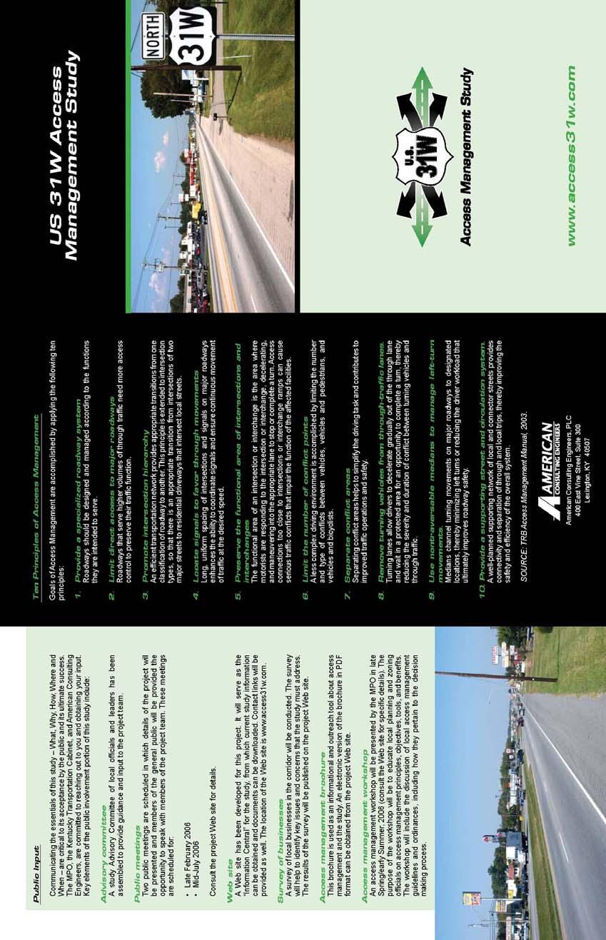
54 A-2
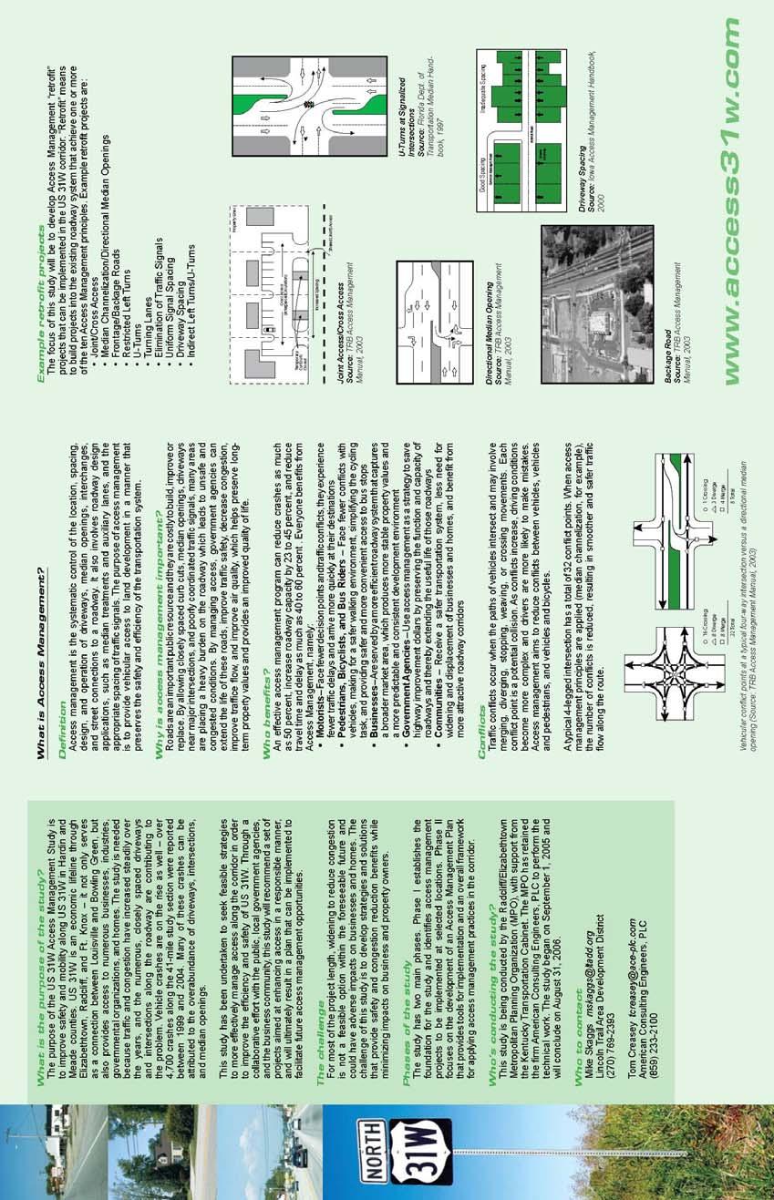
55 A-3
56 Appendix B Business Survey B-1
57 US 31W Access Management Study Business Survey Results General Information Time of Survey: Early December, 2005 through Mid-January, 2006 Estimated Number of Surveys Distributed: 250 Number of Responses 98 (about 40%) Introductory Information Dear Business Owner/Manager: The Lincoln Trail Area Development District (LTADD) and the Kentucky Department of Highways are conducting an Access Management Study for US 31W in Hardin and Meade counties. The purpose of the study is to develop an access management plan that will improve traffic safety and congestion along US 31W. The plan will focus on managing and improving access (that is, driveways) from US 31W to adjacent land in a manner that will benefit both property owners and the traveling public. Your participation in this study is essential. Please take a few minutes to complete this survey and return it in the enclosed postage paid envelope. Thank you! Business Name: Contact Person: Address: Phone: Fax: B-2
58 Survey Questions and Responses 1. How has traffic on US 31W in front of your business changed over the last 10 years? 6 6% 20 20% Increased a little Increased a lot Don't know 72 74% 2. In the area where your business is located, has the character of US 31W changed much over the last 10 years? 9 9% 40 41% 49 50% Yes No Don't know 3. Over the last 10 years, has it become more difficult for traffic to get into and out of your parking lot or site? 25 26% 1 1% 33 34% Yes, it s much more difficult Yes, it s somewhat more difficult No, it s about the same Don t know 39 39% B-3
59 If Yes, has it hurt your business or have customers complained? 5 5% 35 36% 13 13% 19 19% 27 27% Definitely Somewhat Not really Don't know No answer 4. Is your business primarily a destination (that is, customers are making a trip to your business specifically) or do you rely on attracting your customers from passing traffic? 1 1% 11 11% 18 18% 68 70% My business is mostly a specific destination Rely mostly on passing traffic Don t know No answer 5. Where do most of your customers come from? Elizabethtown area Radcliff-Ft. Knox area Southern Hardin County Outside the area B-4
60 6. If your business depends on deliveries from trucks, how do trucks access your business? 17 17% 22 22% 4 4% Other comments: 28 29% 27 28% Park in travel or parking lanes in front of the business Specifically designated parking/unloading areas nearby Other Not applicable No answer Not enough space for parking, so they park parallel to the road We have to stop traffic on 31W, so semis can back out from our back lot. Our parking lot We have a loading dock. In own parking lot beside building or in back They pull to rear of our lot, accessible from 31W Just park in parking lot Our parking area Parking lot Park in customer parking lot In our parking lot Or in road on street that access business Along side of business in parking lot Pull into parking lot You can enter from 3 different streets Own loads & unloads warehouse area Stop on Dixie Ave. - in traffic lane - mail / FedEx Park in our lot Semis back across 31W UPS or lot - trailer trucks use emergency lane Use designated turning lanes (existing) However, cannot park close to my building, have to park at the lot next door Rear of lot 95 Truck and Home cuts across traffic 7. If your business depends on truck deliveries, about how many trucks per week stop there? Range: 0 to 225 Average number of deliveries: 13 Distribution: Are these mostly: % 16 16% Delivery trucks (like a UPS truck) 33 34% Large tractor/semi-trailer trucks A combination of both 20 Don t know % 8 8% No answer More than 40 B-5
61 8. How many driveway entrances from your business to US 31W are there? % 2% 2% 4% 36 37% 53 54% No answer To other streets? 2 2% % 4 4% 6% 39 40% More than 3 No answer 34 35% 9. Do you share a driveway or driveways with neighboring businesses? 46 (47%) Yes 52 (53%) No 10. If your business were to share a driveway or driveways with neighboring businesses or if access to a cross street could be provided (where applicable) and if this improved traffic safety and congestion in front of your business, how would it affect your business? 15 15% 49 51% 12 12% Would help business Would hurt business Would have no effect No answer 22 22% B-6
62 11. Have you noticed any traffic control or roadway improvements to US 31W over the past 10 years? 12, 12% 29, 30% 56, 58% Yes No No answer If Yes, have these improved traffic safety or congestion? 24 24% 42 44% 12 12% 20 20% Yes No Don't know No answer 12. Do you think improvements to US 31W would help your business? 24 24% 1 1% 19 19% 54 56% Yes No Don t know No answer If Yes, how? Need exit from the back to Wal-Mart/lower complex. We have only one entry & exit from 31W. Highway needs to be made wider. Need turn signals at 31W & Mantle Ave. intersection to alleviate unsafe conditions, improve traffic flow and congestion. Make it easier for my customers to access my business. B-7
63 Easier access to business Improve the flow of traffic Addition of center turn lanes could make it safer A middle lane for turning; connecting roadways between businesses should be mandatory or at least unrestricted ingress/egress. We have no direct access from north bound traffic. Can't hurt to widen US 31W Center turn lanes would ease access from 31W. Improvements would provide less congestion & hassle for our customers. Stop drivers from cutting through my lot to get to Logan St. I think that another main road should be made to relieve the heavy traffic from Fort Knox and additional traffic that is coming. Anything that increases traffic past my store, or reduces congestion, or makes it easier for my customers to get to me certainly helps. If I had a better and wider Deicks drive coming to the end at Dixie would help traffic flow. For one, too many people use the street off of 31W to go to mall or other areas & it develops backed up traffic. Better turning lanes Better flow of traffic; widening of road; etc. Would create for safer entrance & exit to our business for customers and employees alike. In Elizabethtown, people complain that the street 31W through town is too narrow and no turning lanes. The ability to travel to and from my business, it is very hard at times to get into the parking lot. No an easy stop. Make it easier & safer for our customers to enter & exit our location. Lanes are much too narrow. Individuals that may avoid 31W due to congestion and narrow lanes may use 31W if improvements are made (increase traffic). Better traffic flow Easier access; encourage clients to visit if less congestion involved in turning off of Dixie If traffic were spaced better it would make entry & exit to our business easier. Improvement means change, and change is good. Eliminate motor vehicles from public square. Turning lane People could get in & out of parking lot onto 31W. Less congestion Stop light at Wilson Rd. would allow customers to more easily turn north on Dixie Much easier access Now you have to pass our business up if you are coming from E-town & make a u-turn with deceleration or turn lane. Smooth the flow of traffic for better visibility and lessen the fear of getting rear-ended Instead of a median, a turn lane would ease the flow of traffic. Reduce the speed to 35 mph! This would also prevent drivers from going thru red lights! Traffic heavy - customers complain on turning into our business and danger of getting out B-8
64 Improvements to US 31W would improve the safety of ingress and egress for the hospital's patients and visitors. Allow traffic to flow out of the mall easier. 31W is so heavy that the amount of auto's and red lights doesn't flow with logic. Heavy traffic during rush hour We need more turning lanes The customers will feel much ease to see in and out of our business. Safety of customers coming south slowing to turn from the fast lane Since our business has been located on 31W they have been talking about widening the road 13. What improvements to US 31W would you like to see? More attractive intersection at by-pass and 31W. A lot of traffic from I- 65 ends at this intersection. Medians are unattractive. Easy access to our store from both sides. Extend businesses all along 31W instead of specific to certain area. Access roads between all centers on each side of 31W Adding another lane and widening 1 lane on Nickles St. & 31W. Turn lane/signals at very least at intersection of 31W and Mantle Ave. Widen 31W for turn lanes. Just extending this turn lane down to the bypass. Need a stop Dixie & Millcreek Rd. More lanes Less traffic lights, which slows traffic & a slower speed limit in area. Fewer access points and in some cases more narrow drives. More turning lanes Remove some of the traffic off of 31W to Wilson and any other streets available. Wider, telephone poles move back. Either a by-pass around Radcliff for Ft. Knox traffic Turning lanes would help! More police patrol to stop the drivers that are cutting traffic at high speeds. Re-surface please 3 lanes each way starting at Wendy's light The 3rd lane from Best Buy to after Ring Rd would be more useful if extended to the by-pass and made a turn only lane. Better curbs and a turning lane in the center. A middle turning lane that is solid all the way from Ring Rd. to the light at Veterans Way. Shopping centers should have access to all streets, drives, etc. for the purpose of reducing traffic on 31W, improving safety, flow of traffic, & convenience. Signal light added on 31W for emergency vehicles from station #2 of the Radcliff Fire Dept. More deceleration lanes for turning off of or across 31W B-9
65 Bike only lanes to allow safe commuting per federal standards (safe routes act) Sewer line & better landscaping Center turn lanes. Side turn lanes, especially southbound. A better solution for the Lincoln Trail/31W/Wilson Rd. intersection. Better traffic control from street lights and law enforcement. Controlled turn lanes for left turns West Point, KY has north of West Point, KY to highway 44 and front Dollar General Store. "Smart" street lights that keep traffic flowing and reduce wasted time and energy. In front of my business and toward Radcliff is fine. From my business toward downtown E'town is a bad road. Way too small. Another road from 31W to the mall & that area. Maybe adding 3 lanes of traffic, plus pot holes need to be more than just filled cause they are a larger pot hole after they are rode on instead of paving & blacktopping the whole road instead of patches. Improve entrances to businesses. Turn lanes; 45 mph from #313 into Radcliff Better turning lanes Construction of secondary/access roads where appropriate. Widening of roadway or set back of utility poles along narrow segments. Turn lane at KFC & Rite Aid intersection Widen it and have a turning lane through town It makes no difference what I'd like to see, our voices are never listened to or anything. Believe me, I'm speaking from experiences. They are OK. More turning lanes to help with traffic. The narrow part needs to be a little wider. Turning lanes Wider lanes In front of my store, I wouldn't want any improvements for fear of losing much needed parking & display space. Wider lanes, improved sidewalks Widen the section of 31W from Hardin Memorial to the south end of town. More businesses on this side of town Not much way to change 31W in the downtown area. Wider lanes I would like to see all the traffic signal lights timed together. For example, if you are going the speed limit you would hit majority of the lights green. Improved patrol & enforcement of pedestrian right of way at crosswalk; caution lights at crosswalks near downtown square in Elizabethtown & in front of the Hardin Co. Justice Center Widening of road from area beginning at intersection of St. John Rd. & Dixie through intersection of Miles St. & Dixie (in Elizabethtown). Signs directing to I-65, Western Ky Pkwy & Bluegrass Pkwy. Adding turning lanes where none presently exist - especially need in front of Justice Center I would like to see your web-site. Traffic rerouted from downtown area. Speed limits enforced. B-10
66 Greater use of backage roads where possible. Access to Towne Mall via Towne Mall bypass. Railroad overpass and one-way streets on each side of public square Turning lane for the traffic going north & turning left for business on Dixie Hwy Different timing of stop lights to space traffic better Minimum of stop light at Wilson Road but a center turn lane similar to area on Ring Road between Dixie & N. Mulberry Do away with the grass medians and put in turning lanes. More lanes and turning lanes Turning lanes More turning lanes across from businesses that don't have them now, with short deceleration lane Reduce quantity of median crossovers; add deceleration/turn lanes north & south. Reduce speed limits between E-town & Radcliff. 3 lanes southbound & 3 lanes northbound Lower speed limit! Another access from 31W to get to west Lincoln - possibly widening Elm Rd. More focus toward the south end of Elizabethtown where my restaurant is located. Expand turning lanes Have a bypass! Lower speed limit We would like to see dedicated turning lanes for the hospital's campus. Improve timing of lights and a more equal exit strategy from all of the various businesses. 2 lanes both ways of ribbed divides(?) on center lanes Speed control More options for drivers to take left/right turns near busy businesses similar to those between "Best Buy" and "Hardin Hospital." Turning lanes instead of crossovers Widen the lanes Please provide any additional comments that you believe will be helpful to those conducting the study. About 15 years ago when this land/property was developed Wal-Mart/Lowes developer has dictated the terms/conditions to all neighboring business properties. Even city did not look at the safety of citizens. We had average of 2 to 3 accidents per month due to one entrance/exit. We have approximately 3000 signatures of our citizens. They have expressed their concerns. Very few people utilize sidewalks on 31W, perhaps use part of each side 31W sidewalks to use "retrofit" principles. An access road would have been nice to connect the shopping centers. We would be opposed to any new "ring roads" that take traffic away from the front of our bank. 1. There is a terrible back-up that occurs most of the time at the 31W to Wal-Mart. This backs up traffic for two blocks on a normal basis. This back-up restricts access to businesses in that area. 2. There is a terrible cross-over problem at Subway in Radcliff. 3. It does not appear that the timing of the lights at the Town Mall area promotes traffic flow. When Wal-Mart was built my business dropped because they took my corner. I lost parking and I can no longer get out onto 31W. We have to get out onto Wal-Mart Way and traffic will not let us in. We can not get out on 31W and go left because traffic won't let us in there either. What a mess!! B-11
67 Since the closing of Wilson Road at Lincoln Trail, traffic (h)as tripled in front of store from about 2:30-3:00 pm to sometimes 6-6:30. You can hardly get in and out of here and if you have to go south say to deliver parts you maybe have gone 30 to 45 min for a 1 mile delivery. We travel from 509 S. Dixie to Williams Dr. approx. 19 mi one way. I take 210 to 31W So. To I-65 N to Exit West to Ring Rd. 251 N to 313 to 31W. That is the best way for me. All you have to do is come out here on a Friday afternoon and see. You be the judge. Our shopping center - Town Pointe - needs another entrance/exit area, possibly in back connecting our parking lot to Captain D's lot or similar Any places parallel to 31W such as shopping centers, businesses, especially those handling large volumes of traffic should be interconnected for the purpose of encouraging use without entering back onto 31W. If safety is truly a concern of the city & state highway, this should be a focused area of attention. Removing utility poles near roadway to improve safety & sight distances (as well as aesthetics) Turn lanes to allow smoother flow Push Ring Rd. west on out to 65/WK Pkwy Improve access to northern section of Logdon Pkwy Wilson Rd. needs more sewer line drain because most of the water from Wilson Rd. comes into our parking lot & front of the office. We are having a lot of cut through traffic in our parking lot. We have installed speed bumps to try and slow traffic down. With today's technology it would seem to me that we could have street lights that could "see" the traffic coming from all directions and make "intelligent" decisions on traffic control based on current conditions. Think of the energy savings alone if we didn't have to stop for a red light when there was no other traffic coming on the cross street. Consider the reduced congestion and frustration if the light could "see" that traffic is backed up for miles on one street and adjusted the control to accommodate. Drainage problem (standing water) I use to live in N.C. U-turns at intersections was approved. We need this and drivers need to know this is ok. At all major stop lights, we need turning lanes and stop and go lights. Just a turning lane without this light is not enough; closing Woodland to the mall puts more traffic on Dixie; need always two turning lanes at all locations on Dixie from hospital toward Radcliff, and long enough to take the traffic. The lights at Dixie and Ring Rd are very good. In my personal opinion, the city officers did no planning for increased traffic near the high traffic area. Where we are is not affected greatly. It was whatever was most profitable to the people in charge, that was what was done. Future traffic problems never occurred or meant anything. I'm sorry but I have tried to be active in my community since 1967 & my voice has always been silenced. No problems Dixie Hwy south of the E-town court house is fine. I don't believe any improvements are necessary. Thanks for our input! Most of the problems with traffic flow and businesses downtown is the fact that many of the old buildings have no place to park. Customers are forced to park in the city lots and feed money into meters. People used to shopping in malls are just not geared to doing this. Thank you for the opportunity to respond! B-12
68 Since the remodeling of the downtown area - we've noticed an increase in cars running up on the curb in front of our office, which have caused cars to veer into other lane and tire damage. Re-routing traffic would drastically hurt the companies in the area. Would suggest removing the grass median & improving the flow of traffic by synchronizing the traffic lights from Ring Road to W.A. Jenkins Rd. Open both Towne Mall & Kroger Mall to Veterans Way. Improve Buford Lane to Woodland to Gray Street to 31W to connect Freeman Lake traffic to Veterans Way/Ring Road. Open by-pass to hwy 1600; upgrade 1600 to Rineyville starting at HMH. I'm located by the road leading to Wal-Mart. It is very difficult to exit from my parking lot onto this newer street. The main reason is that the drivers leaving Wal-Mart will not let me out to get in line to turn onto 31W. This road needs to be widened to allow drivers to go right (north). Also Elm Road needs to be widened & straightened so Ft. Knox people have another way to go south. Speed bumps on the road to Wal-Mart at 31W would also help. The focus of this study seems to be more focused toward Northern Hardin County. However there is still a south side of town. My restaurant has been at the same location for nearly 34 years. But all other businesses seem to be leaving this end of town. There should be focus on Hardin County and E-town as a whole. We must pay our taxes like everyone else, so we should also see some focus put on the south side as well! Very many wrecks on 31W - lots of rear ending - traffic backed up - my son was rear ended leaving John Hardin High on 31W - 5 months after getting license. E-town growing and we desperately need to keep traffic up to date. Driver inattention problems - likely need increased traffic control. Cross access roads at Towne Mall area do not line up. Broaden through District #3. Move utility poles back. We anticipate traffic volumes to and from the hospital campus will continue to increase over the next ten (10) years. We have noted increased traffic volume on Woodland Drive also. There simply isn't a consistent plan or logic. Towne Mall traffic is forced onto 31W and shares with Kroger and other businesses. The number of cars from these businesses doesn't have the # of right & left turn lanes out of the property that are needed. More curbs for pedestrians to walk safely e.g. the road between Roadside Inn towards Commonwealth Motel - there is no (sic) enough space for pedestrians to walk safely especially at night. B-13
69 Appendix C Recommended Actions C-1
 to East Spring Street (Radcliff) Program DESCRIPTION: The section of US 31W from Pear Orchard Road in Elizabethtown to East")
70 ACTION: TYPE: #1/1a. Eliminate/Combine Median Openings - Pear Orchard Road (Elizabethtown) to East Spring Street (Radcliff) Program DESCRIPTION: The section of US 31W from Pear Orchard Road in Elizabethtown to East Spring Street in Radcliff includes 100 median openings over this 7.54-mile section (a density of more than 13 median openings per mile). A number of these median openings serve a single residence or business. Others are duplicate median openings; i.e. two or even three serve a single business or property. Crash analyses indicate that much of this section has extraordinarily high crash experience (a Critical Rate Factor greater than 1.0). Furthermore, 70 percent of the reported crashes that occurred along this section from 2000 to 2004 can be associated with access and median openings prevalent crash types included rearend collisions, angle collisions associated with entering and leaving driveways and median openings, and same-direction sideswipe collisions. It is estimated that 50 of the 100 median openings can be closed, without any adverse impacts on the adjacent land. At those locations that would remain open, about half require the construction of a left-turn deceleration and storage lane so that traffic slowing to make a left turn across the median or a U-turn can safely move out of the through traffic stream. The remaining openings, if necessary, may need modification to accommodate U-turns. BENEFIT: COST ESTIMATE: PRIORITY: Approximately 50 percent of the related crashes can be eliminated by eliminating median openings over this section. Median Closings - $10,000 per location; $500,000 total. Turn Lanes - $40,000 per location; $1,200,000 total. High

71 ACTION: TYPE: #2. Eliminate Traffic Signal Starlite Center Program DESCRIPTION: Currently along US 31W in front of Towne Mall there are three signalized intersections within less than 1,100 feet. In addition to providing access to the mall, these intersections also provide access to retail areas on the east side of US 31W. Proximity of these signals combined with turning activity at the intersections results in heavy congestion along this short section. The recommendation is to eliminate the middle traffic signal and convert the access on both sides of US 31W to rightin/right-out only. While the distance separating the remaining signals still would be less than ideal, 1,100 feet is considerably more desirable than 550 feet. From the east side of US 31W, left-turning and through movements would be relocated north to the intersection at Towne Drive. On the west side, left-turning and through movements would be relocated to intersections north or south, with the mall ring road providing the connectivity. Between 2000 and 2004, there were 425 crashes between the three intersections in question (including all crashes occurring 0.1 miles upstream - north of Towne Drive/K-Mart Center Drive - and downstream- south of Wal-Mart Drive - of the segment). Nearly half (49 percent) of those were rear-end crashes. Conversion of the access drives to right-in/right-out reduces the number of conflict points at the middle intersection from 32 to 4 and reduces the speed variance as well, which greatly reduces the potential for crashes at this location. A traffic simulation model developed for this section demonstrates that average travel times and delays during peak hours can be reduced 10 to 35 percent, depending on time of day and direction of travel. An analysis of traffic signal warrants in the Manual on Uniform Traffic Control Devices showed that warrants are satisfied only partially. BENEFIT: Reduction in travel time and delays from 10 to 35 percent. Estimated reduction crashes 50 percent. COST ESTIMATE: $75,000 PRIORITY: High
 Program DESCRIPTION: This location, which includes a Citgo fuel station located adjacent to the northwest corner, lies just to the")
72 ACTION: TYPE: #3. Driveway Radii Improvements US 31W at KY 84 (Citgo Fuel Station) Program DESCRIPTION: This location, which includes a Citgo fuel station located adjacent to the northwest corner, lies just to the east of Interstate 65 and experiences a lot of circulating traffic as a result of the land use. A skewed alignment of the eastbound approach combined with poor delineation of the access to the property contribute to the safety problems at this location. Crashes at this location tend to be severe of 28 crashes that occurred here from 2000 to 2004, 18 of those were injury crashes. Access drives to the property are wide and poorly delineated. Furthermore, there is no delineation of a right-of-way line for the southbound US 31W-towestbound KY 84 movement and there is no defined property edge on the north side of KY 84. FACING NORTH FACING SOUTH Recommendations are to re-align the east-west KY 84 approaches at this intersection and to narrow and distinctly define the access drives to the northwest corner property both from US 31W and KY 84. Recommended Improvements BENEFIT: Reduced angle collisions resulting from skewed intersection alignment and reduced ingress/egress-related collisions from poorly delineated access drives. Estimated crash reduction 50 percent. COST ESTIMATE: $250,000 PRIORITY: High
 Program DESCRIPTION: At this location, there is heavy turning activity associated with Interstate 65 truck ingress and egress to/from")


73 ACTION: TYPE: #4. Driveway Radii Improvements US 31W at KY 222 (Pilot Fuel Station) Program DESCRIPTION: At this location, there is heavy turning activity associated with Interstate 65 truck ingress and egress to/from the Pilot Fuel Station. From the west, trucks turn left into the Pilot station from KY 222, then exit by making a right turn onto US 31W and another right onto KY 222 to return to I-65. Trucks exiting the Pilot station swing into the oncoming northbound lane of US 31W, creating a hazard. Also, inside wheels from truck trailers track onto the southbound US 31W shoulder, damaging the pavement. Truck Swept Path Encroaching into Opposing Lane The recommendation is to improve the turn radii at the Pilot station access drives to US 31W in order for trucks to make a sharper turn and therefore eliminate the wide sweep into the oncoming northbound US 31W lanes. Also, the turn radius in the northwest corner of the US 31W/KY 222 intersection should be enlarged so that trucks may make the right turn back onto KY 222 without swinging into the opposing lane of KY 222. Finally, the shoulder for southbound US 31W at KY 84 should be reconstructed as a right turn lane. Although it may not be needed from a capacity point of view, it will Recommended Improvements further enable trucks to make the right turn egress movement onto US 31W southbound without the swept path from the truck encroaching into the northbound lanes. BENEFIT: Probability for head-on and opposing direction sideswipe crashes on US 31W will be reduced. Estimated 20 to 25 percent reduction in all types of crashes at this location. COST ESTIMATE: $100,000 PRIORITY: High

74 ACTION: TYPE: #5. Driveway Consolidation/Cross Site Access US 31W at East Lincoln Trail Program DESCRIPTION: The northbound approach of US 31W at East Lincoln Trail is four-lane divided with a center left turn lane. Within 375 feet of the intersection, there are a total of seven driveways to five different fast-food restaurants. Of 178 reported crashes in the last five years, over half were either rear-end or angle crashes, those types frequently associated with driveway ingress and egress movements. The recommendation is to combine driveways and therefore eliminate some of the access points. The current driveway to Arby s could be modified to serve as internal collector that also could provide access to McDonald s and Subway, for example. Conceptually, the seven driveways could be reduced to three. Closely Spaced Multiple Driveways This type of action could be implemented at other locations throughout the corridor. In some cases this would necessitate the provision for cross-site access, depending on the location and specifics of the site. Other candidate locations should be identified and conceptual plans developed on a case-by-case basis. BENEFIT: Reduced conflicts at driveway intersections will result in an overall reduction in crashes along this segment of US 31W. Estimated 50 percent reduction in total crashes. COST ESTIMATE: $300,000 Concept for Driveway Consolidation PRIORITY: High
 and passes through the most densely developed commercial section in the whole study corridor.")
75 ACTION: TYPE: #6. Construct Non-Traversable Median from Cardinal Drive (KY 1600) to S. Wilson Road (KY 447) Project DESCRIPTION: This 2.9-mile section is heavily traveled (average daily traffic ranges from 23,600 to 48,200 vehicles per day) and passes through the most densely developed commercial section in the whole study corridor. US 31W is either four lanes or six lanes wide through here, with two continuous left-turn lanes (one left turn lane in each direction) providing access to parcels on both sides of US 31W. Crash experience is unusually high, even for a heavily traveled section there were 1,376 reported crashes along this section from 2000 to Of those, 82 percent were related to rear-end, angle, or ingress/egress crash types. The recommendation is to construct a raised, non-traversable median through this section. Channelized median openings would be located only at signalized intersections and other designated median breaks, to be determined from further study. Where single left-turn lanes are to be constructed, positive offset should be provided to enhance sight distance (see graphic to the right). All access points not served by a signalized intersection would be converted to right-in, right-out only. Provisions for U-turns should be made at intersections and other designated median breaks as well; midblock u-turn opportunities should be considered for implementation where appropriate. Example Section of Recommended Non-Traversable Median BENEFIT: Reduced conflicts from elimination of turning movements. Reduced congestion and delays. Estimated 25 percent reduction in total crashes. COST ESTIMATE: $632,500 Source: NCHRP 500 PRIORITY: High

76 ACTION: TYPE: #7. Intersection Improvement Add Turn Lanes at KY 434 Intersection Project DESCRIPTION: About 70 reported auto crashes occurred at this intersection from 2000 to One contributing factor is the lack of right turn lanes from northbound and southbound US 31W to KY 434. As this is a high-speed approach, particularly in the northbound direction because of a down grade, there is a significant speed differential at this location due to the slowing of turning vehicles. The recommendation is to add northbound and southbound right turn lanes on US 31W at KY 434. A second recommendation is to relocate the STOP sign currently located on the eastbound KY 434 approach. At this intersection, which is immediately west of US 31W, right-of-way is given to vehicles traveling along KY 447 (S. Wilson Road), which runs parallel to US 31W. STOP signs should be positioned along KY 447 at this intersection instead of KY 434. BENEFIT: Estimated 50 percent reduction in right-turn related crashes, 25 percent reduction in total crashes. COST ESTIMATE: $75,000 PRIORITY: High


77 ACTION: TYPE: #8. Traffic Signal Re-Timing and Optimization Strategy DESCRIPTION: As land use changes over time, travel demands along a corridor change. However, if traffic signal operations are not modified to reflect these changing patterns, the results can be seen in inefficient signal operations, long delays and queues, and inefficient use of available green time. Signal timing plans along US 31W should be updated periodically in response to changing traffic conditions. Timing plans should be developed for peak traffic periods the weekday A.M., mid-day and P.M. peak hours, as well as a weekend peak (particularly in the vicinity of Towne Mall and nearby retail establishments). Timing plans should be developed that will minimize delay and maximize opportunities for traffic progression along US 31W. This type of activity should be performed every three to four years as land use and travel patterns change. BENEFIT: 10 to 15 percent reduction in traffic delays; 12 to 15 percent reduction in vehicle crashes. COST ESTIMATE: $50,000 PRIORITY: Medium


78 ACTION: TYPE: #9. Driveway Turning Radius Improvements Program DESCRIPTION: Certain sections within the corridor, particularly within the South Elizabethtown District, contain numerous driveways to businesses and residences. These sections have high crash experience. For example, the segment from KY 61 (Mulberry Street) to KY 1357 (St. John Road) experienced 336 reported crashes in five years. Of those, 40 percent were rear-end crashes and many were associated with vehicles decelerating in order to make a right turn from US 31W. These driveways are closely spaced and rightof-way constraints are such that it is not Commercial Driveway with Sharp Turning Radii feasible to construct right-turn deceleration lanes at these locations. As an alternative, driveway radii could be increased so that vehicles do not have to slow down as much in order to make this turn. The recommendation is for the implementation of a program to increase driveway radii, primarily for businesses that have recurring traffic. Minimum criteria for turn radii should be established, such as 25 to 30 feet if the vehicles are almost exclusively passenger cars and 50 to 55 feet if large trucks and/or city buses are part of the ingress/egress traffic stream. (Note: These criteria should be consistent with AASHTO s A Policy on Geometric Design of Highways and Streets, 2004.) BENEFIT: COST ESTIMATE: PRIORITY: Will reduce rear-end and angle crashed associated with driveway ingress/egress movements. Estimated 15 percent reduction in related crashes. $5,000 each; $120,000 total Medium One of the Recommended Areawide Program Sections
.")

79 ACTION: TYPE: #10. Construct Non-Traversable Median from Spring Street to Knox Boulevard (KY 2214), Radcliff Project DESCRIPTION: This 1.6-mile section is four-lane with two continuous left-turn lanes (one left turn lane in each direction). It is characterized by dense retail development on both sides of the road and numerous, sometimes closelyspaced access drives. The crash rate for the southern piece from Spring Street to Hill Street is 30 percent higher than the critical crash rate, indicating that this segment has an unusually high crash experience. These are crashes that can be mitigated using access management techniques. Though the northern segment (Hill Street to Knox Boulevard) does not show an unusually high crash frequency, the adjacent land use and numerous closely spaced access drives make this a strong candidate for median separation. The recommendation is to construct a raised median with designated channelized openings and with allowable U-turns, from Spring Street to Knox Boulevard. Where single left-turn lanes are to be constructed, positive offset should be provided to enhance sight distance. BENEFIT: Reduced conflicts from elimination of turning movements. Reduced congestion and delays. Estimated 25 percent reduction in total crashes. COST ESTIMATE: $382,500 PRIORITY: Medium
80 ACTION: TYPE: #11. Interconnecting Road West of Towne Mall Project DESCRIPTION: Providing a supporting street and circulation system is one of the ten principles of access management. The section of US 31W north of Ring Road is the most heavily traveled portion of the study section. Much of this traffic is associated with retail activity at Towne Mall, Wal-Mart, Best Buy, and other stores along the highway. Many times there are short trips along this stretch of highway as shoppers visit multiple stores and restaurants. Proposed Connector The new Veterans Memorial Drive just recently constructed will provide a much needed northsouth alternative to US 31W in this section. To maximize its benefit, a connection between Veterans Memorial Drive and US 31W should be provided. Such a connection could reduce traffic on US 31W as motorists originating south and west of the area could access commercial destinations in the Towne Mall area without using US 31W. A logical choice is the extension of Towne Drive, which currently intersects US 31W at a traffic signal. This connection would relieve US 31W of additional traffic demand; peak hour levels of service would be anticipated to improve from LOS F to LOS E. Reduced congestion would provide improved safety as well. Opportunities for additional connectors to Veterans Memorial Drive should be investigated as well, before full development of the area occurs. It is recognized that steep terrain in some areas will be a limiting factor. In providing these connectors, spacing between intersections on Veterans Memorial Drive will be a limiting factor as well. BENEFIT: Reduced crashes and congestion resulting from traffic diversion away from US 31W. COST ESTIMATE: $160,000 PRIORITY: Medium
 to New Glendale Road (KY 1136) Project DESCRIPTION: The recommendation is to convert US 31W to a three-lane section with a continuous twoway left-turn lane and bike lanes, from St.")


81 ACTION: TYPE: #12. Road Diet (Convert from 4-Lane Undivided to 3-Lane Divided) St. John Road (KY 1347) to New Glendale Road (KY 1136) Project DESCRIPTION: The recommendation is to convert US 31W to a three-lane section with a continuous twoway left-turn lane and bike lanes, from St. John Road (KY 1357) on the north end to New Glendale Road (KY 1136) on the south end. Presently this is a four-lane, undivided section. This type of conversion, sometimes referred to as the Road Diet, provides more capacity for left-turning vehicles throughout the section. Year 2030 forecasts project 27,000 vehicles per day and LOS F for this section, but the LOS F is due to a lack of turn lanes at the intersections. As a three-lane section with turn lanes at signalized intersections, LOS D or better could be achieved along US 31W. Currently this section of US 31W has a crash rate of 1.5 to 2 times the critical crash rate, which means that it has an extraordinary frequency of crashes given the type of roadway, traffic volume that it carries, and characteristics. There were a reported 336 crashes over this section from 2000 through 2004, with 68 percent of those being types that could be mitigated with access management measures rear-end, ingress/egress, and sideswipe (same direction). A three-lane section, with wide travel lanes and opportunities for offsets to the curbs, could help reduce crashes by alleviating some of the problems caused by inadequate driveway turning radii (see Project #6.) BENEFIT: Estimated 30 percent reduction in total crashes. Also reduced delay at intersections. COST ESTIMATE: $390,000 PRIORITY: Medium

82 ACTION: TYPE: #13. Access Drive Delineation South Elizabethtown District Program DESCRIPTION: At various locations throughout the South Elizabethtown District, a number of businesses do not have clearly delineated driveways. An inadequate contrast between driveways and the spaces between them reduces the recognition of individual driveways. This adversely affects safety and operations at driveway junctions with the adjoining street, particularly at night. Lack of delineation also creates a hazardous situation for pedestrians. It is recommended that a program be initiated to properly delineate driveways at businesses and other public facilities within the district. A planter strip or raised median internal to the site provides an excellent contrast between the parking lot and street and makes driveways easy to identify. The program would be a cooperative effort between the Kentucky Transportation Cabinet and individual businesses with frontage along US 31W. It is envisioned that this voluntary program would involve participation in the costs (or reimbursement at some level) by the Cabinet, although there are no details at this time. BENEFIT: COST ESTIMATE: PRIORITY: Potential percent reduction in crashes related to driveway ingress/egress movements. Also improved operations due to more clearly defined vehicle paths. Cost estimate varies, depending on design details and desired level of landscaping, aesthetics, etc. $5,000 - $20,000. Low


83 ACTION: #14. Access Drive Delineation Muldraugh TYPE: Program DESCRIPTION: At various locations throughout Muldraugh on the east side of US 31W, a number of businesses do not have clearly delineated driveways. An inadequate contrast between driveways and the spaces between them reduces the recognition of individual driveways. This adversely affects safety and operations at driveway junctions with the adjoining street, particularly at night. Lack of delineation also creates a hazardous situation for pedestrians. It is recommended that a program be initiated to properly delineate driveways at businesses and other public facilities along this section. A planter strip or raised median internal to the site provides an excellent contrast between the parking lot and street and makes driveways easy to identify. The program would be a cooperative effort between the Kentucky Transportation Cabinet and individual businesses with frontage along US 31W. It is envisioned that this voluntary program would involve participation in the costs (or reimbursement at some level) by the Cabinet, although there are no details at this time. BENEFIT: COST ESTIMATE: PRIORITY: Potential percent reduction in crashes related to driveway ingress/egress movements. Also improved operations due to more clearly defined vehicle paths. Cost estimate varies, depending on design details and desired level of landscaping, aesthetics, etc. $10,000 - $30,000. Low


84 ACTION: TYPE: #15. Driveway Consolidation/Cross Site Access US 31W between Knox Blvd. and Redmar Blvd., Radcliff Program DESCRIPTION: Between Redmar Boulevard and Knox Boulevard in Radcliff there lie a number of adjacent businesses on the east side of US 31W, collectively with multiple driveways. This is another location where the application of a program to combine driveways and provide cross-site access could be used to reduce crashes. The recommendation is to combine driveways and therefore eliminate some of the access points. Conceptually, the nine driveways could be reduced to five. This type of action could be implemented at other locations throughout the corridor. In some cases this would necessitate the provision for crosssite access, depending on the location and specifics of the site. Other candidate locations should be identified and conceptual plans developed on a caseby-case basis. Closely Spaced Multiple Driveways Redmar Blvd. BENEFIT: Estimated 50 percent reduction in crashes related to ingress and egress movements. COST ESTIMATE: $150,000 PRIORITY: Low
85 ACTION: #16. Interconnecting Roadway Lakeshore Plaza to Cott Beverage TYPE: Project DESCRIPTION: The objective of this project is to relocate ingress and egress of delivery trucks from Cott Beverage to an existing signalized intersection with US 31W, the intersection at Lakeshore Plaza. Currently the trucks enter and leave Cott Beverage at the unsignalized driveway in front of the Cott Beverage plant. US 31W Bypass US 31W Dixie Highway Cott Beverage Connector Drive The project would involve improving the connectivity between Lakeshore Plaza and the plant. This would include likely reconstruction of the pavement along the Existing traffic signal Lakeshore Plaza existing access road through the parking lot and delineation of the access road using paint striping or landscaped end islands. Relocation of the trucks entering and exiting the roadway to a signalized intersection will reduce speed variation, improve congestion, and reduce truck-auto conflicts, thereby improving safety. BENEFIT: Improved safety through reduced speed variance and reduced truckauto conflicts. Also reduced congestion. COST ESTIMATE: $60,000 PRIORITY: Low
86 ACTION: TYPE: #17. Establish Auto Carrier Staging Area at Lakeshore Plaza Project DESCRIPTION: Along US 31W between the Bypass and Ring Road, there are several auto dealerships. Currently the auto carrier trucks that deliver vehicles to these businesses park either on the shoulder of the highway or in the median. This creates both safety and operational problems along this stretch of highway. As an alternative, an auto carrier staging area could be established at the Lakeshore Plaza just to the south. Carriers could be parked and unloaded here, away from Dixie Highway. From this point, autos could be driven to the dealerships close by. The existing traffic signal in front of Lakeshore Plaza provides convenient access to and from the site for both auto carrier trucks and the cars that are unloaded. US 31W Bypass US 31W Dixie Highway Staging Area Lakeshore Plaza There would need to be an agreement between the owner of Lakeshore Plaza, the auto Existing traffic signal dealers, the City of Elizabethtown, and possibly the Kentucky Transportation Cabinet. Implementation of this action would benefit many the driving public, auto dealers (less exposure and liability), the City, the Cabinet, and businesses along this section of highway. BENEFIT: Quantifiable benefits not available for this type of action. Qualitatively, benefits include reduced vehicle conflicts, reduced crashes, better visibility, reduced congestion and delay. COST ESTIMATE: $100,000 PRIORITY: Low

87 American Consutling Engineers Atrium Center Linn Station Road, Suite 211 Louisville, KY 40223
Access Location, Spacing, Turn Lanes, and Medians
 Design Manual Chapter 5 - Roadway Design 5L - Access Management 5L-3 Access Location, Spacing, Turn Lanes, and Medians This section addresses access location, spacing, turn lane and median needs, including
Access Management Benefits & Techniques. Access Management Workshop June 2, 2006
 Access Management Benefits & Techniques Access Management Workshop June 2, 2006 1 Benefits of Access Management Safety As access density increases, crash rates increase Increasing the density of access
PennDOT Access Management Model Ordinances Training
 PennDOT Access s Training Trainers: Chad Dixson, AICP, TPD Angela Watson, PB Objective of Today Assist Pennsylvania s municipalities and transportation professionals in better understanding the benefits
Access Management Regulations and Standards
 Access Management Regulations and Standards January 2014 Efficient highway operation Reasonable property access Concept of Access Management The way to manage access to land development while preserving
Access Management Regulations and Standards
 Access Management Regulations and Standards Efficient highway operation Reasonable property access Concept of Access Management The way to manage access to land development while simultaneously preserving
City of Homewood Transportation Plan
 City of Homewood Transportation Plan Prepared for: City of Homewood, Alabama Prepared by: Skipper Consulting, Inc. May 2007 TABLE OF CONTENTS INTRODUCTION... 1 BACKGROUND INFORMATION... 1 EXISTING TRANSPORTATION
City of Wayzata Comprehensive Plan 2030 Transportation Chapter: Appendix A
 A1. Functional Classification Table A-1 illustrates the Metropolitan Council s detailed criteria established for the functional classification of roadways within the Twin Cities Metropolitan Area. Table
Highway 49, Highway 351 and Highway 91 Improvements Feasibility Study Craighead County
 Highway 49, Highway 351 and Highway 91 Improvements Feasibility Study Craighead County Executive Summary March 2015 Highway 49, Highway 351 and Highway 91 Improvements Feasibility Study Craighead County
Access Management Regulations and Standards for Minor Arterials, Collectors, Local Streets
 Access Management Regulations and Standards for Minor Arterials, Collectors, Local Streets September 2009 Paul Grasewicz Access Management Administrator Concept of Access Management The way to manage access
CHAPTER 7 ACCESS MANAGEMENT. Background. Principles of Access Management. Hennepin County Transportation Systems Plan (HC-TSP)
") CHAPTER 7 ACCESS MANAGEMENT Background Principles of Access Management Hennepin County Transportation Systems Plan (HC-TSP) Chapter 7 Access Management 7.1 Background Access management has become an important
CHAPTER 7 ACCESS MANAGEMENT Background Principles of Access Management Hennepin County Transportation Systems Plan (HC-TSP) Chapter 7 Access Management 7.1 Background Access management has become an important
Access Management in the Vicinity of Intersections
 Access Management in the Vicinity of Intersections FHWA-SA-10-002 Technical Summary Photo: Ralph Bentley (used with permission) 0 Access Management is: The design, implementation and management of entry
JONESBORO HIGHWAY 63 HIGHWAY 18 CONNECTOR STUDY
 JONESBORO HIGHWAY 63 HIGHWAY 18 CONNECTOR STUDY Craighead County May 2007 JONESBORO HIGHWAY 63 HIGHWAY 18 CONNECTOR STUDY Craighead County May 2007 Prepared by Planning and Research Division Arkansas State
M-58 HIGHWAY ACCESS MANAGEMENT STUDY Mullen Road to Bel-Ray Boulevard. Prepared for CITY OF BELTON. May 2016
 M-58 HIGHWAY ACCESS MANAGEMENT STUDY Prepared for CITY OF BELTON By May 2016 Introduction Missouri State Highway 58 (M-58 Highway) is a major commercial corridor in the City of Belton. As development has
Recommended Roadway Plan Section 2 - Land Development and Roadway Access
 Recommended Roadway Plan Section 2 - Land Development and Roadway Access SECTION 2 Land Development and Roadway Access 2.1 Land Use and Access Management The Federal Highway Administration (FHWA) defines
American Fork City Access Management Manual
 American Fork City Access Management Manual American Fork, Utah April 2012 UT09-181 3315 West Mayflower Way, Ste. 4 Lehi, Utah 84043 p. 801/ 766.4343 www.halesengineering.com EXECUTIVE SUMMARY As traffic
Executive Summary June 2015
 Executive Summary June 2015 Highway 112 Corridor Study Benton and Washington Counties Executive Summary June 2015 Prepared by Transportation Planning and Policy Division Arkansas State Highway and Transportation
Chapter 4 Traffic Analysis
 Chapter 4 Traffic Analysis PURPOSE The traffic analysis component of the K-68 Corridor Management Plan incorporates information on the existing transportation network, such as traffic volumes and intersection
INTRODUCTION THOROUGHFARE SYSTEM CLASSIFICATIONS
 INTRODUCTION The thoroughfare plan will assist public officials in the development of a specialized system for efficient and safe movement of vehicular traffic while minimizing potential conflicts with
Classification Criteria
 SCHEDULE D TO RECOMMENDED OFFICIAL PLAN AMENDMENT NO. 40 SCHEDULE C-4 Road Criteria Criteria Traffic Service Objective Land Service/Access Typical Daily Traffic Volume Flow characteristics Travel Speed
TRANSPORTATION ANALYSIS REPORT US Route 6 Huron, Erie County, Ohio
 TRANSPORTATION ANALYSIS REPORT US Route 6 Huron, Erie County, Ohio December 12, 2012 Prepared for: The City of Huron 417 Main Huron, OH 44839 Providing Practical Experience Technical Excellence and Client
1.3.4 CHARACTERISTICS OF CLASSIFICATIONS
 Geometric Design Guide for Canadian Roads 1.3.4 CHARACTERISTICS OF CLASSIFICATIONS The principal characteristics of each of the six groups of road classifications are described by the following figure
Background on the Revisions to VDOT s Access Management Spacing Standards
 December 2011 Background on the Revisions to VDOT s Access Management Spacing Standards Spacing Standards for Commercial Entrances, Signals, Intersections, and Crossovers The spacing standards were located
City of Elizabeth City Neighborhood Traffic Calming Policy and Guidelines
 City of Elizabeth City Neighborhood Traffic Calming Policy and Guidelines I. Purpose: The City of Elizabeth City is committed to ensure the overall safety and livability of residential neighborhoods. One
CIRCLE DRIVE TRAFFIC AND ACCESS MANAGEMENT POLICY GUIDE. Management Principles and Implementation Concepts
 CIRCLE DRIVE TRAFFIC AND ACCESS MANAGEMENT POLICY GUIDE A. PREFACE Management Principles and Implementation Concepts The intent of this policy guide is to provide interim guidance on the implementation
APPENDIX G: INTERSECTION NEEDS AT OKEECHOBEE BOULEVARD
 APPENDIX G: INTERSECTION NEEDS AT OKEECHOBEE BOULEVARD INTERSECTION NEEDS AT SR 7 and OKEECHOBEE BOULEVARD SR 7 Extension Project Development and Environment (PD&E) Study From Okeechobee Boulevard (SR
5.0 Roadway System Plan
 Southwest Boise Transportation Study Page 16 5.0 Roadway System Plan The Roadway System Plan outlines roadway improvements in the Initial Study Area. It forecasts future deficiencies on the arterial system,
Access Management Guidelines for the Urbanized Area
 Access Management Guidelines for the Urbanized Area April 2013 Table of Contents EXECUTIVE SUMMARY... 6 SECTION 1: INTRODUCTION TO ACCESS MANAGEMENT... 7 1.1 What is Access Management?... 7 1.2 Relationships
ENHANCED PARKWAY STUDY: PHASE 2 CONTINUOUS FLOW INTERSECTIONS. Final Report
 Preparedby: ENHANCED PARKWAY STUDY: PHASE 2 CONTINUOUS FLOW INTERSECTIONS Final Report Prepared for Maricopa County Department of Transportation Prepared by TABLE OF CONTENTS Page EXECUTIVE SUMMARY ES-1
CITY OF SASKATOON COUNCIL POLICY
 ORIGIN/AUTHORITY Clause 1, Report No. 1-1980 and Clause 4, Report No. 22-1990 of the Works and Utilities Committee; Clause 6, Report No. 17-2004 of the Planning and Operations Committee; and Clause D5,
Chapter 2: Standards for Access, Non-Motorized, and Transit
 Standards for Access, Non-Motorized, and Transit Chapter 2: Standards for Access, Non-Motorized, and Transit The Washtenaw County Access Management Plan was developed based on the analysis of existing
Defining Purpose and Need
 Advanced Design Flexibility Pilot Workshop Session 4 Jack Broz, PE, HR Green May 5-6, 2010 Defining Purpose and Need In your agency s project development process, when do design engineers typically get
Clackamas County Comprehensive Plan
 ROADWAYS The County s road system permits the movement of goods and people between communities and regions, using any of a variety of modes of travel. Roads provide access to virtually all property. They
Access Management Design Standards for Entrances and Intersections
 Access Management Design Standards for Entrances and Intersections July 2012 APPENDIX F VDOT Road Design Manual PREFACE The access management regulations and standards do not apply in cities, towns of
MUTCD Part 6G: Type of Temporary Traffic Control Zone Activities
 MUTCD Part 6G: Type of Temporary Traffic Control Zone Activities 6G.01 Typical Applications Each temporary traffic control (TTC) zone is different. Many variables, such as location of work, highway type,
Highway 111 Corridor Study
 Highway 111 Corridor Study June, 2009 LINCOLN CO. HWY 111 CORRIDOR STUDY Draft Study Tea, South Dakota Prepared for City of Tea Sioux Falls Metropolitan Planning Organization Prepared by HDR Engineering,
Central Arkansas Regional Transportation Study Area ROADWAY DESIGN STANDARDS And Implementation Procedures
 Central Arkansas Regional Transportation Study Area ROADWAY DESIGN STANDARDS And Implementation Procedures These standards have been prepared for the use of all jurisdictions to incorporate into their
CITY OF LUCAS 2014 MASTER THOROUGHFARE PLAN
 INTRODUCTION CITY OF LUCAS 2014 MASTER THOROUGHFARE PLAN A thoroughfare system is intended to provide an effective means of moving vehicles within and through a city. The thoroughfare plan will assist
Safety Impacts: Presentation Overview
 Safety Impacts: Presentation Overview The #1 Theme How Access Management Improves Safety Conflict Points The Science of Access Management By Treatment Studies Themes for Texas Access Management Improve
Chapter 6: Transportation
 Chapter 6: Transportation I. INTRODUCTION The purpose of the Transportation Plan element of the Comprehensive Plan is to provide guidance to the City of North Mankato, as well as existing and future landowners
Traffic Impact Study. Westlake Elementary School Westlake, Ohio. TMS Engineers, Inc. June 5, 2017
 TMS Engineers, Inc. Traffic Impact Study Westlake Elementary School Westlake, Ohio June 5, 2017 Prepared for: Westlake City Schools - Board of Education 27200 Hilliard Boulevard Westlake, OH 44145 TRAFFIC
Appendix 3 Roadway and Bike/Ped Design Standards
 Appendix 3 Roadway and Bike/Ped Design Standards OTO Transportation Plan 2040 4/20/2017 Page A3-1 Adopted Standards The adopted OTO Design Standards and Major Thoroughfare Plan are contained herein.
4.0 ACCESS CONTROL PLAN - SH 14 (JEFFERSON STREET/RIVERSIDE AVENUE)
") 4.1 Existing Conditions Roadway Physical Characteristics Typical Sections Jefferson Street 4.0 ACCESS CONTROL PLAN - SH 14 (JEFFERSON STREET/RIVERSIDE AVENUE) The existing typical cross-section for SH
4.1 Existing Conditions Roadway Physical Characteristics Typical Sections Jefferson Street 4.0 ACCESS CONTROL PLAN - SH 14 (JEFFERSON STREET/RIVERSIDE AVENUE) The existing typical cross-section for SH
Living Streets Policy
 Living Streets Policy Introduction Living streets balance the needs of motorists, bicyclists, pedestrians and transit riders in ways that promote safety and convenience, enhance community identity, create
1 VicRoads Access Management Policies May 2006 Ver VicRoads Access Management Policies May 2006 Version 1.02
 1 VicRoads Access Management Policies May 2006 Ver 1.02 VicRoads Access Management Policies May 2006 Version 1.02 2 VicRoads Access Management Policies May 2006 Ver 1.02 FOREWORD FOR ACCESS MANAGEMENT
JCE 4600 Transportation Engineering. Traffic Control
 JCE 4600 Transportation Engineering Traffic Control Human Factors Primary Driving Tasks NAVIGATION GUIDANCE CONTROL What makes a Traffic Control Device Effective? Fulfill a need Command Attention Convey
Route 7 Corridor Study
 Route 7 Corridor Study Executive Summary Study Area The following report analyzes a segment of the Virginia State Route 7 corridor. The corridor study area, spanning over 5 miles in length, is a multi
TOWN OF CHAPEL HILL POLICY AND PROCEDURES FOR TRAFFIC CALMING MEASURES
 TOWN OF CHAPEL HILL POLICY AND PROCEDURES FOR TRAFFIC CALMING MEASURES (Adopted by the Town Council on June 30, 2004) (Revised December 6, 2010) (Revised February 8, 2016) POLICY AND PROCEDURES FOR TRAFFIC
Intersection Traffic Control Feasibility Study
 Intersection Traffic Control Feasibility Study CSAH 9 at CSAH 60 (185th Avenue) Prepared For: Dakota County Transportation Department Western Service Center 14955 Galaxie Avenue, 3rd Floor Apple Valley,
INDEX. Geometric Design Guide for Canadian Roads INDEX
 Acceleration lane, see Lanes, Acceleration Access, 8.1 Access Management and Functional Classification 8.2 Access Management by Design Classification 8.3 Access Configuration 8.4 Building Set-Back Guidelines
Route 29 Corridor Assessment Update. Development of Possible Solutions
 Route 29 Corridor Assessment Update Development of Possible Solutions Public Workshop #3 October 27, 2016 Purpose of Developing Possible Solutions Recap of where we ve been and timeline for moving forward
Traffic Impact Analysis Walton Acres at Riverwood Athletic Club Clayton, NC
 Traffic Impact Analysis Walton Acres at Riverwood Athletic Club Clayton, NC 1. TABLE OF CONTENTS INTRODUCTION...1 1.1. Site Location and Study Area...1 1.2. Proposed Land Use and Site Access...2 1.3.
Dr. Naveed Anwar Executive Director, AIT Consulting Affiliated Faculty, Structural Engineering Director, ACECOMS
 Dr. Naveed Anwar Executive Director, AIT Consulting Affiliated Faculty, Structural Engineering Director, ACECOMS Overview Highway Functions and Classifications Highway Design Components Design Control
CHAPTER 17 ACCESS MANAGEMENT
 CHAPTER 17 ACCESS MANAGEMENT General 17-2 Permit Procedures 17-4 SDDOT-Owned Access Rights 17-4 Access Management Rules 17-4 Figure 17-1 South Dakota Access Location Criteria Techniques 17-6 Consolidating
Corpus Christi Metropolitan Transportation Plan Fiscal Year Introduction:
 Introduction: The Safe, Accountable, Flexible, Efficient Transportation Equity Act: A Legacy for Users (SAFETEA-LU) has continued the efforts started through the Intermodal Surface Transportation Efficiency
ROUNDABOUTS/TRAFFIC CIRCLES
 GENERAL 1. Description This standard identifies minimum requirements that shall be met for Roundabouts and Neighborhood Traffic Circles in the design and construction of elements for Arlington County Horizontal
APPENDIX F. Access Management Design Standards for Entrances and Intersections
 APPENDIX F Access Management Design Standards for Entrances and Intersections PREFACE The access management regulations and standards do not apply in cities, towns of more than 3,500 and in counties (Henrico
METHODOLOGY. Signalized Intersection Average Control Delay (sec/veh)
") Chapter 5 Traffic Analysis 5.1 SUMMARY US /West 6 th Street assumes a unique role in the Lawrence Douglas County transportation system. This principal arterial street currently conveys commuter traffic
Chapter 5 Traffic Analysis 5.1 SUMMARY US /West 6 th Street assumes a unique role in the Lawrence Douglas County transportation system. This principal arterial street currently conveys commuter traffic
Access Management Guidelines February 2013 THE CITY OF
 Access Management Guidelines February 2013 THE CITY OF Table of Contents Introduction 2 Review and Approval Process 5 Technical Guidelines 9... 10... 12 3. Separation Distance: Non-Signalized All-Turns
3.0 ACCESS CONTROL PLAN - HARMONY ROAD (SH68)
") 3.0 ACCESS CONTROL PLAN - HARMONY ROAD (SH68) 3.1 Existing Conditions Roadway Physical Characteristics Typical Section The existing typical cross-section for SH68 is shown on Figure 3-1 and is comprised
3.0 ACCESS CONTROL PLAN - HARMONY ROAD (SH68) 3.1 Existing Conditions Roadway Physical Characteristics Typical Section The existing typical cross-section for SH68 is shown on Figure 3-1 and is comprised
Technical Summary Access Management in the Vicinity of Intersections
 Technical Summary Access Management in the Vicinity of Intersections FHWA-SA-10-002 Foreword This technical summary is designed as a reference for State and local transportation officials, Federal Highway
SELECTED ROADWAY CAPACITY ANALYSIS
 CHAPTERFOUR SELECTED ROADWAY CAPACITY ANALYSIS 4.1 SELECTED ROADWAY CAPACITY ANALYSIS Introduction Capacity analysis was performed on six selected roadways within the Dearborn County study area using the
#!! "$% ##! &! # '#! % $ #!
 Executive Summary US Highway 16 (US 16) is the primary corridor connecting Rapid City to the Black Hills region. It serves a growing population of commercial and residential traffic, as well as seasonal
RESOLUTION NO ?? A RESOLUTION OF THE CITY OF NEPTUNE BEACH ADOPTING A COMPLETE STREETS POLICY
 RESOLUTION NO. 2018-?? A RESOLUTION OF THE CITY OF NEPTUNE BEACH ADOPTING A COMPLETE STREETS POLICY WHEREAS, safe, convenient, and accessible transportation for all users is a priority of the City of Neptune
Basalt Creek Transportation Refinement Plan Recommendations
 Basalt Creek Transportation Refinement Plan Recommendations Introduction The Basalt Creek transportation planning effort analyzed future transportation conditions and evaluated alternative strategies for
Geometric Design Tables
 Design Manual Chapter 5 - Roadway Design 5C - Geometric Design Criteria 5C-1 Geometric Design Tables A. General The following sections present two sets of design criteria tables - Preferred Roadway Elements
Report. Typical Sections. City of Middleton, WI
 Report Typical Sections City of Middleton, WI December 2006 Report for City of Middleton, Wisconsin Typical Sections repared by: Traffic Associates LLC and STRAND ASSOCIATES, INC. 910 West Wingra Drive
o n - m o t o r i z e d transportation is an overlooked element that can greatly enhance the overall quality of life for the community s residents.
 N o n - m o t o r i z e d transportation is an overlooked element that can greatly enhance the overall quality of life for the community s residents. 84 Transportation CHAPTER 11 INTRODUCTION Transportation
Modern Roundabouts: a guide for application
 Modern Roundabouts: a guide for application Kentucky Community Transportation Innovation Academy 2005 The contents of this booklet reflect the views of the authors who are responsible for the facts and
West Dimond Blvd Upgrade Jodhpur Street to Sand Lake Road
 West Dimond Blvd Jodhpur St to Sand Lake CSS Transportation Project Summary Municipality of Anchorage Project # 05 005 Project Manager: John Smith, P.E. (MOA PM&E) Project Administrator: Julie Makela,
4. ENVIRONMENTAL IMPACT ANALYSIS 9. TRANSPORTATION AND TRAFFIC
 4. ENVIRONMENTAL IMPACT ANALYSIS 9. TRANSPORTATION AND TRAFFIC 4.9.1 INTRODUCTION The following section addresses the Proposed Project s impact on transportation and traffic based on the Traffic Study
CITY OF COCOA BEACH 2025 COMPREHENSIVE PLAN. Section VIII Mobility Element Goals, Objectives, and Policies
 CITY OF COCOA BEACH 2025 COMPREHENSIVE PLAN Section VIII Mobility Element Goals, Objectives, and Policies Adopted August 6, 2015 by Ordinance No. 1591 VIII MOBILITY ELEMENT Table of Contents Page Number
Access requests to County streets and roadways are processed through one of the following methods:
 13.1 GENERAL APPLICATION PROCESS Access requests to County streets and roadways are processed through one of the following methods: A. Planned Developments may set general locations for access points.
SECTION 1 - TRAFFIC PLANNING
 SECTION 1 - TRAFFIC PLANNING 1.1 TRAFFIC OPERATIONS 1.1.1 Roadway Functional Classification The Multnomah County Comprehensive Framework Plan s Policy 34: Trafficways and the Functional Classification
Median Design. Course No: C Credit: 4 PDH. Debra Kennaugh, P.E.
 Median Design Course No: C04-041 Credit: 4 PDH Debra Kennaugh, P.E. Continuing Education and Development, Inc. 9 Greyridge Farm Court Stony Point, NY 10980 P: (877) 322-5800 F: (877) 322-4774 info@cedengineering.com
EXECUTIVE SUMMARY OF CALEDON TRANSPORTATION NEEDS STUDY
 EXECUTIVE SUMMARY OF CALEDON TRANSPORTATION NEEDS STUDY The Caledon Transportation Needs Study has been undertaken as a joint project by the Town of Caledon and the Region of Peel to determine the existing
AMATS Complete Streets Policy
 AMATS Complete Streets Policy Table of Contents: Section 1. Definition of Complete Streets Section 2. Principles of Complete Streets Section 3. Complete Streets Policy Section 4. Consistency Section 5.
Transportation Planning Division
 Transportation Planning Division Presentation Outline Study Tasks Recap of Previous Meetings Data Collected Focus Areas within Study Limits Design Principles Tool Box Recommended Concepts Schedule Moving
Appendix A: Crosswalk Policy
 Appendix A: Crosswalk Policy Appendix A: Crosswalk Policy Introduction This citywide Crosswalk Policy is aimed at improving pedestrian safety and enhancing pedestrian mobility by providing a framework
PEDESTRIAN ACTION PLAN
 ATTACHMENT 2 CITY OF SANTA MONICA PEDESTRIAN ACTION PLAN CITY OF SANTA MONICA PEDESTRIAN ACTION PLAN This page intentionally left blank EXECUTIVE SUMMARY CHAPTER 1 EXECUTIVE SUMMARY Setting the Stage
10.0 CURB EXTENSIONS GUIDELINE
 10.0 CURB EXTENSIONS GUIDELINE Road Engineering Design Guidelines Version 1.0 March 2017 City of Toronto, Transportation Services City of Toronto Page 0 Background In early 2014, Transportation Services
4.11 TRANSPORTATION/CIRCULATION
 4.11 TRANSPORTATION/CIRCULATION This section was developed using information from a Traffic Analysis Report prepared for the project by OEG, Inc. (2010), the Paradiso del Mare Ocean and Inland Estates
Road Diets FDOT Process
 Florida Department of TRANSPORTATION Road Diets FDOT Process Humberto Castillero, PE, PTOE Roadway Design Office Purpose of Guide Develop a statewide lane elimination review process Balance state & local
Tonight is an opportunity to learn about the Study and ask questions of the Study Team members.
 Exhibit 1 Welcome Second Open House Tonight is an opportunity to learn about the Study and ask questions of the Study Team members. A first Public Open House was held on September 18th, 2013 which presented
Oldham County Major Thoroughfare Plan
 Prepared for: Oldham County Planning & Zoning Commission Prepared by: December 2003 Table of Contents I. INTRODUCTION...1 A. Contents of Report...1 B. Purpose of Study...2 C. Related Project Documents...2
TRAFFIC AND SAFETY NOTE 608A. Spacing for Commercial Drives and Streets. To Promote a Uniform Practice in Determining Access Spacing
 TRAFFIC AND SAFETY NOTE 608A SUBJECT: PURPOSE: Spacing for Commercial Drives and Streets To Promote a Uniform Practice in Determining Access Spacing COORDINATING UNIT: Geometric Design Unit INFORMATION:
APPENDIX B Boonville Code of Ordinances. BOONVILLE, MISSOURI Access Management Manual. March Revised April 2009 INDEX
 APPENDIX B Boonville Code of Ordinances BOONVILLE, MISSOURI Access Management Manual March 2002 Revised April 2009 INDEX Section Page 1.0 Introduction and Definitions. 2 2.0 Roadway Classification System.
REGIONAL BICYCLE AND PEDESTRIAN DESIGN GUIDELINES
 REGIONAL BICYCLE AND PEDESTRIAN DESIGN GUIDELINES November 16, 2011 Deb Humphreys North Central Texas Council of Governments Bicycle and Pedestrian Advisory Committee Snapshot of the Guide 1. Introduction
City of Gainesville Transportation/Roadway Needs PROJECT SUMMARY
 A1 Roadway Resurfacing $23,846,000 TYPE: Preservation of existing system Roadway resurfacing A2 Signal Replacement $6,000,000 TYPE: Preservation of existing system Replace traffic signals. B1 W 6th St
WYDOT DESIGN GUIDES. Guide for. Non-NHS State Highways
 WYDOT DESIGN GUIDES Guide for Non-NHS State Highways 2014 GUIDE FOR Non-NATIONAL HIGHWAY SYSTEM (Non-NHS) STATE HIGHWAYS PRESERVATION REHABILITATION RECONSTRUCTION INTRODUCTION This Guide is directed to
MUNICIPALITY OF ANCHORAGE Traffic Department MEMORANDUM
 MUNICIPALITY OF ANCHORAGE DATE: MEMORANDUM TO: FROM: SUBJECT: Anchorage Contractors, Builders, Designers, and Land Owners Robert E. Kniefel, P.E., Municipal Traffic Engineer Municipal Driveway Standards
Madison Urban Area and Dane County. Bicycle Transportation Plan Summary. September Introduction. Bicycle Plan Scope and Planning Process
 Bicycle Transportation Plan Summary Madison Urban Area and Dane County Introduction September 2000 Bicycling is an important mode of transportation in the Madison urban area and countywide that is available
Goodlettsville Bicycle and Pedestrian Plan Executive Summary
 Goodlettsville Bicycle and Pedestrian Plan July 2010 In Cooperation with the Nashville Area Metropolitan Planning Executive Organization Summary Introduction Progressive and forward thinking communities
3.0 Future Conditions
 3.0 Future Conditions In order to be able to recommend appropriate improvements to the transportation system of the Town, it is important to first understand the nature and volume of traffic that is expected
BETHEL ROAD AND SEDGWICK ROAD CORRIDOR STUDY
 DRAFT PLAN City Council Meeting August 14, 2017 STUDY AREA Sedgwick Corridor State Route 160, principal arterial with Class 3 access management designation, commuter and freight route, connection to SR
Transportation Master Plan Advisory Task Force
 Transportation Master Plan Advisory Task Force Network Alternatives & Phasing Strategy February 2016 BACKGROUND Table of Contents BACKGROUND Purpose & Introduction 2 Linking the TMP to Key Council Approved
THE FUTURE OF THE TxDOT ROADWAY DESIGN MANUAL
 THE FUTURE OF THE TXDOT ROADWAY DESIGN MANUAL Kenneth Mora, P.E. (Design Division) 10/10/2017 Table of contents 1 2 Reduction in FHWA design controlling criteria Innovative Intersection Guidance 3-7 8-42
FINAL DESIGN TRAFFIC TECHNICAL MEMORANDUM
 FINAL DESIGN TRAFFIC TECHNICAL MEMORANDUM July 2014 FINAL (SR 43) Project Development and Environment Study From State Road 60 (Adamo Drive) to I-4 (SR 400) Hillsborough County, Florida Work Program Item
3.9 - Transportation and Traffic
 Transportation and Traffic 3.9 - Transportation and Traffic This section describes the potential transportation and traffic effects of project implementation on the project site and its surrounding area.
Appendix A: Safety Assessment
 Appendix A: Safety Assessment Safety Assessment Appendix A A Statement of Philosophy The efficient and responsible investment of resources in addressing safety problems is a difficult task. Since crashes
Mont Vernon - NH 13 Access Management Study
 Mont Vernon - NH 13 Access Management Study April 2006 Prepared by the Nashua Regional Planning Commission TABLE OF CONTENTS MONT VERNON - NH 13 ACCESS MANAGEMENT STUDY...1 A. Introduction...1 B. Study