Secondary Road Program
|
|
|
- Jayson Summers
- 6 years ago
- Views:
Transcription
1 Secondary Road Program Joint Legislative Transportation Oversight Committee October 5,
2 Secondary Roads Program The Big Picture The Secondary Road System Needs and Project Types Paved and Unpaved Looking Forward Prioritization Considerations 2


3 North Carolina State Highway System NCDOT responsible for the Planning, Design, Construction, Maintenance and Operation of 79,185 road miles Approximately 15,000 miles of primary Approximately 64,000 miles of secondary ~3,800 miles of unpaved roads In accordance with Work Program, Principals Asset Management, Targeted Levels of Service 3


4 NC Secondary Road System ~64,000 mile Network 4

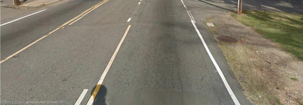
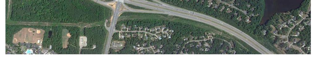
5 What is a Secondary Road? 5


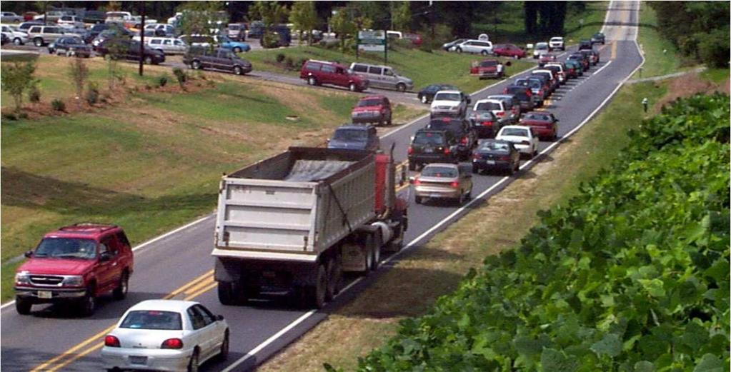
6 6
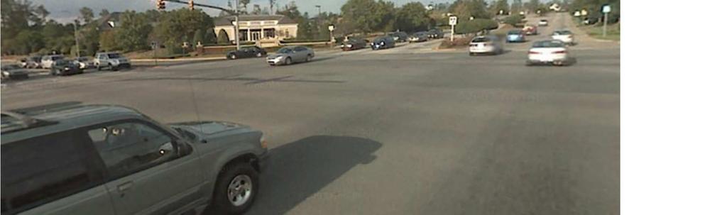
7 Urban. 7


8 Rural Suburban 8
9 9


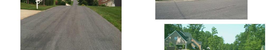
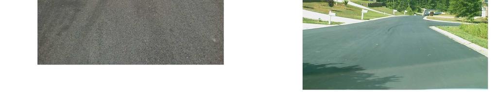
10 Wide Variety of Dirt Roads 10
11 Div. 13 4, % Division Distribution of Secondary Roads Div. 11 5, % Div. 9 4, % Div. 7 4, % Div. 5 5, % Div. 4 4, % Div. 1 3, % Div. 14 3, % Div. 12 5, % Div. 10 4, % Div. 8 5, % Div. 6 4, % Div. 3 4, % Div. 2 3, % 11
12 Secondary Road Funding Routine Maintenance (Highway Fund) Contract Resurfacing (Highway Fund) System Preservation (Highway Fund) Secondary Road Improvement Program (Highway Fund & Highway Trust Fund) 12
13 Routine Maintenance Highway Fund appropriations distributed for use within county boundaries: - $50,000 Uniform Allocation - 90% Based on county road miles compared to state road miles - 10% based on county population compared to state population General Maintenance Reserve fund distributed to Divisions based on pro-rata share of lane miles to help address maintenance needs identified by the Department s Maintenance Condition Assessment Program Serves as primary funding source for all routine highway maintenance operations: - Mowing - Operation of rest area and welcome centers - Patching - Guardrail Repair - Drainage - Litter Pickup - Snow Removal - Shoulder Work - Routine Bridge Maintenance and small pipe replacement 13
14 Contract Resurfacing Highway Fund appropriations distributed for use within county boundaries: - 50% Based on needs identified by the Department s Pavement Condition Survey Program % Based on lane miles % based on population Serves as the primary fund source for pavement resurfacing needs: Provide renewed driving surface Improves ride quality Reduces patching and frequent maintenance Performed by Contract 14
15 System Preservation Revenue Source Highway Fund Funds used for chip seals, crack sealing, pavement markings and markers, painting structural steel, replacing expansion joints and waterproofing bridge decks Portion allocated to Divisions based on pro-rata share of bridge deck area for bridge preservation activities Remainder allocated to Divisions based on pro-rata share of total paved lane miles All System Preservation Funds allocated in this biennium were designated for bridge improvements 15
16 Secondary Road Improvement Program Revenue Source Highway and Highway Trust Fund Funds used to pave unpaved roads and modernize the paved secondary system Funds allocated for use within county boundaries in accordance with G.S A and G.S NCDOT presents programs to county commissions annually for concurrence (G.S ) NCDOT provides progress reports to county commissions annually (G.S ) Allocation Formula: Total miles of secondary roads in County Total miles of secondary roads in State 16
17 Historical Expenditures 10 year look at Secondary Roads Expenditures ($M) Fiscal Year Routine Maintenance Contract Resurfacing System Preservation Secondary Improvement Program TOTAL

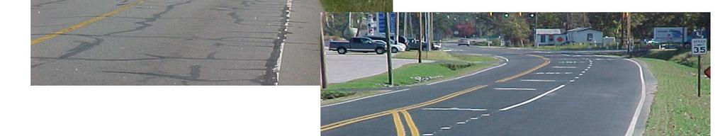
18 State Maintained Unpaved Roads 18


19 What is Left ~ 3800 miles of Unpaved SR Routes Miles on Hold List: 1927 Miles Eligible for Rating:

20 Div Distribution of UnPaved Secondary Roads Miles Div Div Div Div Div Div Div Hold List = Red Non-Hold List = Blue Div Div Div Div Div Div
21 Paving Priority Selection Un-paved Road Improvement Projects: Periodic Rating Cycle with point system - Land use Characteristics - Traffic Volume - Route Characteristics 100 County Specific Prioritization Lists 21
22 Paving Program Challenges Right-of-Way Constructability and environmental permitting issues Maintenance costs of paved vs. unpaved roads Increasing cost of construction versus homes served 22
23 Statutory Changes Began to transition to an Improvement Program to better address safety and mobility needs through modernization improvements on the secondary road system Incorporate widening, resurfacing, safety, and bridge replacement projects on the Secondary Paved System (Modeled the NC Moving Ahead program) Emphasis placed on completion of the paving program to the extent possible in counties where the unpaved mileage is significant. 23
24 House Bill 950 (Fiscal Year ) Statewide Prioritization PRIORITIZE PAVING OF UNPAVED ROADS THROUGHOUT THE STATE SECTION For fiscal year , the Department of Transportation shall expend funds allocated to the paving of unpaved secondary roads for the paving of unpaved secondary roads based on a statewide prioritization. The Department shall pave the eligible unpaved secondary roads that receive the highest priority ranking within this statewide prioritization, notwithstanding the distribution formula in G.S A or any other funding distribution formula in law. This section applies to funding for the paving of secondary roads from both the Highway Fund and the Highway Trust Fund. 24
25 Executing One-Year Statutory Change Requirements: Had to create a statewide priority list Had to fully fund prioritized projects with one year s allocation Had to determine anticipated expenditures for FY for paving unpaved roads 25
26 Executing One-Year Statutory Change Approach: Determined roads anticipated to be programmed with FY funds 194 unpaved roads in 50 Counties Determined amount that could be funded and expended with FY funds $12.3M Applied $12.3 million to 194 eligible roads in statewide priority list 20 counties 47 roads miles 26
27 Distribution of Allocations for SW Priority List SUMMARY OF SW PRIORITY Total Length Div County Total Dollars # Roads (mi) 1 Dare $125, Beaufort $200, Pitt $100, Sampson $50, Davidson $475, Rowan $440, Cabarrus $990, Mecklenburg $40, Ashe $680, Avery $300, Caldwell $800, Watauga $1,900, Wilkes $1,200, Alexander $400, Catawba $1,570, Iredell $1,377, Lincoln $33, Buncombe $901, Mitchell $140, Henderson $550, $12,273, Counties receive "off-the-top" allocations 27
28 Miles of Dirt Road Paving > 13,000 Miles Paved from 1989 to
29 Paved Road Improvement Projects Access & Mobility Industrial road improvements, school bus access, small bridge and pipe replacement Safety straighten curves, intersection alignment, lane widening, shoulders widening, turn lanes, sight distance improvements 29
30 Project Selection Guidelines for Paved Road Improvements Traffic Volume > 1500 Average Daily Traffic Lane Width < 11 feet Shoulder Width (Vehicle Recovery Area) Crash Data Traffic Flow Assessment Minimal Right of Way Requirements Minimal Environmental Impacts 30


31 31

32 32


33 33

34 34
35 Looking Forward Unpaved Roads and Paved Roads How does North Carolina address the needs of the secondary road system with limited resources and increasing demand and inventory? 35
36 Looking Forward Unpaved Roads Consider continuing the statewide paving priority system for unpaved roads Consider minimum threshold for paving unpaved roads For example, minimum traffic volumes, land use density, etc Consider designating a portion of secondary road program funds for paving prioritized unpaved roads 36
37 Looking Forward Unpaved Roads Potential benefits of prioritized system Increases confidence that funds are being expended on projects of greatest need Continues commitment to pave unpaved roads Potential impacts of prioritized system Less local involvement Negative reaction from property owners 37
38 Looking Forward Paved Roads Consider authorizing the development and use of a prioritization process for secondary road improvements based on safety, mobility and access criteria. Consider allocating remaining Secondary Road Improvement Program funds, not used for paving unpaved roads, to this new program. Consider refining funding allocation criteria to address corridor improvements and isolated problem areas 38
39 Looking Forward Paved Roads Benefits: Focuses resources on projects of greatest need Allows resources to be focused on congestion and access mitigation Allows for multi-year and regional planning Potential to modernize key roadways to better link business centers and residential areas Increases flexibility to address safety issues, resulting in lower accident rates and fatalities Impacts: Funds following need, not inventory 39
40 Questions? 40
New Measure A Expenditure Categories DEFINITIONS OF ELIGIBLE EXPENDITURES Adopted March 8, 2007
 New Measure A Expenditure Categories DEFINITIONS OF ELIGIBLE EXPENDITURES Adopted March 8, 2007 City Street and County Road Maintenance Program The preservation and keeping of public street and road rights-of-way
GDOT Fiscal 2015 Year 2017 GDOT PowerPoint. Title Page
 GDOT Fiscal 2015 Year 2017 GDOT PowerPoint Savannah Post SAME Title Page Annual Programs Review Sub Titles K. Joe Carpenter, Jr., P.E. Body Text Director Division of P3/Program Delivery June 15, 2016 Transportation
Fairfax County Transportation Funding and Roadway Service Delivery Study. Study Update Transportation Advisory Commission
 Fairfax County Transportation Funding and Roadway Service Delivery Study Study Update Transportation Advisory Commission May 4, 2010 Past Studies Aug. 1965 The Financial Effects of the Incorporation of
Basalt Creek Transportation Refinement Plan Recommendations
 Basalt Creek Transportation Refinement Plan Recommendations Introduction The Basalt Creek transportation planning effort analyzed future transportation conditions and evaluated alternative strategies for
New Mexico Transportation Funding Challenges
 New Mexico Transportation Funding Challenges Rocky Mountain Pavement Preservation Partnership Meeting October 29-31, 2008 Ernest Archuleta, P.E. Field Operations Division Director 1 NMDOT DISTRICT OFFICES
WYDOT DESIGN GUIDES. Guide for. NHS Arterial (Non-Interstate)
") WYDOT DESIGN GUIDES Guide for NHS Arterial (Non-Interstate) 2014 GUIDE FOR NATIONAL HIGHWAY SYSTEM (NHS) HIGHWAYS (NHS ARTERIALS, Non-Interstate) PRESERVATION REHABILITATION RECONSTRUCTION INTRODUCTION
WYDOT DESIGN GUIDES Guide for NHS Arterial (Non-Interstate) 2014 GUIDE FOR NATIONAL HIGHWAY SYSTEM (NHS) HIGHWAYS (NHS ARTERIALS, Non-Interstate) PRESERVATION REHABILITATION RECONSTRUCTION INTRODUCTION
GDOT GDOT PowerPoint. Title Page
 GDOT 20152017 GDOT PowerPoint Savannah Post SAME Title Page Annual Programs Review Sub Titles Matt Bennett Body Text Program Manager June 14, 2017 Transportation Funding Act of 2015 (HB170) 2015 GDOT Your
Traffic Accident Data Processing
 Traffic Accident Data Processing D o n a l d F. P e t t y Engineer of Traffic Research and Surveys Indiana State Highway Commission The following is a portion of the Highway Safety Program Standards developed
WYDOT DESIGN GUIDES. Guide for. Non-NHS State Highways
 WYDOT DESIGN GUIDES Guide for Non-NHS State Highways 2014 GUIDE FOR Non-NATIONAL HIGHWAY SYSTEM (Non-NHS) STATE HIGHWAYS PRESERVATION REHABILITATION RECONSTRUCTION INTRODUCTION This Guide is directed to
RURAL HIGHWAY SHOULDERS THAT ACCOMMODATE BICYCLE AND PEDESTRIAN USE (TxDOT Project ) June 7, Presented by: Karen Dixon, Ph.D., P.E.
 June 7, Presented by: Karen Dixon, Ph.D., P.E.") RURAL HIGHWAY SHOULDERS THAT ACCOMMODATE BICYCLE AND PEDESTRIAN USE (TxDOT Project 0-6840) June 7, 2016 Presented by: Karen Dixon, Ph.D., P.E., TTI Team: Kay Fitzpatrick, Raul Avelar, & Subasish Das Project
RURAL HIGHWAY SHOULDERS THAT ACCOMMODATE BICYCLE AND PEDESTRIAN USE (TxDOT Project 0-6840) June 7, 2016 Presented by: Karen Dixon, Ph.D., P.E., TTI Team: Kay Fitzpatrick, Raul Avelar, & Subasish Das Project
Michael D. Turpeau Jr. State Safety Program Supervisor Georgia Department of Transportation
 Michael D. Turpeau Jr. State Safety Program Supervisor Georgia Department of Transportation Safety Programs Highway Safety Improvement Program (HSIP) Off-System Safety Program (OSSP) High Risk Rural Roads
KY s s RSA Evolution. Jo Anne Tingle, PE Kentucky Transportation Cabinet (KYTC) AASHTO TIG/FHWA RSA PEER Exchange Little Rock, AR - April 29, 2008
 AASHTO TIG/FHWA RSA PEER Exchange Little Rock, AR - April 29, 2008") KY s s RSA Evolution Jo Anne Tingle, PE Kentucky Transportation Cabinet (KYTC) AASHTO TIG/FHWA RSA PEER Exchange Little Rock, AR - April 29, 2008 Presentation Outline KY s s RSA History How we decided
KY s s RSA Evolution Jo Anne Tingle, PE Kentucky Transportation Cabinet (KYTC) AASHTO TIG/FHWA RSA PEER Exchange Little Rock, AR - April 29, 2008 Presentation Outline KY s s RSA History How we decided
NORTH HIGHLAND LAKE ROAD PROJECT
 NORTH HIGHLAND LAKE ROAD PROJECT The purpose of this special newsletter is to inform the residents of Flat Rock about the facts concerning the proposed N. Highland Lake Road Project and clarify some misconceptions.
Kentucky s Surface Transportation System
 Kentucky s Surface Transportation System ROAD AND BRIDGE CONDITIONS, TRAFFIC SAFETY, TRAVEL TRENDS, AND NEEDS MARCH 2018 PREPARED BY WWW.TRIPNET.ORG Founded in 1971, TRIP of Washington, DC, is a nonprofit
CHAPTER 7 CIRCULATION
 CHAPTER 7 CIRCULATION A township s transportation network links its population with the surrounding communities. Transportation networks, including public and private, provide the means by which township
Chapter 3 DESIGN SPECIFICATIONS
 Brampton PathWays Planning and Design Guidelines 27 Chapter 3 DESIGN SPECIFICATIONS 3.1 CLASS 1 MULTI-USE PATH Off-road multi-use trails are the backbone of the Brampton PathWays Network. They are typically
HIGHWAY 11 CORRIDOR STUDY
 HIGHWAY 11 CORRIDOR STUDY Executive Summary August 2016 Roseau County?æA@?çA@ Warroad Lake of the Woods Roseau Roosevelt Badger?ÄA@ Greenbush Legend N Hwy 11 Study Area Figure 1: Corridor Study Limits
Attachment One. Integration of Performance Measures Into the Bryan/College Station MPO FY 2019 FY 2022 Transportation Improvement Program
 Attachment One Integration of Performance Measures Into the Bryan/College Station MPO FY 2019 FY 2022 Transportation Improvement Program Introduction Begun as part of the Moving Ahead for Progress in the
Zlatko Krstulich, P.Eng. City of O9awa
 Zlatko Krstulich, P.Eng. City of O9awa 1. Introduction to the Ontario Traffic Manual Series 2. What is OTM Book 18: Bicycle Facilities? 3. Study / Committee Team Members 4. Brief overview of the content
MASTER THOROUGHFARE PLAN
 MASTER THOROUGHFARE PLAN Master Thoroughfare Plan Update November 2015 Prepared for Town of Northlake AVO 30659 11/11/2015 1201 North Bowser Road Richardson, Texas 75081 Firm Registration No. 312 MASTER
Connecting cyclists to work. Syracuse Metropolitan Transportation Council
 Connecting cyclists to work Syracuse Metropolitan Transportation Council Overview Prepared at request: NYS Department of Transportation (NYSDOT) Project Achievements Target group Purpose Process Recommendations
Project Status Update
 Project Status Update : Novato Boulevard, 4th & 3rd Streets, Sir Francis Drake Boulevard (3), and Miller Avenue Major roads projects target the most heavily traveled roads in Marin County for repairs,
May 12, 2016 Metro Potential Ballot Measure Issue Brief: Local Return
 Summary: Local return is an important revenue source for cities to maintain their local transportation infrastructure. Most cities use their local return to operate small bus systems and repave streets,
North Carolina Transportation Issues
 North Carolina Transportation Issues David T. Hartgen, Ph.D., P.E. Emeritus Professor of Transportation Studies UNC Charlotte Remarks at the Shaftesbury Lecture John Locke Foundation Raleigh, North Carolina
Section 8. Partnerships and Funding
 This section discusses the potential partnership and funding options that the Town should consider in order to assist with the implementation of the recommendations provided in the Plan. Section 8. Partnerships
APPROVE A RESOLUTION ADOPTING A COMPLETE STREETS POLICY
 STAFF REPORT MEETING DATE: September 13, 2016 TO: FROM: City Council Bob Brown, Community Development Director Russ Thompson, Public Works Director Patrick Filipelli, Management Analyst 922 Machin Avenue
In station areas, new pedestrian links can increase network connectivity and provide direct access to stations.
 The Last Mile Planning for Pedestrians Planning around stations will put pedestrians first. Making walking to stations safe and easy is important; walking will be a part of every rapid transit Accessible
Regional Transportation Needs Within Southeastern Wisconsin
 Regional Transportation Needs Within Southeastern Wisconsin #118274 May 24, 2006 1 Introduction The Southeastern Wisconsin Regional Planning Commission (SEWRPC) is the official areawide planning agency
ITEM 3 ATTACHMENT A RESOLUTION NO
 ITEM 3 ATTACHMENT A RESOLUTION NO. 2018-1575 A RESOLUTION OF THE CITY COUNCIL OF THE CITY OF CALABASAS, CALIFORNIA, ADOPTING THE FISCAL YEAR 2017-18 LIST OF PROJECTS FUNDED BY SB 1: THE ROAD REPAIR AND
land transport road assets
 land transport road assets land transport road assets Otago Region Information as at June 2007 land transport road assets 2 Purpose of this publication Land Transport New Zealand annually publishes comparative
Dr. Naveed Anwar Executive Director, AIT Consulting Affiliated Faculty, Structural Engineering Director, ACECOMS
 Dr. Naveed Anwar Executive Director, AIT Consulting Affiliated Faculty, Structural Engineering Director, ACECOMS Overview Highway Functions and Classifications Highway Design Components Design Control
PRELIMINARY DRAFT FIRST AMENDMENT TO VISION 2050: A REGIONAL LAND USE AND TRANSPORTATION PLAN FOR SOUTHEASTERN WISCONSIN
 PRELIMINARY DRAFT FIRST AMENDMENT TO VISION 2050: A REGIONAL LAND USE AND TRANSPORTATION PLAN FOR SOUTHEASTERN WISCONSIN ESTABLISHING TARGETS FOR FEDERAL PERFORMANCE MEASURES: HIGHWAY SAFETY SOUTHEASTERN
Purpose. Process. Recommendations
 Summary Document Purpose The was developed to increase safety, mobility, and recognition of cycling in the High Country region (Alleghany, Ashe, Avery, Mitchell, Watauga, Wilkes, and Yancey Counties).
2045 Long Range Transportation Plan. Summary of Draft
 2045 Long Range Transportation Plan Summary of Draft Fredericksburg Area Metropolitan Planning Organization The George Washington Region includes the City of Fredericksburg and the counties of Caroline,
APPENDIX A TWO-LANE RURAL ROADS ELEMENTS OF DESIGN CREST VERTICAL CURVES
 APPENDIX A TWO-LANE RURAL ROADS ELEMENTS OF DESIGN CREST VERTICAL CURVES 1. Two-lane Rural Roads 1.1 Introduction The definition of rural area can be derived from the definition of urban areas. Officially,
Readington Road (C.R. 637) Construction
 Construction") Public Information Meeting Thursday, August 2, 2012 Readington Road (C.R. 637) Construction from Dreahook Road to Harlan School Road Branchburg Township, Somerset County Readington Township, Hunterdon
Public Information Meeting Thursday, August 2, 2012 Readington Road (C.R. 637) Construction from Dreahook Road to Harlan School Road Branchburg Township, Somerset County Readington Township, Hunterdon
San Francisco s Capital Plan & the Mayor s Transportation Task Force 2030: Funding the next steps for transportation
 San Francisco s Capital Plan & the Mayor s Transportation Task Force 2030: Funding the next steps for transportation San Francisco Capital Needs In 2006, the Mayor and Board of Supervisors approved San
Owl Canyon Corridor Project Overview and Summary
 Owl Canyon Corridor Project Overview and Summary December 22, 2008 The Owl Canyon corridor (generally the connection between the I-25 / Larimer County Road 70 interchange and the US 287 / Larimer County
Performance Criteria for 2035 Long Range Transportation Plan
 Minimizing Impacts on Natural, Historic, Cultural or Archeological Resources 2035 LRTP Weighting Factor: 7% Objective 1.1: Use appropriate planning and design criteria to protect and enhance the built
The 2012 AASHTO Bike Guide: An Overview
 The 2012 AASHTO Bike Guide: An Overview Presentation by: Jennifer Toole, AICP, ASLA Peter Lagerwey August 10, 2012 {Enter Module Name on Master Slide} WEBINAR #1: OVERVIEW OF 2012 AASHTO BIKE GUIDE Today
Madison Urban Area and Dane County. Bicycle Transportation Plan Summary. September Introduction. Bicycle Plan Scope and Planning Process
 Bicycle Transportation Plan Summary Madison Urban Area and Dane County Introduction September 2000 Bicycling is an important mode of transportation in the Madison urban area and countywide that is available
Regional Bicycle Barriers Study
 Regional Bicycle Barriers Study Executive Summary Background and Purpose The 2040 Transportation Policy Plan (TPP) sets policies for planning and investment direction in the transportation system in the
Malabar Road (SR 514) PD&E. Town of Malabar Briefing (July 17, 2017)
 PD&E. Town of Malabar Briefing (July 17, 2017)") Malabar Road (SR 514) PD&E Town of Malabar Briefing (July 17, 2017) 1 Agenda Project limits and briefing focus PD&E process and project status Public and agency project comments Review Recommended Alternatives:
Malabar Road (SR 514) PD&E Town of Malabar Briefing (July 17, 2017) 1 Agenda Project limits and briefing focus PD&E process and project status Public and agency project comments Review Recommended Alternatives:
TRAFFIC CALMING GUIDE FOR TORONTO CITY OF TORONTO TRANSPORTATION SERVICES DIVISION
 TRAFFIC CALMING GUIDE FOR TORONTO CITY OF TORONTO TRANSPORTATION SERVICES DIVISION CITY OF TORONTO TRANSPORTATION SERVICES DIVISION 2016 TRAFFIC CALMING GUIDE FOR TORONTO TABLE OF CONTENTS Introduction
o n - m o t o r i z e d transportation is an overlooked element that can greatly enhance the overall quality of life for the community s residents.
 N o n - m o t o r i z e d transportation is an overlooked element that can greatly enhance the overall quality of life for the community s residents. 84 Transportation CHAPTER 11 INTRODUCTION Transportation
Bicycle Lanes Planning, Design, Funding South Mountain Partnership Trails Workshop Roy Gothie PennDOT Statewide Bicycle Pedestrian Coordinator
 Bicycle Lanes Planning, Design, Funding 2018 South Mountain Partnership Trails Workshop Roy Gothie PennDOT Statewide Bicycle Pedestrian Coordinator Policy Changes: BOP Bicycle Policy Changes The OLD Way
Project Update May 2018
 Project Update May 2018 Dakota County, in cooperation with the City of Lakeville, is planning to reconstruct 202 nd Street West (County Road 50) from Holyoke Avenue to Cedar Avenue (County Road 23). 202
Chapter 7. Transportation. Transportation Road Network Plan Transit Cyclists Pedestrians Multi-Use and Equestrian Trails
 Chapter 7 Transportation Transportation Road Network Plan Transit Cyclists Pedestrians Multi-Use and Equestrian Trails 7.1 TRANSPORTATION BACKGROUND The District of Maple Ridge faces a number of unique
County of Fairfax, Virginia. Department of Transportation
 Fairfax County Parkway History 2 Planning began 50 years ago 1960s Washington s Regional Transportation Plan Recommends improved north/south travel Construct Capital Beltway and outer beltway Outer beltway
APPENDIX G: INTERSECTION NEEDS AT OKEECHOBEE BOULEVARD
 APPENDIX G: INTERSECTION NEEDS AT OKEECHOBEE BOULEVARD INTERSECTION NEEDS AT SR 7 and OKEECHOBEE BOULEVARD SR 7 Extension Project Development and Environment (PD&E) Study From Okeechobee Boulevard (SR
Sponsored by the Office of Traffic and Safety of the Iowa Department of Transportation NOVEMBER 2001 CTRE
 PAVED SHOULDERS ON PRIMARY HIGHWAYS IN IOWA: AN ANALYSIS OF SHOULDER SURFACING CRITERIA, COSTS, AND BENEFITS EXECUTIVE SUMMARY Sponsored by the Office of Traffic and Safety of the Iowa Department of Transportation
WORK ZONE TRAFFIC CONTROL PROCEDURES AND GUIDELINES FOR SCDOT MAINTENANCE ACTIVITIES
 WORK ZONE TRAFFIC CONTROL PROCEDURES AND GUIDELINES FOR SCDOT MAINTENANCE ACTIVITIES April 1, 2017 WORK ZONE TRAFFIC CONTROL PROCEDURES AND GUIDELINES FOR SCDOT MAINTENANCE ACTIVITIES Table of Contents
FMATS Transportation Improvement Program Project Nomination Form
 FMATS 2015 2018 Transportation Improvement Program Project Nomination Form Project nominations are accepted from the public and are scored based on the adopted Project Scoring Criteria. These criteria
South Carolina Department of Transportation. Engineering Directive
 South Carolina Department of Transportation Engineering Directive Directive Number: ED-22 Effective: December 16, 2009 Subject: References: Purpose: This Directive Applies to: Considerations for Bicycle
MN 5 Corridor Performance. Current Corridor Characteristics Highway: MN AADT: 2,400 73,000
 Corridor Context The corridor runs from Norwood Young America to the connection with US 212 in Eden Prairie. The corridor serves the communities of Chanhassen, Eden Prairie, Norwood Young America, Victoria,
Route 29 Solutions Projects
 Route 29 Solutions Route 29 Solutions Projects www.route29solutions.org October 10, 2014 Route 29 Widening to Six Lanes Albemarle County This project will widen a 1.8-mile segment of Route 29 from four
Systemic Safety. Doug Bish Traffic Services Engineer Oregon Department of Transportation March 2016
 Systemic Safety Doug Bish Traffic Services Engineer Oregon Department of Transportation March 2016 Oregon averages 1700 fatal and serious injury crashes each year. Some of the more common crash types include:
METHODOLOGY. Signalized Intersection Average Control Delay (sec/veh)
") Chapter 5 Traffic Analysis 5.1 SUMMARY US /West 6 th Street assumes a unique role in the Lawrence Douglas County transportation system. This principal arterial street currently conveys commuter traffic
Chapter 5 Traffic Analysis 5.1 SUMMARY US /West 6 th Street assumes a unique role in the Lawrence Douglas County transportation system. This principal arterial street currently conveys commuter traffic
land transport road assets
 land transport road assets land transport road assets Westland District West Coast Region Information as at June 2006 land transport road assets 2 Purpose of this publication Land Transport New Zealand
Non-State Federal Aid Highways. Pavement Condition Ratings. H e r k i m e r a n d O n e i d a C o u n t i e s
 Non-State Federal Aid Highways Pavement Condition Ratings 2010 H e r k i m e r a n d O n e i d a C o u n t i e s 2010 PAVEMENT CONDITION RATINGS for the Non-State Federal Aid Highway System in Herkimer
Alberta Infrastructure HIGHWAY GEOMETRIC DESIGN GUIDE AUGUST 1999
 Alberta Infrastructure HIGHWAY GEOMETRIC DESIGN GUIDE AUGUST 1999,1'(; A ACCELERATION Data on acceleration from stop D-29 Effects of grade D-35 Intersections D-97, D-99 Lanes D-97, F-5, F-7, F-15, F-21,
CE576: Highway Design and Traffic Safety
 CE576: Highway Design and Traffic Safety Predicting Crash Frequency for Two-Lane Rural Highway Segments Cross Sectional Elements Ahmed Abdel-Rahim, Ph.D., P.E. Civil Engineering Department University of
On Road Bikeways Part 1: Bicycle Lane Design
 On Road Bikeways Part 1: Bicycle Lane Design Presentation by: Nick Jackson Bill Schultheiss, P.E. September 04, 2012 FOLLOW THE CONVERSATION ON TWITTER Toole Design Group is live tweeting this webinar
IMPLEMENTATION STRATEGIES
 GEORGETOWN SIDEWALK MASTER PLAN 34% of funding is dedicated to Downtown Overlay District sidewalks 28% of funding is recommended within 1/4 mile of Southwestern University 26% of funding is recommended
Technical Memorandum. Shoulder Width Standards for State Highways. Expiration. Implementation. Introduction. Purpose
 Minnesota Department of Transportation Engineering Services Division Technical Memorandum No. 17-12-TS-05 Technical Memorandum To: Electronic Distribution Recipients From: Nancy T. Daubenberger, P.E. Divison
Off-road Trails. Guidance
 Off-road Trails Off-road trails are shared use paths located on an independent alignment that provide two-way travel for people walking, bicycling, and other non-motorized users. Trails specifically along
2.0 LANE WIDTHS GUIDELINE
 2.0 LANE WIDTHS GUIDELINE Road Engineering Design Guidelines Version 2.0.1 May 2018 City of Toronto, Transportation Services City of Toronto Page 0 Background In early 2014, Transportation Services initiated
2.0 Existing Conditions
 20 2.0 Existing Conditions 2.1 Land Use, Future Growth Patterns, Physical Barriers Geographic Overview Sutter County s land use pattern is characterized by extensive agricultural areas, significant natural
DRAFT. Memo. Range of the Alternatives Considered in the EIS
 Memo Date: Friday, December 09, 2016 Project: To: From: Subject: State Route 30 EIS UDOT Vince Izzo This memorandum summarizes the draft State Route (S.R.) 30 Level 1 screening results. A more detailed
Gordon Proctor Director Policy on Accommodating Bicycle and Pedestrian Travel on ODOT Owned or Maintained Facilities
 Approved: Policy: 20-004(P) Responsible Office: Planning Gordon Proctor Director Policy on Accommodating Bicycle and Pedestrian Travel on ODOT Owned or Maintained Facilities I. POLICY STATEMENT: This policy
4-County Big Oil Oil Impacts Analysis Dunn, McKenzie, Mountrail, & Williams Counties in association with:
 4-County Big Oil Oil Impacts Analysis Dunn, McKenzie, Mountrail, & Williams Counties in association with: In association with: Interim Energy Development and Transmission Legislative Committee March 8,
MCTC 2018 RTP SCS and Madera County RIFP Multi-Modal Project Eval Criteria GV13.xlsx
 MCTC 8 RTP SCS and Madera County RIFP Multi-Modal Project Eval Criteria GV.xlsx Madera County Transportation Commission Regional Transportation Plan / Sustainable Communities Strategy Multi-Modal Project
STATE TRANSPORTATION COMMISSION HEARING
 STATE TRANSPORTATION COMMISSION HEARING Twelve Year Program Update Tom Zilla: Centre County MPO Jim Saylor: SEDA-COG RPO Amy Kessler: North Central RPO PennDOT District 2-0 State College, PA October 8,
Executive Summary June 2015
 Executive Summary June 2015 Highway 112 Corridor Study Benton and Washington Counties Executive Summary June 2015 Prepared by Transportation Planning and Policy Division Arkansas State Highway and Transportation
Phone: Fax: Project Reference No. (to be filled out by MassHighway):
:") Massachusetts Highway Department District 3 Project Need Form (PNF) This form is intended to provide preliminary information about the proposed project. It is not expected that all information that is
Massachusetts Highway Department District 3 Project Need Form (PNF) This form is intended to provide preliminary information about the proposed project. It is not expected that all information that is
Platte County Roads Master Plan
 Roads Master Plan Unincorporated Platte County, Missouri December, 2002 Platte County Roads Master Plan Final Report Prepared by: In conjunction with: Stinson, Morris and Hecker December 2002 Table of
Parks Highway: MP Lucus Road to Big Lake Road
 2 Purpose and Need 2.1 Corridor History The Parks Highway is a 324-mile long Rural Interstate Highway that extends from its intersection with the Glenn Highway north to Fairbanks, Alaska. The Parks Highway
North Carolina Department of Transportation American Recovery and Reinvestment Act of 2009 Division One Highway Infrastructure Program Summary
 Division One Highway Infrastructure Program Summary 1 Hyde NC 12 Northern Ferry Dock Ocracoke Village R-5149 Resurface and Widening to Accommodate Bicycling 13.3 $3,310,000 $0 $3,310,000 Jul-09 1 Dare
I-105 Corridor Sustainability Study (CSS)
") I-105 Corridor Sustainability Study (CSS) Metro Streets and Freeways Subcommittee March 21, 2019 Gary Hamrick Cambridge Systematics, Inc. I-105 CSS Project History & Background Funded by Caltrans Sustainable
I-105 Corridor Sustainability Study (CSS) Metro Streets and Freeways Subcommittee March 21, 2019 Gary Hamrick Cambridge Systematics, Inc. I-105 CSS Project History & Background Funded by Caltrans Sustainable
Welcome. Thank you for your interest in the Lewis & Clark Viaduct Concept Study
 Welcome Thank you for your interest in the Lewis & Clark Viaduct Concept Study Please use the arrows in the upper left hand corner to navigate through the presentation. Use the envelope icon to ask a question
Project Description Form 8EE
 Project Description Form 8EE Basic Project Information Submitting Jurisdiction/Agency: Town of Dumfries Project Title: Route 1 (Fraley Blvd) Widening: Brady's Hill Road to Dumfries Road Project Location:
M-58 HIGHWAY ACCESS MANAGEMENT STUDY Mullen Road to Bel-Ray Boulevard. Prepared for CITY OF BELTON. May 2016
 M-58 HIGHWAY ACCESS MANAGEMENT STUDY Prepared for CITY OF BELTON By May 2016 Introduction Missouri State Highway 58 (M-58 Highway) is a major commercial corridor in the City of Belton. As development has
SALES ASSESSMENT RATIO STUDIES AS OF JANUARY 1, 2013
 SALES ASSESSMENT RATIO STUDIES AS OF JANUARY 1, 2013 North Carolina Department of Revenue Property Tax Division Introduction This report is a compilation of the sales assessment ratio studies, which were
Shenango Valley MPO. State Transportation Commission 2015 Twelve Year Program Development
 State Transportation Commission 2015 Twelve Year Program Development Regional results of the survey and public feedback from August thru November 2013 Shenango Valley MPO Version 01-2014 Mobility Concerns
Multimodal Design Guidance. October 23, 2018 ITE Fall Meeting
 Multimodal Design Guidance October 23, 2018 ITE Fall Meeting Introductions Jessica Wilson TDOT Multimodal Division Office of Multimodal Planning Program Supervisor Jessica.L.Wilson@tn.gov Ali Hangul TDOT
2016 FACT SHEET ENGINEERING STREET OPERATIONS. Engineering Street Operations net 2016 budget is $5,199,900 WHAT IS ENGINEERING STREET OPERATIONS?
 WHAT IS STREET OPERATIONS? This section maintains approximately 570 km of major, collector and residential roads throughout Saanich. Some of the major programs include road surface treatments (pothole
Introduction Methodology Study area and data collection Results and recommendation Conclusion References
 Introduction Methodology Study area and data collection Results and recommendation Conclusion References It is formal procedure for assessing accident potential and safety performance in the provision
FUNDING SOURCES CHAPTER 6
 CHAPTER 6 6.1 BICYCLE 6.1.1 Local 6.1.2 Regional 6.1.3 State 6.1.4 Federal 6.1.5 Public Facilities 6.1.6 Bicycle Registration and Licensing Fees 6.1.7 Summary Table 6.1 of Bicycle Funding Sources 6 2 6.2
West Dimond Blvd Upgrade Jodhpur Street to Sand Lake Road
 West Dimond Blvd Jodhpur St to Sand Lake CSS Transportation Project Summary Municipality of Anchorage Project # 05 005 Project Manager: John Smith, P.E. (MOA PM&E) Project Administrator: Julie Makela,
Last Reval. Tax Rate Equiv
 BY POPULATION () 2009 1 Mecklenburg 940,697 362,667,757 1,009,935,274 35.91 820,770,410 2,633,085 0.3208 0.0022 2011 2019 117,089,446,050 0.8166 100.15 0.8178 97.97 98.72 86.44 19,186,309 0.0164-0.0142
Goodlettsville Bicycle and Pedestrian Plan Executive Summary
 Goodlettsville Bicycle and Pedestrian Plan July 2010 In Cooperation with the Nashville Area Metropolitan Planning Executive Organization Summary Introduction Progressive and forward thinking communities
Street Paving and Sidewalk Policy
 City Commission Policy 600 Street Paving and Sidewalk Policy DEPARTMENT: Public Works DATE ADOPTED: June 7, 1995 DATE OF LAST REVISION: December 10, 2014 Policy No. 600.01 AUTHORITY: PASS City of Tallahassee-Leon
Transportation Safety Planning at DVRPC
 Transportation Safety Planning at DVRPC New York Safety Planning Peer Exchange June 15, 2010 Zoe Neaderland, AICP Manager, Office of Transportation Safety & Congestion Management DVRPC Overview Federally-Designated
Proposed. City of Grand Junction Complete Streets Policy. Exhibit 10
 Proposed City of Grand Junction Complete Streets Policy Exhibit 10 1 City of Grand Junction Complete Streets Policy Vision: The Complete Streets Vision is to develop a safe, efficient, and reliable travel
Route 7 Corridor Study
 Route 7 Corridor Study Executive Summary Study Area The following report analyzes a segment of the Virginia State Route 7 corridor. The corridor study area, spanning over 5 miles in length, is a multi
FUTURE MOBILITY IN TEXAS: The Cost of Meeting the State s Need for Safe and Efficient Mobility
 FUTURE MOBILITY IN TEXAS: The Cost of Meeting the State s Need for Safe and Efficient Mobility OCTOBER 2012 202-466-6706 www.tripnet.org Founded in 1971, TRIP, of Washington, DC is a nonprofit organization
Safety Data Resources. Multi-Discipline Safety Planning Forum March 10 & 11, 2008 Gateway Center
 Safety Data Resources Multi-Discipline Safety Planning Forum March 10 & 11, 2008 Gateway Center Tom McDonald, PE Safety Circuit Rider Iowa LTAP Jack Latterell,, PE Safety Consultant FHWA Safety Engineer,
Now Let s Think Systemic
 Now Let s Think Systemic Remote Rural County Use of the Highway Safety Improvement Program TRINITY COUNTY DEPARTMENT OF TRANSPORTATION Richard Tippett Director MEET TRINITY COUNTY 3,208 square miles 13,786
Recommended Roadway Plan Section 2 - Land Development and Roadway Access
 Recommended Roadway Plan Section 2 - Land Development and Roadway Access SECTION 2 Land Development and Roadway Access 2.1 Land Use and Access Management The Federal Highway Administration (FHWA) defines
Third Street Bridge & Corridor Project
 Third Street Bridge & Corridor Project Preparation for the FY2018 budget to commence October 1, 2017, includes funding to address a project that has been considered since 1994. The Third Street bridge