SCHOOL PATH PRESENTATION 10/10/2013 HAAPASAARI HIIDENKARI LEPISTÖ
|
|
|
- Geoffrey Parsons
- 6 years ago
- Views:
Transcription

1
2 WORKGROUP JENNY HAAPASAARI industrial design PEPPI HIIDENKARI industrial design SONJA LEPISTÖ interior design 2
3 CONTENTS I school path concept II path elements III school path network IV housing fair Vantaa 2015 V summary 3
4 part I SCHOOL PATH CONCEPT 1 concept introduction 2 need for a school path? 3 themes 4 goals 5 community & social aspect 6 target group 4
5 DEMAND NEED FOR A SCHOOL PATH DESIGN? The base for this project was to study what had been done about the school path topic previously. In Koulupolkumanuaali and Draamatyöpaja muotoilijoiden käytössä Marja-Vantaan koulupolulla we found a checklist and elements for a safe school path. Also we learned about children s fears and hopes for a schoolpath. City planning can acknowldge these fears and hopes and find solutions for them. 5

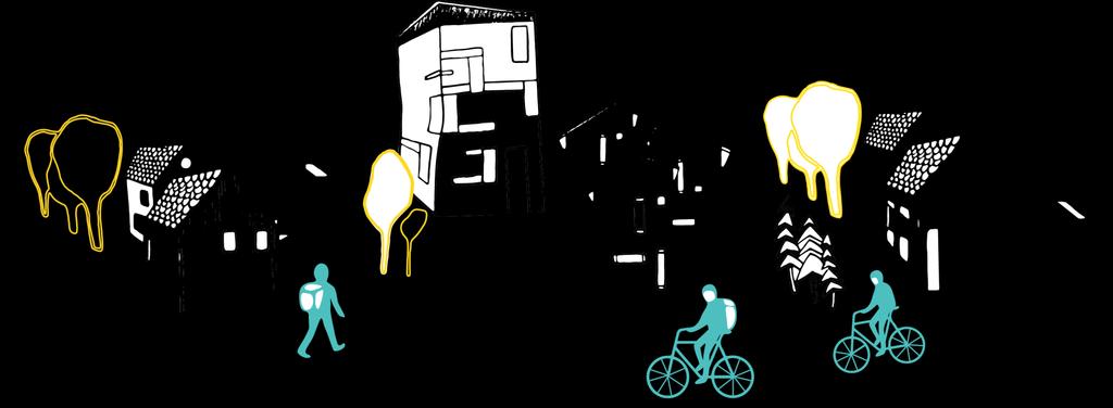
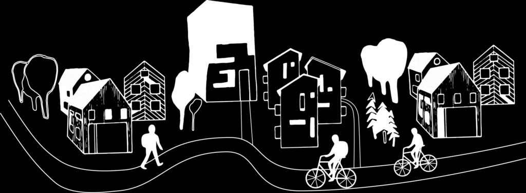
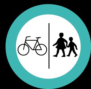
6 SCHOOL PATH CONCEPT School path is a service designed for primary schools in Kivistö which guarantees a safe and comfortable way to school all year round. School path focuses on a bicycle path, but can also be combined with a pedestrian lane. In the school path children are priority but it s for the whole community to use. The concept includes the means to form an optimal school path and the physical elements that it s build of. 6
7 GOALS PRIMARY SCHOOL PATH NETWORK FOR KIVISTÖ SAFE AND OPTIMAL ROUTING DEFINING SCHOOL PATH ELEMENTS MULTIFUNCTIONAL AND FLEXIBLE SECONDARY TRAFFIC AWARENESS EDUCATION CO-OPERATING WITH SCHOOL PATH: SAFETY AND INFROMING GROUP ADDITIONAL SERVICES RECOGNISEABLE AND GRAPHICAL LOOK 7
8 KEY THEMES K E Y W O R D S MULTI-FUNCTION The path is designed in a way that allows it to be modified easily. Concept works even if some elements are left out or edited. Path must be multifunctional to serve most of the community. EMOTIONAL Community Experience Independence Visual Unique Memories Inspiring LOGICAL Functional Safe Year-round Reachable Adaptable Easy to maintain Simple 8
9 COMMUNITY & SOCIAL ASPECT Promoting regional identity with having something unique and local. School path is one tool to teach children to live according to sustainable development values. For public health reasons it s profitable to accustom children to excercise and travel short distances by walking and cycling at a young age. School path would partially preserve the small town spirit by creating a safe and nature favoring enviroment. 9
 PARENTS FAMILIES SENIOR CITIZENS FITNESS & JOGGERS School children need the path only a short while during the day.")
10 TARGET GROUP SCHOOL CHILDREN (1.-6. grade) PARENTS FAMILIES SENIOR CITIZENS FITNESS & JOGGERS School children need the path only a short while during the day. Rest of the time it can as well be used by others too. For the multifunctional aspect we have made the path serve most of the community. 10
11 part II SCHOOL PATH ELEMENTS 1 materials 2 shelter 3 crossing 4 under- & overpass 5 lightening 6 path categories 11


12 MATERIALS Built-in heating system integrated in the path keeps the path clear of ice and snow. Might inspire to cycle to school in winter also. Comes cheap in time; Sanding and salting ground costs a lot and isn t good for enviroment. For the path s coating we use Acrylotex which is designed for use on asphalt and concrete surfaces. Durable and slip resistant surface. Much more permanent than paint. Other pedestrians f.ex senior citizens could also benefit from the safe and well maintained path 12


13 shelter The roof is bended polycarbonate plate. Shelter functions as an element separating pedestrian and cycle lanes. Also it indicates where the main route goes. Material is recycled aluminum. The ligtening works with solar panels placed on the the roof. 13

14 CROSSING elevated crossing area 1 speed bump, rumble strip 2 speed limit 30km/h 3 visibility 4 Välkky, PoLED, SeeMe 5 SignFlash, Levelite 6 safety island 7 traffic lights 8 (+ cyclists own light) 9 14


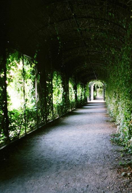
15 underpass Approachable and comfortable. Intensive lightening. Visually interesting and memorable. Children would take part in improving and generating ideas for the tunnels. overpass If possible, in dangerous crossings there should be light overpass. To increase children s sense of safety, the structure could be tubular. There are few overpasses already in the school path. In these cases, road surface and other details continue same way as the basic path. 15

16 LIGHTENING SHELTER Integrated LED lights lenghtwise of the path. Solar panels on the roof. LIGHTENING POLE Streetslights, with theme color paint. Same shape as the shelters profile to keep the lightening cohesive. 16
17 CYCLIST MEASURES cyclists Lane width is between 2,25 m and 2,50 m. pedestrians The pedestrian lane should be wide enough for a stroller and a parent attending their kid to pass each other. MAINTENANCE maintenance category K1 plowing equipment Wille 265 well timed maintenance 1 removal of snow, ice and slush 2 prevent slipperiness 3 own responsibility of cycling equipment 4 17
18 PATH CATEGORIES category I category II category III category IV school path integrated in an existing sidewalk school path + pedestrian lane school path + pedestrian lane + motor traffic lane school path baana 18


19 category II one-level solution school path pedestrian lane two-level solution category III three-level solution two-level solution school path pedestrian lane motor traffic lane category IV Baana school path pedestrian lane 19


20 bike parking & cycling schoolbus stop Near the schools and Kivistö station there will be bike parking in a widened separation lane. When a bench and fixed bike pump are added, the area can also function as a stop for the cycling or walking schoolbus. 20
21 part III SCHOOL PATH NETWORK 1 optimal route 2 maps 3 signage 21
22 OPTIMAL ROUTE SCHOOL PATH: DEFINING ELEMENTS LOCATIONS schools hobbies after school activities playgrounds sports field & hall church library Kivistö station bus terminal GEOGRAPHICAL childrens residential areas & dividing to local schools uphills number of crossings motor traffic 22


23 M A P MAP I simplified map 16,847 m MAP II route by category 1 key locations 2 23


24 SIGNAGE school path sign 1 cycling schoolbus 2 approaching crossing 3 sign for other cyclists 4 24


25 SIGNAGE general signage style 4 sticker, reflective edge 5 infoboard 6 25
26 part IV HOUSING FAIR VANTAA route 2 school path guide for art 3 path category 4 lightening 26

27 HOUSING FAIR ROUTE Easy to reach. Direct connection to several local schools, train station, sports, parks and after school activities. 27
28 SCHOOL PATH GUIDE FOR ART children s participation School paths guide for art aims to involve local children in the art making process. When children are allowed to get involved in designing and creating their school path enviroment they feel it as their own. Sense of ownership helps them to feel more safe and proud of their path. Themes are nature, metals, stones and wood. 28


29 Melbourne Helsinki path category IV 2,25 m wide lanes & tiling Shelter with integrated lighting Year-round; heating system pinwheel tiling Pinwheel tiling is a non-periodic tiling. Following the stone theme of the area, the path passin by housing fair will have a decorative tiling with multiple stone types. Easy to maintain in winter 29

30 tunnels & archs School path will have short tunnels made with different materials. F.ex. corten steel 1 recycled wood 2 trees or plants 3 30


31 corten steel recycled wood trees & plants 31


32 lightening for tunnels Fagerhult: Tall pollar Corten steel color, warm yellow K 32
33 part V SUMMARY 1 summary 2 meetings with Vantaa representatives 33
34 SUMMARY Accessibility is good for all local children as way to school is less than 3 kilometers by bike. School path brings unique value to the new Kivistö area. The path emphazises sense of community. It most benefits families and senior citizens. Childrens exercising and daily movement increases thank to the school path; path is good for winter cycling and no remarkable uphills. Also safe and comfortable tunnels, crossings and separating lanes between traffic eliminate the need for children to be afraid of their most common fears. Path elements are easy to recognize so children don t get lost. 34

35 MEETINGS WITH VANTAA REPRESENTATIVES 26 / 9 meeting with Lea Varpanen, Director of planning for Kivistö. 9 / 10 second meeting with Lea and 18 Vantaa representatives. 1 housing Fair as a school path pilot Kivistö school housing fair Kannisto school 2 the signage is easy to use in short timespan 3 could work as much more siplified elements 35


36 ... 36
Complete Streets. Designing Streets for Everyone. Sarnia
 Complete Streets Designing Streets for Everyone Sarnia Complete Streets ~ Sarnia ~ 2018 Introduction Our City is made up of a network of streets that we use to go for a walk, cycle to work, drive to the
MARTIN LUTHER KING JR. WAY
 OCTOBER 2011 40 Vision and Goals The Martin Luther King, Jr. Way Illustrative Master Plan that follows has been developed through a process of community involvement. It expresses a long term vision for
City of Darlington Beautification Report
 City of Darlington Beautification Report Approved by the City of Darlington Beautification Board February 2016 The New Downtown Darlington has seen many changes during the past decade with the rehabilitation
MAG Town of Cave Creek Bike Study Task 6 Executive Summary and Regional Significance Report
 Page 1 MAG Town of Cave Creek Bike Study Task 6 Executive Summary and Regional Significance Report August 1, 2012 MAG Project #481 Page 2 Task 6 Executive Summary and Regional Significance Report Introduction
Tonight is for you. Learn everything you can. Share all your ideas.
 Strathcona Neighbourhood Renewal Draft Concept Design Tonight is for you. Learn everything you can. Share all your ideas. What is Neighbourhood Renewal? Creating a design with you for your neighbourhood.
Clarkson Walkability Audit: Results and Recommendations Summary
 Clarkson Walkability Audit: Results and Recommendations Summary The following document was prepared by the Region of Peel and includes a summary of comments made by participants during our breakout discussion
Bicycle-friendly urban planning
 Bicycle-friendly urban planning DI Tomi Laine Strafica Ltd. www.strafica.fi 16.3.2016 Contents I. History, statistics II. The concept of Cycling City III. Practical examples Three phases of cycling in
General Design Factors
 Chapter 3: 3-1.0 Introduction General Design Factors Mn/DOT s goals include encouraging and accommodating safe bicycling. From a design perspective, these goals are achieved by first having an understanding
CONNECTING PEOPLE TO PLACES
 CONNECTING PEOPLE TO PLACES 82 EAST BENCH MASTER PLAN 07 Introduction The East Bench transportation system is a collection of slow moving, treelined residential streets and major arteries that are the
Fill in the rating for each section. Total up the ratings to see how your neighbourhood scores overall for walkability.
 WALKABILITY CHECKLIST How walkable is your community? Everyone benefits from walking and other forms of active transportation. These benefits include: improved fitness, cleaner air, reduced risks of certain
PUBLIC REALM MASTER PLAN
 WESTSHORE BUSINESS DISTRICT PUBLIC REALM MASTER PLAN MASTER PLAN COMMITTEE MEETING MARCH 20, 2013 WESTSHORE BUSINESS DISTRCT PUBLIC REALM MASTER PLAN MACRO-SCALE CONCEPT: A PUBLIC REALM FRAMEWORK DEFINED
October 30 th, 2012 Committee of the Whole Meeting Cycling Task Force Recommendations BIKE RACKS
 BIKE RACKS 1. Replace existing bike racks with functionally designed bike racks that promote year round cycling as well as increase the number of bike racks in town. Existing bike racks are poorly designed
INDEX. Geometric Design Guide for Canadian Roads INDEX
 Acceleration lane, see Lanes, Acceleration Access, 8.1 Access Management and Functional Classification 8.2 Access Management by Design Classification 8.3 Access Configuration 8.4 Building Set-Back Guidelines
Observations and Ideas: Toomer s Corner Streetscape Improvements
 Observations and Ideas: Toomer s Corner Streetscape Improvements AUBURN DOWNTOWN MASTER PLAN planning downtown s future August 26, 2013 Observations: Vertical Clutter at Corners 6 3 7 5 9 2 8 4 1 Excess
SITE OBSERVATION FORM
 Sequential # Site ID: Sequential Number in pencil Injury Site B. Additional Site D. Additional Site E. Site type will be completed by the Study Coordinator after the Observation Form is completed. SITE
WALKABILITY CHECKLIST How walkable is your community?
 WALKABILITY CHECKLIST How walkable is your community? Everyone benefits from walking and other forms of active transportation. These benefits include: improved fitness, cleaner air, reduced risks of certain
Mobility measures in Vitoria-Gasteiz
 CIVITAS Study Tour in Vitoria-Gasteiz, Spain 19 & 20 June 2014 Palacio Zulueta Public Space and Nature Environment Service, Paseo de la Senda 2, Vitoria-Gastez Giving back the public space to the people
Report on MEPS Přerov TH MIDDLE EUROPEAN PROJECT SEMINAR LAURA ENJUANES NOGUERO E
 2017 Report on MEPS Přerov 2017 28TH MIDDLE EUROPEAN PROJECT SEMINAR LAURA ENJUANES NOGUERO E01650478 Table of Content 1. Introduction... 1 2. Problem definition... 1 3. Proposed solution in the presentation...
Typical Cross Section: DOWNTOWN (Observer Highway - 8th Street)
") Typical Cross Section: DOWNTOWN (Observer Highway - 8th Street) DRAFT SEPTEMBER 23, 14 1 Washington Street Typical Block Downtown Typical Block: DOWNTOWN (Observer Highway - 8th Street) New crosswalks
Typical Cross Section: DOWNTOWN (Observer Highway - 8th Street) DRAFT SEPTEMBER 23, 14 1 Washington Street Typical Block Downtown Typical Block: DOWNTOWN (Observer Highway - 8th Street) New crosswalks
FOCUS AREA 1 - Alberta Avenue Pocket Park 3 (121 Ave and 92 St)
") FOCUS AREA 1 - Alberta Avenue Pocket Park 3 (121 Ave and 92 St) New benches Plant evergreen trees Widen existing sidewalk from 1.5m to 1.8m Marked crosswalk 1.8m wide sidewalk Add pedestrian oriented lights
FOCUS AREA 1 - Alberta Avenue Pocket Park 3 (121 Ave and 92 St) New benches Plant evergreen trees Widen existing sidewalk from 1.5m to 1.8m Marked crosswalk 1.8m wide sidewalk Add pedestrian oriented lights
TRAFFIC CALMING POLICY & PROCEDURES
 TRAFFIC CALMING POLICY & PROCEDURES AS ADOPTED BY MONTCLAIR TOWNSHIP COUNCIL AUGUST 4, 2009 TABLE OF CONTENTS 1. INTRODUCTION... 2 Purpose... 2 Traffic Calming Definition... 2 Statement Of Township Council
Walking Audit Supporting Information
 Walking Audit Supporting Information Planning to do a walking audit of your streets? Here s some helpful suggestions to help get you started. 1. Preparing for your audit Decide where you want to walk.
Appendix C. TRAFFIC CALMING PROGRAM TOOLBOX
 Appendix C. TRAFFIC CALMING PROGRAM TOOLBOX PHASE I...2 Do Not Enter Sign...3 One-Way Sign...4 Turn Prohibition...5 Pavement Markings...6 Speed Monitoring Trailer...7 Neighborhood Speed Watch...8 Police
Chapter 3 DESIGN SPECIFICATIONS
 Brampton PathWays Planning and Design Guidelines 27 Chapter 3 DESIGN SPECIFICATIONS 3.1 CLASS 1 MULTI-USE PATH Off-road multi-use trails are the backbone of the Brampton PathWays Network. They are typically
Canada s Capital Region Delegation to the Velo-City Global 2010 Conference
 Canada s Capital Region Delegation to the Velo-City Global 2010 Conference Report of Findings from Visits, Meetings & Presentations In Amsterdam-Den Haag, Utrecht, Berlin & Copenhagen The Itinerary Copenhagen
LAD 2013 Route of Experience -Tourist routes. Bicycle routes and lanes
 LAD 2013 Route of Experience -Tourist routes Bicycle routes and lanes Karppanen Keinänen Vuokila Index: Introduction 3 Why 4 Observation trip 5 Concept idea 6 Route of Experience -Tourist routes 7 Tourist
City of Davis East Covell Corridor Plan
 Community Open House #2 January 22, 2014 6:00 8:00 p.m. Veterans Memorial Center, Club Room City of Davis Introduction The (ECCP) is a taking a comprehensive look at the existing transportation systems
WINTER MAINTENANCE IN POLAND IN ASPECT OF ROAD USERS NEEDS Paweł Sobiesiak
 WINTER MAINTENANCE IN POLAND IN ASPECT OF ROAD USERS NEEDS Paweł Sobiesiak KEY QUESTIONS QUESTION 1 What winter services are designed for? Answer: For ensuring passability and safety in winter on the road.
UPTOWN REGIONAL BIKE CORRIDORS PROJECT SAN DIEGO ASSOCIATION OF GOVERNMENTS
 UPTOWN REGIONAL BIKE CORRIDORS PROJECT SAN DIEGO ASSOCIATION OF GOVERNMENTS SUMMARY REPORT: COMMUNITY UPDATE MEETING February 6, 2014 6 8:30 p.m. Roosevelt Middle School Library 3366 Park Blvd, San Diego
RiNo Railroad Crossing Connectivity Analysis. Stakeholder Workshop June 29, 2017
 RiNo Railroad Crossing Connectivity Analysis Stakeholder Workshop June 29, 2017 Ideas and Considerations Presented at Stakeholder Workshop Primary Focus: 38 th Street (between Walnut & Wynkoop) 1 Basic
Chapter 4 TOOLBOX AND SAMPLE BIKE BOULEVARD LAYOUT
 Chapter 4 TOOLBOX AND SAMPLE BIKE BOULEVARD LAYOUT OVERVIEW This chapter describes a cohesive set of strategies to create a bicycle boulevard, namely to make streets safer and more efficient for bicycle
What Is a Complete Street?
 Session 5 Charleen Zimmer, AICP, Zan Associates May 5-7, 2010 What Is a Complete Street? May 2010 5-1 Not a Complete Street More of a Complete Street May 2010 5-2 Benefits of Complete Streets Safety for
Bicycle Facilities Planning
 Bicycle Facilities Planning Overview Types of Cyclists Purpose for Riding Types of Facilities Bike Lanes Bicycle Boulevards Cycle Tracks Intersections Signals Signing and Marking Discussion Types of Bicyclists
DRAFT. System Components. Greenway Trails. Introduction. Trail Types. Zebulon Greenway Master Plan
 5 System Components Wakefield Street Photo Simulation showing Sharrows Introduction The Master Plan identifies various system components that, together, create a comprehensive greenway system. These components
Monroe Street Reconstruction
 Total participants: 45+ Monroe Street Reconstruction Cross Section Workshop Notes September 29, 2016, Wingra School Workshop Orientation, Technical and Functional Considerations: The workshop began with
Ann Arbor Downtown Street Plan
 1 Ann Arbor Downtown Street Plan Public Workshop #1 We know that. 2 Public right-of-way (streets, sidewalks, and alleys) make up 30% of the total District area of downtown. Streets need to provide mobility
El Camino Real Specific Plan. TAC/CAC Meeting #2 Aug 1, 2018
 El Camino Real Specific Plan TAC/CAC Meeting #2 Aug 1, 2018 Land Use Alternatives Goals and Tradeoffs Parks & open space Housing Retail & services Civic spaces Parking Community gathering spaces 3 Alternatives
o n - m o t o r i z e d transportation is an overlooked element that can greatly enhance the overall quality of life for the community s residents.
 N o n - m o t o r i z e d transportation is an overlooked element that can greatly enhance the overall quality of life for the community s residents. 84 Transportation CHAPTER 11 INTRODUCTION Transportation
Redesign of Motorized and Non-motorized Transport in Cities and Sustainable Mobility
 Journal of Energy and Power Engineering 10 (2016) 206-210 doi: 10.17265/1934-8975/2016.03.009 D DAVID PUBLISHING Redesign of Motorized and Non-motorized Transport in Cities and Sustainable Mobility Osman
Copenhagen Cycling Map. Red Lines Cycling facilities
 Copenhagen Cycling Map Red Lines Cycling facilities Copenhagen Cycling Facilities Design Approaches Transportation without Pollution Copenhagen s Strategy Where Cycling is one of the top key activities
Improving cycling experience WITH SAFE, COMFORTABLE AND FUN INFRASTRUCTURE
 Improving cycling experience WITH SAFE, COMFORTABLE AND FUN INFRASTRUCTURE Improving cycling experience WITH SAFE, COMFORTABLE AND FUN INFRASTRUCTURE Cycle safety Cycle comfort Cycle fun CYCLE SAFETY Bikescout
Grade-separation for cyclists includes cycling bridges and cycling tunnels, specially built for cyclists and possibly co-used by pedestrians.
 Infrastructure Give Cycling a Push INFRASTRUCTURE/ INTERSECTIONS AND CROSSINGS GRADE SEPARATION Overview Gradeseparation for cyclists includes cycling tunnels and cycling bridges. These are safe and direct
City of Ann Arbor Pedestrian Safety & Access Task Force
 City of Ann Arbor Pedestrian Safety & Access Task Force Community Wide Meeting #2 Wednesday, March 25 th 6:30 to 8:30 PM Multi-purpose Room, Downtown Library The Greenway Collaborative, Inc. www.greenwaycollab.com
County of Greenville South Carolina. Traffic Calming Program Neighborhood Traffic Education Program and Speed Hump Program
 County of Greenville South Carolina Traffic Calming Program Neighborhood Traffic Education Program and Speed Hump Program (rev) August 2008 I. PURPOSE The potential negative impacts from vehicular traffic
KEARNY MESA COMMUNITY PLAN UPDATE
 KEARNY MESA COMMUNITY PLAN UPDATE January 18, 2018 SUBCOMMITTEE MEETING Mobility Concepts and Urban Design Presentation Outline Mobility Concepts: Multimodal Planning Toolbox Presentation and Activities
Major Bike Routes 102 Avenue Workshop April 21, 2015
 Major Bike Routes 102 Avenue Workshop April 21, 2015 Our Purpose Today Provide context on how Major Bike Routes fit into Edmonton s future Share information on what we heard in our last phase, and how
SRTS IMPLEMENTATION COSTS
 SRTS IMPLEMENTATION COSTS What Is a Estimate? A cost estimate establishes the anticipated budget required to implement the actions (the improvement projects and programs) identified in your School Travel
Better Winter Maintenance by prioritising Case Järvenpää. Mari Päätalo
 Better Winter Maintenance by prioritising Case Järvenpää Mari Päätalo Everything works when we have Communication Coordination Cooperation 2013 Foto: Jukka Nissinen Winter Maintenance Prioritising Classes
All Season Age Friendly Pedestrian Safety and Walkability Checklist *
 FOSTERING AGE FRIENDLY, WALKABLE NEIGHBOURHOODS Walkability is a key component of optimal aging in Age Friendly cities. Walkable neighbourhoods promote physical and mental health and well-being, support
9/21/2016 VIA . RE: The Knot (DR16-270)
") 9/21/2016 VIA EMAIL Garrett Norman, Assistant Planner City of Sacramento Community Development Department 300 Richards Boulevard, 3 rd Floor Sacramento, CA 95811 RE: The Knot (DR16-270) Dear Mr. Norman:
9/21/2016 VIA EMAIL Garrett Norman, Assistant Planner City of Sacramento Community Development Department 300 Richards Boulevard, 3 rd Floor Sacramento, CA 95811 RE: The Knot (DR16-270) Dear Mr. Norman:
COWETA HIGH SCHOOL AND EAST HIGHWAY 51
 COWETA HIGH SCHOOL AND EAST HIGHWAY 51 Lack of sidewalks along Ben Lumpkin Rd. Lack of crosswalks and ramps at intersection. Hwy 51 is wide to cross as a pedestrian. No ADA compliance or connection to
Methuen Rail Trail City of Methuen Public Information Meeting Methuen City Hall
 Methuen Rail Trail City of Methuen Public Information Meeting Methuen City Hall September 22, 2016 Agenda 1 Welcome and Introductions 2 Methuen Rail Trail Update 3 What is a Rail Trail? 4 Conceptual Design
TRANSPORTATION NEEDS ASSESSMENT
 TRANSPORTATION NEEDS ASSESSMENT A travel demand analysis was carried out to determine the operational issues and the potential benefit that adding traffic capacity would have on the road network. All the
Agency Advisory Group Meeting #3 and Walk Audit Anchorage Non-Motorized Plan
 Agency Advisory Group Meeting #3 and Walk Audit Anchorage Non-Motorized Plan Friday, May 18 th Walk Audit 10:00-11:30 AM Meeting 11:30 AM 1:00 PM Municipal Planning Department, 4700 Elmore Road, Training
Merrick and Memorial Neighborhood Study 5/14/2014 Public Meeting
 Merrick and Memorial Neighborhood Study 5/14/2014 Public Meeting Study Area April 9 Public Meeting Comments Summary Pedestrian Safety - A Walking Neighborhood Pedestrian traffic is very difficult A need
STEERING COMMITTEE MEETING June 17, Streetscape Overview Burlington Comprehensive Master Plan
 STEERING COMMITTEE MEETING June 17, 2015 Streetscape Overview Burlington Comprehensive Master Plan 1 Introduction Slide This slide show was presented to the Burlington Steering Committee on June 17, 2015
Executive Summary Route 30 Corridor Master Plan
 Route Corridor Master Plan Project Overview The Route Corridor Master Plan is a coordinated multimodal transportation and land use plan for the entire stretch of Route through East Whiteland Township,
Watertown Complete Streets Prioritization Plan. Public Meeting #1 December 14, 2017
 Watertown Complete Streets Prioritization Plan Public Meeting #1 December 14, 2017 Goals for Public Meeting Overview of MassDOT Complete Streets Funding Program Educate the community on Complete Streets
Design Guidelines. Overview. Design Vision for Yellow Brick Road
 Design Guidelines Overview This section presents the design vision for the Yellow Brick Road network. The Yellow Brick Road is envisioned to be an interconnected network of safe and secure roadways where
01. VICINITY OF GREENBRAE POC: EXISTING CONDITIONS
 01. VICINITY OF GREENBRAE POC: EXISTING CONDITIONS Existing Bus Stop Existing US101 On-ramp Existing POC Old Redwood Highway Rich Street City ROW Environmental Study Limit Industrial Way NO DESIGNATED
Appendix A Guiding Principles for Cycling Safety in Work Zones
 Appendix A Guiding Principles for Cycling Safety in Work Zones 1. Identify Existing Cycling Facility and Requirements This step should be part of the permitting/approval processes for construction zones
2017 Temporary traffic control guidelines for pedestrians. v.2
 2017 Temporary traffic control guidelines for pedestrians v.2 Temporary Traffic Control Guidelines for Pedestrians (2017) The safety and mobility of pedestrians, cyclists and motorists must be considered
8/31/2016 VIA . RE: Freeport Arco Fuel Station (P16-039)
") 8/31/2016 VIA EMAIL Garrett Norman, Assistant Planner City of Sacramento Community Development Department 300 Richards Boulevard, 3 rd Floor Sacramento, CA 95811 RE: Freeport Arco Fuel Station (P16-039)
8/31/2016 VIA EMAIL Garrett Norman, Assistant Planner City of Sacramento Community Development Department 300 Richards Boulevard, 3 rd Floor Sacramento, CA 95811 RE: Freeport Arco Fuel Station (P16-039)
Appendix G. Mavis Road / Sombrero Way Multi-Use Trail Design Alternatives
 Appendix G Mavis Road / Sombrero Way Multi-Use Trail Design Alternatives MEMO To: Dana Glofcheskie, City of Mississauga Date: October 17, 2016 From: Stefan Sirianni, E.I.T., MMM Group Job No.: 3215102
Chapter 6: Along the Street
 Chapter 6: Along the Street This section describes the types of infrastructure that should be in place along school routes to make walking and bicycling to school safer. Sidewalks In communities with sidewalks,
City of Szekesfehervar. Royal traditions Dominant economic role 1000 years of mobility
 City of Szekesfehervar Royal traditions Dominant economic role 1000 years of mobility Strategic location nowadays Graz Győr, Vienna Zagreb, Trieste Budapest 65 km Mid-East Transdanubian Region Capital
The Right to Come Home: Shared Space, Woonerfs, and Safe Streets for All Road Users. Johan Diepens, CEO Mobycon
 The Right to Come Home: Shared Space, Woonerfs, and Safe Streets for All Road Users Johan Diepens, CEO Mobycon info sports 2015-10-07 4 From a Dutch perspective 5 MOBILITY Mobility; a condition for functioning
South Park Street Bicycle Lane Improvements. Public Engagement. November 2017
 South Park Street Bicycle Lane Improvements Public Engagement November 2017 South Park Street Bicycle Lane Improvements WHAT WE HEARD REPORT Introduction To improve safety and bicycle route continuity
CURBSIDE ACTIVITY DESIGN
 5 CURBSIDE ACTIVITY DESIGN This chapter provides design guidance for separated bike lanes adjacent to curbside activities including parking, loading and bus stops. Typical configurations are presented
complete streets design and construction standards public primer City of Edmonton
 complete streets design and construction standards public primer City of Edmonton introduction Complete Streets are streets for everyone: people who walk, wheel, bike, take transit, or drive. They are
CITY OF OTTAWA ROADWAY MODIFICATION APPROVAL UNDER DELEGATED AUTHORITY
 RMA-2015-ATM-038 CITY OF OTTAWA ROADWAY MODIFICATION APPROVAL UNDER DELEGATED AUTHORITY DATE: April 22, 2015 SUBJECT Approval of Roadway Modifications Recommended through an Area Traffic Management Study
Elm Street Business District: Streetscape and Signage Plan
 Winnetka Preliminary Streetscape & Signage Village Council Presentation 1 Elm Street Business District: Streetscape and Signage Plan VILLAGE OF WINNETKA DOWNTOWN MASTER PLAN VILLAGE COUNCIL PRESENTATION
Measuring the Pedestrian Experience Through Walk Audits
 Measuring the Pedestrian Experience Through Walk Audits A presentation to the American Public Works Association September 16, 2009 Agenda 1. Description of a walk audit 2. Field trip 1 City of Columbus
WINTER CYCLING: THE EXAMPLE OF MONTREAL
 WINTER CYCLING: THE EXAMPLE OF MONTREAL Mr. Marc-André Gadoury, City councillor, Official in charge of cycling for the administration of the Mayor of Montreal February 03, 2016 1. Introduction: Presentation
R o s s l y n, A r l i n g t o n C o u n t y, V i r g i n i a. S i t e P l a n R e v i e w C o m m i t t e e M e e t i n g # 5
 1 4 0 1 W i l s o n B o u l e v a r d & 1 4 0 0 K e y B o u l e v a r d R o s s l y n, A r l i n g t o n C o u n t y, V i r g i n i a S i t e P l a n R e v i e w C o m m i t t e e M e e t i n g # 5 1 2.
VILNIUS SUMP. Gintarė Krušinskaitė International project manager place your logo here
 VILNIUS SUMP Gintarė Krušinskaitė International project manager Gintare.krusinskaite@vilniustransport.lt place your logo here 19 April, 2017 WHERE DID WE CAME FROM? Mobility management and mobility planning
Ajax: The Road to Complete Streets
 Ajax: The Road to Complete Streets Hubert Ng, Senior Transportation Planner Elysia Leung, Transportation Demand Management Coordinator Complete Streets Forum October 1, 2015 Overview 1 2 Introduction to
CITY OF SAINT JOHN TRAFFIC CALMING POLICY
 CITY OF SAINT JOHN TRAFFIC CALMING POLICY VERSION: 1.0 April 10, 2012 Pedestrians, Cyclists and Motorists Sharing Street Spaces CONTENTS INTRODUCTION... 3 POLICY GOAL... 3 POLICY OBJECTIVES... 3 GUIDING
Cycle Track Design Best Practices Cycle Track Sections
 Design Best Practices Sections It is along street segments where the separation and protection methods of cycle tracks offer more comfort than conventional bicycle lanes, and are more attractive to a wide
Dr. Naveed Anwar Executive Director, AIT Consulting Affiliated Faculty, Structural Engineering Director, ACECOMS
 Dr. Naveed Anwar Executive Director, AIT Consulting Affiliated Faculty, Structural Engineering Director, ACECOMS Overview Highway Functions and Classifications Highway Design Components Design Control
2014 Review/2015 Business Plan
 Cycling and Pedestrian Advisory Committee (CPAC) 2014 Review/2015 Business Plan PRESENTATION TO DEVELOPMENT SERVICES COMMITTEE March 24, 2015 Membership up to 20 members, supported by staff from Engineering
Agenda Item # Page # RECOMMENDATION
 TO: FROM: SUBJECT: CHAIR AND MEMBERS CIVIC WORKS COMMITTEE MEETING ON FEBRUARY 2, 2016 JOHN BRAAM, P. ENG. MANAGING DIRECTOR, ENVIRONMENTAL & ENGINEERING SERVICES AND CITY ENGINEER FIELD MARSHAL WOLSELEY
Mission-Geneva Transportation Study Community Workshop 2 July 8, 2006
 Community Workshop 2 July 8, 2006 Small Group Workbook 1 Basic Improvements on Mission Street Streetscape. Pedestrian-scale lighting; landscaping; community art on utility boxes; more (possibly unique)
In station areas, new pedestrian links can increase network connectivity and provide direct access to stations.
 The Last Mile Planning for Pedestrians Planning around stations will put pedestrians first. Making walking to stations safe and easy is important; walking will be a part of every rapid transit Accessible
Streetscape: Core Shopping District
 Streetscape: Core Shopping District DRAFT DRAFT DRAFT May 00 Core Shopping District: Phase Blue Island s Core Shopping District is located along Western Avenue, between Grove and Union Streets. Streetscape
Complete Streets for Niagara A working method to visualize the creation of a complete street June 20th, 2013
 Complete Streets for Niagara A working method to visualize the creation of a complete street June 20th, 2013 C O N T E N T S Introduction and background of the report What is a complete street? What can
5. Automobile Circulation, Wayfinding and Signage
 5. Automobile Circulation, Wayfinding and Signage Policy: The City Center should have a balanced, safe, and interconnected circulation system that provides expanded travel opportunities for transit, pedestrian,
Crazylegs Triangle Re:Design Workshop Discussion Notes 6:00-7:30PM, August 8, 2017
 Crazylegs Triangle Re:Design Workshop Discussion Notes 6:00-7:30PM, August 8, 2017 Total Participants: 15 plus city staff City of Madison staff and project team in attendance: Christy Bachmann (Engineering),
NUMBER PROJECT TITLE ESTIMATED COST
 NUMBER PROJECT TITLE ESTIMATED COST PROJECT CATEGORY DESCRIPTION TBD= To be determined 1 Art in Pedestrian Underpass $70,000 Culture and Recreation A public art mural in accordance with the Public Art
Right-of-Way Standards
 City of Ketchum P.O. Box 2315 480 East Ave. N. Ketchum, ID 83340 Right-of-Way Standards Effective July 2015 Introduction A public right-of-way is defined as improved or unimproved public property dedicated
Broad Street Bicycle Boulevard Design Guidelines
 Broad Street Bicycle Boulevard Design Guidelines Building from the strategies introduced in the 2013 Bicycle Transportation Plan and community input received thus far, City Transportation Staff have identified
Item to be Addressed Checklist Consideration YES NO N/A Required Description Complete Streets Guidelines
 Passaic County Complete Streets Checklist - Concept Development Project Name Item to be Addressed Checklist Consideration YES NO N/A Required Description Complete Streets Guidelines Existing Plans Have
12/4/2016 VIA . RE: Grocery Outlet Del Paso (DR16-328)
") 12/4/2016 VIA EMAIL Ethan Meltzer, Assistant Planner City of Sacramento Community Development Department 300 Richards Blvd, 3 rd Floor Sacramento, CA 95811 RE: Grocery Outlet Del Paso (DR16-328) Dear Mr.
12/4/2016 VIA EMAIL Ethan Meltzer, Assistant Planner City of Sacramento Community Development Department 300 Richards Blvd, 3 rd Floor Sacramento, CA 95811 RE: Grocery Outlet Del Paso (DR16-328) Dear Mr.
About the study. North Milwaukee Ave. Key goals of this study are to: Achieve Vision Zero* by. Harmonize the space and improve walkability
 About the study Key goals of this study are to: North Milwaukee Avenue is a local and regional street for multiple modes of transportation. It is officially zoned and functions as a pedestrian street southeast
14 TH STREET TRANSPORTATION & STREETSCAPE DESIGN STUDY PLAN B PLAN B TRANSPORTATION & STREETSCAPE RECOMMENDATIONS
 14 TH STREET TRANSPORTATION & STREETSCAPE DESIGN STUDY PLAN B PLAN B TRANSPORTATION & STREETSCAPE RECOMMENDATIONS 141 Symbols Recommendations - Southern End of 14th Street Study Area Streetscape Each icon
WALK- AND bike-friendly TURLOCK
 WALK- AND bike-friendly TURLOCK Ideas to Encourage Walking and Biking Benefits to the COMMUNITY Get Connected People who walk and bike have many more opportunities for casual interactions with friends
CYCLE SUPER HIGHWAYS
 CYCLE SUPER HIGHWAYS BACKGROUND Cycling offers huge benefits for the individual as well as for society. For the individual, cycling is healthy, flexible and fast. For society, a large number of cyclists
Public Information Centre
 WELCOME Public Information Centre Father Tobin Road Lougheed Middle School - Library Wednesday November 7, 2012 7:00 p.m.to 9:00 p.m. Please sign in Neighbourhood Traffic Calming Guide Background The City
MEDIAN DESIGN example median A
 MEDIAN DESIGN example median A MLK Blvd Design Workshop #3 September 21, 2010 Participants voted on each idea, gave comments about specific ideas or general comments about all ideas. Comments and suggestions
Presentation Comments and Questions
 Presentation Comments and Questions The community had a number of questions regarding the master plan process and operational issues in and around the MARC rail station areas. The bullet points below are