El Camino Real Bus Rapid Transit Conceptual Engineering. Los Altos Council Workshop January 24, 2012
|
|
|
- Toby Edwards
- 6 years ago
- Views:
Transcription

1 El Camino Real Bus Rapid Transit Conceptual Engineering Los Altos Council Workshop January 24, 2012
2 Agenda Introduction Growth in the El Camino Real Corridor Benefits of BRT El Camino Real BRT Decision Process Staff Recommendation Walk the Alignment Looking Ahead
3 Why is VTA proposing BRT? VTA wants to improve the quality of service and level of ridership and reduce operating costs Direction from VTA s Board of Directors BRT Strategic Plan (2009) Policy direction from cities Grand Boulevard Initiative City General Plans and Specific Plans Cost-effective, high-capacity transit solution in growing corridors
: Environmental Geary Blvd in SF (SFCTA): Environmental El Camino Real in Santa Clara County (VTA): Conceptual Stevens Creek Boulevard: Santa Clara County (VTA):")
4 Bay Area BRT Livermore (LAVTA) opened January 2011 Santa Clara Alum Rock in San Jose (VTA): Final Design East Bay in Oakland/San Leandro (AC Transit): PE Van Ness Avenue in SF (SFCTA): Environmental Geary Blvd in SF (SFCTA): Environmental El Camino Real in Santa Clara County (VTA): Conceptual Stevens Creek Boulevard: Santa Clara County (VTA): RFP
5 Growth Projections Source: ABAG Projections 2009
6 Growth in the El Camino Real Corridor Corridor Employment grows 48-71% Corridor Population grows 46-65% within 1/4 mile of El Camino Real Employment Population City Growth % Growth Growth % Growth Palo Alto 27,172 30,950 3,778 14% 24,577 37,604 13,027 53% Los Altos 2,195 2, % 2,227 2, % Mountain View 7,476 11,585 4,109 55% 20,439 25,538 5,099 25% Sunnyvale 8,009 15,470 7,461 93% 29,117 37,761 8,644 30% Santa Clara 12,162 25,653 13, % 23,697 44,013 20,316 86% San Jose 12,509 32,544 20, % 13,024 39,277 26, % Total 69, ,581 49,058 71% 113, ,666 73,585 65% within 1/2 mile of El Camino Real Employment Population City Growth % Growth Growth % Growth Palo Alto 58,124 64,328 6,204 11% 43,500 66,290 22,790 52% Los Altos 3,218 3, % 5,550 6, % Mountain View 15,739 23,748 8,009 51% 39,750 48,377 8,627 22% Sunnyvale 14,881 28,629 13,748 92% 69,269 84,479 15,210 22% Santa Clara 24,293 41,627 17,334 71% 59,647 82,429 22,782 38% San Jose 23,180 44,073 20,893 90% 25,183 67,985 42, % Total 139, ,944 66,509 48% 242, , ,670 46% Source: VTA Traffic Model based on ABAG Projections 2009
7 Growth in Traffic Without an El Camino transit improvement Vehicle Miles Traveled increase by 35% Vehicle Hours Traveled increase by 100% PM peak hour traffic volumes increase 12% on El Camino Real 35% on Central Expressway 63% on Foothill Expressway
8 Transit Benefits of BRT Fast service Branded service Alignment flexibility Rail-like amenities (wi-fi, pre-paid fare, real-time information) Improves efficiency - cost per rider ($2.58) Produces mode shift from auto to transit Increased ridership Lowers operating cost Opens new transit markets
9 City Benefits of BRT $240 Million invested in El Camino Real corridor Reduced greenhouse gases Reduced congestion Reduced vehicle miles travelled Bike lanes Improved pedestrian facilities: porkchop removal, increased crossings, shorter crossings Enhanced landscaping Opportunity for transformation of El Camino Real
10 El Camino Real BRT Where We Are in the Process Highest Ridership in VTA System 20% Strategic Plan Adopted in 2009 Grand Boulevard Initiative Conceptual Engineering Environmental Process Design Construction
11 The Decision Process Preliminary Investment Strategy Review by El Camino PAB Preliminary concurrence by cities Approval by VTA Board Environmental Review VTA Lead Agency for CEQA Cities comment on ED Caltrans Coordination FTA Small Starts
12 The Choice Before Us El Camino Real public right of way is 120 feet wide from Palo Alto through Santa Clara (The Alameda is 115 feet) Many competing interests for street right of way Autos Transit On street parking Bikes Pedestrians Landscaped median Which interests should get priority? Can all interests be accommodated?

13 The Choice Before Us Mixed Flow Lower capital expenditure Constrained by surrounding traffic Spot improvements at stations Longer travel times Higher operating costs Lower ridership

14 The Choice Before Us Dedicated BRT Lanes Provide separate lanes leaves 4 general purpose lanes Limits conflicts with other traffic Improved safety Less time at stations = faster service Higher level of branded service Complete streets treatment Higher ridership

15 4-Lane El Camino Real What does 4 lanes on El Camino Real look like? Redwood City Burlingame Menlo Park Photo: Google Street View Photo: Google Street View Photo: Google Street View

16 Preliminary Investment Strategy Dedicated BRT Lanes from Showers to Lafayette Based on areas of future congestion and analysis of ridership Mixed flow operations elsewhere
17 What Happens to Traffic With Preliminary Investment Strategy Greatly improve BRT travel time in PM peak hour EB from 107 min to 71 min (-34%) WB from 74 min to 53 min (-28%) Little impact to auto travel time EB from 58 min to 57 min WB from 43 min to 45 min Mode shift some people do switch from cars to transit Level of Service stays about the same 5 intersections at LOS F, but most with less delay Some traffic diverts to multiple other routes


18 What Happens to Traffic

19 Parking It s a policy decision Parking OR Bike Lanes Assumes preservation of a 16-foot median City makes the choice
20 Preliminary Investment Strategy Walk the alignment


21 Dinah s Court to Monroe CROWNE PLAZA HOTEL


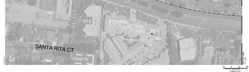
22 Los Altos Avenue COURTYARD BY MARRIOT
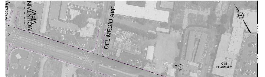
23 Del Medio


24 San Antonio to Showers

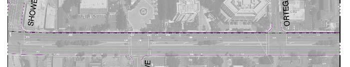
25 Showers to Ortega


26 San Antonio to Showers

27 Showers to Ortega
28 Showers Station in Mixed Flow
29 Showers Station in Mixed Flow


30 Distel to Rengstorff
31 Distel to Rengstorff option 1

32 Distel to Rengstorff option 2

33 Distel to Rengstorff option 3
34 The Decision Process Preliminary Investment Strategy Review by PAB Preliminary concurrence by cities Approval by VTA Board Environmental Review VTA Lead Agency for CEQA Cities comment on ED Caltrans Coordination FTA Small Starts
35 Looking Ahead Council Endorsement Input to future Los Altos General Plan updates Thank you!
36 END
37 Showers Dr Existing 2035 No Project 2035 Project LOS D 36.3 sec average delay LOS E 78.5 sec LOS F sec
38 Dinah s Court Existing 2035 No Project 2035 Project LOS A 5.7 sec average delay LOS B 19.3 sec LOS B 18.7 sec
39 Los Altos Ave Existing 2035 No Project 2035 Project LOS A 9.4 sec average delay LOS B 15.1 sec LOS B 16.5 sec
40 Del Medio Ave Existing 2035 No Project 2035 Project LOS B 13.9 sec average delay LOS D 36.6 sec LOS C 27.0 sec
41 San Antonio Rd Existing 2035 No Project 2035 Project LOS D 52.6 sec average delay LOS F 98.1 sec LOS F 94.2 sec
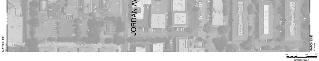
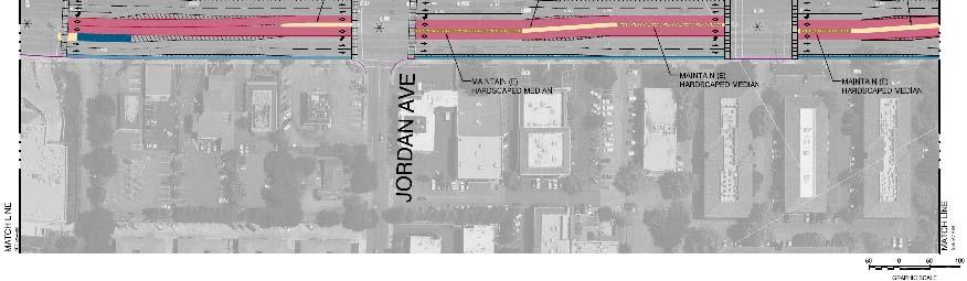
42 Jordan Ave Existing 2035 No Project 2035 Project LOS A 9.5 sec average delay LOS B 17.9 sec LOS B 18.2 sec
43 Ortega Ave Existing 2035 No Project 2035 Project LOS A 6.1 sec average delay LOS A 9.8 sec LOS B 18.1 sec
44 Distel Dr Existing 2035 No Project 2035 Project (option 2,3) LOS A 6.9 sec average delay LOS A 8.5 sec LOS A 9.1 sec
45 Rengstorff Ave Existing 2035 No Project 2035 Project LOS C 23.1 sec average delay LOS D 39.9 sec LOS C 32.4 sec

46 Parking
47 Parking Existing Parking Supply City Mountain View MV/ Los Altos On El Camino Real On Crossstreets Low occupancy east of Rengstorff Off-Street , ,531 Bike Lanes OR Parking on El Camino Real not enough room for both OR Parking
48 Mountain View Draft General Plan Relevant BRT Policies, Statements Mobility Chapter MOB 3.3: Pedestrian and bicycle crossings. Enhance pedestrian and bicycle crossings at key locations MOB 5.4 Connecting key areas. Identify and implement new or enhanced transit services to connect Downtown, El Camino Real, San Antonio, North Bayshore, East Whisman and NASA Ames Research Center MOB 5.5 Access to transit services. Support right-of-way design and amenities consistent with local transit goals to facilitate access to transit services and improve transit as a viable alternative to driving. MOB 9.2 Reduced vehicle miles traveled. Support development and transportation improvements that help reduce greenhouse gas emissions by reducing per capita vehicle miles traveled.
49 Intersection Level of Service
50 Intersection Level of Service Increased left turns
51 Intersection Level of Service Increased WB volume

52 Intersection Level of Service
53 Caltrans Coordination
54 FTA Small Starts Program Alternatives Analysis Study initiation including problem statement and evaluation criteria Development and refinement of alternatives and technical methodologies, including conceptual engineering Analysis and evaluation incl. ridership and cost effectiveness Locally preferred alternative (LPA) $75 million Selection of LPA and AA Report Adopted 2030 RTP including LPA Financial Management Plan Program Management Plan (PMP) Request to Enter PE Preliminary Engineering Final Design Project Construction Grant Agreement Small Starts Report Submittals & Rating EIS incl. Scoping Process Record of Decision (ROD)
55 El Camino BRT Outreach Activities El Camino Real BRT Public Meetings (1 of 3) City/Organization Meeting Date Sunnyvale Sunnyvale City Council March 29, 2011 Sunnyvale Sunnyvale Cool March 30, 2011 Sunnyvale Sunnyvale West Neighborhood Association April 18, 2011 Sunnyvale Sunnyvale Bicycle Pedestrian Advisory Committee May 26, 2011 Palo Alto Palo Alto Bicycle Advisory Committee June 7, 2011 Los Altos Los Altos City Council June 14, 2011 Palo Alto Palo Alto City Council June 20, 2011 Mountain View Mountain View City Council June 21, 2011 GBI Grand Boulevard Task Force June 22, 2011 Mountain View Mountain View Bicycle and Pedestrian Advisory Committee July 27, 2011 Mountain View Mountain View Commission for Sustainable Planning July 29, 2011 VTA VTA Bicycle Pedestrian Advisory Committee August 10, 2011
56 El Camino BRT Outreach Activities El Camino Real BRT Public Meetings (2 of 3) City/Organization Meeting Date Transform El Camino Community Leaders August 15, 2011 El Camino For All Discussion September 21, 2011 San Jose Stroll the Alameda September 25, 2011 Mountain View Open House Sept. 22, 2011 Sunnyvale Open House Sept. 27, 2011 Santa Clara Open House October 18, 2011 Palo Alto Open House October 20, 2011 All Cities Bus Tour October 22, 2011 ACEC American Council of Engineering Companies Santa Clara County Chapter November 7, 2011 San Jose District 6 Leadership Neighborhood Meeting November 29, 2011 Sunnyvale Business Workshop December 5, 2011
57 El Camino BRT Outreach Activities El Camino Real BRT Public Meetings (3 of 3) City/Organization Meeting Date Mountain View Business Workshop December 13, 2011 Santa Clara Santa Clara Chamber of Commerce January 10, 2011 Mountain View City Council Study Session January 17, 2011 Mountain View Planning Commission (EPC) January 18, 2011 Los Altos *City Council Study Session January 24, 2011 VTA *Roundtable Session (Mountain View) January 25, 2011 *Future Meetings
58 BRT Ridership Projections Daily Boardings 2010 Base TSM (2015) TSM (2035) 4+2 (2035)* 4+2/6+2 (2035)** Rapid 522/BRT 522 3,035 7,315 12,085 22,717 23,189 Line 22 10,946 9,916 8,750 15,681 15, ,981 17,231 20,835 38,398 39,179 *4 general lanes, 2 dedicated lanes from Lafayette to Showers **4 general lanes, 2 dedicated lanes from Lafayette to Lawrence & 6 general lanes, 2 dedicated lanes from Lawrence to Showers
59 Tipping Point Analysis Optimized Transit Project Option Location of Dedicated Lanes Ded. Lane Miles Highest Ridership Lowest Travel Time Lowest Net O&M Cost Lowest Capital Cost Lowest Annualized Cost Per Boarding Total Benefits Sum of Rankings Total Benefits Ranking Optimized Showers to Lafayette BRT 500 Showers to Lafayette (5 min) Option C Bernardo to Lafayette Option D Option F Option E Option A Option B Showers to Bernardo and Wolfe to Portola Embarcadero to Showers and Halford to Lafayette Showers to Bernardo and Halford to Lafayette Halford to Lafayette; No Build north of Halford Halford to Lafayette; mixed flow north of Halford
60 Bay Area BRT FTA Funding for Bay Area BRT Project Total Allocated through 2012 Total Requested Oakland, East Bay BRT $47.4M $75M SF, Van Ness BRT $45.4M $75M Fresno, FAX Blackstone BRT $17.8M $38.5M State Funding $90 Million Prop 1B for Santa Clara Alum Rock BRT
61 ü6
62 Bay Area BRT
63 Optimized Transit Project Option Location of Dedicated Lanes Ded. Lane Miles Highest Ridership Lowest Travel Time Lowest Net O&M Cost Lowest Capital Cost Lowest Annualized Cost Per Boarding Total Benefits Ranking Optimized Showers to Lafayette BRT 500 Showers to Lafayette (5 min) Option C Bernardo to Lafayette Option D Option F Option E Option A Option B Showers to Bernardo and Wolfe to Portola Embarcadero to Showers and Halford to Lafayette Showers to Bernardo and Halford to Lafayette Halford to Lafayette; No Build north of Halford Halford to Lafayette; mixed flow north of Halford
64 Analysis of Options
65 Analysis of Options Walk the alignment
66 Analysis of Options Walk the alignment
67 Analysis of Options Walk the alignment
68 Analysis of Options Walk the alignment
69 Analysis of Options Walk the alignment


70 Hybrid Vehicle Walk the alignment

71 Enhanced Stations Walk the alignment

72 Station Photosimulations El Camino Real and Scott Blvd in Santa Clara Existing

73 Station Photosimulations El Camino Real and Scott Blvd in Santa Clara Opening Day with BRT

74 Station Photosimulations El Camino Real and Scott Blvd in Santa Clara Future Buildout
75 Station Photosimulations El Camino Real and Castro Street Existing

76 Station Photosimulations El Camino Real and Castro Street Opening Day with BRT

77 Station Photosimulations El Camino Real and Castro Street Potential Future Buildout

78 Station Photosimulations El Camino Real and California Avenue in Palo Alto Existing
79 Station Photosimulations El Camino Real and California Avenue in Palo Alto Opening Day with BRT
80 Does BRT compete with Caltrain? No. Caltrain and the Valley Rapid service serve different types of travel markets. The Valley Rapid service focuses on short and medium range, all- day trips while Caltrain focuses on commute periods and longer trips. Caltrain is projected to have more riders than the system will be able to carry. Some of the overflow could be served by Valley Rapid.
81 What Happens to Traffic BRT helps to mitigate congestion that may result from intensification of land uses 2035 Base Enhanced Transit Moderate Land Use Enhanced Transit Moderate Land Use Enhanced Land Use Enhanced Transit Enhanced Land Use
Bus Rapid Transit on Silicon Valley s El Camino Real: Working Together to Create a Grand Boulevard Steven Fisher
 Bus Rapid Transit on Silicon Valley s El Camino Real: Working Together to Create a Grand Boulevard Steven Fisher Senior Transportation Planner Santa Clara Valley Transportation Authority San Jose, CA How
EL CAMINO REAL BUS RAPID TRANSIT (BRT) PROJECT
 PROJECT") Agenda Item #4.2 EL CAMINO REAL BUS RAPID TRANSIT (BRT) PROJECT VTA BOARD WORKSHOP MAY 1, 2015 ABOUT THIS PRESENTATION CONTEXT Existing conditions and planning for growth WHAT IS THE PROJECT? Project alternatives
Agenda Item #4.2 EL CAMINO REAL BUS RAPID TRANSIT (BRT) PROJECT VTA BOARD WORKSHOP MAY 1, 2015 ABOUT THIS PRESENTATION CONTEXT Existing conditions and planning for growth WHAT IS THE PROJECT? Project alternatives
Purpose and Need. Chapter Introduction. 2.2 Project Purpose and Need Project Purpose Project Need
 Chapter 2 Purpose and Need 2.1 Introduction The El Camino Real Bus Rapid Transit (BRT) Project (Project) would make transit and other transportation improvements along a 17.6-mile segment of the El Camino
El Camino Real. Dear Transit, You Complete me. Love, The Street. Kevin Connolly Transit Planning Manager, Valley Transportation Authority
 El Camino Real Dear Transit, You Complete me. Love, The Street Kevin Connolly Transit Planning Manager, Valley Transportation Authority November 2012 BUS RAPID TRANSIT El Camino Real Plan/Eng: 2010-2014
Cedric Novenario, Interim Public Works Director. El Camino Real Bus Rapid Transit Draft Environmental Impact Report/ Environmental Assessment
 DATE: January 13, 2015 AGENDA ITEM # 7 TO: FROM: SUBJECT: City Council Cedric Novenario, Interim Public Works Director El Camino Real Bus Rapid Transit Draft Environmental Impact Report/ Environmental
EL CAMINO REAL BUS RAPID TRANSIT PROJECT
 EL CAMINO REAL BUS RAPID TRANSIT PROJECT Would upgrade the current 522 Rapid Bus to BRT status by making changes to El Camino Real and The Alameda that make transit FAST, FREQUENT AND RELIABLE and make
ALTERNATIVES ANALYSIS EXECUTIVE SUMMARY
 West Valley Connector Corridor ALTERNATIVES ANALYSIS EXECUTIVE SUMMARY FINAL September 2014 Ontario International Airport Ontario Mills Rancho Cucamonga Metrolink Station Kaiser Permanente PARSONS EXECUTIVE
Van Ness Avenue BRT Overview and Scoping Process. Geary BRT CAC January 8, 2009
 Van Ness Avenue BRT Overview and Scoping Process Geary BRT CAC January 8, 2009 VAN NESS AVENUE S ROLE Identified in Prop K for BRT treatment Muni 47 and 49; 19 operates on Polk 20,000 daily riders on Van
Van Ness Avenue Bus Rapid Transit (BRT) San Francisco Environment Commission Policy Committee
 San Francisco Environment Commission Policy Committee") Van Ness Avenue Bus Rapid Transit (BRT) San Francisco Environment Commission Policy Committee 04.30.12 Van Ness Avenue BRT Project Background Key north-south link in San Francisco s Rapid Transit network
Van Ness Avenue Bus Rapid Transit (BRT) San Francisco Environment Commission Policy Committee 04.30.12 Van Ness Avenue BRT Project Background Key north-south link in San Francisco s Rapid Transit network
POTENTIAL SANTA CLARA COUNTY TRANSPORTATION MEASURE
 POTENTIAL SANTA CLARA COUNTY TRANSPORTATION MEASURE OVERALL DRAFT EXPENDITURE PLAN TRANSIT/Mode Shift Millions % BART to Downtown San Jose/Santa Clara* 1,400 23% Caltrain Capacity & Safety 1,014 17% Mass
TRANSPORTATION MASTER PLAN Review Citywide Recommendations, Updated List and Scoring Methodology December 6, 2018
 NOTE: Due to lengthy Committee discussion and allotted meeting time, slides 12-35 were not presented at the meeting, but are provided here for reference. TRANSPORTATION MASTER PLAN Review Citywide Recommendations,
TRANSPORTATION TRAINING TOPICS. April 6, 2010
 TRANSPORTATION TRAINING TOPICS April 6, 2010 Roles of Transportation Providers Context and Policy Makers Division of Transportation and Traffic Other City Operations Other Transportation Operators CMA
Dear City Council Members,
 From: Bob Kenyon [mailto: ] Sent: Monday, February 08, 2016 10:20 AM To: City Clerk Subject: Please prioritize Caltrain and a complete transit network Thank you for prioritizing bringing BART to San Jose
SANTA CLARA COUNTYWIDE BICYCLE PLAN August 2008
 SANTA CLARA COUNTYWIDE BICYCLE PLAN August 2008 To assist VTA and Member Agencies in the planning, development and programming of bicycle improvements in Santa Clara County. Vision Statement To establish,
FROM: CITY MANAGER DEPARTMENT: PLANNING AND COMMUNITY ENVIRONMENT DATE: OCTOBER 4, 2004 CMR:432:04
 TO: HONORABLE CITY COUNCIL FROM: CITY MANAGER DEPARTMENT: PLANNING AND COMMUNITY ENVIRONMENT DATE: OCTOBER 4, 2004 CMR:432:04 SUBJECT: FINANCE COMMITTEE RECOMMENDATION TO ADOPT TRANSPORTATION STRATEGIC
Presentation of Staff Draft March 18, 2013 COUNTYWIDE TRANSIT CORRIDORS FUNCTIONAL MASTER PLAN
 Presentation of Staff Draft March 18, 2013 COUNTYWIDE TRANSIT CORRIDORS FUNCTIONAL MASTER PLAN Public Outreach Fall 2011: Two community meetings/open houses Fall 2012: Three community meetings/open houses
Santa Clara I-280 CORRIDOR STUDY
 Santa Clara I-280 CORRIDOR STUDY OCTOBER 2017 PREPARED BY: 1.1 Background The I-280 Corridor Study within Santa Clara County is a high-level highway planning study led by the Santa Clara VTA, in partnership
Beach Cities Living Streets Design Manual and Aviation Boulevard Multimodal Corridor Plan
 Beach Cities Living Streets Design Manual and Aviation Boulevard Multimodal Corridor Plan AGENDA 1 Introductions & Project Scope 2 Public Outreach Recap 3 Living Streets Design Manual 4 Aviation Boulevard
Bus Rapid Transit Plans
 Twin Cities Region Bus Rapid Transit Plans ULI Minnesota Workshop Connecting Bus Rapid Transit to the Community December 15, 2009 John Levin Director of Service Development Metro Transit Metropolitan Area
ROUTES 55 / 42 / 676 BUS RAPID TRANSIT LOCALLY PREFERRED ALTERNATIVE
 ROUTES 55 / 42 / 676 BUS RAPID TRANSIT LOCALLY PREFERRED ALTERNATIVE April, 2012 1 INTRODUCTION The need for transit service improvements in the Routes 42/55/676 corridor was identified during the Southern
Caltrain Bicycle Parking Management Plan DRAFT PROJECT SCOPE SUBMITTED TO CALTRANS FALL 2014
 Caltrain Bicycle Parking Management Plan DRAFT PROJECT SCOPE SUBMITTED TO CALTRANS FALL 2014 NOTE: The following draft scope of work was developed by Caltrain in the fall of 2014 as part of a Caltrans
Bus Rapid Transit ALTERNATIVES ANALYSIS. Open House
 Bus Rapid Transit ALTERNATIVES ANALYSIS Open House June 23, 2015 Open House Meeting Agenda Agenda Introductions What is BRT? Project Goals Study Tasks Next steps Discussion PVTA Bus Rapid Transit Study
ALTERNATIVES SCREENING REPORT
 VAN NESS AVENUE BUS RAPID TRANSIT (BRT) ALTERNATIVES SCREENING REPORT Revised Draft, 3/28/08 San Francisco County Transportation Authority 1 Introduction The San Francisco County Transportation Authority
Scottsdale Road/Rural Road Alternatives Analysis (AA) Study. Arizona ITE/IMSA Spring Conference March 7, 2012
 Study. Arizona ITE/IMSA Spring Conference March 7, 2012") Scottsdale Road/Rural Road Alternatives Analysis (AA) Study Arizona ITE/IMSA Spring Conference March 7, 2012 Study Location and Duration Primary Study Corridor (major focus of effort) Rural Road and Scottsdale
Scottsdale Road/Rural Road Alternatives Analysis (AA) Study Arizona ITE/IMSA Spring Conference March 7, 2012 Study Location and Duration Primary Study Corridor (major focus of effort) Rural Road and Scottsdale
Community Task Force July 25, 2017
 Community Task Force July 25, 2017 Welcome and Introductions Project Partners Regional Transportation District (RTD) Colorado Department of Transportation (CDOT) Denver Regional Council of Governments
4. ENVIRONMENTAL IMPACT ANALYSIS 9. TRANSPORTATION AND TRAFFIC
 4. ENVIRONMENTAL IMPACT ANALYSIS 9. TRANSPORTATION AND TRAFFIC 4.9.1 INTRODUCTION The following section addresses the Proposed Project s impact on transportation and traffic based on the Traffic Study
BRT for Berkeley A Proposal for Consideration
 BRT for Berkeley A Proposal for Consideration CITY OF BERKELEY STAFF PROPOSAL FOR A LOCALLY PREFERRED ALTERNATIVE OF THE EAST BAY BUS RAPID TRANSIT PROJECT SEPTEMBER 8, 2009 Table of Contents Executive
Technical Working Group November 15, 2017
 Technical Working Group November 15, 2017 Welcome and Introductions Project Partners Regional Transportation District (RTD) Colorado Department of Transportation (CDOT) Denver Regional Council of Governments
INTRODUCTION. The focus of this study is to reduce congestion and improve mobility for all modes of transportation. Figure ES-1 Study Corridor Map
 INTRODUCTION The I-280 Corridor Study is a highway planning study led by Santa Clara VTA, in partnership with the City of Cupertino and in coordination with other stakeholders in the study area. The study
MOBILITY WORKSHOP. Joint City Council and Transportation Commission May 5, 2014
 MOBILITY WORKSHOP Joint City Council and Transportation Commission May 5, 2014 Review of General Plan M-1 Develop world-class transit system M-3 Maintain/enhance pedestrian-oriented City M-4 Create comprehensive
Metropolitan Council Transportation Committee
 Nicollet-Central Transit Alternatives Metropolitan Council Transportation Committee August 2013 Project Purpose (approved by Policy Advisory Committee 10/25/2012) The purpose is to improve transit connectivity,
VTA Development Review Program Annual Report for 2015
 VTA Development Review Program Annual Report for 2015 Web Version May 13, 2016 Presentation Outline I. Background II. Data Snapshot a. Development Review Activity for 2015 b. Select Projects Under Construction
San Jose Transportation Policy
 San Jose Transportation Policy Protected Intersections in LOS Policies to Support Smart Growth Presented by: Manuel Pineda City of San Jose Department of Transportation Bay Area Map San Francisco Oakland
San Mateo County Comprehensive Bicycle and Pedestrian Plan Open House
 San Mateo County Comprehensive Bicycle and Pedestrian Plan Open House October 28, 2010 Presented to San Mateo County residents and interested parties by Lauren Ledbetter, Alta Planning + Design Matt Haynes,
Draft MOBILITY ELEMENET. Community Meeting May 22, 2013
 Draft MOBILITY ELEMENET Community Meeting May 22, 2013 Agenda Presentation Ira Brown New Mobility Paradigm Movement of People Implementation Q&A Ira Brown and Dave Roseman Small Group Discussion at Each
Los Altos Hills Town Council - June 18, 2015 Palo Alto City Council June 22, AGENDA ITEM #2.B Presentation
 Los Altos Hills Town Council - June 18, 2015 Palo Alto City Council June 22, 2015 AGENDA ITEM #2.B Presentation Previous Presentations Los Altos Hills Town Council in May 2014 and February 2015 Palo Alto
Development Review Program Annual Report 2016
 Development Review Program Annual Report 2016 Web version Spring 2017 http://museumplacesanjose.com/ http://www.elcaminohospital.org City of Campbell Council Agenda Packet 9/13/16 Gunter Lofts Development
Item B1 November 19, 2009
 November 19, 2009 Planning and Development Department Land Use Planning Division DATE: November 19, 2009 STAFF REPORT TO: FROM: SUBJECT: Members of the Transportation Commission Elizabeth Greene Senior
Arterial Transitway Corridors Study. Ave
 Arterial Transitway Corridors Study Ave January 2012 Arterial Transitway Corridors Study Overview Corridor Features and Demographics 11 study corridors, 95 route miles 86,000 daily rides and half of existing
Geary Corridor Bus Rapid Transit: Staff-Recommended Alternative
 Geary Corridor Bus Rapid Transit: Staff-Recommended Alternative Urban Forestry Council January 24, 2014 SAN FRANCISCO COUNTY TRANSPORTATION AUTHORITY SAN FRANCISCO MUNICIPAL TRANSPORTATION AGENCY Today
I-35W Solutions Alliance Project Update July 13, 2017
 Title I-35W Solutions Alliance Project Update July 13, 2017 Evaluating the potential for Bus Rapid Transit and MnPASS Express Lanes in the southwest Metro, Investigating options for improved bus service
lowercase tod Rail~Volution October 22, 2013 Melanie Hare
 lowercase tod Rail~Volution October 22, 2013 Melanie Hare mhare@urbanstrategies.com overview 1 the challenge 2 on the ground 3 strategies the challenge suburban cities planning for re-urbanization and
4.12 Transportation and Traffic
 This section describes the environmental and regulatory setting for transportation and traffic. It also describes impacts related to transportation and traffic that would result from implementation of
Better Market Street. Engineering, Maintenance & Safety Committee (EMSC) February 28, 2018
 February 28, 2018") Better Market Street Engineering, Maintenance & Safety Committee (EMSC) February 28, 2018 1 Market Street Market Street - San Francisco by rulenumberone2 2 Market Street is the... City s busiest pedestrian
Better Market Street Engineering, Maintenance & Safety Committee (EMSC) February 28, 2018 1 Market Street Market Street - San Francisco by rulenumberone2 2 Market Street is the... City s busiest pedestrian
Topics To Be Covered. Summarize Tier 2 Council Direction Discuss Mill and Ash Alternatives Next Steps
 Topics To Be Covered Summarize Tier 2 Council Direction Discuss Mill and Ash Alternatives Next Steps Tier 2 Council Direction Dismiss Bus Rapid Transit along the Union Pacific Railroad Dismiss Bus Rapid
Memorandum. Fund Allocation Fund Programming Policy/Legislation Plan/Study Capital Project Oversight/Delivery Budget/Finance Contract/Agreement Other:
 Memorandum Date: November 20, 2017 To: Transportation Authority Board From: Eric Cordoba Deputy Director Capital Projects Subject: 12/5/17 Board Meeting: San Francisco Freeway Corridor Management Study
Appendix A-2: Screen 1 Alternatives Report
 Appendix A-2: Screen 1 Alternatives Report SCREEN 1 ALTERNATIVES REPORT Western & Ashland Corridors Bus Rapid Transit (BRT) Project Prepared for Chicago Transit Authority 567 West Lake Street Chicago,
Foothill Expressway Improvements Between El Monte and San Antonio
 Foothill Expressway Improvements Between El Monte and San Antonio June 29, 2017 - Los Altos Community Meeting Introduction Project Background Agenda Visit Stations: Provide Input and Ask Questions Reconvene:
Transportation Master Plan Advisory Task Force
 Transportation Master Plan Advisory Task Force Network Alternatives & Phasing Strategy February 2016 BACKGROUND Table of Contents BACKGROUND Purpose & Introduction 2 Linking the TMP to Key Council Approved
San Tomas Expressway
 Implementation Plan San Tomas Expressway Roads and Airports Department August 19, 2003 Implementation Plan San Tomas Expressway County of Santa Clara Roads and Airports Department 101 Skyport Drive San
Central Freeway and Octavia Circulation Study
 Central Freeway and Octavia Circulation Study Final Report Plans and Programs Committee San Francisco County Transportation Authority September 18, 2012 Presentation Outline Background and Study Purpose
PURPOSE AND NEED SUMMARY 54% Corridor Need 1. Corridor Need 2. Corridor Need 3. Corridor Need 4. Corridor Need 5
 SUMMARY PURPOSE AND NEED Chapel Hill Transit ridership has increased Buses operate every 4 minutes and have standing room only Exceeding seated capacity by 12% Corridor Need 1 by more than 20 percent between
Scope of the Transit Priority Project
 Transit Planning Committee #1 March 19, 2015 Scope of the Transit Priority Project Review of the 2010 plan Analysis of Transit Priority Measures Preliminary plans for rapid transit Recommendations for
In station areas, new pedestrian links can increase network connectivity and provide direct access to stations.
 The Last Mile Planning for Pedestrians Planning around stations will put pedestrians first. Making walking to stations safe and easy is important; walking will be a part of every rapid transit Accessible
Berkeley Strategic Transportation Plan A-76
 Berkeley Strategic Transportation Plan A-76 Appendices 1. A Team Effort 2. Where We ve Been A-11 Berkeley Strategic Transportation Plan Alameda County Transportation Plan Alameda County will be served
Corridor Advisory Group and Task Force Meeting #10. July 27, 2011
 Corridor Advisory Group and Task Force Meeting #10 July 27, 2011 1 Agenda Recap CAG/TF #9 Public Meeting #2 Summary Single Mode Alternatives Evaluation Results Next Steps 2 3 CAG/TF #9 Recap CAG /TF #9
EXECUTIVE SUMMARY... vii 1 STUDY OVERVIEW Study Scope Study Area Study Objectives
 Contents EXECUTIVE SUMMARY... vii 1 STUDY OVERVIEW... 1-1 1.1 Study Scope... 1-1 1.2 Study Area... 1-1 1.3 Study Objectives... 1-3 2 EXISTING CONDITIONS... 2-1 2.1 Existing Freeway Conditions... 2-4 2.1.1
Moving Cambridge. City of Cambridge Transportation Master Plan Public Consultation Centre. March 7, :00 8:00 PM.
 City of Cambridge Transportation Master Plan Public Consultation Centre March 7, 2018 5:00 8:00 PM Region of Waterloo City of Cambridge Transportation Master Plan Public Consultation Centre March 7, 2018
Community Task Force November 15, 2017
 Community Task Force November 15, 2017 Welcome and Introductions Project Partners Regional Transportation District (RTD) Colorado Department of Transportation (CDOT) Denver Regional Council of Governments
Magnolia Place. Traffic Impact Analysis. Prepared for: City of San Mateo. Prepared by: Hexagon Transportation Consultants, Inc.
 Magnolia Place Traffic Impact Analysis Prepared for: City of San Mateo Prepared by: Hexagon Transportation Consultants, Inc. Updated January 4, 2010 Table of Contents 1. Introduction...1 2. Existing Conditions...6
South King County High-Capacity Transit Corridor Study
 HIGH-CAPACITY TRANSIT CORRIDOR STUDY South King County Corridor South King County High-Capacity Transit Corridor Study Corridor Report August 2014 South King County High Capacity Transit Corridor Report
modes, the increased roadway capacity is the implied solution, which, in turn, has been shown to lead to more driving (induced demand).
.") EXECUTIVE SUMMARY A. Introduction The San Francisco Congestion Management Program (CMP) is a biennial program conducted in accordance with state law to monitor congestion and adopt plans for mitigating
EXECUTIVE SUMMARY A. Introduction The San Francisco Congestion Management Program (CMP) is a biennial program conducted in accordance with state law to monitor congestion and adopt plans for mitigating
EMU Procurement Seats/Standees/Bikes/Bathroom
 EMU Procurement Seats/Standees/Bikes/Bathroom Board of Directors June 4, 2015 Agenda Item 7b Purpose Seats / standees / bikes / bathroom balance Develop framework for Draft EMU RFP Feedback on car configuration
Eliminate on-street parking where it will allow for a dedicated bus only lane %
 Traffic Dashboard Priorities Survey Responses Introduction 1) Are you familiar with bus rapid transit (BRT)? a. No, BRT is new to me. 597 23.5% b. I ve heard of BRT, but I don t know much about it. 1,136
2016 Annual Passenger Counts
 2016 Annual Passenger Counts Board of Directors May 5, 2016 Agenda Item 17 Presentation Outline Purpose and Count Methodology 2016 Challenges 2016 Count Results Summary Next Steps 2 1 Purpose of Ridership
 MEMORANDUM - CITY OF PASADENA Department Of Transportation DATE: OCTOBER 21, 2008 TO: ENVIRONMENTAL ADVISORY COMMISSION FROM: ~ FRED C. DOCK, DIRECTOR OF TRANSPORTATION SUBJECT: UPDATE ON DEPT. OF TRANSPORTATION
Key objectives of the survey were to gain a better understanding of:
 3 COMMUNITY INPUT Community input is an essential part of corridor studies. For the SR 87 corridor study, VTA staff conducted an extensive online survey of people living and commuting along the corridor.
Spring Lake Park Mounds View North Oaks. Arden Hills. Shoreview. Roseville. Little Canada. Falcon Heights SNELLING. Lilydale. West Saint Paul 35E
 Coon Rapids Blaine Spring Lake Park Mounds View rth Oaks In 2011, Metro Transit embarked on the Arterial 494 Minnetonka Maple Grove Plymouth Hopkins Brooklyn Park New Hope Golden Valley Louis Park Edina
Good TOD. July 7, 2016 SPUR
 Good TOD July 7, 2016 SPUR Caltrain TOD Context: Growing Demand For Service Extraordinary Ridership Growth Projected Continued Growth High Speed Rail Service on the Peninsula Increasing Land Use Intensities
San Mateo County Comprehensive Bicycle and Pedestrian Plan
 San Mateo County Comprehensive Bicycle and Pedestrian Plan August 26, 2010 Presented to the San Mateo County BPAC by Lauren Ledbetter, Alta Planning + Design in association with: Fehr & Peers Eisen Letunic
Expansion of Bike Share within San Jose supports the City's ambitious mode shift goals to have 15% of commute trips completed by bicycles by 2040.
 COUNCIL AGENDA: 12/01/15 ITEM: 4 CITY OF SAN JOSE CAPITAL OF SILICON VALLEY TO: HONORABLE MAYOR AND CITY COUNCIL SUBJECT: BAY AREA BIKE SHARE EXPANSION Memorandum FROM: Jim Ortbal DATE: Approved Date irftt/ls'
WELCOME! Please complete a comment sheet as we value your feedback. 4 pm to 8 pm. September 15, Hosted by: AECOM on behalf of City of Calgary
 WELCOME! Thank you for attending our open house. There will be no formal presentation today so please take the time to read the boards. If you have any questions, please do not hesitate to approach one
Arterial Transitway Corridors Study
 Arterial Transitway Corridors Study February 2012 Arterial Transitway Corridors Study Overview Corridor Features and Demographics 11 study corridors, 95 route miles Routes: 86,000 daily rides and half
North Shore Transportation Improvement Strategy
 North Shore Transportation Improvement Strategy Preliminary, Near-term Recommendation 2016 April Transportation Improvement Strategy (TIS) Comprehensive and Analytical A multi-modal transportation strategy
Protected Bike Lanes in San Francisco Mike Sallaberry SFMTA NACTO Workshop - Chicago IL
 Protected Bike Lanes in San Francisco Mike Sallaberry SFMTA 10 14 2011 NACTO Workshop - Chicago IL San Francisco 2 nd Highest Density in the U.S. 47 square miles Mild Climate Market Population ~810,000
I-105 Corridor Sustainability Study (CSS)
") I-105 Corridor Sustainability Study (CSS) Metro Streets and Freeways Subcommittee March 21, 2019 Gary Hamrick Cambridge Systematics, Inc. I-105 CSS Project History & Background Funded by Caltrans Sustainable
I-105 Corridor Sustainability Study (CSS) Metro Streets and Freeways Subcommittee March 21, 2019 Gary Hamrick Cambridge Systematics, Inc. I-105 CSS Project History & Background Funded by Caltrans Sustainable
FOR INFORMATION ONLY
 9 Date: August 6, 2012 Current Meeting: August 16, 2012 Board Meeting: September 6, 2012 BOARD MEMORANDUM TO: THROUGH: FROM: SUBJECT: Santa Clara Valley Transportation Authority Congestion Management Program
Chapter 3 BUS IMPROVEMENT CONCEPTS
 Chapter 3 BUS IMPROVEMENT CONCEPTS The purpose of this chapter is to describe potential bus improvement strategies and potential impacts or implications associated with BRT implementation within the existing
Dr. M.L. King, Jr. Street North Complete Streets Resurfacing Opportunities HOUSING, LAND USE, AND TRANSPORTATION COMMITTEE MARCH 22, 2018
 Dr. M.L. King, Jr. Street North Complete Streets Resurfacing Opportunities HOUSING, LAND USE, AND TRANSPORTATION COMMITTEE MARCH 22, 2018 What s Happening The City plans to mill and resurface Dr. M.L.
Dumbarton Transportation Corridor Study. San Francisco Bay ITE November 2016
 Dumbarton Transportation Corridor Study San Francisco Bay ITE November 2016 Dumbarton Corridor Source: Wikipedia 2 Dumbarton Corridor 3 Growth Imbalance Jobs-housing imbalance Major employers driving growth
DRAFT. Memo. Range of the Alternatives Considered in the EIS
 Memo Date: Friday, December 09, 2016 Project: To: From: Subject: State Route 30 EIS UDOT Vince Izzo This memorandum summarizes the draft State Route (S.R.) 30 Level 1 screening results. A more detailed
Expressway Plan 2040 Fact Sheet
 Expressway Plan 2040 Fact Sheet AGENDA ITEM #2.B Expressway Plan 2040 is the successor to the 2003 Comprehensive County Expressway Planning Study and 2008 Update. The 2003 Study developed and documented
General Plan Circulation Element Update Scoping Meeting April 16, 2014 Santa Ana Senior Center, 424 W. 3rd Street, Santa Ana, CA 92701
 General Plan Circulation Element Update Scoping Meeting April 16, 2014 Santa Ana Senior Center, 424 W. 3rd Street, Santa Ana, CA 92701 Meeting Agenda 1. Purpose of Scoping Meeting 2. Project Overview 3.
Highway 17 Transportation Improvement Study
 Final Report Highway 17 Transportation Improvement Study prepared for Santa Cruz County Regional Transportation Commission (SCCRTC) prepared by Planning and Engineering, Inc. 1155 North First Street, Suite
VISION Long Range Plan Update Board Workshop. February 10, 2016
 VISION 2040 Long Range Plan Update Board Workshop February 10, 2016 Vision 2040 Key Milestones UNDERSTAND THE NEED IDENTIFY A RANGE OF OPTIONS EVALUATE COMMUNITY OPTIONS DEFINE PROJECTS & PLANS Vision
East San Fernando Valley Transit Corridor. Draft EIS/EIR Public Hearing (September 1 thru October 16, 2017
 East San Fernando Valley Transit Corridor Draft EIS/EIR Public Hearing (September 1 thru October 16, 2017 1 Public Comments Release of Draft EIS/EIR September 1, 2017 through October 16, 2017 45-day Public
REDWOOD CITY STREETCAR - ALTERNATIVES ANALYSIS
 REDWOOD CITY STREETCAR - ALTERNATIVES ANALYSIS The purpose of this document is to ennumerate the analysis of alternatives for a streetcar along the Broadway Corriodor of Redwood City. The six alternatives
Moving Ahead. (Community Engagement) Chapter Three
 Chapter Three") 3 Community Chapter Three Moving Ahead (Community Engagement) engagement provided an exciting opportunity to engage Redwood City residents, workers, and business owners people who walk, bike, take transit,
3 Community Chapter Three Moving Ahead (Community Engagement) engagement provided an exciting opportunity to engage Redwood City residents, workers, and business owners people who walk, bike, take transit,
For Lease. 940 Old County Rd. Belmont, CA DO NOT DISTURB TENANT. New listing ±2,750 SF. Available now. Flexible lease terms. Extensive glass line
 940 Old County Rd Belmont, CA New listing ±2,750 SF Available now Flexible lease terms Extensive glass line New furniture could be made available Completely remodeled interior and exterior Large conference
2018 Annual Passenger Counts. Board of Directors September 6, 2018 Agenda Item #11
 2018 Annual Passenger Counts Board of Directors September 6, 2018 Agenda Item #11 Presentation Outline Purpose of Annual Count Count Methodology 2018 Challenges 2018 Count Results Weekday Weekend Summary
Public Consultation Centre
 Region of Waterloo Transportation Master Plan Update Public Consultation Centre See the Information Package on how to contact the Project Team and complete the Comment Sheet www.regionofwaterloo.ca/en/exploring-the-region/transportation-master-plan.aspx
Afeasibility study to evaluate bus rapid transit service in the East-West Corridor connecting major employment and activity centers between downtown
 East-West Bus Rapid Transit Feasibility Study Update and Recommended Locally Preferred Alternative (LPA) Summary City of Wauwatosa, Transportation Affairs Committee June 2016 Afeasibility study to evaluate
North Hollywood to Pasadena BRT Corridor Technical Study. Eco-Rapid Transit/Orange Line Development Authority March 8, 2017
 North Hollywood to Pasadena BRT Corridor Technical Study Eco-Rapid Transit/Orange Line Development Authority March 8, 2017 Agenda 1. Background 2. Corridor Review 3. Key Challenge 4. Preliminary BRT Alignments
Public Comment Meeting Geary BRT Project Draft Environmental Impact Statement/Report
 Public Comment Meeting Geary BRT Project Draft Environmental Impact Statement/Report Open House and Opportunity to Provide Comments Public comments can be submitted to the court reporter stationed in the
REVIEW OF LOCAL TRAFFIC FLOW / LONG RANGE PLANNING SOLUTIONS STUDY
 ITEM Town of Atherton TRANSPORTATION COMMITTEE STAFF REPORT TO: FROM: MEMBERS OF THE COMMITTEE ROBERT OVADIA, PUBLIC WORKS DIRECTOR DATE: FEBRUARY 12, 2019 SUBJECT: REVIEW OF LOCAL TRAFFIC FLOW / LONG
Geary Corridor Bus Rapid Transit SFMTA Citizens Advisory Committee
 Geary Corridor Bus Rapid Transit SFMTA Citizens Advisory Committee Project Update SAN FRANCISCO COUNTY TRANSPORTATION AUTHORITY SAN FRANCISCO MUNICIPAL TRANSPORTATION AGENCY August 6, 2015 Project Overview
Appendix A-K Public Information Centre 2 Materials
 Appendix A-K Public Information Centre 2 Materials Our Rapid Transit Initiative Make an impact on the future of transit Join the discussion on Rapid Transit in London You re invited to a Public Information
modes, the increased roadway capacity is the implied solution, which, in turn, has been shown to lead to more driving (induced demand).
.") CONGESTION MANAGEMEN T PROGRAM DECEMBER, 201 7 EXECUTIVE SUMMARY A. Introduction Every two years, the San Francisco County Transportation Authority (SFCTA) prepares the San Francisco Congestion Management
CONGESTION MANAGEMEN T PROGRAM DECEMBER, 201 7 EXECUTIVE SUMMARY A. Introduction Every two years, the San Francisco County Transportation Authority (SFCTA) prepares the San Francisco Congestion Management
BD RESOLUTION NO RESOLUTION ADOPTING THE VISION ZERO RAMP INTERSECTION STUDY PHASE 1
 BD00 RESOLUTION NO. - RESOLUTION ADOPTING THE VISION ZERO RAMP INTERSECTION STUDY PHASE [NTIP PLANNING] FINAL REPORT WHEREAS, The Vision Zero Ramp Intersection Study Phase was recommended by Commissioner
A Selection Approach for BRT Parking Lots Nicolls Road Corridor Parking Study
 A Selection Approach for BRT Parking Lots Nicolls Road Corridor Parking Study Chirantan Kansara, P.E. Engineering Construction Design Planning 2018 ITE Northeastern District Annual Meeting Lake George,