Public Transport and NMT Facilities in Santiago, Chile
|
|
|
- Sybil Flowers
- 6 years ago
- Views:
Transcription

1 Public Transport and NMT Facilities in Santiago, Chile
2 Transantiago BRT System
. Transantiago was operated since 2007.")

3 Transantiago BRT System Transantiago is under El Directorio de Transporte Público Metropolitano (DTPM) serving 32 areas in Satiago, Puente Alto and San Bernardo (680 km2). Transantiago was operated since Operated by 7 companie, which each companies have different bus colors. Most of buses operate 24 hours. Total routes: 391 routes Number of fleet: bus Demand: 3,3 million per day The buses use low deck bus The Direct-Service buses use existing public buses, so they have curb side door Number of seat: ± 25 seats

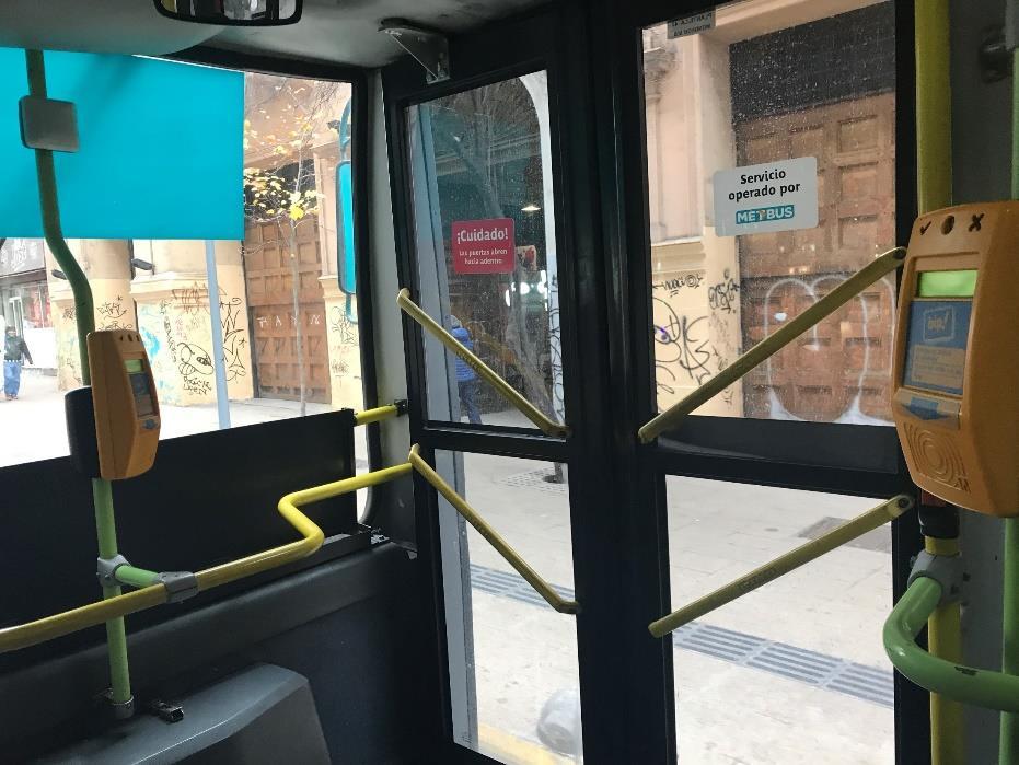
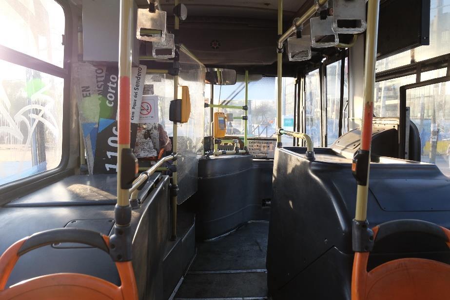
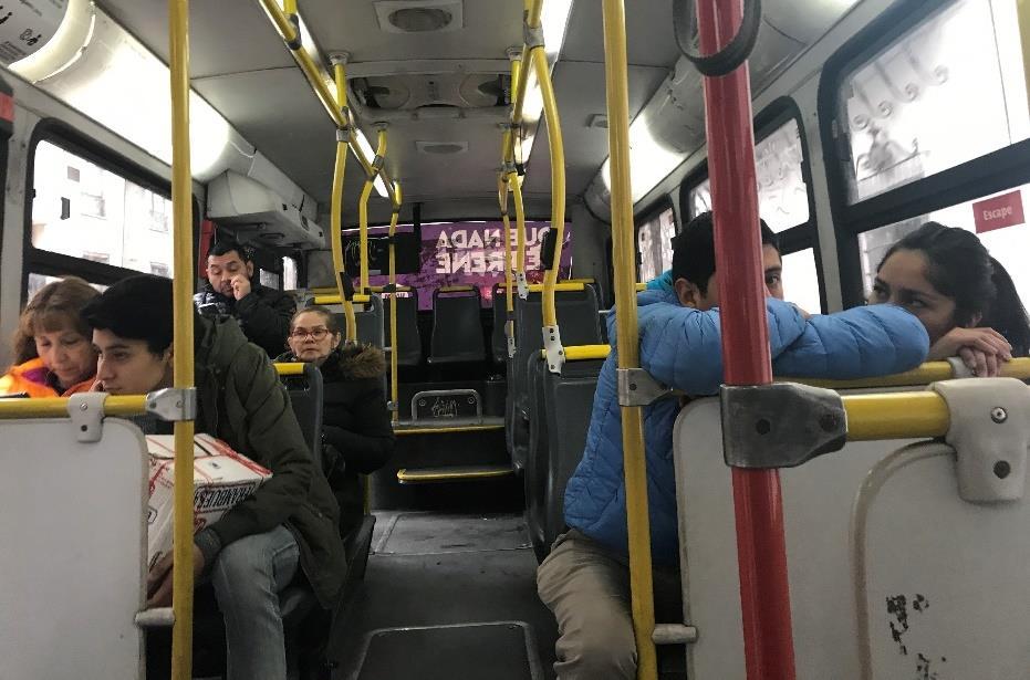
4 Current Condition Inside Transantiago Bus
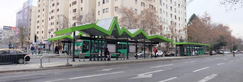
5 Transantiago Station in Corridor

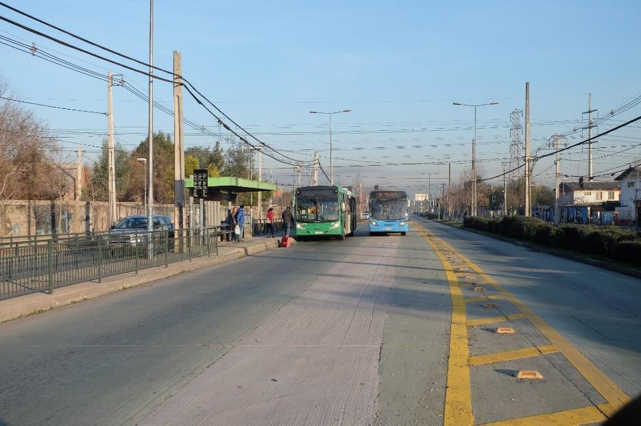
6 Dedicated Lanes
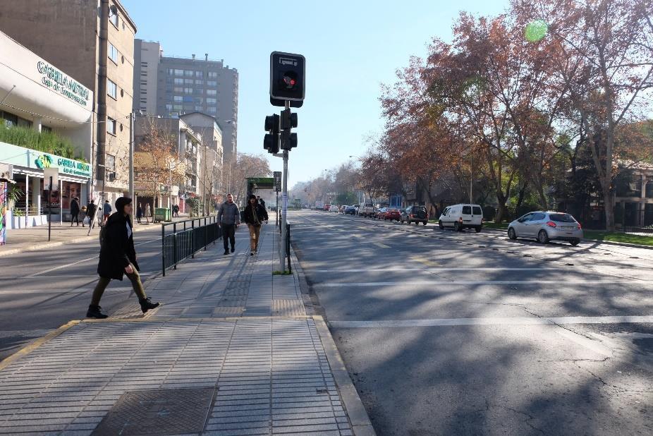

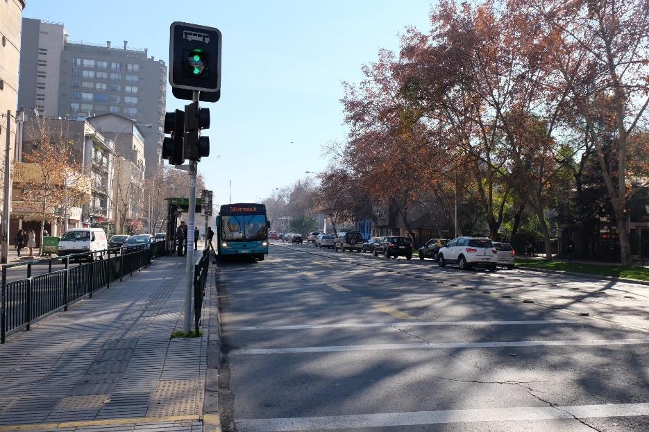
7 Pedestrian Access to Transantiago Station


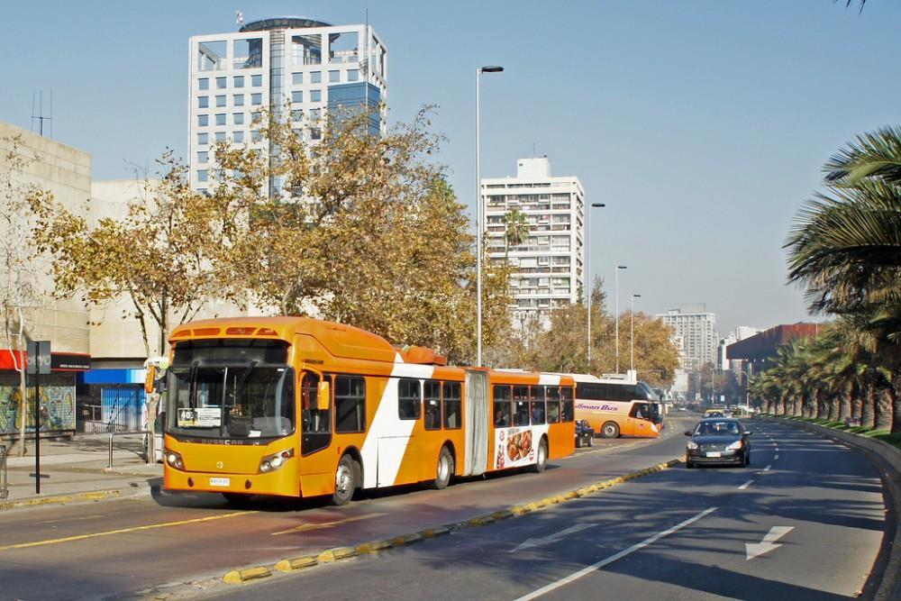
8 Transantiago Off-Corridor Bus station in off-corridor. The buses serve in mixed traffic lanes. Some roads are closed for private vehicles except people who domiciled in those roads. They monitor it through CCTV. Moreover, only buses and NMT are allowed to pass those roads.

 Sumber: http://www.transantiago.")
9 Farebox System All public transport fares are using BIP! Card Purchase and top up BIP! Card can be done in Metro Station, BIP! offices and Centro Bip! kiosks, totems near Metro stations, supermarkets and covinience stores that corporate with Bip! Card Bip! Card can be used for Transantiago, Metro, dan Metro Tren. Checking balance can be done through tapping on gate or online at Fares from Monday to Friday 07:00 08:59 and 18:00 19:59 (in Chilean Peso) Sumber:
10 Farebox System Fares from Monday to Friday 06:00 06:59 dan 20:45 23:00 (in Chilean Peso) Saturday, Sunday, Monday to Friday 06:30 06:59, 09:00 17:59, dan 20:00 20:44 (in Chilean Peso) Sumber:

11 Other Integration, Exclude Integration in Farebox System ROUTE INTEGRATION 5 Metro routes have been integrated with 391 BRT Direct Service routes from Transantiago

12 Other Integration, Exclude Integration in Farebox System The integration of Transantiago is profitable for Metro because it increases the number of passengers Before Transantiago BRT operated

13 Lesson Learned from Metro De Santiago

14 Not Good Enough from Transantiago BUS BUNCHING
15 Metro dan Metrotren in Santiago


16 Metro and Metrotren in Santiago

17 Metro and Metrotren Station

18 Inside Metro and Metrotren in Santiago

19 The exit gate (no need to tap-out). To ride the Metro need tap-in only. The fare will be paid when you tap-in.
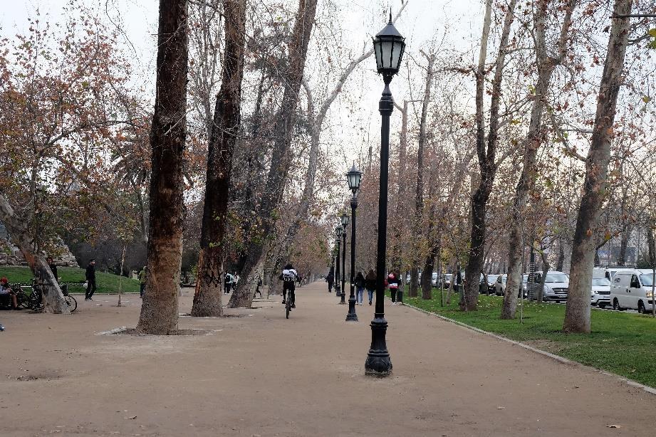
20 Bike share system and bike lane in Santiago

21 Bike lane on drive lane

22 Bike lane on drive lane

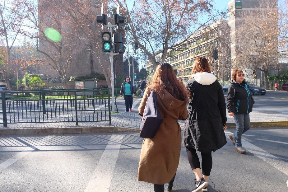
23 Traffic light for cyclists and pedestrians. Bike lane on sidewalk.

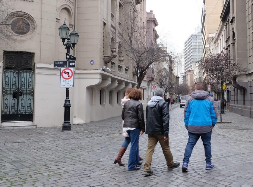
24 Bike lane on sidewalk

25 Bike share station on sidewalk in some roads which high demand pedestrians.


26 Bike share station near Metro Station

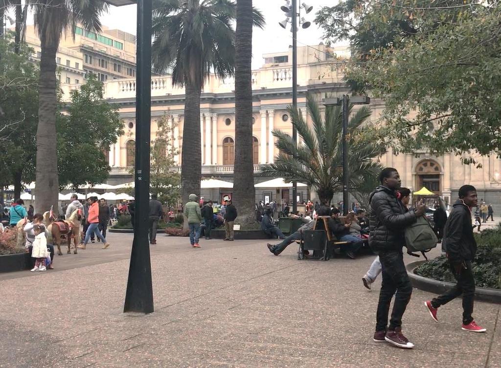
27 Bike share station in pedestrianize area
28 How to use Bikesantiago
29 NMT Facilities in Santiago

30 Wide sidewalk

31 Wide sidewalk

32 Especially on narrow roads and smaller sidewalk, there is a laying arrangement of utilities, street funiture, and street vendors. They put it on buffer spaces. CLEARANCE AREA STREET FURNITURE
33 Crossing facilities

34 Pelican crossing facilities


35 Pavement on shared streets uses paving block so the vehicles will slow down when pass those street.

36 There are a lot of pedestrianize area

37 Dominantly, the pedestrianize areas are the area of heritage, public space, and commercial.

38 Street Furniture BENCHES PEDESTRIAN LIGHTS


39 Tree Grates Tree grate is a tree s roots protector. Commonly, made of iron or metal which designed to protect the roots and trunks of growing trees. Tree grate is able to help plant plots to be neat and do not mess the sidewalks, roads, and surrounding areas.


40 The active sidewalks because of café s benches that are laid parallel along the utility and greeneries spaces.

41 Tactile pavement to help disability person only put on narrow sidewalk.
42 THE END.
GENERAL. 1. Description
 GENERAL 1. Description This standard identifies minimum requirements that shall be met for all Bus Stops in the design and construction of elements for Arlington County Horizontal Design Standards. This
Community Task Force November 15, 2017
 Community Task Force November 15, 2017 Welcome and Introductions Project Partners Regional Transportation District (RTD) Colorado Department of Transportation (CDOT) Denver Regional Council of Governments
CURRENT ORIGINAL REFERENCE SECTIONS. (Typical Section) (Typical Section) The Parade Island Bay : Concept Option Summary Sheets.
 (Typical Section) The Parade Island Bay : Concept Option Summary Sheets.") ORIGINAL (Typical Section) CURRENT (Typical Section) 3,900 3,000 2,000 1,500 3,100 1,600 3,100 1,500 2,000 2,500 3,900 3,000 1,800 600 2,000 3,000 3,000 2,000 600 1,800 2,500 Existing Planting Traffic
ORIGINAL (Typical Section) CURRENT (Typical Section) 3,900 3,000 2,000 1,500 3,100 1,600 3,100 1,500 2,000 2,500 3,900 3,000 1,800 600 2,000 3,000 3,000 2,000 600 1,800 2,500 Existing Planting Traffic
25th Avenue Road Diet Project A One Year Evaluation. Transportation Fund for Clean Air Project #05R07
 25th Avenue Road Diet Project A One Year Evaluation Transportation Fund for Clean Air Project #05R07 Submitted by: The San Francisco Municipal Transportation Agency Dan Provence May 22, 2009 EXECUTIVE
CURBSIDE ACTIVITY DESIGN
 5 CURBSIDE ACTIVITY DESIGN This chapter provides design guidance for separated bike lanes adjacent to curbside activities including parking, loading and bus stops. Typical configurations are presented
Better Market Street Project Update. Urban Forestry Council September 17, 2014
 Better Market Street Project Update Urban Forestry Council September 17, 2014 Project Area Limits Better Market Street Schedule Market Street City s busiest transit corridor Over 85 buses per hour 14 surface
A Guide to Great Streets: The Basics. September 25, 2009
 A Guide to Great Streets: The Basics September 25, 2009 Streets are more than connectors, they are the city 2 Streets are the glue that hold a city together 3 Streets are the means in which a city is perceived
GRTC PULSE. Arriving June 24, May 30, Overview by: Carrie Rose Pace Greater Richmond Transit Company Director of Communications
 GRTC PULSE B u s R a p i d Tr a n s i t S e r v i c e Arriving June 24, 2018 May 30, 2018 Overview by: Carrie Rose Pace Greater Richmond Transit Company Director of Communications GRTC PULSE JOINT SPONSORS
Active Transportation Facility Glossary
 Active Transportation Facility Glossary This document defines different active transportation facilities and suggests appropriate corridor types. Click on a facility type to jump to its definition. Bike
STEERING COMMITTEE MEETING June 17, Streetscape Overview Burlington Comprehensive Master Plan
 STEERING COMMITTEE MEETING June 17, 2015 Streetscape Overview Burlington Comprehensive Master Plan 1 Introduction Slide This slide show was presented to the Burlington Steering Committee on June 17, 2015
York Region Rapid Transit Corporation
 York Region Rapid Transit Corporation 0 Highway 7 East (H3) BRT Dedicated Lanes Municipal Engineers Association (MEA) York Region 2015 November 19, 2015 key points of the presentation Geography / York
Strategies for Maintaining & Renewing Innovative Street Projects. Elyse Parker, Director of Policy & Innovation, City of Toronto NACTO, LA, 2018
 Strategies for Maintaining & Renewing Innovative Street Projects Elyse Parker, Director of Policy & Innovation, City of Toronto NACTO, LA, 2018 1 OUR ASSETS $12B in Assets $20B Replacement Cost $372M Capital
Public Comment Meeting Geary BRT Project Draft Environmental Impact Statement/Report
 Public Comment Meeting Geary BRT Project Draft Environmental Impact Statement/Report Open House and Opportunity to Provide Comments Public comments can be submitted to the court reporter stationed in the
Complete Streets. Designing Streets for Everyone. Sarnia
 Complete Streets Designing Streets for Everyone Sarnia Complete Streets ~ Sarnia ~ 2018 Introduction Our City is made up of a network of streets that we use to go for a walk, cycle to work, drive to the
Technical Working Group November 15, 2017
 Technical Working Group November 15, 2017 Welcome and Introductions Project Partners Regional Transportation District (RTD) Colorado Department of Transportation (CDOT) Denver Regional Council of Governments
Ballston Station Multimodal Study WMATA and Arlington County. Meeting Minutes
 Date of Meeting: June 10, 2010 Location: Ballston Metrorail Station and NRECA Building 4301 Wilson Blvd, Arlington, VA Subject: Ballston Station Multimodal Study Stakeholder Meeting #1 Summary: This first
IMPLEMENTATION. PEDESTRIAN USERS (Continued /) A: Class 2 Pedestrian / Cycle Ways. Pedestrian and Cycle Ways:
 A: Class 2 Pedestrian / Cycle Ways. Pedestrian and Cycle Ways:") A: Class 2 Pedestrian / Cycle Ways PLAN VIEW Pedestrian and Cycle Ways: Layout and Geometry (Refer to A): Walkways and cycle to be provided adjacent to all Class 2 Roads (these facilities should always
A: Class 2 Pedestrian / Cycle Ways PLAN VIEW Pedestrian and Cycle Ways: Layout and Geometry (Refer to A): Walkways and cycle to be provided adjacent to all Class 2 Roads (these facilities should always
Microscale Audit of Pedestrian Streetscapes (MAPS), Mini Version
, Mini Version") Microscale Audit of Pedestrian Streetscapes (MAPS), Mini Version Training Manual & Picture Guide Developed by: Carrie Geremia Kelli Cain Revised February 11, 2014 Tool and protocol developed by: James
Microscale Audit of Pedestrian Streetscapes (MAPS), Mini Version Training Manual & Picture Guide Developed by: Carrie Geremia Kelli Cain Revised February 11, 2014 Tool and protocol developed by: James
Lawrence Avenue Streetscape Concepts August 30, 2011
 Lawrence Avenue Streetscape Concepts August 30, 2011 Neighborhood Context Phase II: River to Western Ave. Phase I: Western Ave. to Clark St. Key Map Lawrence Ave. Existing Streetscape Conditions East of
Crystal City Potomac Yard Transitway. Enforcement Ordinance & Construction Update
 Enforcement Ordinance & Construction Update December 2015 Project Purpose Provide high-capacity, high-quality transit service Support redevelopment in Crystal City and in Potomac Yard in Alexandria and
City of Seattle Edward B. Murray, Mayor
 City of Seattle Edward B. Murray, Mayor Department of Transportation Scott Kubly, Director Eastlake Community Council 117 E Louisa St. #1 Seattle, WA 98102-3278 January 28, 2016 RE: Roosevelt to Downtown
Southside Pilot Proposal
 To improve bicycle access and mobility to UC Berkeley, Downtown Berkeley, and the Southside area, a pilot project could include a two-way parking-protected cycle track. Turn pockets and island bus stops
Figure 5-1 Complete Street Zones. Roadside. May include frontage, pedestrian throughway, furnishings and curbside areas.
 Design Guidelines 5 The design guidelines presented in this section provide descriptions related to the form and function of the four Complete Streets zones: roadside, parking, roadways and lanes, median,
Construction Newsletter No. 32 October 14, 2016 On-Going
 Construction Newsletter No. 32 October 14, 2016 On-Going Here s a block-by-block breakdown of the work currently underway: Harvey Street to Clegg Street: Placement of green thermoplastic for the cycle
DART Bus Crash Analysis. typical scenarios associated with selected crash types
 DART Bus Crash Analysis typical scenarios associated with selected crash types Crash Types Studied in Detail Analysis Methodology 5 Categories 70% of all crashes 500 Crashes Proportionally sampled Matrix
Guidance. ATTACHMENT F: Draft Additional Pages for Bicycle Facility Design Toolkit Separated Bike Lanes: Two-Way to One-Way Transitions
 ATTACHMENT F: Draft Additional Pages for Bicycle Facility Design Toolkit Separated Bike Lanes: Two-Way to One-Way Transitions This treatment provides a transition from two-way separated bike lanes to one-way
El Camino Real Specific Plan. TAC/CAC Meeting #2 Aug 1, 2018
 El Camino Real Specific Plan TAC/CAC Meeting #2 Aug 1, 2018 Land Use Alternatives Goals and Tradeoffs Parks & open space Housing Retail & services Civic spaces Parking Community gathering spaces 3 Alternatives
An optimal enforcement strategy for bus lanes in Santiago de Chile
 1 2 3 4 5 6 7 8 9 10 11 12 13 14 15 16 17 18 19 20 21 22 23 24 25 26 27 28 29 30 An optimal enforcement strategy for bus lanes in Santiago de Chile Christopher Bucknell Email: cpbuckne@uc.cl Sebastián
Bus Rapid Transit: How Delhi Compares
 Bus Rapid Transit: How Delhi Compares Delhi BRT Modern Low Floor CNG Buses are a big improvement: Lower Particulate emissions than TransMilenio Grade A Cycling Facilities Bike flows at peak are as high
Eliminate on-street parking where it will allow for a dedicated bus only lane %
 Traffic Dashboard Priorities Survey Responses Introduction 1) Are you familiar with bus rapid transit (BRT)? a. No, BRT is new to me. 597 23.5% b. I ve heard of BRT, but I don t know much about it. 1,136
Functional, Preliminary Design and Detailed Design
 Functional, Preliminary Design and Detailed Design Main Street (Echo Drive to the Rideau River), Lees Avenue (Main Street to Chestnut Street), and Rideau River Drive (Main Street to 130m south of Main
Why invest in the 1 Street S.W. Corridor?
 Why invest in the 1 Street S.W. Corridor? This project is an investment in the Beltline Community and Calgary s economy. It is anticipated that The City s investment along this corridor will help with
Gerald Ollivier Lead Transport Specialist World Bank, New Delhi. Transforming Cities through Integrated Planning Corridor Scale
 Gerald Ollivier Lead Transport Specialist World Bank, New Delhi Transforming Cities through Integrated Planning Corridor Scale JOB ACCESSIBILITY: ZHENGZHOU A: LINE 1, 2, AND 3 AND WALKING: 12% B. SCENARIO
Welcome to the Quebec Alternatives Analysis Public Meeting
 Welcome to the Public Meeting Please sign in. Public Comment Please fill out a comment card and tell us what you think. Check back or comment any time at: www.quebecalternatives.com Project Area Technical
IMPLEMENTATION. PEDESTRIAN USERS (Continued /) Building Frontages: A: Stair Applications. Geometry (Accessed from the Sidewalk) Refer to A:
 Building Frontages: A: Stair Applications. Geometry (Accessed from the Sidewalk) Refer to A:") A: Stair Applications Building Frontages: Geometry (Accessed from the Sidewalk) Refer to A: Ramps should be provided for disabled users at 1:12 (8.3%) gradient. Ramp rises should be stepped at 400mm intervals.
A: Stair Applications Building Frontages: Geometry (Accessed from the Sidewalk) Refer to A: Ramps should be provided for disabled users at 1:12 (8.3%) gradient. Ramp rises should be stepped at 400mm intervals.
Appendix B - Street Sections
 Appendix B - Street Sections 6TH STREET CORRIDOR PLAN STREET SECTIONS The street sections in Appendix B include recommended improvements to streets for North Glenwood. They include existing conditions
MEDIAN DESIGN example median A
 MEDIAN DESIGN example median A MLK Blvd Design Workshop #3 September 21, 2010 Participants voted on each idea, gave comments about specific ideas or general comments about all ideas. Comments and suggestions
Smart Network Smarter Choices
 Employer Site Audit Form Please fill in this site audit form giving as much detail as possible. Remember to take photos to support the audit. Once completed please return the form to business@centro.org.uk
WHAT IS BRT? Jack M. Gonsalves, PE, Parsons Brinckerhoff, Inc. February 22, 2012
 WHAT IS BRT? Jack M. Gonsalves, PE, Parsons Brinckerhoff, Inc. February 22, 2012 What is Bus Rapid Transit (BRT)? A flexible, high performance rapid transit mode that combines a variety of physical, operating,
New State of the Art BRT systems Walter Hook, Executive Director, ITDP NYU, February 2010
 New State of the Art BRT systems Walter Hook, Executive Director, ITDP NYU, February 2010 Guangzhou is the highest capacity direct service BRT in the world, TransMilenio is the highest trunk and feeder
NORTH DOWNTOWN N EAST WEST
 ORTH DOWTOW CHURCH STREET ALTERATE o. 1 BIKE LAES, O-STREET PARKIG, SIDEWALK AD MULTI-USE PATH This alternate incorporates a 5-foot sidewalk along the eastern side of Church Street, a 10-foot Multi-Use
Chapter 3 BUS IMPROVEMENT CONCEPTS
 Chapter 3 BUS IMPROVEMENT CONCEPTS The purpose of this chapter is to describe potential bus improvement strategies and potential impacts or implications associated with BRT implementation within the existing
Integrated Corridor Approach to Urban Transport. O.P. Agarwal World Bank Presentation at CODATU XV Addis Ababa, 25 th October 2012
 Integrated Corridor Approach to Urban Transport O.P. Agarwal World Bank Presentation at CODATU XV Addis Ababa, 25 th October 2012 What is the Integrated Corridor Approach for Urban Transport Public? Why
Henderson Ave. Complete Streets Project
 Henderson Ave. Complete Streets Project Meeting Purpose To finalize conceptual components of project prior to proceeding with preliminary engineering www.dallascompletestreets.wordpress.com MeetingAgenda
01. VICINITY OF GREENBRAE POC: EXISTING CONDITIONS
 01. VICINITY OF GREENBRAE POC: EXISTING CONDITIONS Existing Bus Stop Existing US101 On-ramp Existing POC Old Redwood Highway Rich Street City ROW Environmental Study Limit Industrial Way NO DESIGNATED
Scope of the Transit Priority Project
 Transit Planning Committee #1 March 19, 2015 Scope of the Transit Priority Project Review of the 2010 plan Analysis of Transit Priority Measures Preliminary plans for rapid transit Recommendations for
Item B1 November 19, 2009
 November 19, 2009 Planning and Development Department Land Use Planning Division DATE: November 19, 2009 STAFF REPORT TO: FROM: SUBJECT: Members of the Transportation Commission Elizabeth Greene Senior
In station areas, new pedestrian links can increase network connectivity and provide direct access to stations.
 The Last Mile Planning for Pedestrians Planning around stations will put pedestrians first. Making walking to stations safe and easy is important; walking will be a part of every rapid transit Accessible
TRANSPORTATION STANDARDS
 INTRODUCTION LOCAL STREETS ON-STREET PARKING SIDEWALKS STREET LIGHTING STREET FURNISHINGS TRAFFIC CALMING STREET TREES MEDIAN PLANTING BOULEVARD LOCATIONS VILLAGE CENTER STREET LOCATIONS RESIDENTIAL STREET
122 Avenue: 107 Street to Fort Road
 : 107 Street to Fort Road November 24, 2015 4:30 8:00 p.m. Meeting Purpose Summarize project work completed to date Share results of public input from Phase 1 Share the draft concept plan and proposed
Route 47 (North Main Street) Reconstruction
 Reconstruction") TOWN OF SUNDERLAND Route 47 (North Main Street) Reconstruction Presented by Lou Rabito, P.E. Presented to Town of Sunderland June 11, 2018 Project Overview MassDOT Project No. 607245 Resurfacing and Related
TOWN OF SUNDERLAND Route 47 (North Main Street) Reconstruction Presented by Lou Rabito, P.E. Presented to Town of Sunderland June 11, 2018 Project Overview MassDOT Project No. 607245 Resurfacing and Related
Traditional Public Transport Priority. Priority/Traffic Management? What is Integrated Public Transport Priority/Traffic management? Why? How?
 Integrated Public Transport Priority & Traffic Management Sam Zimmerman What is Integrated Public Transport Priority/Traffic management? Why? How? Integrated Public Transport Priority/Traffic Management?
Small Town & Rural Multimodal Networks
 Small Town & Rural Multimodal Networks Fred Young, PLA Andrea Clinkscales, AICP, PMP Alta Planning + Design Funding Partners Project Team Existing Design Guidance AASHTO Flexibility Guide 2004 AASHTO Bike
Clybourn Ave. Protected Bike Lane Study Halsted St. to Division St.
 Clybourn Ave. Protected Bike Lane Study Halsted St. to Division St. Nathan Roseberry, Senior Engineer Pam Broviak, Project Manager July 24, 2014 Agenda Project Goals Existing Roadway Conditions Traffic
complete streets design and construction standards public primer City of Edmonton
 complete streets design and construction standards public primer City of Edmonton introduction Complete Streets are streets for everyone: people who walk, wheel, bike, take transit, or drive. They are
SOCIALLY AND ENVIRONMENTALLY SUSTAINABLE URBAN TRANSPORT
 SOCIALLY AND ENVIRONMENTALLY SUSTAINABLE URBAN 1 Not only for clean air, but for basic human rights, those without cars must also be able to move without fear of being killed. 2 Bogotá is far from being
Typical Cross Section: DOWNTOWN (Observer Highway - 8th Street)
") Typical Cross Section: DOWNTOWN (Observer Highway - 8th Street) DRAFT SEPTEMBER 23, 14 1 Washington Street Typical Block Downtown Typical Block: DOWNTOWN (Observer Highway - 8th Street) New crosswalks
Typical Cross Section: DOWNTOWN (Observer Highway - 8th Street) DRAFT SEPTEMBER 23, 14 1 Washington Street Typical Block Downtown Typical Block: DOWNTOWN (Observer Highway - 8th Street) New crosswalks
Roadways. Roadways III.
 Introduction 97 Roadway Design Principles 98 Safe Speeds 99 Optimizing of Street Space 00 Minimum Lane Widths in the City of Boston 02 Design Features that Reduce Operating Speeds 05 Travel Lanes Transit
95 th Street Corridor Transportation Plan. Steering Committee Meeting #2
 95 th Street Corridor Transportation Plan Steering Committee Meeting #2 February 18, 2015 PURPOSE OF THE MEETING Update Steering Committee Present Community/Stakeholder Survey Results Present Transportation
 COMPLETE STREETS CHECKLIST City of Philadelphia The City of Philadelphia's Complete Streets policies are designed ensure that city streets are safe, comfortable and convenient for people of all ages and
Copenhagen Cycling Map. Red Lines Cycling facilities
 Copenhagen Cycling Map Red Lines Cycling facilities Copenhagen Cycling Facilities Design Approaches Transportation without Pollution Copenhagen s Strategy Where Cycling is one of the top key activities
C Line Rapid Bus Preliminary Station Design
 C Line Rapid Bus Preliminary Station Design C Terrence Anderson, Community Outreach Coordinator Shawn Walding, Senior Engineer Metro Transit TAAC February 1, 2016 1 C Line project overview Substantially
UDC Street Cross Sections
 UDC Street Cross Sections Local Street - Downtown Local Street Mountable Curb Local Street Vertical Curb Alley Major Arterial Minor Arterial Residential Lane Residential Collector Residential Collector
Merrick and Memorial Neighborhood Study 5/14/2014 Public Meeting
 Merrick and Memorial Neighborhood Study 5/14/2014 Public Meeting Study Area April 9 Public Meeting Comments Summary Pedestrian Safety - A Walking Neighborhood Pedestrian traffic is very difficult A need
Brooklyn Boulevard (County Road 152) Reconstruction Project Phase I. OPEN HOUSE June 20, 2017
 Reconstruction Project Phase I. OPEN HOUSE June 20, 2017") Brooklyn Boulevard (County Road 152) Reconstruction Project Phase I OPEN HOUSE June 20, 2017 Brooklyn Boulevard (County Road 152) Phase I Project Partners Project Lead Other Project Partners include Brooklyn
Brooklyn Boulevard (County Road 152) Reconstruction Project Phase I OPEN HOUSE June 20, 2017 Brooklyn Boulevard (County Road 152) Phase I Project Partners Project Lead Other Project Partners include Brooklyn
Controlled. Semi-Controlled PAGE 01 CHAPTER 12 INTERSECTIONS
 PAGE 01 CHAPTER 12 INTERSECTIONS You will cross many intersections while driving. Intersections are especially dangerous because vehicles are crossing each other s driving path. Many crashes happen at
Steps to Conducting a Complete Streets Assessment
 Steps to Conducting a Complete Streets Assessment Familiarize yourself with Complete Streets Read through the Complete Streets Assessment Guidelines. This will give you an idea of what Complete Streets
EL CAMINO REAL BUS RAPID TRANSIT PROJECT
 EL CAMINO REAL BUS RAPID TRANSIT PROJECT Would upgrade the current 522 Rapid Bus to BRT status by making changes to El Camino Real and The Alameda that make transit FAST, FREQUENT AND RELIABLE and make
ECONOMY PEOPLE ENVIRONMENT
 Report Back on Local Transit Improvements May 29, 2013 ECONOMY PEOPLE ENVIRONMENT Intro Council Requested Report Back Topics Progress on Planning for Broadway Subway False Creek Bridges Local Transit Improvements
Van Ness Avenue BRT Overview and Scoping Process. Geary BRT CAC January 8, 2009
 Van Ness Avenue BRT Overview and Scoping Process Geary BRT CAC January 8, 2009 VAN NESS AVENUE S ROLE Identified in Prop K for BRT treatment Muni 47 and 49; 19 operates on Polk 20,000 daily riders on Van
Tonight is for you. Learn everything you can. Share all your ideas.
 Strathcona Neighbourhood Renewal Draft Concept Design Tonight is for you. Learn everything you can. Share all your ideas. What is Neighbourhood Renewal? Creating a design with you for your neighbourhood.
10.0 CURB EXTENSIONS GUIDELINE
 10.0 CURB EXTENSIONS GUIDELINE Road Engineering Design Guidelines Version 1.0 March 2017 City of Toronto, Transportation Services City of Toronto Page 0 Background In early 2014, Transportation Services
Bus Rapid Transit ALTERNATIVES ANALYSIS. Open House
 Bus Rapid Transit ALTERNATIVES ANALYSIS Open House June 23, 2015 Open House Meeting Agenda Agenda Introductions What is BRT? Project Goals Study Tasks Next steps Discussion PVTA Bus Rapid Transit Study
BEST PRACTICES FOR ACCESSIBLE TRANSPORT. C G B (Kit) Mitchell
 Mitchell") BEST PRACTICES FOR ACCESSIBLE TRANSPORT by C G B (Kit) Mitchell Independent mobility is necessary for independent living Many people with disabilities use cars, either as driver or passenger Those who
BEST PRACTICES FOR ACCESSIBLE TRANSPORT by C G B (Kit) Mitchell Independent mobility is necessary for independent living Many people with disabilities use cars, either as driver or passenger Those who
Speaker: Brian Dranzik, Fiscal & Policy Administrator Milwaukee County
 Milwaukee County Speaker: Brian Dranzik, Fiscal & Policy Administrator Milwaukee County Department of Transportation and Public Works Project coordinated by Milwaukee County Transit System and Southeastern
ACCESSIBLE LOADING ZONES AND PROTECTED BIKE LANES: A UNIVERSAL DESIGN APPROACH. Accessibility Coalition Dec. 2016
 ACCESSIBLE LOADING ZONES AND PROTECTED BIKE LANES: A UNIVERSAL DESIGN APPROACH Accessibility Coalition Dec. 2016 A myth exists that only able-bodied individuals can ride bicycles. In reality, people with
ABOUT THIS STUDY The Tenderloin-Little Saigon Community-Based Transportation Plan
 ABOUT THIS STUDY The Tenderloin-Little Saigon Community-Based Transportation Plan The Greater Tenderloin Community Study Milestones October Community based organizations (Tenderloin Housing Clinic and
Mobility measures in Vitoria-Gasteiz
 CIVITAS Study Tour in Vitoria-Gasteiz, Spain 19 & 20 June 2014 Palacio Zulueta Public Space and Nature Environment Service, Paseo de la Senda 2, Vitoria-Gastez Giving back the public space to the people
Streetscape: Core Shopping District
 Streetscape: Core Shopping District DRAFT DRAFT DRAFT May 00 Core Shopping District: Phase Blue Island s Core Shopping District is located along Western Avenue, between Grove and Union Streets. Streetscape
Figure 4-10: Pedestrian Improvements Types of Potential Station Area Improvements - Place-Making Improvements
 INCORPORATE FEATURE PAVIN IN CROSSWALK AND INTERSECTION FIELDS Identifies high-priority pedestrian areas and create a station identity through colorful and interesting patterns ADD CURB EXTENSIONS Extending
Omaha s Complete Streets Policy
 Omaha s Complete Streets Policy (Adopted August 2015) VISION To create great places and enhance our quality of life, the City of Omaha will provide safe, accessible streets for all users. Complete Streets
GEARY CORRIDOR BUS RAPID TRANSIT Environmental Analysis. Special Intersections: Preliminary Concepts
 GEARY CORRIDOR BUS RAPID TRANSIT Environmental Analysis Special Intersections: Preliminary Concepts April 2, 2009 FILLMORE: Existing Conditions 3 lanes in underpass, 2 lanes in service road (each direction)
Footpath design. A guide to creating footpaths that are safe, comfortable, and easy to use
 Footpath design A guide to creating footpaths that are safe, comfortable, and easy to use November 2013 Contents Introduction / 1 Zoning system / 2 Width / 4 Height / 5 Surface / 5 Footpath elements /
ITS-NY ANNUAL MEETING Bus Rapid Transit in New York City: Bus Lane Operations on One-Way Arterial Streets
 ITS-NY ANNUAL MEETING Bus Rapid Transit in New York City: Bus Lane Operations on One-Way Arterial Streets June 9, 2011 Ted Orosz AICP, Director Long Range Bus Planning MTA New York City Transit 1 Overview
2.0 LANE WIDTHS GUIDELINE
 2.0 LANE WIDTHS GUIDELINE Road Engineering Design Guidelines Version 2.0.1 May 2018 City of Toronto, Transportation Services City of Toronto Page 0 Background In early 2014, Transportation Services initiated
Supporting Safer Cities. ENHANCING LAST MILE CONNECTIVITY a safety analysis of the Mandi House Metro Station
 Supporting Safer Cities ENHANCING LAST MILE CONNECTIVITY a safety analysis of the Mandi House Metro Station This Report has been prepared as part of the Project being undertaken with NDMC to Enhance the
Item Description: Presentation and Discussion: Berkeley Rapid Transit Locally Preferred Alternative
 Office of the City Manager Meeting Date: April 29, 2010 Item Number: 1 Item Description: Presentation and Discussion: Berkeley Rapid Transit Locally Preferred Alternative Staff report, resolution, and
Item to be Addressed Checklist Consideration YES NO N/A Required Description Complete Streets Guidelines
 Passaic County Complete Streets Checklist - Concept Development Project Name Item to be Addressed Checklist Consideration YES NO N/A Required Description Complete Streets Guidelines Existing Plans Have
EL CAMINO REAL BUS RAPID TRANSIT (BRT) PROJECT
 PROJECT") Agenda Item #4.2 EL CAMINO REAL BUS RAPID TRANSIT (BRT) PROJECT VTA BOARD WORKSHOP MAY 1, 2015 ABOUT THIS PRESENTATION CONTEXT Existing conditions and planning for growth WHAT IS THE PROJECT? Project alternatives
Agenda Item #4.2 EL CAMINO REAL BUS RAPID TRANSIT (BRT) PROJECT VTA BOARD WORKSHOP MAY 1, 2015 ABOUT THIS PRESENTATION CONTEXT Existing conditions and planning for growth WHAT IS THE PROJECT? Project alternatives
Chapter 3 DESIGN SPECIFICATIONS
 Brampton PathWays Planning and Design Guidelines 27 Chapter 3 DESIGN SPECIFICATIONS 3.1 CLASS 1 MULTI-USE PATH Off-road multi-use trails are the backbone of the Brampton PathWays Network. They are typically
Wilshire Boulevard Bus Rapid Transit Project
 Los Angeles County Metropolitan Transportation Authority Wilshire Boulevard Bus Rapid Transit Project COMMUNITY MEETINGS November 2008 Agenda Introduction Proposed Project Overview Participating Agencies
Designing Streets for Transit. Presentation to NACTO Designing Cities Kevin O Malley Managing Deputy Commissioner 10/24/2014
 Designing Streets for Transit Presentation to NACTO Designing Cities Kevin O Malley Managing Deputy Commissioner 10/24/2014 Chicago -- Streets for Transit TODAY Jeffery Jump Transit Signal Priority Central
42nd Ave N Reconstruction
 CITY OF MINNEAPOLIS 42nd Ave N Reconstruction Community Meeting #2 May 2016 6:00 7:30 p.m. 5/16/2016 1 Purpose of Meeting Inform: Provide an overview of project, identify anticipated scope of work, and
Gdynia s bicycle model
 Gdynia s bicycle model Problems related to cycling network and demand modelling Michał Miszewski, city of Gdynia Development of tool for transport analysis - MST Statistical data (baseline and forecasts)
MBTA Key Bus Route Improvement Program. Community Meeting Route 1 - Boston
 MBTA Key Bus Route Improvement Program Community Meeting Route 1 - Boston January 24, 2011 USES, 566 Columbus Ave., Boston Agenda Welcome and introductions Safety briefing/accommodations Key Bus Route
Homework Module 7.01 Drivers Manual Study Questions
 Homework Module 7.01 Drivers Manual Study Questions Name: Date: Directions: Use the Oregon Driver Manual to answer each of the following questions. It is suggested that you underline or highlight each
20 minute presentation on proposed project. Comments and Questions following presentation. City of Madison
 20 minute presentation on proposed project Comments and Questions following presentation 2016 2017 Replace concrete pavement & base Replace curb and sidewalk as needed Proposed contra-flow bike lane Replace
Community Meeting February 27, 2007 Dorchester Avenue Transportation & Streetscape Improvements Action Plan February 27, 2007
 Community Meeting Tonight s Agenda 6:00 Introductions South Boston/Dot Ave Improvement Study Background 6:15 Consultant Introductions Review of Scope and Schedule Review of Proposed Corridor Wide Guidelines
A CHANGING CITY. of Edmonton, it is essential that it reflects the long-term vision of the City.
 A CHANGING CITY By the year 2040, Edmonton will be home to more than 1 million people. To accommodate growth and support a healthy and compact city, we need a new approach to development/redevelopment
BRT Standard 2016 Edition. Jacob Mason Transport Research and Evaluation Manager July 26, 2016
 BRT Standard 2016 Edition Jacob Mason Transport Research and Evaluation Manager July 26, 2016 Overview 1. Context 2. What is Bus Rapid Transit (BRT)? 3. What is the BRT Standard? 4. Why Was It Created?