BC Ministry of Transportation and Infrastructure
|
|
|
- Molly Perry
- 6 years ago
- Views:
Transcription


1 BC Ministry of Transportation and Infrastructure Highway 99 () Corridor Assessment DRAFT V 1.5
2 TABLE OF CONTENTS 1.0 BACKGROUND REGIONAL CONTEXT HIGHWAY 99 CONFIGURATION HIGHWAY 99 TRAVEL DEMAND QUALITY OF SERVICE AND SAFETY PERFORMANCE TRANSIT SERVICE LEVELS ISSUES FUTURE CONDITIONS CANADA LINE INTEGRATION MAINTAINING THE STATUS QUO DEGREE OF TRANSIT ACCOMODATION REQUIRED OPTIONS FOR PROVISION OF ENHANCED TRANSIT ACCOMODATION PREFERRED HIGHWAY 99 TRANSIT ACCOMODATION IMPLEMENTATION...48 January 2009, v1.5 South Coast Region, Programming, Partnerships and Planning
3 1.0 BACKGROUND Highway 99 is a major north-south corridor through Metro Vancouver that runs from the south at its connection with Interstate 5 at the Canada-US border, to the Highway 97 junction near Cache Creek (a total length of 409 km). The 40 kilometres of Highway 99 between the US border and the City of Vancouver is configured as a four lane freeway, with interchanges, tunnels, and overpasses that were constructed between the mid 1950 s and Only structures built since 1986 (Highway 91 interchanges) meet current seismic design standards. The South of Fraser portion of Highway, depicted in Figure 1.1, is located within the Greater Vancouver Regional District (GVRD) and runs through the City of Surrey, Corporation of Delta and City of Richmond, Sea Island Way Bridgeport Rd. Highway 99 Westminster Highway Steveston Highway Sout h Fraser Perime ter o R a d Hi a ghw y 99 Highway 10 King George Highway Highway 17 Highway 99 Referenced Section of Highway 99 Figure 1.1 The South of Fraser Portion of Highway 99 Highway 99 provides strategic goods movement connections between the US interstate Highway System and the BC Lower Mainland, Vancouver Island, and the Whistler-Pemberton area. Significant goods movement hubs served by this highway include the Tsawwassen Ferry Terminal, Delta Port and Vancouver International Airport. South Coast Region, Programming, Partnerships and Planning Page 1
4 In addition to goods movement support the highway also connects Surrey, White Rock, Delta, and Richmond with the Lower Mainland highway and municipal roadway systems. In fact the majority of demand served by Highway 99 is commuter shed traffic generated by these and neighbouring municipalities. 2.0 REGIONAL CONTEXT The South of Fraser municipalities have experienced the greatest rate of growth within the GVRD over the past 10 years. The communities that Highway 99 runs through have experienced the highest rate of growth in the South of Fraser Area. This trend is expected to continue over the next twenty years. Table 2.1 and Figures 2.1 and 2.2 illustrate growth in population and employment for these areas from 2001 to Table 2.1 GVRD and South of Fraser Population and Employment (2001 to 2031) GVRD Population 1,987,000 2,117,000 2,540,400 2,900,000 Employment 1,062,000 1,145,000 1,351,100 1,541,000 South of Fraser Population 573, , , ,000 Employment 234, , , ,000 South Surrey Population 58,710 79,500 80, ,000 Employment 21,175 25,410 27,800 71,000 White Rock Population 18,250 18,755 33, Employment 4,745 4,876 9, Semihamoo Peninsula South Surrey/White Rock Population 76,960 98, , ,000 Employment 25,920 30,286 36,800 84,000 Source: South of Fraser Area Transportation Study, TransLink, City of Surrey South Coast Region, Programming, Partnerships and Planning Page 2
5 3,000,000 2,500,000 2,000,000 1,500,000 1,000, ,000 Population GVRD SOFA 2001 to 2031 Growth Semih. Penn. 46% 66% 183% Figure 2.1 GVRD and South of Fraser Population (2001 to 2031) 3,000,000 2,500,000 2,000,000 1,500,000 1,000, ,000 Employment 2001 to 2031 Growth GVRD 45% 45 SOFA 74% Semih. Penn. 224% Figure 2.2 GVRD and South of Fraser Employment (2001 to 2031) South Coast Region, Programming, Partnerships and Planning Page 3
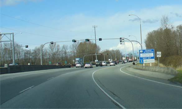
6 Bridgeport Rd. Westminster Highway Steveston Highway Highway 10 King George Highway Highway 99 Corridor Assessment 3.0 HIGHWAY 99 CONFIGURATION The portion of Highway 99 under discussion is configured as an urban freeway with cross sections that range from 4 and 6 lanes. Figure 3.1 describes the corridor laning in detail while Figure 3.2 illustrates the various cross-sections of this portion of the corridor. Oak St. Bridge Highway 91 Highway 17 Highway 91 Number of Lanes Northbound George Massey Tunnel Reversible Lanes 3/1 Peak Direction Northbound HOV Queue Jump Lane Southbound HOV 2 plus shoulder side Northbound HOV 3 plus Shoulder side Number of Lanes Southbound Southbound Bus Only Queue Jump Lane George Massey Tunnel Reversible Lanes 3/1 Peak Direction Figure Highway 99 Lane Allocation by Direction The George Massey Tunnel approaches operate under a signalized lane allocation system which reorganizes the physical two northbound and southbound tunnel lanes such that three peak direction lanes and one off-peak direction lane are made available during peak periods. As well, there are northbound and southbound HOV lanes at the George Massey Tunnel approaches. Northbound HOV eligibility was originally established as plus 6 persons in 1998 but has been successively reduced to plus 3 since. Similarly, the southbound HOV eligibility was also established at plus 6 and has also been successively reduced to plus 2. A northbound HOV queue jump was also implemented in This queue jump begins at the signalized intersection of the Highway 99 northbound off-ramp signal and Highway 17 with an HOV only pre-emptive signal phase that allows HOV vehicles priority access to a northbound HOV lane leading to the tunnel. The HOV only lane terminates just prior to the George Massey Tunnel portal where HOV traffic must merge with general purpose (GP) traffic. A southbound transit only queue jump was implemented in This queue jump begins at the Steveston interchange South Coast Region, Programming, Partnerships and Planning Page 4
7 and proceeds south using a decommissioned Ministry truck inspection area. TransLink buses bypass southbound tunnel queues and re-enter GP travel lanes at the tunnel entrance. Between King George Highway and 80 Street NBD varies SBD Between 80 Street and 300m south of Highway 17 varies Between 300m south of Highway 17 to Highway 17 varies Between Steveston Highway and Westminster Highway 1.5 m 1.5 m Between Highway 91 and Bridgeport Road 1.5 m 1.5 m Figure 3.2 Highway 99 Cross-Sections South Coast Region, Programming, Partnerships and Planning Page 5
8 The shoulder widths along the corridor narrow to 0.5 meters at most bridge and interchange structures. In locations where there is no median barrier the median width varies from 8 to 12 meters. 4.0 HIGHWAY 99 TRAVEL DEMAND Figure 4.1 describes the typical weekday 24 hour trip generation from the Surrey, Delta, White Rock Area (including US border traffic). As can be seen approximately 120,000 daily trips are destined to Richmond, Vancouver and the North Shore. Approximately 50% of this demand of this demand is served by Highway ,200 (0.7%) 70,400 (5.0%) 61,200 (4.4%) 19,500 (1.4%) 5,000 (0.4%) 42,700 (3.1%) 69,400 (5.0%) Source: South of Fraser Transit Plan, TransLink Figure 4.1 Surrey, Delta, White Rock 24 Hour Trip Destinations The two way Highway 99 corridor AADT ranges from 8,800 vehicles at the US border and peaks at the George Massey Tunnel with 94,600 vehicles. Table 4.1 provides a summary of total AADT s and SADT s at various corridor locations. South Coast Region, Programming, Partnerships and Planning Page 6
9 Percentage of Travel by Public Transit Highway 99 Corridor Assessment Table 4.1 Highway 99 Total AADT s and SADT s AADT SADT North of US Border 8,800 11,900 North of 32 Ave 51,000 54,000 North of Highway 91 48,400 51,200 George Massey Tunnel 94,600 99,700 Bridgeport Road 44,000 46,500 Source: BC The Delta, Surrey, White Rock portion of the GVRD currently has a transit modal share of approximately 5%. Figure 4.2 describes modal shares for this area, the GVRD, City of Vancouver and other major jurisdictions. 70% 60% 50% 40% GVRD 2008 Weekday Transit Modal Share 11% GVRD Provincial Transit Plan 2021 Modal Share Target 17% Delta/Surrey/White Rock 2008 Weekday Transit Modal Share 5.0% Delta/Surrey/White Rock 2021 Modal Share Target 11.0% 30% Paris London 20% Greater Toronto Area City of Toronto City of Vancouver 10% Delta/Surrey White Rock Greater Vancouver Regional District 0% Development Density (persons per hectare) Source: South of Fraser Transit Plan Figure 4.2 Percentage of Travel by Transit in the GVRD and other Jurisdictions South Coast Region, Programming, Partnerships and Planning Page 7
10 The recently completed Provincial Transit Plan (PTP) has set a goal for increasing the modal share target of the GVRD from 11% to 17% by In order to achieve the regional modal share target the South of Fraser Area will have to increase its modal share form 5% to 11%. Figure 4.3 describes the weekday hourly distribution of southbound, northbound and total vehicular demand on Highway 99, as well as the weekday AM and PM peak periods and peak hours. The peak periods account for approximately 50% of total daily demand. Northbound Southbound Total Source: TransLink 2006 Travel Diary Figure Highway 99 Weekday Hourly Vehicle Demand Distribution The corridor serves auto, truck and transit modes. Truck demand ranges between 7% and 12%. The corridor supports the operation of the 10 TransLink bus routes shown in Figure 4.4. The bus routes generate 40 buses per hour at the peak load point (Bridgeport Road) in the peak direction. South Coast Region, Programming, Partnerships and Planning Page 8
11 Airport Station 311 North Delta 351 South Surrey 352 South Surrey 354 South Surrey 490 Steveston 601/602 South Delta 603/604 South Delta 620 Tsawwassen Exchanges Steveston Dashed lines indicate local portion of route Scottsdale Mathews Ladner South Surrey Park & Ride South Delta White Rock Centre Figure 4.4 TransLink Bus Routes Using Highway 99 All of the bus routes operating on Highway 99 circulate through their respective service areas as local buses and then operate as express buses on the Highway. There are only two stop locations on the highway in both eastbound and westbound directions; at the Mathews Exchange at Highway 10 and the Steveston Highway. In both instances buses leave and re-enter the highway via interchange ramps. This portion of Highway 99 does not support cycling. This is primarily because of physical constraints posed by the Massey Tunnel (no shoulders through the tunnel) as well as the complexity induced by the tunnel lane control system. Buses operating on Highway 99 are equipped with bus racks. Figures 4.5 and 4.6 describe the 2008 AM and PM corridor peak hour vehicular demand by mode in the peak direction of travel. Figures 4.7 and 4.8 describe the 2008 AM and PM corridor peak hour person demand for auto/truck and transit modes in the peak direction of travel. South Coast Region, Programming, Partnerships and Planning Page 9
12 Auto 3,100 Truck 130 Bus 36 Auto 3,100 Truck 350 Bus 40 Auto 4,300 Truck 480 Bus 40 Auto 4,500 Truck 620 Bus 36 Auto 3,000 Truck 410 Bus 16 Auto 2,500 Truck 190 Bus 16 Auto 3,400 Truck 600 Bus 20 7,000 6,000 5,000 4,000 3,000 2,000 Total Vehicles per hour Auto 2,300 Truck 180 Bus 0 Auto 1,900 Truck 140 Bus 0 Figure 4.5 Northbound AM Peak Hour Vehicular Demand on Highway 99 Auto 2,800 Truck 120 Bus 36 Auto 2,900 Truck 220 Bus 40 Auto 4,000 Truck 460 Bus 40 Auto 4,800 Truck 660 Bus 36 Auto 3,400 Truck 470 Bus 16 Auto 3,000 Truck 190 Bus 16 Auto 3,400 Truck 600 Bus 20 Auto 2,500 Truck 190 Bus 0 Auto 1,800 Truck 130 Bus 0 Figure 4.6 Southbound PM Peak Hour Vehicular Demand on Highway 99 South Coast Region, Programming, Partnerships and Planning Page 10
13 Auto/Truck 3,900 pph Bus 1,400 pph Auto/Truck 4,300 pph Bus 1,600 pph Auto/Truck 5,500 pph Bus 1,600 pph Auto/Truck 6,000 pph Bus 1,400 pph Auto/Truck 3,900 pph Bus 640 pph Auto/Truck 3,100 pph Bus 640 pph 7,000 6,000 5,000 4,000 3,000 2,000 persons per hour GP/Truck 2,000 1,750 1,500 1,250 1, persons per hour Bus Auto/Truck 4,600 pph Bus 800 pph Figure 4.7 Northbound AM Peak Hour Person Demand on Highway 99 Auto/Truck 3,800 pph Bus 1,400 pph Auto/Truck 4,200 pph Bus 1,500 pph Auto/Truck 5,200 pph Bus 1,500 pph Auto/Truck 5,900 pph Bus 1,300 pph Auto/Truck 3,700 pph Bus 590 pph Auto/Truck 3,100 pph Bus 590 pph 7,000 6,000 5,000 4,000 3,000 2,000 persons per hour GP/Truck 2,000 1,750 1,500 1,250 1, persons per hour Bus Auto/Truck 4,500 pph Bus 740 pph Figure 4.8 Southbound PM Peak Hour Person Demand on Highway 99 South Coast Region, Programming, Partnerships and Planning Page 11
14 Average Speed (km/h) Highway 99 Corridor Assessment It is interesting to note that although the numbers of buses on the corridor represent less than 1% of the vehicular demand, the person demand accommodated by buses on the highway ranges from 17% to 26%. 5.0 QUALITY OF SERVICE AND SAFETY PERFORMANCE The quality of service on free flow facilities is described by the speed flow relationship that ascribes level of service based on the density of the traffic flow and the resultant speed achievable. Figure 5.1 describes the speed flow curve calibrated to BC Lower Mainland highway conditions Free Flow Speed A B C Density =6 veh/km/lane Density=9 veh/km/lane D Density=20 veh/km/lane Density=15 veh/km/lane E Density=24-28 veh/km/lane Flow Rate (vehicles per hour) F Figure 5.1 Speed, Flow Rate, and Service Levels Figures 5.2 and 5.3 describe the range of speeds in the peak direction of travel along Highway 99 from King George Highway to the Oak St. Bridge in the weekday AM and PM peak periods. The Figures also show the average peak hour speeds for GP traffic and transit buses. The northbound speed variation during the AM peak period, between the King George Highway and Highway 91 is caused by peak demands which result in vehicle densities that can drop speeds to 30 km/h for short intervals. There is a significant off-load to Highway 91 which reduces vehicular density and thereby reduces the speed variation to more typical ranges. With the addition of southbound demand South Coast Region, Programming, Partnerships and Planning Page 12
15 Bridgeport Rd. Westminster Highway Steveston Highway King George Highway Highway 99 Corridor Assessment from Highways 91, 10, and 17 the peak period demand significantly exceeds the available tunnel capacity. This results in speeds dropping to 10 km/h at the tunnel approaches. These effects rebound as far back as 80 th St. Average bus speeds between King George Highway and 80 th St. drop below GP speeds because buses must exit for passenger exchange at Highway 10. From this point to the tunnel average transit speeds are faster than GP speeds because of northbound HOV accommodation. Oak St. Bridge Highway 91 Highway 17 Highway 10 Highway Km/h Average GP/Truck Speed Peak Hour Average Bus Speed Peak Hour Speed Limit Peak Period Speed Variance Direction of Travel - AM Peak Figure 5.2 Northbound AM Peak Period Speeds on Highway 99 Northbound through the tunnel transit and GP speeds increase to near posted speeds. Transit average speeds drop slightly because buses must exit and re-enter the Highway for passenger exchange at the Steveston Highway. Northbound buses and GP buses maintain the posted speed (90 km/h) to the Westminster Highway. Capacity constraints north of the Oak St. Bridge result in a significant increase in vehicle density which induce speeds as low as 10 km/h for buses and GP traffic. The impact of this capacity constraint is felt as far back as Westminster highways during the AM peak period. South Coast Region, Programming, Partnerships and Planning Page 13
16 Bridgeport Rd. Westminster Highway Steveston Highway Highway 10 King George Highway Highway 99 Corridor Assessment Oak St. Bridge Highway 91 Highway 17 Highway Km/h Average GP/Truck Speed Peak Hour Average Bus Speed Peak Hour Speed Limit Peak Period Speed Variance Direction of Travel - PM Peak Figure 5.3 Southbound PM Peak Period Speeds on Highway 99 In the southbound direction during the PM peak period buses and GP traffic experience relatively modest speed variation between the Oak St. Bridge and Westminster Highway. Transit and GP traffic achieve average speeds slightly lower than the posted speeds on this portion of the highway. South of Westminster Highway the effects of congestion at the George Massey Tunnel begin to affect bus and GP average speeds. With the addition of southbound demand from Highway 91 and Westminster Highway the southbound demand significantly exceeds the capacity available at the George Massey Tunnel. This results in similar speed variation to those experienced in the southbound direction in the AM peak period. Southbound buses achieve higher average speeds from Westminster Highway to Highway 17 as a result of the southbound HOV lane and George Massey Tunnel Queue jump lane. From Highway 17 to the Highway 91 speed variation for southbound buses and GP traffic is relatively low with average speeds very near the posted speed limit. Buses have slightly lower average speeds than GP traffic because buses must leave and re-enter the highway for passenger exchange at Highway 10. Between Highway 91 and King George Highway the peak period highway density increases to levels where average speeds for buses and GP traffic can drop 70 km/h for short durations. Figure 5.4 illustrates the safety performance of the corridor in terms of collision rates (collisions per million vehicle kilometres). Figure 5.5 describes the various causes of these collisions. South Coast Region, Programming, Partnerships and Planning Page 14
 Highway 10 King George Highway 0.00-0.90 Highway 99 0.91-16.0 Highway 17 16.")
17 y 99 Highway 99 Corridor Assessment Sea Island Way Bridgeport Rd. Highway 99 Westminster Highway Steveston Highway Sout h Fraser Perime ter o R a d Hi a ghw Highway 99 Collision Rates (mvk) Highway 10 King George Highway Highway Highway Provincial Average Rate 0.9 mvk Critical Rate 16.0 mvk 32 Ave. Source: BC MoTI HAS Data ( ) Source: BC HAS System (2006 data) Figure 5.4 Highway 99 Collision Rates NBD SBD Source: BC HAS System (2006 data) Figure 5.5 Highway 99 (Oak St. Bridge - King George Highway) Collision Types South Coast Region, Programming, Partnerships and Planning Page 15
18 Between 32 Ave. and King George Highway in South Surrey the collision rate exceeds the provincial average rate. The majority of collisions are rear end and off road right. This collision profile is typical for vehicle density levels that this portion of the highway experiences. Between the King George Highway and Highway 10 both directions of travel are generally within the average provincial rate. From Highway 10 to Highway 17 both directions of travel exceed the provincial average rate. This is again attributable to peak period vehicle density. Between Highway 17 and the Steveston Highway (George Massey Tunnel section) the collision rates significantly exceeds the provincial average rate. This results from head on collisions in the contra flow lanes of the tunnel as well as very high vehicle densities. Various locations on this segment rank 38 th and 56 th on the list of provincial critical safety locations. Between Steveston Highway and the Oak St. Bridge virtually the entire section of highway in both directions exceeds the provincial average rate, the northbound direction being more critical. The collision rates in this segment are consistent with the peak period vehicle densities that occur. South Coast Region, Programming, Partnerships and Planning Page 16
19 6.0 TRANSIT SERVICE LEVELS From a capacity perspective, the allowed passenger load on a bus (set by policy) constrains the number of people that a given number of buses can carry. From a passenger s perspective, loading reflects the comfort level of the on-board portion of a bus trip both in terms of being able to find a seat and in overall crowding levels within the bus. From a transit operator s perspective, liability concerns and the desire to provide every customer with a seat for high-speed or long-distance services may cause the operator to set the allowed loading at levels lower than what riders might tolerate. The passenger load is simply the number of passengers on a single transit vehicle. The occupancy of the vehicle relative to the number of seats, defines the load factor. A factor of 1.0 means that all of the seats are occupied. The importance of vehicle loading varies by the type of service. In general, bus transit provides load factors below 1.0 for long-distance commuter trips and high-speed, mixed-traffic operations such as those on Highway 99. In an effort to manage crowding, while at the same time run an efficient and effective transit service, TransLink worked with area municipalities on the development of service design guidelines. In June 2004, the GVTA approved new Transit Service Guidelines that provide objective rationale for the allocation of transit resources. As the title suggests, these guidelines are used as tools for evaluating system conditions and making decisions on the provision of new services as well as adjustments to the design of existing services. Although many of the guidelines are set as minimum or maximums to achieve desired optimum conditions for the customer and operator, they are not treated as rigid standards. In other words, the guidelines are typically used by transit planners and operators to best manage the system on behalf of all interests. The guidelines are designed with the flexibility to achieve the following: Form a consistent basis for service planning; Evaluating and monitoring the performance of individual routes and making adjustments as necessary; Developing annual budgets to provide service that support the guidelines; and Providing transparency to transit customers, the general public and decision makers on the expected levels of service and performance. Table 6.1 describes Transit Service Design Guidelines with respect to vehicle passenger loads for buses allocated to the South of Fraser Bus routes. South Coast Region, Programming, Partnerships and Planning Page 17
20 Table 6.1 TransLink Transit Service Guidelines Passenger Loads Bus Type Peak 15 minutes In AM & PM Peak periods Peak 30 minutes In AM & PM Peak periods Weekday Midday & Evening, Weekends Peak 60 minutes Maximum Number of Passengers On-Board (standees in brackets) 12 m Highway Coach (47 Seats) 50 (3) 47 (0)) 47(0) 18 m Low Floor Articulated Coach (54 seats) 85 (31) 75(21) 65(11) These guidelines are for the highest passenger loads averaged for all bus trips on a route within the busiest 15 minutes and 30 minutes in peak periods and over 60 minutes in off-peak. Passenger loads on some individual bus trips may exceed the guidelines. The bus allocation to each South of Fraser route currently results in a spare peak period capacity of 20% for each routes It is assumed that TransLink will continue the provision of bus capacity on the same basis in the future. South Coast Region, Programming, Partnerships and Planning Page 18
21 7.0 ISSUES The congested peak period conditions on the Oak St. Bridge and Massey Tunnel approaches and the resultant safety performance pose the most significant service quality and safety issues along the corridor. Bus services and higher occupancy vehicles on the corridor experience slightly better operating conditions than single occupant GP traffic as a result of HOV and bus accommodations provided. However transit operations in terms of schedule reliability and operating efficiency, are particularly affected by the dramatic variance in average operating speeds along the corridor. The collision and incidence frequency further erodes transit schedule reliability. Goods movement along the corridor experience similar effects. With the Delta Port using a just in time truck reservation system truckers are adjusting to the reliability issue by arriving earlier and then parking on Highway 17. South Coast Region, Programming, Partnerships and Planning Page 19
22 8.0 FUTURE CONDITIONS Based on projected land use changes it is expected that travel demand on the Highway 99 corridor will increase 36% by 2021 and another 50% from 2021 to Given that there are no current plans to expand the capacity of Highway it is unlikely that such growth could occur without a major shift to the transit mode. To effect such a shift transit operations on the corridor would have to be significantly improved in terms of reliability and efficiency and transit would have to perform significantly better than GP based travel. Figure 8.1 describes the relationship between transit and auto based travel times and resultant mode splits for work trips (includes school trips). Travel times are total times from trip origin to trip destination for each mode % Travel By Transit Transit to GP Trip Travel Time Ratio Source: Metropolitan Transportation Planning (John W. Hickey, Robert C. Stewart, Richard D. Walker) Figure 8.1 Modal Shares Associated with Transit to GP Travel Time Ratios South Coast Region, Programming, Partnerships and Planning Page 20
23 Given that the majority of travel in the AM peak hour is work related the applicability of the curve shown in Figure 8.1 can be confirmed. The current total travel time averages by bus and car (derived from 2008 AM Peak travel surveys) from White Rock/South Surrey to the Vancouver CBD are estimated to be: 83 minutes and 125 minutes respectively. This produces a transit to GP travel time ratio of Figure 8.1 predicts a transit/gp mode split outcome of 25% with such a travel time differential. The current peak hour mode split at the peak load point is measures at 24% indicating that the relationship is valid for this highway corridor. Based on this relationship it is estimated that the Transit to GP ratio needed to effect a doubling in mode split is This implies a significant increase in transit travel time as well as a significant deterioration in GP travel times. 8.1 Canada Line Integration In Augustl of 2009 the new Canada Line Rapid Transit Line will initiate services between Richmond, the Vancouver International Airport, and Downtown Vancouver. The Bridgeport Canada Line Station intercepts the Highway 99 Corridor near the Oak St. Bridge. Given the limited opportunity for transit accommodation on Vancouver north-south arterial roadways including those that are utilized by South of Fraser buses, TransLink determined that the most effective transit delay mitigation for South of Fraser routes was to terminate the routes at the Bridgeport Canada Line Station and transfer passengers to the Canada Line to complete Vancouver portions of their trip. This would provide significant delay reductions for passengers continuing their trip to Vancouver destinations. Table 8.1 provides a comparison of travel times associated with this a strategy. Figure 8.1 describes the proposed re-routing of South of Fraser Bus routes. Table 8.1 Travel Time Comparisons For Terminated South of Fraser Bus Routes Weekday AM Peak Period Former Bus Only Bus/Canada Line Southbound Average Run Time (min) run time variation (min) 13 3 Weekday PM Peak Period Former Bus Only Bus/Canada Line Southbound Average Run Time (min) run time variation (min) South Coast Region, Programming, Partnerships and Planning Page 21

24 Canada Line South of Fraser Buses Parkade Access Bus Access Figure 8.1 South of Fraser /Canada Line Transit Service Integration Times are in minutes and reflective of buses travelling between Burrard Station in the Vancouver CBD and the South Surrey Park& Ride. The Bus/Canada Line Trip Assumes a 5 minute transfer time once buses reach the Canada Line Station. This strategy by itself will reduce peak direction transit travel times from South Surrey and the Vancouver CBD by 8 and 14 minutes in the AM and PM peak periods. Bus run time variance is reduced by 77% and 25% in the AM and PM peak periods. The northbound AM peak period bus delay is affected by congestion on Highway 99 approaching Bridgeport Road and traffic signal delays along Bridgeport Road. In order to further reduce AM peak period delay the is constructing a northbound shoulder bus lane from Highway 91 to Bridgeport Rd. The construction of a NBD transit only lane between Westminster Highway and Bridgeport Rd. off-ramp will save an additional 4 minutes in AM peak direction transit delay. The signal delay along Bridgeport Road and Seas Island Way will be mitigated by provision of transit signal priority (TSP) on Bridgeport Road and Sea Island Way. Figure 8.2 describes the signalized intersections that will provide transit signal priority. Table 8.2 describes the time savings achievable with the implementation of the Bridgeport Rd./Sea Island Way TSP. South Coast Region, Programming, Partnerships and Planning Page 22
25 Parkade Access Bus Access Canada Line South of Fraser Buses Traffic Signals Featuring Transit Signal Priority Figure 8.2 Bridgeport Rd. /Sea Island Way Transit Signal Priority Intersections Table Bridgeport Station Access Times Scenario AM Peak PM Peak Inbound Outbound Inbound Outbound Canada Line Open No TSP 2:25 2:35 3:00 3:45 Canada Line With TSP 1:50 2:00 2:05 2:25 Times represent minutes and seconds As can be seen the TSP will reduce peak period station access times by South of Fraser buses by about a minute in the peak direction of travel. Table 8.3 provides comparisons of bus only and bus/canada Line transit travel times with northbound transit shoulder bus lane and Bridgeport Rd. /Sea Island Way TSP implemented. South Coast Region, Programming, Partnerships and Planning Page 23
26 Table 8.3 Travel Time Comparisons For Terminated South of Fraser Bus Routes With 2009 Transit Accommodation Weekday AM Peak Period Former Bus Only Bus/Canada Line Southbound Average Run Time (min) run time variation (min) 13 2 Weekday PM Peak Period Former Bus Only Bus/Canada Line Southbound Average Run Time (min) run time variation (min) The AM and PM peak direction travel time differences of 13 minutes and 14 minutes provide travel time reductions of 20% and 18% respectively. South Coast Region, Programming, Partnerships and Planning Page 24
27 9.0 MAINTAINING THE STATUS QUO Although the South of Fraser bus route termination strategy resolves delay issues from the Oak Street north, deterioration in bus travel times and reliability remain to be resolved south of the Oak St. Bridge. Figures 9.1 and 9.2 describe AM and PM peak Hour GP and transit travel times for 2008, 2021, and 2031 under a maintain status quo scenario. (no change in Highway 99 capacity and no additional transit accommodation). Maintaining the status quo is predicted to increase the Highway 99 portion of 2021 AM and PM peak direction transit and GP travel times by 11 and 10 minutes, while 2031 AM and PM peak direction travel times are predicted to increase by 22 and 33 minutes. Table 9.1 provides estimates of total AM peak period origin to destination travel times between White Rock/South Surrey and The Vancouver CBD for bus and GP modes. Table 9.1 AM Peak Periods Bus and GP Total Travel Times (White Rock/South Surrey to Downtown Vancouver) AM Peak Hour NBD BUS GP Bus to GP Travel Time Ratio Travel times are in minutes The transit accommodations that will be in place by the fall of 2009 will provide some mitigation for travel time delay mitigation under future demand. Figure 9.3 identifies the forecast Highway 99 mode splits that could be expected with these modal travel times. The mode splits are predicted to shift by 5% by The Provincial Transit Plan and South of Fraser Transit Plan Goals of doubling the South of Fraser modal share would require a shift in Highway 99 mode split to move from the current 25% to 50%. South Coast Region, Programming, Partnerships and Planning Page 25
28 Bridgeport Rd. Highway 91 Westminster Highway Steveston Highway Highway 10 King George Highway Highway 99 Corridor Assessment Oak St. Bridge Highway 17 Highway Km/h Average GP/Truck Speed Peak Hour Average Bus Speed Peak Hour Speed Limit Km/h Average GP/Truck Speed Peak Hour Average Bus Speed Peak Hour Speed Limit Km/h Average GP/Truck Speed Peak Hour Average Bus Speed Peak Hour Speed Limit Direction of Travel - AM Peak Figure 9.1 AM Peak Hour Northbound GP & Transit Average Transit Travel Time Changes South Coast Region, Programming, Partnerships and Planning Page 26
29 Bridgeport Rd. Westminster Highway Steveston Highway Highway 10 King George Highway Highway 99 Corridor Assessment Oak St. Bridge Highway 91 Highway 17 Highway Km/h Average GP/Truck Speed Peak Hour Average Bus Speed Peak Hour Speed Limit Km/h Average GP/Truck Speed Peak Hour Average Bus Speed Peak Hour Speed Limit Km/h Average GP/Truck Speed Peak Hour Average Bus Speed Peak Hour Speed Limit Direction of Travel - PM Peak Figure 9.2 PM Peak Hour Southbound GP & Transit Average Transit Travel Time Changes South Coast Region, Programming, Partnerships and Planning Page 27
30 % Travel By Transit Transit to GP Trip Travel Time Ratio Figure 9.3 Status Quo Mode Splits on Highway 99 (2021 & 2031) South Coast Region, Programming, Partnerships and Planning Page 28
31 10.0 DEGREE OF TRANSIT ACCOMODATION REQUIRED Figures 10.1 and 10.2 describe the AM and PM peak hour travel time savings achievable if buses were accommodated in some form of dedicated lane on sections of Highway 99 that currently have no form of accommodation. Table 10.1 describes the Bus and GP traffic trip times in both the AM and PM peak hour that would result with such additional transit accommodation. Table 10.1 Predicted Peak Hour Bus And GP Travel Times on Highway 99 (South Surrey Park & Ride to Bridgeport Off-Ramp) AM Peak Hour PM Peak Hour NBD SBD GP Bus GP Bus Travel times are in minutes Table 10.2 provides comparative bus /GP total origin to destination time estimates for AM peak travel from the White Rock /South Surrey Area to downtown Vancouver. Table 10.2 AM Peak Periods Bus and GP Total Travel Times With Enhanced Transit Accommodation (White Rock/South Surrey to Downtown Vancouver) AM Peak Hour NBD BUS GP Bus to GP Travel Time Ratio Travel times are in minutes South Coast Region, Programming, Partnerships and Planning Page 29
32 Bridgeport Rd. Westminster Highway Steveston Highway Highway 10 King George Highway Highway 99 Corridor Assessment Oak St. Bridge Highway 91 Highway 17 Highway Km/h Speed Limit Average Speed GP/Truck 2008 PM Peak Hour Average Speed Transit (no additional accommodation) Average Speed Transit(with additional accommodation) Km/h Speed Limit Average Speed GP/Truck 2021 PM Peak Hour Average Speed Transit (no additional accommodation) Average Speed Transit(with additional accommodation) Km/h Speed Limit Average Speed GP/Truck 2021 PM Peak Hour Average Speed Transit (no additional accommodation) Average Speed Transit(with additional accommodation) Direction of Travel - AM Peak Figure 10.1 AM Peak Hour Northbound GP & Transit Average Transit Travel Time Changes With Additional Transit Accommodation on Highway 99 South Coast Region, Programming, Partnerships and Planning Page 30
33 Km/h Speed Limit 2008 PM Peak Hour Average Speed GP/Truck Average Speed Transit (no additional accommodation) Average Speed Transit(with additional accommodation) Km/h Speed Limit 2021 PM Peak Hour Average Speed GP/Truck Average Speed Transit (no additional accommodation) Average Speed Transit(with additional accommodation) Km/h Speed Limit 2021 PM Peak Hour Average Speed GP/Truck Average Speed Transit (no additional accommodation) Average Speed Transit(with additional accommodation) Direction of Travel - PM Peak Figure 10.2 PM Peak Hour Northbound GP & Transit Average Transit Travel Time Changes With Additional Transit Accommodation on Highway 99 South Coast Region, Programming, Partnerships and Planning Page 31
34 Figure 10.3 describes the projected modal splits for Highway 99 assuming the Bus to GP total travel time ratios in Table % Travel By Transit Transit to GP Trip Travel Time Ratio Figure 10.3 Predicted Mode Splits Assuming Enhanced Transit Accommodation on Highway 99 (2021 & 2031) The predicted mode splits are consistent with the Goals of the Provincial Transit Plan and South of Fraser Transit Plan. Figure 10.4 describes the speed ranges and average speeds for GP and Bus vehicles traveling the Highway 99 corridor in the peak direction in the AM and PM peak periods in 2021 assuming the availability of enhanced transit accommodation. South Coast Region, Programming, Partnerships and Planning Page 32
35 Westminster Highway Steveston Highway Highway 10 King George Highway Highway 99 Corridor Assessment Oak St. Bridge Bridgeport Rd. Highway 91 Highway 17 Highway Km/h Direction of Travel - AM Peak Km/h Direction of Travel - PM Peak 2021 Average GP/Truck Speed Peak Hour Average Bus Speed Peak Hour With Transit Accomodation Speed Limit GP/Truck Peak Period Speed Variance Bus Peak Period Speed Variance Figure AM & PM Peak Hour Average GP/Truck & Transit Travel Times and Peak Period Speed Variation Assuming Transit Accommodation on Highway 99 South Coast Region, Programming, Partnerships and Planning Page 33
36 11.0 OPTIONS FOR PROVISION OF ENHANCED TRANSIT ACCOMODATION Existing HOV Accommodation It is assumed that the existing Northbound HOV lane will be converted to an occupancy eligibility of plus 2. This will match the southbound HOV eligibility that was recently amended. The current northbound HOV lane has a low utilization and there is a continuing public desire to decrease eligibility given the growing northbound delays at the Massey Tunnel approaches. It is expected that the plus 2 eligibility should provide adequate transit accommodation until 2013 to At this time occupant eligibility can be increased or dedicated transit lanes constructed. The northbound HOV queue jump should also be sustainable until the 2013 to 2015 time period. When additional transit accommodation is necessary occupancy eligibility can be modified or dedicated transit lanes constructed. Between 2013 and 2021) the northbound queue jump will have to revert to transit only usage similar to the current southbound queue jump. Location of Priority Lanes Conventional practice for placement of HOV/Bus lanes in highway environments is median side. This works well if buses do not have to move from the lane for the duration of the highway trip. In some cases HOV interchange ramps to facilitate HOV exit and entry from the median side lanes can be considered. This is generally avoided because of costs and complexity of operation. In the Highway 99 environment where buses must move to the curb to leave and re-enter the highway for passenger exchange the median lanes cannot practically be utilized, particularly in the highly congested portions of the corridor such as those approaching the George Massey Tunnel or Oak St. Bridge. The construction of interchange ramps required for median side lanes would exceed the entire cost of constructing shoulder side lanes through the entire corridor. Given that the passenger exchange being accommodated is less than 5 passengers per bus run and given that the existing shoulder side HOV have no operational issues, median side priority lanes were not considered further. Figure 11.1 depicts existing Highway 99 cross sections with shoulder side HOV lanes. South Coast Region, Programming, Partnerships and Planning Page 34
37 Between 80 Street and 300m south of Highway 17 varies Between Steveston Highway and Westminster Highway SBD NBD 1.5 m 1.5 m Figure 11.1 Highway 99 Cross Sections with HOV lanes Additional Priority lanes Additional priority lane accommodation (for highway segments that currently have no accommodation is achievable in a number of ways. The determination of which is the most applicable approach for Highway 99 was determined through a comparisons of the following evaluation criteria: Transit operational feasibility; GP traffic effects Quality of Service and Safety; Transit effects Quality of Service and Safety; Acceptability and Enforcement support required; Capital costs; and Resultant Mode Split Shift. South Coast Region, Programming, Partnerships and Planning Page 35
38 Option 1 Convert Existing GP Lanes to Bus Only Use Exclusive bus priority lanes would be created by converting existing GP lanes to bus only usage (Figure 11.2). The effects of this option would be as follows. varies varies 1.5 m 1.5 m 1.5 m 1.5 m Figure 11.2 Highway 99 Cross Sections with GP lanes Converted to Exclusive Bus lanes South Coast Region, Programming, Partnerships and Planning Page 36
39 Transit operational feasibility Assuming that GP traffic utilization of the converted lane could be kept to a minimum this option would present no feasibility issues form a transit perspective. GP traffic effects - Peak period GP lane demand would be increased to more than 3000 vph. This would drop GP average speeds to less than 30 km/h or less along the entire corridor. The corridor would experience a dramatic increase in rear end collisions at these vehicle density levels. Transit effects Transit speeds would theoretically be maintained at speeds close to the posted speed. The bus/gp speed differential would pose significant safety issues as GP traffic would continually intrude into the bus only lane. Acceptability and enforcement support required This strategy would required full time dedicated enforcement along the entire corridor as GP traffic users would not accept the resultant operating environment when the bus only lane would appear relatively empty. This phenomena has seen the reduction of existing HOV eligibility gradually reduced from plus 6 to plus 2 over a 10 year period. Capital costs The lane conversion would require pavement marking modifications and additional regulatory signage. This is estimated to cost $15,000 per km for each direction. Resultant Mode Split This strategy would result in a Bus to GP total peak hour travel time ratio of 0. 5 or less. This would result in modal splits on Highway 99 that significantly exceed 50%. Given the significant impacts to GP traffic, the hourly bus demand ( between 75 to 100 buses per Hour), and the level of enforcement required keep GP vehicles out of the bus lane this option is not considered feasible. South Coast Region, Programming, Partnerships and Planning Page 37
40 Option 2 Construct New Bus Only Lanes Exclusive bus lanes would be constructed on the shoulder side of Highway 99 (Figure 11.3). varies varies 1.5 m 1.5 m 1.5 m 1.5 m Figure 11.3 Highway 99 Cross Sections with New Exclusive Bus lanes The effects of this option would be as follows. Transit operational feasibility This option is not expected to have any transit operation issues as the bus lane configuration is identical to the current HOV lanes that buses operate in on Highway 99. GP traffic effects - Peak period GP lane demand would remain unchanged and therefore quality of service and safety performance for GP vehicles would be unaltered South Coast Region, Programming, Partnerships and Planning Page 38
41 Transit effects Transit speeds would theoretically be maintained at speeds close to the posted speed other than at the George Massey Tunnel. Bus safety would be enhanced given that much lower vehicle density of the bus lane. Acceptability and enforcement support required This strategy would require dedicated enforcement as GP traffic users would view the bus only lane as being relatively under-utilized in relation to GP vehicular lane demand. (Approximately of 75 buses per hour). The Canadian experience is that it is virtually impossible to maintain exclusive bus lanes on congested corridors when bus demands fall below 90 to 100 buses per hour. Capital costs The construction of dedicated bus lanes could be done within existing highway rights of way. The highway widening required to provide exclusive bus lanes would require extensive bridge and overpass modifications (including seismic upgrades of virtually all structures). This is estimated to cost $7.5 million per km for each direction. Resultant Mode Split This strategy would result in a Bus to GP total peak hour travel time ratio of 0.8. This would result in doubling the current modal splits on Highway 99 from 25% to 50%. This option is considered feasible. Option 3 Construct New HOV Lanes In response to the empty lane syndrome associated with exclusive bus lanes that have an hourly demand that is less than 90 to 100 buses, most North American highway jurisdictions have developed HOV lanes that accommodate vehicles with occupancy levels higher than 1. In the South Coast Region it has not been possible to maintain occupancy eligibility levels higher than plus 2 without constant calls for eligibility reductions. Figure 11.4 describes newly constructed HOV lane cross sections appropriate to Highway 99. South Coast Region, Programming, Partnerships and Planning Page 39
42 varies varies 1.5 m 1.5 m 1.5 m 1.5 m Figure 11.4 Newly Constructed HOV lanes on Highway 99 The effects of this option would be as follows. (plus 2 eligibility) Transit operational feasibility This option is not expected to have any transit operation issues as the new HOV lanes would be identical to the current HOV lanes that buses operate in on Highway 99. GP traffic effects - In the South Coast Region HOV lanes with plus 2 eligibility generally accommodate between 600 to 800 vehicles per hour in peak periods. This reduces GP Peak period lane demand slightly and therefore GP quality of service and safety performance would be slightly enhanced. Transit effects In the South Coast Region HOV lane demand is usually 50% to 60% of GP lane demand in peak periods. This provides HOV traffic with modest travel time advantages over GP traffic. Transit speeds would improve slightly but would still be maintained at speeds that are within 10 km/h of GP vehicle speeds. Bus safety performance would improve slightly because buses are operating in traffic densities that are lower than those on GP lanes. South Coast Region, Programming, Partnerships and Planning Page 40
43 Acceptability and enforcement support required This strategy would require a greater level of enforcement than is provided on existing HOV lanes on the corridor as current enforcement efforts result in high violation rates which reduce the effectiveness of the HOV lanes. Capital costs The construction of the new HOV lanes is the same as the cost of constructing new dedicated bus lanes ($7.5 million per km for each direction). Resultant Mode Split This strategy would result in a Bus to GP total peak hour travel time ratio greater than one which means the model split could not increase beyond 30% This option is considered feasible. Option 4 Construct New Bus and Truck Only Lanes In order to reduce the number of vehicles using the HOV facility while still increasing the utilization of eh lane (combat empty lane syndrome ) an option whereby only Trucks and Buses are permitted use of the HOV lane was also considered. (Figure 11.5) The effects of this option would be as follows. Transit operational feasibility For two thirds of the corridor buses in the HOV lane would be operating in lane densities similar to GP traffic as the passenger car equivalent for trucks is 2.5. Because truckers are also professional drivers this would result in fewer operational issues than would be expected while operating in GP lanes. The portion of the corridor between Highway 91 and King George Highway would experience an improved operating environment (slightly better than on existing HOV lanes. GP traffic effects With the removal of 200 to 600 trucks per hour from existing GP lanes both quality of service and safety performance would be improved. Transit effects The number of buses operating in the peak direction during peak periods ranges from 200 to 600 trucks per hour. This is the equivalent of 500 to 1500 passenger car vehicles per hour. This level of truck activity would result in no improvements to transit service levels or safety performance on two thirds of the corridor. Between Highway 91 and King George Highway HOV lane densities would be similar to current HOV service quality and safety. (Improves service quality and safety performance over GP lane operation). South Coast Region, Programming, Partnerships and Planning Page 41
44 varies varies 1.5 m 1.5 m 1.5 m 1.5 m Figure 11.5 HOV Lanes with Bus and Truck Eligibility Only Acceptability and enforcement support required This strategy would require a greater level of enforcement than is provided on existing HOV lanes on the corridors this would be a new form of HOV lane operation in the lower mainland. Capital costs The construction of the new HOV lanes is the same as the cost of constructing new dedicated bus lanes ($7.5 million per km for each direction). Resultant Mode Split This strategy would result in a Bus to GP total peak hour travel time ratio greater than one which means the model split could not increase beyond 30% This option is considered feasible. Option 5 Reconstruct Highway Shoulder to Accommodate Bus Usage In response to the issue of empty lane syndrome the Ministry of Transportation in Ontario introduced the concept of shoulder bus lanes in the Ottawa area some 20 years ago. OC Transpo buses were given permission to use widened shoulders of Highway 17. Only buses and emergency vehicles were extended South Coast Region, Programming, Partnerships and Planning Page 42
Corporate. Report COUNCIL DATE: June 26, 2006 NO: C012 COUNCIL-IN-COMMITTEE. TO: Mayor & Council DATE: June 22, 2006
 Corporate NO: C012 Report COUNCIL DATE: June 26, 2006 COUNCIL-IN-COMMITTEE TO: Mayor & Council DATE: June 22, 2006 FROM: General Manager, Engineering FILE: 0410-20(MoT/Gate) SUBJECT: Surrey Response on
Operational Comparison of Transit Signal Priority Strategies
 Operational Comparison of Transit Signal Priority Strategies Revision Submitted on: November, 0 Author: Adriana Rodriguez, E.I Assistant Engineer Parsons Brinckerhoff 0 South Orange Avenue, Suite 00 Orlando,
George Massey Tunnel Replacement Project
 George Massey Tunnel Replacement Project Richmond General Purposes Committee January 18, 2016 GP - 11 Project Consultation 2 2012: Phase 1 consultation (1000+ participants) 2013: Phase 2 consultation (1000+
Having held a public hearing, that Council approve:
 3. MODIFICATIONS TO MERIVALE ROAD FROM FALLOWFIELD ROAD TO OLD HIGHWAY 16 TO ACCOMMODATE THE GROWTH WITHIN THE SOUTH MERIVALE BUSINESS PARK - PUBLIC HEARING COMMITTEE RECOMMENDATIONS Having held a public
George Massey Tunnel Replacement Project
 George Massey Tunnel Replacement Project Project Update Corporation of Delta Council January 9, 2017 Existing Challenges Collisions Impacts on: Congestion People Unreliability Goods Seismic vulnerability
HENDERSON DEVELOPMENT 213, 217, 221, 221 ½, 223 HENDERSON AVENUE and 65 TEMPLETON STREET OTTAWA, ONTARIO TRANSPORTATION OVERVIEW.
 HENDERSON DEVELOPMENT 213, 217, 221, 221 ½, 223 HENDERSON AVENUE and 65 TEMPLETON STREET OTTAWA, ONTARIO TRANSPORTATION OVERVIEW Prepared for: 2294170 Ontario Inc. February 2, 2017 117-652 Report_1.doc
2.0 LANE WIDTHS GUIDELINE
 2.0 LANE WIDTHS GUIDELINE Road Engineering Design Guidelines Version 2.0.1 May 2018 City of Toronto, Transportation Services City of Toronto Page 0 Background In early 2014, Transportation Services initiated
Current Travel Needs and Operating Conditions (See pages 4 9 of the Discussion Guide)
") Phase 1 Consultation: Understanding the Need Feedback Form Thank you for participating in this phase of planning for the George Massey Tunnel Replacement. Your feedback is important to us. Input received
Phase 1 Consultation: Understanding the Need Feedback Form Thank you for participating in this phase of planning for the George Massey Tunnel Replacement. Your feedback is important to us. Input received
BUS RAPID TRANSIT. A Canadian Perspective. McCormick Rankin International. John Bonsall P.Eng
 BUS RAPID TRANSIT A Canadian Perspective Why choose BRT? Because it is a practical and cost effective rapid transit solution for the most common types of land use in urban Canada Operating experience shows
Roadways. Roadways III.
 Introduction 97 Roadway Design Principles 98 Safe Speeds 99 Optimizing of Street Space 00 Minimum Lane Widths in the City of Boston 02 Design Features that Reduce Operating Speeds 05 Travel Lanes Transit
3.0 PROJECT DESCRIPTION
 The following section of the Draft EIR contains a description of the proposed Elk Grove Boulevard/SR 99 Interchange Modification project, consistent with the requirements of CEQA Guidelines Section 15124.
North Vancouver Community Associations Network. November 15, pm to 9 pm
 North Vancouver Community Associations Network November 15, 2017 7 pm to 9 pm Topics Decision-making processes and constraints What is TransLink? What financial and planning requirements does TransLink
University Hill Transportation Study Technical Memorandum Alternatives Modeling and Analysis May 2007
 Technical Memorandum May 2007 Syracuse Metropolitan Transportation Council Edwards and Kelcey with Wallace Roberts and Todd Alta Planning and Design CONTENTS SECTION ONE- INTRODUCTION...1 SECTION TWO-
METHODOLOGY. Signalized Intersection Average Control Delay (sec/veh)
") Chapter 5 Traffic Analysis 5.1 SUMMARY US /West 6 th Street assumes a unique role in the Lawrence Douglas County transportation system. This principal arterial street currently conveys commuter traffic
Chapter 5 Traffic Analysis 5.1 SUMMARY US /West 6 th Street assumes a unique role in the Lawrence Douglas County transportation system. This principal arterial street currently conveys commuter traffic
2.2 TRANSIT VISION 2040 FROM VISION TO ACTION. Emphasize transit priority solutions STRATEGIC DIRECTION
 TRANSIT VISION 2040 FROM VISION TO ACTION TRANSIT VISION 2040 defines a future in which public transit maximizes its contribution to quality of life with benefits that support a vibrant and equitable society,
Traffic Data Overview
 George Massey Tunnel Replacement Project Traffic Data Overview DRAFT November 2015 TABLE OF CONTENTS LIST OF FIGURES... ii LIST OF TABLES... iii LIST OF DEFINITIONS... iv 1. INTRODUCTION... 1 2. HISTORICAL
Highway 217 Corridor Study. Phase I Overview Report
 Highway 217 Corridor Study Phase I Overview Report November 3, 24 BACKGROUND AND OVERVIEW Study purpose The Highway 217 Corridor Study is developing multi-modal transportation solutions for traffic problems
Downtown BRT Corridor Alternatives Review: 1 st, 2 nd, 3 rd and 4 th Avenue. Bus Rapid and Conventional Transit Planning and Design Services
 Downtown BRT Corridor Alternatives Review: 1 st, 2 nd, 3 rd and 4 th Avenue Bus Rapid and Conventional Transit Planning and Design Services City of Saskatoon February 2018 Project Team HDR Corporation
WELCOME TO OPEN HOUSE # 1 June 14, 2017
 Langstaff Road Weston Road to Highway 7 Class Environmental Assessment Study WELCOME TO OPEN HOUSE # 1 June 14, 2017 Please sign in and join our mailing list Purpose of Open House #1 & Study Area York
Defining Purpose and Need
 Advanced Design Flexibility Pilot Workshop Session 4 Jack Broz, PE, HR Green May 5-6, 2010 Defining Purpose and Need In your agency s project development process, when do design engineers typically get
Southwest Bus Rapid Transit (SW BRT) Functional Planning Study - Executive Summary January 19 LPT ATTACHMENT 2.
 Functional Planning Study - Executive Summary January 19 LPT ATTACHMENT 2.") Southwest Bus Rapid Transit (SW BRT) Functional Planning Study - Executive Summary 2011 January 19 1 of 19 Introduction This executive summary presents the results of the Southwest Bus Rapid Transit (SW
Southwest Bus Rapid Transit (SW BRT) Functional Planning Study - Executive Summary 2011 January 19 1 of 19 Introduction This executive summary presents the results of the Southwest Bus Rapid Transit (SW
OFFICE/RETAIL DEVELOPMENT 1625 BANK STREET OTTAWA, ONTARIO TRANSPORTATION BRIEF. Prepared for: Canada Inc.
 OFFICE/RETAIL DEVELOPMENT 1625 BANK STREET OTTAWA, ONTARIO TRANSPORTATION BRIEF Prepared for: 9402209 Canada Inc. December 15, 2015 115-625 Report_2.doc D. J. Halpenny & Associates Ltd. Consulting Transportation
Chapter 7. Transportation. Transportation Road Network Plan Transit Cyclists Pedestrians Multi-Use and Equestrian Trails
 Chapter 7 Transportation Transportation Road Network Plan Transit Cyclists Pedestrians Multi-Use and Equestrian Trails 7.1 TRANSPORTATION BACKGROUND The District of Maple Ridge faces a number of unique
3 TRAFFIC CONTROL SIGNAL TIMING AND SYNCHRONIZATION
 Report No. 8 of the Transportation Services Committee Regional Council Meeting of October 20, 2011 3 TRAFFIC CONTROL SIGNAL TIMING AND SYNCHRONIZATION The Transportation Services Committee recommends:
City of White Rock. Strategic Transportation Plan. May 16, 2005
 City of White Rock Strategic Transportation Plan May 16, 2005 1 Outline Scope of Plan & Approach Council input and direction Key issues based on existing conditions Range of strategies to consider? Next
2. NORTEL CARLING CAMPUS EXPANSION - PROPOSED MODIFICATIONS TO MOODIE DRIVE (REGIONAL ROAD 59) AND HIGHWAY 417 INTERCHANGE
 AND HIGHWAY 417 INTERCHANGE") 2. NORTEL CARLING CAMPUS EXPANSION - PROPOSED MODIFICATIONS TO MOODIE DRIVE (REGIONAL ROAD 59) AND HIGHWAY 417 INTERCHANGE COMMITTEE RECOMMENDATIONS AS AMENDED That Council approve: 1. The endorsement
2. NORTEL CARLING CAMPUS EXPANSION - PROPOSED MODIFICATIONS TO MOODIE DRIVE (REGIONAL ROAD 59) AND HIGHWAY 417 INTERCHANGE COMMITTEE RECOMMENDATIONS AS AMENDED That Council approve: 1. The endorsement
NEW WESTMINSTER AREA STUDY
 NEW WESTMINSTER AREA STUDY Prepared by UMA Engineering Ltd. 1998 NEW WESTMINSTER AREA STUDY Introduction... 1 Phase 1: Background Profile... 3 New Westminster Area Study Level 3... 4 New Westminster Area
Memorandum. Fund Allocation Fund Programming Policy/Legislation Plan/Study Capital Project Oversight/Delivery Budget/Finance Contract/Agreement Other:
 Memorandum Date: November 20, 2017 To: Transportation Authority Board From: Eric Cordoba Deputy Director Capital Projects Subject: 12/5/17 Board Meeting: San Francisco Freeway Corridor Management Study
EXECUTIVE SUMMARY OF CALEDON TRANSPORTATION NEEDS STUDY
 EXECUTIVE SUMMARY OF CALEDON TRANSPORTATION NEEDS STUDY The Caledon Transportation Needs Study has been undertaken as a joint project by the Town of Caledon and the Region of Peel to determine the existing
Regional Transportation Needs Within Southeastern Wisconsin
 Regional Transportation Needs Within Southeastern Wisconsin #118274 May 24, 2006 1 Introduction The Southeastern Wisconsin Regional Planning Commission (SEWRPC) is the official areawide planning agency
Blair/Williamson Intersection Expressed Needs
 Blair/Williamson Intersection Expressed Needs NORTH Blair Street is a barrier for pedestrians and bicycles Relocate Capitol City Trail crossing from Blair Street and John Nolen Drive intersection to Williamson
Main-McVay Transit Study: Phase 2 Options Definition and High Level Constraints Evaluation
 Main-McVay Transit Study: Phase 2 Options Definition and High Level Constraints Evaluation APRIL 2016 A collaborative study between: For Additional Information or to Comment If you would like additional
APPENDIX 2 LAKESHORE ROAD TRANSPORTATION REVIEW STUDY EXECUTIVE SUMMARY
 APPENDIX 2 LAKESHORE ROAD TRANSPORTATION REVIEW STUDY EXECUTIVE SUMMARY Appendix 2 City of Mississauga Lakeshore Road FINAL REPORT Transportation Review Study December 2010 EXECUTIVE SUMMARY Study Purpose
9 Leeming Drive Redevelopment Ottawa, ON Transportation Brief. Prepared By: Stantec Consulting Ltd.
 9 Leeming Drive Redevelopment Ottawa, ON Transportation Brief Prepared By: Stantec Consulting Ltd. TIA GUIDELINES CHECKLIST Report Context Municipal Address Comment: Section 1.1 Location relative to major
City of Wayzata Comprehensive Plan 2030 Transportation Chapter: Appendix A
 A1. Functional Classification Table A-1 illustrates the Metropolitan Council s detailed criteria established for the functional classification of roadways within the Twin Cities Metropolitan Area. Table
CPC Parking Lot Riverside Drive. Transportation Rationale
 CPC Parking Lot Transportation Rationale Prepared By: NOVATECH Suite 200, 240 Michael Cowpland Drive Ottawa, Ontario K2M 1P6 September 2015 Novatech File: 114093 Ref: R-2015-153 Table of Contents 1.0 INTRODUCTION...
Purpose and Need. Chapter Introduction. 2.2 Project Purpose and Need Project Purpose Project Need
 Chapter 2 Purpose and Need 2.1 Introduction The El Camino Real Bus Rapid Transit (BRT) Project (Project) would make transit and other transportation improvements along a 17.6-mile segment of the El Camino
Chapter 2 Current and Future Conditions
 Chapter 2 Current and Future Conditions 2.1 An Overview of Ottawa s Transportation System The City of Ottawa is home to about 870,700 people. The city covers an area of 2,760 square kilometres of which
INDUSTRIAL BUILDING 3009 HAWTHORNE ROAD CITY OF OTTAWA TRANSPORTATION OVERVIEW REVISED. Prepared for: Canada Inc.
 INDUSTRIAL BUILDING 3009 HAWTHORNE ROAD CITY OF OTTAWA TRANSPORTATION OVERVIEW REVISED Prepared for: 7849648 Canada Inc. Octiober 1, 2015 114-598 Overview_2.doc D. J. Halpenny & Associates Ltd. Consulting
1. Operate along freeways, either in regular traffic lanes, in high-occupancy vehicle (HOV) lanes, or along the shoulders.
 lanes, or along the shoulders.") Most decisions about whether or not to use transit involve time and cost, and most transit services are slower than travel by private vehicle. However, when transit is faster or nearly as fast as travel
Most decisions about whether or not to use transit involve time and cost, and most transit services are slower than travel by private vehicle. However, when transit is faster or nearly as fast as travel
CITY OF OTTAWA ROADWAY MODIFICATION APPROVAL UNDER DELEGATED AUTHORITY
 RMA-2015-ATM-038 CITY OF OTTAWA ROADWAY MODIFICATION APPROVAL UNDER DELEGATED AUTHORITY DATE: April 22, 2015 SUBJECT Approval of Roadway Modifications Recommended through an Area Traffic Management Study
TRAFFIC IMPACT ANALYSIS
 TRAFFIC IMPACT ANALYSIS FOR THE CHAMPAIGN UNIT#4 SCHOOL DISTRICT PROPOSED HIGH SCHOOL (SPALDING PARK SITE) IN THE CITY OF CHAMPAIGN Final Report Champaign Urbana Urbanized Area Transportation Study 6/24/2014
Public Event 1 Community Workshops
 Public Event 1 Community Workshops Nov. 24 & Dec. 3, 2016 Welcome Workshop Purpose We re looking to you for ideas and insights to help guide future transportation infrastructure planning in the Park Lawn
Washington DC Section of ITE Project Briefing
 Washington DC Section of ITE Project Briefing November 5, 2015 Renée Hamilton, VDOT, Deputy District Administrator I-66 Outside the Beltway Improvement Area Project Location Virginia 2 Purpose and Need
Preliminary Transportation Analysis
 Preliminary Transportation Analysis Goals of a Robust, Multimodal Transportation Network Safe Accessible/Connected Efficient Comfortable Context-Sensitive Motor Vehicle: Continue to analyze the data to
4 DISRUPTION MANAGEMENT PLAN HIGHWAY 7 RAPIDWAY CONSTRUCTION BETWEEN BAYVIEW AVENUE AND WARDEN AVENUE TOWNS OF MARKHAM AND RICHMOND HILL
 4 DISRUPTION MANAGEMENT PLAN HIGHWAY 7 RAPIDWAY CONSTRUCTION BETWEEN BAYVIEW AVENUE AND WARDEN AVENUE TOWNS OF MARKHAM AND RICHMOND HILL The Transportation Services Committee recommends the adoption of
Transportation Master Plan Advisory Task Force
 Transportation Master Plan Advisory Task Force Network Alternatives & Phasing Strategy February 2016 BACKGROUND Table of Contents BACKGROUND Purpose & Introduction 2 Linking the TMP to Key Council Approved
ROUTES 55 / 42 / 676 BUS RAPID TRANSIT LOCALLY PREFERRED ALTERNATIVE
 ROUTES 55 / 42 / 676 BUS RAPID TRANSIT LOCALLY PREFERRED ALTERNATIVE April, 2012 1 INTRODUCTION The need for transit service improvements in the Routes 42/55/676 corridor was identified during the Southern
VIVA RETIREMENT COMMUNITIES OAKVILLE TRAFFIC IMPACT STUDY
 VIVA RETIREMENT COMMUNITIES OAKVILLE TRAFFIC IMPACT STUDY VIVA RETIREMENT COMMUNITIES OAKVILLE TRAFFIC IMPACT STUDY DECEMBER 2012 READ, VOORHEES & ASSOCIATES TORONTO, ONTARIO Read, Voorhees & Associates
INDUSTRIAL BUILDING 1660 COMSTOCK ROAD CITY OF OTTAWA TRANSPORTATION OVERVIEW. Prepared for:
 INDUSTRIAL BUILDING 1660 COMSTOCK ROAD CITY OF OTTAWA TRANSPORTATION OVERVIEW Prepared for: Simluc Contractors Limited 2550 Blackwell Street, Ottawa K1B 5R1 October 18, 2013 113-584 Overview_1.doc D. J.
Roundabouts along Rural Arterials in South Africa
 Krogscheepers & Watters 0 0 Word count: 00 text + figures = 0 equivalent words including Title and Abstract. Roundabouts along Rural Arterials in South Africa Prepared for: rd Annual Meeting of Transportation
Appendix C. NORTH METRO STATION AREA TRAFFIC IMPACT STATEMENT 88th Avenue Station
 Appendix C NORTH METRO STATION AREA TRAFFIC IMPACT STATEMENT 88th Avenue Station Prepared for: Regional Transportation Department and URS Corporation as part of the North Metro EIS David Evans and Associates,
5. MODIFICATIONS AT JEANNE D ARC BOULEVARD/REGIONAL ROAD 174 INTERCHANGE INTERSECTION - PUBLIC HEARING COMMITTEE RECOMMENDATION
 5. MODIFICATIONS AT JEANNE D ARC BOULEVARD/REGIONAL ROAD 174 INTERCHANGE INTERSECTION - PUBLIC HEARING COMMITTEE RECOMMENDATION Having held a public hearing, that Council approve the preliminary designs
Exceeding expectations: The growth of walking in Vancouver and creating a more walkable city in the future through EcoDensity
 Exceeding expectations: The growth of walking in Vancouver and creating a more walkable city in the future through EcoDensity Melina Scholefield, P. Eng. Manager, Sustainability Group, City of Vancouver
Transportation Impacts: Toronto York Spadina Subway Extension
 STAFF REPORT ACTION REQUIRED Transportation Impacts: Toronto York Spadina Subway Extension Date: June 6, 2011 To: From: Wards: Reference Number: North York Community Council Director, Transportation Services
Clackamas County Comprehensive Plan
 ROADWAYS The County s road system permits the movement of goods and people between communities and regions, using any of a variety of modes of travel. Roads provide access to virtually all property. They
1.3.4 CHARACTERISTICS OF CLASSIFICATIONS
 Geometric Design Guide for Canadian Roads 1.3.4 CHARACTERISTICS OF CLASSIFICATIONS The principal characteristics of each of the six groups of road classifications are described by the following figure
North Shore Transportation Improvement Strategy
 North Shore Transportation Improvement Strategy Preliminary, Near-term Recommendation 2016 April Transportation Improvement Strategy (TIS) Comprehensive and Analytical A multi-modal transportation strategy
Design Criteria. Design Criteria
 F Design Criteria Design Criteria Ministry of Transportation Ministère des Transports DESIGN CRITERIA Page: 1 of 13 WORK PROJECT NO. N/A GO Bloomington Station TYPE OF PROJECT LOCATION Bloomington Road
1. Provide a dedicated westbound approach bus lane at the intersection;
 3. MODIFICATIONS AT HIGHWAY 417 WESTBOUND OFF-RAMP/PINCREST ROAD - PUBLIC HEARING COMMITTEE RECOMMENDATIONS Having held a public hearing, that Council approve the preliminary design for the proposed modifications
The Bay Bridge Corridor Congestion Study
 Bay Bridge Corridor Congestion Study Tony Bruzzone, Arup TJPA Board Nov 1, 2010 Funded by AC Transit/Federal Transit Administration (FTA) Contracted with the Transbay Joint Powers Authority (TJPA) Stakeholders:
DON MILLS-EGLINTON Mobility Hub Profile
 Mobility Hub Profile Dundas Don Mills-Eglinton West-Bloor Anchor Hub Gateway Hub N MOBILITY HUBS: Places of connectivity between regional and rapid transit services, where different modes of transportation
Purpose: Financial Implications and Impact Statement: It is estimated that the cost to implement:
 Various Modifications Lower Jarvis Street and Lake Shore Boulevard East; Lower Jarvis Street, east side, between Lake Shore Boulevard East and The Esplanade - 45-77 Lower Jarvis Street; and Lower Jarvis
Calgary Transit Route 302 Southeast BRT Year One Review June
 Calgary Transit Route 302 Southeast BRT Year One Review 2011 June Calgary Transit Route 302 Southeast BRT: Year One Review 2011 April Table of Contents 1.0 Executive Summary... 1 2.0 Introduction... 3
MoPac South: Impact on Cesar Chavez Street and the Downtown Network
 MoPac South: Impact on Cesar Chavez Street and the Downtown Network Prepared by: The University of Texas at Austin Center for Transportation Research Prepared for: Central Texas Regional Mobility Authority
CHAPTER 2G. PREFERENTIAL AND MANAGED LANE SIGNS
 2011 Edition - Revision 2 Page 275 Section 2G.01 Scope CHAPTER 2G. PREFERENTIAL AND MANAGED LANE SIGNS 01 Preferential lanes are lanes designated for special traffic uses such as high-occupancy vehicles
Evaluation and Changes to Pedestrian Priority Phase Signal (Scramble Crossing) at Bay Street and Bloor Street
 at Bay Street and Bloor Street") PW2.2 STAFF REPORT ACTION REQUIRED Evaluation and Changes to Pedestrian Priority Phase Signal (Scramble Crossing) at Bay Street and Bloor Street Date: February 12, 2015 To: From: Public Works and Infrastructure
PW2.2 STAFF REPORT ACTION REQUIRED Evaluation and Changes to Pedestrian Priority Phase Signal (Scramble Crossing) at Bay Street and Bloor Street Date: February 12, 2015 To: From: Public Works and Infrastructure
CITY OF HAMILTON PLANNING AND ECONOMIC DEVELOPMENT DEPARTMENT Transportation Planning and Parking Division
 CITY OF HAMILTON PLANNING AND ECONOMIC DEVELOPMENT DEPARTMENT Transportation Planning and Parking Division TO: Chair and Members Public Works Committee COMMITTEE DATE: June 18, 2018 SUBJECT/REPORT NO:
EXECUTIVE SUMMARY... vii 1 STUDY OVERVIEW Study Scope Study Area Study Objectives
 Contents EXECUTIVE SUMMARY... vii 1 STUDY OVERVIEW... 1-1 1.1 Study Scope... 1-1 1.2 Study Area... 1-1 1.3 Study Objectives... 1-3 2 EXISTING CONDITIONS... 2-1 2.1 Existing Freeway Conditions... 2-4 2.1.1
OTTAWA TRAIN YARDS PHASE 3 DEVELOPMENT CITY OF OTTAWA TRANSPORTATION IMPACT STUDY. Prepared for:
 OTTAWA TRAIN YARDS PHASE 3 DEVELOPMENT CITY OF OTTAWA TRANSPORTATION IMPACT STUDY Prepared for: The Ottawa Train Yards Inc. 223 Colonnade Road South, Suite 212 Nepean, Ontario K2E 7K3 January 17, 2012
2. Context. Existing framework. The context. The challenge. Transport Strategy
 Transport Strategy Providing quality connections Contents 1. Introduction 2. Context 3. Long-term direction 4. Three-year priorities 5. Strategy tree Wellington City Council July 2006 1. Introduction Wellington
Harrah s Station Square Casino
 Transportation Analysis Harrah s Station Square Casino Pittsburgh, Pennsylvania Submitted To: City of Pittsburgh and Pennsylvania Gaming Control Board Prepared By: DKS Associates GAI Consultants December
FAIRFIELD INN & SUITES HOTEL 135 THAD JOHNSON PRIVATE OTTAWA TRANSPORTATION BRIEF. Prepared for:
 FAIRFIELD INN & SUITES HOTEL 135 THAD JOHNSON PRIVATE OTTAWA TRANSPORTATION BRIEF Prepared for: Bona Building & Management Co. Ltd. Place Vanier, 333 North River Road Vanier, Ontario K1L 8B9 August 12,
COUNTY ROAD 22 HORSESHOE VALLEY ROAD. Municipal Class Environmental Assessment. simcoe.ca
 OCTOBER 2014 Municipal Class Environmental Assessment COUNTY ROAD 22 HORSESHOE VALLEY ROAD Project A Truck Climbing Lanes Project B Intersection Improvements simcoe.ca CORPORATE COMMUNICATIONS DEPARTMENT
HILTON GARDEN INN HOTEL HOTEL EXPANSION 2400 ALERT ROAD, OTTAWA TRANSPORTATION BRIEF. Prepared for:
 HILTON GARDEN INN HOTEL HOTEL EXPANSION 2400 ALERT ROAD, OTTAWA TRANSPORTATION BRIEF Prepared for: Bona Building & Management Co. Ltd. Place Vanier, 333 North River Road Vanier, Ontario K1L 8B9 October
Moving Cambridge. City of Cambridge Transportation Master Plan Public Consultation Centre. March 7, :00 8:00 PM.
 City of Cambridge Transportation Master Plan Public Consultation Centre March 7, 2018 5:00 8:00 PM Region of Waterloo City of Cambridge Transportation Master Plan Public Consultation Centre March 7, 2018
DEPARTMENT OF ENVIRONMENTAL SERVICES. North Harrison Street (Lee Highway to Little Falls Road) Comparative Analysis. Prepared for:
 Comparative Analysis. Prepared for:") DEPARTMENT OF ENVIRONMENTAL SERVICES North Harrison Street (Lee Highway to Little Falls Road) Comparative Analysis Prepared for: Arlington County Department of Environmental Services 2100 Clarendon Boulevard,
DEPARTMENT OF ENVIRONMENTAL SERVICES North Harrison Street (Lee Highway to Little Falls Road) Comparative Analysis Prepared for: Arlington County Department of Environmental Services 2100 Clarendon Boulevard,
A Federal Perspective on Congestion Pricing. Wayne Berman Federal Highway Administration July 8, 2010
 A Federal Perspective on Congestion Pricing Wayne Berman Federal Highway Administration July 8, 2010 Overview Background on Congestion Pricing Benefits and Experiences of Pricing Case Study Miami I-95
Northwest Corridor Project Interchange Modification, Interchange Justification and System Analysis Report Reassessment (Phase I)
") Northwest Corridor Project Interchange Modification, Interchange Justification and System Analysis Report Reassessment (Phase I) Introduction The Georgia Department of Transportation (GDOT) prepared a
Northwest Corridor Project Interchange Modification, Interchange Justification and System Analysis Report Reassessment (Phase I) Introduction The Georgia Department of Transportation (GDOT) prepared a
Figure 1: East West Connector Alignment Alternatives Concept Drawing
 Page 2 of 9 Figure 1: East West Connector Alignment Alternatives Concept Drawing The Montebello Drive extension will run north south and connect Wilsonville Road to the Boones Ferry Road to Brown Road
City of Hamilton s Transportation Master Plan (TMP) Public Consultation 3 December 2015
 Public Consultation 3 December 2015") City of Hamilton s Transportation Master Plan (TMP) Public Consultation 3 December 2015 McPhail Transportation Planning Services Ltd. AGENDA 6:00 7:00 pm Viewing Boards / Q & A with the Team 7:00 7:50
City of Hamilton s Transportation Master Plan (TMP) Public Consultation 3 December 2015 McPhail Transportation Planning Services Ltd. AGENDA 6:00 7:00 pm Viewing Boards / Q & A with the Team 7:00 7:50
MEMORANDUM. Charlotte Fleetwood, Transportation Planner
 MEMORANDUM Date: Updated August 22, 2017 To: Organization: Charlotte Fleetwood, Transportation Planner Boston Transportation Department From: Jason DeGray, P.E., PTOE, Regional Director of Engineering
BELFAST RAPID TRANSIT. Ciarán de Búrca Director, Transport Projects Division Department for Regional Development
 BELFAST RAPID TRANSIT Ciarán de Búrca Director, Transport Projects Division Department for Regional Development Objectives of Belfast Rapid Transit To provide a modern, safe, efficient and high quality
A127/A130 Fairglen Interchange Improvement Schemes. Information Leaflet February 2017
 A127/A130 Fairglen Interchange Improvement Schemes Information Leaflet February 2017 1 2 Foreword By Councillor Kevin Bentley Essex is continuing to grow as a vibrant economic hub and as a fantastic place
MEDICAL/OFFICE BUILDING 1637 BANK STREET OTTAWA, ONTARIO TRANSPORTATION OVERVIEW. Prepared for:
 MEDICAL/OFFICE BUILDING 1637 BANK STREET OTTAWA, ONTARIO TRANSPORTATION OVERVIEW Prepared for: 2434984 Ontario Inc. 13-5510 Canotek Road Ottawa, Ontario K1J 9J5 June 4, 2015 115-613 Report_2.doc D. J.
Los Altos Hills Town Council - June 18, 2015 Palo Alto City Council June 22, AGENDA ITEM #2.B Presentation
 Los Altos Hills Town Council - June 18, 2015 Palo Alto City Council June 22, 2015 AGENDA ITEM #2.B Presentation Previous Presentations Los Altos Hills Town Council in May 2014 and February 2015 Palo Alto
10.0 CURB EXTENSIONS GUIDELINE
 10.0 CURB EXTENSIONS GUIDELINE Road Engineering Design Guidelines Version 1.0 March 2017 City of Toronto, Transportation Services City of Toronto Page 0 Background In early 2014, Transportation Services
Active Transportation Facility Glossary
 Active Transportation Facility Glossary This document defines different active transportation facilities and suggests appropriate corridor types. Click on a facility type to jump to its definition. Bike
Arlington Public Schools Thomas Jefferson Site Evaluation Transportation Networks. Thomas Jefferson Working Group Meeting #6 November 10, 2014
 Arlington Public Schools Thomas Jefferson Site Evaluation Transportation Networks Thomas Jefferson Working Group Meeting #6 November 10, 2014 2 3 INTRODUCTION 4 Goal of our work: Identify and assess multi-modal
Mobility and Congestion
 Technical Memorandum Mobility and Congestion Prepared for: Prepared by: September 25, 2013 1 Table of Contents 1. Introduction... 1 2. Congestion Forecasting Process... 1 2.1 Mobility and Congestion Terms...
City of Gainesville Transportation/Roadway Needs PROJECT SUMMARY
 A1 Roadway Resurfacing $23,846,000 TYPE: Preservation of existing system Roadway resurfacing A2 Signal Replacement $6,000,000 TYPE: Preservation of existing system Replace traffic signals. B1 W 6th St
Victoria Transit Priority Corridor Plan
 Options Evaluation Report This report is prepared for the sole use of BC Transit. No representations of any kind are made by Urban Systems Ltd. or its employees to any party with whom Urban Systems Ltd.
URBAN QUARRY HEADQUARTERS 2717 STEVENAGE DRIVE CITY OF OTTAWA TRANSPORTATION OVERVIEW. Prepared for: Urban Quarry 4123 Belgreen Drive, Ottawa K1G 3N2
 URBAN QUARRY HEADQUARTERS 2717 STEVENAGE DRIVE CITY OF OTTAWA TRANSPORTATION OVERVIEW Prepared for: Urban Quarry 4123 Belgreen Drive, Ottawa K1G 3N2 February 27, 2014 113-584 Overview_1.doc D. J. Halpenny
Welcome to the McKenzie Interchange Project Open House!
 Welcome to the McKenzie Interchange Project Open House! Purpose of Open House To provide you with information regarding the project and for you to have the opportunity to share your input on design concepts.
BLUE SEA VILLAGE MER BLEUE 2159 MER BLEUE ROAD OTTAWA, ONTARIO TRANSPORTATION IMPACT ASSESSMENT. Prepared for: Ontario Limited.
 BLUE SEA VILLAGE MER BLEUE 2159 MER BLEUE ROAD OTTAWA, ONTARIO TRANSPORTATION IMPACT ASSESSMENT Prepared for: 2534189 Ontario Limited April 6, 2018 117-668 TIA Report_2.doc D. J. Halpenny & Associates
102 Avenue Corridor Review
 February 26, 2015 102 Avenue Corridor Review Transportation Association of Canada Road Safety Engineering Award Submission for the City of Edmonton Introduction Transportation Association of Canada Road
Scottsdale Road/Rural Road Alternatives Analysis (AA) Study. Arizona ITE/IMSA Spring Conference March 7, 2012
 Study. Arizona ITE/IMSA Spring Conference March 7, 2012") Scottsdale Road/Rural Road Alternatives Analysis (AA) Study Arizona ITE/IMSA Spring Conference March 7, 2012 Study Location and Duration Primary Study Corridor (major focus of effort) Rural Road and Scottsdale
Scottsdale Road/Rural Road Alternatives Analysis (AA) Study Arizona ITE/IMSA Spring Conference March 7, 2012 Study Location and Duration Primary Study Corridor (major focus of effort) Rural Road and Scottsdale
Highway 49, Highway 351 and Highway 91 Improvements Feasibility Study Craighead County
 Highway 49, Highway 351 and Highway 91 Improvements Feasibility Study Craighead County Executive Summary March 2015 Highway 49, Highway 351 and Highway 91 Improvements Feasibility Study Craighead County
5. RUNNINGWAY GUIDELINES
 5. RUNNINGWAY GUIDELINES These guidelines should be considered collectively when making runningway decisions. A runningway is the linear component of the transit system that forms the right-of-way reserved
Welcome. If you have any questions or comments on the project, please contact:
 Welcome This drop-in public open house is intended to provide information about the Bay Street bike lanes project. This project proposes a dedicated cycling facility along Bay Street between Aberdeen Avenue