Villa Rica Trail Master Plan
|
|
|
- Rosemary Atkins
- 6 years ago
- Views:
Transcription

1 Public Meeting April 18, 2018 v
2 Presentation Outline Introductions & Benefits of Trails Master Planning Process Preliminary Findings Trail Branding Construction Standards Next Steps & Schedule
3 PATH Planning + Design Team PATH Foundation Ed McBrayer, Exec. Director KAIZEN Collaborative Greta demayo, PLA Nico Shen, Associate LA

4 PATH Foundation 501(c) 3 Non Profit Public-private partnerships with State, Counties, and Cities Private Sector Partner facilitates fundraising and fast tracking
5 PATH Foundation Built over 275 miles of greenway trails. Raised over $80 Million from private sector for trail development. Caused $130 Million to be allocated from public sector for trails.

6 Assisted 20+ communities and organizations Master Planned 715+ miles of multi-use trails Designed for Construction 80+ miles of bicycle/pedestrian facilities in the southeast
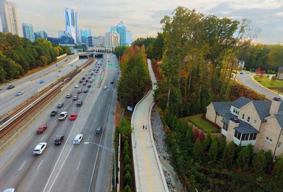
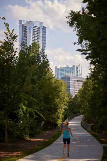
7 PATH 400

8 Photo by: Atlanta Magazine Eastside Atlanta BeltLine

9 Photo by: Atlanta Magazine PATH Parkway
10 Carrollton GreenBelt

11 Arabia Mountain PATH Trail System

12 Silver Comet Trail


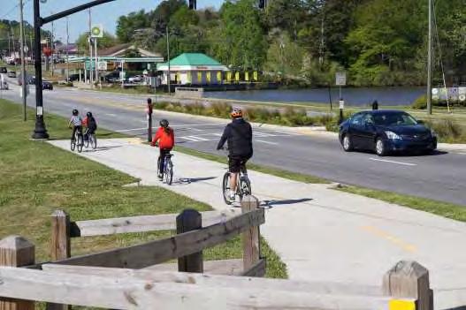
13 Trail Benefits Economic Development Former Columbus dive bar about to sober up River Flow LLC acquired the corner lot and building across the road from the Dragonfly Trail. Retain local talent Attract new businesses and industry Development of tourism based businesses - Photo by Mike Haskey, Columbus, GA Ledger-Enquirer, January 25, 2018

14 Trail Benefits Economic Development Saving Main Street: Powder Springs latest town seeking reinvention Atlanta Journal Constitution Article April 16, 2018 Many of our communities are seeing that they would like to connect directly to the trail because it does give them the opportunity to bring people into their downtowns, said Julianne Meadows, Northwest Georgia Regional Commission, which did an economic analysis of the Silver Comet Trail in 2013.

15 Trail Benefits Health and Wellness Enhance physical and mental health


16 Trail Benefits Alternate Transportation Less dependency on cars and expanded roads Promotes social dignity for all citizens

17 Trail Benefits Quality of Life Improvements Social interaction; neighborhood cohesiveness Nearby recreational amenity Enhance neighborhood security
18 Master Planning Process


19 Planning Considerations < 1% 7% 60% Interested but Concerned 33% No way No How Need to be separated from the road Strong & Fearless Enthused & Confident Will ride in the road

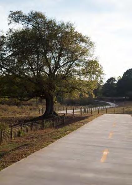
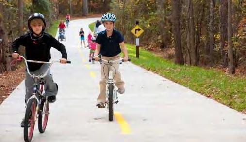
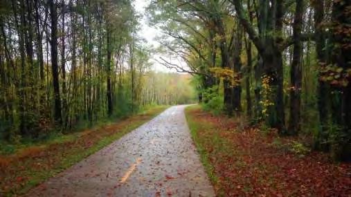
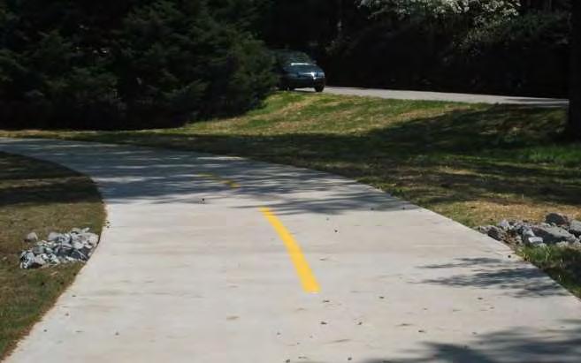
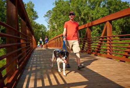
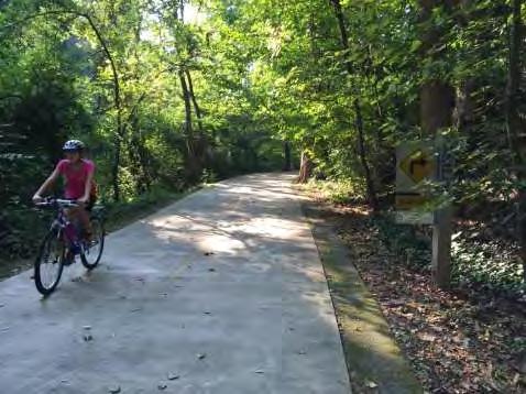
20 Trail Types Greenway Trails Within greenspace, separated from street, shared by bicyclists and pedestrians for non-motorized use. Concrete with center line stripping. 10 min. width


21 Trail Types Greenway Trails

22 Trail Types Shared-Use Streets (Woonerf) New River Street, Batavia, IL Vehicular space is at-grade with bicyclists and pedestrians. Traffic calming elements and pavers are used to create the shared space. Shared-Use Streets can be closed for city festivals/events.

23 Trail Types Shared-Use Streets (Woonerf) New River Street, Batavia, IL New River Street, Batavia, IL

24 Trail Types Side Paths Shared by cyclists and pedestrians. Concrete with center line stripping. 5 min. planted buffer to increase safety and comfort.


25 Trail Types Side Paths


26 Trail Types Bike Routes / Sidewalks Low volume street with 25mph or less speed limit. Bicyclist shares the roadway with vehicular traffic. Pedestrians use sidewalk (min. 6 width recommended)


27 Trail Types Bike Routes / Sidewalks
28 Villa Rica Trail System Preliminary Findings

29 City of Villa Rica Existing Challenges Gold Dust Park Fullerville Tanner Medical Center Conners Road Park Downtown I-20

30 Preliminary Alignments Pine Mountain Gold Museum Gold Dust Park Fullerville Bypass Tanner Medical Center Library Conners Road Park Mirror Lake Neighborhood Elem. Downtown TOTAL = 12.4 mi I - 20 I - 20
31 Preliminary Trail Segments Pine Mountain Gold Museum Gold Dust Park Fullerville Bypass Tanner Medical Center Library Conners Road Park Mirror Lake Neighborhood Elem. Downtown I - 20 I - 20
32 Preliminary Trail Segments - #1 Pine Mountain Gold Museum Gold Dust Park Fullerville Bypass Tanner Medical Center Library Conners Road Park Mirror Lake Neighborhood Elem. Downtown I - 20 I - 20
33 Villa Rica Downtown Master Plan

34 Proposed Downtown Connector Trail
35 1 Downtown Connector

36 1.1 Carroll Road

37 1.1 Proposed Railroad Crossing
38 1 Downtown Loop

39 1.2 Temple Street

40 1.2 Proposed Shared-Use Street

41 1.2 Proposed Shared-Use Street (Events)

42 1.2 Parking Study on Temple Street- Existing (10) Existing Parking Space on Temple St and N Carroll Rd

43 1.2 Parking Study on Temple Street - Proposed (67) (5) Proposed Condition Utilizing Existing Parking at The Mill
44 1.2 Parking Study on Temple Street - Proposed (67) (60) (5) Proposed Condition Church Street Improvement
45 1 Downtown Loop

46 1.3 Cheeves Street to Main Street

47 1.3 Proposed Side Path to Existing Trail
48 1 Downtown Loop
49 1.4 N Dogwood Street


50 1.4 Proposed Neighborhood Greenway [to be updated if time allows]
51 1 Downtown Loop

52 1.5 Wilson Street

53 1.5 Proposed Sidepath
54 1.5 Parking Study on Wilson Street - Existing (5) Existing Parking Space on Wilson St and W View Rd
 (5) (7) (5) Proposed Condition No Net")
55 1.5 Parking Study on Wilson Street - Proposed (8) (5) (7) (5) Proposed Condition No Net Loss
56 Preliminary Trail Segments Pine Mountain Gold Museum Gold Dust Park Fullerville Bypass Tanner Medical Center Library Conners Road Park Mirror Lake Neighborhood Elem. Downtown I - 20 I - 20
57 Preliminary Trail Segments - #2 Pine Mountain Gold Museum Gold Dust Park Fullerville Bypass Tanner Medical Center Library Conners Road Park Mirror Lake Neighborhood Elem. Downtown I - 20 I - 20

58 2 Downtown to Cleghorn Street Park

59 2.1 Cleghorn Street

60 2.1 Proposed Sidepath to Cleghorn Street Park
61 Preliminary Trail Segments - #3 Pine Mountain Gold Museum Gold Dust Park Fullerville Bypass Tanner Medical Center Library Conners Road Park Mirror Lake Neighborhood Elem. Downtown Daniel Rd I - 20 I - 20

62 3 Cleghorn Street Park to Tanner Medical Center
63 3.1 Villa Rica Public Library

64 3.1 Proposed Trail Connection to Library
65 Final Trail Segments - #4 Pine Mountain Gold Museum Gold Dust Park Fullerville Bypass Tanner Medical Center Library Conners Road Park Mirror Lake Neighborhood Elem. Downtown Daniel Rd I - 20 I - 20

66 4 Tanner Medical Center to Fullerville Park

67 4.1 Tanner Medical Center Entrance on Dallas Hwy

68 4.1 Proposed Signalized Crossing
69 Preliminary Trail Segments - #5 Pine Mountain Gold Museum Gold Dust Park Fullerville Bypass Tanner Medical Center Library Conners Road Park Mirror Lake Neighborhood Elem. Downtown Daniel Rd I - 20 I - 20
70 5 Fullerville Park to North Dogwood Street

71 5.1 North Dogwood Street


72 5.1 Proposed Tunnel Under Railroad [to be updated]

73 5 Fullerville Park to North Dogwood Street

74 5.2 Inactive Rail Line

75 5.2 Proposed Rail-Trail
76 Preliminary Trail Segments - #6 Pine Mountain Gold Museum Gold Dust Park Fullerville Bypass Tanner Medical Center Library Conners Road Park Mirror Lake Neighborhood Elem. Downtown I - 20 I - 20

77 6 Gold Dust Park Connector
78 Preliminary Trail Segment - #7 Pine Mountain Gold Museum Gold Dust Park Fullerville Bypass Tanner Medical Center Library Conners Road Park Mirror Lake Neighborhood Elem. Downtown Daniel Rd I - 20 I - 20

79 7 North Loop Bypass Connector
80 Preliminary Trail Segments - #8 Pine Mountain Gold Museum Gold Dust Park Fullerville Bypass Tanner Medical Center Library Conners Road Park Mirror Lake Neighborhood Elem. Downtown Daniel Rd I - 20 I - 20
81 8A Conners Road Park Connector


82 8B Conners Road Park Connector

83 8 Mirror Lake Parkway at Lake Val-Do Mar

84 8 Connors Road at Mirror Lake Elem. School
85 Final Trail Segments - #9 Pine Mountain Gold Museum Gold Dust Park Fullerville Bypass Tanner Medical Center Library Conners Road Park Mirror Lake Neighborhood Elem. Downtown Daniel Rd I - 20 I - 20

86 9A Pine Mountain Gold Museum Connector

87 9B Pine Mountain Gold Museum Connector

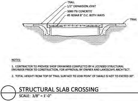
88 9 Mirror Lake Blvd End of Existing Sidepath
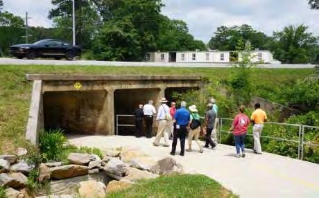
89 Villa Rica Trail System Pine Mountain Gold Museum Gold Dust Park Fullerville Bypass Tanner Medical Center Library Conners Road Park Mirror Lake Neighborhood Elem. Downtown I - 20 I - 20
90 Trail Branding


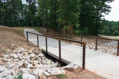
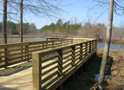
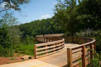
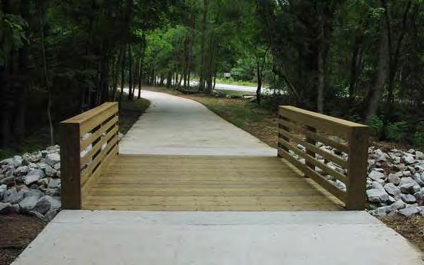
91 Trail Logo Examples
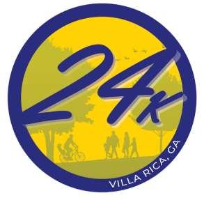
92 Preferred Name 24 K


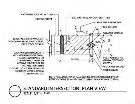
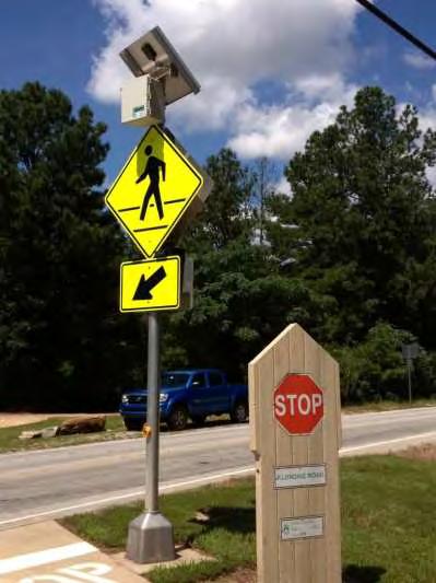
93 Initial Trail Logo Ideas
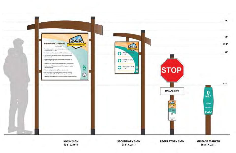
94 Signage


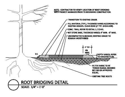
95 Amenities Dynasty Collection by Victor Stanley Model: DYN-SD gallon side-door opening litter receptacles with vertical steel bars. Steelsites RB Collection by Victor Stanley Model: RBF -28, RBF-12 All-steel bench with horizontal solid steel slats, surface mounted tabs, black powder coat. Cycle Sentry Collection by Victor Stanley Model: BRWS-101 Standard u-shaped bike rack, inground mount, and steel powder coated black.
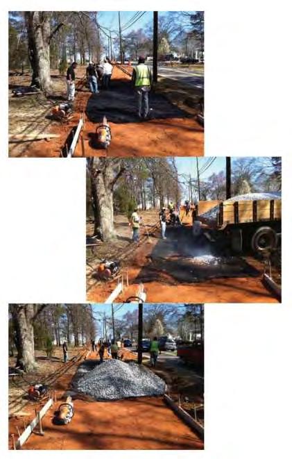
96 Structural Slabs

97 Tunnel under the Railroad


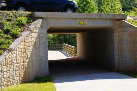
98 Box Culvert under the Roads
99 Boardwalks and Bridges

100 Pocket Parks

101 Intersections

102 At-Grade Crossing
103 Tree Protection & Root Bridging

104 Infiltration Detail
105 Next Steps and Schedule
106 Next Steps Collect Input from the Public Present DRAFT Master Plan to Steering Committee for review and comment Finalize 24 K Master Plan and submit to City Council for Adoption
 239-2521 greta.demayo@kaizencollaborative.com nico.")
107 Contact Information Ed McBrayer 1601 W. Peachtree Street, Atlanta, Georgia (404) KAIZENCOLLABORATIVE Greta demayo Nico Shen 2390 Main Street, Tucker, Georgia (404)

108 Questions and Answers

109 Villa Rica Trail System Proposed Alignments Pine Mountain Gold Museum Gold Dust Park Fullerville Tanner Medical Center Library Conners Road Park Mirror Lake Neighborhood Elem. Downtown TOTAL = 12.4 mi I - 20 I - 20
Gordon County Trail Master Plan
 Gordon County Trail Master Plan Public Meeting March 28, 2017 Agenda Introduction Methodology Types of Trail Facilities Rivers to Ridge Master Plan Branding / Amenities / Design Standards Next Steps Questions
Duwamish Way-finding and CTR Report
 V. North Tukwila When the North Tukwila Manufacturing and Industrial Center was designated in 1992 as part of the region s land use and transportation plan, the plan called for the area to set a light-rail
MAG Town of Cave Creek Bike Study Task 6 Executive Summary and Regional Significance Report
 Page 1 MAG Town of Cave Creek Bike Study Task 6 Executive Summary and Regional Significance Report August 1, 2012 MAG Project #481 Page 2 Task 6 Executive Summary and Regional Significance Report Introduction
4. Action Plan & Projects
 4. Action Plan & Projects 45 46 ACTION PLAN AND PROJECTS The Action Plan organizes the list of transportation projects described in the Mobility Framework Plan section into short-term (0-5 years) and long-term
Perryville TOD and Greenway Plan
 Perryville TOD and Greenway Plan Greenway Glossary Pathway: A bicycle and pedestrian path separated from motorized vehicular traffic by an open space, barrier or curb. Multi-use paths may be within the
City of Birmingham Draft Multi-modal Transportation Plan
 City of Birmingham Draft Multi-modal Transportation Plan City Commission Public Hearing Monday, November 25, 2013 7:30 pm Norman Cox, PLA, ASLA The Greenway Collaborative, Inc. Ann Arbor, Michigan The
City of Wilsonville 5 th Street to Kinsman Road Extension Project
 City of Wilsonville 5 th Street to Kinsman Road Walking Tour & Neighborhood Workshop Summary Report Public Outreach Overview On July 18 th, 2017, the City of Wilsonville hosted a neighborhood walking tour
City Birmingham Multi-Modal Transportation Plan Visioning Workshop Results Meeting
 City Birmingham Multi-Modal Transportation Plan Visioning Workshop Results Meeting Monday, January 28, 2013 7:30 PM, City Hall Norman Cox, PLA, ASLA. Ann Arbor, Michigan. www.greenwaycollab.com Community
Corpus Christi Metropolitan Transportation Plan Fiscal Year Introduction:
 Introduction: The Safe, Accountable, Flexible, Efficient Transportation Equity Act: A Legacy for Users (SAFETEA-LU) has continued the efforts started through the Intermodal Surface Transportation Efficiency
PUBLIC REALM MASTER PLAN
 WESTSHORE BUSINESS DISTRICT PUBLIC REALM MASTER PLAN MASTER PLAN COMMITTEE MEETING MARCH 20, 2013 WESTSHORE BUSINESS DISTRCT PUBLIC REALM MASTER PLAN MACRO-SCALE CONCEPT: A PUBLIC REALM FRAMEWORK DEFINED
4. Mobility and Transportation Element. Page Bikes and Pedestrians
 Below are the specific General Plan text changes proposed for A-16-015 and the proposed changes to Figure MT-2 Paths and Trails. In general changes consist of removing references to the Bicycle, Pedestrian
Austell Road Access Management Plan Public Meeting February 17, 2009
 Austell Road Access Management Plan Public Meeting February 17, 2009 Laraine Vance: Dan Cohen: Cobb DOT Project Manager Pond & Company Planning Director 1 Access Management What is Access Management? The
PROPOSED BICYCLE AND PEDESTRIAN FACILITY Vicinity of Route 123/I-495 Interchange Tysons, Fairfax County, Virginia
 PROPOSED BICYCLE AND PEDESTRIAN FACILITY Vicinity of Route 123/I-495 Interchange Tysons, Fairfax County, Virginia PRELIMINARY ENGINEERING REPORT Prepared for: Prepared by: July 2017 Table of Contents 1
Bicycle-Pedestrian Master Plan Update
 Bicycle-Pedestrian Master Plan Update Planning & Zoning Commission November 29, 2017 Overview Project Purpose & Scope Project History Plan Vision & Goals Chapter 5: Making Connections-Beyond the Path Next
City of Atlanta-MARTA Sales Tax Referendum Draft Project List. Atlanta City Council Work Session May 19, 2016
 1 City of Atlanta-MARTA Sales Tax Referendum Draft Project List Atlanta City Council Work Session May 19, 2016 2 SB 369 - MARTA Sales tax for up to 0.50% is allowed in the City of Atlanta for MARTA Purpose
See Figure 38, Existing Nonmotorized Connections.
 Nonmotorized Connections Existing Nonmotorized Connections Pedestrian, vehicle and bike traffic access and movements are confined primarily to Penny Drive on campus. Due to the steep slope along the length
Parks, Open Space, Trails and Recreation Master Plan
 5.3 DEFINITIONS AND VOCABULARY In order to fully understand the range of trails that have been developed, and should be developed, throughout the community, a vocabulary needs to be established for the
10A. DATE: October 5, Pedestrian and Bicycle Advisory Committee. Kevin Colin, Deputy Planning Manager Curt Bates, City Engineer
 10A DATE: October 5, 2016 TO: PREPARED BY: SUBJECT: Pedestrian and Bicycle Advisory Committee Kevin Colin, Deputy Planning Manager Curt Bates, City Engineer Discussion and Provide Comments, Associated
East Burke Transportation, Safety and Capacity Improvements
 East Burke Transportation, Safety and Capacity Improvements The purpose of this project is to increase mobility and improve safety for pedestrians, cyclists, and motor vehicles along VT Route 114 in the
Construction Specifications Manual
 Isle of Wight County Pedestrian and Bicycle Master Plan Construction Specifications Manual Adopted August 20, 2009 Introduction The Isle of Wight County Pedestrian and Bicycle Facilities Master Plan was
TRANSPORTATION COMMISSION Agenda Staff Report
 TRANSPORTATION COMMISSION Agenda Staff Report Agenda Item No. 5.a DATE: JULY 31, 2014 TO: FROM: SUBJECT: TRANSPORTATION COMMISSION COMMUNITY DEVELOPMENT DEPARTMENT - PLANNING DRAFT OLYMPIC CORRIDOR PREFERRED
City of Novi Non-Motorized Master Plan 2011 Executive Summary
 City of Novi Non-Motorized Master Plan 2011 Executive Summary Prepared by: February 28, 2011 Why Plan? Encouraging healthy, active lifestyles through pathway and sidewalk connectivity has been a focus
Table of Contents Introduction. 2 Purpose of the Plan...2 The Benefits of Walking and Bicycling...3 Vision and Goals of the Plan...
 BICYCLE AND This plan was created through a grant from the Healthy Communities Program with the cooperation of the City of Cynthiana, Cynthiana Main Street, Cynthiana-Harrison County-Berry Joint Planning
Southbend to Prima Vista. October 30, Floresta Corridor Master Plan
 Application of a Complete Street initiative and how it might function operationally 8 8 Southbend to Prima Vista October 30, 2017 Presentation Agenda 2 Perspective and History Traffic projections, Levels
Preliminary Design of Wayzata Boulevard Improvements(CSAH 112)
") Project Area Map 6 COUNTY 112 COUNTY Preliminary Design of Wayzata Boulevard Improvements(CSAH 112) Public Open House Open House To Do List: Sign in Visit with Hennepin County staff and design team Learn
Project Area Map 6 COUNTY 112 COUNTY Preliminary Design of Wayzata Boulevard Improvements(CSAH 112) Public Open House Open House To Do List: Sign in Visit with Hennepin County staff and design team Learn
CITY OF PORTSMOUTH PLANNING DEPARTMENT
 CITY OF PORTSMOUTH PLANNING DEPARTMENT MEMORANDUM TO: JOHN P. BOHENKO, CITY MANAGER FROM: JULIET T.H. WALKER, PLANNING DIRECTOR SUBJECT: BICYCLE / PEDESTRIAN PLAN PROGRESS UPDATE DATE: 3/13/2018 Background
Typical Cross Section: DOWNTOWN (Observer Highway - 8th Street)
") Typical Cross Section: DOWNTOWN (Observer Highway - 8th Street) DRAFT SEPTEMBER 23, 14 1 Washington Street Typical Block Downtown Typical Block: DOWNTOWN (Observer Highway - 8th Street) New crosswalks
Typical Cross Section: DOWNTOWN (Observer Highway - 8th Street) DRAFT SEPTEMBER 23, 14 1 Washington Street Typical Block Downtown Typical Block: DOWNTOWN (Observer Highway - 8th Street) New crosswalks
UDC Street Cross Sections
 UDC Street Cross Sections Local Street - Downtown Local Street Mountable Curb Local Street Vertical Curb Alley Major Arterial Minor Arterial Residential Lane Residential Collector Residential Collector
Obey Creek PEDESTRIAN CIRCULATION EAST WEST PARTNERS PEDESTRIAN CIRCULATION CREEK SIDE LANE SLIP STREET SCOTT MURRAY MAIN STREETS EAST/WEST
 THE VILLAGE AT PEDESTRIAN CIRCULATION MAIN STREETS NORTH/SOUTH MAIN STREETS EAST/WEST SLIP STREET CREEK SIDE LANE PEDESTRIAN CIRCULATION DESCRIPTION: Circulation through the downtown of is organized by
Plant City Walk-Bike Plan
 Plant City Walk-Bike Plan Plant City Commute Mode Share 2.2% 1.4% 2.9% Drove alone 10.2% Carpooled Public transportation (0.1%) Walked Used a Bike (0.4%) 82.9% Taxicab, motorcycle, or other means Worked
Favorable factors for bicycling and walking investments & plan implemtation. Road Map for Success
 Favorable factors for bicycling and walking investments & plan implemtation Road Map for Success Learning Objectives Identify opportunities for funding and support of bicycle and pedestrian projects Explore
Montgomery County Life Sciences Center. LOOP TRAIL GSSC Implementation Advisory Committee Meeting #2 March 26, 2015
 Montgomery County Life Sciences Center LOOP TRAIL GSSC Implementation Advisory Committee Meeting #2 March 26, 2015 Trail Alternatives GENERAL ASSUMPTIONS Where separated bicycle and pedestrian facilities
WHEREAS delivery trucks also pass through the Narrows, into the northern parking lot, to loading docks in the back of the building.
 CEDAR-ISLES-DEAN NEIGHBORHOOD ASSOCIATION ( CIDNA ) RESOLUTION OPPOSING A DRUG STORE DRIVE THRU, AND COMMENDING DORAN COMPANIES FOR PROPOSING MITIGATING AMENITIES INCLUDING NEW LANDSCAPING AND A DEDICATED
Ocean Park Boulevard Green Street Project Alternatives & Trade Offs
 Planning Commission March 4, 2009 Ocean Park Boulevard Green Street Project Alternatives & Trade Offs Purpose of Tonight s Meeting Review concept plans and options Provide input on alternatives and trade-offs
PEDESTRIAN CIRCULATION & STREETSCAPE DESIGN
 CHAPTER 4 Chapter 4 Pedestrian Circulation & Trails PEDESTRIAN CIRCULATION & STREETSCAPE DESIGN In recent years, the City has constructed new sidewalks and enhanced existing ones in the downtown with brick
TOWN OF WILLIAMSTON, SC BICYCLE AND PEDESTRIAN MASTER PLAN TOWN OF WILLIAMSTON, SC BICYCLE AND PEDESTRIAN MASTER PLAN
 TOWN OF WILLIAMSTON, SC BICYCLE AND PEDESTRIAN MASTER PLAN Americans Want Choices 55% of Americans would rather drive less & walk more. Transit use is growing faster than population or highway travel.
Physical Implications of Complete Streets Policies
 Presentation Overview Physical Implications of Complete Norm Cox, ASLA, LLA Landscape Architect Ann Arbor, Michigan, 10:45 to Noon What Are Complete Streets? What Matters to Bicyclists and Pedestrians
Best Southwest Transportation Committee. North Central Texas Council of Governments Transportation Department
 Best Southwest Transportation Committee North Central Texas Council of Governments Transportation Department The The Regional Regional Veloweb Veloweb Review Review NCTCOG Bicycle and Pedestrian Program
Make Lincoln Highway an economically vibrant corridor that is safe, efficient, and beautiful for local residents and visitors.
 Lincoln Highway Streetscape Plan Stakeholder Workshop #2 Handout Contents Introduction and Project Vision Planning Principles Specific Recommendations including a Proposed Typical Roadway Section Renderings
Ocean Park Boulevard Streetscape Improvement Project Alternatives & Trade Offs
 City Council Study Session January 27, 2009 Ocean Park Boulevard Streetscape Improvement Project Alternatives & Trade Offs Scope of Work Purpose of Tonight s Meeting Review work to date and direct staff
MARTIN LUTHER KING JR. WAY
 OCTOBER 2011 40 Vision and Goals The Martin Luther King, Jr. Way Illustrative Master Plan that follows has been developed through a process of community involvement. It expresses a long term vision for
Section 5: Bike and Pedestrian
 Section 5: Bike and Pedestrian Existing Conditions: One defining feature of Glynn County appreciated by both residents and visitors is the extensive sidewalk and bike path system. The City of Brunswick,
Who is Toole Design Group?
 2018 AASHTO Bike Guide Status Update NCHRP 15 60 Amalia Leighton Cody, PE, AICP & Kenneth Loen, PE Washington APWA October 4, 2018 Who is Toole Design Group? TDG is a full service engineering, planning
TO: Board Members Vancouver Park Board FROM: General Manager Parks and Recreation SUBJECT: Seaside Greenway Improvements
 Date: October 1, 2013 TO: Board Members Vancouver Park Board FROM: General Manager Parks and Recreation SUBJECT: Seaside Greenway Improvements RECOMMENDATION A. THAT the Board approve the new bike paths
DRAFT. System Components. Greenway Trails. Introduction. Trail Types. Zebulon Greenway Master Plan
 5 System Components Wakefield Street Photo Simulation showing Sharrows Introduction The Master Plan identifies various system components that, together, create a comprehensive greenway system. These components
CHAPTER 3: Vision Statement and Goals
 Davidson Walks & Rolls: Active Transportation Master Plan CHAPTER 3 Contents: Overview Vision Statement Measurable Goals Public Outreach CHAPTER 3: Vision Statement and Goals Overview The vision statement
Multimodal Transportation Plan
 Multimodal Transportation Plan The Multimodal Transportation Plan will accommodate MILLENIALS ARE DRIVING LESS. WE CANNOT BUILD OUR WAY all modes of transportation by keeping pedestrians, OUT OF CONGESTION.
OKI Awards More Than $41 Million to Transportation Projects Across the Region
 FOR IMMEDIATE RELEASE October 11, 2018 Contact: Ashley Patrick apatrick@oki.org (330) 573-4932 m. OKI Awards More Than $41 Million to Transportation Projects Across the Region Cincinnati, Ohio Ohio-Kentucky-Indiana
RZC Appendix 8A Marymoor Subarea Street Requirements
 RZC Appendix 8A Marymoor Subarea Street Requirements For additional design details for Marymoor Subarea infrastructure, refer to the 2017 Marymoor Subarea Infrastructure Planning Report. STREET REQUIREMENTS
Golden s Plan. For the Highway 6 & 93 Corridor
 Golden s Plan For the Highway 6 & 93 Corridor Purpose of the Study Accommodate regional traffic needs on Highways 6 and 93, as defined by the Northwest Quadrant Feasibility Study. Find a solution that
Appendix B - Street Sections
 Appendix B - Street Sections 6TH STREET CORRIDOR PLAN STREET SECTIONS The street sections in Appendix B include recommended improvements to streets for North Glenwood. They include existing conditions
2014/2015 BIKE ROUTE PLAN 83 AVENUE PROTECTED BIKE LANE
 About the Project 2014/2015 BIKE ROUTE PLAN The City of Edmonton is planning a major bike route on the south side of Edmonton. This bike route is one part of a plan to provide citizens with transportation
BICYCLE AND TRAILS ADVISORY COMMISSION Meeting Minutes
 Minutes Approved as Submitted Date: 8/10/17 Initials: EC BICYCLE AND TRAILS ADVISORY COMMISSION Meeting Minutes June 8, 2017 The Bicycle and Trails Advisory Commission was called to order at 4:00 p.m.
Vision: Traditional hamlet with an attractive business/pedestrian friendly main street connected to adjacent walkable neighborhoods
 N D. Focus Area II Vision: Traditional hamlet with an attractive business/pedestrian friendly main street connected to adjacent walkable neighborhoods Transit Road Focus Area II is located in the Hamlet
CONNECTING PEOPLE TO PLACES
 CONNECTING PEOPLE TO PLACES 82 EAST BENCH MASTER PLAN 07 Introduction The East Bench transportation system is a collection of slow moving, treelined residential streets and major arteries that are the
CHAPTER 1 INTRODUCTION
 CHAPTER 1 INTRODUCTION Chapter Table of Contents THE 2017 HOUSTON BIKE PLAN 1-1 HOUSTON BIKEWAYS PROGRAM 1-2 HISTORY OF BICYCLE PLANNING IN HOUSTON 1-3 BICYCLE LEVEL OF COMFORT 1-3 EXISTING PLANS, PROGRAMS
Pennsylvania Avenue (CR 484) Design Alternatives Study
 Design Alternatives Study") MEMORANDUM Pennsylvania Avenue (CR 484) Design Alternatives Study Prepared for: APRIL 2016 Prepared By TABLE OF CONTENTS Project Background... 2 Previous Concept... 2 Existing Conditions... 4 New Alternatives...
MEMORANDUM Pennsylvania Avenue (CR 484) Design Alternatives Study Prepared for: APRIL 2016 Prepared By TABLE OF CONTENTS Project Background... 2 Previous Concept... 2 Existing Conditions... 4 New Alternatives...
Solana Beach Comprehensive Active Transportation Strategy (CATS)
") Solana Beach Comprehensive Active Transportation Strategy (CATS) 3.0 Goals & Policies The Solana Beach CATS goals and objectives outlined below were largely drawn from the Solana Beach Circulation Element
Solana Beach Comprehensive Active Transportation Strategy (CATS) 3.0 Goals & Policies The Solana Beach CATS goals and objectives outlined below were largely drawn from the Solana Beach Circulation Element
14 TH STREET TRANSPORTATION & STREETSCAPE DESIGN STUDY PLAN B PLAN B TRANSPORTATION & STREETSCAPE RECOMMENDATIONS
 14 TH STREET TRANSPORTATION & STREETSCAPE DESIGN STUDY PLAN B PLAN B TRANSPORTATION & STREETSCAPE RECOMMENDATIONS 141 Symbols Recommendations - Southern End of 14th Street Study Area Streetscape Each icon
The Bike Buzz in Richland. November 2017 Carl Berkowitz
 The Bike Buzz in Richland November 2017 Carl Berkowitz Richland has been growing by leaps and bounds with lots of new homes and roads throughout the community. Recognizing all the growth in the Queensgate
Columbia Pike Implementation Team (CPIT) Meeting
 Meeting") Columbia Pike Implementation Team (CPIT) Meeting November 30, 2010 Agenda Introductions / Purpose of Meeting Review of project goals Multimodal project: 10% street design between the curbs Discussion Multimodal
Columbia Pike Implementation Team (CPIT) Meeting November 30, 2010 Agenda Introductions / Purpose of Meeting Review of project goals Multimodal project: 10% street design between the curbs Discussion Multimodal
DEKALB COUNTY. 22. Priority Projects for DeKalb County
 DEKALB COUNTY 2 0 1 4 T R A N S P O R T A T I O N P L A N 22. Priority s for DeKalb County Following the completion of the project prioritization metrics, each project was able to be compared to other
APPENDIX A: Complete Streets Checklist DRAFT NOVEMBER 2016
 APPENDIX A: Complete Streets Checklist DRAFT NOVEMBER 2016 Complete Streets Checklist MetroPlan Orlando s Complete Streets Checklist is an internal planning tool for staff to further implementation of
Chapter VISION, MISSION, AND GOALS AND OBJECTIVES. Vision. Mission. Goals and Objectives CONNECTING COMMUNITIES ACROSS THE ST.
 VISION, MISSION, AND GOALS AND OBJECTIVES Chapter 3 The Plan s vision, mission, and goals and objectives were developed through a series of interactive exercises with the Citizens Advisory Committee (CAC)
Active Transportation on the Rise
 Integrated Approaches to Shared-Use Paths Doug Sarkkinen, PE Windi Shapley, PE Mandi Roberts, AICP, PLA Why? Biking and walking are important active transportation options. Shared-use paths are critical
BIKE PLAN CONTENTS GATEWAY
 CONTENTS Acknowledgments...vii Great Rivers Greenway District Board of Directors... vii Great Rivers Greenway District Staff... vii Project Consultants... vii Committees... viii Citizens Advisory Committee
SAFE ROUTES TO SCHOOL
 SAFE ROUTES TO SCHOOL Forest Ridge Elementary School Existing Conditions and ACTION PLAN > Oak Creek - Franklin Joint School District Table of Contents CONTEXT Enrollment Boundaries
Dr. M.L. King, Jr. Street North Complete Streets Resurfacing Opportunities HOUSING, LAND USE, AND TRANSPORTATION COMMITTEE MARCH 22, 2018
 Dr. M.L. King, Jr. Street North Complete Streets Resurfacing Opportunities HOUSING, LAND USE, AND TRANSPORTATION COMMITTEE MARCH 22, 2018 What s Happening The City plans to mill and resurface Dr. M.L.
Brooklyn Boulevard (County Road 152) Reconstruction Project Phase I. OPEN HOUSE June 20, 2017
 Reconstruction Project Phase I. OPEN HOUSE June 20, 2017") Brooklyn Boulevard (County Road 152) Reconstruction Project Phase I OPEN HOUSE June 20, 2017 Brooklyn Boulevard (County Road 152) Phase I Project Partners Project Lead Other Project Partners include Brooklyn
Brooklyn Boulevard (County Road 152) Reconstruction Project Phase I OPEN HOUSE June 20, 2017 Brooklyn Boulevard (County Road 152) Phase I Project Partners Project Lead Other Project Partners include Brooklyn
To: Mid America Regional Council From: Louisburg Recreation Commission. March 6, 2018
 To: Mid America Regional Council From: Louisburg Recreation Commission March 6, 2018 The Louisburg Recreation Commission offers their support to the Metcalf Road Complete Street Project in Louisburg. We
City of Davis East Covell Corridor Plan
 Community Open House #2 January 22, 2014 6:00 8:00 p.m. Veterans Memorial Center, Club Room City of Davis Introduction The (ECCP) is a taking a comprehensive look at the existing transportation systems
LANCASTER CITY BICYCLE NETWORK
 LANCASTER CITY BICYCLE NETWORK Downtown Merchants Meeting Wednesday, July 19, 2017 http://www.lancasteratp. DOWNTOWN WALKABILITY ANALYSIS What changes can be made, in the least amount of time, and for
SHIFTING GEARS. for a better ride ahead. MONTGOMERY COUNTY DEPARTMENT OF TRANSPORTATION April 5, 2014
 SHIFTING GEARS for a better ride ahead MONTGOMERY COUNTY DEPARTMENT OF TRANSPORTATION April 5, 2014 CYCLING IN THE USA The number of bicyclists is growing rapidly in the United States Transportation &
CONNECTIVITY PLAN. Adopted December 5, 2017 City of Virginia Beach
 CONNECTIVITY PLAN Adopted December 5, 2017 City of Virginia Beach CONTENTS 1.0 Background & Purpose... 2 2.0 Existing Inventory & Analysis... 3 ViBe District Existing Walking Conditions... 4 3.0 ViBe District
Lynchburg District Update
 Lynchburg District Update Virginia Statewide Bicycle and Pedestrian Advisory Committee Spring Meeting May 16 th, 2017 David Cook Transportation Planner, VDOT Lynchburg District Table of Contents Active
Non-Motorized Transportation 7-1
 Non-Motorized Transportation 7-1 Transportation facilities no longer mean just accommodating a vehicle powered by a combustion engine. Pedestrian and non-motorized facilities are important modes of travel
West End Connectivity Master Plan
 West End Connectivity Master Plan Office of Commissioner Juan C. Zapata District 11 Page 1 of 13 Juan C. Zapata MIAMI- DADE COUNTY COMMISSIONER Introduction I am pleased to announce the West End Connectivity
Roads and Vehicular Traffic Design Principles. Roads and Vehicular Traffic Recommendations
 CIRCULATION AND PARKING roads and vehicular traffic The Campus Master Plan updates the campus transportation network through a multi-modal approach that encourages walking and biking while improving vehicular
Watertown Complete Streets Prioritization Plan. Public Meeting #1 December 14, 2017
 Watertown Complete Streets Prioritization Plan Public Meeting #1 December 14, 2017 Goals for Public Meeting Overview of MassDOT Complete Streets Funding Program Educate the community on Complete Streets
Bicycle Pedestrian Master Plan Pre Bid Meeting Portsmouth, NH August 15, 2013
 Bicycle Pedestrian Master Plan Pre Bid Meeting Portsmouth, NH August 15, 2013 2005 Master Plan GOAL: Provide for safe and convenient bicycle and pedestrian circulation throughout the City. Develop a city
Montgomery County Life Sciences Center Loop Trail
 Montgomery County Life Sciences Center Loop Trail Advisory Committee Meeting #1 February 10, 2015 Agenda 1. Project Background 2. Existing Conditions Analysis 3. Examples from Elsewhere 4. Discussion Project
Public Feedback Comments Appendix G. Appendix G. Public Feedback Comments. Virginia Beach Bikeways and Trails Plan 2011 Page G-1
 Public Feedback Comments Virginia Beach Bikeways and Trails Plan 2011 Page G-1 This is a complete collection to date of responses to the feedback survey which was used at public open houses in December
Plant City Bicycle and Pedestrian Master Plan. Project Update March 2, 2017
 Plant City Bicycle and Pedestrian Master Plan Project Update March 2, 2017 NOV Project Kickoff DEC/ JAN FEB/ MAR Plan Review/Field Work Public Meeting/Coordination Meetings Develop Draft Plan APR/ MAY
Saskatchewan Drive Roadway Rehabilitation and Shared-Use Path Widening
 Saskatchewan Drive Roadway Rehabilitation and Shared-Use Path Widening We are here today to present the draft plan for the Saskatchewan Drive Roadway Rehabilitation and Shared-Use Path Widening project
MASTER BICYCLE AND PEDESTRIAN PLAN
 VILLAGE OF NORTHBROOK MASTER BICYCLE AND PEDESTRIAN PLAN DRAFT PLAN OPEN HOUSE May 2, 2018 AGENDA 1. Community Engagement 2. Vision and Goals 3. General Structure of Plan 4. Recommendations Overview 5.
Route 47 (North Main Street) Reconstruction
 Reconstruction") TOWN OF SUNDERLAND Route 47 (North Main Street) Reconstruction Presented by Lou Rabito, P.E. Presented to Town of Sunderland June 11, 2018 Project Overview MassDOT Project No. 607245 Resurfacing and Related
TOWN OF SUNDERLAND Route 47 (North Main Street) Reconstruction Presented by Lou Rabito, P.E. Presented to Town of Sunderland June 11, 2018 Project Overview MassDOT Project No. 607245 Resurfacing and Related
BIKE ON ROAD NETWORKS: URBAN & RURAL. Non-motorized Transportation Networks. Madison County Council of Governments
 ON ROAD NETWORKS: URBAN & RURAL Non-motorized Transportation Networks Madison County Council of Governments 16 E. 9 th Street Anderson, IN 46016 99 th ANNUAL PURDUE ROAD SCHOOL MARCH 5-7, 2013 PRESENTATION
Fulton Market Streetscape
 Fulton Market Streetscape Ogden Avenue to Halsted Street Public Meeting Recommended Improvements December 10th, 2014 Meeting Purpose and Goals Present Existing Conditions Community Input and Charrette
Small Town & Rural Multimodal Networks
 Small Town & Rural Multimodal Networks Fred Young, PLA Andrea Clinkscales, AICP, PMP Alta Planning + Design Funding Partners Project Team Existing Design Guidance AASHTO Flexibility Guide 2004 AASHTO Bike
GIS Based Data Collection / Network Planning On a City Scale. Healthy Communities Active Transportation Workshop, Cleveland, Ohio May 10, 2011
 The Purpose of GIS Based Network Planning GIS Based Data Collection / Network Planning Healthy Communities Active Transportation Conference Tuesday, May 10, 2011 10:00 AM Norman Cox, LLA, ASLA. Ann Arbor,
Shifting Gears for a Healthier City.
 Shifting Gears for a Healthier City. Mississauga s Cycling Master Plan is an ambitious strategy that sets out to transform Mississauga into a city that is conducive to cycling for daily transportation
Application of a Complete Street
 Application of a Complete Street Southbend to Prima Vista Update May 14, 2018 Meeting Agenda Perspective and History Public input received Typical sections being considered Presentation of the 2-lane master
Route 29 Solutions Projects
 Route 29 Solutions Route 29 Solutions Projects www.route29solutions.org October 10, 2014 Route 29 Widening to Six Lanes Albemarle County This project will widen a 1.8-mile segment of Route 29 from four
City Snapshot September 27, 2018
 1 City Snapshot September 27, 2018 Respondent Introduction Thank you for providing data for the PlacesForBikes City Rating program! The information you provide will be used to understand the progress your
ESSEX TOWN AND VILLAGE BICYCLE AND PEDESTRIAN PLAN. Town of Essex Village of Essex Junction CCRPC DuBois & King
 ESSEX TOWN AND VILLAGE BICYCLE AND PEDESTRIAN PLAN Town of Essex Village of Essex Junction CCRPC DuBois & King Bicycle Pedestrian Plan Update Regional and Local Plans Prepared in 1994 Included list of
UPTOWN REGIONAL BIKE CORRIDORS PROJECT SAN DIEGO ASSOCIATION OF GOVERNMENTS
 UPTOWN REGIONAL BIKE CORRIDORS PROJECT SAN DIEGO ASSOCIATION OF GOVERNMENTS SUMMARY REPORT: COMMUNITY UPDATE MEETING February 6, 2014 6 8:30 p.m. Roosevelt Middle School Library 3366 Park Blvd, San Diego
Bikeable/Walkable Community Plan. Oct. 11, 2012 City Council Workshop
 Bikeable/Walkable Community Plan Oct. 11, 2012 City Council Workshop Background 2006 - O Fallon s population was 72,477. Citizen Survey showed a strong interest in additional bike & pedestrian opportunities.
Safe Streets. City of Lake Forest Park. March 21, 2017
 Safe Streets City of Lake Forest Park March 21, 2017 1 01 WELCOME 2 Agenda WELCOME WHAT IS THIS PROJECT? CONTEXT DRAFT CITYWIDE PROJECTS EXERCISE INTRODUCTION 3 02 WHAT IS THIS PROJECT? 4 WHAT IS THIS
Project Fact Sheet July, 2018
 BELLEVUE AND SYRINGA BIKE SKILLS PARKS Project Fact Sheet July, 2018 Bike parks construction expected to start in August, 2018 After completing a competitive bid process, the City has accepted a bid from
Cascade Bicycle Club Recommendations
 Cascade Bicycle Club Recommendations The following recommendations are focused on improving bicycle commuting in the Duwamish (South Park, South Downtown, Georgetown and North Tukwila). The recommendations