West Shore Boulevard Complete Street Feasibility Evaluation. Summary Report. Prepared for: City of Tampa, Florida. Prepared by: May 8, 2014
|
|
|
- Clifford Riley
- 6 years ago
- Views:
Transcription
1


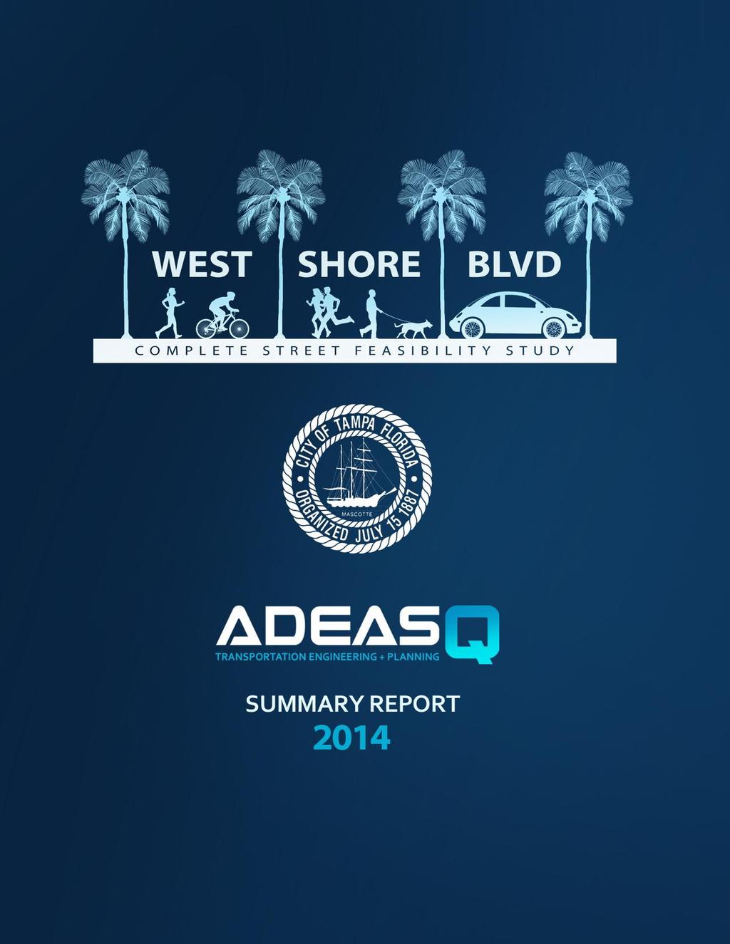
2 West Shore Boulevard Complete Street Feasibility Evaluation Summary Report Prepared for: City of Tampa, Florida Prepared by: May 8, 2014 ADEAS-Q Page 2
3 EXECUTIVE SUMMARY A complete-street feasibility evaluation was completed for West Shore Boulevard between Kennedy Boulevard and Boy Scout/Spruce Street to compare opportunities that could improve multi-modal accommodations while also continuing to serve motor vehicle traffic. This preliminary evaluation consisted of the following: Data collection of historical and existing traffic Travel demand forecasting Review of existing public right-of-way Development of potential cross-sections Development of plan view concept Long range cost estimates Policy recommendations The Westshore Alliance formed a technical subcommittee to help review materials and develop project alternatives. The committee consisted of members from the City of Tampa, Hillsborough County, Florida DOT, Westshore Alliance, and other various professionals with a background in transportation planning and engineering. This project was managed by the City of Tampa. However, this section of West Shore Boulevard is under Hillsborough County jurisdiction, and three of the largest cross-street intersections are under Florida DOT jurisdiction, which is why proactive coordination between the different public agencies was essential. Cross-section recommendations were identified as short-range improvements that potentially could be implemented within the existing public right-of-way. The long-range improvements identify an additional 10- foot public access easement located between the edge of right-of-way and in front of anticipated private redevelopments. The cross-sections were prepared for consistency with the recently created Westshore Overlay District and the Westshore Area Master Plan. The recommendations for both north and south of I-275 contain symmetrical cross-sections with on-street bicycle lanes, much wider sidewalks, trees planted both within a landscaped median and behind the curbs. The segment north of I-275 is proposed to have a typical cross-section that can preserve the existing curbline, which may provide a significant cost savings when compared to a total reconstruction of the facility. The segment south of I-275 has more dramatic improvements by reducing the currently inefficient six-lanes into a four-lane facility between Kennedy Boulevard and I-275. The removal of the outside lanes reduces merging/weaving conflicts and allows the outside travel lanes to accommodate significantly improved landscaping and bicycle/pedestrian facilities. Modifications to existing intersection geometries were then prepared and the recommendations are provided in a plan view that covers the study area. The development of recommendations was an iterative process of considering both traffic engineering and urban design principles. The alternatives developed during this project represent a balance of providing the complete street benefits with the least amount of increased ADEAS-Q Page 3
4 traffic delay. In summary, the recommendations are anticipated to increase existing motor vehicle travel times along the study area by about 4.4 percent (or 11 seconds). Significant opportunities to reduce pedestrian crossing distances, improve sidewalk and bicycle infrastructure, reduce unnecessary pavement, and improve landscaping were identified at various locations throughout the study area. Changes to existing lane configurations were identified at the Kennedy Boulevard and at the Cypress Street intersections. However, these recommendations do not prevent other capacity improvements, such as triple northbound-left-turn-lanes at Kennedy Boulevard, from potentially being evaluated further also. Opportunities at some locations were identified to reduce the length of existing left-turn lanes so that additional median space could be used for landscaping. These opportunities were due to low left-turn volumes and/or a reduced design speed. A speed study was completed as part of this project and the results identified that the majority of vehicles in both directions currently travel five to nine miles per hour slower than the existing 45 mph speed limit. The long-range planning level cost potential was estimated for the recommendations identified in this project. The estimate assumed a total reconstruction of West Shore Boulevard between Kennedy Boulevard and Boy Scout/Spruce Street. The total range of cost potential for the recommendations was from $14-21 million. However, it is expected that the actual cost may be on the low end of the range. If the typical cross section for the north segment can be built within the existing curb, that would be a considerable cost savings compared to a total reconstruction. This cost comparison is recommended for additional refinement with more detailed levels of design and engineering. Transportation policy can have a significant influence on the development of potential improvements for transportation infrastructure. In addition to the design and infrastructure recommendations presented, the following policy considerations were also explored: Constrain the Long Range Transportation Plan (LRTP) to remove six-lane widening project Carry the Analysis Further to PD&E and Design Phases FHWA/FDOT Concurrence with other agencies SR 60/I-275 Interchange Coordination Perform sub-area FSUTMS travel demand model refinement Extension of Reo, Occident, and Trask Streets under I-275 Bury overhead utilities Convert to mast arm traffic signals Convert to 35 mph speed limit Other considerations would be to consider evaluating mid-block pedestrian crossings along the study area and potentially changing the West Shore Boulevard principal arterial classification. The following graphics show the recommended improvements. ADEAS-Q Page 4
5 North Segment Typical Cross Section South Segment Typical Cross Section ADEAS-Q Page 5
6 SOUTH CONCEPT ADEAS-Q Page 6
7 NORTH CONCEPT ADEAS-Q Page 7
8 NORTH CONCEPT ADEAS-Q Page 8
9 TABLE OF CONTENTS Executive Summary Background Existing Cross-Section Traffic Data Travel Demand Modeling Design Traffic Volumes and Analysis Traffic Analysis Findings Alternative Configurations Cost Potential Policy Considerations APPENDIX Available by Electronic File Appendix A: AM, Mid-Day, and PM Peak Turning Movement Count Data Appendix B: West Shore Boulevard Spot Speed Study Appendix C: Pedestrian, Bicycle, and Daily Classification Count Data Appendix D: Existing Traffic Signal Timing Plans Appendix E: Travel Demand Model Plots Appendix F: Future Year Turning Movement Count Worksheets Appendix G: Traffic Signal and Arterial Capacity Analysis Data Files Appendix H: Potential Cost Estimate Worksheet ADEAS-Q Page 9


10 BACKGROUND The Hillsborough County Metropolitan Planning Organization s (MPO) Long Range Transportation Plan (LRTP) identifies widening West Shore Boulevard to continuous six-lanes between Spruce Street and Kennedy Boulevard. The LRTP is based on projected future-year traffic volume forecasts. However, more recent planning efforts, including the Westshore Public Realm Master Plan, have subsequently focused making West Shore Boulevard a complete street serving more than just vehicle traffic. The West Shore corridor was originally developed as a suburban style corridor. Much of the original development exhibits car-oriented design, with surface parking in front and walking and biking access inconvenient or non-existent. The trend over time had been to reduce the number of access points in order to accommodate greater traffic volumes travelling through the neighborhood. The area has grown into a dominant sub-market of retail and office, with most trips made by private vehicles. West Shore Boulevard has grown into a large market of retail and office space since the 1960 s with typical suburban style development patterns. Newer re-developments are now being subject to an overlay architecture district, which encourages buildings in the front, providing better pedestrian access, and parking behind the buildings. Other large residential projects are currently under construction or are planned in the near future. The streetscape includes no landscaping south of I-275, with occasional median landscaping north of I-275. Above-ground utilities exist throughout the corridor, including span-wire traffic signals. In general, the streetscape (within the public right-of-way) could be characterized as barren and hostile to people, with outdated and unsightly equipment prevailing. ADEAS-Q Page 10


11 The existing ROW is purposed to maximize vehicle travel lanes, providing minimal pedestrian and transit facilities, and no dedicated bicycle facilities. Pedestrians are occasionally present along study area, but with only narrow sidewalks and limited crossing opportunities, few people have historically chosen to walk. However, recent observations indicate that the trend may be starting to change. West Shore Boulevard south of I-275. The plan to widen West Shore Boulevard in the LRTP was originally intended to relieve overall traffic congestion by providing additional north-south capacity in the region. Based on generalized roadway capacities, the expected demand warrants six-lanes. However, the generalized capacities do not adequately account for details like intersection capacity and performance, and detailed operational analysis is needed to measure actual improvements in capacity and performance. In recent years, the importance of providing higher-quality pedestrian and bicycle facilities to provide convenient mode choices has become more apparent for mixed-use neighborhoods to remain economically competitive. West Shore Boulevard has a substantial concentration of destinations, particularly office and retail uses, and is expected to see continued growth. It will be difficult to continue to serve this development with an exclusively auto-oriented corridor, and therefore, the City of Tampa is exploring options to provide a more balanced set of transportation options, including re-purposing travel lanes to provide higher-quality pedestrian and bicycle facilities. A pedestrian and a bicyclist share a narrow sidewalk along busy West Shore Boulevard. The purpose of the study is to evaluate options for serving the transportation needs of all modes of travel in the West Shore Boulevard corridor. With input from the Westshore Alliance and the technical subcommittee, the City of Tampa evaluated opportunities to make West Shore Boulevard more of a complete street. This project evaluates which options are technically feasible to improve West Shore Boulevard to better accommodate all modes of travel and to improve aesthetics along this primary arterial. EXISTING CROSS-SECTION West Shore Boulevard is a north-south arterial roadway that connects between International Plaza north of Spruce Street and Interbay Boulevard in South Tampa. The roadway is generally a four-lane divided arterial ADEAS-Q Page 11

12 between International Plaza Mall and I-275, a six-lane divided facility between I-275 and Kennedy Boulevard, and a two-lane undivided facility south of Kennedy Boulevard. While sidewalks are continuous throughout the corridor, the pedestrian environment is generally low quality. North of I-275, sidewalks are generally curb-tight on the west side of the street, set back approximately 10 feet on the east side, are typically four to five feet in width, and with four-lanes of relatively high-volume traffic. South of I-275, sidewalks are almost exclusively curb-tight, adjacent to six-lanes (and up to eightlanes at the intersections) of high-volume traffic. Pedestrian crossings are provided only at signals, where people walking must contend with long wait times, long crossing distances, and significant volumes of conflicting turning vehicles. No dedicated bicycle facilities are provided in the corridor. Bicyclists may legally share the travel lanes, but with a posted speed of 45 mph and 11-foot wide shared use lanes, few people are comfortable doing so, and therefore, frequently a rare bicyclist may share the narrow sidewalk with pedestrians. Existing typical cross-section along the north segment of West Shore Boulevard between Spruce Street and Cypress Street. The right-of-way width in the corridor is generally feet, providing adequate space for a six-lane divided roadway with curb-tight sidewalks and utilities. With this current configuration, there is not adequate space dedicated for complete street features such as wide and/or setback sidewalks, bicycle facilities, or planting strips. ADEAS-Q Page 12


13 Existing typical cross-section along the south segment of West Shore Boulevard between I-275 and Kennedy Boulevard. TRAFFIC DATA Historical traffic counts were first reviewed to identify trends and daily traffic volumes along West Shore Boulevard. Historical traffic counts that are published by the Florida DOT and the City of Tampa along West Shore Boulevard were obtained and reviewed to identify trends. TRAFFIC VOLUME HISTORY ALONG WEST SHORE BOULEVARD ADEAS-Q Page 13
14 The historical traffic data identified that the daily volumes north of Kennedy Boulevard have remained relatively consistent while the volumes north of Cypress Street have been increasing. The truck percentage along West Shore Boulevard has remained relatively consistent at 2-3 percent of overall traffic. Due to the age of existing data, new traffic data was also collected for use in the evaluation. Existing traffic counts were collected at all signalized intersections in the study area along West Shore Boulevard in July 2013 and adjusted to peak season values. A two-hour turning movement count (TMC) was conducted for each peak period (AM Peak, Mid-day, and PM Peak) during a typical week day at the following intersections: Westshore Boulevard & Kennedy Boulevard Westshore Boulevard & North B Street Westshore Boulevard & West Gray Street Westshore Boulevard & I-275 Northbound Ramps Westshore Boulevard & I-275 Southbound Ramps Westshore Boulevard & West Cypress Street Westshore Boulevard & West Laurel Street Westshore Boulevard & West Spruce Street/Boy Scout Boulevard Traffic signal timings, lane geometries, pedestrian counts, and bicycle counts were also collected as part of the TMC data collection process. A summary of the peak hour turning movement count volumes for each of the three time periods is available in the appendix. Twenty-four hour mainline vehicle classification counts that identify volumes by vehicle type were also collected for three consecutive days at two locations in each direction. The south location was collected between Kennedy Boulevard and I-275. The north location was collected between I-275 and Spruce Street/Boy Scout Boulevard. The following graph identifies the hourly volume trends for West Shore Boulevard. The hourly volume collection identified a sustained traffic demand from 7:00am-8:00pm. There are similarities between the north and the south segments regarding hourly distribution of traffic. The northbound direction generally carries more daily volume. The noon hour demonstrates to be the greatest demand along the study area, and the hourly distribution patterns on West Shore Boulevard are different than the I-275 patterns. During the data collection there was consistent demand between different days. The largest challenge was finding regular days to conduct the data collection. The lowest hourly volumes were identified between 10:00am-11:00am, which was when the spot speed data was collected. ADEAS-Q Page 14


15 Hourly Volume by Direction HOURLY TRAFFIC VOLUMES ON WEST SHORE BOULEVARD Since the speed limit was also considered as part of the evaluation, existing speed data was collected and analyzed. One-hour data sets of mainline spot speeds for each direction of travel were collected. Speed data was collected in each direction along the south half and also the north half of the corridor. This data was then summarized to identify the 85 th percentile speed. The table below summarizes the results. A copy of the data collected is provided in the appendix. ADEAS-Q Page 15
16 Most speeds collected were between five to nine mph below the speed limit. The northbound direction was identified to generally be the slower direction. It is likely that there is a combination of factors of why most speeds are below the 45 mph speed limit, such as the traffic volumes, and a variety of dense land uses located near the right-of-way. TRAVEL DEMAND MODELING Travel demand model estimates were generated using the FSUTMS model for future 2035 conditions for both the 4-lane and 6-lane alternatives. The base 2035 Tampa Bay Regional Planning Model was used to compare three alternative scenarios: Base model: 2035 Long Range Cost Affordable Network Scenario 1: 2035 base model with six-lanes of West Shore Blvd and other relievers Scenario 2: 2035 base model with four-lanes of West Shore Blvd and other relievers Scenario 3: 2035 base model with four-lanes of West Shore Blvd only The other relievers are planned parallel local roadways to West Shore Blvd identify to carry local trips underneath I-275. These relievers were identified and adopted by the subcommittee as assumed improvements in the future year condition: Reo Street Occident Street Trask Street The six-lane scenario of West Shore Blvd was identified to attract many more vehicles to the corridor than the four-lane scenario. It would be difficult to demonstrate a service delay improvement with the six-lanes of West Shore Blvd due to the increased volume assignment. This is why an existing traffic volumes comparison was also undertaken. It was identified that the future year six-lane scenario would attract about 10,000 more vehicles per day than the four-lane scenario. The combination of the Reo Street, Occident, and Trask Street relievers were identified as the facilities that would accommodate these vehicles, in addition to help restoring an improved grid network of streets. The travel demand model plots are provided for comparison in the appendix. The table below summarizes the different travel demand model scenario conditions, the assumptions, and resulting assignment of traffic volumes. ADEAS-Q Page 16

17 DESIGN TRAFFIC VOLUMES AND ANALYSIS Future year turning movement counts were generated for each alternative using the link volumes estimated by the travel demand model and the existing turning movement proportions. Future year travel demand model volumes were developed and provided by FDOT. The 2035 Cost Affordable Plan was used and considered to be the base model year for future year analyses. Model volumes were provided in peak- ADEAS-Q Page 17
18 season weekday average daily traffic (PSWADT) and then multiplied by the Florida DOT K factor to obtain peak hour volumes. Existing turning movement proportions were applied from the TMCs. Directionalization of the volumes was done by using the existing directional split for the link. Computing the north-south through volumes was based on the upstream and downstream directional link volumes, and the existing turning proportions. Computing the north-south turning volumes was done as a proportion of the non-through upstream link volume. Computing the east-west turning volumes was done as a proportion of the nonthrough downstream link volume. Computing the east-west through volumes at Spruce and Kennedy Streets was based on their model link volumes and the calculated turning volumes. Computing the remaining eastwest through volumes was proportionate to the east-west turning volumes. Minor street volumes not provided in in the model network were also adjusted to ensure growth projections as compared to existing volumes. There was a lack of preexisting available AADT data for side street traffic. Also, the published traffic volume data in the vicinity is predominantly a combination of estimated and calculated estimates along West Shore Blvd. Therefore, as part of this project, classification count data was collected for three consecutive days along West Shore Blvd to develop an AADT for both the north and south study segments. This AADT was compared to the TMC collected data utilizing the AADT*K*D*% method. The peak season adjusted TMC data demonstrated greater volumes at the majority of locations when compared to the classification count method. Therefore, it was determined that utilizing the existing TMC counts may provide a sufficient and a more conservative analysis. Also, this method allowed the project team to analyze AM, MidDay, and PM Peak scenarios, scenarios which would not be possible under the proposed AADT*K*D*% method. Therefore, the TMC data is considered to be a sufficient and more detailed method to establish the Base Year volumes. Existing traffic conditions and future 2035 traffic conditions for the 4-lane and 6-lane alternatives were analyzed using Synchro. Synchro is a traffic analysis and optimization software application which determines intersection capacity and traffic operations. Analysis was performed for AM, Midday, and PM peak conditions for existing conditions and each future alternative. With future 2035 conditions showing high levels of congestion for all scenarios, the 4-lane alternative was also analyzed with existing traffic volumes for comparison. Future year lane configurations for the alternatives were determined through analysis based upon the future year traffic volumes. Differences in projected volumes along West Shore resulted in substantial expansions needed in turn lane configurations to accommodate projected demand for the 6-lane scenario, as compared to the 4-lane scenario. The 6-lane scenario was developed with an effort made to address forecasted future year travel demand model volumes which may produce V/C ratios more comparable to the 4-lane scenario. The forecasted 6-lane volumes are extremely high, and are difficult or impossible to serve with at-grade intersections, particularly at the Boy Scout, Cypress, I-275, and Kennedy intersections. The 6-lane scenario included more aggressive and hypothetical turn-lane assumptions than the 4-lane scenario regarding turn lanes in an effort to address these much higher volumes, largely because the model forecast allocates ADEAS-Q Page 18
19 significantly more traffic to the 6-lane scenario. Turn lane additions were assumed to bring operations to levels comparable to the 4-lane scenario and the lower allocated demand. The added lanes for the 6-lane scenario consisted of: 3rd NBLT lane, 2nd NBRT lane, 3rd SBLT lane, 3rd SBT lane at Boy Scout/Spruce Street 2nd EBT lane, 2nd EBLT lane, 2nd WBLT lane, WBRT lane, 2nd SBLT lane, SBRT lane, NBRT lane at Cypress 2nd SBLT lane, no merge lane at I-275 NB The additional turn lanes identified in the 6-lane scenario (some of which are located outside of the ROW) are not recommended for further consideration. Refinements that help develop a more detailed travel demand model are suggested for further consideration, but were not originally identified in the City s scope of services for this preliminary screening evaluation of West Shore Blvd. For these reasons is why an existing volume conditions analysis was also undertaken to comparatively evaluate the two alternative scenarios on West Shore Blvd. Traffic signals were optimized manually in accordance with procedures in the Highway Capacity Manual for each intersection to optimize the level of service and the volume-to-capacity (V/C) ratio. The following tables summarize expected level of service, delay, volume/capacity ratios, and critical movements listed by intersection for AM, Midday, and PM peak-hour conditions, respectively. More detail on this data is also documented in the Synchro reports in the appendix. ADEAS-Q Page 19
20 AM Peak-Hour Intersection Conditions AM Existing AM Existing 2035 AM 2035 AM 4-lane Intersections Concept 4-lane 6-lane Boy Scout LOS D D F F Delay Max V/C Movement WBL/EBT WBL/EBT EBL/WBT WBL/EBT Laurel LOS A A B B Delay Max V/C Movement SBT SBT NBL/SBT NBL Cypress LOS D D E D Delay Max V/C Movement NBL NBL SBL/NBT SBL/NBT I-275 SB LOS C C D C Delay Max V/C* Movement WBR WBR WBR WBR NBL V/C* I-275 NB LOS B B D D Delay Max V/C Movement NBT NBT NBT NBR Gray LOS A A B B Delay Max V/C Movement WBTL NBT NBT NBT North B LOS A A A A Delay Max V/C Movement WB NBT WB/NBT WB/NBT Kennedy LOS D D E E Delay Max V/C Movement NBL NBT SBL/NBT/EBT NL/ST/WL/ET ADEAS-Q Page 20
21 Mid-day Peak-Hour Intersection Conditions Mid Existing Mid Existing 2035 Mid 2035 Mid 4-lane Intersections Concept 4-lane 6-lane Boy Scout LOS D E F F Delay Max V/C Movement NBL/SBT NBL/SBT NL/ST/EL/WT WL/ET/NL/ST Laurel LOS A A B B Delay Max V/C Movement EBL EBL SBT NBL Cypress LOS D D F D Delay Max V/C Movement WBL/EBT NBL NL/ST/EL/WT EBL I-275 SB LOS B B C B Delay Max V/C* Movement WBR WBR WBR WBR NBL V/C* I-275 NB LOS A A B B Delay Max V/C Movement NBT NBT NBT NBR Gray LOS B C D E Delay Max V/C Movement EBL EBL/SBT NBL/SBT NBL/SBT/WBL North B LOS B B C B Delay Max V/C Movement EBL EBL/SBT SBT NBL/SBL/EBL Kennedy LOS D D F F Delay Max V/C Movement SBL/NBT SBL/NBT SL/NT/WL/ET SL/NT/WL/ET ADEAS-Q Page 21
22 PM Peak-Hour Intersection Conditions PM Existing PM Existing 2035 PM 2035 PM 4-lane Intersections Concept 4-lane 6-lane Boy Scout LOS E E F F Delay Max V/C Movement NBL/EBL/SBT EBL/WBT/NBL EL/WT/NL/ST EL/WT/NL/ST Laurel LOS A A B C Delay Max V/C Movement EBL EBL EBL/NBT EBL/NBT Cypress LOS D D F E Delay Max V/C Movement EBR EBR EL/WT/SL/NT EBR/WBL/SBT I-275 SB LOS B B B B Delay Max V/C* Movement WBL WBL WBR WBR NBL V/C* I-275 NB LOS F F D F Delay Max V/C Movement SBL/NBR SBL/NBR SBL/NBT SBL/NBR Gray LOS B C D D Delay Max V/C Movement EBL/SBL EBL/SBL EBL/NBT EBL/NBT North B LOS A B C D Delay Max V/C Movement EBL EBL EBL/NBL/SBT EBL/NBL/SBT Kennedy LOS E E F F Delay Max V/C Movement NBL/SBT NBL/SBT WL/ET/NL/ST WL/ET/NL/ST * Note: NBL volumes at Lemon constrained to 1.00 (excess routed to Cypress). Max V/C of movements reported since this is a minor movement with no exclusive signal phase. Phase splits manually optimized based on existing timing plans. Coordinated phase assumed to be along West Shore except at Kennedy and Boy Scout/Spruce. PSCF removed at I-275 ramps for all time periods due to construction diversion from Lois. PSCF removed at Cypress in PM peak due to construction diversion from Lois. ADEAS-Q Page 22
23 Arterial performance along West Shore Boulevard was also analyzed using Synchro to identify the impact to typical travel times. The following table summarizes the arterial performance of the study corridor for AM, Midday, and PM peak-hour conditions, respectively. West Shore Boulevard Arterial Performance Comparisons AM Existing AM Existing 2035 AM 2035 AM Arterial 4-lane Concept 4-lane 6-lane LOS E E F F Northbound Speed Time (s) LOS E E F F Southbound Speed Time (s) Mid Existing Mid Existing 2035 Mid 2035 Mid Arterial 4-lane Concept 4-lane 6-lane LOS D E E E Northbound Speed Time (s) LOS E E F F Southbound Speed Time (s) PM Existing PM Existing 2035 PM 2035 PM Arterial 4-lane Concept 4-lane 6-lane LOS F F F F Northbound Speed Time (s) LOS E E F F Southbound Speed Time (s) lane scenario includes: - Convert to 4-lanes from Kennedy to I Single NBLT lane at Cypress - Single EBT departure lane at Cypress 6-lane scenario includes: - Continuous 6-lanes from Kennedy to Spruce - 3rd NBLT lane, 2nd NBRT lane, 3rd SBLT lane, 3rd SBT lane at Spruce - 2nd EBT lane, 2nd EBLT lane, 2nd WBLT lane, WBRT lane, 2nd SBLT lane, SBRT lane, NBRT lane at Cypress - 2nd SBLT lane, no merge lane at I-275 NB TRAFFIC ANALYSIS FINDINGS Several major capacity constraints exist along the corridor, specifically the intersections with Spruce Street, Cypress Street, I-275, and Kennedy Boulevard. Spruce/Boy Scout and Kennedy Boulevard represent the most significant constraints, and also represent the termini of the study corridor. The minor intersections at ADEAS-Q Page 23
24 Laurel Street, Gray Street, and North B Street have little effect on capacity, and show minimal performance differences with four or six lanes. Overall, future year operations anticipate continued high levels of congestion at the constrained intersections, particularly at Spruce/Boy Scout and Kennedy, with both the four-lane and six-lane alternatives. The additional demand attracted by the six-lane alternative exacerbates the capacity constraints, resulting in the need for additional turn lanes in addition to the mainline widening. Many of these hypothetical turn lanes would be located outside of existing right-of-way. Level of Service F results even with the addition of these turn lanes. In summary, the six-lane alternative induces more demand on West Shore Boulevard than the amount of additional capacity created. Because future-year volumes were showing highly congested operations in all alternatives, the four-lane alternative was analyzed for existing traffic volumes to provide a comparison to existing operations. The reduction in travel lanes between Kennedy and I-275 results in somewhat reduced speeds, but level-ofservice remains comparable to existing conditions. In summary, the proposed four-lane cross-section and associated intersection geometry improvements represent an overall 4.4 percent average travel time increase between all three time periods when compared to existing conditions. This average accounts for both directions of West Shore Boulevard through the study area for each of the three peak periods analyzed. Specifically, a 3.7% (or nine second) increase was reported for the northbound direction and a 5.0% (or 13 second) increase for the southbound direction. ALTERNATIVE CONFIGURATIONS Reconfiguration to a 4-lane roadway would provide space for improved pedestrian, bicycle, or transit facilities or streetscape elements. Several different options for reconfiguring the roadway were developed for review by the project review subcommittee. Provided below is a description of the configurations that were endorsed by the subcommittee. One typical cross-section was developed for each the north segment north of I-275 and the south segment south of I-275. The north segment (I-275 to Spruce/Boy Scout) maintains the roadway as four-lanes with a landscaped median and provides left-turn lanes as needed to preserve access. The existing curb lines are maintained to limit costs, but the space between the curbs is reconfigured to provide 11 foot travel lanes, four-foot on-street bicycle lanes, and a 13.5 foot landscaped median. The remaining space located outside of the curb line on both sides of the street provides approximately a six foot utility, landscaping, furniture and/or sidewalk strip followed by an additional 9-10 feet of continuous sidewalk. These are considered to be short-term improvements since it appears they can be configured within the existing 100 foot public right-of-way. The south segment (Kennedy to I-275) reconfigures the roadway to four-lanes with a continuous landscaped median and provides left-turn lanes as needed. The existing curb lines are changed to provide 11 foot travel lanes, a sixteen foot continuously landscaped median, and six-foot wide on-street bike lanes. The remaining ADEAS-Q Page 24

25 space located outside of the curb line on both sides of the street provides approximately a six foot utility, landscaping, furniture and/or sidewalk strip followed by an additional nine feet of continuous sidewalk. These are considered to be short-term improvements since it appears they can be configured within the existing 105 foot public right-of-way. Both segments also identified long-term improvements that identified a public easement adjacent to the existing public right-of-way line. The width of the easement is 10 feet on each side of the street. The intention is to use the transitional 10 feet as public space for walking and streetscape amenities, such as plaza space, benches, tables, kiosks, public art, etc. along the frontage of buildings. Both proposed segments would significantly improve the walking and bicycling environment compared to existing conditions, and could include an additional sidewalk dedication to be required as redevelopment occurs. Both segments also provide substantial space for median and street side landscaping in order to contribute to the streetscape and sense of place along West Shore Boulevard. The following graphics show the typical cross-section developed for the north and south segment of West Shore Boulevard. North Segment Typical Cross Section ADEAS-Q Page 25
26 South Segment Typical Cross Section A conceptual plan view of improvement alternatives was also developed in addition to the typical crosssections. The plan view covers the entire length of the study area and provides more detail, specifically identifying improvements at the intersections also. Turn-lane modifications were evaluated at each intersection that would have relatively minor impact to traffic delays, while also providing the ability to reduce the existing pedestrian crossing distance and provide the ability for improved landscaping. Where feasible, pedestrian refuge areas were identified within the wider median. Special attention was given at intersections previously identified in the Westshore Area Master Plan as public plaza corners for consistency. A reduced speed limit from the existing 45 mph to 35 mph facilitates the ability to reduce the length of turn lanes by reducing the required braking distance within each turn lane, while still being able to serve the same amount of traffic volumes. Opportunities for turn-lane removal along West Shore Boulevard are identified at the intersection of Kennedy Boulevard and at Cypress Street. The following graphics provide the plan view of conceptual improvements. The four-lane concept alternative that was evaluated in the capacity analysis is the same alternative shown below. ADEAS-Q Page 26
27 SOUTH CONCEPT ADEAS-Q Page 27
28 NORTH CONCEPT ADEAS-Q Page 28
29 NORTH CONCEPT ADEAS-Q Page 29
30 COST POTENTIAL The long-range cost potential was estimated for the recommendations identified in this project. A planning level estimate referenced the most recent Florida Department of Transportation Long Range Estimating (LRE) data for specific cost items. Therefore, conservative assumptions were applied to provide the estimate. The estimate assumed a total reconstruction of West Shore Boulevard between Kennedy Boulevard and Boy Scout/Spruce Street. This reconstruction includes new bicycle and pedestrian facilities, new decorative lighting, new street trees, and retrofit of the new medians. Existing span-wire traffic signals would be changed to assume new and more decorative mast-arm signal assembly. Utilities that are currently overhead would be converted to underground utilities, where feasible. Construction aspects of the cost potential include Maintenance of Traffic (MOT) and mobilization of the contractors. Other phases assumed in the cost potential include 15 percent for inspection (CEI), 15 percent for design, and a 25 percent cost contingency. Cost escalation to year 2015 dollars was also assumed. The total range of cost potential for the recommendations was from $14-21 million. However, it is expected that the actual cost may be on the low end of the range. If the typical cross section for the north segment can be built within the existing curb line (with some existing drain inlets and piping), as discussed in the previous sections of the report, that would be a considerable cost savings away from a total reconstruction. A copy of the potential cost breakdown is provided in the appendix. This cost potential is recommended to be refined further concurrent with more detailed levels of design and engineering. ADEAS-Q Page 30
31 POLICY CONSIDERATIONS In addition to the design and infrastructure recommendations presented, policy considerations were also explored. Transportation policy can have a significant influence on the development of potential improvements for transportation infrastructure. As addressed in previous sections of the report, the current MPO 2035 Cost Feasible Long-Range Transportation Plan (LRTP) has a line-item to widen West Shore Boulevard that would result in a continuous six-lane facility between Kennedy Boulevard and Spruce/Boy Scout Road. It is suggested to modify the LRTP and remove the six lane designation, which is in contrast to the recommendations identified in this report. One option may be to constrain the right-of-way to accommodate only four lanes of travel, or to change the project description to match the recommendations in this report of a multi-modal four-lane complete street. The topic of whether this section of West Shore Boulevard should continue to be classified as a principal arterial may also be worthy of future consideration. These recommendations are associated with a transportation planning initiative. Further development will be required in the design engineering and environmental analysis prior to construction. The evaluation of midblock pedestrian crossings along the study area may also be considered. Refinement of more detailed designs may also include moving the overhead utilities underground and to convert the existing span-wire traffic signals into mast arm assembly. It is suggested that future analyses continue to collaborate with the Florida DOT, Hillsborough County, HART, and the City of Tampa since this high profile corridor has relevance for each agency. These recommendations should be coordinated with the upcoming I-275 & SR 60 interchange project development, as the parallel relievers of Reo, Occident, and Trask Streets are important to its successful implementation. Similarly, the City of Tampa should now consider incorporating these reliever roadway extensions into its Capital Improvement Program. The final policy consideration relates to design speed. The reduction of free-flow travel speeds in urban areas is a significant component towards successful multi-modal and safe, walkable streets. It is suggested that the design speed of future improvements be no greater than 35 mph along this study area of West Shore Boulevard. Similarly, the speed limit would also be reduced accordingly to no greater than 35 mph. Current speed data collected for existing conditions indicate that the majority of vehicles travel below the existing 45 mph speed limit. ADEAS-Q Page 31
APPENDIX G: INTERSECTION NEEDS AT OKEECHOBEE BOULEVARD
 APPENDIX G: INTERSECTION NEEDS AT OKEECHOBEE BOULEVARD INTERSECTION NEEDS AT SR 7 and OKEECHOBEE BOULEVARD SR 7 Extension Project Development and Environment (PD&E) Study From Okeechobee Boulevard (SR
REDEVELOPMENT TRAFFIC IMPACT STUDY
 REDEVELOPMENT TRAFFIC IMPACT STUDY For Wendy s Parker, Colorado January 215 Prepared for: Sterling Design Associates, LLC 29 W. Littleton Boulevard #3 Littleton, Colorado 812 Prepared by: 1233 Airport
FINAL DESIGN TRAFFIC TECHNICAL MEMORANDUM
 FINAL DESIGN TRAFFIC TECHNICAL MEMORANDUM July 2014 FINAL (SR 43) Project Development and Environment Study From State Road 60 (Adamo Drive) to I-4 (SR 400) Hillsborough County, Florida Work Program Item
Walmart (Store # ) 60 th Street North and Marion Road Sioux Falls, South Dakota
 60 th Street North and Marion Road Sioux Falls, South Dakota") Walmart (Store #4865-00) 60 th Street North and Marion Road Sioux Falls, South Dakota Prepared for: Wal-Mart Stores, Inc. Bentonville, Arkansas Prepared by: Kimley-Horn and Associates, Inc. ã2013 Kimley-Horn
Walmart (Store #4865-00) 60 th Street North and Marion Road Sioux Falls, South Dakota Prepared for: Wal-Mart Stores, Inc. Bentonville, Arkansas Prepared by: Kimley-Horn and Associates, Inc. ã2013 Kimley-Horn
City of Homewood Transportation Plan
 City of Homewood Transportation Plan Prepared for: City of Homewood, Alabama Prepared by: Skipper Consulting, Inc. May 2007 TABLE OF CONTENTS INTRODUCTION... 1 BACKGROUND INFORMATION... 1 EXISTING TRANSPORTATION
9 Leeming Drive Redevelopment Ottawa, ON Transportation Brief. Prepared By: Stantec Consulting Ltd.
 9 Leeming Drive Redevelopment Ottawa, ON Transportation Brief Prepared By: Stantec Consulting Ltd. TIA GUIDELINES CHECKLIST Report Context Municipal Address Comment: Section 1.1 Location relative to major
THIS PAGE LEFT BLANK INTENTIONALLY
 GA SR 25 Spur at Canal Road Transportation Impact Analysis PREPARED FOR GLYNN COUNTY, GEORGIA 1725 Reynolds Street, Suite 300 Brunswick, Georgia 31520 PREPARED BY 217 Arrowhead Boulevard Suite 26 Jonesboro,
5.0 Roadway System Plan
 Southwest Boise Transportation Study Page 16 5.0 Roadway System Plan The Roadway System Plan outlines roadway improvements in the Initial Study Area. It forecasts future deficiencies on the arterial system,
Highway 49, Highway 351 and Highway 91 Improvements Feasibility Study Craighead County
 Highway 49, Highway 351 and Highway 91 Improvements Feasibility Study Craighead County Executive Summary March 2015 Highway 49, Highway 351 and Highway 91 Improvements Feasibility Study Craighead County
TRANSPORTATION ANALYSIS REPORT US Route 6 Huron, Erie County, Ohio
 TRANSPORTATION ANALYSIS REPORT US Route 6 Huron, Erie County, Ohio December 12, 2012 Prepared for: The City of Huron 417 Main Huron, OH 44839 Providing Practical Experience Technical Excellence and Client
PRELIMINARY DRAFT WADDLE ROAD / I-99 INTERCHANGE PROJECT ALTERNATIVE ANALYSIS FINAL TRAFFIC SUMMARY REPORT
 PRELIMINARY DRAFT WADDLE ROAD / I-99 INTERCHANGE PROJECT ALTERNATIVE ANALYSIS FINAL TRAFFIC SUMMARY REPORT Prepared by: In Association with: November 2013 EXECUTIVE SUMMARY Patton Township, in partnership
Chapter 4 Traffic Analysis
 Chapter 4 Traffic Analysis PURPOSE The traffic analysis component of the K-68 Corridor Management Plan incorporates information on the existing transportation network, such as traffic volumes and intersection
Design Traffic Technical Memorandum
 State Road 7 Extension PD&E Study Design Traffic Technical Memorandum Palm Beach County, FL October 2010 State Road 7 Extension PD&E Study Design Traffic Technical Memorandum Palm Beach County, FL Prepared
5858 N COLLEGE, LLC N College Avenue Traffic Impact Study
 5858 N COLLEGE, LLC nue Traffic Impact Study August 22, 2016 Contents Traffic Impact Study Page Preparer Qualifications... 1 Introduction... 2 Existing Roadway Conditions... 5 Existing Traffic Conditions...
Arterial Management Plan for US Route 250 and State Route 623
 Arterial Management Plan for US Route 250 and State Route 623 June 25, 2014 Brad Shelton, AICP Access Management and Traffic Impact Analysis Programs Manager Transportation and Mobility Planning Division
Subject: Solberg Avenue / I-229 Grade Separation: Traffic Analysis
 MEMORANDUM Transportation Bill Troe, AICP Jason Carbee, AICP 12120 Shamrock Plaza Suite 300 Omaha, NE 68154 (402) 334-8181 (402) 334-1984 (Fax) To: Project File Date: Subject: Solberg Avenue / I-229 Grade
Defining Purpose and Need
 Advanced Design Flexibility Pilot Workshop Session 4 Jack Broz, PE, HR Green May 5-6, 2010 Defining Purpose and Need In your agency s project development process, when do design engineers typically get
Highway 111 Corridor Study
 Highway 111 Corridor Study June, 2009 LINCOLN CO. HWY 111 CORRIDOR STUDY Draft Study Tea, South Dakota Prepared for City of Tea Sioux Falls Metropolitan Planning Organization Prepared by HDR Engineering,
MEDICAL/OFFICE BUILDING 1637 BANK STREET OTTAWA, ONTARIO TRANSPORTATION OVERVIEW. Prepared for:
 MEDICAL/OFFICE BUILDING 1637 BANK STREET OTTAWA, ONTARIO TRANSPORTATION OVERVIEW Prepared for: 2434984 Ontario Inc. 13-5510 Canotek Road Ottawa, Ontario K1J 9J5 June 4, 2015 115-613 Report_2.doc D. J.
Route 7 Corridor Study
 Route 7 Corridor Study Executive Summary Study Area The following report analyzes a segment of the Virginia State Route 7 corridor. The corridor study area, spanning over 5 miles in length, is a multi
TRAFFIC IMPACT STUDY And A TRAFFIC SIGNAL WARRANT ANALYSIS FOR A SENIOR LIVING AND APARTMENT DEVELOPMENT
 TRAFFIC IMPACT STUDY And A TRAFFIC SIGNAL WARRANT ANALYSIS FOR A SENIOR LIVING AND APARTMENT DEVELOPMENT DEERFIELD TOWNSHIP, WARREN COUNTY, OHIO Nantucket Circle and Montgomery Road () Prepared for: ODLE
DRAFT. Corridor study. Honeysuckle Road. October Prepared for the City of Dothan, AL. Prepared by Gresham, Smith and Partners
 DRAFT Corridor study Honeysuckle Road October 2017 Prepared for the City of Dothan, AL Prepared by TABLE OF CONTENTS SECTION I... 1 STUDY SUMMARY... 1 INTRODUCTION... 1 CONCLUSIONS... 5 SECTION II... 7
INDUSTRIAL BUILDING 1660 COMSTOCK ROAD CITY OF OTTAWA TRANSPORTATION OVERVIEW. Prepared for:
 INDUSTRIAL BUILDING 1660 COMSTOCK ROAD CITY OF OTTAWA TRANSPORTATION OVERVIEW Prepared for: Simluc Contractors Limited 2550 Blackwell Street, Ottawa K1B 5R1 October 18, 2013 113-584 Overview_1.doc D. J.
Road Diets FDOT Process
 Florida Department of TRANSPORTATION Road Diets FDOT Process Humberto Castillero, PE, PTOE Roadway Design Office Purpose of Guide Develop a statewide lane elimination review process Balance state & local
APPENDIX 2 LAKESHORE ROAD TRANSPORTATION REVIEW STUDY EXECUTIVE SUMMARY
 APPENDIX 2 LAKESHORE ROAD TRANSPORTATION REVIEW STUDY EXECUTIVE SUMMARY Appendix 2 City of Mississauga Lakeshore Road FINAL REPORT Transportation Review Study December 2010 EXECUTIVE SUMMARY Study Purpose
LANE ELIMINATION PROJECTS
 PRESENTATION OUTLINE Lane Elimination Considerations Districts 4 & 7 Draft Lane Elimination Processes FDOT Lane Elimination Guidelines Example Projects D4 Case Study: SR A1A (Ft. Lauderdale) D7 Case Study:
Road Conversion Study Plumas Street
 Plumas Street Phase I Submitted to The Regional Transportation Commission of Washoe County Submitted by Zong Tian, Ph.D., P.E. Saeedeh Farivar Haiyuan Li, Ph.D. Center for Advanced Transportation Education
JONESBORO HIGHWAY 63 HIGHWAY 18 CONNECTOR STUDY
 JONESBORO HIGHWAY 63 HIGHWAY 18 CONNECTOR STUDY Craighead County May 2007 JONESBORO HIGHWAY 63 HIGHWAY 18 CONNECTOR STUDY Craighead County May 2007 Prepared by Planning and Research Division Arkansas State
DUNBOW ROAD FUNCTIONAL PLANNING
 DUNBOW ROAD FUNCTIONAL PLANNING Final Report August 3, 216 #31, 316 5th Avenue NE Calgary, AB T2A 6K4 Phone: 43.273.91 Fax: 43.273.344 wattconsultinggroup.com Dunbow Road Functional Planning Final Report
ENHANCED PARKWAY STUDY: PHASE 2 CONTINUOUS FLOW INTERSECTIONS. Final Report
 Preparedby: ENHANCED PARKWAY STUDY: PHASE 2 CONTINUOUS FLOW INTERSECTIONS Final Report Prepared for Maricopa County Department of Transportation Prepared by TABLE OF CONTENTS Page EXECUTIVE SUMMARY ES-1
METHODOLOGY. Signalized Intersection Average Control Delay (sec/veh)
") Chapter 5 Traffic Analysis 5.1 SUMMARY US /West 6 th Street assumes a unique role in the Lawrence Douglas County transportation system. This principal arterial street currently conveys commuter traffic
Chapter 5 Traffic Analysis 5.1 SUMMARY US /West 6 th Street assumes a unique role in the Lawrence Douglas County transportation system. This principal arterial street currently conveys commuter traffic
TRAFFIC IMPACT STUDY COMPREHENSIVE UPDATE TOWN OF THOMPSON S STATION, TENNESSEE PREPARED FOR: THE TOWN OF THOMPSON S STATION
 TRAFFIC IMPACT STUDY COMPREHENSIVE UPDATE TOWN OF THOMPSON S STATION, TENNESSEE PREPARED FOR: THE TOWN OF THOMPSON S STATION Transportation Consultants, LLC 1101 17 TH AVENUE SOUTH NASHVILLE, TN 37212
OFFICE/RETAIL DEVELOPMENT 1625 BANK STREET OTTAWA, ONTARIO TRANSPORTATION BRIEF. Prepared for: Canada Inc.
 OFFICE/RETAIL DEVELOPMENT 1625 BANK STREET OTTAWA, ONTARIO TRANSPORTATION BRIEF Prepared for: 9402209 Canada Inc. December 15, 2015 115-625 Report_2.doc D. J. Halpenny & Associates Ltd. Consulting Transportation
Waterford Lakes Small Area Study
 Waterford Lakes Small Area Study Existing Traffic Conditions PREPARED FOR: ORANGE COUNTY PUBLIC WORKS DEPARTMENT TRAFFIC ENGINEERING DIVISION ORLANDO, FLORIDA PREPARED WITH: INWOOD CONSULTING ENGINEERS
Place Vanier 250 Montreal Road Transportation Impact Study Addendum. Prepared for Broccolini Construction September 20 th, 2012
 Update for the May 31 st, 2012 Traffic Impact Study Prepared for Broccolini Construction 111-23596-00 September 20 th, 2012 2611 Queensview Drive, Suite 300, Ottawa, Ontario CANADA K2B 8K2 Telephone: 613-829-2800
Dr. M.L. King, Jr. Street North Complete Streets Resurfacing Opportunities HOUSING, LAND USE, AND TRANSPORTATION COMMITTEE MARCH 22, 2018
 Dr. M.L. King, Jr. Street North Complete Streets Resurfacing Opportunities HOUSING, LAND USE, AND TRANSPORTATION COMMITTEE MARCH 22, 2018 What s Happening The City plans to mill and resurface Dr. M.L.
Project Description Form 8EE
 Project Description Form 8EE Basic Project Information Submitting Jurisdiction/Agency: Town of Dumfries Project Title: Route 1 (Fraley Blvd) Widening: Brady's Hill Road to Dumfries Road Project Location:
Clackamas County Comprehensive Plan
 ROADWAYS The County s road system permits the movement of goods and people between communities and regions, using any of a variety of modes of travel. Roads provide access to virtually all property. They
Intersection Traffic Control Feasibility Study
 Intersection Traffic Control Feasibility Study CSAH 9 at CSAH 60 (185th Avenue) Prepared For: Dakota County Transportation Department Western Service Center 14955 Galaxie Avenue, 3rd Floor Apple Valley,
APPENDIX H EXISTING TRAFFIC CONDITIONS ANALYSIS
 APPENDIX H EXISTING TRAFFIC CONDITIONS ANALYSIS MEMO : Peter Steacy, P.Eng. Date: December 3, 2014 : Ian Borsuk, P.Eng. Job No.: 3414015-000 Subject: City of Ottawa O-Train Extension Planning & EA Study
SECTION 1 - TRAFFIC PLANNING
 SECTION 1 - TRAFFIC PLANNING 1.1 TRAFFIC OPERATIONS 1.1.1 Roadway Functional Classification The Multnomah County Comprehensive Framework Plan s Policy 34: Trafficways and the Functional Classification
University Hill Transportation Study Technical Memorandum Alternatives Modeling and Analysis May 2007
 Technical Memorandum May 2007 Syracuse Metropolitan Transportation Council Edwards and Kelcey with Wallace Roberts and Todd Alta Planning and Design CONTENTS SECTION ONE- INTRODUCTION...1 SECTION TWO-
Bistro 6. City of Barrie. Traffic Impact Study for Pratt Hansen Group Inc. Type of Document: Final Report. Project Number: JDE 1748
 City of Barrie Traffic Impact Study for Pratt Hansen Group Inc. Type of Document: Final Report Project Number: JDE 1748 Date Submitted: June 12 th, 2017 06/12/17 John Northcote, P.Eng. Professional License
Appendix G: Future Conditions Traffic Analysis Memorandum
 ppendix G: Future Conditions Traffic nalysis Memorandum Prepared by: Bolton & Menk, Inc. Riverfront Drive Corridor Study ǀ T42.867 ppendix MEMORNDUM Date: pril, 27 To: Paul Vogel From: Ross B. Tillman,
Bay to Bay Boulevard Complete Streets Project
 Bay to Bay Boulevard Complete Streets Project Dale Mabry Highway to Bayshore Boulevard February 08, 2018 Photo Source: Tampa Bay Times Alessandra Da Pra Meeting Format Introduction Resurfacing Information
Traffic Impact Analysis Chatham County Grocery Chatham County, NC
 Chatham County Grocery Chatham County, NC TABLE OF CONTENTS 1. INTRODUCTION... 1 1.1. Location and Study Area... 1 1.2. Proposed Land Use and Access... 2 1.3. Adjacent Land Uses... 2 1.4. Existing ways...
East 12 th Street Bikeway Feasibility Study
 Final Report East 12 th Street Bikeway Feasibility Study Prepared for: City of Oakland Public Works Agency Submitted by: 180 Grand Avenue, Suite 250 Oakland, CA 94612 Phone: (510) 839-1742; Fax: (510)
Omaha s Complete Streets Policy
 Omaha s Complete Streets Policy (Adopted August 2015) VISION To create great places and enhance our quality of life, the City of Omaha will provide safe, accessible streets for all users. Complete Streets
West Dimond Blvd Upgrade Jodhpur Street to Sand Lake Road
 West Dimond Blvd Jodhpur St to Sand Lake CSS Transportation Project Summary Municipality of Anchorage Project # 05 005 Project Manager: John Smith, P.E. (MOA PM&E) Project Administrator: Julie Makela,
M-58 HIGHWAY ACCESS MANAGEMENT STUDY Mullen Road to Bel-Ray Boulevard. Prepared for CITY OF BELTON. May 2016
 M-58 HIGHWAY ACCESS MANAGEMENT STUDY Prepared for CITY OF BELTON By May 2016 Introduction Missouri State Highway 58 (M-58 Highway) is a major commercial corridor in the City of Belton. As development has
Glenn Avenue Corridor Traffic Operational Evaluation
 Glenn Avenue Corridor Traffic Operational Evaluation PREPARED FOR: THE CITY OF AUBURN PREPARED BY: DECEMBER 2007 Glenn Avenue Corridor Study--Auburn, Alabama TABLE OF CONTENTS Introduction... 1 Background
Application of a Complete Street
 Application of a Complete Street Southbend to Prima Vista Update May 14, 2018 Meeting Agenda Perspective and History Public input received Typical sections being considered Presentation of the 2-lane master
Grant Avenue Streetscape
 REPORT TYPE GOES HERE Grant Avenue Streetscape PREPARED FOR City of Manassas 9027 Center Street Manassas, VA 20110 PREPARED BY 8300 Boone Boulevard Suite 700 Vienna, Virginia 22182 571.389.8121 July 31,
Henderson Avenue Mixed-Use Development
 Zoning Case: Z145-3 Traffic Impact Analysis Henderson Avenue Mixed-Use Development Dallas, TX October 26 th, 216 Kimley-Horn and Associates, Inc. Dallas, Texas Project #644827 Registered Firm F-928 Traffic
Evaluation of M-99 (Broad Street) Road Diet and Intersection Operational Investigation
 Road Diet and Intersection Operational Investigation") Evaluation of M-99 (Broad Street) Road Diet and Intersection Operational Investigation City of Hillsdale, Hillsdale County, Michigan June 16, 2016 Final Report Prepared for City of Hillsdale 97 North Broad
Evaluation of M-99 (Broad Street) Road Diet and Intersection Operational Investigation City of Hillsdale, Hillsdale County, Michigan June 16, 2016 Final Report Prepared for City of Hillsdale 97 North Broad
Traffic Impact Study. Westlake Elementary School Westlake, Ohio. TMS Engineers, Inc. June 5, 2017
 TMS Engineers, Inc. Traffic Impact Study Westlake Elementary School Westlake, Ohio June 5, 2017 Prepared for: Westlake City Schools - Board of Education 27200 Hilliard Boulevard Westlake, OH 44145 TRAFFIC
Los Altos Hills Town Council - June 18, 2015 Palo Alto City Council June 22, AGENDA ITEM #2.B Presentation
 Los Altos Hills Town Council - June 18, 2015 Palo Alto City Council June 22, 2015 AGENDA ITEM #2.B Presentation Previous Presentations Los Altos Hills Town Council in May 2014 and February 2015 Palo Alto
QUICKIE C STORE AND GAS BAR 1780 HERON ROAD OTTAWA, ONTARIO TRANSPORTATION BRIEF. Prepared for:
 QUICKIE C STORE AND GAS BAR 1780 HERON ROAD OTTAWA, ONTARIO TRANSPORTATION BRIEF Prepared for: Quickie Convenience Stores Larny Holdings Ltd. c/o PBC Group April 15, 2015 115-615 Report_1.doc D. J. Halpenny
INDUSTRIAL BUILDING 3009 HAWTHORNE ROAD CITY OF OTTAWA TRANSPORTATION OVERVIEW REVISED. Prepared for: Canada Inc.
 INDUSTRIAL BUILDING 3009 HAWTHORNE ROAD CITY OF OTTAWA TRANSPORTATION OVERVIEW REVISED Prepared for: 7849648 Canada Inc. Octiober 1, 2015 114-598 Overview_2.doc D. J. Halpenny & Associates Ltd. Consulting
4. ENVIRONMENTAL IMPACT ANALYSIS 9. TRANSPORTATION AND TRAFFIC
 4. ENVIRONMENTAL IMPACT ANALYSIS 9. TRANSPORTATION AND TRAFFIC 4.9.1 INTRODUCTION The following section addresses the Proposed Project s impact on transportation and traffic based on the Traffic Study
List of Exhibits...ii
 One Brickell Traffic Study TABLE OF CONTENTS List of Exhibits...ii EXECUTIVE SUMMARY...1 1. INTRODUCTION...2 1.1 Study Area...2 1.2 Study Objective...5 2. EXISTING TRAFFIC CONDITIONS...6 2.1 Data Collection...6
Transportation Impact Study for Abington Terrace
 Transportation Impact Study for Abington Terrace Abington Township, Montgomery County, PA Sandy A. Koza, P.E., PTOE PA PE License Number PE059911 Prepared by McMahon Associates, Inc. 425 Commerce Drive,
Public Information Meeting. Orange Camp Road. Dr. Martin Luther King Jr. Beltway to I-4. Presented by: Volusia County August 2, 2018
 Public Information Meeting Orange Camp Road Dr. Martin Luther King Jr. Beltway to I-4 Presented by: Volusia County August 2, 2018 1 Project Goals To improve the operations and safety for Orange Camp Road
Figure 1: Vicinity Map of the Study Area
 ARIZONA TEXAS NEW MEXICO OKLAHOMA May 5, 2016 Mr. Anthony Beach, P.E. BSP Engineers 4800 Lakewood Drive, Suite 4 Waco, Texas 76710 Re: Intersection and Access Analysis along Business 190 in Copperas Cove
HILTON GARDEN INN HOTEL HOTEL EXPANSION 2400 ALERT ROAD, OTTAWA TRANSPORTATION BRIEF. Prepared for:
 HILTON GARDEN INN HOTEL HOTEL EXPANSION 2400 ALERT ROAD, OTTAWA TRANSPORTATION BRIEF Prepared for: Bona Building & Management Co. Ltd. Place Vanier, 333 North River Road Vanier, Ontario K1L 8B9 October
Project Development & Environment (PD&E) Study. November 17, SR 90 (SW 8th Street and SW 7th Street) SW 8 th Street/SW 7 th Street PD&E Study 1
 Study. November 17, SR 90 (SW 8th Street and SW 7th Street) SW 8 th Street/SW 7 th Street PD&E Study 1") Financial Management Number: 432639-6-22-01 Federal Aid Project Number: 0202-054-P Efficient Transportation Decision Making Number: 14230 Project Development & Environment (PD&E) Study SR 90 (SW 8th Street
Financial Management Number: 432639-6-22-01 Federal Aid Project Number: 0202-054-P Efficient Transportation Decision Making Number: 14230 Project Development & Environment (PD&E) Study SR 90 (SW 8th Street
Traffic Impact Study. Roderick Place Columbia Pike Thompson s Station, TN. Transportation Group, LLC Traffic Engineering and Planning
 F i s c h b a c h Transportation Group, LLC Traffic Engineering and Planning Traffic Impact Study Roderick Place Columbia Pike Thompson s Station, TN Prepared March 2016 Ms. Gillian L. Fischbach, P.E.,
Truck Climbing Lane Traffic Justification Report
 ROUTE 7 (HARRY BYRD HIGHWAY) WESTBOUND FROM WEST MARKET STREET TO ROUTE 9 (CHARLES TOWN PIKE) Truck Climbing Lane Traffic Justification Report Project No. 6007-053-133, P 101 Ι UPC No. 58599 Prepared by:
FAIRFIELD - RYAN S CORNER TRAFFIC IMPACT ANALYSIS LOUDOUN COUNTY, VIRGINIA
 FAIRFIELD - RYAN S CORNER TRAFFIC IMPACT ANALYSIS LOUDOUN COUNTY, VIRGINIA Submitted on behalf of: Fairfield Residential Prepared by: Wells + Associates, Inc. 1420 Spring Hill Road, Suite 00 McLean, Virginia
Existing Conditions. Date: April 16 th, Dan Holderness; Coralville City Engineer Scott Larson; Coralville Assistant City Engineer
 Date: April 16 th, 2015 To: From: Re: Dan Holderness; Coralville City Engineer Scott Larson; Coralville Assistant City Engineer Darian Nagle-Gamm, Traffic Engineering Planner Highway 6 (2 nd Street) /
Appendix A-2: Screen 1 Alternatives Report
 Appendix A-2: Screen 1 Alternatives Report SCREEN 1 ALTERNATIVES REPORT Western & Ashland Corridors Bus Rapid Transit (BRT) Project Prepared for Chicago Transit Authority 567 West Lake Street Chicago,
Regional Transportation Needs Within Southeastern Wisconsin
 Regional Transportation Needs Within Southeastern Wisconsin #118274 May 24, 2006 1 Introduction The Southeastern Wisconsin Regional Planning Commission (SEWRPC) is the official areawide planning agency
OTTAWA TRAIN YARDS PHASE 3 DEVELOPMENT CITY OF OTTAWA TRANSPORTATION IMPACT STUDY. Prepared for:
 OTTAWA TRAIN YARDS PHASE 3 DEVELOPMENT CITY OF OTTAWA TRANSPORTATION IMPACT STUDY Prepared for: The Ottawa Train Yards Inc. 223 Colonnade Road South, Suite 212 Nepean, Ontario K2E 7K3 January 17, 2012
MEETING FACILITY 2901 GIBFORD DRIVE CITY OF OTTAWA TRANSPORTATION BRIEF. Prepared for: Holiday Inn Express 2881 Gibford Drive Ottawa, ON K1V 2L9
 MEETING FACILITY 2901 GIBFORD DRIVE CITY OF OTTAWA TRANSPORTATION BRIEF Prepared for: Holiday Inn Express 2881 Gibford Drive Ottawa, ON K1V 2L9 December 18, 2012 112-566 Brief_1.doc D. J. Halpenny & Associates
Southbend to Prima Vista. October 30, Floresta Corridor Master Plan
 Application of a Complete Street initiative and how it might function operationally 8 8 Southbend to Prima Vista October 30, 2017 Presentation Agenda 2 Perspective and History Traffic projections, Levels
Chapter 6: Transportation
 Chapter 6: Transportation I. INTRODUCTION The purpose of the Transportation Plan element of the Comprehensive Plan is to provide guidance to the City of North Mankato, as well as existing and future landowners
CITY OF BLOOMINGTON COMPLETE STREETS POLICY
 CITY OF BLOOMINGTON COMPLETE STREETS POLICY POLICY OBJECTIVE: The City of Bloomington will enhance safety, mobility, accessibility and convenience for transportation network users of all ages and abilities,
Proposed Action, Purpose and Need Technical Memorandum
 Proposed Action, Purpose and Need Technical Memorandum MoPac (State Loop 1) Intersections, Austin District From North of Slaughter Lane to South of La Crosse Avenue CSJ: 3136-01-015 Travis County, Texas
City of Gainesville Transportation/Roadway Needs PROJECT SUMMARY
 A1 Roadway Resurfacing $23,846,000 TYPE: Preservation of existing system Roadway resurfacing A2 Signal Replacement $6,000,000 TYPE: Preservation of existing system Replace traffic signals. B1 W 6th St
The proposed development is located within 800m of an existing Transit Station where infill developments and intensification are encouraged.
 Stantec Consulting Ltd. 1331 Clyde Avenue, Suite 4 Ottawa ON K2C 3G4 Tel: (613) 722-442 Fax: (613) 722-2799 May 14, 213 File: 1638823 Robinson Park Development Corp. 5699 Power Road Ottawa, ON, K1G 3N4
2.0 LANE WIDTHS GUIDELINE
 2.0 LANE WIDTHS GUIDELINE Road Engineering Design Guidelines Version 2.0.1 May 2018 City of Toronto, Transportation Services City of Toronto Page 0 Background In early 2014, Transportation Services initiated
APPENDIX A: Complete Streets Checklist DRAFT NOVEMBER 2016
 APPENDIX A: Complete Streets Checklist DRAFT NOVEMBER 2016 Complete Streets Checklist MetroPlan Orlando s Complete Streets Checklist is an internal planning tool for staff to further implementation of
Appendices. Appendix J: Traffic Study
 Appendices Appendix J: Traffic Study The Platinum Triangle Subsequent EIR The Planning Center Appendices This page intentionally left blank. The Platinum Triangle Subsequent EIR The Planning Center TRAFFIC
Exhibit 1 PLANNING COMMISSION AGENDA ITEM
 Exhibit 1 PLANNING COMMISSION AGENDA ITEM Project Name: Grand Junction Circulation Plan Grand Junction Complete Streets Policy Applicant: City of Grand Junction Representative: David Thornton Address:
RZC Appendix 8A Marymoor Subarea Street Requirements
 RZC Appendix 8A Marymoor Subarea Street Requirements For additional design details for Marymoor Subarea infrastructure, refer to the 2017 Marymoor Subarea Infrastructure Planning Report. STREET REQUIREMENTS
RESOLUTION NO ?? A RESOLUTION OF THE CITY OF NEPTUNE BEACH ADOPTING A COMPLETE STREETS POLICY
 RESOLUTION NO. 2018-?? A RESOLUTION OF THE CITY OF NEPTUNE BEACH ADOPTING A COMPLETE STREETS POLICY WHEREAS, safe, convenient, and accessible transportation for all users is a priority of the City of Neptune
Basalt Creek Transportation Refinement Plan Recommendations
 Basalt Creek Transportation Refinement Plan Recommendations Introduction The Basalt Creek transportation planning effort analyzed future transportation conditions and evaluated alternative strategies for
City of Wayzata Comprehensive Plan 2030 Transportation Chapter: Appendix A
 A1. Functional Classification Table A-1 illustrates the Metropolitan Council s detailed criteria established for the functional classification of roadways within the Twin Cities Metropolitan Area. Table
MoPac South: Impact on Cesar Chavez Street and the Downtown Network
 MoPac South: Impact on Cesar Chavez Street and the Downtown Network Prepared by: The University of Texas at Austin Center for Transportation Research Prepared for: Central Texas Regional Mobility Authority
Figure 1: East West Connector Alignment Alternatives Concept Drawing
 Page 2 of 9 Figure 1: East West Connector Alignment Alternatives Concept Drawing The Montebello Drive extension will run north south and connect Wilsonville Road to the Boones Ferry Road to Brown Road
Simulation Analysis of Intersection Treatments for Cycle Tracks
 Abstract Simulation Analysis of Intersection Treatments for Cycle Tracks The increased use of cycle tracks also known as protected bike lanes has led to investigations of how to accommodate them at intersections.
David DiPierro, John Amberson. Steering Committee Meeting #4 Overview
 IBI GROUP 18401 Von Karman Avenue Suite 110 Irvine CA 92612 USA tel 949 833 5588 fax 949 833 5511 ibigroup.com Memorandum To/Attention Steering Committee Members Date February 17, 2016 From IBI Group Project
Traffic Impact Study WestBranch Residential Development Davidson, NC March 2016
 Traffic Impact Study WestBranch Residential Development Davidson, NC March 216 TRAFFIC IMPACT STUDY FOR THE WestBranch Residential Development LOCATED IN DAVIDSON, NC Prepared For: Lennar Carolinas, LLC
ALLEY 24 TRAFFIC STUDY
 ALLEY 24 TRAFFIC STUDY in City of Frostburg, Maryland January 2013 3566 Teays Valley Road Hurricane, WV Office: (304) 397-5508 www.denniscorporation.com Alley 24 Traffic Study January 2013 Frostburg, Maryland
URBAN QUARRY HEADQUARTERS 2717 STEVENAGE DRIVE CITY OF OTTAWA TRANSPORTATION OVERVIEW. Prepared for: Urban Quarry 4123 Belgreen Drive, Ottawa K1G 3N2
 URBAN QUARRY HEADQUARTERS 2717 STEVENAGE DRIVE CITY OF OTTAWA TRANSPORTATION OVERVIEW Prepared for: Urban Quarry 4123 Belgreen Drive, Ottawa K1G 3N2 February 27, 2014 113-584 Overview_1.doc D. J. Halpenny
REPORT CONCURRENCE. City Manager. The General Manager concurs with the recommendation of this report.
 COUNCIL REPORT Report No. ENG 08-018 Executive Committee Date: May 0, 018 File No: 5400-1 To: From: Subject: Mayor and Council Purvez Irani, Senior Transportation Engineer Bluejay Street Road Improvements
Northwest Corridor Project Interchange Modification, Interchange Justification and System Analysis Report Reassessment (Phase I)
") Northwest Corridor Project Interchange Modification, Interchange Justification and System Analysis Report Reassessment (Phase I) Introduction The Georgia Department of Transportation (GDOT) prepared a
Northwest Corridor Project Interchange Modification, Interchange Justification and System Analysis Report Reassessment (Phase I) Introduction The Georgia Department of Transportation (GDOT) prepared a
CENTRAL TRANSPORTATION PLANNING STAFF MEMORANDUM
 CTPS CENTRAL TRANSPORTATION PLANNING STAFF Staff to the Boston Region Metropolitan Planning Organization MEMORANDUM To: Martha White, Natick Town Administrator February 17, 2011 Eric Nascimento, MassDOT
DEPARTMENT OF ENVIRONMENTAL SERVICES. North Harrison Street (Lee Highway to Little Falls Road) Comparative Analysis. Prepared for:
 Comparative Analysis. Prepared for:") DEPARTMENT OF ENVIRONMENTAL SERVICES North Harrison Street (Lee Highway to Little Falls Road) Comparative Analysis Prepared for: Arlington County Department of Environmental Services 2100 Clarendon Boulevard,
DEPARTMENT OF ENVIRONMENTAL SERVICES North Harrison Street (Lee Highway to Little Falls Road) Comparative Analysis Prepared for: Arlington County Department of Environmental Services 2100 Clarendon Boulevard,
PROPOSED BICYCLE AND PEDESTRIAN FACILITY Vicinity of Route 123/I-495 Interchange Tysons, Fairfax County, Virginia
 PROPOSED BICYCLE AND PEDESTRIAN FACILITY Vicinity of Route 123/I-495 Interchange Tysons, Fairfax County, Virginia PRELIMINARY ENGINEERING REPORT Prepared for: Prepared by: July 2017 Table of Contents 1