Identification and Improvement of Accident Black Spots on N.H.- 3 District Una, Himachal Pradesh A Case Study
|
|
|
- Anna Hood
- 6 years ago
- Views:
Transcription
1 Identification and Improvement of Accident Black Spots on N.H.- 3 District Una, Himachal Pradesh A Case Study Vivek Assist. Professor, Civil Engineering, Lovely Professional University Phagwara, India Rakesh Saini Student, Civil engineering, Lovely professional university Abstract As the population is increases day by day the numbers of vehicles are also increasing. As the vehicles are increasing, number of accidents also increases. The accidents are due to Human error or road parameters. Analysis of previous data indicates that 66% of the accidents occur due to human error and 33% due to road parameters such as road and vehicle interaction, other road user and environmental factors. India has a road network of 3.3 million km consisting of National Highway (NH), State Highway (SH), Major District Roads (MDR) and Other District roads (ODR). National Highways constitute 2% of the total road length and carries more than 40% of passenger traffic and 85% of goods traffic has registered more accidents accounting for 20%, as compared to other roads. Road safety has recently become a major concern in most modern societies. The identification of sites (black spots) that are more dangerous from accident point of view can help in better scheduling road safety policies. The study includes collection of secondary accident data and prioritizing the accident prone locations by using Weighted Severity Index (WSI) method. WSI method follows a system of assigning scores based on the number and severity of accidents in that particular location in the last few years. This paper lays emphasis on accident studies on the National Highway - 3 in the District Una, State of Himachal Pradesh, India. So the main aim of this study is therefore, to identify the major accident black spots on National Highway -3 and improvement in it. Keywords: Black spot, Weighted Severity Index 155
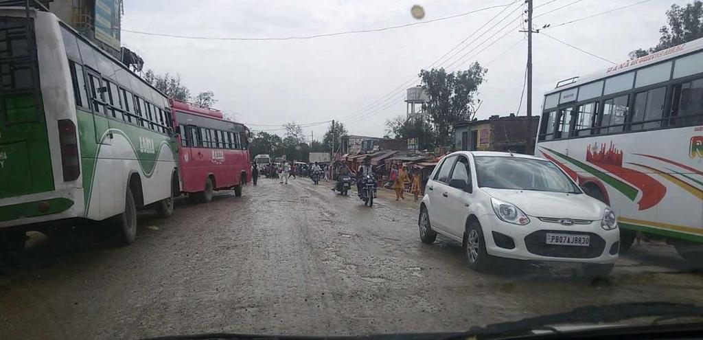
2 I. Introduction The increase in the number of motor vehicles is due to the growth of population and fastly growth of technology and economics. As the mobility increases, the probability of accidents also increases. The basic elements in traffic accidents are road users, vehicles, road and its condition, road geometry and environmental factors etc. The fatality rate is more in developing countries as compare to developed countries. The main cause of road accidents are drunken driving, careless and rash driving, over speeding, sudden braking, skidding, traffic rule violation, sudden twists and turns while driving etc..moreover, road accidents can affect 1% of annual gross product resources of the developing countries. Road accidents cannot be totally prevent/stop, but by using suitable traffic engineering, safety plan and management measures, the accident rate can be decrease. One of the most important factors to reduce traffic is identification of hazard locations. During recent years, road safety and fastly growth of traffic has become a major concern throughout the world. Road traffic accident is a major problem leading to fatalities, injury and property loss and severely impacting the society. According to the statistics released by National Crime Records Bureau (NCRB), approximately 1,39,091 persons lost their lives in 4,40,042 road accidents in India during Road accidents increase means number of vehicles also increases. In India tremendous increase in the total number of registered motor vehicles in last few years. According to a report total number of registered motor vehicles increased from about 0.3 million as on 31st March 1951 to million as on 31st March It is estimated that the economic losses due to road accidents in India are over Rs 100 billion per year. The identification of accident location, analysis and treatment of road accident black spots are widely regarded as one of the most effective approaches to road accident prevention. Black spot is a place on a road that is considered to be dangerous because several accidents have happened there. Accidents happened their because of variety of reasons, such as a sharp curves in a straight road, so oncoming traffic is concealed, if design of junction are not proper on a fast road, poor or concealed warning signs at a cross-roads. Accident black spots can be improve by improving the signage, speed restrictions, improving sightlines, straightening bends etc. In Himachal Pradesh in last ten years 33,922 accidents occur in which 10,727 peoples died and approximately 54,702 peoples injured. It shows that every year in Himachal Pradesh more than 1000 peoples died in road accidents. The major causes of road accidents in Himachal Pradesh are condition of roads are not good and also the rough driving is responsible for this. 156
3 II. Methods use for study work 1. Primary method 2. Secondary method by using WSI. 2.1 Data Collection 1. Primary data 2. Secondary data. III. Analysis of Data 3.1 Analysis of Primary data For Primary data we needed the following: 1. Details of road Inventory 2. Signage inventory Details of road Inventory Road Inventory includes name of the road, Length of the road, Type of road (Flexible or Rigid), Width of the road etc. (a) Name of the Road & Length of the Road Name of the road is Jallandhar, Hoshiarpur, Gagret, MubarikpurAmb, Nadaun, Hamirpur, Sarkaghat, Dharampur, Mandi, Kullu, Manali road. Length of the Total Road Single Lanes (in kms.) Intermediate Lane (in kms.) Double Lane (in kms.) Total Length (in kms.) But the length taken for case study is 29 kms. in Una Distt. (b) Type of Road: The road is flexible types i.e. bitumen road. 157
 Bridges Table 1.")
4 Fig 1.1: National Highway 3. Source: So in this we can collect the data related to the road inventory and study that what are the faults in that and how we can improve it. (c) Bridges Table 1.1: Number of major and minor bridges with span and Carriageway width Name of Bridge Span (meter) Carriageway Width (meter) Type of Bridge Gagretkhad 105 m 6.60 m Major bridge Shivbari 34 m 6.60 m Minor bridge Sawan gap 36 m 6.60 m Minor bridge Sawan River m 6.60 m Major bridge Jangolikhad 77 m 5.50 m Major bridge Karlohikhad m 5.50 m Major bridge Amb khad m 5.50 m Minor bridge Ambkhad m 5.50 m Minor bridge KheranKhad m 5.50 m Minor bridge Source: Site visit data. 158

5 So there are 4 major bridges and 5 minor bridges with the carriageway width of 4.25 m to 6.60 m and span of m to m Signage inventory Traffic signs are important elements of the highway because they guide, warn, and inform the drivers for the safely and efficiently movement on the roads. Well maintained sign important as they help to drivers to make good decision. Fig 1.2: National Highway-3 with Sign Board. Source: So, in sign inventory we study about the different types of signs and their proper position where it is require. And Maintenance of signs are also very important. In this accident data is needed, which we can collect from the related area Police stations. And to analysis the secondary data we use the WSI method. Weighted Severity Index, (WSI) = (5 x K) + (3 x GI) + (1 x MI) Where, K is the number of persons killed, GI is the number of injured, MI is the number of non - injured. After calculations we get the value of WSI by which we can find/tell that on which point of road has more Weighted Severity Index value and consider it as black spot. More the Severity value more the dangerous road section/site. By this we get the black spots and we can find the causes of accidents at their and how we can improve/stop it. 159
 : 2011 to 2014 Year Total Accidents Deaths Injured Non- Injured Severity Index 2011 257 85 442 6 1757 2012 239 57 436 5 1598 2013 239 63 462 4 1705 2014 259 82 391 9 1592")
6 3.2 Analysis of Secondary data Different types of data collected from Police stations Table 1.2: Road Accidents in Distt. Una (Himachal Pradesh) : 2011 to 2014 Year Total Accidents Deaths Injured Non- Injured Severity Index Source: Office of the Superintendent of Police Una, Distt. Una (H.P.). Table 1.3: Road Accidents on NH-3: 2011 to 2014 Year Total Accidents Deaths Injured Non- Injured Severity Index Source: Office of the Superintendent of Police Una, Distt. Una (H.P.). 160
7 Table 1.4: Types of Vehicles Involved in Accidents on NH- 3 : 2011 to 2014 Year Bus Truck Car Jeep Motor Cycle Tractor Three Wheller On Foot Source : Office of the Superintendent of Police Una, Distt. Una (H.P.). Table1.5: Number of Accidents at Day or Night on NH- 3: 2011 to 2014 Year Day Night Source : Office of the Superintendent of Police Una, Distt. Una (H.P.). 161
. Table 1.")
8 15 Accidents at Day and Night on N.H.-3 : 2011 to Day Night Fig 1.5 : Number of Accidents at Day or Night on NH- 3 : 2011 to Source : Office of the Superintendent of Police Una, Distt. Una (H.P.). Table 1.6: Different Ages of Persons involved in Accidents on NH- 3: 2011 to 2014 Age 8 to 14 years 15 to 24 years 25 to 65 years 65 years & above Year Source : Office of the Superintendent of Police Una, Distt. Una (H.P.) Accident Density Accident density =A/L*T Where A = Total number of accidents, L = length of road, T = Number of years. Accident density = 40/29*4 = 0.34 Accident density = Accident Rate per km R = A/L Where A = Total number of accidents occur in one year. L = Length of control section in km. R = 40/29 =

9 3.2.4 Black spots Table 1.7: Top ranked accident spots on NH- 3 in District Una Place WSI Value Near Shiv bari 82 Near Mubarakpur 68 Gagret City 59 Near Alfa Hotel 29 Amb 27 Source: Study work. The WSI value of Shiv bari is highest so it means that Shiv bari spot is more dangerous than other spots. After that Mubarakpur, Gagret city, near Alfa hotel and in last Amb spot. Map 1.1: Black spots on N.H.-3 from Gagret to Amb. Source: Google earth. 3.3 Analysis of Primary Data Road Inventory Survey From the road inventory survey it is observed that, the carriage way width of all stretches varies from 6 m to 8 m. But on bridges the carriageway width is 5.50 m to 6.60 m. So on some places as the carriageway width is less, is not sufficient for accommodating huge traffic and width is not satisfying the standards of national highways. The road inventory survey is carried out in identified accident stretches on NH - 3 in Gagret, Mubarakpur, Amb. Footpath, drainage facility is absent or in poor condition in the study stretches. In some stretches the shoulder is also absent and condition of road is also poor as construction work is going on. 163
10 3.3.2 Traffic Volume Count The traffic volume count gives the measure of how many vehicles passthrough a particular location during a period of time. According to the traffic volume, the time can be classified to peak hour and off peak hour. For any traffic infrastructure design and accident study peak hour traffic volume is necessary. So, in the present study, four hour traffic volume count was taken for all the spots and peak hour traffic in terms of Passenger Car Unit (PCU) was found. From the survey it was observed that the road stretch under consideration carries mixed traffic of fast and slow moving vehicles. The highest peak hour traffic observed at Amb and lowest at Shiv bari. Table 1.8: Traffic volume in terms of PCUs. Accident Black Spot Peak Hour Traffic Volume (PCU) Amb 410 Gagret City 371 Near Mubarakpur 329 Near Alfa Hotel 283 Near Shiv bari 278 Source: Site visit survey Signage Inventory During the signage inventory it is observed that on most of the required places the sign boards are absent like sign board before narrow bridge, right/left turn etc. and also on some places the boards are in poor conditions Speed and Delay Study The speed and delay study was carried out by using moving observer method on entire identified black spots on N.H.-3 in Distt.Una to find out the average journey speed and delay of the traffic stream. The maximum speed without delay is observe at Near Alfa hotel i.e km/hr and minimum at Amb i.e km/hr. The maximum delay is at Amb i.e. of 12seconds which is due to pedestrian crossing and no signal on junction nor the rotary is their so vehicles are moving according to themselves. The main causes of delay of these points are pedestrian crossings, parking problems etc. 164

11 Table 1.9: Speed and Delay study Place Average journey speed (km/hr) Without With Delay Delay Gagret City Near Alfa Hotel Near Shiv bari Near Mubarakpur Amb Source: Site visit survey. IV. Result And Discussions 4.1 Near Shiv bari Shiv bari is identified as the most vulnerable accident stretch on NH- 3 in District Una. 165


12 Fig 1.6: Shiv bari accident locations. Source: Site visit photography. Identified stretch has the necessary lane width and condition of road is also good. But absence of shoulder is the main cause of accidents. The marking is absent on the left & right side of the road Suggestions for improvement 166
13 Fig 1.7: Suggestions for improvement of Shiv bari location. Source: Site visit photography. 1. Provide the shoulder of width1.0 m on hill side and 2.0 m on valley side in Mountainous Terrain. 2. Roadway Width in Mountainous Terrain is 10.0 m (exclusive of parapets and drains). 3. Provide the guard rails on the valley side of the road. 4. Use the sign boards to inform the drivers about the turns, speed etc. 5. Proper marking on roads. 6. We can provide the roadway delineators on the valley side of the road. 4.2 Near Mubarakpur Fig 1.8: Near Mubarakpur (Mubarakpur - Amb Road). Source: Site visit photography. 167

14 This black spot is near Mubarakpur (Mubarakpur Amb road). Here the condition of road is poor. Right edge of road has more height as compare to the left edge of road may be because of inadequate super elevation design Suggestions for improvement Fig 1.9: Suggestions for improvement for Mubarakpur accident spot. Source: Site visit photography. First of all construct the road because the condition of road is poor here. Redesign the Super-elevation because here the right side is more raised as compare to the left side. Because of this the unequal pressure on the wheels of vehicles, which result from high value of sideway force between the tyres and the roadway surface. Here the super-elevation is more than As per Indian practice the Super-elevation is limited to Use the sign board on curves to inform the drivers about the curves and also speed limit sign board. 168

15 Provide the shoulder both side of the road. Provide the road delineators. 4.3 Gagret City Fig 2.1: Gagret city Source: Site visit photography..in the main bazaar of Gagret the width of carriageway is not according to IRC standards for NH. Also the shoulder is absent. Sight distance is poor. Jams also occur here. No space for parking. 169

16 4.3.1 Suggestions for improvement Fig 2.2: Suggestions for improvement for Gagret accident location. Source: Site visit photography. Provide the shoulder. Because of the peoples walk on the road the sight distance is poor and also due to the shopkeepers takeover the road sides in front of their shops. As there is no space available for increase the carriageway width and shoulder, we can suggest the bye-pass for this because of that the jam condition is also decrease in the main bazaar of Gagret. Provide the speed limit sign board. As there is no chance of providing the traffic signals, rotary, the traffic police 170

17 should be there for safe movements of traffic. Provide the space for parking. 4.4 Near Alfa Hotel Fig 2.3: Near Alfa Hotel Gagret. Source: Site visit photography. This black spot point is near Alfa Hotel Gagret. Here the width of carriageway and shoulder is satisfactory. But on the bridge no space for pedestrians for walking. 171

18 4.4.1 Suggestions for improvement Fig 2.4: Suggestions for improvement for Alfa hotel accident location. Source: Site visit photography. Provide the marking on the road as well as on bridge also. Speed limit sign board. Before the bridge provide/install the Narrow Bridge sign board. Provide the safety barriers just before the bridge starting on both sides of road. 172

19 4.5Amb 173
20 Fig 2.5: Amb city. Source: Site visit photography. This spot is near the bus stand and market of Amb city. Here the condition of road is not good but the construction work is going on here. No marking on the roads. No zebra crossings. No space for parking. Also sometimes the buses are stop on the side of road. On intersection of road, no rotary or signal is provided because of which the jams conditions occurs here Suggestions for improvement Provide the markings on the road. Provide the zebra crossings near the bus stand and junction for safe crossing of the pedestrians. Provide the parking so that vehicles cannot be stand on the side of the road which creates the problem for pedestrians and for vehicles also. No bus should be stand on road which is the responsibility of the traffic police. Provide the rotary or signals on junction where the roads are crossing. Provide the speed limit sign boards in the city on National Highway. 174


21 Fig 2.6: Suggestions for improvement for Amb city accident location. Source: Site visit photography. 175
22 V. Conclusion The identification and analysis of accident black spots help in identifying the stretches where accidents are more and these spots reduce the road safety in general.the spot on road where traffic accidents are frequently occurred is termed as black spots. The current study was an attempt to find out the most vulnerable accident locations or black spots on N.H.-3 in Distt. Una, Himachal Pradesh. The Weighted Severity Index (WSI) method was used to rank the accident locations. The top five spots were selected as black spots as per the WSI value from the collected data and suggested some possible alternative measures to improve the transportation system. The overall methodology was found to be effective for the identification, evaluation and treatment of accident black spots if sufficient data is available. The deficiencies like non availability of parking lane, no zebra crossing, no guard rails and sign boards and also the no proper road markings and unauthorized parking etc. It is also observe that most of the 2-wheelers are not using the helmets and they also over speeding their vehicles. It is also observed that this National Highway is under construction and after construction these deficiencies may be reduce. Implementation of the suggested improvements will help to increase the overall road safety. References (1) B. B. and Joseph, K. (2011). Causes and Consequences of Road Accidents in Kerala, International Journal of Research in IT & Management, Vol. 1, pp (2) Dr. K. Krishnamurthy, Dr. M. V. L. R. Anjaneyulu, R. Rakesh (2010). Black spot identification, analysis and improvement measures On selected national highway stretches in Kerala, India (3) Ministry of Road Transportation and Highway (2011). Road transport year book ( ), New Delhi. (4) Nagarajan, M., and Cefil, M. (2012). Identification of Black Spots & Accident Analysis on NH-45 Using Remote Sensing & GIS, International Journal of Civil Engineering Science, Vol. 1, pp.1-7. (5) National Crime Records Bureau (2012). Accidental Deaths & Suicides in India 2012, New Delhi. (6) Pavan, R. Vyas, Madan, L. Honnappanavar, H. B. Balakrishna (2014). Identification of black spots for safe commuting using weighted severity index and GIS 3rd World 176
23 Conference on Applied Sciences, Engineering & Technology 27-29, Kathmandu, Nepal. (7) Rao, B. S., Madhu., E., Jalihal, S., Reddy, T. S. (1988). Accident Study on National Highway-5 between Anakapalli to Visakhapatnam, Proceedings of the Eastern Asia Society for Transportation Studies, Vol. 5. (8) Recommendations about (1982). The Alignment Survey and Geometric Design of Hill Roads, first revision, published by IRC. (9) Road Accidents in India 2010 (2011). Government of India Ministry of Road Transport and Highway Transport Research Wing, New Delhi, December. 177
Analysis Of Road Accidents National Highway-5
 Volume: 2 Issue: 2 Apr,206,ISSN_NO: 2320-723X Analysis Of Road Accidents National Highway-5 Dr.A.S.kanagalakshmi*, M.dinesh**, M.saikrishna raju**, Jishar jaffry**, Syed Ashish basha** *professor, Dept
IDENTIFICATION OF BLACKSPOT REGION ALONG ANANDAPURAM TO ANAKAPALLI STRECH VIA SH-38
 IDENTIFICATION OF BLACKSPOT REGION ALONG ANANDAPURAM TO ANAKAPALLI STRECH VIA SH-38 S.Naveen Kumar 1,O.Ganesh Kumar 2,K.Swetha 3 1,2,3 Assistant Professor,Department of Civil Engineering, Sai Ganapathi
Evaluation of accident black spots on roads using geoinformatics tools in Kozhikode district, Kerala
 218 Evaluation of accident black spots on roads using geoinformatics tools in Kozhikode district, Kerala M.S. Saran National Transportation Planning and Research Centre, Thiruvananthapuram, Kerala 695031
IDENTIFICATION AND ANALYSIS OF ACCIDENT BLACK SPOTS USING GEOGRAPHIC INFORMATION SYSTEM
 ISSN (Online) : 2319-8753 ISSN (Print) : 2347-6710 International Journal of Innovative Research in Science, Engineering and Technology An ISO 3297: 2007 Certified Organization, Volume 2, Special Issue
ANALYSIS OF ACCIDENT SURVEY ON PEDESTRIANS ON NATIONAL HIGHWAY 16 USING STATISTICAL METHODS
 ANALYSIS OF ACCIDENT SURVEY ON PEDESTRIANS ON NATIONAL HIGHWAY 16 USING STATISTICAL METHODS K.SWETHA Assistant Professor Civil Department, Sai Ganapati Engineering College, JNTUK, Visakhapatnam, India,
IDENTIFICATION OF ACCIDENT BLACK SPOTS ON NATIONAL HIGHWAY
 International Journal of Civil Engineering and Technology (IJCIET) Volume 8, Issue 4, April 2017, pp. 588-596 Article ID: IJCIET_08_04_066 Available online at http://www.iaeme.com/ijciet/issues.asp?jtype=ijciet&vtype=8&itype=4
PLANNING FOR SUSTAINABLE PEDESTRIAN INFRASTRUCTURE NALIN SINHA INITIATIVE FOR TRANSPORTATION & DEVELOPMENT PROG. (ITD), DELHI
, DELHI") PLANNING FOR SUSTAINABLE PEDESTRIAN INFRASTRUCTURE NALIN SINHA INITIATIVE FOR TRANSPORTATION & DEVELOPMENT PROG. (ITD), DELHI India s Road Network 5 million kms: Total road length 2.6 mn kms: Surfaced
PLANNING FOR SUSTAINABLE PEDESTRIAN INFRASTRUCTURE NALIN SINHA INITIATIVE FOR TRANSPORTATION & DEVELOPMENT PROG. (ITD), DELHI India s Road Network 5 million kms: Total road length 2.6 mn kms: Surfaced
Introduction Methodology Study area and data collection Results and recommendation Conclusion References
 Introduction Methodology Study area and data collection Results and recommendation Conclusion References It is formal procedure for assessing accident potential and safety performance in the provision
ACCIDENT BLACK SPOT ANALYSIS IN MANGALURU
 ACCIDENT BLACK SPOT ANALYSIS IN MANGALURU Vikram R. Shetty 1, Chethan Kumar NT 2, Mithun 3 1 Assistant professor & Resident Engineer, Civil Engineering Department, YIT, Mangaluru, Karnataka, (India) 2
UG Student, Department of Civil Engineering, MITS, Ernakulam 5. Assistant Professor, Department of Civil Engineering, MITS, Ernakulam
 BLACK SPOT IDENTIFICATION USING ACCIDENT SEVERITY INDEX METHOD M Mohammed Fayaz 1, Mrudula S P 2, Sarah Jaison George 3, Sherin P Yoyak 4, Serin Sara Roy 5 1,2,3,4 UG Student, Department of Civil Engineering,
STUDY AND ANALYSIS OF ACCIDENTS ON NH 71-A
 STUDY AND ANALYSIS OF ACCIDENTS ON NH 71-A SARANSH Department of Civil Engineering Institute of technology and science Bhiwani S.S KAZAL Department of Civil Engineering. Institute of technology and science
Road Safety Infrastructure Facility Standards Indian Context
 Road Safety Infrastructure Facility Standards Indian Context Tony Mathew Road Safety Professional Advisor, IRF Tony.maths@gmail.com Contents AH & NH network in India Key Infrastructure Issues affecting
Identification and Analysis of Accident Blackspots Using GIS
 International Research Journal of Engineering and Technology (IRJET) e-issn: 395-005 Volume: 05 Issue: 03 Mar-08 www.irjet.net p-issn: 395-007 Identification and Analysis of Accident Blackspots Using GIS
A study on Nh-11 to find out the causes and High accident Zone between Jaipur to Sikar
 A study on Nh-11 to find out the causes and High accident Zone between Jaipur to Sikar Shelendra Kumar 1, Hemant Kumar Agrawal 2 Assistant Professor Civil engineering department Sobhasaria engineering
Overhead Pedestrian Crossings Economic Evaluation through Vehicle Operating Cost and Travel Time Savings
 OUSL Journal (2014) Vol 7, (pp77-94) Overhead Pedestrian Crossings Economic Evaluation through Vehicle Operating Cost and Travel Time Savings K. M. G. N. S. Kumara, V. K. M. Pinnagoda and K. S. Weerasekera
(HIGHWAY GEOMETRIC DESIGN -1)
") LECTURE HOUR-19 TE-1(10CV56) UNIT-3 (HIGHWAY GEOMETRIC DESIGN -1) Width of carriage way: Width of the carriage way or the width of the pavement depends on the width of the traffic lane and number of lanes.
LECTURE HOUR-19 TE-1(10CV56) UNIT-3 (HIGHWAY GEOMETRIC DESIGN -1) Width of carriage way: Width of the carriage way or the width of the pavement depends on the width of the traffic lane and number of lanes.
Improving Road Safety for North Eastern State Roads of India A Case Study
 Improving Road Safety for North Eastern State Roads of India A Case Study North Eastern States Portugal Debasis Chakrabarty, Transportation Engineer Key figures of North Eastern States Road Project Total
Analysis of Causal Factors of Accidents near Mahipalpur Junction on NH-8 in Delhi
 Analysis of Causal Factors of Accidents near Mahipalpur Junction on NH-8 in Delhi Nirpinder Jain 1, Bharat Bhushan Jindal 2 1, 2 (Research Scholar, IK Gujral Punjab Technical University, Kapurthala, Punjab,
Kentucky s Surface Transportation System
 Kentucky s Surface Transportation System ROAD AND BRIDGE CONDITIONS, TRAFFIC SAFETY, TRAVEL TRENDS, AND NEEDS MARCH 2018 PREPARED BY WWW.TRIPNET.ORG Founded in 1971, TRIP of Washington, DC, is a nonprofit
Delay analysis due to Road side activities at Urban Arterial Road of Rajkot city
 Delay analysis due to Road side activities at Urban Arterial Road of Rajkot city Rita Bhanushali 1, Prashant Lakkad 2, Mayank Kanani 3 1Final year M.E Student, Civil Engineering Department, Atmiya Institute
Road Safety Analysis A Case Study of National Highway 1-A in India. Authors
 Road Safety Analysis A Case Study of National Highway 1-A in India Authors M. S. Mir & F. A. Mir (Civil Engineering Department, NIT Srinagar India) Presentation by Mohammad Shafi Mir INTRODUCTION Road
Geometric designs for Safe Highways. Dr. Manoj M. Asst. Professor Department of Civil Engineering IIT Delhi
 Geometric designs for Safe Highways Dr. Manoj M. Asst. Professor Department of Civil Engineering IIT Delhi WORKSHOP-CUM-TRAINING PROGRAMME ON ROAD SAFETY 17th 21st September 2018 Outline Introduction Cross
Controlling Traffic by Designing Signal at Intersection of Vidisha Sachin Jat 1 Mr. S.S. Goliya 2 Sachin Nagayach 3 Rohit Gurjar 3
 IJSRD - International Journal for Scientific Research & Development Vol. 3, Issue 05, 2015 ISSN (online): 2321-0613 Controlling Traffic by Designing Signal at Intersection of Vidisha Sachin Jat 1 Mr. S.S.
1. Introduction. 2. Survey Method. Volume 6 Issue 5, May Licensed Under Creative Commons Attribution CC BY
 A Study on Performance of an Urban Arterial Corridor Guggilla Raju 1, Rontala Ashwini 2 1 Assistant Professor, Department of Civil Engineering, GCET 2 Assistant Professor, Department of Civil Engineering,
Transportation Engineering
 Transportation Engineering For Civil Engineering By www.thegateacademy.com Syllabus Syllabus for Transportation Engineering Transportation Infrastructure: Highway Alignment and Engineering Surveys; Geometric
Pedestrian Safety in Cities
 Pedestrian Safety in Cities Priorities for India Geetam Tiwari MoUD Chair Professor, Coordinator, TRIPP Indian Institute of Technology Delhi, India URBAN MOBILITY INDIA 2013 IIT Delhi 2013 RTI in Urban
ENGINEERING DESIGN STANDARDS TO ENSURE ROAD SAFETY: EXPERIENCES FROM INDIA
 ENGINEERING DESIGN STANDARDS TO ENSURE ROAD SAFETY: EXPERIENCES FROM INDIA Atul Kumar 1 ABSTRACT The primary goal of designing roads with adequate standards is to achieve a safer transport facility for
Analysis of Unsignalized Intersection
 International Journal of Constructive Research in Civil Engineering (IJCRCE) Volume 2, Issue 1, 2016, PP 30-36 ISSN 2454-8693 (Online) www.arcjournals.org Analysis of Unsignalized Intersection B.Ramkumar
Case Study on Traffic Management for Rectification of Congestion on a Road Stretch
 Case Study on Traffic Management for Rectification of Congestion on a Road Stretch Chander Mohan Kansal 1, Er. Sushant Gajbhiye 2 1 (Civil Engineering Department, GVIET Banur College/ PTU University, India)
Road Crash Analysis and Alleviation Measures
 Road Crash Analysis and Alleviation Measures R. Nirmala #1 1 Department of Civil Engineering, Sathyabama University, Chennai-119, India 1 nirmala.civil@sathyabamauniversity.ac.in Abstract Now-a days there
Planning and Design of Proposed ByPass Road connecting Kalawad Road to Gondal Road, Rajkot - Using Autodesk Civil 3D Software.
 Planning and Design of Proposed ByPass Road connecting Kalawad Road to Gondal Road, Rajkot - Using Autodesk Civil 3D Software. 1 Harshil S. Shah, 2 P.A.Shinkar 1 M.E. Student(Transportation Engineering),
Traffic Congestion at Road Intersection due to Absence of Efficient Traffic Management and Planning: A Case Study on Fulbarigate, Khulna
 Proceedings of the 3 rd International Conference on Civil Engineering for Sustainable Development (ICCESD 2016), 12~14 February 2016, KUET, Khulna, Bangladesh (ISBN: 978-984-34-0265-3) Traffic Congestion
ROAD SAFETY AUDIT OF A RURAL ROAD
 International Journal of Civil Engineering and Technology (IJCIET) Volume 8, Issue 4, April 2017, pp. 752-761, Article ID: IJCIET_08_04_087 Available online at http://www.iaeme.com/ijciet/issues.asp?jtype=ijciet&vtype=8&itype=4
[Swetha*, 5(2): February, 2016] ISSN: (I2OR), Publication Impact Factor: 3.785
![[Swetha*, 5(2): February, 2016] ISSN: (I2OR), Publication Impact Factor: 3.785](/thumbs/74/69747294.jpg "[Swetha*, 5(2): February, 2016] ISSN: (I2OR), Publication Impact Factor: 3.785") IJESRT INTERNATIONAL JOURNAL OF ENGINEERING SCIENCES & RESEARCH TECHNOLOGY ESTIMATION OF PASSENGER CAR UNIT FOR HETROGENEOUS TRAFFIC IN VISAKHAPATNAM Dadi.Vasavi Swetha * * Civil Department, Diet College,
IJESRT INTERNATIONAL JOURNAL OF ENGINEERING SCIENCES & RESEARCH TECHNOLOGY ESTIMATION OF PASSENGER CAR UNIT FOR HETROGENEOUS TRAFFIC IN VISAKHAPATNAM Dadi.Vasavi Swetha * * Civil Department, Diet College,
VRU Safety & Traffic Calming Measures in Urban & Rural Areas
 VRU Safety & Traffic Calming Measures in Urban & Rural Areas 2 What is Traffic Calming? Road engineering approaches aimed at bringing the design of the road in accordance with the desired speeds of the
Analysis of In-Depth Crash Data on Indian National Highways and Impact of Road Design on Crashes and Injury Severity
 Analysis of In-Depth Crash Data on Indian National Highways and Impact of Road Design on Crashes and Injury Severity Jeya Padmanaban*, Ravishankar Rajaraman**, Greg Stadter*, Swastik Narayan**, Bharat
Punjab Road Safety & Traffic Way Ahead
 Punjab Road Safety & Traffic Way Ahead Navdeep Asija Research Scholar, Indian Institute of Technology Delhi 25 th October 2012 Founder, Ecocabs Punjab- India Present Road Safety Approach Road safety is
MOBILITY CHALLENGES IN HILL CITIES
 MOBILITY CHALLENGES IN HILL CITIES Lalmuansanga Ralte, MCS Pvt Secretary to Minister & Under Secretary Urban Development & Poverty Alleviation Department Govt. of Mizoram DEMOGRAPHIC OVERVIEW INDIA MIZORAM
International Journal of Advance Research in Engineering, Science & Technology
 Impact Factor (SJIF): 4.542 International Journal of Advance Research in Engineering, Science & Technology e-issn: 2393-9877, p-issn: 2394-2444 Volume 4, Issue 4, April-2017 Planning & Design Of New By-pass
A Study to Determine Pedestrian Walkability Index in Mixed Traffic Condition
 A Study to Determine Walkability Index in Mixed Traffic Condition Shahana H 1, Archana S 2 1PG Scholar, Dept.of Civil Engineering, Jyothi Engineering College, Kerala, India 2Assistant Professor, Dept.
PRIORITIZATION OF BLACK SPOTS IN EAST BANGALORE & IMPROVEMENTS OF GEOMETRICS TO BLACK SPOT IN OUTER RING ROAD
 International Journal of Civil Engineering and Technology (IJCIET) Volume 9, Issue 8, August 2018, pp. 1564-1574, Article ID: IJCIET_09_08_157 Available online at http://www.iaeme.com/ijciet/issues.asp?jtype=ijciet&vtype=9&itype=8
Road Accident Analysis and Identify the black spot location On State Highway-5 (Halol-Godhra Section)
") Road Accident Analysis and Identify the black spot location On State Highway-5 (Halol-Godhra Section) 1 Shah Dhruvit, 2 Shah Pranay M. 1 M.E civil(transportation), 2 M.E civil, P.h.d.(pursuing) 1 Tatva
Road Accident Analysis and Identify the black spot location On State Highway-5 (Halol-Godhra Section) 1 Shah Dhruvit, 2 Shah Pranay M. 1 M.E civil(transportation), 2 M.E civil, P.h.d.(pursuing) 1 Tatva
A STUDY ON GAP-ACCEPTANCE OF UNSIGNALIZED INTERSECTION UNDER MIXED TRAFFIC CONDITIONS
 A STUDY ON GAP-ACCEPTANCE OF UNSIGNALIZED INTERSECTION UNDER MIXED TRAFFIC CONDITIONS S.Siva Gowri Prasad 1, Ramesh Surisetty 2, Suresh Kumar ch 3 1 Assistant professor, Department, of Civil Engineering,
Scientific Analysis of Road Traffic Accidents. Requirements and Training Needs. Saving Lives through Accident Research
 Saving Lives through Accident Research Scientific Analysis of Road Traffic Accidents Requirements and Training Needs SAFE Annual Convention Shimla Overview Importance of In-Depth Accident Data (the feedback
Road Accidental Analysis: A Case Study of Rajasthan State, India
 IOSR Journal Of Humanities And Social Science (IOSR-JHSS) Volume 19, Issue 5, Ver. V (May. 2014), PP 34-40 e-issn: 2279-0837, p-issn: 2279-0845. Road Accidental Analysis: A Case Study of Rajasthan State,
International Journal of Advance Engineering and Research Development
 Scientific Journal of Impact Factor (SJIF): 4.72 International Journal of Advance Engineering and Research Development Volume 4, Issue 5, May-2017 e-issn (O): 2348-4470 p-issn (P): 2348-6406 A STUDY ON
Pedestrian Level of Service at Intersections in Bhopal City
 Pedestrian Level of Service at Intersections in Bhopal City 1 Rakesh Wahane 1 M.E. Student 1 Department of Civil Engineering 1 Samrat Ashok Technological Institute Vidisha MP 464001 Abstract - This study
IJRASET: All Rights are Reserved
 Study on Road Accidents and Safety Measures along Selected Roads in Tiruchirappalli, India Dr. G. Nagasubramaniyan 1, N. Satyanarayan 2 1 Associate Professor, Dept. of Humanities and Social Sciences, National
Application of Traffic Management Plan a Sustainable Solution of Traffic Congestions in Pabna City, Bangladesh
 Application of Traffic Management Plan a Sustainable Solution of Traffic Congestions in Pabna City, Bangladesh Ashish Kumer Saha 1, Md. Rashedul Haque 2, Tahmina Tasnim Nahar 3, Md. Motiur Rahman 4 1,
Traffic Improvement for Urban Road Intersection, Surat
 Traffic Improvement for Urban Road Intersection, Surat Sharukh Marfani 1, Dharmkumar Shihora 2, Chirag Kanthariya 3, Harshal Kansara 4 1Assistant Professor, Civil Engineering Department, F.E.T.R, Bardoli,
OVERVIEW OF CURRENT ROAD SAFETY SITUATION IN MALAYSIA
 OVERVIEW OF CURRENT ROAD SAFETY SITUATION IN MALAYSIA Mohamad Nizam Mustafa Highway Planning Unit Road Safety Section Ministry of Works Jalan Sultan Salahuddin 50580 Kuala Lumpur, Malaysia ABSTRACT Road
Impact of Work Zone on Traffic Accident Characteristics of Kochi
 Impact of Work Zone on Traffic Accident Characteristics of Kochi Chinnu Gopakumar M Tech Student, Civil Department, TocH Institute of Science and Technology, Ernakulam, India Aby Varghese Assistant Professor,
Dr. Naveed Anwar Executive Director, AIT Consulting Affiliated Faculty, Structural Engineering Director, ACECOMS
 Dr. Naveed Anwar Executive Director, AIT Consulting Affiliated Faculty, Structural Engineering Director, ACECOMS Overview Highway Functions and Classifications Highway Design Components Design Control
Footpath design. A guide to creating footpaths that are safe, comfortable, and easy to use
 Footpath design A guide to creating footpaths that are safe, comfortable, and easy to use November 2013 Contents Introduction / 1 Zoning system / 2 Width / 4 Height / 5 Surface / 5 Footpath elements /
International Conference on Transportation Infrastructure Projects Conception To Execution
 International Conference on Transportation Infrastructure Projects Conception To Execution TIPCE 2019 Formulation of Engineering Countermeasures for Accident Blackspots using irap as a Tool Case Study
People killed and injured per million hours spent travelling, Motorcyclist Cyclist Driver Car / van passenger
 Cyclists CRASH FACTSHEET 27 CRASH STATISTICS FOR THE YEAR ENDED 31 DEC 26 Prepared by Strategy and Sustainability, Ministry of Transport Cyclists have a number of risk factors that do not affect car drivers.
AN OVERVIEW. Road Accidents in Delhi 2015
 1 AN OVERVIEW Road accident injuries claim more than 1.2 million lives each year and have a huge impact on health and development. In addition to deaths on the roads, up to 50 million people incur non-fatal
Deaths/injuries in motor vehicle crashes per million hours spent travelling, July 2007 June 2011 (All ages) Mode of travel
 Mode of travel") Cyclists CRASH STATISTICS FOR THE YEAR ENDED 31 DECEMBER 211 Prepared by the Ministry of Transport CRASH FACTSHEET 212 Cyclists have a number of risk factors that do not affect car drivers. The main risk
Cyclists CRASH STATISTICS FOR THE YEAR ENDED 31 DECEMBER 211 Prepared by the Ministry of Transport CRASH FACTSHEET 212 Cyclists have a number of risk factors that do not affect car drivers. The main risk
TRAFFIC IMPACT ASSESSMENT IN VIJAYAWADA AT JUNCTION, COMMERICAL AND INDUSTRIAL AREA
 Volume: 06 Issue: 03 Mar 2019 www.irjet.net p-issn: 2395-0072 TRAFFIC IMPACT ASSESSMENT IN VIJAYAWADA AT JUNCTION, COMMERICAL AND INDUSTRIAL AREA 1MRS.KAJA SRI BINDU, 2 VADLAPATLA NAVYA, 3 VELLANKI JASWANTH,
Development of A Hierarchical Structure to Identify Critical Maintenance Components Affecting Road Safety
 Available online at www.sciencedirect.com ScienceDirect Procedia - Social and Behavioral Scien ce s 104 ( 2013 ) 292 301 2 nd Conference of Transportation Research Group of India (2nd CTRG) Development
A Silent Tsunami on Indian Road: A Comprehensive Analysis of Epidemiological Aspects of Road Traffic Accidents
 . British Journal of Medicine & Medical Research British Journal of Medicine & Medical Research 1(1): 14-23, 2011 SCIENCEDOMAIN international www.sciencedomain.org A Silent Tsunami on Indian Road: A Comprehensive
C.A.R.S. Project Design Report.
 C.A.R.S. Project Design Report. PRODUCED BY: Browne, A. Kennedy, M. Dolan, N. Selman, C. STUDENT NO: DATE DUE: COURSE: LECTURER: C09365788-C09686908-D11125480-C08868352 20-April-2012 Dt004/3 Civil Engineering
Accident Analysis of Chanasma-Panchot Circle (28.5km)
") IJSTE - International Journal of Science Technology & Engineering Volume 3 Issue 11 May 2017 ISSN (online): 2349-784X Accident Analysis of Chanasma-Panchot Circle (28.5km) Vyas Kalyani H PG Student Department
IJSTE - International Journal of Science Technology & Engineering Volume 3 Issue 11 May 2017 ISSN (online): 2349-784X Accident Analysis of Chanasma-Panchot Circle (28.5km) Vyas Kalyani H PG Student Department
BUILDING CHINARAP. Zhang Tiejun Research Institute of Highway (RIOH) Beijing, China
 Beijing, China") BUILDING CHINARAP Zhang Tiejun Research Institute of Highway (RIOH) Beijing, China E-mail: tj.zhang@rioh.cn Greg Smith International Road Assessment Programme (irap) Beijing, China E-mail: greg.smith@irap.org
BUILDING CHINARAP Zhang Tiejun Research Institute of Highway (RIOH) Beijing, China E-mail: tj.zhang@rioh.cn Greg Smith International Road Assessment Programme (irap) Beijing, China E-mail: greg.smith@irap.org
SAFETY EVALUATION OF AN UNCONTROLLED
 SAFETY EVALUATION OF AN UNCONTROLLED INTERSECTION USING SURROGATE SAFETY MEASURES By S. Shekhar Babu Research scholar (Ext) IITB Asso Prof CME Pune Prof. P. Vedagiri Asst Prof Dept of civil Engg IIT Bombay
SITUATIONS AND CHALLENGES OF ROAD SAFETY IN CHINA
 SITUATIONS AND CHALLENGES OF ROAD SAFETY IN CHINA Li Yaning Road Administration of Beijing Municipal Commission of Transport No.317, Guangnei Street, Xicheng District, Beijing, P.R. China E-mail: liyaning@bjlzj.gov.cn
Road Markings. Lecture Notes in Transportation Systems Engineering. Prof. Tom V. Mathew
 Road Markings Lecture Notes in Transportation Systems Engineering Prof. Tom V. Mathew 1 Overview The essential purpose of road markings is to guide and control traffic on a highway. They supplement the
ROAD SAFETY RISK MAPPING USING STRUCTURED DATA
 ROAD SAFETY RISK MAPPING USING STRUCTURED DATA DR. P K SIKDAR Jigesh N. Bhavsar* Advisor, IRF (India Ch.) and President, ICT Pvt. Ltd., A-8 Green Park, New Delhi, India 110016 Tel: +91-11-40863224; Email:
2003 road trauma for. Wairoa District. Road casualties Estimated social cost of crashes* Major road safety issues WAIROA DISTRICT JULY 2004
 WAIROA DISTRICT JULY 24 T he Land Transport Safety Authority (LTSA) has prepared this road safety issues report. It is based on reported crash data and trends for the 1999 23 period. The intent of the
GOVERNMENT OF INDlA MINISTRY OF ROAD TRANSPORT & HIGHVv'AYS
 GOVERNMENT OF INDlA MINISTRY OF ROAD TRANSPORT & HIGHVv'AYS No. RW/NH-35072/04/2004-S&R(R) Transport Bhawan. 1, Par I iament Street, New Delhi-110001 Dated: 27th April, 2010 To 1. Secretary, PWDs of all
Identification of Accidental Locations on NH-10 Highways
 Volume-5, Issue-3, June-2015 International Journal of Engineering and Management Research Page Number: 732-737 Identification of Accidental Locations on NH-10 Highways Rina 1, S.S Kajal 2 1 Student, Civil
New Seward and 36 th Avenue Intersection Conceptual Design
 University of Alaska Anchorage New Seward and 36 th Avenue Intersection Conceptual Design Prepared By: Zaid S. Hussein Dana Menendez Galen Jones Civil Engineering Department Prof. Osama Abaza CE A404 Highway
Impact of Signalized Intersection on Vehicle Queue Length At Uthm Main Entrance Mohd Zulhilmi Abdul Halim 1,b, Joewono Prasetijo 2,b
 Impact of Signalized Intersection on Vehicle Queue Length At Uthm Main Entrance Mohd Zulhilmi Abdul Halim 1,b, Joewono Prasetijo 2,b 1,2 Smart Driving Research Center, Faculty of Civil and Environmental
Estimation of accident rate at blockspots
 2017; 3(5): 786-792 ISSN Print: 2394-7500 ISSN Online: 2394-5869 Impact Factor: 5.2 IJAR 2017; 3(5): 786-792 www.allresearchjournal.com Received: 21-03-2017 Accepted: 22-04-2017 M Anvesh Kumar Assistant
The Nine Challenges for the Development of Transport in the Fast Growing Capital of Vietnam: Hanoi.
 The Nine Challenges for the Development of Transport in the Fast Growing Capital of Vietnam: Hanoi. Challenge 1:Economic growth Higher Incomes. More people can afford cars and motorbikes. In good old times
Highway geometric design QUESTION PAPER
 QUESTION PAPER UNIT 1 1. Explain the design control and criteria which governs the design and highway. ( Dec 2011, june july 2011, June 2010, Dec 2010, Dec 2012) 2.Explain PCU value and factors affecting
Road safety design standards and the Asian Highway Network. irap Asia Pacific Workshop Greg Smith 2016/05/26
 Road safety design standards and the Asian Highway Network irap Asia Pacific Workshop Greg Smith (greg.smith@irap.org) 2016/05/26 AH Standard Summary While developing the Asian Highway network, Parties
Children s risks on their way to school: the example of Tallinn
 Ravage of the Planet III 529 Children s risks on their way to school: the example of Tallinn T. Rõivas 1, D. Antov 2, T. Oja 1, K. Abel 1 & E. Sepp 1 1 Faculty of Science and Technology, University of
Identification of Accident Black Spots on NH-65 (Behbalpur Village, Hisar to Barwala)
") Identification of Accident Black Spots on NH-65 (Behbalpur Village, Hisar to Barwala) Sunny Tawar 1, Sachin Dass 2 1Assistant Manager, Traffic and Transportation Department, Intercontinental Consultants
Identification of Accident Black Spots on NH-65 (Behbalpur Village, Hisar to Barwala) Sunny Tawar 1, Sachin Dass 2 1Assistant Manager, Traffic and Transportation Department, Intercontinental Consultants
TRAFFIC STUDY AND DESIGN OF TRAFFIC SINGNAL AT IDENTIFIED INTERSECTIONS IN MANSAROVAR, JAIPUR
 TRAFFIC STUDY AND DESIGN OF TRAFFIC SINGNAL AT IDENTIFIED INTERSECTIONS IN MANSAROVAR, JAIPUR 1 Baldev Mathur, 2 Mr. Deepak Mathur 1, M.Tech. Scholar,department of civil engineering (Transportation Engineering),Kautilya
Improvement of pedestrian safety and traffic flow regulation at the railway junction, Kandy
 J.Natn.Sci.Foundation Sri Lanka 2013 41 (3): 259-270 DOI: http://dx.doi.org/10.4038/jnsfsr.v41i3.6060 RESEARCH ARTICLE Improvement of pedestrian safety and traffic flow regulation at the railway junction,
Identification of Accident Black Spots on NH-65 (Chaudhriwas, Hisar to Hisar City)
") Identification of Accident Black Spots on NH-65 (Chaudhriwas, Hisar to Hisar City) Sunny Tawar 1, Sachin Dass 2 1 Assistant Manager, Traffic and Transportation Department, Intercontinental Consultants
Identification of Accident Black Spots on NH-65 (Chaudhriwas, Hisar to Hisar City) Sunny Tawar 1, Sachin Dass 2 1 Assistant Manager, Traffic and Transportation Department, Intercontinental Consultants
City of Prince Albert Statement of POLICY and PROCEDURE. Department: Public Works Policy No. 66. Section: Transportation Issued: July 14, 2014
 Page: 1 of 8 1 POLICY 1.01 The City shall follow all of the specifications in the Manual of Uniform Traffic Control Devices for Canada, prepared by the National Committee of Uniform Traffic Control, and
Development of Models for Crash Prediction and Collision Estimation- A Case Study for Hyderabad City
 Development of Models for Crash Prediction and Collision Estimation- A Case Study for Hyderabad City V. Niveditha, A. Ramesh 2 and M. Kumar 3 Received: 27.10. 2015 Accepted: 15.02.2016 Abstract Road traffic
PERFORMANCE ACTIVITY 405 LIMB MANAGEMENT
 PERFORMANCE ACTIVITY 405 LIMB MANAGEMENT 405 LIMB MANAGEMENT ACTIVITY DESCRIPTION Cut and/or remove and/or grind tree limbs from the right-of-way. TRAFFIC CONTROL Utilize intermittent mobile operations
Copenhagen Cycling Map. Red Lines Cycling facilities
 Copenhagen Cycling Map Red Lines Cycling facilities Copenhagen Cycling Facilities Design Approaches Transportation without Pollution Copenhagen s Strategy Where Cycling is one of the top key activities
Road Accident Analysis of Srinagar City
 Road Accident Analysis of Srinagar City Musaib Ul Zaman 1, Ishfaq Shafi Masoodi 2 1 M.tech, Transportation Engineering, AP Goyal Shimla University, Shimla, India 2 M.tech, Construction Technology & Management,
guide to a phased approach TRIPP
 complete street development guide to a phased approach TRIPP development phases Existing 00 months 00 crores/km Phase 0 months 0 crores/km Phase 09 months 0 to 08 crores/km Phase months 07 to crores/km
An Evaluation of Rotary Intersection: A Case Study of Prabhat Square Raisen Road Bhopal
 An Evaluation of Rotary Intersection: A Case Study of Prabhat Square Raisen Road Bhopal 1 Rakesh Kumar Chhalotre 2 Dr. Y. P. Joshi 1 M.E. Student, 2 Professor 1,2 Department of Civil Engineering 1,2 Samrat
10.0 CURB EXTENSIONS GUIDELINE
 10.0 CURB EXTENSIONS GUIDELINE Road Engineering Design Guidelines Version 1.0 March 2017 City of Toronto, Transportation Services City of Toronto Page 0 Background In early 2014, Transportation Services
Analyses and statistics on the frequency and the incidence of traffic accidents within Dolj County
 UNIVERSITY OF PITESTI SCIENTIFIC BULLETIN Faculty of Mechanics and Technology AUTOMOTIVE series, year XXIV, no. 28 Analyses and statistics on the frequency and the incidence of traffic accidents within
2.0 LANE WIDTHS GUIDELINE
 2.0 LANE WIDTHS GUIDELINE Road Engineering Design Guidelines Version 2.0.1 May 2018 City of Toronto, Transportation Services City of Toronto Page 0 Background In early 2014, Transportation Services initiated
Sustainable Transport Saves Lives
 Sustainable Transport Saves Lives Ashwin Prabhu Principle Associate EMBARQ India International Conference on Green Buildings CII & IGBC 25 th October, 2013 Background - Road & Traffic Incidents Number
road safety issues 2001 road toll for Gisborne district July 2002 Road user casualties Estimated social cost of crashes*
 GISBORNE DISTRICT road safety issues July 22 The Land Transport Safety Authority (LTSA) has prepared this Road Safety Issues Report. It is based on reported crash data and trends for the 1997 21 period.
Discerning Pedestrian Accidents in Dhaka-Barisal National Highway in Bangladesh
 Discerning Pedestrian Accidents in Dhaka-Barisal National Highway in Bangladesh 1 Fayaz Uddin, 2 Dr. Farzana Rahman, 3 Md. Mostafizur Rahman, 4 Md. Ariful Islam 1 Bangladesh University of Science and Technology
The Engineering Approach to Traffic Safety
 The Engineering Approach to Traffic Safety D o nald S. B erry Director, Traffic and Transportation Division National Safety Council Chicago, Illinois As traffic volume continues to grow, it is essential
Identification and Improvement of Accidents black Spots for Mixed Traffic Streets in Developed Cities-A Case Study
 Identification and Improvement of Accidents black Spots for Mixed Traffic Streets in Developed Cities-A Case Study M.Subbareddy 1, K.S.B.Prasad 2 Department of Civil Engineering, GMRInstitute of Technology,
ROAD ACCIDENT SEVERITY ANALYSIS FOR HYDERABAD CITY
 ROAD ACCIDENT SEVERITY ANALYSIS FOR HYDERABAD CITY S. Ghanshyam Singh 1, T. Saikrishna Bharadwaj 2, Mohammad Ibrahim 3, Arumulla Raju 4 1 Assistant Professor of Civil Engineering,CMR Institute of Technology,
An International Experience on the Safety Performance of 2+1 cross-section. Basil Psarianos Nat l Techn. Univ. Athens, Greece
 An International Experience on the Safety Performance of 2+1 cross-section Basil Psarianos Nat l Techn. Univ. Athens, Greece bpsarian@mail.ntua.gr What is a 2+1 cross-section? It s a 3 lane rural road
Anatomy of Injury Severity and Fatality in Indonesian Traffic Accidents
 412 J. Eng. Technol. Sci., Vol. 49, No. 3, 2017, 412-422 Anatomy of Injury Severity and Fatality in Indonesian Traffic Accidents Sigit Puji Santosa 1*, Andi Isra Mahyuddin 1 & Febrianto Guntur Sunoto 2