SURVEY minutes to complete this questionnaire. Your feedback will help the City determine a future design for Ocean Avenue and Geneva Avenue. Thanks!
|
|
|
- Meagan Wood
- 6 years ago
- Views:
Transcription


1 OCEAN AVENUE CORRIDOR DESIGN ROJECT WORSHO #4 Thank you for your interest in the Ocean Avenue Corridor Design project. lease take a few SURVEY minutes to complete this questionnaire. Your feedback will help the City determine a future design for Ocean Avenue and Geneva Avenue. Thanks! OCEAN AVE: DESIGN 1. The proposed design for Ocean Avenue includes pedestrian safety improvements and amenities at intersections, sidewalk extensions on the south side of Ocean at helan and Howth, planting at medians adjacent to the transit boarding islands, a countraflow bike lane on Howth, decorative paving, and other streetscape amenities. What do you think of the design? (Check one) Somewhat Like Somewhat Dislike 2. The proposed design includes reconfiguring the Ocean/helan/Geneva intersection and creating a local access lane onto Geneva. This would maintain access for the properties on Ocean Ave, provide safer pedestrian crossings and create a public gathering place. This would involve additional study. What do you think of this idea? (Check one) Somewhat Dislike Somewhat Like 3. The north side of Ocean Ave between San Jose and I-280 could have a wider sidewalk and/or more greening. lease select your preference from the following three options. (Check one) Widen the existing 6 sidewalk by adding 3 within the park s property, relocate the park s fence, additional greening could occur. (This would require approval from the Recreation and arks Department). Widen the existing 6 sidewalk an additional 7 ; parking would not be permitted on the north side of Ocean, and additional greening could occur. eep the existing 6 sidewalk as is. 4. CCSF Bridge: The CCSF Bridge connects Geneva Avenue to City College and has been identified by the community for improvement. lease select your preference from the following three options. (Check one) Remove bridge Upgrade bridge eep the bridge as it is For more information visit: : (415) ara información en Español llamar al: (415)


2 GENEVA AVE: DESIGN 5. T he proposed design for Geneva Avenue includes pedestrian safety improvements; a new planted median between Louisburg and Tara; and streetscape amenities. In addition to these improvements, there are three options for additional improvements on Geneva between Tara and Howth. lease rank the options below from 1-3, 1 being your first preference. Option #1: Retain bicycle sharrows in the eastbound and westbound directions, add bulb-outs on the north and south side. Option #2: Add a westbound and an eastbound curb side bike lane, curb side parking and bulb-outs would not be allowed on the north and south side. Option #3: Add a westbound curb side bike lane, remove curb side parking on the north side, retain existing eastbound bicycle sharrows, retain parking on the south side, add bulb-outs on the south side. G1 OTION #1 aul + Third G2 OTION #2 aul + Third aul + Third G3 OTION #3
3 UBLIC REALM IMROVEMENTS: There are a number of locations along Ocean to activate the public realm and improve the pedestrian experience. lease provide feedback on the type of amenities you would like to see at each location. See Streetscape & Greening lan for the location of the gateway and entry nodes. 6. Gateway A - helan/ocean Ave: What specific types of improvements/amenities would you like to see at this location? Check all that apply and circle your top priority. ermanent seating Moveable seating Lighting Greening ublic art Trash cans Bike racks Corridor Signage Special aving Other, please specify 7. Gateway B - Area adjacent to the Ocean 76 Gas Station: The proposed design includes reconfiguring the area adjacent to the gas station. What specific types of improvements/amenities would you like to see at this location? Check all that apply and circle your top priority. ermanent active ground floor uses (ie: cafes, retail, restaurants) Temporary vending or commerce (ie: coffee cart) Moveable seating ermanent seating Other, please specify 8. Gateway C - DW Vacant arcels: The proposed design could reconfigure the DW owned parcels at Geneva and Ocean. How do you envision these parcels to be used in the near term (5 years)? (Check one) Community Garden assive Open Space (not habitable) Dog park/run laza Other, please specify 9. Gateway D - Balboa ark (Ocean Ave at I-280): The proposed design could include an entrance to Balboa ark at the corner of Ocean Ave and the I-280 on ramp. What do you think of this idea? (Check one) Like: we need access here Dislike: no additional park access We need access, but not here. Access should be located at No opinion 10. Gateway E - Balboa ark (Ocean Ave at San Jose Ave): What type of improvements/amenities would you like to see at the Balboa ark entrance at the intersection of Ocean Ave/ San Jose? Check all that apply and circle your top priority. ermanent seating Moveable seating Lighting Special aving ublic art Trash cans Bike racks Other, please specify 11. BART laza Entry Node (at Ocean): What specific types of improvements/amenities would you like to see at this location? Check all that apply and circle your top priority. Seating Lighting Vending or commerce (e.g. coffee cart) Bike racks Real time transit information Special paving ublic art Trash cans Make plaza level with sidewalk Upgrade railing Remove railing Other, please specify


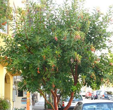
: What do you think about the proposed plant")
? (Check one) Somewhat Like Somewhat Dislike")
4 12. I -280/Ocean Ave Bridge: If the I-280/Ocean Ave bridge were to be upgraded, what type of additional improvements/amenities would you like to see? (Check one) A wider bridge providing additional sidewalk space for pedestrians A wider bridge providing additional space for greening Leave the bridge alone Other, please specify A wider bridge providing additional space for parking A wider bridge providing additional space for bicycle facilities 13. I -280/Geneva Ave Bridge: If the I-280/Geneva Ave bridge were to be upgraded, what type of additional improvements/amenities would you like to see? (Check one) A wider bridge providing additional sidewalk space for pedestrians A wider bridge providing additional space for greening Leave the bridge alone Other, please specify A wider bridge providing additional space for parking A wider bridge providing additional space for bicycle facilities STREETSCAE AMENITIES: lease rank your preference for each streetscape amenity. 14. S treet & edestrian Lighting: What do you think about the proposed street & pedestrian lighting choice? (Check one) Somewhat Like Somewhat Dislike 15. F reeway Overpass Fencing Treatment: What do you think about the proposed freeway overpass fencing treatment? (Check one) Somewhat Like Somewhat Dislike 16. G reening (Medians & Street Trees): What do you think about the proposed plant palette for general streetscape greening (Washingtonia spp, Agave, Red Yucca, niphofia, Leucadendron, Yucca)? (Check one) Somewhat Like Somewhat Dislike

 Somewhat Like Somewhat Dislike 19.")


: Home Address or Intersection")

5 18. Gateway Nodes: What do you think about the proposed material palette for the gateways? (Washingtonia spp., special paving, bench seating, bike racks, bus shelters? (Check one) Somewhat Like Somewhat Dislike 19. Improved Entry Node: What do you think about the proposed programming and amenities for the Balboa ark Bart/Ocean Ave entry node? (Check one) Somewhat Like Somewhat Dislike lease use the space below to provide any additional comments: Thank you for your input and feedback!!!! The questions below are optional. What is your connection to Ocean Avenue? (Check all that apply) Resident Merchant roperty Owner Visitor Student Other, please specify Name (optional): Home Address or Intersection (optional): Zip Code: RETURN COMLETED SURVEYS BY 10/22/14 VIA: FAX: (415) MAIL: San Francisco lanning Department, Attention: Lily Langlois, 1650 Mission Street, Suite 400, San Francisco, CA For more information visit: : (415) ara información en Español llamar al: (415)
Memo. Ocean Avenue Corridor Design Project Public Workshop #2 Summary
 Ocean Avenue Corridor Design Project Public Workshop #2 Summary The second public workshop for the Ocean Avenue Corridor Design Project was held on Wednesday, May 14, 2014 from, 6 to 8 pm at Lick Wilmerding
Why invest in the 1 Street S.W. Corridor?
 Why invest in the 1 Street S.W. Corridor? This project is an investment in the Beltline Community and Calgary s economy. It is anticipated that The City s investment along this corridor will help with
BALBOA AREA: TRANSPORTATION PROJECTS & PLANNING
 BALBOA AREA: TRANSPORTATION PROJECTS & PLANNING TRANSPORTATION FOR ALL AGES, ABILITIES & MEANS CHANGING PATTERNS: TRENDING TO WALKING, BIKING, TRANSIT San Francisco s Change in Number of Commuters by Mode
Brooklyn Boulevard (County Road 152) Reconstruction Project Phase I. OPEN HOUSE June 20, 2017
 Reconstruction Project Phase I. OPEN HOUSE June 20, 2017") Brooklyn Boulevard (County Road 152) Reconstruction Project Phase I OPEN HOUSE June 20, 2017 Brooklyn Boulevard (County Road 152) Phase I Project Partners Project Lead Other Project Partners include Brooklyn
Brooklyn Boulevard (County Road 152) Reconstruction Project Phase I OPEN HOUSE June 20, 2017 Brooklyn Boulevard (County Road 152) Phase I Project Partners Project Lead Other Project Partners include Brooklyn
FOLSOM-HOWARD STREETSCAPE OVERVIEW
 FOLSOM-HOWARD STREETSCAPE OVERVIEW SoMa residents should have the same kinds of amenities that other neighborhoods have. The Folsom- Howard Streetscape Project will make SoMa more livable by making it
FOCUS AREA 1 - Alberta Avenue Pocket Park 3 (121 Ave and 92 St)
") FOCUS AREA 1 - Alberta Avenue Pocket Park 3 (121 Ave and 92 St) New benches Plant evergreen trees Widen existing sidewalk from 1.5m to 1.8m Marked crosswalk 1.8m wide sidewalk Add pedestrian oriented lights
FOCUS AREA 1 - Alberta Avenue Pocket Park 3 (121 Ave and 92 St) New benches Plant evergreen trees Widen existing sidewalk from 1.5m to 1.8m Marked crosswalk 1.8m wide sidewalk Add pedestrian oriented lights
Mission-Geneva Transportation Study Community Workshop 2 July 8, 2006
 Community Workshop 2 July 8, 2006 Small Group Workbook 1 Basic Improvements on Mission Street Streetscape. Pedestrian-scale lighting; landscaping; community art on utility boxes; more (possibly unique)
Southview Blvd & 3 rd Avenue Improvement Project. Public Open House December 4, to 7pm
 Southview Blvd & 3 rd Avenue Improvement Project Public Open House December 4, 2014 5 to 7pm Southview Blvd & 3 rd Avenue Public Information Meeting Agenda Presentation 5:30 to 6:15 pm Purpose of Project
Bicycle and Pedestrian Advisory Committee (BPAC) November 21, 2013
 November 21, 2013") Bicycle and Pedestrian Advisory Committee (BPAC) November 21, 2013 OVERALL LAND USE CONCEPT Overall Broadway Valdez District: 95.5 acres (35.1 acres right-of ways + 60.4 acres developable land) Plan Subareas:
Bicycle and Pedestrian Advisory Committee (BPAC) November 21, 2013 OVERALL LAND USE CONCEPT Overall Broadway Valdez District: 95.5 acres (35.1 acres right-of ways + 60.4 acres developable land) Plan Subareas:
MARTIN LUTHER KING JR. WAY
 OCTOBER 2011 40 Vision and Goals The Martin Luther King, Jr. Way Illustrative Master Plan that follows has been developed through a process of community involvement. It expresses a long term vision for
WalkShop. Highland Creek Village
 On June 5, 2014, 15 people participated in a for the Transportation Master Plan. The purpose of the was to receive feedback from a diverse range of local stakeholders and document existing transportation
Ocean Park Boulevard Green Street Project Community Workshop
 Ocean Park Boulevard Green Street Project Community Workshop 2.2.10 Project Objectives Community Priority: reclaim OPB for public open space. Build upon LUCE principles; neighborhood enhancement, connectivity,
Palou Complete Street Project Barneveld Avenue to Crisp Road Project overview and concept design Community Meeting #2 May 13, 2015
 Palou Complete Street Project Barneveld Avenue to Crisp Road Project overview and concept design Community Meeting #2 May 13, 2015 Agenda Welcome and introductions Project overview, history and goals Concept
Typical Cross Section: DOWNTOWN (Observer Highway - 8th Street)
") Typical Cross Section: DOWNTOWN (Observer Highway - 8th Street) DRAFT SEPTEMBER 23, 14 1 Washington Street Typical Block Downtown Typical Block: DOWNTOWN (Observer Highway - 8th Street) New crosswalks
Typical Cross Section: DOWNTOWN (Observer Highway - 8th Street) DRAFT SEPTEMBER 23, 14 1 Washington Street Typical Block Downtown Typical Block: DOWNTOWN (Observer Highway - 8th Street) New crosswalks
Urban Design Issues and Proposals for City College of San Francisco s Ocean Campus
 Prepared by the Ocean Avenue Association s Street Life Committee Approved by the Balboa Park Station Community Advisory Committee in April 2016 Urban Design Issues and Proposals for City College of San
COWETA HIGH SCHOOL AND EAST HIGHWAY 51
 COWETA HIGH SCHOOL AND EAST HIGHWAY 51 Lack of sidewalks along Ben Lumpkin Rd. Lack of crosswalks and ramps at intersection. Hwy 51 is wide to cross as a pedestrian. No ADA compliance or connection to
5 CIRCULATION AND STREET DESIGN
 5 CIRCULATION AND STREET DESIGN This chapter describes circulation and streetscape improvements proposed for the Northwest Chico Specific Plan Area. It includes detailed design specifications for existing
NEW TOWN RETAIL PRECINCT UPGRADE
 The City of Hobart is seeking feedback from the community on the streetscape concept for the New Town Retail Precinct upgrade project. The concept designs have been developed by the City of Hobart in response
STONY PLAIN ROAD STREETSCAPE
 Jasper Place Revitalization Strategy: Vision The people involved in the Jasper Place Revitalization Strategy envision: Goal 1: Feeling safe in our community Create a community where feeling safe is common--where
A CHANGING CITY. of Edmonton, it is essential that it reflects the long-term vision of the City.
 A CHANGING CITY By the year 2040, Edmonton will be home to more than 1 million people. To accommodate growth and support a healthy and compact city, we need a new approach to development/redevelopment
MEDIAN DESIGN example median A
 MEDIAN DESIGN example median A MLK Blvd Design Workshop #3 September 21, 2010 Participants voted on each idea, gave comments about specific ideas or general comments about all ideas. Comments and suggestions
14 TH STREET TRANSPORTATION & STREETSCAPE DESIGN STUDY PLAN B PLAN B TRANSPORTATION & STREETSCAPE RECOMMENDATIONS
 14 TH STREET TRANSPORTATION & STREETSCAPE DESIGN STUDY PLAN B PLAN B TRANSPORTATION & STREETSCAPE RECOMMENDATIONS 141 Symbols Recommendations - Southern End of 14th Street Study Area Streetscape Each icon
ROUTE 81 CORRIDOR STUDY DESIGN CONCEPTS
 RT 81 Corridor Study CLINTON ROUTE 81 CORRIDOR STUDY DESIGN CONCEPTS View north on High Street, with potential improvements to the streetscape Draft Recommendations November 8 th, 2018 TOWN OF CLINTON
Freeway ramp intersection study
 Freeway ramp intersection study Supporting Vision Zero: Zero traffic deaths in San Francisco by 2024 Study Goals: Primary Improve Safety Improve Accessibility Secondary Provide Efficient Circulation Accommodate
Figure 4-10: Pedestrian Improvements Types of Potential Station Area Improvements - Place-Making Improvements
 INCORPORATE FEATURE PAVIN IN CROSSWALK AND INTERSECTION FIELDS Identifies high-priority pedestrian areas and create a station identity through colorful and interesting patterns ADD CURB EXTENSIONS Extending
McLean Main Street Public Forum Follow-up
 McLean Main Street Public Forum Follow-up Sponsored & Hosted by John W. Foust, Dranesville District Supervisor McLean Planning Committee Fairfax County Office of Community Revitalization and Reinvestment
Polk Streetscape Project
 What is this project? The Polk Streetscape Project is an effort to improve safety for everyone traveling on Polk Street between Union and McAllister streets. Also included in this project are paving, sewer
UNIVERSITY AVENUE CORRIDOR REDESIGN. January 8, 2017 PUBLIC OPEN HOUSE
 January 8, 2017 PUBLIC OPEN HOUSE COLLABORATIVE COMMUNITY-BASED DESIGN IS THE FOUNDATION TO A SUCCESSFUL PROJECT AGENDA FOR TONIGHT 1 INTRODUCTIONS 2 WHY ARE WE HERE PROJECT NEED 3 SCHEDULE & GOALS 4 OPEN
San Jose Transportation Policy
 San Jose Transportation Policy Protected Intersections in LOS Policies to Support Smart Growth Presented by: Manuel Pineda City of San Jose Department of Transportation Bay Area Map San Francisco Oakland
CLOSED. Highlights of the Final Concept Design:
 The final Concept Design is the result of many months of listening, learning, creating, balancing, and understanding different needs and viewpoints, as well as incorporating technical requirements and
Safe Streets. City of Lake Forest Park. March 21, 2017
 Safe Streets City of Lake Forest Park March 21, 2017 1 01 WELCOME 2 Agenda WELCOME WHAT IS THIS PROJECT? CONTEXT DRAFT CITYWIDE PROJECTS EXERCISE INTRODUCTION 3 02 WHAT IS THIS PROJECT? 4 WHAT IS THIS
2014/2015 BIKE ROUTE PLAN 83 AVENUE PROTECTED BIKE LANE
 About the Project 2014/2015 BIKE ROUTE PLAN The City of Edmonton is planning a major bike route on the south side of Edmonton. This bike route is one part of a plan to provide citizens with transportation
San Francisco s Capital Plan & the Mayor s Transportation Task Force 2030: Funding the next steps for transportation
 San Francisco s Capital Plan & the Mayor s Transportation Task Force 2030: Funding the next steps for transportation San Francisco Capital Needs In 2006, the Mayor and Board of Supervisors approved San
1. TRANSFORM CITY ROAD WEST INTO A GREAT CENTRAL city street
 1. TRANSFORM CITY ROAD WEST INTO A GREAT CENTRAL city street Understanding City Road West City Road West (between Clarendon Street and ower Street) is a local street, and can be significantly enhanced
2014/2015 BIKE ROUTE PLAN 83 AVENUE PROTECTED BIKE LANE
 About the Project The City of Edmonton is planning a major bike route on the southside of Edmonton. The Strathcona Bike Route will connect the communities of Strathcona, Garneau and the University area,
Streetscape: Core Shopping District
 Streetscape: Core Shopping District DRAFT DRAFT DRAFT May 00 Core Shopping District: Phase Blue Island s Core Shopping District is located along Western Avenue, between Grove and Union Streets. Streetscape
El Camino Real Specific Plan. TAC/CAC Meeting #2 Aug 1, 2018
 El Camino Real Specific Plan TAC/CAC Meeting #2 Aug 1, 2018 Land Use Alternatives Goals and Tradeoffs Parks & open space Housing Retail & services Civic spaces Parking Community gathering spaces 3 Alternatives
GLEN EIRA CITY COUNCIL. MURRUMBEENA Transforming our neighbourhood together our concepts based on your ideas
 GLEN EIRA CITY COUNCIL MURRUMBEENA Transforming our neighbourhood together our concepts based on your ideas 1 WHAT HAVE WE HEARD? WHAT NOW? Stage one Tell us what you love about your shopping strip November
Cross Street Corridor Non-Motorized Enhancement Project Project Description
 Cross Street Corridor Non-Motorized Enhancement Project Project Description A cooperative study of the Cross Street neighborhood was completed in May 2002 by the City of Ypsilanti, the Depot Town Downtown
Ocean Park Boulevard Streetscape Improvement Project Alternatives & Trade Offs
 City Council Study Session January 27, 2009 Ocean Park Boulevard Streetscape Improvement Project Alternatives & Trade Offs Scope of Work Purpose of Tonight s Meeting Review work to date and direct staff
California Department of Transportation, District 4. Sloat Boulevard Project Skyline Blvd. to 19 th Ave. Community Update January 13, 2016
 California Department of Transportation, District 4 Sloat Boulevard Project Skyline Blvd. to 19 th Ave. Community Update January 13, 2016 Agenda Welcome and introductions Project overview, history and
Sarasota High School June 26, 2018
 June 6, 08 June 9, 08 Review of SHS Security & Safety, Community Input & Ideas June 6, 08 Review of Community Concerns and Ideas, Confirm Community Enhancement Priorities July/August, 08 Vacation Application
PUBLIC REALM MASTER PLAN
 WESTSHORE BUSINESS DISTRICT PUBLIC REALM MASTER PLAN MASTER PLAN COMMITTEE MEETING MARCH 20, 2013 WESTSHORE BUSINESS DISTRCT PUBLIC REALM MASTER PLAN MACRO-SCALE CONCEPT: A PUBLIC REALM FRAMEWORK DEFINED
42nd Ave N Reconstruction
 CITY OF MINNEAPOLIS 42nd Ave N Reconstruction Community Meeting #2 May 2016 6:00 7:30 p.m. 5/16/2016 1 Purpose of Meeting Inform: Provide an overview of project, identify anticipated scope of work, and
KEARNY MESA COMMUNITY PLAN UPDATE
 KEARNY MESA COMMUNITY PLAN UPDATE January 18, 2018 SUBCOMMITTEE MEETING Mobility Concepts and Urban Design Presentation Outline Mobility Concepts: Multimodal Planning Toolbox Presentation and Activities
PROJECT SUMMARY ALBERTA STREETSCAPE PROJECT
 ALBERTA STREETSCAPE PROJECT Revitalizing a Street Rebuilding a Community Realizing a Dream PROJECT SUMMARY December 2001 Project Background In 1998 and 1999, the Alberta Street community was engaged in
Make Lincoln Highway an economically vibrant corridor that is safe, efficient, and beautiful for local residents and visitors.
 Lincoln Highway Streetscape Plan Stakeholder Workshop #2 Handout Contents Introduction and Project Vision Planning Principles Specific Recommendations including a Proposed Typical Roadway Section Renderings
Caltrans Sloat Boulevard Pedestrian Safety Project Response to Community Questions, Comments & Concerns
 Caltrans Sloat Boulevard Pedestrian Safety Project Response to Community Questions, Comments & Concerns Revised: May 10, 2016 The California Department of Transportation (Caltrans) is planning various
Henderson Ave. Complete Streets Project
 Henderson Ave. Complete Streets Project Meeting Purpose To finalize conceptual components of project prior to proceeding with preliminary engineering www.dallascompletestreets.wordpress.com MeetingAgenda
SAN FRANCISCO MUNICIPAL TRANSPORTATION AGENCY
 THIS PRINT COVERS CALENDAR ITEM NO. : 10.2 DIVISION: Sustainable Streets BRIEF DESCRIPTION: SAN FRANCISCO MUNICIPAL TRANSPORTATION AGENCY Adopting Conceptual Proposal for Streetscape Improvements to Broadway,
The Wiggle Route in Context
 The Wiggle Route in Context In a city of hills, the Wiggle is an important route because it winds its way along the flattest streets from Market to the Panhandle, bringing residents to local parks and
122 Avenue: 107 Street to Fort Road
 : 107 Street to Fort Road November 24, 2015 4:30 8:00 p.m. Meeting Purpose Summarize project work completed to date Share results of public input from Phase 1 Share the draft concept plan and proposed
EL CAMINO REAL BUS RAPID TRANSIT PROJECT
 EL CAMINO REAL BUS RAPID TRANSIT PROJECT Would upgrade the current 522 Rapid Bus to BRT status by making changes to El Camino Real and The Alameda that make transit FAST, FREQUENT AND RELIABLE and make
Meade Street Bridge Design Alternative Study
 Meade Street Bridge Design Alternative Study Preferred Alternative Presentation Stakeholder Meeting #3 June 23, 2011 Presented by: Dan Biggs, RLA Meeting Agenda Purpose: 1. Review Meeting #2 Feedback 2.
Community Task Force November 15, 2017
 Community Task Force November 15, 2017 Welcome and Introductions Project Partners Regional Transportation District (RTD) Colorado Department of Transportation (CDOT) Denver Regional Council of Governments
Chinatown Broadway Street Design Summary of Public Comment Workshop #3
 Chinatown Broadway Street Design Summary of Public Comment Workshop #3 Workshop Details: The third community workshop for the Broadway Street Design took place on November 16, 2011 at Gordon J. Lau Elementary
Better Market Street Project Update. Urban Forestry Council September 17, 2014
 Better Market Street Project Update Urban Forestry Council September 17, 2014 Project Area Limits Better Market Street Schedule Market Street City s busiest transit corridor Over 85 buses per hour 14 surface
Scarlett Road Bridge & Road Improvements Lambton Park Community School - Gymnasium Tuesday November 28 th, 2017
 Scarlett Road Bridge & Road Improvements Lambton Park Community School - Gymnasium Tuesday November 28 th, 2017 PROJECT LOCATION 2 SCARLETT ROAD BRIDGE Constructed in 1912, the bridge carries 4 active
Community Meeting February 27, 2007 Dorchester Avenue Transportation & Streetscape Improvements Action Plan February 27, 2007
 Community Meeting Tonight s Agenda 6:00 Introductions South Boston/Dot Ave Improvement Study Background 6:15 Consultant Introductions Review of Scope and Schedule Review of Proposed Corridor Wide Guidelines
Chinatown Broadway Street Design Summary of Public Comment Workshop #1
 Chinatown Broadway Street Design Summary of Public Comment Workshop # Workshop Details: The first community workshop for the Chinatown Broadway Street Design project took place at Bayside Elderly Housing
NEWMARKET UPHAM S CORNER
 SOUTH STATION Planning Initiative NEWMARKET UPHAM S CORNER COLUMBIA ROAD (P) FOUR CORNERS/GENEVA Working Advisory Group (WAG) Meeting #5 TALBOT AVENUE MORTON STREET BLUE HILL AVE/CUMMINS HWY (P) RIVER
A Plan for The Beautiful Way NOVEMBER 16, 2009
 COMMUNITY VISION WORKSHOP NOVEMBER 16, 2009 AGENDA INTRODUCTION COMMUNITY INPUT REVIEW AND SURVEY RESULTS VISIONING IMAGERY SMALL GROUP VISIONING SESSION NEXT STEPS CLOSE SCHEDULE COMMUNITY SURVEY 198
Presentation Starts at 5:30 PM
 Presentation Starts at 5:30 PM Public Meeting #1 September 22, 2016 Purpose of Study Conceptual Complete Streets Study on South Carson Street 5 th Street to Roland Drive Approximately 2.5 miles Consider
Welcome! Thank you for joining us today for a Geary Rapid project open house. Geary Rapid Project. SFMTA.com/GearyRapid
 Welcome! Thank you for joining us today for a Geary Rapid project open house. Get the most out of this event: 1. Sign in and get your feedback sheet 2. Visit project information stations hosted by project
Obey Creek PEDESTRIAN CIRCULATION EAST WEST PARTNERS PEDESTRIAN CIRCULATION CREEK SIDE LANE SLIP STREET SCOTT MURRAY MAIN STREETS EAST/WEST
 THE VILLAGE AT PEDESTRIAN CIRCULATION MAIN STREETS NORTH/SOUTH MAIN STREETS EAST/WEST SLIP STREET CREEK SIDE LANE PEDESTRIAN CIRCULATION DESCRIPTION: Circulation through the downtown of is organized by
Public Meeting #6. Buffalo Niagara Medical Campus Phase III Allen Street Extension Project D Youville College Center February 21, 2018
 Public Meeting #6 Buffalo Niagara Medical Campus Phase III Allen Street Extension Project D Youville College Center February 21, 2018 PHASE A - PROGRESS The Pathway design extends from Washington Street
ALBERTA AVENUE WHAT WE HEARD REPORT BUILDING GREAT NEIGHBOURHOODS
 ALBERTA AVENUE WHAT WE HEARD REPORT BUILDING GREAT NEIGHBOURHOODS FEBRUARY 2019 EXECUTIVE SUMMARY Starting in 2019, Alberta Avenue will see the replacement and enhancement of its aging collector and local
RIVERSIDE, Newton MA BH NORMANDY RIVERSIDE LLC. Riverside Station. A green, transit-oriented community
 Riverside Station A green, transit-oriented community October 6, 2011 TONIGHT S AGENDA: 1. Project Update (5 min.) 2. Master Plan Update (10 min.) 3.Traffic Plan Update (10 min.) Questions & Answers MASTER
@ FRIENDLY ACRES COMMUNITY MEETING
 @ FRIENDLY ACRES COMMUNITY MEETING April 18, 2017 INTRODUCTIONS City of Redwood City TJKM, GATES + Associates Interns Translators AGENDA Presentation Livable Neighborhood Streets Project Background Highlight
Ocean Park Boulevard Green Street Project Alternatives & Trade Offs
 Planning Commission March 4, 2009 Ocean Park Boulevard Green Street Project Alternatives & Trade Offs Purpose of Tonight s Meeting Review concept plans and options Provide input on alternatives and trade-offs
Chapter 3: Multi-Modal Circulation and Streetscapes
 CHAPTER 3: MULTI-MODAL CIRCULATION AND STREETSCAPES Chapter 3: Multi-Modal Circulation and Streetscapes Overview Streetscape improvements have already been completed for Depot Street between Main Avenue
Capital Projects Update: N. Lynn Street Esplanade and Custis Trail Improvements 100% Engineering Design - Progress Report
 Capital Projects Update: N. Lynn Street Esplanade and Custis Trail Improvements 100% Engineering Design - Progress Report UPC 70762 Locally Administered PE Phase VDOT Administered CN Phase 4/6/17 1 Project
Fulton Market Streetscape
 Fulton Market Streetscape Ogden Avenue to Halsted Street Public Meeting Recommended Improvements December 10th, 2014 Meeting Purpose and Goals Present Existing Conditions Community Input and Charrette
El Centro Mobility Hub
 The El Centro drive shed comprises a major portion of the El Centro downtown area, which is well served by bus routes. The proposals intend to promote use of public transit through improvements and enhancements
7/23/2017 VIA . Michael Hanebutt City of Sacramento Community Development Department 300 Richards Boulevard, 3 rd Floor Sacramento, CA 95811
 7/23/2017 VIA EMAIL Michael Hanebutt City of Sacramento Community Development Department 300 Richards Boulevard, 3 rd Floor Sacramento, CA 95811 RE: 65 th Street Apartments (DR17-220) Dear Mr. Hanebutt:
Illustrated Principles of Good Planning
 Illustrated Principles of Good Planning The Miami 21 Zoning Code incorporates time-tested planning principles into the zoning regulations of our City. These are principles that make for better neighborhoods,
Lincoln Highway Streetscape Plan Concept Plan
 Lincoln Highway Streetscape Plan Concept Plan November 14, 2014 Introduction This report provides a summary of conceptual transportation, land use, and design recommendations in the Lincoln Highway Streetscape
19th St/Oakland Station Modernization
 19th St/Oakland Station Modernization BART is advancing the second round of the Station Modernization Program, which will invest resources into the existing core stations and surrounding areas to advance
STREETSCAPE CONCEPTS
 STREETSCAPE S CARGO WAY CARGO WAY CYCLE TRACK Streetscape Concepts JENNINGS ST Illustrative Plan EVANS AVE PG&E BAY TRAIL HERON S HEAD PARK The recommended improvements build off the planned improvements
Geary Corridor Bus Rapid Transit
 Geary Corridor Bus Rapid Transit Near-term Improvements Update SAN FRANCISCO COUNTY TRANSPORTATION AUTHORITY SAN FRANCISCO MUNICIPAL TRANSPORTATION AGENCY Phasing Packages Phase 1 Near-term: Delivers project
Lawrence Avenue Streetscape Concepts August 30, 2011
 Lawrence Avenue Streetscape Concepts August 30, 2011 Neighborhood Context Phase II: River to Western Ave. Phase I: Western Ave. to Clark St. Key Map Lawrence Ave. Existing Streetscape Conditions East of
Commerce Street Complete Street Project from Good Latimer Expressway to Exposition Avenue
 Commerce Street Complete Street Project from Good Latimer Expressway to Exposition Avenue T A N Y A B R O O K S A S S I S T A N T D I R E C T O R M O B I L I T Y P L A N N I N G M O B I L I T Y A N D S
Welcome to the Quebec Alternatives Analysis Public Meeting
 Welcome to the Public Meeting Please sign in. Public Comment Please fill out a comment card and tell us what you think. Check back or comment any time at: www.quebecalternatives.com Project Area Technical
CURBSIDE ACTIVITY DESIGN
 5 CURBSIDE ACTIVITY DESIGN This chapter provides design guidance for separated bike lanes adjacent to curbside activities including parking, loading and bus stops. Typical configurations are presented
WELCOME Mission-Geneva Transportation Study
 WELCOME Mission-Geneva Transportation Study Study Process and Schedule 2005 2006 Oct Nov Dec Jan Feb Mar Apr May Jun Jul Aug Sept Oct Task 2 Develop Outreach Plan Task 3 Document Existing Conditions/ Prioritize
Town of Ashland. Downtown Planning Initiative 2 nd Community Workshop. March 29, Presented by:
 Town of Ashland Downtown Planning Initiative 2 nd Community Workshop Presented by: March 29, 2018 Agenda Tonight Review project & goals Recap 1st workshop (September 18, 2017) Present design alternatives
STREETSCAPE CONCEPT PLAN
 03 STREETSCAPE CONCEPT PLAN Zone 1 This zone includes the gateway into both the downtown and the Village at Harlem. The gateway features are shown closer to the Harlem intersection to make them more prominent.
PRIORITIES RESULTS YOUR PRIORITIES FOR BRIDGEPORT 5% 4% 13% RESIDENTIAL CHOICES TRAILS & PARKS
 Community Visioning Open House The Community Visioning Open House was held on January, 31st 2018 at Harrisburg Area Community College (HACC), Lancaster Campus. Approximately 80 people attended this Open
Design Guidelines. Overview. Design Vision for Yellow Brick Road
 Design Guidelines Overview This section presents the design vision for the Yellow Brick Road network. The Yellow Brick Road is envisioned to be an interconnected network of safe and secure roadways where
5. Automobile Circulation, Wayfinding and Signage
 5. Automobile Circulation, Wayfinding and Signage Policy: The City Center should have a balanced, safe, and interconnected circulation system that provides expanded travel opportunities for transit, pedestrian,
I-215 / NEWPORT ROAD INTERCHANGE PROJECT PRESS KIT
 I-215 / NEWPORT ROAD INTERCHANGE PROJECT PRESS KIT March I-215 / NEWPORT ROAD INTERCHANGE PROJECT Fact Sheet Project Overview This project will reconstruct the existing interchange located on Interstate
01. VICINITY OF GREENBRAE POC: EXISTING CONDITIONS
 01. VICINITY OF GREENBRAE POC: EXISTING CONDITIONS Existing Bus Stop Existing US101 On-ramp Existing POC Old Redwood Highway Rich Street City ROW Environmental Study Limit Industrial Way NO DESIGNATED
50 Avenue S.W. Corridor Study Glenmore Aquatic Centre Drop-In Event
 Project overview The City of Calgary is conducting a transportation corridor study of 5 Avenue S.W., between Crowchild Trail and 4A Street S.W. In 29, it was reclassified as a Parkway under the Calgary
95 th Street Corridor Transportation Plan. Steering Committee Meeting #2
 95 th Street Corridor Transportation Plan Steering Committee Meeting #2 February 18, 2015 PURPOSE OF THE MEETING Update Steering Committee Present Community/Stakeholder Survey Results Present Transportation
Capital Projects Update: N. Lynn Street Esplanade and Custis Trail Improvements Advertisement for Construction - Progress Report
 Capital Projects Update: N. Lynn Street Esplanade and Custis Trail Improvements Advertisement for Construction - Progress Report UPC Design 70762 / CN 109813 Locally Administered PE Phase VDOT Administered
State Street Workshop Summary September 26, 2012 SITE A. - INTERSECTION OF STATE AND HOLLY TOTAL ATTENDEES = ~29
 State Street Workshop Summary September 26, 2012 TOTAL ATTENDEES = ~29 SITE A. - INTERSECTION OF STATE AND HOLLY What do you like best about this place? YMCA building / facade Crosswalk design Landscaping
Vision Zero Priority Projects (March 2017)
") Key in 201 or of Key Potrero Ave., from Division to Cesar Chavez Begin Construction Spring 201 Winter 201 Achieved Safety measures include dedicated transit lane, sidewalk widening, buffers for existing
Key in 201 or of Key Potrero Ave., from Division to Cesar Chavez Begin Construction Spring 201 Winter 201 Achieved Safety measures include dedicated transit lane, sidewalk widening, buffers for existing
TRANSPORTATION COMMISSION Agenda Staff Report
 TRANSPORTATION COMMISSION Agenda Staff Report Agenda Item No. 5.a DATE: JULY 31, 2014 TO: FROM: SUBJECT: TRANSPORTATION COMMISSION COMMUNITY DEVELOPMENT DEPARTMENT - PLANNING DRAFT OLYMPIC CORRIDOR PREFERRED
Columbia Pike Implementation Team (CPIT) Meeting
 Meeting") Columbia Pike Implementation Team (CPIT) Meeting November 30, 2010 Agenda Introductions / Purpose of Meeting Review of project goals Multimodal project: 10% street design between the curbs Discussion Multimodal
Columbia Pike Implementation Team (CPIT) Meeting November 30, 2010 Agenda Introductions / Purpose of Meeting Review of project goals Multimodal project: 10% street design between the curbs Discussion Multimodal
A Guide to Great Streets: The Basics. September 25, 2009
 A Guide to Great Streets: The Basics September 25, 2009 Streets are more than connectors, they are the city 2 Streets are the glue that hold a city together 3 Streets are the means in which a city is perceived