CONTENTS. Foreword. Background and introduction 01. Role and purpose of Solihull Connected 05. An endorsed vision and direction 09
|
|
|
- Allan Mathews
- 5 years ago
- Views:
Transcription
1 Transport Strategy 2016
2
3 CONTENTS Foreword i Background and introduction 01 Role and purpose of Solihull Connected 05 An endorsed vision and direction 09 Solihull Connected Vision and objectives 14 Strategic themes 15 Strategic networks 15 A mass-transit network 16 Heavy rail 18 Investing in our roads 18 Freight management 20 A strategic cycle network 20 Creating safer, healthier communities 22 A town centre masterplan 25 Technology and innovation 30 Next steps The Delivery Plan 33 Appendix A What are the transport needs of the Borough? 35

4 Foreword These are exciting times for the Borough with significant opportunities for investment to ensure our environment and economic health are maintained and enhanced. Solihull Council is embarking on a strategy of Managed Growth through the promotion of UK Central. This plan brings together all of the economic assets of the Borough, including regional business parks, town centres, Jaguar Land Rover, the Airport, future HS2 and the NEC. The Council is determined to make this vision of managed growth a reality. It is hugely important for us to clearly make the case for investment and demonstrate how we will manage growth in a sustainable way. Having a clear transport strategy will be timely for the arrival of HS2 and development opportunities. With the first station north of London, HS2 is helping to put the Borough on the transport investment map and the Council is looking to capitalise on this to secure local network improvements. Councillor Ted Richards OBE Cabinet Member for Transport and Highways The ambition behind Solihull Connected is to create balanced investment in transport infrastructure that recognises the need to cater for cars and places appropriate and increasing emphasis on alternatives; such as: Options for game-changing public transport schemes that will be competitive, fast, reliable and frequent on key corridors across the Borough. We need to serve important destinations including the Airport, Jaguar Land Rover and Birmingham and Coventry city centres; High-quality cycling networks to encourage our residents to cycle to work; and Community-focused initiatives to encourage healthier transport choices where possible. This document represents our policy position on transport investment. It comes about following the publication of the Green Paper in 2015 and a six-month period of consultation and discussion. During this time we had excellent inputs from the public and stakeholders, who endorsed our overall vision for transport. This final strategy document will be accompanied by a detailed Delivery Plan, which will set out our transport investment strategy, in the autumn of i
5 EDINBURGH GLASGOW NEWCASTLE LIVERPOOL MANCHESTER LEEDS BIRMINGHAM BIRMINGHAM AIRPORT HIGH-SPEED RAIL PLACES SOLIHULL AT THE FOCAL POINT OF THE UK RAIL NETWORK LONDON ii

6 Background and introduction This document presents the transport strategy for Solihull. It marks out our vision for how we will deliver transport infrastructure and initiatives in the future, how we will accommodate growth in travel demand on our network and how we will seek to maintain Solihull s character. The timing of this strategy is crucial. It sets out our aspirations at a time when the West Midlands is going through a crucial phase. The Devolution Deal, signed with the government in 2015, puts a large part of our future in the hands of the new West Midlands Combined Authority. Solihull Connected gives our Borough a loud voice at the table, being clear what we re asking for and providing the evidence as to why investment should be directed here. Solihull Connected links directly with our plans for economic growth set out by our Council Managed Growth priorities and promoted by UK Central. There is a risk that without a properly planned transport system growth could cause ever-increasing congestion on our roads; stifling our economy, worsening our quality of life and hampering our transition to a sustainable low-carbon economy. Solihull Connected sets out how we can achieve both a strong, growing economy and still maintain the unique character and high-quality environment of Solihull. This document moves forward the initial vision and ideas set out in the Green Paper, published and consulted on over the summer of That consultation gave us a ringing endorsement of the overall vision for an emphasis on sustainable forms of transport: investing in high-quality public and active transport to provide our residents and workers with much wider opportunities to choose sustainable modes. To accompany this strategy document we are currently developing a Delivery Plan. This will set out a prioritised list of schemes and initiatives, all of which will be focused at the objectives of Solihull Connected. The Delivery Plan will be the culmination of a series of detailed technical studies which will generate the schemes and initiatives and demonstrate their contribution to the Borough. 01
7 02
8 Method to Travel to Work, Solihull Residents: Changes from Census Data 1981 to 2011 Working mainly at or from home. Train. Public transport use has steadily declined in the Borough, although train patronage has seen a small increase between 2001 and Bus, minibus or coach. Taxi. Motorcycle or scooter. 03
9 Other. On foot. Bicycle. On average half of all households have access to a bike; and yet less than 2% of commuters currently cycle to work. Passenger in a car or van. Driving a car or van. More than 60% of all journeys to work made by Solihull commuters are made by car and whilst many authorities in the UK have seen a decline in car use between 2001 and 2011; in Solihull it has increased. 04

10 Role and purpose of Solihull Connected Why do we need Solihull Connected? The Borough needs this strategy so that we have a longterm strategic vision for how we manage the extra travel demand brought about by the predicted economic and population growth; both in the Borough and across the West Midlands. Solihull Connected is linked to the West Midlands Strategic Transport Plan Movement for Growth which has been published by the West Midlands Combined Authority (WMCA). That document provides the strategic direction for transport across the region, whereas Solihull Connected is taking that overall direction and showing how it can be specifically applied within the Borough. In addition, Solihull is a partner in Midlands Connect, which is developing a strategic transport strategy for the whole of the Midlands area (East and West Midlands); aiming to identify the important pieces of road and rail infrastructure which will have the biggest impact on the regional economy. With our location at the heart of some of the UK s most important pieces of transport network (M42, M6, West Coast Main Line, HS2, etc.) we are working with Midlands Connect to identify what the strategic infrastructure investment strategy should be. The big catalyst for the need to plan for this growth is the arrival of the HS2 Interchange in This national-level infrastructure being located in the Borough presents huge opportunities for us to attract investment, housing and jobs growth. However, we must plan carefully to ensure that potential negative impacts from added congestion are minimised on our transport and street networks. The Garden City The International Travel Zone The Entertainment District The High Tech Quarter HS2 Station The Innovation Hub The Communities 05
11 This transport strategy will help us create the conditions which encourage people choose sustainable forms of transport (walking, cycling and public transport). As well as accommodating growth in trip making there are many other reasons to promote these modes. They are: Healthier More equitable Better for the environment Reduce casualty rates from collisions and Create a more pleasant urban environment Finally we want to use investment in transport to improve the Borough as a whole. If congestion rises or we have to build wider roads or bigger junctions then we risk harming the character of Solihull. We want Solihull Connected to provide great streets; allowing more choice for people to move and travel, whilst enhancing the character of the Borough. A growing borough We have significant growth plans for Solihull over the next 20 years or more: Solihull town centre has the capacity and desire to grow, both in terms of its retail offering but also providing high-quality city centre style accommodation and other new job opportunities We can take advantage of the new HS2 station, to be located near the airport, and the opportunities that provides for us to open up growth areas for new jobs and accommodation Major employers in the Borough, such as Jaguar Land Rover, recognise the advantages of our location and are seeking to expand and grow their operations here Other locations, such as Blythe Valley, have opportunities to grow and provide areas for new homes and jobs In total, assuming HS2 is completed, there could be as many as 32,000 more jobs and 8,000 new households in the Borough over the next 20 years or so; which will represent a 30% and 9% increase on today. We would then expect further growth around the HS2 Interchange beyond the 20-year horizon of the initial Solihull Connected document. These are significant numbers which present both opportunities and challenges for us all. This level of growth will bring challenges to our transport system. For example, we estimate that Solihull residents alone currently generate around 572,000 daily trips by all modes (walking, cycling, car and public transport) and this could rise to 675,000 within 20 years with the increase in households. In addition, we know from the 2011 census that there are around 50,000 people who come into the Borough each day to work, representing approximately 50% of our jobs being taken up by people travelling in from elsewhere. In addition, around 60% of Solihull commuters travel out of the Borough for work each day. If the current patterns continue then in 20 years there could be as many as 120,000 people travelling in and out of the Borough each day for work, making 240,000 trips; of which 164,000 will be by car. It is essential that there is an interaction between Solihull Connected land use plans set out in the Borough s Local Plan and the spatial plans of neighbouring authorities. Land use should be planned alongside transport measures to ensure that developments are more sustainable and can be supported by the transport system. It also means that developments are planned in such a way that will reduce the need to travel: with local amenities within easy reach. To this end there is close liaison between Solihull Connected and the Local Plan as they are developed along similar timelines, in particular to embed Solihull Connected objectives within emerging Local Plan policies. We have to be realistic that building significant amounts of new road capacity will be difficult. That s not to say that specific hotspots of congestion cannot and should not be dealt with and access in and out of particular areas be improved for cars. It s more that we must recognise that the road network we have now will largely be the same in the future. We therefore need to look at using our existing roads more efficiently. The growth described above will need to be accommodated by other means if traffic congestion is not to get significantly worse across the Borough. We do though recognise the important role a car plays, and will continue to play, for many people in the Borough. This strategy promotes a solution that allows those who want to use sustainable transport to do so safely and conveniently; encourages others to do so when possible but also keeps the Borough moving for all. 06
12 Population change Lowest Growth Chelmsley Wood Town Centre Birmingham Business Park HS2 Interchange Station Birmingham Airport Jaguar Land Rover Highest Growth Solihull Town Centre Shirley Town Centre Blythe Valley Business Park Population growth in the Borough will be reasonably spread out, primarily within the existing urban area. The biggest single growth area will be around the HS2 Interchange which could see up to 2,000 new homes built. Employment change Lowest Growth Chelmsley Wood Town Centre Birmingham Business Park HS2 Interchange Station Birmingham Airport Jaguar Land Rover Highest Growth Solihull Town Centre Shirley Town Centre Blythe Valley Business Park Employment growth in the Borough will be concentrated in three areas which are collectively known as the UK Central proposals. These include: 1. The Hub around NEC/Airport/HS2 Interchange, Birmingham Business Park and Jaguar Land Rover; 2. Solihull Town Centre; and 3. Blythe Valley Business Park. 07

13 Working across boundaries The high level of cross-border commuting highlighted above illustrates the importance of working with neighbouring authorities to ensure seamless journeys. The Solihull Connected transport strategy is therefore aligned with Movement for Growth, The West Midlands Strategic Transport Plan published in late 2015; and Birmingham Connected, Birmingham s 20-year transport strategy published in late High-quality public transport schemes such as Sprint and Metro will cross the local authority borders, as would potential improvements to rail links such as electrification or additional tracks on the Snow Hill line. Such initiatives would make travel easier for people from across the West Midlands. But it s not just about large-scale projects; more local initiatives such as cycle and walking routes also need to connect to routes and places outside Solihull to maximise potential. Low-carbon future The Stern Report and the Climate Change Act 2008 highlighted the need for action to reduce carbon emissions and consequences if we fail to act. Transport in the UK accounts for around a fifth of all greenhouse gas emissions, mainly CO 2, and is globally a significant contributor to climate change, air pollution and health inequalities. According to the National Statistics Local and Regional CO 2 Emissions Report in 2012 transport contributed to 31% of all carbon emissions in the West Midlands and 36% in Solihull. Although there has been a declining trend in road transport emissions since 2005 due to vehicle fleet technology improvements, more fuelefficient vehicles producing less CO 2 and a shift to diesel, there is a risk of a rise as the economy improves through promoting growth. Enhancing the character of Solihull Solihull is an attractive place to live and work and its Urbs in Rure motto expresses the importance of its green urban character. The availability of transport has wide-ranging beneficial effects but can also harm the attractiveness of urban and rural areas and the wellbeing of the people who live there through the effects of congestion, speeding vehicles, severance, pollution, noise and conflict between local access and through traffic. In order to maintain Solihull s character and respond to the needs and wellbeing of local people, decisions about the transport investment need to fully consider and be sensitive to these issues. Solihull Connected will ensure that investment to improve transport within the Borough also improves Solihull s quality as a place to live. Securing future funding Another important reason for this strategy in place is that it will help us to get access to future funding. The Delivery Plan, which will follow the publication of this strategy, will include a long list of schemes which we believe will be beneficial to help meet the overall objectives. Knowing what our strategic priorities are means that we can be shovel ready when funding from Central Government (e.g. Devolution Deal and GBSLEP), the European Union or private developers comes available. We hope to use this strategy to start getting more than our fair share of investment into our transport system. To support a low-carbon future Solihull will work in partnership with regional partners and align with the West Midlands Strategic Transport Plan Movement for Growth, the GBSLEP Low-carbon Transport Strategy, Birmingham Connected and Highways England, in particular to support people making low-carbon travel choices such as walking, cycling and public transport, the market for low-carbon vehicles and investment in recharging infrastructure and new technologies. 08
14 An endorsed vision and direction Over the summer of 2015, we consulted stakeholders and residents on the Green Paper; published in July Support for the vision and objectives of Solihull Connected There was broad support for the vision and objectives underpinning Solihull Connected, in particular the need to invest in mass-transit, along with a town centre masterplan and local community infrastructure aimed at encouraging walking and cycling. This support is shown in the below graphs, which show the responses to questions we asked the public and key stakeholders. How we consulted 300 residents questionnaires 37 stakeholder questionnaires 16 formal responses 63 stakeholder workshop participants 27 parish workshop participants 87 focus group participants 200 school pupil workshop participants Residents agree or disagree with strategy themes? A mass-transit style public transport system providing Metro and Sprint buses focusing on journeys in and out of the Borough towards Birmingham and north/south within the Borough itself 23% 30% 39% 29% 17% 18% 13% 11% 6% 3% 10% 1% A strategic cycle network focused on providing safe facilities for cyclists on all major roads 15% 39% 19% 19% 5% 3% Investing in roads at congestion hotspots only Local community infrastructure aimed at getting more journeys to be made locally on foot and by bicycle (e.g. wider, footway, more crossing facilities and environments) 29% 35% 18% 11% 6% 1% A Solihull town centre master plan which aims to improve accessibility for pedestrians, cyclists and public transport users in particular 30% 34% 19% 9% 5% 3% 15% 21% 17% 17% 27% 3% A car parking strategy for Solihull town centre which may include charging more for the most popular car parks. Base: All respondents (n=300) Strongly agree Agree Neutral Disagree Strongly Disagree Don t know 09
15 Stakeholders agree or disagree with strategy themes? A mass-transit style public transport system providing Metro and Sprint buses focusing on journeys in and out of the Borough towards... 33% 54% 36% 26% 21% 10% 3% 5% 3% 5% A strategic cycle network focused on providing safe facilities for cyclists on all major roads 10% 38% 31% 13% 3% 5% Investing in roads at congestion hotspots only Local community infrastructure aimed at getting more journeys to be made locally on foot and by bicycle (e.g. wider, footway, more crossing facilities and environments) 41% 44% 10% 5% A Solihull town centre master plan which aims to improve accessibility for pedestrians, cyclists and public transport users in particular 36% 44% 13% 3% 5% 15% 26% 31% 18% 5% 5% A car parking strategy for Solihull town centre which may include charging more for the most popular car parks. Base: All who provided a response (n:39) Strongly agree Agree Neutral Disagree Strongly Disagree Don t know Consultees agreed that growth and development planned for Solihull will create further congestion and capacity problems and there is a need for Solihull Connected to offset those problems. Stakeholders in particular feel that Solihull s limited connectivity is a key barrier to growth. The planned growth in jobs and new homes in Solihull will create traffic congestion and capacity problems if no action is taken? 8% 2% 7% 3% 2% 3% 3% 3% 2% 4% Strongly support 11% 19% 23% 10% Support 46% 32% Neutral Oppose Strongly oppose 80% 78% 69% Don t know 46% 49% Stateholder Questionnaire (n:39) Stateholder Workshops (n:57) Parish Council Workshops (n:27) Public Focus Groups (n:50) Public Questionnaire (n:300) 10
16 While there is broad support for the Solihull Connected objectives and themes, there is strong feeling that the importance of the car should be recognised and that a balanced approach is required: both relieving congestion at key locations and investing in high-quality alternatives. How do you feel about the initial vision? 5% 3% 10% 12% 19% 2% 2% 6% 1% 9% 8% 14% 4% 18% 11% 16% 33% 58% 48% 50% 31% 49% 34% 16% 19% 22% Stateholder Questionnaire (n:39) Stateholder Workshops (n:57) Parish Council Workshops (n:27) Public Focus Groups (n:50) Public Questionnaire (n:300) Strongly support Support Neutral Oppose Strongly oppose Don t know When asked about the principal problems facing transport in the Borough, people identified traffic congestion, poor public transport connectivity and the cost of public transport. Residents feel that the traffic congestion is partly caused by traffic signal timings, roadworks and the school run. Barriers to using sustainable modes were discussed in detail, and it was felt that public transport services and active modes do not currently provide a realistic or viable alternative for many people. Some of the barriers to people using public transport more frequently included a lack of evening/sunday services, and long and indirect routes and journey times illustrated below. Residents are particularly concerned about the safety of cycling. 11
17 Solihull Residents View of Public Transport Takes too long Lack of information to plan your trip Public transport is not convenient enough Not enough public transport Poor bus and rail connections Furthermore, it was felt that people now simply have less time: We re too busy these days, rushing around, we don t have time for walking and cycling and We don t want to add to our journeys by using public transport or similar were common responses. The local community feels strongly that action needs to be taken to improve Solihull s transport network and many agree that to achieve the Solihull Connected initial vision, people and organisations need to change how they travel. How much do you agree or disagree with the statement: To achieve the Solihull Connected initial vision, people and businesses need to change how they travel? 5% 1% 1% 25% Strongly agree Agree 22% Neutral Disagree Strongly Disagree Don t know 46% 12
 for people to switch modes.")
18 It is clear that a number of barriers to the use of sustainable modes need to be addressed before Solihull residents and workers will consider changing their travel behaviour: alternative modes need to be as convenient (if not more) for people to switch modes. Suggested improvements to public transport range from better connectivity within the Borough and beyond; more frequent and reliable public transport services with a timetable that also includes evenings and weekends; plus changes to ticketing (including price) and better information provision. The environment for active travel, in particular cycling, would need to feel considerably safer for it to become a viable option. How often might you use public transport for the following types of journeys if your main reason for not currently using it is removed? 24% 7% 4% 3% 4% 35% 22% To/from work and education (n=258) 12% 17% 7% 14% 19% 17% 14% For leisure/day trips (n=263) 14% 18% 7% 11% 12% 25% 13% Short trips to see friends/local shops, etc (n=263) 8% 8% 2% 9% 9% 37% 28% Other (n=128) Most days Once a week Once a fortnight Once a month Several times a year Never N/A The consultation on the Green Paper gave us a clear direction: The vision for an emphasis on public and active transport was clearly supported but residents and stakeholders alike want high-quality, reliable and safe alternatives before they will begin to use their cars a little less. The message to Solihull Council was to continue to develop a transport strategy in the spirit of the Green Paper. This document finalises the vision for transport in the Borough and paves the way for schemes to come forward in the final strategy which support this new direction. 13
19 Solihull Connected Vision and objectives Our location at the heart of the Midlands and the country makes Solihull a very attractive place for people to live and for firms to locate. There is a risk that proposed development could potentially increase car trips on our roads significantly and exacerbate the congestion hotspots we currently see every day. Solihull Connected provides us with the opportunity to develop the best mix of infrastructure and policies which will achieve the growth strategy and still retain the character which makes Solihull unique. Having Solihull Connected means that we are focused on what our needs are and we can ensure that all schemes and policies that come forward are focused on us achieving a single vision. Given the above, our vision for what Solihull Connected will focus on achieving is: Solihull Connected will enable great mobility and connections for all by attracting major investment in our transport system and places enhancing the Borough as an attractive, sustainable and economically vibrant place to live, work and visit. Objectives: Objective 1 Ensure that major transport investment enables and manages growth to achieve the Council priorities for homes and jobs. Objective 2 Support and enable the integrated delivery of sustainable and efficient forms of transport like mass-transit, cycling and walking. Objective 3 Contribute to the council priorities to support people s everyday lives and improve health and wellbeing through the promotion of smarter choices programmes linked to major and local infrastructure investment. Objective 4 Identify a prioritised short, medium and longterm delivery plan to achieve the overarching vision and objectives whilst recognising the specific needs of the different parts of the Borough. Objective 5 Ensure that the objectives of Solihull Connected are embedded in Local Plan and Health and Wellbeing policies to support walking, cycling and public transport use. We ve started already Solihull Connected builds on the transport investment that has been made in the borough over the last few years. Our recent transport schemes have sought to better coordinate and integrate transport investment by ourselves and others, with wider agendas such as economic development, place making and health. Investment in local centres, cycle networks, travel planning and safety improvements for example, have been successfully delivered through our capital programme, other investment programmes by partners and through developer led projects. Solihull Connected will therefore ensure we continue this process and the strategy will provide us with a definitive direction to follow. 14
20 Strategy Themes Strategic Networks Chelmsley Wood Town Centre 15
21 Solihull Connected will create a balanced investment in transport infrastructure that recognises the need to cater for cars but places appropriate and increasing emphasis on alternatives; including innovative and game-changing public transport. Technical assessments are ongoing to fully understand the scale of the increase in travel demand but we know that the most significant growth will be around the airport/nec/hs2 Interchange, Solihull town centre and Blythe Valley. We also know that realistically there is limited opportunity to build significant capacity into our road network. To encourage more people to use public and active transport modes will not be an overnight occurrence. It will take a carefully considered strategy requiring investment in infrastructure of the right quality; plus the right behaviour change marketing and promotion to ensure that people understand the benefits of using an alternative mode. A mass-transit network For Solihull mass-transit means an interconnected system of public transport modes focused on the most significant demand movements in the Borough. This system, which would consist of rail, Metro and Sprint buses, will be able to carry large numbers of people quickly, reliably and comfortably. This network would form the pinnacle of a public transport hierarchy which would include local buses serving areas of lower demand and integrating with the mass-transit system. The plan for the overall network is shown on the following map; this takes the metropolitan network presented by the West Midlands Combined Authority (WMCA) and expands it to the needs of Solihull. For the most part the network is focused on improved links with Birmingham as we know that this is where the greatest demand will be. This also builds upon recommendations from Birmingham s transport strategy which suggested a number of routes connecting Birmingham and Solihull. However, we have also identified a need for better north/south connections through public transport and this network shows a route linking the three growth areas from Blythe Valley in the south to the airport/nec/hs2 Interchange in the north, via Solihull Town Centre. Strategic studies are also suggesting that the development proposals of UK Central will create sufficient demand for a connection towards Coventry in order to get people to/from work at The Hub area, or connect in with HS2. We will work with delivery partners and funding bodies, such as Centro, the new West Midlands Combined Authority, Midlands Connect and the Greater Birmingham and Solihull Local Enterprise Partnership to create a mass transit network which serves our needs. This will include: Key Railway line Metro Sprint Solihull Sprint Sprint Route Option A Metro link between the airport and Birmingham city centre Sprint bus routes along the A45 and right in the north of the Borough running between Coleshill Parkway and Birmingham city centre Potentially a Sprint link out to Coventry from the HS2 Interchange, which could form an extension of the A45 route Sprint bus routes connecting Solihull town centre with Birmingham city centre along the Stratford and Warwick roads A Solihull-focused Sprint route which would eventually link Chester Road with Solihull Town Centre, via Chelmsley Wood and the airport. There could be two possible routes from there; one via the JLR Factory to provide connectivity to jobs but there s potentially an alternative route via Damson Parkway which could provide a faster link Improved interchanges and connectivity at rail stations across the Borough to link passengers into the rest of the mass-transit network. 16
22 A detailed technical study is currently underway which is examining how these routes can be accommodated on Solihull s roads; which will include a recommendation as to what level of priority should be given to public transport in different locations across the network. This study will provide a prioritised list of when we believe each of these routes should come forward in order to support the economic growth of the Borough. To implement a road-based system like Sprint and Metro will require us to balance road space across the needs of different users; in order to improve the system as a whole. The mass-transit modes need to be of such quality that it they attract new users (over the existing bus users), and therefore re-allocated road space is not seen as a waste of a scarce resource. Additionally, when people do start to change their travel behaviour and congestion eases a little, it may be necessary to then further lock in some of the released capacity to sustainable modes or the congestion will simply build up again. An attractive and hence well-used public transport system could be the difference between an economically successful area and daily traffic congestion. Public transport needs a better image for the residents of much of the Borough, but those living in the Urban Core in particular. In general residents of this area are relatively affluent and often have access to multiple cars per household. Public transport is not seen as a suitable alternative to their car for many people. Simple accessibility and frequency of service is not enough for most residents of this area; despite existing services following corridors of high demand. Here the quality, comfort, simplicity of use and reliability of the service being offered is as important to potential users as just the frequency. If we are to attract people who enjoy the quality of transport using their car provides them on a daily basis then we have to present something that is a step-change from what they see on-street today. We will work closely with Centro to ensure that the quality of public transport on these mass-transit corridors will meet the needs of our residents and workers. Whilst there are three different service types in this masstransit network, Rail, Metro and Sprint buses, all three will need to achieve the following characteristics in order for the network as a whole to be successful: 1. High quality The vehicles, waiting facilities and information must be of a modern and striking appearance which brands the service as part of a West Midlands-wide network. 2. An attractive frequency Mass-transit users should not need to use a timetable, as services should be based on a turn up and go philosophy which requires high-frequency and high-capacity vehicles. 3. Reliability This is a critically important feature; if the system cannot be relied upon then people will not use it. For Sprint (and in some places Metro), because it is road based, this may mean physical and technological infrastructure providing priority at some junctions and congestion spots along routes. 4. Safety Vehicles and waiting facilities should achieve a high degree of safety and security. 5. Integration within and outside of the system Key to this network will be to achieve a high degree of integration. This will be needed not only between the modes described here but also with the regular bus network; which will continue to operate alongside the mass-transit network. Integration will mean services stopping together at interchange points, timetables being coordinated as far as possible (although a turn up and go frequency should mean this is not such as issue) and cross ticketing to enable a whole of journey fare structure to be put in place. 6. Ultra-low Emissions It is possible in the future for the entire system to be emissions free at source by using technology such as conductive charging for electric vehicles; which is already being used internationally and as a trial in Milton Keynes. 7. A modern and flexible fares and payment system The fare system for the mass-transit system needs to be fully integrated into the overall public transport network. It will need to adopt a whole of journey pricing mechanism. Ultimately, the system should aim to be totally cashless and accessible through a variety of means, including: traditional permits and passes, pre-charged or top-up smart cards, contact payments on cash or credit cards, or linked to smartphone applications. 17

23 Heavy rail Strong growth is continuing in the regional and intercity passenger markets. As a result, many peak services in Solihull are overcrowded and meeting the increasing demand for rail transport requires investment in longer/ more frequent trains in the short term and additional infrastructure capability in the medium to long term including the possible electrification of the Snow Hill lines. Rail services to and from Solihull Station are planned and delivered around historic Birmingham centric commuter routes and do not reflect the town centre s role as an important sub-regional economic hub with a work force approaching 20,000. Rail needs to help maintain and enhance its connectivity and interface with the wider through increased longer distance and inter-regional rail connectivity from Solihull Station. We cannot deliver these improvements alone and are working with regional partners and the rail industry to develop our short, medium and long-term aspirations for Solihull. This is being done in a number of ways below. West Midlands Rail Vision The West Midlands Rail Vision sets out the high level context and rail-specific regional aspirations for key ongoing (and future) work streams including the significant investment by Government in the new high speed rail line HS2. The vision sets out the current state and identifies long-term investment opportunities to inform Network Rail s Long-term Planning process and local opportunities for improving the passenger experience. Midlands Connect Midlands Connect will provide the evidence base for a package of multi-modal connectivity improvements for delivery in Control Period 6 and beyond. This package will be aligned to ensuring that we can maximise the regional benefits from HS2 and which will support economic growth in line with the HS2 Taskforce recommendations. As such it will build on the rail elements of the initial HS2 Connectivity Package which ideally needs to be developed further as part of the Network Rail/HS2 Integrated Plan work stream, requested by the Secretary of State for Transport. Rail devolution We are a member of West Midlands Rail Ltd and together with our regional partner authorities have been developing a proposal for increasing local involvement and influence over local rail services operating on the new London Midland franchise to commence in October This will mean a local rail network that is locally specified and where investment decisions are made both as part of an integrated transport system and in the context of national rail policy, so delivering the greatest economic return for investment. It will allow the local rail network to be tailored to the needs of the region and will place decision-making to the people that know the local rail network the best. We will also consider developing a Solihull Rail Vision to identify a detailed specification and delivery plan for passenger facilities in the Borough. Investing in our roads Whilst we strongly believe there is a need to achieve a real and sustained shift from car to public and active transport in order for us to achieve our ambition of managed growth ; we also have to be realistic that we cannot take our attention away from managing traffic congestion. By investing where our roads are most congested we can keep the Borough moving for both cars and public transport; thereby also helping to achieve our mode shift aspirations. We must also recognise that many of our roads serve other functions, such as a local high street. In such cases we will need to find a balance between moving people and creating great places. 18
24 We need to focus our investment to ensure we retain competitiveness of our growth areas and local centres. This means focusing on the network which will improve access to the NEC, airport, Birmingham Business Park, Blythe Valley, Jaguar Land Rover, Solihull Town Centre and Shirley and Chelmsley Wood. Some specific needs for our future roads investment include: M42 Junction 6 is a significant congestion issue and a scheme has been committed in Highways England s Route Investment Strategy for completion by New road infrastructure will be needed to support the housing and employment growth at the development around the HS2 Interchange Improved access to business parks, such as Birmingham Business Park and Blythe Valley Congestion hotspots on arterials approaching Solihull Town Centre and other local centres A detailed technical study is currently underway which is examining the needs of the highway network. This will produce a list of specific road upgrade requirements which will support the economic growth of the Borough. The outputs of this study will form part of the Delivery Plan for Solihull Connected, which will follow the publication of this strategy document later in Autumn In addition to managing traffic growth and congestion through key investment in our road network; it will also be important to ensure our parking policies and strategies are aligned to match these investment strategies. Our parking policies will need to be flexible to both accommodate growth and also manage demand where there is a need to limit the number of cars coming to an area. For this reason we will develop a Borough-wide car parking strategy; which will set an overall policy for both residential and commercial parking but also be cognisant of the needs of individual areas. Identified Congestion Hotspots Across the Borough Key Congestion sites Chelmsley Wood Town Centre Birmingham Business Park HS2 Interchange Station Birmingham Airport Jaguar Land Rover Solihull Town Centre Shirley Town Centre Blythe Valley Business Park 19

25 Freight management Freight is a major user of our road network and implementing a system that controls and manages the flow of freight will be important for safety, congestion and environmental purposes. It is also advantageous for businesses to have detailed information on road space and loading/unloading slots available in order to optimise their operations and remain competitive. We need to ensure that we support the businesses within Solihull to effectively manage their operations. The logistics needs of large firms, such as Jaguar Land Rover, are a vital component to the success of their business and therefore a major consideration as to where they locate. The West Midlands Metropolitan Freight Strategy (2013) includes proposals which affect Solihull directly, including encouraging greater freight use of the M6 Toll, the development of an Urban Road Freight Network and efficient and reliable access to national airports. Other proposals include Freight Consolidation Centres, enhanced local deliveries and strategic rail freight interchanges. This strategy is currently being updated and a key component of this is the ambition to make the West Midlands a hub of logistics best practice, attracting investment while reducing impacts on communities and the environment. A strategic cycle network In addition to the mass-transit system Solihull Connected is planning for cycling to become a mass-participation form of transport for our residents. The Borough has a number of factors which we can build on to create an environment whereby cycling is more widely used: A household travel survey in 2011 suggested that already half of households in the Borough have access to a bicycle; the highest in the West Midlands. The same survey suggested that 57% of all daily trips made by Solihull residents are shorter than 5km in length, a total of 320,000 trips every day which are a short walk or cycle distance. If we could switch just 10% of its residents commuter journeys to cycling, based upon conservative estimates of how many could switch at various distances, then we could raise cycling participation from around 6,300 now to over 55,000 trips per day across the Borough. To get to a position where cycling is a widely used form of daily transport across the Borough we must plan for it in the same way we would plan for any other mode of transport. Cyclists are like any other road user: they want to make their journey as quickly, reliably and safely as possible. To enable them to do so we need to provide a comprehensive network of cycle routes across the Borough. This would build upon our recent success in delivering the North Solihull Cycle Network and seek to develop high-quality and connected routes across the borough. This will be supported by a range cycle promotion and education activities that promote and encourage use of the new and existing network. 20
26 As with the mass-transit network we have the opportunity to tie in to Birmingham s developing cycle network; thereby linking our residents to jobs across our border. To do so we believe we should plan a network which provides a hierarchy of facilities to enable different types of journeys and different levels of cyclists: 1. Primary routes running along most main arterial roads in the Borough to provide fast and safe journeys to/from our main trip generating locations within the Borough and across the border with Birmingham. 2. Secondary routes allowing journeys within suburbs and connecting cyclists from their homes to the strategic routes. Possible Strategic Cycle Network for Solihull 3. Local streets local neighbourhood streets will need to become cycle friendly from all users, enabling journeys to local shops, schools, etc., to be made. This may not require much in the way of physical infrastructure but could mean reducing speeds down to 20mph for most residential streets. The concept of active streets is gaining momentum across the UK and is about recapturing our streets and neighbourhoods from cars and providing safe places for us to walk, cycle and play. 4. Green routes using facilities such as rights of way and canals we can provide routes which, whilst predominantly focused on leisure cycling, can provide vital links between villages in our rural areas and urban centres. We have the opportunity to link into: a) the Birmingham s Cycle Revolution network which has placed great emphasis on utilising the canal network, b) the planning of green cycle routes as part of the UKC Hub draft concept between HS2 Interchange and the NEC, c) the opportunities identified in the M42 Economic Gateway Masterplan to nurture and create green links and d) Department for Transport sponsored work investigating the potential to deliver a national cycle network aligned with HS2, particularly through the rural east connecting local settlements to UKC growth areas. Key Primary routes Secondary routes Chelmsley Wood Town Centre Green routes Canal routes Birmingham Business Park Railway stations Birmingham Airport HS2 Interchange Jaguar Land Rover Solihull Town Centre Shirley Town Centre Blythe Valley Park 21
27 A detailed technical study is currently underway which is examining the priorities for new cycle routes and how this can be accommodated within the wider network aspirations for better public transport and traffic congestion management at key junctions. This study will provide recommendations for the location of cycle infrastructure across the Borough. As well as the on-road infrastructure, investment in cycling must also include investment in other aspects, such as secure parking at key locations such as local centres. Persuading more commuters will also require their places of work to have adequate end of trip facilities such as showers and lockers. One of the strands of the current Local Sustainable Transport Fund (LSTF), which is being delivered in partnership between Solihull Council and Centro, is to help businesses to provide such facilities. This type of investment, in addition to cycle lanes and segregated cycle-ways, will continue to be a vital strand to our overall policy to encourage more people to ride. A further output from Solihull Connected will be to produce a walking and cycling strategy under the umbrella of Solihull Connected. This document will reference national and regional best practice as well as setting out specific local policies, infrastructure proposals and promotional activities needed to encourage and enable people to make more use of active modes of travel for both business and leisure trips. Creating safer, healthier communities Streets, not roads A key part of our strategy for transport at a neighbourhood level will be to plan for communities to reduce the need or desire to make very short distance trips by car. Trip making within individual neighbourhoods to get to local shops, schools, doctors, etc. should be cycleable or walkable. We must recognise that there are reasons why some people currently drive these journeys or even make longer distance journeys by car than absolutely necessary. A big part of this is to ensure that streets are welcoming and safe and barriers to movement are reduced or removed. Getting people using their local streets more has two potential benefits. We can promote healthier lifestyles through more people walking and cycling; plus we can have an impact on traffic congestion levels by enabling people to access jobs and services more easily without driving short distances. In North Solihull for example, given the number of households not having access to a car and the general health and inactivity levels, we need to do more to encourage people to walk and cycle within their neighbourhood. The North Solihull Cycle Network has been successfully delivered but we need to build upon this. We will also improve connections between residential neighbourhoods and the jobs and economic assets in or near the area. This would involve linking into Birmingham s cycle network as well as providing a means of penetrating the barrier of the A45 to get cyclists towards the JLR factory and Solihull town centre. If we can achieve these aims then we will be tackling one of the main causes of congestion in the morning peak the school run; which is particularly a problem on roads in the Urban Core. A study is currently underway within the Council to develop a new initiative by which communities can potentially put forward their desires for local transport improvements. The results of this study and how the programme will be implemented will be presented in the Delivery Plan due for publication later in Autumn The Council s current Road Safety Strategy for Solihull comes to an end in This will be refreshed as a direct output from Solihull Connected and the new Road Safety Strategy will build on the excellent results seen in casualty reduction numbers in recent years and link to the new vision and policies set out in Solihull Connect. This will set out our specific objectives, targets and interventions around changing driver behaviour, engineer interventions and enforcement activities to ensure the road network in Solihull is safe for everyone. The figure below sets out the reduction achieved in the number of killed and seriously injured casualties that have been achieved across the Borough since The figures include the latest confirmed figures from the Department for Transport up to and including
28 Exercise participation levels Lowest Participation Levels Chelmsley Wood Town Centre Birmingham Business Park Highest Participation Levels HS2 Interchange Station Birmingham Airport Jaguar Land Rover Solihull Town Centre Shirley Town Centre Blythe Valley Business Park A survey by Sport England shows how there are big differences in exercise participation across the Borough. Trend ( ) Killed and seriously injured road casualties Number of KSIs KSI 20 0 Child KSI Linear (KSI) Linear (Child KSI)

29 Planning for vulnerable users A further consideration for Solihull is to ensure that we plan and provide infrastructure which is aimed at the needs of vulnerable users, including: children, visually impaired and older people. The Borough already has some areas with an older than average-aged population compared with the rest of the UK and is also home to large numbers of people who are of an age where they will retire over the next 10 to 20 years. Retired people s journeys can often be overlooked when planning for transport as they do not commute or attend school or often go shopping at peak times. Instead older people want to make journeys within their neighbourhood, visiting friends and family. Good street design and infrastructure will help people of all ages to make enjoyable local journeys on foot. We need to listen to the needs of our residents and if possible involve them in the design process to ensure the results are tailored to their needs. Encouraging travel behaviour change A stated objective of this strategy is to increase the use of public transport and active modes. We believe if this can be achieved then this will contribute to healthier communities, fewer cars on the road and safer, more pleasant streets. Analysis was undertaken on the responses from residents when asked questions about their travel habits and perceptions of different modes of transport. The purpose of this analysis was to find out why people chose to make particular journeys by car if other modes were available. To help people change their travel behaviour, it is essential to provide alternatives of sufficient quality. Many of the initiatives described earlier in this strategy will provide improved public and active transport infrastructure. However, this alone is not enough: residents need to be made aware of the changes and be given the necessary information about how they can access it. The analysis of the public consultation showed that for many Solihull residents do not perceive that they have an alternative to driving their cars. Research on behaviour change has shown that once a new behaviour is viewed as normal then it is easier to encourage others to follow. That is why we re aiming at the so-called early adopters to be the start of change across the Borough. There are three types of early adopters: they could be people who are already aware of alternative travel options and will change their behaviour once the alternative is provided (for example, they know they could cycle to work if the route was safer). They could also be those who value attributes such as health or the environment more than others (e.g. change their behaviour because it s the right thing to do ). Finally, there are those who might consider a different mode for short trips and leisure. By targeting these early adopters through incentives and marketing will enable us to demonstrate to others that using alternative modes makes those behaviours more normal. Policies and measures aimed at changing travel behaviours are often collectively described as Smarter Choices. These are collections of non-infrastructure schemes such as travel planning, public transport ticket incentives, car share clubs or car/cycle hire schemes. Solihull Connected will implement such measures further across the Borough; building on the Local Sustainable Transport Fund (LSTF) initiatives being delivered by Centro and Solihull. Getting it right from the start It is easier to establish high levels of walking and cycling within new neighbourhoods than it is to change entrenched behaviours of existing residents. We will consider the need for sustainable trip making as we plan the new developments in the Borough. Particularly in areas of high housing growth around Blythe Valley and the HS2 Interchange we will plan the street network to be people focused; but also ensure that there are the correct mix of services and social infrastructure to ensure localised trip making. 24
30 A town centre master plan A master planning study is currently underway which is considering consider the future of Solihull s centre. This will help frame what the town wants to be; how should it grow and to what extent, and what will be the key uses and drivers for its vitality. Movement is a critical element of the success of the town and this is being considered in conjunction with land use. We are looking at the following aspects in detail and will present plans and schemes in the Delivery Plan: Public transport accessibility and penetration The town centre will continue to be a focal point for public transport. Following the earlier section around a planned mass-transit network, consideration is being given as to how to get this network to best integrate with the town centre. The rail station is key to this discussion. To create a truly integrated network then all mass-transit (which would be Sprint buses in the case of the town centre) must service the rail station. Yet they also need to stop as close to the central area as possible. The exact routing and stopping locations will be determined as part of the masterplan. Potential development opportunities if the rail station were moved Existing station location Bus Stops Town Centre Alternative station location Key 10 Minute Walk Distance from High Street 10 Minute Walk Distance from Bus Stops Potential Bus Routing if Rail Station is Re-Located Potential Growth Area for Town Centre if Station is Re-Located 25
31 Accessibility for pedestrians and cyclists As part of a full masterplan a detailed audit of walking and cycling access to the town centre will help identify how key routes can be improved; building on the work contained within the Town Centre Public Realm Framework. We are currently developing schemes which will improve accessibility and safety for pedestrians and cyclists to get into the town centre and thereby helping to encourage those travelling short distances to leave their cars at home. Pedestrian and cyclist accessibility issues identified across the town centre There are a number of easily identifiable barriers to movement for pedestrians and cyclists wishing to access the centre. These are primarily concerned with crossing major roads and negotiating busy junctions. Yet the town centre itself is a barrier to cyclists because they are currently not allowed to use the high street. High Street Key Shared use Cycle Route Signposted Cycle Route Access Barriers Quality of Pedestrian and Cyclist Provision at Key Gateways Significant Access Barriers Some Access Barriers Minor Access Barriers High Quality Link Impassable area for cyclists 26
32 Possible package of measures to improve pedestrian and cyclist accessibility across town centre Key Shared use Advisory Cycle Route Signposted Cycle Route Potential Walk/Cycle Link Quality Reasonable Good Excellent 27


33 Recommendations for possible interventions and examples from across the UK 1. Cycling Hub, Ealing 2. Floating bus stop 3. Improved pedestrian and cyclist provision on station approach 5. Improved pedestrian connectivity between the town centre and rail station 6. Floating bus stop 7. Traffic calming to better accommodate cyclists when passing buses 8. Improved crossing on key desire line 9. Side road entry treatment 10. Provide better cycle facilities along Warwick Road pavement or carriageway as appropriate 14. Introduce 20mph zone with cycle markings 15. Welcome cycling gateway into High Street. Example Barls Hospital Public Space 16. Introduce 20mph zone and possible shared use path 17. Strengthen link, widen, more visible 18. Introduce a possible 20mph zone 19. Advanced Stop Lane, left turn cycle filter lane over footway to bypass lights, with protector island 20. Sufficient width to accommodate two way cycle lanes 21. Revise crossing with emphasis as key ped/cycle route 4. Winchester station approach bus/taxi/cycle only 11. Provide cycle lanes from dual carriageway section of New Road to Warwick Road (on carriageway where possible) 12. Provide cycle lanes from dual carriageway section of New Road to Warwick Road (on carriageway where possible) 13. Support leisure cycling route from Malvern and Brueton Park into High Street by improving quality of arrival for cyclists into town centre 22. Widened crossing to create gateway feature, Poynton 23. Capitalise on segregated southern cycle gateway with link to station via park. 28

34 Car park strategy Having ample parking for shoppers is a major selling point for Solihull s retail offer. However, there are obviously issues around over demand for some and under demand for other car parks. This is evident by the long queues often witnessed for people trying to access Touchwood and John Lewis and yet empty spaces in locations such as Mell Square. The expansion of Touchwood will not provide any increase in its immediate car park and accommodating the associated increased demand relies on re-distributing car parking around the town centre. A strategy needs to be developed which would address the current imbalance and help accommodate further growth of Solihull s retail offer. Some strategies being considered include: 1. Differential pricing Currently car parks cost the same across the town centre. Yet, Touchwood and John Lewis offer a better parking service than others. An option could be that customers are encouraged to park at the less-convenient facilities and those with the spare capacity and pay a higher rate depending on the service quality they receive. Pricing in this way could alleviate some of the queuing as demand across all the car parks in the centre begins to even out. 2. Technology Some of the delays and queuing at busy car parks is often caused by people circulating to find fewer and fewer spaces. Technology can be deployed to reduce this circulating time including: simple red and green lights above spaces so that people can see availability from further away; numbered allocated spaces printed on tickets upon entry that guide a car to a specific space; or even a premium service via an app which allows people to reserve particular spaces for additional cost. 3. Park and ride options As the retail offer in the centre grow so the demand for parking will also increase. There may come a point where the opportunities for creating new parking facilities could become an issue and alternative solution could be required. At this point we may look at the opportunities for a park and ride solution to capture shoppers coming from longer distances, most likely somewhere off the M42 or the A41 Solihull Bypass; although other locations could be explored. 4. Long-term Parking Options There is currently only one long-stay car park serving the centre located to the south at Monkspath Hall Road. We seek opportunities for another facility to the north of the centre to firstly offer more capacity for long stay demand and also off-set the need for people approaching from the north to travel right through or around the centre to get to Monkspath Hall Road. 29

 which assists our traffic control centre.")
35 Technology and innovation Technology advances at such a pace that it is more valuable to consider it as an enabler of overarching objectives, rather than investing in it for its own right. We would therefore need to develop a technology roadmap which sits under Solihull Connected, where transport technology is viewed as a key supporting mechanism for enhancing road use and use of public transport modes. Some of the possible technology interventions which could be considered include: 1. Integrated information management and control system We already have a traffic management system (the West Midlands UTMC ) which assists our traffic control centre. However, there is a possibility that by interfacing with other operators such as Highways England, the NEC and Birmingham Airport then we could produce a more integrated system which manages traffic, congestion and public transport priority where needed across our network. 2. Real-time information With the rise of smartphones and tablets ownership the ability to present up-to-date travel information via apps provides many opportunities to provide tailored services to the traveller. The traditional display screens still has a large role to play at places like bus stops, interchanges, shopping malls and other facilities. Social media such as Twitter is also being adopted by authorities to broadcast the latest travel news. Objectives of Solihull Connected ITS and Technology Deployment 3. Smart ticketing To facilitate ease of payment on public transport a fully integrated smart ticketing system is being rolled out across the West Midlands. Centro s Swift Card has been in use since 2012 on some bus services, but since January of this year it is now able to be used on trains, almost all bus services and the Metro. This is a huge step forward for residents of the region but we should not stop there. There are many exciting things that could be done which may mean we could integrate with other services such as cycle hire or car clubs running from the same payment system. If we can work with our partners we can create a truly integrated system whereby our residents can easily choose any number of different ways to travel and perhaps owning a car or multiple cars per household may become unnecessary. 30

36 Promoting ultra-low emissions vehicles The government s vision is for every new car or van to be an ultra-low emissions vehicle (ULEV) from 2040 and an effectively zero-emission fleet by Solihull will work with regional partners to consider; The scope and scale of the infrastructure required in order to achieve significant take-up of ultralow emission vehicles. Targeting strategic partnerships with vehicle manufacturers (particularly of heavier vehicles) to address specification requirements for green fleets. The skills needed for local supply chain companies to address implementation requirements for new technology solutions; and Investment and development in the wider renewable energy and sustainable infrastructure (including biomethane, electricity, hydrogen and liquid air) to support ULEV technologies in new vehicle development. 31
37 32
38 Next steps The Delivery Plan The overarching strategy set out in this document is the future direction for investment in our transport system. What we need to do now is identify specific schemes and interventions which will enable us to deliver on the vision we are promoting. A number of technical studies are currently underway. These will provide a strong evidence base as to what our future investments should be. Each study is focused on a different aspect of our transport system and their outputs will be tailored towards the objectives stated in this strategy. The areas of investigation for these studies have been decided upon using the results from the consultation exercise on the Green Paper. The public and stakeholders told us what they supported, what they wanted to see more of and what they wanted more information about. The scope of the studies includes: A Town Centre Masterplan a detailed examination of the land use and commercial potential for Solihull town centre. A Town Centre Access and Movement Strategy closely linked to the master planning, we are examining how to make the centre more accessible for sustainable modes of transport. The study will ensure that the road system is future ready for the mass-transit system and the level of demand for movement by all users that the land use generates. A Community Liveability Programme we are looking at new ways to promote and deliver place and transport initiatives in local neighbourhoods. The aim is to have a funded programme which can be supported by council, partner and community resources to promote great public realm and wellconnected communities with safer and healthier transport options to access jobs, health and other services. A Smarter Choices Programme using analysis of the public consultation responses we are developing a plan as to how we can use research into behavioural change and marketing techniques to encourage a greater shift to sustainable modes as we invest in new infrastructure. Highways Schemes Identification we recognise that there are many calls for the space on our roads from cars, buses, cyclists and pedestrians. We are therefore examining how we can allocate space efficiently to different users in different locations around the Borough. We are also looking specifically at known existing and future potential congestion hotspots; particularly in relation to ensuring our economic growth can be accommodated. Finally, this study will also inform us how the masstransit network, promoted in this strategy, can be accommodated on our roads. A Technology Roadmap a technology roadmap which sits under Solihull Connected, where transport technology is viewed as a key supporting mechanism for enhancing road use and use of public transport modes. A Solihull Rail Vision an evidence base for all Solihull stations for improved infrastructure and services to influence regional rail strategies and studies. Each of these studies will produce schemes and initiatives which will contribute to the objectives of this strategy. We will firstly prioritise these initiatives according to how they well they meet the needs of the Borough and secondly we will bring them together into a Delivery Plan which will set out when we believe each of these initiatives should come forward. In addition to the technical work being undertaken to directly feed into the Delivery Plan, a number of complementary strategies will be developed or refreshed in the early stages of the Delivery Plan. These include a refresh of the Road Safety Strategy, drafting a Rail Story for the Borough to guide our thinking on priorities for heavy rail, a Parking Strategy and a Walking and Cycling Strategy for the borough. The Delivery Plan is due for publication later in Autumn
39
40 Appendix A: What are the transport needs of the Borough? In this section we present some of the issues around transport needs and current travel habits in each area of Solihull. To generate the evidence base we have pulled together information from a wide range of sources. These sources included, but are not limited to: the census, a recent household travel survey, the West Midlands Cordon Count reports, a recent study into congestion hotspots across the Borough and future planning data on population and employment. Being clear on our transport priorities through identifying our needs for investment will help us build on recent funding success such as recent announcements on: The M42 Junction 6 providing better access to Birmingham, Coventry and the HUB; The A45 realignment providing for future airport long distance growth at Birmingham Airport; The Lode Lane Route Enhancement improving bus journey times, reliability and frequency on our busiest route; Solihull Gateway bus interchange improving access to the town centre and connections beyond, the public realm and future growth; The Journey Time Reliability five-year programme of road network enhancements to growth centres; Local Sustainable Transport Fund of Smarter Choices measures working with the community, schools and employers all supporting people, place and the economy; North Solihull cycle network improving access to employment where car ownership is lowest; As part of the 2014 Growth Deal, Centro has been provisionally awarded 50m of funding for a Sprint corridor along the A45 Coventry Road between Birmingham City Centre and Birmingham Airport. There is also potential to provide a spur from the route along the Lode Lane, allowing a Sprint connection to Solihull town centre; The regeneration of Chelmond s Cross and Smith s Wood Village centres; and The HS2 Growth Strategy planning and infrastructure work to enable and encourage managed development at the hub. North Solihull Airport, NEC, HS2, The Hub Urban Core Solihull Town Centre Rural East Southern Fringe 35
41 36
42 North Solihull What we know... The area is home to 57,361 people, representing 28% of Solihull s population There are 22,604 jobs in the area (excl. NEC/airport) The growth plans for the area could see as many as 8,000 more people and just under 8,000 more jobs by 2031 The area has the youngest population of the Borough. 50% of people are younger than 34 The area has the highest levels of deprivation, with some areas being within the bottom 10% most deprived of the UK as a whole Levels of physical inactivity are low in this area and in general residents are the unhealthiest in the Borough Car ownership is 0.98 per household with 34% of households not having access to a car 17% of commuters use the bus to get to work, the highest in the Borough Commuters from this area travel the least distance of all the areas in the Borough There are good connections into Birmingham from the North, with services running every 15 minutes Connections to the rest of the Borough are poor with services to Solihull Town Centre every 30 minutes A452 A45 M42 Residents of North Solihull make just 13% of their daily trips to Solihull Town Centre and the urban core. This equivalent figure is over 33% for all other areas of the Borough, Demonstrating the lack of connection residents of North Solihull have with the rest of the Borough. Overall road congestionis low, but there are hotspots along the A452, the A45 and the M42. This effectively creates a barrier to movement in/out of the area. Traffic along major routes which run through the area is forcast to grow significantly in the future

43 What we believe the area needs Better public transport connectivity to Solihull town centre and central area of the Borough 2. Ensure that the public transport aspirations of Birmingham and the West Midlands that run through the area meet the needs of our residents 3. An even greater focus on providing safe and attractive cycle links 4. A strategy for reducing the barrier effect of the A45 Coventry Road for all users 5. A greater focus on improving local streets and reducing severance from busy roads so that people are encouraged to walk and cycle and are happy to let their children do so. 38
44 Urban Core What we know... The area is home to 100,561 people, representing 49% of Solihull s population There are 44,443 jobs in the area (including Jaguar Land Rover but excluding the Solihull town centre which is considered separately) 60% The growth plans for the area could see as many as 8,000 of residents are less more people and 6,000 than 50 years old more jobs by 2031 Almost 50% of all daily commuters in the Borough live in this area Car ownership is 1.4 per household with 16% households having no access to a car Almost 40% of commuters who live here travel out of the Borough into Birmingham each day; with around a third of those going to Birmingham city centre 50% of jobs in the area are taken up by people who do not live in Solihull Although cycling to work is low across all modes, almost 60% of people in the Borough who do cycle live in this area Rail trips are highest in this area, given that it is in close proximity to the main rail station of the Borough There are some highfrequency bus services in the area. These are predominantly focused at getting people in/out of the Solihull town centre and towards Birmingham city centre Although 96.8% of Solihull residents can reach Jaguar Land Rover within 60 minutes by public transport, just 36% can do so within a more acceptable half an hour

45 What we believe the area needs Change the perception of public transport in order for it to compete with the car; for peak-time commuter journeys in particular. This will require a step-change in the service offer currently on-street; such as: a. Vehicle quality b. Journey reliability c. Flexible payment systems 2. Provide improved accessibility to rail stations by public transport and cycling to enable commuters to get into the rail system quicker and easier 3. Provide more frequent and reliable public transport connections to the north and south of the Borough 4. Take advantage of the latent demand for cycling from the resident population who already own and use bikes for leisure purposes. Provide a network of cycle facilities which lie along peak demand lines for commuting purposes but also connect parks and rural areas; taking advantage of the green lungs of the Borough 5. Improving local streets and reducing severance from busy roads so that people are encouraged to walk and cycle and are happy to let their children do so to school. In doing so we can alleviate traffic congestion caused by the morning school run 40
46 Rural East What we know... The area is home to 14,448 people, representing 7% of Solihull s population There are 6,327 jobs in the area The growth plans for the area are very small small amounts of growth in population and jobs by % of the population in this area is 65 and over. A further 32% is aged between and may be due to retire in the next 20 years. Just 5% of Solihull commuters come from this area Car ownership is 1.72 per household with 9% of households not having access to a car Residents of this area make around a third of their daily trips to the Urban Core and Solihull town centre The area has both one of the highest proportions of long distance trip making and yet also the highest proportion of trips less than a mile to under a mile Residents make approximately 70% of all their daily trips by car; with the average across the Borough being 50% Public transport options in the area are limited, due to very low population densities meaning that high frequency commercial services are generally not viable but, although some demand responsive services do exist There is very little in the way of safe cycle infrastructure that either runs between villages or from villages towards the central area

47 What we believe the area needs Better cycling connectivity between and within villages for both leisure purposes but also to provide an alternative to driving for short distance trips 2. Investigation into the best way to serve the area by public transport. Clearly there is insufficient demand to operate high-frequency buses and yet we need to provide accessibility for those who either don t own a car or don t wish to drive particular journeys. Connectivity to Solihull town centre, the airport/nec and over towards Coventry and Warwickshire is and will be important to this area 3. The effect of traffic and speeds in villages needs to be considered and treated appropriately 4. Ensure that there is sufficient capacity at rail station Park & Ride facilities to provide this area with a viable option to driving to work 5. A greater focus on improving local streets and reducing severance from busy roads so that people are encouraged to walk and cycle and are happy to let their children do so 42
48 Southern Fringe What we know... The area is home to 28,164 people, representing 14% of Solihull s population There are 10,305 jobs in the area The growth plans for the area could see as many as 1,800 more people and 6,600 more jobs by 2031 This area has the highest employment percentage than anywhere in the Borough, with around 45% of residents in employment Car ownership is 1.7 per household with 8% of households not having access to a car People from this area travel on average 14km to get to work The Blythe Valley Business Park is particularly poorly connected to Solihull, with just 13% of Solihull residents able to access it within half an hour by public transport

49 What we believe the area needs As further development occurs, Blythe Valley Business Park needs vastly improved connections, by public transport and cycling, to the wider Borough and beyond 2. Create alternative southern access to Blythe Valley Park to alleviate congestion 3. Improve the public transport and cycling connections between Cheswick Green, Dickens Heath with Stratford Railway Line, Shirley, Dorridge/Knowle and Solihull Town Centre. Determine the potential for a new orbital bus service linking the communities 4. Ensure that there is sufficient capacity at rail station Park & Ride facilities to provide this area with a viable option to driving to work 5. Integrated active travel choices with environmental assets including a network of country parks 6. Safe Routes to schools programme within the area to include safer/quiet lanes and cycle lanes 7. A greater focus on improving local streets and reducing severance from busy roads so that people are encouraged to walk and cycle and are happy to let their children do so 44
50 Solihull Town Centre What we know... The area is home to 1,177 people, representing 0.6% of Solihull s population There are 14,520 jobs in the area The growth plans for the area could see as many as 42% of commuters to the town 1,200 centre travel less than 5km more jobs by 2031 and yet walking and cycling combined account for just 7% of mode share The rail station is currently disconnected from the core area and requires people to cross a number of busy roads to walk between the two. 57% of the population of Solihull live within 30mins by public transport of the town centre. The equivalent figure for Birmingham city centre is 75% There are a number of major barriers to pedestrian and cyclist movement into the town centre, including busy roads and major junctions Touchwood and John Lewis Car Parks are extremely popular with queues regularly occurring at peak shopping times; and yet other car parks are significantly under-used at the same time Despite the town centre being the most accessible place in the Borough for public transport, still 79% of people arriving do so by car. This is the second highest of all centres in the West Midlands, with only Dudley town centre having a higher car usage The corridors either within or approaching the town centre are some of the most congested in the Borough during commuter peak periods Travel to the town centre has a very pronounced peak between 8am and 9am where around 7,500 vehicles typically enter the area; with an average of around 4,500 per hour through the middle of the day

51 What we believe the area needs There is a need for a comprehensive master plan for Solihull town centre.this study should take a detailed look at the land use plans and bring together a staged approach to: a. Identify the best land use mix and location b. More fully understand the current and future car parking need and develop a considered strategy for pricing, locations and making the best use of technology c. Ask and answer the question as to whether moving the railway station could result in an improved overall land use pattern for the centre d. Improve the interchange between modes of transport e. Improve accessibility for pedestrians and cyclists into and across the centre f. Public realm design and the relationship between walking and cycling networks and green space g. Can businesses in the centre collectively encourage more sustainable transport use by their employees; helping to alleviate peak time congestion h. Investigating the possibility of opening the high street to vehicles in the evening in order to activate the area for the evening economy 46
52 Birmingham Airport/ NEC/HS2 Interchange What we know... It is one of the most strategically connected locations in the whole of the UK. It lies at the junction of the M6 and M42, has Birmingham International Station on the West Coast Main Line, the prospect of HS2 arriving in 2026 and the airport connects the area to the rest of the world The area currently holds around 10,391 jobs In all, almost 2,000,000 people across the UK live within an hour s public transport journey of Birmingham International; and yet just 30% of Solihull s population live within 30 minutes This is the area with some of the most significant growth planned in both Solihull and the West Midlands as a whole. In all 10,000 more jobs and 2,000 people could be placed in this area by 2031 if HS2 is delivered We would also expect growth to continue strongly in this area beyond the 20 year horizon of Solihull Connected 74% of people commuting to the area do so by car. If this pattern continues in the future then the number of people driving to the area for work will increase from 7,738 to 15,658 by 2031 Just 24% of people accessing jobs in the area live in Solihull itself and the average distance travelled to get to work in this area is 17.6 km

53 What we believe the area needs Improved public transport connections, both to places within the Borough and beyond 2. A land use mix and design that encourages walking, cycling and public transport access and interchange within the area. Specifically infrastructure is needed to overcome severance caused by the M42, the West Coast Main Line and in the future HS2 rail line 3. Enhanced and new cycle and pedestrian links to connect the area with the urban and rural parts of Solihull 4. A high-quality strategic multi-modal interchange 5. Improvements to highways infrastructure (both strategic and local) to accommodate access by car 6. A collaborative approach to dealing with the varied parking needs and provision of businesses in the area 48
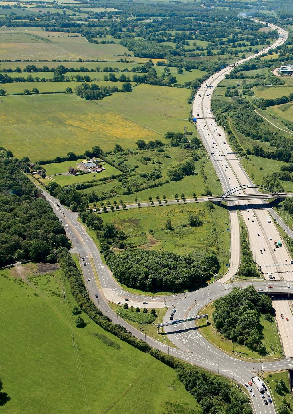
54
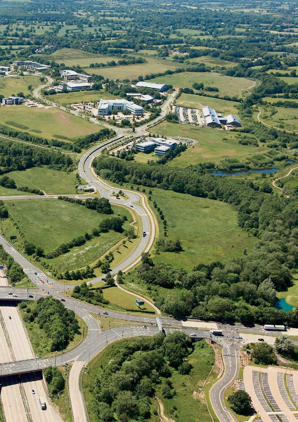
55
Living Streets response to the Draft London Plan
 Living Streets response to the Draft London Plan Contents Living Streets response to the Draft London Plan... 1 About Living Streets... 2 Summary... 2 Consultation response... 3 Chapter 1: Planning London
2. Context. Existing framework. The context. The challenge. Transport Strategy
 Transport Strategy Providing quality connections Contents 1. Introduction 2. Context 3. Long-term direction 4. Three-year priorities 5. Strategy tree Wellington City Council July 2006 1. Introduction Wellington
Transportation Master Plan Advisory Task Force
 Transportation Master Plan Advisory Task Force Network Alternatives & Phasing Strategy February 2016 BACKGROUND Table of Contents BACKGROUND Purpose & Introduction 2 Linking the TMP to Key Council Approved
March Maidstone Integrated Transport Strategy Boxley Parish Council Briefing Note. Context. Author: Parish Clerk 2 March 2016
 Context. Author: Parish Clerk 2 The Draft Integrated Transport Policy (DITS) sets out a vision and objectives, and identifies a detailed programme of interventions to support the Maidstone Borough Local
Birmingham Connected. Edmund Salt. Transportation Policy Birmingham City Council
 Birmingham Connected Edmund Salt Transportation Policy Birmingham City Council www.birmingham.gov.uk/connected Birmingham Connected the story so far Broadly following EU Guidance We ve done all of this
Our journey a 20 year Transport Manifesto for the North East
 Our journey a 20 year Transport Manifesto for the North East Sustrans submission to North East Combined Authority (NECA). March 2016 Summary Sustrans is a leading UK charity enabling people to travel by
Active Travel Strategy Dumfries and Galloway
 Active Travel Strategy Dumfries and Galloway Our Active Travel Strategy The agreed Interventions for Dumfries and Galloway Council s Local Transport Strategy includes an action to Develop an Active Travel
Launceston's Transport Futures. Greater travel options for the people of Launceston
 Launceston's Transport Futures Greater travel options for the people of Launceston Final Draft 13 Jan 2014 1 Page Number Executive summary 3 What is Transport Futures? 4 Vision 6 Economy, access and liveability
London Cycle Network Annual Report 2000
 London Cycle Network Annual Report 2000 A cycle network for London by 2005 A cycle network for London by 2005 The London Cycle Network will: provide local links between residential neighbourhoods, railway
Final Plan 20 December 2016
 Final Plan 20 December 2016 Introduction Aims of the Travel Plan How do we travel? Understanding travel behaviours? The University Master Plan and its implications Galway City sustainable transport policies
ABERDEEN: CITY OF THE FUTURE
 ABERDEEN: CITY OF THE FUTURE A contribution towards discussions on a future transport strategy for Aberdeen and its Region Prepared by the Centre for Transport Research University of Aberdeen June 2010
Bristol City Council has produced a draft Bristol Transport Strategy document.
 Bristol Transport Strategy Summary Document Introduction Bristol City Council has produced a draft Bristol Transport Strategy document. The Strategy fills a gap in transport policy for Bristol. We have
Nottingham Cycle City Frequently Asked Questions
 Nottingham Cycle City Frequently Asked Questions About the scheme How much money is to be spent on cycling? And where is the money from? We have 6.1 million in Growth Fund which we will be investing directly
9. Parking Supporting Statement
 9. Parking Supporting Statement Content 1. Setting the Scene 2. Vision 3. Parking and the Shared Priorities 4. Issues 5. Delivery Programme in the first Plan Period 2001/02 2005/06 6. Good Practice 7.
Douglas Land Use and Transportation Strategy (DLUTS) Summary. August 2013
 Summary. August 2013") Douglas Land Use and Transportation Strategy (DLUTS) Summary August 2013 Background Douglas is a large and popular residential suburb of approximately 30,000 persons on the periphery of Cork City along
Douglas Land Use and Transportation Strategy (DLUTS) Summary August 2013 Background Douglas is a large and popular residential suburb of approximately 30,000 persons on the periphery of Cork City along
This report is PUBLIC [NOT PROTECTIVELY MARKED] WMCA Board. (1) To approve the adoption of the West Midlands Cycle Design Guidance.
![This report is PUBLIC [NOT PROTECTIVELY MARKED] WMCA Board. (1) To approve the adoption of the West Midlands Cycle Design Guidance.](/thumbs/94/121802829.jpg "This report is PUBLIC [NOT PROTECTIVELY MARKED] WMCA Board. (1) To approve the adoption of the West Midlands Cycle Design Guidance.") This report is PUBLIC [NOT PROTECTIVELY MARKED] WMCA Board Date 8 December 2017 Report title Portfolio Lead Accountable Chief Executive Accountable Employee Report has been considered by West Midlands
This report is PUBLIC [NOT PROTECTIVELY MARKED] WMCA Board Date 8 December 2017 Report title Portfolio Lead Accountable Chief Executive Accountable Employee Report has been considered by West Midlands
Cycle network linking Wolverhampton city centre and Bilston town centre with employment sites and residential areas:
 Context and Problems Corridor length 12.3 km; Population within 800m 59,922; Jobs within 800m 59,100; Unemployment 11%; Average Index of Multiple Deprivation 46; Households with no car 45%; Proportion
GETTING WHERE WE WANT TO BE
 CAMBRIDGESHIRE & peterborough GETTING WHERE WE WANT TO BE A GREEN PARTY TRANSPORT POLICY CONTENTS Our Campaign Priorities 4 Bus Franchising 6 Supporting Active Transport 8 Workplace Parking Levy 9 Tackling
Sandwell General Hospital Travel Plan 2014
 Sandwell General Hospital Travel Plan 2014 Travel Plan Survey Dated 24 th June 2013 Travel plan finalised March 2014 Prepared by Michael Raynor, JMP Consultants Ltd Site Address Lyndon, West Bromwich,
PERSONALISED TRAVEL PLANNING IN MIDLETON, COUNTY CORK
 PERSONALISED TRAVEL PLANNING IN MIDLETON, COUNTY CORK Elaine Brick Principal Transport Planner AECOM Abstract Smarter Travel funding was awarded to the Chartered Institute of Highways and Transportation
Contents Location Map Welcome and Introduction Travel Plan Management Science Park Accessibility Walking Cycling Bus Rail Car Sharing Contact Details
 Contents Contents Location Map Welcome and Introduction Travel Plan Management Science Park Accessibility Walking Cycling Bus Rail Car Sharing Contact Details 1 2 3 5 7 9 11 13 15 17 19 Thames Valley Science
Transport Workshop Dearbhla Lawson Head of Transport & Infrastructure Policy & Funding University of the Third Age.
 Transport Workshop Dearbhla Lawson Head of Transport & Infrastructure Policy & Funding University of the Third Age 30 th March 2015 1 Presentation Overview Roles and responsibilities Snapshot of Key Challenges
21.07 TRANSPORT CONNECTIVITY AND INFRASTRUCTURE
 21.07 TRANSPORT CONNECTIVITY AND INFRASTRUCTURE 21.07-1 Connectivity and Choice Transport connectivity and mode choice are critical to achieving productive, sustainable and socially just cities. Travel
What s the issue for transport in Cardiff?
 Demand for travel The number of commuters travelling to work in Cardiff has increased from 190,000 in 2001 to 198,000 in 2010, with some 124,000 Cardiff residents travelling across the city daily to their
Central London Bus Services Review
 Central London Bus Services Review Sustrans response to Transport for London November 2018 About Sustrans Sustrans is the charity making it easier for people to walk and cycle. We are engineers and educators,
Cycle traffic and the Strategic Road Network. Sandra Brown, Team Leader, Safer Roads- Design
 Cycle traffic and the Strategic Road Network Sandra Brown, Team Leader, Safer Roads- Design Highways England A Government owned Strategic Highways Company Department for Transport Road Investment Strategy
Walking and Cycling Action Plan Summary. A Catalyst for Change The Regional Transport Strategy for the west of Scotland
 Walking and Cycling Action Plan Summary A Catalyst for Change The Regional Transport Strategy for the west of Scotland 2007-2021 Strathclyde Partnership for Transport Contents Purpose...2 Issues, Constraints
CYCLING CHARTER ACTION PLAN EXECUTIVE SUMMARY
 CYCLING CHARTER ACTION PLAN EXECUTIVE SUMMARY THE VISION OF THE CYCLING CHARTER To realise the full potential of cycling s contribution to the health and wealth of the West Midlands creating more sustainable
Update June 2018 OUR 2017 PUBLIC ENGAGEMENT
 Update June 2018 Hi, Let s Get Wellington Moving (LGWM) is developing a Recommended Programme of Investment (RPI) that meets our programme objectives and supports the city s and region s growth. As part
Local Sustainable Transport Fund
 I II III Sustainable travel in Greater Manchester: The journey to a low carbon economy Greater Manchester has a vision of sustainable commuting at the heart of its blueprint for a low carbon economy, as
University of Leeds Travel Plan
 University of Leeds Travel Plan 2015-2018 Contents 1: Introduction 1.1 What is a Travel Plan? 1.2 Why do we need one? 1.3 Sustainability Strategy 2: Overview 2.1 The bigger picture 2.2 The City scale 2.3
Sustainable Urban Mobility Plan for Aberdeen, Scotland. Louise Napier Senior Planner Aberdeen City Council
 Sustainable Urban Mobility Plan for Aberdeen, Scotland Louise Napier Senior Planner Aberdeen City Council A bit about me.. Louise Napier Senior Planner (Transport Strategy & Programmes) Aberdeen City Council
GD 0043/18 ACTIVE TRAVEL STRATEGY
 GD 0043/18 ACTIVE TRAVEL STRATEGY 2018-2021 May 2018 Minister s Introduction There is strong evidence that regular physical activity reduces the risk of a range of health conditions. The best way to increase
Reflections on our learning: active travel, transport and inequalities
 Reflections on our learning: active travel, transport and inequalities Jill Muirie Glasgow Centre for Population Health Active travel definition Active travel refers to walking, cycling or using some other
Cambridgeshire Local Transport Plan Policies and Strategy
 Cambridgeshire Local Transport Plan 2011 2026 Policies and Strategy John Onslow Acting Executive Director of Environment Services Cambridgeshire County Council Shire Hall Castle Hill Cambridge CB3 0AP
I write in response to the current consultation. I am copying this to Derrick Ashley and I will be posting this online.
 Dear John Draft Local Transport Plan 2050 I write in response to the current consultation. I am copying this to Derrick Ashley and I will be posting this online. East Herts is a largely rural area, with
Stepping up a gear. Our vision for cycling in Cardiff
 Stepping up a gear Our vision for cycling in Cardiff Cardiff is growing fast in fact, over the last 10 years its population has grown quicker than any UK city outside London and this rate of expansion
WEST YORKSHIRE LTP CYCLE PROSPECTUS
 WEST YORKSHIRE LTP CYCLE PROSPECTUS The West Yorkshire Ambition: To be recognised as a great place for safe cycling, inspiring more people to cycle more often. INTRODUCTION Cycling is low cost, environmentally
Developing a Birmingham Transport Space Allocation policy. David Harris Transport Policy Manager Economy Directorate Birmingham City Council
 Developing a Birmingham Transport Space Allocation policy David Harris Transport Policy Manager Economy Directorate Birmingham City Council Birmingham s Sustainable Urban Mobility Plan Birmingham Connected
ONE SIZE DOESN T FIT ALL RECONCILING OVERLAPPING TRANSPORT NETWORKS IN A CONSTRAINED URBAN ENVIRONMENT
 One Size Doesn t Fit All S Corbett, C Chenery Page 1 ONE SIZE DOESN T FIT ALL RECONCILING OVERLAPPING TRANSPORT NETWORKS IN A CONSTRAINED URBAN ENVIRONMENT Authors/Presenters: Sam Corbett, Principal Transport
Cycling and Walking Investment Strategy & Local Cycling and Walking Infrastructure Plans
 Cycling and Walking Investment Strategy & Local Cycling and Walking Infrastructure Plans 1 Investing in cycling and walking contributes to a broad range of cross-cutting policy objectives Cycling and walking
Westminster s Joint Health and Wellbeing Strategy
 Westminster s Joint Health and Wellbeing Strategy 2013 2016 Response from Sustrans General comments From a strategic perspective, Sustrans welcomes the Health and Wellbeing Strategy s focus on encouraging
National Transport Awards Cambridge Park & Ride
 National Transport Awards Cambridge Park & Ride What Cambridgeshire has achieved q An award winning scheme focussed on quality. q Four sites, with a fifth site due to be built later this year. q 950,000
Wayfinding and Walking in London. Lilli Matson Transport for London May 2013
 Wayfinding and Walking in London Lilli Matson Transport for London May 2013 I want to make walking in London as attractive and enjoyable as possible by making walking count Mayor of London Boris Johnson
The role of the Authority in promoting sustainable transport. Gerry Murphy South East Regional Assembly 27 th May 2011
 The role of the Authority in promoting sustainable transport Gerry Murphy South East Regional Assembly 27 th May 2011 Who we are National Transport Authority established on 1 st December 2009 Dublin Transport
Active Travel Towns Funding Scheme Project Proposal. Sligo. Sligo Local Authorities
 Active Travel Towns Funding Scheme 2014-2016 Project Proposal for Sligo by Sligo Local Authorities Introduction Over the last two years, Sligo Local Authorities have implemented years 1 & 2 of their 5
20mph. We want to make Edinburgh a better and safer place to live, work and play.
 20mph CREATING A BETTER SAFER EDINBURGH We want to make Edinburgh a better and safer place to live, work and play. That s why on 13 January 2015 Councillors approved a new speed limit network for Edinburgh
A127/A130 Fairglen Interchange Improvement Schemes. Information Leaflet February 2017
 A127/A130 Fairglen Interchange Improvement Schemes Information Leaflet February 2017 1 2 Foreword By Councillor Kevin Bentley Essex is continuing to grow as a vibrant economic hub and as a fantastic place
Active travel and economic performance: A What Works review of evidence from cycling and walking schemes
 1 Making the economic case for active travel Active travel and economic performance: A What Works review of evidence from cycling and walking schemes Active Travel Toolkit Slide Pack July 2017 Active travel
Your views are important. Please fill in a form before you leave. Or alternatively
 Drum Property Group is delighted to welcome you to this exhibition which sets out our initial proposals for a mixed-use development at Stead s Place, Edinburgh. We are keen to hear the views of local people
A1307 Haverhill to Cambridge: Approval to consult on transport improvement concepts
 Report To: Greater Cambridge City Deal Executive Board 3 March 2016 Lead Officer: Graham Hughes, Executive Director of Economy, Transport and Environment, Cambridgeshire County Council A1307 Haverhill
Part 3: Active travel and public transport planning in new housing developments
 1 Linking active travel and public transport to housing growth and planning Part 3: Active travel and public transport planning in new housing developments Active Travel Toolkit Slide Pack July 2017 Linking
A future cycle route network for North Staffordshire mb/08/16 Need for a strategy. Existing cycle route network
 Need for a strategy 1. The government s aim is to double cycling levels nationally by 2025 [note 1]. This would bring significant health, environmental, economic and traffic benefits [note 2]. It is widely
Government transport policy
 Government transport policy and the implications for planning RTPI TPS Transport Planning Network James Harris P o l i c y a n d N e t w o r k s M a n a g e r R o y a l To w n P l a n n i n g I n s t i
RESPONSE from SPOKES to NPF3 Main Issues Report to: July 2013
 RESPONSE from SPOKES to NPF3 Main Issues Report to: npfteam@scotland.gsi.gov.uk July 2013 A LOW CARBON PLACE 1. How can NPF3 support the transition to a largely decarbonised heat sector? 2. How should
Welcome. Background. Goals. Vision
 Welcome The formal Public Information Centre (PIC) for the Transportation Master Plan How We GO will be held in early 2017. At that time we will present the recommended transportation system for Niagara
A VISION... A city where it s normal for everyone to travel more sustainably every day, and the culture of sustainable travel is celebrated.
 A VISION... Imagine a city where everyone, no matter who they are, can get around easily. A city where it is enjoyable, easy, convenient and affordable for everyone to get from A to B and where the transport
HAMILTON BIKING PLAN OUR VISION: A BIKE FRIENDLY CITY
 HAMILTON BIKING PLAN 2015-2045 OUR VISION: A BIKE FRIENDLY CITY INTRODUCTION Biking as a travel option is experiencing a resurgence internationally and in New Zealand, growing as a familyfriendly and healthy
Public Consultation Centre
 Region of Waterloo Transportation Master Plan Update Public Consultation Centre See the Information Package on how to contact the Project Team and complete the Comment Sheet www.regionofwaterloo.ca/en/exploring-the-region/transportation-master-plan.aspx
Draft Greater Sydney Region Plan
 Powered by TCPDF (www.tcpdf.org) Draft Greater Sydney Region Plan Submission_id: 31452 Date of Lodgment: 15 Dec 2017 Origin of Submission: Online Organisation name: UNSW Sydney Organisation type: Other
Section 2 Strategic Alignment. Contents
 Section 2 Strategic Alignment Contents 2 Strategic Alignment... 2 2.1 General... 2 2.2 SmartGrowth Strategy and Implementation Plan... 2 2.3 Walking and Cycling Strategy... 3 2.4 Built Environment Strategy...
ANNEX1 The investment required to achieve the Government s ambition to double cycling activity by 2025
 ANNEX1 The investment required to achieve the Government s ambition to double cycling activity by 2025 May 2016 About Sustrans Sustrans makes smarter travel choices possible, desirable and inevitable.
Climate Change Action Plan: Transportation Sector Discussion Paper: Cycling
 Climate Change Action Plan: Transportation Sector Discussion Paper: Cycling ontario.ca/climatechange Contents 1. Minister of Transportation s message... 3 2. Introduction... 5 3. Sector Overview and Support
The seamless journey The seamless journey: Public transport links with walking and cycling
 The seamless journey The seamless journey: Public transport links with walking and cycling The PEP Workshop Kyiv, Ukraine June 8-9, 2011 Susanne Stölting UITP - A global membership UITP is... The network
CONTENTS PREFACE 1.0 INTRODUCTION AND SCOPE 2.0 POLICY AND GOVERNANCE 3.0 SUMMARY OF PROGRESS 4.0 NATURE OF DEMAND 5.0 TRAVEL AND PARKING INITIATIVES
 CONTENTS PREFACE 1.0 INTRODUCTION AND SCOPE 2.0 POLICY AND GOVERNANCE 3.0 SUMMARY OF PROGRESS 4.0 NATURE OF DEMAND 5.0 TRAVEL AND PARKING INITIATIVES 6.0. TARGETS PREFACE The University of St Andrews has
Department for Transport
 Improving UK evidence on health and environmental (low carbon) behaviours John Cummings Department for Transport 4 th November, 2015 CYCLING AND WALKING POLICY TEAM, OFFICIAL, 1st DRAFT 1 Walking and cycling
Purpose and Need. Chapter Introduction. 2.2 Project Purpose and Need Project Purpose Project Need
 Chapter 2 Purpose and Need 2.1 Introduction The El Camino Real Bus Rapid Transit (BRT) Project (Project) would make transit and other transportation improvements along a 17.6-mile segment of the El Camino
RESTRICTED ROADS (20 MPH SPEED LIMIT) (SCOTLAND) BILL. 1. Is reducing the speed limit to 20mph the best way of achieving the aims of the Bill?
 (SCOTLAND) BILL. 1. Is reducing the speed limit to 20mph the best way of achieving the aims of the Bill?") RURAL ECONOMY AND CONNECTIVITY COMMITTEE RESTRICTED ROADS (20 MPH SPEED LIMIT) (SCOTLAND) BILL SUBMISSION FROM CYCLE STIRLING Questions 1. Is reducing the speed limit to 20mph the best way of achieving
RURAL ECONOMY AND CONNECTIVITY COMMITTEE RESTRICTED ROADS (20 MPH SPEED LIMIT) (SCOTLAND) BILL SUBMISSION FROM CYCLE STIRLING Questions 1. Is reducing the speed limit to 20mph the best way of achieving
LEA BRIDGE ROAD - A STREET FOR EVERYONE Public consultation document
 LEA BRIDGE ROAD - A STREET FOR EVERYONE Public consultation document TELL US Bakers Arms to Leyton Green Road (Section D, E, F) Leyton Green Road to Whipps Cross Roundabout (Section G) YOUR VIEWS www.enjoywalthamforest.co.uk
RAA Submission to: The City of Adelaide Draft Integrated Movement Strategy Moving Adelaide
 RAA Submission to: The City of Adelaide Draft Integrated Movement Strategy 2012-22 Moving Adelaide May 2012 RAA Submission to the City of Adelaide Draft Integrated Movement Strategy 2012-22 Moving Adelaide
DOE Climate Change Proposals
 DOE Climate Change Proposals Sustrans response to Proposals for Taking Forward NI Climate Change Legislation January 2016 About Sustrans Sustrans makes smarter travel choices possible, desirable and inevitable.
E4 Cycle Route Exeter University to Redhayes Bridge. - Recommendations from Exeter Cycling Campaign
 E4 Cycle Route Exeter University to Redhayes Bridge - Recommendations from Exeter Cycling Campaign 1.0 Introduction Exeter Cycling Campaign has prepared this report to provide recommendations for Devon
CITY OF CARDIFF COUNCIL TRANSPORT STRATEGY REPORT OF DIRECTOR CITY OPERATIONS AGENDA ITEM: 6
 CYNGOR DINAS CAERDYDD CITY OF CARDIFF COUNCIL CABINET MEETING: 13 OCTOBER 2016 CITY OF CARDIFF COUNCIL TRANSPORT STRATEGY REPORT OF DIRECTOR CITY OPERATIONS AGENDA ITEM: 6 PORTFOLIO: TRANSPORT, PLANNING
Road Safety Partnership
 Cambridgeshire and Peterborough Road Safety Partnership Cambridgeshire and Peterborough Road Safety Partnership Introduction Road accidents can have a devastating impact not only for the people directly
ENFIELD TOWN THE REVISED DESIGN
 TOWN THE REVISED DESIGN We re turning Enfield into a borough that encourages walking and cycling, a place that s easy for all of us to get around however we choose to travel. A greener place, with safer
University of Victoria Campus Cycling Plan Terms of Reference. 1.0 Project Description
 University of Victoria Campus Cycling Plan Terms of Reference 1.0 Project Description The Campus Cycling Plan, a first for the University, will provide a comprehensive and coordinated approach to support
Nottingham, the great cycle city
 Nottingham, the great cycle city Our vision for the city s cycling future Foreword Councillor Jon Collins Leader of the Council Nottingham has a world class public transport system which is essential to
City of Hamilton s Transportation Master Plan (TMP) Public Consultation 3 December 2015
 Public Consultation 3 December 2015") City of Hamilton s Transportation Master Plan (TMP) Public Consultation 3 December 2015 McPhail Transportation Planning Services Ltd. AGENDA 6:00 7:00 pm Viewing Boards / Q & A with the Team 7:00 7:50
City of Hamilton s Transportation Master Plan (TMP) Public Consultation 3 December 2015 McPhail Transportation Planning Services Ltd. AGENDA 6:00 7:00 pm Viewing Boards / Q & A with the Team 7:00 7:50
Speed Limit Policy Isle of Wight Council
 APPENDIX B Speed Limit Policy Isle of Wight Council 2009 Contents Section 1 Introduction 1.1 Links with the Local Transport Plan Section 2 Speed Limits on Urban Roads and Residential Areas 2.1 20mph Limits
Exhibit 1 PLANNING COMMISSION AGENDA ITEM
 Exhibit 1 PLANNING COMMISSION AGENDA ITEM Project Name: Grand Junction Circulation Plan Grand Junction Complete Streets Policy Applicant: City of Grand Junction Representative: David Thornton Address:
Report to Cabinet. 18 May 2016
 Agenda Item 8 Report to Cabinet 18 May 2016 Subject: Presenting Cabinet Member: Proposed CCTV Enforcement of Traffic Contraventions in a Bus Lane (Key Decision Ref. No. HE030) Highways and Environment
Oxford Street West. 21 December https://consultations.tfl.gov.uk/roads/oxford-street/?cid=oxford-street
 Oxford Street West 21 December 2017 https://consultations.tfl.gov.uk/roads/oxford-street/?cid=oxford-street This consultation response is on behalf of the London Cycling Campaign (LCC), the capital s leading
LEEDS BECKETT UNIVERSITY. Transport Strategy
 LEEDS BECKETT UNIVERSITY Transport Strategy 2016-2021 2 3 Contents 1. Introduction 1. Introduction...3 Scope of the Document...3 Vision...3 Key Successes...3 2. Our Travel Behaviour...4 Staff and Student
Bike share success factors
 Bike share success factors A guide to the types of locations where bike share can flourish January 2016 Bike share success factors A guide to the types of locations where bike share can flourish and how
City of Novi Non-Motorized Master Plan 2011 Executive Summary
 City of Novi Non-Motorized Master Plan 2011 Executive Summary Prepared by: February 28, 2011 Why Plan? Encouraging healthy, active lifestyles through pathway and sidewalk connectivity has been a focus
North Coast Corridor:
 North Coast Corridor: Connecting People, Transportation & Environment Legislative Hearing: 11.8.10 1 North Coast Corridor Region s Lifeline A Regional Strategy Mobility, Economy & Environment North Coast
This objective implies that all population groups should find walking appealing, and that it is made easier for them to walk more on a daily basis.
 Walking for life The Norwegian Walking Strategy Guro Berge Norwegian public Roads Administration "Walking for life" is the slogan for the National Walking Strategy that is now being formulated in Norway.
EUROPEAN TRANSPORT CONFERENCE 2006 ROAD SAFETY IN LONDON PAST SUCCESSES AND FUTURE INNOVATIONS
 EUROPEAN TRANSPORT CONFERENCE 26 ROAD SAFETY IN LONDON PAST SUCCESSES AND FUTURE INNOVATIONS Mr Chris Lines Head of the London Road Safety Unit, Transport for London 1. PAST SUCCESSES Road safety is a
Ormond & McKinnon Walks Response to Draft Glen Eira Community Plan
 Response to Draft Glen Eira Community Plan We would like to take this opportunity to thank Glen Eira City Council for the opportunity to comment on the Glen Eira Draft Community Plan. Below is an outline
KIGALI CITY, RWANDA MODERNIZATION OF TRANSPORT INFRASTRUCTURE AND SERVICES. Presentation to ITC, UTwente Enschede 13 June 2018
 KIGALI CITY, RWANDA MODERNIZATION OF TRANSPORT INFRASTRUCTURE AND SERVICES Presentation to ITC, UTwente Enschede 13 June 2018 Dr. Eng. Alphonse NKURUNZIZA City Engineer, City of Kigali Kigali City Projected
Joint Response to the Department for Transport Consultation on the Station Champions Report on Better Rail Stations. February 2010
 Joint Response to the Department for Transport Consultation on the Station Champions Report on Better Rail Stations Joint Response to the Better Rail Stations Consultation This response has been prepared
Technical note. 1. Introduction
 Project: A428 study - Phase 2 To: Adrian Shepherd Subject: Park & Ride site locations From: Atkins Date: Jun 3, 2016 cc: Ashley Heller 1. Introduction 1.1. Purpose of Technical Note The purpose of this
Building An Active Travel Future for Northern Ireland Consultation Response
 Building An Active Travel Future for Northern Ireland Consultation Response Belfast Healthy Cities welcomes the opportunity to comment on the Draft Active Travel Strategy. About Belfast Healthy Cities:
5 DECEMBER Cycling In London. Andrew Summers, Transport for London Strategy and Policy Manager Active Travel and Health.
 5 DECEMBER 2017 Cycling In London Andrew Summers, Transport for London Strategy and Policy Manager Active Travel and Health 2017 TRL Ltd CYCLING IN LONDON Contents 1. Why is cycling so important for London?
APPENDIX 2 PROPOSAL FOR REPLACEMENT FOR POOLE (DOLPHIN) LEISURE CENTRE FINAL SPECIFICATION
 LEISURE CENTRE FINAL SPECIFICATION") APPENDIX 2 PROPOSAL FOR REPLACEMENT FOR POOLE (DOLPHIN) LEISURE CENTRE FINAL SPECIFICATION 1 PURPOSE 1.1 To provide the following information and supporting evidence for the Member decision (reference
APPENDIX 2 PROPOSAL FOR REPLACEMENT FOR POOLE (DOLPHIN) LEISURE CENTRE FINAL SPECIFICATION 1 PURPOSE 1.1 To provide the following information and supporting evidence for the Member decision (reference
WELCOME. City of Greater Sudbury. Transportation Demand Management Plan
 WELCOME City of Greater Sudbury Transportation Demand Management Plan Public Consultation Session St. Andrew s Place, Activity Hall 111 Larch Street Wednesday September 13, 2017 6:00 to 8:00 pm Welcome
Report to: Greater Cambridge Partnership Executive Board 4 July Transport Strategy - Future Public Transport Requirements
 Report to: Greater Cambridge Partnership Executive Board 4 July 2018 Lead officer: Peter Blake GCP Transport Director Transport Strategy - Future Public Transport Requirements 1. Purpose 1.1. This paper
City of Toronto Complete Streets Guidelines
 Round One This is a summary of the Complete Streets Guidelines Survey posted on June 18 th, 2015 and live until July 2 nd, 2015. The survey was designed to solicit feedback on the draft Complete Streets
DON MILLS-EGLINTON Mobility Hub Profile
 Mobility Hub Profile Dundas Don Mills-Eglinton West-Bloor Anchor Hub Gateway Hub N MOBILITY HUBS: Places of connectivity between regional and rapid transit services, where different modes of transportation
NEWMARKET CENTRE Mobility Hub Profile
 Mobility Hub Profile Dundas Newmarket West-Bloor Centre Anchor Hub Gateway Hub N MOBILITY HUBS: Places of connectivity between regional and rapid transit services, where different modes of transportation