SOUND TRANSIT AT A GLANCE
|
|
|
- Ezra Howard
- 5 years ago
- Views:
Transcription
1 SOUND TRANSIT AT A GLANCE STATION ACCESS IMROVEMENTS ROJECT Sound Transit operates Sounder commuter trains, ST Express buses and Link light rail. The 2008 voter-approved Sound Transit 2 package included funding for access improvements at uyallup and Sumner stations. Sound Transit 2 also included funding for additional round-trip Sounder service between Lakewood and Seattle. opulation in the region is expected to grow by more than 28% by the year 2035 and Sounder average daily ridership on the south line is expected to increase by more than 13,000. MA KEY Link Light Rail Central Link (SeaTac/Airport Westlake/Seattle) Tacoma Link (Tacoma Dome Theater District) Under Construction In Design In lanning/ lanned Sounder Commuter Rail Everett Seattle Sounder Lakewood Tacoma Seattle Sounder ST Express Regional Bus Express Bus Service Future Bus Rapid Transit (BRT) Edmonds Mukilteo Lynnwood Ash Way Mountlake Terrace Shoreline TBD Everett South Everett Bothell Canyon ark Woodinville Supporting Investments ark & Ride Rail Station or Bus Facility Rail Station, Transit Center or Bus Stop Improvements First Hill Streetcar (Opens 2014) HOV/Transit Improvements HOV Direct Access Ramp, Freeway Station or Overpass Ferry Terminal Sea-Tac Airport Amtrak Future projects at a glance Expanded new light rail service to Lynnwood, Overlake and Kent/ Des Moines New First Hill streetcar connecting Capitol Hill and ioneer Square Four new round-trip Sounder trains between Lakewood and Seattle Seattle Westlake University Street ioneer Square International District/ Chinatown & King Street West Seattle Stadium SODO Northgate Roosevelt U District University of Washington Capitol Hill Kirkland Bellevue Transit Center East Main First Hill South Bel llevue Rainier Mercer Island Beacon Hill Mount Baker Columbia City Othello Rainier Beach Totem Lake Redmond Construction not currently funded SE Redmond Overlake Transit Center Overlake Village 130th 120th Hospital Bellevue Eastgate Issaquah South Sammamish Issaquah Highlands Sounder station improvements ermanent Sounder station in Tukwila Bus Rapid Transit service across SR 520 Tukwila/ International Blvd Burien SeaTac /Airport Tukwila Renton Angle Lake Kent/Des Moines Kent S 272nd/Federal Way Construction not currently funded To Gig Harbor and urdy Tacoma Community College South Tacoma Tacoma Federal Way Theater District/ S 9th Commerce Street/ S 11th Convention Center/ S 15th Union Station/ S 19th S 25th Tacoma Dome uyallup Auburn Sumner Lakewood Bonney Lake Duont


2 SOUND TRANSIT: MOVING EOLE ACROSS THE REGION STATION ACCESS IMROVEMENTS ROJECT Sounder trains and ST Express buses serve more than 19 million riders each year. Just over 330,000 of those riders access trains and buses from Sumner Station and area park-and-ride lots. Sound Transit helps move people across the region by providing reliable transit options that are conveniently located in population centers.

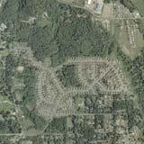
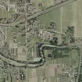
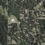
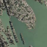
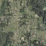
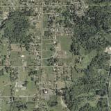
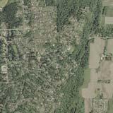
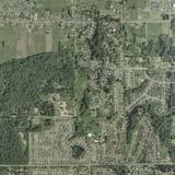
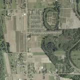
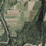
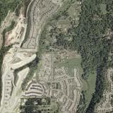
3 TELL US WHERE YOU LIVE STATION ACCESS IMROVEMENTS ROJECT uyallup Station Sumner Station Map data 2013 Google


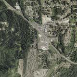
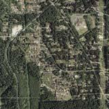
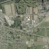
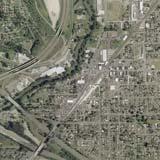
4 HOW DO YOU GET TO SUMNER STATION? STATION ACCESS IMROVEMENTS ROJECT 167 Sumner Station 410 Bonney Lake ark and Ride 162
5 HOW ARE RIDERS GETTING TO SUMNER STATION? STATION ACCESS IMROVEMENTS ROJECT 63% car arking Spaces 49% from addresses within 5 miles 343 dedicated 99% occupied 302 Sounder lot + 41 State Street lot Additional parking provided at the Red Apple lot (60 spaces) and Bonney Lake ark and Ride (356 spaces) Street parking within 1/2 mile of station 21% bus 11 % drop off 3% bike 2% walk (walking from home)
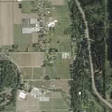
6 WHERE ARE DRIVERS COMING FROM? STATION ACCESS IMROVEMENTS ROJECT 167 Sumner Station 410 Bonney Lake ark and Ride 162 Arrows show the relative number of cars traveling to Sumner Station.


7 SOUNDER STATION ACCESS CHALLENGES STATION ACCESS IMROVEMENTS ROJECT Sounder service will increase from 10 to 13 round trip trains by Sound Transit needs to provide capacity for increased Sounder ridership, which is expected to grow by about 70% before This is about 600 new riders each day. As ridership increases, more than half of Sounder riders are expected to access the station by car. Currently, dedicated parking spaces are full by the second train in the morning, and on-street parking in Sumner is limited. Overall traffic congestion in downtown Sumner is increasing, affecting both car and bus access to Sumner Station. Bicycle and pedestrian amenities near the station are limited.
8 ROJECT GOALS AND EVALUATION CRITERIA STATION ACCESS IMROVEMENTS ROJECT DRAFT GOALS rovide improved access to Sounder riders Benefit the local community Support Sound Transit s regional commitments Maintain a healthy environment EVALUATION CRITERIA rovides capacity for existing and future riders rovides safe, multi-modal access and reliable travel times to the Sounder station area for riders Supports community character, vision, plans and policies for the station area, including historic downtown Supports access to parking for downtown businesses and residences within the station area Minimizes additional congestion and impacts to neighborhood traffic within the station area Is cost-effective and financially sustainable Supports plans and policies from Sound Transit and regional agencies Builds on the access improvements identified in the Sounder Stations Access and Demand Study Minimizes potential adverse impacts to the natural and built environment
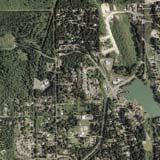
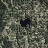
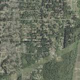
9 SUMNER STATION ACCESS IMROVEMENTS STATION ACCESS IMROVEMENTS ROJECT Washington Ave Bridge St Av e Fryar Ave 167 Main St 410 E Main Ave Traffic St Sumner Station Thompson St Cherry Ave e Maple St Academy St ¼ Mile Radius Alder Ave Sumner Ave Wood Ave ½ Mile Radius urpose: Improve access for Sounder train riders to Sumner Station, focusing on pedestrian, bike and parking improvements Focus on pedestrian and parking garage improvements within a quarter-mile Focus on parking lot, vehicle access and bicycle improvements within a half-mile Total project budget $37.8 million (2012 dollars) Complete project by 2023
10 OTENTIAL NON-MOTORIZED IMROVEMENTS STATION ACCESS IMROVEMENTS ROJECT edestrian and bicycle improvements were identified as part of the Sounder Station Access Study. Washington Ave Bridge St Av e Fryar Ave Main St Maple St N E Main Ave Traffic St 6 Sumner Station Thompson St Cherry Ave e Academy St ¼ Mile Radius Alder Ave Sumner Ave 2 Wood Ave ½ Mile Radius 1 Linden Drive / SR 410 Crossing Improvements 2 Academy Street Bike Boulevard* 3 Riverwalk Trail Access oint 4 uyallup River Trail Extension 5 White River Trail Extension (partially complete) 6 Station edestrian Bridge * Specific types of bike improvements will be further evaluated as part of this project.
11 OTHER IDEAS FOR NON-MOTORIZED IMROVEMENTS STATION ACCESS IMROVEMENTS ROJECT edestrian bridge across SR 410 (mid-way between Traffic Avenue and SR 162 interchange) Connect uyallup River Trail Extension to station via Alder Avenue or Sumner Avenue Complete missing sidewalk segments, especially in the southwest area ADA access (ramps) throughout the sidewalk system Bike sharrows along Academy out to Wood Avenue, from Wood Avenue south to Meade McCumber, from Meade McCumber moving south to Valley Ave East Note the city effort needed for bike boulevard identified in study (Academy Street) Tie bicycle amenities for station to a larger program with the city Improve lighting along city streets rojects that could particularly demonstrate the Sound Transit/ Sumner partnership: rograms that promote bicycling Borrowed bikes; bike share Bike lockers at both ends of the Sounder route Developing bike lanes and/or segments Consider the future of cars and how changes will impact our choices

12 OTENTIAL BUS IMROVEMENTS STATION ACCESS IMROVEMENTS ROJECT Current bus service to the station is provided by ST Express route 596 from the Bonney Lake ark and Ride. ST Express Route 578 offers mid-day express bus service to Seattle. At the request of the project s leadership working group, Sound Transit is evaluating potential new and/or additional shuttle service for Sounder riders.* Buses to the station may benefit from city traffic management improvements such as transit signal priority. * Funding for shuttle service not included in the voter-approved Sound Transit 2 plan.
13 OTENTIAL ARKING IMROVEMENTS STATION ACCESS IMROVEMENTS ROJECT arking improvements could add parking spaces, which may include surface lots, a small or large parking garage, or a combination of both. and/or or Surface lot At least 30 and up to 300 parking spaces Leased and/or purchased $5,000 per space to build arking garage Approximately 300 to 500 parking spaces Minimum size of 120 feet by 250 feet Up to 4-1/2 stories (parking on the roof of a 4-story building) $25,000 per space to build

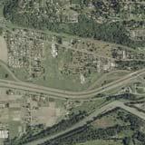
14 OTENTIAL SITES FOR ARKING IMROVEMENTS STATION ACCESS IMROVEMENTS ROJECT Surface lots and parking garages Sumner Station


15 OTENTIAL SITES FOR ARKING IMROVEMENTS STATION ACCESS IMROVEMENTS ROJECT otential satellite parking off Shaw Road rovider for potential shuttle service needs to be identified* * Funding for shuttle service not included in the voter-approved Sound Transit 2 plan.


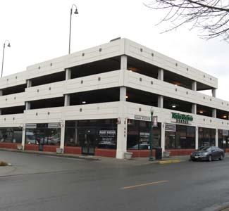
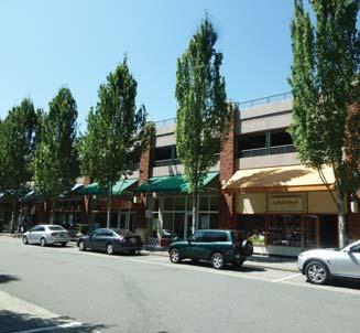
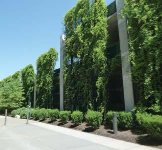
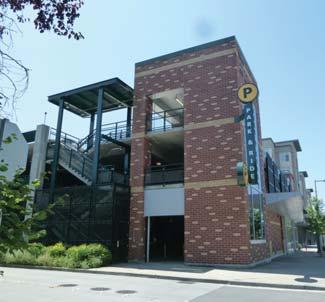
16 EXAMLE ARKING GARAGES STATION ACCESS IMROVEMENTS ROJECT
17 TRAFFIC CONGESTION AROUND SUMNER STATION STATION ACCESS IMROVEMENTS ROJECT Today In 2035 without parking improvements In 2035 with parking improvements Intersections with traffic delays Intersections with traffic delays without any Sound Transit access improvements near Sumner Station Intersections with traffic delays with the addition of parking spaces near Sumner Station Sounder Station otential cut-through traffic * Delays of less than 1 minute Delays of more than 1 minute Length of delay depends on the location of parking facilities Delays of approximately 3 minutes *Note: substantial delay at SR 410 ramp intersections (approx. 3 minutes at each) will lead some drivers to cut through neighborhood streets to the east.

18 OTENTIAL CONGESTION IMROVEMENTS STATION ACCESS IMROVEMENTS ROJECT Sound Transit is exploring options to reduce transit rider-related congestion near the station, including: Tools to manage traffic, such as more traffic signals and coordination of existing signals Adding capacity to existing intersections Focused capacity improvements to existing roads

19 OTENTIAL CONGESTION IMROVEMENTS STATION ACCESS IMROVEMENTS ROJECT As part of this project analysis, Sound Transit is exploring with Washington State Department of Transportation potential improvements to the Traffic Avenue/SR 410 interchange. This potential project would help reduce congestion at several intersections near Sumner Station and would be a partnership opportunity for Sound Transit, local jurisdictions and other agencies. It would also provide a key connection to local trail systems. In 2035 with parking improvements In 2035 with bridge and parking improvements Intersections with substantial traffic delays with the addition of parking spaces near Sumner Station Intersections with traffic delays Delays of more than 1 minute Delays of less than 1 minute Length of delay depends on the location of parking facilities Delays of approximately 3 minutes Area for potential improvements


 of improvement options Winter 2013 - Summer 2014 Developing and evaluating packages")
20 SCHEDULE STATION ACCESS IMROVEMENTS ROJECT WE ARE HERE Identified funding for improvements to uyallup and Sumner Stations Sounder Stations Access Study reliminary access improvement recommendations for all Sounder stations Leadership Working Groups Alternatives Development Environmental Review reliminary Design ROW/roperty Acquisition and ermitting Final Design Construction 2023 Final construction of all improvements Sounder Service begins Spring Fall 2013 Identifying options for access improvements Sound Transit Board identifies preferred package(s) of improvement options Winter Summer 2014 Developing and evaluating packages of improvement options
21 e DEVELOING IMROVEMENT OTIONS STATION ACCESS IMROVEMENTS ROJECT Identify improvement options Washington Ave Bridge St Fryar Ave e 167 Main St 410 E Main Ave Traffic St Maple St Sumner Station Academy St Thompson St Cherry Ave ¼ Mile Radius Alder Ave Sumner Ave Wood Ave ½ Mile Radius Open House February 2014 Develop and evaluate packages of improvement options A B C D Open House Spring 2014 Refine package(s) of improvement options X Sound Transit Board identifies preferred alternative(s) Summer 2014

22 HOW TO STAY INVOLVED STATION ACCESS IMROVEMENTS ROJECT soundtransit.org/ SumnerImprovements
CURRENT AND VOTER APPROVED SOUND TRANSIT SERVICE
 CURRENT AND VOTER AROVED SOUND TRANSIT SERVICE Everett MA KEY Link Light Rail Mukilteo Link (SeaTac/Airport University of Washington) Tacoma Link (Tacoma Dome Theater District) Under Construction In Design
Bellevue Chamber of Commerce, Transportation & Public Affairs Committee meeting. July 12, 2016
 Bellevue Chamber of Commerce, Transportation & Public Affairs Committee meeting July 12, 2016 Regional Link Light Rail Expansion By 2023, Puget Sound will have 50+ miles of light rail, with 30+ stations,
PROJECT OVERVIEW. Auburn Station Access Improvements Project
 ROJECT OVERVIEW Auburn Station Access Improvements roject Average daily ridership on the south Sounder line has been growing rapidly over the past few years and is expected to increase approximately 70
Transportation 2040 Update: Travel Trends. Transportation Policy Board June 9, 2016
 Transportation 2040 Update: Travel Trends Transportation Policy Board June 9, 2016 2 Today s Discussion How has travel behavior changed? How are we growing and how has that affected our travel patterns?
CENTRAL AND EAST CORRIDORS
 HIGH-CAPACITY TRANSIT STUDY CENTRAL AND EAST CORRIDORS SEPTEMBER 2014 CORRIDOR REPORT: I-405 BUS RAPID TRANSIT HIGH-CAPACITY TRANSIT CORRIDOR STUDY I-405 Bus Rapid Transit Corridor Sound Transit Central/East
2010 Regional Bicycle and Pedestrian Count Report
 2010 Regional Bicycle and Pedestrian Count Report Table of Contents: I. Overview II. III. IV. Bicycle Counts a. Methodology b. Count Location Selection c. Results d. Top 10 Helmet Utilization Bicycles
DRAFT SYSTEM PLAN MAP KEY BRT STATION EXISTING FACILITY. Burien TC
 I-5 DRAFT SYSTEM PLAN I-405 BUS RAPID TRANSIT Lynnwood TC SR 527 Canyon Park I-405 BRT ELEMENTS»» Lynnwood Transit Center (existing) BRT station»» Bothell Canyon Park BRT station»» Bothell UW Bothell/NE
Sound Transit Permit Parking Program
 Sound Transit Permit Parking Program Purpose The purposes of the proposed permit parking program are to increase the number of transit customers accommodated per parking space provided, to improve the
PROJECT OVERVIEW. Auburn Station Access Improvements Project
 PROJECT OVERVIEW Station Access Improvements Project Voters approved improvements to the Sounder Station in 2008 as part of the ballot measure to expand mass transit throughout the region The Sound Transit
South King County High-Capacity Transit Corridor Study
 HIGH-CAPACITY TRANSIT CORRIDOR STUDY South King County Corridor South King County High-Capacity Transit Corridor Study Corridor Report August 2014 South King County High Capacity Transit Corridor Report
Employment 8,881 17,975 9,094. Households 18,990 31,936 12,946
 This section describes the future transportation environment of the UW Tacoma campus and surrounding area. A description of the future conditions on campus in terms of the street system, traffic and intersection
Transit Development Plan and 2009 Annual Report
 Transit Development Plan 2010-2015 and 2009 Annual Report Public Hearing: March 18, 2010 Operations and Administration Committee: March 18, 2010 Board of Directors Approval for Submittal: March 25, 2010
Transportation 2040 Update - Financial Strategy Balancing
 Move PROJECTS TO BE MOVED FROM CONSTRAINED TO UNPROGRAMMED AUBURN 4513 White River Trail Bicycle/ Pedestrian P 27 2030 $6,000,000 Auburn 4514 Williams Trail Bicycle/ Pedestrian P 25 2020 $2,000,000 AUBURN
South King County High Capacity Transit Corridor Report. Regional Transit Connections and Active Transportation
 Regional Transit Connections and Active Transportation South King County High Capacity Transit Corridor Report Alternative B2 connects to the dense bus network in West Seattle as a result of reaching the
I-405/SR 167 Corridor Executive Advisory Group
 I-405/SR 167 Corridor Executive Advisory Group Meeting #2 Bellevue City Hall July 18, 2016 Introductions Roger Millar, P.E., AICP Acting Secretary of Transportation 2 Agenda Introductions I-405 Partner
Interim Transit Ridership Forecast Results Technical Memorandum
 Interim Transit Ridership 401 South Jackson Street Seattle, WA 98104-2826 September 2012 Table of Contents 1 INTRODUCTION... 1-1 1.1 Project Background... 1-1 2 RIDERSHIP FORECASTS... 2-1 2.1 System Ridership
The Regional Transportation Plan Appendix G. Regional Capacity Projects List. Puget Sound Regional Council. May 2018
 The Regional Transportation Plan 2018 Appendix G Regional Capacity Projects List May 2018 Puget Sound Regional Council May 2018 Funding for this document provided in part by member jurisdictions, grants
Pedestrian and Bicycle Safety Program Leg Agency Title of Project Project Description Dist
 2015-17 and Bicycle Safety Program Leg Lummi Nation 42 Kennewick 8 Lummi Nation 42 Jamestown S'Klallam 24 WSDOT-- NW 32 Port of Vancouver 49 Spokane 3 Seattle 46 Shoreline 32 Lummi Shore Drive Columbia
Draft Transportation 2040 Update Regional Capacity Projects
 Draft Transportation 2040 Update Regional Capacity Projects Note: Project costs are expressed in 2018 dollars and are sorted by sponsor. Sponsor: AUBURN Project ID: 4287 Title: Auburn Way S (SR-164) -
Eliminate on-street parking where it will allow for a dedicated bus only lane %
 Traffic Dashboard Priorities Survey Responses Introduction 1) Are you familiar with bus rapid transit (BRT)? a. No, BRT is new to me. 597 23.5% b. I ve heard of BRT, but I don t know much about it. 1,136
Mayor Claudia Balducci, Chair, Transportation Policy Board
 ACTION ITEM June 18, 2015 To: From: Subject: Executive Board Mayor Claudia Balducci, Chair, Transportation Policy Board Adopt 2015 Transportation 2040 Minor Amendment IN BRIEF At times it may be necessary
BEAR CREEK PARK AND RIDE
 BEAR CREEK PARK AND RIDE 7760 178th Pl NE, Redmond, WA 98052 700 Average weekday transit boardings 283 Parking spaces Owned by King County Metro Served by Sound Transit and King County Metro Bear Creek
North Coast Corridor:
 North Coast Corridor: Connecting People, Transportation & Environment Legislative Hearing: 11.8.10 1 North Coast Corridor Region s Lifeline A Regional Strategy Mobility, Economy & Environment North Coast
CMAQ $ 23,775,198 STP
 PSRC's 2017-2020 FHWA Funding: FINAL BALANCING MAY 2017 Note: the State TIP is being amended to include the information referenced here, with approval expected in mid-june. Table 1 - FFY 2017 Projects
NORTH SEATTLE SUBJECT PROPERTY DEVELOPMENT SITE. Dane Erickson TH AVE NE SEATTLE, WA 98125
 NORTH SEATTLE DEVELOPMENT SITE 11514 15 TH AVE NE SEATTLE, WA 98125 Dane Erickson 206.769.2013 Dane@urbanseattle.com Property Description Offering Urban Commercial Partners is pleased to offer the property
1. Operate along freeways, either in regular traffic lanes, in high-occupancy vehicle (HOV) lanes, or along the shoulders.
 lanes, or along the shoulders.") Most decisions about whether or not to use transit involve time and cost, and most transit services are slower than travel by private vehicle. However, when transit is faster or nearly as fast as travel
Most decisions about whether or not to use transit involve time and cost, and most transit services are slower than travel by private vehicle. However, when transit is faster or nearly as fast as travel
Appendix I Transportation 2040 Alternatives Analysis Congestion Management Process Report
 Appendix I Transportation 2040 Alternatives Analysis Congestion Management Process Report Appendix I: Transportation 2040 Alternative Analysis Congestion Management Process (CMP) Report Transportation
ONE CENTER CITY SEATTLE'S NEAR-TERM ACTION PLAN EXECUTIVE SUMMARY. Office of Planning and Community Development
 ON CNTR CITY SATTL'S NAR-TRM ACTION PLAN XCUTIV SUMMARY Office of Planning and Community Development March 018 One Center City Seattle's Near-Term Action Plan Summary What is One Center City? The One Center
Highway 217 Corridor Study. Phase I Overview Report
 Highway 217 Corridor Study Phase I Overview Report November 3, 24 BACKGROUND AND OVERVIEW Study purpose The Highway 217 Corridor Study is developing multi-modal transportation solutions for traffic problems
Aurora Corridor to E Line
 Aurora Corridor to E Line Jack Whisner Transit Planner, Service Development King County Metro Transit Seattle, Washington jack.whisner@kingcounty.gov 206-477-5847 King County Metro Transit Part of general
Metropolitan Council Transportation Committee
 Nicollet-Central Transit Alternatives Metropolitan Council Transportation Committee August 2013 Project Purpose (approved by Policy Advisory Committee 10/25/2012) The purpose is to improve transit connectivity,
MASTER BICYCLE AND PEDESTRIAN PLAN
 VILLAGE OF NORTHBROOK MASTER BICYCLE AND PEDESTRIAN PLAN DRAFT PLAN OPEN HOUSE May 2, 2018 AGENDA 1. Community Engagement 2. Vision and Goals 3. General Structure of Plan 4. Recommendations Overview 5.
3.2 TRANSPORTATION NETWORKS
 3.2 TRASORTATIO ETWORKS EDESTRIA ETWORK The Islands various blocks, neighborhoods, parks, and other public spaces are connected by a diverse network of pedestrian routes. Its core consists of primary routes
Sound Move. Appendix C:, J?enefits, system use and transportation impacts of Sound Move. Launching a Rapid Transit System for the Puget Sound Region
 Launching a Rapid Transit System for the Puget Sound Region Appendix C:, J?enefits, system use and transportation impacts of,.,.~., s -.,.-.::. ~:~ " '!.,_ '- ~.. > '..,. '. "..,._j '#... As adopted May
Environmental Assessment Findings & Recommendations. Public Hearing November 13, 2014
 Environmental Assessment Findings & Recommendations Public Hearing November 13, 2014 Welcome! Welcome and Introductions Project and Environmental Assessment Overview Public Comments Adjourn Purpose of
Transportation & Bicycle Plan
 Transportation & Bicycle Plan Sustainable Design Group GG LO DESIGN 1301 First Ave. Suite 301 Seattle, WA 98101 206.467.5828 www.gglo.com August 2013 Table of Contents Transportation & Bicycle Plan 02
APPENDIX D: SACRAMENTO URBAN AREA TRANSPORTATION PRIORITIES
 1 County County County County 2 Yolo Arterial Roadway Collector Roadway Urban Residential Street Rural Residential Roadway I-80 / U.S. 50 Bus/Carpool Lanes in both directions Richards Blvd PM Yol 80 0.237
Active Transportation on the Rise
 Integrated Approaches to Shared-Use Paths Doug Sarkkinen, PE Windi Shapley, PE Mandi Roberts, AICP, PLA Why? Biking and walking are important active transportation options. Shared-use paths are critical
Designing Streets for Transit. Presentation to NACTO Designing Cities Kevin O Malley Managing Deputy Commissioner 10/24/2014
 Designing Streets for Transit Presentation to NACTO Designing Cities Kevin O Malley Managing Deputy Commissioner 10/24/2014 Chicago -- Streets for Transit TODAY Jeffery Jump Transit Signal Priority Central
WELCOME BUS RAPID TRANSIT PUBLIC MEETING. MEETING TIME: 5 p.m. - 8 p.m.
 WELCOME BUS RAPID TRANSIT PUBLIC MEETING MEETING TIME: 5 p.m. - 8 p.m. Milwaukee County in conjunction with the Federal Transit Administration is hosting today s meeting to give the public an opportunity
Southwest Bus Rapid Transit (SW BRT) Functional Planning Study - Executive Summary January 19 LPT ATTACHMENT 2.
 Functional Planning Study - Executive Summary January 19 LPT ATTACHMENT 2.") Southwest Bus Rapid Transit (SW BRT) Functional Planning Study - Executive Summary 2011 January 19 1 of 19 Introduction This executive summary presents the results of the Southwest Bus Rapid Transit (SW
Southwest Bus Rapid Transit (SW BRT) Functional Planning Study - Executive Summary 2011 January 19 1 of 19 Introduction This executive summary presents the results of the Southwest Bus Rapid Transit (SW
Hennepin County Bicycle and Pedestrian Planning
 Hennepin County Bicycle and Pedestrian Planning 1 Value of bicycle and sidewalk systems Safety Livability Mobility Health Personal Finances Economic Sustainability Clean Air Recreation Parking and congestion
West Seattle and Ballard Link Extensions
 West Seattle and Ballard Link Extensions Stakeholder Advisory Group Meeting May 30, 2018 Agenda Welcome and introductions Previous meeting summary What we heard: Level 1 feedback Level 1 recommendations
ROUTES 55 / 42 / 676 BUS RAPID TRANSIT LOCALLY PREFERRED ALTERNATIVE
 ROUTES 55 / 42 / 676 BUS RAPID TRANSIT LOCALLY PREFERRED ALTERNATIVE April, 2012 1 INTRODUCTION The need for transit service improvements in the Routes 42/55/676 corridor was identified during the Southern
East Link light rail: Downtown Bellevue Open House Summary
 East Link light rail: Downtown Open House Summary March 2010 East Link Light Rail Project Overview East Link is Sound Transit s voter-approved project to build light rail between Seattle and Overlake Transit
Broward Boulevard Gateway Implementation Project, Downtown Walkability Analysis, & Joint Development Initiative (JDI)
") Broward Boulevard Gateway Implementation Project, Downtown Walkability Analysis, & Joint Development Initiative (JDI) City of Fort Lauderdale ~ Commission Conference July 10, 2012 Page 1 of 15 A Multi-Agency
Broward Boulevard Gateway Implementation Project, Downtown Walkability Analysis, & Joint Development Initiative (JDI) City of Fort Lauderdale ~ Commission Conference July 10, 2012 Page 1 of 15 A Multi-Agency
SANTA CLARA COUNTYWIDE BICYCLE PLAN August 2008
 SANTA CLARA COUNTYWIDE BICYCLE PLAN August 2008 To assist VTA and Member Agencies in the planning, development and programming of bicycle improvements in Santa Clara County. Vision Statement To establish,
Purpose and Need. Chapter Introduction. 2.2 Project Purpose and Need Project Purpose Project Need
 Chapter 2 Purpose and Need 2.1 Introduction The El Camino Real Bus Rapid Transit (BRT) Project (Project) would make transit and other transportation improvements along a 17.6-mile segment of the El Camino
JOINT PARTNERSHIPS: Working Together To Support Light Rail in Santa Monica
 JOINT PARTNERSHIPS: Working Together To Support Light Rail in Santa Monica ITY OF ANTA MONICA RAIL-VOLUTION / OCTOBER 17, 2012 SARAH LEJEUNE, PRINCIPAL PLANNER, STRATEGIC + TRANSPORTATION PLANNING DIVISION
Sounder Stations Access Study
 Sounder Stations Access Study Report September 2012 Prepared for: Prepared by the URS Team Table of Contents Chapter 1: Introduction... 1-1 Why are we conducting this planning study?... 1-1 What will you
Local Communities. Where We re Growing: Planning Together for a Sustainable Region
 w Multimodal e l c Transportation o m e for Local Communities Where We re Growing: Planning Together for a Sustainable Region Kitsap Transit s Fast-Ferry Plan 2016 Kitsapferries.com Three Routes Why
Transit Planning at 3 Scales: the Network, Corridor, and Station Levels
 Transit Planning at 3 Scales: the Network, Corridor, and Station Levels Case studies of challenges, solutions and lessons learned Elizabeth Mros-O Hara, John Katz, Charles Carlson, Alicia McIntire, and
7 NE 145TH STREET STATION TOD POTENTIAL
 7 NE 145TH STREET STATION TOD POTENTIAL Key Findings The 145th Street Station area has limited TOD potential, primarily because of its location in an area that is currently zoned predominantly single-family
In station areas, new pedestrian links can increase network connectivity and provide direct access to stations.
 The Last Mile Planning for Pedestrians Planning around stations will put pedestrians first. Making walking to stations safe and easy is important; walking will be a part of every rapid transit Accessible
CITY OF COCOA BEACH 2025 COMPREHENSIVE PLAN. Section VIII Mobility Element Goals, Objectives, and Policies
 CITY OF COCOA BEACH 2025 COMPREHENSIVE PLAN Section VIII Mobility Element Goals, Objectives, and Policies Adopted August 6, 2015 by Ordinance No. 1591 VIII MOBILITY ELEMENT Table of Contents Page Number
Major Bike Routes 102 Avenue Workshop April 21, 2015
 Major Bike Routes 102 Avenue Workshop April 21, 2015 Our Purpose Today Provide context on how Major Bike Routes fit into Edmonton s future Share information on what we heard in our last phase, and how
Cottonwood Heights HAWK Pedestrian Crossing on Fort Union Blvd. Project Type Capital Improvement
 Cottonwood Heights HAWK Pedestrian Crossing on Fort Union Blvd. At West Side of Mountview Park Entrance (Approx. 1600 East) $ 206,800 $ 192,800 Install a HAWK Pedestrian Crossing System on Fort Union Boulevard,
Cherry Creek Transportation and Land Use Forum September 25, 2013 Meeting Summary
 Cherry Creek Transportation and Land Use Forum September 25, 2013 Meeting Summary I. LEAD-IN TO SMALL GROUP DISCUSSION, POLLING AND STEERING COMMITTEE/TECHNICAL TASK FORCE DISCUSSION The meeting began
Seattle Transit Master Plan
 Seattle Transit Master Plan Seattle City Council Transportation Committee Briefing July 26, 2011 Seattle Department of Transportation In Association with: URS Corporation SVR DKS Associates The Underhill
MARCH 2005 PERFORMANCES DRIVING DIRECTIONS
 All dancers must arrive (generally) 30 minutes before performance time as noted after each performance location and wait quietly before dancing. Dancers who do not arrive on time for a performance may
Regional Alternatives Analysis. Downtown Corridor Tier 2 Evaluation
 Regional Alternatives Analysis Downtown Corridor Tier 2 Evaluation September 19, 2011 EVALUATION PROCESS REVIEW OF EVALUATION PROCESS Tier 1: Screen Seven Alignment Options into a Short List Tier 2: Evaluate
RapidRide Roosevelt Seat Sea t t le t le Depa De r pa t r men men t of Sept T an r sp an or sp t or a t t a ion
 RapidRide Roosevelt Seattle Bicycle Advisory Board 1 Our mission, vision, and core values Mission: deliver a high-quality transportation system for Seattle Vision: connected people, places, and products
Bus Rapid Transit Plans
 Twin Cities Region Bus Rapid Transit Plans ULI Minnesota Workshop Connecting Bus Rapid Transit to the Community December 15, 2009 John Levin Director of Service Development Metro Transit Metropolitan Area
PURPOSE AND NEED SUMMARY 54% Corridor Need 1. Corridor Need 2. Corridor Need 3. Corridor Need 4. Corridor Need 5
 SUMMARY PURPOSE AND NEED Chapel Hill Transit ridership has increased Buses operate every 4 minutes and have standing room only Exceeding seated capacity by 12% Corridor Need 1 by more than 20 percent between
TRANSPORTATION & MOBILITY
 TRANSPORTATION & MOBILITY ROADWAY SYSTEM There are approximately 40 miles of roadways in Manitou Springs. For planning purposes, roadways are typically assigned a functional classification which defines
SOUNDCAST CALIBRATION AND SENSITIVITY TEST RESULTS (DRAFT) TABLE OF CONTENTS. Puget Sound Regional Council. Suzanne Childress.
 TABLE OF CONTENTS. Puget Sound Regional Council. Suzanne Childress.") SOUNDCAST CALIBRATION AND SENSITIVITY TEST RESULTS (DRAFT) Puget Sound Regional Council Suzanne Childress June 2015 This document describes the activity-based model calibration to the 2010 using the following
SOUNDCAST CALIBRATION AND SENSITIVITY TEST RESULTS (DRAFT) Puget Sound Regional Council Suzanne Childress June 2015 This document describes the activity-based model calibration to the 2010 using the following
NACTO Designing Cities 2014 Dongho Chang, City Traffic Engineer October 23, 2014
 NACTO Designing Cities 2014 Dongho Chang, City Traffic Engineer October 23, 2014 Presentation overview Perspective on Safety Changing needs of our cities How Seattle is meeting those needs Challenge for
Corridor Advisory Group and Task Force Meeting #10. July 27, 2011
 Corridor Advisory Group and Task Force Meeting #10 July 27, 2011 1 Agenda Recap CAG/TF #9 Public Meeting #2 Summary Single Mode Alternatives Evaluation Results Next Steps 2 3 CAG/TF #9 Recap CAG /TF #9
C C C
 C-012-001 Thank you for your support for the creation of new public space and nonmotorized access between downtown and the waterfront through the Overlook Walk, the East-West Connections, and the Promenade.
Operations -- Transit From: N/A To: N/A. Improvement Type: Regionally Significant: No
 Central Puget Sound Regional 2017-2020 Transportation Improvement Program Amendments and Corrections to be included in the 2017-20 STIP PSRC's Amendment 2017-08 County: King List of 17-08 Amendment Projects:
Kansas City Area Transportation Authority. Downtown Transit Improvement Vision 2/11/15
 Kansas City Area Transportation Authority Downtown Transit Improvement Vision 2/11/15 Today s Meetings Downtown Transit Vision Long Term Vision for Downtown Bus Service Priorities for Short Term Implementation
Duwamish Way-finding and CTR Report
 V. North Tukwila When the North Tukwila Manufacturing and Industrial Center was designated in 1992 as part of the region s land use and transportation plan, the plan called for the area to set a light-rail
Appendix C 3. Bicycle / Pedestrian Planning
 Appendix C 3. Bicycle / Pedestrian Planning BICYCLE/PEDESTRIAN PLANNING 2005 Master Plan GOAL: Provide for safe and convenient bicycle and pedestrian circulation throughout the City. Develop a city-wide
Regional Transportation Needs Within Southeastern Wisconsin
 Regional Transportation Needs Within Southeastern Wisconsin #118274 May 24, 2006 1 Introduction The Southeastern Wisconsin Regional Planning Commission (SEWRPC) is the official areawide planning agency
ANGLE LAKE DISTRICT STATION AREA PLAN
 SCHOOL ANGLE LAKE DISTRICT STATION AREA PLAN ADOPTED JULY 2015 TABLE OF CONTENTS Introduction... 1 Existing Conditions... 4 Economic Opportunity... 15 Community Vision... 18 Urban Design Framework... 22
North Shore Transportation Improvement Strategy
 North Shore Transportation Improvement Strategy Preliminary, Near-term Recommendation 2016 April Transportation Improvement Strategy (TIS) Comprehensive and Analytical A multi-modal transportation strategy
Tunnel Reconstruction Brooklyn CB 1 August 14, 2018
 Tunnel Reconstruction Brooklyn CB 1 August 14, 2018 Reconstructing the Tunnel 2 Service During Tunnel Reconstruction April 2019 through July 2020 3 Projected Cross River Travel Paths of Customers The Service
EXECUTIVE SUMMARY... vii 1 STUDY OVERVIEW Study Scope Study Area Study Objectives
 Contents EXECUTIVE SUMMARY... vii 1 STUDY OVERVIEW... 1-1 1.1 Study Scope... 1-1 1.2 Study Area... 1-1 1.3 Study Objectives... 1-3 2 EXISTING CONDITIONS... 2-1 2.1 Existing Freeway Conditions... 2-4 2.1.1
Lake to Sound Trail FEASIBILITY STUDY. February 2009
 Lake to Sound Trail FEASIBILITY STUDY February 2009 Acknowledgements King County City of Renton City of Tukwila City of SeaTac City of Burien City of Des Moines Sound Transit Washington State Department
KEARNY MESA COMMUNITY PLAN UPDATE
 KEARNY MESA COMMUNITY PLAN UPDATE January 18, 2018 SUBCOMMITTEE MEETING Mobility Concepts and Urban Design Presentation Outline Mobility Concepts: Multimodal Planning Toolbox Presentation and Activities
Downtown Grand Rapids Bicycle Parking Working Group Short Term Implementation Strategies
 Downtown Grand Rapids Bicycle Parking Working Group Short Term Implementation Strategies area. Goal: To provide cyclist with both short and long-term bicycle parking options in the downtown Objective #1:
Chapter 7. Transportation. Transportation Road Network Plan Transit Cyclists Pedestrians Multi-Use and Equestrian Trails
 Chapter 7 Transportation Transportation Road Network Plan Transit Cyclists Pedestrians Multi-Use and Equestrian Trails 7.1 TRANSPORTATION BACKGROUND The District of Maple Ridge faces a number of unique
Welcome. If you have any questions or comments on the project, please contact:
 Welcome This drop-in public open house is intended to provide information about the Bay Street bike lanes project. This project proposes a dedicated cycling facility along Bay Street between Aberdeen Avenue
Guidance. ATTACHMENT F: Draft Additional Pages for Bicycle Facility Design Toolkit Separated Bike Lanes: Two-Way to One-Way Transitions
 ATTACHMENT F: Draft Additional Pages for Bicycle Facility Design Toolkit Separated Bike Lanes: Two-Way to One-Way Transitions This treatment provides a transition from two-way separated bike lanes to one-way
Calgary Transit Route 302 Southeast BRT Year One Review June
 Calgary Transit Route 302 Southeast BRT Year One Review 2011 June Calgary Transit Route 302 Southeast BRT: Year One Review 2011 April Table of Contents 1.0 Executive Summary... 1 2.0 Introduction... 3
Transit-Driven Complete Streets
 Questions: Type questions into the box at bottom of webinar panel. Panelists for today s webinar: Nimotalai Azeez, Program Associate with the National Complete Streets Coalition Rich Weaver, Director of
CHAPTER 1 INTRODUCTION
 CHAPTER 1 INTRODUCTION Chapter Table of Contents THE 2017 HOUSTON BIKE PLAN 1-1 HOUSTON BIKEWAYS PROGRAM 1-2 HISTORY OF BICYCLE PLANNING IN HOUSTON 1-3 BICYCLE LEVEL OF COMFORT 1-3 EXISTING PLANS, PROGRAMS
4 MOBILITY PLAN. Mobility Plan Objectives. Mobility Context. 1. Integrate with Local and Regional Transit Improvements
 Harbor Mixed Use CHAPTER Transit Corridor 4: Mobility Plan 4 MOBILITY PLAN Mobility Plan Objectives The Harbor Corridor Plan seeks to expand and improve the ways that people move along and through the
SURVEY minutes to complete this questionnaire. Your feedback will help the City determine a future design for Ocean Avenue and Geneva Avenue. Thanks!
 OCEAN AVENUE CORRIDOR DESIGN ROJECT WORSHO #4 Thank you for your interest in the Ocean Avenue Corridor Design project. lease take a few SURVEY minutes to complete this questionnaire. Your feedback will
Roads and Vehicular Traffic Design Principles. Roads and Vehicular Traffic Recommendations
 CIRCULATION AND PARKING roads and vehicular traffic The Campus Master Plan updates the campus transportation network through a multi-modal approach that encourages walking and biking while improving vehicular
Advisory Group Meeting #5. Potential Near-Term Mobility Strategies January 26, Ruth Fisher Board Room, Union Station. 6:00-8:00 pm.
 move connect experience Advisory Group Meeting #5. Near-Term Mobility Strategies January 26, 2017. Ruth Fisher Board Room, Union Station. 6:00-8:00 pm. TABLE OF CONTENTS 1-2 Advisory Group: Near-Term Strategies
Lynnwood Link Extension. Shoreline & Seattle Open House
 Lynnwood Link Extension Shoreline & Seattle Open House Presentation Overview Introductions Project description and schedule Construction preview Station design & updates Permits Open house guide Current
2014/2015 BIKE ROUTE PLAN 83 AVENUE PROTECTED BIKE LANE
 About the Project 2014/2015 BIKE ROUTE PLAN The City of Edmonton is planning a major bike route on the south side of Edmonton. This bike route is one part of a plan to provide citizens with transportation
State Highway 16 Kuna-Mora Road to Ada/Gem County Line
 Background Update! (February 2018): This project has been partially funded; see below. State Highway 16 is the main commuter route from Gem County to the Treasure Valley. An increase in traffic and accidents
MOBILITY WORKSHOP. Joint City Council and Transportation Commission May 5, 2014
 MOBILITY WORKSHOP Joint City Council and Transportation Commission May 5, 2014 Review of General Plan M-1 Develop world-class transit system M-3 Maintain/enhance pedestrian-oriented City M-4 Create comprehensive
Vision Public Workshop: Findings
 Vision Public Workshop: Findings Long Range Transportation Plan & Bicycle Mobility Plan February 2018 Vision Workshop South Kingstown 1/23/18 Providence 1/24/18 Newport 1/31/18 Long Range Transportation
State Highway 44/State Street High Capacity Corridor
 Background State Highway 44/State Street runs from I-84 in Canyon County through parts of the cities of Middleton, Star, Eagle, and Garden City to downtown Boise. It is a commuter route from several communities
I-105 Corridor Sustainability Study (CSS)
") I-105 Corridor Sustainability Study (CSS) Metro Streets and Freeways Subcommittee March 21, 2019 Gary Hamrick Cambridge Systematics, Inc. I-105 CSS Project History & Background Funded by Caltrans Sustainable
I-105 Corridor Sustainability Study (CSS) Metro Streets and Freeways Subcommittee March 21, 2019 Gary Hamrick Cambridge Systematics, Inc. I-105 CSS Project History & Background Funded by Caltrans Sustainable
DAFFODIL FESTIVAL 2018 STREET PARADE BANDS & LARGE MARCHING UNITS USING BUSES (SU#5)
") DAFFODIL FESTIVAL 2018 STREET PARADE BANDS & LARGE MARCHING UNITS USING BUSES (SU#5) The Parade will start at: 10:15 a.m. in Tacoma 2:30 p.m. in Sumner 12:45 p.m. in Puyallup 5:00 p.m. in Orting MARCHERS:
DAFFODIL FESTIVAL 2018 STREET PARADE BANDS & LARGE MARCHING UNITS USING BUSES (SU#5) The Parade will start at: 10:15 a.m. in Tacoma 2:30 p.m. in Sumner 12:45 p.m. in Puyallup 5:00 p.m. in Orting MARCHERS:
Intermodal Connections with Light Rail in Phoenix, AZ Wulf Grote, P.E. Director, Planning & Development
 Intermodal Connections with Light Rail in Phoenix, AZ Wulf Grote, P.E. Director, Planning & Development 12th National LRT Conference Salt Lake City, UT November 12, 2012 Outline METRO Light Rail Overview