CONTENTS INTRODUCTION... 1 PURPOSE AND SCOPE... 1 MOBILITY ELEMENT TRANSPORTATION REPORT... 2 ROADWAY COMPONENT... 3 OPPORTUNITY AREAS...
|
|
|
- Trevor Parsons
- 5 years ago
- Views:
Transcription
1
2 CONTENTS INTRODUCTION... 1 PURPOSE AND SCOPE... 1 TRANSPORTATION REPORT... 2 ROADWAY COMPONENT... 3 OPPORTUNITY AREAS... 7 OTHER TRANSPORTATION MODES... 9 GOALS, POLICIES AND IMPLEMENTING ACTIONS LIST OF FIGURES 1 Roadway Sections Roadway Classifications Opportunity Areas Bikeway Plan City of Bishop General Plan i Austin-Foust Associates, Inc.
3 INTRODUCTION The Mobility Element (ME) of the General Plan (GP) sets out the desired goals and strategies for enhancing mobility in and near the City. It is closely coordinated with the Land Use, Housing, Noise, and Public Facilities Elements of the GP in recognition of the interrelationships between them. The ME includes all travel modes, addressing mobility in the context of driving, cycling, walking, and accessibility to transit and air services. Along with the other elements of the GP, it focuses on the economic stability and vitality of the City, while providing for safe and efficient means of travel within the City and adjacent areas. California Government Code Section 65302(b) mandates City and County agencies to include within their General Plans a ME, which describes and locates the basic systems that provide for the transportation needs of the community, including local and regional traffic. Previously referred to as the Circulation Element of the General Plan, the ME as presented here satisfies that mandate. The city of Bishop has... A scenic environment Nearby recreation activities PURPOSE AND SCOPE The purpose of the ME is to define how the City will serve the mobility needs of residents, businesses, and visitors while protecting its environmental, economic, and natural resources. The goals and policies of the ME are statements of intent with respect to enhancing Citywide mobility and the implementing actions define how those goals and policies can be achieved. In accordance with State General Plan guidelines, the ME includes goals and policies that will: Coordinate transportation systems with planned land uses Promote the safe and efficient transport of goods and the safe and effective movement of all populations Make efficient use of existing transportation facilities Protect environmental quality and promote the wise and equitable use of economic and natural resources Diverse shopping opportunities Entertainment City of Bishop General Plan 1 Austin-Foust Associates, Inc.
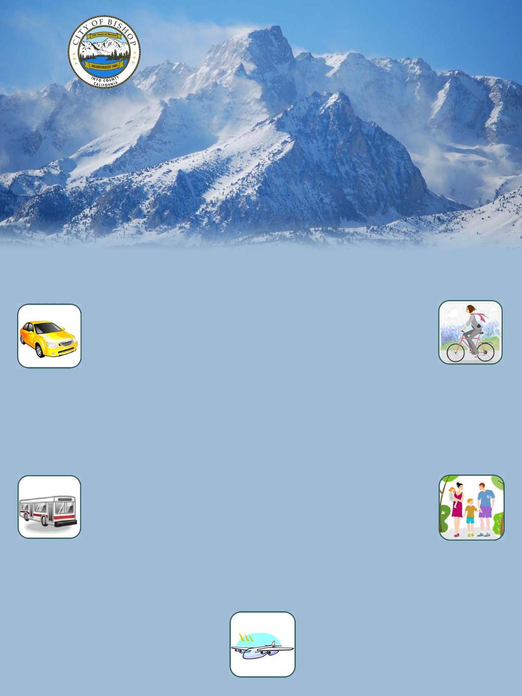
4 The City of Bishop ME embraces these guidelines and addresses the City s mobility needs in the context of the following topics: Roadways Public Transportation Bicycles Air Transportation Pedestrians Parking and Access The Mobility Element addresses... Driving The ME shows and describes the general location and nature of street and bicycle facilities. Public transportation, air transportation and pedestrian and parking facilities are also discussed. Goals and policies related to each of these transportation modes are presented, establishing a framework for achieving enhanced mobility for the community. Cycling TRANSPORTATION REPORT The Mobility Element Transportation Report (TR) provides technical information in support of the ME. It is a separate document the presents current data and addresses a variety of related topics, providing technical information in support of the ME. Information in the TR will be the subject of regular updates, and includes the following: Public Transportation Existing Conditions As these change over time, the TR will be updated to show current data on traffic volumes, levels of service, etc. Related Actions/Studies These include changes that occur over time (in some cases implementing a specific feature of the ME), studies that have relevance to the ME, and regional changes influencing the City s transportation system. Future Conditions As new information is obtained and/or special studies are carried out, traffic forecast data and related information in the TR will be updated. Walking as well as air transportation, parking and access City of Bishop General Plan 2 Austin-Foust Associates, Inc.
5 Implementing Actions Recommendations regarding implementation projects, special studies, and other actions together with a list of proposed projects are presented in the TR. The intent is that as information becomes available and conditions change, the TR will document that information without a need to formally update the ME. The TR is an administrative document that may include recommendations requiring City Council approval for implementation but which does not require formal approval itself. ROADWAY COMPONENT The roadway component of the ME describes the City s arterial street system used for vehicular travel in the City. The street system is planned to meet existing and future transportation demands, and provide for safe and efficient vehicular travel within the City. This is accomplished by designing traffic routes according to their functions, while maintaining sensitivity to surrounding land uses and resources. The effectiveness of the street system directly influences mobility and the overall vitality of the City, and its visual appearance contributes to the image of the City held by residents, businesses, and visitors. The Mobility Element seeks to enhance the drivability of the City s roadway system. Roadways have two basic classifications, state highways and local streets. The City is served by three State Highways, Highway 395, Highway 168, and Highway 6. These are planned, constructed, and operated by the California Department of Transportation (Caltrans), and the City has no jurisdiction over these streets. The arterial streets under City jurisdiction serve both local and regional traffic in varying capacities. Streets under City jurisdiction are referred to as Local Streets. They differ in their physical characteristics according to function and adjacent zoning. Essentially there are four variations: 1. Local Residential Streets 2. Local Commercial Streets 3. Interim version of 1 or 2 above (Country Lane) 4. Alleys City of Bishop General Plan 3 Austin-Foust Associates, Inc.
6 Figure 1 shows typical cross sections for the first three of these and the following briefly describes their characteristics. 1. Local Streets in Residential Areas These are two-lane streets that pass through residential areas, serving the adjacent residential land uses and through traffic. If bike lanes are included, adequate right-of-way (ROW) is required as shown in the cross-section. When the standard (i.e., less than the 60 foot minimum) ROW is not available, consideration is given to reducing lane, shoulder, sidewalk, and planter widths. 2. Local Streets in Commercial Areas These are two-lane arterials that pass through and serve commercial areas. The emphasis is on accessibility to the adjacent commercial land uses. If bike lanes are included, the maximum ROW shown in the cross-section should be provided. When the standard ROW is not available (i.e., less than the 60 foot minimum), consideration is given to reducing lane, shoulder, and sidewalk widths. 3. Local Street (Country Lane) Interim Section These are two lane roadways which typically have no adjacent developed land at the time they are built. They will have the full 60 to 70 right-of-way of a local street and can transition to a Residential Street or Commercial Street when conditions change and the need arises. Different types of streets serve different functions in the overall roadway plan... and serve local accessibility needs and provide connections to recreation opportunities. 4. Alleys - In addition to local streets, the City has numerous alleys in both residential and commercial areas. These are City owned and maintained, and have an important function with respect to providing accessibility for adjacent land uses. Their functions include access to parking (e.g., residential garages), access to loading and unloading areas for local businesses, and access to utilities and other services. They are encouraged in new developments where they can provide additional access and locations for utilities, and create separation between properties. Figure 2 shows the street designations for the Roadway Component of the ME. Selected future roadways on the ME are referred to as Opportunity Corridors. These are routes that are of strategic importance as far as connectivity is concerned, but because of right-of-way and other constraints, cannot simply be considered as future roadways. The intent is for these routes to be pursued as new City of Bishop General Plan 4 Austin-Foust Associates, Inc.
 Note: With the wider roadway width, 5' bike lanes are added.")
7 10' 8' 24' - 34' 8' 10' SW PS P ROADWAY P PS SW 60' - 70' ROW LOCAL STREET (RESIDENTIAL AREA) Note: With the wider roadway width, 5' bike lanes are added. 10' 8' 24' - 34' 8' 10' SW P ROADWAY P SW 60' - 70' ROW LOCAL STREET (COMMERCIAL AREA) Note: With the wider roadway width, 5' bike lanes are added. 18' UNPAVED 24' - 34' PAVED ROADWAY 18' UNPAVED 60' - 70' ROW LOCAL STREET (INTERIM SECTION - COUNTRY LANE) Figure 1 ROADWAY SECTIONS 5
8 0 500' 1000' 2000' 1/2 mi Legend State Highway Existing Local Street Future Local Street (conceptual only) Opportunity Corridor (conceptual only) Note: New streets outside of City limits will require approvals from appropriate entities. Also, as future sheets are developed, redundant existing sheets such as Kelso Road would be evaluated and possibly eliminated. Figure 2 ROADWAY CLASSIFICATIONS 6
9 roads only if opportunities arise such as right-of-way becoming available for purchase. While the emphasis is on vehicular roadways, such corridors could be single or multi-use trails, or be implemented initially as a trail and later as a full roadway. The local street additions not designated as Opportunity Corridors are mostly streets that will provide local accessibility and connectivity when development occurs in currently undeveloped areas. The alignments shown here are conceptual only, and when considered for implementation they will be subject to alignment and impact studies. On all existing and new streets, landscaped medians could be provided if space is available and access is not affected. East Line Street is an example of where this concept could be considered. The three State Highways through the City have specific function classifications under the California Road System and these are noted in the TR. OPPORTUNITY AREAS There are locations in the City that have traffic related issues, but for which solutions need to be pursued in a broader context that just traffic improvements. Typically, they involve land use and business enhancement opportunities that would accompany beneficial traffic improvements. A brief discussion of these opportunity areas follows and Figure 3 illustrates the locations of the opportunity areas designated in the ME. Wye Road Opportunity Area The triangle defined by Highway 395, North Main Street / Highway 6 and Wye Road has traffic issues related to the intersections created by this triangle. Also, the proximity of the Kmart / Vons shopping center driveway presents significant operational issues in the area. Because three of the intersection legs are State Highways, and land under the Los Angeles Department of Water and Power (DWP) ownership and other private ownership would be affected, a coordinated approach to land use and traffic will be required to identify a comprehensive solution for this area. Land use and transportation demands may make a wider than standard cross section appropriate for Wye Road. The Opportunity Areas will examine selected parts of the City in a broader context than simply traffic improvements, e.g... Land Use Accessibility Walkability City of Bishop General Plan 7 Austin-Foust Associates, Inc.
10 0 500' 1000' 2000' 1/2 mi Legend Figure 3 Opportunity Area OPPORTUNITY AREAS 8
11 Park Street Opportunity Area The traffic signal at Park Street is a four-way configuration with Park Street on the east side and access to a commercial property on the west side. Operational issues sometimes occur with vehicles queuing to enter the commercial property and traffic can be heavy in and out of the park during special events. Parking opportunities on the east side of Main Street in the City Park and land use changes could create a focal point for tourists and residents. Hence, this intersection and the adjoining land uses provide an opportunity for enhancements that can benefit residents, visitors, and local businesses, thereby helping promote the overall goals of the ME. Potential beneficial enhancements to this area could include the relocation of the Park Street intersection slightly northward and the construction of new street providing connections to the west (this is shown as an opportunity corridor in the street map). Grove-Pine Opportunity Area East-west access between West and East Pine Street or between Grove Street and Pine Street is constrained by the offset intersections. Only Grove Street is signalized, and the offset tends to discourage this location as a means of providing east-west relief to the Line Street intersection to the south. While a direct connection between Grove Street and East Pine Street would be the preferred connection, there are land use constraints involved in creating a single intersection. Ideally, any such change would be accompanied by land use changes that could enhance the adjacent commercial areas. The TR discusses potential strategies that could be included in a study of this area. OTHER TRANSPORTATION MODES Other modes of transportation modes available to residents of the City include transit, bicycle and pedestrian facilities, and air transportation via the Bishop Airport. Some comments on each of these follow. Public Transportation is an important contributor to overall community mobility. Public Transportation Transit service provided by the Eastern Sierra Transit Authority (ESTA) includes fixed route and demand responsive service, City of Bishop General Plan 9 Austin-Foust Associates, Inc.
12 and current information on these can be found in the TR. Policies in this ME support efforts by ESTA to enhance transit service and usage. Bicycles Three types of bicycle facilities are included in the City Bikeway Plan shown in Figure 4. Bike Paths Often referred to as Class I Bikeways these are pathways separated from the vehicular roadway. They may be adjacent to a roadway or a totally separate facility. In some cases they may be a multi-use trail, whereby the pathway is shared with pedestrians. Bicycle amenities provide many benefits to the overall livability and vitality of the City. Bike Lanes These represent the Class II Bikeways in a Bikeway Plan, and are striped lanes on a roadway. Bike Routes These Class III Bikeways are designated onstreet routes for bicycles. No striping is provided but bike route signs can be installed to indicate that a particular street is a bike route. Air transportation has the potential to enhance visitor accessibility to the Bishop area. The Bishop Bikeway Plan is shown in Figure 4. This bicycle network is consistent with the Inyo County Collaborative Bikeways Plan, with some minor additions where appropriate. Bishop Airport The Bishop Airport, located approximately two miles east of the City, provides a variety of services including aircraft maintenance, aircraft rental, charter services, and instruction. The Airport Master Plan identifies the need for runway improvements, navigational aides, control tower, terminal building, hangars, fire-crash facilities, and added parking, particularly if commercial service is successfully started at the airport. The Airport Master Plan also identifies the need for improved access to the airport from Wye Road. The ME goals and policies include a desire to enhance accessibility to the airport and support the introduction of commercial air services at that facility. Bishop s diverse downtown area and attractive local streets provide an ideal walking environment for residents and visitors. City of Bishop General Plan 10 Austin-Foust Associates, Inc.
13 0 500' 1000' 2000' 1/2 mi Legend Bike Path Bike Lane Bike Route Note: New streets outside of City limits will require approvals from appropriate entities. Figure 4 BIKEWAY PLAN 11
14 Pedestrians The City provides an attractive walking environment, with many open space areas and scenic vistas. The goals and policies seek to ensure that the mobility impaired including those confined to wheelchairs can share in that walking environment. For residential and commercial streets that include sidewalks, this environment is largely provided through paved sidewalks and associated facilities. While pedestrian facilities are not designated on the ME, the goals and policies include a directive to actively facilitate and enhance walking opportunities for residents and visitors. Sidewalks and walkways should be provided in all developed areas and in areas with pedestrian demand. Creating walking tours, with maps and information to encourage such activities, is an example of actions that could assist in achieving such goals. City of Bishop General Plan 12 Austin-Foust Associates, Inc.
15 GOALS, POLICIES, AND IMPLEMENTING ACTIONS The Goals, Policies and Implementing Actions of the ME provide overall guidance for enhancing mobility for the community. Goals are broad based statements of intent, and the related policies give direction to future planning and implementation programs. Behind the individual mobility goals and policies are the overall planning goals of creating positive economic conditions for businesses, enhancing livability, and maintaining the existing character of the City. The following subsections outline the goals and policies and related implementing actions. Overall ME Goals and Policies are first presented, followed by Goals, Policies and Implementing Actions for the six subject areas addressed in this ME. OVERALL GOAL Provide a balanced transportation system that moves people and goods throughout the City efficiently, enhances livability and economic viability, and preserves residential neighborhoods and other environmental resources. POLICIES P 1.1 P 1.2 P 1.3 P 1.4 Promote accessible transportation services and facilities that are responsive to the needs of residents, businesses, and visitors. Facilitate future plans and programs for enhancing mobility while preserving the existing character of the City. Encourage transportation strategies that achieve energy conservation, reduce air pollution, and protect water and other environmental resources. Reduce the need for vehicular travel by facilitating non-auto modes of travel. Implementing actions relating to these overall policies can be found under the individual subject headings in the sections that follow. City of Bishop General Plan 13 Austin-Foust Associates, Inc.
16 Roadway System GOAL Provide safe and attractive roadways to serve existing and future traffic demand and enhance accessibility. POLICIES Roadway System Related Actions P 2.1 P 2.2 P 2.3 P 2.4 Promote street system additions and improvements that enhance accessibility. Support a system of street cross-sections as guidelines for street operation and improvements, and new street construction. Require streets to be dedicated and improved in accordance with the adopted street standards, with any modifications requiring approval by the Planning Commission. Give priority to transportation projects designed to improve the efficiency, safety, and quality of existing facilities. A 2.1, A 2.2, A 2.3, A 2.7, A 2.10 A 2.2 A 2.1, A 2.2, A 2.4 A 2.4, A 2.5, A 2.9 P 2.5 Promote transportation programs that enhance the downtown area by improving accessibility. A 2.1, A 2.3, A 2.9 P 2.6 P 2.7 Consider aesthetic values such as streetscape features in new roadways and roadway improvements. Ensure transportation facilities are developed, operated and maintained to protect and enhance water and other environmental resources. A 2.5, A 2.6 A 2.11 ACTIONS Roadway System Related Policies A 2.1 A 2.2 Pursue the construction of new roadway links as shown on the ME roadway plan. Develop and maintain the City street network consistent with the ME roadway plan, including appropriate roadway widths, bicycle lanes, and pedestrian amenities. P 2.1, P 2.3 P 2.1, P 2.2 City of Bishop General Plan 14 Austin-Foust Associates, Inc.
17 ACTIONS Roadway System (continued) Related Policies A 2.3 A 2.4 A 2.5 A 2.6 A 2.7 A 2.8 A 2.9 A 2.10 A 2.11 Pursue financing for all components of the transportation system to achieve and maintain desired level of service standards. Provide turn lanes for major intersections where needed and feasible. Minimize the number of driveways by requiring shared/common driveways where feasible. Protect and incorporate mature trees located in or adjacent to the street right-of-way into overall street design where feasible. Require new utilities to be located underground and work with utility companies to move existing overhead facilities underground. Utilize intelligent transportation control systems to improve traffic flow and safety on the City s roadway system. Participate with the Inyo County LTC and Caltrans for evaluating measures to improve traffic flow in the City, with focus on major intersections through the downtown area. Include alleys as a potential requirement for new development where appropriate and beneficial. Require transportation facilities to minimize adverse impacts to water quality by avoiding surface water, maintaining natural hydrologic features and patterns, and utilizing beneficial practices and design features. P 2.5 P 2.2, P 2.4 P 2.2, P 2.4 P 2.6 P 2.6 P 2.4 P 2.1, P 2.4, P 2.5 P 2.1 P 2.7 City of Bishop General Plan 15 Austin-Foust Associates, Inc.
18 Public Transportation GOAL Facilitate public transportation services and facilities that enhance accessibility for residents and visitors, and serve the young, aged, handicapped and disadvantaged. POLICIES Public Transportation Related Actions P 3.1 P 3.2 P 3.3 P 3.4 Encourage transit ridership between Bishop and the surrounding communities. Enhance local transit accessibility for residents and visitors. Support private services that provide additional mobility opportunities for residents and visitors. Ensure that public transportation in the City is responsive to the needs of the young, aged, handicapped and disadvantaged. A 3.1, A 3.2, A 3.3 A 3.2, A 3.5 A. 3.3 A 3.1, A 3.2, A 3.3 ACTIONS Public Transportation Related Policies A 3.1 A 3.2 A 3.3 A 3.4 A 3.5 Cooperate with ESTA, Caltrans, Inyo LTC, and Inyo County in the planning and implementation of public transportation improvements. Enhance local/regional bus system interface by providing convenient and attractive access locations. Assist ESTA in providing access to information on transit services for residents and visitors. Support bus turnouts on Main Street north of Line Street, and bus stops south of Line Street. Support construction of tourist railroad service between Laws Railroad Museum and Bishop. P 3.1 P 3.2 P 3.2 P 3.1, P 3.2 P 3.2 City of Bishop General Plan 16 Austin-Foust Associates, Inc.
19 Bicycles GOAL Provide safe and attractive bicycle facilities throughout the City thereby promoting bicycle commuting and facilitating recreation opportunities. POLICIES Bicycles Related Actions P 4.1 P 4.2 P 4.3 P 4.4 Promote bicycle travel as part of serving the overall mobility needs of the City. Encourage productive and complementary use of city street right of way for bicycle facilities. Support the goals and implementing actions of the Inyo County Collaborative Bikeways Plan. Promote connections of City bike facilities to trail networks outside of the City A 4.1, A 4.2, A 4.3 A 4.1, A 4.2, A 4.3 A 4.2 A 4.1, A 4.2 ACTIONS Bicycles Related Policies A 4.1 A 4.2 A 4.3 A 4.4 A 4.5 A 4.6 Develop and maintain a system of bicycle facilities in accordance with the ME Bikeway Plan with emphasis on Class 1 and Class 2 facilities where possible. Coordinate planning for bicycle facilities with the County and the Bishop Painte Tribe. Incorporate facilities suitable for bicycle use in the design of intersections, and other street-improvement/maintenance projects. Make improvements to streets, signs, and traffic signals as needed to improve bicycle convenience and safety and consider digital way-finding. Install bicycle parking in the Downtown area and at City parks, civic buildings, and other community centers. Work with the school district and college to promote cycling and bicycle access. P 4.1, P 4.2, P 4.3, P 4.4 P 4.1, P 4.2, P 4.3 P 4.2, P 4.3 P 4.1, P 4.3 P 4.1, P 4.2 P 4.1 City of Bishop General Plan 17 Austin-Foust Associates, Inc.
20 ACTIONS Bicycles (continued) Related Policies A 4.7 A 4.8 Encourage employers to provide secure bicycle parking facilities. Support the efforts of the Eastern Sierra Transit Authority (ESTA) to provide bicycle racks on buses. P 4.1 P 4.2 Air Transportation GOAL Improve access to the Bishop Airport and cooperate with Inyo County to promote air services that can promote tourism in the area. POLICIES Air Transportation Related Actions P 5.1 P 5.2 Encourage transportation improvements that will serve the Bishop Airport. Support actions that will provide air services for visitors to the Bishop area. A 5.1 A 5.2 ACTIONS Air Transportation Related Policies A 5.1 A 5.2 Pursue opportunities for transportation improvements that will improve access to the airport. Work with Inyo County to identify opportunities for visitor usage of the airport (e.g., recreation charter packages, etc.) P 5.1 P 5.2 Pedestrians GOAL Provide safe and attractive pedestrian facilities throughout the City. POLICIES Pedestrians Related Actions P 6.1 Consider pedestrians in all land use and transportation planning. A 6.1, A 6.2 City of Bishop General Plan 18 Austin-Foust Associates, Inc.
21 POLICIES Pedestrians (continued) Related Actions P 6.2 Support the implementation of sidewalks and walkways on existing and future streets as in Policy 2.3. A 6.3, A 6.4, A 6.5 P 6.3 Promote facilities and amenities that enhance the walkability of the City. A 6.2, A 6.3, A 6.4 P 6.4 P 6.5 Require all new or renovated pedestrian facilities to be of a sufficient width to ensure pedestrian comfort and safety and to accommodate the special needs of the physically disabled. Promote connections of City pedestrian facilities to trail networks outside of the City. A 6.4 A 6.8 ACTIONS Pedestrians Related Policies A 6.1 A 6.2 A 6.3 A 6.4 A 6.5 Facilitate the creation of walking tour and way-finding information that can direct residents and visitors to experience the walkability of the City. Provide pedestrian-oriented features, such as benches, enhanced landscaping, and trash receptacles, in high pedestrian usage areas such as the Downtown and Park areas. Work with neighborhoods to implement sidewalks on unimproved local streets so that sidewalk continuity can be established. Require new development to provide sidewalks and other pedestrian-dedicated facilities on new public streets as in Policy 2.3. Pursue funding for the continued replacement and repair of sidewalks that have deteriorated due to age and tree-root invasion. P 6.1, P 6.3 P 6.1, P 6.3 P 6.2 P 6.2 P 6.1 City of Bishop General Plan 19 Austin-Foust Associates, Inc.
22 ACTIONS Pedestrians (continued) Related Policies A 6.6 A 6.7 A 6.8 Develop and implement a program to identify, prioritize, and fund the retrofitting of existing intersections that do not currently have handicapped access ramps or have currently sub-standard ramps at the street corners. Tree planting in sidewalk areas should be encouraged and managed in consultation with adjacent property owners in a manner that minimizes conflicts and damage. Coordinate planning for pedestrians with the County and the Bishop Paiute Tribe. P 6.1 P 6.2, P 6.4 P 6.1 Parking And Access GOAL Enhance accessibility to City businesses for residents and visitors by assuring adequate and convenient parking. POLICIES Parking and Access Related Actions P 7.1 Promote programs such as signage and parking management to facilitate parking for the downtown area and for community events. A 7.1, A 7.2, A 7.3 P 7.2 P 7.3 P 7.4 Encourage development that reduces parking demand and promotes alternative means of travel. Encourage and facilitate the establishment of convenient parking areas to enhance parking accessibility. Ensure that adequate off street parking is incorporated into all new developments and redevelopments outside the downtown commercial area. A 7.3 A 7.1, A 7.2 A 7.1 ACTIONS Parking and Access Related Policies A 7.1 Pursue opportunities for parking management actions that will result in convenient parking areas for downtown. P 7.2 City of Bishop General Plan 20 Austin-Foust Associates, Inc.

23 ACTIONS Parking and Access Related Policies A 7.2 Improve access to local businesses for visitors by providing P 7,1, P 7.3 signed parking areas with convenient accessibility. A 7.3 Improve accessibility to community events through clear directional signage, parking and shuttle services, and information sources, particularly for tourists. P 7.1 City of Bishop General Plan 21 Austin-Foust Associates, Inc.
CITY OF COCOA BEACH 2025 COMPREHENSIVE PLAN. Section VIII Mobility Element Goals, Objectives, and Policies
 CITY OF COCOA BEACH 2025 COMPREHENSIVE PLAN Section VIII Mobility Element Goals, Objectives, and Policies Adopted August 6, 2015 by Ordinance No. 1591 VIII MOBILITY ELEMENT Table of Contents Page Number
APPENDIX A: Complete Streets Checklist DRAFT NOVEMBER 2016
 APPENDIX A: Complete Streets Checklist DRAFT NOVEMBER 2016 Complete Streets Checklist MetroPlan Orlando s Complete Streets Checklist is an internal planning tool for staff to further implementation of
Solana Beach Comprehensive Active Transportation Strategy (CATS)
") Solana Beach Comprehensive Active Transportation Strategy (CATS) 3.0 Goals & Policies The Solana Beach CATS goals and objectives outlined below were largely drawn from the Solana Beach Circulation Element
Solana Beach Comprehensive Active Transportation Strategy (CATS) 3.0 Goals & Policies The Solana Beach CATS goals and objectives outlined below were largely drawn from the Solana Beach Circulation Element
CONNECTING PEOPLE TO PLACES
 CONNECTING PEOPLE TO PLACES 82 EAST BENCH MASTER PLAN 07 Introduction The East Bench transportation system is a collection of slow moving, treelined residential streets and major arteries that are the
o n - m o t o r i z e d transportation is an overlooked element that can greatly enhance the overall quality of life for the community s residents.
 N o n - m o t o r i z e d transportation is an overlooked element that can greatly enhance the overall quality of life for the community s residents. 84 Transportation CHAPTER 11 INTRODUCTION Transportation
CITY OF BLOOMINGTON COMPLETE STREETS POLICY
 CITY OF BLOOMINGTON COMPLETE STREETS POLICY POLICY OBJECTIVE: The City of Bloomington will enhance safety, mobility, accessibility and convenience for transportation network users of all ages and abilities,
Executive Summary Route 30 Corridor Master Plan
 Route Corridor Master Plan Project Overview The Route Corridor Master Plan is a coordinated multimodal transportation and land use plan for the entire stretch of Route through East Whiteland Township,
Circulation in Elk Grove includes: Motor vehicles, including cars and trucks
 Circulation, as it is used in this General Plan, refers to the many ways people and goods move from place to place in Elk Grove and the region. Circulation in Elk Grove includes: Motor vehicles, including
ACTIVE TRANSPORTATION
 ACTIVE TRANSPORTATION Mobility 2040 Supported Goals Improve the availability of transportation options for people and goods. Support travel efficiency measures and system enhancements targeted at congestion
Vision: Traditional hamlet with an attractive business/pedestrian friendly main street connected to adjacent walkable neighborhoods
 N D. Focus Area II Vision: Traditional hamlet with an attractive business/pedestrian friendly main street connected to adjacent walkable neighborhoods Transit Road Focus Area II is located in the Hamlet
Proposed. City of Grand Junction Complete Streets Policy. Exhibit 10
 Proposed City of Grand Junction Complete Streets Policy Exhibit 10 1 City of Grand Junction Complete Streets Policy Vision: The Complete Streets Vision is to develop a safe, efficient, and reliable travel
Corpus Christi Metropolitan Transportation Plan Fiscal Year Introduction:
 Introduction: The Safe, Accountable, Flexible, Efficient Transportation Equity Act: A Legacy for Users (SAFETEA-LU) has continued the efforts started through the Intermodal Surface Transportation Efficiency
Clackamas County Comprehensive Plan
 ROADWAYS The County s road system permits the movement of goods and people between communities and regions, using any of a variety of modes of travel. Roads provide access to virtually all property. They
Living Streets Policy
 Living Streets Policy Introduction Living streets balance the needs of motorists, bicyclists, pedestrians and transit riders in ways that promote safety and convenience, enhance community identity, create
Chapter 6 Transportation Plan
 Chapter 6 Transportation Plan Transportation Plan Introduction Chapter 6 Transportation Plan Transportation Plan Introduction This chapter describes the components of Arvada s transportation system, comprised
Exhibit 1 PLANNING COMMISSION AGENDA ITEM
 Exhibit 1 PLANNING COMMISSION AGENDA ITEM Project Name: Grand Junction Circulation Plan Grand Junction Complete Streets Policy Applicant: City of Grand Junction Representative: David Thornton Address:
This chapter describes the proposed circulation system and transportation alternatives associated with
 5.0 Circulation 5.1 OVERVIEW This chapter describes the proposed circulation system and transportation alternatives associated with West Landing, and summarize the information contained in the Existing
NM-POLICY 1: Improve service levels, participation, and options for non-motorized transportation modes throughout the County.
 Transportation PRINCE WILLIAM COUNTY 2008 COMPREHENSIVE PLAN NON-MOTORIZED PLAN CONTENTS Goals, Policies, and Action Strategies Table 4 (Bike Facility Classifications and Descriptions) Table 5 (Bike Facility
CONNECTIVITY PLAN. Adopted December 5, 2017 City of Virginia Beach
 CONNECTIVITY PLAN Adopted December 5, 2017 City of Virginia Beach CONTENTS 1.0 Background & Purpose... 2 2.0 Existing Inventory & Analysis... 3 ViBe District Existing Walking Conditions... 4 3.0 ViBe District
Roadway Classification Design Standards and Policies. Pueblo, Colorado November, 2004
 Roadway Classification Design Standards and Policies Pueblo, Colorado November, 2004 Table of Contents Page Chapter 1. General Provisions 1.1 Jurisdiction 3 1.2 Purpose and Intent 3 1.3 Modification 3
RESOLUTION NO ?? A RESOLUTION OF THE CITY OF NEPTUNE BEACH ADOPTING A COMPLETE STREETS POLICY
 RESOLUTION NO. 2018-?? A RESOLUTION OF THE CITY OF NEPTUNE BEACH ADOPTING A COMPLETE STREETS POLICY WHEREAS, safe, convenient, and accessible transportation for all users is a priority of the City of Neptune
Non-Motorized Transportation 7-1
 Non-Motorized Transportation 7-1 Transportation facilities no longer mean just accommodating a vehicle powered by a combustion engine. Pedestrian and non-motorized facilities are important modes of travel
Item to be Addressed Checklist Consideration YES NO N/A Required Description Complete Streets Guidelines
 Passaic County Complete Streets Checklist - Concept Development Project Name Item to be Addressed Checklist Consideration YES NO N/A Required Description Complete Streets Guidelines Existing Plans Have
General Plan Circulation Element Update Scoping Meeting April 16, 2014 Santa Ana Senior Center, 424 W. 3rd Street, Santa Ana, CA 92701
 General Plan Circulation Element Update Scoping Meeting April 16, 2014 Santa Ana Senior Center, 424 W. 3rd Street, Santa Ana, CA 92701 Meeting Agenda 1. Purpose of Scoping Meeting 2. Project Overview 3.
Chapter 7. Transportation. Transportation Road Network Plan Transit Cyclists Pedestrians Multi-Use and Equestrian Trails
 Chapter 7 Transportation Transportation Road Network Plan Transit Cyclists Pedestrians Multi-Use and Equestrian Trails 7.1 TRANSPORTATION BACKGROUND The District of Maple Ridge faces a number of unique
Bicycle Master Plan Goals, Strategies, and Policies
 Bicycle Master Plan Goals, Strategies, and Policies Mobilizing 5 This chapter outlines the overarching goals, action statements, and action items Long Beach will take in order to achieve its vision of
MAG Town of Cave Creek Bike Study Task 6 Executive Summary and Regional Significance Report
 Page 1 MAG Town of Cave Creek Bike Study Task 6 Executive Summary and Regional Significance Report August 1, 2012 MAG Project #481 Page 2 Task 6 Executive Summary and Regional Significance Report Introduction
City of Novi Non-Motorized Master Plan 2011 Executive Summary
 City of Novi Non-Motorized Master Plan 2011 Executive Summary Prepared by: February 28, 2011 Why Plan? Encouraging healthy, active lifestyles through pathway and sidewalk connectivity has been a focus
Bicycle and Pedestrian Advisory Committee (BPAC) November 21, 2013
 November 21, 2013") Bicycle and Pedestrian Advisory Committee (BPAC) November 21, 2013 OVERALL LAND USE CONCEPT Overall Broadway Valdez District: 95.5 acres (35.1 acres right-of ways + 60.4 acres developable land) Plan Subareas:
Bicycle and Pedestrian Advisory Committee (BPAC) November 21, 2013 OVERALL LAND USE CONCEPT Overall Broadway Valdez District: 95.5 acres (35.1 acres right-of ways + 60.4 acres developable land) Plan Subareas:
West Dimond Blvd Upgrade Jodhpur Street to Sand Lake Road
 West Dimond Blvd Jodhpur St to Sand Lake CSS Transportation Project Summary Municipality of Anchorage Project # 05 005 Project Manager: John Smith, P.E. (MOA PM&E) Project Administrator: Julie Makela,
Classification Criteria
 SCHEDULE D TO RECOMMENDED OFFICIAL PLAN AMENDMENT NO. 40 SCHEDULE C-4 Road Criteria Criteria Traffic Service Objective Land Service/Access Typical Daily Traffic Volume Flow characteristics Travel Speed
4. ENVIRONMENTAL IMPACT ANALYSIS 9. TRANSPORTATION AND TRAFFIC
 4. ENVIRONMENTAL IMPACT ANALYSIS 9. TRANSPORTATION AND TRAFFIC 4.9.1 INTRODUCTION The following section addresses the Proposed Project s impact on transportation and traffic based on the Traffic Study
In station areas, new pedestrian links can increase network connectivity and provide direct access to stations.
 The Last Mile Planning for Pedestrians Planning around stations will put pedestrians first. Making walking to stations safe and easy is important; walking will be a part of every rapid transit Accessible
Complete Streets. Designing Streets for Everyone. Sarnia
 Complete Streets Designing Streets for Everyone Sarnia Complete Streets ~ Sarnia ~ 2018 Introduction Our City is made up of a network of streets that we use to go for a walk, cycle to work, drive to the
DRAFT - CITY OF MEDFORD TRANSPORTATION SYSTEM PLAN Roadway Cross-Sections
 Roadway Cross-Sections Medford s roadway cross-section standards apply to new and reconstructed roads. The crosssections take into consideration roadway function and operational characteristics, including
REGIONAL BICYCLE AND PEDESTRIAN DESIGN GUIDELINES
 REGIONAL BICYCLE AND PEDESTRIAN DESIGN GUIDELINES November 16, 2011 Deb Humphreys North Central Texas Council of Governments Bicycle and Pedestrian Advisory Committee Snapshot of the Guide 1. Introduction
Omaha s Complete Streets Policy
 Omaha s Complete Streets Policy (Adopted August 2015) VISION To create great places and enhance our quality of life, the City of Omaha will provide safe, accessible streets for all users. Complete Streets
PEDESTRIAN ACTION PLAN
 ATTACHMENT 2 CITY OF SANTA MONICA PEDESTRIAN ACTION PLAN CITY OF SANTA MONICA PEDESTRIAN ACTION PLAN This page intentionally left blank EXECUTIVE SUMMARY CHAPTER 1 EXECUTIVE SUMMARY Setting the Stage
Chapter 2: Standards for Access, Non-Motorized, and Transit
 Standards for Access, Non-Motorized, and Transit Chapter 2: Standards for Access, Non-Motorized, and Transit The Washtenaw County Access Management Plan was developed based on the analysis of existing
A CHANGING CITY. of Edmonton, it is essential that it reflects the long-term vision of the City.
 A CHANGING CITY By the year 2040, Edmonton will be home to more than 1 million people. To accommodate growth and support a healthy and compact city, we need a new approach to development/redevelopment
EXECUTIVE SUMMARY. Vision
 Vision Walking and bicycling in Salt Lake City will be safe, convenient, comfortable, and viable transportation options that connect people to places, foster recreational and economic development opportunities,
4 MOBILITY PLAN. Mobility Plan Objectives. Mobility Context. 1. Integrate with Local and Regional Transit Improvements
 Harbor Mixed Use CHAPTER Transit Corridor 4: Mobility Plan 4 MOBILITY PLAN Mobility Plan Objectives The Harbor Corridor Plan seeks to expand and improve the ways that people move along and through the
7 Complete Streets & Roadway Aesthetics
 7 Complete Streets & Roadway Aesthetics 7.1 OVERVIEW Our streets lay the foundation for how we interface with travel needs, physical exercise, social exchanges and access to goods and services. They are
2025 Comprehensive Plan for the City of Temple Terrace Florida. Mobility Element. Adopted by City Council June 30, 2009
 2025 Comprehensive Plan for the City of Temple Terrace Florida Mobility Element Adopted by City Council June 30, 2009 Effective Date September 22, 2009 GOAL 2: To protect and promote the quality of life
5.0 Roadway System Plan
 Southwest Boise Transportation Study Page 16 5.0 Roadway System Plan The Roadway System Plan outlines roadway improvements in the Initial Study Area. It forecasts future deficiencies on the arterial system,
5. RUNNINGWAY GUIDELINES
 5. RUNNINGWAY GUIDELINES These guidelines should be considered collectively when making runningway decisions. A runningway is the linear component of the transit system that forms the right-of-way reserved
Cycle Track Design Best Practices Cycle Track Sections
 Design Best Practices Sections It is along street segments where the separation and protection methods of cycle tracks offer more comfort than conventional bicycle lanes, and are more attractive to a wide
Goal 3: Foster an environment of partnerships and collaboration to connect our communities and regions to one another.
 Non-Motorized Transportation Plan (NMTP) Draft Vision, Goal and,, Tri-County Regional Planning Commission (TCRPC) Purpose The purpose of the Tri-County Regional Planning Commission (TCRPC) Non-Motorized
Agenda. Overview PRINCE GEORGE S PLAZA METRO AREA PEDESTRIAN PLAN
 PRINCE GEORGE S PLAZA METRO AREA PEDESTRIAN PLAN May 28, 2008 Agenda Welcome and introductions Project overview and issue identification Planning context and strengths Design challenges and initial recommendations
NJDOT Complete Streets Checklist
 Background The New Jersey Department of Transportation s Complete Streets Policy promotes a comprehensive, integrated, connected multi-modal network by providing connections to bicycling and walking trip
Chapter 2. Bellingham Bicycle Master Plan Chapter 2: Policies and Actions
 Chapter 2 Bellingham Bicycle Master Plan Chapter 2: Policies and Actions Chapter 2: Policies and Actions The Bicycle Master Plan provides a road map for making bicycling in Bellingham a viable transportation
complete streets design and construction standards public primer City of Edmonton
 complete streets design and construction standards public primer City of Edmonton introduction Complete Streets are streets for everyone: people who walk, wheel, bike, take transit, or drive. They are
5 CIRCULATION AND STREET DESIGN
 5 CIRCULATION AND STREET DESIGN This chapter describes circulation and streetscape improvements proposed for the Northwest Chico Specific Plan Area. It includes detailed design specifications for existing
Ocean Park Boulevard Green Street Project Alternatives & Trade Offs
 Planning Commission March 4, 2009 Ocean Park Boulevard Green Street Project Alternatives & Trade Offs Purpose of Tonight s Meeting Review concept plans and options Provide input on alternatives and trade-offs
Perryville TOD and Greenway Plan
 Perryville TOD and Greenway Plan Greenway Glossary Pathway: A bicycle and pedestrian path separated from motorized vehicular traffic by an open space, barrier or curb. Multi-use paths may be within the
Stakeholder Meeting Handouts. January 2013
 January 2013 Stakeholder Meeting Handouts The Case FOR Parking Minimum Requirements Reduce street congestion around the development site Avoid parking spillover Create orderly development patterns Anticipate
S T A T I O N A R E A P L A N
 The Circulation and Access Plan describes vehicle, pedestrian, and transit improvements recommended within the Concept Plan. In order to create and sustain a vibrant business district that provides pedestrian-friendly
CHAPTER 7.0 IMPLEMENTATION
 CHAPTER 7.0 IMPLEMENTATION Achieving the vision of the Better Streets Plan will rely on the ability to effectively fund, build and maintain improvements, and to sustain improvements over time. CHAPTER
Report. Typical Sections. City of Middleton, WI
 Report Typical Sections City of Middleton, WI December 2006 Report for City of Middleton, Wisconsin Typical Sections repared by: Traffic Associates LLC and STRAND ASSOCIATES, INC. 910 West Wingra Drive
Chapter 9: Pedestrians and Bicyclists
 Chapter 9: Pedestrians and Bicyclists Walking and bicycling are essential modes of transportation. These modes allow people to travel without contributing to congestion and air pollution, to access other
M-58 HIGHWAY ACCESS MANAGEMENT STUDY Mullen Road to Bel-Ray Boulevard. Prepared for CITY OF BELTON. May 2016
 M-58 HIGHWAY ACCESS MANAGEMENT STUDY Prepared for CITY OF BELTON By May 2016 Introduction Missouri State Highway 58 (M-58 Highway) is a major commercial corridor in the City of Belton. As development has
Prince George s County plans, policies, and projects
 Prince George s County plans, policies, and projects Over 250 projects for trails, bikeways, designated bike lanes and sidewalk construction Trail projects that improve access to Metro Sidewalk and trail
Rochester Downtown Bicycle Study 2009
 Rochester Downtown Bicycle Study 2009 Relationship of ROCOG Long Range Transportation Plan to Rochester Comprehensive Plan Regional Long Range Transportation Plan (LRTP) is prepared under the auspices
Tonight is for you. Learn everything you can. Share all your ideas.
 Strathcona Neighbourhood Renewal Draft Concept Design Tonight is for you. Learn everything you can. Share all your ideas. What is Neighbourhood Renewal? Creating a design with you for your neighbourhood.
HARRISON STREET/OAKLAND AVENUE COMMUNITY TRANSPORTATION PLAN
 HARRISON STREET/OAKLAND AVENUE Community Workshop #4: Draft Plan Review December 3, 2009 D E S I G N, C O M M U N I T Y & E N V I R O N M E N T INTRODUCTIONS Key Project Staff: Alisa Shen, Project Manager,
CITY OF BURIEN, WASHINGTON MEMORANDUM
 DATE: November 2, 2011 CITY OF BURIEN, WASHINGTON MEMORANDUM TO: FROM: SUBJECT: Burien Planning Commission Charles W. Chip Davis, AICP, Senior Planner Recommendation on Revised Comprehensive Plan Transportation
2.0 Existing Conditions
 20 2.0 Existing Conditions 2.1 Land Use, Future Growth Patterns, Physical Barriers Geographic Overview Sutter County s land use pattern is characterized by extensive agricultural areas, significant natural
INDOT Complete Streets Guideline & Policy
 INDOT Complete Streets Guideline & Policy INTRODUCTION The Complete Streets guidelines build upon multiple efforts and promote a multimodal transportation system that is integrated and sustains land use
Chapter 5 Future Transportation
 Chapter 5 Future Transportation The Future Land Use Plan identifies the desired land use designations. The land uses desired for Crozet depend, in large part, on the success of the transportation system,
East Burke Transportation, Safety and Capacity Improvements
 East Burke Transportation, Safety and Capacity Improvements The purpose of this project is to increase mobility and improve safety for pedestrians, cyclists, and motor vehicles along VT Route 114 in the
Berkeley Strategic Transportation Plan A-76
 Berkeley Strategic Transportation Plan A-76 Appendices 1. A Team Effort 2. Where We ve Been A-11 Berkeley Strategic Transportation Plan Alameda County Transportation Plan Alameda County will be served
Vision. Goals and Objectives. Walking
 Vision Walking and biking is an accepted and valued part of everyday life in Portsmouth. People of all ages and abilities include walking and biking as part of their daily activities which helps to make
SECTION 1 - TRAFFIC PLANNING
 SECTION 1 - TRAFFIC PLANNING 1.1 TRAFFIC OPERATIONS 1.1.1 Roadway Functional Classification The Multnomah County Comprehensive Framework Plan s Policy 34: Trafficways and the Functional Classification
Morristown, NJ Complete Streets Policy
 Morristown, NJ Complete Streets Policy Introduction A Complete Street is defined as a means to provide safe access for all users by designing and operating a comprehensive, integrated, connected multi-modal
SR-203 Sidewalks and Town-Wide Mobility Improvements. Town Council Presentation September 7, 2016
 SR-203 Sidewalks and Town-Wide Mobility Improvements Town Council Presentation September 7, 2016 SR-203 Sidewalks and Town- Wide Mobility Improvements SR-203 Sidewalks and Appurtenances Town-Wide Mobility
MCTC 2018 RTP SCS and Madera County RIFP Multi-Modal Project Eval Criteria GV13.xlsx
 MCTC 8 RTP SCS and Madera County RIFP Multi-Modal Project Eval Criteria GV.xlsx Madera County Transportation Commission Regional Transportation Plan / Sustainable Communities Strategy Multi-Modal Project
Develop a Multi-Modal Transportation Strategy (Theme 6)
") DEVELOP A MULTI-MODAL TRANSPORTATION STRATEGY (THEME 6) WHY IS THIS THEME ADDRESSED? Develop a Multi-Modal Transportation Strategy (Theme 6) Statement of Ideal Reduce resident and visitor reliance on single
DEVELOP A MULTI-MODAL TRANSPORTATION STRATEGY (THEME 6) WHY IS THIS THEME ADDRESSED? Develop a Multi-Modal Transportation Strategy (Theme 6) Statement of Ideal Reduce resident and visitor reliance on single
Complete Streets Process and Case Study: Taft / McMillian Two-Way Street Conversion Cincinnati, Ohio. Traffic Engineering Workshop June 4, 2014
 Complete Streets Process and Case Study: Taft / McMillian Two-Way Street Conversion Cincinnati, Ohio Traffic Engineering Workshop June 4, 2014 Complete Streets Streets that enable safe access for users
Plant City Walk-Bike Plan
 Plant City Walk-Bike Plan Plant City Commute Mode Share 2.2% 1.4% 2.9% Drove alone 10.2% Carpooled Public transportation (0.1%) Walked Used a Bike (0.4%) 82.9% Taxicab, motorcycle, or other means Worked
CURBSIDE ACTIVITY DESIGN
 5 CURBSIDE ACTIVITY DESIGN This chapter provides design guidance for separated bike lanes adjacent to curbside activities including parking, loading and bus stops. Typical configurations are presented
TRANSPORTATION NEEDS ASSESSMENT
 TRANSPORTATION NEEDS ASSESSMENT A travel demand analysis was carried out to determine the operational issues and the potential benefit that adding traffic capacity would have on the road network. All the
TOWN OF PORTLAND, CONNECTICUT COMPLETE STREETS POLICY
 TOWN OF PORTLAND, CONNECTICUT COMPLETE STREETS POLICY I. VISION, GOALS & PRINCIPLES VISION To improve the streets of Portland making them safer and more accessible for all users including pedestrians,
STEERING COMMITTEE MEETING June 17, Streetscape Overview Burlington Comprehensive Master Plan
 STEERING COMMITTEE MEETING June 17, 2015 Streetscape Overview Burlington Comprehensive Master Plan 1 Introduction Slide This slide show was presented to the Burlington Steering Committee on June 17, 2015
Chapter 5. Complete Streets and Walkable Communities.
 Chapter 5. Complete Streets and Walkable Communities. 5.1 Description of Complete Streets. Cities throughout the world, and specifically the United States, are coming to embrace a new transportation and
ADA Transition Plan. City of Gainesville FY19-FY28. Date: November 5, Prepared by: City Of Gainesville Department of Mobility
 ADA Transition Plan FY19-FY28 Date: November 5, 2018 Prepared by: City Of Gainesville Department of Mobility 1.0 INTRODUCTION 1.1 BACKGROUND The federal statute known as the Americans with Disabilities
Michael Parmer, Management Aide, City Manager's Office
 P139 STAFF REPORT f CITY NL- NAGER' S OFFICE RANCHO Date: C;UCAMONGA To: From: Subject: Mayor and Members of the City Council John R. Gillison, City Manager Michael Parmer, Management Aide, City Manager's
City of Gainesville Transportation/Roadway Needs PROJECT SUMMARY
 A1 Roadway Resurfacing $23,846,000 TYPE: Preservation of existing system Roadway resurfacing A2 Signal Replacement $6,000,000 TYPE: Preservation of existing system Replace traffic signals. B1 W 6th St
Planning Study SR 976. Project Advisory Team Meeting May 24, 2017
 ` SR 976 BIRD ROAD/SW 40TH STREET FROM SR 821/HEFT TO SR 5/US-1 Miami-Dade County, Florida FPID No.: 434845-4-22-01 Planning Study Project Advisory Team Meeting May 24, 2017 1 Agenda Introductions Project
COUNCIL POLICY NAME: COUNCIL REFERENCE: 06/119 06/377 09/1C 10llC 12/1C INDEX REFERENCE: POLICY BACKGROUND
 COUNCIL POLICY NAME: COUNCIL ADVISORY COMMITTEES - TERMS OF REFERENCE ISSUED: APRIL 3, 2006 AMENDED: NOVEMBER 27, 2006 NOVEMBER 23, 2009 JANUARY 11, 2010 DECEMBER 17, 2012 POLICY COUNCIL REFERENCE: 06/119
Chapter 14 PARLIER RELATIONSHIP TO CITY PLANS AND POLICIES. Recommendations to Improve Pedestrian Safety in the City of Parlier (2014)
") Chapter 14 PARLIER This chapter describes the current status and future plans for biking and walking in the City of Parlier. RELATIONSHIP TO CITY PLANS AND POLICIES The Parlier General Plan is the primary
Chapter 14 PARLIER This chapter describes the current status and future plans for biking and walking in the City of Parlier. RELATIONSHIP TO CITY PLANS AND POLICIES The Parlier General Plan is the primary
Chapter 3 DESIGN SPECIFICATIONS
 Brampton PathWays Planning and Design Guidelines 27 Chapter 3 DESIGN SPECIFICATIONS 3.1 CLASS 1 MULTI-USE PATH Off-road multi-use trails are the backbone of the Brampton PathWays Network. They are typically
Arlington s Master Transportation Plan
 Arlington s Master Transportation Plan The Master Transportation Plan (MTP) Adopted in eight parts Goals & Policies element and MTP Map adopted in 2007 Bicycle, Pedestrian and Demand and Systems Management
10A. DATE: October 5, Pedestrian and Bicycle Advisory Committee. Kevin Colin, Deputy Planning Manager Curt Bates, City Engineer
 10A DATE: October 5, 2016 TO: PREPARED BY: SUBJECT: Pedestrian and Bicycle Advisory Committee Kevin Colin, Deputy Planning Manager Curt Bates, City Engineer Discussion and Provide Comments, Associated
Road Diets FDOT Process
 Florida Department of TRANSPORTATION Road Diets FDOT Process Humberto Castillero, PE, PTOE Roadway Design Office Purpose of Guide Develop a statewide lane elimination review process Balance state & local
TRANSPORTATION COMMISSION Agenda Staff Report
 TRANSPORTATION COMMISSION Agenda Staff Report Agenda Item No. 5.a DATE: JULY 31, 2014 TO: FROM: SUBJECT: TRANSPORTATION COMMISSION COMMUNITY DEVELOPMENT DEPARTMENT - PLANNING DRAFT OLYMPIC CORRIDOR PREFERRED
GIS Based Data Collection / Network Planning On a City Scale. Healthy Communities Active Transportation Workshop, Cleveland, Ohio May 10, 2011
 The Purpose of GIS Based Network Planning GIS Based Data Collection / Network Planning Healthy Communities Active Transportation Conference Tuesday, May 10, 2011 10:00 AM Norman Cox, LLA, ASLA. Ann Arbor,
New Measure A Expenditure Categories DEFINITIONS OF ELIGIBLE EXPENDITURES Adopted March 8, 2007
 New Measure A Expenditure Categories DEFINITIONS OF ELIGIBLE EXPENDITURES Adopted March 8, 2007 City Street and County Road Maintenance Program The preservation and keeping of public street and road rights-of-way
TRAVEL PLAN: CENTRAL EUROPEAN UNIVERSITY CAMPUS REDEVELOPMENT PROJECT TRAVEL PLAN. Central European University Campus Redevelopment Project.
 TRAVEL PLAN Central European University Campus Redevelopment Project Page 1 Table of Contents Introduction... 3 Background... 7 Building Users... 7 Transportation in Community Consultation... 7 Summary
TRANSPORTATION & MOBILITY
 TRANSPORTATION & MOBILITY ROADWAY SYSTEM There are approximately 40 miles of roadways in Manitou Springs. For planning purposes, roadways are typically assigned a functional classification which defines
Exhibit B: Proposed amendments to the Transportation Element of the Oakland Comprehensive Plan
 Exhibit B: Proposed amendments to the Transportation Element of the Oakland Comprehensive Plan TRANSPORTATION Introduction An important aspect of any community is its transportation system, the means by