Appendix A6. Comment Letters
|
|
|
- Eric Lester
- 5 years ago
- Views:
Transcription
1 Appendix A6 Comment Letters

2
3

4

5

6 Bicycle Advisory Committee of the City of Los Angeles Morrison Street, Los Angeles CA VIA E MAIL TO srimal.hewawitharana@lacity.org October 30, 2015 Environmental Analysis Section Department of City Planning 200 North Spring Street, Room 750 Los Angeles, CA Re: SunWest Project Case No. ENV EIR Department of City Planning: I am Chair of the Bicycle Advisory Committee of the City of Los Angeles ( BAC ), which was established in 1973 to act in an advisory capacity to... the various agencies of the... City of Los Angeles in the encouragement and facilitation of the use of the bicycle as a regular means of transportation and recreation. We take seriously our obligation to ensure that Los Angeles elected and appointed officials fulfill their duties to fully implement the bicycle related elements of the newly adopted Mobility Plan The Environmental Impact Report should address and analyze the impact of this project individually and cumulatively with other projects in the Hollywood area, on bicycling and policies and programs in Mobility Plan Mobility Plan 2035 includes plans and policies related to a multi layered bicycle network. The backbone of the bikeway system is the Bicycle Enhanced Network ( BEN ), which consists large of Class I bike paths along the LA River and storm channels, and Class IV protected bike lanes on arterial streets. The BEN is complemented by a network of low stress local and collector streets designated as the Neighborhood Enhanced Network or NEN. In traffic congested areas, including all of the Los Angeles Basin west of the Harbor Freeway and north of Venice Boulevard, Mobility Plan 2035 recognizes that installing protected bike lanes on arterial streets is politically infeasible, and so designates several NEN streets as part of the BEN. First Mile, Last Mile Bikeways to Major Transit Stations Both Metro and the City of Los Angeles have policies promoting first mile, last mile connections to major transit facilities, including Red Line stations in the vicinity of the Project. Mobility Plan 2035; Metro First Last Mile Strategic Plan. Such connections include on street bikeways in the vicinity of
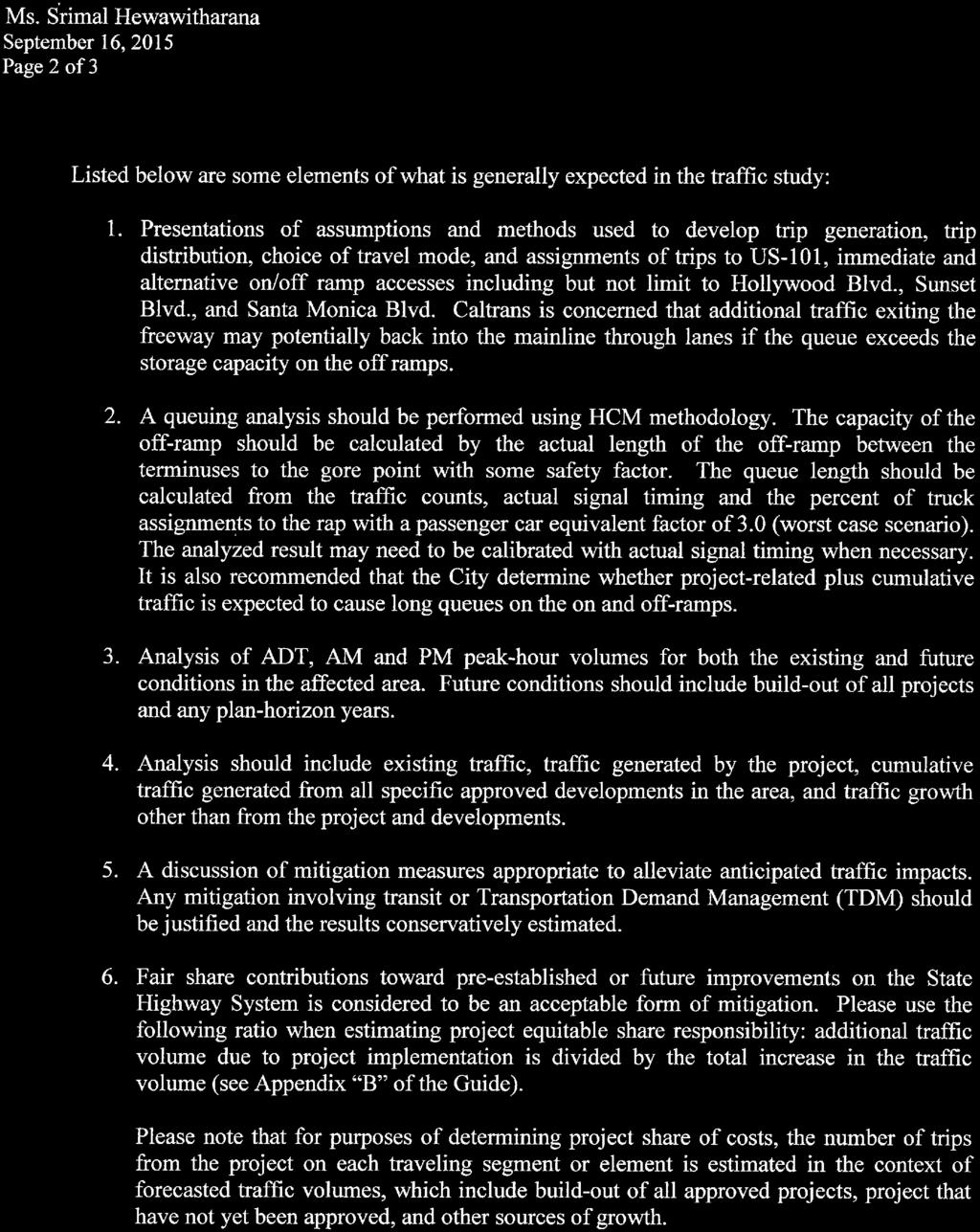
7 Department of City Planning Case No. ENV EIR October 30, 2015 Page 2 of 3 stations. For purposes of these policies, the bicycle catchment area is 3 miles. The Project is within 3 miles of several Red and Purple Line Stations. Although the Red and Purple Lines have been operating in the area for 15 years or more, the City of Los Angeles has not installed a single bicycle connection to any Red Line or Purple Line Station in Koreatown, East Hollywood or Hollywood. In recent years, the City has begun to explore installing bike lanes that connect to some of these stations, including along Vermont Avenue, Hollywood Boulevard and Vine Street, but in all cases has refused to move forward because of concerns about motor vehicle traffic congestion. In addition, the City has refused to install bike lanes on Lankershim Boulevard that would provide direct connections to the Valley Red Line stations. In short, although there are policies, programs and plans requiring the City to improve bike access to major transit stations, the City has a practice of not implementing these plans because of traffic volumes. For that reason, any project that generates additional trips within the 3 mile bicycle catchment area potentially has a significant impact on first mile, last mile policies. This is an issue where a cumulative impact analysis must be undertaken. Even if this project adds only a small number of trips to Hollywoodarea streets, the cumulative traffic generating impact of all approved and proposed developments along the Red and Purple Lines must be taken into account in evaluating whether, under the City s current practice, additional traffic makes it less likely that the City will provide bike access to transit stations. The EIR must analyze this issue. I would note that this is entirely a problem of the City s own making. If the City had a track record of providing high quality bike access to major transit stations despite potential traffic impacts, it might be able to conclude that traffic generating projects did not have an impact on bicycle plans or policies. But as long as the City uses traffic impacts as a justification for refusing to install bike infrastructure, it cannot take the position for the purposes of CEQA that traffic generation does not have an impact on these policies. As noted, the cumulative impact of all development on the City s implementation of Mobility Plan 2035 s bicycle networks is significant. In short, because the City s practice is to treat traffic congestion as significant and often determinative in making decisions not to implement Mobility Plan 2035 (and predecessor bicycle plans), the City cannot contend that this issue is not significant under CEQA. Neighborhood Enhanced Network Under Mobility Plan 2035, NEN streets are to provide comfortable and safe routes for localized travel of slower moving modes such as walking, bicycling, or other slow speed motorized means of travel. This network complements the Pedestrian Enhanced Districts and the Bicycle Enhanced Network by identifying non arterial streets important to the movement of people who walk and bike. While the Mobility Plan does not establish absolute standards for NEN streets, it does include suggested performance criteria, including vehicular travel that does not exceed 1500 vehicles a day and streets where the 85th percentile of travel speed is equal to or less than 20 mph, in order to provide a safe and comfortable experience for people who travel by walking, bicycling, or other slower moving modes.

8 Department of City Planning Case No. ENV EIR October 30, 2015 Page 3 of 3 The EIR must evaluate existing and projected traffic volumes on NEN streets in the vicinity of the Project, both from this project and cumulatively with other approved or proposed projects in the vicinity, to determine whether there will be an impact on implementation of the NEN. In this regard, I note that the City has not implemented any traffic diverters or other measures to actually limit vehicle volumes on any proposed NEN street anywhere in the vicinity of the project (the Yucca bike boulevard simply modified existing traffic diverters that were installed many years ago for other purposes). It is immaterial that the NEN performance criteria are not stated in absolutes. The argument is not that traffic volumes over 1,500 exceed a threshold by which impacts are automatically considered significant, but that traffic volumes and speeds are necessary to a subjective, case by case determination about the whether the impacts are significant. Typically, because CEQA still requires a traffic impact analysis, all of the proposed mitigation measures for a project are aimed at increasing vehicle flow, adding turn lanes and more complex turning movements at intersections, etc. However, these are precisely the kinds of improvements that adversely impact the safety of people who bike and walk. Finally, if the project EIR seeks to claim trip reductions based on TDM measures such as bicycle parking, those credits cannot fairly be claimed if the project will make the streets surrounding the project more hostile for bicycling. Respectfully, Jeff Jacobberger


9
10

11


12
13
14


15

16

17
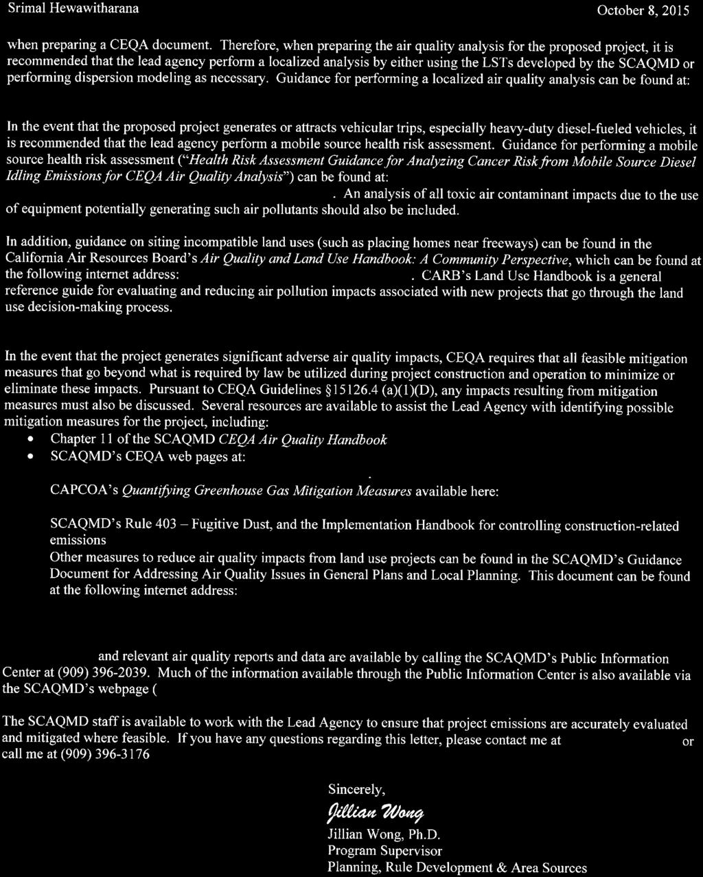
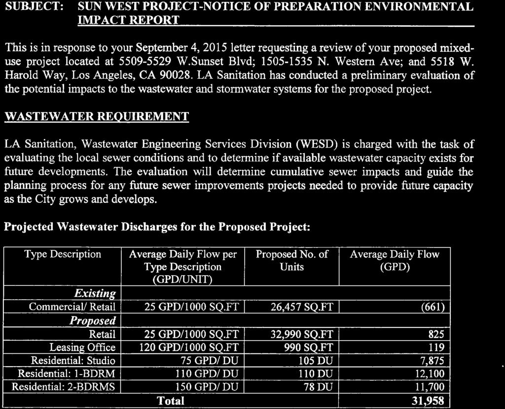
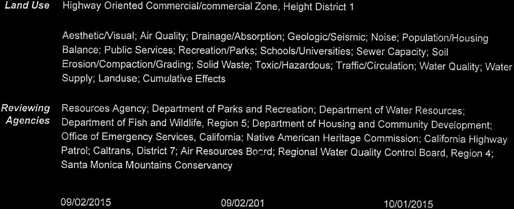
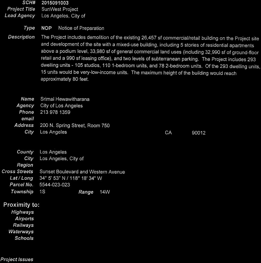
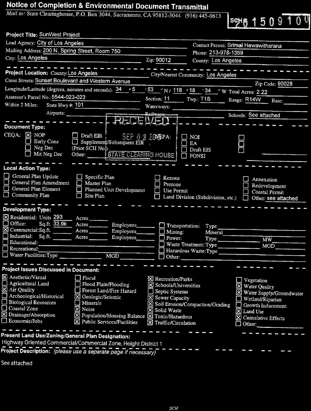
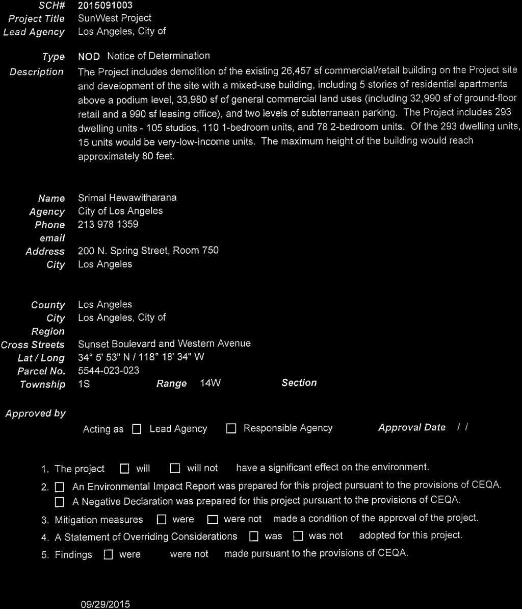
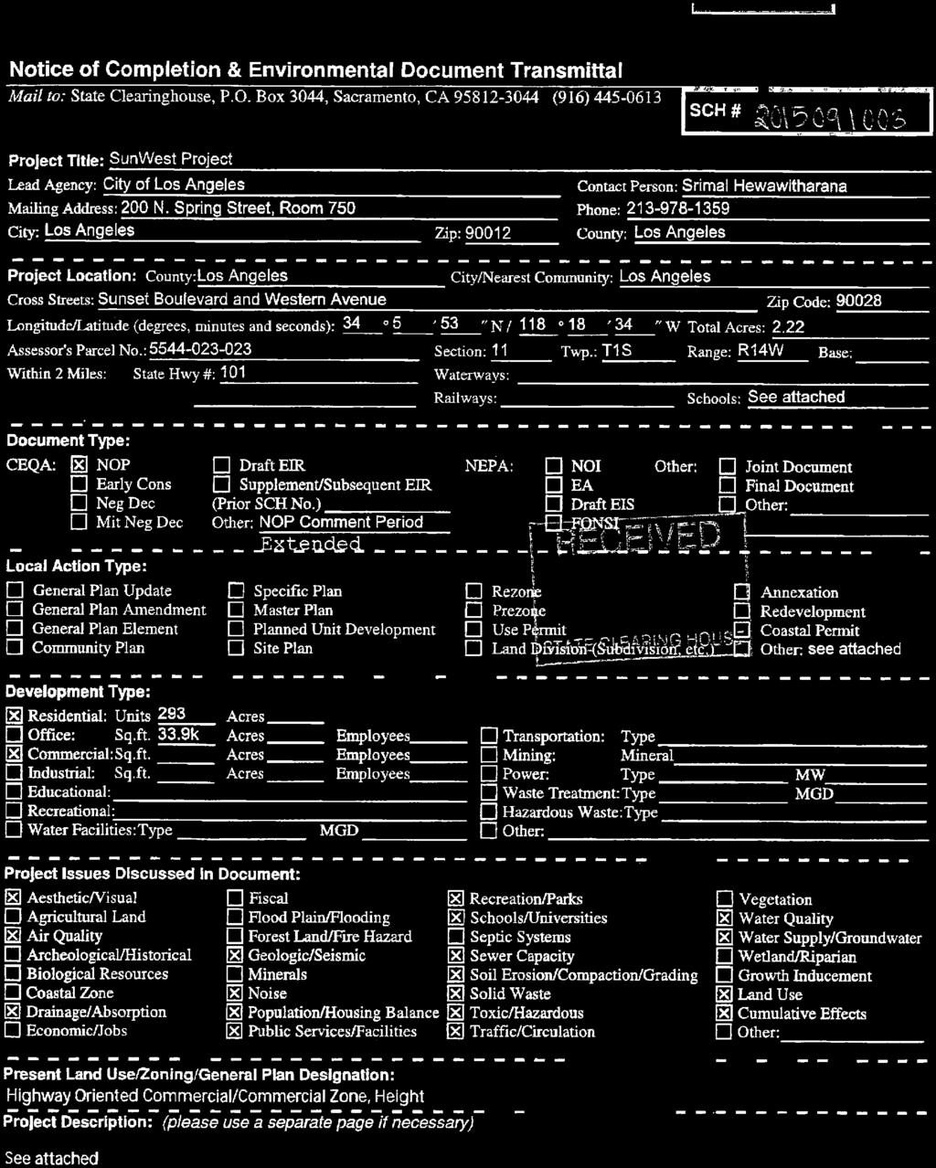
18 RAMON C. CORTINES Superintendent of Schools Los Angeles Unified School District Office of Environmental Health and Safety THELMA MELÉNDEZ, PH.D. Chief Executive Officer, Office of Educational Services ROBERT LAUGHTON Director, Environmental Health and Safety October 5, 2015 Srimal Hewawitharana Environmental Analysis Section Department of City Planning 200 N. Spring Street, Room 750 Los Angeles, CA CARLOS A. TORRES Deputy Director, Environmental Health and Safety Submitted via electronic mail to SUBJECT: SunWest Project (Case No: ENV EIR) Dear Srimal Hewawitharana: Presented below are comments submitted on behalf of the Los Angeles Unified School District (LAUSD) regarding the Notice of Preparation (NOP) for the proposed SunWest Project (proposed project) located at West Sunset Boulevard; North Western Avenue; and 5518 West Harold Way, Los Angeles, CA The proposed project would entail the development of 293 residential units and would have the potential to increase the demand on the existing school services provided by LAUSD. Please note that the proposed project would be located near the following LAUSD schools: Grant Elementary School (1530 N. Wilton Place, Los Angeles, CA 90028) Helen Bernstein High School (1309 N. Wilton Place, Hollywood, CA 90028) Joseph Le Conte Middle School (1316 N. Bronson Ave, Hollywood, CA 90028) LAUSD is providing these comments to the City in order to ensure that potential impacts to its campuses resulting from construction of the proposed project are appropriately analyzed and mitigated, as necessary. Air Quality Construction related activities associated with the proposed project would have the potential to adversely impact sensitive receptors. Sensitive receptors are facilities that house or attract children, the elderly, and people with illnesses or others who are especially sensitive to the effects of air pollutants. Hospitals, schools, convalescent facilities, and residential areas are examples of sensitive receptors. To ensure that effective mitigation is employed to reduce construction related air quality and fugitive dust impacts on proximate schools, we ask that the following language be considered for inclusion in the Draft Environmental Impact Report (EIR) for air quality impacts: If air quality and fugitive dust-related impacts remain after implementation of the proposed mitigation measures, the project applicant shall develop new feasible and appropriate measures to effectively mitigate construction-related air quality and fugitive dust at the affected schools. Provisions shall be made to allow the schools 333 South Beaudry Avenue, 28 th Floor, Los Angeles, CA Telephone (213) Fax (213) The Office of Environmental Health and Safety is dedicated to providing a safe and healthy environment for the students and employees of the Los Angeles Unified School District.
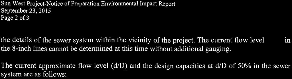
19 Comments: PROJECT NAME: SunWest Project CASE NO: ENV EIR Noise and/or designated representative(s) to notify the project applicant when such measures are warranted. Noise and vibration created by construction activities would adversely affect the students and staff at the proximate schools. LAUSD established maximum allowable noise levels to protect students and staff from noise impacts generated in terms of Leq (equivalent continuous noise level). These standards were established based on regulations set forth by the California Department of Transportation and the City of Los Angeles. LAUSD s exterior noise standard is 67 dba (Aweighted decibel) Leq and the interior noise standard is 52 dba Leq. A noise level increase of 3 dba or more over ambient noise levels is considered significant for existing schools and would require mitigation to achieve levels within 2 dba of pre-project ambient level. To ensure that effective mitigation is employed to reduce construction related noise impacts on the proximate schools, we ask that the following language be considered in the Draft EIR for potential noise impacts: If noise-related impacts remain after implementation of the proposed mitigation measures, the project applicant shall develop additional feasible and appropriate measures to effectively mitigate construction-related noise at the affected schools. Provisions shall be made to allow the schools and/or designated representative(s) to notify the project applicant when such measures are warranted, such as during Statemandated testing. Public Services Development of 293 new residential units would be expected to increase the demand of school services. Schools currently serving the proposed project area include Grant Elementary School, Joseph Le Conte Middle School, and Helen Bernstein High School. Information regarding each school s capacity and enrollment is available on LAUSD s Find A School website at Information related to school developer fees can be obtained by contacting the LAUSD Developer Fee Office at (213) Transportation/Traffic LAUSD schools are required to comply with California Education Code (CEC), Section 5, regarding the preparation of Safe School Plans. Safe School Plans address violence prevention, emergency preparedness, traffic safety, and crisis intervention. During and after construction, changed traffic patterns, lane adjustments, traffic light patterns and altered bus stops may impact pedestrian routes to schools, school bus time performance and bus passenger safety, and parent drop off and pick up activities. Additionally, truck traffic and construction vehicles may cause traffic delays for transported students. During the construction phase, street and/or sidewalk closures may impede pedestrians from taking the safest path of travel to nearby schools, which include intersections and street segments Page 2 of 3
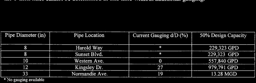
20 Comments: PROJECT NAME: SunWest Project CASE NO: ENV EIR surrounding the proposed project. Vehicle ingress and egress from the proposed project site during construction and operation would also traverse routes to school. LAUSD requests the inclusion of the following measures in the Draft EIR or project design for the proposed project to address school traffic, pedestrian routes to school, and transportation safety issues during construction and operation of the proposed project: Contractors must guarantee that safe and convenient pedestrian routes to LAUSD schools are maintained. Pedestrian Routes to School maps can be found at Contractors must maintain ongoing communication with the site administrators of proximate schools, providing sufficient notice to forewarn children and parents when existing pedestrian and vehicular routes to schools will be impacted. The LAUSD Transportation Branch must be contacted at (213) , regarding the potential impact of the proposed project upon existing school bus routes. The Project Manager or designee should notify the LAUSD Transportation Branch of the expected start and ending dates for various portions of the proposed project that may affect traffic through the areas. Because of provisions in the California Vehicle Code, trucks and construction vehicles may encounter school buses using the red flashing lights and must stop. School buses and parents dropping off their students must have access to the drop off areas located on each of the proximate school campuses. LAUSD s charge is to protect the health and safety of students, faculty, staff, and the integrity of the learning environment. The comments presented above identify potential environmental impacts related to the proposed project that must be addressed to ensure the welfare of the students, faculty, and staff at LAUSD schools. If additional issues are identified by LAUSD, we will bring them to the attention of the City. Thank you for your attention to this matter. Please feel free to contact me at (213) should you require any additional information. Sincerely, Eimon Smith CEQA Project Manager/Contract Professional c: Christopher Ikeanyi, Principal, Grant Elementary School Rosemary Hindinger, Principal, Joseph Le Conte Middle School Andre Spicer, Principal, Helen Bernstein High School Page 3 of 3


21

22
23


24

25

26

27

28

29


30

31
32


33
1.0 INTRODUCTION 1.1 PURPOSE OF THIS REPORT
 1.0 INTRODUCTION This chapter provides an overview of the purpose, authorization and focus of this Recirculated Draft Environmental Impact Report (EIR), an identification of the Lead Agency, an outline
Clackamas County Comprehensive Plan
 ROADWAYS The County s road system permits the movement of goods and people between communities and regions, using any of a variety of modes of travel. Roads provide access to virtually all property. They
Bicycle Master Plan Goals, Strategies, and Policies
 Bicycle Master Plan Goals, Strategies, and Policies Mobilizing 5 This chapter outlines the overarching goals, action statements, and action items Long Beach will take in order to achieve its vision of
General Plan Circulation Element Update Scoping Meeting April 16, 2014 Santa Ana Senior Center, 424 W. 3rd Street, Santa Ana, CA 92701
 General Plan Circulation Element Update Scoping Meeting April 16, 2014 Santa Ana Senior Center, 424 W. 3rd Street, Santa Ana, CA 92701 Meeting Agenda 1. Purpose of Scoping Meeting 2. Project Overview 3.
Draft MOBILITY ELEMENET. Community Meeting May 22, 2013
 Draft MOBILITY ELEMENET Community Meeting May 22, 2013 Agenda Presentation Ira Brown New Mobility Paradigm Movement of People Implementation Q&A Ira Brown and Dave Roseman Small Group Discussion at Each
Solana Beach Comprehensive Active Transportation Strategy (CATS)
") Solana Beach Comprehensive Active Transportation Strategy (CATS) 3.0 Goals & Policies The Solana Beach CATS goals and objectives outlined below were largely drawn from the Solana Beach Circulation Element
Solana Beach Comprehensive Active Transportation Strategy (CATS) 3.0 Goals & Policies The Solana Beach CATS goals and objectives outlined below were largely drawn from the Solana Beach Circulation Element
Section 3.5 Transportation and Traffic
 Section 3.5 Transportation and Traffic 3.5.1 Introduction This section presents the transportation and traffic analysis conducted for the proposed project. Pursuant to California Environmental Quality
4. ENVIRONMENTAL IMPACT ANALYSIS 9. TRANSPORTATION AND TRAFFIC
 4. ENVIRONMENTAL IMPACT ANALYSIS 9. TRANSPORTATION AND TRAFFIC 4.9.1 INTRODUCTION The following section addresses the Proposed Project s impact on transportation and traffic based on the Traffic Study
City of Los Angeles CALIFORNIA. Traffic and Safety Assessment
 DEPARTMENT OF CITY PLANNING 200 N. SPRING STREET, ROOM 525 LOS ANGELES, CA 90012-4801 AND 6262 VAN NUYS BLVD., SUITE 351 VAN NUYS, CA 91401 - CITY PLANNING COMMISSION WILLIAM ROSCHEN PRESIDENT REGINA M.
AMENDING MOTION: Mobility Plan - Pedestrians and Disadvantaged Communities
 I MOVE that the Council: AMENDING MOTION: Mobility Plan - Pedestrians and Disadvantaged Communities 1. INSTRUCT the Department of City Planning to amend the proposed Mobility Plan to include the following;
Magnolia Place. Traffic Impact Analysis. Prepared for: City of San Mateo. Prepared by: Hexagon Transportation Consultants, Inc.
 Magnolia Place Traffic Impact Analysis Prepared for: City of San Mateo Prepared by: Hexagon Transportation Consultants, Inc. Updated January 4, 2010 Table of Contents 1. Introduction...1 2. Existing Conditions...6
3.9 Recreational Trails and Natural Areas
 3.9 Recreational Trails and Natural Areas 3.9.1 Introduction Parks and other recreational facilities such as trails, bicycle routes, and open space are important community resources. This section discusses
 MEMORANDUM - CITY OF PASADENA Department Of Transportation DATE: OCTOBER 21, 2008 TO: ENVIRONMENTAL ADVISORY COMMISSION FROM: ~ FRED C. DOCK, DIRECTOR OF TRANSPORTATION SUBJECT: UPDATE ON DEPT. OF TRANSPORTATION
MASTER BICYCLE AND PEDESTRIAN PLAN
 VILLAGE OF NORTHBROOK MASTER BICYCLE AND PEDESTRIAN PLAN DRAFT PLAN OPEN HOUSE May 2, 2018 AGENDA 1. Community Engagement 2. Vision and Goals 3. General Structure of Plan 4. Recommendations Overview 5.
CITY OF SAINT JOHN TRAFFIC CALMING POLICY
 CITY OF SAINT JOHN TRAFFIC CALMING POLICY VERSION: 1.0 April 10, 2012 Pedestrians, Cyclists and Motorists Sharing Street Spaces CONTENTS INTRODUCTION... 3 POLICY GOAL... 3 POLICY OBJECTIVES... 3 GUIDING
Recommended Roadway Plan Section 2 - Land Development and Roadway Access
 Recommended Roadway Plan Section 2 - Land Development and Roadway Access SECTION 2 Land Development and Roadway Access 2.1 Land Use and Access Management The Federal Highway Administration (FHWA) defines
TRAC. March 2, Mayor Gayle McLaughlin and City Councilors City of Richmond P.O. Box 4046 Richmond, CA 94804
 TRAC Trails for Richmond Action Committee 73 Belvedere Avenue Richmond, CA 94801 Phone/Fax 510-235-2835 tracbaytrail@earthlink.net March 2, 2011 Mayor Gayle McLaughlin and City Councilors City of Richmond
Circulation in Elk Grove includes: Motor vehicles, including cars and trucks
 Circulation, as it is used in this General Plan, refers to the many ways people and goods move from place to place in Elk Grove and the region. Circulation in Elk Grove includes: Motor vehicles, including
5.13 PEDESTRIAN SAFETY
 5.13 This section of the program EIR evaluates the potential for implementation of the SUP to impact pedestrian safety in the District. This section discusses plans and policies from several jurisdictional
Corpus Christi Metropolitan Transportation Plan Fiscal Year Introduction:
 Introduction: The Safe, Accountable, Flexible, Efficient Transportation Equity Act: A Legacy for Users (SAFETEA-LU) has continued the efforts started through the Intermodal Surface Transportation Efficiency
Appendix B. Environmental Resource Technical Memorandum. Assessment on Travel Pattern and Access Impacts
 Appendix B Environmental Resource Technical Memorandum Assessment on Travel Pattern and Access Impacts TECHNICAL MEMORANDUM ENVIRONMENTAL RE-EVALUATION FOR UNION STATION TO OAK CLIFF DALLAS STREETCAR To:
D.13 Transportation and Traffic
 This section addresses transportation and traffic issues and impacts related to the Proposed Project. Section D.13.1 provides a description of the affected environment for the Proposed Project. Applicable
August 3, Bay Trail Connection With The Community
 Ms. Lina Velasco, Senior Planner City of Richmond Planning Division P.O. Box 4046 Richmond, CA 94804 Dear Ms. Velasco: August 3, 2009 73 Belvedere Ave. Richmond, CA 94801 Phone/Fax: 510-235-2835 Email:tracbaytrail@earthlink.net
TOWN OF CHAPEL HILL POLICY AND PROCEDURES FOR TRAFFIC CALMING MEASURES
 TOWN OF CHAPEL HILL POLICY AND PROCEDURES FOR TRAFFIC CALMING MEASURES (Adopted by the Town Council on June 30, 2004) (Revised December 6, 2010) (Revised February 8, 2016) POLICY AND PROCEDURES FOR TRAFFIC
POLICY: TRAFFIC CALMING
 2006 MAY REFERENCE: COUNCIL APPROVED BY COUNCIL MAY 23, 2006 CITY OPERATIONS - NO. 608 POLICY: TRAFFIC CALMING A. All requests for traffic calming within the City shall be considered in accordance with
Municipal and School PROUD TO SERVE. Transportation Assistance
 Municipal and School PROUD TO SERVE Transportation Assistance MSTA School Traffic Calculator To help insure school systems incorporate transportation safety in future designs, state law requires schools
Traffic Impact Memorandum. May 22, 2018
 BISHOP PROFESSIONAL DEVELOPMENT BUILDING Proposed Land-use Change & Parking Modification 3601 SW 31st Street Topeka, Kansas 66614 CFS Project No. 185077 Traffic Impact Memorandum May 22, 2018 Prepared
Bicycle and Pedestrian Advisory Committee (BPAC) November 21, 2013
 November 21, 2013") Bicycle and Pedestrian Advisory Committee (BPAC) November 21, 2013 OVERALL LAND USE CONCEPT Overall Broadway Valdez District: 95.5 acres (35.1 acres right-of ways + 60.4 acres developable land) Plan Subareas:
Bicycle and Pedestrian Advisory Committee (BPAC) November 21, 2013 OVERALL LAND USE CONCEPT Overall Broadway Valdez District: 95.5 acres (35.1 acres right-of ways + 60.4 acres developable land) Plan Subareas:
Chapter 5. Complete Streets and Walkable Communities.
 Chapter 5. Complete Streets and Walkable Communities. 5.1 Description of Complete Streets. Cities throughout the world, and specifically the United States, are coming to embrace a new transportation and
4.11 Transportation and Traffic
 4.11.1 Introduction This section evaluates whether implementation of the Russian River Estuary Management Project (Estuary Management Project) would result in potential adverse impacts related to transportation
Bay to Bay Boulevard Complete Streets Project
 Bay to Bay Boulevard Complete Streets Project Dale Mabry Highway to Bayshore Boulevard February 08, 2018 Photo Source: Tampa Bay Times Alessandra Da Pra Meeting Format Introduction Resurfacing Information
NM-POLICY 1: Improve service levels, participation, and options for non-motorized transportation modes throughout the County.
 Transportation PRINCE WILLIAM COUNTY 2008 COMPREHENSIVE PLAN NON-MOTORIZED PLAN CONTENTS Goals, Policies, and Action Strategies Table 4 (Bike Facility Classifications and Descriptions) Table 5 (Bike Facility
INTRODUCTION THOROUGHFARE SYSTEM CLASSIFICATIONS
 INTRODUCTION The thoroughfare plan will assist public officials in the development of a specialized system for efficient and safe movement of vehicular traffic while minimizing potential conflicts with
MOBILITY WORKSHOP. Joint City Council and Transportation Commission May 5, 2014
 MOBILITY WORKSHOP Joint City Council and Transportation Commission May 5, 2014 Review of General Plan M-1 Develop world-class transit system M-3 Maintain/enhance pedestrian-oriented City M-4 Create comprehensive
This chapter describes the proposed circulation system and transportation alternatives associated with
 5.0 Circulation 5.1 OVERVIEW This chapter describes the proposed circulation system and transportation alternatives associated with West Landing, and summarize the information contained in the Existing
Complete Street Analysis of a Road Diet: Orange Grove Boulevard, Pasadena, CA
 Complete Street Analysis of a Road Diet: Orange Grove Boulevard, Pasadena, CA Aaron Elias, Bill Cisco Abstract As part of evaluating the feasibility of a road diet on Orange Grove Boulevard in Pasadena,
Lyons Avenue/Dockweiler Road Extension Project Draft Environmental Impact Report. Appendix I Traffic Impact Study
 Lyons Avenue/Dockweiler Road Extension Project Draft Environmental Impact Report Appendix I Traffic Impact Study Street 0 80-1947 500.4501 RITA ld Court 0 91355-1096 400.7401 LA n Avenue 0 590-3745 300-9301
West Capitol Avenue Road Rehabilitation and Safety Enhancement Project
 West Capitol Avenue Road Rehabilitation and Safety Enhancement Project Stakeholder Focus Group Meeting #2 Tuesday, August 28, 2018 7:00 8:00 a.m. West Sacramento City Hall 1110 West Capitol Avenue, West
K 2: Los Angeles Department of Transportation (LADOT) Approval Letter
 Approval Letter") K 2: Los Angeles Department of Transportation (LADOT) Approval Letter Luci Ibarra -2- October 10, 2014 DISCUSSION AND FINDINGS A. Project Description The proposed project would develop the northeast
K 2: Los Angeles Department of Transportation (LADOT) Approval Letter Luci Ibarra -2- October 10, 2014 DISCUSSION AND FINDINGS A. Project Description The proposed project would develop the northeast
Project Kickoff Meeting February 15, 2018
 Project Kickoff Meeting February 15, 2018 Scope of Work: Study Area Project Goals Develop traffic calming alternatives to the Vine Street local right of way, to mitigate speeding. Develop concept plans
3.9 - Transportation and Traffic
 Transportation and Traffic 3.9 - Transportation and Traffic This section describes the potential transportation and traffic effects of project implementation on the project site and its surrounding area.
TRAFFIC IMPACT STUDY CRITERIA
 Chapter 6 - TRAFFIC IMPACT STUDY CRITERIA 6.1 GENERAL PROVISIONS 6.1.1. Purpose: The purpose of this document is to outline a standard format for preparing a traffic impact study in the City of Steamboat
HARRISON STREET/OAKLAND AVENUE COMMUNITY TRANSPORTATION PLAN
 HARRISON STREET/OAKLAND AVENUE Community Workshop #4: Draft Plan Review December 3, 2009 D E S I G N, C O M M U N I T Y & E N V I R O N M E N T INTRODUCTIONS Key Project Staff: Alisa Shen, Project Manager,
REVIEW OF LOCAL TRAFFIC FLOW / LONG RANGE PLANNING SOLUTIONS STUDY
 ITEM Town of Atherton TRANSPORTATION COMMITTEE STAFF REPORT TO: FROM: MEMBERS OF THE COMMITTEE ROBERT OVADIA, PUBLIC WORKS DIRECTOR DATE: FEBRUARY 12, 2019 SUBJECT: REVIEW OF LOCAL TRAFFIC FLOW / LONG
Traffic Calming Policy
 Article I. Purpose and Goal. The purpose of this policy is to establish criteria and procedures the City will use to evaluate requests for, and if appropriate, implement traffic calming measures. Neighborhood
TRAFFIC CALMING GUIDE FOR TORONTO CITY OF TORONTO TRANSPORTATION SERVICES DIVISION
 TRAFFIC CALMING GUIDE FOR TORONTO CITY OF TORONTO TRANSPORTATION SERVICES DIVISION CITY OF TORONTO TRANSPORTATION SERVICES DIVISION 2016 TRAFFIC CALMING GUIDE FOR TORONTO TABLE OF CONTENTS Introduction
Chapter 6 Transportation Plan
 Chapter 6 Transportation Plan Transportation Plan Introduction Chapter 6 Transportation Plan Transportation Plan Introduction This chapter describes the components of Arvada s transportation system, comprised
Public Works and Infrastructure Committee. General Manager, Transportation Services
 STAFF REPORT ACTION REQUIRED Extending the Bay Street Bicycle Lanes Date: May 16, 2013 To: From: Public Works and Infrastructure Committee General Manager, Transportation Services Wards: Toronto Centre
REGIONAL BICYCLE AND PEDESTRIAN DESIGN GUIDELINES
 REGIONAL BICYCLE AND PEDESTRIAN DESIGN GUIDELINES November 16, 2011 Deb Humphreys North Central Texas Council of Governments Bicycle and Pedestrian Advisory Committee Snapshot of the Guide 1. Introduction
CITY OF COCOA BEACH 2025 COMPREHENSIVE PLAN. Section VIII Mobility Element Goals, Objectives, and Policies
 CITY OF COCOA BEACH 2025 COMPREHENSIVE PLAN Section VIII Mobility Element Goals, Objectives, and Policies Adopted August 6, 2015 by Ordinance No. 1591 VIII MOBILITY ELEMENT Table of Contents Page Number
Traffic Control Signals - Cosburn Avenue and Cedarvale Avenue
 REPORT FOR ACTION Traffic Control Signals - Cosburn Avenue and Cedarvale Avenue Date: April 24, 2017 To: Toronto and East York Community Council From: Acting Director, Transportation Services, Toronto
Lincoln Avenue Road Diet Trial
 Lincoln Avenue Road Diet Trial Data Collection Report June 1, 2015 Department of Transportation Table of Contents I. Introduction...... 3 II. Data Collection Methodology & Results...... 5 A. Traffic Volume
SAFE ROUTES TO SCHOOL
 SAFE ROUTES TO SCHOOL Edgewood Elementary School Existing Conditions and ACTION PLAN > Oak Creek - Franklin Joint School District Table of Contents CONTEXT Enrollment Boundaries Enrollment
POLICY FOR NEIGHBORHOOD TRAFFIC CALMING
 POLICY FOR NEIGHBORHOOD TRAFFIC CALMING I. STATEMENT OF PURPOSE This policy provides a procedure for the consideration, evaluation and implementation of requests for traffic calming measures. II. DEFINITIONS
Implementing the Three Es of School Zone Traffic Calming
 Implementing the Three Es of School Zone Traffic Calming Use this evaluation tool as a guide to analyze the specific safety needs of your school. SCHOOL PROFILE School Name: School District: Address: Phone
EUCLID AVENUE PARKING STUDY CITY OF SYRACUSE, ONONDAGA COUNTY, NEW YORK
 EUCLID AVENUE PARKING STUDY CITY OF SYRACUSE, ONONDAGA COUNTY, NEW YORK CITY OF SYRACUSE DEPARTMENT OF PUBLIC WORKS 1200 CANAL STREET EXTENSION SYRACUSE, NEW YORK 13210 DRAFT REPORT DATE: November 13,
Caltrans Sloat Boulevard Pedestrian Safety Project Response to Community Questions, Comments & Concerns
 Caltrans Sloat Boulevard Pedestrian Safety Project Response to Community Questions, Comments & Concerns Revised: May 10, 2016 The California Department of Transportation (Caltrans) is planning various
Arlington s Master Transportation Plan
 Arlington s Master Transportation Plan The Master Transportation Plan (MTP) Adopted in eight parts Goals & Policies element and MTP Map adopted in 2007 Bicycle, Pedestrian and Demand and Systems Management
3.16 TRANSPORTATION, CIRCULATION, AND PARKING Regulatory Setting Environmental Setting ROADWAY SYSTEM
 3.16 TRANSPORTATION, CIRCULATION, AND PARKING This section assesses the potential for implementation of the Orchard Park Redevelopment component of the 2018 LRDP to result in impacts related to transportation,
West Dimond Blvd Upgrade Jodhpur Street to Sand Lake Road
 West Dimond Blvd Jodhpur St to Sand Lake CSS Transportation Project Summary Municipality of Anchorage Project # 05 005 Project Manager: John Smith, P.E. (MOA PM&E) Project Administrator: Julie Makela,
New Seward and 36 th Avenue Intersection Conceptual Design
 University of Alaska Anchorage New Seward and 36 th Avenue Intersection Conceptual Design Prepared By: Zaid S. Hussein Dana Menendez Galen Jones Civil Engineering Department Prof. Osama Abaza CE A404 Highway
VILLAGE OF NILES TRAFFIC CALMING POLICY
 INTRODUCTION There is increasing interest across the country in developing new strategies to reduce the speed and amount of traffic in residential neighborhoods. Measurement of speeds, traffic volumes,
3.13 TRANSPORTATION AND TRAFFIC
 3.13 TRANSPORTATION AND TRAFFIC INTRODUCTION This section of the Draft EIR describes the transportation and traffic based on the Transportation Impact Analysis (TIA) prepared by Overland Traffic Consultants,
Route 7 Corridor Study
 Route 7 Corridor Study Executive Summary Study Area The following report analyzes a segment of the Virginia State Route 7 corridor. The corridor study area, spanning over 5 miles in length, is a multi
Double the amount of bicycle ridership while at the same time reducing the number of bicycle crashes by one-third.
 CHAPTER 6 Recommended Policies and Action Items To achieve the goals stated in Chapter 1 and guide implementation of the Bicycle Plan, policies and action items have been identified. They are presented
TRAFFIC IMPACT ANALYSIS
 TRAFFIC IMPACT ANALYSIS FOR THE CHAMPAIGN UNIT#4 SCHOOL DISTRICT PROPOSED HIGH SCHOOL (SPALDING PARK SITE) IN THE CITY OF CHAMPAIGN Final Report Champaign Urbana Urbanized Area Transportation Study 6/24/2014
Welcome. If you have any questions or comments on the project, please contact:
 Welcome This drop-in public open house is intended to provide information about the Bay Street bike lanes project. This project proposes a dedicated cycling facility along Bay Street between Aberdeen Avenue
County of Greenville South Carolina. Traffic Calming Program Neighborhood Traffic Education Program and Speed Hump Program
 County of Greenville South Carolina Traffic Calming Program Neighborhood Traffic Education Program and Speed Hump Program (rev) August 2008 I. PURPOSE The potential negative impacts from vehicular traffic
Mission Street Medical Office Development
 reet Medical Office Development Traffic Impact Analysis Prepared for: Palo Alto Medical Foundation February 23, 2012 Hexagon Office: 7888 Wren Avenue, Suite B121 Gilroy, CA 95020 Hexagon Job Number: 11RD11
EXECUTIVE SUMMARY... vii 1 STUDY OVERVIEW Study Scope Study Area Study Objectives
 Contents EXECUTIVE SUMMARY... vii 1 STUDY OVERVIEW... 1-1 1.1 Study Scope... 1-1 1.2 Study Area... 1-1 1.3 Study Objectives... 1-3 2 EXISTING CONDITIONS... 2-1 2.1 Existing Freeway Conditions... 2-4 2.1.1
City of Wayzata Comprehensive Plan 2030 Transportation Chapter: Appendix A
 A1. Functional Classification Table A-1 illustrates the Metropolitan Council s detailed criteria established for the functional classification of roadways within the Twin Cities Metropolitan Area. Table
TRAFFIC ACTION PLAN. North Central Neighborhood CITY OF SAN MATEO
 TRAFFIC ACTION PLAN North Central Neighborhood CITY OF SAN MATEO Draft February 2017 Table of Contents Introduction... 1 The Traffic Forum Process... 4 Neighborhood Traffic Issues... 6 Neighborhood Recommendations
4 DISRUPTION MANAGEMENT PLAN HIGHWAY 7 RAPIDWAY CONSTRUCTION BETWEEN BAYVIEW AVENUE AND WARDEN AVENUE TOWNS OF MARKHAM AND RICHMOND HILL
 4 DISRUPTION MANAGEMENT PLAN HIGHWAY 7 RAPIDWAY CONSTRUCTION BETWEEN BAYVIEW AVENUE AND WARDEN AVENUE TOWNS OF MARKHAM AND RICHMOND HILL The Transportation Services Committee recommends the adoption of
DATE: October 20, Planning Commission. Beth McKibben, Planner Community Development Department FILE NO.: CSP
 DATE: October 20, 2014 TO: FROM: Planning Commission Beth McKibben, Planner Community Development Department FILE NO.: CSP2014 0017 PROPOSAL: Local consistency review of DOT&PF project to remove and replace
APPENDIX 2 LAKESHORE ROAD TRANSPORTATION REVIEW STUDY EXECUTIVE SUMMARY
 APPENDIX 2 LAKESHORE ROAD TRANSPORTATION REVIEW STUDY EXECUTIVE SUMMARY Appendix 2 City of Mississauga Lakeshore Road FINAL REPORT Transportation Review Study December 2010 EXECUTIVE SUMMARY Study Purpose
MOUNTAIN HOUSE SPECIFIC PLAN I 9.1 INTRODUCTION ASSUMPTIONS TRANSPORTATION FACILITIES TRANSPORTATION IMPROVEMENTS PHASING 9.
 CHAPTER NINE: TRANSPORTATION AND CIRCULATION 9.1 INTRODUCTION 9.1 9.2 ASSUMPTIONS 9.1 9.3 TRANSPORTATION FACILITIES 9.1 9.4 TRANSPORTATION IMPROVEMENTS PHASING 9.3 LIST OF FIGURES LIST OF TABLES Figure
San Bernardino County Non-Motorized Transportation Plan - Chapter 5
 City of Upland Population 76,106 City Overview The City of Upland was incorporated on May 15, 1906, after previously being named North Ontario. The City was originally established as an irrigation colony
o n - m o t o r i z e d transportation is an overlooked element that can greatly enhance the overall quality of life for the community s residents.
 N o n - m o t o r i z e d transportation is an overlooked element that can greatly enhance the overall quality of life for the community s residents. 84 Transportation CHAPTER 11 INTRODUCTION Transportation
City of Memphis On-Street Parking Modification Guidelines
 City of Memphis Effective Date: December 1, 2013 Bicycle/Pedestrian Program 125 N. Main Street Memphis, TN 38103 (901) 576-6710 www.bikepedmemphis.com City of Memphis Executive Summary It is current practice
Tonight is for you. Learn everything you can. Share all your ideas.
 Strathcona Neighbourhood Renewal Draft Concept Design Tonight is for you. Learn everything you can. Share all your ideas. What is Neighbourhood Renewal? Creating a design with you for your neighbourhood.
BUDGET FOR RESEDA BOULEVARD, STREET RECONSTRUCTION / VISION ZERO PROGRAM, REPORT BACK, COUNCIL FILE
 FORM GEN. 160 (Rev. 11-02) CITY OF LOS ANGELES INTERDEPARTMENTAL CORRESPONDENCE Date: To: Honorable City Council From: Gary Lee Moore, City Engineer Bureau of Engineering 7%mt /Electronically signed by
CITY OF BLOOMINGTON COMPLETE STREETS POLICY
 CITY OF BLOOMINGTON COMPLETE STREETS POLICY POLICY OBJECTIVE: The City of Bloomington will enhance safety, mobility, accessibility and convenience for transportation network users of all ages and abilities,
Chapter 14 PARLIER RELATIONSHIP TO CITY PLANS AND POLICIES. Recommendations to Improve Pedestrian Safety in the City of Parlier (2014)
") Chapter 14 PARLIER This chapter describes the current status and future plans for biking and walking in the City of Parlier. RELATIONSHIP TO CITY PLANS AND POLICIES The Parlier General Plan is the primary
Chapter 14 PARLIER This chapter describes the current status and future plans for biking and walking in the City of Parlier. RELATIONSHIP TO CITY PLANS AND POLICIES The Parlier General Plan is the primary
IV. Environmental Impact Analysis B.3 Pedestrian Circulation and Bicycle and Pedestrian Safety
 IV. Environmental Impact Analysis B.3 Pedestrian Circulation and Bicycle and Pedestrian Safety 1. Introduction This section analyzes the potential impacts of the Project on pedestrian circulation and bicycle
5. RUNNINGWAY GUIDELINES
 5. RUNNINGWAY GUIDELINES These guidelines should be considered collectively when making runningway decisions. A runningway is the linear component of the transit system that forms the right-of-way reserved
Preliminary Transportation Analysis
 Preliminary Transportation Analysis Goals of a Robust, Multimodal Transportation Network Safe Accessible/Connected Efficient Comfortable Context-Sensitive Motor Vehicle: Continue to analyze the data to
Chapter 3 Transportation
 Figure 3-28. Station/Bus/Pedestrian-Bicycle Impact Analysis Westwood/UCLA On-Street Optional Station Draft Environmental Impact Statement/Environmental Impact Report 3-55 Figure 3-29. Station/Bus/Pedestrian-Bicycle
County of Spartanburg South Carolina
 County of Spartanburg South Carolina Traffic Calming Program June 2012 (Revised/Program on Hold) PURPOSE The potential negative impacts from vehicular traffic on residential roads have been a longstanding
City of Elizabeth City Neighborhood Traffic Calming Policy and Guidelines
 City of Elizabeth City Neighborhood Traffic Calming Policy and Guidelines I. Purpose: The City of Elizabeth City is committed to ensure the overall safety and livability of residential neighborhoods. One
4.0 TRAFFIC IMPACT STUDIES
 SECTION 4 4.0 TRAFFIC IMPACT STUDIES 4.1 TRAFFIC IMPACT STUDY REQUIREMENTS The City has established Traffic Impact Study (TIS) requirements for the purpose of ensuring that both the quantitative and qualitative
Woodward Hill Elementary School School Safety and Operation Review
 Address: 6082-142 nd Street Surrey, BC, V3X 1C1 Site Visit: March 7, 2011 Principal Anne Mackie Report Date: November 25, 2011 Phone: (604) 594-2408 Email: Mackie_A@sd36.bc.ca The following report is one
CHAPTER 3. Transportation and Circulation
 CHAPTER 3 Transportation and Circulation 3.0 TRANSPORTATION AND CIRCULATION This chapter evaluates traffic circulation, transit, parking, pedestrian, bicycle, and rail operational conditions in the Project
Dec 2, Dear Tri Ong, Sam Woods, and Scott Kubly,
 Dec 2, 2014 Dear Tri Ong, Sam Woods, and Scott Kubly, Thank you for providing us with the 2015 Arterial Asphalt and Concrete (AAC) repaving project 60% plan for Roosevelt Way NE. It's exciting to see the
ELEMENT 11 TRANSPORTATION ELEMENT
 ELEMENT 11 TRANSPORTATION ELEMENT TRANSIT, CIRCULATION, PARKING, PEDESTRIAN, & NON-VEHICULAR CIRCULATION Introduction The following narrative describes the concepts on which the transportation plan is
Exhibit 1 PLANNING COMMISSION AGENDA ITEM
 Exhibit 1 PLANNING COMMISSION AGENDA ITEM Project Name: Grand Junction Circulation Plan Grand Junction Complete Streets Policy Applicant: City of Grand Junction Representative: David Thornton Address:
Washington DC Section of ITE Project Briefing
 Washington DC Section of ITE Project Briefing November 5, 2015 Renée Hamilton, VDOT, Deputy District Administrator I-66 Outside the Beltway Improvement Area Project Location Virginia 2 Purpose and Need
WALKNBIKE DRAFT PLAN NASHVILLE, TENNESSEE EXECUTIVE SUMMARY NASHVILLE, TENNESSEE
 NASHVILLE, TENNESSEE EXECUTIVE SUMMARY Executive Summary A world-class multi-modal transportation system is essential to a vibrant city and better quality of life. -Mayor Barry The WalknBike plan aims
THIS PAGE INTENTIONALLY BLANK
 THIS PAGE INTENTIONALLY BLANK Readers Guidance: This chapter provides responses to all comments submitted on the Draft Supplemental EIR of November 2011. All comments have been numbered and a corresponding
Santa Ana Creating Community Together
 City of Santa Ana Creating Community Together Circulation & Housing Element Update Open House Thursday, May 9, 2013 1 General Plan Circulation Element Update Open House #3 2 What is a Circulation Element?
Transportation, Parking & Roads
 Transportation, Parking & Roads Design Carolina North as a walkable community Design the transportation system and development patterns (i.e., urban design elements such as density, building design, mix