LANE ELIMINATION PROJECTS
|
|
|
- Flora Simpson
- 5 years ago
- Views:
Transcription
1
2 PRESENTATION OUTLINE Lane Elimination Considerations Districts 4 & 7 Draft Lane Elimination Processes FDOT Lane Elimination Guidelines Example Projects D4 Case Study: SR A1A (Ft. Lauderdale) D7 Case Study: Nebraska Avenue (Tampa)
3 LANE ELIMINATION PROJECTS Support local government & community visions Provide opportunities for aesthetic features Provide opportunities for on-street parking Have potential to increase economic vitality Introduce or improve bicycle/pedestrian features
4 FDOT CONSIDERATIONS Lane Elimination projects on the State Highway System must be approved by FDOT Lane Elimination projects offer benefits, but can be challenging to implement A formal process defines how approval is obtained A formal process assures consistency and thorough analysis & coordination Open communication & coordination with local municipalities with sensitivity to the context of the project
5 LANE ELIMINATION CONSIDERATIONS Safety / Crash History Long Range Needs Traffic Operations Pedestrians / Bicyclists Transit Services / Ridership Parking Supply / Activity Environmental Impacts Design Variations / Exceptions Functional Classification Access Management Emergency Evacuation Jurisdictional Transfers Freight Routes / Access Community Support Consistency with Local Plans Costs & Funding
6 LANE ELIMINATION PROCESS HISTORY Before 2009 No formal process in place for staff or applicants Requests handled by different offices in different project phases Inconsistent review approaches Defined Process Multi-disciplinary team mapped informal processes Formal process developed Process coordinated by Planning & Environmental Management Office Process focusses on multi-disciplined review & coordination
7 FDOT LANE ELIMINATION GUIDELINES D4 Refined Process Refinements based on experience with the 2009 process Identified milestones & deliverables Defined clearer expectations for staff and applicant Central Office circulated D4 & D7 processes for input FDOT Statewide Lane Elimination Guidelines
8 DISTRICTS 4 & 7 DRAFT PROCESSES Step 1: Initial Meeting Applicant provides preliminary project information District provides information about review process District identifies fatal flaws & key issues to be considered in detailed analysis Multiple FDOT offices involved Provides Lane Reduction Request Form (D7) Establish evaluation methodology based on initial meeting Central Office is notified of the request Information provided by the applicant includes: Project purpose Project location Project limits Proposed change in lane configuration Typical section (if available) Consistency with plans/programs
9 DISTRICTS 4 & 7 DRAFT PROCESSES Step 2: Interim Meeting & Concept Report Applicant provides detailed concept report & evaluation Focus on traffic analyses & long term needs Multiple FDOT offices involved District provides formal review comments Central Office is notified Applicant provides completed Lane Reduction Request Form (D7) Information provided by applicant includes: Near- and long-term level of service analyses Mitigation to address impacts of lane elimination Crash analyses Conceptual design plans Pedestrian/bicycle/transit/truck assessments Conceptual implementation and funding strategies Case-specific analyses
10 DISTRICTS 4 & 7 DRAFT PROCESSES Step 3: Final Review Applicant obtains approval resolution from city or county Applicant discusses public involvement activities Applicant provides funding, and implementation plans (as applicable) Applicant submits formal application for lane elimination (D4) District conducts multi-disciplined review and makes a recommendation for approval (or denial) to Central Office
11 FDOT LANE ELIMINATION GUIDANCE 2014 Resource Document (Phase 1): Examples of Florida lane elimination projects Literature review focused on impacts of lane elimination projects Profiles considerations associated with lane elimination requests Documentation of existing formal processes Phase 2 effort to develop example processes and possibly a statewide process Process for converting through lanes to transit lanes also under development


")

")
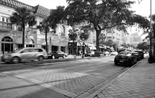
12 Las Olas Boulevard (Ft. Lauderdale) SR 5/Olive Avenue (West Palm Beach) Hillsboro Boulevard (Deerfield Beach) Atlantic Avenue (Delray Beach)

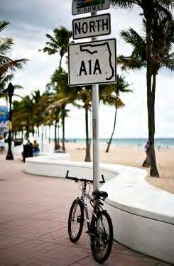
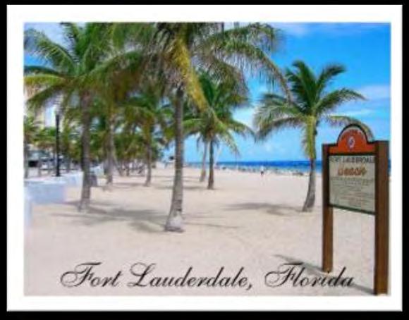
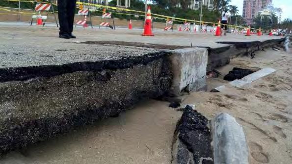
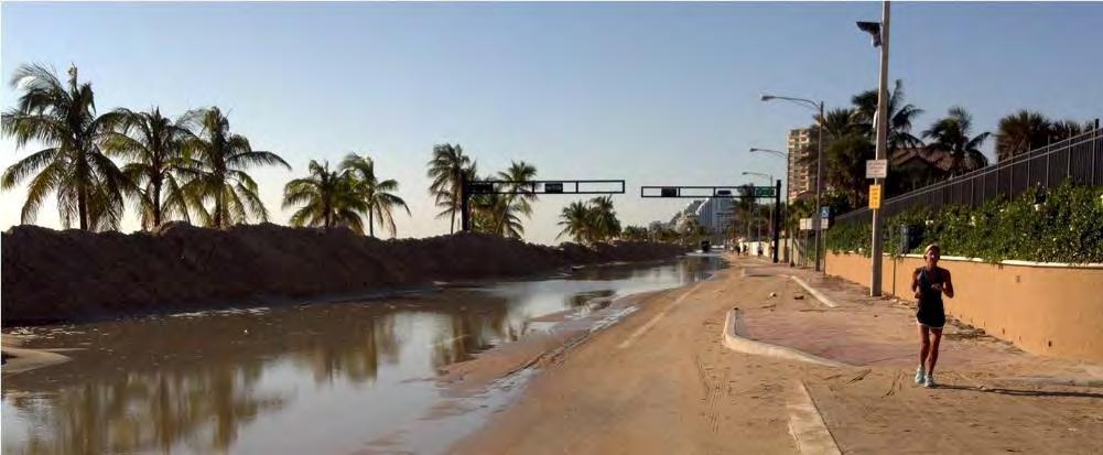
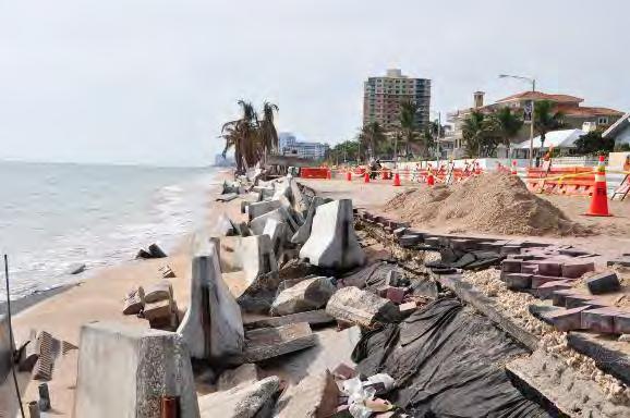
13 State Road A1A (Ft. Lauderdale)


14

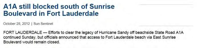
15 HURRICANE SANDY AFTERMATH

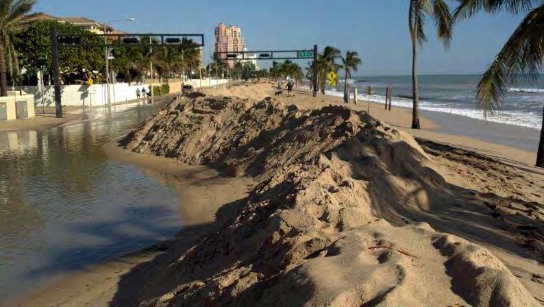
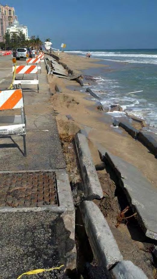
16 HURRICANE SANDY AFTERMATH
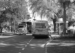
17 TYPICAL SECTION PRIOR TO HURRICANE SANDY
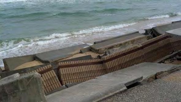
18
19 TYPICAL SECTION (EMERGENCY PROJECT)


20 SR A1A: EMERGENCY RECONSTRUCTION PROJECT Restored traffic flow with elimination of two through lanes Drive sheet pile & construct safety pile cap Repave roadway


21 SR A1A: EMERGENCY RECONSTRUCTION PROJECT Restripe for traffic, bicyclists, and parking


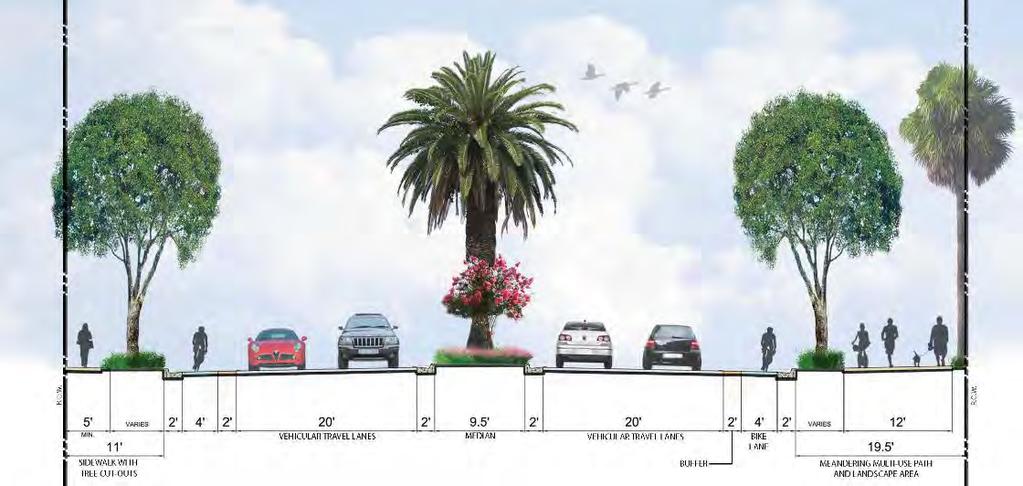
22 SR A1A: PROPOSED TYPICAL SECTIONS

23 PROPOSED PROJECT Raised roadway & new drainage system Bicycle lanes in both directions Beachfront promenade Paver sidewalk Decorative wall with accent lighting Pedestrian lighting Landscaping Two signalized pedestrian crosswalks Median islands and left turn lanes in the residential area
 encroachment Sea-turtle lighting Traffic Analysis Non-traditional peak hours (weekends & special events) Hurricane evacuation route Diversion to other routes (US-1 & Intracoastal Bridges)")
24 LANE ELIMINATION REQUEST KEY (AND UNIQUE) CONSIDERATIONS Implement Local Vision Promenade, decorative features & pedestrian lighting Coordination & Permitting with Resource Agencies Beach (species habitat) encroachment Sea-turtle lighting Traffic Analysis Non-traditional peak hours (weekends & special events) Hurricane evacuation route Diversion to other routes (US-1 & Intracoastal Bridges) Intersection turn-lane analyses
25
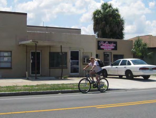
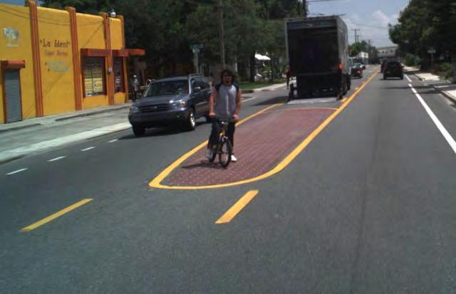
26 NEBRASKA AVENUE (SR 45) Urban Minor Arterial Roadway Located in a highly urbanized area of Tampa with both residential and commercial development High bus route ridership Nebraska Avenue was among the highest bicycle and pedestrian crash frequency corridors in FDOT District 7


27 BEFORE CONDITIONS 4-Lane Undivided Roadway Narrow Lane Widths 2006 AADT = 21,500 Design Speed = 45 mph Posted Speed = 35 mph Truck Traffic = 5% No Bike Lanes

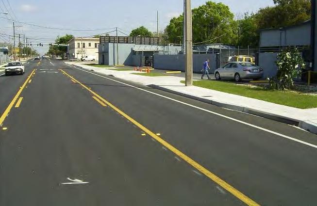
28 AFTER CONDITIONS 3-Lane Roadway Dual Left Turn Lane 2010 AADT = 15,800 Design Speed = 45 mph Posted Speed = 35 mph Truck Traffic = 3% Wider Travel Lanes Bike Lanes

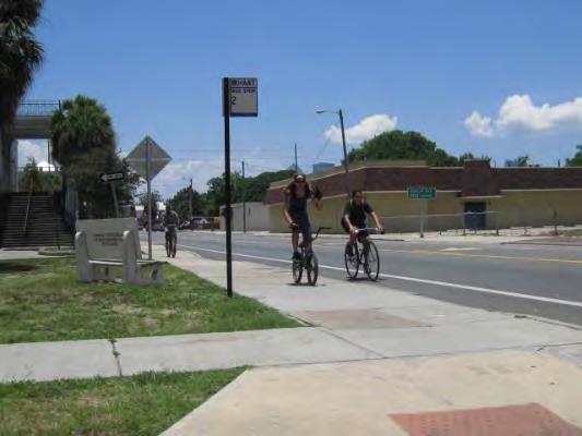
29 Bike Lanes
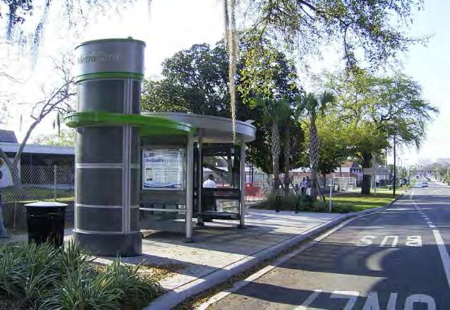
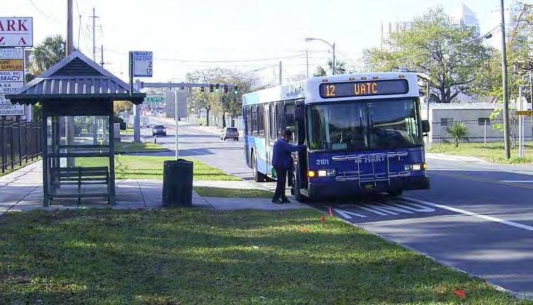
30 Bus Bays


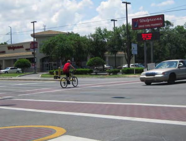
31 Traffic Signal & Pedestrian Signal Upgrades Midblock Crosswalk Updated ADA & Pedestrian Features
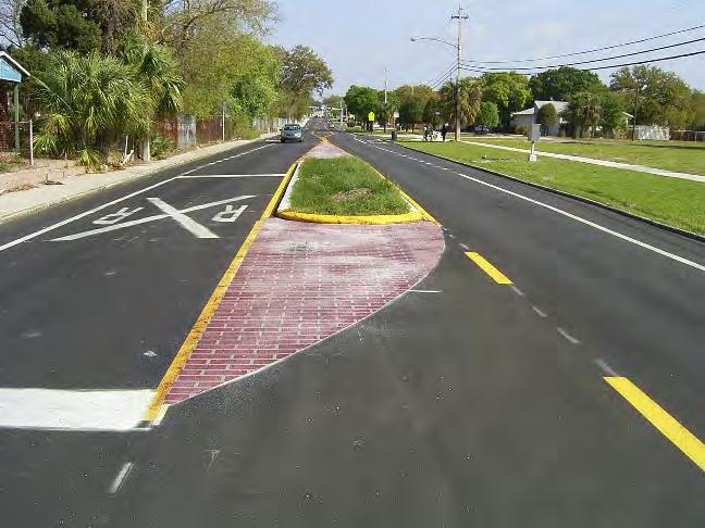
32 Drainage Improvements Median Improvements
33 SAFETY RESULTS SUMMARY The overall crash frequency, crash rates, and crash severity has decreased. The reduction in crashes has exceeded the expected results based on FHWA countermeasure data (FHWA Desktop Reference for Crash Reduction Factors) This corridor previously exhibited a crash rate 50% higher than the average crash rate for urban 4-lane undivided roadways. The current crash rate is less than the statewide crash rate for an urban 2-lane divided roadway.
34 SAFETY RESULTS SUMMARY Crash Rate: Decreased from 7.6 crashes per million vehicle miles traveled (MVMT) to 2.83 crashes per MVMT (less than the 4.18 crashes per MVMT statewide average for this roadway configuration) Reduction in the types of crashes most susceptible to severe injury (head-on, pedestrian, bicycle, and angle/left turn crashes). 61% reduction in fatal/incapacitating crashes per year. Pedestrian crashes: reduced from 7 crashes per year to 2.5 crashes per year. Bicycle crashes: reduced from 5.0 per year to 1.7 per year.
35 Lane Elimination Process Dana Knox, FDOT Central Office Kelly Blume, Kittelson & Associates Chon Wong, D4 Lane Elimination Coordinator SR A1A Project Scott Peterson, D4 FDOT Project Manager D4 In-House Design Section 3 D4 Drainage Office D4 Maintenance Office D4 Planning & Environmental Management City of Fort Lauderdale Nebraska Avenue Project FDOT District 7 Ronald Chin, District Design Engineer John Escobio, FDOT Project Manager Rochelle Garrett, FDOT Design G. Britton Hardy, Engineer of Record Megan Arasteh, Drainage Engineer Bijan Behzadi, Traffic Design City of Tampa Hillsborough Area Regional Transit (HART) Chamber of Commerce Local Community Groups Acknowledgements


36
Road Diets FDOT Process
 Florida Department of TRANSPORTATION Road Diets FDOT Process Humberto Castillero, PE, PTOE Roadway Design Office Purpose of Guide Develop a statewide lane elimination review process Balance state & local
122 Avenue: 107 Street to Fort Road
 : 107 Street to Fort Road November 24, 2015 4:30 8:00 p.m. Meeting Purpose Summarize project work completed to date Share results of public input from Phase 1 Share the draft concept plan and proposed
FLORIDA DEPARTMENT OF TRANSPORTATION DISTRICT 7 DISTRICT WIDE BICYCLE/PEDESTRIAN ACCESS TO TRANSIT SAFETY ASSESSMENT AND IMPROVEMENT PLAN
 FLORIDA DEPARTMENT OF TRANSPORTATION DISTRICT 7 DISTRICT WIDE BICYCLE/PEDESTRIAN ACCESS TO TRANSIT SAFETY ASSESSMENT AND IMPROVEMENT PLAN TRANSIT SAFETY ASSESSMENT SR 55/US 19 AT 80 TH AVE N DRAFT JUNE
Safety Emphasis Areas & Safety Project Development Florida Department of Transportation District Seven Tampa Bay
 Safety Emphasis Areas & Safety Project Development Florida Department of Transportation District Seven Tampa Bay Stephen L. Benson, AICP, CNU-A FDOT District Seven Safety Office Presentation Overview Safety
Completing the Vision
 Villas of Positano Completing the Vision North A1A Lane Reconfiguration N. Surf Rd. Redirection of Traffic Margaritaville Resort March 4, 2014 1 Completing The Vision Project Limits Hollywood Blvd. to
Pine Hills Road Pedestrian/Bicycle Safety Study Board of County Commissioners Work Session
 Pine Hills Road Pedestrian/Bicycle Safety Study Board of County Commissioners Work Session February 20, 2018 Meeting Agenda Study Overview Existing Conditions Access Management Potential Gateway Features
SR 693 (Pasadena Avenue) Corridor Study from Shore Drive South to 66 th Street
 Corridor Study from Shore Drive South to 66 th Street") Welcome and Introduction Sign-in and comment sheets Restrooms and exits Meeting agenda and timeline Meeting goals / expectations Provide input to guide study recommendations Actively participate throughout
Welcome and Introduction Sign-in and comment sheets Restrooms and exits Meeting agenda and timeline Meeting goals / expectations Provide input to guide study recommendations Actively participate throughout
Dr. M.L. King, Jr. Street North Complete Streets Resurfacing Opportunities HOUSING, LAND USE, AND TRANSPORTATION COMMITTEE MARCH 22, 2018
 Dr. M.L. King, Jr. Street North Complete Streets Resurfacing Opportunities HOUSING, LAND USE, AND TRANSPORTATION COMMITTEE MARCH 22, 2018 What s Happening The City plans to mill and resurface Dr. M.L.
CTDOT Pedestrian and Bicycle Safety Initiatives
 CTDOT Pedestrian and Bicycle Safety Initiatives 2017 Northeast Transportation Safety Conference Mark F. Carlino, P.E. Traffic Engineering Division Chief Bureau of Engineering and Construction Connecticut
APPENDIX A: Complete Streets Checklist DRAFT NOVEMBER 2016
 APPENDIX A: Complete Streets Checklist DRAFT NOVEMBER 2016 Complete Streets Checklist MetroPlan Orlando s Complete Streets Checklist is an internal planning tool for staff to further implementation of
C C C
 C-012-001 Thank you for your support for the creation of new public space and nonmotorized access between downtown and the waterfront through the Overlook Walk, the East-West Connections, and the Promenade.
CITY OF COCOA BEACH 2025 COMPREHENSIVE PLAN. Section VIII Mobility Element Goals, Objectives, and Policies
 CITY OF COCOA BEACH 2025 COMPREHENSIVE PLAN Section VIII Mobility Element Goals, Objectives, and Policies Adopted August 6, 2015 by Ordinance No. 1591 VIII MOBILITY ELEMENT Table of Contents Page Number
Proposed. City of Grand Junction Complete Streets Policy. Exhibit 10
 Proposed City of Grand Junction Complete Streets Policy Exhibit 10 1 City of Grand Junction Complete Streets Policy Vision: The Complete Streets Vision is to develop a safe, efficient, and reliable travel
BETHEL ROAD AND SEDGWICK ROAD CORRIDOR STUDY
 DRAFT PLAN City Council Meeting August 14, 2017 STUDY AREA Sedgwick Corridor State Route 160, principal arterial with Class 3 access management designation, commuter and freight route, connection to SR
Bay to Bay Boulevard Complete Streets Project
 Bay to Bay Boulevard Complete Streets Project Dale Mabry Highway to Bayshore Boulevard February 08, 2018 Photo Source: Tampa Bay Times Alessandra Da Pra Meeting Format Introduction Resurfacing Information
Hillsborough Pedestrian Safety Action Plan 2015 Update. Hillsborough MPO BPAC May 2015
 Hillsborough Pedestrian Safety Action Plan 2015 Update Hillsborough MPO BPAC May 2015 Presentation Overview Pedestrian Safety Action Plan (PSAP) Review Pedestrian Crash Trends Stakeholder Activities Engineering
Presentation Outline. Project/Study Purpose. Existing Conditions. Future Conditions. Understanding the Streetside. Similar Walkable Environments
 Presentation Outline Project/Study Purpose Study Area Map Existing Conditions Future Conditions Understanding the Streetside Similar Walkable Environments Conceptual Alternatives Magnolia/NE 1st Ave Block
Downtown Naples Mobility and Connectivity Study. Naples City Council Presentation January 2017
 Downtown Naples Mobility and Connectivity Study Naples City Council Presentation January 2017 Agenda 1. Introduction 2. Scope Review 3. Project Schedule 4. Existing Conditions 5. Public Charrette 6. Mobility
COMPLETE STREETS A STEP FORWARD ITE District 10/FSITE Annual Meeting November 3, 2015
 COMPLETE STREETS A STEP FORWARD 2015 ITE District 10/FSITE Annual Meeting November 3, 2015 About Lakeland Incorporated: 1885 Population: 100,728 Area: Approx. 75 sq. mi Major Employers: Publix, Lakeland
5. RUNNINGWAY GUIDELINES
 5. RUNNINGWAY GUIDELINES These guidelines should be considered collectively when making runningway decisions. A runningway is the linear component of the transit system that forms the right-of-way reserved
Chapter 5 DATA COLLECTION FOR TRANSPORTATION SAFETY STUDIES
 Chapter 5 DATA COLLECTION FOR TRANSPORTATION SAFETY STUDIES 5.1 PURPOSE (1) The purpose of the Traffic Safety Studies chapter is to provide guidance on the data collection requirements for conducting a
RESOLUTION NO ?? A RESOLUTION OF THE CITY OF NEPTUNE BEACH ADOPTING A COMPLETE STREETS POLICY
 RESOLUTION NO. 2018-?? A RESOLUTION OF THE CITY OF NEPTUNE BEACH ADOPTING A COMPLETE STREETS POLICY WHEREAS, safe, convenient, and accessible transportation for all users is a priority of the City of Neptune
MCTC 2018 RTP SCS and Madera County RIFP Multi-Modal Project Eval Criteria GV13.xlsx
 MCTC 8 RTP SCS and Madera County RIFP Multi-Modal Project Eval Criteria GV.xlsx Madera County Transportation Commission Regional Transportation Plan / Sustainable Communities Strategy Multi-Modal Project
10.0 CURB EXTENSIONS GUIDELINE
 10.0 CURB EXTENSIONS GUIDELINE Road Engineering Design Guidelines Version 1.0 March 2017 City of Toronto, Transportation Services City of Toronto Page 0 Background In early 2014, Transportation Services
Broward Complete Streets Advisory Committee (CSAC) Meeting. Monday, September 24, 2018
 Meeting. Monday, September 24, 2018") Broward Complete Streets Advisory Committee (CSAC) Meeting Monday, September 24, 2018 HOUSEKEEPING Please make sure you have signed in and have an agenda. This meeting is being recorded. Please introduce
Broward Complete Streets Advisory Committee (CSAC) Meeting Monday, September 24, 2018 HOUSEKEEPING Please make sure you have signed in and have an agenda. This meeting is being recorded. Please introduce
appendix b BLOS: Bicycle Level of Service B.1 Background B.2 Bicycle Level of Service Model Winston-Salem Urban Area
 appendix b BLOS: B.1 Background Winston-Salem Urban Area Bicycle Level of Service Level of Service (LOS) is a framework that transportation professionals use to describe existing conditions (or suitability)
STANLEY STREET December 19, 2017
 STANLEY STREET December 19, 2017 Welcome Mike Wiza, Mayor Scott Beduhn, Director of Public Works Agenda 1. Introduction 2. Existing Roadway Conditions 3. Current Alternative Improvements 4. Summary of
APPENDIX G: INTERSECTION NEEDS AT OKEECHOBEE BOULEVARD
 APPENDIX G: INTERSECTION NEEDS AT OKEECHOBEE BOULEVARD INTERSECTION NEEDS AT SR 7 and OKEECHOBEE BOULEVARD SR 7 Extension Project Development and Environment (PD&E) Study From Okeechobee Boulevard (SR
Overview. Illinois Bike Summit IDOT Complete Streets Policy Presentation. What is a Complete Street? And why build them? And why build them?
 Overview Illinois Bike Summit IDOT Complete Streets Policy Presentation Aren Kriks, P.E. District One Bicycle Coordinator and Bureau of Programming Project Engineer History of Complete Streets IDOT Policy
West Dimond Blvd Upgrade Jodhpur Street to Sand Lake Road
 West Dimond Blvd Jodhpur St to Sand Lake CSS Transportation Project Summary Municipality of Anchorage Project # 05 005 Project Manager: John Smith, P.E. (MOA PM&E) Project Administrator: Julie Makela,
Beach Cities Living Streets Design Manual and Aviation Boulevard Multimodal Corridor Plan
 Beach Cities Living Streets Design Manual and Aviation Boulevard Multimodal Corridor Plan AGENDA 1 Introductions & Project Scope 2 Public Outreach Recap 3 Living Streets Design Manual 4 Aviation Boulevard
Bicycle Master Plan Goals, Strategies, and Policies
 Bicycle Master Plan Goals, Strategies, and Policies Mobilizing 5 This chapter outlines the overarching goals, action statements, and action items Long Beach will take in order to achieve its vision of
Corridor Advisory Group and Task Force Meeting #10. July 27, 2011
 Corridor Advisory Group and Task Force Meeting #10 July 27, 2011 1 Agenda Recap CAG/TF #9 Public Meeting #2 Summary Single Mode Alternatives Evaluation Results Next Steps 2 3 CAG/TF #9 Recap CAG /TF #9
City of Gainesville Transportation/Roadway Needs PROJECT SUMMARY
 A1 Roadway Resurfacing $23,846,000 TYPE: Preservation of existing system Roadway resurfacing A2 Signal Replacement $6,000,000 TYPE: Preservation of existing system Replace traffic signals. B1 W 6th St
Public Information Meeting. Orange Camp Road. Dr. Martin Luther King Jr. Beltway to I-4. Presented by: Volusia County August 2, 2018
 Public Information Meeting Orange Camp Road Dr. Martin Luther King Jr. Beltway to I-4 Presented by: Volusia County August 2, 2018 1 Project Goals To improve the operations and safety for Orange Camp Road
Defining Purpose and Need
 Advanced Design Flexibility Pilot Workshop Session 4 Jack Broz, PE, HR Green May 5-6, 2010 Defining Purpose and Need In your agency s project development process, when do design engineers typically get
Application of a Complete Street
 Application of a Complete Street Southbend to Prima Vista Update May 14, 2018 Meeting Agenda Perspective and History Public input received Typical sections being considered Presentation of the 2-lane master
GOAL 2A: ESTABLISH AND MAINTAIN A SAFE, CONVENIENT, AND EFFICIENT MULTI-MODAL TRANSPORTATION SYSTEM TO MOVE PEOPLE AND GOODS THROUGHOUT THE CITY.
 2. TRANSPORTATION ELEMENT The purpose of this element is to assist in establishing an adequate transportation system within the City and to plan for future motorized and non-motorized traffic circulation
General Plan Circulation Element Update Scoping Meeting April 16, 2014 Santa Ana Senior Center, 424 W. 3rd Street, Santa Ana, CA 92701
 General Plan Circulation Element Update Scoping Meeting April 16, 2014 Santa Ana Senior Center, 424 W. 3rd Street, Santa Ana, CA 92701 Meeting Agenda 1. Purpose of Scoping Meeting 2. Project Overview 3.
Project Description Form 8AA
 Project Description Form 8AA Basic Project Information Submitting Jurisdiction/Agency: Fairfax County Project Title: Route 1 Widening: Mount Vernon Memorial Highway to Napper Road Project Location: US
MAG Town of Cave Creek Bike Study Task 6 Executive Summary and Regional Significance Report
 Page 1 MAG Town of Cave Creek Bike Study Task 6 Executive Summary and Regional Significance Report August 1, 2012 MAG Project #481 Page 2 Task 6 Executive Summary and Regional Significance Report Introduction
Florida Redevelopment Association 2015 Annual Conference
 Florida Redevelopment Association 2015 Annual Conference Reimagining State Arterials Jeff Costello, Delray Beach CRA Executive Director I-95 Fed. Hwy Pairs Two blocks west of Intracoastal Waterway One-way
Orange County s Transportation Planning and Multimodal Corridor Plan
 Orange County Transportation Planning Division Orange County s Transportation Planning and Multimodal Corridor Plan Presentation to UCF LIFE November 11, 2014 Alissa Barber Torres, Ph.D., AICP, PLS Presentation
Pine Hills Road Pedestrian/Bicycle Safety Study Community Meeting #1
 Pine Hills Road Pedestrian/Bicycle Safety Study Community Meeting #1 June 8, 2017 Meeting Agenda Study Overview Community Survey Existing Conditions Access Management Potential Safety Countermeasures Potential
DRAFT - CITY OF MEDFORD TRANSPORTATION SYSTEM PLAN Roadway Cross-Sections
 Roadway Cross-Sections Medford s roadway cross-section standards apply to new and reconstructed roads. The crosssections take into consideration roadway function and operational characteristics, including
RETREAT AGENDA ITEM MIDTOWN AREA TRANSPORTATION PLAN UPDATE
 October 17, 2017 RETREAT AGENDA ITEM MIDTOWN AREA TRANSPORTATION PLAN UPDATE STATEMENT OF ISSUE An update on the Midtown Area Transportation Plan will be provided including a discussion of preliminary
Long Island Rail Road Expansion Project Floral Park to Hicksville
 Long Island Rail Road Expansion Project Floral Park to Hicksville Final Environmental Impact Statement Appendix 1-D Complete Streets Policy Checklist April 2017 0902ML PIN: Project Location: 18A-4 Floral
Thank you for this opportunity to discuss with you how we can work together to make our streets more complete.
 Thank you for this opportunity to discuss with you how we can work together to make our streets more complete. 1 2 3 Thank you for this opportunity to discuss with you how we can work together to make
Access Management in the Vicinity of Intersections
 Access Management in the Vicinity of Intersections FHWA-SA-10-002 Technical Summary Photo: Ralph Bentley (used with permission) 0 Access Management is: The design, implementation and management of entry
Roundabout Feasibility Memorandum
 Roundabout Feasibility Memorandum To From Gwen Pipkin Bill Howell Date June 18, 2013 Subject Roundabout Feasibility Study SR 29 PD&E Study From Oil Well Road to SR 82 Collier County, FL FPID 417540-1-22-01
Road Diets: Reconfiguring Streets for Multi-Modal Travel
 Road Diets: Reconfiguring Streets for Multi-Modal Travel Tom Grant, P.E., PTOE What is a Road Diet? Reconfiguration of travel lanes to benefit all roadway users (i.e., Complete Street) Reclaiming the space
Lincoln Avenue Road Diet Trial
 Lincoln Avenue Road Diet Trial Data Collection Report June 1, 2015 Department of Transportation Table of Contents I. Introduction...... 3 II. Data Collection Methodology & Results...... 5 A. Traffic Volume
APPENDIX 2 LAKESHORE ROAD TRANSPORTATION REVIEW STUDY EXECUTIVE SUMMARY
 APPENDIX 2 LAKESHORE ROAD TRANSPORTATION REVIEW STUDY EXECUTIVE SUMMARY Appendix 2 City of Mississauga Lakeshore Road FINAL REPORT Transportation Review Study December 2010 EXECUTIVE SUMMARY Study Purpose
North Shore Transportation Improvement Strategy
 North Shore Transportation Improvement Strategy Preliminary, Near-term Recommendation 2016 April Transportation Improvement Strategy (TIS) Comprehensive and Analytical A multi-modal transportation strategy
Maywood Town Hall Meeting. May 4, 2016
 Maywood Town Hall Meeting May 4, 2016 1 AGENDA Overall I-290 Study Background Maywood Advisory Working Group (AWG) findings to date Noise Wall Update Next Steps 2 Questions? Study team members also available
Basalt Creek Transportation Refinement Plan Recommendations
 Basalt Creek Transportation Refinement Plan Recommendations Introduction The Basalt Creek transportation planning effort analyzed future transportation conditions and evaluated alternative strategies for
City of Jacksonville Mobility Fee Update
 City of Jacksonville Mobility Fee Update 2017 Preliminary Analysis May 3, 2017 Carnival Cruise lines photo credit Presentation Overview Public Outreach Process Pedestrian and Bicycle Master Plan Study
TPA Committee Meetings May 2018
 TPA Committee Meetings May 2018 Purpose Develop a comprehensive plan to identify multimodal improvements for all users of the roadway and evaluate the potential for a premium express bus service Overview
Exhibit 1 PLANNING COMMISSION AGENDA ITEM
 Exhibit 1 PLANNING COMMISSION AGENDA ITEM Project Name: Grand Junction Circulation Plan Grand Junction Complete Streets Policy Applicant: City of Grand Junction Representative: David Thornton Address:
Lawrence Avenue Streetscape Concepts August 30, 2011
 Lawrence Avenue Streetscape Concepts August 30, 2011 Neighborhood Context Phase II: River to Western Ave. Phase I: Western Ave. to Clark St. Key Map Lawrence Ave. Existing Streetscape Conditions East of
Complete Streets Initiative Update
 Complete Streets Initiative Update UrbanAdvantage Council Transportation and Environment Committee April 23, 2012 Presentation Purpose Update the Council Committee on community workshops results and preliminary
Route 7 Corridor Study
 Route 7 Corridor Study Executive Summary Study Area The following report analyzes a segment of the Virginia State Route 7 corridor. The corridor study area, spanning over 5 miles in length, is a multi
Frequently Asked Questions
 Frequently Asked Questions Business US 190 in Copperas Cove From Avenue D to Constitution Drive What is access management? A. Access Management is a growing effort by government agencies to improve how
INDOT Complete Streets Guideline & Policy
 INDOT Complete Streets Guideline & Policy INTRODUCTION The Complete Streets guidelines build upon multiple efforts and promote a multimodal transportation system that is integrated and sustains land use
BOARD OF COUNTY COMMISSIONERS AGENDA ITEM SUMMARY
 7B BOARD OF COUNTY COMMISSIONERS AGENDA ITEM SUMMARY PLACEMENT: REQUESTS AND PRESENTATIONS PRESET: TITLE: FLORIDA DEPARTMENT OF TRANSPORTATION (FDOT) PRESENTATION RECONSTRUCTION OF SR-76 (SW KANNER HIGHWAY)
54 th Avenue North Complete Streets Concept Plan
 54 th Avenue North Complete Streets Concept Plan June 2018 TABLE OF CONTENTS Introduction and Purpose...1 Existing Conditions...5 Stakeholder and Public Outreach...15 Preferred Options West Segment...19
Access Management Regulations and Standards
 Access Management Regulations and Standards Efficient highway operation Reasonable property access Concept of Access Management The way to manage access to land development while simultaneously preserving
FM 1092/Murphy Road Access Management Study Pulic Meeting #1. Wednesday, August 31, :00 p.m. 8:00 p.m.
 FM 1092/Murphy Road Access Management Study Pulic Meeting #1 Wednesday, August 31, 2011 6:00 p.m. 8:00 p.m. Introductions Agency Partners H-GAC Missouri City TxDOT Introductions Consulting Team In Association
Transportation Planning Division
 Transportation Planning Division Presentation Outline Study Tasks Recap of Previous Meeting Stakeholder Interviews Data Collection Design Principles Tool Box Recommendations Schedule Moving Forward North
Crash Data Analysis for Converting 4-lane Roadway to 5-lane Roadway in Urban Areas
 Crash Data Analysis for Converting 4-lane Roadway to 5-lane Roadway in Urban Areas Xiaoduan Sun, University of Louisiana at Lafayette Nicholas P. Fruge, LADOTD District 3 Subasish Das, University of Louisiana
Complete Street Analysis of a Road Diet: Orange Grove Boulevard, Pasadena, CA
 Complete Street Analysis of a Road Diet: Orange Grove Boulevard, Pasadena, CA Aaron Elias, Bill Cisco Abstract As part of evaluating the feasibility of a road diet on Orange Grove Boulevard in Pasadena,
SR/CR A1A PEDESTRIAN SAFETY & MOBILITY STUDY RIVER TO SEA TRANSPORTATION PLANNING ORGANIZATION
 SR/CR A1A PEDESTRIAN SAFETY & MOBILITY STUDY RIVER TO SEA TRANSPORTATION PLANNING ORGANIZATION 2016 Florida Section ITE Annual Summer Meeting June 24, 2016 Today s Presenters Lois Bollenback Executive
Access Management Regulations and Standards
 Access Management Regulations and Standards January 2014 Efficient highway operation Reasonable property access Concept of Access Management The way to manage access to land development while preserving
FDOT Bicycle/Pedestrian Focused Initiative & Complete Streets
 Florida Department of TRANSPORTATION FDOT Bicycle/Pedestrian Focused Initiative & Complete Streets Billy L. Hattaway, PE District One Secretary Secretary s Pedestrian Safety Initiative Dangerous by Design
Public Involvement Kickoff Meeting. April 29, 2015
 Public Involvement Kickoff Meeting April 29, 2015 Title VI Compliance The Florida Department of Transportation complies with various non-discrimination laws and regulations, including Title VI of the Civil
Project Goal and Description. Why Broadway? Broadway SFMTA.COM/BROADWAY. The goal of the Broadway Safety Improvement
 PROJECT OVERVIEW Project Goal and Description The goal of the Broadway Safety Improvement d St Van Ness Ave Project is to improve safety and comfort for all who Franklin St Hyde St Octavia St Gough St
GARLAND ROAD/GASTON AVENUE/ GRAND AVENUE INTERSECTION IMPROVEMENT STUDY
 MEETING OF AFFECTED PROPERTY OWNERS AND STAKEHOLDERS GARLAND ROAD/GASTON AVENUE/ GRAND AVENUE INTERSECTION IMPROVEMENT STUDY CSJ 0009-02-067 Meeting Agenda 1 2 3 4 5 6 7 8 9 10 Opening Remarks State Representative
Effects of Traffic Signal Retiming on Safety. Peter J. Yauch, P.E., PTOE Program Manager, TSM&O Albeck Gerken, Inc.
 Effects of Traffic Signal Retiming on Safety Peter J. Yauch, P.E., PTOE Program Manager, TSM&O Albeck Gerken, Inc. Introduction It has long been recognized that traffic signal timing can have an impact
Pedestrian, Bicycle and Traffic Calming Strategic Implementation Plan. January 18, 2011
 Pedestrian, Bicycle and Traffic Calming Strategic Implementation Plan January 18, 2011 Tonight s Agenda Receive update on project Provide feedback on two policy issues Complete Streets Policy Project Prioritization
LTAP Fact Sheet. Abuzz word among transportation professionals. Kansas. Smarter, Safer Roadways: Road Diets for Rural Communities.
 Spring 2009 Kansas LTAP Fact Sheet A Service of Kansas University Transportation Center for Road, Street & Bridge Agencies Smarter, Safer Roadways: Road Diets for Rural Communities By Mehrdad Givechi,
2. TRANSPORTATION ELEMENT.
 2. TRANSPORTATION ELEMENT. The purpose of this element is to assist in establishing an adequate transportation system within the City and to plan for future motorized and non-motorized traffic circulation
FEDERAL HIGHWAY ADMINISTRATION APPLICATION
 FEDERAL HIGHWAY ADMINISTRATION APPLICATION REQUEST FOR PERMISSION TO EXPERIMENT WITH A BICYCLE BOX INTERSECTION TREATMENT Submitted by: City of Columbus Department of Public Service Date: June 26, 2009
Complete Streets Workshop Follow-up. April 27, 2011 Rockledge City Hall
 Complete Streets Workshop Follow-up April 27, 2011 Rockledge City Hall Agenda Complete Streets draft briefing presentation and sample policy language Share your Complete Streets projects and post workshop
TRANSPORTATION NEEDS ASSESSMENT
 TRANSPORTATION NEEDS ASSESSMENT A travel demand analysis was carried out to determine the operational issues and the potential benefit that adding traffic capacity would have on the road network. All the
Project Description Form 8EE
 Project Description Form 8EE Basic Project Information Submitting Jurisdiction/Agency: Town of Dumfries Project Title: Route 1 (Fraley Blvd) Widening: Brady's Hill Road to Dumfries Road Project Location:
Performance Criteria for 2035 Long Range Transportation Plan
 Minimizing Impacts on Natural, Historic, Cultural or Archeological Resources 2035 LRTP Weighting Factor: 7% Objective 1.1: Use appropriate planning and design criteria to protect and enhance the built
Emerging Methods for Evaluating Transportation Systems Multimodal LOS and Highway Safety Manual
 Emerging Methods for Evaluating Transportation Systems Multimodal LOS and Highway Safety Manual November 8, 2012 Lake Merritt Tower in Oakland Transportation Education Series 1 Presenters Mark Bowman,
Regional Trails Corridor Assessment
 Regional Trails Corridor Assessment Project Goals Complete the regional trails network in the River to Sea TPO Planning Area and advance the Florida Greenways and Trails System Plan by developing/finalizing
Living Streets Policy
 Living Streets Policy Introduction Living streets balance the needs of motorists, bicyclists, pedestrians and transit riders in ways that promote safety and convenience, enhance community identity, create
Financial Project ID No(s).: and ETDM No(s).: and 14181
.: and ETDM No(s).: and 14181") Palm Beach Metropolitan Planning Organization (MPO) Presentation I-95 at Boynton Beach Boulevard Interchange and I-95 at Gateway Boulevard Interchange Project Development and Environment Study Palm Beach
Palm Beach Metropolitan Planning Organization (MPO) Presentation I-95 at Boynton Beach Boulevard Interchange and I-95 at Gateway Boulevard Interchange Project Development and Environment Study Palm Beach
Lee s Summit Road Improvement Study Public Open House June 7, 2007 Summary of Comment Card Responses
 Lee s Summit Road Improvement Study Public Open House June 7, 2007 Summary of Comment Card Responses Introduction At the Lee s Summit Road Improvement Study Public Open House held Thursday, June 7, 2007
Planning Study SR 976. Project Advisory Team Meeting May 24, 2017
 ` SR 976 BIRD ROAD/SW 40TH STREET FROM SR 821/HEFT TO SR 5/US-1 Miami-Dade County, Florida FPID No.: 434845-4-22-01 Planning Study Project Advisory Team Meeting May 24, 2017 1 Agenda Introductions Project
Complete Streets for Louisiana
 Complete Streets for Louisiana Louisiana Transportation Conference 2011 Ellen W. Soll, AICP Planner Burk-Kleinpeter, Inc esoll@bkiusa.com 504.486.5901 x143 What is a Complete Street? What are Complete
What Is a Complete Street?
 Session 5 Charleen Zimmer, AICP, Zan Associates May 5-7, 2010 What Is a Complete Street? May 2010 5-1 Not a Complete Street More of a Complete Street May 2010 5-2 Benefits of Complete Streets Safety for
CITY OF FRANKLIN, TENNESSEE. Columbia Avenue. Widening & Improvements Project. Public Meeting May 16, 2017
 CITY OF FRANKLIN, TENNESSEE Columbia Avenue Widening & Improvements Project Public Meeting May 16, 2017 Agenda 6:00 6:30 Formal Presentation 6:30 8:00 Town Hall Forum City of Franklin Columbia Avenue Alternatives
Solana Beach Comprehensive Active Transportation Strategy (CATS)
") Solana Beach Comprehensive Active Transportation Strategy (CATS) 3.0 Goals & Policies The Solana Beach CATS goals and objectives outlined below were largely drawn from the Solana Beach Circulation Element
Solana Beach Comprehensive Active Transportation Strategy (CATS) 3.0 Goals & Policies The Solana Beach CATS goals and objectives outlined below were largely drawn from the Solana Beach Circulation Element
Southcote Road Improvements Class Environmental Assessment Study
 1 Southcote Road Improvements Class Environmental Assessment Study Public Information Centre #1 May 24, 2018 Study Area 2 3 Welcome The Ancaster Transportation Master Plan (2011) outlined a long range
Raymond Avenue: Rightsizing Improved Safety and Pedestrian Experience
 Page 1 of 5 Work With Us Free Newsletter Stay Connected Home About Services Training Projects Placemaking Blog Resources Reference Store Great Public Spaces Image Collection Raymond Avenue: Rightsizing
PEDESTRIAN ACTION PLAN
 ATTACHMENT 2 CITY OF SANTA MONICA PEDESTRIAN ACTION PLAN CITY OF SANTA MONICA PEDESTRIAN ACTION PLAN This page intentionally left blank EXECUTIVE SUMMARY CHAPTER 1 EXECUTIVE SUMMARY Setting the Stage
INTERSECTION CONTROL NOVEMBER 2018
 INTERSECTION CONTROL NOVEMBER 2018 ICE OVERVIEW AGENDA Why ICE? When ICE is Required? Applicability and Process 2 AVAILABLE RESOURCES http://www.fdot.gov/traffic/trafficservices/intersection_operations.shtm