Photo: Salt Lake City. Bikeway Design. Photo: Salt Lake City
|
|
|
- Doris Brooks
- 5 years ago
- Views:
Transcription


1 Photo: Salt Lake City Bikeway Design Photo: Salt Lake City
2
3 Bicyclist Characteristics The purpose of this section is to provide facility designers with an understanding of how bicyclists operate and how their bicycles influence that operation. Bicyclists are much more affected by poor facility design, construction activities, and maintenance issues than motor vehicle drivers. They also lack the protection from the elements and roadway hazards provided by an automobile s physical design and safety features. By understanding the unique characteristics and needs of bicyclists, designers can provide high-quality facilities and minimize risk to the people who use them. Figure 1: Dimensions of an average adult bicyclist Preferred Operating Width 5' Operating Height 8'4" Eye Height 5' Handlebar Height 3'8 Physical Width 2'6" Minimum Operating Width 4' Bicycle as a Design Vehicle Like motor vehicles, bicyclists and their bicycles come in a variety of sizes and configurations. Variations occur in the types of bicycle vehicle (such as a conventional bicycle, recumbent bicycle, or a tricycle) and behavioral characteristics (such as the comfort level of the bicyclist). Bikeway designs should consider reasonably expected bicycle types and types of bicyclists, and utilize the appropriate dimensions. For example, high comfort bicycle facilities such as neighborhood byways (see definition on page 8) and multi-use paths are likely to attract families biking with cargo or trail-a-bikes. Figure 1 shows the operating space and physical dimensions of a normal adult bicyclist, which are the basis for typical facility design. Bicyclists require clear space to safely operate within a facility. Bicyclists prefer five feet or more operating width, although four feet is minimally acceptable (typically for short constrained segments). Many other commonly used pedal-driven cycles and accessories should be considered during bikeway design. The most common types include cargo bikes, tandem bicycles, recumbent bicycles, and trailer accessories. Figure 2 provides typical dimensions for these bicycle types. Larger bike types may travel more slowly because of the extra weight of cargo/children, and have a greater operating width. Primary design considerations for larger bikes include compatibility with constrained bikeway or other roadway elements (e.g., median crossing islands, signal timing, turning radius, and a larger bike parking footprint. Figure 2: Typical Bicycle and Rider Dimensions 6' 8' 7' 3'6" 2'8" 3'9" Adapted from: AASHTO Guide for the Development of Bicycle Facilities, 4th Edition 3

 5' Physical Length 6' Physical Height of Handlebars Operating Height 3'8\" 8'4\" Eye Height 5' Vertical Clearance to Obstructions (tunnel height,")
 Approximate Verticle Center of Gravity Recumbent Bicyclist 10' 2'9\" - 3'4\" Physical Length 7' Eye Height 2'6\" Tandem Bicyclist Physical Length 8'")
4 Design Speed Expectations The expected speed that different types of bicyclists maintain under various conditions also influences bikeway design, particularly for multi-use paths. Table 1: Typical Dimensions Bicycle Type Upright Adult Bicyclist Physical Width Typical Dimensions 2'6" Operating Width (Minimum) 4' Operating Width (Preferred) 5' Physical Length 6' Physical Height of Handlebars Operating Height 3'8" 8'4" Eye Height 5' Vertical Clearance to Obstructions (tunnel height, lighting, etc.) Approximate Verticle Center of Gravity Recumbent Bicyclist 10' 2'9" - 3'4" Physical Length 7' Eye Height 2'6" Tandem Bicyclist Physical Length 8' Bicyclist with Child Trailer Physical Length 10' Physical Width 2'6" * Tandem bicycles and bicyclists with trailers have typical speeds equal to or less than upright adult bicyclists * Values in this table relate only to the operating characteristics of bicyclists, NOT to facility design 4
5 Types of Bicyclists It is important to consider bicyclists of all skill levels when creating bikeways or bicycle programs. Bicyclist skill level greatly influences expected speeds and behavior, both in separated bikeways and on shared roadways. Several bicyclist classification frameworks have been developed over the years including the most conventional, which classifies cyclists as Advanced, Basic, and Child. Figure 3: Cyclist Classifications The AASHTO Guide for the Development of Bicycle Facilities classifies cyclists as either experienced/confident or casual/less confident. A more detailed understanding of the U.S. population as a whole is illustrated in Figure 3, which was originally developed by planners in Portland, OR. These figures are supported by data collected nationally since 2005 and were updated in to reflect a national perspective. This classification system provides the following categories to address varying attitudes towards bicycling in the U.S. 7% 5% 51% Strong and Fearless (approximately 7% of population) This segment of the population will typically ride anywhere regardless of roadway conditions or weather. These people ride faster than other user types, prefer direct routes, and typically choose roadway connections even if shared with vehicles over separate bicycle facilities such as shared-use paths. Enthused and Confident (approximately 5% of population) This user group encompasses the intermediate bicyclists who are fairly comfortable riding on all types of bikeways but usually choose low traffic streets or shared-use paths when available. These bicyclists may deviate from a more direct route in favor of a preferred facility type. This group includes all kinds of bicyclists including commuters, recreationalists, racers, and utilitarian bicyclists. Interested but Concerned (approximately 51% of population) This user type makes up the bulk of the potential cycling population and represents people who typically only ride a bicycle on low traffic streets or shared-use paths under favorable conditions and weather. These people perceive significant barriers to cycling, specifically traffic and other safety issues. However, they may become Enthused & Confident with encouragement, education, and experience. 37% No Way, No How (approximately 37% of population) People in this category do not ride bicycles and perceive severe safety issues with riding in traffic. Some of them may eventually give cycling a second look, and may progress to the user types above. A significant portion of these people will not ride a bicycle under any circumstances. Education and experience help less confident bicyclists more comfortably and safely share the roadway with vehicular traffic, however there will likely always be a large proportion of bicyclists (or would-be bicyclists) that prefer to ride separated from motor vehicles or on shared streets with low motor vehicle speeds and volumes. Bicycle infrastructure should be planned and designed to accommodate as many user types as possible. This may require multiple facility types within a community or along parallel routes to provide a comfortable experience for the greatest number of people. 1 Webinar, Part II: Four Types of Cyclists: A National Look, J Dill


6 Design Standards and Guidelines The following manuals provide more detailed information on bicycle facility and roadway design than is provided in this document, and should be referenced early in the design process. National Association of City Transportation Officials NACTO 2014 NACTO is comprised of the transportation departments of many major and mid-sized US cities. NACTO members collaborated to create a shared best practice called the Urban Bikeway Design Guide, first published in This is an alternative to other available design guides and contains more guidance on innovative bikeway designs than any other source. Guidelines found in the Urban Bikeway Design Guide sometimes provide additional bikeway design options than those found in the AASHTO guide (described below), although they are mostly in agreement. It may be viewed or downloaded for free at: American Association of State Highway and Transportation Officials AASHTO 2012 AASHTO is a nonprofit, nonpartisan body representing state transportation departments. AASHTO s Guide for the Development of Bicycle Facilities is a widely used bikeway planning and design tool. It is used by UDOT as the agency s official bikeway design guidebook. This guidebook was last published in It does not contain guidance on some bicycle facility types and treatments that are widely in use by transportation agencies such as protected bike lanes. A revision that will include the latest in bicycle facility design and contextual guidance is in process and anticipated to be published in The 2012 version is available for purchase at: Manual on Uniform Traffic Control Devices (MUTCD) FHWA 2009 Including Revision 1 dated May 2012 and Revision 2 dated May 2012 The MUTCD defines the standards used by road managers nationwide to install and maintain traffic control devices on all public streets, highways, and bikeways. The MUTCD was last published by the Federal Highway Administration (FHWA) in Its main contributions to bikeway design are provision of signage and striping standards. The MUTCD is available for free download at: 6


7 Separated Bike Lane Planning and Design Guide Federal Highway Administration SEPARATED BIKE LANE PLANNING AND DESIGN GUIDE FHWA 2015 This guide is the first federal-level guide for planning considerations and design options for protected bike lanes. In addition to guidance, it also includes case studies that highlight best practices and lessons learned. The guide is available for free download at: bikelane_pdg/page00.cfm MAY 2015 ACHIEVING MULTIMODAL NETWORKS APPLYING DESIGN FLEXIBILITY & REDUCING CONFLICTS Achieving Multimodal Networks: Applying Design Flexibility and Reducing Conflicts FHWA 2016 This publication highlights ways that planners and designers can apply the design flexibility found in current national design guidance (e.g., AASHTO Greenbook) to address common roadway design challenges and barriers. It focuses on reducing multimodal conflicts and achieving connected networks so that walking and bicycling are safe, comfortable, and attractive options for people of all ages and abilities. The guide is available for free download at: pedestrian/publications/multimodal_networks/ AUGUST 2016 Incorporating On-Road Bicycle Networks into Resurfacing Projects FHWA 2016 Incorporating On-Road Bicycle Networks into Resurfacing Projects MARCH Installing bicycle facilities during roadway resurfacing projects is an efficient and costeffective way for communities to create connected networks of bicycle facilities. This workbook provides recommendations for how roadway agencies can integrate bicycle facilities into their resurfacing program. The workbook also provides methods for fitting bicycle facilities onto existing roadways, cost considerations, and case studies. The workbook does not present detailed design guidance, but highlights existing guidance, justifications, and best practices for providing bikeways during resurfacing projects. The guide is available for free download at: pedestrian/publications/resurfacing/


8 The following sections describe bikeway types by their operational characteristics, degree of separation from motor vehicle traffic, and maintenance needs. Multi-Use Paths Multi-use paths are typically located in rights-of-way separate from roadways, or adjacent to high-speed roads with very few roadway crossings of the path. They are preferred by less experienced cyclists because of their separation from traffic. More experienced cyclists may avoid them if pedestrians and slower cyclists are present. Snow removal and sweeping of these paths may require specialized equipment. Additionally, tree roots growing under the pavement may require periodic maintenance to preserve a comfortably smooth pathway surface. 8

9 Neighborhood Byways Neighborhood byways (also referred to as bicycle boulevards or neighborhood greenways) are low-speed, low-volume shared roadways that create a high comfort bicycling environment. Traffic calming or diversion treatments are sometimes used to promote speed and volume reductions but they are not required. Shared lane markings and wayfinding signs are often used to help the user navigate the route and raise awareness that bicyclists are present. Neighborhood byways also feature enhanced treatments at arterial/collector street intersections to provide safe and convenient crossings. Maintenance requirements are generally low because cars shared the same space and assist with sweeping of debris from the travel path, although traffic calming elements would add some upkeep needs if they are installed 9

10 Protected Bike Lanes (also known as Cycle Tracks) This bikeway type combines the user experience of a separated path with the on-street infrastructure of bike lanes. They may be one-way or two-way, level with the travel lane or raised above the level of the adjacent travel lane. Separation from traffic can be achieved with vertical separation or physical elements such as a lane of parallel parking, planters, curbing, or flexposts. Protected bike lanes have added design considerations at driveways, transit stops, and intersections (especially for two-way protected bike lanes) to manage conflicts with turning vehicles and crossing pedestrians. Protected bike lanes may require bicycle-specific signals or phasing. Colored pavement or other visual treatments may be used to enhance visibility and raise awareness of the bike lane. Sidewalk Furniture/ Landscape Buffer Bike Lane Street Buffer Street 1-Way Sidewalk Level 1-Way Curb Separated 1-Way Object Separated 10
. The buffer is demarcated with two longitudinal strips and diagonal pavement (i.e., gore) striping.")
11 Buffered Bike Lanes Buffered Bike Lanes provide a greater sense of comfort for bicyclists than conventional bike lanes by way of a lateral painted buffer between the bike lane and either the travel lane or parked cars (or both). The buffer is demarcated with two longitudinal strips and diagonal pavement (i.e., gore) striping. A raised profile stripe or rumble strip may also deter motor vehicles from encroaching into the bike lane while being more compatible with snow plows, but would make access to and from the buffered lanes more difficult for bicyclists. Maintenance considerations are similar to regular bike lanes except that buffered lanes have more striping that needs to be refreshed. 11

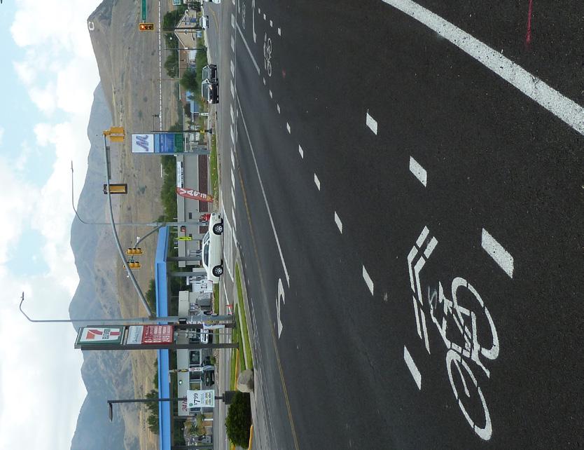
12 Conventional Bike Lanes This bikeway type uses signage and striping to allocate dedicated roadway space to bicyclists. Bike lanes encourage predictable movements by bicyclists and motorists. Care must be taken to properly design bike lanes to meet or exceed minimum standards, particularly for operating space, and to properly restrict cars from parking in them. Substandard bike lanes are often worse than no bikeway at all, as such facilities will attract few cyclists, may be perceived as a waste of public funds, and could be hazardous. It is also important that bike lane treatments be carried up to and through intersections (see intersection treatments on page 16) to provide continuity and guidance for bicyclists where the potential for conflicts is highest. Where bike lanes must end due to space constrictions or must transition to another facility type, advance warning and/or wayfinding signage for an alternative route should be provided to instruct bicyclists how to proceed. Bike lanes generally need to be swept periodically to keep debris from accumulating in them, especially if they are located adjacent to a curb 12

 contra-flow lanes can be installed on higher volume/speed streets.")
13 Conventional Bike Lane Variations Where the application of conventional bike lanes is not possible or feasible due to space limitations, traffic patterns or other reasons, the following bike lane variations can be used to provide bicycle connectivity. These bike lane variations have the same or similar maintenance considerations as conventional bike lanes. Contra flow lanes are bike lanes designed to allow bicyclists to travel in two directions on a one-way street, typically on lower volume, lower speed streets, for short distances such as a block or two. Contra flow lanes can be used to transition to or from an existing bikeway or to close a gap in the bicycle network. With added protections between the bike lane and motor vehicle lane (e.g., protected bike lane) contra-flow lanes can be installed on higher volume/speed streets. Left side bike lanes are useful on one-way streets or two-way median-divided streets when there are conflicts on the right side of a roadway that make providing a bicycle lane challenging or unsafe, such as heavy right turn volumes, freight loading activity, high turnover parking, or transit facilities. 13


14 Conventional Bike Lane Variations Climbing Lanes are bike lanes in the uphill direction in segments where providing a bike lane in both directions is not feasible due to space constraints, or desirable given grade, presence of parking, or a large number of driveways. Climbing lanes allow slower-moving, uphill bicyclists to have designated lane space where speed differentials are greatest. Advisory bike lanes are a bikeway type used to provide bicycle and motor vehicle connectivity on roadways with low motor vehicle volumes and speeds that are not wide enough to provide bike lanes and two standard motor vehicle lanes. These can be an alternative to shared lane markings, but are operationally different in that bicyclists maintain their pathway and motor vehicles are expected to yield to bicyclists. This treatment currently has experimental status under the MUTCD. 14


15 Shoulder Bikeway Shoulder bikeways may exist in rural or urban areas. Curb and gutter is typically not present in rural areas. Urban areas usually do have curb and gutter, and parked cars may also be present. Where 4-foot or wider paved shoulders exist (5-foot or wider where curb is present, not including gutter or rumble strip width), it is acceptable or even desirable to mark them as bike lanes in various circumstances, such as to provide continuity between other bikeways. If paved shoulders are marked as bike lanes, they need to also be designed as bike lanes at intersections. Maintenance needs are similar to that of bike lanes. Shared Roadways On this type of bikeway, bicyclists and cars operate within the same travel lane, either side-by-side or in single file depending on the roadway configuration, outside lane width, and presence (or absence) of shoulder space. The most basic type of bikeway is a signed shared roadway. This facility provides continuity to other bikeway types (usually bike lanes) or is used to designate preferred routes through high-demand corridors where higher level bikeways (e.g. bike lane or protected bike lane) do not exist. Shared Lane Markings may be used to give further indication to drivers and bicyclists that they are sharing roadway space and to encourage bicyclists to properly position themselves laterally. Shared roadways are generally considered comfortable for less confident cyclists if vehicle speeds and volumes are low (e.g., neighborhood byways). Shared roadways require relatively low maintenance because cars help to sweep debris toward the far right of the roadway and gutter. Maintenance is primarily limited to period refreshment of shared lane markings and sign replacement. 15
16 Bikeway Traffic Stress Continuum The continuum shown below illustrates the varying degrees of comfort people can generally expect when riding a bicycle on each bikeway type. The greater the separation/protection and lower the traffic volume and speed, the higher the level of comfort bicyclists experience. People with less bicycling experience will generally prefer higher-comfort route types 4. Multi-use pathways have the highest degree of separation of any bikeway type. Multi-Use Path Neighborhood Byway Protected Bike Lane MOST Comfortable Buffered Bike Lane Bike Lane Shoulder Bikeway Shared Roadway LEAST Comfortable 4 Maaza C. Mekuri, Ph.D., P.E., P.T.O.E., Peter G. Furth, Ph.D., and Hilary Nixon, Ph.D. Low-Stress Bicycling Network Connectivity. (MTI Report 11-19, 2012) 16
17 Intersection and Crossing Treatments In concert with the installation of bikeways, it is essential to make provisions for bicyclists to safely and comfortably cross busy streets and navigate intersections. In fact, the residents of Salt Lake County identified provision of safe crossings of busy streets as the number one priority for developing a high comfort bicycle network 2. The appropriate engineering treatment will depend on the bikeway type, the classification and characteristics of the crossing street, and the geometry of the intersection. Design treatments should minimize conflicts, indicate an intuitive path of travel, and provide good visibility and indication of safe positioning and queuing for bicyclists. Treatments can range from easy-to-implement tools like pavement markings, colored pavement, and signage to more capital-intensive infrastructure like medians, signal detection, signal timing, and separate signal phases. Protected bike lanes require a higher level of design considerations at intersections. For more information and design guidance on all these treatments refer to the design guidance referenced on pages 5 and 6. Treatments to Help Bicyclists Continue on Bike Lane Through Intersections A through bike lane indicates the path of travel of bicyclists when there is a bike lane and dedicated right-turn lane. Bicyclists and motorists must cross paths for the bicyclist to be positioned between the right-turn lane and through lane. Extreme caution must be taken in transitioning the bike lane when the outside travel lane becomes a trap lane for vehicles turning right (see the FHWA Separated Bike Lane Design Guidance or the NACTO Urban Bikeway Design Guide for design guidance). A combined bike lane/turn lane is used to designate space for bicyclists within a turn lane when there is insufficient space to provide standard width lanes. This treatment correctly positions bicyclists to reduce conflicts with right-turning vehicles. Establishing a bike lane within a combined turn lane is not approved by FHWA, however this treatment has been used by cities around the country. An alternative treatment installed previously in Salt Lake County is the use of shared lane markings within the turn lane. 2 Input received during Active Transportation Implementation Plan regional outreach meetings held in Spring of
18 A bike box is a designated area at the head of a traffic lane at a signalized intersection that provides bicyclists with a safe and visible way to get ahead of queuing traffic during the red signal phase. Two-stage turn queue boxes designate space in an intersection for bicyclists to make a left turn in two stages. This left turn method eliminates the need for bicyclists to weave across through traffic lanes to reach a left turn pocket. Queue boxes are especially helpful for less experienced cyclists on multilane, high-speed roadways.this treatment has experimental status for intersections with more than 3 legs under the MUTCD. Intersection crossing markings are used to indicate the intended path of bicyclists through an intersection or crossing. Markings may consist of dotted lines, shared lane markings, or skipped green lane indicating the bicycle path of travel. Dotted Line Extensions Dotted Line Extenstions Shared Lane Markings Shared Lane Markings Colored Conflict Area Colored Conflict Area* Elephant's Feet Elephant s Feet* * Not included in the MUTCD 18


19 A protected Intersection maintains physical separation for bicyclists through the intersection by means of median barriers, corner islands, and in some cases, protected signal phasing. This treatment increases bicyclist comfort by eliminating merging movements that are typical of conventional bikeway intersection design. Bicycle Signal On-road bicyclists typically use the same traffic signals as motor vehicles. At intersections where bicyclists cannot see vehicle signal faces or where bicyclists have a separate directional movement, phase, or interval, designers should consider use of a bicycle signal that may improve safety by reducing confusion and conflict with motor vehicles. A bicycle signal is more suitable than directing bicyclists to use the pedestrian signal as it can be timed for bicyclist speeds, increasing the time a bicyclist my legally enter the roadway. The AASHTO Bike Guide provides guidance on signal timing for bicyclists. Signal Detection Bicycle detection at signals reduces delay for bicycle travel and discourages red light running by bicyclists. The preferred method for bicycle detection is with passive detection (e.g., in-pavement loops, video, microwave, radar, etc). Push buttons may be used where other means of detection are not feasible. If push buttons are used, they should be easy to access by bicyclists without dismounting (e.g., curbside buttons or curb ramps to access sidewalk). Proper bicycle detection meets two primary criteria: 1) accurately and consistently detects bicyclists; and 2) provides clear guidance to bicyclists on how to actuate detection (e.g., what button to push, where to stand). 19

 islands provide dedicated protected space for bicyclists and pedestrians.")

 are a type of active warning beacon that use an irregular flash pattern similar to emergency flashers on police vehicles and can be installed on two- to")
20 Treatments to Help Bicyclists Cross Busy Streets Bicyclists traveling on multi-use paths, neighborhood byways, or bike lanes may encounter unsignalized intersections with streets where motor vehicle speeds and volumes are high or there are multiple vehicle lanes to cross. These intersections can be barriers to all types of bicyclists, and particularly the less confident cyclist. In order to develop a high comfort bicycle network that attracts a wide range of cyclists, it is important to design these crossings so that less confident bicyclists can comfortably and confidently cross the street. Below are typical treatments that can be used. Median refuge (crossing) islands provide dedicated protected space for bicyclists and pedestrians. They facilitate safe crossings by enabling bicyclists and pedestrians to cross the roadway in two stages. Median crossing islands are a FHWA Proven Safety Countermeasure and have demonstrated a 46-percent reduction in pedestrian crashes. They can be extended through the intersection, restricting through traffic, as an access management strategy. Rectangular Rapid Flash Beacons (RRFBs) are a type of active warning beacon that use an irregular flash pattern similar to emergency flashers on police vehicles and can be installed on two- to five-lane roadways. RRFBs should be used where existing motor vehicle gaps are inadequate. Generally, this treatment should be used with caution at crossings with more than one lane of traffic in a given direction so as not to promote situations where a motorist in one lane stops but a motorist in the adjacent lane does not. Beacons can be actuated either manually by a push button or passively through detection. Advanced Yield Markings and Signage placed 20 to 50 feet ahead of the crosswalk can greatly reduce the likelihood of a multiple-threat crash on multi-lane roadways by encouraging motorists to stop far enough back so a crossing pedestrian can see if a second motor vehicle in the other lane is not stopping and be able to take evasive action. Studies have found that this treatment can be particularly effective when combined with RRFBs or medians. Traffic Signals can help people riding bicycles safely and comfortably cross the street where gaps in motor vehicle traffic are infrequent. Existing and projected crossing demand should be used to determine if a location meets warrants. FHWA s Achieving Multimodal Networks (described on page 6) document provides details on methods for applying warrants and where design flexibility exists in the MUTCD. 20


21 Salt Lake City Pedestrian Hybrid Beacon (HAWK) Hybrid beacons are used to improve non-motorized mid-block crossings of major streets in locations where crossing demand does not support installation of a conventional traffic signal or a decision is made to not install a signal. Hybrid beacons were developed specifically to enhance pedestrian crossings of major streets. However, several cities have installed modified hybrid beacons that explicitly incorporate bicycle movements. Incorporating a bike signal with a hybrid beacon requires experimental approval from FHWA. The hybrid beacon can significantly improve the operations of a bicycle route, particularly along neighborhood byways. Because of the low traffic volumes on these facilities, intersections with major roadways are often unsignalized, creating difficult and potentially unsafe crossing conditions for bicyclists. Salt Lake City TOUCAN Traffic Signals provide safe and comfortable crossings for pedestrians and bicyclists and are typically placed at locations of heavy bicycle and pedestrian crossing activity such as where neighborhood byways cross major streets. TOUCANs can be activated through passive detection or by using push buttons. Bicyclists use a bicycle signal and a center-oriented crossing while pedestrians get a standard WALK indication and have a separate, adjacent crosswalk. The system uses a standard signal for motorists on the major street being crossed. Clearance time depends on who activates the signal (i.e., pedestrians get longer time to cross the street, bicyclists shorter time). Integral to a TOUCAN is the restriction of through motor vehicle movements: vehicles on the minor street are forced to turn right. Salt Lake City has installed several TOUCAN signals along its 600 East neighborhood byway. Offset Intersections The typical off-set intersection consists of a neighborhood and arterial street in which the neighborhood street approaches do not align. This offset may range from 50 to several hundred feet in Salt Lake County. Where the motor vehicle volumes and speeds of intersecting streets are low, wayfinding signage may be all that is needed. Where a neighborhood street intersects a high speed/volume arterial roadway with an offset, providing safe, comfortable, and direct bicycle routing may be achieved by installing a crossing (of the arterial) at one of the approaching side streets (based on guidance in this and other documents) and directing bicyclists from the other approach street to the crossing on a widened sidewalk, multi-use path, or protected bike lane. Where feasible and desirable, the crossing treatment on the arterial street may incorporate a median that restricts left-in and left-out movements at the intersection, thus reducing traffic volumes on the neighborhood street and potential conflicts at the crossing. Such traffic calming measures could be considered under circumstances such as: Request from neighborhood residents to reduce traffic volume on their streets Desire of the city or county to provide safe and comfortable bicycle route on a neighborhood street Reports of crashes or near-miss at the off-set intersection Presence of a nearby alternate route for vehicles to make the prohibited left-in and left-out movements or u-turn 21

22 Seasonal Maintenance Routine and seasonal maintenance of bikeways is important for ensuring year-round safe use. Bike lanes require periodic sweeping because debris tends to accumulate at the edge of roadways where bike lanes are typically located. Additional seasonal maintenance may be needed in the fall when leaves are falling and in the winter when snow accumulates. Snow removal should ideally be done on the same schedule as arterial/primary vehicular routes. Primary bikeway routes for prioritized snow clearance should be identified as it may not be feasible to clear all bicycle facilities immediately after a snow event. Priority should be given to bikeways that provide access to schools, business districts, major employers, major transit centers, and other important destinations. The primary bikeways should be publicized (e.g, on websites, through social media) so that residents are aware of their mobility options after a snow event. In order to provide good winter maintenance of bicycle facilities in the County, the following practices should be followed: 1. Snow removal requires a commitment by multiple agencies to address increased workload, budget, and coordination. Key agencies include the primary agency responsible for snow removal (usually the Public Works Department) and the department or office responsible for bicycle facility design and construction. Additional budget may need to be allocated for snow removal on bike facilities. 2. Snow removal on bikeways is best conducted by the same agency responsible for snow removal of the roads. Agency staff should identify primary bikeways, conduct post-snow checks, and develop of levels of service targets. The County can assist in identifying priority regional routes. 3. Suggested level of service commitments are as follows: a. Snow is removed within 24 hours or less of the end of the storm on primary bikeways. b. Plows clear to bare pavement. c. A minimum width of three feet clear is maintained on the bikeways. d. Sand, salt, and debris are cleared in early spring. 4. Suggested procedures for snow removal are as follows: a. Plows make multiple passes per snow event (more than for vehicle travel lanes) in order to: i. Minimize ice and re-freezing which can cause serious injury to cyclists. ii. Ensure that property owners and/or plows don t push snow back onto the bikeway. b. Bikeways are pre-salted. 3 c. All snow (travel lane and bikeway) is pushed to downside of grade to minimize re-freezing. d. Snow is removed as needed to maintain the level of service. 5. Standard snow plow equipment may be used for conventional and buffered bike lanes. The most costeffective vehicle for plowing wide protected bike lanes is a narrow pickup truck, which can clear facilities down to 8 wide and travel between locations. Multiple other vehicle options exist, whether owned by the city or contractors. Guidance on plowing of narrower protected bike lanes can be found in the next section. 3 Salt is less effective on bikeways since car tires enhance effectiveness, but is still used. Toronto is experimenting with a trailer to follow the salt machine to work the salt into the ground, similar to how a car does so. 22

 require specialized (smaller) maintenance equipment.")
23 Maintenance Practices for Protected Bike Lanes Protected bike lanes are more likely to accumulate debris in all seasons because car tires do not help to sweep them and because the physical barriers can limit nominal clearance that would otherwise be achieved by precipitation and wind. Bicyclists may have limited opportunities to avoid obstacles such as debris, obstructions, slippery surfaces, and pavement damage because they are confined by physical barriers. Protected bike lanes often can t be swept or plowed in the same manner as other vehicular lanes and may (depending on facility width) require specialized (smaller) maintenance equipment. Additional considerations for winter maintenance include plowing schedules, snow storage, and de-icing. Salt Lake City prioritizes snow removal on protected bike lanes. This practice enables year-round use and is an example of a maintenance best practice. Plowed snow must be stored offsite so as not to impede bikes and protected bike lanes must be de-iced because they will not receive the same level of wear as vehicular travel lanes. 23


. Conformance with standard bikeway designs allows users to anticipate whether they would feel comfortable riding on a particular bikeway and plan their trips accordingly.")
24 Bikeway Selection This section presents a method for selecting particular bikeway types and intersection treatments for given contexts. There are no absolute rules for determining the most appropriate type of bicycle facility for a particular location. Roadway speeds, volumes, right-of-way width, presence of parking, adjacent land uses, and expected bicycle user types are all critical elements of this decision. Studies find that the most significant factors influencing bicycle use are motor vehicle traffic volumes and speeds. Additionally, most people prefer high comfort facilities separated from motor vehicle traffic (e.g., multi-use paths, protected bike lanes) or located on local roads with low motor vehicle traffic speeds and volumes (e.g., neighborhood byways). Conformance with standard bikeway designs allows users to anticipate whether they would feel comfortable riding on a particular bikeway and plan their trips accordingly. A process consisting of the following four steps can help determine the appropriate bikeway type and intersection/crossing treatment to provide: Identify Design User Consider Traffic Speed and Volume Select a Bikeway Type Select Intersection/Crossing Treatment Identify Design User One of the most important factors to consider during bikeway design is the type of person the facility is meant to attract. User preferences vary by bicyclist skill level, trip purpose, and individual characteristics. As the level of separation increases, a facility becomes more attractive to a wider range of bicycle users, thereby making bicycling a more viable and preferred transportation mode. During the planning phase of a particular bikeway, the expected user group should be determined based on factors such as land use (e.g. proximity to schools, parks, and commercial areas), connections to transit, and agency goals. 24
25 Consider Traffic Speed and Volume Bicyclists comfort levels decrease proportionally with increases in motor vehicle volumes and a widening differential between the speed of bicycles and the speed of adjacent traffic. As a result, both traffic volume and traffic speed are important considerations when choosing an appropriate bikeway type for a given location. In general, as both volume and speed increase, so does the need for greater separation of the bikeway from traffic in order to appeal to a wider cross-section of people. Wider bikeways (i.e., more than the standard five feet) also help to mitigate the effects of volume and speed, albeit to a lesser extent than increasing facility separation with painted buffers or physical barriers. Figure 4 combines both speed and volume into a single chart to help identify an appropriate treatment a for a given roadway assuming the interested but concerned design user. Research, including a survey conducted by Salt Lake County, indicates that providing less protection/separation on roads with higher speeds and volumes will result in fewer people choosing to use a bicycle on those roads. Bicycle Figure Facility 4: High Comfort Bicycle Facility Selection Chart Chart vehicles per day 20k 18k 16k 14k 12k 10k Multi-use path, Protected bike lane or Buffered bike lane* Bike lane* Buffered bike lane Protected bike lane Urban and Suburban Roadways VOLUME 8k 6k 4k 2k 0 0 Bike lane Buffered bike lane Neighborhood byway/ Shared lane SPEED miles per hour * Facility not likely to attract a broad spectrum of users given vehicle speed and volumes. Chart is based on Level of Traffic Stress (Mekuria, Furth, Nixon, 2012 and empirical behavioral research on cyclist route choice (Lowry, Furth, Hadden-Loh, 2016 and results from 25

26 Select A Bikeway Type This step begins with a determination of whether the preferred bikeway type resulting from Step 2 can be accommodated within the right-of-way, which may entail reallocating existing space and considering the budget. If it can, the bikeway selection process is over. If a determination is made that it cannot be accommodated within the right-of-way and budgetary constraints, then other options should be explored to serve the design user. Options may include selecting a parallel yet proximate route, managing motor vehicle speeds so that a bicycle facility with less separation can be installed while still maintaining a relatively high level of comfort, or diverting traffic to prioritized motor vehicle routes. A critical consideration in selecting a bikeway type is return on investment. A conventional bike lane may be easy to implement, but may not attract much use. A buffered bike lane or protected bike lane may be more difficult to implement (e.g., require parking removal, lane reduction, etc.), but if designed properly, it will attract a higher ridership and contribute to a viable multimodal transportation system that serves the wider population. Options for retrofitting bikeways on existing roads are presented in later sections. Select Appropriate Intersection/ Crossing Treatment Maintaining bicycle facility level of comfort at street crossings and intersections is critical to providing a consistent and continuous user experience and attracting less confident bicyclists. While best available research is focused on operational safety, the guidance provided in Table 2 also considers comfort (i.e., perceived safety). This guidance provides rules of thumb that are to be considered during the planning phase. More detailed analysis may be required to determine the most appropriate crossing treatment. Even though it will be ideal to provide high comfort crossing treatments like hybrid beacons and traffic signals at all bikeway crossings that meet the guidance provided in the table, it may be cost prohibitive to do so as there is likely to be many roadways that Where available road space allows, always exceed minimum recommended bikeway dimensions and provide necessary protection. For detailed design guidance, consult the AASHTO Guide for the Development of Bicycle Facilities and the NACTO Urban Bikeway Design Guide. meet the criteria. Hence, for practical purposes, the high comfort crossing treatments may be prioritized on bikeway networks that provide regional connection or high potential for increasing bicycle mode share by connecting destinations such as shopping districts, major institutions/employers, and transit stations. Table 2: High Comfort Intersection Crossing Treatment Selection Guide ADT <3000 >3,000-9,000 >9,000-12,000 >12,000-15,000 >15,000 # of Lanes to to to to mph mph mph mph mph No crossing treatment needed* 2 Median Crossing Island/Median crossing island should be installed on any roadway with 3 lanes or more 3 RRFB/Where RRFB is recommended, roadways with 3 or more lanes should include crossing island 4 Pedestrian Hybrid Beacon OR Pedestrian Traffic Signal/Where Ped Hybrid Beacon OR Ped Signal is recommended, roadway with 3 or more lanes should include crossing island 5 Pedestrian Hybrid Beacon 6 Pedestrian Traffic Signal. The decision of whether to install a hybrid beacon or traffic signal is location specific and volume warrants should be considered. Notes: *Bicycle crossing markings should be installed in combination with all treatments. High visibility crossing warning signs assumed at all unsignalized crossings. RRFB may not be appropriate in locations where there is a combination of high traffic volumes and high ped/bike volumes, or on some multi-lane roads. On roadways where speeds exceed 40 MPH, efforts should be made to lower speeds before installing an unsignalized at-grade crossing. Grade separation may be appropriate in locations where vehicle speeds and volumes are high, there are multiple lanes in each direction, and the installation of a traffic signal or high comfort intersection treatments are infeasible. However, the bridge or underpass must conveniently accessed and designed for people of all ages and abilities in order to maximize compliance and safety. 26


27 Retrofitting Existing Streets to Add Bikeways This section presents the various ways in which bikeways may be retrofitted to existing streets. Different methods may be used to reallocate space from parking or travel lanes to bikeways, or create new space by widening. The following retrofit methods are presented here: Lane Narrowing Lane Reconfiguration Parking Reduction Roadway Widening Reducing vehicle speeds through physical changes to the roadway is a critical component of the creation of high comfort bikeways. Studies show that most people will drive at a speed that feels safe based on the physical conditions presented to them. Reallocating existing roadway space through lane narrowing and lane reconfiguration is an effective way to lower vehicle speeds, which boosts safety and comfort for bicyclists and pedestrians and lowers the frequency and severity of vehicle collisions. 5 Table 3 shows required space that needs to be reallocated to implement given bikeway types. The values include both sides of the road. Ranges are given to reflect variation between minimum and desired values. This section of the best practice shows typical ways of retrofitting roads to accommodate bicyclists. For more details on retrofit strategies refer to FHWA s guide Incorporating On-Road Bicycle Networks into Resurfacing Projects. Table 3: Roadway Space Reallocation Applicable Treatments Shoulder Bikeway Conventional Bike Lane Buffered Bike Lane Protected Bike Lane Total Width (Both Sides) That Must Be Reallocated Through Modifications 8-12' 10-12' 14-18' 14-20' More information about the most common retrofit methods is given on the following pages. Each method is couched in the assumption that space is being reallocated for a conventional bike lane. However, the retrofit methods can be used in the same manner to create space for buffered bike lanes and protected bike lanes (although more reallocated space would be needed for them). 5 Achieving Multimodal Networks: Applying Design Flexibility and Reducing Conflicts: Design Criteria and Lane Width, 2016, pedestrian/publications/multimodal_networks/part01.cfm#s1 27

28 AUGUST 2016 Roadway Widening Bike lanes can be accommodated on streets with excess right-of-way by adding new shoulders or widening existing shoulders. Although roadway widening incurs higher expenses compared with re-striping projects, bike lanes can be added to streets currently lacking curbs, gutters, and sidewalks without the high costs of major infrastructure reconstruction. Guidance Select bikeway type to implement. If the design user is the interested but concerned group, use Figure 4 on page 24 to determine the most appropriate bikeway facility for the corridor. Consult the NACTO and AASHTO guides for additional guidance for bikeway treatments for roads with and without curb and gutter. Considerations Drainage impacts of additional roadway widening should be taken into consideration. Safety of bicyclists should be considered in the widening of the street. Sight lines, side slopes and other features should be looked at carefully. See the AASHTO Bike Guide for additional guidance. ACHIEVING MULTIMODAL NETWORKS APPLYING DESIGN FLEXIBILITY & REDUCING CONFLICTS Part 1 of Achieving Multimodal Networks: Applying Design Flexibility and Reducing Conflicts discusses where flexibility exists in national guidance and standards (e.g., AASHTO Greenbook) related to lane widths and cites safety benefits of narrower vehicle travel lanes. 28
29 Lane Narrowing Lane narrowing provides the needed space for new bike lanes (or enhancing existing bike lanes) by converting extra roadway space that exceeds minimum lane width standards. Many motor vehicle travel lanes are wider than the minimum standards prescribed in local and national roadway design standards. Most standards allow for the use of 11-foot and sometimes 10-foot wide travel lanes. Existing roadways with wider lane widths are ideal candidates to create space for bike lanes, although truck volumes need to be considered as one of the factors when contemplating lane narrowing. The 2010 Highway Capacity Manual states that there is no operational difference between 10-foot and 12-foot travel lanes and research has shown that on roads with speeds less than 45 MPH, there are no safety benefits to lanes greater than 10 feet Roadway Before Narrowing Narrowing Motor Vehicle Lanes to increase Amenity Zone and add Bicycle Lanes Guidance Vehicle lane width: 8 Before: 12+ feet After: feet Considerations with more 10 than 6% heavy 10 Roadways 8 traffic or 7 vehicle major transit routes should maintain 11-foot travel lanes Receiving lanes at intersections with high turning movements should maintain 11-foot travel lanes 6 Potts, Ingrid B., Douglas W. Harwood, and Karen R. Richard. Relationship of Lane Width to Safety on Urban and Suburban Arterials. Transportation Research Record, Issue 2023 (2007): doi: /
30 Lane Reconfiguration The removal of a single vehicle travel lane generally provides sufficient space for bike lanes on both sides of a street. Streets with excess vehicle capacity provide opportunities for lane reconfiguration as bike lane retrofit projects. Although the figure below shows a situation where a four-lane roadway is reconfigured to a three-lane roadway with center-turn lane and bike lane, there may be several other situations where lane reconfiguration of existing roadways can result in addition of different types of bikeways. For example, existing roadways with a center turn lane may be eligible for installation of a bikeway if the continuous turn lane can be removed due to low left-turning volume and/or few driveway or side-street accesses. Other examples include five- to three-lane road conversions and unbalanced lane splits. Detailed benefits of lane reconfiguration can be found in the FHWA s Road Diet Information Guide. Typical 4-lane road with on-street parking Depending on a street s existing configuration, traffic operations, user needs, and safety concerns, various lane reduction opportunities exist. For instance, a fourlane street (with two travel lanes in each direction) could be modified to provide one travel lane in each direction, a center turn lane, and bike lanes. Prior to implementing lane reconfiguration measures, a traffic analysis should identify potential impacts. Three-lane road diet (with center two-way left-turn lane), with on-street parking and separated bicycle lane Guidance Vehicle Volumes As a rule of thumb that might inform a range of lane reconfigurations, a four-to three-lane reconfiguration is often feasible on roadways with average annual daily traffic volumes (AADT) of 20,000 or less depending on intersection spacing and operations. Lane reconfiguration may be feasible on roadways with AADT as high as 25,000 if alternate parallel streets are present within 0.5 miles and if signal spacing is 0.5 mile or greater. In some instances, a five-lane roadway may also be reconfigured to a three-lane roadway with bike lanes when the existing traffic volume can be accommodated in the reduced travel lanes without significant level of service impacts. Considerations Existing traffic signals would need to be modified to relocate signal heads and detections. Additionally, on streets with closely spaced signals, signal re-timing and coordination may be required to mitigate the impact on vehicle queues and delays. Some intersections may require exclusive right-turn lanes to accommodate high right-turn volume. In such situations, bike and travel lane width may be reduced to minimum widths to accommodate the right-turn lane, if feasible. Otherwise, existing curb may need to be relocated to accommodate the required turn lanes. Existing traffic signals should be re-evaluated to ensure that adequate capacity is provided to all movements and vehicular delay and queues are not excessive. 30


31 Parking Reduction Bike lanes can replace one or more on-street parking lanes on streets where excess parking exists or the importance of bike lanes outweighs parking needs. Eliminating or reducing on-street parking also improves sight distance for bicyclists in bike lanes and for motorists on approaching side streets and driveways. Removing or reducing onstreet parking to install bike lanes requires comprehensive outreach to the affected businesses and residents. Prior to reallocating onstreet parking for other uses, a parking study should be performed to gauge demand and to evaluate impacts to all users, including people with disabilities. Guidance Parking lane width: Parking lanes are typically 7- to 8-feet wide; therefore, removal of one parking lane typically does not yield enough space for installing standard width bicycle facilities on both sides of the street. Lane narrowing or reconfiguration may also be required to achieve high comfort bicycle facilities. Considerations In some circumstances, extensive public outreach will be required to remove existing on-street parking spaces. Initial endorsement of the project from local elected representatives and adjacent business owners would be ideal and should be sought in the initial phases of the project. Off-street parking should be considered when determining the impacts of parking removal. Fewer challenges may be present on roads where residences have parking in the form of driveways or alleys and commercial uses have off-street parking lots. Where parking is removed in commercial areas, include bicycle parking in excess of the number of on-street vehicular parking stalls removed as a means to encourage bicycling to adjacent businesses. 31

 Bicycle wayfinding signs also visually cue motorists that they are driving along a bikeway and should use caution.")

32 Bikeway Signing The ability to navigate is informed by landmarks, natural features, and other visual cues. Bikeway signage should indicate: Direction of travel Location of destinations Travel time/distance to those destinations Signage can serve the following purposes: Helping to familiarize users with the bicycle network Helping users identify the best routes to destinations Helping to address misperceptions about time and distance Helping overcome a barrier to entry for people who are not frequent bicyclists (e.g. interested but concerned bicyclists) Bicycle wayfinding signs also visually cue motorists that they are driving along a bikeway and should use caution. Signs are typically placed at key locations leading to and along bikeways, including intersections of multiple routes. Too many road signs tend to clutter the right-of-way, and it is recommended that these signs be posted at a level most visible to bicyclists rather than per vehicle signage standards. The AASHTO Bike Guide and MUTCD contain guidance about lateral and vertical sign placement considerations. May 2017 Active Transportation Implementation Plan: BICYCLE WAYFINDING PROTOCOL >>> The Salt Lake County Bicycle Wayfinding Protocol provides guidance on implementing a county-wide bicycle wayfinding system. It draws on national guidance and best practices while also addressing local objectives and conditions. It is available for download at Bike Parking Conveniently located and secure bike parking supports bicycle use for transportation as well as recreation, and can attract bicyclists to businesses. Bicycle parking may be provided in a variety of forms but should be based on the needs of the users. Short-term bike parking uses (under 2 hours), such as for a brief shopping stop, require highly visible, conveniently located parking spots near the entrances of buildings. It may consist of individual or multiple bike racks placed along the sidewalk or high capacity corrals placed within the street itself (e.g., where there is a parking lane). Longer-term bike parking, such as for residents of multi-unit buildings or employees, should offer security and shelter from the elements. Long-term parking may consist of racks, cages, or corrals placed in sheltered, off-street locations such as parking garages/lots, transit station entrances, or special purpose rooms. Access control is a valued feature for long-term term bike parking. Long-term bike parking should also accommodate a wide range of bicycle types, including cargo bikes. Bike racks should be easy to use, sturdy, and well-anchored. For more detailed design guidance on rack selection and installation see the Association of Pedestrian and Bicycle Professional s Essentials of Bike Parking. 32


.")
33 Bicycles on Narrow Canyon Roads Salt Lake County s many canyons are popular destinations for recreational bicyclists seeking exercise or scenic opportunities, despite canyon roads being difficult for motorists and bicyclists to comfortably share. Roads are generally narrow and curvy and widening may be difficult, costly, or undesirable for environmental or aesthetic reasons. Motorists complain that bicyclists do not ride single file, while bicyclists describe instances of cars passing too closely or being otherwise harassed. The following best practices which include both infrastructure and non-infrastructure solutions can help to address this issue: Where possible, widen the roadway and/or shoulder in the uphill direction to give drivers the ability to safely pass bicyclists. Additional space is less critical for bicyclists traveling in the downhill direction as their speeds will be higher and more similar to speeds (see page 13 for climbing lane guidance). In canyons with higher motor vehicle speeds (e.g. the Cottonwood Canyons), user-activated flashing warning signs can be installed at the canyon entrances to alert motorists of bicyclists on the road ahead. This treatment is less applicable for Emigration Canyon, where cyclists are ubiquitous and the flashers would remain on for long stretches of time. On canyon roads with more than 4 foot of shoulder, installing a bicycle-friendly rumble strip in the uphill direction may provide additional protection for bicyclists provided they are installed with bicyclists in mind. Rumble strips should be no greater than 1 foot wide and gaps should be provided at regular intervals to allow bicyclists to exit the shoulder. The fog line should be painted over the rumble strip to allow bicyclists full use of the shoulder. See advocacyadvance.org/docs/rumble_strips.pdf and safety.fhwa.dot.gov/roadway_dept/pavement/rumble_strips/ t504039/ for more design guidance. Work with bicycle clubs and teams to adopt a Single File is Safer ethic. An example of an existing program can be found at: UDOT and tourism-focused organizations may also be good partners for promoting the message. See Colorado s state bike laws for an example: com/tips.html. Install signs to highlight the expectation of bicyclists using the road (e.g. Bicycles on Road ) or to encourage specific behavior (e.g. minimum passing distance or instructions to ride single file). Signs alone are less effective than the other best practices mentioned above and should be supplementary to other treatments. 33
Off-road Trails. Guidance
 Off-road Trails Off-road trails are shared use paths located on an independent alignment that provide two-way travel for people walking, bicycling, and other non-motorized users. Trails specifically along
Active Transportation Facility Glossary
 Active Transportation Facility Glossary This document defines different active transportation facilities and suggests appropriate corridor types. Click on a facility type to jump to its definition. Bike
On Road Bikeways Part 1: Bicycle Lane Design
 On Road Bikeways Part 1: Bicycle Lane Design Presentation by: Nick Jackson Bill Schultheiss, P.E. September 04, 2012 FOLLOW THE CONVERSATION ON TWITTER Toole Design Group is live tweeting this webinar
Broad Street Bicycle Boulevard Design Guidelines
 Broad Street Bicycle Boulevard Design Guidelines Building from the strategies introduced in the 2013 Bicycle Transportation Plan and community input received thus far, City Transportation Staff have identified
Cycle Track Design Best Practices Cycle Track Sections
 Design Best Practices Sections It is along street segments where the separation and protection methods of cycle tracks offer more comfort than conventional bicycle lanes, and are more attractive to a wide
Bicycle Facilities Planning
 Bicycle Facilities Planning Overview Types of Cyclists Purpose for Riding Types of Facilities Bike Lanes Bicycle Boulevards Cycle Tracks Intersections Signals Signing and Marking Discussion Types of Bicyclists
General Design Factors
 Chapter 3: 3-1.0 Introduction General Design Factors Mn/DOT s goals include encouraging and accommodating safe bicycling. From a design perspective, these goals are achieved by first having an understanding
CURBSIDE ACTIVITY DESIGN
 5 CURBSIDE ACTIVITY DESIGN This chapter provides design guidance for separated bike lanes adjacent to curbside activities including parking, loading and bus stops. Typical configurations are presented
Toronto Complete Streets Guidelines
 88 90 5.1 Cycling Design Principles 92 5.2 Context-sensitive Cycling Facilities 96 5.3 Key Cycling Elements Cycling infrastructure provides choice in how people are able to move around the city. Cyclists
Appendix 3 Roadway and Bike/Ped Design Standards
 Appendix 3 Roadway and Bike/Ped Design Standards OTO Transportation Plan 2040 4/20/2017 Page A3-1 Adopted Standards The adopted OTO Design Standards and Major Thoroughfare Plan are contained herein.
Bicycle Boulevards and Neighborhood Greenways
 Bicycle Boulevards and Neighborhood Greenways Traffic Safety is Improving for Everyone 90 80 70 60 50 40 30 20 10 0 PORTLAND: TOTAL TRAFFIC FATALITIES 1986-2008 1986 1987 1988 1989 1990 1991 1992 1993
APPENDIX A: Complete Streets Checklist DRAFT NOVEMBER 2016
 APPENDIX A: Complete Streets Checklist DRAFT NOVEMBER 2016 Complete Streets Checklist MetroPlan Orlando s Complete Streets Checklist is an internal planning tool for staff to further implementation of
REGIONAL BICYCLE AND PEDESTRIAN DESIGN GUIDELINES
 REGIONAL BICYCLE AND PEDESTRIAN DESIGN GUIDELINES November 16, 2011 Deb Humphreys North Central Texas Council of Governments Bicycle and Pedestrian Advisory Committee Snapshot of the Guide 1. Introduction
DRAFT Montgomery County Bicycle Master Plan Design Toolkit
 DRAFT Montgomery County Bicycle Master Plan Design Toolkit Fall 2016 Sidepaths Sidepaths are shared use paths located parallel to and within the road right-of-way providing twoway travel for walking, bicycling,
Proposed. City of Grand Junction Complete Streets Policy. Exhibit 10
 Proposed City of Grand Junction Complete Streets Policy Exhibit 10 1 City of Grand Junction Complete Streets Policy Vision: The Complete Streets Vision is to develop a safe, efficient, and reliable travel
Planning Guidance in the 2012 AASHTO Bike Guide
 Planning Guidance in the 2012 AASHTO Bike Guide Presentation by: RJ Eldridge Peter Lagerwey August 22, 2012 WEBINAR 2: PLANNING GUIDANCE IN THE 2012 AASHTO BIKE GUIDE Today s Webinar Significant Updates
Appendix C. TRAFFIC CALMING PROGRAM TOOLBOX
 Appendix C. TRAFFIC CALMING PROGRAM TOOLBOX PHASE I...2 Do Not Enter Sign...3 One-Way Sign...4 Turn Prohibition...5 Pavement Markings...6 Speed Monitoring Trailer...7 Neighborhood Speed Watch...8 Police
2.0 LANE WIDTHS GUIDELINE
 2.0 LANE WIDTHS GUIDELINE Road Engineering Design Guidelines Version 2.0.1 May 2018 City of Toronto, Transportation Services City of Toronto Page 0 Background In early 2014, Transportation Services initiated
Appendix C. City of Fort Collins Recommended Bicycle Design Guidelines. Appendix C: Recommended Bicycle Design Guidelines 1
 Appendix C City of Fort Collins Recommended Bicycle Design Guidelines Appendix C: Recommended Bicycle Design Guidelines 1 This appendix provides general design considerations for implementation of bicycle
2018 AASHTO BIKE GUIDE
 2018 AASHTO BIKE GUIDE Your presenters Jessica Fields, PE Denver Office Director Sagar Onta, PE, PTOE Denver Engineering Director 35 years of combined experience street design, transportation planning,
City of Vallejo Traffic Calming Toolbox
 City of Vallejo Traffic Calming Toolbox June 1, 2013 Final Table of Contents Introduction... 1 Non-Physical Devices... 3 High-Visibility Crosswalk... 3 In Pavement Lighted Crosswalk... 4 Rapid Flashing
FHWA Bikeway Selection Guide
 FHWA Bikeway Selection Guide Tamara Redmon Federal Highway Administration Bill Schultheiss Toole Design Lauren Blackburn VHB March 26, 2019 PBIC Webinar pedbikeinfo.org @pedbikeinfo Housekeeping Problems
Guidance. ATTACHMENT F: Draft Additional Pages for Bicycle Facility Design Toolkit Separated Bike Lanes: Two-Way to One-Way Transitions
 ATTACHMENT F: Draft Additional Pages for Bicycle Facility Design Toolkit Separated Bike Lanes: Two-Way to One-Way Transitions This treatment provides a transition from two-way separated bike lanes to one-way
MEMORANDUM. Date: 9/13/2016. Citywide Crosswalk Policy
 MEMORANDUM Date: 9/13/2016 Re: Citywide Crosswalk Policy Foreword Through the s Circulation Element and Complete Streets Policy, it is the City s goal to promote walking trips and provide safe facilities
APPENDIX D LEVEL OF TRAFFIC STRESS METHODOLOGY
 APPENDIX D LEVEL OF TRAFFIC STRESS METHODOLOGY 01 WHAT IS LEVEL OF TRAFFIC STRESS? When people bicycle on roadways, they encounter varying levels of stress from traffic. A quiet residential street with
Chapter 2: Standards for Access, Non-Motorized, and Transit
 Standards for Access, Non-Motorized, and Transit Chapter 2: Standards for Access, Non-Motorized, and Transit The Washtenaw County Access Management Plan was developed based on the analysis of existing
Bike Planning: A New Day
 Bike Planning: A New Day Josh Sikich, AICP, LEED AP Chicago Office Director Alta Planning + Design 312-265-0628 joshuasikich@altaplanning.com cities of all sizes are changing Illinois Bike Summit October
Appendix A: Crosswalk Policy
 Appendix A: Crosswalk Policy Appendix A: Crosswalk Policy Introduction This citywide Crosswalk Policy is aimed at improving pedestrian safety and enhancing pedestrian mobility by providing a framework
10.0 CURB EXTENSIONS GUIDELINE
 10.0 CURB EXTENSIONS GUIDELINE Road Engineering Design Guidelines Version 1.0 March 2017 City of Toronto, Transportation Services City of Toronto Page 0 Background In early 2014, Transportation Services
Who is Toole Design Group?
 2018 AASHTO Bike Guide Status Update NCHRP 15 60 Amalia Leighton Cody, PE, AICP & Kenneth Loen, PE Washington APWA October 4, 2018 Who is Toole Design Group? TDG is a full service engineering, planning
Multimodal Through Corridors and Placemaking Corridors
 68 Multimodal Through Corridors and Placemaking Corridors Corridors have different functions in a region. Some corridors are used to get smoothly and rapidly through a region or to get quickly to major
TRAFFIC CALMING GUIDE FOR TORONTO CITY OF TORONTO TRANSPORTATION SERVICES DIVISION
 TRAFFIC CALMING GUIDE FOR TORONTO CITY OF TORONTO TRANSPORTATION SERVICES DIVISION CITY OF TORONTO TRANSPORTATION SERVICES DIVISION 2016 TRAFFIC CALMING GUIDE FOR TORONTO TABLE OF CONTENTS Introduction
On-Street Bicycle Facilities
 On-Street Bicycle Facilities A. General 12B-3 Design Manual Chapter 12 - Sidewalks and Bicycle Facilities 12B - Bicycle Facilities Cyclists have similar access and mobility needs as other transportation
2018 AASHTO BIKE GUIDE
 2018 AASHTO BIKE GUIDE Your presenter Rob Burchfield, PE NW Regional Engineering Director 35 years of experience in traffic engineering and bicycle facility design Toole Design Group Toole Design Group
TOWN OF PORTLAND, CONNECTICUT COMPLETE STREETS POLICY
 TOWN OF PORTLAND, CONNECTICUT COMPLETE STREETS POLICY I. VISION, GOALS & PRINCIPLES VISION To improve the streets of Portland making them safer and more accessible for all users including pedestrians,
INDOT Complete Streets Guideline & Policy
 INDOT Complete Streets Guideline & Policy INTRODUCTION The Complete Streets guidelines build upon multiple efforts and promote a multimodal transportation system that is integrated and sustains land use
City of Albert Lea Policy and Procedure Manual 4.10 ALBERT LEA CROSSWALK POLICY
 4.10 ALBERT LEA CROSSWALK POLICY PURPOSE: Pedestrian crosswalks are an integral part of our transportation infrastructure. To be effective and promote safety, marked crosswalks must be installed after
5. RUNNINGWAY GUIDELINES
 5. RUNNINGWAY GUIDELINES These guidelines should be considered collectively when making runningway decisions. A runningway is the linear component of the transit system that forms the right-of-way reserved
Appendix T CCMP TRAIL TRAFFIC & TRANSPORTATION DESIGN STANDARD
 Appendix T CCMP 3.3.4 TRAIL TRAFFIC & TRANSPORTATION DESIGN STANDARD 3.3.4 Trail Traffic and Transportation Design Multi-use trails have certain design standards, which vary depending on the agency that
Chapter 3 DESIGN SPECIFICATIONS
 Brampton PathWays Planning and Design Guidelines 27 Chapter 3 DESIGN SPECIFICATIONS 3.1 CLASS 1 MULTI-USE PATH Off-road multi-use trails are the backbone of the Brampton PathWays Network. They are typically
INDEX. Geometric Design Guide for Canadian Roads INDEX
 Acceleration lane, see Lanes, Acceleration Access, 8.1 Access Management and Functional Classification 8.2 Access Management by Design Classification 8.3 Access Configuration 8.4 Building Set-Back Guidelines
Guidance for Installation of Pedestrian Crosswalks on Michigan State Trunkline Highways
 Guidance for Installation of Pedestrian Crosswalks on Michigan State Trunkline Highways Michigan Department of Transportation July 7, 2014 Engineering Manual Preamble This manual provides guidance to administrative,
CITY OF SARATOGA SPRINGS PEDESTRIAN CROSSING TOOLBOX
 CITY OF SARATOGA SPRINGS PEDESTRIAN CROSSING TOOLBOX This toolbox is to be used to guide pedestrian crossing improvements within the City of Saratoga Springs. Details for each crossing type are provided.
The 2012 AASHTO Bike Guide: An Overview
 The 2012 AASHTO Bike Guide: An Overview Presentation by: Jennifer Toole, AICP, ASLA Peter Lagerwey August 10, 2012 {Enter Module Name on Master Slide} WEBINAR #1: OVERVIEW OF 2012 AASHTO BIKE GUIDE Today
Town of Windsor Pedestrian Crossing Guidelines
 Town of Windsor Pedestrian Crossing Guidelines Prepared for: Town of Windsor Engineering Department 301 Walnut Street Windsor, Colorado 80550 For More Information, please contact: Engineering Department
Document 2 - City of Ottawa Pedestrian Crossover (PXO) Program
 Program") 40 Document 2 - City of Ottawa Pedestrian Crossover (PXO) Program OVERVIEW The City of Ottawa Pedestrian Crossover (PXO) Program provides the basis for PXO implementation in Ottawa. The program s processes
40 Document 2 - City of Ottawa Pedestrian Crossover (PXO) Program OVERVIEW The City of Ottawa Pedestrian Crossover (PXO) Program provides the basis for PXO implementation in Ottawa. The program s processes
Chapter 5: Crossing the Street
 Chapter 5: Crossing the Street Whether walking or bicycling, a student s journey to school will more than likely require crossing one or more streets. Per the Safe Routes to School Guide, maintained by
Access Location, Spacing, Turn Lanes, and Medians
 Design Manual Chapter 5 - Roadway Design 5L - Access Management 5L-3 Access Location, Spacing, Turn Lanes, and Medians This section addresses access location, spacing, turn lane and median needs, including
Agenda. Overview PRINCE GEORGE S PLAZA METRO AREA PEDESTRIAN PLAN
 PRINCE GEORGE S PLAZA METRO AREA PEDESTRIAN PLAN May 28, 2008 Agenda Welcome and introductions Project overview and issue identification Planning context and strengths Design challenges and initial recommendations
Acknowledgements. Mr. David Nicol 3/23/2012. Daniel Camacho, P.E. Highway Engineer Federal Highway Administration Puerto Rico Division
 Daniel Camacho, P.E. Highway Engineer Federal Highway Administration Puerto Rico Division Acknowledgements Mr. David Nicol Director, FHWA Office of Safety FHWA Office of Safety http://safety.fhwa.dot.gov/provencountermeasures/
UNCONTROLLED PEDESTRIAN CROSSING GUIDELINES
 City and County of Denver UNCONTROLLED PEDESTRIAN CROSSING GUIDELINES Prepared for: Prepared by: Adopted September 2016 This page is intentionally left blank. Contents for Denver Uncontrolled Pedestrian
Dr. M.L. King, Jr. Street North Complete Streets Resurfacing Opportunities HOUSING, LAND USE, AND TRANSPORTATION COMMITTEE MARCH 22, 2018
 Dr. M.L. King, Jr. Street North Complete Streets Resurfacing Opportunities HOUSING, LAND USE, AND TRANSPORTATION COMMITTEE MARCH 22, 2018 What s Happening The City plans to mill and resurface Dr. M.L.
CITY OF SAINT JOHN TRAFFIC CALMING POLICY
 CITY OF SAINT JOHN TRAFFIC CALMING POLICY VERSION: 1.0 April 10, 2012 Pedestrians, Cyclists and Motorists Sharing Street Spaces CONTENTS INTRODUCTION... 3 POLICY GOAL... 3 POLICY OBJECTIVES... 3 GUIDING
Multimodal Design Guidance. October 23, 2018 ITE Fall Meeting
 Multimodal Design Guidance October 23, 2018 ITE Fall Meeting Introductions Jessica Wilson TDOT Multimodal Division Office of Multimodal Planning Program Supervisor Jessica.L.Wilson@tn.gov Ali Hangul TDOT
DESIGN GUIDANCE 1. INTRODUCTION 2. PRIORITIZED STATEWIDE BICYCLE NETWORK
 DESIGN GUIDANCE 1 1. INTRODUCTION This document presents context sensitive guidance for the selection and maintenance of bikeway infrastructure along roadway facilities owned and maintained by NMDOT. The
What Is a Complete Street?
 Session 5 Charleen Zimmer, AICP, Zan Associates May 5-7, 2010 What Is a Complete Street? May 2010 5-1 Not a Complete Street More of a Complete Street May 2010 5-2 Benefits of Complete Streets Safety for
Bowman-Melton Associates, Inc. june 2011
 2011 dallas bike plan ADDENDUM Bowman-Melton Associates, Inc. Complete Streets Initiative Design and policy guidance june 2011 2 2011 Dallas Bike Plan Complete Streets Initiative Design and Policy Guidance
PBIC Webinar. How to Create a Bicycle Safety Action Plan: Planning for Safety [IMAGE] Oct. 2, 2014, 2 pm
![PBIC Webinar. How to Create a Bicycle Safety Action Plan: Planning for Safety [IMAGE] Oct. 2, 2014, 2 pm](/thumbs/86/93953441.jpg "PBIC Webinar. How to Create a Bicycle Safety Action Plan: Planning for Safety [IMAGE] Oct. 2, 2014, 2 pm") PBIC Webinar How to Create a Bicycle Safety Action Plan: Planning for Safety [IMAGE] Bill Schultheiss, Vice President, Toole Design Peter Lagerwey, Regional Director, Toole Design Oct. 2, 2014, 2 pm Today
PBIC Webinar How to Create a Bicycle Safety Action Plan: Planning for Safety [IMAGE] Bill Schultheiss, Vice President, Toole Design Peter Lagerwey, Regional Director, Toole Design Oct. 2, 2014, 2 pm Today
In response to your request for information on mid-block pedestrian crossing policies and guidelines, the following information is enclosed:
 August 18, 2016 City of Brentwood, Tennessee Mr. Kirk Bednar City Manager 5211 Maryland Way P. O. Box 788 Brentwood, Tennessee 37024 VIA ELECTRONIC MAIL Dear Mr. Bednar: In response to your request for
Cyclists and Bikeways: What s your match? A guide to bikeway options for a variety of cyclists
 Cyclists and Bikeways: What s your match? guide to bikeway options for a variety of cyclists The workshop and this resource were made possible by funding from the Province of Ontario via the Ministry of
ACTIVE TRANSPORTATION
 ACTIVE TRANSPORTATION Mobility 2040 Supported Goals Improve the availability of transportation options for people and goods. Support travel efficiency measures and system enhancements targeted at congestion
Omaha s Complete Streets Policy
 Omaha s Complete Streets Policy (Adopted August 2015) VISION To create great places and enhance our quality of life, the City of Omaha will provide safe, accessible streets for all users. Complete Streets
Road Diets: Reconfiguring Streets for Multi-Modal Travel
 Road Diets: Reconfiguring Streets for Multi-Modal Travel Tom Grant, P.E., PTOE What is a Road Diet? Reconfiguration of travel lanes to benefit all roadway users (i.e., Complete Street) Reclaiming the space
Zlatko Krstulich, P.Eng. City of O9awa
 Zlatko Krstulich, P.Eng. City of O9awa 1. Introduction to the Ontario Traffic Manual Series 2. What is OTM Book 18: Bicycle Facilities? 3. Study / Committee Team Members 4. Brief overview of the content
Chapter 2. Bellingham Bicycle Master Plan Chapter 2: Policies and Actions
 Chapter 2 Bellingham Bicycle Master Plan Chapter 2: Policies and Actions Chapter 2: Policies and Actions The Bicycle Master Plan provides a road map for making bicycling in Bellingham a viable transportation
NJDOT Complete Streets Checklist
 Background The New Jersey Department of Transportation s Complete Streets Policy promotes a comprehensive, integrated, connected multi-modal network by providing connections to bicycling and walking trip
Chapter VISION, MISSION, AND GOALS AND OBJECTIVES. Vision. Mission. Goals and Objectives CONNECTING COMMUNITIES ACROSS THE ST.
 VISION, MISSION, AND GOALS AND OBJECTIVES Chapter 3 The Plan s vision, mission, and goals and objectives were developed through a series of interactive exercises with the Citizens Advisory Committee (CAC)
Designing for Pedestrian Safety in Washington, DC
 Designing for Pedestrian Safety in Washington, DC February 25, 2014 George Branyan Pedestrian Program Coordinator District Department of Transportation DC Journey to work mode split: 2012 Means of Transportation
Bicycle Transportation Budget Plan: Lawrence, KS
 Bicycle Transportation Budget Plan: Lawrence, KS Bicycle Objectives Lawrence Planning Documents Establish a dedicated funding plan to complete the implementation of a bikeway system plan, and for maintenance
INTRODUCTION. Intersections Treatments
 Table of Contents Introduction Bikeway Facility Types Off-Street Trails Stream Valley Park Trails Sidepaths Separated Bike Lanes Buffered Bike Lanes Conventional Bike Lanes Advisory Bike Lanes Bikeable
PEDESTRIAN SAFETY IMPROVEMENT EVALUATION GUIDELINE FOR UNCONTROLLED CROSSINGS
 PEDESTRIAN SAFETY IMPROVEMENT EVALUATION GUIDELINE FOR UNCONTROLLED CROSSINGS Traffic Safety Engineering Division Updated: April 2018 EXECUTIVE SUMMARY NDOT Traffic Safety Engineering Division developed
PEDESTRIAN ACCOMMODATIONS DPS 201 AT ROUNDABOUTS
 PEDESTRIAN ACCOMMODATIONS DPS 201 AT ROUNDABOUTS WHY THEY WORK FOR PEDESTRIANS IF DESIGNED CORRECTLY Separated sidewalks direct peds to crosswalks Splitter island Slow speed exit Truck apron Crosswalk
C. Best Practice Pedestrian Treatment Toolbox
 C. Best Practice Pedestrian Toolbox The Best Practice Pedestrian Toolbox presents the recommended tools in striping, signalization, signage, geometry and other categories for improving both uncontrolled
A Insert design-related public comment here.
 Design Guidelines A Insert design-related public comment here. - Public Comment, 2016 This regional plan focuses on connecting regional nodes, such as Wilmington, NC (Gary Shell Cross-City Trail shown
Defining Purpose and Need
 Advanced Design Flexibility Pilot Workshop Session 4 Jack Broz, PE, HR Green May 5-6, 2010 Defining Purpose and Need In your agency s project development process, when do design engineers typically get
Watertown Complete Streets Prioritization Plan. Public Meeting #1 December 14, 2017
 Watertown Complete Streets Prioritization Plan Public Meeting #1 December 14, 2017 Goals for Public Meeting Overview of MassDOT Complete Streets Funding Program Educate the community on Complete Streets
Complete Streets. Designing Streets for Everyone. Sarnia
 Complete Streets Designing Streets for Everyone Sarnia Complete Streets ~ Sarnia ~ 2018 Introduction Our City is made up of a network of streets that we use to go for a walk, cycle to work, drive to the
DRAFT - CITY OF MEDFORD TRANSPORTATION SYSTEM PLAN Roadway Cross-Sections
 Roadway Cross-Sections Medford s roadway cross-section standards apply to new and reconstructed roads. The crosssections take into consideration roadway function and operational characteristics, including
Coquitlam Cross-town Bike Route Improving Bicycle Facilities in a Mature Suburban Environment
 Coquitlam Cross-town Bike Route Improving Bicycle Facilities in a Mature Suburban Environment Sarah Rocchi, Vice-President, Projects, Opus International Consultants (Main Presenter) Catherine Mohoruk,
Draft North Industrial Area-Wide Traffic Plan
 Summary of North Industrial and Hudson Bay Industrial Recommended Improvements Table 1. Summary of s Item Location 1 2 3 4 5 6 7 8 9 10 11 12 Millar Ave north of 51st St Super 8 Motel back lane 400 Block
Pedestrian & Bicycle Safety Innovations & Applications
 Pedestrian & Bicycle Safety Innovations & Applications County Engineers Association of Maryland Spring, 2017 Conference May 25, 2017 George Branyan Pedestrian Program Coordinator District Department of
Project Team. Refined Pedestrian Crossing Toolbox. Problem Statement. Aerial of Study Corridor. Crossing Accommodations and Pedestrian Fatalities
 Project Team Refined Pedestrian Crossing Toolbox Treatments on Wide, High Speed Urban Roadways Developed as Part of the Springfield Main Street (OR 126) Safety Study Consultants Scott Mansur, P.E., P.T.O.E.
4.1 CONTEXT. The existing terrain and sight conditions will affect available sight lines and approach speeds of bicyclists and motorists.
 4 INTERSECTION DESIGN This chapter provides key principles that should be used to develop and evaluate design approaches and treatments that will result in intersections that support all ages and abilities
DRAFT FOR DISCUSSION PURPOSED ONLY, 10/26/13 MOBILITY PLAN UPDATE DESIGN TOOLBOX
 DRAFT FOR DISCUSSION PURPOSED ONLY, 10/26/13 MOBILITY PLAN UPDATE DESIGN TOOLBOX Tool #1: Bike Lane Portion of the roadway designated for preferential use by bicyclists. One-way facilities that typically
G AT E WAY PLAN. Community BRIEFING KIT GATEWAY BIKE
 G AT E WAY PLAN GATEWAY BIKE Community BRIEFING KIT PLAN August 2016 TABLE OF CONTENTS INTRODUCTION... 1 THE BENEFITS OF A BIKEABLE COMMUNITY... 2 ECONOMY...2 SAFETY...3 HEALTH...3 HOUSEHOLD SPENDING...3
AMATS Complete Streets Policy
 AMATS Complete Streets Policy Table of Contents: Section 1. Definition of Complete Streets Section 2. Principles of Complete Streets Section 3. Complete Streets Policy Section 4. Consistency Section 5.
Madison Urban Area and Dane County. Bicycle Transportation Plan Summary. September Introduction. Bicycle Plan Scope and Planning Process
 Bicycle Transportation Plan Summary Madison Urban Area and Dane County Introduction September 2000 Bicycling is an important mode of transportation in the Madison urban area and countywide that is available
Implementing Complete Streets in Ottawa. Project Delivery Process and Tools Complete Streets Forum 2015 October 1, 2015
 Implementing Complete Streets in Ottawa October 1, 2015 The Essentials Complete Streets Implementation Framework will become part of the routine delivery of City transportation projects Approach uses every
Small Town & Rural Multimodal Networks
 Small Town & Rural Multimodal Networks Fred Young, PLA Andrea Clinkscales, AICP, PMP Alta Planning + Design Funding Partners Project Team Existing Design Guidance AASHTO Flexibility Guide 2004 AASHTO Bike
2014 FHWA Aging Road User Handbook. Recommendations to Accommodate Aging Pedestrians. Lifesaver National Conference. What is the Handbook?
 2014 FHWA Aging Road User Handbook Recommendations to Accommodate Aging Pedestrians Lifesaver National Conference March 17, 2015 Revised June 2014 1 What is the Handbook? 1998 1st Edition 2001 2nd Edition
4 Goals, Objectives & Actions
 Chapter4 4 This chapter presents goals, objectives, and recommended actions to support the vision of making Overland Park a safer and easier place to ride a bicycle. 35 4.1 Recommendations Structure The
PEDESTRIAN ACTION PLAN
 ATTACHMENT 2 CITY OF SANTA MONICA PEDESTRIAN ACTION PLAN CITY OF SANTA MONICA PEDESTRIAN ACTION PLAN This page intentionally left blank EXECUTIVE SUMMARY CHAPTER 1 EXECUTIVE SUMMARY Setting the Stage
Town of Mooresville, North Carolina Neighborhood Traffic Calming and Control Device Policy
 Town of Mooresville, North Carolina Neighborhood Traffic Calming and Control Device Policy Adopted January 6, 2014 Town of Mooresville Development Services Department TOWN OF MOORESVILLE NEIGHBORHOOD TRAFFIC
CONNECTING PEOPLE TO PLACES
 CONNECTING PEOPLE TO PLACES 82 EAST BENCH MASTER PLAN 07 Introduction The East Bench transportation system is a collection of slow moving, treelined residential streets and major arteries that are the
Physical Implications of Complete Streets Policies
 Presentation Overview Physical Implications of Complete Norm Cox, ASLA, LLA Landscape Architect Ann Arbor, Michigan, 10:45 to Noon What Are Complete Streets? What Matters to Bicyclists and Pedestrians
Designing for Bicyclist Safety at Crossings and Intersections
 Designing for Bicyclist Safety at Crossings and Intersections Brooke Struve Federal Highway Administration Greg Bakos VHB April 27, 2017 Housekeeping Problems with audio? Dial into the phone line instead
THE FUTURE OF THE TxDOT ROADWAY DESIGN MANUAL
 THE FUTURE OF THE TXDOT ROADWAY DESIGN MANUAL Kenneth Mora, P.E. (Design Division) 10/10/2017 Table of contents 1 2 Reduction in FHWA design controlling criteria Innovative Intersection Guidance 3-7 8-42
Chapter 4 On-Road Bikeways
 Chapter 4: 4-1.0 Introduction On-Road Bikeways This chapter provides guidelines to help select and design safe on-road bikeways. On-road bikeways include bicycle lanes, shared lanes, shoulders, and wide
MUTCD (HAWK) 2016 & Adapting the Pedestrian Hybrid Beacon (HAWK) to Facilitate Bicycle Use. ITE-IMSA March, 2014
 2016 & Adapting the Pedestrian Hybrid Beacon (HAWK) to Facilitate Bicycle Use. ITE-IMSA March, 2014") MUTCD (HAWK) 2016 & Adapting the Pedestrian Hybrid Beacon (HAWK) to Facilitate Bicycle Use Presented By Richard Nassi, P.E., Ph.D. PAG Engineering Consultant Services, CA 0344 Traffic Engineering Gabriel
MUTCD (HAWK) 2016 & Adapting the Pedestrian Hybrid Beacon (HAWK) to Facilitate Bicycle Use Presented By Richard Nassi, P.E., Ph.D. PAG Engineering Consultant Services, CA 0344 Traffic Engineering Gabriel
DISTRIBUTION: Electronic Recipients List TRANSMITTAL LETTER NO. (17-01) MINNESOTA DEPARTMENT OF TRANSPORTATION. MANUAL: Road Design English Manual
 MINNESOTA DEPARTMENT OF TRANSPORTATION. MANUAL: Road Design English Manual") DISTRIBUTION: Electronic Recipients List MINNESOTA DEPARTMENT OF TRANSPORTATION DEVELOPED BY: Design Standards Unit ISSUED BY: Office of Project Management and Technical Support TRANSMITTAL LETTER NO.
DISTRIBUTION: Electronic Recipients List MINNESOTA DEPARTMENT OF TRANSPORTATION DEVELOPED BY: Design Standards Unit ISSUED BY: Office of Project Management and Technical Support TRANSMITTAL LETTER NO.