Northwest Foothills Transportation Study Update
|
|
|
- Toby Smith
- 5 years ago
- Views:
Transcription
1 DRAFT
2


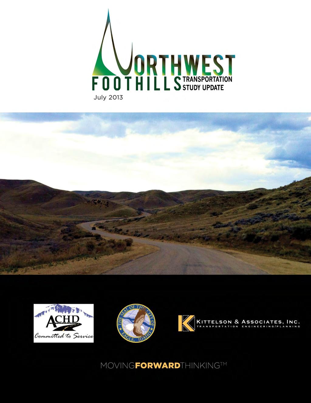
3 Northwest Foothills Transportation Study Update Ada County, Idaho Study Area Parks Schools Prepared For Ada County Highway District 3775 Adams Street Garden City, Idaho (208) Prepared By: Kittelson & Associates, Inc. 101 S. Capitol Blvd., Suite 301 Boise, ID (208) Project No July 2013
4
5 Northwest Foothills Transportation Study Update July 2013 Preface PREFACE The Northwest Foothills Transportation Study Update was developed under the guidance of the Project Management Team (PMT) and Project Steering Committee (SC). PMT and SC members are identified below, along with members of the consultant team. The PMT was responsible for reviewing all work products, providing direction to the project, facilitating the open house, and making recommendations to the Eagle City Council and Ada County Highway District (ACHD) Commission for consideration of Study adoption. The PMT included representatives from ACHD, the City of Eagle, Ada County, and COMPASS. The SC was responsible for reviewing all work products, providing input and recommendations to the PMT, and participating at the public open house. The SC was made up of local citizens, business owners, and local officials including the Idaho Transportation Department. Thank you to the following PMT and SC members for their instrumental involvement with the development of the Northwest Foothills Transportation Study Update. PROJECT MANAGEMENT TEAM Jeff Lowe, Ada County Highway District Amar Pillai, Ada County Highway District Mindy Wallace, Ada County Highway District Shawn Martin, Ada County Highway District Christy Foltz-Alrichs, Ada County Highway District Nichoel Baird Spencer, City of Eagle MaryAnn Waldinger, COMPASS Richard Beck, Ada County PROJECT STEERING COMMITTEE Dave Szplett, Idaho Transportation Department Mark Butler, Eagle City Council Nichoel Baird Spencer, City of Eagle CJ Petrovsky, Foothills Resident Jeff Laughlin, Eagle Transportation Committee Kurt McClenny, Eagle Fire Department Jon Seel, Eagle Resident Rick Thomas, Foothills Landowner Dan Richter, Avimor Gerry Robbins, M3 Companies Dana Borquist, Eagle Police Chief Lynn Moser, Eagle Sewer District CONSULTANT TEAM Kittelson & Associates, Inc. John Ringert, Kittelson & Associates, Inc Nick Foster, Kittelson & Associates, Inc. Ryan Whitney, Kittelson & Associates, Inc. A special thanks to the Eagle City Council and Ada County Highway District Commission for attending the work sessions and public meetings and providing input and guidance during the development of the plan. A final thank you to any person, individual, group, agency, or participating member of the public that provided information, comments, suggestions, or their valuable time during this planning process. i
6
7 Northwest Foothills Transportation Study Update July 2013 Table of Contents TABLE OF CONTENTS SECTION 1. EXECUTIVE SUMMARY... 2 SECTION 2. INTRODUCTION... 9 Changes Since The Last Study SECTION 3. INTERAGENCY AND PUBLIC INVOLVEMENT PROGRAM Project Management Team Developer Meetings Public Open House Informational Sessions SECTION 4. ROADWAY NETWORKS & LAND-USE PROJECTION Roadway Network Land-Use Projections Future Traffic Operations Development Driven Improvements SECTION 5. KEY CORRIDORS Eagle Road Willow Creek Road Beacon Light Road SH Linder Road SH 55 Beacon Light Road to Avimor SECTION 6. IMPLEMENTATION STRATEGY Implementation Plan Process Implementation Plan Elements iii
8 Northwest Foothills Transportation Study Update July 2013 Table of Contents Figure 1: Recommended Roadway Sizes and Intersection Control... 3 Figure 2: Development Study Area... 9 Figure 3: Open House Announcement Figure 4: Recommended Roadway Network from 2008 Study Figure 5: Recommended Roadway Sizes and Intersection Control Figure 6: Northwest Foothills Development Driven Impacts and Improvements Figure 7: Eagle Road - North of Plaza Drive Figure 8: Eagle Road - South of Beacon Light Road Figure 9: Willow Creek Road - Near Stillwell Drive Figure 10: Beacon Light Road - North of Eagle Road Figure 11: Beacon Light Volume and Capacity Comparison Figure 12: 2035 Beacon Light Volume Projection vs. SH 44 Lanes Figure 13: Linder Road - North of Chinden Blvd (US 20/26) Figure 14: Linder Road Extension into M3 Spring Valley Development Figure 15: SH 55 - North of Beacon Light Road Figure 16: Short-Term Improvements Figure 17: Medium-Term Improvements Figure 18: Long-Term Improvements Figure 19: Very Long-Term Improvements Table 1: Comparison of Land Use for Foothills Development (2008 vs. Update) Table 2: Year 2035 Traffic Conditions and Recommended Roadway Configuration Summary Table 3: Roadway Segment Sizes Updated from the 2008 Study Table 4: Implementation Strategy of Corridor Plan (Capital Projects) Improvements iv
9 Northwest Foothills Transportation Study Update July 2013 Table of Contents Appendix A: Public Involvement Appendix B: 2035 Traffic Projections Appendix C: Roadway and Key Intersections Analysis Results v
10

11 Section 1 Executive Summary
12
13 Northwest Foothills Transportation Study Update July 2013 Section 1. Executive Summary SECTION 1. EXECUTIVE SUMMARY The purpose of the Northwest Foothills Transportation Study Update (NWFTS Update) is to revise the roadway network and improvement recommendations of the Northwest Foothills Transportation Study which was adopted in 2008 (2008 NWFTS). Since its adoption, the following changes have occurred in and around the City of Eagle to bring about the need for this update: Update to the COMPASS Communities in Motion (CIM) Long Range Transportation Plan with a regional population forecast increase from 825,000 for 2030 to 1,022,000 for 2035 for Ada and Canyon Counties; Update of the Eagle Comprehensive Plan for the Eagle downtown area; ACHD Commission decision to not proceed with federal funding for the proposed Three Cities River Crossing roadway project, due to an estimated cost of over $80 million; The secondary crossing of Bureau of Land Management (BLM) property to serve the M3 Spring Valley development from Palmer Road was not approved by the BLM making Linder Road the only access from northwest Eagle; A Community Infrastructure District formed for M3 Spring Valley by City of Eagle; Adoption of the State Street Transit & Traffic Operational Plan (TTOP) by the City of Eagle, City of Boise, and ACHD; In addition to these regional actions, development plans in the foothills have changed for many of the tracts of privately-owned land. The City and ACHD also identified the need to tie the anticipated development to the regional horizon year of The 2008 NWFTS assumed all of the potential development in the foothills study area was fully completed (build-out), even though it could take well beyond on the 2035 horizon year to accomplish. The change in development plans and the horizon year for estimating potential development in the northwest foothills result in the anticipated housing dropping from 24,261 units to 13,889 units and the anticipated employment dropping from 10,822 jobs to 4,579 jobs for this update. Figure 1 shows the updated roadway sizes and the anticipated type of control at key intersections. In addition, the roadways which increased or decreased in size from the 2008 NWFTS are highlighted. Following are the key recommendations as part of this update: Eagle Road: Between Plaza Drive and Willow Creek Road, three lanes are recommended which will be refined pending the outcome of the Eagle Road/State Street Concept Study. Between Chinden Boulevard and SH 44, seven lanes are recommended in the long term, which is primarily due to regional growth and the removal of the Three Cities River Crossing. SH 44: Based on the TTOP recommendations and funding considerations, SH 44 is recommended to be five lanes plus high occupancy vehicle lanes (seven lanes total) between Glenwood Street and Eagle Road and five lanes between Eagle Road and SH 16. 2

14 BALLANTYNE LN EAGLE RD Northwest Foothills Transportation Study Update July 2013 N Aerie Way Avimor Dr CHAPARRAL RD Right-in or Right-in/ Right-out 16 Aerie Way Equest Ln Alignment to be Determined HOMER RD 55 May be grade-separated beyond plan = Grade Separated NEW HOPE RD BEACON LIGHT RD LINDER RD 2008 plan = 3 lanes Right-in H:\projfile\ NW Foothills Transportation Study Update\GIS\ActiveFiles\Recommended_Roads.mxd 2 Lanes 3 Lanes 5 Lanes with Median 5 Lanes with Turn Lane 5 Lanes + HOV 7 Lanes Changed Since Last Plan Overpass Grade-Separated Interchange High-Capacity Intersection MUNGER RD FLOATING FEATHER RD STAR RD STAR RD CHINDEN BLVD STATE ST EMMETT HWY Signal or Roundabout Unsignalized or Roundabout PALMER LN Signal Unsignalized Roundabout LINDER RD PARK LN 2008 plan = 2 lanes MERIDIAN RD FLOATING FEATHER RD 2008 plan = 6 lanes MACE RD Intersection to be Studied 2008 plan = 5 lanes EAGLE RD Willow Creek Rd 2008 plan = 2 lanes FLOATING FEATHER RD RANCH DR 2008 plan = 5 lanes HILL RD HWY 44 HWY CHINDEN BLVD HWY 55 HWY 2008 plan = 6 lanes STATE ST ARNEY LN BOGART LN SEAMAN GULCH RD GARY LN RIVERSIDE DR MARIGOLD ST RECOMMENDED ROADWAY SIZES AND INTERSECTION CONTROL HILL RD CASTLE DR COLLISTER DR CARTWRIGHT RD 36TH ST Figure 1 BOGUS BASIN RD
15
16 Northwest Foothills Transportation Study Update July 2013 Section 1. Executive Summary SH 55: Between Beacon Light Road and Avimor, five lanes is recommended with at-grade traffic signals at Beacon Light Road, Brookside and the two Avimor intersections. Grade separation may be required beyond 2035 or in response to specific development requirements. Therefore right-of-way preservation for grade separations is recommended. Linder Road: Between Chinden Boulevard and SH 44, seven lanes are recommended in the very long term with the potential for incremental widening to five lanes in the medium term. This is primarily due to regional growth and the removal of the Three Cities River Crossing. Between Beacon Light Road and the M3 Spring Valley development, five lanes could be needed with the removal of the Palmer Road connection. Therefore, corridor preservation and/or construction of five lanes north of Beacon Light Road are recommended beyond Beacon Light Road: Between Linder Road and SH 55, five lanes were identified as needed near the end of the study timeframe (around year 2035). Corridor preservation for five lanes is therefore recommended. Willow Creek Road: A bypass of Willow Creek Road from Eagle Road to the proposed east-west foothills collector continues to be recommended as part of this plan due to the design and constraint of Willow Creek Road. The alignment of the bypass road will be dependent on future property development and topography. With this update, an implementation plan was developed. Following are the key findings of the implementation plan: Most of the short-term improvements on the existing transportation system are funded and planned for construction in the next five years. The two most significant short-term and medium-term improvements to existing roadways that remain unfunded are the widening of Chinden Boulevard (US 20/26) to five lanes from Eagle Road to SH 16 and widening SH 44 to five lanes between Linder Road and SH 16. The Idaho Transportation Department (ITD) has indicated that both improvements will likely be funded in the next five to ten years. All of the long-term widening needed on ITD roadways are currently unfunded including: o SH 55 widening to five lanes north of Beacon Light Road o SH 16 widening to five lanes (four lanes with median/left-turn lane), SH 44 to M3 Spring Valley o SH 44 widening for HOV lanes, Glenwood to SH 55 o Eagle Road widening to seven lanes, Chinden Boulevard to SH 44 Right-of-way preservation should be the focus for the following very long-term projects: o Beacon Light Road widening to five lanes (Linder Road to SH 55) o Linder Road widening to seven lanes (Chinden Boulevard to SH 44) o Linder Road widening to five lanes (Beacon Light Road to M3 Spring Valley) o SH 16 grade separations at, SH 44 Floating Feather, Beacon Light, and M3 Spring Valley o SH 55 widening to seven lanes from SH 44 to Beacon Light Road 5
17 Northwest Foothills Transportation Study Update July 2013 Section 1. Executive Summary o Chinden Boulevard widening to seven lanes (six lanes with median/left-turn lane) from Cloverdale Road to SH 16. The roadway network and recommended projects should remain dynamic and responsive to development and changes to the adopted land-use and transportation plans. To accomplish this goal, a monitoring process should be agreed upon by the City and ACHD in an Inter-Governmental Agreement that identifies triggers for reviewing the improvements and how development within the surrounding area will be reviewed and coordinated with all parties. It is recommended that the land-use assumptions and recommendations used for this study be reviewed at least every five years and the study updated if significant changes to the future roadway network, land use assumptions, or adopted plans occur that could affect the need or appropriateness of the recommendations in this NWFTS Update. 6
Northwest Foothills Transportation Study Update
 DRAFT Northwest Foothills Transportation Study Update Ada County, Idaho Study Area Parks Schools Prepared For Ada County Highway District 3775 Adams Street Garden City, Idaho 83714 (28) 387-61 Prepared
ACHD COMMISSION DECISION
 DRAFT ACHD COMMISSION DECISION On January 22, 2014, the ACHD Commission voted to delay the decision on the adoption of this study until January 2015. The decision to the delay the adoption was a result
State Highway 44/State Street High Capacity Corridor
 Background State Highway 44/State Street runs from I-84 in Canyon County through parts of the cities of Middleton, Star, Eagle, and Garden City to downtown Boise. It is a commuter route from several communities
State Street Transit and Traffic Operational Plan June Æa «44 «55. Installation of Bus Bays. Land Use Activities
 State Street Transit and Traffic Operational Plan June 2011 FLOATING FEATHER RD $+ «16 PALMER LN Intersection Expansions SH 16 Extension Roadway Improvements èé Signalized Intersection $+ Intersection
State Highway 16 Kuna-Mora Road to Ada/Gem County Line
 Background State Highway 16 is the main commuter route from Gem County to the Treasure Valley. An increase in traffic and accidents on this highway have been a concern for several years, and the Idaho
State Highway 16/McDermott Road Kuna-Mora Road to Ada/Gem County Line
 Background State Highway 16 is the main commuter route from Gem County to the Treasure Valley. An increase in traffic and accidents on this highway have been a concern for several years, and the Idaho
State Highway 16 Kuna-Mora Road to Ada/Gem County Line
 Background Update! (February 2018): This project has been partially funded; see below. State Highway 16 is the main commuter route from Gem County to the Treasure Valley. An increase in traffic and accidents
5.0 Roadway System Plan
 Southwest Boise Transportation Study Page 16 5.0 Roadway System Plan The Roadway System Plan outlines roadway improvements in the Initial Study Area. It forecasts future deficiencies on the arterial system,
What is the Congestion Management Process? What is Congestion? Growth in the Treasure Valley Development and Congestion
 Treasure Valley Annual Congestion Management System Report, 2017 07-2019 February 2019 Table of Contents Background and Introduction... 2 What is the Congestion Management Process?... 2 What is Congestion?...
Final Report. Southwest Boise Transportation Study. Prepared For: Ada County Highway District
 Final Report Southwest Boise Transportation Study Ada County, Idaho September 2009 Prepared by: 101 S Capitol Boulevard, Suite 301 Boise, ID 83702 (208) 338-2683 Southwest Boise Transportation Study Final
ACHD Commission, Director, and Deputy Directors
 John S. Franden, President Mitchell A. Jaurena, Vice President Rebecca W. Arnold, Commissioner Sara M. Baker, Commissioner Jim D. Hansen, Commissioner March 19, 2014 TO: FROM: SUBJECT: ACHD Commission,
Review and Comment ACHD s FY Five Year Work Program Draft for Adoption
 Date: January 5, 2006 To: From: Mayor and City Council Karen Gallagher Planning and Development Services Meeting: January 10, 2006 Re: Review and Comment ACHD s FY 2007-2011Five Year Work Program Draft
EAGLE ROAD AND STATE STREET INTERSECTION CONCEPT STUDY
 EAGLE ROAD AND STATE STREET INTERSECTION CONCEPT STUDY Eagle, Idaho May 2014 This page intentionally left blank Eagle, Idaho Prepared For: Ada County Highway District (ACHD) 3775 Adams St. Garden City,
FY Regional Transportation Improvement Program
 FY2014-2018 Regional Transportation Improvement Program Basic Project List (All Values in Thousands of Dollars) All costs in current dollars Project Name Key # Year Project Cost 10th Avenue Bridge, Caldwell
Table 1: Recommended Interim Improvement and Long Term Improvement/ROW Preservation Proposed Improvements. Recommended Interim Improvement
 Rebecca W. Arnold, President Sara M. Baker, Vice President John S. Franden, Commissioner Carol A. McKee, Commissioner Mitchell Jaurena, Commissioner June 19, 2012 Planning & Programming Department TO:
State Street and Pierce Park Lane Intersection Concept Report
 State Street and Pierce Park Lane Intersection Prepared for September 2017 Prepared by CITATION Parametrix. 2017. State Street & Pierce Park Lane Intersection. Prepared by Parametrix, Boise, ID. September
Committed to Service
 Committed to Service Paul Woods, President Rebecca W. Arnold, Vice President Sara M. Baker, Commissioner Jim D. Hansen, Commissioner Kent Goldthorpe, Commissioner March 14, 2017 Planning and Programming
Northwest Boise NEIGHBORHOOD WALKING AND BIKING PLAN
 Northwest Boise NEIGHBORHOOD WALKING AND BIKING PLAN OCTOBER 2015 This page is intentionally left blank. Northwest Boise NEIGHBORHOOD WALKING AND BIKING PLAN The Northwest Boise Neighborhood Walking and
WEST AND SOUTH WEST RING ROAD DOWNSTREAM TRAFFIC IMPACTS
 Page 1 of 9 EXECUTIVE SUMMARY Alberta Transportation ( AT ) is preparing to construct the final sections of the Calgary Ring Road. This includes the South West Ring Road ( SWRR ) (from Lott Creek Blvd
ARTINSVILLE ENRY OUNTY REA RANSPORTATION TUDY
 ARTINSVILLE ENRY OUNTY REA RANSPORTATION TUDY DEVELOPED BY THE TRANSPORTATION AND MOBILITY PLANNING DIVISION OF THE VIRGINIA DEPARTMENT OF TRANSPORTATION IN COOPERATION WITH THE U.S. DEPARTMENT OF TRANSPORTATION,
MOUNTAIN HOUSE SPECIFIC PLAN I 9.1 INTRODUCTION ASSUMPTIONS TRANSPORTATION FACILITIES TRANSPORTATION IMPROVEMENTS PHASING 9.
 CHAPTER NINE: TRANSPORTATION AND CIRCULATION 9.1 INTRODUCTION 9.1 9.2 ASSUMPTIONS 9.1 9.3 TRANSPORTATION FACILITIES 9.1 9.4 TRANSPORTATION IMPROVEMENTS PHASING 9.3 LIST OF FIGURES LIST OF TABLES Figure
REGIONAL TRANSPORTATION ADVISORY COMMITTEE October 25, :30 a.m. COMPASS, 1st Floor Board Room 700 NE 2nd Street, Meridian, Idaho **AGENDA**
 REGIONAL TRANSPORTATION ADVISORY COMMITTEE October 25, 2017-8:30 a.m. COMPASS, 1st Floor Board Room 700 NE 2nd Street, Meridian, Idaho I. CALL TO ORDER (8:30) **AGENDA** II. III. IV. Page 2 AGENDA ADDITIONS/CHANGES
Coming soon: big changes to Eagle Road Many say it's about time, too
 Coming soon: big changes to Eagle Road Many say it's about time, too By Cynthia Sewell The Idaho Statesman Edition Date: 06-12-2005 The state's busiest non-interstate road is about to get a makeover. Eagle
Welcome. Thank you for attending tonight s open house. The purpose of this open house is to give you an opportunity to:
 Welcome Thank you for attending tonight s open house. The purpose of this open house is to give you an opportunity to: Review the circulation plan concept Give us your input Why a circulation plan? During
General Plan Circulation Element Update Scoping Meeting April 16, 2014 Santa Ana Senior Center, 424 W. 3rd Street, Santa Ana, CA 92701
 General Plan Circulation Element Update Scoping Meeting April 16, 2014 Santa Ana Senior Center, 424 W. 3rd Street, Santa Ana, CA 92701 Meeting Agenda 1. Purpose of Scoping Meeting 2. Project Overview 3.
12 RECOMMENDATIONS Road Improvements. Short Term (generally the next five years)
") 12 RECOMMENDATIONS Recommendations are based on the technical analysis of existing and future road and active transportation conditions, the results of the review of existing City policies and public feedback.
12 RECOMMENDATIONS Recommendations are based on the technical analysis of existing and future road and active transportation conditions, the results of the review of existing City policies and public feedback.
WELCOME TO OPEN HOUSE # 1 June 14, 2017
 Langstaff Road Weston Road to Highway 7 Class Environmental Assessment Study WELCOME TO OPEN HOUSE # 1 June 14, 2017 Please sign in and join our mailing list Purpose of Open House #1 & Study Area York
Anniedale - Tynehead NCP. Transportation Highway 15 & Golden Ears Way Analysis
 Highway 15 & Golden Ears Way Analysis Stage 1 Conclusions Analysis indicated capacity constraints at Highway 15 & Golden Ears Way Grade Separation required for safe and efficient traffic movement Supports
3.0 Future Conditions
 3.0 Future Conditions In order to be able to recommend appropriate improvements to the transportation system of the Town, it is important to first understand the nature and volume of traffic that is expected
4. ENVIRONMENTAL IMPACT ANALYSIS 9. TRANSPORTATION AND TRAFFIC
 4. ENVIRONMENTAL IMPACT ANALYSIS 9. TRANSPORTATION AND TRAFFIC 4.9.1 INTRODUCTION The following section addresses the Proposed Project s impact on transportation and traffic based on the Traffic Study
Report Purpose To seek Council s approval of the Wye Road Functional Planning Study (January 2015).
.") COUNCIL MEETING Meeting Date: March 10, 2015 Agenda Item #: 13.1 Wye Road Functional Planning Study (January 2015) Report Purpose To seek Council s approval of the Wye Road Functional Planning Study (January
COUNCIL MEETING Meeting Date: March 10, 2015 Agenda Item #: 13.1 Wye Road Functional Planning Study (January 2015) Report Purpose To seek Council s approval of the Wye Road Functional Planning Study (January
Providing an Efficient and Multi-modal Transportation System
 Providing an Efficient and Multi-modal Transportation System Welcome and Introductions The Plan Process Transportation Overview Workshop Discussions Report Out and Next Steps AGENDA Comprehensive Plan
ADOT Statewide Bicycle and Pedestrian Program Summary of Phase IV Activities APPENDIX B PEDESTRIAN DEMAND INDEX
 ADOT Statewide Bicycle and Pedestrian Program Summary of Activities APPENDIX B PEDESTRIAN DEMAND INDEX May 24, 2009 Pedestrian Demand Index for State Highway Facilities Revised: May 29, 2007 Introduction
LSC TRANSPORTATION CONSULTANTS, INC. 516 North Tejon Street Colorado Springs, CO (719) FAX (719)
 FAX (719)") LSC TRANSPORTATION CONSULTANTS, INC. 516 North Tejon Street Colorado Springs, CO 80903 (719) 633-2868 FAX (719) 633-5430 E-mail: lsc@lsccs.com May 15, 2009 Mr. Davis Farrar Western Slope Consulting, LLC
LSC TRANSPORTATION CONSULTANTS, INC. 516 North Tejon Street Colorado Springs, CO 80903 (719) 633-2868 FAX (719) 633-5430 E-mail: lsc@lsccs.com May 15, 2009 Mr. Davis Farrar Western Slope Consulting, LLC
Committed to Service
 Development Services Department Committed to Service TO: FROM: Ada County Highway District Commissioners Mindy Wallace, AICP Planner III COMISSION HEARING: January 27, 2016 SUBJECT: Syringa Valley Specific
Re: Boise s Annual Transportation Requests Reviewing the List of Projects and Listening to Public Input
 September 9, 2009 To: Mayor and City Council From: Karen Gallagher Transportation Planner Re: Boise s Annual Transportation Requests Reviewing the List of Projects and Listening to Public Input Requested
Memorandum INTRODUCTION METHODOLOGY. Smart Growth. Bruce Robinson, Transport Advisor, Infrastructure Planning
 Memorandum To: Smart Growth From: Bruce Robinson, Transport Advisor, Infrastructure Planning Subject: Te Tumu Transportation Assessment: Stage 1 Sensitivity Analysis Date: 1 June 2016 INTRODUCTION This
Appendix C. NORTH METRO STATION AREA TRAFFIC IMPACT STATEMENT 88th Avenue Station
 Appendix C NORTH METRO STATION AREA TRAFFIC IMPACT STATEMENT 88th Avenue Station Prepared for: Regional Transportation Department and URS Corporation as part of the North Metro EIS David Evans and Associates,
KEARNY MESA COMMUNITY PLAN UPDATE
 KEARNY MESA COMMUNITY PLAN UPDATE January 18, 2018 SUBCOMMITTEE MEETING Mobility Concepts and Urban Design Presentation Outline Mobility Concepts: Multimodal Planning Toolbox Presentation and Activities
!!!!!!!!!!!!!!!!!! Metro!Denver!MTD!Governance!Committee! October!23,!2013!!9:00!AM!to!10:00!AM! Denver!Regional!Council!of!Governments!
 MetroDenverMTDGovernanceCommittee October23,2013 9:00AMto10:00AM DenverRegionalCouncilofGovernments MeetingRecord MetroDenverMTDGovernanceCommittee October23,2013 9:00AM Agenda: 9:00AM Welcome&Introductions
Exhibit 1 PLANNING COMMISSION AGENDA ITEM
 Exhibit 1 PLANNING COMMISSION AGENDA ITEM Project Name: Grand Junction Circulation Plan Grand Junction Complete Streets Policy Applicant: City of Grand Junction Representative: David Thornton Address:
Golden s Plan. For the Highway 6 & 93 Corridor
 Golden s Plan For the Highway 6 & 93 Corridor Purpose of the Study Accommodate regional traffic needs on Highways 6 and 93, as defined by the Northwest Quadrant Feasibility Study. Find a solution that
A copy of the draft plan is available at:
 To: From: Re: Mayor and City Council Patricia Nilsson, AICP, Comprehensive Planning Manager Boise Central Bench Neighborhood Pedestrian and Bicycle Plan Date: August 24, 2012 Requested Action Provide comments
Chapter 6 1 Future Transportation System Priorities and Needs
 Chapter 6 1 Future Transportation System Priorities and Needs The Treasure Valley s population is expected to almost double from 600,000 in 2013 to 1,022,000 by the year. That growth will impact future
Town of Bethlehem. Planning Assessment. Bethlehem Town Board
 Town of Bethlehem US 9W Corridor Transportation Planning Assessment Presented e to: Bethlehem Town Board June 2009 Overview Study Background Route 9W Corridor Conditions and Improvements Selkirk Bypass
Basalt Creek Transportation Refinement Plan Recommendations
 Basalt Creek Transportation Refinement Plan Recommendations Introduction The Basalt Creek transportation planning effort analyzed future transportation conditions and evaluated alternative strategies for
Los Altos Hills Town Council - June 18, 2015 Palo Alto City Council June 22, AGENDA ITEM #2.B Presentation
 Los Altos Hills Town Council - June 18, 2015 Palo Alto City Council June 22, 2015 AGENDA ITEM #2.B Presentation Previous Presentations Los Altos Hills Town Council in May 2014 and February 2015 Palo Alto
Anholm Bikeway Plan Planning Commission Meeting Summary (8/14/18)
") Anholm Bikeway Plan Planning Commission Meeting Summary (8/14/18) Overview: On August 14, 2018, the Planning Commission considered plans for the middle section of the Anholm Bikeway Plan, focusing on the
Anholm Bikeway Plan Planning Commission Meeting Summary (8/14/18) Overview: On August 14, 2018, the Planning Commission considered plans for the middle section of the Anholm Bikeway Plan, focusing on the
JONESBORO HIGHWAY 63 HIGHWAY 18 CONNECTOR STUDY
 JONESBORO HIGHWAY 63 HIGHWAY 18 CONNECTOR STUDY Craighead County May 2007 JONESBORO HIGHWAY 63 HIGHWAY 18 CONNECTOR STUDY Craighead County May 2007 Prepared by Planning and Research Division Arkansas State
Peer Review of Highlands Neighborhood Traffic and Pedestrian Safety Plan
 FINAL REPORT March 14, 2017 Prepared for: Ada County Highway District Prepared by: SIX MILE ENGINEERING, PA Executive Summary The (Highlands Safety Plan) developed by the Ada County Highway District (ACHD)
EXECUTIVE SUMMARY OF CALEDON TRANSPORTATION NEEDS STUDY
 EXECUTIVE SUMMARY OF CALEDON TRANSPORTATION NEEDS STUDY The Caledon Transportation Needs Study has been undertaken as a joint project by the Town of Caledon and the Region of Peel to determine the existing
Fairview and Main Local Streets Improvement Plan
 PIM#2 Summary Report Meeting Format Date & Time: Location: Address: Prepared By: Community Open House August 11, 2016 5:30 p.m. 7:30 p.m. Red Lion Hotel 1800 W. Fairview Avenue, Boise Stephanie Borders,
Arterial Management Plan for US Route 250 and State Route 623
 Arterial Management Plan for US Route 250 and State Route 623 June 25, 2014 Brad Shelton, AICP Access Management and Traffic Impact Analysis Programs Manager Transportation and Mobility Planning Division
Bicycle and Pedestrian Plans and Improvements
 Bicycle and Pedestrian Plans and Improvements Presented to the City Council By Randle Harwood, Planning and Development, and Richard Zavala, Parks and Community Services September 24, 2013 Purpose Review
APPENDIX G: INTERSECTION NEEDS AT OKEECHOBEE BOULEVARD
 APPENDIX G: INTERSECTION NEEDS AT OKEECHOBEE BOULEVARD INTERSECTION NEEDS AT SR 7 and OKEECHOBEE BOULEVARD SR 7 Extension Project Development and Environment (PD&E) Study From Okeechobee Boulevard (SR
Develop a Multi-Modal Transportation Strategy (Theme 6)
") DEVELOP A MULTI-MODAL TRANSPORTATION STRATEGY (THEME 6) WHY IS THIS THEME ADDRESSED? Develop a Multi-Modal Transportation Strategy (Theme 6) Statement of Ideal Reduce resident and visitor reliance on single
DEVELOP A MULTI-MODAL TRANSPORTATION STRATEGY (THEME 6) WHY IS THIS THEME ADDRESSED? Develop a Multi-Modal Transportation Strategy (Theme 6) Statement of Ideal Reduce resident and visitor reliance on single
Project Update May 2018
 Project Update May 2018 Dakota County, in cooperation with the City of Lakeville, is planning to reconstruct 202 nd Street West (County Road 50) from Holyoke Avenue to Cedar Avenue (County Road 23). 202
CHAPTER 4: IDENTIFICATION OF ROAD SYSTEM DEFICIENCIES: TRANSPORTATION PLANNING MODEL
 CHAPTER 4: IDENTIFICATION OF ROAD SYSTEM DEFICIENCIES: TRANSPORTATION PLANNING MODEL I. INTRODUCTION Transportation planning models are the primary tools used to predict future travel conditions. With
Traffic Study 30th Street Specific Area Plan
 Prepared for HDR Engineering, Inc. River Quarry at Park Center 412 E. Parkcenter Blvd., Suite 100 Boise, ID 83706-6659 Prepared by 5561 N Glenwood Street, Suite B Boise, ID 83714-1336 208-898-0012 www.parametrix.com
DUNBOW ROAD FUNCTIONAL PLANNING
 DUNBOW ROAD FUNCTIONAL PLANNING Final Report August 3, 216 #31, 316 5th Avenue NE Calgary, AB T2A 6K4 Phone: 43.273.91 Fax: 43.273.344 wattconsultinggroup.com Dunbow Road Functional Planning Final Report
Clackamas County Comprehensive Plan
 ROADWAYS The County s road system permits the movement of goods and people between communities and regions, using any of a variety of modes of travel. Roads provide access to virtually all property. They
Lee s Summit Road Improvement Study Public Open House June 7, 2007 Summary of Comment Card Responses
 Lee s Summit Road Improvement Study Public Open House June 7, 2007 Summary of Comment Card Responses Introduction At the Lee s Summit Road Improvement Study Public Open House held Thursday, June 7, 2007
Title. Metropolitan Council Transportation Committee December 12, Brad Larson Metro District MnDOT
 Title Metropolitan Council Transportation Committee December 12, 2016 Evaluating the potential for Bus Rapid Transit and MnPASS Express Lanes in the southwest Metro Brad Larson Metro District MnDOT Background
AGENDA REPORT. Issue: Discussion of potential improvements on Barnwell Road at Niblick Drive
 AGENDA REPORT To: From: By: Honorable Mayor and City Council Members Warren Hutmacher, City Manager Tom Black, Public Works Director Date: March 23, 2016 Agenda: March 28, 2016 WORK SESSION AGENDA: Barnwell
Citywide Transportation Plan
 Prepared for City of Nampa, Idaho Adopted Acknowledgements Special thanks to those that gave their time and talents to this effort: City of Nampa; Michael Fuss, Public Works Director Len Grady, City Engineer
COUNCIL AGENDA STAFF REPORT
 CITY OF AMERICAN CANYON SUBJECT COUNCIL AGENDA STAFF REPORT Workshop to review the draft General Plan Circulation Element. SUBMITTED BY: Brent Cooper, AICP, Community Development Director BACKGROUND AND
Fairview Avenue Corridor Management Strategy
 Report for Fairview Avenue Corridor Management Strategy Prepared for Prepared by February 2014 This page intentionally left blank Project Team Ada County Highway District Jeff Lowe, Project Manager Christy
CHIEF PEGUIS TRAIL EXTENSION WEST
 1 PRELIMINARY DESIGN OF THE CHIEF PEGUIS TRAIL EXTENSION WEST Public Information Session June 6, 2017 Welcome 1 Thank you for attending today s public information session. The following boards provide
TABLE OF CONTENTS. Executive Summary
 Executive Summary Background... ES-1 Pedestrian Network... ES-2 Bikeway Network... ES-2 Collision History... ES-2 Public Input... ES-4 Conclusions and Recommendations... ES-4 1. Introduction and Setting
Transportation Master Plan Advisory Task Force
 Transportation Master Plan Advisory Task Force Network Alternatives & Phasing Strategy February 2016 BACKGROUND Table of Contents BACKGROUND Purpose & Introduction 2 Linking the TMP to Key Council Approved
Terwillegar Drive Expressway Draft Concept Plan
 Terwillegar Drive Expressway Draft Concept Plan Anthony Henday Drive to Whitemud Drive November 28 5:00-8:00 p.m. December 1 10:00 a.m. - 3:00 p.m. Let s Talk Today you can: Learn about the new direction
TRAFFIC ACTION PLAN. North Central Neighborhood CITY OF SAN MATEO
 TRAFFIC ACTION PLAN North Central Neighborhood CITY OF SAN MATEO Draft February 2017 Table of Contents Introduction... 1 The Traffic Forum Process... 4 Neighborhood Traffic Issues... 6 Neighborhood Recommendations
Committed to Service. Development Services. February 21, ACHD Commission. Mindy Wallace, AICP
 Committed to Service Sara M. Baker, President Rebecca W. Arnold, Vice President Jim D. Hansen, Commissioner Kent Goldthorpe, Commissioner Paul Woods, Commissioner February 21, 2018 Development Services
Highway 111 Corridor Study
 Highway 111 Corridor Study June, 2009 LINCOLN CO. HWY 111 CORRIDOR STUDY Draft Study Tea, South Dakota Prepared for City of Tea Sioux Falls Metropolitan Planning Organization Prepared by HDR Engineering,
2018 Final Service Changes Proposal Ada County
 2018 Final Service Changes Proposal Ada County 1 Background Based on Plans The changes being proposed in Ada County are intended to be consistent with the objectives of ValleyConnect 2.0 and Boise s Transportation
DRAFT BUENA VISTA 2020 TRANSPORTATION PLAN
 DRAFT BUENA VISTA 2020 TRANSPORTATION PLAN DEVELOPED BY THE TRANSPORTATION PLANNING DIVISION OF THE VIRGINIA DEPARTMENT OF TRANSPORTATION IN COOPERATION WITH THE U.S. DEPARTMENT OF TRANSPORTATION, FEDERAL
Planning & Programming
 Kent Goldthorpe, President Paul Woods, Vice President Rebecca W. Arnold, Commissioner Sara M. Baker, Commissioner Jim D. Hansen, Commissioner September 14, 2016 Planning & Programming TO: ACHD Commissioners,
What are Managed Lanes?
 Express Lanes What are Managed Lanes? Highway facilities or a set of lanes where operational strategies are proactively implemented and managed in response to changing conditions. http://ops.fhwa.dot.gov/freewaymgmt/managedlanesvideo/index.htm
Abstract. Background. protected/permissive operation. Source: Google Streetview, Fairview/Orchard intersection
 ITE 2015 Western District Annual Meeting Ada County Highway District s Flashing Yellow Arrow Initiative Primary Author: Tim Curns, PE Ada County Highway District Traffic Engineer Author: Andrew Cibor,
MnPASS System Today and the Future
 MnPASS System Today and the Future April 2010 By Nick Thompson Minnesota Department of Transportation Topics Minnesota s Current and Future MnPASS High Occupancy Toll Systems Overview of the MnPASS System
City of Homewood Transportation Plan
 City of Homewood Transportation Plan Prepared for: City of Homewood, Alabama Prepared by: Skipper Consulting, Inc. May 2007 TABLE OF CONTENTS INTRODUCTION... 1 BACKGROUND INFORMATION... 1 EXISTING TRANSPORTATION
City of Gainesville Transportation/Roadway Needs PROJECT SUMMARY
 A1 Roadway Resurfacing $23,846,000 TYPE: Preservation of existing system Roadway resurfacing A2 Signal Replacement $6,000,000 TYPE: Preservation of existing system Replace traffic signals. B1 W 6th St
CITY OF ALPHARETTA DOWNTOWN MASTER PLAN TRAFFIC EVALUATION
 CITY OF ALPHARETTA DOWNTOWN MASTER PLAN TRAFFIC EVALUATION June 2015 CITY OF ALPHARETTA DOWNTOWN MASTER PLAN TRAFFIC EVALUATION Introduction The Alpharetta Downtown Master Plan was developed in the fall
Corporate. Report COUNCIL DATE: June 26, 2006 NO: C012 COUNCIL-IN-COMMITTEE. TO: Mayor & Council DATE: June 22, 2006
 Corporate NO: C012 Report COUNCIL DATE: June 26, 2006 COUNCIL-IN-COMMITTEE TO: Mayor & Council DATE: June 22, 2006 FROM: General Manager, Engineering FILE: 0410-20(MoT/Gate) SUBJECT: Surrey Response on
Access Management Regulations and Standards
 Access Management Regulations and Standards January 2014 Efficient highway operation Reasonable property access Concept of Access Management The way to manage access to land development while preserving
Corridor Advisory Group and Task Force Meeting #10. July 27, 2011
 Corridor Advisory Group and Task Force Meeting #10 July 27, 2011 1 Agenda Recap CAG/TF #9 Public Meeting #2 Summary Single Mode Alternatives Evaluation Results Next Steps 2 3 CAG/TF #9 Recap CAG /TF #9
Southwest Bus Rapid Transit (SW BRT) Functional Planning Study - Executive Summary January 19 LPT ATTACHMENT 2.
 Functional Planning Study - Executive Summary January 19 LPT ATTACHMENT 2.") Southwest Bus Rapid Transit (SW BRT) Functional Planning Study - Executive Summary 2011 January 19 1 of 19 Introduction This executive summary presents the results of the Southwest Bus Rapid Transit (SW
Southwest Bus Rapid Transit (SW BRT) Functional Planning Study - Executive Summary 2011 January 19 1 of 19 Introduction This executive summary presents the results of the Southwest Bus Rapid Transit (SW
Transportation in Washoe County. Lee Gibson, Executive Director February 15, 2011
 Transportation in Washoe County Lee Gibson, Executive Director February 15, 2011 RTC OF WASHOE COUNTY Metropolitan Planning Organization Meet long term needs Deliver federal funding Program projects in
Public Works and Infrastructure Committee. General Manager, Transportation Services. P:\2016\Cluster B\TRA\TIM\pw16009tim.docx
 Ten Year Cycling Network Plan Date: May 3, 2016 STAFF REPORT ACTION REQUIRED PW13.11 To: From: Wards: Reference Number: Public Works and Infrastructure Committee General Manager, Transportation Services
HIGHWAY 401 WIDENING SECOND LINE WEST STRUCTURE
 HIGHWAY 401 WIDENING SECOND LINE WEST STRUCTURE Public Meeting November 16, 2011 OVERVIEW BACKGROUND DISCUSSION ITEMS TRAFFIC ANALYSIS CYCLIST / PEDESTRIAN CONNECTION BACKGROUND February 1982 Ministry
US 69 RELIEF ROUTE STUDY
 US 69 RELIEF ROUTE STUDY Jacksonville, Texas PUBLIC MEETING #2 May 29 th, 2018 Welcome to the public meeting for the US 69 Relief Route Study in Jacksonville. This is the second public meeting for this
Carmel, Indiana Illinois Street and 126th Street Westfield Boulevard and 96th Street Arts and Design District RAB
 Sustainability Benefits Of Network Wide Roundabout Use Case Study of Carmel, Indiana Presented By: Michael McBride PE Carmel City Engineer Carmel, Indiana Carmel, Indiana 1996 Carmel, Indiana Population
RZC Appendix 8A Marymoor Subarea Street Requirements
 RZC Appendix 8A Marymoor Subarea Street Requirements For additional design details for Marymoor Subarea infrastructure, refer to the 2017 Marymoor Subarea Infrastructure Planning Report. STREET REQUIREMENTS
EXHIBIT B-1 PROJECT DESCRIPTION. Phase 1 of the Preferred Alternative
 EXHIBIT B-1 PROJECT DESCRIPTION Phase 1 of the Preferred Alternative The Transform 66 Public-Private Partnership (P3) Project (the Project ) means the Phase 1 of the Preferred Alternative components of
Committed to Service
 Committed to Service Sherry R. Huber, President Rebecca W. Arnold, Vice President John S. Franden, Commissioner Carol A. McKee, Commissioner Sara M. Baker, Commissioner To: From: ACHD Commissioners, Director,
Chapter 4 Traffic Analysis
 Chapter 4 Traffic Analysis PURPOSE The traffic analysis component of the K-68 Corridor Management Plan incorporates information on the existing transportation network, such as traffic volumes and intersection
Access Management Regulations and Standards
 Access Management Regulations and Standards Efficient highway operation Reasonable property access Concept of Access Management The way to manage access to land development while simultaneously preserving
Executive Summary Route 30 Corridor Master Plan
 Route Corridor Master Plan Project Overview The Route Corridor Master Plan is a coordinated multimodal transportation and land use plan for the entire stretch of Route through East Whiteland Township,
CONNECTIVITY PLAN. Adopted December 5, 2017 City of Virginia Beach
 CONNECTIVITY PLAN Adopted December 5, 2017 City of Virginia Beach CONTENTS 1.0 Background & Purpose... 2 2.0 Existing Inventory & Analysis... 3 ViBe District Existing Walking Conditions... 4 3.0 ViBe District
Prepared For: DIRECTION 2035 SHAPING OUR FUTURE SUMMARY REPORT JULY Prepared By: Staff to Bay County TPO
 Prepared For: DIRECTION 2035 SHAPING OUR FUTURE SUMMARY REPORT JULY 2012 Prepared By: Staff to Bay County TPO TPO Overview The Bay County Transportation Planning Organization (TPO) is a regional transportation