STUDY ADVISORY COMMITTEE. October 8, 2015
|
|
|
- Harold Gallagher
- 5 years ago
- Views:
Transcription


1 STUDY ADVISORY COMMITTEE October 8, 2015
2 Study Purpose evaluate the long-term transportation strategies and investments needed to sustain the county s economic health and quality of life in the coming decades
3 Objectives of Meeting Review and discuss land use scenarios Review and discuss transportation challenges and conceptual themes and evaluation framework Review and discuss public engagement approach
4 Agenda Welcome and Agenda Review Land Use Scenarios Transportation Investment Packages Public Involvement on Transportation Investment Packages Public Comment Next Steps and Closing

5 Study Process We are here January 2015 Fall 2016


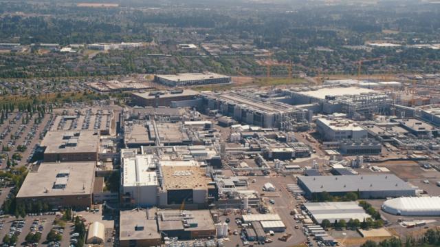


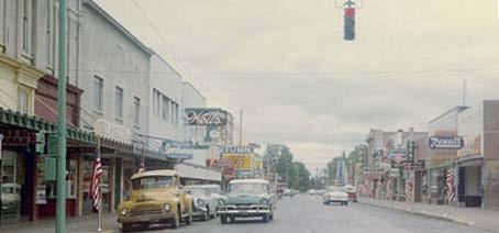

6 Changing Land Use Patterns Hillsboro, circa 1964 Hillsboro, circa 2014

7

8

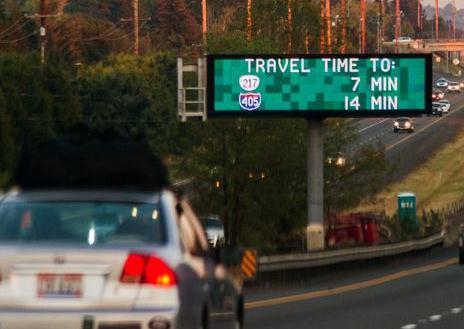


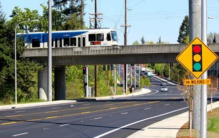
9 Changing Travel
10 LAND USE SCENARIOS
11 Relationship between adopted plans, scenarios, and transportation investment packages Scenarios Scenario 2 Economic tide Transportation Investment Packages Package 2 Common Elements Scenario 1 Current trends Package 1 Adopted Land Use and Transportation Plans Adopted Regional Pop/Emp Forecast Horizon Year
12 Scenarios Scenario 1 : Current Trends Use regional forecast midpoint to 2055 Continue regional socio-economic trends, like aging population and higher share of in-migration Scenario 2 : Rising Economic Tide High end of range forecast Growth in technology manufacturing, transportation, and warehousing jobs Decline in retail jobs Increase share of high income households
13 Drivers of Change Changing Climate Economic Tide Circuits and Sensors Climate change Climate change regulations Climate refugees Shifting attitudes toward transportation Intensifying weather conditions Increase in service- and technology-based industries Aging population Growth in metro areas Emerging global middle class Ease of lifestyle changes and domestic migration In-migration Telecommuting Uber and ride-sharing 3D printing Increase in online shopping Autonomous vehicles
14 Households by County 500, , , , , , , Scenario 1: 2055 Scenario 2: , ,000 50,000 - Clackamas Clark Multnomah Washington
15 Employment by County Scenario 1: 2055 Scenario 2: Clackamas Clark Multnomah Washington
16 Regional Household Growth Scenario 1: 2055 Scenario 2: County Area Rest of Region
17 Regional Employment Growth Scenario 1: 2055 Scenario 2: County Area Rest of Region
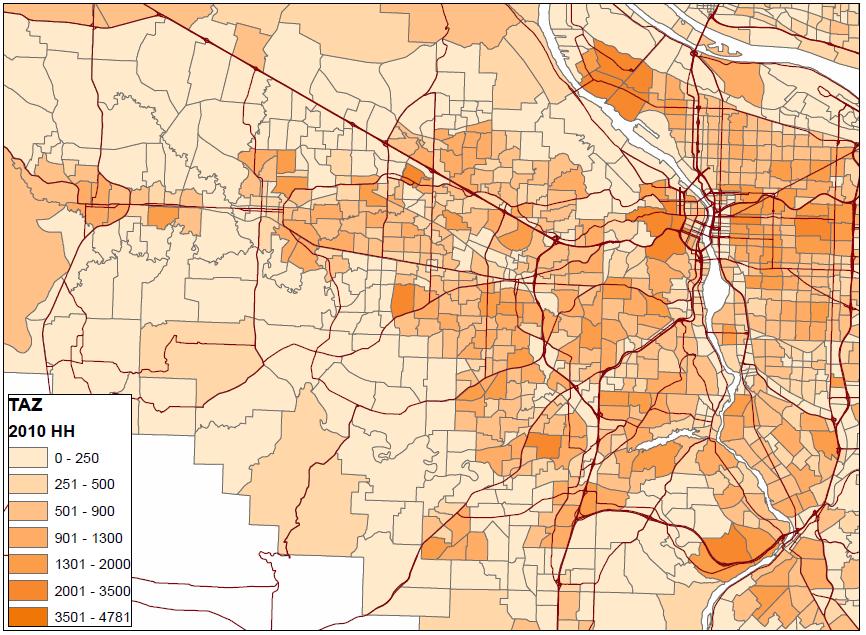
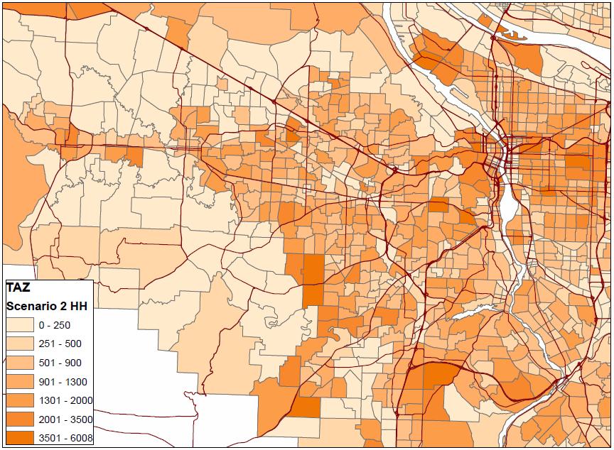
18 Households
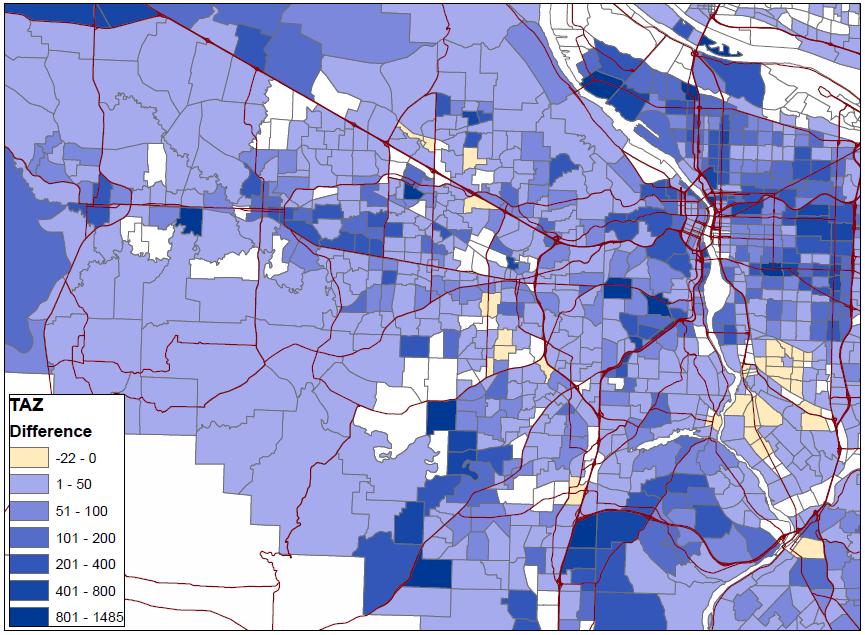
19 Households


20 Employment
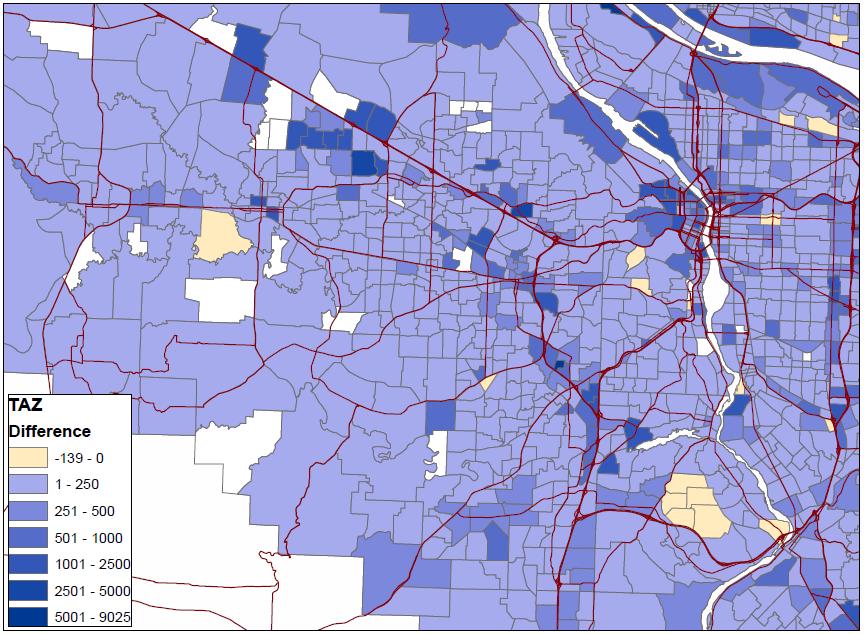
21 Employment
22 Next Steps Land Use data becomes: Input to transportation model Basis for evaluation measures
23 TRANSPORTATION INVESTMENT PACKAGES

24
25 TRANSPORTATION INVESTMENT PACKAGES CONCEPTUALLY Concept A Common Elements All Modes Planned Investments Technology Pricing Concept B
26 QUESTIONS? Are these the right challenges? Are there other challenges you think need to be addressed? Do the conceptual investment packages reflect the types of investments you want to study?
27 TRANSIT Future Challenges Connecting people from where they live to their daily needs and employment areas Growth in satellite cities Connections to new urban areas
28 Concept A Grid network Community connectors to serve growing residential and employment areas TRANSIT Common Elements SW Corridor HCT Service Enhancement Plans Wider use of Transit Priority Concept B High capacity and express services to nodes, and satellite cities Additional park & ride Community connectors to serve growing residential and employment areas
29 Concept A Grid network Community connectors to serve growing residential and employment areas BRT on TV Hwy and B- H Hwy TRANSIT Common Elements SW Corridor HCT Service Enhancement Plans Wider use of Transit Priority Concept B High capacity and express services to nodes, and satellite cities Additional park & ride Community connectors to serve growing residential and employment areas
30 Concept A Grid network Community connectors to serve growing residential and employment areas BRT on TV Hwy and B- H Hwy TRANSIT Common Elements SW Corridor HCT Service Enhancement Plans Wider use of Transit Priority Concept B High capacity and express services to nodes, and satellite cities Additional park & ride Community connectors to serve growing residential and employment areas
31 Concept A Grid network Community connectors to serve growing residential and employment areas BRT on TV Hwy and B- H Hwy TRANSIT Common Elements SW Corridor HCT Service Enhancement Plans Wider use of Transit Priority Concept B High capacity and express services to nodes, and satellite cities Additional park & ride Community connectors to serve growing residential and employment areas
32 ARTERIALS AND COLLECTORS Delay and reliability Future Challenges Arterials serving all needs and functions Urban traffic on rural roads and through neighborhoods Lack of grid connectivity
33 Concept A Improved parallel connections to Hwy 217, US 26 and TV Hwy Reduced Travel Speeds Safety improvements on rural roadways o Cornelius Pass (US 26 to US 30) Around the mountain connections ARTERIALS AND COLLECTORS Common Elements I-5/99W Connector Southern Arterial Widen arterials and collectors (e.g. Tualatin Sherwood Road) Overcrossing of Hwy 217 and US 26 Urban Reserves local network Concept B Widen Cornelius Pass (US 26 to US 30) to 4 lanes New east-west connection between Forest Grove and Hillsboro Grade Separated Intersections
34 Concept A Improved parallel connections to Hwy 217, US 26 and TV Hwy Reduced Travel Speeds Safety improvements on rural roadways o Cornelius Pass (US 26 to US 30) Around the mountain connections ARTERIALS AND COLLECTORS Common Elements I-5/99W Connector Southern Arterial Widen arterials and collectors (e.g. Tualatin Sherwood Road) Overcrossing of Hwy 217 and US 26 Urban Reserves local network Concept B Widen Cornelius Pass (US 26 to US 30) to 4 lanes New east-west connection between Forest Grove and Hillsboro Grade Separated Intersections
35 Concept A Improved parallel connections to Hwy 217, US 26 and TV Hwy Reduced Travel Speeds Safety improvements on rural roadways o Cornelius Pass (US 26 to US 30) Around the mountain connections ARTERIALS AND COLLECTORS Common Elements I-5/99W Connector Southern Arterial Widen arterials and collectors (e.g. Tualatin Sherwood Road) Overcrossing of Hwy 217 and US 26 Urban Reserves local network Concept B Widen Cornelius Pass (US 26 to US 30) to 4 lanes New east-west connection between Forest Grove and Hillsboro Grade Separated Intersections
36 Concept A Improved parallel connections to Hwy 217, US 26 and TV Hwy Reduced Travel Speeds Safety improvements on rural roadways o Cornelius Pass (US 26 to US 30) Around the mountain connections ARTERIALS AND COLLECTORS Common Elements I-5/99W Connector Southern Arterial Widen arterials and collectors (e.g. Tualatin Sherwood Road) Overcrossing of Hwy 217 and US 26 Urban Reserves local network Concept B Widen Cornelius Pass (US 26 to US 30) to 4 lanes New east-west connection between Forest Grove and Hillsboro Grade Separated Intersections
37 THROUGHWAYS Future Challenges Delay and reliability Major bottlenecks Lack of North-South routes East-West routes functioning as arterials
38 Concept A THROUGHWAYS Concept B Auxiliary lanes at constrained locations Overcrossings between interchanges Hwy 219 passing lanes and Scholls- Sherwood realignment Targeted ramp meter bypass Access management on TV Hwy and OR 99W Common Elements 6 lane US 26 to Brookwood Allen-Denney split diamond interchange I-5 Columbia River Crossing Auxiliary lanes on I-5 between Rose Qrt and Nyberg New 6 lane limited access multi-modal roadway (with dedicated transit) Additional capacity on Hwy 217 (6 lanes) and I-5 (8 lanes, PDX past Boones Bridges) Managed lane on 8 lane facilities
39 Concept A THROUGHWAYS Concept B Auxiliary lanes at constrained locations Overcrossings between interchanges Hwy 219 passing lanes and Scholls- Sherwood realignment Targeted ramp meter bypass Access management on TV Hwy and OR 99W Common Elements 6 lane US 26 to Brookwood Allen-Denney split diamond interchange I-5 Columbia River Crossing Auxiliary lanes on I-5 between Rose Qrt and Nyberg New 6 lane limited access multi-modal roadway (with dedicated transit) Additional capacity on Hwy 217 (6 lanes) and I-5 (8 lanes, PDX past Boones Bridges) Managed lane on 8 lane facilities Grade Separated intersections on TV Hwy and OR 99W
40 Concept A THROUGHWAYS Concept B Auxiliary lanes at constrained locations Overcrossings between interchanges Hwy 219 passing lanes and Scholls- Sherwood realignment Targeted ramp meter bypass Access management on TV Hwy and OR 99W Common Elements 6 lane US 26 to Brookwood Allen-Denney split diamond interchange I-5 Columbia River Crossing Auxiliary lanes on I-5 between Rose Qrt and Nyberg New 6 lane limited access multi-modal roadway (with dedicated transit) Additional capacity on Hwy 217 (6 lanes) and I-5 (8 lanes, PDX past Boones Bridges) Managed lane on 8 lane facilities Grade Separated intersections on TV Hwy and OR 99W
41 Concept A THROUGHWAYS Concept B Auxiliary lanes at constrained locations Overcrossings between interchanges Hwy 219 passing lanes and Scholls- Sherwood realignment Targeted ramp meter bypass Access management on TV Hwy and OR 99W Common Elements 6 lane US 26 to Brookwood Allen-Denney split diamond interchange I-5 Columbia River Crossing Auxiliary lanes on I-5 between Rose Qrt and Nyberg New 6 lane limited access multi-modal roadway (with dedicated transit) Additional capacity on Hwy 217 (6 lanes) and I-5 (8 lanes, PDX past Boones Bridges) Managed lane on 8 lane facilities Grade Separated intersections on TV Hwy and OR 99W
42 FREIGHT Future Challenges Higher level of uncertainty Congestion on major freight routes Transporting hazardous materials, oversize, and overweight freight Last mile connectivity
43 Concept A Targeted freight priority First mile/last mile connections Cornelius Pass safety improvements Increased rail freight FREIGHT Common Elements Widen US 26 to 6 lanes from 185 th Ave to Brookwood Parkway Grahams Ferry Road improvements 5-lane 124 th Avenue 5-lane Tualatin Sherwood Road Southern Arterial Concept B New 6 lane limited access multi-modal roadway (with dedicated transit) Additional capacity on Hwy 217 (6 lanes) and I- 5 (8 lanes, PDX past Boones Bridges) Freight lane on regional system Cornelius Pass capacity improvements Ramp Meter bypass
44 Concept A Targeted freight priority First mile/last mile connections Cornelius Pass safety improvements Increased rail freight FREIGHT Common Elements Widen US 26 to 6 lanes from 185 th Ave to Brookwood Parkway Grahams Ferry Road improvements 5-lane 124 th Avenue 5-lane Tualatin Sherwood Road Southern Arterial Concept B New 6 lane limited access multi-modal roadway (with dedicated transit) Additional capacity on Hwy 217 (6 lanes) and I- 5 (8 lanes, PDX past Boones Bridges) Freight lane on regional system Cornelius Pass capacity improvements Ramp Meter bypass
45 Concept A Targeted freight priority First mile/last mile connections Cornelius Pass safety improvements Increased rail freight FREIGHT Common Elements Widen US 26 to 6 lanes from 185 th Ave to Brookwood Parkway Grahams Ferry Road improvements 5-lane 124 th Avenue 5-lane Tualatin Sherwood Road Southern Arterial Concept B New 6 lane limited access multi-modal roadway (with dedicated transit) Additional capacity on Hwy 217 (6 lanes) and I- 5 (8 lanes, PDX past Boones Bridges) Freight lane on regional system Cornelius Pass capacity improvements Ramp Meter bypass
46 Concept A Targeted freight priority First mile/last mile connections Cornelius Pass safety improvements Increased rail freight FREIGHT Common Elements Widen US 26 to 6 lanes from 185 th Ave to Brookwood Parkway Grahams Ferry Road improvements 5-lane 124 th Avenue 5-lane Tualatin Sherwood Road Southern Arterial Concept B New 6 lane limited access multi-modal roadway (with dedicated transit) Additional capacity on Hwy 217 (6 lanes) and I- 5 (8 lanes, PDX past Boones Bridges) Freight lane on regional system Cornelius Pass capacity improvements Ramp Meter bypass
47 Biking, Walking, and Other Mobility Devices Future Challenges Gaps in the biking and walking network Growing vulnerable populations Travel speeds in centers Major barriers (highways, arterials and railroads)
48 Concept A Additional arterial, throughway and rail bike/ped crossings Enhanced on-street facilities Biking, Walking, and Other Mobility Devices Common Elements Planned bike lanes and sidewalks Westside Trail crossing of US 26 Wider use of ped/bike signal detection and priority Concept B Regional protected bike highways Arterial, throughway and rail grade separated bike/ped crossings
49 Concept A Additional arterial, throughway and rail bike/ped crossings Enhanced on-street facilities Biking, Walking, and Other Mobility Devices Common Elements Planned bike lanes and sidewalks Westside Trail crossing of US 26 Wider use of ped/bike signal detection and priority Concept B Regional protected bike highways Arterial, throughway and rail grade separated bike/ped crossings
50 Concept A Additional arterial, throughway and rail bike/ped crossings Enhanced on-street facilities Biking, Walking, and Other Mobility Devices Common Elements Planned bike lanes and sidewalks Westside Trail crossing of US 26 Wider use of ped/bike signal detection and priority Concept B Regional protected bike highways Arterial, throughway and rail grade separated bike/ped crossings
51 Concept A Additional arterial, throughway and rail bike/ped crossings Enhanced on-street facilities Biking, Walking, and Other Mobility Devices Common Elements Planned bike lanes and sidewalks Westside Trail crossing of US 26 Wider use of ped/bike signal detection and priority Concept B Regional protected bike highways Arterial, throughway and rail grade separated bike/ped crossings
52 EVALUATION OF TRANSPORTATION INVESTMENT PACKAGES
53 Community Values 1) Connectivity 2) Efficiency 3) Transportation Options 4) Community Identity 5) Social Equity 6) Environmental Stewardship 7) Strategic Investment 8) Economic Vitality 9) Health 10)Safety

54 How Should we Evaluate the Transportation Investment Packages? COMMUNITY VALUES ORGANIZED TO INFORM EVALUATION

55 Proposed Travel Corridors
56 PUBLIC INVOLVEMENT ON TRANSPORTATION INVESTMENT PACKAGES
57 Goal of Public Involvement Provide input to help shape the transportation investment packages (Did we miss anything?) Set the stage for main public outreach effort in Fall 2015
58 Questions for the Public Transportation challenges Any other challenges that need to be addressed? Transportation investment packages Any other solutions that should be studied? Evaluation measures What information would you find helpful to assess trade-offs between the packages?

59 Outreach Activities Online Open House Meeting with stakeholders and organizations Targeted outreach to underserved populations Media outreach: social media, blasts, press releases, web outreach
60 Questions for SAC Does this seem like the right approach? Other ideas for engagement? What groups need to be updated at this point?
61 PUBLIC COMMENT
62 NEXT STEPS
63 NEXT STEPS SAC Input on Packages Refine Draft TIPs for Public Review Public Comment on TIP late October-early November SAC review of final packages for modeling in December
64 Thank you! Study Contact Information Department of Land Use and Transportation
Basalt Creek Transportation Refinement Plan Recommendations
 Basalt Creek Transportation Refinement Plan Recommendations Introduction The Basalt Creek transportation planning effort analyzed future transportation conditions and evaluated alternative strategies for
Highway 217 Corridor Study. Phase I Overview Report
 Highway 217 Corridor Study Phase I Overview Report November 3, 24 BACKGROUND AND OVERVIEW Study purpose The Highway 217 Corridor Study is developing multi-modal transportation solutions for traffic problems
Providing an Efficient and Multi-modal Transportation System
 Providing an Efficient and Multi-modal Transportation System Welcome and Introductions The Plan Process Transportation Overview Workshop Discussions Report Out and Next Steps AGENDA Comprehensive Plan
City of Hamilton s Transportation Master Plan (TMP) Public Consultation 3 December 2015
 Public Consultation 3 December 2015") City of Hamilton s Transportation Master Plan (TMP) Public Consultation 3 December 2015 McPhail Transportation Planning Services Ltd. AGENDA 6:00 7:00 pm Viewing Boards / Q & A with the Team 7:00 7:50
City of Hamilton s Transportation Master Plan (TMP) Public Consultation 3 December 2015 McPhail Transportation Planning Services Ltd. AGENDA 6:00 7:00 pm Viewing Boards / Q & A with the Team 7:00 7:50
Transportation Master Plan Advisory Task Force
 Transportation Master Plan Advisory Task Force Network Alternatives & Phasing Strategy February 2016 BACKGROUND Table of Contents BACKGROUND Purpose & Introduction 2 Linking the TMP to Key Council Approved
Durham Region Long Term Transit Strategy
 Durham Region Long Term Transit Strategy An adaptive, safe, reliable, frequent, accessible and desirable transit system that shapes and connects Durham Region and beyond in an economically and environmentally
Chapter 7. Transportation. Transportation Road Network Plan Transit Cyclists Pedestrians Multi-Use and Equestrian Trails
 Chapter 7 Transportation Transportation Road Network Plan Transit Cyclists Pedestrians Multi-Use and Equestrian Trails 7.1 TRANSPORTATION BACKGROUND The District of Maple Ridge faces a number of unique
COWETA HIGH SCHOOL AND EAST HIGHWAY 51
 COWETA HIGH SCHOOL AND EAST HIGHWAY 51 Lack of sidewalks along Ben Lumpkin Rd. Lack of crosswalks and ramps at intersection. Hwy 51 is wide to cross as a pedestrian. No ADA compliance or connection to
City of Wayzata Comprehensive Plan 2030 Transportation Chapter: Appendix A
 A1. Functional Classification Table A-1 illustrates the Metropolitan Council s detailed criteria established for the functional classification of roadways within the Twin Cities Metropolitan Area. Table
Governor s Transportation Vision Panel
 Office of Governor Kate Brown Governor s Transportation Vision Panel JLA Public Involvement Project Overview The is a yearlong effort to develop a series of recommendations for the Governor that address
Linking Transportation and Health in Nashville & Middle Tennessee
 Linking Transportation and Health in Nashville & Middle Tennessee Fit Nation New Orleans CPPW Mentoring Grant Built Environment Program May 14, 2011 Local Transportation Planning Framework Federal U.S.
WELCOME TO OPEN HOUSE # 1 June 14, 2017
 Langstaff Road Weston Road to Highway 7 Class Environmental Assessment Study WELCOME TO OPEN HOUSE # 1 June 14, 2017 Please sign in and join our mailing list Purpose of Open House #1 & Study Area York
Chapter 5 Future Transportation
 Chapter 5 Future Transportation The Future Land Use Plan identifies the desired land use designations. The land uses desired for Crozet depend, in large part, on the success of the transportation system,
Public Consultation Centre
 Region of Waterloo Transportation Master Plan Update Public Consultation Centre See the Information Package on how to contact the Project Team and complete the Comment Sheet www.regionofwaterloo.ca/en/exploring-the-region/transportation-master-plan.aspx
Vision Public Workshop: Findings
 Vision Public Workshop: Findings Long Range Transportation Plan & Bicycle Mobility Plan February 2018 Vision Workshop South Kingstown 1/23/18 Providence 1/24/18 Newport 1/31/18 Long Range Transportation
ACTIVE TRANSPORTATION
 ACTIVE TRANSPORTATION Mobility 2040 Supported Goals Improve the availability of transportation options for people and goods. Support travel efficiency measures and system enhancements targeted at congestion
Figure 1: East West Connector Alignment Alternatives Concept Drawing
 Page 2 of 9 Figure 1: East West Connector Alignment Alternatives Concept Drawing The Montebello Drive extension will run north south and connect Wilsonville Road to the Boones Ferry Road to Brown Road
MCTC 2018 RTP SCS and Madera County RIFP Multi-Modal Project Eval Criteria GV13.xlsx
 MCTC 8 RTP SCS and Madera County RIFP Multi-Modal Project Eval Criteria GV.xlsx Madera County Transportation Commission Regional Transportation Plan / Sustainable Communities Strategy Multi-Modal Project
Welcome. Background. Goals. Vision
 Welcome The formal Public Information Centre (PIC) for the Transportation Master Plan How We GO will be held in early 2017. At that time we will present the recommended transportation system for Niagara
WEST AND SOUTH WEST RING ROAD DOWNSTREAM TRAFFIC IMPACTS
 Page 1 of 9 EXECUTIVE SUMMARY Alberta Transportation ( AT ) is preparing to construct the final sections of the Calgary Ring Road. This includes the South West Ring Road ( SWRR ) (from Lott Creek Blvd
Portland International Airport Bicycle and Pedestrian Plan (October 2003) Staff Acknowledgements
 Staff Acknowledgements") Portland International Airport Bicycle and Pedestrian Plan (October 2003) Staff Acknowledgements Scott King, Senior Aviation Planner Jason Gately, Senior Aviation Planner Preston Beck, Associate Planner
Portland International Airport Bicycle and Pedestrian Plan (October 2003) Staff Acknowledgements Scott King, Senior Aviation Planner Jason Gately, Senior Aviation Planner Preston Beck, Associate Planner
I-105 Corridor Sustainability Study (CSS)
") I-105 Corridor Sustainability Study (CSS) Metro Streets and Freeways Subcommittee March 21, 2019 Gary Hamrick Cambridge Systematics, Inc. I-105 CSS Project History & Background Funded by Caltrans Sustainable
I-105 Corridor Sustainability Study (CSS) Metro Streets and Freeways Subcommittee March 21, 2019 Gary Hamrick Cambridge Systematics, Inc. I-105 CSS Project History & Background Funded by Caltrans Sustainable
ACTION TRANSMITTAL No
 Transportation Advisory Board of the Metropolitan Council of the Twin Cities ACTION TRANSMITTAL No. 2016-15 DATE: January 14, 2016 TO: TAC Planning Committee PREPARED BY: Steven Elmer (651) 602-1756 SUBJECT:
Chapter 6 Transportation Plan
 Chapter 6 Transportation Plan Transportation Plan Introduction Chapter 6 Transportation Plan Transportation Plan Introduction This chapter describes the components of Arvada s transportation system, comprised
Draft MOBILITY ELEMENET. Community Meeting May 22, 2013
 Draft MOBILITY ELEMENET Community Meeting May 22, 2013 Agenda Presentation Ira Brown New Mobility Paradigm Movement of People Implementation Q&A Ira Brown and Dave Roseman Small Group Discussion at Each
4. ENVIRONMENTAL IMPACT ANALYSIS 9. TRANSPORTATION AND TRAFFIC
 4. ENVIRONMENTAL IMPACT ANALYSIS 9. TRANSPORTATION AND TRAFFIC 4.9.1 INTRODUCTION The following section addresses the Proposed Project s impact on transportation and traffic based on the Traffic Study
STREET AND HIGHWAY PLAN
 STREET AND HIGHWAY PLAN Introduction The street and highway system in the Winston-Salem Urban Area consists of thousands of miles of traffic carrying facilities, ranging from short local residential streets
Clackamas County Comprehensive Plan
 ROADWAYS The County s road system permits the movement of goods and people between communities and regions, using any of a variety of modes of travel. Roads provide access to virtually all property. They
Washington DC Section of ITE Project Briefing
 Washington DC Section of ITE Project Briefing November 5, 2015 Renée Hamilton, VDOT, Deputy District Administrator I-66 Outside the Beltway Improvement Area Project Location Virginia 2 Purpose and Need
Corridor Advisory Group and Task Force Meeting #10. July 27, 2011
 Corridor Advisory Group and Task Force Meeting #10 July 27, 2011 1 Agenda Recap CAG/TF #9 Public Meeting #2 Summary Single Mode Alternatives Evaluation Results Next Steps 2 3 CAG/TF #9 Recap CAG /TF #9
Building a Liveable Ottawa 2031 Backgrounder 4: Kanata/Stittsville
 Building a Liveable Ottawa 2031 Backgrounder 4: Kanata/Stittsville Wards 4, 6 and 23 Official Plan Transportation Master Plan Cycling Plan Pedestrian Plan October 2013 ottawa.ca/liveableottawa Building
Bus Rapid Transit Plans
 Twin Cities Region Bus Rapid Transit Plans ULI Minnesota Workshop Connecting Bus Rapid Transit to the Community December 15, 2009 John Levin Director of Service Development Metro Transit Metropolitan Area
TRASBURG RANSPORTATION
 TRASBURG RANSPORTATION LAN DEVELOPED BY THE TRANSPORTATION PLANNING DIVISION OF THE VIRGINIA DEPARTMENT OF TRANSPORTATION IN COOPERATION WITH THE U.S. DEPARTMENT OF TRANSPORTATION, FEDERAL HIGHWAY ADMINISTRATION
Goal 3: Foster an environment of partnerships and collaboration to connect our communities and regions to one another.
 Non-Motorized Transportation Plan (NMTP) Draft Vision, Goal and,, Tri-County Regional Planning Commission (TCRPC) Purpose The purpose of the Tri-County Regional Planning Commission (TCRPC) Non-Motorized
Regional Transportation Needs Within Southeastern Wisconsin
 Regional Transportation Needs Within Southeastern Wisconsin #118274 May 24, 2006 1 Introduction The Southeastern Wisconsin Regional Planning Commission (SEWRPC) is the official areawide planning agency
Congress Avenue. Palm Beach MPO Subcommittee Meetings December 2017
 1 Congress Avenue Palm Beach MPO Subcommittee Meetings December 2017 2 Agenda Study Purpose Study Process Multimodal Alternatives Development Next Steps *ACTION ITEM: CONFIRM ALTERNATIVES TO MOVE INTO
Service Business Plan
 Service Business Plan Service Name Transportation Planning Service Type Public Service Owner Name Kaylan Edgcumbe Budget Year 2019 Service Owner Title Service Description Manager of Transportation Planning
Stakeholder Update. Agenda. Project update Needs Identification Strategy Proposed needs Safety Collectors/Arterials Greenways Local roads
 1 Stakeholder Update May 21, 2018 2 Agenda Project update Needs Identification Strategy Proposed needs Safety Collectors/Arterials Greenways Local roads Proposed Evaluation Criteria Next Steps 1 Project/Schedule
BUILDING THE CASE FOR TRAVEL OPTIONS IN WASHING TON COUNTY. Image: Steve Morgan. Image: Steve Morgan
 BUILDING THE CASE FOR TRAVEL OPTIONS IN WASHING TON COUNTY Image: Steve Morgan Image: Steve Morgan Image: TriMet Image: TriMet WHAT ARE TRAVEL OPTIONS PROGRAMS? Travel options programs encourage residents,
York Region Population and Employment Growth
 March 1, 2016 1 York Region Population and Employment Growth York Region needs to comply with The Provincial Growth Plan and new forecasts introduced to 2036 and 2041 2 Regional Official Plan Review York
POTENTIAL SANTA CLARA COUNTY TRANSPORTATION MEASURE
 POTENTIAL SANTA CLARA COUNTY TRANSPORTATION MEASURE OVERALL DRAFT EXPENDITURE PLAN TRANSIT/Mode Shift Millions % BART to Downtown San Jose/Santa Clara* 1,400 23% Caltrain Capacity & Safety 1,014 17% Mass
2. Context. Existing framework. The context. The challenge. Transport Strategy
 Transport Strategy Providing quality connections Contents 1. Introduction 2. Context 3. Long-term direction 4. Three-year priorities 5. Strategy tree Wellington City Council July 2006 1. Introduction Wellington
Route 7 Corridor Study
 Route 7 Corridor Study Executive Summary Study Area The following report analyzes a segment of the Virginia State Route 7 corridor. The corridor study area, spanning over 5 miles in length, is a multi
TRANSPORTATION & MOBILITY
 TRANSPORTATION & MOBILITY ROADWAY SYSTEM There are approximately 40 miles of roadways in Manitou Springs. For planning purposes, roadways are typically assigned a functional classification which defines
PEDESTRIAN ACTION PLAN
 ATTACHMENT 2 CITY OF SANTA MONICA PEDESTRIAN ACTION PLAN CITY OF SANTA MONICA PEDESTRIAN ACTION PLAN This page intentionally left blank EXECUTIVE SUMMARY CHAPTER 1 EXECUTIVE SUMMARY Setting the Stage
INNER LOOP EAST. AIA Rochester Annual Meeting November 13, 2013 TRANSFORMATION PROJECT. Bret Garwood, NBD Erik Frisch, DES
 INNER LOOP EAST TRANSFORMATION PROJECT AIA Rochester Annual Meeting November 13, 2013 Bret Garwood, NBD Erik Frisch, DES Why? We are building a city that encourages walking, biking and enjoying the outdoor
City of Wilsonville 5 th Street to Kinsman Road Extension Project
 City of Wilsonville 5 th Street to Kinsman Road Walking Tour & Neighborhood Workshop Summary Report Public Outreach Overview On July 18 th, 2017, the City of Wilsonville hosted a neighborhood walking tour
Appendix C. NORTH METRO STATION AREA TRAFFIC IMPACT STATEMENT 88th Avenue Station
 Appendix C NORTH METRO STATION AREA TRAFFIC IMPACT STATEMENT 88th Avenue Station Prepared for: Regional Transportation Department and URS Corporation as part of the North Metro EIS David Evans and Associates,
Performance Criteria for 2035 Long Range Transportation Plan
 Minimizing Impacts on Natural, Historic, Cultural or Archeological Resources 2035 LRTP Weighting Factor: 7% Objective 1.1: Use appropriate planning and design criteria to protect and enhance the built
Rochester Downtown Bicycle Study 2009
 Rochester Downtown Bicycle Study 2009 Relationship of ROCOG Long Range Transportation Plan to Rochester Comprehensive Plan Regional Long Range Transportation Plan (LRTP) is prepared under the auspices
Sixth Line Development - Transit Facilities Plan
 Memorandum Date: November 13, 2012 To: From: c.c. Subject: Rob Freeman (Freeman Planning) Kevin Phillips Sixth Line Development - Transit Facilities Plan 33016631 This memo was prepared to review the transit
WELCOME! Please complete a comment sheet as we value your feedback. 4 pm to 8 pm. September 15, Hosted by: AECOM on behalf of City of Calgary
 WELCOME! Thank you for attending our open house. There will be no formal presentation today so please take the time to read the boards. If you have any questions, please do not hesitate to approach one
2045 Long Range Transportation Plan. Summary of Draft
 2045 Long Range Transportation Plan Summary of Draft Fredericksburg Area Metropolitan Planning Organization The George Washington Region includes the City of Fredericksburg and the counties of Caroline,
NEWMARKET UPHAM S CORNER
 SOUTH STATION Planning Initiative NEWMARKET UPHAM S CORNER COLUMBIA ROAD (P) FOUR CORNERS/GENEVA Working Advisory Group (WAG) Meeting #5 TALBOT AVENUE MORTON STREET BLUE HILL AVE/CUMMINS HWY (P) RIVER
Safety & Convenience for All Users, in All Modes. Barbara McCann NCSL December 3, 2013
 Safety & Convenience for All Users, in All Modes Barbara McCann NCSL December 3, 2013 Safety & Convenience for All Users? Who was left out when this road was planned? Takaaki Iwabu for Raleigh News Observer
Goals, Objectives, and Policies
 Goals, Objectives, and Policies ADVISORY GROUP INPUT PUBLIC INPUT SNS PREVIOUS STUDIES RBPP Goals Vision Statement Southern Nevada will develop a safe, connected, and convenient walking and bicycling system
Preliminary Transportation Analysis
 Preliminary Transportation Analysis Goals of a Robust, Multimodal Transportation Network Safe Accessible/Connected Efficient Comfortable Context-Sensitive Motor Vehicle: Continue to analyze the data to
Route 29 Solutions Projects
 Route 29 Solutions Route 29 Solutions Projects www.route29solutions.org October 10, 2014 Route 29 Widening to Six Lanes Albemarle County This project will widen a 1.8-mile segment of Route 29 from four
T1-A - Service Reduction (Re-sizing)
") Key T1-A Choice A Key T1-B Choice B Key T1-C Choice C Key T1-D Choice D Key T1-E Choice E Key T1-F Choice F Key Choice G T2 T1-A - Service Reduction (Re-sizing) Description This key choice would represent
Key T1-A Choice A Key T1-B Choice B Key T1-C Choice C Key T1-D Choice D Key T1-E Choice E Key T1-F Choice F Key Choice G T2 T1-A - Service Reduction (Re-sizing) Description This key choice would represent
# Southeastern Wisconsin Regional Freeway System Reconstruction Study and Preliminary Recommended Plan
 #70421 Southeastern Wisconsin Regional Freeway System Reconstruction Study and Preliminary Recommended Plan Public Information Meetings and Hearings May June 2002 1 Reason for Freeway System Study 270-mile
DULLES AREA TRANSPORTATION ASSOCIATION (DATA) February 18, Susan Shaw, P.E., VDOT, Megaprojects Director
 February 18, Susan Shaw, P.E., VDOT, Megaprojects Director") DULLES AREA TRANSPORTATION ASSOCIATION (DATA) February 18, 2015 Susan Shaw, P.E., VDOT, Megaprojects Director I-66 Corridor Conditions Steady population growth Employment growth in activity centers Congestion
DULLES AREA TRANSPORTATION ASSOCIATION (DATA) February 18, 2015 Susan Shaw, P.E., VDOT, Megaprojects Director I-66 Corridor Conditions Steady population growth Employment growth in activity centers Congestion
95 th Street Corridor Transportation Plan. Steering Committee Meeting
 95 th Street Corridor Transportation Plan Steering Committee Meeting August 11, 2014 PROJECT OBJECTIVES Develop a Transportation and Economic Plan for the 95 th Street Corridor Improve public transit efficiency
APPENDIX D: SACRAMENTO URBAN AREA TRANSPORTATION PRIORITIES
 1 County County County County 2 Yolo Arterial Roadway Collector Roadway Urban Residential Street Rural Residential Roadway I-80 / U.S. 50 Bus/Carpool Lanes in both directions Richards Blvd PM Yol 80 0.237
Mobility Greater Johnson County Transportation Coalition. May 23, 2018
 Mobility 2045 Greater Johnson County Transportation Coalition May 23, 2018 Agenda Regional Perspective Mobility Planning Overview Mobility 2045 Draft Recommendations Financial Planning Overview Schedule
Online Open House Survey Report. December 2016
 December 216 I. OVERVIEW & OUTREACH SUMMARY Introduction Washington County evaluated long-term transportation investments and strategies as part of the Transportation Futures Study. The purpose of the
HARRISON STREET/OAKLAND AVENUE COMMUNITY TRANSPORTATION PLAN
 HARRISON STREET/OAKLAND AVENUE Community Workshop #4: Draft Plan Review December 3, 2009 D E S I G N, C O M M U N I T Y & E N V I R O N M E N T INTRODUCTIONS Key Project Staff: Alisa Shen, Project Manager,
Task Force Meeting #5, August 3, Prepared by DKS Associates
 Task Force Meeting #5, August 3, 2018 Prepared by DKS Associates Agenda 1. Agenda Review and Meeting #4 Recap 2. Review Project Goal, Data, and Project Ideas 3. Recommendations and Reporting a) Recommended
Washington Metropolitan Area Transit Authority Board Action/Information Summary
 Washington Metropolitan Area Transit Authority Board Action/Information Summary Action Information MEAD Number: 200242 Resolution: Yes No TITLE: MWCOG Strategic Investment Plan & TPB Priorities PRESENTATION
North Shore Transportation Improvement Strategy
 North Shore Transportation Improvement Strategy Preliminary, Near-term Recommendation 2016 April Transportation Improvement Strategy (TIS) Comprehensive and Analytical A multi-modal transportation strategy
Perryville TOD and Greenway Plan
 Perryville TOD and Greenway Plan Greenway Glossary Pathway: A bicycle and pedestrian path separated from motorized vehicular traffic by an open space, barrier or curb. Multi-use paths may be within the
A CHANGING CITY. of Edmonton, it is essential that it reflects the long-term vision of the City.
 A CHANGING CITY By the year 2040, Edmonton will be home to more than 1 million people. To accommodate growth and support a healthy and compact city, we need a new approach to development/redevelopment
Planning Study SR 976. Project Advisory Team Meeting May 24, 2017
 ` SR 976 BIRD ROAD/SW 40TH STREET FROM SR 821/HEFT TO SR 5/US-1 Miami-Dade County, Florida FPID No.: 434845-4-22-01 Planning Study Project Advisory Team Meeting May 24, 2017 1 Agenda Introductions Project
Dumbarton Transportation Corridor Study. San Francisco Bay ITE November 2016
 Dumbarton Transportation Corridor Study San Francisco Bay ITE November 2016 Dumbarton Corridor Source: Wikipedia 2 Dumbarton Corridor 3 Growth Imbalance Jobs-housing imbalance Major employers driving growth
Arlington County 10-Year Transit Development Plan & Premium Transit Network Briefing. May 2016
 Arlington County 10-Year Transit Development Plan & Premium Transit Network Briefing May 2016 Overview 10-Year Transit Development Plan Premium Transit Network Columbia Pike service concept Premium amenities
Thank you for attending
 Improving mobility safety comfort WELCOME Thank you for attending The purpose of this meeting is to: Learn about the project Prioritize potential walking and biking improvements on Snelling Ave Gather
Bike/Multipurpose Trail Study for Glynn County, Georgia MAY 16, 2016
 Bike/Multipurpose Trail Study for Glynn County, Georgia MAY 16, 2016 Agenda» Project Status Update» Draft Recommendations Overview» Next Steps» Questions/Discussion Project Overview» Comprehensive Bikeway
Circulation in Elk Grove includes: Motor vehicles, including cars and trucks
 Circulation, as it is used in this General Plan, refers to the many ways people and goods move from place to place in Elk Grove and the region. Circulation in Elk Grove includes: Motor vehicles, including
Welcome. Public Meeting. Heading 1. Heading 2. DeMers Ave. Columbia Rd. Washington St. 42nd St. 32nd Ave. Heading 3 HEADING
 Heading 1 Heading 2 Heading 3 HADING Welcome 4 Heading 5 Normal Normal Less Spacing Public Meeting Normal No Spacing Strong mphasis Intense mphasis To Do List ullet List ullet Last List ullet 2 CÞ List
Exhibit 1 PLANNING COMMISSION AGENDA ITEM
 Exhibit 1 PLANNING COMMISSION AGENDA ITEM Project Name: Grand Junction Circulation Plan Grand Junction Complete Streets Policy Applicant: City of Grand Junction Representative: David Thornton Address:
DES MOINES AREA MPO. Presentation to Iowa Commercial Real Estate Association. April 6, 2017
 DES MOINES AREA MPO Presentation to Iowa Commercial Real Estate Association April 6, 2017 Presentation Outline MPO Overview Trends We re Watching Plans, Projects, Initiatives, Regional Transportation Priorities
Regional Bicycle Barriers Study
 Regional Bicycle Barriers Study Executive Summary Background and Purpose The 2040 Transportation Policy Plan (TPP) sets policies for planning and investment direction in the transportation system in the
2015 Florida Main Street Annual Conference. Complete Streets Equal Stronger Main Streets
 WHAT ARE COMPLETE STREETS? CASE STUDIES COMPLETING YOUR MAIN STREET 2015 Florida Main Street Annual Conference St. Petersburg, Florida August 19, 2015 WHAT ARE COMPLETE STREETS? CASE STUDIES COMPLETING
We believe the following comments and suggestions can help the department meet those goals.
 The Honorable Secretary Anthony Foxx The Secretary of Transportation United States Department of Transportation 1200 New Jersey Avenue, SE Washington, DC 20590 August 30, 2013 Dear Secretary Foxx, Thank
TRANSPORTATION TRAINING TOPICS. April 6, 2010
 TRANSPORTATION TRAINING TOPICS April 6, 2010 Roles of Transportation Providers Context and Policy Makers Division of Transportation and Traffic Other City Operations Other Transportation Operators CMA
ARTINSVILLE ENRY OUNTY REA RANSPORTATION TUDY
 ARTINSVILLE ENRY OUNTY REA RANSPORTATION TUDY DEVELOPED BY THE TRANSPORTATION AND MOBILITY PLANNING DIVISION OF THE VIRGINIA DEPARTMENT OF TRANSPORTATION IN COOPERATION WITH THE U.S. DEPARTMENT OF TRANSPORTATION,
Overview. Illinois Bike Summit IDOT Complete Streets Policy Presentation. What is a Complete Street? And why build them? And why build them?
 Overview Illinois Bike Summit IDOT Complete Streets Policy Presentation Aren Kriks, P.E. District One Bicycle Coordinator and Bureau of Programming Project Engineer History of Complete Streets IDOT Policy
This page intentionally left blank.
 This page intentionally left blank. COMMUNITY Coweta Community Overview Coweta Coweta, a residential community located in Wagoner County, is a suburb of Tulsa situated southeast of the metropolitan area
Multi Modal Transit Access Plan KIPDA ID # 239. Project Type: STUDY
 Multi Modal Transit Access Plan KIPDA ID # 239 Project Type: STUDY Description: In conjunction with the results from Project Gobility and the Transit LOS Analysis, TARC seeks to examine the possibilities
AGENDA ITEM NO. 5b HCAOG TAC meeting of May 8, 2014
 Humboldt County Association of Governments Eureka, CA, 95501 AGENDA ITEM NO. 5b HCAOG TAC meeting of May 8, 2014 DATE: May 1, 2014 TO: HCAOG Technical Advisory Committee (TAC) FROM:, SUBJECT: Letters of
WHITE PAPER: TRANSIT SERVICE FOR SOUTH SHAGANAPPI
 9/27/2012 TRANSIT PLANNING WHITE PAPER: TRANSIT SERVICE FOR SOUTH SHAGANAPPI 2012 Calgary Transit 1 Table of Contents Purpose... 3 Area of Change... 3 Background... 3 Access to destinations... 5 Connecting
SR 693 (Pasadena Avenue) Corridor Study from Shore Drive South to 66 th Street
 Corridor Study from Shore Drive South to 66 th Street") Welcome and Introduction Sign-in and comment sheets Restrooms and exits Meeting agenda and timeline Meeting goals / expectations Provide input to guide study recommendations Actively participate throughout
Welcome and Introduction Sign-in and comment sheets Restrooms and exits Meeting agenda and timeline Meeting goals / expectations Provide input to guide study recommendations Actively participate throughout
City of Gainesville Transportation/Roadway Needs PROJECT SUMMARY
 A1 Roadway Resurfacing $23,846,000 TYPE: Preservation of existing system Roadway resurfacing A2 Signal Replacement $6,000,000 TYPE: Preservation of existing system Replace traffic signals. B1 W 6th St
Welcome. Thank you for your interest in the Lewis & Clark Viaduct Concept Study
 Welcome Thank you for your interest in the Lewis & Clark Viaduct Concept Study Please use the arrows in the upper left hand corner to navigate through the presentation. Use the envelope icon to ask a question
Sacramento Grid 2.0. The Downtown Transportation Study
 Sacramento Grid 2.0 The Downtown Transportation Study April 20, 2016 The Grid 4.25 square miles Street grid defined at birth of City Lettered and numbered streets spaced every 400 ft East-west alleys halfway
3.0 Future Conditions
 3.0 Future Conditions In order to be able to recommend appropriate improvements to the transportation system of the Town, it is important to first understand the nature and volume of traffic that is expected
Project Description Form 6V
 Project Description Form 6V Basic Project Information Submitting Jurisdiction/Agency: Prince William County Project Title: Route 15 Widening: Route 55 to south of RR tracks & Construct RR Overpass Project
Typical Rush Hour Commute. PennyforTransportation.com
 Typical Rush Hour Commute In the News Overview of the Plan Collaborative plan with projects in every community Prioritizing connectivity and congestion relief Dedicated transportation-specific funding;
City of Novi Non-Motorized Master Plan 2011 Executive Summary
 City of Novi Non-Motorized Master Plan 2011 Executive Summary Prepared by: February 28, 2011 Why Plan? Encouraging healthy, active lifestyles through pathway and sidewalk connectivity has been a focus
Twin Cities Bicycle Barriers Study Technical Advisory Work Group December 19, 2016
 Twin Cities Bicycle Barriers Study Technical Advisory Work Group December 19, 2016 Regional Bicycle Barriers Overall Study Area Parameters Specific Barrier Parameters Rivers & streams Rail corridors Overall
State Road 54/56 Tampa Bay s Northern Loop. The Managed Lane Solution Linking I-75 to the Suncoast Parkway
 State Road 54/56 Tampa Bay s Northern Loop The Managed Lane Solution Linking I-75 to the Suncoast Parkway SUNCOAST PARKWAY Both I 75 and the Suncoast Parkway are planning, or in the process of constructing,