BIKE ON ROAD NETWORKS: URBAN & RURAL. Non-motorized Transportation Networks. Madison County Council of Governments
|
|
|
- Griselda McKenzie
- 5 years ago
- Views:
Transcription

1 ON ROAD NETWORKS: URBAN & RURAL Non-motorized Transportation Networks Madison County Council of Governments 16 E. 9 th Street Anderson, IN th ANNUAL PURDUE ROAD SCHOOL MARCH 5-7, 2013

2 PRESENTATION OVERVIEW Background Information 2005 Bicycle & Pedestrian Master Plan 2014 Update Next Steps

3 BACKGROUND INFORMATION Madison County, Indiana Metropolitan Planning Area 130,000 population 450 square miles 3 cities, 11 towns

4 BACKGROUND INFORMATION August 12, 1996 I live in Pendleton. I would love to be able to ride my bike to work everyday instead of driving, if I could do it safely. I would do it in a minute.

5 BACKGROUND INFORMATION September 06, We like it. It is a great idea and would improve the quality of life in this part of Indiana.
6 Roadway inventory miles of roads - All county roads and highways inventoried - Checklist


7 Design Considerations - Pavement - Lane widths and design speed - Horizontal alignment and grade - Sight distance - Signs and marking

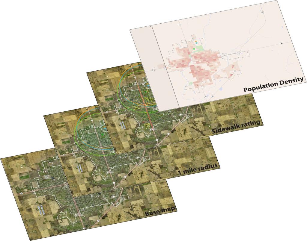
8 Level-of-Service Map - ArcView GIS - Values for criteria - Some items will be weighed more heavily than others


9 Photographic inventory - Photos of existing facilities in the county - Indian Trails Greenway - Falls Park trails - Shadyside trails - County Roads - Attractions/nodes


10 Field Study - Accompanied by Spoke and Wheel Club - Valuable to experience roads from cyclists viewpoint
11 Community Outreach - Citizen Advisory Committee - Public meetings - Meetings with municipalities - Alexandria, Anderson, Chesterfield, Daleville, Edgewood, Elwood, Fortville, Frankton, Ingalls, Lapel, Markleville, Orestes, Pendleton, Summitville, and Madison County

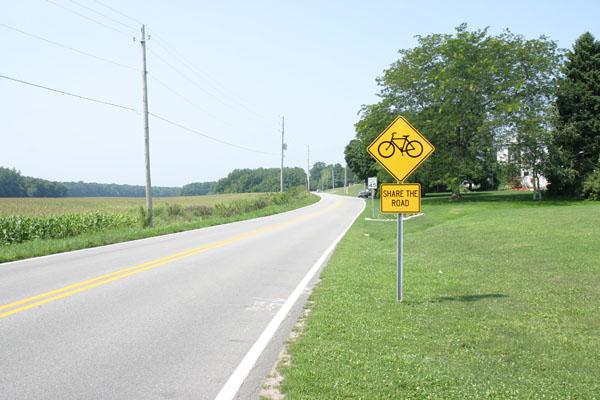
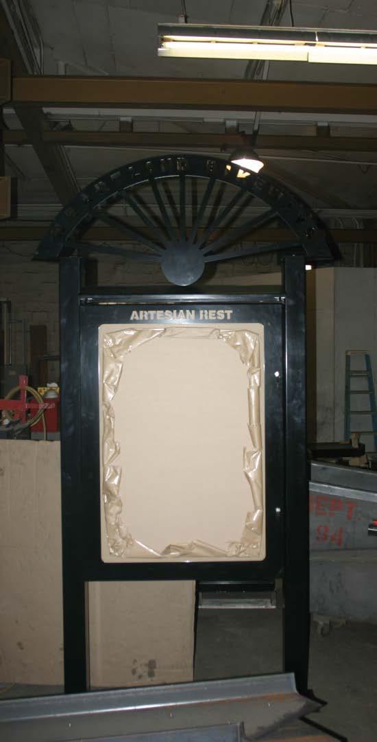
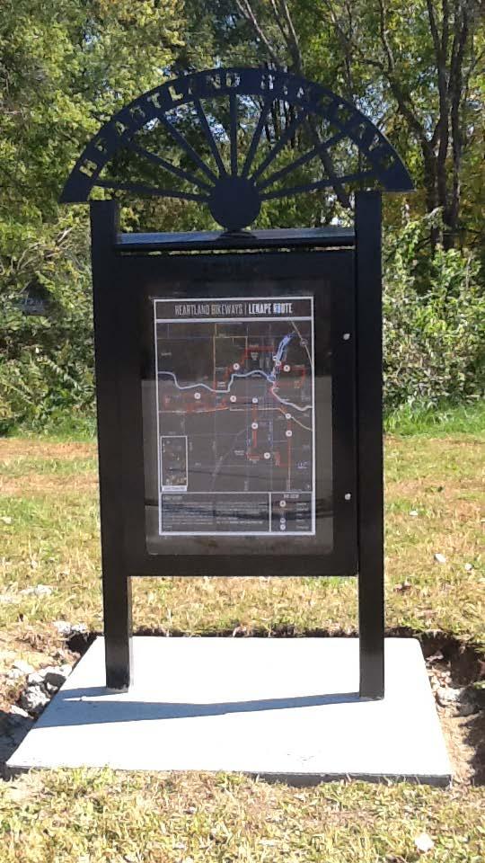
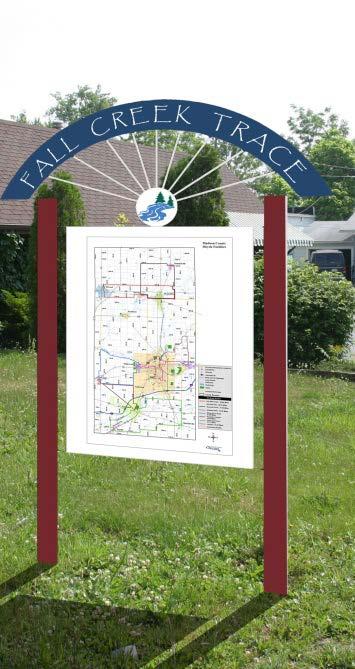
12 Support facilities - Trailheads - Rest and water stops - Restrooms - Bicycle racks - Information kiosks - Stops in all municipalities
13
14 Route: State Road 38 From: State Road 9/67 to County Road 300 East Segment Length = 5.2 mile Background The analysis of State Road 38 shows there is great potential for the road to be part of the county wide plan for bicycle and pedestrian facilities. The land along this route is mainly farmland and residential near the town of Markleville. This segment of the proposed county wide trail is currently part of the Spoke and Wheel route. Existing Conditions The analysis studies State Road 38 from County Road 300 East to State Road 9/67, an overall corridor length of 5.2 miles. This two way asphalt road has a lane width of 11 feet, 6 inches. A shoulder with a width of 2 feet, 10 inches exists, and there is no parking permitted. The posted speed is 50 miles per hour, while the observed speed is 55 miles per hour. The traffic volume is around 4,553 vehicles per day. The surface condition was rated in very good condition (5). The right-of-way on the north side is 25 feet. The road crosses a part of Lick Creek. Concerns Acquiring right-of-way Vehicle travel speed Recommendations The trail should be constructed on the north side of the road and physically separated from vehicle travel lanes. Minimum trail width should be 12.
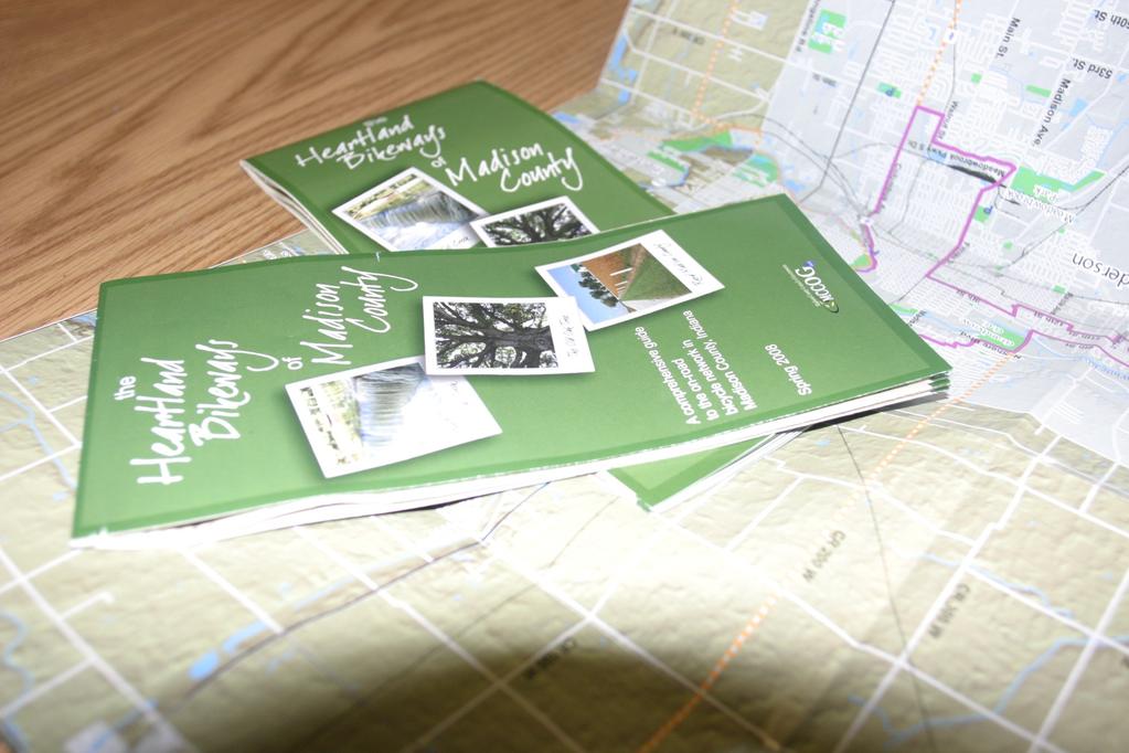
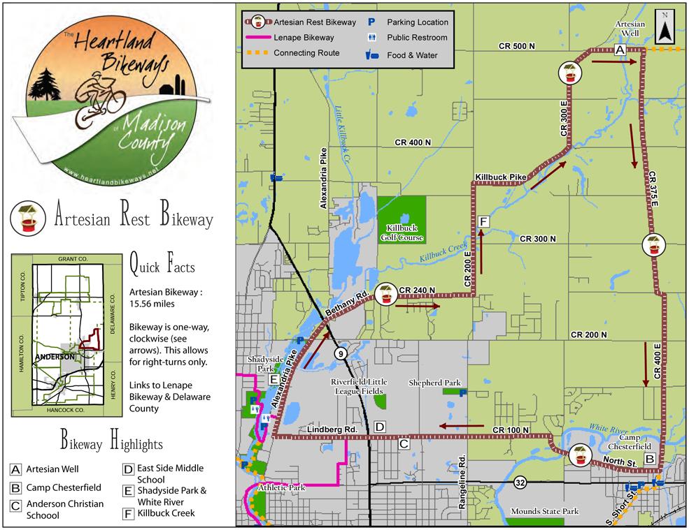
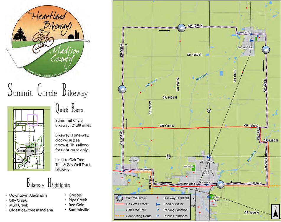
15 Implementation Strategy 1. Prioritize routes 2. Select design treatments 3. Identify potential funding sources 4. Develop public interest 5. Implement route 6. Develop and distribute route brochure 7. Maintain and monitor


16 Roadway Improvements - Drainage grates and utility covers - Traffic control devices - Bicycle lanes - Shoulders - Railroad crossings - Structures - Intersections - Traffic calming

17
18
19
20
21
22
23
24
25
26

27
28 2014 UPDATE 2014 Update - Electric Vehicles/Golf Carts - Long Range Transportation Plan
29 NEXT STEPS Funding - Private Foundations - Transportation Enhancement - STP

30 NEXT STEPS
31 NEXT STEPS Lessons Learned Lack of Awareness Poor Road Maintenance Souvenir/Damaged Signs Tracking Users Funding
32 CONTACT INFORMATION Madison County Council of Governments 16 E. 9 th Street Anderson, Indiana P F E webmaster@mccog.net Allan Henderson, AICP Planning Manager ahenderson@mccog.net

33 Start Pedaling Indiana Alexander Hotel Indianapolis March 15-16,
Developing a Bike/Pedestrian Plan Using ArcInfo and Public Participation Rob Shumowsky, Madison County Council of Governments
 Developing a Bike/Pedestrian Plan Using ArcInfo and Public Participation Rob Shumowsky, Madison County Council of Governments Abstract: The Madison County Council of Governments is creating a bike/pedestrian
Goodlettsville Bicycle and Pedestrian Plan Executive Summary
 Goodlettsville Bicycle and Pedestrian Plan July 2010 In Cooperation with the Nashville Area Metropolitan Planning Executive Organization Summary Introduction Progressive and forward thinking communities
MAG Town of Cave Creek Bike Study Task 6 Executive Summary and Regional Significance Report
 Page 1 MAG Town of Cave Creek Bike Study Task 6 Executive Summary and Regional Significance Report August 1, 2012 MAG Project #481 Page 2 Task 6 Executive Summary and Regional Significance Report Introduction
ACTION TRANSMITTAL No
 Transportation Advisory Board of the Metropolitan Council of the Twin Cities DATE: August 25, 2016 TO: FROM: ACTION TRANSMITTAL No. 2016-47 Technical Advisory Committee TAC Funding and Programming Committee
Non-Motorized Transportation 7-1
 Non-Motorized Transportation 7-1 Transportation facilities no longer mean just accommodating a vehicle powered by a combustion engine. Pedestrian and non-motorized facilities are important modes of travel
Castro Valley Municipal Advisory Council March 19, 2018
 Castro Valley Municipal Advisory Council March 19, 2018 1 Background 2 Draft Bicycle Vision and Pedestrian Networks 3 Next Steps 4 Updates Agenda 2 PROJECT AREA: Unincorporated Areas of Alameda County
TABLE OF CONTENTS. Executive Summary
 Executive Summary Background... ES-1 Pedestrian Network... ES-2 Bikeway Network... ES-2 Collision History... ES-2 Public Input... ES-4 Conclusions and Recommendations... ES-4 1. Introduction and Setting
City of Waterloo Complete Streets Policy
 City of Waterloo Complete Streets Policy Chris Hodgson P. Eng City of Waterloo Complete Streets Forum 2011 April 28-29 Toronto Waterloo context: Current population Major employers Universities and student
Connecting cyclists to work. Syracuse Metropolitan Transportation Council
 Connecting cyclists to work Syracuse Metropolitan Transportation Council Overview Prepared at request: NYS Department of Transportation (NYSDOT) Project Achievements Target group Purpose Process Recommendations
CTDOT Pedestrian and Bicycle Safety Initiatives
 CTDOT Pedestrian and Bicycle Safety Initiatives 2017 Northeast Transportation Safety Conference Mark F. Carlino, P.E. Traffic Engineering Division Chief Bureau of Engineering and Construction Connecticut
Construction Specifications Manual
 Isle of Wight County Pedestrian and Bicycle Master Plan Construction Specifications Manual Adopted August 20, 2009 Introduction The Isle of Wight County Pedestrian and Bicycle Facilities Master Plan was
Best Southwest Transportation Committee. North Central Texas Council of Governments Transportation Department
 Best Southwest Transportation Committee North Central Texas Council of Governments Transportation Department The The Regional Regional Veloweb Veloweb Review Review NCTCOG Bicycle and Pedestrian Program
CITY OF ELKO BICYCLE AND PATHWAY PLAN
 CITY OF ELKO BICYCLE AND PATHWAY PLAN INTRODUCTION: The City of Elko is intended to provide the basic framework for the development of a functional bicycle and pathway system for the community with connections
Gordon Proctor Director Policy on Accommodating Bicycle and Pedestrian Travel on ODOT Owned or Maintained Facilities
 Approved: Policy: 20-004(P) Responsible Office: Planning Gordon Proctor Director Policy on Accommodating Bicycle and Pedestrian Travel on ODOT Owned or Maintained Facilities I. POLICY STATEMENT: This policy
Montclair s Complete Streets Experience
 Presented by: Hon. Jerry Fried, Mayor Montclair Township About Montclair Six square miles Six commuter rail stations Four local bus routes (NJ Transit) Two private commuter bus routes Five business districts
Off-Road Facilities Part 1: Shared Use Path Design
 Off-Road Facilities Part 1: Shared Use Path Design Presentation by: Eric Mongelli, P.E. Tom Huber October 9, 2012 FOLLOW THE CONVERSATION ON TWITTER Toole Design Group is live tweeting this webinar @tooledesign
Moraga Pedestrian and Bicycle Master Plan Update and Wayfinding Plan. Citizens Advisory Committee Meeting July 21, 2015
 Moraga Pedestrian and Bicycle Master Plan Update and Wayfinding Plan Citizens Advisory Committee Meeting July 21, 2015 Planning process Inventory of existing conditions 2 of 21 Planning process Inventory
Bicycle-Pedestrian Master Plan: Chapters 3 and 4 Distribution
 Bicycle-Pedestrian Master Plan: Chapters 3 and 4 Distribution Finksburg Planning and Citizens Council March 22, 2018 Overview Progress Citizen Outreach Vision Chapter 3 - Existing Conditions Chapter 4
Regional Bicycle Barriers Study
 Regional Bicycle Barriers Study Executive Summary Background and Purpose The 2040 Transportation Policy Plan (TPP) sets policies for planning and investment direction in the transportation system in the
Corpus Christi Metropolitan Transportation Plan Fiscal Year Introduction:
 Introduction: The Safe, Accountable, Flexible, Efficient Transportation Equity Act: A Legacy for Users (SAFETEA-LU) has continued the efforts started through the Intermodal Surface Transportation Efficiency
TOWN OF CHAPEL HILL POLICY AND PROCEDURES FOR TRAFFIC CALMING MEASURES
 TOWN OF CHAPEL HILL POLICY AND PROCEDURES FOR TRAFFIC CALMING MEASURES (Adopted by the Town Council on June 30, 2004) (Revised December 6, 2010) (Revised February 8, 2016) POLICY AND PROCEDURES FOR TRAFFIC
DRAFT. Table of Contents. Background
 Douglas County Table of Contents Existing Infrastructure 86 Funding 89 Policy and Program Recommendations 90 Infrastructure Recommendations 92 Conclusion 95 Background Home to 4,500 residents and Baker
Sustainable Transportation Initiatives and Plans in Caledon
 Sustainable Transportation Initiatives and Plans in Caledon Arash Olia, P.Eng., PhD. Coordinator, Transportation Development Finance & Infrastructure Services Town of Caledon Eric Chan, P.Eng., PMP Manager,
Wood and Cortland Neighborhood Greenways
 Wednesday, May 25 th, 2016 Wood and Cortland Neighborhood Greenways Alderman Hopkins 2 nd Ward Alderman Waguespack 32 nd Ward Mike Amsden, AICP Assistant Director of Transportation Planning David Smith,
Agency Advisory Group Meeting #3 and Walk Audit Anchorage Non-Motorized Plan
 Agency Advisory Group Meeting #3 and Walk Audit Anchorage Non-Motorized Plan Friday, May 18 th Walk Audit 10:00-11:30 AM Meeting 11:30 AM 1:00 PM Municipal Planning Department, 4700 Elmore Road, Training
TRANSPORTATION FACILITY PLANNING Waugh Chapel Road Maytime Drive to New Market Lane
 July 24, 2018 TRANSPORTATION FACILITY PLANNING Waugh Chapel Road Maytime Drive to New Market Lane DPWandYOU.com Making a difference, together Meeting Agenda Purpose of the project Overview of work conducted
South Carolina Department of Transportation. Engineering Directive
 South Carolina Department of Transportation Engineering Directive Directive Number: ED-22 Effective: December 16, 2009 Subject: References: Purpose: This Directive Applies to: Considerations for Bicycle
RURAL HIGHWAY SHOULDERS THAT ACCOMMODATE BICYCLE AND PEDESTRIAN USE (TxDOT Project ) June 7, Presented by: Karen Dixon, Ph.D., P.E.
 June 7, Presented by: Karen Dixon, Ph.D., P.E.") RURAL HIGHWAY SHOULDERS THAT ACCOMMODATE BICYCLE AND PEDESTRIAN USE (TxDOT Project 0-6840) June 7, 2016 Presented by: Karen Dixon, Ph.D., P.E., TTI Team: Kay Fitzpatrick, Raul Avelar, & Subasish Das Project
RURAL HIGHWAY SHOULDERS THAT ACCOMMODATE BICYCLE AND PEDESTRIAN USE (TxDOT Project 0-6840) June 7, 2016 Presented by: Karen Dixon, Ph.D., P.E., TTI Team: Kay Fitzpatrick, Raul Avelar, & Subasish Das Project
Basalt Creek Transportation Refinement Plan Recommendations
 Basalt Creek Transportation Refinement Plan Recommendations Introduction The Basalt Creek transportation planning effort analyzed future transportation conditions and evaluated alternative strategies for
Off-road Trails. Guidance
 Off-road Trails Off-road trails are shared use paths located on an independent alignment that provide two-way travel for people walking, bicycling, and other non-motorized users. Trails specifically along
Pedestrian, Bicycle and Traffic Calming Strategic Implementation Plan. January 18, 2011
 Pedestrian, Bicycle and Traffic Calming Strategic Implementation Plan January 18, 2011 Tonight s Agenda Receive update on project Provide feedback on two policy issues Complete Streets Policy Project Prioritization
Peter Kremer, WSP/Parsons Brinckerhoff
 Peter Kremer, WSP/Parsons Brinckerhoff COMPLETE STREETS IMPLEMENTATION OVERVIEW Level-of-Traffic-Stress Analysis Somers Point Regional Trail Network Atlantic County Technical Assistance Outreach, Training
TOWN OF WILLIAMSTON, SC BICYCLE AND PEDESTRIAN MASTER PLAN TOWN OF WILLIAMSTON, SC BICYCLE AND PEDESTRIAN MASTER PLAN
 TOWN OF WILLIAMSTON, SC BICYCLE AND PEDESTRIAN MASTER PLAN Americans Want Choices 55% of Americans would rather drive less & walk more. Transit use is growing faster than population or highway travel.
Solana Beach Comprehensive Active Transportation Strategy (CATS)
") Solana Beach Comprehensive Active Transportation Strategy (CATS) 3.0 Goals & Policies The Solana Beach CATS goals and objectives outlined below were largely drawn from the Solana Beach Circulation Element
Solana Beach Comprehensive Active Transportation Strategy (CATS) 3.0 Goals & Policies The Solana Beach CATS goals and objectives outlined below were largely drawn from the Solana Beach Circulation Element
Madison Urban Area and Dane County. Bicycle Transportation Plan Summary. September Introduction. Bicycle Plan Scope and Planning Process
 Bicycle Transportation Plan Summary Madison Urban Area and Dane County Introduction September 2000 Bicycling is an important mode of transportation in the Madison urban area and countywide that is available
CHAPTER 16 PEDESTRIAN FACILITIES DESIGN AND TECHNICAL CRITERIA TABLE OF CONTENTS
 CHAPTER 16 PEDESTRIAN FACILITIES DESIGN AND TECHNICAL CRITERIA TABLE OF CONTENTS Section Title Page 16.1 General... 16-1 16.1.1 AASHTO Reference... 16-1 16.1.2 ADA Requirements... 16-1 16.2 Sidewalks...
Complete Streets. Designing Streets for Everyone. Sarnia
 Complete Streets Designing Streets for Everyone Sarnia Complete Streets ~ Sarnia ~ 2018 Introduction Our City is made up of a network of streets that we use to go for a walk, cycle to work, drive to the
Engineering - Bicycle and Pedestrian
 Capital Improvement Plan Project Summary # Bikeways Program 781,000 860,000 900,000 933,000 933,000 933,000 # Cannonball Path 1,200,000-780,000 - - - # Capital City Trail - 70,000 - - 910,000 - # Goodman
DRAFT. System Components. Greenway Trails. Introduction. Trail Types. Zebulon Greenway Master Plan
 5 System Components Wakefield Street Photo Simulation showing Sharrows Introduction The Master Plan identifies various system components that, together, create a comprehensive greenway system. These components
Washington County, Oregon
 Washington County, Oregon Photo add here 1 Washington County, Oregon Total population: 536,370 City population: 320,000 Based on 2010 Census Rural population: 26,000 Urban Unincorporated Population: 190,000
2.0 LANE WIDTHS GUIDELINE
 2.0 LANE WIDTHS GUIDELINE Road Engineering Design Guidelines Version 2.0.1 May 2018 City of Toronto, Transportation Services City of Toronto Page 0 Background In early 2014, Transportation Services initiated
General Design Factors
 Chapter 3: 3-1.0 Introduction General Design Factors Mn/DOT s goals include encouraging and accommodating safe bicycling. From a design perspective, these goals are achieved by first having an understanding
Chapter 5 Future Transportation
 Chapter 5 Future Transportation The Future Land Use Plan identifies the desired land use designations. The land uses desired for Crozet depend, in large part, on the success of the transportation system,
Shifting Gears for a Healthier City
 Shifting Gears for a Healthier City Mississauga s Cycling Master Plan is an ambitious strategy that sets out to transform Mississauga into a city that is conducive to cycling for daily transportation needs.
APPENDIX A. GIS ANALYSIS FOR THE MRT
 APPENDIX A. GIS ANALYSIS FOR THE MRT The Iowa Mississippi River Trail plan was created through a data-driven analysis using geographic information systems. GIS integrates map images with relevant data,
CITY OF COCOA BEACH 2025 COMPREHENSIVE PLAN. Section VIII Mobility Element Goals, Objectives, and Policies
 CITY OF COCOA BEACH 2025 COMPREHENSIVE PLAN Section VIII Mobility Element Goals, Objectives, and Policies Adopted August 6, 2015 by Ordinance No. 1591 VIII MOBILITY ELEMENT Table of Contents Page Number
Appendix 3 Roadway and Bike/Ped Design Standards
 Appendix 3 Roadway and Bike/Ped Design Standards OTO Transportation Plan 2040 4/20/2017 Page A3-1 Adopted Standards The adopted OTO Design Standards and Major Thoroughfare Plan are contained herein.
Bicycle Master Plan Goals, Strategies, and Policies
 Bicycle Master Plan Goals, Strategies, and Policies Mobilizing 5 This chapter outlines the overarching goals, action statements, and action items Long Beach will take in order to achieve its vision of
Public Information Centre
 WELCOME Public Information Centre Father Tobin Road Lougheed Middle School - Library Wednesday November 7, 2012 7:00 p.m.to 9:00 p.m. Please sign in Neighbourhood Traffic Calming Guide Background The City
and older adults and people with disabilities still face barriers when using the pedestrian network and public transportation.
 Background Afterthe1980Olympics,theLakePlacid/NorthElbacommunityadoptedaneconomicstrategy ofdevelopingandmarketingeventstoincreaseareatourism.thisstrategyhasbeenvery successful.overrecentyearsthevolumeofvisitorshasincreased,andthelengthofthe
Agenda. Overview PRINCE GEORGE S PLAZA METRO AREA PEDESTRIAN PLAN
 PRINCE GEORGE S PLAZA METRO AREA PEDESTRIAN PLAN May 28, 2008 Agenda Welcome and introductions Project overview and issue identification Planning context and strengths Design challenges and initial recommendations
BIKE PLAN CONTENTS GATEWAY
 CONTENTS Acknowledgments...vii Great Rivers Greenway District Board of Directors... vii Great Rivers Greenway District Staff... vii Project Consultants... vii Committees... viii Citizens Advisory Committee
Lynchburg District Update
 Lynchburg District Update Virginia Statewide Bicycle and Pedestrian Advisory Committee Spring Meeting May 16 th, 2017 David Cook Transportation Planner, VDOT Lynchburg District Table of Contents Active
County of Spartanburg South Carolina
 County of Spartanburg South Carolina Traffic Calming Program June 2012 (Revised/Program on Hold) PURPOSE The potential negative impacts from vehicular traffic on residential roads have been a longstanding
Residential Traffic Calming Program Guide. Town of Ashland, Virginia
 Residential Traffic Calming Program Guide Town of Ashland, Virginia August 1, 2006 TABLE OF CONTENTS A. INTRODUCTION... 1 B. GOALS... 1 C. CRITERIA... 1 D. IDENTIFYING NEIGHBORHOOD TRAFFIC CONCERNS...
Perryville TOD and Greenway Plan
 Perryville TOD and Greenway Plan Greenway Glossary Pathway: A bicycle and pedestrian path separated from motorized vehicular traffic by an open space, barrier or curb. Multi-use paths may be within the
Safe Routes to School Action Plan Aberdeen, Idaho
 Background Aberdeen, Idaho is a largely agricultural community of nearly 2,000 people and is located in the southeast portion of the state on the western edge of American Falls Reservoir. The community
ACTIVE TRANSPORTATION
 ACTIVE TRANSPORTATION Mobility 2040 Supported Goals Improve the availability of transportation options for people and goods. Support travel efficiency measures and system enhancements targeted at congestion
City of Elizabeth City Neighborhood Traffic Calming Policy and Guidelines
 City of Elizabeth City Neighborhood Traffic Calming Policy and Guidelines I. Purpose: The City of Elizabeth City is committed to ensure the overall safety and livability of residential neighborhoods. One
City of Charlottesville Bicycle and Pedestrian Master Plan Update
 City of Charlottesville Bicycle and Pedestrian Master Plan Update September 17, 2014 I. Welcome and meeting overview II. Project status update III. Network overview IV. Break-out groups Pedestrian Network
Reams Road RCA Study. Board of County Commissioners Public Hearing
 Reams Road RCA Study Board of County Commissioners Public Hearing April 24, 2018 Presentation Overview Study Overview Existing Conditions Development of Alternatives Preferred Alternative Public Involvement
The 2012 AASHTO Bike Guide: An Overview
 The 2012 AASHTO Bike Guide: An Overview Presentation by: Jennifer Toole, AICP, ASLA Peter Lagerwey August 10, 2012 {Enter Module Name on Master Slide} WEBINAR #1: OVERVIEW OF 2012 AASHTO BIKE GUIDE Today
Zlatko Krstulich, P.Eng. City of O9awa
 Zlatko Krstulich, P.Eng. City of O9awa 1. Introduction to the Ontario Traffic Manual Series 2. What is OTM Book 18: Bicycle Facilities? 3. Study / Committee Team Members 4. Brief overview of the content
NJDOT Complete Streets Checklist
 Background The New Jersey Department of Transportation s Complete Streets Policy promotes a comprehensive, integrated, connected multi-modal network by providing connections to bicycling and walking trip
ANDERSON METROPOLITAN PLANNING AREA
 ANDERSON METROPOLITAN PLANNING AREA 2016-2040 2026 Adopted 08.04.16 BICYCLE FACILITIES PLAN 1 ACKNOWLEDGEMENTS This publication has been prepared by the Madison County Council of Governments. Special thanks
Chapter 3 DESIGN SPECIFICATIONS
 Brampton PathWays Planning and Design Guidelines 27 Chapter 3 DESIGN SPECIFICATIONS 3.1 CLASS 1 MULTI-USE PATH Off-road multi-use trails are the backbone of the Brampton PathWays Network. They are typically
Beyond the Highway. Tale of the Trails. Tom Beekman, P.E. Northwest Regional Planning Chief Department of Transportation
 Beyond the Highway Tale of the Trails Tom Beekman, P.E. Northwest Regional Planning Chief Department of Transportation Beyond the Highway October 11, 2016 Stevens Point, WI Wisconsin DOT and Trails TOPICS
» Draft Recommendations» Discussion» Next Steps. Plan for Walking and Biking
 SAC Meeting Plan #3 for September Walking and 12, Biking 2018 » Draft Recommendations» Discussion» Next Steps Plan for Walking and Biking » Stakeholder and Public Outreach» Background data collection and
Section 9. Implementation
 Section 9. Implementation The transportation system is just one of many aspects that must be carefully planned to maintain and enhance the quality of living in Cecil County. The Cecil County Bicycle Plan
o n - m o t o r i z e d transportation is an overlooked element that can greatly enhance the overall quality of life for the community s residents.
 N o n - m o t o r i z e d transportation is an overlooked element that can greatly enhance the overall quality of life for the community s residents. 84 Transportation CHAPTER 11 INTRODUCTION Transportation
WELCOME Public Information Centre
 WELCOME Public Information Centre Fernforest Drive Brampton Soccer Centre Community Room #2 Tuesday January 19, 2016 6:30 p.m.to 9:00 p.m. Please sign in Neighbourhood Traffic Calming Guide Background
CITY OF PORTSMOUTH PLANNING DEPARTMENT
 CITY OF PORTSMOUTH PLANNING DEPARTMENT MEMORANDUM TO: JOHN P. BOHENKO, CITY MANAGER FROM: JULIET T.H. WALKER, PLANNING DIRECTOR SUBJECT: BICYCLE / PEDESTRIAN PLAN PROGRESS UPDATE DATE: 3/13/2018 Background
Bicycle and Pedestrian Facilities Toolbox (Excerpt from Figure 3.1)
") Appendix B Neighborhood Connections Summaries This Appendix is a supplement to the information presented in Chapter 3 Connect People. The Appendix includes a summary or profile for each of the proposed
Appendix B Neighborhood Connections Summaries This Appendix is a supplement to the information presented in Chapter 3 Connect People. The Appendix includes a summary or profile for each of the proposed
IOWA HIGHWAY 58 CORRIDOR IMPROVEMENT STUDY PROJECT UPDATE NO. 1 OCTOBER 17, 2013
 IOWA HIGHWAY 58 CORRIDOR IMPROVEMENT STUDY PROJECT UPDATE NO. 1 OCTOBER 17, 2013 INTRODUCTION This web page provides information on the Iowa Highway 58 (IA 58) Corridor Improvement Study in Cedar Falls,
2014/2015 BIKE ROUTE PLAN 83 AVENUE PROTECTED BIKE LANE
 About the Project 2014/2015 BIKE ROUTE PLAN The City of Edmonton is planning a major bike route on the south side of Edmonton. This bike route is one part of a plan to provide citizens with transportation
Closing Plenary Session
 TRAFFIC SAFETY CONFERENCE Closing Plenary Session June 9, 2017 Las Colinas, TX Order of Report Out June 9, 2017 Las Colinas, TX Distracted Driving Prioritized Countermeasures Countermeasure 4a Systemically
Traffic Calming Policy
 Page 22 of Report TS-1-13 Development and Infrastructure Division Transportation Services Department Approved by: City Council on February 19, 2013 Report Number: TS-1-13 Effective: February 20, 2013 Amended:
MONTCLAIR SAFE COMPLETE STREETS IMPLEMENTATION PLAN. Monday November 13, 2017 Michael Dannemiller, Principal Engineer NV5, Inc.
 MONTCLAIR SAFE COMPLETE STREETS IMPLEMENTATION PLAN Monday November 13, 2017 Michael Dannemiller, Principal Engineer NV5, Inc. PROJECT TEAM THE OFFICE OF BICYCLE AND PEDESTRIAN PROGRAMS, NEW JERSEY DEPARTMENT
I-10 Bypass Project Banning to Cabazon
 I-10 Bypass Project Banning to Cabazon Presentation to City of Banning Town Hall Meeting April 11, 2018 June 17 th, 2005 Emergency Action Plan Conceptual Project Purpose Summary Construct a new roadway
BICYCLE FACILITIES INVENTORY: SUMMARY REPORT
 BICYCLE FACILITIES INVENTORY: SUMMARY REPORT Southern New Jersey September 2008 2002 D Lincoln Drive West Marlton, NJ 08053 (856) 596-8228 www.driveless.com BICYCLE FACILITIES INVENTORY SUMMARY REPORT
General Plan Circulation Element Update Scoping Meeting April 16, 2014 Santa Ana Senior Center, 424 W. 3rd Street, Santa Ana, CA 92701
 General Plan Circulation Element Update Scoping Meeting April 16, 2014 Santa Ana Senior Center, 424 W. 3rd Street, Santa Ana, CA 92701 Meeting Agenda 1. Purpose of Scoping Meeting 2. Project Overview 3.
WALKNBIKE DRAFT PLAN NASHVILLE, TENNESSEE EXECUTIVE SUMMARY NASHVILLE, TENNESSEE
 NASHVILLE, TENNESSEE EXECUTIVE SUMMARY Executive Summary A world-class multi-modal transportation system is essential to a vibrant city and better quality of life. -Mayor Barry The WalknBike plan aims
Cyclists and Bikeways: What s your match? A guide to bikeway options for a variety of cyclists
 Cyclists and Bikeways: What s your match? guide to bikeway options for a variety of cyclists The workshop and this resource were made possible by funding from the Province of Ontario via the Ministry of
10.0 CURB EXTENSIONS GUIDELINE
 10.0 CURB EXTENSIONS GUIDELINE Road Engineering Design Guidelines Version 1.0 March 2017 City of Toronto, Transportation Services City of Toronto Page 0 Background In early 2014, Transportation Services
Agenda. Citizen Advisory Committee. CSAH 101 (CSAH 62 to Hutchins Drive) City of Minnetonka May 29, :00 pm
 City of Minnetonka May 29, :00 pm") Citizen Advisory Committee CSAH 101 (CSAH 62 to Hutchins Drive) City of Minnetonka May 29, 2012 3:00 pm Agenda 1. Introductions 2. Project Overview 3. Role of Citizen Advisory Committee 4. Citizen Advisory
Citizen Advisory Committee CSAH 101 (CSAH 62 to Hutchins Drive) City of Minnetonka May 29, 2012 3:00 pm Agenda 1. Introductions 2. Project Overview 3. Role of Citizen Advisory Committee 4. Citizen Advisory
Carbondale to Murphysboro Bike Route JACKSON COUNTY
 Carbondale to Murphysboro Bike Route JACKSON COUNTY March, 2017 PREPARED BY: Southern Illinois Metropolitan Organization Table of Contents Introduction... 1 A. Project Purpose and Study Area... 1 B. Previous
S.R. 3009, Section A20 South Park & Logan Road Intersection Improvement Project
 Open House Public Meeting S.R. 3009, Section A20 South Park & Logan Road Intersection Improvement Project Municipality of Bethel Park, Allegheny County Bethel Park Municipal Building 5001 West Library
CSAH 101 Preliminary Design
 CSAH 101 Preliminary Design Public Open House No. 2 January 29, 2013 CSAH 62 to Hutchins Drive Welcome / Introductions Hennepin County Craig Twinem, Transportation Maury Hooper, Transportation Nick Peterson,
City of Madison: 2017 Capital Budget Capital Improvement Plan
 Capital Improvement Plan Project Summary Bikeways Program 779,000 751,000 630,000 670,000 703,000 703,000 Cannonball Path 210,000 - - 730,000 - - Cap City Trail 1,140,000-360,000 - - 910,000 Ice Age Junction
2014/2015 BIKE ROUTE PLAN 83 AVENUE PROTECTED BIKE LANE
 About the Project The City of Edmonton is planning a major bike route on the southside of Edmonton. The Strathcona Bike Route will connect the communities of Strathcona, Garneau and the University area,
Bikeway action plan. Bicycle Friendly Community Workshop March 5, 2007 Rochester, MN
 Bikeway action plan Summary The was held on March 5, 2007 at the Rochester Mayo Civic Center. The workshop was hosted by Rochester-Olmsted County Planning Department in collaboration with the League of
Edenbrook Hill Drive Traffic Calming Study
 WELCOME Public Information Centre Edenbrook Hill Drive Traffic Calming Study Fletchers Meadow Secondary School Wednesday January 20, 2016 6:30 p.m.to 9:00 p.m. Please sign in Neighbourhood Traffic Calming
appendix b BLOS: Bicycle Level of Service B.1 Background B.2 Bicycle Level of Service Model Winston-Salem Urban Area
 appendix b BLOS: B.1 Background Winston-Salem Urban Area Bicycle Level of Service Level of Service (LOS) is a framework that transportation professionals use to describe existing conditions (or suitability)
Almon Street Bike Lane Planning
 Almon Street Bike Lane Planning Public Engagement Session Maritime Room, Halifax Forum May 3, 2017 Agenda 6:30 pm 7:00 pm Browse display boards, talk to staff. 7:00 pm 7:30 pm Presentation 7:30 pm 7:40
GPATS Long-Range Transportation Plan. Complete Streets
 GPATS Long-Range Transportation Plan 5: BICYCLE AND PEDESTRIAN INTRODUCTION Complete Streets As the GPATS region grows, the role the active transportation infrastructure plays in the regional transportation
West Dimond Blvd Upgrade Jodhpur Street to Sand Lake Road
 West Dimond Blvd Jodhpur St to Sand Lake CSS Transportation Project Summary Municipality of Anchorage Project # 05 005 Project Manager: John Smith, P.E. (MOA PM&E) Project Administrator: Julie Makela,
PBIC Webinar. How to Create a Bicycle Safety Action Plan: Planning for Safety [IMAGE] Oct. 2, 2014, 2 pm
![PBIC Webinar. How to Create a Bicycle Safety Action Plan: Planning for Safety [IMAGE] Oct. 2, 2014, 2 pm](/thumbs/86/93953441.jpg "PBIC Webinar. How to Create a Bicycle Safety Action Plan: Planning for Safety [IMAGE] Oct. 2, 2014, 2 pm") PBIC Webinar How to Create a Bicycle Safety Action Plan: Planning for Safety [IMAGE] Bill Schultheiss, Vice President, Toole Design Peter Lagerwey, Regional Director, Toole Design Oct. 2, 2014, 2 pm Today
PBIC Webinar How to Create a Bicycle Safety Action Plan: Planning for Safety [IMAGE] Bill Schultheiss, Vice President, Toole Design Peter Lagerwey, Regional Director, Toole Design Oct. 2, 2014, 2 pm Today
Public Works Committee Meeting Richard E. Mastrangelo Council Chamber November 20, 2017
 Public Works Committee Meeting Richard E. Mastrangelo Council Chamber November 20, 2017 Purpose of Meeting Why are we here? Project Recap/Updates Project Limits/Segments Road Diet Concept Lessons Learned
APPENDIX A: Complete Streets Checklist DRAFT NOVEMBER 2016
 APPENDIX A: Complete Streets Checklist DRAFT NOVEMBER 2016 Complete Streets Checklist MetroPlan Orlando s Complete Streets Checklist is an internal planning tool for staff to further implementation of
Scope of Services BICYCLE/PEDESTRIAN PLAN FOR THE INDIAN RIVER COUNTY MPO
 I. INTRODUCTION Scope of Services BICYCLE/PEDESTRIAN PLAN FOR THE INDIAN RIVER COUNTY MPO The Indian River County Metropolitan Planning Organization (MPO) Bicycle and Pedestrian Plan was completed in 1997.