Glenn Avenue Corridor Traffic Operational Evaluation
|
|
|
- Georgia James
- 5 years ago
- Views:
Transcription


1 Glenn Avenue Corridor Traffic Operational Evaluation PREPARED FOR: THE CITY OF AUBURN PREPARED BY: DECEMBER 2007
2 Glenn Avenue Corridor Study--Auburn, Alabama TABLE OF CONTENTS Introduction... 1 Background Information... 3 Study Area Roadways... 3 Peak Hour Traffic Counts... 3 Daily Traffic Counts... 3 Existing Intersection Capacity Analysis... 6 Existing Arterial Segment Capacity Analysis... 7 Existing Roadway Segment Analysis... 8 Right-Turn Lane Warrant Evaluations... 8 Intersection Accident Analysis North College Street at Glenn Avenue North Donahue Drive at West Glenn Avenue West Glenn Avenue at Wright Street Traffic Signal Warrant Analysis Traffic Signal Systems Evaluation Recommended Improvements Glenn Avenue at Donahue Drive Glenn Avenue at Wright Street Glenn Avenue at College Street Glenn Avenue Improvements Intersection Capacity Analysis with Recommended Improvements Arterial Segment Capacity Analysis with Improvements Page Appendix A Appendix B Appendix C Existing Traffic Count Data Existing Capacity Analysis Printouts Capacity Analysis Printouts with Recommended Improvements Skipper Consulting, Inc. i
3 Glenn Avenue Corridor Study--Auburn, Alabama LIST OF ILLUSTRATIONS Figure Description Page 3-1 Glenn Avenue Corridor Study Intersections Existing AM Peak Hour Turning Movement Counts Existing PM Peak Hour Turning Movement Counts Traffic Signal Systems Glenn Avenue at Donahue Drive Improvements Glenn Avenue at College Street Improvements Glenn Avenue at Wright Street Improvements Glenn Avenue Improvements LIST OF TABULATIONS Table Description Page 3-1 Study Area Roadways Characteristics Existing Intersection Levels of Service Existing Arterial Segment Levels of Service Intersection Levels of Service with Improvements Arterial Segment Levels of Service with Improvements Skipper Consulting, Inc. ii
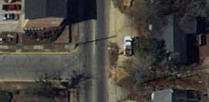
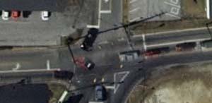
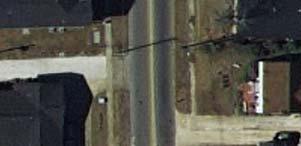
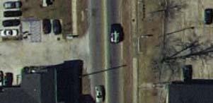
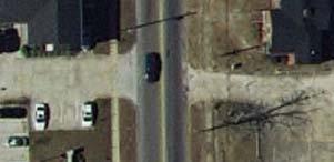
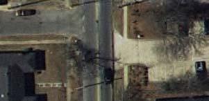
4 INTRODUCTION This section documents the results of traffic signal operations evaluations and traffic signal systems needs for the Glenn Avenue Corridor from Donahue Drive to College Street in Auburn, Alabama. The intersections studied in this corridor include: Glenn Avenue at Donahue Drive Glenn Avenue at Wright Street Glenn Avenue at College Street The locations of the study intersections along the Glenn Avenue Corridor are illustrated in Figure 3-1. In order to accomplish the traffic signal operations evaluations at these locations within the study corridor, the following tasks were undertaken: existing peak hour turning movement counts were conducted for the study intersections; capacity analyses were conducted for the study intersections; current traffic operational deficiencies were identified; geometric and traffic control improvements were developed for the study intersections to address operational and safety deficiencies; and traffic signal systems needs were identified to develop a coordinated signal system. Sources of information used in this section include: the City of Auburn, Alabama; the Institute of Transportation Engineers; American Association of State Highway and Transportation Officials; the Manual on Uniform Traffic Control Devices; the Transportation Research Board; and the files and field reconnaissance efforts of Skipper Consulting, Inc. Skipper Consulting, Inc. 1
5
6 BACKGROUND INFORMATION Study Area Roadways The Glenn Avenue Corridor from Donahue Drive to College Street runs in an east/west direction. The segment of Glenn Avenue evaluated is approximately 0.5 miles in length. Characteristics for each study roadway evaluated in the Glenn Avenue Corridor are provided in Table 3-1. Table 3-1 Study Corridor Roadways Characteristics # of Lanes Travel Speeds (mph) Roadway Parking Travel Classification Direction Glenn Avenue None 2 East/West 25 Arterial Donahue Drive None 3 North/South 25 Arterial Wright Street Parallel 1 North 25 Collector College Street None 4 North/South 35 Arterial Peak Hour Traffic Counts Morning (7:00-9:00 am) and afternoon (4:00-6:00 pm) peak hour turning movement counts were conducted at the Glenn Avenue Corridor intersections during the months of September and October Wright Street counts were conducted in September of Traffic count data utilized for the analyses of these intersections is illustrated in Figure 3-2 and Figure 3-3. Complete traffic count data is provided in Appendix A for reference. Daily Traffic Counts Daily traffic counts for Glenn Avenue were conducted by the City of Auburn on April 11, These counts indicate that the current daily volume on Glenn Avenue is 14,208 vehicles per day. Daily traffic count data for Glenn Avenue is provided in Appendix A. Skipper Consulting, Inc. 3
7
8
9 EXISTING INTERSECTION CAPACITY ANALYSIS Capacity analyses for peak hour conditions at the study intersections along the Glenn Avenue Corridor were conducted for morning and afternoon peak hour periods using methods outlined in the Highway Capacity Manual, Third Edition. According to methods of the Highway Capacity Manual, capacity is expressed as levels of service ranging from A (best) through F (worst). In general, a level of service C is considered desirable while a level of service D is considered acceptable during peak hour operations. Results of these capacity analyses for existing conditions are summarized in Table 3-2. Existing intersection capacity printouts, which present details of the capacity analyses, are provided in Appendix B for reference. Intersection (traffic control) Glenn Avenue at Donahue Drive (traffic signal) Table 3-2 Existing Intersection Levels of Service Approach Movement/Lane Group A.M. Peak Hour Level of Service P.M. Peak Hour EB Glenn Avenue Left C C Through/Right C C WB Glenn Avenue Left D D Through/Right C D NB Donahue Drive Left B B Through/Right C D SB Donahue Drive Left B B Through/Right C C Overall LOS C C Glenn Avenue at NB Wright Street Left D F Wright Street Right B D (side street stop) Overall LOS C F Glenn Avenue at College Street (traffic signal) EB Glenn Avenue Left C B Through/Right C C WB Glenn Avenue Left C C Through/Right D C Left B C NB College Street Through C E Right C D Left B C SB College Street Through C D Right C D Overall LOS C D Skipper Consulting, Inc. 6
10 As shown in Table 3-2, the study intersections evaluated along the Glenn Avenue Corridor operate with acceptable levels of service for both peak periods evaluated. The only movements which operate with less than a level of service D is the northbound through movement on College Street and the northbound left turn movement on Wright Street during the afternoon peak hour. EXISTING ARTERIAL SEGMENT CAPACITY ANALYSIS Arterial segment capacity analyses for peak hour conditions along the Glenn Avenue Corridor were conducted for the morning and afternoon peak hour periods using methods outlined in the Highway Capacity Manual, Third Edition. Levels of service for the arterial analyses conducted for Glenn Avenue are summarized in Table 3-3. Capacity printouts are provided in Appendix B. Table 3-3 Existing Arterial Segment Levels of Service Eastbound Glenn Avenue Arterial Analysis Arterial Level of Segment Service by Section From To Length AM Peak PM Peak Donahue Drive College Street 0.50 B B Total Urban Street LOS B B Westbound Glenn Avenue Arterial Analysis Arterial Level of Segment Service by Section From To Length AM Peak PM Peak College Street Donahue Drive 0.50 B B Total Urban Street LOS B B Table 3-3 indicates that the total urban street level of service along Glenn Avenue from Donahue Drive to College Street would be a level of service B for each direction of travel during both the morning and afternoon peak hours. Skipper Consulting, Inc. 7
11 EXISTING ROADWAY SEGMENT ANALYSIS A comparison of current daily traffic volumes and daily carrying capacities was conducted for Glenn Avenue. This comparison was conducted utilizing the Alabama Department of Transportation s Approved Capacities and Level of Service Criteria. Based on these criteria, the daily carrying capacity for a two-lane arterial roadway is 13,300 vehicles per day. The current daily traffic volume on Glenn Avenue is 14,208 vehicles, as counted by the City of Auburn on April 11, Based upon this comparison, the current daily traffic volume on Glenn Avenue exceeds the carrying capacity based upon the ALDOT criteria. RIGHT-TURN LANE WARRANT EVALUATIONS An assessment of the need for right turn lanes along Glenn Avenue and the intersecting roadways was conducted. This assessment was conducted for each approach at of Glenn Avenue and the intersecting roadways for each of the study intersections. The criteria utilized was based upon information contained in the Intersection Channelization Design Guide, Report 279, published by the Transportation Research Board. Existing peak hour traffic volumes were compared with right-turn lane warrant criteria as presented in the Intersection Channelization Design Guide, Report 279. The results of these comparisons indicate current volumes are sufficient to meet the criteria for right-turn lanes as described above. Westbound Glenn Avenue at Donahue Drive During both the morning and afternoon peak hours, traffic volumes are sufficient to meet the criteria for full length right turn lanes with tapers. Northbound Donahue Drive at Glenn Avenue During the morning peak hour, traffic volumes are sufficient to meet the criteria for a deceleration taper. Skipper Consulting, Inc. 8
12 However, during the afternoon peak hour, traffic volumes are sufficient to meet and exceed the criteria for a full length right turn lane with taper. Eastbound Glenn Avenue at College Street During both the morning and afternoon peak hours, traffic volumes would meet and exceed the criteria for a full right turn lane with taper. Right turn lane guidelines, as presented in the Intersection Channelization Design Guide, Report 279, are provided for reference in the following charts. RIGHT TURN LANE WARRANT RIGHT TURNS IN PEAK HOUR (VPH) TAPER RADIUS ONLY REQUIRED 2 - LANE HIGHWAYS FULL- WIDTH TURN LANE 20 NOTE: FOR POSTED SPEEDS AT OR UNDER 45 MPH, PEAK HOUR RIGHT TURNS GREATER THAN 40 VPH, AND TOTAL PEAK HOUR APPROACH LESS THAN 300VPH, ADJUST RIGHT TURN VOLUMES. ADJUSTED PEAK HOUR RIGHT TURNS= PEAK HOUR RIGHT TURNS TOTAL PEAK HOUR APPROACH VOLUME (VPH) Skipper Consulting, Inc. 9
13 120 RIGHT TURN LANE WARRANT RIGHT TURNS IN PEAK HOUR (VPH) TAPER FULL WIDTH TURN LANE 4 - LANE HIGHWAYS RADIUS NOTE: FOR APPLICATION ON HIGH SPEED HIGHWAYS TOTAL PEAK HOUR APPROACH VOLUME (VPH) * Taken from Figure 4-23, Intersection Channelization Design Guide, Report 279, published by the Transportation Research Board. INTERSECTION ACCIDENT ANALYSIS North College Street at Glenn Avenue According to the initial crash screening of this intersection, it has approximately 1.31 crashes per million vehicles entering the intersection for The City of Auburn provided crash data at this intersection for the purposes of crash pattern analysis. After a review of the latest crash data provided, no sustainable pattern in crashes was observed to indicate contributing conditions to a crash from the intersection. Based on a physical review of the intersection as well as the crash information, it is recommended that no corrective measures would be required at this time to mitigate any crashes for North College Street at Glenn Avenue intersection. North Donahue Drive at West Glenn Avenue According to the initial crash screening of this intersection, it has approximately 2.43 crashes per million vehicles entering the intersection for The City of Auburn provided crash data at this intersection for the purposes of crash pattern analysis. After a review of the latest crash data provided, no sustainable pattern in crashes was observed to Skipper Consulting, Inc. 10
14 indicate contributing conditions to a crash from the intersection. Based on a physical review of the intersection as well as the crash information, it is recommended that no corrective measures would be required at this time to mitigate any crashes for North Donahue Drive at the West Glenn Avenue intersection. It is recommended, however, that the performance of this intersection be monitored considering it experienced approximately 2.43 crashes per million vehicles entering for the period. West Glenn Avenue at Wright Street According to the initial crash screening of this intersection, it has approximately 0.65 crashes per million vehicles entering the intersection for The City of Auburn provided crash data at this intersection for the purposes of crash pattern analysis. After a review of the latest crash data provided, no sustainable pattern in crashes was observed to indicate contributing conditions to a crash from the intersection. Crash data was provided by the City of Auburn for the Wright Street at Glenn Avenue intersection for the most recent 12 month period (2006). A review of the crash data was conducted to determine if any crash patterns were being experienced which would possibly be preventable with the installation of a traffic signal. Upon review of the crash data, approximately 10 crashes were reported to have occurred during 2006 at the study intersection. Further evaluation of the crash data indicates that 5 of these crashes actually occurred at either private driveways or in the vicinity of the study intersection, but were not actually intersection related. Similar results were found during 2004 and Of the 5 accidents that actually occurred at the study intersection during 2006, 2 were angle crashes which would possibly be preventable with the installation of a traffic signal. TRAFFIC SIGNAL WARRANT ANALYSIS Wright Street at Glenn Avenue As a result or current levels of service for the left turn exiting Wright Street during the afternoon peak hour, a signal warrant analysis was conducted to evaluate the need for a traffic signal at this intersection. The traffic signal warrant criteria utilized is presented in Skipper Consulting, Inc. 11
15 the Manual on Uniform Traffic Control Devices (MUTCD) 2000 Edition, as published by the Federal Highway Administration. To warrant traffic signalization, an intersection must satisfy one or more of the eight warrants presented in the MUTCD. Complete descriptions of the applicable warrants can be found in the MUTCD. Based on the volumes collected during the peak hours a traffic signal warrant was conducted. Based upon the comparison of existing traffic volumes with the peak hour warrant criteria, sufficient volumes are present to meet the criteria for signal warranting at this location. However, the majority of the approach volumes for Wright Street is in the right turn movement. With right turn reductions applied at this location, traffic signalization would not be warranted. A review of crash data for this intersection was also evaluated for signal warranting purposes. The results of this evaluation, presented in a previous section of this document, indicate that two (2) crashes susceptible to prevention with the installation of a traffic signal occurred at this intersection which does not meet the criteria of the MUTCD of five (5) crashes susceptible for prevention. TRAFFIC SIGNAL SYSTEMS EVALUATION Skipper Consulting, Inc. performed an evaluation of traffic signal spacing and traffic flow characteristics on Glenn Avenue. While there are no recommendations for traffic signal coordination between the two study intersections, it should be noted that a coordinated traffic signal system exists on Glenn Avenue from College Street to Gay Street. This system includes two signalized intersections, which are currently supervised by the onstreet master controller currently located at the water tank at the corner of Donahue Drive and Glenn Avenue using spread spectrum radios. The traffic signal system on Glenn Avenue as listed in the previous paragraph of this report should be included in the overall traffic signal system plan for the City of Auburn. Recommendations are made concerning traffic signal systems in other sections of this Skipper Consulting, Inc. 12
16 report; however due to the overlapping nature of the corridors the signal systems are interdependent. The relationship of the Glenn Avenue signal system with other signal systems recommended in this report is shown in Figure 3-4. As shown in this figure, the Glenn Avenue traffic signal system is cross-linked with the College Street signal system (existing) and the Gay Street signal system (proposed). The proposed Wright Street traffic signal should be incorporated into the Glenn Avenue signal system due to the close proximity with the intersection of Glenn Avenue and College Street. Skipper Consulting, Inc. 13
17
18 RECOMMENDED IMPROVEMENTS Based upon the analyses and evaluations conducted for the Glenn Avenue Corridor, recommended roadway and traffic control improvements were developed in an effort to improve traffic flows through the corridor at study intersections and to address any capacity or safety deficiencies for the study intersections. The following outlines the recommended improvements for the Glenn Avenue Corridor from Donahue Drive to College Street. Glenn Avenue at Donahue Drive Signal timing and phasing modifications to include implementation of westbound protected/permissive left turn phasing. Construct a right turn lane for the westbound approach of Glenn Avenue. Construct a right turn lane for the northbound approach of Donahue Drive. Glenn Avenue at Wright Street Installation of a traffic signal to include pedestrian features. Traffic signalization at this location shall be coordinated with the Glenn Avenue Signal System. As previously mentioned, peak hour volumes at Wrights Street and Glenn Avenue would be sufficient to meet the peak hour signal warrant criteria of the MUTCD. Glenn Avenue at College Street Construct a right turn lane for the eastbound approach of Glenn Avenue. Convert the existing northbound right turn lane on College Street to a northbound through lane. Construct a northbound right turn lane on College Street. Glenn Avenue Improvements In addition to the intersection improvements recommended along this portion of Glenn Avenue, roadway and pedestrian crossing improvements are also recommended. The roadway improvements consist of widening Glenn Avenue to a three-lane cross section Skipper Consulting, Inc. 15
19 which would consist of a continuous center left turn lane. The roadway widening is recommended as a result of the current traffic volumes on Glenn Avenue as well as the number of access points along Glenn Avenue. It may be possible to restripe portions of Glenn Avenue to provide the three lane cross section. However, should the current roadway width not provide sufficient lane widths, widening could be accomplished with minimal widening efforts either symmetrically or on one side of Glenn Avenue. The pedestrian improvements are recommended as a result of the pedestrian activity observed crossing Glenn Avenue. The recommended improvements for the Glenn Avenue Corridor study intersections are illustrated in as follows: Figure 3-5 Figure 3-6 Figure 3-7 Figure 3-8 Glenn Avenue at Donahue Drive Improvements Glenn Avenue at College Street Improvements Glenn Avenue at Wright Street Improvements Glenn Avenue Improvements Skipper Consulting, Inc. 16
20
21
22


23
24 INTERSECTION CAPACITY ANALYSIS WITH RECOMMENDED IMPROVEMENTS Capacity analyses were conducted for the study intersections along Glenn Avenue with the recommended improvements assumed to be in place. Capacity analyses were conducted using methods of the Highway Capacity Manual, as previously introduced. Table 3-4 provides a summary of the levels of service for study intersections assuming the recommended improvements would be implemented. For comparative purposes, existing levels of service are shown in red in Table 3-4. Capacity printouts are provided in Appendix C. Intersection (traffic control) Glenn Avenue at Donahue Drive (traffic signal) Table 3-4 Intersection Levels of Service with Improvements (Existing LOS indicated in RED) Approach Movement/Lane Group A.M. Peak Hour Level of Service P.M. Peak Hour EB Glenn Avenue Left C C C C Through/Right C C C C Left C D D D WB Glenn Avenue Through C C C Right A A D Left B B B B NB Donahue Drive Through C C C Right B B D SB Donahue Drive Left B B B B Through/Right C C C C Overall LOS C C C C Glenn Avenue at EB Glenn Avenue Through A -- B -- Wright Street WB Glenn Avenue Through A -- A -- (traffic signal) Left B D C F (LOS in red NB Wright Street for existing side Right B B D D street stop condition) Overall LOS C C B F Glenn Avenue at College Street (traffic signal) Left C C B B EB Glenn Avenue Through C C C Right B B C WB Glenn Avenue Left C C C C Through/Right D D C C Left B B C C NB College Street Through C C D E Right C C D D Left B B C C SB College Street Through C C D D Right C C D D Overall LOS C C C D Skipper Consulting, Inc. 21
25 Table 3-4 indicates that acceptable levels of service would be realized at each of the study intersections (Donahue Drive, Wright Street and College Street) along the Glenn Avenue Corridor with the implementation of the recommended improvements. With the implementation of the recommended improvements, delay reduction is expected for overall traffic flows at the study intersections as well as Glenn Avenue. ARTERIAL SEGMENT CAPACITY ANALYSIS WITH IMPROVEMENTS Arterial segment capacity analyses for peak hour conditions along the Glenn Avenue Corridor were conducted for the morning and afternoon peak hours using methods outlined in the Highway Capacity Manual, Third Edition. Levels of service for the arterial analyses conducted for Glenn Avenue are summarized in Table 3-5. For comparative purposes, existing levels of service are shown in red in Table 3-5. Capacity printouts are provided in Appendix C. Table 3-5 Arterial Segment Levels of Service with Improvements (Existing LOS indicated in RED) Eastbound Glenn Avenue Arterial Analysis Arterial Level of Segment Service by Section From To Length AM Peak PM Peak Donahue Drive Wright Street 0.42 A n/a B n/a Wright Street College Street 0.08 C n/a C n/a Total Urban Street LOS C B C B Westbound Glenn Avenue Arterial Analysis Arterial Level of Segment Service by Section From To Length AM Peak PM Peak College Street Wright Street 0.42 A n/a A n/a Wright Street Donahue Drive 0.08 C n/a C n/a Total Urban Street LOS B B C B Table 3-5 indicates that the total urban street level of service along Glenn Avenue from Donahue Drive to College Street would operate at levels of service C or better for each direction of travel during both the morning and afternoon peak hours. This analysis was Skipper Consulting, Inc. 22
26 conducted assuming the roadway and traffic control improvements outlined in this report would be in place. It should be noted that the overall arterial levels of service would generally be levels of service C with recommended improvements as compared to existing levels of service B. This is a result of installing a new signal at the Wright Street intersection with Glenn Avenue. With the installation of a new traffic signal, it is typical for the arterial level of service to deteriorate to some extent with delay for the main street through movements being realized with stop time for the main street associated with the newly installed traffic signal. However, Glenn Avenue would maintain an overall acceptable level of service with the installation of a signal at Wright Street. In order to minimize any potential impacts of a new signal along Glenn Avenue, side street green time should be held to a minimum and signal coordination with the traffic signal at College Street would be required for the Wright Street and Glenn Avenue intersection. Skipper Consulting, Inc. 23
Donahue Drive Corridor Traffic Operational Evaluation
 Donahue Drive Corridor Traffic Operational Evaluation PREPARED FOR: THE CITY OF AUBURN PREPARED BY: JANUARY 2007 Donahue Drive Corridor Study--Auburn, Alabama TABLE OF CONTENTS Introduction... 1 Background
Traffic Impact Analysis Chatham County Grocery Chatham County, NC
 Chatham County Grocery Chatham County, NC TABLE OF CONTENTS 1. INTRODUCTION... 1 1.1. Location and Study Area... 1 1.2. Proposed Land Use and Access... 2 1.3. Adjacent Land Uses... 2 1.4. Existing ways...
Traffic Impact Analysis Walton Acres at Riverwood Athletic Club Clayton, NC
 Traffic Impact Analysis Walton Acres at Riverwood Athletic Club Clayton, NC 1. TABLE OF CONTENTS INTRODUCTION...1 1.1. Site Location and Study Area...1 1.2. Proposed Land Use and Site Access...2 1.3.
Traffic Impact Study Little Egypt Road Development Denver, North Carolina June 2017
 Traffic Impact Study Little Egypt Road Development Denver, North arolina June 2017 N. Little Egypt Road DQ\ QDQFLQJ VDOHV RU RWKHU SHUIRUPDQFH EDVHG FULWHULD Proposed Site Driveways Site Driveway 1 TRAFFI
Chapter 4 Traffic Analysis
 Chapter 4 Traffic Analysis PURPOSE The traffic analysis component of the K-68 Corridor Management Plan incorporates information on the existing transportation network, such as traffic volumes and intersection
Traffic Impact Study WestBranch Residential Development Davidson, NC March 2016
 Traffic Impact Study WestBranch Residential Development Davidson, NC March 216 TRAFFIC IMPACT STUDY FOR THE WestBranch Residential Development LOCATED IN DAVIDSON, NC Prepared For: Lennar Carolinas, LLC
5858 N COLLEGE, LLC N College Avenue Traffic Impact Study
 5858 N COLLEGE, LLC nue Traffic Impact Study August 22, 2016 Contents Traffic Impact Study Page Preparer Qualifications... 1 Introduction... 2 Existing Roadway Conditions... 5 Existing Traffic Conditions...
INDUSTRIAL BUILDING 3009 HAWTHORNE ROAD CITY OF OTTAWA TRANSPORTATION OVERVIEW REVISED. Prepared for: Canada Inc.
 INDUSTRIAL BUILDING 3009 HAWTHORNE ROAD CITY OF OTTAWA TRANSPORTATION OVERVIEW REVISED Prepared for: 7849648 Canada Inc. Octiober 1, 2015 114-598 Overview_2.doc D. J. Halpenny & Associates Ltd. Consulting
Evaluation of M-99 (Broad Street) Road Diet and Intersection Operational Investigation
 Road Diet and Intersection Operational Investigation") Evaluation of M-99 (Broad Street) Road Diet and Intersection Operational Investigation City of Hillsdale, Hillsdale County, Michigan June 16, 2016 Final Report Prepared for City of Hillsdale 97 North Broad
Evaluation of M-99 (Broad Street) Road Diet and Intersection Operational Investigation City of Hillsdale, Hillsdale County, Michigan June 16, 2016 Final Report Prepared for City of Hillsdale 97 North Broad
FORM A PASCO COUNTY ACCESS CONNECTION PERMIT APPLICATION
 FORM 901.3.A PASCO COUNTY ACCESS CONNECTION PERMIT APPLICATION The following information is required from all applicants directly or indirectly accessing any collector or arterial road or as otherwise
MEETING FACILITY 2901 GIBFORD DRIVE CITY OF OTTAWA TRANSPORTATION BRIEF. Prepared for: Holiday Inn Express 2881 Gibford Drive Ottawa, ON K1V 2L9
 MEETING FACILITY 2901 GIBFORD DRIVE CITY OF OTTAWA TRANSPORTATION BRIEF Prepared for: Holiday Inn Express 2881 Gibford Drive Ottawa, ON K1V 2L9 December 18, 2012 112-566 Brief_1.doc D. J. Halpenny & Associates
Truck Climbing Lane Traffic Justification Report
 ROUTE 7 (HARRY BYRD HIGHWAY) WESTBOUND FROM WEST MARKET STREET TO ROUTE 9 (CHARLES TOWN PIKE) Truck Climbing Lane Traffic Justification Report Project No. 6007-053-133, P 101 Ι UPC No. 58599 Prepared by:
TRANSPORTATION ANALYSIS REPORT US Route 6 Huron, Erie County, Ohio
 TRANSPORTATION ANALYSIS REPORT US Route 6 Huron, Erie County, Ohio December 12, 2012 Prepared for: The City of Huron 417 Main Huron, OH 44839 Providing Practical Experience Technical Excellence and Client
TRAFFIC IMPACT STUDY COMPREHENSIVE UPDATE TOWN OF THOMPSON S STATION, TENNESSEE PREPARED FOR: THE TOWN OF THOMPSON S STATION
 TRAFFIC IMPACT STUDY COMPREHENSIVE UPDATE TOWN OF THOMPSON S STATION, TENNESSEE PREPARED FOR: THE TOWN OF THOMPSON S STATION Transportation Consultants, LLC 1101 17 TH AVENUE SOUTH NASHVILLE, TN 37212
Traffic Impact Study. Westlake Elementary School Westlake, Ohio. TMS Engineers, Inc. June 5, 2017
 TMS Engineers, Inc. Traffic Impact Study Westlake Elementary School Westlake, Ohio June 5, 2017 Prepared for: Westlake City Schools - Board of Education 27200 Hilliard Boulevard Westlake, OH 44145 TRAFFIC
MEDICAL/OFFICE BUILDING 1637 BANK STREET OTTAWA, ONTARIO TRANSPORTATION OVERVIEW. Prepared for:
 MEDICAL/OFFICE BUILDING 1637 BANK STREET OTTAWA, ONTARIO TRANSPORTATION OVERVIEW Prepared for: 2434984 Ontario Inc. 13-5510 Canotek Road Ottawa, Ontario K1J 9J5 June 4, 2015 115-613 Report_2.doc D. J.
THE LANDMARK AT TALBOT PARK
 TRAFFIC IMPACT STUDY FOR THE LANDMARK AT TALBOT PARK IN NORFOLK, VA INTERMODAL ENGINEERING, P.C. OCTOBER, 200 The Landmark at Talbot Park is a proposed redevelopment of the existing apartments along the
TRAFFIC IMPACT STUDY And A TRAFFIC SIGNAL WARRANT ANALYSIS FOR A SENIOR LIVING AND APARTMENT DEVELOPMENT
 TRAFFIC IMPACT STUDY And A TRAFFIC SIGNAL WARRANT ANALYSIS FOR A SENIOR LIVING AND APARTMENT DEVELOPMENT DEERFIELD TOWNSHIP, WARREN COUNTY, OHIO Nantucket Circle and Montgomery Road () Prepared for: ODLE
TRANSPORTATION IMPACT STUDY PROPOSED RIVERFRONT 47 MIXED USE DEVELOPMENT
 November 2016 TRANSPORTATION IMPACT STUDY PROPOSED RIVERFRONT 47 MIXED USE DEVELOPMENT & Aspinwall Borough, Sharpsburg Borough & O Hara Township, Allegheny County, Pennsylvania Prepared for: Riverfront
Existing Conditions. Date: April 16 th, Dan Holderness; Coralville City Engineer Scott Larson; Coralville Assistant City Engineer
 Date: April 16 th, 2015 To: From: Re: Dan Holderness; Coralville City Engineer Scott Larson; Coralville Assistant City Engineer Darian Nagle-Gamm, Traffic Engineering Planner Highway 6 (2 nd Street) /
TRAFFIC SIGNAL WARRANT STUDY
 TRAFFIC SIGNAL WARRANT STUDY 5 th STREET & ENCHANTED PINES DRIVE JANUARY 2013 TRAFFIC OPERATIONS ENGINEERING SERVICES/PUBLIC WORKS DEPARTMENT TABLE OF CONTENTS INTERSECTION LOCATION MAP ii INTRODUCTION
4.0 TRAFFIC IMPACT STUDIES
 SECTION 4 4.0 TRAFFIC IMPACT STUDIES 4.1 TRAFFIC IMPACT STUDY REQUIREMENTS The City has established Traffic Impact Study (TIS) requirements for the purpose of ensuring that both the quantitative and qualitative
METHODOLOGY. Signalized Intersection Average Control Delay (sec/veh)
") Chapter 5 Traffic Analysis 5.1 SUMMARY US /West 6 th Street assumes a unique role in the Lawrence Douglas County transportation system. This principal arterial street currently conveys commuter traffic
Chapter 5 Traffic Analysis 5.1 SUMMARY US /West 6 th Street assumes a unique role in the Lawrence Douglas County transportation system. This principal arterial street currently conveys commuter traffic
Project Report. South Kirkwood Road Traffic Study. Meadows Place, TX October 9, 2015
 Meadows Place, TX October 9, 2015 Contents 1 Introduction... 1 2 Data Collection... 1 3 Existing Roadway Network... 2 4 Traffic Volume Development... 2 5 Warrant Analysis... 3 6 Traffic Control Alternative
Intersection Traffic Control Feasibility Study
 Intersection Traffic Control Feasibility Study CSAH 9 at CSAH 60 (185th Avenue) Prepared For: Dakota County Transportation Department Western Service Center 14955 Galaxie Avenue, 3rd Floor Apple Valley,
1609 E. FRANKLIN STREET HOTEL TRAFFIC IMPACT STUDY EXECUTIVE SUMMARY
 1609 E. FRANKLIN STREET HOTEL TRAFFIC IMPACT STUDY EXECUTIVE SUMMARY Prepared for: The Town of Chapel Hill Public Works Department Traffic Engineering Division Prepared by: HNTB North Carolina, PC 343
Traffic Circulation Study for Neighborhood Southwest of Mockingbird Lane and Airline Road, Highland Park, Texas
 ARIZONA TEXAS NEW MEXICO OKLAHOMA February 13, 2015 Mr. Meran Dadgostar P.E., R.S. Town of Highland Park 4700 Drexel Dr. Highland Park, Texas 75205 Re: Traffic Circulation Study for Neighborhood Southwest
TRAFFIC STUDY GUIDELINES Clarksville Street Department
 TRAFFIC STUDY GUIDELINES Clarksville Street Department 9/1/2009 Introduction Traffic studies are used to help the city determine potential impacts to the operation of the surrounding roadway network. Two
Harrah s Station Square Casino
 Transportation Analysis Harrah s Station Square Casino Pittsburgh, Pennsylvania Submitted To: City of Pittsburgh and Pennsylvania Gaming Control Board Prepared By: DKS Associates GAI Consultants December
Marina Loft (DRC 51-R-12)
") Marina Loft (DRC 51-R-12) traffic study prepared for: Cymbal Development OCtober 2012 Traf Tech October 1, 2012 Mr. Asi Cymbal - President Cymbal Development 3470 North Miami Avenue Upper Suite Miami,
Marina Loft (DRC 51-R-12) traffic study prepared for: Cymbal Development OCtober 2012 Traf Tech October 1, 2012 Mr. Asi Cymbal - President Cymbal Development 3470 North Miami Avenue Upper Suite Miami,
QUICKIE C STORE AND GAS BAR 1780 HERON ROAD OTTAWA, ONTARIO TRANSPORTATION BRIEF. Prepared for:
 QUICKIE C STORE AND GAS BAR 1780 HERON ROAD OTTAWA, ONTARIO TRANSPORTATION BRIEF Prepared for: Quickie Convenience Stores Larny Holdings Ltd. c/o PBC Group April 15, 2015 115-615 Report_1.doc D. J. Halpenny
King Soopers #116 Thornton, Colorado
 Traffic Impact Study King Soopers #116 Thornton, Colorado Prepared for: Galloway & Company, Inc. 1.0 EXECUTIVE SUMMARY King Soopers #116, a grocery marketplace anchored commercial development, is proposed
Traffic Study North Shore School District 112
 Traffic Study North Shore School District 112 Proposed Expansion of Northwood Junior High School Prepared By: May 1, 2015 1. Introduction Kenig, Lindgren, O Hara, Aboona, Inc. (KLOA, Inc.) has been retained
PINESTONE TRAFFIC IMPACT STUDY Travelers Rest, South Carolina
 PINESTONE TRAFFIC IMPACT STUDY Travelers Rest, South Carolina Prepared for Longbranch Development Prepared by January 13, 219 ii Table of Contents Subject Page Signature Page... i Table of Contents...
OFFICE/RETAIL DEVELOPMENT 1625 BANK STREET OTTAWA, ONTARIO TRANSPORTATION BRIEF. Prepared for: Canada Inc.
 OFFICE/RETAIL DEVELOPMENT 1625 BANK STREET OTTAWA, ONTARIO TRANSPORTATION BRIEF Prepared for: 9402209 Canada Inc. December 15, 2015 115-625 Report_2.doc D. J. Halpenny & Associates Ltd. Consulting Transportation
DRAFT. Corridor study. Honeysuckle Road. October Prepared for the City of Dothan, AL. Prepared by Gresham, Smith and Partners
 DRAFT Corridor study Honeysuckle Road October 2017 Prepared for the City of Dothan, AL Prepared by TABLE OF CONTENTS SECTION I... 1 STUDY SUMMARY... 1 INTRODUCTION... 1 CONCLUSIONS... 5 SECTION II... 7
Transportation Impact Study for Abington Terrace
 Transportation Impact Study for Abington Terrace Abington Township, Montgomery County, PA Sandy A. Koza, P.E., PTOE PA PE License Number PE059911 Prepared by McMahon Associates, Inc. 425 Commerce Drive,
OTTAWA TRAIN YARDS PHASE 3 DEVELOPMENT CITY OF OTTAWA TRANSPORTATION IMPACT STUDY. Prepared for:
 OTTAWA TRAIN YARDS PHASE 3 DEVELOPMENT CITY OF OTTAWA TRANSPORTATION IMPACT STUDY Prepared for: The Ottawa Train Yards Inc. 223 Colonnade Road South, Suite 212 Nepean, Ontario K2E 7K3 January 17, 2012
DUNBOW ROAD FUNCTIONAL PLANNING
 DUNBOW ROAD FUNCTIONAL PLANNING Final Report August 3, 216 #31, 316 5th Avenue NE Calgary, AB T2A 6K4 Phone: 43.273.91 Fax: 43.273.344 wattconsultinggroup.com Dunbow Road Functional Planning Final Report
Troutbeck Farm Development
 Troutbeck Farm Development Willistown Township, Chester County PA For Submission To: Willistown Township Last Revised: October, 4 TPD# INLM.A. 5 E. High Street Suite 65 Pottstown, PA 9464 6.36.3 TPD@TrafficPD.com
HILTON GARDEN INN HOTEL HOTEL EXPANSION 2400 ALERT ROAD, OTTAWA TRANSPORTATION BRIEF. Prepared for:
 HILTON GARDEN INN HOTEL HOTEL EXPANSION 2400 ALERT ROAD, OTTAWA TRANSPORTATION BRIEF Prepared for: Bona Building & Management Co. Ltd. Place Vanier, 333 North River Road Vanier, Ontario K1L 8B9 October
Walton Acres at Riverwood Athletic Club Clayton, North Carolina
 9. CONCLUSIONS This Traffic Impact Analysis Update was conducted to determine the potential traffic impacts of the proposed Walton Acres at Riverwood Athletic Club residential development, located east
Road Conversion Study Plumas Street
 Plumas Street Phase I Submitted to The Regional Transportation Commission of Washoe County Submitted by Zong Tian, Ph.D., P.E. Saeedeh Farivar Haiyuan Li, Ph.D. Center for Advanced Transportation Education
THIS PAGE LEFT BLANK INTENTIONALLY
 GA SR 25 Spur at Canal Road Transportation Impact Analysis PREPARED FOR GLYNN COUNTY, GEORGIA 1725 Reynolds Street, Suite 300 Brunswick, Georgia 31520 PREPARED BY 217 Arrowhead Boulevard Suite 26 Jonesboro,
Shockoe Bottom Preliminary Traffic and Parking Analysis
 Shockoe Bottom Preliminary Traffic and Parking Analysis Richmond, Virginia August 14, 2013 Prepared For City of Richmond Department of Public Works Prepared By 1001 Boulders Pkwy Suite 300, Richmond, VA
Highway 111 Corridor Study
 Highway 111 Corridor Study June, 2009 LINCOLN CO. HWY 111 CORRIDOR STUDY Draft Study Tea, South Dakota Prepared for City of Tea Sioux Falls Metropolitan Planning Organization Prepared by HDR Engineering,
INDUSTRIAL BUILDING 1660 COMSTOCK ROAD CITY OF OTTAWA TRANSPORTATION OVERVIEW. Prepared for:
 INDUSTRIAL BUILDING 1660 COMSTOCK ROAD CITY OF OTTAWA TRANSPORTATION OVERVIEW Prepared for: Simluc Contractors Limited 2550 Blackwell Street, Ottawa K1B 5R1 October 18, 2013 113-584 Overview_1.doc D. J.
FRONT RANGE CROSSINGS TRAFFIC IMPACT STUDY
 FRONT RANGE CROSSINGS TRAFFIC IMPACT STUDY Prepared for: City of Thornton And Colorado Department of Transportation Prepared by: 11 Blake Street, Suite 2 Denver, Colorado 822 Contact: Brian Bern, PE, PTOE
Traffic Impact Statement
 Traffic Impact Statement Mixed Use Development, US 41 and Old Trail Drive aka Tide-Starbucks 4900 9 th Street North General Development Site Plan (GDSP) Collier County, FL 10/6/2015 Prepared for: Prepared
TRAFFIC IMPACT STUDY. Creekside Thornton, Colorado. For. August 2015 November 2015 Revised: August Prepared for:
 TRAFFIC IMPACT STUDY For Creekside Thornton, Colorado August 215 November 215 Revised: August 216 Prepared for: Jansen Strawn Consulting Engineers 45 West 2 nd Avenue Denver, Colorado 8223 Prepared by:
NEW YORK CENTRAL PARK SUBDIVISION BLAIS STREET/ST-PIERRE STREET EMBRUN, ONTARIO TRAFFIC IMPACT STUDY. Prepared for:
 NEW YORK CENTRAL PARK SUBDIVISION BLAIS STREET/ST-PIERRE STREET EMBRUN, ONTARIO TRAFFIC IMPACT STUDY Prepared for: Solidex Holdings Limited & Investissement Maurice Lemieux Investments Attn: Mr. Anthony
Traffic Impact Study. Roderick Place Columbia Pike Thompson s Station, TN. Transportation Group, LLC Traffic Engineering and Planning
 F i s c h b a c h Transportation Group, LLC Traffic Engineering and Planning Traffic Impact Study Roderick Place Columbia Pike Thompson s Station, TN Prepared March 2016 Ms. Gillian L. Fischbach, P.E.,
List of Attachments. Location Map... Site Plan... City of Lake Elsinore Circulation Element... City of Lake Elsinore Roadway Cross-Sections...
 List of Attachments Exhibits Location Map... Site Plan... City of Lake Elsinore Circulation Element... City of Lake Elsinore Roadway Cross-Sections... Existing Lane Geometry and Traffic Controls... Existing
Traffic Study of Fuller Street, Cady Street, West Street and West Avenue. Final Report
 Traffic Study of Fuller Street, Cady Street, West Street and West Avenue Final Report July 2005 Prepared for: Town of Ludlow Prepared by: Pioneer Valley Planning Commission 26 Central Street West Springfield,
Transportation Advisory Board
 C I T Y O F WEATHERFORD Transportation Advisory Board AGENDA REPORT Meeting Date: October 15,2015 Staff Contact: Manny Palacios Jr. Phone: E-mail: 817-598-4296 mpalacios@weatherfordtx.gov SUBJECT: Discuss
Capital Region Council of Governments
 March 23, 2018 Capital Region Council of Governments PROJECT CONCEPT REPORT Realignment of Swamp and Northfield Road s approaches to Route 44 (Boston Turnpike) Town of Coventry SUMMARY: The Town of Coventry
Figure 1: Vicinity Map of the Study Area
 ARIZONA TEXAS NEW MEXICO OKLAHOMA May 5, 2016 Mr. Anthony Beach, P.E. BSP Engineers 4800 Lakewood Drive, Suite 4 Waco, Texas 76710 Re: Intersection and Access Analysis along Business 190 in Copperas Cove
Highway 49, Highway 351 and Highway 91 Improvements Feasibility Study Craighead County
 Highway 49, Highway 351 and Highway 91 Improvements Feasibility Study Craighead County Executive Summary March 2015 Highway 49, Highway 351 and Highway 91 Improvements Feasibility Study Craighead County
FINAL DESIGN TRAFFIC TECHNICAL MEMORANDUM
 FINAL DESIGN TRAFFIC TECHNICAL MEMORANDUM July 2014 FINAL (SR 43) Project Development and Environment Study From State Road 60 (Adamo Drive) to I-4 (SR 400) Hillsborough County, Florida Work Program Item
Walmart (Store # ) 60 th Street North and Marion Road Sioux Falls, South Dakota
 60 th Street North and Marion Road Sioux Falls, South Dakota") Walmart (Store #4865-00) 60 th Street North and Marion Road Sioux Falls, South Dakota Prepared for: Wal-Mart Stores, Inc. Bentonville, Arkansas Prepared by: Kimley-Horn and Associates, Inc. ã2013 Kimley-Horn
Walmart (Store #4865-00) 60 th Street North and Marion Road Sioux Falls, South Dakota Prepared for: Wal-Mart Stores, Inc. Bentonville, Arkansas Prepared by: Kimley-Horn and Associates, Inc. ã2013 Kimley-Horn
Henderson Avenue Mixed-Use Development
 Zoning Case: Z145-3 Traffic Impact Analysis Henderson Avenue Mixed-Use Development Dallas, TX October 26 th, 216 Kimley-Horn and Associates, Inc. Dallas, Texas Project #644827 Registered Firm F-928 Traffic
Intersection LOS Intersection level of service (LOS) is defined by the Highway Capacity Manual (HCM) by the following criteria:
 is defined by the Highway Capacity Manual (HCM) by the following criteria:") Page 2 of 9 Intersection LOS Intersection level of service (LOS) is defined by the Highway Capacity Manual (HCM) by the following criteria: Table 1 LOS Definitions Level of Signalized Un-Signalized Definition
Page 2 of 9 Intersection LOS Intersection level of service (LOS) is defined by the Highway Capacity Manual (HCM) by the following criteria: Table 1 LOS Definitions Level of Signalized Un-Signalized Definition
Cheyenne Metropolitan Planning Organization
 Dell Range Boulevard Corridor Study PHASE II SECTION 20 DRAFT Prepared for: Cheyenne Metropolitan Planning Organization November 20, 2015 (Section 20 is bordered by Powderhouse Road on the west, Storey
Meadowlake Ranch Traffic Impact Analysis (LSC #184600) August 27, 2018
 August 27, 2018") LSC TRANSPORTATION CONSULTANTS, INC. 545 East Pikes Peak Avenue, Suite 210 Colorado Springs, CO 80903 (719) 633-2868 FAX (719) 633-5430 E-mail: lsc@lsctrans.com Website: http://www.lsctrans.com Traffic
LSC TRANSPORTATION CONSULTANTS, INC. 545 East Pikes Peak Avenue, Suite 210 Colorado Springs, CO 80903 (719) 633-2868 FAX (719) 633-5430 E-mail: lsc@lsctrans.com Website: http://www.lsctrans.com Traffic
Traffic Impact Study. Crestline Piggly Wiggly Mountain Brook, Alabama. Goodwyn, Mills and Cawood, Inc. Birmingham, Alabama.
 Traffic Impact Study Crestline Piggly Wiggly Mountain Brook, Alabama Prepared for: Goodwyn, Mills and Cawood, Inc. Birmingham, Alabama September 214 Revision 1 October 214 Crestline Piggly Wiggly Mountain
INTERSECTION SAFETY STUDY State Route 57 / Seville Road
 INTERSECTION SAFETY STUDY State Route 57 / Seville Road City of Wadsworth, Medina County, Ohio Prepared For: City of Wadsworth Engineering Department 120 Maple Street Wadsworth, OH 44281 Prepared By: GPD
FAIRFIELD INN & SUITES HOTEL 135 THAD JOHNSON PRIVATE OTTAWA TRANSPORTATION BRIEF. Prepared for:
 FAIRFIELD INN & SUITES HOTEL 135 THAD JOHNSON PRIVATE OTTAWA TRANSPORTATION BRIEF Prepared for: Bona Building & Management Co. Ltd. Place Vanier, 333 North River Road Vanier, Ontario K1L 8B9 August 12,
Traffic Academy: IJS & IMS FAQ/RULES OF THUMB
 FAQ/RULES OF THUMB HCS intersection analysis criteria See LDM Figure 401-14aE Cycle lengths between 60 to 120 seconds No impractical phases, i.e., 1 second green time Yellow + All Red must be no less than
HOLIDAY INN HOTEL 235 KING EDWARD AVENUE CITY OF OTTAWA TRANSPORTATION BRIEF. Prepared for:
 HOLIDAY INN HOTEL 235 KING EDWARD AVENUE CITY OF OTTAWA TRANSPORTATION BRIEF Prepared for: Momentum Planning & Communications 1165 Greenlawn Crescent Ottawa, ON K1L 6C2 June 29, 2015 115-618 Brief_1.doc
MEMORANDUM. Nantasket Road at Kingsley Road Kingsley Road at Sumner Street Kingsley Road at Revere Street Kingsley Road at Kenberma Street
 MEMORANDUM Date: June 28, 2012 To: From: Subject: Mr. Joseph Stigliani, Director of Public Works Kenneth J. Petraglia, P.E., PTOE Greg E. Lucas, P.E., PTOE Kingsley Road Stop Sign Warrant Analysis BETA
TRAFFIC IMPACT ANALYSIS
 TRAFFIC IMPACT ANALYSIS FOR THE CHAMPAIGN UNIT#4 SCHOOL DISTRICT PROPOSED HIGH SCHOOL (SPALDING PARK SITE) IN THE CITY OF CHAMPAIGN Final Report Champaign Urbana Urbanized Area Transportation Study 6/24/2014
TRAFFIC IMPACT STUDY CRITERIA
 Chapter 6 - TRAFFIC IMPACT STUDY CRITERIA 6.1 GENERAL PROVISIONS 6.1.1. Purpose: The purpose of this document is to outline a standard format for preparing a traffic impact study in the City of Steamboat
MoPac South: Impact on Cesar Chavez Street and the Downtown Network
 MoPac South: Impact on Cesar Chavez Street and the Downtown Network Prepared by: The University of Texas at Austin Center for Transportation Research Prepared for: Central Texas Regional Mobility Authority
Corporate. Report COUNCIL DATE: May 25, 1998 NO: R1500 REGULAR COUNCIL. TO: Mayor & Council DATE: April 27, 1998
 R1500 : Traffic Safety at 25 Avenue and 128 Street Intersection Corporate NO: R1500 Report COUNCIL DATE: May 25, 1998 REGULAR COUNCIL TO: Mayor & Council DATE: April 27, 1998 FROM: General Manager, Engineering
Gateway Transportation Study
 Gateway Transportation Study Amherst, Massachusetts SUBMITTED TO University of Massachusetts Amherst Town of Amherst SUBMITTED BY Vanasse Hangen Brustlin, Inc. Watertown, Massachusetts March 213 Back of
URBAN QUARRY HEADQUARTERS 2717 STEVENAGE DRIVE CITY OF OTTAWA TRANSPORTATION OVERVIEW. Prepared for: Urban Quarry 4123 Belgreen Drive, Ottawa K1G 3N2
 URBAN QUARRY HEADQUARTERS 2717 STEVENAGE DRIVE CITY OF OTTAWA TRANSPORTATION OVERVIEW Prepared for: Urban Quarry 4123 Belgreen Drive, Ottawa K1G 3N2 February 27, 2014 113-584 Overview_1.doc D. J. Halpenny
Brian McHugh, Buckhead Community Improvement District. SUBJECT: Wieuca Road at Phipps Boulevard Intersection Improvements Project
 MEMO TO: FROM: Brian McHugh, Buckhead Community Improvement District Jagan Kaja, AICP, WSP Parsons Brinckerhoff SUBJECT: Wieuca Road at Phipps Boulevard Intersection Improvements Project DATE: October
Route 28 (South Orleans Road)/Route 39 (Harwich Road)/Quanset Road Intersection
/Route 39 (Harwich Road)/Quanset Road Intersection") TRAFFIC FEASIBILITY STUDY Route 28 (South Orleans Road)/Route 39 (Harwich Road)/Quanset Road Intersection Orleans, Massachusetts Prepared for: Town of Orleans Prepared by: Fay, Spofford & Thorndike, LLC
TRAFFIC FEASIBILITY STUDY Route 28 (South Orleans Road)/Route 39 (Harwich Road)/Quanset Road Intersection Orleans, Massachusetts Prepared for: Town of Orleans Prepared by: Fay, Spofford & Thorndike, LLC
TABLE TRAFFIC ANALYSIS SCENARIOS
 4.11 TRANSPORTATION The potential traffic impacts of the proposed project are evaluated in the Buena Park Beach/Orangethorpe Mixed Use Project Traffic Analysis (Traffic Analysis) by Austin-Foust Associates
4. ENVIRONMENTAL IMPACT ANALYSIS 9. TRANSPORTATION AND TRAFFIC
 4. ENVIRONMENTAL IMPACT ANALYSIS 9. TRANSPORTATION AND TRAFFIC 4.9.1 INTRODUCTION The following section addresses the Proposed Project s impact on transportation and traffic based on the Traffic Study
Access Location, Spacing, Turn Lanes, and Medians
 Design Manual Chapter 5 - Roadway Design 5L - Access Management 5L-3 Access Location, Spacing, Turn Lanes, and Medians This section addresses access location, spacing, turn lane and median needs, including
J Street and Folsom Boulevard Lane Conversion Project (T ) Before and After Traffic Evaluation
 Before and After Traffic Evaluation") J Street and Folsom Boulevard Lane Conversion Project (T15125400) Before and After Traffic Evaluation Prepared by Transportation Division June 2014 Executive Summary On February 12, 2013, the City of Sacramento
J Street and Folsom Boulevard Lane Conversion Project (T15125400) Before and After Traffic Evaluation Prepared by Transportation Division June 2014 Executive Summary On February 12, 2013, the City of Sacramento
4.0 TRANSPORTATION SYSTEMS
 Transportation Systems 4.0 TRANSPORTATION SYSTEMS This chapter examines the impacts of the Central Corridor Extension on existing roadways and traffic operations and discusses the transit service, operations,
CarMax Auto Superstore/ Reconditioning Center #6002 Murrieta, California
 CarMax Auto Superstore/ Reconditioning Center #6002 Murrieta, California TUSTIN 17782 17th Street Suite 200 Tustin, CA 92780-1947 714.665.4500 Fax: 714.665.4501 LOS ANGELES 145 S. Spring Street Suite 120
REDEVELOPMENT TRAFFIC IMPACT STUDY
 REDEVELOPMENT TRAFFIC IMPACT STUDY For Wendy s Parker, Colorado January 215 Prepared for: Sterling Design Associates, LLC 29 W. Littleton Boulevard #3 Littleton, Colorado 812 Prepared by: 1233 Airport
EXECUTIVE SUMMARY. Page 1 of 6
 EXECUTIVE SUMMARY The purpose of this report is to identify conformance with the original traffic impact study for the proposed retail development on Lot 5 of Riverdale Retail Filing No. 1 located on the
APARTMENT BUILDING DEVELOPMENT 1161 HERON ROAD OTTAWA, ONTARIO TRANSPORTATION IMPACT STUDY. Prepared for:
 APARTMENT BUILDING DEVELOPMENT 1161 HERON ROAD OTTAWA, ONTARIO TRANSPORTATION IMPACT STUDY Prepared for: 1649362 Ontario Inc. c/o Manor Park Management 231 Brittany Drive, Suite D Ottawa ON K1K 0R8 July
City of Homewood Transportation Plan
 City of Homewood Transportation Plan Prepared for: City of Homewood, Alabama Prepared by: Skipper Consulting, Inc. May 2007 TABLE OF CONTENTS INTRODUCTION... 1 BACKGROUND INFORMATION... 1 EXISTING TRANSPORTATION
APPENDIXB. Traffic Operations Technical Memorandum
 APPENDIXB Traffic Operations Technical Memorandum Environmental Assessment - Lincoln County, SD 85 th Street: Sundowner Avenue to Louise Avenue November 2017 MEMORANDUM Transportation Jim Kollbaum, PE
STILLWATER AVENUE CORRIDOR STUDY Old Town, Maine
 Draft Study STILLWATER AVENUE CORRIDOR STUDY Old Town, Maine SUBMITTED TO: BANGOR AREA COMPREHENSIVE TRANSPORTATION SYSTEM SUBMITTED BY: I MAY 23, 2017 DRAFT STILLWATER AVENUE STUDY FINAL REPORT Table
6060 North Central Expressway Mixed-Use Site Dallas, Texas
 Volume 1 Traffic Impact Analysis 6060 North Central Expressway Mixed-Use Site Dallas, Texas April 30, 2018 Kimley-Horn and Associates, Inc. Dallas, Texas Project #063238300 Registered Firm F-928 Traffic
Include autoturn exhibits of WB-67 trucks at each roundabout.
 1 Along the through path, the desired relationship is R1>R2
Draft Report. Traffic Impact Study. Superstore, Wal-Mart, and Kent Development. Yarmouth, Nova Scotia. Prepared for
 oad & Traffic Management Road & Traffic Management R Atlantic Traffic Engineering Specialists Draft Report Traffic Impact Study Superstore, Wal-Mart, and Kent Development Yarmouth, Nova Scotia Prepared
List of Exhibits...ii
 One Brickell Traffic Study TABLE OF CONTENTS List of Exhibits...ii EXECUTIVE SUMMARY...1 1. INTRODUCTION...2 1.1 Study Area...2 1.2 Study Objective...5 2. EXISTING TRAFFIC CONDITIONS...6 2.1 Data Collection...6
ALLEY 24 TRAFFIC STUDY
 ALLEY 24 TRAFFIC STUDY in City of Frostburg, Maryland January 2013 3566 Teays Valley Road Hurricane, WV Office: (304) 397-5508 www.denniscorporation.com Alley 24 Traffic Study January 2013 Frostburg, Maryland
TABLE OF CONTENTS TABLE OF CONTENTS... I APPENDICES... III LIST OF EXHIBITS... V LIST OF TABLES... VII LIST OF ABBREVIATED TERMS...
 TABLE OF CONTENTS TABLE OF CONTENTS... I APPENDICES... III LIST OF EXHIBITS... V LIST OF TABLES... VII LIST OF ABBREVIATED TERMS... IX 1 INTRODUCTION... 1 1.1 Project Overview... 1 1.2 Analysis Scenarios...
ACCESS MANAGEMENT PLAN: BLUFFTON PARKWAY BLUFFTON PARKWAY: PHASE FOUR TOWN OF BLUFFTON & BEAUFORT COUNTY, SC
 ACCESS MANAGEMENT PLAN: BLUFFTON PARKWAY BLUFFTON PARKWAY: PHASE FOUR TOWN OF BLUFFTON & BEAUFORT COUNTY, SC Prepared for: Beaufort County & Town of Bluffton Prepared by: SRS ENGINEERING, LLC 801 Mohawk
M-58 HIGHWAY ACCESS MANAGEMENT STUDY Mullen Road to Bel-Ray Boulevard. Prepared for CITY OF BELTON. May 2016
 M-58 HIGHWAY ACCESS MANAGEMENT STUDY Prepared for CITY OF BELTON By May 2016 Introduction Missouri State Highway 58 (M-58 Highway) is a major commercial corridor in the City of Belton. As development has
TOWN OF CHAPEL HILL POLICY AND PROCEDURES FOR TRAFFIC CALMING MEASURES
 TOWN OF CHAPEL HILL POLICY AND PROCEDURES FOR TRAFFIC CALMING MEASURES (Adopted by the Town Council on June 30, 2004) (Revised December 6, 2010) (Revised February 8, 2016) POLICY AND PROCEDURES FOR TRAFFIC
Grant Avenue Streetscape
 REPORT TYPE GOES HERE Grant Avenue Streetscape PREPARED FOR City of Manassas 9027 Center Street Manassas, VA 20110 PREPARED BY 8300 Boone Boulevard Suite 700 Vienna, Virginia 22182 571.389.8121 July 31,