OPPORTUNITIES & CONSTRAINTS
|
|
|
- Todd White
- 5 years ago
- Views:
Transcription
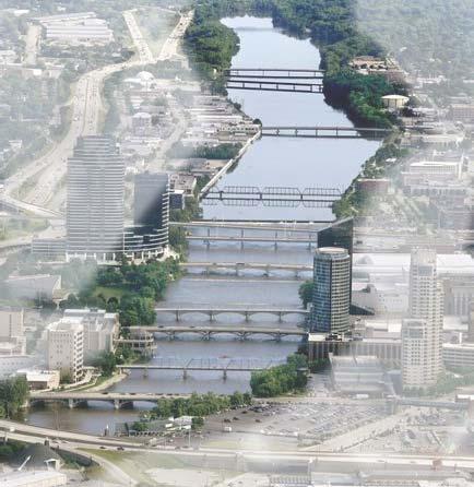


1 OPPORTUNITIES & CONSTRAINTS Grand Rapids Restoration August 2012


2 We have inherited the past; we can create the future Unknown


3 TABLE OF CONTENTS ES-1 ES BACKGROUND CONCEPTUAL PLAN ES-2... OPPORTUNITIES & CONSTRAINTS ES-6 ES TIMELINE CONCLUSION
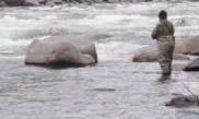
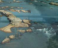
4 1. BACKGROUND The community of Grand Rapids is proposing a legacy conservation effort to restore their urban waters. This is a project proposed in and on the Grand River through the urban corridor of Grand Rapids, Michigan. The 2009 Green Grand Rapids Special Study, Grand River Whitewater Park Preferred Alternative (FTCH 2009) first prioritized the project for the community. The total project area covers 127 acres of the Grand River that can be significantly improved for habitat, whitewater, fishing, aesthetics and stream health. Rapid habitat has always been extremely rare in the Great Lakes region. Works of man have further disconnected and degraded these habitats. The life cycle of many native species depends on the healthy function of rapid habitat and access to these rare habitats. Problem Statement: The ecological, cultural and recreational functions of the rapids in the Grand River have been degraded by five low head dams, flood walls, urban encroachment, and channelization (dredging and grading). Objective: The community seeks to remove the dams, and enhance the channel bed and banks, to restore the ecological, cultural and recreational functions of the historic rapids. Goals: Install water quality and habitat enhancements; Connect historic sturgeon spawning habitat; Improve access and recreational opportunities for residents; Enhance natural aesthetics and riparian function of the riverfront; Attract tourism, businesses and employment opportunities; Create access to natural areas for under-represented community members; Invigorate the cultural significance of the rapids; Implement a comprehensive plan for watershed and green infrastructure issues; and Generate a stewardship ethic for the river through education and outreach. 2. CONCEPTUAL PLAN Diversification is the major theme of the Grand Rapids Restoration plan. Diversification of the currents, habitats and recreation use can be achieved through enhancements to the channel bed. The diversified channel will spread out the use, as well as maximize the economic benefits of fishing, whitewater, and aesthetics. Diversification is also the key to stream health as the life cycles of species that evolved with the river can be maximized in a complex and diverse environment. Early pre-dam reports indicate that the river was strewn with granite boulders and cobble stones. Before the river was changed by the work of man the rapids had a nearly uniform descent for about a mile, from where is now Leonard Street to Pearl Street. The total amounted to about eighteen feet, or sufficient to give a decided turbulent and wild appearance to the waters, and to make a noise that broke the stillness of the forest and echoed from the neighboring hills. (Charles A. Whittemore, Kent Scientific Institute of Grand Rapids, 1895 )

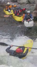
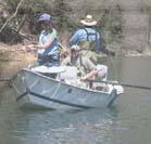
5 Five low head dams have been constructed in the project reach. Sixth Street dam is the most significant structure with over 8 feet of hydraulic drop. All dams would be significantly modified or removed as part of the restoration. Upstream of Sixth Street Dam is a submerged limestone shelf that was likely the prime spawning grounds for the abundant sturgeon reported to have been in Grand Rapids prior to the construction of dams. The five dams, floodwalls and historic grading of the channel bed have limited aquatic habitat and degraded stream function. The conceptual plan envisions mimicking the boulder strewn rapid downstream of Sixth Street Dam and uncovering the limestone shelves upstream of the dam. All five dams would be modified, buried or removed. The channel bed would be restored with diverse gravel, cobble and boulder substrates. Fish passage and aquatic habitat would be greatly enhanced. As many as 12 Class III whitewater features may form at different flows, with longer runs and pools between the focused whitewater. Wade fishing from the shore and banks would also be facilitated by structures in the channel bed. 3. OPPORTUNITIES AND CONSTRAINTS The Grand Rapids Restoration project has significant opportunity for habitat, recreation and aesthetic improvement in the Grand Rapids area. The constraints are important, but may feasibly be overcome with careful planning and coordination backed up with detailed engineering and design. The most significant constraints are: Sea lamprey barrier and control Efforts to control lamprey parasitism of Great Lakes fish populations have been ongoing since the late-1940s by the U.S. Fish and Wildlife Service. Sixth Street Dam is not considered a complete barrier for sea lamprey (Klinger, USFWS personal communication) as spawning populations have been observed upstream of the dam. The incompleteness of the existing barrier increases the feasibility that it can be modified and mitigated, and USFWS has stated openness to modification ideas. Any proposed modifications to Sixth Street Dam, and especially those required to maximize sturgeon habitat, will require additional detailed analysis and approval from USFWS prior to construction.

6 Lands and easements In Grand Rapids, private parties may have rights to the river bed. Riparian rights and easements were identified and obtained during the construction of the floodwalls. These rights are being reviewed and additional easements may be necessary for the project. The City of Grand Rapids owns many parcels adjacent to the Grand River, which will facilitate the compilation of easements. The project may be adjusted in final design as accommodated by lands that become available. A total project cost of $27.5M Preliminary budget estimates for implementation of the complete concept plan are a total project cost of $27.5 Million. This total includes $8.0 Million for soft costs including: lands; easements; design; long-term maintenance; and contingencies. Soft costs may represent the local contribution to the project, currently estimated at 29%. Grants usually require a cost share of at least 25 percent, and usually a federal grant requires a 35 percent non-federal cost share. Partnerships for this project will likely require at least $2 Million in donated or local government cash to complete a 35% match. Additional partnership cash will serve to facilitate the efficiency, completeness and timeliness of the project. A fundraising strategy is being developed to create a solid foundation of support for the project to ensure that the benefits to the whole community are understood. The funding strategy focuses on each of the components of the project and identifies the most appropriate funding source or sources for each component. The strategy includes a project timeline to be able to anticipate funding opportunities and be proactive in pursuing and submitting applications.

 was created to determine the feasibility of reasonable drops in the low flow channels and to evaluate the affect of proposed low flow channel")

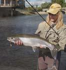
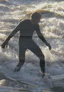
7 Flood conveyance The flood hazard of the Grand River is a constraint on the project and a concern of the DEQ, which has permit authority. Most of the river through the project area is lined with elevated floodwalls. The combination of the backwater submergence and the constriction of the project area bridges results in the channel bed having very little influence on the elevations of the flood flows. A proposed conditions hydraulic model (HEC-RAS) was created to determine the feasibility of reasonable drops in the low flow channels and to evaluate the affect of proposed low flow channel modifications on flood flows. It has been determined that substantial work can be performed on the low flow channel without reducing the flood capacity. The benefits of restoration within the constraints include: 500% increase in fish holding habitat 5 times increase in habitat diversity 850% increase in lake sturgeon spawning habitat 100% upstream fish passage 1 sea lamprey adjustable velocity barrier 75% reduction in low flow width to depth ratio 1700% increase in hyporheic exchange (stream health) Direct improvement to aquatic habitat Reduction in fine sedimentation Propagation of 100,000 mussels 275% increase in sport fishing perimeter 4 additional acres of native riparian forest


8 100% downstream paddle and oar boat passage 2.5 mile drift boating reach 5,400 feet of Class II whitewater 3,300 feet of Class III whitewater 700 feet of Class IV whitewater 400 meters of International Canoe Federation Local Merit Slalom Course 10 to 15 International Canoe Federation Whitewater Rodeo features 1 adjustable whitewater surfing wave 8 lanes of 1,000+ meter FISA Masters Competition Rowing 6 lanes of 2,000+ meter FISA International Competition Rowing 2 new riverside parks Shoreline interaction at all riverfront parks 12 acres of limestone bedrock shoals 5 educational signs Greater than $5M annual economic impact in the heart of Grand Rapids
9 Two new riverfront parks were envisioned as part of the Green Grand Rapids Master Plan prepared by the City of Grand Rapids. These parks conveniently bound the major restoration efforts in the channel. The park at the upstream end of the project would be at the defunct water filtration plant south of Ann Street. The City recently purchased some of that land and is planning to build a river trail to connect Riverside Park to Canal Street Park. The lamprey barrier is proposed to be built fronting the park area. The restoration of the river in front of the filtration plant park would expose 12 acres of shallow bedrock shelves. During low flows, the park will be very wadeable for all ages; similar to tidal pools along some ocean fronts. The filtration plant park may become a destination where the community can cool off in a natural water feature. The park at the downstream end of the project would be at the City Maintenance yard on Market Street at the US-131 exit. This riverfront park would connect the extended riverwalk, provide shoreline access and act as the downstream takeout for drift boats and whitewater enthusiasts. A more significant boat ramp may include access for motor boats. Existing pedestrian trails are completed between Sixth Street and Fulton Street on both sides of the river. Additional connections of the trails and walkways are envisioned in the Master Plan to connect on the east bank from the Filtration Plant to the City Maintenance yard. These and other envisioned connections would provide a fluid circulation between the shore based and river based recreational opportunities. On river left, the White Pine Trail connects to the river trail in Riverside Park. As mentioned above, the City plans to extend this trail to connect to the riverwalk at Canal Street Park. Plans have already been drawn up for the trail to extend downstream of Fulton Street to Wealthy Street, and eventually connect to the Oxford Street Bridge and Trail and on the Millennium Park. On river right, the White Pine Trail is proposed to continue along the river s edge to Ann Street, and then head west to connect to the bike lane along Seward Avenue, connecting to Butterworth Avenue, to Indiana Street, to Wealthy Street and eventually to the Kent Trails System. The Grand Rapids Restoration will create a number of shores to trail access points for wade fishing and boating as well as passive recreation. The trail connection projects will also offer opportunities for additional restoration of riparian forests and greenways, expanding on the efforts of the Project. 4. TIMELINE In 2009 Grand Rapids Whitewater (GRWW) was formed as a 501 c3 non-profit with the mission to bring whitewater to the City. GRWW is championed by the vision of local residents Chip Richards and Chris Muller. In 2010 the project was included as a preferred alternative in the Green Grand Rapids planning process. In 2011 GRWW retained RiverRestoration of Glenwood Springs, Colorado for river engineering expertise. Fall of 2011 channel and sediment surveys were conducted and a real estate strategy developed. Winter of 2012 efforts included ongoing project specific coordination and outreach with stakeholders.


10 This Grand Rapids Restoration Opportunities and Constraints report has identified an achievable project with wide spread social, environmental and economic benefits. Design is a process and the final feasible configuration of the project will be identified through further technical coordination with stakeholders in The remaining 2012 planning and design tasks for this project include the following activities: Detailed hydraulic designs of sea lamprey barrier and USFWS review and comment Additional survey and review of flood impact model Documentation for permit applications Fresh water mussel survey Hydraulic ice analysis Economic impact study Lands and easements negotiations Baseline monitoring surveys o macroinvertebrates o substrate (pebble counts, geomorphology survey) o fish population o habitat conditions 5. CONCLUSION Significant restoration of the Grand River in Grand Rapids is achievable. Restoration is expected to have valuable social, environmental and economic benefits for the entire community. Further studies will show how the proposed project conforms to major constraints including flood conveyance and sea lamprey control. Restoration of lake sturgeon and fresh water mussel habitats are regionally rare opportunities. Based on concepts, the Grand Rapids Restoration has broad support from the managers and regulators of the river. Compelling community support is being voiced and gaining sustained momentum. A community legacy can be established in restoring the regionally rare functions of the Grand Rapids.

11 Grand Rapids Restoration Start Stakeholder Coordination Opps and Constraints report Final Design Const Start GRWW formed Concept Plan Feasible design alts Ad for Const Bid Const End RiverRestora tion surveys Fundraising campaign Finalize Real- Estate Habitat Monitoring Permitting Photo Credit: Deron Staffen, License CC 2.0 some rights reserved,
GRAND RAPIDS RESTORATION GRAND RAPIDS REVITALIZATION
 GRAND RAPIDS RESTORATION RETURNING THE RAPIDS TO THE GRAND WHY IS THIS PLACE CALLED GRAND RAPIDS? We have been asking for over 100- years, where are the rapids? WHY IS THIS PLACE CALLED GRAND RAPIDS? compare
Chagrin River TMDL Appendices. Appendix F
 Appendix F The following are excerpts from the Eastern Brook Trout Joint Venture s Conservation Strategy (Working Draft v.6), Conserving the Eastern Brook Trout: Strategies for Action Found at: http://www.easternbrooktrout.org/constrategy.html
Conserving the Forests, Lakes and Streams of Northeast Michigan
 4241 Old US 27 South, Suite 2, Gaylord, Michigan 49735 (989) 448-2293 www.huronpines.org info@huronpines.org Prioritized Restoration Projects in the AuSable River Watershed Summer 2015 Update from Huron
Of the following, which best describes you?
 Summary of Downtown Des Moines Dam Debate April 26 th, 2016 The following are the responses we heard from participants in the Dam Debate cohosted by the Register and the Des Moines Area Metropolitan Planning
Perryville TOD and Greenway Plan
 Perryville TOD and Greenway Plan Greenway Glossary Pathway: A bicycle and pedestrian path separated from motorized vehicular traffic by an open space, barrier or curb. Multi-use paths may be within the
Hydraulic Modeling of Stream Enhancement Methods
 Hydraulic Modeling of Stream Enhancement Methods Matthew J. Curry John J. Levitsky Abstract Development within watersheds increases the amounts of runoff causing stream erosion and degradation of stream
Big Spring Creek Habitat Enhancement and Fishery Management Plans
 Big Spring Creek Habitat Enhancement and Fishery Management Plans November 5, 2012 Big Spring Events and Activities Center Newville, PA Charlie McGarrell Regional Habitat Biologist Pennsylvania Fish and
The Economic Importance of Recreational River Use to the City of Calgary
 The Economic Importance of Recreational River Use to the City of Calgary Prepared by: Calgary River Users Alliance May 20, 2016 The Economic Importance of Recreational River Use to the City of Calgary
Conceptual Design Report for the Fabri Dam Modifications Project
 Conceptual Design Report for the Fabri Dam Modifications Project Flint, Michigan Prepared For: City of Flint P.O. Box 99 Flint, MI 48501-0099 Flint River Watershed Coalition 432 N. Saginaw St. Suite 1001
The approach of CanoeKayak BC Whitewater (CKBC-WW) to River Access issues is driven by the organizational Mission Statement:
 to River Access issues is driven by the organizational Mission Statement:") CanoeKayak BC - Whitewater DRAFT RIVER ACCESS POLICY For Comment The approach of CanoeKayak BC Whitewater (CKBC-WW) to River Access issues is driven by the organizational Mission Statement: Provide structure
CanoeKayak BC - Whitewater DRAFT RIVER ACCESS POLICY For Comment The approach of CanoeKayak BC Whitewater (CKBC-WW) to River Access issues is driven by the organizational Mission Statement: Provide structure
Columbia Lake Dam Removal Project
 Columbia Lake Dam Removal Project The Columbia Lake dam located 1/4 mile upstream of the Paulins Kill River's confluence with the Delaware River in Knowlton Township, Warren County has been proposed for
North Coast Corridor:
 North Coast Corridor: Connecting People, Transportation & Environment Legislative Hearing: 11.8.10 1 North Coast Corridor Region s Lifeline A Regional Strategy Mobility, Economy & Environment North Coast
COLUMBIA LAKE DAM REMOVAL PROJECT
 COLUMBIA LAKE DAM REMOVAL PROJECT Major Goals of the Columbia Lake Dam Removal: Reconnect 10 miles of the Paulins Kill River to the Delaware River, restoring natural flow regime and sediment transport.
Columbia Lake Dam Removal Project
 Columbia Lake Dam Removal Project Major Goals of the Columbia Lake Dam Removal: Reconnect 10 miles of the Paulins Kill River to the Delaware River, restoring natural flow regime and sediment transport.
Eastern Brook Trout. Roadmap to
 Eastern Brook Trout Roadmap to CONSERVATION Our Brook Trout heritage he wild Brook Trout is an American symbol of persistence, adaptability, and the pristine wilderness that covered North America prior
OKANAGAN RIVER RESTORATION INITIATIVE - FAQ
 OKANAGAN RIVER RESTORATION INITIATIVE - FAQ Initiative background: The health of the q awsitk w (Okanagan River) has been severely impacted by the channelization works that occurred in the mid-1950 s.
FACT SHEET MCGREGOR LAKE RESTORATION HABITAT PROJECT POOL 10, UPPER MISSISSIPPI RIVER, WISCONSIN ENVIRONMENTAL MANAGEMENT PROGRAM
 FACT SHEET MCGREGOR LAKE RESTORATION HABITAT PROJECT POOL 10, UPPER MISSISSIPPI RIVER, WISCONSIN ENVIRONMENTAL MANAGEMENT PROGRAM LOCATION McGregor Lake is located within a mid-river island in Pool 10
Habitat Development: Habitat Boulders Lawson Pier Foreshore Enhancement
 Habitat Development: Habitat Boulders Improve the existing habitat by stabilising beach sediments. Increase biodiversity by creating new habitats and colonisation opportunities. Loose cobble is unstable;
Aquatic Organism Passage at Road-Stream Crossings CHUCK KEEPORTS FOREST HYDROLOGIST ALLEGHENY NATIONAL FOREST WARREN, PENNSYLVANIA
 Aquatic Organism Passage at Road-Stream Crossings CHUCK KEEPORTS FOREST HYDROLOGIST ALLEGHENY NATIONAL FOREST WARREN, PENNSYLVANIA TOPICS COVERED Aquatic Organism Passage (AOP) Benefits of AOP Crossings
Estimated on-the-ground start and end dates: 1 June October 2018
 A. Applicant Information Name of Organization: U.S. Army Corps of Engineers, Carlyle Lake 801 Lake Road, Carlyle, IL 62231 Contact Information: Robert Wilkins, Operations Manager, (618) 594-2484, Robert.Wilkins@usace.army.mil
Living Streets Policy
 Living Streets Policy Introduction Living streets balance the needs of motorists, bicyclists, pedestrians and transit riders in ways that promote safety and convenience, enhance community identity, create
Blue River Restoration Project William D. Linfield, P.E.
 Blue River Restoration Project William D. Linfield, P.E. 1 2 3 4 5 Blue River Restoration Project BUILDING BRIDGES BETWEEN COMMUNITIES IN COOPERATION WITH THE NATIONAL FOREST FOUNDATION Building Bridges
Restoring the Kootenai: A Tribal Approach to Restoration of a Large River in Idaho
 Restoring the Kootenai: A Tribal Approach to Restoration of a Large River in Idaho Susan Ireland, Kootenai Tribe of Idaho Future of our Salmon Conference Technical Session August 2016 Healthy Floodplains,
Blue River Restoration Project
 Blue River Restoration Project Blue River Restoration Project BUI LDI NG BRI DGES BETWEEN COMMUNI TI ES I N COOPERATI ON WI TH THE NATI ONAL FOREST FOUNDATI ON The Blue River Restoration project is an
Amendment to a Biological Assessment/Evaluation completed for the Coon Creek Land Disposal completed December Grand Valley Ranger District
 Amendment to a Biological Assessment/Evaluation completed for the Coon Creek Land Disposal completed December 2007 Grand Valley Ranger District Grand Mesa, Uncompahgre, Gunnison National Forests Prepared
CHAPTER 7.0 IMPLEMENTATION
 CHAPTER 7.0 IMPLEMENTATION Achieving the vision of the Better Streets Plan will rely on the ability to effectively fund, build and maintain improvements, and to sustain improvements over time. CHAPTER
Bicycle Master Plan Goals, Strategies, and Policies
 Bicycle Master Plan Goals, Strategies, and Policies Mobilizing 5 This chapter outlines the overarching goals, action statements, and action items Long Beach will take in order to achieve its vision of
City of Novi Non-Motorized Master Plan 2011 Executive Summary
 City of Novi Non-Motorized Master Plan 2011 Executive Summary Prepared by: February 28, 2011 Why Plan? Encouraging healthy, active lifestyles through pathway and sidewalk connectivity has been a focus
University of Victoria Campus Cycling Plan Terms of Reference. 1.0 Project Description
 University of Victoria Campus Cycling Plan Terms of Reference 1.0 Project Description The Campus Cycling Plan, a first for the University, will provide a comprehensive and coordinated approach to support
JAP Additional Information Sheet
 JAP Additional Information Sheet Block 15: Purpose and Need The USACE purpose of the project is to provide a safe and reliable whitewater park for the recreational public in a city park, which will provide
Friends of the Detroit River Habitat Restoration Project Update
 Friends of the Detroit River Habitat Restoration Project Update 11 Beneficial Use Impairments (BUIs) were originally identified to be associated with the Detroit River: 1. Restrictions on fish and wildlife
FACT SHEET I. LOCATION
 STEAMBOAT ISLAND HABITAT REHABILITATION AND ENHANCEMENT PROJECT (HREP) SCOTT COUNTY, IOWA, UPPER MISSISSIPPI RIVER RESTORATION-ENVIRONMENTAL MANAGEMENT PROGRAM ROCK ISLAND DISTRICT FACT SHEET I. LOCATION
Understanding the Impacts of Culvert Performance on Stream Health
 Understanding the Impacts of Culvert Performance on Stream Health Kristin Thomas Aquatic Ecologist Michigan Trout Unlimited Transportation and the Environment Conference 12/5/2018 Importance of adequately
Iowa Department of Natural Resources Iowa Water Trails Grant Program
 Iowa Department of Natural Resources Iowa Water Trails Grant Program Submitted by the City of Story City in conjunction with the Skunk River Paddlers and the Story County Conservation Board Tuesday, January
Goal 3: Foster an environment of partnerships and collaboration to connect our communities and regions to one another.
 Non-Motorized Transportation Plan (NMTP) Draft Vision, Goal and,, Tri-County Regional Planning Commission (TCRPC) Purpose The purpose of the Tri-County Regional Planning Commission (TCRPC) Non-Motorized
Annual Report for Fiscal Year and Future Plans for the Tillamook Bay Watershed Council
 Annual Report for Fiscal Year 2012-2013 and Future Plans for the Tillamook Bay Watershed Council A report prepared for the Tillamook County Board of Commissioners August 2013 Table of Contents: Recently
Searsville Dam Removal
 Searsville Dam Removal A unique opportunity for all Presented by the Beyond Searsville Dam Coalition San Francisquito Creek flows into the San Francisco Bay near the Palo Alto Airport and Golf Course seen
MAG Town of Cave Creek Bike Study Task 6 Executive Summary and Regional Significance Report
 Page 1 MAG Town of Cave Creek Bike Study Task 6 Executive Summary and Regional Significance Report August 1, 2012 MAG Project #481 Page 2 Task 6 Executive Summary and Regional Significance Report Introduction
ACTIVE TRANSPORTATION/NONMOTORIZED TRANSPORTATION
 ACTIVE TRANSPORTATION/NONMOTORIZED TRANSPORTATION BACKGROUND Active transportation, also known as nonmotorized transportation, is increasingly recognized as an important consideration when planning and
Conceptual Design Report for the Hamilton Dam Modifications Project. Flint, Michigan. Prepared For: City of Flint P.O. Box 99 Flint, MI
 Conceptual Design Report for the Hamilton Dam Modifications Project Flint, Michigan Prepared For: City of Flint P.O. Box 99 Flint, MI 48501-0099 Flint River Watershed Coalition 432 N. Saginaw St. Suite
Proposed. City of Grand Junction Complete Streets Policy. Exhibit 10
 Proposed City of Grand Junction Complete Streets Policy Exhibit 10 1 City of Grand Junction Complete Streets Policy Vision: The Complete Streets Vision is to develop a safe, efficient, and reliable travel
BIKE PLAN CONTENTS GATEWAY
 CONTENTS Acknowledgments...vii Great Rivers Greenway District Board of Directors... vii Great Rivers Greenway District Staff... vii Project Consultants... vii Committees... viii Citizens Advisory Committee
CITY OF COCOA BEACH 2025 COMPREHENSIVE PLAN. Section VIII Mobility Element Goals, Objectives, and Policies
 CITY OF COCOA BEACH 2025 COMPREHENSIVE PLAN Section VIII Mobility Element Goals, Objectives, and Policies Adopted August 6, 2015 by Ordinance No. 1591 VIII MOBILITY ELEMENT Table of Contents Page Number
Maryland Chapter Trout Unlimited Brook Trout Conservation Effort
 Maryland Chapter Trout Unlimited Brook Trout Conservation Effort Photo by Matt Kline Portfolio of Recent Work MDTU Brook Trout Conservation Coordinator: Scott C. Scarfone, ASLA sscarfone@oasisdesigngroup.com
Okanagan Sockeye Reintroduction
 Okanagan Sockeye Reintroduction Backgrounder Elders accounts, and other forms of Traditional Ecological Knowledge (TEK) tell us that many species of salmon once came into the Okanagan Valley and tell us
East Burke Transportation, Safety and Capacity Improvements
 East Burke Transportation, Safety and Capacity Improvements The purpose of this project is to increase mobility and improve safety for pedestrians, cyclists, and motor vehicles along VT Route 114 in the
Black Sturgeon Regional Plan
 Black Sturgeon Regional Plan This is one of twenty Regional Plans that support implementation of the Lake Superior Biodiversity Conservation Strategy (Strategy). The Strategy, prepared and overseen by
Exhibit 1 PLANNING COMMISSION AGENDA ITEM
 Exhibit 1 PLANNING COMMISSION AGENDA ITEM Project Name: Grand Junction Circulation Plan Grand Junction Complete Streets Policy Applicant: City of Grand Junction Representative: David Thornton Address:
FISH PASSAGE IMPROVEMENT in California s Watersheds. Assessments & Recommendations by the Fish Passage Forum
 FISH PASSAGE IMPROVEMENT in California s Watersheds Assessments & Recommendations by the Fish Passage Forum FISH PASSAGE IMPROVEMENT in California s Watersheds The mission of the Fish Passage Forum is
APPENDIX 2.1 Lake Sturgeon - Mitigation and Enhancement
 APPENDIX 2.1 Lake Sturgeon - Mitigation and This page is intentionally left blank. Lake Sturgeon Mitigation and As a provincial crown corporation providing electric energy and natural gas service, Manitoba
Three point plan to addressing land use and habitat loss impacts on Chesapeake Bay tidal fish and shellfish
 Three point plan to addressing land use and habitat loss impacts on Chesapeake Bay tidal fish and shellfish 1. Establish Principles for Protection of Chesapeake Bay Fish and Shellfish The Fisheries GIT
PE17.1 REPORT FOR ACTION
 PE17.1 REPORT FOR ACTION Encouraging a paddling and fishing friendly City Date: February 2, 2017 To: Parks and Environment Committee From: General Manager, Parks, Forestry and Recreation Division Wards:
3 FRAMEWORK FOR IMPLEMENTATION OF LAKE-TO-LAKE CYCLING ROUTE
 3 FRAMEWORK FOR IMPLEMENTATION OF LAKE-TO-LAKE CYCLING ROUTE The Planning and Economic Development Committee recommends the adoption of the recommendations contained in the following report dated December
LaSalle Park Marina Wave Break
 LaSalle Park Marina Wave Break Federal and Municipal Environmental Assessment Background History of the Marina and LaSalle Park The LaSalle Park Marina is located in LaSalle Park at the foot of LaSalle
The North American Waterfowl Management Plan: Incorporating the New Goal
 The North American Waterfowl Management Plan: Incorporating the New Goal Mark P. Vrtiska, Ph.D. Waterfowl Program Manager Nebraska Game and Parks Commission Young Andy Bishop 2012 NAWMP Goals 1. Abundant
Salmon Five Point Approach restoring salmon in England
 Salmon Five Point Approach restoring salmon in England Our Mission To restore the abundance, diversity and resilience of salmon stocks throughout England We will do this by:- a) Maximising the production
Restoring the Iconicc Lower Cache River
 Restoring the Iconicc Lower Cache River A new chapter holds promise of revitalizing cherished waters and woods The story of conservation in the lower Cache River and surrounding Big Woods of eastern Arkansas
STRATEGIC PLANNING FOR DEVELOPMENT OF THE OREGON SHORT LINE TERMINUS HISTORIC DISTRICT
 STRATEGIC PLANNING FOR DEVELOPMENT OF THE OREGON SHORT LINE TERMINUS HISTORIC DISTRICT & AN EXECUTIVE SUMMARY OF THE HEART OF WEST YELLOWSTONE CONCEPTUAL PLANNING REPORT November 2004 PREPARED BY The Portico
CALIFORNIA SALMONID STREAM HABITAT RESTORATION MANUAL APPENDIX IX-A CULVERT CRITERIA FOR FISH PASSAGE INTRODUCTION
 APPENDIX IX-A STATE OF CALIFORNIA RESOURCES AGENCY DEPARTMENT OF FISH AND GAME CULVERT CRITERIA FOR FISH PASSAGE For habitat protection, ecological connectivity should be a goal of stream-road crossing
Tips for Using & Printing Spreadsheets
 Key to Spreadsheets Spreadsheet # Type Description/Purpose a Development & Construction in Waterways b Debits Development & Construction in Other Aquatic Areas c Indirect Impacts to Waterways from Development
TOWN OF PORTLAND, CONNECTICUT COMPLETE STREETS POLICY
 TOWN OF PORTLAND, CONNECTICUT COMPLETE STREETS POLICY I. VISION, GOALS & PRINCIPLES VISION To improve the streets of Portland making them safer and more accessible for all users including pedestrians,
Transportation Master Plan Advisory Task Force
 Transportation Master Plan Advisory Task Force Network Alternatives & Phasing Strategy February 2016 BACKGROUND Table of Contents BACKGROUND Purpose & Introduction 2 Linking the TMP to Key Council Approved
Fisheries Management Zone 10:
 Fisheries Management Zone 10: Lake Trout Operational Objectives and Management Photo Credit: www.jamessmedleyoutdoors.com 2 FMZ 10: Lake Trout Operational Objectives and Management Lake trout are the second
ST. LOUIS SECTION PROJECT OF THE YEAR AWARD
 ST. LOUIS SECTION PROJECT OF THE YEAR AWARD Originality and Innovation The St. Louis Harbor Project is located in the Upper Mississippi River between the entrance to the Chain of Rocks Canal at River
Vision: Traditional hamlet with an attractive business/pedestrian friendly main street connected to adjacent walkable neighborhoods
 N D. Focus Area II Vision: Traditional hamlet with an attractive business/pedestrian friendly main street connected to adjacent walkable neighborhoods Transit Road Focus Area II is located in the Hamlet
Municipal Class EA To Address Traffic Congestion On The Ontario Street Corridor (Grand Bend) Public Information Meeting June 4, 2018
 Public Information Meeting June 4, 2018") Municipal Class EA To Address Traffic Congestion On The Ontario Street Corridor (Grand Bend) Public Information Meeting June 4, 2018 Background Agenda Traffic Study Update Class EA Alternatives Bridge
Municipal Class EA To Address Traffic Congestion On The Ontario Street Corridor (Grand Bend) Public Information Meeting June 4, 2018 Background Agenda Traffic Study Update Class EA Alternatives Bridge
Corpus Christi Metropolitan Transportation Plan Fiscal Year Introduction:
 Introduction: The Safe, Accountable, Flexible, Efficient Transportation Equity Act: A Legacy for Users (SAFETEA-LU) has continued the efforts started through the Intermodal Surface Transportation Efficiency
Trout Unlimited Comments on the Scope of Environmental Impact Statement for the Constitution Pipeline Project, Docket No. PF12-9
 October 9, 2012 Kimberly D. Bose, Secretary Federal Energy Regulatory Commission 888 First Street, NE, Room 1A Washington, DC 20426 RE: Trout Unlimited Comments on the Scope of Environmental Impact Statement
2016 Volunteer Program Annual Report
 The mission of the Oregon Department of Fish & Wildlife Volunteer Program is to actively involve citizens as volunteers in the protection and enhancement of Oregon s fish and wildlife resources for the
INNER LOOP EAST. AIA Rochester Annual Meeting November 13, 2013 TRANSFORMATION PROJECT. Bret Garwood, NBD Erik Frisch, DES
 INNER LOOP EAST TRANSFORMATION PROJECT AIA Rochester Annual Meeting November 13, 2013 Bret Garwood, NBD Erik Frisch, DES Why? We are building a city that encourages walking, biking and enjoying the outdoor
ACTIVE TRANSPORTATION
 ACTIVE TRANSPORTATION Mobility 2040 Supported Goals Improve the availability of transportation options for people and goods. Support travel efficiency measures and system enhancements targeted at congestion
Appendix G Whitewater Recreation Flow Study Plan
 Appendix G Whitewater Recreation Flow Study Plan Study Plan Whitewater Recreation Flow Study Grandfather Falls Hydroelectric Project FERC Project No. 1966 March 2013 An Integrys Energy Group Company Section
California Steelhead: Management, Monitoring and Recovery Efforts
 California Steelhead: Management, Monitoring and Recovery Efforts Jonathan Nelson Steelhead Restoration & Management Program Oncorhynchus mykiss irideus California Steelhead Distinct Population Segments
Waikanae River Environmental Strategy. 12. Arapawaiti/Otaihanga Reach
 74 Waikanae River Environmental Strategy 12. Arapawaiti/Otaihanga Reach Figure 12: Arapawaiti/Otaihanga Reach 75 PART C: Protecting and Improving the River Corridor / Arapawaiti/Otaihanga Reach Waikanae
Rhode Island Department of Environmental Management Division of Fish and Wildlife American Shad Habitat Plan for the Pawcatuck River
 Rhode Island Department of Environmental Management Division of Fish and Wildlife American Shad Habitat Plan for the Pawcatuck River Prepared by: Phil Edwards, Rhode Island Department of Environmental
WELCOME TO OPEN HOUSE # 1 June 14, 2017
 Langstaff Road Weston Road to Highway 7 Class Environmental Assessment Study WELCOME TO OPEN HOUSE # 1 June 14, 2017 Please sign in and join our mailing list Purpose of Open House #1 & Study Area York
Western native Trout Status report
 Bull trout (Salvelinus confluentus) Data: Draft Recovery Plan, USFWS, 2002; FR Final Critical Habitat Rule - 2005 Partners: ID, MT, OR, WA, NV, FWS, FS, BLM, NPS, Tribes, AK, Canada Species Status review:
OREGON DEPARTMENT OF FISH AND WILDLIFE
 OREGON DEPARTMENT OF FISH AND WILDLIFE Ladd Marsh Wildlife Area 1 Benefits for all Oregonians 2 The Mission To protect and enhance Oregon's fish and wildlife and their habitats for use and enjoyment by
Presented by Fred Halterman, URS Jennie Agerton, URS
 Presented by Fred Halterman, URS Jennie Agerton, URS What is Eco Friendly Culvert Design? Culvert design that: Maintains connectivity for aquatic organism migration Maintains connectivity for gene flow
COUNCIL POLICY NAME: COUNCIL REFERENCE: 06/119 06/377 09/1C 10llC 12/1C INDEX REFERENCE: POLICY BACKGROUND
 COUNCIL POLICY NAME: COUNCIL ADVISORY COMMITTEES - TERMS OF REFERENCE ISSUED: APRIL 3, 2006 AMENDED: NOVEMBER 27, 2006 NOVEMBER 23, 2009 JANUARY 11, 2010 DECEMBER 17, 2012 POLICY COUNCIL REFERENCE: 06/119
Safe Routes to School Grant Application Phase I March 2014
 Safe Routes to School Grant Application Phase I March 2014 Page 1 The City of Mission is requesting grant funding to create a Safe Routes to School Plan which will encompass all of the existing elementary
Colorado Avenue Dam Proposed Paddle Trail Improvements Preliminary Design Report Deschutes River, Bend, Oregon
 Colorado Avenue Dam Proposed Paddle Trail Improvements Preliminary Design Report Deschutes River, Bend, Oregon Prepared For: Bend Metro Park and Recreation District 799 SW Colombia Street Bend, Oregon
Clackamas County Comprehensive Plan
 ROADWAYS The County s road system permits the movement of goods and people between communities and regions, using any of a variety of modes of travel. Roads provide access to virtually all property. They
Chapter 2. Bellingham Bicycle Master Plan Chapter 2: Policies and Actions
 Chapter 2 Bellingham Bicycle Master Plan Chapter 2: Policies and Actions Chapter 2: Policies and Actions The Bicycle Master Plan provides a road map for making bicycling in Bellingham a viable transportation
Five Counties Salmonid Conservation Program - Fish Passage Design Workshop. February 2013
 Program - Aquatic Organisms and Stream Crossings Ecological Connectivity A watershed is a network of channels that drain a common boundary. Channel characteristics formed by interaction of precipitation,
PEDESTRIAN ACTION PLAN
 ATTACHMENT 2 CITY OF SANTA MONICA PEDESTRIAN ACTION PLAN CITY OF SANTA MONICA PEDESTRIAN ACTION PLAN This page intentionally left blank EXECUTIVE SUMMARY CHAPTER 1 EXECUTIVE SUMMARY Setting the Stage
The Blue Heron Slough Conservation Bank
 1 The Blue Heron Slough Conservation Bank CONSERVATION BANKING July 19-23, 2010 CASE STUDY SERIES The Blue Heron Slough Conservation Bank (Washington) I. OVERVIEW & BACKGROUND: Location: Snohomish River
3. The qualification raised by the ISRP is addressed in #2 above and in the work area submittal and review by the ISRP as addressed in #1.
 Please find attached a response from The Confederated Tribes of the Warm Springs Reservation of Oregon (CTWSRO) for Project # 2008-301-00, Habitat Restoration Planning, Design and Implementation within
Understanding Today s Environmental Issues and the Oregon Stewardship Guidelines. David Phipps GCSAA NW Field Staff
 Understanding Today s Environmental Issues and the Oregon Stewardship Guidelines David Phipps GCSAA NW Field Staff My Roots Northwest Landscape Industries 1986-1990 The Oregon Golf Club 1990-2000 Stone
EcoLogic Memorandum. TO: Ben Brezell; EDR FROM: Mark Arrigo RE: Possible Impacts of Dredging Snooks Pond DATE: 6/4/07
 EcoLogic Memorandum TO: Ben Brezell; EDR FROM: Mark Arrigo RE: Possible Impacts of Dredging Snooks Pond DATE: 6/4/07 Background EDR P.C. (EDR) has been contracted by a landowner to assess the feasibility
CITY OF GRAND JUNCTION URBAN TRAILS COMMITTEE 2017 ANNUAL REPORT
 CITY OF GRAND JUNCTION URBAN TRAILS COMMITTEE 2017 ANNUAL REPORT INTRODUCTION INTRODUCTION Resolution No. 48 94 created the Grand Junction Trails Board in 1994 as a subcommittee of the Riverfront Commission
Implementing the New Fisheries Protection Provisions under the Fisheries Act
 Implementing the New Fisheries Protection Provisions under the Fisheries Act Discussion Paper Fisheries and Oceans Canada April 2013 Contents 1. Introduction 2. Managing Threats to Canada s Fisheries 3.
CHAPTER 4 DESIRED OUTCOMES: VISION, GOALS, AND OBJECTIVES
 CHAPTER 4 DESIRED OUTCOMES: VISION, GOALS, AND OBJECTIVES Vision One of the first steps in developing this Plan was articulating a vision - a clear statement of what the Plan strives to achieve and what
Shoreline Studies Program, Department of Physical Sciences, VIMS
 Living Shoreline Training Class 2017 1 Demonstration sites discussed in this talk. 2 A shoreline management plan for the entire creek made conceptual shoreline management recommendations along every stretch
Frequently Asked Questions About Revised Critical Habitat and Economic Analysis for the Endangered Arroyo Toad
 Q Frequently Asked Questions About Revised Critical Habitat and Economic Analysis for the Endangered Arroyo Toad Q. What is the arroyo toad? The arroyo toad (Bufo californicus) is a small, light greenish-grey
Rochester Area Bike Sharing Program Study
 roc bike share Rochester Area Bike Sharing Program Study Executive Summary ~ January 2015 JANUARY 2015 8484 Georgia Avenue, Suite 800 Silver Spring, MD 20910 3495 Winton Pl., Bldg E, Suite 110 Rochester,
Case Study 3. Case Study 3: Cebu Island, Philippines MPA Network 10
 Case studies of mpa networks Case Study 3: Cebu Island, Philippines MPA Network 10 Location and background Cebu Island in the Philippines lies in the center of the Visayan Islands, known as an area high
Conservation Planning in Vermont
 Conservation Planning in Vermont Today s outline 1. A primer on conservation biology 2. VT Wildlife Action Plan 3. How VTRANS & Fish and Wildlife work together 4. Discussion: How can we better work together?
Broad Street Bicycle Boulevard City Council Study Session Summary
 Broad Street Bicycle Boulevard City Council Study Session Summary Overview: On August 15 th, 2017, a City Council Study Session was held to invite community input and request City Council guidance on a
THE WESTERN NATIVE TROUT INITIATIVE PLAN FOR STRATEGIC ACTIONS November GOALS, OBJECTIVES, and KEY STRATEGIC ACTIONS
 THE WESTERN NATIVE TROUT INITIATIVE PLAN FOR STRATEGIC ACTIONS November 2016 INTRODUCTION In January 2008, after an intensive scoping and development process, the Western Native Trout Initiative (WNTI)