Study Report. Proposed Upper Chattahoochee River Canoe Trail. Upper Chattahoochee River. Canoe Trail
|
|
|
- Arabella Walker
- 6 years ago
- Views:
Transcription

1 Study Report Proposed Upper Chattahoochee River Canoe Trail Upper Chattahoochee River Canoe Trail Prepared for Georgia State Parks & Historic Sites Department of Natural Resources Prepared by Upper Chattahoochee Riverkeeper Rivers, Trails & Conservation Assistance Program National Park Service December 2009
2 Contents Section Title Page 1 Executive Summary 4 2 Introduction 5 o Georgia Perspective 6 o Project Description & Purpose 6 o Study Committee 7 3 Existing Conditions 8 o The Study Area 8 o Launch site & design issues 10 o Inventory of existing conditions 10 4 Proposed Canoe Trail 24 o Evaluation Goals 24 o Benefits & Limitations 25 o Launch Site Descriptions & Recommendations 26 5 Next Steps for Implementation 31 Tables Table 1: Mileage--Segments of Canoe Trail 26 Maps Map 1: Study Area 9 Map 2: Sautee Creek Launch Sites 12 Map 3: Belton Bridge Launch Sites 18 Map 4: Don Carter Launch Sites 21 Map 5: Lula Bridge to Clarks Bridge 23 Map 6: Lula Park road changes 29 Appendices A. Launch Design Considerations 35 B. Traits of Successful Water Trails 35 C. Southeast States: Canoe Trail Information 37 2
3 D. University of Georgia: Blueways in Georgia 44 E. University of Georgia: Sautee Park Plan 52 F. DNR Memo: Legal Issues of River Access 54 G. Leave No Trace Principles 56 H. Why we need water trails 59 I. Water Trails a new network across America 61 3
4 Section 1: Executive Summary Blueways, or canoe trails, are gaining recognition for their value as a conservation and watershed protection tool, in addition to their recreational benefits. When Georgia s Department of Natural Resources (DNR) updated its Statewide Comprehensive Outdoor Recreation Plan in 2006, citizens indicated a strong desire for more water recreation and increased connectivity between parks. A prime opportunity for such connectivity exists on a 40-mile stretch of the upper Chattahoochee River above Lake Lanier that has been used informally by individuals and commercial outfitters for decades. With technical assistance from the National Park Service s Rivers, Trails and Conservation Assistance Program, Upper Chattahoochee Riverkeeper (UCR) initiated a study in 2007 to determine the feasibility of a state-designated canoe trail on the upper Chattahoochee from the confluence of Sautee Creek and the river in White County to Clarks Bridge on Lake Lanier. This river section connects three state-owned park sites, two federally-owned recreation sites, one county-owned park, two commercial sites and two public bridge/road sites. Each of these ten sites is evaluated in the attached study report for use as a potential put-in and take-out location for canoes and kayaks; tubing is not recommended for use in this river section. Also included are recommendations for site improvements to enhance safety and recreational enjoyment. The study was guided by the following goals: To create a recreational boating opportunity for paddlers that respects private property To provide safe and dependable access to the river for kayaks and canoes To use only public land or commercial sites for access, as negotiated with owners To provide support facilities where appropriate To minimize impacts to the river corridor while promoting stewardship and recreation To meet the goals of DNR s Statewide Comprehensive Outdoor Recreation Plan Based on existing site conditions and the current status of the master planning process for the three state parks, this Report recommends that the state consider the designation of the Upper Chattahoochee River Canoe Trail for canoes and kayaks to start at Sautee Creek and end at Clarks Bridge County Park on Lake Lanier. DNR is strongly encouraged include river access in the master plans for Buck Shoals, Mossy Creek and Don Carter State Parks and to provide limited river access with special use permits during the interim period while the master plans are being completed. Management of the canoe trail would be supported and implemented by DNR, U.S. Army Corps of Engineers, Hall County and partners to include Wildwood Outfitters, UCR, Georgia Canoeing Association and Lake Lanier Association. We also recommend the creation of a Coordinating Team with representatives from all stakeholder groups to take suggested next steps in making this canoe trail a reality. 4

5 Section 2: Introduction An Overview of the Current Interest and Value of Kayak and Canoe Trails excerpted from a 2004 essay by David Getchell, Sr., co-founder of North American Water Trails: Water trails are finally being recognized as an important feature of the recreational landscape. True they have been around for hundreds of years in one form or another, but in early times they were trade and exploration routes and recreation was unknown. Throughout the first half of the 20th century they were neglected or taken for granted, while many were simply forgotten. But as population continued to increase and access to our waterways became increasingly difficult, the value of our vast water heritage and its potential for recreation began to be seen. In 1966 Maine established the 92-mile-long Allagash Wilderness Waterway and in 1970 this spectacular resource became the first state-administered component of the National Wild and Scenic Rivers System. In 1978 the huge Boundary Waters Canoe Area Wilderness was established in Minnesota. Elsewhere, some state governments began designating paddle routes on lakes and rivers. In the late 1980's a new approach was tried. Maine's non-profit Island Institute, working with the state, established the Maine Island Trail along some 325 miles of coastline, using more than 30 state-owned wild islands as overnight stopovers. A separate membership organization, the Maine Island Trail Association (MITA), was set up by the Institute to develop and maintain the trail with the state paying an annual stipend to MITA to help care for the state islands. With no facilities whatsoever on the islands, this would seem to be an easy job. But lacking enforcement authority-and not wanting any!- the organization had to try something new to keep the state-owned and dozens of privately-owned islands in its system in pristine condition. Many other water trails have been founded with user care as part of their methods of operation, some more successfully than others. Among the most successful of these is the Washington Water Trails Association and its superb Cascadia Marine Trail. Water trails are going to be an important part of the recreational mix in the coming years because they offer such an exciting variety of outdoor experiences. The most successful ones, however, will rest on a strong foundation of partners. More importantly, they will be built around a strong stewardship ethic, because their very nature requires TLC from the people using them. 5
6 The Georgia Perspective Greenway corridors and blueways, or canoe trails, are gaining recognition for their value as a conservation and watershed protection tool, in addition to their recreational benefits. Often referred to as "green infrastructure", these natural systems connect people and places along with valuable historical, cultural and ecological resources. This desire for linkages between parks and other resources was confirmed several years ago when Georgia s Department of Natural Resources updated its Statewide Comprehensive Outdoor Recreation Plan in At a series of public meetings, citizens indicated a strong desire for more water recreation and increased connectivity between parks. As further evidence of the growing interest in river recreation, Paddle Georgia, a project of Georgia River Network, now attracts more than three hundred kayakers and canoeists every year to week-long adventures on different waterways. Canoe trails are being discussed and studied by local groups and government planners on the Etowah, the Ocmulgee, the Coosa, and the Oostanaula, as well as the Chattahoochee. In the late 1990s, DNR developed a regional park strategy based on a vision to create a series of parks along the Chattahoochee River linked by greenways. The state's decision to develop the plan for a series of riverside parks, as part of the Chattahoochee Land Protection Campaign, grew out of the desire to provide the public with more river access. State leaders felt that DNR has a responsibility to the citizens of Georgia to provide recreational opportunities as well as land protection. By December 2002, the state had spent more than $14 million to purchase four large properties as new state parks on a 40-plus mile section of the Chattahoochee above Lake Lanier: Hardman Farm, Buck Shoals, Mossy Creek and Don Carter. This section of the river has been used informally for many years for individual and commercial recreation. In fact, Wildwood Outfitters first established a business for recreational use in During the 1990s, the Chattahoochee River Race was held on the upper segment of the river, starting at the King property on Sautee Creek. Project Description & Purpose The purpose of this Study Report is to evaluate the feasibility of a canoe trail on the Upper Chattahoochee River above Lake Lanier. Upper Chattahoochee Riverkeeper has worked since its inception in 1994 to get people out on the river as well as to walk, run or just sit beside it. By evaluating the opportunities for a canoe trail for a portion of the Chattahoochee River above Lake Lanier, UCR hopes to raise awareness of the resource, promote a stewardship ethic, and provide exceptional educational and recreational opportunities. Since UCR has no authority to create or designate a canoe trail linking state parks, this Study Report will be provided to the Georgia State Parks & Historic Sites for its consideration and any subsequent action. 6
7 The recreational and scenic value of the Chattahoochee River above Lake Lanier is wellknown and provides excellent opportunities for paddlers to experience both Class II-III rapids and stretches of flat water. The state and Federal agencies that manage outdoor recreation sites are already aware of the linkages that could capitalize on existing resources in the area and improve river-related recreation. The study of an Upper Chattahoochee River Canoe Trail will help state, Federal and county managers evaluate the potential to develop new and/or enhanced recreational experiences by linking existing parks and access points. Additional benefits of paddling trails for river users and adjacent landowners include improved river stewardship and management, increased awareness of threats to the river leading to citizen action, and a greater understanding of the connections between rivers and the faucets and showers in our homes. The exceptional drought ( ) and ongoing water crisis in north Georgia have focused greater attention on the health of our waterways and the need for everyone to become river stewards. This Study Report evaluates approximately 40 miles of river that connects three stateowned park sites, two federally-owned recreation sites, one county-owned park, two commercial sites and two public bridge/road sites. The sites were analyzed for use by kayaks and canoes. Tubing is not recommended for this section of river. Because of the existing public land in the area, no land acquisition should be needed for this proposed canoe trail. Private property does exist along the Chattahoochee River between these public sites and must be respected at all times. All literature, websites and information materials prepared for any future canoe trail would note that private property is not accessible to paddlers and that they would be trespassing if they left the river except at public sites. There are many rivers in Georgia that enjoy access by paddlers even though private landowners border the river. Several jurisdictions in the state have developed canoe trails that connect public park sites or boat ramps and there is no documentation of any consistent abuse or danger posed to private property. In fact, the support of local or state jurisdictions for the paddling trails has encouraged enforcement and maintenance consistency that is of benefit to private landowners and river users. Study Committee The UCR received technical assistance from the National Park Service through the Rivers, Trails & Conservation Assistance Program (RTCA) from The RTCA staff met with the UCR to develop the study committee. The study committee evaluated the opportunities and constraints for a canoe trail on the Chattahoochee River above Lake Lanier and worked with UCR and RTCA to prepare the Study Report. UCR and RTCA submitted a draft report to DNR for review in September

8 Members of the Study Committee: * Upper Chattahoochee Riverkeeper * Georgia Department of Natural Resources * Rivers, Trails & Conservation Assistance Program--National Park Service * Wildwood Outfitters * Gary Gaines, riverfront property owner * Georgia Canoeing Association * U.S. Army Corps of Engineers * Lake Lanier Association Section 3: Existing Conditions The Chattahoochee River Basin upstream of Buford Dam includes Lake Lanier and parts of six counties in north Georgia: White, Habersham, Lumpkin, Dawson, Forsyth and Hall. The Chattahoochee and its headwater tributaries, including the sub-watersheds of the Soque and Chestatee Rivers, support reproducing populations of rainbow, brown and brook trout. The primary water quality problems in this 1036 square mile area are erosion and sedimentation, elevated fecal coliform, increased temperatures and nutrient levels. The Study Area The study area is the upper section of the Chattahoochee River, above Lake Lanier (see Map 1). This study corridor is approximately 40 miles long, beginning at the confluence of Sautee Creek and the Chattahoochee in White County and ending at Clarks Bridge County Park (former venue for the 1996 Olympics). The section of the river above Sautee Creek that includes Hardman Farm State Park was not included in the study area for this report. There are 10 potential sites that are evaluated in this report for use as put-in and take-out locations for a proposed canoe trail. The State of Georgia, Department of Natural Resources, Division of Parks & Historic Sites (DNR) owns three parcels of land on the river: Buck Shoals State Park (582 acres), Mossy Creek State Park (200 acres), and Don Carter State Park (1081 acres). All of these DNR sites are in various stages of the master 8

9 Map 1: Study Corridor and Proposed Canoe Trail 9
10 planning process. Two U.S. Army Corps of Engineer sites, Belton Bridge and Lula Park, and one Hall County park, Clarks Bridge, are also river access sites that were evaluated. Two road/bridge crossings and two sites owned by a commercial outfitter were also evaluated. Considerations for Access Locations and Launch Design All of the potential sites have some type of existing launch area that could be used by boaters (either canoes or kayaks); several locations have been in use for many years. The existing conditions dictate the need for improvement to ensure safety and easy boat access. Information on specific launch design considerations is located in Appendix A and is taken from Logical Lasting Launches; Design Guidance for Canoe and Kayak Launches (National Park Service; Rivers, Trails & Conservation Assistance Program, May, 2004). The considerations for design and location for river launch sites should provide for safe and easy access for paddlers while accommodating the topographic, climatic, and ecological characteristics of the location. Ideally, the construction of any improvements for launch sites is cost-efficient and durable and has little impact on the environment and riparian ecology. Paddlers of all abilities want to launch and land smoothly without capsizing or damaging their boats. They need firm surfaces that support their movements and sufficient space to accommodate the length of their boats during put-in and take-out. Paddlers must be able to stabilize their boats during transition to and from the water. Climbing in and out of boats can be especially challenging when there is significant height difference between seat levels and shoreline. Additionally, federal law requires that all boating facilities provide access to paddlers with disabilities whenever possible. Inventory of Existing Conditions This Study Report evaluates the 10 locations along the river that were considered as potential access sites for a canoe trail. It describes the existing site conditions at the river access points, the status of available facilities (parking, restrooms, water, food). It also describes any significant concerns, issues or conditions of the river segments between access points. The conditions of the access sites and river are noted from site visits by the UCR staff in June 2008 and also from information in A Canoe and Kayaking Guide to Georgia (Welander, et.al., 2004). 1. Sautee Creek River Mile 0.0 Access A- Public Ownership: GA-DOT right-of-way Location: GA. Hwy 17 bridge, northeast corner. To access the river, a boater must carry boat over bridge guard and down slope to river. Bottom 30ft is very steep. This is the only trail from bridge to take a boat down to the water. 10


11 Access to Sautee Creek at Hwy 17 Bridge Sautee Creek below Hwy. 17 Bridge Shoreline: Slope: Steep slope Riparian Vegetation: grass, some woody vegetation & trees Materials: hardpacked clay with some grass covering; erosion present Flow of water: very rocky and swift Width: sufficient width for launch area. Distance on Sautee Creek to confluence with Chattahoochee River = ¼ mile. Existing launch structures: None present. Current use is dirt/grass creek bank. Existing Facilities: none Parking area: road right-of-way. Significant safety issues. Access B-- Private This site is located at the King property off of Lynch Mountain Rd; however, this is access and parking only for Wildwood Outfitters. The only public parking is on the shoulder of the bridge going over Sautee Creek on Lynch Mountain Road. Sautee Creek access on King property King property used by Wildwood Outfitters 11


12 Sautee Creek from King property Put-in from King property Map 2: Launch sites for Sautee Creek In 2006, UGA graduate students from the School of Design and Environment, created a plan showing how the King property and some nearby land could be improved for river access. A summary of the recommendations and the schematic plans are included in Appendix E. River Segment from confluence of Sautee Creek and Chattahoochee River downstream to GA Highway 255 Bridge. Mild class II rapids 12


13 2. GA Highway 255 Bridge River Mile 5.9 Ownership: GA-DOT Location: Road shoulder at bridge crossing on southeast quadrant. Wildwood Outfitter will drop paddlers at this location. Hwy. 255 Bridge Overpass Bottom of trail to water at 255 Bridge Put-in at 255 bridge Trail up to road at 255 bridge Shoreline: Slope: Steep drop at road leading to gentle slope winding down trail to river. Riparian Vegetation: grass, some woody vegetation; deadfall on trail. Materials: dirt bank, hard packed clay, some grass, erosion is present. Flow of water: Gentle easy access in eddy but can be deep and steep Width: under the bridge in the right-of-way Length: undefined; along the bank, 50 yards before bridge on river left Existing launch structures: N/A Existing Facilities: None Parking area: only in road right-of-way. Significant safety issues. River segment between GA Highway 255 and GA 115 Starts with Class I rapids and smooth pools Continues with Class II and some Class III at high water. One Class II-III rapid at Smith Island 13


14 3. GA Highway 115- Sidney Lanier Bridge River Mile 10.6 Ownership: Wildwood Outfitters Location: Under the bridge; access via gravel parking area off access road on southeast corner of bridge. 115 Bridge at Wildwood Outfitters Wildwood Outfitter parking area Trail from parking to river Shoreline: Slope: fairly steep bank Riparian Vegetation: Materials: dirt and rock Flow of water: swift but shallow Width: undefined; under bridge in right of way along shoreline Length: along bank river left, after bridge Existing launch structures: N/A Existing Facilities: None Restrooms: Port-a-let on seasonal basis. Parking area: Yes, for approximately 20 cars. No parking fee. Shuttle service from Wildwood Outfitters available from this location. River segment between GA Highway115 and Buck Shoals State Park Class II rapids 14


15 4. Buck Shoals State Park River Mile 11.8 Ownership: GA State DNR Location: Gate at GA Hwy. 384 Current access to park only for paddlers already on the river. Also available for DNR sanctioned programs. Pictures: Beach at Buck Shoals Shoreline: Slope: cut bank at edge of river with vertical drop of about one foot to beach area on river. Riparian Vegetation: grass Materials: clay and sand Flow of water: strong current in middle of river, but safe and slow pull outs Width: ample area for several boats to land and launch. Can change with water level changes in the river. Length: ample area for several boats to land and launch. Can change with modifications to the river channel. Existing launch structures: No structures or modifications to bank for access. Description: sandy beach Materials: existing river sand/rocks Sustainability: no maintenance by DNR ADA standards: no. Existing Facilities: not open to paddlers. Restrooms: yes, in the existing bath house Water fountains: yes in the existing bath house Food: no Phone: no Parking area: Not open to public by land yet. Camping: Day use only at this time. Available in future with staff & funding increases. River segment between Buck Shoals and GA 384 Frequent, lengthy Class II and Class II+ rapids Soque River enters river left upstream of S curve and island above the bridge 15


16 5. GA Highway 384 Duncan Bridge Road River Mile 14.9 Ownership: Wildwood Outfitters 2 Megan Drive, Cleveland GA Location: Duncan Bridge Road at Chattahoochee River Access from Duncan Bridge Rd. River at access point Shoreline Slope: steep Riparian Vegetation: weedy, shrubby on side of trail Materials: dirt trail Flow of water: Not fast but deep Width: one boat at time launch or take out Length: 15 FT Existing launch structures Description: dock Materials: wood Sustainability: moderate ADA standards: No Existing Facilities Restrooms: yes Water fountains: yes Food: snacks and some supplies Phone: Parking area: yes with fee and/or shuttle service River segment between GA Highway 384 and Mossy Creek State Park A few Class I-II rapids Mossy Creek enters on river right 6. Mossy Creek State Park River Mile 21.4 Ownership: GA DNR Location: Gated access at Old Homeplace Road and Skitts Mountain Drive. Currently locked and no public access. 16


17 Entrance gate gravel parking Steps to creek Access landing at creek Looking downstream in creek Proposed camping area Shoreline on Mossy Creek: Slope: steep, irregular slope; very accessible from DNR launch site Riparian Vegetation: dense growth of woody shrubs & small trees Materials: eroded soils, irregular gullies with grass, woody vegetation. Flow of water: rapid in high water conditions Width: n/a Length: n/a Existing launch structures: Description: launch ramp stairs for kayaks/canoes located on Mossy Creek approximately 50 yards up creek from river. Materials: concrete and wood Sustainability: moderate; some erosion from high water is possible ADA standards: No 17

18 Existing Facilities: not open yet to paddlers Parking area: yes, gravel, but gated by DNR. The road is an easy drive down to parking area for river & creek access. Camping: yes, for future use as primitive camping. On open, grassy hill across Mossy Creek from stairs/landing, approximately 50 yards up the creek from the river.. Requires either a portage across the creek from boat landing/stairs or paddling directly to the shoreline of the proposed camping area across from boat landing/stairs. River segment between Mossy Creek State Park and Belton Bridge Park Class I with flat water and a few shallow shoals. Sandbars and wide shoreline provide an easy paddle. 7. Belton Bridge Park River Mile 26.4 Ownership: US Army Corps of Engineers. Location: GA Hwy 365 north to Belton Bridge Road. River is accessible from the Park entrance at the boat ramp. Map 3: Belton Bridge Access 18


19 River Access Parking Shoreline Slope: slight Riparian Vegetation: low growing grasses, weeds. Materials: sand or mud Flow of water: moderate Width: wide and curved Length: approximately 50 yard long dirt parking lot Existing launch structures: Description: 15 foot wide dirt boat ramp down to river Materials: dirt shoreline Sustainability: poor; no stabilizing materials; easily eroded and damaged in high water conditions. ADA standards: no Existing Facilities: none Parking area: Dirt; off road along river in flood plain. Prone to flooding in high water. No security. In an effort to clean this park up, the USCOE brought in heavy equipment and graded the open areas used for parking and access. They built high dirt barriers to block ORV and ATV vehicles and cleaned up the trash and pitted areas. They placed litter signs and performed general maintenance. River segment between Belton Bridge Park and Lula Park Flat water starts here and continues to Lake Lanier Interpretive signs placed on the river by DNR 19


20 8. Lula Park River Mile 30.9 Ownership: US Army Corps of Engineers Location: GA.Hwy. 53 near Ga. 395/I-985. Boat ramp Access to ramp Shoreline: Slope: shallow Riparian Vegetation: weeds Materials: mud and dirt Flow of water: very gentle Width: extremely wide and easy for many boats to launch at one time Length: ¼ mile at low pool, Existing launch structures: Description: boat ramp for motor boats; only at full pool. Materials: concrete Sustainability: yes ADA standards: no Existing Facilities: none Parking area: ample paved parking A new road and bridge are being planned for this site. The project is in the DOT 5 Year TIP. The new construction project will impact the current park and the existing river access. River segment between Lula Park and Don Carter State Park Flat water 9. Don Carter State Park River Mile 33.5 Ownership: GA DNR Location: Browning Bridge Road, Hall County. Hwy 52 to Glade Farm Rd, to Clarks Bridge Rd to Browning Bridge. Entrance A: Official Park entrance. A dirt trail that extends about ½ mile from the entrance and does not continue to the river. 20


21 Entrance B: runs parallel to park entrance about ¼ mile farther down Browning Bridge Road. This is a dirt road that leads to a paved road through private property. The road ends at steep dirt hills going down to the river. Map 4: Don Carter river access Entrance A Entrance A Entrance A is not accessible and does not extend to the river. 21


22 Entrance B: access to river Entrance B: private road Entrance B: Shoreline: Slope: Steep dirt hills running down to flat shoreline at river Riparian Vegetation: weeds Materials: dirt and deep mud at low pool; dirt at high pool Flow of water: low and gentle Width: extremely wide and easy for many boats to launch at one time Length: ½ mile at low pool, ¼ at full Existing launch structures: none Existing Facilities: none Parking area: dirt; no official parking area Park has been used as a unofficial landfill for many years Camping potential for future development of camping sites. River segment between Don Carter State Park and Clarks Bridge Park Flatwater of Lake Lanier 10. Clarks Bridge County Park River Mile 39 Ownership: Hall County Location: 3105 Clarks Bridge Road/GA Hwy Former Olympic rowing/kayaking facility on Lake Lanier Shoreline: Not applicable launch area is adjacent to paved parking area on Lake Lanier Existing launch structures: 22

23 Description: former Olympic venue with concrete boat ramps, floating docks. Materials: floating docks of concrete and wood. Sustainability: good sustainability with minimal maintenance. ADA standards: yes. Existing Facilities: Restrooms: yes but may be locked at times Water fountains: yes Food: no Phone: no Parking area: paved parking areas for large number of vehicles. Map 5: Section of river from Lula Bridge to Clarks Bridge 23

24 Section 4: The Proposed Canoe Trail The study area was evaluated in terms of its ability to offer a canoe trail that achieves the following goals established by the Study Committee: To create a recreational boating opportunity for paddlers that respects private property. To provide access to the river for kayaks and canoes that is safe and dependable To use only public land for access locations or commercial sites as negotiated with owners. To provide support facilities such as restrooms, camping areas, potable water, parking where appropriate. To minimize impacts to the riparian corridor and the river while promoting river stewardship and recreation. To meet the goals of the DNR Statewide Comprehensive Outdoor Recreation Plan. Based on existing site conditions and the current status of the planning process for the master plans for the three state parks, this Report recommends that an Upper Chattahoochee Canoe Trail for canoes and kayaks be designated to start at Sautee Creek and end at Clarks Bridge County Park. The Study Committee strongly encourages DNR to include river access in the master plans for Buck Shoals, Mossy Creek and Don Carter State Parks and to provide limited river access with special use permits during the interim period while the master plans are being completed. The minimum improvements, as suggested in the following discussion, would be beneficial for a future canoe trail that is a safe and pleasant experience for paddlers while respecting private property rights. Management of the canoe trail would be supported and implemented by DNR, U.S. Army Corps of Engineers, Hall County and partner groups to include Wildwood Outfitters, Upper Chattahoochee Riverkeeper, Georgia Canoeing Association, and Lake Lanier Association. The Report recommends that DNR consider the creation of a trail designation program similar to that in Florida, which requires that certain criteria be met in order to designate 24
25 sections of rivers as state paddling trails. While North Carolina, South Carolina, and Tennessee do not have official blueway programs or state designation procedures with criteria, they each have naming or recognition procedures that acknowledge the canoe trail and provide different types of publicity and support. Benefits: The potential for a successful canoe trail on the Upper Chattahoochee River is very high. This section of river is aesthetically appealing to paddlers while offering a modest variety of water conditions. The distance in river miles between the access locations are consistent with accepted distances for paddlers of average experience. A majority of the launch sites are currently under public ownership which is a significant advantage even though the DNR sites still have access limitations. It can be quickly implemented with minimal costs for the basic site improvements. The launch locations are known by many paddlers and new publicity and endorsement by the state and local agencies will make promotion of the canoe trail an easier process than starting with unknown launch locations. Limitations: The access points that are just road rights-of-way are functional but are not the most desirable for a designated canoe trail. These locations should be evaluated for the possibility of acquiring additional right-of-way or adjacent private land to make the sites safer and more accessible for parking, handling boats and gear and for boat launching. The lack of management plans for the DNR sites delays the improvements that would allow for more camping sites and better facilities at Buck Shoals, Mossy Creek and Don Carter. The absence of a statewide canoe trail program misses an opportunity for the promotion of statewide tourism, recreation, and economic development through marketing materials and support programs. Description of the River Corridor above Lake Lanier The evaluation of the existing public access sites on the Chattahoochee River above Lake Lanier considers the existing conditions and makes recommendations for future improvements. The study corridor begins at Sautee Creek at GA Highway 17 in White County. Sautee Creek flows approximately one-quarter mile to its confluence with the Chattahoochee River which forms the border between White and Habersham Counties and continues into Hall County where the river is impounded to form Lake Lanier. The study corridor includes 10 sites available for public access that were described in Section 2 of this Study. It ends at Clarks Bridge on Lake Lanier, the 1996 Olympic venue. The following mileage in Table 1 identifies the distance of each segment between the access points and also provides a cumulative mileage value moving downstream from the beginning to the end of the proposed canoe trail. 25
26 Table 1: Upper Chattahoochee Canoe Trail: Segment Mileage River segment Distance of segment Total mileage of segments Begins at Sautee Creek 0 Sautee Creek Hwy 17 Bridge to 255 Bridge Bridge to 115 Bridge Bridge to Buck Shoals Beach ** Buck Shoals Beach to Wildwood Outfitters Wildwood Outfitters to Mossy Creek** Mossy Creek to Belton Bridge Belton Bridge to Lula Park Lula Park to Don Carter--North Don Carter North to Don Carter South Don Carter South to Clarks Bridge Total mileage 39.0 Total sites for access = 10 Total of river miles = 39 Average mileage between sites is 3.9 miles Longest segment = 6.5 miles Shortest segment = 1.2 miles See Map # 1 for all segments ** means camping is feasible at Buck Shoals, Mossy Creek Recommendations: 1. Sautee Creek: Sautee Creek is the point at which a potential canoe trail could start. However, the existing conditions are difficult for the necessary safe and legal access to the river. The site that is legal for the general public is not safe because it is a narrow area on the shoulder of the road that is located in the Georgia Dept. of Transportation right-of-way. The other access site crosses private property. The safety concerns at the public location are significant. Currently there is no parking area away from the road to safely allow for handling boats and gear. To access the river, boaters must carry their boat over the bridge guardrail and down a slope to river. The bottom 30 feet of this bank is very steep. This is the only trail from the bridge that can be used to take a boat down to the water to the launch location. The second location is available for use only by Wildwood Outfitters because it crosses property owned by the King family. It is our understanding that the Kings are not currently interested in formalizing any agreements to allow public access. The family is 26
27 agreeable to continuing the informal use of their property only by Wildwood Outfitters, a commercial business providing equipment, shuttle service and guides to paddlers. Suggested improvements Site--A: o Create a safe parking area away from the shoulder of the road at the Highway 17 Bridge and improve river access. o From the parking area down the bank to the river, create access that reduces potential erosion of the shoreline and steep bank while providing a means for safe movement up and down the slope for paddlers carrying their boats and gear. It should be located on the southeast side of the bridge. Suggested improvements Site--B: o DNR creates a partnership agreement with Wildwood Outfitters to use their access site to the river. 2. GA Highway 255 Bridge: There are significant safety concerns at this location since there is not a parking area away from the road. Current practice is for boaters to park their cars on the shoulder and unload their gear and go down to the river. As part of their shuttle service, Wildwood Outfitters will drop paddlers at this location. Suggested improvements: o Discuss easement options with the adjacent property owner. o Construct steps and a boat slide down to the river to reduce erosion, improve safety and make it easier to carry boats and equipment. 3. GA Highway 115 Sidney Lanier Bridge: The Wildwood Outfitters maintains a gravel parking lot located below the Highway 115 Bridge. Access to the river is down a steep bank. Boaters pay to use this for their own shuttle or to use the Wildwood shuttle service. No other services or facilities are available. Suggested improvements: o Stabilize parking area and trail to prevent erosion into the river. o Fix existing steps. o Consider building a boat slide along the steps down to the river for improved safety and easier transfer of boats and equipment. 4. Buck Shoals State Park: Currently the park is only available for day use by paddlers from the river. There is no public access for boaters arriving by car and expecting to use this as a launch site or for paddlers who want to take out at this location. This park offers an excellent opportunity for river access and primitive camping near the river. There is an existing bathhouse with restrooms. Water and sewer lines are in place, however, there will be no use of these facilities until the DNR master plan determines a timeframe for improvements. Suggested improvements: 27
28 o Buck Shoals is a key camping site since it is 11.8 river miles from the Sautee Creek start of the canoe trail. For average paddlers this distance would be a full day of paddling and a camping area would be needed for paddlers on overnight trips. o Make this site available only for access from the river for limited numbers of campers while the existing facilities are renovated. o Allow primitive camping at the site before the master plan and management guidelines are finalized by DNR. Establish a reservation system. o Determine whether a compost toilet can be installed or whether Leave No Trace principles must be required. o While the facility remains closed, give gate access to Wildwood Outfitters for shuttle pick-ups for day paddlers. o Include primitive camping and boating access in the master plan. 5. Duncan Bridge Road / GA Highway 384: Boaters can use Wildwood Outfitters for parking (for a fee) to leave their vehicles after unloading boats and gear. The location offers steep stairs for access to the river and a dock launch. Boaters can use this for their own shuttle or pay to use the Wildwood shuttle service. Basic services and supplies are available. Suggested improvements: o Consider the addition of a boat slide for improved safety and easier transfer of boats and equipment. 6. Mossy Creek State Park: Currently the park is available by water access only. A launch area with steps down the bank to the creek provides access for paddlers. It is approximately 50 yards into Mossy Creek from the river. An area that can be used for primitive camping is across Mossy Creek from the boat access. DNR must determine if only boaters will have access to the camping area from the water or whether it will be open to the general public from the land as well. If DNR agrees to a primitive camping area, it must also evaluate the conditions of the bank /shoreline at the camping area and determine if any type of shoreline stabilization is necessary. Controlling this access will be a design and management issue. A gate at the gravel parking area is intended to prevent vehicular access to the launch steps except during normal operating hours. Currently, the gate remains locked and prevents any vehicular access. State DNR Wildlife officers are responsible for patrolling and securing this site. Suggested improvements: o Designate a primitive camping area across Mossy Creek from the launch site. Establish a reservation system. o Evaluate the need for a stabilized landing area for paddlers at the camping area. o Determine whether to manage the camping area only for boaters or to include the general public. o Determine whether a compost toilet or other type facility can be installed in the camping area or whether Leave No Trace principles must be required. o Include primitive camping in the master plan. 28

29 7. Belton Bridge Park: The river access from this location is good. There are security issues associated with the site since it is out of view of the road and somewhat isolated. There is a large section of floodplain for parking and river access. There is no daily management or staff that attends to this site. If a canoe trail is established, the Army Corps of Engineers need to be a partner and included in discussions about providing a more secure site. If the site security can not be improved, it should be further evaluated before including it on the canoe trail. Suggested improvements: o Address the safety issues of the site. 8. Lula Park: The site offers safe and accessible area for parking and unloading gear. The existing boat ramps allow for both motor boat launches and canoes and kayaks. There is typically no conflict between users. The site is suitable without any additional improvements. Suggested improvements: o Coordinate with DOT and USCOE during the design phase for the new road and bridge to include lake access for kayaks and canoes. Map 6: Possible changes to road alignment at Lula Bridge 9. Don Carter State Park: Currently the management plan is complete but there is not enough staff to implement the plan and manage the park. Currently the park is open for day use by paddlers only on an experimental basis; there is no land access. The site offers suitable overnight camping locations that could be initiated now on a trial basis as exist at Buck Shoals State Park. 29
30 Suggested improvements: o Identify primitive camping areas for boaters and implement these now. Establish a reservation system if there will be limited sites available. o Determine whether a compost toilet can be installed or whether Leave No Trace principles must be required. o Address potential conflicts and safety issues between hunting and boating/camping at the park. o Implement the master plan. The following actions were taken by the DNR board regarding the Don Carter Park: May 30, :43 a.m. hblackwood@gainesvilletimes.com The State Board of Natural Resources took the next step in funding for the planned Don Carter State Park in Gainesville during its regular monthly meeting on Wednesday. The board adopted resolutions requesting the Georgia State Financing and Investment Commission to issue $4.96 million in bonds approved in the state budget. The projects that will be funded with the proceeds of this sale include $1.96 million for design of the Don Carter State Park, which will be the first state park in Hall County and the first on Lake Lanier. Among those voting for the approval was James A. "Jim" Walters of Gainesville,who is immediate past chairman of the DNR board. The park is named for Hall County civic leader Don Carter, who served for three decades on the DNR board. 10. Clarks Bridge County Park: This location offers a safe and secure area for loading and unloading boats and gear from vehicles. The site is suitable without any additional improvements. 30

31 Section 5: Next Steps In order to promote a coordinated process for establishing the Upper Chattahoochee River Canoe Trail, the following topics should be considered by management agencies, trail partners, and other stakeholders. Coordinating Team DNR is the most appropriate agency to take the lead for the creation of a coordinating team with representatives from the management agencies and stakeholder groups. This team will make the decisions, based on recommendations from partners and stakeholders, regarding the topics listed in this section. This team will identify the responsibilities for each agency and stakeholder. The members must communicate between the Coordinating Team and the agencies and stakeholders so that all recommendations are approved and accepted by the agencies with jurisdiction for launch sites or for the river. Define a State Blueway or Canoe Trail Program Georgia DNR will establish definitions, guidelines, and procedures for a state blueway program. Launch Sites All launch sites to and from the river should be designed for the existing site conditions and provide the safe landing and launch conditions described in Logical Lasting Launches; Design Guidance for Canoe and Kayak Launches (National Park Service; Rivers, Trails & Conservation Assistance Program, May, 2004). Improvements to each site should maintain Best Management Practices that protect the riparian habitat as well as the water quality. The same standards should be applied on all sites on the canoe trail. Safety Safety issues apply to personal and property safety, both on the river and at the launch sites. The site surrounding the launch area should be as safe and secure as feasibly possible given that some of these locations are in isolated areas or along roadways. The police or sheriff department for the jurisdiction of each launch site should be informed about the canoe trail and involved in the development of protocol for providing security and responding to emergencies. All rescue and emergency services should have the same information regarding directions and locations to all the access and camping locations. Each agency responsible for launch sites (DNR, USCOE, Hall County) must consult with the local jurisdiction regarding safety and security issues for the canoe trail and launch 31
32 sites. Public information materials should be provided on websites, on signs and in print form that identify the emergency contacts for all launch sites and sections of the river. It is the responsibility of paddlers to prepare for the river based on their level of skills and the existing water and weather conditions. The safety of paddlers and their property on land becomes more of a responsibility for the managers of the launch sites. Promoting safe design at the sites and developing partnerships with local paddling clubs, recreation clubs, and others who can help monitor the sites will improve the safety and security of some of the more remote sites. In order for paddlers to plan their trips for safety, the public information materials should show the locations of all launch sites and nearby facilities. A means for obtaining information on the water levels or conditions of the river should be included in the materials. Any permanent obstructions in the river that are dangerous should be noted in all the materials. Management & Maintenance Each agency must determine the management criteria and plans for their sites. It will be important to the success of the canoe trail to coordinate all of these planning efforts with the purposes of the canoe trail as a primary goal. DNR is responsible for three locations; USCOE for two and Hall County for one. The two road locations may either be GA- DOT or the county. Wildwood Outfitter is responsible for two sites. Various agreements can be created to form an organized and efficient system for the maintenance tasks so that repetitive responsibilities can be sourced to one entity to reduce the costs. The public information at each site should clearly identify who the public must contact for maintenance problems are management issues. Partnerships The partners should include all members of the Coordinating Team plus any additional stakeholders that add value to the canoe trail. Partnerships can form a nonprofit or friends group to assist in many ways to support the trail such as with fund raising, maintenance, publicity, special events, etc. All public information for the canoe trail such as signs, logos, printed information, and websites should be reviewed by the partners so that the branding and marketing products are consistent. Each partner should take advantage of the opportunities for environmental education when preparing supporting information for the canoe trail. This would include information on the websites and signage at the launch sites regarding such topics as wildlife habitats, river ecology, Leave No Trace guidelines, watershed boundary maps, and water quality conditions. Funding In order for the canoe trail to succeed, there will need to be a dedicated funding source for each jurisdiction that has costs associated with the long term maintenance and management of the canoe trail. The funding responsibilities and a future strategy must be addressed by the Coordinating Team. The six sites that are currently owned and managed by Federal, state and local agencies will be susceptible to the budget 32
33 opportunities and constraints for each agency. Partnerships with nonprofits and friends groups as well as foundation grants will be necessary to help offset the limitations imposed by budget restrictions. For many new canoe trails, the need for funding is driven by the need to purchase land or easements in order to create the launch sites for paddlers. Funds might be needed for entrance roads, parking, launch structures, and facilities on the site for camping or restrooms. However, for this proposed canoe trail, the major land purchases are already complete. Initial funding will be needed for site improvements, the design and production of graphics, information signs, websites, and printed brochures. Each of these items should be addressed in the marketing strategy. Coordination between jurisdictions One key component of the success of any multi-jurisdictional canoe trail is a communication protocol. This should include options for emergency situations, daily operations, and regular maintenance schedules. The Coordinating Team should identify and implement the Coordination Plan. Marketing/PR/logo/signs The canoe trail should be identified and marketed with a consistent graphic image, logo and support materials. All of the partners and jurisdictions should use the same materials and graphic images for signs, brochures, websites and marketing products. The signage can include the canoe trail information in addition to the specific name/logo or graphic identity of a particular partner or jurisdiction. Each jurisdiction should include the entire trail map and access information on their websites. Consolidate all information for the water trail in one web location for easy access by people interested in planning a canoe trip for this section of the Chattahoochee River. Provide a link and information for the canoe trail to the Georgia Water Trails Clearinghouse. Directional and informational signs are necessary for each location. In addition, interpretive signs regarding natural, historic or environmental information should also be included at each location consistent with the overall purpose and management of the site. 33
34 Appendices 34
35 Appendix A: Launch Design Considerations General recommendations for designing an accessible launch: Height above water: between 9 and 2 from highest expected water level. Width: At least 5 wide, preferably Length: At least 25 to allow paddlers dry access to entire length of their boats. Slope: ADA Accessibility Guidelines require that slopes not exceed 8.33% whenever possible; a slope exceeding 15% will make transition from land to water difficult for any paddler. Support: handrails or other support structures, including step-down designs or ropes, help paddlers balance their weight during put-in and take-out. Location: Ideally in areas without heavy flow, erosion, exposure to elements, heavy boat traffic, or fragile riparian habitats. The term Best-Suited means that the type of launch chosen should be suitable for a particular access location, meaning that it should be the most sensible choice considering the characteristics of the water body, as well as relevant climatic and ecological factors. General recommendations for a launch that is best-suited: Is constructed in accordance with any applicable regulations. Provides safe access, away from potential river hazards, especially at different flow levels. Can withstand flow levels, currents, and exposure to elements at a particular site. Accommodates paddlers in varying water depths. Provides a firm surface for launching, despite changes in sedimentation levels. Will not be easily damaged due to climatic or seasonal conditions. Does not cause damage to riparian habitats or vegetation during its construction and is unlikely to have environmental impacts over time and through usage. Is not constructed in an area vulnerable to erosion. Is constructed with consideration to its intended uses and frequency of use. Appendix B: Traits of Successful Water Trails National Park Service/RTCA Program, Seattle Office. Sue Abbott PHYSICAL SUPPORT (Facilities and Infrastructure) Safe and legal launch and landing sites and facilities (general guidelines: every 5-8 miles for long-distance, wilderness paddling/camping trails; every 1-2 miles for urban, day-use trails) Safe and ample trailhead parking (at launch sites) 35
36 Places to rent boats and equipment and learn about safety Lock-up facilities for boats and equipment at community access points Facilities for storing small, non-motorized boats along the trail Places to stay overnight (camp sites, hotels, B&Bs) Places to visit and explore along the trail (such as interpretive sites, museums, restaurants, retail stores, hiking trails, parks and picnic areas, bird and wildlife viewing spots ORGANIZATIONAL SUPPORT (Coordination and Management) (Most trails need a Partnership/ Organization with leaders to carry out a plan of action) Possible ROLES for a Partnership/ Organization to Coordinate and Manage a Water Trail: To serve as a clearing house To provide a regional voice To serve as a liaison with Stakeholders, Neighbors, Officials, Landowners, and Public (communities, park boards, tourism offices, outfitters, recreation groups, politicians, etc.) To develop and implement an action plan To pool resources and set priorities To.. Possible TASKS for a Partnership/ Organization to Coordinate and Manage a Water Trail Agree on an ACTION PLAN (with vision, goals, recommended actions, and a time frame) Develop a MASTER PLAN for the Water Trail (inventory of existing resources, recommendations for future) Produce and distribute MAPS of the Water Trail Advocate SAFETY along the trail -establish a regional system of signs marking launch, landing, and camp sites use permits for overnight trips? -promote boating regulations -develop a trail etiquette (code of ethics) -provide emergency contact information Promote EDUCATION and STEWARDSHIP along the trail Work to instill an environmental awareness of the river corridor -ESA messages 36
37 -water quality, wildlife habitat, and other resource protection messages -respect for private property rights Provide trail orientation and wayfaring information Promote and coordinate stewardship activities -resource monitoring and inventorying -habitat restoration work -remove invasive species -clean-up events -adopt-a-trail for sections/ reaches of the river Provide interpretation of sites and resources along the trail Coordinate VOLUNTEERS and SERVICE PROGRAMS (for stewardship, education, marketing, etc.) -community and school efforts -Earth Share -Student Conservation Service Organize PROMOTION and PUBLICITY -establish a regional identity (logo) for the trail -produce a trail overview and regional map showing trail sections or reaches based on geography, jurisdictions, landscape character, -assemble a media/press kit (flyer, photos, human interest stories) -put out a newsletter or Monthly Calendar of Events -sponsor trail dedication events and on-going trail events -encourage and support local and regional history and stories (Native Americans, Pioneers, Early Explorers, Settlers, Transportation/Shipping, Fishing/Processing, Timber, Community Treasures, etc.) Appendix C: SE States Canoe Trail Information State contacts Alabama State Lands Division in Dept. Conservation & Natural Resources. Chris Smith, chris.smith@dcnr.alabama.gov { } Florida Designation Program for Canoe Trails Heather Pence Office of Greenways & Trails, Department of Environmental Protection 3900 Commonwealth Blvd., MS 795 Tallahassee, Florida heather.pence@dep.state.fl.us ; Fax South Carolina State Trails Coordinator: Ronda Pratt rpratt@scprt.com 37
38 South Carolina Department of Parks, Recreation & Tourism (SC-PRT) Recreation, Planning & Engineering Office 1205 Pendleton St Columbia SC State Parks Trails Coordinator Crystal Robertson, Trails Coordinator, SC State Park Service 1205 Pendleton St Columbia SC ; North Carolina Darrell L. McBane, State Trails Coordinator & Program Manager NC Division of Parks & Recreation MSC 1615 Raleigh NC ; Fax Tennessee Robert Richards, Greenways and Trail Coordinator TDEC Recreation Educational Services 10th Floor L&C Tower, 401 Church St Nashville TN ; Fax: State Programs Canoe Trails in States Adjacent to Georgia State Designated By State Managed by State Managed by non-state group Listed on state information materials AL N Y-on state Y Y lands FL Y-state Y Y Y process NC Y-only Y- in state Y N name-no criteria parks only SC N N Y Y TN N N Y Y Examples of Canoe Trails by State 38

 Canoe Trail: The Suwannee River (Lower) Canoe Trail is officially designated as part of Florida s Statewide System of Greenways and Trails.")
39 Listed below are examples of canoe trails in the Alabama, Florida, Georgia, North Carolina, South Carolina, Tennessee and Virginia. The list is not exhaustive, but gives examples of the types of canoe trails in these states. Alabama Alabama Scenic River Trail--- Montgomery Grand Opening, June 6, Designated a National Recreation Trail in Bartram Canoe Trail --- Mobile-Tensaw Delta. Map published by the State Lands Division of the Department of Conservation and Natural Resources. Florida Suwannee River (Lower) Canoe Trail: The Suwannee River (Lower) Canoe Trail is officially designated as part of Florida s Statewide System of Greenways and Trails. This section of the Suwannee River begins at Suwannee River State Park and continues downstream for 51.7 miles and passes through 8 counties. Rising out of the Okefenokee Swamp in Georgia, the Suwannee is fed by many springs on its way to the Gulf of Mexico. Suwannee River Wilderness Trail: The Florida Sea Islands Paddling Trails Twelve blueways that include the Timucuan Ecological & Historic Preserve, nearby state parks, the City of Jacksonville and other areas comprise The Florida Sea Islands Paddling Trails. These paddling trails are located on four rivers that are part of the Florida Sea Islands. A paddling guide on the website provides maps and all necessary information for paddlers to plan day trips or longer excursions. These blueways connect to the St. Johns American Heritage River and the Florida Circumnavigation Saltwater Paddling Trail. 39

40 Florida Circumnavigation Saltwater Paddling Trail This is a paddling trail around the entire coastline of Florida, from Ft. Clinch State Park in the northeast to the western end of the panhandle near Pensacola. Segment 26 includes the Florida Sea Islands Paddling Trails and also connects to the American Heritage River. The Saltwater Paddling Trail is being developed by the State of Florida and will be the longest continuous paddling trail in the country. St. Johns American Heritage River The St. Johns American Heritage River was designated by Executive Order in 1996 along with thirteen other rivers in the country. One focus of the St. Johns River Alliance is to create trails, blueways and greenways in the river corridor to promote recreation and conservation. Each jurisdiction along the river is creating a trail and blueway plan. Manatee River Blueway 75 mile Paddle Manatee Blueways trail system connecting the Intercoastal Waterway, multiple bays and bayous, and 2 rivers that run inland deep into the county. The total project cost to develop the system is approximately $50,000 which paid for the guide development and marker installation plus staff and volunteer time. Sarasota Bay National Estuary Program: Blueways included. www. Georgia Altamaha River various paddling opportunities. Augusta in the Augusta Canal National Heritage Area, there is about a 6 mile blueway on the canal. Columbus developing access to the Chattahoochee River to go along with the new riverwalk. A small dam will be removed to allow for canoe and kayak access on the river. Etowah River in planning process by Forsyth County Parks & Recreation. 42 miles of blueway through Lumpkin, Dawson, Forsyth and Cherokee Counties. Revenue from a bond referendum will pay for improvements at some access sites. City of Canton Greenway Master Plan (2000) includes blueway. Will become part of the Etowah River Blueway. Chattahoochee River National Recreation Area, National Park Service 48 miles. Access points along the river. Cartecay -- about 10 miles of whitewater Chestatee Appalachian Outfitters and paddlers use several access points on about 33 miles of the river. 40
41 Chattooga --- Wild and Scenic River managed by U.S. Forest Service. Flint --- Paddle Georgia location in 2008 with Georgia River Network/Rivers Alive. Oconee River--- Grand Opening of Greenway and Riverwalk on May 3, Provides enhanced access to the river. Oconee River Greenway Authority (ORGA a State Authority) established by state legislation in Ocmulgee River -- Macon Ocmulgee Heritage Trail. Public private partnership managed by NewTown Macon and Macon-Bibb County Parks & Recreation Department Canoe trail access at the Water Works Park. Ocmulgee River -- Hawkinsville City of Hawkinsville and Pulaski County developing a River Park, River Trail and upgrading 2 boat launch sites. A blueway on the Ocmulgee is part of their long range plan, eventually connecting upstream to Macon and downstream to the Altamaha River. Okefenokee Swamp Stephen Foster State Park SE Coast Saltwater Paddle Trail---a paddle trail along the coast of Georgia. Started in 2009 by the Coastal Regional Commission in partnership with GA DNR/Coastal Resources Division and National Park Service/Rivers, Trails & Conservation Assistance Program. South River Blueway & Greenway Corridor through DeKalb and Rockdale Counties. Includes Arabia Mountain National Heritage Area, Panola Mountain State Conservation Park, Davidson-Arabia Mountain Nature Center and South Rockdale Community Park. St. Mary s --- St. Mary s River Canoe Trail is officially designated as part of the Florida Statewide System of Greenways & Trails. North Carolina, Tennessee, Virginia French Broad River Blueway TN & NC, approx. 218 miles (102 in TN; 116 in NC). TN section: NC section: Mountains to Sea Trail NC across the state Lumber River, NC New River Blueway and Greenway NC, VA, WV New River State Park, Virginia DCR Roanoke River NC. Lower Roanoke River with camping and a reservation system. Waccamaw River Blueway NC. Planning process underway to connect to the SC section of the river. South Carolina 41


42 Berkeley County: Coastal South Carolina. The Berkeley County Blueways paddling trail system identifies over 175 miles of total water course from 23 trails and is a result of the vision and efforts of many individuals and organizations working in partnership. The Berkeley Soil and Water Conservation District served as the coordinating agency with supporting grants from Berkeley County Government and the National Oceanic and Atmospheric Administration made available through the SCDHEC Office of Coastal Resource Management. Berkeley County, Santee Cooper and the US Forest Service are partners and the waters and landings listed for the canoe trail are under their management. ACE Basin---composed of 3 main rivers and their tributaries: Ashepoo, Combahee & Edistor. Trail.com; River Trail.com. Many canoe and kayak trails on these rivers. Edisto River Canoe and Kayak Trail --- Edisto River Canoe and Kayak Trail Commission is group of volunteers who promote river conservation, education and paddling. Ashley River Heritage Paddling Trail--- The trail was created with the idea of integrating research with site management and public education. The Maritime Archaeological Site Canoe Trail forms part of the South Carolina Heritage Corridor. It represents a partnership between the state, private enterprise, and the local community. Congaree River Blueway May 30, 2007 A designated National Recreation Trail. 50 miles of the Congaree River between downtown Columbia and U.S American Rivers, a national advocacy group, will designate the Congaree as its first blue trail. National Trends Floating Your Own Boat. The recent surge in solo sports has put kayaking into the mainstream Oct. 25, 2007 By ANITA HAMILTON As the sport has caught on, new boat styles have been created that are sturdier, more comfortable and lighter in weight than their predecessors. Plunk yourself down in a small plastic kayak with nothing but a paddle, and you might think you'll need Hulk-like strength to do anything more than bob gently downstream. 42
43 But that's a myth that Anna Levesque, 33, is helping to debunk. A professional whitewater kayaker and instructor based in Asheville, N.C., she says, "Kayaking isn't about strength; it's about finesse." And once you get the hang of it, "you get a real sense of accomplishment," she continues. "You are the master of your craft." That could help explain why more landlubbers are picking up oars. Participation in the U.S. has doubled to nearly 8 million people over the past decade, according to the National Sporting Goods Association, and women enthusiasts are among kayaking's fastest-growing groups. "I love the quietness of it," says Linda Weinmann, 36, of Winona, Minn. "It makes you feel like you are a part of your surroundings." Smarter lightweight designs are making kayaks easier to carry and maneuver. Meanwhile, the free lessons that kayaking outfitters offer along urban waterfronts in places like Baltimore and New York City, man-made white-water parks inland, and myriad kayaking festivals and expeditions let newcomers get their toes wet before sinking what is typically about $1,000 (but can run up to $5,000) into a boat and accessories. Just as participation in many group sports has declined, individual sports like archery, snowboarding and kayaking have seen steep increases in recent years. After all, why hang out in the outfield waiting for a ball to head your way when you can be the star player in your very own craft? "It's really part of this greater trend of people wanting to self-express themselves," says Mark J. Penn, author of Microtrends. At Wenonah Canoe, one of the largest canoe and kayak makers in the country, kayak sales outpaced those of canoes four years ago, according to president Rich Enochs. While canoes typically seat two people and are harder to steer, most kayaks are built for one, and after a 30-minute lesson, even novices can go faster than they could in a canoe. New activities like kayak fishing, in which fishers explore narrow creeks and waterways in specialized boats with more legroom, have helped boost sales. And Wenonah's Current Designs line features smaller vessels that are easier for shorter adults to control. Most kayaks are still made of plastic, but some newer ones, like the $3,350 Suka, come in stronger, lightweight Kevlar, which can shave up to 20% off the total weight. While kayaking is a solo sport, it's hardly for hermits. The Washington Kayak Club, based in Seattle, boasts some 700 members and sponsors everything from fall outings on the Cedar River to viewings of the sockeye salmon swimming upstream to clinics at local pools on how to roll your boat over in the water. Year-round festivals include the weeklong Calusa Blueway Paddling Festival, which starts Oct. 27 in Fort Myers, Fla., and features more than 50 group paddles. You'll always be the master of your kayak, but it's more fun when a paddling buddy comes along for the ride. 43
 FREQUENCY Average = 6 times in 2005 Sources: National Sporting Goods Association Outdoor Industry Association (2) Appendix D: University of Georgia")
44 KAYAK PARTICIPATION GENDER 1995 = 3.5 million Female: 45% 2005 = 7.6 million Male: 55% 117% increase (in 2005) FREQUENCY Average = 6 times in 2005 Sources: National Sporting Goods Association Outdoor Industry Association (2) Appendix D: University of Georgia Blueways in Georgia To: Annaka Woodruff, Office of Planning and Quality Growth, GA Department of Community Affairs From: Heather Fleming, University of Georgia Environmental Practicum Date: April 1, 2008 (revised April 10, 2008) Re: Blueways Draft: Final I. Introduction 44
45 In an effort to protect our nation's waterways, recreational planners have found an avenue to conservation through blueways. By establishing a blueway, the river and its surrounding areas are protected and maintained for their recreational and aesthetic value. The National Park Service defines a blueway, or water trail, as a stretch of river, a shoreline, or an ocean that has been mapped out with the intent to create an educational, scenic, and challenging experience for recreational canoers and kayakers (NPS, 2008). North American Water Trails (NAWT) definition is a route along a river, lake, or marine coast, usually with campsites available for overnighting, and with a definite beginning and end (2000). Blueways provide economic, recreation, health, education, and conservation opportunities for local communities and tourists. Establishment and development requires collaboration among the local community, private individuals, nonprofit organizations, and all levels of government (Getchell, 2000). II. The National Park Service: The Rivers, Trails and Conservation Assistance Program The National Park Service's Rivers, Trails and Conservation Assistance (RTCA) Program aids communities mainly through planning and conservation assistance. Ninety conservation and recreation-planning professionals throughout the county have aided in protection of over 700 miles of waterways (NPS, 2008). Though they do not provide funding to blueway development and maintenance, RTCA does provide resources to obtain funding and support for water trail initiatives. RTCA collaborates with community groups and local, state and federal government agencies. Their guiding principles include environmental enhancement, which includes conservation, preservation, and restoration; community livability, giving citizen's access and involvement and providing interpretation; and personal wholeness, which encompasses health and character and spiritual growth (NPS, 2008). According to American Canoe Association's Water Trails Database, Georgia does not currently have any established blueways. This does not mean that there are no recreational water trails used by paddlers, they just do not have official status by the ACA. The following Georgia rivers have portions with access sites and that are open for recreational use: Altamaha, Augusta Canal Savannah River, Etowah, Chattahoochee, Cartecay, Chestatee, Chattooga, Flint, Ocmulgee, Okefenokee Swamp Suwanee River, South River, and the St. Mary s Rivers (Charlotte Gillis, NPS RTCA, 2/28/2008). III. Interest Groups and Funding Funding for access points and campsite development, signage and guides, facilities, and possibly for land acquisition, is an important consideration in blueway development. When planning a blueway, it is necessary to gather support among a wide range of interest groups. Public and private landowners, conservation and recreation groups, and governmental agencies are an obvious consideration; however public utilities and mills that may control water rights, as well as community businesses that could be impacted by increased tourism are important (Getchell, 2000). These various stakeholders also may be a source for funding, if support for the project is obtained. Start-up costs and continued maintenance monies are a necessary component of blueway development. The initial funding may be more difficult to obtain, as awareness and support of the project may not be raised yet. The RTCA, as well as North American 45
46 Water Trails, Inc. (NAWT) and other agencies provide assistance for obtaining funding. Once the trail is open to the public, governmental public funding and local business support may be easier to acquire. A noted example, Minnesota established a Canoe and Boating Program in With money from the state public treasury, they have established 19 routes on lakes and 2,800 miles of streams (Getchell, 2000). User fees are a way to obtain ongoing support in funding natural resource recreation opportunities. American Whitewater posted an online survey on imposing recreational user fees. The survey results showed that 75% of respondents somewhat or strongly agreed that they do not mind paying some user fees (Colburn, 2008). This same survey reported that 92% of respondents thought that Congress should fund recreation management, but 45% encouraged onsite user fees. Though user fees are often frowned upon, they may be useful in attaining initial support and could be relaxed as the project became self-sufficient. Volunteers can be very important to the success of a blueway. Setting up a Friends of the Trail group can assist in managing, maintenance, and promotion of the water trail (Johnson, 2002). Even though funding for development of the blueway may be provided or assisted by various private and public agencies, an ongoing budget may not be, therefore volunteers are often appropriate signage (both directional and interpretive) must be considered. IV. A. Access Laws (and obtaining access on private lands) Access laws are an issue that must be addressed when planning a blueway route. It is important to look at the state's access laws and to contact landowners to ascertain permission for navigation. The American Canoe Association (ACA) has reference information on access and liability issues and laws that may assist in any problems that may arise (Getchell, 2000). Georgia's current law does not support passage on nonnavigable waterways, which often fall on private lands. Georgia Code , states that up to the midpoint of a bed in a non-navigable river is owned by the adjacent landowner owner (Bridges, 2008). If the landowner owns both sides of the river or partners with a neighboring landowner, they can prohibit passage to the river. Paddlers only have rights to navigable rivers, which are defined as those capable of transporting boats loaded with freight in the regular course of trade either for the whole or a part of the year (Bridges, 2008). This definition restricts most rivers in Georgia that are frequented by paddlers. Efforts are currently being made to change rights of passage laws or state definitions to open rivers to recreation access. The Seattle RTCA outlines multiple approaches to obtaining access to private landholdings, both formal and informal (n.d.). Formal approaches tend to be legally binding and include permits, licenses, easements, and user fees. Permits and licenses may outline specific activities allowed and may contain a time limit to the agreement. This non- or semi-permanent agreement allows the landowner to become more comfortable with the conditions of the agreement before making it permanent. Establishing a private access site with user fees is enticing for the landowner, however it is possible that recreational use statutes may not cover the landowner when charges are imposed. There also is proposed legislation, S. 2438, the Fee Repeal and Expanded Access Act of 2007, that would only allow user fees on NPS sites and highly developed recreational facilities (Colburn, 2008). Easements are another legally binding contract that may lay out specific 46
47 goals and wishes of both the landowner and blueway organization. They also are less cost prohibitive than land acquisition. Many times, the landowner may receive tax benefits for providing land into an easement. Informal agreements, or handshake agreements, are non-legal, verbal agreements providing access. A possible challenge is that this agreement may be revoked at any time. (Seattle RTCA, n.d.) In a study looking at case studies of water trail impacts on rural communities, landowners were not bothered by paddlers, as they tend to congregate at public access points and campsites. Littering and trespassing were not issues when private property was properly marked. (Johnson, 2002) Referencing case studies and other success stories may aid in gaining support and access through privately owned sections of a river. IV. B. Access Points Previously established public access sites may be sufficient without the need to develop new entry points. Day trips are usually 8-10 miles long, so both access sites and campsites should be provided within this mileage distance (Charlotte Gillis, NPS RTCA, 2/28/2008). More access sites are recommended for paddlers who prefer shorter trips; however a detailed map could help them plan their trip according to the desired mileage. IV. C. Campsites Campsites are usually seen as a requirement for an extensive blueway or water trail. There is the option to provide either primitive or more developed campsites. A primitive campsite may be a simple flat area to set up a tent or may include a fire ring, picnic table, and backwoods toilet. It is preferred that sites be accessible just by water, over both water and road. Motor vehicle accessibility allows more use and possibly more maintenance requirements. A site may already be an existence in natural locations. According to NAWT, optimal locations are at portages or on the edge of attractive pools on rivers and on points of land, stream inlets, or isolated beaches on lakes (Gretchell, 2000). It is also important to consider wind and rough waters as a safety issue for paddlers accessing and using the sites. Using small signs or flags will help paddlers identify the campsite from the water. Signage will be discussed in more depth later in this section. A suggestion is coordinating campsites with state and federal agencies to aid in the development and upkeep of the campsite (Gretchell, 2000). IV. D. Facilities Facilities include bathrooms, restaurants, and accommodations (campsites, motels, Bed and Breakfast establishments). Environmental impacts can arise when facilities are lacking, especially from human waste and littering. Composting toilets are a low-impact method that also would require little ongoing maintenance. It is hoped that most paddlers would be knowledgeable of Leave No Trace principles, therefore waste and littering should not be an issue, even when facilities are not provided. Economic advantages are generated by providing food and accommodation facilities, as money will stay in the local communities. IV. E. Guides and Signage Guide and map brochures provide important information for paddlers about the 47
48 river trail, rules and regulations, and may also promote stewardship practices. Information provided should include access sites, facilities, water trail length, distance between access sites and camp or other lodge sites, skill level, and description of water movement, wind and tides. Other interpretive information about the surrounding landscape, wildlife, and history of the trail could also be included in the guide or on interpretive signs along the blueway. Maps and guide brochures are also a good avenue for advertising local businesses. (Johnson, 2002) Along with interpretation, signage may provide location, direction, and distance information. Signs should be clearly visible, however should not distract from the scenery, nor be intrusive to the surrounding environment or wildlife. V. Blueway Impacts The adoption of any natural resource recreational opportunity will have impacts on the environment, economics, and the community. Though some negative aspects arise with any increase in population and use of a natural resource, even when nonconsumptive, the hope is that the majority of the impacts will be beneficial in conserving both the resource and boosting the local economy. V. A. Recreation Recreation trends have shown an increase in paddling sports, leading to a growing interest in blueway development. It is projected that the demand for canoeing and kayaking trips will increase by 73% by the year 2050 (Johnson, 2002). According to the National Survey on Recreation and the Environment, kayaking and canoeing are two of the fastest growing recreation activities in the United States (2005). In the five year period from 1995 to 2000, those participating in canoeing increased by 6.87 million and there was a 4.71 million participant increase in kayaking (NSRE, 2005). Obesity is on the rise in the United States, our country being among the highest obesity rates in the world. Providing recreational exercise opportunities could aid in both the health of our citizens, as well as healthcare costs. A 14% decrease in claims against medical insurance is reported by people who exercise. People who exercise also spend 30% fewer days in the hospital. An estimated $3 billion a year is lost to American business owners because of employee health problems. (NPS, 1995) V. B. Economy Though initial development and ongoing maintenance costs are assumed, local communities usually benefit economically by supporting the initiation of a blueway in their area. Recreation and leisure time is becoming increasingly important to people, which is reflected in their spendings. According to the National Park Service, leisure and recreations spending exceeds that of the U.S. Government on national defense or housing construction (1995). Over 62 million tourists visited Georgia in 2005, spending an estimated $16.6 billion (GA DNR, 2008). Providing a recreation opportunity for visiting tourists is a worthwhile way to boost the local economy. Recreational paddling spending by visitors fits into the following areas: retail stores, recreation services (outfitters and liveries), food, and lodging (Johnson, 2002). A low-end estimate of the start-up cost for individual kayaking is $1080 (NPS, 1995). Johnson reports that $200 million was spent on retail sales for paddling 48
49 equipment, apparel, and accessories in 1996 (2002). Developing retail businesses to provide for blueway recreation could greatly contribute to the local economy. As further support for this notion, a 2001 study estimated that kayakers, rafters and other recreational users of the Wild and Scenic reach of the Chattooga River in northwestern South Carolina, northeastern Georgia, and southwestern North Carolina spent $1.8 million in the six county area. This resulted in an overall economic contribution of $2.7 million (Bergerson, 2008). Concessionaires may be recruited or often bid to provide retail and services that blueway management and public agencies do not choose to provide, including food services, recreation equipment rentals and sales, lessons, lodging, and convenience items. The NPS references a study showing that for every $1 paid to canoeing outfitters, customers spent $5 for gas, groceries, restaurants, campgrounds, and other lodging (NPS, 1995). Special events are another way to both promote the blueway and to bring in monies to support ongoing maintenance. An example could be a paddling expedition or interpretive tour. With the increase in local businesses supporting the blueway, employment opportunities will increase. Ken Cordell of the U.S. Forest Service, reports that there are approximately 300,000 jobs in the food and drink industry in non-metropolitan areas that result from outdoor recreation trips. These jobs provide almost $3.5 million in earnings (Johnson, 2002). Lodging also contributes to the economy with over 46% of all jobs in this sector being related to non-visitor outdoor recreation visitors (Johnson, 2002). The managing agency also provides jobs and supports the community by buying supplies and services locally (NPS, 1995). It is also important to mention recreation and benefits in terms of non-market values. This is usually measured in willingness-to-pay terms. This means the maximum amount of money a person is willing to pay to participate in a certain activity. The U.S. Forest Service reported that paddlers are willing to pay $5 on a day trip and $20 for recreation as a destination trip ( >12-hour activity day) (Johnson, 2002). The survey and calculation of this amount can aid in setting a user-fee, if so desired. Other non-market values include option value, existence value, and bequest value. Option value is knowing that there is an opportunity to access the resource at some point, whether planned or not. Existence value is knowing a resource is being preserved, even without recreational use planned for the resource. And bequest value is knowing a resource will be preserved for future generations. An example of this concept is how people are willing to pay to protect natural resources, even if they can't use them. One study showed that only 6% of Americans actually use wilderness areas, however 60-95% are willing to be taxed to support its preservation. (NPS, 1995) There is also the non-market benefit of increasing community pride as citizens are involved with the blueway (Johnson, 2002). V. C. Conservation, Education, and Stewardship Blueways are an effective avenue for conservation and promoting stewardship of natural resources. With the establishment of a blueway, both the surrounding environment and wildlife are protected through ongoing management. Community involvement ties local citizens and visitors to the resource and encourage active participation in conservation. In Johnson's study of rural communities and blueways, volunteer support of development and ongoing maintenance showed the effectiveness of blueways providing both recreational opportunities and stewardship promotion (2002). 49
50 Blueway guides consist of maps, paddling routes, difficulty levels, rules and regulations and other information about the water trail. These brochures can be a great tool to educate the visitors about conservation efforts, history of the area. Particularly important are minimal impact practices (Johnson, 2002). The 'Leave No Trace' code of ethics is used to promote responsible use of natural resources (Bergerson, 2008). It is hoped that these practices will carry over into the visitors daily lives as a positive environmental stewardship ethic. V. D. Negative Impacts The focus here is mainly on positive impacts, however there are some drawbacks. An influx of people brings issues for local citizens such as lines, traffic, and sharing the river with tourists (Johnson, 2002). Pristine settings, known for their solitude, may be impacted by increased visitors and impacts to the natural environment. Though 'Leave No Trace' principles are usually fostered and adhered to by paddlers, some level of degradation often occurs as the number of visitors increase. VI. Conclusion Blueways can provide means to conservation, economic, and recreation opportunities. Though there may be challenges in funding, land access, local support, initial set-up and ongoing maintenance, all of these may be overcome with proper planning and outreach to the community. There are many organizations, including NPS s Rivers, Trails, and Conservation Assistance Program, that are set up to help local communities and organizations in the planning and development of their river blueway. Negative impacts may be negated through education and including the local community in the all stages of the blueway program. Developing a blueway would provide many benefits for the environment, recreationists and other tourists, and the local community of any town. Being that Georgia does not have any official ACA blueways, this would be particularly worthy venture. References: American Canoe Association Accessed 2/7/08. Bergerson, Terry. Benefits of Water Trails: Oregon Parks & Recreation Department. Available online at: Accessed 2/5/08. Bridges, Tripp Public Access to Non-Navigable Rivers Ideas for Change in Georgia: A Comment. The National Sea Grant Law Center. Available online at: Accessed 2/23/08. Colburn, Kevin User Fee Survey Results And Opportunities. Available online at: y_full. Accessed 3/19/08. 50
51 Georgia Department of Natural Resources Trends Affecting Outdoor Recreation. Pages in: Georgia Statewide Comprehensive Outdoor Recreation Plan. Available online at: apter2.pdf. Accessed 3/19/08. Getchell, David R North American Water Trails: A guide to establishing and maintaining recreational waterways on fresh and salt water. North American Water Trails, Inc., Washington DC. Johnson, Lindsy Case Studies of Water Trail Impacts in Rural Communities. University of Oregon. Available online at: Accessed 2/3/08. National Park Service: Rivers, Trails, and Conservation Assistance Program Accessed 2/5/08. National Park Service: Rivers, Trails, and Conservation Assistance Program Economic Impacts of Protecting Rivers, Trails, and Greenway Corridors. Available online at: Accessed 2/5/08. National Park Service: Rivers, Trails, and Conservation Assistance Program. ND. Strategies for Gaining Access for Water Trails on Private Land. Seattle, WA. National Survey on Recreation and the Environment NSRE: Planning for the Eighth National Recreation Survey. U.S. Forest Service, NOAA, University of Georgia and University of Tennessee. Available online at: Accessed 3/19/08. 51

52 Appendix E: University of Georgia Sautee Park Plan 52
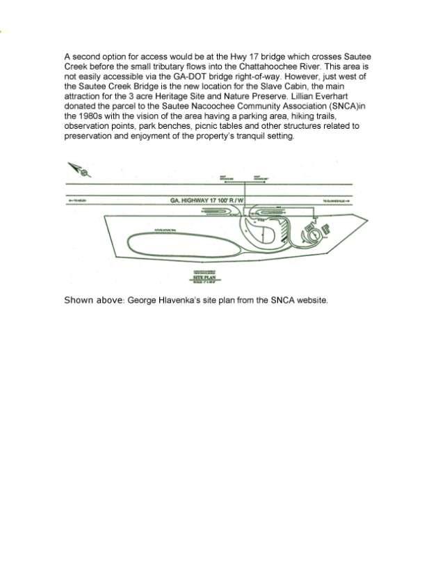
53 53
54 Appendix F: Legal Issues for river access in Georgia Memo from GA-DNR staff to GA-DNR Board NAVIGABILITY LAW SUMMARY FOR MAY 23, 2007 BOARD MEETING 1 Whether a particular stream or river is navigable is a factual question that requires a case by case determination. It typically focuses on the specific part of the river or stream at issue. It requires an analysis of both federal and Georgia law. FEDERAL LAW Under current federal regulations, navigable waters include waters currently used or susceptible of being used for navigation to transport interstate commerce, as well as waters that were used or susceptible of being used for such navigation in the past. 33 C.F.R In other words, past, present, or the potential presence of interstate commerce may be sufficient. 33 C.F.R Interstate commerce may be existent on an intrastate voyage which occurs only between places within the same state. It is only necessary that goods may be brought from, or eventually be destined to go to, another state. 33 C.F.R (b). Further, a waterbody may be entirely within a state, yet still be capable of carrying interstate commerce. 33 C.F.R The Code of Federal Regulations states that [i]t is the waterbody s capability of use by the public for purposes of transportation of commerce which is the determinative factor, and not the time, extent or manner of that use. As discussed in of this part, it is sufficient to establish the potential for commercial use at any past, present, or future time. Thus, sufficient commerce may be shown by historical use of canoes, bateaux, or other frontier craft, as long as that type of boat was common or well-suited to the place and period. Similarly, the particular items of commerce may vary widely, depending again on the region and period. The goods involved might be grain, furs, or other commerce of the time. 33 C.F.R (a). Under federal law, a stream, to be navigable, need not be open to navigation at all seasons of the year, or at all stages of the water. However... susceptibility of use as a highway for commerce should not be confined to exceptional conditions or short periods of temporary high water." 2 GEORGIA LAW 1 This summary was prepared to address navigability law for a briefing to the Georgia Board of Natural Resources at its May 23, 2007 meeting in Atlanta, Georgia. It was not intended to and does not take a position on whether any particular body of water is or is not navigable. Rather, it merely sets forth a summary of the applicable law in this area. 2 U.S. v. Harrell, 926 F.2d 1036, 1040 (11 th Cir. 1991) (citations and internal quotation marks omitted). 54
55 In 1863, a statutory definition for determining navigability under Georgia law emerged that is currently codified at O.C.G.A (a). Under this Code section, a navigable stream or river is one which is capable of transporting boats loaded with freight in the regular course of business either for the whole or part of the year. The mere rafting of timber or the transporting of wood in small boats shall not make a stream navigable. O.C.G.A (a). The appellate courts of Georgia have applied this definition in deciding whether a stream or river is navigable under Georgia law. 3 One test is whether the stream or river is currently navigable as set forth in the statutory definition. As another test, the Georgia Attorney General has opined that a historical approach can also be used Op. Att y Gen. U85-8. Under this approach, the test is whether the stream or river was used or capable of being used for commercial navigation as known and understood by the lawmakers at the time navigable stream was defined. Id. As noted above, the definition of navigable stream now codified at O.C.G.A (a) first appeared in the Georgia Code in RIGHTS OF LANDOWNERS IN NON-NAVIGABLE STREAMS AND RIVERS The owner of a non-navigable stream [or river] is entitled to the same exclusive possession of the stream [or river] as he has of any other part of his land. O.C.G.A The owner of a non-navigable stream or river owns to the center of the stream or river, with exclusive fishing rights to the center of the stream or river. If, however, the owner owns both sides of a non-navigable stream or river, then he or she owns the entire stream or river bed and has the right to exclude the passage of others over the water, as well as exclusive fishing, unless a servitude exists. 4 RIGHTS OF LANDOWNERS IN NAVIGABLE STREAMS AND RIVERS The rights of the owner of lands which are adjacent to navigable streams [or rivers] extend to the low-water mark in the bed of the stream [or river]. O.C.G.A (b). If the stream or river is navigable, then the public has a right of passage. 5 Also, the public generally has a right of fishing in navigable bodies of water. However, there is an exception with regard to fishing rights. Even in a navigable stream or river, [i]f the landowner s property was granted out of the State prior to this 1863 enactment [now codified at O.C.G.A (a)], and the landowner can trace his chain of title back to the original State grant, then the landowner would own the bed of the navigable river and have exclusive fishing rights therein Op. Att y Gen. U Givens v. Ichauway, Inc., 268 Ga. 710 (1997); Seaboard Air-Line Railway v. Sikes, 4 Ga. App. 7 (1908). 4 O.C.G.A , , and ; Givens v. Ichauway, Inc., 268 Ga. 710 (1997). 5 Seaboard Air-Line Railway v. Sikes, 4 Ga. App. 7 (1908) ( citizens have an inherent right to use as highways all navigable rivers ). 55
56 Appendix G: Leave No Trace Questions and Answers FROM THE WEBSITE of What is the Leave No Trace program? Leave No Trace is a nationwide (and international) program designed to assist visitors with their decisions when they travel and camp on America's public lands. The program strives to educate visitors about the nature of their recreational impacts as well as techniques to prevent and minimize such impacts. Leave No Trace is best understood as an educational and ethical program, not as a set of rules and regulations. What is Leave No Trace's mission? The mission of Leave No Trace is to promote and inspire responsible outdoor recreation through education, research and partnerships. The Leave No Trace program is focused specifically on human-powered (non-motorized) recreation. Does Leave No Trace have a political agenda? No. Leave No Trace seeks only to educate non-motorized recreationists on how and why to minimize their impacts while enjoying public lands. How is the Leave No Trace program structured? The Leave No Trace program is managed by Leave No Trace, Inc., a non-profit 501(c)(3) organization based in Boulder, CO, with the assistance of many partners. The Leave No Trace program's success is due primarily to its broad partnership support in the development and delivery of the message. By enlisting the support of many organizations, agencies, companies, non-profits and individuals, the Leave No Trace program is able to reach a variety of users with a tailored message. Why Leave No Trace? The Leave No Trace program's effectiveness lies in its broad base of support from all outdoor enthusiasts- from federal land managers to individual citizens, from non-profits to corporate manufacturers, from scouting groups to retail shops. An agreement with four federal land agencies: US Forest Service National Park Service Bureau of Land Management US Fish and Wildlife Service ensures that the Leave No Trace message is offered as the minimum impact recreation message on public lands. LNT strives to offer a consistent message to all visitors in a 56
57 variety of locations. Hopefully, visitors that receive the LNT message will learn and practice Leave No Trace ethics. Is the Leave No Trace message specific to one type of use or environment? No. One of the strengths of the Leave No Trace message is that it has been tailored for multiple uses and ecosystems. Curriculum has been developed for hikers, rafters, kayakers, rock climbers, equestrians, mountain bikers, and others. The Leave No Trace principles have also been adapted for desert ecosystems, tropical rainforests, deciduous forests, caves, coastal environments, and other locations. The Leave No Trace Skills and Ethics booklet series is organized in regions that cover all of North America. Check for your region on the website. How do I get involved? There are many ways to get involved in the Leave No Trace program, depending on your organizational affiliation and/or level of interest. As an interested citizen, you can join as an individual member, thereby receiving educational materials, newsletters and merchandise to help promote Leave No Trace. As an organization, you can join as a nonprofit, corporate, or retail/outfitter partner. To become a member call (800) Leave No Trace, Inc. Leave No Trace courses are also available (see below). You can also download any of the information on this website to inform your friends, family, students, co-workers or others. The Leave No Trace, Inc. staff is available to field your questions and to help involve you in Leave No Trace education and outreach efforts. What can Leave No Trace do in my area? LNT has an extensive network of "Master Educators" trained in Leave No Trace techniques and teaching skills. As volunteers, Master Educators may be willing to work with you and others to promote the LNT message. If a Master is unavailable, an alternative is a visit from the Leave No Trace Traveling Trainers. The Traveling Trainer program, sponsored by Subaru, places two mobile education teams on the road throughout America. If neither the Master Educator nor the Traveling Trainer teams are available, Leave No Trace has numerous materials that will assist you in educating yourself and those around you in Leave No Trace practices. What are the differences between the Trainer and the Master Educator courses? Leave No Trace training levels have been developed in a train-the-trainer format, whereby each level of training results in an educated individual who can then train others. The Master educator course (developed by the National Outdoor Leadership School) is the highest level of Leave No Trace training offered. The Master educator course is an extensive, five-day field course designed to train educators and others ways to practice and teach Leave No Trace skills and ethics. Master educator courses are currently offered by two organizations: the National Outdoor Leadership School and the Appalachian Mountain Club. 57
58 Trainer courses, taught by individual Master Educators, are an abbreviated version of the Master Educator course. Trainer courses are generally two days in duration and focus less on the teaching component than Master educator courses. Trainer course are generally more appropriate for people who are seeking a definitive level of Leave No Trace training, but with less time, money, or willingness to commit to a Master Educator course. While Masters are able to offer Trainer courses, Trainers are able to offer workshops, seminars and other less formalized types of Leave No Trace outreach. How do I get a Master Educator course in my area? Master course scheduling occurs through the Leave No Trace, Inc. office. Courses are offered by the National Outdoor Leadership School and the Appalachian Mountain Club. Course proposals are accepted by August 15th of the year prior to the proposed course date. Proposals should include at least the following information: course dates, location, stated need, audience, marketing strategy, route, travel medium and contact person. Please contact Ben Lawhon for more details regarding Master Educator course proposals. How do I get a Trainer course in my area? Trainer courses can be offered by Master Educators working independently or Master Educators working within an organization. Contact Ben Lawhon for more information about reaching Leave No Trace Master Educators in your area. How do I navigate the Leave No Trace website? The LNT website is easily navigated by using the tool bars on the left of the LNT homepage. The bars will direct you to various locations within the LNT site that should provide you with the information you seek. Can I download and use Leave No Trace materials from the website? You are permitted to download the texts of all of Leave No Trace's written materials as long as you do not sell them (or print them professionally). We also ask that you cite the existing copyrights (National Outdoor Leadership School) and list both the Leave No Trace website address ( and the toll free number ( ). If you seek hard copies of the materials, contact the Leave No Trace office. 58

59 Appendix H: Why we need water trails 59
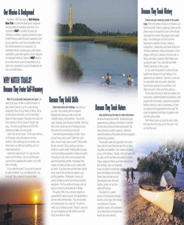
60 60

61 Appendix I: Water trails: A new network across America 61
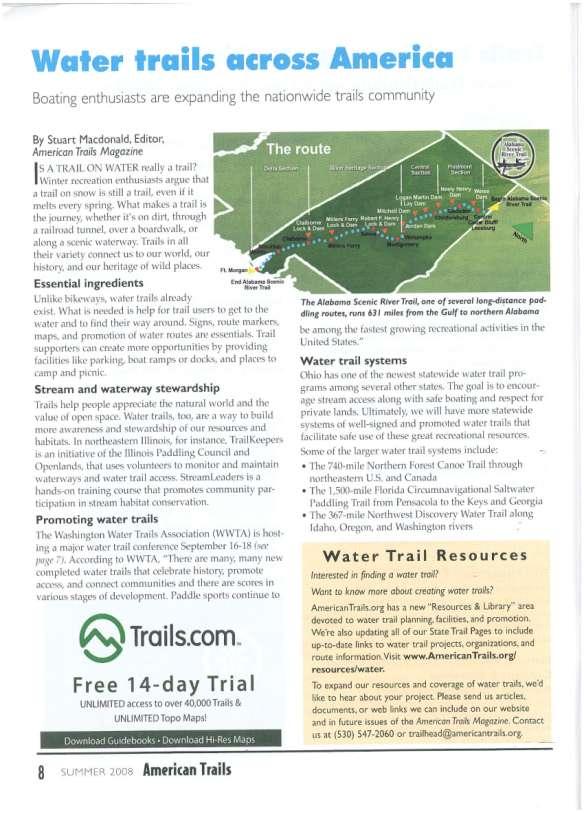
62 62
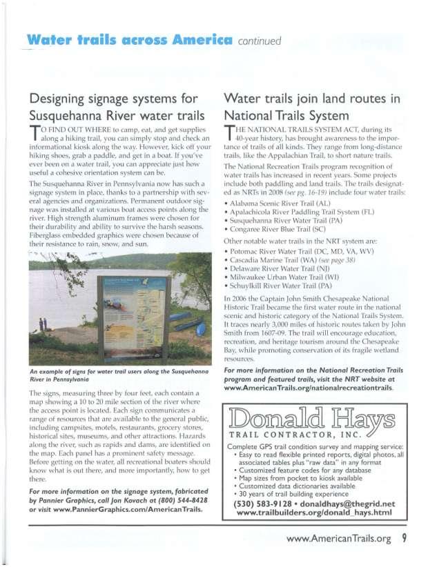
63 63
TxDOT Bicycle Tourism Trails Study Update. April 2017 BAC Meeting April 10, 2017
 AGENDA ITEM 6 TxDOT Bicycle Tourism Trails Study Update April 2017 BAC Meeting April 10, 2017 Agenda Approval of interim products o Present study vision statement, goals, and study objectives o Present
Iowa Department of Natural Resources Iowa Water Trails Grant Program
 Iowa Department of Natural Resources Iowa Water Trails Grant Program Submitted by the City of Story City in conjunction with the Skunk River Paddlers and the Story County Conservation Board Tuesday, January
10/20/2010 Version 3. Guidelines for Developing Non-motorized Boat Launches in Florida
 Guidelines for Developing Non-motorized Boat Launches in Florida 1 These guidelines were prepared by the Florida Fish and Wildlife Conservation Commission with input from a Non-motorized Boating (NMB)
Androscoggin River Trail Access Sites. Mahoosucs. 168 miles from its source at Lake Umbagog to Merrymeeting Bay
 Androscoggin River Trail Access Sites Mahoosucs 168 miles from its source at Lake Umbagog to Merrymeeting Bay Trail Under Construction More than 40 Public Access Sites Available Androscoggin River Watershed
APPENDIX C BLUEWAYS ASSESSMENT
 APPENDIX C Blueways Assessment Poor Fork of Cumberland River Section above Kingdom Come State Park and Cumberland, KY By Steve Spencer, Ed.D. Western Kentucky University The author is an American Canoe
Section 9. Implementation
 Section 9. Implementation The transportation system is just one of many aspects that must be carefully planned to maintain and enhance the quality of living in Cecil County. The Cecil County Bicycle Plan
CHAPTER 7.0 IMPLEMENTATION
 CHAPTER 7.0 IMPLEMENTATION Achieving the vision of the Better Streets Plan will rely on the ability to effectively fund, build and maintain improvements, and to sustain improvements over time. CHAPTER
CANOE AND KAYAK TRIPS IN THE DAHLONEGA AREA
 CANOE AND KAYAK TRIPS IN THE DAHLONEGA AREA 27 Canoe and Kayak Trips in the Georgia Mountains Within 37 Miles of Dahlonega Provided by the Dahlonega- Lumpkin County Visitors Center Information compiled
TESTIMONY OF THOMAS O KEEFE, PhD PACIFIC NORTHWEST STEWARDSHIP DIRECTOR ON BEHALF OF AMERICAN WHITEWATER
 TESTIMONY OF THOMAS O KEEFE, PhD PACIFIC NORTHWEST STEWARDSHIP DIRECTOR ON BEHALF OF AMERICAN WHITEWATER OREGON STATE HOUSE House Committee on Transportation Policy Representative Caddy McKeown, Chair
Middle Fork Snoqualmie River Access Project
 Middle Fork Snoqualmie River Access Project a proposal submitted to the National Park Service RTCA program 30 June 2003 Middle Fork Snoqualmie River Access Project submitted by
COUNCIL POLICY NAME: COUNCIL REFERENCE: 06/119 06/377 09/1C 10llC 12/1C INDEX REFERENCE: POLICY BACKGROUND
 COUNCIL POLICY NAME: COUNCIL ADVISORY COMMITTEES - TERMS OF REFERENCE ISSUED: APRIL 3, 2006 AMENDED: NOVEMBER 27, 2006 NOVEMBER 23, 2009 JANUARY 11, 2010 DECEMBER 17, 2012 POLICY COUNCIL REFERENCE: 06/119
Corpus Christi Metropolitan Transportation Plan Fiscal Year Introduction:
 Introduction: The Safe, Accountable, Flexible, Efficient Transportation Equity Act: A Legacy for Users (SAFETEA-LU) has continued the efforts started through the Intermodal Surface Transportation Efficiency
Androscoggin River Trail Access Sites. Mahoosucs. 168 miles from its source at Lake Umbagog to Merrymeeting Bay
 Androscoggin River Trail Access Sites Mahoosucs 168 miles from its source at Lake Umbagog to Merrymeeting Bay Trail Under Construction More than 40 Public Access Sites Available Androscoggin River Watershed
Canoe/Kayak Launch Sites and Accessibility
 Canoe/Kayak Launch Sites and Accessibility Doug Alderson, Paddling Trails Coordinator Division of Recreation and Parks Office of Greenways and Trails Each potential access site on a river, lake or ocean
MAG Town of Cave Creek Bike Study Task 6 Executive Summary and Regional Significance Report
 Page 1 MAG Town of Cave Creek Bike Study Task 6 Executive Summary and Regional Significance Report August 1, 2012 MAG Project #481 Page 2 Task 6 Executive Summary and Regional Significance Report Introduction
Perryville TOD and Greenway Plan
 Perryville TOD and Greenway Plan Greenway Glossary Pathway: A bicycle and pedestrian path separated from motorized vehicular traffic by an open space, barrier or curb. Multi-use paths may be within the
Goal 3: Foster an environment of partnerships and collaboration to connect our communities and regions to one another.
 Non-Motorized Transportation Plan (NMTP) Draft Vision, Goal and,, Tri-County Regional Planning Commission (TCRPC) Purpose The purpose of the Tri-County Regional Planning Commission (TCRPC) Non-Motorized
Exhibit 1 PLANNING COMMISSION AGENDA ITEM
 Exhibit 1 PLANNING COMMISSION AGENDA ITEM Project Name: Grand Junction Circulation Plan Grand Junction Complete Streets Policy Applicant: City of Grand Junction Representative: David Thornton Address:
PREPARE TO LAUNCH! DESIRED LAUNCH CHARACTERISTICS Updated April User Accessibility. Site Location Appropriateness
 DESIRED LAUNCH CHARACTERISTICS Updated April 2018 User Accessibility Site Location Appropriateness Cost Considerations / Trade-offs Environmentallyfriendly There are four primary questions to answer in
Roanoke River Blueway
 Roanoke River Blueway Roanoke River Currents Conference Friday October 9, 2015 Ferrum College Shane Sawyer, Regional Planner Roanoke Valley - Alleghany Regional Commission Roanoke River Blueway www.roanokeriverblueway.org
Canoe Trip # Maps: 63L Amisk Lake 63M Pelican Narrows
 Canoe Trip #51 49 Southeast Arem Deschambault Lake - Pelican Narrows - Wunehikun Bay - Attitti Lake - Belcher Lake - Mukoman Lake - Ohoo Lake - Mukoman River - Sokatisewin Lake - Sandy Bay 170 Kilometers
April 16, Yosemite National Park Superintendent Don Neubacher Attn: Merced River Plan P.O. Box 577 Yosemite, CA 95389
 www.americanwhitewater.org Dave Steindorf California Stewardship Director 4 Baroni Drive Chico, CA 95928 530-343-1871 dave@americanwhitewater.org April 16, 2013 Yosemite National Park Superintendent Don
Paddlesports and Florida Demographic Trends with Implications for Non-motorized Boating Launch Design
 Division of Recreation and Parks Paddlesports and Florida Demographic Trends with Implications for Non-motorized Boating Launch Design Liz Sparks, Office of Greenways & Trails Paddling Trail Coordinator
Kennesaw Mountain National Battlefield Park Mountain Road Alternatives
 Kennesaw Mountain National Battlefield Park Mountain Road Alternatives Management Issue Kennesaw Mountain National Battlefield Park was established by Congress in 1935 to preserve and commemorate the site
Lee s Summit Road Improvement Study Public Open House June 7, 2007 Summary of Comment Card Responses
 Lee s Summit Road Improvement Study Public Open House June 7, 2007 Summary of Comment Card Responses Introduction At the Lee s Summit Road Improvement Study Public Open House held Thursday, June 7, 2007
Executive Summary Route 30 Corridor Master Plan
 Route Corridor Master Plan Project Overview The Route Corridor Master Plan is a coordinated multimodal transportation and land use plan for the entire stretch of Route through East Whiteland Township,
Visitor Guidelines for WPC-owned Properties. Last revised 5/20/2010
 WESTERN PENNSYLVANIA CONSERVANCY Visitor Guidelines for WPC-owned properties 800 Waterfront Dr., Pittsburgh, PA 15222 412-288-2777, www.waterlandlife.org Visitor Guidelines for WPC-owned Properties Last
Owl Canyon Corridor Project Overview and Summary
 Owl Canyon Corridor Project Overview and Summary December 22, 2008 The Owl Canyon corridor (generally the connection between the I-25 / Larimer County Road 70 interchange and the US 287 / Larimer County
Macutagon Creek to Russell s Landing
 Day Trips Macutagon Creek to Russell s Landing Manitouwadge Public Consultation Committee Canoe Route #13 #13 MACUTAGON CREEK TO RUSSELL S LANDING This route is suitable to all levels of paddlers but due
Living Streets Policy
 Living Streets Policy Introduction Living streets balance the needs of motorists, bicyclists, pedestrians and transit riders in ways that promote safety and convenience, enhance community identity, create
East Burke Transportation, Safety and Capacity Improvements
 East Burke Transportation, Safety and Capacity Improvements The purpose of this project is to increase mobility and improve safety for pedestrians, cyclists, and motor vehicles along VT Route 114 in the
Anne Arundel County BICYCLE, PEDESTRIAN, TRANSIT ASSESSMENT GUIDELINES
 Anne Arundel County BICYCLE, PEDESTRIAN, TRANSIT ASSESSMENT GUIDELINES December 2018 TABLE OF CONTENTS I. Executive Summary 3 II. When Is A Bicycle Pedestrian Transit Assessment (BPTA) Required? 4 III.
City of Novi Non-Motorized Master Plan 2011 Executive Summary
 City of Novi Non-Motorized Master Plan 2011 Executive Summary Prepared by: February 28, 2011 Why Plan? Encouraging healthy, active lifestyles through pathway and sidewalk connectivity has been a focus
Construction Specifications Manual
 Isle of Wight County Pedestrian and Bicycle Master Plan Construction Specifications Manual Adopted August 20, 2009 Introduction The Isle of Wight County Pedestrian and Bicycle Facilities Master Plan was
Chapter I: Marine Resources
 NOTE TO READERS: This is a draft of the Kennebunk Comprehensive Plan. The Comprehensive Plan provides us with a description of the town today in a range of categories, and identifies issues and recommendations
2.0 Existing Conditions
 20 2.0 Existing Conditions 2.1 Land Use, Future Growth Patterns, Physical Barriers Geographic Overview Sutter County s land use pattern is characterized by extensive agricultural areas, significant natural
General Design Factors
 Chapter 3: 3-1.0 Introduction General Design Factors Mn/DOT s goals include encouraging and accommodating safe bicycling. From a design perspective, these goals are achieved by first having an understanding
Developing a Bike/Pedestrian Plan Using ArcInfo and Public Participation Rob Shumowsky, Madison County Council of Governments
 Developing a Bike/Pedestrian Plan Using ArcInfo and Public Participation Rob Shumowsky, Madison County Council of Governments Abstract: The Madison County Council of Governments is creating a bike/pedestrian
The approach of CanoeKayak BC Whitewater (CKBC-WW) to River Access issues is driven by the organizational Mission Statement:
 to River Access issues is driven by the organizational Mission Statement:") CanoeKayak BC - Whitewater DRAFT RIVER ACCESS POLICY For Comment The approach of CanoeKayak BC Whitewater (CKBC-WW) to River Access issues is driven by the organizational Mission Statement: Provide structure
CanoeKayak BC - Whitewater DRAFT RIVER ACCESS POLICY For Comment The approach of CanoeKayak BC Whitewater (CKBC-WW) to River Access issues is driven by the organizational Mission Statement: Provide structure
Proposed Amendment to the City-Wide Trails Plan
 Proposed Amendment to the City-Wide Trails Plan Planning and Zoning Commission June 23, 2015 Comprehensive Plan 2010 Sustainable Community Recommendations 2 Goal: Walking and Cycling are Encouraged throughout
CITY OF COCOA BEACH 2025 COMPREHENSIVE PLAN. Section VIII Mobility Element Goals, Objectives, and Policies
 CITY OF COCOA BEACH 2025 COMPREHENSIVE PLAN Section VIII Mobility Element Goals, Objectives, and Policies Adopted August 6, 2015 by Ordinance No. 1591 VIII MOBILITY ELEMENT Table of Contents Page Number
The Economic Importance of Recreational River Use to the City of Calgary
 The Economic Importance of Recreational River Use to the City of Calgary Prepared by: Calgary River Users Alliance May 20, 2016 The Economic Importance of Recreational River Use to the City of Calgary
BASS LAKE PLANNING UNIT Willow Creek Watershed
 Existing Conditions & Uses Overview Reservoir that is a popular summer recreation destination, with substantial residential and recreation development 1,085 acres in Madera County; 149 acres outside and
Gordon Proctor Director Policy on Accommodating Bicycle and Pedestrian Travel on ODOT Owned or Maintained Facilities
 Approved: Policy: 20-004(P) Responsible Office: Planning Gordon Proctor Director Policy on Accommodating Bicycle and Pedestrian Travel on ODOT Owned or Maintained Facilities I. POLICY STATEMENT: This policy
Of the following, which best describes you?
 Summary of Downtown Des Moines Dam Debate April 26 th, 2016 The following are the responses we heard from participants in the Dam Debate cohosted by the Register and the Des Moines Area Metropolitan Planning
APPENDIX C VEGETATED EMERGENCY SPILLWAY. VERSION 1.0 March 1, 2011
 APPENDIX C VEGETATED EMERGENCY SPILLWAY VERSION 1.0 March 1, 2011 [NOTE: Could use a better photo more clearly showing the emergency spillway in the context of the dam.] SECTION C-1: DESCRIPTION OF PRACTICE
M-58 HIGHWAY ACCESS MANAGEMENT STUDY Mullen Road to Bel-Ray Boulevard. Prepared for CITY OF BELTON. May 2016
 M-58 HIGHWAY ACCESS MANAGEMENT STUDY Prepared for CITY OF BELTON By May 2016 Introduction Missouri State Highway 58 (M-58 Highway) is a major commercial corridor in the City of Belton. As development has
Lake Texoma Advisory Committee
 Lake Texoma Authorized by Flood Control Act of 1938 Construction of dam completed in 1944 89,000 surface acres Largest lake in capacity in the Tulsa District Operated by the U.S. Army Corps of Engineers
Redondo Beach Boat Launch Ramp Facility
 Redondo Beach Boat Launch Ramp Facility Feasibility Report for the California Department of Boating and Waterways 2015 Grant Cycle For the City of Redondo Beach Submitted by March 13, 2014 Table of Contents
Appendix G Whitewater Recreation Flow Study Plan
 Appendix G Whitewater Recreation Flow Study Plan Study Plan Whitewater Recreation Flow Study Grandfather Falls Hydroelectric Project FERC Project No. 1966 March 2013 An Integrys Energy Group Company Section
4 Goals, Objectives & Actions
 Chapter4 4 This chapter presents goals, objectives, and recommended actions to support the vision of making Overland Park a safer and easier place to ride a bicycle. 35 4.1 Recommendations Structure The
Launch Site Accessibility Evaluation & Design Recommendations
 Access Recreation Group, LLC Cindy Burkhour, MA, CTRS, CPRP 2454 Lamplighter Drive, Jenison, MI 49428-9127 Phone (616)669-9109 Mobile (616)560-2378 AccessRecreationGroup@juno.com Location: New Buffalo
MEMORANDUM. Existing Operations. City of Clearwater. Michael Herrman. Date: January 26, Seminole Boat Launch Overview. M&N Job No.
 1509 W. Swann Avenue, Suite 225 Tampa, FL 33606 (813) 258-8818 Fax (813) 258-8525 www.moffattnichol.com MEMORANDUM To: From: City of Clearwater Michael Herrman Date: Subject: Seminole Boat Launch Overview
Chagrin River TMDL Appendices. Appendix F
 Appendix F The following are excerpts from the Eastern Brook Trout Joint Venture s Conservation Strategy (Working Draft v.6), Conserving the Eastern Brook Trout: Strategies for Action Found at: http://www.easternbrooktrout.org/constrategy.html
Proposed. City of Grand Junction Complete Streets Policy. Exhibit 10
 Proposed City of Grand Junction Complete Streets Policy Exhibit 10 1 City of Grand Junction Complete Streets Policy Vision: The Complete Streets Vision is to develop a safe, efficient, and reliable travel
Canoe Route. Dogtooth Lake-Highwind Lake-Dryberry Lake- Lake of the Woods-Blindfold Lake
 1 Canoe Route Dogtooth Lake-Highwind Lake-Dryberry Lake- Lake of the Woods-Blindfold Lake This is an interesting and challenging route starting and ending at Rushing River Provincial Park. It passes over
Climate Change Adaptation and Stream Restoration. Jack Williams;
 Climate Change Adaptation and Stream Restoration Jack Williams; jwilliams@tu.org 1 Goals for this presentation Develop strategies for adapting streams to climate impacts by Thinking like a watershed Understanding
Water Resources Report RKLD Annual Meeting July 30, 2016
 Water Resources Report RKLD Annual Meeting 2016 July 30, 2016 Topics Hydrology Report Indianford Dam trash rack cleanout performance Experimental Project update Review of PAS project Twin floods- 1 to
San Francisco Bay Area Water Trail Site Description for. Cuttings Wharf
 1 San Francisco Bay Area Water Trail Site Description for Cuttings Wharf Location, Ownership, and Management: Cuttings Wharf is a public boat launch on the Napa River, located at 1230 Cuttings Wharf Road
One Truckee River Sparks City Council
 One Truckee River Sparks City Council What is the One Truckee River initiative? Working together for a sustainable, clean, thriving river community recognized in the hearts and minds of all for the treasure
Pre-Application Document Kaweah Project (FERC Project No. 298)
") TABLE OF CONTENTS Page 3.12 Aesthetic Resources... 3.12-1 3.12.1 Information Sources... 3.12-1 3.12.2 Setting... 3.12-1 3.12.3 Project Facilities... 3.12-2 3.12.4 Previous Visual Resources Assessment...
TABLE OF CONTENTS Page 3.12 Aesthetic Resources... 3.12-1 3.12.1 Information Sources... 3.12-1 3.12.2 Setting... 3.12-1 3.12.3 Project Facilities... 3.12-2 3.12.4 Previous Visual Resources Assessment...
Agenda. Overview PRINCE GEORGE S PLAZA METRO AREA PEDESTRIAN PLAN
 PRINCE GEORGE S PLAZA METRO AREA PEDESTRIAN PLAN May 28, 2008 Agenda Welcome and introductions Project overview and issue identification Planning context and strengths Design challenges and initial recommendations
State Route 28 Shared Use Path & Safety/Stormwater Enhancements Public Information Meeting
 State Route 28 Shared Use Path & Safety/Stormwater Enhancements Public Information Meeting Thursday, March 30, 2017 4-7 p.m. Presentation at 5:30 p.m. The Chateau at Incline Village 955 Fairway Blvd. Incline
Non-Motorized Transportation 7-1
 Non-Motorized Transportation 7-1 Transportation facilities no longer mean just accommodating a vehicle powered by a combustion engine. Pedestrian and non-motorized facilities are important modes of travel
Spearfish Canyon State Park & Bismarck Lake
 Spearfish Canyon State Park & Bismarck Lake Land Exchange Between the U.S. Forest Service and the State of South Dakota July 12, 2016 Background In 2006, the State of South Dakota received title to several
Floating the Buffalo National River. with First River Outfitter. Michelle Hulett. exp2010_w01h3buffalo2_ann_solution
 Floating the Buffalo National River with First River Outfitter Michelle Hulett The Buffalo River Beginning as just a trickle, The Buffalo National River runs down the Boston Mountains, flows north and
MEETING Agenda. Introductions. Project Overview. Key Study Components. Alternative Station Concepts. Preferred Station Concept. Next Steps.
 City GARLAND Council ROADVISION Briefing STUDY VISION STUDY Dallas, TX April 8, 2010 1 1 MEETING Agenda Introductions Project Overview Key Study Components Alternative Station Concepts Preferred Station
ECONOMY PEOPLE ENVIRONMENT
 Report Back on Local Transit Improvements May 29, 2013 ECONOMY PEOPLE ENVIRONMENT Intro Council Requested Report Back Topics Progress on Planning for Broadway Subway False Creek Bridges Local Transit Improvements
Thank you for this opportunity to discuss with you how we can work together to make our streets more complete.
 Thank you for this opportunity to discuss with you how we can work together to make our streets more complete. 1 2 3 Thank you for this opportunity to discuss with you how we can work together to make
Lamprey Rivers Advisory Committee (LRAC) Annual Report FY 2017 (Oct. 1, 2016 Sept. 30, 2017)
 Annual Report FY 2017 (Oct. 1, 2016 Sept. 30, 2017)") Lamprey Rivers Advisory Committee (LRAC) Annual Report FY 2017 (Oct. 1, 2016 Sept. 30, 2017) Participants on the Lamprey River Eco-paddle Photo courtesy of Peter Sawtell We are pleased to feature an outreach
Lamprey Rivers Advisory Committee (LRAC) Annual Report FY 2017 (Oct. 1, 2016 Sept. 30, 2017) Participants on the Lamprey River Eco-paddle Photo courtesy of Peter Sawtell We are pleased to feature an outreach
Summary of Research RESULTS SAFETY TRAINING. Selected Results From a 2006 Survey of Registered Off-Highway Vehicle (OHV) Owners in Montana YES 44%
 Owners in Montana YES 44%") Summary of Research Selected Results From a 2006 Survey of Registered Off-Highway Vehicle (OHV) Owners in Montana RMU Research Summary No. 21 Michael S. Lewis and Ray Paige July 2006 In the last decade,
Summary of Research Selected Results From a 2006 Survey of Registered Off-Highway Vehicle (OHV) Owners in Montana RMU Research Summary No. 21 Michael S. Lewis and Ray Paige July 2006 In the last decade,
Appendix T CCMP TRAIL TRAFFIC & TRANSPORTATION DESIGN STANDARD
 Appendix T CCMP 3.3.4 TRAIL TRAFFIC & TRANSPORTATION DESIGN STANDARD 3.3.4 Trail Traffic and Transportation Design Multi-use trails have certain design standards, which vary depending on the agency that
APPENDIX A: Complete Streets Checklist DRAFT NOVEMBER 2016
 APPENDIX A: Complete Streets Checklist DRAFT NOVEMBER 2016 Complete Streets Checklist MetroPlan Orlando s Complete Streets Checklist is an internal planning tool for staff to further implementation of
The Jenkinsburg River Access Project
 Left: Keith Pitzer, executive director, Friends of Cheat; Right: Dave Hough, Managing Partner of Mountain Streams A view of the takeout from the Jenkinsburg Bridge; the Big Sandy Creek comes in on the
Washington State Parks comments to the Draft Clallam County Shoreline Master Program Update Consistency Review June 3, 2011
 Washington State Parks comments to the Draft Clallam County Shoreline Master Program Update Consistency Review June 3, 2011 Pg 10 Public access is typically discussed as a requirement placed on facilities
Canoe Trip # Length of Trip: 225 kilometres Time Required to Complete Trip: 10 to 14 days Number of Portages: 21 to 25
 Canoe Trip #34 34 Brabant Lake - Wapiskau River - Steephill Lake - Reindeer River - Churchill River - Sandy Bay 225 Kilometers - 10 to 14 days - 21 to 25 portages Length of Trip: 225 kilometres Time Required
RLRC COMMUNITIES EAST GRAND FORKS AREA CHARACTER THE RED LAKE RIVER & THE RED RIVER OF THE NORTH CONFLUENCE EAGLE POINT BOAT LAUNCH DESIGN
 AREA CHARACTER THE RED LAKE RIVER & THE RED RIVER OF THE NORTH CONFLUENCE EAGLE POINT BOAT LAUNCH DESIGN DESIGN DETAILS 135 AREA CHARACTER East Grand Forks a city of 7,501 people is located across the
CHAPTER X: PORTAGES AROUND DAMS
 CHAPTER X: PORTAGES AROUND DAMS A. General Description Portages are land routes used by paddlers to transport their boats to and from a launch area or between access sites. Often located along water bodies
Chapter 3: Multi-Modal Circulation and Streetscapes
 CHAPTER 3: MULTI-MODAL CIRCULATION AND STREETSCAPES Chapter 3: Multi-Modal Circulation and Streetscapes Overview Streetscape improvements have already been completed for Depot Street between Main Avenue
Climate Change Action Plan: Transportation Sector Discussion Paper: Cycling
 Climate Change Action Plan: Transportation Sector Discussion Paper: Cycling ontario.ca/climatechange Contents 1. Minister of Transportation s message... 3 2. Introduction... 5 3. Sector Overview and Support
 Time of Change We Are Growing We Are An Attractive Place To Live We Are Age Diverse + Living Longer 50000 40000 30000 20000 10000 0 2010 Census Job Density Housing Sheds Transit Sheds The Project FUNDING
Eastern Brook Trout. Roadmap to
 Eastern Brook Trout Roadmap to CONSERVATION Our Brook Trout heritage he wild Brook Trout is an American symbol of persistence, adaptability, and the pristine wilderness that covered North America prior
Big Spring Creek Habitat Enhancement and Fishery Management Plans
 Big Spring Creek Habitat Enhancement and Fishery Management Plans November 5, 2012 Big Spring Events and Activities Center Newville, PA Charlie McGarrell Regional Habitat Biologist Pennsylvania Fish and
Solana Beach Comprehensive Active Transportation Strategy (CATS)
") Solana Beach Comprehensive Active Transportation Strategy (CATS) 3.0 Goals & Policies The Solana Beach CATS goals and objectives outlined below were largely drawn from the Solana Beach Circulation Element
Solana Beach Comprehensive Active Transportation Strategy (CATS) 3.0 Goals & Policies The Solana Beach CATS goals and objectives outlined below were largely drawn from the Solana Beach Circulation Element
CITY OF BLOOMINGTON COMPLETE STREETS POLICY
 CITY OF BLOOMINGTON COMPLETE STREETS POLICY POLICY OBJECTIVE: The City of Bloomington will enhance safety, mobility, accessibility and convenience for transportation network users of all ages and abilities,
*Sandy Point State Park Paddling Routes
 *Sandy Point State Park Paddling Routes *Paddleboards are crazy popular in Anne Arundel County creeks and rivers. The life guards on this park s beaches have paddleboards to use in recusing swimmers. Not
TOWN OF PORTLAND, CONNECTICUT COMPLETE STREETS POLICY
 TOWN OF PORTLAND, CONNECTICUT COMPLETE STREETS POLICY I. VISION, GOALS & PRINCIPLES VISION To improve the streets of Portland making them safer and more accessible for all users including pedestrians,
County of Orange Resources and Development Management Department Harbors, Beaches and Parks. Strategic Plan. HBP Strategic Plan Workshop 1.
 County of Orange Resources and Development Management Department Harbors, Beaches and Parks Strategic Plan HBP Strategic Plan Workshop 1 v18 PRESENTATION OUTLINE Harbors, Beaches & Parks (HBP) History
Comments EXECUTIVE SUMMARY
 Comments 1. Under any Alternatives, MCDOT should provide better at-grade pedestrian crossing of Georgia Avenue and Forest Glen Road, including improved crosswalks with wider medians and adequate signal
Montgomery County Life Sciences Center Loop Trail
 Montgomery County Life Sciences Center Loop Trail Advisory Committee Meeting #1 February 10, 2015 Agenda 1. Project Background 2. Existing Conditions Analysis 3. Examples from Elsewhere 4. Discussion Project
PRESENTATION TO THE BRITISH COLUMBIA LEGISALTIVE STANDING COMMITTEE ON FINANCE September 26, 2013
 PRESENTATION TO THE BRITISH COLUMBIA LEGISALTIVE STANDING COMMITTEE ON FINANCE September 26, 2013 On behalf of its 40,000 plus members, The BC Wildlife Federation welcomes the opportunity to address the
St. Francis Drive through the City of Santa Fe Corridor Study
 VII. ENGINEERING AND ENVIRONMENTAL EVALUATION TRAIL CONNECTIVITY In the southern portion of the Corridor there is a lack of a sidewalk, trail or bicycle facility within the right-ofway. However, the City
3.9 Recreational Trails and Natural Areas
 3.9 Recreational Trails and Natural Areas 3.9.1 Introduction Parks and other recreational facilities such as trails, bicycle routes, and open space are important community resources. This section discusses
Bicycle and Pedestrian Planning in a Historically Car-Centric Culture: A Focus on Connectivity, Safety, & Accessibility
 Bicycle and Pedestrian Planning in a Historically Car-Centric Culture: A Focus on Connectivity, Safety, & Accessibility Kate Horton and Zylavian Watley Transportation Planners Memphis MPO Date: October
Kelowna On the Move. Pedestrian and Bicycle Master Plan
 Kelowna On the Move Pedestrian and Bicycle Master Plan Executive Summary April 2016 Purpose of the Plan The Pedestrian and Bicycle Master Plan identifies infrastructure, planning, and policy requirements
Section 5: Bike and Pedestrian
 Section 5: Bike and Pedestrian Existing Conditions: One defining feature of Glynn County appreciated by both residents and visitors is the extensive sidewalk and bike path system. The City of Brunswick,
12 RECOMMENDATIONS Road Improvements. Short Term (generally the next five years)
") 12 RECOMMENDATIONS Recommendations are based on the technical analysis of existing and future road and active transportation conditions, the results of the review of existing City policies and public feedback.
12 RECOMMENDATIONS Recommendations are based on the technical analysis of existing and future road and active transportation conditions, the results of the review of existing City policies and public feedback.
ADA TRANSITION PLAN 2013
 ADA TRANSITION PLAN 2013 TABLE OF CONTENTS Contents Introduction 1 Purpose 2 Identified Obstacles to the Public Right of Way 3 Criteria for Determining Impediments at Village Facilities 4 Removing Barriers
Lake Michigan Coastal Communities Trail Towns Master Plan. St. Joseph
 Lake Michigan Coastal Communities Trail Towns Master Plan St. Joseph Local officials and community stakeholders in St. Joseph have identified two potential access sites for improvement along the St. Joseph
DALE HOLLOW LAKE TROOPER ISLAND IMPROVEMENT PROJECT Proposal for Reservoir Fisheries Habitat Partnership (RFHP)
") DALE HOLLOW LAKE TROOPER ISLAND IMPROVEMENT PROJECT Proposal for Reservoir Fisheries Habitat Partnership (RFHP) A. Applicant Information: US Army Corps of Engineers, Dale Hollow Lake POC: Gregg Nivens
DALE HOLLOW LAKE TROOPER ISLAND IMPROVEMENT PROJECT Proposal for Reservoir Fisheries Habitat Partnership (RFHP) A. Applicant Information: US Army Corps of Engineers, Dale Hollow Lake POC: Gregg Nivens