Monitoring of fish values in the City Rivers: 2 nd round; Avon River
|
|
|
- Brianna Lawson
- 5 years ago
- Views:
Transcription


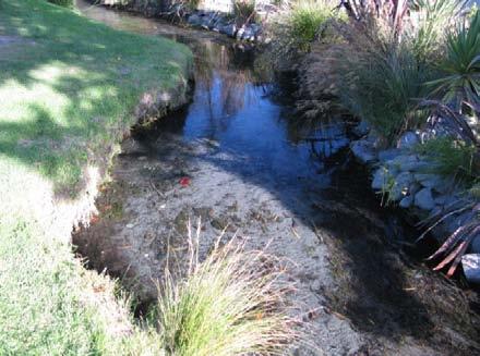
1 Monitoring of fish values in the City Rivers: 2 nd round; Avon River Prepared for: Christchurch City Council AEL Report No. 59 Malcolm Main Mark Taylor Final Report March 2010 Aquatic Ecology Ltd. PO Box 3254 Christchurch 1 Telephone/ Facsimile (03) mark@ael.org.nz Waimairi Stream, north branch
2 Contents 1 Executive Summary Introduction Background Catchment description Methods Lower river fish Fishing methods in the middle-river tributaries...3 Fishing methods in the upper-river tributaries Trout spawning survey methods Statistical Analysis Results Lower river fish Fish in the middle-river tributaries Fish in the upper-river tributaries Distribution of trout redds Discussion Lower River Middle reach tributaries Upper reach tributaries Habitat considerations for trout spawning Conclusions Recommendations Acknowledgements References Appendix I. Lower river sampling sites Appendix II. Lower river tributary sites Appendix III. Upper river tributary sites Appendix IV. Locations of brown trout redds... 20
3 1 Executive Summary During 2008 and 2009, AEL conducted a number of fish sampling programmes in the Avon River catchment. These were: a netting programme at three sites in the lower river in and about the mainstem, electric fishing of three tributaries in the middle reach of the river and electric fishing of four upper river tributaries,. In addition, a trout spawning survey (redd count) was undertaken in July These were all intended to be a follow-up of surveys which were undertaken by MAF Fisheries staff in The winter 2008 trout spawning survey has been previously documented, but upon request from CCC, the results are summarised in this document, along with the findings of the fish surveys described above. At the lower reach sites, a number of species which are representative of sites close to the sea was recorded, although generally at lower numbers than were recorded in However, much of this variation can be explained by a difference in sampling effort and the inherent difficulty of representatively sampling large bodies of water such as those. The middle reach tributary sites were more readily sampled in a representative manner, and the species assemblage in those was similar to that recorded in One difference was that we did not record trout from any of the three streams, although they were present in one, Taylors Drain, at quite high densities in In contrast, the density of upland bully that we recorded from Taylors Drain was much higher than that recorded there in Also of note was that in one of these middle reach streams (Dudleys Creek), we recorded four species of bully, one of which (blue-gilled bully), was an unusual catch for a stream of this sort. Four species (longfin eel, shortfin eel, upland bully and brown trout) were recorded from the upper river tributaries. The densities of brown trout were much lower than those recorded from them in The highest number of trout redds (54) was recorded in Wairarapa Stream, and the lowest number (none) from the South Branch of Waimairi Stream, but oddly, the highest number of juvenile trout recorded the following year was from the Waiamiri Stream south branch, whereas only one individual was recorded from Wairarapa Stream. In contrast to trout numbers, the densities of upland bully were generally far higher than were recorded in This is probably because trout are significant predators of bullies, and they may have depressed the bully populations when their numbers were higher. Overall, it appears that the brown trout population of the Avon River has declined substantially since 1992, and this decline is paralleled by a reduction in trout spawning activity. However, at the same time, and probably as a result, the densities of upland bully have increased. It is recommended that an effort be made to determine the cause of the decline in the brown trout population, with a focus on examining the quality of spawning gravels. Further, in some streams where native fish predominate, they would probably benefit from the addition of cover from riparian vegetation such as Carex sp. 2 Introduction This document reports on the fish communities at three sites on the lower Avon River, which were sampled in May 2008, and a brown trout spawning survey conducted in July In addition in April 2009, a fish survey was conducted in three tributaries in the mid-reach of the river, and sampling of four upper river tributaries in the same month. The purpose of this report is to integrate the trout spawning report released previously (Taylor & Bray 2008), with a re-survey of specific fish habitats which where were surveyed as part of the inaugural fish survey in the 1990s (Eldon & Kelly 1992). These and other previous surveys are outlined below. 1
4 3 Background The inaugural fisheries survey of the Avon River was conducted over the 1991/1992 summer (Eldon & Kelly 1992). That work involved sampling 33 sites, and a trout spawning survey conducted in June, July and August The sites sampled in their survey were a subset of those included by the former Christchurch Drainage Board (now part of Christchurch City Council) in its benthic invertebrate sampling of the river (Robb 1980). The current survey involved a resurvey of a subset of the sites sampled by Eldon and Kelly in 1991 and In 2003, an ecological assessment, of invertebrate and fish values, was undertaken within the middle reach of the Avon River mainstem, between Fendalton Road and Fitzgerald Avenue (McMurtrie & Taylor 2003). In addition to the 191 study, other relevant earlier fisheries studies include a 2002 trout spawning in the Avon River (Taylor & Burrell 2002), and the 2008 survey (Taylor & Bray 2008), which is also recompiled into this report. 4 Catchment description The Avon River rises as a series of springs in the north-western suburbs of Christchurch, which provide the flow for the headwaters of the Waimairi, Wai-iti, Wairarapa, and Okeover Stream, and (in turn) the Avon River mainstem (Daglish 1985). These streams all converge above Mona Vale. Further downstream, Addington Drain and Riccarton Drain flow into the river from the west. Lower still in the catchment, Taylors Drain, Dudleys Stream, St Albans Stream, Shirley Stream, and Corsers Stream contribute flow from the north. The springs that feed the headwater streams source their groundwater from the Waimakariri River. The catchment area (ca. 84 km 2 ) is totally flat, and about 80% of it is urbanised. The river discharges into the Avon-Heathcote Estuary, and it is tidally-influenced for about 12km inland (to Fitzgerald Avenue), and depending on the height of the tide, saline water penetrates upstream to about Avondale Road (ca. 5.5 km upstream from the Estuary). 5 Methods The survey programme comprised four phases: 1. netting of the fish community at three sites on and about the mainstem of the lower river in May 2008, 2. electric fishing on three middle river reach tributaries in April 2009, 3. electric fishing of four upper river tributaries, also in April 2009, and 4. a trout spawning survey. Netting techniques were all passive, and all fish were returned to the resident habitat unharmed. Similarly, all fish captured using the electric fishing machines were returned to the habitat in which they were identified. 5.1 Lower river fish The fish community of the lower river was sampled at three sites on or about the mainstem, using a series of baited fyke nets. The nets were set during the evening of 5 May 2008 and lifted the next morning. The locations of these sampling sites are shown in figure 1, the sites collated in Table 1, and illustrated in Appendix I. The three sites were: the true right bank of the mainstem of the river above Avondale Bridge, the main river at Cockayne Reserve, and Porritt Park loop at Kerrs Reach. 2
 nets set Avondale 181 M35: 847-452 4 large One net with a twisted wing.")
5 Figure 1. The lower river sampling sites Table 1. Netting sites in the lower river. Site CDB site no. Grid ref (NZ- Number of fyke Comments 260 series) nets set Avondale 181 M35: large One net with a twisted wing. Porritt Park loop 175 M35: small One net poorly set Cockayne Reserve 188 M:35: small One net set in shallow water 5.2 Fishing methods in the middle-river tributaries Sites on the three middle-river reach tributaries were electric fished on 3/4/09. This was undertaken using a Kainga EFM 300 packset machine set to 200 volts; with the operator working downstream towards an assistant with a stop net. The locations of these sites are shown in figure 2, the sites described in Table 2, and illustrated in Appendix II. 3

6 Taylors Drain at Elmwood Park English Park on Cranford Street At Banks Avenue Avon River mainstem Figure 2. The three tributary sites in the middle reaches. The mainstem of the Avon River is also indicated. Table 2. Electric fishing sites in the middle river tributaries. Tributary Site CDB site no. 260 series, grid ref (centre of site) Site length (m) Area sampled (m 2 ) Fishing time (minutes) St Albans English 88 M: Stm Park Taylors Elmwood 52 M: Drain Park Dudley Creek Banks Ave 109 M: Fishing methods in the upper-river tributaries Fishes at four sites in the upper river tributaries were sampled by electric fishing on 7 April 2009, using the same approach as above. The locations of these sites are shown in figure 3, details of the four sites provided in Table 3, and the sites illustrated in Appendix III. 4
 (m) (m 2 ) (minutes) Waimairi Stream, Barlow St 7 M35: 762-431 34 108 19 South Branch Waimairi Stream, Below")
7 Figure 3. Locations of the tributary sampling sites in the upper reaches. Table 3. Details of sampling sites in the upper river. CDB site no. NZMG 260 grid ref (centre of Site length Area sampled Fishing time Tributary Site site) (m) (m 2 ) (minutes) Waimairi Stream, Barlow St 7 M35: South Branch Waimairi Stream, Below dam 7 M35: North Branch Wairarapa Glandovey 66 M35: Stream Okeover Stream Forestry Rd CL4 M35: Trout spawning survey methods The reach surveyed for trout spawning commenced at the Barbadoes Street Bridge, then proceeded upstream along the Avon River mainstem to Mona Vale gardens. At that point the tributaries of Waimairi and Wairarapa Streams enter the mainstem. The survey proceeded upstream along the main courses of both of these tributaries, and finished at Ilam Road. Okeover Stream, a tributary of Waimairi Stream not previously surveyed, was also investigated. The surveys were conducted at baseflow on the 3 July (mainstem), 8 July (Waimairi Stream), 10 July (Wairarapa Stream, upper Avon). The surveys preceded a number of high-flow events that occurred from the middle to the end of July, and also a silt discharge from the lower Millbrook into the Avon mainstem on 18 July Along the mainstem - between Barbadoes Street and Mona Vale - the survey was conducted by two field workers, one on each bank. This was necessary because the width of the channel made it difficult for a single field-worker to survey the channel effectively. Upstream of Mona Vale, only one surveyor was necessary. All the reaches surveyed in the 1991 and 2002 surveys were resurveyed in However, a reach which was surveyed in 1991 (mainstem between Straven Road and Mona Vale), but inadvertently missed in 2002, was re-surveyed in
8 The riverbed was visually surveyed for redds, trout and partially excavated redds. The relative age of redds was estimated by visually assessing periphyton cover on the redd relative to adjacent gravels. Freshly excavated redds were comprised of relatively clean gravel, whereas older redds possessed more periphyton. The size of observed trout was also estimated where possible. Observers wore Polaroid sunglasses, and restricted surveying times to between 10am and 4pm, when the sun was high in the sky, thereby maximising visibility. The locations of trout redds were logged onto a high-sensitivity 12-channel GPS recorder, and the relative size and age of redds were recorded. Also recorded were details and locations of weirs, which may impede trout passage. 5.5 Statistical Analysis Data processing consisted of the construction of maps of trout redd distribution by downloading the GPS data into Google Earth Plus. In the dedicated trout spawning report (Taylor & Bray 2008), the spatial data was statistically analysed with SigmaStat (ver. 3.1), with the longitudinal distribution analysed statistically using t-tests where its distribution was normal, and non-parametrically (Mann-Whitney Rank Sum tests) when the distribution could not be normalised. However, the results of the statistical analysis are summarised in this document, and not cited in detail. The catch per 100 square metres of stream sampled was calculated as a measure of catch per unit effort for the electric fishing. This was the convention in the earlier reports, and is repeated here. For the purpose of clarifying the text, this is referred to as numbers of fish, but it relates specifically to the numbers of fish over a standardised area of 100m 2. 6 Results 6.1 Lower river fish Table 4 shows the results of the netting programme in the lower river. These sites are all within the tidal influence, and the results are typical of sites which are tidally-influenced, although they do not include two species - common smelt (Retropinna retropinna) and inanga (Galaxias maculatus) - which are commonly found in the tidal reaches. Table 4. Netting results from the lower Avon River. Scientific Site Species name Avondale Bridge Yellow-eyed Aldrichetta mullet forsteri Avondale Bridge Giant bully Gobiomorphus gobioides Avondale Bridge Shortfin eel Anguilla australis Avondale Bridge Longfin eel Anguilla dieffenbachii Number Size range recorded (mm) Cockayne Reserve Giant bully Gobiomorphus gobioides Porritt Park loop Common bully Gobiomorphus cotidianus Porritt Park loop Giant bully Gobiomorphus gobioides
. Figure 4. Anesthetised giant bullies from the Porritt Park loop.")
9 There was relative high giant bully numbers recorded, especially at the Porritt Park loop. Some of the catch of this species from that site are shown in figure 4. Only one of this species was captured at Cockayne Reserve, but it was a large individual (148mm T.L.). Figure 4. Anesthetised giant bullies from the Porritt Park loop. The dark colouration and long lower jaw is characteristic of this species. 6.2 Fish in the middle-river tributaries Table 5 shows the results of electric fishing in the middle-river reach tributaries. The Dudley Creek site had an unusual bully species community, in that it is unusual for upland bully to be recorded with giant bully, and highly unusual for blue-gilled bully to be found with giant bully. Table 5. Results of electric fishing from middle river reach tributaries Site Species Scientific name Number Number per 100 m 2 Size range (mm) Dudley Giant bully Gobiomorphus Creek gobioides Common bully Gobiomorphus cotidianus Upland bully Gobiomorphus breviceps Blue-gilled Gobiomorphus bully hubbsi Shortfin eel Anguilla australis Taylors Drain Upland bully Gobiomorphus breviceps Shortfin eel Anguilla australis St Albans Stream Shortfin eel Upland bully Anguilla australis Gobiomorphus breviceps
, were relatively abundant in both branches of Waimairi Stream. Figure 5. Well-conditioned, anaesthetised juvenile brown trout from the South Branch of the Waimairi Stream. Table 6.")
10 6.3 Fish in the upper-river tributaries Upland bully was the predominant species at all of those sites (Table 6). Small brown trout, of good condition (Fig. 5), were relatively abundant in both branches of Waimairi Stream. Figure 5. Well-conditioned, anaesthetised juvenile brown trout from the South Branch of the Waimairi Stream. Table 6. Results of electric fishing the upper Avon River tributaries Scientific Number Number Size range Site Species Name per 100 m 2 (mm) Waimairi Upland bully Gobiomorphus Stream South Branch breviceps Brown trout Salmo trutta Shortfin eel Anguilla australis Waimairi Stream Nth Branch Wairarapa Stream Okeover Stream Longfin eel Anguilla dieffenbachii Shortfin eel Anguilla australis Brown trout Salmo trutta Upland bully Gobiomorphus breviceps Brown trout Salmo trutta Upland bully Longfin eel Shortfin eel Upland bully Gobiomorphus breviceps Anguilla dieffenbachii Anguilla australis Gobiomorphus breviceps
11 6.4 Distribution of trout redds Avon River mainstem Locations of all identified brown trout spawning nests (called redds) in the Avon Catchment are mapped as an overview in App IV a, with close-up maps for Waimairi Stream (App IV, Fig. b), and Wairarapa Stream (App. IV, Fig. c). These maps overlay the more recent 2008 redd distribution (yellow icons) with the 2002 distribution (blue icons). In the Avon River mainstem, trout redds were well-distributed, with redds recorded from as far downstream as the Madras Street Bridge, then sporadically through the CBD (Central Business District) (Appendix IV Fig. a). The distribution extended upstream to the weirs at Mona Vale and Christchurch Girls High School. These high weirs impound water behind them through the Mona Vale gardens, and the slow-flowing impounded habitat is unsuitable for trout spawning. Upstream of the weirs, only a single redd was found downstream of the Christchurch Boys High School weir in winter 2008, and at the same location as in No redds were found in the upper reaches of the Avon mainstem in 2008 or 2002, although low numbers were recorded in Redds in the mainstem were often clustered close together, and occasionally superimposed, for example downstream of the Mona Vale weir. Total redd numbers were lower in the Avon River mainstem compared to 2002, and especially so when compared with redd numbers from Reductions in the number of redds were evident in most of the 14 surveyed reaches, and some of the reaches used for spawning in the past would now appear to not support trout spawning. A substantial decrease in redd numbers was reported at the once-favoured spawning habitat near the Harper Avenue Bridge (Carlton Mill Corner). At that location, redd counts have decreased from 46 redds in 1991, to 11 in 2002, to only 4 in Also, the long straight reach of the Avon River mainstem along Park Terrace was not utilised for trout spawning in 2008 or 2002, although 11 redds were recorded from this habitat in In 2008, fifteen completed redds were recorded from the north branch of Waimairi Stream, but none from the south branch, and 54 from Wairarapa Stream between Ilam Road and Garden Road. This survey indicated a similar number of redds as in 2002, but a decrease in the utilisation of the lower Wairarapa Stream, and the mainstem of the Avon River. However, there has been a compensatory increase in the number of redds in the upper Wairarapa Stream. Compared to redd numbers counted in 1991, the mainstem spawning grounds at Carlton Mill Corner and Mona Vale had relatively few redds, and the long reach of suitable spawning gravel alongside Park Terrace is no longer utilised by spawning trout. Trout spawning in Waimairi Stream continues at a fairly consistent low level, but with a statistically significant shift for trout to utilise more upstream gravels. A more detailed breakdown of these results may be found in (Taylor & Bray 2008) Waimairi Stream Numbers of trout redds in Waimairi Stream exhibited no temporal trend over the three surveys, with trout redd numbers varying from 13 identified in 1991, 23 in 2002, to 15 in No redds have been recorded in the south branch of Waimairi Stream since the inaugural 1991 survey. Almost all redds in 2008 were recorded over a 1 km reach between Straven Road and Clyde Road (Appendix IV, Fig. b). This reach was the same one utilised in 2002, but two redds this season (2008) were recorded upstream of Clyde Road. If the redd locations for the two spawning seasons are superimposed, it would appear that the trout have used different sections of the reach for spawning. These translocations exceed the error of the GPS geo-referencing (± 10 m). Based on GPS data from 2002 and 2008, there was a significant upstream shift in distribution of trout redds in Waimairi Stream (Fig. 4b) (t one-tail = 1.70, p < 0.05). 9
12 6.4.3 Wairarapa Stream In 2008, the most downstream redds were recorded near the Railway Line Bridge, but most redds were recorded much further upstream in a long (1.5 km) reach from near Glandovey Road upstream to Ilam Road (Appendix IV, Fig. c). Within this reach, redds were particularly concentrated between Wai-iti Terrace and Ilam Road, near the school grounds of Cobham Intermediate. A local resident along this reach claimed that she had not seen so much trout spawning activity for many years (pers. obs.). Wairarapa Stream has always been well utilised for trout spawning. Comparing the 1991, 2002, and 2008 surveys, trout redd numbers have varied in Wairarapa Stream. In 1991, 82 redds were recorded, but 35 redds recorded in 2002, and 56 fully excavated redds recorded in the 2008 season. Compared to 1991, there was little spawning in the reaches downstream of Idris Road, both in 2008 or 2002 (Table 1), although there was a number of redds found in a reach downstream of the railway bridge where redds have not been recorded previously. The reach between Idris Road and Garden Road, in particular, has demonstrated a marked decrease in utilisation from 28 redds in 1991, to 1 in 2002, and 4 in This decline in redd numbers warrants some further investigation as to the cause, although it is suspected to be caused by weed growth, and subsequent sedimentation of the bed. The CREAS dataset may prove useful in respect to analysing temporal shifts in physical habitat features associated with trout spawning habitat. However, while there is some indication of upstream movement in the distribution of trout redds in this tributary, this shift was not significant over the entire length of Wairarapa Stream (Mann-Whitney T = 1476, n.s. p=0.337). Unfortunately, like the Avon River redd distribution, the distribution in this waterway was multi-modal, and could not be transformed adequately to apply a parametric t-test. 7 Discussion 7.1 Lower River The species recorded from the lower Avon River were virtually the same as those recorded by Eldon and Kelly (1992) using similar sampling equipment, except that the earlier survey also recorded a single brown trout and single black flounder. As well as that, using a fine-meshed seine net, they recorded inanga, smelt, and triplefin. The triplefin is an estuarine species, so it was something of an oddity in their catch, and its distribution could vary depending on the state of the tide when netting takes place. Seine netting was not used by us on this brief survey. It would be expected that inanga and smelt would have escaped through the mesh of the fyke nets, so would not be expected in our catch. Our results indicate a lower catch rate of some species in the lower river in 2009 than in For example, we captured only 11 giant bully, which although it is a reasonably large number for this species (because it is usually only recorded in small numbers; (McDowall 1997)), it is by no means anything like as many as the large catch (70 specimens), recorded using a similar sampling effort by Eldon and Kelly (1992). The numbers of eels captured by us were also lower, but numbers of common bully were similar or even higher than previously. However, a large amount of variability can be expected when sampling such a large body of water with a small amount of gear. Such large, tidal bodies of water are notoriously difficult to fish in a thorough, quantitative manner (McDowall 1997), especially when fish move with the tide cycle. Apart from fish species inventories, deriving statistically significant comparisons of fish numbers would require a greater degree of fishing effort than what was expended from this survey. However, if this is of interest to CCC, then more effort, using a greater variety of techniques could be used in the future. 10
13 7.2 Middle reach tributaries In the small tributary streams, the fishing results could be expected to be more representative of the fish community, and therefore more readily comparable with the results of the previous survey. Indeed, in Dudley Creek, our catch rates, expressed as fish numbers per hundred metres of area fished, were generally similar to those of Eldon and Kelly (1992). Differences in species composition in that stream were that we recorded a single blue-gilled bully, whereas they captured a longfin eel. We recorded higher densities of common bully and upland bully there, but they recorded significantly higher concentrations of shortfin eels. The density of shortfin eels that we recorded from St Albans Stream was almost identical to that which Eldon and Kelly recorded, but we recorded about half the density of upland bully in that stream. They also recorded inanga there, which we did not capture, although this is likely to be a seasonal bias, as many inanga are likely to migrate to the lower reaches during February and March, after which they are thought to die (McDowall 1990). In Taylors Drain we recorded a similar density of shortfin eels to Eldon and Kelly, but we did not record brown trout, which they did at 14.6 and 31.6/100m 2 (they sampled two reaches close together in this stream). However, the density of upland bullies that we recorded there was far higher than theirs (14.4 compared with 3.7 and 5.2/100m 2 ). It is extremely unusual to record the species in the same habitat as giant bullies, which are a lower river reach/estuary dweller (McDowall 1997). However, it might have been that the specimen, which was small (35 mm), was in the process of migrating from the sea to the adult habitat. Bluegill bullies, and in some number, have been recorded from mainstem (McMurtrie & Taylor 2003), and even from a atypically fast-flowing boxed drain habitat in the horseshoe lake catchment (Taylor & McMurtrie 2003). 7.3 Upper reach tributaries In the upper reach tributaries, the numbers of brown trout that we recorded in every stream were much lower than those recorded by Eldon and Kelly, but the numbers of upland bully were much higher in every case, except in Okeover Stream, where bullies were only at a slightly higher numbers than previously (29.3 compared with 24.4/100m 2 ). It is quite probable that this observed increase in the abundances of upland bully populations, in parallel with reductions in brown trout populations (which was also noted in Taylors Drain), is an example of cause and effect, since trout predate heavily upon bullies (McDowall 1990). Similarly, it was noted during a fisheries survey of the Heathcote River that there was an inverse relationship between the densities of brown trout (which were not recorded in the Heathcote) and native fishes (notably inanga, which were abundant) in that catchment (Eldon et al. 1989). Densities of longfin and shortfin eels were similar between our survey and that in Eldon and Kelly (1992) also recorded a single lamprey, which was a species that was absent from our sampling. However, little can be drawn from this observation. 7.4 Habitat considerations for trout spawning Brown trout lay their eggs in nests (which are called redds) in riverbed gravel, and these fish have particular physical and hydraulic requirements. They select relatively clean but stable gravel about 5 cm in diameter. D.F. Hobbs, writing in 1948 described it this way Trout prefer to spawn where there is a moderate current over relatively stable gravels, usually to 5cm in diameter, moderately consolidated with finer binding materials. Trout avoid loose, clean shingle. While they can move very consolidated underlying material, they avoid areas where surface stones sit, as it were, waist deep in embedding silts (Hobbs 1948). The results of the trout spawning survey have already been reported in depth (Taylor & Bray 2008). The amount of trout spawning activity declined greatly between 1992 and Of 11
14 note in relation to the current report was the fact that there appeared to be little co-relation between the number of redds in the upper tributaries and the subsequent numbers of juvenile trout recorded from those sites. Thus, although the vast majority of the spawning activity was located in the Wairarapa Stream in 2008 (54 redds were noted there), only one juvenile trout was captured in that stream in April In contrast, there were a relatively large number of juveniles captured in the south branch of Waimairi Stream, where there was no spawning recorded at all. This latter site had the highest trout density that we recorded (6.5/100 m 2 ). The separation noted between spawning sites and juvenile rearing areas is probably because trout are known to utilise different habitats for spawning and for juvenile rearing (Kalleberg 1958), and there was no barrier to their migration between the streams. Further, juvenile trout (parr) become territorial at a young age, which would also facilitate dispersal from spawning grounds. However, the density of trout that we recorded from the Waimairi Stream south branch (i.e., 6.5/100 m 2 ) was low compared with the 38.4/100m 2 recorded by Eldon and Kelly for the same site, which was the highest trout density that they recorded during their survey. Given the demonstrable loss of spawning habitat in the Avon River mainstem, further investigation is required in establishing the reasons for the decline, especially in the previously major spawning grounds adjacent to Carlton Mill Corner, and Christchurch Girls High School. In this context, the largely adverse effect of interstitial sediment on stream ecology, and in particular to trout egg health is of interest. AEL is currently developing methods in which trout redd health can be quantified, with the likelihood that these methods will be applied to Avon River habitats in the future. Cover for brown trout is an important habitat component. Cover is the refuge offered by overhanging bankside vegetation, or instream weed. From these locations, fish can rest out of the current, or hide from potential prey or predators. During the spawning season, large (i.e. > 30 cm F.L.) brown trout swim upstream into the upper Avon River catchment, and may occupy these shallow habitats for several weeks. During the final stages of maturation these large fish will take refuge along the banks. It is therefore important that riparian vegetation is left to grow over the water s edge during the winter months, particularly along the spawning reaches. The type of cover required does not differ materially from that required for native fish, e.g. overhanging tussock sedge (Carex secta), or long fescue grasses. However, cover for large trout could be expected to overhang the wetted margin by more than 30 cm to provide benefit for large trout. Long grasses alongside the banks of the Avon River through Hagley Park is left uncut to provide cover for spawning trout, and juvenile trout can be found in cover along the banks can be found in some numbers (Fig. 6). 12

15 Figure 6. Long tall fescue grass provides cover for adult and juvenile brown trout near a trout spawning ground adjacent to Hagley Park (photo from McMurtrie & Taylor 2003). 7.5 Conclusions Overall, there appeared to have been a decrease in the abundance of brown trout in the Avon River since 1991, and a resultant reduction in trout spawning activity. Eldon and Kelly (1992) noted that, based on anglers records, there appeared to be a similar decline in trout numbers in the years between 1962 and Diaries from 1962 recorded that a reasonable number of fish were captured, but in 1968 there were very few. Historically, the Avon River had been rated as a good trout fishery (Donne, 1927). The reason why brown trout numbers have steadily decreased over this time is not obvious. The trout spawning survey indicated that the availability of spawning gravel would not appear to be limiting, and for example, there was unutilised gravel at Carlton Mill which has previously been a favoured spawning site. However, the quality of the gravel might be an issue. The concentrations of dissolved oxygen passing through spawning gravels (intra-gravel dissolved oxygen concentrations - IGDO), is one aspect of the quality of spawning sites. Work is currently in progress by AEL to assess IGDO concentrations at some spawning sites in the river, and this work might shed some light on the issue. One potential positive aspect of the reduction in the observed brown trout populations is that the abundance of small native fishes, namely upland bully, appeared to have increased, particularly in the upper reach tributary streams. In contrast, native fish populations appear to have decreased in some middle reach tributaries. However, Dudley Creek was an exception in this respect; it has held its own since 1991 with respect to both species diversity and abundance, although its appearance is still similar to when Eldon and Kelly (1992) described it as Looking like the broadside capability of an old warship As a result, it could probably benefit from some riparian planting, especially by overhanging sedges of the genus Carex, which are highly suitable for providing cover for fish. The beneficial aspects of existing riparian plantings, including Carex, are discussed in a study of how fish communities were 13
16 associated covered in some depth in an investigation in how existing bank treatments along the Avon River benefit fish communities (McMurtrie & Taylor 2003). 8 Recommendations We reiterate the recommendations made previously in the report on trout spawning in the catchment (Taylor & Bray 2008), specifically: Monitoring of the physical nature of the trout spawning reaches in the lower Wairarapa Stream should be undertaken (i.e. Between Idris Road and Garden Road), which appears to have suffered a decline in trout spawning activity. The continuing loss of trout spawning reaches in the mainstem is of concern, and we consider that some emphasis should be placed on establishing the causes for that, and implementing any management options recommended from other research work conducted by AEL. In addition, some tributaries which are more suitable as native fish habitat than trout habitat, such as Dudley Creek, could benefit from the provision of cover by riparian planting. For small native fish, we found from field experimentation, that long introduced grass or native Carex, which overhang the water by 30 cm, both work well at increasing cover for native fish. 9 Acknowledgements Jonathan Bray assisted with the field work. We acknowledge funding from the Christchurch City Council, who funded this study as part of their ecological monitoring programme for Christchurch s waterways. 14
17 10 References Daglish, W. H Flow regimes and spring locations in the Styx and Avon River systems. North Canterbury Catchment Board, Christchurch. No. p. Eldon, G. A.; Kelly, G. R Fisheries survey of the Avon River, Freshwater Fisheries Centre, Christchurch. New Zealand Freshwater Fisheries Report No p. Eldon, G. A.; Kelly, G. R.; Bonnett, M. L.; Taylor, M. J Fisheries survey of the Heathcote River, January MAFFish, Christchurch. New Zealand Fisheries Report No p. Hobbs, D. F Trout fisheries in New Zealand. New Zealand Marine Department, Christchurch. N. Z. Marine Department Fisheries Bulletin No p. McDowall, R. M. 1990: New Zealand Freshwater Fishes: A Natural History and Guide. Auckland, Heinemann Reed. 553 p. McDowall, R. M. 1997: Note on the conservation status of the giant bully, Gobiomorphus gobioides (Teleostei: Eleotridae). Journal of The Royal Society of New Zealand 27 (1): McMurtrie, S.; Taylor, M. J Ecological assessment of the Avon River mainstem, from Fendalton Road to Fitzgerald Avenue. EOS Ecology, EOS Ecology, report prepared for the Christchurch City Council No. 61 p. Robb, J. A A biological survey of the rivers in the metropolitan Christchurch area and outlying districts: The Avon, Heathcote, and Styx Rivers and their tributaries. Christchurch Drainage Board, Christchurch. No. 214 p. Taylor, M. J.; Bray, J Brown trout spawning in the Avon River, and comparisons with previous surveys. Aquatic Ecology Limited, Christchurch. AEL Report No p. Taylor, M. J.; Burrell, G., P Brown trout redd distribution in the Avon River, and a comparison with the 1991 trout redd survey. Aquatic Ecology Limited, Christchurch. AEL Report No p. Taylor, M. J.; McMurtrie, S. A Aquatic Ecology of the Horseshoe Lake Catchment. Aquatic Ecology Limited, Christchurch. AEL Report No p. 15


18 11 Appendix I. Lower river sampling sites The Avondale site, looking downstream from Avondale bridge A fyke net set in Cockayne Reserve The Porritt Park loop Area 16


19 12 Appendix II. Lower river tributary sites St Albans Stream at English Park, looking upstream St Albans Stream at English Park, looking downstream Dudley Creek at Banks Avenue, looking downstream Dudley Creek at Banks Avenue, looking upstream Taylors Drain at Elmwood Park, looking upstream Taylors Drain at Elmwood Park, looking downstream 17


20 13 Appendix III. Upper river tributary sites Okeover stream at Forestry Road, looking upstream Okeover stream at Forestry Road, looking downstream Wairarapa Stream at Glandovey Road, looking upstream. Wairarapa Stream at Glandovey Road, looking downstream. Waimairi Stream South Branch, looking downstream. Waimairi Stream South Branch, looking upstream. 18


21 Appendix III cotd. Upper river tributary sites Waimairi Stream North Branch, looking upstream. Waimairi Stream North Branch, looking downstream. 19
 Ilam Road 15 17, 18 1 2 3 16 Clyde Road 4 5 6 7 10 9 8 13 14 University of Canterbury Weirs")
22 14 Appendix IV. Locations of brown trout redds Monitoring of fish values in the City Rivers, round 2 (Main and Taylor 2009) Ilam Road 15 17, Clyde Road University of Canterbury Weirs at Mona Vale Madras Street Figure a. Avon catchment showing redd sites (GPS coordinates) from the 2002 survey, and redds from the 2008 survey. The 2002 sites have been elevated above the stream to allow greater visual clarity. Start of survey and end of survey markers are also indicated. 20

23 Fendalton Road Memorial Avenue Straven Road Clyde Road Tui Street Figure b. Waimairi Stream showing redd sites (GPS coordinates) from the 2002 survey, and redds from the 2008 survey. The 2002 sites have been elevated above the stream to allow greater visual clarity. Start of survey and end of survey markers are also indicated. The reach and associated reach number (in white font) are tabulated in the text (Table 1 in Taylor & Bray 2008). 21
 from the 2002 survey, and redds from the 2008 survey. The 2002 sites have been elevated above the stream to allow greater visual clarity.")
24 N Cobham Intermediate School Idris Road Railway Line Reach 17 Ilam Road Glandovey Road 500m Wai-iti Terrace Memorial Avenue Clyde Road Fendalton Road Figure c. Wairarapa stream showing redd sites (GPS coordinates) from the 2002 survey, and redds from the 2008 survey. The 2002 sites have been elevated above the stream to allow greater visual clarity. Start of survey and end of survey markers are also indicated. N 22
Kaituna River fish inventory
 Kaituna River fish inventory NIWA Client Report: HAM2005-047 April 2005 NIWA Project: BOP04223 Kaituna River fish inventory Jacques Boubée Cindy Baker Prepared for Environment Bay of Plenty NIWA Client
Please find attached the City Council's further submission on PC4 LWRP.
 From: To: Subject: Date: Attachments: Kingsbury, Peter Mailroom Mailbox PC4 plwrp Further Submission Tuesday, 17 November 2015 1:03:24 p.m. CCC further submission on ECan s LWRP PC4. Land and Water Regional
ELECTRO-FISHING REPORT 2016 UPPER TWEED
 ELECTRO-FISHING REPORT 2016 UPPER TWEED The electro-fishing programme carried out each summer by The Tweed Foundation is part of our management plan, which details the information that is required to manage
SCIENCE & RESEARCH SERIES N0.15 FISHES OF THE TE ARAI RIVER. R. T. T. Stephens
 SCIENCE & RESEARCH SERIES N0.15 FISHES OF THE TE ARAI RIVER by R. T. T. Stephens Published by Head Office, Department of Conservation, P.O. Box 10-420 Wellington, New Zealand. ISSN 0113-3713 ISBN 0-478-01139-3
Swimming against the tide gates. Paul Franklin
 Swimming against the tide gates Paul Franklin Introduction Flood & tide gates used worldwide Act as physical barriers Modify aquatic environment Impact on aquatic communities What are tide gates? How do
Fish Survey Report and Stocking Advice for Loch Milton. (Loch a Mhuilinn), May 2011
, May 2011") Fish Survey Report and Stocking Advice for Loch Milton (Loch a Mhuilinn), May 2011 Jonah Tosney Freshwater Fisheries Biologist Wester Ross Fisheries Trust 1 Loch Milton (Loch a Mhuilinn) Fish Survey Report
Fish Survey Report and Stocking Advice for Loch Milton (Loch a Mhuilinn), May 2011 Jonah Tosney Freshwater Fisheries Biologist Wester Ross Fisheries Trust 1 Loch Milton (Loch a Mhuilinn) Fish Survey Report
Field survey of the fish populations of the lower Mohaka River
 Field survey of the fish populations of the lower Mohaka River Glenn Maclean May 2014 HBRC Publication No. 4872 Report No. RM16-53 CMB 93, RD 2, Owhango 3990 E glenn@technicallytrout.co.nz W www.technicallytrout.co.nz
Stillwater Status Report: Lough Muck, County Donegal
 LOUGHS AGENCY OF THE FOYLE CARLINGFORD AND IRISH LIGHTS COMMISSION Stillwater Status Report: Lough Muck, County Donegal Stillwater Fish Stock Survey Loughs Agency of the Foyle Carlingford and Irish Lights
Management Flows for Aquatic Ecosystems in the Tokomairiro River. April 2014
 Management Flows for Aquatic Ecosystems in the Tokomairiro River April 2014 Otago Regional Council Private Bag 1954, Dunedin 9054 70 Stafford Street, Dunedin 9016 Phone 03 474 0827 Fax 03 479 0015 Freephone
State of San Francisco Bay 2011 Appendix O Steelhead Trout Production as an Indicator of Watershed Health
 State of San Francisco Bay 2011 Appendix O Steelhead Trout Production as an Indicator of Watershed Health Gordon Becker and Katherine Smetak, Center for Ecosystem Management and Restoration 290 Introduction
DECEMBER 2003 Instream habitat assessment for the Waikanae River
 DECEMBER 3 Instream habitat assessment for the Waikanae River Laura Watts Resource Investigations Department Executive Summary An instream habitat investigation of the Waikanae River was performed to assess
NASCO Guidelines for the Protection, Restoration and Enhancement of Atlantic Salmon Habitat
 NASCO Guidelines for the Protection, Restoration and Enhancement of Atlantic Salmon Habitat 1 NASCO Guidelines for the Protection, Restoration and Enhancement of Atlantic Salmon Habitat Additional copies
Juvenile Steelhead and Stream Habitat Conditions Steelhead and Coho Salmon Life History Prepared by: DW ALLEY & Associates, Fishery Consultant
 Juvenile Steelhead and Stream Habitat Conditions Steelhead and Coho Salmon Life History Prepared by: DW ALLEY & Associates, Fishery Consultant I-1. Steelhead and Coho Salmon Ecology Migration. Adult steelhead
Alton Perrie, Environmental Science Department. Jo Beaglehole, Environmental Policy Department Juliet Milne, Environmental Science Department
 MEMO PREPARED BY REVIEWED BY Alton Perrie, Environmental Science Department Jo Beaglehole, Environmental Policy Department Juliet Milne, Environmental Science Department DATE 11 September 2014 Indigenous
Field survey of the fish populations of the lower Ngaruroro River
 Field survey of the fish populations of the lower Ngaruroro River Glenn Maclean March 2014 HBRC Publication No. 4873 Report No. RM16-54 CMB 93, RD 2, Owhango 3990 E glenn@technicallytrout.co.nz W www.technicallytrout.co.nz
In the Matter of the Resource Management Act 1991
 Before the Southland Regional Council In the Matter of the Resource Management Act 1991 And In the Matter of Resource consent application by Alliance Group Limited for water and discharge permits associated
ATLANTIC SALMON NEWFOUNDLAND AND LABRADOR, SALMON FISHING AREAS 1-14B. The Fisheries. Newfoundland Region Stock Status Report D2-01
 Fisheries Pêches and Oceans et Océans DFO Science Newfoundland Region Stock Status Report D2-01 ATLANTIC SALMON NEWFOUNDLAND AND LABRADOR, SALMON FISHING AREAS 1-14B Background There are 15 Atlantic salmon
Environment Waikato Technical Report 2007/11 The Freshwater Fish Spawning and Migration Calendar Report
 Environment Waikato Technical Report 2007/11 The Freshwater Fish Spawning and Migration Calendar Report www.ew.govt.nz ISSN 1172-4005 (Print) ISSN 1177-9284 (Online) Prepared by: Mark Hamer For: Environment
Abundance of Steelhead and Coho Salmon in the Lagunitas Creek Drainage, Marin County, California
 scanned for KRIS Abundance of Steelhead and Coho Salmon in the Lagunitas Creek Drainage, Marin County, California Prepared for: Marin Municipal Water District 220 Nellen Drive Corte Madera, California
Columbia Lake Dam Removal Project
 Columbia Lake Dam Removal Project The Columbia Lake dam located 1/4 mile upstream of the Paulins Kill River's confluence with the Delaware River in Knowlton Township, Warren County has been proposed for
Big Spring Creek Habitat Enhancement and Fishery Management Plans
 Big Spring Creek Habitat Enhancement and Fishery Management Plans November 5, 2012 Big Spring Events and Activities Center Newville, PA Charlie McGarrell Regional Habitat Biologist Pennsylvania Fish and
Fish population survey report
 Fish population survey report Upper River Avon Catchment This report provides a summary of results from recent fish population surveys on the Tetbury Avon, Sherston Avon and River Marden The surveys were
COLUMBIA LAKE DAM REMOVAL PROJECT
 COLUMBIA LAKE DAM REMOVAL PROJECT Major Goals of the Columbia Lake Dam Removal: Reconnect 10 miles of the Paulins Kill River to the Delaware River, restoring natural flow regime and sediment transport.
Columbia Lake Dam Removal Project
 Columbia Lake Dam Removal Project Major Goals of the Columbia Lake Dam Removal: Reconnect 10 miles of the Paulins Kill River to the Delaware River, restoring natural flow regime and sediment transport.
MINISTRY OF ENVIRONMENT ENVIRONMENTAL STEWARDSHIP DIVISION FISH AND WILDLIFE BRANCH. Horsefly River Angling Management Plan
 MINISTRY OF ENVIRONMENT ENVIRONMENTAL STEWARDSHIP DIVISION FISH AND WILDLIFE BRANCH Horsefly River Angling Management Plan January 30 th, 2006 Area/Fishery Description The Horsefly River watershed provides
Refined Designated Uses for the Chesapeake Bay and Tidal Tributaries
 A-1 appendixa Refined Designated Uses for the Chesapeake Bay and Tidal Tributaries BACKGROUND Federal water quality standards regulations establish that states must specify appropriate water uses to be
Water Framework Directive Fish Stock Survey of Glencar Lough, August 2013
 1 Water Framework Directive Fish Stock Survey of Glencar Lough, August 2013 Fiona L. Kelly, Lynda Connor, Emma Morrissey, John Coyne, Ronan Matson, Rory Feeney and Kieran Rocks Inland Fisheries Ireland,
Cindy Baker 2. Warrick Powrie 1 Dudley Bell 1
 Boat electrofishing of the Waikato River upstream and downstream of the Huntly Power Station: spring 2010 CBER Contract Report 115 Client report prepared for Genesis Energy Ltd by Brendan J Hicks 1 Cindy
Water Framework Directive Fish Stock Survey of Lickeen Lough, September 2013
 1 Water Framework Directive Fish Stock Survey of Lickeen Lough, September 2013 Fiona L. Kelly, Lynda Connor, Emma Morrissey, John Coyne, Ronan Matson, Rory Feeney and Kieran Rocks Inland Fisheries Ireland,
Proposed Hurunui and Waiau River Regional Plan. And Proposed Plan Change 3 to the Canterbury Natural Resources Regional Plan
 Proposed Hurunui and Waiau River Regional Plan And Proposed Plan Change 3 to the Canterbury Natural Resources Regional Plan Section 42A Report September 2012 Effects of mid-range flow changes on fish migration
Executive Summary. Map 1. The Santa Clara River watershed with topography.
 Santa Clara River Steelhead Trout: Assessment and Recovery Opportunities December 2005 Prepared By: Matt Stoecker and Elise Kelley, Ph.D. University of California, Santa Barbara Prepared For: The Santa
JadEco, LLC PO BOX 445 Shannon, IL 61078
 Introduction: With the assistance of Lake Holiday staff and volunteers, we were able to conduct an AC electrofishing survey on May 8, 27. Water temperatures were 2.3 C (8.5 F) and water clarity was decent
Job 1. Title: Estimate abundance of juvenile trout and salmon.
 STUDY PERFORMANCE REPORT State: Michigan Project No.: F-53-R-13 Study No.: 461 Title: Population dynamics of juvenile rainbow trout and coho salmon in Lake Superior tributaries Period Covered: April 1,
FINAL REPORT. Yonkers Creek Migration Barrier Removal Project Wonderstump Road Del Norte County. Submitted By:
 FINAL REPORT Yonkers Creek Migration Barrier Removal Project Wonderstump Road Del Norte County Submitted By: Del Norte County Community Development Department Yonkers Creek Migration Barrier Removal Project
SUMMARY OF MOVEMENT AND HABITAT USED BY TAGGED BROOK TROUT IN THE MAIN BRANCH AND NORTH BRANCH AU SABLE RIVER DURING SUMMER Data Submitted to:
 SUMMARY OF MOVEMENT AND HABITAT USED BY TAGGED BROOK TROUT IN THE MAIN BRANCH AND NORTH BRANCH AU SABLE RIVER DURING SUMMER 2014 Data Submitted to: Anglers of the Au Sable Submitted by: Dr. Mark R. Luttenton
Removal of natural obstructions to improve Atlantic Salmon and Brook Trout habitat in western NL. 26/02/2015 Version 2.0
 Removal of natural obstructions to improve Atlantic Salmon and Brook Trout habitat in western NL 26/02/2015 Version 2.0 1 Table of Contents List of Tables... 2 Introduction... 3 Methods... 4 Preliminary
Trout Unlimited Comments on the Scope of Environmental Impact Statement for the Constitution Pipeline Project, Docket No. PF12-9
 October 9, 2012 Kimberly D. Bose, Secretary Federal Energy Regulatory Commission 888 First Street, NE, Room 1A Washington, DC 20426 RE: Trout Unlimited Comments on the Scope of Environmental Impact Statement
Know Your River River Afan Salmon and Sea Trout Catchment Summary
 Know Your River River Afan Salmon and Sea Trout Catchment Summary Introduction This report describes the status of the salmon and sea trout populations in the Afan catchments. Bringing together data from
Stillwater Status Report: Lough Mourne, County Donegal
 LOUGHS AGENCY OF THE FOYLE CARLINGFORD AND IRISH LIGHTS COMMISSION Stillwater Status Report: Lough Mourne, County Donegal Stillwater Fish Stock Survey Loughs Agency of the Foyle Carlingford and Irish Lights
Fish Community. Fish Habitat, Streams and Rivers
 Clear, Ston(e)y and White Lake Plan Fish Community The lakes support a cool/warm water fishery including muskellunge, walleye, largemouth and smallmouth bass, yellow perch, pumpkinseed, rockbass, blue
Water Framework Directive Fish Stock Survey of Lough Meelagh, August 2014
 1 Water Framework Directive Fish Stock Survey of Lough Meelagh, August 2014 Fiona L. Kelly, Lynda Connor, Emma Morrissey, John Coyne, Rory Feeney, Ronan Matson and Kieran Rocks Inland Fisheries Ireland,
5B. Management of invasive species in the Cosumnes and Mokelumne River Basins
 5B. Management of invasive species in the Cosumnes and Mokelumne River Basins Cosumnes River The Cosumnes River basin has a number of distinct habitat types that require different management strategies
STUDY PERFORMANCE REPORT
 STUDY PERFORMANCE REPORT State: Michigan Project No.: F-80-R-4 Study No.: 702 Title: Effects of sediment traps on Michigan river channels Period Covered: October 1, 2002 to September 30, 2003 Study Objectives:
Native fishery species of significance in the Taranaki region
 Native fishery species of significance in the Taranaki region Review of the Regional Freshwater Plan for Taranaki Taranaki Regional Council Private Bag 713 Stratford 4352 February 2016 Document: 1190381
9 Pātiki Mohoao (Black flounder)
") 9 Pātiki Mohoao (Black flounder) Family: Pleuronectidae Species: Rhombosolea retiaria The black flounder (Figure 69), pātiki mohoao (Rhombosolea retiaria), is the only member of the flatfish family, or
9 Pātiki Mohoao (Black flounder) Family: Pleuronectidae Species: Rhombosolea retiaria The black flounder (Figure 69), pātiki mohoao (Rhombosolea retiaria), is the only member of the flatfish family, or
We would also like to thank Dr. Martin O Grady (CFB) and No. 3 Operational Wing, Irish Air Corps (Aer Chór na héireann) for the aerial photographs.
 and No. 3 Operational Wing, Irish Air Corps (Aer Chór na héireann) for the aerial photographs.") ACKNOWLEDGEMENTS The authors wish to gratefully acknowledge the help and co-operation of the acting CEO Dr. Milton Matthews and staff of the Northern Regional Fisheries Board. The authors would also like
ACKNOWLEDGEMENTS The authors wish to gratefully acknowledge the help and co-operation of the acting CEO Dr. Milton Matthews and staff of the Northern Regional Fisheries Board. The authors would also like
2013 Electrofishing Program Summary. Miramichi Salmon Association In collaboration with the Department of Fisheries and Oceans
 2013 Electrofishing Program Summary Miramichi Salmon Association In collaboration with the Department of Fisheries and Oceans Prepared by: Alex Parker Biologist Miramichi Salmon Association 485, Route
Goldfish control in the Vasse River: summary of the 2008 programme
 Goldfish control in the Vasse River: summary of the 8 programme Prepared by Freshwater and Threatened Fish Research Facility Prepared for February 9 1 Goldfish control in the Vasse River: summary of the
Waikato Regional Council Technical Report 2014/12 Flow requirements for fish habitat in the Ohinemuri River, Waihou River and selected tributaries
 Waikato Regional Council Technical Report 2014/12 Flow requirements for fish habitat in the Ohinemuri River, Waihou River and selected tributaries www.waikatoregion.govt.nz ISSN 2230-4355 (Print) ISSN
Know Your River Conwy Salmon & Sea Trout Catchment Summary
 Know Your River Conwy Salmon & Sea Trout Catchment Summary Introduction This report describes the status of the salmon and sea trout populations in the Conwy catchment. Bringing together data from rod
Background. Introduction
 Purakaunui Mark Taylor AEL Aquatic Ecology Limited February 2002 Styx Report: 2002/1 AEL7 The Waterway along Regents Park Drive; A Consideration of its Ecology and Habitat Access Purakaunui Mark Taylor
Five Counties Salmonid Conservation Program - Fish Passage Design Workshop. February 2013
 Program - Aquatic Organisms and Stream Crossings Ecological Connectivity A watershed is a network of channels that drain a common boundary. Channel characteristics formed by interaction of precipitation,
Know Your River - Clwyd Salmon & Sea Trout Catchment Summary
 Know Your River - Clwyd Salmon & Sea Trout Catchment Summary Introduction This report describes the status of the salmon and sea trout populations in the Clwyd catchment. Bringing together data from rod
Youngs Creek Hydroelectric Project
 Youngs Creek Hydroelectric Project (FERC No. 10359) Resident Trout Monitoring Plan Annual Report 2014 Survey Prepared by: Everett, WA November 2014 Final This document has been prepared for the District.
Modification of the floodgates and drainage patterns into Lake Pounui: implications for fish passage
 Modification of the floodgates and drainage patterns into Lake Pounui: implications for fish passage Charles Mitchell &Associates Biological Consultants Te Manu Road, RD 2 Rotorua Published by Department
Striped Bass and White Hybrid (x) Striped Bass Management and Fishing in Pennsylvania
 Striped Bass Management and Fishing in Pennsylvania") Striped Bass and White Hybrid (x) Striped Bass Management and Fishing in Pennsylvania Prepared by R. Lorantas, D. Kristine and C. Hobbs PFBC Warmwater Unit 2005 (stocking numbers updated after 2005) Goal:
Striped Bass and White Hybrid (x) Striped Bass Management and Fishing in Pennsylvania Prepared by R. Lorantas, D. Kristine and C. Hobbs PFBC Warmwater Unit 2005 (stocking numbers updated after 2005) Goal:
Youngs Creek Hydroelectric Project (FERC No. P 10359)
") Youngs Creek Hydroelectric Project (FERC No. P 10359) Resident Trout Monitoring Plan Annual Report 2010 Survey and Results of Pre Project Monitoring Prepared by: September 2010 Overview The Public Utility
Youngs Creek Hydroelectric Project (FERC No. P 10359) Resident Trout Monitoring Plan Annual Report 2010 Survey and Results of Pre Project Monitoring Prepared by: September 2010 Overview The Public Utility
STUDY PERFORMANCE REPORT
 STUDY PERFORMANCE REPORT State: Michigan Project No.: F-80-R-7 Study No.: 230654 Title: Evaluation of brown trout and steelhead competitive interactions in Hunt Creek, Michigan. Period Covered: October
What does science tell us about Tuna? Tuna biology.101. Erica Williams, Jacques Boubée & Wakaiti Dalton
 What does science tell us about Tuna? Tuna biology.101 Erica Williams, Jacques Boubée & Wakaiti Dalton Types of tuna Anguillidae (Tuna, Puhi, Anguilliformes) is the family name of fish that includes all
Brook Trout Life Cycle and Habitat
 Brook Trout Life Cycle and Habitat Directions: 1. As you watch this slide show, watch for vocabulary terms we learned today. The first time they appear, you will see them in RED! (not redd!) 2. At the
California Steelhead: Management, Monitoring and Recovery Efforts
 California Steelhead: Management, Monitoring and Recovery Efforts Jonathan Nelson Steelhead Management, Research and Restoration Program Oncorhynchus mykiss irideus California Steelhead - Hot Topics Implementation
Discussion on the Selection of the Recommended Fish Passage Design Discharge
 Discussion on the Selection of the Recommended Fish Passage Design Discharge Introduction The provision of fish passage is a requirement for most proposed culvert and bridge installations in Alberta, depending
Draft report on one day visit to Brampton Bryan, R. Teme
 Dr Nick Giles & Associates, 50 Lake Road, Verwood, Dorset, BH31 6BX. Telephone 01202 824245 Fax 01202 828056 email nickgiles@cix.co.uk Consultants : Freshwater Fisheries, Conservation & Wetland Ecology
Current projects for Fisheries Research Unit of Minnesota Department of Natural Resources
 Current projects for Fisheries Research Unit of Minnesota Department of Natural Resources MAJOR RESOURCE ISSUES IN THE DIVISION OF FISHERIES Status of Fish Populations To effectively manage fish populations,
Firth Creek Habitat Enhancement Project 1993
 Firth Creek Habitat Enhancement Project 1993 A. R. Langston December 1993 PWFWCP Report No. 77 The Peace/Williston Fish & Wildlife Compensation Program is a cooperative venture of BC Hydro and the provincial
Nechako white sturgeon are an Endangered Species
 Nechako white sturgeon are an Endangered Species There are likely less than 350 Nechako white sturgeon, and historically there were over 5000 in the Nechako Watershed. Endangered as per the Species at
Rampart Stream Fish Stock Survey - Monitoring Report
 Rampart Stream Fish Stock Survey - Monitoring Report Action E3 LIFE09 NAT/IE/000220 BLACKWATER SAMOK 2015 The IRD Duhallow LIFE Project is supported through the LIFE financial instrument of the European
3. The qualification raised by the ISRP is addressed in #2 above and in the work area submittal and review by the ISRP as addressed in #1.
 Please find attached a response from The Confederated Tribes of the Warm Springs Reservation of Oregon (CTWSRO) for Project # 2008-301-00, Habitat Restoration Planning, Design and Implementation within
Jason Blackburn, Paul Hvenegaard, Dave Jackson, Tyler Johns, Chad Judd, Scott Seward and Juanna Thompson
 Alberta Conservation Association (ACA) Date: 2014-2015 Project Name: Owl River Walleye and Aquatic Habitat Assessment Fisheries Program Manager: Peter Aku Project Leader: Tyler Johns Primary ACA staff
Appendix A Recommended EPA Temperature Thresholds for use in Establishing Thermal Potential and Species Life Stage Numeric Criteria
 Appendix A Recommended EPA Temperature Thresholds for use in Establishing Thermal Potential and Species Life Stage Numeric Criteria 1. Temperature Limits Recommended to Protect Salmonid Guilds In this
Stillwater Status Report: Lough Muck, County Tyrone
 LOUGHS AGENCY OF THE FOYLE CARLINGFORD AND IRISH LIGHTS COMMISSION Stillwater Status Report: Lough Muck, County Tyrone Stillwater Fish Stock Survey Loughs Agency of the Foyle Carlingford and Irish Lights
Loughs Agency Gníomhaireacht na Lochanna Factrie fur Loughs
 CONSULTATION DOCUMENT PROPOSED AMENDMENTS OF THE FOYLE AREA (CONTROL OF FISHING) REGULATIONS 1999 Foyle Area (Control of Fishing) (Amendment) Regulations 2008 INTRODUCTION This Consultation Document sets
WFC 10 Wildlife Ecology & Conservation Nov. 29, Restoration Ecology: Rivers & Streams. Lisa Thompson. UC Cooperative Extension
 Restoration Ecology: Rivers and Streams WFC 10 29 Nov 2010 Restoration of ecosystems often involves creating new systems with only partial resemblance to the original ecosystems Lisa Thompson Fisheries
Significant Ecological Marine Area Assessment Sheet
 Significant Ecological arine Area Assessment Sheet Name: ouhora arbour arine Values Summary: The entrance subtidal channel, tidal flats, seagrass mangrove and saltmarsh habitats of ouhora arbour have given
WFC 50 California s Wild Vertebrates Jan. 11, Inland Waters (Lakes and Streams) Lisa Thompson
 Lisa Thompson") Inland Waters: Lakes and Streams WFC 50 11 January 2011 Lisa Thompson Fisheries Extension Specialist Wildlife, Fish, & Conservation Biology Department University of California, Davis Take home messages
Inland Waters: Lakes and Streams WFC 50 11 January 2011 Lisa Thompson Fisheries Extension Specialist Wildlife, Fish, & Conservation Biology Department University of California, Davis Take home messages
Anglers Notice Review
 Anglers Notice Review Introduction Otago Fish and Game Council is seeking information and view from anglers as part of a comprehensive review of the freshwater sports fishing Regulations (Anglers Notice)
Know Your River Conwy Salmon & Sea Trout Catchment Summary
 Know Your River Conwy Salmon & Sea Trout Catchment Summary Introduction This report describes the status of the salmon and sea trout populations in the Conwy catchment. Bringing together data from rod
Guidance Note. Hydropower Guidance Note: HGN 8 Fish Passage. When do you need to install a fish pass?
 Guidance Note Hydropower Guidance Note: This guidance note is not intended as a statement of law. It should be read in combination with, and in the context of, the relevant enactments and EU obligations.
Low Gradient Velocity Control Short Term Steep Gradient Channel Lining Medium-Long Term Outlet Control Soil Treatment Permanent [1]
![Low Gradient Velocity Control Short Term Steep Gradient Channel Lining Medium-Long Term Outlet Control Soil Treatment Permanent [1]](/thumbs/80/80811988.jpg "Low Gradient Velocity Control Short Term Steep Gradient Channel Lining Medium-Long Term Outlet Control Soil Treatment Permanent [1]") Check Dams DRAINAGE CONTROL TECHNIQUE Low Gradient Velocity Control Short Term Steep Gradient Channel Lining Medium-Long Term Outlet Control Soil Treatment Permanent [1] [1] Though not generally considered
Check Dams DRAINAGE CONTROL TECHNIQUE Low Gradient Velocity Control Short Term Steep Gradient Channel Lining Medium-Long Term Outlet Control Soil Treatment Permanent [1] [1] Though not generally considered
HABITAT ADVISORY VISIT TO THE RIVER ITCHEN, CHERITON BISHOP, HAMPSHIRE.
 HABITAT ADVISORY VISIT TO THE RIVER ITCHEN, CHERITON BISHOP, HAMPSHIRE. UNDERTAKEN BY VAUGHAN LEWIS, WINDRUSH AEC LTD ON BEHALF OF SUSSEX PISCATORIAL SOCIETY DECEMBER 2005 Sponsored by: 1.0 Introduction
Water Framework Directive Fish Stock Survey of Glenbeg Lough, September 2014
 1 Water Framework Directive Fish Stock Survey of Glenbeg Lough, September 2014 Fiona L. Kelly, Lynda Connor, Emma Morrissey, John Coyne, Rory Feeney, Ronan Matson and Kieran Rocks Inland Fisheries Ireland,
To: The results of these surveys have been analysed and are summarised within this Technical Note.
 Technical Note Project: Histon Road / Milton Road, Cambridge Parking Surveys To: Andy Harrison Subject: Survey Report v1.6 From: Jonathan Barlow Date: 18 th February 2016 cc: Richard Jones / Dave Boddy
Lecture 2: Sampling gear. Ichthyology 3
 Lecture 2: Sampling gear Ichthyology 3 Total samples Total samples Draining Gives a total sample but this is often not practical. Kariega estuary study on salt marshes. Explosives Extremely effective sampling
The Central and Regional Fisheries Boards
 1 ACKNOWLEDGEMENTS The authors wish to gratefully acknowledge the help and co-operation of the CEO Mr. Pat Doherty, Assistant CEO Mr. William Walsh and their staff from the Eastern Regional Fisheries Board.
Final Bull Trout Redd Monitoring Report for the Wallowa Falls Hydroelectric Project
 Final for the Wallowa Falls Hydroelectric Project East Fork Wallowa River barrier to upstream fish migration, photo courtesy of Kendrick Moholt (FERC No. P-308) December 18, 2017 Prepared by: Jeremiah
Lower Dolores River Corridor Planning Meeting Jim White Colorado Division of Wildlife
 Lower Dolores River Corridor Planning Meeting Jim White Colorado Division of Wildlife Objectives Overview of cold and warm water fishes in the Dolores River including: Flow and Fish Management Distribution
Peace River Water Use Plan. Monitoring Program Terms of Reference. GMSMON-1 Peace River Creel Survey
 Peace River Water Use Plan Monitoring Program Terms of Reference GMSMON-1 Peace River Creel Survey April 10, 2008 Terms of Reference for the Peace River Water Use Plan Monitoring Program: Peace River Creel
Estimating Summer Steelhead Escapement using Redd Surveys: What have we learned and where do we go? Jim Ruzycki Oregon Department of Fish & Wildlife
 Estimating Summer Steelhead Escapement using Redd Surveys: What have we learned and where do we go? Jim Ruzycki Oregon Department of Fish & Wildlife Spawner Abundance for the John Day Summer Steelhead
FISH PROTECTION STRUCTURES AND FISH PASSAGE FACILITIES. Toshio Hirose The honorary member of the Japan Society of Civil Engineers, Japan UNESCO EOLSS
 FISH PROTECTION STRUCTURES AND FISH PASSAGE FACILITIES Kyohei Baba University of Tokyo, Japan Toshio Hirose The honorary member of the Japan Society of Civil Engineers, Japan Keywords: specific fish population,
THE DYNAMICS OF ESTUARIES AND THEIR FISH POPULATIONS: implications for fish conservation in the Tidal Thames
 THE DYNAMICS OF ESTUARIES AND THEIR FISH POPULATIONS: implications for fish conservation in the Tidal Thames Adrian C. Pinder Bournemouth University Global Environmental Solutions (BUG) ESTUARIES AND THEIR
Don Pedro Project Relicensing
 Don Pedro Project Relicensing M ODESTO I RRIGATION D ISTRICT TURLOCK I RRIGATION D ISTRICT FERC PROJECT N O. 2299 Resident Fish in Don Pedro Reservoir Don Pedro Reservoir Fish Stocking (1971-Present) CDFG
Redd Dewatering and Juvenile Salmonid Stranding in the Lower Feather River,
 Redd Dewatering and Juvenile Salmonid Stranding in the Lower Feather River, 2005-2006 Interim Report for NOAA Fisheries Prepared by: California Department of Water Resources Division of Environmental Services
NEVADA DEPARTMENT OF WILDLIFE STATEWIDE FISHERIES MANAGEMENT
 NEVADA DEPARTMENT OF WILDLIFE STATEWIDE FISHERIES MANAGEMENT FEDERAL AID JOB PROGRESS REPORTS F-20-52 2016 Lake Tahoe Rainbow Trout Study WESTERN REGION NEVADA DEPARTMENT OF WILDLIFE, FISHERIES DIVISION
Council CNL(11)35. Annual Report on Actions Taken Under Implementation Plans. EU - France
35. Annual Report on Actions Taken Under Implementation Plans. EU - France") Agenda Item 6.1 For Information Council CNL(11)35 Annual Report on Actions Taken Under Implementation Plans EU - France Annual Report on actions taken under Implementation Plans for the Calendar Year
Agenda Item 6.1 For Information Council CNL(11)35 Annual Report on Actions Taken Under Implementation Plans EU - France Annual Report on actions taken under Implementation Plans for the Calendar Year
Dauphin Lake Fishery. Status of Walleye Stocks and Conservation Measures
 Dauphin Lake Fishery Status of Walleye Stocks and Conservation Measures Date: December, 21 Dauphin Lake Fishery Status of Walleye Stocks and Conservation Measures Background: Walleye stocks in Dauphin
middle deschutes progress in restoration
 middle deschutes progress in restoration Acknowledgements prepared by: Upper Deschutes Watershed Council Deschutes River Conservancy Oregon Department of Fish and Wildlife DESIGN & PRODUCTION FUNDED by:
RIVER CONONISH INVERTEBRATE SURVEY Dr Kjersti Birkeland
 RIVER CONONISH INVERTEBRATE SURVEY 26 Dr Kjersti Birkeland Background The Cononish, the upper reaches of the River Dochart, should be very important for spring salmon but surveys by the Tay District Salmon
Salmon and Migratol~Y Trout of the N,anaimo 'River lind Adjacent Streams (Revised 1,973)
") .. '.' ~! ~j-:-t. ~" I. This s~rie~ includes " unpublished preliminary' reports. ana Glatd rec
.. '.' ~! ~j-:-t. ~" I. This s~rie~ includes " unpublished preliminary' reports. ana Glatd rec
Monitoring of sea trout post-smolts, 2012
 Monitoring of sea trout post-smolts, 2012 A report to the West Sutherland Fisheries Trust, Report No. WSFT2/13 January 2013 Shona Marshall Fisheries Biologist West Sutherland Fisheries Trust Gardeners
Know Your River - Ogwen Salmon & Sea Trout Catchment Summary
 Know Your River - Ogwen Salmon & Sea Trout Catchment Summary Introduction This report describes the status of the salmon and sea trout populations in the Ogwen catchment. Bringing together data from rod