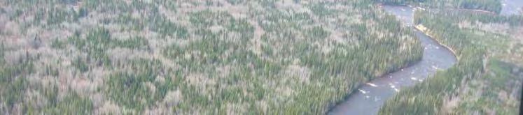
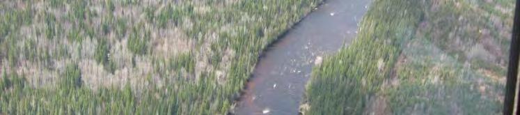
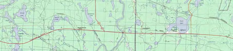
Site 4 PEESHOO. Approx. Head = 10 m Design Flow = 70 m 3 /s Capacity = 6 MW. Peeshoo. Kabinakagami River. Rogers Road HWY 11.
|
|
|
- Domenic Sharp
- 6 years ago
- Views:
Transcription
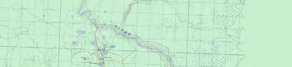
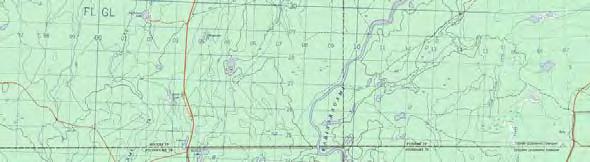
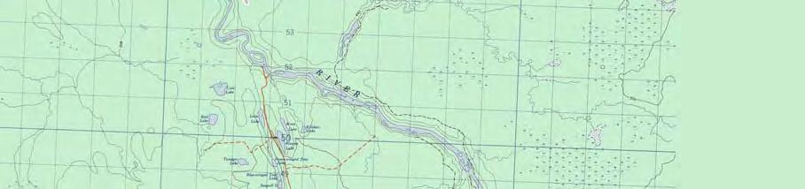
1 Kabinakagami River Site 4 PEESHOO Rogers Road Peeshoo Approx. Head = 10 m Design Flow = 70 m 3 /s Capacity = 6 MW N HWY 11 Kilometers
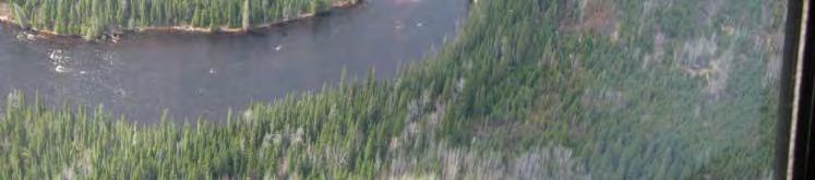
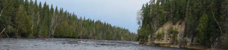
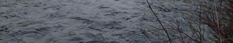
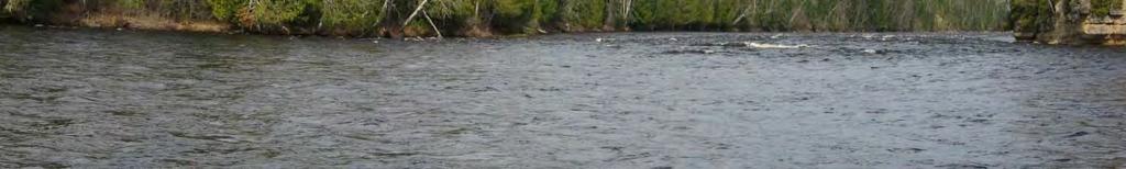
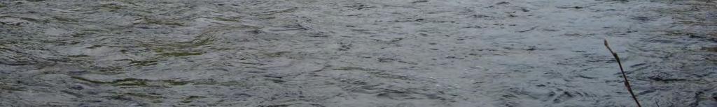
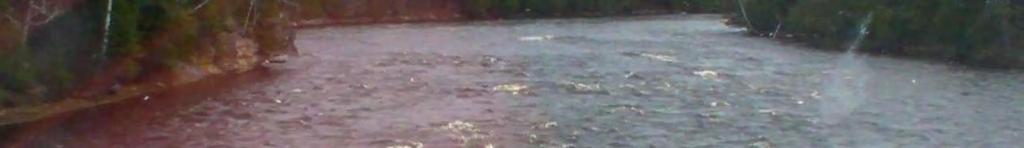
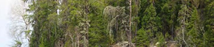
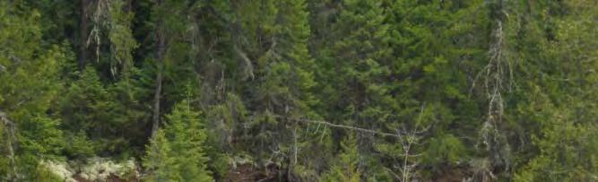
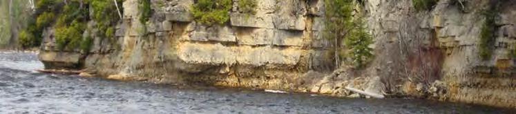
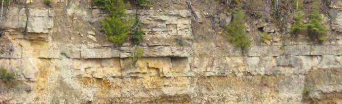
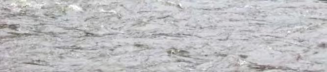
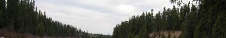
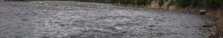
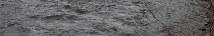
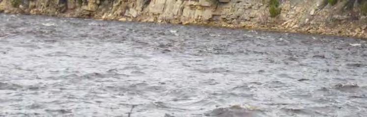
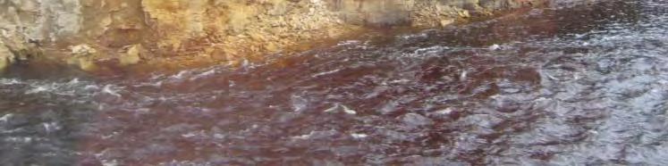
2 Site 4 - PEESHOO Looking Downstream Looking Downstream
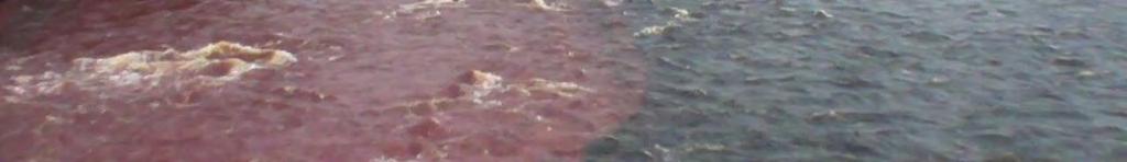
3 Site 4 - PEESHOO Looking Upstream

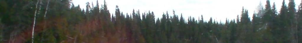
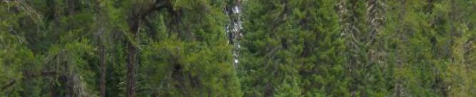
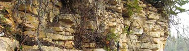
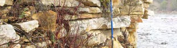
4 Site 4 - PEESHOO
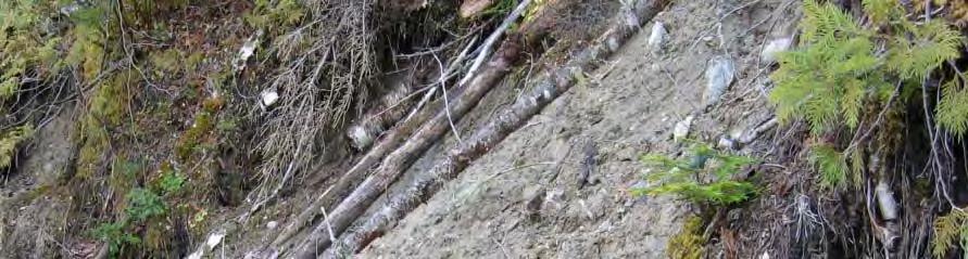
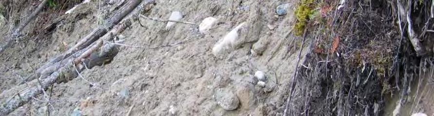
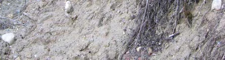
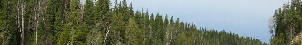
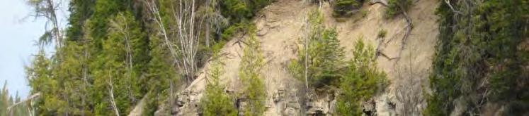
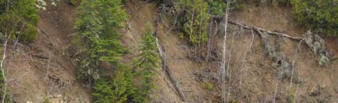
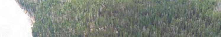
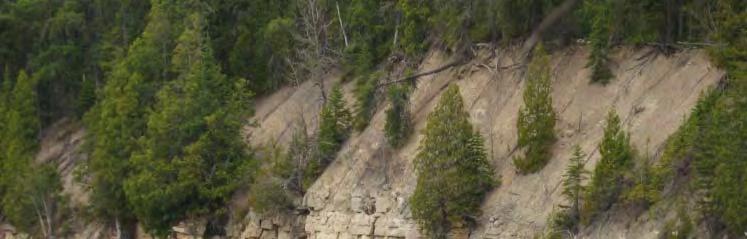
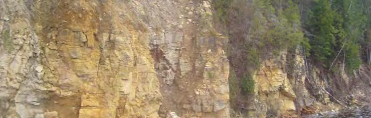
5 Site 4 - PEESHOO Similar geology to Site 3 good rock under till Steep till bank on the left side Proposed dam is downstream of a series rapids where there is a natural island
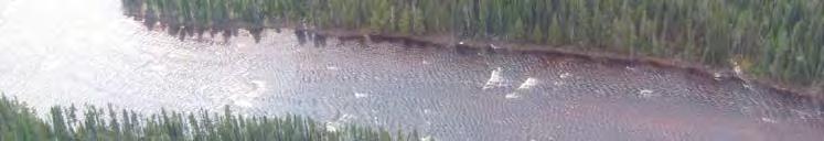
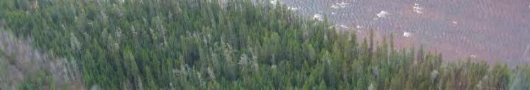
6 Site 4 - PEESHOO Powerhouse FLOW Spillway


7 Site 4 - PEESHOO N Kilometers
8 Kabinakagami River Site 4 PEESHOO Rogers Road Peeshoo N Kilometers HWY Kilometers N
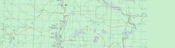
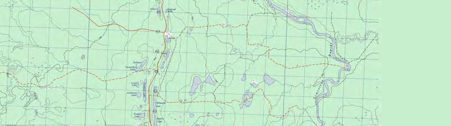
9 Kabinakagami River Site 5 WAHPEESTAN Wahpeestan Rogers Road Approx. Head = 10 m Design Flow = 70 m 3 /s Capacity = 6 MW N HWY 11 Kilometers

10 Site 5 - WAHPEESTAN
11 Site 5 - WAHPEESTAN Looking Downstream
12 Site 5 - WAHPEESTAN Looking Upstream
13 Site 5 - WAHPEESTAN
14 Site 5 - WAHPEESTAN Wide section of river ( < 100 m) No rapids upstream, however a short section downstream of the proposed dam alignment. Terrace on the left bank and a steep rock / sand outcrop on the right side. Preferred powerhouse location is on the right bank.
15 Site 5 - WAHPEESTAN Spillway FLOW Powerhouse
16 Site 5 - WAHPEESTAN N Kilometers

17 Kabinakagami River Site 5 WAHPEESTAN Rogers Road Wahpeestan N Kilometers HWY Kilometers N
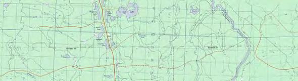
18 Kabinakagami River Site 6 WAPOOSE Wapoose Rogers Road Approx. Head = 10 m Design Flow = 70 m 3 /s Capacity = 6 MW N HWY 11 Kilometers

19 Site 6 - WAPOOSE

20 Site 6 - WAPOOSE Looking Downstream
21 Site 6 - WAPOOSE Looking Upstream

22 Site 6 - WAPOOSE
23 Site 6 - WAPOOSE Very similar to Site 5 Wide section of river ( < 100 m) Bend in the river at the proposed p location Terrace on the left bank and a steep rock / sand outcrop on the right side. Preferred powerhouse location is on the right bank.
24 Site 6 - WAPOOSE Spillway Powerhouse FLOW


25 Site 6 - WAPOOSE Kilometers N

26 Kabinakagami River Site 6 WAPOOSE Rogers Road Wapoose N Kilometers HWY Kilometers N
27 Engineering Studies Completed studies: Engineer Site Visit Completed May 2009 Geotechnical and Layout engineers visit the sites to assess the chosen project locations All sites were visited over a period of a week Geophysical Investigations Completed May 2010 GPR was contracted to do geophysical investigations of Wahpeestan and Wapoose (Sites 5&6) This helps to determine how far the rock is under the ground surface
28 Engineering Investigations Upcoming studies: Borehole Drilling Planned for this fall Three or four holes will be drilled at each site 4 to 6 weeks of work Used to determine foundation conditions and basis for engineering design Bathymetric (Underwater) Survey 2011 A survey of the river bottom is needed in order to model the river flow To calculate water levels, velocities, etc. as input for operational strategies and the environmental program Construction Material Test Pit Program 2011 Sources for construction material will be explored
29 Engineering Next Steps Definition Phase engineering All aspects of the projects will be investigated and optimized, including: Number and size of turbines Spillway structures Dam type / construction o material a Transmission lines Access roads Powerhouse layout
30 QUESTIONS?
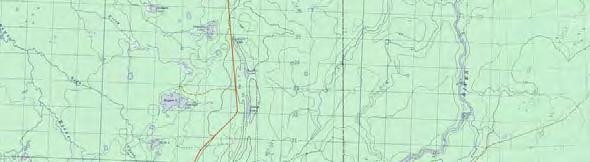
31 Amisk Kabinakagami River Neekik Wapoose Wahpeestan Rogers Road Peeshoo Neeskah Mahekun Muskoo N HWY 11 Kilometers


32 Fisheries Need to understand what fish and other aquatic wildlife are there and then determine how they will be effected by the project for Constance Lake First Nation, Ministry of Natural Resources and Fisheries and Oceans Canada
33 Fisheries Studies Spring Fisheries Studies - sturgeon, pickerel and sucker spawning Summer Fisheries Studies - fish identification - aquatic habitat assessment - small fish assessment Fall Fisheries Studies - whitefish h and brook trout t spawning - benthic invertebrate (fish food) Studies - sediment characterization fish mercury assessment - fish mercury assessment Water Quality Assessment (Spring, Summer, Fall)
34 Spring Fisheries Study Dates May 7 to 29, 2009 collected fish using nets and fishing rods collected fish eggs using egg mats visual observed fish and aquatic environment habitat assessment - bed of river (visual, underwater camera) - water depth and flow completed studies on all eight sites members of Constance Lake First Nation assisted in these studies and provided d information on the River during this time
35 Site 1 Muskoo
36 Spring Fisheries Study - Results Site 1 - Muskoo - predominantly high flow rapids work from shore only - no fish or eggs collected - some spawning habitat along slower velocity, rocky shorelines - Constance Lake First Nation workers indicated Constance Lake First Nation workers indicated pickerel and brook trout are here present in summer
37 Spring Fisheries Study - Results Site 2 - Mahekun - fish found included pickerel, white sucker, longnose sucker, shorthead redhorse, northern pike in various stages of spawning - spawning habitat in rapids - small falls downstream from site - barrier to upstream movement - Constance Lake First Nation workers indicated that pickerel are caught throughout the area after the spawning period
38 Site 3 - Neeskah
39 Spring Fisheries Study - Results Site 3 - Neeskah - white sucker only species captured, but pickerel and redhorse are known to be present - spawning habitat for pickerel and sucker species available at base of rapids no further upstream movement possible as the rapids are a barrier - spawning habitat for pickerel and sucker species present in head pond and Carey Creek - Constance Lake First Nation workers indicated Constance Lake First Nation workers indicated that brook trout have been caught in the Carey Creek area
40 Spring Fisheries Study - Results Site 4 - Peeshoo - predominantly high speed rapids at dam site we were only able to work from shore - pickerel found in rapids - some spawning habitat along slower speed, rocky shorelines - Constance Lake First Nation workers indicated that sturgeon have been observed spawning downstream from Site 4 none caught in 2009
41 Spring Fisheries Study - Results Site 5 - Wahpeestan - pickerel, white sucker collected at several locations in proposed head pond - sucker eggs collected at one location - spawning habitat along shorelines and at upstream end of head pond (base of Site 4 Peeshoo rapids) - one post-spawn female lake sturgeon found


 -")
42 Spring Fisheries Study - Results Site 6 - Wapoose - pickerel, white sucker, northern pike and brook trout found downstream from site - sucker eggs collected at three locations (side channels and mid-channel humps) - spawning habitat relatively abundant
43 Site 7 Neekik The Wall
44 Spring Fisheries Study - Results Site 7 - Neekik - pickerel, lake sturgeon, white sucker, longnose sucker, shorthead redhorse, northern pike, brook trout found - sturgeon and redhorse spawning confirmed at and upstream from the Wall - tributary downstream from Site 7 Neekik may provide spawning habitat - 8 lake sturgeon radio-tagged at the Wall for future 8 lake sturgeon radio tagged at the Wall for future tracking
45 Spring Fisheries Study - Results Site 8 - Amisk - pickerel, lake sturgeon, white sucker, longnose sucker, shorthead redhorse, brook trout, northern pike and whitefish found - white sucker and pickerel spawning found at several locations, typically in the side channels - spawning habitat abundant
46 Lake Sturgeon
47 Sturgeon Spawning
48 Summer Fisheries Study Dates: September 15-24, 2009 Fish Identification (Netting) - using specially designed nets to catch a range of small to large fish species Shoreline Backpack Electrofishing Rod Fishing done at select locations Aquatic Habitat Assessment - description of the habitat including bed and shore of river
49 Summer Fisheries Study - Netting Results Downstream from Site 7 - Neekik - sturgeon, pickerel, northern pike, white sucker, longnose sucker, shorthead redhorse, yellow perch, spottail shiner, trout perch - pickerel most by number (31%), white sucker, redhorse (21% each) - redhorse most by weight (28%), pickerel (26%) and lake sturgeon (19%)
50 Summer Fisheries Study - Netting Results Site 3 - Neeskah - pickerel, shorthead redhorse, longnose sucker, lake sturgeon (1 adult, 1 juvenile) - Sturgeon tagged and released Site 2 - Mahekun - pickerel, northern pike, white sucker, longnose sucker, shorthead redhorse, yellow perch - redhorse most by number (37%), pickerel (27%) and northern pike (15%) - redhorse most by weight (39%), pickerel (21%)


, longnose dace (17.")
51 Summer Fisheries Study - Results Electrofishing - in shallow riffles and runs - burbot, logperch, white sucker, mottled sculpin, Johnny darter, longnose dace, trout-perch, pickerel, brook trout - mottled sculpin most by number (50.7%), longnose dace (17.3%) and Johnny darter (14.6%)
52 Summer Fisheries Study - Results Rod Fishing - found pickerel and northern pike caught throughout project area Aquatic Habitat Assessment - highlightshli ht - Site 1 Muskoo - rapids - Site 2 Nahekun to Site 4 Peeshoo - low gradient, deeper runs interspersed with bedrock controlled rapids - downstream of Site 4 Peeshoo mostly shallow, swift flowing riffles and runs in Limestone Rapids - mapping and habitat descriptions provided in study report
53 Fall Fisheries Study Dates: October 14 18, 2009 Lake Whitefish Spawning - netting upstream and downstream from Rogers Landing Brook Trout Spawning - visual assessment and electrofishing in tributaries - capture during whitefish netting Lake Sturgeon Tagging - to determine where sturgeon are moving to and from Benthic Invertebrate (Fish Food)/Sediment Study Fish Mercury Assessment
54 Fall Fisheries Study - Results Lake Whitefish Spawning - no whitefish captured during September study - low numbers of whitefish captured 500 m upstream and 2 km downstream from Rogers Landing in October - therefore, whitefish move upstream into lower end of study area to spawn but don t appear to move upstream into Limestone Rapids
55 Fall Fisheries Study - Results Brook Trout Spawning - ready to spawn brook trout captured in small tributary at Rogers Landing, tributary 150 m upstream from landing and in main channel 200 m upstream from landing - adult trout present in tributary downstream from Site 7 Neekik - no trout captured in tributaries at Site 6 Wapoose, Carey Creek or Site 2 Mahekun, but habitat appears suitable - therefore, trout spawning could occur throughout Limestone Rapids reach and in tributaries
56 Brook Trout


57 Fall Fisheries Study - Results Lake Sturgeon Tagging - 1 adult sturgeon and 1 pickerel tagged below Site 3 Neeskah in October sturgeon tagged at the Wall in May 2009
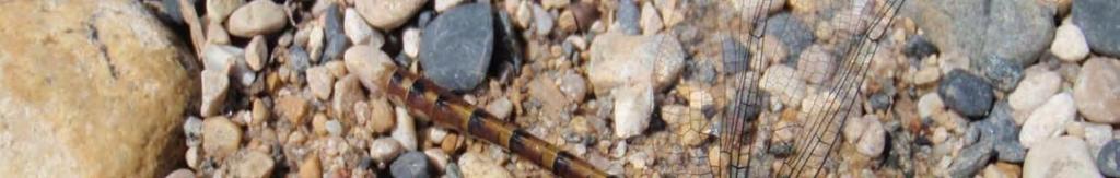
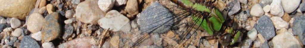
58 Lake Sturgeon - Results Lake Sturgeon - sturgeon spawning in 2009 and 2010 were observed to spawn at the Wall - sturgeon forage in the River from the time of spawning to late fall periods up to Site 3 Neeskah - most sturgeon over-winter downstream near the forks of the Nagagami, Kabinakagami and Kenogami Rivers, but some sturgeon overwinter downstream from Site 3 Neeskah - Site 3 Neeskah appears to be a barrier to upstream sturgeon movements given that no sturgeon have been captured or observed further upstream
59 Fall Fisheries Study - Results Insect Larvae Benthic Invertebrates (Fish Food) Assessment - to determine the amount and quality of fish food available - 49 samples taken throughout the project area - diverse, abundant bug communities found throughout h t the study area - rapids have higher numbers of bugs than slower moving areas
60 Fall Fisheries Study - Results Fish Mercury Assessment - baitfish captured in October, gamefish captured in May/September and submitted for analysis of mercury content - gamefish results not yet available will be sent to MOE to put in Guide to Eating Sportfish - baitfish results complete and will be used to compare to post-construction surveys
61 Terrestrial Study Dates: September 9-16, 2009 Fly Over - look for large nests, beaver lodges, Species at Risk habitat (e.g., caribou, common nighthawk, Canada warbler, black tern, rusty blackbird, and olive-sided flycatcher) Ground Survey - vegetation plots (10x10 m) to identify vegetation species throughout study area based on MNR requirements - observations of birds, mammals, reptiles and amphibians (e.g. frogs)
62 Terrestrial Study - Results Birds - 14 bird species observed, more expected to be present during breeding season - bald eagles observed at railway tracks and downstream from Site 7 Neekik - two stick nests observed one no longer in use, other likely a common raven nest - other priority species and Species at Risk could also potentially be present Mammals - common species including moose, beaver and river otter - black bear, wolf, lynx, skunk, marten, mink, hare and other small species likely present


63 Stick nest along river Stick Nest


64 Beaver lodge along river
65 Terrestrial Study - Results Woodland Caribou - no recent reports of caribou in study area, but they are known to occur in the regional area, particularly north and west of study area - Northland planning to undertake a winter caribou survey in winter 2011 Reptiles/Amphibians - eastern garter snake, american toad and wood frog observed, other frog species likely present
66 Terrestrial Study - Results Vegetation Communities - relatively common vegetation communities observed throughout study area no provincial or federal Species At Risk observed or expected - rocky rivershore only present at Sites 1 Muskoo, 3 Neeskah and 4 Peeshoo - no rare or uncommon species recorded in these areas
67 Dragonfly Survey 102 shoreline samples plots in July 2009 taking the shed skin random collection of adults as they are found 28 dragonfly species and 2 damselfly species found 4 provincially rare species (extra-striped snaketail, uhler s sundragon, broad-tailed shadowdragon, riffle snaketail) extra-striped clubtail was the most common species observed in study area diversity similar to Kapuskasing River
68 Shed skins along rivers edge

69 Rusty Snaketail
70 Discussions with Members of Constance Lake First Nation Northland and Hatch met with several members of Constance Lake First Nation to obtain Traditional Ecological Knowledge which will be integrated into the environmental reports with the assistance of Constance Lake First Nation knowledge of the site from Constance Lake First Nation workers during the field studies will also be integrated
71 Discussions with Members of Constance Lake First Nation Highlights g include: moose calve on islands between Site 8 Amisk and Site 7 Neekik importance of sturgeon and whitefish importance of fish for food in the past and present for the community used to see snow geese but not any more cormorants are eating the fish sturgeon spawn at the Wall Northland and Hatch would like to interview more members of Constance Lake First Nation to obtain further Traditional Ecological Knowledge of the area
72 Next Steps - Environmental Environmental Studies caribou study winter 2011 MNR site release process in process obtain Applicant of Record status Environmental approvals from federal government complete federal environmental assessment process review background documents, obtain Traditional Ecological Knowledge, complete field studies, determine impacts, determine activities and measures to decrease impacts, propose monitoring plan, complete Aboriginal, public and agency consultation
73 Next Steps - Environmental after federal environmental assessment process is completed and approved, obtain other federal permits (e.g. fisheries act authorization) Environmental approvals from provincial government provincial environmental assessment process is very similar to the federal process and therefore they are harmonized and one report is prepared after provincial environmental assessment process is completed and approved, obtain other provincial permits (e.g. lakes and rivers improvement act permits)
74 Timelines (Tentative) MNR Site Release Process tentatively completed summer 2010 Federal and provincial environmental assessment process commence summer 2010 and finish summer 2011 Engineering Design starting summer 2010 Environmental permits fall 2011 Construction Spring 2012 to 2014
75 QUESTIONS?
SUMMARY REPORT FOR LAKE ST. MALO FISHERIES ASSESSMENT. Prepared for the St. Malo and District Wildlife Association
 SUMMARY REPORT FOR LAKE ST. MALO FISHERIES ASSESSMENT Prepared for the St. Malo and District Wildlife Association Presented by August 25, 2014 Study dates thus far: Date Tasks February 16 Fishing derby;
EXECUTIVE SUMMARY FISH COMMUNITY AND HABITAT EXISTING CONDITIONS REPORT
 EXECUTIVE SUMMARY FISH COMMUNITY AND HABITAT EXISTING CONDITIONS REPORT First Mining Gold (First Mining) has completed a comprehensive Fish Community and Habitat Existing Conditions Report which has utilized
Thunder Bay River Assessment Appendix. Appendix 2
 Appendix 2 Known past and present fish distributions in the River system. Distribution of fishes were compiled from Bailey et al. (2003) and from records located at the Michigan Department of Natural Resources
Ecology and control of invasive Northern Pike in the Columbia River, Canada
 Ecology and control of invasive Northern Pike in the Columbia River, Canada Brian Heise, Daniel Doutaz, Matthias Herborg, Matt Neufeld, David Derosa, Jeremy Baxter 19 th International Conference on Aquatic
At Home on the Elbow River. -Ours to share-
 At Home on the Elbow River -Ours to share- Living in the shed You are part of the Elbow River Watershed. The Elbow River and its tributaries drain over 1,200 km² of land. The source of the Elbow River
Tahquamenon River Assessment Appendix
 DNR DEPARTMENT OF NATURAL RESOURCES MICHIGAN STATE OF MICHIGAN DEPARTMENT OF NATURAL RESOURCES SR45 Appendix February 2008 Tahquamenon River Assessment Appendix James R. Waybrant and Troy G. Zorn www.michigan.gov/dnr/
Lake St. Clair Fish Community and Fishery
 Lake St. Clair Fish Community and Fishery Megan Belore Ontario Ministry of Natural Resources and Forestry Mike Thomas Michigan Department of Natural Resources Fish Community Fish Community Mixture of warm
Winter Drawdown Issues of Concern
 Winter Drawdown Issues of Concern Wetland Connectivity Amphibians Fisheries Winter Drawdown Wetland Connectivity Wetland complex near Osprey Creek is not responsive to lake level Wetland at upper end of
Fisheries Survey of White Rapids Flowage, Marinette County Wisconsin during Waterbody Identification Code
 Fisheries Survey of White Rapids Flowage, Marinette County Wisconsin during 25 Waterbody Identification Code 6343 Michael Donofrio Fisheries Supervisor Wisconsin Department of Natural Resources Peshtigo,
Crooked Lake Oakland County (T4N, R9E, Sections 3, 4, 9) Surveyed May James T. Francis
 Surveyed May James T. Francis") Michigan Department of Natural Resources Status of the Fishery Resource Report No. 2004-1, 2004 Crooked Lake Oakland County (T4N, R9E, Sections 3, 4, 9) Surveyed May 2002 James T. Francis Environment Crooked
Michigan Department of Natural Resources Status of the Fishery Resource Report No. 2004-1, 2004 Crooked Lake Oakland County (T4N, R9E, Sections 3, 4, 9) Surveyed May 2002 James T. Francis Environment Crooked
NEVADA DEPARTMENT OF WILDLIFE STATEWIDE FISHERIES MANAGEMENT
 NEVADA DEPARTMENT OF WILDLIFE STATEWIDE FISHERIES MANAGEMENT FEDERAL AID JOB PROGRESS REPORTS F-20-52 2016 Lake Tahoe Rainbow Trout Study WESTERN REGION NEVADA DEPARTMENT OF WILDLIFE, FISHERIES DIVISION
FISH COMMUNITIES AND FISHERIES OF THE THOUSAND ISLANDS AND MIDDLE CORRIDOR
 St. Lawrence River Discussion Paper FISH COMMUNITIES AND FISHERIES OF THE THOUSAND ISLANDS AND MIDDLE CORRIDOR Issues Below is a synopsis of fish community issues and proposed management approaches. More
Alberta Conservation Association 2017/18 Project Summary Report
 Alberta Conservation Association 2017/18 Project Summary Report Project Name: Abundance, Distribution, Spawning, and Thermal Habitat of Westslope Cutthroat Trout and Bull Trout in the Stimson Creek Watershed
Appendix D Spring Fisheries Investigations - Data Report (Hatch, 2012d)
") Appendix D5 2012 Spring Fisheries Investigations - Data Report (Hatch, 2012d) Hatch 2012/10 Horizon Hydro Inc. 2012 Spring Fisheries Investigations - Data Report Trout Lake River Hydro Project 327203.201.17
Appendix D5 2012 Spring Fisheries Investigations - Data Report (Hatch, 2012d) Hatch 2012/10 Horizon Hydro Inc. 2012 Spring Fisheries Investigations - Data Report Trout Lake River Hydro Project 327203.201.17
Columbia Lake Dam Removal Project
 Columbia Lake Dam Removal Project The Columbia Lake dam located 1/4 mile upstream of the Paulins Kill River's confluence with the Delaware River in Knowlton Township, Warren County has been proposed for
Water Habitat Model. Outcome: Materials: Teacher Instructions: : Identify the components of an animal habitat..
 Water Habitat Model Outcome: 4-1-03: Identify the components of an animal habitat.. Materials: Shoe boxes (1 per student) Art supplies: Glue and/or tape Paint and brushes for the background Plasticine/clay
Study 9.5 Fish Distribution and Abundance in the Upper Susitna River
 Initial Study Report Meeting Study 9.5 Fish Distribution and Abundance in the Upper Susitna River October 15, 2014 Prepared by R2 Resource Consultants, Inc. 10/15/2014 1 Study 9.5 Objectives 1. Describe
Nechako white sturgeon are an Endangered Species
 Nechako white sturgeon are an Endangered Species There are likely less than 350 Nechako white sturgeon, and historically there were over 5000 in the Nechako Watershed. Endangered as per the Species at
Creation of Fish and Wildlife Habitat on the Closed Salmon Harbour Mine in Minto, NB
 Creation of Fish and Wildlife Habitat on the Closed Salmon Harbour Mine in Minto, NB M. Coleman 1, R. Rutherford 2, RA Currie 3 1 NB Power 2 Thaumas Environmental Consultants Ltd 3 RA Currie Ltd. Location
6TH PELLETIER BROOK LAKE T15 R9, Aroostook Co. U.S.G.S. Gardner Pond, Maine (7 1/2 )
") 6TH PELLETIER BROOK LAKE T15 R9, Aroostook Co. U.S.G.S. Gardner Pond, Maine (7 1/2 ) Fishes Brook trout Minnows Blacknose dace Pearl dace Physical Characteristics Area - 27 acres Average depth - 2 feet
6TH PELLETIER BROOK LAKE T15 R9, Aroostook Co. U.S.G.S. Gardner Pond, Maine (7 1/2 ) Fishes Brook trout Minnows Blacknose dace Pearl dace Physical Characteristics Area - 27 acres Average depth - 2 feet
Swift Current Creek Watershed
 Swift Current Creek Watershed Watershed Boundary Gross drainage area 3939 km 2 973,343 acres Gross creek length 230 km 143 miles Primary water source for 20 000 people Major source of water base recreation
Elk Lake, Antrim and Grand Traverse counties T. 28, 29 N., R. 8, 9 W., Sec. many. Lake surveys. began at 40 feet
 Elk Lake, Antrim and Grand Traverse counties T. 28, 29 N., R. 8, 9 W., Sec. many Physical and chemical data surveyed August 1931 Temperature ( F) Secchi disk (feet) 9. 6 Surface 74 Bottom 45 PH 8.0 Thermocline
Methods for Evaluating Shallow Water Habitat Restoration in the St. Clair River
 Methods for Evaluating Shallow Water Habitat Restoration in the St. Clair River Objectives Document fish use of restoration sites Spawning Presence of larvae, juvenile, and adult fish Quantify differences
Rehabilitation of Grimes Creek, a Stream Impacted in the Past by Bucket-lined Dredge Gold Mining, Boise River Drainage, July 2008 to August 2011.
 Rehabilitation of Grimes Creek, a Stream Impacted in the Past by Bucket-lined Dredge Gold Mining, Boise River Drainage, July 2008 to August 2011. Pam Harrington TU,1020 W. Main Street Suite 440, Boise,
TRAPLINE VC34 Land Use Before the La Grande Complex
 SUMMARY OF TRAPLINE LAND USE BEFORE THE LA GRANDE PROJECT TRAPLINE VC34 Land Use Before the La Grande Complex Trapline Background Information The trapline VC34 is located at more than 175 km east of Eastmain,
SUMMARY OF CONOWINGO DAM WEST FISH LIFT OPERATIONS 2012
 SUMMARY OF CONOWINGO DAM WEST FISH LIFT OPERATIONS 2012 Michael L. Hendricks Pennsylvania Fish and Boat Commission 1735 Shiloh Rd. State College, Pa 16801 INTRODUCTION The shore-based trapping device at
EXECUTIVE SUMMARY. Muskegon River Watershed Assessment
 EXECUTIVE SUMMARY This assessment for the Muskegon River watershed is one of a series being prepared by Michigan Department of Natural Resources, Fisheries Division, for river basins in Michigan. This
Minnesota Department of Natural Resources Division of Fish and Wildlife Section of Fisheries. Stream Survey Report. Cold Spring Creek.
 Minnesota F-29-R(P)-24 Area 315 Study 3 March 2015 Minnesota Department of Natural Resources Division of Fish and Wildlife Section of Fisheries Stream Survey Report Cold Spring Creek 2014 Mark Pelham Montrose
Black Sturgeon Regional Plan
 Black Sturgeon Regional Plan This is one of twenty Regional Plans that support implementation of the Lake Superior Biodiversity Conservation Strategy (Strategy). The Strategy, prepared and overseen by
Job 1 Part JOB 1, PART 2: SUMMARY OF CONOWINGO DAM WEST FISH LIFT OPERATIONS, 2009
 2.0 JOB 1, PART 2: SUMMARY OF CONOWINGO DAM WEST FISH LIFT OPERATIONS, 2009 Lawrence M. Miller Normandeau Associates U. S. Fish and Wildlife Service 1921 River Road Harrisburg, Pennsylvania Drumore, Pennsylvania
Report prepared for: Prepared by: January 2002 BEAK Ref
 AQUATIC ENVIRONMENTAL STUDY KANATA WEST CONCEPT PLAN Report prepared for: ROBINSON CONSULTANTS Prepared by: BEAK INTERNATIONAL INCORPORATED 14 Abacus Road Brampton, Ontario L6T 5B7 January 2002 BEAK Ref.
Conservation Planning in Vermont
 Conservation Planning in Vermont Today s outline 1. A primer on conservation biology 2. VT Wildlife Action Plan 3. How VTRANS & Fish and Wildlife work together 4. Discussion: How can we better work together?
FISHERIES MANAGEMENT PLAN FOR DUFFINS CREEK AND CARRUTHERS CREEK JUNE, 2004
 FISHERIES MANAGEMENT PLAN FOR DUFFINS CREEK AND CARRUTHERS CREEK JUNE, 2004 Toronto and Region Conservation 2004 ISBN0-9732764-0-1 www.trca.on.ca 5 Shoreham Drive, Toronto, Ontario M3N 1S4 phone: 416-661-6600
Big Spring Creek Habitat Enhancement and Fishery Management Plans
 Big Spring Creek Habitat Enhancement and Fishery Management Plans November 5, 2012 Big Spring Events and Activities Center Newville, PA Charlie McGarrell Regional Habitat Biologist Pennsylvania Fish and
Alcona Dam Pond Alcona County (T25N, R5E, Sections various) Surveyed June 6-12 and September 16, 2003
 Surveyed June 6-12 and September 16, 2003") Michigan Department of Natural Resources Status of the Fishery Resource Report No. 2004-6, Year 2004 Alcona Dam Pond Alcona County (T25N, R5E, Sections various) Surveyed June 6-12 and September 16, 2003
Michigan Department of Natural Resources Status of the Fishery Resource Report No. 2004-6, Year 2004 Alcona Dam Pond Alcona County (T25N, R5E, Sections various) Surveyed June 6-12 and September 16, 2003
Understanding the Impacts of Culvert Performance on Stream Health
 Understanding the Impacts of Culvert Performance on Stream Health Kristin Thomas Aquatic Ecologist Michigan Trout Unlimited Transportation and the Environment Conference 12/5/2018 Importance of adequately
Onondaga Lake Fishery: 2011 Fact Sheet
 October, 2011 Onondaga County Department of Water Environment Protection SUNY College of Environmental Science and Forestry Joanne M. Mahoney, County Executive Tom Rhoads, P.E., Commissioner Onondaga Lake
OKANAGAN RIVER RESTORATION INITIATIVE - FAQ
 OKANAGAN RIVER RESTORATION INITIATIVE - FAQ Initiative background: The health of the q awsitk w (Okanagan River) has been severely impacted by the channelization works that occurred in the mid-1950 s.
Largemouth Bass. Max 30 inches Average 4-12 inches EATS
 Largemouth Bass Max 30 inches Average 4-12 inches EATS Largemouth Bass may only be consumed if they are bigger than 12 to preserve the supply of Largemouth Bass in this pond. Please catch and release if
Ecological gains through EIA in Parks Canada
 Ecological gains through EIA in Parks Canada Eric Tremblay, Park Ecologist, Kouchibouguac National Park, NB, Canada April 6 th, 2017 1 Integrating SARA and Fisheries Act Aboriginal consultations 2 Kouchibouguac
Fish Community. Fish Habitat, Streams and Rivers
 Clear, Ston(e)y and White Lake Plan Fish Community The lakes support a cool/warm water fishery including muskellunge, walleye, largemouth and smallmouth bass, yellow perch, pumpkinseed, rockbass, blue
Restoration of Spawning Habitat for Native Fish in the Central Great Lakes
 Restoration of Spawning Habitat for Native Fish in the Central Great Lakes D. H. B E N N I O N 1, E. R O S E M A N 1, B. M A N N Y 1, G. K E N N E D Y 1, J. B O A S E 2, J C R A I G 1 1 U S G S - G R E
Quemahoning Reservoir
 Pennsylvania Fish & Boat Commission Biologist Report Quemahoning Reservoir Somerset County May 2011 Trap Net, Gill Net and Electrofishing Survey Quemahoning Reservoir is an 899 acre impoundment located
2012 Wildlife Studies
 2012 Wildlife Studies Prepared by Cardno ENTRIX Agency Meeting on Draft 2012 Study Descriptions December 8, 2011 1 Project Components 2 Project Region ADF&G GMUs 3 Wildlife Studies for 2012 W-S1: Wildlife
Refined Designated Uses for the Chesapeake Bay and Tidal Tributaries
 A-1 appendixa Refined Designated Uses for the Chesapeake Bay and Tidal Tributaries BACKGROUND Federal water quality standards regulations establish that states must specify appropriate water uses to be
First Nations Fish Habitat Program Discussion Workbook
 First Nations Fish Habitat Program Discussion Workbook The First Nations Fish Habitat Program is a joint initiative of the Centre for Indigenous Environmental Resources (CIER) and The Southern Chiefs Organization
Current projects for Fisheries Research Unit of Minnesota Department of Natural Resources
 Current projects for Fisheries Research Unit of Minnesota Department of Natural Resources MAJOR RESOURCE ISSUES IN THE DIVISION OF FISHERIES Status of Fish Populations To effectively manage fish populations,
Cold-transitional Small River
 Cold-transitional Small River A Brief Ecological Description of this Michigan River Type Cold-transitional Small River segments are defined (by the Michigan Department of Natural Resources, Fisheries Division)
Mississippi River Life
 Mississippi River Life National Mississippi River Museum and Aquarium Conservation Education Curriculum Target Grades: Pre K 4 th grade Key Words: Habitat, diversity Subject Areas: science, biology Duration:
NEVADA DEPARTMENT OF WILDLIFE STATEWIDE FISHERIES MANAGEMENT
 NEVADA DEPARTMENT OF WILDLIFE STATEWIDE FISHERIES MANAGEMENT FEDERAL AID JOB PROGRESS REPORTS F-20-50 2014 BILK CREEK RESERVOIR WESTERN REGION 1 NEVADA DEPARTMENT OF WILDLIFE, FISHERIES DIVISION JOB PROGRESS
NEVADA DEPARTMENT OF WILDLIFE STATEWIDE FISHERIES MANAGEMENT
 NEVADA DEPARTMENT OF WILDLIFE STATEWIDE FISHERIES MANAGEMENT FEDERAL AID JOB PROGRESS REPORTS F-2-52 216 CHIMNEY RESERVOIR WESTERN REGION NEVADA DEPARTMENT OF WILDLIFE, FISHERIES DIVISION JOB PROGRESS
Crawford Reservoir. FISH SURVEY AND MANAGEMENT INFORMATION Eric Gardunio, Fish Biologist Montrose Service Center
 FISH SURVEY AND MANAGEMENT INFORMATION General Information: Crawford Reservoir is a popular fishery that provides angling opportunity for yellow perch, channel catfish, northern pike, rainbow trout, black
Study Update Fish Distribution and Species Composition
 Study Update Fish Distribution and Species Composition Goals and Study Area Gain a better understanding of fish species composition and abundance in waters associated with the Packwood Lake Hydroelectric
Quillback (Carpoides cyprinus)
") t. Joseph Assessment Appendix Quillback (Carpoides cyprinus) feeding - clear to turbid water - Michigan - sand, sandy gravel, sandy silt, or clay-silt substrate - medium- to low-gradient rivers and streams;
t. Joseph Assessment Appendix Quillback (Carpoides cyprinus) feeding - clear to turbid water - Michigan - sand, sandy gravel, sandy silt, or clay-silt substrate - medium- to low-gradient rivers and streams;
1 INTRODUCTION AND SUMMARY
 December 10, 2012 Pacific Booker Minerals 1702 1166 Alberni Street Vancouver, British Columbia V6E 3Z3 Erik Tornquist Executive VP and COO Dear Mr. Erik Tornquist: 1 INTRODUCTION AND SUMMARY This letter
Juvenile Steelhead and Stream Habitat Conditions Steelhead and Coho Salmon Life History Prepared by: DW ALLEY & Associates, Fishery Consultant
 Juvenile Steelhead and Stream Habitat Conditions Steelhead and Coho Salmon Life History Prepared by: DW ALLEY & Associates, Fishery Consultant I-1. Steelhead and Coho Salmon Ecology Migration. Adult steelhead
ESA, Proposed Threatened ESA, Threatened New Mexico-WCA, Endangered
 Scientific Name: Percina macrolepida Common Name: Bigscale Logperch BISON No.: 010270 Legal Status: Arizona, Species of Special Concern ESA, Endangered ESA, Proposed Endangered ESA, Proposed Threatened
Tittabawassee River Assessment. Miles. Gladwin Smallwood Impoundment. Harrison. Clare. Midland. Mt. Pleasant. St. Louis. Saginaw.
 Warmouth Lepomis gulosus feeding - clear lakes and impoundments and very low-gradient streams - abundant aquatic vegetation - silt-free water - mucky substrate often covered with organic debris spawning
Fish Survey Report and Stocking Advice for Loch Milton. (Loch a Mhuilinn), May 2011
, May 2011") Fish Survey Report and Stocking Advice for Loch Milton (Loch a Mhuilinn), May 2011 Jonah Tosney Freshwater Fisheries Biologist Wester Ross Fisheries Trust 1 Loch Milton (Loch a Mhuilinn) Fish Survey Report
Fish Survey Report and Stocking Advice for Loch Milton (Loch a Mhuilinn), May 2011 Jonah Tosney Freshwater Fisheries Biologist Wester Ross Fisheries Trust 1 Loch Milton (Loch a Mhuilinn) Fish Survey Report
feeding - downstream sections of large rivers, lakes, and impoundments
 River Assessment Appendix Shorthead redhorse (Moxostoma macrolepidotum) feeding - downstream sections of large rivers, lakes, and impoundments - rocky substrates - swift water near riffles - clear to slightly
Applying Engineering Solutions to the Science of Protection and Enhancement of Aquatic Environments. Bill Holman, P.E. Stanley Consultants
 Applying Engineering Solutions to the Science of Protection and Enhancement of Aquatic Environments Bill Holman, P.E. Stanley Consultants Project Development PHASE STAGE TASKS PURPOSE I II III Investigation
Current Status and Management Recommendations for the Fishery in the Cloverleaf Chain of Lakes
 Current Status and Management Recommendations for the Fishery in the Cloverleaf Chain of Lakes Jason Breeggemann Senior Fisheries Biologist Wisconsin Department of Natural Resources Outline DNR fisheries
Steelhead Society of BC. Thompson River Watershed Restoration and Enhancement Project #4 Nicola River Bank Stabilization and Enhancement Project
 Steelhead Society of BC Presents: Thompson River Watershed Restoration and Enhancement Project #4 Nicola River Bank Stabilization and Enhancement Project Application for Funding December 2013 1.0 BACKGROUND
DE PERE RIVERWALK AND WILDLIFE VIEWING PIER FUN FACTS
 DE PERE RIVERWALK AND WILDLIFE VIEWING PIER FUN FACTS Updated June 16, 2014 Fish Walleye Sturgeon Walleye can be found year round in the Fox River, however they are most visible during their annual spawning
Great Lakes Coastal Wetland Communities: Vulnerabilities to Climate Change and Response to Adaptation Strategies
 Great Lakes Coastal Wetland Communities: Vulnerabilities to Climate Change and Response to Adaptation Strategies CCAF Wetlands Study Investigators: Susan Doka Fisheries & Oceans, Great Lakes Lab for Fisheries
NEVADA DEPARTMENT OF WILDLIFE STATEWIDE FISHERIES MANAGEMENT
 NEVADA DEPARTMENT OF WILDLIFE STATEWIDE FISHERIES MANAGEMENT FEDERAL AID JOB PROGRESS REPORTS F-20-49 2013 LAKE TAHOE WESTERN REGION NEVADA DEPARTMENT OF WILDLIFE, FISHERIES DIVISION ANNUAL PROGRESS REPORT
Michigan Department of Natural Resources Status of the Fishery Resource Report Page 1
 Michigan Department of Natural Resources 2008-59 Status of the Fishery Resource Report Page 1 Bowens Manistee County, (T24N R16W Sec. 11, 12, 13, 14, 15, 24, and 30). Last surveyed 2008 Mark A. Tonello
Don Pedro Project Relicensing
 Don Pedro Project Relicensing M ODESTO I RRIGATION D ISTRICT TURLOCK I RRIGATION D ISTRICT FERC PROJECT N O. 2299 Resident Fish in Don Pedro Reservoir Don Pedro Reservoir Fish Stocking (1971-Present) CDFG
Lower Dolores River Corridor Planning Meeting Jim White Colorado Division of Wildlife
 Lower Dolores River Corridor Planning Meeting Jim White Colorado Division of Wildlife Objectives Overview of cold and warm water fishes in the Dolores River including: Flow and Fish Management Distribution
5B. Management of invasive species in the Cosumnes and Mokelumne River Basins
 5B. Management of invasive species in the Cosumnes and Mokelumne River Basins Cosumnes River The Cosumnes River basin has a number of distinct habitat types that require different management strategies
RAMP Objectives. RAMP Studies
 2008 Monitoring Results Fort Chipewyan, June 9, 2009 Presented by: Fred Kuzmic Wade Gibbons Martin Davies Heather Keith Hatfield Consultants. All Rights Reserved. 8/12/2009 SLIDE 1 What is RAMP? Initiated
HURON RIVER WATERSHED
 Brown bullhead (Ameiurus nebulosus) feeding - larger streams and rivers, lakes and impoundments - clear cool water with little clayey silt - moderate amounts of aquatic vegetation - sand, gravel, or muck
The Fish Fauna of Cranberry Bog, Town of Burlington, Otsego County, N.Y.
 80 The Fish Fauna of Cranberry Bog, Town of Burlington, Otsego County, N.Y. Steven M. Foster* ABSTRACT In June 1995 a baseline fish survey of Cranberry Bog was conducted in order to identify the species
Co-operative Freshwater Ecology Unit 2004 Program
 Co-operative Freshwater Ecology Unit 2004 Program Nordic Fish Survey (2003 + 2004) A survey of fish communities present in 25 Sudbury lakes was performed using the international standard Nordic Method.
Fish Survey of Arctic Lake (ID # ), Scott County, Minnesota in 2012
, Scott County, Minnesota in 2012") Snapping Turtle from Arctic Lake, September 2012 Fish Survey of Arctic Lake (ID #70-0085), Scott County, Minnesota in 2012 Survey Dates: September 18-20, 2012 MnDNR Permit Number: 18362 Prepared for: Shakopee
Snapping Turtle from Arctic Lake, September 2012 Fish Survey of Arctic Lake (ID #70-0085), Scott County, Minnesota in 2012 Survey Dates: September 18-20, 2012 MnDNR Permit Number: 18362 Prepared for: Shakopee
Cedar Lake Comprehensive Survey Report Steve Hogler and Steve Surendonk WDNR-Mishicot
 Cedar Lake- 2006 Comprehensive Survey Report Steve Hogler and Steve Surendonk WDNR-Mishicot ABSTRACT Cedar Lake is a 142 acre lake located in the southwest corner of Manitowoc County. It is a seepage lake
REC 6 FISHERIES HABITAT EVALUATION
 REC 6 FISHERIES HABITAT EVALUATION 1.0 EXECUTIVE SUMMARY Analysis of fisheries habitat for recreational angling opportunities was completed by reviewing the results of the CAWG 1, Characterize Stream and
Minnesota Department of Natural Resources Division of Fish and Wildlife Section of Fisheries. Stream Survey Report. Three Mile Creek 2011
 Minnesota Department of Natural Resources Division of Fish and Wildlife Section of Fisheries Stream Survey Report Three Mile Creek 2011 By Joseph D. Stewig Montrose Area Fisheries Office TABLE OF CONTENTS
Flint River Assessment Appendix
 14 Appendix 3 Distribution Maps of Fish Species This appendix contains maps of past and known present fish distributions within the River watershed. The distributions of fish species were compiled from
Friends of the Detroit River Habitat Restoration Project Update
 Friends of the Detroit River Habitat Restoration Project Update 11 Beneficial Use Impairments (BUIs) were originally identified to be associated with the Detroit River: 1. Restrictions on fish and wildlife
Lake Superior. Ontonagon River Assessment. Ontonagon. Rockland. Victoria Dam. Bergland. Bergland. Dam. Bruce Crossing Agate Falls. Kenton Lower.
 Sand shiner otropis stramineus feeding - sand and gravel substrate - shallow pools in medium size streams, lakes, and impoundments - clear water and low gradient - rooted aquatic vegetation preferred -
Removal of natural obstructions to improve Atlantic Salmon and Brook Trout habitat in western NL. 26/02/2015 Version 2.0
 Removal of natural obstructions to improve Atlantic Salmon and Brook Trout habitat in western NL 26/02/2015 Version 2.0 1 Table of Contents List of Tables... 2 Introduction... 3 Methods... 4 Preliminary
Cold-transitional Stream
 Cold-transitional Stream A Brief Ecological Description of this Michigan River Type Cold-transitional Stream segments are defined (by the Michigan Department of Natural Resources, Fisheries Division) as
APPENDIX 3. Distribution Maps of Fish Species
 APPENDIX 3 Distribution Maps of Fish Species This appendix contains maps of known past and present fish distributions within the Manistique River watershed. The distributions of fish species were compiled
SITE C CLEAN ENERGY PROJECT FISH AND FISH HABITAT TECHNICAL DATA REPORT
 SITE C CLEAN ENERGY PROJECT FISH AND FISH HABITAT TECHNICAL DATA REPORT Prepared for BC Hydro Power and Authority 333 Dunsmuir Street Vancouver, BC V6B 5R3 By Mainstream Aquatics Ltd. 6956 Roper Road Edmonton,
Adapting to Climate Change In Coastal Environments
 Adapting to Climate Change In Coastal Environments Peter Nimmrichter, P.Eng. AMEC Earth and Environmental, Mississauga, Ontario 19/11/2007 1 The Great Lakes Watershed The Great Lakes cover an area of 244,160
NEVADA DEPARTMENT OF WILDLIFE STATEWIDE FISHERIES MANAGEMENT
 NEVADA DEPARTMENT OF WILDLIFE STATEWIDE FISHERIES MANAGEMENT FEDERAL AID JOB PROGRESS REPORTS F-20-48 2012 LAKE TAHOE WESTERN REGION Contents NEVADA DEPARTMENT OF WILDLIFE, FISHERIES DIVISION ANNUAL PROGRESS
Finescale Dace. Appendix A: Fish. Chrosomus neogaeus. New Hampshire Wildlife Action Plan Appendix A Fish-60
 Finescale Dace Chrosomus neogaeus Federal Listing State Listing Global Rank State Rank Regional Status SC S3 Photo by John Lyons Justification (Reason for Concern in NH) Finescale dace are vulnerable to
FISH ASSEMBLAGE ASSESSMENT
 Relicensing Study 3.3.11 FISH ASSEMBLAGE ASSESSMENT Updated Study Report Summary Northfield Mountain Pumped Storage Project No. 2485) and Turners Falls Hydroelectric Project No. 1889) Prepared for: Prepared
EcoLogic Memorandum. TO: Ben Brezell; EDR FROM: Mark Arrigo RE: Possible Impacts of Dredging Snooks Pond DATE: 6/4/07
 EcoLogic Memorandum TO: Ben Brezell; EDR FROM: Mark Arrigo RE: Possible Impacts of Dredging Snooks Pond DATE: 6/4/07 Background EDR P.C. (EDR) has been contracted by a landowner to assess the feasibility
I Region I Area I DOW Number / County I DOW Lake Name I Acreage I
 LAKE MANAGEMENT PLAN 814 Bp I Region I Area I DOW Number / County I DOW Lake Name I Acreage I I I # I f 2 Duluth F213 690036 St Louis Salo DOW:149 Plan: 137 Long Range Goal: Manage for walleye with a gillnet
Fish Habitat Restoration and Monitoring in Southeast Washington. Andy Hill Eco Logical Research, Inc.
 Fish Habitat Restoration and Monitoring in Southeast Washington Andy Hill Eco Logical Research, Inc. Fish Habitat Restoration and Monitoring in Southeast Washington Talk overview: Restoration projects
Fisheries Management Zone 10:
 Fisheries Management Zone 10: Lake Trout Operational Objectives and Management Photo Credit: www.jamessmedleyoutdoors.com 2 FMZ 10: Lake Trout Operational Objectives and Management Lake trout are the second
NEVADA DEPARTMENT OF WILDLIFE STATEWIDE FISHERIES MANAGEMENT
 NEVADA DEPARTMENT OF WILDLIFE STATEWIDE FISHERIES MANAGEMENT FEDERAL AID JOB PROGRESS REPORTS F-20-52 2016 REDBAND TROUT EASTERN REGION NEVADA DEPARTMENT OF WILDLIFE, FISHERIES DIVISION ANNUAL JOB PROGRESS
WFC 10 Wildlife Ecology & Conservation Nov. 29, Restoration Ecology: Rivers & Streams. Lisa Thompson. UC Cooperative Extension
 Restoration Ecology: Rivers and Streams WFC 10 29 Nov 2010 Restoration of ecosystems often involves creating new systems with only partial resemblance to the original ecosystems Lisa Thompson Fisheries
Keeyask Generation Project Request to Install Additional Ice Boom Sections Description of Construction and Potential Environmental Effects
 Keeyask Generation Project Request to Install Additional Ice Boom Sections Description of Construction and Potential Environmental Effects The Keeyask Environmental Impact Statement indicated there would
The Life History and Management of Alewife (Alosa pseudoharengus)
") The Life History and Management of Alewife (Alosa pseudoharengus) Abigail Franklin, University of Massachusetts, Amherst Department of Natural Resources Conservation The Biology and Management of Alewife
The Life History and Management of Alewife (Alosa pseudoharengus) Abigail Franklin, University of Massachusetts, Amherst Department of Natural Resources Conservation The Biology and Management of Alewife
Columbia Lake Dam Removal Project
 Columbia Lake Dam Removal Project Major Goals of the Columbia Lake Dam Removal: Reconnect 10 miles of the Paulins Kill River to the Delaware River, restoring natural flow regime and sediment transport.
SACRAMENTO MUNICIPAL UTILITY DISTRICT UPPER AMERICAN RIVER PROJECT (FERC Project No. 2101) and
 and") SACRAMENTO MUNICIPAL UTILITY DISTRICT UPPER AMERICAN RIVER PROJECT (FERC Project No. 2101) and PACIFIC GAS AND ELECTRIC COMPANY CHILI BAR PROJECT (FERC Project No. 2155) RESERVOIR SHORELINE HABITAT TECHNICAL
SACRAMENTO MUNICIPAL UTILITY DISTRICT UPPER AMERICAN RIVER PROJECT (FERC Project No. 2101) and PACIFIC GAS AND ELECTRIC COMPANY CHILI BAR PROJECT (FERC Project No. 2155) RESERVOIR SHORELINE HABITAT TECHNICAL
Beaches of the Delaware Estuary
 Beaches of the Delaware Estuary Woodland Beach Bombay Hook Fortescue Bivalve Thompsons Beach Moores Beach Reeds Beach Port Mahon Pickering Kitts Hummock Bowers Beach Big Stone Beach Town Bank Slaughter