THE FISHERY IN KENNEBEC LAKE Prepared by: Cam McCauley Landscape Planning Biologist Peterborough District, i t Kingston
|
|
|
- Donna Bruce
- 5 years ago
- Views:
Transcription
1 THE FISHERY IN KENNEBEC LAKE Prepared by: Cam McCauley Landscape Planning Biologist Peterborough District, i t Kingston
2 Questions 1. How many walleye and age structure now? 2. Status of walleye habitat, food, fishing pressure? 3. How to get/keep a sustainable population/fishery? 4. How do current walleye numbers compare with what could be produced? Possible causes?
3 If we decide to stock some walleye: 1. What happens to stocked fingerlings or adults? 2. Are many dumped into one location? 3. How do we address the genetics & disease? 4. What effect does stocking have on resident fish? 5. Has stocking worked elsewhere in Central or North Frontenac? 6. Can stocking change fishing pressure?
4 Some other questions 1. How many baitfish licences are there on this lake? 2. How many and what species are coming out? 3. Can this affect other fish in the lake? 4. What do we know about species that originally inhabited Kennebec Lake? 5. Were walleye here originally or brought to the lake from elsewhere?
5 What do we historically know about the lake? 1 st recorded stocking episode occurred in 1917, 15,000 fingerling smallmouth bass In 1927, 1 st recorded stocking of walleye and lake trout regular stocking episodes of smallmouth bass and walleye throughout 30 s, early 40 s and early-mid 50 s Lake trout tried again in 1953 Since then two episodes of smallmouth bass stocking in 1971 & 1972


6 1971 & 1979 Lake Surveys- fish species

7 Fish species continued


8 Gill net comparisons 1971 Lake survey multifilament gill net 13 nets set overnight in July 2001 Fall Walleye Index Netting (FWIN), monofilament gill net, standard 14 nets set overnight in fall (Sept-October)
9 Kennebec Lake gill net catch comparisons 1971 & (13 nets) 2001 (14 nets) fish no walleye pike Smbass perch herring sucker burbot
10 Kennebec Lake gill net catch per net comparisons 1971 & per net catch walleye pike smbass perch sucker burbot
11 How does Kennebec compare with other area lakes? FWIN walleyee catch per net Ken ennebec Beaver Big Clear Bobs Buck Con onsecon Hors rseshoe Sharbot Wolfe Kingston South

 currently")
12 Kennebec Lake trap netting Six trap nets set in July-August 1971 Six-foot trap nets set overnight, tied off to shore Samples near shore fish community, comparable to standard Nearshore Community Index Netting (NSCIN) currently carried out
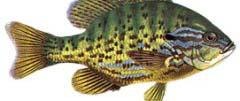
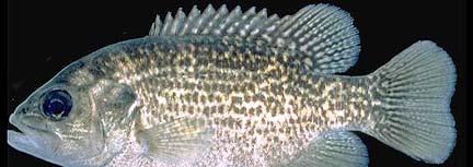
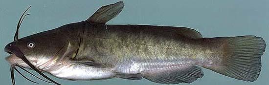
13 Kennebec trap net catch no. of fish catch/net catch total catch per net walleye pike lmbass smbass rockbass sunfish bullhead 5 0
14 2001 Fall Walleye Index Netting age structure from 26 walleye no. fish mean age= age
15 2001 Kennebec FWIN walleye size structure no. fish mean total length - 45 cm fork length (cm)

16 Other Kennebec Walleye Findings Age-at-50% maturity is 3, on average, one year less than other Kingston and southern Ontario Lakes Growth index is 200 mm/yr, on average, 50 mm/yr more than other Kingston and southern Ontario Lakes
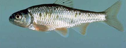
17 Other fish species FWIN findings Mean age Smallmouth Northern bass pike Lake herring (63 fish) (6 fish) (145 fish) Age-4 Age-3 Age-6 Mean total length 27 cm 42 cm 27 cm 10.5 in 16.5 in 10.5 in


18 Kennebec Lake fishing pressure? No historical creel surveys on file 2007 Community Fisheries & Wildlife Involvement Program (CFWIP) grant for boat counts on Kennebec Voluntary creel forms handed out
19 2007 Kennebec CFWIP Boat Counts Participants Many thanks to the following participants: Bernie & Noreen Dertinger Terry Kennedy Doug Smith Greg Morris Jack & Dianne Nicolson John, Calvin & Charlotte Duchene S. Tucker David Praskey Aileen & Gray Merriam Peter & Gloria Smiley Ron Henry Bill Van Vug
20 2007 Kennebec CFWIP Boat Counts Boat counts done at least three times for each strata (season, daytype, period) 28 boat counts between May 12 Sept 3 An average 1 hour count sampled across entire day (6 am to 9 pm), weekdays and weekends, entire lake On average, 3 boats fishing per count (0 to 9 boats) One more boat, on average, in summer One more boat, on average, on weekends
21 Boat counts daily variation May12-June22 combined weekend weekday no o. boats time no. boats combined weekend weekday June 23-Sept time of day
22 2007 Kennebec Fishing Effort May12-Sep3 May12-Jun22 Jun22-Sep angler hours weekend weekday all week
23 What are anglers fishing for? Seven parties completed voluntary creel forms: Total effort of 344 angler hours Fished an average of 2.5 hours per trip Number of interviews ie per stratum: Daytype/period May12-June22 June23-Sept3 WE/AM 3 10 WE/PM WD/AM WD/PM Total days fished
24 What did participant catch and harvest? catch harvest hrs/fish fish no walleye pike smbass lmbass sunfish hours to catch 1 fish
25 How do current walleye numbers compare with what could be produced? Newest science suggests the following lake characteristics are what dictate sustainable walleye yields: Lake size (546 ha) Total dissolved solids (47 mg/l, 1971 data) Mean depth (7.9 m) Maximum depth (27 m) Secchi disc depth (2.3 m, 1971 data) Growing Degree Days >5degC (1890) Predicted sustainable walleye yield is 1.3 kg/ha/yr or 710 kg/yr (estimated t 1000 fish per 0.7 kg/fish) Looks like Kennebec Lake is not yielding what it could
26 Possible reason(s)? Lack of suitable spawning habitat or access to suitable habitat? Access to existing, enhancement opportunities Zebra mussels changing water clarity? Walleye are light-sensitive Are they here yet? Food? Gill nets not capturing many yellow perch Other pan fish present
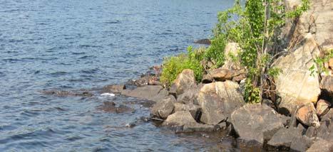
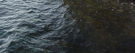
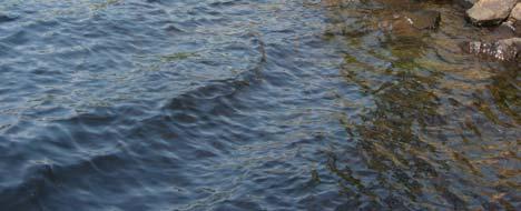
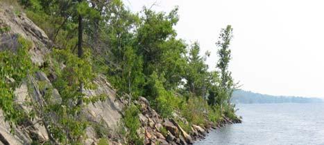
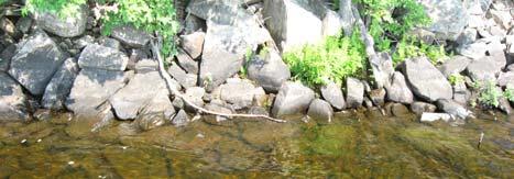
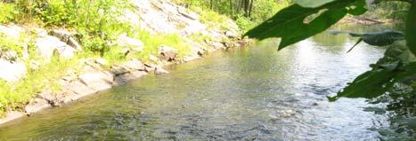
27 2007 Kennebec Lake CFWIP Potential Walleye Spawning Habitat Beaver Creek bridge crossing Historically observed here, beaver dam issues blocking access some years (picture) Crooked Creek and creek at top end of Cox s Lake Excellent spawning areas, beaver dam issues blocking access some years 2 shoreline/island l points with good exposure at east end of lake Rock could be added to enhance these sites 1 walleye observed off small islands at west end of lake Walleye have been observed in narrows to Salmon R.
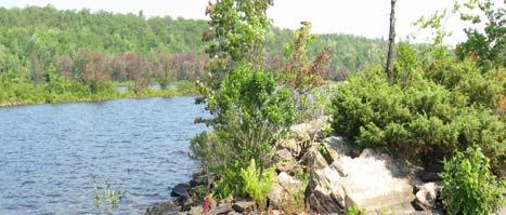
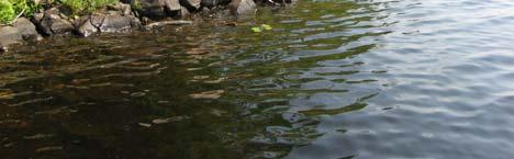
28 Potential Walleye Shoal Assessment continued Section of north shore in western basin (pictures) Have big rock, potential ti to add some Off point of small island adjacent to Salmon R. outlet t (picture) Some rock present, enhancement possible

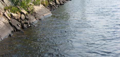
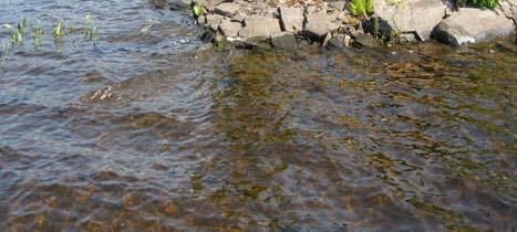
29 Potential Shoal Enhancement Opportunities

30 Potential Shoal Enhancement Opportunities
31 Baitfish harvesting Kennebec Township has three bait fish licences Tend to harvest bait fish from small streams and small lakes Not likely that any harvesting is occurring from Kennebec Lake
32 MNR Southern Region viable reasons for walleye stocking always most efficient to work with resident population 1. Introduction stocking Not currently present in a lake 2. Put-Grow-Take stocking Walleye recruitment is not regular enough to produce a sustainable fishery, stocking artificially replaces recruitment 3. Rehabilitation stocking Have prepared a stocking plan that includes benchmarks, remedial actions to enhance walleye habitat and commitments to monitor successes/failures
33 Things to consider before stocking 1. What happens to stocked fingerlings or adults? Cannibalism, competition i for food, depends d on the lake, no guarantees 2. Are many dumped into one location? Better practise is to stock them at numerous locations throughout the lake 3. How do we address genetics & disease? Egg collection from nearby lakes not in Viral Hemorrhagic Septicemia (VHS) infection zone Implanting on enhanced sites with Kennebec eggs collect eggs from numerous females, milt from numerous males
34 3. What effect does stocking have on resident fish? There will be competition for same food supply but would follow stocking density guidelines ( fingerlings per hectare) stock every 3 rd year 4. Has stocking walleye worked elsewhere in Central or North Frontenac? Anecdotal information that it has in some lakes but not in others (St. Andrew Lakes) Netting last summer indicates it hasn t worked in Fourteen Island Lake
35 5. Can stocking change fishing pressure? YES, likely number one impact for any stocking into a lake with public access
36 Conclusions Some potential for walleye spawning habitat enhancement CFWIP grant Last walleye assessment done in 2001, would be good to update CFWIP grant Updated trap netting will provide updated insight into rest of fish community (bass, northern pike, pan fish) CFWIP Kennebec Lake Association would continue to need help from it s membership for future fisheries work These would all go a long way toward creating a stocking plan if this option is to be considered
Fish Community. Fish Habitat, Streams and Rivers
 Clear, Ston(e)y and White Lake Plan Fish Community The lakes support a cool/warm water fishery including muskellunge, walleye, largemouth and smallmouth bass, yellow perch, pumpkinseed, rockbass, blue
Kawartha Lakes Fisheries. Dan Taillon Peterborough District Mike Rawson Kawartha Lakes Fisheries Assessment Unit
 Kawartha Lakes Fisheries Dan Taillon Peterborough District Mike Rawson Kawartha Lakes Fisheries Assessment Unit Presentation Outline State of the Kawartha Lakes Fishery Index netting data Angler creel
NORTHWEST SCIENCE AND INFORMATION
 Science and Information Branch NORTHWEST SCIENCE AND INFORMATION Aquatics Update 2002-1 Fall Walleye Index Netting (FWIN) and Trap Netting Summary for Niobe Lake, 2000 by T. Cano Introduction Since 1981,
Presented to O.F.A.H. Zone F August 22, 2010 By Ed Giffin, Chair O.F.A.H. Zone F
 O1 Walleye in Ontario Presented to O.F.A.H. Zone F August 22, 2010 By Ed Giffin, Chair O.F.A.H. Zone F Slide 1 O1 Owner, 28/04/2009 Walleye in Southern Ontario 2005 Survey of Recreational Fishing in Ontario
Quemahoning Reservoir
 Pennsylvania Fish & Boat Commission Biologist Report Quemahoning Reservoir Somerset County May 2011 Trap Net, Gill Net and Electrofishing Survey Quemahoning Reservoir is an 899 acre impoundment located
Elk Lake, Antrim and Grand Traverse counties T. 28, 29 N., R. 8, 9 W., Sec. many. Lake surveys. began at 40 feet
 Elk Lake, Antrim and Grand Traverse counties T. 28, 29 N., R. 8, 9 W., Sec. many Physical and chemical data surveyed August 1931 Temperature ( F) Secchi disk (feet) 9. 6 Surface 74 Bottom 45 PH 8.0 Thermocline
Dauphin Lake Fishery. Status of Walleye Stocks and Conservation Measures
 Dauphin Lake Fishery Status of Walleye Stocks and Conservation Measures Date: December, 21 Dauphin Lake Fishery Status of Walleye Stocks and Conservation Measures Background: Walleye stocks in Dauphin
FISH COMMUNITIES AND FISHERIES OF THE THOUSAND ISLANDS AND MIDDLE CORRIDOR
 St. Lawrence River Discussion Paper FISH COMMUNITIES AND FISHERIES OF THE THOUSAND ISLANDS AND MIDDLE CORRIDOR Issues Below is a synopsis of fish community issues and proposed management approaches. More
HUBBARD LAKE Alcona County (T27N, R7E; T28N, R7E) Surveyed May and September Tim A. Cwalinski
 Surveyed May and September Tim A. Cwalinski") Michigan Department of Natural Resources Status of the Fishery Resource Report No. 2003-1, 2003 HUBBARD LAKE Alcona County (T27N, R7E; T28N, R7E) Surveyed May and September 1996 Tim A. Cwalinski Environment
Michigan Department of Natural Resources Status of the Fishery Resource Report No. 2003-1, 2003 HUBBARD LAKE Alcona County (T27N, R7E; T28N, R7E) Surveyed May and September 1996 Tim A. Cwalinski Environment
LAKE DIANE Hillsdale County (T8-9S, R3W, Sections 34, 3, 4) Surveyed May Jeffrey J. Braunscheidel
 Surveyed May Jeffrey J. Braunscheidel") Michigan Department of Natural Resources Status of the Fishery Resource Report No. 2003-4, 2003 LAKE DIANE Hillsdale County (T8-9S, R3W, Sections 34, 3, 4) Surveyed May 2001 Jeffrey J. Braunscheidel Environment
Michigan Department of Natural Resources Status of the Fishery Resource Report No. 2003-4, 2003 LAKE DIANE Hillsdale County (T8-9S, R3W, Sections 34, 3, 4) Surveyed May 2001 Jeffrey J. Braunscheidel Environment
Building a science for landscape fisheries management
 Building a science for landscape fisheries management Nigel Lester Aquatic Research and Monitoring Section Science and Research Branch Ministry of Natural Resources nigel.lester@ontario.ca American Fisheries
SKIATOOK LAKE MANAGEMENT PLAN
 SKIATOOK LAKE MANAGEMENT PLAN Background Skiatook Lake impounds Hominy Creek, 5 miles west of Skiatook in Osage County, Oklahoma (Figure 1). Skiatook Lake covers 10,540 surface acres and was constructed
JadEco, LLC PO BOX 445 Shannon, IL 61078
 Introduction: With the assistance of Lake Holiday staff and volunteers, we were able to conduct an AC electrofishing survey on May 8, 27. Water temperatures were 2.3 C (8.5 F) and water clarity was decent
BIG TWIN LAKE Kalkaska County (T28N, R05W, Section 18, and T28N, R06W, Section 13) Surveyed May 1999
 Surveyed May 1999") Michigan Department of Natural Resources Status of the Fishery Resource Report No. 2001-1, Year 2001 BIG TWIN LAKE Kalkaska County (T28N, R05W, Section 18, and T28N, R06W, Section 13) Surveyed May 1999
Michigan Department of Natural Resources Status of the Fishery Resource Report No. 2001-1, Year 2001 BIG TWIN LAKE Kalkaska County (T28N, R05W, Section 18, and T28N, R06W, Section 13) Surveyed May 1999
NEVADA DEPARTMENT OF WILDLIFE STATEWIDE FISHERIES MANAGEMENT
 NEVADA DEPARTMENT OF WILDLIFE STATEWIDE FISHERIES MANAGEMENT FEDERAL AID JOB PROGRESS REPORTS F-20-52 2016 Lake Tahoe Rainbow Trout Study WESTERN REGION NEVADA DEPARTMENT OF WILDLIFE, FISHERIES DIVISION
2017 Glad Lake Pike Transfer Summary of Activities
 2017 Glad Lake Pike Transfer Summary of Activities Submitted by: Holly Urban, Brock Koutecky & Megan Paterson on behalf of Swan Valley Sport Fishing Enhancement 1 Date: November, 2017 Summary of Activities
Lake information report
 Page 1 of 6 Lake information report Name: Saganaga Nearest Town: Grand Marais Primary County: Cook Survey Date: 08/08/2011 Inventory Number: 16063300 walleye stocking. Purchase a walleye stamp. Your voluntary
Go Home Bay Walleye Re-introduction Project
 Eastern Georgian Bay Stewardship Council www.helpourfisheries.com Go Home Bay Walleye Re-introduction Project Eastern Georgian Bay Stewardship Council July 27, 2010 Walleye summer fingerlings planted in
Alcona Dam Pond Alcona County (T25N, R5E, Sections various) Surveyed June 6-12 and September 16, 2003
 Surveyed June 6-12 and September 16, 2003") Michigan Department of Natural Resources Status of the Fishery Resource Report No. 2004-6, Year 2004 Alcona Dam Pond Alcona County (T25N, R5E, Sections various) Surveyed June 6-12 and September 16, 2003
Michigan Department of Natural Resources Status of the Fishery Resource Report No. 2004-6, Year 2004 Alcona Dam Pond Alcona County (T25N, R5E, Sections various) Surveyed June 6-12 and September 16, 2003
Crooked Lake Oakland County (T4N, R9E, Sections 3, 4, 9) Surveyed May James T. Francis
 Surveyed May James T. Francis") Michigan Department of Natural Resources Status of the Fishery Resource Report No. 2004-1, 2004 Crooked Lake Oakland County (T4N, R9E, Sections 3, 4, 9) Surveyed May 2002 James T. Francis Environment Crooked
Michigan Department of Natural Resources Status of the Fishery Resource Report No. 2004-1, 2004 Crooked Lake Oakland County (T4N, R9E, Sections 3, 4, 9) Surveyed May 2002 James T. Francis Environment Crooked
Pennsylvania Fish & Boat Commission Biologist Report. Wilmore Dam. Cambria County. May 2011 Trap Net, Electrofishing and Hoop Net Survey
 Pennsylvania Fish & Boat Commission Biologist Report Wilmore Dam Cambria County May 2011 Trap Net, Electrofishing and Hoop Net Survey Wilmore Dam is a 195 acre impoundment located in central Cambria County
Invasive Fish in the Cariboo Region. Russell Bobrowski Fisheries Biologist, BC Gov Cariboo Region Dec 19, 2017
 Invasive Fish in the Cariboo Region Russell Bobrowski Fisheries Biologist, BC Gov Cariboo Region Dec 19, 2017 Cariboo - Fishery Combination of productive lake and river fisheries 700 lakes with known game
Keuka Lake State of the Lake 2017
 Keuka Lake State of the Lake 2017 1 2 Lake Characteristics Third largest by area of the Finger Lakes 11,730 ac Deep and steep sided - max 185 ft mean 101 ft Two story fishery (warmwater/coldwater) 178,800
2017 Lake Winnebago Bottom Trawling Assessment Report
 217 Lake Winnebago Bottom Trawling Assessment Report Adam Nickel, Winnebago System Gamefish Biologist, March 218 There were several highlights from the 217 Lake Winnebago bottom trawling survey, including
Current projects for Fisheries Research Unit of Minnesota Department of Natural Resources
 Current projects for Fisheries Research Unit of Minnesota Department of Natural Resources MAJOR RESOURCE ISSUES IN THE DIVISION OF FISHERIES Status of Fish Populations To effectively manage fish populations,
Striped Bass and White Hybrid (x) Striped Bass Management and Fishing in Pennsylvania
 Striped Bass Management and Fishing in Pennsylvania") Striped Bass and White Hybrid (x) Striped Bass Management and Fishing in Pennsylvania Prepared by R. Lorantas, D. Kristine and C. Hobbs PFBC Warmwater Unit 2005 (stocking numbers updated after 2005) Goal:
Striped Bass and White Hybrid (x) Striped Bass Management and Fishing in Pennsylvania Prepared by R. Lorantas, D. Kristine and C. Hobbs PFBC Warmwater Unit 2005 (stocking numbers updated after 2005) Goal:
DOW# West Twin Lake
 DOW# 69-0696 West Twin Lake West Twin Lake has a surface area of 120.4 acres and is located on the east side of St. Louis County Road 31, south of Highway 2. West Twin Lake has a maximum depth of 18 feet
Executive Summary Lake Vermilion Fisheries Management Plan
 Executive Summary Lake Vermilion Fisheries Management Plan 2017-2022 Minnesota Department of Natural Resources Division of Fish and Wildlife Section of Fisheries 500 Lafayette Road St. Paul, MN 55155-4020
Mark A. Tonello and Ralph L. Hay
 Michigan Department of Natural Resources Status of the Fishery Resource Report No. 2003-3, 2003 Fife Lake Grand Traverse County (T25N, R09W, Section 13) Surveyed June 4-8, 2001 Mark A. Tonello and Ralph
Tampier Lake Population Survey
 Located in Palos Park on 131 st St. between Wolf and Will-Cook Rd. s. Tampier Lake has 131 acres of fishable water, with a maximum depth of 9.4 feet. Walleye, northern pike, largemouth bass and channel
Bode Lake - South Population Survey
 Bode Lake - South Survey Located in Hoffman Estates on the north side of Bode Rd. 1 mile west of Barrington Rd. Bode Lake is made up of two lakes along Poplar Creek; the larger and deeper Bode Lake South
A Report on the Collection of Lake Trout Eggs and Milt from Lake of Bays for the Purpose of Rehabilitation Stocking in Mary Lake
 A Report on the Collection of Lake Trout Eggs and Milt from Lake of Bays for the Purpose of Rehabilitation Stocking in Mary Lake Andrew Ivany Fisheries Technician Ontario Ministry of Natural Resources
NEVADA DEPARTMENT OF WILDLIFE STATEWIDE FISHERIES MANAGEMENT
 NEVADA DEPARTMENT OF WILDLIFE STATEWIDE FISHERIES MANAGEMENT FEDERAL AID JOB PROGRESS REPORTS F-20-49 2013 LAKE TAHOE WESTERN REGION NEVADA DEPARTMENT OF WILDLIFE, FISHERIES DIVISION ANNUAL PROGRESS REPORT
SUMMARY REPORT FOR LAKE ST. MALO FISHERIES ASSESSMENT. Prepared for the St. Malo and District Wildlife Association
 SUMMARY REPORT FOR LAKE ST. MALO FISHERIES ASSESSMENT Prepared for the St. Malo and District Wildlife Association Presented by August 25, 2014 Study dates thus far: Date Tasks February 16 Fishing derby;
Wampum Lake Population Survey
 Wampum Lake Survey Located in Thornton on Thornton-Lansing Rd. 1½ mile west of Torrence Ave. Wampum Lake is 35 acres is size and has a maximum depth of 14.1 feet. Northern pike, largemouth bass, bluegill,
NEVADA DEPARTMENT OF WILDLIFE STATEWIDE FISHERIES MANAGEMENT
 NEVADA DEPARTMENT OF WILDLIFE STATEWIDE FISHERIES MANAGEMENT FEDERAL AID JOB PROGRESS REPORTS F-20-48 2012 LAKE TAHOE WESTERN REGION Contents NEVADA DEPARTMENT OF WILDLIFE, FISHERIES DIVISION ANNUAL PROGRESS
Crawford Reservoir. FISH SURVEY AND MANAGEMENT INFORMATION Eric Gardunio, Fish Biologist Montrose Service Center
 FISH SURVEY AND MANAGEMENT INFORMATION General Information: Crawford Reservoir is a popular fishery that provides angling opportunity for yellow perch, channel catfish, northern pike, rainbow trout, black
Michigan Dept. of Natural Resources Status of the Fishery Resource Report Page 1. Weber Lake Cheboygan County, T34N, R3W, Sec.
 Michigan Dept. of Natural Resources 2012-143 Status of the Fishery Resource Report Page 1 Weber Lake Cheboygan County, T34N, R3W, Sec. 31 Neal Godby, Fisheries Biologist Environment Weber Lake is a 28.5-acre
Cedar Lake Comprehensive Survey Report Steve Hogler and Steve Surendonk WDNR-Mishicot
 Cedar Lake- 2006 Comprehensive Survey Report Steve Hogler and Steve Surendonk WDNR-Mishicot ABSTRACT Cedar Lake is a 142 acre lake located in the southwest corner of Manitowoc County. It is a seepage lake
LAKE MANAGEMENT PLAN
 LAKE MANAGEMENT PLAN Region 1 Area Park Rapids D.O.W. Number 29-185 County Hubbard D.O.W. Lake Name Big Sand Lake Class 22 Acreage 1,635 GIS 465 littoral LONG RANGE GOALS: Maintain or improve the quality
Michigan Department of Natural Resources Status of the Fishery Resource Report Page 1
 Michigan Department of Natural Resources 2007-33 Status of the Fishery Resource Report Page 1 Grand Sable Lake Alger County, T49N, R14W, Sec. Many Lake Superior watershed, last year surveyed 2004 James
2010 Fishing Opener Prognosis. Central Region
 2010 Fishing Opener Prognosis Central Region Hinckley PINE COUNTY Pokegama, Cross, Island, Oak and North and South Big Pine Lakes are typically the best lakes for targeting walleye in Pine County. They
December 18, Dear Sir/Madam,
 December 18, 2000 Dear Sir/Madam, We are writing to bring you up-to-date on our efforts to develop fish community objectives for the St. Lawrence River. First of all, we want to thank you for participating
Lake information report
 Lake information report: Minnesota DNR Page of 5 Lake information report jf Prinlable senior Name: Spring Nearest Town: Spring Lake (Scott) Primary County: Scott Survey Date: 08/02/200 Inventory Number:
Lake Wanapitei Fall Walleye Index Netting, 2004
 Lake Wanapitei Fall Walleye Index Netting, 2004 Kimberley Carmichael, Fisheries Biologist August 2005 755 Wallace Road, Unit 5 North Bay, ON P1B 8G4 Phone: (705) 472-7888 Fax: (705) 472-6333 email: aofrc@aofrc.org
Inventory # Perch Lake
 Inventory # 9-036 Perch Lake Perch Lake is a double-basin lake. The southern, shallow portion of the lake is 414 acres, making it the largest wild rice lake on the Reservation. The fish communities sampled
NEVADA DEPARTMENT OF WILDLIFE STATEWIDE FISHERIES MANAGEMENT
 NEVADA DEPARTMENT OF WILDLIFE STATEWIDE FISHERIES MANAGEMENT FEDERAL AID JOB PROGRESS REPORTS F-20-52 2016 LAKE TAHOE WESTERN REGION NEVADA DEPARTMENT OF WILDLIFE, FISHERIES DIVISION ANNUAL PROGRESS REPORT
In each summer issue of Lake
 The 2000 Lake Erie Walleye Report by Rick Kubb In each summer issue of Lake Erie Walleye Magazine, we provide a synopsis of the walleye fishery in Lake Erie based on the scientific reports produced by
Maple Lake Population Survey
 Maple Lake Survey Located in Willow Springs approximately 1 mile west of Willow Springs Rd. (104 th Ave.) at Wolf Rd. and 95 th St. Constructed in the 1920 s this 60 acre lake drops down to 20.4 feet in
Rolling Knolls Pond Population Survey
 Located near the town of Elgin on the west side of Rohrssen Rd. between Illinois Route 58 and U.S.- 20. This small 1.8 acre pond has a maximum depth of 7.5 feet and is occasionally influenced by Poplar
Comprehensive Fisheries Evaluation of Patten Lake, Florence County, Wisconsin 2011
 Comprehensive Fisheries Evaluation of Patten Lake, Florence County, Wisconsin 211 Water body Identification Code 6537 Gregory Matzke Fisheries Biologist Wisconsin Department of Natural Resources Florence
Lake St. Clair Fish Community and Fishery
 Lake St. Clair Fish Community and Fishery Megan Belore Ontario Ministry of Natural Resources and Forestry Mike Thomas Michigan Department of Natural Resources Fish Community Fish Community Mixture of warm
MIDDLE FORK RESERVOIR Wayne County 2004 Fish Management Report. Christopher C. Long Assistant Fisheries Biologist
 MIDDLE FORK RESERVOIR Wayne County 2004 Fish Management Report Christopher C. Long Assistant Fisheries Biologist FISHERIES SECTION INDIANA DEPARTMENT OF NATURAL RESOURCES DIVISION OF FISH AND WILDLIFE
2011 Status of Major Stocks. Lake Erie Management Unit March 2012
 211 Status of Major Stocks Lake Erie Management Unit March 212 The Lake Erie Management Unit of the Ontario Ministry of Natural Resources is responsible for managing the fishery resources of the Ontario
Agenda and minutes. Minnesota 1837 Ceded Territory Fisheries Committee January 17, 2018, 10:00 a.m. WebEx
 Agenda and minutes Minnesota 1837 Ceded Territory Fisheries Committee January 17, 2018, 10:00 a.m. WebEx 1. Introductions 2. Review and approve agenda (Action) Agenda was approved 3. Distribute past meeting
Fall Walleye Index Netting at Battle Lake, Alberta, 2012
 Fall Walleye Index Netting at Battle Lake, Fisheries Management Red Deer Area February 28, 213 Fall Walleye Index Netting at Battle Lake, Fisheries Biologist(s): Jason Cooper, Kelly Dick Fisheries Management,
Caro Impoundment, Tuscola County
 Caro Impoundment is a 200 acre impoundment of the Cass River located one mile south of the Village of Caro in Tuscola County. Caro Dam, originally constructed in 1906 for water supply to Michigan Sugar
6TH PELLETIER BROOK LAKE T15 R9, Aroostook Co. U.S.G.S. Gardner Pond, Maine (7 1/2 )
") 6TH PELLETIER BROOK LAKE T15 R9, Aroostook Co. U.S.G.S. Gardner Pond, Maine (7 1/2 ) Fishes Brook trout Minnows Blacknose dace Pearl dace Physical Characteristics Area - 27 acres Average depth - 2 feet
6TH PELLETIER BROOK LAKE T15 R9, Aroostook Co. U.S.G.S. Gardner Pond, Maine (7 1/2 ) Fishes Brook trout Minnows Blacknose dace Pearl dace Physical Characteristics Area - 27 acres Average depth - 2 feet
Fisheries Management Zone 10:
 Fisheries Management Zone 10: Lake Trout Operational Objectives and Management Photo Credit: www.jamessmedleyoutdoors.com 2 FMZ 10: Lake Trout Operational Objectives and Management Lake trout are the second
A SURVEY OF THE PRETTY LAKE FISH COMMUNITY, LARGEMOUTH BASS AND WALLEYE POPULATIONS AND FISH HARVEST LaGrange County 2010
 A SURVEY OF THE PRETTY LAKE FISH COMMUNITY, LARGEMOUTH BASS AND WALLEYE POPULATIONS AND FISH HARVEST LaGrange County 2010 Larry A. Koza Assistant Fisheries Biologist Fisheries Section Indiana Department
Busse Reservoir South Lateral Pool Population Survey
 Busse Reservoir South Lateral Pool Survey Located in Elk Grove Village south of Higgins Rd. between RT 53/I-290 and Arlington Heights Rd. Busse Reservoir is comprised of three pools making up a total of
Future of Lake Whitefish and Lake Trout Populations in The Great Lakes
 Future of Lake Whitefish and Lake Trout Populations in The Great Lakes Mark P. Ebener Inter-Tribal Fisheries and Assessment Program Chippewa Ottawa Resource Authority Lake Trout (Salvelinus namaycush)
Highlights of the Annual Lake Committee Meetings Great Lakes Fishery Commission proceedings held in Ypsilanti, MI
 Inland Seas Angler GREAT LAKES BASIN REPORT Special Report Lake Ontario A Publication of the Great Lakes Sport Fishing Council May 2009 http://www.great-lakes.org Vol. 20, No. 7 Highlights of the Annual
LAKE OF THE WOODS and RAINY RIVER INFORMATION December 1, 2017 April 23, Minnesota Waters Fishing Regulation Summary
 LAKE OF THE WOODS and RAINY RIVER INFORMATION December 1, 2017 April 23, 2018 Lake of the Woods is a border water, shared with the Canadian provinces of Manitoba and Ontario. The Minnesota portion of Lake
WISCONSIN DEPARTMENT OF NATURAL RESOURCES FISH MANAGEMENT ACTIVITIES DELAVAN LAKE SPRING 2012
 WISCONSIN DEPARTMENT OF NATURAL RESOURCES FISH MANAGEMENT ACTIVITIES DELAVAN LAKE SPRING 212 Electrofishing and fyke net surveys were conducted on Delavan Lake March 2-May 3, 212. Fyke netting and electrofishing
NEVADA DEPARTMENT OF WILDLIFE STATEWIDE FISHERIES MANAGEMENT
 NEVADA DEPARTMENT OF WILDLIFE STATEWIDE FISHERIES MANAGEMENT FEDERAL AID JOB PROGRESS REPORTS F-2-52 216 CHIMNEY RESERVOIR WESTERN REGION NEVADA DEPARTMENT OF WILDLIFE, FISHERIES DIVISION JOB PROGRESS
Columbia Lake Dam Removal Project
 Columbia Lake Dam Removal Project The Columbia Lake dam located 1/4 mile upstream of the Paulins Kill River's confluence with the Delaware River in Knowlton Township, Warren County has been proposed for
Current Status and Management Recommendations for the Fishery in the Cloverleaf Chain of Lakes
 Current Status and Management Recommendations for the Fishery in the Cloverleaf Chain of Lakes Jason Breeggemann Senior Fisheries Biologist Wisconsin Department of Natural Resources Outline DNR fisheries
Peace River Water Use Plan. Monitoring Program Terms of Reference. GMSMON-1 Peace River Creel Survey
 Peace River Water Use Plan Monitoring Program Terms of Reference GMSMON-1 Peace River Creel Survey April 10, 2008 Terms of Reference for the Peace River Water Use Plan Monitoring Program: Peace River Creel
Alberta Conservation Association 2011/12 Project Summary Report. Project Name: Walleye Stock Assessment Program 2011/12 Moose and Fawcett Lakes
 Alberta Conservation Association 2011/12 Project Summary Report Project Name: Walleye Stock Assessment Program 2011/12 Moose and Fawcett Lakes Fisheries Program Manager: Peter Aku Project Leader: Clayton
DRIPPING SPRINGS LAKE 5 YEAR LAKE MANAGEMENT PLAN
 DRIPPING SPRINGS LAKE 5 YEAR LAKE MANAGEMENT PLAN FISHERIES DIVISION CENTRAL REGION OKLAHOMA DEPTMENT OF WILDLIFE CONSERVATION PREPARED BY: DANNY BOWEN OCTOBER 2013 1 Background Dripping Springs Lake impounds
LAKE SURVEY REPORT DRAFT VERSION PRELIMINARY DATA (AS OF 08/24/2018) Fisheries Management. DOW Number: Survey ID Date: 08/21/2018
 Fisheries Management. DOW Number: Survey ID Date: 08/21/2018") Fisheries Management DRAFT VERSION PRELIMINARY DATA (AS OF 8//8) Lake Name: Sisseton Survey Type: Standard Survey DOW Number: 6-- Survey ID Date: 8//8 Lake Identification Alternate Lake Name: Primary Lake
Fisheries Management DRAFT VERSION PRELIMINARY DATA (AS OF 8//8) Lake Name: Sisseton Survey Type: Standard Survey DOW Number: 6-- Survey ID Date: 8//8 Lake Identification Alternate Lake Name: Primary Lake
Application of a New Method for Monitoring Lake Trout Abundance in Yukon: Summer Profundal Index Netting (SPIN)
") Application of a New Method for Monitoring Lake Trout Abundance in Yukon: Summer Profundal Index Netting (SPIN) Prepared by: Lars Jessup Nathan Millar November 2011 Application of a New Method for Monitoring
Application of a New Method for Monitoring Lake Trout Abundance in Yukon: Summer Profundal Index Netting (SPIN) Prepared by: Lars Jessup Nathan Millar November 2011 Application of a New Method for Monitoring
Summary of 2012 DNR and Partners Fisheries Surveys in St. Clair/Lake Erie and Fishery Forecast for 2013
 Summary of 2012 DNR and Partners Fisheries Surveys in St. Clair/Lake Erie and Fishery Forecast for 2013 LE/LSC Citizens Fishery Advisory Committee April 2, 2013 Michael Thomas Fisheries Research Biologist
MARTINDALE POND Wayne County 2004 Fish Management Report. Christopher C. Long Assistant Fisheries Biologist
 MARTINDALE POND Wayne County 2004 Fish Management Report Christopher C. Long Assistant Fisheries Biologist Fisheries Section Indiana Department of Natural Resources Division of Fish and Wildlife I.G.C.
Arrowhead Lake Population Survey
 Located in Palos Heights at 135 th St, east of Harlem Ave. Arrowhead Lake is a 13 acre body of water with a maximum depth of 12.6 feet. Fish species found in this lake include largemouth bass, bluegill,
CARL BLACKWELL LAKE MANAGEMENT PLAN
 CARL BLACKWELL LAKE MANAGEMENT PLAN Background Lake Carl Blackwell impounds Stillwater Creek, 10 miles west of Stillwater in Payne County, Oklahoma (Figure 1). The lake covers 3,370 surface acres and was
East Metro Forest Lake (2,251 acres): Coon Lake (1,481 acres):
: Coon Lake (1,481 acres):") East Metro Forest Lake (2,251 acres): Located within the City of Forest Lake and just east of Interstate 35, Forest Lake boasts good numbers of northern pike and walleye. Northern pike and walleye were
East Metro Forest Lake (2,251 acres): Located within the City of Forest Lake and just east of Interstate 35, Forest Lake boasts good numbers of northern pike and walleye. Northern pike and walleye were
Green Lake Population Survey
 Located next to the Green Lake Aquatic Center in Calumet City on the north side of 159 th St, east of Torrence Ave. Size can be deceiving; this 5 acre lake is the deepest lake in the District with a maximum
MINISTRY OF ENVIRONMENT ENVIRONMENTAL STEWARDSHIP DIVISION FISH AND WILDLIFE BRANCH. Horsefly River Angling Management Plan
 MINISTRY OF ENVIRONMENT ENVIRONMENTAL STEWARDSHIP DIVISION FISH AND WILDLIFE BRANCH Horsefly River Angling Management Plan January 30 th, 2006 Area/Fishery Description The Horsefly River watershed provides
FISHERY MANAGEMENT. Table of Contents
 FISHERY MANAGEMENT Table of Contents Lake Trout (Cold Water) Fishery Warm & Cool Water Fishery Broad-scale Monitoring Appendix Eagle Lake Property Owners`Association 2 Fish & Fishery Table 1. Weight class
An annual fisheries newsletter from Grand Rapids Fisheries: Spring 2018
 Fisheries Update Contact us Minnesota Dept. of Natural Resources Grand Rapids Area Fisheries Office 1201 East Hwy 2 Grand Rapids, MN 55744 Phone (218) 328-8836 grandrapids.fisheries @state.mn.us Did you
Comprehensive Fisheries Survey of High Falls Reservoir, Marinette County Wisconsin during 2004 and Waterbody Identification Code
 Comprehensive Fisheries of High Falls Reservoir, Marinette County Wisconsin during 2004 and 2005 Waterbody Identification Code 540600 Justine Hasz Senior Fisheries Biologist Wisconsin Department of Natural
Fall Walleye Index Netting at Jackson Lake, Alberta, 2010
 , 2010 Fisheries Management Lac La Biche Senior Fisheries Biologist(s): Dwayne Latty, Cold Lake Data Summary and Report by: Eric Hegerat, Fisheries Technician, Lac La Biche; Rebecca Skarsen, Fisheries
Assessment of Elizabeth Lake as a Potential Candidate for Stocking
 Assessment of Elizabeth Lake as a Potential Candidate for Stocking Region 1, Nanaimo West Coast Planning Unit Ministry of Water, Land and Air Protection Prepared by: Laura Cassin Scott Silvestri 2002 1.0
EXECUTIVE SUMMARY FISH COMMUNITY AND HABITAT EXISTING CONDITIONS REPORT
 EXECUTIVE SUMMARY FISH COMMUNITY AND HABITAT EXISTING CONDITIONS REPORT First Mining Gold (First Mining) has completed a comprehensive Fish Community and Habitat Existing Conditions Report which has utilized
Highlights of Native Fish Rehabilitation Activities in the Great Lakes. Presented By: Arunas Liskauskas, Ontario Ministry of Natural Resources
 Highlights of Native Fish Rehabilitation Activities in the Great Lakes Presented By: Arunas Liskauskas, Ontario Ministry of Natural Resources In this presentation Focus on activities from 2002 to 2007
Executive Summary Chubb Lake 2004
 Executive Chubb Lake 2004 A stocking assessment was conducted at Chubb Lake on September 29, 2004. The objective of this assessment was to document the status of the fishery. Chubb Lake is a 67.3 ha lake
Minnesota Department of Natural Resources
 Minnesota Department of Natural Resources Fisheries Management DRAFT VERSION - PRELIMINARY DATA (AS OF 7/7/) Lake Name: Bloody Survey Type: Standard Survey DOW Number: -4- Survey ID Date: 7// Lake Identification
Fisheries Management Plan for Fisheries Management Zone 17: November Ontario Ministry of Natural Resources Peterborough District
 Fisheries Management Plan for Fisheries Management Zone 17: November 2009 Ontario Ministry of Natural Resources Peterborough District Fisheries Management Plan for Fisheries Management Zone 17 November
Fall Walleye Index Netting at Sylvan Lake, Alberta, 2012
 Fall Walleye Index Netting at Sylvan Lake, Fisheries Management Red Deer Area February 28, 213 Fall Walleye Index Netting at Sylvan Lake, Fisheries Biologist(s): Jason Cooper, Kelly Dick Fisheries Management,
NEVADA DEPARTMENT OF WILDLIFE STATEWIDE FISHERIES MANAGEMENT
 NEVADA DEPARTMENT OF WILDLIFE STATEWIDE FISHERIES MANAGEMENT FEDERAL AID JOB PROGRESS REPORTS F-20-49 2013 SQUAW CREEK RESERVOIR WESTERN REGION Contents NEVADA DEPARTMENT OF WILDLIFE, FISHERIES DIVISION
Fall Walleye Index Netting at Blackett Lake, Alberta, 2010
 , 2010 Fisheries Management Lac La Biche Senior Fisheries Biologist(s): Dwayne Latty, Cold Lake Data Summary and Report by: Eric Hegerat, Fisheries Technician, Lac La Biche; Rebecca Skarsen, Fisheries
Fisheries Survey of White Rapids Flowage, Marinette County Wisconsin during Waterbody Identification Code
 Fisheries Survey of White Rapids Flowage, Marinette County Wisconsin during 25 Waterbody Identification Code 6343 Michael Donofrio Fisheries Supervisor Wisconsin Department of Natural Resources Peshtigo,
Fall Walleye Index Netting on the North Arm of Rainy Lake, Ontario, 2007
 Fall Walleye Index Netting on the North Arm of Rainy Lake, Ontario, 2007 Darryl McLeod and Alyson Rob Ontario Ministry of Natural Resources Fort Frances, Ontario April, 2009 Fort Frances District Report
Bell Lake & North Steeprock Lake Trap Netting. FEF Project
 Bell Lake & North Steeprock Lake Trap Netting FEF Project 12-024 Swan Valley Sport Fishing Enhancement Inc. Submitted by: Holly Urban & Brock Koutecky November 2013 Summary The purpose of conducting trap
I Region I Area I DOW Number / County I DOW Lake Name I Acreage I
 LAKE MANAGEMENT PLAN 814 Bp I Region I Area I DOW Number / County I DOW Lake Name I Acreage I I I # I f 2 Duluth F213 690036 St Louis Salo DOW:149 Plan: 137 Long Range Goal: Manage for walleye with a gillnet
Chemical and Biological Recovery from Acidic Deposition in the Honnedaga Lake Watershed
 Chemical and Biological Recovery from Acidic Deposition in the Honnedaga Lake Watershed Abstract Honnedaga Lake supports one of seven remaining heritage strains of brook trout designated by the State of
Walleye (Sander vitreus) reintroduction update: Walleye stocking, gill netting 2008
 reintroduction update: Walleye stocking, gill netting 2008") Walleye (Sander vitreus) reintroduction update: Walleye stocking, gill netting 28 Mark D. Cornwell 1 and Norman D. McBride 2 INTRODUCTION In 2 a multi-year stocking program was initiated to re-introduce
Walleye (Sander vitreus) reintroduction update: Walleye stocking, gill netting 28 Mark D. Cornwell 1 and Norman D. McBride 2 INTRODUCTION In 2 a multi-year stocking program was initiated to re-introduce
Sag Quarry - West Population Survey
 Located in Lemont on RT 83 and Archer Ave. just north of 111 th St. Like Sag Quarry East, this lake is an old limestone quarry, 14 acres in size and with a maximum depth of 10.3 feet. The species found