California South Coast
|
|
|
- Brett Young
- 6 years ago
- Views:
Transcription


1 State of the California South Coast Summary of Findings from Baseline Monitoring of Marine Protected Areas,

2 About This Report This report provides a summary of ecological and socioeconomic conditions in the South Coast near the time of marine protected area (MPA) implementation in It provides key findings from South Coast MPA baseline monitoring projects, which occurred from 2011 to Each project included two to three years of data collection. This report also includes ecological, biological, oceanographic, and socioeconomic information and findings from key partners. We acknowledge and are deeply appreciative of the work and input from our many partners and collaborators in the region. We thank everyone for their expertise, dedication, and generous time given to this project. Learn More Throughout the report, you will find Learn More boxes that contain links to additional resources with numbered references within each section. Also, check the back cover for a full list of common and scientific names of species mentioned in this report. California Ocean Science Trust (OST), California Department of Fish and Wildlife (CDFW), California Ocean Protection Council (OPC), and California Sea Grant coordinated and collaborated in the implementation of South Coast MPA baseline monitoring, which was funded by OPC. This report was produced by OST working in partnership and collaboration with CDFW and OPC. This report will be provided to the California Fish and Game Commission and relevant state agencies and entities, including the MPA Statewide Leadership Team, to help inform the MPA Management Program. It will also be presented to the broader South Coast ocean community through a series of community gatherings and other meetings. Convening Editors Benét Duncan, Sarah Finstad, Dina Liebowitz, Erin Meyer (OST) Amanda Van Diggelen, Stephen Wertz, Adam Frimodig, Becky Ota (CDFW) Cyndi Dawson (OPC) Report Designed by Clare McParland Support for this Report Provided by California Ocean Science Trust California Department of Fish and Wildlife California Ocean Protection Council Resources Legacy Fund Citation State of the California South Coast: Summary of Findings from Baseline Monitoring of Marine Protected Areas, California Ocean Science Trust, California Department of Fish and Wildlife, and California Ocean Protection Council, California, USA. March OceanSpaces: The online community tracking California s ocean health Everything in this report can be explored in more depth on OceanSpaces.org. Dive into the State of the California South Coast page on OceanSpaces.org for the full portfolio of scientific reports and analyses from MPA monitoring in the region. OceanSpaces houses hundreds of data packages, projects, and synthesis products a collective body of scientific knowledge to make science-informed decisions for our coast and ocean. Connect to a wealth of resources available on OceanSpaces, and join the online community to engage with the science and track the health of California s ocean.

3 Table of Contents Highlights and Key Findings...1 Setting the Scene Traditional & Cultural Connections California s MPA Network MPA Management in the South Coast....9 Timeline of Selected Regulations Introduction to MPA Monitoring...15 Understanding the South Coast Setting South Coast Baseline Monitoring...17 Physical Ocean Conditions Establishing a Benchmark Key Highlights from Baseline Monitoring Human activities in the South Coast Sandy Beach Ecosystems Creature Feature: Coastal & Island Breeding Seabirds Rocky Intertidal Ecosystems Creature Feature: California Spiny Lobster Kelp Forest & Shallow Rocky Reef Ecosystems...36 Location Feature: The Channel Islands Mid Depth and Deep Ecosystems...43 Connections Among Ecosystems in the South Coast Patterns of Biodiversity Broadening Participation & Sources of Knowledge Exploring Changes...53` Informing Ocean Management Decisions Filling in the Gaps...57 Changing Ocean Conditions...57 Linking Natural Resource & Water Quality Management Helping Decision-Makers Understand Unexpected Events Leveraging Existing Capacity Appendix Collaborators Species Names: Common & Scientific Photo: Colleen Wisniewski
 to protect the state s marine life, habitats, and ecosystems.")
4 Highlights and Key Findings Photo: Jim Kirklin Network of MPAs With the passage of the Marine Life Protection Act in 1999, California became the first state in the nation to require a statewide network of marine protected areas (MPAs) to protect the state s marine life, habitats, and ecosystems. In 2012, 50 MPAs and two special closures were implemented in the South Coast, including new MPAs and pre-existing MPAs at the Channel Islands and mainland, some of which had their boundaries or take regulations modified. Scientists, fishermen, coastal California Native American tribes, industry representatives, non-governmental organizations (NGOs), managers, and others participated in a unique, collaborative, and science based public planning process to design and implement these MPAs. This extensive effort set the stage for an informed community of participants and stewards interested in engaging in the implementation, scientific monitoring, and adaptive management of the region s MPAs. Invaluable Benchmark of Conditions Long-term scientific monitoring is essential to evaluate the effects of MPAs and inform ocean management. California s MPA Monitoring Program takes a two-phase approach: regional baseline monitoring (Phase 1) and statewide long-term monitoring (Phase 2). The goal of baseline monitoring is to establish a benchmark of ecological and socioeconomic conditions inside and outside MPAs around the time of MPA implementation, against which future changes can be measured. The scientific data gathered and analyses conducted during South Coast MPA baseline monitoring add up to a detailed picture of ocean conditions in the region. This scientific benchmark provides a foundation for rigorous science-informed decisions for our coast and ocean, including MPA, fisheries, and water quality management and climate change adaptation. Broadened Sources of Knowledge California recognizes that implementing, monitoring, and managing California s MPA network requires coordination and collaboration. This is certainly the case for MPA monitoring in a region as large and diverse as the South Coast. The work summarized in this report represents partnerships among more than 40 academic institutions, state and federal agencies, coastal California Native American tribes, non-profit organizations, fishing groups, and citizen science groups. Science to Support Management Tracking Changing Ocean Conditions Monitoring can inform ocean management beyond adaptive management of MPAs. For example, the Southern California Coastal Water Research Project s (SCCWRP) Bight 13 Regional Monitoring Program represented an important collaboration between MPA and water quality monitoring efforts. Continued collaboration with water quality and climate change managers will be key to identifying opportunities to leverage resources, capacity, and expertise. Understanding & Responding to Unexpected Events Rocky intertidal baseline monitoring researchers expanded their sampling to include new locations after observing diseased sea stars in early By May, sea star populations at many sites across the United States West Coast were at or near zero. Continued data collection has shown recruitment of juvenile sea stars in the South Coast, a hopeful sign that populations could recover. In 2015, over 100,000 gallons of crude oil was released from a ruptured pipeline near Refugio State Beach in Santa Barbara County. Baseline data provided information about conditions at and near Refugio State Beach before the spill and are being used to help assess the impacts that occurred to marine ecosystems in the area. Continued monitoring will be key to tracking the recovery of coastal and ocean habitats in the area. 1 HIGHLIGHTS AND KEY FINDINGS

5 A Comprehensive View of the South Coast Discovering the Unknown Through baseline monitoring, researchers were able to: Explore and characterize new locations in rarely-monitored South Coast deep, canyon, and sandy beach ecosystems. Improve our understanding of ecologically and economically important species like the California spiny lobster, and protected species like the endangered California Least Tern. Revealing Unique & Diverse Communities The South Coast is distinguished by abundant and varied marine life, with community structure driven by a strong water temperature gradient. Researchers identified and characterized the following distinct communities, each with a particular composition of species: 17 kelp and shallow rock communities 9 rocky intertidal mobile invertebrate communities 14 rocky intertidal sessile invertebrate communities Connected Ecosystems Baseline research illuminated the many ways that coastal and marine ecosystems in the South Coast are connected: Kelp, other algae, and seagrass wash onto sandy beaches, forming wrack that supports abundant and diverse populations of macroinvertebrates and shorebirds. Estuarine and pelagic seabirds rely on different ecosystems including estuaries, beaches, kelp forests, and nearshore pelagic for activities such as breeding, feeding, and roosting. Older MPAs Show Positive Trends Consistent with other regions, marine communities are responding to older MPAs: Biomass of targeted fish species has increased in kelp and shallow rock ecosystems inside and outside of the northern Channel Islands MPAs (established in 2003). Biodiversity in rocky intertidal ecosystems is significantly higher in old MPAs (established before 2012) than outside, while new MPAs show intermediate and highly variable biodiversity. Looking Forward Leveraging Existing Capacity As the state transitions from baseline to long-term monitoring, the South Coast Monitoring Survey provides a detailed picture of the current monitoring capacity in the region. Results from the survey identified the geographic and temporal coverage of monitoring activities inside and outside of South Coast MPAs, and the alignment of those activities with the State's MPA monitoring priorities. Results of the South Coast Monitoring Survey are publicly available in the interactive California Coastal Monitoring Dashboard. Learn More Learn more about South Coast MPA baseline monitoring, access data, and explore the California Coastal Monitoring Dashboard at oceanspaces.org/scsotr. 2

6 Photo: istock/sean Pavone 3 SETTING THE SCENE

7 Setting the Scene Stretching from the remote and windswept Point Conception and northern Channel Islands to the urban shorelines of Santa Monica and San Diego, California's South Coast is a region distinguished by its abundance and variety, both above and below the water. With its mild weather and easy to access coastline, the South Coast is an ideal location for ocean-related recreation, commerce, and research. The South Coast region encompasses 2,351 square miles of state waters, which extend from the mean high tide line to three nautical miles (nm) offshore from the mainland coast and the Channel Islands coast, bounded by Point Conception in the north and the California Mexico border in the south. Located at the confluence of two major current systems, South Coast marine and coastal ecosystems are characterized by extremely variable oceanographic conditions and a strong and persistent gradient in water temperature. Commercial fishing in the region primarily focuses on invertebrates such as California spiny lobster, market squid, and red sea urchin, while recreational fishing targets primarily finfish. The region supports over $40 billion in ocean-dependent tourism and over 800,000 jobs, dozens of academic and research institutions, offshore oil extraction, multiple military installations, and one of the busiest ports in the world. 4
8 The Chumash community s annual crossing from the South Coast mainland to Santa Cruz Island (Limuw), the Chumash sacred place of creation. Paddlers pray with each pull of the water in the traditional tomol (redwood sewn-plank canoe). Photo: Robert Schwemmer. Traditional & Cultural Connections Since time immemorial, First Nations Peoples have lived in intimate relationship with California s South Coast. Core cultural values, sustainable reciprocity, and observance of natural laws inform all aspects of Coastal California Native tradition. The rich bounty provided by relationships with marine and coastal habitats supported the highest population density in Indigenous North America allowing the establishment of large, affluent, permanent villages with complex religio-sociopolitical systems, extensive trade networks, and sophisticated resource management regimes. Marine resources were, and continue to be, the foundation for traditional foods, medicines, ceremony, music, regalia, social ties, and trade economy. Geographic resources are also integral to Indigenous heritage and cosmology including: traditional places of ceremony; centers of origin; the gateway to the afterlife; and ancestral villages and burial complexes (both coastal and submerged). Countless sacred sites exist throughout the South Coast, including the Channel Islands. These places continue to be honored by Coastal California Native Nations who work for their protection/preservation, and are central to traditions such as the Tongva and Chumash traditional redwood plank canoe journeys back to the ancestral islands of Pimu (Santa Catalina Island) and Limuw (Santa Cruz Island). Despite historic intergenerational trauma, colonization, and legal disenfranchisement from land and water resources, California Native Nations maintain their traditional knowledge and reciprocal relationships with coastal and marine resources. Although California s complex history has resulted in lack of federal recognition for the majority of Coastal Native Nations, through partnerships with other First Nations, environmental organizations, academic institutions, and government agencies, Indigenous Californians actively protect ancestral village locations/sacred sites, preserve rights to continue traditional lifeways, restore coastal and marine habitats, and advocate for sustainable practices throughout the region. The editors extend their gratitude to individuals, members, and/or leadership from the following Coastal Native Nations and organizations for working in collaboration with California Ocean Science Trust (OST) to develop the language in this section that highlights traditional and cultural connections to marine resources: Wishtoyo Chumash Foundation, Chumash Maritime Association, Coastal Band of the Chumash Nation, Ti at Society Juaneño Band of Mission Indians Acjachemen Nation, and the United Coalition to Protect Panhe. 5 SETTING THE SCENE
9 California s MPA Network Taking a network-based approach to MPAs is relatively new in marine resource management. While individual MPAs function to protect organisms and ecosystems within a specific area, a network of MPAs can function to sustain marine life at multiple scales that cross ecosystem boundaries and span long distances. An MPA network includes individual MPAs of different sizes and degrees of protection, and is intended to complement fisheries management to maintain and improve ocean health. EMBARGOED until March 13, 2017 North Coast The California Marine Life Protection Act (MLPA, Chapter 10.5 of the California Fish & Game Code, ) was passed by the California legislature in 1999 and directed the state to reevaluate and redesign California s system of MPAs. Through the MPA network design and siting process, California implemented a science-based and stakeholderdriven, collaborative, multi-year public process to plan the new network of MPAs iteratively across four coastal regions. In September 2007, the Central Coast became the first region to implement a redesigned network of MPAs, followed by the North Central Coast in May 2010, the South Coast in January 2012, and the North Coast in December 2012, completing the statewide network. North Central Coast Central Coast South Coast The MLPA identifies six goals for the state s MPA network: 1. To protect the natural diversity and abundance of marine life, and the structure, function and integrity of marine ecosystems. 2. To help sustain, conserve and protect marine life populations, including those of economic value, and rebuild those that are depleted. 3. To improve recreational, educational, and study opportunities provided by marine ecosystems that are subject to minimal human disturbance, and to manage these uses in a manner consistent with protecting biodiversity. 4. To protect marine natural heritage, including protection of representative and unique marine life habitats in California waters for their intrinsic value. 5. To ensure that California s MPAs have clearly defined objectives, effective management measures, and adequate enforcement, and are based on sound scientific guidelines. 6. To ensure that the state s MPAs are designed and managed, to the extent possible, as a network. To help achieve these goals, the MLPA also required California Department of Fish and Wildlife (CDFW) to develop, and the Fish and Game Commission (FGC) to adopt, a master plan to guide the design, implementation, and management of the network. A draft Master Plan (2008 Master Plan) was adopted by the FGC in 2008 and guided the process for designing and siting MPAs through a regional approach. In August 2016, the FGC adopted the final Master Plan (2016 Master Plan) that sets a statewide foundation for the MPA Management Program to meet the goals of the MLPA. 1 6
10 EMBARGOED until March 13, 2017 Point Conception Santa Barbara Ventura Oxnard Santa Cruz Island Anacapa Island Santa Rosa Island San Miguel Island Santa Barbara Island Begg Rock San Nicolas Island Number South Coast Protected Area Classifications Area (miles²) Percent of South Coast State Waters State Marine Reserve (SMR) % Area of Special Biological Significance (ASBS) State Marine Conservation Area (SMCA) % Federal Marine Reserve (FMR) State Marine Conservation Area (no-take) % Federal Marine Conservation Area (FMCA) Special Closure % National Marine Sanctuary % National Park Total for South Coast Region* *Numbers for area and percentages are rounded values and totals do not include special closures. 7 Other Classifications in the South Coast S E T T I N G T H E S C E N E California State Waters
11 EMBARGOED until March 13, 2017 The South Coast extends from Point Conception in Santa Barbara County to the California Mexico border, and includes state waters around the Channel Islands. State waters extend from mean high tide to three nm from shore. The region s 50 MPAs cover 921 km² (356 miles²) of ocean, or approximately 15% of the 6,089 km² (2,351 miles²) of state waters in the region, and are managed as part of a statewide network.² The South Coast includes a range of MPA classifications, each of which allow differing levels of take and other human activities. In addition to the South Coast MPAs and special closures described above, the region also contains a number of other types of protected areas, including a National Marine Sanctuary, Federal MPAs, and Areas of Special Biological Significance. Santa Monica Los Angeles Classifications in the South Coast State Marine Reserve, Federal Marine Reserve An area where all commercial and recreational damage or take of living, geologic, or cultural resources is prohibited. Scientific research and non-consumptive uses may be allowed.* State Marine Conservation Area, Federal Marine Conservation Area An area where select recreational and/or commercial take activities are allowed to continue. Scientific research and non-consumptive uses may be allowed.* State Marine Conservation Area (no-take) An area where all take and consumptive use is prohibited, except for the take incidental to existing permitted activities such as infrastructure maintenance or water quality operations. Scientific research and non-consumptive uses may be allowed.* Special Closure An area adjacent to seabird rookeries or marine mammal haul-out sites, where access or boating activities are restricted. Redondo Beach Long Beach Huntington Beach Area of Special Biological Significance An area where discharge of waste is prohibited, except as permitted in the public interest. Discharges must be located a sufficient distance from designated areas to maintain natural water quality conditions in the areas. * Unless specifically prohibited, non-consumptive activities such as diving, surfing, swimming, and boating are allowed within MPAs, as long as take restrictions are followed. A valid CDFW Scientific Collecting Permit is required for scientific research. Laguna Niguel Santa Catalina Island Oceanside San Clemente Island San Diego 8

12 Vantuna Research Group researcher monitors a shallow rocky reef ecosystem at Begg Rock. Photo: Jonathan Williams. MPA Management in the South Coast California's MPA network is managed collaboratively through the MPA Management Program, which includes four focal areas: policy and permitting; enforcement and compliance; outreach and education; and research and monitoring. The focus of this report is on monitoring, but this section provides an overview of the other three focal areas. The MPA Management Program is led by CDFW, California Ocean Protection Council (OPC), OST, and FGC. The FGC is the primary decision-making authority for California's MPA regulations. The FGC adopted the MPA Management Program (known as the Marine Life Protection Program in the MLPA), and the 2016 Master Plan (see page 6). CDFW is the lead managing agency for California's MPA network. CDFW implements and enforces the regulations set by the FGC, and their work spans all four focal areas of the MPA Management Program. 3 OPC is the policy lead for California's MPAs and implementation of MLPA activities. OST is an independent non-profit partner organization that supports science informed decision making for California's coast and ocean. A Partnership Based Approach The Collaborative Approach: Marine Protected Areas Partnership Plan (Partnership Plan), 4 adopted by the OPC in 2014, and the 2016 Master Plan (see page 6) both recognize that implementing and managing California's MPA network requires collaboration. For example, in April 2014, the MPA Statewide Leadership Team (Leadership Team) was convened by OPC as a standing body to ensure communication, collaboration, and coordination among entities that have significant authority, mandates, or interests that relate to California's MPA network. The founding members of the Leadership Team include state and federal agencies, departments, boards, and commissions with jurisdiction or management interests regarding California's MPAs. In addition to OPC, core members include the FGC, CDFW, and OST. MPA monitoring in a region as large and diverse as the South Coast relies on collaboration and partnerships. The work summarized in this report represents partnerships among more than 40 academic institutions, state and federal agencies, coastal California Native American tribes, non-profit organizations, fishing groups, and community and citizen science groups. 9 SETTING THE SCENE

13 Policy & Permitting A Scientific Collecting Permit (SCP) issued by CDFW is required to take wildlife (including marine fishes, invertebrates, algae, and seagrasses) for scientific, educational, or propagation purposes. No permit is necessary when a researcher merely observes, records, or documents wildlife without direct physical interaction with the organisms or habitats. The number of projects permitted annually within MPAs increased four-fold from 2010 to 2014, from 25 to 105 projects, respectively. The increase is related to South Coast baseline monitoring beginning in 2011, and an overall interest in studying MPA effects. The projects were split between no-take MPAs (SMRs and no-take SMCAs) and limited take SMCAs. SCPs were issued for a wide variety of projects, from MPA directed research such as the South Coast MPA baseline monitoring projects, to research into ecosystem resiliency within an MPA relative to climate change; docent-led educational trips; and research on the sex changing abilities and behavior of Blue-banded Gobies EMBARGOED until March 13, 2017 Enforcement & Compliance The success of MPAs relies on both the users compliance with and the proper enforcement of MPA regulations. A single poaching event can have significant detrimental effects on the success of the MPA network, highlighting the need for successful enforcement of these areas. For example, in 2012 CDFW enforcement officers caught a diver and his companion with 47 California spiny lobsters from the Laguna Beach SMR. Due to their intervention all 47 lobsters were safely returned to the ocean, and evidence of the poaching event led to the first successfully prosecuted MPA resource crime since the implementation of the South Coast MPAs. CDFW is the primary agency responsible for enforcing MPA regulations, with occasional assistance from California State Parks, National Marine Fisheries Service, National Marine Sanctuaries, U.S. Coast Guard, National Park Service, Harbor Patrol, local police, sheriffs, lifeguards, and city resource officers. However, these agencies do not always have the necessary mandate, training, or resources to take independent action. In the South Coast, there are 42 CDFW enforcement officers poised to respond to MPA and other marine regulation violations. To augment their MPA patrol and detection efforts, a variety of nearshore and offshore watercraft assets are available for wardens to effectively patrol coastal ocean waters, including waters around the Channel Islands. Total number of unique projects From January 2012 to December 2015, approximately 760 MPArelated violations (8% of the total violations in the region) were issued throughout five South Coast counties according to best available citation record information. Among the violations, noncompliance with MPA regulations and boundaries occurred within 24 of the 50 South Coast MPAs. Los Angeles County, which includes Santa Catalina Island, accounted for 60% of those total violations, 15% mainland and 85% Catalina Island, respectively SMR SMCA SMCA (no-take) SMP SC Total number of unique projects permitted for work within MPAs and special closures in the South Coast, The disappearance of SMPs after 2011 is attributed to the network redesign process which removed existing SMPs in the South Coast following the January 1, 2012 implementation date. Source: CDFW Better technology, public awareness, and community support will increase compliance through improved surveillance systems, detection, and interdiction. CDFW-Law Enforcement Division is advancing finer resolution analyses, to determine specific violation types and strategically plan continued enforcement efforts Number of violations Total SMR SMCA SMCA (no-take) Blue-banded Goby. Photo: Sarah Finstad. Number of violations in South Coast MPAs, January 2012 December Source: CDFW. 10
14 Select Events Affecting Ocean Resources in the South Coast General Regulations and Recreational (R) and Commercial (C) Fishing Seasonal closures for rockfish and Lingcod established with allowance during closures for take of other groundfish by anglers (continued into 2002 and 2003) Cowcod Conservation Areas established (R and C) Channel Islands National Marine Sanctuary becomes the third national marine sanctuary in the sanctuary system Rockfish bag limits reduced and number of hooks per line for anglers limited General Regulations & Recreational Fishing Revisions made to groundfish management (e.g., rockfish complex divided into shelf, slope, and nearshore categories) Commercial Fishing Proposition 132 prohibited set gill and trammel nets within 3 nm from Pt. Arguello south Groundfish restricted access program established Magnuson Stevens Sustainable Fisheries Act reauthorized and amended Finfish trap permits required and trap numbers limited, from Pt. Arguello south Market squid limited entry program established Marine Life Protection Act effective Marine Life Management Act effective Nonrestrictive nearshore fishery permit (NFP) established along with moratorium on new NFPs Coastal pelagic species finfish limited entry program established New regulations for nearshore species implemented including species restrictions and renewal criteria for NFP Seasonal closures for rockfish and Lingcod established White Seabass Fishery Management Plan (FMP) effective General commercial trap permits required in all state waters Spot prawn restricted access program established Nearshore rockfish closed early 11 SETTING THE SCENE
15 Nearshore rockfish closed early (R and C) Nearshore FMP effective Channel Islands MPAs established in State jurisdictional waters (0 3 nm from shore) Federal expansion of designated Channel Islands MPAs (3 6 nm from shore) Magnuson-Stevens Sustainable Fisheries Act reauthorized Rock crab closed at beginning of November from the Ventura/Santa Barbara county line north to the CA/OR border (including 3 northern Channel Islands) due to high levels of domoic acid in crabs (R and C) Federal Fishery Ecosystem Plan adopted Federal Pacific Coast Groundfish FMP Amendment 19 adopted Ban on take of krill Minimum size limit increased and daily bag limit decreased for saltwater bass Market Squid FMP effective Rockfish Conservation Areas established Lobster report card required South Coast MPAs implemented California Halibut bottom trawl fishery legislation California Halibut bottom trawl vessel permit required California Halibut bottom light touch trawl gear requirements effective Spot prawn trawl vessels allowed trap permits to join trap fishery National Marine Fishery Service implements the groundfish trawl IFQ program Nearshore fishery restricted access program established Restrictive deeper nearshore species fishery permit established Federal groundfish permit/boat buyback program implemented Groundfish trawl Individual Fishing Quota (IFQ) program implemented Sardine fishery closed for fishing year as a precautionary management measure to prevent fishery stock from entering an overfished state as recommended by the Pacific Fishery Management Council Spot prawn trawl gear prohibited Rockfish Conservation Area established 12


16 Outreach & Education Education and outreach are important tools used to encourage compliance with MPA regulations and foster understanding of the statewide network. Initial outreach and education efforts led by CDFW focused on public awareness, understanding, and compliance with the region s newly implemented 50 MPAs and two special closures. CDFW funded the installation of 66 MPA regulatory and interpretive signs in the South Coast to help coastal users understand and comply with the MPA regulations. CDFW s goal is to cultivate stewards who understand the purpose of the individual and the statewide network of MPAs to protect marine species, biodiversity, and habitats. CDFW has partnered with countless groups and organizations to expand the reach of their outreach efforts through the creations of printed, online and mobile, videos and training materials. A key partner in the outreach and education efforts in the MPA Collaborative Network. CDFW reviews partners materials to help ensure accuracy and consistency in MPA information and regulatory messaging. 7 For example, Wishtoyo Foundation s Chumash Tribal MPAs Program annually provides cultural and marine science education to approximately 6,000 K 12 students (75% from Title 1 schools) at its 8,000-year-old coastal village site in Malibu, overlooking the Pacific Ocean. Students learn about Chumash culture, marine conservation, MPAs, and the importance of relationship with the natural environment through traditional storytelling and hands-on experiences. Wishtoyo produces educational materials allowing schools to bring cultural science and a conservation ethic back to the classroom. Wishtoyo s Inter-Tribal Cultural and Marine Science Summer Field Study for Indigenous youth includes field work at Wishtoyo village and the UC Reserve Station at Limuw, Santa Cruz Island. Visit OceanSpaces.org to learn more about Indigenous marine conservation and partnerships with coastal California Native American tribes. Indigenous student researchers with Wishtoyo's Inter-Tribal Cultural and Marine Science Summer Field Study working from the Santa Cruz Island UC Reserve Field Station. Photo: Paul Novoa. As part of Wishtoyo s Chumash Tribal Marine Protected Areas Education Program, Southern California students learn about marine conservation and the importance of their relationships with the natural environment and culture. Photo: Luhui Isha. 13 SETTING THE SCENE


17 MPA Collaborative Network Bringing a local voice to MPA implementation The MPA Collaborative Network provides a framework for local stakeholders to engage in the MPA implementation process, including enhancing understanding and increasing compliance of MPAs. The MPA Collaborative Network consists of 14 regional MPA Collaboratives that are open to anyone and include members of diverse organizations including non-profits, fishing associations, coastal California Native American tribes, federal, state and county government agencies, municipalities, academic and research institutions, aquaria, and ocean businesses. There are five active MPA Collaboratives in the South Coast region: Santa Barbara Channel, Los Angeles, Catalina Island, Orange County, and San Diego. Each Collaborative works with state partners to advance local priorities. 8 Collaborative projects in this region have included: Educational and recreational programs and events to increase awareness of local MPAs Guides and brochures, including a brochure that highlights recreational opportunities in Santa Barbara MPAs, Spanish and English guides with boundary photos for fishing in and near MPAs in Los Angeles County, and MPA guides with maps in San Diego County, Orange County and Catalina Island Development and installation of regulatory signage and sign templates Enforcement trainings Citizen science projects Orange County research symposium highlighting local results from scientists involved in South Coast baseline monitoring South Coast Collaboratives partner with the state to support MPA implementation. Photos: Calla Allison (top, middle), Michael Quill (bottom). 14
, and that the results of monitoring be disseminated to inform")

, research institutions, coastal California Native American tribes, non-profit")
18 Introduction to MPA Monitoring What is MPA Monitoring & Why Do We Do It? The MLPA requires that the statewide network of MPAs be monitored to evaluate progress toward meeting specific goals (see page 6), and that the results of monitoring be disseminated to inform adaptive management decisions. Under the MLPA, adaptive management includes learning from program actions such as monitoring and evaluation of ecosystems, and management effectiveness. Tracking Conditions in California s Coast & Ocean The Statewide MPA Monitoring Program takes an ecosystem-based approach that assesses the condition of California s coastal and marine ecosystems and how they change through time. Monitoring is conducted by fishermen, community or citizen groups, government agencies (local, state, federal, tribal), research institutions, coastal California Native American tribes, non-profit organizations, and private companies. Key aspects of an ecosystem are identified that, when measured together, can indicate the condition of that ecosystem. For example, by monitoring populations of California Sheephead, a top predator in South Coast kelp forests, scientists can gain insights about the status of the sea urchins and other large invertebrates on which they prey, and thus of the ecosystem more broadly. Human activities and behaviors are indicators, too. For example, by monitoring where fishing occurs and what is being fished, and tracking changes for both factors over time, we can evaluate the influence of MPAs on particular fisheries. Informing MPA Adaptive Management Decisions Many decisions contributed to creating California s network of MPAs: How big should each MPA be? How far apart? What types of habitats should be included? What uses and activities should be allowed within the boundaries? MPA monitoring results, combined with additional sources of information, can inform the State s adaptive management process to help us learn and evaluate whether the MPA network is making progress towards meeting the goals of the MLPA. Adding Data & Results to Understand the South Coast Setting Reef Check California divers monitor South Coast kelp forest and shallow rocky reef ecosystems. Photos: Colleen Wisniewski (top & bottom), Michelle Hoalton (center). Establishing a benchmark, or baseline of conditions requires not only information on the ecology and socioeconomics of the region, but also an understanding of the broader physical habitat, oceanographic and socioeconomic context in which the MPAs are placed. Fortunately, the large human population in the South Coast supports dozens of research institutions and organizations, which contributes to the extensive research capacity in the region. In addition to the ten projects funded as part of baseline monitoring, this report brings together work supported by other state, federal, and private investments. For example, the Southern California Coastal Water Research Project (SCCWRP) and the Southern California Coastal Ocean Observing System (SCCOOS) collected and analyzed data on oceanographic conditions and water quality in the region, which provides important context for the interpretation of baseline data and contributes to developing a benchmark SETTING THE SCENE
 and statewide long-term monitoring (Phase 2).")
19 Multi-Agency Rocky Intertidal Network (MARINe) researchers monitor a rocky intertidal ecosystem on the Palos Verdes Peninsula. Photo: UCSC California s MPA Monitoring Program California takes a two-phase approach to MPA monitoring: regional baseline monitoring (Phase 1) and statewide long-term monitoring (Phase 2). Phase 1: Establishing a Benchmark Through Baseline Monitoring Near the time of MPA implementation in each region, the state designed and implemented baseline monitoring to establish a regional benchmark of ecological and socioeconomic conditions, and document any initial changes resulting from MPA implementation. Baseline monitoring serves as an important set of data against which future conditions can be measured. The findings presented in this report are the outcome of baseline monitoring. Phase 2: Supporting Decision-Making Through Long-Term Statewide Monitoring As regional baseline monitoring nears completion, the State is designing and implementing long-term statewide monitoring. A Statewide MPA Monitoring Action Plan is under development, and is planned for release in It will reflect current State priorities and management needs, while building on the knowledge, capacity, and unique considerations for each region. With an efficient, leveraged, long-term monitoring program, California will provide access to data that support near-term and long-term decisions regarding coastal and marine ecosystem management. 16
, both with the Multi-agency Rocky Intertidal Network (MARINe), led a team of marine ecologists who surveyed invertebrates and algae along the rocky shoreline in MPAs")
 citizen science program to evaluate their rocky intertidal monitoring")

 quantified fish,")
 and UCSB led a team of research divers to quantify fish, invertebrates, and algae on")
20 South Coast MPA Baseline Monitoring Projects Jessie Altstatt Rocky Intertidal Ecosystems Carol Blanchette from the University of California Santa Barbara (UCSB) and Pete Raimondi from the University of California Santa Cruz (UCSC), both with the Multi-agency Rocky Intertidal Network (MARINe), led a team of marine ecologists who surveyed invertebrates and algae along the rocky shoreline in MPAs and associated reference sites. Researchers also collaborated with staff from the Long-term Monitoring Program and Experiential Training for Students (LiMPETS) citizen science program to evaluate their rocky intertidal monitoring protocol. Sandy Beach Ecosystems Jenny Dugan and David Hubbard from UCSB led a team of scientists to survey sandy beach ecosystems in MPAs and adjacent reference sites on the mainland South Coast from Gaviota to San Diego. These researchers also collaborated with the LiMPETS program to evaluate their monitoring protocol for sandy beaches. Jenny Dugan Citizen Science Data Collection by Volunteer Divers A network of highly-trained and tested volunteer divers led by Jan Freiwald from Reef Check California (RCCA) quantified fish, invertebrates, and algae in kelp and shallow rock ecosystems in MPAs and associated reference sites. Colleen Wisniewski Kelp and Shallow Rock Ecosystems Dan Pondella and Jeremy Claisse from Vantuna Research Group (VRG) at Occidental College, and Jenn Caselle from the Partnership for Interdisciplinary Studies of Coastal Oceans (PISCO) and UCSB led a team of research divers to quantify fish, invertebrates, and algae on shallow rocky reefs and kelp forests in MPAs and associated reference sites. Jonathan Williams Remotely Operated Vehicle (ROV) Surveys James Lindholm from California State University Monterey Bay (CSUMB) and Dirk Rosen from Marine Applied Research and Exploration (MARE) led a project that used an ROV equipped with video and still cameras to quantify fish and invertebrates over mid-depth rock, soft bottom subtidal, and deep ecosystems at MPAs and associated reference sites. Tim Maricich South Coast Baseline Monitoring Baseline monitoring in the South Coast began with a $4 million investment by the State, and was implemented through a partnership among the OPC, OST, CDFW, and California Sea Grant. Ten projects selected through a competitive process that included peer review of all proposals covered a range of ecosystems and human activities in the region. These projects began data collection in 2011, before South Coast MPAs were implemented in January 2012, with data collection completed by Some projects incorporated historical datasets into their analyses. This suite of ecological and socioeconomic data provides a broad picture of the condition of South Coast coastal and marine ecosystems around the time of MPA implementation SETTING THE SCENE
 fleet.")


21 Jessie Altstatt Socioeconomics of Fisheries Social science researchers, led by Cheryl Chen of Point 97/Ecotrust, conducted a socioeconomic survey and developed baseline estimates of the quantity, spatial distribution, and economic value of human activities in the South Coast, including recreation, commercial fisheries, and the commercial passenger fishing vessel (CPFV or party boat ) fleet. Nearshore & Estuarine Seabirds Dan Robinette from Point Blue Conservation Science (PBCS) led a team evaluating seabird use of nearshore habitats for breeding, roosting, and foraging at MPAs and associated reference sites. Abigail Cannon Amalia Harrington Ocean Imaging Spiny Lobster Kevin Hovel of San Diego State University (SDSU), Doug Neilson of CDFW, and Ed Parnell of Scripps Institution of Oceanography (SIO) led a study in collaboration with commercial lobster fishermen and trained volunteers to collect data on the abundance, size distribution, behavior, and consumptive use of California spiny lobster at MPAs and associated reference sites. Aerial Imagery Jan Svejkovsky and Mark Hess from Ocean Imaging, Inc. created high-resolution maps for shallow subtidal and intertidal benthic habitats and analyzed changes in habitat types and extent over time. Integrative Assessment Jenn Caselle and Carol Blanchette of UCSB worked to coordinate monitoring across projects through workshops and working groups, and to facilitate products that synthesized results across ecosystem features. Carol Blanchette Learn More: Setting the Scene Master Plan: goo.gl/byg7ap 2. MPA Management Program, brochures, and maps: goo.gl/52n9nx 3. MPA research and monitoring: goo.gl/whkfd9 4. MPA Statewide Leadership Team and Partnership Plan: goo.gl/pg03yv 5. Summary of CDFW Scientific Collecting Permits: oceanspaces.org/sc-cdfw-scp 6. Summary of enforcement and compliance activities: oceanspaces.org/sc-cdfw-led 7. Summary of outreach and education activities: oceanspaces.org/sc-cdfw-outreach 8. MPA Collaborative Network: mpacollaborative.org 9. South Coast MPA baseline monitoring projects: goo.gl/x4ijg0 18
, and human-caused impacts like climate")
22 Photo: istock/nadezhda Abramian EMBARGOED until March 13, 2017 Physical Ocean Conditions The South Coast is shaped by dynamic ocean conditions and a wide variety of human activities. Ocean conditions can vary over short and long timescales, due to natural seasonal and multi-year cycles (such as El Niño and the Pacific Decadal Oscillation), and human-caused impacts like climate change and impaired water quality. These driving factors have a profound impact on the marine algae, plants, and animals that call this region home, and by extension the humans who are part of, visit, and depend on these important ecosystems. Physical ocean conditions provide important context for understanding ecological and socioeconomic trends. Unique Conditions The South Coast is part of two important ocean features: the Southern California Bight and the California Current Large Marine Ecosystem. A bight is a curved stretch of coastline that forms an open bay, and the Southern California Bight extends from Point Conception to Baja Mexico. The California Current Large Marine Ecosystem (CCLME) extends along the West Coast of the United States, and is one of the most productive ecosystems in the world. Point Conception Sea Surface Temperature (ºC) Santa Barbara Ventura Oxnard San Miguel Santa Rosa Santa Monica Santa Cruz Los Angeles Anacapa Redondo Beach Long Beach Huntington Beach Laguna Niguel Santa Barbara Begg Rock Santa Catalina Oceanside San Nicolas San Clemente San Diego Spatial pattern of mean sea surface temperature from 2000 to 2012 in the South Coast. Source: South Coast Baseline Program Final Report: Integration. 19 S E T T I N G T H E S C E N E During spring and early summer months, seasonal winds travel southward along the coast of California, and the rotation of the Earth pulls the surface water offshore. This causes coastal upwelling, which occurs when cool, nutrient-rich, deep water travel upward to replace the surface water that has been pulled offshore. Upwelled waters are an important source of nutrients that drive the food chain and make the CCLME so productive. Upwelled waters are also an important driver of ocean chemistry. Deep waters contain dissolved carbon dioxide, which reacts with water to create acidic conditions. As a result, cool, upwelled water is typically more acidic than warmer water. Adding to its uniqueness, the South Coast is located at the intersection of two major ocean currents: the southward-flowing California Current meets the northward-flowing Southern California Countercurrent at Point Conception. This leaves areas to the north of Point Conception strongly influenced by the cooler California Current, with consistently strong coastal upwelling. Areas south of Point Conception are influenced by the warmer Southern California Countercurrent, with seasonal upwelling during winter. As a result, the Channel Islands are influenced by both currents and experience strong gradients in oceanographic conditions.1 Data reveal typical seasonal patterns and spatial gradients in winds, sea surface temperature, and upwelling. On average, sea surface temperatures are cooler in the northern portion of the region and warmer in the southern portion of the region. During spring and early summer, upwelling is stronger, with winds traveling from the northwest to the southeast. At the same time, even during upwelling periods, warm waters brought into the southern portion of the region keep temperatures from being as cool as in the northern portion of the region.
23 3.0º 2.0º 1.0º Degrees F 0º -1.0º -2.0º -3.0º South Coast Region Mean Temperature Departure January December Mean monthly sea surface temperature anomalies for Shown are mean monthly temperatures that are below or cooler (blue bars) and above or warmer (red bars) than the historical mean, and the 11-year running mean (black line) showing a clear trend of warming sea surface temperatures. Anomalies are relative to the base period. Source: Western Regional Climate Center. 3 Detecting Regional Patterns The South Coast is home to an abundance of researchers based at local universities and agencies who track physical conditions in the region. These researchers monitor the air and sea with sensors from piers, moorings, ships, and even gliders. SCCOOS, a key partner in South Coast monitoring, provides near real-time data on waves, temperature, currents, and chemistry to inform decision-making and better understand changing conditions in the South Coast region. 2 From 2014 to 2016, the entire West Coast of the U.S. experienced anomalously warm water conditions. Nicknamed The Blob, this warm water anomaly can be thought of as a series of marine heat waves. SCCOOS and its partners at Northwestern Association of Networked Ocean Observing Systems (NANOOS) and Central and Northern California Coastal Ocean Observing System (CeNCOOS) are working closely with researchers and managers to explore the issue. While a full understanding of the event will take time, scientists have observed that seasonal upwelling continued at a near-normal intensity in the South Coast during the anomaly, despite the elevated temperatures. Climate change is already impacting the South Coast, with increases in temperature and sea level, and ocean acidification expected to continue. Each of these physical changes can have profound impacts on marine life in the region. For example, increasingly acidic waters make it difficult for calcifying organisms to build shells, decreasing their survival. Mobile species that cannot tolerate warmer temperatures may migrate northward, while species that must live at rocky shores and sandy beaches may find that their habitat is less available to them as sea level continues to rise. Researchers have identified range extensions and unusual occurrences of several species of marine fish, algae, invertebrates, and birds. 1 Long-term monitoring is key to tracking these changes and identifying their impacts on marine life in the South Coast now and in the future. Learn More: Ocean Conditions 1. South Coast Baseline Program Final Report: Integration: goo.gl/h5kkyt 2. SCCOOS: sccoos.org 3. Western Regional Climate Center: 4. CNAP: cnap.ucsd.edu 5. CSCMP: goo.gl/ose2l4 6. Santa Barbara Coastal LTER: sbc.lternet.edu 20

24 Photo: Michelle Hoalton 21 ESTABLISHING A BENCHMARK

25 Establishing a Benchmark Marine ecosystems change over time, and these changes are driven by multiple factors. Baseline monitoring at or near the time of MPA implementation is a critical first step and provides an important reference of ecological and socioeconomic conditions in the region. Beginning in 2011, academic, agency, and citizen scientists, fishermen, and volunteers, gathered baseline data in the region. By studying a range of ecosystems, from rocky shores and kelp forests to deep reefs, researchers documented patterns in marine life populations and communities throughout the South Coast. These ecological patterns, together with patterns of human activities, create a region-wide benchmark of ecological and socioeconomic conditions for examining future changes. 22


26 HUMAN USES: Consumptive & Non-Consumptive The South Coast supports a substantial proportion of statewide commercial fishing activity, contributing 68% of landings, 40% of ex-vessel revenue, and 37% of fishermen in Market squid harvested by purse seine gear was the most important commercial fishery in the region. San Diego was the most active port for CPFV fishing, with an annual average ( ) of 94 vessels and 172,772 anglers. During the trips taken by CPFVs from 1992 to 2015, rockfish species were the most commonly landed marine finfish, followed by Barred Sand Bass, Kelp Bass, and California Scorpionfish. California spiny lobster, which support important commercial and recreational fisheries in the South Coast, tend to be larger and less abundant in the northern part of the region and smaller and more abundant in the southern part of the region. In 2012 and 2013, the majority of non-consumptive coastal trips in the region occurred in Los Angeles County and the fewest occurred in Ventura County, with beach going, scenic enjoyment, and biking or hiking as the most popular activities. The average non-consumptive survey respondent took seven trips to the coast each year, and spent around $60 per trip. KEY HIGHLIGHTS from Baseline Monitoring The state-funded ten projects, which together covered the region and described important ecosystem types and species found in the South Coast, produced peer-reviewed technical reports, and delivered 143 publicly accessible data packages. The results of many of these projects are provided in technical reports, and many are summarized in a series of Snapshot Reports; all reports are available at oceanspaces.org/scsotr. 23 ESTABLISHING A BENCHMARK ROCKY INTERTIDAL ECOSYSTEMS Species and sizes of individuals present at particular sites were influenced by the degree of human use of the intertidal Researchers identified and characterized 14 distinct sessile (non mobile) community groups and nine distinct mobile community groups. Community composition is driven by: water temperature, latitude and longitude, type and slope of substrate, and surrounding habitat. Biodiversity was highest at sites within old MPAs, and lowest at sites outside of MPAs. Photos (clockwise from top left): Jessie Altstatt, Sarah Finstad, istock, Jenny Dugan, Dan Robinette. Sarah Finstad, IfAME/MARE, Colleen Wisniewski, Sarah Finstad.


27 SOFT BOTTOM INTERTIDAL & BEACH ECOSYSTEMS Wrack algae and surfgrass washed ashore is a key ecological connection between sandy beaches and nearby kelp forests and rocky reefs, providing food for macroinvertebrates. The South Coast may represent a biodiversity hotspot for sandy beach macroinvertebrates, due to high species diversity, abundance, and biomass when compared to global values. Suspension feeders (e.g., sand crabs and bean clams) dominate the macroinvertebrate community by weight. Shorebirds were the most abundant group of birds observed, supported by abundant macroinvertebrate prey. NEARSHORE PELAGIC ECOSYSTEMS Seabird diets often reflect patterns of fish recruitment. Monitoring seabirds can provide important insights into nearshore pelagic ecosystems, potentially acting as an indicator for systems that are challenging and costly to monitor. ESTUARINE & WETLAND ECOSYSTEMS California Least Tern, an endangered species, utilizes MPAs encompassing estuarine habitat for breeding. KELP & SHALLOW ROCK ECOSYSTEMS Reefs across the South Coast region group into 17 kelp forest community clusters, each with its own unique combination of fish, invertebrate, and algale species. Clusters are driven by a strong water temperature gradient and physical differences between mainland and rocky island reefs, and influenced on a local scale by site depth and substrate characteristics, including relief and proportions of sand and boulder cover. The biomass of reef-associated fish species targeted by commercial and recreational fishing has increased throughout the northern Channel Islands since Researchers detected biomass increases both inside and outside of northern Channel Islands MPAs, but the rate of change was much greater inside northern Channel Islands MPAs. High variability from year to year and site to site is the norm in these ecosystems in the South Coast. Kelp forests close to shore have greater interannual stability. MID DEPTH ROCK, SOFT BOTTOM SUBTIDAL, AND DEEP ECOSYSTEMS Mid-depth and deep rocky ecosystems support a range of habitat-forming invertebrates, such as sponges, gorgonians, and hydrocorals. Soft bottom ecosystems are the most abundant habitat type in the region, supporting a diverse assemblage of fishes and invertebrates, including flatfishes, dwarf rockfishes, ridgeback prawns, crabs, and octopuses. Over 90 species of fishes and 80 species of invertebrates were identified during ROV surveys. Fish populations in some locations were dominated by dwarf rockfishes (e.g., Halfbanded Rockfish), while invertebrate communities were often dominated by sea urchins. In La Jolla Canyon, biodiversity of fishes increased below 200m, while overall abundance declined. 24

28 Point Conception EMBARGOED Santa Barbara until March 13, 2017 Ventura Oxnard San Miguel Santa Rosa Santa Cruz Anacapa Santa Monica Los Angeles Redondo Beach Long Beach Huntington Beach Laguna Niguel Santa Barbara Begg Rock Santa Catalina Oceanside San Nicolas Low Marine Protected Area High San Clemente San Diego Relative intensity of coastal recreation in the South Coast Relative intensity of coastal recreation in the South Coast, based on phone surveys (n=9885). Source: Ecotrust Human activities in the South Coast: Consumptive & Non-consumptive Uses With a population of over 17 million people, a mild climate, and nearly 750 miles of coastline, it comes as no surprise that the South Coast has over 800,000 ocean-dependent jobs and supports $41 billion in ocean tourism each year. However, these same factors contribute to the enormous pressure faced by coastal and ocean ecosystems, and the species that inhabit them. As a part of South Coast MPA baseline monitoring, Point 97/Ecotrust conducted a region wide analysis of coastal recreation, commercial fishing, and CPFV activity. In addition, CDFW also analyzed commercial and recreational fishing records from the South Coast. Non-Consumptive Use: Coastal Recreation Coastal recreation is an important component of both the economy and culture of the South Coast. Based on the Point 97/Ecotrust surveys conducted in 2012 and 2013, the majority of coastal trips in the region occurred in Los Angeles County (31%) and the fewest occurred in Ventura County (8%), with beach going, scenic enjoyment, and biking or hiking as the most popular activities. Point Dume SMR/SMCA was the most popular MPA destination for coastal recreation, and approximately 10% of all coastal recreation trips occurred within South Coast MPAs. The average survey respondent took seven trips to the coast each year, and spent around $60 per trip. 1 A surfer walks along the La Jolla coast. Photo: Jenny Dugan 25 ESTABLISHING A BENCHMARK
29 Consumptive Use: Commercial Fisheries From 1992 to 2015, reported total landings for all commercial fisheries in the South Coast region fluctuated, with a high of approximately 428 million pounds landed in 2000, and a low of less than 70 million pounds landed in 2015 (see page 53 for supporting figure). Reported ex-vessel revenue from landing receipts, adjusted for inflation (2010$), also fluctuated with a low of approximately $46 million in 1992 to a peak of approximately $105 million in Over the study period, the relative proportion of landings and ex-vessel revenue from state waters increased relative to federal waters, from 62% of revenue in 1992 to 98% of revenue in Ex-vessel revenue was fairly stable during this time period (with an average of $74 million), despite a decrease in the total number of fishermen. South Coast landings were a substantial proportion of statewide commercial fishing activity, contributing to 68% of landings, 40% of ex-vessel revenue, and 37% of fishermen in 2012 (see page 53 for reported South Coast annual commercial landings). 1 Market squid harvested by purse seine gear was a fishery of interest in the South Coast for both landings and ex-vessel revenue, with 90 participating fishermen in Coastal Pelagic Species (CPS defined as Pacific Sardine, Northern Anchovy, Pacific Mackerel, Jack Mackerel, and unspecified mackerel) and sea urchins were the second and third most landed fisheries in 2012, respectively. Sea urchins and California spiny lobster were the second and third most lucrative fisheries in terms of ex-vessel revenue, and with 175 and 165 participating fishermen in 2012, respectively. Landings (millions of pounds) other urchin-dive coastal pelagics-seine/net market squid-brail market squid-seine/net Reported commercial landings for fisheries of interest in the South Coast \, Highest volume commercial fisheries of interest and the other category which includes all additional species and fishing modes reported for South Coast commercial landings. Source: CDFW. California s Market Squid Fishery The purse seine fishery for market squid is one of California s most lucrative commercial fisheries. The success of the fishery depends upon targeting spawning aggregations of squid in cool (50 60 F), shallow waters over sandy substrate. Squid are sensitive to variable ocean conditions. Since the 2011/2012 season, landings and effort have decreased within the South Coast, coinciding with the warming of Eastern Pacific waters since Since squid is a highly mobile species with adults moving to spawn where ocean conditions are favorable, they receive little protection from established no-fishing areas within MPAs, with the exception of their spawning aggregation events. South Coast MPAs protect at a minimum 14.6% of available squid spawning grounds within no-take MPAs. 3 While the contribution of these MPAs to squid spawning success and recruitment is not yet known, long-term monitoring can help us understand how MPAs might affect the squid population and the fishery. Reported landings (short tons, thousands) * Total nets set (thousands) Reported landings: North of Pt. Conception Reported landings: South Coast Effort (total sets): North of Pt. Conception Effort (total sets): South Coast Photo: IfAME/MARE Total reported seasonal commercial purse seine landings and effort for market squid 2005/2006 to 2014/2015 fishing seasons. *MPAs implemented January 1, Source: CDFW. 26
30 Photo: istock/kit Leong Consumptive Use: Recreational Fisheries In California, recreational anglers can fish from beaches, piers, jetties, docks, and aboard private boats and CPFVs. Due to the numerous fishing areas available within the South Coast, sampling recreational anglers can be more difficult and time intensive than sampling their commercial counterparts. CDFW scientists collect estimates of effort and catch for four fishing modes: man-made structures (e.g., piers and jetties), beaches and banks, private/rental vessels, and CPFVs (through two different avenues, the California Recreational Fisheries Survey (CRFS) and the CPFV logbooks). 4 Fishing Activity in the South Coast During the period of , estimated effort (number of angler trips) decreased from a region-wide high of approximately 2.5 million trips in 2006 to a low in 2011, with less than 1.7 million angler trips taken across all four fishing modes. While the number of angler trips rebounded in 2012, effort slightly declined from 2013 to 2015, with approximately 1.9 million total trips in the South Coast in The total estimated annual catch (number of fish examined and reported dead by angler) peaked at approximately 7.2 million fish in 2006 for all four fishing modes, 5 then declined to a regionwide low of approximately 3.9 million fish in Estimates of total catch for the 2010 beach/bank mode and the 2011 man-made mode only account for part of the year due to curtailed sampling. Total Catch (in millions) total man-made beach/bank party/charter private/rental CRFS estimates regarding annual catch (number of fish examined and reported dead by angler) for shore-based fishing modes and private/rental vessels. Due to reduced CRFS sampler trips on CPFV s to accommodate paying passengers, CPFV logbook data was used to display catch for party/ charter vessels. Southern California Region (ocean only), Source: CDFW ESTABLISHING A BENCHMARK
 1992 1994 1996 1998 2000 2002 2004 2006 2008 2010 2012 2014 Number of anglers Barred Sand Bass California Barracuda California")

31 Number of fish caught (in millions) Number of anglers (thousands) Number of anglers Barred Sand Bass California Barracuda California Scorpionfish Coastal Pelagic Species Kelp Bass Ocean Whitefish Rockfish Sanddab Tuna Yellowtail Blue Rockfish at Santa Rosa Island. Photo: Channel Islands National Park. Total number of the top 10 species caught during CPFV fishing trips, and total number of anglers within the South Coast from Data Source: CDFW. Total number of CPFV trips 35,000 30,000 25,000 20,000 15,000 10,000 5, Average number of anglers per trip Average number of anglers per trip Santa Barbara/Ventura Oxnard/Point Hueneme Los Angeles Redondo Beach/San Pedro/Long Beach Newport Beach Dana Point Oceanside San Diego/Mission Bay Ocean Whitefish and Kelp Bass. Photo: Jim Kirklin. CPFV Activity The total number of reported CPFV trips within the South Coast decreased steadily from a high of approximately 27,000 trips in 1997 to a low of approximately 17,500 trips in During this decline, the average number of anglers per vessel also decreased. The total number of CPFV trips then increased from 2011 to 2015, with the average number of anglers per vessel remaining around anglers per trip. San Diego was the most active port for CPFV fishing, with an annual average ( ) of 94 vessels and 172,772 anglers. During the trips taken by CPFVs from 1992 to 2015, rockfish were the most commonly landed marine finfish, followed by Barred Sand Bass, Kelp Bass, and California Scorpionfish. While rockfish were caught region wide, CPFV anglers specialized in Barred Sand Bass, Kelp Bass, tuna, and Yellowtail in Oceanside, Dana Point, and San Diego, respectively. During this period, landings of Kelp Bass declined by approximately 76%, and landings of the following species declined by more than 90%: Barred Sand Bass, California Barracuda, and CPS. In contrast, landings of Sanddabs, Yellowtail, and Ocean Whitefish increased substantially. 5 Total effort and average number of anglers per CPFV trip within the South Coast from 1992 to Source: CDFW. Learn More: Human Uses 1. Human Uses baseline monitoring project: oceanspaces.org/sc-human-uses 2. CDFW summary of commercial fishing: oceanspaces.org/sc-cdfw-commercial 3. CDFW Market Squid Fishery Spotlight: oceanspaces.org/sc-cdfw-squid-spotlight 4. CDFW summary of recreational fishing: oceanspaces.org/sc-cdfw-recreational 5. CDFW Mapping CRFS Catch Rates: goo.gl/gf0wzp 6. CDFW California Spiny Lobster Fishery Spotlight: oceanspaces.org/sc-cdfw-lobster-spotlight 28


 in the region.")

32 Sandy Beach Ecosystems Sandy beaches make up over a third of the South Coast shoreline and are among the most intensely used coastal ecosystems in the region. Although they are extremely important to coastal cultures and economies, the ecology of sandy beaches is not as well studied as many other marine ecosystems, and they are often overlooked in conservation and monitoring efforts. Sandy beach ecosystems extend from the breaking waves of the surf zone to the uppermost extent of unvegetated sandy habitat this means this dynamic ecosystem often extends well above MPA jurisdiction, which ends at the mean high tide line. Sandy beaches on the South Coast support high endemic biodiversity and provide a number of critical functions and services, including habitat and prey resources for wildlife such as pinnipeds, birds, and fishes, buffering of storm impacts, water filtration, and nutrient cycling. Despite these important functions, many South Coast sandy beaches, including those in MPAs, are often altered by activities such as grooming or raking, vehicle and heavy equipment driving, berm building, and beach filling. Sandy beaches rely on sediment inputs from rivers and coastal sources up-current to replace sand lost through wave action. These inputs have been severely restricted by dams and coastal armoring (e.g., seawalls, groins, revetments) in the region. In an attempt to compensate for this loss, millions of cubic meters of sand have been added to South Coast beaches over the last century. Connected Ecosystems Photo: Jenny Dugan. In this project, researchers demonstrated a number of important relationships that shape South Coast sandy beach ecosystems and connect them to other ecosystems. Key connections exist between sandy beaches and nearby kelp forests and rocky reefs algae and surfgrass wash ashore, forming wrack. Wrack supports a large and diverse macroinvertebrate community, which in turn supports a large and diverse shorebird community. This sets the scene for the high diversity of species that rely on South Coast sandy beach ecosystems for survival. For details on the connections between kelp forests, macroinvertebrates, and birds, explore the Connections Among Ecosystems section, pages Are South Coast Sandy Beaches Biodiversity Hotspots? When compared to global values, the South Coast may represent a biodiversity hotspot for sandy beach macroinvertebrates, due to high species diversity, abundance, and biomass. A total of 87 macroinvertebrate types were observed during this study, with a peak of 45 species observed in a single survey at Isla Vista Beach (Campus Point MPA). More than 30 species were observed in a single survey at half of the 12 study beaches. Approximately 45% of the observed macroinvertebrate species found on any beach use wrack as food and/or habitat. South Coast beaches supported a total of 34 species of endemic beach beetles, several of which are flightless. 1 Key Players in Sandy Beach Ecosystems Wrack in the South Coast consists primarily of giant kelp, feather boa kelp, and surfgrass. Wrack accumulation is highly variable from beach to beach and throughout the year, and is influenced by numerous factors, including proximity of kelp forests and rocky reefs and beach grooming. Peak wrack abundance is in fall and early winter. Macroinvertebrates are animals without a spine that can easily be seen with the naked eye. On beaches all these animals are highly mobile, constantly moving up and down the beach to adjust changing tides and waves. Researchers found taxa ranging from tiny flies and mites to large Pismo clams on South Coast beaches. Wrack from kelp forests and reefs was an important food source for beach food webs. Beaches with finer sand grains and flatter slopes supported a greater abundance and diversity of macroinvertebrates, likely because more species can burrow easily and thrive on these beaches. Shorebirds were the most abundant group of birds observed. Shorebirds utilizing South Coast sandy beach habitats spend the majority of their year in California, only leaving during the summer breeding months. Small, wrack-associated macroinvertebrates and swash-riding sand crabs are especially important prey for shorebirds. Photos: Jenny Dugan. 29 ESTABLISHING A BENCHMARK


33 Broadening Participation Researchers worked with LiMPETS, a citizen science group that focuses on monitoring sandy beach and rocky intertidal ecosystems, primarily with middle and high school students. They compared the results of surveys conducted using a modified adaptive LiMPETS protocol developed for the baseline study with those conducted using the LiMPETS protocol. Recommended updates to the LiMPETS protocol would better incorporate the dynamics of mobile beach animals and enhance the rigor of this educational program. These modifications could potentially produce more scientifically rigorous data while still being appropriate for students with little to no data collection experience or knowledge of intertidal species. Photo: Jessie Altstatt. Researchers are also collaborating with Pepperdine University, Surfrider Foundation, and other groups to develop All Ashore, a new citizen science program for monitoring a wide range of physical and biological beach metrics. As part of this new program, they are creating a website and iphone/ipad application to aid with beach species identification. Suspension Feeders on Sandy Beaches Researchers found that by weight, the sandy beach macroinvertebrate community is dominated by suspension feeders. These animals sieve plankton from the surrounding water. The most abundant players in the South Coast are fastmoving sand crabs and colorful bean clams. Long-lived Pismo clams, a fished species that can reach large body sizes are also found on some of the fine sand beaches of the South Coast. Sand crabs made up an average of 50% of the biomass, making these highly mobile crabs a good indicator of food availability for shorebirds and fishes that forage in the surf zone. Seasonal declines in sand crab abundance were particularly striking in older MPAs, such as San Diego Scripps Coastal SMCA, where fish were regularly observed feeding in the swash zone. Bean clams. Photo: Jenny Dugan. Aerial Imaging Ocean Imaging, Inc. (OI) analyzed aerial imagery to classify sandy beach habitats in and around South Coast MPAs. They identified, for each MPA, the total and relative cover of sand and wrack. The greatest extent (area and percent) of sandy beach in 2012 was observed at Gull Island SMR (551,383 m², 2%), Swami s SMCA (420,371 m², 10%), and Point Dume SMCA (24,440 m², 11%). The most wrack was observed at Matlahuayl SMR (21,402 m², 1%), Tijuana River Mouth SMCA (12,927 m², 0.4%), and Gull Island SMR (5,302 m², 0.01%). 2 Sand crab. Photo: Jenny Dugan. Learn More: Sandy Beaches 1. Sandy Beach baseline monitoring project: oceanspaces.org/sc-sandy-beach 2. Aerial Mapping baseline monitoring project: oceanspaces.org/sc-substrate-mapping 30


34 Creature Feature: Coastal & Island Breeding Seabirds Seabirds are long-lived predators with key roles in many coastal and marine ecosystems. Many species exhibit high site fidelity, and specific requirements for breeding, roosting, and foraging habitat. In this baseline project, researchers from Point Blue Conservation Science monitored the use of coastal and nearshore habitats inside and outside of MPAs in 2012 and 2013 for breeding, roosting, and foraging by seven focal species: California Least Tern, Brandt s Cormorant, Pelagic Cormorant, Pigeon Guillemot, Western Gull, California Brown Pelican, and Black Oystercatcher. 1 Seabirds Benefitting from MPAs? Researchers found that the majority of breeding populations for the monitored species were found outside of MPAs, with the exception of Western Gulls. Approximately 20% of the Least Tern breeding population was inside or near MPAs, especially those that contained estuary habitat. Roost utilization was the same inside and outside of MPAs for all focal species except Pelagic Cormorants, which were observed roosting more often outside of MPAs. Roost utilization was highest at Santa Cruz Island for all species. Overall abundance and biodiversity of foraging seabirds was also the same inside and outside of MPAs. Above: Brandt s Cormorants at Santa Cruz Island. Photo: Cassie Bednar Below: California Least Tern chicks at Batiquitos Lagoon. Photos: Dan Robinette Improving Understanding of an Endangered Species This project examined the relationship between reproductive success and diet of the California Least Tern, an endangered species. During the two years examined, reproductive success was low compared to the long-term data, with breeding productivity ranging from 0.0 to 0.6 fledglings per breeding pair among the seven focal colonies. Comparably low rates have only been recorded a handful of times over the last four decades. Diet analysis showed that birds from the most successful colony, at Port of Los Angeles, tended to eat more Northern Anchovies and young-ofthe-year rockfish, while birds at less successful colonies had a more varied diet that suggested feeding at multiple sites at greater distances from their colonies. Sensitive Species Some seabird species are known to be very sensitive to human disturbance, and may abandon nesting sites if a threat is perceived. This study suggests that disturbance rates in the South Coast are higher on average than other regions in the state, with birds at the San Diego study area experiencing an average rate of 0.35 disturbances per hour of observation. Matlahuayl SMR, in the San Diego study area, experienced the most disturbance (e.g disturbances per hour in 2013), mostly from people nearby. Matlahuayl SMR was the only mainland MPA with breeding seabirds in this study. Learn More: Seabirds 1. Seabird baseline monitoring project: oceanspaces.org/sc-seabirds Black Oystercatcher. Photo: Sarah Finstad. 31 ESTABLISHING A BENCHMARK

35 Cabrillo Beach Tidepools in San Pedro. Photo: Sarah Finstad Rocky Intertidal Ecosystems Rocky intertidal ecosystems exist where the rocky shore meets the ocean, and are home to familiar species such as sea stars, limpets, mussels, anemones, snails, crabs, and surfgrass. In the South Coast, these ecosystems cover approximately one-quarter of the coastline, including rocky cliffs, boulder rubble, and wave-cut platforms. By occupying the space between land and sea, rocky intertidal ecosystems are vulnerable to a wide range of threats, including sea level rise, increasing water and air temperatures, ocean acidification, oil spills, and coastal development. Along with sandy beaches, the rocky intertidal is also one of the most easily accessible marine environments for people. These visitors are attracted to the rocky intertidal for a variety of activities such as tidepooling, scientific study, and harvesting organisms. People also pass through the rocky intertidal to pursue recreational activities in other habitats. Building on Existing Programs to Create a Robust Baseline The rocky intertidal baseline project extended pre-existing rocky intertidal monitoring programs (MARINe and PISCO) that have been monitoring sites from Alaska to Mexico for over three decades. This project had excellent spatial coverage, including study sites from Point Conception south to San Diego, as well as the Channel Islands. Monitoring sites were located inside and outside MPAs, including old MPAs that were designated prior to Aerial Mapping Ocean Imaging, Inc. (OI) analyzed aerial imagery to classify intertidal habitats in and around South Coast MPAs. By using baseline data collected in the field by rocky intertidal scientists, researchers at OI were able to ground-truth the computer-generated classification of the aerial images, and thus increase accuracy and precision. They identified, for a given region and MPA, the total and relative cover of: sand, bare rock, cobble, man-made, mixed rock/mussel/ barnacle/anemone, green algae, mixed red/brown algae, bluegreen algae, surfgrass, and eelgrass. The greatest coverage (in area and percent) of the iconic rocky intertidal assemblage of mussels/ barnacles/anemones in 2012 was found at Naples SMCA (10,805 m², 0.4%), Campus Point SMCA (2,253 m², 0.05%), and Anacapa Island SMR (1,862 m², 0.16%). One group of intertidal species of particular interest in the context of ocean acidification and hypoxia, surfgrass, was found in 2012 in greatest abundance at Gull Island SMR (249,524 m², 0.6%), Crystal Cove SMCA (117,720 m², 2.1%), and Point Conception SMR (96,800 m², 2%). 2 32
, Sarah Finstad (2, 3, 4).")


 community groups and nine distinct mobile community groups (see Patterns of Biodiversity, page 49-50).")


36 Rocky intertidal communities in the South Coast are home to diverse organisms such as sea anemones, surfgrass, barnacles, mussels, and Snowy Egrets. Photos: Jessie Altstatt (1), Sarah Finstad (2, 3, 4). Easily Accessible, Easily Impacted The large number of visitors to the rocky intertidal inevitably leads to impacts, whether through physical disturbance or extraction. Researchers determined that the species and sizes of individuals present at particular sites were influenced by the degree of human access. For example, owl limpets were smaller at sites with high human use, regardless of whether the sites were inside or outside MPAs. A Series of Distinct Communities Previous research identified five ecologically and geographically distinct regions in the South Coast, called bioregions baseline monitoring results are consistent with these. Within the bioregions, further analysis revealed 14 distinct sessile (non-mobile) community groups and nine distinct mobile community groups (see Patterns of Biodiversity, page 49-50). The strong water temperature gradient in the South Coast, driven by the convergence of warm and cool currents, is a well-known driver of species distributions, including those in the rocky intertidal. Typical in many parts of the world, latitude and longitude were also found to be important predictors of community composition. On a local scale, the type and slope of substrate and surrounding habitat were also influential. Broadening Participation The researchers for this project worked with LiMPETS, a citizen science group that focuses on monitoring rocky intertidal and sandy beach ecosystems, primarily with middle and high school students. Researchers compared the results of MARINe surveys with LiMPETS surveys and recommended updates to the LiMPETS protocol that would produce more scientifically rigorous data while still being appropriate for students with little to no data collection experience or knowledge of intertidal species. Photos: Jessie Altstatt Learn More: Rocky Intertidal 1. Rocky Intertidal baseline monitoring project: oceanspaces.org/sc-rocky-intertidal 2. Aerial Mapping baseline monitoring project: oceanspaces.org/sc-substrate-mapping 33 ESTABLISHING A BENCHMARK

37 Creature Feature: California Spiny Lobster National Park Service Kelp Forest researcher, Kelly Moore, with a large California spiny lobster in the northern Channel Islands. Photo: NPS. Nocturnal Kelp Forest Predators California spiny lobsters are key members of marine ecosystems in the South Coast, serving critical ecological roles and supporting important commercial and recreational fisheries. These large, nocturnal invertebrates shelter in rocky crevices during the day and come out at night to hunt in kelp forests, rocky intertidal zones, seagrass beds, estuaries, and soft-bottom subtidal ecosystems. Spiny lobsters eat sea urchins and other benthic invertebrates, and are in turn eaten by large fishes and marine mammals. Patterns in Size & Abundance During the study period, spiny lobsters were smaller but more abundant in the southern part of the region, and larger but less abundant in the northern part of the region. 1 Growth rates were variable throughout the region, averaging 3.22 mm/yr. Spiny lobsters at the Laguna Beach study area exhibited a higher growth rate than at other sites, and males grew faster than females at Laguna Beach and Swami s study areas. The Laguna Beach study area also had an unusually high number of larger lobsters, where legal-sized lobsters made up approximately 50% of the catch. 2 Researchers noted that it is too soon to detect impacts on lobster size and abundance resulting from MPA implementation because spiny lobsters have relatively slow growth rates and they do not reproduce until they are 3 7 years old. Anacapa San Nicolas Point Vicente SMCA Santa Barbara Santa Catalina San Clemente Map of SCLRG study areas Los Angeles Redondo Beach Long Beach Laguna Beach SMR Huntington Beach Swami s SMCA South La Jolla SMR Cabrillo SMR Oceanside San Diego Broadening Participation As a part of the South Coast Lobster Research Group (SCLRG), scientists, resource managers, fishermen, and volunteers worked together from 2011 to 2013 to provide baseline information on the status of spiny lobsters in the region. 2 This work was part of South Coast MPA baseline monitoring. Five study areas were chosen to reflect some of the most productive fishing grounds with historical records of fishing effort. SCLRG collected field data from May September in two ways: 1) tag-recapture studies for measurements of abundance, size, and movement ( ), and 2) scuba-based surveys to explore habitat preferences and sheltering behavior ( ). They also analyzed commercial fishing catch and effort before and after MPA implementation. 34


38 Changes in Commercial Fishing When South Coast MPAs were implemented, some lobster fishing grounds were closed to commercial fishing. While some fishermen relocated to adjacent fishing grounds, others were displaced. The degree of change before and after implementation varied by study area, with the greatest impacts at Point Vicente and Laguna Beach study areas. 2 Despite the displacement of some fishermen, when researchers analyzed landings and effort data for the years immediately preceding and following MPA implementation (2010/2011 and 2012/2013, respectively), they found an increase in both landings and effort, with no substantial change in regional catch-per-unit-effort. 3 The California Spiny Lobster Fishery The California spiny lobster is an important commercial and recreational fishery in state waters. CDFW has managed this fishery for over a century, and recently collaborated with many individuals and organizations to develop the California Spiny Lobster Fishery Management Plan (Lobster FMP). 4 The Lobster FMP represents the first instances where CDFW has integrated MPAs into fisheries management through the use of a Spawning Potential Ratio model. The model accounts for the estimated 14.6% of lobster habitat protected by MPAs that prohibit the take of lobster; thus providing a reproductive benefit that reflects the importance of MPAs to the reproductive potential of lobster. CALIFORNIA SPINY LOBSTER FISHERY MANAGEMENT PLAN April, 2016 California spiny lobsters. Photo: Dan Pondella. FINAL A Broad Range of Habitat Preferences Spiny lobsters habitat preferences were highly variable among study areas, and researchers did not find a single habitat characteristic or combination of characteristics that could be used to successfully predict the presence of lobsters. However, they did observe a sharp decline in abundance below 12m (40 ft), despite the presence of similar habitat across depths and the greatest fishing pressure in shallow waters. 2 Researchers detected only a small amount of movement across MPA boundaries at all study areas except Point Vicente SMCA, where no movement was observed. This result was expected since lobsters have small home ranges. Spiny lobster aggregation behavior may serve to protect them from predators. Locations with greater densities of large predatory fish were associated with larger aggregations of sheltering lobsters. Researchers expect that spiny lobster aggregation size and frequency could change as predatory fish species respond to MPAs. CDFW scientist, Travis Buck, with California spiny lobsters. Photo: CDFW. Learn More: Spiny Lobsters 1. Spiny Lobster baseline monitoring project: oceanspaces.org/sc-spiny-lobster 2. Human Uses baseline monitoring project: oceanspaces.org/sc-human-uses 3. CDFW California Spiny Lobster Fishery Spotlight: oceanspaces.org/sc-cdfw-lobster-spotlight 4. Lobster FMP: goo.gl/f6yemi California Department of Fish and Wildlife Marine Region 5. CDFW Spiny Lobster Report Card Program: goo.gl/b8vf2l 35 ESTABLISHING A BENCHMARK

39 Black Perch in the kelp forest at Scorpion Anchorage, Santa Cruz Island. Photo: Colleen Wisniewski. Kelp Forest & Shallow Rocky Reef Ecosystems Shallow rocky reefs in the South Coast are diverse and highly productive ecosystems, hosting a variety of fish and invertebrate species as well as many marine birds and mammals. Large, canopyforming kelps colonize rocks in some areas, while other areas lack a canopy and are instead dominated by understory algae or bare rock. Rocky reefs and the kelp forests that attach to them support a range of human activities. Important South Coast recreational and commercial fisheries, including California spiny lobster, red sea urchins, California Sheephead, Kelp Bass, and a number of rockfish species, are dependent on healthy kelp forests. These iconic California ecosystems are also a prime destination for recreational users, including scuba divers and snorkelers. Kelp forests tend to thrive in the cool, nutrient rich waters brought to the surface by coastal upwelling. Upwelling occurs when winds from the north drive surface water away from shore, drawing deeper water upward to take its place. Kelp forests are sensitive to changes in environmental conditions, including decreased water quality and rising temperatures. Such changes are often associated with land-based pollution, climate change, and El Niño events. 36


 primarily northern (colder waters), 2)")


40 EMBARGOED until March 13, 2017 Point Conception Primarily Northern Point Conception Los Angeles Primarily Southern Los Angeles Black and Yellow Rockfish Fish per 100m² Primarily Northern Point Conception Los Angeles Los Angeles Primarily Southern Point Conception Los Angeles Purple Sea Urchin Invertebrates per 100m² California Spiny Lobster Invertebrates per 100m² Region-wide California Sheephead Fish per 100m² Garibaldi Fish per 100m² Point Conception Point Conception Region-wide Los Angeles Kellet s Whelk Invertebrates per 100m² Both fish and invertebrate species tended to show one of three general distributional trends: 1) primarily northern (colder waters), 2) primarily southern (warmer waters), or 3) region-wide. This information will be especially important in tracking emerging invertebrate fisheries and future shifts in species distributions due to climate change. Source: PISCO/VRG. Photos: Colleen Wisniewski, Sarah Finstad, Steve Lonhart. Confirming & Expanding Knowledge The two kelp and shallow rock baseline projects were incorporated into the well-established programs in the region. One project was a collaboration between PISCO and VRG, and the other was led by RCCA. Both projects built upon previous long-term studies in the region, enabling sites across the entire South Coast to be sampled in 2011 and 2012, including nearly every rocky reef MPA and comparable reference areas. In these projects, researchers studied kelp and shallow rock ecosystems from the surface down to 30 meters. Researchers confirmed previously identified patterns of regional fish species distributions, and substantially improved our understanding of algal and invertebrate species distributions throughout the South Coast region.1,2 A Reef Check diver surveys invertebrates in a sea urchin barren at Goldfish Bowl, Anacapa Island Photo: Michelle Hoalton 37 E S TA B L I S H I N G A B E N C H M A R K


41 Broadening Participation EMBARGOED until March 13, 2017 With its warm waters, good visibility, and easily accessible shorelines, the South Coast is a popular destination for local and visiting scuba divers. RCCA has mobilized scuba divers as citizen scientists to monitor rocky reefs in the region since RCCA trained or recertified 226 volunteer divers and had over 50% volunteer retention during the baseline monitoring period a major programmatic success. RCCA attributes this retention to increased volunteer engagement when contributing to management-relevant MPA monitoring. Involving the public in robust, scientific resource monitoring leads to an engaged stakeholder community ready to contribute to MPA management. RCCA invests heavily in its volunteers, and increased retention from improved volunteer engagement is important to the program s long-term viability. Citizen science programs like RCCA that produce scientifically robust data will continue to be an important component of MPA monitoring in the future. Photo: Colleen Wisniewski Targeted Species Responding to Older MPAs Twelve MPAs were implemented within state waters at the northern Channel Islands in 2003, and a thirteenth was implemented in 2007, prior to the establishment of other South Coast MPAs in Eleven of the thirteen are SMRs, which restrict all take. The biomass of reef-associated fish species targeted by commercial and recreational fishing has increased throughout the northern Channel Islands since Researchers detected biomass (total weight in a given area) increases both inside and outside of northern Channel Islands MPAs, but the rate of change was much greater inside northern Channel Islands MPAs. The average size of individual Kelp Bass and California Sheephead was significantly larger inside northern Channel Islands MPAs than outside. The abundance of targeted invertebrate species, including California spiny lobster, warty sea cucumber, and red sea urchin, was higher inside northern Channel Islands MPAs. Non-targeted fish species also showed increases in biomass, but at similar rates inside and outside northern Channel Islands MPAs. While monitoring has not yet been conducted long enough to evaluate trends in the response of species to the recently implemented MPAs (2012), these findings point to the possibility of changes similar to those seen in northern Channel Islands MPAs occurring over comparable timescales. California Sheephead at Diver s Cove in Laguna Beach. Photo: Sarah Finstad Unique Kelp Forest Community Clusters The PISCO/VRG program demonstrated that reefs across the South Coast group into 17 kelp forest community clusters, each with its own unique combination of fish, invertebrate, and algae species (see Patterns of Biodiversity, page 49-50). 2 This high degree of community structure was shaped by a variety of physical factors. The strong water temperature gradient in the South Coast, driven by the convergence of cool currents from the north and warm currents from the south, is a well-known driver of species distributions. Differences between mainland and rocky island reefs also shape community structure. Mainland reefs tend to be flatter (have less relief), extend farther from shore than island reefs, and have more sediment inputs. Data collected by RCCA divers also show that, on a local scale, communities were influenced by site depth and substrate characteristics, including relief and proportions of sand and boulders at a reef. A detailed understanding of how kelp and shallow rock communities differ across the region can inform the selection of long-term monitoring sites, since MPAs in different parts of the region contain different kelp forest communities. Supporting Lucrative Fisheries Researchers analyzed South Coast fishing data from 1980 to 2009, which showed that the region s kelp forests and rocky reefs supported the largest recreational fishing industry on the West Coast and 10% of the state s commercial fishing revenue. During that time period, recreational fishermen in South Coast kelp and shallow rock habitats primarily landed finfish (e.g., Kelp Bass, California Sheephead) with catch concentrated on reefs close to mainland boat harbors and around Catalina Island. Commercial fishermen primarily landed invertebrates such as red sea urchin, rock crab, spiny lobster, and warty sea cucumber, with fishing effort focused at the northern Channel Islands and Point Loma. Due to the concentration of the commercial sector on invertebrates, PISCO and VRG have adapted their methods to include estimates of biomass for invertebrate species, such as spiny lobster, red sea urchin, and Kellet s whelk. 38

 included Dana Point SMCA (574,507 m²), Campus Point SMCA (567,567 m²), Naples SMCA (467,538 m²), and Swami s SMCA (456,018 m²).")
42 Aerial Mapping Ocean Imaging, Inc. (OI) analyzed aerial imagery to identify kelp forest habitats in and around South Coast MPAs, and to track changes in the distribution of those habitats over time. When they assessed the entire study area, OI found that kelp/brown algae covered more than 2%, surfgrass covered more than 0.5%, and mixed red/brown algae covered more than 0.5%. In 2012, the MPAs with the greatest amount of kelp cover (m²) included Dana Point SMCA (574,507 m²), Campus Point SMCA (567,567 m²), Naples SMCA (467,538 m²), and Swami s SMCA (456,018 m²). The MPAs with the greatest proportion of kelp cover (%) included Pt. Vicente SMCA (28%), Naples SMCA (17%), Judith Rock SMR (13%), and Campus Point SMCA (13%). When OI compared historical aerial photos collected by CDFW with newly acquired imagery to track changes in kelp cover from 1999 to 2012, they observed a high degree of interannual variability. For example, the Point Conception SMR ranged from a high of 651,779 m² (0.25 miles²) in 2003 to low of zero kelp cover in 2011, and Gull San Miguel Island Kelp Persistence 11.1% 22.2% 33.3% 44.4% 55.5% 66.6% 77.7% 88.8% 100% Island SMR ranged from a high of 1,221,690 m² (0.47 miles²) in 2004 to a low of 76,489 m² (0.03 miles²) in A greater degree of persistence was observed among kelp beds close to shore, as shown in the image above. 4 Highly Variable Ecosystems Researchers explored baseline data, the PISCO Northern Channel Islands dataset, and other historical datasets for geographic patterns of species abundance over different timescales. Analyses revealed no consistent regionwide abundance trends for any species, and both studies concluded that high variability from year to year and site to site is the norm in these ecosystems in the South Coast. Researchers noted that differences across the region are expected because it is so large. A primary driver of this pattern is the effect of oceanographic conditions on recruitment (individuals successfully joining a population) in a given year. For example, years with strong spring upwelling conditions are generally good for rockfish recruitment, which prefer colder water, and generally bad for Kelp Bass recruitment, which prefer warmer water. Learn More: Kelp & Shallow Rock 1. PISCO/VRG Kelp Forest baseline monitoring project: oceanspaces.org/sc-kelp-pisco-vrg 2. RCCA Kelp Forest baseline monitoring project: oceanspaces.org/sc-kelp-reefcheckca 3. PISCO A Decade of Protection": goo.gl/gaz7bs 4. Aerial Mapping baseline monitoring project: oceanspaces.org/sc-substrate-mapping Kelp Rockfish. Photo: Michelle Hoalton 39 ESTABLISHING A BENCHMARK

 experience cooler water temperatures and have different species compositions than the southernmost Channel Islands (Santa Catalina")


43 Location Feature: The Channel Islands Photo: Sarah Finstad A Special Place Located off the Southern California Coast, the eight Channel Islands are teeming with marine algae and animals in rich kelp forests and rocky shores. The islands are situated at the convergence of cool currents from the north and warm currents from the south. The resulting strong water temperature gradient is reflected in their ecology. The northernmost Channel Islands (San Miguel and Santa Rosa) experience cooler water temperatures and have different species compositions than the southernmost Channel Islands (Santa Catalina and San Clemente), which experience warmer water temperatures. State and federal MPAs on and around the Channel Islands help to make them refugia for seabirds, pinnipeds, and other wildlife from human activity. With fewer stressors, species may be better able to adapt to changing ocean conditions. 1 California Gulls and Elephant Seals. Photos: Jessie Altstatt Tracking MPA Performance Long-term monitoring by PISCO, RCCA, and CINP is being used to evaluate the impacts of MPAs on kelp and rocky reef ecosystems at the northern Channel Islands. These studies have found increased biomass of targeted and non-targeted fish species inside and outside of northern Channel Islands MPAs since implemented in 2003, though response varied across the different islands. (see Exploring Changes on page 53 for more information). 2 A Reef Check Diver completes his survey at Landing Cove, Anacapa Island. Photo: Colleen Wisniewski. 40
44 Oxnard Point Conception EMBARGOED until March 13, 2017 Santa Barbara Ventura San Miguel Santa Cruz Santa Rosa Anacapa Extensive Monitoring Grounded in Partnerships The Channel Islands are home to a wide range of ecological monitoring by agency and academic scientists, led by several key partners: Channel Islands National Park (CINP) includes the land and ocean environments out to one nm around Anacapa, Santa Cruz, Santa Rosa, San Miguel, and Santa Barbara Islands. Researchers at CINP have led a long-term ecological monitoring program in rocky intertidal and kelp forest ecosystems since 1982, and at sandy beach ecosystems on these islands since These data provide both an important baseline prior to establishment of protected areas, and insights on the effects of protected areas on the ecology of the Channel Islands. Begg Rock San Nicolas Santa Barbara Designated in 1980, Channel Islands National Marine Sanctuary (CINMS) encompasses federal waters around Anacapa, Santa Cruz, Santa Rosa, San Miguel, and Santa Barbara Islands, out to 6 nm offshore. Sanctuary staff work in partnership with CDFW, CINP, the U.S. Navy, PISCO, MARINe, and others to support monitoring in federal and state protected waters around these islands. These collaborations often include sharing of staff expertise and operational support provided by research vessels. CDFW conducts abalone, sea urchin, and sea cucumber studies at the Channel Islands in partnership with CINP and PISCO. MARINe is a partnership of agencies, universities, and private organizations who collaborate to study rocky shores along the U.S. West Coast, including the Channel Islands. MARINe researchers monitor rocky shores across the Channel Islands. For more than 30 years, they have conducted monitoring within the northern Channel Islands, including as part of South Coast baseline monitoring. PISCO is a long-term research and monitoring program designed to track changes in kelp forests, rocky shores, and coastal oceans along the entire U.S. West Coast. PISCO researchers have been monitoring kelp forests in and around the Santa Barbara Channel and the northern Channel Islands since The resulting longterm data are being used to track the impacts of protected areas and climate change on the ecology of the region. 41 ESTABLISHING A BENCHMARK Reef Check California has worked with highly-trained volunteer divers to monitor rocky reefs and kelp forests within and around the northern Channel Islands MPAs since 2006, including as part of South Coast MPA baseline monitoring. In combination with its longterm monitoring data from other southern California sites, these data will be used to track the effects of MPAs in the region. Based at Occidental College, Vantuna Research Group has monitored kelp forest, rocky reef and estuarine ecosystems in southern California since The research program features the longest continual time series studies of rocky reefs in the world. Marine Applied Research and Exploration (MARE) uses ROVs to monitor mid-depth and deep ecosystems around the Channel Islands, at Anacapa, Santa Rosa, Santa Cruz, and San Miguel islands. Initial surveys were conducted with CDFW from 2004 to 2009, with return surveys conducted at ten of the historical sites in 2014 and MARE also convened an underwater researchers workshop to share information and track changes in the Channel Islands from scuba depths to deep water.
45 LEGEND State Marine Reserve (SMR) Federal Marine Reserve (FMR) State Marine Conservation Area (SMCA) Federal Marine Conservation Area (FMCA) State Marine Conservation Area (no-take) Special Closure California State Waters Channel Islands National Marine Sanctuary Channel Islands National Park Long Beach Learn More 1. Channel Islands Snapshot Report: oceanspaces.org/scsotr/channelislands-snapshot 2. PISCO A Decade of Protection : goo.gl/gaz7bs Santa Catalina Oceanside San Clemente San Diego The United States Navy owns and operates San Clemente Island, using the surrounding three nm safety zone as critical training ranges and Operating Areas for the Unites States Department of Defense and allied forces. In 2012, the Navy began monitoring four ecosystems within the safety zones (rocky intertidal, kelp and shallow rock, deep rock, and subtidal soft bottom) using methods consistent with the South Coast MPA baseline monitoring, in partnership with University of California Santa Cruz, Vantuna Research Group, and California State University Monterey Bay. The results will be a key component of the baseline characterization of the Channel Islands. 42
 were conducted in and around Point Vicente and Abalone Cove SMCAs, over primarily soft substrate between 10 and 175")


46 Mid Depth and Deep Ecosystems Photo: IFAME/MARE Characterizing Deep Ecosystems: Transects at Key Sites Spotted Ratfish, Halfbanded Rockfish. Photo: IFAME/MARE Point Vicente Normal transects (transects at a constant depth) were conducted in and around Point Vicente and Abalone Cove SMCAs, over primarily soft substrate between 10 and 175 meters depth. Over 15,000 fish were identified from 37 species or species groups, at an average rate of over 1,000 fish and two species per kilometer surveyed. Halfbanded Rockfish was by far the dominant fish species, making up over 80% of identified fish. Commonly observed mobile and sessile invertebrates of interest include ridgeback prawns, octopuses, sea cucumbers, and sea pens/whips. The only Spotted Ratfish, English Sole, Bearded Eelpout and Sebastolobus spp. identified during this study were observed on Point Vicente transects. Benthic siphonophore, sea cucumber, brittle star. Photo: IFAME/MARE Santa Catalina Island Normal transects were conducted in and around Farnsworth Onshore and Offshore SMCAs, over soft, hard, and mixed substrate between 13 and 229 meters depth. Over 11,000 fish were identified from 52 species or species groups, including 30 rockfish species. The average rate of identification was over 300 fish and 1.5 species per kilometer surveyed. Blacksmith was the most abundant fish species, making up nearly 30% of identified fish. Commonly observed mobile and sessile invertebrates of interest include California hydrocoral, sea cucumbers, and gorgonians over hard/ mixed substrate, and octopuses, crabs, sea pens/whips, basket stars, and Dromelia spp. (unusual benthic siphonophores) over soft substrate. There were 11 species of rockfish and three species of sharks and skates that were only identified on Santa Catalina transects, along with kelpfish, Cabezon, and Ocean Whitefish. California Tonguefish. Photo: IFAME/MARE Laguna Beach Normal transects were conducted in and around Crystal Cove and Dana Point SMCAs and Laguna Beach SMR and SMCA, over soft, hard, and mixed substrate between 10 and 107 meters depth. Over 900 fish were identified from 21 species or species groups. The average rate of identification was over 150 fish and 3.5 species per kilometer surveyed. Blacksmith was the most abundant fish species, making up 50% of identified fish. Commonly observed mobile and sessile invertebrates of interest include gorgonians, sponges, and anemones over hard/mixed substrate, and crabs, octopuses, and sea pens/whips over soft substrate. The only California Tonguefish and Barred Sand Bass identified during this study were observed on Laguna Beach transects. 43 ESTABLISHING A BENCHMARK


47 Mid Depth and Deep Ecosystems Mid-depth and deep ecosystems are home to many commercially and ecologically important species. Rockfishes and Lingcod can be found over rocky substrate, and flatfishes and ridgeback prawns can be found over the more abundant soft substrate. Species that inhabit these dark waters, especially on rocky substrate, tend to be long-lived and slow-growing, including habitat-forming sessile invertebrates such as sea fans and corals that are especially sensitive to physical disturbance. We have only begun to explore and grow our understanding of these deep, dark ecosystems off the California coast. These habitats often exist at depths that make exploration and research very difficult. Most scuba diving for research occurs shallower than 30m which limits direct human observation to a narrow band of habitats near shore. The ROV South Coast baseline monitoring project surveyed three South Coast ecosystem types that exist below depths that scuba divers can efficiently survey. Mid-depth rock ecosystems exist between 30 and 100m (98 and 328ft), while subtidal soft-bottom ecosystems extend from 0 to 100m (328ft), and deep and canyon ecosystems occur below 100m (328ft) and can have either rocky or soft substrates. 1 Rainbow gorgonians. Photo: IFAME/MARE La Jolla Normal transects were conducted in and around Matlahuayl SMR and and San Diego Scripps Coastal SMCA, over soft, hard, and mixed substrate between 10 and 252 meters depth. Over 15,000 fish were identified from 40 species or species groups, at an average rate of identification over 1,000 fish and nearly 3 species per kilometer surveyed. Halfbanded Rockfish was by far the dominant fish species, making up 80% of identified fish. Commonly observed mobile and sessile invertebrates of interest include sea cucumbers, spot prawns, sponges, and gorgonians over hard/mixed substrate, and ridgeback prawns, octopuses, and sea pens/whips over soft substrate. The only Brown Rockfish, Chilipepper Rockfish, Fantail Sole, and Rock Wrasse identified during this study were observed on La Jolla transects. Vermilion and Halfbanded Rockfish. Photo: IFAME/MARE Exploring La Jolla Canyon with Elevator Transects La Jolla Canyon is a key feature of the La Jolla Study Area. Researchers conducted special elevator transects straight up along the canyon walls, where they identified 37 fish species or species groups, including 15 rockfish species. They analyzed the data to see which physical factors were the best predictors of biodiversity and abundance. Depth is the most important predictor of biodiversity, while slope and ruggedness of the canyon walls were the best predictors of abundance. For example, the deepest portions of the canyon transects, which were over 200m below the surface, had the greatest species richness but the lowest overall abundance. Some species were evenly distributed across depth ranges, such as Halfbanded Rockfish and California Lizardfish, while some were only observed at the greatest depths, such as Hundred Fathom Codling. Spot prawn, squat lobster, and Halfbanded Rockfish. Photo: IFAME/MARE Examining Depth Distributions with Vertical Transects To explore the distribution of fishes and invertebrates across depths, additional vertical transects were conducted at all four study sites. These transects started at or near the edge of the continental shelf and extended up-slope, surveying depths ranging from 50 to 400m. Some fish were most common at the deepest parts of the transects, such as Aurora/Splitnose Rockfish and Dogface Witch-eels, which were observed at their greatest density between 300 and 400m. Other fish were more common in the shallower portions of the transects, such as Halfbanded Rockfish, which had their greatest density at 50m. Mobile invertebrates most commonly observed on the vertical transects included squat lobsters, octopuses, and prawns. Squat lobsters reached their peak density at 260m and were observed over a relatively narrow depth range, while octopuses were observed across the entire depth range but at low densities. 44
.")


48 A Collaborative Effort This project represents a successful collaboration between academic scientists at the Institute for Applied Marine Ecology (IfAME) at CSUMB, scientists and engineers at the non-profit organization MARE, and members of the commercial fishing community (F/V Donna Kathleen and her crew). 1 Together, researchers collected video and still imagery along transects using an ROV from four locations representing the biogeographic zones across the South Coast. By combining these images with map products from the CSCMP funded by OPC and others, researchers described the ecological characteristics inside and outside of selected SMRs and SMCAs at the time of South Coast MPA implementation. ROV The Beagle, being deployed from the FV Donna Kathleen Photo: Tim Maricich The above display is seen by operators when the ROV is in use, and this video footage is later watched by researchers who collect data on the species and habitats observed. The data is stored in a database, and the footage is archived for later use. Photo: IFAME/MARE. Ups & Downs: Monitoring with ROVs ROVs are a non-destructive way to observe species and communities at depths not easily accessible by divers. They create a permanent data archive through their real time video and photographic imaging and recording systems, which can be verified and re-evaluated at any time. They can also be outfitted with sensors to record associated data such as temperature, depth, and dissolved oxygen. However, researchers noted that ROVs can be expensive, and the deployment and analysis of footage is time- and labor-intensive. Their use can be complicated by entanglement risk (e.g., thick kelp or fishing gear), or by poor visibility. Both the strengths and challenges of using ROVs will be considered in planning for long-term monitoring. CDFW Southern California Surveys of MPAs Using an ROV In 2014, building on the baseline ROV work, CDFW began a three year survey of California s MPA network to explore rocky habitats found in California s deep waters. The survey was divided into five separate deployments using MARE s ROV The Beagle. Led by CDFW scientists, MARE s team completed the first two deployments throughout the South Coast in 2014, conducting a total of 143 km of survey lines across 52 sites. Over 451,000 invertebrates were identified from over 80 species and species groups. The most abundant invertebrates, collectively accounting for 93% of all invertebrate observations, were the white sea urchin, gorgonians (orange, purple, and red), and the California sea cucumber. Over 420,000 fish were observed throughout all the sites from 50 distinct species or species groups, 95% of which were rockfish. 2 Densities (number of fish observed per 100 square meters) for four fish species were summarized and averaged for each site visited. Overall, for those fish summarized, densities were much higher at the Channel Islands sites than mainland sites. 2 Each individual site has unique habitat characteristics and human use patterns that may account for the differences in densities. Therefore, data from these index sites are most valuable when they are tracked over time. Individual fish observations plotted over ROV transect lines for three sites at Farnsworth Offshore SMCA, near Catalina Island. Inset photo shows California hydrocoral, a red gorgonian coral, Squarespot Rockfish, and a Blackeyed Goby. Source: CDFW. Further analysis is underway to examine factors that may describe species association with habitat, and the relationship between protection afforded by MPAs and consumptive use of fisheries resources. The synthesis of all ROV statewide survey data will inform the development of long-term monitoring protocols and site selection, as well as provide a baseline for comparison into the future. 45 ESTABLISHING A BENCHMARK


49 Southern California Trawl Surveys OST and SCCWRP identified an opportunity to leverage existing data from the Bight Monitoring Program (described on page 58) to expand our understanding of softbottom subtidal ecosystems in the region. Researchers from VRG worked closely with SCCWRP to analyze data collected from 1994 to 2013 at 799 otter trawl sites throughout the South Coast. Of these sites, 72 were located within South Coast MPAs. 3 Results show that soft-bottom fauna exhibit strong spatial differences in fish and invertebrate community structure with depth. There were also strong changes in soft-bottom fauna over time, largely due to significantly higher catch and lower biodiversity in the trawl surveys conducted in Researchers found few differences between areas inside of new South Coast MPAs that had been established in 2012 and areas outside of MPAs, indicating that the trawl sites would be appropriate for continued evaluation of MPA effects. Photos: IFAME/MARE. Above: spot prawn. Right: ridgeback prawn and Dromelia sp. Photos: IFAME/MARE. Prawn Distributions: Steep & Deep Spot prawns and ridgeback prawns are commercially important species. Researchers analyzed the distribution of prawns across all four study sites to characterize their habitat preferences. Ridgeback prawns were most commonly observed at depths of m and at slopes of 10 20º. Spot prawns seemed to prefer deeper and steeper conditions, and were most commonly observed at depths of m and slopes of 25 45º. Learn More: ROV 1. ROV baseline monitoring project: oceanspaces.org/sc-deep 2. Summary of CDFW ROV monitoring: oceanspaces.org/cdfw-rov 3. Southern California trawl survey analysis: oceanspaces.org/sccwrp-trawl 46
50 EMBARGOED until March 13, 2017 Connections Among Ecosystems in the South Coast South Coast ecosystems influence each other in a number of important ways. This diagram specifically highlights how kelp forests support beach ecosystems through wrack. Seabirds also act as important links among ecosystems, by eating fish from kelp forests and nearshore pelagic waters, and nesting and roosting on sandy beaches, rocky outcroppings, and coastal cliffs along the mainland and Channel Islands. Photos: Jenny Dugan, Sarah Finstad, Dan Robinette. KE LP a rds e seabi ke l p fo rest ke l p s pr ovide food & t fis h shelter for fish & su rfgr ass wa sh on to sa nd yb ea ch es ma cro inv erte b ra t es ea t w ra c k shoreb M AC 47 E S TA B L I S H I N G A B E N C H M A R K RA TE S WR ACK ROI N E RTEB V at m irds e acro er inv teb


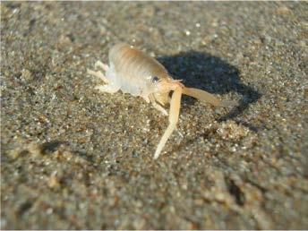
51 t ats habi R st al S HO sh or eb ird sn est an dr oos t in ma ny IRDS coa EB CA RN tes L IF OR TE b ra EMBARGOED until March 13, 2017 NIA LEAS T 48


52 Point Conception EMBARGOED until March 13, 2017 Santa Barbara california current Ventura Oxnard Santa Rosa Santa Cruz Anacapa nor th e rn Santa Monica oregio a n d bi Los Angeles southe r n mid-channel islands bioregion mai nl n San Miguel ma western channel islands bioregion Redondo Beach Long Beach inla nd Huntington Beach b i o region Laguna Niguel Santa Barbara Begg Rock Santa Catalina Oceanside eastern channel islands bioregion t rren r cu nte cou nia or lif ca San Nicolas San Clemente San Diego Patterns of Biodiversity 49 E S TA B L I S H I N G A B E N C H M A R K SE Ñ O RITA O C K FI R S E Ñ O ITA RED E N GO R G O N GIA GI AN UE R P PE R C H GO KEL SH BL A C KS MI T H LD R S E Ñ O ITA SO BL UR C H I N N T KE LP UT HER N SE A PA LM Photos: Sarah Finstad, Jim Kirklin, Steve Lonhart, Jonathan Williams T SPIN E D ST P P ERCH N Map of the South Coast, including the five bioregions, major warm and cool currents, and kelp forest community groups (colored dots). Each color represents a different group. Some common species are shown for a few selected groups. This figure was adapted from the PISCO/VRG project's technical report. K EL IA Kelp and shallow rock researchers from PISCO and VRG identified 17 kelp forest community groups, each with its own unique combination of fish, invertebrate, and algae species. In addition to water temperature, differences between mainland and rocky island reefs also shaped community structure. Data collected by RCCA divers also showed that communities were influenced by site depth and substrate characteristics as well. 17 Kelp Forest Community Groups AR Prior to baseline monitoring, five ecologically and geographically distinct regions in the South Coast called bioregions were identified. Analyses of baseline data collected in rocky intertidal and kelp and shallow rock ecosystems revealed unique community groups consistent with these bioregions. The various communities were shaped by a variety of physical factors, including water temperature. The strong water temperature gradient in the South Coast, driven by the convergence of warm and cool currents, is a well-known driver of species distributions, including those in rocky intertidal and kelp and shallow rock ecosystems.


. Each color represents a different group.")
53 Point Conception EMBARGOED until March 13, 2017 Santa Barbara california current Ventura Oxnard Santa Rosa Santa Cruz Anacapa nor th e rn Santa Monica oregio a n d bi Los Angeles southe r n mid-channel islands bioregion mai nl n San Miguel ma western channel islands bioregion Redondo Beach Long Beach inla nd b i o region Huntington Beach Laguna Niguel Santa Barbara Begg Rock Santa Catalina Oceanside eastern channel islands bioregion t rren r cu nte cou nia or lif ca San Nicolas San Clemente San Diego Rocky intertidal researchers from PISCO and MARINe identified 14 distinct sessile (non-mobile) community groups and 9 distinct mobile community groups. In addition to water temperature, latitude and longitude were also found to be important predictors of community composition, as is typical in many ecosystems globally. On a local scale, the type and slope of substrate and surrounding habitat also influenced community composition. 14 Rocky Intertidal Sessile Community Groups BAR NA C L E S M US SE LS BA R NA C L E S RO RF G R A SS TU EN N A C LES BAR Map of the South Coast, including the five bioregions, major warm and cool currents, and sessile community groups (colored dots). Each color represents a different group. Some prevalent and ecologically important sessile species are shown for a few selected groups. SU CR F AL GA E U S TIN G A L G AE R F AL GAE TU TUR C KW E E D EGR E GIA R F AL GAE M U SS E L S Photos: Nate Fletcher, Dave Lohse, Sarah Finstad, Jessie Altstatt 50


54 Broadening Participation & Sources of Knowledge As described in OPC s Partnership Plan, California is committed to broadening participation and incorporating multiple sources of knowledge into MPA monitoring. This can include work with local experts and citizen scientists, collaborative fisheries research, and traditional knowledge all of which can enhance our understanding of historical and current ocean conditions. 1 Citizen Science in the South Coast The capacity for citizen science monitoring is great in the South Coast. In a survey of South Coast monitoring programs, 21 of 36 programs reported that their work involves volunteer data collectors. 2 Reef Check diver surveys fish at Cathedral Cove, Anacapa Island. Photo: Michelle Hoalton. Local Experts & Citizen Science in South Coast MPA baseline monitoring Four of the nine monitoring projects that participated in South Coast MPA baseline monitoring incorporated work with local experts and citizen scientists, through collaboration with three groups: Reef Check California led monitoring of a kelp and rocky reef monitoring project, working with a team of highly-trained volunteer divers to collect data on the ecology of these iconic ecosystems. RCCA has mobilized this volunteer base to monitor South Coast kelp and shallow rock ecosystems since LiMPETS is a citizen science group that focuses on monitoring sandy beach and rocky intertidal ecosystems, primarily with middle and high school students. Researchers in both the sandy beach and the rocky intertidal monitoring projects collaborated with LiMPETS to evaluate the group s monitoring protocol. 4,5 The South Coast Lobster Research Group (SCLRG) led the spiny lobster research project (see page 34). The SCLRG is a collaboration among scientists, resource managers, fishermen, and volunteers. Members of the SCLRG collected data through tag-recapture and scuba studies from 2011 to Left: Students monitor rocky intertidal ecosystems in Santa Barbara with the LiMPETS program. Photos: Jessie Altstatt 51 ESTABLISHING A BENCHMARK


55 Commercial fishing in the Channel Islands. Photo: Jessie Altstatt Fishermen s Knowledge Fishermen spend much of their lives accumulating knowledge and skills related to marine ecosystems and fisheries. This includes ecological, social, and technical knowledge related to catching and handling fish and invertebrates. Three projects during the South Coast MPA baseline period incorporated fishermen s knowledge: SCLRG, Interpreting CPFV data with the Sportfishing Association of California, and Collaborative Fisheries Studies of Bass. OST convened conversations with South Coast fishing leadership to derive lessons learned from those experiences. This work highlights the roles that fishermen s knowledge can play, and potential challenges at various stages of the collaborative research process. 6 MPA Watch volunteers in Los Angeles. Photo: MPA Watch. MPA Watch MPA Watch is a statewide citizen science initiative that conducts monitoring of consumptive and non-consumptive human uses along the coast, to track how usage is changing over time. The initiative represents a consortium of participating organizations, each of which provides training and support for volunteers to collect data that is relevant to managers, scientifically rigorous, and broadly accessible. From August 2011 to August 2016, MPA Watch worked with over 1,000 citizen science volunteers to conduct 8,677 land-based surveys and nearly 900 boat-based surveys. Over time, these data can help to track the impacts of MPA implementation on human activities in California. 8 Kelp Bass in the Channel Islands. Photo: Jim Kirklin. Collaborative Fisheries Studies of Bass From 2012 to 2014, Collaborative Fisheries Research West (CFR West) conducted a collaborative study in partnership with South Coast recreational fishermen to evaluate mortality and population abundance of three species of bass: Kelp Bass, Spotted Sand Bass, and Barred Sand Bass. In the project, which was funded by OPC, researchers and recreational fishermen conducted a catch-andrelease study and a tagging study from chartered CPFV vessels off the coast of San Diego. Researchers attribute the success of this project to this close collaboration, which helped to create a two-way conversation between the recreational fishermen and scientists. 7 Learn More: Partnerships 1. OPC Partnership Plan: goo.gl/ldrfkz 2. South Coast Monitoring Dashboard: tools.oceanspaces.org/dash#/welcome 3. RCCA Kelp Forest baseline monitoring project: oceanspaces.org/sc-kelp-reefcheckca 4. Sandy Beach baseline monitoring project: oceanspaces.org/sc-sandy-beach 5. Rocky Intertidal baseline monitoring project: oceanspaces.org/sc-rocky-intertidal 6. Summary of collaboration with South Coast fishermen s knowledge: oceanspaces.org/sc-fk 7. CFR West collaborative Bass study: oceanspaces.org/sc-cfr-bass 8. MPA Watch contributed snapshot report: oceanspaces.org/mpawatch 52
56 Exploring Changes California s MPA network is designed to achieve the goals of the MLPA (see page 6) to protect marine life and ecosystems, restore depleted populations, and provide recreational opportunities, among others. Deep and shallow reefs are inhabited by longliving and slow maturing rockfish, while algae and invertebrate populations on rocky shores fluctuate in response to wind and wave disturbance. Data from temperate ecosystems globally and in California suggest that most ecological changes happen slowly. By comparison, change in human uses such as geographic patterns of commercial fishing or landings from CPFVs can be more readily observable over a shorter period. Examining initial ecological and socioeconomic changes in the first few years following MPA implementation sets the stage to document trajectories of marine life, habitats, and human activity over many years and begins to build the time series needed to evaluate MPA performance. Baseline monitoring focused on conditions in the South Coast near the time of MPA implementation. However, we can also gain valuable insights from programs that have collected data at specific locations for many years. Significant changes in marine life populations were not expected to occur within five years, but some initial changes provide early hints of how ecosystems may change into the future. Socioeconomic Changes Commercial Fishing CDFW data reported on the landing receipts suggest that overall landings and revenue have decreased in the period following MPA implementation, while the number of fishermen has stayed relatively stable. 1 However, many factors beyond MPA implementation influence fisheries landings and revenue, including oceanographic and socioeconomic conditions as well as changing fishing regulations. Commercial fisheries can be impacted by regulatory changes if the quantity or quality of harvestable species changes in response to environmental conditions (e.g., El Niño), if there are changes in market value, if consumer demand and willingness to pay within an economy fluctuates, and if the cost of fuel increases or decreases. Landings were historically low in 2015, impacted significantly by the strong El Niño event and a shift in the market squid fishery north of Point Conception. However, the landings of some species, such as rock crab, have increased in the post-implementation period. 1 An analysis of the California spiny lobster fishery suggests that in the year immediately following MPA implementation, changes to participation and landings varied substantially by area, with slight increases in landings on a region-wide scale ,500 Total number of CPFV trips 35,000 30,000 25,000 20,000 15,000 10,000 5, Average number of anglers per trip Landings (lbs) and ex-vessel revenue (millions 2010$) ,000 1,500 1, Number of fishermen Average number of anglers per trip Santa Barbara/Ventura Oxnard/Point Hueneme Los Angeles Redondo Beach/San Pedro/Long Beach Implementation of MPAs Newport Beach Dana Point Oceanside San Diego/Mission Bay pounds revenue fishermen Reported South Coast annual commercial landings (lbs), ex-vessel revenue (2010$), and number of fishermen for all fisheries, Source: CDFW. Total effort and average number of anglers per trip within the South Coast from 1992 to Port groups identified in supplemental report. Source: CDFW. Recreational Fishing Recreational fishing catch from man-made structures has decreased since the implementation of MPAs, but catch from other types of recreational fishing have remained relatively constant. 3 Participation in CPFV has increased since the implementation of MPAs, driven primarily by activity in the San Diego/Mission Bay region. 53 ESTABLISHING A BENCHMARK

57 Ecological Changes MPA Effects at the Northern Channel Islands Twelve MPAs were implemented in state waters around the northern Channel Islands in 2003 with an additional MPA implemented in PISCO and CINP researchers have been monitoring kelp forest and shallow rocky reef ecosystems within those MPAs for over a decade. In 2008 (five years after implementation of the northern Channel Islands MPAs), PISCO identified that a number of positive trends were emerging, including increased density and biomass inside MPAs. Continued monitoring revealed that these trends have continued. 4 In 2013, PISCO released a report, A Decade of Protection: 10 Years of Change at the Channel Islands, which summarizes the continued positive trends. 5 Biomass (tons per hectare) % 23% 28% Inside MPAs Outside MPAs 21% 5 yr 10 yr 5 yr 10 yr 5 yr 10 yr 5 yr 10 yr Average biomass increased inside and outside of MPAs, among both targeted (left) and non-targeted species (right), at northern Channel Islands 10 years after implementation. The greatest increases have been seen for targeted species inside MPAs. Source: PISCO. These trends are not uniform across all islands. For example, PISCO and CINP monitoring show that the percent increase in biomass of targeted fish species was greater inside MPAs at Anacapa than at other Channel Islands. Researchers suggest that this could be due to water temperature or changes in fishing pressure near mainland sites. MPA Effects in Rocky Intertidal Ecosystems Researchers from PISCO/MARINe examined dozens of rocky intertidal study sites, some of which were designated as MPAs in 2012 (new) and some of which had been protected in some way prior to 2012 (old). They found that sites in old MPAs had significantly higher biodiversity than sites outside of MPAs. Sites in new MPAs showed intermediate and highly variable biodiversity. 6 Biomass (tons/hectare) San Miguel Santa Rosa Santa Cruz Anacapa Colder Water Warmer Water Inside MPAs Outside MPAs Biomass of targeted species inside and outside northern Channel Islands MPAs has responded differently across islands, possibly due to difference in water temperature. Source: PISCO. Learn More: Exploring Changes 1. CDFW summary of commercial fishing: oceanspaces.org/sc-cdfw-commercial 2. Human Uses baseline monitoring project: oceanspaces.org/sc-human-uses 3. CDFW summary of recreational fishing: oceanspaces.org/sc-cdfw-recreational 4. PISCO/VRG Kelp Forest baseline monitoring project: oceanspaces.org/sc-kelp-pisco-vrg 5. PISCO A Decade of Protection": goo.gl/gaz7bs Researchers from Point Blue Conservation Science monitor seabirds at Santa Cruz Island. Photo: Abigail Cannon 6. Rocky Intertidal baseline monitoring project: oceanspaces.org/sc-rocky-intertidal 54

58 Photo: istock/ron Thomas 55 INFORMING OCEAN MANAGEMENT DECISIONS

59 Informing Ocean Management Decisions The wealth of knowledge about this region produced through MPA monitoring is useful for supporting decisions across a wide range of ocean resource management issues. From tracking the effects of a changing climate to managing fisheries and water quality, MPA monitoring results are serving California broadly. The data collected and lessons learned from South Coast baseline monitoring (Phase 1) and the work of partners will inform the approach to long-term monitoring (Phase 2), including the selection of metrics and sites. Baseline monitoring in the South Coast has produced novel scientific findings, strengthened partnerships, and contributed to a benchmark of ecological and socioeconomic conditions that will be used to evaluate future MPA performance, progress toward MLPA goals, and track changing ocean conditions. 56


60 Filling in the Gaps EMBARGOED until March 13, 2017 The State s investment in coastal and ocean ecosystem monitoring went a long way toward filling in key gaps in scientific knowledge. Through baseline monitoring, researchers were able to add new study sites to existing programs, collect data from previously unexplored ecosystems, and improve our understanding of ecologically and economically important species. Building Coupled Ocean Acidification & MPA Monitoring Programs Ocean acidification refers to chemical changes that are occurring as increasing levels of carbon dioxide are dissolved into ocean and coastal waters. These changes result in increasingly acidic waters, which make it difficult for calcifying organisms to form their shells, and affect the growth, survival, and behavior of species throughout the food web. In 2016, the West Coast Ocean Acidification and Hypoxia Science Panel (OAH Panel) released its major findings and recommendations report, 1 which included the following guidance: OAH will have severe environmental, ecological, and economic consequences for the West Coast and requires a concerted regional management focus; West Coast managers can manage for resilience using approaches already in place, including protected areas; Coupled ecological and ocean acidification monitoring can provide a crucial pathway to inform crossjurisdictional adaptation and mitigation strategies. Already, California has some key efforts in place. California Environmental Protection Agency s Office of Environmental Health Hazard Assessment (OEHHA) is leading an effort with other state agencies and researchers to develop updated indicators of climate change in California, including indicators of ocean acidification. 2 Baseline monitoring in kelp forests expanded existing monitoring efforts. Photo: Colleen Wisniewski. Changing Ocean Conditions Tracking the Impacts of a Changing Climate Climate change is having a profound impact on coastal and marine ecosystems in the South Coast, including rising sea levels, warming water temperatures, and changes in ocean chemistry. Changes in ocean conditions affect the health of South Coast ecosystems. For example, warmer waters make it difficult for species that rely on cool water temperatures to survive. As a result, some mobile species are expected to shift their ranges to cooler waters in the north. Rising sea levels are expected to reduce the availability of sandy beach and rocky intertidal habitat for invertebrates, algae, and marine plants, making it difficult for them to survive. By reducing the pressure of fishing and harvesting on an ecosystem, MPAs may serve as refugia for species that are threatened by climate change. MPAs provide an important resource for understanding ocean health generally and as living laboratories to better understand the impacts of climate change on species and ecosystems. As part of the California Natural Resources Agency (CNRA), OPC is coordinating research for California s Fourth Climate Assessment. As part of that work, researchers at the University of California Davis Bodega Marine Laboratory are collaborating with OST to advance development and sharing of a mussel-based indicator of ocean acidification. OPC is also leading efforts to develop an inventory of state and federal OAH monitoring that will draw on the OEHHA indicators of climate change, and supporting work to incorporate ocean acidification monitoring into existing ecological research programs. The West Coast Ocean Acidification and Hypoxia Science Panel THEME 1: ADDRESS LOCAL FACTORS THAT CAN REDUCE OAH EXPOSURE MAJOR FINDINGS, RECOMMENDATIONS, AND ACTIONS Recommendation 1: Reduce local pollutant inputs that exacerbate OAH. While elevated atmospheric CO 2 levels are a major driver of OA, local discharge of organic carbon and nutrients can exacerbate OA. Upon discharge, organic carbon is broken down by bacteria, which consume dissolved oxygen during the decomposition process, triggering hypoxic conditions, increasing CO 2 levels and lowering ph. When nutrients such as nitrogen and phosphorus are introduced to coastal waters, they can trigger proliferation of algae that, following their death, are decomposed by bacteria that further decrease dissolved-oxygen levels and increase acidity. The Panel s recommendation to reduce local inputs is tempered by the recognition that scientists do not yet have adequate information to precisely identify locations where reductions in local inputs can meaningfully mitigate OAH effects. In general, the effectiveness of local actions will be greatest in semi-enclosed water bodies, such as estuaries, where local processes dominate over oceanic forcing. Site-specific evaluations are needed to determine which local input(s) (wastewater discharges vs. non-point source pollution in river discharge or atmospheric deposition) should be the targets of nutrient reduction efforts. Because of uncertainties concerning which localcontrol strategies will be most effective in reducing OA, West Coast managers may find it advantageous to pursue more than a purely regulatory enforcement strategy. For example, upgrades to wastewater treatment plants or investment in water reuse could be incentivized to design facilities that reduce nutrient discharges. Regardless of whether incentive-based or regulation-based approaches are used to achieve desired outcomes, managers can support the expedited development of predictive OA models that will guide decisions about how to best implement local source controls. Action 1.1: Generate an inventory of areas where local pollutant inputs are likely to exacerbate OA. While local nutrient- or other discharge-related control programs will not be effective everywhere, there are a number of locations where local nutrient inputs are thought to exacerbate OA. West Coast managers should compile an inventory of those locations to focus their initial management efforts, as these locations can serve as testing grounds for understanding the relative successes that can be achieved by reducing local inputs. Action 1.2: Develop robust predictive models of OAH. One method to determine where reduction of local inputs will result in the greatest gains in water quality is through use of coupled physicalbiogeochemical models. These models quantify to what degree various nutrient, carbon, and CO 2 inputs influence OAH, and project how these inputs will exacerbate OAH. Several research groups on the West Coast are in various stages of developing such models, but before they can be used to support OAH-related management decisions, further investment is required to enhance and coordinate modeling efforts, and to link them to managerially relevant endpoints. A more thorough discussion of how West Coast managers can enhance the usefulness of these modeling efforts appears in Appendix E. Once models are operational, model outputs should be made accessible for comparisons among models and with monitoring data. Action 1.3: Develop an incentive-based strategy for reducing pollutant inputs. West Coast managers can develop grants, loans and other programs to create financial incentives for both the public and private sector to work proactively toward reducing local inputs that can exacerbate OAH, as well as promote reductions in atmospheric CO 2 emissions. In general, the effectiveness of local actions will be greatest in semi-enclosed water bodies, such as estuaries, where local processes dominate over oceanic forcings. APRIL INFORMING OCEAN MANAGEMENT DECISIONS

 focused on projects in five key areas: nutrients, contaminant impact assessment, shoreline microbiology, MPA/rocky reefs, and")

61 Linking Natural Resource & Water Quality Management Bight 13 MPA/Rocky Reefs Project EMBARGOED until March 13, 2017 The Southern California Coastal Water Research Project (SCCWRP) is an environmental research institute and public agency that works to provide a scientific foundation for informed water quality management. Since 1994, SCCWRP has coordinated the Bight Regional Monitoring Program. This program brings together over 100 agencies and organizations to conduct coordinated water quality-relevant assessments of the region on a five-year cycle. The most recent Bight Regional Monitoring Program in 2013 (Bight 13) focused on projects in five key areas: nutrients, contaminant impact assessment, shoreline microbiology, MPA/rocky reefs, and trash and debris. 3 The Bight 13 MPA/Rocky Reefs project was the first of its kind in the Bight Regional Monitoring Program, and it was designed to assess the relative impacts of water quality and fishing pressure on the ecological health of rocky reefs. To do this, researchers from VRG, SCCWRP, and OST developed three indices: Fishing Pressure Index to identify areas with the highest fishing pressure Plume Exposure Index to estimate the likelihood of exposure of nearshore rocky reefs in the Bight to water-borne pollutants Biological Reef Response Index to estimate ecological health in rocky reef habitats (using MPA monitoring data) Comparing the three indices suggests that rocky reef communities are sensitive to both fishing pressure and pollutants, and that these stressors can co-occur and cause cumulative effects. This issue was especially prevalent near urban centers in the region. Researchers emphasized the importance of future work to further develop and refine these indices, and the need for increasing alignment between MPA and water quality monitoring programs. BIGHT ' 13 Rocky Reefs Southern California Bight 2013 Regional Monitoring Program Volume II SCC RP e hni al Re ort 32 Figure 7: Map of Plume exposure index based on combined sources. A researcher collects water quality data. Photo: SWRCB. Looking Forward This work represented an important step forward in better understanding the impacts of both fishing pressure and water quality on rocky reefs in the South Coast. It also serves as the first step toward aligning MPA and water quality monitoring through collaborative efforts across jurisdictions. This connection was strengthened through a joint SCCWRP/OST Science Integration Fellow, who led development of the Biological Reef Response Index. The rocky shoreline along the Palos Verdes Peninsula. Photo: Sarah Finstad. Leveraging connections between MPA and water quality monitoring will continue to be a priority. For example, OST and SWRCB, together with the Leadership Team, are working to identify opportunities to align monitoring programs for MPAs, water quality, and water quality protected areas like ASBSs to leverage resources, capacity, and expertise. This work is included in the first three-year work plan of the Leadership Team. 4 58
. Photo: Jessie Altstatt. Sea stars with wasting syndrome (right). Photo: Jayson Smith.")

62 Helping Decision-Makers Understand Unexpected Events Data collected as part of South Coast MPA baseline monitoring has helped decision-makers to better understand the impacts of two different unexpected events: sea star wasting syndrome and the Refugio oil spill. Healthy sea stars (left). Photo: Jessie Altstatt. Sea stars with wasting syndrome (right). Photo: Jayson Smith. Sea Star Wasting Syndrome Beginning in June 2013, a massive die-off of sea stars spread down the U.S. West Coast, later dubbed "sea star wasting syndrome" (SSWS). South Coast rocky intertidal researchers from MARINe monitored sites near Santa Barbara to look for the presence of diseased sea stars, and expanded their baseline sampling after observing diseased individuals in January By May 2014, sea star populations at many South Coast sampling sites were at or near zero, with northern portions of the region affected first. 5 Researchers noted that SSWS is often preceded by warm water temperatures, and it can lead to death of infected individuals within days. The syndrome progresses so quickly that at some sites, all sea stars had died before researchers could return as part of their increased sampling. Continued data collection has shown recruitment of juvenile sea stars in the South Coast, a hopeful sign that populations could recover. Today, the data allow us to explore the causes and assess the ecological consequences of this die-off on South Coast marine ecosystems. Data like these, and having boots in the water, better prepare us for capturing and learning from future events. Learn More: Informing Management 1. OAH Panel major findings and recommendations report: westcoastoah.org/executivesummary 2. OEHHA Indicators of Climate Change in California report: goo.gl/h2m2zn 3. Bight 13 MPA/Rocky Reefs Report: goo.gl/pxi9i0 4. MPA Statewide Leadership Team: goo.gl/pg03yv 5. Sea Star Wasting Syndrome: seastarwasting.org 6. Refugio Oil Spill: 7. CA Coastal Monitoring Dashboard: Refugio Oil Spill On May 19, 2015, approximately 101, ,000 gallons of crude oil leaked from a pipeline near Refugio State Beach in Santa Barbara, with an estimated 21,000 gallons reaching the ocean. South Coast MPA monitoring helped to build a network of researchers, many of whom mobilized immediately after the spill to conduct rapid monitoring of the affected areas. 6 Data collected in the South Coast during baseline monitoring provided a wealth of information about conditions at and near Refugio State Beach before the spill. For example, Reef Check California volunteer divers surveyed kelp forests off of Refugio State Beach for the nine years prior to the spill, including during the baseline period. Their dataset provided important information about conditions in these ecosystems. Continued monitoring will be key to tracking the recovery of coastal and ocean habitats in the area. Soft-bottom Intertidal & Beach Ecosystems Rocky Intertidal Ecosystems Soft-bottom Subtidal Ecosystems (0-100m) Kelp & Shallow Rock Ecosystems (0-30m) Mid-Depth Rock Ecosystems (30-100m) Deep Ecosystems Nearshore Pelagic Ecosystems Estuarine & Wetland Ecosystems Consumptive Uses Non-consumptive Uses NGO academic Breakdown of monitoring projects by ecosystem from the South Coast Monitoring Survey. Source: OST Leveraging Existing Capacity government private The South Coast Monitoring Survey is providing a detailed picture of the current monitoring capacity in the region. Results from the survey help identify the geographic and temporal coverage of monitoring activities inside and outside of South Coast MPAs, and the alignment of those activities with the metrics and priorities detailed in the South Coast MPA Monitoring Plan. Results of the South Coast Monitoring Survey are publicly available in the interactive California Coastal Monitoring Dashboard, an online platform developed to share and connect the monitoring community. 7 Through the dashboard, you can search for monitoring in specific ecosystems, learn what metrics a project is monitoring, and even find out how to access data. Results from the South Coast Monitoring Survey are helping OPC, CDFW, OST, and other partners design and implement cost-effective, long-term statewide MPA monitoring, which will be guided by the Statewide MPA Monitoring Action Plan, to be led by CDFW and OPC. 59 INFORMING OCEAN MANAGEMENT DECISIONS
63 Collaborators EMBARGOED until March 13, 2017 SCCWR P Established 1969 Species Names: Common & Scientific Common Name Scientific Name Common Name Scientific Name Common Name Scientific Name Abalone Haliotis spp. California Sheephead Semicossyphus pulcher Pacific Sardine Sardinops sagax Aurora/Splitnose Rockfish Barred Sand Bass Basket star Bean clam Bearded Eelpout Benthic siphonophore Black and Yellow Rockfish Black Oystercatcher Black Perch Blacksmith Blue Rockfish Bluebanded Goby Brandt's Cormorant Brittle star Brown Rockfish Cabezon California Barracuda California Brown Pelican California Halibut California hydrocoral California Least Tern California Lizardfish California Scorpionfish Sebastes aurora/ diploproa Paralabrax nebulifer Euryalina Donax gouldii Lyconema barbatum Dromelia spp. Sebastes chrysomelas Haematopus bachmani Embiotoca jacksoni Chromis punctipinnis Sebastes mystinus Lythrypnus dalli Phalacrocorax penicillatus Ophiurida Sebastes auriculatus Scorpaenichthys marmoratus Sphyraena argentea Pelecanus occidentalis callifornicus Paralichthys californicus Sylaster californicus Sterna antillarum browni Synodus lucioceps Scorpaena guttata California spiny lobster California Tonguefish Chilipepper Rockfish Dogface Witch-eel English Sole Fantail Sole Garibaldi Giant kelp Giant spined sea star Golden gorgonian Gorgonians Halfbanded Rockfish Hundred Fathom Codling Jack Mackerel Kellet's whelk Kelp Bass Kelp Perch Kelp Rockfish Kelpfishes Lingcod Market squid Mussels Northern Anchovy Ocean Whitefish Pacific Mackerel Panulirus interruptus Symphurus atricaudus Sebastes goodei Facciolella gilbertii Parophrys vetulus Xystreurys liolepis Hypsypops rubicundus Macrocystis pyrifera Pisaster giganteus Muricea californica Holaxonia Sebastes semicinctus Physiculus rastrelliger Trachurus symmetricus Kelletia kelletii Paralabrax clathratus Brachyistius frenatus Sebastes astrovirens Clinidae Ophiodon elongatus Doryteuthis (Loligo) opalescens Mytilus californianus Engraulis mordax Caulolatilus princeps Scomber japonicus Pelagic Cormorant Pigeon Guillemot Pismo clam Purple sea urchin Red sea urchin Ridgeback prawn Rock crab Rock Wrasse Rockfish Sand crab Sanddab Señorita Snowy Egret Southern sea palm Spot prawn Spotted Ratfish Spotted Sand Bass Squat lobster Surfgrass Tuna Warty sea cucumber Western Gull Yellowtail Phalacrocorax pelagicus Cepphus columba Tivela stultorum Stronglyocentrotus purpuratus Mesocentrotus franciscanus Sicyonia ingentis Cancer spp. Halichoeres semicinctus Sebastes spp. Emerita analoga Citharichthys spp. Oxyjulis californica Egretta thula Eisenia arborea Pandalus platyceros Hydrolagus colliei Paralabrax maculatofasciatus Munida spp. Phyllospadix spp. Thunnus spp. Parastichopus parvimensis Larus occidentalis Seriola lalandi 60


64 61 EMBARGOED until March 13, 2017
Enforcement and Compliance within South Coast Marine Protected Areas
 STATE OF THE CALIFORNIA SOUTH COAST SUPPLEMENTAL REPORT ENFORCEMENT AND COMPLIANCE Enforcement and Compliance within South Coast Marine Protected Areas Proper enforcement of, and compliance with, marine
Orange County MPA Watch A n n u a l R e p o r t
 Orange County MPA Watch 2 0 1 4 A n n u a l R e p o r t WHAT IS AN MPA? Marine Protected Areas (MPAs) are discrete geographic marine or estuarine areas designed to protect or conserve marine life and habitat.
To Fish or Not to Fish? A role-playing activity based on the Marine Reserves process at the Channel Islands National Marine Sanctuary
 To Fish or Not to Fish? A role-playing activity based on the Marine Reserves process at the Channel Islands National Marine Sanctuary Introduction This role playing activity is designed to teach you about
Orange County MPA Watch M o n i t o r i n g H u m a n U s a g e
 Orange County MPA Watch M o n i t o r i n g H u m a n U s a g e WHAT IS AN MPA? Marine Protected Areas (MPAs) are discrete geographic marine or estuarine areas designed to protect or conserve marine life
Orange County MPA Watch A n n u a l R e p o r t
 Orange County MPA Watch 2 0 1 5 A n n u a l R e p o r t WHAT IS AN MPA? Marine Protected Areas (MPAs) are discrete geographic marine or estuarine areas designed to protect or conserve marine life and habitat.
Orange County MPA Watch 2016 A n n u a l R e p o r t
 Orange County MPA Watch 2016 A n n u a l R e p o r t WHAT IS AN MPA? Marine Protected Areas (MPAs) are discrete geographic marine or estuarine areas designed to protect or conserve marine life and habitat.
Commercial Fisheries in the South Coast s Marine Protected Areas
 STATE OF THE CALIFORNIA SOUTH COAST SUPPLEMENTAL REPORT COMMERCIAL FISHERIES Researchers from the California Department of Fish and Wildlife (CDFW) used landings data from CDFW s Commercial Fisheries Information
Orange County MPA Watch Program Quarterly Report (Jan 1 March 31, 2012)
") Orange County MPA Watch Program Quarterly Report (Jan 1 March 31, 2012) What is the OC MPA Watch Program? The Orange County Marine Protected Area (OC MPA) Watch Program enlists volunteers, community groups
Orange County MPA Watch Program Quarterly Report (Jan 1 March 31, 2012) What is the OC MPA Watch Program? The Orange County Marine Protected Area (OC MPA) Watch Program enlists volunteers, community groups
Orange County MARINE PROTECTED AREAS
 Orange County MARINE PROTECTED AREAS Orange County Coastkeeper QUARTERLY REPORT 1/1/ 2013 3/30/12 2013 WHAT IS THE OC MPA WATCH PROGRAM? The Orange County Marine Protected Area (OC MPA) Watch Program enlists
Orange County MARINE PROTECTED AREAS 2 nd Quarter 2016 Report
 Orange County MARINE PROTECTED AREAS 2 nd Quarter 2016 Report Page 1 of 7 WHAT IS THE OC MPA WATCH PROGRAM? The Orange County Marine Protected Area (OC MPA) Watch Program enlists volunteers, community
Case Study 3. Case Study 3: Cebu Island, Philippines MPA Network 10
 Case studies of mpa networks Case Study 3: Cebu Island, Philippines MPA Network 10 Location and background Cebu Island in the Philippines lies in the center of the Visayan Islands, known as an area high
Orange County MARINE PROTECTED AREAS
 Orange County MARINE PROTECTED AREAS Orange County Coastkeeper QUARTERLY REPORT 7/1/2013 9/30/2013 WHAT IS THE OC MPA WATCH PROGRAM? The Orange County Marine Protected Area (OC MPA) Watch Program enlists
Orange County MARINE PROTECTED AREAS 3 rd Quarter 2015 Report
 Orange County MARINE PROTECTED AREAS 3 rd Quarter 2015 Report Page 1 of 7 WHAT IS THE OC MPA WATCH PROGRAM? The Orange County Marine Protected Area (OC MPA) Watch Program enlists volunteers, community
NOTICE: This publication is available at:
 Department of Commerce National Oceanic & Atmospheric Administration National Marine Fisheries Service NATIONAL MARINE FISHERIES SERVICE POLICY DIRECTIVE 01-118 February 12, 2015 Fisheries Management NATIONAL
2016 West Coast Entanglement Summary
 March 2017 2016 West Coast Entanglement Summary Overview of Entanglement Data west coast region MMHSRP Permit #18786 In 2016, 71 separate cases of entangled whales were reported off the coasts of Washington,
To Fish or Not to Fish?
 ? This role-playing activity is based on the Marine Reserves process at the Channel Islands National Marine Sanctuary and explores the complex decision-making process for establishing marine protected
Coastal and marine recreation in New England is ingrained in the region s economic and
 RECREATION Coastal and marine recreation in New England is ingrained in the region s economic and social fabric. Recreation on the ocean and coast includes many of New Englanders most time-honored and
Eastern Shore Islands Area of Interest Community Newsletter
 Eastern Shore Islands Area of Interest Community Newsletter Fall 2018 1ỊNTRODUCTION In addition to information on our Fisheries and Oceans Canada (DFO) website, we have now created a seasonal, community
Socioeconomic Profile and Spatial Analysis of Fisheries in the three central California National Marine Sanctuaries
 Socioeconomic Profile and Spatial Analysis of Fisheries in the three central California National Marine Sanctuaries Overview and Assessment of CDFG Fisheries Data for use in the Joint Management Plan Review
California Management of Forage Fish Species. Deb Wilson- Vandenberg Senior Environmental Scientist California Department of Fish and Game
 California Management of Forage Fish Species Deb Wilson- Vandenberg Senior Environmental Scientist California Department of Fish and Game Overview Ø State Management Authorities Ø Major forage species
Unless otherwise noted, images throughout the presentation are by FWC.
 This presentation provides a summary of a series of proposed final rules intended to address management of the shore-based shark fishery and shark-related cleanup of existing Florida Fish and Wildlife
Evolution of Deepwater Coral Protection in the Southeast U.S
 Evolution of Deepwater Coral Protection in the Southeast U.S Tina Udouj, Florida Fish and Wildlife Conservation Commission Roger Pugliese, South Atlantic Fishery Management Council Overview Deepwater Corals
Essential Fish Habitat
 Pacific Fishery Management Council Fact sheet: Essential Fish Habitat Habitat is the environment where an animal lives, feeds, and reproduces. Identifying fish habitat is complex because fish move through
Office of Science & Technology
 NOAA Fisheries Highlights of FEUS 2015 Highlights from the Annual Report Fisheries Economics of the United States, 2015 Office of Science & Technology Fisheries and the Economy U.S. fisheries provide jobs,
no-take zone 1 of 5 Channel Islands National Marine Sanctuary, California
 This website would like to remind you: Your browser (Apple Safari 4) is out of date. Update your browser for more security, comfort and the best experience on this site. Encyclopedic Entry no-take zone
SUMMARY Pacific Fishery Management Council Preferred Alternative Groundfish Essential Fish Habitat Final Environmental Impact Statement
 SUMMARY Pacific Fishery Management Council Preferred Alternative Groundfish Essential Fish Habitat Final Environmental Impact Statement Introduction This document summarizes the Pacific Fishery Management
4 th Quarter 2014 Report OC MPA Watch Program Orange County Coastkeeper
 4 th Quarter 2014 Report OC MPA Watch Program Orange County Coastkeeper Intro January 1 st, 2012 was the implementation date for the South Coast MPAs from Point Conception to the Mexican border. The Orange
NOAA Fisheries Update:
 NOAA Fisheries Update: A Presentation to the Pacific States Marine Fisheries Commission August 20, 2012 Dr. Paul N. Doremus Deputy Assistant Administrator for Operations 1 A Milestone Year for Fisheries
Comparison of EU and US Fishery management Systems Ernesto Penas Principal Adviser DG Mare
 Comparison of EU and US Fishery management Systems Ernesto Penas Principal Adviser DG Mare Stock and Fisheries Status Seminar Brussels, 26 September 2017 Why comparing the EU and the US? Need to put the
 ROV Transects of Deep Sea Coral Communities Habitat Type, Species Abundance and Diversity The teacher may choose to explore species abundance and diversity in deep sea coral communities in several different
CHAPTER 4 DESIRED OUTCOMES: VISION, GOALS, AND OBJECTIVES
 CHAPTER 4 DESIRED OUTCOMES: VISION, GOALS, AND OBJECTIVES Vision One of the first steps in developing this Plan was articulating a vision - a clear statement of what the Plan strives to achieve and what
Wave Prediction in the Santa Barbara Channel
 Wave Prediction in the Santa Barbara Channel OCS Study MMS 2001-055 Final Technical Summary Final Study Report U.S. Department of the Interior Minerals Management Service Pacific OCS Region Wave Prediction
MANAGEMENT OF KRILL AS AN ESSENTIAL COMPONENT OF THE CALIFORNIA CURRENT ECOSYSTEM
 MANAGEMENT OF KRILL AS AN ESSENTIAL COMPONENT OF THE CALIFORNIA CURRENT ECOSYSTEM AMENDMENT 12 TO THE COASTAL PELAGIC SPECIES FISHERY MANAGEMENT PLAN ENVIRONMENTAL ASSESSMENT, REGULATORY IMPACT REVIEW
The Otter Project & MPA Watch
 The Otter Project & MPA Watch More Than a Cute Face How do otters keep warm in our cold California waters? What do otters eat? How do otters sleep? What dangers do otters face? Why should otters be protected?
Marine Debris from Land to Sea: Holistic Characterization, Reduction and Education Efforts in New Hampshire
 Marine Debris from Land to Sea: Holistic Characterization, Reduction and Education Efforts in New Hampshire ABSTRACT Over time, the focus of marine debris research and work has shifted away from simply
SOCIETAL GOALS TO DETERMINE ECOSYSTEM HEALTH: A FISHERIES CASE STUDY IN GALVESTON BAY SYSTEM, TEXAS
 SOCIETAL GOALS TO DETERMINE ECOSYSTEM HEALTH: A FISHERIES CASE STUDY IN GALVESTON BAY SYSTEM, TEXAS Anthony S. Pait, NOAA, National Centers for Coastal Ocean Science Thomas P. O Connor, David R. Whitall,
Update on Columbia Basin Partnership Task Force
 Update on Columbia Basin Partnership Task Force June 25, 2018 Marla Harrison Port of Portland M A F A C C B P T A S K F O R C E Overview of Today s Presentation: Background on Columbia Basin & why we need
Trawl fishery management of Eastern Arabian Sea
 Trawl fishery management of Eastern Arabian Sea Dr. A.P.Dineshbabu, Central Marine Fisheries Research Institute, India Existing management practices Seasonal closure of fishery: The regulations for closed
ADDENDUM I TO AMENDMENT 3 OF THE INTERSTATE FISHERY MANAGEMENT PLAN FOR WEAKFISH
 ATLANTIC STATES MARINE FISHERIES COMMISSION ADDENDUM I TO AMENDMENT 3 OF THE INTERSTATE FISHERY MANAGEMENT PLAN FOR WEAKFISH Prepared by the Weakfish Plan Review Team Approved October 18, 2000 TABLE OF
Sustainable Fisheries for Future Generations The Fisheries White Paper
 Sustainable Fisheries for Future Generations The Fisheries White Paper Key messages The Fisheries White Paper Sustainable Fisheries for Future Generations charts the course for a sustainable and profitable
Fisheries Off West Coast States; Coastal Pelagic Species Fisheries; Annual. AGENCY: National Marine Fisheries Service (NMFS), National Oceanic and
, National Oceanic and") This document is scheduled to be published in the Federal Register on 06/30/2017 and available online at https://federalregister.gov/d/2017-13685, and on FDsys.gov Billing Code 3510-22-P DEPARTMENT OF
This document is scheduled to be published in the Federal Register on 06/30/2017 and available online at https://federalregister.gov/d/2017-13685, and on FDsys.gov Billing Code 3510-22-P DEPARTMENT OF
Submission on summary of the Draft Convention on Biological Diversity National Report
 23 November 2018 Submission on summary of the Draft Convention on Biological Diversity National Report The New Zealand Marine Sciences Society (NZMSS) is a professional society affiliated to the Royal
California s Marine Environment. Highly Variable Narrow Continental Shelf Upwelling and El Nino
 California s Marine Environment Highly Variable Narrow Continental Shelf Upwelling and El Nino Fisheries Diversity Wetfish small pelagics Tuna Salmon Groundfish Shellfish Boutique Management Approaches
The Impacts of Changing Climate on the Local Seafood Industry
 The Impacts of Changing Climate on the Local Seafood Industry The Ocean s Importance Regulates the Earth System Holds 97% of our Earth s Water Produce more than half of the oxygen in our atmosphere Absorb
Coastal Pelagic Species
 Pacific Fishery Management Council Fact sheet: Coastal Pelagic Species The Fish The term pelagic refers to species that live in the water column as opposed to living near the sea floor. They can generally
REGIONAL AND LOCAL VARIATION OF BOTTOM FISH AND INVERTEBRATE POPULATIONS
 M. James Allen and Robert Voglin REGIONAL AND LOCAL VARIATION OF BOTTOM FISH AND INVERTEBRATE POPULATIONS One of the projects included in our recently completed research for the EPA was an assessment of
The Fisheries Reform Act of The Joint Legislative Commission on Seafood and Aquaculture March 30, 2010
 The Fisheries Reform Act of 1997 The Joint Legislative Commission on Seafood and Aquaculture March 30, 2010 History July 1, 1994 Moratorium on Commercial Fishing Licenses Based on wide range of concerns
RESEARCH Massachusetts Recreational Boater Survey. Project Summary
 Coastal and Marine Spatial Planning RESEARCH Project Summary 2010 Massachusetts Recreational Boater Survey The 2010 Massachusetts Recreational Boater Survey gathered spatial and economic data relating
Socioeconomic Profile of Fisheries in the Cordell Bank and Gulf of the Farallones NMSs
 Socioeconomic Profile of Fisheries in the Cordell Bank and Gulf of the Farallones NMSs Presentation to CDFG and the joint fishing working group April 2-22, 25 Charles Steinback and Astrid Scholz Outline
Fisheries Off West Coast States; Coastal Pelagic Species Fisheries; Amendment to
 This document is scheduled to be published in the Federal Register on 08/01/2017 and available online at https://federalregister.gov/d/2017-16135, and on FDsys.gov Billing Code 3510-22-P DEPARTMENT OF
Strait of Georgia and Howe Sound Glass Sponge Reef Conservation Initiative
 Strait of Georgia and Howe Sound Glass Sponge Reef Conservation Initiative Presentation for the Howe Sound Community Forum October 13, 2017 Aleria Ladwig Resource Management Pacific Region 1 Presentation
Productivity Susceptibility Analysis (PSA) Tool overview and preliminary findings
 Tool overview and preliminary findings") Productivity Susceptibility Analysis (PSA) Tool overview and preliminary findings ERA Workshop Long Beach, CA June 15, 2017 Overview Share information about PSA tool and process Share draft results Discuss
Productivity Susceptibility Analysis (PSA) Tool overview and preliminary findings ERA Workshop Long Beach, CA June 15, 2017 Overview Share information about PSA tool and process Share draft results Discuss
Modernizing Maine's Municipal Shellfish Programs. Chad Coffin President of the Maine Clammers Association
 Modernizing Maine's Municipal Shellfish Programs Chad Coffin President of the Maine Clammers Association Maine Clammers Association Represents people and fishing families who care about and rely on healthy
October Net Loss: Overfishing Off the Pacific Coast
 October 2007 Net Loss: Overfishing Off the Pacific Coast Net Loss Overfishing Off the Pacific Coast October 2007 Acknowledgements Written by Michael Gravitz, Oceans Advocate, U.S. PIRG Education Fund,
Fish Habitat and the Mid-Atlantic Fishery Management Council
 Fish Habitat and the Mid-Atlantic Fishery Management Council Jessica Coakley June 19, 2017 Today Council s habitat interests (evolution) Essential Fish Habitat Redo progress Mid-Atlantic fish habitat assessment
Appendix Template for Submission of Scientific Information To Describe Ecologically or Biologically Significant Marine Areas
 Appendix Template for Submission of Scientific Information To Describe Ecologically or Biologically Significant Marine Areas Abstract (in less than 150 words) Coastal and marine areas: Africa Somalia has
PRESENTATION TO THE BRITISH COLUMBIA LEGISALTIVE STANDING COMMITTEE ON FINANCE September 26, 2013
 PRESENTATION TO THE BRITISH COLUMBIA LEGISALTIVE STANDING COMMITTEE ON FINANCE September 26, 2013 On behalf of its 40,000 plus members, The BC Wildlife Federation welcomes the opportunity to address the
Monica Medina Deputy Director, Environment September 29, 2016
 Monica Medina Deputy Director, Environment September 29, 2016 Walton Family Foundation Commitment To Oceans At the Walton Family Foundation, we believe that conservation solutions that make economic sense
NOAA California Current IEA Team
 March 2015 PFMC meeting, Vancouver, WA Agenda Item E.1.b Agenda Item E.1.b Supplemental IEA PowerPoint 2 (Electronic Only) March 2015 NOAA California Current IEA Team Environmental Highlights The Northeast
Certification Determination. Louisiana Blue Crab Commercial Fishery
 15 th November 2016 Certification Determination For The Louisiana Blue Crab Commercial Fishery Following a meeting of a Global Trust Certification Committee on 20 th October 2016, a positive determination
Salmon Five Point Approach restoring salmon in England
 Salmon Five Point Approach restoring salmon in England Our Mission To restore the abundance, diversity and resilience of salmon stocks throughout England We will do this by:- a) Maximising the production
and found that there exist a significant overlap between the billfish resources and the exploitation activities targeting tunas and mahi mahi.
 Executive Summary Report 2016 Billfish Research in the Eastern Pacific Ocean Rosenstiel School of Marine and Atmospheric Science University of Miami January 2017 During 2016, the Eastern Pacific Ocean
STATUS OF THE PACIFIC COAST
 STATUS OF THE PACIFIC COAST COASTAL PELAGIC SPECIES FISHERY AND RECOMMENDED ACCEPTABLE BIOLOGICAL CATCHES STOCK ASSESSMENT AND FISHERY EVALUATION -2002 Pacific Fishery Management Council 7700 NE Ambassador
Texas Shrimp Action Plan
 Texas Shrimp Action Plan Updated April 2017 Prepared by: Audubon Nature Institute Gulf United for Lasting Fisheries (G.U.L.F.) Laura Picariello - Technical Programs Manager Ashford Rosenberg - Outreach
Fisheries Off West Coast States; Coastal Pelagic Species Fisheries; Annual. AGENCY: National Marine Fisheries Service (NMFS), National Oceanic and
, National Oceanic and") This document is scheduled to be published in the Federal Register on 06/25/2018 and available online at https://federalregister.gov/d/2018-13583, and on FDsys.gov BILLING CODE: 3510-22-P DEPARTMENT OF
This document is scheduled to be published in the Federal Register on 06/25/2018 and available online at https://federalregister.gov/d/2018-13583, and on FDsys.gov BILLING CODE: 3510-22-P DEPARTMENT OF
make people aware of the department s actions for improving the deer population monitoring system,
 Investing in Wisconsin s Whitetails 1 Over the last 60 years, the department has developed a deer herd monitoring and management system that seeks to use the best science and data possible. The deer monitoring
PEDESTRIAN ACTION PLAN
 ATTACHMENT 2 CITY OF SANTA MONICA PEDESTRIAN ACTION PLAN CITY OF SANTA MONICA PEDESTRIAN ACTION PLAN This page intentionally left blank EXECUTIVE SUMMARY CHAPTER 1 EXECUTIVE SUMMARY Setting the Stage
Essential Fish Habitat OCNMS Advisory Council July 13, 2013
 Essential Fish Habitat OCNMS Advisory Council July 13, 2013 John Stadler Habitat Conservation Division NMFS Northwest Region Essential Fish Habitat (EFH) What is it, where did it come from, and what does
North Carolina. Striped Mullet FMP. Update
 North Carolina Striped Mullet FMP Update Presentation for the Marine Fisheries Commission January 24, 2008 COMMERCIAL HARVEST 4,000,000 2,000,000 3,500,000 3,000,000 Landings (lb) Value ($) 1,800,000
Oceans Humans both depend on it and threaten it with their activities
 Oceans Humans both depend on it and threaten it with their activities Oceans Water covers nearly ¾ of the Earth s surface More than 50% of the world s population lives within an hour of the coast Oceans
Management under the Highly Migratory Species Fishery Management Plan
 Agenda Item G.4.b CDFW Report 1 September 2014 CALIFORNIA DEPARTMENT OF FISH AND WILDLIFE REPORT ON BAG REDUCTION OPTIONS FOR THE RECREATIONAL TAKE OF PACIFIC BLUEFIN TUNA Introduction At the June 2014
Reducing Risk of Whale Entanglements in Oregon Dungeness Crab Gear
 Session 3 Reducing Risk of Whale Entanglements in Oregon Dungeness Crab Gear CaseID: 20150703Mn NMFS MMHSRP Permit #: 18786 Overview West Coast Information Framing the problem Summary of West Coast large
Oregon Department of Fish & Wildlife Nearshore Marine Resource Management Strategy Public Meeting Notes: Roseburg, 4/1/05
 Oregon Department of Fish & Wildlife Nearshore Marine Resource Management Strategy Public Meeting Notes: Roseburg, 4/1/05 Meeting notes are summarized to capture the thoughts and opinions of individual
Warm-up # 7 A day 5/17 - B day 5/18 UPDATE YOUR TABLE OF CONTENTS
 Warm-up # 7 A day 5/17 - B day 5/18 UPDATE YOUR TABLE OF CONTENTS Question: List all examples of surface water on Earth. Answer: Rivers and streams, lakes and reservoirs, (ponds) wetlands, estuaries and
Eastern Brook Trout. Roadmap to
 Eastern Brook Trout Roadmap to CONSERVATION Our Brook Trout heritage he wild Brook Trout is an American symbol of persistence, adaptability, and the pristine wilderness that covered North America prior
Black Sturgeon Regional Plan
 Black Sturgeon Regional Plan This is one of twenty Regional Plans that support implementation of the Lake Superior Biodiversity Conservation Strategy (Strategy). The Strategy, prepared and overseen by
North Pacific Fishery Management Council. Community considerations in Federally-managed fisheries. April 2005
 North Pacific Fishery Management Council Community considerations in Federally-managed fisheries April 2005 Why are Fisheries Off Alaska so important to communities? Would rank in the top 10 producing
World Oceans Day Does marine legislation actually protect the marine environment?
 World Oceans Day Does marine legislation actually protect the marine environment? 7 June 2012 Marine Protected Areas What the science tells us For biodiversity protection we need to protect at least 20%
Gulf of the Farallones National Marine Sanctuary Safe Harbor for Sea Turtles
 Gulf of the Farallones National Marine Sanctuary Safe Harbor for Sea Turtles Photos by Doug Perrine They re here now! Leatherbacks swim 6,000 miles from Indonesia to California to Feed on Jellyfish ~ August
Legislation. Lisa T. Ballance Marine Mammal Biology SIO 133 Spring 2013
 Legislation Lisa T. Ballance Marine Mammal Biology SIO 133 Spring 2013 Really Quickly: Marine Mammal Legislation The big two: the Marine Mammal Protection Act and the Endangered Species Act International
Cook Inlet Habitat Conservation Strategy
 Cook Inlet Habitat Conservation Strategy What is the Cook Inlet Habitat Conservation Strategy? It s a new effort to tie together all of NOAA Fisheries habitat-related science and management activities
Policy Instruments for Fisheries Management and the Concept of Fisheries Refugia
 REVERSING ENVIRONMENTAL DEGRADATION TRENDS Policy Instruments for Fisheries Management and the Concept of Fisheries Refugia Christopher Paterson, UNEP/GEF South China Sea Project REVERSING ENVIRONMENTAL
Ventura County. Open Pacific Coast Study. California Coastal Analysis and Mapping Project
 Ventura County Open Pacific Coast Study California Coastal Analysis and Mapping Project December 2011 Project Name: Meeting: Date and Time: Location: California Coastal Analysis and Mapping Project (CCAMP)/Open
Significant Ecological Marine Area Assessment Sheet
 Significant Ecological arine Area Assessment Sheet Name: ouhora arbour arine Values Summary: The entrance subtidal channel, tidal flats, seagrass mangrove and saltmarsh habitats of ouhora arbour have given
COMMERCIAL & RECREATIONAL FISHING
 COMMERCIAL & RECREATIONAL FISHING Commercial fishing in New England has a long and storied history. Its importance culturally and economically has lasted hundreds of years, becoming a part of many tales
Moving beyond BACI: What do to when science and reality clash in marine reserve monitoring? Workshop Held: June 10 th, 2015
 Moving beyond BACI: What do to when science and reality clash in marine reserve monitoring? Workshop Held: June 10 th, 2015 Challenges have arisen when implementing a BACI (Before-After-Control-Impact)
Preserving New Caledonia s Marine Environment The benefits of a large and highly protected marine reserve
 A fact sheet from the Pew Bertarelli Ocean Legacy Project July 2015 Preserving New Caledonia s Marine Environment The benefits of a large and highly protected marine reserve Overview The ocean plays a
Map Showing NAFO Management Units
 Map Showing NAFO Management Units Biology Are 6 species of seals in Atlantic Canadian waters, all of which occur in Newfoundland Two Arctic Species (Ringed, Bearded) Two temperate (Grey, Harbour) Two migratory
Fisheries Historic Status U.S. fishermen are granted the right to fish in public waters under the Public Trust Doctrine. Through the years, this right
 US U.S. Fisheries i Law: An Introduction Fisheries Historic Status U.S. fishermen are granted the right to fish in public waters under the Public Trust Doctrine. Through the years, this right has been
Consultation Document
 Consultation Document Development of a regulation establishing a multiannual plan for the management of Northern Adriatic Sea small pelagic fisheries The sole purpose of this consultation is to collect
California Steelhead: Management, Monitoring and Recovery Efforts
 California Steelhead: Management, Monitoring and Recovery Efforts Jonathan Nelson Steelhead Management, Research and Restoration Program Oncorhynchus mykiss irideus California Steelhead - Hot Topics Implementation
RHODE ISLAND. Foundation. P.O. Box 1465, Coventry, Rhode Island FAX:
 RHODE ISLAND SALTWATER Foundation P.O. Box 1465, Coventry, Rhode Island 02816 401-826-2121 FAX: 401-826-3546 2013 Southern New England Recreational Fishing Symposium April 2, 2013 Radisson Airport Hotel,
NOAA/NWFSC Southern California Shelf Rockfish Hook and Line Survey
 NOAA/NWFSC Southern California Shelf Rockfish Hook and Line Survey NOAA Fisheries, Northwest Fisheries Science Center 2725 Montlake Blvd. E, Seattle, WA 98112 John Harms, NOAA/NWFSC Jim Benante, PSMFC/NWFSC
Authors: Luiz Barbieri and Martha Bademan
 This is a review and discussion of a proposal to develop and implement a Gulf Offshore Recreational Fishing Permit in support of more accurate, precise, and timely catch and effort estimates for offshore
Summary of SCUBA Diving Operations Conducted From R/V Fulmar Fiscal Year 2010
 Summary of SCUBA Diving Operations Conducted From R/V Fulmar Fiscal Year 2010 Prepared by Chad King Monterey Bay National Marine Sanctuary November 10, 2010 Unit or Line Office Primary Diving Mission/Task:
Marine Management Strategy Frequently Asked Questions
 Marine Management Strategy Frequently Asked Questions Can I still go fishing at Rottnest? Yes Where will I be able to go fishing on Rottnest Island? Recreational fishing can occur at any location outside
from a decade of CCD temperature data
 (Some of) What we have learned from a decade of CCD temperature data Craig Gelpi and Karen Norris Long Beach Aquarium of the Pacific August 15, 2008 Introduction Catalina Conservancy Divers collected temperature
Chagrin River TMDL Appendices. Appendix F
 Appendix F The following are excerpts from the Eastern Brook Trout Joint Venture s Conservation Strategy (Working Draft v.6), Conserving the Eastern Brook Trout: Strategies for Action Found at: http://www.easternbrooktrout.org/constrategy.html
Nordatlantisk Fiskeriministerkonference i Shediac 29. august 2017
 Naalakkersuisoq Karl-Kristian Kruses tale Nordatlantisk Fiskeriministerkonference i Shediac 29. august 2017 Dear friends and colleagues I would like to thank our hosts for this chance to visit beautiful
The Maritime Law Association of Australia and New Zealand
 The Maritime Law Association of Australia and New Zealand Protecting the Environment and Promoting Safe Navigation: Australia s System of Pilotage in the Torres Strait Adam McCarthy Assistant Secretary