Aquatic Invasive Species Education, Prevention and Planning Project
|
|
|
- Gwen Beverly Wilkinson
- 6 years ago
- Views:
Transcription


1 Florence County Aquatic Invasive Species Prevention and Management Program Aquatic Invasive Species Education, Prevention and Planning Project Grant Number: AEPP Final Report Prepared by Rich Wolosyn Florence County Conservationist, Image from Google Earth Florence County Land Conservation Department Scott W. Goodwin Conservation Technician, & Carolyn Weber-Starling AIS Coordinator 1
2 Table of Contents Map of Florence County Lakes Monitored 4 Project Description... 5 Problems to be Addressed... 5 Goals and Objectives... 6 Activities and Methods Plankton Tow Report Error... 7 Barrens Lake... 8 Cosgrove Lake Edith Lake Lake Anna Lake Ellwood Lake Emily Fay Lake Fisher Lake Frog Lake Halsey Lake 33 Keyes Lake Lake of Dreams Long Lake Loon Lake Montgomery Lake Patten Lake Pine River Porcupine Lake Sand Lake Sea Lion Lake
3 Table of Contents, cont. Spread Eagle Chain of Lakes Bass Lake East Lake Long Lake Middle Lake North Lake West Lake West Bass Lake Total Phosphorus Testing...77 Water Hardness Testing Staff and Public Education Budget and Finance Plans for Future Work 83 Acknowledgments 86 Bibliography.87 3

4 Lakes monitored through the course of this project Image: Google Earth 4
5 Project Description Funding for this two-year project was awarded in 2015 which utilizes local, regional, and state support for implementation of a county-wide invasive species prevention and management strategy whose primary focus is aimed at reducing risk factors associated with further AIS introduction into outstanding and exceptional waters of Florence County. Over the course of the project four seasonal staff were hired to conduct AIS absence/presence monitoring along with collecting water chemistry data at source waters locations and at pristine water bodies in addition to quality trout streams, rivers and creeks, including significant segments of two of Wisconsin's Wild Rivers, the Pine and Popple. In conjunction with a separate watercraft inspection project where paid inspectors and volunteers are stationed at multiple priority boat landings following the state's Clean Boat, Clean Waters program protocols, two boater decontamination stations were staffed with resources donated by local lake association members. Efforts to protect lakes, river and wetlands from invasive species impacts are coordinated through the newly organized Florence County Invasive Species Council and the formal partners and members of the Wild Rivers Invasive Species Coalition (WRISC), the local Cooperative Invasive Species Management Area (CISMA). Problems to be addressed Florence County is home to over 250 inland lakes, many miles of high quality streams, and thousands of acres of wetlands. Several waterbodies have now been impacted by AIS such as the 2003 Eurasian watermilfoil/hybrid (Myriophyllum spicatum) found in Lake Ellwood and Frog Lake, and more recently in Seidel Lake, Barrens Lake, North Lake and Sea Lion Lakes. Zebra mussels (Dreissena polymorpha) were first noted in Keyes Lake in 2010, have since spread throughout the neighboring Spread Eagle Chain of Lakes. Phragmites (Phragmites australis) were first documented at the Menominee River bridge a few years previous to this project, and now show a population growing on nearby Cosgrove Lake. Spiny water flea (Bythotrephes longimanus), curly leaf pondweed (Potamogeton crispus) and yellow floating heart (Nymphoides peltata) are on the radar in neighboring communities. Limited Term Employment positions were requested to be dedicated toward public education and presence/absence monitoring in these AIS free and source waters and will also support volunteer/staff efforts following CBCW state initiatives that provide clear directions to the public to help slow the spread of invasive species. Specimen collection and vouchering were also part of these summer positions, along with participation in the AIS Action Team of the Wild Rivers Invasive Species Coalition (WRISC). Presentations were given to raise the public's awareness of AIS and offer BMPs to better reach Clean, Drain and Dry objectives and related state laws. 5
6 Goals and Objectives Develop an AIS Control Plan Provide Local AIS Education Participate in Statewide AIS Education Initiatives Prevent the Spread of AIS Conduct Early Detection Monitoring Activities and Methods Lake monitoring was most often conducted by boat. Water quality samples (D.O., ph, Conductivity, and temperatures) were gathered using a Hach HQ40d handheld multi-meter. Secchi disk readings were also taken and surface samples were collected for total phosphorus testing at the State Laboratory of Hygiene. Visual surveys from boats and with snorkel equipment were also conducted on the lakes. Rake samples were taken on some lakes, but this did not reach the level of a point intercept survey. In the 2016 season water hardness tests were added to the monitoring protocol as a way to assess the potential for the tested lake to be habitat for zebra mussels or other calcium-demanding invasive species. During the 2015 and 2016 seasons Florence County AIS staff also participated in: WDNR s AIS Gear-up Workshop (2015) WDNR s AIS Coordinators Meeting (2016 pre and post season meetings) Coordinated with WRISC in training CBCW staff and volunteers (2015 & 2016) AIS Bridge Snapshot Day (2015 & 2016) Presented current AIS and on-going control efforts at annual FCLARA meetings (2015 & 2016) Hand-pulling of Eurasian water-milfoil on Barrens Lake (2015) Hand-pulling of Eurasian water-milfoil on Keyes Lake in partnership with FCLARA and WRISC (2015 & 2016) AIS removal on Spread Eagle Chain of Lakes in partnership with White Water Associates, Inc. (2015 & 2016) Aided WDNR work on East Bass and Keyes Lakes (2015) Collected water samples for edna testing on Keyes Lake (2015) Electro-fishing with WDNR Fisheries Biologists to gain a deeper knowledge of the local fisheries (2015 & 2016) AIS-themed participation in Fourth of July parades in Iron Mountain and Long Lake (2015 & 2016) Painted stop AIS messages at paved boat landings in the county (2016) 6
7 2015 Plankton Tow Report Error Due to a misreading of the 2015 WDNR s plankton tow results The Florence County Land Conservation Department mistakenly thought there were zebra mussels and spiny waterflea found in some county lakes in The LCD went into the 2016 season determined to get the word out, and to see the extent of these new invasions. At the start of the 2016 season the LCD placed zebra mussel substrate tests in three lakes, Patten, Emily and Loon, and was attempting to find locations on Fay Lake when the mistake was found by DNR staff and alerted LCD staff. As erroneous information had been disseminated to the public Conservation Technician Scott Goodwin sent the following to members of the public, local officials and state DNR staff involved. Ladies and Gentlemen, I am contacting you as you are associated with three Florence County lakes that the Land Conservation Department, and I in my capacity as AIS Coordinator for Florence County, have discussed with you regarding the findings of Zebra Mussel veliger and/or Spiny Waterflea in plankton tows conducted by the DNR in Specifically, Lake Emily, Fay Lake, and Patten Lake. My dissemination of this report was in error. The WI DNR results did not show the presence of these invasive species in your lakes. On behalf of myself, the Florence County Land Conservation Department and the members of the Florence County AIS and CBCW Staff, I sincerely apologize for any concern or stress you may have been caused by this incorrect information. After discussion with the DNR it is my understanding that the Excel spreadsheet that was sent to me was a preliminary report missing a column that showed either a positive or a negative result for the lakes tested. I misinterpreted this data initially as a positive finding. Then, as the AIS Coordinator is a Limited Term Employment position, my 2015 term had ended and I was no longer in the office when the final report the report that showed either positive or negative results was sent out, and therefore I never saw the final report. When I returned to work in April of 2016 I did so with the belief that we had new potential infestations and we needed to get to work on them as soon as possible. That the discovery of this error coincided with the Land Conservation Department s staff transition, with me leaving as AIS Coordinator to take the position of Land Conservation Technician, and Carolyn Weber-Starling taking over as AIS Coordinator, only added to the problem as communications were confused and delayed. Again, I apologize for this error. The positive side of this is that Lakes Emily, Fay, and Patten probably do not have new AIS infestations. However, as we already have Zebra Mussel substrate test plates installed on two of the three lakes I would suggest we keep those in place and continue to monitor them through the season. If you have any questions please contact me at sgoodwin@co.florence.wi.us or call me at (715) Thank you. Scott W. Goodwin Florence County Land Conservation Technician Florence County Land Conservation Department P.O. Box 410; 501 Lake Ave. Florence, WI Phone: (715) ; Cell: (715)

8 Barrens Lake (WBIC ) Contained within the Spread Eagle Barrens State Natural Area, Barrens Lake is an approximately 9 acre lake with a depth of 23 feet (WDNR 2015A). The unpaved, one-lane trail leading to the lake and rough dirt boat landing restricts the size and type of watercraft that can be used on the lake. Eurasian (Myriophyllum spicatum) and hybrid water-milfoil are present in Barrens Lake. Florence County AIS Technicians (AIST) Crago and Brunette conducted the 2015 assessment of the lake. They observed invasive water-milfoil predominantly along the east and north side of the lake, with the growth along the east shore as densest. The 2016 monitoring was conducted by AIS Coordinator (AISC) Weber-Starling, and AIST Crago. No significant changes in the invasive milfoil populations was seen. No additional invasive species were found. On July 28, 2015 four county AIS staff members conducted an exercise to hand-pull the invasive watermilfoil in the lake. This was largely unsuccessful due to numerous factors including the depth, bottom muck, loss of visibility, and number of the plants present. Removal of the invasive water-milfoil in Barrens Lake will require different methods, possibly a Diver Assisted Suction Harvesting (DASH) system, to make any headway. However, due to the difficulty in launching watercraft on this lake makes a standard pontoon boat-based DASH system impossible to use on this lake. Limited access is a problem on other Florence County lakes 2015 Eurasian Watermilfoil locations in Barrens Lake with EWM, such as Frog Lake. Test Site Image from Google Earth 8

 operating in northeast Wisconsin and the Upper Peninsula of Michigan. WRISC covers five counties, including Florence.")
9 With this problem in mind, in 2015 the Florence County Land Conservation Department assessed options for the development of a DASH vessel and system based on the concept of being easily broken down, transported, and reassembled. While such a versatile DASH vessel was, and still is, beyond the current resources of Florence County LCD, the information was passed to the Wild Rivers Invasive Species Coalition (WRISC). WRISC is a Cooperative Invasive Species Management Area (CISMA) operating in northeast Wisconsin and the Upper Peninsula of Michigan. WRISC covers five counties, including Florence. Florence County was a founding partner in WRISC, and Conservation Technician (CT) Goodwin currently serves on the WRISC Board of Directors. AIS staff conduct hand-pulling of Eurasian Water Milfoil on Barrens Lake, 2015 Photo: Scott W. Goodwin Area, and with dense, mixed native and invasive plant growth, Barrens Lake may prove to be an ideal lake to test this new vessel and system out. If this project proceeds, the Florence County LCD will work with WRISC in communicating with the DNR to address questions, and secure permitting for mechanical removal of invasive plants in some Florence County lakes. In January 2017 WRISC applied for a Great Lakes Restoration Initiative grant. A portion of this grant may be earmarked for the building of a versatile DASH vessel based on this concept of easy transport. If this funding is secured the Florence County Land Conservation Department anticipates its staff helping WRISC with the full design and construction of the DASH vessel and system. Once completed this DASH unit would be available for use on lakes within the five counties WRISC operates in. With limited activity, inside a State Natural Problems with visibility and bottom muck made hand-pulling difficult Photo: Scott W. Goodwin 9
10 Barrens Lake Data


11 Barrens Lake Data 2016 N/A N/A N ' W ' 11

12 Cosgrove Lake (WIBC ) Cosgrove Lake is located in north-central Florence County. It is a 76 acre seepage lake with a maximum depth of 26 feet (WDNR 2015B). There is a 2.9 acre privately owned island in the west portion of the lake. The 2015 monitoring of Cosgrove Lake was conducted by Florence County AIS Staff Crago and Brunette on July 9, Cosgrove Lake is one of two known locations in Florence County of the invasive grass Phragmites (Phragmites australis). In 2015 this infestation was estimated to be located on the south shore of the island and along the southeast shore of the lake. Ongoing fisheries research by the DNR has precluded the use of herbicide sprays to treat the infestation. The Wild Rivers Invasive Species Coalition (WRISC) had planned for hand removal of the Phragmites during the 2016 field season (Anderson, E., personal communication). As of December 2015 DNR Fisheries Biologist Greg Matzkie cleared WRISC to hand swipe the plants with herbicide as it was decided this would not affect the outcome of the fisheries research. On August 6, 2016 WRISC Coordinator Emily Anderson and Florence County Conservation Technician (CT) Scott Goodwin conducted the lake monitoring of Cosgrove Lake and assessed the non-native Phragmites growth on the lake. Four additional sites were documented showing the invasive Phragmites was spreading around the lake. In addition to the Phragmites, a single stem of purple loosestrife was located by Anderson inside the large mass of Phragmites on the island (site 4). SITE 1 South Cosgrove Lake SITE 2 SITE-NEW1 Cosgrove Lake SITE 3 SITE 4 SITE 5 SITE-NEW2 SITE 6 South Cosgrove Lake is a small waterbody that is linked to the main body by a navigable channel. The public boat landing is located on the south shore of this lake. South Cosgrove Lake was also inspected for AIS at this time with no findings. Sept. 30, 2016 Phragmites locations on Cosgrove Lake Test Site Image from Google Earth Data: WRISC & FCLCD SITE 7 12

used a 2% Rodeo +1% Cygnet Plus solution to hand-swipe stems on multiple sites around the lake.")

13 Cosgrove Lake (WIBC ) Lindsay Peterson (WRISC) hand-swiping Phragmites at Cosgrove Lake Site 2 All photos: Scott W. Goodwin On September 30, 2016 CT Goodwin, and Project Manager Lindsay Peterson of WRISC conducted eradication efforts on the documented stands of non-native Phragmites. This work was conducted under WDNR Permit Number NO Peterson (Applicator Certification Number: RA)used a 2% Rodeo +1% Cygnet Plus solution to hand-swipe stems on multiple sites around the lake. Phragmites at Cosgrove Lake Site 4 During this work two additional small stands of non-native Phragmites were located, bringing the total number of Phragmites locations on the lake to nine. The plants at these two sites had bolted between the August assessment and the September eradication work. As neither FCLCD nor WRISC had secured land-owner permission to treat these new locations they were left untreated. It is anticipated that after securing land-owner clearance these two sites will be treated in the 2017 season when additional treatment of the known sites is conducted. Phragmites at Cosgrove Lake Site 7 13


14 Cosgrove Lake (WIBC ) With the expansion of non-native Phragmites to new areas of Cosgrove Lake the Florence County Land Conservation Department and the Wild Rivers Invasive Species Coalition are concerned the invasive will also spread to nearby ponds bordering Cosgrove Lake. Such pond-hopping could allow non-native Phragmites to enter Lake Anna to the south and the Spread Eagle Chain of Lakes to the east. An attempt was made to inspect these ponds late in the 2016 season, but they are surrounded by private property with no public access. The Florence County Land Conservation Department and the Wild Rivers Invasive Species Coalition will attempt to secure permission from land-owners to allow for inspection and possible treatment of these ponds during the 2017 season. Cosgrove Lake Spread Eagle Chain of Lakes Known Phragmites Lake Anna Image from Google Earth 14
15 2015 Cosgrove Lake Data 15
16 2016 Cosgrove Lake Data 16

17 Edith Lake (WBIC ) Located in the north-central Florence County Edith Lake is a 42 acre drainage lake. Much of the land surrounding Edith Lake is either Federal or State owned, and with only one camp along its shoreline, the lake retains a high natural status. Though the lake is not particularly large, LCD staff recorded a depth of 79 feet at the test site, slightly deeper than the DNR s listed depth of 72 feet. Test Site Image from Google Earth Monitoring on this fairly remote lake was conducted on August 11, 2016 by Florence County AIS Coordinator (AISC) Carolyn Weber-Staring and AIS Technician (AIST) Bryce Crago. There were no AIS found, and the lake appeared to be very healthy. A large wetland on the east shore was assessed for invasives with no findings. 17

18 2016 Edith Lake Data 18


19 Lake Anna (WBIC ) Lake Anna is a 33 acre seepage lake located at , in the central region of Florence County. Lake monitoring was conducted in 2016 by AISC Weber-Starling and AIST Crago. Lake Anna has a non-verified report of freshwater jellyfish. Florence County staff did not find any of this species, nor were any new AIS infestations documented for this lake. Test Site Image from Google Earth 19
 also has banded mystery snail (Viviparus georgianus), and rusty crayfish (Orconectes rusticus) populations.")
20 Lake Ellwood (WBIC ) Located in central Florence County Lake Ellwood is a known source-water for Eurasian and hybrid water-milfoil (Myriophyllum spicatum). This 130 acre seepage lake (WDNR 2015C) also has banded mystery snail (Viviparus georgianus), and rusty crayfish (Orconectes rusticus) populations. The Lake Ellwood Association has been contracting on-going mitigation of the invasive water-milfoil infestation for multiple seasons as part of their Lake Management Plan. SITE 2 SITE 3 Lake monitoring on Ellwood was conducted on July 23, 2015 by Florence County AIS Staff Crago and Brunette. They documented Eurasian watermilfoil floating on the surface near the public boat landing as well as snails thought to be banded mystery snails, but not confirmed. SITE 1 The 2016 monitoring of Lake Ellwood was conducted by CT Goodwin and AISC Weber-Starling on October 11, A full meandering shoreline survey was conducted. Locations of Eurasian/hybrid water-milfoil were documented. Test Site Site 1: N ' W ' Site 2: N ' W ' Site 3:N ' W ' Image from Google Earth 20

21 2015 Lake Ellwood Data N ' W ' 21
22 2016 Lake Ellwood Data 22
.")

 at the start of the 2016 season the LCD placed zebra mussel substrate tests in Lake Emily.")
23 Lake Emily (WBIC ) Lake Emily is a 183 acre drainage lake with a maximum depth of 43 feet (WDNR 2015D). Analysis of the 2015 Clean Boats Clean Waters project conducted by Florence County showed Lake Emily to be one of the more busy public boat landings (Goodwin Unpublished). Known invasives before 2015 included the Chinese mystery snail (Cipangopaludina chinensis) and rusty crayfish (Orconectes rusticus). Test Site The 2015 monitoring was conducted on June 13, 2015 by CT Goodwin and AIST Crago. No new invasives were located. The 2016 monitoring was conducted by AISC Weber-Starling and AIST Crago on July 19, Image from Google Earth This work included a meandering shoreline survey. No new AIS were found. Due to the confusion with the 2015 DNR plankton tow results (see pg. 7 this report) at the start of the 2016 season the LCD placed zebra mussel substrate tests in Lake Emily. After it was determined the tow was negative it was decided to keep the tests in place and monitor them. No zebra mussels were found on the test plates at any time through the course of the 2016 season. As one of the popular boat landings in the county the LCD will return to conducting regular Clean Boats, Clean Waters inspections at Lake Emily in The lake was not included in the LCD s 2016 CBCW program, but WRISC did have CBCW staff and a boatwash at Lake Emily periodically in 2016 as part of their CBCW project. AIS Tech Crago conducts a Secchi disk reading on Lake Emily, 2015 Photo: Scott W. Goodwin 23

24 Lake Emily 2015 Data N ' W ' 24

25 Lake Emily 2016 Data 25


26 Fay Lake (WBIC ) Fay Lake is a 272 acre drainage lake (WDNR 2015E) located in west Florence County. Fay receives water from Long Lake and Halsey Lake and drains into the Pine River. Fay Lake is a shallow lake, with a maximum depth of ten feet. The 2016 monitoring was conducted by CT Goodwin and AIST Crago on August 11, At this time the lake was very low. Most of the monitored depth was less than five feet, including at the test location. A full shoreline survey was attempted, as the LCD had records from a previous AIS Coordinator that nonnative Phragmites might be in this lake. While the low water level made access to some areas of shoreline impossible, no Phragmites was located. Goodwin did note possible reed canary grass (Phalaroides arundinacea), but due to the low water level and dense aquatic plant growth extending well out from the shore the team was not able to get close enough to make a positive identification. This will be added to the list for possible work in Possible reed canary grass location Test Site Image from Google Earth Inset: Scott W. Goodwin 26

27 2015 Fay Lake Data N ' W ' 27


28 2016 Fay Lake Data N ' W ' South shore of Fay Lake with dense plant growth, 2016 Photo: Scott W. Goodwin 28

29 Fisher Lake (WBIC ) This 50 acre drainage lake (WDNR 2016A) is located in the Town of Florence, within sight of the historic County Courthouse and Jail (NRHP-ID# ). Monitoring was conducted by AISC Weber-Starling and AIST Crago. Fisher Lake was not found to have invasive species at this time. As this lake is located within the largest population center in the county, and with a public park, ORV trails, and easy boat access this lake will be monitored closely in the future for AIS. The Land Conservation Department will also assess Fisher Lake for possible inclusion in future Clean Boats, Clean Waters programs. Test Site Images from Google Earth 29
30 Fisher Lake 2016 Data N ' W ' 30


31 Frog Lake (WBIC ) Frog Lake is a small, 28 acre seepage lake (WDNR 2016B). The public boat landing is difficult to access and is only useable by paddle-craft as the walk-in and location in a wetland area allows entry only on foot. The 2016 monitoring of Frog Lake was conducted by AISC Weber-Starling and AIST Crago. The lake was found to have dense population of aquatic plants. Like the closely neighboring Lake Ellwood, and nearby Barren s Lake, Frog Lake has both documented Eurasian and hybrid water-milfoil populations. At the time of the monitoring no additional AIS were found. Test Site Images from Google Earth Lake Ellwood Barrens Lake Frog Lake Neighboring lakes Ellwood, Frog and Barrens all have Eurasian water-milfoil 31

32 Frog Lake 2016 Data 32

33 Halsey Lake (WBIC ) Halsey Lake is a 506 acre drainage lake located in the western portion of Florence County (WDNR M). While this is the largest lake by area in Florence County, it is a shallow lake, with a maximum depth of ten feet. Halsey Lake drains into Fay Lake to the north. Test Site There are currently no documented invasive species in Halsey, and none were reported in 2015 by Florence County staff at the time of the monitoring. Image from Google Earth The 2016 survey of Halsey Lake was conducted on August 11, 2016 by CT Goodwin and AIST Crago. At the time of monitoring the lake level was lower than normal, with much of the lake less than four feet deep. The testing location (the same as in 2015) was approximately five feet deep. It should be acknowledged that the low Secchi disk reading may have been due to the boat stirring up the bottom of the shallow lake. No AIS were documented in Halsey Lake in

34 2015 Halsey Lake Data N ' W ' 34
35 2016 Halsey Lake Data 35

36 Keyes Lake (WBIC ) This 195 acre spring lake (WDNR 2015F) in the central region of the county is potentially a major source water for zebra mussels (Dreissena polymorpha) and other invasive species. Zebra mussels have colonized nearly all the hard substrate in the lakes including docks and vessels. As such, on weekends and other predicted busy days, there is a Clean Boats, Clean Waters boatwash stationed at the public landing throughout the summer. This boatwash is owned by the Florence County Lakes and Rivers Association (FCLARA) and operated by Florence County AIS staff and volunteers. Keyes Lake also has the invasives Chinese mystery snail (Cipangopaludina chinensis), and rainbow smelt (Osmerus mordax). In the 2015 season hybrid/eurasian water-milfoil (Myriophyllum spicatum) was confirmed in three locations in Keyes Lake, by Michelle Nault with the DNR. (Nault, personal communication). Keyes Lake remains both a problematic source water, and a lake likely to receive new invasive species. It is a popular lake for residents and visitors, with a resort and other amenities nearby. The outflow from Keyes Lake ties to Loon Lake, Grass Lake, and flows into Sea Lion Lake, and from there to the Pine River. Though it cannot be confirmed, it is possible this outflow was the method for zebra mussels to enter Loon Lake. In 2015 environmental DNA (edna) testing was positive for spiny waterflea (Bythotrephes longimanus) (Kronlein, personal communication). As of the time of this report, no spiny waterflea populations have been detected. After the confirmation of hybrid water-milfoil on Keyes Lake a hand-pulling effort was launched. In 2015 Florence County AIS Staff, WRISC staff, and volunteers from the Florence County Lakes and Rivers Association (FCLARA) spent four hours hand pulling EWF in the three locations. SITE 1 SITE 2 SITE 3 Hybrid Water Milfoil Test Site Image: Google Earth, Eurasian Water-milfoil locations from M. Nault WDNR 36

 was removed in 2016, but late-season assessment by Cary Anderson (FCLARA) found pockets of the EWM still present at the three sites (Anderson, C.")

37 Keyes Lake (WBIC ) This resulted in approximately 7 kilograms (dry weight) of the invasive plant being removed. Additional hand-pulling was conducted in 2016 by staff and volunteers from the same organizations. The depth of the hybrid/eurasian water-milfoil infestations in Keyes Lake run from two feet to ten feet. This makes snorkeling borderline effective in the deeper areas. An additional 10 kilograms (dry weight) was removed in 2016, but late-season assessment by Cary Anderson (FCLARA) found pockets of the EWM still present at the three sites (Anderson, C. personal communication). These plants were either missed during the hand-pulling, or have gown back after as the workers were not able to remove all of the roots. While the hand-pulling may have been effective at keeping this invasive from spreading throughout the lake up to this time, it is clear this method is limited in ability to eradicate the EWM. The Florence County Land Conservation Department will work with WDNR, WRISC, FCLARA, and the Keyes Lake Association to determine a plan. This could include the use of SCUBA equipment, a Diver Assisted Suction Harvesting (DASH) system, or benthic mats to control the EWM hand pulling of Hybrid/Eurasian Water Milfoil Inset: Underwater photograph of Hybrid Eurasian Water Milfoil in Keyes Lake 2016 The hand-pulling continues While conducting the 2015 lake monitoring work on Keyes Florence County LCD s ph probe (Hach model PHC10103) malfunctioned. As a result ph data is not available for this lake. The 2016 monitoring was conducted by CT Goodwin and AIST Crago. An assessment was made of the known invasive milfoil locations, and plants missed during the hand-pulling operations were noted. No additional locations, or new AIS were found at this time. 37

38 Keyes Lake 2015 Data 38

39 Keyes Lake Data 39

40 Keyes Lake 2016 Data 40


41 Lake of Dreams (WBIC ) Lake of Dreams is a small (65 acre) lake located in the township of Tippler. Lake of Dreams is a shallow seepage lake with a maximum depth of 15 feet (WDNR 2015G) AIS staff found no indications of invasives species in Lake of Dreams. The DNR lists Purple Loosestrife as the only known invasive for this lake. Test Site Image from Google Earth 41

42 Long Lake (WBIC ) This 337 acre (WDNR 2015H) lake is located on the western boarder of the county. The Florence-Forest county line bisects the lake north-south thought the long axis of the lake. This drainage lake has a maximum depth of 21 feet, but the southern portion of the lake is 10 feet deep or less. This shallow section of the lake develops heavy native plant growth through the summer, making boat passage nearly impossible. Florence County AIS staff were unable to do a full survey of the lake due to this issue. Where Long Lake outflows to Fay Lake there is a flow control structure. Banded (Viviparus georgianus) and Chinese (Cipangopaludina chinensis) mystery snails as well as purple loosestrife (Lythrum salicaria) are confirmed invasives in this lake (WDNR 2015G). Purple Loosestrife Test Site The 2015 lake monitoring was conducted by AIS Technicians Crago and Brunette on July 30. The 2016 monitoring was conducted by Conservation Technician Goodwin and AIS Technician Crago on August 11. The 2016 field work found a few purple loosestrife stems on the north shore of the lake. These were marked with GPS locations. Biological control beetles have been used on the purple loosestrife growth on this lake in the past. The few stems found in 2016 are not sufficient enough to require the new use of beetles. The GPS coordinates will be passed along to WRISC to harvest the plants for their beetle rearing in The LCD will also work with the Lake Association of Long Lake to remove the plants that WRISC does not need. Forest Co. Florence Co. Image from Google Earth In the 2015 season the Florence County Land Conservation Department began working with the Lake Association of Long Lake and DNR Fisheries Biologist Greg Matzke to replace the inefficient aeration system on the lake. Due to the large area of shallow water and abundant summer plant growth, Long Lake has a history of winter fish kills. Wisconsin DNR Fisheries Biologist Greg Matzke recommended an aeration system be run from January 1 to ice out every year. Florence County LCD and AIS staff aided the Lake Association in their efforts to secure funding for a new aeration system through a Lumberjack R.C. & D. grant. By late summer 2016 a new aerator system had been purchased and installed. CT Goodwin inspected the site on January 5, 2017 after multiple sub-zero nights and found the aerator keeping an area ice free. 42


43 Long Lake 2015 Data N ' W ' New Long Lake aerator during installation Photo: Mary Sullivan Aerator in operation, Long Lake 2016 Photo: Mary Sullivan 43


44 Long Lake 2016 Data Warning sign, Long Lake boat landing Photo: Scott W. Goodwin Long Lake open ice, January 2017 Photo: Scott W. Goodwin 44
 were brought into the Land Conservation Office by the granddaughter of a lake property owner.")

45 Loon Lake (WBIC ) While the 47 acre Loon Lake was not included on the grant proposal it was added to the list of lakes to cover in 2016 when samples of adult zebra mussels (Dreissena polymorpha) were brought into the Land Conservation Office by the granddaughter of a lake property owner. This young lady had just recently finished a report on zebra mussels for her elementary school class, and was confident that the mussels she found on uprooted vegetation along the shore near her family s dock were the invasive. Within 24 hours CT Goodwin inspected the property and found multiple zebra mussels on uprooted aquatic vegetation gathered along the shoreline. An additional specimen was found on a rock under the European Marsh Thistle Image from Google Earth Test Site ZM Located 2015 ZM Test Plates dock at the property. Samples were collected, photographed, and turned over to DNR personnel. No zebra mussels were found to be on the dock itself at that time. However, 2015 end-of-season reports from additional Loon Lake property owners came into the Land Conservation Office about finding zebra mussels on docks and boats being removed for winter storage was the first time owners have complained about the infestation. Loon Lake s public boat access is very poor. Without ready boat access county AIS staff were not able to conduct any data collection from Loon Lake in the 2015 season. On July 27, 2016 CT Goodwin and AIST Crago conducted Inset: Zebra mussel on rock found during initial investigation monitoring of Loon Lake. Access to the lake was made after securing permission from Loon Lake land-owner, Dwaine Drewa, to access the lake from his property. Mr. Drewa also allowed LCD staff to place substrate test plates on his dock. Zebra mussels were found on many hard surfaces throughout the lake. Additionally, two small stands of European marsh thistle (Cirsium palistre) were found in the west shore of the lake. There were less than ten plants in each of these area. 45


46 Substrate sample plates were places in Loon Lake on June 29, The plates were checked and one set pulled on August 10, Inspection of the plates was conducted at the LCD office using a VanGuard model 1132ZF stereo microscope. A total of 18,786 zebra mussels ranging in size from 0.25mm to 16mm were counted on the set of plates. An additional estimated 1,500 zebra mussels were dislodged but captured by the bag used to transport the sample plates. Scans of one NDR form (R02/10) completed for Loon Lake Segment of substrate test plate from Loon Lake, 2016 Photo: Scott W. Goodwin 46
47 Loon Lake 2016 Data 47
 has been previously reported at the lake.")


48 Montgomery Lake (WBIC ) This small (23 acre) drainage lake has a maximum depth of 27 feet (WDNR, 2015I). Purple loosestrife (Lythrum salicaria) has been previously reported at the lake. No additional invasive species were observed during the 2015 survey. The 2016 monitoring was conducted on August 5, by AIS staff Weber-Starting and Crago. Purple loosestrife (Lythrum salicaria) was documented on the southeast shore. Subsequent work by WRISC removed the plants for use in rearing biological control beetles. Test Site Purple Loose- Image from Google Montgomery Lake will be inspected for new growth of purple loosestrife in the 2017 season. If new stems are found a management plan will be developed in consultation with the DNR and WRISC. Purple Loosestrife on Montgomery Lake Photos by: Carolyn Weber-Starling 48

49 Montgomery Lake 2015 Data 49

50 Montgomery Lake 2016 Data 50
.")
51 Patten Lake (WBIC ) Patten Lake, a 254 acre drainage lake is located in central Florence County (WDNR 2015J). It has a maximum depth of 52. Before 2015 the only documented invasive in this lake were Rusty Crayfish (Orconectes rusticus). The 2015 monitoring was conducted by Florence County s AIS Coordinator and a volunteer from the Florence County Lakes and Rivers Association (FCLARA). The conductivity probe would only read in ms/cm, rather than the usual µs/cm. The accuracy of this reading is questionable. There were no new AIS identified in the lake in The 2016 monitoring was conducted on June 30 by CT Goodwin and Karen Roberts, a volunteer. A full shoreline survey was conducted. No new invasive species were found at this time. In August the LCD received a phone call regarding an algae bloom in the lake. CT Goodwin responded to the call and found mats of filamentous algae had broken loose from the bottom and collected on the west side of the lake. Goodwin provided the property owner with information on hand removal allowed under Wisconsin Administrative Code NR90. Florence County AIS staff placed two zebra mussel monitoring substrate test plates in this lake at the start of the 2016 season. One set of test plates was left for the season, while the 2016 Algae report Test Site other was checked monthly. Neither set of plates showed zebra mussel growth. ZM Test Site Image from Google Earth At the one month check AIS staff found two rusty crayfish in between segments of the test plates. Both escaped into the lake before they could be captured. No rusty crayfish were present at subsequent checks. These were the only AIS observed in the lake in

52 Patten Lake 2015 Data 52
53 Patten Lake 2016 Data 53


 that have been documented previously in the Pine River.")
54 Pine River On August 8, 2015 Conservation Technician Goodwin and a volunteer, Dr. John Roberts, paddled a 3.3 mile stretch of the Pine River between Rochon s Landing to Highway 101. This route went past the multiple inflows from Sea Lion Lake. Substrate in the slow moving waters at the inflow areas were inspected for zebra mussels and other invasives with the thought that as these invasives are established in Keyes and Loon Lakes the species might have moved to Sea Lion and new areas of the Pine River via the outflow. The 2015 inspection found no zebra mussels in this stretch of the Pine River. The only invasive identified was rusty crayfish (Orconectes rusticus) that have been documented previously in the Pine River. Paddle route & examination of Sea Lion Lake inflow to Pine River, 2015 season River bed, Pine River 2015 Photo: Scott W. Goodwin Image from Google Earth CT Goodwin takes a GPS reading on the Pine River, 2015 Photo: John Roberts 54

55 Porcupine Lake (WBIC ) Test Site Image from Google Earth Porcupine Lake is a 36 acre seepage lake (WDNR 2016F) located in western Florence County. It is fully within the border of Chequamegon-Nicolet National Forest, though much of the shoreline is privately owned. This lake was one lake scheduled for monitoring in 2015, that was missed due to delays from equipment problems. On July 25, 2016 AISC Weber-Starling and AIST Crago assessed the lake. Access was gained through a property owner and FCLARA volunteer, Mick Mlinar. Mr. Mlinar also provided the paddle -craft used by county staff to conduct the monitoring on this lake. Purple loosestrife (Lythrum salicaria) is the only verified AIS at Porcupine Lake. The AIS staff did not document any stems during their assessment. Eurasian water-milfoil (Myriophyllum spicatum) has been reported but not verified by the DNR. Weber-Starling and Crago looked for this invasive, but could not find any. Porcupine lake had the lowest Conductivity reading of any lake tested. This was low enough the field crew wondered if the new probe had broken as the probe did in Subsequent testing and checking of the calibration confirmed the probe was in working order. Therefore it was not surprising to find Porcupine Lake also had a total hardness of 25ppm, making one of the softest lakes tested (see pg. 78). 55

56 Porcupine Lake 2016 Data Treefall in Porcupine Lake, 2016 Photo: Carolyn Weber-Starling 56

57 Sand Lake (WBIC ) Monitoring on the 23 acre (WDNR 2017A) Sand Lake was conducted by AISC Weber-Starling and AIST Crago on August 17, This lake was slated to be monitored in 2015, but was not completed. Located with the Spread Eagle Barrens State Natural Area it is a popular lake with visitors to the protected area. There is an unimproved boat landing allowing for small craft access. This lake does not have any known invasive species, and none were found during the 2016 monitoring. Test Site Image from Google Earth 57

58 Sea Lion Lake (WBIC ) Sea Lion Lake is 114 acres with a maximum depth of 82 feet (WDNR 2015K). This drainage lake takes in water from Keyes, Loon, and Grass Lakes and discharges into the Pine River. As two upstream lakes have zebra mussel (Dreissena polymorpha) infestations it is anticipated Sea Lion will also be colonized in the future. In 2016 the Flornce County Forestry & Parks Department completed a new paved boat ramp and restroom facilities at this landing. This may increase traffic on this lake. It will be assessed for inclusion in future CBCW projects. The 2015 monitoring was conducted on September 9. CT Goodwin and Cary Anderson, a volunteer with the Florence County Lakes and Rivers Association, conducted a meander survey of the shoreline for three quarters of the lake. Strong winds and a low battery for the trolling motor did not allow for a full survey. Docks, boats, and other hard surfaces were examined for signs of zebra mussels with negative findings. A plankton tow was also conducted by Florence County AIS staff and microscopic examination of the collected sample showed no veligers. The 2016 survey was conducted by CT Goodwin and AIST Crago on July 17. Unlike 2015, with good weather and a gasoline outboard a full meander survey was conducted, Again, hard surfaces were checked for zebra mussels. None were found. The 2016 survey did locate two areas of hybrid Eurasian/northern watermilfoil. The locations were documented, but no sample was taken as this invasive has previously been identified in this lake. Native plant density is high and varied in this lake. It should be acknowledged that the survey may have missed some hybrid watermilfoil locations due to this. Hybrid Milfoil 1 Test Site 2015 Hybrid Milfoil 2 Test Site 2016 Paddle-route of examination of Sea Lion Lake inflows into the Pine River, 2015 season See pg. 54 of this report Image from Google Earth 58

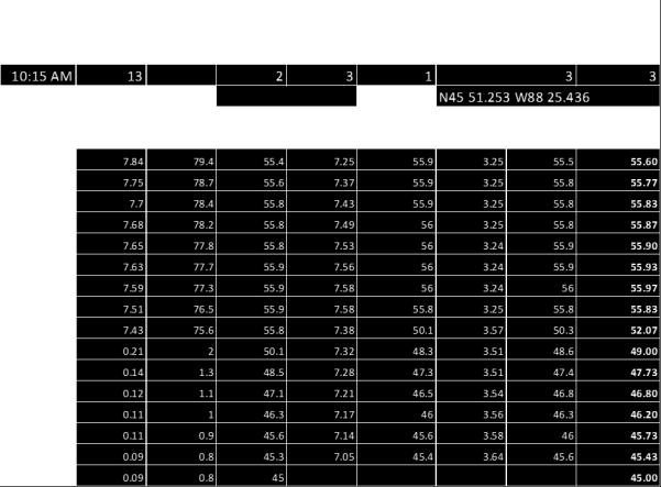
59 Sea Lion Lake 2015 Data Sea Lion Lake, 2016 Photo: Scott W. Goodwin Monitoring this lake for zebra mussels will continue in the future. Some Sea Lion Lake property owners have informed the LCD they are willing to have substrate test plates at their property. The LCD will work to have these in place for the start of the 2017 season. Secchi Obs. Time Secchi Depth Sampled Lake Depth Hit Bottom Lake Level Appearance Water Color Perception 1=yes 2=no 1=high 2=low 1=clear 1=blue 2=green 3=brown 1(best) - 3=normal 2=murky 4=red 5=yellow 5 (worst) 9:35 11 ft 23 no Chemistry Observation Period 10:00-10:40 AM Lat/Long N ' W ' Depth (feet) D.O. (mg/l) Saturation (%) Temp ( F) ph (SU) Temp ( F) Conductivity (μs/cm) Temp ( F) Avg. Temp ( F)

60 Sea Lion 2016 Data 60
.")
61 Spread Eagle Chain of Lakes The Spread Eagle Chain of Lakes is located in central Florence County. This chain is a drainage lake system, with the outflow running to the Menominee River at the Twin Falls Flowage (WDNR 2015L). These seven lakes are the most heavily utilized lakes in the county both by residents, and the many visitors using the public landing at North Lake. Spread Eagle Chain hosts fishing tournaments, and a Fourth of July fireworks display that draws many boaters from in and out of the county. All of this boat traffic has resulted in the Spread Eagle Chain becoming home to numerous invasive species. Invasives known to be in the Spread Eagle Chain of Lakes are banded mystery snail (Viviparus georgianus), Chinese mystery snail (Cipangopaludina chinensis), rusty crayfish (Orconectes rusticus), zebra mussel (Dreissena polymorpha), and Eurasian water-milfoil (Myriophyllum spicatum). In 2015 edna results for North Lake showed a positive indication for spiny waterflea. A subsequent plankton tow and examination by the Wild Rivers Invasive Species Coalition (WRISC) staff did not find spiny waterflea specimens. North Lake West Lake Middle Lake Long Lake East Lake Bass Lake Railroad Lake White water crowfoot Image from Google Earth 61
. This work is paid for in part by a grant from the DNR.")
. Monitoring and removal will continue pending new grant funds.")
62 Spread Eagle Chain of Lakes The Spread Eagle Chain of Lakes Association (SECOLA) has contracted with the environmental consulting firm White Water Associates to conduct hand removal of the Eurasian Water-milfoil (Myriophyllum spicatum). This work is paid for in part by a grant from the DNR. In 2016 it was reported to Florence County AIS staff that the efforts seem to be working, as the populations of Eurasian Water-milfoil were noticeably less in the 2016 season (Weber, personal communication). Monitoring and removal will continue pending new grant funds. The 2015 monitoring was conducted by Florence County AIS staff Crago and Brunette, with the help of a SECOLA member, Carl Sundberg. The 2016 monitoring was conducted by Florence County AIS staff Weber-Starling, and Crago, with the help of SECOLA member, Gary Weber. In 2016 the Florence County Land Conservation Department and the officers of the Spread Eagle Chain of Lakes Association had both received complaint calls from Railroad Lake residents about an aquatic plant bloom. This was mistakenly referred to a milfoil. AIS staff, SECOLA members, and White Water Associates personnel, Angie Stein, assessed the growth and found it to be native White water crowfoot (Ranunculus aquatilis). White water crowfoot bloom in Railroad Lake, Spread Eagle Chain, Photos: Carolyn Weber-Starling 62
 Test Site Image from Google Earth")
63 Bass Lake (Spread Eagle) 2015 Data (WBIC ) Test Site Image from Google Earth 63
64 Bass Lake (Spread Eagle) 2016 Data (WBIC ) 64
 Test Site Image from Google Earth")
65 East Lake (Spread Eagle) 2015 Data (WBIC ) Test Site Image from Google Earth 65
")
66 East Lake (Spread Eagle) 2016 Data (WBIC ) 66
 2015 Data")

67 Long Lake (Spread Eagle) 2015 Data (WBIC ) Test Site Image from Google Earth 67
")
68 Long Lake (Spread Eagle) 2016 Data (WBIC ) 68
 2015 Data")

69 Middle Lake (Spread Eagle) 2015 Data (WBIC ) Test Site Image from Google Earth 69
70 Middle Lake (Spread Eagle) 2016 Data (WBIC ) 70
 Test Site Image from Google Earth")
71 North Lake (Spread Eagle) 2015 Data (WBIC ) Test Site Image from Google Earth 71
")
72 North Lake (Spread Eagle) 2016 Data (WBIC ) 72
 Test Site Image from Google Earth")
73 West Lake (Spread Eagle) 2015 Data (WBIC ) Test Site Image from Google Earth 73
74 West Lake (Spread Eagle) 2016 Data (WBIC ) 74

75 West Bass Lake (WBIC ) Southern Naiad Test Site European Marsh Thistle Image from Google Earth Monitoring of the 55 acre West Bass Lake was conducted by CT Goodwin and AIST Crago on July 15, A week previously the LCD received a call from a resident concerned with aquatic plant growth in the lake. This call accelerated the planned monitoring of West Bass Lake. Goodwin and Crago found three masses of native southern naiad (Najas guadalupensis) on the surface of the lake each approximately three to five square meters. Some plants were still rooted to the ten-foot deep bottom keeping the masses in place. In 2013 Florence County Land Conservation Staff had documented a larger bloom of southern naiad on West Bass Lake (Richard, et al. 2013). Banded mystery snail (Viviparus georgianus) is the only known invasive in West Bass Lake. Goodwin and Crago located a small stand of European marsh thistle (Cirsium palistre) along the south shore. As the plants were on private property a sample was not collected. 75
76 West Bass Lake 2016 Data 76
 for total Phosphorus testing. The results are tabulated below.")
77 Total Phosphorus Test Results In the 2016 season LCD staff collected near surface samples from the lakes monitored. These samples were sent to the Wisconsin State Laboratory of Hygiene (SLOH) for total Phosphorus testing. The results are tabulated below. Results from the SLOH are noted as approximate due to field collection methods and prolonged storage. Wisconsin statue NR102.06(4)(b) defines the allowable total P based on lake type as follows: Drainage & Stratified: 30 µg/l Drainage: 40 µg/l Seepage & Stratified: 20 µg/l Seepage: 40 µg/l As per NR102.06(4)(b) stratified status was defined by calculating the Lathrop/Lillie Value (WDNR 2014) using the equation: Maximum Depth (feet)* Log 10 (Lake Area (acres)* ) Where a resultant value 3.8=mixed lake, >3.8=stratified lake The SLOH reported results in mg/l, this was converted to µg/l to match NR102.06(4)(b). This testing did not conform to the DNR s WisCALM protocols for Total P testing. A single sample was from each lake, not a minimum of six samples over two years. Any future collection and sampling will conform to the WisCALM standards Total P Testing Results * *=Barrens Lake is currently undefined in the WDNR database. If future research classifies Barrens Lake as a drainage lake it does not exceed Total P, if a seepage lake it exceeds Total P by 6.40 µg/l. 77
, rusty crayfish (Orconectes rusticus), or other")

78 Water Hardness Testing In the 2016 season the LCD staff tested total hardness (as CaCO 3 ). This testing was conducted as an initial baseline to establish what lakes might be susceptible to infestation by zebra mussels (Dreissena polymorpha), rusty crayfish (Orconectes rusticus), or other AIS that require CaCO 3. Testing was conducted using Hach Total Hardness color change test strips (Cat ). These test strips produced a color change at 0, 25, 50, 120, 250, & 450 parts per million. While the test strips are not the most accurate method available for CaCO 3 testing, this method did allow for quick testing without having to send additional samples to the SLOH. In their meta-research study, Cohen and Weinstein (2001), concluded a CaCO 3 amount of 20mg/L was sufficient to allow viable reproduction of zebra mussels. The field testing of lakes in Florence County indicate that all tested lakes are above this range, with Lake Anna and Porcupine Lake at the low end. Of specific interest for this testing was Sea Lion Lake. As it receives water from Keyes and Loon Lakes it was expected there would be little difference, and yet it was found to be softer, but still well within range for zebra mussels to colonize the lake. Zebra mussels on the bottom of Keyes Lake, 2015 Photo: Scott W. Goodwin 78


79 Staff and Public Educational Activities Over the course of this two year grant the Florence County Land Conservation Department was involved with environmental and invasive species educational opportunities for our staff and the public. Our staff partnered with the Wild Rivers Invasive Species Coalition, the Wisconsin Department of Natural Resources, and the private contractor Whitewater Associates on multiple projects. Florence County AIS, CBCW staff and volunteers in training AIS Tech Bryce Crago working with DNR Fisheries Biologists Photo: Greg Matzke Photos: Scott W. Goodwin AIS staff collect water samples for edna testing on Keyes Lake Florence County AIS staff attended the DNR s Gear- Up meeting and training sessions, and Marinette County s Diver Assisted Suction Harvesting workshop. They attended multiple state AIS Coordinators meetings, participated in WRISC s Clean Boats, Clean Waters training, and attended the 2016 Upper Midwest Invasive Species Conference. In 2015 and 2016 Florence County Staff and volunteers participated in the River Alliance AIS Bridge Snapshot Day. Multiple locations on Woods Creek, and the Pine, and Menomonee Rivers were examined Two locations from AIS Bridge Snapshot Day Photo: Scott W. Goodwin Photo: Carolyn Weber-Starling 79


80 Our public education efforts included participating with the help of volunteers and WRISC in the Long Lake, Wisconsin and the Iron Mountain Michigan Fourth of July Parades. Staff and volunteers created floats and distributed Stop Invasive Species materials. Florence County AIS and CBCW staff participated in the 2015 and 2016 Drain Campaigns, and Fourth of July Landing Blitzes. End-of-season zebra mussel inspection newspaper educational notice. From Florence Mining News 9/29/2016 With thanks to WRISC and the use of their road stencils, Florence County AIS staff painted eight paved boat landings in the county with Clean, Drain, Dry and Stop Invasive Species messages. We placed AIS educational notices in the local newspaper, including a half-page article for end-of-season zebra mussel inspection of boats and equipment. In the past two years Florence County AIS staff have, through dozens of personal interactions, s, and phone calls, answered hundreds of questions and addressed concerns of county residents and visitors. Florence County AIS staff painted AIS public awareness messages at boat landings in 2016 Photo: Carolyn Weber-Starling 80


81 Truck and boat as AIS awareness float, Long Lake Fourth of July Parade, Martha Bartels, Mary, Matt, (AIST) Shelby, & Sydnee Brunette with Benny, the Stop AIS dog, at the Long Lake Fourth of July Parade, Florence County and WRISC staff in the 2015 Iron Mountain Fourth of July Parade. Florence County AIS Coordinator Carolyn Weber- Starling and CBCW Watercraft Inspector Cassie Dumke ready for the 2016 Iron Mountain Fourth of July Parade. 81

82 Budget & Finance A full accounting of all expenses for this project will be provided to the Wisconsin Department of Natural Resources as a part of the grant reimbursement process. This is scheduled to be complete by February 28, The totals provided in this report are for a general understanding of the program and do not represent the full and final accounting of the AEPP project. Parties interested in the final financial information may contact the Florence County Land Conservation Department. The grant amount was $38,144.90, with a cost share match requirement of $13, The 2015 reimbursement request and documentation was developed for submission to the WDNR by Margie Yadro and Scott Goodwin. At the end of the 2015 season the project had a remaining cash balance of $20, and a cost share requirement totaling $7, The wages and benefits for the 2016 season were less than initially expected due to staffing changes. Conservation Technician Goodwin stopped being paid from the AEPP grant in mid-june, His subsequent work was treated as cost-share match Amount 2016 Amount Wages & Benefits $15, Wages & Benefits $10, Equipment $1, Equipment $6, Travel $1, Travel $1, Misc. Expenses $ Misc. Expenses $ Eurasian/northern water-milfoil hybrid, Barrens Lake,
83 Plans for Future Work The LCD will continue to work on reducing the spread of AIS. We will be looking to the DNR for funding to continue the work started under this project, but will also be looking for additional resources. If funding is not available we will continue to work on AIS issues for the county on a smaller scale than this grant allowed for. We will also be working with WRISC, our partner CISMA, and with the various lake associations in the county to continue the work started under this grant. In 2017 there will be a new LCD-managed Clean Boats, Clean Waters program in Florence County covering seven landings for at least 1,200 hours of watercraft inspections. This will include the six busiest landings in the county, plus a new landing on the Menominee River that opened in late Water Chemistry Testing: The Land Conservation Department has applied for a grant from Lumberjack R.C. & D. to purchase a spectrophotometer. If approved, this device, along with other equipment, will allow the LCD to conduct detailed water chemistry testing. We are not attempting to establish a state-certified laboratory with this testing. As required by the DNR protocols, we will continue to send water samples to the State Lab of Hygiene for Total Phosphorus testing, and any testing that has potential legal ramifications will be sent to the SLOH. However, this in-house testing will help with our understanding of the health of Florence County waters. It will allow us to test at a range and volume the department could never afford to process through the State Lab. WRISC Partnership: The Florence County Land Conservation Department will continue its strong partnership with the Wild Rivers Invasive Species Coalition. Conservation Technician Goodwin will continue to serve on the WRISC Board, and anticipates standing for re-election to this position when his current term is up. In January 2017 WRISC applied for a Great Lakes Restoration Initiative Environmental Protection Agency grant. If this grant is approved for funding this grant could allow WRISC to construct and operate a versatile Diver Assisted Suction Harvesting vessel in the five county area they serve. If this vdash system is constructed the LCD will work with WRISC and the DNR to utilize the vessel effectively in Florence County. Barrens Lake: Barrens Lake will be monitored for changes in the non-native milfoil, and the introduction of new invasive species. This lake may make a suitable test lake for WRISC s possible vdash system. If this project develops the LCD will work closely with the DNR and WRISC moving forward. Cosgrove Lake: We will continue working with WRISC on non-native Phragmites eradication work on Cosgrove Lake. Inspections will be made of the neighboring ponds to ensure the plant is not spreading. If found, it will be treated pending land-owner permission and permitting from the DNR. Fay Lake: In 2017 LCD staff will assess Fay Lake for the possible reed canary grass (Phalaris arundinacea) that CT Goodwin speculated might be present. This assessment will be scheduled for when the water level is high, and the staff will be prepared to pole the boat through the extensive vegetation that restricted access in Lake Ellwood: Monitoring of the EWM in this lake will continue. The Lake Ellwood Association has contracted AIS control work for this lake. It is assumed this work will continue based on funding, and the LCD will be available to assist the Lake Ellwood Association as needed. 83

84 Keyes, Loon, Grass & Sea Lion Lakes: Keyes Lake: Volunteer hand-pulling of the EWM will continue in However, if this method is found to be of limited use in controlling the plant the Land Conservation Department will contact the Keyes Lake Association to assist the association in applying for a DNR AIS Established Population Control grant to hire a contractor for control work. It is possible that the potential WRISC vdash vessel, if constructed, could be used on this lake for control before the plant spreads. Loon Lake: With the discovery of zebra mussels in Loon Lake we will continue to monitor the lake in the 2017 season with substrate test plates. In addition, the LCD will work with WRISC to remove the European marsh thistle (Cirsium palistre) found at the south end of Loon Lake. Grass Lake: The LCD will attempt to access and assess Grass Lake. This lake is part Keyes, Loon, Sea Lion Lakes chain, but it was not included for any work under this grant due to its size and limited access. The lake is small, shallow, and has no Pine River Grass Lake Outflow Sea Lion Lake Inflow Sea Lion Lake outflows Turtle Creek Road culvert Loon Lake public access. Property owner clearance will have to be secured to access the lake. Additionally, If entry can be made, the wetland channels connecting these lakes will also be inspected. Sea Lion: We will monitor Sea Lion Lake closely in the future for signs the zebra mussels are spreading into the lake via the outflow from Loon Lake. Unfortunately, it is anticipated this will happen at some point. One potential method of stopping this might be to place a semi-permeable barrier at the culvert on the outflow from Loon Lake to Sea Lion Lake. This could be investigated at as a possibility. Numerous questions Outflow Keyes Lake Outflow Image from Google Earth would need to be answered, foremost being, will the DNR agree to this? What is the flow rate of the culvert? What micron-size mesh will be capable of catching all veligers? How much water would a semipermeable barrier impound? What is the potential for flooding near-by property? How often would the 84

85 barrier need to be cleaned, maintained, and/or replaced? What would the estimated cost be? Would it be effective in the long-term? What is the funding source? While LCD staff will try to answer these questions, it is possible by the time enough is known to seek a funding source zebra mussels will already be in Sea Lion Lake. Long Lake: The LCD will work with WRISC and the Lake Association of Long Lake to remove the regrowth of purple loosestrife documented in the 2016 survey. It is possible WRISC may need plants for biologic control rearing. If not, the LCD will assist the Lake Association in removal. Montgomery Lake: Much of the purple loosestrife that was found on this lake was removed by WRISC staff late in the 2016 season. It is expected there will be more found in As with Long Lake, the purple loosestrife at this site may prove to be needed by WRISC for beetle rearing. We will work with WRISC to remove any new plants. Spread Eagle Chain of Lakes: The Land Conservation Department will continue to work with SECOLA on their efforts to combat AIS in the chain. The department will be operating a CBCW boatwash at North Lake for a third season, and as with , this location will be staffed full-time, seven days a week. We can do this thanks to the on-going financial support from SECOLA. This support also allows the LCD to staff other landings in the county through the DNR s CBCW program that would not be possible with the match requirements for the DNR s grant. County Wide: The Land Conservation Department will continue to educate the public and local government officials about the problem of invasive species. Department staff continue to monitor the spread of new invasives as they move closer to the county, and be efforts will be made to prepare for new introductions, and to respond in a timely manner if and when these are found. Purple Loosestrife on the north shore of Long Lake, Photo: Scott W. Goodwin 85

 Emily Anderson (WRISC) Martha Bartels Mary & Matt Brunette Shelby Brunette (FCLCD) Sydnee Brunette Russ & Ruth Cassens (FCLARA) Jacob Coe (WRISC)")
 Charissa Kashain (WRISC) Dave Lafebvre Greg Matzke (DNR) Mick Mlinar (FCLARA) Amanda Nelson (DCD) Kayla Obremski (WRISC) Ed Patrick (SECOLA) Lindsay Peterson (WRISC")
 Mary Sissie Sullivan (LAOLL) Carl Sundberg (SECOLA) Dominic VanLaanen (FCLCD) Gary Weber (SECOLA) Jay Weber (SECLOA) Carolyn Weber-Starling (FCLCD) Rich Wolosyn")
86 Acknowledgments The Florence County Land Conservation Department and staff would like to thank the following individuals and organizations who participated or supported this project. Their support, volunteer work, equipment donations, and property access was invaluable to the completion and success of the AIS Prevention and Monitoring Program. Cary Anderson (FCLARA) Emily Anderson (WRISC) Martha Bartels Mary & Matt Brunette Shelby Brunette (FCLCD) Sydnee Brunette Russ & Ruth Cassens (FCLARA) Jacob Coe (WRISC) Gayla & Jeff Crago Joe DeClark (WRISC) Dwaine Drewa Cassandra Dumke (FCLCD) Jarrod Folkman (WRISC) Scott Goodwin (FCLCD) Anne Hruska (DCD) Glen Johnson (FCLARA & SECO- LA) Charissa Kashain (WRISC) Dave Lafebvre Greg Matzke (DNR) Mick Mlinar (FCLARA) Amanda Nelson (DCD) Kayla Obremski (WRISC) Ed Patrick (SECOLA) Lindsay Peterson (WRISC & DCD) Casey Ponchaud (FCLCD) John Roberts Karen Roberts Lillian Slajus (WRISC) Angie Stine (White Water Associates, Inc.) Mary Sissie Sullivan (LAOLL) Carl Sundberg (SECOLA) Dominic VanLaanen (FCLCD) Gary Weber (SECOLA) Jay Weber (SECLOA) Carolyn Weber-Starling (FCLCD) Rich Wolosyn (FCLCD) Margie Yadro (FCLCD) Ron Yadro And the Florence County Land Conservation Committee: Jeanette Bomberg Kim Broullire Todd Broullire Jason Neuens Susan Theer Ed Kelly Yvonne VanPembrook Ed Wenger 86
Eurasian water-milfoil (Myriophyllum spicatum) SCUBA Dive Monitoring Survey Sand Bar Lake WBIC: Bayfield County, Wisconsin
 SCUBA Dive Monitoring Survey Sand Bar Lake WBIC: Bayfield County, Wisconsin") Eurasian water-milfoil (Myriophyllum spicatum) SCUBA Dive Monitoring Survey Sand Bar Lake WBIC: 2494900 Bayfield County, Wisconsin 6ft EWM Towers with Rooted Branch Preparing to Fall Off (Berg 2016) EWM
Eurasian water-milfoil (Myriophyllum spicatum) SCUBA Dive Monitoring Survey Sand Bar Lake WBIC: 2494900 Bayfield County, Wisconsin 6ft EWM Towers with Rooted Branch Preparing to Fall Off (Berg 2016) EWM
Beaver Creek Reserve Meets Success In 6-County AIS Prevention Effort. Anna Mares Beaver Creek Reserve April 13 th, 2011
 Beaver Creek Reserve Meets Success In 6-County AIS Prevention Effort Anna Mares Beaver Creek Reserve April 13 th, 2011 Outline Beaver Creek Reserve Five-county AIS Survey of Lakes With Public Access in
Waupaca Chain O' Lakes Anonymous Stakeholder Survey Surveys Distributed: 804 Surveys Returned: 432 Response Rate: 54% Chain Property
 Waupaca Chain O' Lakes Anonymous Stakeholder Survey Surveys Distributed: 84 Surveys Returned: 432 Rate: 54% Chain Property 1. On which lake of the Chain do you reside or own property? Percent Columbia
MEMORANDUM Comfort Lake-Forest Lake Watershed District
 MEMORANDUM Comfort Lake-Forest Lake Watershed District To: Board of Managers Date: December 7, 2016 From: Mike Kinney Subject: 2016 Watercraft Inspections and AIS Report Summaries Watercraft Inspection
2016 Field Survey Oneida Lake / Three Mile Bay WMA SLELO-PRISM Early Detection Surveillance
 St. Lawrence Eastern Lake Ontario Partnership for Regional Invasive Species Management 2016 Field Survey Oneida Lake / Three Mile Bay WMA Early Detection Surveillance August 3 rd, 4 th, 5 th, and 8 th,
Aquatic Invasive Species in Muskoka. March 2010
 Aquatic Invasive Species in Muskoka March 2010 Introduction The mission of MWC is To Champion Watershed Health. MWC Goals are to Evaluate the Watersheds, Advocate for the Watersheds, Communicate and Educate
Clean Boats, Clean Waters. Watercraft Inspection Program
 Clean Boats, Clean Waters Watercraft Inspection Program Polk County: A Gathering of Waters 42 square miles of water 437 lakes 365 miles of rivers and streams 21,000 acres of wetlands Wisconsin: A Gathering
Starry Stonewort in Silver Lake Washington County, WI BRAD STECKART AIS COORDINATOR FOR WASHINGTON AND WAUKESHA COUNTIES
 Starry Stonewort in Silver Lake Washington County, WI BRAD STECKART AIS COORDINATOR FOR WASHINGTON AND WAUKESHA COUNTIES Brad Steckart -AIS coordinator for Washington and Waukesha Counties -Graduated from
Aquatic Invasive Species in Douglas County Waterways
 Aquatic Invasive Species in Douglas County Waterways Saturday, March 28, 2009 Douglas County Fish & Game League Sport Show Wessman Arena, Superior, WI The Public Trust Wisconsin lakes and rivers are public
Clean Boats, Clean Waters. Watercraft Inspection Program
 Clean Boats, Clean Waters Watercraft Inspection Program Wisconsin Lakes Partnership Science Citizens Education Wisconsin: A Gathering of Waters 11,190 square miles of water 15,081 lakes 43,000 miles of
Mud Bay SLELO-PRISM Water Chestnut & Hydrilla Surveillance 2012
 St. Lawrence Eastern Lake Ontario Partnership for Regional Invasive Species Management Mud Bay Water Chestnut & Hydrilla Surveillance 2012 June 27 th (Water Chestnut) & August 2 (Hydrilla), 2012 Figure
Dexter Marsh Wildlife Management Area and Muskellunge Creek: Water Hyacinth (Eichhornia crassipes) Assessment
 Assessment") St. Lawrence Eastern Lake Ontario Partnership for Regional Invasive Species Management Special Note The partners of the SLELO PRISM have identified 2 Priority Conservation Areas on which we conduct early
St. Lawrence Eastern Lake Ontario Partnership for Regional Invasive Species Management Special Note The partners of the SLELO PRISM have identified 2 Priority Conservation Areas on which we conduct early
Aquatic Exotics In Wisconsin
 Aquatic Exotics In Wisconsin A Presentation Developed by Wisconsin Sea Grant Advisory Services October 2006 Aquatic Exotics In Wisconsin Wisconsin has become host to several aquatic species that never
Delaware Estuary Aquatic Nuisance Species of Concern Summary of ANS Survey, Summer 2002 Kirstin Wakefield, DEP & Ann Faulds, PA Sea Grant
 Delaware Estuary Aquatic Nuisance Species of Concern Summary of ANS E-mail Survey, Summer 2002 Kirstin Wakefield, DEP & Ann Faulds, PA Sea Grant This is a compilation of responses to an e-mail survey of
Chateaugay Lakes Milfoil Control Program
 Chateaugay Lakes Milfoil Control Program Summary of Activities and Findings for June August 29 Prepared By: Daniel L. Kelting Executive Director Adirondack Watershed Institute Paul Smith's College P.O.
Leech Lake Update 5/20/2009 Walker Area Fisheries Office State Hwy. 371 NW Walker, MN
 Frequency (N) Leech Lake Update 5/20/2009 Walker Area Fisheries Office 07316 State Hwy. 371 NW Walker, MN 56484 218-547-1683 Greetings! This update is part of a series of reports the Minnesota Department
Eurasian Water-milfoil Bed Mapping Survey Red Lake (WBIC: ) Douglas County, Wisconsin
 Douglas County, Wisconsin") Eurasian Water-milfoil Bed Mapping Survey Red Lake (WBIC: 2492100) Douglas County, Wisconsin Red Lake Eurasian water-milfoil with >12 leaflet pairs/limp whorls out of water EWM Beds on Red Lake 10/2/16
Eurasian Water-milfoil Bed Mapping Survey Red Lake (WBIC: 2492100) Douglas County, Wisconsin Red Lake Eurasian water-milfoil with >12 leaflet pairs/limp whorls out of water EWM Beds on Red Lake 10/2/16
Lake Winnibigoshish Fisheries Information Newsletter
 Lake Winnibigoshish Fisheries Information Newsletter 03/21/2016 An annual fisheries newsletter for Lake Winnibigoshish In This Issue 2016 Population Assessment Invasive Species VHS Interesting Links Invasive
Citizen Lake Monitoring Network. Lakes Convention April 2011 Laura Herman Brenda Nordin Jay Schiefelbein
 Citizen Lake Monitoring Network Lakes Convention April 2011 Laura Herman Brenda Nordin Jay Schiefelbein Wisconsin s Lakes are Changing Faster than Ever: Algae blooms (phosphorus pollution) Destruction
Aquatic Plant Point-Intercept Survey for Pike Lake, Scott County, Minnesota
 Campers on Pike Lake, Scott County, Minnesota, 2015 Aquatic Plant Point-Intercept Survey for Pike Lake, Scott County, Minnesota [Plant Survey Conducted August 24, 2015] Prepared for: Prior Lake/Spring
Management of Hybrid Watermilfoil (Myriophyllum sibericum x spicatum) using Diver Assisted Suction Harvesting
 using Diver Assisted Suction Harvesting") 2527 Lake Ottawa Road Iron River, MI 49935 906.284.2198 Management of Hybrid Watermilfoil (Myriophyllum sibericum x spicatum) using Diver Assisted Suction Harvesting Lake Ellwood, Florence, WI - 2014 Final
2527 Lake Ottawa Road Iron River, MI 49935 906.284.2198 Management of Hybrid Watermilfoil (Myriophyllum sibericum x spicatum) using Diver Assisted Suction Harvesting Lake Ellwood, Florence, WI - 2014 Final
Bythotrephes longimanus (also known as Bythotrephes cederstroemi)
") DEPARTMENT OF NATURAL RESOURCES CHAPTER P-8 - AQUATIC NUISANCE SPECIES (ANS) 2 CCR 405-8 [Editor s Notes follow the text of the rules at the end of this CCR Document.] ARTICLE 1 - GENERAL PROVISIONS #
DEPARTMENT OF NATURAL RESOURCES CHAPTER P-8 - AQUATIC NUISANCE SPECIES (ANS) 2 CCR 405-8 [Editor s Notes follow the text of the rules at the end of this CCR Document.] ARTICLE 1 - GENERAL PROVISIONS #
Aquatic Invasive Species : Update on AIS related efforts at Deep Creek Lake, Maryland
 Aquatic Invasive Species : Update on AIS related efforts at Deep Creek Lake, Maryland Presentation to the DCL Property Owners Association August 19, 2017 Julie Bortz Maryland Department of Natural Resources
Assessing the Risk of AIS in Waters with no Public Boat Access Hennepin County 2018
 Assessing the Risk of AIS in Waters with no Public Boat Access Hennepin County 2018 Fortin Consulting, Inc. January 2019 Contents Assessing the Risk of AIS in Waters with no Public Boat Access... 2 Executive
located Let s go fishing Hydrilla
 Our Lake of the Month for November is Lake August (set your GPS to 27.2750-81.4136). The elevation of Lake August is 102.5. Lake August is a 52 acre dredge hole lake (man-made from a former wetland; see
Kerr Lake Vegetation Survey. October November Report submitted by NC State University. Background
 Kerr Lake Vegetation Survey October November 2012 Report submitted by NC State University Background Hydrilla (Hydrilla verticillata) is a non-native invasive submersed aquatic plant. This plant was first
Summary of Diver Assisted Suction Harvesting Efforts. Lake Ellwood Florence County, WI
 2527 Lake Ottawa Road Iron River, MI 49935 906.284.2198 Summary of Diver Assisted Suction Harvesting Efforts Lake Ellwood Florence County, WI 2015 WDNR Mechanical Harvesting Permit Annual Report Permit
Eurasian Water-milfoil
 Eurasian Water-milfoil Exotic Eurasian Water-milfoil 11 Native Species of Water-milfoil in USA 7 Native Species of Water-milfoil in WI EWM Native to Asia and Europe EWM Arrived in US in 1942 & WI in 1960s
NEVADA DEPARTMENT OF WILDLIFE STATEWIDE FISHERIES MANAGEMENT
 NEVADA DEPARTMENT OF WILDLIFE STATEWIDE FISHERIES MANAGEMENT FEDERAL AID JOB PROGRESS REPORTS F-20-48 2012 RYE PATCH RESERVOIR WESTERN REGION NEVADA DEPARTMENT OF WILDLIFE, FISHERIES DIVISION JOB PROGRESS
Invasive Species Prevention. For Birch Island Lake Association May 26, 2018
 For Birch Island Lake Association May 26, 2018 What Are The Invasive Species Wisconsin DNR Aquatic Invasive Species What Are The Invasive Species That concern us the most? Eurasian Milfoil Purple Loosestrife
Osoyoos Lake Aquatic Plant Mapping
 Osoyoos Lake Aquatic Plant Mapping AquaTechnex, LLC Presented to Okanogan County NWCB by PO Box 30824 Bellingham WA, 98228 www.aquatechnex.com Introductions Myriophyllum spicatum or Eurasian Milfoil has
ATTACHMENT F. Minnesota Department of Natural Resources. Marsh Lake Ecosystem Restoration Project
 ATTACHMENT F Minnesota Department of Natural Resources Marsh Lake Ecosystem Restoration Project Mussel Rescue and Translocation Plan for Pomme de Terre River Restoration (Prepared June, 2016) Attachment
SECTION #1. What is Watercraft Inspection?
 SECTION #1 What is Watercraft Inspection? 1:1 Recreational boating is identified as a key pathway in the spread of aquatic invasive species (AIS) across the Great Lakes Basin including inland waterbodies
Preventing Aquatic Invasive Species
 Preventing Aquatic Invasive Species Photo by: Alison Fox, University of Florida, Bugwood.org Photo by: Chris Evans, Illinois Wildlife Action Plan, Bugwood.org Many drops make a bucket, many buckets make
Michigan Dept. of Natural Resources Status of the Fishery Resource Report Page 1. Weber Lake Cheboygan County, T34N, R3W, Sec.
 Michigan Dept. of Natural Resources 2012-143 Status of the Fishery Resource Report Page 1 Weber Lake Cheboygan County, T34N, R3W, Sec. 31 Neal Godby, Fisheries Biologist Environment Weber Lake is a 28.5-acre
Columbia Lake Dam Removal Project
 Columbia Lake Dam Removal Project The Columbia Lake dam located 1/4 mile upstream of the Paulins Kill River's confluence with the Delaware River in Knowlton Township, Warren County has been proposed for
DRAFT AMENDMENT 1. Introduction
 DRAFT AMENDMENT 1 Aquatic Plant Management Plan, Yahara River and Upper Mud Lake, Lower Rock River Basin, Dane County Wisconsin Approved by the Dane County Lakes and Watershed Commission on and by the
A Guide to Selected Invasive Non-native Aquatic Species in Massachusetts
 A Guide to Selected Invasive Non-native Aquatic Species in Massachusetts C. Barre Hellquist Department of Biology Massachusetts College of Liberal Arts North Adams, Massachusetts 01247 James Straub Massachusetts
CORRESPONDENCE/MEMORANDUM
 CORRESPONDENCE/MEMORANDUM State of Wisconsin DATE: November 13, 2012 FILE REF: [Click here and type file ref.] TO: FROM: Mike Donofrio Harpt Lake File Steve Hogler SUBJECT: 2012 Harpt Lake Electrofishing
COCOLALLA LAKE ASSOCIATION MEETING JUNE 17, 2008
 COCOLALLA LAKE ASSOCIATION MEETING JUNE 17, 2008 The annual membership and public meeting of the CLA was held on June 17, 2008, at the Cocolalla Community Hall. 14 members and guests were present. Board
REQUEST FOR BID FOR DIVER ASSISTED SUCTION HARVESTING
 REQUEST FOR BID FOR DIVER ASSISTED SUCTION HARVESTING Located on Black Otter Lake, Village of Hortonville, Outagamie County Issued on: January 18, 2018 Due Date: March 16, 2018, 12:00PM Administered by:
AIS Review Bayfield County
 Aquatic Invasive Species Program. Summer / Fall 2011 AIS Review Bayfield County Volume 1, Issue 2 ~ Lake Survey Results ~ This summer, nine lakes were surveyed in Bayfield County. These comprehensive surveys
Cedar Lake Comprehensive Survey Report Steve Hogler and Steve Surendonk WDNR-Mishicot
 Cedar Lake- 2006 Comprehensive Survey Report Steve Hogler and Steve Surendonk WDNR-Mishicot ABSTRACT Cedar Lake is a 142 acre lake located in the southwest corner of Manitowoc County. It is a seepage lake
the Preventing invasive species from spreading to Minnesota lakes is a top priority for the DNR and every Minnesotan. By Mary Hoff
 ST P the By Mary Hoff Preventing invasive species from spreading to Minnesota lakes is a top priority for the DNR and every Minnesotan. One of Ann Latham s fondest memories is going out fishing with her
AQUATIC INVASIVE SPECIES EARLY DETECTORS A HOW-TO GUIDE
 AQUATIC SPECIES EARLY DETECTORS A HOW-TO GUIDE CM 0 1 2 3 4 5 6 7 8 9 10 11 12 13 14 15 16 17 18 19 20 21 FIELD NOTES TABLE OF CONTENTS AIS EARLY DETECTOR BASICS 3 How to prepare 5 Assembling a monitoring
2014 Threatened and Endangered Fish Survey of. East Loon Lake and West Loon Lake. Lake County, Illinois
 2014 Threatened and Endangered Fish Survey of East Loon Lake and West Loon Lake Lake County, Illinois Prepared by Integrated Lakes Management 120 LeBaron St. Waukegan, IL 60085. Chris Ryan Chris Rysso
Fisheries Survey of White Rapids Flowage, Marinette County Wisconsin during Waterbody Identification Code
 Fisheries Survey of White Rapids Flowage, Marinette County Wisconsin during 25 Waterbody Identification Code 6343 Michael Donofrio Fisheries Supervisor Wisconsin Department of Natural Resources Peshtigo,
EcoLogic Memorandum. TO: Ben Brezell; EDR FROM: Mark Arrigo RE: Possible Impacts of Dredging Snooks Pond DATE: 6/4/07
 EcoLogic Memorandum TO: Ben Brezell; EDR FROM: Mark Arrigo RE: Possible Impacts of Dredging Snooks Pond DATE: 6/4/07 Background EDR P.C. (EDR) has been contracted by a landowner to assess the feasibility
Aquatic Plants of the Three Lakes
 Aquatic Plants of the Three Lakes Chris Doyle, CLM Senior Aquatic Biologist/Water Quality Program Supervisor Allied Biological, Inc. 580 Rockport Road Hackettstown, NJ 07840 Phone: 908-850-0303 E-mail:
MINNESOTA FRESHWATER MUSSEL SURVEY AND RELOCATION PROTOCOL
 MINNESOTA FRESHWATER MUSSEL SURVEY AND RELOCATION PROTOCOL Minnesota Department of Natural Resources, Division of Ecological and Water Resources U.S. Fish and Wildlife Service, Twin Cities Field Office
Zebra mussels in a Nebraska Lake. Steven Schainost Nebraska Game and Parks 8 January 2009
 Zebra mussels in a Nebraska Lake Steven Schainost Nebraska Game and Parks 8 January 2009 So where are we? Bellevue and Offutt AFB at center right, just south of Omaha Offutt Base Lake and environs Timeline
Aquatic Invasive Species Outreach Program
 2014 2015 Aquatic Invasive Species Outreach Program Preventing the spread of aquatic invasive species through education and communication programs Created by: Kaila Schmidt Consultant for Missouri Department
6/23/2010. Characteristics of Invasive Species
 Aquatic Nuisance Species Aquatic Invasive Species Exotic Aquatics Biological Roulette By the end of the 21st century, biological invasions [will] become one of the most prominent ecological l issues on
NEVADA DEPARTMENT OF WILDLIFE STATEWIDE FISHERIES MANAGEMENT
 NEVADA DEPARTMENT OF WILDLIFE STATEWIDE FISHERIES MANAGEMENT FEDERAL AID JOB PROGRESS REPORTS F-2-52 216 CHIMNEY RESERVOIR WESTERN REGION NEVADA DEPARTMENT OF WILDLIFE, FISHERIES DIVISION JOB PROGRESS
Conserving the Forests, Lakes and Streams of Northeast Michigan
 4241 Old US 27 South, Suite 2, Gaylord, Michigan 49735 (989) 448-2293 www.huronpines.org info@huronpines.org Prioritized Restoration Projects in the AuSable River Watershed Summer 2015 Update from Huron
Fish Community and Aquatic Ecosystem Responses to the Cessation of Eurasian Watermilfoil Chemical Treatment on Lake Ellwood, Wisconsin
 Fish Community and Aquatic Ecosystem Responses to the Cessation of Eurasian Watermilfoil Chemical Treatment on Lake Ellwood, Wisconsin Greg G. Sass Wisconsin Department of Natural Resources Fisheries and
Pickwick Lake 2018 REEL FACTS Trevor Knight Fisheries Biologist (662)
") Pickwick Lake 218 REEL FACTS Trevor Knight Fisheries Biologist trevork@mdwfp.state.ms.us (662) 84-5176 General Information: Covering 43,1 acres, Pickwick Lake, which borders Alabama, Tennessee, and Mississippi,
Pickwick Lake 218 REEL FACTS Trevor Knight Fisheries Biologist trevork@mdwfp.state.ms.us (662) 84-5176 General Information: Covering 43,1 acres, Pickwick Lake, which borders Alabama, Tennessee, and Mississippi,
NEVADA DEPARTMENT OF WILDLIFE STATEWIDE FISHERIES MANAGEMENT
 NEVADA DEPARTMENT OF WILDLIFE STATEWIDE FISHERIES MANAGEMENT FEDERAL AID JOB PROGRESS REPORTS F-2-49 213 RYE PATCH RESERVOIR WESTERN REGION NEVADA DEPARTMENT OF WILDLIFE, FISHERIES DIVISION ANNUAL PROGRESS
Lake wide Milfoil Management Efforts
 Lake Winnipesaukee Lake wide Milfoil Management Efforts Gilford Island Association Winter Meeting March 5, 2016 Presented by: Patricia Tarpey Lake Winnipesaukee Association Gilford Conservation Commission
MARTINDALE POND Wayne County 2004 Fish Management Report. Christopher C. Long Assistant Fisheries Biologist
 MARTINDALE POND Wayne County 2004 Fish Management Report Christopher C. Long Assistant Fisheries Biologist Fisheries Section Indiana Department of Natural Resources Division of Fish and Wildlife I.G.C.
NEVADA DEPARTMENT OF WILDLIFE STATEWIDE FISHERIES MANAGEMENT
 NEVADA DEPARTMENT OF WILDLIFE STATEWIDE FISHERIES MANAGEMENT FEDERAL AID JOB PROGRESS REPORTS F-20-52 2016 REDBAND TROUT EASTERN REGION NEVADA DEPARTMENT OF WILDLIFE, FISHERIES DIVISION ANNUAL JOB PROGRESS
Aquatic Invasive Species Program 2016 Final Report
 Aquatic Invasive Species Program 2016 Final Report Hudson River Sloop Clearwater, Inc. Samantha Epstein Invasive Species Program Coordinator Hudson River Sloop Clearwater Epstein@clearwater.org (845) 265-8080
Aquatic Plant Point-Intercept Survey for Cates Lake, Scott County, Minnesota
 American Lotus in Cates Lake, Scott County, Minnesota, 2016 Aquatic Plant Point-Intercept Survey for Cates Lake, Scott County, Minnesota [Plant Survey Conducted August 29, 2016] Prepared for: Prior Lake-Spring
NEVADA DEPARTMENT OF WILDLIFE STATEWIDE SPORT FISHERIES MANAGEMENT
 NEVADA DEPARTMENT OF WILDLIFE STATEWIDE SPORT FISHERIES MANAGEMENT FEDERAL AID JOB PROGRESS REPORT F-20-53 2017 RUBY MOUNTAIN & EAST HUMBOLDT HIGH MOUNTAIN LAKES NEVADA DEPARTMENT OF WILDLIFE, FISHERIES
Current Status and Management Recommendations for the Fishery in the Cloverleaf Chain of Lakes
 Current Status and Management Recommendations for the Fishery in the Cloverleaf Chain of Lakes Jason Breeggemann Senior Fisheries Biologist Wisconsin Department of Natural Resources Outline DNR fisheries
PRODUCING A TROPHY LARGEMOUTH BASS FISHERY (CASE STUDY) Greg Grimes President of Aquatic Environmental Services, Inc.
 Greg Grimes President of Aquatic Environmental Services, Inc.") PRODUCING A TROPHY LARGEMOUTH BASS FISHERY (CASE STUDY) Greg Grimes President of Aquatic Environmental Services, Inc. Background 32 acre lake in Harris County, Georgia o The construction of the lake began
PRODUCING A TROPHY LARGEMOUTH BASS FISHERY (CASE STUDY) Greg Grimes President of Aquatic Environmental Services, Inc. Background 32 acre lake in Harris County, Georgia o The construction of the lake began
To help protect Becker County s lakes and rivers, please keep these points in mind before transporting watercraft.
 BECKER COUNTY FORESTRY TOURISM INDUSTRY Established to Serve Since 1858 Becker County AGRICULTURE Minnesota is known for its clean water, good fishing, and incredible recreational opportunities. With your
Pine Lake News. Greetings from Pine Lake. Spring Pine Lake Commissioners. Chairperson: Greetings from the Board...
 Pine Lake Commissioners Chairperson: Terry Kloehn 811 Hillview Lane Hiles, WI 11 Commissioners: Jim Gehl 11 N. Range Line Court Mequon, WI 9 Paul Gagnon N77 W11 Woodview Drive Menomonee Falls, WI 1 Karl
Brant Lake Aquatic Invasive Species Training Brant Lake, NY July 30 th, 2010
 Brant Lake Aquatic Invasive Species Training Brant Lake, NY July 30 th, 2010 Tyler Smith Aquatic Invasive Species Coordinator Adirondack Park Invasive Plant Program www.adkinvasives.com Objectives Outline
Aquatic Invasive Species (AIS) Aquatic Plant Management (APM)
 Aquatic Plant Management (APM)") Aquatic Invasive Species (AIS) Aquatic Plant Management (APM) June 28, 2016 Bassett Creek Watershed Management Commission AIS APM Committee Meeting Meg Rattei, Senior Biologist What are Aquatic Invasive
Aquatic Invasive Species (AIS) Aquatic Plant Management (APM) June 28, 2016 Bassett Creek Watershed Management Commission AIS APM Committee Meeting Meg Rattei, Senior Biologist What are Aquatic Invasive
Aquatic Plant Management and Importance to Sport Fisheries
 Aquatic Plant Management and Importance to Sport Fisheries Presentation to Michigan Inland Lakes Convention May 2014 Mike Maceina Professor Emeritus School of Fisheries, Aquaculture, and Aquatic Sciences
Fish Assessment for Sanctuary Pond October 10, 2005
 83 Ambrogio Dr, Suite K Gurnee, IL 60030 8847-244-6662 847-244-0261 fax www.lakesmanagement.com Fish Assessment for Sanctuary Pond October 10, 2005 Prepared For: Dr. Mike Sands Executive Director Liberty
Deep Creek Lake Policy and Review Board. Regular Quarterly Meeting. Deep Creek Lake Discovery Center. Monday October 31, 2016
 Deep Creek Lake Policy and Review Board Regular Quarterly Meeting Deep Creek Lake Discovery Center Monday October 31, 2016 In attendance: PRB Board Members: Greg Snook, Bob Browning, Bob Hoffman, Robert
LAKE TANEYCOMO 2012 ANNUAL LAKE REPORT. Shane Bush Fisheries Management Biologist Missouri Department of Conservation Southwest Region
 LAKE TANEYCOMO 12 ANNUAL LAKE REPORT Shane Bush Fisheries Management Biologist Missouri Department of Conservation Southwest Region March 1, 13 EXECUTIVE SUMMARY Lake Taneycomo was formed by the construction
Aquatic Plant Surveys in Donner Lake State Park, California: Report to California State Parks. Final Draft
 Aquatic Plant Surveys in Donner Lake State Park, California: 2017 Report to California State Parks Final Draft Brant Allen, Katie Senft, and Brandon Berry UC Davis Tahoe Environmental Research Center February
BIG TWIN LAKE Kalkaska County (T28N, R05W, Section 18, and T28N, R06W, Section 13) Surveyed May 1999
 Surveyed May 1999") Michigan Department of Natural Resources Status of the Fishery Resource Report No. 2001-1, Year 2001 BIG TWIN LAKE Kalkaska County (T28N, R05W, Section 18, and T28N, R06W, Section 13) Surveyed May 1999
Michigan Department of Natural Resources Status of the Fishery Resource Report No. 2001-1, Year 2001 BIG TWIN LAKE Kalkaska County (T28N, R05W, Section 18, and T28N, R06W, Section 13) Surveyed May 1999
6TH PELLETIER BROOK LAKE T15 R9, Aroostook Co. U.S.G.S. Gardner Pond, Maine (7 1/2 )
") 6TH PELLETIER BROOK LAKE T15 R9, Aroostook Co. U.S.G.S. Gardner Pond, Maine (7 1/2 ) Fishes Brook trout Minnows Blacknose dace Pearl dace Physical Characteristics Area - 27 acres Average depth - 2 feet
6TH PELLETIER BROOK LAKE T15 R9, Aroostook Co. U.S.G.S. Gardner Pond, Maine (7 1/2 ) Fishes Brook trout Minnows Blacknose dace Pearl dace Physical Characteristics Area - 27 acres Average depth - 2 feet
NEVADA DEPARTMENT OF WILDLIFE STATEWIDE FISHERIES MANAGEMENT
 NEVADA DEPARTMENT OF WILDLIFE STATEWIDE FISHERIES MANAGEMENT FEDERAL AID JOB PROGRESS REPORTS F-20-52 2016 LAKE TAHOE WESTERN REGION NEVADA DEPARTMENT OF WILDLIFE, FISHERIES DIVISION ANNUAL PROGRESS REPORT
Fighting Milfoil at Lake Louise
 Fighting Milfoil at Lake Louise Presentation by Cottagers Council, Lake Louise Christian Community Charlevoix County Parks and Recreation Committee April 20, 2015 Lake Louise Christian Community (LLCC)
Fisheries and Oceans Canada Aquatic Invasive Species (AIS) Funding Update. Becky Cudmore, AIS Program Fisheries and Oceans Canada
 Funding Update. Becky Cudmore, AIS Program Fisheries and Oceans Canada") Fisheries and Oceans Canada Aquatic Invasive Species (AIS) Funding Update Becky Cudmore, AIS Program Fisheries and Oceans Canada 1 Threats around Canada West coast: Largemouth Bass Smallmouth Bass New
Fisheries and Oceans Canada Aquatic Invasive Species (AIS) Funding Update Becky Cudmore, AIS Program Fisheries and Oceans Canada 1 Threats around Canada West coast: Largemouth Bass Smallmouth Bass New
Issues facing this region include the status of the Sluice Creek tide gates, various tidal wetlands, and locations of public access:
 5.6 Guilford Point to Madison Town Line Existing Resources This region extends from Guilford Point to the Madison town line. Named places include Grass Island and the East River. Residential, commercial,
CARL BLACKWELL LAKE MANAGEMENT PLAN
 CARL BLACKWELL LAKE MANAGEMENT PLAN Background Lake Carl Blackwell impounds Stillwater Creek, 10 miles west of Stillwater in Payne County, Oklahoma (Figure 1). The lake covers 3,370 surface acres and was
Shallow Lake Management Strategies. Steve McComas Blue Water Science Shallow Lakes Forum April 2014
 Shallow Lake Management Strategies Steve McComas Blue Water Science Shallow Lakes Forum April 2014 Shallow Lakes and Ponds Are Similar Shallow Lake Goal: Clear water and macrophytes. Clear Turbid Aquatic
BIG MARINE LAKE, WASHINGTON COUNTY: 2017 AQUATIC VEGETATION REPORT
 BIG MARINE LAKE, WASHINGTON COUNTY: 2017 AQUATIC VEGETATION REPORT Report by the Invasive Species Program Division of Ecological and Water Resources Minnesota Department of Natural Resources Lake: Big
Fisheries Management Zone 10:
 Fisheries Management Zone 10: Lake Trout Operational Objectives and Management Photo Credit: www.jamessmedleyoutdoors.com 2 FMZ 10: Lake Trout Operational Objectives and Management Lake trout are the second
Missouri Non Native Aquatic Species and Watercraft Survey, October 2009
 Missouri Department of Conservation Missouri Non Native Aquatic Species and Watercraft Survey, October 9 Timothy J. Banek and Shelly N. Colatskie March 11 This project was funded by the U.S. Fish and Wildlife
DRIPPING SPRINGS LAKE 5 YEAR LAKE MANAGEMENT PLAN
 DRIPPING SPRINGS LAKE 5 YEAR LAKE MANAGEMENT PLAN FISHERIES DIVISION CENTRAL REGION OKLAHOMA DEPTMENT OF WILDLIFE CONSERVATION PREPARED BY: DANNY BOWEN OCTOBER 2013 1 Background Dripping Springs Lake impounds
Recent changes in invasive zebra mussel abundance in Gull Lake. Jeffrey D. White GLQO Annual Meeting 12 August 2014
 Recent changes in invasive zebra mussel abundance in Gull Lake Jeffrey D. White GLQO Annual Meeting 12 August 2014 Zebra mussels: background Introduced: 1980s from Europe/Asia Transported: ballast water
ZEBRA MUSSEL MONITORING Guidelines for Stream Teams
 ZEBRA MUSSEL MONITORING Guidelines for Stream Teams How Stream Teams can help track the status of Missouri s latest threat to streams and lakes Zebra Mussels Are Here! Missouri has had its share of exotic
Summary of and Initial Response to public comments on MN Department of Natural Resources proposal to manage new waters for Muskellunge
 Summary of and Initial Response to public comments on MN Department of Natural Resources proposal to manage new waters for Muskellunge Summary of and Initial Response to public comments: This document
AQUATIC INVASIVE SPECIES PREVENTION FOR LAKE GEORGE PUBLIC HEARING MAY 21, LAKE GEORGE
 AQUATIC INVASIVE SPECIES PREVENTION FOR LAKE GEORGE PUBLIC HEARING MAY 21, LAKE GEORGE What is the Lake George Park Commission? The Lake George Park Commission is a NYS agency established to oversee and
Hazardous Paths to the Columbia Gorge
 AQUATIC INVADER INVESTIGATOR Hazardous Paths to the Columbia Gorge SOLVE THE PATHWAY PUZZLE AND IDENTIFY HAZARDS The Columbia River, pictured here, forms the border between Oregon and Washington. Photo
Crooked Lake Oakland County (T4N, R9E, Sections 3, 4, 9) Surveyed May James T. Francis
 Surveyed May James T. Francis") Michigan Department of Natural Resources Status of the Fishery Resource Report No. 2004-1, 2004 Crooked Lake Oakland County (T4N, R9E, Sections 3, 4, 9) Surveyed May 2002 James T. Francis Environment Crooked
Michigan Department of Natural Resources Status of the Fishery Resource Report No. 2004-1, 2004 Crooked Lake Oakland County (T4N, R9E, Sections 3, 4, 9) Surveyed May 2002 James T. Francis Environment Crooked
DIVING AS A TECHNIQUE TO CONTROL EXOTIC AQUATIC PLANTS: THE WEED CONTROL DIVER PROGRAM
 DIVING AS A TECHNIQUE TO CONTROL EXOTIC AQUATIC PLANTS: THE WEED CONTROL DIVER PROGRAM PREPARED BY: NEW HAMPSHIRE DEPARTMENT OF ENVIRONMENTAL SERVICES EXOTIC SPECIES PROGRAM 29 HAZEN DRIVE CONCORD, NH
Appendix G Whitewater Recreation Flow Study Plan
 Appendix G Whitewater Recreation Flow Study Plan Study Plan Whitewater Recreation Flow Study Grandfather Falls Hydroelectric Project FERC Project No. 1966 March 2013 An Integrys Energy Group Company Section
Upper/Lower Owl Creek Reservoir
 Upper/Lower Owl Creek Reservoir Schuylkill County 2018 Largemouth Bass Survey Upper Owl Creek Reservoir and Lower Owl Creek Reservoir are 67-acre and 26-acre impoundments, respectively, created by two
Lake George Association E-news March 2011
 Trouble view ing this email? Click here to see it in a brow ser. Lake George Association E-news March 2011 IN THIS ISSUE... An update on the West Brook Enviromental Park Asian Clam Rapid Response Task
What was the historic coaster fishery like?
 1 of 6 1/30/2012 12:25 PM Home About Topics Contact Us Fishing Calendar Fish ID Tips FAQs Hack Noyes Research Vessel Is it a unique strain long lost from Wisconsin's shoreline? Fisheries Reports Tributaries
Delineation of the Asian Clam (Corbicula fluminea) Population at Sand Harbor State Park, Nevada
 Population at Sand Harbor State Park, Nevada") Delineation of the Asian Clam (Corbicula fluminea) Population at Sand Harbor State Park, Nevada Report to the Nevada Division of State Lands and the Tahoe Regional Planning Agency Final Draft Brant Allen,
Delineation of the Asian Clam (Corbicula fluminea) Population at Sand Harbor State Park, Nevada Report to the Nevada Division of State Lands and the Tahoe Regional Planning Agency Final Draft Brant Allen,
Starry Stonewort. A new aquatic invader in Wisconsin. Michelle Nault Wisconsin Department of Natural Resources
 Starry Stonewort A new aquatic invader in Wisconsin Michelle Nault Wisconsin Department of Natural Resources Michelle.Nault@Wisconsin.gov Photo: Paul Skawinski What is starry stonewort? Starry stonewort