Cyndi Baker, Ph.D. formerly with Ducks Unlimited, Inc.
|
|
|
- Maryann Lane
- 6 years ago
- Views:
Transcription

1 Cyndi Baker, Ph.D. formerly with Ducks Unlimited, Inc.
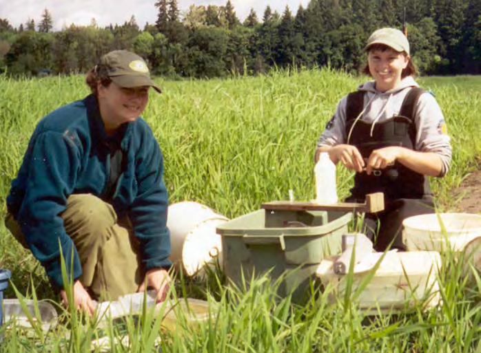
2 Background of Study with DU 15 sites in seasonal floodplain wetlands across Oregon & Washington Community ecology perspective (OSU) Fish assemblage late-fall through spring Movement into/out of floodplains Restoration projects and salmon (DU) Juvenile salmon use was the prime focus Seasonal use of floodplain wetlands Fish passage capability through structures Risk of stranding /predation juvenile salmon by allowing access to floodplain Benefits to salmon by increasing hydrologic connectivity to floodplain and wetland area during winter/spring (growth, condition factor, survival)

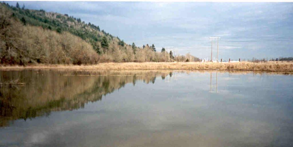
3 Actively managed sites


4 Structures increase duration and predictability of inundation Bottom surface elevation of channel 2.5 m
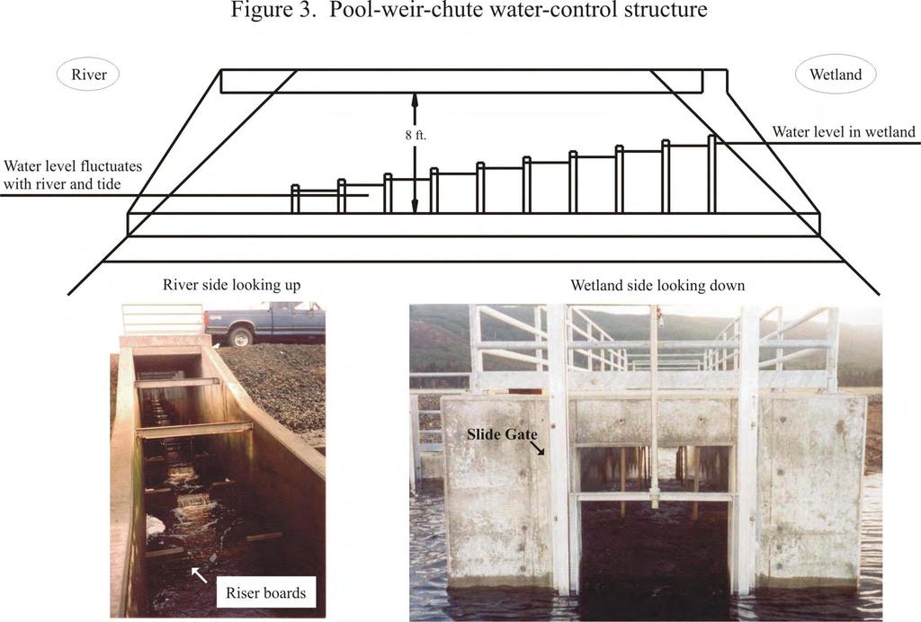
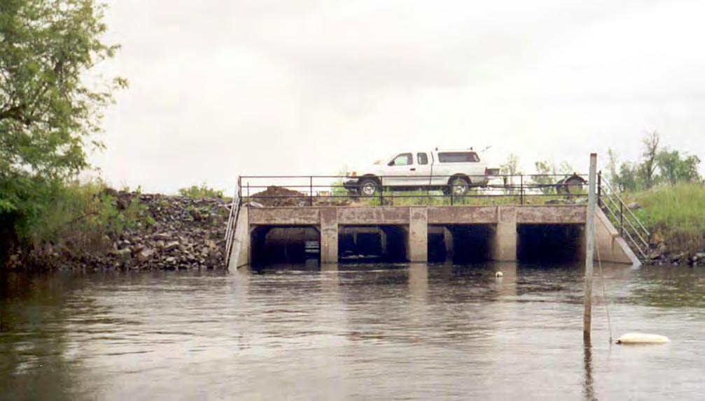
5 Pool-weir-chute
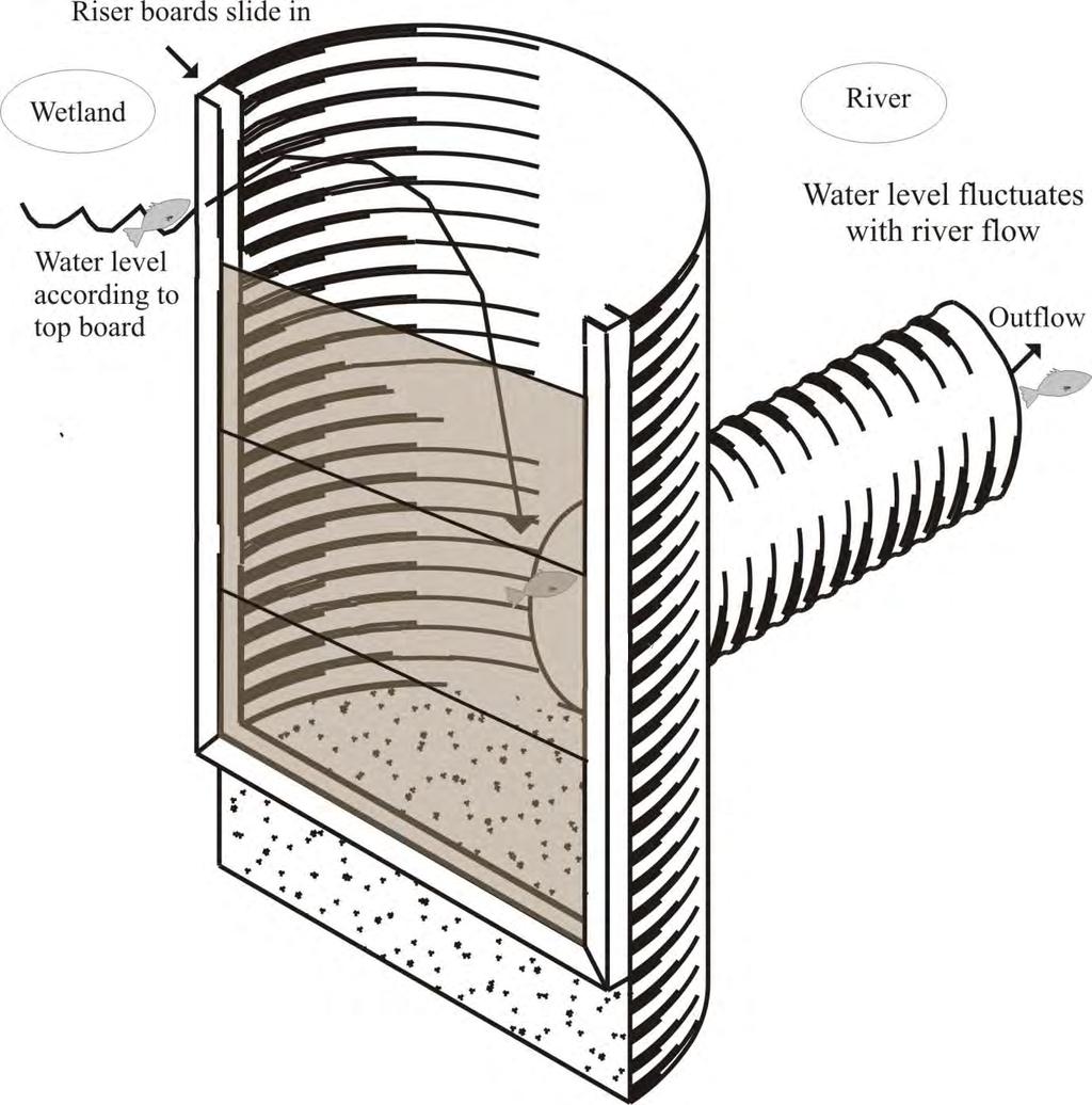
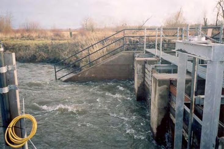
6 Flashboard riser
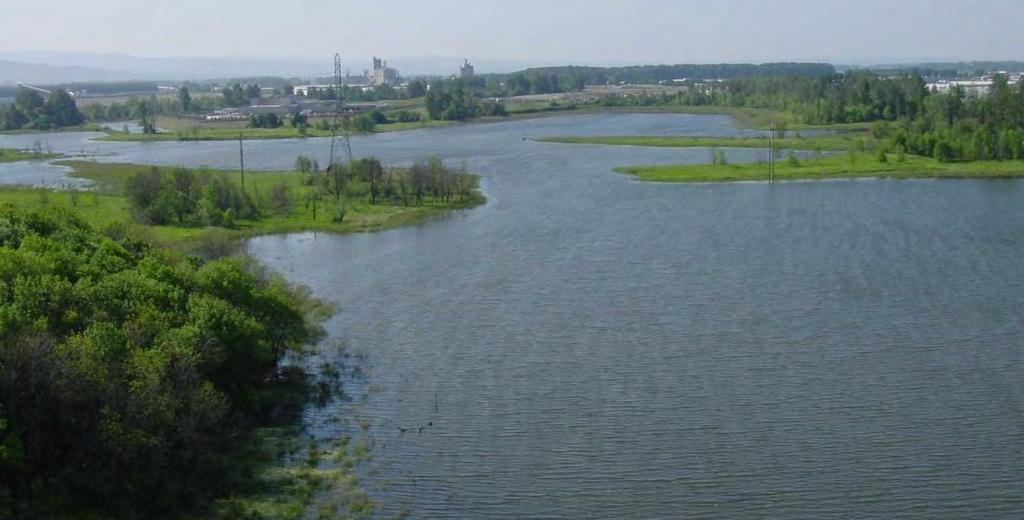
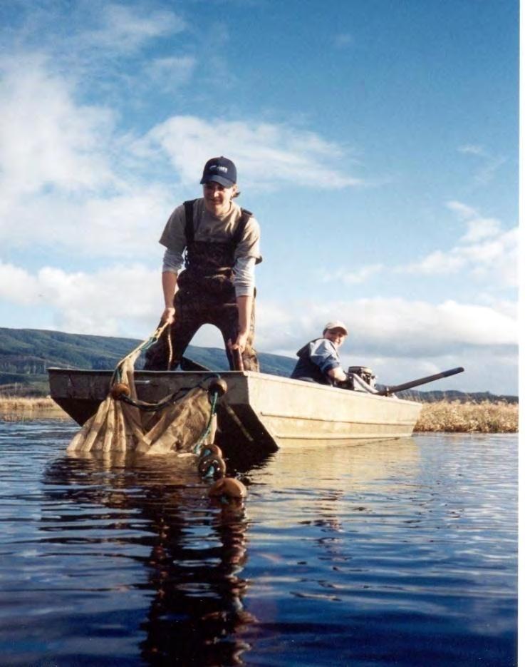
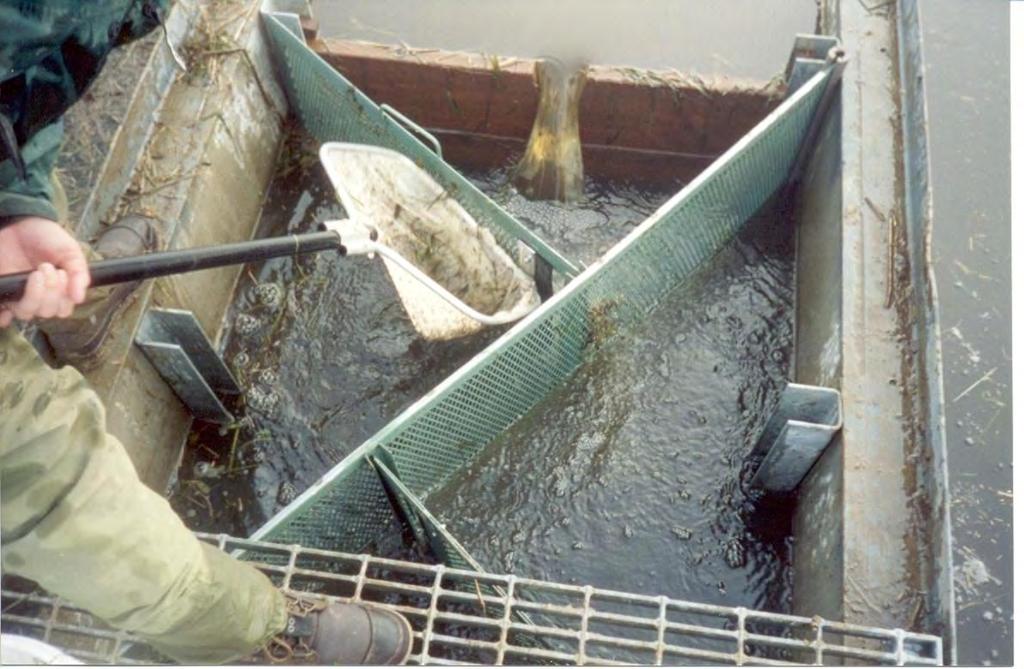
7 Site selection Opportunistic sampling at Ducks Unlimited project sites in Oregon and Washington Wetlands periodically accessible to riverine fishes during period of inundation (Nov-June) No salmon spawning occur in streams flowing into wetland sites (juvenile salmon must enter from adjacent river) Broad geographical range across continuum of environmental conditions Dispersed across PNW
8 Sites in Lower Willamette and East Fork Lewis rivers Smith & Bybee Lakes McCarthy Ck. (aka Enyart) Multnomah N. Ruby Lake Widgeon Lake LaCenter
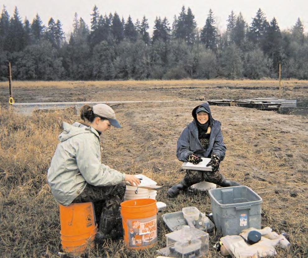
9 Sampling Protocol Based on water year November through June WY 2002 to 2006 (5 yrs) Within wetland sampling Ingress/egress sampling
10 Environmental Variables Water temperature Water surface elevation (river vs. floodplain) Precipitation Wetland site (area, volume, average depth, distance to salmon migration route) Categorical (region, tidal influence, structure type, stream flow through wetland) Other (lunar phase, barometric pressure)
 Set every")

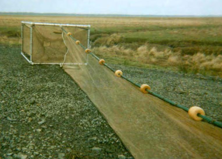
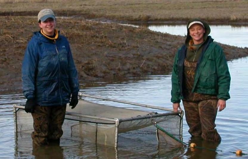
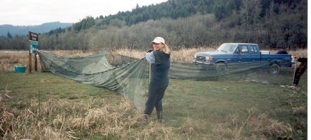
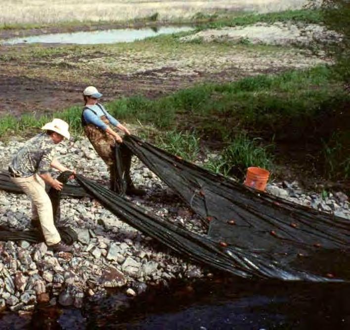
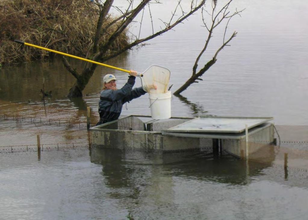
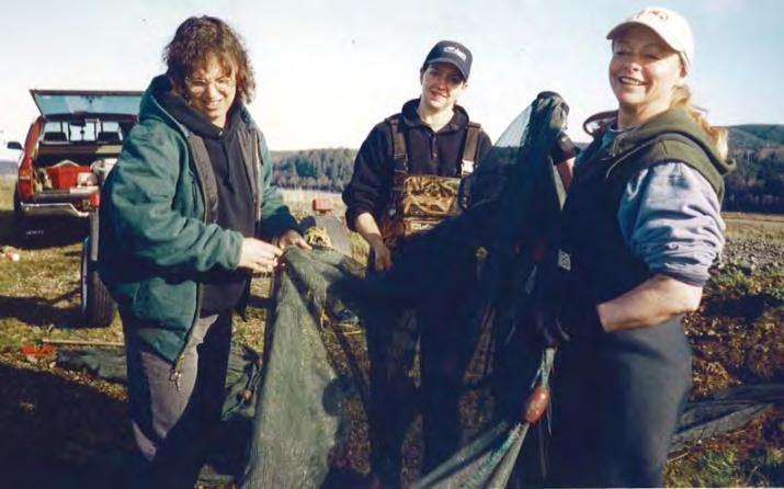
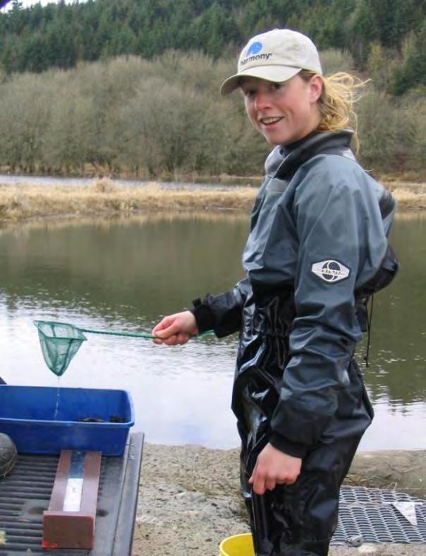
11 Within-wetland sampling Passive trap nets (4-5 nets) Set every 4-6 weeks Overnight sets 176 sample events (1-2 days, all nets used )
12
13
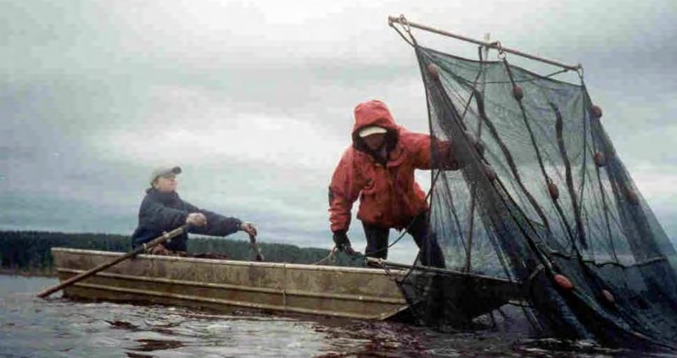
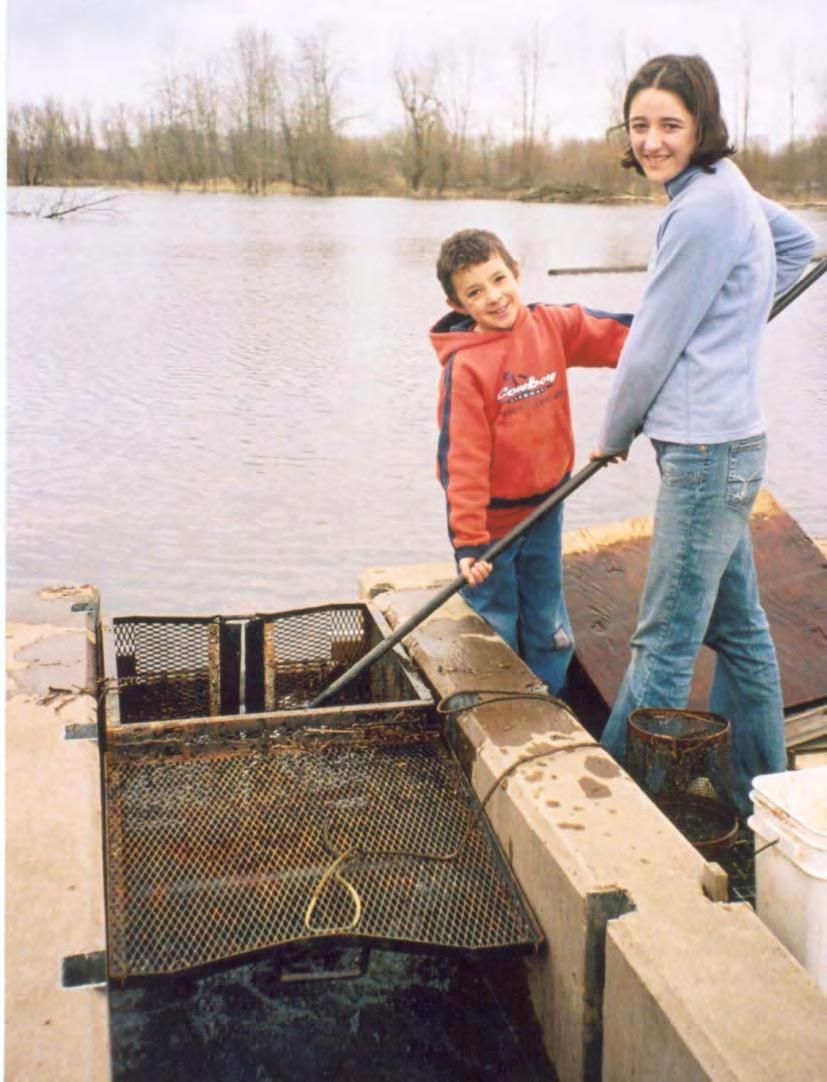
14 Ingress/Egress sampling Two-way traps all six sites in Upper CR estuary Traps checked 3x/week 1311 sample events (trap-check days/site)
15

16 Comparison among six sites in upper Columbia River estuary
17 Fish species presence (indicated by X) at each site in UCRE (species common to all sites are shaded) Species in order of abundance McCarthy Ck. Mulnomah N. LaCenter Smith- Bybee Wigeon Lk. Ruby Lk. Native fish species Threespine stickleback X X X X X X Northern pikeminnow X X X X X X Chinook X X X X X X Redside shiner X X X X X X Peamouth X X X X X Coho X X X X Largescale sucker X X X X X X Sculpin sp. X X X X X X Lamrey sp. X X X X Rainbow/steelhead X X X Cutthroat X X Chiselmouth X Total native species Introduced fish species Carp/goldfish X X X X X X Yellow perch X X X X X X Crappie sp. X X X X X X Bullhead sp. X X X X X X Sunfish sp. X X X X X X Oriental weatherfish X X X X X Banded killifish X X X X X X Golden shiner X X X X X X Largemouth bass X X X X X X Amur goby X Mosquitofish X X X X X X Smallmouth bass X X X Fathead minnow X X Total introduced species Total N+I species
18 Average a) native and b) introduced fish species richness among UCRE sites in winter and spring (with 95% confidence intervals).
19 In UCRE sites: % of total catch small-bodied fishes <200 mm Of the total catch in all wetlands, small- Bodied fishes weighed 72% of the total catch and large-bodied fishes weighed the remaining 28% Species ( 200mmFL) fish/net-day % of total catch Threespine stickleback Carp/goldfish (<100mmFL) Yellow perch Northern pikeminnow Crappie sp Brown bullhead Sunfish sp Chinook Redside shiner Peamouth Coho Carp (>100mmFL) Oriental weatherfish Sculpin sp Largescale sucker Banded killifish Golden shiner Largemouth bass Lamprey sp Amur goby Mosquitofish Rainbow trout (steelhead) Cutthroat trout Smallmouth bass Fathead minnow 0 0 Chiselmouth 0 0 total= 99.70% 27.8% of catch, by weight (all fish large and small)
20 % of total catch largebodied fishes >200 mm Species (>200mmFL) Max. FL (mm) Av. FL (mm) fish/net-day % of total catch Peamouth Carp/goldfish (>200mmFL) Brown/yellow bullhead Largescale sucker Rainbow trout (steelhead) Yellow perch Northern pikeminnow Crappie sp Cutthroat trout Chinook Largemouth bass Smallmouth bass total= 0.30% 69 fish 9 fish each 1 fish each 7 fish Large bodied fishes weighed 28% of the total catch 24% was non-predatory fishes (carp, suckers) 4% of the total catch, by weight, were piscivorous fishes (bullhead, N. pikeminnow, etc.)


21 How does fish species composition differ between floodplain lakes and sloughs? I have data attributed by channel, pond and wetland but not analyzed Not always easy to distinguish habitat types especially during high water

22 How does fish species composition differ between main stem and floodplain habitats?
23 About 60% of fish species found in rivers were documented in the adjacent wetlands. Almost all fish species in a given wetland were present in the adjacent river (94%) Willamette River East Fork Lewis River 1. American shad (i) 9. chiselmouth 20. peamouth 1. Chinook 13. largemouth bass 2. banded killifish (i) 10. coho 21. prickly sculpin 2. chum 14. smallmouth bass 3. black crappie (i) 11. carp (i) 22. redside shiner 3. coho 15. carp white crappie (i) goldfish (i) 23. sandroller 4. steelhead/rainbow goldfish 4. bluegill (i) 12. smelt 24. smallmouth bass (i) 5. cutthroat 16. white crappie pumpkinseed (i) 13. golden shiner (i) 25. sockeye 6. sculpin black crappie warmouth (i) 14. largemouth bass (i) 26. starry flounder 7. bridgelip sucker 17. banded killifish 5. bridgelip sucker 15. longnose dace largescale sucker 18. yellow perch largescale sucker speckled dace 27. steelhead/rainbow 8. peamouth 19. pumpkinseed 28. threespine 6. brown bullhead (i) 16. mosquitofish (i) stickleback 9. northern pikeminnow 20. brown bullhead yellow bullhead (i) 17. mountain whitefish 29. walleye (i) 10. smelt yellow bullhead 7. channel catfish (i) 18. northern pikeminnow 30. sturegon 11. sandroller 21. white sturgeon 8. Chinook 19. Pacific lamprey 31. yellow perch (i) 12. redside shiner 22. threespine stickleback i=introduced exclusive to river In Willamette River floodplain sites, only fathead minnow & oriental weatherfish exclusive to wetlands In LaCenter wetland, Amur goby, golden shiner & Mosquitofish exclusive to wetland
24 Find patterns in fish communities and relate to environmental variables PC-ORD cluster analysis - assign species to functional groups and validate group membership non-metric multidimensional scaling - ordination method used to correlate groups with species trait characteristics and for graphical representation displaying the association between fish species and species traits HyperNiche non-parametric multiplicative regression used to identify relationships between individual fish species and variables from the environmental matrix
25 Species traits brown bullhead carp/ goldfish chiselmouth coho trophic category (see below) pisc macro plank macro adult vegetation preference (y/n) y y n n preference for clear water (y/n) n n y y prefer mud feeding substrate (y/n) y y n n typically reside in wetlands as adults (y/n) y y n n spawning water type (stream/wetland) wetland wetland stream stream spawning substrate/structure (see below) mud veg gravel gravel min water temp spawn º C max water temp spawn º C current required for spawning (y/n) n n y y range for spawning timing Apr-Jun Apr-Jul May-Jul Sep-Jan multiple spawning per season (y/n) n n n n juv min water temp preference º C juv max water temp preference º C juv current preference (still, low, mod) still still mod low juv preference structure/substate (see below) veg veg log/rock pool/ch typically rear in wetlands (y/n) y y n y tolerance to low DO (low, med, hi) hi hi low low trophic category is according to the most common size class in the catch (macroinvertebrate, piscivore, planktivore) spawning substrate/structure (log, vegetation, mud, gravel, sand) juvenile preference for structure/substate (log/rock, veg, mud, pool/channel)
26 Group WW: Introduced, warmwater spawning and rearing temperatures Group MOD: Native and introduced*, moderate spawning and rearing water temperatures Group CW: Native, cool-water spawning and rearing temperature Amur goby (GOB) Chiselmouth (CHM) Chinook (CHI) Banded killifish (BAK) Largescale sucker (LGS) Coho (CHO) Brown bullhead (BRB) Northern pikeminnow (NPM) Chum (CHU) Crappie (CRP) Peamouth (PEA) Cutthroat (CUT) Fathead minnow (FHM) Redside shiner (RSS) Rainbow trout (RBT) Golden shiner (GOS) Speckled dace (SKD) Sculpin (COT) Largemouth bass (LMB) Carp/goldfish* (CAP) Lamprey (LAM) Mosquitofish (MOF) Oriental weatherfish* (OWF) Olympic mudminnow (OLY) Smallmouth bass (SMB) Yellow perch* (YEP) Threespine stickleback (TSS) Sunfish (SUN)
27 Ordination displaying the association between fish species and species traits

28 Response surface of introduced, warm-water fish functional group to environmental variables Predictor Sensitivity Tolerance 7-d avg max air temp d avg water temp
 decrease, 2005-2006 Site Trap direction Predictor 1 (sensitivity) Predictor 2 (sensitivity) xr 2 # SU WW SB IN WetWt (1.0069) WM3dSD (0.3391) 0.")
29 Two views of response surfaces of inbound WW fish (log fish/trapcheck day) at Smith-Bybee wetland to wetland water temperature (ºC) and maximum 3-day stage (m) decrease, Site Trap direction Predictor 1 (sensitivity) Predictor 2 (sensitivity) xr 2 # SU WW SB IN WetWt (1.0069) WM3dSD (0.3391)
30 Average Daily Average Water Temperatures in Six UCRE Floodplain Wetlands Nov- June, Species Water temperature ( o C) References minimum maximum Chinook (Armour 1991) (Scott and Crossman 1998) Chum (Scott and Crossman 1998) Coho (Bjornn and Reiser 1991) Cutthroat trout (Hickman and Raleigh 1982) Rainbow trout (Benke 1992) Preferred water temperatures for juvenile salmonid rearing
31 Water temperature in the East Fork Lewis River and two ponds within LaCenter Bottoms wetland, Nov June 2005 Behavioral thermoregulation - move through temperature gradients to find preference Hydrologic connectivity allows fish to move between river and floodplain to find most suitable habitat

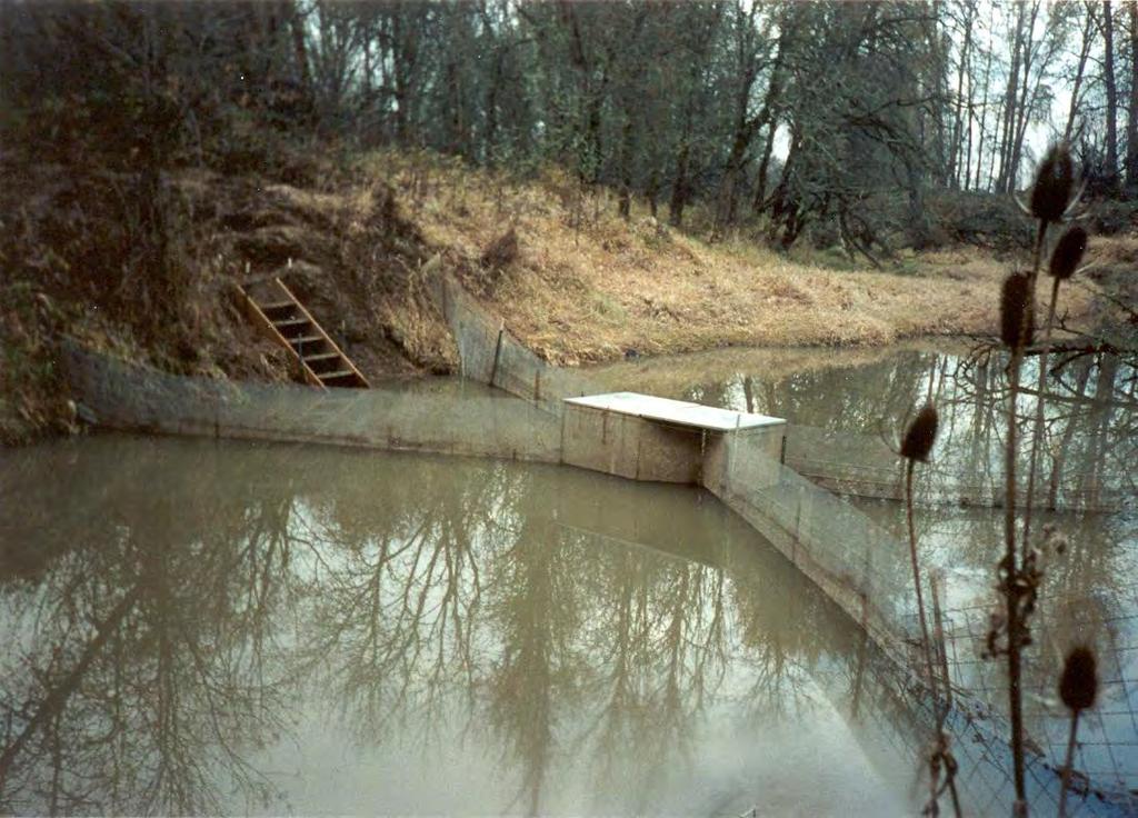
32 LaCenter Floodplain Restoration Area and East Fork Lewis River

33 What factors influence movement in and out of floodplain habitats
34 Average catch of coho and Chinook in two-way traps
35 Ingress/Egress UCRE: greatest catch coho/chinook inbound was Nov-March; outbound April-June
36 Two-way traps missed ingress of juvenile salmonids during high water events McCarthy Ck. Wetland after high water event Water surface elevation in Multnomah Channel WY 2003 Stage (ft.) NGVD Feb 2, 2003 High water event in Mulnomah Channel 2/2/03 Sampled floodplain on 2/11/03: 1, Chinook caught (34-52 mm and 52 coho (67-108mm) In April, only Chinook were caught
37 LaCenter coho ingress 5.5 HyperNiche model (60 trap checks, xr 2 =0.44) Wetland water level (4.1 m) Stage (NAVD 1988) m River level 4.0 (3.1 m) Channel Wetland
38 LaCenter coho/chinook egress One day change in barometric pressure (-0.35 mm Hg) Lunar phase HyperNiche model (53 trap checks, xr 2 =0.66)

39
40 Juvenile salmon growth in wetlands Data sparse but suggests positive growth of juvenile Chinook and coho during winter and spring
41 Change in condition factors after wetland residence LaCenter 2005: 50% coho CF increased in wetland, 30% remained stable and 20% decreased (n=10) LaCenter/Enyart 2006: 80% increased, 20% remained stable (n=9)

42

43 Chinook fry stock and origin DU and ODFW observe Chinook fry in Willamette R. and wetlands winter/spring DU collected fin clips winter/spring 2005 and 2006 David Teel, NOAA Fisheries, microsatellite DNA analysis

44 river vs. wetland spring 05

45 Wetlands spring 06
46 Summary 1 Juvenile salmonid use of seasonal floodplain wetlands was widespread across the region. Salmonids were caught in every wetland sampled, although relative abundance varied greatly.
47 Summary 2 Risk of juvenile salmonid predation in seasonal floodplain wetlands may be small judging from the low relative abundance of potential piscivores in the catch, high relative abundance of other species more prone to predation (threespine stickleback), and the increase in rearing area following inundation may reduce the probability of encountering a predator.
48 Summary 3 Moderate to high growth rates (up to 1.04 mm/d) of salmonids rearing in wetlands and higher condition factors after wetland rearing compared with wetland entry indicated that juvenile salmon received some benefit by inhabiting floodplain wetlands.
49 Summary 4 Wetland water temperatures were in the optimal range for juvenile salmonid growth during the late winter and early spring. Juvenile salmon egressed from wetland sites as water temperatures warmed in the spring.
50 Summary 5 Juvenile salmon caught in traps as they entered wetlands from adjacent rivers indicated volitional entry. Patterns of inbound and outbound movement of juvenile salmon at wetland sites varied seasonally. Movements were prompted by different environmental variables depending on site, species, and whether juvenile salmon were entering or leaving wetland sites.
51 Implications for restoration and management: A Despite alterations to habitat and hydrologic regime, juvenile coho and Chinook use floodplain habitats in winter and spring when they have access Will providing ingress/egress opportunity benefit salmon? Growth, early indications suggest yes Survival? Life history diversity?
52 Implications for restoration and management: B Design and management of projects effect ingress/egress and stranding Must choose appropriate design according to hydrology and management capability
53 Implications for restoration and management: C Restoration projects in lower river reaches may benefit juveniles from stocks other than those that spawn upstream in that river
54
55 Support provided by: Ducks Unlimited MJ Murdock Charitable Trust Oregon Watershed Enhancement Board FishAmerica Foundation Pacific Joint Venture David and Lucille Packard Foundation The Wertheimer Family Trust National Fish and Wildlife Foundation EPA Wetland Program US Forest Service Oregon SeaGrant
Ecosystem Monitoring Project 2014 Fish Sampling Update
 Ecosystem Monitoring Project 2014 Fish Sampling Update Lyndal Johnson, Sean Sol, Dan Lomax, Paul Chittaro, David Teel, and Gina Ylitalo NOAA Fisheries Northwest Fisheries Science Center, Seattle, WA, USA
Thunder Bay River Assessment Appendix. Appendix 2
 Appendix 2 Known past and present fish distributions in the River system. Distribution of fishes were compiled from Bailey et al. (2003) and from records located at the Michigan Department of Natural Resources
Parasitic Copepods (Salmincola sp.) and Fish Species Composition in Upper Willamette Reservoirs
 and Fish Species Composition in Upper Willamette Reservoirs") Parasitic Copepods (Salmincola sp.) and Fish Species Composition in Upper Willamette Reservoirs Jeremy D. Romer* Ryan Emig* Fred R. Monzyk Oregon Department of Fish and Wildlife Corvallis Research Lab
Parasitic Copepods (Salmincola sp.) and Fish Species Composition in Upper Willamette Reservoirs Jeremy D. Romer* Ryan Emig* Fred R. Monzyk Oregon Department of Fish and Wildlife Corvallis Research Lab
Juvenile chum migration patterns in the lower Columbia River and estuary
 Juvenile chum migration patterns in the lower Columbia River and estuary Curtis Roegner Dan Bottom Kristen Homel Thanks to the many NOAA and CE colleagues! * Columbia River Estuary Workshop 214 * Collapse
Salmon and Steelhead in the American River Tim Horner, PhD Geology Department California State University, Sacramento
 Salmon and Steelhead in the American River Tim Horner, PhD Geology Department California State University, Sacramento What kind of fish are in the American River? The American River provides habitat for
Great Lakes Coastal Wetland Communities: Vulnerabilities to Climate Change and Response to Adaptation Strategies
 Great Lakes Coastal Wetland Communities: Vulnerabilities to Climate Change and Response to Adaptation Strategies CCAF Wetlands Study Investigators: Susan Doka Fisheries & Oceans, Great Lakes Lab for Fisheries
Cemetery Creek Smolt Trap Data Summary What is a smolt? What is a smolt trap? Cemetery Creek Smolt Trap Data:
 Cemetery Creek Smolt Trap Data Summary What is a smolt? A "smolt" is one of the life stages of a juvenile salmon. This life stage occurs when the juvenile salmon begins its migration from freshwater to
Minnesota Department of Natural Resources Division of Fish and Wildlife Section of Fisheries. Stream Survey Report. Three Mile Creek 2011
 Minnesota Department of Natural Resources Division of Fish and Wildlife Section of Fisheries Stream Survey Report Three Mile Creek 2011 By Joseph D. Stewig Montrose Area Fisheries Office TABLE OF CONTENTS
TABLE 1. Riverscape surveys completed in the upper Chehalis River, Newaukum, and Satsop rivers.
 RIVERSCAPE SURVEYS OF IN-STREAM FISH ASSEMBLAGES AND HABITAT IN THE CHEHALIS RIVER Mara Zimmerman and John Winkowski Washington Department of Fish and Wildlife, Fish Program EXECUTIVE SUMMARY Introduction
Campbell Slough. Franz Lake
 35 3 Temperature (oc) 25 2 15 1 27 5 3 25 Temperature (oc) 2 15 1 5 April May June July August Figure x. Month water temperature at fish sampling events at and. 1% 9% other sucker 8% shad 7% 6% sculpin
Caro Impoundment, Tuscola County
 Caro Impoundment is a 200 acre impoundment of the Cass River located one mile south of the Village of Caro in Tuscola County. Caro Dam, originally constructed in 1906 for water supply to Michigan Sugar
Sag Quarry - West Population Survey
 Located in Lemont on RT 83 and Archer Ave. just north of 111 th St. Like Sag Quarry East, this lake is an old limestone quarry, 14 acres in size and with a maximum depth of 10.3 feet. The species found
Alcona Dam Pond Alcona County (T25N, R5E, Sections various) Surveyed June 6-12 and September 16, 2003
 Surveyed June 6-12 and September 16, 2003") Michigan Department of Natural Resources Status of the Fishery Resource Report No. 2004-6, Year 2004 Alcona Dam Pond Alcona County (T25N, R5E, Sections various) Surveyed June 6-12 and September 16, 2003
Michigan Department of Natural Resources Status of the Fishery Resource Report No. 2004-6, Year 2004 Alcona Dam Pond Alcona County (T25N, R5E, Sections various) Surveyed June 6-12 and September 16, 2003
LAKE DIANE Hillsdale County (T8-9S, R3W, Sections 34, 3, 4) Surveyed May Jeffrey J. Braunscheidel
 Surveyed May Jeffrey J. Braunscheidel") Michigan Department of Natural Resources Status of the Fishery Resource Report No. 2003-4, 2003 LAKE DIANE Hillsdale County (T8-9S, R3W, Sections 34, 3, 4) Surveyed May 2001 Jeffrey J. Braunscheidel Environment
Michigan Department of Natural Resources Status of the Fishery Resource Report No. 2003-4, 2003 LAKE DIANE Hillsdale County (T8-9S, R3W, Sections 34, 3, 4) Surveyed May 2001 Jeffrey J. Braunscheidel Environment
Matching bird diets with fish data: New insight into avian predation in the Columbia River estuary
 Matching bird diets with fish data: New insight into avian predation in the Columbia River estuary Laurie Weitkamp and Tom Good NOAA Fisheries, Northwest Fisheries Science Center Don Lyons and Dan Roby
LIFE HISTORY DIVERSITY AND RESILIENCE
 LIFE HISTORY DIVERSITY AND RESILIENCE SPRING CHINOOK IN THE WILLAMETTE RIVER BASIN Kirk Schroeder Brian Cannon Luke Whitman Paul Olmsted Oregon Department of Fish and Wildlife Corvallis Research Lab Thanks
Columbia Lake Dam Removal Project
 Columbia Lake Dam Removal Project The Columbia Lake dam located 1/4 mile upstream of the Paulins Kill River's confluence with the Delaware River in Knowlton Township, Warren County has been proposed for
Methods for Evaluating Shallow Water Habitat Restoration in the St. Clair River
 Methods for Evaluating Shallow Water Habitat Restoration in the St. Clair River Objectives Document fish use of restoration sites Spawning Presence of larvae, juvenile, and adult fish Quantify differences
Monitoring of Downstream Fish Passage at Cougar Dam in the South Fork McKenzie River, Oregon February 8, By Greg A.
 Monitoring of Downstream Fish Passage at Cougar Dam in the South Fork McKenzie River, Oregon 1998- February 8, 2 By Greg A. Taylor Oregon Dept. of Fish & Wildlife 315 E. Main Street Springfield, OR 97478
CHAPTER 2 - THE COQUILLE FISHERY
 CHAPTER 2 - THE COQUILLE FISHERY TABLE OF CONTENTS A. INTRODUCTION... 2-1 FIGURE 2-1 Life Histories of Anadromous Salmonids in the Coquille River... 2-2 1. Coho Salmon... 2-2 FIGURE 2-2 Coho Packed or
Schiller Pond Population Survey
 Located in the town of Schiller Park on Irving Park Rd. just west of Cumberland Ave. This small 6 acre pond has a maximum depth of 6.3 feet. In addition to largemouth bass and bluegill, Schiller Pond is
Tahquamenon River Assessment Appendix
 DNR DEPARTMENT OF NATURAL RESOURCES MICHIGAN STATE OF MICHIGAN DEPARTMENT OF NATURAL RESOURCES SR45 Appendix February 2008 Tahquamenon River Assessment Appendix James R. Waybrant and Troy G. Zorn www.michigan.gov/dnr/
Study Update Tailrace Slough Use by Anadromous Salmonids
 Study Update Tailrace Slough Use by Anadromous Salmonids Goals and Objectives Identify what anadromous salmonids use the tailrace slough by: Life Stage (Juvenile, migrating and spawning adults) Timing
Indiana Administrative Code Page IAC Aquaculture permit Authority: IC Affected: IC Sec. 17. (a) A person must not
 A person must not") Indiana Administrative Code Page 71 312 IAC 9-10-17 Aquaculture permit Affected: IC 14-22-27 Sec. 17. (a) A person must not import, raise, sell, or transport fish into or within Indiana without an aquaculture
Indiana Administrative Code Page 71 312 IAC 9-10-17 Aquaculture permit Affected: IC 14-22-27 Sec. 17. (a) A person must not import, raise, sell, or transport fish into or within Indiana without an aquaculture
Elk Lake, Antrim and Grand Traverse counties T. 28, 29 N., R. 8, 9 W., Sec. many. Lake surveys. began at 40 feet
 Elk Lake, Antrim and Grand Traverse counties T. 28, 29 N., R. 8, 9 W., Sec. many Physical and chemical data surveyed August 1931 Temperature ( F) Secchi disk (feet) 9. 6 Surface 74 Bottom 45 PH 8.0 Thermocline
Delaware River Seine Survey: 2012 Sampling Summary
 Delaware River Seine Survey: 2012 Sampling Summary Fish and Wildlife employees pull in the seine net From June 18 to November 21, 2012, biologists conducted the Delaware River Seine Survey. Over the course
Ned Currence, Nooksack Indian Tribe
 Ned Currence, Nooksack Indian Tribe Problem Status Distribution Habitat Hatcheries Harvest 25000 20000 Natural-Origin Spawners 15000 10000 22500 5000 0 Historic catch Spawners (2011-2015) Problem Status
Chinook salmon (photo by Roger Tabor)
") Stream Residence 1. The choice : emigration vs. residence 2. Food: Abundance, density, and variation 3. Territory and Dominance 4. Fish Responses: Distribution, growth, survival 5. Mortality Migration
Stream Residence 1. The choice : emigration vs. residence 2. Food: Abundance, density, and variation 3. Territory and Dominance 4. Fish Responses: Distribution, growth, survival 5. Mortality Migration
Busse Reservoir South Lateral Pool Population Survey
 Busse Reservoir South Lateral Pool Survey Located in Elk Grove Village south of Higgins Rd. between RT 53/I-290 and Arlington Heights Rd. Busse Reservoir is comprised of three pools making up a total of
Maple Lake Population Survey
 Maple Lake Survey Located in Willow Springs approximately 1 mile west of Willow Springs Rd. (104 th Ave.) at Wolf Rd. and 95 th St. Constructed in the 1920 s this 60 acre lake drops down to 20.4 feet in
Rolling Knolls Pond Population Survey
 Located near the town of Elgin on the west side of Rohrssen Rd. between Illinois Route 58 and U.S.- 20. This small 1.8 acre pond has a maximum depth of 7.5 feet and is occasionally influenced by Poplar
Bode Lake - South Population Survey
 Bode Lake - South Survey Located in Hoffman Estates on the north side of Bode Rd. 1 mile west of Barrington Rd. Bode Lake is made up of two lakes along Poplar Creek; the larger and deeper Bode Lake South
Yakima Klickitat Fisheries Project
 Yakima Klickitat Fisheries Project Michael Porter Fisheries Biologist Avian and Fish Predation studies Yakima River Basin Identification of Smolt Survival within the Yakima River Survival may be linked
WFC 50 California s Wild Vertebrates Jan. 11, Inland Waters (Lakes and Streams) Lisa Thompson
 Lisa Thompson") Inland Waters: Lakes and Streams WFC 50 11 January 2011 Lisa Thompson Fisheries Extension Specialist Wildlife, Fish, & Conservation Biology Department University of California, Davis Take home messages
Inland Waters: Lakes and Streams WFC 50 11 January 2011 Lisa Thompson Fisheries Extension Specialist Wildlife, Fish, & Conservation Biology Department University of California, Davis Take home messages
Fish monitoring requirements of new FERC licenses: are they adequate?
 Fish monitoring requirements of new FERC licenses: are they adequate? Joseph D. Kiernan, Peter B. Moyle and John G. Williams Center for Watershed Sciences University of California, Davis Trends from recently
Invasive Fish in the Cariboo Region. Russell Bobrowski Fisheries Biologist, BC Gov Cariboo Region Dec 19, 2017
 Invasive Fish in the Cariboo Region Russell Bobrowski Fisheries Biologist, BC Gov Cariboo Region Dec 19, 2017 Cariboo - Fishery Combination of productive lake and river fisheries 700 lakes with known game
COLORADO RIVER RECOVERY PROGRAM RECOVERY PROGRAM FY 2015 ANNUAL PROJECT REPORT PROJECT NUMBER: 160
 COLORADO RIVER RECOVERY PROGRAM RECOVERY PROGRAM FY 215 ANNUAL PROJECT REPORT PROJECT NUMBER: 16 I. Project Title: Assessment of Stocked Razorback Sucker Reproduction in the Lower Green and Lower Colorado
2018 NASS RIVER SALMON STOCK ASSESSMENT UPDATE MONDAY, 9 JULY
 218 NASS RIVER SALMON STOCK ASSESSMENT UPDATE MONDAY, 9 JULY The following is the fourth general public update for 218 of Nass River salmon and summer run steelhead stock assessments from the Nisga a Lisims
NEVADA DEPARTMENT OF WILDLIFE STATEWIDE FISHERIES MANAGEMENT
 NEVADA DEPARTMENT OF WILDLIFE STATEWIDE FISHERIES MANAGEMENT FEDERAL AID JOB PROGRESS REPORTS F-20-48 2012 LAKE TAHOE WESTERN REGION Contents NEVADA DEPARTMENT OF WILDLIFE, FISHERIES DIVISION ANNUAL PROGRESS
Wetland Recovery and Salmon Population Resilience: A Case Study in Estuary Ecosystem Restoration
 Wetland Recovery and Salmon Population Resilience: A Case Study in Estuary Ecosystem Restoration Daniel L. Bottom NOAA NW Fisheries Science Center, Newport, OR Kim K. Jones, Trevan J. Cornwell, Staci Stein
CUSHMAN RESERVOIRS. Skokomish Watershed Monitoring Conference - Public Meeting Florian Leischner 9/17/2015
 CUSHMAN RESERVOIRS Skokomish Watershed Monitoring Conference - Public Meeting Florian Leischner 9/17/2015 CUSHMAN RESERVOIRS MONITORING Management and monitoring of Tacoma Power reservoirs Lake Cushman
Quemahoning Reservoir
 Pennsylvania Fish & Boat Commission Biologist Report Quemahoning Reservoir Somerset County May 2011 Trap Net, Gill Net and Electrofishing Survey Quemahoning Reservoir is an 899 acre impoundment located
Geology. Key Factors. Overfishing. Great Lakes Fishes. Historical Fishing. About 10,000 years since last glacial retreat very young ecologically
 Great Lakes Fishes Geology About 10,000 years since last glacial retreat very young ecologically Largest surface freshwater system on earth 21% of world s supply 84% of North America s supply Five unique
STEELHEAD SURVEYS IN OMAK CREEK
 STEELHEAD SURVEYS IN OMAK CREEK 2002 Annual Report Prepared by Chris Fisher John Arterburn Colville Confederated Tribes Fish and Wildlife Department P.O. Box 150 Nespelem, WA 99155 Prepared for Project
5B. Management of invasive species in the Cosumnes and Mokelumne River Basins
 5B. Management of invasive species in the Cosumnes and Mokelumne River Basins Cosumnes River The Cosumnes River basin has a number of distinct habitat types that require different management strategies
Penny Road Pond Population Survey
 Located in Barrington Hills on the south side of Penny Rd. west of Old Sutton Rd. This small 7 acre pond has a maximum depth of 4.6 feet and is connected to Spring Creek. The fish population of Penny Road
Current Status and Management Recommendations for the Fishery in the Cloverleaf Chain of Lakes
 Current Status and Management Recommendations for the Fishery in the Cloverleaf Chain of Lakes Jason Breeggemann Senior Fisheries Biologist Wisconsin Department of Natural Resources Outline DNR fisheries
Lake St. Clair Fish Community and Fishery
 Lake St. Clair Fish Community and Fishery Megan Belore Ontario Ministry of Natural Resources and Forestry Mike Thomas Michigan Department of Natural Resources Fish Community Fish Community Mixture of warm
LAKE ONTARIO FISH COMMUNITIES AND FISHERIES: 2013 ANNUAL REPORT OF THE LAKE ONTARIO MANAGEMENT UNIT
 LAKE ONTARIO FISH COMMUNITIES AND FISHERIES: 2013 ANNUAL REPORT OF THE LAKE ONTARIO MANAGEMENT UNIT LAKE ONTARIO FISH COMMUNITIES AND FISHERIES: 2013 ANNUAL REPORT OF THE LAKE ONTARIO MANAGEMENT UNIT
2014 Island Lake Survey June 13 th, 2014 Andrew Plauck District Fisheries Biologist Report Prepared 4 March 2015
 2014 Island Lake Survey June 13 th, 2014 Andrew Plauck District Fisheries Biologist Report Prepared 4 March 2015 BACKGROUND - A fish survey was requested due to a moderately severe winterkill in Island
Tampier Lake Population Survey
 Located in Palos Park on 131 st St. between Wolf and Will-Cook Rd. s. Tampier Lake has 131 acres of fishable water, with a maximum depth of 9.4 feet. Walleye, northern pike, largemouth bass and channel
Big Bend Lake Population Survey
 Big Bend Lake Survey Located in Des Plaines on East River Rd. just south of Golf Rd. This 27 acre body of water has a depth of 27.8 feet; however because it is connected to the Des Plaines River by a spillway,
NEVADA DEPARTMENT OF WILDLIFE STATEWIDE FISHERIES MANAGEMENT
 NEVADA DEPARTMENT OF WILDLIFE STATEWIDE FISHERIES MANAGEMENT FEDERAL AID JOB PROGRESS REPORTS F-20-52 2016 Lake Tahoe Rainbow Trout Study WESTERN REGION NEVADA DEPARTMENT OF WILDLIFE, FISHERIES DIVISION
DRAFT TECHNICAL MEMORANDUM
 DRAFT TECHNICAL MEMORANDUM From: File No.: 213.001 Re: Beaux Arts Village Shoreline - 2016 Introduction The Washington Academy of Beaux Arts (WABA) completed shoreline habitat restoration at three locations
Little Calumet River Rapid Response Fish Identification and Enumeration Branch Summary Report
 Little Calumet River Rapid Response Fish Identification and Enumeration Branch Summary Report Introduction A rotenone rapid response was completed on a 2.6-mile section of the Little Calumet River immediately
Cedar Lake Comprehensive Survey Report Steve Hogler and Steve Surendonk WDNR-Mishicot
 Cedar Lake- 2006 Comprehensive Survey Report Steve Hogler and Steve Surendonk WDNR-Mishicot ABSTRACT Cedar Lake is a 142 acre lake located in the southwest corner of Manitowoc County. It is a seepage lake
X.B WETLANDS ROGUE RIVER ESTUARY
 X.B WETLANDS ROGUE RIVER ESTUARY The Rogue River has a drainage area of 5,100 square miles, yet the estuary of the Rogue River is one of the smallest in Oregon, measuring approximately 1,880 acres during
SUMMARY OF CONOWINGO DAM WEST FISH LIFT OPERATIONS 2012
 SUMMARY OF CONOWINGO DAM WEST FISH LIFT OPERATIONS 2012 Michael L. Hendricks Pennsylvania Fish and Boat Commission 1735 Shiloh Rd. State College, Pa 16801 INTRODUCTION The shore-based trapping device at
Job 1 Part JOB 1, PART 2: SUMMARY OF CONOWINGO DAM WEST FISH LIFT OPERATIONS, 2009
 2.0 JOB 1, PART 2: SUMMARY OF CONOWINGO DAM WEST FISH LIFT OPERATIONS, 2009 Lawrence M. Miller Normandeau Associates U. S. Fish and Wildlife Service 1921 River Road Harrisburg, Pennsylvania Drumore, Pennsylvania
UNIT 5B. WATER QUALITY AND QUANTITY
 UNIT 5B. WATER QUALITY AND QUANTITY ACTIVITY TIME LEVEL Water Temperature & Comfort 45 minutes Introductory Fish & Water Temperature Chart Analysis 60-90 minutes Introductory Goldfish Lab Activity 30-45
NEVADA DEPARTMENT OF WILDLIFE STATEWIDE SPORT FISHERIES MANAGEMENT
 NEVADA DEPARTMENT OF WILDLIFE STATEWIDE SPORT FISHERIES MANAGEMENT FEDERAL AID JOB PROGRESS REPORT F-2-52 216 WILDHORSE RESERVOIR EASTERN REGION NEVADA DEPARTMENT OF WILDLIFE, FISHERIES DIVISION ANNUAL
The full version of Appendix II is available at
 R. A. L E IDY 183 APPENDIX II Historical References for Native Stream Fishes for the Period 1854-1981, San Francisco Estuary, California The full version of Appendix II is available at www.sfei.org/leidy_no530/index.html
BIG TWIN LAKE Kalkaska County (T28N, R05W, Section 18, and T28N, R06W, Section 13) Surveyed May 1999
 Surveyed May 1999") Michigan Department of Natural Resources Status of the Fishery Resource Report No. 2001-1, Year 2001 BIG TWIN LAKE Kalkaska County (T28N, R05W, Section 18, and T28N, R06W, Section 13) Surveyed May 1999
Michigan Department of Natural Resources Status of the Fishery Resource Report No. 2001-1, Year 2001 BIG TWIN LAKE Kalkaska County (T28N, R05W, Section 18, and T28N, R06W, Section 13) Surveyed May 1999
Five Counties Salmonid Conservation Program - Fish Passage Design Workshop. February 2013
 Program - Aquatic Organisms and Stream Crossings Ecological Connectivity A watershed is a network of channels that drain a common boundary. Channel characteristics formed by interaction of precipitation,
1 INTRODUCTION AND SUMMARY
 December 10, 2012 Pacific Booker Minerals 1702 1166 Alberni Street Vancouver, British Columbia V6E 3Z3 Erik Tornquist Executive VP and COO Dear Mr. Erik Tornquist: 1 INTRODUCTION AND SUMMARY This letter
Climate Change Impacts on Great Lakes Fishes
 Climate Change Impacts on Great Lakes Fishes Stuart A. Ludsin ludsin.1@osu.edu Changing Climate Webinar Series The Ohio State University 19 April 2011 Today s Presentation Great Lakes Fish Community A
APPENDIX A bay pipefish Sygnathus leptorhynchus California halibut Paralichthys californicus Chinook salmon Oncorhynchus tshawytscha
 APPENDIX A Total number of fishes caught in Marsh by otter trawl, beach seine, midwater trawl, and all methods from 1979 to 2013 (native species in bold). Common Name Scientific Name Otter Trawl Beach
LONE TREE POCKET ESTUARY RESTORATION 2004 FISH SAMPLING AND PRE-RESTORATION PROJECT MONITORING REPORT
 Skagit River System Cooperative 11426 Moorage Way P.O. Box 368 LaConner, WA 98257-368 Phone: 36-466-7228 Fax: 36-466-447 www.skagitcoop.org LONE TREE POCKET ESTUARY RESTORATION 24 FISH SAMPLING AND PRE-RESTORATION
Juvenile Salmon Use of Knik Arm Estuaries. Hannah N. Ramage
 Juvenile Salmon Use of Knik Arm Estuaries Hannah N. Ramage Literature Review Function of estuaries for juvenile salmon Migration pathway Pink salmon use estuaries as a neutral pathway (Simenstad 1982)
Lower Dolores River Corridor Planning Meeting Jim White Colorado Division of Wildlife
 Lower Dolores River Corridor Planning Meeting Jim White Colorado Division of Wildlife Objectives Overview of cold and warm water fishes in the Dolores River including: Flow and Fish Management Distribution
PRODUCING A TROPHY LARGEMOUTH BASS FISHERY (CASE STUDY) Greg Grimes President of Aquatic Environmental Services, Inc.
 Greg Grimes President of Aquatic Environmental Services, Inc.") PRODUCING A TROPHY LARGEMOUTH BASS FISHERY (CASE STUDY) Greg Grimes President of Aquatic Environmental Services, Inc. Background 32 acre lake in Harris County, Georgia o The construction of the lake began
PRODUCING A TROPHY LARGEMOUTH BASS FISHERY (CASE STUDY) Greg Grimes President of Aquatic Environmental Services, Inc. Background 32 acre lake in Harris County, Georgia o The construction of the lake began
Michigan Department of Natural Resources Status of the Fishery Resource Report Page 1
 Michigan Department of Natural Resources 2008-59 Status of the Fishery Resource Report Page 1 Bowens Manistee County, (T24N R16W Sec. 11, 12, 13, 14, 15, 24, and 30). Last surveyed 2008 Mark A. Tonello
Summary of 2012 DNR and Partners Fisheries Surveys in St. Clair/Lake Erie and Fishery Forecast for 2013
 Summary of 2012 DNR and Partners Fisheries Surveys in St. Clair/Lake Erie and Fishery Forecast for 2013 LE/LSC Citizens Fishery Advisory Committee April 2, 2013 Michael Thomas Fisheries Research Biologist
RECREATIONAL PONDS AND LAKES
 RECREATIONAL PONDS AND LAKES POND ECOLOGY AQUATIC PLANTS & FISH F.S. Conte Department of Animal Science University of California Davis Photos By Flickr AQUATIC PLANTS POND HEALTH Chemical Recycling Oxygen
2018 NASS RIVER SALMON STOCK ASSESSMENT UPDATE MONDAY, 20 AUGUST
 218 NASS RIVER SALMON STOCK ASSESSMENT UPDATE MONDAY, 2 AUGUST The following is the tenth general public update for 218 of Nass River salmon and summer run steelhead stock assessments from the Nisga a
INTERNAL REPORT 34. Richard S. Wydoski. University of Washington, Seattle INTRODUCTION
 3i INTERNAL REPORT 34 CJJIiCKLIST OF FISHES IN THE LAK}i WASHINGTON DRAINAGE Richard S. Wydoski University of Washington, Seattle INTRODUCTION Table I has been modified from Ajwani's (1956). Scientific
Introduction: JadEco, LLC PO BOX 445 Shannon, IL 61078
 Introduction: was contacted to collected data on the fishery for Lake Holiday. AC Electroshocking was conducted at 2 locations on September 28, 2015. Fish population data was collected for a total of 100
Alberta Conservation Association 2017/18 Project Summary Report
 Alberta Conservation Association 2017/18 Project Summary Report Project Name: Abundance, Distribution, Spawning, and Thermal Habitat of Westslope Cutthroat Trout and Bull Trout in the Stimson Creek Watershed
JOB 1, PART 2. SUMMARY OF CONOWINGO DAM WEST FISH LIFT OPERATIONS 2011
 JOB 1, PART 2. SUMMARY OF CONOWINGO DAM WEST FISH LIFT OPERATIONS 2011 Michael L. Hendricks Pennsylvania Fish and Boat Commission 1735 Shiloh Rd. State College, Pa 16801 INTRODUCTION The shore-based trapping
FY 2010 ANNUAL PROJECT REPORT PROJECT NUMBER: FR- 115
 COLORADO RIVER RECOVERY PROGRAM RECOVERY PROGRAM FY 21 ANNUAL PROJECT REPORT PROJECT NUMBER: FR- 1 I. Project Title: Cumulative Effects of Flaming Gorge Dam Releases, since 1996, on the Fish Community
Reproductive success of hatchery chinook salmon in the Deschutes River, Washington
 Reproductive success of hatchery chinook salmon in the Deschutes River, Washington Howard Fuss Hatchery Wild Interactions Team Washington Department of Fish and Wildlife Acknowledgments HSRG for providing
2018 NASS RIVER SALMON STOCK ASSESSMENT UPDATE MONDAY, 10 SEPTEMBER
 218 NASS RIVER SALMON STOCK ASSESSMENT UPDATE MONDAY, 1 SEPTEMBER The following is the thirteenth general public update for 218 of Nass River salmon and summer run steelhead stock assessments from the
Flowering Rush An Invasive Aquatic Macrophyte Infesting the Columbia River Basin
 Flowering Rush An Invasive Aquatic Macrophyte Infesting the Columbia River Basin Virgil Dupuis Salish Kootenai College Peter Rice University of Montana Pacific Northwest Distribution Montana Distribution
August 11 Snorkel SCC side channel network (SBA, SCC3) feet 707
 feet 707") Date Survey Type Habitat July 29 Snorkel (reconnaissance) Table 1. Fish use survey schedule 2004 Water temperature 1 (ºC) Estimated Mean visibility 2 discharge 3 (cfs) Mainstem (units #1 42) ND ND 814
Date Survey Type Habitat July 29 Snorkel (reconnaissance) Table 1. Fish use survey schedule 2004 Water temperature 1 (ºC) Estimated Mean visibility 2 discharge 3 (cfs) Mainstem (units #1 42) ND ND 814
OKANAGAN RIVER RESTORATION INITIATIVE - FAQ
 OKANAGAN RIVER RESTORATION INITIATIVE - FAQ Initiative background: The health of the q awsitk w (Okanagan River) has been severely impacted by the channelization works that occurred in the mid-1950 s.
Concurrent Sessions C: Prioritization - Oregon Fish Passage Priority List - A Statewide Barrier Prioritization Effort
 University of Massachusetts - Amherst ScholarWorks@UMass Amherst International Conference on Engineering and Ecohydrology for Fish Passage International Conference on Engineering and Ecohydrology for Fish
Onondaga Lake Fishery: 2011 Fact Sheet
 October, 2011 Onondaga County Department of Water Environment Protection SUNY College of Environmental Science and Forestry Joanne M. Mahoney, County Executive Tom Rhoads, P.E., Commissioner Onondaga Lake
THE FISHES OF RICKREALL CREEK
 THE FISHES OF RICKREALL CREEK Prepared In Fulfillment of Requirements for FW 1, 2 & 3 for Department of Fisheries and Wildlife, Oregon State University & The Rickreall Watershed Council By Jesse Chastain,
Confederated Tribes of the Warm Springs Reservation
 Confederated Tribes of the Warm Springs Reservation PACIFIC LAMPREY STUDIES Cyndi Baker Jen Graham Joel Santos Matt Fox Lamprey Program History 1997: Member of lamprey working group 2002: First lamprey
Fashion a Michigan Fish
 4ENVIRONMENTAL SCIENCE Fashion a Michigan Fish Key Concept: Adaptations Grade Level: 1 7 Education Subject: Science Success Indicator: After participating in this activity, learners will be able to: Classify
I. Project Title: Annual Operation and Maintenance of the Fish Passage Structure at the Redlands Diversion Dam on the Gunnison River
 COLORADO RIVER RECOVERY PROGRAM FY 2017 ANNUAL PROJECT REPORT RECOVERY PROGRAM PROJECT NUMBER: C4-b-RED I. Project Title: Annual Operation and Maintenance of the Fish Passage Structure at the Redlands
ELECTRO-FISHING REPORT 2016 UPPER TWEED
 ELECTRO-FISHING REPORT 2016 UPPER TWEED The electro-fishing programme carried out each summer by The Tweed Foundation is part of our management plan, which details the information that is required to manage
FISHERIES BLUE MOUNTAINS ADAPTATION PARTNERSHIP
 FISHERIES A warming climate, by itself, substantially affects the hydrology of watersheds in the Blue Mountains. Among the key hydrologic changes projected under all scenarios for the 2040s and beyond
Fish Community. Fish Habitat, Streams and Rivers
 Clear, Ston(e)y and White Lake Plan Fish Community The lakes support a cool/warm water fishery including muskellunge, walleye, largemouth and smallmouth bass, yellow perch, pumpkinseed, rockbass, blue
San Lorenzo Valley Water District, Watershed Management Plan, Final Version Part I: Existing Conditions Report
 LIST OF FIGURES Figure 1-1. Map of the San Lorenzo River watershed Figure 2-1. The Santa Cruz Mountains Bioregion Figure 2-2. Protected areas within the San Lorenzo River watershed Figure 2-3. Primary
Study 9.5 Fish Distribution and Abundance in the Upper Susitna River
 Initial Study Report Meeting Study 9.5 Fish Distribution and Abundance in the Upper Susitna River October 15, 2014 Prepared by R2 Resource Consultants, Inc. 10/15/2014 1 Study 9.5 Objectives 1. Describe
NEVADA DEPARTMENT OF WILDLIFE STATEWIDE FISHERIES MANAGEMENT
 NEVADA DEPARTMENT OF WILDLIFE STATEWIDE FISHERIES MANAGEMENT FEDERAL AID JOB PROGRESS REPORTS F-20-49 2013 LAKE TAHOE WESTERN REGION NEVADA DEPARTMENT OF WILDLIFE, FISHERIES DIVISION ANNUAL PROGRESS REPORT
STUDY PERFORMANCE REPORT
 STUDY PERFORMANCE REPORT State: Michigan Project No.: F-35-R-24 Study No.: 682 Title: Pond rearing of juvenile lake sturgeon Period Covered: April 1, 1998 to September 30, 1999 Study Objective: To determine
Beaver in tidal marshes: Dam effects on low-tide channel pools and fish use of estuarine habitat. W. Gregory Hood Skagit River System Cooperative
 Beaver in tidal marshes: Dam effects on low-tide channel pools and fish use of estuarine habitat W. Gregory Hood Skagit River System Cooperative Skagit Historical and Current Deltas 95% loss of tidal
Pennsylvania Fish & Boat Commission Biologist Report. Wilmore Dam. Cambria County. May 2011 Trap Net, Electrofishing and Hoop Net Survey
 Pennsylvania Fish & Boat Commission Biologist Report Wilmore Dam Cambria County May 2011 Trap Net, Electrofishing and Hoop Net Survey Wilmore Dam is a 195 acre impoundment located in central Cambria County