Report for the Santa Ana Sucker (Catostomus santaanae) Survey and Relocation Effort in the Big Tujunga Wash at Oro Vista Avenue (W.O.
|
|
|
- Julius Blake
- 6 years ago
- Views:
Transcription


1 Report for the Santa Ana Sucker (Catostomus santaanae) Survey and Relocation Effort in the Big Tujunga Wash at Oro Vista Avenue (W.O. E ) Prepared for: The City of Los Angeles Prepared by: Submitted by:
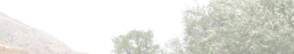
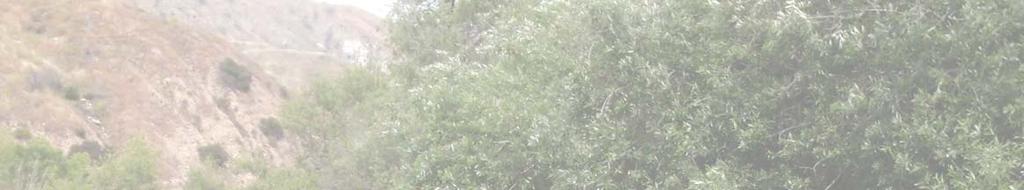
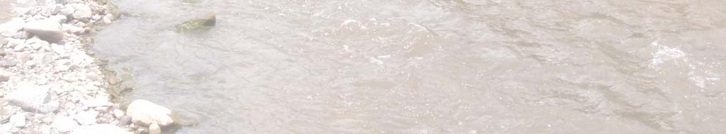
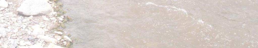
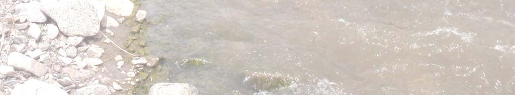
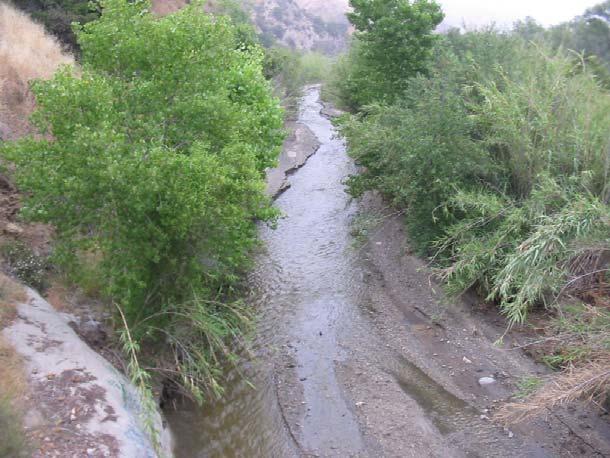
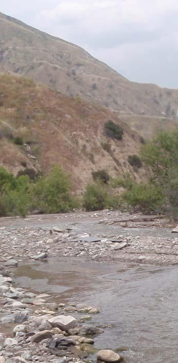
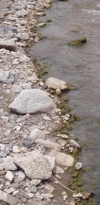
2 Title Page Photo Legend Background Photo: Big Tujunga Wash upstream of Oro Vista Avenue prior to diversion and channel alignment construction Right Panel Large Photo: Big Tujunga Wash upstream of Oro Vista Avenue following the diversion and channel alignment construction. Flow within the newly wetted channel with undisturbed riparian vegetation. Right Panel Small Photo: Close-up underwater image of Santa Ana sucker (Catostomus santaanae) in temporary holding tank prior to relocation.
3 INTRODUCTION This letter report presents the results of the focused surveys and relocation efforts for native fishes including the federally threatened Santa Ana sucker (Catostomus santaanae) performed in the Big Tujunga Wash at Oro Vista Avenue. Photographs of the prevailing site conditions, the relocation efforts, and the condition of the current channel habitat are provided in Appendix A. Due to the recent fires in the watershed (Station Fire 2009), and subsequent rain events, large amounts of sediment and debris entered the Big Tujunga Wash. The sediment and debris altered the current channel alignment and buried the emergency overflow culverts. The water flowed over the Arizona crossing portion of Oro Vista Avenue and forced sporadic road closures during high flow events. The Oro Vista Avenue paved by-road provides the only access to the private gated community of Riverwood Ranch, which consists of about 35 homes north of the Big Tujunga Wash, in the City of Los Angeles (Figure 1). Under normal conditions water is contained in a channel on the western edge of the wash which passes under the Oro Vista Avenue Bridge. There are also twin culverts which convey the water during high flows. There is an Arizona crossing portion of the road which is intended to carry water over the road only during major flood events. Emergency maintenance after large storm events is necessary to clear the culverts and re-establish the low flow channel beneath the bridge. The City of Los Angeles obtained a Regional General Permit (RGP) No. 63 from the United States Army Corps of Engineers (USACE), for this emergency debris clearance of the culverts, and the construction of a diversion channel to redirect the existing flows away from the Arizona crossing portion of the road. The presence of the federally listed as threatened Santa Ana sucker and other California species of special concern fishes (arroyo chub [Gila orcutti] and Santa Ana speckled dace [Rhinichthys osculus ssp. 3]) requires that special measures be adhered to with regard to the capture and clearance of these fishes prior to the diversion and dewatering of the of the active channel, and during any construction within the wetted portions of the channel. The total project construction area is approximately 900 meters (m) in length from the point of the channel diversion upstream, to the downstream extent of the impacts generated by the dewatering activity (Figure 2). The portion of the wash upstream of the road was primarily contained in a single channel, whereas downstream there were three main channels with a complex of secondary braided channels. Portions of the Big Tujunga Wash are able to support self sustaining populations of these native fish species which could represent some of the last remaining populations within the Los Angeles River system. Southern California coastal freshwater fish species have been heavily impacted by habitat alteration and dewatering and thus their numbers are greatly reduced in distribution and overall abundances (Moyle 2002). Santa Ana suckers are primarily found in small to medium sized streams, usually less than 7 m in width, that flow year-round and may vary in depth from several centimeters to over 1 m deep. They favor cool (<22 C), clear, flowing water where gravel, rubble, and boulder substrates are present. While Santa Ana suckers are commonly found in association with algae, they are not normally found in habitats containing aquatic plants. They use their scraping mouths to feed on algae and detritus, and may also feed on insects. The sucker s natal streams are subject to severe flooding, though these fish are well adapted to re-colonize through early maturity, high fecundity, and extended spawning. Santa Ana suckers rarely live more than four years, but they reach sexual maturity in their second summer. Spawning typically occurs from mid-march till early June in riffle habitats possessing gravel substrates. 1

4 WOODLEY AVE Study Area 14 I 5 BALBOA BLVD 118 SAN FERNANDO RD 405 VAN NUYS BLVD SHERMAN WAY VICTORY BLVD BURBANK BLVD 210 GLENOAKS BLVD VINELAND AVE ^_ TUNA CANYON RD FOOTHILL BLVD INorth Sc ale in Feet 0 3,000 1 inch = 3,000 feet N:\2010\ Big Tujunga Santa Ana Sucker\MAPS\Site_Vicinity\Tujunga_SASVicinity.mxd Map Date: 06/10/2010 Figure 1. Site and Vicinity Map Big Tujunga Santa Ana Sucker


5 D A V Upstream Extent!( B I G T U J U N G A C A N Y O N R D E B E Y C A N Y O N R D O R O V I S T A V A Downstream Extent B!( I G T U J U N G A C A N Y O N R D E L L E N B O G E N S T I Scale in Feet A A V Location: N:\2010\ Big Tujunga Santa Ana Sucker\MAPS\SSS_Survey_and_Mapping\Santa Ana Sucker\Maps\BigTSAS_Survey_ Figure 2. Survey Location Map Big Tujunga Santa Ana Sucker A V inch = 500 feet Map Date: 06/10/2010 Photo: Aerials Express April 2010
6 METHODS Manna Warburton (TE ) assumed the role as the lead 10(a)(1)(A) permitted biologist for the Santa Ana sucker on this project. He led a team of fisheries biologists including Todd Chapman (TE ), Brian Zitt, and two additional field technicians. Water quality was measured with a Horiba U-52 Multiparameter Water Quality Checker. Multiple passes were conducted with a Smith Root 12B Backpack Electrofisher unit throughout the project area on June 1, and 2, Settings were maintained within the recommended guidelines provided by both USFWS and CDFG for the prevailing water quality conditions in the system. A maximum output voltage of 400 volts, pulse rate of 30 Hertz, and a pulse width of less than 5 milliseconds were maintained throughout the duration of the effort. All of the electrofishing efforts were conducted in an upstream to downstream manner, to herd fishes into a downstream 1/8-inch delta mesh seine net which was lifted and checked for fish following the sampling of individual 5 m sections of stream channel. Two biologists with dip-nets mirrored the anode pole and the electrical field to quickly net and capture all fishes. Additional measures which were implemented to avoid potential injury to Santa Ana sucker and native fishes included: moving the anode continuously in a herringbone pattern through the water, avoiding electrofishing in one areas for extended periods of time, and removing fish from the electric field as quickly as possible. All suckers were closely monitored during the sampling efforts for recovery times and signs of any excessive stress or injury. Upon their capture all of the native fish species were placed into oxygenated holding tanks which were continually monitored until they could be safely released into suitable habitat downstream. Preceding a partial diversion of water from the wetted channel, a single pass was conducted throughout the entire site beginning at the point of the diversion and working downstream. Oro Vista Avenue was used as a habitat break during our sampling to separate passes conducted upstream of the Arizona crossing from those conducted downstream. After this initial fish relocation effort, the construction crew was permitted to complete the diversion of the water into the preferred channel location on the western side of the wash. A second pass was conducted along the entire upstream portion of the previously wetted channel, targeting pools and all other remaining surface waters to ensure that all remaining fishes had been removed from channel upstream of the crossing. The stream habitat downstream of the crossing continued to maintain sufficient surface flows for the completion of a second and third pass through this area on June 1, An additional two passes were completed through this area downstream of the crossing on June 2, 2010 to ensure that all remaining fishes were captured and safely relocated. All of the fishes captured were enumerated and checked for injuries or other signs of stress. If time permitted and fish were not showing signs of stress, their lengths were measured to the nearest millimeter, and their weights were measured to the nearest hundredth of a gram with an electronic balance. All of the non-native fishes collected were measured, euthanized, and buried on-site. ECORP Consulting, Inc Big Tujunga Santa Ana Sucker
7 RESULTS Water temperatures increased from 15.9 C on June 1, 2010 to 18.7 C on June 2, 2010 (Table 1). Both dissolved oxygen and ph dropped, going from to mg/l and 8.36 to 7.89 respectively. Conductivity and oxidation/reduction potential (ORP) increased, going from 510 to 580 µs/cm and 97 to 110 mv respectively. The capture and relocation effort for Santa Ana sucker and other native fish species in Big Tujunga Wash at Oro Vista Avenue channel crossing yielded a total of 442 native fish (Table 2), out of a total of 450 fish. The three native fish species comprised 98.2 percent of the total catch. These fish clearance passes were conducted in the channel both upstream and downstream of the road crossing separately. A total of 16 fish were captured upstream of the road crossing, with native species accounting for 56.3 percent of the catch within that reach. A total of 434 fish were captured downstream of the road crossing, with native species accounting for 99.8 percent of the catch within that reach. Santa Ana sucker were the most abundant species captured with a total of 308 fish, arroyo chub were the next most abundant species with a total of 76 fish, and the third most abundant species captured was the Santa Ana speckled dace with a total of 58 fish. All of these native fish species were relocated in good condition to suitable habitat just downstream of the construction area. Dace displayed signs of sexual maturity and several of the sucker captured exhibited tubercles on their fins, although other signs of recruitment (i.e., larvae or juveniles) in this area were not observed. Several of the Santa Ana speckled dace likewise exhibited bright orange fins and coloration around the lips and face, which is also indicative of breeding activity. The arroyo chub captured during this effort did not exhibit any obvious signs of breeding, although there were several individuals which were extremely large and deep bodied, possibly gravid females. There were two non-native fish species captured during the relocation effort, the black bullhead (Ameiurus melas), and fathead minnow (Pimephales promelas). A total of 7 black bullhead were captured in the channel upstream of the road crossing. A single male fathead minnow was captured downstream of the road crossing. This fish was exhibiting breeding tubercles on its head, although the distinctive dark breeding coloration was not evident with this individual. Each of these non-native fishes was euthanized and buried on-site. Overall there were far fewer fishes captured upstream of the road crossing than downstream. The second pass through the upstream portion produced zero fish, although 2 two-striped garter snakes (Thamnophis hammondii) were observed, along with several western toad (Bufo boreas) tadpoles. A total of five passes were conducted throughout the entire complex of braided channels downstream of the road crossing, three passes were conducted on June 1, and two additional passes were conducted on June 2, Good depletion numbers were achieved for all three species during both days of the relocation effort. The number of individuals captured during pass 4 on the second day exhibited an increase over the numbers achieved during pass 3 on the previous day. During pass 5 however, there were only two fish captured which once again established an observable depletion in the numbers. ECORP Consulting, Inc Big Tujunga Santa Ana Sucker
8 Table 1. Water Quality Record, Big Tujunga Wash at Oro Vista Avenue, June 2010 Date Time Water Column Location Temp ( C) ph Conductivity (µs/cm) TDS (g/l) Salinity (ppt) Dissolved Oxygen (mg/l) ORP (mv) Turbidity (NTU) 6/1/2010 7:20 AM surface /2/2010 7:05 AM surface ECORP Consulting, Inc Big Tujunga Santa Ana Sucker
9 Table 2. Fish Species Abundance Table, Big Tujunga Wash at Oro Vista Avenue Location Date Arroyo Chub Native Fishes Santa Ana Speckled Dace Santa Ana Sucker Non-Native Fishes Black Bullhead Fathead Minnow Totals Upstream Pass #1 6/1/ Upstream Pass #2 6/1/ Downstream Pass #1 6/1/ Downstream Pass #2 6/1/ Downstream Pass #3 6/1/ Downstream Pass #4 6/2/ Downstream Pass #5 6/2/ Grand Total ECORP Consulting, Inc Big Tujunga Santa Ana Sucker
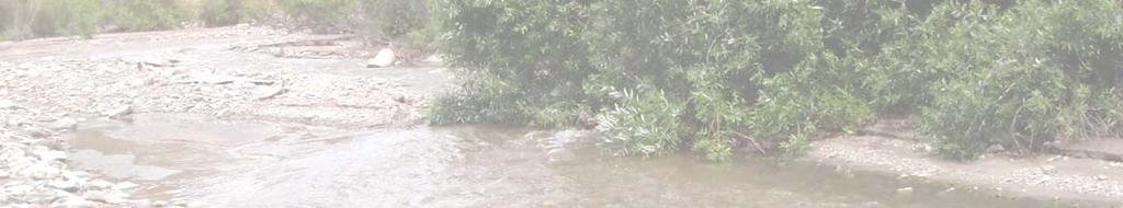
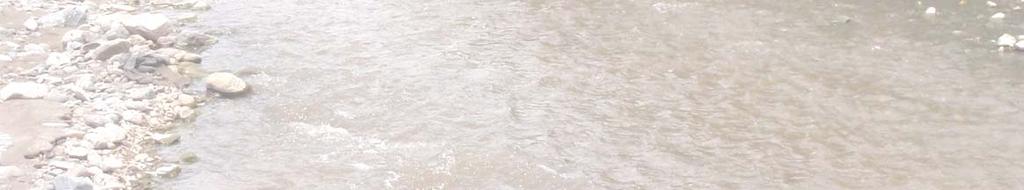
10 DISCUSSION The capture and relocation effort was completed without any major incidents or fish mortalities. All of the native fishes appeared to be in extremely good condition; there were only a few fishes which had some external leeches, which were removed prior to their release. There were three size classes of Santa Ana sucker captured, primarily second, third year individuals with only a small number of fourth year fish. There were definite signs of sexual maturity in many of the fishes captured, especially the sucker and speckled dace. All of the fish were adult individuals; no juvenile or life stages were observed or captured during all of our relocation efforts. The main flows of the Big Tujunga Wash have been successfully diverted back into the preexisting channel which goes under the bridge. This project has really served two purposes. The first was to divert the flow away from the Arizona crossing, which was an issue for public safety, but the second was to restore a connection between habitat for the Santa Ana sucker and other native species downstream of Oro Vista Avenue and the habitat upstream which extends up into the Angeles National Forest. It is our opinion that this road crossing was acting as a barrier to fish movement within this system when the water was flowing over the road. The diversion of the water beneath the bridge has provided passage. The new channel has provided some great new riffle habitat; there are boulders and cobbles which are already exposed and the banks are bordered with riparian vegetation (mulefat, willows, and cottonwoods). This should be a benefit to all the native fishes in this system providing the ability to gain access to additional habitat and possibly strengthening their overall population strength in the face of impacts sustained as a result of the Station Fire. The project related construction activities and disturbances to the wash associated with the diversion and realignment of the flows extended approximately 700 m upstream of the road crossing. Heavy equipment was used to remove excess sediments and debris from a small portion of the upper project area, to construct a connection between the point of the diversion and the channel which extends under the bridge. Sediment and debris was also removed from the two emergency overflow culverts and an area directly adjacent to and upstream of the road crossing. Some of the excess material removed from this location was placed along the downstream side of the road crossing to create a shoulder approximately 3 m wide. The operation of heavy equipment was only conducted within dry portions of the wash, and there were no rain events which occurred during the construction to produce any runoff from the project area. The diversion of water into the new channel was conducted in a controlled manner to allow the disturbed portions of the streambed to adequately acclimate to surface flows and thus minimize the release of large amounts of sediment downstream of the project area. The newly established channel possesses dense riparian vegetation on both banks, exposed boulders and cobbles, and has previously experienced high velocity flows which made it less susceptible to erosion and sediment release downstream. Due to the pre-emptive actions taken during the channel construction and water diversion, there were no additional measures implemented to minimize erosion/sedimentation associated with the project. ECORP Consulting, Inc Big Tujunga Santa Ana Sucker
11 REFERENCES Moyle, P.B Inland fishes of California. University of California Press, Berkeley, California. Revised and expanded. CERTIFICATION I certify that the information in this survey report and attached exhibits fully and accurately represent the presence/absence survey work conducted on the Big Tujunga Wash at the Oro Vista Avenue crossing. July 8, 2010 Manna Warburton (TE ) Senior Biologist ECORP Consulting, Inc. Date ECORP Consulting, Inc Big Tujunga Santa Ana Sucker
12 10 APPENDIX A Site Photos
13 Appendix A Site Photos Figure 1. Santa Ana sucker collected downstream of Oro Vista Avenue. Figure 2. Male Santa Ana speckled dace in breeding coloration collected downstream of Oro Vista Avenue.
14 Appendix A Site Photos Figure 3. Arroyo chub collected downstream of Oro Vista Avenue. Figure 4. Two-stripe garter snake observed upstream of Oro Vista Avenue.


15 Appendix A Site Photos Figure 5. Post-construction, with water no longer flowing over Oro Vista Avenue. Figure 6. Post-construction looking northeast.
FISH PROTECTION ACTIVITIES AT PRADO DAM, CORONA, CA.
 San Marino Environmental Associates 560 South Greenwood Avenue, San Marino, CA 91108 (626) 792-2382 FAX (626) 792-8233 s FISH PROTECTION ACTIVITIES AT PRADO DAM, CORONA, CA. Prepared for: U. S. Army Corps
Trip Report: Eagle Creek, Arizona
 Trip Report: Eagle Creek, Arizona 15-17 June 2009 Participants: Abraham Karam, Brian Kesner, and Mike Childs Native Fish Lab Marsh & Associates, LLC 5016 South Ash Avenue Suite 108 Tempe, Arizona 85282
Native Suckers of the Chuska Mountains and Defiance Plateau GLENN SELBY-FISH BIOLOGIST
 Native Suckers of the Chuska Mountains and Defiance Plateau GLENN SELBY-FISH BIOLOGIST Native Species on the Chuska Mts and Defiance Plateau Speckled Dace Bluehead sucker Zuni bluehead sucker Native Suckers
Minnesota Department of Natural Resources Division of Fish and Wildlife Section of Fisheries. Stream Survey Report. Luxemburg Creek.
 Minnesota F-29-R(P)-24 Area 315 Study 3 March 2016 Minnesota Department of Natural Resources Division of Fish and Wildlife Section of Fisheries Stream Survey Report Luxemburg Creek 2015 Mark Pelham Sauk
Rehabilitation of Grimes Creek, a Stream Impacted in the Past by Bucket-lined Dredge Gold Mining, Boise River Drainage, July 2008 to August 2011.
 Rehabilitation of Grimes Creek, a Stream Impacted in the Past by Bucket-lined Dredge Gold Mining, Boise River Drainage, July 2008 to August 2011. Pam Harrington TU,1020 W. Main Street Suite 440, Boise,
Final Bull Trout Genetics Monitoring Plan for the Wallowa Falls Hydroelectric Project. (FERC No. P-308) June 2017
 June 2017") Final for the Wallowa Falls Hydroelectric Project (FERC No. P-308) June 2017 Prepared by: Jeremiah Doyle PacifiCorp 825 NE Multnomah Street Portland, OR 97232 June, 2017 Page 1 of 8 Table of Contents 1.0
Final for the Wallowa Falls Hydroelectric Project (FERC No. P-308) June 2017 Prepared by: Jeremiah Doyle PacifiCorp 825 NE Multnomah Street Portland, OR 97232 June, 2017 Page 1 of 8 Table of Contents 1.0
Jason Blackburn, Paul Hvenegaard, Dave Jackson, Tyler Johns, Chad Judd, Scott Seward and Juanna Thompson
 Alberta Conservation Association (ACA) Date: 2014-2015 Project Name: Owl River Walleye and Aquatic Habitat Assessment Fisheries Program Manager: Peter Aku Project Leader: Tyler Johns Primary ACA staff
Compsopogon coeruleus in the Santa Ana River. Photo credits: Christine Medak, Kai Palenscar and Ayoola Folarin (USFWS) unless otherwise noted.
 unless otherwise noted.") Compsopogon coeruleus in the Santa Ana River Photo credits: Christine Medak, Kai Palenscar and Ayoola Folarin (USFWS) unless otherwise noted. Kai Palenscar May 15, 2014 Outline RIX Exotic Fish Shocking
Compsopogon coeruleus in the Santa Ana River Photo credits: Christine Medak, Kai Palenscar and Ayoola Folarin (USFWS) unless otherwise noted. Kai Palenscar May 15, 2014 Outline RIX Exotic Fish Shocking
Big Spring Creek Habitat Enhancement and Fishery Management Plans
 Big Spring Creek Habitat Enhancement and Fishery Management Plans November 5, 2012 Big Spring Events and Activities Center Newville, PA Charlie McGarrell Regional Habitat Biologist Pennsylvania Fish and
FINAL REPORT. Yonkers Creek Migration Barrier Removal Project Wonderstump Road Del Norte County. Submitted By:
 FINAL REPORT Yonkers Creek Migration Barrier Removal Project Wonderstump Road Del Norte County Submitted By: Del Norte County Community Development Department Yonkers Creek Migration Barrier Removal Project
September 16, Submitted to: Sterling Avenue Riverside, CA On behalf of: Santa Ana Sucker Conservation Team
 Habitat variability and distribution of the Santa Ana sucker, Catostomus santaanae, in the Santa Ana River from the confluence of the Rialto channel to the Prado Basin September 16, 2014 Submitted to:
Amendment to a Biological Assessment/Evaluation completed for the Coon Creek Land Disposal completed December Grand Valley Ranger District
 Amendment to a Biological Assessment/Evaluation completed for the Coon Creek Land Disposal completed December 2007 Grand Valley Ranger District Grand Mesa, Uncompahgre, Gunnison National Forests Prepared
Bonita Creek Fish Monitoring September 29 October 2, 2015
 Bonita Creek Fish Monitoring September 29 October 2, 2015 Brittany M. Woodward, Kristen G. Humphrey, and Brian R. Kesner Marsh & Associates, LLC 5016 S. Ash Avenue, Suite 108 Tempe, Arizona 85282 Submitted
Study Update Tailrace Slough Use by Anadromous Salmonids
 Study Update Tailrace Slough Use by Anadromous Salmonids Goals and Objectives Identify what anadromous salmonids use the tailrace slough by: Life Stage (Juvenile, migrating and spawning adults) Timing
NEVADA DEPARTMENT OF WILDLIFE STATEWIDE FISHERIES MANAGEMENT
 NEVADA DEPARTMENT OF WILDLIFE STATEWIDE FISHERIES MANAGEMENT FEDERAL AID JOB PROGRESS REPORT F-20-50 2014 LAHONTAN CUTTHROAT TROUT STUDY WESTERN REGION NEVADA DEPARTMENT OF WILDLIFE, FISHERIES DIVISION
San Lorenzo Valley Water District, Watershed Management Plan, Final Version Part I: Existing Conditions Report
 LIST OF FIGURES Figure 1-1. Map of the San Lorenzo River watershed Figure 2-1. The Santa Cruz Mountains Bioregion Figure 2-2. Protected areas within the San Lorenzo River watershed Figure 2-3. Primary
Bonita Creek Fish Monitoring November 4 6, 2015
 Bonita Creek Fish Monitoring November 4 6, 2015 Brittany M. Woodward, Kristen G. Humphrey, and Brian R. Kesner Marsh & Associates, LLC 5016 S. Ash Avenue, Suite 108 Tempe, Arizona 85282 Submitted to Bureau
Final Fish Salvage & Temporary Tailrace Barrier Report for the Wallowa Falls Hydroelectric Project Tailrace. (FERC No. P-308) December 18, 2017
 December 18, 2017") Final for the Wallowa Falls Hydroelectric Project Tailrace (FERC No. P-308) December 18, 2017 Prepared by: Jeremiah Doyle PacifiCorp 825 NE Multnomah Street Portland, OR 97232 December 18, 2017 Page 1
Final for the Wallowa Falls Hydroelectric Project Tailrace (FERC No. P-308) December 18, 2017 Prepared by: Jeremiah Doyle PacifiCorp 825 NE Multnomah Street Portland, OR 97232 December 18, 2017 Page 1
SURVEY METHODOLOGY. April 15, Rob Livick City of Morro Bay Public Services Director/City Engineer 955 Shasta Avenue San Luis Obispo, CA 93401
 April 15, 2011 Rob Livick City of Morro Bay Public Services Director/City Engineer 955 Shasta Avenue San Luis Obispo, CA 93401 SUBJECT: Summary Letter Report for Tidewater Goby and Steelhead Monitoring
MEMORANDUM 2140 Eastman Avenue, Suite 200 Ventura, CA (805)
") Excellence in Environmental Consulting Since 1984 MEMORANDUM 2140 Eastman Avenue, Suite 200 Ventura, CA 93003 (805) 644-5948 To: From: Wendy Katagi Camp Dresser and McKee, Inc. (CDM) 523 West 6 th Street,
Excellence in Environmental Consulting Since 1984 MEMORANDUM 2140 Eastman Avenue, Suite 200 Ventura, CA 93003 (805) 644-5948 To: From: Wendy Katagi Camp Dresser and McKee, Inc. (CDM) 523 West 6 th Street,
Lake Superior. Ontonagon River Assessment. Ontonagon. Rockland. Victoria Dam. Bergland. Bergland. Dam. Bruce Crossing Agate Falls. Kenton Lower.
 Sand shiner otropis stramineus feeding - sand and gravel substrate - shallow pools in medium size streams, lakes, and impoundments - clear water and low gradient - rooted aquatic vegetation preferred -
Final Fish Salvage & Temporary Tailrace Barrier Report for the Wallowa Falls Hydroelectric Project Tailrace. (FERC No. P-308) December 20, 2018
 December 20, 2018") Final Fish Salvage & Temporary Tailrace Barrier Report for the Wallowa Falls Hydroelectric Project Tailrace (FERC No. P-308) December 20, 2018 Prepared by: Jeremiah Doyle PacifiCorp 825 NE Multnomah Street
Final Fish Salvage & Temporary Tailrace Barrier Report for the Wallowa Falls Hydroelectric Project Tailrace (FERC No. P-308) December 20, 2018 Prepared by: Jeremiah Doyle PacifiCorp 825 NE Multnomah Street
DESERT SUCKER. Evaluation Species. Catostomus clarkii utahensis Sucker Family (Catostomidae)
") Fish DESERT SUCKER Catostomus clarkii utahensis Sucker Family (Catostomidae) John Rinne/Desert Fshes Council Description: A medium-sized (maximum length of 33 cm [13 in.]) fish with a round, sucker-shaped
Fish DESERT SUCKER Catostomus clarkii utahensis Sucker Family (Catostomidae) John Rinne/Desert Fshes Council Description: A medium-sized (maximum length of 33 cm [13 in.]) fish with a round, sucker-shaped
Preakness Brook - FIBI098
 Preakness Brook - FIBI098 Preakn ess B rook Preakness " ( FIBI098 Naachtpunkt Brook 202 80 IBI Ratings FIBI Sampling Location Excellent Small Streams (1st and 2nd Order) Good Fair Large Streams (3rd Order
NEVADA DEPARTMENT OF WILDLIFE STATEWIDE FISHERIES MANAGEMENT
 NEVADA DEPARTMENT OF WILDLIFE STATEWIDE FISHERIES MANAGEMENT FEDERAL AID JOB PROGRESS REPORTS F-20-52 2016 Lake Tahoe Rainbow Trout Study WESTERN REGION NEVADA DEPARTMENT OF WILDLIFE, FISHERIES DIVISION
SUMMARY REPORT FOR LAKE ST. MALO FISHERIES ASSESSMENT. Prepared for the St. Malo and District Wildlife Association
 SUMMARY REPORT FOR LAKE ST. MALO FISHERIES ASSESSMENT Prepared for the St. Malo and District Wildlife Association Presented by August 25, 2014 Study dates thus far: Date Tasks February 16 Fishing derby;
Five Counties Salmonid Conservation Program - Fish Passage Design Workshop. February 2013
 Program - Aquatic Organisms and Stream Crossings Ecological Connectivity A watershed is a network of channels that drain a common boundary. Channel characteristics formed by interaction of precipitation,
JAP Additional Information Sheet
 JAP Additional Information Sheet Block 15: Purpose and Need The USACE purpose of the project is to provide a safe and reliable whitewater park for the recreational public in a city park, which will provide
Michigan Dept. of Natural Resources Status of the Fishery Resource Report Page 1. Weber Lake Cheboygan County, T34N, R3W, Sec.
 Michigan Dept. of Natural Resources 2012-143 Status of the Fishery Resource Report Page 1 Weber Lake Cheboygan County, T34N, R3W, Sec. 31 Neal Godby, Fisheries Biologist Environment Weber Lake is a 28.5-acre
PROJECT TO INSTALL LARGE WOOD HABITAT STRUCTURES IN THE CARMEL RIVER USING CALIFORNIA DEPARTMENT OF FISH AND GAME GRANT FUNDS
 PROJECT TO INSTALL LARGE WOOD HABITAT STRUCTURES IN THE CARMEL RIVER USING CALIFORNIA DEPARTMENT OF FISH AND GAME GRANT FUNDS The Monterey Peninsula Water Management District (MPWMD), in cooperation with
FISH PASSAGE IMPROVEMENT in California s Watersheds. Assessments & Recommendations by the Fish Passage Forum
 FISH PASSAGE IMPROVEMENT in California s Watersheds Assessments & Recommendations by the Fish Passage Forum FISH PASSAGE IMPROVEMENT in California s Watersheds The mission of the Fish Passage Forum is
A.23 RIVER LAMPREY (LAMPETRA
 A. RIVER LAMPREY (LAMPETRA AYRESII) A.. Legal and Other Status The river lamprey is a Class (Watch List) California Species of Special Concern (Moyle et al., DFG 0). It has no federal status. A.. Species
Hot Springs Canyon Fish and Amphibian Monitoring, 2014
 Hot Springs Canyon Fish and Amphibian Monitoring, 2014 Paul C. Marsh Marsh & Associates, LLC 5016 S. Ash Avenue, Suite 108 Tempe, Arizona 85282 Submitted to Robert W. Clarkson Bureau of Reclamation LC-
Abundance of Steelhead and Coho Salmon in the Lagunitas Creek Drainage, Marin County, California
 scanned for KRIS Abundance of Steelhead and Coho Salmon in the Lagunitas Creek Drainage, Marin County, California Prepared for: Marin Municipal Water District 220 Nellen Drive Corte Madera, California
SAN JUAN RIVER BASIN RECOVERY IMPLEMENTATION PROGRAM
 SAN JUAN RIVER BASIN RECOVERY IMPLEMENTATION PROGRAM DETAILED REACH STUDY 2009 DRAFT FINAL REPORT prepared by Ron Bliesner Keller-Bliesner Engineering, LLC 78 East Center Logan, Utah 84321 (435) 753-5651
Minnesota Department of Natural Resources Division of Fish and Wildlife Section of Fisheries. Stream Survey Report. Cold Spring Creek.
 Minnesota F-29-R(P)-24 Area 315 Study 3 March 2015 Minnesota Department of Natural Resources Division of Fish and Wildlife Section of Fisheries Stream Survey Report Cold Spring Creek 2014 Mark Pelham Montrose
STREAM SURVEY File form No..
 scanned for KRIS THE RESOURCES AGENCY OF CALIFORNIA California Department of Fish and Game STREAM SURVEY File form No.. Date: September 4, 1969. NAME: North Fork Schooner Gulch Creek COUNTY: Mendocino.
FACT SHEET MCGREGOR LAKE RESTORATION HABITAT PROJECT POOL 10, UPPER MISSISSIPPI RIVER, WISCONSIN ENVIRONMENTAL MANAGEMENT PROGRAM
 FACT SHEET MCGREGOR LAKE RESTORATION HABITAT PROJECT POOL 10, UPPER MISSISSIPPI RIVER, WISCONSIN ENVIRONMENTAL MANAGEMENT PROGRAM LOCATION McGregor Lake is located within a mid-river island in Pool 10
Frequently Asked Questions About Revised Critical Habitat and Economic Analysis for the Endangered Arroyo Toad
 Q Frequently Asked Questions About Revised Critical Habitat and Economic Analysis for the Endangered Arroyo Toad Q. What is the arroyo toad? The arroyo toad (Bufo californicus) is a small, light greenish-grey
Minnesota Department of Natural Resources Division of Fish and Wildlife Section of Fisheries. Stream Survey Report. Three Mile Creek 2011
 Minnesota Department of Natural Resources Division of Fish and Wildlife Section of Fisheries Stream Survey Report Three Mile Creek 2011 By Joseph D. Stewig Montrose Area Fisheries Office TABLE OF CONTENTS
FISHERIES BLUE MOUNTAINS ADAPTATION PARTNERSHIP
 FISHERIES A warming climate, by itself, substantially affects the hydrology of watersheds in the Blue Mountains. Among the key hydrologic changes projected under all scenarios for the 2040s and beyond
Field survey of the fish populations of the lower Ngaruroro River
 Field survey of the fish populations of the lower Ngaruroro River Glenn Maclean March 2014 HBRC Publication No. 4873 Report No. RM16-54 CMB 93, RD 2, Owhango 3990 E glenn@technicallytrout.co.nz W www.technicallytrout.co.nz
2014 Threatened and Endangered Fish Survey of. East Loon Lake and West Loon Lake. Lake County, Illinois
 2014 Threatened and Endangered Fish Survey of East Loon Lake and West Loon Lake Lake County, Illinois Prepared by Integrated Lakes Management 120 LeBaron St. Waukegan, IL 60085. Chris Ryan Chris Rysso
(Revised February,2005) CULVERTS, BRIDGES, AND FORDS
 CULVERTS, BRIDGES, AND FORDS") GUIDE TO STREAM CROSSINGS (Revised February,2005) CULVERTS, BRIDGES, AND FORDS Culverts, bridges, and fords are all methods used to cross-streams. Culverts are the most common stream crossing structure.
GUIDE TO STREAM CROSSINGS (Revised February,2005) CULVERTS, BRIDGES, AND FORDS Culverts, bridges, and fords are all methods used to cross-streams. Culverts are the most common stream crossing structure.
feeding - downstream sections of large rivers, lakes, and impoundments
 River Assessment Appendix Shorthead redhorse (Moxostoma macrolepidotum) feeding - downstream sections of large rivers, lakes, and impoundments - rocky substrates - swift water near riffles - clear to slightly
Freshwater Fish Assessment
 Alaska Department of Transportation & Public Facilities Seward Highway MP 7-9 6-7 Freshwater Fish Assessment March 14, 8 Prepared by HDR Alaska C Street, Suite 3 Anchorage, Alaska 993 Project Number: BR-BH-NH-OA3
Manual of Fisheries Survey Methods II: with periodic updates. Chapter 22: Guidelines for Sampling Warmwater Rivers with Rotenone
 Manual of Fisheries Survey Methods II: with periodic updates : Guidelines for Sampling Warmwater Rivers with Rotenone P. W. Seelbach, G. L. Towns, and D. D. Nelson Suggested citation: Seelbach, Paul W.,
Holderness. The Three Watersheds within the Newfound Lake Drainage Dorchester. Groton Plymouth. Ashland. Hebron. Canaan. Bridgewater.
 Background Brook trout are the only native stream dwelling trout species in New Hampshire, having a historic range that extended from Georgia to eastern Canada. It is believed that wild brook trout were
Herring Highway A Study of a New Fish Passage for River Herring at Rock Creek National Park
 Bridging the Watershed An Outreach Program of the Alice Ferguson Foundation in Partnership with the National Park Service and Area Schools Herring Highway A Study of a New Fish Passage for River Herring
Final Bull Trout Redd Monitoring Report for the Wallowa Falls Hydroelectric Project
 Final for the Wallowa Falls Hydroelectric Project East Fork Wallowa River barrier to upstream fish migration, photo courtesy of Kendrick Moholt (FERC No. P-308) December 18, 2017 Prepared by: Jeremiah
1165 S Hwy 191, Suite S 2350 W Moab, UT Vernal, UT
 COLORADO RIVER RECOVERY PROGRAM FY 2018 ANNUAL PROJECT REPORT RECOVERY PROGRAM PROJECT NUMBER: C29a/138 I. Project Title: Green River Canal Company (GRCC) Canal Salvage II. Bureau of Reclamation Agreement
State of San Francisco Bay 2011 Appendix O Steelhead Trout Production as an Indicator of Watershed Health
 State of San Francisco Bay 2011 Appendix O Steelhead Trout Production as an Indicator of Watershed Health Gordon Becker and Katherine Smetak, Center for Ecosystem Management and Restoration 290 Introduction
Executive Summary. Map 1. The Santa Clara River watershed with topography.
 Santa Clara River Steelhead Trout: Assessment and Recovery Opportunities December 2005 Prepared By: Matt Stoecker and Elise Kelley, Ph.D. University of California, Santa Barbara Prepared For: The Santa
Redd Dewatering and Juvenile Salmonid Stranding in the Lower Feather River,
 Redd Dewatering and Juvenile Salmonid Stranding in the Lower Feather River, 2005-2006 Interim Report for NOAA Fisheries Prepared by: California Department of Water Resources Division of Environmental Services
Fossil Creek Native Fish Repatriation 2009 Implementation Plan Arizona Game and Fish Department
 Fossil Creek Native Fish Repatriation 2009 Implementation Plan Arizona Game and Fish Department MONITORING: Annual monitoring is conducted for each species stocked, typically during late summer or early
Fish Survey of Arctic Lake (ID # ), Scott County, Minnesota in 2012
, Scott County, Minnesota in 2012") Snapping Turtle from Arctic Lake, September 2012 Fish Survey of Arctic Lake (ID #70-0085), Scott County, Minnesota in 2012 Survey Dates: September 18-20, 2012 MnDNR Permit Number: 18362 Prepared for: Shakopee
Snapping Turtle from Arctic Lake, September 2012 Fish Survey of Arctic Lake (ID #70-0085), Scott County, Minnesota in 2012 Survey Dates: September 18-20, 2012 MnDNR Permit Number: 18362 Prepared for: Shakopee
Minnesota Department of Natural Resources Division of Fish and Wildlife Section of Fisheries. Stream Survey Report. Cold Spring Creek.
 Minnesota F-29-R(P)-24 Area 315 Study 3 March 2013 Minnesota Department of Natural Resources Division of Fish and Wildlife Section of Fisheries Stream Survey Report Cold Spring Creek 2012 Mark Pelham Montrose
Quillback (Carpoides cyprinus)
") t. Joseph Assessment Appendix Quillback (Carpoides cyprinus) feeding - clear to turbid water - Michigan - sand, sandy gravel, sandy silt, or clay-silt substrate - medium- to low-gradient rivers and streams;
t. Joseph Assessment Appendix Quillback (Carpoides cyprinus) feeding - clear to turbid water - Michigan - sand, sandy gravel, sandy silt, or clay-silt substrate - medium- to low-gradient rivers and streams;
EXTENT OF OBSERVATION
 scanned for KRIS THE RESOURCES AGENCY OF CALIFORNIA Department of Fish and Game STREAM SURVEY Date: May 25 and 31, 1977. NAME: Unnamed Stream (Tributary to Sonoma Creek) COUNTY: Sonoma. STREAM SECTION:
Steelhead Society of BC. Thompson River Watershed Restoration and Enhancement Project #4 Nicola River Bank Stabilization and Enhancement Project
 Steelhead Society of BC Presents: Thompson River Watershed Restoration and Enhancement Project #4 Nicola River Bank Stabilization and Enhancement Project Application for Funding December 2013 1.0 BACKGROUND
California Steelhead: Management, Monitoring and Recovery Efforts
 California Steelhead: Management, Monitoring and Recovery Efforts Jonathan Nelson Steelhead Management, Research and Restoration Program Oncorhynchus mykiss irideus California Steelhead - Hot Topics Implementation
Striped Bass and White Hybrid (x) Striped Bass Management and Fishing in Pennsylvania
 Striped Bass Management and Fishing in Pennsylvania") Striped Bass and White Hybrid (x) Striped Bass Management and Fishing in Pennsylvania Prepared by R. Lorantas, D. Kristine and C. Hobbs PFBC Warmwater Unit 2005 (stocking numbers updated after 2005) Goal:
Striped Bass and White Hybrid (x) Striped Bass Management and Fishing in Pennsylvania Prepared by R. Lorantas, D. Kristine and C. Hobbs PFBC Warmwater Unit 2005 (stocking numbers updated after 2005) Goal:
Scientific Name: Ameiurus melas Common Name: Black bullhead BISON No.:
 Scientific Name: Ameiurus melas Common Name: Black bullhead BISON No.: 010065 Legal Status: Arizona, Species of Special Concern ESA, Endangered ESA, Proposed Endangered ESA, Proposed Threatened ESA, Threatened
Trout Buffer Variance
 Trout Buffer Variance Ashley L. Rodgers, PE Spring 2015 Why a Trout Buffer Capturing pollutants in runoff to keep the water clean. Capturing sediment to keep mud out of the water. Providing shade to keep
Fish Community. Fish Habitat, Streams and Rivers
 Clear, Ston(e)y and White Lake Plan Fish Community The lakes support a cool/warm water fishery including muskellunge, walleye, largemouth and smallmouth bass, yellow perch, pumpkinseed, rockbass, blue
Fish Passage Culvert Inspection (FPCI) Nicklen Creek Watershed
 Nicklen Creek Watershed") Fish Passage Culvert Inspection (FPCI) Nicklen Creek Watershed FPCI Sites funded by FIA Prepared for: Tolko Industries Ltd., Okanagan Regional Woodlands & British Columbia Timber Sales, Okanagan-Shuswap
Fish Passage Culvert Inspection (FPCI) Nicklen Creek Watershed FPCI Sites funded by FIA Prepared for: Tolko Industries Ltd., Okanagan Regional Woodlands & British Columbia Timber Sales, Okanagan-Shuswap
San Antonio Creek Spreading Grounds Rehabilitation Project Ojai Valley, CA
 Ventura County Watershed Protection District San Antonio Creek Spreading Grounds Rehabilitation Project Ojai Valley, CA Presentation to Ventura River Watershed Council Project Funding Proposition 50 Integrated
ESA, Proposed Threatened ESA, Threatened New Mexico-WCA, Endangered
 Scientific Name: Catostomus discobolus Common Name: Bluehead sucker BISON No.: 010495 Legal Status: Arizona, Species of Special Concern ESA, Endangered ESA, Proposed Endangered ESA, Proposed Threatened
California Steelhead: Management, Monitoring and Recovery Efforts
 California Steelhead: Management, Monitoring and Recovery Efforts Jonathan Nelson Steelhead Restoration & Management Program Oncorhynchus mykiss irideus California Steelhead Distinct Population Segments
Understanding the Impacts of Culvert Performance on Stream Health
 Understanding the Impacts of Culvert Performance on Stream Health Kristin Thomas Aquatic Ecologist Michigan Trout Unlimited Transportation and the Environment Conference 12/5/2018 Importance of adequately
SECTION F FISH HABITAT CONDITION AND AQUATIC SPECIES DISTRIBUTION
 SECTION F FISH HABITAT CONDITION AND AQUATIC SPECIES DISTRIBUTION INTRODUCTION The fish species currently inhabiting the Gualala River WAU are steelhead trout (Oncorhynchus mykiss), sculpin (Cottus spp.),
OCTOBER 2006 MAMMOTH CREEK FISH COMMUNITY SURVEY
 OCTOBER 2006 MAMMOTH CREEK FISH COMMUNITY SURVEY Prepared for: Mammoth Community Water District P.O. Box 597 Mammoth Lakes, California 93546 FINAL REPORT Prepared by: Tim Salamunovich Thomas R. Payne &
FINAL Fish Salvage Plan for the Wallowa Falls Hydroelectric Project Tailrace. (FERC No. P-308) April 19, 2017
 April 19, 2017") FINAL for the Wallowa Falls Hydroelectric Project Tailrace (FERC No. P-308) April 19, 2017 Prepared by: Jeremiah Doyle PacifiCorp 825 NE Multnomah Street Portland, OR 97232 April 19, 2017 Page 1 of 10
FINAL for the Wallowa Falls Hydroelectric Project Tailrace (FERC No. P-308) April 19, 2017 Prepared by: Jeremiah Doyle PacifiCorp 825 NE Multnomah Street Portland, OR 97232 April 19, 2017 Page 1 of 10
Assessment of Elizabeth Lake as a Potential Candidate for Stocking
 Assessment of Elizabeth Lake as a Potential Candidate for Stocking Region 1, Nanaimo West Coast Planning Unit Ministry of Water, Land and Air Protection Prepared by: Laura Cassin Scott Silvestri 2002 1.0
Fraser River. FISH SURVEY AND MANAGEMENT INFORMATION Jon Ewert - Aquatic Biologist (Hot Sulphur Springs)
") Fraser River FISH SURVEY AND MANAGEMENT INFORMATION Jon Ewert - Aquatic Biologist (Hot Sulphur Springs) General Information: The Fraser River is a highly diverse river offering many transitions in habitat
Fraser River FISH SURVEY AND MANAGEMENT INFORMATION Jon Ewert - Aquatic Biologist (Hot Sulphur Springs) General Information: The Fraser River is a highly diverse river offering many transitions in habitat
ESA, Proposed Threatened ESA, Threatened New Mexico-WCA, Endangered
 Scientific Name: Luciana parva Common Name: Rainwater killifish BISON No.: 010265 Legal Status: Arizona, Species of Special Concern ESA, Endangered ESA, Proposed Endangered ESA, Proposed Threatened ESA,
Juvenile Steelhead and Stream Habitat Conditions Steelhead and Coho Salmon Life History Prepared by: DW ALLEY & Associates, Fishery Consultant
 Juvenile Steelhead and Stream Habitat Conditions Steelhead and Coho Salmon Life History Prepared by: DW ALLEY & Associates, Fishery Consultant I-1. Steelhead and Coho Salmon Ecology Migration. Adult steelhead
Alberta Conservation Association 2017/18 Project Summary Report
 Alberta Conservation Association 2017/18 Project Summary Report Project Name: Abundance, Distribution, Spawning, and Thermal Habitat of Westslope Cutthroat Trout and Bull Trout in the Stimson Creek Watershed
Klamath Lake Bull Trout
 Klamath Lake Bull Trout Existing Populations The Klamath Lake Bull Trout SMU is comprised of seven existing populations and four populations classified as extinct or functionally extinct (Table 189). Populations
Minnesota Department of Natural Resources Fisheries Division, Lake Superior Area
 Minnesota F-9-R(P)- Study 4 Job 616 Minnesota Department of Natural Resources Fisheries Division, Lake Superior Area Coaster Brook Trout Status in Minnesota-Lake Superior Tributaries Following Regulation
WFC 50 California s Wild Vertebrates Jan. 11, Inland Waters (Lakes and Streams) Lisa Thompson
 Lisa Thompson") Inland Waters: Lakes and Streams WFC 50 11 January 2011 Lisa Thompson Fisheries Extension Specialist Wildlife, Fish, & Conservation Biology Department University of California, Davis Take home messages
Inland Waters: Lakes and Streams WFC 50 11 January 2011 Lisa Thompson Fisheries Extension Specialist Wildlife, Fish, & Conservation Biology Department University of California, Davis Take home messages
Tuolumne River Gravel Introduction
 Tuolumne River Gravel Introduction 2000 2003 Tuolumne River La Grange Gravel Addition, Phase II Course Sediment Replenishment Program Tuolumne River Salmonid Habitat Improvement Project River Mile 49.9
Residence Tract Surveys For: Mountain Yellow-Legged Frog (Rana muscosa), California Red- Legged Frog (Rana aurora) and Arroyo Toad (Bufo californicus)
, California Red- Legged Frog (Rana aurora) and Arroyo Toad (Bufo californicus)") Residence Tract Surveys For: Mountain Yellow-Legged Frog (Rana muscosa), California Red- Legged Frog (Rana aurora) and Arroyo Toad (Bufo californicus) Technical Report Prepared for: Angeles National Forest
Residence Tract Surveys For: Mountain Yellow-Legged Frog (Rana muscosa), California Red- Legged Frog (Rana aurora) and Arroyo Toad (Bufo californicus) Technical Report Prepared for: Angeles National Forest
ESA, Proposed Threatened ESA, Threatened New Mexico-WCA, Endangered
 Scientific Name: Percina macrolepida Common Name: Bigscale Logperch BISON No.: 010270 Legal Status: Arizona, Species of Special Concern ESA, Endangered ESA, Proposed Endangered ESA, Proposed Threatened
Cedar Lake Comprehensive Survey Report Steve Hogler and Steve Surendonk WDNR-Mishicot
 Cedar Lake- 2006 Comprehensive Survey Report Steve Hogler and Steve Surendonk WDNR-Mishicot ABSTRACT Cedar Lake is a 142 acre lake located in the southwest corner of Manitowoc County. It is a seepage lake
Columbia Lake Dam Removal Project
 Columbia Lake Dam Removal Project Major Goals of the Columbia Lake Dam Removal: Reconnect 10 miles of the Paulins Kill River to the Delaware River, restoring natural flow regime and sediment transport.
NEVADA DEPARTMENT OF WILDLIFE STATEWIDE FISHERIES MANAGEMENT
 NEVADA DEPARTMENT OF WILDLIFE STATEWIDE FISHERIES MANAGEMENT FEDERAL AID JOB PROGRESS REPORTS F-20-52 2016 REDBAND TROUT EASTERN REGION NEVADA DEPARTMENT OF WILDLIFE, FISHERIES DIVISION ANNUAL JOB PROGRESS
Interim Guidance Fish Presence Absence
 Interim Guidance Fish Presence Absence Source: Forest Practices Act Guidance for Division 635 of the forest practices act dealing with stream classification when no fish surveys have been done (referenced
Columbia Lake Dam Removal Project
 Columbia Lake Dam Removal Project The Columbia Lake dam located 1/4 mile upstream of the Paulins Kill River's confluence with the Delaware River in Knowlton Township, Warren County has been proposed for
Don Pedro Project Relicensing
 Don Pedro Project Relicensing M ODESTO I RRIGATION D ISTRICT TURLOCK I RRIGATION D ISTRICT FERC PROJECT N O. 2299 Resident Fish in Don Pedro Reservoir Don Pedro Reservoir Fish Stocking (1971-Present) CDFG
NORTH RIVER FISH KILL PRELIMINARY REPORT 2014 SUMMARY
 NORTH RIVER FISH KILL PRELIMINARY REPORT 2014 SUMMARY A fish kill on Nor River was reported to e 1-800 Environmental emergency number on August 9, 2014. Representatives from e PEI Department of Environment,
Firth Creek Habitat Enhancement Project 1993
 Firth Creek Habitat Enhancement Project 1993 A. R. Langston December 1993 PWFWCP Report No. 77 The Peace/Williston Fish & Wildlife Compensation Program is a cooperative venture of BC Hydro and the provincial
ATTACHMENT F. Minnesota Department of Natural Resources. Marsh Lake Ecosystem Restoration Project
 ATTACHMENT F Minnesota Department of Natural Resources Marsh Lake Ecosystem Restoration Project Mussel Rescue and Translocation Plan for Pomme de Terre River Restoration (Prepared June, 2016) Attachment
COLUMBIA LAKE DAM REMOVAL PROJECT
 COLUMBIA LAKE DAM REMOVAL PROJECT Major Goals of the Columbia Lake Dam Removal: Reconnect 10 miles of the Paulins Kill River to the Delaware River, restoring natural flow regime and sediment transport.
Fisheries Survey of White Rapids Flowage, Marinette County Wisconsin during Waterbody Identification Code
 Fisheries Survey of White Rapids Flowage, Marinette County Wisconsin during 25 Waterbody Identification Code 6343 Michael Donofrio Fisheries Supervisor Wisconsin Department of Natural Resources Peshtigo,
Salmon and Steelhead in the American River Tim Horner, PhD Geology Department California State University, Sacramento
 Salmon and Steelhead in the American River Tim Horner, PhD Geology Department California State University, Sacramento What kind of fish are in the American River? The American River provides habitat for
Presented by Fred Halterman, URS Jennie Agerton, URS
 Presented by Fred Halterman, URS Jennie Agerton, URS What is Eco Friendly Culvert Design? Culvert design that: Maintains connectivity for aquatic organism migration Maintains connectivity for gene flow
Lower Dolores River Corridor Planning Meeting Jim White Colorado Division of Wildlife
 Lower Dolores River Corridor Planning Meeting Jim White Colorado Division of Wildlife Objectives Overview of cold and warm water fishes in the Dolores River including: Flow and Fish Management Distribution
Hydraulic Modeling of Stream Enhancement Methods
 Hydraulic Modeling of Stream Enhancement Methods Matthew J. Curry John J. Levitsky Abstract Development within watersheds increases the amounts of runoff causing stream erosion and degradation of stream
1998 Willow Creek Downstream Migrant Trap Report. Draft. Prepared By: C. A. Walker. Lower Trinity Ranger District. Six Rivers National Forest
 1998 Willow Creek Downstream Migrant Trap Report Draft Prepared By: C. A. Walker Lower Trinity Ranger District Six Rivers National Forest September 1998 Executive Summary The downstream migrant trap was