Fishery Management Plan for the Scallop Fishery off Alaska
|
|
|
- Ami Lee
- 6 years ago
- Views:
Transcription
1 Fishery Management Plan for the Scallop Fishery off Alaska North Pacific Fishery Management Council 605 W. 4th Avenue, Suite 306 Anchorage, Alaska PHONE: (907) FAX: (907) February 2014
2 Table of Contents Executive Summary... iv Chapter 1 Introduction Amendments to the Fishery Management Plan Foreign Fishing... 9 Chapter 2 Management Policy and Objectives National Standards for Fishery Conservation and Management NPFMC Policy and Objectives Management Goal Management Objectives Procedures for FMP Implementation (Federal/State) Chapter 3 Conservation and Fishery Management Measures Federal Management Measures Optimum Yield and Overfishing Limited Access Management Essential Fish Habitat and Habitat Areas of Particular Concern Management Measures Delegated to the State of Alaska Setting harvest limits Guideline Harvest Ranges (GHRs) Gear Limitations Crew and Efficiency limits Fishing Seasons Inseason Adjustments Closed areas Notices of closure Prohibited Species and Bycatch Limits Crab bycatch limits (CBLs) Observer Requirements and At-Sea Catch Sampling Recordkeeping and Reporting Requirements Other Chapter 4 Description of Stocks and Fishery Geographic description of the management area Registration Areas, District, Subdistrict, and Section Boundaries Physical characteristics of the management area Description of Stocks and Fishery General Biology Reproduction and early life history Longevity and natural mortality Stock Structure and Productivity Present Condition and Abundance Ecological Relationships Habitat of managed stocks Fishing Activities Affecting the Scallop Stocks History of exploitation Commercial Fishery Subsistence Fishery Recreational Fishery Scallop FMP i February 2014
3 4.8 Economic and Socioeconomic Characteristics Fishing Communities Chapter 5 Relationship to Applicable Law and Other Fisheries Chapter 6 Reference Material Sources of Available Data Management & Enforcement Considerations Management and Enforcement Activities: Description and Cost Estimates Literature Cited Appendix A: History of the Alaska Scallop Fishery and FMP Appendix B: Geographical Coordinates of Areas Described in the FMP Appendix C: Section 211 of AFA Appendix D: Essential Fish Habitat and Habitat Areas of Particular Concern Non-fishing Activities that may Adversely Affect Essential Fish Habitat Upland Activities Silviculture/Timber Harvest Pesticides Urban and Suburban Development Road Building and Maintenance Riverine Activities Mining Organic and Inorganic Debris Dam Operation Commercial and Domestic Water Use Estuarine Activities Dredging Material Disposal and Filling Activities Vessel Operations, Transportation, and Navigation Invasive Species Pile Installation and Removal (From NMFS 2005) Overwater Structures (from NMFS 2005) Flood Control/Shoreline Protection (from NMFS 2005) Log Transfer Facilities/In-Water Log Storage (from NMFS 2005) Utility Line, Cables, and Pipeline Installation Mariculture Coastal/Marine Activities Point-Source Discharges Seafood Processing Waste Shoreside and Vessel Operation Water Intake Structures/Discharge Plumes Oil and Gas Exploration, Development, and Production Habitat Restoration and Enhancement Marine Mining References Appendix E: Research Needs Appendix F: Community Profiles Scallop FMP ii February 2014
4 List of Figures Figure 1 Alaska weathervane scallop fishing registration areas... 6 Figure 2 Alaska coastal areas closed to scallop fishing Figure 3 Alaska weathervane scallop registration areas Figure 4 Scallop fishing locations outside Cook Inlet during the 2003/04 season Figure 5 Statewide scallop harvest (pounds shucked scallop meats) and MSY levels from the FMP.. 33 List of Tables Table 1 Management measure categories in the Scallop FMP Table 2 Statewide crab bycatch limits, in percent of the crab abundance estimate or number of crab.27 Table 3 Percent of scallop meats caught in federal and state waters Table 4 Historic Statewide Commercial Weathervane Scallop Revenue Statistics, / Table 5 Statewide weathervane scallop landings by port, Scallop FMP iii February 2014
5 Executive Summary This Fishery Management Plan (FMP) governs scallop fisheries in federal waters off the State of Alaska. The FMP management unit is the U.S. exclusive economic zone (EEZ) of the Bering Sea, Aleutian Islands, and the Gulf of Alaska, and includes weathervane scallops and other scallop species not currently exploited. The GOA is defined as the U.S. EEZ of the North Pacific Ocean, exclusive of the Bering Sea, between the eastern Aleutian Islands at 170EW longitude and Dixon Entrance at 132E40'W longitude. The BSAI is defined as the U.S. EEZ south of the Bering Strait to the Alaska Peninsula and Aleutian Islands and extending south of the Aleutian Islands west of 170EW long. Alaska weathervane scallop fishing registration areas Cook Inlet Area H Kayak Island Adak Area R Dutch Harbor Area O Bering Sea Area Q Alaska Peninsula Area M Shelikof District Semidi District Northeast District Kodiak Area K Prince William Sound Area E Yakutat Area D District 16 Gulf of Alaska Southeastern Alaska Area A This FMP was approved on July 26, 1995, which established a one-year interim closure of federal waters to scallop fishing to prevent uncontrolled fishing. This FMP has since been amended several times, initially in order to establish a State-Federal management regime, then to address several Federal requirements under the Magnuson Stevens Act as well as to address issues such as overcapacity in the fishery. The scallop fishery is jointly managed by the National Marine Fisheries Service (NMFS) and the Alaska Department of Fish and Game (ADF&G) under this FMP. Scallop FMP iv February 2009
6 Management measures in this FMP fall into two categories: Category 1 measures are those delegated to the State for implementation, while Category 2 measures are limited access management measures which are fixed in the FMP, implemented by Federal regulation, and require and FMP amendment to change. Category 1 and 2 measures are listed below. This version of the FMP has been revised to remove or update obsolete references to management measures, outdated catch information and other scientific information. The FMP has also been reorganized to provide readers with a clear understanding of the Scallop fishery and conservation and management measures promulgated by this FMP. CATEGORY 1 (Delegated to the State) Guideline Harvest Levels Registration Areas, Districts, Subdistricts and Sections Gear Limitations Crew and Efficiency Limits Fishing Seasons Observer Requirements Prohibited Species and Bycatch Limits Recordkeeping and Reporting Requirements In-season Adjustments Closed Areas Other CATEGORY 2 (Fixed in FMP, Implemented by Federal Regulation) License limitation program Optimum Yield specification Overfishing specification EFH/HAPC designation Scallop FMP v February 2009
7 Chapter 1 Introduction The scallop fishery in Alaska's Exclusive Economic Zone (EEZ; miles offshore) is jointly managed by the state and federal government under the FMP. Most aspects of scallop fishery management are delegated to the State of Alaska, while limited access and other federal requirements are under jurisdiction of the federal government. The FMP was developed by the North Pacific Fishery Management Council under the Magnuson Stevens Act and approved by NMFS on July 26, Cook Inlet Area H Kayak Island Adak Area R Dutch Harbor Area O Bering Sea Area Q Alaska Peninsula Area M Shelikof District Semidi District Northeast District Kodiak Area K Prince William Sound Area E Yakutat Area D District 16 Gulf of Alaska Southeastern Alaska Area A Figure 1 Alaska weathervane scallop fishing registration areas Although the FMP covers all scallop stocks off the coast of Alaska including weathervane scallops (Patinopecten caurinus), pink or reddish scallops (Chlamys rubida), spiny scallops (Chlamys hastata), and rock scallops (Crassadoma gigantea), the weathervane scallop is the only commercially exploited stock at this time. Commercial fishing for weathervane scallops occurs in the Gulf of Alaska, Bering Sea, and Aleutian Islands. 1.1 Amendments to the Fishery Management Plan The original FMP authorized an interim closure of Federal waters to fishing for scallops. The intent of the FMP was to prevent an unregulated and uncontrolled fishery for scallops while a Federal management regime was established to authorize and manage the fishery. Amendments 1 through 3 to the FMP established the specifics of the State-Federal management regime. Subsequent amendments to the FMP established a license limitation program, refined overfishing levels, designated EFH and AFA sideboard measures and modified aspects of the FMP to better manage the fishery. Scallop FMP 6 February 2009
8 Amendment 1: State-Federal Management Regime Amendment 1 was approved by NMFS on July 10, 1996 (61 FR 38099). Amendment 1 established a joint State- Federal management regime under which NMFS implemented Federal scallop regulations that duplicated most State scallop regulations, including definitions of scallop registration areas and districts, scallop fishing seasons, closed waters, gear restrictions, efficiency limits, crab bycatch limits, scallop catch limits, in-season adjustments, and observer coverage requirements. This joint State-Federal management regime was designed as a temporary measure to prevent unregulated fishing in Federal waters until changes in the Magnuson-Stevens Act would enable the Council to delegate management of the fishery to the State. Federal and State waters were re-opened to fishing for scallops on August 1, Amendment 2: Vessel Moratorium Amendment 2 to the FMP, establishing a temporary moratorium on the entry of new vessels into the scallop fishery in Federal waters off Alaska was approved on April 11, 1997 (62 FR 17749). To qualify its owner for a moratorium permit, a vessel must have made a legal landing of scallops during 1991, 1992, or 1993, or during at least 4 separate years from 1980 through The moratorium was intended to remain in effect through June 30, 2000, or until replaced by a permanent limited access system. Eighteen vessel owners qualified for moratorium permits under the Federal vessel moratorium. Amendment 3: Delegate Management Authority to the State Amendment 3 delegated to the State the authority to manage all aspects of the scallop fishery in Federal waters, except limited access, including the authority to regulate vessels not registered under the laws of the State. The final rule implementing Amendment 3 was published on July 17, 1998 (63 FR 38501). Amendment 3 simplified scallop management in the Federal waters off Alaska by eliminating the unnecessary duplication of regulations at the State and Federal levels. Amendment 4: License Limitation Program In December 1996, the Council initiated analysis of a license limitation program for the scallop fishery. An LLP was proposed to limit access to the fishery, because re-entry of latent capacity would adversely affect the economic viability of the current participants in the fishery. The Council adopted an LLP, which limited the fishery to a total of 9 licenses. Only one license was issued for each qualifying vessel. Only those holders of moratorium permits who made legal landings of scallops from a vessel in two of the three years 1996, 1997, or 1998 received a license. Of the 9 licenses issued, 7 had no gear restrictions outside of Cook Inlet (except to comply with state regulations limiting dredge gear to no more than 2-15ft dredges) while 2 licenses were limited to the use of a single 6-ft dredge. The Council further adopted several options from the analysis, including no area endorsements and restrictions and limits on vessel replacement size. NMFS approved the LLP June 8, 2000 (65 FR 78110) and implemented the LLP for the 2001 scallop fishery. Amendment 5: Description and Identification of Essential Fish Habitat. On April 26, 1999, NMFS approved Amendment 5 to the FMP which implemented the Essential Fish Habitat (EFH) provisions contains in the Magnuson-Stevens Fishery Conservation and Management Act and 50 CFR Amendment 5 describes and identifies EFH fish habitat for scallops and describes and identifies fishing and non-fishing threats to scallop EFH, research needs, habitat areas of particular concern, and EFH conservation and enhancement recommendations. Scallop FMP 7 February 2009
9 Amendment 6: Established overfishing levels for weathervane scallops Amendment 6 established an overfishing level for weathervane scallops as a fishing rate (F overfishing ) in excess of the natural mortality rate M = An Optimum Yield range was specified as million pounds of shucked scallop meats. The upper bound of this range is the established MSY for weathervane scallops, and is based upon the average catch from (excluding 1995). This amendment also added additional information to the FMP on bycatch data collection. NMFS approved amendment 6 on March 3, 1999 (64 FR 11390). Amendment 7: Habitat Areas of Particular Concern (HAPC) Amendment 7 identified specific sites as habitat areas of particular concern, and established management measures to reduce potential adverse effects of fishing. The sites in the BSAI are: Aleutian Islands Coral Habitat Protection Areas and the Alaska Seamount Habitat Protection Areas, in which the use of bottom contact gear is prohibited; and the Bowers Ridge Habitat Conservation Zone, in which the use of mobile bottom contact gear is prohibited. The sites in the GOA are: the Alaska Seamount Habitat Protection Areas (fourteen sites in the GOA management area listed in Appendix D) and three sites of GOA coral HAPCs (two on the Fairweather Grounds and one off Cape Ommaney) within which five smaller areas comprise the GOA Coral Habitat Protection Areas. Amendment 8: Sideboard measures for AFA qualified vessels Amendment 8 established sideboard measures for the AFA qualified vessels, whereby a limited amount of scallops could be taken by a vessel that was qualified as a Bering Sea pollock vessel under the American Fisheries Act. NMFS approved Amendment 8 on February 27, 2002 (67 FR 79692). Amendment 9: Description and Identification of Essential Fish Habitat (EFH) Amendment 9 refined and updated the description and identification of EFH for managed species and revised approach for identifying Habitat Areas of Particular Concern within EFH, by adopting a sitebased approach. Amendment 9 also established a new area (Aleutian Islands Habitat Conservation Area) in which non-pelagic trawling is prohibited, to protect sensitive habitats from potential adverse effects of fishing. Amendment 10: Modify License Limitation Program The Council took final action in October 2004 to modify the existing gear restriction endorsement on two LLP licenses. The Council took final action on this amendment in October 2004, to approve the modification of the two gear restriction to allow the use of two dredges not more that 20 feet total in length. Regulations implementing this amendment were published on July 11, 2005 (70 FR 39965). Amendment 11: Housekeeping In April 2005, the Council adopted Amendment 11 to the FMP for the Scallop Fishery off Alaska. This action is a housekeeping amendment to update the FMP text to reflect current management of the scallop fishery and recent biological information. Amendment 12: Aleutian Islands Habitat Conservation Area Revision Scallop FMP 8 February 2009
10 Amendment 12 revised the Aleutian Islands Habitat Conservation Area boundaries near Agattu and Buldir Islands. The amendment was approved on February 4, 2008 (73 FR 9035). Amendment 13: Annual Catch Limits. In October 2010, the Council adopted Amendment 13 to (1) revise the maximum sustainable yield and optimum yield to include all fishing mortality; (2) specify that the overfishing limit equals the maximum sustainable yield in the absence of a statewide estimate of spawning biomass for weathervane scallops; (3) specify an acceptable biological catch control rule to account for uncertainty in the overfishing limit; (4) set the annual catch limit equal to the acceptable biological catch; (5) specify accountability measures; and (6) create an ecosystem component category for non-target scallop species. NMFS approved Amendment 13 on September 30, 2011 (70 FR 61997). Amendment 15: Revisions to EFH Amendment 15, approved on October 31, 2012, revised Amendments 7 and 9 based on the outcome of the 2010 EFH 5-year review. The amendment revised EFH descriptions and identifications by species, and updated life history, distribution, and habitat association information; updated descriptions of EFH impacts from non-fishing activities, and EFH conservation recommendations for non-fishing activities; revised the timeline associated with the HAPC process to a 5-year timeline; and updated EFH research priority objectives. 1.2 Foreign Fishing Because scallops only have been harvested by U.S. vessels in the past, and effort remains high, it is likely that the OY can be fully harvested by U.S. vessels and fully processed by U.S. processors in future years. Hence, no considerations have been made to allow a foreign fishery on Alaskan scallops. Scallop FMP 9 February 2009
11 Chapter 2 Management Policy and Objectives The Magnuson-Stevens Fishery Conservation and Management Act (Magnuson-Stevens Act) is the primary domestic legislation governing management of the nation s marine fisheries. In 1996, the United States Congress reauthorized the Magnuson-Stevens Act to include, among other things, a new emphasis on the precautionary approach in U.S. fishery management policy. The Magnuson-Stevens Act contains ten national standards, with which all fishery management plans (FMPs) must conform and which guide fishery management. The national standards are listed in Section 2.1, and provide the primary guidance for the management of the groundfish fisheries. Under the Magnuson-Stevens Act, the North Pacific Fishery Management Council (Council) is authorized to prepare and submit to the Secretary of Commerce for approval, disapproval or partial approval, a FMP and any necessary amendments, for each fishery under its authority that requires conservation and management. The Council conducts public hearings so as to allow all interested persons an opportunity to be heard in the development of FMPs and amendments, and reviews and revises, as appropriate, the assessments and specifications with respect to the optimum yield from each fishery (16 U.S.C. 1852(h)). The Council has developed a management policy and objectives to guide its development of management recommendations to the Secretary of Commerce for the Scallop fishery. This management approach is described in Section 2.2. This FMP covers all scallop stocks off the coast of Alaska including weathervane scallops (Patinopecten caurinus), pink or reddish scallops (Chlmys rubida), spiny scallops (Chlamys hastata), and rock scallops (Crassadoma gigantea). However, the weathervane scallop is the only commercially exploited scallop in Alaskan waters at this time. 2.1 National Standards for Fishery Conservation and Management The Magnuson-Stevens Fishery Conservation and Management Act, as amended, sets out 10 national standards for fishery conservation and management (16 U.S.C. ' 1851), with which all fishery management plans must be consistent. 1. Conservation and management measures shall prevent overfishing while achieving, on a continuing basis, the optimum yield from each fishery for the United States fishing industry. 2. Conservation and management measures shall be based upon the best scientific information available. 3. To the extent practicable, an individual stock of fish shall be managed as a unit throughout its range, and interrelated stocks of fish shall be managed as a unit or in close coordination. 4. Conservation and management measures shall not discriminate between residents of different States. If it becomes necessary to allocate or assign fishing privileges among various United States fishermen, such allocation shall be (A) fair and equitable to all such fishermen; (B) reasonably calculated to promote conservation; and (C) carried out in such manner that no particular individual, corporation, or other entity acquires an excessive share of such privileges. 5. Conservation and management measures shall, where practicable, consider efficiency in the utilization of fishery resources; except that no such measure shall have economic allocation as its sole purpose. Scallop FMP 10 February 2009
12 6. Conservation and management measures shall take into account and allow for variations among, and contingencies in, fisheries, fishery resources, and catches. 7. Conservation and management measures shall, where practicable, minimize costs and avoid unnecessary duplication. 8. Conservation and management measures shall, consistent with the conservation requirements of this Act (including the prevention of overfishing and rebuilding of overfished stocks), take into account the importance of fishery resources to fishing communities in order to (A) provide for the sustained participation of such communities, and (B) to the extent practicable, minimize adverse economic impacts on such communities. 9. Conservation and management measures shall, to the extent practicable, (A) minimize bycatch and (B) to the extent bycatch cannot be avoided, minimize the mortality of such bycatch. 10. Conservation and management measures shall, to the extent practicable, promote the safety of human life at sea. 2.2 NPFMC Policy and Objectives The objective of the FMP is to prevent localized overfishing of scallop stocks and protect the long term productivity of the resource to allow for the achievement of optimum yield on a continuing basis. This objective is based on the premise that uncontrolled fishing for scallops in Federal waters could result in irreversible damage to the resource's ability to recover in a reasonable period of time. Fishing on a stock at a level that severely compromises that stock's future productivity is counter to the goals of the Magnuson Act and seriously jeopardizes the opportunity to harvest optimum yield on a continuing basis under a future management regime that would authorize a regulated fishery for scallops in Federal waters. Conservative management of the scallop resource is warranted given (1) unprecedented activity of vessels fishing for scallops in Federal waters outside the jurisdiction of Alaska State regulations, (2) the harvesting and processing capacity of the scallop fleet, which, if allowed to fish unregulated in Federal waters, could exceed State harvest guidelines by several orders of magnitude, (3) inadequate data on stock status and biology, and (4) the vulnerability of the scallop resource to localized depletion. The Council, in cooperation with the State, is committed to developing a long-range plan for managing the scallop fishery that will promote a stable regulatory environment for the seafood industry and maintain the health of the resources and environment. The management system conforms to the Magnuson-Stevens Act's national standards as listed in Section Management Goal The management goal is to maximize the overall long-term benefit to the nation of scallop stocks by coordinated Federal and State management, consistent with responsible stewardship for conservation of the scallop resource and its habitats Management Objectives Within the scope of the management goal, seven specific objectives have been identified. These relate to stock condition, economic and social objectives of the fishery, gear conflicts, habitat, weather and ocean conditions affecting safe access to the fishery, access of all interested parties to the process of revising this FMP and any implementing regulations, and necessary research and management. Each of these objectives requires relevant management measures. Several management measures may contribute to more than one objective, and several objectives may mesh in any given management decision on a caseby-case basis. Scallop FMP 11 February 2009
13 1. Biological Conservation Objective: Ensure the long-term reproductive viability of scallop populations. To ensure the continued reproductive viability of each scallop population through protection of reproductive potential, management must prevent overfishing. Management measures also may be adopted to address other biological concerns such as restricting harvest of scallops during spawning periods and maintaining low bycatch of finfish and crab. The maintenance of adequate reproductive potential in each scallop stock will take precedence over economic and social considerations. 2. Economic and Social Objective: Maximize economic and social benefits to the nation over time. Economic benefits are broadly defined to include, but are not limited to: profits, income, employment, benefits to consumers, and less tangible or less quantifiable social benefits such as the economic stability of coastal communities. To ensure that economic and social benefits derived for fisheries covered by this FMP are maximized over time, the following will be examined in the selection of management measures: The value of scallops harvested during the season for which management measures are considered, The future value of scallop stocks, Economic impacts on coastal communities. This examination will be accomplished by considering, to the extent that data allow, the impact of management alternatives on the size of the catch during the current and future seasons and their associated prices, harvesting costs, processing costs, employment, the distribution of benefits among members of the harvesting, processing and consumer communities, management costs, and other factors affecting the ability to maximize the economic and social benefits as defined in this section. Social benefits are tied to economic stability and impacts of commercial fishing associated with coastal communities. While social benefits can be difficult to quantify, economic indices may serve as proxy measures of the social benefits which accrue from commercial fishing. In 1984, 7% of total personal income or 27% of total personal income in the private sector in Alaska was derived from commercial fishing industries. On a statewide basis, shellfish accounted for 21% of the total exvessel value of commercial fish harvested in Alaska in 1984, however, the bulk of shellfish harvests were king and Tanner crab. 3. Gear Conflict Objective: Minimize gear conflict among fisheries. Management measures developed for the scallop fisheries will take into account the interaction of those fisheries, and the people engaged in them, with other fisheries. To minimize gear conflict among fisheries, the compatibility of different types of fishing gear and activities on the same fishing grounds should be considered. Scallop fisheries are conducted with dredge gear. Many other fisheries in the fishery management unit are conducted with fixed gear (pot and hook-and-line). Fishing seasons, gear storage, and fishing areas may be arranged to eliminate, insofar as possible, conflicts between gear types and preemption of fishing grounds by one form of gear over another. 4. Habitat Objective: To protect, conserve, and enhance adequate quantities of essential fish habitat (EFH) to support scallop populations and maintain a healthy ecosystem Habitat is defined as the physical, chemical, geological, and biological surroundings the support healthy, self-sustaining populations of living marine resources. Habitat includes both the physical component of the environment which attracts living marine resources (e.g. salt marshes, sea grass beds, coral reefs, intertidal lagoons, and near shore characteristics) and the chemical (e.g. salinity, benthic community) and biological characteristics (e.g. scallop life stage histories, oceanography) that are necessary to support living marine resources. The quality and availability of habitat supporting the scallop populations are important. Fishery managers should strive to ensure that those waters and substrate necessary to scallops for spawning, breeding, feeding, or growth to maturity are available. It is also important to consider the Scallop FMP 12 February 2009
14 potential impact of scallop fisheries on other fish and shellfish populations. Scallop EFH is described in Appendix D of this FMP. Those involved in both management and exploitation of scallop resources will actively review actions by other human users of the management area to ensure that their actions do not cause deterioration of habitat. Any action by a State or Federal agency potentially affecting scallop habitat in an adverse manner may be reviewed by the Council for possible action under the Magnuson-Stevens Act. The Council will also consider the effect on scallop habitat of its own management decisions in other fisheries. 5. Vessel Safety Objective: Provide public access to the regulatory process for vessel safety considerations. Upon request, and when appropriate, the Council and the State shall consider, and may provide for, temporary adjustments, after consultation with the Coast Guard and persons utilizing the fishery, regarding access to the fishery for vessels otherwise prevented from harvesting because of weather or other ocean conditions affecting the safety of vessels. 6. Due Process Objective: Ensure that access to the regulatory process and opportunity for redress are available to all interested parties. In order to attain the maximum benefit to the nation, the interrelated biological, economic and social, habitat, and vessel safety objectives outlined above must be balanced against one another. A continuing dialogue between fishery managers, fishery scientists, fishermen, processors, consumers, and other interested parties is necessary to keep this balance. Insofar as is practical, management meetings will be scheduled around fishing seasons and in places where they can be attended by fishermen, processors, or other interested parties. Access to the FMP development and regulatory process is available through membership in a Council work group, testimony on the record before the Council's Advisory Panel or SSC, or before the Council itself, testimony before the Board, conversations with members of the plan team or officials of regulatory agencies, and by commenting on the FMP, any subsequent amendments and any regulations proposed for their implementation. This FMP defers much of day-to-day scallop management to the State. Means of access to the regulatory process at the State level and of redress of perceived wrongs by the State are necessary. 7. Research and Management Objective: Provide fisheries research, data collection, and analysis to ensure a sound information base for management decisions. Necessary data must be collected and analyzed in order to measure progress relative to other objectives and to ensure that management actions are adjusted to reflect new knowledge. Achieving the objective will require new and ongoing research and analysis relative to stock conditions, dynamic feedback to market conditions, and adaptive management strategies. An annual Stock Assessment Fishery Evaluation (SAFE) report discussing current biological and economic status of the fisheries, guideline harvest ranges, and support for different management decisions or changes in harvest strategies will be prepared by the State (ADF&G lead agency), with NMFS and scallop plan team input when appropriate. Such information will be made available to the public. The management program authorized under this FMP conforms to the Magnuson Act's national standards as listed in section 2.1. Under this FMP, the prevention of overfishing of the Alaska scallop stocks and the maintenance of adequate reproductive potential for the scallop resource takes precedence over other economic, social, management and research considerations. Scallop FMP 13 February 2009
15 2.3 Procedures for FMP Implementation (Federal/State) A primary objective of the FMP is to establish and maintain consistent management efforts at the State and Federal levels. To the extent practicable, NMFS will coordinate with ADF&G to maintain uniform management measures throughout the EEZ that are consistent with the objectives of the FMP and the Magnuson Act. Nothing in this FMP is intended to preempt State of Alaska scallop regulations set out under Chapter 38 of the Alaska Administrative Code for vessels fishing for scallops in Federal waters off Alaska which are registered under the laws of the State. The Secretary (through the Council and NMFS) and the State of Alaska have established the following protocol which describes the roles of the Federal and State governments in managing the scallop fishery off Alaska. 1. The Council will maintain the FMP (and develop future amendments) to govern management of the scallop fisheries in Federal waters off Alaska. The FMP prescribes objectives and any management measures found by the Secretary to be necessary for effective management. The State will promulgate regulations applicable to all vessels fishing for scallops in Federal waters that are consistent with the FMP, Magnuson-Stevens Act, and other applicable Federal law. The FMP contains two categories of management measures: (1) Category 1 measures are general management measures delegated to the State for implementation that may be freely adopted or modified by the State, subject to other Federal law, and (2) Category 2 measures are management measures that are fixed in the FMP, implemented by Federal regulation and require an FMP amendment to change. 2. If at any time the Secretary determines that a State law or regulation applicable to a vessel fishing for scallops in Federal waters is not consistent with the FMP, the Secretary shall promptly notify the State and the Council of such determination and provide an opportunity for the State to correct any inconsistencies identified in the notification. If, after notice and opportunity for corrective action, the State does not correct the inconsistencies identified by the Secretary, the delegating of authority granted to the State under this FMP shall not apply until the Secretary and the Council find that the State has corrected the inconsistencies. 3. ADF&G will have responsibility for developing the information upon which to base State fishing regulations, with continued assistance from NMFS. In carrying out this responsibility, ADF&G will consult actively with the NMFS (Alaska Regional Office and Alaska Fisheries Science Center), NOAA General Counsel, the plan team, and other fishery management or research agencies in order to prevent duplication of effort and assure consistency with the Magnuson- Stevens Act, the FMP, and other applicable Federal law. 4. An annual area management report discussing current biological and economic status of the fisheries, guideline harvest ranges, and support for different management decisions or changes in harvest strategies will be prepared by the State (ADF&G lead agency), with NMFS and scallop plan team input incorporated as appropriate. This report will be available for public review. 5. Federal enforcement agents (NOAA) and the U.S. Coast Guard (DOT) shall work in cooperation with the State to enforce scallop fishing regulations in the EEZ off Alaska. Scallop FMP 14 February 2009
16 Chapter 3 Conservation and Fishery Management Measures Two categories of management measures are described in the FMP (Table 1): Category 1 measures are general management measures delegated to the State for implementation. These measures may be freely adopted or modified by the State, subject to other Federal law. Category 2 measures are management measures that are fixed in the FMP, implemented by Federal regulation and require an FMP amendment to change. The following description of management measures is not intended to limit the State government to only these measures. However, implementation of other management measures not described in the FMP must be consistent with the FMP, the Magnuson-Stevens Act, and other applicable Federal law. Although specific strategies for attainment of objectives in the FMP are not described, management measures described in this chapter are all derived to attain one or more of those objectives. Table 1 Management measure categories in the Scallop FMP CATEGORY 1 (Delegated to the State) Guideline Harvest Levels Registration Areas, Districts, Subdistricts and Sections Gear Limitations Crew and Efficiency Limits Fishing Seasons Observer Requirements Prohibited Species and Bycatch Limits Recordkeeping and Reporting Requirements In-season Adjustments Closed Areas Other CATEGORY 2 (Fixed in FMP, Implemented by Federal Regulation) License Limitation Program Optimum Yield Specification Overfishing specification EFH/HAPC designation 3.1 Federal Management Measures Federal management measures under this FMP are considered category 2 measures. These are measures which are fixed in the FMP and require an amendment to change. Since the FMP was implemented it has been amended several times, as described previously in section 1.1. Category 2 measures are implemented by Federal regulation Optimum Yield and Overfishing Under the Magnuson-Stevens Act, a fishery management plan for scallops must specify an optimum yield (OY) for the scallop fishery. The OY for a fishery means the amount of fish which will provide the greatest overall benefit to the nation, with particular reference to food production and recreational activities. The OY is specified on the basis of the maximum sustainable yield from the fishery, as modified by any relevant economic, social, or ecological factors. The national standard 1 guidelines (50 Scallop FMP 15 February 2009
17 CFR ) state that the most important limitation on the specification of OY is that the choice of OY, and the conservation and management measures proposed to achieve it, must prevent overfishing. If a stock or stock complex becomes overfished, OY provides for rebuilding to the MSY level. Overfishing is a level of fishing mortality that jeopardizes the long-term capacity of a stock or stock complex to produce MSY on a continuing basis. The definition of overfishing for a stock or stock complex may be expressed in terms of maximum level of fishing mortality or minimum stock size threshold. Overfishing must be defined in a way to enable the Council and the Secretary to monitor and evaluate the condition of the stock or stock complex relative to the definition. Overfishing definitions must be based on the best scientific information available and reflect appropriate consideration of risk. Risk assessments should take into account uncertainties in estimating harvest levels, stock conditions, or the effects of environmental factors Assessment of the available scientific data to determine Optimum Yield The State of Alaska's draft fishery management plan for scallops (Kruse 1994) summarizes much of the scientific data available on Alaska scallop life history traits and other biological parameters that should be considered in assessing appropriate concepts of MSY, OY, and overfishing for the scallop fishery. Pertinent portions of the State s management plan that address management concerns regarding recruitment overfishing and sustainable yield are incorporated and/or paraphrased in this section of the FMP. Recruitment Overfishing Definition. It is widely accepted that fishery harvest levels should be prescribed in ways to prevent recruitment overfishing, the condition that occurs when stocks are reduced to levels too low to produce adequate numbers of young scallops the future recruits to the fishery (Gulland 1983). Recruitment is a prerequisite for maintenance of a viable population and is needed for sustainable harvests that support long-term economic benefits from a fishery. Worldwide History of Scallop Overfishing. Although there are a number of cases of scallop fisheries that have been sustainable over long time periods, overfishing has occurred in many scallop fisheries worldwide. Stock recovery has been either slow or non-existent. Attempts to develop aquaculture in many countries are largely attributable to the collapse of natural populations. Kruse (1994) provides numerous examples of scallop overfishing around the world. Implications of Stock Structure. Prevention of overfishing requires knowledge about a species stock structure and the biological productivity of each stock. For species with populations that are wellconnected by extensive larval drift, risk of overfishing is relatively low at least on an area-specific level. In such cases, local depletions can be replenished by settlement of larvae carried by ocean currents from spawning stocks located elsewhere. However, a growing body of evidence indicates that many benthic invertebrates such as scallops exist as a number of discrete, self-sustaining populations. To prevent overfishing for species with such a population structure, it is necessary to manage each stock separately (Caddy 1989; Fevolden 1989; Sinclair et al ) Unfortunately, the stock structure of weathervane scallops in Alaska is not well understood. Studies of genetic structure and comparative population characteristics (e.g., growth rate, gonadal somatic index) are needed to resolve uncertainties. In the absence of such information, a reasonable and conservative approach is to assume that each major fishing area compromises a separate stock (Caddy 1989; Sinclair et al. 1985). However, even with this approach, the possibility exists that multiple self-sustaining populations exist within a fishing area. For example, the apparent existence of separate self-sustaining populations of sea scallops on the Northern Edge and Northeast Peak of Georges Bank (Tremblay and Sinclair 1992; McGarvey et al. 1993) is somewhat unexpected given prevailing ocean currents and proximity of these areas to other scallop fishing grounds on Georges Bank. Scallop FMP 16 February 2009
18 Importance of Spawning Stock Biomass. Even after scallop stocks have been defined, overfishing will occur unless fishing mortality is limited to a level commensurate with the productivity of each stock. Worldwide, scallop populations are characterized by recruitment variability. Often, scallop populations are dominated by a few strong year classes that are separated by long periods of poor recruitment. Potential stock-recruitment relationships have not been well studied for scallops. A study by McGarvey et al. (1993) provides a rare example with evidence of a relationship between spawning stock (total egg production) and recruitment for sea scallops on Georges Bank. In that instance, higher egg production was directly related to higher recruitment. Conversely, it is often assumed that scallop recruitment is linked to environmental conditions (Hanock 1973). However, even when recruitment of a marine species is primarily driven by environmental effects, it is commonly held that parental spawning biomass affects recruitment, at least at low population sizes. Peterson and Summerson (1992) showed that the bay scallop (Argopecten irradians concentricus) was recruitment-limited due to reduced abundance of adults caused by a red tide (Ptychodiscus brevis) outbreak. In relating their findings to fishery management, the authors noted that a common assumption of shellfish fisheries management was that fishing pressure on adults did not adversely affect subsequent recruitment. Peterson and Summerson (1992) concluded that this assumption was unjustified. Sustainable Yield Ideally, an appropriate harvest rate is developed from yield models based on a species' life history traits and other biological parameters. Annual catches are specified by applying these harvest rates to annual biomass estimates derived from stock assessment surveys. Unfortunately, limited information on biological productivity is available for weathervane scallops to promote the conservation of stocks and sustained yields of the fishery. Biomass estimates are unavailable and yield models have not been developed. In Alaska, some biological data was collected during the early years of the fishery (Haynes and Powell 1968; Hennick 1970b, 1973), although it has been summarized more recently by Kaiser (1986). In the early 1950s, the Bureau of Commercial Fisheries began systematic surveys to determine whether commercial quantities were available. The only assessment survey conducted between 1972 and 1996 occurred in 1984 in lower Cook Inlet (Hammarstrom and Merritt 1985). Likewise, until implementation of the State's onboard observer program in 1993, there was no routine biological or fishery sampling conducted on weathervane scallops in Alaska. Implications of Natural Mortality Rate. Natural mortality is one of the biological reference points commonly used in fisheries management to establish appropriate exploitation rates (Clark 1991). The longevity (28 years) of weathervane scallops in Alaska implies that this species experiences a very low natural mortality rate (M = 0.13 or 12% annual mortality). The biological reference point obtained by setting instantaneous fishing mortality F equal to M implies that scallop harvest rates should not exceed 12% annually on any given stock. Unfortunately, other potentially useful benchmarks that would bear on the choice of appropriate exploitation rates for weathervane scallops are not presently available. The biological reference point, F=M=0.13 implies that weathervane scallop stocks are at greater risk of overfishing than red king crabs (Paralithodes camtschaticus) and Tanner crabs (Chionoecetes bairdi) for which M=0.2 and M=0.3, respectively (NPFMC 1998). Also, unlike many crab stocks off Alaska, few stock assessments of weathervane scallop biomass have been made. Given these two observations, maintenance of healthy weathervane scallop stocks poses a serious challenge to fishery managers. Implications of Recruitment Variability. Large annual fluctuations in recruitment that are typical of scallop populations have management implications. Weathervane scallops spawn annually after reaching maturity at age 3 or 4. This feature of multiple spawning (iteroparity) is likely to be an evolutionary response to environmentally-induced recruitment variations (Murphy 1968). Iteroparous species with Scallop FMP 17 February 2009
19 highly variable recruitment are particularly vulnerable to overfishing when high levels of harvest create a recruit-only fishery. Murphy (1967) simulated the effects of fishing on Pacific sardine (Sarinops sagax) age structure so that the population approached a single reproducing age class. Compared to an unfished population with a protracted age structure, abundance of the fished population was much lower and more variable. The fished population recovered slowly even when fishing was terminated and had a higher probability of extinction than the unfished population. These results led Murphy (1967) to assert the need to maintain diverse age structure in populations with long life spans that experience environmentally driven recruitment. The same advice was advanced by Leaman (1991) for long-lived rockfishes (Sebastes). By comparison of scallop longevity estimates (Orensanz et al. 1991), weathervane scallops, with a maximum age of 28 (Hennick 1973), may be the longest-lived scallop species in the world. That is, the advice of Murphy (1967, 1968) and Leaman (1991) is apropos. Sustainability of Weathervane Scallop Harvests. Changes in the Alaskan scallop fishery through 1992 raised concerns that harvests may not be sustainable on a local or regional level for several reasons. First, landings during the early 1990s were 2-3 times higher than the long-term average harvest taken over a 20- year period during the 1970s and 1980s. In fact, these harvests were at levels comparable to those taken in the late 1960s and early 1970s, which proved to not be sustainable by the fishery. Reduced scallop abundance was at least partly responsible for the fishery collapse in the 1970s. Second, high harvests in the early 1990s were at least partly attributable to shifts in fishing effort to new scallop beds. Third, during 1992 limited inseason catch reports from some areas indicated that small scallops constituted an increased portion of landings as had occurred prior to the fishery decline in the mid-1970s. Last, misreporting was suspected; widespread misreporting could seriously compromise historical catch data upon which assessments of sustainable harvests are based Specification of OY and Overfishing The following reference points are specified for weathervane scallops in accordance with the national standard 1 guidelines (50 CFR ). Maximum Sustainable Yield (MSY). MSY is the largest long-term average catch or yield that can be taken from a stock or stock complex under prevailing ecological and environmental conditions. The long-term average stock size obtained by fishing year after year at this rate under average recruitment may be a reasonable proxy for the MSY stock size, and the long-term average catch so obtained is considered a reasonable proxy for MSY MSY for weathervane scallops is million lbs. (582 metric tons) of shucked meats. MSY is estimated based on the average retained catch from , (1995 data is not included as the fishery was closed most of the year), which is 1,240,000 lbs. ( metric tons) of shucked meats, plus an amount equivalent to estimates of the additional fishing mortality during the period (excluding 1995). Additional fishing mortality includes discard mortalities from the directed scallop fishery, the groundfish fisheries, and total mortality from agency surveys. The time period from 1990 to 1997 reflects prevailing ecological conditions. The fishery was fully capitalized during this time period, and all areas of the state where scallops could be harvested were being exploited. Prior to that time period, vessels moved into and out of the scallop fishery, in part in response to economic opportunities available in other fisheries (Shirley and Kruse, 1995). However, since 1993, the fishery has been somewhat limited by crab bycatch limits, closure areas, and season length. As a consequence, a stable period during the history of this fishery does not exist. MSY estimation by averaging catches is problematic, however, a better solution does not exist at this point. Scallop FMP 18 February 2009
20 MSY Control Rule (F msy ). The MSY control rule is a harvest strategy which, if implemented, would be expected to result in a long-term average catch approximating MSY. In choosing an MSY control rule, the Council isguided by the characteristics of the fishery, the FMP's objectives, and the best scientific information available. In any MSY control rule, a given stock size is associated with a given level of fishing mortality and a given level of potential harvest, where the long-term average of these potential harvests provides an estimate of MSY. The MSY control rule is based on natural mortality, using the estimate of M = 0.13, the MSY control rule F msy equals M, or F msy = MSY Stock Size (B msy ). The MSY stock size is the long term average size of the stock or stock complex, measured in terms of spawning biomass or other appropriate units, associated with the production of MSY. It is the stock size that would be achieved under an appropriate MSY control rule. It is also the minimum standard for a rebuilding target when remedial management action is required. As noted earlier, MSY for weathervane scallops is established at million lbs. (582 mt) of shucked meats. Therefore, MSY stock size is estimated as MSY/M = 9.87 million lbs. (4,477 mt) of shucked meat biomass. In terms of whole animals (including shells and gurry) B msy would be 98.7 million lbs. (44,760 mt), as expanded by a product recovery rate of 10%. This assumes that the stock was at B msy and that catches were at MSY during period, and that the logistic equation holds. Minimum Stock Size Threshold (MSST). The (MSST), to the extent possible, should equal whichever is greater: one half the MSY stock size, or the minimum stock size at which rebuilding to the MSY level would be expected to occur within 10 years if the stock or stock complex were exploited at the maximum fishing mortality threshold. Should the actual size of the stock or stock complex in a given year fall below MSST, the stock or stock complex is considered overfished. The MSST should be expressed in terms of spawning biomass or other measure of reproductive capacity. Based on the national standard guidelines, a MSST for weathervane scallops is established based on 2 MSY stock size = 2B msy = 4.93 million lbs. (2,236 mt) of shucked meats. Overfishing Control Rule (F overfishing ). The national standard guidelines define the terms Aoverfishing@ to mean a rate or level of fishing mortality that jeopardizes the capacity of a fishery to produce MSY on a continuing basis. The overfishing rate is established for weathervane scallop as a fishing rate in excess of the natural mortality rate. Hence, F overfishing = M = Overfishing Limit (OFL). The OFL will be used to determine if overfishing occurs in a given year. Overfishing occurs if the total catch exceeds the OFL. If an estimate of the statewide weathervane scallop spawning biomass is available, the overfishing control rule would be applied to that estimate of spawning biomass to determine the OFL. In the absence of an estimate of the statewide weathervane scallop spawning biomass, the default OFL is the MSY of million lbs. (582 mt) of shucked meats. Optimum Yield (OY). Optimum yield should be established on the basis of MSY. OY is upper bounded by MSY = F msy B msy = M B msy (= million lbs or 582 mt.). Hence, a numerical range for OY of million lbs. (582 mt) can thus be established for Alaska weathervane scallops. Sufficient conservatism is built into establishing an annual OY cap of million lbs. (582 mt) of shucked meats for the following reasons: 1. the years of averaging include years when no fishing occurred in the Bering Sea, but obviously some sustainable harvest was possible; 2. the period of averaging includes other areas and years when the harvest was constrained by fishery controls, such as recently by bycatch PSCs, and therefore the resulting catch underestimates the productivity of scallop stocks; 3. substantial areas are closed to scallop dredging due to concerns about bycatch, yet these areas have substantial productivity; Scallop FMP 19 February 2009
21 4. closed areas can almost be thought of as marine refuges and potential yields from these areas are not factored into MSY estimates; 5. there are years during the history of the fishery when effort was low due to market (not abundance) conditions; 6. F 30% is probably a better estimator of F overfishing than is F=M, yet M<F 30% so the overfishing rule is conservative; and 7. in years of good recruitment, the stocks are likely greater than B msy, thus we will fish at F<F overfishing to achieve OY=MSY (recall MSY = F msy B msy, so if B>B msy, then F<F msy ). In the future, better quantitative estimates of appropriate scallop yields by area may be generated using assessment surveys and stock assessment models. At such time, MSY and OY would be re-estimated and the FMP amended. Acceptable biological catch (ABC). The ABC is a level of annual catch of a stock that is set below the OFL and accounts for the scientific uncertainty in the estimate of OFL and any other scientific uncertainty. The maximum ABC is calculated from the ABC control rule. Annually, the Council s Scientific and Statistical Committee will set a statewide ABC for the weathervane scallop fishery prior to the beginning of the fishing season. The Scientific and Statistical Committee may set an ABC lower than the maximum ABC, but it must provide an explanation for setting the ABC below the maximum ABC. ABC Control Rule. The ABC control rule is the specified approach for setting the maximum ABC for weathervane scallops. The ABC control rule calculates a statewide maximum ABC at 90 percent of the OFL, which provides a 10 percent buffer to account for scientific uncertainty in the estimation of the OFL. Lacking a stock assessment model, the sources of scientific uncertainty in the weathervane scallop OFL estimate are not directly quantifiable at this time. The 10 percent buffer incorporates scientific uncertainty and limits the risk of overfishing occurring in the weathervane scallop fishery. Annual catch limit (ACL). The ACL is the level of annual catch of a stock that serves as the basis for invoking accountability measures. For weathervane scallops, the ACL will be set equal to the ABC. Measures to ensure accountability with the ACL are described in section 3.2 of this FMP Limited Access Management A system for limiting access, which is an optional measure under section 303(b) of the Magnuson- Stevens Act, is a type of allocation of fishing privileges that may be used to promote economic efficiency or conservation. For example, "limited access may be used to combat overfishing, overcrowding, or overcapitalization in a fishery to achieve OY" (50 CFR (c)). The Magnuson-Stevens Act (Section 3(28)) further defines"... The "optimum" with respect to the yield from a fishery, means the amount of fish which -- (A) will provide the greatest overall benefit to the Nation, particularly with respect to food production and recreational opportunities, and taking into account the protection of marine ecosystems; (B) is prescribed on the basis of the maximum sustainable yield from the fishery, as reduced by any relevant social, economic, or ecological factor; and (C) in the case of an overfished fishery, provides for rebuilding to a level consistent with producing the maximum sustainable yield in such fishery. As of 2001, a Federal scallop license is required for vessels participating in all scallop fisheries in the EEZ off Alaska. NPFMC created the scallop LLP to limit the number of participants and reduce fishing capacity in the scallop fishery. The LLP license is required on board any vessel deployed in the weathervane scallop fishery in federal waters off Alaska. NMFS granted 7 vessel owners licenses to fish statewide (outside of the Cook Inlet Registration Area) utilizing two 15-foot dredges. Additionally, NMFS granted two vessel owners licenses to fish statewide utilizing a single 6-foot dredge. Amendment Scallop FMP 20 February 2009
22 10 to the FMP to modified this restriction such that these vessels are allowed to fish utilizing two 10-foot dredges or two dredges with a combined width of no more than 20 feet. All 9 licenses allow vessel owners to fish inside Cook Inlet with a single 6-foot dredge Elements of the License Limitation Program 1. Qualification Criteria. A license authorizes the license holder to use a vessel from which directed fishing for scallops can be conducted. A license was issued to a moratorium permit holder who made legal landing of scallops in each of any 2 years in the period from January 1, 1996 through October 9, Licenses are not vessel specific. 2. License Recipients. Licenses were issued to U.S. Citizens, or U.S. business (corporation, partnership, or other association) that satisfy the above qualification criteria. 3. Who May Purchase Licenses. Licenses may be transferred only to Apersons@ defined as those Aeligible to document a fishing vessel@ under Chapter 121, Title 46, U.S.C. Licenses may not be leased. 4. Area Endorsements. The licenses have no area endorsements. All licenses are statewide. However, some licenses (2) are restricted for use with two dredges with a combined width of no more than 20 feet (6.1 m). 5. Vessel Length. No increases in vessel length will be allowed. A license is designated with a MLOA that limits the length of a vessel that could be used by the license holder. 6. License Ownership Caps. No person could hold more than 2 scallop licenses at once unless that person is initially issued more than 2 licenses, in which case the person can hold the number of licenses initially issued. However, a person who has more than 2 scallop licenses could not receive a scallop license by transfer until the number of scallop licenses which that person has is less than 2. After obtaining transfer eligibility by dropping below 2 licenses, the person could not again exceed 2 licenses, regardless of his or her earlier status of being allowed to exceed 2 licenses on initial issuance. 7. Appeals. The appeals process is established in Federal Regulations at 50 CFR Essential Fish Habitat and Habitat Areas of Particular Concern Description of Essential Fish Habitat Section 303(a)(7) of the Magnuson-Stevens Act requires FMPs to describe and identify Essential Fish Habitat (EFH), minimize to the extent practicable adverse effects of fishing on EFH, and identify other actions to conserve and enhance EFH. This FMP describes scallop EFH in text, maps EFH distributions, and includes information on habitat and biological requirements for each life history stage of the species. Appendix D contains this required information, as well as identifying an EFH research approach Description of Habitat Areas of Particular Concern The EFH regulations at 50 CFR (a)(8) provide the Councils with guidance to identify habitat areas of particular concern (HAPCs). HAPCs are meant to provide greater focus to conservation and management efforts and may require additional protection from adverse effects. FMPs should identify specific types or areas of habitat within EFH as HAPCs based on one or more of the following considerations: 1. the importance of the ecological function provided by the habitat; 2. the extent to which the habitat is sensitive to human-induced environmental degradation; Scallop FMP 21 February 2009
23 3. whether, and to what extent, development activities are, or will be, stressing the habitat type; or 4. the rarity of the habitat type. Proposed HAPCs, identified on a map, must meet at least two of the four considerations established in 50 CFR (a)(8), and rarity of the habitat is a mandatory criterion. HAPCs may be developed to address identified problems for FMP species, and they must meet clear, specific, adaptive management objectives. The Council will initiate the HAPC process by setting priorities and issuing a request for HAPC proposals. Any member of the public may submit a HAPC proposal. HAPC proposals may be solicited every 5 years, to coincide with the EFH 5-year review, or may be initiated at any time by the Council. The Council will establish a process to review the proposals. The Council may periodically review existing HAPCs for efficacy and considerations based on new scientific research. In 2005, the Council identified the following areas as HAPCs within EFH: Alaska Seamount Habitat Protection Areas Bowers Ridge Habitat Conservation Zone GOA Coral Maps of these HAPCs, as well as their coordinates, are contained in Appendix D Conservation and Enhancement Recommendations for EFH and HAPC Appendix D identifies fishing and non-fishing threats to EFH. Conservation and enhancement recommendations for non-fishing threats to EFH and HAPCs are described therein. In order to protect EFH from fishing threats, the Council established the following areas: Aleutian Islands Habitat Conservation Area Aleutian Islands Coral Habitat Protection Areas GOA Slope Habitat Conservation Areas Maps of these areas, as well as their coordinates, are contained in Appendix D. In addition, the Council established restrictions for these areas as described below. Aleutian Islands Habitat Conservation Area The use of nonpelagic trawl gear, as described in 50 CFR part 679, is prohibited year-round in the Aleutian Islands Habitat Conservation Area, except for the designated areas open to nonpelagic trawl gear fishing. Aleutian Islands Coral Habitat Protection Areas The use of bottom contact gear, as described in 50 CFR part 679, and anchoring by federally permitted fishing vessels is prohibited in the Aleutian Islands Coral Habitat Protection Areas. GOA Slope Habitat Conservation Areas The use of nonpelagic trawl gear in the GOA Slope Habitat Conservation Areas by any federally permitted fishing vessel, as described in 50 CFR part 679, is prohibited. In order to minimize adverse effects of fishing, the Council also established restrictions for HAPCs. These restrictions are described below. Scallop FMP 22 February 2009
24 Alaska Seamount Habitat Protection Areas The use of bottom contact gear and anchoring by a federally permitted fishing vessel, as described in 50 CFR part 679, is prohibited in the Alaska Seamount Habitat Protection Area. Bowers Ridge Habitat Conservation Zone The use of mobile bottom contact gear, as described in 50 CFR part 679, is prohibited in the Bowers Ridge Habitat Conservation Zone. GOA Coral Habitat Protection Areas within GOA Coral HAPC The GOA Coral Habitat Protection Areas are five specific areas within the larger GOA Coral HAPC. Maps of these areas, as well as their coordinates, are in Appendix D. The use of bottom contact gear and anchoring, as described in 50 CFR part 679, is prohibited in these areas Review of EFH To address regulatory guidelines for review and revision of EFH FMP components, the Council will conduct a complete review of all the EFH components of the FMP once every 5 years and will amend the FMP as appropriate to include new information. Additionally, the Council may solicit proposals for HAPCs and/or conservation and enhancement measures to minimize the potential adverse effects of fishing. Any proposal endorsed by the Council would be implemented by FMP amendment. HAPC proposals may be solicited every 5 years, coinciding with the EFH 5-year review, or may be initiated at any time by the Council. 3.2 Management Measures Delegated to the State of Alaska The following Category 1 management measures are measures delegated to the State of Alaska for implementation Setting harvest limits The FMP authorizes the State of Alaska to set guideline harvest ranges (GHRs) and guideline harvest levels (GHLs) under State regulations. GHRs and GHLs are harvest limits that corresponds to the total allowable catch (TAC) used in groundfish FMPs for the Gulf of Alaska and Bering Sea and Aleutian Islands Management Areas. GHRs are hard caps established in State of Alaska regulations for each registration area and are not to be exceeded. Each year, the sum of upper end values of the scallop GHRs established for each fishing area will fall within the OY range specified in this FMP. GHLs are pre-season targets set for each fishing area (registration area, district, or statistical area) prior to each season. The State establishes the annual GHL for each scallop management area at a level sufficiently below the ACL so that total catch (directed fishery removals plus all fishery discard mortality) does not exceed the ACL. As an accountability measure, if an ACL is exceeded, the overage will be accounted for through a downward adjustment to the GHL for the following fishing season by an amount sufficient to remedy the biological consequences of the overage. In scallop Registration Areas D (Yakutat), E (Prince William Sound), H (Cook Inlet), K (Kodiak), M (Alaska Peninsula), Q (Bering Sea), O (Dutch Harbor), and R (Adak), GHLs are established by ADF&G each year prior to the opening of the fishing season. Scallop seasons are not opened in Area A (Southeastern Alaska). Specifying harvest limits in terms of ranges allows the State to make inseason management decisions based on observer data obtained from the fishery as it occurs. Areas or parts of areas may be closed before the upper end of the GHL is reached due to concerns about fishery performance, bycatch rates, or localized depletion. Scallop FMP 23 February 2009
25 In Scallop Registration Areas K, M, O, Q, and R, ADF&G also establishes crab bycatch limits (CBLs) for red king crab and Tanner crab species each year prior to the season. Scallop fishing is closed in any area where these limits are attained regardless of the amount of scallops harvested. Bycatch of crab and other prohibited species is closely monitored by ADF&G in all fishing areas of the state. GHRs and GHLs are the result of a process which includes evaluation of the effects of different harvest levels on the seven objectives of management listed previously in this FMP; however, GHRs and GHLs will most frequently be used as management measures to achieve the first two objectives. The first concern in setting GHRs and GHLs is to prevent overfishing. Because the maintenance of adequate reproductive potential takes precedence over economic and social considerations, the upper end of the GHR serves as an upper bound constraint on harvest. Economic benefits such as profits, personal income, employment, benefits to consumers, and less tangible or less quantifiable social benefits such as the economic stability of coastal communities, are considered secondarily to the prevention of overfishing. GHRs reflect uncertainty in stock status and in estimates of socioeconomic benefits. The process of setting appropriate GHRs and GHLs which prevent overfishing and maximize socioeconomic benefits includes collection and analysis of biological, economic, social, and other data. Available information on scallop resources in Alaska s different registration areas varies in quantity and in quality, and consequently, procedures for determining GHRs and GHLs vary as well. Data collected through the State s onboard observer program, which requires 100% coverage outside of Cook Inlet, is a mainstay of information for GHR and GHL analyses. NMFS and the Council will, to the extent possible, coordinate with ADF&G in the establishment of GHRs, GHLs and CBLs that are consistent with current Federal and State regulations. GHRs and CBLs will apply to both Federal and State waters, so that scallop fisheries in each registration area are managed as a cohesive unit. GHRs, GHLs and CBLs are periodically reviewed by the Council to assure compliance with this FMP, the Magnuson-Stevens Fishery Conservation and Management Act, and all applicable federal laws. This FMP authorizes the commercial harvest of scallops species listed in Chapter 4.0 of this plan. It is prohibited for a person to take or retain scallops in any registration area unless the season for that species within those waters is open. It is prohibited for a person to possess, purchase, barter, sell, or transport scallops if that person knows or has reason to know that such shellfish were taken or possessed in contravention of this FMP Guideline Harvest Ranges (GHRs) Annual scallop GHL will be specified by registration area for the time period extending from July 1 through June 30 of the following year. Official announcements on GHL will be available to the public approximately one month prior to season openings Registration Areas D, E, H, K, M, Q and O Annual scallop GHRs for registration areas D, E, H, K, M, Q, O, and R shall be established as a weight in pounds of shucked scallop meats based on a review of the following: 1. Assessments of the biological condition of scallop populations in each area, including where available, assessment survey results, updated estimates of MSY, historical catch trends, recent fishery performance, size and/or age structure of recent harvests, assessments of alternative harvesting strategies, and relevant information relating to changes in scallop markets. 2. Socioeconomic considerations consistent with the goals and objectives of the FMP. Scallop FMP 24 February 2009
26 3.2.3 Gear Limitations Gear limitations may include restrictions on the number and width of dredges that may be deployed by vessels fishing in a particular area and minimum ring sizes for dredges to prevent the taking of undersize scallops. Gear restrictions will be specified in State regulations. The following gear restrictions apply to the taking of scallops under this FMP: 1. A vessel fishing for weathervane scallops (Patinopectin caurinus) may use or carry only scallop dredges with rings having an inside diameter of four inches (10.16 cm) or larger. 2. No more than two scallop dredges may be operated at one time from a vessel, and the opening of a scallop dredge may not be more than 15 feet (4.57 meters) wide. 3. In the Kamishak, Southern, and Central Districts of Scallop Registration Area H, scallops may be taken only with a single dredge. The opening of a dredge may not be more than six feet (1.87 meters) in width Crew and Efficiency limits Efficiency limits may be necessary to prevent excess capacity in the Alaska scallop fishery. These limits may include prohibitions on automatic shucking machines and restrictions on the number of crew on board a vessel engaged in fishing for scallops. Efficiency limits currently specified in State regulations include: 1. Scallops may be shucked by hand only. No mechanical shucking machines may be on board any vessel fishing for scallops off Alaska. 2. A vessel fishing for scallops may have on board no more than 12 crew members. Crew members are all persons involved with vessel operations, including captains, mates, engineers, cooks, deckhands, and processing workers. ADF&G and NMFS onboard fishery observers are not considered crew members for purposes of this limit Fishing Seasons Fishing seasons will be specified in State regulation to achieve various management objectives that may include: (1) limiting fishing during spawning periods; (2) timing fishing seasons to achieve the highest possible product quality; (3) limiting gear conflicts with other fisheries; and (4) increasing vessel safety. Under current regulations, scallops may be taken in Areas D, E, K, M, Q, O, and R from 12:01 a.m. July 1 to 11:59 p.m. February 15. Scallops may be taken in the Kamishak District of Scallop Registration Area H from 12:01 a.m. August 15 to 11:59 p.m. October 31. Scallop fishing seasons are subject to changes, closures, and other provisions of the FMP and State regulations Inseason Adjustments The State may make inseason adjustments to GHLs, fishing seasons, bycatch limits, and may close areas in State and Federal waters to scallop fishing. In making such adjustments, the State may consider all available data on factors such as: (1) overall fishing effort; (2) catch per unit effort and rate of harvest; (3) rate of bycatch; (4) relative scallop abundance; (5) attainment of the upper end of GHRs or bycatch limits; (6) general information on stock condition; (7) timeliness and accuracy of catch reporting; and (8) other factors that affect the State s ability to meet objectives of the FMP. All inseason adjustments will be recorded and justified in writing. These justifications are attached to the emergency order and will be made available to the public. Scallop FMP 25 February 2009
27 Unimak Bight Scotch Cap Light Closed areas State regulations implementing the FMP may include time and area closures designed to minimize bycatch and protect habitat. Existing State regulations close most areas that are also closed to bottom trawling to protect crab and other sensitive habitat. Closed areas will be specified in regulations. Existing closures in Alaskan coastal waters are shown in Figure 2. Alaska Cook Inlet District 16 Bering Sea Prince William Sound Yakutat Southeastern Alaska Adak Dutch Harbor Alaska Peninsula Kodiak Figure 2 Alaska coastal areas closed to scallop fishing Notices of closure When the State determines that the upper end of a GHR or a CBL will be reached, the State will publish an Emergency Order giving notice of season closure Prohibited Species and Bycatch Limits State regulations may prohibit vessels fishing under this FMP from retaining certain species identified as prohibited including salmon, halibut, king crab, Tanner crab, and herring. Species identified as prohibited must be avoided while fishing and must be immediately returned to the sea with a minimum of injury when caught and brought aboard. Prohibited species bycatch limits may be established for specified areas or subareas to limit bycatch of prohibited species in the scallop fishery Crab bycatch limits (CBLs) Annual CBLs may be specified for red king crab and Tanner crab species in each registration area or district thereof. Table 2details the CBLs by area. These are subject to change by the Board of Fisheries. Time period for CBLs. Annual CBLs will be specified for the time period from July 1 through June 30 of the following year. Scallop FMP 26 February 2009
28 Table 2 Statewide crab bycatch limits, in percent of the crab abundance estimate or number of crab. Scallop Registration Areas Red King Crab C. bairdi C. opilio Yakutat (D) District 16 NA NA NA Remainder of Area D NA NA NA Prince William Sound (E) Eastern Section of outside District NA 0.5% a NA Cook Inlet (H) Kamishak District 0.5% a 60 crabs a NA Outer/Easter/Barren Island Districts NA NA NA Kodiak (K) Shelikof District 0.5% or 1.0% 0.5% or 1.0% NA Northeast District 0.5% or 1.0% 0.5% or 1.0% NA Semidi District Regulated inseason Regulated inseason NA Alaska Peninsula (M) 0.5% or 1.0% 0.5% or 1.0% NA Bering Sea (Q) 500 crabs a Three Tier Approach Three Tier Approach Dutch Harbor (O) 0.5% or 1.0% 0.5% or 1.0% NA Adak (R) 50 b 10,000 b NA NA= Not applicable Fixed CBL b Bycatch limit set to allow scallop fleet adequate opportunity to explore and harvest scallop stocks while protecting the crab resource Observer Requirements and At-Sea Catch Sampling Observer coverage requirements may be specified in State regulations. The State may place observers aboard scallop fishing and/or processing vessels to obtain fishery performance and biological data. Scallop vessels fishing in the GOA or BSAI must carry an ADF&G-certified scallop observer when asked to do so. No one shall forcibly assault, resist, impede, intimidate, or interfere with an observer placed aboard a fishing vessel under this FMP. The State of Alaska currently requires 100% onboard observer coverage for all vessels fishing for scallops outside the Cook Inlet Registration Area as a condition for obtaining a permit. The focus of the scallop observer program is to monitor bycatch and to collect biological and fishery data relating to the weathervane scallop. The sampling program is designed to answer questions necessary for successful management of the resource. The scallop observer program collects a variety of biological data on a daily basis. Each fishing day, the observer s goal is to sample a single dredge from one tow for species haul composition and a single dredge from 5 different tows for crab and halibut bycatch and discarded scallop catch. Haul composition Scallop FMP 27 February 2009
29 sampling documents all species caught in the dredge by weight. For bycatch samples, observers identify, count, measure, classify, and record the number and condition of crab and halibut caught in the dredge. The discarded scallop catch is collected and weighed, and a subsample is examined to determine the weight and number of broken and intact scallops. Shell heights are measured from samples of both retained and discarded scallops, and shells are collected for age determination. Observers report scallop harvest, number of tows, area fished, and crab bycatch to ADF&G at minimum three times per week during the season by radio or ; these data are used extensively by ADF&G for inseason fishery management. ADF&G Reports summarize all data collected by the observer program and are made available to the public (e.g., Barnhart and Rosenkranz, 2003) Recordkeeping and Reporting Requirements The State may implement recordkeeping and reporting requirements as necessary to meet the management objectives of the FMP. As the scallop fishery has grown over the years, so has our knowledge of the species. Information gained through scientific surveys, research, and fishermen's observations have all led to a better understanding of the biology, environmental requirements, and behavior of Alaska s scallop stocks. Because management decisions are made inseason based on fishery data from the fleet, the State s catch and processing reporting requirements are an important component in achieving the management objectives of the FMP. NMFS should coordinate with ADF&G to the extent possible to gather data needed to improve understanding of scallop stock dynamics and the effect of exploitation on the stock s capacity to produce MSY on a continuing basis. Useful data would include information on: (1) stock abundance and size/age structure; (2) scallop biology, life history, and stock production parameters; (3) analyses of population thresholds and recruitment overfishing; (4) estimation of optimum dredge ring size or minimum shell height based on studies of rates of growth and mortality; (5) investigations of exploitation rates and alternative management strategies; (6) genetic stock structure; and (7) new gear designs to reduce bycatch and to minimize adverse effects on bottom habitat. These objectives may be attained, in part, through use of data collected by the scallop observer program. However, stock assessments and other scallop research will be dependent on Federal funding, State of Alaska general fund appropriations, or future amendments to the FMP that would authorize experimental fishing under Federal permit conditions Other As previously noted, the State of Alaska is not limited solely to the management measures described in this FMP. However, implementation of additional management measures not described here must be consistent with the FMP, the Magnuson-Stevens Act, and other applicable Federal law. Scallop FMP 28 February 2009
30 Chapter 4 Description of Stocks and Fishery 4.1 Geographic description of the management area The management areas covered under the FMP includes all Federal waters of the Gulf of Alaska (GOA) and the Bering Sea/Aleutian Islands area (BSAI). The GOA is defined as the U.S. exclusive economic zone (EEZ) of the North Pacific Ocean, exclusive of the Bering Sea, between the eastern Aleutian Islands at 170EW. longitude and Dixon Entrance at 132E40'W. longitude. The BSAI is defined as the U.S. EEZ south of the Bering Strait to the Alaska Peninsula and Aleutian Islands and extending south of the Aleutian Islands west of 170E W. longitude Registration Areas, District, Subdistrict, and Section Boundaries This FMP adopts existing State registration areas. The management unit historically has been divided by the State into nine scallop registration areas composed of the Federal waters and adjacent State waters described in each area (Appendix B). Registration areas may be further divided into fishing districts, subdistricts, and sections for purposes of management. For the purpose of scallop management, the State has divided the Yakutat, Cook Inlet, and Kodiak Registration Areas into districts. Registration areas are characterized by relatively homogeneous established fisheries on scallop stocks. State regulations require vessels to register for fishing in these areas, and may require vessels to register for specific fishing districts within a registration area. Registration requirements allow estimation of fishing effort and the rate at which the resource will be harvested. Existing Registration Areas and districts are shown in Figure 3 and defined in Appendix B. Cook Inlet Area H Kayak Island Adak Area R Dutch Harbor Area O Bering Sea Area Q Alaska Peninsula Area M Shelikof District Semidi District Northeast District Kodiak Area K Prince William Sound Area E Yakutat Area D District 16 Gulf of Alaska Southeastern Alaska Area A Figure 3 Alaska weathervane scallop registration areas Scallop FMP 29 February 2009
31 4.2 Physical characteristics of the management area The continental shelf parallels the southeastern Alaska coast and extends around the GOA. Total area of continental shelf in the GOA is about 160,000 square km, which is more than the shelf area in the Washington-California region but less than 25% of the eastern Bering Sea Shelf. Between Canada and Cape Spencer the Continental Shelf is narrow and rough. North and west of Cape Spencer it is broader. Although its width is less than 10 miles at some points, it is generally 30 to 60 miles wide. As it curves westerly from Cape Spencer towards Kodiak Island it extends some 50 miles seaward, making it the most extensive shelf area south of the Bering Sea. West of Kodiak Island and proceeding along the Alaska Peninsula toward the Aleutian Islands, the shelf gradually becomes narrow and rough again. More detailed information on the Alaskan shelf can be found in Sharma (1979). Coastal waters overlying the continental shelf are subject to considerable seasonal influences. Winter cooling, accompanied by turbulence and mixing due to major storms results in a uniform cold temperature in the upper 100 m. Seasonal changes in temperature and salinity diminish with increasing depth and distance from shore. Along the outer shelf and upper slope, bottom water temperatures of 4 to 5E C persist year-round throughout the periphery of the GOA. With further increase in depth, water temperature shows no significant seasonal change but gradually decreases with depth, reaching 2E C or less at greater depths. The water circulation pattern in both the eastern Bering Sea and Gulf of Alaska is a counterclockwise gyre (Sharma 1979). Inshore current flow patterns are affected by weather, tides, and topography. All commercial fisheries for Alaskan scallops take place in relatively shallow waters (< 200 m) of the continental shelf. Weathervane scallops are found at depths ranging from intertidal waters to depths of 300 m (Foster 1991), but abundance tends to be greatest between depths of m on substrates consisting of mud, clay, sand, or gravel (Hennick 1973). Although weathervane scallops are widely distributed along the shelf, the highest densities in Alaska have been found to occur in discrete areas. Areas fished during the 2003/2004 scallop fishery included beds in the Bering Sea, off the Alaska Peninsula, in Shelikof Strait, on the east side of Kodiak Island, and along the Gulf coast from Yakutat to Kayak Island (Figure 4). Figure 4 Scallop fishing locations outside Cook Inlet during the 2003/04 season Scallop FMP 30 February 2009
32 4.3 Description of Stocks and Fishery This FMP covers all scallop stocks off the coast of Alaska including weathervane scallops Patinopecten caurinus, rock scallops Crassadoma gigantea, pink scallops Chlamys rubida, spiny scallops Chlamys hastata, Chlamys behringiana, and Chlamys albida. Weathervane scallops are in the fishery as they are targeted and retained for commercial sale. Rock scallops and the Chlamys species are managed under this FMP as Ecosystem Component (EC) species in section General Biology Weathervane scallops are distributed from Point Reyes, California to the Pribilof Islands, Alaska. The highest densities in Alaska are found along the eastern gulf coast from Cape Spencer to Cape St. Elias, around Kodiak Island, and in the Bering Sea. The weathervane scallop is a bivalve with a single adductor muscle, a socket-like hinge, and distinct dorsal and ventral valves. Scallops have limited swimming ability achieved through hydraulic water pressure due to clapping the valves together. Numerous eyes (ocelli) are located on stalks along the outer mantle. Scallops are non-burrowing filter feeders that subsist primarily on phytoplankton. Although weathervane scallops are currently the only species commercially harvested in Alaska, several other scallop species found in the EEZ off Alaska have commercial potential. These scallops are related to the Icelandic scallop Chlamys islandica of the North Atlantic and grow to smaller sizes than weathervane scallops; Chlamys behringiana inhabit the Chukchi Sea to the Western Bering Sea, Chlamys albida are distributed from the Bering Sea and Aleutian Islands to the Japan Sea, pink scallops range from California to the Pribilof Islands, and spiny scallops are found in coastal regions from California to the Gulf of Alaska. Little is known about the biology of these scallop species. Chlamys species occupy different habitats and have different growth characteristics than weathervane scallops. Pink scallops are found to depths of 200 m in areas with soft bottom, whereas spiny scallops occur in shallower (<150 m) areas characterized by hard bottoms and strong currents. Spiny scallops grow to slightly larger sizes (75 mm shell height, SH) than pink scallops (60 mm SH). Both species mature at age 2 (~35 mm SH) and are characterized by a high natural mortality rate and maximum age of about 6 years. Spiny scallops are autumn spawners (August October), whereas pink scallops are winter spawners (January March; Bourne and Harbo 1987). Rock scallops Crassadoma gigantea range from Mexico to Unalaska Island. The abundance of this species is not known, and a commercial fishery has never been developed. Because they attach themselves to rocks, they cannot be captured efficiently with trawls or dredges. As suggested by the species name, these scallops attain a large size (up to 250 mm SH) and exhibit fast growth rates. Rock scallops are found in relatively shallow areas (0 80 m) with strong currents. Distribution of this species appears to be discontinuous and abundance in most areas is low. Rock scallops may spawn during two distinct periods, one in autumn (October January) and one during spring summer (March August; Jacobsen 1977) Reproduction and early life history Scallop sexes are in general separate, although one case of hermaphroditism in weathervane scallops has been observed (Hennick 1971). Mature male and female scallops are distinguishable through gonad coloration, with pink or orange-red gonads in females and white gonads in males (Haynes and Powell 1968; Robinson and Breese 1984). Although spawning times vary with latitude and depth (Robinson and Breese 1984; MacDonald and Bourne 1987; Starr and McCrae 1983), weathervane scallops in Alaska appear to mature in mid-december to late January and spawn in May through July (Hennick 1970a). Scallop FMP 31 February 2009
33 Scallops develop through egg, larval, juvenile, and adult life stages. Eggs and spermatozoa are released into the water, where the eggs may be fertilized (Cragg and Crisp 1991). After a few days, eggs hatch and larvae rise into the water column to drift with ocean currents. Larvae are pelagic for about one month until metamorphosis to the juvenile stage (Bourne 1991). Post-larval scallops settle to the bottom and may attach to a hard surface with byssal threads. Young juveniles may remain attached or become mobile; within a few months, the shell develops pigmentation and juveniles resemble adults in appearance. Most weathervane scallops mature by age 3 at about 76 mm SH, and virtually all scallops are mature by age 4 (Haynes and Powell 1968; Hennick 1970b, 1973). Growth is most rapid during the first years (Hennick 1973). However, growth, maximum size, and size at maturity vary significantly within and between beds and geographic areas. For example, average maximum size is about 190 mm SH off the east side of Kodiak Island and only 144 mm SH for the Cape Fairweather-Cape St. Elias area; the largest recorded specimen measured was 250 mm SH (Hennick 1973). Although increasing with age and size, scallop meat weight varies seasonally, with yields declining during the spawning season and increasing during the growing season. Adductor weights of weathervane scallops apparently vary among regions as well, with the west side of Kodiak Island producing the largest meats relative to shell size (Jeff Barnhart, ADF&G, unpublished data) Longevity and natural mortality Weathervane scallops can live 28 years or more (Hennick 1973). A median instantaneous natural mortality rate of M=0.13 was estimated by Kruse and Funk (1995). Their estimate was based on data presented in published papers (Kaiser 1986; Hennick 1973) and various methodology, including growth parameter analysis (Alverson and Carney 1975), catch curve analysis (Robson and Chapman 1961), and maximum age (Hoenig 1983; Beverton 1963). Little is known about the causes of natural mortality for scallops. Scallops are likely prey for various fish and invertebrates during the early part of their life cycle. Flounders (Pleuronectides spp.) are known to prey on juvenile weathervane scallops, and seastars (Stelleroidea) may also be important predators (Bourne 1991) Stock Structure and Productivity The stock structure of weathervane scallops has not been studied. Until recently, benthic ecologists generally believed that invertebrate species such as scallops have open populations that are interconnected between geographically distinct areas through advection of pelagic larvae. However, a growing body of evidence (e.g., Sinclair 1988; Orensanz et al. 1991) suggests that some invertebrate populations are comprised of multiple discrete, self-sustaining units. Sinclair et al. (1985) suggested that populations of 3 species of scallops in the North Atlantic Ocean were organized this way; between Virginia and Newfoundland, at least 19 discrete concentrations of Atlantic scallops were identified. Fevolden (1989) provided strong evidence for restricted gene flow among different concentrations of Iceland scallops in the northeast Atlantic Ocean and concluded that scallops sampled from different areas should be treated as discrete genetic units for management purposes. Caddy (1989) asserted that it is reasonable to assume that historically maintained centers of scallop concentrations are self-sustaining populations. Further, he recommended that these commercially important scallop beds should compose the unit stock upon which management measures are based. He also noted that a scallop fishing ground may contain several beds of high scallop density surrounded by low-density scallop fishing areas. 4.4 Present Condition and Abundance ADF&G establishes GHRs and manages weathervane scallop harvests conservatively in each fishing area based on the best data currently available. The Scallop Plan Team reviews management practices regularly and updates the scallop SAFE report with recent abundance survey information and fishery performance data. Due to the absence of scallop biomass estimates for many fishing areas, OY and MSY Scallop FMP 32 February 2009
34 are set for the statewide stock as a whole; harvest levels have averaged 39% to 66% of MSY since inception of the observer program in 1993 (Figure 5), and the stock is not overfished. 2.0 Statewide Scallop Catch 1.8 Million lbs MSY / / / / / / / / / / /04 Season Figure 5 Statewide scallop harvest (pounds shucked scallop meats) and MSY levels from the FMP The State of Alaska Scallop Fishery Management Plan established 9 scallop registration areas in Alaska for vessels commercially fishing for scallops (Figure 1). These include the Southeastern Alaska Registration Area (Area A); Yakutat Registration Area (Area D and District 16); Prince William Sound Registration Area (Area E); Cook Inlet Registration Area (Area H); Kodiak Registration Area (Area K), which is subdivided into the Northeast, Shelikof and Semidi Districts; Alaska Peninsula Registration Area (Area M); Dutch Harbor Registration Area (Area O); Bering Sea Registration Area (Area Q); and Adak Registration Area (Area R). Scallop seasons are not opened in Area A, and effort occurred in Area R in 1995 only. Stocks in each area are independently assessed with methods that vary by region. ADF&G conducts biennial dredge surveys in the Kamishak District of the Cook Inlet Registration Area and near Kayak Island in the Prince William Sound Registration Area. For registration areas without surveys, stocks are assessed and managed based on extensive data sets collected by the scallop observer program. These data consist of scallop catch and fishing effort, including total harvest, CPUE, fishing locations, size structure of the catch, and crab bycatch. Confidential spatially explicit observer data is examined in detail each year when GHRs are set. ADF&G personnel have developed methodology for fishery-independent video surveys of scallop stocks in the highest-producing beds that should provide biomass estimates for additional areas in the future. GHRs for registration areas where scallop fishing traditionally occurred were first established by the State of Alaska in 1993 under the Interim Management Plan for Commercial Scallop Fisheries in Alaska. The upper limit of the GHR (pounds of shucked meats) from traditional areas included Yakutat (250,000 pounds), Prince William Sound (50,000), Kamishak District of Cook Inlet (20,000 pounds), Kodiak (400,000 pounds), and Dutch Harbor (170,000) pounds. The combined upper limits of the GHRs totaled 890,000 pounds of shucked meats. GHRs for each area were determined by averaging historic catches from 1969 to 1992 excluding years when either no fishing or a fishing-up effect occurred (Barnhart 2003). Production may be over-estimated by using data from fishing-up periods, when catches exceed Scallop FMP 33 February 2009
35 sustainable levels as a newly established fishery removes older individuals from a population and exploits marginal beds that may rebuild slowly. Prior to the August 1, 1996 opening of the weathervane scallop fishery, ADF&G established GHRs for non-traditional registration areas. GHR upper limits were established for the Alaska Peninsula (200,000 pounds), Bering Sea (600,000 pounds), District 16 (35,000 pounds) and Adak (75,000 pounds). Historic high catches for each registration area were established as the GHR upper limit. The combination of GHRs from traditional and non-traditional areas totaled 1.8 million pounds of shucked scallop meats, which was defined as MSY in Amendment 1 to the FMP. In 1998, the scallop plan team recommended a more conservative approach, defining MSY as 1.24 million pounds of shucked scallop meats based on average landings from , excluding 1995 when the fishery was closed most of the year. Subsequently, MSY was established in Amendment 6 of the FMP at 1.24 million pounds and optimum yield (OY) as a range from 0 to 1.24 million pounds. To accommodate the lower limits the department reduced the upper end of the GHR in Kodiak from 400,000 to 300,000 pounds, in Dutch Harbor from 170,000 to 110,000 pounds, and in the Bering Sea from 600,000 to 400,000 pounds. Vessel participation and total catch by registration area and year are published in the annually updated Stock Assessment and Fishery Evaluation (SAFE) Report compiled by the Scallop Plan Team of the North Pacific Fishery Management Council. Copies of the SAFE Report are available through the Council office. With the exception of Kodiak, Prince William Sound and Cook Inlet (except recent years), catches have been well below state GHRs for each area. The Alaska Department of Fish and Game has obtained release forms signed by vessel operators in order to display confidential catch information. Whenever possible, unless otherwise indicated as confidential, catch records have been made available for publication by the State Ecosystem Component Rock scallops and the Chlamys species are non-target scallops and classified as EC species. The following factors were considered, per the National Standard 1 Guidelines, in classifying these non-target species as an EC species: (A) These scallop species are not the target of commercial exploitation or retention by commercial fisheries; (B) None of the non-target scallop species are generally retained for sale or personal use; (C) The best available scientific information indicates that none of the non-target scallop species are overfished or subject to overfishing; and (D) The best available scientific information indicates that none of the non-target stocks are likely to become subject to overfishing or overfished in the absence of conservation and management measures. In accordance with NS 1 Guidelines, reference points and status determination criteria are not specified for the EC species. However, these species are monitored to ensure they are not targeted and that incidental catch does not reach a point where there are concerns for the sustainability of these stocks. Evaluation of EC species bycatch in the weathervane scallop fishery occurs annually through the existing Stock Assessment and Fishery Evaluation (SAFE) report process. The SAFE report annually summarizes best available scientific information on EC species. Before a commercial fishery for an EC species could occur in Federal waters, the FMP must be amended to move an EC species in to the fishery for targeted commercial fishing and specify biological reference points for that species. Scallop FMP 34 February 2009
36 4.5 Ecological Relationships Scallop predators have not been well studied. Scallops are likely prey to various fish and invertebrates during the early part of their life cycle. Flounders are known to prey on juvenile weathervane scallops, and seastars may also be important predators. 4.6 Habitat of managed stocks Appendix D describes the habitat of the GOA and BSAI management areas for scallops, defines essential fish habitat for scallops, describes habitat areas of particular concerns, and provides habitat conservation and enhancement recommendations. 4.7 Fishing Activities Affecting the Scallop Stocks History of exploitation Since the early 1980s, between 4 and 20 vessels annually have participated in the Alaska scallop fishery. Gross earnings experienced by the fleet during this same period of time has ranged from almost.9 million in 1983 to about 7 million in Between 1969 and 1991, about 40% of the annual landings of scallops from waters off Alaska were comprised of scallops harvested from State waters. Table 3 shows the percent of scallop harvest caught in federal waters versus state waters from 1998/99 through the 2003/04 regulatory season. GHRs are set for a regulatory area, regardless of state or federal jurisdiction within that area. Examining the percentage of harvest between state and federal areas gives an indication of where the harvest is primarily being taken, although this is not necessarily an indication of the biological availability of the resource. The State of Alaska has managed the scallop fishery in State and Federal waters, consistent with section 306(a)(3) of the Magnuson Fishery Conservation and Management Act (16 U.S.C et seq.), which allows a state to directly regulate any fishing vessel outside state waters if the vessel is registered under the law of that state. Scallop FMP 35 February 2009
37 Table 3 Percent of scallop meats caught in federal and state waters p g Registration Federal/State Percent of Harvest by State/Federal Water a,b Area District Waters 1998/ / / / / /04 D D FED 65% 70% 80% 64% 78% 56% STATE 35% 30% 20% 36% 22% 44% D Total 100% 100% 100% 100% 100% 100% D16 FED 28% 55% 13% 28% 100% 83% STATE 72% 45% 87% 72% - 17% D16 Total 100% 100% 100% 100% 100% 100% E E FED 68% 30% 100% 100% 100% 100% STATE 32% 70% E Total 100% 100% 100% 100% 100% 100% H H FED 100% 100% 100% 100% 100% 100% H Total 100% 100% 100% 100% 100% 100% K KNE FED 100% 100% 100% 100% 100% 100% KNE Total 100% 100% 100% 100% 100% 100% KSH FED 69% 74% 70% 51% 61% 70% STATE 31% 26% 30% 49% 39% 30% KSH Total 100% 100% 100% 100% 100% 100% Semidi FED 56% STATE 44% 100% Semidi Total 100% 100% M M FED 100% 100% 100% STATE 0% 0% M Total 100% 100% 100% O O FED 0% 4% - - 4% - STATE 100% 96% % - O Total 100% 100% % - Q Q FED 100% 100% 100% 100% 100% 100% Q Total 100% 100% 100% 100% 100% 100% a 0% indicates some fishing occurred, an insignificant amount was caught b - designation indicates no fishing occurred The Alaska Department of Fish and Game (ADF&G) initiated development of a management plan for the scallop fishery in response to overfishing concerns resulting from recent changes in the weathervane scallop fishery off Alaska. Weathervane scallops possess biological traits (e.g., longevity, low natural mortality rate, and variable recruitment) that render them vulnerable to overfishing. Record landings occurred in the late 1960s (about 1.8 million pounds shucked scallop meat), followed by a significant decline in catch through the 1970s and 1980s when landed catch ranged between 0.2 and 0.9 million pounds. The ADF&G believes this decline is due, in part, to reduced abundance of scallop stocks (Kruse, 1994). Landings since 1989 have increased to near record levels. During this period, the number of vessels fishing for scallops has not increased (about vessels annually), although an increase in fishing power is evidenced by a substantial increase in average vessel length (from 84 feet registered Scallop FMP 36 February 2009
38 length in 1981 to 110 feet in 1991), a predominance of full-time scallop vessels, and an increased number of deliveries. Until 1993, the State did not have a data collection program, although some indication exists that overfishing, or at least localized depletion may have occurred. Data voluntarily submitted by participants in the scallop fishery during the early 1990s showed that an increase in meat counts per pound has occurred, indicating that smaller scallops now account for a greater proportion of the harvest. These data also suggest that catch per unit of effort in traditional fishing grounds has decreased. Limited age data suggest that the scallop stock historically exploited off west Kodiak Island experienced an age-structure shift from predominately age 7 and older scallops in the late 1960s to an age structure predominated by scallops less than age 6 during the early 1970s. This shift indicated that harvest amounts had exceeded sustainable levels. Changes in fleet distribution from historical fishing grounds primarily in State waters to previously unfished grounds in the EEZ compounded management concerns. In response to these concerns, the ADF&G implemented a management plan for the scallop fishery in that established a total of nine fishery registration areas corresponding to the Southeastern, Yakutat, Prince William Sound, Cook Inlet, Kodiak, Alaska Peninsula, Dutch Harbor, Adak, and Bering Sea portions of the State. To prevent overfishing and maintain reproductive potential of scallop stocks, ADF&G established a guideline harvest range (GHR) for each of the traditional weathervane scallop fishing areas. In the absence of biomass estimates needed to implement an exploitation rate harvest strategy, the upper limit of the GHRs are specified as the long-term productivity (catch) from each of the traditional harvest areas. The ADF&G may adjust GHRs based on changes in stock status, such as shifts in population size/age structure coupled to changes in area-specific catch-per-unit-effort. If a GHR for a registration area is not specified, ADF&G may authorize fishing for weathervane or other scallop species under special use permits that generally include location and duration of harvests, gear limitations and other harvest procedures, periodic reporting or logbook requirements, requirements for onboard observers, and scallop catch or crab bycatch limits. The ADF&G also has implemented king and Tanner crab bycatch limits to constrain the mortality of Tanner crab and king crab incidentally taken by scallop dredge gear. Generally, crab limits are set at 1% of the total crab population for those management areas where crab stocks are healthy enough to support a commercial fishery. In areas closed to commercial fishing for crab, the crab bycatch limits for the scallop fishery are set at 0.5% of the total crab population. Specified waters are closed to fishing for scallops to prevent scallop dredging in biologically critical habitat areas, such as locations of high bycatch of crab or nursery areas for young fish and shellfish. State regulations also require each vessel to carry an observer at all times to provide timely data for monitoring scallop catches relative to GHRs and for monitoring crab bycatch. Observers also collect scientific data on scallop catch rates, size distribution and age composition. This information is required by ADF&G for potential adjustment of GHRs based on changes in stock status and productivity. Last, ADF&G regulations establish gear specifications to minimize the catch of undersized scallops and efficiency controls to reduce the economic feasibility of harvesting scallops much smaller than sizes associated with optimum yield. Current efficiency controls include a ban on automatic shucking machines and a crew limit of 12 persons Commercial Fishery The weathervane scallop fishery is prosecuted with standard New Bedford style scallop dredges. On average, fully-rigged 1 dredges weigh the following: a 6ft dredge weighs between pounds (J. Barnhart, ADF&G pers. comm.); an 8ft dredge weights between pounds (J. Barnhart, 1 Fully-rigged dredge ready to fish includes ring bag, club stick and attachments Scallop FMP 37 February 2009
39 ADF&G, pers. comm.); and a 15ft dredge weighs approximately 2,600 pounds. The frame design provides a rigid, fixed dredge opening. Attached to and directly behind the frame is a steel ring bag consisting of 4-inch (inside diameter) rings connected with steel links. A sweep chain footrope is attached to the bottom of the mesh bag. The top of the bag consists of 6-inch stretched mesh polypropylene netting which helps hold the bag open while the dredge is towed along the ocean floor. A club stick attached to the end of the bag helps maintain the shape of the bag and provides for an attachment point to dump the dredge contents on deck. Steel dredge shoes that are welded onto the lower corners of the frame bear most of the dredge=s weight and act as runners, permitting the dredge to move easily along the substrate. Each dredge is attached to the boat by a single steel wire cable operated from a deck winch. All vessels fishing inside the Cook Inlet Registration Area are limited to a single dredge not more than 6 feet in width. Unless otherwise restricted by the LLP, vessels fishing in the remainder of the state may simultaneously operate a maximum of 2 dredges that are 15 feet or less in width. Vessels used in the weathervane scallop fishery range in size from 58 feet to 124 feet length overall with a maximum of 850 horsepower. Federal LLP permits have been voluntarily consolidated by the fleet through an industry cooperative. Three larger vessels with LLP permits, including one limited by American Fisheries Act (AFA) sideboards, participate in the federal water portion of the fishery and harvest the majority of the scallop quota in the federal (statewide) fishery outside of Cook Inlet. Three smaller vessels with LLP permits participate primarily in the Cook Inlet fishery. Occasionally, one of the smaller vessels participates in the scallop fishery outside of Cook Inlet. In 1997, the Alaska legislature approved legislation (AS ) establishing a scallop vessel moratorium in state waters (0-3 miles). In 2001, the legislature authorized a 3-year extension of the moratorium, due to expire July 1, During the 2002 legislative session, passage of HB206 resulted in changes to the state s limited entry statutes. These changes authorized use of a vessel-based limited entry program in the weathervane scallop fishery. However, vessel entry permits issued for the statewide weathervane scallop fishery will expire on December 31, 2008 unless statutory authority is extended. Prior to the July 1, 2004 expiration of the state vessel moratorium, a vessel permit limited entry system for the statewide weathervane scallop fishery was in place. Eight vessel owners received permits to fish for weathervane scallops in state waters Voluntary Scallop Cooperative In May 2000, six of the nine LLP owners formed the North Pacific Scallop Cooperative under authority of the Fishermen's Cooperative Marketing Act, 48 Stat (1934), 15 U.S.C. Sec The cooperative regulates individual vessel allocations within the GHR and caps under the terms of their cooperative contract. The purpose of the cooperative was to slow the race for fish enabling participants to develop better techniques for bycatch avoidance, as well as to improve efficiency in targeting scallops. According to members of the cooperative, the cooperative members negotiate allocations of scallops and crab bycatch among members annually and enforce those allocations through provisions in the cooperative contract. Participants must stop fishing once they have reached either their scallop allowance or crab caps. The cooperative contract gives co-op members the authority to seek injunctive relief if a member fails to cease fishing once their allocation is met. According to cooperative members, some owners opted to remove their boats from the fishery due to decreased profitability in the scallop fishery in recent years. The catch history associated with those permits is then fished by the remaining vessels in the cooperative. Since formation of the cooperative, fewer vessels participate and fishing effort occurs over a longer time period each season. Scallop FMP 38 February 2009
40 4.7.3 Subsistence Fishery There has been no known subsistence fishery for scallops Recreational Fishery Anecdotal reports by ADF&G managers have indicated that some limited fishing for scallops by scuba divers in Southeast has occurred. Scallop dredges are legal personal use gear. Limited recreational harvest by longline fishermen, and by a personal use dredge in Prince William Sound has occurred. 4.8 Economic and Socioeconomic Characteristics An overview of historic Alaska weathervane scallop harvest and wholesale revenue is presented in Table 4. This data is reprinted from Kruse et al. (in press). Vessel participation and numbers of landings in this fishery have varied considerably over time. Participation increased rapidly from an historic low of 2 vessels in 1967 to 19 in both 1968 and Similarly, only 6 landings occurred in 1967 but by 1969, 157 landings were made and that year is the historical peak in participation, landings, and catch and among the years with highest first wholesale gross revenue. Following 1969, participation, landing, and catch trended downward through In 1977 and 1978 the fishery was open but fishermen opted not to fish. In 1980 there were 8 participants making 56 landings totaling more than 600,000 pounds of scallop meats. In the following years, participation, landings, and catch trended upwards until 1983 before cycling downward. There followed an upward trend in landings and catch through the mid 1990s. Since the mid 1990s, participation, landings, and catch have stabilized somewhat with catch consistently between 500,000 lbs and 850,000 pounds each year. Vessel participation has been limited in recent years by the formation of the voluntary cooperative in May 2000 and the implementation of the LLP in The federal LLP limits the participation to 9 permit holders. Since 2000 no more than 8 vessels have participated and in recent years it has been even fewer. Table 4 also provides historical statewide average price per pound of landed scallop meats as well as a consumer price index based inflation adjusted price. Total gross revenue is then calculated using landed pounds of meats multiplied by the adjusted price. Adjusted price converts the landed prices by year to year 2002/03 values so that comparisons can be made in present day dollar values, after accounting for inflation. It is important to note that landed scallop meats have been processed (shucked) and frozen at sea. Thus, although landed price is often referred to as an ex-vessel price, it is actually a first wholesale price in that the landed product is a primary processed product. Thus, gross revenue is identified as first wholesale value here. Adjusted price generally trended upwards during the late 1960s and through the 1970s. Following the three years of closure, prices rose dramatically to nearly 7.5 per pound, possibly in response to shortage caused by the closures. Historic prices peaked in 1983 at 8.56 per pound before trending downward through the mid 1990s, upward during the late 1990s and then back downward from 1999 through 2002/03 when adjusted prices averaged 5.25 per pound. This trend may be directly related to U.S. east coast scallop stock conditions and related market prices and the dependence of market prices in the Alaska scallop fishery on east coast markets is a topic for further research. First wholesale revenue in this fishery has varied considerably over the years as both price and landings have varied. The peak value in the fishery occurred in 1992 when about 8.8 million was earned. Since that time, total first wholesale revenue in the fishery has trended downward along with landings, catch, and prices. In 2002/03, the fishery yielded about 2.7 million in total first wholesale revenue. Scallop FMP 39 February 2009
41 Table 4 Historic Statewide Commercial Weathervane Scallop Revenue Statistics, /03 Year Number of Vessels Number of Landings a Catch (lbs meats) b Average Price/lb. Inflation Factor Adjusted Price 1st Wholesale Value c , ,677, ,252, ,849, ,606, ,440, ,784, , ,760, ,167, ,007, ,109, ,671, , ,095, , ,799, , ,172, , 1978 No Effort ,826 NA NA NA NA ,717 c ,587, , ,990, , ,294, , ,646, , ,527, , ,927, , ,437, ,947 d ,131, , ,832, , ,898, ,481, ,773, ,136, ,588, ,785, ,883, e , ,585, / , ,213, / ,240, ,624, / ,743 d ,910, / , ,267, / , ,947, / , ,794, / , ,649, / , ,309, / , ,056, / , ,674,639 Notes: a: Prior to and including 1995, number of landings equals number of fish tickets. After 1995, the number of landings equals number of deliveries (off-loads). A delivery typically includes multiple tickets, normally one per week. b: Pounds of shucked scallop meats. c: Unshucked scallop deliveries were converted to shucked meats using a 10% conversion factor. d: Harvest includes those taken by a single vessel outside the jurisdiction of the State of Alaska in excess of the allowable limit. e: January 1 through June 30 Scallop FMP 40 February 2009
42 4.9 Fishing Communities Table 5 lists the landings (in number of offloads) of weathervane scallops by ports from Alaskan ports which have landed scallops during this time period are: Cordova, Dutch Harbor, Homer, Kodiak, Ketchikan, Petersburg, Pelican, Seldovia, Seward, Sitka, Sand Point and Yakutat. Communities outside of Alaska include Bellingham, WA and Seattle, WA. An overview of major demographic characteristics of these communities as well as their connections with North Pacific fisheries are provided in Appendix F. Additional information may be found in Sepez et al Scallop FMP 41 February 2009
43 Table 5 Statewide weathervane scallop landings by port, (Landings are indicated by the number of offloads at a specific port.) Port Landings Bel/Sea, WA Cordova Dutch Harbor Homer Kodiak Ketchikan 1 1 Petersburg 2 2 Pelican 3 3 Seldovia 1 1 Seward Sitka Sand Point 1 1 Yakutat At Sea Total Landings Scallop FMP 42 February 2009
44 Chapter 5 Relationship to Applicable Law and Other Fisheries This FMP is consistent with the Magnuson-Stevens Act (16 USC 1851), including the ten National Standards and other applicable law. Under the Federal FMP initiated in 1995, all management measures, except limited access and MSA requirements, are delegated to the State of Alaska. ADF&G management of the weathervane scallop fishery covers both state and federal waters off Alaska. Scallop FMP 43 February 2009
45 Chapter 6 Reference Material 6.1 Sources of Available Data Additional sources of information on Scallop fisheries may be found on the following web sites: National Marine Fisheries Service: North Pacific Fishery Management Council: Alaska Department of Fish and Game, Division of Commercial Fisheries: Management & Enforcement Considerations This section provides information on the management and enforcement considerations for the scallop fishery off Alaska. Management and enforcement consideration include the personnel included in managing the fisheries, data collection, research and stock evaluation and assessment, and the related costs of each. Additional information on the management of the fishery may be obtained from ADF&G. Enforcement of regulations in the scallop fishery is accomplished by a range of state and federal responsibilities. This includes the NOAA enforcement of federal LLP permits, the role of the U.S. Coast Guard as well as the service provided in monitoring compliance by trained scallop observers. The Alaska Board of Fisheries has specific findings and regulations with respect to the scallop observer program and the role of observers in monitoring and data collection during the fishery. These are laid out in 5 AAC and are excerpted below: (a) (b) (c) (d) (e) The Board of Fisheries finds that in particular fisheries observers on board fishing vessels would generally enhance primarily by facilitating information gathering, and by improving regulatory compliance. Onboard observers may be the only practical fishery monitoring, data gathering, or enforcement mechanism in some Alaska fisheries where a large component of vessels, such as catcher-processors and floating processors, rarely or never enter Alaskan ports. Every onboard observer shall have free and unobstructed access to inspect the catch, equipment, gear, or operations of the fishing vessel or tender to which the observer is assigned. Onboard observes are not required to obtain criminal or administrative search warrants to conduct their duties. Onboard observers shall carry out such scientific and other duties as deemed necessary or appropriate to manage, protect, maintain, improve, and extend the fish and aquatic plant resources of the state. Onboard observers shall have free and unobstructed access to loran or GPS coordinates, at random, at least twice in each 24-hour period. However, an observer shall have access to loran or GPS coordinates at any time if the observer suspects illegal activities. These loran or GPS observations are not to interfere with normal operations of the vessel. Scallop FMP 44 February 2009
46 Observers are not enforcement agents. They are trained to document the incident in writing and with photographs and turn it over to ADF&G as soon as they return to port. Observers may be required to testify in court Management and Enforcement Activities: Description and Cost Estimates Cooperative Management of Statewide Weathervane Scallop Fisheries This project is funded by a NOAA grant for the continued Cooperative management between the Council, NMFS, the BOF and ADF&G for the weathervane scallop fishery in the EEZ off Alaska under a federal FMP. Federal support is provided to the state to cover additional costs incurred to meet federal oversight and FMP objectives. This includes management and reporting responsibilities required by the FMP. These additional requirements, beyond those required under a wholly state managed program, require additional staff to coordinate with Council and NMFS personnel, travel to public meetings, aid in FMP amendment analyses, provide information to assure public process, achievement of OY and meet compliance with federal laws. Alaska has developed a comprehensive system for managing the scallop fisheries both within state waters and the U.S. EEZ. This system represents the acquired expertise of numerous state employees across the management regions of the state. The benefits of cooperative management provides: (1) some financial relief to the state for incurred costs of federal compliance; (2) significant cost savings to the NMFS, which does not have to duplicate and develop an extensive new management program to meet FMP requirements needed if they were to assume management under the federal program; and (3) scallop fisheries managed to optimum yields. Cost: 259,000 including indirect charges Scallop Stock Assessment Central Region. Cook Inlet and Prince William Sound weathervane scallop stock assessment. Cost: 83,000 including indirect charges Statewide. Three year rotating schedule between the Yakutat Registration Area, Kodiak Registration Area and Bering Sea Registration Area. Cost: 72, Other Management-related Costs Approximately 11 biologists and technicians, in three administrative regions of Alaska, whose salaries, office space and associated costs are not covered in the Cooperative Management grant, are involved with some aspect of the weathervane scallop fishery. This includes briefing and debriefing onboard observers, management of the fishery, preparing for and attending Alaska Board of Fisheries meetings, and other duties Enforcement Costs The primary purpose of the onboard scallop observer program is to collect biological and fishery-based data, monitor bycatch, and provide for regulatory enforcement. Beyond that, the Alaska State Troopers have been involved with enforcement activities involving scallop vessels. These activities range from routine inspections to case work. Cost: The cost range is 1 man-hour to 35 man-hours per year. Scallop FMP 45 February 2009
47 6.3 Literature Cited Alverson, D.L., and M.J. Carney A graphic review of the growth and decay of population cohorts. Journal du Conseil, Conseil International pour lexploration de la Mer 36(2): Baker, J.E., T.M. Church, S.J. Eisenreich, W.F. Fitzgerald, and J.R. Scudlark Relative atmospheric loadings of toxic contaminants and nitrogen to great waters. Report to U.S. Environmental Protection Agency Great Waters Program Coordinator. 142p Berg, R. J An updated assessment of biological resources and their commercial importance in the St. George Basin of the eastern Bering Sea. OCSEAP Research Unit #437, NMFS, Juneau, Alaska, 116p. Beverton, R.J.H Maturation, growth, and mortality of clupeid and engraulid stocks in relation to fishing. International Council for the exploration of the Sea, Rapports et Proces-Verbaux de Reunions 154: Bourne, N Fisheries and Aquaculture: West Coast of North America. In: S.E. Shumway, (ed.), Scallops: biology, ecology, and aquaculture. Elsevier, N.Y Caddy, J.F Underwater observations on scallop (Placopecten magellanicus) behavior and drag efficiency. Journal of the Fisheries Research Board of Canada 25: Caddy, J.F A perspective on the population dynamics and assessment of scallop fisheries, with special reference to the sea scallop, Placopecten magellanicus Gmelin. Pages in J.F. Caddy, editor. Marine invertebrate fisheries: their assessment and management. John Wiley and Sons, New York. Clark, W.G Groundfish exploitation rates based on life history parameters. Canadian Journal of Fisheries and Aquatic Sciences 48: Cragg, S.M. and D.J. Crisp The biology of scallop larvae. Pages in S.E. Shumway, editor. Scallops: biology, education and aquaculture. Developments in Aquaculture and Fisheries Science 21, Elsevier, New York. Favorite, Felix and Taivo Laevastu, Finfish and the environment. In Hood, D.W. and J.A. Calder (eds.): The eastern Bering Sea shelf: oceanography and resources, Vol. 1. Univ. of Washington Press, Seattle, Washington: Fevolden, S. E Genetic differentiation of the Iceland scallop Chlamys islandica (Pectinidae) in the northern Atlantic Ocean. Mar. Ecol. Prog. Ser. 51: Garison, K. J. and B. S. Miller 1982, Review of the early life history of Puget Sound fishes. Fish. Res. Inst. University of Washington, Seattle, WA. 729p. Gershanovich, D.E., Bottom relief of the main fishing grounds (shelf and continental slope) and some aspects of the geomorphology of the Bering Sea. Tr. Vses. Nauchno-issled. Inst. Morsk., Rybn. Khoz. Okeanogr. 48 (Izv. Tikhookean. Nauchno-issled. Inst. Morsk. Rybn. Khoz. Okeanogr. 50). (Transl. in Soviet Fisheries Investigations in the Northeast Pacific, Part I, p Scallop FMP 46 February 2009
48 by Israel Program Sci. Transl., Avail. Natl. Tech. Inf. Serv., Springfield, VA as TT ) Gershanovich, D.E., N.S. Fadeev, T.G. Lyubimova, P.A. Moiseev, and V.V. Natanov, Principal results of Soviet oceanography investigations in the Bering Sea. In D. W. Hood and E. J. Kelley (eds.): Oceanography of the Bering Sea. Inst. Mar. Sci., Univ. Alaska, pp Goldsborough, W.J Human impacts on SAV B a Chesapeake Bay case study. In: Aquatic Coastal Submerged Aquatic Vegetation. ASMFC Habitat Management Series #1. Washington, D.C. Gould, E., Greig, R.A., Rusanowsky, D., and B.C. Marks Metal-exposed sea scallops, Placopecten magellanicus: A comparison of the effects and uptake of cadmium and copper. In F.J. Thurberg, A. Calabrese, and W.B. Vernberg (Eds), Marine Pollution and Physiology: Recent Advances. Univ. South Carolina Press, Columbia S.C. pp Gould, E., and B.A. Fowler Scallops and Pollution. In: Sandra E. Shumway, (Ed), Scallops: biology, ecology, and aquaculture. Elsevier, N.Y Hamilton, K., and L.A. Mysak, Possible effects of the Sitka eddy on sockeye and pink salmon migration off Southeast Alaska. Can. J. Fish. Aquatic Sci. 43: Hancock, D.A The relationship between stock and recruitment in exploited invertebrates. Pages in B.B. Parrish, editor. International Council for the Exploration of the Sea, Rapoorts et Proces-Verbaux des Reunions Hartman, G., J.C. Scrivener, L.B. Holtby, and L. Powell Some effects of different streamside treatments on physical conditions and fish population processes in Carnation Creek, a Coastal rain forest stream in British Columbia. IN: Streamside Management: Forestry and Fishery Interactions. Edited by E. O. Salo and T. W. Cundy. University of Washington, Institute of Forest Resources. Contribution No. 57. Haynes, E.B., and G.C. Powell A preliminary report on the Alaska sea scallop - fishery exploration, biology, and commercial processing. Alaska Department of Fish and Game, Division of Commercial Fisheries, Informational Leaflet 125, Juneau. Hennick, D.P Reproductive cycle, size at maturity, and sexual composition of commercially harvested weathervane scallops (Patinopecten caurinus) in Alaska. Journal of the Fisheries Research Board of Canada 27: Hennick, D.P Sea scallop, Patinopecten caurinus, investigations in Alaska. Alaska Department of Fish and Game, Division of Commercial Fisheries, Completion Report 5-23-R, Juneau. Hoenig, J.M Empirical use of longevity data to estimate mortality rates. Fishery Bulletin 82(1): Hood, D.W. and E.J. Kelly, Introduction. In D. W. Hood and E. J. Kelly (eds.). Oceanography of the Bering Sea. Inst. Mar. Sci., Univ. Alaska, pp. XV-XXI. Hood, D.W., and Zimmerman, S.T., eds The Gulf of Alaska: Physical Environmental and Scallop FMP 47 February 2009
49 Biological Resources, U.S.DOC, NOAA and Department of the Interior, MMS, pp Hunt, G. L. and P. J. Stabeno Climate change and the control of energy flow in the southeastern Bering Sea. Progress in Oceanography 55:5-22. Kaiser, R.J Characteristics of the Pacific weathervane scallop (Pecten [Patinopecten] caurinus, Gould 1850) fishery in Alaska, Alaska Department of Fish and Game, Division of Commercial Fisheries (Unpublished Report, Catalog RUR-5J86-01), Juneau. Kinder, T. and J.D. Schumacher. 1981a. Hydrographic structure over the continental shelf of the southeastern Bering Sea. In The Eastern Bering Sea Shelf: oceanography and resources. Vol. 1. D.W. Hood and J.A. Calder, editors. OMPA?NOAA, Distributed by University of Washington Press, Seattle, WA. Kinder, T.H., and J.D. Schumacher. 1981b. Circulation over the continental shelf of the southeastern Bering Sea. In: Eastern Bering Sea Shelf: Oceanography and Resources, D.W. Hood and J.A. Calder (eds.), 1(5), 53 75, USDOC/NOAA/OMPA. Klein, D.H., and E.D. Goldberg Mercury in the marine environment. Env. Sci. Tech. 4(9): Kruse, G.H Fishery Management Plan for Commercial Scallop Fisheries in Alaska. ADF&G Draft Special Publication No. 5. Kruse, G.H., Barnhart, J.P., and G.E. Rosenkrant. In press. Management of the data-limited weathervane scallop fishery in Alaska. Alaska Sea Grant, University of Alaska Fairbanks. Kruse, G.H., and F.C. Funk Biological Reference Points for Weathervane Scallops in Alaska, a poster presented to North Pacific Symposium on Invertebrate Stock Assessment and Management, Nanaimo, British Columbia, March 1995 Kruse, G.H., P.R. Larson, and M.C. Murphy Proposed interim management measures for commercial scallop fisheries in Alaska. ADF&G Regional Information Report No. 5J Kruse, G.H., E. Krygier, R.D. Mecum, and M.C. Murphy Synopsis of the ADF&G scallop meeting, Anchorage, Alaska, July 15, ADF&G Regional Information Report No. 5J LaPerriere, J.D., S.M. Wagener, and D.M. Bjerklie Gold mining effects on heavy metals in streams, Circle Quadrangle, Alaska. Water Resources Bulletin 21: Larsen, P.F., and R.M. Lee Observations on the abundance, distribution, and growth of postlarval sea scallops, Placopecten magellanicus, on Georges Bank. The Nautilus 92: Leaman, B.M Reproductive styles and life history variables relative to exploitation and management of Sebastes stocks. Environmental Biology of Fishes 30: Leibovitz, L., Schott, E.F., and R.C. Karney Diseases of wild, captive, and cultured scallops. In: J.M. Capuzzo (Ed), Bay scallop fishery: Problems and management. Woods Hole Oceanographic Institution Tech. Rep , pp. 8. Scallop FMP 48 February 2009
50 Lloyd, D.S., J.P. Koenings, J.D. LaPerriere Effects of turbidity in fresh waters of Alaska. North American Journal of Fisheries Management 7: MacDonald, B.A., and N.F. Bourne Growth, reproductive output, and energy partitioning in weathervane scallops, Patinopecten caurinus, from British Columbia. Can. J. Fish. Aquat. Sci., 44: McGarvey, R., F.M. Serchuk, I.A. McLaren Spatial and Parent-Age Analysis of Stock- Recruitment in the Georges Bank Sea Scallop (Placopecten magellanicus) Population, Can. J. Fish. Aquat. Sci., 50: Mearns, A.J., and D.R. Young Chromium in the marine environment. In: C.S. Giam (Ed), Pollutant effects on marine organisms. Lexington Books: Lexington MA pp Morris, B.F., Alton, M.S., and Braham, H.W Living Marine Resources of the Gulf of Alaska. NOAA Technical Memorandum, NMFS F/AKR-5, U.S. DOC.pp Murphy, G.I Vital statistics of the Pacific sardine (Sardinops caerulea) and the population consequences. Ecology 48: Murphy, G.I Pattern in life history and the environment. American Naturalist, 102: Musgrave, D.L., Weingartner, T.J., and Royer, T.C Circulation and hydrography in the northwest Gulf of Alaska. Deep-Sea Research, 39, pp National Marine Fisheries Service Living marine resources, commercial fisheries and potential impacts of oil and gas development in the St. George Basin, eastern Bering Sea. Northwest and Alaska Fisheries Center, 133 p. National Marine Fisheries Service Living marine resources and commercial fisheries relative to potential oil and gas Development in the northern Aleutian shelf area. NWAFC, Auke Bay Laboratory, Alaska Region, Juneau, Alaska, Juneau, Alaska, 92p. Nelson, C.H., D.E. Pierce, K.W. Leong, and F.F. H. Wang, Mercury distribution in ancient and modern sediment of northeastern Bering Sea. Marine Geology 18: NPFMC Environmental Assessment for Amendment 6 to the Fishery Management Plan for the Scallop Fishery off Alaska to 1. Revise Definitions of Overfishing, MSY, and OY and 2. Add Additional Information on Bycatch Data Collection to FMP. North Pacific Fishery Management Council, Anchorage, AK Oresanz, J.M., A.M. Parma, and O.O. Iribarne Population dynamics and management of natural stocks. Pp In S.E. Shumway (ed.). Scallops: Biology, Ecology and Aquaculture. Developments in Aquaculture and Fisheries Science, 21. Elsevier, Amsterdam. Pesch, G.G., Stewart, N.E., and C. Pesch Copper toxicity to the bay scallop (Argopecten irradians). Bull. Environ. Contam. Toxicol. 23(6): Scallop FMP 49 February 2009
51 Peterson, C.H. & Summerson, H.C Basin-scale coherence of population dynamics of an exploited marine invertebrate, the bay scallop: implications of recruitment limitation. Mar.Ecol.Progr.Ser. 90: Potocsky, G.J., Alaska area 15- and 30-day ice forecasting guide. Naval Ocean. Office, Spec. Publ. 263: 190 p. Rice, S.D., Moles, A., Taylor, T.L., and J.F. Karinen Sensitivity of 39 Alaskan marine species to Cook Inlet crude oil and No. 2 fuel oil. In: Proceedings, Oil Spill Conference 19 Mar 1979, Los Angeles, CA (pp ). NOAA/NMFS Auke Bay Lab. Rice, S.D., D.A. Moles, J.F. Karinen, S. Korn, M.G. Carls, C.C. Brodersen, J.A. Gharrett, and M.M. Babcock Effects of petroleum hydrocarbons on Alaskan aquatic organisms: a comprehensive review of all oil-effects research on Alaskan fish and invertebrates conducted by the Auke Bay Laboratory, NOAA Tech. Mem., NMFS F/NWC-67, Seattle, Washington, 128p. Robinson, A.M., and W.P. Breese Spawning cycle of the weathervane scallop Pecten (Patinopecten) caurinus Gould along the Oregon coast. Journal of Shellfish Research 4: Sease, J.L. and D.G. Chapman IN: Selected marine mammals of Alaska: species accounts with research and management recommendations. Lenifer, Jack W., Ed. Marine Mammal Commission, Washington, D.C. pp Sedell, J.R. and F.J. Swanson Ecological characteristics of streams in old-growth forests of the Pacific Northwest, Pages 9-16 In: M.R. Meehan, T.R. Merrill, Jr. and Ta. Hanley, eds. Fish and wildlife relationships in old-growth forests. American Institute of Fishery Research Biologists. Sharma, G.D The Alaskan shelf: hydrographic, sedimentary, and geochemical environment, Springer-Verlag, New York.498. Sharma, G.D., Contemporary depositional environment of the eastern Bering Sea. Part I. Contemporary sedimentary regimes of the eastern Bering Sea. In D.W. Hood and E.J. Kelly (eds.). Oceanography of the Bering Sea. Inst. Mar. Sci., Univ. Alaska, pp Shirley, S.M., and G.H. Kruse Development of the fishery for weathervane scallops, Patinopecten caurinus (Gould 1850), in Alaska. Journal of Shellfish Research 14: Shumway, S.E A review of the effects of algal blooms on shellfish and aquaculture. Journal World Aquaculture Society. Sinclair, M Marine populations: an essay on population regulation and speciation. University of Washington Press, Seattle, WA. Sinclair, M.R., R.K. Mohn, G. Robert, D.L. Roddick Considerations for effective management of the Atlantic scallops, Can. Tech. Rep. Fish. Aquat. Sci. 1382, 113p. Scallop FMP 50 February 2009
52 Sindermann, C.J Environmental stress in oceanic bivalve mollusc populations. Proc. Nat. Shellfisheries Assoc. 69: Spies, R.B., S.D. Rice, D.A. Wolfe, and B.A. Wright The effects of the Exxon Valdez oil spill on the Alaskan coastal environment. American Fisheries Society Symposium 18:1-16. Starr, R.M., and J.E. McCrae Weathervane scallop (Patinopecten caurinus) investigations in Oregon, Oregon Department of Fish and Wildlife, Information Reports 83-10, Newport. Tabata, S., The anticyclonic baroclinic eddy off Sitka, Alaska in the northeast Pacific. In Journal of Physical Oceanography, Vol. 12, No. 11: pp Thorsteinson, F.V., and L.K. Thorsteinson Finfish resources. In Proceedings of a synthesis meeting: the St. George Basin environment and possible consequences of planned offshore oil and gas development, OCSEAP, U.S. Departments of Commerce and Interior, Juneau, Alaska, pp Tremblay, M.J., and M. Sinclair Planktonic sea scallop larvae (Placopecten magellanicus) in the Georges Bank region: broadscale distribution in relation to physical oceanography. Canadian Journal of Fisheries and Aquatic Sciences. 49: University of Aberdeen A physical and economic evaluation of loss of access to fishing grounds due to oil and gas installations in the North Sea, Aberdeen, 152 p. U.S. Department of Commerce (USDOC) Commercial Tanner crab fishery off the Coast of Alaska, fishery management plan and proposed regulations, Federal Register Vol. 43 No. 95, U.S. Department of Commerce (USDC) General description of non-fishing threats to essential fish habitat in the mid-atlantic region (draft). NOAA/NMFS Unpublished document 20 p. U.S. Environmental Protection Agency (USEPA) Guidance for specifying management measures for sources of nonpoint pollution in coastal waters. Office of Water. 840-B p. Vattuone, G.M., Griggs, K.S. McIntire, D.R. Littlepage, J.L. and F.L. Harrison Cadmium concentrations in rock scallops in comparison with some other species. Lawrence Livermore National Laboratory, UCRL pp. Wassman, R., and J. Ramus Seaweed invasion. Natural History 82(10): Weber, D.D., Growth of immature king crab Paralithodes camtschatica (Tilesius). University of Washington, Masters Thesis, 100 p. Wood, J.M Biological cycles for toxic elements in the environment. In Science, No. 4129, Vol. 183, pp Scallop FMP 51 February 2009
53 Zheng, J. and G.H. Kruse (MS). ICES International Symposium on Recruitment Dynamics of Exploited Marine Populations: Physical-Biological Interactions. September 22-24, 1997, Baltimore, Maryland. Scallop FMP 52 February 2009
54 Appendix A: History of the Alaska Scallop Fishery and FMP Alaskan weathervane scallop Patinopecten caurinus populations were first evaluated for commercial potential in the early 1950s by both government and private sector research. However, it was not until the late 1960s as catches declined in the U.S. and Canadian scallop fisheries on Georges Bank that interest in a fishery off Alaska began to take shape. Initial commercial fishing effort took place in 1967 when two vessels harvested weathervane scallops from fishing grounds off the eastside of Kodiak Island. By the following year, 19 vessels consisting of New England type scallop vessels, converted Alaskan crab boats, salmon seiners, halibut longliners, and shrimp trawlers entered the fishery. From the inception of the fishery in 1967 through mid May 1993, the scallop fishery was passively managed employing minimal management measures. Closed waters and seasons were established to protect crabs and crab habitat. As catches declined in one bed vessels moved to better grounds. While this may have been generally acceptable for a sporadic low intensity fishery, increased participation led to boom and bust cycles (Barnhart 2003). In the early 1990s, the Alaska weathervane scallop fishery expanded rapidly with an influx of scallop boats from the East Coast of the United States. Concerns about bycatch (in particular crab bycatch) and overharvest of the scallop resource prompted the Commissioner of ADF&G, under 5 AAC , to designate the weathervane scallop fishery a high impact emerging fishery on May 21, This action required ADF&G to close the fishery and implement an interim management plan prior to reopening. The interim management plan contained provisions for king and Tanner crab bycatch limits (CBLs) for most areas within the Westward Region. Since then, crab bycatch limits have been established for the Kamishak District of the Cook Inlet Registration Area and the Prince William Sound Registration Area. The commissioner adopted the regulations and opened the fishery on June 17, 1993, consistent with the measures identified in the interim management plan. The interim management plan included a provision for 100% onboard observer coverage to monitor crab bycatch and to collect biological and fishery-based data. In March 1994, the Alaska Board of Fisheries (BOF) adopted the interim regulations identified as the Alaska Scallop Fishery Management Plan, 5 AAC From 1967 until early 1995, all vessels participating in the Alaska scallop fishery were registered under the laws of the State of Alaska. Scallop fishing in both state and federal waters was managed under state jurisdiction. In January 1995, the captain of a scallop fishing vessel home-ported in Norfolk, Virginia returned his 1995 scallop interim use permit card to the State of Alaska Commercial Fisheries Entry Commission in Juneau and proceeded to fish scallops in the EEZ with total disregard to harvest limits, observer coverage, and other management measures. In response to this unanticipated event, federal waters in the EEZ were closed to scallop fishing by emergency rule on February 23, The initial emergency rule was in effect through May 30, 1995, and was extended for an additional 90 days through August 28, The intent of the emergency rule was to control the unregulated scallop fishery in federal waters until an FMP could be implemented closing the fishery. Prior to August 28, NPFMC submitted a proposed FMP which closed scallop fishing in the EEZ for a maximum of one year, with an expiration date of August 28, The final rule implementing Amendment 1 to the FMP was filed July 18, 1996 and published in the Federal Register on July 23, It became effective August 1, 1996, allowing the weathervane scallop fishery to reopen in the EEZ. Scallop fishing in state waters of the Westward Region was delayed until August 1, 1996 to coincide with the opening of the EEZ. The state Scallop FMP, Appendices 53 February 2014
55 continued as the active manager of the fishery with in-season actions duplicated by the federal system (Barnhart 2003). In March 1997, the NMFS approved Amendment 2, a vessel moratorium under which 18 vessels qualified for federal moratorium permits to fish weathervane scallops in federal waters off Alaska. The vessel moratorium remained in effect until June 30, A vessel qualified for inclusion in the moratorium program if it made a legal landing of scallops during 1991, 1992 or 1993; or during at least 4 separate years from 1980 through The moratorium permit program was superseded by the scallop license limitation program. By February 1999, the Council recommended replacing the federal moratorium program with an LLP, which became Amendment 4 to the FMP. The Council s goal was to reduce capacity to approach a sustainable fishery with maximum net benefits to the Nation, as required by the Magnuson-Stevens Act. NPFMC s preferred alternative created a total of nine licenses with no area endorsements; each vessel permitted to fish statewide. However, vessels that fished exclusively in the Cook Inlet Registration Area during the qualifying period are limited to fishing a single 6-foot dredge, which was the existing gear restriction in Cook Inlet during the qualifying period. This gear restriction has recently been reevaluated by the Council under Amendment 10 to the FMP. Scallop FMP, Appendices 54 February 2014
56 Appendix B: Geographical Coordinates of Areas Described in the FMP B.1 Scallop Registration Areas For the purpose of managing the scallop fishery, the FMP area is divided into nine scallop registration areas (Figure 4) composed of the Federal waters and adjacent State waters described in each area. These areas are identical to the State of Alaska scallop registration areas set out at 5 AAC (b). The Yakutat, Cook Inlet, and Kodiak Registration Areas are further divided into districts. Registration Area A (Southeastern Alaska) has as its southern boundary the International Boundary at Dixon Entrance, and as its northern boundary Loran-C line 7960-Y-29590, which intersects the western tip of Cape Fairweather at 58E 47' 58" N. lat., 137E 56' 30" W. long., except for ADF&G District 16 defined as all waters north of a line projecting west from the southernmost tip of Cape Spencer and south of a line projecting southwest from the westernmost tip of Cape Fairweather. Registration Area D (Yakutat) has as its western boundary the longitude of Cape Suckling (143E 53' W. long.), and as its southern boundary Loran-C line 7960-Y-29590, which intersects the western tip of Cape Fairweather at 58E 47' 58" N. lat., 137E 56' 30" W. long., and ADF&G District 16 defined as all waters all waters north of a line projecting west from the southernmost tip of Cape Spencer and south of a line projecting southwest from the westernmost tip of Cape Fairweather. Registration Area E (Prince William Sound) has as its western boundary the longitude of Cape Fairfield (148E 50' W. long.), and its eastern boundary the longitude of Cape Suckling (143E 53' W. long.). Registration Area H (Cook Inlet) has as its eastern boundary the longitude of Cape Fairfield (148E 50' W. long.) and its southern boundary the latitude of Cape Douglas (58E 52' N. lat.). Northern District: north of a line extending from Boulder Point at 60 46' 23" N. lat., to Shell Platform C, then to a point on the west shore at 60E 46' 23" N. lat. Central District: all waters between a line extending from Boulder Point at 60E 46' 23" N. lat., to Shell Platform C, to a point on the west shore at 60E 46' 23" N. lat., and the latitude of Anchor Point Light (59E 46' 12" N. lat.). Southern District: all waters enclosed by a line from Anchor Point Light west to 59E 46' 12" N. lat., 152E 20' W. long., then south to 59E 03' 25" N. lat., 152E 20' W. long., then in a northeasterly direction to the tip of Cape Elizabeth at 59E 09' 30" N. lat., 151E 53' W. long., then from the tip of Cape Elizabeth to the tip of Point Adam at 59E 15' 20" N. lat., 151E 58' 30" W. long. Kamishak Bay District: all waters enclosed by a line from 59E 46' 12" N. lat., 153E 00' 30" W. long., then east to 59E 46' 12" N. lat., 152E 20' W. long., then south to 59E 03' 25" N. lat., 152E 20' W. long., then southwesterly to Cape Douglas (58E 52' N. lat.). The seaward boundary of the Kamishak Bay District is three nautical miles seaward from the shoreline between a point on the west shore of Cook Inlet at approximately 59E 46' 12" N. lat., 153E 00' 30" W. long., and Cape Douglas at approximately 58E 52' N. lat., 153E 15' W. long., including a line three nautical miles seaward from the shorelines of Augustine Scallop FMP, Appendices 55 February 2014
57 Island and Shaw Island, and including the line demarking all state waters shown on National Oceanic and Atmospheric Administration nautical chart number 16640, 21st Ed., May 5, Barren Island District: all waters enclosed by a line from Cape Douglas (58E 52' N. lat.) to the tip of Cape Elizabeth at 59E 09' 30" N. lat., 151E 53' W. long., then south to 58E 52' N. lat., 151E 53' W. long., then west to Cape Douglas. Outer District: all waters enclosed by a line from the tip of Point Adam to the tip of Cape Elizabeth, then south to 58E 52' N. lat., 151E 53' W. long., then east to the longitude of Aligo Point (149E 44' 33" W. long.), then north to the tip of Aligo Point. Eastern District: all waters east of the longitude of Aligo Point (149E 44' 33" W. long.), west of the longitude of Cape Fairfield (148E 50' W. long.), and north of 58E 52' N. lat. Registration Area K (Kodiak) has as its northern boundary the latitude of Cape Douglas (58E 52' N lat.), and as its western boundary the longitude of Cape Kumlik (157E 27' W. long.). Northeast District: all waters northeast of a line extending 168E from the easternmost tip of Cape Barnabas, east of a line from the northernmost tip of Inner Point to the southernmost tip of Afognak Point, east of 152E 30' in Shuyak Strait, and east of the longitude of the northernmost tip of Shuyak Island (152E 20' W. long.). Southeast District: all waters southwest of a line extending 168E from the easternmost tip of Cape Barnabas and east of a line extending 222E from the southernmost tip of Cape Trinity. Southwest District: all waters west of a line extending 222E from the southernmost tip of Cape Trinity, south of a line from the westernmost tip of Cape Ikolik to the southernmost tip of Cape Kilokak and east of the longitude of Cape Kilokak (156E 19' W. long.). Semidi Island District: all waters west of 156E 19' W. long. at Cape Kilokak and east of the longitude of Cape Kumlik at 157E 27' W. long. Shelikof District: all waters north of a line from the westernmost tip of Cape Ikolik to the southernmost tip of Cape Kilokak, west of a line from the northernmost tip of Inner Point to the southernmost tip of Afognak Point, west of 152E 30' W. long., in Shuyak Strait, and west of the longitude of the northernmost tip of Shuyak Island (152E 20' W. long.). Registration Area M (Alaska Peninsula) has as its eastern boundary the longitude of Cape Kumlik (157E 27' W. long.), and its western boundary the longitude of Scotch Cap Light. The registration area also includes all waters of Bechevin Bay and Isanotski Strait south of a line from the easternmost tip of Chunak Point to the westernmost tip of Cape Krenitzen. Registration Area O (Dutch Harbor) has as its northern boundary the latitude of Cape Sarichef (54E 36' N. lat.), as its eastern boundary the longitude of Scotch Cap Light, and as its western boundary 171E W. long., excluding the waters of Statistical Area Q. Registration Area Q (Bristol Bay-Bering Sea) has as its southern boundary a line from Cape Sarichef (54E 36' N. lat.), to 54E 36' N. lat., 171E W. long., to 55E 30' N. lat., 171E W. long., to 55E 30' N. lat., 173E 30' E. long., as its northern boundary the latitude of Point Hope (68E 21' N. lat.). Registration Area R (Adak) has as its eastern boundary 171E W. long., and as its northern boundary 55E 30' N. lat. Scallop FMP, Appendices 56 February 2014
58 Appendix C: Section 211 of AFA American Fisheries Act (AFA) sideboard restrictions On October 21, 1998, the President signed into law the American Fisheries Act (AFA) which mandated sweeping changes to the conservation and management program for the pollock fishery of the BSAI and to a lesser extent, affected the management programs for the other groundfish fisheries of the BSAI, the groundfish fisheries of the GOA, the king and Tanner crab fisheries of the BSAI, and the scallop fishery off Alaska. With respect to the fisheries off Alaska, the AFA requires a suite of new management measures that fall into four general categories: (1) regulations that limit access into the fishing and processing sectors of the BSAI pollock fishery and that allocate pollock to such sectors, (2) regulations governing the formation and operation of fishery cooperatives in the BSAI pollock fishery, (3) sideboard regulations to protect other fisheries from spillover effects from the AFA, and (4) regulations governing catch measurement and monitoring in the BSAI pollock fishery. While the AFA primarily affects the management of the BSAI pollock fishery, the Council is also directed to develop and recommend harvesting and processing sideboard restrictions for AFA catcher vessels that are fishing for scallops in the EEZ off Alaska. Section 211 of the AFA addresses sideboard protections for other fisheries off Alaska and this entire section of the AFA is incorporated into he AFA by reference. Scallop harvesting sideboard restrictions that are consistent with Section 211 of the AFA will be implemented through regulation or provided to the Board of Fish as recommendations. Any measure recommended by the Council that supersedes Section 211 of the AFA must be implemented by FMP amendment in accordance with the provisions of Section 213 of the AFA and the Magnuson- Stevens Act. Limits on participation by AFA vessels. NMFS may issue regulations, as approved by the Council, which define the participation criteria for AFA vessels that wish to participate in the scallop fishery off Alaska. Harvest limitations for AFA Vessels. The Council may provide scallop harvesting sideboard recommendations to the Board of Fisheries. The State of Alaska, through the Board of Fisheries, may issue regulations to establish an allowable harvest percentage of the GHL by AFA eligible vessels in any scallop fishery, and to govern the in-season management of any sideboard harvest levels established for AFA eligible vessels. Scallop FMP, Appendices 57 February 2014
59 Appendix D: Essential Fish Habitat and Habitat Areas of Particular Concern CONTENTS 1.0 OVERVIEW LIFE HISTORY FEATURES AND HABITAT REQUIREMENTS Habitat Types in the Bering Sea, Aleutian Islands, and Gulf of Alaska Habitat Description for Weathervane Scallops (Patinopecten caurinus) ESSENTIAL FISH HABITAT Description of Essential Fish Habitat Maps of Essential Fish Habitat Essential Fish Habitat Conservation and Habitat Areas of Particular Concern Aleutian Islands Coral Habitat Protection Areas Aleutian Islands Habitat Conservation Area GOA Slope Habitat Conservation Areas Alaska Seamount Habitat Protection Area Bowers Ridge Habitat Conservation Zone GOA Coral Habitat Areas of Particular Concern EFFECTS OF FISHING ON ESSENTIAL FISH HABITAT Habitat Connections Evaluation of Effects NON-FISHING IMPACTS... Error! Bookmark not defined. G.2.2 Urban/Suburban Development G.3.2 Organic and Inorganic Debris G Organic Debris G.4.5 Pile Installation and Removal G Pile Driving G G.5.3 Water Intake Structures/Discharge Plumes G.5.4 Oil/Gas Exploration/Development/Production G.5.5 Habitat Restoration/Enhancement CUMULATIVE EFFECTS OF FISHING AND NON-FISHING ACTIVITIES ON EFH RESEARCH APPROACH FOR EFH Objectives Research Questions Research Activities Research Timeframe REFERENCES Scallop FMP, Appendices 58 February 2014
60 1.0 OVERVIEW Section 303(a)(7) of the Magnuson-Stevens Act requires that FMPs describe and identify Essential Fish Habitat (EFH), minimize to the extent practicable the adverse effects of fishing on EFH, and identify other actions to conserve and enhance EFH. FMPs must describe EFH in text, map EFH distributions, and provide information on habitat and biological requirements for each life history stage of the species. This appendix contains all of the required EFH provisions of the FMP, including the requirement in EFH regulations (50 Code of Federal Regulations [CFR] (a)(2)(i)) that each FMP must contain an evaluation of the potential adverse effects of all regulated fishing activities on EFH. In 2005 NMFS and the Council completed the Environmental Impact Statement for Essential Fish Habitat Identification and Conservation in Alaska (EFH EIS, NMFS 2005). The EFH EIS provided a thorough analysis of alternatives and environmental consequences for amending the Council=s FMPs to include EFH information pursuant to Section 303(a)(7) of the Magnuson-Stevens Act and 50 CFR (a). Specifically, the EFH EIS examined three actions: (1) describing and identifying EFH for Council managed fisheries, (2) adopting an approach to identify HAPCs within EFH, and (3) minimizing to the extent practicable the adverse effects of fishing on EFH. The Council=s preferred alternatives from the EFH EIS were implemented through Amendment 7 to the FMP and corresponding amendments to the Council=s other FMPs. 2.0 LIFE HISTORY FEATURES AND HABITAT REQUIREMENTS This section describes habitat requirements and life histories of the scallops managed by this FMP. Information contained in this appendix details life history information for federally managed scallop species. Each species or species group is described individually; however, summary tables that denote habitat associations (Table 1), biological associations (Table 2), and predator and prey associations (Table 3) are also provided. In each section, a species-specific table summarizes habitat requirements. Table 1. Summary of habitat associations for scallops. Nearshore Shelf Slope Location Intermediate Stratum Reference Upper Pelagic Inner Middle Outer Lower Basin Physical Oceanography Substrate Structure Community Associations Oceanographic Properties Species Life Stage Freshwater Estuarine Intertidal Subtidal 1-50m m m m m m m m >3000m Shallows Island Pass Bay/Fjord Bank Flat Edge Gully Surafce Near surface Semi-demersal Demersal 1-200m (epi) m (meso) >1000m (bathy) Upwelling areas Gyres Thermo/pycnocline Fronts Edges (ice, bath) Organic Debris Mud Sand Gravel Mud & sand Mud & gravel Sand & mud Gravel & mud Gravel & sand Gravel & sand & mud Gravel & mud & sand Cobble Rock Bars Sinks Slumps\Rockfalls\Debris Channels Ledges Pinnacles Seamounts Reefs Vertical Walls Man-made Red King Crab Tanner crab Shrimps Octopi Flatfishes Pacific cod Benthic invertibrates Temperature (Celsius) Salinity (ppt) Oxygen Conc (ppm) Life Stage Weathervane scallop M x x x x x x x x x x x x x x x x x x x x x x x x x M LJ x x x x x x x x x x x x x x x x x x x x x x x x x LJ EJ x x x x x x x x x x x x x x x EJ L x x x x L E x x x x E Scallop FMP, Appendices 59 February 2014
61 Table 2. Summary of biological associations for scallops. Life Stage Species Age at Maturity Fertilization/Egg Female Male Development Reproductive Traits Spawning Behavior Spawning Season 50% 100% 50% 100% External Internal Oviparous Ovoviviparous Viviparous Batch Spawner Broadcast Spawner Egg Case Deposition Nest Builder Egg/Young Guarder Egg/Young Bearer January February March April May June July August September October November December Weathervane scallop M x x x x x LJ EJ L E Table 3. Summary of predator and prey associations for scallops. Predator to Prey of Life Stage Algae Plants Plankton Zooplankton Diatoms Sponges Eusphausiid Hydroids Amphipoda Copepods Starfish Polychaetes Squid Philodae (gunnels) Bi-valves Mollusks Crustaceans Ophiuroids (brittle stars) Shrimps, mysidacae Sand lance Osmerid (eulachon) Herring Myctophid (lantern fishes) Cottidae (sculpins) Arrowtooth Rockfish Salmon Pacific cod Pollock Halibut Life Stage Jellyfish Starfish Chaetognaths (arrowworms Crab Herring Salmon Pollock Pacific cod Ling cod Rockfish Rock Sole Flathead Sole Yellowfin sole Arrowtooth flounder Hailbut Salmon Shark Northern Fur Seal Harbor Seal Steller sea lion Dalls Porpoise Beluga whale Killer Whale Minke whale sea otters Seabirds Octopus Skates wolf eels Terrerstrial Mammals Species Weathervane scallop M x x x M x x x x x x LJ x x x LJ x x x x x x x x x x x x EJ x x x EJ x x x x x x x x x x x x L L E E Scallop FMP, Appendices 60 February 2014
62 2.1 Habitat Types in the Bering Sea, Aleutian Islands, and Gulf of Alaska Bering Sea The Bering Sea is a semi-enclosed, high-latitude sea. Of its total area of 2.3 million sq. km, 44% is continental shelf, 13% is continental slope, and 43% is deep-water basin. Its broad continental shelf is one of the most biologically productive areas of the world. The eastern Bering Sea (EBS) contains approximately 300 species of fish, 150 species of crustaceans and mollusks, 50 species of seabirds, and 26 species of marine mammals (Livingston and Tjelmeland 2000). However, commercial fish species diversity is lower in the EBS than in the Gulf of Alaska (GOA). A special feature of the EBS is the pack ice that covers most of its eastern and northern continental shelf during winter and spring. The dominant circulation of the water begins with the passage of North Pacific water (the Alaska Stream) into the EBS through the major passes in the Aleutian Islands (AI) (Favorite et al. 1976). There is net water transport eastward along the north side of the AI and a turn northward at the continental shelf break and at the eastern perimeter of Bristol Bay. Eventually EBS water exits northward through the Bering Strait, or westward and south along the Russian coast, entering the western North Pacific via the Kamchatka Strait. Some resident water joins new North Pacific water entering Near Strait, which sustains a permanent cyclonic gyre around the deep basin in the central BS. The EBS sediments are a mixture of the major grades representing the full range of potential grain sizes of mud (subgrades clay and silt), sand, and gravel. The relative composition of such constituents determines the type of sediment at any one location (Smith and McConnaughey 1999). Sand and silt are the primary components over most of the seafloor, with sand predominating the sediment in waters with a depth less than 60 m. Overall, there is often a tendency of the fraction of finer-grade sediments to increase (and average grain size to decrease) with increasing depth and distance from shore. This grading is particularly noticeable on the southeastern BS continental shelf in Bristol Bay and immediately westward. The condition occurs because settling velocity of particles decreases with particle size (Stokes Law), as does the minimum energy necessary to resuspend or tumble them. Since the kinetic energy of sea waves reaching the bottom decreases with increasing depth, terrigenous grains entering coastal shallows drift with water movement until they are deposited, according to size, at the depth at which water speed can no longer transport them. However, there is considerable fine-scale deviation from the graded pattern, especially in shallower coastal waters and offshore of major rivers, due to local variations in the effects of waves, currents, and river input (Johnson 1983). The distribution of benthic sediment types in the EBS shelf is related to depth (Figure 2). Considerable local variability is indicated in areas along the shore of Bristol Bay and the north coast of the Alaska Peninsula, as well as west and north of Bristol Bay, especially near the Pribilof Islands. Nonetheless, there is a general pattern whereby nearshore sediments in the east and southeast on the inner shelf (0 to 50 m depth) often are sandy gravel and gravelly sand. These give way to plain sand farther offshore and west. On the middle shelf (50 to 100 m), sand gives way to muddy sand and sandy mud, which continue over much of the outer shelf (100 to 200 m) to the start of the continental slope. Sediments on the central and northeastern shelf (including Norton Sound) have not been so extensively sampled, but Sharma (1979) reports that, while sand is dominant in places here, as it is in the southeast, there are concentrations of silt both in shallow nearshore waters and in deep areas near the shelf slope. In addition, there are areas of exposed relic gravel, possibly resulting from glacial deposits. These departures from a classic seaward decrease in grain size are attributed to the large input of fluvial silt from the Yukon River and to flushing and scouring of sediment through the Bering Strait by the net northerly current. Scallop FMP, Appendices 61 February 2014
63 McConnaughey and Smith (2000) and Smith and McConnaughey (1999) describe the available sediment data for the EBS shelf. These data were used to describe four habitat types. The first, situated around the shallow eastern and southern perimeter and near the Pribilof Islands, has primarily sand substrates with a little gravel. The second, across the central shelf out to the 100 m contour, has mixtures of sand and mud. A third, west of a line between St. Matthew and St. Lawrence islands, has primarily mud (silt) substrates, with some mixing with sand (Figure 2). Finally, the areas north and east of St. Lawrence Island, including Norton Sound, have a complex mixture of substrates. Important water column properties over the EBS include temperature, salinity, and density. These properties remain constant with depth in the near-surface mixed-layer, which varies from approximately 10 to 30 m in summer to approximately 30 to 60 m in winter (Reed 1984). The inner shelf (less than 50 m) is, therefore, one layer and is well mixed most of the time. On the middle shelf (50 to 100 m), a two-layer temperature and salinity structure exists because of downward mixing of wind and upward mixing due to relatively strong tidal currents (Kinder and Schumacher 1981). On the outer shelf (100 to 200 m), a three-layer temperature and salinity structure exists due to downward mixing by wind, horizontal mixing with oceanic water, and upward mixing from the bottom friction due to relatively strong tidal currents. Oceanic water structure is present year-round beyond the 200-m isobath. Three fronts, the outer shelf, mid-shelf, and inner shelf, follow along the 200-, 100-, and 50-m bathymetric contours, respectively; thus, four separate oceanographic domains appear as bands along the broad EBS shelf. The oceanographic domains are the deep water (more than 200 m), the outer shelf (200 to 100 m), the mid-shelf (100 to 50 m), and the inner shelf (less than 50 m). The vertical physical system also regulates the biological processes that lead to separate cycles of nutrient regeneration. The source of nutrients for the outer shelf is the deep oceanic water; for the mid-shelf, it is the shelf-bottom water. Starting in winter, surface waters across the shelf are high in nutrients. Spring surface heating stabilizes the water column, then the spring bloom begins and consumes the nutrients. Steep seasonal thermoclines over the deep EBS (30 to 50 m), the outer shelf (20 to 50 m), and the midshelf (10 to 50 m) restrict vertical mixing of water between the upper and lower layers. Below these seasonal thermoclines, nutrient concentrations in the outer shelf water invariably are higher than those in the deep EBS water with the same salinity. Winter values for nitrate-n/phosphate-p are similar to the summer ratios, which suggests that, even in winter, the mixing of water between the mid-shelf and the outer shelf domains is substantially restricted (Hattori and Goering 1986). Effects of a global warming climate should be greater in the EBS than in the GOA. Located further north than the GOA, the seasonal ice cover of the EBS lowers albedo effects. Atmospheric changes that drive the speculated changes in the ocean include increases in air temperature, storm intensity, storm frequency, southerly wind, humidity, and precipitation. The increased precipitation, plus snow and ice melt, leads to an increase in freshwater runoff. The only decrease is in sea level pressure, which is associated with the northward shift in the storm track. Although the location of the maximum in the mean wind stress curl will probably shift poleward, how the curl is likely to change is unknown. The net effect of the storms is what largely determines the curl, and there is likely to be compensation between changes in storm frequency and intensity. Ocean circulation decreases are likely to occur in the major current systems: the Alaska Stream, Near Strait Inflow, Bering Slope Current, and Kamchatka Current. Competing effects make changes in the Unimak Pass inflow, the shelf coastal current, and the Bering Strait outflow unknown. Changes in hydrography should include increases in sea level, sea surface temperature, shelf bottom temperature, and basin stratification. Decreases should occur in mixing energy and shelf break nutrient supply, while competing effects make changes in shelf stratification and eddy activity unknown. Ice extent, thickness, and brine rejection are all expected to decrease. Scallop FMP, Appendices 62 February 2014
64 Temperature anomalies in the EBS illustrate a relatively warm period in the late 1950s, followed by cooling (especially in the early 1970s), and then by a rapid temperature increase in the latter part of that decade. For more information on the physical environment of the EBS, refer to the Alaska Groundfish Fisheries Programmatic Supplemental EIS (NMFS 2004). Aleutian Islands The Aleutian Islands lie in an arc that forms a partial geographic barrier to the exchange of northern Pacific marine waters with EBS waters. The AI continental shelf is narrow compared with the EBS shelf, ranging in width on the north and south sides of the islands from about 4 km or less to 42 to 46 km; the shelf broadens in the eastern portion of the AI arc. The AI comprises approximately 150 islands and extends about 2,260 km in length. Bowers Ridge in the AI is a submerged geographic structure forming a ridge arc off the west-central AI. Bowers Ridge is about 550 km long and 75 to 110 km wide. The summit of the ridge lies in water approximately 150 to 200 m deep in the southern portion deepening northward to about 800 to 1,000 m at its northern edge. The AI region has complicated mixes of substrates, including a significant proportion of hard substrates (pebbles, cobbles, boulders, and rock), but data are not available to describe the spatial distribution of these substrates. The patterns of water density, salinity, and temperature are very similar to the GOA. Along the edge of the shelf in the Alaska Stream, a low salinity (less than 32.0 ppt) tongue-like feature protrudes westward. On the south side of the central AI, nearshore surface salinities can reach as high as 33.3 ppt, as the higher salinity EBS surface water occasionally mixes southward through the AI. Proceeding southward, a minimum of approximately 32.2 ppt is usually present over the slope in the Alaska Stream; values then rise to above 32.6 ppt in the oceanic water offshore. Whereas surface salinity increases toward the west as the source of fresh water from the land decreases, salinity values near 1,500 m decrease very slightly. Temperature values at all depths decrease toward the west. Climate change effects on the AI area are similar to the effects described for climate change in the EBS. For more information on the physical environment of the AI, refer to the Alaska Groundfish Fisheries Programmatic Supplemental EIS (NMFS 2004). Gulf of Alaska The GOA has approximately 160,000 km 2 of continental shelf, which is less than 25% of the EBS shelf (Figure 1). The GOA is a relatively open marine system with land masses to the east and the north. Commercial species are more diverse in the GOA than in the EBS, but less diverse than in the Washington-California region. The most diverse set of species in the GOA is the rockfish group; 30 species have been identified in this area. The dominant circulation in the GOA (Musgrave et al. 1992) is characterized by the cyclonic flow of the Alaska gyre. The circulation consists of the eastward-flowing Subarctic Current system at approximately 501 N and the Alaska Coastal Current (Alaska Stream) system along the northern GOA. Large seasonal variations in the wind-stress curl in the GOA affect the meanders of the Alaska Stream and nearshore eddies. The variations in these nearshore flows and eddies affect much of the region=s biological variability. Scallop FMP, Appendices 63 February 2014
65 The GOA has a variety of seabed types such as gravely sand, silty mud, and muddy to sandy gravel, as well as areas of hardrock (Hampton et al. 1986) (Figure 1). Investigations of the northeast GOA shelf (less than 200 meters [m]) have been conducted between Cape Cleare (1481 W) and Cape Fairweather (1381 W) (Feder and Jewett 1987). The shelf in this portion of the GOA is relatively wide (up to 100 km). The dominant shelf sediment is clay silt that comes primarily from either the Copper River or the Bering and Malaspina glaciers. When the sediments enter the GOA, they are generally transported to the west. Sand predominates nearshore, especially near the Copper River and the Malaspina Glacier. Most of the western GOA shelf (west of Cape Igvak) consists of slopes characterized by marked dissection and steepness. The shelf consists of many banks and reefs with numerous coarse, clastic, or rocky bottoms, as well as patchy bottom sediments. In contrast, the shelf near Kodiak Island consists of flat relatively shallow banks cut by transverse troughs. The substrate in the area from Near Strait and close to Buldir Island, Amchitka, and Amukta Passes is mainly bedrock outcrops and coarsely fragmented sediment interspersed with sand bottoms. Temperature anomalies in the GOA illustrate a relatively warm period in the late 1950s, followed by cooling (especially in the early 1970s), and then by a rapid temperature increase in the latter part of that decade. Subsurface temperature anomalies for the coastal GOA also show a change from the early 1970s into the 1980s, similar to that observed in the sea surface (U.S. GLOBEC 1996). In addition, high latitude temperature responses to El Niño southern oscillation events can be seen, especially at depth, in 1977, 1982, 1983, 1987, and the 1990s. Between these events, temperatures in the GOA return to cooler and more neutral temperatures. The 1997/98 El Niño southern oscillation event, one of the strongest recorded this century, has significantly changed the distribution of fish stocks off California, Oregon, Washington, and Alaska. The longer-term impacts of this event remain to be seen. Piatt and Anderson (1996) provide evidence of possible changes in prey abundance due to decadal scale climate shifts. These authors examined relationships between significant declines in marine birds in the northern GOA during the past 20 years and found that significant declines in common murre populations occurred from the mid- to late-1970s to the early 1990s. Piatt and Anderson (1996) found marked changes in diet composition of five seabird species collected in the GOA from 1975 to 1978 and from 1988 to Their diet changed from capelin-dominated in the former period to one in which capelin was virtually absent in the latter period. On a larger scale, evidence of biological responses to decadal-scale climate changes is also found in the coincidence of global fishery expansions or collapses of similar species complexes. For example, salmon stocks in the GOA and the California Current are out of phase. When salmon stocks do well in the GOA, they do poorly in the California Current and vice versa (Hare and Francis 1995, Mantua et al. 1997). For more information about the GOA physical environment, refer to the final programmatic groundfish SEIS (NMFS 2004). Scallop FMP, Appendices 64 February 2014
")

66 Figure 1 Surficial sediment textural charateristics (Append B, NMFS 2005) for the continental shelf. Source: Naidu 1988 Scallop FMP, Appendices 65 February 2014
67 #S #Y #Y %U %U%U %U %U %U %U %U T %U %U %U%U %U%U %U %U %U %U %U %U %U #Y %U %U %U %U #S %U %U #Y Sediment Texture # Gravel & Sand #Y Gravel & Sand & Mud T Gravel & Mud r #S %U Sand Sand & Mud Mud Rock #S %U %U %U %U #S # #S # %U %U%U %U %U%U %U %U %U %U %U T %U r %U %U %U %U %U #S #S #S #S r #S #S #S #S r #S #S #S #S # #S #S #S #S #S #S #S #S #S %U r #S # #S #S #Y #S #Y #S #S #S # #S #S #S #S #S #S #S #S #S #S #S # #S #S # # # #S #S #S #S %U #S #S #S #S #S #S #S #S # #S #S #S #S #S #S #S#S #S #S %U #S #S #S #S #S #S #S #S #S #S #S #S #S r #S #S #S #S r %U %U #S #Y #S #S %U %U %U #S #S #S#S #S # #S #S #S #S #S #S #S#S #S #S #S #S #S # #S #S r #S #S #S # # ##S#S #S #S #S#S #Y #Y #Y#Y #S #S #S #S #S ## r# #Y #S # #S rt #S #S # # #S #S #S #S #S #S #S #S #S #S #S %U %U %U #S #Y #S#S #S W N #S #S #S # #S#S #S #S #S ##S #S #S # #S #S # #S #S E # S Figure 2 Distribution of Bering Sea Sediments. Source: Smith and McConnaughey 1999 Scallop FMP, Appendices 66 February 2014
68 2.2 Habitat Description for Weathervane Scallops (Patinopecten caurinus) Life History and General Distribution Weathervane scallops are distributed from Point Reyes, California, to the Pribilof Islands, Alaska. The highest known densities in Alaska have been found to occur in the BS, off Kodiak Island, and along the eastern gulf coast from Cape Spencer to Cape St. Elias. Weathervane scallops are found from intertidal waters to depths of 300 m, but abundance tends to be greatest between depths of 40 to 130 m on beds of mud, clay, sand, and gravel. Beds tend to be elongated along the direction of current flow. A combination of large-scale (overall spawning population size and oceanographic conditions) and smallscale (site suitability for settlement) processes influence recruitment of scallops to these beds. Sexes are separate and mature male and female scallops are distinguishable based on gonad color. Although spawning time varies with latitude and depth, weathervane scallops in Alaska spawn in May to July depending on location. Eggs and spermatozoa are released into the water, where the eggs become fertilized. After a few days, eggs hatch, and larvae rise into the water column and drift with ocean currents. Larvae are pelagic and drift for about one month until metamorphosis to the juvenile stage when they settle to the bottom. Several other species of scallops found in the EEZ off Alaska have commercial potential. These scallops grow to smaller sizes than weathervanes, and thus have not been extensively exploited in Alaska. Pink scallops, Chlamys rubida, range from California to the Pribilof Islands. Pink scallops are found in deep waters (to 200 m) in areas with soft bottom, whereas spiny scallop occur in shallower (to 150 m) areas characterized by hard bottom and strong currents. Pink scallops mature at age 2 and spawn in the winter (January to March). Maximum age for this species is 6 years. Spiny scallops, Chlamys hastata, are found in coastal regions from California to the GOA. Spiny scallops grow to slightly larger sizes (75 mm) than pink scallops (60 mm). Spiny scallops also mature at age 2 (35 mm) and spawn in the autumn (August to October). Rock scallops, Crassadoma gigantea, range from Mexico to Unalaska Island. Rock scallops are found in relatively shallower water (0 to 80 m) with strong currents. Apparently, distribution of these animals is discontinuous, and the abundance in most areas is low. These scallops attach themselves to rocks, attain a large size (to 250 mm), and exhibit fast growth rates. Rock scallops are thought to spawn during two distinct periods, one in the autumn (October to January), and one in the spring-summer (March to August). Fishery The weathervane scallop resource consists of multiple, discrete, self sustaining populations that are managed as separate stock units. Scallop stocks in Alaska have been managed under a federal fishery management plan (FMP) since The FMP controls the fishery through permits, registration areas and districts, seasons, closed waters, gear restrictions, efficiency limits, crab bycatch limits, scallop catch limits, inseason adjustments, and observer monitoring. Most of these regulations were developed by the State prior to Dredge size is limited to a maximum width of 15 feet, and only two dredges may be used at any one time. In the Kamishak District of Cook Inlet, only one dredge with a 6-foot maximum width is allowed. Dredges are required to have rings with a 4-inch minimum inside diameter. To reduce incentives to harvest small scallops, crew size on scallop vessels is limited to 12 persons, and all scallops must be manually shucked. Dredging is prohibited in areas designated as crab habitat protection areas, similar to the groundfish FMPs. Since 1967, when the first landings were made, fishing effort and total scallop harvest (weight of shucked meats) have varied annually. Total commercial harvest of weathervane scallops has fluctuated from a high of 157 landings totaling 1,850,187 pounds of shucked meats by 19 vessels in 1969 to no landings in Scallop FMP, Appendices 67 February 2014
69 1978. Prices and demand for scallops have remained high since fishery inception. Prior to 1990, about two-thirds of the scallop harvest has been taken off Kodiak Island, and about one-third has come from the Yakutat area; other areas had made minor contributions to overall landings. Harvests in 1990 and 1991 were the highest on record since the early 1970s. The 1992 scallop harvest was even higher at 1,810,788 pounds. The increased harvests in the 1990s occurred with new exploitation in the BS. Relevant Trophic Information Scallop predators have not been well studied. Scallops are likely prey to various fish and invertebrates during the early part of their life cycle. Flounders are known to prey on juvenile weathervane scallops, and octopus and sea stars are also important predators. Approximate Upper Size Limit of Juvenile Scallops (in cm): Weathervane scallops begin to mature by age 2 at about 7.6 cm (3 inches) in shell height (SH), and virtually all scallops are mature by age 4. Growth, maximum size, and size at maturity vary significantly within and between beds and geographic areas. Weathervane scallops are long-lived; individuals may live 28 years or more. The natural mortality rate is thought to be about 15% annually (M = 0.16). Habitat and Biological Associations Scallops are found from intertidal waters and to 300 m. Abundance tends to be greatest between 40 and 130 m on beds of mud, clay, sand, and gravel (Hennick 1973). Weathervane scallops are associated with other benthic species, such as red king crabs, Tanner crabs, shrimps, octopi, flatfishes, Pacific cod, and other species of benthic invertebrates and fishes. SPECIES: Weathervane Scallops off Alaska Stage - EFH Level Duration or Age Diet/ Prey Season/ Time Location Eggs several days None May July inner and middle continental shelf Larvae 2 3 weeks May August inner, middle, and outer continental shelf Early juveniles Late Juveniles/ Adults Age 0 to Age 3 Age 3-28 August + Spawning May July inner, middle, and outer continental shelf inner, middle, and outer continental shelf Water Column demersal pelagic Bottom Type Oceanographic Features unknown unknown demersal mud, sand, unknown gravel, sandy mud, muddy sand demersal mud, sand, unknown gravel, sandy mud, muddy sand Note, inner continental shelf = 1 50 m, middle continental shelf = m, outer continental shelf = m. Other Literature References Bechtol, W. R., R. L. Gustafson and T. R. Kerns A survey of weathervane scallops in Kamishak Bay, Alaska Department of Fish and Game, Fishery Data Series No , Anchorage. Lauth, R. R Results of the 2009 eastern Bering Sea continental shelf bottom trawl survey of groundfish and invertebrate resources. U.S. Dep. Commer., NOAA Tech. Memo. NMFS-AFSC 204, 228 p. Rosenkranz, G.E., Gallager, S.M., Shepard, R.W., Blakeslee, M Development of a high-speed, megapixel Scallop FMP, Appendices 68 February 2014
70 benthic imaging system for coastal fisheries research in Alaska. Fisheries Research 92: Rosenkranz, G. and R. Burt Summary of observer data collected during the 2006/07 Alaska weathervane scallop fishery. Alaska Department of Fish and Game, Fishery Data Series No , Anchorage. Rosenkranz, G. E Summary of observer data collected during the 2007/08 Alaska weathervane scallop fishery. Alaska Department of Fish and Game, Fishery Data Series No , Anchorage. Spalinger, K Bottom trawl survey of crab and groundfish: Kodiak, Chignik, South Peninsula, and Eastern Aleutians Management Districts, Alaska Department of Fish and Game, Fishery Management Report No , Anchorage. Spalinger, K Bottom trawl survey of crab and groundfish: Kodiak, Chignik, South Peninsula, and Eastern Aleutians Management Districts, Alaska Department of Fish and Game, Fishery Management Report No , Anchorage. 3.0 ESSENTIAL FISH HABITAT Essential Fish Habitat (EFH) means those waters and substrate necessary to fish for spawning, breeding, feeding, or growth to maturity. For the purpose of interpreting the definition of essential fish habitat: includes aquatic areas and their associated physical, chemical, and biological properties that are used by fish, and may include areas historically used by fish where appropriate; includes sediment, hard bottom, structures underlying the waters, and associated biological communities; means the habitat required to support a sustainable fishery and a healthy ecosystem; and Aspawning, breeding, feeding, or growth to maturity@ covers a species= full life cycle. EFH for groundfish species is determined to be the general distribution of a species described by life stage. General distribution is a subset of a species s total population distribution and is identified as the distribution of 95% of the species population for a particular life stage, if life history data are available for the species. Where information is insufficient and a suitable proxy cannot be inferred, EFH is not described. General distribution is used to describe EFH for all stock conditions whether or not higher levels of information exist, because the available higher level data are not sufficiently comprehensive to account for changes in stock distribution (and thus habitat use) over time. EFH is described for FMP-managed species by life stage as general distribution using new guidance from the EFH Final Rule (67 FR 2343), including the EFH Level of Information definitions. New analytical tools are used and recent scientific information is incorporated for each life history stage from updated scientific habitat assessment reports. EFH descriptions include both text (see section 3.1) and a map (see section 3.2), if information is available for a species s particular life stage. EFH descriptions are interpretations of the best scientific information. In support of this information, a thorough review of FMP species is contained in the Environmental Impact Statement for Essential Fish Habitat Identification and Conservation (NMFS 2005) (EFH EIS) in Section 3.2.1, Biology, Habitat Usage, and Status of Magnuson-Stevens Act Managed Species and detailed by life history stage in Appendix F: EFH Habitat Assessment Reports. This EIS was supplemented in 2010 by a 5-year review, which re-evaluated EFH descriptions and fishing and non-fishing impacts on EFH in light of new information (NPFMC and NMFS 2010). The EFH descriptions are risk averse, supported by scientific rationale, and account for changing oceanographic conditions and regime shifts. 3.1 Description of Essential Fish Habitat EFH descriptions are based on the best available scientific information. In support of this information, a thorough review of FMP species is contained in this Appendix and in the EFH EIS (NMFS 2005). A Scallop FMP, Appendices 69 February 2014
71 summary of the habitat information levels for each species, as described in the EFH regulations at 50 CFR (a)(1)(iii), is listed in the table below. EFH Information Levels for Alaska Scallops Scallop Species Eggs Larvae Early Juvenile Late Juvenile Adult Weathervane scallop x x x 1 1 x - No information available. EFH Description for Weathervane Scallops EggsCNo EFH Description Determined Insufficient information is available. LarvaeCNo EFH Description Determined Insufficient information is available. Early JuvenilesCNo EFH Description Determined Insufficient information is available. Late Juveniles EFH for late juvenile weathervane scallops is the general distribution area for this life stage, located in the sea floor along the inner (1 to 50 m), middle (50 to 100 m), and outer (100 to 200 m) shelf in concentrated areas of the GOA and BSAI where there are substrates of clay, mud, sand, and gravel that are generally elongated in the direction of current flow, as depicted in Figure 3. Adults EFH for adult weathervane scallops is the general distribution area for this life stage, located in the sea floor along the inner (1 to 50 m), middle (50 to 100 m) and outer (100 to 200 m) shelf in concentrated areas of the GOA and BSAI where there are substrates of clay, mud, sand, and gravel that are generally elongated in the direction of current flow, as depicted in Figure 3. EFH Description for Other Species of Scallops Information is insufficient or lacking to describe EFH for any life stage of pink, spiny, and rock scallops. 3.2 Maps of Essential Fish Habitat Scallop FMP, Appendices 70 February 2014
 are specific sites within EFH that are of particular ecological importance to the long-term sustainability of managed")
72 Figure 3 EFH Distribution for Late Juveniles/Adult Weathervane Scallop 3.3 Habitat Areas of Particular Concern Habitat Areas of Particular Concern (HAPCs) are specific sites within EFH that are of particular ecological importance to the long-term sustainability of managed species, are of a rare type, or are especially susceptible to degradation or development. HAPCs are meant to provide greater focus to conservation and management efforts, and may require additional protection from adverse effects HAPC Process The Council may designate specific sites as HAPCs and may develop management measures to protect habitat features within HAPCs. 50 CFR (a)(8) provides guidance to the regional fishery management councils in identifying HAPCs. FMPs should identify specific types or areas of habitat within EFH as habitat areas of particular concern based on one or more of the following considerations: (i) The importance of the ecological function provided by the habitat. (ii) The extent to which the habitat is sensitive to human-induced environmental degradation. (iii) Whether, and to what extent, development activities are, or will be, stressing the habitat type. (iv) The rarity of the habitat type. Scallop FMP, Appendices 71 February 2014
73 Proposed HAPCs, identified on a map, must meet at least two of the four considerations established in 50 CFR (a)(8), and rarity of the habitat is a mandatory criterion. HAPCs may be developed to address identified problems for FMP species, and they must meet clear, specific, adaptive management objectives. The Council will initiate the HAPC process by setting priorities and issuing a request for HAPC proposals. Any member of the public may submit a HAPC proposal. HAPC proposals may be solicited every 5 years, to coincide with the EFH 5-year review, or may be initiated at any time by the Council. The Council will establish a process to review the proposals. The Council may periodically review existing HAPCs for efficacy and considerations based on new scientific research Designation of HAPCs In 2005, the Council identified the following areas as HAPCs within EFH: Alaska Seamount Habitat Protection Areas Bowers Ridge Habitat Conservation Zone GOA Coral Maps of these areas, as well as their coordinates, and any fishing restrictions that apply in these areas, are described in Section EFH Conservation and HAPC Restrictions The Council established the Aleutian Islands Habitat Conservation Area, the Aleutian Islands Coral Habitat Protection Areas, and the GOA Slope Habitat Conservation Area to protect EFH from fishing threats. The Council also established Habitat Areas of Particular Concern (HAPCs) within EFH to protect those areas from fishing threats: the Alaska Seamount Habitat Protection Areas, the Bowers Ridge Habitat Conservation Zone, and the GOA Coral Habitat Protection Area (NPFMC 2005). Maps of these areas, as well at the coordinates, are provided below Aleutian Islands Coral Habitat Protection Areas The use of bottom contact gear, as described in 50 CFR part 679, is prohibited year-round in the Aleutian Islands Coral Habitat Protection Areas, see Figure 4. Anchoring by a federally permitted fishing vessel, as described in 50 CFR part 679, is also prohibited. The coordinates for the areas are listed in the table below. Scallop FMP, Appendices 72 February 2014
74 Area Number Name Latitude Longitude 1 Great Sitkin Is N W Great Sitkin Is N W Great Sitkin Is N W Great Sitkin Is N W 2 Cape Moffett Is N W Cape Moffett Is N W Cape Moffett Is N W Cape Moffett Is N W Cape Moffett Is N W 3 Adak Canyon N W Adak Canyon N W Adak Canyon N W Adak Canyon N W 4 Bobrof Is N W Bobrof Is N W Bobrof Is N W Bobrof Is N W 5 Ulak Is N W Ulak Is N W Ulak Is N W Ulak Is N W 6 Semisopochnoi Is N E Semisopochnoi Is N E Semisopochnoi Is N E Semisopochnoi Is N E Note: Each area is delineated by connecting the coordinates in the order listed by straight lines. The last set of coordinates for each area is connected to the first set of coordinates for the area by a straight line. The projected coordinate system is North American Datum 1983, Albers. Scallop FMP, Appendices 73 February 2014

75 Figure 4 Aleutian Islands Coral Habitat Protection Areas Aleutian Islands Habitat Conservation Area Nonpelagic trawl gear fishing is prohibited year-round in the Aleutian Islands Habitat Conservation Area, except for designated areas open to nonpelagic trawl gear. The Aleutian Islands Habitat Conservation Area is defined as the entire Aleutian Islands groundfish management subarea, as defined in 50 CFR 679. Areas open to nonpelagic trawl gear fishing in the Aleutian Islands are delineated by the table below and shown in Figure 5. Scallop FMP, Appendices 74 February 2014
76 Name Latitude Longitude Footnote Islands of 4 Mountains North N W N W N W N W Islands of 4 Mountains West N W N W N W N W N W N W N W N W N W N W N W N W N W N W Yunaska I South N W N W N W N W Amukta I North N W N W N W N W N W N W N W N W Amukta Pass North N W N W N W N W Amlia North/Seguam N W N W N W N W N W N W N W N W Scallop FMP, Appendices 75 February 2014
77 Name Latitude Longitude Footnote N W N W N W N W N W N W N W N W N W N W N W N W N W N W N W N W N W N W N W N W N W N W N W N W N W N W N W N W N W N W N W N W N W N W 6 Amlia North/Seguam donut N W N W N W N W N W N W N W N W 5, 7 Scallop FMP, Appendices 76 February 2014
78 Name Latitude Longitude Footnote Atka/Amlia South N W N W N W N W N W N W N W N W N W N W N W N W N W N W N W N W N W N W N W N W N W N W Atka I North N W N W N W N W N W N W N W N W N W N W N W N W N W N W N W N W N W N W N W N W N W Scallop FMP, Appendices 77 February 2014
79 Name Latitude Longitude Footnote N W N W Atka I South N W N W N W N W Adak I East N W N W N W N W N W N W N W N W N W N W N W N W N W N W N W N W N W N W N W N W N W N W N W N W N W N W N W N W N W N W N W N W N W N W N W N W N W Scallop FMP, Appendices 78 February 2014
80 Name Latitude Longitude Footnote N W N W N W Cape Adagdak N W N W N W N W N W N W N W N W N W N W N W N W N W Cape Kiguga/Round Head N W N W N W N W N W N W N W N W N W N W Adak Strait South N W N W N W N W N W N W N W N W N W 3 Bay of Waterfalls N W N W N W 3 Tanaga/Kanaga North N W N W N W N W N W Scallop FMP, Appendices 79 February 2014
81 Name Latitude Longitude Footnote N W N W N W N W N W N W N W N W N W N W N W N W 4 Tanaga/Kanaga South N W N W N W N W N W N W N W N W N W N W N W N W N W N W N W N W N W N W N W N W N W N W N W N W N W Amchitka Pass East N W N W N W N W N W N W Scallop FMP, Appendices 80 February 2014
82 Name Latitude Longitude Footnote N W N W N W N W N W N W N W N W N W N W N W N W N W N W Amatignak I N W N W N W N W N W N W N W N W Amchitka Pass Center N W N W N W N W Amchitka Pass West N E N E N E N E N E N E N E Petrel Bank N W N W N W N W N W N W N W N W N W Scallop FMP, Appendices 81 February 2014
83 Name Latitude Longitude Footnote N E N E N E N E N W N W N W N W N W N W N W N W N W Rat I/Amchitka I South N E N E N E N E N E N E N E N E N E N E N E N E N E N E N E N E N E N E N E N E N E N E N E N E N E N E N E N E N E Scallop FMP, Appendices 82 February 2014
84 Name Latitude Longitude Footnote N E N E N E N E N E N E N E N E N E N E N E N E N E N E N E N E N E N E N E N E N E N E N E N E N E N E Amchitka I North N E N E N E N E N E N E N E N E N E Pillar Rock N E N E N E N E Murray Canyon N E N E N E Scallop FMP, Appendices 83 February 2014
85 Name Latitude Longitude Footnote N E N E N E N E N E Buldir N E N E N E N E N E N E N E N E N E N E N E N E N E N E N E N E N E N E N E N E N E N E N E N E N E N E N E N E N E N E N E N E N E N E N E N E N E Scallop FMP, Appendices 84 February 2014
86 Name Latitude Longitude Footnote N E N E N E N E N E Buldir donut N E N E N E N E 5, 7 Buldir Mound N E N E N E N E Buldir West N E N E N E N E N E N E N E N E N E N E Tahoma Canyon N E N E N E N E N E N E Walls Plateau N E N E N E N E N E N E N E N E N E N E N E N E Scallop FMP, Appendices 85 February 2014
87 Name Latitude Longitude Footnote N E N E N E N E N E Semichi I N E N E N E N E N E N E N E N E N E N E N E N E N E N E N E N E N E N E N E N E N E N E N E N E N E N E N E N E Agattu South N E N E N E N E N E N E Attu I North N E N E Scallop FMP, Appendices 86 February 2014
88 Name Latitude Longitude Footnote N E N E Attu I West N E N E N E N E Stalemate Bank N E N E N E N E Note: Unless otherwise footnoted, each area is delineated by connecting in order the coordinates listed by straight lines. Except for the Amlia North/Seguam donut and the Buldir donut, each area delineated in the table is open to nonpelagic trawl gear fishing. The remainder of the entire Aleutian Islands subarea and the areas delineated by the coordinates for the Amlia North/Seguam and Buldir donuts are closed to nonpelagic trawl gear fishing, as specified at Unless otherwise noted, the last set of coordinates for each area is connected to the first set of coordinates for the area by a straight line. The projected coordinate system is North American Datum 1983, Albers. 1The connection of these coordinates to the next set of coordinates is by a line extending in a clockwise direction from these coordinates along the shoreline at mean lower-low water to the next set of coordinates. 2The connection of these coordinates to the next set of coordinates is by a line extending in a counter clockwise direction from these coordinates along the shoreline at mean lower-low water to the next set of coordinates. 3The connection of these coordinates to the first set of coordinates for this area is by a line extending in a clockwise direction from these coordinates along the shoreline at mean lower-low water to the first set of coordinates. 4The connection of these coordinates to the first set of coordinates for this area is by a line extending in a counter clockwise direction from these coordinates along the shoreline at mean lower-low water to the first set of coordinates. 5 The area specified by this set of coordinates is closed to fishing with non-pelagic trawl gear. 6 This set of coordinates is connected to the first set of coordinates listed for the area by a straight line. 7The last coordinate for the donut is connected to the first set of coordinates for the donut by a straight line. Scallop FMP, Appendices 87 February 2014

89 Figure 5 trawl gear. Aleutian Islands Habitat Conservation Area. Polygons are areas open to nonpelagic Scallop FMP, Appendices 88 February 2014
90 3.4.3 GOA Slope Habitat Conservation Areas Nonpelagic trawl gear fishing is prohibited in the GOA Slope Habitat Conservation Area. Coordinates for the area are listed in the table below. See Figure 6. Note: Each area is delineated by connecting the coordinates in the order listed by straight lines. The last set of coordinates for each area is connected to the first set of coordinates for the area by a straight line. Projected coordinate system is North American Datum 1983, Albers. Area Number Name Latitude Longitude 1 Yakutat N W Yakutat N W Yakutat N W Yakutat N W 2 Cape Suckling N W Cape Suckling N W Cape Suckling N W Cape Suckling N W 3 Kayak Is N W Kayak Is N W Kayak Is N W Kayak Is N W Kayak Is N W 4 Middleton Is east N W Middleton Is east N W Middleton Is east N W Middleton IS east N W 5 Middleton Is west N W Middleton Is west N W Middleton Is west N W Middleton Is west N W 6 Cable N W Cable N W Cable N W Cable N W 7 Albatross Bank N W Albatross Bank N W Albatross Bank N W Albatross Bank N W 8 Shumagin Is N W Shumagin Is N W Shumagin Is N W Shumagin Is N W 9 Sanak Is N W Sanak Is N W Sanak Is N W Sanak Is N W 10 Unalaska Is N W Unalaska Is N W Unalaska Is N W Unalaska Is N W Scallop FMP, Appendices 89 February 2014

91 Figure 6 GOA Slope Habitat Conservation Areas are located within the thick line boxes Alaska Seamount Habitat Protection Areas The use of bottom contact gear and anchoring by a federally permitted fishing vessel, as described in 50 CFR part 679, is prohibited year-round in the Alaska Seamount Habitat Protection Areas, see Figure 7. Coordinates for the Alaska Seamount Habitat Protection Areas are listed in the table below. Area Number Name Latitude Longitude 1 Dickins Seamount N W Dickins Seamount N W Dickins Seamount N W Dickins Seamount N W 2 Denson Seamount N W Denson Seamount N W Denson Seamount N W Denson Seamount N W 3 Brown Seamount N W Scallop FMP, Appendices 90 February 2014
92 Area Number Name Latitude Longitude Brown Seamount N W Brown Seamount N W Brown Seamount N W 4 Welker Seamount N W Welker Seamount N W Welker Seamount N W Welker Seamount N W 5 Dall Seamount N W Dall Seamount N W Dall Seamount N W Dall Seamount N W 6 Quinn Seamount N W Quinn Seamount N W Quinn Seamount N W Quinn Seamount N W 7 Giacomini Seamount N W Giacomini Seamount N W Giacomini Seamount N W Giacomini Seamount N W 8 Kodiak Seamount N W Kodiak Seamount N W Kodiak Seamount N W Kodiak Seamount N W 9 Odessey Seamount N W Odessey Seamount N W Odessey Seamount N W Odessey Seamount N W 10 Patton Seamount N W Patton Seamount N W Patton Seamount N W Patton Seamount N W 11 Chirikof & Marchand Seamounts Chirikof & Marchand Seamounts Chirikof & Marchand Seamounts Chirikof & Marchand Seamounts N W N W N W N W 12 Sirius Seamount N W Sirius Seamount N W Sirius Seamount N W Sirius Seamount N W Scallop FMP, Appendices 91 February 2014


93 Area Number Name Latitude Longitude 13 Derickson Seamount N W Derickson Seamount N W Derickson Seamount N W Derickson Seamount N W 14 Unimak Seamount N W Unimak Seamount N W Unimak Seamount N W Unimak Seamount N W 15 Bowers Seamount N E Bowers Seamount N E Bowers Seamount N E Bowers Seamount N E Note: The area is delineated by connecting the coordinates in the order listed by straight lines. The last set of coordinates is connected to the first set of coordinates by a straight line. The projected coordinate system is North American Datum 1983, Albers. Figure 7 Alaska Seamount Habitat Protection Areas are located within the thick line boxes. Scallop FMP, Appendices 92 February 2014
94 3.4.5 Bowers Ridge Habitat Conservation Zone The use of mobile bottom contact gear, as described in 50 CFR part 679, is prohibited year-round in the Bowers Ridge Habitat Conservation Zone, see Figure 8. The areas are described in the table below. Area Number Name Latitude Longitude 1 Bowers Ridge N E Bowers Ridge N E Bowers Ridge N E Bowers Ridge N W Bowers Ridge N W Bowers Ridge N W 2 Ulm Plateau N E Ulm Plateau N E Ulm Plateau N E Ulm Plateau N E Note: Each area is delineated by connecting the coordinates in the order listed by straight lines. The last set of coordinates for each area is connected to the first set of coordinates for the area by a straight line. The projected coordinate system is North American Datum 1983, Albers. Scallop FMP, Appendices 93 February 2014


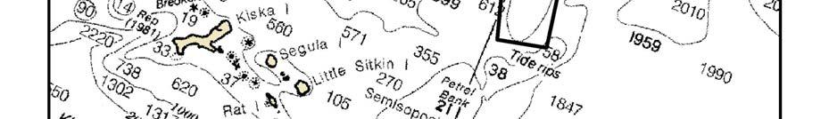
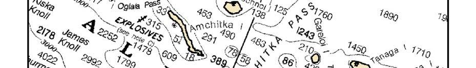
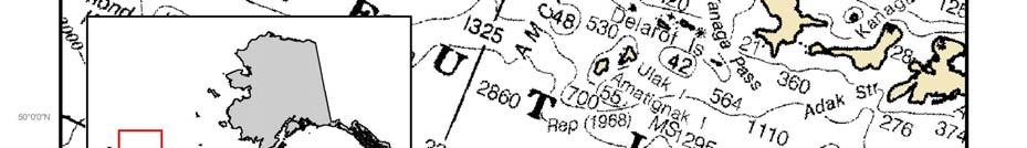
95 Figure 8 Bowers Ridge Habitat Conservation Zone Scallop FMP, Appendices 94 February 2014
96 3.4.6 GOA Coral Habitat Areas of Particular Concern The coordinates for the GOA Coral Habitat Areas of Particular Concern are listed in the table below. See Figures 9 and 10. HAPC Latitude Longitude Cape Ommaney 56 12' 51" N 56 12' 51" N ' 41" W ' 30" W 56 09' 32" N ' 30" W 56 09' 32" N ' 41" W Fairweather Ground NW Area 58 28' 10" N 58 28' 10" N 58 22' 00" N 58 22' 00" N ' 44" W ' 42" W ' 42" W ' 44" W Fairweather Ground Southern Area 58 16' 00" N 58 16' 00" N 58 13' 10" N 58 13' 10" N ' 45" W ' 34" W ' 34" W ' 45" W GOA Coral Habitat Protection Areas Within the GOA Coral HAPC are GOA Coral Habitat Protection Areas. Bottom contact gear fishing and anchoring are prohibited in the GOA Coral Habitat Protection Area. Coordinates for the area are listed in the table below. See Figures 9 and 10. Note: Each area is delineated by connecting the coordinates in the order listed by straight lines. The last set of coordinates for each area is connected to the first set of coordinates for the area by a straight line. Projected coordinate system is North American Datum 1983, Albers. Scallop FMP, Appendices 1 February 2014

97 Figure 9 GOA Coral HAPC and GOA Coral Protect Areas in the Fairweather Grounds Scallop FMP, Appendices 2 February 2014

98 Figure 10 GOA Coral HAPC and GOA Coral Protect Areas near Cape Ommaney Scallop FMP, Appendices 3 February 2014
Fishery Management Plan for the Scallop Fishery off Alaska
 Fishery Management Plan for the Scallop Fishery off Alaska North Pacific Fishery Management Council 605 W. 4th Avenue, Suite 306 Anchorage, Alaska 99501 PHONE: (907) 271-2809 FAX: (907) 271-2817 May 2006
Fisheries Historic Status U.S. fishermen are granted the right to fish in public waters under the Public Trust Doctrine. Through the years, this right
 US U.S. Fisheries i Law: An Introduction Fisheries Historic Status U.S. fishermen are granted the right to fish in public waters under the Public Trust Doctrine. Through the years, this right has been
STOCK ASSESSMENT AND FISHERY EVALUATION REPORT. SCALLOP FISHERY off ALASKA. The Scallop Plan Team
 STOCK ASSESSMENT AND FISHERY EVALUATION REPORT for the SCALLOP FISHERY off ALASKA Prepared by The Scallop Plan Team With contributions by: J. Armstrong, R. Burt, M. Byerly, J. Leon, S. Miller, N. Nichols,
Fisheries Off West Coast States; Coastal Pelagic Species Fisheries; Annual. AGENCY: National Marine Fisheries Service (NMFS), National Oceanic and
, National Oceanic and") This document is scheduled to be published in the Federal Register on 06/30/2017 and available online at https://federalregister.gov/d/2017-13685, and on FDsys.gov Billing Code 3510-22-P DEPARTMENT OF
This document is scheduled to be published in the Federal Register on 06/30/2017 and available online at https://federalregister.gov/d/2017-13685, and on FDsys.gov Billing Code 3510-22-P DEPARTMENT OF
Revisions to the National Standard 1 Guidelines:
 Revisions to the National Standard 1 Guidelines: Guidance on Annual Catch Limits and Other Requirements January 2009 NOAA Fisheries Service Office of Sustainable Fisheries Silver Spring, MD 1 Note: This
Public Review Draft ENVIRONMENTAL ASSESSMENT. For proposed. Amendment 24. To the Fishery Management Plan for
 ENVIRONMENTAL ASSESSMENT For proposed Amendment 24 To the Fishery Management Plan for Bering Sea and Aleutian Islands King and Tanner Crabs to Revise Overfishing Definitions Prepared by staff of the: Alaska
Discussion Paper on BSAI Fixed Gear Parallel Waters Fishery North Pacific Fishery Management Council October 2008
 Discussion Paper on BSAI Fixed Gear Parallel Waters Fishery North Pacific Fishery Management Council October 2008 Item D-2(b) At its April 2008 meeting, the Council initiated a staff discussion paper on
Fisheries Off West Coast States; Coastal Pelagic Species Fisheries; Annual. AGENCY: National Marine Fisheries Service (NMFS), National Oceanic and
, National Oceanic and") This document is scheduled to be published in the Federal Register on 06/25/2018 and available online at https://federalregister.gov/d/2018-13583, and on FDsys.gov BILLING CODE: 3510-22-P DEPARTMENT OF
This document is scheduled to be published in the Federal Register on 06/25/2018 and available online at https://federalregister.gov/d/2018-13583, and on FDsys.gov BILLING CODE: 3510-22-P DEPARTMENT OF
ADDENDUM I TO AMENDMENT 3 OF THE INTERSTATE FISHERY MANAGEMENT PLAN FOR WEAKFISH
 ATLANTIC STATES MARINE FISHERIES COMMISSION ADDENDUM I TO AMENDMENT 3 OF THE INTERSTATE FISHERY MANAGEMENT PLAN FOR WEAKFISH Prepared by the Weakfish Plan Review Team Approved October 18, 2000 TABLE OF
North Pacific Fishery Management Council Standardized Management Actions Council Coordinating Committee (CCC) May 2009 in Boston, MA
 May 2009 in Boston, MA") North Pacific Fishery Management Council Standardized Management Actions Council Coordinating Committee (CCC) May 2009 in Boston, MA The NPFMC maintains Fishery Management Plans (FMPs) for: (1) Groundfish
North Pacific Fishery Management Council Standardized Management Actions Council Coordinating Committee (CCC) May 2009 in Boston, MA The NPFMC maintains Fishery Management Plans (FMPs) for: (1) Groundfish
Comparison of EU and US Fishery management Systems Ernesto Penas Principal Adviser DG Mare
 Comparison of EU and US Fishery management Systems Ernesto Penas Principal Adviser DG Mare Stock and Fisheries Status Seminar Brussels, 26 September 2017 Why comparing the EU and the US? Need to put the
National Oceanic and Atmospheric Administration. Fisheries of the Caribbean, Gulf of Mexico, and South
 This document is scheduled to be published in the Federal Register on 07/13/2016 and available online at http://federalregister.gov/a/2016-16510, and on FDsys.gov Billing Code: 3510-22-P DEPARTMENT OF
North Pacific Fishery Management Council. Community considerations in Federally-managed fisheries. April 2005
 North Pacific Fishery Management Council Community considerations in Federally-managed fisheries April 2005 Why are Fisheries Off Alaska so important to communities? Would rank in the top 10 producing
Draft Discussion Document. May 27, 2016
 Draft Discussion Document May 27, 2016 Action to consider modifications to the sub-acl of GB haddock allocated to the Atlantic herring fishery and associated accountability measures AP/ CMTE Input 1. Review
Atlantic Highly Migratory Species; Atlantic Bluefin Tuna Fisheries. AGENCY: National Marine Fisheries Service (NMFS), National Oceanic and Atmospheric
, National Oceanic and Atmospheric") This document is scheduled to be published in the Federal Register on 05/11/2018 and available online at https://federalregister.gov/d/2018-09960, and on FDsys.gov Billing Code: 3510-22-P DEPARTMENT OF
This document is scheduled to be published in the Federal Register on 05/11/2018 and available online at https://federalregister.gov/d/2018-09960, and on FDsys.gov Billing Code: 3510-22-P DEPARTMENT OF
Fishery management responses to climate change in the North Pacific
 Fishery management responses to climate change in the North Pacific Diana Stram and Chris Oliver North Pacific Fishery Management Council Anchorage, AK Effects of Climate Change on the World s s Oceans
Red Snapper Allocation
 Tab B, No. 6 06/04/13 Red Snapper Allocation Draft Options Paper for Amendment 28 to the Fishery Management Plan for the Reef Fish Resources of the Gulf of Mexico June 2013 This is a publication of the
AGENCY: National Marine Fisheries Service (NMFS), National Oceanic and Atmospheric
, National Oceanic and Atmospheric") This document is scheduled to be published in the Federal Register on 05/08/2013 and available online at http://federalregister.gov/a/2013-10931, and on FDsys.gov Billing Code: 3510-22-P DEPARTMENT OF
This document is scheduled to be published in the Federal Register on 05/08/2013 and available online at http://federalregister.gov/a/2013-10931, and on FDsys.gov Billing Code: 3510-22-P DEPARTMENT OF
Essential Fish Habitat
 Pacific Fishery Management Council Fact sheet: Essential Fish Habitat Habitat is the environment where an animal lives, feeds, and reproduces. Identifying fish habitat is complex because fish move through
Modifications to Gulf Reef Fish and South Atlantic Snapper Grouper Fishery Management Plans
 Tab B, No. 11b 3/19/15 Modifications to Gulf Reef Fish and South Atlantic Snapper Grouper Fishery Management Plans Draft Joint Generic Amendment DECISION DOCUMENT For the Joint Council Committee on South
Essential Fish Habitat OCNMS Advisory Council July 13, 2013
 Essential Fish Habitat OCNMS Advisory Council July 13, 2013 John Stadler Habitat Conservation Division NMFS Northwest Region Essential Fish Habitat (EFH) What is it, where did it come from, and what does
DECISION DOCUMENT. Framework Adjustment 53. Council Meeting November 17-20, for. to the Northeast Multispecies. Fishery Management Plan (FMP)
") DECISION DOCUMENT for Framework Adjustment 53 to the Northeast Multispecies Fishery Management Plan (FMP) Council Meeting November 17-20, 2014 Framework 53 Decision Document 1 November 2014 NEFMC Meeting
DECISION DOCUMENT for Framework Adjustment 53 to the Northeast Multispecies Fishery Management Plan (FMP) Council Meeting November 17-20, 2014 Framework 53 Decision Document 1 November 2014 NEFMC Meeting
2012 Maryland FMP Report (July 2013) Section 15. Red Drum (Sciaenops ocellatus)
 Section 15. Red Drum (Sciaenops ocellatus)") 1981 1983 1985 1987 1989 1991 1995 1997 1999 2001 2003 2005 2007 2009 2011 Pounds 2012 Maryland FMP Report (July 2013) Section 15. Red Drum (Sciaenops ocellatus) Chesapeake Bay FMP In 2012, red drum were
1981 1983 1985 1987 1989 1991 1995 1997 1999 2001 2003 2005 2007 2009 2011 Pounds 2012 Maryland FMP Report (July 2013) Section 15. Red Drum (Sciaenops ocellatus) Chesapeake Bay FMP In 2012, red drum were
Federal Register / Vol. 64, No. 76 / Wednesday, April 21, 1999 / Rules and Regulations
 19503 application in a queue. The priority rights of the lead applicant, against all other applicants, are determined by the date of filing, but the filing date for subsequent, conflicting applicants only
North Carolina. Striped Mullet FMP. Update
 North Carolina Striped Mullet FMP Update Presentation for the Marine Fisheries Commission January 24, 2008 COMMERCIAL HARVEST 4,000,000 2,000,000 3,500,000 3,000,000 Landings (lb) Value ($) 1,800,000
Certification Determination. Louisiana Blue Crab Commercial Fishery
 15 th November 2016 Certification Determination For The Louisiana Blue Crab Commercial Fishery Following a meeting of a Global Trust Certification Committee on 20 th October 2016, a positive determination
OTHER SPECIES ANALYSIS 2007 ANDREW SMOKER NATIONAL MARINE FISHERIES SERVICE MARCH 2007
 OTHER SPECIES ANALYSIS 2007 ANDREW SMOKER NATIONAL MARINE FISHERIES SERVICE MARCH 2007 Abstract The North Pacific Fishery Management Council is considering alternatives for restructuring the management
The Fisheries Reform Act of The Joint Legislative Commission on Seafood and Aquaculture March 30, 2010
 The Fisheries Reform Act of 1997 The Joint Legislative Commission on Seafood and Aquaculture March 30, 2010 History July 1, 1994 Moratorium on Commercial Fishing Licenses Based on wide range of concerns
Bering Sea Salmon Bycatch Update North Pacific Fishery Management Council, July 2017
 Bering Sea Salmon Bycatch Update North Pacific Fishery Management Council, July 2017 Salmon are caught incidentally in the Bering Sea and Aleutian Islands (BSAI) offshore trawl fisheries, especially in
Atlantic Highly Migratory Species. Draft Amendment 10 Essential Fish Habitat
 Atlantic Highly Migratory Species Draft Amendment 10 Essential Fish Habitat Outline Introduction to Essential Fish Habitat (EFH) Timeline of HMS EFH Actions Draft Amendment 10 Alternatives Important Reminders
Discussion Paper: Consideration of a Registration for Self-Guided Halibut Rental Boats
 Discussion Paper: Consideration of a Registration for Self-Guided Halibut Rental Boats December 2017 1 1 Introduction... 1 2 Description of the Problem... 1 2.1 Definition of self-guided halibut rental
HABITAT AREAS OF PARTICULAR CONCERN (HAPC) PROPOSAL
 PROPOSAL") HABITAT AREAS OF PARTICULAR CONCERN (HAPC) PROPOSAL Date: 1/10/04 Name of Proposer: Alaska Draggers Association, Alaska Groundfish Data Bank, & Groundfish Forum Affiliation: Trawl associations with member
HABITAT AREAS OF PARTICULAR CONCERN (HAPC) PROPOSAL Date: 1/10/04 Name of Proposer: Alaska Draggers Association, Alaska Groundfish Data Bank, & Groundfish Forum Affiliation: Trawl associations with member
Alabama Management for Recreational Red Snapper
 Tab B, No. 7d 3/30/2018 Alabama Management for Recreational Red Snapper Draft Amendment 50D to the Fishery Management Plan for the Reef Fish Resources of the Gulf of Mexico April 2018 This is a publication
Modify Federal Regulations for Swordfish Trip Limits the Deep-set Tuna Longline Fishery. Decision Support Document November 2010
 Agenda Item J.2.a Attachment 2 November 2010 Modify Federal Regulations for Trip Limits the Deep-set Tuna Longline Fishery (Action Pursuant to Modification of Routine Management Measures under the Framework
Atlantic Highly Migratory Species; Atlantic Bluefin Tuna Fisheries. AGENCY: National Marine Fisheries Service (NMFS), National Oceanic and Atmospheric
, National Oceanic and Atmospheric") This document is scheduled to be published in the Federal Register on 04/26/2018 and available online at https://federalregister.gov/d/2018-08783, and on FDsys.gov Billing Code: 3510-22-P DEPARTMENT OF
This document is scheduled to be published in the Federal Register on 04/26/2018 and available online at https://federalregister.gov/d/2018-08783, and on FDsys.gov Billing Code: 3510-22-P DEPARTMENT OF
Assessment Summary Report Gulf of Mexico Red Snapper SEDAR 7
 Assessment Summary Report Gulf of Mexico Red Snapper SEDAR 7 Stock Distribution: Red snapper are found throughout the Gulf of Mexico, the Caribbean Sea, and from the U.S. Atlantic Coast to northern South
West Coast Rock Lobster. Description of sector. History of the fishery: Catch history
 West Coast Rock Lobster Description of sector History of the fishery: The commercial harvesting of West Coast rock lobster commenced in the late 1800s, and peaked in the early 1950s, yielding an annual
Skate Amendment 3 Scoping Hearings Staff summary of comments May 22-24, 2007
 Skate Amendment 3 Scoping Hearings Staff summary of comments May 22-24, 2007 The hearings were sparsely attended, the highest turnout was in Narragansett, RI by a processor and several fishermen that target
Fisheries Off West Coast States; Coastal Pelagic Species Fisheries; Amendment to
 This document is scheduled to be published in the Federal Register on 08/01/2017 and available online at https://federalregister.gov/d/2017-16135, and on FDsys.gov Billing Code 3510-22-P DEPARTMENT OF
17-06 BFT RECOMMENDATION BY ICCAT FOR AN INTERIM CONSERVATION AND MANAGEMENT PLAN FOR WESTERN ATLANTIC BLUEFIN TUNA
 17-06 BFT RECOMMENDATION BY ICCAT FOR AN INTERIM CONSERVATION AND MANAGEMENT PLAN FOR WESTERN ATLANTIC BLUEFIN TUNA RECALLING the Recommendation by ICCAT to Establish a Rebuilding Program for Western Atlantic
JAN Approved Measures. Dr. John Quinn Chairman New England Fishery Management Council 50 Water Street, Mill 2 Newburyport, MA 01950
 UNITED STATES DEPARTMENT OF COMMERCE National Oceanic and Atmospheric Administration NATIONAL MARINE FISHERIES SERVICE GREATER ATLANTIC REGIONAL FISHERIES OFFICE 55 Great Republic Drive Gloucester, MA
Atlantic States Marine Fisheries Commission
 Atlantic States Marine Fisheries Commission Vision: Sustainably Managing Atlantic Coastal Fisheries Meeting Summary Joint ASMFC Summer Flounder, Scup and Black Sea Bass Board and MAFMC March 6 & 7, 2019
AGENCY: National Marine Fisheries Service (NMFS), National Oceanic and Atmospheric
, National Oceanic and Atmospheric") This document is scheduled to be published in the Federal Register on 05/06/2014 and available online at http://federalregister.gov/a/2014-10222, and on FDsys.gov Billing Code: 3510-22-P DEPARTMENT OF
This document is scheduled to be published in the Federal Register on 05/06/2014 and available online at http://federalregister.gov/a/2014-10222, and on FDsys.gov Billing Code: 3510-22-P DEPARTMENT OF
Update: This document has been updated to include biological information on red snapper and information from the recent Gulf of Mexico Fishery
 Update: This document has been updated to include biological information on red snapper and information from the recent Gulf of Mexico Fishery Management Council (Gulf Council) meeting. Author: Luiz Barbieri
NASCO Guidelines for the Management of Salmon Fisheries
 NASCO Guidelines for the Management of Salmon Fisheries NASCO Guidelines for the Management of Salmon Fisheries Additional copies of these Guidelines can be obtained free of charge from: The Secretary
Essential Fish Habitat Consultation
 1 Essential Fish Habitat Consultation Marine Shoreline Development Workshop February 21, 2007 John H. Stadler Washington State Habitat Office National Marine Fisheries Service Magnuson-Stevens Fishery
Agenda Item F.1.b Supplemental Public Comment 2 June 2018
 Agenda Item F.1.b Supplemental Public Comment 2 June 2018 1 May 29, 2018 Mr. Phil Anderson, Chair Pacific Fishery Management Council 7700 NE Ambassador Place, Suite 101 Portland, OR 97220 RE: F.1 Live
Cook Inlet Habitat Conservation Strategy
 Cook Inlet Habitat Conservation Strategy What is the Cook Inlet Habitat Conservation Strategy? It s a new effort to tie together all of NOAA Fisheries habitat-related science and management activities
Atlantic States Marine Fisheries Commission An Overview. Tina Berger, Director of Communications
 Atlantic States Marine Fisheries Commission An Overview By Tina Berger, Director of Communications Presentation Overview Commission Overview ASMFC Programs Species Highlights American Eel Atlantic Menhaden
2001 REVIEW OF THE ATLANTIC STATES MARINE FISHERIES COMMISSION FISHERY MANAGEMENT PLAN FOR WEAKFISH (Cynoscion regalis)
") 2001 REVIEW OF THE ATLANTIC STATES MARINE FISHERIES COMMISSION FISHERY MANAGEMENT PLAN FOR WEAKFISH (Cynoscion regalis) Plan Review Team Rick Cole, DE Louis Daniel, NC Charles Lesser, DE Rob O Reilly,
2001 REVIEW OF THE ATLANTIC STATES MARINE FISHERIES COMMISSION FISHERY MANAGEMENT PLAN FOR WEAKFISH (Cynoscion regalis) Plan Review Team Rick Cole, DE Louis Daniel, NC Charles Lesser, DE Rob O Reilly,
U.N. Gen. Ass. Doc. A/CONF.164/37 (8 September 1995) <http://daccessdds.un.org/doc/undoc/gen/n95/274/67/pdf/n pdf?openelement>.
 <http://daccessdds.un.org/doc/undoc/gen/n95/274/67/pdf/n pdf?openelement>.") Agreement for the Implementation of the Provisions of the United Nations Convention on the Law of the Sea Of 10 December 1982 Relating to the Conservation and Management of Straddling Fish Stocks and Highly
Agreement for the Implementation of the Provisions of the United Nations Convention on the Law of the Sea Of 10 December 1982 Relating to the Conservation and Management of Straddling Fish Stocks and Highly
Fisheries Management Standard. Version 2.0
 Enacted in Japanese: 2017.10.03 Effective in Japanese: 2018.02.01 Fisheries Management Standard Version 2.0 Marine Eco-Label Japan Council (2018) Introduction Marine Eco-Label Japan (MEL) Council have
Public Hearing Document
 Regulatory Amendment 1 to the Fishery Management Plan for the Dolphin and Wahoo Fishery of the Atlantic Modify commercial trip limits for dolphin Environmental Assessment Regulatory Impact Review Regulatory
Amendment 9 to the Fishery Management Plan for the Shrimp Fishery of the South Atlantic Region
 Amendment 9 to the Fishery Management Plan for the Shrimp Fishery of the South Atlantic Region Environmental Assessment Regulatory Flexibility Act Analysis Regulatory Impact Review Fishery Impact Statement
Magnuson-Stevens Fishery Conservation and Management Act Provisions; Fisheries of the
 This document is scheduled to be published in the Federal Register on 11/07/2013 and available online at http://federalregister.gov/a/2013-26773, and on FDsys.gov BILLING CODE 3510-22-P DEPARTMENT OF COMMERCE
Management advisory for the Bay of Bengal hilsa fishery June 2012
 Page1 Management advisory for the Bay of Bengal hilsa fishery June 2012 What is the BOBLME RFMAC The BOBLME Project is supporting countries to implement an ecosystem approach to fisheries management of
3.4.3 Advice June Barents Sea and Norwegian Sea Cod in Subareas I and II (Norwegian coastal waters cod)
") 3.4.3 Advice June 2013 ECOREGION STOCK Barents Sea and Norwegian Sea Cod in Subareas I and II (Norwegian coastal waters cod) Advice for 2014 ICES advises on the basis of the Norwegian rebuilding plan,
3.4.3 Advice June 2013 ECOREGION STOCK Barents Sea and Norwegian Sea Cod in Subareas I and II (Norwegian coastal waters cod) Advice for 2014 ICES advises on the basis of the Norwegian rebuilding plan,
Fisheries of the Exclusive Economic Zone Off Alaska; Steller Sea Lion Protection Measures for
 This document is scheduled to be published in the Federal Register on 11/25/2014 and available online at http://federalregister.gov/a/2014-27658, and on FDsys.gov Billing Code: 3510-22-P DEPARTMENT OF
Gulf of Maine Research Institute Responsibly Harvested Seafood from the Gulf of Maine Region. Report on Gulf of Maine/Georges Bank Redfish
 Gulf of Maine Research Institute Responsibly Harvested Seafood from the Gulf of Maine Region Report on Gulf of Maine/Georges Bank Redfish The fishery is managed by a competent authority and has a management
NOAA Fisheries Update:
 NOAA Fisheries Update: A Presentation to the Pacific States Marine Fisheries Commission August 20, 2012 Dr. Paul N. Doremus Deputy Assistant Administrator for Operations 1 A Milestone Year for Fisheries
National Standard 10 Advanced Notice of Proposed Rulemaking New England Fishery Management Council
 National Standard 10 Advanced Notice of Proposed Rulemaking New England Fishery Management Council Portland, ME June 21, 2011 Presentation Outline Information on Fishing Safety National Standard 10 and
Introduction to population dynamics and stock assessments
 South East Fisheries Science Center Introduction to population dynamics and stock assessments Adyan Rios MREP USVI Tuesday, May 23, 2017 Introduction to population dynamics and stock assessments Part 1
October Net Loss: Overfishing Off the Pacific Coast
 October 2007 Net Loss: Overfishing Off the Pacific Coast Net Loss Overfishing Off the Pacific Coast October 2007 Acknowledgements Written by Michael Gravitz, Oceans Advocate, U.S. PIRG Education Fund,
2.0 HISTORY OF THE WEST COAST GROUNDFISH TRAWL FISHERY
 2.0 HISTORY OF THE WEST COAST GROUNDFISH TRAWL FISHERY The Pacific groundfish FMP was first approved in 1982, establishing management measures for over 90 species caught off the United States (U.S.) West
Submission on summary of the Draft Convention on Biological Diversity National Report
 23 November 2018 Submission on summary of the Draft Convention on Biological Diversity National Report The New Zealand Marine Sciences Society (NZMSS) is a professional society affiliated to the Royal
Mississippi Management for Recreational Red Snapper
 Mississippi Management for Recreational Red Snapper Tab B, No. 6e(2) 1/8/2018 Draft Amendment to the Fishery Management Plan for the Reef Fish Resources of the Gulf of Mexico January 2018 This is a publication
Year End Report of The Fishing Company of Alaska Offshore Rockfish Cooperative
 Year End Report of The Fishing Company of Alaska Offshore Respectively submitted to: Regional Administrator NMFS Alaska P.O. Box 21668 Juneau, Alaska 99802 December 15, 2010 TABLE OF CONTENTS I. INTRODUCTION.
Testimony of Ray Hilborn to U.S. Senate subcommittee.
 Testimony of Ray Hilborn to U.S. Senate subcommittee. 24 October 2017 Ray Hilborn, Professor, School of Aquatic and Fishery Sciences, University of Washington, Seattle, WA. Qualifications I am an ecologist
NORTH PACIFIC FISHERY MANAGEMENT COUNCIL AGENCY REPORT
 NORTH PACIFIC FISHERY MANAGEMENT COUNCIL AGENCY REPORT A. OVERVIEW Many of the North Pacific Council=s actions in 2001 were related to developing supplemental environmental impact assessments (SEIS). A
Chesapeake Bay Jurisdictions White Paper on Draft Addendum IV for the Striped Bass Fishery Management Plan
 Chesapeake Bay Jurisdictions White Paper on Draft Addendum IV for the Striped Bass Fishery Management Plan Maryland Department of Natural Resources, District of Columbia s Fisheries and Wildlife Division,
Agenda Item J.3 Attachment 2 September 2016
 Agenda tem J.3 Attachment 2 September 216 UNTED STATES DEPARTMENT OF COMMERCE National Oceanic and Atmospheric Administration NATONAL MARNE FSHERES SERVCE West Coast Region 76 Sand Point Way N.E., Bldg.
Texas Shrimp Action Plan
 Texas Shrimp Action Plan Updated April 2017 Prepared by: Audubon Nature Institute Gulf United for Lasting Fisheries (G.U.L.F.) Laura Picariello - Technical Programs Manager Ashford Rosenberg - Outreach
Gulf of Maine Research Institute Responsibly Harvested Seafood from the Gulf of Maine Region Report on Atlantic Sea Scallops (Inshore Canada)
") Gulf of Maine Research Institute Responsibly Harvested Seafood from the Gulf of Maine Region Report on Atlantic Sea Scallops (Inshore Canada) The fishery is managed by a competent authority and has a management
Gulf of Maine Research Institute Responsibly Harvested Seafood from the Gulf of Maine Region Report on Atlantic Sea Scallops (Inshore Canada) The fishery is managed by a competent authority and has a management
ASMFC Stock Assessment Overview: Red Drum
 Purpose The purpose of this document is to improve the understanding and transparency of the Commission s stock assessment process and results. It is the first of several that will be developed throughout
St. Croix-Draft Actions and Alternatives.
 [Type the document title] St. Croix-Draft Actions and Alternatives. Scoping Meetings April 2014 Table of Contents List of Tables... 2 List of Figures... 2 Action 1. Identify Fishery Management Units (FMUs)
CALIFORNIA DEPARTMENT OF FISH AND WILDLIFE REPORT ON SWORDFISH MANAGEMENT AND MONITORING PLAN
 Agenda Item G.2.a Supplemental CDFW Report September 2015 CALIFORNIA DEPARTMENT OF FISH AND WILDLIFE REPORT ON SWORDFISH MANAGEMENT AND MONITORING PLAN At this meeting the Pacific Fishery Management Council
Legislation. Lisa T. Ballance Marine Mammal Biology SIO 133 Spring 2013
 Legislation Lisa T. Ballance Marine Mammal Biology SIO 133 Spring 2013 Really Quickly: Marine Mammal Legislation The big two: the Marine Mammal Protection Act and the Endangered Species Act International
Press Release New Bilateral Agreement May 22, 2008
 Informational Report 3 June 2008 Press Release New Bilateral Agreement May 22, 2008 The Pacific Salmon Commission is pleased to announce that it has recommended a new bilateral agreement for the conservation
Consultation Document
 Consultation Document Development of a regulation establishing a multiannual plan for the management of Northern Adriatic Sea small pelagic fisheries The sole purpose of this consultation is to collect
STOCK ASSESSMENT AND FISHERY EVALUATION REPORT FOR THE GROUNDFISH FISHERIES OF THE GULF OF ALASKA AND BERING SEA/ALEUTIAN ISLAND AREA:
 STOCK ASSESSMENT AND FISHERY EVALUATION REPORT FOR THE GROUNDFISH FISHERIES OF THE GULF OF ALASKA AND BERING SEA/ALEUTIAN ISLAND AREA: ECONOMIC STATUS OF THE GROUNDFISH FISHERIES OFF ALASKA, 1998 by Terry
Worldwide Office 4245 North Fairfax Drive, Suite 100 Arlington, VA 22203
 October 24, 2017 Megan Ware Atlantic States Marine Fisheries Commission 1050 North Highland Street, Suite 200A-N Arlington, Virginia 22201 [sent via email] Dear Ms. Ware and Menhaden Management Board members,
Wild flatfish (Alaska Sole and Flounder), living in the clear remote waters of Alaska, are managed to provide a sustainable food source while
, living in the clear remote waters of Alaska, are managed to provide a sustainable food source while") Wild flatfish (Alaska Sole and Flounder), living in the clear remote waters of Alaska, are managed to provide a sustainable food source while protecting against habitat damage. Flatfish fishermen are dedicated
Wild flatfish (Alaska Sole and Flounder), living in the clear remote waters of Alaska, are managed to provide a sustainable food source while protecting against habitat damage. Flatfish fishermen are dedicated
National Oceanic and Atmospheric Administration. Pacific Island Pelagic Fisheries; 2016 U.S. Territorial
 This document is scheduled to be published in the Federal Register on 07/07/2016 and available online at http://federalregister.gov/a/2016-16013, and on FDsys.gov BILLING CODE 3510-22-P DEPARTMENT OF COMMERCE
Official Journal of the European Union L 248/17
 22.9.2007 Official Journal of the European Union L 248/17 COUNCIL REGULATION (EC) No 1100/2007 of 18 September 2007 establishing measures for the recovery of the stock of European eel THE COUNCIL OF THE
NATIONAL MARINE FISHERIES SERVICE REPORT ON DEEP-SET BUOY GEAR AMENDMENT SCOPING
 Agenda Item F.3.a NMFS Report March 2016 NATIONAL MARINE FISHERIES SERVICE REPORT ON DEEP-SET BUOY GEAR AMENDMENT SCOPING I. Introduction/DSBG Timeline Deep-set buoy gear (DSBG) is a novel gear type that
To Revise the Maximum Retainable Amounts of Groundfish in the Arrowtooth Flounder Fishery
 INITIAL REVIEW DRAFT ENVIRONMENTAL ASSESSMENT/REGULATORY IMPACT REVIEW/ INITIAL REGULATORY FLEXIBILITY ANALYSIS For a proposed Regulatory Amendment to the Fishery Management Plan for the Groundfish Fishery
National Oceanic and Atmospheric Administration. Fisheries of the Caribbean, Gulf of Mexico, and South Atlantic;
 This document is scheduled to be published in the Federal Register on 02/05/2019 and available online at https://federalregister.gov/d/2019-01117, and on govinfo.gov BILLING CODE 3510-22-P DEPARTMENT OF
Kodiak and Alaska Peninsula Commercial Dungeness Crab Fisheries, Report to the Alaska Board of Fisheries. Michael P. Ruccio.
 Kodiak and Alaska Peninsula Commercial Dungeness Crab Fisheries, 1999 Report to the Alaska Board of Fisheries By Michael P. Ruccio and David R. Jackson Regional Information Report 1 No. 4K00-3 Alaska Department
Amendment 43 to the Fishery Management Plan for the Snapper Grouper Fishery of the South Atlantic Region. Options Paper
 Amendment 43 to the Fishery Management Plan for the Snapper Grouper Fishery of the South Atlantic Region Amendment 43 to the Fishery Management Plan for the Snapper Grouper Fishery of the South Atlantic
Fisheries off West Coast States; Pacific Coast Groundfish Fishery Management Plan;
 This document is scheduled to be published in the Federal Register on 03/29/2018 and available online at https://federalregister.gov/d/2018-06316, and on FDsys.gov Billing Code 3510-22-P DEPARTMENT OF
Alaska Responsible Fisheries Management Certification Program. Announcement of Full Re-assessment of. Announcement of Full Assessment of
 16 th December 2016 Alaska Responsible Fisheries Management Certification Program Announcement of Full Re-assessment of Bristol Bay Red King Crab Fishery BSAI Snow crab Fishery St. Matthew Blue King Crab
Reef Fish Amendment 32 Gag and Red Grouper
 AMENDMENT GUIDE 11/2/11 Reef Fish Amendment 32 Gag and Red Grouper Provisions in the Magnuson-Stevens Fishery Conservation and Management Act require regional fishery management councils to develop annual
Framework Adjustment 56. to the. Northeast Multispecies FMP
 to the Northeast Multispecies FMP Calculation of Northeast Multispecies Annual Catch Limits, FY 2017 FY II-1 II-2 This appendix documents the calculation of Northeast Multispecies Overfishing Levels (OFLs),
Atlantic Highly Migratory Species; Atlantic Bluefin Tuna Fisheries. AGENCY: National Marine Fisheries Service (NMFS), National Oceanic and Atmospheric
, National Oceanic and Atmospheric") This document is scheduled to be published in the Federal Register on 05/15/2015 and available online at http://federalregister.gov/a/2015-11791, and on FDsys.gov DEPARTMENT OF COMMERCE BILLING CODE 3510-22-P
This document is scheduled to be published in the Federal Register on 05/15/2015 and available online at http://federalregister.gov/a/2015-11791, and on FDsys.gov DEPARTMENT OF COMMERCE BILLING CODE 3510-22-P
Gulf of Maine Research Institute Responsibly Harvested Seafood from the Gulf of Maine Region Report on Atlantic Sea Scallops
 Gulf of Maine Research Institute Responsibly Harvested Seafood from the Gulf of Maine Region Report on Atlantic Sea Scallops The fishery is managed by a competent authority and has a management plan in
REC.CM-GFCM/40/2016/4
 REC.CM-GFCM/40/2016/4 establishing a multiannual management plan for the fisheries exploiting European hake and deep-water rose shrimp in the Strait of Sicily (GSA 12 to 16) The General Fisheries Commission
Pacific Fishery Management Council Initial Concepts for North Pacific Albacore Management Strategy Evaluation
 Pacific Fishery Management Council Initial Concepts for North Pacific Albacore Management Strategy Evaluation Introduction The ISC s Albacore Working Group has been tasked with developing a management
Evolution of Deepwater Coral Protection in the Southeast U.S
 Evolution of Deepwater Coral Protection in the Southeast U.S Tina Udouj, Florida Fish and Wildlife Conservation Commission Roger Pugliese, South Atlantic Fishery Management Council Overview Deepwater Corals
7 GULF OF ALASKA POLLOCK
 7 GULF OF ALASKA POLLOCK 7.1 Introduction For the Gulf of Alaska (GOA) pollock fishery, the Principle 1 and 2 PIs were mapped against the following indicators within the stated reports: FAM PI: Assessment
Proposal for a COUNCIL REGULATION
 EUROPEAN COMMISSION Brussels, 31.8.2018 COM(2018) 608 final 2018/0320 (NLE) Proposal for a COUNCIL REGULATION fixing for 2019 the fishing opportunities for certain fish stocks and groups of fish stocks