Review of the current impacts of Dredge Spoil Islands and water circulation on adjacent seagrass beds Swansea Flats
|
|
|
- Aldous Randall
- 6 years ago
- Views:
Transcription
1 Office of the Lake Macquarie and Catchment Co-ordinator Review of the current impacts of Dredge Spoil Islands and water circulation on adjacent seagrass beds Swansea Flats March 2004
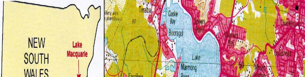
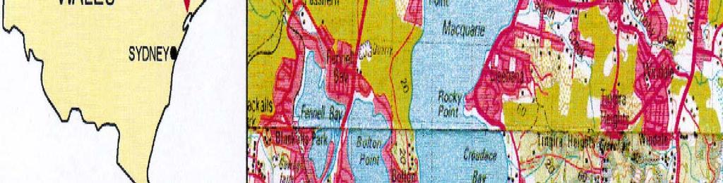
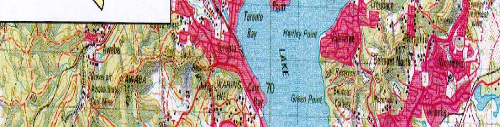
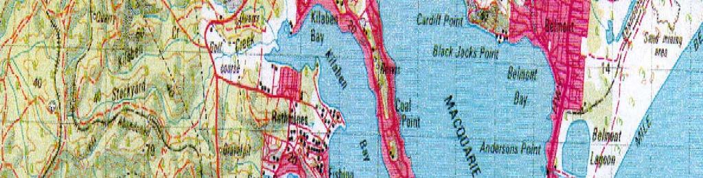
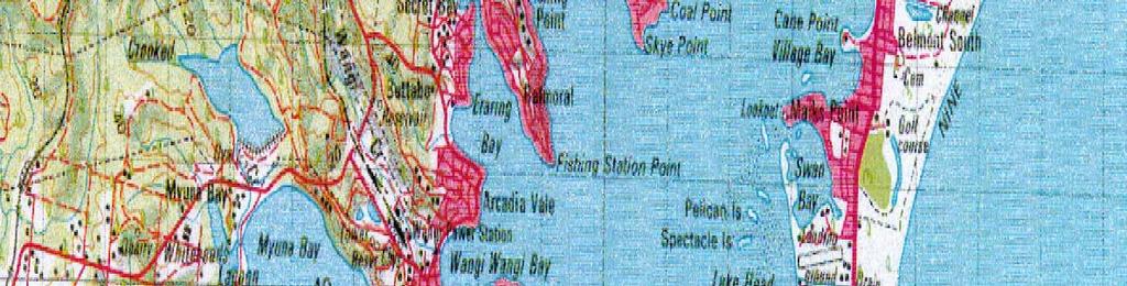
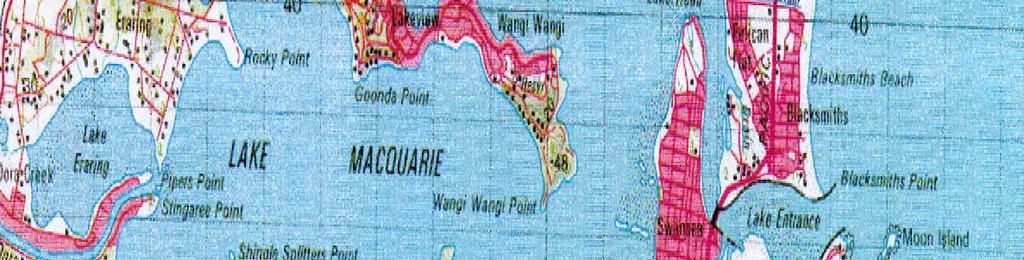
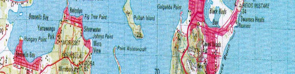
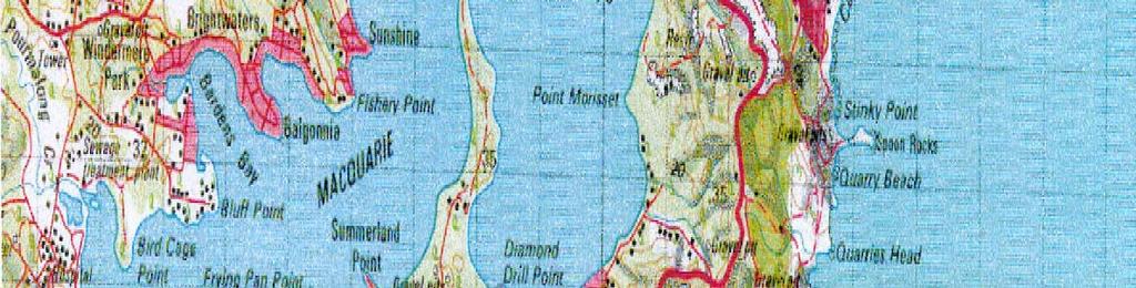
2 TABLE OF CONTENTS 1.0 INTRODUCTION STUDY AREA THE IMPORTANCE OF SEAGRASS IN LAKE MACQUARIE OBJECTIVES SURVEY METHODOLOGY ASSESSMENT OF SEAGRASS HEALTH CONCLUSIONS AND RECOMMENDATIONS REFERENCES... 5 FIGURES 1.1 Locality Plan Local Environmental Features, Swansea Flats Navigation and Dredging Features of Swansea Flats Location of Seagrass Sampling Points Channel Profiles Mean (±SE) Percent Cover of Seagrass and Macroalgae at each Site Mean (±SE) Seagrass Shoot Length and Epiphyte Cover at each Site...4 Umwelt (Australia) Pty Limited 1879/R01/V2 March 2004 i
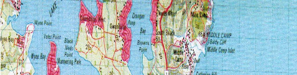
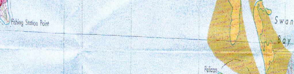
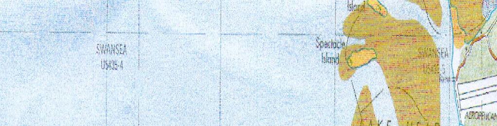
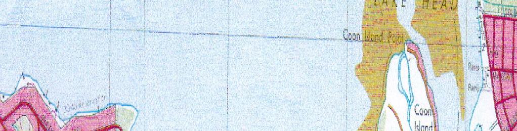
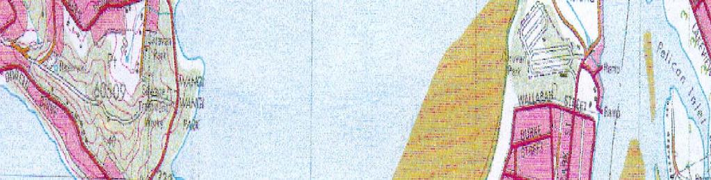
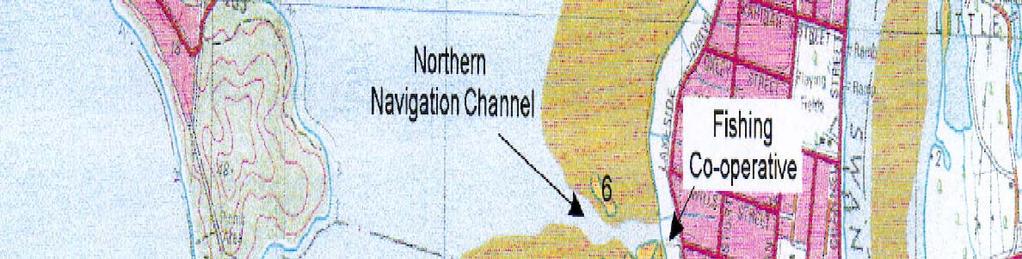
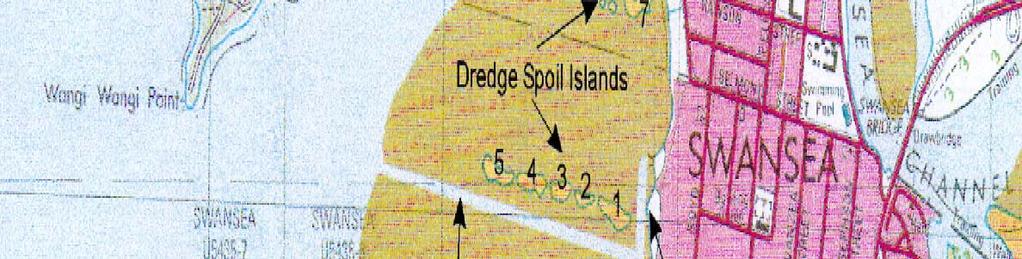
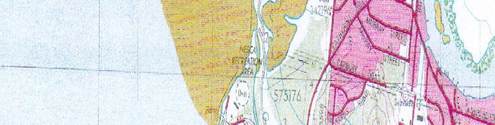
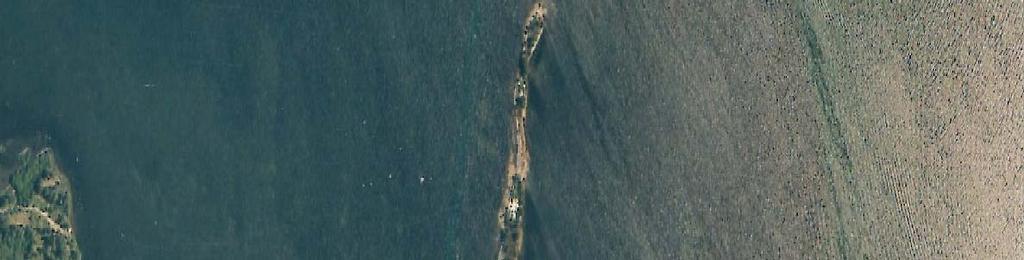
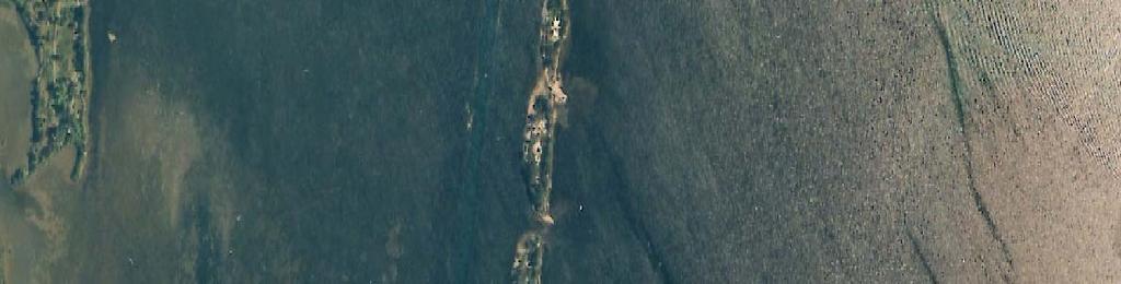
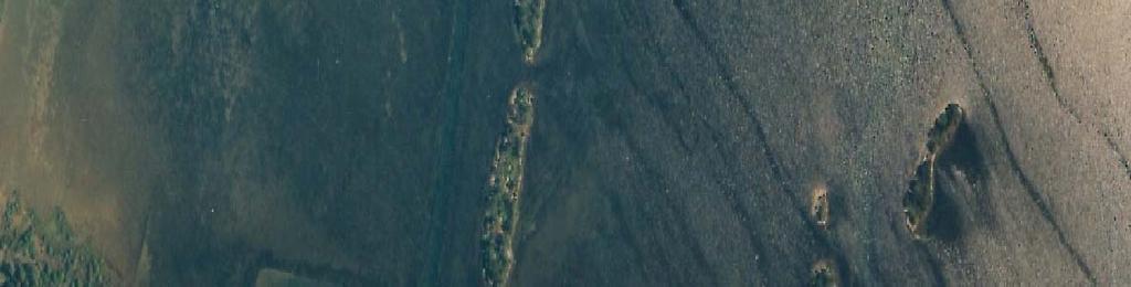
3 1.0 INTRODUCTION Lake Macquarie is the largest coastal lake in eastern Australia, covering an area of approximately 120 kilometres squared. It is located approximately 135 kilometres north of Sydney and 20 kilometres south of Newcastle. Lake Macquarie is a barrier estuary characterised by a narrow, elongated entrance channel with twin training breakwaters. As a result tidal exchange is limited, estimated at approximately 1 per cent per tidal cycle (DLWC, 2000). The lake is reasonably shallow with an average depth of 7 metres and maximum depth of around 11 metres. Swansea Flats is located on the eastern shoreline of Lake Macquarie (151º37 E, 33º06 S), immediately south of the entrance channel (Figure 1.1). The Flats are a shallow estuarine area, characterised by water depths typically less than 1 metre, reasonably clean quartzose marine sand and widespread seagrass meadows. The shallow water and seagrass habitat make Swansea Flats an important first refuge and settlement area for fish larvae entering the lake from the ocean. For this reason, the maintenance of water quality and seagrass health at Swansea Flats is very important for the overall ecological productivity of Lake Macquarie. In the late 1950s, two channels were dredged across Swansea Flats to improve navigational access to the shoreline. The dredge spoil material was retained within the estuary and used to construct a series of linear islands. Over time the detailed morphology of the islands has been modified both by subaerial and estuarine processes, so that they now form a more continuous barrier than in the past. This has raised community concerns that the islands may be impeding water circulation across the shallow sand flats, thus trapping urban stormwater runoff, reducing water quality, degrading seagrass habitat and reducing the area s value for the recruitment of juvenile fish. At the same time, there has been no lessening of demand for navigation access across the sand flats to the foreshore. This report has been prepared by Umwelt (Australia) Pty Limited on behalf of the Office of the Lake Macquarie and Catchment Co-ordinator, to review and update the report, Investigation of the Impacts of Dredge Spoil Islands Swansea Flats (Umwelt, 2001). 1.1 STUDY AREA The study area for this project is the shallow sand shoal area known as Swansea Flats. The sand deposit extends south from Coon Island Point to the Nesca Recreation Area (south of Galgabba Point), and in the vicinity of the dredge spoil islands extends some 1.5 kilometres into the lake towards Wangi Point. Between 1959 and 1965, two shore normal channels were cut on the Lake foreshore at Swansea to improve navigational access to the foreshore. The northern channel, off Rawson Street (Fishing Co-operative), is bounded by side castings of dredge spoil along both sides. The southern channel, off Lake Road, has dredging spoil side cast along its northern side, to form four small elongate islands that extend from the shore, 750 metres into the Lake. The southern dredge spoil islands were deposited as a series of low mounds and together form a narrow spit that extends 750 metres from the shoreline, ending at a water depth of little more than 1 metre. The first island commences 40 metres from the shoreline. There is a gap of 20 metres between Island 1 and Island 2 (see Figure 1.2), 15 metres between Island 2 and Island 3, and 4 metres between Island 3 and Island 4. The fourth and fifth island is now continuous, although there was formerly a channel about half way along this island, which is now vegetated with saltmarsh. The surface of the islands is generally less than 1 metre above sea level, and all islands are reasonably well vegetated. Umwelt (Australia) Pty Limited 1879/R01/V2 March
4
5
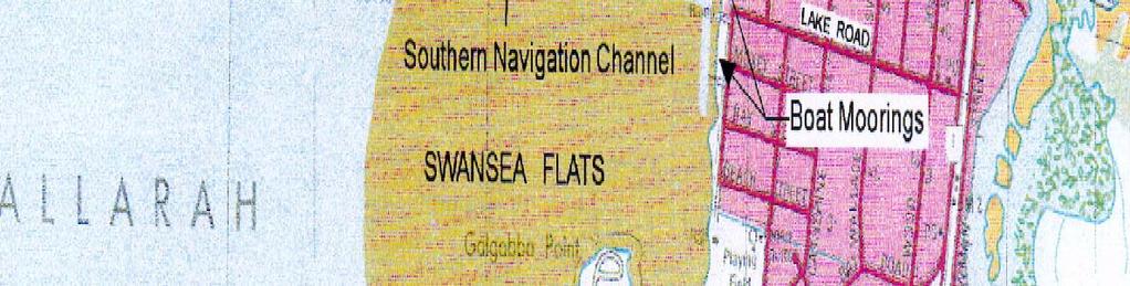
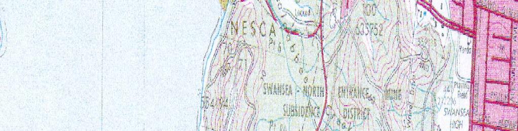
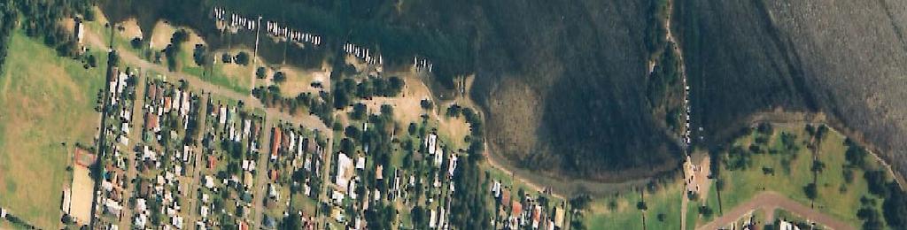
6 The shoreline on both sides of the spit is used for mooring small recreational vessels. Vessels are generally tethered to a post just off the shoreline, and held at right angles to the shoreline. A boat ramp also serves this area (see Figure 1.3). The area of Swansea Flats that is bounded by these dredge spoil deposits is the focus of the present study. Figure 1.2 shows the local character of the study area. 1.2 THE IMPORTANCE OF SEAGRASS IN LAKE MACQUARIE Seagrasses are angiosperms (flowering plants) that live submerged in brackish, estuarine and marine waters. Seagrasses require high light levels to grow, and are therefore most commonly found in low nutrient, shallow waters. Seagrass is often seen as an indication that a waterway is healthy. Four species of seagrass occur in Lake Macquarie, Ruppia sp, Halophila ovalis, Zostera capricorni and Posidonia australis. Seagrass meadows have a number of important functions in the coastal marine ecosystem. Their matted roots bind sediments and reduce local water velocities thereby protecting the shoreline from erosion. Within the meadows, seagrass provides habitat for a wide range of crabs, shrimps, molluscs, algae and microscopic fauna flourish. The combination of physical protection and rich food supply make seagrass meadows important breeding grounds and nurseries for prawns and many commercial fish species (Keogh and Jenkins, 1995). Many species also benefit from the organic matter released by bacterial and fungal breakdown of seagrass detritus. Macroalgae (benthic algae) are multicellular, large visible algae found in seagrass meadows, on intertidal and subtidal reefs. They occur naturally in all estuaries and contribute substantially to overall primary production. They also provide a major food source for fish grazers and detritovores. A healthy lake system is characterised by a balance between seagrass and macroalgae. If nutrient levels are too high, macroalgae can bloom, smothering seagrass beds. The decomposition of large quantities of dead seagrass and macroalgae washed up along the foreshore can produce offensive odours and create a thick layer of organic ooze, covering the sandy bottom. In addition to these direct ecological values, the maintenance of healthy seagrass meadows in Lake Macquarie has important economic implications. Major losses of seagrass (area or density) would have a dramatic impact on available fish stocks for recreational purposes, which would in turn impact on the local economy. AWACS 1995 identify six main threats to seagrass in Lake Macquarie: Boat moorings (swing chains); Boat navigation (propeller damage); Sedimentation (catchment derived); Nutrient enrichment, particularly in the inshore zone; Beach formation (resident cropping of seagrass to improve swimming amenity); Net hauling (no longer undertaken). At Swansea Flats, the perceived threats to seagrass relate primarily to sedimentation and nutrient enrichment. Both of these are catchment development impacts that can be exacerbated by changes to estuarine hydrodynamic processes. Although the Lake Macquarie Processes Study does not Umwelt (Australia) Pty Limited 1879/R01/V2 March

7
8 specifically identify dredging as a threat to seagrass, it does record that large volumes of sediment have been dredged from the entrance channel of the lake and from several tributaries and bays. Loss of seagrass is likely to have been both a direct and an indirect impact of past dredging activity. 1.3 OBJECTIVES In response to continued community concerns about the health of seagrass meadows in Swansea Flats, the Lake Macquarie and Catchment Co-ordinator s office requested an update and review of seagrass health to: assess the current health of adjacent seagrass beds and evaluate whether the islands are having a detrimental impact on seagrass; determine the need or otherwise for dredging the channels between the four dredge spoil islands; and determine the point at which maintenance dredging of the channels is to be undertaken. 2.0 SURVEY METHODOLOGY A seagrass survey was undertaken in the project area by Umwelt (Australia) Pty Limited on 10 February At the time of the survey, the estuary was particularly calm and clear, aiding the visual assessment. To make a quantitative assessment of the seagrass immediately surrounding the dredge spoil islands, four sites were sampled from two locations (inshore and offshore), on both the northern and southern shores of the islands (refer to Figure 2.1). Percent cover (density) of seagrass and macroalgae was estimated at five replicate samples within each sampling point using a 0.25 metre square quadrat. Also at each sampling point, ten randomly selected leaves of Zostera capricorni were collected and measured to the nearest centimetre and an estimate of epiphyte cover made. A cross-sectional profile of each channel between the dredge spoil islands was mapped by taking depth measurements every 50 centimetres across the narrowest point of the channel. Notes were also taken regarding seagrass and macroalgae wrack accumulation along the foreshore and the vegetation communities which have established on the dredge spoil islands. 3.0 ASSESSMENT OF SEAGRASS HEALTH Water flow and circulation between the dredge spoil islands is maintained via three narrow channels. A profile of each channel is provided in Figure 3.1. The channels range from approximately 22 metres wide and 80 centimetres deep between Islands 1 and 2, to 4 metres wide and 20 centimetres deep between Islands 3 and 4. The seagrass Zostera capricorni was established in the vicinity of each island channel. At the time of the survey, seagrass wrack had accumulated in the channel between Islands 3 and 4. Seagrass wrack was also evident on the lake foreshore, adjacent to the boat ramp and around the boat moorings. Each dredge spoil island is vegetated with casuarina, saltmarsh and mangrove species. Saltmarsh has recently been listed under preliminary determination as an endangered ecological community under the Threatened Species Conservation Act In addition, mangroves are a protected Umwelt (Australia) Pty Limited 1879/R01/V2 March
9
10
11 species under the Fisheries Management Act This habitat, although spatially restricted, contributes to the biological diversity of the Lake and aids to replace similar habitat that has been lost around the lakeshore. Zostera capricorni dominated the seagrass meadows of the Swansea Flats. Halophila ovalis was also recorded in low densities. Interspersed throughout the seagrass meadows were clumps of drifting, attached and epiphytic forms of macroalgae. The most common species of macroalgae identified included Chondria sp, Sargassum sp, Laurencia sp and Gracilaria sp. No Posidonia australis was observed within the study area. The mean (±SE, n=5) density of seagrass was highest at sites 1 and 2, furthest away from the lake foreshore (refer to Figure 3.2). This pattern was also evident in relation to the island foreshores, with the offshore locations consistently showing a higher density of seagrass than the inshore locations. Considerable variability was evident between all sites and locations, a pattern that has been consistently found in estuaries within New South Wales. Small scale variations were evident in the mean (±SE, n=5) density of drifting and attached macroalgae between all sampling points. Density was greatest at sites 1 and 4, inshore on the northern foreshore (refer to Figure 3.2). Generally, the mean macroalgae density was less than 20 per cent. The mean (±SE, n=10) shoot length of Zostera capricorni varied significantly between all sampling points (refer to Figure 3.3). In general, shoot length was greatest at sites 1 and 2, with the exception of the northern, offshore, site 2 sample. At site 1, shoot length varied significantly between the northern and southern foreshores, whereas at site 4, the inshore samples were significantly different to the offshore samples. There was no significant difference in the mean (±SE, n=10) epiphyte cover between any of the sampling points (refer to Figure 3.3). Epiphyte cover ranged from a mean 3 to 13.5 per cent. Epiphyte cover was highest at the inshore locations of site 4, for both the northern and southern foreshores. 4.0 CONCLUSIONS AND RECOMMENDATIONS The dredge spoil islands at Swansea Flats have been in place for some 34 years. In that time the islands have become vegetated with casuarina, saltmarsh and mangrove communities. The morphology of the islands has also changed and will continue to change over time. This is particularly apparent between Islands 3 and 4, where the channel has gradually infilled (refer to Figure 3.1). Seagrass, both living and dead is an important part of the foreshore. However, the accumulation of large quantities of seagrass wrack can be detrimental to the scenic amenity and recreational values of an area. The alignment of boat moorings along the Lake Macquarie foreshore, particularly those located directly south and north of the dredge spoil islands (refer to Figure 2.1), is likely to be having some impact of foreshore currents by reducing water flow and trapping seagrass wrack. Relocation or re-orientation of the boat moorings, into slightly deeper water and further away from the foreshore, whilst not eliminating seagrass wrack accumulation, may aid in reducing the volume of wrack by allowing the material to drift and disperse under the influence of currents. The study found that the seagrass meadows at Swansea Flats, on both sides of the dredge spoil islands, were healthy, in terms of density, shoot length and epyphite cover. Seagrass and macroalgae assemblages varied at small spatial scales for all variables. The seagrass meadows do not differ significantly from one side of the dredge spoil islands to the other. The variations in seagrass and macroalgae found between sites were consistent with the patterns found in estuaries throughout NSW, where considerable temporal and spatial variations in abundance are common. Umwelt (Australia) Pty Limited 1879/R01/V2 March
12 80 Percent cover of Seagrass Cover (%) Site 1 Site 2 Site 3 Site 4 Site L1 - North L2 - North L1 - South L2 - South Cover (%) Percent cover of Macroalgae Site 1 Site 2 Site 3 Site 4 Site L1 - North L2 - North L1 - South L2 - South FIGURE 3.2 Mean (±SE) Percent Cover of Seagrass and Macroalgae at each Site File Name (A4): R01_V1/1879_006.dgn
13 Shoot Length (cm) Seagrass Shoot Length Site 1 Site 2 Site 3 Site 4 Site L1 - North L2 - North L1 - South L2 - South Cover (%) Epiphyte Cover Site 1 Site 2 Site 3 Site 4 Site L1 - North L2 - North L1 - South L2 - South FIGURE 3.3 Mean (±SE) Seagrass Shoot Length and Epiphyte Cover at each Site File Name (A4): R01_V1/1879_007.dgn
14 The results of the seagrass assessment support the conclusion that the dredge spoil islands at Swansea Flats have not significantly impacted on seagrass health to date. The seagrass assessment suggests that there would be no significant change to seagrass health if all or part of the dredge spoil islands were to be removed. Indeed the removal of dredge spoil islands would result in the loss of valuable (and protected) saltmarsh and mangrove communities, which play a pivotal role in replacing habitat that has been lost elsewhere in Lake Macquarie. Previous studies (Umwelt, 2001) suggest that wind and tidally driven currents pass through the channels between the islands (ie between the shoreline and the first island, Islands 1 and 2, Islands 2 and 3, and Islands 3 and 4). At this stage the islands do not appear to be impeding water circulation across Swansea Flats. In addition, the seagrass assessment suggests that there has been no adverse affect on the adjacent seagrass meadows. Although it is considered important that the existing channels between the islands are maintained to ensure sufficient flushing across Swansea Flats, it is not considered that maintenance dredging needs to be undertaken at this time. It is recommended that annual monitoring of the channels be undertaken and limited maintenance dredging (to the existing depth and width) be instigated when the channels have lost approximately 50 per cent of their current flow capacity. The former channel between Islands 4 and 5 however, which has been overgrown with saltmarsh vegetation should not be dredged at any stage. 5.0 REFERENCES AWACS, 1995, Lake Macquarie Process Study Report 94/25. Australian Water and Coastal Studies, Manly Vale, Australia. Department of Land and Water Conservation, 2000, Estuaries of New South Wales: Lake Macquarie. Department of Land and Water Conservation. Umwelt (Australia) Pty Limited, 2001, Investigation of the Impacts of Dredge Spoil Islands Swansea Flats. Report prepared for the Office of Lake Macquarie and Catchment Coordinator. Umwelt (Australia) Pty Limited 1879/R01/V2 March
15 Umwelt (Australia) Pty Limited 2/20 The Boulevarde PO Box 838 Toronto NSW 2283 Ph Fax
SEAGRASS MAPPING FOR THE PENRHYN ESTUARY HABITAT ENHANCEMENT PLAN
 SEAGRASS MAPPING FOR THE PENRHYN ESTUARY HABITAT ENHANCEMENT PLAN PREPARED FOR SYDNEY PORTS CORPORATION By D. E. Roberts, S. R. Murray, G. R., Sainty August 2008 TABLE OF CONTENTS INTRODUCTION...3 METHODS...3
Impacts of breakwaters and training walls
 Across the eastern seaboard of Australia, breakwaters and training walls have instigated fundamental perturbations to coastal and estuary processes. This has induced long-term changes to foreshore alignments,
COUPLED MANAGEMENT STRATEGY LAKE CATHIE ESTUARY & COAST
 Lake Cathie Progress Association Inc. ABN 28 251 433 854 P.O. Box 247 Lake Cathie NSW 2445 PHONE/FAX: 02 6584 8211 EMAIL: r3packag@bigpond.com 20 th October 2009 Port Macquarie Hastings Council PO Box
Significant Ecological Marine Area Assessment Sheet
 Significant Ecological arine Area Assessment Sheet Name: ouhora arbour arine Values Summary: The entrance subtidal channel, tidal flats, seagrass mangrove and saltmarsh habitats of ouhora arbour have given
Puget Sound Shorelines. Waves and coastal processes. Puget Sound shorelines: Effects of beach armoring
 Puget Sound Shorelines Puget Sound shorelines: Effects of beach armoring Waves and coastal processes Factors affecting wave energy hitting the coast Processes transporting sediment along coastlines What
SWANSEA CHANNEL DREDGING TO IMPROVE NAVIGATION
 SWANSEA CHANNEL DREDGING TO IMPROVE NAVIGATION B.Morgan 1, G.Blumberg 1, A.Ling 2, H.Nelson 1 1 Royal HaskoningDHV, Sydney, NSW 2 NSW Department of Trade & Investment (Crown Lands), Newcastle, NSW Overview
CHAPTER 11.1 THE WORLD OCEAN MARINE BIOMES NOTES
 CHAPTER 11.1 THE WORLD OCEAN MARINE BIOMES NOTES 1. The world ocean can be divided into zones both and. The,, and zones that apply to large lakes also apply to the ocean. 2. In addition to the depth zones,
Habitat Fact Sheets. Rocky habitats are dominated by seaweeds and often mussels, which rely on the rocks for attachment.
 Habitat Fact Sheets Habitats in the Gulf of Maine serve many important roles for the environment and for humans as well. These include: cycling nutrients, filtering pollution, trapping sediments, storing
Part 9 Specific Land Uses - Foreshore & Waterway Development
 7 FORESHORE AND WATERWAY DEVELOPMENT This section applies to the following development uses proposed within the foreshore area (defined by LM LEP 2014), and contains Council s specific requirements for
Red Bay Seagrass Bed recommendation to the Department of Environment Northern Ireland
 Seagrass Bed recommendation to the Department of Environment Northern Ireland Northern Ireland would recommend the large subtidal seagrass bed present in the Red Bay/Waterfoot Bay area of Co. Antrim (Fig.
1. Distribute the activity sheet, and allow 20 minutes for the first use.
 A LOCAL WAY OF LEARNING Title: MISSING MANGROVE MESSAGE Author: Eulalie R. Rivera Elementary School Environmental Education Team Grade Level: 4-6 Concepts: 2.Ecosystem 6.Resources 9.Change Disciplines:
Characterising the status of the Western Port recreational fishery in relation to biodiversity values: Phase 1 Greg Jenkins and Simon Conron
 Characterising the status of the Western Port recreational fishery in relation to biodiversity values: Phase 1 Greg Jenkins and Simon Conron November 2015 1 Contents Executive Summary... 7 Introduction...
Today: Coastal Issues and Estuaries
 Today: Coastal Issues and Estuaries Coastal issues Human effect on coastlines What is an estuary Why are they so important? Circulation of water in estuary Environmental issues Coastal Issues: Problem
SA New Trial Artificial Reef Project
 BACKGROUND PAPER SA New Trial Artificial Reef Project Development of options for the trial artificial reef 1. Summary CONTENTS Each year, an estimated 236,000 South Australians participate in recreational
Oceanic Society Reef Research Team: Nicole Crane, Avigdor Abelson, Peter Nelson, Giacomo Bernardi, Michelle Paddack, Kate Crosman
 The coral reef of Tamil (Yap, FSM): Preliminary ecological assessment of reef state and fish assemblages, and potential of conservation for sustainable use Report compiled by vigdor belson, Peter Nelson
Marine Ecosystems. Aquatic Ecosystems Section 2
 Marine Ecosystems Marine ecosystems are located mainly in coastal areas and in the open ocean. Organisms that live in coastal areas adapt to changes in water level and salinity. Organisms that live in
EcoLogic Memorandum. TO: Ben Brezell; EDR FROM: Mark Arrigo RE: Possible Impacts of Dredging Snooks Pond DATE: 6/4/07
 EcoLogic Memorandum TO: Ben Brezell; EDR FROM: Mark Arrigo RE: Possible Impacts of Dredging Snooks Pond DATE: 6/4/07 Background EDR P.C. (EDR) has been contracted by a landowner to assess the feasibility
Context Most US West Coast open coast estuaries have: INTERTIDAL AQUACULTURE AS HABITAT IN PACIFIC NORTHWEST COASTAL ESTUARIES: CONSIDERING SCALE
 INTERTIDAL AQUACULTURE AS HABITAT IN PACIFIC NORTHWEST COASTAL ESTUARIES: CONSIDERING SCALE Brett Dumbauld USDA Agricultural Research Service Context Most US West Coast open coast estuaries have: Broad
Seagrass Surveys in Kampot
 Coastal Annual Forum 23 rd October 2014 Sihanoukville, Cambodia Seagrass Surveys in Kampot Presentation by Louis Bourne INTERNATIONAL UNION FOR CONSERVATION OF NATURE Presentation Overview Location and
Warm-up # 7 A day 5/17 - B day 5/18 UPDATE YOUR TABLE OF CONTENTS
 Warm-up # 7 A day 5/17 - B day 5/18 UPDATE YOUR TABLE OF CONTENTS Question: List all examples of surface water on Earth. Answer: Rivers and streams, lakes and reservoirs, (ponds) wetlands, estuaries and
Significant Ecological Marine Area Assessment Sheet
 Significant Ecological Marine Area Assessment Sheet Name: Parengarenga arbour Marine Values Parengarenga arbour is as an outstanding example of a northern estuary with a true tropical and subtropical influence
Beach profile surveys and morphological change, Otago Harbour entrance to Karitane May 2014 to June 2015
 Beach profile surveys and morphological change, Otago Harbour entrance to Karitane May 2014 to June 2015 Prepared for Port Otago Ltd Martin Single September 2015 Shore Processes and Management Ltd Contact
Florida Seagrass Integrated Mapping and Monitoring Program
 Florida Seagrass Integrated Mapping and Monitoring Program - 2004 The following document is composed of excerpts taken from the 2011 publication, Seagrass Integrated Mapping and Monitoring for the State
SALINITY. It's the amount of dissolved salts the water contains.
 AQUATIC ECOSYSTEMS SALINITY The types of organisms in an aquatic ecosystem depend upon the water s Salinity. It's the amount of dissolved salts the water contains. Salinity determines the two main aquatic
Figure 1. Schematic illustration of the major environments on Mustang Island.
 STOP #1: PACKERY CHANNEL BEACH TO BAY We will start this field guide near the north jetty of Packery Channel and hike across the island to Corpus Christi Bay (fig. 1). The island emerges from the Gulf
Implications of proposed Whanganui Port and lower Whanganui River dredging
 PO Box 637 Wanganui 4540 Attention: Rowan McGregor Dear Rowan 1 Summary We understand that it has been proposed to bring large vessels into the Port at Whanganui requiring the excavation of a channel up
Case Study 3. Case Study 3: Cebu Island, Philippines MPA Network 10
 Case studies of mpa networks Case Study 3: Cebu Island, Philippines MPA Network 10 Location and background Cebu Island in the Philippines lies in the center of the Visayan Islands, known as an area high
Figure 4, Photo mosaic taken on February 14 about an hour before sunset near low tide.
 The Impact on Great South Bay of the Breach at Old Inlet Charles N. Flagg and Roger Flood School of Marine and Atmospheric Sciences, Stony Brook University Since the last report was issued on January 31
Shoreline Response to an Offshore Wave Screen, Blairgowrie Safe Boat Harbour, Victoria, Australia
 Shoreline Response to an Offshore Wave Screen, Blairgowrie Safe Boat Harbour, Victoria, Australia T.R. Atkins and R. Mocke Maritime Group, Sinclair Knight Merz, P.O. Box H615, Perth 6001, Australia ABSTRACT
Ecological Interactions in Coastal Marine Ecosystems: Rock Lobster
 Ecological Interactions in Coastal Marine Ecosystems: Rock Lobster Progress Report to 3 November Lachlan MacArthur and Glenn A. Hyndes Centre for Ecosystem Management, Edith Cowan University, 1 Joondalup
Species Conclusions Table
 Conclusions Table Project Name: Chesapeake Landing HOA- Breakwaters (NAO-14-0283) Date: February 25, 2014 /Resource Name Loggerhead sea turtle (Caretta caretta) Conclusion ESA Section 7 / Eagle Act Determination
LAB: WHERE S THE BEACH
 Name: LAB: WHERE S THE BEACH Introduction When you build a sandcastle on the beach, you don't expect it to last forever. You spread out your towel to sunbathe, but you know you can't stay in the same spot
The Maritime Law Association of Australia and New Zealand
 The Maritime Law Association of Australia and New Zealand Protecting the Environment and Promoting Safe Navigation: Australia s System of Pilotage in the Torres Strait Adam McCarthy Assistant Secretary
Inlet Management Study for Pass-A-Grille and Bunces Pass, Pinellas County, Florida
 Inlet Management Study for Pass-A-Grille and Bunces Pass, Pinellas County, Florida Final Report Submitted By Ping Wang, Ph.D., Jun Cheng Ph.D., Zachary Westfall, and Mathieu Vallee Coastal Research Laboratory
Examples of estuaries include bays, sounds, salt marshes, mangrove forests, mud flats, swamps, inlets, and sloughs.
 An estuary is a partially enclosed body of water where incoming seawater is mixed with fresh water coming from the land. Examples of estuaries include bays, sounds, salt marshes, mangrove forests, mud
Seagrasses of the Virgin Islands
 Seagrasses of the Virgin Islands Seagrasses are flowering plants that live underwater. These marine plants resemble the land species of grasses in that they have long blade-like leaves. Seagrasses grow
Dr. Kim Peyton. (w/ some modifications by Dr. Bruland) University of Hawai i Mānoa
 University of Hawai i Mānoa") The Seagrasses Dr. Kim Peyton (w/ some modifications by Dr. Bruland) University of Hawai i Mānoa Department t of Botany 1 Outline Anatomy Characteristics Taxonomy, systematics, &evolution Distribution
The Seagrasses Dr. Kim Peyton (w/ some modifications by Dr. Bruland) University of Hawai i Mānoa Department t of Botany 1 Outline Anatomy Characteristics Taxonomy, systematics, &evolution Distribution
HARBOUR SEDIMENTATION - COMPARISON WITH MODEL
 HARBOUR SEDIMENTATION - COMPARISON WITH MODEL ABSTRACT A mobile-bed model study of Pointe Sapin Harbour, in the Gulf of St. Lawrence, resulted in construction of a detached breakwater and sand trap to
Bay of Fundy Estuary Profile
 s The is a sub-basin of the Bay of Fundy along the northwestern shore of Nova Scotia and at the western end of the Annapolis Valley. The Annapolis River is the major water source flowing into the estuary.
Seagrass surveys must be conducted between the dates of April 1 st and October 31 st with the following exceptions:
 Florida Fish and Wildlife Conservation Commission (FWC) Recommended Survey Protocols for Estuarine and Marine Submerged Aquatic Vegetation (SAV) related to Permitting Applications 12/14/2011 DRAFT 1) Survey
Chesil Beach, Dorset UK High energy, shingle coastline. Brighton Beach, Sussex UK Pebble beach
 Beaches: Depositional landform Extends from the highest high tide to the lowest low tide. Very important temporary store in coastal system. Accretion: sediment returning to the visible portion of a beach
Subtidal and intertidal restored reefs in North Carolina
 Subtidal and intertidal restored reefs in North Carolina Jonathan H. Grabowski 1, Sean P. Powers 2, Pete Peterson 3, and Hunter S. Lenihan 4 1 Gulf of Maine Research Institute/U. Maine-Darling Marine Center
Use of Conservation Moorings as a Component of Eelgrass Restoration in two Massachusetts Harbors
 Use of Conservation Moorings as a Component of Eelgrass Restoration in two Massachusetts Harbors Massachusetts Bays Program Division of Marine Fisheries Jay Baker, Tay Evans, Mass Bays Program MarineFisheries
Restoration of Eelgrass to Upper Casco Bay: Feasibility Tests in Hilary A. Neckles US Geological Survey Augusta, ME
 Restoration of Eelgrass to Upper Casco Bay: Feasibility Tests in 2015 Hilary A. Neckles US Geological Survey Augusta, ME hneckles@usgs.gov Robert J. Orth Eelgrass: Zostera marina * marine flowering plant
Habitat Development: Habitat Boulders Lawson Pier Foreshore Enhancement
 Habitat Development: Habitat Boulders Improve the existing habitat by stabilising beach sediments. Increase biodiversity by creating new habitats and colonisation opportunities. Loose cobble is unstable;
Conservation and Restoration Florida s Coastal Marshes: An Overview of MESS. Jeff Beal, Kent Smith, Erin McDevitt, Maria Merrill
 Conservation and Restoration Florida s Coastal Marshes: An Overview of MESS Jeff Beal, Kent Smith, Erin McDevitt, Maria Merrill FWC s MESS: -Marine/Estuarine Subsection -within Aquatic Habitat Conservation
Gulf and Caribbean Research
 Gulf and Caribbean Research Volume 19 Issue 1 January 27 A Comparison of Fish Assemblages Among Five Habitat Types Within a Caribbean Lagoonal System Ivan Mateo USVI Division of Fish and Wildlife William
EVALUATION OF BEACH EROSION UP-DRIFT OF TIDAL INLETS IN SOUTHWEST AND CENTRAL FLORIDA, USA. Mohamed A. Dabees 1 and Brett D.
 EVALUATION OF BEACH EROSION UP-DRIFT OF TIDAL INLETS IN SOUTHWEST AND CENTRAL FLORIDA, USA Mohamed A. Dabees 1 and Brett D. Moore 1 The paper discusses the analysis of up-drift beach erosion near selected
Eastern Shore Islands Area of Interest Community Newsletter
 Eastern Shore Islands Area of Interest Community Newsletter Fall 2018 1ỊNTRODUCTION In addition to information on our Fisheries and Oceans Canada (DFO) website, we have now created a seasonal, community
THE HYDRAULIC AND MORPHOLOGICAL RESPONSE OF A LARGE COASTAL LAKE TO RISING SEA LEVELS
 THE HYDRAULIC AND MORPHOLOGICAL RESPONSE OF A LARGE COASTAL LAKE TO RISING SEA LEVELS Mr Evan K Watterson 1 Dr Joanna M Burston 1 Ms Heather Stevens 2 Mr Dan J Messiter 1 1 Author affiliation: WorleyParsons
Environmental. Effects of Dredging
 Envi~onmental Effects of Dredging Technical Notes THE VALUE OF GRAVEL DISPOSAL MOUNDS IN RIVER SIDE CHANNELS FOR FRESHWATER MUSSELS PURPOSE: This note provides information on the value of gravel disposal
Definitions. The environment is the biological, chemical, physical, and social conditions that surround organisms.
 Marine Ecosystems Definitions An ecosystem is a geographically specified system of organisms (including humans), the environment, and the processes that control its dynamics. The environment is the biological,
Focus on New Sites for Caves and Reefs Issues Identified. Dr. Leyla Knittweis-Mifsud Department of Biology, Faculty of Science University of Malta
 Focus on New Sites for Caves and Reefs Issues Identified Dr. Leyla Knittweis-Mifsud Department of Biology, Faculty of Science University of Malta Presentation Overview Areas of conservation potential within
Recreational Fishers and Fish Habitat. A National Fish Habitat Strategy to Improve Our Fisheries
 2017 Recreational Fishers and Fish Habitat A National Fish Habitat Strategy to Improve Our Fisheries A National Fish Habitat Strategy is an effective and efficient way to protect and improve our recreational
SEDIMENT BUDGET OF LIDO OF PELLESTRINA (VENICE) Written by Marcello Di Risio Under the supervision of Giorgio Bellotti and Leopoldo Franco
 Written by Marcello Di Risio Under the supervision of Giorgio Bellotti and Leopoldo Franco") SEDIMENT BUDGET OF LIDO OF PELLESTRINA (VENICE) Written by Marcello Di Risio Under the supervision of Giorgio Bellotti and Leopoldo Franco Table of contents: 1. Introduction...3 2. Protection structures
SEDIMENT BUDGET OF LIDO OF PELLESTRINA (VENICE) Written by Marcello Di Risio Under the supervision of Giorgio Bellotti and Leopoldo Franco Table of contents: 1. Introduction...3 2. Protection structures
Significant Ecological Marine Area Assessment Sheet
 Significant Ecological Marine Area Assessment Sheet Name: Whangarei arbour Marine Values Summary: Whangarei arbour as a whole estuarine system has an important array of ecological values. It plays an important
Lecture Outlines PowerPoint. Chapter 15 Earth Science, 12e Tarbuck/Lutgens
 Lecture Outlines PowerPoint Chapter 15 Earth Science, 12e Tarbuck/Lutgens 2009 Pearson Prentice Hall This work is protected by United States copyright laws and is provided solely for the use of instructors
VIMS CCRM Coastal Management Decision Tools. Decision Tree for Undefended Shorelines and Those with Failed Structures
 VIMS CCRM Coastal Management Decision Tools Decision Tree for Undefended Shorelines and Those with Failed Structures Center for Coastal Resources Management Virginia Institute of Marine Science Gloucester
SHOREHAM BEACH LOCAL NATURE RESERVE
 SHOREHAM BEACH LOCAL NATURE RESERVE Coastal Geography Education Programme 2014-15 S. Savage 2014 COASTAL GEOGRAPHY OPPORTUNITIES Shoreham Beach Shoreham Beach is a shingle spit formed over many centuries
Project Webpage:
 Project Webpage: http://nature.ly/marinesatlanticbightera Coastal Data and Full Metadata: http://easterndivision.s3.amazonaws.com/marine/sab MA/SABMACoastalEcosystems.zip Coastal Chapter: http://easterndivision.s3.amazonaws.com/marine/sab
SOCIETAL GOALS TO DETERMINE ECOSYSTEM HEALTH: A FISHERIES CASE STUDY IN GALVESTON BAY SYSTEM, TEXAS
 SOCIETAL GOALS TO DETERMINE ECOSYSTEM HEALTH: A FISHERIES CASE STUDY IN GALVESTON BAY SYSTEM, TEXAS Anthony S. Pait, NOAA, National Centers for Coastal Ocean Science Thomas P. O Connor, David R. Whitall,
Visiting Lake Macquarie
 Visiting Lake Macquarie Lake Macquarie is the largest coastal salt water lake in Australia and is a prime boating destination for both small and large vessels. Many sailing regattas and fishing activities
The Blue Heron Slough Conservation Bank
 1 The Blue Heron Slough Conservation Bank CONSERVATION BANKING July 19-23, 2010 CASE STUDY SERIES The Blue Heron Slough Conservation Bank (Washington) I. OVERVIEW & BACKGROUND: Location: Snohomish River
SELECTION OF THE PREFERRED MANAGEMENT OPTION FOR STOCKTON BEACH APPLICATION OF 2D COASTAL PROCESSES MODELLING
 SELECTION OF THE PREFERRED MANAGEMENT OPTION FOR STOCKTON BEACH APPLICATION OF 2D COASTAL PROCESSES MODELLING C Allery 1 1 DHI Water and Environment, Sydney, NSW Abstract This paper presents an approach
RAINBOW BAY FIELD REPORT
 RAINBOW BAY FIELD REPORT Contents Page Abstract 1.0 Introduction.. 2.0 Methodology 2.1 Limitations.. 3.0 Statement of Findings. 3.1 History. 3.2 Data Collection. 3.2.1 Observations. 3.2.2 Management Strategies
Refined Designated Uses for the Chesapeake Bay and Tidal Tributaries
 A-1 appendixa Refined Designated Uses for the Chesapeake Bay and Tidal Tributaries BACKGROUND Federal water quality standards regulations establish that states must specify appropriate water uses to be
WHAT ARE ECOSYSTEMS? Dr. V. N. Nayak Professor of Marine Biology (Retd)
") WHAT ARE ECOSYSTEMS? Dr. V. N. Nayak Professor of Marine Biology (Retd) An ECOSYSTEM is an interacting system of plant, animals, and humans and the surrounding environment. An ecosystem contains living
WHAT ARE ECOSYSTEMS? Dr. V. N. Nayak Professor of Marine Biology (Retd) An ECOSYSTEM is an interacting system of plant, animals, and humans and the surrounding environment. An ecosystem contains living
Chapter 10 Lecture Outline. The Restless Oceans
 Chapter 10 Lecture Outline The Restless Oceans Focus Question 10.1 How does the Coriolis effect influence ocean currents? The Ocean s Surface Circulation Ocean currents Masses of water that flow from one
FOR INFORMATION ONLY. Gold Coast Seaway Channel Scour and Rock Wall Stability Investigation. R.B doc December 2011
 A part of BMT in Energy and Environment Gold Coast Seaway Channel Scour and Rock Wall Stability Investigation R.B18625.001.00.doc December 2011 Gold Coast Seaway Channel Scour and Rock Wall Stability Investigation
STATUS REPORT FOR THE SUBMERGED REEF BALL TM ARTIFICIAL REEF SUBMERGED BREAKWATER BEACH STABILIZATION PROJECT FOR THE GRAND CAYMAN MARRIOTT HOTEL
 August 23 STATUS REPORT FOR THE SUBMERGED REEF BALL TM ARTIFICIAL REEF SUBMERGED BREAKWATER BEACH STABILIZATION PROJECT FOR THE GRAND CAYMAN MARRIOTT HOTEL performed by Lee E. Harris, Ph.D., P.E. Consulting
Australian Coastal Councils Conference
 Australian Coastal Councils Conference Kiama March 2019 Where Has My Beach Gone? (and what can I do about it?) Dr Andrew McCowan Water Technology Where Has My Beach Gone? Where Has My Beach Gone? Where
USING BIOLOGICALLY IMPORTANT PHYSICAL CHARACTERISTICS OF ESTUARIES TO CLASSIFY AUSTRALIAN AND NEW ZEALAND ESTUARIES
 USING BIOLOGICALLY IMPORTANT PHYSICAL CHARACTERISTICS OF ESTUARIES TO CLASSIFY AUSTRALIAN AND NEW ZEALAND ESTUARIES Michael Whelan, Southern Cross University, Australia. Peter Saenger, Southern Cross University,
Impact of Dredging the Lower Narrow River on Circulation and Flushing
 Impact of Dredging the Lower Narrow River on Circulation and Flushing Craig Swanson Ph.D. Swanson Environmental Alex Shaw Ocean Engineering, URI Prof. Malcolm L. Spaulding Ocean Engineering, URI 29 January
Living Shorelines. Created by: JoAnn Moody & Tina Miller-Way Discovery Hall Programs Dauphin Island Sea Lab
 Living Shorelines Created by: JoAnn Moody & Tina Miller-Way Discovery Hall Programs Dauphin Island Sea Lab Living Shorelines Subject: Life Science Grade Level: 6 th -8 th Time Required: 60 min Key Terms:
Friends of Semiahmoo Bay Society Eelgrass Transplant Pilot Project May 6, 2007, Blackie Spit, Surrey, BC.
 Friends of Semiahmoo Bay Society Eelgrass Transplant Pilot Project May 6, 2007, Blackie Spit, Surrey, BC. Prepared for: Friends of Semiahmoo Bay Society Prepared by: Ramona C. de Graaf, BSc., MSc., Emerald
Eelgrass Survey PARADISE CAY BELVEDERE, MARIN COUNTY CALIFORNIA. Prepared For:
 Eelgrass Survey PARADISE CAY BELVEDERE, MARIN COUNTY CALIFORNIA Prepared For: Radford (Skid) Hall, Ph.D. Land Planning and Permitting Consultant 500 Airport Blvd., Suite 350 Burlingame, CA 94010 (650)
Montserrat. Wise practices for coping with. i b bea n Se a
 Wise practices for coping with Montserrat Car i b bea n Se a Fisheries Division, Montserrat Physical Planning Department, Montserrat University of Puerto Rico, Sea Grant College Program Caribbean Development
LK Increasing knowledge on sea grass habitats and dugong distribution at selected sites in North Western Sri Lanka Project progress July2016
 LK6-2132 Increasing knowledge on sea grass habitats and dugong distribution at selected sites in North Western Sri Lanka Project progress July2016 ORCA Ocean Resources Conservation Association This is
Puget Sound Nearshore Ecosystem Restoration Project Restore America s Estuaries Conference 2012 Tampa, FL
 Restore America s Estuaries Conference 2012 Tampa, FL presented by: Theresa Mitchell, WA Dept. of Fish & Wildlife Nearshore General Investigation Change Analysis: Comparison of historical and current
DEAD-ENDCHANNELFLUSHINGINHARBORS
 DEAD-ENDCHANNELFLUSHNGNHARBORS PURPOSE: The purpose of this technical note is to present some design con- siderations which benefit dead-end channel flushing. Some of these factors can also be used to
Chapter. The Dynamic Ocean
 Chapter The Dynamic Ocean An ocean current is the mass of ocean water that flows from one place to another. 16.1 The Composition of Seawater Surface Circulation Surface Currents Surface currents are movements
Coastal and marine recreation in New England is ingrained in the region s economic and
 RECREATION Coastal and marine recreation in New England is ingrained in the region s economic and social fabric. Recreation on the ocean and coast includes many of New Englanders most time-honored and
Reading Material. Inshore oceanography, Anikouchine and Sternberg The World Ocean, Prentice-Hall
 Reading Material Inshore oceanography, Anikouchine and Sternberg The World Ocean, Prentice-Hall BEACH PROCESSES AND COASTAL ENVIRONMENTS COASTAL FEATURES Cross section Map view Terminology for Coastal
St Kitts. Wise practices for coping with
 Wise practices for coping with St Kitts Caribbean Sea Department of the Environment, St Kitts Fisheries Division, St Kitts Physical Planning and Development Division, St Kitts University of Puerto Rico,
TITLE: COASTAL EROSION AND LANDFORMS.
 TITLE: COASTAL EROSION AND LANDFORMS. AIM: What are the factors that influence the formation of coastal features along Fishing Pond beach Trinidad? LOCATION OF FIELD STUDY: The study was carried out in
page - Laboratory Exercise #5 Shoreline Processes
 page - Laboratory Exercise #5 Shoreline Processes Section A Shoreline Processes: Overview of Waves The ocean s surface is influenced by three types of motion (waves, tides and surface currents). Shorelines
MESSOLOGI LAGOON AREA (GREECE)
") MESSOLOGI LAGOON AREA (GREECE) 20 Contact: Kyriakos SPYROPOULOS TRITON Consulting Engineers 90 Pratinou Str. 11634 Athens (GREECE) Tel: +32 10 729 57 61 Fax: +32 10 724 33 58 e-mail: kspyropoulos@tritonsa.gr
MESSOLOGI LAGOON AREA (GREECE) 20 Contact: Kyriakos SPYROPOULOS TRITON Consulting Engineers 90 Pratinou Str. 11634 Athens (GREECE) Tel: +32 10 729 57 61 Fax: +32 10 724 33 58 e-mail: kspyropoulos@tritonsa.gr
Geography of the Lower Fitzroy and navigation problems
 Geography of the Lower Fitzroy and navigation problems A topographic map of the Fitzroy estuary readily indicates why the Fitzroy River has proved difficult for shipping to negotiate. The river meanders
Port Curtis and Rodds Bay seagrass and benthic macro-invertebrate community baseline survey
 INFORMATION SERIES QI03058 Port Curtis and Rodds Bay seagrass and benthic macro-invertebrate community baseline survey November/December 2002 M A Rasheed R Thomas A J Roelofs K M Neil and S P Kerville
Habitat selection during settlement of three Caribbean coral reef fishes: Indications for directed settlement to seagrass beds and mangroves
 Notes 903 Limnol. Oceanogr., 52(2), 2007, 903 907 E 2007, by the American Society of Limnology and Oceanography, Inc. Habitat selection during settlement of three Caribbean coral reef fishes: Indications
There are many different kinds of beaches which are generally characterized by the dominance of waves, tides, rivers and currents, and in particular
 Fig. 11-11, p. 253 There are many different kinds of beaches which are generally characterized by the dominance of waves, tides, rivers and currents, and in particular differ by the amount of energy, which
Coastal areas have become increasingly under threat in recent years. Climate change is having a huge effect on coastal areas, making them much more
 Why are some coastal environments under threat? Coastal areas have become increasingly under threat in recent years. Climate change is having a huge effect on coastal areas, making them much more likely
Wave-dominated embayed beaches. Andrew D Short School of Geosciences University of Sydney
 Wave-dominated embayed beaches Andrew D Short School of Geosciences University of Sydney Wave-dominated embayed beaches wave-dominated beaches embayed beaches morphodynamics of W-D embayed beaches circulation,
IDENTIFYING AND UNDERSTANDING NURSERY HABITATS FOR EXPLOITED PENAEID SHRIMP IN NSW ESTUARIES
 IDENTIFYING AND UNDERSTANDING NURSERY HABITATS FOR EXPLOITED PENAEID SHRIMP IN NSW ESTUARIES Matthew D. Taylor 1,2 1 Port Stephens Fisheries Institute, New South Wales Department of Primary Industries,
Managing the coral reef - The Great Barrier Reef Marine Park Authority Great Barrier Reef Coral Sea World Heritage Site Zoning
 Managing the coral reef - The Great Barrier Reef Marine Park Authority The Great Barrier Reef is the largest coral reef in the world. It is made of over 2900 individual reefs and 900 islands stretching
Coastal issues: Beaches and Estuaries. Recent Sea Level: Beaches: Baltimore D.C. Patomac R. Chesapeake Bay
 Coastal issues: Beaches and Estuaries Definitions: Coast = broad zone where both marine & terrestrial processes act It includes the beach, lagoons, marshes, bars etc. Coastal processes act to shape the
CHAPTER 134 INTRODUCTION
 CHAPTER 134 NEW JETTIES FOR TUNG-KANG FISHING HARBOR, TAIWAN Chi-Fu Su Manager Engineering Department Taiwan Fisheries Consultants, Inc. Taipei, Taiwan INTRODUCTION Tung-Kang Fishing Harbor, which is about
Blakely Island, N Thatcher Bay. Restoration Recommendation: Rank Score (total score)
") Soft Shore Protection/Structure Removal Blueprint for San Juan County Forage Fish Beaches Appendix 2: Recommendations for sites scoring below the top ten, sorted by island (east to west) Blakely Island,
Soft Shore Protection/Structure Removal Blueprint for San Juan County Forage Fish Beaches Appendix 2: Recommendations for sites scoring below the top ten, sorted by island (east to west) Blakely Island,
14.0 MARINE ENVIRONMENT
 14.0 MARINE ENVIRONMENT 14.1 INTRODUCTION This Chapter provides an assessment of the physical and ecological effects of the proposed marine facilities in Rupert s Bay. The proposed works at Rupert s Bay
Case Study: 4. Shoalhaven River Fishing Industry
 Case Study: 4. Shoalhaven River Fishing Industry Why is the Shoalhaven River Seafood Industry Important? The Shoalhaven River supports a large concentration of commercial fishers that produce high quality