ANNUAL REPORT. Data collection and analysis in support of single and multispecies stock assessments in Chesapeake Bay:
|
|
|
- Linda Wilkins
- 5 years ago
- Views:
Transcription
1
2
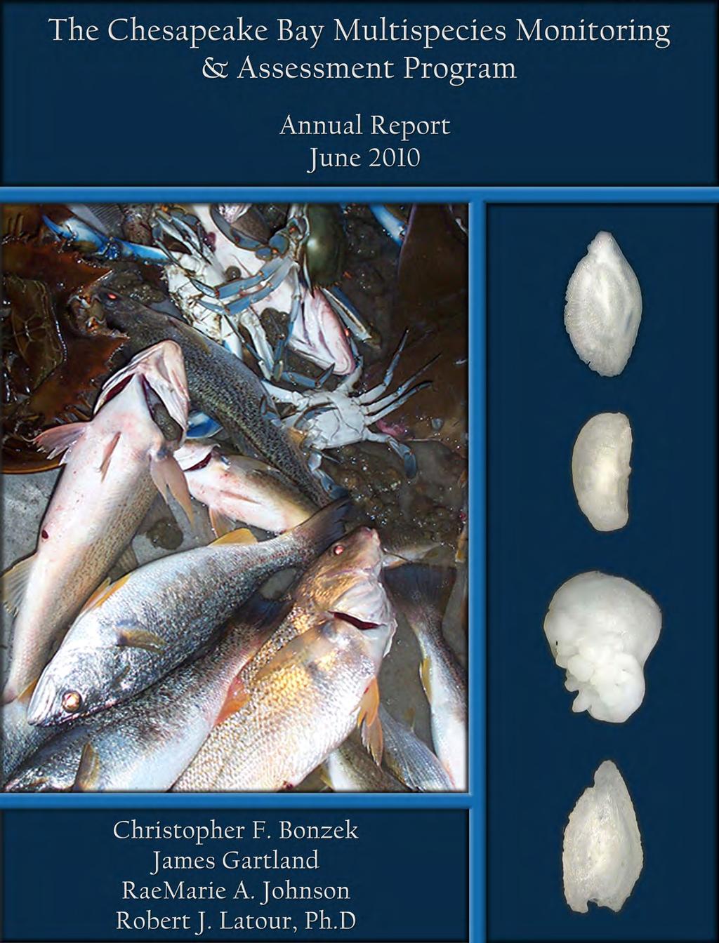
3 ANNUAL REPORT Data collection and analysis in support of single and multispecies stock assessments in Chesapeake Bay: The Chesapeake Bay Multispecies Monitoring and Assessment Program Prepared for: Virginia Marine Resources Commission and U.S. Fish & Wildlife Service For Sampling During: Calendar Year 2009 and Previous Years Project Number: F-130-R-5 Submitted: June 2010 Prepared by: Christopher F. Bonzek James Gartland RaeMarie A. Johnson Robert J. Latour, Ph.D School of Marine Science College of William and Mary Virginia Institute of Marine Science Gloucester Point, VA 23062
4
5 Table of Contents Introduction. 1 Methods. 4 Results Task Results Tasks 2-4 / Species Data Summaries Atlantic croaker. 18 Black seabass. 20 Bluefish. 22 Butterfish. 23. Kingfish 24. Northern puffer. 25 Scup. 26 Spot. 27 Striped bass. 28 Summer flounder Weakfish White perch Water Quality. 35 Results Task Results Appendix Literature Cited. 40 Species Data Tables & Figures Atlantic croaker. 45 Black seabass. 57 Bluefish. 69 Butterfish. 81. Kingfish 89. Northern puffer. 101 Scup. 111 Spot. 123 Striped bass. 135 Summer flounder Weakfish White perch. 175 Water Quality Figures Temperature Salinity Dissolved oxygen
6 Task 5 Figures Current ChesMMAP net. 203 Alternative ChesMMAP net. 209 Appendix Species data summaries for blue crab (male and adult female) and clearnose skate. 217
7 Introduction Historically, fisheries management has been based on the results of single-species stock assessment models that focus on the interplay between exploitation level and sustainability. There currently exists a suite of standard and accepted analytical frameworks (e.g., virtual population analysis (VPA), biomass dynamic production modeling, delay difference models, etc.) for assessing the stocks, projecting future stock size, evaluating recovery schedules and rebuilding strategies for overfished stocks, setting allowable catches, and estimating fishing mortality or exploitation rates. A variety of methods also exist to integrate the biological system and the fisheries resource system, thereby enabling the evaluation of alternative management strategies on stock status and fishery performance. These well-established approaches have specific data requirements involving biological (life history), fisheriesdependent, and fisheries-independent data (Table 1). From these, there are two classes of stock assessment or modeling approaches used in fisheries: partial assessment based solely on understanding the biology of a species, and full analytical assessment including both biological and fisheries data. Table 1. Summary of biological, fisheries-dependent and fisheries-independent data requirements for single-species analytical stock assessment models. Data Category Assessment Type Data Description Biological / Life History Partial Growth (length / weight) Maturity schedule Fecundity Partial recruitment schedules Longevity Life history strategies (reproductive and behavioral) Fishery-Dependent Data Analytical Catch, landings, and effort Biological characterization of the harvest (size, sex, age) Gear selectivity Discards/bycatch Fishery-Independent Data Analytical Biological characterization of the population (size, sex, age) Mortality rates Estimates of annual juvenile recruitment Although single-species assessment models are valuable and informative, a primary shortcoming is that they generally fail to consider the ecology of the species under 1
8 management (e.g., habitat requirements, response to environmental change), ecological interactions (e.g., predation, competition), and technical interactions (e.g., discards, bycatch) (NMFS 1999, Link 2002a,b). Inclusion of ecological processes into fisheries management plans is now strongly recommended (NMFS 1999) and in some cases even mandated (NOAA 1996). Multispecies assessment models have been developed to move towards an ecosystem-based approach to fisheries management (Hollowed et al. 2000, Whipple et al. 2000, Link 2002a,b). Although such models are still designed to yield information about sustainability, they are structured to do so by incorporating the effects of ecological processes among interacting populations. Over the past decade, the number and type of multispecies models designed to provide insight about fisheries questions has grown significantly (Hollowed et al. 2000, Whipple et al. 2000). While this growth has been fueled primarily by the need to better inform fisheries policy makers and managers, recent concerns about effects of fishing on the structure of ecosystems have also prompted research activities on multispecies modeling and the predator-prey relationships that are implied. From a theoretical perspective, basing fisheries stock assessments on multispecies rather than single-species models certainly appears to be more appropriate, since multispecies approaches allow a greater number of the processes that govern population abundance to be modeled. However, this increase in realism leads to an increased number of model parameters, which in turn, creates the need for additional types of data. In the Chesapeake Bay region, there has been a growing interest in ecosystem-based fisheries management, as evidenced by the recent development of fisheries steering groups (e.g., ASMFC multispecies committee), the convening of technical workshops (Miller et al. 1996, Houde et al. 1998), and the goals for ecosystem-based fisheries management set by the Chesapeake Bay 2000 (C2K) Agreement. In many respects, it can be argued that the ecosystembased fisheries mandates inherent to the C2K Agreement constitute the driving force behind this growing awareness. The exact language of the C2K agreement, as it pertains to multispecies fisheries management, reads as follows: 1. By 2004, assess the effects of different population levels of filter feeders such as menhaden, oysters and clams on bay water quality and habitat. 2. By 2005, develop ecosystem-based multispecies management plans for targeted species. 3. By 2007, revise and implement existing fisheries management plans to incorporate ecological, social and economic considerations, multispecies fisheries management and ecosystem approaches. If either single-species or ecosystem-based management plans are to be developed, they must be based on sound stock assessments. In the Chesapeake Bay region, however, the data 2
9 needed to perform single and multispecies assessments has been either partially available or nonexistent. The Chesapeake Bay Multispecies Monitoring and Assessment Program (ChesMMAP) was developed to assist in filling these data gaps, and ultimately to support bay-specific stock assessment modeling activities at both single and multispecies scales. While no single gear or monitoring program can collect all of the data necessary for both types of assessments, ChesMMAP was designed to maximize the biological and ecological information collected for several recreationally, commercially, and ecologically important species in the bay. In general, ChesMMAP is fishery-independent monitoring survey that uses a large-mesh bottom trawl to sample late juvenile-to-adult fishes in the mainstem of Chesapeake Bay. This program currently provides data on relative abundance, length, weight, sex ratio, maturity, age, and trophic interactions for several important fish species that inhabit the bay seasonally. This report summarizes the data generated from the field and laboratory components of this project. Among the research agencies in the Chesapeake Bay region, only VIMS has a program focused on multispecies issues involving the late juvenile and adult (i.e., harvested) components of the exploited fish species that seasonally inhabit the bay. The multispecies research program at VIMS is comprised of three main branches: field data collection (ChesMMAP), laboratory processing (The Chesapeake Trophic Interactions Laboratory Services CTILS, and ChesMMAP), and data analysis and multispecies modeling (The Fisheries Ecosystem Modeling and Assessment Program - FEMAP). The research group is also responsible for executing the nearshore trawl survey for the Northeast Area Monitoring and Assessment Program (NEAMAP). In this report, we summarize the ChesMMAP field, laboratory, and data analysis activities through the 2009 sampling year. During 2008 the VIMS Vessel Operations unit made plans for an extensive overhaul of the ChesMMAP sampling platform, the RV Bay Eagle. This overhaul included replacing both engines, installing new hydraulic and steering systems, and replacing the bridge control systems including extensive electrical upgrades, among other smaller projects. These upgrades were scheduled to take place during the time between the March and May 2009 ChesMMAP cruises. As might be expected, this overhaul took considerably longer than anticipated and the delays caused the vessel to be unavailable for our scheduled May cruise. Project researchers requested and received permission from the Marine Resources Commission and the Fish and Wildlife Service to redirect the funds that would have been used for the May 2009 cruise to conduct scale model flume tank tests of the current ChesMMAP trawl gear and a possible replacement net. The latter was developed based on the design of the new trawl used by the Northeast Fisheries Science Center Bottom Trawl Surveys and the NEAMAP Nearshore Trawl Survey. Those tests were conducted at the Marine Institute (MI) at Memorial University in St. John s, Newfoundland in December The following Tasks are addressed in this report: 3
10 Task 1 Conduct research cruises Task 2 Synthesize data for single species analyses Task 3 Quantify trophic interactions for multispecies analyses Task 4 Estimate abundance Task 5 Evaluate sampling gear characteristics in flume tank tests Methods Task 1 Conduct research cruises In 2009, four research cruises were conducted bimonthly from March to November in the mainstem of Chesapeake Bay (the May cruise had to be cancelled due to the unavailability of the RV Bay Eagle during a vessel overhaul). The timing of the cruises was chosen so as to coincide with the seasonal abundances of fishes in the bay. The R/V Bay Eagle, a 19.8 m aluminum hull, twin diesel vessel owned and operated by VIMS, served as the sampling platform for this survey. Fishes (and select invertebrates) were collected using a 13.7 m (headrope length), two-bridle, four-seam bottom trawl manufactured by Reidar s Manufacturing Inc. of New Bedford, MA. The top belly, bottom belly, and side panels of the net are constructed of 15.2 cm stretch mesh (2.6 mm diameter twine), and the codend is constructed of 7.6cm stretch mesh (1.6 mm diameter twine). The bridles (legs) of the net are 6.1 m and connected directly to 1.3 m x 0.8 m steel-v trawl doors weighing 71.8 kg each. The trawl net is deployed with a single-warp system using 9.5 mm (dia.) steel main cable and a 37.6 m bridle constructed of 7.9 mm wire rope. For each cruise, the goal was to sample 80 sites throughout the mainstem of Chesapeake Bay. Sampling sites were selected using a stratified random design. The bay was stratified by dividing the mainstem into five regions of 30 latitudinal minutes each (the upper and lower regions being slightly smaller and larger than 30 minutes, respectively). Within each region, three depth strata ranging from 3.0 m-9.1 m, 9.1 m-15.2 m, and >15.2 m were defined. A grid of 1.9 km 2 cells was superimposed over the mainstem, where each cell represented a potential sampling location. The number of stations sampled in each region and in each stratum was proportional to the surface area of water represented. Stations were sampled without replacement and those north of Pooles Island (latitude 39 o 17 ) have not been sampled since July 2002 due to repeated loss of gear. In the future, we plan to use sidescan sonar to identify potential sampling locations in this area. Tows were conducted in the same general direction as the tidal current (pilot work conducted using the net monitoring gear in November 2001 indicated that the survey gear performed most consistently when towed with the current rather than against the current). The net was generally deployed at a 4:1 scope, which refers to the cable length: water depth ratio. For shallow stations, however, bridle wires were always fully deployed, implying that the scope ratio could be quite high in these particular situations. The target tow speed was 3.5 kts but occasionally varied depending on wind and tidal conditions. Based on data collected from the net monitoring gear, tow speed and scope were adjusted occasionally to ensure that the net 4
11 maintained expected geometry. Tows were 20 minutes in duration, unless obstructions or other logistical issues forced a tow to be shortened (if the duration of a tow was at least 10 minutes, it was considered valid). Computer software was used to record data from the net monitoring gear (i.e., wingspread and headrope height) as well as a continuous GPS stream during each tow. On occasions when the monitoring gear failed, the trawl geometry was assumed to follow cruise averages and beginning and ending tow coordinates were recorded by hand from the vessel s GPS system. Task 2 Synthesize data for single species analyses Once onboard, the catch from each tow was sorted and measured by species and size-class if distinct classes within a particular species were evident. A subsample of each species/size-class was further processed for individual weight determination, stomach contents, ageing, and determination of sex and maturity stage. In addition to these biological data, water temperature, salinity, and dissolved oxygen readings from both the surface and bottom were recorded at each sampling location. Single-species assessment models typically require information on (among others) age-, length-, and weight-structure, sex ratio, and maturity stage. Data were synthesized to characterize annual length- and age-frequency distributions. Analytical computer programs to characterize each of the assessment-related data elements (length, weight, age, sex, maturity) were developed to allow for the summarization of these characteristics across a variety of spatial and temporal scales (e.g., by year, season, or region of the bay) for each species. Task 3 Quantify trophic interactions for multispecies analyses In addition to the population-level information described under Task 2, multispecies assessment models require information on predator-prey interactions across broad seasonal and spatial scales. In general, these procedures involve examining the stomach contents of predators and identifying each prey item to the lowest possible taxonomic level. As such, stomach samples were collected and preserved in the field and were processed at VIMS following standard diet analysis procedures (Hyslop 1980). Several diet indices were calculated to identify the main prey types for each species sampled by the ChesMMAP Survey: %weight, %number, and %frequency-of-occurrence (only %weight analyses are presented in this report). These indices were coupled with the information generated from Task 2 and age-, length-, and sex-specific diet characterizations were developed for each species. Efforts also focused on characterizing spatial and temporal variability in these diets. As noted above, several diet index values were calculated to identify the main prey in the diet of predators in the mainstem Chesapeake Bay. Since trawl collections essentially yield a cluster of fish at each sampling location, these indices were calculated using a cluster sampling estimator (Buckel et al. 1999). Specifically, the contribution of each prey type to the diet by weight (%Q k ) is given by: 5
12 where n M iqik i= 1 % Qk =, (1) n M i= 1 wik q ik = *100, w i i and where n is the number of clusters (species/size-class combinations) of the predator of interest sampled, M i is the number of individuals of this predator species represented in cluster i, w i is the total weight of all prey items encountered in the stomachs of that predator sampled from cluster i, and w ik is the total weight of prey type k in those stomachs. Task 4 Estimate abundance Time-series of relative abundance information can easily be developed from the basic catch data of a monitoring survey. For each species sampled by the ChesMMAP Survey, a variety of relative abundance trends can be generated according to year, season, and location within Chesapeake Bay. Absolute abundance estimates can be generated for each species by combining relative abundance data with area swept by the trawl and gear efficiency information. Area swept was calculated for each tow by multiplying tow distance (provided by GPS) by average wingspread (provided by net monitoring gear). Gear efficiency estimates, gained through hydroacoustic data collection as described in previous project reports, have been estimated for two species common in ChesMMAP catches (Atlantic croaker and white perch) and results were recently published (Hoffman et al. 2009). While minimum total or absolute abundance estimates are important for certain bioenergetic and ecosystem level analyses, fishery assessments typically depend upon relative abundance indices from surveys as important indicators of abundance. Previous ChesMMAP project progress reports have presented an evolving series of relative and absolute abundance estimates. Overall (i.e. all age-classes combined) abundance estimates presented in this report are identical to those presented in the 2009 report (Bonzek et al, 2009 a). Likewise age-specific relative abundance indices presented here are identical to those presented for the previous segment but use only one (aged-sample expansion) of the three experimental methods previously presented. While these estimates reflect our best efforts to date to develop meaningful and statistically valid abundance indices they do not represent our final effort. Analyses conducted during the past year (not presented in this report) indicate that further work is required in determining the best statistical treatments and transformations of raw catch data and the most valid method to calculate and present estimates of variability. Abundance index calculations presented here are calculated according to: 6
13 1. Raw catch data used for each species index are restricted by Month, Region, and Depth strata such that only those strata with maximum catch-per-unit-effort for that species are used. The methods used to determine these species-specific restrictions were briefly described in our previous progress report (Bonzek et al. 2009a). 2. Using the restricted data, annual geometric mean catch per area swept indices for each species for all ages combined, were calculated according to the formula: where: I = Index C = number or biomass caught at a station a = area swept at a station i = ith stratum n = number of strata w = stratum weight Arithmetic means for total abundance (i.e., across all age-classes) are also presented for comparative purposes. 3. Age-specific abundance indices were calculated using only one (aged sample expansion) of the three methods presented in our previous report. Currently we consider this to represent the best methodology though this is also still subject to further analysis. Briefly, the method is as follows: As described under Task 2, at each station a subsample of specimens of each species are dissected for later age determination. During data post processing, expansion factors are calculated and included in the ChesMMAP data base such that each of these subsampled specimens represents a number of individuals in the total catch. In effect, using these expansion factors yields age-frequency information at the catch level. For example, if a total of 20 individuals are captured at a station and 5 of them are dissected for age determination, each fish subsampled for ageing is assigned an expansion factor of 4, meaning that each of these subsampled fish represents 4 fish in the total catch. Age-specific indices were calculated with the same formulae as used for the overall abundance, but using only the appropriately (age-0,1,2, etc.) aged fish and the appropriate expansion factors at each tow. These age-specific abundance indices were calculated for the youngest and/or most abundant one-to-three age classes but could be determined for each ageclass captured. For a small number of species, hard-part samples have not been completely analyzed for the most recent year (or in an even smaller number of 7
14 cases, for any years due to lack of availability of appropriate methodology in the literature). As mentioned, most indices presented in this report were calculated using geometric means. Many surveys use geometric means for calculation of survey indices as these catch data have often been shown to be log-normally distributed (Pennington and Stromme 1998). However, other distributions and data transformations (e.g. delta distribution, gamma distribution) have been shown to be more appropriate for some survey data. In the future we plan to examine the distributions of ChesMMAP abundance data on a species-specific basis. Task 5 Evaluate sampling gear characteristics in flume tank tests Background: Since its inception in 2002, the ChesMMAP Trawl Survey has used a two-bridle, four seam shrimp trawl for all sampling operations. During the gear selection process of the design phase of this survey, the principal investigators of ChesMMAP at VIMS worked with Glavan Trawl Manufacturing Company of Biloxi, Mississippi to develop a trawl that would sample Chesapeake Bay in a manner consistent with the survey goals. Specifically, the net needed to have a sizeable opening (i.e., headline height and wingspread) and be capable of being towed at a relatively high speed so as to collect the late juvenile and adult stages of the benthic and semi-pelagic fishes inhabiting this estuary. Early life phases of Chesapeake Bay fishes have been adequately sampled by the VIMS Juvenile Fish and Blue Crab Trawl Survey since 1955 (Tuckey and Fabrizio 2009). The final product was semi-balloon shrimp trawl that was large relative to other survey trawls used, both currently and previously, in Chesapeake Bay and that had large mesh webbing in the top and bottom bellies, side panels, and codend. The semi-balloon design is a modification of the standard balloon-style shrimp trawl, in which side panels of webbing are added to the balloon trawl in order to achieve greater headrope heights and, in turn, more efficient capture of pelagic and semi-pelagic fishes (Watson et al. 1984). The overall size (13.7 m headrope length, 246 x 15.2 cm fishing circle) and the large mesh/small diameter twine that comprise this trawl (i.e., 15.2 cm stretch mesh of 2.6 mm diameter twine in the body and 7.6 cm stretch mesh of 1.6 mm diameter twine in the codend) were meant to optimize mouth opening and area swept per tow and to minimize net drag thereby enabling greater towing speeds, respectively. Taken together, these factors increased the probability of capturing and retaining larger fishes (late juvenile and adult stages), the target of this survey. Initial field trials of this gear and subsequent years of survey sampling indicated that this trawl was capable of collecting the older life stages of a variety of finfish species and that the size-frequencies of fishes sampled by this net were complimentary to those captured by the VIMS Juvenile Trawl Survey (Bonzek et al. 2009a). Over the past decade, there has been a growing awareness of the importance of the sampling gear in fishery-independent monitoring trawl surveys (ICES 2005). The data generated by these surveys often inform fisheries stock assessments that are used to make inferences about population levels and subsequently set harvest levels, and one of the main components of the 8
15 assessment analyses involves comparisons of survey data (i.e., catch data from a given survey across various spatial and temporal scales). As such, ensuring that the sampling gear is fishing in its optimal configuration (to maximize catch efficiency) and achieving this geometry consistently for each survey tow (to facilitate meaningful data comparisons) is an essential element of these programs (Zimmerman et al. 2003, ICES 2005). ChesMMAP has documented the headline height and wingspread of its survey trawl on nearly every tow made by the program since 2002 in an effort to monitor trawl configuration and document sampling consistency. The collection of these data has been accomplished using the Netmind TM Trawl Monitoring System. While the information provided by this equipment has been useful from both operational (i.e., adjustments can be made during survey tows so that expected headline height and wingspread are achieved for each) and analytical (i.e., used to generate various data analyses on an area swept basis) perspectives, no information has been available regarding whether these values reflect the optimal performance of the gear. Furthermore, headline height and wingspread are only two measures among many (e.g., doorspread, bridle angle, bottom contact, webbing behavior, etc.) related to trawl configuration and sampling consistency. As such, a determination of the optimal geometry of the ChesMMAP survey trawl and an investigation into the consistency of the behavior of this gear was warranted. As noted above, the net used by ChesMMAP represents a modification of the traditional balloon shrimp trawl and is itself a relatively classic gear (Watson et al. 1984). As the technology and facilities designed to support the study of trawl design and behavior have evolved over the past decades, more modern trawls have been developed, and some of these have begun to be incorporated into fishery-independent survey programs (Brown et al. 2007). In most cases, these new gears have proven to be superior to the older designs both in terms of configuration and consistency. A recent example is seen in the northeastern U.S., where a new three-bridle, four-seam, 400 x 12 cm net has outperformed survey trawls used previously in the region in terms of net opening, geometric consistency, and catch efficiency (Brown et al. 2007). This gear was designed by the joint Mid-Atlantic/New England Fishery Management Council Trawl Survey Advisory Panel and three New England trawl manufacturers for use by the NEFSC for their Bottom Trawl Surveys, and later for the NEAMAP Nearshore Trawl Survey (Brown et al. 2007, Bonzek et al. 2009b). This new survey trawl is too large to be employed by most of the state surveys operating in the estuarine and nearshore coastal waters of New England and the Mid-Atlantic, given the size of both the sampling areas and survey vessels. However, the manufacturers involved in the design of this gear noted that it would be possible to build smaller versions of this net, while still realizing reasonable gear geometry and performance consistency. It was estimated that trawls as small as 1/3 to 1/2 of the size of the original net would be possible (T. Bendiksen, pers. comm.). From a comparative standpoint, the advantages of state monitoring trawl surveys using a gear design that matches that of the larger-scale offshore programs is obvious. With this in mind, and considering the potential improvements in gear geometry and consistency associated with a more modern design, ChesMMAP personnel in conjunction with Reidar s 9
16 Manufacturing, Inc. (hereafter referred to as Reidar s) developed and tested a three-bridle, four-seam, 200 x 12 cm trawl as a possible replacement for the survey s current net. This new gear is identical to the one used by the NEFSC Bottom Trawl Survey and NEAMAP, but is 1/2 of the size. With respect to the evaluation of the optimal geometry and sampling consistency of survey trawls, a number of techniques have been used. Of these, underwater video, acoustics, remote sensing, computer modeling, and flume tank testing have been the most common (Winger et al. 2006). The first three involve expensive ship time and equipment and, given visibility in Chesapeake Bay, the likelihood of success with underwater video is questionable. Computer modeling of fishing gears, while valuable, has yet to be developed beyond simple simulations. Trials of scale model trawls in flume tanks, however, provide a means by which gear behavior (in terms of typical operating configuration and response to changes in rigging and/or hydrodynamics) can be observed directly in a controlled environment at relatively low cost. The results of these trials are then applied to the full-scale fishing systems in the field to improve both trawl geometry and consistency. Several fishery-independent monitoring trawl surveys in the eastern U.S. and Canada have used flume testing to both evaluate and improve current sampling gears as well as to test novel designs (Macallum and Walsh 1997, Brown et al. 2007, Sherman et al. 2007). Given the scientific and financial advantages of using flumes to study survey trawls, it was decided that the current ChesMMAP net and the proposed alternative gear would be tested in the flume tank located at the MI of Memorial University in Newfoundland, Canada. This is the largest flume of its kind in the world and the only such facility in North America. The goals of this flume testing were as follows: Define the optimal configuration (defined using headline height & wing spread) of the ChesMMAP Survey Trawl and, if this geometry varies from the average values observed during field operations, identify the appropriate adjustments needed to achieve the correct geometry. Upon defining the ideal geometry for this net, identify target tow speed and acceptable ranges for wing spread and headline height. Test the effects of some scenarios commonly encountered in the field on the performance of the survey trawl. Identify the optimal towing speed and geometry, as well as acceptable ranges for these parameters, for the alternative survey trawl. Approach: The first step in the process of conducting flume trials for survey gears involves the appropriate scaling and construction of the model net. The scaling of the gear represents a trade off in which the model trawl is small enough to enable simulation of towing speeds achieved in the field but large enough the allow meaningful data to be collected and conclusions drawn (Winger et al. 2006). Maximum flow in flume tanks designed to test fishing gears typically can 10
17 not reach speeds observed during most trawling operations. As the scaling number of a model gear is increased (i.e., the model is made smaller), however, a given flow speed in the flume represents a greater towing speed in the field. For the current ChesMMAP net, design plans were furnished to staff at the MI, and it was decided that a 1:6 scale model would be appropriate as this would allow testing of the behavior of the trawl at tow speeds up to 3.5 kts, near the maximum observed in the field. MI staff then completed the scaling and construction of this survey trawl. ChesMMAP survey personnel and the shop foreman of Reidar s (company currently responsible for crafting the ChesMMAP trawls) served as resources for MI staff whenever discrepancies or incomplete information was encountered in the net plans. Prior to the initiation of this project, smaller versions of the three-bridle, four-seam, 400 x 12 cm net had yet to be developed. Because Reidar s was involved with the original design of this sampling gear and supplies the trawls currently used by ChesMMAP, survey staff contacted this company to gauge their interest in creating the plans for a version of the 400 x 12 cm net that would be appropriate for this program. Following conversations between VIMS and Reidar s regarding the common bottom types in the sampling area (i.e., Chesapeake Bay) and specifications of the survey vessel, plans were drawn for a three-bridle, four-seam 200 x 12 cm bottom trawl. This net is an identical half-size version of the gear currently used by the NEFSC Bottom Trawl Survey and the NEAMAP Nearshore Trawl Survey. In terms of specifications, the trawl has a headrope length of 11.2 m, and mesh sizes of 12 cm stretch (3 mm diameter twine) in the wings, jibs, square, first size panel, and first bottom belly and 6 cm stretch (1.8 mm diameter twine) in all of the top bellies, the second and third bottom bellies, and the second, third, and fourth side panels. The cod end of this net is made of a 2.5 cm, knotless nylon liner inside of a bag constructed of 12 cm, 3 mm dia. webbing. The footgear of this net is outfitted with a cookie-style sweep, since there are very few hard bottom areas in Chesapeake Bay, and is similar to that used by NEAMAP. This gear configuration has been shown to be effective in collecting the late juvenile and adult stages of the benthic and semi-pelagic fishes of the inshore waters of the Mid-Atlantic and, since many of the fishes in the Chesapeake Bay and the southern portion of the Mid-Atlantic coastal waters are the same, would likely perform equally well in the bay (Bonzek et al. 2009b). Following the development of this new gear, plans were sent to MI for scaling. Based on the anticipated size of the gear in full-scale and target tow speed of 3.0 kts (speed at which the larger version of this net is towed for NEAMAP), it was decided that a 1:5 scale would be appropriate for this model. MI staff compiled the materials needed to construct the model and sent them to Reidar s for assembly. This decision was made as a cost-saving mechanism as the foreman of this company, who has created scale models of other trawls in the past, agreed to complete this work at no cost to VIMS. ChesMMAP personnel and Reidar s remained in contact throughout the assembly period to address all details of the gear design and model construction. Testing of the current and candidate ChesMMAP model trawls took place at the MI flume tank facility on 2 & 3 December, These dates were chosen as they did not conflict with the ChesMMAP field season and were convenient for the foreman of Reidar s. Three survey staff, 11
18 the captain and mate of the ChesMMAP research boat, the foreman of Reidar s, and two MI staff were in attendance. All flume operations, setting and hauling of the model nets, data collection, photography, and videography were conducted by the MI staff members. The remainder of the participants was responsible for observing the behavior of these trawls, recording notes, and suggesting additional tests and modifications. As outlined above, the main objective of these trials was to observe the current ChesMMAP survey net under a variety of simulated conditions, including those typically encountered in the field as well as extremes, to identify the optimal geometry of this gear as well as the ranges over which its configuration and behavior is acceptable. While the ideal geometry of a trawl depends on both the construction and purpose of the net, here we define optimal geometry as one in which headrope height and wingspread are, to the extent possible, simultaneously maximized while consistent bottom contact is maintained along the entire sweep of the net, small pockets or dead webbing in the wings and body are minimized, and the net maintains an overall conical shape from mouth to codend. It is possible to control a number of variables in a flume system. These include water flow and belt speed (to simulate towing speed), the position of the towing masts (to adjust trawl door and net spread), and the rigging of the model gear (both hardware utilized and its configuration). Because the current ChesMMAP trawl has been used by the survey since 2002 and maintaining consistency in rigging is considered essential from a standardization perspective, changing the hardware on the model gear was not an option. Therefore, only variations in simulated towing speed and net spread were used to explore the behavior of the trawl under various conditions. Tow speed and net geometry data recorded by the ChesMMAP Survey since 2002 indicated that, on average, the gear is pulled at 2.9 kts (vessel speed over ground) and achieves a wingspread of 8.0 m and a headrope height of 2.3 m. As such, a range of tow speeds and spreads around these values were defined for testing. Specifically, the behavior of the trawl was observed at wingspreads ranging from 6.1 m to 9.1 m at 0.6 m intervals. At each spread, tow speeds of 2.5, 2.7, 2.8, 2.9, 3.1, and 3.3 kts were simulated. A number of variables were recorded for each spread/speed combination and included: tow speed, doorspread, wingspread, headline height, net tension (drag), mouth area, and bridle angle. Following testing, tow speed, headline height, and wingspread data were coupled with notes recorded from the visual observations of each spread/speed trail to identify the target tow speed, optimal geometry, and acceptable configuration ranges for this gear. Beyond identifying the optimal configuration of the current ChesMMAP gear, survey staff took this flume opportunity to evaluate the rigging of this net and explore the response of the trawl to various catch scenarios. With respect to the rigging, the position of the tickler chain relative to the net was evaluated to ensure that this chain remains ahead of the sweep, but behind the headrope, under normal fishing conditions. When fished in this correct manner, a tickler chain can increase the efficiency of a trawl with respect to flatfish capture. Rigged incorrectly, however, a tickler can reduce efficiency not only of these species, but of other fishes as well if it were to interact with the net itself. Also, while not part of the original testing plan, the length of the bridles of this trawl (lines connecting the net and doors) were adjusted during the flume 12
19 session based on observations made during the spread/speed trials. Finally, because the quantity of biotic habitat (i.e., hydroids and bryozoans) has increased dramatically in ChesMMAP collections in recent years, at times yielding a ton or more of catch, the effect of various levels of codend filling (light to extreme) were simulated to gauge the impacts on trawl geometry. For the alternative trawl, the target tow speed, optimal configuration, and acceptable ranges of net geometry were identified through a set of trials similar to those described for the current gear. The rigging of the trawl was held constant throughout these experiments, while doorspread (and therefore wingspread) and simulated towing speed were varied. Doorspreads ranging from 15.0 m to 18.0 m were tested at 1.0 m increments while, at each spread, tow speed was allowed to vary from 2.6 kts to 3.2 kts at 0.2 kt increments. Again, MI staff recorded all pertinent data while ChesMMAP, vessel, and Reidar s personnel noted visual observations. As for the current net, tow speed, headline height, and wingspread data were combined with the notes recorded from the visual observations for each spread/speed trial to identify the target towing speed, optimal configuration, and acceptable ranges of the geometry of this alternative gear. Results Task 1 Conduct Research Cruises Cruise dates and the numbers of stations completed during each survey since 2002 are shown in Table 2. For years the target number of stations per cruise was 90 and since 2005 that target number has been 80 (extensive analyses of data collected through 2004 revealed that the target number could be decreased by 10 stations per cruise with little effect on survey precision, but that decreases below 80 do have a significant negative effect on precision). Examination of the data presented in Table 1 reveals that as experience has been gained and survey procedures improved, the number of calendar days per cruise has decreased from an average of days down to 9-11 (or even fewer days if we are fortunate to have a good weather window). Likewise, the number of actual work days has decreased from a range of 8-10 down to 7-8. As the survey only pays vessel costs on days actually worked, this increased efficiency has resulted in significant cost savings (note however that some of the increased efficiency has likely resulted from an overall decrease in the number of fish caught, described below). In mid-2008 we gained the ability to plot previous successful tow tracks onto electronically displayed overlays of selected sampling cells for each cruise. In difficult trawling areas, which are very common in Chesapeake Bay, by approximately retracing a successful tow track it becomes much less likely that the trawl gear will hang up and/or be significantly damaged. This has resulted both in a further increase in efficiency (much less time is spent retrieving hung gear so more time is spent sampling) and a decrease in the number of nets requiring major repair or replacement. Both of these elements offer further cost savings. 13
20 As previously explained, for reasons beyond control of project researchers, only four of five research cruises were completed in 2009 and the vessel charge costs were reprogrammed to examine the fishing characteristics of the current and potential replacement survey trawls in flume tank tests (see Task 5). Table 2. Cruise dates and number of stations completed during ChesMMAP research cruises since Year Cruise Begin Date End Date Stations Completed Calendar Days Work Days 2002 March 3/29/2002 4/16/ May 5/20/2002 5/28/ July 7/8/2002 7/16/ September 9/13/2002 9/22/ November 10/28/ /10/ March 3/24/2003 4/4/ May 5/20/2003 5/23/ July 6/30/2003 7/10/ September 9/30/ /8/ November 10/28/ /5/ March 3/20/2004 3/31/ May 5/17/2004 5/26/ July 7/1/2004 7/10/ September 9/2/2004 9/15/ November 10/28/ /10/ March 3/16/2005 3/25/ May 5/2/2005 5/10/ July 7/1/2005 7/12/ September 9/8/2005 9/18/ November 10/31/ /9/ March 3/23/2006 3/31/ May 5/15/2006 5/25/ July 6/28/2006 7/13/ September 8/30/2006 9/13/ November 10/30/ /7/ March 3/13/2007 3/23/ May 5/9/2007 5/23/ July 7/2/2007 7/10/ September November 10/30/ /12/ March 3/17/2008 3/26/ May 5/20/2008 5/27/ July 6/28/2008 7/7/ September 9/2/2008 9/11/ November 10/30/ /11/ March 3/16/2009 3/26/ May July 7/14/2009 7/20/ September 9/2/2009 9/12/ November 11/3/ /10/
21 After reaching a maximum during the third survey year (2004), the total number of specimens sampled annually has steadily declined and this trend continued in 2009 (Table 3). Likewise the number of specimens measured and the number of otoliths and stomachs preserved and examined has also declined. Table 3. Number of specimens collected, measured and processed for age determination and diet composition information from ChesMMAP, Year Fish collected Fish measured Otoliths collected Otoliths processed Stomachs collected Stomachs processed ,019 23,605 5,487 4,494 4,560 3, ,924 20,828 3,913 3,055 3,250 2, ,622 31,245 5,169 4,290 4,272 3, ,204 36,909 6,065 5,006 5,067 3, ,957 31,243 5,413 4,229 4,402 2, ,893 22,124 4,282 3,253 3,677 2, ,299 19,596 4,206 3,048 3,677 3, ,050 15,694 3,227 2,206 2,722 2,613 As it raises a concern as to whether this decrease in catch is due to actual changes in species abundance or whether it is an artifact of sampling, the phenomenon of continued decreasing catch rates was further examined. Raw total numbers and biomass (kg) captured each year rose from approximately 30,000 and 6,000 (respectively) in to roughly 45,000 and 9,000 during , an increase of about 50%. Since 2007 those figures have declined to 23,000 and 4,500 respectively for 2009 (Figure 1). Figure 1. Total number and biomass (kg) captured by ChesMMAP each year, ,000 15,000 Number 45,000 Biomass 13,500 40,000 12,000 35,000 10,500 Number Caught 30,000 25,000 20,000 9,000 7,500 6,000 Biomass Caught (kg) 15,000 4,500 10,000 3,000 5,000 1,
22 As fishing effort changes somewhat year to year (e.g. the cancelled May 2009 cruise) raw catch numbers can be somewhat misleading. Therefore, these same catch data were expressed on a catch-per-unit-effort (CPUE) basis, namely catch per standard 20 minute tow ([yearly catch / total yearly trawl minutes] x 20) (Figure 2). Expressed as CPUE, the changes in catch rates were somewhat dampened but were certainly still present. Figure 2. Total number and biomass (kg) per standard 20 minute tow captured by ChesMMAP each year Number Biomass Number Caught per 20 Minute Tow Biomass Caught (kg) per 20 Minute Tow It has been apparent, both anecdotally observing tow-by-tow catches in the field and through data analysis (see Data Summaries below), that catch rates of Atlantic croaker in ChesMMAP samples have decreased appreciably since Therefore as a first attempt to explain the changing survey catch rates, catches of Atlantic croaker were removed from the analyses and data were re-plotted (Figure 3). Removal of Atlantic croaker revealed that the decrease in catches of this single species explained a major portion of the observed changes in overall catch rates. CPUE (especially in numbers) was still highest in but the impression that catches were falling sharply is much less pronounced. A considerable portion of the large catches in 2005 and 2006 is due to high catch rates for spot and white perch, two other species that usually constitute large percentages of our overall catches (analyses not presented here). 16
23 Figure 3. Total number and biomass (kg) per standard 20 minute tow captured by ChesMMAP each year , with Atlantic croaker excluded Number 22.5 Number Caught per 20 Minute Tow Biomass Biomass Caught (kg) per 20 Minute Tow The vast majority of ageing structure (i.e. otoliths, opercles, etc.) and stomach samples preserved have been analyzed. Currently, most of the otolith and stomach samples that remain to be processed represent species which are either of relatively minor management interest (e.g. oyster toadfish otoliths), which involve significantly different preparation and analysis techniques (e.g. elasmobranch vertebrae), which are particularly difficult to analyze (e.g. Atlantic menhaden stomachs), or which currently have no accepted processing protocols (e.g., butterfish sampled from inshore waters). Tasks 2-4 Data Summaries The data summaries in this report represent a subset of the biological and ecological analyses which could be calculated from the ChesMMAP data set. For those species which are wellsampled by the survey, overall and age-specific abundance estimates are presented. Abundance is given both in units of minimum trawlable abundance and in relative index units using abundance per area swept. Relative abundance index calculations were based on limiting the data used for each species to the months, regions, and depth strata of maximum abundance over all years (Table 4). Length-frequency, age-frequency (for those species for which ageing has been completed) and overall diet summaries are also presented. Some analyses (e.g. sex ratios, length-weight relationships, growth equations) presented in previous project reports are not included. It is assumed that, when needed, assessment scientists and managers will request specific analyses of these data types which could not be fully anticipated 17
24 in this report. Therefore, only those general data summaries of the most universal possible use are included. The profiles that follow are organized first by species and then by type of analysis ( Task ). Each Task element (single-species stock parameter summarizations, trophic interaction summaries, and estimates of abundance) is included but is not labeled with a Task number and is not necessarily shown in Task number order (note also that not all analysis types are available for all species). For each species, the following data summaries are presented (note that some data/analyses may not be available for all species): 1) Minimum trawlable abundance, in numbers and biomass, by year, month, and region within the bay. 2) A table containing relative abundance indices. Overall and age-specific (where appropriate) indices are presented. 3) Figures presenting overall area-swept abundance indices by number and biomass, calculated using both geometric and arithmetic means. 4) Figures presenting age-specific geometric mean abundance indices, in numbers and biomass, using the aged-subsample expansion calculation method. 5) Length-frequency data by year. 6) Age-frequency distributions by year (for those species where appreciable numbers have been captured and otoliths have been processed). 7) A series of GIS figures showing total abundance at each sampling site overlaid on the survey depth strata, for each cruise during the year (Note that in earlier project reports figures for all survey years have been presented. To compare results in 2009 to prior years refer to the previous project report Bonzek et al. 2009a). 8) Diet analyses by weight, using all data collected and analyzed Species Data Summaries Atlantic Croaker (Micropogonias undulatus) Abundance: Atlantic croaker is typically among the most abundant species in ChesMMAP survey catches, especially during the May and July cruises each year, with minimum trawlable number (MTN) estimates often reaching million and minimum trawlable biomass (MTB) between 5-10 million kg (Figure 4). The majority of fish are captured in Regions 4 and 5 (Virginia). Catches decline in September and November as this summer resident species leaves bay waters. Relative abundance indices for all ages combined calculated as geometric and arithmetic means follow similar trends, both in numbers and biomass (Figure 5, Table 5). Low values in 2002 and 2003 were followed by high abundance throughout but indices reflect time-series low abundance in 2008 and
25 Age specific geometric mean abundance indices appear to vary without trend (Figure 6). Generally, it is possible to follow relatively high (e.g Age-0, 2003 Age-1, 2004 Age-2) and low (e.g Age-0, 2004 Age-1, 2005 Age-2) abundance estimates over time. This indicates both that sampling methods and efficiencies remain consistent year-to-year and that ageing protocols are likely reliable. An exception to this however is the very high 2008 Age-0 index which was not followed by a similar uptick in the 2009 Age-1 estimate. Note that the difference in scale between the Age-0 and Age-1 indices is about 1.5 orders of magnitude, so for Age-0 croaker it is likely that a small number of larger catches could significantly affect the index and the reliability of the index for Age-0 specimens will have to be evaluated over time. Length and Age: Specimens between 14mm and 499mm in total length (Figure 7) and between age 0 and 15 (Figure 8) appear in survey data; most individuals range between 150mm and 350mm and ages 1-5. Croaker to age 8 are not uncommon for this survey. During 2008, program personnel attended an Atlantic croaker ageing workshop sponsored by the Atlantic States Marine Fisheries Commission. The consensus report from that workshop set a birth date of 1 January each year, as that date is the approximate mid-point of spawning in the southern portion (i.e., south of Cape Hatteras) of the species range. Spawning north of Hatteras, including Virginia s waters, occurs several months earlier, and is often complete by early December. As a result, all croaker ages in the ChesMMAP data base were adjusted down one year and it is now possible to capture age-negative 1 fish in the survey. This occurs when fish spawned in late summer and autumn of a given year are collected during the September or November cruises of that year. Those fish are not considered age-0 (or young-of-the year) until that upcoming January, so to place them in the correct year-class, they are assigned an agenegative 1. The length distribution of this species changes considerably year-to-year as year- classes of either extremely high or extremely low abundance move through the stock. For example, a highly abundant 2002 year class was seen as a peak in the length-frequency histograms between 2003 and 2007 and as a distinctly abundant year class in the age-frequency figures even into There appears to be evidence of mildly to highly successful year class in 2006 which was still abundant in 2007 and 2008 but was not found in appreciable numbers in Conversely, the 2007 year class appears to have been nearly absent in Chesapeake Bay and similarly was not abundant in In 2009 these two-year-old fish were the most abundant age class but number captured was very low compared with other years. Whether the low abundance for this species in ChesMMAP samples is a result of migratory irregularities or represents a more coastwide phenomenon can be determined by examination of data from outside Chesapeake Bay. Diet: Miscellaneous polychaetes (22.6%) represent the largest single prey type in the diet of Atlantic croaker and all worms combined (39.8%) represent the largest taxonomic group. Unidentifiable material (16.2% - likely constituted largely of worms and soft-bodied molluscs) is the second largest single prey type. Molluscs (16.2%, mostly bivalves) and crustaceans (15.1%, with the largest prey type being mysids) were nearly equal in importance. It is notable that, in the habitats sampled by the survey, blue crabs did not constitute an appreciable amount of the 19
26 diet (defined here as 1% of the diet). Five other categories of prey constituted a total of 12.7% of the diet, by weight (Figure 10). Figure 4. Atlantic croaker minimum trawlable abundance estimates in numbers (A) and biomass (B) in Chesapeake Bay Table 5. Abundance indices (number and biomass) for Atlantic croaker, overall (calculated as geometric and arithmetic means) and by age (geometric means only, based on expansion of aged sub-sample). Figure 5. Overall abundance indices (number and biomass) for Atlantic croaker based on geometric (A) and arithmetic (B) means. Figure 6. Atlantic croaker age-specific geometric mean abundance indices (number and biomass) based on expansion of aged samples of age-0, age-1, and age-2 specimens. Figure 7. Atlantic croaker length-frequency in Chesapeake Bay, Figure 8. Atlantic croaker age-structure in Chesapeake Bay, Figure 9. Abundance (kg per hectare swept) of Atlantic croaker in Chesapeake Bay, Figure 10. Atlantic croaker diet in Chesapeake Bay, combined. Black Seabass (Centropristis striata) Abundance: The ChesMMAP survey gear and sampling methodology are not considered particularly effective for this structure-oriented species (locations of known complex bottom structures and other hangs are purposely avoided). However, enough individuals are captured for a certain amount of information to be extracted from survey samples. Catches are typically highest during the July, September and November cruises and are concentrated in Regions 4 and 5 but are not uncommon in Region 3 (Figure 11). Significant differences in catch rates among depth strata were not observed (Bonzek et al., 2009a). Overall relative abundance indices expressed either in numbers or biomass and calculated both at geometric and arithmetic means exhibit consistent inter-annual patterns. While 2008 abundance was estimated as the lowest value in the time series, 2009 abundance was among the high time series values and it is difficult to discern a time series trend (Figure 12). As catch rates for this species are low and inconsistent, confidence limits on the abundance estimates are broad (Table 6). Age-specific geometric mean abundance indices are presented for both age-0 and age-1 (Figure 13). Indices indicate that after hovering at very low levels for the first four survey years, the 20
27 Age-0 index increased in 2006 and again in 2007 and then remained at a relatively high level in Age-1 indices exhibit a generally downward trend throughout the survey years and interestingly do not reflect (given a one year lag) the higher abundance in the Age-0 indices. It must be stressed again that catch rates for this species are low and abundance indices generated from these survey data may not be reliable. Otoliths taken during 2009 have not yet been analyzed and questions have arisen as to the proper ageing protocol for this species. This will be examined by consultation with scientists inside and outside the Chesapeake region. Length and Age: Specimens captured in the survey tend to be relatively small (<250mm) and young (age-0 and age-1) though individuals up to 270mm total length have been sampled (Figure 14). Preliminary ageing of samples from earlier survey years was completed in 2008 and revealed that in most years the survey catches are dominated by age-1 specimens, though in the 2006 and 2007 survey years the number of age-0 specimens increased (Figure 15). Comparisons of abundance estimates between this and other surveys has not yet been accomplished but may give insight as to the reliability of data from this and other programs. Diet: Though the sample size is relatively small (188 specimens, 117 clusters) and the size range of samples is limited, the diet data is probably the most valuable ChesMMAP contribution for this species. Crustaceans (68.8%), dominated by mysids (16.8%) and mud crabs (8.5%), contribute the highest portion of the diet, by weight of identifiable prey. Fish constitute 10.0% of the diet with bay anchovy (2.7%) the largest component among identifiable species. A variety of worms (5.7%) molluscs (5.0%) and other less prominent or unidentifiable taxa comprise the remainder of the diet (Figure 17). Figure 11. Black sea bass minimum trawlable abundance estimates in numbers (A) and biomass (B) in Chesapeake Bay Table 6. Abundance indices (number and biomass) for black seabass, overall (calculated as geometric and arithmetic means) and by age (geometric means only, age-specific indices based on three calculation methods). Figure 12. Abundance indices (number and biomass) for black sea bass based on geometric (A) and arithmetic (B) means. Figure 13. Black seabass age-specific geometric mean abundance indices (number and biomass) based on expansion of aged samples of age-0 and age-1 specimens (2009 specimens not yet aged). Figure 14. Black sea bass length-frequency in Chesapeake Bay, Figure 15. Black seabass age-structure in Chesapeake Bay, (2009 specimens not yet aged). Figure 16. Abundance (kg per hectare swept) of black sea bass in Chesapeake Bay,
28 Figure 17. Black sea bass diet in Chesapeake Bay, combined. Bluefish (Pomatomus saltatrix) Abundance: Due to the fast-swimming and pelagic nature of bluefish, this species also is not considered to be well sampled by ChesMMAP, though some useful assessment-related information can be generated from these survey data (Figure 18). When captured, typically between one and five specimens occur in a tow, though as many as 42 have been collected in a single sampling event. Bluefish are usually captured in either the shallow (10-30 ) or mid-depth (30-50 ) strata. Catches are typically highest late in the year, presumably as the young-of-the year fish are moving into deeper waters in preparation for outmigration from the bay. Abundance is normally highest in Regions 4 and 5 but notable exceptions occur such as a single capture of 26 specimens in Region 1 during the September 2008 cruise (Bonzek et al. 2009a). Abundance indices for all ages of bluefish combined have varied without trend over the survey years, though 2009 represented the time-series low value (Table 7, Figure 19). Patterns between indices by number and weight as well as between geometric and arithmetic calculation methods are nearly identical. The exception is that the arithmetic indices increased in 2008 while those calculated by geometric mean decreased. This is likely due to the single large catch of individuals that occurred in Region 1 in September; the geometric mean would moderate such an event while the arithmetic mean would not. Estimates of abundance for age-0 and age-1 specimens also tend to vary without trend (Figure 20). Future work must include comparison of ChesMMAP indices to those generated by other surveys. Length and Age: Most individuals sampled in the survey are less than 350mm fork length and, due to the number of small number of specimens captured and protracted spawning season of this species, it is difficult to differentiate cohorts in length frequencies (Figure 21). Nearly all ChesMMAP bluefish are either age-0 or age-1 and in most years the majority of specimens captured are age-0 (Figure 22). Diet: Diet data presented here are consistent with previous studies in showing that bluefish are highly piscivorous (Figure 24). For the 230 specimens examined, which represent 133 clusters, bay anchovy constitute 45.3% of the diet, Atlantic menhaden 11.6%, and all fish species together represent 84.0%. Crustaceans (mainly mysids) represent 13.4% and Loligo squid 1.9% of the diet of observed fish. Figure 18. Bluefish minimum trawlable abundance estimates in numbers (A) and biomass (B) in Chesapeake Bay,
29 Table 7. Abundance indices (number and biomass) for bluefish, overall (calculated as geometric and arithmetic means) and by age (geometric means only, based on expansion of aged subsample). Figure 19. Abundance indices (number and biomass) for bluefish based on geometric (A) and arithmetic (B) means. Figure 20. Bluefish age-specific geometric mean abundance indices (number and biomass) based on expansion of aged samples of age-0 and age-1 specimens. Figure 21. Bluefish length-frequency in Chesapeake Bay, Figure 22. Bluefish age-structure in Chesapeake Bay, Figure 23. Abundance (kg per hectare swept) of bluefish in Chesapeake Bay, Figure 24. Bluefish diet in Chesapeake Bay, combined. Butterfish (Peprilus triacanthus) Abundance: Butterfish abundance follows a generally predictable annual pattern, building from near-zero during March, increasing abundance (albeit low) through the spring and summer, and reaching a maximum generally during the September and November cruises (Figure 25). Abundance indices (geometric and arithmetic, numbers and biomass) increased between 2002 and 2004, decreased through 2007 then turned upward slightly in The numerical index for 2009 showed a slight increase though the biomass index exhibited a decline (Figure 26, Table 8). This indicates that more, but smaller (likely Age-0), specimens were captured in 2009 and the length-frequency figures (see below) bear this out. Age-specific indices have not yet been calculated for this species (see next section). Length and Age: This program (and others) has found butterfish extremely difficult to age. We are still investigating methods to obtain accurate age determinations from otolith samples. Yearly length frequency diagrams (Figure 27) appear to reveal at least two year classes of varying strength present in the Chesapeake Bay fish during any given year, however this will require further analysis. Ageing has been accomplished for specimens captured from NMFS surveys (Kawahara, 1978) so it may be possible to estimate ChesMMAP ages from length-age keys. Diet: Analyses of butterfish stomachs from early program years revealed a high percentage of generally unidentifiable gelatinous zooplankton and other unidentifiable items. It was determined that further analyses of butterfish diets was not an efficient use of resources and the decision was made to discontinue preservation and analysis of butterfish stomachs. 23
30 Figure 25. Butterfish minimum trawlable abundance estimates in numbers (A) and biomass (B) in Chesapeake Bay, Table 8. Abundance indices (number and biomass) for butterfish, overall (calculated as geometric and arithmetic means). Figure 26. Abundance indices (number and biomass) for butterfish based on geometric (A) and arithmetic (B) means. Figure 27. Butterfish length-frequency in Chesapeake Bay, Figure 28. Abundance (kg per hectare swept) of butterfish in Chesapeake Bay, Kingfish (Menticirrhus spp.) The ranges of two closely related species, the northern kingfish (Menticirrhus saxatilis) and the southern kingfish (Menticirrhus americanus) overlap in Chesapeake Bay. While some specimens are easily separable, many are not. We have therefore adopted the practice of combining all of these specimens into a single category of kingfish (Menticirrhus spp.). Abundance: It appears that kingfish have been on a generally increasing abundance trend throughout the survey years. Both geometric and arithmetic indices (expressed either numerically or in biomass units) were lower in 2009 than in 2008 but (referring only to the geometric mean indices) the past four years have been the highest in the time series (Table 9, Figures 29 and 30). Among the three age-classes for which abundance indices are presented (Ages 0-2), Age-2 specimens are the most abundant and they exhibit the strongest increasing time-series trend (Figure 31). Interestingly, even though all three age-classes showed increasing abundance between 2008 and 2009, the overall abundance index decreased between the two years. This is likely due to the fact that nearly no specimens older than Age-2 were captured in 2009 but significant numbers were captured in 2008 and some earlier years (see next section). Length and Age: Due to the relatively small number of specimens captured during any particular year, it is difficult to interpret length frequencies, though at least two cohorts are apparent in some years (e.g. 2005, 2007, Figure 32). Specimens between ages 0 and 7 have been captured with most being age-4 or less. Year-classes of high (e.g. 2002) and low (e.g. 2004) abundance do seem to track through the stock from year to year, which indicates consistent survey sampling and otolith analysis. Relatively large numbers of Age-0 and Age-2 specimens were captured in 2009 but the number of Age-3-and-older fish was very small (Figure 33). 24
31 Diet: The largest taxa of prey items in kingfish stomachs are crustaceans (38.7%), primarily small shrimps and crabs. Molluscs and worms constitute 33.2% and 14.1% of the diet, respectively, with fish comprising an additional 5.5% (Figure 35). Figure 29. Kingfish minimum trawlable abundance estimates in numbers (A) and biomass (B) in Chesapeake Bay, Table 9. Abundance indices (number and biomass) for kingfish, overall (calculated as geometric and arithmetic means) and by age (geometric means only, based on expansion of aged subsample). Figure 30. Abundance indices (number and biomass) for kingfish based on geometric (A) and arithmetic (B) means. Figure 31. Kingfish age-specific geometric mean abundance indices (number and biomass) based on expansion of aged samples age-0, age-1, and age-2 specimens. Figure 32. Kingfish length-frequency in Chesapeake Bay, Figure 33. Kingfish age-structure in Chesapeake Bay, Figure 34. Abundance (kg per hectare swept) of kingfish in Chesapeake Bay, Figure 35. Kingfish diet in Chesapeake Bay, combined. Northern Puffer (Sphoeroides maculatus) Abundance: Typical patterns of abundance for this species in the survey are minimal numbers in spring and early summer, and a peak in abundance during the November cruise, perhaps as the summer residents are migrating toward offshore wintering grounds (though in 2009 the highest catches occurred in September). Catches are consistently greatest in Regions 4 and 5, though the species is common into Region 3 (Figure 36). As catches in the survey are spotty, estimates of abundance for this species are of unknown reliability. Relative abundance indices from survey data have varied without trend since Indices calculated as both geometric and arithmetic means, based on both numbers and biomass, tend toward good agreement (Figure 37, Table 10). Ageing of preserved hard parts has not yet been attempted for this species, so age-specific indices are not available. Length and Age: Specimens between approximately 50mm and 270mm total length have been captured, though most individuals measured between 100mm and 250mm. The length composition varies year to year, likely as a result of varying year-classes entering and leaving 25
32 the bay stock (Figure 38). However, as this is not a high priority species, ageing has not been completed. Diet: Crustaceans (39.4%), primarily small crab species, molluscs (18.7%), and worms (11.8%), constitute the majority of identifiable items in the stomachs of this species. Unidentifiable material constitutes an appreciable (14.6%) portion of prey items examined (Figure 40). Figure 36. Northern puffer minimum trawlable abundance estimates in numbers (A) and biomass (B) in Chesapeake Bay, Table 10. Abundance indices (number and biomass) for northern puffer, overall (calculated as geometric and arithmetic means). Figure 37. Abundance indices (number and biomass) for northern puffer based on geometric (A) and arithmetic (B) means. Figure 38. Northern puffer length-frequency in Chesapeake Bay, Figure 39. Abundance (kg per hectare swept) of northern puffer in Chesapeake Bay, Figure 40. Northern puffer diet in Chesapeake Bay, combined. Scup (Stenotomus chrysops) Abundance: Survey catches of scup are typically rare during spring through early summer and nearly always reach a peak in September before declining again in November as fish leave bay waters (Figure 41). The species is most abundant in Region 5 and is rarely captured north of Region 4. It is important to note that 2007 data are limited due to cancellation of the September cruise. Scup are typically most abundant in shallow strata (10-30 ) and mid-depth strata (30-50 ) and are rarely captured in waters over 50. Discerning trends over the time series is problematic due to the difficulty in interpreting 2007 data when the September cruise was cancelled resulting from a budget shortfall. Geometric mean indices for both number and biomass indicate relatively high abundance in 2007 while arithmetic mean indices show a downward trend since a time series peak in All indices however show a time series low abundance in 2008 and an increase to roughly the time series average in 2009 (Figure 42, Table 11). Ageing of 2008 and 2009 specimens has not been completed so age-specific indices are not presented. Length and Age: Most specimens captured in the survey are less than 200mm fork length and at least two year classes are apparent in length data (Figure 43). Nearly all specimens captured 26
33 are either age-0 or age-1, so it is difficult to discern whether year-class abundance can be followed in age frequency figures (Figure 44). Most research groups that generate age data for this species use scales rather than the otoliths used by ChesMMAP, so scale/otolith comparisons must be completed in coming years. Diet: Worm species constitute a near majority (49.5%) of identifiable items in scup stomachs (Figure 46) but unidentifiable prey (likely largely constituted of worms and other soft-bodied prey) also make up a large portion (24.8%). Crustaceans (15.2%) are also a major prey source, consisting primarily of mysids and skeleton shrimp. Figure 41. Scup minimum trawlable abundance estimates in numbers (A) and biomass (B) in Chesapeake Bay, Table 11. Abundance indices (number and biomass) for scup, overall (calculated as geometric and arithmetic means). Figure 42. Abundance indices (number and biomass) for scup based on geometric (A) and arithmetic (B) means. Figure 43. Scup length-frequency in Chesapeake Bay, Figure 44. Scup age-structure in Chesapeake Bay, Figures 45. Abundance (kg per hectare swept) of scup in Chesapeake Bay, Figure 46. Scup diet in Chesapeake Bay, combined. Spot (Leiostomus xanthurus) Abundance: Spot are typically among the most abundant species in the survey during all cruises except March. Likewise this species is well distributed throughout the bay, though concentrations are highest in Regions 4 and 5. Spot appear to invade the bay earlier and remain abundant later in the fall during recent years compared to earlier survey years (Figure 47). Whether this is environmentally driven or a result of other factors is unknown. Abundances (all ages combined) over the time series vary considerably year to year and though no trend is apparent, abundance increased to a time-series high in Patterns between geometric and arithmetic means and expressed in numbers and biomass are consistent (Figure 48, Table 12). Discerning trends in age-specific indices is difficult for both age classes for which indices were examined. However, for both Age-0 and Age-1 fish 2009 represented a time-series high (Figure 49). 27
34 Length and Age: Individuals between 100mm and 250mm are most common in the survey, with a smaller number of specimens up to 300mm occasionally captured (Figure 50). The largest individuals are most often captured in Regions 2 or 3. Nearly all fish in the survey are either age-0 or age-1 with the oldest fish captured at age-4 (Figure 51). Diet: Not surprisingly, the largest single prey type is unidentified material (32.4%) followed by worms (30.5%) which for the most part were not identifiable to specific taxa, molluscs (19.1%), and crustaceans (9.6%) (Figure 53). Figure 47. Spot minimum trawlable abundance estimates in numbers (A) and biomass (B) in Chesapeake Bay, Table 12. Abundance indices (number and biomass) for spot, overall (calculated as geometric and arithmetic means) and by age (geometric means only, based on expansion of aged subsample). Figure 48. Abundance indices (number and biomass) for spot based on geometric (A) and arithmetic (B) means. Figure 49. Spot age-specific geometric mean abundance indices (number and biomass) based on expansion of aged samples of age-0 and age-1 specimens. Figure 50. Spot length-frequency in Chesapeake Bay, Figure 51. Spot age-structure in Chesapeake Bay, Figure 52. Abundance (kg per hectare swept) of spot in Chesapeake Bay, Figure 53. Spot diet in Chesapeake Bay, combined. Striped Bass (Morone saxatilis) Abundance: Intra-annual patterns of abundance for striped bass typically follow a consistent trend. Large numbers of spawning migrants are captured during the March cruise, followed by lower numbers in May as the spawners leave the bay. Lower catches occur in July and September, and higher numbers are encountered again in November as fish school before leaving the bay for offshore wintering grounds. Most striped bass are captured in Regions 1 3 (Maryland waters) but the species occurs regularly in samples from all bay locations. In March, catches are high in all depth strata, but in other survey months catch rates are greatest in waters less than 50 (Figure 54, Figure 61). 28
35 Two sets of abundance indices have been calculated for this species: one using data from the March cruise which assesses abundance of the spring spawning stock, and one using data from November which characterizes the number of summer residents as they school together in the fall. Geometric mean March abundance, with all ages combined, expressed both as numbers and biomass, show peaks in 2004 and Arithmetic mean indices are somewhat more difficult to interpret but seem to show peak abundances in 2005 and 2008 (Figure 55, Table 13). Potentially meaningful age-specific indices could be calculated to age 5 or 6, but for purposes of brevity only those for ages 1-3 are presented here (Figure 56). Generally, these indices exhibit large year to year variations with trends difficult to discern. Patterns in November indices for all ages combined are difficult to interpret. The indices vary widely using either geometric or arithmetic means, without discernable trend. Geometric mean indices for number and biomass generally follow similar inter-annual patterns, as do those using arithmetic means, but patterns between the two calculation methodologies do not track with one another (Figure 57, Table 14). Likewise no obvious trend is apparent in age-specific indices, though the 2003 year class is measured in relatively high abundance as age-1, age-2 and age-3. Within an age class, patterns of abundance are generally consistent whether measured using the Expanded calculation or the Age-Length indices, for both numbers and biomass (Figure 58). Length and Age: Most specimens captured in the survey are about 600mm fork length or less (ages 1 7). The largest individuals approach 1000mm and are captured during spring spawning. Due to the relatively long-lived nature of this species, the varying life history scenarios for different portions of the stock and associated variable growth rates, along with variable young-of-year recruitment, it is difficult to differentiate year-classes within lengthfrequency histograms (Figure 59). However, age distribution figures (Figure 60) readily reveal year-class strength (high peaks during one year tend to follow into succeeding years, as do low abundances) and this phenomenon is being used in an attempt to validate results of young-ofyear seine surveys. The oldest specimen yet sampled by the survey, at age-20 (1988 year class), was captured in Diet: Results of diet analyses from this study differ appreciably from previous studies using specimens from Chesapeake Bay (Figure 62). While fish comprise the largest taxonomic group in the diet (42.4%), this survey consistently finds that bay anchovy contributes the highest proportion by weight (16.9%) among fishes, with Atlantic menhaden a distant second (9.7%). Further, crustaceans such as mysids and amphipods constitute 17.7% and 5.4% respectively, a sharp contrast to previous studies; and worms make up another 15.5%. These differences from previous diet studies are likely the result both of sampling methodological differences (the broad temporal and geographic scale of ChesMMAP as well as the trawl gear used) and analytical/mathematical differences in calculating percentages in the diet. In brief, this study calculates fish diets using cluster-sampling theory and analytical methods whereas previous studies are thought to have used the assumption of simple random sampling of fish. This is 29
36 discussed thoroughly in a paper recently submitted by this work group for publication in the primary literature. Figure 54. Striped bass minimum trawlable abundance estimates in numbers (A) and biomass (B) in Chesapeake Bay, Table 13. Abundance indices (number and biomass) for striped bass (March), overall (calculated as geometric and arithmetic means) and by age (geometric means only, based on expansion of aged sub-sample). Figure 55. Abundance indices (number and biomass) for striped bass (March) based on geometric (A) and arithmetic (B) means. Figure 56. Striped bass (March) age-specific geometric mean abundance indices (number and biomass) based on expansion of aged samples of age-1, age-2, and age-3 specimens. Table 14. Abundance indices (number and biomass) for striped bass (November), overall (calculated as geometric and arithmetic means) and by age (geometric means only, based on expansion of aged sub-sample). Figure 57. Abundance indices (number and biomass) for striped bass (November) based on geometric (A) and arithmetic (B) means. Figure 58. Striped bass (November) age-specific geometric mean abundance indices (number and biomass) based on expansion of aged samples of age-0 and age-1 specimens. Figure 59. Striped bass length-frequency in Chesapeake Bay, Figure 60. Striped bass age-structure in Chesapeake Bay, Figure 61. Abundance (kg per hectare swept) of striped bass in Chesapeake Bay, Figure 62. Striped bass diet in Chesapeake Bay, combined. Summer Flounder (Paralichthys dentatus) Abundance: The typical intra-annual pattern of numerical abundance for summer flounder shows catches increasing monthly throughout the sample year, with highest catches in September and/or November. Biomass estimates however, tend to reach a high level in May and remain relatively constant for the rest of the year (Figure 63). This interesting pattern likely results as more numerous but smaller individuals become available to the survey as the sampling season progresses. Summer flounder are most abundant in Regions 4 and 5 but are common in Regions 2 and 3 as well. A slightly higher catch rate is exhibited for mid-depth (30 30
37 50 ) and deep (>50 ) stations than in shallow (10 30 ) waters. The highest catches of summer flounder often occur along the eastern portions of Regions 4 and 5 but this is not an absolute (Figure 68). Abundance indices for all ages combined have varied considerably over the time but appear to have been declining for the past three years, whether calculated as geometric or arithmetic means, or expressed as numbers or biomass (Figure 64, Table 15). Age-specific indices follow consistent patterns within an age-class but no obvious visual correlation is apparent among age-classes (Figure 65). Length and Age: Fish which measure between approximately 200mm and 500mm total length are most prevalent in survey samples though fish as large as 760mm have been captured (Figure 66). In several years a large number of fish under 300mm (likely age-0) can be differentiated in length-frequency graphs. Most fish in the survey are age-5 and under, and the oldest fish yet captured are three specimens at age-12. In age classes older than age-2 it appears to be more difficult, compared to other species, to follow abundance trends of particular year classes in successive years (Figure 67). This could be the result of differential migration patterns among different sized fish or of fishery preferences and/or regulations. Diet: Fish comprise a slight majority (51.2%) of summer flounder diets in the survey, with the primary prey being bay anchovy (17.8%), weakfish (9.8%), and spot (7.3%) (Figure 69). Crustaceans constitute just slightly less of the diet (44.8%) with the main prey types being mysids (22.8%), mantis shrimp (11.0%), and sand shrimp (6.8%). The high prevalence of fish in summer flounder stomachs, especially for larger individuals, leads to the conclusion that this species should be considered a top predator in Chesapeake Bay along with striped bass, bluefish, and weakfish (Latour et al. 2008). Figure 63. Summer flounder minimum trawlable abundance estimates in numbers (A) and biomass (B) in Chesapeake Bay, Table 15. Abundance indices (number and biomass) for summer flounder, overall (calculated as geometric and arithmetic means) and by age (geometric means only, based on expansion of aged sub-sample). Figure 64. Abundance indices (number and biomass) for summer flounder based on geometric (A) and arithmetic (B) means. Figure 65. Summer flounder age-specific geometric mean abundance indices (number and biomass) based on expansion of aged samples of age-0, age-1, and age-2 specimens. Figure 66. Summer flounder length-frequency in Chesapeake Bay, Figure 67. Summer flounder age-structure in Chesapeake Bay,
38 Figure 68. Abundance (kg per hectare swept) of summer flounder in Chesapeake Bay, Figure 69. Summer flounder diet in Chesapeake Bay, combined. Weakfish (Cynoscion regalis) Abundance: Weakfish is among the most abundant species in survey samples over most seasons and locations. Catches are typically low in March but by May fish have begun to migrate into the bay and remain abundant in the survey throughout the rest of the year. Peak catches are usually in September and decline somewhat in November as fish begin their late fall migration out of the bay (Figure 70). Catches are typically higher in mid-depth (30 50 ) and deep (>50 ) stations than at shallow ones (10 30 ) (Figure 75). Consistent with recent coast wide trends, abundance over all age groups increased between 2002 and 2005 and has steadily declined since. After reaching a time series low in 2008 (Figure 71, Table 16), the numerical indices increased slightly in 2009 though the biomass indices were either flat (geometric mean index) or continued the downward trend (arithmetic index). The pattern of increasing abundance until 2004 or 2005 and decreasing abundance since is generally seen in each of the age-specific indices as well, though the Age-0 indices increased in 2009 (Figure 72). Length and Age: Most weakfish captured by the survey are between 100mm and 350mm total length. Minimum and maximum sizes found during the six survey years are 23mm and 616mm respectively (Figure 73). With only a few exceptions, most fish captured over 400mm were sampled during the first two years of the survey (2002 and 2003). Likewise, the age structure of Chesapeake Bay weakfish has compressed over the past seven years, with few individuals older than age-2 captured in recent years and almost none older than age-3 (Figure 74). Diet: Fish, primarily bay anchovy (31.7%), comprise a majority (55.4%) of prey types in the weakfish diet (Figure 76). Notably, weakfish account for 4.9% of prey in the diet of weakfish, by weight. The relatively low percent of Atlantic menhaden seen in the survey stomach samples (3.3%), when compared to earlier studies, may be due to the truncation of the size range of weakfish in Chesapeake Bay. Crustaceans (38.4%) constitute most of the remainder of the diet with mysids (30.0%) contributing the largest share by a wide margin. Figure 70. Weakfish minimum trawlable abundance estimates in numbers (A) and biomass (B) in Chesapeake Bay, Table 16. Abundance indices (number and biomass) for weakfish, overall (calculated as geometric and arithmetic means) and by age (geometric means only, based on expansion of aged sub-sample). 32
39 Figure 71. Abundance indices (number and biomass) for weakfish based on geometric (A) and arithmetic (B) means. Figure 72. Weakfish age-specific geometric mean abundance indices (number and biomass) based on expansion of aged samples of age-0, age-1, and age-2 specimens. Figure 73. Weakfish length-frequency in Chesapeake Bay, Figure 74. Weakfish age-structure in Chesapeake Bay, Figure 75. Abundance (kg per hectare swept) of weakfish in Chesapeake Bay, Figure 76. Weakfish diet in Chesapeake Bay, combined. White Perch (Morone americana) Abundance: White perch are extremely abundant in survey samples throughout each year in Regions 1 and 2 and are common into Region 3 (Figure 77). Estimates of numerical and biomass abundance were highest in 2006 and 2007, except for a single cruise in September 2004 when a small number of very large catches resulted in the highest abundance estimates of the survey. Due to this species concentration in the shallow waters of Region 1 (Figure 84), catches are highest in the shallowest strata (10 30 ), followed by the mid-depth strata (30 50 ), with this species rarely seen in samples from the deepest stations (>50 ). Interpretation of abundance indices for this species must account for the fact that ChesMMAP samples only a portion of the range of the species and catches can be significantly influenced by salinity. As with striped bass, indices of abundance are presented for both the spring (March) spawning population and for the fall (November) when fish again school together. For the spring spawning aggregation, overall abundance indices (geometric and arithmetic mean, for numbers and biomass) generally estimate higher abundance in 2007 and 2008 with a significant decline in 2009, though the patterns among the various indices do not follow identical inter-annual patterns (Figure 78, Table 17). As this species is long-lived and is not fully recruited to the survey gear until at least age-3, age-specific indices are difficult to interpret. Indices beyond age-5 could be calculated from survey data but have not been presented here for the sake of brevity (Figure 79). Fall indices (all ages combined) were highest in 2004 and show either a flat or a slightly declining trend since (Figure 80, Table 18). Again, the age-specific indices are difficult to interpret, though in at least some cases it does seem possible to follow abundant year classes through successive yearly indices (Figure 81). Length and Age: All white perch of sizes greater than approximately 150mm fork length are well sampled in the survey (Figure 82). Due to the relatively small maximum size, long life, and slow growth rates it is difficult to separate year-classes of this species using length-frequency. The peak of abundance in 2007 and 2008 samples was at a smaller size then during previous years. 33
40 This species is not well sampled by the survey until approximately age-2 or 3 (Figure 83), however past that age the survey appears to adequately represent all age classes. The species age distribution appears to be regulated by the relative success of each year-class. Year-class specific peaks in abundance can be easily followed during successive years in survey samples (e.g., 1993, 1996, 2000, 2003 year-classes). Diet: While unidentified material represents the largest single prey category in white perch stomachs (18.3%), crustaceans (31.6%) constitute the largest identifiable taxon with amphipods (14.9) as the primary prey, followed by mud crabs (4.2%) and copepods (3.6%). Worms (25.4%), primarily Nereis clam worms (13.3%) and other polychaetes (12.1%), are the second most abundant prey, followed by bivalve molluscs (16.0%). Notably, a small number of bay anchovy (2.0%) are present in white perch stomachs (Figure 85). Figure 77. White perch minimum trawlable abundance estimates in numbers (A) and biomass (B) in Chesapeake Bay, Table 17. Abundance indices (number and biomass) for white perch (March), overall (calculated as geometric and arithmetic means) and by age (geometric means only, based on expansion of aged sub-sample). Figure 78. Abundance indices (number and biomass) for white perch (March) based on geometric (A) and arithmetic (B) means. Figure 79. White perch (March) age-specific geometric mean abundance indices (number and biomass) based on expansion of aged samples of age-3, age-4 and age-5 specimens. Table 18. Abundance indices (number and biomass) for white perch (November), overall (calculated as geometric and arithmetic means) and by age (geometric means only, based on expansion of aged sub-sample). Figure 80. Abundance indices (number and biomass) for white perch (November) based on geometric (A) and arithmetic (B) means. Figure 81. White perch (November) age-specific geometric mean abundance indices (number and biomass) based on expansion of aged samples of age-3, age-4 and age-5 specimens. Figure 82. White perch length-frequency in Chesapeake Bay, Figure 83. White perch age-structure in Chesapeake Bay, Figure 84. Abundance (number per hectare swept) of white perch in Chesapeake Bay, Figure 85. White perch diet in Chesapeake Bay, combined. 34
41 Water Quality Figures Interpolated bay-wide water temperature values 2009, surface and bottom. Figures Interpolated bay-wide salinity values 2009, surface and bottom. Figures Interpolated bay-wide dissolved oxygen values 2009, surface and bottom. Task 5 Evaluate sampling gear characteristics in flume tank tests Current ChesMMAP Trawl: Observations were made of a 1:6 scale model of the net currently used by the ChesMMAP Trawl Survey in the MI flume tank in an effort to define the target towing speed for this gear, optimal geometry, and acceptable ranges of performance (Figure 92). This was accomplished by setting the net at various spreads ranging from 6.1 m to 9.1 m (0.6 m intervals), and allowing simulated tow speeds to vary between 2.5 kts and 3.3 kts. Headline height, wingspread, and the general shape of the net were recorded for each spread/speed combination. Overall, the current ChesMMAP trawl responded as anticipated; headline height generally decreased with increasing tow speed and wingspread (Figure 93 a-c). The variability in headline height over the range of speeds tested decreased with increasing wingspread. This gear maintained its shape for all spread/speed combinations, and no major flaws were observed. There where, however, some areas of concern. Specifically, a hump or cockpit was observed in the headline of the net, essentially at the center, and included a portion of the webbing immediately aft. A similar phenomenon was seen in the footgear; although the footrope maintained its shape (likely due to contact with the bottom), a cockpit of webbing was located just aft of the center of the footrope. These areas of distorted webbing are apparently the result of the way in which netting is hung on the frame (headrope, footrope, and up-and-down lines) of a balloon trawl that has been modified to create a high-rise net (i.e., semi-balloon trawl) (T. Bendiksen, pers. comm.). The design of the semi-balloon trawl often results in slack or dead webbing in the wings as well. This phenomenon was also observed for the model ChesMMAP net for all spread/speed combinations. Unsurprisingly, these two deformities seemed to be accentuated at opposite extremes. As spreads and speeds increased, headline height and associated cockpits decreased in size. At the same time, as the net began to take on a more squat appearance, the amount of slack webbing in the wings increased (Figure 94 a- c). Aside from these areas of slack webbing, bottom contact was the only other issue that raised concerns regarding the current ChesMMAP net. In these trials, the net maintained consistent bottom contact along the length of the footgear at all tested speeds when spreads were 7.3 m or less. At 7.9 m, constant bottom contact was observed at towing speeds less than 3.1 kts. As 35
42 simulated speed increased beyond 3.1 kts, bottom contact near the wing ends became inconsistent. The center of the footgear remained on the bottom at all times, however. A similar phenomenon was observed for the 8.5 m spread trials, except that the outer ends of the wings were consistently off of the bottom at speeds higher than 3.0 kts. At the largest spread tested in these trials, the bottom contact of the wings was variable below 3.0 kts, and was not achieved above this speed. Again, for all spreads/speeds, the center of the net remained on the bottom throughout the trials. When defining the target tow speed and optimal geometry of this gear, both the quantitative measurements of the model trawl and visual observations of the net behavior were taken into account. Of the three main deficiencies in the trawl noted above, the loose webbing in the wings is the least likely to have an effect on the capture efficiency of this gear. Fishes could potentially escape through the cockpits if they were to encounter them straight-on and are small enough to pass through the mesh, while they could also escape under the footgear should it be raised off the bottom near the wing-ends. Because cockpits and bottom contact issues are accentuated under opposite extremes of tow speed and net spread, it is necessary to identify a speed and geometry that strikes a balance between the two. The model trawl exhibited consistent bottom contact throughout all speeds when spreads were less than 7.3 m, but the cockpits near the center of the headline and footgear were relatively large. These webbing distortions were much less pronounced when spread was greater than 8.5 m, but at higher speeds the footgear at the wings of the net was off of the bottom. At spreads of 7.9 m, however, the cockpits and variability in headline height were reduced relative to the smaller spreads, while bottom contact was more consistent than observed at the greater spreads. With respect to target tow speed, again there is a trade-off between these cockpits and bottom contact in the wings. At a speed of approximately 3.0 kts, cockpits were minimized and bottom contact was maintained along the entire length of the footgear. At 3.0 kts and 7.9 m of wingspread, the headline height of this trawl was approximately 1.7 m. Based on the suite of the spread/speed trials observed for this net, it appears that these values represent a reasonable target towing speed and optimal gear geometry, respectively. It is imperative to note that this target speed represents the relative speed of the net through the water, not over the ground. Because the optimal gear configuration was similar to that observed during survey operations in the field, it was not necessary to conduct subsequent sea trials in order to adjust the fishing system. The funds identified for this work were therefore used for standard survey field sampling. Once optimal geometry values for a trawl are determined, defining acceptable ranges is typically a matter of defining some percentage of the optimum as a tolerable amount of variation, and is normally based on field data and observations made during flume testing (Bonzek et al. 2009b). While the purpose of defining these ranges is to promote consistency in trawl performance and in turn (theoretically) sampling operations, doing so accomplishes little if the majority of survey tows wind up being rejected due to gear geometry issues. With this balance in mind, we propose defining acceptable ranges that represent 10% variability about the optimal values. Beginning with the 2011 sampling season then, only tows in which the 36
43 average wingspread is between 7.1 m and 8.7 m and headline is between 1.5 m and 1.9 m will be considered acceptable. Values outside these ranges for either parameter will result in a retow. Because this flume information was unavailable during the earlier years of this survey and expected performance values were for this gear were nonexistent, tows falling outside these criteria that were made prior to 2011 will not be eliminated from the database, but rather noted so that investigators using this dataset can treat these samples as they see fit. In addition to defining the target tow speed, optimal configuration, and acceptable performance ranges for this gear, a number of other aspects of the behavior of this fishing system were observed in the flume. The tickler chain used by this survey measures 27.7 m and, although the length was determined through scaling relative to the footgear, direct observations of the appropriateness of the length of this chain had yet to be made. MI staff were able to construct a model of the tickler for use in conjunction with the trawl, and this chain was observed to fish correctly in each of the spread/speed trials outlined above. Specifically, the tickler chain used by ChesMMAP rides ahead of the footrope and sweep of the net, but aft of the headline. This ensures that fishes are disturbed by this chain ahead of the sweep, that those escaping upwards are collected by the overhanging top bellies of the net, and that the chain does not interfere with the operation of the trawl itself. Following discussions regarding options to increase the headrope height of the current ChesMMAP trawl while maintaining wingspread, setback chains were added to the top bridles of the fishing system (Figure 95 a). These chains enable the headline to lift higher than it otherwise could at a given wingspread, and trials were run where 0.3 m and 0.6 m of setback were added to the top bridles. The addition of this hardware resulted in an additional 0.3 m and 0.5 m of headline height, respectively, relative to the configuration of this trawl without these chains. In each instance, however, the trawl doors nosed down, the footgear lost contact with the bottom on each wing back to the center section of the net, and a large cockpit of webbing formed where the top belly of the trawl met the codend (Figure 95 a-c). It was therefore decided that these setbacks would not be beneficial and would not be added to the ChesMMAP trawl in the field. Conversely, trials were run in which the codend of the model trawl was filled with the equivalent of catches on the order of tons. The trawl showed no response with respect to geometry and general shape (with the exception of stretched webbing in the area of the catch), indicating that the performance of this gear is little affected by varying levels of catch. Alternative ChesMMAP Trawl: In an approach similar to that used to define the optimal geometry of the current ChesMMAP trawl, a number of trials were conducted to identify the ideal configuration and target towing speed of the alternative survey net (Figure 96). Specifically, the spread of the net was allowed to vary over a given range and, at each spread, several towing speeds were simulated. Net geometry and performance data were recorded by MI staff; the remainder of the participants recorded notes on the general shape and behavior of the net. While the ranges of wingspread and towing speed for the trials of the current ChesMMAP trawl were guided by eight years of field data that were available for this gear, no such information existed for the alternative net, 37
44 as it has yet to be tested at sea. The NEFSC Bottom Trawl Survey and NEAMAP Nearshore Trawl Survey have been using a net nearly identical in design, but twice the size, since 2005 and 2006, respectively (Brown et al. 2007, Bonzek et al. 2009b). Assuming that the NEFSC and NEAMAP trawls might exhibit a geometry that is double that of the alternative ChesMMAP net (since the former are identical in design, but twice the size), field data on doorspread and wingspread for the NEFSC/NEAMAP net were halved for these trials. Specifically, doorspreads ranging from 15.0 m to 18.0 m, tested at 1.0 m increments and corresponding to wingspreads between 6.0 m to 6.7 m, were used. At each spread, simulated towing speed was allowed to vary between 2.6 kt and 3.2 kt at 0.2 kt intervals. The response of this alternative net to changes in spread and towing speed was as expected and followed the pattern observed for the current ChesMMAP net. For the most part, headline height decreased with increasing spread of the gear and speed through the water (Figure 97 a- c). Interestingly, however, headline height was unaffected by spread as doorspread was increased from 16.0 m to 17.0 m (wingspread from 6.3 m to 6.5 m) and towing speed was 3.0 kts or less. It is important to note that wingspreads for these and all trials with this gear were measured at the middle jib, as this region of the wings of the net was more responsive to changes in rigging and towing conditions than were the top or bottom. A similar phenomenon was observed when the larger version of this trawl was field tested by the NEFSC in 2005 (R. Brown, pers. comm.). Overall, this gear was very stable over the range of spreads and speeds tested. This net maintained bottom contact for each spread/speed combination at all but the extreme ends of the wings. In contrast with the current ChesMMAP net, there were no areas of distorted or dead webbing in any portion of the trawl; a smooth, conical shape was maintained throughout (Figure 98 a-c). Also, while headline height varied with gear spread and towing speed, the variability in height over the range of speeds was consistent and relatively small (approximately 0.2 m) for each spread tested. Because this gear remained in such a stable configuration over the door and wingspreads tested, attempts were made to identify the spread at which this trawl becomes distorted and performs sub-optimally. Doorspreads were increased to 20.0 m, 22.0 m, 24.0 m, and 30.0 m to determine whether this gear would overspread, distort, and lose bottom contact (Figure 99 a-d). While headline decreased as spread continued to increase, this net maintained its conical shape and bottom contact at each interval. The widest spread approaches that of the larger-version net used by the NEFSC and NEAMAP. The behavior of this trawl during each of these trials attests to the stability and consistency of this fishing system. Because the observations of the general shape and behavior of this net during each spread/speed trial did not raise any concerns, measurements of gear geometry played a larger role in the identification of optimal configuration. As noted above, headline height decreased as doorspread increased from 15.0 m to 16.0 m, remained constant as spread increased from 16.0 m to 17.0 m (at 3.0 kts or less), and then declined again as doorspread was increased to 18.0 m. In an effort to satisfy the competing desires of maximizing spread and headrope height then, it appears that selecting an optimal doorspread of 17.0 m (corresponding wingspread of 6.5 m) is a reasonable choice. A target towing speed of 3.0 kts would theoretically increase the 38
45 probability of capture of larger specimens (i.e., late juveniles and adults) relative to the slower speeds, as well as match the target speed used by NEAMAP and the NEFSC for the larger version of this gear. At doorspreads of 17.0 m and towing speed of 3.0 kts, the expected headline height according to the scale model is 2.5 m. Again, wingspread in this configuration is 6.5 m. Unsurprisingly, these optimal geometry values are approximately half of those associated with the larger version of this gear used by the NEFSC and NEAMAP. With respect to setting acceptable ranges of performance around these ideal values, there were no indications in the spread/speed trials that any of the combinations tested should be avoided due to poor gear performance. Coupled with the fact that no field data are currently available for this net, setting acceptable ranges of performance for this gear becomes a rather subjective exercise. Nevertheless, we propose allowing a 10% variation about the ideal values to serve as candidate acceptable ranges, which matches the allowable variability used by NEAMAP and proposed for the current ChesMMAP gear. Acceptable ranges for wingspread would therefore be 5.8 m to 7.2 m and for headline height would be 2.2 m to 2.8 m. Ranges are not set for doorspread for two reasons: doorspread and wingspread have been shown to be highly correlated, and it is not certain that the doors that will likely be coupled with this net would be large enough to support the added weight of doorspread monitoring sensors. We intend to test whether these acceptable ranges are realistic during field trials of this alternative trawl during the summer and fall of Appendix 1 Abundance data summaries for a selection of common species which are not considered as recreational species for funding and management purposes are provided in the Appendix. The species are: Blue crab males and mature females Clearnose skate 39
46 Literature Cited Bonzek, C.F., J. Gartland, R.A. Johnson, R.J. Latour. 2009a. Progress Report: The Chesapeake Bay Multispecies Monitoring and Assessment Program. Project Number F-130-R-4. Virginia Institute of Marine Science. Gloucester Point, VA. Bonzek, C.F., J. Gartland, J.D. Lange Jr., R.J. Latour. 2009b. Northeast Area Monitoring and Assessment Program, Final Report Report to the Atlantic States Marine Fisheries Commission. Virginia Institute of Marine Science. Gloucester Point, VA. Brown, R.W., M. Fogarty, C. Legault, T. Miller, V. Nordahl, P. Politis, and P. Rago Survey transition and calibration of bottom trawl surveys along the Northeastern continental shelf of the United States. ICEM CM2007/Q:20, 25p. Buckel, J.A., D.O. Conover, N.D. Steinberg, and K.A. McKown Impact of age-0 bluefish (Pomatomus saltatrix) predation on age-0 fishes in Hudson River Estuary: evidence for density-dependant loss of juvenile striped bass (Morone saxatilis). Canadian Journal of Fisheries and Aquatic Sciences 56: Hoffman, J.C., C.F. Bonzek, R.J. Latour Estimation of bottom trawl efficiency For two demersal fishes, the Atlantic croaker and the white perch, in Chesapeake Bay. Marine and Coastal Fisheries: Dynamics, Management, and Ecosystem Science 1: Hollowed, A.B., N. Bax, R. Beamish, J. Collie, M. Fogarty, P. Livingston, J. Pope, and J.C. Rice Are multispecies models an improvement on single-species models for measuring fishing impacts on marine ecosystems? ICES Journal of Marine Science 57: Houde, E.D., M.J. Fogarty and T.J. Miller (Convenors) STAC Workshop Report: Prospects for Multispecies Fisheries Management in Chesapeake Bay. Chesapeake Bay Program, Scientific Technical Advisory Committee. Hyslop, E.J Stomach content analysis a review of methods and their application. Journal of Fish Biology 17: ICES Report of the Study Group on Survey Trawl Standardisation (SGSTS), , Rome, Italy. ICES CM 2005/B:02. 67p. April Kawahara. S Age and growth of butterfish, Peprilus triacanthus (Peck), in ICNAF Subarea 5 and Statistical Area 6. ICNAF Sel. Pap. 3, International Communications of Northwest Atlantic Fisheries, Dartmouth, Nova Scotia, Canada B2Y 3Y9, p
47 Latour, R.J., J. Gartland, C.F. Bonzek, and R.A. Johnson The trophic dynamics of summer flounder (Paralichthys dentatus) in Chesapeake Bay. Fishery Bulletin 106: Link, J.S. 2002a. Ecological considerations in fisheries management: when does it matter? Fisheries 27(4): Link, J.S. 2002b. What does ecosystem-based fisheries management mean? Fisheries 27: Macallum, B.R., and S.J. Walsh Groundfish survey trawls used at the Northwest Atlantic Fisheries Centre, 1971 to present. NAFO Scientific Council Studies 29: Miller, T.J., E.D. Houde, and E.J. Watkins STAC Workshop Report: Prospectives on Chesapeake Bay fisheries: Prospects for multispecies fisheries management and sustainability. Chesapeake Bay Program, Scientific Technical Advisory Committee. NMFS (National Marine Fisheries Service) Ecosystem-based fishery management. A report to Congress by the Ecosystems Principles Advisory Panel. U. S. Department of Commerce, Silver Spring, Maryland. NOAA (National Oceanic and Atmospheric Administration) Magnuson-Stevens Fishery Management and Conservation Act amended through 11 October NOAA Technical Memorandum NMFS-F/SPO-23. U. S. Department of Commerce. Pennington, M. and T. Stromme Surveys as a research tool for managing dynamic stocks. Fisheries Research 37: Sherman, S.A., K.L. Stepanek, and J. Sowles Continuation of the Maine-New Hampshire Inshore Trawl Survey. Project Number PZ Maine Department of Marine Resources, West Boothbay Harbor, ME. Tuckey, T.D. and M.C. Fabrizio Estimating relative juvenile abundances of ecologically important finfish in the Virginia portion of Chesapeake Bay. Project Number F-104-R-13. Virginia Institute of Marine Science. Gloucester Point, VA. Watson, Jr., J.W., I.K. Workman, C.W. Taylor, and A.F. Serra Configurations and relative efficiencies of shrimp trawls employed in southeastern United States waters. NOAA/National Marine Fisheries Service, NOAA Technical Report, NMFS 3, 18p. Whipple, S. J., J. S. Link, L. P. Garrison, and M. J. Fogarty Models of predation and fishing mortality in aquatic ecosystems. Fish and Fisheries 1: Winger, P.D., H. DeLouche, and G. Legge Designing and testing new fishing gears: the value of a flume tank. Marine Technology Society Journal 40:
48 Zimmerman, M., Wilkins, M.E., Weinberg, K.L., Lauth, R.R., and F.R. Shaw Influence of improved performance monitoring on the consistency of a bottom trawl. ICES Journal of Marine Science 60:
49 Table 4. Selected Months, Regions, and Depth Strata data used for abundance indices for each species Species Sp. Code Month Region Depth Atlantic croaker 0005 black seabass 0002 bluefish 0009 butterfish 0004 kingfish sp northern puffer 0050 scup 0001 spot 0033 striped bass (March) 0031 striped bass (November) 0031 summer flounder 0003 weakfish 0007 white perch (March) 0032 white perch (November) 0032 Additional species blue crab - ad. female 6143 blue crab - male (May-July) 6141 blue crab - male (Sept-Nov) 6141 clearnose skate
50 44
51 Atlantic Croaker 45
52 Figure 4. Atlantic croaker minimum trawlable abundance estimates in numbers (A) and biomass (B) in Chesapeake Bay A B 46
53 Table 5. Abundance indices (number and biomass) for Atlantic croaker, overall (calculated as geometric and arithmetic means) and by age (geometric means only, based on expansion of aged sub-sample). All Ages Year LCI Index UCI CV Year LCI Index UCI CV Geometric Mean By Number Geometric Mean By Weight , , , , , , , , , Age 0 Arithmetic Mean Arithmetic Mean , , , , , , , , , , , , , , , , , , , , , , , , , , , , , , , , , , , , , , , By Aged Sub-Sample Expansion By Aged Sub-Sample Expansion Age Age
54 Figure 5. Overall abundance indices (number and biomass) for Atlantic croaker based on geometric (A) and arithmetic (B) means. A B 48
55 Figure 6. Atlantic croaker age-specific geometric mean abundance indices (number and biomass) based on expansion of aged samples of age-0, age-1, and age-2 specimens. Age-0 Age-0 Age-1 Age-1 Age-2 Age-2 49
56 Figure 7. Atlantic croaker length-frequency in Chesapeake Bay Expanded Number 50

57 Figure 7. continued. Expanded Number 51
58 Figure 8. Atlantic croaker age-structure in Chesapeake Bay, Expanded Number 52
59 Figure 8. continued. C Expanded Number 53
 of Atlantic croaker in")
60 Figure 9. Abundance (kg per hectare swept) of Atlantic croaker in Chesapeake Bay, March July September November 54
61 Figure 10. Atlantic croaker diet in Chesapeake Bay combined n (fish) = 1,858 n (clusters) = worms (39.8%) unid. mat'l (16.2%) molluscs (16.2%) crustaceans (15.1%) tunicates (3.3%) misc. (3.1%) plants (2.9%) fish (1.3%) inorganic mat'l(2.1%) Percent (by weight) Prey Species 55
62 56
63 Black Sea Bass 57
64 Figure 11. Black sea bass minimum trawlable abundance estimates in numbers (A) and biomass (B) in Chesapeake Bay A B 58
65 Table 6. Abundance indices (number and biomass) for black seabass, overall (calculated as geometric and arithmetic means) and by age (geometric means only, age-specific indices based on three calculation methods). All Ages Year LCI Index UCI CV Year LCI Index UCI CV Geometric Mean By Number Geometric Mean By Weight Age 0 Arithmetic Mean Arithmetic Mean By Aged Sub-Sample Expansion By Aged Sub-Sample Expansion Age
66 Figure 12. Abundance indices (number and biomass) for black sea bass based on geometric (A) and arithmetic (B) means. A B 60
67 Figure 13. Black seabass age-specific geometric mean abundance indices (number and biomass) based on expansion of aged samples of age-0 and age-1 specimens (2009 specimens not yet aged). Age-0 Age-0 Age-1 Age-1 61
68 Figure 14. Black sea bass length-frequency in Chesapeake Bay, Expanded Number 62


69 Figure 14. continued. Expanded Number 63
70 Figure 15. Black seabass age-structure in Chesapeake Bay, (2009 specimens not yet aged). 64
71 Figure 15. continued. 65
 of black sea bass in")
72 Figure 16. Abundance (kg per hectare swept) of black sea bass in Chesapeake Bay, March July September November 66
73 Figure 17. Black sea bass diet in Chesapeake Bay, combined n (fish) = 188 n (clusters) = 117 crustaceans (68.8%) fish (10.0%) worms (5.7%) crustaceans (15.1%) molluscs (5.0%) unid. mat'l (5.0%) 14.0 misc. (3.9%) Bryozoans (1.7%) Percent (by weight) Prey Species 67
74 68

75 Bluefish 69
76 Figure 18. Bluefish minimum trawlable abundance estimates in numbers (A) and biomass (B) in Chesapeake Bay, A B 70
77 Table 7. Abundance indices (number and biomass) for bluefish, overall (calculated as geometric and arithmetic means) and by age (geometric means only, based on expansion of aged sub-sample). All Ages Year LCI Index UCI CV Year LCI Index UCI CV Geometric Mean By Number Geometric Mean By Weight Age 0 Arithmetic Mean Arithmetic Mean By Aged Sub-Sample Expansion By Aged Sub-Sample Expansion Age
78 Figure 19. Abundance indices (number and biomass) for bluefish based on geometric (A) and arithmetic (B) means. A B 72
79 Figure 20. Bluefish age-specific geometric mean abundance indices (number and biomass) based on expansion of aged samples of age-0 and age-1 specimens. Age-0 Age-0 Age-1 Age-1 73
80 Figure 21. Bluefish length-frequency in Chesapeake Bay, Expanded Number 74
81 Figure 21. continued. Expanded Number 75
82 Figure 22. Bluefish age-structure in Chesapeake Bay,
83 Figure 22. continued. 77
84 Figure 23. Abundance (kg per hectare swept) of bluefish in Chesapeake Bay, March July September November 78
85 Figure 24. Bluefish diet in Chesapeake Bay, combined n (fish) = 230 n (clusters) = 133 fish (84.0%) crustaceans (13.4%) molluscs (1.9%) misc. (0.7%) 35.0 Percent (by weight) Prey Species 79
86 80
87 Butterfish 81
88 Figure 25 Butterfish minimum trawlable abundance estimates in numbers (A) and biomass (B) in Chesapeake Bay, A B 82
89 Table 8. Abundance indices (number and biomass) for butterfish, overall (calculated as geometric and arithmetic means). All Ages Year LCI Index UCI CV Year LCI Index UCI CV Geometric Mean By Number Geometric Mean By Weight Arithmetic Mean Arithmetic Mean
90 Figure 26. Abundance indices (number and biomass) for butterfish based on geometric (A) and arithmetic (B) means. A B 84
91 85

92 Figure 27. Butterfish length-frequency in Chesapeake Bay, Expanded Number 86
93 Figure 27. continued. Expanded Number 87
94 Figure 28. Abundance (kg per hectare swept) of butterfish in Chesapeake Bay, March July September November 88
 89")
95 Kingfish (spp.) 89
96 Figure 29. Kingfish minimum trawlable abundance estimates in numbers (A) and biomass (B) in Chesapeake Bay, A B 90
97 Table 9. Abundance indices (number and biomass) for kingfish, overall (calculated as geometric and arithmetic means) and by age (geometric means only, based on expansion of aged sub-sample). All Ages Year LCI Index UCI CV Year LCI Index UCI CV Geometric Mean By Number Geometric Mean By Weight Age 0 Arithmetic Mean Arithmetic Mean By Aged Sub-Sample Expansion By Aged Sub-Sample Expansion Age Age
98 Figure 30. Abundance indices (number and biomass) for kingfish based on geometric (A) and arithmetic (B) means. A B 92
99 Figure 31. Kingfish age-specific geometric mean abundance indices (number and biomass) based on expansion of aged samples of age-0, age-1, and age-2 specimens. Age-0 Age-0 Age-1 Age-1 Age-2 Age-2 93
100 Figure 32. Kingfish length-frequency in Chesapeake Bay, Expanded Number 94

101 Figure 32. continued. Expanded Number 95
102 Figure 33. Kingfish age-structure in Chesapeake Bay,
103 Figure 33. continued. 97
104 Figure 34. Abundance (kg per hectare swept) of kingfish in Chesapeake Bay, March July September November 98
105 Figure 35. Kingfish diet in Chesapeake Bay, combined n (fish) = 581 n (clusters) = crustaceans (38.7%) molluscs (33.2%) worms (14.1%) unid. material (6.1%) 20.0 fish (5.5%) Percent (by weight) misc. (2.4%) 0.0 Prey Species 99
106 100

107 Northern Puffer 101
108 Figure 36. Northern puffer minimum trawlable abundance estimates in numbers (A) and biomass (B) in Chesapeake Bay, A B 102
109 Table 10. Abundance indices (number and biomass) for northern puffer, overall (calculated as geometric and arithmetic means). All Ages By Number By Weight Year LCI Index UCI CV Year LCI Index UCI CV Geometric Mean Geometric Mean Arithmetic Mean Arithmetic Mean
110 Figure 37. Abundance indices (number and biomass) for northern puffer based on geometric (A) and arithmetic (B) means. A B 104
111 105
112 Figure 38. Northern puffer length-frequency in Chesapeake Bay, Expanded Number 106
113 Figure 38. continued. Expanded Number 107
114 Figure 39. Abundance (kg per hectare swept) of northern puffer in Chesapeake Bay, March July September November 108
115 Figure 40. Northern puffer diet in Chesapeake Bay, combined n (fish) = 616 n (clusters) = 270 crustaceans (39.4%) molluscs (18.7%) 20.0 unid. mat'l (14.6%) worms (11.8%) Percent (by weight) Bryozoans (5.8%) vegetation (3.9%) misc. (1.9%) sand (1.5%) sponges (1.5%) fish (1.0%) 0.0 Prey Species 109
116 110

117 Scup 111
118 Figure 41. Scup minimum trawlable abundance estimates in numbers (A) and biomass (B) in Chesapeake Bay, A B 112
119 Table 11. Abundance indices (number and biomass) for scup, overall (calculated as geometric and arithmetic means). All Ages Year LCI Index UCI CV Year LCI Index UCI CV Geometric Mean By Number Geometric Mean By Weight Arithmetic Mean Arithmetic Mean , ,
120 Figure 42. Abundance indices (number and biomass) for scup based on geometric (A) and arithmetic (B) means. A B 114
121 115
122 Figure 43. Scup length-frequency in Chesapeake Bay, Expanded Number 116
123 Figure 43. continued. 117
124 Figure 44. Scup age-structure in Chesapeake Bay,
125 Figure 44. continued. 119
126 Figure 45. Abundance (kg per hectare swept) of scup in Chesapeake Bay, March July September November 120
127 Figure 46. Scup diet in Chesapeake Bay, combined worms (49.5%) unid. mat'l (24.8%) crustaceans (15.2%) misc. (5.2%) 20.8 molluscs (3.4%) sand (2.0%) 20.0 Percent (by weight) n (fish) = 591 n (clusters) = Prey Species 121
128 122
129 Spot 123
")
130 Figure 47. Spot minimum trawlable abundance estimates in numbers (A) and biomass (B) in Chesapeake Bay, A B 124
131 Table 12. Abundance indices (number and biomass) for spot, overall (calculated as geometric and arithmetic means) and by age (geometric means only, based on expansion of aged sub-sample). All Ages Year LCI Index UCI CV Year LCI Index UCI CV Geometric Mean By Number Geometric Mean By Weight Age 0 Arithmetic Mean Arithmetic Mean , , , , , , , , , , , , , , , , By Aged Sub-Sample Expansion By Aged Sub-Sample Expansion Age
132 Figure 48. Abundance indices (number and biomass) for spot based on geometric (A) and arithmetic (B) means. A B 126
133 Figure 49. Spot age-specific geometric mean abundance indices (number and biomass) based on expansion of aged samples of age-0 and age-1 specimens. Age-0 Age-0 Age-1 Age-1 127

134 Figure 50. Spot length-frequency in Chesapeake Bay, Expanded Number 128
135 Figure 50. continued. Expanded Number 129
136 Figure 51. Spot age-structure in Chesapeake Bay, Expanded Number 130
137 Figure 51. continued. 131
138 Figure 52. Abundance (kg per hectare swept) of spot in Chesapeake Bay, March July September November 132
139 Figure 53. Spot diet in Chesapeake Bay, combined unidentified mat'l (32.4%) n (fish) = 934 n (clusters) = 452 worms (30.5%) molluscs (19.1%) crustaceans (9.6%) inorganic mat'l (3.0%) Percent (by weight) fishes (2.4%) vegetation (1.6%) misc. (1.3%) Prey Species 133
140 134

141 Striped Bass 135

142 Figure 54. Striped bass minimum trawlable abundance estimates in numbers (A) and biomass (B) in Chesapeake Bay, A B 136
143 Table 13. Abundance indices (number and biomass) for striped bass (March), overall (calculated as geometric and arithmetic means) and by age (geometric means only, based on expansion of aged sub-sample). All Ages Year LCI Index UCI CV Year LCI Index UCI CV Geometric Mean By Number Geometric Mean By Weight Age 1 Arithmetic Mean Arithmetic Mean , , , By Aged Sub-Sample Expansion By Aged Sub-Sample Expansion Age Age
144 Figure 55. Abundance indices (number and biomass) for striped bass (March) based on geometric (A) and arithmetic (B) means. A B 138
145 Figure 56. Striped bass (March) age-specific geometric mean abundance indices (number and biomass) based on expansion of aged samples of age-1, age-2, and age-3 specimens. Age-1 Age-1 Age-2 Age-2 Age-3 Age-3 139
146 Table 14. Abundance indices (number and biomass) for striped bass (November), overall (calculated as geometric and arithmetic means) and by age (geometric means only, based on expansion of aged sub-sample). All Ages Year LCI Index UCI CV Year LCI Index UCI CV Geometric Mean By Number Geometric Mean By Weight Age 1 Arithmetic Mean Arithmetic Mean , , , By Aged Sub-Sample Expansion By Aged Sub-Sample Expansion Age Age
147 141
148 Figure 57. Abundance indices (number and biomass) for striped bass (November) based on geometric (A) and arithmetic (B) means. A B 142
149 Figure 58. Striped bass (November) age-specific geometric mean abundance indices (number and biomass) based on expansion of aged samples of age-0 and age-1 specimens. Age-1 Age-1 Age-2 Age-2 Age-3 Age-3 143
150 Figure 59. Striped bass length-frequency in Chesapeake Bay, Expanded Number 144
151 Figure 59. continued. Expanded Number 145
152 Figure 60. Striped bass age-structure in Chesapeake Bay, Expanded Number C 146
153 Figure 60. continued. C C Expanded Number C 147
154 Figure 61. Abundance (kg per hectare swept) of striped bass in Chesapeake Bay, March July September November 148
155 Figure 62. Striped bass diet in Chesapeake Bay, combined n (fish) = 2,372 n (clusters) = 911 fish (42.4%) crustaceans (29.6%) worms (15.5%) Percent (by weight) unid. mat'l (7.9%) molluscs (2.8%) fishes (2.4%) misc. (1.7%) Prey Species 149
156 150

157 Summer Flounder 151

 and biomass (B) in Chesapeake")
158 Figure 63. Summer flounder minimum trawlable abundance estimates in numbers (A) and biomass (B) in Chesapeake Bay, A B 152
159 Table 15. Abundance indices (number and biomass) for summer flounder, overall (calculated as geometric and arithmetic means) and by age (geometric means only, based on expansion of aged sub-sample). All Ages Year LCI Index UCI CV Year LCI Index UCI CV Geometric Mean By Number Geometric Mean By Weight Age 0 Arithmetic Mean Arithmetic Mean By Aged Sub-Sample Expansion By Aged Sub-Sample Expansion Age Age
160 Figure 64. Abundance indices (number and biomass) for summer flounder based on geometric (A) and arithmetic (B) means. A B 154
161 Figure 65. Summer flounder age-specific geometric mean abundance indices (number and biomass) based on expansion of aged samples of age-0, age-1, and age-2 specimens. Age-0 Age-0 Age-1 Age-1 Age-2 Age-2 155
162 Figure 66. Summer flounder length-frequency in Chesapeake Bay, Expanded Number 156
163 Figure 66. continued. Expanded Number 157
164 Figure 67. Summer flounder age-structure in Chesapeake Bay, Expanded Number 158
165 Figure 67. continued. Expanded Number 159
166 Figure 68. Abundance (kg per hectare swept) of summer flounder in Chesapeake Bay, March July September November 160
167 Figure 69. Summer flounder diet in Chesapeake Bay, combined fish (51.2%) crustaceans (44.8%) molluscs (2.0%) misc. (1.6%) worms (0.3%) Percent (by weight) n (fish) = 2,577 n (clusters) = Prey Species 161
168 162
169 Weakfish 163
")
170 Figure 70. Weakfish minimum trawlable abundance estimates in numbers (A) and biomass (B) in Chesapeake Bay, A B 164
171 Table 16. Abundance indices (number and biomass) for weakfish, overall (calculated as geometric and arithmetic means) and by age (geometric means only, based on expansion of aged sub-sample). All Ages Year LCI Index UCI CV Year LCI Index UCI CV Geometric Mean By Number Geometric Mean By Weight Age 0 Arithmetic Mean Arithmetic Mean , , , , , , , , , , , By Aged Sub-Sample Expansion By Aged Sub-Sample Expansion Age Age
172 Figure 71. Abundance indices (number and biomass) for weakfish based on geometric (A) and arithmetic (B) means. A B 166
173 Figure 72. Weakfish age-specific geometric mean abundance indices (number and biomass) based on expansion of aged samples of age-0, age-1, and age-2 specimens. Age-0 Age-0 Age-1 Age-1 Age-2 Age-2 167
174 Figure 73. Weakfish length-frequency in Chesapeake Bay, Expanded Number 168
175 Figure 73. continued. Expanded Number 169

176 Figure 74. Weakfish age-structure in Chesapeake Bay, Expanded Number 170
177 Figure 74. continued. Expanded Number 171
178 Figure 75. Abundance (kg per hectare swept) of weakfish in Chesapeake Bay, March July September November 172
179 Figure 76. Weakfish diet in Chesapeake Bay, combined fish (56.0%) crustaceans (37.8%) unid. mat'l (4.2%) worms (1.2%) molluscs (0.5%) Percent (by weight) misc. (0.2%) Prey Species 173
180 174

181 White Perch 175
182 Figure 77. White perch minimum trawlable abundance estimates in numbers (A) and biomass (B) in Chesapeake Bay, A B C 176
183 Table 17. Abundance indices (number and biomass) for white perch (March), overall (calculated as geometric and arithmetic means) and by age (geometric means only, based on expansion of aged sub-sample). All Ages Year LCI Index UCI CV Year LCI Index UCI CV Geometric Mean By Number Geometric Mean By Weight , , , , , , , , , Age 3 Arithmetic Mean Arithmetic Mean , , , , , , , , , , , , , , , , , , , , , , , , , By Aged Sub-Sample Expansion By Aged Sub-Sample Expansion Age Age
184 Figure 78. Abundance indices (number and biomass) for white perch (March) based on geometric (A) and arithmetic (B) means. A C C C B 178
185 Figure 79. White perch (March) age-specific geometric mean abundance indices (number and biomass) based on expansion of aged samples of age-3, age-4 and age-5 specimens. C Age-3 Age-3 C C Age-4 C Age-4 C C Age-5 Age-5 C C 179
186 180
187 Table 18. Abundance indices (number and biomass) for white perch (November), overall (calculated as geometric and arithmetic means) and by age (geometric means only, based on expansion of aged sub-sample). All Ages Year LCI Index UCI CV Year LCI Index UCI CV Geometric Mean By Number Geometric Mean By Weight , , , , , , , , , , , , , , , , , , , , , , , , , , , , , , , , Age 3 Arithmetic Mean Arithmetic Mean , , , , , , , , , , , , , , , , , , , , , , , , , , , , , , , , By Aged Sub-Sample Expansion By Aged Sub-Sample Expansion Age Age
188 Figure 80. Abundance indices (number and biomass) for white perch (November) based on geometric (A) and arithmetic (B) means. A B 182
189 Figure 81. White perch (November) age-specific geometric mean abundance indices (number and biomass) based on expansion of aged samples of age-3, age-4 and age-5 specimens. Age-3 Age-3 C C Age-4 C Age-4 Age-5 Age-5 C C 183
190 Figure 82. White perch length-frequency in Chesapeake Bay, Expanded Number 184
191 Figure 82. continued. Expanded Number 185

192 Figure 83. White perch age-structure in Chesapeake Bay, Expanded Number 186
193 Figure 83. continued. Expanded Number 187
194 Figure 84. Abundance (kg per hectare swept) of white perch in Chesapeake Bay, March July September November 188
195 Figure 85. White perch diet in Chesapeake Bay, combined crustaceans (31.6%) worms (25.4%) unid. mat'l (18.3%) molluscs (16.0%) Percent (by weight) fish (4.1%) inorganic mat'l (3.3%) misc. (1.4%) Prey Species 189
196 190
197 Water Temperature 191
198 Figure 86. Surface temperature in Chesapeake Bay, March July September November 192

199 Figure 87. Bottom temperature in Chesapeake Bay, March July September November 193
200 194
201 Salinity 195
202 Figure 88. Surface salinity in Chesapeake Bay, March July September November 196
203 Figure 89. Bottom salinity in Chesapeake Bay, March July September November 197
204 198
205 Dissolved Oxygen 199
206 Figure 90. Surface dissolved oxygen in Chesapeake Bay, March July September November 200
207 Figure 91. Bottom dissolved oxygen in Chesapeake Bay, March July September November 201
208 202

209 Figure 92. Plan of the two-bridle, four-seam 246 x 15.2 cm semi-balloon otter trawl currently used by the ChesMMAP Trawl Survey. 203

210 Figure 93. Plot of (A) the relationship between headrope height and wingspread and towing speed for the current ChesMMAP trawl based on flume trials of a 1:6 scale model of the net. Headline height and wingspread are given in meters, while tow speed is given in knots. Additional two-dimensional plots of these same data were included to facilitate the interpretation of the relationships between (B) headline height and towing speed and (C) headline height and wingspread. A Headline Height (m) Wingspread (m) Towing Speed (kts)
211 Figure 93. continued. B Headline Height (m) m WS 6.7 m WS 7.3 m WS 7.9 m WS 8.5 m WS 9.1 m WS Towing Speed (kts) C Headline Height (m) kts 2.7 kts 2.8 kts 2.9 kts 3.0 kts 3.3 kts Wingspread (m) 205
 9.1 m and towed at 2.9 kts.")

212 Figure 94. Photographs showing the configuration and behavior of the current ChesMMAP net with wingspreads of (A) 6.1 m, (B) 7.9 m, and (C) 9.1 m and towed at 2.9 kts. Headline (HL), wingspread (WS), and tow speed (SPD) values are given, while the cockpits on the headline and footrope (FR), and slack webbing in the wings are identified in each photograph. A Slack Webbing HL Cockpit HL = 2.1 m WS = 6.1 m SPD = 2.9 kts FR Cockpit B HL Cockpit Slack Webbing HL = 1.7 m WS = 7.9 m SPD = 2.9 kts FR Cockpit 206

213 Figure 94. continued. C HL Cockpit Slack Webbing HL = 1.5 m WS = 9.1 m SPD = 2.9 kts FR Cockpit 207
 trawl doors, (B)")
, wingspread (WS) & speed (SPD) are given for each. A 0.")

214 Figure 95. Photographs displaying the effects of adding a 0.6 m section of setback chain to the top bridles on the (A) trawl doors, (B) footgear, and (C) top belly/codend junction of the current ChesMMAP trawl. Headline (HL), wingspread (WS) & speed (SPD) are given for each. A 0.6 m setback chain HL = 2.5 WS = 8.0 m SPD = 2.8 kts Doors nosed down B HL = 2.5 WS = 8.0 m SPD = 2.8 kts Raised footgear C Top belly / codend cockpit HL = 2.5 WS = 8.0 m SPD = 2.8 kts 208
215 Figure 96. Plan of the three-bridle, four-seam 200 x 12 cm trawl designed by Reidar s Manufacturing, Inc. as a proposed alternative (i.e., replacement) net for the ChesMMAP Trawl Survey. 209

216 Figure 97. Plot of (A) the relationship between headrope height and wingspread and towing speed for the alternative trawl based on flume trials of a 1:5 scale model of the net. Headline height and wingspread are given in meters, while tow speed is given in knots. Additional two-dimensional plots of these same data were included to facilitate the interpretation of the relationships between (B) headline height and towing speed and (C) headline height and wingspread. A Headline Height (m) Wingspread (m) Towing Speed (kts)
217 Figure 97. continued. B 2.9 Headline Height (m) m WS 6.3 m WS 6.5 m WS 6.7 m WS Towing Speed (kts) C 2.9 Headline Height (m) kts 2.8 kts 3.0 kts 3.2 kts Wingspread (m) 211

, wingspread (WS), doorspread (DS) and tow speed (SPD) values are given for each.")
218 Figure 98. Photographs showing the configuration and behavior of the alternative ChesMMAP net with doorspreads of (A) 15.0 m, (B) 17.0 m, and (C) 18.0 m and towed at 3.0 kts. Headline (HL), wingspread (WS), doorspread (DS) and tow speed (SPD) values are given for each. A HL = 2.6 m WS = 6.0 m DS = 15.0 m SPD = 3.0 kts B HL = 2.5 m WS = 6.5 m DS = 17.0 m SPD = 3.0 kts 212

219 Figure 98. continued. C HL = 2.4 m WS = 6.8 m DS = 18.0 m SPD = 3.0 kts 213

 and tow speed (SPD) values are given for each.")
220 Figure 99. Photographs showing the configuration and behavior of the alternative ChesMMAP net during overspread trials. Doorspreads of (A) 20.0 m, (B) 22.0 m, (C) 24.0 m, and (D) 30.0 m were tested at 3.0 kts. Doorspread (DS) and tow speed (SPD) values are given for each. Headline and wingspread values were not recorded. A DS = 20.0 m SPD = 3.0 kts B DS = 22.0 m SPD = 3.0 kts 214


221 Figure 99. continued. C DS = 24.0 m SPD = 3.0 kts D DS = 30.0 m SPD = 3.0 kts 215
222 216
223 Appendix Blue Crab and Clearnose Skate Abundance 217

224 Figure A1. Male blue crab minimum trawlable abundance estimates in numbers (A) and biomass (B) in Chesapeake Bay A B 218
Assessing the Chesapeake Bay Forage Base: Existing Data and Research Priorities. Scientific and Technical Advisory Committee Workshop.
 Assessing the Chesapeake Bay Forage Base: Existing Data and Research Priorities Scientific and Technical Advisory Committee Workshop Solomons, MD 12 13 November 2014 What Managed Predators Should Be Our
Northeast Area Monitoring and Assessment Program (NEAMAP)
") Northeast Area Monitoring and Assessment Program (NEAMAP) Photo credit: MADMF Nicole Lengyel Costa (RI DEM, Chair) ISFMP Policy Board October 25, 2018 Outline Overview What is NEAMAP? Data Uses Surveys
Northeast Area Monitoring and Assessment Program (NEAMAP) Photo credit: MADMF Nicole Lengyel Costa (RI DEM, Chair) ISFMP Policy Board October 25, 2018 Outline Overview What is NEAMAP? Data Uses Surveys
ASMFC Stock Assessment Overview: Red Drum
 Purpose The purpose of this document is to improve the understanding and transparency of the Commission s stock assessment process and results. It is the first of several that will be developed throughout
ATLANTIC STATES MARINE FISHERIES COMMISSION. Winter Flounder Abundance and Biomass Indices from State Fishery-Independent Surveys
 ATLANTIC STATES MARINE FISHERIES COMMISSION Winter Flounder Abundance and Biomass Indices from State Fishery-Independent Surveys Technical Committee Report to the Winter Flounder Management Board February
Sourced from:
 Catch Comparison trials using a 400mm Square Mesh Panel Louise Jones SFF Data Analyst Sourced from: http://www.worldfishingtoday.com/newbuildings/default.asp?nyid=621277 Summary: The 400mm SMP alone is
ASMFC Stock Assessment Overview: Red Drum
 Introduction This document presents a summary of the 217 stock assessments for red drum. These assessments were initially conducted through the Southeast Data, Assessment and Review (SEDAR) process using
Forage indicators and consumption profiles for Chesapeake Bay fishes
 Forage indicators and consumption profiles for Chesapeake Bay fishes Andre Buchheister Ed Houde Carlos Lozano Presentation to Fisheries GIT Dec 14, 2015 Outline Background & Objectives Result Highlights
Rockhopper/Chain Sweep Relative Catch Efficiency Analysis
 Rockhopper/Chain Sweep Relative Catch Efficiency Analysis Northeast Fisheries Science Center Michael Martin Ecosystems Surveys Branch Northeast Fisheries Science Center Woods Hole, MA 5/31/2016 Study Motivation:
STUDY PERFORMANCE REPORT
 SUDY PERFORMANCE REPOR State: Michigan Project No.: F-81-R-1 Study No.: 495 itle: Assessment of lake trout populations in Michigan waters of Lake Superior Period Covered: October 1, 1999 to September 3,
Cable Grid Testing 2018 Panama City Beach Trawl Diving and TED Testing
 NOAA FISHERIES Cable Grid Testing 2018 Panama City Beach Trawl Diving and TED Testing TIII Evaluation with NEFSC Flounder Trawl TII Evaluation with Kites TI Video Documentation Nicholas Hopkins 7/20/2018
Framework 35 Northeast Multispecies FMP
 and 2. In addition to small mesh multispecies, vessels target herring in Small Mesh Areas 1 and 2 and therefore use mesh smaller than 2.5-inches in the codend. The net specifications listed in Section
Assessment Summary Report Gulf of Mexico Red Snapper SEDAR 7
 Assessment Summary Report Gulf of Mexico Red Snapper SEDAR 7 Stock Distribution: Red snapper are found throughout the Gulf of Mexico, the Caribbean Sea, and from the U.S. Atlantic Coast to northern South
Gulf of Maine Northern Shrimp Survey
 November 21, 2003 CRUISE RESULTS Gulf of Maine Northern Shrimp Survey July 27 - August 8, 2003 Introduction This report summarizes results of the 2003 survey cruise for northern shrimp, Pandalus borealis,
Atlantic States Marine Fisheries Commission
 Atlantic States Marine Fisheries Commission 1050 N. Highland Street Suite 200A-N Arlington, VA 22201 703.842.0740 703.842.0741 (fax) www.asmfc.org MEMORANDUM To: From: Subject: January 18, 2018 South Atlantic
STUDY PERFORMANCE REPORT
 STUDY PERFORMANCE REPORT State: Michigan Project No.: F-81-R-3 Study No.: 491 Title: Evaluation of lake sturgeon Acipenser fulvescens populations in the St. Clair River and Lake St. Clair Period Covered:
The effects of v-notching on reproductive potential in American lobsters (Homarus americanus) in Newfoundland
 in Newfoundland") The effects of v-notching on reproductive potential in American lobsters (Homarus americanus) in Newfoundland Kathryn Goetting adapted from The reproductive potential of v-notched American lobsters (Homarus
The effects of v-notching on reproductive potential in American lobsters (Homarus americanus) in Newfoundland Kathryn Goetting adapted from The reproductive potential of v-notched American lobsters (Homarus
2007 REVIEW OF THE ATLANTIC STATES MARINE FISHERIES COMMISSION FISHERY MANAGEMENT PLAN FOR. SPOT (Leiostomus xanthurus) 2006 FISHING YEAR
 2006 FISHING YEAR") 2007 REVIEW OF THE ATLANTIC STATES MARINE FISHERIES COMMISSION FISHERY MANAGEMENT PLAN FOR SPOT (Leiostomus xanthurus) 2006 FISHING YEAR Prepared by Nichola Meserve (ASMFC) The Spot Plan Review Team Joe
2007 REVIEW OF THE ATLANTIC STATES MARINE FISHERIES COMMISSION FISHERY MANAGEMENT PLAN FOR SPOT (Leiostomus xanthurus) 2006 FISHING YEAR Prepared by Nichola Meserve (ASMFC) The Spot Plan Review Team Joe
2012 Maryland FMP Report (July 2013) Section 15. Red Drum (Sciaenops ocellatus)
 Section 15. Red Drum (Sciaenops ocellatus)") 1981 1983 1985 1987 1989 1991 1995 1997 1999 2001 2003 2005 2007 2009 2011 Pounds 2012 Maryland FMP Report (July 2013) Section 15. Red Drum (Sciaenops ocellatus) Chesapeake Bay FMP In 2012, red drum were
1981 1983 1985 1987 1989 1991 1995 1997 1999 2001 2003 2005 2007 2009 2011 Pounds 2012 Maryland FMP Report (July 2013) Section 15. Red Drum (Sciaenops ocellatus) Chesapeake Bay FMP In 2012, red drum were
Three different funding sources funded different facets of the research.
 Three different funding sources funded different facets of the research. In November 2014, the research team received monies from the N.C. Marine Fisheries Commission s Conservation Fund, with matching
NOAA s Role in Chesapeake Bay
 NOAA s Role in Chesapeake Bay NOAA Chesapeake Bay Office Mission To understand, predict and explain changes in the Chesapeake Bay ecosystem, and to coordinate efforts to conserve and manage coastal and
Trials of a Net Grid for the UK Nephrops trawl fisheries
 Trials of a Net Grid for the UK Nephrops trawl fisheries Tom Catchpole, Frank Armstrong, Stuart Masson, Dave Price, Mark O Brien & John Hingley June 2012 This work was funded by Defra Executive Summary
Species Profile: Red Drum Benchmark Assessment Finds Resource Relatively Stable with Overfishing Not Occurring
 Red Drum Sciaenops ocellatus Management Unit: New Jersey - Florida Interesting Facts: * The name is derived from their color and the fact that during spawning time males produce a drum-like noise by vibrating
ASMFC Stock Assessment Overview: American Lobster
 Introduction The 215 benchmark stock assessment for lobster is the most comprehensive evaluation of stock status to date. It differs from previous stock assessments in that it combines the Gulf of Maine
Black Sea Bass Encounter
 Black Sea Bass Encounter Below is an adaptation of the Shark Encounter (Lawrence Hall of Science: MARE 2002) lesson plan to be about Black Sea Bass and to incorporate information learned from Dr. Jensen
Fishery Resource Grant Program Final Report 2010
 Fishery Resource Grant Program Final Report 2010 Project title: Improving Gill net Selectivity by Altering Mesh Characteristics 2010 Name of PI: Robert Weagley Telephone: (804) 855-4112 Address: 10201
Map Showing NAFO Management Units
 Map Showing NAFO Management Units Biology Are 6 species of seals in Atlantic Canadian waters, all of which occur in Newfoundland Two Arctic Species (Ringed, Bearded) Two temperate (Grey, Harbour) Two migratory
ASMFC Stock Assessment Overview: Atlantic Menhaden
 Introduction This document presents a summary of the 217 Stock Assessment Update for Atlantic menhaden. The assessment is an update to the 215 Benchmark Stock Assessment that was peer reviewed by an independent
Year Avg. TAC Can Others Totals
 SKATE IN DIVISIONS 3L, 3N, 3O AND SUBDIVISION 3Ps Background There are 8 to 1 species of skate in the waters around Newfoundland. Of these, thorny skate (Raja radiata) is by far the most common, comprising
Atlantic States Marine Fisheries Commission ADDENDUM XXI TO THE SUMMER FLOUNDER, SCUP AND BLACK SEA BASS FISHERY MANAGEMENT PLAN FOR PUBLIC COMMENT
 Atlantic States Marine Fisheries Commission ADDENDUM XXI TO THE SUMMER FLOUNDER, SCUP AND BLACK SEA BASS FISHERY MANAGEMENT PLAN FOR PUBLIC COMMENT Black Sea Bass Recreational Management in 211 ASMFC Vision
Advice June 2014
 5.3.23 Advice June 2014 ECOREGION STOCK Celtic Sea and West of Scotland Plaice in Division VIIa (Irish Sea) Advice for 2015 Based on ICES approach to data-limited stocks, ICES advises that catches should
Atlantic States Marine Fisheries Commission
 Atlantic States Marine Fisheries Commission Vision: Sustainably Managing Atlantic Coastal Fisheries Meeting Summary Joint ASMFC Summer Flounder, Scup and Black Sea Bass Board and MAFMC March 6 & 7, 2019
Dauphin Lake Fishery. Status of Walleye Stocks and Conservation Measures
 Dauphin Lake Fishery Status of Walleye Stocks and Conservation Measures Date: December, 21 Dauphin Lake Fishery Status of Walleye Stocks and Conservation Measures Background: Walleye stocks in Dauphin
ISSN (online) ISBN (online) July New Zealand Fisheries Assessment Report 2017/41. P.L. Horn C.P.
 ISBN (online) July New Zealand Fisheries Assessment Report 2017/41. P.L. Horn C.P.") Catch-at-age for hake (Merluccius australis) and ling (Genypterus blacodes) in the 1 16 fishing year and from two research trawl surveys in 16, with a summary of all available data sets from the New Zealand
Catch-at-age for hake (Merluccius australis) and ling (Genypterus blacodes) in the 1 16 fishing year and from two research trawl surveys in 16, with a summary of all available data sets from the New Zealand
A. SOUTHERN NEW ENGLAND / MID-ATLANTIC (SNE/MA) WINTER FLOUNDER ASSESSMENT SUMMARY FOR 2011
 WINTER FLOUNDER ASSESSMENT SUMMARY FOR 2011") A. SOUTHERN NEW ENGLAND / MID-ATLANTIC (SNE/MA) WINTER FLOUNDER ASSESSMENT SUMMARY FOR 2011 State of Stock: In 2010 the SNE/MA winter flounder stock was overfished but overfishing was not occurring. The
A. SOUTHERN NEW ENGLAND / MID-ATLANTIC (SNE/MA) WINTER FLOUNDER ASSESSMENT SUMMARY FOR 2011 State of Stock: In 2010 the SNE/MA winter flounder stock was overfished but overfishing was not occurring. The
Chesapeake Bay Jurisdictions White Paper on Draft Addendum IV for the Striped Bass Fishery Management Plan
 Chesapeake Bay Jurisdictions White Paper on Draft Addendum IV for the Striped Bass Fishery Management Plan Maryland Department of Natural Resources, District of Columbia s Fisheries and Wildlife Division,
Gulf of St. Lawrence (4RST) Greenland Halibut
 Greenland Halibut") Fisheries and Oceans Science Pêches et Océans Sciences DFO Science Stock Status Report A4-3 () 52 5 48 46 Québec Nouveau-Brunswick Québec 4T 4S 4R 3Pn 4Vn Terre-Neuve 3Ps 3K 3L Gulf of St. Lawrence (4RST)
Fisheries and Oceans Science Pêches et Océans Sciences DFO Science Stock Status Report A4-3 () 52 5 48 46 Québec Nouveau-Brunswick Québec 4T 4S 4R 3Pn 4Vn Terre-Neuve 3Ps 3K 3L Gulf of St. Lawrence (4RST)
ADDENDUM I TO AMENDMENT 3 OF THE INTERSTATE FISHERY MANAGEMENT PLAN FOR WEAKFISH
 ATLANTIC STATES MARINE FISHERIES COMMISSION ADDENDUM I TO AMENDMENT 3 OF THE INTERSTATE FISHERY MANAGEMENT PLAN FOR WEAKFISH Prepared by the Weakfish Plan Review Team Approved October 18, 2000 TABLE OF
SOCIETAL GOALS TO DETERMINE ECOSYSTEM HEALTH: A FISHERIES CASE STUDY IN GALVESTON BAY SYSTEM, TEXAS
 SOCIETAL GOALS TO DETERMINE ECOSYSTEM HEALTH: A FISHERIES CASE STUDY IN GALVESTON BAY SYSTEM, TEXAS Anthony S. Pait, NOAA, National Centers for Coastal Ocean Science Thomas P. O Connor, David R. Whitall,
West Coast Rock Lobster. Description of sector. History of the fishery: Catch history
 West Coast Rock Lobster Description of sector History of the fishery: The commercial harvesting of West Coast rock lobster commenced in the late 1800s, and peaked in the early 1950s, yielding an annual
Cami T. McCandless and Joesph J. Mello SEDAR39- DW June 2014
 Standardized indices of abundance for Smooth Dogfish, Mustelus canis, from the Northeast Fisheries Observer Program Cami T. McCandless and Joesph J. Mello SEDAR39- DW- 09 30 June 2014 This information
Atlantic Sturgeon Update NER Protected Resources
 Atlantic Sturgeon Update NER Protected Resources June 18, 2013 Outline Brief background Update on information available for Atlantic sturgeon Overview of draft batched fisheries Biological Opinion (BiOp)
2000 REVIEW OF THE ATLANTIC STATES MARINE FISHERIES COMMISSION FISHERY MANAGEMENT PLAN FOR BLUEFISH (Pomatomus saltatrix)
") 2000 REVIEW OF THE ATLANTIC STATES MARINE FISHERIES COMMISSION FISHERY MANAGEMENT PLAN FOR BLUEFISH (Pomatomus saltatrix) Prepared by: Robert Beal (ASMFC) Bluefish Plan Review Team Elliot Atstupenas (USFWS)
2000 REVIEW OF THE ATLANTIC STATES MARINE FISHERIES COMMISSION FISHERY MANAGEMENT PLAN FOR BLUEFISH (Pomatomus saltatrix) Prepared by: Robert Beal (ASMFC) Bluefish Plan Review Team Elliot Atstupenas (USFWS)
Hakes Assessment SARC 51. Whiting NEFMC PDT Meeting February 14, 2011 Milford, MA
 Hakes Assessment SARC 51 Whiting NEFMC PDT Meeting February 14, 2011 Milford, MA Revisions and Updates to Assessment Summary Document Silver hake Revised assessment document Silver hake assessment summary
3.4.3 Advice June Barents Sea and Norwegian Sea Cod in Subareas I and II (Norwegian coastal waters cod)
") 3.4.3 Advice June 2013 ECOREGION STOCK Barents Sea and Norwegian Sea Cod in Subareas I and II (Norwegian coastal waters cod) Advice for 2014 ICES advises on the basis of the Norwegian rebuilding plan,
3.4.3 Advice June 2013 ECOREGION STOCK Barents Sea and Norwegian Sea Cod in Subareas I and II (Norwegian coastal waters cod) Advice for 2014 ICES advises on the basis of the Norwegian rebuilding plan,
Advice June 2012
 2.4.1 Advice June 212 ECOREGION STOCK Iceland and East Greenland Beaked redfish (Sebastes mentella) in Subareas V, XII, and XIV and NAFO Subareas 1+2 (Deep pelagic stock > 5 m) Advice for 213 The advice
Spatial/Seasonal overlap between the midwater trawl herring fishery and predator focused user groups
 Spatial/Seasonal overlap between the midwater trawl herring fishery and predator focused user groups A working paper submitted to the Herring PDT Micah Dean July 26, 2017 Introduction A goal of Amendment
Atlantic croaker, Micropogonias undulatus (Linnaeus, 1766)
") Atlantic croaker, Micropogonias undulatus (Linnaeus, 1766) Although Atlantic croaker occur throughout much of Florida, they are seldom found south of Tampa Bay on the gulf coast or south of the Indian
Atlantic croaker, Micropogonias undulatus (Linnaeus, 1766) Although Atlantic croaker occur throughout much of Florida, they are seldom found south of Tampa Bay on the gulf coast or south of the Indian
Comparison of EU and US Fishery management Systems Ernesto Penas Principal Adviser DG Mare
 Comparison of EU and US Fishery management Systems Ernesto Penas Principal Adviser DG Mare Stock and Fisheries Status Seminar Brussels, 26 September 2017 Why comparing the EU and the US? Need to put the
Marine Debris Survey in Virginia Interim Progress Report 2
 Marine Debris Survey in Virginia Interim Progress Report 2 Carl Hershner, Kirk J. Havens, Donna Marie Bilkovic, David Stanhope, Kory Angstadt Center for Coastal Resources Management Interim Report for
Report on a Salmon Survey in the Waterford Estuary in 2010
 Report on a Salmon Survey in the Waterford Estuary in 2010 Dr. P. Gargan Inland Fisheries Ireland June 2011 1 Contents 1. Introduction 3 2. Proposal for a Survey in Waterford estuary in 2010 3 3. Survey
SEA GRANT PROGRESS REPORT
 SEA GRANT PROGRESS REPORT Project Title: The relationship between seasonal migrations of berried female lobster Homarus americanus, egg development and larval survival. Principal Investigator: Winsor H.
Appendix F: Ecology F-6 Methodology for Estimating Potential Hydroacoustic Impacts to Abundant Hudson River Fish Species and Shortnose Sturgeon from
 Appendix F: Ecology F-6 Methodology for Estimating Potential Hydroacoustic Impacts to Abundant Hudson River Fish Species and Shortnose Sturgeon from Pile-driving Activities during Construction of the Tappan
Assessment of Diamond Cod-end Mesh Size on Catch Composition in a Celtic Sea Nephrops Trawl Fishery
 Assessment of Diamond Cod-end Mesh Size on Catch Composition in a Celtic Sea Nephrops Trawl Fishery Ronán Cosgrove, Daragh Browne, Daniel McDonald, Peter Tyndall, BIM Key Findings The 100 mm cod-end outperformed
SOUTH PACIFIC COMMISSION. TWENTY-SECOND REGIONAL TECHNICAL MEETING ON FISHERIES (Noumea, New Caledonia, 6-10 August 1990)
") Page 1 ORIGINAL : ENGLISH SOUTH PACIFIC COMMISSION TWENTY-SECOND REGIONAL TECHNICAL MEETING ON FISHERIES (Noumea, New Caledonia, 6-10 August 1990) STOCK STATUS OF SKIPJACK TUNA IN THE WESTERN TROPICAL
Page 1 ORIGINAL : ENGLISH SOUTH PACIFIC COMMISSION TWENTY-SECOND REGIONAL TECHNICAL MEETING ON FISHERIES (Noumea, New Caledonia, 6-10 August 1990) STOCK STATUS OF SKIPJACK TUNA IN THE WESTERN TROPICAL
Technical Briefing. Northern Cod (NAFO Div. 2J3KL) Newfoundland & Labrador March 23, 2018
 Newfoundland & Labrador March 23, 2018") Technical Briefing Northern Cod (NAFO Div. 2J3KL) Newfoundland & Labrador March 23, 2018 Outline Purpose of this briefing Science advice & the precautionary approach Summary of stock status How we estimate
Technical Briefing Northern Cod (NAFO Div. 2J3KL) Newfoundland & Labrador March 23, 2018 Outline Purpose of this briefing Science advice & the precautionary approach Summary of stock status How we estimate
2001 STATUS OF ATLANTIC MENHADEN STOCK AND FISHERY
 2001 STATUS OF ATLANTIC MENHADEN STOCK AND FISHERY Report of the Atlantic Menhaden Technical Committee July 1, 2001 1. Executive Summary The Atlantic Menhaden Technical Committee met in Richmond, Virginia
Forage Fish in Chesapeake Bay: Status, Trends, Science and Monitoring
 Forage Fish in Chesapeake Bay: Status, Trends, Science and Monitoring GIT Meeting Chesapeake Biological Lab Solomons, MD 4 December 2013 Chesapeake Bay Watershed Agreement, Draft 11/3/13 Forage Fish Outcome:
Advice May Herring in Subdivisions and 32 (excluding Gulf of Riga herring)
") 8.3.10 Advice May 2014 ECOREGION STOCK Baltic Sea Herring in Subdivisions 25 29 and 32 (excluding Gulf of Riga herring) Advice for 2015 ICES advises on the basis of the MSY approach that catches in 2015
8.3.10 Advice May 2014 ECOREGION STOCK Baltic Sea Herring in Subdivisions 25 29 and 32 (excluding Gulf of Riga herring) Advice for 2015 ICES advises on the basis of the MSY approach that catches in 2015
Paper prepared by the Secretariat
 COMMISSION FOURTEENTH REGULAR SESSION Manila, Philippines 3 7 December 2017 REFERENCE DOCUMENT FOR REVIEW OF CMM 2005-03 AND FOR THE DEVELOPMENT OF HARVEST STRATEGIES UNDER CMM 2014-06 North Pacific Albacore
Atlantic Striped Bass Draft Addendum V. Atlantic Striped Bass Board May 9, 2017
 Atlantic Striped Bass Draft Addendum V Atlantic Striped Bass Board May 9, 2017 Timeline May 2017: Consider Approval of Draft Addendum V for Public Comment May July 2017: Public Comment period August 2017:
Predator diet as an indicator of comb jellyfish (Ctenophora) abundance dynamics in the Barents Sea
 abundance dynamics in the Barents Sea") Predator diet as an indicator of comb jellyfish (Ctenophora) abundance dynamics in the Barents Sea Eriksen, E. 1, Dolgov, A. 2, Bogstad, B. 1 1 Institute of Marine Research (IMR), Norway 2 Polar Research
Predator diet as an indicator of comb jellyfish (Ctenophora) abundance dynamics in the Barents Sea Eriksen, E. 1, Dolgov, A. 2, Bogstad, B. 1 1 Institute of Marine Research (IMR), Norway 2 Polar Research
2002 REVIEW OF THE ATLANTIC STATES MARINE FISHERIES COMMISSION FISHERY MANAGEMENT PLAN FOR BLUEFISH (Pomatomus saltatrix)
") 2002 REVIEW OF THE ATLANTIC STATES MARINE FISHERIES COMMISSION FISHERY MANAGEMENT PLAN FOR BLUEFISH (Pomatomus saltatrix) Prepared by: Michael Lewis (ASMFC) Bluefish Plan Review Team Elliot Atstupenas
2002 REVIEW OF THE ATLANTIC STATES MARINE FISHERIES COMMISSION FISHERY MANAGEMENT PLAN FOR BLUEFISH (Pomatomus saltatrix) Prepared by: Michael Lewis (ASMFC) Bluefish Plan Review Team Elliot Atstupenas
North Carolina. Striped Mullet FMP. Update
 North Carolina Striped Mullet FMP Update Presentation for the Marine Fisheries Commission January 24, 2008 COMMERCIAL HARVEST 4,000,000 2,000,000 3,500,000 3,000,000 Landings (lb) Value ($) 1,800,000
NOAA FISHERIES SERVICE. Habitat Assessment Prioritization
 NOAA FISHERIES SERVICE Habitat Assessment Prioritization What is a Habitat Assessment? A habitat assessment is both the process and products associated with consolidating, analyzing, and reporting the
Plaice (Pleuronectes platessa) in Division 7.e (western English Channel)
 in Division 7.e (western English Channel)") Celtic Seas and Greater North Sea ecoregions Published 30 June 2016 Version 2: 15 May 2017 5.3.51 Plaice (Pleuronectes platessa) in Division 7.e (western English Channel) ICES stock advice ICES advises
Celtic Seas and Greater North Sea ecoregions Published 30 June 2016 Version 2: 15 May 2017 5.3.51 Plaice (Pleuronectes platessa) in Division 7.e (western English Channel) ICES stock advice ICES advises
Blue crab ecology and exploitation in a changing climate.
 STAC Workshop 28 March 2017 Blue crab ecology and exploitation in a changing climate. Thomas Miller Chesapeake Biological Laboratory University of Maryland Center for Environmental Science Solomons, MD
United States Commercial Vertical Line Vessel Standardized Catch Rates of Red Grouper in the US South Atlantic,
 SEDAR19-DW-14 United States Commercial Vertical Line Vessel Standardized Catch Rates of Red Grouper in the US South Atlantic, 1993-2008 Kevin McCarthy and Neil Baertlein National Marine Fisheries Service,
Advice June Sole in Division IIIa and Subdivisions (Skagerrak, Kattegat, and the Belts)
") 6.3.26 Advice June 2014 ECOREGION STOCK North Sea Sole in Division IIIa and Subdivisions 22 24 (Skagerrak, Kattegat, and the Belts) Advice for 2015 ICES advises on the basis of the MSY approach that catches
6.3.26 Advice June 2014 ECOREGION STOCK North Sea Sole in Division IIIa and Subdivisions 22 24 (Skagerrak, Kattegat, and the Belts) Advice for 2015 ICES advises on the basis of the MSY approach that catches
Forage Fish Outcome Management Strategy , v.1
 Management Strategy 2015 2025, v.1 I. Introduction Photo credit: Virginia Institute of Marine Science. Bay anchovy (Anchoa mitchilli). Forage species are an important component of the food web linking
White Paper on the Potential 2018 Experimental Wave 1 Recreational Black Sea Bass Fishery
 White Paper on the Potential 2018 Experimental Wave 1 Recreational Black Sea Bass Fishery May 2017 Brandon Muffley, Fishery Management Specialist Mid-Atlantic Fishery Management Council Background Historically,
A Combined Recruitment Index for Demersal Juvenile Cod in NAFO Divisions 3K and 3L
 NAFO Sci. Coun. Studies, 29: 23 29 A Combined Recruitment Index for Demersal Juvenile Cod in NAFO Divisions 3K and 3L David C. Schneider Ocean Sciences Centre, Memorial University St. John's, Newfoundland,
ICES Advice on fishing opportunities, catch, and effort Celtic Seas and Greater North Sea ecoregions Published 30 June 2016
 ICES Advice on fishing opportunities, catch, and effort Celtic Seas and Greater North Sea ecoregions Published 30 June 2016 5.3.57 Sea bass (Dicentrarchus labrax) in divisions 4.b c, 7.a, and 7.d h (central
ASMFC Stock Assessment Overview: Black Drum
 Introduction This document presents a summary of the 215 benchmark stock assessment for black drum. The assessment was peerreviewed by an independent panel of scientific experts through the ASMFC integrated
Application of a New Method for Monitoring Lake Trout Abundance in Yukon: Summer Profundal Index Netting (SPIN)
") Application of a New Method for Monitoring Lake Trout Abundance in Yukon: Summer Profundal Index Netting (SPIN) Prepared by: Lars Jessup Nathan Millar November 2011 Application of a New Method for Monitoring
Application of a New Method for Monitoring Lake Trout Abundance in Yukon: Summer Profundal Index Netting (SPIN) Prepared by: Lars Jessup Nathan Millar November 2011 Application of a New Method for Monitoring
Sprat (Sprattus sprattus) in subdivisions (Baltic Sea)
 in subdivisions (Baltic Sea)") ICES Advice on fishing opportunities, catch, and effort Baltic Sea Ecoregion Published 31 May 2016 8.3.18 Sprat (Sprattus sprattus) in subdivisions 22 32 (Baltic Sea) ICES stock advice ICES advises that
ICES Advice on fishing opportunities, catch, and effort Baltic Sea Ecoregion Published 31 May 2016 8.3.18 Sprat (Sprattus sprattus) in subdivisions 22 32 (Baltic Sea) ICES stock advice ICES advises that
Co-Principal Investigators Stephen C. Jewett, Ph.D. Paul C. Rusanowski, Ph.D.
 PROGRESS REPORT FACTORS AFFECTING NEARSHORE SURVIVAL AND PRODUCTION OF JUVENILE SOCKEYE SALMON FROM KVICHAK BAY Phase I: Important habitat, migration routes and food resources CoPrincipal Investigators
STUDY PERFORMANCE REPORT
 TUDY PERFORMACE REPORT tate: Michigan Project o.: F-81-R-6 tudy o.: 23495 Title: Assessment of lake trout populations in Michigan waters of Lake uperior Period Covered: October 1, 24 to eptember 3, 25
DECISION DOCUMENT. Framework Adjustment 53. Council Meeting November 17-20, for. to the Northeast Multispecies. Fishery Management Plan (FMP)
") DECISION DOCUMENT for Framework Adjustment 53 to the Northeast Multispecies Fishery Management Plan (FMP) Council Meeting November 17-20, 2014 Framework 53 Decision Document 1 November 2014 NEFMC Meeting
DECISION DOCUMENT for Framework Adjustment 53 to the Northeast Multispecies Fishery Management Plan (FMP) Council Meeting November 17-20, 2014 Framework 53 Decision Document 1 November 2014 NEFMC Meeting
2016 ANNUAL FISH TRAWL SURVEY REPORT
 216 ANNUAL FISH TRAWL SURVEY REPORT The University of Rhode Island Graduate School of Oceanography The Graduate School of Oceanography (GSO) Fish trawl survey began weekly sampling two stations in Narragansett
Cod (Gadus morhua) in subdivisions 24 32, eastern Baltic stock (eastern Baltic Sea) *
 in subdivisions 24 32, eastern Baltic stock (eastern Baltic Sea) *") ICES Advice on fishing opportunities, catch, and effort Baltic Sea Ecoregion Published 31 May 2017 Version 2: 1 June 2017 Version 3: 8 June 2017 Version 4: 8 March 2018 DOI: 10.17895/ices.pub.3096 Cod
ICES Advice on fishing opportunities, catch, and effort Baltic Sea Ecoregion Published 31 May 2017 Version 2: 1 June 2017 Version 3: 8 June 2017 Version 4: 8 March 2018 DOI: 10.17895/ices.pub.3096 Cod
Serial No. N5900 NAFO SCR Doc. 11/017 REVISED SCIENTIFIC COUNCIL MEETING JUNE 2010
 NOT TO BE CITED WITHOUT PRIOR REFERENCE TO THE AUTHOR() Northwest Atlantic Fisheries Organization erial No. N5900 NAFO CR Doc. 11/017 REVIED CIENTIFIC COUNCIL MEETING JUNE 2010 Report on Greenland Halibut
DEPARTMENT OF FISH AND GAME
 Sean Parnell, GOVERNOR DEPARTMENT OF FISH AND GAME November 4, 2011 DIVISION OF SPORT FISH 3298 Douglas Place Homer, AA 99603-8027 PHONE: (907) 235-8191 FAX: (907) 235-2448 and Douglas Island Center Bldg
Draft Discussion Document. May 27, 2016
 Draft Discussion Document May 27, 2016 Action to consider modifications to the sub-acl of GB haddock allocated to the Atlantic herring fishery and associated accountability measures AP/ CMTE Input 1. Review
2017 North Pacific Albacore Stock Assessment
 2017 North Pacific Albacore Stock Assessment 13 th Regular Session of the Northern Committee August 28-September 1, 2017 Busan, Republic of Korea ISC-Albacore Working Group 2017 North Pacific Albacore
Fishing mortality in relation to highest yield. Fishing mortality in relation to agreed target
 3.4 Stock summaries 3.4. Northeast Arctic cod State of the stock Spawning biomass in relation to precautionary limits Full reproductive capacity Fishing mortality in relation to precautionary limits/management
NEW ENGLAND FISHERY MANAGEMENT COUNCIL. Annual Monitoring Report for Fishing Year 2014 With a Red Hake Operational Assessment for Calendar Year 2014
 6. Small Mesh Mulitspecies - (Sept. 29 - Oct. 1, 2015) - M #2 NEW ENGLAND FISHERY MANAGEMENT COUNCIL Annual Monitoring Report for Fishing Year 2014 With a Red Hake Operational Assessment for Calendar Year
FISHERY ASSESSMENT REPORT
 FISHERY ASSESSMENT REPORT IFFO GLOBAL STANDARD FOR RESPONSIBLE SUPPLY OF FISHMEAL AND FISH OIL R1 FISHERY: LOCATION: DATE OF REPORT: ASSESSOR: Atlantic menhaden (Brevoortia tyrannus) USA (Virginia, New
NOAA Fisheries Update:
 NOAA Fisheries Update: A Presentation to the Pacific States Marine Fisheries Commission August 20, 2012 Dr. Paul N. Doremus Deputy Assistant Administrator for Operations 1 A Milestone Year for Fisheries
Blue cod 5 (BCO5) pot mesh size review
 pot mesh size review") Blue cod 5 (BCO5) pot mesh size review Discussion Document MPI Discussion Paper No: 2017/01 Prepared for public consultation by the Ministry for Primary Industries ISBN No: 978-1-77665-454-3 (o) ISSN No:
Blue cod 5 (BCO5) pot mesh size review Discussion Document MPI Discussion Paper No: 2017/01 Prepared for public consultation by the Ministry for Primary Industries ISBN No: 978-1-77665-454-3 (o) ISSN No:
STOCK STATUS OF SOUTHERN BLUEFIN TUNA
 7 th Expert Consultation on Indian Ocean Tunas, Victoria, Seychelles, 9-14 November, 1998 STOCK STATUS OF SOUTHERN BLUEFIN TUNA Tsuji, S. 1 Introduction The Commission for the Conservation of Southern
New England Fishery Management Council
 FOR IMMEDIATE RELEASE May 16, 2018 PRESS CONTACT: Janice Plante (607) 592-4817, jplante@nefmc.org Scallop RSA Program: Council and Northeast Fisheries Science Center Announce 15 Awards Selected for 2018-2019
2.3.1 Advice May Capelin in Subareas V and XIV and Division IIa west of 5 W (Iceland East Greenland Jan Mayen area).
.") 2.3.1 Advice May 2014 ECOREGION Iceland and East Greenland STOCK Capelin in Subareas V and XIV and Division IIa west of 5 W (Iceland East Greenland Jan Mayen area) Advice for 2014/2015 ICES advises on
2.3.1 Advice May 2014 ECOREGION Iceland and East Greenland STOCK Capelin in Subareas V and XIV and Division IIa west of 5 W (Iceland East Greenland Jan Mayen area) Advice for 2014/2015 ICES advises on
Annual Pink Shrimp Review
 Annual Pink Shrimp Review Oregon Department of Fish and Wildlife ODFW Marine Region, Marine Science Dr., Bldg. #3, Newport, OR 97365 (503) 867-4741 TO: FROM: OREGON SHRIMP INDUSTRY BOB HANNAH, PINK SHRIMP
Why has the cod stock recovered in the North Sea?
 Why has the cod stock recovered in the North Sea? Summary The expansion of European fisheries during the 1970s and 1980s resulted in high fishing pressure on stocks of cod, haddock, whiting and saithe
Modeling effects of fishing closures in the Western Florida Shelf
 Modeling effects of fishing closures in the Western Florida Shelf David J. Die and Steven Saul* University of Miami * Currently SEFSC/NMFS/NOAA Outline Effects of fishing closures DWH Fishing closures
5. purse seines 3 000
 Sea Bass Q and A Latest News What have the 28 Member States decided on 2 July? The EU has today taken another step to protect sea bass. The 28 EU member states agreed to the Commission's proposal to increase
6 th Meeting of the Scientific Committee Puerto Varas, Chile, 9-14 September SC6-Doc21 Chinese Taipei s Annual Report
 6 th Meeting of the Scientific Committee Puerto Varas, Chile, 9-14 September 2018 SC6-Doc21 Chinese Taipei s Annual Report 2018 National Report of Chinese Taipei to SPRFMO Scientific Committee on the Squid
HADDOCK ON THE SOUTHERN SCOTIAN SHELF AND IN THE BAY OF FUNDY (DIV. 4X/5Y)
") Canadian Science Advisory Secretariat Science Advisory Report 26/47 HADDOCK ON THE SOUTHERN SCOTIAN SHELF AND IN THE BAY OF FUNDY (DIV. 4X/5Y) Context Haddock (Melanogrammus aeglefinus) are found on both
Canadian Science Advisory Secretariat Science Advisory Report 26/47 HADDOCK ON THE SOUTHERN SCOTIAN SHELF AND IN THE BAY OF FUNDY (DIV. 4X/5Y) Context Haddock (Melanogrammus aeglefinus) are found on both
SARASOTA BAY ESTUARY PROGRAM OYSTER HABITAT MONITORING RESULTS: YEAR 1. Jay R. Leverone
 SARASOTA BAY ESTUARY PROGRAM OYSTER HABITAT MONITORING RESULTS: YEAR 1 by Jay R. Leverone Mote Marine Laboratory 1600 Ken Thompson Parkway Sarasota, Fl 34236 to Gary Raulerson Sarasota Bay Estuary Program
JadEco, LLC PO BOX 445 Shannon, IL 61078
 Introduction: With the assistance of Lake Holiday staff and volunteers, we were able to conduct an AC electrofishing survey on May 8, 27. Water temperatures were 2.3 C (8.5 F) and water clarity was decent