Fisheries Resources in White Pine County
|
|
|
- Darrell Ford
- 5 years ago
- Views:
Transcription

1 Fisheries Resources in White Pine County June 22, 2013 Update to the Nevada Board of Wildlife Commissioners Jon C. Sjöberg Chief of Fisheries
, pike population crashes in mid-1980 s.")
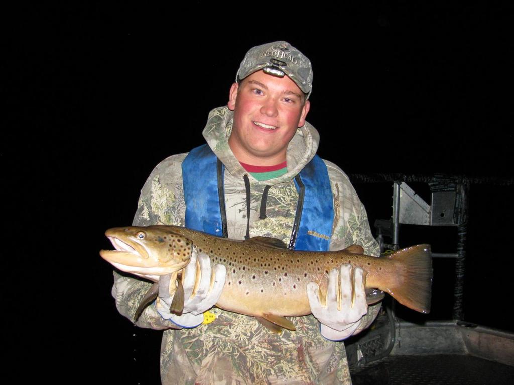
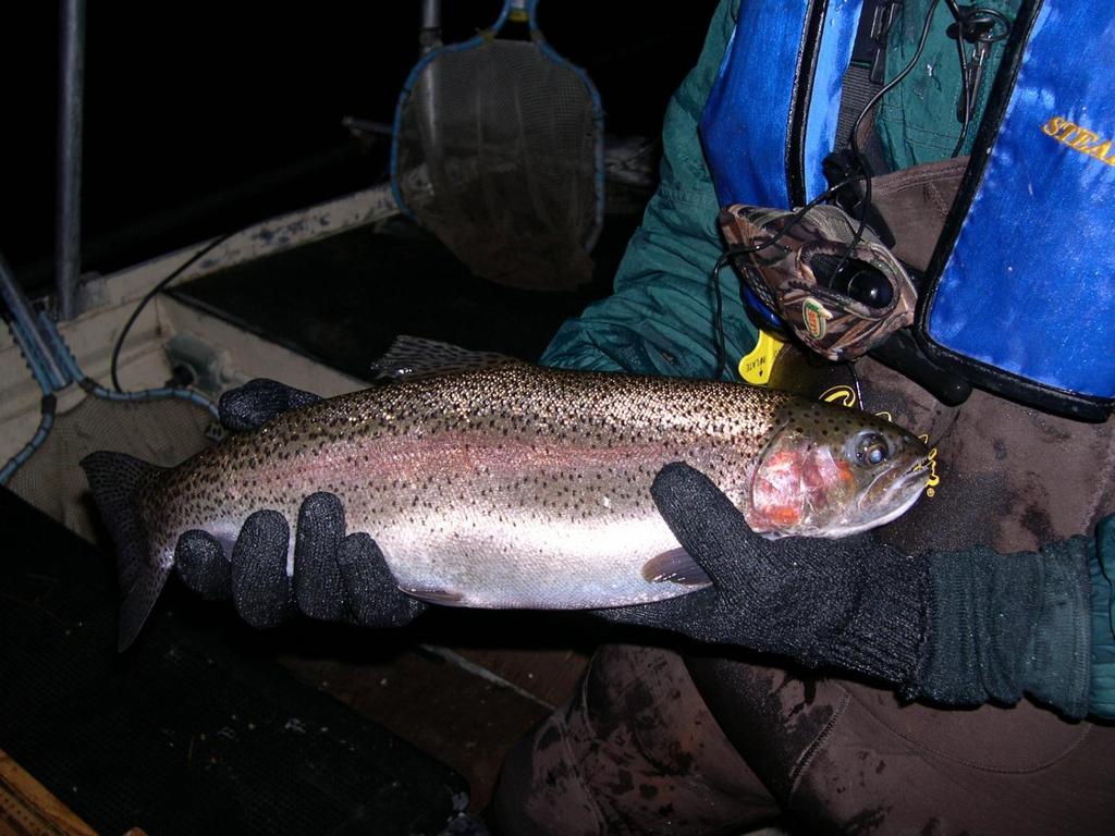
2 Comins Lake Located 7 miles south of Ely. Built in 1953 as storage reservoir for 3-C Ranch. 410 surface acres at capacity. Max depth of 14 feet with an average depth of 4-6 feet. Fed by Steptoe Creek. Northern pike introduced to control a nuisance population of Utah chub. After exhausting all food resources (chub, trout, bass), pike population crashes in mid-1980 s. Reservoir chemically treated in Trout restocked in the fall of Purchased by NDOW in 1999 SVWMA. From the mid 1990 s through mid 2000 s was a trophy trout and bass fishery. In th most visited fishery in the state. Northern pike illegally introduced in Very successful spawn in 2001 and every year since. Heavy predation upon trout and bass documented every year since Trout stocking terminated in 2007.

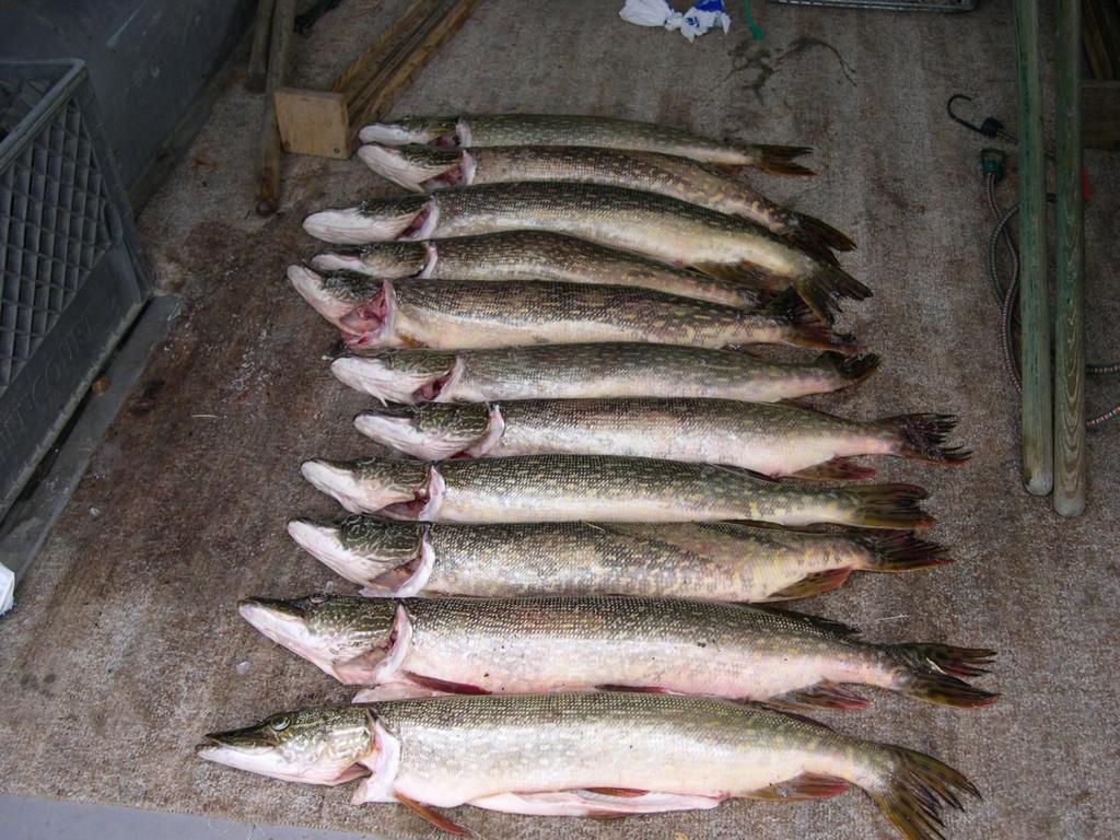
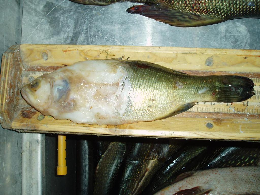
3 Since pike first spawned in 2001, it took less than 10 years to transform the fishery from this
4
5
6 To this
7

8
9

10 Current Status of the Reservoir Electroshocking surveys document the effective elimination of trout by fall, Largemouth bass reproduction effectively eliminated by fall, After exhausting all available food sources, the pike population has turned to invertebrates and cannibalism Recent data shows the pike population has crashed once again.
11 40000 ANGLER USE (DAYS) ANGLER USE (DAYS)
12 ANGLER EXPENDITURES $2,500,000 $2,000,000 $1,500,000 $1,000,000 $500,000 $ ANGLER EXPENDITURES
13 WP COUNTY ANGLERS OTHER COUNTY ANGLERS

14 Comins Lake and Mercury Issues 2006 Routine sampling found elevated methylmercury levels in fish inhabiting Comins Lake Northern Pike 1.20 ppm Largemouth Bass 1.25 ppm Rainbow Trout 0.85 ppm A health advisory was subsequently issued for the reservoir recommending no consumption of northern pike and largemouth bass and 1 rainbow trout per month Developed by Nevada State Health Division in cooperation with NDOW and NDEP Particularly applicable to pregnant women, nursing mothers and children Elevated mercury levels in fish tissue led to subsequent follow-up investigations by EPA and NDEP Preliminary soil sampling in 2007 by NDEP and the EPA identified two possible sources of mercury.

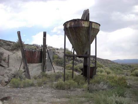
15 Argus Mill Site Monitor Mill Site

16 Additional soil and reservoir substrate sampling was conducted by NDEP/ EPA in 2008 and a comprehensive study was initiated examining soil and substrates, vegetation, macroinvertebrates, plankton, water, and fish to determine where and how the methylation is occurring in Comins Lake, and options for mercury remediation. The study concluded in August, 2010 and a report was released in September 2011

 Argus")
17 Inflow from Steptoe Creek (Monitor Mill site) Argus Mill site
18 EPA study recommendations Options for remediation Removal (excavation) of sediments Capping contaminated soils (Argus mill site) Reduce nutrient inputs Dike (isolate) area around the Argus Mill Divert Steptoe Creek around the Monitor Mill site Reduce/remove aquatic vegetation Deepen areas of the south lake basin (to reduce future vegetation growth)
19 Next Steps / Future Strategy Effective remediation following EPA study recommendations will be difficult: - Physical remediation in Comins Lake (e.g. sediment removal, capping, diking, deepening) will be very expensive. - EPA [superfund site] funding is limited or nonexistent. - Probability of success is uncertain (success = reducing methylmercury levels to a point where health advisories would not be needed). NDOW had an independent assessment of the EPA report done by Dr. Mae Gustin/UNR - This generally supported the EPA conclusions and recommendations - Strategies to minimize disturbance of existing sediments and selectively control vegetation would help reduce future mercury methylation
20 Next Steps / Future Strategy Potential near-term options include: -Evaluate bypass of Monitor Mill contamination area - Options to remove/control aquatic vegetation - NDOW is supportive of actions to address large-scale remediation, however - Community support and external grant/funding sources will be needed to implement any substantive remediation strategies
 - The current water budget for Steptoe WMA would only allow filling in wet")
21 Next Steps / Future Strategy Comins Lake Dam: - Because of the NDOT requirement to move/realign US93, current cost estimates are in the range of ~$14M - Increased storage from raising the dam 8-10 feet would increase available fish habitat but also would increase exposure to contaminated sediments (Argosy Mill site) - The current water budget for Steptoe WMA would only allow filling in wet years Comins Lake Fishery Restoration: - This will proceed independent of contamination remediation project planning, NEPA compliance renovation and sport fishery restoration - Pursuing boat launch facilities improvements concurrent with fishery restoration - Prudent approach is to treat Bassett Lake simultaneous with Comins Lake

22 Bassett Lake Located 5 miles northwest of McGill. 77 surface acres at capacity. Constructed in 1942 by Kennecott Copper Co. Max depth 9 feet; Average depth 4 feet; Very susceptible to low water / drought conditions. Currently contains northern pike, carp, and LMB. Once a popular fishery, it now represents a pike population after a crash. Basset was probably the source of pike for the illegal introduction into Comins Lake. Eradication here is crucial to prevent future illegal introductions. Bassett has excellent warmwater fishery potential.

23 Cave Lake Located 14 miles southeast of Ely. Constructed in 1930 s, purchased by Nevada F&G Commission in The reservoir is currently managed under a co-op agreement with Nevada Division of State Parks. 32 surface acres; Max depth 60 feet; Average depth 25 feet; Fed by Cave Creek. Major repair/replacement needs were identified for Cave Lake dam in The engineering and design assessment is in the contracting process and will be completed in FY14


24 Cave Lake Cave Lake is currently managed as a put-and-take rainbow trout fishery and averages more than 20,000 angler days / year. - Much like Comins Lake in the past, Cave Lake attracts a significant number of out-of-area anglers to White Pine County The Reservoir also supports a reproducing brown trout fishery and produced the current state record brown trout in 1984 at 27 lb. 5 oz. NDOW is currently assessing the feasibility of introducing an additional game fish species in the reservoir.

25 The End Cave Lake brown trout.
Crawford Reservoir. FISH SURVEY AND MANAGEMENT INFORMATION Eric Gardunio, Fish Biologist Montrose Service Center
 FISH SURVEY AND MANAGEMENT INFORMATION General Information: Crawford Reservoir is a popular fishery that provides angling opportunity for yellow perch, channel catfish, northern pike, rainbow trout, black
NEVADA DEPARTMENT OF WILDLIFE STATEWIDE FISHERIES MANAGEMENT
 NEVADA DEPARTMENT OF WILDLIFE STATEWIDE FISHERIES MANAGEMENT FEDERAL AID JOB PROGRESS REPORTS F-20-50 2014 WHITE PINE COUNTY Small Lakes and Reservoirs Eastern Region NEVADA DEPARTMENT OF WILDLIFE, FISHERIES
NEVADA DEPARTMENT OF WILDLIFE STATEWIDE FISHERIES MANAGEMENT
 NEVADA DEPARTMENT OF WILDLIFE STATEWIDE FISHERIES MANAGEMENT FEDERAL AID JOB PROGRESS REPORTS F-20-49 2013 LAKE TAHOE WESTERN REGION NEVADA DEPARTMENT OF WILDLIFE, FISHERIES DIVISION ANNUAL PROGRESS REPORT
NEVADA DEPARTMENT OF WILDLIFE STATEWIDE FISHERIES MANAGEMENT
 NEVADA DEPARTMENT OF WILDLIFE STATEWIDE FISHERIES MANAGEMENT FEDERAL AID JOB PROGRESS REPORTS F-20-52 2016 LAKE TAHOE WESTERN REGION NEVADA DEPARTMENT OF WILDLIFE, FISHERIES DIVISION ANNUAL PROGRESS REPORT
NEVADA DEPARTMENT OF WILDLIFE STATEWIDE FISHERIES MANAGEMENT
 NEVADA DEPARTMENT OF WILDLIFE STATEWIDE FISHERIES MANAGEMENT FEDERAL AID JOB PROGRESS REPORTS F-20-48 2012 LAKE TAHOE WESTERN REGION Contents NEVADA DEPARTMENT OF WILDLIFE, FISHERIES DIVISION ANNUAL PROGRESS
Anticipated 2014 Drought Impacts to Nevada Fisheries
 Anticipated 2014 Drought Impacts to Nevada Fisheries Presentation to NBWC March 21, 2014 Jon Sjöberg, Chief of Fisheries Nevada Department of Wildlife Truckee River Basin Snowpack in the Truckee River
NEVADA DEPARTMENT OF WILDLIFE STATEWIDE FISHERIES MANAGEMENT
 NEVADA DEPARTMENT OF WILDLIFE STATEWIDE FISHERIES MANAGEMENT FEDERAL AID JOB PROGRESS REPORTS F-20-50 2014 BILK CREEK RESERVOIR WESTERN REGION 1 NEVADA DEPARTMENT OF WILDLIFE, FISHERIES DIVISION JOB PROGRESS
FINAL Caples Lake Fisheries Management Plan. Version 4.0
 FINAL Caples Lake Fisheries Management Plan Version 4.0 August 15, 2008 Purpose The Caples Lake Fisheries Management Plan (Plan) outlines the stocking plan to reestablish a sport fishery in Caples Lake
NEVADA DEPARTMENT OF WILDLIFE STATEWIDE FISHERIES MANAGEMENT
 NEVADA DEPARTMENT OF WILDLIFE STATEWIDE FISHERIES MANAGEMENT FEDERAL AID JOB PROGRESS REPORTS F-20-49 2013 SQUAW CREEK RESERVOIR WESTERN REGION Contents NEVADA DEPARTMENT OF WILDLIFE, FISHERIES DIVISION
NEVADA DEPARTMENT OF WILDLIFE STATEWIDE FISHERIES MANAGEMENT FEDERAL AID JOB PROGRESS REPORTS F EUREKA COUNTY Small Lakes and Reservoirs
 NEVADA DEPARTMENT OF WILDLIFE STATEWIDE FISHERIES MANAGEMENT FEDERAL AID JOB PROGRESS REPORTS F-20-48 2012 EUREKA COUNTY Small Lakes and Reservoirs NEVADA DEPARTMENT OF WILDLIFE, FISHERIES DIVISION ANNUAL
NEVADA DEPARTMENT OF WILDLIFE STATEWIDE FISHERIES MANAGEMENT
 NEVADA DEPARTMENT OF WILDLIFE STATEWIDE FISHERIES MANAGEMENT FEDERAL AID JOB PROGRESS REPORTS F-2-52 216 CHIMNEY RESERVOIR WESTERN REGION NEVADA DEPARTMENT OF WILDLIFE, FISHERIES DIVISION JOB PROGRESS
NEVADA DEPARTMENT OF WILDLIFE STATEWIDE FISHERIES MANAGEMENT
 NEVADA DEPARTMENT OF WILDLIFE STATEWIDE FISHERIES MANAGEMENT FEDERAL AID JOB PROGRESS REPORTS F-20-52 2016 RYE PATCH RESERVOIR WESTERN REGION NEVADA DEPARTMENT OF WILDLIFE, FISHERIES DIVISION ANNUAL PROGRESS
NEVADA DEPARTMENT OF WILDLIFE STATEWIDE FISHERIES MANAGEMENT
 NEVADA DEPARTMENT OF WILDLIFE STATEWIDE FISHERIES MANAGEMENT FEDERAL AID JOB PROGRESS REPORTS F-20-52 2016 WHITE PINE COUNTY Small Lakes and Reservoirs Eastern Region NEVADA DEPARTMENT OF WILDLIFE, FISHERIES
SKIATOOK LAKE MANAGEMENT PLAN
 SKIATOOK LAKE MANAGEMENT PLAN Background Skiatook Lake impounds Hominy Creek, 5 miles west of Skiatook in Osage County, Oklahoma (Figure 1). Skiatook Lake covers 10,540 surface acres and was constructed
NEVADA DEPARTMENT OF WILDLIFE STATEWIDE FISHERIES MANAGEMENT
 NEVADA DEPARTMENT OF WILDLIFE STATEWIDE FISHERIES MANAGEMENT FEDERAL AID JOB PROGRESS REPORTS F-20-52 2016 SQUAW CREEK RESERVOIR WESTERN REGION NEVADA DEPARTMENT OF WILDLIFE, FISHERIES DIVISION ANNUAL
NEVADA DEPARTMENT OF WILDLIFE STATEWIDE SPORT FISHERIES MANAGEMENT
 NEVADA DEPARTMENT OF WILDLIFE STATEWIDE SPORT FISHERIES MANAGEMENT FEDERAL AID JOB PROGRESS REPORT F-20-50 2014 Urban Sport Fisheries SOUTHERN REGION NEVADA DEPARTMENT OF WILDLIFE, FISHERIES DIVISION ANNUAL
NEVADA DEPARTMENT OF WILDLIFE STATEWIDE FISHERIES MANAGEMENT
 NEVADA DEPARTMENT OF WILDLIFE STATEWIDE FISHERIES MANAGEMENT FEDERAL AID JOB PROGRESS REPORTS F-2-49 213 RYE PATCH RESERVOIR WESTERN REGION NEVADA DEPARTMENT OF WILDLIFE, FISHERIES DIVISION ANNUAL PROGRESS
NEVADA DEPARTMENT OF WILDLIFE STATEWIDE SPORT FISHERIES MANAGEMENT
 NEVADA DEPARTMENT OF WILDLIFE STATEWIDE SPORT FISHERIES MANAGEMENT FEDERAL AID JOB PROGRESS REPORT F-20-52 2016 Urban Sport Fisheries SOUTHERN REGION NEVADA DEPARTMENT OF WILDLIFE, FISHERIES DIVISION ANNUAL
NEVADA DEPARTMENT OF WILDLIFE STATEWIDE FISHERIES MANAGEMENT
 NEVADA DEPARTMENT OF WILDLIFE STATEWIDE FISHERIES MANAGEMENT FEDERAL AID JOB PROGRESS REPORTS F-20-52 2016 Lake Tahoe Rainbow Trout Study WESTERN REGION NEVADA DEPARTMENT OF WILDLIFE, FISHERIES DIVISION
NEVADA DEPARTMENT OF WILDLIFE STATEWIDE FISHERIES MANAGEMENT
 NEVADA DEPARTMENT OF WILDLIFE STATEWIDE FISHERIES MANAGEMENT FEDERAL AID JOB PROGRESS REPORTS F-20-48 2012 RYE PATCH RESERVOIR WESTERN REGION NEVADA DEPARTMENT OF WILDLIFE, FISHERIES DIVISION JOB PROGRESS
NEVADA DEPARTMENT OF WILDLIFE STATEWIDE FISHERIES MANAGEMENT
 NEVADA DEPARTMENT OF WILDLIFE STATEWIDE FISHERIES MANAGEMENT FEDERAL AID JOB PROGRESS REPORTS F-20-52 2016 BOULDER RESERVOIR WESTERN REGION NEVADA DEPARTMENT OF WILDLIFE, FISHERIES DIVISION ANNUAL PROGRESS
NEVADA DEPARTMENT OF WILDLIFE STATEWIDE SPORT FISHERIES MANAGEMENT
 NEVADA DEPARTMENT OF WILDLIFE STATEWIDE SPORT FISHERIES MANAGEMENT FEDERAL AID JOB PROGRESS REPORT F-20-49 2013 Urban Sport Fisheries SOUTHERN REGION NEVADA DEPARTMENT OF WILDLIFE, FISHERIES DIVISION ANNUAL
Bode Lake - South Population Survey
 Bode Lake - South Survey Located in Hoffman Estates on the north side of Bode Rd. 1 mile west of Barrington Rd. Bode Lake is made up of two lakes along Poplar Creek; the larger and deeper Bode Lake South
July 11, Mr. Mike King Executive Director Colorado Department of Natural Resources 1313 Sherman Street, Room 718 Denver, CO 80203
 July 11, 2014 Mr. Mike King Executive Director Colorado Department of Natural Resources 1313 Sherman Street, Room 718 Denver, CO 80203 Subject: Upper Colorado River Endangered Fish Recovery Program Water
Upper/Lower Owl Creek Reservoir
 Upper/Lower Owl Creek Reservoir Schuylkill County 2018 Largemouth Bass Survey Upper Owl Creek Reservoir and Lower Owl Creek Reservoir are 67-acre and 26-acre impoundments, respectively, created by two
NEVADA DEPARTMENT OF WILDLIFE STATEWIDE SPORT FISHERIES MANAGEMENT
 NEVADA DEPARTMENT OF WILDLIFE STATEWIDE SPORT FISHERIES MANAGEMENT FEDERAL AID JOB PROGRESS REPORT F-2-52 216 WILDHORSE RESERVOIR EASTERN REGION NEVADA DEPARTMENT OF WILDLIFE, FISHERIES DIVISION ANNUAL
Sebec Lake Fisheries Management Plan 2012
 Sebec Lake Fisheries Management Plan 2012 Sebec Lake is a 6,800-acre oligotrophic lake located in northwestern Maine. It has popular fisheries for landlocked salmon, lake trout, and smallmouth bass. Other
Lake information report
 Page 1 of 6 Lake information report Name: Saganaga Nearest Town: Grand Marais Primary County: Cook Survey Date: 08/08/2011 Inventory Number: 16063300 walleye stocking. Purchase a walleye stamp. Your voluntary
Current projects for Fisheries Research Unit of Minnesota Department of Natural Resources
 Current projects for Fisheries Research Unit of Minnesota Department of Natural Resources MAJOR RESOURCE ISSUES IN THE DIVISION OF FISHERIES Status of Fish Populations To effectively manage fish populations,
NEVADA DEPARTMENT OF WILDLIFE STATEWIDE FISHERIES MANAGEMENT
 NEVADA DEPARTMENT OF WILDLIFE STATEWIDE FISHERIES MANAGEMENT FEDERAL AID JOB PROGRESS REPORTS F-20-50 2014 ELKO COUNTY SMALL LAKES AND RESERVOIRS EASTERN REGION NEVADA DEPARTMENT OF WILDLIFE, FISHERIES
Inventory # Perch Lake
 Inventory # 9-036 Perch Lake Perch Lake is a double-basin lake. The southern, shallow portion of the lake is 414 acres, making it the largest wild rice lake on the Reservation. The fish communities sampled
Management of Small Impoundments
 Management of Small Impoundments Chapter 12 (Lake food webs) Chapter 15 (Natural Lakes) Chapter 16 (Farm Ponds & Small Impoundments) Quote for today: "The gods do not deduct from man's allotted span the
Warmwater Fisheries Assessments 2014
 NJDEP Division of Fish and Wildlife Bureau of Freshwater Fisheries Warmwater Fisheries Assessments 2014 New Jersey has over 400 impoundments open to the general public for fishing and thousands more in
RECREATIONAL PONDS AND LAKES
 RECREATIONAL PONDS AND LAKES POND ECOLOGY AQUATIC PLANTS & FISH F.S. Conte Department of Animal Science University of California Davis Photos By Flickr AQUATIC PLANTS POND HEALTH Chemical Recycling Oxygen
DRIPPING SPRINGS LAKE 5 YEAR LAKE MANAGEMENT PLAN
 DRIPPING SPRINGS LAKE 5 YEAR LAKE MANAGEMENT PLAN FISHERIES DIVISION CENTRAL REGION OKLAHOMA DEPTMENT OF WILDLIFE CONSERVATION PREPARED BY: DANNY BOWEN OCTOBER 2013 1 Background Dripping Springs Lake impounds
An Assessment of the Fish Community in Lake Acworth
 An Assessment of the Fish Community in Lake Acworth By John Damer Fisheries Biologist Georgia Department of Natural Resources Wildlife Resources Division Fisheries Section Calhoun, GA 30701 July 2008 Introduction
Geology. Key Factors. Overfishing. Great Lakes Fishes. Historical Fishing. About 10,000 years since last glacial retreat very young ecologically
 Great Lakes Fishes Geology About 10,000 years since last glacial retreat very young ecologically Largest surface freshwater system on earth 21% of world s supply 84% of North America s supply Five unique
Lake information report
 Lake information report: Minnesota DNR Page of 5 Lake information report jf Prinlable senior Name: Spring Nearest Town: Spring Lake (Scott) Primary County: Scott Survey Date: 08/02/200 Inventory Number:
DEPARTMENT OF WILDLIFE Fisheries Division 6980 Sierra Center Parkway, Ste 120 Reno, Nevada (775) Fax (775)
 Fax (775)") STATE OF NEVADA #23 DEPARTMENT OF WILDLIFE Fisheries Division 6980 Sierra Center Parkway, Ste 120 Reno, Nevada 89511 (775) 688-1500 Fax (775) 688-1987 MEMORANDUM September 24, 2016 To: From: Title: Nevada
STATE OF NEVADA #23 DEPARTMENT OF WILDLIFE Fisheries Division 6980 Sierra Center Parkway, Ste 120 Reno, Nevada 89511 (775) 688-1500 Fax (775) 688-1987 MEMORANDUM September 24, 2016 To: From: Title: Nevada
LAKE TANEYCOMO 2012 ANNUAL LAKE REPORT. Shane Bush Fisheries Management Biologist Missouri Department of Conservation Southwest Region
 LAKE TANEYCOMO 12 ANNUAL LAKE REPORT Shane Bush Fisheries Management Biologist Missouri Department of Conservation Southwest Region March 1, 13 EXECUTIVE SUMMARY Lake Taneycomo was formed by the construction
Overview of Recreational Pond Management
 Overview of Recreational Pond Management extension November 13 th 2013 Forrest Wynne State Extension Specialist for Aquaculture Kentucky State University Ponds are built for some of the following purposes:
Green Lake Population Survey
 Located next to the Green Lake Aquatic Center in Calumet City on the north side of 159 th St, east of Torrence Ave. Size can be deceiving; this 5 acre lake is the deepest lake in the District with a maximum
Environmental Review and Permitting for Wild Trout
 Environmental Review and Permitting for Wild Trout Tom Shervinskie Wild Trout Summit Watershed Analysis Section August 26, 2017 Division of Environmental Services The mission of the Pennsylvania Fish and
Invasive Fish in the Cariboo Region. Russell Bobrowski Fisheries Biologist, BC Gov Cariboo Region Dec 19, 2017
 Invasive Fish in the Cariboo Region Russell Bobrowski Fisheries Biologist, BC Gov Cariboo Region Dec 19, 2017 Cariboo - Fishery Combination of productive lake and river fisheries 700 lakes with known game
Managing a Quality Pond
 Managing a Quality Pond Gary Burtle The University of Georgia Successful Pond Management Set your GOAL Pond design Stocking Strategy Proper Nutrients Fish Growth and Harvest Successful Fish Reproduction
Columbia Lake Dam Removal Project
 Columbia Lake Dam Removal Project The Columbia Lake dam located 1/4 mile upstream of the Paulins Kill River's confluence with the Delaware River in Knowlton Township, Warren County has been proposed for
HUBBARD LAKE Alcona County (T27N, R7E; T28N, R7E) Surveyed May and September Tim A. Cwalinski
 Surveyed May and September Tim A. Cwalinski") Michigan Department of Natural Resources Status of the Fishery Resource Report No. 2003-1, 2003 HUBBARD LAKE Alcona County (T27N, R7E; T28N, R7E) Surveyed May and September 1996 Tim A. Cwalinski Environment
Michigan Department of Natural Resources Status of the Fishery Resource Report No. 2003-1, 2003 HUBBARD LAKE Alcona County (T27N, R7E; T28N, R7E) Surveyed May and September 1996 Tim A. Cwalinski Environment
Don Pedro Project Relicensing
 Don Pedro Project Relicensing M ODESTO I RRIGATION D ISTRICT TURLOCK I RRIGATION D ISTRICT FERC PROJECT N O. 2299 Resident Fish in Don Pedro Reservoir Don Pedro Reservoir Fish Stocking (1971-Present) CDFG
NEVADA DEPARTMENT OF WILDLIFE STATEWIDE FISHERIES MANAGEMENT
 NEVADA DEPARTMENT OF WILDLIFE STATEWIDE FISHERIES MANAGEMENT FEDERAL AID JOB PROGRESS REPORTS F-20-52 2016 EAST FORK AND MAIN STEM CARSON RIVER WESTERN REGION NEVADA DEPARTMENT OF WILDLIFE, FISHERIES DIVISION
The Sierra Fund Science Director Carrie Monohan, Ph.D.
 The Sierra Fund Science Director Carrie Monohan, Ph.D. Mercury and the Gold Rush USGS Fact Sheet 2005-3014 Mercury and the Gold Rush Mercury was used during hardrock and hydraulic mining. It is still entrained
Rolling Knolls Pond Population Survey
 Located near the town of Elgin on the west side of Rohrssen Rd. between Illinois Route 58 and U.S.- 20. This small 1.8 acre pond has a maximum depth of 7.5 feet and is occasionally influenced by Poplar
Nonnative Fish Management River Specific Fact Sheets 2010
 Stephen D. Guertin, Chairman Implementation Committee Thomas E. Chart, Director Recovery Program U.S. Fish and Wildlife Service P.O. Box 25486 Denver Federal Center Denver, CO 80225 (303) 969-7322 Fax
PRE- PROPOSAL FORM - Lewis River Aquatic Fund
 PRE- PROPOSAL FORM - Lewis River Aquatic Fund 1. Applicant organization. USDA Forest Service Gifford Pinchot National Forest 2. Organization purpose Resource management agency 3. Project manager (name,
Tampier Lake Population Survey
 Located in Palos Park on 131 st St. between Wolf and Will-Cook Rd. s. Tampier Lake has 131 acres of fishable water, with a maximum depth of 9.4 feet. Walleye, northern pike, largemouth bass and channel
CARSON CITY ADVISORY BOARD TO MANAGE WILDLIFE PUBLIC NOTICE
 PUBLIC NOTICE The will hold a public meeting at 5:30 p.m. on Monday, July 29, 2013, in the CITY HALL CAPITOL CONFERENCE ROOM, 201 NORTH CARSON STREET, CARSON CITY, NEVADA AGENDA 1. CALL TO ORDER, DETERMINATION
CARSON CITY ADVISORY BOARD TO MANAGE WILDLIFE Minutes of the August 30, 2000 Meeting Page 1
 Page 1 A regular meeting of the Carson City Advisory Board to Manage Wildlife was held at 7:00 p.m. on Wednesday, August 30, 2000 in the City Hall Capitol Conference Room, 201 North Carson Street, Carson
Big Spring Creek Habitat Enhancement and Fishery Management Plans
 Big Spring Creek Habitat Enhancement and Fishery Management Plans November 5, 2012 Big Spring Events and Activities Center Newville, PA Charlie McGarrell Regional Habitat Biologist Pennsylvania Fish and
NEVADA DEPARTMENT OF WILDLIFE STATEWIDE FISHERIES MANAGEMENT FEDERAL AID JOB PROGRESS REPORT F STREAM FISHERIES MANAGEMENT WESTERN REGION
 NEVADA DEPARTMENT OF WILDLIFE STATEWIDE FISHERIES MANAGEMENT FEDERAL AID JOB PROGRESS REPORT F-20-50 2014 STREAM FISHERIES MANAGEMENT WESTERN REGION NEVADA DEPARTMENT OF WILDLIFE, FISHERIES DIVISION ANNUAL
NEVADA DEPARTMENT OF WILDLIFE STATEWIDE SPORT FISHERIES MANAGEMENT
 NEVADA DEPARTMENT OF WILDLIFE STATEWIDE SPORT FISHERIES MANAGEMENT FEDERAL AID JOB PROGRESS REPORT F-20-53 2017 RUBY MOUNTAIN & EAST HUMBOLDT HIGH MOUNTAIN LAKES NEVADA DEPARTMENT OF WILDLIFE, FISHERIES
Trout Unlimited Comments on the Scope of Environmental Impact Statement for the Constitution Pipeline Project, Docket No. PF12-9
 October 9, 2012 Kimberly D. Bose, Secretary Federal Energy Regulatory Commission 888 First Street, NE, Room 1A Washington, DC 20426 RE: Trout Unlimited Comments on the Scope of Environmental Impact Statement
Arrowhead Lake Population Survey
 Located in Palos Heights at 135 th St, east of Harlem Ave. Arrowhead Lake is a 13 acre body of water with a maximum depth of 12.6 feet. Fish species found in this lake include largemouth bass, bluegill,
Amendment to a Biological Assessment/Evaluation completed for the Coon Creek Land Disposal completed December Grand Valley Ranger District
 Amendment to a Biological Assessment/Evaluation completed for the Coon Creek Land Disposal completed December 2007 Grand Valley Ranger District Grand Mesa, Uncompahgre, Gunnison National Forests Prepared
Pennsylvania Fish and Boat Commission Fisheries Committee Harrisburg, PA
 Pennsylvania Fish and Boat Commission Fisheries Committee Harrisburg, PA Dave Miko, Chief July 16, 2012 Purpose of Tail Water Workgroup Evaluate possibilities for enhancement of cold water tail water fisheries
Crooked Lake Oakland County (T4N, R9E, Sections 3, 4, 9) Surveyed May James T. Francis
 Surveyed May James T. Francis") Michigan Department of Natural Resources Status of the Fishery Resource Report No. 2004-1, 2004 Crooked Lake Oakland County (T4N, R9E, Sections 3, 4, 9) Surveyed May 2002 James T. Francis Environment Crooked
Michigan Department of Natural Resources Status of the Fishery Resource Report No. 2004-1, 2004 Crooked Lake Oakland County (T4N, R9E, Sections 3, 4, 9) Surveyed May 2002 James T. Francis Environment Crooked
Schiller Pond Population Survey
 Located in the town of Schiller Park on Irving Park Rd. just west of Cumberland Ave. This small 6 acre pond has a maximum depth of 6.3 feet. In addition to largemouth bass and bluegill, Schiller Pond is
Elko County Wildlife Advisory Board 571 Idaho Street, Room 105, Elko, Nevada Phone Fax
 Elko County Wildlife Advisory Board 571 Idaho Street, Room 105, Elko, Nevada 89801 775-738-5398 Phone 775-753-8535 Fax www.elkocountynv.net PUBLIC MEETING NOTICE The Elko County Wildlife Advisory Board,
Jordanelle Reservoir Fishery Management Plan
 Jordanelle Reservoir Fishery Management Plan Jordanelle Reservoir Working Group April 2016 Table of Contents Jordanelle Working Group... 3 Working Group Members... 3 Jordanelle Working Group Purpose and
LAKE TANEYCOMO 2011 ANNUAL LAKE REPORT
 LAKE TANEYCOMO 211 ANNUAL LAKE REPORT Shane Bush Fisheries Management Biologist Missouri Department of Conservation Southwest Region March 1, 212 EXECUTIVE SUMMARY Lake Taneycomo was formed by the construction
Restoring a Recreational Gem. Pete Jopke Water Resources Planner Dane County Land & Water Resources Department
 Restoring a Recreational Gem Pete Jopke Water Resources Planner Dane County Land & Water Resources Department Lake Park Association 1912 Land purchased, road constructed and dam built Late Fall 1912 January
Current Status and Management Recommendations for the Fishery in the Cloverleaf Chain of Lakes
 Current Status and Management Recommendations for the Fishery in the Cloverleaf Chain of Lakes Jason Breeggemann Senior Fisheries Biologist Wisconsin Department of Natural Resources Outline DNR fisheries
Name of Applicant Phone Number # Mailing Address. City State Zip
 VIRGINIA DEPARTMENT OF GAME AND INLAND FISHERIES EXOTIC SPECIES APPLICATION/PERMIT TO IMPORT CERTIFIED TRIPLOID GRASS CARP FOR AQUATIC VEGETATION CONTROL IN PRIVATE PONDS (Under Authority of 4 VAC 15-30-40
Spring Lake 2017 REEL FACTS Keith Meals Fisheries Biologist
 Spring Lake 217 REEL FACTS Keith Meals Fisheries Biologist keithm@mdwfp.state.ms.us General Information: Spring Lake is a clear, shallow 6 acre spring-fed impoundment in Wall Doxey State Park. Nearly half
Sag Quarry - West Population Survey
 Located in Lemont on RT 83 and Archer Ave. just north of 111 th St. Like Sag Quarry East, this lake is an old limestone quarry, 14 acres in size and with a maximum depth of 10.3 feet. The species found
COLUMBIA LAKE DAM REMOVAL PROJECT
 COLUMBIA LAKE DAM REMOVAL PROJECT Major Goals of the Columbia Lake Dam Removal: Reconnect 10 miles of the Paulins Kill River to the Delaware River, restoring natural flow regime and sediment transport.
DEPARTMENT OF WILDLIFE & BOARD OF WILDLIFE COMMISSIONERS
 DEPARTMENT OF WILDLIFE & BOARD OF WILDLIFE COMMISSIONERS 2017 Legislative Joint Subcommittee Natural Resources February 9, 2017 EXHIBIT C Senate Committee on Natural Resources Date: 2-9-2017 Total pages:
Flowering Rush An Invasive Aquatic Macrophyte Infesting the Columbia River Basin
 Flowering Rush An Invasive Aquatic Macrophyte Infesting the Columbia River Basin Virgil Dupuis Salish Kootenai College Peter Rice University of Montana Pacific Northwest Distribution Montana Distribution
CARL BLACKWELL LAKE MANAGEMENT PLAN
 CARL BLACKWELL LAKE MANAGEMENT PLAN Background Lake Carl Blackwell impounds Stillwater Creek, 10 miles west of Stillwater in Payne County, Oklahoma (Figure 1). The lake covers 3,370 surface acres and was
Busse Reservoir South Lateral Pool Population Survey
 Busse Reservoir South Lateral Pool Survey Located in Elk Grove Village south of Higgins Rd. between RT 53/I-290 and Arlington Heights Rd. Busse Reservoir is comprised of three pools making up a total of
2014 Island Lake Survey June 13 th, 2014 Andrew Plauck District Fisheries Biologist Report Prepared 4 March 2015
 2014 Island Lake Survey June 13 th, 2014 Andrew Plauck District Fisheries Biologist Report Prepared 4 March 2015 BACKGROUND - A fish survey was requested due to a moderately severe winterkill in Island
Michigan Department of Natural Resources Status of the Fishery Resource Report Page 1
 Michigan Department of Natural Resources 2007-33 Status of the Fishery Resource Report Page 1 Grand Sable Lake Alger County, T49N, R14W, Sec. Many Lake Superior watershed, last year surveyed 2004 James
STATE OF NEVADA BOARD OF WILDLIFE COMMISSIONERS
 STATE OF NEVADA BOARD OF WILDLIFE COMMISSIONERS Number: P-33 Title: Fisheries Management Program Commission Policy Number 33 References: NRS 501.105, 501.181 Effective Date: July 24, 1999 Reviewed Date:
Michigan Dept. of Natural Resources Status of the Fishery Resource Report Page 1. Weber Lake Cheboygan County, T34N, R3W, Sec.
 Michigan Dept. of Natural Resources 2012-143 Status of the Fishery Resource Report Page 1 Weber Lake Cheboygan County, T34N, R3W, Sec. 31 Neal Godby, Fisheries Biologist Environment Weber Lake is a 28.5-acre
Chapter 5: Survey Reports
 Manual of Fisheries Survey Methods II: with periodic updates : Survey Reports James C. Schneider and J. W. Merna Suggested citation: Schneider, James C. and J. W. Merna. 2000. Survey reports. in Schneider,
WFC 50 California s Wild Vertebrates Jan. 11, Inland Waters (Lakes and Streams) Lisa Thompson
 Lisa Thompson") Inland Waters: Lakes and Streams WFC 50 11 January 2011 Lisa Thompson Fisheries Extension Specialist Wildlife, Fish, & Conservation Biology Department University of California, Davis Take home messages
Inland Waters: Lakes and Streams WFC 50 11 January 2011 Lisa Thompson Fisheries Extension Specialist Wildlife, Fish, & Conservation Biology Department University of California, Davis Take home messages
Columbia Lake Dam Removal Project
 Columbia Lake Dam Removal Project Major Goals of the Columbia Lake Dam Removal: Reconnect 10 miles of the Paulins Kill River to the Delaware River, restoring natural flow regime and sediment transport.
Maple Lake Population Survey
 Maple Lake Survey Located in Willow Springs approximately 1 mile west of Willow Springs Rd. (104 th Ave.) at Wolf Rd. and 95 th St. Constructed in the 1920 s this 60 acre lake drops down to 20.4 feet in
Eastern Brook Trout Joint Venture Completed Project Report Form
 Eastern Brook Trout Joint Venture Completed Project Report Form Project Title: Assessing the Efficacy of Remediating Episodic Low ph (and High Aluminum) Concentrations in Headwater Brook Trout Streams
Mecklenburg County. Fish Consumption Advisories A Local Government Perspective
 Mecklenburg County Fish Consumption Advisories A Local Government Perspective David Caldwell Charlotte-Mecklenburg Storm Water Services Water Quality Program NCLMS October 4, 2012 Lake monitoring program
Quarry Lakes Fisheries Report EBRPD Fisheries Department. Joe Sullivan Fisheries Resource Analyst Peter Alexander Fisheries Program Manager
 Quarry Lakes Fisheries Report 2011 EBRPD Fisheries Department Joe Sullivan Fisheries Resource Analyst Peter Alexander Fisheries Program Manager Introduction The purpose of this report is to give lake supervisors
Regulations. Grabbling season May 1 July 15; only wooden structures allowed.
 Arkabutla Reservoir 219 REEL FACTS Keith Meals, Arthur Dunn, Stanley Turner Fisheries Biologists keithm@wfp.ms.gov, ArthurD@wfp.ms.gov, StanleyT@wfp.ms.gov General Information: Arkabutla Reservoir is one
Tunica Cutoff 2018 REEL FACTS Keith Meals Fisheries Biologist
 Tunica Cutoff 218 REEL FACTS Keith Meals Fisheries Biologist keithm@mdwfp.state.ms.us General Information: Tunica Cutoff was created by the US Army Corps of Engineers (COE) in 1942 when a bend in the Mississippi
Keuka Lake State of the Lake 2017
 Keuka Lake State of the Lake 2017 1 2 Lake Characteristics Third largest by area of the Finger Lakes 11,730 ac Deep and steep sided - max 185 ft mean 101 ft Two story fishery (warmwater/coldwater) 178,800
Cedar Lake Comprehensive Survey Report Steve Hogler and Steve Surendonk WDNR-Mishicot
 Cedar Lake- 2006 Comprehensive Survey Report Steve Hogler and Steve Surendonk WDNR-Mishicot ABSTRACT Cedar Lake is a 142 acre lake located in the southwest corner of Manitowoc County. It is a seepage lake
LAKE DIANE Hillsdale County (T8-9S, R3W, Sections 34, 3, 4) Surveyed May Jeffrey J. Braunscheidel
 Surveyed May Jeffrey J. Braunscheidel") Michigan Department of Natural Resources Status of the Fishery Resource Report No. 2003-4, 2003 LAKE DIANE Hillsdale County (T8-9S, R3W, Sections 34, 3, 4) Surveyed May 2001 Jeffrey J. Braunscheidel Environment
Michigan Department of Natural Resources Status of the Fishery Resource Report No. 2003-4, 2003 LAKE DIANE Hillsdale County (T8-9S, R3W, Sections 34, 3, 4) Surveyed May 2001 Jeffrey J. Braunscheidel Environment
NEVADA DEPARTMENT OF WILDLIFE STATEWIDE FISHERIES MANAGEMENT FEDERAL AID JOB PROGRESS REPORTS F LAHONTAN CUTTHROAT TROUT EASTERN REGION
 NEVADA DEPARTMENT OF WILDLIFE STATEWIDE FISHERIES MANAGEMENT FEDERAL AID JOB PROGRESS REPORTS F-20-50 2014 LAHONTAN CUTTHROAT TROUT EASTERN REGION NEVADA DEPARTMENT OF WILDLIFE, FISHERIES DIVISION ANNUAL
NEVADA DEPARTMENT OF WILDLIFE STATEWIDE SPORT FISHERIES MANAGEMENT
 NEVADA DEPARTMENT OF WILDLIFE STATEWIDE SPORT FISHERIES MANAGEMENT FEDERAL AID JOB PROGRESS REPORT F-20-48 2012 SOUTH FORK RESERVOIR EASTERN REGION NEVADA DEPARTMENT OF WILDLIFE, FISHERIES DIVISION ANNUAL
Wampum Lake Population Survey
 Wampum Lake Survey Located in Thornton on Thornton-Lansing Rd. 1½ mile west of Torrence Ave. Wampum Lake is 35 acres is size and has a maximum depth of 14.1 feet. Northern pike, largemouth bass, bluegill,
Estimated on-the-ground start and end dates: 1 June October 2018
 A. Applicant Information Name of Organization: U.S. Army Corps of Engineers, Carlyle Lake 801 Lake Road, Carlyle, IL 62231 Contact Information: Robert Wilkins, Operations Manager, (618) 594-2484, Robert.Wilkins@usace.army.mil
Fisheries Management Zone 10:
 Fisheries Management Zone 10: Lake Trout Operational Objectives and Management Photo Credit: www.jamessmedleyoutdoors.com 2 FMZ 10: Lake Trout Operational Objectives and Management Lake trout are the second
Aquatic Plant Management and Importance to Sport Fisheries
 Aquatic Plant Management and Importance to Sport Fisheries Presentation to Michigan Inland Lakes Convention May 2014 Mike Maceina Professor Emeritus School of Fisheries, Aquaculture, and Aquatic Sciences