VOLUME I OF II HARRIS RANCH SPECIFIC PLAN 2007 (AMENDMENT 6.1, ORDINANCE 11-13)
|
|
|
- Gladys James
- 6 years ago
- Views:
Transcription


1 VOLUME I OF II HARRIS RANCH SPECIFIC PLAN 2007 (AMENDMENT 6.1, ORDINANCE 11-13)


2 OWNER ACKNOWLEDGMENTS DEVELOPMENT MANAGER LEGAL In Loving memory of Dallas Harris By George we can do it if we work hard PLANNING ARCHITECTS paul macdonald Architect = pllc ENGINEERING TRAFFIC/TRANSPORTATION LANDSCAPE ARCHITECTS WILDLIFE GEOTECH FLOOD ANALYSIS WETLANDS CULTURAL HISTORY


3
4
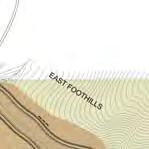
5 A. VOLUME 1 PAGE A. VOLUME 1 PAGE A VOLUME 1 PAGE TABLE OF CONTENTS 1-15 a) INTRODUCTION 1-2 b) c) ILLUSTRATIVE MASTER PLAN AND LEGAL DESCRIPTION d) VICINITY / EXISTING CONDITIONS / 300 RADIUS MAP e) OWNERSHIP MAP ) DETAILED PLANS a) CIRCULATION PLANS i) Roadway Plan 17 ii) Bike Lanes, Greenways and 18 Pathways Plan iii) Transit Plan 19 iv) Right-of-Way Sections v) Roundabouts in Harris Ranch b) LAND USE PLANS i) Prototypical Block Instructions ii) LEGAL DESCRIPTION AND EXHIBITS Land Use Development Plan iii) Harris Ranch Allowed Uses iv) Land Use Development and Prototypical Block Charts v) Block Prototype Details Block Prototype 1-35 c) LANDSCAPE PLANS i) Open Space and Pathways Plan 113 ii) Streetscapes Plan 114 iii) Streetscapes Details iv) Roundabout Islands 117 v) Street Trees 118 vi) Irrigation 119 vii) River Corridor 120 viii) Idaho Power Corridor 121 ix) Stormwater Feature 122 x) Village Green 123 xi) Neighborhood Green 124 xii) Landscape Block Prototypes 125 d) COMMUNITY SERVICES PLAN i) Utility Report - Civil Design Narrative ii) Water and Sewer Plan 128 iii) Grading and Drainage Plan 129 iv) Electrical, Communications and Street Lighting Plan 130 v) Utility and Drainage Block Prototypes vi) Harris Ranch Phasing Plan 134 Narrative vii) Public Amenities Phasing Plan 136 viii) Alta Harris Community Park 137 ix) Greenbelt Plan 138 x) Trail Phasing Plan 139 3) ARCHITECTURAL AND LANDSCAPE DESIGN GUIDELINES a) COMMERCIAL, MIXED USE, MULTI-FAMILY HOUSING AND TOWNHOME BUILDINGS i) Intent 141 ii) Introduction 141 iii) GUIDELINES 142 a. Building Types b. Building Height 144 c. Form 144 d. Proportion 145 e. Roofs 145 f. Exterior Walls and Projections 145 g. Transparency 146 h. Entrances and Storefronts 146 i. Windows and Doors 146 j. Materials and Colors 147 k. Out-Buildings and Landscape Structures 147 l. Exterior Lighting 147 m. Miscellaneous (dumpsters, satellite dishes, mechanical equipment, etc.) 147 n. Signage 147 o. Parking 147 p. Commercial Buildings and Parking Lots 147 b) LANDSCAPE DESIGN GUIDELINES i) General Requirements ii) iii) iv) Street Tree Requirements Streetscape Furnishings Commercial, Mixed-Use, Multi-Family Housing and Townhouse Landscape v) Additional Requirements vi) q. Private Outdoor Space for Residential Uses Plant Palette Recommendations GENERAL PROVISIONS; ADMINISTRATION GENERAL AND SPECIFIC USE STANDARDS PARKING STANDARDS SIGN STANDARDS FOOTHILLS PLANNED DEVELOPMENT HILLSIDE AND FOOTHILL AREAS 5) DEFINITIONS/TABLE OF ABBREVIATIONS 147 4) CODE A. VOLUME 1 PAGE B. VOLUME II APPENDICES 1) DALLAS HARRIS ORIGINAL MASTER PLAN 2) ORAL HISTORIES AND HISTORICAL PHOTOS 3) CULTURAL ASSESSMENT REPORT 4) TRAFFIC IMPACT STUDY 5) TRANSPORTATION MANAGEMENT PLAN (TMA) 6) WILDLIFE IMPACT ASSESSMENT AND MANAGEMENT PLAN 7) PRELIMINARY GEOTECHNICAL AND GEOLOGY REPORT 8) FLOOD ANALYSIS, EXISTING SITUATION AND PROPOSED MANAGEMENT PLAN 9) WETLANDS ANALYSIS, EXISTING SITUATION AND PROPOSED FUTURE SITUATION 10) FISCAL IMPACT ANALYSIS REPORT 11) EXISTING CONDITIONS AND VICINITY MAP AT 36 X 48 12) WATER AND SEWER AT 36 X 48 13) STORM DRAIN & GRADING PLAN AT 36X48 14) ELECTRICAL, COMMUNICATIONS & STREET LIGHTING AT 36X48 15) PHASING PLAN AT 36X48 16) WEST FOOTHILLS GRADING AND DRAINAGE PLAN AT 36X48 17) WEST FOOTHILLS WATER AND SEWER PLAN AT 36X48 18) EAST FOOTHILLS GRADING AND DRAINAGE AT 36X48 19) EAST FOOTHILLS WATER AND SEWER AT 36X48


6 THE VISION: By George - we can do it if we all work hard! Dallas Harris was often heard to say. Dallas had a dream for this land east of Boise, and the courage and drive to pursue its fulfillment. Although Dallas is not here to celebrate this achievement, it is a testament to his vision that this plan is presented to the people of Boise today. Dallas philosophy was that hard work and cooperation between his family, a dedicated team of consultants, and existing neighbors, would culminate in an outstanding community. This philosophy is evident in the Harris Ranch Specific Plan. In March of 1976, Dallas Harris completed the first master plan for Harris Ranch, the Warm Springs Village Plan. The hard work that went into that plan has continued for many years through the efforts of Dallas wife Mrs. Alta Harris, his son Randy Harris and his daughters Millie Davis and Felicia Burkhalter. Additional master plans, and modifications, were developed over the next several years, the last one being completed in In June of 2005 the Harris Family Limited Partnership (HFLP) adopted as its mission statement the following: In a timely manner, to profitably sell the assets of Harris Ranch in a professional and businesslike atmosphere demonstrative of the Owners commitment to the environment, the community and their heritage.. Over the last decade or so, citizens and Boise City have been exploring ways to bring New Urbanism principles to Boise. Smart Growth as a concept had been embraced by leaders long before they became the official, elected leaders. These principles have been adopted by the Owners and employed by its consultants to plan for this area. In April of 2006 a four-day charrette was conducted in which representatives from seven neighborhoods, The Idaho Conservation League, Idaho Fish & Game, Boise Parks & Recreation, Ada County Parks, Idaho Power, Boise Planning & Development Services, participated in the planning process. This was followed by a two-day charrette a month later and a monthly charrette/progress meeting until submittal of the application in December Through the charrette process with the Owners and stakeholders, a clear vision of the preferred future for Harris Ranch evolved. That vision is one of pedestrianoriented public streets, plazas, greens, riverfront walks and pathways. Those public streets are lined with, and shaped by, mixed-use, pedestrian-oriented buildings. The scale and general character of new development is based, in many ways, on the best elements of Boise s heritage the mixed-use shop-front buildings of historic Downtown and the iconic buildings of the agriculture and timber industries. The heart of this vision is one of a very particular kind of place. A sense of place results only when the public realm the streets and other public open spaces and the private realm the buildings that line the public spaces are designed to connect to one another at the scale of the person on foot. Such a place once thrived in the Barber Valley in the form of the town of Barberton. 1 Public spaces in addition to providing circulation of people on foot, on bicycles and in cars are the living rooms, the gathering places, the center of the community. The shape, scale and character of these public spaces are defined by their design and detailing, and by the way that private buildings connect to their edges. The coordination of the design of public and private elements, to be built in large and small increments over a period of many years, does not happen automatically. An overall framework and a systematic approach to the design of the components and the connections between them are required. The Specific Plan for Harris Ranch, the Harris Ranch Specific Plan Code and exacting design guidelines to be applied, not only by the City but by Harris Ranch community itself, will provide a system for ensuring that the design of the public realm and the design of private buildings are rigorously coordinated and focused on the pedestrian experience. The Specific Plan, the Code, and Design Guidelines, 1 see appendix 2) ORAL HISTORIES AND HISTORICAL PHOTOS define an agreement between the community and property owners. The community commits itself to building and maintaining high-quality, pedestrian-oriented streets, squares, plazas, and pathways, while the property and business owners commit themselves to building highquality buildings that face the public domain with façades scaled to the pedestrian, orienting on-site parking and service functions to the backs of the buildings and the interiors of the blocks. In creating the Specific Plan for Harris Ranch, the Owners have been inspired by the principles of the Congress for New Urbanism and have embraced them as their own: HFLP desires the evolution of true and diverse neighborhoods that conserve the natural environment and develop a built environment worth preserving. Economic vitality, community stability and environmental health can be enhanced and sustained with such a coherent and supportive physical framework. HFLP shall strive to germinate neighborhoods that are diverse in use and population; designed for pedestrians as well as cars; shaped by physically-defined and accessible open spaces; and neighborhoods that are framed by architecture and landscape design that celebrate the rich history of Harris Ranch, its ecology and buildings. HFLP is committed to re-establishing the relationship between building and the making of community, through citizenbased participatory planning. HFLP asserts the following principles to guide Harris Ranch development and design: Harris Ranch is one of multiple centers in Boise with its own identifiable center and boundaries derived from topography, river basin, ranch lands, parks and institutions. The development patterns of Harris Ranch A. VOLUME I b) INTRODUCTION attempt to shape the defined edge of Boise. Harris Ranch is contiguous to the existing urban boundary, and will be organized as neighborhoods and districts and integrated with the existing urban pattern. The development of Harris Ranch respects the historical patterns, precedents and boundaries of what was once the largest town in Idaho, the mill town of Barberton. HFLP will strive for a broad spectrum of land uses to support the economy of Harris Ranch and Boise and to benefit people of all incomes. Affordable housing will be found throughout Harris Ranch. The physical organization of Harris Ranch will be supported by a framework of transportation alternatives. Pedestrian, bicycle and transportation systems will maximize access and mobility throughout Harris Ranch while reducing dependence on cars. The neighborhood, the corridor and the community are the essential elements of Harris Ranch. They form the identifiable nested hierarchy that encourages residents and workers to take responsibility for the maintenance and evolution of Harris Ranch. Harris Ranch neighborhoods are compact, pedestrian-friendly and mixeduse. Schools will be sized and located to enable children to walk or bicycle to school. Corridors are connectors of neighborhoods and district corridors. They range from boulevards, bus routes and sidewalks to paths and trails. Many activities of daily living occur within walking distance, allowing independence to those who do not drive, particularly the elderly and the young. Interconnected networks of streets are designed to encourage walking, reduce the number and length of car trips and conserve energy. HARRIS RANCH SPECIFIC PLAN (Amend.6.1(2015)) Page 1


7 b) INTRODUCTION Within Harris Ranch neighborhoods, a broad range of housing types and price levels will bring people of diverse ages, gender and incomes into daily interaction, strengthening the bonds essential to a contributing neighborhood of Boise. Appropriate building densities and land uses are within walking distance of probable future transit stops permitting public transit to become a viable alternative to cars. The economic health and compatible evolution of Harris Ranch will be cultivated through graphic urban design codes that serve as predictable guides for change. Conservation areas and open lands are used to define the edges of, and connect different neighborhoods and districts to Harris Ranch. Individual architectural projects will be linked to their surrounding. The design of streets and buildings will reinforce safe environments, but not at the expense of accessibility and openness. Streets, squares and greens will be designed to be safe, comfortable and interesting to the pedestrian, to encourage walking and enable neighbors to know each other and protect their community. Architecture and landscape design grow from the rich history, topography and building practices in Harris Ranch. The development of Harris Ranch will provide residents with a clear sense of location, historical roots and a firm foundation in the present time. The Plan: A primary goal of the Harris Ranch Specific Plan is to provide enough detailed information so the Owners and the Community can rely on Harris Ranch to move forward from one phase to the next, and finally, to completion. This would allow the Owners to clearly demonstrate their commitment to the environment, the community and their heritage. This would allow the stakeholders to see their vision take shape based on the following components: Detailed, phased specific plan based on issues identified during the charrette process Specific plan employing the principles of Smart Growth and New Urbanism Rebirth of Dallas Harris Village Center Oral History manuscript Complete and comprehensive Impact Assessment and Wildlife Mitigation Plan Cultural Assessment Report Traffic Impact Study Open Space of over 700 acres Clustered development in the lower foothills Establishment and turnover of the greenbelt Identification of a Fire Station site Identification of an Elementary School site Major setbacks from and along the Boise River of 200 to 700 feet The project team is greatly appreciative of the tremendous trust and confidence the Harris family has demonstrated in the project team, the stakeholders and the process. We offer our sincerest thanks to the stakeholders who asked questions, gave constructive criticism and were instrumental in formulating the Harris Ranch Specific Honoring the promise living the dream Page 2
8 a) LEGAL DESCRIPTION Project: Date: January 12, 2007 Amended: March 14, 2007; July 19, 2007, August 14, 2007 HARRIS RANCH SPECIFIC PLAN 2006 BOUNDARY DESCRIPTION Six areas of land situated in Sections 17, 19, 20, 21, 28, 29, and 30, Township 3 North, Range 3 East, Boise Meridian, Ada County, Idaho, more particularly described as follows: AREA A A parcel of land situated in the west half of Sections 17, 20 and 29, in the south half of Section 19, and in the north half of Section 30, more particularly described as: BEGINNING at the quarter corner common to Sections 19 and 20; thence, along the west line of said Section 20, 1) N W., feet to the northwest corner of said Section 20; thence, along the west line of said Section 17, 2) N E., feet to the west quarter corner of said section; thence, continuing along said westerly line, 3) N W., feet to the north 1/16th corner common to Sections 17 and 18; thence, 4) S E., feet to the northwest 1/16th corner of said Section 17; thence, 5) S E., feet to the center west 1/16th corner thereof; thence, 6) S E., feet to the center west east 1/64th corner; thence, 7) S W., feet to the center southwest east 1/16th corner; thence, 8) S E., feet to the center south 1/16th corner of said section; thence, 9) S E., feet to the quarter corner common to said Sections 17 and 20; thence, along the north line of said Section 20, 10) N W., feet to the west east 1/64th corner common to said sections; thence, along the west line of the east ½ of the east ½ of the west ½ of said Section ) S E., feet to the west east 1/64th corner common to said Sections 20 and 29; thence, along the west line of the east ½ of the east ½ of the west ½ of said Section 29, 12) S W., feet to the northeast bank of the Boise River as shown on Record of Survey No. 1053, 3909, and 7188, Ada County records, thence, along said northeasterly bank through the following courses: 13) N W., feet; thence, 14) N W., feet; thence, 15) N W., feet; thence, 16) N W., feet; thence, 17) N W., feet; thence, 18) N W., feet; thence, 19) N W., feet; thence, 20) N W., feet; thence, 21) N W., feet; thence, 22) N W., feet; thence, 23) N E., feet; thence, 24) N W., feet; thence, 25) N W., feet; thence, 26) N W., feet; thence, 27) N W., feet; thence, 28) N W., feet; thence, 29) N E., feet; thence, 30) N E., feet; thence, 31) N W., feet; thence, 32) N W., feet; thence, 33) N W., feet; thence, 34) N W., feet; thence, 35) N W., feet; thence, 36) N W., feet; thence, 37) N W., feet; thence, 38) N W., feet; thence, 39) N W., 9.15 feet; thence, 40) N W., feet; thence, 41) S W., feet; thence, 42) S W., feet; thence, 43) N W., feet; thence, 44) N W., feet; thence, 45) N W., feet; thence, 46) N W., feet; thence, 47) N E., feet; thence, 48) N W., feet; thence, 49) N W., feet; thence, 50) N W., feet; thence, 51) N W., feet; thence, 52) N W., feet; thence, 53) N W., feet; thence, 54) N W., feet; thence, 55) N W., feet; thence, 56) N W., feet; thence, 57) N W., feet; thence, 58) N W., feet; thence, leaving said Boise River northeasterly bank, along the westerly lines of said Record of Survey No and 7188 through the following courses: 59) N E., feet; thence, 60) S E., feet; thence, 61) N E., feet more or less to a non-tangent point on a curve on the northerly right-of-way line of E. Warm Springs Avenue; thence, along said northeasterly line, 62) Southeasterly along said curve to the left having a radius of feet, an arc length of feet, through a central angle of , and a chord bearing and distance of S E., feet; thence, nontangent 63) N E., feet to a point on the northerly right-of-way line of E. Barber Dr.; thence, along said northerly line through the following courses: 64) Northeasterly along a curve to the left having radius of feet, an arc length of feet, through a central angle of , and a chord bearing and distance of N E., feet; thence, tangent 65) N E., feet to the beginning of a tangent curve; thence, 66) Northeasterly along a curve to the right having a radius of feet, an arc length of feet, through a central angle of , and a chord bearing and distance of N E., feet; thence, tangent 67) N E., feet to the beginning of a tangent curve,; thence, 68) Northeasterly along said curve to the right having a radius of feet, an arc length of feet, through a central angle of , and a chord bearing and distance of N E., feet; thence, tangent 69) N E., feet to the beginning of a tangent curve; thence, 70) Northeasterly along said curve to the right having a radius of feet, an arc length of feet, through a central angle of , and a chord bearing and distance of N E., feet to a point on the easterly line of Government Lot 4 of said Section 19; thence, leaving said northerly line, along said easterly line, 71) S W., feet to the southwest corner of the northwest quarter of the southeast quarter of said section; thence, along the southerly line of said northwest quarter of the southeast quarter of Section 19, 72) S E., feet to the southeast corner of the southeast quarter of the southeast quarter of said section; thence, along the easterly line of the northwest quarter of the southeast quarter of said Section 19, 73) N E., feet to a point on the above-described northerly right-of-way line of E. Barber Dr.; thence, along said northerly line, 74) N E., feet to a point on the easterly line of said Section 19; thence, along said easterly line, 75) N E., feet to the POINT OF EXCEPTING THEREFROM Two parcels of land situated in the southwest quarter of said Section 20, said parcels being Parcels A and B as shown on Record of Survey No. 1357, Ada County Records, more particularly described as follows: PARCEL A COMMENCING at the quarter corner common to said Sections 19 and 20, from which point the northwest corner of said Section 20 bears N W., feet; thence, A) S E., feet to the most northerly corner of said Parcel A as shown on said survey and the POINT OF BEGINNING; thence, along the exterior boundary of said Parcel A through the following courses: 76) S E., feet; thence, 77) S W., to a point hereinafter referred to as Point A ; thence, continuing along said boundary, 78) N W., feet; thence, 79) N E., feet to the POINT OF SAID PARCEL A containing 1.00 acre. PARCEL B COMMENCING at the above-described Point A; thence, HARRIS RANCH SPECIFIC PLAN (Amend.6.1(2015)) Page 3
9 a) LEGAL DESCRIPTION B) S W., feet to the most easterly corner of said Parcel B and the POINT OF BEGINNING; thence, along the exterior of said Parcel B through the following courses: 80) S W., feet; thence, 81) N W., feet; thence, 82) N E., feet; thence, 83) N E., feet; thence, 84) S E., feet to the POINT OF SAID PARCEL B containing 1.00 acre. ALSO EXCEPTING THEREFROM A parcel of land situated in the southeast quarter of the northwest quarter of Section 29, being that certain 1.46 acre parcel of land as shown on Record of Survey No. 6825, Ada County records, more particularly described as follows: COMMENCING at the northwest quarter of said section, from which corner, the north quarter corner of said section bears S E., feet; thence, along the north line of said section, C) S E., feet to a point on the west line of an Idaho Power Corridor as described in Instrument No , Ada County records; thence, along said westerly line, D) S W., feet to the POINT OF BEGINNING; thence, continuing, 85) S W., feet; thence, 86) S W., feet; thence, 87) N W., feet; thence, 88) N E., feet; thence, 89) S E., feet to the POINT OF SAID PARCEL containing 1.46 acres, more or FURTHER EXCEPTING THEREFROM A parcel of land situated in the southeast quarter of the southeast quarter of said Section 19 and in the northeast quarter of the northeast quarter of said Section 30, being the two parcels of land as shown on Record of Survey No. 752, Ada County records, more particularly described as a whole as follows: COMMENCING at the Section Corner common to said Sections 19, 20, 29, and 30 as shown on said survey, from which point the quarter corner common to said Sections 19 and 30 bears, N W., ; thence, along the south line of said Section 19, E) N W., feet to a point on the centerline of Union Pacific Railroad, Barber Spur; thence, along said centerline, F) N W., feet; thence, perpendicular to said centerline, G) S W., feet to the POINT OF BEGINNING; thence, continuing, 90) S W., feet; thence, 91) N W., feet to a point on the easterly line of Wise Way; thence, along said easterly line, 92) N E., feet to a point hereinafter referred to as Point B ; thence, 93) S E., feet to the POINT OF SAID PARCELS containing 4.64 acres. more or ALSO EXCEPTING THEREFROM A parcel of land situated in the southeast quarter of the southeast quarter of said Section 19, said parcel being that certain 1.00 acre parcel of land as shown on Record of Survey No. 740, Ada County records, more particularly described as follows: COMMENCING at the above-described Point B ; thence, H) N W., feet to the most northerly corner of said parcel on the westerly line of Wise Way, and the POINT OF BEGINNING; thence, along the exterior of said parcel through the following courses: 94) S W., feet; thence, 95) N W., feet; thence, 96) N E., feet; thence, 97) S E., feet to the POINT OF SAID PARCEL containing 1.00 acre. ALSO EXCEPTING THEREFROM A parcel of land situated in the south half of said Section 19, and in the north half of said Section 30 as described in Warranty Deed Instrument No and Gift Deed Instrument No , described as a whole as follows: COMMENCING at the quarter section corner common to said Sections 20 and 29; thence, along the section line common to said sections, I) N W., feet to the section corner common to Sections 19, 20, 29 and 30; thence, J) N W., feet to the northeast most corner of that parcel of land as shown on Record of Survey No. 1053, of Ada County Records, said point being on the southerly boundary line of that property owned by Ada County, (formerly the Oregon Short Line Railroad Property), said point also being the POINT OF BEGINNING; thence, leaving said southerly boundary line, along the easterly boundary line of said Record of Survey No. 1053, 98) S W., feet; thence, leaving said easterly boundary line, 99) S E., feet; thence, 100) S E., feet; thence, 101) S E., feet; thence, 102) S E., feet; thence, 103) S E., feet; thence, 104) S E., feet; thence, 105) S E., feet to a point on the northeasterly bank of the Boise River as shown on Record of Survey No. 1053, 3909, and 7188, Ada County records; thence, along said northeasterly bank and exterior boundary line of said parcel of land as shown on Record of Survey No through the following courses: 106) N W., feet; thence, 107) S W., feet; thence, 108) S W., feet; thence, 109) N W., feet; thence, 110) N W., feet; thence, 111) N W., feet; thence, 112) N W., feet; thence, 113) N E., feet; thence, 114) N W., feet; thence, 115) N W., feet; thence, 116) N W., feet; thence, 117) N W., feet; thence, 118) N W., feet; thence, 119) N W., feet; thence, 120) N W., feet; thence, 121) N W., feet; thence, 122) N W., feet; thence, 123) N W., feet to a point on the northeasterly bank of the Boise River, said point being within the right-of-way of a future Ada County Highway District road; thence along said northeasterly bank of the Boise River, 124) N W., feet to the southeast corner of that parcel of land described in Deed Instrument No , Ada County records; thence, leaving said northeasterly bank of the Boise River, along the easterly boundary line of said parcel of land, 125) N E., feet; thence, 126) S E., feet to a point in the bottom of a diversion channel; thence, 127) N E., feet to a point on a curve on the southerly boundary line of that property owned by Ada County, (formerly the Oregon Short Line Railroad Property), as shown on said Record of Survey No. 1053; thence, along the southerly boundary line of said property owned by Ada County through the following courses: 128) Southeasterly along said curve to the left having a radius of feet, an arc length of feet, through a central angle of , and a chord bearing and distance of S E., feet; thence, 129) S E., feet; thence, 130) S E., feet to a point within the right-of-way of a future Ada County Highway District road, said point being a point on a non-tangent curve on the southerly boundary line of that property owned by Ada County, (formerly the Oregon Short Line Railroad Property), as shown on said Record of Survey No. 1053; thence, 131) Southeasterly along said curve to the right having a radius of feet, an arc length of feet, through a central angle of , and a chord bearing and distance of S E., feet; thence, 132) S E., feet; thence, 133) S E., feet to the POINT OF SAID PARCELS containing acres, more or SAID AREA A containing 725 acres, more or AREA B A parcel of land being the northwest quarter of the northwest quarter of Section 21, together with portions of the east half of Section 20, the northwest quarter of Section 28 and the northeast quarter of section 29 more particularly described as follows: BEGINNING at the quarter corner common to said Sections 17 and 20; thence, along the south line of said Section 17, Page 4
10 a) LEGAL DESCRIPTION 134) N E., feet to the northeast corner of said Section 20; thence, along the north line of said Section 21, 135) N E., feet to the west 1/16th corner common to Sections 16 and 21; thence, 136) S E., feet to the northwest 1/16th corner of said Section 21; thence, 137) S W., feet to the north 1/16th corner common to Sections 20 and 21; thence, along the east line of said Section 20, 138) S E., feet to the southeast corner thereof; thence, along the north line of said Section 28, 139) N E., feet to the quarter corner common to said Sections 21 and 28; thence, 140) S W., feet to the center quarter corner of said section 28; thence, 141) N W., feet to the west 1/16 corner thereof, said point being the southerly prolongation of the easterly line of Triplett Subdivision recorded in Book 99 of Plats at Pages , Ada County records; thence, along said prolongation and easterly line, 142) N E., feet to an angle point thereon; thence, along the northeasterly line of said subdivision, 143) N W., feet to the intersection with the southeasterly line of Record of Survey No. 5911, (Old Water Reservoir Parcel), Ada County records; thence, along the exterior boundary of said survey through the following courses: 144) N E., feet; thence, 145) N W., feet; thence, 146) N E., feet; thence, 147) N W., feet; thence, 148) S W., feet; thence, 149) S E., feet to the intersection with the northwesterly line of said Triplett Subdivision; thence, along said northwesterly line, 150) S W., feet to the most westerly corner thereof, said point also being the northwest corner of Lot 1, Block 1 of Barberton Subdivision No. 1; thence, 151) N W., feet more or less to a point on the southeasterly line of Parcel B as shown on Property Line Adjustment Record of Survey No. 6244, Ada County records; thence, along the southeasterly line of said parcel through the following courses: 152) N E., feet to the beginning of a tangent curve; thence, 153) Northeasterly along said curve to the left having a radius of feet, an arc length of feet, through a central angle of , and a chord bearing and distance of N E., feet thence, tangent 154) N W., feet to the beginning of a tangent curve; thence, 155) Northeasterly along said curve to the right having a radius of feet, an arc length of feet, through a central angle of , and a chord bearing and distance of N E., feet; thence, tangent 156) N E., feet; thence, 157) S W., feet to a point on the westerly line of said section, said point also being an angle point on the easterly line of Parcel A as shown on said survey; thence, along the easterly and northerly line of said parcel, 158) N W., feet; thence, 159) S W., feet to the southeast corner of Lot 14, Block 29 of Harris Ranch Subdivision No. 4, recorded in Book 81 of Plats at Pages 8807 through 8809, Ada County records; thence, along the exterior boundary of said subdivision through the following courses: 160) N W., feet; thence, 161) N W., feet; thence, 162) N W., feet; thence, 163) N W., feet; thence, 164) S W., feet to a point on the northerly line of said Section 29; thence, along said northerly line, 165) N W., feet to the southeasterly corner of that certain 7.29 acre parcel of land as shown on Record of Survey No. 5558, Ada County records; thence, along the easterly and northeasterly line of said parcel through the following courses: 166) N E., feet; thence, 167) N W., feet; thence, 168) N W., feet; thence, 169) N W., feet to the most northerly corner of said parcel on the midsection line of said Section 20; thence, along said mid-section line, 170) N W., feet to the POINT OF SAID AREA B containing 475 acres, more or AREA C A parcel of land situated in the east half of Section 29, more particularly described as follows: COMMENCING at the quarter corner common to said Sections 20 and 29; thence, along the mid-section line of said Section 29, K) S W., feet to a non-tangent point on a curve on a line parallel with and feet southwesterly of the southwesterly right-of-way of E. Warm Springs Avenue, (Old Hwy 21), and the POINT OF BEGINNING; thence, along said parallel line, 171) Southeasterly along said curve to the right having a radius of feet, an arc length of feet, through a central angle of , and a chord bearing and distance of S E., feet; thence, tangent 172) S E., feet to the intersection with the northwesterly right-of-way line of S. Eckert Road as shown on Harris Ranch Subdivision No. 1 recorded in Book 79 of Plats at Pages 8416 through 8425, Ada County records; thence, along said northwesterly right-of-way line through the following courses 173) S W., feet; thence, 174) S W., feet to the beginning of a tangent curve; thence, 175) Southwesterly along said curve to the right having a radius of feet, an arc length of feet, through a central angle of , and a chord bearing and distance of S W., feet to the intersection with the mid-section line of said section; thence, along said mid-section line, 176) N E., feet to the POINT OF SAID AREA C containing acres, more or AREA D A parcel of land situated in the east half of said Section 29, being Lots 2 through 18, Block 5 of Harris Ranch Subdivision No. 6 recorded in Book 84 of Plats at Pages 9321 through 9324, Ada County records more particularly described as follows: COMMENCING at the quarter corner common to said Sections 28 and 29 as shown on said subdivision; thence, along the east line of said Section 29, L) S W., feet to a point on the southwesterly right-of-way line of W. Warm Springs Ave., (Old Hwy 21); thence, along said southwesterly line, M) N W., feet to the most easterly corner of Lot 10 of said block and the POINT OF BEGINNING; thence, along the exterior boundary of said Lots 2 through 18 through the following courses: 177) S W., feet; thence, 178) S E., feet; thence, 179) S W., feet to the beginning of a tangent curve; thence, 180) Southwesterly along said curve to the left having a radius of feet, an arc length of feet, through a central angle of , and a chord bearing and distance of S W., feet; thence, tangent 181) S W., 9.85 feet to the beginning of a tangent curve; thence, 182) Southwesterly along said curve to the right having a radius of feet, an arc length of feet, through a central angle of , and a chord bearing and distance of S W., feet to a point of compound curvature; thence, 183) Southwesterly along said curve to the right having a radius of feet, an arc length of feet, through a central angle of , and a chord bearing and distance of S W., feet to a point of compound curvature; thence, 184) Northwesterly along a curve to the right having a radius of feet, an arc length of feet, through a central angle of , and a chord bearing and distance of N W., feet to a point of reverse curvature; thence, 185) Southwesterly along said curve to the left having a radius of feet, an arc length of feet, through a central angle of Page 5
11 a) LEGAL DESCRIPTION , and a chord bearing and distance of S W., feet to a point of reverse curvature; thence, 186) Southwesterly along said curve to the right having a radius of feet, an arc length of feet, through a central angle of , and a chord bearing and distance of S W., feet to a point of compound curvature; thence, 187) Northwesterly along said curve to the right having a radius of feet, an arc length of feet, through a central angle of , and a chord bearing and distance of N W., feet to a point of reverse curvature; thence, 188) Northwesterly along said curve to the left having a radius of feet, an arc length of feet, through a central angle of , and a chord bearing and distance of N W., feet; thence, tangent 189) N W., feet; thence, 190) N W., feet to a point on the southeasterly right-of-way line of S. Eckert Road as shown on said subdivision; thence, along said southeasterly line through the following courses: 191) N E., feet; thence, 192) N E., feet; thence, 193) N E., feet to a point on the southwesterly right-of-way line of E. Warm Springs Avenue; thence, along said southwesterly line, 194) S E., feet to the POINT OF SAID AREA D containing 7.75 acres, more or AREA E A parcel of land situated in the southeast quarter of said 29, more particularly described as follows: COMMENCING at the quarter corner common to said Sections 28 and 29; thence, along the easterly line of said Section 29, N) S W., feet to a point on the southwesterly right-of-way line of E. Warm Springs Ave., (Old Hwy 21); thence, along said southwesterly line, O) N W., feet to the most easterly corner of that certain acre parcel of land as shown on Record of Survey No. 4343, Ada County Records; thence, along the southeasterly line of said survey through the following courses: P) S W., feet; thence, Q) S W., feet; thence, R) S W., feet; thence, S) S W., feet to the POINT OF BEGINNING; thence, leaving said southeasterly line, 195) S E., feet; thence, 196) N E., feet; thence, 197) S E., feet; thence, 198) S W., feet; thence, 199) N W., feet to a point on the southerly line of said survey; thence, along said southeasterly line 200) N E., feet to the POINT OF SAID AREA E containing 3.91 acres, more or AREA F A parcel of land situated in the southeast quarter of said Section 29, more particularly described as follows COMMENCING at the south quarter corner of said Section 29 as shown on Record of Survey No. 4343, Ada County records; thence, along the north-south mid-section line of said section, T) N E., feet to the southwesterly corner of that certain acre parcel of land as shown on said survey and the POINT OF BEGINNING; thence, continuing, 201) N E., feet to the intersection with the southwesterly line as described in Instrument No , Ada County records; thence, along said southwesterly line through the following courses: 202) S E., feet; thence, 203) S E., feet; thence, 204) S E., feet; thence, 205) S E., feet; thence, 206) S W., feet; thence, 207) S E., feet to an angle point on the southerly line of the above-described acre parcel of land; thence, leaving said southwesterly line, along said southerly line through the following courses: 208) S W., feet; thence, 209) N W., feet; thence, 210) S W., feet; thence, 211) S W., feet; thence, 212) N W., feet; thence, 213) N W., feet; thence, 214) N W., feet to the POINT OF SAID PARCEL F containing 8.60 acres, more or TOTAL AREA containing 1234 acres, more or SUBJECT TO, all Covenants, Rights, Rights-of-Way, Easements of Record, and other Encumbrances. EXHIBITS B-1 B-3 attached, and by this reference, made a part hereof. NOTE: The above description was derived from public records, i.e.: Ada County Assessors, Records of Surveys, Subdivision Plats, Warranty Deeds and Quit Claim Deeds. Some of the survey and subdivision information has been rotated to obtain a best fit solution and to close mathematically. No Title Report was provided. No field surveying was performed by this firm for this description. Page 6
12 a) LEGAL DESCRIPTION - EXHIBITS Page 7
13 a) LEGAL DESCRIPTION - EXHIBITS Page 8


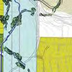

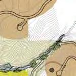

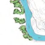


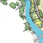


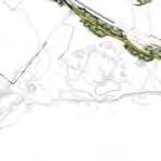


14 c) ILLUSTRATIVE MASTER PLAN Destination Spa Resort Chief Jim s Winter Camp Site Kelly s Hot Springs and Warm Springs Creek Harris Homestead Foundation Barberton Historic Home (Relocated) Neighborhood Greens Old Barn (Reconstituted as Pumphouse/Utility Barn) LEGEND Mixed-Use Commercial and High-Density Residential Mixed-Use Commercial and Med-high-Density Residential (15 DU/Ac.) Mixed-Use Village Center (15 DU/Ac.) Mixed-Use Village Center (30 DU/Ac.) Residential -- Medium-Density (8 DU/Ac.) Residential -- Medium-Density (6 DU/Ac.) Residential -- Low-Density (4 DU/Ac.) Residential -- Low-Density (2 DU/Ac.) Residential -- Foothill Development Destination Spa Resort Public Facilities (Schools, Fire Station) Harris Homestead Foundation OPen Space/Conservation Areas Idaho Power Corridor Homeowner s Association Green Space (Town Square To Have Farmer s Market & Restaurant) Open Space/Conservation Areas Historic/Cultural Site P Parking Structure NAP NOT A PART Note: Historic and cultural sites will be protected. Refer to the Harris Ranch Cultural Resources Survey and Supplement - Vol. II, Appendix 3. NAP NAP Foothills Residential Development Note: Elementary school site to be donated as public amenity. Site to be mutually determined by Spring (Squaw) Creek NAP Existing Harris Ranch Spring Creek Neighborhood NAP NAP East Park Center Bridge Fire Station NAP Main Street Development Village Green, Farmer s Market & Restaurant NAP NAP Alta Harris Community Park Boise River NAP Existing Commercial Existing Harris Ranch MIll District Neighborhood Ruins --- Barber Town Mill Barber Dam & Powerhouse Page 9
15 c) ILLUSTRATIVE MASTER PLAN - Legal Description with F&G Project: Date: January 12, 2007 Amended: March 14, 2007; August 16, 2007 HARRIS RANCH SPECIFIC PLAN 2006 BOUNDARY DESCRIPTION (INCLUDING IDAHO DEPARTMENT OF FISH & GAME) Seven areas of land situated in Sections 17, 19, 20, 21, 28, 29, and 30, Township 3 North, Range 3 East, Boise Meridian, Ada County, Idaho, more particularly described as follows: AREA A A parcel of land situated in the west half of Sections 17, 20 and 29, in the south half of Section 19, and in the north half of Section 30, more particularly described as: BEGINNING at the quarter corner common to Sections 19 and 20; thence, along the west line of said Section 20, 1) N W., feet to the northwest corner of said Section 20; thence, along the west line of said Section 17, 2) N E., feet to the west quarter corner of said section; thence, continuing along said westerly line, 3) N W., feet to the north 1/16th corner common to Sections 17 and 18; thence, 4) S E., feet to the northwest 1/16th corner of said Section 17; thence, 5) S E., feet to the center west 1/16th corner thereof; thence, 6) S E., feet to the center west east 1/64th corner; thence, 7) S W., feet to the center southwest east 1/16th corner; thence, 8) S E., feet to the center south 1/16th corner of said section; thence, 9) S E., feet to the quarter corner common to said Sections 17 and 20; thence, along the north line of said Section 20, 10) N W., feet to the west east 1/64th corner common to said sections; thence, along the west line of the east ½ of the east ½ of the west ½ of said Section ) S E., feet to the west east 1/64th corner common to said Sections 20 and 29; thence, along the west line of the east ½ of the east ½ of the west ½ of said Section 29, 12) S W., feet to the northeast bank of the Boise River as shown on Record of Survey No. 1053, 3909, and 7188, Ada County records, thence, along said northeasterly bank through the following courses: 13) N W., feet; thence, 14) N W., feet; thence, 15) N W., feet; thence, 16) N W., feet; thence, 17) N W., feet; thence, 18) N W., feet; thence, 19) N W., feet; thence, 20) N W., feet; thence, 21) N W., feet; thence, 22) N W., feet; thence, 23) N E., feet; thence, 24) N W., feet; thence, 25) N W., feet; thence, 26) N W., feet; thence, 27) N W., feet; thence, 28) N W., feet; thence, 29) N E., feet; thence, 30) N E., feet; thence, 31) N W., feet; thence, 32) N W., feet; thence, 33) N W., feet; thence, 34) N W., feet; thence, 35) N W., feet; thence, 36) N W., feet; thence, 37) N W., feet; thence, 38) N W., feet; thence, 39) N W., 9.15 feet; thence, 40) N W., feet; thence, 41) S W., feet; thence, 42) S W., feet; thence, 43) N W., feet; thence, 44) N W., feet; thence, 45) N W., feet; thence, 46) N W., feet; thence, 47) N E., feet; thence, 48) N W., feet; thence, 49) N W., feet; thence, 50) N W., feet; thence, 51) N W., feet; thence, 52) N W., feet; thence, 53) N W., feet; thence, 54) N W., feet; thence, 55) N W., feet; thence, 56) N W., feet; thence, 57) N W., feet; thence, 58) N W., feet; thence, leaving said Boise River northeasterly bank, along the westerly lines of said Record of Survey No and 7188 through the following courses: 59) N E., feet; thence, 60) S E., feet; thence, 61) N E., feet more or less to a non-tangent point on a curve on the northerly right-of-way line of E. Warm Springs Avenue; thence, along said northeasterly line, 62) Southeasterly along said curve to the left having a radius of feet, an arc length of feet, through a central angle of , and a chord bearing and distance of S E., feet; thence, nontangent 63) N E., feet to a point on the northerly right-of-way line of E. Barber Dr.; thence, along said northerly line through the following courses: 64) Northeasterly along a curve to the left having radius of feet, an arc length of feet, through a central angle of , and a chord bearing and distance of N E., feet; thence, tangent 65) N E., feet to the beginning of a tangent curve; thence, 66) Northeasterly along a curve to the right having a radius of feet, an arc length of feet, through a central angle of , and a chord bearing and distance of N E., feet; thence, tangent 67) N E., feet to the beginning of a tangent curve,; thence, 68) Northeasterly along said curve to the right having a radius of feet, an arc length of feet, through a central angle of , and a chord bearing and distance of N E., feet; thence, tangent 69) N E., feet to the beginning of a tangent curve; thence, 70) Northeasterly along said curve to the right having a radius of feet, an arc length of feet, through a central angle of , and a chord bearing and distance of N E., feet to a point on the easterly line of Government Lot 4 of said Section 19; thence, leaving said northerly line, along said easterly line, 71) S W., feet to the southwest corner of the northwest quarter of the southeast quarter of said section; thence, along the southerly line of said northwest quarter of the southeast quarter of Section 19, 72) S E., feet to the southeast corner of the southeast quarter of the southeast quarter of said section; thence, along the easterly line of the northwest quarter of the southeast quarter of said Section 19, 73) N E., feet to a point on the above-described northerly right-of-way line of E. Barber Dr.; thence, along said northerly line, 74) N E., feet to a point on the easterly line of said Section 19; thence, along said easterly line, 75) N E., feet to the POINT OF EXCEPTING THEREFROM Two parcels of land situated in the southwest quarter of said Section 20, said parcels being Parcels A and B as shown on Record of Survey No. 1357, Ada County Records, more particularly described as follows: PARCEL A COMMENCING at the quarter corner common to said Sections 19 and 20, from which point the northwest corner of said Section 20 bears N W., feet; thence, A) S E., feet to the most northerly corner of said Parcel A as shown on said survey and the POINT OF BEGINNING; thence, along the exterior boundary of said Parcel A through the following courses: 76) S E., feet; thence, 77) S W., to a point hereinafter referred to as Point A ; thence, continuing along said boundary, 78) N W., feet; thence, 79) N E., feet to the POINT OF SAID PARCEL A containing 1.00 acre. Page 10
16 c) ILLUSTRATIVE MASTER PLAN - Legal Description with F&G PARCEL B COMMENCING at the above-described Point A; thence, B) S W., feet to the most easterly corner of said Parcel B and the POINT OF BEGINNING; thence, along the exterior of said Parcel B through the following courses: 80) S W., feet; thence, 81) N W., feet; thence, 82) N E., feet; thence, 83) N E., feet; thence, 84) S E., feet to the POINT OF SAID PARCEL B containing 1.00 acre. ALSO EXCEPTING THEREFROM A parcel of land situated in the southeast quarter of the northwest quarter of Section 29, being that certain 1.46 acre parcel of land as shown on Record of Survey No. 6825, Ada County records, more particularly described as follows: COMMENCING at the northwest quarter of said section, from which corner, the north quarter corner of said section bears S E., feet; thence, along the north line of said section, C) S E., feet to a point on the west line of an Idaho Power Corridor as described in Instrument No , Ada County records; thence, along said westerly line, D) S W., feet to the POINT OF BEGINNING; thence, continuing, 85) S W., feet; thence, 86) S W., feet; thence, 87) N W., feet; thence, 88) N E., feet; thence, 89) S E., feet to the POINT OF SAID PARCEL containing 1.46 acres, more or FURTHER EXCEPTING THEREFROM A parcel of land situated in the southeast quarter of the southeast quarter of said Section 19 and in the northeast quarter of the northeast quarter of said Section 30, being the two parcels of land as shown on Record of Survey No. 752, Ada County records, more particularly described as a whole as follows: COMMENCING at the Section Corner common to said Sections 19, 20, 29, and 30 as shown on said survey, from which point the quarter corner common to said Sections 19 and 30 bears, N W., ; thence, along the south line of said Section 19, E) N W., feet to a point on the centerline of Union Pacific Railroad, Barber Spur; thence, along said centerline, F) N W., feet; thence, perpendicular to said centerline, G) S W., feet to the POINT OF BEGINNING; thence, continuing, 90) S W., feet; thence, 91) N W., feet to a point on the easterly line of Wise Way; thence, along said easterly line, 92) N E., feet to a point hereinafter referred to as Point B ; thence, 93) S E., feet to the POINT OF SAID PARCELS containing 4.64 acres. more or ALSO EXCEPTING THEREFROM A parcel of land situated in the southeast quarter of the southeast quarter of said Section 19, said parcel being that certain 1.00 acre parcel of land as shown on Record of Survey No. 740, Ada County records, more particularly described as follows: COMMENCING at the above-described Point B ; thence, H) N W., feet to the most northerly corner of said parcel on the westerly line of Wise Way, and the POINT OF BEGINNING; thence, along the exterior of said parcel through the following courses: 94) S W., feet; thence, 95) N W., feet; thence, 96) N E., feet; thence, 97) S E., feet to the POINT OF SAID PARCEL containing 1.00 acre. ALSO EXCEPTING THEREFROM A parcel of land situated in the south half of said Section 19, and in the north half of said Section 30 as described in Warranty Deed Instrument No and Gift Deed Instrument No , described as a whole as follows: COMMENCING at the quarter section corner common to said Sections 20 and 29; thence, along the section line common to said sections, I) N W., feet to the section corner common to Sections 19, 20, 29 and 30; thence, J) N W., feet to the northeast most corner of that parcel of land as shown on Record of Survey No. 1053, of Ada County Records, said point being on the southerly boundary line of that property owned by Ada County, (formerly the Oregon Short Line Railroad Property), said point also being the POINT OF BEGINNING; thence, leaving said southerly boundary line, along the easterly boundary line of said Record of Survey No. 1053, 98) S W., feet; thence, leaving said easterly boundary line, 99) S E., feet; thence, 100) S E., feet; thence, 101) S E., feet; thence, 102) S E., feet; thence, 103) S E., feet; thence, 104) S E., feet; thence, 105) S E., feet to a point on the northeasterly bank of the Boise River as shown on Record of Survey No. 1053, 3909, and 7188, Ada County records; thence, along said northeasterly bank and exterior boundary line of said parcel of land as shown on Record of Survey No through the following courses: 106) N W., feet; thence, 107) S W., feet; thence, 108) S W., feet; thence, 109) N W., feet; thence, 110) N W., feet; thence, 111) N W., feet; thence, 112) N W., feet; thence, 113) N E., feet; thence, 114) N W., feet; thence, 115) N W., feet; thence, 116) N W., feet; thence, 117) N W., feet; thence, 118) N W., feet; thence, 119) N W., feet; thence, 120) N W., feet; thence, 121) N W., feet; thence, 122) N W., feet; thence, 123) N W., feet to a point on the northeasterly bank of the Boise River, said point being within the right-of-way of a future Ada County Highway District road; thence along said northeasterly bank of the Boise River, 124) N W., feet to the southeast corner of that parcel of land described in Deed Instrument No , Ada County records; thence, leaving said northeasterly bank of the Boise River, along the easterly boundary line of said parcel of land, 125) N E., feet; thence, 126) S E., feet to a point in the bottom of a diversion channel; thence, 127) N E., feet to a point on a curve on the southerly boundary line of that property owned by Ada County, (formerly the Oregon Short Line Railroad Property), as shown on said Record of Survey No. 1053; thence, along the southerly boundary line of said property owned by Ada County through the following courses: 128) Southeasterly along said curve to the left having a radius of feet, an arc length of feet, through a central angle of , and a chord bearing and distance of S E., feet; thence, 129) S E., feet; thence, 130) S E., feet to a point within the right-of-way of a future Ada County Highway District road, said point being a point on a non-tangent curve on the southerly boundary line of that property owned by Ada County, (formerly the Oregon Short Line Railroad Property), as shown on said Record of Survey No. 1053; thence, 131) Southeasterly along said curve to the right having a radius of feet, an arc length of feet, through a central angle of , and a chord bearing and distance of S E., feet; thence, 132) S E., feet; thence, 133) S E., feet to the POINT OF SAID PARCELS containing acres, more or SAID AREA A containing 725 acres, more or AREA B A parcel of land being the northwest quarter of the northwest quarter of Section 21, together with portions of the east half of Section 20, the northwest quarter of Page 11
17 c) ILLUSTRATIVE MASTER PLAN - Legal Description with F&G Section 28 and the northeast quarter of section 29 more particularly described as follows: BEGINNING at the quarter corner common to said Sections 17 and 20; thence, along the south line of said Section 17, 134) N E., feet to the northeast corner of said Section 20; thence, along the north line of said Section 21, 135) N E., feet to the west 1/16th corner common to Sections 16 and 21; thence, 136) S E., feet to the northwest 1/16th corner of said Section 21; thence, 137) S W., feet to the north 1/16th corner common to Sections 20 and 21; thence, along the east line of said Section 20, 138) S E., feet to the southeast corner thereof; thence, along the north line of said Section 28, 139) N E., feet to the quarter corner common to said Sections 21 and 28; thence, 140) S W., feet to the center quarter corner of said section 28; thence, 141) N W., feet to the west 1/16 corner thereof, said point being the southerly prolongation of the easterly line of Triplett Subdivision recorded in Book 99 of Plats at Pages , Ada County records; thence, along said prolongation and easterly line, 142) N E., feet to an angle point thereon; thence, along the northeasterly line of said subdivision, 143) N W., feet to the intersection with the southeasterly line of Record of Survey No. 5911, (Old Water Reservoir Parcel), Ada County records; thence, along the exterior boundary of said survey through the following courses: 144) N E., feet; thence, 145) N W., feet; thence, 146) N E., feet; thence, 147) N W., feet; thence, 148) S W., feet; thence, 149) S E., feet to the intersection with the northwesterly line of said Triplett Subdivision; thence, along said northwesterly line, 150) S W., feet to the most westerly corner thereof, said point also being the northwest corner of Lot 1, Block 1 of Barberton Subdivision No. 1; thence, 151) N W., feet more or less to a point on the southeasterly line of Parcel B as shown on Property Line Adjustment Record of Survey No. 6244, Ada County records; thence, along the southeasterly line of said parcel through the following courses: 152) N E., feet to the beginning of a tangent curve; thence, 153) Northeasterly along said curve to the left having a radius of feet, an arc length of feet, through a central angle of , and a chord bearing and distance of N E., feet thence, tangent 154) N W., feet to the beginning of a tangent curve; thence, 155) Northeasterly along said curve to the right having a radius of feet, an arc length of feet, through a central angle of , and a chord bearing and distance of N E., feet; thence, tangent 156) N E., feet; thence, 157) S W., feet to a point on the westerly line of said section, said point also being an angle point on the easterly line of Parcel A as shown on said survey; thence, along the easterly and northerly line of said parcel, 158) N W., feet; thence, 159) S W., feet to the southeast corner of Lot 14, Block 29 of Harris Ranch Subdivision No. 4, recorded in Book 81 of Plats at Pages 8807 through 8809, Ada County records; thence, along the exterior boundary of said subdivision through the following courses: 160) N W., feet; thence, 161) N W., feet; thence, 162) N W., feet; thence, 163) N W., feet; thence, 164) S W., feet to a point on the northerly line of said Section 29; thence, along said northerly line, 165) N W., feet to the southeasterly corner of that certain 7.29 acre parcel of land as shown on Record of Survey No. 5558, Ada County records; thence, along the easterly and northeasterly line of said parcel through the following courses: 166) N E., feet; thence, 167) N W., feet; thence, 168) N W., feet; thence, 169) N W., feet to the most northerly corner of said parcel on the midsection line of said Section 20; thence, along said mid-section line, 170) N W., feet to the POINT OF SAID AREA B containing 475 acres, more or AREA C A parcel of land situated in the east half of Section 29, more particularly described as follows: COMMENCING at the quarter corner common to said Sections 20 and 29; thence, along the mid-section line of said Section 29, K) S W., feet to a non-tangent point on a curve on a line parallel with and feet southwesterly of the southwesterly right-of-way of E. Warm Springs Avenue, (Old Hwy 21), and the POINT OF BEGINNING; thence, along said parallel line, 171) Southeasterly along said curve to the right having a radius of feet, an arc length of feet, through a central angle of , and a chord bearing and distance of S E., feet; thence, tangent 172) S E., feet to the intersection with the northwesterly right-of-way line of S. Eckert Road as shown on Harris Ranch Subdivision No. 1 recorded in Book 79 of Plats at Pages 8416 through 8425, Ada County records; thence, along said northwesterly right-of-way line through the following courses 173) S W., feet; thence, 174) S W., feet to the beginning of a tangent curve; thence, 175) Southwesterly along said curve to the right having a radius of feet, an arc length of feet, through a central angle of , and a chord bearing and distance of S W., feet to the intersection with the mid-section line of said section; thence, along said mid-section line, 176) N E., feet to the POINT OF SAID AREA C containing acres, more or AREA D A parcel of land situated in the east half of said Section 29, being Lots 2 through 18, Block 5 of Harris Ranch Subdivision No. 6 recorded in Book 84 of Plats at Pages 9321 through 9324, Ada County records more particularly described as follows: COMMENCING at the quarter corner common to said Sections 28 and 29 as shown on said subdivision; thence, along the east line of said Section 29, L) S W., feet to a point on the southwesterly right-of-way line of W. Warm Springs Ave., (Old Hwy 21); thence, along said southwesterly line, M) N W., feet to the most easterly corner of Lot 10 of said block and the POINT OF BEGINNING; thence, along the exterior boundary of said Lots 2 through 18 through the following courses: 177) S W., feet; thence, 178) S E., feet; thence, 179) S W., feet to the beginning of a tangent curve; thence, 180) Southwesterly along said curve to the left having a radius of feet, an arc length of feet, through a central angle of , and a chord bearing and distance of S W., feet; thence, tangent 181) S W., 9.85 feet to the beginning of a tangent curve; thence, 182) Southwesterly along said curve to the right having a radius of feet, an arc length of feet, through a central angle of , and a chord bearing and distance of S W., feet to a point of compound curvature; thence, 183) Southwesterly along said curve to the right having a radius of feet, an arc length of feet, through a central angle of , and a chord bearing and distance of S W., feet to a point of compound curvature; thence, 184) Northwesterly along a curve to the right having a radius of feet, an arc length Page 12
18 c) ILLUSTRATIVE MASTER PLAN - Legal Description with F&G of feet, through a central angle of , and a chord bearing and distance of N W., feet to a point of reverse curvature; thence, 185) Southwesterly along said curve to the left having a radius of feet, an arc length of feet, through a central angle of , and a chord bearing and distance of S W., feet to a point of reverse curvature; thence, 186) Southwesterly along said curve to the right having a radius of feet, an arc length of feet, through a central angle of , and a chord bearing and distance of S W., feet to a point of compound curvature; thence, 187) Northwesterly along said curve to the right having a radius of feet, an arc length of feet, through a central angle of , and a chord bearing and distance of N W., feet to a point of reverse curvature; thence, 188) Northwesterly along said curve to the left having a radius of feet, an arc length of feet, through a central angle of , and a chord bearing and distance of N W., feet; thence, tangent 189) N W., feet; thence, 190) N W., feet to a point on the southeasterly right-of-way line of S. Eckert Road as shown on said subdivision; thence, along said southeasterly line through the following courses: 191) N E., feet; thence, 192) N E., feet; thence, 193) N E., feet to a point on the southwesterly right-of-way line of E. Warm Springs Avenue; thence, along said southwesterly line, 194) S E., feet to the POINT OF SAID AREA D containing 7.75 acres, more or AREA E A parcel of land situated in the southeast quarter of said 29, more particularly described as follows: COMMENCING at the quarter corner common to said Sections 28 and 29; thence, along the easterly line of said Section 29, N) S W., feet to a point on the southwesterly right-of-way line of E. Warm Springs Ave., (Old Hwy 21); thence, along said southwesterly line, O) N W., feet to the most easterly corner of that certain acre parcel of land as shown on Record of Survey No. 4343, Ada County Records; thence, along the southeasterly line of said survey through the following courses: P) S W., feet; thence, Q) S W., feet; thence, R) S W., feet; thence, S) S W., feet to the POINT OF BEGINNING; thence, leaving said southeasterly line, 195) S E., feet; thence, 196) N E., feet; thence, 197) S E., feet; thence, 198) S W., feet; thence, 199) N W., feet to a point on the southerly line of said survey; thence, along said southeasterly line 200) N E., feet to the POINT OF SAID AREA E containing 3.91 acres, more or AREA F A parcel of land situated in the southeast quarter of said Section 29, more particularly described as follows COMMENCING at the south quarter corner of said Section 29 as shown on Record of Survey No. 4343, Ada County records; thence, along the north-south mid-section line of said section, T) N E., feet to the southwesterly corner of that certain acre parcel of land as shown on said survey and the POINT OF BEGINNING; thence, continuing, 201) N E., feet to the intersection with the southwesterly line as described in Instrument No , Ada County records; thence, along said southwesterly line through the following courses: 202) S E., feet; thence, 203) S E., feet; thence, 204) S E., feet; thence, 205) S E., feet; thence, 206) S W., feet; thence, 207) S E., feet to an angle point on the southerly line of the above-described acre parcel of land; thence, leaving said southwesterly line, along said southerly line through the following courses: 208) S W., feet; thence, 209) N W., feet; thence, 210) S W., feet; thence, 211) S W., feet; thence, 212) N W., feet; thence, 213) N W., feet; thence, 214) N W., feet to the POINT OF SAID AREA F containing 8.60 acres, more or AREA G A parcel of land situated in the southwest quarter of said Section 21, more particularly described as follows: BEGINNING at the southwest corner of said section; thence, along the westerly line thereof, 215) N W., feet; thence, 216) N E., feet; thence, 217) S E., feet; thence, 218) S E., feet; thence, 219) S E., feet; thence, 220) S E., feet; thence, 221) S W., feet; thence, 222) S W., feet to a point on the southerly line of said section; thence, along said southerly line, 223) S W., feet to the POINT OF SAID AREA G containing acres, more or Note: Area G currently owned by Idaho Department of Fish and Game. TOTAL AREA containing 1272 acres, more or SUBJECT TO, all Covenants, Rights, Rights-of-Way, Easements of Record, and other Encumbrances. NOTE: The above description was derived from public records, i.e.: Ada County Assessors, Records of Surveys, Subdivision Plats, Warranty Deeds and Quit Claim Deeds. Some of the survey and subdivision information has been rotated to obtain a best fit solution and to close mathematically. No Title Report was provided. No field surveying was performed by this firm for this description. Page 13
 Page")
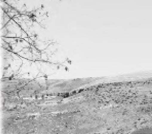
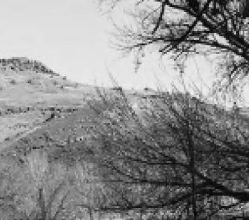
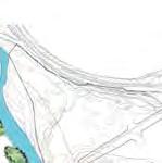
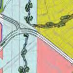
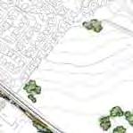
19 d) VICINITY/EXISTING CONDITIONS/300 RADIUS MAP See Aerial Photo of Vicinity and Existing Conditions (Appendix 11) Page 14

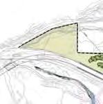
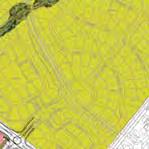
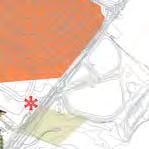
20 e) OWNERSHIP MAP Page 15
DANE COUNTY ORDINANCE AMENDMENT NO: Internal Tracking Number: RECU25760
 DANE COUNTY ORDINANCE AMENDMENT NO: 10246 Internal Tracking Number: RECU25760 Amending Section 10.03 relating to Zoning Districts in the Town of Vienna. The Dane County Board of Supervisors does ordain
Corpus Christi Metropolitan Transportation Plan Fiscal Year Introduction:
 Introduction: The Safe, Accountable, Flexible, Efficient Transportation Equity Act: A Legacy for Users (SAFETEA-LU) has continued the efforts started through the Intermodal Surface Transportation Efficiency
SPECIAL USE PERMIT - SUP Metcalf Avenue
 NOTICE OF PUBLIC HEARING CITY PLANNING COMMISSION CITY OF OVERLAND PARK, KANSAS Notice is hereby given that the City Planning Commission of Overland Park, Kansas, will hold a public hearing Monday, March
ORDINANCE NO. SB-3131
 ORDINANCE NO. SB-3131 AN ORDINANCE MAKING FINDINGS AND ESTABLISHING A STAR BOND PROJECT DISTRICT WITHIN THE CITY OF OVERLAND PARK, KANSAS PURSUANT TO K.S.A. 12-17,160 ET SEQ., AS AMENDED (BLUHAWK STAR
Village of Bedford Park ) ) SS County of Cook ) REVISED NOTICE TO SOLICIT PROPOSALS
 ) SS County of Cook ) REVISED NOTICE TO SOLICIT PROPOSALS") Village of Bedford Park ) ) SS County of Cook ) REVISED NOTICE TO SOLICIT PROPOSALS Notice is hereby given the Village of Bedford Park, Cook County, Illinois is soliciting proposals for the sale of real
Village of Bedford Park ) ) SS County of Cook ) REVISED NOTICE TO SOLICIT PROPOSALS Notice is hereby given the Village of Bedford Park, Cook County, Illinois is soliciting proposals for the sale of real
Executive Summary Route 30 Corridor Master Plan
 Route Corridor Master Plan Project Overview The Route Corridor Master Plan is a coordinated multimodal transportation and land use plan for the entire stretch of Route through East Whiteland Township,
Exhibit 1 PLANNING COMMISSION AGENDA ITEM
 Exhibit 1 PLANNING COMMISSION AGENDA ITEM Project Name: Grand Junction Circulation Plan Grand Junction Complete Streets Policy Applicant: City of Grand Junction Representative: David Thornton Address:
ORDINANCE NO CITY OF MONTICELLO ADOPTING TAX INCREMENT FINANCING TAX INCREMENT FINANCING DISTRICT II
 ORDINANCE NO. 2006-59 CITY OF MONTICELLO ADOPTING TAX INCREMENT FINANCING TAX INCREMENT FINANCING DISTRICT II WHEREAS, the City of Monticello, Illinois, desires to adopt tax increment financing pursuant
CHAPTER House Bill No. 1509
 CHAPTER 2006-358 House Bill No. 1509 An act relating to Flagler Estates Road and Water Control District, St. Johns County; amending chapter 98-529, Laws of Florida; providing additional powers of the district
CHAPTER House Bill No. 1311
 CHAPTER 2017-216 House Bill No. 1311 An act relating to the Lehigh Acres Municipal Services Improvement District, Lee and Hendry Counties; amending chapter 2015-202, Laws of Florida; expanding the territorial
EXHIBIT A LEGAL DESCRIPTION OF AVIGATION EASEMENT Being that certain real property situate in the unincorporated area of the County of Monterey, State
 EXHIBIT A LEGAL DESCRIPTION OF AVIGATION EASEMENT Being that certain real property situate in the unincorporated area of the County of Monterey, State of California, described as follows: Being a portion
All of Lot 5, Except the North 783 feet, Wolf Creek Acres, a subdivision of land in the City of Overland Park, Johnson County, Kansas.
 NOTICE OF PUBLIC HEARING CITY PLANNING COMMISSION CITY OF OVERLAND PARK, KANSAS Notice is hereby given that the City Planning Commission of Overland Park, Kansas, will hold a public hearing Monday, January
Introduction Parks Open Space Standards Recreation & Open Space Land Use Design Principles
 Chapter Seven: Parks, Recreation, & Open Space Chapter Seven: Parks, Recreation, & Open Space Introduction Parks Open Space Standards Recreation & Open Space Land Use Design Principles September 2008 Page
2.0 Existing Conditions
 20 2.0 Existing Conditions 2.1 Land Use, Future Growth Patterns, Physical Barriers Geographic Overview Sutter County s land use pattern is characterized by extensive agricultural areas, significant natural
September 18, Mr. Matthew Morris Kolter Acquisitions, LLC 6981 Professional Parkway E. Sarasota, Florida Dear Mr.
 JIM C. STUDIALE Director Community Development Department September 18, 2014 Mr. Matthew Morris Kolter Acquisitions, LLC 6981 Professional Parkway E. Sarasota, Florida 34240 RE: Minor Modification of PUD
Starting Bid: $15,000
 Starting Bid: $15,000 Parcel # 12.00593.00 Garage Legal Description Information Lot-005 Block-006 FOREST EDGE ADDITION Eckles Township 20 147 34 Forfeited: 06-222018 Deeded acres: 1.33 Appraised Value
COUNCIL COMMUNICATION
 Meeting Date: March 20, 2018 COUNCIL COMMUNICATION Agenda Item: Agenda Location: Action Items Work Plan # Legal Review: 1 st Reading 2 nd Reading Subject: A resolution approving the final design for the
Illustrated Principles of Good Planning
 Illustrated Principles of Good Planning The Miami 21 Zoning Code incorporates time-tested planning principles into the zoning regulations of our City. These are principles that make for better neighborhoods,
APPROVED BY REVIEW COMMITTEE April 13, 2015
 APPROVED BY REVIEW COMMITTEE April 13, 2015 CARLTON LANDING ECONOMIC DEVELOPMENT PROJECT PLAN PREPARED BY: THE TOWN OF CARLTON LANDING, OKLAHOMA JOANNE CHINNICI, MAYOR JEFF CLICK, TOWN TRUSTEE RICHARD
Perryville TOD and Greenway Plan
 Perryville TOD and Greenway Plan Greenway Glossary Pathway: A bicycle and pedestrian path separated from motorized vehicular traffic by an open space, barrier or curb. Multi-use paths may be within the
Living Streets Policy
 Living Streets Policy Introduction Living streets balance the needs of motorists, bicyclists, pedestrians and transit riders in ways that promote safety and convenience, enhance community identity, create
ORDINANCE NO. ASMT-3189
 ORDINANCE NO. ASMT-3189 AN ORDINANCE LEVYING ASSESSMENTS ON LOTS, PIECES AND PARCELS OF GROUND FOR THE PURPOSE OF PAYING THE COST FOR THE CONSTRUCTION OF A FLOOD CONTROL PROJECT ALONG NEGRO CREEK BETWEEN
5 CIRCULATION AND STREET DESIGN
 5 CIRCULATION AND STREET DESIGN This chapter describes circulation and streetscape improvements proposed for the Northwest Chico Specific Plan Area. It includes detailed design specifications for existing
CHAPTER House Bill No. 1495
 CHAPTER 2000-419 House Bill No. 1495 An act relating to Acme Improvement District, Palm Beach County; amending chapter 28557, Laws of Florida, 1953, as amended; expanding the boundaries of said district,
RESOLUTION OF ADVISABILITY AND AUTHORIZATION NO. 7841
 1 2 3 4 5 6 7 8 9 10 11 12 13 14 15 16 17 18 19 20 21 22 23 24 25 26 27 28 29 30 31 32 33 34 35 (Published in the Topeka Metro News August 9, 2006) RESOLUTION OF ADVISABILITY AND AUTHORIZATION NO. 7841
Planning & Zoning Commission
 Preliminary Plat Westwood, Section 3 Planning & Zoning Commission Planning & Development Department March 21, 2016 Request Subdivide approximately 38.1 acres of previously unplatted property to create
Obey Creek PEDESTRIAN CIRCULATION EAST WEST PARTNERS PEDESTRIAN CIRCULATION CREEK SIDE LANE SLIP STREET SCOTT MURRAY MAIN STREETS EAST/WEST
 THE VILLAGE AT PEDESTRIAN CIRCULATION MAIN STREETS NORTH/SOUTH MAIN STREETS EAST/WEST SLIP STREET CREEK SIDE LANE PEDESTRIAN CIRCULATION DESCRIPTION: Circulation through the downtown of is organized by
EXHIBIT A LEGAL DESCRIPTION OF PROPERTY TO BE INCLUDED IN THE DISTRICT
 - - - - EXHIBIT A LEGAL DESCRIPTION OF PROPERTY TO BE INCLUDED IN THE DISTRICT COMMUNITY FACILITIES DISTRICT FOR QUAILWOOD AND ROUWENHORST LEGAL DESCRIPTION JULY 28, 2004 A PORTION OF LAND LYING WITHIN
STONY PLAIN ROAD STREETSCAPE
 Jasper Place Revitalization Strategy: Vision The people involved in the Jasper Place Revitalization Strategy envision: Goal 1: Feeling safe in our community Create a community where feeling safe is common--where
FEASIBILITY REPORT STORM DRAINAGE IMPROVEMENTS TERRACE AND METCALF CITY OF OVERLAND PARK JOHNSON COUNTY, KANSAS
 March 2, 2011 FEASIBILITY REPORT STORM DRAINAGE IMPROVEMENTS STANLEY STORM DRAINAGE IMPROVEMENTS, 151sT TERRACE AND METCALF CITY OF OVERLAND PARK JOHNSON COUNTY, KANSAS DESCRIPTION: This report relates
ORDINANCE NO. WHEREAS, Downtown Bellingham and the Fairhaven commercial core are places where people come to play, work, shop, and live;
 ORDINANCE NO. AN ORDINANCE OF THE CITY OF BELLINGHAM, WASHINGTON AMENDING BELLINGHAM MUNICIPAL CODE PROVISIONS 10.24.070, 11.48.140, 11.52.010, EXTENDING THE HOURS OF RESTRICTION FOR SITTING AND LYING
Chapter 5 Future Transportation
 Chapter 5 Future Transportation The Future Land Use Plan identifies the desired land use designations. The land uses desired for Crozet depend, in large part, on the success of the transportation system,
Vision: Traditional hamlet with an attractive business/pedestrian friendly main street connected to adjacent walkable neighborhoods
 N D. Focus Area II Vision: Traditional hamlet with an attractive business/pedestrian friendly main street connected to adjacent walkable neighborhoods Transit Road Focus Area II is located in the Hamlet
ORDINANCE NO AN ORDINANCE MAKING CERTAIN FINDINGS AND ESTABLISHING THE MALL REDEVELOPMENT DISTRICT
 Introduced: January 20, 2015 Passed: January 20, 2015 Published: January 23, 2015 ORDINANCE NO. 2015-2 AN ORDINANCE MAKING CERTAIN FINDINGS AND ESTABLISHING THE MALL REDEVELOPMENT DISTRICT WHEREAS, K.S.A.
PennDOT Access Management Model Ordinances Training
 PennDOT Access s Training Trainers: Chad Dixson, AICP, TPD Angela Watson, PB Objective of Today Assist Pennsylvania s municipalities and transportation professionals in better understanding the benefits
M I N U T E S OKLAHOMA COUNTY PLANNING COMMISSION
 M I N U T E S OKLAHOMA COUNTY PLANNING COMMISSION September 21, 2000 1:30 P.M. The meeting of the Oklahoma County Planning Commission convened and was called to order by Ms. Cheryl Dorrance, at 1:30 P.M.,
PEDESTRIAN ACTION PLAN
 ATTACHMENT 2 CITY OF SANTA MONICA PEDESTRIAN ACTION PLAN CITY OF SANTA MONICA PEDESTRIAN ACTION PLAN This page intentionally left blank EXECUTIVE SUMMARY CHAPTER 1 EXECUTIVE SUMMARY Setting the Stage
AGENDA BILL. Beaverton City Council Beaverton, Oregon FOR AGENDA OF: ~1-8 BILL NO: BUDGET IMPACT
 AGENDA BILL SUBJECT: An Ordinance Withdrawing Territory From The Tualatin Valley Water District and Declaring An Emergency Beaverton City Council Beaverton, Oregon 3-27-18 FOR AGENDA OF: ~1-8 BILL NO:
Make Lincoln Highway an economically vibrant corridor that is safe, efficient, and beautiful for local residents and visitors.
 Lincoln Highway Streetscape Plan Stakeholder Workshop #2 Handout Contents Introduction and Project Vision Planning Principles Specific Recommendations including a Proposed Typical Roadway Section Renderings
CITY OF COCOA BEACH 2025 COMPREHENSIVE PLAN. Section VIII Mobility Element Goals, Objectives, and Policies
 CITY OF COCOA BEACH 2025 COMPREHENSIVE PLAN Section VIII Mobility Element Goals, Objectives, and Policies Adopted August 6, 2015 by Ordinance No. 1591 VIII MOBILITY ELEMENT Table of Contents Page Number
NEWMARKET UPHAM S CORNER
 SOUTH STATION Planning Initiative NEWMARKET UPHAM S CORNER COLUMBIA ROAD (P) FOUR CORNERS/GENEVA Working Advisory Group (WAG) Meeting #5 TALBOT AVENUE MORTON STREET BLUE HILL AVE/CUMMINS HWY (P) RIVER
East Burke Transportation, Safety and Capacity Improvements
 East Burke Transportation, Safety and Capacity Improvements The purpose of this project is to increase mobility and improve safety for pedestrians, cyclists, and motor vehicles along VT Route 114 in the
Approaches. Livable Neighborhood Design. Examples. Traditional neighborhood development. CE 594 University of Wisconsin- Milwaukee
 Approaches Livable Neighborhood Design CE 594 University of Wisconsin- Milwaukee Traditional neighborhood design (TND), new urbanism, transit friendly design, transit oriented development and walkable
SEWER CONNECTION FEES
 100.01 Connection Fees Required 100.04 Establishment of Sewer Districts 100.02 East Sanitary Sewer District 100.05 East Southside Drive Sewer Connection District 100.03 West Sanitary Sewer District 100.01
MAPPING DESCRIPTIONS AND DRAFTING PARCEL BOUNDARIES FOR CADASTRAL MAPPING
 MAPPING DESCRIPTIONS AND DRAFTING PARCEL BOUNDARIES FOR CADASTRAL MAPPING Chapter 6 2015 Cadastral Mapping Manual 6-0 Another method of describing land, aside from the fractional section method, is called
CANADA PROVINCE OF BRITISH COLUMBIA
 Note: This supplementary Letters Patent has been consolidated from the Supplementary Letters Patents of the three Regional Districts of the Okanagan valley: North Okanagan Regional District; Central Okanagan
Table #6 VISION CHARACTERISTICS
 Table #6 VISION White Flint is a place to live, work, play, shop, and walk with sufficient density to encourage quality redevelopment. Vibrant streets and consistent streetscapes are important. CHARACTERISTICS
NOTICE OF PUBLIC HEARING
 NOTICE OF PUBLIC HEARING Notice is hereby given that the first and second public hearing of a proposed annexation area described below will be held by the City Council of the City of Rockport, Texas, at
CITY OF ELKO BICYCLE AND PATHWAY PLAN
 CITY OF ELKO BICYCLE AND PATHWAY PLAN INTRODUCTION: The City of Elko is intended to provide the basic framework for the development of a functional bicycle and pathway system for the community with connections
CONNECTING PEOPLE TO PLACES
 CONNECTING PEOPLE TO PLACES 82 EAST BENCH MASTER PLAN 07 Introduction The East Bench transportation system is a collection of slow moving, treelined residential streets and major arteries that are the
DOWNTOWN TENINO. Goal: Get more People in Downtown. A Pamphlet of Concepts for
 A Pamphlet of Concepts for DOWNTOWN TENINO The Tenino Planning Commission believes that the highest potential for economic development and business development in the City of Tenino (in the short-term)
Arthrex, Inc Creekside Boulevard Naples FL Creekside Commerce Park CPUD
 Arthrex, Inc. 1370 Creekside Boulevard Naples FL 34108 239.403.6804 dgenson@barroncollier.com 27 48S 25E Please see Exhibit 2 Please see Exhibit 3 X X Please see Exhibit 5 Exhibit 2 Legal Description
FIRST AMENDMENT TO METRO NORTH CROSSING TAX INCREMENT FINANCING PLAN
 FIRST AMENDMENT TO METRO NORTH CROSSING TAX INCREMENT FINANCING PLAN KANSAS CITY, MISSOURI TIF COMMISSION APPROVAL: 12/13/17 12-2-17 DATE RESOLUTION NO. CITY COUNCIL APPROVAL: 2/1/18 180020 DATE ORDINANCE
Site Location Map and 4424 Excelsior Boulevard, and 3743 Monterey Drive
 Site Location Map 4400 and 4424 Excelsior Boulevard, and 3743 Monterey Drive www.bkvgroup.com EXCELSIOR AND MONTEREY DRIVE 10/20/2015 www.bkvgroup.com EXCELSIOR AND MONTEREY DRIVE 10/20/2015 SHEET 2 OF
Sixth Line Development - Transit Facilities Plan
 Memorandum Date: November 13, 2012 To: From: c.c. Subject: Rob Freeman (Freeman Planning) Kevin Phillips Sixth Line Development - Transit Facilities Plan 33016631 This memo was prepared to review the transit
o n - m o t o r i z e d transportation is an overlooked element that can greatly enhance the overall quality of life for the community s residents.
 N o n - m o t o r i z e d transportation is an overlooked element that can greatly enhance the overall quality of life for the community s residents. 84 Transportation CHAPTER 11 INTRODUCTION Transportation
MEETING Agenda. Introductions. Project Overview. Key Study Components. Alternative Station Concepts. Preferred Station Concept. Next Steps.
 City GARLAND Council ROADVISION Briefing STUDY VISION STUDY Dallas, TX April 8, 2010 1 1 MEETING Agenda Introductions Project Overview Key Study Components Alternative Station Concepts Preferred Station
More Restrictive Provisions of LDC to Apply
 APPENDIX E Section E101 Purpose and Intent A Parcel Specific Future Land Use with conditions (PSLUC) may be established as the result of a comprehensive plan amendment, which has been reviewed and adopted
WHEREAS delivery trucks also pass through the Narrows, into the northern parking lot, to loading docks in the back of the building.
 CEDAR-ISLES-DEAN NEIGHBORHOOD ASSOCIATION ( CIDNA ) RESOLUTION OPPOSING A DRUG STORE DRIVE THRU, AND COMMENDING DORAN COMPANIES FOR PROPOSING MITIGATING AMENITIES INCLUDING NEW LANDSCAPING AND A DEDICATED
Solana Beach Comprehensive Active Transportation Strategy (CATS)
") Solana Beach Comprehensive Active Transportation Strategy (CATS) 3.0 Goals & Policies The Solana Beach CATS goals and objectives outlined below were largely drawn from the Solana Beach Circulation Element
Solana Beach Comprehensive Active Transportation Strategy (CATS) 3.0 Goals & Policies The Solana Beach CATS goals and objectives outlined below were largely drawn from the Solana Beach Circulation Element
West Dimond Blvd Upgrade Jodhpur Street to Sand Lake Road
 West Dimond Blvd Jodhpur St to Sand Lake CSS Transportation Project Summary Municipality of Anchorage Project # 05 005 Project Manager: John Smith, P.E. (MOA PM&E) Project Administrator: Julie Makela,
This chapter describes the proposed circulation system and transportation alternatives associated with
 5.0 Circulation 5.1 OVERVIEW This chapter describes the proposed circulation system and transportation alternatives associated with West Landing, and summarize the information contained in the Existing
Bicycle and Pedestrian Facilities Toolbox (Excerpt from Figure 3.1)
") Appendix B Neighborhood Connections Summaries This Appendix is a supplement to the information presented in Chapter 3 Connect People. The Appendix includes a summary or profile for each of the proposed
Appendix B Neighborhood Connections Summaries This Appendix is a supplement to the information presented in Chapter 3 Connect People. The Appendix includes a summary or profile for each of the proposed
Proposed. City of Grand Junction Complete Streets Policy. Exhibit 10
 Proposed City of Grand Junction Complete Streets Policy Exhibit 10 1 City of Grand Junction Complete Streets Policy Vision: The Complete Streets Vision is to develop a safe, efficient, and reliable travel
City of Chicago O Office of the City Clerk. Document Tracking Sheet
 City of Chicago Office of the City Clerk O2019-2185 Document Tracking Sheet Meeting Date: Sponsor(s): Type: Title: Committee(s) Assignment: 3/13/2019 Emanuel (Mayor) Ordinance Adoption of Tax Increment
2.0 Ballpark District
 2.0 Ballpark District 2.1 Introduction The Ballpark District is located in the south central portion of the City of Lake Elsinore, just north of the City limit line in this area. The Ballpark District
10A. DATE: October 5, Pedestrian and Bicycle Advisory Committee. Kevin Colin, Deputy Planning Manager Curt Bates, City Engineer
 10A DATE: October 5, 2016 TO: PREPARED BY: SUBJECT: Pedestrian and Bicycle Advisory Committee Kevin Colin, Deputy Planning Manager Curt Bates, City Engineer Discussion and Provide Comments, Associated
A CHANGING CITY. of Edmonton, it is essential that it reflects the long-term vision of the City.
 A CHANGING CITY By the year 2040, Edmonton will be home to more than 1 million people. To accommodate growth and support a healthy and compact city, we need a new approach to development/redevelopment
116TH STREET AND BROOKS SCHOOL ROAD ORDINANCE NO B
 116TH STREET AND BROOKS SCHOOL ROAD ORDINANCE NO. 031802B A Text Amendment to Ordinance No. 071000A - An Ordinance Establishing the 116th Street and Brooks School Road Planned Unit Development District
City of Novi Non-Motorized Master Plan 2011 Executive Summary
 City of Novi Non-Motorized Master Plan 2011 Executive Summary Prepared by: February 28, 2011 Why Plan? Encouraging healthy, active lifestyles through pathway and sidewalk connectivity has been a focus
City of East Moline Committee of the Whole
 City of East Moline Committee of the Whole City Council Chambers 915 16 th Avenue East Moline, IL 61244 DATE: Monday, May 5 th, 2014 TIME: Immediately Following the Regular Council Meeting 1 Enterprise
Lee s Summit Road Improvement Study Public Open House June 7, 2007 Summary of Comment Card Responses
 Lee s Summit Road Improvement Study Public Open House June 7, 2007 Summary of Comment Card Responses Introduction At the Lee s Summit Road Improvement Study Public Open House held Thursday, June 7, 2007
Garden City State Street Corridor Existing Conditions October 2012
 Garden City State Street Corridor Existing Conditions October 2012 Prepared by Garden City Development Services Leon Letson, Missy Harris & Jenah Thornborrow 6015 Glenwood Street Garden City, Idaho 83714
DALLAS MIDTOWN REDEVELOPMENT PLAN FOCUS NORTH TEXAS Peer Chacko, AICP, Assistant Director, City of Dallas
 DALLAS MIDTOWN REDEVELOPMENT PLAN FOCUS NORTH TEXAS 2014 Peer Chacko, AICP, Assistant Director, City of Dallas Dallas Midtown: Strategic growth area Future transit node 2 Peterson Road Study Area Galleria
TULSA INTERNATIONAL AIRPORT ECONOMIC DEVELOPMENT PROJECT PLAN
 Adopted, 2016 TULSA INTERNATIONAL AIRPORT ECONOMIC DEVELOPMENT PROJECT PLAN A PROJECT OF: THE CITY OF TULSA IN COOPERATION WITH: TULSA COUNTY TULSA INTERNATIONAL AIRPORT DEVELOPMENT TRUST TULSA AIRPORTS
Mainstreet Master Plan Land Use
 Mainstreet Master Plan 04 Land Use Top Recommendations Active Uses: Promote active ground-floor uses such as retail, restaurants, galleries and personal services with interactive storefronts for Mainstreet
Paoli Road Improvement Feasibility Study
 Paoli Road Improvement Feasibility Study & Public Participation Project March 24, 2015 Prepared for: Tredyffrin Township Prepared by: McMahon Associates, Inc. with Town Planning Partnership, LLC Glackin
including infrastructure, transit and open space, Open Space changed approximately 50 to approximately 60
 Draft North Branch Framework Plan s The below table itemizes changes made to the North Branch Industrial Corridor Framework and Design Guidelines. The original draft was posted March 17, 2017. This table
ORDINANCE NO AMENDMENT TO ORDINANCE NO NASSAU COUNTY, norida. WHEREAS, on the 28th day of January, 1991, the Board of County
 ORDINANCE NO. 99-23 AMENDMENT TO ORDINANCE NO. 91-04 NASSAU COUNTY, norida WHEREAS, on the 28th day of January, 1991, the Board of County Commissioners, Nassau County, Florida (the "Board"), did adopt
CHAPTER House Bill No. 1213
 CHAPTER 2015-198 House Bill No. 1213 An act relating to the West Palm Beach Water Catchment Area, Palm Beach County; amending chapter 67-2169, Laws of Florida, as amended; revising boundaries; providing
Downtown Naples Mobility and Connectivity Study. Naples City Council Presentation January 2017
 Downtown Naples Mobility and Connectivity Study Naples City Council Presentation January 2017 Agenda 1. Introduction 2. Scope Review 3. Project Schedule 4. Existing Conditions 5. Public Charrette 6. Mobility
when the following proceedings, among others were held and done, to-wit:
 STATE OF COLORADO ) COUNTY OF ADAMS ) At a regular meeting of the Board of County Commissioners for Adams County, Colorado, held at the Administration Building in Brighton, Colorado on the 22 nd day of
EXHIBIT 314B TRACT I
 - 2878 EXHIBIT 314B 122312 PRESTON CENTER SPECIAL PURPOSE DISTRICT TRACT BOUNDARY DESCRIPTIONS TRACT I BEING all of City Block 1/5625 and is further described as being a tract of land beginning at a point
Comments The Plan for Port Whitby
 Comments The Plan for Port Whitby April 24th, 2013 Community Meeting #2 Summary Report Prepared by GLPi April 29th, 2013 1 Introduction The purpose of the Port Whitby Secondary Plan Update, Community Improvement
MEMORANDUM OF LEASE RECITALS
 MEMORANDUM OF LEASE THE STATE OF TEXAS COUNTY OF HARRIS THIS MEMORANDUM OF LEASE (this "Memorandum") is made and entered into effective as of the 17th day of May, 2001, by and between HARRIS COUNTY SPORTS
CONNECTIVITY PLAN. Adopted December 5, 2017 City of Virginia Beach
 CONNECTIVITY PLAN Adopted December 5, 2017 City of Virginia Beach CONTENTS 1.0 Background & Purpose... 2 2.0 Existing Inventory & Analysis... 3 ViBe District Existing Walking Conditions... 4 3.0 ViBe District
ORDINANCE NO AMENDMENT TO THE CITATION ESTATES MPD DEVELOPMENT AGREEMENT
 ORDINANCE NO. 2015- AMENDMENT TO THE CITATION ESTATES MPD DEVELOPMENT AGREEMENT AN ORDINANCE OF THE CITY COUNCIL OF THE CITY OF PALM COAST, FLORIDA, PROVIDING FOR THE SECOND AMENDED AND RESTATED MASTER
MAG Town of Cave Creek Bike Study Task 6 Executive Summary and Regional Significance Report
 Page 1 MAG Town of Cave Creek Bike Study Task 6 Executive Summary and Regional Significance Report August 1, 2012 MAG Project #481 Page 2 Task 6 Executive Summary and Regional Significance Report Introduction
PEDESTRIAN CIRCULATION & STREETSCAPE DESIGN
 CHAPTER 4 Chapter 4 Pedestrian Circulation & Trails PEDESTRIAN CIRCULATION & STREETSCAPE DESIGN In recent years, the City has constructed new sidewalks and enhanced existing ones in the downtown with brick
Sponsored by Mrs. Gina Gregory and Mr. Reggie Copeland.
 AN ORDINANCE REGULATION TO AMEND THE SUBDIVISION REGULATIONS FOR THE CITY OF MOBILE, ALBAMA CODES TO CREATE NEW WALKABLE STREET STANDARDS THAT ENABLES TRADITIONAL, WALKABLE VILLAGE AND NEIGHBORHOOD CENTERS
QUIT-CLAIM DEED. STONE CLIFF, LC, a Utah limited liability company, and TRAVELLER/STONE CLIFF,
 Recorded at Request of: Stone Cliff Owners Association c/o John D. Richards III Richards Kimble & Winn, PC 2040 E. Murray-Holladay Rd., Suite 102 Salt Lake City, UT 84117 Mail tax notice to: Stone Cliff
PRINCE GEORGE S PLAZA METRO AREA PEDESTRIAN PLAN
 PRINCE GEORGE S PLAZA METRO AREA PEDESTRIAN PLAN May 28, 2008 Agenda Welcome and introductions Project overview and issue identification Planning context and strengths Design challenges and initial recommendations
AGENDA REPORT. Issue: Discussion of potential improvements on Barnwell Road at Niblick Drive
 AGENDA REPORT To: From: By: Honorable Mayor and City Council Members Warren Hutmacher, City Manager Tom Black, Public Works Director Date: March 23, 2016 Agenda: March 28, 2016 WORK SESSION AGENDA: Barnwell
WalkShop. Highland Creek Village
 On June 5, 2014, 15 people participated in a for the Transportation Master Plan. The purpose of the was to receive feedback from a diverse range of local stakeholders and document existing transportation
CHAPTER 7.0 IMPLEMENTATION
 CHAPTER 7.0 IMPLEMENTATION Achieving the vision of the Better Streets Plan will rely on the ability to effectively fund, build and maintain improvements, and to sustain improvements over time. CHAPTER
Ann Arbor Downtown Street Plan
 1 Ann Arbor Downtown Street Plan Public Workshop #1 We know that. 2 Public right-of-way (streets, sidewalks, and alleys) make up 30% of the total District area of downtown. Streets need to provide mobility
Development Services Department
 Development Services Department Project/File: Lead Agency: Site address: Harris Ranch Specific Area Plan Text Amendments/ZOA14-00001 The applicant is requesting approval of a text amendment application
Year GRANITE RIDGE. City of Fishers Planned Development Ordinance # v
 GRANITE RIDGE v.03.09.15 City of Fishers Planned Development Ordinance # 020215 1.01 Declaration, Purpose and Intent, and Permitted Uses Declaration Ordinance No. 020215 ("this Ordinance") Adopted: The
Wyldewood Estates. Pre-Application Public Engagement Summary of Issues and Responses
 Wyldewood Estates Pre-Application Public Engagement Summary of Issues and Responses March 2016 Executive Summary Morguard Residential Properties has been thoughtfully planning the redevelopment of Wyldewood
SR-203 Sidewalks and Town-Wide Mobility Improvements. Town Council Presentation September 7, 2016
 SR-203 Sidewalks and Town-Wide Mobility Improvements Town Council Presentation September 7, 2016 SR-203 Sidewalks and Town- Wide Mobility Improvements SR-203 Sidewalks and Appurtenances Town-Wide Mobility