MBTA Route 39 Key Bus Route Improvement Program
|
|
|
- Timothy Snow
- 6 years ago
- Views:
Transcription
1 MBTA Route 39 Key Bus Route Improvement Program Presentation of Improvements Kennedy School 7 Bolster Street Jamaica Plain
2 Agenda Welcome and Introductions Overview of Route 39 Improvement Program Final Plan Next Steps 2 Leading the Nation in Transportation Excellence

3 Why We Are Here Today Final engineering plans are complete Construction schedule Summer 2012: Hire contractor Fall 2012: Start construction Spring 2013: Finish construction What to expect 3


4 What are we Proposing? A Better Route 39 Improved bus stop locations Bus stop consolidation New shelters and amenities Better accessibility Upgrades to bus service & reliability 4


5 Background & History MassDOT commitment in 2008 Comprehensive community process Stimulus /ARRA funding availability Integration into larger Key Bus Routes Program
6 Project Process Community meetings Public comments/recommendations Citizen working group meetings Ongoing coordination City of Boston Abutters/Community Groups Centre/South Transportation Action Plan Conceptual plan Preliminary plan Final plan Construction 6

7 Why has this taken so long? Availability of construction funds Comprehensive public participation process Challenges with maximizing accessibility Prototype for the larger Key Bus Routes Program 7

8 Route 39: Overview Forest Hills to Back Bay >5 miles long Run Time Varies by Time of Day (approx min) MBTA s 2nd Busiest Route Over 14,000 daily boardings Buses run every 6-12 minutes 8
9 Project Goals Faster service Less stops, shorter trip times, fewer delays

10 Faster Service Reduce Overall Delays - Shorten Trip Times Traffic Signal Improvements Stop Locations Reliability Improvements Fewer Stops Faster Boarding 10


11 Better Bus Stop Locations Ridership customer boardings and alightings Appropriate distance between stops Proximity to schools, medical centers, etc Sufficient length to allow buses to pull to the curb Clear boarding/alighting area Considerate of adjacent traffic and parking
12 Project Goals Faster service Less stops, shorter trip times, fewer delays Improved accessibility For seniors and persons with disabilities Leading the Nation in Transportation Excellence


13 Improved Accessibility Legal Mandate All bus doors must open at curb Deter cars from parking in stops Providing accessible curb access requires longer bus stops Bus Stops must meet current Guidelines for 60 buses 13


14 Required Bus Stop Lengths 60 bus Farside 80ft Nearside 100ft About 50% of Route 39 stops are less than 60 in length 14 Midblock (or after left hand turn) 120ft


15 New Pavement Markings Improves bus stop delineation Helps prevent illegal parking 15
16 Project Goals Faster service Less stops, shorter trip times, fewer delays Improved accessibility For seniors and persons with disabilities Passenger amenities Shelters, benches, signage, trash receptacles 16 Leading the Nation in Transportation Excellence

17 New Bus Stop Amenities Trash receptacles Shelters 17 Benches
18 Project Goals Faster service Less stops, shorter trip times, fewer delays Improved accessibility For seniors and persons with disabilities Passenger amenities Shelters, benches, signage, trash receptacles Reliability Less bus bunching, improved on-time performance 18 Leading the Nation in Transportation Excellence


19 Improving Reliability Tools to monitor and control buses Bus bunching Overcrowding On-time performance 19 Leading the Nation in Transportation Excellence

20 Improvement Highlights Consolidation of 20% of stops Adjust location of 9 stops Accessibility Enhancements Amenities More parking 20 Leading the Nation in Transportation Excellence

21 New Bus Shelters Up to 10 new shelters Contingent on Abutter approval 21


22 Amenities 11 New Benches 29 New Trash Receptacles 31 Stops with New Pavement Markings 7 Catenary Pole Removals 22 Leading the Nation in Transportation Excellence


23 Plan Update: Harvest Market 23 Leading the Nation in Transportation Excellence


24 Plan Update: Bardwell St 24 Leading the Nation in Transportation Excellence
 25 Leading")

25 New Shelter South St at Curtis Hall (IB) 25 Leading the Nation in Transportation Excellence

26 Curb Extension: Seaverns 26 Leading the Nation in Transportation Excellence Requires abutter approval

27 Typical Curb Extension 27

28 Curb Extensions Extend the sidewalk Improves pedestrian safety at intersections; shortens crossing distance Provides width on sidewalks for bus shelters, benches, and standing room Reduces parking loss associated with longer bus stops Improves the ability of pedestrians, bicyclists, and motorists to see each other 28 Leading the Nation in Transportation Excellence

29 Curb Extension: St. John Requires abutter approval March 2, 2011 Leading the Nation in Transportation Excellence
 Lochstead 30")

30 New Shelter Centre St at Lochstead Ave (OB) Lochstead 30 Leading the Nation in Transportation Excellence

31 Curb Extension: Roseway 31


32 Plan Update: Heath Street IB 32 Leading the Nation in Transportation Excellence


33 Curb Extension: Perkins Requires abutter approval Poposed 33 Existing


34 New Shelter S. Huntington Ave at Huntington Ave (OB) 34 Leading the Nation in Transportation Excellence
 35")

35 New Shelter Huntington at Louis Prang St (OB) 35 Leading the Nation in Transportation Excellence
")


36 New Shelters 360 Huntington (IB and OB) Northeastern 360 Huntington Opera Place 36 Leading the Nation in Transportation Excellence

37 Signal Improvements 37 Leading the Nation in Transportation Excellence


38 What to Expect during Construction Fall 2012 Spring 2012 No disruption of bus service Minor inconveniences due to short-term, temporary bus stops & sidewalk closures Advance community notifications & contact information 38
39 Up Next: Route 39 Downtown/Back Bay Routing Copley Back Bay 39


40 Larger Program Enhancements to 15 Key Bus Routes Funded by $10 million ARRA grant 40


41 Key Bus Route Program 41 Leading the Nation in Transportation Excellence 41 Leading the Nation in Transportation Excellence
42 Project Updates: Mail to: MBTA Operations and Service Development, 45 High St, Boston, MA to: 43 Leading the Nation in Transportation Excellence

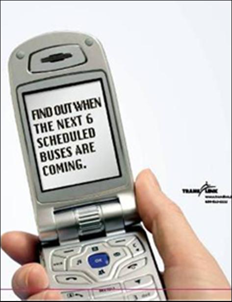
43 Bus Arrival Times 44
MBTA Key Bus Route. Community Meeting Route 1 - Cambridge
 MBTA Key Bus Route Improvement Program Community Meeting Route 1 - Cambridge Cambridge Senior Center, Central Square Agenda Welcome and introductions Safety briefing/accommodations Key Bus Route Program
MBTA Key Bus Route Improvement Program. Community Meeting Route 1 - Boston
 MBTA Key Bus Route Improvement Program Community Meeting Route 1 - Boston January 24, 2011 USES, 566 Columbus Ave., Boston Agenda Welcome and introductions Safety briefing/accommodations Key Bus Route
MBTA Key Bus Route Improvement Program. Community Meeting Route 28
 MBTA Key Bus Route Improvement Program Community Meeting Route 28 April 5, 2012 Boston Public Library Mattapan Branch Agenda Welcome and introductions Safety briefing/accommodations Key Bus Route Program
MBTA Key Bus Route Improvement Program. Community Meeting Route 66 - Brookline
 MBTA Key Bus Route Improvement Program Community Meeting Route 66 - Brookline February 9, 2011 Brookline Town Hall, 333 Washington St., Brookline Agenda Welcome and introductions Safety briefing/accommodations
MBTA Key Bus Route. Community Meeting Route 66 - Boston
 MBTA Key Bus Route Improvement Program Community Meeting Route 66 - Boston Jackson Mann Community Center Agenda Welcome and introductions Safety briefing/accommodations Key Bus Route Program overview Existing
CURBSIDE ACTIVITY DESIGN
 5 CURBSIDE ACTIVITY DESIGN This chapter provides design guidance for separated bike lanes adjacent to curbside activities including parking, loading and bus stops. Typical configurations are presented
Roadways. Roadways III.
 Introduction 97 Roadway Design Principles 98 Safe Speeds 99 Optimizing of Street Space 00 Minimum Lane Widths in the City of Boston 02 Design Features that Reduce Operating Speeds 05 Travel Lanes Transit
Contents. Champaign-Urbana Mass Transit District Stop Placement Guidelines
 Contents Champaign-Urbana Mass Transit District Introduction... 1 Stop Spacing... 2 Rural... 2 Low Density Suburban... 2 General Urban... 2 Urban Core... 2 Operational Safety... 3 Stop Placement... 4 Nearside
GENERAL. 1. Description
 GENERAL 1. Description This standard identifies minimum requirements that shall be met for all Bus Stops in the design and construction of elements for Arlington County Horizontal Design Standards. This
Why invest in the 1 Street S.W. Corridor?
 Why invest in the 1 Street S.W. Corridor? This project is an investment in the Beltline Community and Calgary s economy. It is anticipated that The City s investment along this corridor will help with
TRANSPORT CHICAGO: STRATEGIC PUBLIC TRANSIT BUS RELIABILITY IMPROVEMENTS
 TRANSPORT CHICAGO: STRATEGIC PUBLIC TRANSIT BUS RELIABILITY IMPROVEMENTS Presented by David VanderZee and Jack Chalabian Monday, June 02, 2014 Overview of Strategic Route Management CTA Strategic Route
M14A/D Select Bus Service
 M14A/D Select Bus Service Manhattan Community Board 6: April 1, 2019 New York City Transit 2 Background M14 Select Bus Service M14 was identified as a critical future SBS corridor in past BRT studies as
California Department of Transportation, District 4. Sloat Boulevard Project Skyline Blvd. to 19 th Ave. Community Update January 13, 2016
 California Department of Transportation, District 4 Sloat Boulevard Project Skyline Blvd. to 19 th Ave. Community Update January 13, 2016 Agenda Welcome and introductions Project overview, history and
9. TRANSIT ACCOMMODATIONS
 9. TRANSIT ACCOMMODATIONS INTRODUCTION... 1 FDOT District Four Facilities Guidelines... 1 ESSENTIAL PRINCIPLES OF DESIGNING STREETS FOR TRANSIT... 1 ACCESS TO TRANSIT... 2 BUS STOPS... 3 Layout... 3 -Specific
ALTERNATIVES TO BE CONSIDERED
 ALTERNATIVES TO BE CONSIDERED EXISTING CONDITIONS (BASE CASE) In order to evaluate and understand the potential benefits and impacts of introducing downtown transit improvements in Providence, a Base Case
Building Great Neighbourhoods QUEEN ALEXANDRA
 Building Great Neighbourhoods QUEEN ALEXANDRA We are here today to Explain how the City is investing in improving your neighbourhood and how your neighbourhood will be improved to meet current City standards.
C Line Rapid Bus Preliminary Station Design
 C Line Rapid Bus Preliminary Station Design C Terrence Anderson, Community Outreach Coordinator Shawn Walding, Senior Engineer Metro Transit TAAC February 1, 2016 1 C Line project overview Substantially
Community Task Force November 15, 2017
 Community Task Force November 15, 2017 Welcome and Introductions Project Partners Regional Transportation District (RTD) Colorado Department of Transportation (CDOT) Denver Regional Council of Governments
NJDOT Complete Streets Checklist
 Background The New Jersey Department of Transportation s Complete Streets Policy promotes a comprehensive, integrated, connected multi-modal network by providing connections to bicycling and walking trip
Active Transportation Facility Glossary
 Active Transportation Facility Glossary This document defines different active transportation facilities and suggests appropriate corridor types. Click on a facility type to jump to its definition. Bike
9. TRANSIT ACCOMMODATIONS
 9. TRANSIT ACCOMMODATIONS INTRODUCTION...1 Broward County County-Wide Community Design Guidebook...1 FDOT District Four Transit Facilities Guidelines...2 ESSENTIAL PRINCIPLES OF DESIGNING STREETS FOR TRANSIT...3
Technical Working Group November 15, 2017
 Technical Working Group November 15, 2017 Welcome and Introductions Project Partners Regional Transportation District (RTD) Colorado Department of Transportation (CDOT) Denver Regional Council of Governments
APPENDIX A: Complete Streets Checklist DRAFT NOVEMBER 2016
 APPENDIX A: Complete Streets Checklist DRAFT NOVEMBER 2016 Complete Streets Checklist MetroPlan Orlando s Complete Streets Checklist is an internal planning tool for staff to further implementation of
Brooklyn Boulevard (County Road 152) Reconstruction Project Phase I. OPEN HOUSE June 20, 2017
 Reconstruction Project Phase I. OPEN HOUSE June 20, 2017") Brooklyn Boulevard (County Road 152) Reconstruction Project Phase I OPEN HOUSE June 20, 2017 Brooklyn Boulevard (County Road 152) Phase I Project Partners Project Lead Other Project Partners include Brooklyn
Brooklyn Boulevard (County Road 152) Reconstruction Project Phase I OPEN HOUSE June 20, 2017 Brooklyn Boulevard (County Road 152) Phase I Project Partners Project Lead Other Project Partners include Brooklyn
Chapter 3 BUS IMPROVEMENT CONCEPTS
 Chapter 3 BUS IMPROVEMENT CONCEPTS The purpose of this chapter is to describe potential bus improvement strategies and potential impacts or implications associated with BRT implementation within the existing
2017 Temporary traffic control guidelines for pedestrians. v.2
 2017 Temporary traffic control guidelines for pedestrians v.2 Temporary Traffic Control Guidelines for Pedestrians (2017) The safety and mobility of pedestrians, cyclists and motorists must be considered
Henderson Ave. Complete Streets Project
 Henderson Ave. Complete Streets Project Meeting Purpose To finalize conceptual components of project prior to proceeding with preliminary engineering www.dallascompletestreets.wordpress.com MeetingAgenda
Guidance. ATTACHMENT F: Draft Additional Pages for Bicycle Facility Design Toolkit Separated Bike Lanes: Two-Way to One-Way Transitions
 ATTACHMENT F: Draft Additional Pages for Bicycle Facility Design Toolkit Separated Bike Lanes: Two-Way to One-Way Transitions This treatment provides a transition from two-way separated bike lanes to one-way
STEERING COMMITTEE MEETING June 17, Streetscape Overview Burlington Comprehensive Master Plan
 STEERING COMMITTEE MEETING June 17, 2015 Streetscape Overview Burlington Comprehensive Master Plan 1 Introduction Slide This slide show was presented to the Burlington Steering Committee on June 17, 2015
Geary Corridor Bus Rapid Transit
 Geary Corridor Bus Rapid Transit Near-term Improvements Update SAN FRANCISCO COUNTY TRANSPORTATION AUTHORITY SAN FRANCISCO MUNICIPAL TRANSPORTATION AGENCY Phasing Packages Phase 1 Near-term: Delivers project
Caltrans Sloat Boulevard Pedestrian Safety Project Response to Community Questions, Comments & Concerns
 Caltrans Sloat Boulevard Pedestrian Safety Project Response to Community Questions, Comments & Concerns Revised: May 10, 2016 The California Department of Transportation (Caltrans) is planning various
Public Works Committee Meeting Richard E. Mastrangelo Council Chamber November 20, 2017
 Public Works Committee Meeting Richard E. Mastrangelo Council Chamber November 20, 2017 Purpose of Meeting Why are we here? Project Recap/Updates Project Limits/Segments Road Diet Concept Lessons Learned
S T A T I O N A R E A P L A N
 The Circulation and Access Plan describes vehicle, pedestrian, and transit improvements recommended within the Concept Plan. In order to create and sustain a vibrant business district that provides pedestrian-friendly
ABOUT THIS OPEN HOUSE
 ABOUT THIS OPEN HOUSE Welcome, and thanks for joining us today for the Folsom-Howard Near-Term Project! The purpose of today s open house is to: Understand how the near-term project ties into the larger
MASSACHUSETTS AVENUE BRIDGE REPLACEMENT PROJECT APRIL 25, 2018
 MASSACHUSETTS AVENUE BRIDGE REPLACEMENT PROJECT APRIL 25, 2018 AGENDA Introductions Project Benefits Progress to Date Schedule for Remaining Work Phase 3 Activities, Impacts & Traffic Detours Phase 4 Activities
Bus Rapid Transit ALTERNATIVES ANALYSIS. Open House
 Bus Rapid Transit ALTERNATIVES ANALYSIS Open House June 23, 2015 Open House Meeting Agenda Agenda Introductions What is BRT? Project Goals Study Tasks Next steps Discussion PVTA Bus Rapid Transit Study
MEMORANDUM. TO: Transportation Planning and Programming Committee December 4, 2008 of the Boston Region Metropolitan Planning Organization
 MEMORANDUM TO: Transportation Planning and Programming Committee December 4, 2008 of the Boston Region Metropolitan Planning Organization FROM: Mark S. Abbott, PE Efi Pagitsas RE: MBTA Transit Signal Priority
MUNI FORWARD Proposed Changes: Stanyan
 MUI FORWARD Proposed Changes: Stanyan Clayn ew Transit Remove Sps at Stanyan St at Stanyan St at Cole St Allows right turning aus clear the left turn lane, reducing the delay buses experience due heavy
Building Great Neighbourhoods BELLEVUE AND VIRGINIA PARK
 Building Great Neighbourhoods BELLEVUE AND VIRGINIA PARK This is Meeting 2 Unfortunately, some residents in Bellevue and Virginia Park received the wrong information for this public open house (Meeting
MASONIC AVENUE STREET DESIGN STUDY Community Workshop 2. Masonic Ave Street Design Study Community Workshop 2 August 10, 2010
 Masonic Ave Street Design Study Community Workshop 2 August 10, 2010 Introduction MASONIC AVENUE STREET DESIGN STUDY Community Workshop 2 SF Municipal Transportation Agency Javad Mirabdal, Project Manager
Better Market Street. Engineering, Maintenance & Safety Committee (EMSC) February 28, 2018
 February 28, 2018") Better Market Street Engineering, Maintenance & Safety Committee (EMSC) February 28, 2018 1 Market Street Market Street - San Francisco by rulenumberone2 2 Market Street is the... City s busiest pedestrian
Better Market Street Engineering, Maintenance & Safety Committee (EMSC) February 28, 2018 1 Market Street Market Street - San Francisco by rulenumberone2 2 Market Street is the... City s busiest pedestrian
Southside Pilot Proposal
 To improve bicycle access and mobility to UC Berkeley, Downtown Berkeley, and the Southside area, a pilot project could include a two-way parking-protected cycle track. Turn pockets and island bus stops
February 2018 HIGHWAY 316 IMPROVEMENTS PROJECT
 February 2018 HIGHWAY 316 IMPROVEMENTS PROJECT Agenda 1 2 3 4 5 A Message from the City Project Area Traffic Conditions Pedestrian/Bicycle Comfort & Safety Next Steps Q&A City of Hastings Supports a study
Welcome! Thank you for joining us today for a Geary Rapid project open house. Geary Rapid Project. SFMTA.com/GearyRapid
 Welcome! Thank you for joining us today for a Geary Rapid project open house. Get the most out of this event: 1. Sign in and get your feedback sheet 2. Visit project information stations hosted by project
Station Plan: Penn & 43rd Avenue
 Station Plan: Penn & 43rd Avenue This station will serve the northern portion of the Penn Avenue corridor, including the commercial node at 44th Avenue. Ridership and roadway geometry support station siting
Building Great Neighbourhoods LANSDOWNE
 Building Great Neighbourhoods LANSDOWNE We are here today to Explain how the City is investing in improving your neighbourhood and how your neighbourhood will be improved to meet current City standards.
Southview Blvd & 3 rd Avenue Improvement Project. Public Open House December 4, to 7pm
 Southview Blvd & 3 rd Avenue Improvement Project Public Open House December 4, 2014 5 to 7pm Southview Blvd & 3 rd Avenue Public Information Meeting Agenda Presentation 5:30 to 6:15 pm Purpose of Project
PART A: IDENTIFICATION/LOCATION
 Appendix A. Quick Bus Stop Checklist QUICK BUS STOP CHECKLIST A1 Street Name: PART A: IDENTIFICATION/LOCATION A2 Nearest Cross Street (street name or landmark if mid-block): A3 A4 A5 Bus Route Direction:
Arterial Transitway Corridors Study. Ave
 Arterial Transitway Corridors Study Ave January 2012 Arterial Transitway Corridors Study Overview Corridor Features and Demographics 11 study corridors, 95 route miles 86,000 daily rides and half of existing
Functional, Preliminary Design and Detailed Design
 Functional, Preliminary Design and Detailed Design Main Street (Echo Drive to the Rideau River), Lees Avenue (Main Street to Chestnut Street), and Rideau River Drive (Main Street to 130m south of Main
Knox Street Complete Streets Project
 Knox Street Complete Streets Project Meeting Purpose Get community feedback on two conceptual street design options Meeting Agenda Presentation (20 minutes) Project background and schedule Summary of preferences
Community Meeting February 27, 2007 Dorchester Avenue Transportation & Streetscape Improvements Action Plan February 27, 2007
 Community Meeting Tonight s Agenda 6:00 Introductions South Boston/Dot Ave Improvement Study Background 6:15 Consultant Introductions Review of Scope and Schedule Review of Proposed Corridor Wide Guidelines
MARTIN LUTHER KING JR. WAY
 OCTOBER 2011 40 Vision and Goals The Martin Luther King, Jr. Way Illustrative Master Plan that follows has been developed through a process of community involvement. It expresses a long term vision for
Design Guidelines. Overview. Design Vision for Yellow Brick Road
 Design Guidelines Overview This section presents the design vision for the Yellow Brick Road network. The Yellow Brick Road is envisioned to be an interconnected network of safe and secure roadways where
95 th Street Corridor Transportation Plan. Steering Committee Meeting #2
 95 th Street Corridor Transportation Plan Steering Committee Meeting #2 February 18, 2015 PURPOSE OF THE MEETING Update Steering Committee Present Community/Stakeholder Survey Results Present Transportation
ALTERNATIVE A ONLY. Right Turn Only. BOTH ALTERNATIVES on southbound Mission from 23rd St to 25th St and on northbound Mission from 20th St to 23rd St
 Proposal Detail: 22nd on southbound Mission from on both sides of Mission from to 23rd from at northbound Mission and 22nd St and at at northbound Mission and 23rd St Reconfigure Lanes ONLY No Parking
14 TH STREET TRANSPORTATION & STREETSCAPE DESIGN STUDY PLAN B PLAN B TRANSPORTATION & STREETSCAPE RECOMMENDATIONS
 14 TH STREET TRANSPORTATION & STREETSCAPE DESIGN STUDY PLAN B PLAN B TRANSPORTATION & STREETSCAPE RECOMMENDATIONS 141 Symbols Recommendations - Southern End of 14th Street Study Area Streetscape Each icon
Providence Downtown Transit Connector STAKEHOLDER MEETING #2. Stakeholder Meeting #1 October 24, 2016
 Providence Downtown Transit Connector STAKEHOLDER MEETING #2 Stakeholder Meeting #1 October 24, 2016 February 2017 1 AGENDA 1 DTC Goals and Expectations 2 Street Design Concepts 3 Potential Benefits and
Pedestrian Safety Guide for Transit Agencies
 Pedestrian Safety Guide for Transit Agencies FDOT/FTPA/CUTR Professional Development Workshop June 15, 2010 1 Purpose Presentation Overview Bus Stop Location and Design Process/Partnership 2 Purpose Every
Chicago Safe Routes to School Safe Routes to High School (SRTS/SRTHS)
") Chicago Safe Routes to School Safe Routes to High School (SRTS/SRTHS) Marshall Community High School and Faraday Elementary School Recommended Improvements Agenda Goals Related Programs Project Location/Area
Chicago Safe Routes to School Safe Routes to High School (SRTS/SRTHS) Marshall Community High School and Faraday Elementary School Recommended Improvements Agenda Goals Related Programs Project Location/Area
NEWMARKET UPHAM S CORNER
 SOUTH STATION Planning Initiative NEWMARKET UPHAM S CORNER COLUMBIA ROAD (P) FOUR CORNERS/GENEVA Working Advisory Group (WAG) Meeting #5 TALBOT AVENUE MORTON STREET BLUE HILL AVE/CUMMINS HWY (P) RIVER
6 Screen 3 Analysis and Results
 6 Screen 3 Analysis and Results Introduction This chapter documents the results of the Screen 3 (final) evaluation and screening process. This chapter contains the following elements: Description of the
TORONTO TRANSIT COMMISSION REPORT NO.
 Revised: March/13 TORONTO TRANSIT COMMISSION REPORT NO. MEETING DATE: January 28, 2014 SUBJECT: IMPROVING PEDESTRIAN SAFETY AND CUSTOMER JOURNEY TIMES: TRANSIT STOPS ACTION ITEM RECOMMENDATIONS It is recommended
Rhode Island Bus Stop Design Guide
 Rhode Island Bus Stop Design Guide In partnership with Community Meeting June 2016 Meeting Format Welcome! Presentation Q&A on presentation Break-up Review bus stop design typologies Opportunity to Post-it
Richmond-Adelaide Cycle Tracks
 Public Drop-In Event Richmond-Adelaide Cycle Tracks June 25, 2018 12:00 p.m. 3:00 p.m. 4:30 p.m. 7:30 p.m. Metro Hall, Rotunda 55 John Street 1 Purpose of Event In Scope Communicate an update about the
Eliminate on-street parking where it will allow for a dedicated bus only lane %
 Traffic Dashboard Priorities Survey Responses Introduction 1) Are you familiar with bus rapid transit (BRT)? a. No, BRT is new to me. 597 23.5% b. I ve heard of BRT, but I don t know much about it. 1,136
Southwest Bus Rapid Transit (SW BRT) Functional Planning Study - Executive Summary January 19 LPT ATTACHMENT 2.
 Functional Planning Study - Executive Summary January 19 LPT ATTACHMENT 2.") Southwest Bus Rapid Transit (SW BRT) Functional Planning Study - Executive Summary 2011 January 19 1 of 19 Introduction This executive summary presents the results of the Southwest Bus Rapid Transit (SW
Southwest Bus Rapid Transit (SW BRT) Functional Planning Study - Executive Summary 2011 January 19 1 of 19 Introduction This executive summary presents the results of the Southwest Bus Rapid Transit (SW
HARRISON STREET/OAKLAND AVENUE COMMUNITY TRANSPORTATION PLAN
 HARRISON STREET/OAKLAND AVENUE Community Workshop #4: Draft Plan Review December 3, 2009 D E S I G N, C O M M U N I T Y & E N V I R O N M E N T INTRODUCTIONS Key Project Staff: Alisa Shen, Project Manager,
Geary Bus Rapid Transit Project
 Geary Bus Rapid Transit Project Urban Forestry Council Planning and Funding Committee Meeting September 13, 2016 SAN FRANCISCO COUNTY TRANSPORTATION AUTHORITY SAN FRANCISCO MUNICIPAL TRANSPORTATON AGENCY
City of Albert Lea Policy and Procedure Manual 4.10 ALBERT LEA CROSSWALK POLICY
 4.10 ALBERT LEA CROSSWALK POLICY PURPOSE: Pedestrian crosswalks are an integral part of our transportation infrastructure. To be effective and promote safety, marked crosswalks must be installed after
MONTGOMERY COUNTY PLANNING DEPARTMENT
 MONTGOMERY COUNTY PLANNING DEPARTMENT THE MARYLAND-NATIONAL CAPITAL PARK AND PLANNING COMMISSION Veirs Mill Corridor Master Plan: Work Session #5 MCPB Item No. Date: 10/04/18 Jessica McVary, Planner Coordinator,
ECONOMY PEOPLE ENVIRONMENT
 Report Back on Local Transit Improvements May 29, 2013 ECONOMY PEOPLE ENVIRONMENT Intro Council Requested Report Back Topics Progress on Planning for Broadway Subway False Creek Bridges Local Transit Improvements
Building Great Neighbourhoods BONNIE DOON
 Building Great Neighbourhoods BONNIE DOON We Are Here Today To Explain the Neighbourhood Renewal Process Show you the Westwood Preliminary Design Ask for local knowledge Highlight the Local Improvement
Project Goals Project Limits Boston Bikes Data Existing Conditions Proposed Options Discussion
 COMMERCIAL STREET/ ATLANTIC AVENUE BICYCLE FACILITIES Toole Design Group Nick Jackson Michelle Langone Danila, P.E., PTOE April 28, 2011 Presentation Outline Project Goals Project Limits Boston Bikes Data
Traffic Circulation & Pedestrian Safety Study
 Lyons Township High School North Campus La Grange, Illinois Parking Lot Vaughan Building N Main Building Prepared for: Prepared by: July 23, 2015 Contents List of Figures, iii 1. Introduction...1 2. Existing
BD RESOLUTION NO RESOLUTION ADOPTING THE VISION ZERO RAMP INTERSECTION STUDY PHASE 1
 BD00 RESOLUTION NO. - RESOLUTION ADOPTING THE VISION ZERO RAMP INTERSECTION STUDY PHASE [NTIP PLANNING] FINAL REPORT WHEREAS, The Vision Zero Ramp Intersection Study Phase was recommended by Commissioner
NY 5 BRT Conceptual Design Study: Study Advisory Committee Meeting 1. with Creighton Manning Engineering, LLP Logitrans Herb Levinson
 NY 5 BRT Conceptual Design Study: Study Advisory Committee Meeting 1 with Creighton Manning Engineering, LLP Logitrans Herb Levinson September 22, 2003 Overview Introduction to the consultant team Goals
MASTER BICYCLE AND PEDESTRIAN PLAN
 VILLAGE OF NORTHBROOK MASTER BICYCLE AND PEDESTRIAN PLAN DRAFT PLAN OPEN HOUSE May 2, 2018 AGENDA 1. Community Engagement 2. Vision and Goals 3. General Structure of Plan 4. Recommendations Overview 5.
Scope of the Transit Priority Project
 Transit Planning Committee #1 March 19, 2015 Scope of the Transit Priority Project Review of the 2010 plan Analysis of Transit Priority Measures Preliminary plans for rapid transit Recommendations for
Columbia Pike Implementation Team (CPIT) Meeting
 Meeting") Columbia Pike Implementation Team (CPIT) Meeting November 30, 2010 Agenda Introductions / Purpose of Meeting Review of project goals Multimodal project: 10% street design between the curbs Discussion Multimodal
Columbia Pike Implementation Team (CPIT) Meeting November 30, 2010 Agenda Introductions / Purpose of Meeting Review of project goals Multimodal project: 10% street design between the curbs Discussion Multimodal
Crystal City Potomac Yard Transitway. Enforcement Ordinance & Construction Update
 Enforcement Ordinance & Construction Update December 2015 Project Purpose Provide high-capacity, high-quality transit service Support redevelopment in Crystal City and in Potomac Yard in Alexandria and
MASONIC AVENUE STREET DESIGN STUDY Community Workshop 3. Masonic Ave Street Design Study Community Workshop 3 September 30, 2010
 Masonic Ave Street Design Study Community Workshop 3 September 30, 2010 Introduction MASONIC AVENUE STREET DESIGN STUDY Community Workshop 3 SF Municipal Transportation Agency Javad Mirabdal, Project Manager
Mission-Geneva Transportation Study Community Workshop 2 July 8, 2006
 Community Workshop 2 July 8, 2006 Small Group Workbook 1 Basic Improvements on Mission Street Streetscape. Pedestrian-scale lighting; landscaping; community art on utility boxes; more (possibly unique)
SAN FRANCISCO MUNICIPAL TRANSPORTATION AGENCY
 THIS PRINT COVERS CALENDAR ITEM NO.: 11 DIVISION: Transit Services BRIEF DESCRIPTION: SAN FRANCISCO MUNICIPAL TRANSPORTATION AGENCY Approving the installation of traffic and parking modifications along
Polk Streetscape Project
 What is this project? The Polk Streetscape Project is an effort to improve safety for everyone traveling on Polk Street between Union and McAllister streets. Also included in this project are paving, sewer
EMPHASIS AREA 1: PEDESTRIANS
 EMPHASIS AREA 1: PEDESTRIANS A pedestrian is seriously injured or killed every 3 days on Toronto s roads. Pedestrian collisions involve any person that is not riding in a vehicle or on a bicycle. 26% OF
Watertown Complete Streets Prioritization Plan. Public Meeting #1 December 14, 2017
 Watertown Complete Streets Prioritization Plan Public Meeting #1 December 14, 2017 Goals for Public Meeting Overview of MassDOT Complete Streets Funding Program Educate the community on Complete Streets
4 MOBILITY PLAN. Mobility Plan Objectives. Mobility Context. 1. Integrate with Local and Regional Transit Improvements
 Harbor Mixed Use CHAPTER Transit Corridor 4: Mobility Plan 4 MOBILITY PLAN Mobility Plan Objectives The Harbor Corridor Plan seeks to expand and improve the ways that people move along and through the
Agenda. Overview PRINCE GEORGE S PLAZA METRO AREA PEDESTRIAN PLAN
 PRINCE GEORGE S PLAZA METRO AREA PEDESTRIAN PLAN May 28, 2008 Agenda Welcome and introductions Project overview and issue identification Planning context and strengths Design challenges and initial recommendations
Vermont Rail conversion/feasibility Study
 Vermont Rail conversion/feasibility Study Stakeholder Meetings May 2018 Welcome https://www.youtube.com/watch?v=jcg3cjutk80 Purpose of Tonight s Meeting > Provide a study overview > Solicit feedback and
Appendix C. TRAFFIC CALMING PROGRAM TOOLBOX
 Appendix C. TRAFFIC CALMING PROGRAM TOOLBOX PHASE I...2 Do Not Enter Sign...3 One-Way Sign...4 Turn Prohibition...5 Pavement Markings...6 Speed Monitoring Trailer...7 Neighborhood Speed Watch...8 Police
Indiana University Campus Bus Service. Bus Stop Consolidation
 Indiana University Campus Bus Service Bus Stop Consolidation Logan Garrett 3/17/2011 1 Contents Overview... 3 Campus Core... 3 Third Street (Between Jordan Ave. and Indiana Ave.)... 3 Current Stop Spacing...
Downtown BRT Corridor Alternatives Review: 1 st, 2 nd, 3 rd and 4 th Avenue. Bus Rapid and Conventional Transit Planning and Design Services
 Downtown BRT Corridor Alternatives Review: 1 st, 2 nd, 3 rd and 4 th Avenue Bus Rapid and Conventional Transit Planning and Design Services City of Saskatoon February 2018 Project Team HDR Corporation
West Dimond Blvd Upgrade Jodhpur Street to Sand Lake Road
 West Dimond Blvd Jodhpur St to Sand Lake CSS Transportation Project Summary Municipality of Anchorage Project # 05 005 Project Manager: John Smith, P.E. (MOA PM&E) Project Administrator: Julie Makela,
Figure 5-1 Complete Street Zones. Roadside. May include frontage, pedestrian throughway, furnishings and curbside areas.
 Design Guidelines 5 The design guidelines presented in this section provide descriptions related to the form and function of the four Complete Streets zones: roadside, parking, roadways and lanes, median,
MOBILITY WORKSHOP. Joint City Council and Transportation Commission May 5, 2014
 MOBILITY WORKSHOP Joint City Council and Transportation Commission May 5, 2014 Review of General Plan M-1 Develop world-class transit system M-3 Maintain/enhance pedestrian-oriented City M-4 Create comprehensive
Geary Corridor Bus Rapid Transit: Staff-Recommended Alternative
 Geary Corridor Bus Rapid Transit: Staff-Recommended Alternative Urban Forestry Council January 24, 2014 SAN FRANCISCO COUNTY TRANSPORTATION AUTHORITY SAN FRANCISCO MUNICIPAL TRANSPORTATION AGENCY Today
Traffic Control Signals - Cosburn Avenue and Cedarvale Avenue
 REPORT FOR ACTION Traffic Control Signals - Cosburn Avenue and Cedarvale Avenue Date: April 24, 2017 To: Toronto and East York Community Council From: Acting Director, Transportation Services, Toronto
Item Description: Presentation and Discussion: Berkeley Rapid Transit Locally Preferred Alternative
 Office of the City Manager Meeting Date: April 29, 2010 Item Number: 1 Item Description: Presentation and Discussion: Berkeley Rapid Transit Locally Preferred Alternative Staff report, resolution, and
CHAPTER 16 PEDESTRIAN FACILITIES DESIGN AND TECHNICAL CRITERIA TABLE OF CONTENTS
 CHAPTER 16 PEDESTRIAN FACILITIES DESIGN AND TECHNICAL CRITERIA TABLE OF CONTENTS Section Title Page 16.1 General... 16-1 16.1.1 AASHTO Reference... 16-1 16.1.2 ADA Requirements... 16-1 16.2 Sidewalks...