Estimating Beach Volume Change as a function of Beach Profile Spacing
|
|
|
- Clement Rodgers
- 5 years ago
- Views:
Transcription

1 Estimating Beach Volume Change as a function of Beach Profile Spacing Kevin R. Bodge, Ph.D., P.E. William Reilly, P.E. and Patrick Snyder, P.E. Steve Howard, P.E. Bill Hobensack, P.E. Chris Creed, P.E. Al Browder, Ph.D., P.E. olsen associates, inc. Jacksonville, Florida

2 How does the accuracy of beach volume change estimates vary with fewer beach profile survey lines?
3 BEACH PROFILE SURVEY LINE
4 SURVEY 1 SURVEY 2
5 SURVEY 1 SURVEY 2
6 SURVEY 1 SURVEY 2
7 SURVEY 1 SURVEY 2


8 COMPLETE BEACH PROFILE SURVEY SET R1 R2 R2A R3 R3A R3B R4 R5 R6 R7 R8 R8A R9 R10 APPROX 1000 FT IN FLORIDA (TYPICAL)

9 TYPICAL BEACH PROFILE SURVEYS (1000-FT) R1 R2 R2A R3 R3A R3B R4 R5 R6 R7 R8 R8A R9 R10 APPROX 1000 FT IN FLORIDA (TYPICAL)
")
10 SURVEY EVERY 2000-FT (EVEN) SURVEY EVERY 2000-FT (ODD) R1 R2 R3 R4 R5 R6 R7 R8 R9 R10 APPROX 1000 FT IN FLORIDA (TYPICAL)
 (2) (1) R1 R2 R3")


11 SURVEY EVERY 3000-FT (3) SURVEY EVERY 3000-FT (2) SURVEY EVERY 3000-FT (1) R1 R2 R3 R4 R5 R6 R7 R8 R9 R10 APPROX 1000 FT IN FLORIDA (TYPICAL)

12 Why survey less profile lines?
13 Why survey less profile lines? For long shorelines (3+ miles). Survey costs decrease mostly linearly with number of profiles Analysis costs decrease somewhat with number of profiles Example.. 4-mile shoreline: Savings of $ 6K - $10K to survey every 2 nd or 3 rd line 8-mile shoreline: Savings of $13K - $20K to survey every 2 nd or 3 rd line


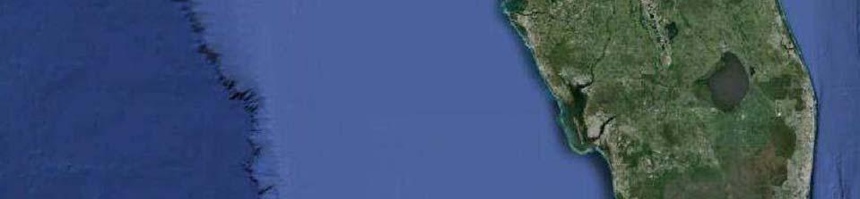
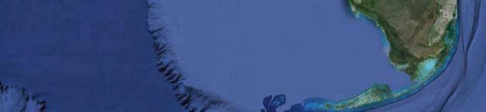
14 Amelia Island R55-R miles
15 AMELIA ISLAND (June 2008 to July 2009) -45% Error relative to ft profile spacing -5% +17% +38%
16 AMELIA ISLAND +10% +20% -6.5% -41% -44%
17 AMELIA ISLAND (June 2013 to June 2013) -5% -7.4% +2% +4% +5.4%
18 AMELIA ISLAND Volume Change above Mean High Water +46% +51% % -61%
19 AMELIA ISLAND Volume Change above Mean High Water +4 to -20% +8 to -6%

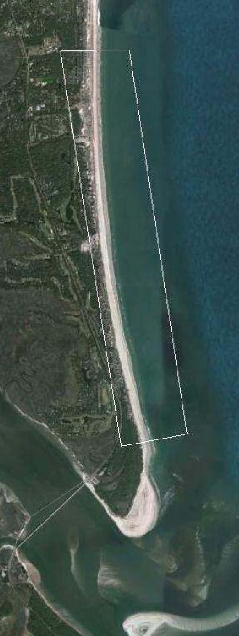
20 Duval County R46-R79 6 miles
21 DUVAL COUNTY -12% ±0.5% +20%
22 DUVAL COUNTY -600% -72% +114% +300%

23 Brevard County North Reach & Patrick AFB R3-R miles
24 BREVARD NORTH REACH +6% +10% <2% -2.5% -9% +44% +2.2% +10% -4.8% -21% -24%
25 Patrick Air Force Base < 1% +9%
26 Patrick Air Force Base < 1% < 4% +9% +13% +25%

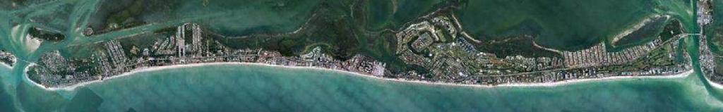
27 Brevard County South Reach R118-R139 4 miles
28 Brevard South Reach +3% +10% -10% -20%
29 Brevard South Reach -61% -81% +73% +135%

30 Segment II Broward County Segments II and III R25 D miles Port Everglades Entrance Segment III

")


31 Broward Segment II ( R25 R85: 11.4 miles north of Port Everglades Entrance) +38% -54% +153% -110% 300, , , , ,000 50, , ,000 Apr '07 - June '08 +1% -1% +102% -90% 1,000 2,000 3,000 Profile Line Spacing (ft) 100,000 50, , , , , , ,000 Feb ' Apr Apr ' % +19% -95% +105% 1,000 2,000 3,000 Profile Line Spacing (ft) 200, ,000 June '08 - Apr '09 100,000 50, , , , ,000-99% +16% -314% +183% 1,000 2,000 3,000 Profile Line Spacing (ft)
32 Broward Segment III (8.7 miles south of Port Everglades Entrance) 38,000 cy 440% 88,000 cy 1000% 25,000 cy 280% 128,000 cy 1400%
33 Broward Segment III (8.7 miles south of Port Everglades Entrance) Feb 06 Apr 07-30% -65% +25% -68%

34 Longboat Key R44 R miles
35 Longboat Key -115% +102%


36 Longboat Key Cumulative alongshore volume change, measured north (left) to south (right)
37 Longboat Key Greatest noise Cumulative alongshore volume change, measured north (left) to south (right)
38 Longboat Key Remove greatest noise Cumulative alongshore volume change, measured north (left) to south (right)
39 Longboat Key -115% 8.6 miles 10 miles +102% Error did not change appreciably when noisy northern 1.4 miles of shoreline is removed from analysis.
40 Longboat Key -50% -28% -9% +2% +16%

41 Longboat Key -50% -9% -28% +2% 10 miles 8.6 miles +16% Error did not change appreciably when noisy northern 1.4 miles of shoreline is removed from analysis.

42 Pensacola Beach R107 R150 8 miles
43 Estimating storm erosion, Florida Panhandle Pensacola Beach ±25% ±45%


44 Errors inherently increase with cuspate or rhythmic bar shorelines. (Thus, there is greatest potential error with large profile spacing along Panhandle beaches.) Pensacola Beach, FL
45 Summary -- All Datasets (volume changes across total profile) Percent volume error (rel. to 1000 profiles) % chance that 2000 spacing will be within 15% of 1000 profile spacing % OCCURRENCE that Error is Less
46 Summary -- All Datasets (volume changes across total profile) Percent volume error (rel. to 1000 profiles) % chance that 3000 spacing will be within 22% of 1000 spacing % OCCURRENCE that Error is Less
47 Summary -- All Datasets (volume changes across total profile) Percent volume error (rel. to 1000 profiles) 75% chance that 2000 or 3000 spacing will be within 50% of 1000 profile spacing % OCCURRENCE that Error is Less
48 Percent Error is a poor descriptor of accuracy among profile spacing (particularly in those cases when the absolute volume change is small). The Absolute Error (volume per ft alongshore) is a more meaningful and consistent descriptor.
49 Summary -- All Datasets (volume changes across total profile) Absolute volume error (cubic yards alongshore) 50% chance that error at 2000 profile spacing will be less than 1.0 cy/ft
50 Summary -- All Datasets (volume changes across total profile) Absolute volume error (cubic yards alongshore) 50% chance that error at 3000 spacing will be less than 1.5 cy/ft
51 Summary -- All Datasets (volume changes across total profile) 75% chance that error at 2000 or 3000 spacing will be less than 2.0 cy/ft, relative to 1000 spacing

52 Observations and Summary Results varied widely within and among all sites and among survey intervals. Found no correlation between error and shoreline length. Found no correlation between error and baseline volume change. The decision to skip profiles might depend upon: - historical error computed from skipping profiles at the specific site - the objective of the survey (e.g., template calculations have low error) Percent error is a poor descriptor of the accuracy of skipping profiles. Absolute error is a better descriptor of accuracy: Overall, relative to 1000-ft profile spacing: 50% probability that error of 2000 spacing will be less than 1.0 cy/ft 50% probability that error of 3000 spacing will be less than 1.5 cy/ft 75% probability that error of 2000 or 3000 spacing will be < 2.0 cy/ft The risk of some error in the data is probably less than having no data at all.
53 Estimating Beach Volume Change as a function of Beach Profile Spacing Kevin R. Bodge, Ph.D., P.E. William Reilly, P.E. and Patrick Snyder, P.E. Steve Howard, P.E. Bill Hobensack, P.E. Chris Creed, P.E. Al Browder, Ph.D., P.E. olsen associates, inc. Jacksonville, Florida
Beach Renourishment in Jacksonville
 Beach Renourishment in Jacksonville Kevin Bodge, PhD, P.E. - Olsen Associates, Inc. 1978 Oct 2004 2000 2016 2011 Oct 2016 Coastal Duval County, FL Nassau Sound Blount Island Ft. George Inlet St. Johns
Regular Workshop October 20, 2014 Agenda Item: Dr. Albert E. Browder, PE; Olsen Associates, Inc.
 Regular Workshop October 20, 2014 Agenda Item 8 Agenda Item: Presenter: Summary: Beach Update Town Manager; Dr. Albert E. Browder, PE; Olsen Associates, Inc. At the January 21, 2014 Regular Workshop Meeting,
CHAPTER 281 INFLUENCE OF NEARSHORE HARDBOTTOM ON REGIONAL SEDIMENT TRANSPORT
 CHAPTER 281 INFLUENCE OF NEARSHORE HARDBOTTOM ON REGIONAL SEDIMENT TRANSPORT Paul C.-P. Lin, Ph.D., P.E. 1 and R. Harvey Sasso, P.E. 2 ABSTRACT The influence of nearshore hardbottom on longshore and cross-shore
Town of Duck, North Carolina
 Tracking No. 00.00.2010 Erosion Mitigation And Shoreline Management Feasibility Study Town of Duck, North Carolina Coastal Planning & Engineering of North Carolina August 15, 2012 Tom Jarrett Robert Neal
Changes in Beach Profile and Grain Size after Beach Renourishment
 Kevin Bodge, PE PhD Krista Egan, EI olsen associates, inc. and Mike McGarry Brevard County Natural Resources Mgt. Dept. Changes in Beach Profile and Grain Size after Beach Renourishment February 2018 Beach
Table 4. Volumetric Change Rates Pre-Project and Post-Project for the Town of Duck
 V. VOLUMETRIC CHANGES General Volumetric changes measured over the entire monitoring area for various time periods are provided in Table 4. The volume changes are given in terms of cubic yards/foot of
Beach Restoration in Okaloosa and Walton Counties. FSBPA Technology Conference Clearwater, FL
 Beach Restoration in Okaloosa and Walton Counties FSBPA Technology Conference Clearwater, FL Presented by: Duncan Greer, E.I. February 5, 2015 PRESENTATION OUTLINE 1. Overview of Project Locations 2. Eglin
Protecting our Beaches
 Protecting our Beaches South Amelia Island Shore Stabilization Project Nassau County, FL Mr. Drew Wallace President South Amelia Island Shore Stabilization Association (SAISSA) Mr. Bill Moore, AICP Project
Beach Nourishment Impact on Beach Safety and Surfing in the North Reach of Brevard County, Florida
 Beach Nourishment Impact on Beach Safety and Surfing in the North Reach of Brevard County, Florida Prepared by John Hearin, Ph.D. Coastal Engineering Vice Chairman Cocoa Beach Chapter Port Canaveral Patrick
Things Learned Truck-Hauling over 1 Million Cubic Yards of Sand for Emergency Beach and Dune Projects
 Things Learned Truck-Hauling over 1 Million Cubic Yards of Sand for Emergency Beach and Dune Projects Mike McGarry Brevard County Natural Resources Management Office Watershed Management Program Cocoa
FINAL ENVIRONMENTAL IMPACT STATEMENT ON BROWARD COUNTY SHORE PROTECTION PROJECT SEGMENTS II AND III BROWARD COUNTY, FLORIDA
 FINAL ENVIRONMENTAL IMPACT STATEMENT ON BROWARD COUNTY SHORE PROTECTION PROJECT SEGMENTS II AND III BROWARD COUNTY, FLORIDA 1. PROJECT PURPOSE AND NEED 1.1. PROJECT AUTHORITY. 1.1.1. INITIAL AUTHORIZATION.
BEACH FILL CONSTRUCTION USING SEABED REHANDLING AREAS. Kevin R. Bodge, Ph.D., P.E. 1
 Proceedings, 28 th International Conference on Coastal Engineering. 2002. World Scientific Publishing Co. Pte. Ltd. Volume 3 - ISBN 981-238-984-9. pp. 3736-3747 BEACH FILL CONSTRUCTION USING SEABED REHANDLING
APPENDIX B ENGINEERING DESIGN AND COST ESTIMATES BROWARD COUNTY, FLORIDA SHORE PROTECTION PROJECT GENERAL REEVALUATION REPORT SEGMENT III
 APPENDIX B ENGINEERING DESIGN AND COST ESTIMATES BROWARD COUNTY, FLORIDA SHORE PROTECTION PROJECT GENERAL REEVALUATION REPORT SEGMENT III APPENDIX B ENGINEERING DESIGN AND COST ESTIMATES BROWARD COUNTY,
STATE OF THE COAST 2016 Coastal Frontiers Corporation June 1, 2017
 STATE OF THE COAST 2016 Coastal Frontiers Corporation June 1, 2017 Shoreline Preservation Committee 1. Background OVERVIEW 2. Monitoring Program 3. Results 2015-16 El Niño Post-RBSP II Post-RBSP I 4. Conclusions
STATUS REPORT FOR THE SUBMERGED REEF BALL TM ARTIFICIAL REEF SUBMERGED BREAKWATER BEACH STABILIZATION PROJECT FOR THE GRAND CAYMAN MARRIOTT HOTEL
 August 23 STATUS REPORT FOR THE SUBMERGED REEF BALL TM ARTIFICIAL REEF SUBMERGED BREAKWATER BEACH STABILIZATION PROJECT FOR THE GRAND CAYMAN MARRIOTT HOTEL performed by Lee E. Harris, Ph.D., P.E. Consulting
Effectiveness of Beach Nourishment in Response to Sea Level Rise
 2014 FSBPA Annual Conference Effectiveness of Beach Nourishment in Response to Sea Level Rise Navarre Beach Santa Rosa County July 18, 2005 Lovers Key Lee County April 23, 2012 South County St. Lucie County
2013 FEDERAL STORM RESPONSE
 2013 FEDERAL STORM Presented to the Florida Shore & Beach Association Sep 26, 2013 Presented by: COL Alan Dodd Commander, Jacksonville District September 2013 THE COLLABORATION 2 THE PROGRAM 3 THE STORMS
Long Term Success and Future Approach of the Captiva and Sanibel Islands Beach Renourishment Program
 2017 National Conference on Beach Preservation Technology February 8-10, 2017; Stuart, Florida Long Term Success and Future Approach of the Captiva and Sanibel Islands Beach Renourishment Program Thomas
UPPER BEACH REPLENISHMENT PROJECT RELATED
 ASSESSMENT OF SAND VOLUME LOSS at the TOWNSHIP of UPPER BEACH REPLENISHMENT PROJECT RELATED to the LANDFALL OF HURRICANE SANDY - PURSUANT TO NJ-DR 4086 This assessment is in response to Hurricane Sandy
Volume and Shoreline Changes along Pinellas County Beaches during Tropical Storm Debby
 Volume and Shoreline Changes along Pinellas County Beaches during Tropical Storm Debby Ping Wang and Tiffany M. Roberts Coastal Research Laboratory University of South Florida July 24, 2012 Introduction
CLAM PASS RESTORATION AND MANAGEMENT PLAN BATHYMETRIC MONITORING REPORT NO. 7 Including Interior Bay Dredge Cuts and Tidal Data
 CLAM PASS RESTORATION AND MANAGEMENT PLAN BATHYMETRIC MONITORING REPORT NO. 7 Including Interior Bay Dredge Cuts and Tidal Data Submitted to: Florida Department of Environmental Protection DEP File No.
RE: Hurricane Matthew Beach Damage Assessment and Recommendations [CSE 2416]
![RE: Hurricane Matthew Beach Damage Assessment and Recommendations [CSE 2416]](/thumbs/83/87675702.jpg "RE: Hurricane Matthew Beach Damage Assessment and Recommendations [CSE 2416]") October 25, 2016 Iris Hill Town Administrator Town of Edisto Beach 2414 Murray St Edisto Beach SC 29438 RE: Hurricane Matthew Beach Damage Assessment and Recommendations [CSE 2416] Dear Iris, Hurricane
October 25, 2016 Iris Hill Town Administrator Town of Edisto Beach 2414 Murray St Edisto Beach SC 29438 RE: Hurricane Matthew Beach Damage Assessment and Recommendations [CSE 2416] Dear Iris, Hurricane
ST. JOSEPH PENINSULA, GULF COUNTY, FLORIDA Beach Re-Nourishment and Environmental Enhancement Project RECOMMENDATIONS
 ST. JOSEPH PENINSULA, GULF COUNTY, FLORIDA Beach Re-Nourishment and Environmental Enhancement Project RECOMMENDATIONS January 23, 2018 543 Harbor Boulevard, Suite 204 Destin, Florida 32541 850.654.1555
Impact of Hurricane Matthew on the Atlantic Coast of Florida
 Impact of Hurricane Matthew on the Atlantic Coast of Florida A coastal engineer was driving across country and his jeep broke down in front of a monastery. It was late in the day and the monks invited
KEYNOTE PRESENTATION FSBPA olsen
 AMELIA ISAND, FLORIDA BEACH MANAGEMENT PARTNERING AND PERSERVERENCE Erik Olsen, PE associates, inc. KEYNOTE PRESENTATION FSBPA 2009 IN ORDER TO ADDRESS SHORE PROTECTION TODAY LOCAL INTERESTS PARTNER WITH:
Performance of Upham Beach T-Groin Project and Its Impact to the Downdrift Beach
 Performance of Upham Beach T-Groin Project and Its Impact to the Downdrift Beach Progress Report for the Period of October 2008 to April 2009 Submitted by Ping Wang, Ph.D., and Tiffany M. Roberts Department
STORM RESPONSE SIMULATION
 APPENDIX V STORM RESPONSE SIMULATION Final Environmental Impact Statement Village of Bald Head Island Shoreline Protection Project Brunswick County, North Carolina Delft3D Storm Response Simulations With
SACO RIVER AND CAMP ELLIS BEACH SACO, MAINE SECTION 111 SHORE DAMAGE MITIGATION PROJECT APPENDIX F ECONOMIC ASSESSMENT
 SACO RIVER AND CAMP ELLIS BEACH SACO, MAINE SECTION 111 SHORE DAMAGE MITIGATION PROJECT APPENDIX F ECONOMIC ASSESSMENT Department of the Army New England District, Corps of Engineers 696 Virginia Road
Sussex County, DE Preliminary Study Overview
 Sussex County, DE Preliminary Study Overview Coastal study scope: 102 miles of entire County shoreline Revised 102 panels for coastal study Riverine study scope: 14 streams, 67.1 miles, within the Nanticoke
23- Year Sand Volume Changes at Site 132, 15th Street, Brigantine
 149 Figure75. Location map for the 9 NJBPN profile sites in Atlantic County, NJ ATLANTIC COUNTY SPRING 2008 to FALL 2009 150 The Atlantic County oceanfront shoreline consists of three barrier islands.
APPENDIX A ENGINEERING DESIGN AND COST ESTIMATE BROWARD COUNTY, FLORIDA SHORE PROTECTION PROJECT GENERAL REEVALUATION REPORT SEGMENT II
 APPENDIX A ENGINEERING DESIGN AND COST ESTIMATE BROWARD COUNTY, FLORIDA SHORE PROTECTION PROJECT GENERAL REEVALUATION REPORT SEGMENT II APPENDIX A ENGINEERING DESIGN AND COST ESTIMATES BROWARD COUNTY,
2018 Annual Beach Monitoring Report
 May 1, 218 Town of Hilton Head Island, SC 218 Annual Beach Monitoring Report Submitted to: Town of Hilton Head Island, SC November 15, 217 Prepared by: Olsen Associates, Inc. 2618 Herschel Street Jacksonville,
Trusted Partners Delivering Value, Today and Tomorrow BUILDING STRONG
 Miami-Dade County Renourishment Project U.S. Army Corps of Engineers Jacksonville District January 5, 2017 US Army Corps of Engineers Project Purpose coastal storm risk management beach erosion control
Tanya M. Beck. Kelly Legault. Research Physical Scientist Coastal & Hydraulics Lab, ERDC Vicksburg, MS
 Inlet And Adjacent Shoreline Processes at Cascading Time Scales Using the Coastal Modeling System and GenCade Tanya M. Beck Research Physical Scientist Coastal & Hydraulics Lab, ERDC Vicksburg, MS Kelly
CHAPTER 179. Performance of a Submerged Breakwater for Shore Protection
 CHAPTER 179 Abstract Performance of a Submerged Breakwater for Shore Protection Albert E. Browder',A. Member, ASCE; Robert G. Dean 2, Member, ASCE; and Renjie Chen 3 A summary is presented of the results
Town of Duck, North Carolina
 Tracking No. 00.00.2010 Erosion Mitigation And Shoreline Management Feasibility Study Town of Duck, North Carolina Coastal Planning & Engineering of North Carolina February 28, 2013 Ken Willson 1 Tracking
Figure79. Location map for the 10 NJBPN profile sites in Atlantic County, NJ 155
 154 Figure79. Location map for the 10 NJBPN profile sites in Atlantic County, NJ 155 ATLANTIC COUNTY SPRING 2009 to FALL 2010 The Atlantic County coastline consists of three barrier islands. Between Little
A PHYSICAL AND BIOLOGICAL SURVEY OF THE MID-REACH MITIGATION REEF SET NUMBER 1
 A PHYSICAL AND BIOLOGICAL SURVEY OF THE MID-REACH MITIGATION REEF SET NUMBER 1 John M. Hearin, Ph.D., P.E. 1 ; Geoff Swain, Ph.D. 2 ; Robert Weaver, Ph.D., P.E. 2 ; Kelli Z. Hunsucker, Ph.D. 2 ; Caglar
MOREHEAD CITY HARBOR, NC. Dredged Material Management Plan (DMMP)
") MOREHEAD CITY HARBOR, NC Dredged Material Management Plan (DMMP) Public Meeting/Info Session 15 January 2014 US Army Corps of Engineers Morehead City Harbor DMMP Presentation Topics Morehead City Harbor
MOREHEAD CITY HARBOR, NC Dredged Material Management Plan (DMMP) Public Meeting/Info Session 15 January 2014 US Army Corps of Engineers Morehead City Harbor DMMP Presentation Topics Morehead City Harbor
CMS Modeling of the North Coast of Puerto Rico
 CMS Modeling of the North Coast of Puerto Rico PRESENTED BY: Dr. Kelly Rankin Legault, Ph.D., P.E. 1 Dr. Alfredo Torruella, Ph.D. 2 1 USACE Jacksonville District 2 University of Puerto Rico October 2016
CROSS-SHORE SEDIMENT PROCESSES
 The University of the West Indies Organization of American States PROFESSIONAL DEVELOPMENT PROGRAMME: COASTAL INFRASTRUCTURE DESIGN, CONSTRUCTION AND MAINTENANCE A COURSE IN COASTAL DEFENSE SYSTEMS I CHAPTER
Nearshore Dredged Material Placement Pilot Study at Noyo Harbor, CA
 1 Nearshore Dredged Material Placement Pilot Study at Noyo Harbor, CA Noyo Cove N 2011 National Conference on Beach Preservation Technology 9-11, February 2011 Lihwa Lin, Honghai Li, Mitchell Brown US
Inlet Management Study for Pass-A-Grille and Bunces Pass, Pinellas County, Florida
 Inlet Management Study for Pass-A-Grille and Bunces Pass, Pinellas County, Florida Final Report Submitted By Ping Wang, Ph.D., Jun Cheng Ph.D., Zachary Westfall, and Mathieu Vallee Coastal Research Laboratory
How beach nourishment has impacted the surf breaks of Cape Canaveral and Cocoa Beach, Florida
 How beach nourishment has impacted the surf breaks of Cape Canaveral and Cocoa Beach, Florida A white paper prepared by John M. Hearin Ph.D., P.E. Ocean Engineer with assistance from Cocoa Beach Chapter
Navarre Beach & Dune Restoration Project Status Report to be regularly updated June 17, 2016 Report
 Navarre Beach & Dune Restoration Project Status Report to be regularly updated June 17, 2016 Report Work Completed (June 11 to June 17) Weeks Marine Inc. (Contractor): o continued filling Segment 4 including
SFM mapping of coastal erosion at Point Woronzof. Gennady Gienko, PhD Department of Geomatics, UAA
 SFM mapping of coastal erosion at Point Woronzof Gennady Gienko, PhD Department of Geomatics, UAA ggienko@alaska.edu POINT WORONZOF Point Woronzof bluff 135 ft elevation Point Woronzof bluff Pt. Woronzof
Beach Nourishment, Static Lines, and Static Line Exceptions
 Beach Nourishment, Static Lines, and Static Line Exceptions Matt Slagel, Shoreline Management Specialist Coastal Resources Commission February 26, 2014 Nags Head Defining the Static Line Defining the Static
On The Relationship Between Missing Shoulder Ballast and Development of Track Geometry Defects
 On The Relationship Between Missing Shoulder Ballast and Development of Track Geometry Defects Professor Allan M. Zarembski 1, Gregory T. Grissom 2, Todd l. Euston 2, John J. Cronin 3. 1 University of
Concentration and Upstream Migration of Postlarval Pink Shrimp in Northern Florida Bay
 Concentration and Upstream Migration of Postlarval Pink Shrimp in Northern Florida Bay Maria M. Criales Joan A. Browder Michael B. Robblee Thomas L. Jackson Hernando Cardenas Outline Question Hypothesis
Chapter 15 SEASONAL CHANGES IN BEACHES OP THE NORTH ATLANTIC COAST OF THE UNITED STATES
 Chapter 15 SEASONAL CHANGES IN BEACHES OP THE NORTH ATLANTIC COAST OF THE UNITED STATES By John M. Darling Hydraulic Engineer, Research Division U. S. Army Coastal Engineering Research Center Corps of
HURRICANE SANDY LIMITED REEVALUATION REPORT UNION BEACH, NEW JERSEY DRAFT ENGINEERING APPENDIX SUB APPENDIX D SBEACH MODELING
 HURRICANE SANDY LIMITED REEVALUATION REPORT UNION BEACH, NEW JERSEY DRAFT ENGINEERING APPENDIX SUB APPENDIX D SBEACH MODELING Rev. 18 Feb 2015 1 SBEACH Modeling 1.0 Introduction Following the methodology
New Jersey Beach Profile Network Atlantic County Profile Site Locations
 215 RICHARD STOCKTON COLLEGE OF NEW JERSEY New Jersey Beach Profile Network Atlantic County Profile Site Locations COASTAL RESEARCH CENTER Figure 128 There are nine NJBPN survey sites on the Atlantic County
Figure 262. Location map for the 10 NJBPN profile sites in Atlantic County, NJ 279
 278 Figure 262. Location map for the 10 NJBPN profile sites in Atlantic County, NJ 279 ATLANTIC COUNTY SUMMARY The Atlantic County coastline consists of three barrier islands. The island of Little Beach
Shoreline. Page. About Shoreline
 Page About Page 2 Pinellas County is the local sponsor for three Federal Shore Protection Projects on the barrier islands (Figure 1) of Sand Key, Treasure Island, and Long Key. The Army Corp is also authorized
Population workforce, and employment in Florida :
 University of South Florida Scholar Commons College of Business Publications College of Business 1-1-2000 Population workforce, and employment in Florida : 1999-2000 University of South Florida. Center
FIG: 27.1 Tool String
 Bring up Radioactive Tracer service. Click Acquisition Box - Edit - Tool String Edit the tool string as necessary to reflect the tool string being run. This is important to insure proper offsets, filters,
Figure 106. Locations of the 28 NJBPN profile stations in Ocean County, NJ.
 130 Figure 106. Locations of the 28 NJBPN profile stations in Ocean County, NJ. 131 2016-2017 Beach Fills in Ocean County: The federal/state/local storm damage reduction project (beachfill) between Manasquan
ARTIFICIAL REEF CONSTRUCTION: AN ENGINEERED APPROACH. Timothy K. Blankenship, P.E. R. Harvey Sasso, P.E.
 ARTIFICIAL REEF CONSTRUCTION: AN ENGINEERED APPROACH Timothy K. Blankenship, P.E. R. Harvey Sasso, P.E. Coastal Systems International, Inc. 464 South Dixie Highway Coral Gables, Florida 33146 Stephen Higgins
USING A PROBABILITY APPROACH TO RANK IN-LINE INSPECTION ANOMALIES FOR EXCAVATION AND FOR SETTING REINSPECTION INTERVALS
 USING A PROBABILITY APPROACH TO RANK IN-LINE INSPECTION ANOMALIES FOR EXCAVATION AND FOR SETTING REINSPECTION INTERVALS by Dennis C. Johnston and Carolyn E. Kolovich Kiefner & Associates, Inc. P.O. Box
4-3 Rate of Change and Slope. Warm Up. 1. Find the x- and y-intercepts of 2x 5y = 20. Describe the correlation shown by the scatter plot. 2.
 Warm Up 1. Find the x- and y-intercepts of 2x 5y = 20. Describe the correlation shown by the scatter plot. 2. Objectives Find rates of change and slopes. Relate a constant rate of change to the slope of
Dare County Nourishment Project Town of Duck
 Dare County Nourishment Project Town of Duck Julien Devisse, P.E. and Ken Willson CB&I / Coastal Planning & Engineering of North Carolina, Inc. February 15, 2017 A World of Solutions Outline Background
US Beach Nourishment Experience:
 Beach Nourishment: Introduction of new sand to the beach by truck or dredge Large beach >1 million cubic yards (100,000 dump truck loads) Funding is a combination of federal, state, local & private Also
Monitoring Surfing Quality Below the Jordan River Generating Station (Year 3)
") Jordan River Water Use Plan Monitoring Surfing Quality Below the Jordan River Generating Station (Year 3) Reference: JORMON-5 Monitoring Surfing Quality Below the Jordan River Generating Station Study
Jordan River Water Use Plan Monitoring Surfing Quality Below the Jordan River Generating Station (Year 3) Reference: JORMON-5 Monitoring Surfing Quality Below the Jordan River Generating Station Study
The 2017 Panama City Beaches Beach Interim Renourishment Project. Answers to Common Questions
 The 2017 Panama City Beaches Beach Interim Renourishment Project The fourth renourishment of the Panama City Beaches will be under construction during March and April 2017, with a planned completion by
Evaluating Extreme Storm Power and Potential Implications to Coastal Infrastructure Damage, Oregon Coast, USA
 Evaluating Extreme Storm Power and Potential Implications to Coastal Infrastructure Damage, Oregon Coast, USA 1.0 INTRODUCTION Heidi P. Moritz, P.E. and Hans R. Moritz, P.E. U. S. Army Corps of Engineers,
CUPSIM Water Supply Variability Study All information subject to change.
 . 1 IN A NUTSHELL The CUP Water Supply Variability Study is an opportunistic, proactive example of responsible water system management The CUP is very complex and approaching full demand The study capitalizes
Investigations and Recommendations for Solutions to the Beach Erosion Problems in the City of Herzliya, Israel
 Investigations and Recommendations for Solutions to the Beach Erosion Problems in the City of Herzliya, Israel Site Inspection Performed 30 April to 6 May 2007 Prepared for: City of Herzliya Office of
South Amelia Island Shore Stabilization Project- Beach Renourishment
 South Amelia Island Shore Stabilization Project- Beach Renourishment Evaluation of Beach Nourishment Impacts to Beach Indicator Species Spring 2013 Year 2 Post-Construction Final Report USACE Permit No.
Figure 46. Locations of the 28 NJBPN profile stations in Ocean County, NJ. A new site was added in the Borough of Seaside Heights (#248).
.") 90 Figure 46. Locations of the 28 NJBPN profile stations in Ocean County, NJ. A new site was added in the Borough of Seaside Heights (#248). 91 OCEAN COUNTY SPRING 2008 to FALL 2009 The Ocean County shoreline
90 Figure 46. Locations of the 28 NJBPN profile stations in Ocean County, NJ. A new site was added in the Borough of Seaside Heights (#248). 91 OCEAN COUNTY SPRING 2008 to FALL 2009 The Ocean County shoreline
Florida Seagrass Integrated Mapping and Monitoring Program
 Florida Seagrass Integrated Mapping and Monitoring Program - 2004 The following document is composed of excerpts taken from the 2011 publication, Seagrass Integrated Mapping and Monitoring for the State
SPECIAL SPRING 2018 STORM REPORT ON THE CONDITION OF THE MUNICIPAL BEACHES FOR THE BOROUGH OF STONE HARBOR, CAPE MAY COUNTY, NEW JERSEY
 SPECIAL SPRING 2018 STORM REPORT ON THE CONDITION OF THE MUNICIPAL BEACHES FOR THE BOROUGH OF STONE HARBOR, CAPE MAY COUNTY, NEW JERSEY Aerial photograph taken April 21, 2018 showing the view up the beach
Cumulative Frequency Diagrams
 Save My Exams! The Home of Revision For more awesome GCSE and A level resources, visit us at www.savemyexams.co.uk/ Cumulative Frequency Diagrams Mark Scheme Level Subject Exam Board Topic Sub Topic Booklet
BEACH NOURISHMENT COMBINED WITH SIC VERTICAL DRAIN IN MALAYSIA. Claus Brøgger 1 and Poul Jakobsen 2
 BEACH NOURISHMENT COMBINED WITH SIC VERTICAL DRAIN IN MALAYSIA. Claus Brøgger 1 and Poul Jakobsen 2 The present paper presents measurements and results from a three year full scale Pilot Project with the
Do As I Say Not As I Do: Observed Compliance vs. Stated Understanding of Pedestrian Crossing Laws in Florida
 Do As I Say Not As I Do: Observed Compliance vs. Stated Understanding of Pedestrian Crossing Laws in Florida Achilleas Kourtellis, Ph.D. July 9, 2015 CUTR Webcast Series Center for Urban Transportation
UFL/COEL-92/008 HISTORICAL SHORELINE RESPONSE TO INLET MODIFICATIONS AND SEA LEVEL RISE. Jonathan R. H. Grant. Thesis. May 1992
 UFL/COEL-92/008 HISTORICAL SHORELINE RESPONSE TO INLET MODIFICATIONS AND SEA LEVEL RISE by Jonathan R. H. Grant Thesis May 1992 HISTORICAL SHORELINE RESPONSE TO INLET MODIFICATIONS AND SEA LEVEL RISE By
Intracoastal Waterway and other Federal Shallow Draft Inlets
 Intracoastal Waterway and other Federal Shallow Draft Inlets Shelley Trulock Project Manager 904-232-3292 Navigation 900 miles of Inland Waterways 6 navigation locks Atlantic Intracoastal Waterway (AIWW)
EVALUATION OF BEACH EROSION UP-DRIFT OF TIDAL INLETS IN SOUTHWEST AND CENTRAL FLORIDA, USA. Mohamed A. Dabees 1 and Brett D.
 EVALUATION OF BEACH EROSION UP-DRIFT OF TIDAL INLETS IN SOUTHWEST AND CENTRAL FLORIDA, USA Mohamed A. Dabees 1 and Brett D. Moore 1 The paper discusses the analysis of up-drift beach erosion near selected
Southern California Beach Processes Study
 Southern California Beach Processes Study Torrey Pines Field Site 5th Quarterly Report 31 May 22 to California Resources Agency and California Department of Boating and Waterways R.T. Guza 1, W.C. O Reilly
Investigation of the Impact of Beach Raking on Beach Accretion/Erosion: West End Beaches of Galveston Island, Texas 2007/ 2008
 Investigation of the Impact of Beach Raking on Beach Accretion/Erosion: West End Beaches of Galveston Island, Texas 2007/ 2008 By Robert Webster 1, Timothy Dellepenna Ph.D. 1, 1 Texas A&M at Galveston
PRESENTATION OUTLINE
 November 8, 2017 PRESENTATION OUTLINE Regional Express Lanes Network Purpose/Benefits of Express Lanes 95 Express Phase 3C Project Video and Overview 95 Express Phase 3C Schedule 2 SOUTH FLORIDA REGIONAL
EROSION MECHANICS OF A CARBONATE- TOMBOLO BEACH IN MIYAKOJIMA ISLAND, OKINAWA PREFECTURE, JAPAN.
 EROSION MECHANICS OF A CARBONATE- TOMBOLO BEACH IN MIYAKOJIMA ISLAND, OKINAWA PREFECTURE, JAPAN. Ryuichiro NISHI 1, Takaaki UDA 2, Akio KIKUCHI 3 and Kou FURUIKE 4 1) Associate Prof. Dept. of Ocean Civil
Construction and performance of six template groins at Hunting Island, South Carolina
 Construction and performance of six template groins at Hunting Island, South Carolina By Steven B. Traynum Coastal Science & Engineering P.O. Box 8056, Columbia, SC 29202 straynum@coastalscience.com Timothy
Assateague Island National Seashore North End Restoration Project Timeline
 Assateague Island National Seashore North End Restoration Project Timeline Date Event Some information provided in the Project Introduction document. Detailed events are available in a timeline compiled
Citrus, Hernando, and Pasco Coastal Hazard Analysis. Flood Risk Review Meeting Citrus, Hernando, and Pasco Counties, Florida December 14, 2017
 Citrus, Hernando, and Pasco Coastal Hazard Analysis Flood Risk Review Meeting Citrus, Hernando, and Pasco Counties, Florida December 14, 2017 Introductions Risk MAP Project Team FEMA Region IV RAMPP (study
Surf Survey Summary Report
 Port Otago Limited 15 Beach Street Port Chalmers Surf Survey Summary Report August 13-September 1 Leigh McKenzie Summary of Surf Locations of Interest Port Otago Ltd is undertaking monitoring of changes
FINDING OF NO SIGNIFICANT IMPACT
 DEPARTMENT OF THE ARMY CHARLESTON DISTRICT, CORPS OF ENGINEERS 69A HAGOOD AVENUE CHARLESTON, SOUTH CAROLINA 29403-5107 FINDING OF NO SIGNIFICANT IMPACT EDISTO BEACH COASTAL STORM DAMAGE REDUCTION GENERAL
Atlantic Coast of Long Island, Jones Inlet to East Rockaway Inlet, Long Beach Island, NY Construction Update
 Atlantic Coast of Long Island, Jones Inlet to East Rockaway Inlet, Long Beach Island, NY Construction Update June 2016 US Army Corps of Engineers Project Purpose Three specific damage mechanisms of coastal
Safety Implications of Managed Lane Cross Sectional Elements (Buffer Width vs. Shoulder Width vs. Lane Width)
") Safety Implications of Managed Lane Cross Sectional Elements (Buffer Width vs. Shoulder Width vs. Lane Width) 2016 Traffic Safety Conference June 7, 2016 Raul Avelar, Ph.D., P.E. Kay Fitzpatrick, Ph.D.,
Safety Implications of Managed Lane Cross Sectional Elements (Buffer Width vs. Shoulder Width vs. Lane Width) 2016 Traffic Safety Conference June 7, 2016 Raul Avelar, Ph.D., P.E. Kay Fitzpatrick, Ph.D.,
Echo Sounder Evaluation of XBT Drop Rate off the coast of Florida
 Echo Sounder Evaluation of XBT Drop Rate off the coast of Florida Lockheed Martin Sippican Grant Johnson Engineering Project Manager Ocean Products 9/22/2010 1 Introduction New fall rate evaluation approach
April 7, Prepared for: The Caribbean Disaster Emergency Response Agency Prepared by: CEAC Solutions Co. Ltd.
 April 7, 2006 Prepared for: The Caribbean Disaster Emergency Response Agency Prepared by: Introduction CEAC Solutions Co. Ltd was commissioned in May 2005 to prepare coastal beach erosion hazard maps for
Coastal and Hydraulics Laboratory
 ERDC/CHL TR-12-14 Coastal Inlets Research Program St. Johns County, St. Augustine Inlet, FL Report 1: Historical Analysis and Sediment Budget Kelly Legault, Julie D. Rosati, Jason Engle, and Tanya M. Beck
INTRODUCTION TO COASTAL ENGINEERING
 The University of the West Indies Organization of American States PROFESSIONAL DEVELOPMENT PROGRAMME: COASTAL INFRASTRUCTURE DESIGN, CONSTRUCTION AND MAINTENANCE A COURSE IN COASTAL DEFENSE SYSTEMS I CHAPTER
Wind Resource Assessment for CHEFORNAK, ALASKA
 813 W. Northern Lights Blvd. Anchorage, AK 99503 Phone: 907-269-3000 Fax: 907-269-3044 www.akenergyauthority.org Wind Resource Assessment for CHEFORNAK, ALASKA Date last modified: 3/15/2006 Compiled by:
SANDY RESPONSE SENDS NEW JERSEY GOV APPROVAL SKY-HIGH, QUINNIPIAC UNIVERSITY POLL FINDS; VOTERS BACK STRICTER CODES FOR SHORE REBUILDING
 Maurice Carroll, Director, Quinnipiac University Polling Institute (203) 582-5334 Rubenstein Associates, Inc. Public Relations Contact: Pat Smith (212) 843-8026 FOR RELEASE: NOVEMBER 27, 2012 SANDY RESPONSE
Jordan River Project Water Use Plan
 Jordan River Project Water Use Plan Monitoring Surfing Quality below the Jordan River Generating Station Implementation Year 5 Reference: JORMON-5 Study Period: March 5 to April 1, RRL Recreation Resources
Texas passes, longshore transport, hurricanes, beach erosion and sea level
 Texas passes, longshore transport, hurricanes, beach erosion and sea level Richard L. Watson, Ph.D. (361) 749-4152 Field work can be strange! 120,000 years of sea level Years each zone exposed above S/L
St. Louis County, MN Coastal Hazard Analysis Flood Risk Review Meeting. May 2, 2018
 St. Louis County, MN Coastal Hazard Analysis Flood Risk Review Meeting May 2, 2018 Agenda Introductions Coastal Flood Risk Study and Mapping Program Current Status Technical Overview of Study and Mapping
Black Seabass Length Frequencies and Condition of Released Fish from At-Sea Headboat Observer Surveys, 2004 to 2010.
 SEDAR25-DW1 Black Seabass Length Frequencies and Condition of Released Fish from At-Sea Headboat Observer Surveys, 24 to 21. Prepared by: Beverly Sauls, Florida Fish and Wildlife Conservation Commission
How to Use Survey and Harvest Data
 How to Use Survey and Harvest Data oth novice and experienced hunters will find these sections a valuable resource to help in making informed decisions regarding hunt selections. The sections contain up-to-date
FLORIDA RESIDENTS OPINIONS ON BLACK BEARS AND BLACK BEAR MANAGEMENT
 FLORIDA RESIDENTS OPINIONS ON BLACK BEARS AND BLACK BEAR MANAGEMENT Conducted for the Florida Fish and Wildlife Conservation Commission by Responsive Management 01 FLORIDA RESIDENTS OPINIONS ON BLACK BEARS