Measurement of Coastal & Littoral Toxic Material Tracer Dispersion. Dr. Robert E. Marshall T41 NSWCDD
|
|
|
- Julia Little
- 6 years ago
- Views:
Transcription
1 Measurement of Coastal & Littoral Toxic Material Tracer Dispersion Dr. Robert E. Marshall T41 NSWCDD


2 Mouth of the Piankatank River Chesapeake Bay Model this for CB defense? Ground level Biomass Burn January, 2001 WeatherFlow What validated technologies exist? What technologies must be developed and/or validated?
3 Objectives Focus on the land/sea interface Atmospheric releases Accurate modeling capability to predict hazard Model development empirical coupled NWP Model Validation data field program
4 Coastal Circulations True child of the sun Thermal circulation in the presence of contrast between the heat capacity and thermal conductivity of the land and adjacent water Basic unit is the sea breeze
5 Sea Breeze Sun heats the land Land heats the surface air by conduction Convective turbulence heats the upper air 960 mb 970 mb 980 mb
6 Sea Breeze Circulation 25 km inshore 50 km offshore m deep kt winds surface up to 100m
7 Sea Breeze Circulation Sea breeze front begins to move towards shore when T is 3-6deg C Convection can appear along sea breeze front Sea breeze dies out 1-2 hours after sunset Weaker land breeze may form as land cools below temperature of water

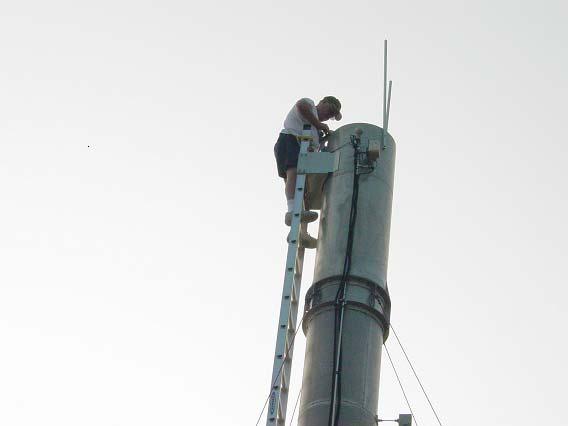
8 Wallops Island, VA 29 April 2000

9 Wallops Island, VA 29 April 2000
10 Wallops Island, VA 29 April 2000
11 Wallops Island, VA 29 April 2000
12 Modifications to Sea Breeze Coastline shape: convergence/divergence Coastal terrain: mountain or valley winds may enhance or inhibit sea breeze circulations Low level inversions over land: limit vertical extent of heating and weaken sea breeze Coriolis induces late afternoon veering
13 Similar Circulations Lake breeze: Great Lakes, Lake Okeechobee River breeze: Landing at National Airport Desert breeze: differential heating-contrasting albedo of types of sand- Dugway Proving Ground
14 Components Literature search for data/models/theory Empirical model development Leverage meteorological data improvements in mesoscale NWP remote and in situ sensor data assimilation coupled ocean/atmospheric modeling Field testing Improved coupled met and T&D model
15 Literature Search for Data/Models/Theory Investigation of Data and Remote Sensing Needed for Supporting Transport and Dispersion Forecasts for Chem/Bio Threat Mitigation In Coastal and Littoral Regions NOAA/ATDD Measurement of Coastal & Littoral Toxic Material Tracer Dispersion NSWCDD
16 Empirical Model Development Land Sea Temperature Difference Offshore wind speed Coastline shape Surface heat flux Dstl, Porton Down
17 Leverage Meteorological Data Investigation of Data and Remote Sensing Needed for Supporting Transport and Dispersion Forecasts for Chem/Bio Threat Mitigation In Coastal and Littoral Regions NOAA/ATDD Coupled Air-Sea Modeling for Improved Coastal Dispersion Prediction NRL-MRY Measurement of Coastal & Littoral Toxic Material Tracer Dispersion Weatherflow NRL-MRY
18 Field Testing Measurement of Coastal & Littoral Toxic Material Tracer Dispersion NSWCDD Weatherflow NRL-MRY NPS JHU/APL NASA/WFF October 2004 Sea Breeze Workshop
19 Improved Coupled Met and T&D Model DTRA/TDOC/HPAC Meteorological Research Team PSU NOAA NCAR/RAL DTRO-L Workshop on Uncertainty in Transport and Dispersion of CBRN Materials
20 Measurement of Coastal & Littoral Toxic Material Tracer Dispersion Two week met and T&D sea breeze measurement program NSWCDD Program management, met measurements, chaff release, experiment control center NRL-MRY High resolution COAMPS modeling and data assimilation Weatherflow Meteorological measurements, high resolution RAMS modeling and data assimilation JHU/APL Meteorological measurements Naval Postgraduate School Meteorological measurements NASA/WFF SPANDAR
21 Experiment control center-real time telemetered met data Measurement of Coastal & Littoral Toxic Material Tracer Dispersion NSWCDD Program Management Boat based chaff release Boat based surface and GPS upper air met, SST-5 to 65km offshore Shoreline surface met measurements Land mobile GPS radiosonde system
22 Measurement of Coastal & Littoral Toxic Material Tracer Dispersion NRL-MRY Literature Search Wallops Island Sea Breeze Climatological Study 3km horizontal resolution COAMPS modeling Data assimilation Forecast team member
23 Forecast team member Measurement of Coastal & Littoral Toxic Material Tracer Dispersion Weatherflow Literature Search Wallops Island Sea Breeze Climatological Study 2km horizontal resolution RAMS modeling Along coast surface met sites Data assimilation
24 Measurement of Coastal & Littoral Toxic Material Tracer Dispersion JHU/APL Literature Search Helicopter MABL soundings 5 to 65 km offshore Rocketsonde soundings 0-5 km offshore Surface met measurements and SST 0-5km offshore
25 Measurement of Coastal & Littoral Toxic Material Tracer Dispersion Naval Postgraduate School Literature Search Offshore Reynolds fluxes Offshore wave heights
26 Measurement of Coastal & Littoral Toxic Material Tracer Dispersion NASA Wallops Flight Facility SPANDAR 00UTC and 12UTC synoptic soundings 3 surface met sites Shoreline wind tower (15,30,45,60,75,90m ASL) WFF climatological sea breeze study
27 Measurement of Coastal & Littoral Toxic Material Tracer Dispersion Flow dimensions on the order of 100km Chaff concentration proportional to measured radar reflectivity (no chemistry or biology) 25 micron diameter aluminum coated mylar cut to λ/2 (5cm) 1 cm sec -1 terminal velocity CHAFF??? variance of Doppler spectrum related to turbulence intensity
28 Measurement of Coastal & Littoral Toxic Material Tracer Dispersion Space Range Radar SPANDAR Range resolution = 75 meters Azimuth resolutiom = 340 meters at 50km 1 chaff filament per range bin at 50km provides a > 10dB signal to noise Data analysis and display tools well exercised at NSWCDD
29 Measurement of Coastal & Littoral Toxic Material Tracer Dispersion FY06 Develop WFF sea breeze climatology Fabricate, mount and test chaff release system Maintain and calibrate land and sea based meteorological hardware WFF environmental assessment Test site preparations Engage empirical model developers NWP model development Develop a test plan
30 Measurement of Coastal & Littoral Toxic Material Tracer Dispersion FY07 Obtain expendables Establish forecast team Install auxiliary surface meteorological sites Move hardware to WFF Install control center Two week field program Remove hardware from WFF Archive data Experiment first look
31 Measurement of Coastal & Littoral Toxic Material Tracer Dispersion FY08 Data Analysis NWP model testing Empirical model testing Workshop
32 Measurement of Coastal & Littoral Toxic Material Tracer Dispersion Experiment Holes Land based Reynolds flux measurements Doppler Lidar technology (winds) Raman Lidar (temperature and humidity profiles) Some NAVSEA interest We invite participation

33

34
35

36
6.28 PREDICTION OF FOG EPISODES AT THE AIRPORT OF MADRID- BARAJAS USING DIFFERENT MODELING APPROACHES
 6.28 PREDICTION OF FOG EPISODES AT THE AIRPORT OF MADRID- BARAJAS USING DIFFERENT MODELING APPROACHES Cecilia Soriano 1, Darío Cano 2, Enric Terradellas 3 and Bill Physick 4 1 Universitat Politècnica de
2.4. Applications of Boundary Layer Meteorology
 2.4. Applications of Boundary Layer Meteorology 2.4.1. Temporal Evolution & Prediction of the PBL Earlier, we saw the following figure showing the diurnal evolution of PBL. With a typical diurnal cycle,
Wind: Small Scale and Local Systems Chapter 9 Part 1
 Wind: Small Scale and Local Systems Chapter 9 Part 1 Atmospheric scales of motion Scales of atmospheric circulations range from meters or less to thousands of kilometers- millions of meters Time scales
Interference of the Equatorial Waves on the 2017 Indian Monsoon Northward Progression
 https://www.bing.com/images/search?view=detailv2&ccid=4gaj08ec&id=15b827d717e11e 07790F5BCC0A4E13BBD103123C&thid=OIP.4gaj08EcIqXuIdGNdiwwUAEsDI&q=monsoon+pi ctures&simid=608027853209010910&selectedindex=119&mode=overlay&first=1
2. THE NEW ENGLAND AIR QUALITY STUDY
 P2.4 NEW ENGLAND COASTAL AIR POLLUTION DISPERSION MODELING Michael Tjernström * and Mark Žagar Stockholm University, Stockholm, Sweden Wayne Angevine CIRES, University of Colorado, and NOAA Aeronomy Laboratory,
Sea and Land Breezes METR 4433, Mesoscale Meteorology Spring 2006 (some of the material in this section came from ZMAG)
") Sea and Land Breezes METR 4433, Mesoscale Meteorology Spring 2006 (some of the material in this section came from ZMAG) 1 Definitions: The sea breeze is a local, thermally direct circulation arising from
Sea and Land Breezes METR 4433, Mesoscale Meteorology Spring 2006 (some of the material in this section came from ZMAG) 1 Definitions: The sea breeze is a local, thermally direct circulation arising from
An Analysis of the South Florida Sea Breeze Circulation: An Idealized Study
 An Analysis of the South Florida Sea Breeze Circulation: An Idealized Study John Cangialosi University of Miami/RSMAS Abstract This experiment is an idealized study (removal of mean large scale flow) to
Remote sensing standards: their current status and significance for offshore projects
 Remote sensing standards: their current status and significance for offshore projects Peter J M Clive Technical Development Consultant SgurrEnergy Ltd 225 Bath Street Glasgow G2 4GZ E: peter.clive@sgurrenergy.com
Development of SAR-Derived Ocean Surface Winds at NOAA/NESDIS
 Development of SAR-Derived Ocean Surface Winds at NOAA/NESDIS Pablo Clemente-Colón, William G. Pichel, NOAA/NESDIS Frank M. Monaldo, Donald R. Thompson The Johns Hopkins University Applied Physics Laboratory
Conditions for Offshore Wind Energy Use
 Carl von Ossietzky Universität Oldenburg Institute of Physics Energy Meteorology Group Detlev Heinemann Conditions for Offshore Wind Energy Use Detlev Heinemann ForWind Carl von Ossietzky Universität Oldenburg
REMOTE SENSING APPLICATION in WIND ENERGY
 REMOTE SENSING APPLICATION in WIND ENERGY Siraj Ahmed Professor & Head Department of Mechanical Engineering Maulana Azad National Iinstitute of Technology Bhopal, India sirajahmed@manit.ac.in Contents
Climatology of the 10-m wind along the west coast of South American from 30 years of high-resolution reanalysis
 Climatology of the 10-m wind along the west coast of South American from 30 years of high-resolution reanalysis David A. Rahn and René D. Garreaud Departamento de Geofísica, Facultad de Ciencias Físicas
NAVAL POSTGRADUATE SCHOOL THESIS
 NAVAL POSTGRADUATE SCHOOL MONTEREY, CALIFORNIA THESIS FACTORS INFLUENCING THE STRUCTURE OF THE MONTEREY BAY SEA BREEZE by Emily M. Duvall March 2004 Thesis Advisor: Second Reader: Wendell A. Nuss David
Assessing the quality of Synthetic Aperture Radar (SAR) wind retrieval in coastal zones using multiple Lidars
 wind retrieval in coastal zones using multiple Lidars") Assessing the quality of Synthetic Aperture Radar (SAR) wind retrieval in coastal zones using multiple Lidars Tobias Ahsbahs Merete Badger, Ioanna Karagali, Xiaoli Larsen What is the coastal zone? Coastal
Assessing the quality of Synthetic Aperture Radar (SAR) wind retrieval in coastal zones using multiple Lidars Tobias Ahsbahs Merete Badger, Ioanna Karagali, Xiaoli Larsen What is the coastal zone? Coastal
Characterization of Boundary-Layer Meteorology During DISCOVER-AQ
 Characterization of Boundary-Layer Meteorology During DISCOVER-AQ Daniel M. Alrick and Clinton P. MacDonald Sonoma Technology, Inc. Gary A. Morris St. Edward s University for Texas Air Quality Research
Wave-Phase-Resolved Air-Sea Interaction
 DISTRIBUTION STATEMENT A. Approved for public release; distribution is unlimited. Wave-Phase-Resolved Air-Sea Interaction W. Kendall Melville Scripps Institution of Oceanography (SIO) UC San Diego La Jolla,
WindProspector TM Lockheed Martin Corporation
 WindProspector TM www.lockheedmartin.com/windprospector 2013 Lockheed Martin Corporation WindProspector Unparalleled Wind Resource Assessment Industry Challenge Wind resource assessment meteorologists
INTRODUCTION * Corresponding author address: Michael Tjernström, Stockholm University, Department of Meteorology, SE-
 4.12 NEW ENGLAND COASTAL BOUNDARY LAYER MODELING Mark Žagar and Michael Tjernström * Stockholm University, Stockholm, Sweden Wayne Angevine CIRES, University of Colorado, and NOAA Aeronomy Laboratory,
Idealized WRF model sensitivity simulations of sea breeze types and their effects on offshore windfields: Supplementary material
 Idealized WRF model sensitivity simulations of sea breeze types and their effects on offshore windfields: Supplementary material Authors: C. J. Steele, S. R. Dorling, R. von Glasow and J. Bacon Synoptic
Scales of Atmospheric Motion Scale Length Scale (m) Time Scale (sec) Systems/Importance Molecular (neglected)
 Time Scale (sec) Systems/Importance Molecular (neglected)") Supplement Wind, Fetch and Waves Scales of Atmospheric Motion Scale Length Scale (m) Time Scale (sec) Systems/Importance Molecular 10-7 - 10-2 10-1 (neglected) Coriolis not important Turbulent 10-2 10
Supplement Wind, Fetch and Waves Scales of Atmospheric Motion Scale Length Scale (m) Time Scale (sec) Systems/Importance Molecular 10-7 - 10-2 10-1 (neglected) Coriolis not important Turbulent 10-2 10
Observations of Velocity Fields Under Moderately Forced Wind Waves
 Observations of Velocity Fields Under Moderately Forced Wind Waves Timothy P. Stanton Oceanography Department, Code OC/ST Naval Postgraduate School Monterey, CA 93943-5000 phone: (831) 656 3144 fax: (831)
OPERATIONAL USE OF A WIND PROFILER FOR AVIATION METEOROLOGY ABSTRACT
 OPERATIONAL USE OF A WIND PROFILER FOR AVIATION METEOROLOGY Miguel Angel Pelacho, Darío Cano, Eugenio Ayensa Spanish Agency of Meteorology (AEMET) Parque del Buen Retiro, Apdo. 285, 28080-MADRID E-mail:
MET 200 Lecture 11 Local Winds. Last Lecture: Forces. Review of Forces. Balance of Forces
 MET 200 Lecture 11 Local Winds Last Lecture: Forces Scales of Motion Eddies Sea Breeze Mountain-Valley Circulations Chinook - Snow Eater Drainage Wind - Katabatic Wind 1 2 Review of Forces 1. Pressure
On the Interpretation of Scatterometer Winds near Sea Surface Temperature Fronts
 On the Interpretation of Scatterometer Winds near Sea Surface Temperature Fronts Jim Edson University of Connecticut Amanda Plagge & Doug Vandemark University of New Hampshire IOVWST Meeting Utrecht, NL
Local Winds. Please read Ahrens Chapter 10
 Local Winds Please read Ahrens Chapter 10 Scales of Motion Microscale: meters Turbulent eddies Formed by mechanical disturbance or convection Lifetimes of minutes Mesoscale: km s to 100 s of km s Local
ASSESSMENT OF SEA BREEZE CHARACTERISTICS FROM SODAR ECHOGRAMS
 ASSESSMENT OF SEA BREEZE CHARACTERISTICS FROM SODAR ECHOGRAMS SUNEETHA RANI. JUPUDI Prof. M. PURNACHANDRA RAO Department of Physics, Andhra University, Visakhapatnam, India. ABSTRACT The SODAR echograms
1. Atmospheric Diffusion of Stack Gases
 1. Atmospheric Diffusion of Stack Gases 5F: Atmospheric Diffusion & Field Experiment Atmospheric diffusion is the process of diluting air pollutants by atmospheric turbulences. Historically, Taylor, G.I.
LOW LAYER WIND SHEAR OVER DAKAR
 LOW LAYER WIND SHEAR OVER DAKAR Dr Cheikh Sadibou SOW ASECNA Senior Meteorologist Abstract : Low layer wind shears are dangerous for planes. Their observation and study are one of the main fields where
The dryline is a mesoscale phenomena whose development and evaluation is strongly linked to the PBL.
 2.2. Development and Evolution of Drylines The dryline is a mesoscale phenomena whose development and evaluation is strongly linked to the PBL. Text books containing sections on dryline: The Dry Line.
4.9 MICROMETEOROLOGICAL CHARACTERISTICS OF THE SEA BREEZE DURING THE WILMINGTON 2005 URBAN DISPERSION STUDY
 4.9 MICROMETEOROLOGICAL CHARACTERISTICS OF THE SEA BREEZE DURING THE WILMINGTON 2005 URBAN DISPERSION STUDY Xiangyi Li and Marko Princevac * Department of Mechanical Engineering, University of California,
ABSTRACT INTRODUCTION
 Numerical investigation of the formation of elevated pollution layers over the Los Angeles air basin Rong Lu, R.P. Turco Department of Atmospheric Sciences, University of California, Los Angeles, 405 Hilgard
Profiles of Wind and Turbulence in the Coastal Atmospheric Boundary Layer of Lake Erie
 Journal of Physics: Conference Series OPEN ACCESS Profiles of Wind and Turbulence in the Coastal Atmospheric Boundary Layer of Lake Erie To cite this article: H Wang et al 2014 J. Phys.: Conf. Ser. 524
G. Meadows, H. Purcell and L. Meadows University of Michigan
 www.coj.net/departments/fire+and+rescue/emergency+preparedness/rip+current.htm G. Meadows, H. Purcell and L. Meadows Over 80% of all surf related rescues are attributable to Rip Currents According to the
Wind Project Siting and Permitting Blaine Loos
 Wind Project Siting and Permitting Blaine Loos Energy Project Analyst Center for Wind Energy at James Madison University Wind Project Siting and Permitting The Energy in Wind Resource Assessment (Macro-siting)
10.6 Eddy Formation and Shock Features Associated with a Coastally Trapped Disturbance
 10.6 Eddy Formation and Shock Features Associated with a Coastally Trapped Disturbance William T. Thompson and Stephen D. Burk Naval Research Laboratory Monterey, California 1. Introduction On 28 August
P2.25 SUMMER-TIME THERMAL WINDS OVER ICELAND: IMPACT OF TOPOGRAPHY. Bergen
 P2.25 SUMMER-TIME THERMAL WINDS OVER ICELAND: IMPACT OF TOPOGRAPHY Haraldur Ólafsson 1 and Hálfdán Ágústsson 2 1 University of Iceland, Bergen School of Meteorology, Geophysical Institute, University of
Low level coastal jet
 MetOcean analysis of a low-level coastal jet off the Norwegian coast. EERA DeepWind'2014 Deep Sea Offshore Wind R&D Conference, Trondheim, 22-24 January 2014 Harokopio University Konstantinos Christakos,
Santa Ana Winds. Surface weather map showing typical Santa Ana conditions.
 Santa Ana Winds Surface weather map showing typical Santa Ana conditions. High Desert Elevation ~1500-2000 ft Santa Ana Winds ~1500 meters 0 meters Santa Ana Winds ~875 mb ~1500 meters ~875 mb Horizontal
The Sea Breeze. What? Why? How? Sea Breeze. Lancing SC Race Training. Slide 1 MDC 20-April-11
 The What? Why? How? Slide 1 thermally driven wind effects local to the coast driven by the temperature difference between the sea and land.. Temp. (degc) Average Daytime Sea / Land Temps. Days/month 25
ASAP Satellite-based tropopause fold and mountain wave detection and validation
 ASAP Satellite-based tropopause fold and mountain wave detection and validation Tony Wimmers, Kristopher M. Bedka, Wayne Feltz, Nathan Uhlenbrock Cooperative Institute for Meteorological Satellite Studies
Comparisons between Mesoscale Model Terrain Sensitivity Studies and Doppler Lidar Measurements of the Sea Breeze at Monterey Bay
 VOLUME 130 MONTHLY WEATHER REVIEW DECEMBER 2002 Comparisons between Mesoscale Model Terrain Sensitivity Studies and Doppler Lidar Measurements of the Sea Breeze at Monterey Bay LISA S. DARBY AND ROBERT
San Diego Coastal Ocean Observing System
 California Clean Beaches Initiative San Diego Coastal Ocean Observing System WWW.SDCOOS.ORG Presentation to Imperial Beach City Council August 3, 2005 Eric J. Terrill, Ph.D. Scripps Institution of Oceanography
1.5 THE LAND BREEZE CHARACTERISTICS IN ISRAEL DURING THE SUMMER BY THE MM5 MODEL
 1. THE LAND BREEZE CHARACTERISTICS IN ISRAEL DURING THE SUMMER BY THE MM MODEL S. Berkovic and Y. Feliks Department of Mathematics, Israel Institute for Biological Research P.O.B 19, Ness-Ziona, Israel
JCOMM Technical Workshop on Wave Measurements from Buoys
 JCOMM Technical Workshop on Wave Measurements from Buoys Val Swail Chair, JCOMM Expert Team on Wind Waves and Storm Surges Neville Smith Vincent Cardone Peter Janssen Gerbrand Komen Peter Taylor WIND WAVES
A simple 1D numerical model for operational nowcasting of sea breeze at the HKIA
 A simple 1D numerical model for operational nowcasting of sea breeze at the HKIA Julian S.Y Tang, P. Cheung WSN16, 25-29 July 2016 Presented by P. CHEUNG Sea breeze at HKIA Mostly westerlies in background
August 1990 H. Kondo 435. A Numerical Experiment on the Interaction between Sea Breeze and
 August 1990 H. Kondo 435 A Numerical Experiment on the Interaction between Sea Breeze and Valley Wind to Generate the so-called "Extended Sea Breeze" By Hiroaki Kondo National Research Institute for Pollution
Determination of the Spatial Variation of the Atmosphere and Ocean Wave Fields in Extremely Light Wind Regimes
 Determination of the Spatial Variation of the Atmosphere and Ocean Wave Fields in Extremely Light Wind Regimes Gennaro H. Crescenti U.S. Dept. Commerce / NOAA Air Resources Laboratory Field Research Division
A new mechanism of oceanatmosphere coupling in midlatitudes
 A new mechanism of oceanatmosphere coupling in midlatitudes Arnaud Czaja & Nicholas Blunt Imperial College, London Grantham Institute for Climate Change 1. Motivation Two key questions By which mechanism(s)
A climatological study of the sea and land breezes in the Arabian Gulf region
 Click Here for Full Article JOURNAL OF GEOPHYSICAL RESEARCH, VOL. 113,, doi:10.1029/2007jd009710, 2008 A climatological study of the sea and land breezes in the Arabian Gulf region Rebecca E. Eager, 1,4
Geophysical Fluid Dynamics of the Earth. Jeffrey B. Weiss University of Colorado, Boulder
 Geophysical Fluid Dynamics of the Earth Jeffrey B. Weiss University of Colorado, Boulder The Earth is a spinning sphere Coriolis force depends on latitude solar flux depends on latitude Michael Ritter,
Summertime precipitation patterns associated with the sea breeze and land breeze in southern Mississippi and eastern Louisiana
 Summertime precipitation patterns associated with the sea breeze and land breeze in southern Mississippi and eastern Louisiana Patrick J. Fitzpatrick Christopher M. Hill James H. Corbin Yee H. Lau Sachin
Numerical Study of Diurnal Circulations of Tropical Coastal Site Visakhapatnam Using the ARW MesoScale Model
 (An ISO 3297: 2007 Certified Organization Numerical Study of Diurnal Circulations of Tropical Coastal Site Visakhapatnam Using the ARW MesoScale Model 1 V. LakshmanaRao, 2P.Satish 1 Assistant Professor,
APPENDIX G WEATHER DATA SELECTED EXTRACTS FROM ENVIRONMENTAL DATA FOR BCFS VESSEL REPLACEMENT PROGRAM DRAFT REPORT
 APPENDIX G WEATHER DATA SELECTED EXTRACTS FROM ENVIRONMENTAL DATA FOR BCFS VESSEL REPLACEMENT PROGRAM DRAFT REPORT Prepared for: B.C. Ferries Services Inc. Prepared by: George Roddan, P.Eng. Roddan Engineering
Wind: Small-scale and Local Systems
 Wind: Small-scale and Local Systems Scales of Atmospheric Motion Atmospheric motions/phenomena occur on many diverse spatial and temporal scales. Weather forecasters tend to focus on Mesoscale and synoptic
The influence of synoptic scale flow on sea breeze induced surface winds and calm zones
 PUBLISHED BY THE INTERNATIONAL METEOROLOGICAL INSTITUTE IN STOCKHOLM SERIES A DYNAMIC METEOROLOGY AND OCEANOGRAPHY Tellus (2010), 62A, 209 217 Printed in Singapore. All rights reserved C 2009 The Authors
Gravity waves and bores. Material kindly provided by Dr. Steven Koch GSD NOAA (Boulder, CO)
") Gravity waves and bores Material kindly provided by Dr. Steven Koch GSD NOAA (Boulder, CO) Presented at Iowa State University 11 April 2005 What is a gravity wave? An oscillation caused by the displacement
Gravity waves and bores Material kindly provided by Dr. Steven Koch GSD NOAA (Boulder, CO) Presented at Iowa State University 11 April 2005 What is a gravity wave? An oscillation caused by the displacement
Comparison of flow models
 Comparison of flow models Rémi Gandoin (remga@dongenergy.dk) March 21st, 2011 Agenda 1. Presentation of DONG Energy 2. Today's presentation 1. Introduction 2. Purpose 3. Methods 4. Results 3. Discussion
It seemed that airplanes arriving and departing AVWEATHER
 BY ED BROTAK It seemed that airplanes arriving and departing from Will Rogers World Airport in Oklahoma City, Oklahoma, United States, on the morning of Aug. 3, 2012, would have few problems with wind
Currents measurements in the coast of Montevideo, Uruguay
 Currents measurements in the coast of Montevideo, Uruguay M. Fossati, D. Bellón, E. Lorenzo & I. Piedra-Cueva Fluid Mechanics and Environmental Engineering Institute (IMFIA), School of Engineering, Research
Seasonal Evaluation of Temperature Inversion
 Seasonal Evaluation of Temperature Inversion Kandil, H A 1, Kader M M. A 2, Moaty, A A. 2, Elhadidi, B 3, Sherif, A.O. 3 The seasonal evaluation of the temperature inversion over Cairo-Egypt is examined
EXTREME WIND GUSTS IN LARGE-EDDY SIMULATIONS OF TROPICAL CYCLONES
 The National Center for Atmospheric Research (NCAR) is sponsored by the National Science Foundation (NSF) EXTREME WIND GUSTS IN LARGE-EDDY SIMULATIONS OF TROPICAL CYCLONES George Bryan National Center
10.2 ATMOSPHERIC ROTORS: AIRCRAFT IN SITU AND CLOUD RADAR MEASUREMENTS IN T-REX
 10.2 ATMOSPHERIC ROTORS: AIRCRAFT IN SITU AND CLOUD RADAR MEASUREMENTS IN T-REX Vanda Grubišić 1, Larry Armi 2, Joachim Kuettner 3, Samuel Haimov 4, Larry Oolman 4, Rick Damiani 4, and Brian Billings 1
Wind Power. Kevin Clifford METR 112 April 19, 2011
 Wind Power Kevin Clifford METR 112 April 19, 2011 Outline Introduction Wind Turbines Determining Wind Power Output The Price of Wind Power Wind Power Availability across the World and US California Wind
CROSS-SHORE SEDIMENT PROCESSES
 The University of the West Indies Organization of American States PROFESSIONAL DEVELOPMENT PROGRAMME: COASTAL INFRASTRUCTURE DESIGN, CONSTRUCTION AND MAINTENANCE A COURSE IN COASTAL DEFENSE SYSTEMS I CHAPTER
High Frequency Acoustical Propagation and Scattering in Coastal Waters
 High Frequency Acoustical Propagation and Scattering in Coastal Waters David M. Farmer Graduate School of Oceanography (educational) University of Rhode Island Narragansett, RI 02882 phone: (401) 874-6222
Rip Currents Onshore Submarine Canyons: NCEX Analysis
 Rip Currents Onshore Submarine Canyons: NCEX Analysis Dr. Thomas C. Lippmann Civil and Environmental Engineering & Geodetic Science, Byrd Polar Research Center, 1090 Carmack Rd., Ohio State University,
The Seabreeze 2009 experiment: investigating the impact of ocean and atmospheric processes on radar performance in the Bay of Plenty, New Zealand
 82 The Seabreeze 2009 experiment: investigating the impact of ocean and atmospheric processes on radar performance in the Bay of Plenty, New Zealand S.A. Garrett 1, D.E. Cook 1, R.E. Marshall 2 1 Defence
6.4 ASSESSMENT OF WIND SHEAR FORECAST PERFORMANCE AND IMPLICATIONS ON WIND COMPRESSION IMPACTS
 6.4 ASSESSMENT OF WIND SHEAR FORECAST PERFORMANCE AND IMPLICATIONS ON WIND COMPRESSION IMPACTS Colleen Reiche*, Michael Robinson, Bernard Niu, Dennis O Donnell, Mike Kay AvMet Applications, Inc., Reston,
The impact of ocean bottom morphology on the modelling of long gravity waves from tides and tsunami to climate
 The impact of ocean bottom morphology on the modelling of long gravity waves from tides and tsunami to climate Christian Le Provost and Florent Lyard Laboratoire d Etudes en Géophysique et Océanographie
Global Flow Solutions Mark Zagar, Cheng Hu-Hu, Yavor Hristov, Søren Holm Mogensen, Line Gulstad Vestas Wind & Site Competence Centre, Technology R&D
 Global Flow Solutions Mark Zagar, Cheng Hu-Hu, Yavor Hristov, Søren Holm Mogensen, Line Gulstad Vestas Wind & Site Competence Centre, Technology R&D vestas.com Outline The atmospheric modeling capabilities
The Influence of the Chesapeake Bay Breeze on Maryland Air Quality
 The Influence of the Chesapeake Bay Breeze on Maryland Air Quality MARAMA Data Analysis Workshop Laura Landry January 20, 2011 Martin O Malley, Governor Anthony G. Brown, Lt. Governor Robert M. Summers,
Polar storms and polar jets: Mesoscale weather systems in the Arctic & Antarctic
 Polar storms and polar jets: Mesoscale weather systems in the Arctic & Antarctic Ian Renfrew School of Environmental Sciences, University of East Anglia ECMWF-WWRP/Thorpex Polar Prediction Workshop 24-27
ATMS 310 Tropical Dynamics
 ATMS 310 Tropical Dynamics Introduction Throughout the semester we have focused on mid-latitude dynamics. This is not to say that the dynamics of other parts of the world, such as the tropics, are any
Airborne Remote Sensing of Surface and Internal Wave Processes on the Inner Shelf
 Airborne Remote Sensing of Surface and Internal Wave Processes on the Inner Shelf Ken Melville, Luc Lenain Scripps Institution of Oceanography North Wind/Wave NDBC Station 42040 29.212 N 88.207 W 19 Oct
P2.17 OBSERVATIONS OF STRONG MOUNTAIN WAVES IN THE LEE OF THE MEDICINE BOW MOUNTAINS OF SOUTHEAST WYOMING
 P2.17 OBSERVATIONS OF STRONG MOUNTAIN WAVES IN THE LEE OF THE MEDICINE BOW MOUNTAINS OF SOUTHEAST WYOMING Larry D. Oolman 1, Jeffrey R. French 1, Samuel Haimov 1, David Leon 1, and Vanda Grubišić 2 1 University
Observations and Modeling of Coupled Ocean-Atmosphere Interaction over the California Current System
 Observations and Modeling of Coupled Ocean-Atmosphere Interaction over the California Current System Cape Blanco Dudley Chelton 1, Xin Jin 2, Jim McWilliams 2 & Tracy Haack 3 1 Oregon State University
Understanding Offshore Wind s Enhanced Peak Load Coincidence for East Coast Transmission Systems
 WINDPOWER 2013 Conference Chicago, May 8, 2013 Understanding Offshore Wind s Enhanced Peak Load Coincidence for East Coast Transmission Systems Bruce Bailey, Ph.D. President/CEO Co Authors: Whitney Wilson,
10.6 The Dynamics of Drainage Flows Developed on a Low Angle Slope in a Large Valley Sharon Zhong 1 and C. David Whiteman 2
 10.6 The Dynamics of Drainage Flows Developed on a Low Angle Slope in a Large Valley Sharon Zhong 1 and C. David Whiteman 2 1Department of Geosciences, University of Houston, Houston, TX 2Pacific Northwest
Parameterizations (fluxes, convection)
") Parameterizations (fluxes, convection) Heinke Schlünzen Meteorological Institute, University of Hamburg New resolutions - new challenges What is the current status? Surface fluxes Convection Towards improving
Parameterizations (fluxes, convection) Heinke Schlünzen Meteorological Institute, University of Hamburg New resolutions - new challenges What is the current status? Surface fluxes Convection Towards improving
Pathways Interns: Annika O Dea, Ian Conery, Andrea Albright
 1 REMOTE SENSING OF COASTAL MORPHODYNAMICS 237 237 237 217 217 217 2 2 2 8 119 27 252 174.59 255 255 255 163 163 163 131 132 122 239 65 53 11 135 12 112 92 56 62 12 13 12 56 48 13 12 111 Kate Brodie Brittany
Chapter 2. Turbulence and the Planetary Boundary Layer
 Chapter 2. Turbulence and the Planetary Boundary Layer In the chapter we will first have a qualitative overview of the PBL then learn the concept of Reynolds averaging and derive the Reynolds averaged
Morphological Evolution Near an Inlet
 DISTRIBUTION STATEMENT A. Approved for public release; distribution is unlimited. Morphological Evolution Near an Inlet Steve Elgar Woods Hole Oceanographic Institution, MS11 Woods Hole, MA 02543 phone:
Super-parameterization of boundary layer roll vortices in tropical cyclone models
 DISTRIBUTION STATEMENT A. Approved for public release; distribution is unlimited. Super-parameterization of boundary layer roll vortices in tropical cyclone models PI Isaac Ginis Graduate School of Oceanography
Offshore Wind Turbine Wake Characterization using Scanning Doppler Lidar
 Offshore Wind Turbine Wake Characterization using Scanning Doppler Lidar R. Krishnamurthy a, J. Reuder b, B. Svardal c, H.J.S. Fernando a, J. B. Jakobsen d a University of Notre-Dame, Notre-Dame, Indiana
OBSERVATIONAL AND NUMERICAL STUDY ON THE INFLUENCE OF LARGE-SCALE FLOW DIRECTION AND COASTLINE SHAPE ON SEA-BREEZE EVOLUTION
 OBSERVATIONAL AND NUMERICAL STUDY ON THE INFLUENCE OF LARGE-SCALE FLOW DIRECTION AND COASTLINE SHAPE ON SEA-BREEZE EVOLUTION ROBERT C. GILLIAM, SETHU RAMAN and DEV DUTTA S. NIYOGI Department of Marine,
Air-Sea Interaction Spar Buoy Systems
 DISTRIBUTION STATEMENT A: Distribution approved for public release; distribution is unlimited Air-Sea Interaction Spar Buoy Systems Hans C. Graber CSTARS - University of Miami 11811 SW 168 th Street, Miami,
THE IMPACT OF COASTAL DEVELOPMENT ON THE DELAWARE BAY/SEA BREEZE 1.5 COASTAL ATMOSPHERIC/OCEANIC PROCESSES AND URBAN EFFECTS
 THE IMPACT OF DEVELOPMENT ON THE DELAWARE BAY/SEA BREEZE 1.5 ATMOSPHERIC/OCEANIC PROCESSES AND URBAN EFFECTS Christopher P. Hughes *, Dana Veron University of Delaware, Newark, Delaware 1. Introduction
EVE 402/502 Air Pollution Generation and Control. Introduction. Intro, cont d 9/18/2015. Chapter #3 Meteorology
 EVE 402/502 Air Pollution Generation and Control Chapter #3 Meteorology Introduction Meteorology is the study and forecasting of weather changes resulting from large-scale atmospheric circulation Characteristics
Wednesday, September 15, 2010 Coriolis force, 3 dimensions (p 65)
") Wednesday, September 15, 2010 Coriolis force, 3 dimensions (p 65) Weather fronts (p 63) General circulation on a rotating Earth (p 65) Geostrophy force balance (p 66) Local effects (no coriolis force)
Wednesday, September 15, 2010 Coriolis force, 3 dimensions (p 65) Weather fronts (p 63) General circulation on a rotating Earth (p 65) Geostrophy force balance (p 66) Local effects (no coriolis force)
Review of Equivalent Neutral Winds and Stress
 Review of Equivalent Neutral Winds and Stress Mark A. Bourassa Center for Ocean-Atmospheric Prediction Studies, Geophysical Fluid Dynamics Institute & Department of Earth, Ocean and Atmospheric Science
Lecture 15 General Circulation of the Atmosphere and Ocean
 Lecture 15 General Circulation of the Atmosphere and Ocean Non-rotating model of atmospheric general circulation Hadley (1735) Cell is induced by uneven distribution of solar heating. Conceptual models
Global Circulations. GEOG/ENST 2331 Lecture 15 Ahrens: Chapter 10
 Global Circulations GEOG/ENST 2331 Lecture 15 Ahrens: Chapter 10 Last lecture Microscale (turbulence) Mesoscale (land/sea breeze) Synoptic scale (monsoon) Global scale (3 cell circulation) Three Cell Model
Kathleen Dohan. Wind-Driven Surface Currents. Earth and Space Research, Seattle, WA
 Updates to OSCAR and challenges with capturing the wind-driven currents. Wind-Driven Surface Currents Kathleen Dohan Earth and Space Research, Seattle, WA ENSO OSCAR Surface currents from satellite fields
WSRC-MS mdf r An Observational Study of Turbulence in the SPBL
 WSRC-MS-97-0385 mdf- 770760--r An Observational Study of Turbulence in the SPBL by R. Kurzeja Westinghouse Savannah River Company Savannah River Site Aiken, South Carolina 29808 A document prepared for
Department of Meteorology. An Analysis of Sea Breezes on the South Coast of England and Evidence of Pre- and Post-Frontal Waves at the Surface.
 Department of Meteorology An Analysis of Sea Breezes on the South Coast of England and Evidence of Pre- and Post-Frontal Waves at the Surface. GILLEAN J KEITH A dissertation submitted in partial fulfilment
LiDAR Application to resource assessment and turbine control
 ENERGY LiDAR Application to resource assessment and turbine control Dr. Avishek Kumar The New Zealand Wind Energy Conference 13 th April 2016 1 SAFER, SMARTER, GREENER Agenda What is LiDAR? Remote Sensing
High-Resolution Measurement-Based Phase-Resolved Prediction of Ocean Wavefields
 DISTRIBUTION STATEMENT A. Approved for public release; distribution is unlimited. High-Resolution Measurement-Based Phase-Resolved Prediction of Ocean Wavefields Dick K.P. Yue Center for Ocean Engineering
13.6 AIRBORNE RADAR OBSERVATIONS OF BREAKING WAVES/ROTORS IN THE LEE OF THE MEDICINE BOW MOUNTAINS IN SE WYOMING, USA
 13.6 AIRBORNE RADAR OBSERVATIONS OF BREAKING WAVES/ROTORS IN THE LEE OF THE MEDICINE BOW MOUNTAINS IN SE WYOMING, USA Jeffrey R. French 1 *, Samuel Haimov 1, Larry Oolman 1, Vanda Grubišić 2, and Dave
Experience with the representation of stable conditions in the ECMWF model
 Experience with the representation of stable conditions in the ECMWF model Irina Sandu Anton Beljaars, Gianpaolo Balsamo, Peter Bechtold, Mark Rodwell 1. Stable conditions: current issues 2. Land-atmosphere
"Real-Time Vertical Temperature, and Velocity Profiles from a Wave Glider"
 DISTRIBUTION STATEMENT A. Approved for public release; distribution is unlimited. "Real-Time Vertical Temperature, and Velocity Profiles from a Wave Glider" Luca Centurioni Scripps Institution of Oceanography