Terms to Know. archipelago tsunami loess
|
|
|
- Amber Liliana Little
- 6 years ago
- Views:
Transcription
1
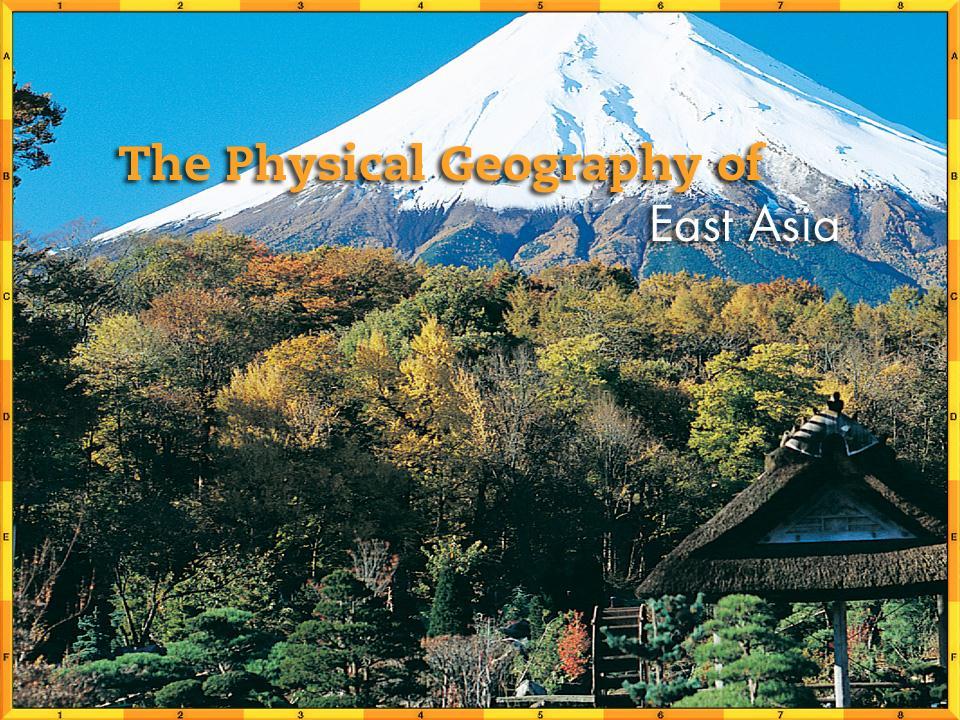
2 Chapter Objectives Identify East Asia s varied landforms, water systems, and natural resources. Explain the factors that influence East Asia s diverse climates and vegetation.
3 The Land Section 1
4 Objectives Describe how East Asia s landforms are affected by the region s location on the Ring of Fire. Compare the landforms of China with those in the rest of East Asia. List the important natural resources that are present in East Asia.
5 Terms to Know archipelago tsunami loess
6 A Geographic View
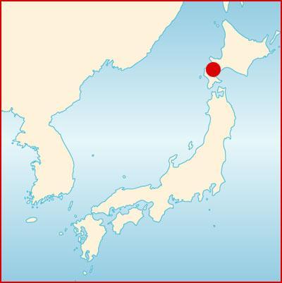
7 Geographic Literacy Japan is a chain of more than 3,000 islands running from Hokkaido in the north to the distant Ryukyu Islands in the south. Four main islands Honshu, Hokkaido, Shikoku, and Kyushu account for more than 98 percent of the total land area. At their greatest length from the northeast to southwest, the main islands stretch about 1,200 mi (1,900 km) and span 900 miles (1,500 km) from east to west. Japan has over 18,000 miles of coastline, but its total size is less than that of California.
8 Land and Sea China covers about 80 percent of East Asia s land area and has the world s largest population more than 1.25 billion people. The rest of East Asia is shared by Japan, Taiwan, North and South Korea, and Mongolia. Peninsulas, Islands, and Seas Along the coast of East Asia, many peninsulas and islands dot the westernmost Pacific Ocean. The South China Sea, stretching from Taiwan to the Philippines and the peninsula of Southeast Asia, carries onethird of the world s shipping traffic.
9 Land and Sea The Ring of Fire The islands of Japan and Taiwan are part of the Pacific Ring of Fire, a circle of volcanoes bordering the Pacific Ocean. Plate movements there cause frequent, violent earthquakes and volcanic eruptions. Japan has more than a thousand minor earthquakes every year. Japan is also vulnerable to tsunamis generated by underwater earthquakes. These high tidal waves crash over the land and can cause great destruction and loss of life.

10 Land and Sea
11 Mountain Highlands and Lowlands Mountain ranges and highlands mark inland regions of East Asia. Lowlands stretch through eastern and coastal areas. East Asian Mountains From an area of high peaks known as the Pamirs, the Kunlun Shan and Tian Shan ranges extend across western China. The Himalaya, the world s highest mountains, separate China from South Asia. Japan and Taiwan have mountainous interiors surrounded by coastal plains. Mount Fuji is a dramatic peak rising above the central plains of Honshu, Japan s biggest island.
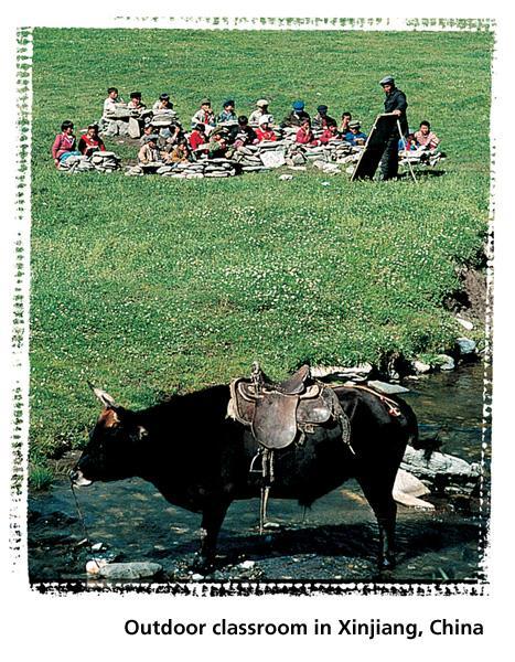
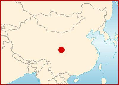
12 Mountain Highlands and Lowlands China s Plateaus, Basins, and Deserts The Plateau of Tibet in southwest China is East Asia s highest plateau region with an elevation of about 15,000 ft. (4,600 m). The Mongolian Plateau consists mainly of grassy pastures ideal for grazing. Broad, flat highlands include the Tarim Basin between China s far inland mountain ranges; the Taklimakan Desert to its west; and the Gobi, a desert area located in the north. The Sichuan Basin, a huge, fertile area between the Plateau of Tibet and the North China Plain, is one of China s most important agricultural areas. It has a mild climate and a long growing season.
13 River Systems China s Rivers China s major rivers originate high in the Plateau of Tibet and flow eastward to the Pacific Ocean. The Yellow River, or Huang He, gets its name from the tons of yellowish topsoil blown by winds from the western deserts. Carried eastward and deposited by the river, this rich soil makes the North China Plain an agriculturally productive area. Throughout history, flood waters have also killed hundreds of thousands of people.

14 River Systems
15 River Systems China s River Systems Central China s Yangtze, or Chang Jiang, is Asia s longest river at 3,965 miles (6,380 km). It flows through gorges and plains and empties into the ocean at Shanghai. The Xi, or West, River is southern China s most important river. It flows into the South China Sea, where it has created a huge, fertile delta. The Grand Canal the world s longest artificial waterway connects Hangzhou in the south to Beijing in the north.
16 River Systems Rivers in Korea and Japan Japan and Korea have short, swiftly flowing rivers with spectacular waterfalls. These rivers provide hydroelectric power. North Korea s Amnok, or Yalu, River forms its border with China. The Power of Wind and Water The Chinese concept of feng shui guides architects, contractors, and decorators to design and build structures that harmonize with surrounding landforms.
17 Natural Resources Service Industries More and more South Asians, especially Indians and Pakistanis, work in service industries such as transportation, banking, and administration. The High-Technology Sector The high-technology industry has grown rapidly in South Asia. India, for example, is the world s second-largest exporter of software, earning $5 billion in software trade with the United States in the year 2000.

18 South Asian Industries
19 Tourism South Asian countries draw millions of foreign visitors each year. In recent years, border disputes and ethnic and tribal conflicts have discouraged many tourists from visiting South Asia. Some countries restrict tourism for environmental or religious reasons. However, ecotourism, which requires visitors to behave responsibly toward the environment, may be a profitable alternative to such restrictions.

20 Tourism
21 People and their Environment Section 2
22 Objectives State the reasons for East Asia s wide variety of climates. Explain how winds, ocean currents, and mountains influence the climates of East Asia. Identify the conditions that cause the extreme climates in much of China. List the kinds of natural vegetation that are found in East Asia s varied climate regions.
23 Terms to Know Monsoon Japan current Typhoon
24 A Geographic View
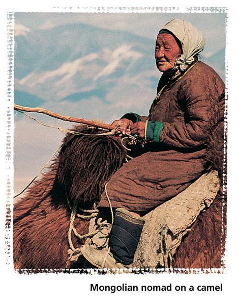
25 Geographic Literacy Mongolia is surrounded by land on all sides. It borders Russia to the north and China to the east, south, and west. About 80 percent of Mongolia s land consists of pastures and meadows. As a result, most Mongolians are engaged in agriculture, primarily as herders. Mongolians grow some wheat and barley, but the mainstay of the economy is raising livestock.
26 Climate Regions Dry highlands and grasslands dominate East Asia s north and west, with humid and temperate forests to the south and east. Mid-Latitude Climates The southeastern quarter of East Asia has a humid subtropical climate. Summers are warm, and rains are heavy. The northeastern quarter has a humid continental climate, with cold, snowy winters. In the eastern half of the region, forests consist of evergreen and deciduous trees. Bamboo grows abundantly in warmer areas and is the only food source for rare mammals, such as giant and red pandas. People in the region use bamboo in numerous ways, from medicines to material for bridges. Tea and mulberry leaves also play a major role in the culture and economy of East Asia.
27 Climate Regions Desert and Steppe Climates Mongolia and inland northern China are very dry because the surrounding mountains block the rain. Gobi and Taklimakan desert areas are often cold and windy. Temperatures in this climate region vary greatly.
28 Climate Regions Highlands Climates The higher the elevation in the mountains, the colder the temperature. The Plateau of Tibet has an average high temperature of only 58ºF (14ºC). Tropical Rain Forest Climate Hainan, an island off of China s southern coast, shares a rain forest climate with Taiwan. The temperatures are always warm, and the summer is very rainy. The Roots of Rice and Soy The Chinese have cultivated rice and soybeans for seven thousand years. These are the two staple foods.

29 Managing Natural Resources
30 Monsoons Monsoon winds bring seasonal weather patterns to East Asia. Summer monsoons blow from southeast to northwest, causing soaking rains from April to October. Winter monsoons blow in the opposite direction, bringing icy winds from November to March. Farmers depend on the summer monsoon rains for their crops.
31 Ocean Currents The warm Japan Current flows northward toward southern Japan, bringing moisture and warm temperatures. The cold Kuril Current flows southwest from the Bering Sea, bringing cold winds and lower temperatures to Japan s northern islands. The interaction of ocean currents and monsoon winds can give rise to violent typhoons. Typhoons form in the Pacific Ocean and blow across coastal East Asia. They tend to be most severe between late August and October.
32 Section 1 Summary East Asia is rich in minerals, but they are unevenly distributed. Limited farmlands, long coastlines, and large populations have made the region dependent on the sea for food.
33 Section 2 Summary East Asia s varied vegetation includes needle-leaved and broad-leaved evergreen trees, tropical plants, bamboo, tea, mulberry trees, and grasses as well as tropical rain forest vegetation.
STUDY GUIDE. Physical Features. The Land. Chapter 23, Section 1. Landforms. Rivers. Natural Resources. Terms to Know DRAWING FROM EXPERIENCE
 For use with textbook pages 569 574. The Land Terms to Know subcontinent A landmass that is large and distinct but joined to a continent (page 569) alluvial plain An area of fertile soil deposited by river
AERO Standards: c c.
 AERO Standards: 4.1.5.c. Identify cause and effect relationships in history. 4.3.5.c. Apply concepts such as location, distance, direction, scale, movement and region. Northeast plains Also known as the
Success Criteria: Ch. 7 China
 Log in to Geography of China ppt Success Criteria: Ch. 7 China Last Name 1. Identify China, the Huang He River, the Gobi Desert, and the Plateau of Tibet on any map. 2. Identify where the first civilization
STUDY GUIDE. The Land. Physical Geography of Europe. Chapter 11, Section 1. Terms to Know DRAWING FROM EXPERIENCE ORGANIZING YOUR THOUGHTS
 For use with textbook pages 271 276. The Land Terms to Know dikes Large banks of earth and stone that hold back water (page 272) polder Drained area of land (page 272) glaciation The process in which glaciers
Natural Regions of the World
 Natural Regions of the World Revision for Competitive Exams 10x10learning.com 1 Concept of Natural Regions provides a framework for understanding the diversity of physical and biological environment Taiga
The Land Where Continents Collided. Physical Geography and Climate of South Asia
 The Land Where Continents Collided Physical Geography and Climate of South Asia South Asia Countries include: 1. Pakistan 2. India 3. Nepal 4. Bhutan 1 2 3 5 4 5. Bangladesh 6. Sri Lanka 7. Maldives 7
MONSOONS. Summer Monsoon
 MONSOONS A monsoon is a seasonal change in the direction of the prevailing, or strongest, winds of a region. Monsoons cause wet and dry seasons throughout much of the tropics. Monsoons are most often associated
MT - GEOGRAPHY - (73) - SEMI PRELIM - II : PAPER - 6
 - SEMI PRELIM - II : PAPER - 6") 208 00 MT MT - GEOGRAPHY - (7) - SEMI PRELIM - II : PAPER - 6 Time : 2 Hours (Model Answer Paper) Max. Marks : 0 A.. Fill in the blank choosing the correct alternative : (a) The Barren Island is the only
208 00 MT MT - GEOGRAPHY - (7) - SEMI PRELIM - II : PAPER - 6 Time : 2 Hours (Model Answer Paper) Max. Marks : 0 A.. Fill in the blank choosing the correct alternative : (a) The Barren Island is the only
Biyani's Think Tank. Concept based notes. Geography of Asia BA-III. Shweta Modi Deptt. of Arts Biyani Girls College, Jaipur
 Biyani's Think Tank Concept based notes Geography of Asia BA-III Shweta Modi Deptt. of Arts Biyani Girls College, Jaipur 2 Published by : Think Tanks Biyani Group of Colleges Concept & Copyright : Biyani
Chapter- 9. Multiple Choice Questions
 Chapter- 9 Multiple Choice Questions 1. The low-latitude climates: a. are located along the equator b. are located between the tropics of cancer and capricorn c. do not include the ITCZ d. are restricted
Canada s Natural Systems. Canadian Geography 1202
 Canada s Natural Systems Canadian Geography 1202 Canada s Natural Systems Natural System: A system found in nature Here are the four natural systems that we will explore in the next few weeks 1. Canada
Latitude Altitude (Elevation) Proximity to large bodies of water Ocean Currents. larger. concentrated. direct. heating. heating.
 Proximity to large bodies of water Ocean Currents. larger. concentrated. direct. heating. heating.") Climographs Climographs Climographs Roles of Temperature and Precipitation on Climate Roles of Temperature and Precipitation on Climate : Altitude (Elevation) Proximity to large bodies of water Ocean Currents
Climographs Climographs Climographs Roles of Temperature and Precipitation on Climate Roles of Temperature and Precipitation on Climate : Altitude (Elevation) Proximity to large bodies of water Ocean Currents
Reading and Vocabulary Study Guide
 Reading and Vocabulary Study Guide Boston, Massachusetts Upper Saddle River, New Jersey The map on page 20 is based on a map by DK Cartography. Copyright by Pearson Education, Inc., publishing as Pearson
Geography and the Early Settlement of China
 Chapter 19 Geography and the Early Settlement of China How did geograptiy affect life in ancient China? Chapter 19 Geography and the Early Settlement of China How did geograptiy affect life in ancient
Maggie s. Activity Pack! The Nomad s Home. Daybreak on the Steppe. The Land of Nomads
 Maggie s Activity Pack! Name Date The Nomad s Home Daybreak on the Steppe The hot sun rises on the vast, dry grasslands of Central Asia. It lights up the bright orange-colored door of a Mongolian herder
Chapter 22, Section 1 - Ocean Currents. Section Objectives
 Chapter 22, Section 1 - Ocean Currents Section Objectives Intro Surface Currents Factors Affecting Ocean Currents Global Wind Belts (you should draw and label a diagram of the global wind belts) The Coriolis
Ecology. Professor Andrea Garrison Biology 3A Illustrations 2014 Cengage Learning unless otherwise noted
 Ecology Professor Andrea Garrison Biology 3A Illustrations 2014 Cengage Learning unless otherwise noted Ecology Ecology (oikos = house) is the study of where an organism lives and all the interactions
Physical Geography. Physical Geography III of the United States and Canada. Formation of Great Lakes. Climates of North America. Definitions 2/21/2013
 Physical Geography III of the United States and Canada Ancient Glacial Lakes As the Ice Age ended, areas of North America beyond the terminal moraine were flooded with melt water Prof Anthony Grande AFG
OCEANOGRAPHY STUDY GUIDE
 OCEANOGRAPHY STUDY GUIDE Chapter 2 Section 1 1. Most abundant salt in ocean. Sodium chloride; NaCl 2. Amount of Earth covered by Water 71% 3. Four oceans: What are they? Atlantic, Pacific, Arctic, Indian
Maggie s. Activity Pack! The Nomad s Home. Daybreak on the Steppe. The Land of Nomads
 Maggie s Activity Pack! Name Date The Nomad s Home Daybreak on the Steppe The hot sun rises on the grasslands of Central Asia. It lights up the bright orange door of a herder s home. This home is called
Chapter 13 Geography and the Early Settlement of India. How did geography affect early settlement in India?
 Chapter 13 Geography and the Early Settlement of India How did geography affect early settlement in India? Section 13.1 - Introduction The Art Archive / Collection Antonovich / Gianni Dagli Orti This stone
Air Masses and Fronts
 Air Masses and Fronts A huge body of air that has similar temperature, humidity, and air pressure at any given height is called an air mass. A single air mass may spread over millions of square kilometers
Your web browser (Safari 7) is out of date. For more security, comfort and the best experience on this site: Update your browser Ignore
 is out of date. For more security, comfort and the best experience on this site: Update your browser Ignore") Your web browser (Safari 7) is out of date. For more security, comfort and the best experience on this site: Update your browser Ignore L A NIÑA El Niño-Southern Oscillation (ENSO) For the complete encyclopedic
Your web browser (Safari 7) is out of date. For more security, comfort and the best experience on this site: Update your browser Ignore L A NIÑA El Niño-Southern Oscillation (ENSO) For the complete encyclopedic
THE NATIVE AMERICANS
 THE NATIVE AMERICANS Native American Diversity By the year 1500, Native Americans had divided into hundreds of cultural groups who perhaps spoke up to 2,000 different languages. Each group adapted to its
GEOGRAPHY UNIT 2 REVIEW. 1. The daily atmospheric conditions, such as heat, moisture and air movement for a particular area are known as
 UNIT 2 REVIEW GEOGRAPHY Name: 1. The daily atmospheric conditions, such as heat, moisture and air movement for a particular area are known as 2. The average conditions of the weather for a long period
Climate Scavenger Hunt
 Climate Scavenger Hunt ELA & Science Grades 4nd to 9th Created by Piyush & Ilaxi Directions to use Climate Scavenger Hunt Purpose : At the end of this scavenger hunt on climate students will be able to
The Movement of Ocean Water. Currents
 The Movement of Ocean Water Currents Ocean Current movement of ocean water that follows a regular pattern influenced by: weather Earth s rotation position of continents Surface current horizontal movement
9-1: What Causes Climate. 6 th Grade Earth Science
 6 th Grade Earth Science What is Climate? 9-1: What Causes Climate Climate is the long-term average conditions of temperature, precipitation, winds, and clouds in an area. Examples of Climate The Mojave
Deserts. Locations of deserts WORDS
 1 WORDS certain =special cover =here: make up create = make cut off =separate little = not very much rise = go up surface =the top layer of an object trade wind = a tropical wind that blows to the equator
First of all, you should know that weather and climate are not the same thing.
 First of all, you should know that weather and climate are not the same thing. WEATHER IS: Short term Limited area Can change rapidly Difficult to predict WEATHER is what s happening outside your window
Applied Earth Science Climate Exam Practice Questions Page 1
 Name: 1. Which combination of climate factors generally results in the coldest temperatures? A) low elevation and low latitude B) low elevation and high latitude C) high elevation and low latitude D) high
Name: Date: Day/Period: CGC1P1: Interactions in the Physical Environment. Factors that Affect Climate
 Name: Date: Day/Period: CGC1P1: Interactions in the Physical Environment PART A: Weather and Climate Factors that Affect Climate 1. The words weather and climate are often incorrectly used interchangeably.
Wednesday, September 15, 2010 Coriolis force, 3 dimensions (p 65)
") Wednesday, September 15, 2010 Coriolis force, 3 dimensions (p 65) Weather fronts (p 63) General circulation on a rotating Earth (p 65) Geostrophy force balance (p 66) Local effects (no coriolis force)
Wednesday, September 15, 2010 Coriolis force, 3 dimensions (p 65) Weather fronts (p 63) General circulation on a rotating Earth (p 65) Geostrophy force balance (p 66) Local effects (no coriolis force)
West Africa Desertification in West Africa
 Non-fiction: West Africa Desertification in West Africa West Africa Desertification in West Africa In Arabic, Sahel means shore, or coast. The Sahel is the place where the waves of the ocean crash onto
Chapter 8 Air Masses
 Chapter 8 Air Masses Air Masses - 1 1. An Air Mass is a large body of air usually about 1500 km across and several km thick, that has homogeneous physical properties. 2. The important physical properties
Physical Features, Where People Live, & How They Trade
 Physical Features, Where People Live, & How They Trade 5 large freshwater lakes in central North America HOMES (Huron, Ontario, Michigan, Erie, Superior) Serve as the industrial heartland of the continent
Meteorology. Circle the letter that corresponds to the correct answer
 Chapter 7 Worksheet 2 Meteorology Name: Circle the letter that corresponds to the correct answer 1) Which of the following factors contributes to the general subsidence in the latitude zone 20 degrees
ELA & Science Grades 4 nd to 9 th Created by Piyush & Ilaxi
 ELA & Science Grades 4 nd to 9 th Created by Piyush & Ilaxi 2014 Brilliant Classes by Piyush Page 1 Directions to use Climate Scavenger Hunt Purpose : At the end of this scavenger hunt on climate students
Directed Reading. Section: Ocean Currents. a(n). FACTORS THAT AFFECT SURFACE CURRENTS
. FACTORS THAT AFFECT SURFACE CURRENTS") Skills Worksheet Directed Reading Section: Ocean Currents 1. A horizontal movement of water in a well-defined pattern is called a(n). 2. What are two ways that oceanographers identify ocean currents? 3.
Skills Worksheet Directed Reading Section: Ocean Currents 1. A horizontal movement of water in a well-defined pattern is called a(n). 2. What are two ways that oceanographers identify ocean currents? 3.
Ocean Currents that Redistribute Heat Globally
 Ocean Currents that Redistribute Heat Globally Ocean Circulation Ocean Currents Fig. CO7 OCEAN CURRENTS Surface ocean currents are similar to wind patterns: 1. Driven by Coriolis forces 2. Driven by winds
Meteorology I Pre test for the Second Examination
 Meteorology I Pre test for the Second Examination MULTIPLE CHOICE 1. A primary reason why land areas warm up more rapidly than water areas is that a) on land, all solar energy is absorbed in a shallow
WIND SPEED LENGTH OF TIME WIND BLOWS (Duration) DISTANCE OVER WHICH IT BLOWS (Fetch)
 DISTANCE OVER WHICH IT BLOWS (Fetch)") WAVES Up and down movement of ocean surface Transportation of energy across the water over vast distances If not stopped by anything, waves can travel entire oceans Size and speed depend upon: WIND SPEED
WAVES Up and down movement of ocean surface Transportation of energy across the water over vast distances If not stopped by anything, waves can travel entire oceans Size and speed depend upon: WIND SPEED
GEOGRAPHY AND CLIMATE
 Web Japan http://web-japan.org/ GEOGRAPHY AND CLIMATE A country of diverse topography and climate Geography A Pacific Island Country Japan is an island country forming an arc in the Pacific Ocean to the
Section 2- Migration
 Section 2- Migration Today, most scientists agree that the first people in North America came from Asia. This migration is estimated to have taken place during the last ice age, at least 12,500 years ago.
Geography. Reading Passage. Unit
 Unit 1 Geography Word Bank separate v. measure v. roughly adv. make up (of) range n. in length landslide n. poisonous a. glimpse n. Taiwan Blue Magpie encounter v. active a. extinct a. dormant a. soak
Continental Drift Theory
 Chapter 24: Physical Geography of South Asia: The Land Where Continents Collided South Asia India, Pakistan, Nepal, Sri Lanka & Bangladesh South Asia s major landforms, including the massive Himalayan
AQUACULTURE STATUS OF VIETNAM Han Mai Huong, Cairo, November 2011
 AQUACULTURE STATUS OF VIETNAM Han Mai Huong, Cairo, November 2011 VIETNAM Mainland Territory: 331,211.6 sq. km. Lying on the eastern part of the Indochinese peninsula, Vietnam is a strip of land shaped
Unit 2 World Climate Patterns
 Unit 2 World Climate Patterns Weather the day to day or short term conditions of the atmosphere. Weather includes variables such as temperature, precipitation, humidity, cloud cover, wind, and air pressure.
9/25/2014. Scales of Atmospheric Motion. Scales of Atmospheric Motion. Chapter 7: Circulation of the Atmosphere
 Chapter 7: Circulation of the Atmosphere The Atmosphere: An Introduction to Meteorology, 12 th Lutgens Tarbuck Lectures by: Heather Gallacher, Cleveland State University Scales of Atmospheric Motion Small-
Atmospheric Circulation (Ch. 8) Ocean & Atmosphere are intertwined Gases & waters freely exchanged Wind Weather Climate
 Ocean & Atmosphere are intertwined Gases & waters freely exchanged Wind Weather Climate") Atmospheric Circulation (Ch. 8) Ocean & Atmosphere are intertwined Gases & waters freely exchanged Wind Weather Climate Atmospheric Structure Consists of Layers Separated by Temperature Stratosphere: Temperature
Atmospheric Circulation (Ch. 8) Ocean & Atmosphere are intertwined Gases & waters freely exchanged Wind Weather Climate Atmospheric Structure Consists of Layers Separated by Temperature Stratosphere: Temperature
CLIMATES IN SOUTH AFRICA
 CLIMATES IN SOUTH AFRICA South Africa has various climates throughout the country. It is in the Southern Hemisphere and is surrounded by ocean except for at its Northern borders. South Africa s climates
Changing Climate and the Outlook
 Changing Climate and the Outlook for Oilseed 2016 Evelyn Browning Garriss Conclusions Climate change is not linear. It ebbs and flows. There is a 90% chance the current El Niño will be strong and last
Rice Yield And Dangue Haemorrhagic Fever(DHF) Condition depend upon Climate Data
 Condition depend upon Climate Data") Rice Yield And Dangue Haemorrhagic Fever(DHF) Condition depend upon Climate Data Dr Lai Lai Aung, Assistant Director( Met Service) Dr Khaing Khaing Soe Assistant Director(Public Health) Dr Thin Nwe htwe
Rice Yield And Dangue Haemorrhagic Fever(DHF) Condition depend upon Climate Data Dr Lai Lai Aung, Assistant Director( Met Service) Dr Khaing Khaing Soe Assistant Director(Public Health) Dr Thin Nwe htwe
National Weather Service
 National Weather Service The North American Monsoon Until the late 1970s, there was serious debate about whether a monsoon truly existed in North America. However, considerable research, which culminated
Atmospheric Circulation. Recall Vertical Circulation
 Today s topics: Atmospheric circulation: generation of wind patterns on a rotating Earth Seasonal patterns of climate: Monsoons and Sea Breezes Tropical Cyclones: Hurricanes and typhoons Atmospheric Circulation
Vocabulary: Headwaters, watershed, tributaries, estuary, replica, point source pollution, nonpoint source pollution, amd river miles.
 From Source To Sea: Lesson Plan Concepts: 1. Understanding the path the Hudson River takes from the headwaters in the Adirondacks to the New York Harbor 2. Identifying the Hudson River watershed area,
Influences on Weather and Climate Weather and Climate. Coriolis Effect
 Influences on Weather and limate Weather and limate oriolis Effect 1 limate is defined as the common weather conditions in one area over a long period of time. Temperature, humidity, rainfall, and wind
- terminology. Further Reading: Chapter 07 of the text book. Outline. - characteristics of ENSO. -impacts
 (1 of 14) Further Reading: Chapter 07 of the text book Outline - terminology - characteristics of ENSO -impacts (2 of 14) Today: Introduction We want to look at another source of variability in the atmosphere
Dr. Xu Yong Deputy Director General of Economic and Technological Cooperation Department of Jilin Province,P.R.C.
 Dr. Xu Yong Deputy Director General of Economic and Technological Cooperation Department of Jilin Province,P.R.C. The Development of Snow and Ice Industry in China Jilin Province Provides a Broad Space
Coastal management has lagged behind the growth in population leading to problems with pollution
 Fifty percent of the population of the industrialized world lives within 100 km of a coast. Coastal management has lagged behind the growth in population leading to problems with pollution and natural
Climate of Colorado. Climatography of the United States No. 60 (updated 1/2003) Prepared by
 Prepared by") Climate of Colorado Climatography of the United States No. 60 (updated 1/2003) Prepared by Nolan J. Doesken, Roger A. Pielke, Sr., and Odilia A.P. Bliss Colorado Climate Center, Atmospheric Science Department,
Climate of Colorado Climatography of the United States No. 60 (updated 1/2003) Prepared by Nolan J. Doesken, Roger A. Pielke, Sr., and Odilia A.P. Bliss Colorado Climate Center, Atmospheric Science Department,
Atmospheric and Ocean Circulation Lab
 Atmospheric and Ocean Circulation Lab name Key Objectives: The main goal of this lab is to learn about atmospheric and oceanic circulation and how these two processes are strongly inter-dependent and strongly
In Search of the Source of Wind.
 In Search of the Source of Wind Role of Wind in the Voyage Atmospheric Pressure The Weight of Atmospheric Air on Earth Gravitational force helps Air to remain on Earth Variations in the Atmospheric Pressure
March 4 th, 2019 Sample Current Affairs
 March 4 th, 2019 Sample Current Affairs 1. A weak El Niño is developing in the equatorial Pacific Ocean, which is expected to continue for a few months at least. What is El Nino? What causes El Nino? What
Ocean Currents Unit (4 pts)
") Name: Section: Ocean Currents Unit (Topic 9A-1) page 1 Ocean Currents Unit (4 pts) Ocean Currents An ocean current is like a river in the ocean: water is flowing traveling from place to place. Historically,
Name: Section: Ocean Currents Unit (Topic 9A-1) page 1 Ocean Currents Unit (4 pts) Ocean Currents An ocean current is like a river in the ocean: water is flowing traveling from place to place. Historically,
2015 Evelyn Browning Garriss. El Niño, the Twisted Atlantic and the Effect on Global Agriculture
 2015 Evelyn Browning Garriss El Niño, the Twisted Atlantic and the Effect on Global Agriculture Conclusions Climate change is not linear. It ebbs and flows. Recent polar volcano eruptions created a cool
Atmospheric Circulation. Density of Air. Density of Air: H 2 O and Pressure effects
 Today s topics: Atmospheric circulation: generation of wind patterns on a rotating Earth Seasonal patterns of climate: Monsoons and Sea Breezes Tropical Cyclones: Hurricanes and typhoons Atmospheric Circulation
Write answers on your own paper. A. the Sun B. the Moon C. Earth s gravity D. Earth s rotation
 The tmosphere Write answers on your own paper 1. What is the primary energy source that drives all weather events, including precipitation, hurricanes, and tornados?. the Sun. the Moon C. Earth s gravity
7-1 What Factors Influence Climate?
 Key Questions and Concepts 7-1 What factors influence climate? CONCEPT 7-1 An area s climate is determined mostly by solar radiation, the earth s rotation, global patterns of air and water movement, gases
Section 1. Global Wind Patterns and Weather. What Do You See? Think About It. Investigate. Learning Outcomes
 Chapter 5 Winds, Oceans, Weather, and Climate Section 1 Global Wind Patterns and Weather What Do You See? Learning Outcomes In this section, you will Determine the effects of Earth s rotation and the uneven
What Country is Upstream? Conflicts that can occur because of relative position on a river
 What Country is Upstream? Conflicts that can occur because of relative position on a river The source of a river is the place where it starts - usually in hills or mountains. People who live near a river
Lecture 13 March 24, 2010, Wednesday. Atmospheric Pressure & Wind: Part 4
 Lecture 13 March 24, 2010, Wednesday Atmospheric Pressure & Wind: Part 4 Synoptic scale winds Mesoscale winds Microscale winds Air-sea interactions The largest synoptic scale wind. Monsoon: Arabic for
Notepack 41. Aim: What factors determine the climate of a certain area? Do Now: What is the difference between weather and climate?
 Notepack 41 Aim: What factors determine the climate of a certain area? Do Now: What is the difference between weather and climate? WEATHER VS. CLIMATE Weather atmospheric conditions at a certain location
Reading 6.1 Competition Between Populations
 Reading 6.1 Competition Between Populations In the ecosystem models you used in class you discovered that population sizes can fluctuate. One type of fluctuation that can appear is repeating cycles of
Lecture 13 El Niño/La Niña Ocean-Atmosphere Interaction. Idealized 3-Cell Model of Wind Patterns on a Rotating Earth. Previous Lecture!
 Lecture 13 El Niño/La Niña Ocean-Atmosphere Interaction Previous Lecture! Global Winds General Circulation of winds at the surface and aloft Polar Jet Stream Subtropical Jet Stream Monsoons 1 2 Radiation
Name Date L.O: SWBAT explain what breezes, planetary winds, ocean currents & monsoons are.
 Name Date L.O: SWBAT explain what breezes, planetary winds, ocean currents & monsoons are. 1. A cool breeze is blowing toward the land from the ocean on a warm, cloudless summer day. This condition is
Finish Characteristics of Climate
 Bell Ringer Finish Characteristics of Climate Wind Coriolis Effect Newton s second law: a body in motion will continue in motion (unchanged) unless acted upon by an outside force. Liquid (water) and gas
Monsoon. Arabic word mausim means season. Loose definition: a wind/precipitation pattern that shifts seasonally
 Monsoon Arabic word mausim means season Loose definition: a wind/precipitation pattern that shifts seasonally Classical criteria (Ramage 1971) Prevailing wind shifts 120 o between Jan & July Average frequency
New Normal and La Niñas: Dealing with Natural Climate Now and in the Future James Jackson Garriss /Browning Media
 New Normal and La Niñas: Dealing with Natural Climate Now and in the Future 2018 James Jackson Garriss /Browning Media Conclusions Climate change is not linear. It ebbs and flows. Long term climate conditions
Section 6. The Surface Circulation of the Ocean. What Do You See? Think About It. Investigate. Learning Outcomes
 Chapter 5 Winds, Oceans, Weather, and Climate Section 6 The Surface Circulation of the Ocean What Do You See? Learning Outcomes In this section, you will Understand the general paths of surface ocean currents.
Cal Poly Lands located in San Luis Obispo County experience a collection of idyllic microclimates
 Climate Margot McDonald, College of Architecture and Environmental Design Cal Poly Lands located in San Luis Obispo County experience a collection of idyllic microclimates due to their geographical position
DELHI PUBLIC SCHOOL TAPI
 DELHI PUBLIC SCHOOL TAPI CLASS VII Learning Partnership 5 (KEY) Water : LESSON 5: Water (KEY) Writing Task: W.B (pp-136) 1. What are the 3 main process involved in the water cycle. Evaporation, Condensation,
Jeopardy Q $100 Q $100 Q $100 Q $100 Q $100 Q $200 Q $200 Q $200 Q $200 Q $200 Q $300 Q $300 Q $300 Q $300 Q $300 Q $400 Q $400 Q $400 Q $400 Q $400
 Jeopardy Grab Bag Review Grab Bag Review 2 Biomes Climate Factors that affect climate Q $100 Q $200 Q $300 Q $400 Q $500 Q $100 Q $100 Q $100 Q $100 Q $200 Q $200 Q $200 Q $200 Q $300 Q $300 Q $300 Q $300
OCN 201 Lab Fall 2009 OCN 201. Lab 9 - El Niño
 OCN 201 Lab Fall 2009 OCN 201 Lab 9 - El Niño El Niño is probably one of the most widely publicized oceanic phenomena. If there s one single reason for that it s probably the fact that El Niño s presence
ESCI 107 The Atmosphere Lesson 11 Global Circulation
 Reading: Meteorology Today, Chapter 10 THE GLOBAL CIRCULATION ESCI 107 The Atmosphere Lesson 11 Global Circulation Latitudinal heat imbalance The tropics receive more radiation than they emit. The polar
Atmospheric Circulation. Recall Vertical Circulation
 Today s topics: Atmospheric circulation: generation of wind patterns on a rotating Earth Seasonal patterns of climate: Monsoons and El Niño Tropical Cyclones: Hurricanes and typhoons Atmospheric Circulation
Grade 5 Term Geography
 Grade 5 Term 2 2016 Geography 1 High places and low places on a physical map in South Africa Land, on a map, is shown in a different colour to the sea. The sea is always shown in the colour blue. On a
Grade 5 Geography Term 2
 1 Grade 5 Geography Term 2 Contents High places and low places on a physical map in South Africa... 2 Coastal plains, escarpment and plateaus... 2 Activity 1... 3 The location of the Highveld, Lowveld,
Lessons to be learnt from Mekong River for Asia
 28 January 2011 Lessons to be learnt from Mekong River for Asia Gary Kleyn FDI Research Manager Global Food and Water Crises Research Programme Summary South East Asia will face increasing problems as
 1 2 http://ds.data.jma.go.jp/tcc/tcc/index.html http://ds.data.jma.go.jp/tcc/tcc/index.html Climate in Japan World Climate Extratropics Tropics Oceanograhpic conditions World Climate Page 2 Extratropics
Review for the second quarter. Mechanisms for cloud formation
 Review for the second quarter Mechanisms for cloud formation 1 Rising air expands and cools; Sinking air compresses and warms. (18) (24) Dry adiabatic lapse rate (10 o C/km): the rate of temperature decrease
Local Winds & Microclimates. Unit 2- Module 1
 Local Winds & Microclimates Unit 2- Module 1 Objectives Overview of local winds (sea & land breezes, valley winds) Overview of microclimates (valley, urban, woodland) Local Winds Local Winds Local winds
Climate and Climate Change
 Climate and Climate Change Chapter Test A Multiple Choice Write the letter of the correct answer on the line at the left. 1. Climates are classified according to two major factors: a. elevation and precipitation.
Global Climate Systems and Climate Change
 Global Climate Systems and Climate Change 1) An area defined by characteristic, long-term weather patterns is called A) a biome. B) an average weather place. C) an ecosystem. D) a climatic region. 2) Climate
Life in the Current. Beyond the Book. FOCUS Book
 FOCUS Book Eddies often form on the edges of a fast-moving ocean current. Make a model of an eddy. Fill a clear plastic bowl with warm tap water. Slowly stir the water to make it swirl. Predict what will
Winds and Ocean Circulations
 Winds and Ocean Circulations AT 351 Lab 5 February 20, 2008 Sea Surface Temperatures 1 Temperature Structure of the Ocean Ocean Currents 2 What causes ocean circulation? The direction of most ocean currents
Chapter 10. Adjacent seas of the Pacific Ocean
 Chapter 10 Adjacent seas of the Pacific Ocean Although the adjacent seas of the Pacific Ocean do not impact much on the hydrography of the oceanic basins, they cover a substantial part of its area and
McKnight's Physical Geography 11e
 Chapter 2 Lecture McKnight's Physical Geography 11e Lectures Chapter 5 Atmospheric Pressure and Wind Michael Commons Ohio Northern University Atmospheric Pressure and Wind The Nature of Atmospheric Pressure
Presentation from the USDA Agricultural Outlook Forum 2017
 Presentation from the USDA Agricultural Outlook Forum 2017 United States Department of Agriculture 93 rd Annual Agricultural Outlook Forum A New Horizon: The Future of Agriculture February 23-24, 2017
CLIMATE OF WASHINGTON
 1 of 7 3/19/2008 11:37 AM CLIMATE OF WASHINGTON TOPOGRAPHIC FEATURES The location of the State of Washington on the windward coast in mid-latitudes is such that the climatic elements combine to produce